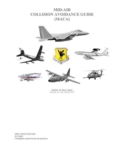
MID-AIR COLLISION AVOIDANCE GUIDE (MACA)
MID-AIR COLLISION AVOIDANCE GUIDE (MACA)
MID-AIR COLLISION AVOIDANCE GUIDE (MACA)

You also want an ePaper? Increase the reach of your titles
YUMPU automatically turns print PDFs into web optimized ePapers that Google loves.
<strong>MID</strong>-<strong>AIR</strong><br />
<strong>COLLISION</strong> <strong>AVOIDANCE</strong> <strong>GUIDE</strong><br />
(<strong>MACA</strong>)<br />
Kadena Air Base, Japan<br />
“HOME OF THE SHOGUNS”<br />
OPR: 18TH WING/SEF<br />
JUN 2007<br />
COORDINATED WITH 18 OSS/OSA
INTRODUCTION<br />
Midair collisions have been associated with flying ever since the first aircraft. In the past, many pilots primarily used<br />
the “Big Sky” theory as their primary method of collision avoidance. However, advances in technology and crowding<br />
of all airspace have made that “Big Sky” pretty small indeed. This transformation is certainly true of the airspace<br />
around Kadena Air Base (AB).<br />
Okinawa, labeled the “Keystone of the Pacific,” is a vital hub for United States military aviation in the Western Pacific.<br />
Three major airports within 11 NM miles of each other are based on Okinawa. In-addition, there are three satellite<br />
airports that surround the major island of Okinawa. Military and civilian aircraft operate from all airports with the<br />
majority of the civilian traffic operating out of Japan’s fourth busiest airport, Naha International. Okinawa Approach<br />
Control, located on Kadena AB, is the controlling agency for Kadena AB, Naha International, Futenma Marine Corps<br />
Air Station, and Kume-Jima airports.<br />
The 18th Wing publishes this pamphlet to familiarize local and transient aircrew with the aviation environment around<br />
Kadena and to alert everyone to areas of potential conflict in the airspace over Okinawa. If you have any questions or<br />
comments, please contact 18 WG/SEF, DSN 634-2577.<br />
JOSHUA J. SPEAR, Capt, USAF<br />
Flight Safety Officer, 18th Wing<br />
2
TABLE OF CONTENTS<br />
POINTS OF CONTACT ...............................................................................................................................................4<br />
AREAS OF POTENTIAL CONFLICTS...................................................................................................................5<br />
Air Traffic System Conflicts ....................................................................................................................................5<br />
Warning Area Conflicts ...........................................................................................................................................8<br />
Terrain......................................................................................................................................................................8<br />
GENERAL <strong>AIR</strong>FIELD INFORMATION ................................................................................................................9<br />
Airfield Description..................................................................................................................................................9<br />
Primary Aircraft Information .................................................................................................................................10<br />
Kadena Bird Activity .............................................................................................................................................11<br />
<strong>AIR</strong>SPACE.................................................................................................................................................................12<br />
Okinawa Approach Control ...................................................................................................................................12<br />
Okinawa Class Bravo Airspace..............................................................................................................................12<br />
Aero Club Operating Areas....................................................................................................................................13<br />
VFR Reporting Points ............................................................................................................................................15<br />
Helicopter Activity.................................................................................................................................................15<br />
Warning and Restricted Airspace...........................................................................................................................16<br />
VFR / IFR PROCEDURES.......................................................................................................................................16<br />
VFR Arrival Procedures.........................................................................................................................................16<br />
IFR Arrival Procedures ..........................................................................................................................................17<br />
IFR Departure Procedures......................................................................................................................................18<br />
Reduced Same Runway Separation........................................................................................................................19<br />
FACTORS CONTRIBUTING TO <strong>MID</strong>-<strong>AIR</strong> <strong>COLLISION</strong>S ...............................................................................20<br />
Communication Problems ......................................................................................................................................20<br />
Factors Affecting Vision ........................................................................................................................................20<br />
Collision Avoidance Tips.......................................................................................................................................21<br />
ANNEX A 353 SOG<br />
Kadena MC-130 VFR Low Level Flying and Standard VFR Departures..............................................................22<br />
Kadena Standard MC-130 Recoveries ..................................................................................................................24<br />
Airdrop Activity.....................................................................................................................................................25<br />
Helicopter Air Refueling........................................................................................................................................26<br />
3
POINTS OF CONTACT<br />
Kadena AB, JAPAN<br />
DSN 634-XXXX<br />
Commercial 81-611-734-XXXX<br />
or Operator 81-098-938-1111<br />
18 WG/CC 634-1801 BASE OPS 634-3118<br />
18 WG/CV 634-1802 WEATHER FLIGHT 634-4515<br />
18 WG/SE 634-1811 FLIGHT SURGEON 630-4305<br />
18 WG/PA 634-4502 RAPCON 634-1075<br />
18 OG/CC 634-1803 SAFETY (FLIGHT) 634-2577<br />
18 OG/OGV 634-4567 SOF (18 WG FIGHTER) 634-1810<br />
18 OSS/OSA 634-3410 TOWER 634-1440<br />
18 OSS/OSOSF 634-4597 TRANSIENT ALERT 634-1286<br />
18 OSS/OSX 634-4927 <strong>AIR</strong>FIELD OPS FLT CC 634-3410<br />
18th Wing<br />
Associate Units<br />
44 FS 634-1831/1836 1 SOS (C-130) 634-8476<br />
67 FS 634-1871/6707 17 SOS (C-130) 630-9155<br />
33 RQS 634- 6206/6208 82 RS (RC-135) 634-6044<br />
909 ARS 634-9008/8077 733 AMSS (AMC Transient) 634-1841<br />
961 AACS 634-8109/8107 AERO CLUB (Cessna) 634-5758<br />
MARINE WING LIAISON<br />
KADENA (MWLK, F/A-18,<br />
AV-8)<br />
CFAO (P-3)<br />
632-7148<br />
632-7151<br />
Director, Naha Area Control Center (ACC) (098) 858-8201 Ext 300<br />
Chief Controller, Naha ACC (098) 858-8201 Ext 362<br />
Airspace Management Officer, Naha ACC (098) 858-820l Ext 364 or DSN 637-7465<br />
Operations and Planning Officer (098) 858-8201 Ext 365<br />
Naha Tower Chief Controller (098) 857-1101 Ext 700<br />
USAF-JASDF Liaison Officer 634-7417/7433<br />
4
AREAS OF POTENTIAL CONFLICT<br />
Air Traffic System Conflicts<br />
There are several recurring conflicts inherent to the air traffic system, for which ATC depends on procedures to assure<br />
separation (See Figures 1 and 2). These include:<br />
1. The Naha VORTAC 010 radial and any visual downwind or base turn for RWY 05. Commercial aircraft<br />
inbound for Naha RWY 18 will pass within 3 NMs of Bolo Point at 1,000’ MSL feet, so controllers will always rely on<br />
altitude to assure separation: 1,500’ MSL for VFR aircraft, and 2,000’MSL for IFR aircraft executing a visual<br />
approach who are not yet established on a 5 NM final.<br />
2. The Naha 010 radial and the standard radar climbout for RWY 23. Heading 360 within 2 DME of the RWY 23<br />
departure end makes an almost perfect reciprocal course for the Naha 18 final approach course. Failure for the<br />
controller to issue traffic advisories on aircraft established on final, and the pilot to climb as quickly as possible<br />
through 2,000’ MSL after crossing the departure end, could lead to unsafe proximity between aircraft.<br />
3. Any instrument approach to RWY 05L/05R. Northbound departures from Naha RWY 36, arrivals to Naha<br />
RWY 18 (both at 1,000’ MSL or below), and F-4s/T-4s in the Naha overhead pattern (1,500’ MSL) all fly courses<br />
intersecting the instrument final approach courses to Kadena RWY 05L and 05R. Arrival will typically wait until any<br />
departure or arrival traffic has been reported in-sight by the pilot, before shipping an aircraft to Tower, but they usually<br />
cannot see primary radar targets or altitude information on aircraft in the Naha overhead pattern.<br />
4. The Futenma north VFR downwind and visual operations in the south Kadena downwind. Aircraft executing<br />
any visual maneuvers south of RWY 05R should remain within 3 DME of Kadena, and never lower than 2,500’ MSL<br />
without approval from ATC. Futenma Tower’s conventional pattern altitude is 1,500’ MSL and descending lower<br />
than 2,000’ MSL outside 3 DME without coordination by Kadena Tower could lead to unsafe proximity between<br />
aircraft.<br />
5
Figure 1. Naha Runway 36 Arrival/Departure Flow.<br />
Airliners inbound from Mainland Japan<br />
Airliners En route to Mainland<br />
Japan continue climb to FL 290<br />
“The Slot”<br />
Approximately 15-18<br />
Nautical Miles from Kadena<br />
Aircraft Altitudes: 2,000’ – 12,000’<br />
Naha departures will cross<br />
Kadena and Futenma<br />
arrival corridor at 1,000’<br />
Fighters recovering VFR<br />
will be at or above 2,500’<br />
“The Slot”<br />
Kadena and Futenma inbounds will cross Naha<br />
departure corridor at 2,000’<br />
Dog leg to final varies from 15-25 miles<br />
from Naha Int Airport<br />
6
Figure 2. Naha Runway 18 Arrival/Departure Flow.<br />
Airliners inbound from Mainland Japan<br />
Naha arrivals will cross<br />
Kadena and Futenma<br />
final at 1,000’<br />
Kadena and Futenma inbounds will cross Naha<br />
arrival corridor at 2,000’<br />
Airliners En route to Mainland<br />
Japan continue climb to FL 290<br />
Airliners departing Naha<br />
climb initially to 2,000’<br />
7
Warning Area Conflicts<br />
1. The southwestern tip of W-173. Naha RWY 36 arrivals from the northeast will enter Okinawa Approach’s<br />
airspace at FL200, five miles north and fifty miles northeast of the Kadena VORTAC (See Figure 1 and 3). A course<br />
direct to the airfield could present conflict with a descending Naha arrival, before Approach can legally issue vectors<br />
and altitudes outside the warning area; leaving the southwestern tip of W-173 on a southwesterly heading eliminates<br />
the most common possibility for conflict.<br />
2. W-178/A while Naha RWY 18 is active (See Figures 2 and 3). The Naha 010 radial almost perfectly bisects<br />
the warning airspace, meaning that arrivals to Naha RWY 18 from the northeast will probably intercept the radial<br />
inbound, and rely on separation by altitude from a hot W-178/A and its participating aircraft. Aircraft canceling IFR<br />
and entering W-178/A should reconfirm the altitude to which they can use W-178/A, prior to entering the airspace and<br />
contacting range controllers.<br />
3. W-174 (See Figure 3). F-4s and T-4s sometimes use West Point (KAD 260/49 or NHC 270/40) to recover to<br />
Naha, which on a direct course will bring them within 2 NMs of W-174’s southern border descending to somewhere<br />
between FL160 and 10,000’ MSL. Leaving W-174 on a northeasterly heading eliminates the most common<br />
possibility for conflict.<br />
Figure 3. Warning Area Conflicts.<br />
50 DME<br />
W178A SFC-13k<br />
13k’<br />
W178<br />
W176<br />
Naha 010 R<br />
W173<br />
W174A<br />
W174<br />
20 DME DME<br />
30 30 DME DME<br />
Terrain<br />
Mt. Onna, 1,410’ MSL, is located approximately 8 NMs northeast of Kadena RWY 23L/R approach end. The<br />
conventional pattern is flown at 1,300’ MSL. If extended on right downwind to RWY 23L/R at Kadena, pilots should<br />
be aware of the associated terrain:<br />
• Mt. Onna - 025/10 NM-1,410 feet.<br />
• Mountain peaks - 050/32.5 NM-1,634 feet.<br />
• Antenna - 205/11.4 NM-766 feet.<br />
8
GENERAL <strong>AIR</strong>FIELD INFORMATION<br />
Airfield Description<br />
Kadena AB is located on the west coast of the southern end of the main island of Okinawa. The base is 11 NM<br />
north-northeast of Naha International Airport and 4 NM north of Futenma MCAS, which have overlapping Class D<br />
Airspace (Figure 4). Pilots and controllers must be vigilant of the potential conflicts that exist due to the close<br />
proximity of the airports. Kadena Class Delta Airspace (Formerly known as ATA) Operating Rules and<br />
Pilot/Equipment Requirements:<br />
1. Pilot Certification. No specific certification required.<br />
2. Equipment. Unless otherwise authorized by ATC, an operable two-way radio is required.<br />
3. Arrival or Through Flight Entry Requirements.<br />
Two-way radio communication must be established with the ATC facility providing ATC services prior to entry and<br />
thereafter maintain those communications while in the Class D airspace. Pilots of arriving aircraft should contact the<br />
control tower on the publicized frequency and give their position, altitude, destination, and any request(s). Radio<br />
contact should be initiated far enough from the Class D airspace boundary to preclude entering the Class D airspace<br />
before two-way radio communications are established.<br />
NOTE−<br />
1. If the controller responds to a radio call with, “[aircraft call-sign] standby,” radio communications have been<br />
established and the pilot can enter the Class D airspace.<br />
2. If workload or traffic conditions prevent immediate entry into Class D airspace, the controller will inform the pilot<br />
to remain outside the Class D airspace until conditions permit entry.<br />
Fig. 4. Class D Airspace.<br />
BOLO POINT<br />
KIN<br />
KADENA<br />
(KAD)<br />
GUSHIKAWA<br />
KADENA<br />
FUTENMA<br />
(NF0)<br />
NAHA<br />
(NHC)<br />
NAHA<br />
FUTENMA<br />
Naha Class D: Surface up to<br />
but not including 2,000’ AGL<br />
(2,010’ MSL)<br />
Futenma Class D: Surface up<br />
to but not including 2,000’ AGL<br />
(2,250’ MSL)<br />
Kadena Class D: Surface up<br />
to but not including 3,000’<br />
AGL (3,140’ MSL)<br />
9
The airfield consists of two parallel asphalt and concrete runways, designated RWY 05/23 left and right (Figure 5).<br />
RWY 05R/23L is 12,100 feet long and 200 feet wide. The primary instrument runway, 5L/23R, is 12,100 feet long<br />
and 300 feet wide. NAVAIDs include VORTAC and ILS. Precision approaches include ILS to RWY 05L/23R, and<br />
PARs to all runways. Non-precision approaches include VOR, TACAN, and ASR approaches to all runways.<br />
Fig. 5. Airfield Diagram<br />
The base is surrounded by the densely populated Naha - Okinawa City metropolitan area. The airfield is a joint-use<br />
facility that accommodates Air Force F-15s, C-130s, KC/EC-135s, E-3s, C-9s, H-60s, Navy P-3s, C-12s, Marine Corp<br />
FA-18s, AV-8s, UH-1s, AH-1, CH-46s, H-53s, and Aero Club C-172s. Kadena AB also hosts numerous transients to<br />
include C-17s, C-5s, KC-10s, MD-11s, B747s, C-500, LJ-35s, B-190s, C-12s, E-2s.<br />
Primary Aircraft Information<br />
F-15s fly in the Kadena pattern from 150-350<br />
knots at 1,300' to 3,000' MSL. Often formation<br />
flights will be flying in trail (2-4 aircraft). If you<br />
are instructed to follow a flight of F-15s, make<br />
sure that you have the last aircraft in the trail in<br />
sight.<br />
HH-60s approach the airfield from the north and<br />
south at 800’ MSL. They may cross all of the<br />
runways en-route to their landing site. Outside<br />
Airport Traffic Areas (Class Delta), HH-60s<br />
conduct night operations at 500’ MSL and<br />
below using infrared lighting only.<br />
Heavy KC 135s, AWACS, MC-130s and Cessna aircraft may stay in the IFR and VFR traffic<br />
patterns for extended periods. These types of aircraft have limited cockpit visibility and<br />
maneuverability. Circling Approach, VFR Rectangular, and Instrument Patterns are the most<br />
common types of approaches.<br />
10
.<br />
Kadena Bird Activity<br />
A wide variety of bird species populate the area around Kadena AB. The most common are plovers, cattle egrets, and<br />
pratincoles (Ref KAB 91-212, Bird Aircraft Strike Hazard (BASH) Plan).<br />
Plovers<br />
Plovers, similar in size to swallows, are present year round. They occur in flocks of 50-300, and are usually found on<br />
wet pavement areas. These birds spend most of their time on the ground, and are usually only a hazard when<br />
encountered in large flocks.<br />
Cattle Egrets<br />
Cattle egrets, similar in size to a small goose, are present during April/May and September/October migratory seasons.<br />
Although they generally only stay at Kadena for 3-4 days, cattle egrets flocks in excess of 200 occasionally occur in<br />
close proximity to the runways. Cattle egrets are easily scared into flight and often transit across the runways.<br />
Pratincoles and Swallows<br />
These birds eat insects in flight. Pratincoles in particular are very common at Kadena and are usually encountered<br />
during taxi and/or takeoff.<br />
Pilots shall report the presence of any of these birds to the Kadena Tower.<br />
11
<strong>AIR</strong>SPACE<br />
Okinawa Approach Control<br />
Okinawa Approach Control provides air traffic control services within a 50 NM radius of Kadena AB, from the<br />
surface up to and including 20,000’ MSL (Figure 6). Air traffic control services are also provided within a 30 NM<br />
radius of Kume-Jima Island, up to and including 5,000’ MSL; however, be advised that this area is controlled via<br />
non-radar operational procedures. Services are provided to five airports within its assigned airspace. The three<br />
primary airports include Kadena AB, Futenma MCAS, and Naha International. Two secondary airports are located on<br />
Kume-Jima and Aguni-Jima islands.<br />
ATC separation standards can be found in the Federal Aviation Administration Order 7110.65. Pilots should increase<br />
separation when dealing with heavy jets and formation flights. While under VFR or IFR and accepting a visual<br />
approach or visual separation, pilots are responsible for maintaining their own wake turbulence separation behind<br />
heavy jet aircraft. ATC will not apply Visual separation between military and civilian airline traffic.<br />
Fig. 6. Okinawa Approach Control Airspace.<br />
FL 200<br />
,<br />
5,000 Ft<br />
30 NM<br />
KX<br />
KAD<br />
50 NM<br />
Okinawa Class Bravo Airspace (Figure 7); formerly known as Terminal Control Area (TCA) Operating Rules and<br />
Equipment Requirements for VFR/IFR Operations within Class B:<br />
Regardless of weather conditions, an ATC clearance is required prior to operating within Class B airspace. Pilots<br />
should not request a clearance to operate within Class B airspace unless the requirements of 14 CFR Section 91.215<br />
and 14 CFR Section 91.131 are met.<br />
Included among these requirements are:<br />
1. Unless otherwise authorized by ATC, aircraft must be equipped with an operable two-way radio capable of<br />
communicating with ATC on appropriate frequencies for that Class B airspace. Unless otherwise authorized by ATC,<br />
each person operating a large turbine engine-powered airplane to or from a primary airport shall operate at or above<br />
the designated floors while within the lateral limits of Class B airspace.<br />
2. Unless otherwise authorized by ATC, each aircraft must be equipped as follows:<br />
(a) For IFR operations, an operable VOR or TACAN receiver; and<br />
(b) For all operations, a two-way radio capable of communications with ATC on appropriate frequencies for that area;<br />
and<br />
(c) Unless otherwise authorized by ATC, an operable radar beacon transponder with automatic altitude reporting<br />
equipment.<br />
VFR aircraft requesting IFR handling shall make request with ATC and maintain VFR conditions until issued an IFR<br />
clearance.<br />
12
Fig. 7. Okinawa Class B Airspace.<br />
Okinawa Class B Airspace<br />
015R<br />
050R<br />
315R<br />
NHC 30 DME<br />
NAHA VORTAC<br />
Ch 112 NHC<br />
116.5<br />
B1 Surface – 10, 000 feet<br />
B2 1,000 – 10, 000 feet<br />
B3 2,000 – 10, 000 feet<br />
NHC 30 DME<br />
B4 4,000 – 10, 000 feet<br />
200R<br />
173R<br />
Aero Club Operating Areas<br />
Kadena has an active Aero Club operating light Cessna aircraft. Figure 8 on the next page depicts the Aero Club<br />
training areas; Nago Bay and White Beach. Figure 9 depicts the VFR reporting points used by ATC.<br />
NOTE: Lateral limits depicted in red. Expect to see the majority of aero club aircraft in the local traffic pattern at or<br />
below 2500’ MSL.<br />
13
Fig. 8. Aero Club Training Areas<br />
14
Fig. 9. VFR Reporting Points.<br />
VFR Reporting Points<br />
BOLO<br />
POINT<br />
R-326/5.5 NM<br />
MOON<br />
BEACH<br />
NAGO<br />
TORII<br />
BEACH<br />
R-240/2.4 NM<br />
SEAWALL<br />
R-239/1.5<br />
GATE ONE<br />
R-201/2 NM<br />
HARBOR 1<br />
R-208/2.3 NM<br />
POINT<br />
SIERRA<br />
NAHA<br />
WATER<br />
TOWER<br />
KADENA<br />
GATE 3<br />
R-075/1.5 NM<br />
CHIBANA<br />
R-085/2.4 NM<br />
GUSHIKAWA<br />
R-087/5.5 NM<br />
WHITE<br />
BEACH<br />
Helicopter Activity<br />
There is a significant amount of Air Force, Marine, and Japan Air Self-Defense Force (JASDF) helicopter activity in<br />
the Okinawa area. Most helicopter arrivals/departures from Kadena AB occur at 800’ MSL and take the aircraft to<br />
either Bolo Point or Gushikawa City. From these two points, helicopters travel north and south along the coastline.<br />
Additionally, helicopters that are transitioning from Futenma to Kadena will often be instructed to hold over Gate 1<br />
prior to being given clearance to cross the runways for landing at the Rescue Pad on Taxiway Charlie. This could<br />
present a traffic conflict for aircraft established on right downwind for RWY 05R as they turn to base. Finally, Marine<br />
helicopters will normally transition from Bolo Point to Futenma MCAS along the coastline. This transition is called<br />
the ‘seawall transition.’ When Marine aircraft reports seawall, expect to see them at 300’ MSL immediately off the<br />
approach end of RWY 05L/R along the seawall heading either North or South. This traffic (USMC & USAF) is<br />
normally transiting the airspace to conduct training at the helicopter landing zones (HLZ) at Ie Shima (W-178), or in<br />
the restricted areas adjacent to Camps Hansen and Schwab (R-177) as well at the Jungle Warfare Training Center<br />
(R-201) in northeast Okinawa.<br />
Fig.10. VFR Helicopter Routes.<br />
VFR Helicopter Routes<br />
- Gusikawa Three<br />
- Futenma One<br />
- Moon Beach<br />
B-5<br />
MB<br />
NAGO<br />
R177<br />
SFC-3000<br />
3000’<br />
- Bolo Five<br />
- Ishikawa Transition<br />
G-3<br />
ISHIKAWA<br />
TRANSITION<br />
Itinerate Traffic will normally<br />
be at or below 800’.<br />
F-1<br />
HELOCOPTER<br />
HELOCOPTER<br />
ROUTES<br />
ROUTES<br />
15
Warning and Restricted Airspace<br />
Approach Control will assist pilots with VFR traffic advisories within 50 NM of Kadena when requested by pilots<br />
(traffic permitting) up to but not in warning and restricted airspace. ATC cannot approve or disapprove entry into or<br />
exit from warning areas located within or adjacent to Approach Control airspace.<br />
R-177 (depicted in Figure 10) is the only restricted airspace in the immediate area around Kadena. The R-177 remains<br />
active 24 hours a day, 7 days a week up to and including 1,000’ MSL. Upon approval from Approach Control, the<br />
ceiling on R-177 may be raised to 3,000’ MSL for special requirements. Aircraft planning to over-fly R-177 below<br />
3,500’ MSL should check with ATC and request the status of the area.<br />
VFR / IFR PROCEDURES<br />
VFR Arrival Procedures<br />
At Kadena, VFR traffic operations will not be conducted by conventional aircraft unless the reported ceiling is 1,800’<br />
AGL or higher. Jet aircraft require a reported ceiling of 2,300’ AGL or higher. Even if the reported weather<br />
conditions meet these criteria the tower controller will deny aircraft entry into the VFR pattern if they cannot maintain<br />
visual contact with the aircraft.<br />
Tower will issue traffic advisories to arriving aircraft to help locate aircraft already established in the pattern. Get<br />
visual contact with that traffic as soon as possible and be prepared to take evasive action should the traffic overshoot<br />
final on their approach. To avoid conflict with traffic departing from the parallel runway pilots executing closed<br />
traffic are not to cross the departure end of the parallel runway without approval.<br />
Aircraft making visual approaches from the North Downwind to RWY 05L/R will be advised by ATC to maintain<br />
2,000’ MSL until 5 DME to avoid IFR arrivals into Naha and Kadena. The higher terrain northeast of Kadena often<br />
causes cloud formations at traffic pattern altitudes. This causes a unique problem when landing on RWY 23L/R. In<br />
some cases, this will prevent the pilot from seeing other traffic in Delta airspace and runway acquisition in time to<br />
make a safe visual approach.<br />
Many heavy aircraft near Kadena AB use Traffic Collision Avoidance System (TCAS). It is extremely important to be<br />
aware of heavy aircraft in the Class D airspace around Kadena AB or on approach/departure from Naha IAP. Rapid<br />
changes in heading or altitude by Fighter aircraft may cause a resolution advisory (RA) forcing the heavy aircraft to<br />
take evasive action, whether it is warranted or not.<br />
Fig. 11. Overhead Traffic Pattern<br />
Kadena Class Delta<br />
SFC-3000AGL<br />
(SFC-3143)<br />
Report 5 DME Initial to Runway 5R/23L.<br />
North breaks authorized in emergencies only.<br />
Initial Approach Altitude 1,800’ MSL.<br />
Fighter Closed Traffic Altitude 1,800’ MSL.<br />
Remain within 4.3 DME (5 SM) of airfield<br />
Futenma Class Delta<br />
SFC-2000AGL<br />
(SFC-2250)<br />
16
Fig. 12. Rectangular Traffic Pattern<br />
Kadena Class Delta<br />
SFC-3000AGL<br />
(SFC-3143)<br />
Futenma Class Delta<br />
SFC-2000AGL<br />
(SFC-2250)<br />
Rectangular Pattern Altitude: 1,300’ MSL.<br />
Helicopter/Aero Club Pattern Altitude: 800’<br />
MSL.<br />
Remain within 4.3 DME (5 SM) of Airfield.<br />
DO NOT displace downwind southeast of<br />
Runway 5R/23L further than 1 NM to avoid<br />
potential conflict with Futenma MCAS Class<br />
D Airspace.<br />
IFR Arrival Procedures<br />
Okinawa Approach Control will assign a Mode 3 squawk for radar identification upon initial contact with IFR arrivals.<br />
Pilots shall report with ATIS and Request on initial contact. NOTE: The earlier the initial contact, the easier it is to fit<br />
that aircraft into the traffic flow. Pilots who intend to make both instrument and visual transitions at Kadena should<br />
plan their flights to make the visual transitions at the end of their flight. Make requests for entry into the radar pattern<br />
at least one VFR pattern prior so that the tower controller can coordinate for a hand off with little or no delay.<br />
Fighter Aircraft: On initial contact with fighters, approach will verify number in flight, current ATIS, request for<br />
approach and landing, and any special handling requirements unless stated by the pilot on initial contact. Requesting<br />
radar identification at 55-60 DME will permit the controller time to identify the aircraft and carry out special requests,<br />
i.e., formation split-ups or re-sequencing the arrival flow for an emergency. An early call and slowing to 250-280 kts<br />
upon entering Okinawa Approach’s airspace (within 50nm of Kadena) will make all aspects of air traffic safer and<br />
more flexible for requests. Fighter aircraft requesting nonstandard shall have last element squawk 5300 with altitude.<br />
17
IFR Departure Procedures<br />
Aircraft departing from Kadena will be assigned a Standard Instrument Departure (SID); either the MIKE 3 (Figure<br />
13) or OVERWATER 3 SID (Figure 14). In-addition aircraft requesting local IFR pattern will be assigned Standard<br />
Radar Climbout. Do not expect vectors immediately after take-off due to noise abatement procedures. Departures<br />
from Kadena include a 2,000’ MSL restriction by 5 DME and a 4,000’ MSL or 6,000’ MSL restriction at 15 DME to<br />
deconflict traffic from Naha International. Departures from Futenma MCAS include a 2,000’ MSL restriction until 15<br />
DME. Departures from Naha will be issued a 1,000’ MSL restriction until 15 DME off RWY 36 and a 2,000’ MSL<br />
restriction off RWY 18. These altitude restrictions will normally be canceled when no other traffic conflicts exist, or<br />
altered to fit the present traffic situation. Special attention should be paid to reading back assigned altitudes, because<br />
of multiple crossing arrival and departure corridors in the area (See Figure 1 and 2).<br />
Figure 13. MIKE 3 DEPARTURE.<br />
Figure 14. OVERWATER 3 DEPARTURE.<br />
18
Reduced Same Runway Separation<br />
Reduced runway separation applies to Kadena AB, per the HQ PACOM Joint Letter of Agreement on Reduced Same<br />
Runway Separation at PACAF Bases, 1 Mar 01. The airfield operations flight commander and each flying unit<br />
commander will ensure that all assigned military aircrews, transient military aircrews sponsored by an assigned unit,<br />
and air traffic controllers understand the requirements for RSRS (Figures 15 and 16). RSRS standards do not apply (1)<br />
when the landing or succeeding aircraft has declared an emergency; (2) when the landing aircraft will make a full stop<br />
with the succeeding aircraft cleared for the option, low approach, stop-and-go or touch-and-go; (3) when braking<br />
action reports of “fair” or less are in effect (Ref: Joint LOA, para e).<br />
Figure 15. Daytime RSRS Standards.<br />
P<strong>AIR</strong>INGS<br />
Full Stop<br />
behind<br />
Touch Go<br />
Full Stop<br />
behind Low<br />
Approach<br />
Low<br />
Approach<br />
behind Low<br />
Approach<br />
Full Stop<br />
behind Full<br />
Stop<br />
Low<br />
Approach<br />
behind Full<br />
Stop<br />
Touch Go<br />
behind Touch<br />
Go<br />
Touch Go<br />
behind Low<br />
Approach<br />
Same Fighter-Type 3,000’ 3,000’ 3,000’ 3,000’ 6,000’ 3,000’ 3,000’<br />
Dissimilar Fighter-Type + + + 6,000’ 6,000’ + +<br />
Same Non-Heavy, + + + 6,000’ + + +<br />
Non-Fighter-Type<br />
Same-Type Aircraft + + + 6,000’ + + +<br />
Formations<br />
Fighter-Type behind + + + 9,000’ + + +<br />
Non-Heavy, Non-Fighter<br />
Type<br />
Non-Heavy, Non-Fighter<br />
Type behind Fighter-Type<br />
+ + + 9,000’ + + +<br />
Figure 16. Nighttime RSRS Standards.<br />
P<strong>AIR</strong>INGS<br />
Full Stop<br />
behind<br />
Touch Go<br />
Full Stop<br />
behind Low<br />
Approach<br />
Low Approach<br />
behind Low<br />
Approach<br />
Full Stop<br />
behind<br />
Full Stop<br />
Low<br />
Approach<br />
behind Full<br />
Stop<br />
Touch Go<br />
behind<br />
Touch Go<br />
Fighter-Type + + + 6,000’ 9,000’ + +<br />
Same Non-Heavy, + + + 6,000’ + + +<br />
Non-Fighter-Type<br />
Same-Type Aircraft + + + 6,000’ + + +<br />
Formations<br />
Fighter-Type behind + + + 9,000’ + + +<br />
Non-Heavy, Non-Fighter<br />
Type<br />
Non-Heavy, Non-Fighter<br />
Type behind<br />
Fighter-Type<br />
+ + + 9,000’ + + +<br />
+Note: Standard FAAO 7110.65 separation will be applied.<br />
In addition, less than standard category separation or IFR separation (as applicable) will not be authorized when one or<br />
more of the aircraft involved is:<br />
a. A heavy jet.<br />
b. Civil aircraft.<br />
c. Military contract carrier.<br />
d. Host-nation military aircraft.<br />
e. Aircraft experiencing an emergency.<br />
f. Aeromedical aircraft.<br />
Kadena AB cannot conduct simultaneous IFR parallel-runway operations (FAAO 7110.65, 5-8-5.a).<br />
Touch Go<br />
behind Low<br />
Approach<br />
19
FACTORS CONTRIBUTING TO <strong>MID</strong>-<strong>AIR</strong> <strong>COLLISION</strong>S<br />
Communication Problems<br />
In order to avoid a mid-air collision, you need to be able to detect other aircraft in the crowded skyways. TCAS is not<br />
in the AF vocabulary, so what can we do now to help ourselves out? Clear with your ears!!!<br />
A breakdown in communication is a common factor in mishap studies. Here are some things to watch out for:<br />
Similar Sounding Alphanumerics: There are often multiple aircraft operating on the same frequency with similar<br />
callsigns. Don’t make the mistake of following someone else’s clearance.<br />
Hearing Problems: Ensure that the controller heard, repeated, and understood what you said. If either party has any<br />
doubts, it is important to initiate clarification or repeat the readback. Remember controllers monitor and simulcast<br />
many frequencies at once and may not hear pilots the first time.<br />
Phraseology: Use standard terminology prescribed in the Pilot/Controller Glossary in the AIM. Nonstandard phrases<br />
lead to misunderstandings and radios full of pilots explaining what they really meant.<br />
Blocked or Simultaneous Transmissions: Listen to the radio before talking. Don’t initiate a transmission if someone<br />
else is about to read back controller instructions because you’ll both have to repeat yourselves.<br />
Enunciation: English is the official language of aviation, but we’re in an international environment at Kadena.<br />
Accents affect both speaking and listening. When you speak use a normal speaking voice and proper phraseology to<br />
minimize the confusion of similar sounds.<br />
Radio Discipline: Poor technique by pilots and controllers confuses and frustrates the ATC system. Maintain the<br />
efficiency of each radio transmission.<br />
Factors Affecting Vision<br />
Sight is essential to avoiding other aircraft. Yet our eyes have limitations. Being aware of these limitations could<br />
improve our ability to see and avoid. Here are some factors to watch out for:<br />
Blind Spot: The human eye has a blind spot where light strikes the optic nerve. The location of the blind spot for most<br />
people is about 30 degrees right of center. With both eyes unobstructed, the blind spots of each eye are cancelled out<br />
by the peripheral vision of the other eye. However, put a windshield center post or other type obstruction between the<br />
eyes and the brain cannot fill the void. Under certain conditions a Boeing 707 would be blocked out at a distance of<br />
one mile and a Boeing 747 would disappear at a mile and a half.<br />
Empty Space Myopia: At high altitudes, without objects to focus on (horizon, clouds, etc.), the eyes tend to focus at<br />
the windscreen or just outside the cockpit. Shifting sight frequently to instrument panel, wingtips, and distant objects<br />
will help overcome myopia.<br />
Fixation: A tendency for fixation must be avoided. This can be accomplished by scanning in sectors, shifting gaze<br />
vertically as well as horizontally, and practice focusing on objects of known or accurately estimable distances.<br />
Contrast: Objects with contrast are very important to avoid another aircraft. The aircraft that contrasts with its<br />
background is much easier to detect than one that blends in with its background, especially during low light<br />
illumination. Sky conditions on many occasions make it much more difficult to detect another aircraft. If there is a<br />
lack of contrast, the aircraft must come closer in order to be detected, thus creating the danger of an in-flight collision.<br />
Today’s fighter aircraft are painted to provide enemy fighters poor contrasts making them very difficult to see in any<br />
background.<br />
Glare: This over stimulates the eyes and causes a loss of sensitivity, which reduces the ability of the eye to see objects<br />
under normal light conditions. Glare may be produced from the light striking the windscreen or the instrument panel<br />
at an angle. Blinding glare can be caused when the pilot looks directly into the sun, causing a temporary haze over the<br />
visual field.<br />
Hypoxia: This can affect the ability of the eyes to detect distant objects, especially at night. Due to the lack of oxygen<br />
in the blood the eyes suffer a loss of acuity and have difficulty in focusing. The smoker must be especially aware of<br />
this factor. The smoker’s blood is carrying carbon monoxide, which displaces some of the oxygen and makes the<br />
effects of hypoxia take place sooner.<br />
Scan: Using an organized scan pattern during your visual look out is paramount. You can see an aircraft at the<br />
20
greatest distance by looking directly at it (daytime). If you see it 7 miles away, you can avoid it, even head-on<br />
at Mach 1 closure. But, if the aircraft is only 10 degrees to the side and you’re looking straight ahead, your eyes can’t<br />
pick it up until about one tenth the distance (0.7 miles). In this case, if you’re on a collision course, it’s too late.<br />
Collision Avoidance Tips<br />
1. Know where the high-density traffic areas are.<br />
2. Fly as high as practical.<br />
3. Obtain an IFR clearance or participate in flight following whenever possible.<br />
4. Clear constantly for other aircraft, both visually and over the radio.<br />
5. Use landing lights at lower altitudes, especially near airports.<br />
6. Always use your Mode C transponder and cross check its accuracy with ATC whenever possible.<br />
7. Fly at the appropriate hemispheric altitudes and don’t let your altimeter wander.<br />
8. Keep your windscreen clean and clear.<br />
9. Learn proper task management in the air. A cockpit can get very busy. Learn the proper methods to help you<br />
reduce the workload and deal with time crunches.<br />
10. Understand the limitations of your eyes and use proper visual scanning techniques.<br />
11. AVOID COMPLACENCY! There is no guarantee that everyone is flying by the rules. Don’t let someone<br />
else’s stupidity kill you.<br />
21
ANNEX A 353 SOG<br />
KADENA MC-130 VFR LOW LEVEL FLYING AND STANDARD VFR DEPARTURES<br />
The MC-130s assigned to the 353rd Special Operations Group regularly fly VFR low level through out the Ryuku<br />
Islands. The routes are flown single ship and formation at 2,000’ MSL and below into the various objects list below<br />
(airdrops, tactical approaches and helicopter air refueling). The low level traffic monitors Okinawa Approach, Naha<br />
Center, Range Control and Northern Training Area frequencies as appropriate for their route of flight.<br />
Figure 17. IKEI DEPARTURES<br />
RWY 05: Maintain at or below 1,000’ MSL until outside 10 DME. At 5 DME, proceed directly to Ikei Island. Advise<br />
ATC when passing 10 DME from Kadena VORTAC.<br />
RWY 23: Maintain at or below 1,000’ MSL. Turn left within 2 DME to a downwind and proceed to Gushikawa (KAD<br />
085/006). After Gushikawa, proceed direct to Ikei Island. Advise ATC when passing 10 DME from Kadena<br />
VORTAC.<br />
22
Figure 18. SESOKO DEPARTURES<br />
RWY 05: Climb runway heading to 1,500’ MSL, at 5 DME turn direct Sesoko. If weather precludes climb to 1,500<br />
MSL, advise ATC prior to departure and request IFR clearance. Proceed to Sesoko maintaining 1,500’ MSL. Advise<br />
ATC when passing 10 DME from Kadena VORTAC.<br />
RWY 23: Climb to 1,500’ MSL and turn right within 2 DME direct to Moon Beach; if weather precludes climb to<br />
1,500’ MSL, advise ATC prior to departure. After Moon Beach, proceed to Sesoko maintaining 1,500’ MSL. Advise<br />
ATC when passing 10 DME from Kadena VORTAC.<br />
23
KADENA STANDARD MC-130 RECOVERIES<br />
Figure 19.<br />
STRAIGHT – IN VFR RECOVERIES<br />
BOLO TO 3 MILE FINAL RECOVERY<br />
Figure 20.<br />
MC-130s typically fly at night, 1,000’ AGL and below and will request all runway lighting to be turned OFF for their<br />
recoveries to facilitate NVG training. This is approved on a non-interference basis only.<br />
24
<strong>AIR</strong>DROP ACTIVITY<br />
Parachute jumping and equipment air drops occur at Ie Island (Approx 20 NM North of RODN) and at White Beach<br />
water drop zone (Approx 10 NM East of ROTM). The drop zones can be approached from various directions.<br />
IE SHIME DROP ZONE (W178)<br />
Ie Shima DZ is approached from the northeast from two locations. One run-in begins just south of Izena Shima and<br />
the other from halfway between Izena Shima and Kouri Shima. The Ie Shima DZ can also be approached from the<br />
southwest starting about 10 NM ENE of Bolo Point. Airdrops are conducted at altitudes from 500’ AGL to 10,000’<br />
MSL. (NOTE: Landings at the Coral LZ on Ie Shima are often conducted in conjunction with airdrop operations)<br />
Figure 21.<br />
25
WHITE BEACH DROP ZONE<br />
White Beach DZ (Depicted by the triangle below) can be approached from any direction with run in heading from 230<br />
degrees to 360 degrees depending on the wind. Airdrops are conducted at Altitudes from 1,000’ to 4,000’ MSL.<br />
Figure 22<br />
HELICOPTER <strong>AIR</strong> REFUELING<br />
Helicopter aerial refueling in the local area occurs between 1,000’ and 8,000’ MSL (2,000’ MSL being the standard),<br />
depending on weather. The primary tracks are SHOOTER and SHARK depending on helicopter training profile. This<br />
is a VFR maneuver and track space is not allocated in AP. Collision avoidance with civilian and military aircraft is<br />
strictly based on visual detection.<br />
Figure 23.<br />
26