Selesmar ECDIS - Consilium
Selesmar ECDIS - Consilium
Selesmar ECDIS - Consilium

Create successful ePaper yourself
Turn your PDF publications into a flip-book with our unique Google optimized e-Paper software.
CONSILIUM <strong>ECDIS</strong><br />
<strong>Consilium</strong> <strong>ECDIS</strong><br />
Electronic Chart Display and Information System<br />
<strong>Consilium</strong> <strong>ECDIS</strong> has been developed based on extensive experience<br />
of a world-class innovative engineering team with several<br />
“firsts” in maritime electronics within radar data processing, radar<br />
data extraction, display presentation and electronic cartography.<br />
<strong>Consilium</strong> <strong>ECDIS</strong> is fully compliant with the IMO Resolution<br />
A.817(19):1995, IMO Resolution MSC.64(67), Annex5:1996, IHO<br />
S-57 and S-52 Standards, IEC 61174:1998, IMO A.817(19) Appendix<br />
A.7:1998 and IMO Resolution MSC.232(82).<br />
Key benefits of <strong>Consilium</strong> <strong>ECDIS</strong><br />
– Total situation appraisal on one integrated dispay, chart,<br />
radar, ARPA and AIS eliminating the need to move between<br />
instruments and designed in accordance with IMO/IEC<br />
requirements for Integrated Navigation Systems.<br />
– Type approved by DNV<br />
– Powerful decision support and information tool.<br />
– Capable of incorporating official HO ENC’s along with raster<br />
charts produced by several official Hydrographic offices.<br />
– Enables extremely precise navigation providing precise<br />
bearings to lights and landmarks at long ranges.<br />
– Greatly reduces workload in the production of Voyage Plans<br />
ETA’s and rapid changes to these.<br />
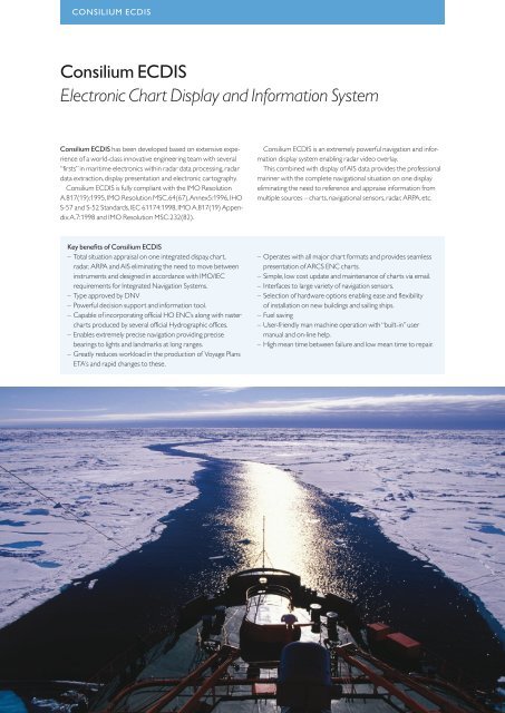
<strong>Consilium</strong> <strong>ECDIS</strong> is an extremely powerful navigation and information<br />
display system enabling radar video overlay.<br />
This combined with display of AIS data provides the professional<br />
mariner with the complete navigational situation on one display<br />
eliminating the need to reference and appraise information from<br />
multiple sources – charts, navigational sensors, radar, ARPA, etc.<br />
– Operates with all major chart formats and provides seamless<br />
presentation of ARCS ENC charts.<br />
– Simple, low cost update and maintenance of charts via email.<br />
– Interfaces to large variety of navigation sensors.<br />
– Selection of hardware options enabling ease and flexibility<br />
of installation on new buildings and sailing ships.<br />
– Fuel saving<br />
– User-friendly man machine operation with “built-in” user<br />
manual and on-line help.<br />
– High mean time between failure and low mean time to repair.