Comprehensive Site Development Plan ... - City of Kelowna
Comprehensive Site Development Plan ... - City of Kelowna
Comprehensive Site Development Plan ... - City of Kelowna

Create successful ePaper yourself
Turn your PDF publications into a flip-book with our unique Google optimized e-Paper software.
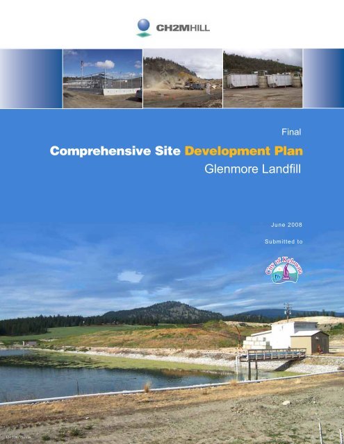
Final<br />
<strong>Comprehensive</strong> <strong>Site</strong> <strong>Development</strong> <strong>Plan</strong><br />
Glenmore Landfill<br />
June 2008<br />
Submitted to<br />
ES122007001VBC
Copyright 2008 by CH2M HILL. All rights reserved.<br />
Reproduction and distribution in whole or in part beyond the intended<br />
scope <strong>of</strong> the contract without written consent <strong>of</strong> CH2M HILL is prohibited.
Copyright 2008 by CH2M HILL. All rights reserved.<br />
Reproduction and distribution in whole or in part beyond the intended<br />
scope <strong>of</strong> the contract without written consent <strong>of</strong> CH2M HILL is prohibited.
Copyright 2008 by CH2M HILL. All rights reserved.<br />
Reproduction and distribution in whole or in part beyond the intended<br />
scope <strong>of</strong> the contract without written consent <strong>of</strong> CH2M HILL is prohibited.
Copyright 2008 by CH2M HILL. All rights reserved.<br />
Reproduction and distribution in whole or in part beyond the intended<br />
scope <strong>of</strong> the contract without written consent <strong>of</strong> CH2M HILL is prohibited.
Copyright 2008 by CH2M HILL. All rights reserved.<br />
Reproduction and distribution in whole or in part beyond the intended<br />
scope <strong>of</strong> the contract without written consent <strong>of</strong> CH2M HILL is prohibited.
Copyright 2008 by CH2M HILL. All rights reserved.<br />
Reproduction and distribution in whole or in part beyond the intended<br />
scope <strong>of</strong> the contract without written consent <strong>of</strong> CH2M HILL is prohibited.
• <br />
<br />
<br />
• <br />
• <br />
<br />
• <br />
• <br />
<br />
•
• <br />
<br />
<br />
• <br />
• <br />
<br />
• <br />
• <br />
<br />
•
• <br />
<br />
<br />
• <br />
• <br />
<br />
• <br />
• <br />
<br />
•
<strong>Site</strong> Location<br />
<br />
Exhibit 2-1<br />
General <strong>Site</strong> Location
Figure 2-2<br />
Lease Property and Acquisition<br />
Land Boundaries
Figure 2-2<br />
Lease Property and Acquisition<br />
Land Boundaries
Figure 2-3<br />
Major Features and <strong>Development</strong>s in<br />
the Glenmore Valley Area
Refuse<br />
Clay<br />
Sand / Gravel<br />
Till<br />
Bedrock<br />
Approximate Water Table<br />
Inferred Groundwater Flow Direction
Refuse<br />
Clay<br />
Sand / Gravel<br />
Till<br />
Bedrock<br />
Approximate Water Table<br />
Inferred Groundwater Flow Direction
• <br />
<br />
<br />
• <br />
<br />
<br />
•
• <br />
<br />
<br />
• <br />
<br />
<br />
•
• <br />
<br />
<br />
• <br />
<br />
<br />
•
Feature<br />
Recommended Separation Distances<br />
Property Boundary<br />
Other Facilities (residence, school, etc.)<br />
Airports<br />
Surface Water Bodies<br />
Unstable Areas<br />
50 m<br />
300 m<br />
8 km<br />
100 m<br />
100 m
Design Component Natural Control Landfill Engineered Landfill<br />
Minimum Liner Thickness (m) 2.0 1.0<br />
Maximum Liner Hydraulic Conductivity (cm/s) 1 x 10 -6 1 x 10 -7<br />
Minimum Slope <strong>of</strong> Bottom <strong>of</strong> Liner N/A 2% on controlling slopes<br />
0.5% on remaining slopes<br />
Thickness <strong>of</strong> Leachate Collection System (m) N/A 0.3<br />
Hydraulic Conductivity <strong>of</strong> Leachate Collection<br />
System (cm/s)<br />
N/A 1 x 10 -2<br />
Maximum Hydraulic Head on Liner (m) N/A 0.3<br />
Final Cover Thickness (m) 1.0 1.0<br />
Cover Hydraulic Conductivity (cm/s) 1 x 10 -5 1 x 10 -5<br />
Topsoil Thickness (m) 0.15 0.15<br />
Final Cover Minimum Slope 4% 4%<br />
Final Cover Maximum Slope 33% 33%<br />
N/A denotes Not Applicable
Figure 2-5<br />
Agricultural Land Reserve Boundaries
Jurisdiction 2007<br />
Population<br />
Estimated Growth Rates<br />
2007 – 2015 2015 – 2025 Beyond 2025<br />
<strong>Kelowna</strong> (including Native<br />
Reserves)<br />
116,479<br />
Lake Country 10,615<br />
Peachland 5,290<br />
Westside District Municipality 28,793<br />
West Electoral Area (including<br />
Westbank First Nation)<br />
8,018<br />
3%<br />
(all areas)<br />
2%<br />
(all areas)<br />
0%<br />
(all areas)<br />
East Electoral Area (including<br />
Native Reserves)<br />
3,978
TABLE 2-4<br />
Cumulative Waste Volumes 2007 to 2107<br />
Existing Service Area<br />
Westside Service Area<br />
Total Waste<br />
Airspace Consumption<br />
Year Population Annual Cumm. Population Annual Cumm Annual Cumm Waste Cover 1 Waste+Cover Cummulative<br />
Tonnes Tonnes Served Tonnes Tonnes Tonnes Tonnes (m3) (m3) (m3) (m3)<br />
2007 131,072 120,586 120,586 42,101 - - 120,586 120,586 141,866 35,467 177,333 177,333<br />
2008 135,004 124,204 244,790 43,364 - - 124,204 244,790 146,122 36,531 182,653 359,985<br />
2009 139,054 127,930 372,720 44,665 - - 127,930 372,720 150,506 37,626 188,132 548,118<br />
2010 143,226 131,768 504,488 46,005 - - 131,768 504,488 155,021 38,755 193,776 741,894<br />
2011 147,523 135,721 640,209 47,385 - - 135,721 640,209 159,672 39,918 199,590 941,483<br />
2012 151,948 139,793 780,001 48,807 31,236 31,236 171,029 811,237 201,210 50,303 251,513 1,192,996<br />
2013 156,507 143,986 923,988 50,271 32,173 63,410 176,160 987,397 207,247 51,812 259,058 1,452,054<br />
2014 161,202 148,306 1,072,293 51,779 33,139 96,548 181,444 1,168,841 213,464 53,366 266,830 1,718,884<br />
2015 166,038 152,755 1,225,048 53,332 34,133 130,681 186,888 1,355,729 219,868 54,967 274,835 1,993,719<br />
2016 169,359 155,810 1,380,859 54,399 34,815 165,496 190,625 1,546,355 224,265 56,066 280,332 2,274,051<br />
2017 172,746 158,926 1,539,785 55,487 35,512 201,008 194,438 1,740,793 228,751 57,188 285,938 2,559,989<br />
2018 176,201 162,105 1,701,890 56,597 36,222 237,230 198,327 1,939,119 233,326 58,331 291,657 2,851,646<br />
2019 179,725 165,347 1,867,237 57,729 36,946 274,176 202,293 2,141,413 237,992 59,498 297,490 3,149,136<br />
2020 183,319 168,654 2,035,891 58,883 37,685 311,861 206,339 2,347,752 242,752 60,688 303,440 3,452,576<br />
2021 186,986 172,027 2,207,918 60,061 38,439 350,300 210,466 2,558,218 247,607 61,902 309,509 3,762,085<br />
2022 190,726 175,468 2,383,385 61,262 39,208 389,508 214,675 2,772,893 252,559 63,140 315,699 4,077,784<br />
2023 194,540 178,977 2,562,362 62,487 39,992 429,499 218,969 2,991,862 257,610 64,403 322,013 4,399,796<br />
2024 198,431 182,556 2,744,918 63,737 40,792 470,291 223,348 3,215,210 262,762 65,691 328,453 4,728,249<br />
2025 202,400 186,208 2,931,126 65,012 41,608 511,899 227,815 3,443,025 268,018 67,004 335,022 5,063,272<br />
2026 202,400 186,208 3,117,334 65,012 41,608 553,506 227,815 3,670,840 268,018 67,004 335,022 5,398,294<br />
2027 202,400 186,208 3,303,541 65,012 41,608 595,114 227,815 3,898,655 268,018 67,004 335,022 5,733,316<br />
2028 202,400 186,208 3,489,749 65,012 41,608 636,721 227,815 4,126,470 268,018 67,004 335,022 6,068,338<br />
2029 202,400 186,208 3,675,956 65,012 41,608 678,329 227,815 4,354,285 268,018 67,004 335,022 6,403,360<br />
2030 202,400 186,208 3,862,164 65,012 41,608 719,936 227,815 4,582,100 268,018 67,004 335,022 6,738,382<br />
2031 202,400 186,208 4,048,371 65,012 41,608 761,544 227,815 4,809,915 268,018 67,004 335,022 7,073,405<br />
2032 202,400 186,208 4,234,579 65,012 41,608 803,151 227,815 5,037,730 268,018 67,004 335,022 7,408,427<br />
2060 202,400 186,208 9,448,390 65,012 41,608 1,968,162 227,815 11,416,552 268,018 67,004 335,022 16,789,047<br />
2065 202,400 186,208 10,379,428 65,012 41,608 2,176,200 227,815 12,555,627 268,018 67,004 335,022 18,464,158<br />
2070 202,400 186,208 11,310,465 65,012 41,608 2,384,237 227,815 13,694,703 268,018 67,004 335,022 20,139,269<br />
2075 202,400 186,208 12,241,503 65,012 41,608 2,592,275 227,815 14,833,778 268,018 67,004 335,022 21,814,380<br />
Notes:<br />
1. Cover volumes based on 4:1 ratio (on a volume basis) <strong>of</strong> waste to soil.
17,500,000<br />
15,000,000<br />
Cummulate Waste Generation (tonnes)<br />
12,500,000<br />
10,000,000<br />
7,500,000<br />
5,000,000<br />
Westside Lanfill Service Area<br />
Existing Service Area<br />
2,500,000<br />
0<br />
2005<br />
2010<br />
2015<br />
2020<br />
2025<br />
2030<br />
2035<br />
2040<br />
2045<br />
2050<br />
2055<br />
2060<br />
2065<br />
2070<br />
2075<br />
Figure 2-6<br />
Projected Waste Quantities<br />
(2007 - 2075)
• <br />
• <br />
•
Standard Soil Barrier Liner, 6.0% Bottom Grade with 1-lift Refuse<br />
Average Annual Values for Years 1 through 20<br />
Average Annual Precipitation<br />
Average Percolation through Barrier Layer a<br />
364.9 mm<br />
27.7 mm<br />
Peak Daily Values for Years 1 through 20<br />
Precipitation<br />
Maximum Percolation through Barrier Layer a<br />
42.2 mm<br />
0.1 mm<br />
Proposed Geomembrane Composite Barrier Liner, 6.0% Bottom Grade with 1-lift Refuse<br />
Average Annual Values for Years 1 through 20<br />
Precipitation<br />
Average Percolation through Barrier Layer a<br />
364.9 mm<br />
0.05 mm<br />
Peak Daily Values for Years 1 through 20<br />
Precipitation<br />
Maximum Percolation through Barrier Layer a<br />
42.2 mm<br />
0.001 mm<br />
a<br />
The average or maximum amount <strong>of</strong> leachate percolating through the soil or geomembrane component <strong>of</strong><br />
the lining system.
• <br />
<br />
<br />
<br />
• <br />
<br />
<br />
•
• <br />
<br />
•
• <br />
<br />
•
• <br />
<br />
•
Figure 3-5<br />
Leachate Collector Details
Figure 3-5<br />
Leachate Collector Details
Figure 3-6<br />
Surface Water Diversion Berm and<br />
Groundwater Cut<strong>of</strong>f Trench
• <br />
• <br />
•
• <br />
<br />
<br />
<br />
<br />
• <br />
<br />
<br />
<br />
<br />
<br />
<br />
<br />
<br />
• <br />
<br />
<br />
•
• <br />
<br />
<br />
<br />
<br />
• <br />
<br />
<br />
<br />
<br />
<br />
<br />
<br />
<br />
• <br />
<br />
<br />
•
Pre-design Reports (1) 2007 Updated Fill Volumes (2)<br />
Landfill Phase<br />
20% MC<br />
(scfm)<br />
35% MC<br />
(scfm)<br />
Scenario 1<br />
(35% MC with Constraints)<br />
(scfm)<br />
Phase 1 250 425 480<br />
Phase 2 550 675 980<br />
Phase 3 2,200 2,650 3,675<br />
Total at Landfill Closure 2,500 2,820 4,360<br />
Notes:<br />
(1) As estimated in the CH2M HILL July 2002 and October 2004 Pre-design reports.<br />
(2) Updated waste volumes estimated by SHA in the April 2007 report.<br />
MC = Moisture Content
• <br />
• <br />
• <br />
• <br />
• <br />
<br />
<br />
<br />
<br />
<br />
• <br />
• <br />
• <br />
• <br />
• <br />
<br />
<br />
<br />
<br />
<br />
<br />
<br />
<br />
<br />
<br />
<br />
<br />
<br />
<br />
• <br />
• <br />
<br />
•
• <br />
<br />
• <br />
<br />
• <br />
<br />
<br />
<br />
• <br />
<br />
• <br />
<br />
<br />
<br />
• <br />
• <br />
• <br />
• <br />
•
• <br />
<br />
• <br />
<br />
• <br />
<br />
<br />
<br />
• <br />
<br />
• <br />
<br />
<br />
<br />
• <br />
• <br />
• <br />
• <br />
•
• <br />
• <br />
• <br />
• <br />
<br />
<br />
• <br />
• <br />
• <br />
<br />
• <br />
• <br />
• <br />
• <br />
• <br />
• <br />
• <br />
<br />
• <br />
• <br />
• <br />
• <br />
• <br />
• <br />
<br />
<br />
<br />
<br />
<br />
<br />
<br />
<br />
<br />
<br />
<br />
<br />
• <br />
<br />
<br />
•
• <br />
• <br />
• <br />
• <br />
• <br />
• <br />
• <br />
<br />
• <br />
• <br />
• <br />
• <br />
• <br />
•
• <br />
• <br />
• <br />
• <br />
• <br />
• <br />
• <br />
<br />
• <br />
• <br />
• <br />
• <br />
• <br />
•
• <br />
• <br />
• <br />
• <br />
• <br />
• <br />
• <br />
<br />
• <br />
• <br />
• <br />
• <br />
• <br />
•
• <br />
• <br />
• <br />
• <br />
• <br />
• <br />
• <br />
<br />
• <br />
• <br />
• <br />
• <br />
• <br />
•
• <br />
• <br />
• <br />
• <br />
• <br />
• <br />
• <br />
<br />
• <br />
• <br />
• <br />
• <br />
• <br />
•
Categories<br />
Dimensional wood –treated/painted<br />
Recommended Uses<br />
• Grind for use on onsite roads and working surfaces<br />
• Grind for use as alternative daily cover in landfill<br />
operations<br />
Dimensional wood – untreated/unpainted<br />
• Grind for use at co-generation facility<br />
• Grind for use as amendment in yard waste or biosolids<br />
composting operation<br />
• Grind for use/sale as mulch<br />
Large branches (more than 1.5” diameter),<br />
and logs and stumps<br />
Small branches and tree prunings less than<br />
1.5” diameter<br />
• Grind for use at co-generation facility<br />
• Grind use as amendment in yard waste or biosolids<br />
composting operation<br />
• Incorporate directly into yard waste composting<br />
operation
• <br />
• <br />
<br />
• <br />
<br />
<br />
•
• <br />
• <br />
<br />
• <br />
<br />
<br />
•
• <br />
• <br />
<br />
• <br />
<br />
<br />
•
• <br />
<br />
<br />
<br />
<br />
• <br />
<br />
• <br />
<br />
• <br />
<br />
<br />
<br />
<br />
<br />
• <br />
<br />
<br />
<br />
<br />
<br />
<br />
• <br />
<br />
<br />
<br />
<br />
•
• <br />
<br />
<br />
<br />
<br />
• <br />
<br />
• <br />
<br />
• <br />
<br />
<br />
<br />
<br />
<br />
• <br />
<br />
<br />
<br />
<br />
<br />
<br />
• <br />
<br />
<br />
<br />
<br />
•
Figure 5-1<br />
Entrance and Scale Facilities
• <br />
<br />
• <br />
• <br />
• <br />
• <br />
<br />
• <br />
• <br />
•
• <br />
<br />
• <br />
<br />
<br />
• <br />
<br />
<br />
<br />
<br />
• <br />
<br />
• <br />
<br />
<br />
• <br />
<br />
<br />
• <br />
<br />
<br />
<br />
• <br />
<br />
<br />
•
Scenario<br />
Service<br />
Time<br />
Required Queue Length (95 th %)<br />
Vehicles<br />
per Hour Single Scale System Dual Scale System<br />
Inbound Typical 30 sec 75 50 m 15-20 m per lane<br />
Inbound Peak 40 sec 100 Insufficient Capacity 40-60 m per lane<br />
Outbound Typical 40 sec 75 140 m 25-35 m per lane<br />
Outbound Peak 50 sec 100 Insufficient Capacity 70-140 m per lane
• <br />
• <br />
<br />
• <br />
<br />
•
(
(
• <br />
• <br />
<br />
• <br />
<br />
• <br />
<br />
<br />
<br />
<br />
<br />
<br />
<br />
<br />
<br />
<br />
<br />
<br />
<br />
<br />
<br />
<br />
<br />
<br />
<br />
• <br />
<br />
• <br />
• <br />
<br />
<br />
•
• <br />
• <br />
<br />
• <br />
<br />
• <br />
<br />
<br />
<br />
<br />
<br />
<br />
<br />
<br />
<br />
<br />
<br />
<br />
<br />
<br />
<br />
<br />
<br />
<br />
<br />
• <br />
<br />
• <br />
• <br />
<br />
<br />
•
• <br />
<br />
• <br />
<br />
• <br />
<br />
•
• <br />
• <br />
•
• <br />
<br />
• <br />
<br />
<br />
<br />
• <br />
<br />
<br />
<br />
• <br />
<br />
<br />
• <br />
<br />
<br />
•
• <br />
• <br />
• <br />
•
• <br />
• <br />
• <br />
• <br />
• <br />
• <br />
• <br />
•
Figure 5-6<br />
Staffing and Organization Chart
• <br />
<br />
<br />
<br />
<br />
<br />
<br />
<br />
•
• <br />
<br />
<br />
<br />
<br />
• <br />
<br />
<br />
• <br />
<br />
<br />
<br />
<br />
<br />
<br />
<br />
<br />
<br />
<br />
• <br />
• <br />
• <br />
•
• <br />
• <br />
• <br />
• <br />
• <br />
•
• <br />
• <br />
• <br />
• <br />
• <br />
•
• <br />
• <br />
• <br />
• <br />
• <br />
•
• <br />
• <br />
• <br />
• <br />
• <br />
•
• <br />
• <br />
• <br />
• <br />
• <br />
•
350000<br />
300000<br />
250000<br />
Vol<br />
um 200000<br />
e,<br />
m3<br />
150000<br />
100000<br />
50000<br />
0<br />
Inputs<br />
Outputs<br />
<br />
Direct precipitation Surface run<strong>of</strong>f or groundwater inflow Evaporation Removed for irrigation<br />
<br />
<br />
<br />
Month<br />
Average Annual<br />
Run<strong>of</strong>f<br />
(1969 to 1986)<br />
Highest Annual<br />
Run<strong>of</strong>f<br />
(1982)<br />
Highest Spring<br />
Run<strong>of</strong>f<br />
(1974)<br />
Lowest Annual<br />
Run<strong>of</strong>f and<br />
Lowest<br />
Spring Run<strong>of</strong>f<br />
(1970)<br />
Jan 0.013 0.009 0.005 0.023<br />
Feb 0.013 0.013 0.007 0.028<br />
Mar 0.033 0.015 0.029 0.038<br />
Apr 0.165 0.055 0.218 0.067<br />
May 0.405 0.349 0.486 0.545<br />
Jun 0.164 0.126 0.198 0.151<br />
Jul 0.082 0.246 0.031 0.051<br />
Aug 0.026 0.043 0.005 0.013<br />
Sep 0.034 0.046 0.003 0.020<br />
Oct 0.028 0.048 0.005 0.026<br />
Nov 0.022 0.028 0.006 0.020<br />
Dec 0.014 0.022 0.006 0.018<br />
Total 1.000 1.000 1.000 1.000
Year<br />
Run<strong>of</strong>f Volume<br />
m 3<br />
Precipitation Equivalent Run<strong>of</strong>f<br />
mm<br />
Average Run<strong>of</strong>f (1969 to 1986) 180,000 21<br />
Highest Annual Run<strong>of</strong>f – 1982 256,000 30<br />
Highest Spring Run<strong>of</strong>f – 1974 248,000 29<br />
Lowest Annual Run<strong>of</strong>f and<br />
Lowest Spring Run<strong>of</strong>f – 1970<br />
45,000 5
• <br />
<br />
<br />
• <br />
<br />
<br />
<br />
<br />
• <br />
<br />
<br />
<br />
•
• <br />
<br />
<br />
• <br />
<br />
<br />
<br />
<br />
• <br />
<br />
<br />
<br />
•
• <br />
<br />
<br />
• <br />
<br />
<br />
<br />
<br />
• <br />
<br />
<br />
<br />
•
Activity<br />
Stage 1<br />
2008 – 2012<br />
Stage 2<br />
2012 – 2018<br />
Stage 3<br />
After 2018<br />
Public Consultation & Regulatory Approvals<br />
<strong>Site</strong> Infrastructure and Facilities<br />
• Relocate scale and entrance facilities<br />
• Relocate staff and administrative facilities<br />
• Improve maintenance and fuelling facilities<br />
<br />
<br />
<br />
Water Management and Drainage<br />
• Conveyance between Tutt Pond and Little Roberts<br />
Lake<br />
<br />
Waste Diversion Facilities<br />
• Relocate/improve recycling and diversion facilities<br />
• Establish household hazardous waste diversion facility<br />
• Relocate wood and yard waste diversion areas<br />
• Relocate composting operations<br />
<br />
<br />
<br />
<br />
<br />
Landfill Containment and Leachate Management <br />
• Design and construction (Bredin Hill Exp)<br />
• Design and construction (Tutt Mtn. Exp.)<br />
• Design and construction (Phase 3)<br />
<br />
<br />
<br />
<br />
<br />
Landfill Gas Management <br />
• Expand Phase 1 LFG system<br />
• Expand Phase 2 LFG system<br />
• Design and construction <strong>of</strong> Phase 3 LFG system
Table 8-2<br />
Budgetary Cost Estimates<br />
Landfill System Component 2008 - 2017 > 2018<br />
(Phase 1 & 2) (Phase 3)<br />
<strong>Site</strong> Infrastructure and Facilities<br />
Relocate scale and entrance facilities $ 2,040,000<br />
Relocate staff and administrative facilities $ 805,000<br />
Improve maintenance and fuelling facilities $ 215,000<br />
$ 3,060,000<br />
Waste Diversion Facilities<br />
Relocate/improve recycling and diversion facilities $ 2,800,000<br />
Establish household hazardous waste diversion facility $ 350,000<br />
Relocate wood and yard waste diversion areas $ 350,000<br />
Relocate composting operations $ 10,000<br />
$ 3,510,000<br />
Water Management and Drainage<br />
Conveyance between Tutt Pond and Little Roberts Lake $ 260,000<br />
Landfill Containment and Leachate Management<br />
Design and construction (Bredin Hill Exp) $ 2,205,000<br />
Design and construction (Tutt Mtn. Exp.) $ 4,214,000<br />
Design and construction (Phase 3) $ 20,607,000<br />
$ 6,419,000 $ 20,607,000<br />
Landfill Gas Management<br />
Expand Phase 1 LFG system $ 750,000<br />
Expand Phase 2 LFG system $ 2,500,000<br />
Design and construction <strong>of</strong> Phase 3 LFG system $ 14,141,000<br />
$ 3,250,000 $ 14,141,000<br />
Totals (excluding engineering and administration)= $ 16,499,000 $ 34,748,000
APPENDIX A
• <br />
<br />
• <br />
<br />
<br />
• <br />
<br />
<br />
• <br />
<br />
• <br />
<br />
<br />
• <br />
<br />
• <br />
<br />
<br />
• <br />
<br />
• <br />
<br />
• <br />
<br />
<br />
•
APPENDIX B
APPENDIX B
• <br />
• <br />
• <br />
• <br />
•
• <br />
<br />
• <br />
<br />
•
• <br />
<br />
• <br />
<br />
•
• <br />
<br />
• <br />
<br />
•
• <br />
<br />
• <br />
<br />
•
APPENDIX C
APPENDIX D
Avocets at Glenmore Landfill<br />
1<br />
Conservation <strong>Plan</strong> for the American Avocet at the Glenmore Landfill,<br />
<strong>Kelowna</strong>, British Columbia<br />
By<br />
John M. Cooper, M.Sc., R.P.Bio.<br />
Manning, Cooper and Associates<br />
3# 1018 Win Way<br />
Brentwood Bay, BC<br />
V8M 1E7<br />
1. Status <strong>of</strong> the American Avocet in British Columbia.<br />
The American Avocet (Recurvirostra americana) was formerly a sporadic visitor to British<br />
Columbia, and was first documented to breed in the province near Creston in 1968 (Campbell<br />
1972). Since then, one or two pairs have nested at scattered locations in southern British<br />
Columbia, but only for a year or two at any one location (Cooper 1983; Campbell et al. 1990;<br />
Gebauer 2000). In 1997, 19 pairs were recorded breeding at Alki Lake (Glenmore Landfill) near<br />
<strong>Kelowna</strong> (Weir 1997). From 1997-2000, avocets have nested each year at the Glenmore Landfill<br />
(see below), and this site has become the first regularly-used nesting area in the province<br />
(Gebauer 2000). In 1999, a second concentration <strong>of</strong> nesting avocets was found near Clinton, and<br />
that colony was also active in 2000.<br />
The American Avocet is a species <strong>of</strong> high conservation concern in British Columbia and is<br />
currently on the provincial Blue-List (Fraser et al. 1999). The Blue-List includes wildlife<br />
considered vulnerable to extirpation. A recent status report (Gebauer 2000) has recommended the<br />
American Avocet be uplisted to the Red –List, which includes wildlife species or populations that<br />
are severely threatened with extirpation. This recommendation seems reasonable given that<br />
American Avocets nest semi-colonially and the entire provincial breeding population seems to<br />
occur at only two sites, which makes them vulnerable to single catastrophic events. Most<br />
wetlands which have been used by nesting American Avocets in British Columbia are not under<br />
any imminent threat <strong>of</strong> destruction, except the Glenmore Landfill which is slated to expand into<br />
areas used by American Avocets over the next few years (Alan Newcombe, <strong>City</strong> <strong>of</strong> <strong>Kelowna</strong><br />
pers. comm.).<br />
1.1 Status at Alki Lake (Glenmore Landfill)<br />
• 1960s-Alki Lake became a landfill for <strong>City</strong> <strong>of</strong> <strong>Kelowna</strong><br />
• mid 1980s-south end <strong>of</strong> Alki Lake reverted to a shallow wetland on top <strong>of</strong> buried garbage<br />
• 1987-First breeding recorded when 2 pairs nested at Alki Lake (Cannings et al. 1987)<br />
• 1988-1996-No records <strong>of</strong> nesting but up to 18 adults in 1996, and nesting suspected from<br />
1995-1996 (Gebauer 2000)<br />
• 1997-19 nests and up to 39 birds were documented at Alki Lake (Weir 1997)<br />
• 1998-3 nests and up to 23 birds occurred at Alki Lake Gebauer (2000). Water levels were high<br />
and few nest sites were available.<br />
• 1999-21 nests and up to 13 breeding pairs and 49 birds at Alki Lake (Weir and Gyug 1999)<br />
Manning, Cooper and Associates
Avocets at Glenmore Landfill<br />
2<br />
• 2000-27 nests at Alki Lake (L. Gyug, Central Okanagan Naturalist Club, pers. comm.)<br />
1.2 Habitat Status<br />
American Avocets breed in highly alkaline, <strong>of</strong>ten highly saline wetlands with shallow (1-20 cm)<br />
water for feeding and low, sparsely or non-vegetated islands or spits for nesting (Campbell et al.<br />
1990; Robinson et al. 1997). These wetland types occur rarely in the Okanagan valley. Within<br />
the central Okanagan valley, the Glenmore Valley contains the only significant concentration <strong>of</strong><br />
clayey Gray Luvisol soils <strong>of</strong> lacustrine origin that are likely to naturally contain large alkali<br />
playas (i.e., shallow lakes where evaporation is the dominant or only form <strong>of</strong> water loss) (Roed<br />
1995). The only 2 large clay-bottomed alkali playas <strong>of</strong> the central Okanagan are Alki and Robert<br />
lakes. These two lakes have high alkalinity, high salinity, high total dissolved solids, and low<br />
dissolved oxygen (Ambrozy 1999). The rest <strong>of</strong> the <strong>Kelowna</strong> area rests on soils developed from<br />
morainal, colluvial, fluvial or fluvioglacial material that are either better drained than the<br />
Glenmore Valley, or not as flat as the Glenmore Valley (Roed 1995).<br />
Foraging may also occur in other wetlands within the vicinity <strong>of</strong> wetland used for breeding. For<br />
example near the Glenmore Landfill, wetlands used for foraging include Roberts Lake,<br />
Chichester Marsh, Okanagan Lake and others (Weir and Gyug 1999). Nest sites tend to be on<br />
islands when available, especially if surrounded by deeper water (Sidle and Arnold 1982; Giroux<br />
1985). At Glenmore Landfill, nests are clumped on soil islands exposed as water levels drop, but<br />
occasionally nests are placed on dykes. Artificial nest platforms are also used (Weir and Gyug<br />
1999).<br />
2. Conservation and mitigation options<br />
2.1 Conservation efforts in other jurisdictions<br />
Wetlands engineered for American Avocet breeding habitat have experienced better than<br />
expected results in California (Robinson et al. 1997), which suggests that mitigation can be<br />
effectively applied. For example, one 130 ha site managed for avocets resulted in a 6-fold<br />
increase in nesting density and a decline to
Avocets at Glenmore Landfill<br />
3<br />
2.3 Potential compensation habitat at Glenmore Landfill<br />
Four sites near the Glenmore Landfill site were investigated for potential for compensation<br />
habitat. Consideration was given to natural potential <strong>of</strong> the site, potential for engineering suitable<br />
habitat, and plans for location <strong>of</strong> proposed water management facilities at the landfill. Potential<br />
sites at Glenmore Landfill included:<br />
(1) northeast meadow near the buffer zone with Quail Ridge<br />
(2) a portion <strong>of</strong> the existing south Alki Lake;<br />
(3) farm field north <strong>of</strong> the present landfill;<br />
(4) small pond near access road to landfill<br />
The northeast area was rejected because 1) the landscape is likely too confining, i.e. too close to<br />
hills for the avocet which likes open prairie-like conditions, 2) many trees would need to be cut to<br />
provide open spaces around the wetland, and 3) water management requirements suggest a deep<br />
pond will be required at that location.<br />
The farm field to the north was rejected because 1) the slope is steep and considerable earthworks<br />
would be required to engineer a flat wetland, 2) property may have to be purchased, and 3) an<br />
access road across the land has been committed to by the <strong>City</strong> <strong>of</strong> <strong>Kelowna</strong> within a 10-year time<br />
frame.<br />
The small wetland near the existing access road to the landfill was rejected because 1) avocets do<br />
not use this pond at all, probably because <strong>of</strong> disturbance from traffic and work operations, and 2)<br />
this disturbance will likely continue in the future.<br />
The south end <strong>of</strong> the Glenmore Landfill appears to <strong>of</strong>fer favourable mitigation potential because<br />
1) it is currently used by nesting American Avocets, a smaller part (but <strong>of</strong> sufficient size, -see<br />
Conservation <strong>Plan</strong>) <strong>of</strong> it could be partitioned and engineered relatively easily compared to other<br />
sites, 2) the south end <strong>of</strong> Alki Lake is furthest away from human disturbance compared to other<br />
potential sites, and 3) an evaporation-type pond at the south end <strong>of</strong> the landfill could fulfill the<br />
needs <strong>of</strong> a proposed water management system for the landfill.<br />
2.4 Potential compensation habitat elsewhere near <strong>Kelowna</strong>.<br />
Other wetlands in the <strong>Kelowna</strong> area could be altered to create breeding and feeding habitat for<br />
avocets. The most viable site for mitigation is Robert Lake, which is a short distance to the south<br />
<strong>of</strong> the Glenmore Landfill.<br />
Robert Lake has been used once for nesting by American Avocets, as 2 pairs nested there in<br />
1998 when water levels were low and exposed soil spits were present (Weir and Gyug 1999).<br />
Since avocets regularly use this wetland for foraging, and it is <strong>of</strong> a similar size to Alki Lake with<br />
sufficient shoreline for many pairs, it appears that the lack <strong>of</strong> nesting islands may prevent the<br />
regular use <strong>of</strong> Robert Lake for breeding. There are significant issues around land ownership and<br />
access to this wetland for the purposes <strong>of</strong> mitigation, however.<br />
Slough Number 2 and Bubna Slough on Glenmore Road “look” to be suitable for avocets but<br />
none have ever been seen foraging there (Weir and Gyug 1999). These wetlands may not be<br />
suitable because they are less alkaline than avocets normally prefer (MacNeil 1999). If they were<br />
Manning, Cooper and Associates
Avocets at Glenmore Landfill<br />
4<br />
to be used for mitigation, nesting islands would need to be constructed and trees cleared to<br />
provide open space around the wetland.<br />
Sexsmith Wetlands are open, privately-owned fields bounded by Sexsmith Road to the north,<br />
Longhill Road to the west and Campion Road industrial area to the east. The field is devoid <strong>of</strong><br />
trees and appears to be a suitable location for creation <strong>of</strong> compensation habitat for avocets. A<br />
relatively small 7-10 ha wetland would take up only a fraction <strong>of</strong> the total area. The site is gently<br />
sloping and cattail marshes presently occur along a drainage, which suggests natural potential for<br />
a wetland. The site would need to be assessed to see if an alkali evaporation pan could be built<br />
there, and how much earth works might be required. Alterations to the present surrounding<br />
habitat would be unnecessary because it is presently very open and likely suitable (in general) for<br />
avocets. Soil substrates appear to be clay but would have to be assessed. A natural gas pipeline<br />
occurs to one side <strong>of</strong> the field and would have to be avoided (Weir and Gyug 1999).<br />
Fields south <strong>of</strong> Duck Lake may have potential for compensation habitat but further assessment<br />
is warranted. The large open meadows and hayfields occur to the south and south east <strong>of</strong> Duck<br />
Lake.<br />
2.5 Potential compensation habitat elsewhere in British Columbia<br />
One other nesting colony <strong>of</strong> avocets has been discovered in British Columbia, at Little White<br />
Lake near Clinton. Habitat enhancement work could be conducted at this site, mainly related to<br />
exclusion <strong>of</strong> cattle (Weir and Gyug 1999). Other colonies potentially occur in the southern<br />
Cariboo as there is a very high concentration <strong>of</strong> alkali lakes in the vicinity <strong>of</strong> Clinton and 70-Mile<br />
House (Renaut 1993). Funding <strong>of</strong> surveys for possible colonies could be viewed as partial<br />
mitigation for the eventual loss <strong>of</strong> the Glenmore Landfill site.<br />
3. Conservation <strong>Plan</strong><br />
3.1 The future <strong>of</strong> the American Avocet in the <strong>Kelowna</strong> area.<br />
Because the risk <strong>of</strong> extirpation is so high (one catastrophic event or cumulative smaller effects,<br />
from continued expansion and operation <strong>of</strong> the landfill, could easily result in extirpation <strong>of</strong> the<br />
colony), I believe the best approach is to implement a conservative conservation plan. The main<br />
initiatives <strong>of</strong> the plan would be to:<br />
1. Immediately attempt to establish a breeding colony at Robert Lake (see 3.2).<br />
2. At the same time, provide alternative breeding habitat (nesting platforms) at other sites near<br />
Glenmore Landfill, such as Slough No. 2 and Bubna Slough (see 3.3).<br />
3. Maintain existing wetland habitat at the Glenmore Landfill for breeding avocets while<br />
assessing the success <strong>of</strong> providing alternative <strong>of</strong>fsite habitats (see 3.4).<br />
4. If attempts to encourage avocets to breed elsewhere fail, engineer an onsite wetland to<br />
provide breeding habitat for breeding American Avocets that will also serve landfill water<br />
management purposes (see 3.5).<br />
Manning, Cooper and Associates
Avocets at Glenmore Landfill<br />
5<br />
There is considerable time (5-10 years) before the remaining wetlands in the Glenmore Landfill<br />
are needed for landfill purposes. This gives us the comfort <strong>of</strong> having a number <strong>of</strong> years to attempt<br />
to encourage the colony to move to <strong>of</strong>fsite habitats. As that scenario would be by far the most<br />
cost-effective mitigation scenario, considerable effort should be made to make that occur.<br />
Another reason to encourage the movement <strong>of</strong> the colony to an <strong>of</strong>fsite location is that although<br />
American Avocets presently breed successfully at the Glenmore Landfill, there are no guarantees<br />
that as the landfill expands they will not abandon the site due to disturbance, or as conditions<br />
change.<br />
If a colony becomes established at Robert Lake, or other wetlands, whether or not avocets<br />
continue to nest at the Glenmore Landfill, then the danger <strong>of</strong> extirpation in the Okanagan valley<br />
becomes diminished. This hoped-for result would give resource managers short term comfort<br />
while planning for long term conservation <strong>of</strong> avocets, and a long-term option to perhaps more<br />
fully develop the Glenmore Landfill as pressure to expand the landfill increases, without<br />
endangering the Okanagan avocet population.<br />
3.2 Alternative breeding habitat at Slough No. 2 and Bubna Slough<br />
At the same time as habitat enhancement work is being conducted at Robert Lake, a few nesting<br />
platforms should be installed at Slough No. 2 and Bubna Slough. These wetlands have not been<br />
used by avocets previously, but it would be an inexpensive experiment and, if successful, would<br />
provide additional conservation options.<br />
3.3 Potential for <strong>of</strong>f-site mitigation at Robert Lake<br />
Robert Lake is regularly used for foraging and nesting occurred once. There appears to be ample<br />
shoreline to support a breeding colony <strong>of</strong> American Avocets. This shoreline currently attracts a<br />
number <strong>of</strong> migrant and local avocets to forage. Clusters <strong>of</strong> artificial floating nesting islands<br />
might be used to stimulate colony development, but this would have to be tested before this could<br />
be relied on as a mitigation method. These might be preferable to constructing permanent low<br />
islands with 12:1 side slopes on public land or rights-<strong>of</strong>-way in the lake as water levels cannot be<br />
controlled at the present time. Permanent islands might be flooded in some years, and connected<br />
to the mainland in other years, thereby becoming unsuitable for nesting avocets. However, there<br />
are water management options that could control water levels, if all stakeholders agreed.<br />
Unless private owners were amenable to making portions <strong>of</strong> land available, the best option on<br />
public land for construction <strong>of</strong> permanent islands would be for a single island (0.07 ha or 30-m<br />
diameter) in the south west corner. That part <strong>of</strong> Robert Lake is presently owned by Central<br />
Okanagan Regional District and could be managed as parkland (Weir and Gyug 1999).<br />
3.4 Maintain existing wetland habitat at the Glenmore Landfill for breeding<br />
avocets<br />
While attempts to encourage the breeding colony to move elsewhere are underway, it is<br />
imperative that the existing wetland at the Glenmore Landfill is retained. It may be necessary to<br />
manage water levels in such a way as to make the landfill site less desirable s nesting habitat than<br />
usual, but the wetland should be retained in such a condition that it could be restored to a suitable<br />
condition quickly.<br />
Manning, Cooper and Associates
Avocets at Glenmore Landfill<br />
6<br />
3.5 Conservation habitat at Glenmore Landfill<br />
If an engineered wetland at Glenmore Landfill is required to conserve the breeding population <strong>of</strong><br />
avocets then several factors must be considered. Several design factors are critical to consider<br />
when designing a wetland suitable for breeding avocets.<br />
Size: After studying the movements and territoriality <strong>of</strong> nesting pairs at Alki Lake, Weir<br />
and Gyug (1999) suggest that each nesting pair requires 0.5 ha <strong>of</strong> foraging habitat. If we assume<br />
12 breeding pairs (average number <strong>of</strong> breeding pairs in past 3 years) and 6 nonbreeding avocets (a<br />
total <strong>of</strong> 30 adult birds), then 6.6 ha would be required based on 0.5 ha/pair and chicks and 0.1<br />
ha/nonbreeder (Robinson and Oring 1997, Robinson et al. 1997). Since avocets tend to use about<br />
2/3 <strong>of</strong> suitable habitat available (Girard and Yesou 1991), 10 ha seems more appropriate.<br />
However, since other wetlands specifically engineered for nesting American Avocets have<br />
increased densities markedly (e.g., Tulare Lake Drainage District 1996), there is potential for<br />
providing habitat for more than 30 avocets in 10 ha.<br />
Surrounding Area: Land areas surrounding compensation habitat should be relatively<br />
flat and open with few trees so the area mimics prairie-like wetland habitat. In particular, all<br />
perch sites used by raptors (predators <strong>of</strong> avocets) should be cleared within 150 m from<br />
compensation habitat. To minimize human disturbance during nesting, the site needs to be<br />
designed so that there are no work operations carried out within 150 m <strong>of</strong> the site during the<br />
period when avocets are nesting (approximately May1 to August 15).<br />
Substrate: Clay or clay-silt should be used as substrate <strong>of</strong> compensation habitat as it is<br />
impermeable to water and thus stops underground water loss, forcing water losses through<br />
evaporation which aids in increasing salinity and alkalinity.<br />
Foraging Habitat: Shallow feeding areas <strong>of</strong> 1-17 cm depth are necessary in order for<br />
avocets to forage. Water depth in the majority <strong>of</strong> feeding areas could average 10 cm and be in the<br />
range <strong>of</strong> 5-13.5 cm deep. Small areas <strong>of</strong> deeper water (17-60 cm) should be scattered throughout<br />
the compensation habitat as some invertebrate species used as food may need deeper water at<br />
certain portions <strong>of</strong> their life cycles.<br />
Water Control: As water levels in compensation habitats fluctuate, it will be necessary<br />
to control water levels to keep nesting islands exposed in high water years and surrounded by<br />
water in dry years, to keep water depth in foraging areas at an optimal level, and to achieve a<br />
relatively constant water level through the incubation period. Outside the breeding season (May<br />
1-August 15) these water levels can be manipulated for other landfill management purposes.<br />
Other considerations with water level control are 1) salinity and alkalinity, which may be<br />
reduced when water is flushed through the system instead <strong>of</strong> allowing solutes to build up through<br />
evaporative water loss, 2) impacts on invertebrate prey abundance, and 3) vegetation control.<br />
The site should be designed so water levels can easily be manipulated, particularly to raise water<br />
levels on some occasions to prevent buildup <strong>of</strong> permanent vegetation on low nesting islands and<br />
in shallow foraging habitat.<br />
Water quality: Water should be highly alkaline (>400mg/L), highly saline (>12,000uS),<br />
have high Total Dissolved Solids and low Dissolved Oxygen (Ambrozy 1999).<br />
Manning, Cooper and Associates
Avocets at Glenmore Landfill<br />
7<br />
Shoreline: Shoreline slopes should be 10:1 to 12:1 slope maximizing the shoreline area<br />
which can be used for foraging (Robinson et al. 1997).<br />
Nesting Islands: Compensation habitat should have numerous small islands or several<br />
large islands for nesting as outlined in Weir and Gyug (1999). Artificial nesting islands can be<br />
constructed in existing alkaline wetlands provided that foraging habitat exists already at those<br />
sites. In creating artificial nesting islands for American Avocets, a number <strong>of</strong> factors need to be<br />
considered (Robinson et al. 1997; Weir and Gyug 1999). These include: 1) distance and depths<br />
<strong>of</strong> water between island and shore, 2) size and distribution, 3) slope, 4) vegetative cover, 5)<br />
substrate, 6) height above water; and 7) durability.<br />
General recommendations for nesting islands (after Weir and Gyug 1999) include:<br />
• Minimum distance <strong>of</strong> 30 m to shore, and depth <strong>of</strong> water at least 1 m deep to protect against<br />
mammalian predators somewhere between shore and island.<br />
• Islands can be <strong>of</strong> almost any size, but if small islands are used they should be clustered.<br />
• Side slopes at 10:1 to 12:1 under water and above water (Figure 1). At Tulare Lake Drainage<br />
District in California, artificially created nesting islands with side slopes <strong>of</strong> 12:1 attracted<br />
large numbers <strong>of</strong> avocets but islands with side slopes <strong>of</strong> 3:1 were used to discourage avocet<br />
nesting (Tulare Lake Drainage District 1999). Burgess and Hirons (1992) constructed nesting<br />
islands for Pied Avocets (Recurvirostra avosetta) in Great Britain with side slopes <strong>of</strong> 10:1.<br />
• Vegetative coverage, if any, should be sparse and short on nesting islands. If vegetation is<br />
not to be controlled by water levels, then vegetation can be discouraged by placing several<br />
layers <strong>of</strong> weed resistant plastic over islands and then placing highly alkaline and saline clay<br />
on top <strong>of</strong> plastic. Salt can be spread over island surface to discourage plant growth.<br />
• Any natural material substrate is acceptable, but should be resistant to wave erosion. Islands<br />
with a base constructed <strong>of</strong> large rocks and clay topping is recommended.<br />
• Island height should be great enough to reduce chances <strong>of</strong> sudden flooding but should not<br />
usually exceed 30 cm because then the island would have to be very large to not exceed the<br />
recommended side slopes. Islands should also be low so that permanent vegetation does not<br />
establish, and thereby negate the value to avocets. On such low islands, both occasional<br />
flooding and a rooting zone that would extend into relatively toxic alkali waters are likely to<br />
keep most vegetation to a minimum. An alternative would be to construct islands with clay<br />
placed over a vegetation-impermeable plastic or other barrier.<br />
• Erosion caused by wave action can reduce island life. To prolong island life and avoid<br />
having to reconstruct them at regular intervals, artificial nesting islands constructed in Great<br />
Britain were designed to reduce erosion. Techniques included: 1) using a 10:1 slope at base;<br />
2) covering island with plastic netting; 3) placing stakes on windward side <strong>of</strong> island; and 4)<br />
placing pebble like substrates along water margin <strong>of</strong> islands (Burgess and Hirons 1992).<br />
Nursery sites: Short vegetation in very shallow water 1-5 cm deep should be created<br />
near each nesting island for chicks to hide in. Such nursery sites should occur naturally if Alkali<br />
Saltgrass occurs. Saltgrass will not grow in deep water.<br />
Overall design: There are many possible wetland designs that incorporate all or most <strong>of</strong><br />
the above recommendations. Obviously any design would need to incorporate existing site<br />
constraints and other factors, particularly the requirement to maintain high alkalinity. A<br />
“generic” example <strong>of</strong> a wetland design was developed by Weir and Gyug (1999), and is included<br />
here as a recommended concept (Figure 2). The design is for a 10 ha wetland (10 ha in size (250<br />
m x 400 m). Five island ridges would run parallel to each other with shallow wide feeding lanes<br />
between each island. Island ridges would be 45 m apart from each other. The exact width <strong>of</strong> the<br />
Manning, Cooper and Associates
Avocets at Glenmore Landfill<br />
8<br />
islands would depend on the water level at any given time but should generally be 3 m wide, to<br />
reduce the amount <strong>of</strong> area exposed out <strong>of</strong> the water, and maximize the foraging area in shallow<br />
water. A shallow 35 m periphery zone would surround the island ridges and would have<br />
incorporated into it a deep-water moat <strong>of</strong> ~ 1.5 m depth and 5-10 m width. Overall depth <strong>of</strong><br />
water would be 5-17 cm.<br />
This design is not the only possible design, however. Clusters <strong>of</strong> shorter islands could work just<br />
as well as the proposed island ridges, or ridges that are not as continuous could work as well.<br />
However, the Tulare Lake Drainage District (1996) found that long island ridges did work very<br />
successfully as avocet nesting habitat. This design would also depend on relatively fine control<br />
<strong>of</strong> water levels. Other designs would be necessary if fine control <strong>of</strong> water levels is not possible<br />
while maintaining high alkalinity.<br />
4. Literature Cited<br />
Ambrozy, Samantha. 1999. Water chemistry preferences for habitat <strong>of</strong> American Avocet in<br />
British Columbia. Report prepared under auspices <strong>of</strong> Deep River Science Academy,<br />
Okanagan University College for Central Okanagan Naturalists Club, <strong>Kelowna</strong>, British<br />
Columbia.<br />
Campbell, R.W. 1972. The American Avocet (Recurvirostra americana) in British Columbia.<br />
Syesis 5:173-178.<br />
Campbell, R.W., N.K. Dawe, I. McTaggart-Cowan, J.M. Cooper, G.W. Kaiser and M.C.E.<br />
McNall. 1990. The birds <strong>of</strong> British Columbia. Volume 2. Royal British Columbia<br />
Museum, Victoria, BC and Canadian Wildlife Service, Delta, BC.<br />
Cannings, R.A., R.J. Cannings and S.G. Cannings. 1987. Birds <strong>of</strong> the Okanagan valley, British<br />
Columbia. Royal BC Museum, Victoria, BC.<br />
Cooper, J.M. 1983. Recent occurrences <strong>of</strong> the American Avocet in British Columbia. Murrelet<br />
64: 47-48.<br />
Fraser, D.F., W.L. Harper, S.G. Cannings and J.M. Cooper. 1999. Rare birds <strong>of</strong> British Columbia.<br />
Wildlife Branch and Resource Inventory Branch, Ministry <strong>of</strong> Environment, Lands and<br />
Parks, Victoria. 244 pp.<br />
Gebauer, M. 2000. Status <strong>of</strong> the American Avocet in British Columbia. Wildlife Branch, B.C.<br />
Ministry <strong>of</strong> Environment, Lands and Parks, Victoria, B.C.<br />
Girard, O. and P. Yesou. 1991. Developpement spatial d’une colonie d’avocettes (Recurvirostra<br />
americana). Gibier Faune Sauvage Vol. 8 Mars 1991: 31-42.<br />
Giroux, J.F. 1985. Nest sites and superclutches <strong>of</strong> American avocets on artificial islands.<br />
Canadian J. Zool. 63:1302-1305.<br />
Kondla, N. G., and H. W. Pinel. 1978. Clutch size <strong>of</strong> the American Avocet in the prairie<br />
provinces. Blue Jay 36: 150-153.<br />
MacNeil, Christina. 1999. Abundance and types <strong>of</strong> potential invertebrate prey <strong>of</strong> American<br />
Avocet in British Columbia. Report prepared under auspices <strong>of</strong> Deep River Science<br />
Academy, Okanagan University College for Central Okanagan Naturalists Club, <strong>Kelowna</strong>,<br />
British Columbia.<br />
Manning, Cooper and Associates
Avocets at Glenmore Landfill<br />
9<br />
Renaut, R. 1993. Morphology, distribution and preservation potential <strong>of</strong> microbial mats in the<br />
hydromagnesite-magnesite playas <strong>of</strong> the Cariboo Plateau, British Columbia, Canada.<br />
Hydrobiologia 267:75-98<br />
Robinson, J.A., and L.W. Oring. 1997. Natal and breeding dispersal <strong>of</strong> American Avocets. Auk<br />
114: 416-430.<br />
Robinson, J.A., L.W. Oring, J.P. Skorupa, and R. Bettcher. 1997. American avocet<br />
(Recurvirostra americana). In The Birds <strong>of</strong> North America, No. 275 (A. Poole and F. Gill,<br />
eds.). The Academy <strong>of</strong> Natural Sciences, Philadelphia, PA, and the American<br />
Ornithologists’ Union, Washington, D.C.<br />
Roed, M.A. with contributions from others. 1995. Geology <strong>of</strong> the <strong>Kelowna</strong> area and origin <strong>of</strong><br />
the Okanagan Valley, British Columbia. <strong>Kelowna</strong> Geology Committee, <strong>Kelowna</strong>, B.C.<br />
Sidle, J.G., and P.M. Arnold. 1982. Nesting <strong>of</strong> the American avocet in North Dakota. Prairie<br />
Nat. 14: 73-80.<br />
Tulare Lake Drainage District. 1996. Supplement to the 1995 annual report. Tulare Lake<br />
Drainage District, Corcoran, CA.<br />
Tulare Lake Drainage District. 1999. Tulare Lake Drainage District: Summary <strong>of</strong> Activities,<br />
January 1999. Report prepared by Tulare Lake Drainage District, Hansen’s Biological<br />
Consulting and Hanson Environmental, Inc.<br />
Weir, J.T. 1997. The breeding biology <strong>of</strong> an American avocet colony in British Columbia.<br />
British Columbia Birds 7: 3-7.<br />
Weir, J.T. and L.W. Gyug. 1999. Population numbers, breeding success and habitat<br />
characteristics <strong>of</strong> the American Avocet (Recurvirostra americana) in British Columbia.<br />
Central Okanagan Naturalist Club, <strong>Kelowna</strong>, BC.<br />
Manning, Cooper and Associates