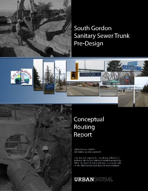
Conceptual Routing Report FINAL.pdf - City of Kelowna
Conceptual Routing Report FINAL.pdf - City of Kelowna
Conceptual Routing Report FINAL.pdf - City of Kelowna

Create successful ePaper yourself
Turn your PDF publications into a flip-book with our unique Google optimized e-Paper software.
SouthGordon<br />
SanitarySewerTrunk<br />
Pre-Design<br />
<strong>Conceptual</strong><br />
<strong>Routing</strong><br />
<strong>Report</strong><br />
<strong>City</strong>Reference:5340-07<br />
USLReference:0467.0384.01.R<br />
Thisreportispreparedforthesoleuse<strong>of</strong>the<strong>City</strong><strong>of</strong><br />
<strong>Kelowna</strong>.Norepresentations<strong>of</strong>anykindaremadeby<br />
UrbanSystemsLtd.oritsemployeestoanypartywith<br />
whom UrbanSystemsLtd.doesnothaveacontract.
<strong>City</strong> <strong>of</strong> <strong>Kelowna</strong><br />
South Gordon Sanitary Sewer Trunk Pre-design<br />
<strong>Conceptual</strong> <strong>Routing</strong> <strong>Report</strong><br />
TABLE OF CONTENTS<br />
1.0 INTRODUCTION .................................................................................................................. 1<br />
2.0 DESIGN CRITERIA .............................................................................................................. 2<br />
2.1 POPULATION PROJECTIONS ........................................................................................................ 2<br />
2.2 UNIT HYDRAULIC LOADING ........................................................................................................ 2<br />
2.2.1 Existing Conditions .......................................................................................................... 2<br />
2.2.2 Future Conditions ............................................................................................................ 6<br />
2.3 SEWER SIZING ........................................................................................................................ 7<br />
2.3.1 Minimum Pipe Diameter .................................................................................................. 7<br />
2.3.2 Maximum Flow Depths .................................................................................................... 7<br />
2.3.3 Minimum Fluid Velocity .................................................................................................... 7<br />
2.3.4 Minimum Pipe Grade ....................................................................................................... 7<br />
2.3.5 Depth and Cover ............................................................................................................. 7<br />
2.3.6 Manholes ........................................................................................................................ 7<br />
3.0 BASIN BOUNDARIES .......................................................................................................... 8<br />
4.0 LAND USE ASSUMPTIONS ................................................................................................10<br />
4.1 EXISTING CONDITIONS ........................................................................................................... 10<br />
4.2 FUTURE CONDITIONS .............................................................................................................. 11<br />
5.0 HYDRAULIC MODELING ...................................................................................................13<br />
5.1 CONSIDERATIONS .................................................................................................................. 13<br />
5.2 ASSUMPTIONS ....................................................................................................................... 14<br />
5.3 ANALYSIS – EXISTING CONDITIONS ............................................................................................ 14<br />
5.4 ANALYSIS – FUTURE CONDITIONS .............................................................................................. 16<br />
5.5 ANALYSIS – SENSITIVITY ......................................................................................................... 18<br />
5.6 CONCEPTUAL ROUTING ALTERNATIVES ........................................................................................ 19<br />
5.6.1 General <strong>Routing</strong> Considerations ..................................................................................... 20<br />
5.6.2 Option #1: Lakeshore – Gyro Lift Station ........................................................................ 21<br />
5.6.3 Option #2: Gordon – Gyro Lift Station ............................................................................ 23<br />
5.6.4 Option #3: Gordon – Waste Water Treatment Plant ........................................................ 24<br />
Page (i)<br />
0467.0384.01-R / October 14, 2009<br />
U:\Projects_KEL\0467\0384\01\R-<strong>Report</strong>s-Studies-Documents\Final\<strong>Conceptual</strong> <strong>Routing</strong> <strong>Report</strong>\2009-10-14 <strong>Conceptual</strong> <strong>Routing</strong> <strong>Report</strong> <strong>FINAL</strong>.doc
<strong>City</strong> <strong>of</strong> <strong>Kelowna</strong><br />
South Gordon Sanitary Sewer Trunk Pre-design<br />
<strong>Conceptual</strong> <strong>Routing</strong> <strong>Report</strong><br />
6.0 CONCLUSIONS ..................................................................................................................26<br />
7.0 RECOMMENDATIONS ........................................................................................................29<br />
8.0 CLOSURE ...........................................................................................................................30<br />
APPENDICES<br />
Appendix A<br />
Appendix B<br />
Appendix C<br />
Digital Information<br />
Construction Cost Estimates<br />
Memorandum – Future Land Use Projections<br />
LIST OF FIGURES<br />
Figure 3.1<br />
Figure 3.2<br />
Figure 4.1<br />
Figure 4.2<br />
Figure 5.1<br />
Figure 5.2<br />
Sector Boundaries<br />
Basin Boundaries<br />
2020 Land Use Scenario<br />
Future Urban Reserve Potential Growth<br />
Hydraulic Model Existing System<br />
Existing Residual Capacities<br />
Figure 5.3 <strong>Routing</strong> Option 1<br />
Figure 5.4 Hydraulic Model Ultimate Flows Option 1<br />
Figure 5.5 <strong>Routing</strong> Option 2<br />
Figure 5.6 Hydraulic Model Ultimate Flows Option 3<br />
Figure 5.7 <strong>Routing</strong> Option 3<br />
LIST OF TABLES<br />
Table 2.1<br />
Table 2.2<br />
Table 2.3<br />
Table 2.4<br />
Table 4.1<br />
Table 4.2<br />
Table 5.1<br />
Table 5.2<br />
Table 5.3<br />
Table 5.4<br />
Table 5.5<br />
Table 6.1<br />
Population Criteria<br />
Flow Monitoring Data Summary<br />
Sanitary Lift Station Data<br />
Unit Infiltration Rates – Existing Conditions<br />
Existing Population<br />
Future Serviced Population<br />
Pipe Capacity Summary (Critical Trunkmain Sections)<br />
Future Conditions<br />
Reduced Lift Station Discharge Rates to Reflect Future Trunk Storage Attenuation<br />
Future Conditions with Reduced Hydraulic Load Assumptions<br />
Riparian Management Area Setbacks<br />
Option Evaluation<br />
Page (ii)<br />
0467.0384.01-R / October 14, 2009<br />
U:\Projects_KEL\0467\0384\01\R-<strong>Report</strong>s-Studies-Documents\Final\<strong>Conceptual</strong> <strong>Routing</strong> <strong>Report</strong>\2009-10-14 <strong>Conceptual</strong> <strong>Routing</strong> <strong>Report</strong> <strong>FINAL</strong>.doc
<strong>City</strong> <strong>of</strong> <strong>Kelowna</strong><br />
South Gordon Sanitary Sewer Trunk Pre-design<br />
<strong>Conceptual</strong> <strong>Routing</strong> <strong>Report</strong><br />
1.0 INTRODUCTION<br />
The South Gordon Drive Sanitary Trunk Sewer has been identified for some time as an important element<br />
<strong>of</strong> the <strong>City</strong> <strong>of</strong> <strong>Kelowna</strong>‟s future sanitary sewer infrastructure. This trunk will allow for a „splitting‟ <strong>of</strong><br />
sewage flow from the southern end <strong>of</strong> the <strong>City</strong>, effectively creating a conduit parallel to the existing<br />
Lakeshore Road Sanitary Trunk Sewer. Development within the South Slopes area <strong>of</strong> <strong>Kelowna</strong> – recent<br />
and future – will ultimately overload the Lakeshore Road trunk sewer unless a relief trunk is in place.<br />
In January <strong>of</strong> 2009, the <strong>City</strong>‟s Design and Construction Services Division initiated a proposal call to<br />
investigate the preferred route, alignment and size <strong>of</strong> the noted sanitary trunk sewer. The <strong>City</strong> was<br />
specifically interested in determining whether or not a section <strong>of</strong> the sanitary trunk sewer could be<br />
constructed in conjunction with planned road widening improvements along Gordon Drive, should it be<br />
determined that Gordon Drive is the preferred route for the new trunk main. In March <strong>of</strong> 2009, the <strong>City</strong><br />
<strong>of</strong> <strong>Kelowna</strong> commissioned Urban Systems Ltd to undertake the South Gordon Sanitary Sewer Trunk Pre-<br />
Design assignment. This infrastructure planning and pre-design assignment includes an initial assessment<br />
<strong>of</strong> viable trunk main routing alternatives. This „<strong>Conceptual</strong> <strong>Routing</strong> <strong>Report</strong>‟ summarizes the key findings<br />
and conclusions <strong>of</strong> the routing assessment.<br />
The primary objectives <strong>of</strong> the <strong>Conceptual</strong> <strong>Routing</strong> <strong>Report</strong> are described as follows:<br />
<br />
<br />
<br />
<br />
<br />
<br />
Provide a brief synopsis <strong>of</strong> applicable design criteria;<br />
Summarize preliminary hydraulic analyses and associated assumptions;<br />
Identify viable routing options and associated pipe diameters for the gravity trunk main;<br />
Develop a list <strong>of</strong> potential issues and considerations for each routing option;<br />
Prepare preliminary construction cost estimates, and;<br />
Recommend a preferred trunk main route.<br />
P a g e | 1<br />
0467.0384.01-R / October 14, 2009<br />
U:\Projects_KEL\0467\0384\01\R-<strong>Report</strong>s-Studies-Documents\Final\<strong>Conceptual</strong> <strong>Routing</strong> <strong>Report</strong>\2009-10-14 <strong>Conceptual</strong> <strong>Routing</strong> <strong>Report</strong> <strong>FINAL</strong>.doc
<strong>City</strong> <strong>of</strong> <strong>Kelowna</strong><br />
South Gordon Sanitary Sewer Trunk Pre-design<br />
<strong>Conceptual</strong> <strong>Routing</strong> <strong>Report</strong><br />
2.0 DESIGN CRITERIA<br />
2.1 Population Projections<br />
For the purpose <strong>of</strong> the <strong>Conceptual</strong> <strong>Routing</strong> evaluation, existing and future populations were estimated<br />
using the unit criteria summarized in Table 2.1.<br />
Table 2.1– Population Criteria<br />
Land Use DU DU/acre Capita/DU Comments<br />
Single/Two-Unit Residential DU 6 2.8<br />
Multi Unit Low Density DU 15 2.8<br />
Multi Unit Medium Density DU 35 1.5<br />
Multi Unit High Density DU 55 1.5<br />
Multi Unit Cluster Housing DU 6 2.8<br />
Institutional Sq.m. Per Zoning Bylaw<br />
Commercial Sq.m. Per Zoning Bylaw<br />
Industrial Sq.m. Per Zoning Bylaw<br />
The current version <strong>of</strong> the <strong>City</strong> <strong>of</strong> <strong>Kelowna</strong> Official Community Plan (OCP) was the source <strong>of</strong> these unit<br />
population criteria. These criteria are consistent with the <strong>City</strong>‟s 2030 OCP update, which is currently<br />
underway.<br />
2.2 Unit Hydraulic Loading<br />
For the purposes <strong>of</strong> this report, a mixture <strong>of</strong> unit hydraulic loads was incorporated into the capacity<br />
analyses and trunk sizing exercises. Development <strong>of</strong> distinct unit rates was necessary because the unit<br />
hydraulic loads specified in the <strong>City</strong> <strong>of</strong> <strong>Kelowna</strong> Subdivision, Development and Servicing Bylaw (SDS) are<br />
somewhat conservative, thereby ensuring that new sanitary sewers have somewhat <strong>of</strong> a margin in terms<br />
<strong>of</strong> available capacity. Applying bylaw criteria to the existing service population results in “theoretical”<br />
peak flow rates which typically exceed measured flows. This conservatism may ultimately trigger an<br />
upgrade – a new trunk in this case – sooner than is likely necessary. It also demands that hydraulic<br />
capacity for the proposed upgrade be even greater than what might be required.<br />
2.2.1 Existing Conditions<br />
The hydraulic behaviour <strong>of</strong> flows within the existing Lakeshore and Old Meadows Road trunks is<br />
influenced by a number <strong>of</strong> factors as it turns out:<br />
<br />
Off/on discharges from several lift stations<br />
P a g e | 2<br />
0467.0384.01-R / October 14, 2009<br />
U:\Projects_KEL\0467\0384\01\R-<strong>Report</strong>s-Studies-Documents\Final\<strong>Conceptual</strong> <strong>Routing</strong> <strong>Report</strong>\2009-10-14 <strong>Conceptual</strong> <strong>Routing</strong> <strong>Report</strong> <strong>FINAL</strong>.doc
<strong>City</strong> <strong>of</strong> <strong>Kelowna</strong><br />
South Gordon Sanitary Sewer Trunk Pre-design<br />
<strong>Conceptual</strong> <strong>Routing</strong> <strong>Report</strong><br />
<br />
<br />
<br />
<br />
<br />
<br />
Dry weather domestic flows<br />
Inflow<br />
Infiltration<br />
Seasonal variations in tributary populations<br />
Seasonal variations in lake levels, and<br />
Attenuation within the mains<br />
Our initial efforts were focused on examining the hydraulics <strong>of</strong> the existing trunk system and, to some<br />
degree, the interplay between the various factors affecting these hydraulics. The ultimate objective, <strong>of</strong><br />
course, was to determine residual capacity within the existing Lakeshore trunk - and by extension - the<br />
„trigger‟ point flows dictating the need for a relief main.<br />
The route to this objective included derivation <strong>of</strong> specific unit rate rates for:<br />
<br />
<br />
Average Daily Unit Loads (dry weather flow), and<br />
Average Daily Infiltration/Inflow<br />
that apply solely to the existing, serviced population.<br />
The <strong>City</strong> <strong>of</strong> <strong>Kelowna</strong> recently installed temporary flow monitoring equipment at four locations within the<br />
study area. Table 2.2 summarizes the key information gleaned from the recorded data.<br />
Table 2.2 – Flow Monitoring Data Summary<br />
Location<br />
Date<br />
Daily Flow Rates (L/s)<br />
Installed Removed Peak Avg Low<br />
MH 109107 – Lakeshore (between Barrera & Cook) 18-Sep-08 10-Oct-08 108.6 42.8 14.7<br />
MH 109574 – Lakeshore (At Old Meadows) 01-Apr-09 07-Apr-09 29.6 9.5 0.6<br />
MH 109571 – Lakeshore (South <strong>of</strong> Old Meadows) 04-Mar-09 09-Mar-09 32.0 12.4 1.0<br />
MH 109584 – Old Meadows ( Gordon to Lakeshore) 04-Mar-09 30-Apr-09 26.8 9.1 2.1<br />
Each monitoring site provided both flow level and velocity data, from which flow rates were derived. A<br />
review <strong>of</strong> each data set reveals that the information gathered at MH 109574 (Lakeshore at Old Meadows)<br />
might not be reliable for the following reasons:<br />
<br />
The manhole forms the junction <strong>of</strong> the Lakeshore and Old Meadows trunks. Hence laminar flow<br />
conditions necessary for reliable water measurements might not be present.<br />
P a g e | 3<br />
0467.0384.01-R / October 14, 2009<br />
U:\Projects_KEL\0467\0384\01\R-<strong>Report</strong>s-Studies-Documents\Final\<strong>Conceptual</strong> <strong>Routing</strong> <strong>Report</strong>\2009-10-14 <strong>Conceptual</strong> <strong>Routing</strong> <strong>Report</strong> <strong>FINAL</strong>.doc
<strong>City</strong> <strong>of</strong> <strong>Kelowna</strong><br />
South Gordon Sanitary Sewer Trunk Pre-design<br />
<strong>Conceptual</strong> <strong>Routing</strong> <strong>Report</strong><br />
<br />
The recorded flows are lower than those measured at MH 109571, which is located just<br />
upstream, on Lakeshore Road.<br />
Therefore, the data recorded at the Old Meadows Road monitoring location (MH 109584) were used to<br />
determine the existing unit loads, since this location does not have lift stations discharging into the<br />
upstream sewer system. Unfortunately, the data summarized in Table 2.2 are insufficient to determine<br />
how much <strong>of</strong> the low flow, if any, is attributable to infiltration. For the purposes <strong>of</strong> this study, we have<br />
assumed that approximately 50% <strong>of</strong> the low flow rates are a result <strong>of</strong> infiltration. This yields the following<br />
average daily flow rates, based on an average monitored flow rate <strong>of</strong> 9.1 L/s:<br />
<br />
<br />
Average dry weather flow – 8.05 L/s<br />
Infiltration – 1.05 L/s<br />
We also examined selected operational<br />
data, which included design discharge<br />
rates, daily pump run times, and<br />
continuous pump run times for the<br />
Eldorado, Bluebird, and Gyro lift stations.<br />
These data, combined with flow<br />
monitoring and historical lake level data,<br />
suggests that daily sanitary flow volumes<br />
increase during the summer months. This<br />
is illustrated by the adjacent figure<br />
showing the Bluebird lift station data and<br />
Okanagan Lake levels. Note that the<br />
patterns are similar for both the Eldorado and Gyro lift stations.<br />
We have insufficient data to determine if the increased flow volumes are due to increased summertime<br />
population, to increased infiltration caused by a higher groundwater level, or both. For the purposes <strong>of</strong><br />
this study, however, we have assumed that the increases are due to infiltration since there is a very close<br />
correlation with the lake water level, which influences local groundwater levels.<br />
Table 2.3 summarizes key data obtained for each <strong>of</strong> the lift stations contributing to the Lakeshore trunk<br />
sewer.<br />
P a g e | 4<br />
0467.0384.01-R / October 14, 2009<br />
U:\Projects_KEL\0467\0384\01\R-<strong>Report</strong>s-Studies-Documents\Final\<strong>Conceptual</strong> <strong>Routing</strong> <strong>Report</strong>\2009-10-14 <strong>Conceptual</strong> <strong>Routing</strong> <strong>Report</strong> <strong>FINAL</strong>.doc
<strong>City</strong> <strong>of</strong> <strong>Kelowna</strong><br />
South Gordon Sanitary Sewer Trunk Pre-design<br />
<strong>Conceptual</strong> <strong>Routing</strong> <strong>Report</strong><br />
Table 2.3 – Sanitary Lift Station Data<br />
Lift<br />
Station<br />
Pump<br />
Discharge<br />
Rate (L/s)<br />
Average Daily Pump Run<br />
Time (min)<br />
Summer (S)<br />
Winter (W)<br />
S/W Ratio<br />
Lakeshore 81 109 79 1.38<br />
Farris 12 76 51 1.49<br />
Eldorado 27 227 164 1.38<br />
Bluebird 40 206 136 1.51<br />
Average 1.45<br />
The lift station and monitored flow data also indicate that flows discharged from force mains into the<br />
gravity trunk sewer are attenuated significantly as they travel downstream.<br />
The <strong>City</strong> also provided us with rainfall data from several local weather monitoring stations. Timing <strong>of</strong> the<br />
rainfall events was coincident with some <strong>of</strong> the flow monitoring data generated from the Lakeshore<br />
Sanitary Trunk. Unfortunately, no significant rainfall occurred during these monitoring periods, so it was<br />
not possible to confirm if inflow is <strong>of</strong> significance. It could be assumed, however, that little inflow occurs<br />
because the sewer systems in the basins are relatively new and hence few (or no connections) from<br />
drainage catch basins are likely.<br />
Therefore, as shown in Table 2.3 above, it appears that infiltration during the summer months (peaking<br />
in June) is typically higher than that inferred from the monitoring data. For the purposes <strong>of</strong> this report,<br />
we have adjusted the inferred infiltration flow as follows:<br />
Increase daily volume by the summer/winter (S/W) ratio <strong>of</strong> 1.45<br />
<br />
<br />
Subtract the portion <strong>of</strong> daily volume attributed to dry weather flow (domestic loads)<br />
Net result is the adjusted infiltration volume<br />
Applying the above rational, our derivation <strong>of</strong> the „adjusted infiltration flow rate‟ is described as follows:<br />
<br />
<br />
<br />
Adjusted Infiltration Flow Rate = (Average Monitored Flow Rate)(S/W ratio) – (Average Dry<br />
Weather Flow Rate)<br />
Adjusted Infiltration Flow Rate = (9.1 L/s)(1.45) – (8.05L/s)<br />
Adjusted Infiltration Flow Rate = 5.15 L/s<br />
Typically, unit infiltration rates are expressed in terms <strong>of</strong> litres per day per hectare. We have also<br />
calculated unit infiltration in terms <strong>of</strong> litres per day per km <strong>of</strong> pipe for existing conditions in other<br />
jurisdictions. This alternative approach more accurately reflects the fact that the amount <strong>of</strong> infiltration is<br />
P a g e | 5<br />
0467.0384.01-R / October 14, 2009<br />
U:\Projects_KEL\0467\0384\01\R-<strong>Report</strong>s-Studies-Documents\Final\<strong>Conceptual</strong> <strong>Routing</strong> <strong>Report</strong>\2009-10-14 <strong>Conceptual</strong> <strong>Routing</strong> <strong>Report</strong> <strong>FINAL</strong>.doc
<strong>City</strong> <strong>of</strong> <strong>Kelowna</strong><br />
South Gordon Sanitary Sewer Trunk Pre-design<br />
<strong>Conceptual</strong> <strong>Routing</strong> <strong>Report</strong><br />
correlated more to the number <strong>of</strong> joints, manholes, and service connections than it is to serviced area.<br />
Table 2.4 summarizes the calculated unit infiltration rates for existing conditions using the flow<br />
monitoring data from Old Meadows Road (MH 109584) and the adjusted infiltration flow rate <strong>of</strong> 5.15 L/s<br />
(309 L/min).<br />
Table 2.4 – Unit Infiltration Rates – Existing Conditions<br />
Land Use<br />
Assumed<br />
Infiltration<br />
(Lpm)<br />
Serviced<br />
Area<br />
(ha)<br />
Length<br />
<strong>of</strong> Sewer<br />
(km)<br />
Unit Infiltration<br />
Rate<br />
Lpd/ha<br />
Lpd/km<br />
MH 109584 – Old Meadows ( Gordon to Lakeshore) 309 241 30.8 1846 14,450<br />
Based on an upstream existing, serviced population <strong>of</strong> 4812 (i.e. upstream <strong>of</strong> MH 109584), and the<br />
adjusted unit flow rates summarized in Table 2.4, the derived unit flow rates for existing conditions are:<br />
<br />
<br />
Average Daily Unit Load (dry weather flow) = 145 Lpd/capita<br />
Average Daily Infiltration = 1,850 Lpd/ha or 14,450 Lpd/km <strong>of</strong> pipe<br />
The peaking factor derived from the Old Meadows Road monitoring station data is approximately 2.1, for<br />
a service population <strong>of</strong> 4812. For the same population, the Subdivision, Development and Servicing Bylaw<br />
dictates a peaking factor (75% <strong>of</strong> the Harmon PF) <strong>of</strong> 2.4. Hence, the more conservative Bylaw peaking<br />
factor equation was applied throughout this study when calculating peak flows for a service area, given<br />
the closeness <strong>of</strong> these two values.<br />
2.2.2 Future Conditions<br />
Preceding Section 2.2.1 addresses unit hydraulic loading values as they apply to existing populations<br />
within the study area. For future development – including future homes on serviced but currently vacant<br />
lots - the Subdivision, Development and Servicing Bylaw criteria would apply as follows:<br />
<br />
<br />
<br />
Domestic Flow Rate (dry weather flow) = 300 litres/capita/day<br />
Infiltration rate for pipes not in water table = 5,000 l/ha/d<br />
Infiltration rate for pipes in water table = 8,000 l/ha/d<br />
The peaking factor applied to the average flow is calculated as follows:<br />
Peaking Factor = f (1+14/(4+P 0.5 ))<br />
where: P = Population in Thousands<br />
f = Reduction factor, applied as follows<br />
New residential areas = 0.75<br />
P a g e | 6<br />
0467.0384.01-R / October 14, 2009<br />
U:\Projects_KEL\0467\0384\01\R-<strong>Report</strong>s-Studies-Documents\Final\<strong>Conceptual</strong> <strong>Routing</strong> <strong>Report</strong>\2009-10-14 <strong>Conceptual</strong> <strong>Routing</strong> <strong>Report</strong> <strong>FINAL</strong>.doc
<strong>City</strong> <strong>of</strong> <strong>Kelowna</strong><br />
South Gordon Sanitary Sewer Trunk Pre-design<br />
<strong>Conceptual</strong> <strong>Routing</strong> <strong>Report</strong><br />
Commercial and Industrial area = 1.00<br />
2.3 Sewer Sizing<br />
The <strong>City</strong>‟s SDS Bylaw specifies the following criteria for the design <strong>of</strong> sanitary sewer mains:<br />
2.3.1 Minimum Pipe Diameter<br />
<br />
For residential development – 200 mm minimum diameter<br />
<br />
For non-residential development – 250 mm minimum diameter<br />
2.3.2 Maximum Flow Depths<br />
At peak design flow, sewers shall be designed so that they flow:<br />
<br />
<br />
2/3 full for pipes 250 mm diameter and less; or<br />
3/4 full for pipes greater than 250 mm diameter<br />
2.3.3 Minimum Fluid Velocity<br />
Minimum fluid velocity is 0.6 m/s.<br />
2.3.4 Minimum Pipe Grade<br />
The grade <strong>of</strong> any sewer main is governed by the minimum velocity. If the calculated design flow is not<br />
expected to produce a velocity <strong>of</strong> at least 0.6 m/sec., then the minimum grade shall be calculated on the<br />
basis <strong>of</strong> the pipe flowing 35% full at a theoretical velocity <strong>of</strong> 0.6 m/sec.<br />
2.3.5 Depth and Cover<br />
The absolute minimum cover over a pipe must be 1.0 m, measured from the surface to the top <strong>of</strong> the<br />
pipe. However, in practise preferred minimums range between 1.2 m and 1.5 m, according to the <strong>City</strong>‟s<br />
Design and Construction Services Division.<br />
2.3.6 Manholes<br />
Manholes are required at:<br />
<br />
<br />
<br />
<br />
<br />
All changes in grade;<br />
All changes in direction;<br />
All changes in pipe sizes;<br />
All terminal sections; and<br />
Downstream end <strong>of</strong> curvilinear sewer<br />
P a g e | 7<br />
0467.0384.01-R / October 14, 2009<br />
U:\Projects_KEL\0467\0384\01\R-<strong>Report</strong>s-Studies-Documents\Final\<strong>Conceptual</strong> <strong>Routing</strong> <strong>Report</strong>\2009-10-14 <strong>Conceptual</strong> <strong>Routing</strong> <strong>Report</strong> <strong>FINAL</strong>.doc
<strong>City</strong> <strong>of</strong> <strong>Kelowna</strong><br />
South Gordon Sanitary Sewer Trunk Pre-design<br />
<strong>Conceptual</strong> <strong>Routing</strong> <strong>Report</strong><br />
3.0 BASIN BOUNDARIES<br />
Clearly, definition <strong>of</strong> the existing and future catchment areas for the South Gordon Trunk is a key<br />
element <strong>of</strong> the <strong>Conceptual</strong> <strong>Routing</strong> exercise. To this end, we relied upon previous work completed for the<br />
<strong>City</strong> by others, and complemented that work with our own observations and analysis.<br />
Stanley Consulting Group Ltd (Stanley) completed a Wastewater Master Plan for the <strong>City</strong> <strong>of</strong> <strong>Kelowna</strong> in<br />
June <strong>of</strong> 1997. This Plan provided a blueprint for ongoing development and expansion <strong>of</strong> <strong>Kelowna</strong>‟s<br />
sanitary sewer utility past the year 1997.<br />
The Stanley report identifies six sectors within and external to the <strong>City</strong>‟s existing sanitary sewer system,<br />
as shown in Figure 3.1. These sectors were developed on the basis <strong>of</strong> historical development and future<br />
land use projections. The three sectors relevant to this <strong>Conceptual</strong> <strong>Routing</strong> evaluation are the Central<br />
<strong>Kelowna</strong>, Southeast <strong>Kelowna</strong> and Okanagan Mission sectors. It should be noted that extensive areas <strong>of</strong><br />
agricultural land within the <strong>City</strong> are protected by Provincial legislation and cannot be readily developed.<br />
Consequently, agricultural land uses were excluded from the tributary basins within each sector. Our<br />
<strong>Conceptual</strong> <strong>Routing</strong> evaluation relied on the earlier Stanley work, allowing us to determine which sectors,<br />
and basins within each sector, could potentially contribute to the South Gordon Trunk sewer.<br />
Any new sanitary sewer trunk main infrastructure servicing these three sectors would potentially begin at<br />
Old Meadows Road, within the Okanagan Mission sector, and end at either the <strong>Kelowna</strong> Pollution Control<br />
Centre (KPCC) or at Gyro lift station. Both <strong>of</strong> these latter facilities are within the Central <strong>Kelowna</strong> sector.<br />
The Stanley servicing strategy for the Southeast <strong>Kelowna</strong> sector was examined to determine whether or<br />
not this sector would contribute to the South Gordon Trunk.<br />
The Wastewater Master Plan identified that the Southeast <strong>Kelowna</strong> sector is largely rural in nature, with<br />
the gradient <strong>of</strong> the land generally sloping towards the northwest. The Stanley servicing strategy proposed<br />
a twin trunk collection system for the Southeast <strong>Kelowna</strong> sector, with the two trunks converging near Hall<br />
Road, where the existing trunk is now terminated. Presently, the Hall Road trunk is routed west along<br />
KLO Road to Benvoulin Road, then heads north along Benvoulin Road, then west again through a number<br />
<strong>of</strong> private land parcels, eventually entering the KPCC site from Raymer Avenue. This routing arrangement<br />
tells us that the Southeast <strong>Kelowna</strong> sector will not contribute sewage flows to the South Gordon Trunk. If<br />
and when the McCulloch/Gallagher‟s Canyon area is connected to the sanitary sewer system, the flows<br />
emanating from this area could be routed along Gulley and Spiers Roads, ultimately connecting to the<br />
Hall Road trunk at the intersection <strong>of</strong> Hall Road and Spiers Road. This suggested routing is in keeping<br />
with the <strong>City</strong>‟s 20 year Major Road Network Plan, which sees Spiers and Gulley Roads being upgraded to<br />
a two lane arterial status. However, the <strong>City</strong> would need to consider the potential ramifications <strong>of</strong><br />
implementing a sanitary trunk sewer - in conjunction with the proposed future roadway improvements -<br />
through what is predominantly agricultural land. A portion <strong>of</strong> any trunk main along the northern leg <strong>of</strong><br />
Spiers Road may need to incorporate an inverted siphon, given the ground pr<strong>of</strong>ile along that section <strong>of</strong><br />
road. There may also be a need for flow attenuation from the Gallagher‟ Canyon service area to<br />
P a g e | 8<br />
0467.0384.01-R / October 14, 2009<br />
U:\Projects_KEL\0467\0384\01\R-<strong>Report</strong>s-Studies-Documents\Final\<strong>Conceptual</strong> <strong>Routing</strong> <strong>Report</strong>\2009-10-14 <strong>Conceptual</strong> <strong>Routing</strong> <strong>Report</strong> <strong>FINAL</strong>.doc
FIGURE 3.1<br />
SECTOR BOUNDARIES<br />
Project No. 0467.0384.01<br />
SOUTH GORDON SANITARY SEWER TRUNK PRE-DESIGN<br />
<strong>Conceptual</strong> <strong>Routing</strong> <strong>Report</strong>
<strong>City</strong> <strong>of</strong> <strong>Kelowna</strong><br />
South Gordon Sanitary Sewer Trunk Pre-design<br />
<strong>Conceptual</strong> <strong>Routing</strong> <strong>Report</strong><br />
accommodate the expected flows within the capacity <strong>of</strong> the existing Hall Road and Benvoulin Road<br />
trunks.<br />
Those portions <strong>of</strong> the Central <strong>Kelowna</strong> and Okanagan Mission sectors contributing to the South Gordon<br />
Trunk were subdivided into a number <strong>of</strong> basins as shown in Figure 3.2. The basin boundaries reflect<br />
both the individual areas tributary to a number <strong>of</strong> lift stations within the noted sectors, as well as sub<br />
areas within the sector drained by gravity flow to either an existing or future trunk main. The Central<br />
<strong>Kelowna</strong> sector has only one contributing basin - Gyro lift station. The Okanagan Mission sector is divided<br />
into seven distinct basins: Uplands lift station, South Mission, Farris lift station, Eldorado lift station, Old<br />
Meadows, Bluebird lift station and Mission Waterpark lift station.<br />
The Old Meadows, South Mission and Gyro lift station basins all flow directly by gravity to the existing<br />
Lakeshore Trunk. The majority flows discharged from the <strong>of</strong> Gyro lift station basin enter the existing<br />
Lakeshore trunk at the intersection <strong>of</strong> Swordy Road and Lakeshore Road, influencing only a small portion<br />
<strong>of</strong> the Lakeshore trunk prior to discharging to the Gyro lift station facility.<br />
P a g e | 9<br />
0467.0384.01-R / October 14, 2009<br />
U:\Projects_KEL\0467\0384\01\R-<strong>Report</strong>s-Studies-Documents\Final\<strong>Conceptual</strong> <strong>Routing</strong> <strong>Report</strong>\2009-10-14 <strong>Conceptual</strong> <strong>Routing</strong> <strong>Report</strong> <strong>FINAL</strong>.doc
FIGURE 3.2<br />
BASIN BOUNDARIES<br />
Project No. 0467.0384.01<br />
SOUTH GORDON SANITARY SEWER TRUNK PRE-DESIGN<br />
<strong>Conceptual</strong> <strong>Routing</strong> <strong>Report</strong>
<strong>City</strong> <strong>of</strong> <strong>Kelowna</strong><br />
South Gordon Sanitary Sewer Trunk Pre-design<br />
<strong>Conceptual</strong> <strong>Routing</strong> <strong>Report</strong><br />
4.0 LAND USE ASSUMPTIONS<br />
This section <strong>of</strong> the report outlines assumptions regarding both existing and future land use, within the<br />
lands tributary to the sanitary trunk system under study.<br />
4.1 Existing Conditions<br />
Existing development within the study area is divided into two categories – serviced and not serviced.<br />
This distinction is important since one <strong>of</strong> the study objectives is to establish unit load criteria for existing<br />
conditions (this was completed using monitored flow data as outlined in Section 2.0). In order to<br />
accomplish this objective, the following assumptions were made to ensure that only the development<br />
units contributing sanitary loads to the system were considered:<br />
<br />
<br />
<br />
Parcels which have a sanitary service connection and which are not classified as vacant, were<br />
considered as “existing serviced”.<br />
Parcels which have a sanitary service connection, but which are classified as vacant, were<br />
considered as “existing not serviced”.<br />
Parcels which do not have a sanitary service connection, but which are classified as not vacant,<br />
were considered as “existing not serviced”.<br />
All parcels deemed “existing not serviced” were not included in the existing conditions model. These<br />
parcels will, however, contribute sanitary loading in the future conditions model based upon their existing<br />
or ultimate land use designation.<br />
The study area was also divided into several catchments, based on locations <strong>of</strong> interest. These include:<br />
<br />
<br />
<br />
Service areas contributing to a lift station<br />
Gravity service areas tributary (by gravity flow) to flow monitoring sites (manholes)<br />
Service areas tributary (by gravity flow) to the Lakeshore Trunk sewer<br />
Table 4.1 summarizes the overall existing populations (serviced and not serviced) within each<br />
catchment.<br />
P a g e | 10<br />
0467.0384.01-R / October 14, 2009<br />
U:\Projects_KEL\0467\0384\01\R-<strong>Report</strong>s-Studies-Documents\Final\<strong>Conceptual</strong> <strong>Routing</strong> <strong>Report</strong>\2009-10-14 <strong>Conceptual</strong> <strong>Routing</strong> <strong>Report</strong> <strong>FINAL</strong>.doc
<strong>City</strong> <strong>of</strong> <strong>Kelowna</strong><br />
South Gordon Sanitary Sewer Trunk Pre-design<br />
<strong>Conceptual</strong> <strong>Routing</strong> <strong>Report</strong><br />
Table 4.1 – Existing Population<br />
Catchment<br />
Existing Population<br />
Serviced Not Serviced Total<br />
Comments<br />
Gyro LS-North 6,888 101 6,989 North <strong>of</strong> MH 109107<br />
Gyro LS-South 1,694 14 1,708 Flow monitoring site – MH 109107<br />
Mission Water Park 0 0 0<br />
MH 107520 (institutional point<br />
load)<br />
Bluebird LS 1,569 112 1,681<br />
South Mission 1,915 172 2,087 Flow monitoring site – MH 109571<br />
Old Meadows 4,812 1,358 6,170 Flow monitoring site – MH 109584<br />
Eldorado LS 1,418 23 1,441<br />
Farris LS 180 11 191<br />
Upland LS 2,125 1,434 3,559<br />
Totals 20,601 3,225 23,826<br />
The populations for existing conditions were determined as follows:<br />
Parcels were classified by their primary use (SF, MF, ICI). See Table 2.1.<br />
<br />
<br />
BC Assessment Authority (BCAA) counts <strong>of</strong> units were allocated to each parcel.<br />
The population associated with each parcel was calculated using the BCAA unit count and the<br />
unit criteria outlined in Table 2.1.<br />
4.2 Future Conditions<br />
The <strong>City</strong> <strong>of</strong> <strong>Kelowna</strong> is currently undertaking a review <strong>of</strong> its Official Community Plan (OCP), which is<br />
scheduled for completion by early 2010. The OCP review involves preparation <strong>of</strong> several future land use<br />
scenarios, comparison <strong>of</strong> key measures, and the ultimate selection <strong>of</strong> a preferred growth scenario (or<br />
combination <strong>of</strong> scenarios) to be incorporated into the OCP. As noted in the Terms <strong>of</strong> Reference for the<br />
South Gordon Trunk assignment, the <strong>City</strong>‟s preferred growth scenario, and by extension the 2030 land<br />
use projections, will not be available until June 30, 2009. It was assumed at the outset <strong>of</strong> this routing<br />
evaluation that the <strong>City</strong>‟s current 2020 land use information would be used to support recommendations<br />
included in this study.<br />
However, Urban Systems Ltd. is currently the prime consultant for the <strong>City</strong>‟s OCP review initiative. As<br />
such, we are familiar with potential growth scenarios being considered beyond the current 2020 OCP land<br />
use plan, and, more specifically, within designated Future Urban Reserve Areas in the South Slopes<br />
areas. Consideration <strong>of</strong> these potential growth areas as an “upper limit” condition is certainly relevant in<br />
the context <strong>of</strong> this study, although the OCP review process is not complete, and remains subject to<br />
change.<br />
P a g e | 11<br />
0467.0384.01-R / October 14, 2009<br />
U:\Projects_KEL\0467\0384\01\R-<strong>Report</strong>s-Studies-Documents\Final\<strong>Conceptual</strong> <strong>Routing</strong> <strong>Report</strong>\2009-10-14 <strong>Conceptual</strong> <strong>Routing</strong> <strong>Report</strong> <strong>FINAL</strong>.doc
<strong>City</strong> <strong>of</strong> <strong>Kelowna</strong><br />
South Gordon Sanitary Sewer Trunk Pre-design<br />
<strong>Conceptual</strong> <strong>Routing</strong> <strong>Report</strong><br />
Consequently, we took advantage <strong>of</strong> the preliminary 2030 land use projection information to allow for<br />
development <strong>of</strong> two future condition scenarios, as follows:<br />
<br />
<br />
2020 Scenario - in accordance with the Terms <strong>of</strong> Reference for the assignment, future population<br />
is based on the 2020 OCP full capacity build-out (i.e. not including Future Urban Reserve Areas),<br />
as shown in Figure 4.1.<br />
2030 Scenario - as an “upper limit” condition, future population is based on full capacity build-out<br />
based upon the most current planning information available related to the 2030 OCP update, plus<br />
the potential growth associated with expressions <strong>of</strong> interest from the development community<br />
within designated Future Urban Reserve Areas as shown in Figure 4.2. A memorandum<br />
summarizing the future land use projections associated with the 2030 Scenario is provided in<br />
Appendix C.<br />
Table 4.2 – Future Serviced Population<br />
Catchment<br />
Future Serviced Population<br />
2020 Scenario 2030 Scenario<br />
Gyro LS-North 10,058 10,660<br />
Gyro LS-South 2,314 2,424<br />
Mission Water Park 8 145<br />
Bluebird LS 2,231 2,297<br />
South Mission 5,299 6,332<br />
Old Meadows 16,883 20,749<br />
Eldorado LS 2,756 2,954<br />
Farris LS 528 570<br />
Upland LS 8,679 11,739<br />
Totals 48,756 57,870<br />
We assumed that the majority <strong>of</strong> future development would be residential in nature. Further we assumed<br />
that 60% <strong>of</strong> the development would be multi-family, with the remaining 40% single family in nature –<br />
these assumptions are consistent with the <strong>City</strong>‟s 2030 OCP update, which, as noted above, is currently<br />
underway.<br />
As noted early, the populations for future conditions were determined as follows:<br />
<br />
<br />
Parcels were classified by their primary use (SF, MF, ICI).<br />
The population associated with each parcel was calculated using the unit criteria outlined in<br />
Table 2.1.<br />
Sections 5.4 and 5.5 <strong>of</strong> this report examine how these future populations impact things from a<br />
hydraulic perspective.<br />
P a g e | 12<br />
0467.0384.01-R / October 14, 2009<br />
U:\Projects_KEL\0467\0384\01\R-<strong>Report</strong>s-Studies-Documents\Final\<strong>Conceptual</strong> <strong>Routing</strong> <strong>Report</strong>\2009-10-14 <strong>Conceptual</strong> <strong>Routing</strong> <strong>Report</strong> <strong>FINAL</strong>.doc
FIGURE 4.1<br />
2020 Land Use<br />
Scenario<br />
Project No. 0467.0384.01<br />
SOUTH GORDON SANITARY SEWER TRUNK PRE-DESIGN<br />
<strong>Conceptual</strong> <strong>Routing</strong> <strong>Report</strong>
FIGURE 4.2<br />
Future Urban<br />
Reserve Potential<br />
Growth<br />
AREA 3<br />
AREA 2<br />
AREA 1<br />
POTENTIAL GROWTH AREAS<br />
SOUTH GORDON SANITARY SEWER TRUNK PRE-DESIGN <strong>Conceptual</strong> <strong>Routing</strong> <strong>Report</strong><br />
Project No. 0467.0384.01
<strong>City</strong> <strong>of</strong> <strong>Kelowna</strong><br />
South Gordon Sanitary Sewer Trunk Pre-design<br />
<strong>Conceptual</strong> <strong>Routing</strong> <strong>Report</strong><br />
5.0 HYDRAULIC MODELING<br />
A computer-based hydraulic model was developed as a tool to assist the team with the hydraulic<br />
analyses:<br />
<br />
<br />
<br />
To identify existing capacity issues;<br />
To determine the conditions which would trigger need for additional trunk capacity; and<br />
To optimize the proposed trunk size and operational configuration<br />
The <strong>City</strong> <strong>of</strong> <strong>Kelowna</strong> provided Urban Systems with data from an InfoSewer model developed by <strong>City</strong> Staff.<br />
These data were imported into a PCSWMM.NET model which formed the basis <strong>of</strong> the model used for the<br />
<strong>Conceptual</strong> <strong>Routing</strong> evaluation.<br />
5.1 Considerations<br />
The set <strong>of</strong> computer model data we received from the <strong>City</strong> is highly detailed and includes all sanitary<br />
sewers within the service area. It also includes average load allocations from existing, serviced parcels to<br />
specific manholes. Since we are interested only in a small portion <strong>of</strong> the modeled system, this level <strong>of</strong><br />
detail can become a liability for the following reasons:<br />
<br />
<br />
Rather than simply adding lumped loads, which reflect future development conditions, additional<br />
effort is required to properly allocate them throughout each service catchment.<br />
Future development might trigger upgrades to sewers and lift stations upstream <strong>of</strong> the Lakeshore<br />
trunk sewer. These would have to be modeled to ensure future flows adequately reach the<br />
subject trunks, even though this is not an objective within the scope <strong>of</strong> this assignment.<br />
We therefore proposed - and were subsequently given permission from <strong>City</strong> Staff to - simplify the model<br />
as follows:<br />
<br />
<br />
Lift stations and force mains would be replaced with constant flow inputs to the model.<br />
Existing and future loads would be grouped and allocated to manholes immediately upstream <strong>of</strong><br />
the subject trunk sewers, using appropriate peaking factors.<br />
Several assumptions were necessary in order to simplify the model. These and other assumptions about<br />
the required analyses are outlined in Section 5.2.<br />
P a g e | 13<br />
0467.0384.01-R / October 14, 2009<br />
U:\Projects_KEL\0467\0384\01\R-<strong>Report</strong>s-Studies-Documents\Final\<strong>Conceptual</strong> <strong>Routing</strong> <strong>Report</strong>\2009-10-14 <strong>Conceptual</strong> <strong>Routing</strong> <strong>Report</strong> <strong>FINAL</strong>.doc
<strong>City</strong> <strong>of</strong> <strong>Kelowna</strong><br />
South Gordon Sanitary Sewer Trunk Pre-design<br />
<strong>Conceptual</strong> <strong>Routing</strong> <strong>Report</strong><br />
5.2 Assumptions<br />
The following assumptions govern the hydraulic analyses conducted for the purposes <strong>of</strong> this study, in<br />
addition to the design and analysis criteria outlined in Section 2.0.<br />
<br />
<br />
Developing steady-state peak flows is sufficient for evaluation purposes, since the analytical<br />
objective is to provide design peak flows for sizing the proposed sanitary trunk sewer. Timebased<br />
flow patterns will be used for reference purposes only.<br />
Loads from all <strong>of</strong> the service areas south <strong>of</strong> Old Meadows Road can be lumped and allocated to<br />
two locations:<br />
a. Manhole 109574 on Lakeshore Road at Old Meadows Road, and<br />
b. Manhole 108383 on Gordon Drive at Old Meadows Road<br />
<br />
<br />
<br />
<br />
Currently, lift station flows are significantly attenuated downstream <strong>of</strong> the forcemain discharge<br />
location. This appears to be a result <strong>of</strong> very short pump run-times. As additional development<br />
occurs, however, the lift station pumps will run for a longer period <strong>of</strong> time, thereby reducing the<br />
attenuation effect in the downstream trunks. Hence, the lift station discharge rates have been<br />
input as steady state flows within the model, without any reduction factor. Generally this is a<br />
conservative, but realistic, approach and represents the upper-limit <strong>of</strong> the potential design load.<br />
We assumed that each lift station discharge rate will remain unchanged unless the peak flows<br />
generated by the future population within each lift station service area exceed the lift station<br />
discharge rate.<br />
The <strong>City</strong>‟s computer model contains allocated loads at select manholes (model nodes). It was<br />
assumed that the allocated loads can be used as the basis for distributing loads within the<br />
portion <strong>of</strong> the model served directly by the subject trunk sewers.<br />
The simplified computer model will be used to establish the “trigger” peak flow rate, for purposes<br />
<strong>of</strong> the routing analysis. Sizing the proposed trunk and determining the design peak flow rate was<br />
completed manually since it was assumed that the trunk diameter and slope would be uniform<br />
along the entire length <strong>of</strong> the trunk.<br />
5.3 Analysis – Existing Conditions<br />
The <strong>Conceptual</strong> <strong>Routing</strong> evaluation included an analysis <strong>of</strong> existing hydraulic conditions throughout the<br />
reach <strong>of</strong> the Lakeshore Trunk. The purpose <strong>of</strong> the analysis was to determine:<br />
<br />
<br />
<br />
Existing peak flows;<br />
Residual capacity; and<br />
The peak flow rate which would trigger construction <strong>of</strong> additional trunk capacity<br />
P a g e | 14<br />
0467.0384.01-R / October 14, 2009<br />
U:\Projects_KEL\0467\0384\01\R-<strong>Report</strong>s-Studies-Documents\Final\<strong>Conceptual</strong> <strong>Routing</strong> <strong>Report</strong>\2009-10-14 <strong>Conceptual</strong> <strong>Routing</strong> <strong>Report</strong> <strong>FINAL</strong>.doc
<strong>City</strong> <strong>of</strong> <strong>Kelowna</strong><br />
South Gordon Sanitary Sewer Trunk Pre-design<br />
<strong>Conceptual</strong> <strong>Routing</strong> <strong>Report</strong><br />
Figure 5.1 illustrates the peak flow rates along the length <strong>of</strong> the existing Lakeshore trunk sewer. Note<br />
that flows rates in Figure 5.1 are higher than those derived from the monitoring program, since the<br />
monitoring rates were subsequently adjusted to reflect higher summertime flow rates, as discussed in<br />
Section 2.2. Also note that the projected flow rates through the north end <strong>of</strong> the system are<br />
significantly higher than those expected through the southern reach.<br />
The existing siphon crossing Mission Creek was analysed to determine its maximum flow capacity. The<br />
siphon is comprised <strong>of</strong> two 500 mm diameter pipes and one 315 mm diameter pipe. These pipes have an<br />
inside diameter <strong>of</strong> 463.5 mm and 284.5 mm respectively. The total length <strong>of</strong> each pipe is 35.4 m. The<br />
available head loss for each pipe barrel is 0.273 m.<br />
The equation<br />
<br />
Q / A<br />
h m<br />
K<br />
2g<br />
<br />
2<br />
was used to determine the minor head losses for each barrel in the<br />
siphon, where Q represents the flow rate, A is the cross-sectional area <strong>of</strong> the pipe and g is the force <strong>of</strong><br />
gravity. The pipe entrance for each barrel was assumed to be flush with the manhole wall yielding a “K”<br />
value <strong>of</strong> 0.5. The major losses through each siphon barrel were calculated using the Hazen-Williams<br />
equation -<br />
Q 0.278xCxD<br />
2.63<br />
h<br />
f<br />
<br />
L<br />
<br />
<br />
<br />
0.54<br />
, where D is the diameter <strong>of</strong> the pipe, L is the length <strong>of</strong> the<br />
pipe, h f is the friction loss, Q is the flow rate and C is the roughness coefficient. Assuming a roughness<br />
coefficient <strong>of</strong> 120, the major losses (h f ) through each barrel were determined. The total head loss<br />
through each pipe was determined by summing the major and minor losses.<br />
We were able to determine the ultimate flow capacity <strong>of</strong> the siphon by manipulating the flow rate (Q)<br />
until the actual head loss was equal to the allowable head loss <strong>of</strong> 0.273 m. Each 500mm diameter barrel<br />
has an ultimate capacity <strong>of</strong> 0.274 m 3 /s. The 315mm diameter barrel has an ultimate capacity <strong>of</strong> 0.081<br />
m 3 /s. Hence, the ultimate capacity <strong>of</strong> the siphon is 0.629 m 3 /s or 629 L/s.<br />
Figure 5.2 identifies several pipe segments <strong>of</strong> the Lakeshore Trunk that are nearing their design<br />
capacity based on the maximum liquid depth criteria defined in Section 2.0. Details <strong>of</strong> the more critical<br />
trunkmain sections are summarized in Table 5.1.<br />
P a g e | 15<br />
0467.0384.01-R / October 14, 2009<br />
U:\Projects_KEL\0467\0384\01\R-<strong>Report</strong>s-Studies-Documents\Final\<strong>Conceptual</strong> <strong>Routing</strong> <strong>Report</strong>\2009-10-14 <strong>Conceptual</strong> <strong>Routing</strong> <strong>Report</strong> <strong>FINAL</strong>.doc
FIGURE 5.1<br />
Hydraulic Model<br />
Existing System<br />
Project No. 0467.0384.01<br />
SOUTH GORDON SANITARY SEWER TRUNK PRE-DESIGN<br />
<strong>Conceptual</strong> <strong>Routing</strong> <strong>Report</strong>
FIGURE 5.2<br />
Existing Residual<br />
Capacities<br />
Project No. 0467.0384.01<br />
SOUTH GORDON SANITARY SEWER TRUNK PRE-DESIGN<br />
<strong>Conceptual</strong> <strong>Routing</strong> <strong>Report</strong>
<strong>City</strong> <strong>of</strong> <strong>Kelowna</strong><br />
South Gordon Sanitary Sewer Trunk Pre-design<br />
<strong>Conceptual</strong> <strong>Routing</strong> <strong>Report</strong><br />
Table 5.1 – Pipe Capacity Summary (Critical Trunkmain Sections)<br />
Section<br />
Existing Lakeshore Trunk Section<br />
Slope<br />
(m/m)<br />
Flows (L/s)<br />
Existing Capacity Residual<br />
A<br />
B<br />
C<br />
MH 107488 to 107489: between Cook &<br />
Barrera Roads 0.0003 132 133 1<br />
MH 109107 to 109105: between Cook &<br />
Barrera Roads 0.0004 132 153 21<br />
MH 112299 to 106836: south <strong>of</strong> Lexington<br />
Drive 0.0037 124 147 23<br />
The capacity <strong>of</strong> Section A could be increased somewhat (±20 L/s) by allowing a slight surcharge in MH<br />
107488, thereby raising the overall additional capacity in Sections A through C by about 20 L/s. A key<br />
question though, is “Where might any additional 20 L/s <strong>of</strong> load come from?” If it is generated within the<br />
catchment area north <strong>of</strong> Old Meadows Road, then the „trigger flow‟ would be 70 L/s (existing peak flow<br />
on Lakeshore at Old Meadows Road). However, if the future flows are generated south <strong>of</strong> Old Meadows<br />
Road, then the trigger flow would be 90 L/s (70 L/s + 20 L/s), the minimum residual capacity on<br />
Lakeshore Road.<br />
We determined that the increase in future peak flow rates generated within the catchment north <strong>of</strong> Old<br />
Meadows Road would be about 10 L/s. Based on the future development scenario outlined in Section<br />
4.2, this means that the maximum allowable flow into the existing Lakeshore trunk at Old Meadows Road<br />
would be 80 L/s (70 + 20 – 10).<br />
5.4 Analysis – Future Conditions<br />
This aspect <strong>of</strong> the conceptual routing evaluation examined the impacts <strong>of</strong> additional flows generated by<br />
future development within the tributary basins. The objectives were to determine:<br />
<br />
<br />
<br />
Future peak flow rates;<br />
Allocation <strong>of</strong> flows between existing and proposed trunks; and<br />
Proposed trunk sizing.<br />
We suggest that the assumptions governing this particular analysis are conservative, yielding “upper<br />
limit” values. They are based on the following assumptions:<br />
The future population is based upon the 2030 growth projection scenario, per Table 4.2.<br />
Specifically, future population projections assume full capacity build-out applying the most<br />
current planning information available for the 2030 OCP update, plus the potential growth areas<br />
within designated Future Urban Reserve Areas (refer to Appendix C).<br />
P a g e | 16<br />
0467.0384.01-R / October 14, 2009<br />
U:\Projects_KEL\0467\0384\01\R-<strong>Report</strong>s-Studies-Documents\Final\<strong>Conceptual</strong> <strong>Routing</strong> <strong>Report</strong>\2009-10-14 <strong>Conceptual</strong> <strong>Routing</strong> <strong>Report</strong> <strong>FINAL</strong>.doc
<strong>City</strong> <strong>of</strong> <strong>Kelowna</strong><br />
South Gordon Sanitary Sewer Trunk Pre-design<br />
<strong>Conceptual</strong> <strong>Routing</strong> <strong>Report</strong><br />
<br />
<br />
Hydraulic loads for all development units currently not serviced or constructed (future) are<br />
calculated by applying the Bylaw unit load criteria, per Section 2.2.2.<br />
Existing lift stations discharge at their full rate.<br />
The resulting peak flow rates at three key locations within the study area are:<br />
<br />
<br />
<br />
Lakeshore Road, south <strong>of</strong> Old Meadows Road – 185 L/s<br />
Gordon Drive, south <strong>of</strong> Old Meadows Road – 206 L/s<br />
Lakeshore Road, north <strong>of</strong> Cook Road – 465 L/s (existing trunk capacity limit location)<br />
Based on these flow rates, Table 5.2 summarizes the theoretical peak flow rates and minimum main<br />
diameters required for the potential future trunk sewers along two primary routes; Lakeshore Road and<br />
Gordon Drive.<br />
Table 5.2 – Future Conditions<br />
Potential Future Trunk Section<br />
Lakeshore Road Route<br />
Peak Flow<br />
Rate 1<br />
(L/s)<br />
Minimum Pipe<br />
Diameter 2<br />
(mm)<br />
Old Meadows Road: Gordon to Lakeshore 206 675 3<br />
Lakeshore Road: Twin Trunk 332 4 900 5<br />
Lakeshore Road: Replacement Trunk 6 465 900 7<br />
Gordon Drive Route<br />
Old Meadows Road: Lakeshore to Gordon 185 750<br />
Gordon Drive: Relief Trunk 411 1050<br />
1<br />
2<br />
3<br />
4<br />
5<br />
6<br />
7<br />
Peak Flow Rate = (Contributing Population)(Unit Domestic Loading)(Peaking Factor) + (Contributing Area)(Unit Infiltration<br />
Loading)<br />
Minimum pipe diameters were calculated based on preliminary trunk main design grades, the maximum flow depth criteria<br />
described in Section 2.3.2, and the associated peak flow rates.<br />
The capacity <strong>of</strong> the existing 675mm main along Old Meadows Road is sufficient to carry the ultimate flows from this basin.<br />
332 L/s is the difference between the theoretical peak flow rate (465 L/s) and the critical pipe capacity along the existing<br />
Lakeshore trunk, as described in Section 5.3 (133 L/s).<br />
The capacity <strong>of</strong> a 750mm diameter pipe, flowing ¾ full, at the estimated design grade <strong>of</strong> 0.066% is 309 L/s which is less than<br />
the 332 L/s peak flow rate (see note 4), thus, a 900mm diameter pipe is required to satisfy the SDS bylaw design criteria.<br />
The replacement trunk option is intended to provide the <strong>City</strong> with some perspective as it relates to incremental pipe diameter<br />
required to accommodate peak flows in a dedicated trunk main. In this scenario, the existing trunk main could be abandoned if<br />
it were deemed necessary as a function <strong>of</strong> age, condition, etc.<br />
The capacity <strong>of</strong> a 900mm diameter pipe, flowing ¾ full, at the estimated design grade <strong>of</strong> 0.066% is 503 L/s which exceeds the<br />
465 L/s peak flow rate.<br />
P a g e | 17<br />
0467.0384.01-R / October 14, 2009<br />
U:\Projects_KEL\0467\0384\01\R-<strong>Report</strong>s-Studies-Documents\Final\<strong>Conceptual</strong> <strong>Routing</strong> <strong>Report</strong>\2009-10-14 <strong>Conceptual</strong> <strong>Routing</strong> <strong>Report</strong> <strong>FINAL</strong>.doc
<strong>City</strong> <strong>of</strong> <strong>Kelowna</strong><br />
South Gordon Sanitary Sewer Trunk Pre-design<br />
<strong>Conceptual</strong> <strong>Routing</strong> <strong>Report</strong><br />
5.5 Analysis – Sensitivity<br />
We completed a second analysis <strong>of</strong> future conditions using less conservative assumptions regarding<br />
design flows and population projections. These revised assumptions are:<br />
<br />
<br />
The unit loads inferred from the flow monitoring data, rather than the Bylaw unit loads, were<br />
applied to future development (vacant lots as well as new development). This applies to both dry<br />
weather and infiltration unit loads as described in Section 2.2.1.<br />
Rather than using the lift station discharge capacities as steady state flows, assumed reduction<br />
factors were applied. The resulting steady state discharge rates, inferred from the flow<br />
monitoring data and used in this analysis, are summarized in Table 5.3.<br />
The future population is based on the 2020 growth scenario, as described in Section 4.2.<br />
Specifically, future population assumes full capacity build-out <strong>of</strong> the 2020 OCP (i.e. not including<br />
Future Urban Reserve Areas).<br />
Table 5.3 – Reduced Lift Station Discharge Rates to Reflect<br />
Future Trunk Storage Attenuation<br />
Lift<br />
Station<br />
Design<br />
Pump Discharge Rates (L/s)<br />
Recorded<br />
(2008-05-19)<br />
Assumed<br />
Attenuate<br />
d<br />
Lakeshore 81 81 12<br />
Farris 12 12 2<br />
Eldorado 27 27 4<br />
Bluebird 40 38 40<br />
This analysis was completed to determine how sensitive the required trunk main diameters are to peak<br />
flow rates. Table 5.4 summarizes the resulting peak flow rates and required trunk diameters under these<br />
reduced load assumptions.<br />
P a g e | 18<br />
0467.0384.01-R / October 14, 2009<br />
U:\Projects_KEL\0467\0384\01\R-<strong>Report</strong>s-Studies-Documents\Final\<strong>Conceptual</strong> <strong>Routing</strong> <strong>Report</strong>\2009-10-14 <strong>Conceptual</strong> <strong>Routing</strong> <strong>Report</strong> <strong>FINAL</strong>.doc
<strong>City</strong> <strong>of</strong> <strong>Kelowna</strong><br />
South Gordon Sanitary Sewer Trunk Pre-design<br />
<strong>Conceptual</strong> <strong>Routing</strong> <strong>Report</strong><br />
Table 5.4 – Future Conditions with Reduced Hydraulic Load Assumptions<br />
Potential Future Trunk Section<br />
Lakeshore Road Route<br />
Peak Flow<br />
Rate 1<br />
(L/s)<br />
Minimum Pipe<br />
Diameter 2<br />
(mm)<br />
Old Meadows Road: Gordon to Lakeshore 95 675 3<br />
Lakeshore Road: Twin Trunk 80 4 450<br />
Lakeshore Road: Replacement Trunk 213 675<br />
Gordon Drive Route<br />
Old Meadows Road: Lakeshore to Gordon 50 450<br />
Gordon Drive: Relief Trunk 162 675<br />
1<br />
2<br />
3<br />
4<br />
Peak Flow Rate = (Contributing Population)(Unit Domestic Loading)(Peaking Factor) + (Contributing Area)(Unit Infiltration<br />
Loading)<br />
Minimum pipe diameters were calculated based on preliminary trunk main design grades, the maximum flow depth criteria<br />
described in Section 2.3.2, and the associated peak flow rates.<br />
The capacity <strong>of</strong> the existing 675 mm main along Old Meadows Road is sufficient for ultimate flows from this basin.<br />
80 L/s is the difference between the peak flow rate (213 L/s) and the critical pipe capacity along the existing Lakeshore trunk,<br />
as described in Section 5.3 (133 L/s).<br />
The minimum trunk main diameters listed in Table 5.2 and Table 5.4 vary significantly for each<br />
particular trunk section. This is to be expected when you consider the underlying assumptions related to<br />
land use, unit loading, and system hydraulics. Consequently, the <strong>City</strong> can have greater confidence that<br />
the proposed works will have sufficient capacity to compensate for uncertainties associated with the land<br />
use plan (ultimate build-out) and design criteria (unit loads), based on these analyses.<br />
5.6 <strong>Conceptual</strong> <strong>Routing</strong> Alternatives<br />
We identified three potential routing options for the proposed South Gordon Trunk, in accordance with<br />
our proposal commitments. The scope here entailed evaluating the feasibility <strong>of</strong> each route, determining<br />
preliminary construction costs for the individual options and identifying any unique issues and/or<br />
constraints as they related to the three routes.<br />
P a g e | 19<br />
0467.0384.01-R / October 14, 2009<br />
U:\Projects_KEL\0467\0384\01\R-<strong>Report</strong>s-Studies-Documents\Final\<strong>Conceptual</strong> <strong>Routing</strong> <strong>Report</strong>\2009-10-14 <strong>Conceptual</strong> <strong>Routing</strong> <strong>Report</strong> <strong>FINAL</strong>.doc
<strong>City</strong> <strong>of</strong> <strong>Kelowna</strong><br />
South Gordon Sanitary Sewer Trunk Pre-design<br />
<strong>Conceptual</strong> <strong>Routing</strong> <strong>Report</strong><br />
5.6.1 General <strong>Routing</strong> Considerations<br />
The <strong>City</strong> <strong>of</strong> <strong>Kelowna</strong> provided us with a considerable amount <strong>of</strong> project-related resource material in the<br />
early stages <strong>of</strong> this assignment, as follows:<br />
<br />
<br />
<br />
<br />
<br />
<br />
<br />
<br />
<br />
<br />
<br />
<br />
<br />
<br />
Current Legal Base for study area<br />
Gordon Drive 2010 Roadway Improvements – Detailed Design<br />
Mission Creek Bridge Designs (Gordon Drive and Lakeshore Road)<br />
Tie-in Location and Invert Elevation at WWTP (to satisfy gravity flow)<br />
Hydraulic Modeling information as per the Terms <strong>of</strong> Reference<br />
Sanitary Sewer Flow Monitoring Data<br />
2020 Land Use Plan<br />
Lakeshore Road Multi-Use Corridor - Design Cross Section<br />
Lakeshore Road Ground Survey<br />
Geotechnical reporting within the study area<br />
Lift Station Operational Data<br />
Rain Gauge Information<br />
Utility Composite Information<br />
As-Built Information (via Remote Drawing Viewer)<br />
To complement this material, we initiated a planning/design request via BC 1Call in order to reconcile the<br />
extent and location <strong>of</strong> all private utilities within the study area. Existing utility base information for<br />
Terasen Gas, Fortis BC, Telus and Shaw infrastructure was compiled and considered in the context <strong>of</strong> the<br />
<strong>Conceptual</strong> <strong>Routing</strong> analysis.<br />
Key members <strong>of</strong> our design team conducted a site reconnaissance to identify any anomalies between the<br />
record information provided to us and existing field conditions. We also catalogued any obstacles and/or<br />
surface features that may impact the proposed routing options.<br />
We do not anticipate subsurface conditions along Gordon Drive and along Lakeshore Road to be<br />
significantly different. We base this conclusion on our general experience in the area, along with limited<br />
record and anecdotal information. High groundwater levels will be encountered along both routes. The<br />
prevalent native silty soils are not expected to be suitable for re-use as trench backfill. Accordingly,<br />
construction will likely entail both dewatering and significant volumes <strong>of</strong> imported granular trench backfill,<br />
regardless <strong>of</strong> the selected route.<br />
P a g e | 20<br />
0467.0384.01-R / October 14, 2009<br />
U:\Projects_KEL\0467\0384\01\R-<strong>Report</strong>s-Studies-Documents\Final\<strong>Conceptual</strong> <strong>Routing</strong> <strong>Report</strong>\2009-10-14 <strong>Conceptual</strong> <strong>Routing</strong> <strong>Report</strong> <strong>FINAL</strong>.doc
<strong>City</strong> <strong>of</strong> <strong>Kelowna</strong><br />
South Gordon Sanitary Sewer Trunk Pre-design<br />
<strong>Conceptual</strong> <strong>Routing</strong> <strong>Report</strong><br />
From an environmental perspective, construction related impacts are primarily limited to potential stream<br />
undercrossings. There are three streams within the study area - Wilson Creek, Mission Creek and<br />
Thomson Creek. Table 5.5 summarizes the Riparian Management Area (RMA) Setbacks for each <strong>of</strong> the<br />
noted streams, as defined by the <strong>City</strong>‟s OCP.<br />
Stream<br />
Table 5.5 – Riparian Management Area Setbacks<br />
Stream Reach<br />
Riparian<br />
Management<br />
Area (m)<br />
Wilson Creek All 10<br />
Mission Creek Downstream <strong>of</strong> Gordon Drive 15<br />
Mission Creek Upstream <strong>of</strong> Gordon Drive 50<br />
Thomson Creek Downstream <strong>of</strong> Gordon Drive 15<br />
Thomson Creek Upstream <strong>of</strong> Gordon Drive 10<br />
Any sanitary sewer infrastructure improvements proposed within the RMA would be subject to the<br />
appropriate Municipal, Provincial and Federal regulatory requirements, which may include:<br />
<br />
<br />
<br />
<br />
Environmental Impact Assessments;<br />
A Riparian Area Regulations assessment;<br />
Provisions under the Federal Fisheries Act; and<br />
Best Management Practices for work within a stream<br />
Appendix A contains a digital version <strong>of</strong> a design drawing for each routing option. The drawings<br />
illustrate the preliminary trunk main alignments and pr<strong>of</strong>iles and any conflicts with existing infrastructure<br />
within the study area.<br />
An individual summary for each proposed routing option is provided in the next few pages.<br />
5.6.2 Option #1: Lakeshore – Gyro Lift Station<br />
Basin Boundaries - Figure 3.2 outlines the basin boundaries within the study area. <strong>Routing</strong> Option #1<br />
would convey gravity flows from the South Mission, Old Meadows and Gyro basins as well as any pumped<br />
sewage from the Uplands, Farris, Eldorado, Bluebird and Mission Water Park lift stations.<br />
Alignment – <strong>Routing</strong> Option #1 would be aligned within the Lakeshore Road right-<strong>of</strong>-way, between Old<br />
Meadows Road and the Gyro lift station, as shown in Figure 5.3 (note that in the figure, the alignment is<br />
shown schematically only). This proposed route is approximately 2,600 m long. The trunk main ultimately<br />
connects to the existing gravity sewer system within the <strong>City</strong> <strong>of</strong> <strong>Kelowna</strong> parking lot at Gyro Beach,<br />
P a g e | 21<br />
0467.0384.01-R / October 14, 2009<br />
U:\Projects_KEL\0467\0384\01\R-<strong>Report</strong>s-Studies-Documents\Final\<strong>Conceptual</strong> <strong>Routing</strong> <strong>Report</strong>\2009-10-14 <strong>Conceptual</strong> <strong>Routing</strong> <strong>Report</strong> <strong>FINAL</strong>.doc
FIGURE 5.3<br />
<strong>Routing</strong> Option 1<br />
Project No. 0467.0384.01<br />
SOUTH GORDON SANITARY SEWER TRUNK PRE-DESIGN<br />
<strong>Conceptual</strong> <strong>Routing</strong> <strong>Report</strong>
<strong>City</strong> <strong>of</strong> <strong>Kelowna</strong><br />
South Gordon Sanitary Sewer Trunk Pre-design<br />
<strong>Conceptual</strong> <strong>Routing</strong> <strong>Report</strong><br />
located immediately south <strong>of</strong> the Gyro lift station facility. The proposed trunk sewer would run parallel to<br />
and west <strong>of</strong> the existing 675 mm diameter Lakeshore Road trunk sewer. The limited elevation difference<br />
between the upstream and downstream tie in points for the new trunk precludes it from crossing under<br />
the existing 675 mm trunk sewer at any point.<br />
The proposed trunk main would not align along a fixed <strong>of</strong>fset from the boundary <strong>of</strong> the road right-<strong>of</strong>-way,<br />
given the extent and location <strong>of</strong> existing utilities within the right-<strong>of</strong>-way. The proposed main alignment<br />
would trigger relocation <strong>of</strong> a section <strong>of</strong> an existing 200 mm AC water main, between Barrera Road and<br />
the north side <strong>of</strong> Wilson Creek (about 280 m in length). This section <strong>of</strong> water main would be relocated<br />
further west in order to provide a minimum 3.0 m horizontal separation from the new trunk sewer. Fire<br />
hydrant leads and existing water services would be re-established, as required.<br />
The proposed trunk sewer alignment lies within the limits <strong>of</strong> the existing asphalt carriageway along<br />
Lakeshore Road - with the exception <strong>of</strong> some 400 m between Old Meadows and Lequime Road. For<br />
preliminary costing purposes, the extent <strong>of</strong> road restoration was determined in accordance with Workers<br />
Compensation Board regulations, as they relate to trench excavation slopes. Road restoration between<br />
Old Meadows Road and Lequime Road would be focused more towards the west side <strong>of</strong> the road right-<strong>of</strong>way.<br />
Here, restoration revolves around existing asphalt and gravel driveways, grassed areas and about<br />
half <strong>of</strong> the asphalt road surface along Lakeshore Road.<br />
Design Criteria – Refer to Section 2.0 for relevant design criteria.<br />
Conflicts - Existing sanitary services originating from properties on the west side <strong>of</strong> Lakeshore Road<br />
would likely need to be connected to the new trunk sewer, given the proposed grade and alignment <strong>of</strong><br />
the new main. Similarly, lateral mains from Bluebird, Radant, Truswell and Cook Roads would need to be<br />
connected to the new trunk main. The existing force main from the Bluebird lift station will conflict with<br />
the new trunk alignment, but the force main could be reconfigured so as to connect to either the existing<br />
or new trunk main.<br />
The proposed trunk main would cross existing gas mains and water mains at several locations. Those gas<br />
mains that are impacted are <strong>of</strong> a diameter <strong>of</strong> less than 88 mm, all are classified as distribution pressure<br />
mains and are all typically buried at a depth <strong>of</strong> approximately 1.2 m. Any water main conflicts will require<br />
new PVC u-bend connections. We have assumed that any asbestos (AC) water mains that are exposed<br />
during the trunk sewer excavation would be removed and replaced with PVC pipe for the width <strong>of</strong> the<br />
trench section.<br />
As noted in Section 5.3, the capacity <strong>of</strong> the existing Mission Creek siphon is not exceeded relative to the<br />
theoretical flows generated by the 2020 and 2030 planning horizons.<br />
However, some modifications to<br />
the inlet and outlet structures would be required in order to connect the proposed trunk main to the<br />
existing siphon. The inlet structure, in its current state, is prone to sediment accumulation and requires<br />
flushing on a regular basis. Improved inlet hydraulics would be considered as part <strong>of</strong> the pre-design<br />
phase <strong>of</strong> this assignment, should the Lakeshore option be selected as the preferred route. From an<br />
P a g e | 22<br />
0467.0384.01-R / October 14, 2009<br />
U:\Projects_KEL\0467\0384\01\R-<strong>Report</strong>s-Studies-Documents\Final\<strong>Conceptual</strong> <strong>Routing</strong> <strong>Report</strong>\2009-10-14 <strong>Conceptual</strong> <strong>Routing</strong> <strong>Report</strong> <strong>FINAL</strong>.doc
<strong>City</strong> <strong>of</strong> <strong>Kelowna</strong><br />
South Gordon Sanitary Sewer Trunk Pre-design<br />
<strong>Conceptual</strong> <strong>Routing</strong> <strong>Report</strong><br />
environmental perspective, this work would occur outside <strong>of</strong> the Riparian Management Area for Mission<br />
Creek. Both Thomson Creek and Wilson Creek are not impacted by the proposed trunk main design.<br />
Connection details at the upstream end <strong>of</strong> the new trunk will vary depending on whether or not the new<br />
trunk supplements or replaces the existing trunk sewer. A direct connection can be made to the existing<br />
sanitary sewer mains at the intersection <strong>of</strong> Lakeshore Road and Old Meadows Road if the new trunk<br />
sewer replaces the existing trunk. If the new trunk sewer supplements the existing trunk, then a<br />
diversion structure would be required at the intersection <strong>of</strong> Lakeshore Road and Old Meadows Road.<br />
Details <strong>of</strong> this connection will be developed, once a preferred routing option has been selected by the<br />
<strong>City</strong> <strong>of</strong> <strong>Kelowna</strong>.<br />
Trunk Sizing - The results <strong>of</strong> our hydraulic analyses, along with the associated pipe diameters, are<br />
shown in Section 5.4 and Section 5.5. Refer to Figure 5.4 for a graphical representation <strong>of</strong> the<br />
modeled flows for <strong>Routing</strong> Option #1.<br />
Construction Cost – The hydraulic analyses, associated trunk main diameter and construction cost<br />
estimate are based on the <strong>City</strong>‟s future land use projections as described in Appendix C.<br />
A preliminary estimate for <strong>Routing</strong> Option #1 is provided in Appendix B. This Class „C‟ estimate sets the<br />
cost for this option at $7,844,000.<br />
5.6.3 Option #2: Gordon – Gyro Lift Station<br />
Basin Boundaries – Again, Figure 3.3 outlines the basin boundaries within the study area. <strong>Routing</strong><br />
Option #2 would convey gravity flows from the South Mission, Old Meadows and Gyro basins as well as<br />
any pumped sewage from the Uplands, Farris and Eldorado lift stations. The Bluebird and Mission Water<br />
Park lift stations would continue to discharge to the existing trunk sewer along Lakeshore Road.<br />
A diversion structure would be required at the intersection <strong>of</strong> Old Meadows Road and Lakeshore Road to<br />
maximize the allowable flow into the existing 675 mm diameter Lakeshore Trunk. Details <strong>of</strong> this<br />
connection will be developed, once a preferred routing option has been selected by the <strong>City</strong> <strong>of</strong> <strong>Kelowna</strong>.<br />
Alignment – <strong>Routing</strong> Option #2 would be aligned within the Old Meadow, Gordon, Casorso and Swordy<br />
road right-<strong>of</strong>-ways, as shown in Figure 5.5 (again, note that in the figure, the alignment is shown<br />
schematically only). This proposed route is approximately 3,800 meters long. Similar to <strong>Routing</strong> Option<br />
#1, the limited elevation difference between the upstream and downstream tie in points for the new<br />
trunk precludes it from crossing under the existing 675 mm trunk sewer at any point.<br />
New manholes would be constructed on top <strong>of</strong> the existing Lakeshore trunk at both Swordy Road and Old<br />
Meadows Road. The proposed trunk main would generally align along the middle <strong>of</strong> the Swordy, Casorso<br />
and Gordon road right-<strong>of</strong>-ways, given the absence <strong>of</strong> existing utilities along these corridors. The new<br />
trunk sewer would be constructed along the south side <strong>of</strong> Old Meadows Road, between Gordon Drive and<br />
P a g e | 23<br />
0467.0384.01-R / October 14, 2009<br />
U:\Projects_KEL\0467\0384\01\R-<strong>Report</strong>s-Studies-Documents\Final\<strong>Conceptual</strong> <strong>Routing</strong> <strong>Report</strong>\2009-10-14 <strong>Conceptual</strong> <strong>Routing</strong> <strong>Report</strong> <strong>FINAL</strong>.doc
FIGURE 5.4<br />
Hydraulic Model<br />
Ultimate Flows<br />
Option 1<br />
Project No. 0467.0384.01<br />
SOUTH GORDON SANITARY SEWER TRUNK PRE-DESIGN<br />
<strong>Conceptual</strong> <strong>Routing</strong> <strong>Report</strong>
FIGURE 5.5<br />
<strong>Routing</strong> Option 2<br />
Project No. 0467.0384.01<br />
SOUTH GORDON SANITARY SEWER TRUNK PRE-DESIGN<br />
<strong>Conceptual</strong> <strong>Routing</strong> <strong>Report</strong>
<strong>City</strong> <strong>of</strong> <strong>Kelowna</strong><br />
South Gordon Sanitary Sewer Trunk Pre-design<br />
<strong>Conceptual</strong> <strong>Routing</strong> <strong>Report</strong><br />
Lakeshore Road. The existing 675 mm sewer flowing east to west along Old Meadows would either be<br />
abandoned or removed.<br />
The proposed trunk sewer alignment lies within the limits <strong>of</strong> the existing asphalt carriageway along<br />
Swordy, Casorso, Gordon and Old Meadows - with the exception <strong>of</strong> the new Mission Creek siphon<br />
undercrossing.<br />
Design Criteria – Refer to Section 2.0 for relevant design criteria.<br />
Conflicts - Similar to <strong>Routing</strong> Option #1, the proposed trunk main would cross existing gas mains and<br />
water mains at several locations. Those gas mains that are impacted are larger diameter, all are classified<br />
as distribution pressure mains and are all typically buried at a depth <strong>of</strong> approximately 1.2 m. Any water<br />
main conflicts will require new PVC u-bend connections. We have assumed that any asbestos (AC) water<br />
mains that are exposed during the trunk sewer excavation would be removed and replaced with PVC pipe<br />
for the width <strong>of</strong> the trench section. In addition, sanitary sewer lateral mains from Landie and Scott Roads<br />
currently connected to the existing 450 mm diameter trunk sewer along Swordy Road would need to be<br />
connected to the new trunk main.<br />
At least two siphons would be required for the new trunk main – the first at Mission Creek and the<br />
second under an existing 1200 mm diameter culvert near the intersection <strong>of</strong> Gordon Drive and Lequime<br />
Road. Detailed ground survey <strong>of</strong> the existing culvert crossing <strong>of</strong> Thomson Creek (across Gordon Drive)<br />
would be undertaken at the pre-design stage to confirm that there is no conflict with the proposed trunk.<br />
Trunk Sizing - The results <strong>of</strong> our hydraulic analyses, along with the associated pipe diameters, are<br />
shown in Section 5.4 and Section 5.5. Refer to Figure 5.6 for a graphical representation <strong>of</strong> the<br />
modeled flows for <strong>Routing</strong> Option #2.<br />
Construction Cost – The hydraulic analyses, associated trunk main diameter and construction cost<br />
estimate are based on the <strong>City</strong>‟s future land use projections as described in Appendix C.<br />
A preliminary estimate for <strong>Routing</strong> Option #2 is provided in Appendix B. This Class „C‟ estimate sets the<br />
cost for this option at $14,646,000.<br />
5.6.4 Option #3: Gordon – Waste Water Treatment Plant<br />
Alignment – The Terms <strong>of</strong> Reference for the assignment include examination <strong>of</strong> a potential new gravity<br />
trunk main connecting Old Meadows Road to KPCC (<strong>Kelowna</strong> Pollution Control Centre). This option is<br />
depicted in Figure 5.7.<br />
We observe that the lowest invert elevation at the tie-in point to the existing sanitary sewer system<br />
nearest the KPCC site (on Raymer Avenue), is approximately 341.40 m. The tie-in point elevation at the<br />
intersection <strong>of</strong> Old Meadows Road and Lakeshore Road is 341.50 m.<br />
Hence, the overall available<br />
elevation difference between the two ends <strong>of</strong> any such trunk is 0.1 m, over a length <strong>of</strong> some 4.85 km.<br />
P a g e | 24<br />
0467.0384.01-R / October 14, 2009<br />
U:\Projects_KEL\0467\0384\01\R-<strong>Report</strong>s-Studies-Documents\Final\<strong>Conceptual</strong> <strong>Routing</strong> <strong>Report</strong>\2009-10-14 <strong>Conceptual</strong> <strong>Routing</strong> <strong>Report</strong> <strong>FINAL</strong>.doc
FIGURE 5.6<br />
Hydraulic Model<br />
Ultimate Flows<br />
Option 2<br />
Project No. 0467.0384.01<br />
SOUTH GORDON SANITARY SEWER TRUNK PRE-DESIGN<br />
<strong>Conceptual</strong> <strong>Routing</strong> <strong>Report</strong>
FIGURE 5.7<br />
<strong>Routing</strong> Option 3<br />
Project No. 0467.0384.01<br />
SOUTH GORDON SANITARY SEWER TRUNK PRE-DESIGN<br />
<strong>Conceptual</strong> <strong>Routing</strong> <strong>Report</strong>
<strong>City</strong> <strong>of</strong> <strong>Kelowna</strong><br />
South Gordon Sanitary Sewer Trunk Pre-design<br />
<strong>Conceptual</strong> <strong>Routing</strong> <strong>Report</strong><br />
This route will require at least two siphons (similar to Option #2), each requiring in the order <strong>of</strong> 0.2 m to<br />
0.3 m <strong>of</strong> operational head (elevation). This would be over and above the elevation difference needed to<br />
convey the design flows through a new trunk gravity main. We can safely conclude, therefore, that there<br />
is insufficient elevation difference for this routing option.<br />
P a g e | 25<br />
0467.0384.01-R / October 14, 2009<br />
U:\Projects_KEL\0467\0384\01\R-<strong>Report</strong>s-Studies-Documents\Final\<strong>Conceptual</strong> <strong>Routing</strong> <strong>Report</strong>\2009-10-14 <strong>Conceptual</strong> <strong>Routing</strong> <strong>Report</strong> <strong>FINAL</strong>.doc
<strong>City</strong> <strong>of</strong> <strong>Kelowna</strong><br />
South Gordon Sanitary Sewer Trunk Pre-design<br />
<strong>Conceptual</strong> <strong>Routing</strong> <strong>Report</strong><br />
6.0 CONCLUSIONS<br />
Section 5.0 <strong>of</strong> this report identifies that two viable routing options have emerged from the analytical work, namely a Lakeshore Road and a South<br />
Gordon Drive trunk. These two routing options are illustrated in Figures 5.3 and 5.5 respectively.<br />
Table 6.1 provides a summary <strong>of</strong> the key criteria being considered in our evaluation <strong>of</strong> the two routes, along with specific comments for each routing<br />
option.<br />
Table 6.1 – Option Evaluation<br />
Evaluation Criteria Option #1: Lakeshore – Gyro Lift Station Option #2: Gordon – Gyro Lift Station<br />
Capital Cost The estimated construction cost is $7,844,000. The estimated construction cost is $14,646,000.<br />
Future Improvements Lakeshore Road is identified as a future 4-lane arterial road in The 4-laning <strong>of</strong> Gordon Drive is currently under construction between<br />
Traffic Management<br />
And<br />
Business Impacts<br />
the <strong>City</strong>‟s current Major Road Network Plan. Further, the <strong>City</strong><br />
is currently advancing detailed design <strong>of</strong> the Lakeshore Road<br />
Multi-Use Corridor between Mission Creek and Gyro Beach.<br />
Coordination <strong>of</strong> the sanitary trunk sewer improvements with<br />
other planned transportation improvements could conceivably<br />
reduce construction related costs and impacts (trench asphalt<br />
restoration, road base gravels, traffic management and<br />
business impacts).<br />
Lakeshore Road is currently a 2-lane arterial road within the<br />
study area, and traffic volumes along this section <strong>of</strong> Lakeshore<br />
Road are considerable. At minimum, we expect alternating<br />
one-way traffic would be available during construction. The<br />
recent 4-laning <strong>of</strong> Gordon Drive could provide a desirable<br />
north-south construction detour route - serving the South<br />
Slopes area for the duration <strong>of</strong> construction along Lakeshore<br />
Road. In addition, Cook Road (via Gordon Drive) could be<br />
promoted as a primary east-west access for businesses within<br />
the study area.<br />
P a g e | 26<br />
0467.0384.01-R / October 14, 2009<br />
U:\Projects_KEL\0467\0384\01\R-<strong>Report</strong>s-Studies-Documents\Final\<strong>Conceptual</strong> <strong>Routing</strong> <strong>Report</strong>\2009-10-14 <strong>Conceptual</strong> <strong>Routing</strong> <strong>Report</strong> <strong>FINAL</strong>.doc<br />
Cook Road and Lanfranco Road. Upon completion (scheduled for<br />
November 2009), the majority <strong>of</strong> the Gordon Drive will be<br />
constructed to a full 4 lane standard within the study area - in<br />
accordance with the <strong>City</strong>‟s Major Road Network Plan. The opportunity<br />
to coordinate sanitary trunk sewer improvements with future<br />
roadway improvements along Gordon Drive would be limited to the<br />
Mission Creek bridge improvement project.<br />
By the end <strong>of</strong> 2009, Gordon Drive will be a 4-lane arterial road within<br />
the study area. The increased road width provides greater flexibility<br />
in terms <strong>of</strong> minimizing the impact to daily traffic patterns along<br />
Gordon Drive. In addition, the level <strong>of</strong> effort associated with traffic<br />
management would be reduced in comparison to Option #1. The<br />
number and type <strong>of</strong> existing businesses along this route, and by<br />
extension the associated construction related impacts, are minimal by<br />
comparison.
Service Area<br />
Conflicts<br />
<strong>City</strong> <strong>of</strong> <strong>Kelowna</strong><br />
The proposed grade for the Lakeshore Road trunk main would<br />
be very similar to that <strong>of</strong> the existing 750mmø trunk main.<br />
Accordingly, the number <strong>of</strong> adjacent properties currently<br />
serviced by gravity sewer will not increase.<br />
The proposed trunk main conflicts with a number <strong>of</strong> existing<br />
service connections and lateral sanitary sewer mains along the<br />
west side <strong>of</strong> Lakeshore Road. In addition, a section <strong>of</strong> existing<br />
watermain parallel to the proposed trunk main would require<br />
relocation. Construction within the Lakeshore Road corridor<br />
will present greater challenges in terms <strong>of</strong> maintaining existing<br />
services (water, sanitary, gas).<br />
Environmental Impact The existing Mission Creek siphon is capable <strong>of</strong><br />
Project Phasing<br />
accommodating the theoretical flows generated by both the<br />
2020 or 2030 planning horizons. From an environmental<br />
perspective, connections to the siphon inlet and outlet<br />
structures would occur outside <strong>of</strong> the Riparian Management<br />
Area for Mission Creek. Neither Thomson Creek nor Wilson<br />
Creek are impacted by the proposed trunk main design.<br />
As noted in Figure 5.2, the capacity <strong>of</strong> the existing 750mmø<br />
Lakeshore Road trunk main varies greatly between Old<br />
Meadows Road and the Gyro lift station. Consequently, the<br />
<strong>City</strong> could consider a phased implementation strategy for the<br />
Lakeshore Road trunk main - addressing system capacity<br />
issues as development occurs in the South Slopes area.<br />
South Gordon Sanitary Sewer Trunk Pre-design<br />
<strong>Conceptual</strong> <strong>Routing</strong> <strong>Report</strong><br />
Gordon Drive is currently the western boundary <strong>of</strong> the Agricultural<br />
Land Reserve (ALR) within the study area. The <strong>City</strong>‟s current 2030<br />
OCP update does not envision future development within the ALR. As<br />
such, the adjacent ALR lands have not been considered in the<br />
context <strong>of</strong> future development in our routing analyses. Existing lateral<br />
trunk mains radiating from the present Lakeshore Road trunk<br />
(Lexington Drive, Cook Road, Mission Springs Crescent, and Casorso<br />
Road) could potentially accommodate some future development<br />
within the ALR lands beyond the <strong>City</strong>‟s current planning horizon.<br />
The scope <strong>of</strong> utility conflicts associated with this option are<br />
significantly less than Option #1. However, at least two new siphons<br />
would be required for the proposed trunk main - at Mission Creek,<br />
and near the intersection <strong>of</strong> Gordon Drive and Lequime Road. In<br />
addition, the length <strong>of</strong> „deep‟ trunk main installation associated with<br />
this alternative is greater than Option #1 - which has a significant<br />
impact on construction costs (refer to Appendix B).<br />
Two new siphons will be required to achieve the crossings <strong>of</strong> Mission<br />
Creek and Thomson Creek. The extent <strong>of</strong> environmental impacts<br />
could be minimized if trenchless methods were employed. However,<br />
the feasibility <strong>of</strong> trenchless methods vary as a function <strong>of</strong><br />
geotechnical conditions, pipe diameter and design grade tolerances<br />
for siphons. It is unlikely that environmental impacts associated with<br />
the siphon installations can be avoided.<br />
In order to provide relief to the existing Lakeshore Road trunk main,<br />
construction <strong>of</strong> Option #2 would be required in its entirety between<br />
Lakeshore Road and the Gyro lift station – providing no opportunity<br />
for project phasing.<br />
P a g e | 27<br />
0467.0384.01-R / October 14, 2009<br />
U:\Projects_KEL\0467\0384\01\R-<strong>Report</strong>s-Studies-Documents\Final\<strong>Conceptual</strong> <strong>Routing</strong> <strong>Report</strong>\2009-10-14 <strong>Conceptual</strong> <strong>Routing</strong> <strong>Report</strong> <strong>FINAL</strong>.doc
<strong>City</strong> <strong>of</strong> <strong>Kelowna</strong><br />
South Gordon Sanitary Sewer Trunk Pre-design<br />
<strong>Conceptual</strong> <strong>Routing</strong> <strong>Report</strong><br />
Based on our hydraulic analyses, the bulk <strong>of</strong> the increased hydraulic load from development within the<br />
study area will flow down Lakeshore Road to Old Meadows Road, rather than down Gordon Drive and Old<br />
Meadows Road to Lakeshore Road. Options #1 and #2 assume gravity flow from Old Meadows Road to<br />
the Gyro lift station. Under this condition, we understand the capacity <strong>of</strong> the Gyro lift station will be<br />
exceeded and an expansion would be required to convey peak flow rates to the WWTP. Conceivably,<br />
adding a new lift station to the <strong>City</strong>‟s sewer collection system (elsewhere in the study area) could obviate<br />
future upgrades to the Gyro lift station. The advantages and disadvantages <strong>of</strong> incorporating non-gravity<br />
solutions into the <strong>Conceptual</strong> <strong>Routing</strong> <strong>Report</strong> were discussed with <strong>City</strong> staff. Ultimately, the <strong>City</strong> elected<br />
to defer the investigation <strong>of</strong> non-gravity solutions until a later date.<br />
P a g e | 28<br />
0467.0384.01-R / October 14, 2009<br />
U:\Projects_KEL\0467\0384\01\R-<strong>Report</strong>s-Studies-Documents\Final\<strong>Conceptual</strong> <strong>Routing</strong> <strong>Report</strong>\2009-10-14 <strong>Conceptual</strong> <strong>Routing</strong> <strong>Report</strong> <strong>FINAL</strong>.doc
<strong>City</strong> <strong>of</strong> <strong>Kelowna</strong><br />
South Gordon Sanitary Sewer Trunk Pre-design<br />
<strong>Conceptual</strong> <strong>Routing</strong> <strong>Report</strong><br />
7.0 RECOMMENDATIONS<br />
This <strong>Conceptual</strong> <strong>Routing</strong> <strong>Report</strong> is the first phase <strong>of</strong> a pre-design assignment that examines the details <strong>of</strong><br />
a relief sewer trunk that will divert future sanitary sewer flows away from the existing Lakeshore Trunk<br />
main. Based on our conclusions identified in Section 6.0 <strong>of</strong> this report, it is our recommendation that<br />
the <strong>City</strong> <strong>of</strong> <strong>Kelowna</strong> select „Option #1 Lakeshore - Gyro lift station‟ given that this option:<br />
Represents the most cost effective approach (~$6,800,000 less than Option #2);<br />
<br />
<br />
<br />
Provides the <strong>City</strong> with an opportunity to coordinate sanitary trunk sewer improvements with<br />
future road network improvements planned within the study area;<br />
Minimizes the environmental impacts associated with construction, and;<br />
Provides greater flexibility in terms <strong>of</strong> implementation (project phasing).<br />
As noted in Section 6.0, the viability <strong>of</strong> and potential for non-gravity solutions have not been examined<br />
within the <strong>Conceptual</strong> <strong>Routing</strong> <strong>Report</strong>. Our technical recommendations are based exclusively on the<br />
provision <strong>of</strong> gravity sanitary trunk sewer solutions.<br />
Finally, we recommend that the <strong>City</strong> <strong>of</strong> <strong>Kelowna</strong> consider a summer period flow monitoring program for<br />
the Lakeshore trunk. There appears to be less residual capacity in the existing trunk than might be<br />
expected, as noted earlier in this report. Obviously, this matter is <strong>of</strong> some significance, given the lead<br />
time that might be required for design, tendering and construction <strong>of</strong> a relief trunk. We suggest the <strong>City</strong><br />
continue to collect flow data in locations previously identified by <strong>City</strong> staff within the study area. In this<br />
way, the <strong>City</strong> can confirm if there is a predictable difference between the summer and winter flows. The<br />
critical trunk main sections summarized in Table 5.1 could also be included in the <strong>City</strong>‟s flow monitoring<br />
program.<br />
P a g e | 29<br />
0467.0384.01-R / October 14, 2009<br />
U:\Projects_KEL\0467\0384\01\R-<strong>Report</strong>s-Studies-Documents\Final\<strong>Conceptual</strong> <strong>Routing</strong> <strong>Report</strong>\2009-10-14 <strong>Conceptual</strong> <strong>Routing</strong> <strong>Report</strong> <strong>FINAL</strong>.doc
<strong>City</strong> <strong>of</strong> <strong>Kelowna</strong><br />
South Gordon Sanitary Sewer Trunk Pre-design<br />
<strong>Conceptual</strong> <strong>Routing</strong> <strong>Report</strong><br />
8.0 CLOSURE<br />
We trust that this submission meets with your expectations. We look forward to meeting with the <strong>City</strong> to<br />
review the <strong>Conceptual</strong> <strong>Routing</strong> <strong>Report</strong>, address any staff comments and concerns, and confirm the<br />
preferred trunk routing for the assignment.<br />
P a g e | 30<br />
0467.0384.01-R / October 14, 2009<br />
U:\Projects_KEL\0467\0384\01\R-<strong>Report</strong>s-Studies-Documents\Final\<strong>Conceptual</strong> <strong>Routing</strong> <strong>Report</strong>\2009-10-14 <strong>Conceptual</strong> <strong>Routing</strong> <strong>Report</strong> <strong>FINAL</strong>.doc
<strong>City</strong> <strong>of</strong> <strong>Kelowna</strong><br />
South Gordon Sanitary Sewer Trunk Pre-design<br />
<strong>Conceptual</strong> <strong>Routing</strong> <strong>Report</strong><br />
APPENDIX A<br />
DIGITAL INFORMATION<br />
DESIGN DRAWINGS<br />
POPULATION PROJECTIONS<br />
CATCHMENTS<br />
COST ESTIMATES<br />
0467.0384.01-R / October 14, 2009<br />
U:\Projects_KEL\0467\0384\01\R-<strong>Report</strong>s-Studies-Documents\Final\<strong>Conceptual</strong> <strong>Routing</strong> <strong>Report</strong>\2009-10-14 <strong>Conceptual</strong> <strong>Routing</strong> <strong>Report</strong> <strong>FINAL</strong>.doc
<strong>City</strong> <strong>of</strong> <strong>Kelowna</strong><br />
South Gordon Sanitary Sewer Trunk Pre-design<br />
<strong>Conceptual</strong> <strong>Routing</strong> <strong>Report</strong><br />
Please refer to hard copy submission for compact disc <strong>of</strong> Appendix A<br />
0467.0384.01-R / October 14, 2009<br />
U:\Projects_KEL\0467\0384\01\R-<strong>Report</strong>s-Studies-Documents\Final\<strong>Conceptual</strong> <strong>Routing</strong> <strong>Report</strong>\2009-10-14 <strong>Conceptual</strong> <strong>Routing</strong> <strong>Report</strong> <strong>FINAL</strong>(appendix A).doc
<strong>City</strong> <strong>of</strong> <strong>Kelowna</strong><br />
South Gordon Sanitary Sewer Trunk Pre-design<br />
<strong>Conceptual</strong> <strong>Routing</strong> <strong>Report</strong><br />
APPENDIX B<br />
CONSTRUCTION COST ESTIMATES<br />
0467.0384.01-R / October 14, 2009<br />
U:\Projects_KEL\0467\0384\01\R-<strong>Report</strong>s-Studies-Documents\Final\<strong>Conceptual</strong> <strong>Routing</strong> <strong>Report</strong>\2009-10-14 <strong>Conceptual</strong> <strong>Routing</strong> <strong>Report</strong> <strong>FINAL</strong>.doc
South Gordon Sanitary Trunk Pre-Design<br />
CONCEPTUAL ROUTING REPORT - ROUTING OPTION #1<br />
Class 'C' Construction Cost Estimate<br />
ITEM DESCRIPTION UNIT<br />
UNIT PRICE QUANTITY AMOUNT<br />
Section 01535 - Temporary Facilities<br />
1535.1 Dewatering for excavations lin.m. $ 150.00 2,600 $ 390,000<br />
Section 01561 - Environmental Protection<br />
1561.1 Environmental protection and compensation L.S. n/a<br />
Section 01570 - Traffic Regulation<br />
1570.1 Traffic management week $ 5,000.00 36 $ 180,000<br />
Section 02070 - Sitework Demolition and Removal<br />
2070.1<br />
Remove and dispose <strong>of</strong> watermain pipe and appurtenances, regardless <strong>of</strong><br />
diameter or depth<br />
lin.m. $ 80.00 283 $ 22,600<br />
Section 02223 - Excavating, Trenching and Backfilling<br />
2223.1 Common excavation, <strong>of</strong>fsite disposal cu. m $ 14.00 37,600 $ 526,400<br />
2223.2<br />
Removal and replacement <strong>of</strong> unsuitable trench backfill with import<br />
material<br />
cu. m $ 30.00 18,900 $ 567,000<br />
Section 02233 - Granular Base<br />
2233.1 Granular base, 25 mm minus crushed gravel<br />
75mm thickness (roadway) sq. m $ 6.00 18,149 $ 108,900<br />
Section 02234 - Granular Subbase<br />
2234.1 Granular subbase, 75mm minus crushed gravel<br />
535mm thickness sq. m $ 25.00 18,149 $ 453,700<br />
Section 02512 - Hot Mix Asphalt Concrete Paving<br />
2512.1 Asphalt lower course, 60 mm sq. m $ 13.00 19,709 $ 256,200<br />
2512.2 Asphalt surface course, 40mm sq. m $ 9.00 19,709 $ 177,400<br />
Section 02550 - Asphalt Removal<br />
2550.1 Sawcut, remove and dispose asphalt paving (all thicknesses) sq.m $ 4.00 19,709 $ 78,800<br />
Section 02666 - Waterworks<br />
2666.1 200 mm diameter pipe, C900 PVC Class 100 lin.m. $ 200.00 283 $ 56,600<br />
2666.2 Connection to existing watermain each $ 2,000.00 2 $ 4,000<br />
2666.3 U-Bend connection each $ 2,500.00 3 $ 7,500<br />
2666.4 Remove and replace perpendicular AC watermain each $ 1,000.00 5 $ 5,000<br />
U:\Projects_KEL\0467\0384\01\D-Drafting-Design-Analysis\D3-Models-Spreadsheets\Spreadsheets\2009-10-09 South Gordon <strong>Conceptual</strong> <strong>Routing</strong> <strong>Report</strong> Schedule <strong>of</strong> Quantities.xls
South Gordon Sanitary Trunk Pre-Design<br />
CONCEPTUAL ROUTING REPORT - ROUTING OPTION #1<br />
Class 'C' Construction Cost Estimate<br />
ITEM DESCRIPTION UNIT<br />
UNIT PRICE QUANTITY AMOUNT<br />
Section 02725 - Manholes and Catchbasins<br />
2725.1 Manhole base, lid and casting<br />
1500mm ø each $ 4,500.00 37 $ 166,500<br />
2725.2 Manhole riser section<br />
1500mm ø v.m $ 1,100.00 120 $ 132,000<br />
Section 02731 - Sanitary Sewer<br />
2731.1 Pipe - 0.0m to 3.0m Depth<br />
900mm ø - DR 35 lin.m $ 670.00 815 $ 546,100<br />
2731.2 Pipe - 3.0m to 3.5m Depth<br />
900mm ø - DR 35 lin.m $ 750.00 385 $ 288,800<br />
2731.3 Pipe - 3.5m to 4.0m Depth<br />
900mm ø - DR 35 lin.m $ 880.00 435 $ 382,800<br />
2731.4 Pipe - 4.0m to 4.5m Depth<br />
900mm ø - DR 35 lin.m $ 900.00 275 $ 247,500<br />
2731.5 Pipe - 4.5m to 5.0m Depth<br />
900mm ø - DR 35 lin.m $ 920.00 690 $ 634,800<br />
2731.6 Tie in to existing lateral sewer main each $ 1,000.00 4 $ 4,000<br />
2731.7 Re-connect existing sewer service each $ 1,500.00 50 $ 75,000<br />
Section 03300 - Precast and Cast-in-Place Concrete<br />
3300.1 Adjustment to Mission Creek Siphon Inlet/Outlet Manholes each $ 12,000.00 2 $ 24,000<br />
SUBTOTAL $ 5,335,600<br />
ENGINEERING & CONTINGENCY ALLOWANCE (40%) $ 2,134,300<br />
SUBTOTAL $ 7,469,900<br />
GST (5%) $ 373,500<br />
TOTAL $ 7,844,000<br />
U:\Projects_KEL\0467\0384\01\D-Drafting-Design-Analysis\D3-Models-Spreadsheets\Spreadsheets\2009-10-09 South Gordon <strong>Conceptual</strong> <strong>Routing</strong> <strong>Report</strong> Schedule <strong>of</strong> Quantities.xls
South Gordon Sanitary Trunk Pre-Design<br />
CONCEPTUAL ROUTING REPORT - ROUTING OPTION #2<br />
Class 'C' Construction Cost Estimate<br />
ITEM DESCRIPTION UNIT<br />
UNIT PRICE QUANTITY AMOUNT<br />
Section 01535 - Temporary Facilities<br />
1535.1 Dewatering for excavations lin.m. $ 150.00 3,750 $ 562,500<br />
Section 01561 - Environmental Protection<br />
1561.1 Environmental protection and compensation L.S. $ 50,000<br />
Section 01570 - Traffic Regulation<br />
1570.1 Traffic management week $ 3,500.00 60 $ 210,000<br />
Section 02070 - Sitework Demolition and Removal<br />
2070.1<br />
Remove and dispose <strong>of</strong> sanitary sewer pipe, regardless <strong>of</strong> diameter or<br />
depth<br />
lin.m. $ 100.00 293 $ 29,300<br />
2070.2 Remove and dispose <strong>of</strong> manholes each $ 900.00 2 $ 1,800<br />
Section 02223 - Excavating, Trenching and Backfilling<br />
2223.1 Common excavation, <strong>of</strong>fsite disposal cu. m $ 14.00 78,250 $ 1,095,500<br />
2223.2<br />
Removal and replacement <strong>of</strong> unsuitable trench backfill with import<br />
material<br />
cu. m $ 30.00 47,400 $ 1,422,000<br />
Section 02233 - Granular Base<br />
2233.1 Granular base, 25 mm minus crushed gravel<br />
75mm thickness (roadway) sq. m $ 6.00 31,786 $ 190,700<br />
Section 02234 - Granular Subbase<br />
2234.1 Granular subbase, 75mm minus crushed gravel<br />
535mm thickness sq. m $ 25.00 31,786 $ 794,700<br />
Section 02512 - Hot Mix Asphalt Concrete Paving<br />
2512.1 Asphalt lower course, 60 mm sq. m $ 13.00 34,036 $ 442,500<br />
2512.2 Asphalt surface course, 40mm sq. m $ 9.00 34,036 $ 306,300<br />
Section 02550 - Asphalt Removal<br />
2550.1 Sawcut, remove and dispose asphalt paving (all thicknesses) sq.m $ 4.00 34,036 $ 136,100<br />
Section 02666 - Waterworks<br />
2666.1 Remove and replace perpendicular AC watermain each $ 1,000.00 5 $ 5,000<br />
U:\Projects_KEL\0467\0384\01\D-Drafting-Design-Analysis\D3-Models-Spreadsheets\Spreadsheets\2009-10-09 South Gordon <strong>Conceptual</strong> <strong>Routing</strong> <strong>Report</strong> Schedule <strong>of</strong> Quantities.xls
South Gordon Sanitary Trunk Pre-Design<br />
CONCEPTUAL ROUTING REPORT - ROUTING OPTION #2<br />
Class 'C' Construction Cost Estimate<br />
ITEM DESCRIPTION UNIT UNIT PRICE QUANTITY AMOUNT<br />
Section 02725 - Manholes and Catchbasins<br />
2725.1 Manhole base, lid and casting<br />
1350mm ø each $ 3,400.00 1 $ 3,400<br />
1800mm ø each $ 5,400.00 35 $ 189,000<br />
2725.2 Manhole riser section<br />
1350mm ø v.m $ 650.00 3 $ 1,950<br />
1800mm ø v.m $ 1,500.00 124 $ 186,000<br />
Section 02731 - Sanitary Sewer<br />
2731.1 Pipe - 3.0m to 3.5m Depth<br />
750mm ø - DR 35 lin.m $ 475.00 160 $ 76,000<br />
1050mm ø - DR 35 lin.m $ 1,000.00 610 $ 610,000<br />
2731.2 Pipe - 3.5m to 4.0m Depth<br />
750mm ø - DR 35 lin.m $ 510.00 160 $ 81,600<br />
1050mm ø - DR 35 lin.m $ 1,060.00 270 $ 286,200<br />
2731.3 Pipe - 4.0m to 4.5m Depth<br />
1050mm ø - DR 35 lin.m $ 1,120.00 510 $ 571,200<br />
2731.4 Pipe - 4.5m to 5.0m Depth<br />
1050mm ø - DR 35 lin.m $ 1,180.00 340 $ 401,200<br />
2731.5 Pipe - 5.0m to 6.0m Depth<br />
1050mm ø - DR 35 lin.m $ 1,250.00 1,700 $ 2,125,000<br />
2731.6 Siphon Construction<br />
Mission Creek LS $ 100,000<br />
1200mm ø Culvert LS $ 50,000<br />
2731.7 Tie in to existing lateral sewer main each $ 1,000.00 2 $ 2,000<br />
2731.8 Re-connect existing sewer service each $ 1,500.00 22 $ 33,000<br />
SUBTOTAL $ 9,963,000<br />
ENGINEERING & CONTINGENCY ALLOWANCE (40%) $ 3,985,200<br />
SUBTOTAL $ 13,948,200<br />
GST (5%) $ 697,500<br />
TOTAL $ 14,646,000<br />
U:\Projects_KEL\0467\0384\01\D-Drafting-Design-Analysis\D3-Models-Spreadsheets\Spreadsheets\2009-10-09 South Gordon <strong>Conceptual</strong> <strong>Routing</strong> <strong>Report</strong> Schedule <strong>of</strong> Quantities.xls
<strong>City</strong> <strong>of</strong> <strong>Kelowna</strong><br />
South Gordon Sanitary Sewer Trunk Pre-design<br />
<strong>Conceptual</strong> <strong>Routing</strong> <strong>Report</strong><br />
APPENDIX C<br />
MEMORANDUM – FUTURE LAND USE PROJECTIONS<br />
0467.0384.01-R / October 14, 2009<br />
U:\Projects_KEL\0467\0384\01\R-<strong>Report</strong>s-Studies-Documents\Final\<strong>Conceptual</strong> <strong>Routing</strong> <strong>Report</strong>\2009-10-14 <strong>Conceptual</strong> <strong>Routing</strong> <strong>Report</strong> <strong>FINAL</strong>.doc
#500 - 1708 Dolphin Avenue, <strong>Kelowna</strong>, BC V1Y 9S4<br />
Telephone: 250-762-2517 Fax: 250-763-5266<br />
MEMORANDUM<br />
date: July 30, 2009<br />
to: Kevin Wahl<br />
cc: Joel Shaw, Gary Stephen, Ken Oliver, Joel Short<br />
from: Clayton Drewlo<br />
file #: 0467.0384.01 C-1<br />
subject: 'FUTURE' LAND USE PROJECTIONS<br />
The following memorandum summarizes the ‘future’ land use projections to be incorporated into the<br />
<strong>Conceptual</strong> <strong>Routing</strong> <strong>Report</strong> and Pre-Design <strong>Report</strong> for the South Gordon Drive Sanitary Sewer Trunk Pre-<br />
Design (South Gordon) assignment.<br />
BACKGROUND<br />
The Terms <strong>of</strong> Reference (ToR) for the South Gordon assignment had assumed future land use projections<br />
associated with the 2030 Official Community Plan (OCP) update would be available on June 30, 2009.<br />
However, we understand formal Council adoption <strong>of</strong> the 2030 OCP Update (and by extension the 2030<br />
land use projections) will not occur until sometime in early 2010.<br />
The <strong>City</strong> has elected to define ‘future’ land use projections in advance <strong>of</strong> the formal Council adoption <strong>of</strong><br />
the 2030 OCP Update which will ensure the South Gordon assignment is completed in accordance with<br />
the original schedule listed in the ToR.<br />
FUTURE LAND USE ASSUMPTIONS<br />
The <strong>City</strong> intends to take a conservative approach with respect to identifying the potential number <strong>of</strong> units<br />
that will contribute to flows in the South Gordon sanitary trunk main. Using the most current land use<br />
planning information available (sector plans, expression <strong>of</strong> interest, etc.), we will calculate the number <strong>of</strong><br />
units possible beyond the 2030 timeframe <strong>of</strong> the current OCP update. The primary growth areas beyond<br />
the 2030 timeframe are those areas that are currently designated as Urban Reserve, as well as one area<br />
that is outside the Permanent Growth Boundary being considered in the OCP update. Figure 1.0<br />
illustrates the location <strong>of</strong> these areas within the South Gordon study area.<br />
Figure 1.0: Primary Growth Areas Beyond 2030<br />
www.urban-systems.com<br />
CALGARY | EDMONTON | FORT ST. JOHN | KAMLOOPS | KELOWNA | NELSON | QUESNEL | RICHMOND
MEMORANDUM<br />
Kevin Wahl<br />
0467.0384.01 C-1<br />
July 30, 2009<br />
Page 2 <strong>of</strong> 3<br />
Specific comments related to each growth area are set out below.<br />
Area 1<br />
• Current status: Designated for Single / Two Unit Residential use in the current OCP, but outside<br />
the contemplated Permanent Growth Boundary in OCP update.<br />
• Type <strong>of</strong> units: Single unit residential<br />
• Number <strong>of</strong> units: 210 units as per June 26 email to Signe Bagh and Gary Stephen. These units<br />
were deleted from SW Mission Neighbourhood 1 area units because they were outside <strong>of</strong> the<br />
Permanent Growth Boundary, but are being included for the purposes <strong>of</strong> the South Gordon<br />
sanitary sewer trunk main analyses.<br />
Area 2<br />
• Current status: Designated as Future Urban Reserve in the current OCP, and not identified for<br />
development in the OCP update.<br />
• Type <strong>of</strong> units: Single unit residential and some multi unit residential<br />
• Number <strong>of</strong> Units: 1450 units as per the 1994 Southwest Okanagan Mission Sector Plan. This<br />
includes area 2d, 3d and part <strong>of</strong> area 3c. The sector plan anticipates 30% multi unit and 70%<br />
single unit forms <strong>of</strong> development for the sector, which would result in 435 multi unit and 1015<br />
single unit.<br />
Area 3<br />
• Current status: Designated as Future Urban Reserve in the current OCP, and not identified for<br />
development in the OCP update.<br />
• Type <strong>of</strong> units: Single unit residential and some multi unit residential<br />
• Number <strong>of</strong> Units: An expression <strong>of</strong> interest for development <strong>of</strong> the area dated December 16,<br />
2008, identified a potential for 1000 to 1250 units in this area. As per the June 17 email to Gary<br />
Stephen and Signe Bagh (before Council eliminated this area from consideration), we will include<br />
the following units: 1000 single unit residential and 250 multi unit residential.<br />
In addition to the anticipated development within Urban Reserve areas, we will also calculate the capacity<br />
for additional development in areas already designated in the current 2020 OCP. Specifically, we will<br />
calculate the number <strong>of</strong> units beyond those permitted under the current 2020 OCP land use designations,<br />
as contemplated in the most recent version <strong>of</strong> the 2030 OCP update. This will include areas such as:<br />
• Proposed Residential Intensification Corridors<br />
• Proposed Mixed Use areas<br />
• Proposed Village Centres<br />
www.urban-systems.com<br />
CALGARY | EDMONTON | FORT ST. JOHN | KAMLOOPS | KELOWNA | NELSON | QUESNEL | RICHMOND
MEMORANDUM<br />
Kevin Wahl<br />
0467.0384.01 C-1<br />
July 30, 2009<br />
Page 3 <strong>of</strong> 3<br />
CLOSURE<br />
This concludes our assessment <strong>of</strong> ‘future’ land use projections associated with the South Gordon<br />
assignment. Following <strong>City</strong> review/endorsement <strong>of</strong> the approach described herein, we will incorporate the<br />
defined land use projections into our supporting analyses for the <strong>Conceptual</strong> <strong>Routing</strong> <strong>Report</strong> and<br />
subsequently, the Pre-Design <strong>Report</strong>.<br />
We trust that this information meets with your expectations, if you have any questions please do not<br />
hesitate to contact the undersigned at anytime.<br />
URBAN SYSTEMS LTD.<br />
Clayton Drewlo<br />
Project Engineer<br />
/cd<br />
U:\Projects_KEL\0467\0384\01\C-Correspondence\C1-Client\2009-07-30-MEM-KWahl-Future Land Use Projections.doc<br />
www.urban-systems.com<br />
CALGARY | EDMONTON | FORT ST. JOHN | KAMLOOPS | KELOWNA | NELSON | QUESNEL | RICHMOND