to view - NSW Rural Fire Service - NSW Government
to view - NSW Rural Fire Service - NSW Government
to view - NSW Rural Fire Service - NSW Government
Create successful ePaper yourself
Turn your PDF publications into a flip-book with our unique Google optimized e-Paper software.
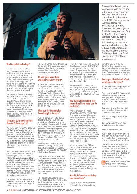
Tom Patterson<br />
Some of the latest spatial<br />
technology was put <strong>to</strong> use<br />
in the search operations<br />
after the 2009 Vic<strong>to</strong>rian<br />
bush fires. Tom Patterson<br />
from ESRI (Environmental<br />
Systems Research<br />
Institute, USA) joined<br />
Steve Forbes, Manager of<br />
Risk Management and GIS<br />
for the ACT Emergency<br />
<strong>Service</strong>s Agency at the<br />
conference <strong>to</strong> explain<br />
the startling impact new<br />
spatial technology is likely<br />
<strong>to</strong> have on the future of<br />
fire management. Steve<br />
Forbes spoke <strong>to</strong> the Bush<br />
<strong>Fire</strong> Bulletin after their<br />
presentation.<br />
What is spatial technology?<br />
Everyone uses maps. All of<br />
our fire services use maps<br />
and we have a lot of <strong>to</strong>ols at a<br />
local level. Now we are trying<br />
<strong>to</strong> get people <strong>to</strong> embrace the<br />
current and future technologies<br />
in spatial technology. Tom is<br />
travelling around the world trying<br />
<strong>to</strong> showcase the really big uses<br />
of spatial technologies in major<br />
disasters around the world.<br />
We saw it here in Australia in<br />
the aftermath of Vic<strong>to</strong>rian bush<br />
fires. What policing did for<br />
Disaster Victim Identification<br />
and the evidence gathering for<br />
the Coroner was new ground<br />
in spatial technology. A lot of<br />
these new systems that were<br />
established in the days after<br />
Black Saturday were established<br />
by spatial volunteers.<br />
Something quite new happened<br />
down in Vic<strong>to</strong>ria didn’t it?<br />
Yes that’s right for us. We deployed<br />
eight volunteers every day over<br />
43 days. A <strong>to</strong>tal of 53 people were<br />
deployed <strong>to</strong> assist Vic<strong>to</strong>ria Police.<br />
They were all spatial professionals<br />
and all worked as volunteers. It is<br />
my understanding that is probably<br />
the biggest deployment of spatial<br />
volunteers in any disaster in<br />
Australia.<br />
After the 2003 fires in the ACT we<br />
saw that the adoption of spatial<br />
technologies could have been a<br />
little better. We also realised that<br />
Canberra has a huge concentration<br />
of spatial professionals because<br />
of its proximity <strong>to</strong> Federal<br />
government departments. So we<br />
have leveraged off that. We asked<br />
them <strong>to</strong> volunteer <strong>to</strong> help us make<br />
spatial technologies available <strong>to</strong><br />
fire and emergency crews.<br />
We’ve got over 60 volunteers<br />
dedicated <strong>to</strong> that now. They are<br />
known as MAPS – mapping and<br />
planning support.<br />
The work MAPS did with Vic<strong>to</strong>ria<br />
Police post the bush fires clearly<br />
showed that these volunteers<br />
were able <strong>to</strong> sustain long<br />
consistent deployment.<br />
At what point were those<br />
volunteers down in Vic<strong>to</strong>ria?<br />
At the end of Day 2 there was<br />
a request offered by the ACT.<br />
This was absorbed within three<br />
hours of the request being<br />
made. Within 24 hours of that<br />
we had crews on the ground at<br />
Williams<strong>to</strong>wn Police Search and<br />
Rescue centre getting briefings<br />
for deployment. So they were<br />
active on the ground with the<br />
police on Day 3.<br />
What was the technological<br />
breakthrough in Vic<strong>to</strong>ria?<br />
A lot of paradigm shifts came<br />
<strong>to</strong>gether there. The first was<br />
the advent of 3G networks in<br />
our mobile phone world. Spatial<br />
technology revolves around large<br />
graphics - aerial pho<strong>to</strong>graphy or<br />
<strong>to</strong>pographic maps. If you want<br />
<strong>to</strong> send those electronically in<br />
the field then you need <strong>to</strong> have<br />
big data pipelines. The Next G<br />
network introduced that.<br />
So in Vic<strong>to</strong>ria we had police<br />
officers walking around (in the<br />
fire-affected areas) with palm<br />
pilots collecting data for Disaster<br />
Victim Identification.<br />
They knew exactly where they<br />
were because they have a GPS<br />
in their palm pilot. The palm pilot<br />
was ruggedized, it was dustproof,<br />
it was resistant-proof and<br />
more importantly, it was shockproof<br />
- because all emergency<br />
workers like dropping things<br />
don’t we?<br />
The police were able <strong>to</strong> move<br />
from paper <strong>to</strong> an electronic realm<br />
so the incident management<br />
teams were able <strong>to</strong> see exactly<br />
where they were and exactly<br />
what they had done. This assisted<br />
the planning teams…Rather than<br />
going out and collecting wad<br />
loads of paper in manila folders<br />
and employing 20-30 data entry<br />
clerks that stay up <strong>to</strong> midnight<br />
entering data - because this is<br />
what we did on the first few days<br />
after Black Saturday.<br />
We were able <strong>to</strong> have that<br />
data integrated in<strong>to</strong> a database<br />
instantly, allowing those decision<br />
makers <strong>to</strong> plan forward straight<br />
away. That’s the advance that has<br />
been made.<br />
How quickly did it happen that<br />
you switched from paper over <strong>to</strong><br />
electronic?<br />
That is probably the most<br />
amazing part of the whole s<strong>to</strong>ry.<br />
The fact that those volunteers<br />
were there gave us the ability<br />
<strong>to</strong> put <strong>to</strong>gether a system for the<br />
research of all the properties<br />
in the Kinglake/Murrundindi<br />
Complex of fires within 24 hours!<br />
From zero database and a paper<br />
system, <strong>to</strong> a fully digital backend<br />
set up database that was sharing<br />
data across the intranet of Vic<strong>to</strong>ria<br />
Police out <strong>to</strong> external agencies as<br />
well as consuming information<br />
from other agencies.<br />
It was all set up in a 24-hour<br />
period. As a testament <strong>to</strong> what<br />
they did, they never had <strong>to</strong><br />
change it after that. It worked,<br />
it was solid, it never failed<br />
throughout the whole process.<br />
It shows us that the technology<br />
is there <strong>to</strong>day, it is solid <strong>to</strong>day<br />
and we should start <strong>to</strong> trust it<br />
and employ more resources<br />
in<strong>to</strong> spatial technology for<br />
decision-support in emergency<br />
management.<br />
And this information was being<br />
sent in real time?<br />
That’s another paradigm shift.<br />
The ability <strong>to</strong> stream data live<br />
from the field in<strong>to</strong> the IMT!<br />
It means that you are seeing<br />
the information live rather than<br />
waiting for the end of the shift or<br />
when the crew leader finally gets<br />
back <strong>to</strong> the fire control centre.<br />
How do you think that will affect<br />
firefighting in the future?<br />
It’s like that old analogy ‘a picture<br />
paints a thousand words’.<br />
Well I like <strong>to</strong> say that new spatial<br />
technologies in emergency<br />
management change that <strong>to</strong><br />
‘a picture paints a thousand<br />
spreadsheets’. It paints a lot of<br />
data!<br />
If we can stream that live stuff<br />
back then decision makers can<br />
work more effectively.<br />
‘Our plan is <strong>to</strong> put a bulldozer<br />
track there.’<br />
‘But hang on Sir, the fire has<br />
already crossed that area.’<br />
‘How do you know that?’<br />
‘We’ve got a live stream of GPS<br />
data coming in. We’ve got a live<br />
stream of infrared radar coming<br />
in or information from satellites.’<br />
These are all technologies that<br />
can be adapted in<strong>to</strong> a spatial<br />
environment. This is where we<br />
are going in the world. GPS is<br />
about inventing data - its location<br />
intelligence - not just about<br />
where you are standing.<br />
Hear the full inter<strong>view</strong> with<br />
Steve Forbes on http://<br />
www.rfs.nsw.gov.au/podcasts<br />
20 BUSH FIREbulletin // INTERNATIONAL WILDFIRE MANAGEMENT CONFERENCE: FACING OUR FUTURE


