Click here to view - NSW Rural Fire Service
Click here to view - NSW Rural Fire Service
Click here to view - NSW Rural Fire Service

Create successful ePaper yourself
Turn your PDF publications into a flip-book with our unique Google optimized e-Paper software.
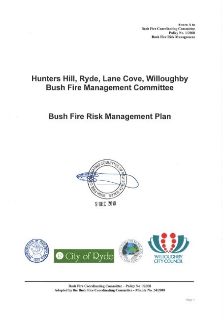
Annex A <strong>to</strong><br />
Bush <strong>Fire</strong> Coordinating Committee<br />
Policy No. 1/2008<br />
Bush <strong>Fire</strong> Risk Management<br />
<br />
<br />
Prepared by the Hunters Hill, Ryde, Lane Cove, WilloughbyBush <strong>Fire</strong> Management Committee;<br />
pursuant <strong>to</strong> section 52 of the <strong>Rural</strong> <strong>Fire</strong>s Act, 1997. In accordance with the Regulations <strong>to</strong> the <strong>Rural</strong><br />
<strong>Fire</strong>s Act 1997, the draft bush fire risk management plan will be exhibited for a period of not less<br />
than 42 days during which time submissions are invited from the public.<br />
As such, members of the public, whether as private individuals or as members of community interest<br />
groups are invited <strong>to</strong> comment on the plan. Submissions should be in writing, and as detailed and<br />
specific as possible; however any comments, no matter how brief or general are welcome. All<br />
comments received will be referred <strong>to</strong> the Bush <strong>Fire</strong> Coordinating Committee with the plan for their<br />
final deliberation and approval.<br />
Prior <strong>to</strong> finalising the plan, the Bush <strong>Fire</strong> Management Committee is required <strong>to</strong> consider the<br />
submissions <strong>to</strong> plan and prepare a re<strong>view</strong> for consideration by the Bush <strong>Fire</strong> Coordinating<br />
Committee. Under the Act, the Bush <strong>Fire</strong> Coordinating Committee may approve the plan, amend<br />
the plan or reject the plan in the light of public submissions.<br />
If significant changes are made <strong>to</strong> the plan after public exhibition, the draft plan will be placed on<br />
further exhibition prior <strong>to</strong> its final adoption.<br />
The closing date for comments on this plan is: Monday 10 August 2009<br />
Comments should be forwarded <strong>to</strong>:<br />
Executive Officer<br />
Bush <strong>Fire</strong> Management Committee<br />
Gary McBain<br />
Superintendent<br />
New South Wales <strong>Fire</strong> Brigade<br />
PO Box H4<br />
Harris Park <strong>NSW</strong> 2150<br />
Additional information or enquires on any aspect of the plan can be obtained from Hunters Hill,<br />
Ryde, Lane Cove or Willoughby Council.<br />
Hunters Hill Council link<br />
City of Ryde Council link<br />
Lane Cove Council link<br />
Willoughby City Council link<br />
<br />
Bush <strong>Fire</strong> Coordinating Committee – Policy No 1/2008<br />
Adopted by the Bush <strong>Fire</strong> Coordinating Committee - Minute No. 24/2008
Annex A <strong>to</strong><br />
Bush <strong>Fire</strong> Coordinating Committee<br />
Policy No. 1/2008<br />
Bush <strong>Fire</strong> Risk Management<br />
Table of Contents<br />
Glossary 7<br />
Chapter 1. Introduction 9<br />
1.1 Background 9<br />
1.2 Aim and Objectives 9<br />
1.3 Description of the Hunters Hill, Ryde, Lane Cove, Willoughby BFMC Area 10<br />
1.3.1 Location and land tenure 10<br />
1.3.2 Climate and bush fire season 10<br />
1.3.3 Population and demographic information 11<br />
1.3.4 His<strong>to</strong>ry of bush fire frequency and ignition cause 12<br />
Chapter 2. Identifying and Assessing the Bush <strong>Fire</strong> Risk 13<br />
2.1 Process 13<br />
2.2 Communication and Consultation 13<br />
2.3 Identifying the Bush <strong>Fire</strong> Risk 14<br />
2.3.1 Assets 14<br />
2.3.2 Assessing the Bush <strong>Fire</strong> Risk - Consequence 15<br />
2.3.3 Assessing the Bush <strong>Fire</strong> Risk - Likelihood 16<br />
2.3.4 Identifying the level of risk 16<br />
2.3.5 Evaluating the Bush <strong>Fire</strong> Risk 16<br />
2.3.6 Prioritising Treatments 16<br />
2.3.7 Risk Acceptability 17<br />
Chapter 3. Treating the Risk 18<br />
3.1 Bush <strong>Fire</strong> Management Zones 18<br />
3.2 BFMC Wide Treatments 20<br />
3.3 Asset Specific Treatments 22<br />
3.4 <strong>Fire</strong> Thresholds 23<br />
3.5 Annual Works Programs 24<br />
3.6 Implementation 24<br />
Chapter 4. Performance Moni<strong>to</strong>ring and Re<strong>view</strong>ing 25<br />
4.1 Re<strong>view</strong> 25<br />
4.2 Moni<strong>to</strong>ring 25<br />
4.3 Reporting 25<br />
4.4 Performance Measurements 25<br />
Appendix 1 Community Participation Strategy 26<br />
Appendix 2 Asset Register 28<br />
Appendix 3 Treatment Register 32<br />
Appendix 4 Maps 35<br />
<br />
Bush <strong>Fire</strong> Coordinating Committee – Policy No 1/2008<br />
Adopted by the Bush <strong>Fire</strong> Coordinating Committee - Minute No. 24/2008
Annex A <strong>to</strong><br />
Bush <strong>Fire</strong> Coordinating Committee<br />
Policy No. 1/2008<br />
Bush <strong>Fire</strong> Risk Management<br />
<br />
Table 1.1 Land Tenure and land ownership percentage with the BFMC area 10<br />
Table 3.1 Bush <strong>Fire</strong> Management Zones: Purpose, objectives and characteristics 19<br />
Table 3.2 Asset specific treatments used in the Hunters Hill, Ryde, Lane Cove, Willoughby BFMC area 22<br />
Table 3.3 <strong>Fire</strong> Thresholds for Vegetation Categories 23<br />
<br />
<br />
<br />
Figure 2.1 Current climate change predictions 11<br />
Figure 2.2 Over<strong>view</strong> of the risk assessment process 13<br />
<br />
Bush <strong>Fire</strong> Coordinating Committee – Policy No 1/2008<br />
Adopted by the Bush <strong>Fire</strong> Coordinating Committee - Minute No. 24/2008
Annex A <strong>to</strong><br />
Bush <strong>Fire</strong> Coordinating Committee<br />
Policy No. 1/2008<br />
Bush <strong>Fire</strong> Risk Management<br />
<br />
<br />
<br />
<br />
<br />
<br />
<br />
<br />
<br />
<br />
<br />
<br />
<br />
<br />
Bush <strong>Fire</strong> Coordinating Committee – Policy No 1/2008<br />
Adopted by the Bush <strong>Fire</strong> Coordinating Committee - Minute No. 24/2008
Annex A <strong>to</strong><br />
Bush <strong>Fire</strong> Coordinating Committee<br />
Policy No. 1/2008<br />
Bush <strong>Fire</strong> Risk Management<br />
<br />
Assets: anything valued by the community which includes houses, crops, heritage<br />
buildings and places, infrastructure, the environment, businesses, and forests, that may be<br />
at risk from bush fire.<br />
Bush <strong>Fire</strong>: a general term used <strong>to</strong> describe fire in vegetation, includes grass fire.<br />
Bush <strong>Fire</strong> Hazard: the potential severity of a bush fire, which is determined by fuel load,<br />
fuel arrangement and <strong>to</strong>pography under a given climatic condition.<br />
Bush <strong>Fire</strong> Risk: the chance of a bush fire igniting, spreading and causing damage <strong>to</strong> the<br />
community or the assets they value.<br />
Bush <strong>Fire</strong> Risk Management: a systematic process that provides a range of treatments<br />
which contribute <strong>to</strong> the well being of communities and the environment, which suffer the<br />
adverse effects of wildfire/bush fire.<br />
Bush <strong>Fire</strong> Threat: potential bush fire exposure of an asset due <strong>to</strong> the proximity and type of<br />
a hazard and the slope on which the hazard is situated.<br />
Consequence: outcome or impact of a bush fire event.<br />
<strong>Fire</strong> Fighting Authorities: the <strong>NSW</strong> <strong>Rural</strong> <strong>Fire</strong> <strong>Service</strong>, <strong>NSW</strong> <strong>Fire</strong> Brigades, the National<br />
Parks and Wildlife <strong>Service</strong> and Forests <strong>NSW</strong>.<br />
Likelihood: the chance of a bush fire igniting and spreading.<br />
Major Bush <strong>Fire</strong>: A bush fire which requires the attendance of multiple brigades, or causes<br />
damage <strong>to</strong> property or injury <strong>to</strong> one or more persons.<br />
Display area: geographic area determined by the Bush <strong>Fire</strong> Management Committee<br />
which is used <strong>to</strong> provide a suitable area and scale for community participation and<br />
mapping display purposes.<br />
Recovery costs: the capacity of an asset <strong>to</strong> recover from the impacts of a bush fire.<br />
Risk Acceptance: is an informed decision <strong>to</strong> accept the consequences and the likelihood of<br />
a particular risk.<br />
Risk Analysis: is a systematic process <strong>to</strong> understand the nature of and <strong>to</strong> deduce the level<br />
of risk.<br />
Risk Assessment: the overall process of risk identification, risk analysis and risk<br />
evaluation.<br />
<br />
Bush <strong>Fire</strong> Coordinating Committee – Policy No 1/2008<br />
Adopted by the Bush <strong>Fire</strong> Coordinating Committee - Minute No. 24/2008
Annex A <strong>to</strong><br />
Bush <strong>Fire</strong> Coordinating Committee<br />
Policy No. 1/2008<br />
Bush <strong>Fire</strong> Risk Management<br />
Risk Identification: the process of determining what, w<strong>here</strong>, when, why, and how<br />
something could happen.<br />
Risk Treatment: the process of selection and implementation of measures <strong>to</strong> modify risk.<br />
Vulnerability: the susceptibility of an asset <strong>to</strong> the impacts of bush fire.<br />
<br />
Bush <strong>Fire</strong> Coordinating Committee – Policy No 1/2008<br />
Adopted by the Bush <strong>Fire</strong> Coordinating Committee - Minute No. 24/2008
Annex A <strong>to</strong><br />
Bush <strong>Fire</strong> Coordinating Committee<br />
Policy No. 1/2008<br />
Bush <strong>Fire</strong> Risk Management<br />
<br />
1.1 Background<br />
Under the <strong>Rural</strong> <strong>Fire</strong>s Act 1997 the Bush <strong>Fire</strong> Coordinating Committee (BFCC) must<br />
constitute a Bush <strong>Fire</strong> Management Committee (BFMC) for each area in the State, which<br />
is subject <strong>to</strong> the risk of bush fires. Each BFMC is required <strong>to</strong> prepare and submit <strong>to</strong> the<br />
BFCC a draft Bush <strong>Fire</strong> Risk Management Plan (BFRMP).<br />
A BFRMP is a strategic document that identifies community assets at risk and sets out a<br />
five-year program of coordinated multi-agency treatments <strong>to</strong> reduce the risk of bush fire <strong>to</strong><br />
the assets. Treatments may include such things as hazard reduction burning, grazing,<br />
community education, fire trail maintenance and establishing community fireguard groups.<br />
Annual programs <strong>to</strong> implement the treatments identified in this plan will be undertaken by<br />
the relevant land managers and fire fighting authorities.<br />
In exercising its functions under the <strong>Rural</strong> <strong>Fire</strong>s Act 1997, including the preparation of a<br />
draft bush fire risk management plan, the Hunters Hill, Ryde, Lane Cove, Willoughby<br />
BFMC is required <strong>to</strong> have regard <strong>to</strong> the principles of ecologically sustainable development<br />
(ESD).<br />
This document and the accompanying maps <strong>to</strong>gether form the BFRMP for the Hunters Hill,<br />
Ryde, Lane Cove, Willoughby BFMC area. This BFRMP has been prepared by the<br />
Hunters Hill, Ryde, Lane Cove, Willoughby BFMC and covers both public and private<br />
lands. This BFRMP must be re<strong>view</strong>ed and updated within each successive five-year<br />
period from the constitution of the BFMC.<br />
The BFCC recognises that climate change has the potential <strong>to</strong> increase bush fire risk. The<br />
risk assessment process applied in this BFRMP is based on current climatic conditions.<br />
The BFCC will moni<strong>to</strong>r information on climate change and will modify the process when<br />
necessary.<br />
1.2 Aim and Objectives<br />
The aim of this BFRMP is <strong>to</strong> minimise the risk of adverse impact of bush fires on life,<br />
property and the environment.<br />
The of this BFRMP are <strong>to</strong>:<br />
reduce the number of human-induced bush fire ignitions that cause damage <strong>to</strong> life,<br />
property and the environment;<br />
manage fuel <strong>to</strong> reduce the rate of spread and intensity of bush fires, while<br />
minimising environmental/ecological impacts;<br />
reduce the community’s vulnerability <strong>to</strong> bush fires by improving its preparedness;<br />
and<br />
effectively contain fires with a potential <strong>to</strong> cause damage <strong>to</strong> life, property and the<br />
environment.<br />
<br />
Bush <strong>Fire</strong> Coordinating Committee – Policy No 1/2008<br />
Adopted by the Bush <strong>Fire</strong> Coordinating Committee - Minute No. 24/2008
Annex A <strong>to</strong><br />
Bush <strong>Fire</strong> Coordinating Committee<br />
Policy No. 1/2008<br />
Bush <strong>Fire</strong> Risk Management<br />
1.3 Description of the Hunters Hill, Ryde, Lane Cove, Willoughby BFMC<br />
Area<br />
<br />
The Hunters Hill, Ryde, Lane Cove, Willoughby BFMC area is located in greater Sydney<br />
area of New South Wales and includes the Local Government Area/s of Hunters Hill,<br />
Ryde, Lane Cove, Willoughby. It also includes areas of the Lane Cove National Park.<br />
The area covered by the Hunters Hill, Ryde, Lane Cove, Willoughby BFMC is 8,000<br />
hectares and includes the land tenures outlined in Table 1.1.<br />
<br />
<br />
<br />
National Parks & Wildlife <strong>Service</strong><br />
0.1<br />
(DECC)<br />
Department of Lands 3.8<br />
Local Government 22<br />
Private 73<br />
All other 1.1<br />
<br />
The typical/average climate* in the Hunters Hill, Ryde, Lane Cove, Willoughby BFMC area<br />
is:<br />
Mean daily maximum summer temperature of 27˚ C<br />
Mean daily minimum temperature in winter of 7 - 8˚C<br />
Mean annual rainfall of approximately 1,100mm<br />
10 – 11 wet days per month<br />
Mean wind speed at 9am of 9 -10km/hour<br />
(*Taken from an average of Sydney and Parramatta meteorological data)<br />
The localised conditions within Hunters Hill, Ryde, Lane Cove, Willoughby BFMC will vary<br />
due <strong>to</strong> local wind and temperature patterns formed by the orientation of and changes in<br />
landforms and vegetation cover. The bush fire season generally runs from Oc<strong>to</strong>ber <strong>to</strong><br />
March.<br />
Prevailing weather conditions associated with the bush fire season in the Hunters Hill,<br />
Ryde, Lane Cove, Willoughby BFMC area are North-westerly winds accompanied by high<br />
daytime temperatures and low relative humidity.<br />
<br />
Bush <strong>Fire</strong> Coordinating Committee – Policy No 1/2008<br />
Adopted by the Bush <strong>Fire</strong> Coordinating Committee - Minute No. 24/2008
Annex A <strong>to</strong><br />
Bush <strong>Fire</strong> Coordinating Committee<br />
Policy No. 1/2008<br />
Bush <strong>Fire</strong> Risk Management<br />
In terms of future climatic range, under current climate change impact models, reports<br />
released by CRC suggest that areas prone <strong>to</strong> bushfires, such as locales within Hunters<br />
Hill, Ryde, Lane Cove, Willoughby BFMC, ma y become hotter and drier, with greater<br />
prevalence of high wind conditions. Furthermore, current predictions propose an increase<br />
in very high and extreme fire danger day s. A manifestation of these bushfire-favouring<br />
fac<strong>to</strong>rs must be taken in<strong>to</strong> consideration by Land Managers when it comes <strong>to</strong> future<br />
mitigation practices for managing at-risk areas within the bushland urban environment 2 .<br />
<br />
<br />
<br />
<br />
The population of the Hunters Hill, Ryde, Lane Cove, Willoughby BFMC area is<br />
approximately 200,000 people. The major population centres are spread throughout the<br />
local government areas. The following issues have been identified within the Hunters Hill,<br />
Ryde, Lane Cove, Willoughby BFMC area as potentially impacting on the ability of certain<br />
sections of the community <strong>to</strong> prepare themselves for bush fire:<br />
<br />
<br />
<br />
<br />
<br />
high levels of people with non English speaking background<br />
seasonal population changes e.g. high <strong>to</strong>urism areas, student accommodation,<br />
corporate accommodation<br />
corporate ownership of land<br />
areas with high residential turnover / rental accommodation<br />
large number of residential aged care facilities and schools<br />
2 Bush<strong>Fire</strong> CRC 2006 <strong>Fire</strong> Note Issue 4: Climate change and its impact on the management of Bushfire.<br />
<br />
Bush <strong>Fire</strong> Coordinating Committee – Policy No 1/2008<br />
Adopted by the Bush <strong>Fire</strong> Coordinating Committee - Minute No. 24/2008
Annex A <strong>to</strong><br />
Bush <strong>Fire</strong> Coordinating Committee<br />
Policy No. 1/2008<br />
Bush <strong>Fire</strong> Risk Management<br />
<br />
The Hunters Hill, Ryde, Lane Cove, Willoughby BFMC area has on average10 (ten) bush<br />
fires per year, of which 2 (two) on average can be considered <strong>to</strong> be major fires.<br />
The main sources of ignition in the Hunters Hill, Ryde, Lane Cove, Willoughby BFMC area<br />
are:<br />
<br />
<br />
<br />
<br />
Arson<br />
Electrical and lighting<br />
Cigarette butts<br />
Debris burning<br />
<br />
Bush <strong>Fire</strong> Coordinating Committee – Policy No 1/2008<br />
Adopted by the Bush <strong>Fire</strong> Coordinating Committee - Minute No. 24/2008
Annex A <strong>to</strong><br />
Bush <strong>Fire</strong> Coordinating Committee<br />
Policy No. 1/2008<br />
Bush <strong>Fire</strong> Risk Management<br />
<br />
2.1 Process<br />
The Australia/New Zealand Standard AS/NZS 4360: 2004 Risk Management was used as<br />
the basis for the risk assessment process. Figure 2.1 shows the steps involved in this<br />
process. For a detailed description of the process undertaken see the Bush <strong>Fire</strong> Risk<br />
Management Planning Guidelines for Bush <strong>Fire</strong> Management Committees on the RFS<br />
website: www.rfs.nsw.gov.au.<br />
Establish the<br />
Context<br />
Communicate and consult<br />
Identify risks<br />
Analyse risks<br />
Evaluate risks<br />
Risk Assessment<br />
Moni<strong>to</strong>r and re<strong>view</strong><br />
Treat risks<br />
<br />
2.2 Communication and Consultation<br />
Community participation is an integral part of risk management. The Community<br />
Participation Strategy involved developing and implementing a process <strong>to</strong> address the<br />
needs, issues and concerns of stakeholders within the BFMC area in regards <strong>to</strong> the<br />
BFRMP. See Appendix 1 for the Community Participation Strategy used by the Hunters<br />
Hill, Ryde, Lane Cove, Willoughby BFMC in preparing this BFRMP.<br />
<br />
Bush <strong>Fire</strong> Coordinating Committee – Policy No 1/2008<br />
Adopted by the Bush <strong>Fire</strong> Coordinating Committee - Minute No. 24/2008
Annex A <strong>to</strong><br />
Bush <strong>Fire</strong> Coordinating Committee<br />
Policy No. 1/2008<br />
Bush <strong>Fire</strong> Risk Management<br />
2.3 Identifying the Bush <strong>Fire</strong> Risk<br />
Identifying the level of bush fire risk firstly involved identifying important community assets<br />
considered <strong>to</strong> be at risk from bush fire in the Hunters Hill, Ryde, Lane Cove, Willoughby<br />
BFMC area, and then assessing the likelihood and consequence ratings.<br />
<br />
BFMC members and the community, including New South Wales Community <strong>Fire</strong> Unit<br />
volunteers, identified assets within the Hunters Hill, Ryde, Lane Cove, Willoughby BFMC<br />
that they believed were at risk of bush fire.<br />
The assets were divided in<strong>to</strong> four asset types:<br />
<br />
Residential areas including urban bushland interface areas and rural properties;<br />
Special <strong>Fire</strong> Protection areas including schools, hospitals, nursing homes, and<br />
<strong>to</strong>urist facilities; and<br />
Other human settlement areas including commercial and industrial areas w<strong>here</strong><br />
distinct from major <strong>to</strong>wns.<br />
<br />
Agricultural; e.g. major silos, regional saleyards, cropping/grazing land;<br />
Commercial/industrial e.g. major industries, waste treatment plants, sawmills;<br />
Infrastructure e.g. large power lines, gas and oil pipelines, railway lines, electricity<br />
substations, communication facilities;<br />
Tourist and recreational e.g. <strong>to</strong>urist sites and facilities, resorts, retreats;<br />
Mines;<br />
Commercial forests e.g. pine plantations, eucalypt plantations and commercial<br />
native forests; and<br />
Drinking water catchments.<br />
<br />
Threatened species, populations and ecological communities and Ramsar<br />
wetlands;<br />
Locally important species and ecological communities, such as species and<br />
ecological communities especially sensitive <strong>to</strong> fire.<br />
<br />
Bush <strong>Fire</strong> Coordinating Committee – Policy No 1/2008<br />
Adopted by the Bush <strong>Fire</strong> Coordinating Committee - Minute No. 24/2008
Annex A <strong>to</strong><br />
Bush <strong>Fire</strong> Coordinating Committee<br />
Policy No. 1/2008<br />
Bush <strong>Fire</strong> Risk Management<br />
<br />
Aboriginal significance – Aboriginal places and items of significance;<br />
Non-indigenous heritage – places and items arising from the early occupation of<br />
<strong>NSW</strong> by European or other non-indigenous settlers; and<br />
Other cultural assets – community halls, clubs and recreational facilities.<br />
See for the full list of assets identified within the Hunters Hill, Ryde, Lane<br />
Cove, Willoughby BFMC area. Also refer <strong>to</strong> maps in for the location of assets<br />
<strong>to</strong> be treated under this BFRMP.<br />
<br />
Once the assets were identified, the consequence of a bush fire impacting on these assets<br />
was assessed. Refer <strong>to</strong> for the consequence ratings assigned <strong>to</strong> each asset<br />
identified in the Hunters Hill, Ryde, Lane Cove, Willoughby BFMC area.<br />
The different asset types had different assessment processes used <strong>to</strong> determine the<br />
consequence. These processes are identified below.<br />
<br />
A potential fire behaviour model using vegetation type, slope and separation distance was<br />
used <strong>to</strong> produce a threat rating for human settlement assets. The vulnerability of the asset<br />
<strong>to</strong> a bush fire was also assessed and a rating assigned. These ratings were then used <strong>to</strong><br />
assess the consequence of a bush fire impacting upon a human settlement asset.<br />
Special <strong>Fire</strong> Protection (SFP) assets were considered in<strong>here</strong>ntly more vulnerable <strong>to</strong> bush<br />
fire due <strong>to</strong> mobility capacity, knowledge or other issues relating <strong>to</strong> their inhabitants, (e.g.<br />
the elderly, infirm, children or <strong>to</strong>urists) and t<strong>here</strong>fore stricter requirements for vulnerability<br />
assessment and rating were applied.<br />
<br />
The level of economic impact e.g. local, regional or state, as well as the economic<br />
recovery costs (how long and complicated a financial recovery will be) of the asset were<br />
identified. These ratings were used <strong>to</strong> assess the consequence of a bush fire impacting<br />
upon an economic asset.<br />
<br />
Environmental assets with known minimum fire threshold were assessed <strong>to</strong> determine if<br />
they were at risk of a bush fire within the 5 year life of the BFRMP using fire his<strong>to</strong>ry and<br />
fire threshold data. Those environmental assets which were within or above the fire<br />
threshold were not assessed in the BFRMP, as the negative impact of a fire within the 5<br />
year period was determined as being low and may even be of benefit <strong>to</strong> the asset and<br />
surrounding habitat.<br />
<br />
Bush <strong>Fire</strong> Coordinating Committee – Policy No 1/2008<br />
Adopted by the Bush <strong>Fire</strong> Coordinating Committee - Minute No. 24/2008
Annex A <strong>to</strong><br />
Bush <strong>Fire</strong> Coordinating Committee<br />
Policy No. 1/2008<br />
Bush <strong>Fire</strong> Risk Management<br />
The vulnerability of an environmental asset was determined by its conservation status and<br />
its geographic extent (distribution across the landscape). Vulnerability and potential impact<br />
of bush fire were used <strong>to</strong> assess the consequence of a bush fire impacting upon an<br />
environmental asset.<br />
<br />
For non-indigenous his<strong>to</strong>rical, Aboriginal and other cultural assets a potential fire<br />
behaviour model using fuel load, slope and proximity was used <strong>to</strong> produce a threat rating.<br />
The physical vulnerability of the asset <strong>to</strong> a bush fire was also assessed. These ratings<br />
were then used <strong>to</strong> assess the consequence of a bush fire impacting upon a cultural asset.<br />
<br />
For all asset types the likelihood of a bush fire occurring was assessed. This involves<br />
considering fire his<strong>to</strong>ry, including ignition cause and patterns, known fire paths, access,<br />
containment potential and potential fire run (size of the vegetated area). See Appendix 2<br />
for the likelihood ratings assigned <strong>to</strong> each asset identified in the Hunters Hill, Ryde, Lane<br />
Cove, Willoughby BFMC area.<br />
<br />
The consequence and likelihood ratings were then used <strong>to</strong> identify the level of risk. Refer<br />
<strong>to</strong> for the risk ratings assigned <strong>to</strong> each asset identified in the Hunters Hill,<br />
Ryde, Lane Cove, Willoughby BFMC area.<br />
<br />
Once the risk ratings for each asset were identified, they were evaluated <strong>to</strong>:<br />
a.) confirm that risk levels identified in the risk analysis process are appropriate and<br />
reflect the relative seriousness of the bush fire risk;<br />
b.) identify which assets require treatments; and<br />
c.) identify treatment priorities.<br />
<br />
No organisation has limitless resources <strong>to</strong> deal with adverse risk. It is t<strong>here</strong>fore necessary<br />
<strong>to</strong> define priorities. The bush fire risk ratings determined were used <strong>to</strong> prioritise the risk<br />
treatments, i.e. areas of extreme risk were considered first for treatment, then very high,<br />
then high then medium then low. It was also necessary <strong>to</strong> prioritise within the risk levels<br />
i.e. determining which of the high risks was the most serious. This was done on the basis<br />
of the consequence and likelihood ratings.<br />
<br />
Bush <strong>Fire</strong> Coordinating Committee – Policy No 1/2008<br />
Adopted by the Bush <strong>Fire</strong> Coordinating Committee - Minute No. 24/2008
Annex A <strong>to</strong><br />
Bush <strong>Fire</strong> Coordinating Committee<br />
Policy No. 1/2008<br />
Bush <strong>Fire</strong> Risk Management<br />
<br />
Risks below a certain level were assessed as not requiring treatment within the life of this<br />
plan. This is due <strong>to</strong> a combination of the number of extreme and very high risk priorities<br />
and the capacity <strong>to</strong> undertake the works. Within the Hunters Hill, Ryde, Lane Cove,<br />
Willoughby BFMC area the level of acceptability is high. Areas of medium or low risk are<br />
likely <strong>to</strong> be managed by routine procedures and so do not require a specific application of<br />
resources.<br />
<br />
Bush <strong>Fire</strong> Coordinating Committee – Policy No 1/2008<br />
Adopted by the Bush <strong>Fire</strong> Coordinating Committee - Minute No. 24/2008
Annex A <strong>to</strong><br />
Bush <strong>Fire</strong> Coordinating Committee<br />
Policy No. 1/2008<br />
Bush <strong>Fire</strong> Risk Management<br />
<br />
3.1 Bush <strong>Fire</strong> Management Zones<br />
Bush <strong>Fire</strong> Management Zones were identified within the Hunters Hill, Ryde, Lane Cove,<br />
Willoughby BFMC area and mapped (refer <strong>to</strong> maps in Appendix 4). These zones identify<br />
the fire management intent for a specific area. See Table 3.1 for descriptions of the zones<br />
and their purposes. The four categories of Bush <strong>Fire</strong> Management Zones are:<br />
Asset Protection Zone (APZ);<br />
Strategic <strong>Fire</strong> Advantage Zone (SFAZ);<br />
Land Management Zone (LMZ); and<br />
<strong>Fire</strong> Exclusion Zone (FEZ).<br />
Some of these zones (usually Land Management Zones) may be further classified within<br />
this category by the land manager, e.g. LMZ -Heritage Management Zone (NPWS).<br />
LMZs that have been identified as a polygon on the map will have defined management<br />
objectives. Below is a table listing each identified LMZ and its associated management<br />
objectives (Table 3.1).<br />
<br />
Bush <strong>Fire</strong> Coordinating Committee – Policy No 1/2008<br />
Adopted by the Bush <strong>Fire</strong> Coordinating Committee - Minute No. 24/2008
Annex A <strong>to</strong><br />
Bush <strong>Fire</strong> Coordinating Committee<br />
Policy No. 1/2008<br />
Bush <strong>Fire</strong> Risk Management<br />
<br />
<br />
<br />
<br />
<br />
<br />
<br />
<br />
<br />
<br />
<br />
<br />
<br />
<br />
<br />
To protect human<br />
life, property and<br />
highly valued public<br />
assets and values.<br />
To provide strategic<br />
areas of fire<br />
protection<br />
advantage which<br />
will reduce the<br />
speed and intensity<br />
of bush fires, and<br />
reduce the potential<br />
for spot fire<br />
development;<br />
To aid containment<br />
of wildfires <strong>to</strong><br />
existing<br />
management<br />
boundaries.<br />
To meet relevant<br />
land management<br />
objectives in areas<br />
w<strong>here</strong> APZs or<br />
SFAZs are not<br />
appropriate.<br />
To exclude bush<br />
fires.<br />
To enable the safe use of<br />
suppression<br />
strategies within the zone.<br />
To minimise bush fire impacts<br />
on undefended assets.<br />
To improve the likelihood and<br />
safe use of:<br />
suppression<br />
strategies within the zone.<br />
and/or<br />
(back<br />
burning) in high <strong>to</strong> very high<br />
fire weather conditions within<br />
the zone.<br />
To reduce the likelihood of:<br />
Crown fire development<br />
within the zone.<br />
and/or<br />
Spot fire ignition potential<br />
from the zone<br />
.<br />
As per the land management<br />
and fire protection objectives<br />
of the responsible land<br />
management agency.<br />
To reduce the likelihood of<br />
spread of fires.<br />
To undertake mosaic burning<br />
N/A<br />
As per RFS document<br />
Standards for Asset<br />
Protection Zones.<br />
Zone width related <strong>to</strong><br />
suppression objectives<br />
and dependant upon:<br />
Topography<br />
Aspect<br />
Spotting<br />
propensity<br />
Location of<br />
adjacent<br />
firebreaks<br />
<br />
Mosaic pattern of<br />
treatment<br />
Assess Overall Fuel<br />
Hazard (OFH) once<br />
vegetation communities<br />
reach minimum fire<br />
thresholds within this<br />
plan.<br />
Management practices<br />
should aim <strong>to</strong> achieve<br />
mosaic fuel reduction<br />
patterns so that the<br />
majority of the SFAZ has<br />
an OFH of less than<br />
high.<br />
As appropriate <strong>to</strong><br />
achieve land<br />
management e.g.<br />
heritage and/or fire<br />
protection e.g. broad<br />
scale mosaic burning<br />
objectives.<br />
Variable dependant on<br />
size of fire sensitive area<br />
requiring protection.<br />
OFH refers the Overall Fuel Hazard Guide as described in the document<br />
published by (Dept. of Sustainability and Environment 3 rd ed. 1999 & NPWS version);<br />
State-wide procedures for assessment of fuel hazard will be developed in conjunction with<br />
the BFCC.<br />
<br />
All areas that are not mapped or described as APZs or SFAZs are considered as<br />
LMZs.<br />
<br />
Bush <strong>Fire</strong> Coordinating Committee – Policy No 1/2008<br />
Adopted by the Bush <strong>Fire</strong> Coordinating Committee - Minute No. 24/2008
Annex A <strong>to</strong><br />
Bush <strong>Fire</strong> Coordinating Committee<br />
Policy No. 1/2008<br />
Bush <strong>Fire</strong> Risk Management<br />
3.2 BFMC Wide Treatments<br />
BFMC wide treatments are activities which reduce the overall bush fire risk within the<br />
BFMC area and are undertaken on an ongoing basis as part of normal business. These<br />
treatments are not linked <strong>to</strong> specific assets in the BFRMP, rather they are applied across<br />
all or part of the BFMC area as designated by legislation or agency policy. BFMC wide<br />
treatments include the following:<br />
<br />
These maps identify bush fire prone land and are used <strong>to</strong> trigger whether a<br />
development application is assessed using Planning for Bush <strong>Fire</strong> Protection 1 .<br />
Planning for<br />
Bush <strong>Fire</strong> Protection<br />
This assessment process requires new applications for development <strong>to</strong> include bush<br />
fire protection measures.<br />
<br />
<br />
LEPs can be used <strong>to</strong> exclude development in extreme bush fire risk areas or w<strong>here</strong><br />
bush fire protection measures cannot be incorporated.<br />
<br />
In years w<strong>here</strong> the weather is particularly adverse the bush fire danger period may be<br />
brought in early or extended. This is assessed every year by the BFMC.<br />
<br />
In the bush fire danger period a fire safety permit is required <strong>to</strong> light a fire in the open.<br />
Permits specify conditions such as fire fighting equipment that must be on site, or<br />
restrict burns based on weather conditions.<br />
<br />
Under the <strong>Rural</strong> <strong>Fire</strong>s Act 1997 persons may be prosecuted for breaching the<br />
conditions on a fire permit, lighting a fire during a Total <strong>Fire</strong> Ban, allowing fire <strong>to</strong> escape<br />
their property, or other breaches of the Act.<br />
<br />
All bush fires which do not have a known cause are investigated <strong>to</strong> identify how they<br />
started. The investigation of bushfires within the Hunters Hill, Ryde, Lane Cove,<br />
Willoughby BFMC area are only <strong>to</strong> be investigated by the Authority/Agency responsible<br />
for the <strong>Fire</strong> District in which the point of origin is located. Another Agency’s investiga<strong>to</strong>r<br />
may conduct the investigation in conjunction with the responsible Authority/Agency but<br />
only with approval from the responsible Authority/Agency.<br />
<br />
Responding <strong>to</strong> bush fire is a normal business activity for the fire fighting authorities.<br />
1 <strong>NSW</strong> <strong>Rural</strong> <strong>Fire</strong> <strong>Service</strong> 2006 Planning for Bush <strong>Fire</strong> Protection: A guide for councils, planners, fire<br />
authorities and developers.<br />
<br />
Bush <strong>Fire</strong> Coordinating Committee – Policy No 1/2008<br />
Adopted by the Bush <strong>Fire</strong> Coordinating Committee - Minute No. 24/2008
Annex A <strong>to</strong><br />
Bush <strong>Fire</strong> Coordinating Committee<br />
Policy No. 1/2008<br />
Bush <strong>Fire</strong> Risk Management<br />
<br />
<br />
Strategic fire fighting resource allocation provisions is the process used <strong>to</strong> identify the<br />
number of stations, brigades and appliances required in an area, and considers<br />
members, training, assets and hazards.<br />
<br />
The Operations Coordination Plan is prepared biannually and sets out how coordinated<br />
fire fighting will occur. It includes specific operational restrictions on fire fighting<br />
techniques in certain areas, w<strong>here</strong> fires will be managed from, and how agencies<br />
involved can communicate during operations.<br />
<br />
Some land management agencies have developed fire management plans or plans of<br />
management with specific fire or fuel management strategies, for example a Forests<br />
<strong>NSW</strong> Regional Fuel Management Risk Plan, a NPWS <strong>Fire</strong> Management Strategy.<br />
These publicly exhibited plans form the basis for operational fire planning on public<br />
parks, reserves and forests.<br />
<br />
If someone is concerned about possible bush fire hazards on a neighbouring property<br />
or any other land, then this can be reported <strong>to</strong> the RFS Commissioner, their local RFS<br />
<strong>Fire</strong> Control Centre or by submitting the online Bushfire Hazard Complaint form found<br />
on the internet site:<br />
http://www.rfs.nsw.gov.au/dsp_content.cfm?cat_id=1032<br />
The complaint will be investigated and may result in a notice being issued <strong>to</strong> the<br />
landowner or manager <strong>to</strong> reduce the hazard.<br />
Any notice issued <strong>to</strong> any Land Owner/Manager <strong>to</strong> reduce hazards by burning must<br />
state “…that hazard reduction by burning within the Hunters Hill, Ryde, Lane Cove,<br />
Willoughby BFMC area is only <strong>to</strong> be conducted by, or with the approval of, the<br />
responsible Authority/Agency of the relevant <strong>Fire</strong> District.”<br />
<br />
Bush <strong>Fire</strong> Coordinating Committee – Policy No 1/2008<br />
Adopted by the Bush <strong>Fire</strong> Coordinating Committee - Minute No. 24/2008
Annex A <strong>to</strong><br />
Bush <strong>Fire</strong> Coordinating Committee<br />
Policy No. 1/2008<br />
Bush <strong>Fire</strong> Risk Management<br />
3.3 Asset Specific Treatments<br />
T<strong>here</strong> are five broad strategy groups available <strong>to</strong> treat the bush fire risk <strong>to</strong> assets identified<br />
in the BFRMP.<br />
The types of asset specific treatments in each strategy group used in the Hunters Hill,<br />
Ryde, Lane Cove, Willoughby BFMC area are listed below. A full list of the treatment<br />
strategies in the Hunters Hill, Ryde, Lane Cove, Willoughby BFMC area are in <br />
.<br />
<br />
<br />
<br />
Hunters Hill, Ryde, Lane<br />
Cove, Willoughby<br />
Ignition<br />
Management<br />
Suspend fire generating activities on days of very high <strong>to</strong><br />
extreme fire danger<br />
Hazard<br />
Reduction<br />
Perform maintenance along APZ as required Undertake mosaic<br />
burning in SFAZ<br />
Community<br />
Education<br />
Property<br />
Planning<br />
Preparedness<br />
Manage CFU’s as per <strong>NSW</strong> <strong>Fire</strong> Brigade Policy Undertake<br />
letterbox drops/education material<br />
Inspect and maintain fire trails as required<br />
<br />
Bush <strong>Fire</strong> Coordinating Committee – Policy No 1/2008<br />
Adopted by the Bush <strong>Fire</strong> Coordinating Committee - Minute No. 24/2008
Annex A <strong>to</strong><br />
Bush <strong>Fire</strong> Coordinating Committee<br />
Policy No. 1/2008<br />
Bush <strong>Fire</strong> Risk Management<br />
3.4 <strong>Fire</strong> Thresholds<br />
The vegetation in the Hunters Hill, Ryde, Lane Cove, Willoughby BFMC area was<br />
classified in<strong>to</strong> fire threshold categories (Table 3.3). Refer <strong>to</strong> for fire threshold<br />
mapping of the vegetation in the Hunters Hill, Ryde, Lane Cove, Willoughby BFMC area.<br />
<br />
<br />
Vegetation formation<br />
Minimum<br />
SFAZ<br />
Threshold<br />
Minimum<br />
LMZ<br />
Threshold<br />
Maximum<br />
Threshold<br />
Notes<br />
Rainforest NA NA NA <strong>Fire</strong> should be avoided.<br />
Alpine complex NA NA NA <strong>Fire</strong> should be avoided.<br />
Wet Sclerophyll forest<br />
(shrubby subformation)<br />
Wet Sclerophyll forest<br />
(grassy subformation)<br />
25 30 60<br />
10 15 50<br />
Grassy woodland 5 8 40<br />
Grassland 2 3 10<br />
Dry sclerophyll forest<br />
(shrub/grass subformation)<br />
Dry sclerophyll forest<br />
(shrub subformation)<br />
5 8 50<br />
7 10 30<br />
Heathlands 7 10 30<br />
Freshwater wetlands 6 10 35<br />
Forested wetlands 7 10 35<br />
Crown fires should be avoided in the<br />
lower end of the interval range.<br />
Crown fires should be avoided in the<br />
lower end of the interval range.<br />
Minimum interval of 10 years should<br />
apply in the southern Tablelands area.<br />
Occasional intervals greater then 15<br />
years may be desirable.<br />
Occasional intervals greater than 7<br />
years should be included in coastal<br />
areas. T<strong>here</strong> was insufficient data <strong>to</strong><br />
give a maximum interval; available<br />
evidence indicates maximum intervals<br />
should be approximately 10 years.<br />
Occasional intervals greater than 25<br />
years may be desirable.<br />
Occasional intervals greater than 25<br />
years may be desirable.<br />
Occasional intervals greater than 20<br />
years may be desirable.<br />
Occasional intervals greater than 30<br />
years may be desirable.<br />
Some intervals greater than 20 years<br />
may be desirable.<br />
Saline wetlands NA NA NA <strong>Fire</strong> should be avoided.<br />
Semi-arid woodlands<br />
(grassy subformation)<br />
Semi-arid woodlands<br />
(shrubby subformation)<br />
Arid shrublands (chenopod<br />
subformation<br />
Arid shrublands (acacia<br />
subformation)<br />
6 9 No max<br />
10 15 No Max<br />
Not enough data for a maximum fire<br />
interval.<br />
Not enough data for a maximum fire<br />
interval.<br />
NA NA NA <strong>Fire</strong> should be avoided.<br />
10 15 No Max<br />
Not enough data for a maximum fire<br />
interval.<br />
<br />
Bush <strong>Fire</strong> Coordinating Committee – Policy No 1/2008<br />
Adopted by the Bush <strong>Fire</strong> Coordinating Committee - Minute No. 24/2008
Annex A <strong>to</strong><br />
Bush <strong>Fire</strong> Coordinating Committee<br />
Policy No. 1/2008<br />
Bush <strong>Fire</strong> Risk Management<br />
3.5 Annual Works Programs<br />
The land management agencies and fire fighting authorities responsible for implementing<br />
the treatments identified in this plan will include those treatments in their annual works<br />
programs detailing how, when, and w<strong>here</strong> the required activities will be undertaken.<br />
Prescribed Burning within the Hunters Hill, Ryde, Lane Cove, Willoughby BFMC area is<br />
only <strong>to</strong> be conducted by, or with the approval of, the responsible Authority / Agency of the<br />
relevant <strong>Fire</strong> District.<br />
3.6 Implementation<br />
When the treatments identified in this BFRMP are implemented t<strong>here</strong> are a number of<br />
issues that need <strong>to</strong> be considered by the responsible agency including environmental<br />
assessments and approvals, smoke management and prescribed burn plans.<br />
<br />
In the Hunters Hill, Ryde, Lane Cove, Willoughby BFMC area backyard burning is not<br />
permitted by private landowners. They may however apply <strong>to</strong> Council for a burn <strong>to</strong> be<br />
undertaken by the New South Wales <strong>Fire</strong> Brigades. The issuing of permits/hazard<br />
reduction burning is not permitted during the bushfire season set by the <strong>Rural</strong> <strong>Fire</strong> <strong>Service</strong><br />
and the New South Wales <strong>Fire</strong> Brigades.<br />
<br />
<br />
Bush <strong>Fire</strong> Coordinating Committee – Policy No 1/2008<br />
Adopted by the Bush <strong>Fire</strong> Coordinating Committee - Minute No. 24/2008
Annex A <strong>to</strong><br />
Bush <strong>Fire</strong> Coordinating Committee<br />
Policy No. 1/2008<br />
Bush <strong>Fire</strong> Risk Management<br />
4.1 Re<strong>view</strong><br />
This BFRMP must be re<strong>view</strong>ed and updated within each successive five-year period from<br />
the constitution of the BFMC. The Hunters Hill, Ryde, Lane Cove, Willoughby BFMC will<br />
also re<strong>view</strong> this plan as necessary <strong>to</strong> account for any changes in context or risk. This may<br />
be triggered by a range of circumstances, including but not limited <strong>to</strong>:<br />
changes <strong>to</strong> the BFMC area, organisational responsibilities or legislation;<br />
changes <strong>to</strong> the bush fire risk in the area; or<br />
following a major fire event.<br />
4.2 Moni<strong>to</strong>ring<br />
The BFMC is required <strong>to</strong> moni<strong>to</strong>r progress <strong>to</strong>wards the completion of treatment works<br />
listed in the BFRMP, and the timeliness of the works.<br />
4.3 Reporting<br />
The BFMC is required <strong>to</strong> report annually <strong>to</strong> the BFCC on its progress in implementing the<br />
bush fire risk management activities identified in this plan.<br />
4.4 Performance Measurements<br />
State wide performance measurements which are linked <strong>to</strong> the BFRMP have been<br />
identified by the BFCC. All BFMC’s must use these <strong>to</strong> moni<strong>to</strong>r and report on their success<br />
in reducing the bush fire risk in their BFMC area.<br />
<br />
Bush <strong>Fire</strong> Coordinating Committee – Policy No 1/2008<br />
Adopted by the Bush <strong>Fire</strong> Coordinating Committee - Minute No. 24/2008
Annex A <strong>to</strong><br />
Bush <strong>Fire</strong> Coordinating Committee<br />
Policy No. 1/2008<br />
Bush <strong>Fire</strong> Risk Management<br />
<br />
<br />
<br />
Preparation<br />
1. Determine the following:<br />
a) period for public consultation – 8 weeks (6 weeks minimum)<br />
b) target audience – see list below. Each agency will be required <strong>to</strong> generate a<br />
contact list with mailing address.<br />
c) need for a public meeting – only if after the consultation period begins will it<br />
be determined in a public meeting is held. A public meeting should only be<br />
held if constructive input can be more easily received.<br />
2. Councillors Workshop detailing the BFRMP.<br />
3. Council report <strong>to</strong> adopt plan for consultation<br />
4. Prepare pro forma letters for all Councils use <strong>to</strong> contact key groups / stakeholders<br />
asking them <strong>to</strong> <strong>view</strong> the plan and provide written comment. – all correspondence<br />
must be sent out by the BFMC Chairperson.<br />
Notification<br />
5. Advertise the plan in the Public Notice section of print media - local papers,<br />
community newsletter, notice boards<br />
6. Send out letters <strong>to</strong> key stakeholders documenting their distribution – as per 1(b)<br />
Exhibition<br />
7. Availability <strong>to</strong> <strong>view</strong> the Bushfire Risk Plan<br />
hardcopy available at cus<strong>to</strong>mer service, library, information centres<br />
Council / National Park website<br />
All plans must be accompanied by the Bush <strong>Fire</strong> Risk Management Planning<br />
Guidelines; BFCC Policy 2007; & RFS Act 1997<br />
8. Once period ends collate response and meet <strong>to</strong> discuss.<br />
<br />
Bush <strong>Fire</strong> Coordinating Committee – Policy No 1/2008<br />
Adopted by the Bush <strong>Fire</strong> Coordinating Committee - Minute No. 24/2008
Annex A <strong>to</strong><br />
Bush <strong>Fire</strong> Coordinating Committee<br />
Policy No. 1/2008<br />
Bush <strong>Fire</strong> Risk Management<br />
Amendments and Adoption<br />
9. Document all questions and enquiries fielded by staff using agreed format – all<br />
correspondence must be sent <strong>to</strong> the Executive Officer of the BFMC <strong>to</strong> be collate.<br />
Submissions received must be properly registered and indexed for access at a later<br />
date.<br />
An acknowledgment receipt of the submission and outlining the responses <strong>to</strong> the<br />
submission as well as the re<strong>view</strong> process must be sent in reply.<br />
10. BFMC <strong>to</strong> determine if changes are <strong>to</strong> be incorporated in<strong>to</strong> the draft.<br />
11. Final draft adopted by the BFMC and sent <strong>to</strong> RFS for approval.<br />
Potential Target Groups<br />
All property owners identified as an assets on the plan.<br />
Bushcare groups<br />
Conservation / environment groups<br />
Local <strong>Fire</strong> Stations<br />
CFU (Community <strong>Fire</strong> Units)<br />
Council staff and Councillors<br />
Council community advisory committees<br />
Residential homes in ‘asset’ identified areas<br />
Care and Aged facilities in ‘asset’ identified areas<br />
Schools in ‘asset’ identified areas<br />
State Agencies – EA, Sydney Water, Telstra, Integral, AGL, RTA, Lands Dept, Rail<br />
Corp.<br />
Adjoining BFMCs<br />
Aboriginal Heritage Office.<br />
Any other identified stakeholders?<br />
<br />
Bush <strong>Fire</strong> Coordinating Committee – Policy No 1/2008<br />
Adopted by the Bush <strong>Fire</strong> Coordinating Committee - Minute No. 24/2008
Appendix 2: Assets Register<br />
<br />
<br />
<br />
<br />
<br />
<br />
<br />
Annex A <strong>to</strong> Bush <strong>Fire</strong> Coordinating Committee<br />
Policy No. 1/2008<br />
Bush <strong>Fire</strong> Risk Management<br />
<br />
<br />
<br />
<br />
<br />
<br />
<br />
<br />
<br />
<br />
<br />
<br />
<br />
<br />
<br />
<br />
<br />
<br />
<br />
<br />
<br />
<br />
<br />
<br />
<br />
<br />
<br />
<br />
<br />
<br />
<br />
<br />
<br />
<br />
<br />
<br />
<br />
<br />
<br />
<br />
<br />
<br />
<br />
<br />
<br />
<br />
<br />
<br />
<br />
<br />
<br />
Bush <strong>Fire</strong> Coordinating Committee - Policy No. 1/2008<br />
Adopted by the Bush <strong>Fire</strong> Coordinating Committee - Minute No. 24/2008
Appendix 2: Assets Register<br />
Annex A <strong>to</strong> Bush <strong>Fire</strong> Coordinating Committee<br />
Policy No. 1/2008<br />
<br />
Bush <strong>Fire</strong> Risk Management<br />
<br />
<br />
<br />
<br />
<br />
<br />
<br />
<br />
<br />
<br />
<br />
<br />
<br />
<br />
<br />
<br />
<br />
<br />
<br />
<br />
<br />
<br />
<br />
<br />
<br />
<br />
<br />
<br />
<br />
<br />
<br />
<br />
<br />
<br />
<br />
<br />
<br />
<br />
<br />
<br />
<br />
<br />
<br />
<br />
<br />
<br />
<br />
<br />
<br />
<br />
<br />
<br />
<br />
<br />
<br />
<br />
<br />
<br />
Bush <strong>Fire</strong> Coordinating Committee - Policy No. 1/2008<br />
Adopted by the Bush <strong>Fire</strong> Coordinating Committee - Minute No. 24/2008
Appendix 2: Assets Register<br />
<br />
Annex A <strong>to</strong> Bush <strong>Fire</strong> Coordinating Committee<br />
Policy No. 1/2008<br />
Bush <strong>Fire</strong> Risk Management<br />
<br />
<br />
<br />
<br />
<br />
<br />
<br />
<br />
<br />
<br />
<br />
<br />
<br />
<br />
<br />
<br />
<br />
<br />
<br />
<br />
<br />
<br />
<br />
<br />
<br />
<br />
<br />
<br />
<br />
<br />
<br />
<br />
<br />
<br />
<br />
<br />
<br />
<br />
<br />
<br />
<br />
<br />
<br />
<br />
<br />
<br />
<br />
<br />
<br />
<br />
<br />
<br />
<br />
Bush <strong>Fire</strong> Coordinating Committee - Policy No. 1/2008<br />
Adopted by the Bush <strong>Fire</strong> Coordinating Committee - Minute No. 24/2008
Annex A <strong>to</strong><br />
Bush <strong>Fire</strong> Coordinating Committee<br />
Policy No. 1/2008<br />
Bush <strong>Fire</strong> Risk Management<br />
This page has been intentionally left blank<br />
Bush <strong>Fire</strong> Coordinating Committee – Policy No 1/2008<br />
Adopted by the Bush <strong>Fire</strong> Coordinating Committee - Minute No. 24/2008<br />
Page 31
Annex A <strong>to</strong><br />
Bush <strong>Fire</strong> Coordinating Committee<br />
Policy No. 1/2008<br />
Bush <strong>Fire</strong> Risk Management<br />
<br />
<br />
<br />
<br />
Bush <strong>Fire</strong> Coordinating Committee – Policy No 1/2008<br />
Adopted by the Bush <strong>Fire</strong> Coordinating Committee - Minute No. 24/2008<br />
<br />
<br />
1 Hazard Reduction SFAZ - Delhi Road C 3A DECC<br />
2 Hazard Reduction SFAZ - Delhi Road entrance 2A DECC<br />
4 Hazard Reduction LMZ - Bushland Park (eastern embankment) 2A LGA<br />
5 Hazard Reduction LMZ - Osborne Park 4 LGA<br />
6 Hazard Reduction LMZ - Tennyson Park NA LGA<br />
8 Hazard Reduction<br />
LMZ - Lower Stringybark Creek (below Epping<br />
Rd) 1B LGA<br />
9 Other APZ - Epping Rd, Sam Johnson Way, Moore St 1B LGA;RTA<br />
10 Hazard Reduction APZ - Lake at SC Johnson 1B Private<br />
11 Hazard Reduction SFAZ - along Northern Escarpment 1B LGA<br />
12 Community Education Letterdrop <strong>to</strong> residents about scheduled burns 1B LGA<br />
13 Hazard Reduction SFAZ - Avian Crescent 1B LGA<br />
14 Hazard Reduction SFAZ - adjacent <strong>to</strong> Lane Cove National Park 1B LGA;ARTC<br />
15 Community Education Direct contact with residents 1B LGA<br />
16 Hazard Reduction SFAZ - Berriwerri Reserve 1B DECC<br />
17 Hazard Reduction SFAZ - Woodvale Ave 1B DECC<br />
18 Hazard Reduction SFAZ - Busaco Road 1B DECC<br />
19 Hazard Reduction SFAZ - Durham Reserve 1B DECC<br />
20 Hazard Reduction SFAZ - Tuckwell Place A 1B DECC<br />
21 Hazard Reduction SFAZ - Tuckwell Place B 1B DECC<br />
22 Hazard Reduction SFAZ - Riverside Drive entry 1B DECC<br />
23 Hazard Reduction SFAZ - Blue Hole 1B DECC<br />
24 Hazard Reduction SFAZ - Bloodwoods A 1B DECC<br />
25 Hazard Reduction SFAZ - Scribbly Gums 1B DECC<br />
26 Hazard Reduction SFAZ - Carters Creek A 1B DECC<br />
27 Hazard Reduction SFAZ - Fullers Park 1B DECC<br />
28 Hazard Reduction SFAZ - Millwood Avenue A 1B DECC<br />
29 Hazard Reduction SFAZ - UTS Kuringgai Campus B 1B DECC<br />
30 Hazard Reduction SFAZ - Millwood Avenue B 1B LGA<br />
31 Hazard Reduction SFAZ Greville Street Park 1B LGA<br />
32 Hazard Reduction APZ - Busaco Road 1B DECC<br />
33 Hazard Reduction SFAZ - adjacent <strong>to</strong> Cammeray road edge 1B LGA<br />
Maintain established APZ's along bushland<br />
34 Other<br />
interface 1B LGA<br />
35 Community Education Letterdrop <strong>to</strong> residents 1B LGA<br />
36 Community Education Ongoing community education 1B LGA<br />
37 Other Continue <strong>to</strong> maintain established APZ 1B LGA<br />
38 Other Continue <strong>to</strong> maintain established APZ 1B LGA<br />
39 Community Education Coomunication with property owners 1B LGA<br />
H.R. burn - below S<strong>to</strong>ker playground, Edinburgh<br />
40 Hazard Reduction Rd. 1B LGA<br />
41 Community Education Letterdrop <strong>to</strong> residents 1B LGA<br />
42 Other Maintain established APZ 1B LGA<br />
43 Hazard Reduction Hazard Reduction Burn - Rampart, Castlecrag 1B LGA<br />
44 Hazard Reduction SFAZ - Mooney street 1B LGA<br />
45 Other Maintain Reduced fine fuels around property 1B LGA<br />
46 Hazard Reduction Hazard Reduction Burn - Avian Crescent 1B LGA
Annex A <strong>to</strong><br />
Bush <strong>Fire</strong> Coordinating Committee<br />
Policy No. 1/2008<br />
Bush <strong>Fire</strong> Risk Management<br />
47 Other Communication with Aboriginal Heritage Office 1B LGA<br />
48 Preparedness APZ - Annual maintenance roster 1B LGA;Private<br />
49 Hazard Reduction LMZ - Crimea Road 1B LGA<br />
50 Hazard Reduction LMZ - Ryde Hospital 1B DL<br />
51 Community Education Letterdrop <strong>to</strong> residents 1B LGA<br />
52 Hazard Reduction LMZ - Batten Reserve 1B LGA<br />
53 Hazard Reduction APZ - Old Pacific Power Site 1B LGA;Private<br />
54 Hazard Reduction APZ - Blackman Park 1B LGA<br />
55 Hazard Reduction APZ - 35 Sirius Rd Lane Cove West 1B Private;Other<br />
56 Hazard Reduction LMZ - Ventemans Reach 1B LGA<br />
57 Hazard Reduction SFAZ - Magdala Road 1B DECC<br />
58 Hazard Reduction LMZ - Gore Creek Reserve 2A LGA<br />
59 Hazard Reduction SFAZ - Opposite 31-33 Sirius Rd 2A LGA<br />
60 Hazard Reduction APZ - Lane Cove Golf Course & River Rd 2A LGA<br />
61 Hazard Reduction Hazard Reduction Burn - Ferndale Reserve 2A LGA<br />
62 Other LMZ - Millwood-Fullers 2A LGA;DECC<br />
63 Hazard Reduction SFAZ - River Avenue 2A DECC<br />
64 Hazard Reduction SFAZ - Ventemans Reach (below Mars Rd) 2A LGA<br />
65 Hazard Reduction SFAZ - Ventemans Reach end of Mars Rd 2A LGA<br />
66 Hazard Reduction SFAZ - Block burn around property 2A LGA<br />
67 Hazard Reduction LMZ - Portious Park 2A LGA<br />
68 Hazard Reduction SFAZ - Delhi Road A 2A DECC<br />
69 Hazard Reduction SFAZ - Koboda Rocks 2A DECC<br />
70 Hazard Reduction SFAZ - Quebec Road 2A LGA;<strong>NSW</strong>FB<br />
71 Hazard Reduction SFAZ - Wallumatta Nature Reserve 2A DECC<br />
72 Hazard Reduction<br />
LMZ - Lane Cove Nat Park <strong>Fire</strong> Management<br />
Strategy 2A DECC<br />
73 Hazard Reduction APZ - Princess St 2A LGA<br />
74 Hazard Reduction APZ - Boronia Park 2A LGA<br />
75 Hazard Reduction LMZ - Field of Mars 1B LGA<br />
76 Hazard Reduction<br />
Hazard Reduction Burn - Morella place/Korinya<br />
road 2A LGA<br />
77 Other<br />
Liaise with Scouts about hazard reduction<br />
program 2A LGA<br />
78 Preparedness Evacuation planning 2A LGA<br />
79 Hazard Reduction Hazard Reduction Burn - rear of Scout Hall 2A LGA<br />
80 Hazard Reduction Hazard Reduction Burn - Watergate Reserve 2A LGA<br />
81 Other Maintain fuel free zone around perimeter 2A LGA<br />
82 Hazard Reduction APZ - Bob Campbell Oval 2A LGA<br />
83 Hazard Reduction<br />
LMZ - Gore Creek Reserve - weed control<br />
program 2A LGA<br />
84 Hazard Reduction LMZ - Bar<strong>to</strong>n Reserve 2A LGA<br />
85 Hazard Reduction LMZ - Terrys Creek 2A LGA<br />
86 Hazard Reduction LMZ - Mallee 2A LGA<br />
87 Hazard Reduction LMZ - Denis<strong>to</strong>ne Park 2A LGA<br />
88 Hazard Reduction LMZ - Darvall Park 1B LGA<br />
89 Hazard Reduction LMZ - Brush Farm Park 2A LGA<br />
90 Hazard Reduction LMZ - Blenheim Park 2A LGA<br />
91 Hazard Reduction LMZ - Bundara Reserve 2A LGA<br />
92 Hazard Reduction LMZ - Ivanhoe 2A DL;LGA<br />
93 Hazard Reduction LMZ - Epping Rd Plateau (west) 2A LGA<br />
94 Hazard Reduction LMZ - Pumphouse Reserve 3A LGA<br />
<br />
Bush <strong>Fire</strong> Coordinating Committee – Policy No 1/2008<br />
Adopted by the Bush <strong>Fire</strong> Coordinating Committee - Minute No. 24/2008
Annex A <strong>to</strong><br />
Bush <strong>Fire</strong> Coordinating Committee<br />
Policy No. 1/2008<br />
Bush <strong>Fire</strong> Risk Management<br />
95 Hazard Reduction SFAZ - Pumphouse Reserve 3A LGA<br />
96 Hazard Reduction APZ - SC Johnson site 3A Private<br />
97 Hazard Reduction APZ - Mown area 3A DECC<br />
98 Hazard Reduction APZ - Tunks Hill 3A DECC<br />
99 Hazard Reduction SFAZ - Tunks Hill 2A DECC<br />
100 Hazard Reduction SFAZ - Commandment Rock 3A DECC<br />
101 Hazard Reduction SFAZ - Delhi Road B 3A DECC<br />
102 Hazard Reduction SFAZ - Ironbark Corner 3A DECC<br />
103 Hazard Reduction SFAZ - Ironbark Corner 3A DECC<br />
104 Hazard Reduction SFAZ - Moola/Illoura/Koonjeree picnic areas 3A DECC<br />
105 Hazard Reduction SFAZ - Nundah reserve 3A DECC<br />
106 Community Education Letterdrop <strong>to</strong> residents 3A LGA<br />
107 Other Maintain established APZ 3A LGA<br />
108 Community Education Letterdrop and liaiase 3A LGA<br />
109 Hazard Reduction<br />
Hazard Reduction Burn - small burn around<br />
property 3A LGA<br />
110 Community Education Letterdrop and liaise 3A LGA<br />
111 Other Manually remove fuels 3A LGA<br />
112 Hazard Reduction Hazard Reduction Burn - Wood St 3C LGA<br />
113 Hazard Reduction APZ - Penrose St Park + adjoining mowed areas 3C LGA<br />
114 Hazard Reduction LMZ - Lovetts Reserve 3C LGA<br />
115 Hazard Reduction SFAZ - Sugarloaf Point 3C DECC<br />
116 Hazard Reduction SFAZ - Epping Rd Plateau 4 LGA<br />
117 Hazard Reduction SFAZ - Batten Reserve - Pinaroo St 4 LGA<br />
118 Hazard Reduction SFPZ - Osborne Rd 4 LGA<br />
119 Hazard Reduction SFAZ - Terrys Creek 4 DECC<br />
120 Hazard Reduction SFAZ - Bloodwoods B 4 DECC<br />
121 Hazard Reduction SFAZ - Riverside Drive VES 4 <strong>NSW</strong>FB<br />
122 Hazard Reduction APZ - Weil Park Sport Field 4 LGA<br />
123 Hazard Reduction APZ - Richmond Cres 4 LGA<br />
124 Hazard Reduction APZ - Riverglade Reserve 4 LGA<br />
125 Hazard Reduction LMZ - Burrows Park 4 LGA<br />
126 Hazard Reduction LMZ - Bushland Park (western / northern) 4 LGA<br />
127 Hazard Reduction APZ - Maintain sports ground at Greenwich P.S 4 Other<br />
128 Hazard Reduction APZ - Old laneway behind William Edward St NA LGA<br />
129 Hazard Reduction APZ - Behind Myee Cres NA Private<br />
130 Hazard Reduction APZ - Elizabeth Pde, Gordon Cres, & Kullah Pde NA LGA<br />
131 Hazard Reduction SFAZ - Penrose St 3C LGA<br />
132 Hazard Reduction SFAZ - Elizabeth Pde NA LGA<br />
133 Hazard Reduction LMZ - Glades Bay NA LGA<br />
134 Hazard Reduction LMZ - ELS Hall NA LGA<br />
135 Hazard Reduction LMZ - Warraroon Resrve NA LGA<br />
136 Hazard Reduction APZ - River Rd NA LGA<br />
137 Hazard Reduction SFAZ - The Boreen NA LGA<br />
138 Hazard Reduction APZ - create and maintain 2A Private<br />
<br />
Bush <strong>Fire</strong> Coordinating Committee – Policy No 1/2008<br />
Adopted by the Bush <strong>Fire</strong> Coordinating Committee - Minute No. 24/2008
Annex A <strong>to</strong><br />
Bush <strong>Fire</strong> Coordinating Committee<br />
Policy No. 1/2008<br />
Bush <strong>Fire</strong> Risk Management<br />
4<br />
<br />
Bush <strong>Fire</strong> Coordinating Committee – Policy No 1/2008<br />
Adopted by the Bush <strong>Fire</strong> Coordinating Committee - Minute No. 24/2008
LEGEND<br />
Note: Not all items in Legend may appear on map<br />
<br />
<br />
S Ç<br />
<br />
<br />
<br />
<br />
<br />
<br />
<br />
<br />
<br />
<br />
<br />
<br />
<br />
<br />
<br />
Map Prepared by: <strong>NSW</strong> <strong>Fire</strong> Brigade<br />
Bushland Urban Interface Section<br />
Amarina Ave, GREENACRE <strong>NSW</strong> 2190
MARSDEN ROAD<br />
151°5'0"E<br />
BEECROFT ROAD<br />
North Epping<br />
115<br />
13 13<br />
13<br />
West Pymble<br />
Gordon<br />
Killara<br />
151°10'0"E<br />
Assets<br />
Map Ref Asset name Asset type Subtype Risk level Priority Treatment<br />
13 Busaco Road Human Settlement Residential Extreme 1B (1)<br />
14 Residential, North Ryde Human Settlement Residential Extreme 1B (2)<br />
15 Lane Cove River Caravan Park Human Settlement Special <strong>Fire</strong> Extreme 1B T25;26<br />
16 Crimea Road Human Settlement Residential Extreme 1B (3)<br />
17 St T<strong>here</strong>se Primary School Human Settlement Special <strong>Fire</strong> Extreme 1B T48;51<br />
18 Ryde Hospital Human Settlement Special <strong>Fire</strong> Extreme 1B T50<br />
Hunters Hill, Lane<br />
Cove, Ryde,<br />
Willoughby BFMC<br />
Epping<br />
16<br />
48<br />
49<br />
49<br />
16<br />
130<br />
130<br />
130<br />
44<br />
44<br />
44<br />
129<br />
Macquarie Park<br />
25<br />
RYDE ROAD<br />
RYDE ROAD<br />
19 Telstra Sub Station Economic Infrastructure Extreme 1B T88<br />
20 Montisouri PreSchool Human Settlement Special <strong>Fire</strong> Extreme 1B T48;51<br />
21 De Burghs Cottage Human Settlement Residential Extreme 1B T22;23;24<br />
22 Energy Australia compound Economic Infrastructure Extreme 1B T75<br />
25 Electricity Transmission Lines Economic Infrastructure Extreme 1B (4)<br />
44 M2 Offices & Toll booths Economic Infrastructure Very High 2A T138<br />
46 River Avenue Human Settlement Residential Very High 2A (5)<br />
RYDE - Map Display Area<br />
Map 1 of 4<br />
BEECROFT ROAD<br />
CARLINGFORD ROAD<br />
49<br />
50<br />
49<br />
49<br />
BALACLAVA ROAD<br />
EPPING ROAD<br />
Marsfield<br />
59<br />
M2 MOTORWAY<br />
14<br />
M2 MOTORWAY<br />
75<br />
82<br />
21<br />
110<br />
64<br />
West Killara<br />
91<br />
West Lindfield<br />
PACIFIC HIGHWAY<br />
Lindfield<br />
PACIFIC HIGHWAY<br />
47 Riverside Corporate Park Economic Commercial Very High 2A T26;68<br />
48 Pembroke Power Sub Station Economic Infrastructure Very High 2A T48;85<br />
49 Terrys Creek Human Settlement Residential Very High 2A T48;85;51<br />
50 CSIRO Radiophysics Labora<strong>to</strong>ry Human Settlement Other Very High 2A T48;85;51<br />
51 Kittys Creek Human Settlement Residential Very High 2A (6)<br />
52 New Horizons Economic Commercial Very High 2A T67<br />
53 Field of Mars Human Settlement Residential Very High 2A T75;48;51<br />
54 Bar<strong>to</strong>n Reserve Human Settlement Residential Very High 2A T48;84;51<br />
55 Mallee Reserve Human Settlement Residential Very High 2A T48;86;51<br />
56 Denis<strong>to</strong>ne Park Human Settlement Residential Very High 2A T48;87;51<br />
This Bush <strong>Fire</strong> Risk Management Plan (BFRMP) has been prepared by the Hunters<br />
Hill, Lane Cove, Ryde, Willoughby Bush <strong>Fire</strong> Management Committee (BFMC)<br />
pursuant <strong>to</strong> section 52 of the <strong>Rural</strong> <strong>Fire</strong>s Act 1997.<br />
The aim of this BFRMP is <strong>to</strong> reduce the adverse impact of bush fires on life, property<br />
and the environment.<br />
The objectives of this BFRMP are <strong>to</strong>:<br />
- reduce the number of human-induced bush fire ignitions that cause damage <strong>to</strong> life,<br />
property or the environment;<br />
- manage fuel <strong>to</strong> reduce the spread and intensity of bush fires while minimising<br />
environmental/ecological impacts;<br />
- reduce the community's vulnerability <strong>to</strong> bush fires by improving its preparedness; and<br />
- effectively contain fires with a potential <strong>to</strong> cause damage <strong>to</strong> life, property and the<br />
environment.<br />
134<br />
57 Darvall Park Human Settlement Residential Very High 2A T48;88;51<br />
33°50'0"S<br />
VICTORIA ROAD<br />
MARSDEN ROAD<br />
STEWART STREET<br />
STEWART STREET<br />
58<br />
RUTLEDGE STREET<br />
VICTORIA ROAD<br />
Melrose Park<br />
Meadowbank<br />
Rhodes<br />
HOMEBUSH BAY DRIVE<br />
HOMEBUSH BAY DRIVE<br />
FIRST AVENUE<br />
CONCORD ROAD<br />
CONCORD ROAD<br />
BLAXLAND ROAD<br />
81<br />
87<br />
135<br />
58<br />
46<br />
57<br />
61<br />
47<br />
46<br />
18<br />
133<br />
58<br />
57<br />
46<br />
58<br />
57<br />
North Ryde<br />
56<br />
Denis<strong>to</strong>ne East<br />
46<br />
58<br />
19<br />
56<br />
47<br />
114<br />
58<br />
56<br />
17<br />
46<br />
58<br />
57<br />
56 56<br />
60<br />
46<br />
Denis<strong>to</strong>ne<br />
56<br />
90<br />
RYDE<br />
58<br />
56<br />
Denis<strong>to</strong>ne West 57<br />
78<br />
57<br />
78<br />
98<br />
78 78<br />
11<br />
77<br />
78 78<br />
29 104<br />
70<br />
107<br />
119<br />
51<br />
126<br />
51<br />
51<br />
104 101<br />
20<br />
104 102<br />
52<br />
51<br />
51<br />
104<br />
131<br />
51<br />
51<br />
51<br />
69<br />
51<br />
69<br />
West Ryde<br />
51<br />
51<br />
51<br />
51<br />
128<br />
54<br />
51<br />
121<br />
54<br />
51<br />
1<br />
54<br />
51 51<br />
99<br />
121<br />
54<br />
27<br />
Erming<strong>to</strong>n<br />
53<br />
104<br />
54<br />
Ryde<br />
East Ryde<br />
28<br />
151°5'0"E<br />
0 0.25 0.5 0.75 1<br />
km<br />
134<br />
45<br />
58 Brush Farm Park Human Settlement Residential Very High 2A T48;89;51<br />
59 Ivanhoe Housing Commision Human Settlement Residential Very High 2A T92;51<br />
106<br />
83<br />
Eastwood<br />
134<br />
60 Blenheim Park Human Settlement Residential Very High 2A T48;90;51<br />
84<br />
85<br />
61 Bundara Reserve Human Settlement Residential Very High 2A T48;91;51<br />
15<br />
134<br />
76<br />
134<br />
86<br />
62 Koonjeree Picnic Area Economic Tourist and Very High 2A T2<br />
CONCORD ROAD<br />
CHURCH STREET<br />
CHURCH STREET<br />
DEVLIN STREET<br />
Parramatta River<br />
DEVLIN STREET<br />
BLAXLAND ROAD<br />
GOULDING ROAD<br />
79<br />
99<br />
53<br />
54<br />
99<br />
143 Lane Cove West<br />
108 108<br />
104 100<br />
113<br />
22<br />
108 100<br />
80 53<br />
141<br />
53<br />
53<br />
100 100<br />
53<br />
122<br />
53<br />
104<br />
124<br />
LANE COVE<br />
55<br />
55<br />
55<br />
Boronia Park<br />
67<br />
92<br />
Gladesville<br />
138<br />
120<br />
Lane Cove<br />
66<br />
River<strong>view</strong><br />
127<br />
Linley Point<br />
Putney<br />
Longueville<br />
Tennyson<br />
Tennyson Point<br />
Concord West<br />
Treatments<br />
Treatments<br />
TWIN ROAD<br />
LANE COVE ROAD<br />
LANE COVE ROAD<br />
WICKS ROAD<br />
MONASH ROAD<br />
PITTWATER ROAD<br />
RYDE ROAD<br />
DELHI ROAD<br />
BURNS BAY ROAD<br />
GLADESVILLE ROAD<br />
88<br />
111<br />
RIVERSIDE DRIVE<br />
136 65 65<br />
65<br />
89 112 65<br />
65<br />
62<br />
46<br />
PENROSE STREET<br />
DELHI ROAD<br />
123<br />
104 120<br />
120<br />
EPPING ROAD<br />
CENTENNIAL AVENUE<br />
BRIDGE STREET<br />
104 123<br />
123<br />
MILLWOOD AVENUE<br />
7<br />
39<br />
105<br />
41 Chatswood West<br />
WILLOUGHBY 40<br />
40<br />
8<br />
Lane Cove North<br />
HUNTERS HILL<br />
(5):T69;70;63;48;51<br />
33°50'0"S<br />
140<br />
Hunters Hill<br />
(6):T67;71;48;51<br />
132<br />
116<br />
(7):T105;57;48;51<br />
132<br />
(8):T101;102;103<br />
132 132<br />
TarbanHuntleys Cove<br />
(9):T48;75;51;116;10;57;53<br />
Homebush Bay<br />
142<br />
117<br />
(10):T22;24;23;120;121<br />
Huntleys Point<br />
Mortlake<br />
Liberty Grove<br />
139<br />
137<br />
Woolwich<br />
Henley<br />
Breakfast Point<br />
Treatments<br />
ID Treatment strategy Action Agencies (Support)<br />
ID Treatment strategy Action Agencies (Support)<br />
ID Treatment strategy Action Agencies (Support)<br />
T115 Hazard Reduction SFAZ - DECC<br />
T10 Hazard Reduction APZ - Lake at SC Johnson Private<br />
T2 Hazard Reduction SFAZ - Delhi Road entrance DECC<br />
Sugarloaf Point<br />
T116 Hazard Reduction SFAZ - Epping Rd Plateau LGA (<strong>NSW</strong>FB)<br />
T13 Hazard Reduction SFAZ - Avian Crescent LGA (<strong>NSW</strong>FB)<br />
T63 Hazard Reduction SFAZ - River Avenue DECC<br />
T119 Hazard Reduction SFAZ - Terrys Creek DECC (DL, LGA, T16 Hazard Reduction SFAZ - Berriwerri Reserve DECC (DL, LGA, <strong>NSW</strong>FB)<br />
T67 Hazard Reduction LMZ - Portious Park LGA (<strong>NSW</strong>FB)<br />
<strong>NSW</strong>FB)<br />
T120 Hazard Reduction SFAZ - Bloodwoods DECC (<strong>NSW</strong>FB)<br />
T17 Hazard Reduction SFAZ - Woodvale Ave DECC (DL, LGA, DECC, <strong>NSW</strong>FB) T68 Hazard Reduction SFAZ - Delhi Road A DECC (<strong>NSW</strong>FB)<br />
B<br />
T121 Hazard Reduction SFAZ - Riverside Drive <strong>NSW</strong>FB (<strong>NSW</strong>FB)<br />
T18 Hazard Reduction SFAZ - Busaco Road DECC<br />
T69 Hazard Reduction SFAZ - Koboda Rocks DECC<br />
VES<br />
T125 Hazard Reduction LMZ - Burrows Park LGA (<strong>NSW</strong>FB)<br />
T19 Hazard Reduction SFAZ - Durham Reserve DECC (DL, LGA, DECC, <strong>NSW</strong>FB) T70 Hazard Reduction SFAZ - Quebec Road LGA, <strong>NSW</strong>FB (DL, DECC)<br />
T133 Hazard Reduction LMZ - Glades Bay LGA (<strong>NSW</strong>FB)<br />
T20 Hazard Reduction SFAZ - Tuckwell Place A DECC (DL, LGA, <strong>NSW</strong>FB)<br />
T71 Hazard Reduction SFAZ - Wallumatta Nature Reserve DECC<br />
T134 Hazard Reduction LMZ - ELS Hall LGA (<strong>NSW</strong>FB)<br />
T21 Hazard Reduction SFAZ - Tuckwell Place B DECC (DL, LGA, <strong>NSW</strong>FB)<br />
T84 Hazard Reduction LMZ - Bar<strong>to</strong>n Reserve LGA (<strong>NSW</strong>FB)<br />
T22 Hazard Reduction SFAZ - Riverside Drive entry DECC (<strong>NSW</strong>FB)<br />
T85 Hazard Reduction LMZ - Terrys Creek LGA (<strong>NSW</strong>FB)<br />
T86 Hazard Reduction LMZ - Mallee LGA (<strong>NSW</strong>FB)<br />
T23 Hazard Reduction SFAZ - Blue Hole DECC (<strong>NSW</strong>FB)<br />
T87 Hazard Reduction LMZ - Denis<strong>to</strong>ne LGA (<strong>NSW</strong>FB)<br />
T24 Hazard Reduction SFAZ - Bloodwoods A DECC (<strong>NSW</strong>FB)<br />
Park<br />
T89 Hazard Reduction LMZ - Brush Farm Park LGA (<strong>NSW</strong>FB)<br />
T25 Hazard Reduction SFAZ - Scribbly Gums DECC (<strong>NSW</strong>FB)<br />
T90 Hazard Reduction LMZ - Blenheim Park LGA (<strong>NSW</strong>FB)<br />
T26 Hazard Reduction SFAZ - Carters Creek A DECC (<strong>NSW</strong>FB)<br />
T91 Hazard Reduction LMZ - Bundara Reserve LGA (<strong>NSW</strong>FB)<br />
T32 Hazard Reduction APZ - Busaco Road DECC (LGA)<br />
T92 Hazard Reduction LMZ - Ivanhoe DL, LGA (<strong>NSW</strong>FB)<br />
T44 Hazard Reduction SFAZ - Mooney street LGA<br />
T99 Hazard Reduction SFAZ - Tunks Hill DECC (<strong>NSW</strong>FB)<br />
T48 Preparedness APZ - Annual maintenance roster LGA, Private<br />
T138 Hazard Reduction APZ - create and Private (RTA)<br />
T49 Hazard Reduction LMZ - Crimea Road LGA (<strong>NSW</strong>FB)<br />
maintain<br />
T1 Hazard Reduction SFAZ - Delhi Road C DECC<br />
T50 Hazard Reduction LMZ - Ryde Hospital DL (<strong>NSW</strong>FB)<br />
T97 Hazard Reduction APZ - Mown area DECC<br />
T51 Community Education Letterdrop <strong>to</strong> residents LGA<br />
T98 Hazard Reduction APZ - Tunks Hill DECC<br />
T53 Hazard Reduction APZ - Old Pacific Power Site LGA, Private<br />
T100 Hazard Reduction SFAZ - Commandment DECC T54 Hazard Reduction APZ - Blackman Park LGA<br />
Rock (<strong>NSW</strong>FB)<br />
T101 Hazard Reduction SFAZ - Delhi Road B DECC (<strong>NSW</strong>FB)<br />
T55 Hazard Reduction APZ - 35 Sirius Rd Lane Cove West Private, Energy Australia (LGA,<br />
T102 Hazard Reduction SFAZ - Ironbark Corner DECC<br />
T56 Hazard Reduction LMZ - Ventemans Reach LGA<br />
T103 Hazard Reduction SFAZ - Ironbark Corner DECC<br />
T57 Hazard Reduction SFAZ - Magdala Road DECC<br />
T104 Hazard Reduction SFAZ - Moola/Illoura/Koonjeree DECC<br />
T75 Hazard Reduction LMZ - Field of Mars LGA (<strong>NSW</strong>FB)<br />
picnic areas<br />
T105 Hazard Reduction SFAZ - Nundah reserve DECC<br />
T88 Hazard Reduction LMZ - Darvall Park LGA (<strong>NSW</strong>FB)<br />
123<br />
151°10'0"E<br />
MOWBRAY ROAD<br />
104<br />
118<br />
RIVER ROAD<br />
64 Porters Creek Bridge Cultural Non Very High 2A T99<br />
75 Edan Garden Retail Centre Economic Commercial High 3A T97;98;99<br />
76 Northern Suburbs Cemetery Cultural Non High 3A T99<br />
77 North Ryde RSL Club Economic Commercial High 3A T48;51<br />
78 Banool, Nundar Reserves Human Settlement Residential High 3A (7)<br />
79 Field of Mars Cemetery Cultural Non High 3A T75;48;51<br />
80 Field of Mars Environmental Human Special High 3A T48;75;51<br />
Education Settlement <strong>Fire</strong><br />
81 Brush Farm Park Sports Facilities Economic Tourist and High 3A T48;89;51<br />
82 Tunks Hill Picnic Area Economic Tourist and High 3A T98;99<br />
83 Halfway Point Picnic Area Economic Tourist and High 3A T25;100<br />
84 Scribbly Gums Picnic Area Economic Tourist and High 3A T25;100<br />
85 Commandment Rock Picnic Area Economic Tourist and High 3A T100<br />
86 Cot<strong>to</strong>nwood Glen Picnic Area Economic Tourist and High 3A T100<br />
87 Carters Creek Picnic Area Economic Tourist and High 3A (8)<br />
88 Moola Picnic Area Economic Tourist and High 3A T104<br />
89 Illoura and Blue Wren Picnic Area Economic Tourist and High 3A T104;1<br />
95 Ecological Community Environment Endangered High 3A T44;13<br />
96 Flora Environment Vulnerable High 3A T99<br />
131 East Ryde Public School Human Settlement Special <strong>Fire</strong> High 3C T51<br />
107 Magdala Park Economic Tourist and Medium 4 T48<br />
108 Burrows Park Human Settlement Residential Medium 4 T48;125;51<br />
109 Field of Mars Information Centre Human Settlement Special <strong>Fire</strong> Medium 4 (9)<br />
110 De Burghs entrance box Economic Tourist and Medium 4 (10)<br />
111 Lane Cove Boatshed Economic Tourist and Medium 4 T104<br />
113 Sugarloaf Carpark Economic Tourist and Medium 4 T75<br />
114 Sydney Water compound River Ave Economic Infrastructure Medium 4 T63<br />
115 Browns Waterhole picnic area Economic Tourist and Medium 4 T16;119<br />
129 Christie Park Economic Tourist and Low NA T48;51<br />
130 Macquarie University Sports Centre Economic Tourist and Low NA T48<br />
132 Glades Bay Human Settlement Residential Low NA T48;133;51<br />
133 Brush Park Economic Commercial Low NA T48;89;51<br />
Bowling Club<br />
134 ELS Hall Park Human Settlement Residential Low NA T48;134;51<br />
135 11 River Ave Human Settlement Residential Low NA T63<br />
141 Sugarloaf Point Economic Tourist and Low NA T115<br />
picnic area<br />
(1):T18;32;48;51<br />
(2):T19;20;21;48;51<br />
(3):T16;17;48;49;51<br />
(4):T55;53;54;56;57<br />
This map forms part of the BFRMP for the Hunters Hill, Lane Cove, Ryde, Willoughby<br />
BFMC, covering the local government area(s) of . It should be <strong>view</strong>ed in conjunction<br />
with the accompanying BFRMP document which provides further details on the BFMC<br />
area, the assets assessed and the risk assessment process used.<br />
1<br />
4<br />
3<br />
2<br />
Re<strong>view</strong><br />
Under the <strong>Rural</strong> <strong>Fire</strong>s Act 1997 this plan must be re<strong>view</strong>ed and updated within each<br />
successive five year period following the constitution of the BFMC. The Hunters Hill,<br />
Lane Cove, Ryde, Willoughby BFMC will also re<strong>view</strong> this plan as necessary. This may<br />
be triggered by a range of circumstances, including but not limited <strong>to</strong>:<br />
- changes <strong>to</strong> the BFMC area, organisational reponsibilities or legislation;<br />
- changes <strong>to</strong> the bush fire risk in the area; or<br />
- following a major fire event.<br />
Assets<br />
This BFRMP identifies the assets that are considered by the Hunters Hill, Lane Cove,<br />
Ryde, Willoughby BFMC and community <strong>to</strong> be at risk from bush fires, assesses the<br />
bush fire risk <strong>to</strong> each asset and assigns treatments designed <strong>to</strong> mitigate the risk.<br />
Assets in the BFMC area identified as requiring treatments are listed in the assets<br />
table. Other assets within the BFMC area that were assessed as not requiring<br />
treatments within the life of this plan are listed in the appendix <strong>to</strong> the BFRMP<br />
document. The Map Ref number "NA" denotes non-spatial assets.<br />
Treatments<br />
Specific treatments assigned <strong>to</strong> assets in the Hunters Hill, Lane Cove, Ryde,<br />
Willoughby area are listed in the treatments table and linked <strong>to</strong> the assets which they<br />
are designed <strong>to</strong> protect. Standard BFMC wide treatments (i.e. not linked <strong>to</strong> a specific<br />
asset) which occur on an ongoing basis within the BFMC area are:<br />
- re<strong>view</strong>ing the bush fire prone land map;<br />
- ensuring developments in the bush fire prone land comply with Planning for Bush<br />
<strong>Fire</strong> Protection;<br />
- using the Local Environment Plan/s (LEPs) <strong>to</strong> control development in areas with a<br />
bush fire risk;<br />
- varying the standard bush fire danger period as required;<br />
- requiring permits during bush fire danger periods<br />
- prosecution of arsonists/offenders<br />
- investigation of bush fire cause;<br />
- normal fire suppression activities;<br />
- assessing and managing compliance with strategic fire-fighting resource allocation<br />
management systems;<br />
- preparation of a S52 Operations Coordination Plan;<br />
Note on LMZ: All areas not specifically mapped as an APZ, SFAZ or FEZ are<br />
considered as LMZ for this risk management plan. For areas identified by an LMZ<br />
polygon on the map, please refer <strong>to</strong> the BFRMP document for the specific land<br />
management objectives.<br />
Zone Purpose Suppression Zone<br />
Asset To protect human life, To enable the safe As per RFS<br />
Protection property and highly use of Direct Attack document Standards<br />
Zone valued public assets supression strategies for Asset Protection<br />
and values.<br />
within the zone. Zones.<br />
To minimise bush fire<br />
impacts on<br />
undefended assets.<br />
Strategic To provide strategic To improve the Zone width related <strong>to</strong><br />
<strong>Fire</strong><br />
areas of fire<br />
likelihood and safe suppression<br />
Advantage protection advantage use of:<br />
objectives and<br />
Zone which will reduce the Parallel Attack dependant upon:<br />
speed and intensity of suppression<br />
- Topography<br />
bush fires, and strategies within the - Aspect<br />
reduce the potential zone.<br />
- Spotting propensity<br />
for spot fire<br />
and/or<br />
- Location of<br />
development. Indirect Attack (back adjacent fire breaks<br />
To aid containment of burning) in high <strong>to</strong> - Mosaic pattern of<br />
wildfires <strong>to</strong> existing very high fire weather treatment<br />
management conditions within the Assess Overall Fuel<br />
boudnaries.<br />
zone.<br />
Hazard (OFH) once<br />
vegetation<br />
To reduce the communities reach<br />
likelihood of:<br />
minimum fire<br />
Crown fire<br />
thresholds within this<br />
development within plan.<br />
the zone.<br />
Management<br />
and/or<br />
practices should aim<br />
Spot fire ignition <strong>to</strong> achieve mosaic<br />
potential from the fuel reduction<br />
zone.<br />
patterns so that the<br />
majority of the SFAZ<br />
has an OFH of less<br />
than high..<br />
Land To meet relevant land As per the land As appropriate <strong>to</strong><br />
Management management management and fire achieve land<br />
Zone objectives in area protection objectives management, e.g.<br />
w<strong>here</strong> APZs or of the responsible heritage and/or fire<br />
SFAZs are not land management protection e.g. broad<br />
appropriate.<br />
agency.<br />
scale mosaic burning<br />
To reduce the objectives.<br />
likelihood of spread of<br />
fires.<br />
To undertake mosaic<br />
burning.<br />
<strong>Fire</strong><br />
To exclude bush fires. N/A Variable dependant<br />
Exclusion<br />
on size of fire<br />
Zone<br />
sensitive area<br />
requiring protection.<br />
Disclaimer<br />
The Hunters Hill, Lane Cove, Ryde, Willoughby BFMC makes every effort <strong>to</strong> ensure the<br />
quality of the information available on this map. Before relying on the information on<br />
this map, users should carefully evaluate its accuracy, completeness and relevance for<br />
their purposes, and should obtain any appropriate professional advice relevant <strong>to</strong> their<br />
particular circumstances.<br />
The Hunters Hill, Lane Cove, Ryde, Willoughby BFMC can not guarantee and assumes<br />
no legal liability or responsibility for the accuracy, currency or completeness of the<br />
information. Copyright: Hunters Hill, Lane Cove, Ryde, Willoughby BFMC 2010.<br />
Authorized by .......................................................... of Hunters Hill, Lane Cove, Ryde,<br />
Willoughby BFMC.<br />
Date created: Monday, 1 March 2010<br />
BFRR version 2.0.1.5
25<br />
54<br />
54<br />
54<br />
54<br />
51<br />
52<br />
131<br />
51<br />
51<br />
53<br />
79<br />
51<br />
51<br />
51<br />
51<br />
51<br />
20<br />
51<br />
51<br />
51<br />
51<br />
51<br />
51<br />
51<br />
51<br />
51<br />
East Ryde<br />
PITTWATER ROAD<br />
104 101<br />
104<br />
69<br />
99<br />
27<br />
104<br />
28<br />
99<br />
69<br />
128<br />
104<br />
121<br />
1<br />
121<br />
102<br />
120<br />
Lane Cove North<br />
120<br />
104<br />
120<br />
EPPING ROAD<br />
CENTENNIAL AVENUE<br />
EPPING ROAD<br />
151°10'0"E<br />
MOWBRAY ROAD<br />
LONGUEVILLE ROAD<br />
LONGUEVILLE ROAD<br />
PACIFIC HIGHWAY<br />
WILLOUGHBY<br />
GORE HILL FREEWAY<br />
Artarmon<br />
Assets<br />
Map Ref Asset name Asset type Subtype Risk level Priority Treatment<br />
25 Electricity Transmission Lines Economic Infrastructure Extreme 1B (1)<br />
66 Buffalo Park Human Settlement Residential Very High 2A T73;75;72<br />
67 Montefiore Jewish Home Human Settlement Special <strong>Fire</strong> Very High 2A T74<br />
92 Boronia Pk 1 Human Settlement Residential High 3A T73;74<br />
95 Ecological Community Environment Endangered High 3A T44;13<br />
96 Flora Environment Vulnerable High 3A T99<br />
116 Riverglade Reserve 1 Human Settlement Residential Medium 4 T123;12;124<br />
117 Marist Sisters College Human Settlement Special <strong>Fire</strong> Medium 4 T122;12<br />
137 Kellys Bush Human Settlement Residential Low NA T12;122<br />
138 Boronia Pk 2 Human Settlement Residential Low NA T73;12;74<br />
139 Francis St Reserve Human Settlement Residential Low NA T12<br />
140 Theological College Human Settlement Special <strong>Fire</strong> Low NA T123;12<br />
Hunters Hill, Lane<br />
Cove, Ryde,<br />
Willoughby BFMC<br />
HUNTERS HILL - Map Display Area<br />
Map 2 of 4<br />
54<br />
53<br />
53<br />
53<br />
109<br />
80<br />
53<br />
53<br />
53<br />
22<br />
113<br />
RYDE<br />
Boronia Park<br />
141<br />
66<br />
99<br />
104<br />
100<br />
143<br />
100<br />
100<br />
100<br />
122<br />
124 104<br />
Lane Cove West<br />
PENROSE STREET<br />
LANE COVE<br />
BRIDGE STREET<br />
123<br />
104<br />
123<br />
123 123<br />
Lane Cove<br />
Osborne Park<br />
GORE HILL FREEWAY<br />
(1):T55;53;54;56;57<br />
This Bush <strong>Fire</strong> Risk Management Plan (BFRMP) has been prepared by the Hunters<br />
Hill, Lane Cove, Ryde, Willoughby Bush <strong>Fire</strong> Management Committee (BFMC)<br />
pursuant <strong>to</strong> section 52 of the <strong>Rural</strong> <strong>Fire</strong>s Act 1997.<br />
The aim of this BFRMP is <strong>to</strong> reduce the adverse impact of bush fires on life, property<br />
and the environment.<br />
The objectives of this BFRMP are <strong>to</strong>:<br />
- reduce the number of human-induced bush fire ignitions that cause damage <strong>to</strong> life,<br />
property or the environment;<br />
- manage fuel <strong>to</strong> reduce the spread and intensity of bush fires while minimising<br />
environmental/ecological impacts;<br />
- reduce the community's vulnerability <strong>to</strong> bush fires by improving its preparedness; and<br />
- effectively contain fires with a potential <strong>to</strong> cause damage <strong>to</strong> life, property and the<br />
environment.<br />
PACIFIC HIGHWAY<br />
MONASH ROAD<br />
92<br />
67<br />
River<strong>view</strong><br />
104<br />
RIVER ROAD<br />
104<br />
103<br />
104<br />
This map forms part of the BFRMP for the Hunters Hill, Lane Cove, Ryde, Willoughby<br />
BFMC, covering the local government area(s) of . It should be <strong>view</strong>ed in conjunction<br />
with the accompanying BFRMP document which provides further details on the BFMC<br />
area, the assets assessed and the risk assessment process used.<br />
NORTHWOOD ROAD<br />
26<br />
127<br />
118<br />
Linley Point<br />
104<br />
144<br />
Gladesville<br />
138<br />
30<br />
RIVER ROAD<br />
125<br />
Longueville<br />
Northwood<br />
1<br />
4<br />
RYDE ROAD<br />
BURNS BAY ROAD<br />
Greenwich<br />
2<br />
3<br />
33°50'0"S<br />
HUNTERS HILL<br />
33°50'0"S<br />
132<br />
140<br />
GLADESVILLE ROAD<br />
Hunters Hill<br />
132<br />
132<br />
132<br />
116<br />
TarbanHuntleys Cove<br />
142<br />
Re<strong>view</strong><br />
Under the <strong>Rural</strong> <strong>Fire</strong>s Act 1997 this plan must be re<strong>view</strong>ed and updated within each<br />
successive five year period following the constitution of the BFMC. The Hunters Hill,<br />
Lane Cove, Ryde, Willoughby BFMC will also re<strong>view</strong> this plan as necessary. This may<br />
be triggered by a range of circumstances, including but not limited <strong>to</strong>:<br />
- changes <strong>to</strong> the BFMC area, organisational reponsibilities or legislation;<br />
- changes <strong>to</strong> the bush fire risk in the area; or<br />
- following a major fire event.<br />
Henley<br />
Huntleys Point<br />
139<br />
137<br />
117<br />
Woolwich<br />
Assets<br />
This BFRMP identifies the assets that are considered by the Hunters Hill, Lane Cove,<br />
Ryde, Willoughby BFMC and community <strong>to</strong> be at risk from bush fires, assesses the<br />
bush fire risk <strong>to</strong> each asset and assigns treatments designed <strong>to</strong> mitigate the risk.<br />
Assets in the BFMC area identified as requiring treatments are listed in the assets<br />
table. Other assets within the BFMC area that were assessed as not requiring<br />
treatments within the life of this plan are listed in the appendix <strong>to</strong> the BFRMP<br />
document. The Map Ref number "NA" denotes non-spatial assets.<br />
Abbotsford<br />
Chiswick<br />
VICTORIA ROAD<br />
Cocka<strong>to</strong>o Island<br />
Treatments<br />
Specific treatments assigned <strong>to</strong> assets in the Hunters Hill, Lane Cove, Ryde,<br />
Willoughby area are listed in the treatments table and linked <strong>to</strong> the assets which they<br />
are designed <strong>to</strong> protect. Standard BFMC wide treatments (i.e. not linked <strong>to</strong> a specific<br />
asset) which occur on an ongoing basis within the BFMC area are:<br />
- re<strong>view</strong>ing the bush fire prone land map;<br />
- ensuring developments in the bush fire prone land comply with Planning for Bush<br />
<strong>Fire</strong> Protection;<br />
- using the Local Environment Plan/s (LEPs) <strong>to</strong> control development in areas with a<br />
bush fire risk;<br />
- varying the standard bush fire danger period as required;<br />
- requiring permits during bush fire danger periods<br />
- prosecution of arsonists/offenders<br />
- investigation of bush fire cause;<br />
- normal fire suppression activities;<br />
- assessing and managing compliance with strategic fire-fighting resource allocation<br />
management systems;<br />
- preparation of a S52 Operations Coordination Plan;<br />
VICTORIA ROAD<br />
LYONS ROAD<br />
Birchgrove<br />
Note on LMZ: All areas not specifically mapped as an APZ, SFAZ or FEZ are<br />
considered as LMZ for this risk management plan. For areas identified by an LMZ<br />
polygon on the map, please refer <strong>to</strong> the BFRMP document for the specific land<br />
management objectives.<br />
Zone Purpose Suppression Zone<br />
151°10'0"E<br />
Asset<br />
Protection<br />
Zone<br />
To protect human life,<br />
property and highly<br />
valued public assets<br />
and values.<br />
To enable the safe<br />
use of Direct Attack<br />
supression strategies<br />
within the zone.<br />
To minimise bush fire<br />
impacts on<br />
undefended assets.<br />
As per RFS<br />
document Standards<br />
for Asset Protection<br />
Zones.<br />
0 0.1 0.2 0.3 0.4<br />
km<br />
Treatments<br />
ID Treatment strategy Action Agencies (Support)<br />
T12 Community Education Letterdrop <strong>to</strong> residents about scheduled burns LGA<br />
T13 Hazard Reduction SFAZ - Avian Crescent LGA (<strong>NSW</strong>FB)<br />
T44 Hazard Reduction SFAZ - Mooney street LGA<br />
T53 Hazard Reduction APZ - Old Pacific Power Site LGA, Private<br />
T54 Hazard Reduction APZ - Blackman Park LGA<br />
T55 Hazard Reduction APZ - 35 Sirius Rd Lane Cove West Private, Energy Australia (LGA,<br />
T56 Hazard Reduction LMZ - Ventemans Reach LGA<br />
T57 Hazard Reduction SFAZ - Magdala Road DECC<br />
T75 Hazard Reduction LMZ - Field of Mars LGA (<strong>NSW</strong>FB)<br />
T72 Hazard Reduction LMZ - Lane Cove Nat Park <strong>Fire</strong> Management DECC (DL, LGA, <strong>NSW</strong>FB)<br />
T73 Hazard Reduction APZ - Princess St LGA<br />
T74 Hazard Reduction APZ - Boronia Park LGA<br />
T99 Hazard Reduction SFAZ - Tunks Hill DECC (<strong>NSW</strong>FB)<br />
Strategic<br />
<strong>Fire</strong><br />
Advantage<br />
Zone<br />
To provide strategic To improve the<br />
areas of fire<br />
likelihood and safe<br />
protection advantage use of:<br />
which will reduce the Parallel Attack<br />
speed and intensity of suppression<br />
bush fires, and strategies within the<br />
reduce the potential zone.<br />
for spot fire<br />
and/or<br />
development. Indirect Attack (back<br />
To aid containment of burning) in high <strong>to</strong><br />
wildfires <strong>to</strong> existing very high fire weather<br />
management conditions within the<br />
boudnaries.<br />
zone.<br />
To reduce the<br />
likelihood of:<br />
Crown fire<br />
development within<br />
the zone.<br />
and/or<br />
Spot fire ignition<br />
potential from the<br />
zone.<br />
Zone width related <strong>to</strong><br />
suppression<br />
objectives and<br />
dependant upon:<br />
- Topography<br />
- Aspect<br />
- Spotting propensity<br />
- Location of<br />
adjacent fire breaks<br />
- Mosaic pattern of<br />
treatment<br />
Assess Overall Fuel<br />
Hazard (OFH) once<br />
vegetation<br />
communities reach<br />
minimum fire<br />
thresholds within this<br />
plan.<br />
Management<br />
practices should aim<br />
<strong>to</strong> achieve mosaic<br />
fuel reduction<br />
patterns so that the<br />
majority of the SFAZ<br />
has an OFH of less<br />
than high..<br />
T122 Hazard Reduction APZ - Weil Park Sport Field LGA<br />
T123 Hazard Reduction APZ - Richmond Cres LGA<br />
T124 Hazard Reduction APZ - Riverglade Reserve LGA<br />
Land<br />
Management<br />
Zone<br />
To meet relevant land<br />
management<br />
objectives in area<br />
w<strong>here</strong> APZs or<br />
SFAZs are not<br />
appropriate.<br />
As per the land As appropriate <strong>to</strong><br />
management and fire achieve land<br />
protection objectives management, e.g.<br />
of the responsible heritage and/or fire<br />
land management protection e.g. broad<br />
agency.<br />
scale mosaic burning<br />
To reduce the objectives.<br />
likelihood of spread of<br />
fires.<br />
To undertake mosaic<br />
burning.<br />
<strong>Fire</strong><br />
Exclusion<br />
Zone<br />
To exclude bush fires. N/A Variable dependant<br />
on size of fire<br />
sensitive area<br />
requiring protection.<br />
Disclaimer<br />
The Hunters Hill, Lane Cove, Ryde, Willoughby BFMC makes every effort <strong>to</strong> ensure the<br />
quality of the information available on this map. Before relying on the information on<br />
this map, users should carefully evaluate its accuracy, completeness and relevance for<br />
their purposes, and should obtain any appropriate professional advice relevant <strong>to</strong> their<br />
particular circumstances.<br />
The Hunters Hill, Lane Cove, Ryde, Willoughby BFMC can not guarantee and assumes<br />
no legal liability or responsibility for the accuracy, currency or completeness of the<br />
information. Copyright: Hunters Hill, Lane Cove, Ryde, Willoughby BFMC 2010.<br />
Authorized by .......................................................... of Hunters Hill, Lane Cove, Ryde,<br />
Willoughby BFMC.<br />
Date created: Monday, 1 March 2010<br />
BFRR version 2.0.1.5
25<br />
60<br />
M2 MOTORWAY<br />
78<br />
M2 MOTORWAY<br />
46<br />
47 46<br />
90<br />
114<br />
41<br />
151°10'0"E<br />
105 Chatswood West<br />
40<br />
HIGH STREET<br />
Assets<br />
Map Ref Asset name Asset type Subtype Risk level Priority Treatment<br />
1 Moore St (northside) Human Settlement Residential Extreme 1B (1)<br />
- Lane Cove West<br />
25 Electricity Transmission Lines Economic Infrastructure Extreme 1B (2)<br />
26 Valley<strong>view</strong> Rd, Greenwich Human Settlement Residential Very High 2A T60;4;15<br />
27 Telstra Telecommunication Economic Infrastructure Very High 2A (3)<br />
Tower - Lane<br />
Hunters Hill, Lane<br />
Cove, Ryde,<br />
Willoughby BFMC<br />
28 Energy Australia Power Sub Station Economic Infrastructure Very High 2A (4)<br />
51<br />
51<br />
PITTWATER ROAD<br />
78<br />
78<br />
77<br />
51<br />
RYDE<br />
51<br />
78<br />
78 78<br />
107<br />
98<br />
104<br />
29<br />
70<br />
101<br />
104<br />
69<br />
104<br />
69<br />
128<br />
119<br />
126<br />
102<br />
104<br />
121<br />
11<br />
8<br />
120<br />
104<br />
120<br />
Lane Cove North<br />
WILLOUGHBY<br />
PENSHURST STREET<br />
MOWBRAY ROAD<br />
Willoughby<br />
ALPHA ROAD<br />
29 Possum Corner - child care centre Human Settlement Special <strong>Fire</strong> Very High 2A T9;93<br />
30 Standish St, Greenwich Human Settlement Residential Very High 2A (5)<br />
69 SC Johnson - chemical fac<strong>to</strong>ry Economic Commercial High 3A (6)<br />
70 Office Block - adj Shell <strong>Service</strong> Station Economic Commercial High 3A (7)<br />
91 Fiddens Wharf Cultural Non High 3A T99<br />
95 Ecological Community Environment Endangered High 3A T44;13<br />
96 Flora Environment Vulnerable High 3A T99<br />
98 Penfords Fac<strong>to</strong>ry Economic Commercial High 3A (8)<br />
99 Lane Cove Industrial Estate Economic Commercial High 3B (9)<br />
100 Wood St, Lane Cove West Human Settlement Residential High 3C (10)<br />
122 Aged and Disability Housing Human Settlement Special <strong>Fire</strong> High 3C (11)<br />
- Lane Cove<br />
LANE COVE - Map Display Area<br />
Map 3 of 4<br />
This Bush <strong>Fire</strong> Risk Management Plan (BFRMP) has been prepared by the Hunters<br />
Hill, Lane Cove, Ryde, Willoughby Bush <strong>Fire</strong> Management Committee (BFMC)<br />
pursuant <strong>to</strong> section 52 of the <strong>Rural</strong> <strong>Fire</strong>s Act 1997.<br />
51<br />
51<br />
East Ryde<br />
99<br />
27<br />
104<br />
28<br />
99<br />
1<br />
121<br />
EPPING ROAD<br />
EPPING ROAD<br />
CENTENNIAL AVENUE<br />
120<br />
LONGUEVILLE ROAD<br />
LONGUEVILLE ROAD<br />
GORE HILL FREEWAY<br />
Artarmon<br />
125 Greenwich Hospital Human Settlement Special <strong>Fire</strong> High 3C (12)<br />
101 Shell <strong>Service</strong> Station Economic Commercial Medium 4 (13)<br />
102 Mowbray Rd, Merinda, Human Settlement Residential Medium 4 (14)<br />
Pinaroo Rd - Lane<br />
103 Obsorne Rd - Lane Cove Human Settlement Residential Medium 4 (15)<br />
126 Child Care Centre - Mowbray Rd Human Settlement Special <strong>Fire</strong> Medium 4 (16)<br />
128 Orion Rd Child Care Centre Human Settlement Special <strong>Fire</strong> Medium 4 (17)<br />
144 Greenwich Public School Human Settlement Special <strong>Fire</strong> Medium 4 (18)<br />
The aim of this BFRMP is <strong>to</strong> reduce the adverse impact of bush fires on life, property<br />
and the environment.<br />
The objectives of this BFRMP are <strong>to</strong>:<br />
- reduce the number of human-induced bush fire ignitions that cause damage <strong>to</strong> life,<br />
property or the environment;<br />
- manage fuel <strong>to</strong> reduce the spread and intensity of bush fires while minimising<br />
environmental/ecological impacts;<br />
- reduce the community's vulnerability <strong>to</strong> bush fires by improving its preparedness; and<br />
- effectively contain fires with a potential <strong>to</strong> cause damage <strong>to</strong> life, property and the<br />
environment.<br />
FLAT ROCK DRIVE<br />
53<br />
53<br />
22<br />
113<br />
Boronia Park<br />
92<br />
141<br />
66<br />
67<br />
99<br />
104<br />
100<br />
143<br />
100<br />
100<br />
100<br />
122<br />
124 104<br />
Lane Cove West<br />
PENROSE STREET<br />
BRIDGE STREET<br />
123<br />
104<br />
123<br />
123 123<br />
LANE COVE<br />
Lane Cove<br />
Osborne Park<br />
104<br />
GORE HILL FREEWAY<br />
PACIFIC HIGHWAY<br />
Gore Hill<br />
St Leonards<br />
CHANDOS STREET<br />
WILLOUGHBY ROAD<br />
WARRINGAH FREEWAY<br />
Naremburn<br />
WARRINGAH FREEWAY<br />
BROOK STREET<br />
118 William Edward St & Borambil Rd - Human Settlement Residential Low NA (19)<br />
119 Fac<strong>to</strong>ry Warehouse - Mowbray Rd Economic Commercial Low NA T9;93<br />
120 Elizabeth Pde, Gordon Cres, Kullah Human Settlement Residential Low NA (20)<br />
Pde -<br />
121 Moore St (southside) - Lane Cove West Human Settlement Residential Low NA (21)<br />
123 Bridge St, River Rd, Fox St - River<strong>view</strong> Human Settlement Residential Low NA T15;6<br />
124 Myee Cres <strong>to</strong> Cope St - Lane Cove West Human Settlement Residential Low NA (22)<br />
127 Kallaroo Rd, Werona Rd - River<strong>view</strong> Human Settlement Residential Low NA T15;135;136<br />
143 Blackman Park Tennis Club Economic Tourist and Low NA (23)<br />
(1):T9;10;15;52;8<br />
(2):T55;53;54;56;57<br />
(3):T65;55;53;54;56<br />
(4):T64;55;59;56;53<br />
(5):T60;58;82;83<br />
(6):T96;10;53;57;48;9<br />
(7):T95;94;57;48;9;53<br />
This map forms part of the BFRMP for the Hunters Hill, Lane Cove, Ryde, Willoughby<br />
BFMC, covering the local government area(s) of . It should be <strong>view</strong>ed in conjunction<br />
with the accompanying BFRMP document which provides further details on the BFMC<br />
area, the assets assessed and the risk assessment process used.<br />
1<br />
4<br />
CHRISTIE STREET<br />
River<strong>view</strong><br />
104<br />
RIVER ROAD<br />
104<br />
103<br />
26<br />
(8):T95;94;57;48;9;53<br />
(9):T64;53;65;55;59;56;57;48<br />
(10):T112;113;54;114;56;115<br />
2<br />
3<br />
NORTHWOOD ROAD<br />
Linley Point<br />
127<br />
118<br />
104<br />
144<br />
(11):T131;54;113;114;56<br />
(12):T82;83;58;48<br />
(13):T95;94;53;57;48;10;9<br />
138<br />
30<br />
RIVER ROAD<br />
125<br />
(14):T9;116;10;117;93;52;8<br />
(15):T60;118;15;126;5<br />
33°50'0"S<br />
116<br />
140<br />
RYDE ROAD<br />
GLADESVILLE ROAD<br />
BURNS BAY ROAD<br />
HUNTERS HILL<br />
Hunters Hill<br />
Longueville<br />
Northwood<br />
Greenwich<br />
Wolls<strong>to</strong>necraft<br />
SHIRLEY ROAD<br />
FALCON STREET<br />
Crows Nest<br />
(16):T116;10;93;52;9<br />
(17):T53;96;10;57;48;9<br />
(18):T83;60;127;58<br />
(19):T128;15;135;136<br />
(20):T9;117;132;130;52<br />
(21):T9;10;52;8;15<br />
(22):T54;129;114;56;115;137<br />
(23):T112;54;114;56<br />
33°50'0"S<br />
Re<strong>view</strong><br />
Under the <strong>Rural</strong> <strong>Fire</strong>s Act 1997 this plan must be re<strong>view</strong>ed and updated within each<br />
successive five year period following the constitution of the BFMC. The Hunters Hill,<br />
Lane Cove, Ryde, Willoughby BFMC will also re<strong>view</strong> this plan as necessary. This may<br />
be triggered by a range of circumstances, including but not limited <strong>to</strong>:<br />
- changes <strong>to</strong> the BFMC area, organisational reponsibilities or legislation;<br />
- changes <strong>to</strong> the bush fire risk in the area; or<br />
- following a major fire event.<br />
Assets<br />
This BFRMP identifies the assets that are considered by the Hunters Hill, Lane Cove,<br />
Ryde, Willoughby BFMC and community <strong>to</strong> be at risk from bush fires, assesses the<br />
bush fire risk <strong>to</strong> each asset and assigns treatments designed <strong>to</strong> mitigate the risk.<br />
Assets in the BFMC area identified as requiring treatments are listed in the assets<br />
table. Other assets within the BFMC area that were assessed as not requiring<br />
treatments within the life of this plan are listed in the appendix <strong>to</strong> the BFRMP<br />
document. The Map Ref number "NA" denotes non-spatial assets.<br />
142<br />
TarbanHuntleys Cove<br />
Henley<br />
Huntleys Point<br />
139<br />
137<br />
117<br />
Woolwich<br />
Waver<strong>to</strong>n<br />
Treatments<br />
Specific treatments assigned <strong>to</strong> assets in the Hunters Hill, Lane Cove, Ryde,<br />
Willoughby area are listed in the treatments table and linked <strong>to</strong> the assets which they<br />
are designed <strong>to</strong> protect. Standard BFMC wide treatments (i.e. not linked <strong>to</strong> a specific<br />
asset) which occur on an ongoing basis within the BFMC area are:<br />
- re<strong>view</strong>ing the bush fire prone land map;<br />
- ensuring developments in the bush fire prone land comply with Planning for Bush<br />
<strong>Fire</strong> Protection;<br />
- using the Local Environment Plan/s (LEPs) <strong>to</strong> control development in areas with a<br />
bush fire risk;<br />
- varying the standard bush fire danger period as required;<br />
- requiring permits during bush fire danger periods<br />
- prosecution of arsonists/offenders<br />
- investigation of bush fire cause;<br />
- normal fire suppression activities;<br />
- assessing and managing compliance with strategic fire-fighting resource allocation<br />
management systems;<br />
- preparation of a S52 Operations Coordination Plan;<br />
VICTORIA ROAD<br />
Mcmahons Point<br />
Note on LMZ: All areas not specifically mapped as an APZ, SFAZ or FEZ are<br />
considered as LMZ for this risk management plan. For areas identified by an LMZ<br />
polygon on the map, please refer <strong>to</strong> the BFRMP document for the specific land<br />
management objectives.<br />
Zone Purpose Suppression Zone<br />
VICTORIA ROAD<br />
151°10'0"E<br />
Cocka<strong>to</strong>o Island<br />
Asset<br />
Protection<br />
Zone<br />
To protect human life,<br />
property and highly<br />
valued public assets<br />
and values.<br />
To enable the safe<br />
use of Direct Attack<br />
supression strategies<br />
within the zone.<br />
To minimise bush fire<br />
impacts on<br />
undefended assets.<br />
As per RFS<br />
document Standards<br />
for Asset Protection<br />
Zones.<br />
0 0.1 0.2 0.3 0.4<br />
km<br />
Treatments<br />
ID Treatment strategy Action Agencies (Support)<br />
T8 Hazard Reduction LMZ - LGA<br />
Lower Stringybark Creek (below Epping Rd)<br />
T9 Other APZ - Epping Rd, Sam Johnson Way, Moore St LGA, RTA (LGA)<br />
T10 Hazard Reduction APZ - Lake at SC Johnson Private<br />
T13 Hazard Reduction SFAZ - Avian Crescent LGA (<strong>NSW</strong>FB)<br />
T15 Community Education Direct contact with residents LGA (<strong>NSW</strong>FB)<br />
T44 Hazard Reduction SFAZ - Mooney street LGA<br />
T48 Preparedness APZ - Annual maintenance roster LGA, Private<br />
T52 Hazard Reduction LMZ - Batten Reserve LGA<br />
T53 Hazard Reduction APZ - Old Pacific Power Site LGA, Private<br />
T54 Hazard Reduction APZ - Blackman Park LGA<br />
T55 Hazard Reduction APZ - 35 Sirius Rd Lane Cove West Private, Energy Australia (LGA,<br />
T56 Hazard Reduction LMZ - Ventemans Reach LGA<br />
T57 Hazard Reduction SFAZ - Magdala Road DECC<br />
Treatments<br />
ID Treatment strategy Action Agencies (Support)<br />
T112 Hazard Reduction Hazard Reduction Burn - Wood St LGA (<strong>NSW</strong>FB)<br />
T113 Hazard Reduction APZ - Penrose St Park + adjoining mowed areas LGA<br />
T114 Hazard Reduction LMZ - Lovetts Reserve LGA<br />
T115 Hazard Reduction SFAZ - Sugarloaf Point DECC<br />
T131 Hazard Reduction SFAZ - Penrose St LGA (<strong>NSW</strong>FB)<br />
T5 Hazard Reduction LMZ - Osborne Park LGA (<strong>NSW</strong>FB)<br />
T116 Hazard Reduction SFAZ - Epping Rd Plateau LGA (<strong>NSW</strong>FB)<br />
T117 Hazard Reduction SFAZ - Batten Reserve - Pinaroo St LGA (<strong>NSW</strong>FB)<br />
T118 Hazard Reduction SFPZ - Osborne Rd LGA (<strong>NSW</strong>FB)<br />
T126 Hazard Reduction LMZ - Bushland Park (western / northern) LGA<br />
T127 Hazard Reduction APZ - Maintain sports ground at Greenwich P.S Education Department<br />
T6 Hazard Reduction LMZ - Tennyson Park LGA (<strong>NSW</strong>FB)<br />
T128 Hazard Reduction APZ - Old laneway behind William Edward St LGA<br />
Strategic<br />
<strong>Fire</strong><br />
Advantage<br />
Zone<br />
To provide strategic To improve the<br />
areas of fire<br />
likelihood and safe<br />
protection advantage use of:<br />
which will reduce the Parallel Attack<br />
speed and intensity of suppression<br />
bush fires, and strategies within the<br />
reduce the potential zone.<br />
for spot fire<br />
and/or<br />
development. Indirect Attack (back<br />
To aid containment of burning) in high <strong>to</strong><br />
wildfires <strong>to</strong> existing very high fire weather<br />
management conditions within the<br />
boudnaries.<br />
zone.<br />
To reduce the<br />
likelihood of:<br />
Crown fire<br />
development within<br />
the zone.<br />
and/or<br />
Spot fire ignition<br />
potential from the<br />
zone.<br />
Zone width related <strong>to</strong><br />
suppression<br />
objectives and<br />
dependant upon:<br />
- Topography<br />
- Aspect<br />
- Spotting propensity<br />
- Location of<br />
adjacent fire breaks<br />
- Mosaic pattern of<br />
treatment<br />
Assess Overall Fuel<br />
Hazard (OFH) once<br />
vegetation<br />
communities reach<br />
minimum fire<br />
thresholds within this<br />
plan.<br />
Management<br />
practices should aim<br />
<strong>to</strong> achieve mosaic<br />
fuel reduction<br />
patterns so that the<br />
majority of the SFAZ<br />
has an OFH of less<br />
than high..<br />
T4 Hazard Reduction LMZ - Bushland Park (eastern embankment) LGA (<strong>NSW</strong>FB)<br />
T58 Hazard Reduction LMZ - Gore Creek Reserve LGA<br />
T59 Hazard Reduction SFAZ - Opposite 31-33 Sirius Rd LGA (<strong>NSW</strong>FB)<br />
T60 Hazard Reduction APZ - Lane Cove Golf Course & River Rd LGA<br />
T64 Hazard Reduction SFAZ - Ventemans Reach (below Mars Rd) LGA (<strong>NSW</strong>FB, Energy Australia)<br />
T65 Hazard Reduction SFAZ - Ventemans Reach end of Mars Rd LGA (<strong>NSW</strong>FB)<br />
T82 Hazard Reduction APZ - Bob Campbell Oval LGA<br />
T129 Hazard Reduction APZ - Behind Myee Cres Private (LGA)<br />
T130 Hazard Reduction APZ - Elizabeth Pde, Gordon LGA<br />
Cres, & Kullah Pde<br />
T132 Hazard Reduction SFAZ - Elizabeth Pde LGA (<strong>NSW</strong>FB)<br />
T135 Hazard Reduction LMZ - Warraroon Resrve LGA<br />
T136 Hazard Reduction APZ - River Rd LGA (RTA)<br />
T137 Hazard Reduction SFAZ - The Boreen LGA (<strong>NSW</strong>FB)<br />
Land<br />
Management<br />
Zone<br />
To meet relevant land<br />
management<br />
objectives in area<br />
w<strong>here</strong> APZs or<br />
SFAZs are not<br />
appropriate.<br />
As per the land As appropriate <strong>to</strong><br />
management and fire achieve land<br />
protection objectives management, e.g.<br />
of the responsible heritage and/or fire<br />
land management protection e.g. broad<br />
agency.<br />
scale mosaic burning<br />
To reduce the objectives.<br />
likelihood of spread of<br />
fires.<br />
To undertake mosaic<br />
burning.<br />
T83 Hazard Reduction LMZ - Gore Creek Reserve - weed control LGA<br />
T93 Hazard Reduction LMZ - Epping Rd Plateau (west) LGA<br />
T99 Hazard Reduction SFAZ - Tunks Hill DECC (<strong>NSW</strong>FB)<br />
<strong>Fire</strong><br />
Exclusion<br />
Zone<br />
To exclude bush fires. N/A Variable dependant<br />
on size of fire<br />
sensitive area<br />
requiring protection.<br />
T94 Hazard Reduction LMZ - Pumphouse Reserve LGA<br />
T95 Hazard Reduction SFAZ - Pumphouse Reserve LGA (<strong>NSW</strong>FB)<br />
T96 Hazard Reduction APZ - SC Johnson site Private<br />
Disclaimer<br />
The Hunters Hill, Lane Cove, Ryde, Willoughby BFMC makes every effort <strong>to</strong> ensure the<br />
quality of the information available on this map. Before relying on the information on<br />
this map, users should carefully evaluate its accuracy, completeness and relevance for<br />
their purposes, and should obtain any appropriate professional advice relevant <strong>to</strong> their<br />
particular circumstances.<br />
The Hunters Hill, Lane Cove, Ryde, Willoughby BFMC can not guarantee and assumes<br />
no legal liability or responsibility for the accuracy, currency or completeness of the<br />
information. Copyright: Hunters Hill, Lane Cove, Ryde, Willoughby BFMC 2010.<br />
Authorized by .......................................................... of Hunters Hill, Lane Cove, Ryde,<br />
Willoughby BFMC.<br />
Date created: Monday, 1 March 2010<br />
BFRR version 2.0.1.5
25<br />
Killara<br />
151°10'0"E<br />
WARRINGAH ROAD<br />
Forestville<br />
WARRINGAH ROAD<br />
Assets<br />
Map Ref Asset name Asset type Subtype Risk level Priority Treatment<br />
2 Castle Cove Human Settlement Residential Extreme 1B (1)<br />
North Escarpment<br />
3 Middle cove North Escarpment Human Settlement Residential Extreme 1B (2)<br />
4 Castlecrag North Escarpment Human Settlement Residential Extreme 1B T40;12;34<br />
5 Northbridge North Escarpment Human Settlement Residential Extreme 1B (3)<br />
Hunters Hill, Lane<br />
Cove, Ryde,<br />
Willoughby BFMC<br />
6 Northbridge Southern Escarpment 1 Human Settlement Residential Extreme 1B T12;34<br />
East Lindfield<br />
7 Chatswood West 1 Human Settlement Residential Extreme 1B (4)<br />
WAKEHURST PARKWAY<br />
RYDE ROAD<br />
RYDE ROAD<br />
8 Chatswood West 2 Human Settlement Residential Extreme 1B (5)<br />
9 Gleneaon High School Human Settlement Special <strong>Fire</strong> Extreme 1B (6)<br />
10 Castlecrag Foreshore Cottages Human Settlement Special <strong>Fire</strong> Extreme 1B T34;39<br />
11 Mowbray Scout Hall Human Settlement Special <strong>Fire</strong> Extreme 1B T45<br />
12 Aboriginal Significant Heritage - Cultural Aboriginal Extreme 1B T30;47<br />
WILLOUGHBY - Map Display Area<br />
Map 4 of 4<br />
<br />
31 Castle Cove Southern Escarpment Human Settlement Residential Very High 2A T76;12;34<br />
14<br />
14<br />
82<br />
75<br />
LANE COVE ROAD<br />
LANE COVE ROAD<br />
M2 MOTORWAY<br />
EPPING ROAD<br />
106<br />
M2 MOTORWAY<br />
61<br />
21<br />
110<br />
45<br />
76<br />
64<br />
West Killara<br />
91<br />
83<br />
84<br />
85<br />
15<br />
86<br />
87<br />
47<br />
88<br />
111<br />
RIVERSIDE DRIVE<br />
West Lindfield<br />
136 65 65<br />
65<br />
89 112 65<br />
65<br />
62<br />
46<br />
135<br />
46<br />
46<br />
DELHI ROAD<br />
7<br />
MILLWOOD AVENUE<br />
39<br />
Lindfield<br />
ARCHBOLD ROAD<br />
Roseville<br />
BOUNDARY STREET<br />
BABBAGE ROAD<br />
Chatswood<br />
CLIVE STREET<br />
VICTORIA AVENUE<br />
PENSHURST STREET<br />
Roseville Chase<br />
2<br />
71<br />
93<br />
North Willoughby<br />
9<br />
Castle Cove<br />
2<br />
3<br />
Middle Cove<br />
32<br />
Killarney Heights<br />
31<br />
43<br />
North Seaforth<br />
Middle Harbour<br />
CLONTARF STREET<br />
32 Middle Cove Southern Escarpment Human Settlement Residential Very High 2A T12;34<br />
33 Castlecrag North Escarpment 1 Human Settlement Residential Very High 2A T12;34<br />
34 Castlecrag Southern Escarpment Human Settlement Residential Very High 2A T80;12;34<br />
35 Northbridge North/East Escerpment Human Settlement Residential Very High 2A T12;34<br />
36 Northbridge Southern Escarpment Human Settlement Residential Very High 2A T12;34<br />
37 Naremburn North Escarpment Human Settlement Residential Very High 2A T12;34<br />
38 Castlecrag Sea Scout Hall Human Settlement Special <strong>Fire</strong> Very High 2A (7)<br />
39 Hearing acoustic lab and others Economic Commercial Very High 2A (8)<br />
40 Chatswood West 3 Human Settlement Residential Very High 2A T61;12;34<br />
41 Chatswood West 3 Human Settlement Residential Very High 2A T12;34<br />
42 Northbridge Scout Hall Human Settlement Special <strong>Fire</strong> Very High 2A T12;34<br />
43 Old Dance Hall Ruins Cultural Non Very High 2A T81<br />
71 Castle Cove Southern Human Residential High 3A T106;107<br />
Escarpment 1 Settlement<br />
72 Castlecrag Boatshed/Marina Economic Commercial High 3A (9)<br />
73 Northbridge Swimming Baths Economic Tourist and High 3A T12;34<br />
74 Northbridge Sailing Club and Economic Commercial High 3A T110;12;34<br />
Northbridge<br />
93 Tennis Valley Economic Tourist and High 3A T12;34<br />
94 Fatty Dawson Ruins Cultural Non High 3A T111<br />
95 Ecological Community Environment Endangered High 3A T44;13<br />
96 Flora Environment Vulnerable High 3A T99<br />
98 Penfords Fac<strong>to</strong>ry Economic Commercial High 3A (10)<br />
This Bush <strong>Fire</strong> Risk Management Plan (BFRMP) has been prepared by the Hunters<br />
Hill, Lane Cove, Ryde, Willoughby Bush <strong>Fire</strong> Management Committee (BFMC)<br />
pursuant <strong>to</strong> section 52 of the <strong>Rural</strong> <strong>Fire</strong>s Act 1997.<br />
The aim of this BFRMP is <strong>to</strong> reduce the adverse impact of bush fires on life, property<br />
and the environment.<br />
The objectives of this BFRMP are <strong>to</strong>:<br />
- reduce the number of human-induced bush fire ignitions that cause damage <strong>to</strong> life,<br />
property or the environment;<br />
- manage fuel <strong>to</strong> reduce the spread and intensity of bush fires while minimising<br />
environmental/ecological impacts;<br />
- reduce the community's vulnerability <strong>to</strong> bush fires by improving its preparedness; and<br />
- effectively contain fires with a potential <strong>to</strong> cause damage <strong>to</strong> life, property and the<br />
environment.<br />
This map forms part of the BFRMP for the Hunters Hill, Lane Cove, Ryde, Willoughby<br />
BFMC, covering the local government area(s) of . It should be <strong>view</strong>ed in conjunction<br />
with the accompanying BFRMP document which provides further details on the BFMC<br />
area, the assets assessed and the risk assessment process used.<br />
EASTERN VALLEY WAY<br />
VICTORIA ROAD<br />
PITTWATER ROAD<br />
RYDE ROAD<br />
DELHI ROAD<br />
46<br />
North Ryde<br />
46<br />
47<br />
105 Chatswood West<br />
114<br />
41<br />
46<br />
60<br />
46<br />
90<br />
RYDE<br />
40<br />
78<br />
78<br />
98<br />
8<br />
78 78<br />
11<br />
77<br />
78 78<br />
29 104<br />
70<br />
107<br />
119<br />
126<br />
51<br />
104 101<br />
51 20<br />
104 102<br />
Lane Cove North<br />
51<br />
51<br />
51<br />
104<br />
104 120<br />
51<br />
69<br />
69<br />
51 51<br />
128<br />
51<br />
121<br />
120<br />
1<br />
120<br />
51 51<br />
99<br />
121<br />
27<br />
104<br />
East Ryde<br />
28<br />
99<br />
53<br />
99<br />
143 Lane Cove West<br />
100<br />
22<br />
104<br />
113<br />
100<br />
80 109 53<br />
141<br />
53<br />
100 100<br />
122<br />
53<br />
104<br />
124<br />
123<br />
Lane Cove<br />
104 123<br />
123 123<br />
Boronia Park<br />
LANE COVE<br />
66<br />
67<br />
92<br />
River<strong>view</strong><br />
104<br />
127<br />
118<br />
Linley Point<br />
138<br />
Longueville<br />
33°50'0"S<br />
HUNTERS HILL 140<br />
Hunters Hill<br />
BURNS BAY ROAD<br />
GLADESVILLE ROAD<br />
PENROSE STREET<br />
EPPING ROAD<br />
CENTENNIAL AVENUE<br />
BRIDGE STREET<br />
FULLERS ROAD<br />
LONGUEVILLE ROAD<br />
LONGUEVILLE ROAD<br />
NORTHWOOD ROAD<br />
116<br />
TarbanHuntleys Cove<br />
142<br />
117<br />
Huntleys Point<br />
139<br />
137<br />
Woolwich<br />
Henley<br />
VICTORIA ROAD<br />
151°10'0"E<br />
RIVER ROAD<br />
WILLOUGHBY<br />
Artarmon<br />
Osborne Park<br />
GORE HILL FREEWAY<br />
GORE HILL FREEWAY<br />
PACIFIC HIGHWAY<br />
104<br />
Gore Hill<br />
104<br />
103<br />
26<br />
104 144<br />
30<br />
125<br />
Northwood<br />
Greenwich<br />
RIVER ROAD<br />
St Leonards<br />
MOWBRAY ROAD<br />
CHANDOS STREET<br />
SHIRLEY ROAD<br />
WILLOUGHBY ROAD<br />
Wolls<strong>to</strong>necraft<br />
Waver<strong>to</strong>n<br />
33<br />
10<br />
Willoughby East<br />
Castlecrag<br />
Willoughby<br />
34<br />
6<br />
37<br />
Naremburn<br />
94<br />
WARRINGAH FREEWAY<br />
ALPHA ROAD<br />
FLAT ROCK DRIVE<br />
BROOK STREET<br />
Crows Nest<br />
EDINBURGH ROAD<br />
SAILORS BAY ROAD<br />
MILLER STREET<br />
STRATHALLEN AVENUE<br />
ERNEST STREET<br />
FALCON STREET<br />
35<br />
Northbridge<br />
36<br />
Cammeray<br />
Cremorne<br />
North Sydney<br />
Neutral Bay<br />
WARRINGAH FREEWAY<br />
CLARK ROAD<br />
HIGH STREET<br />
38<br />
72<br />
5<br />
73<br />
KURRABA ROAD<br />
BELGRAVE STREET<br />
WYCOMBE ROAD<br />
BANNERMAN STREET<br />
4<br />
74<br />
74<br />
GERARD STREET<br />
MURDOCH STREET<br />
RANGERS ROAD<br />
SPOFFORTH STREET<br />
MACPHERSON STREET<br />
MILITARY ROAD<br />
Cremorne Point<br />
OURIMBAH ROAD<br />
Beauty Point<br />
SPIT ROAD<br />
Mosman<br />
105 Chatswood West Tennis Club Economic Tourist and Medium 4 T12;34<br />
(1):T11;12;33;34<br />
(2):T35;38;12;34<br />
(3):T41;42;43;12;34<br />
(4):T14;27;28;29;30;31;12;34<br />
(5):T13;44;46;12;34<br />
(6):T36;37;34;12<br />
(7):T66;77;78;79<br />
(8):T30;31;12;34;62<br />
(9):T108;109;34;12<br />
(10):T95;94;57;48;9;53<br />
33°50'0"S<br />
1<br />
4<br />
3<br />
2<br />
Re<strong>view</strong><br />
Under the <strong>Rural</strong> <strong>Fire</strong>s Act 1997 this plan must be re<strong>view</strong>ed and updated within each<br />
successive five year period following the constitution of the BFMC. The Hunters Hill,<br />
Lane Cove, Ryde, Willoughby BFMC will also re<strong>view</strong> this plan as necessary. This may<br />
be triggered by a range of circumstances, including but not limited <strong>to</strong>:<br />
- changes <strong>to</strong> the BFMC area, organisational reponsibilities or legislation;<br />
- changes <strong>to</strong> the bush fire risk in the area; or<br />
- following a major fire event.<br />
Assets<br />
This BFRMP identifies the assets that are considered by the Hunters Hill, Lane Cove,<br />
Ryde, Willoughby BFMC and community <strong>to</strong> be at risk from bush fires, assesses the<br />
bush fire risk <strong>to</strong> each asset and assigns treatments designed <strong>to</strong> mitigate the risk.<br />
Assets in the BFMC area identified as requiring treatments are listed in the assets<br />
table. Other assets within the BFMC area that were assessed as not requiring<br />
treatments within the life of this plan are listed in the appendix <strong>to</strong> the BFRMP<br />
document. The Map Ref number "NA" denotes non-spatial assets.<br />
Treatments<br />
Specific treatments assigned <strong>to</strong> assets in the Hunters Hill, Lane Cove, Ryde,<br />
Willoughby area are listed in the treatments table and linked <strong>to</strong> the assets which they<br />
are designed <strong>to</strong> protect. Standard BFMC wide treatments (i.e. not linked <strong>to</strong> a specific<br />
asset) which occur on an ongoing basis within the BFMC area are:<br />
- re<strong>view</strong>ing the bush fire prone land map;<br />
- ensuring developments in the bush fire prone land comply with Planning for Bush<br />
<strong>Fire</strong> Protection;<br />
- using the Local Environment Plan/s (LEPs) <strong>to</strong> control development in areas with a<br />
bush fire risk;<br />
- varying the standard bush fire danger period as required;<br />
- requiring permits during bush fire danger periods<br />
- prosecution of arsonists/offenders<br />
- investigation of bush fire cause;<br />
- normal fire suppression activities;<br />
- assessing and managing compliance with strategic fire-fighting resource allocation<br />
management systems;<br />
- preparation of a S52 Operations Coordination Plan;<br />
Note on LMZ: All areas not specifically mapped as an APZ, SFAZ or FEZ are<br />
considered as LMZ for this risk management plan. For areas identified by an LMZ<br />
polygon on the map, please refer <strong>to</strong> the BFRMP document for the specific land<br />
management objectives.<br />
Zone Purpose Suppression Zone<br />
Asset To protect human life, To enable the safe As per RFS<br />
Protection property and highly use of Direct Attack document Standards<br />
Zone valued public assets supression strategies for Asset Protection<br />
and values.<br />
within the zone. Zones.<br />
To minimise bush fire<br />
impacts on<br />
undefended assets.<br />
HIGH STREET<br />
0 0.25 0.5 0.75 1<br />
km<br />
Treatments<br />
ID Treatment strategy Action Agencies (Support)<br />
T9 Other APZ - Epping Rd, Sam Johnson Way, Moore St LGA, RTA (LGA)<br />
T11 Hazard Reduction SFAZ - along Northern Escarpment LGA (<strong>NSW</strong>FB)<br />
T12 Community Education Letterdrop <strong>to</strong> residents about scheduled burns LGA<br />
T13 Hazard Reduction SFAZ - Avian Crescent LGA (<strong>NSW</strong>FB)<br />
T14 Hazard Reduction SFAZ - adjacent <strong>to</strong> Lane Cove National Park LGA, ARTC (<strong>NSW</strong>FB)<br />
T27 Hazard Reduction SFAZ - Fullers Park DECC<br />
T28 Hazard Reduction SFAZ - Millwood Avenue A DECC<br />
T29 Hazard Reduction SFAZ - UTS Kuringgai Campus B DECC (LGA)<br />
T30 Hazard Reduction SFAZ - Millwood Avenue B LGA<br />
T31 Hazard Reduction SFAZ Greville Street Park LGA<br />
T33 Hazard Reduction SFAZ - adjacent <strong>to</strong> Cammeray road edge LGA (<strong>NSW</strong>FB)<br />
T34 Other Maintain established APZ's along bushland LGA<br />
T35 Community Education Letterdrop <strong>to</strong> residents LGA<br />
Treatments<br />
ID Treatment strategy Action Agencies (Support)<br />
T53 Hazard Reduction APZ - Old Pacific Power Site LGA, Private<br />
T57 Hazard Reduction SFAZ - Magdala Road DECC<br />
T61 Hazard Reduction Hazard Reduction Burn - Ferndale Reserve LGA (<strong>NSW</strong>FB)<br />
T62 Other LMZ - Millwood-Fullers LGA, DECC (LGA, DECC)<br />
T66 Hazard Reduction SFAZ - Block burn around property LGA<br />
T76 Hazard Reduction Hazard Reduction Burn - Morella place/Korinya LGA (<strong>NSW</strong>FB)<br />
T77 Other Liaise with Scouts about hazard reduction LGA<br />
T78 Preparedness Evacuation planning LGA<br />
T79 Hazard Reduction Hazard Reduction Burn - rear of Scout Hall LGA (LGA)<br />
T80 Hazard Reduction Hazard Reduction Burn - Watergate Reserve LGA (<strong>NSW</strong>FB)<br />
T81 Other Maintain fuel free zone around perimeter LGA<br />
T99 Hazard Reduction SFAZ - Tunks Hill DECC (<strong>NSW</strong>FB)<br />
T94 Hazard Reduction LMZ - Pumphouse Reserve LGA<br />
Strategic<br />
<strong>Fire</strong><br />
Advantage<br />
Zone<br />
To provide strategic To improve the<br />
areas of fire<br />
likelihood and safe<br />
protection advantage use of:<br />
which will reduce the Parallel Attack<br />
speed and intensity of suppression<br />
bush fires, and strategies within the<br />
reduce the potential zone.<br />
for spot fire<br />
and/or<br />
development. Indirect Attack (back<br />
To aid containment of burning) in high <strong>to</strong><br />
wildfires <strong>to</strong> existing very high fire weather<br />
management conditions within the<br />
boudnaries.<br />
zone.<br />
To reduce the<br />
likelihood of:<br />
Crown fire<br />
development within<br />
the zone.<br />
and/or<br />
Spot fire ignition<br />
potential from the<br />
zone.<br />
Zone width related <strong>to</strong><br />
suppression<br />
objectives and<br />
dependant upon:<br />
- Topography<br />
- Aspect<br />
- Spotting propensity<br />
- Location of<br />
adjacent fire breaks<br />
- Mosaic pattern of<br />
treatment<br />
Assess Overall Fuel<br />
Hazard (OFH) once<br />
vegetation<br />
communities reach<br />
minimum fire<br />
thresholds within this<br />
plan.<br />
Management<br />
practices should aim<br />
<strong>to</strong> achieve mosaic<br />
fuel reduction<br />
patterns so that the<br />
majority of the SFAZ<br />
has an OFH of less<br />
than high..<br />
T36 Community Education Ongoing community education LGA<br />
T37 Other Continue <strong>to</strong> maintain established APZ LGA<br />
T38 Other Continue <strong>to</strong> maintain established APZ LGA<br />
T39 Community Education Coomunication with property owners LGA<br />
T40 Hazard Reduction H.R. burn - below S<strong>to</strong>ker playground, Edinburgh LGA (<strong>NSW</strong>FB)<br />
T41 Community Education Letterdrop <strong>to</strong> residents LGA<br />
T42 Other Maintain established APZ LGA<br />
T95 Hazard Reduction SFAZ - Pumphouse Reserve LGA (<strong>NSW</strong>FB)<br />
T106 Community Education Letterdrop <strong>to</strong> residents LGA<br />
T107 Other Maintain established APZ LGA<br />
T108 Community Education Letterdrop and liaiase LGA<br />
T109 Hazard Reduction Hazard Reduction Burn - small burn around LGA<br />
T110 Community Education Letterdrop and liaise LGA<br />
T111 Other Manually remove fuels LGA<br />
Land<br />
Management<br />
Zone<br />
To meet relevant land<br />
management<br />
objectives in area<br />
w<strong>here</strong> APZs or<br />
SFAZs are not<br />
appropriate.<br />
As per the land As appropriate <strong>to</strong><br />
management and fire achieve land<br />
protection objectives management, e.g.<br />
of the responsible heritage and/or fire<br />
land management protection e.g. broad<br />
agency.<br />
scale mosaic burning<br />
To reduce the objectives.<br />
likelihood of spread of<br />
fires.<br />
To undertake mosaic<br />
burning.<br />
T43 Hazard Reduction Hazard Reduction Burn - Rampart, Castlecrag LGA (<strong>NSW</strong>FB)<br />
T44 Hazard Reduction SFAZ - Mooney street LGA<br />
T45 Other Maintain Reduced fine fuels around property LGA<br />
<strong>Fire</strong><br />
Exclusion<br />
Zone<br />
To exclude bush fires. N/A Variable dependant<br />
on size of fire<br />
sensitive area<br />
requiring protection.<br />
T46 Hazard Reduction Hazard Reduction Burn - Avian Crescent LGA (<strong>NSW</strong>FB)<br />
T47 Other Communication with Aboriginal Heritage Office LGA<br />
T48 Preparedness APZ - Annual maintenance roster LGA, Private<br />
Disclaimer<br />
The Hunters Hill, Lane Cove, Ryde, Willoughby BFMC makes every effort <strong>to</strong> ensure the<br />
quality of the information available on this map. Before relying on the information on<br />
this map, users should carefully evaluate its accuracy, completeness and relevance for<br />
their purposes, and should obtain any appropriate professional advice relevant <strong>to</strong> their<br />
particular circumstances.<br />
The Hunters Hill, Lane Cove, Ryde, Willoughby BFMC can not guarantee and assumes<br />
no legal liability or responsibility for the accuracy, currency or completeness of the<br />
information. Copyright: Hunters Hill, Lane Cove, Ryde, Willoughby BFMC 2010.<br />
Authorized by .......................................................... of Hunters Hill, Lane Cove, Ryde,<br />
Willoughby BFMC.<br />
Date created: Monday, 1 March 2010<br />
BFRR version 2.0.1.5