Land use plan - Manchester Airport
Land use plan - Manchester Airport
Land use plan - Manchester Airport

Create successful ePaper yourself
Turn your PDF publications into a flip-book with our unique Google optimized e-Paper software.
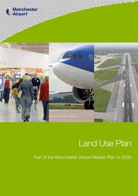
<strong>Land</strong> Use Plan<br />
Part of the <strong>Manchester</strong> <strong>Airport</strong> Master Plan to 2030
Contents<br />
Chapter 1 - Introduction 3<br />
Chapter 2 - Context 5<br />
Chapter 3 - Planning Policy Framework 9<br />
Chapter 4 - Development Appraisal 15<br />
Chapter 5 - <strong>Land</strong> Use Proposals 17<br />
Chapter 6 - Surface Access and Car Parking 34<br />
Chapter 7 - Operational Area and Green Belt 41<br />
Chapter 8 - Environment and Mitigation 47<br />
Chapter 9 - Next Steps 48<br />
Appendix 1 50<br />
Appendix 2 52<br />
Appendix 3 62<br />
Appendix 4 63<br />
1
Chapter 1 - Introduction<br />
This <strong>Land</strong> Use Plan is the latest in a series of documents<br />
that set out the long-term development strategy for<br />
<strong>Manchester</strong> <strong>Airport</strong>. We published our first Development<br />
Strategy in 1982 that covered the period up to 1990.<br />
The most recent document was published in 2003, and<br />
took our <strong>plan</strong>s forward to 2015. That Development<br />
Strategy formed part of our response to the<br />
Government’s consultation ‘The Future Development of<br />
Air Transport in the United Kingdom’ in 2002 - 2003.<br />
This <strong>Land</strong> Use Plan updates much of the material that we<br />
published in the Development Strategy to 2015. In line<br />
with Government guidance, we have also extended our<br />
<strong>plan</strong>ning horizon to cover the period up to 2030. The <strong>Land</strong><br />
Use Plan is one of a family of Master Plan documents that<br />
a re closely related and should be read together.<br />
The Master Plan<br />
The starting point for our Master Plan is the national<br />
policy that has been set by Government in The Air<br />
Transport White Paper. The Master Plan introduces our<br />
vision for <strong>Manchester</strong> <strong>Airport</strong>, the strategic context for<br />
the future and introduces the challenges and<br />
opportunities that we face as the <strong>Airport</strong> develops. A<br />
draft Master Plan to 2030 was published for public<br />
consultation in July 2006. We have now taken account<br />
of the comments and made changes to our <strong>plan</strong>s.<br />
The Action Plans<br />
The draft Master Plan is supported by four detailed<br />
Action Plans. These cover:<br />
• Ground Transport<br />
• Environment<br />
• <strong>Land</strong> Use<br />
Our <strong>Land</strong> Use Plan is intended to:<br />
• Set a clear framework to guide the development of<br />
the <strong>Airport</strong> site up to 2030 in line with the Air<br />
Transport White Paper.<br />
• Identify future airport capacity and development<br />
proposals.<br />
• Set out the land <strong>use</strong> requirements to support our<br />
Master Plan and provide a <strong>Land</strong> Use Policy that is<br />
integrated with our Ground Transport, Environment<br />
and Community Plans.<br />
• Provide input to the North West Regional Spatial<br />
Strategy, the <strong>Manchester</strong> City Region Development<br />
Plan and the <strong>Manchester</strong> and Macclesfield Local<br />
Development Frameworks.<br />
• Give guidance and information to airport customers,<br />
statutory agencies, developers and local residents.<br />
In looking at how we see the development of the <strong>Airport</strong>,<br />
it is important that we recognise the value of our land, its<br />
scarcity as a business resource and its ecological and<br />
landscape character. Our <strong>Land</strong> Use Plan concentrates<br />
on increasing efficiency and improving the overall<br />
utilisation and capability of the <strong>Airport</strong> site.<br />
Some of our earlier Development Strategies introduced<br />
major step-changes in airport capacity such as Terminal<br />
2 and the Second Runway. Whilst we are <strong>plan</strong>ning for a<br />
significant growth in air traffic over the next 25 years, we<br />
intend to do this mainly within the existing terminal<br />
complex and the present runway layout.<br />
• Community<br />
3
Introduction<br />
Our <strong>plan</strong>s were circulated to a wide range of consultees,<br />
local communities and people interested in the operation<br />
and development of the <strong>Airport</strong>. We are grateful to<br />
everyone who took time to respond. Following public<br />
consultation, we have considered the comments that<br />
were made to us and changes and amendments have<br />
been made to our <strong>plan</strong>s.<br />
We intend to keep our Master Plan and this <strong>Land</strong> Use<br />
Plan under review to ensure that they remain relevant<br />
and reflect the evolution and development of the <strong>Airport</strong>.<br />
We intend to review and update our <strong>plan</strong>s every 5 years.<br />
Figure 1 - Master Plan and Action Plans<br />
Master Plan<br />
Ground Transport<br />
Plan<br />
Environment<br />
Plan<br />
<strong>Land</strong> Use<br />
Plan<br />
Community<br />
Plan<br />
4
Chapter 2 - Context<br />
<strong>Manchester</strong> <strong>Airport</strong> is the largest airport outside London<br />
and handles more traffic than some European capital city<br />
airports. The <strong>Airport</strong> serves as the major international<br />
gateway for much of Northern Britain. In 2006, over 22<br />
million passengers travelled on over 226,000 aircraft<br />
movements to over 200 worldwide destinations.<br />
<strong>Manchester</strong> is also an important cargo airport handling<br />
150,000 tonnes of freight in 2006.<br />
40<br />
35<br />
30<br />
25<br />
20<br />
15<br />
10<br />
5<br />
Future Growth<br />
As prosperity across our catchment area continues to<br />
increase, it brings an increasing demand to travel.<br />
Increased affordability, and the widening choice of<br />
destinations, are opening up new opportunities to travel<br />
both to and from the North West.<br />
As part of our Master Plan, we have assessed the likely<br />
scale of airline activity at <strong>Manchester</strong>. In doing this, we<br />
have carefully considered the changing trends in the<br />
airline industry, in particular the dramatic growth of ‘no<br />
frills’ or ‘low cost’ carriers and increasing environmental<br />
pressures. We have also taken account of the<br />
opportunity to expand our network of scheduled<br />
services, especially to long-haul destinations. We expect<br />
that there will be:<br />
• An overall annual increase in demand of between<br />
4 – 6%<br />
• Continued growth in the ‘no frills’ market<br />
Year<br />
The growth in air traffic over the years has resulted in<br />
investment in new and improved passenger facilities and<br />
transport links. The <strong>Airport</strong> has three passenger<br />
terminals, two runways and we have the ability to handle<br />
a significantly higher passenger throughput without the<br />
need for another runway or a major new terminal.<br />
The <strong>Airport</strong> is also successfully developing as a public<br />
transport hub following the opening of The Station. This<br />
facility provides easy access between air, rail, coach and<br />
bus services. As passenger throughput increases, so we<br />
expect to see a substantial increase in passengers and<br />
staff using public transport services.<br />
• Further expansion of the <strong>Airport</strong>’s long-haul network<br />
• The consolidation of airlines in to major alliances<br />
Our Master Plan and this <strong>Land</strong> Use Plan is not forecast.<br />
Whilst annual passenger forecasts are widely <strong>use</strong>d to<br />
give an indication of the overall scale of airport activity<br />
and future growth, our focus is on maximising the<br />
capacity of our existing and future facilities and<br />
increasing the efficiency of all our assets.<br />
5
Context<br />
The national consultation undertaken by the Depart m e n t<br />
for Tr a n s p o rt 1 was underpinned by very detailed fore c a s t s<br />
of passenger and and air traffic movements. This work<br />
included detailed national air traffic forecasts that were<br />
then allocated to particular airports. This modelling<br />
assumed that there would be significant growth, not just at<br />
M a n c h e s t e r, but also at the other airports in the Nort h .<br />
As part of this process we provided our own data and<br />
material to assist with and cross check the work carr i e d<br />
out by the Department for Tr a n s p o rt. As part of our Master<br />
Plan, we have reviewed our passenger forecasts for 2015<br />
and 2030. We broadly agree with the Government that the<br />
A i r p o rt will be handling between 37 and 38 million<br />
passengers a year by 2015 and that this could reach 50<br />
million passengers a year by 2030. This produces a<br />
combined annual growth rate of around 6% over the<br />
period to 2015. This assumes high growth in the ‘no frills’<br />
market and the growth and the development of the<br />
A i r p o rt ’s long-haul services. In the period up to 2030 it is<br />
assumed that the overall annual growth rate will be<br />
significantly slower as the <strong>Airport</strong> ’s market matures and<br />
m o re routes are developed from other airports in the<br />
re g i o n .<br />
Annual passenger throughput is often <strong>use</strong>d to quantify<br />
activity and anticipated levels of future growth. In<br />
preparing our Master Plan and this <strong>Land</strong> Use Plan, we<br />
have also <strong>use</strong>d forecasts of future hourly passenger,<br />
aircraft and traffic flows to shape our future <strong>plan</strong>s. This is<br />
a much better way of identifying future land and facility<br />
requirements, and this approach also ensures that<br />
efficiency improvements are a key consideration.<br />
Drivers of Capacity<br />
The <strong>Airport</strong>’s operations are characterised by flows of<br />
both arriving and departing passengers throughout any<br />
given day. In the summer peak, the demands on the<br />
airport system are greater than during the quieter winter<br />
months. The trigger for additional capacity is a result of<br />
the peak flows of passengers taken alongside the<br />
standards of service that we provide for our customers.<br />
Our forecasts also assume the aviation industry paying<br />
increased costs for its environmental impact. So the<br />
modelling takes account of the effects of an economic<br />
instrument, such as an emission trading scheme, on<br />
future demand. The Department for Transport’s forecasts<br />
suggested that a 100% fuel tax would have the effect of<br />
reducing demand by 10%. The forecasts also included<br />
projections of future air transport movements. In 2006<br />
the <strong>Airport</strong> handled 226,704 movements. Movements are<br />
forecast to grow to 353,000 by 2015.<br />
The Government’s forecasts were reviewed in 2006 and<br />
the updated forecasts remain in line with those produced<br />
for the White Paper.<br />
1 The Future Development of Air Transport in the United Kingdom:<br />
North England. Department for Transport July 2002.<br />
6
Context<br />
Peak Passenger Flows<br />
The trigger for additional terminal capacity is derived from<br />
both annual passenger throughput and also the number<br />
of passengers anticipated to pass through the facility in a<br />
typical busy hour. By spreading this peak in relative<br />
terms to the total number of passengers using the<br />
<strong>Airport</strong> throughout the day, we will be able to make a<br />
greater and more efficient <strong>use</strong> of the existing facilities.<br />
This improves efficiency in the <strong>use</strong> of land as well as the<br />
<strong>use</strong> of resources. Since 1993, the overall efficiency in<br />
asset utilisation has improved by more than 15%. We<br />
intend to continue this approach.<br />
In looking ahead, improving our efficiency is fundamental<br />
to delivering growth. Our pricing policy is designed to<br />
encourage off-peak growth, however stringent controls<br />
will continue to be placed on aircraft operations at night.<br />
Runway 23L-05R is not usually <strong>use</strong>d between 22:00 and<br />
06:00. In addition, between 23:30 and 06:00, controls<br />
are placed on the numbers and the types of aircraft that<br />
are permitted to operate.<br />
We intend to further improve the overall efficiency of the<br />
<strong>Airport</strong> terminals by spreading the peaks and through the<br />
<strong>use</strong> of technology and new operational procedures. This<br />
will help us contain the overall size of the <strong>Airport</strong> site as<br />
well as minimising the environmental effects of growth.<br />
Service Standards<br />
We operate in an increasingly competitive business, and<br />
the level of service that we are able to offer our airline<br />
customers and their passengers is critical to our<br />
continued success. We are also re q u i red to operate the<br />
A i r p o rt in accordance with specific internationally agre e d<br />
criteria. This is regulated and audited by the UK Civil<br />
Aviation Authority (CAA). We have to operate in<br />
a c c o rdance with our aero d rome licence and we have to<br />
satisfy and constantly adhere to precise safety standard s .<br />
These influence the layout and the future development of<br />
the <strong>Airport</strong> and the surrounding area and are a major<br />
consideration in the airport master <strong>plan</strong>ning pro c e s s .<br />
The Department for Transport regulate the <strong>Airport</strong>’s<br />
security requirements and procedures. Security can have<br />
an influence on the space requirements within the<br />
terminals and can also affect the need and the location<br />
of future development.<br />
We are very conscious that our facilities should be<br />
developed to meet the needs of the airlines and their<br />
passengers. These needs are different depending on the<br />
type of airline. For example the ‘no frills’ carriers need a<br />
very different level of facility to the long-haul scheduled<br />
airlines. In <strong>plan</strong>ning our facilities we <strong>use</strong> a series of<br />
international service standards (developed by ICAO 2 ) that<br />
include:<br />
• Space provision, including the size of lounges and<br />
key processing facilities such as security, check-in<br />
and baggage reclaim<br />
• Number of seats<br />
• Standards of service, such as the balance of<br />
passengers served from a pier rather than bussed to<br />
remote aircraft stands<br />
The level of service can be considered as a range of<br />
values or assessments of the ability of the terminal space<br />
to meet the demand. It combines both qualitative and<br />
quantitative assessments of relative comfort and<br />
convenience.<br />
2 International Civil Aviation Organisation - a UN agency covering civil<br />
aviation worldwide.<br />
7
Context<br />
These can be expressed in terms of space per<br />
passenger and are:<br />
Check-in<br />
1.4 sq metres per passenger<br />
There are issues relating to security, baggage handling<br />
and cost, but we have successfully dealt with these in<br />
The Station. A trial in an on-site car park will give further<br />
experience that can then be extended to, say<br />
<strong>Manchester</strong> Piccadilly and Crewe rail stations.<br />
Concourse and Lounge<br />
Gate Area<br />
Baggage Reclaim<br />
1.9 sq metres per passenger<br />
1.0 sq metres per passenger<br />
1.6 sq metres per passenger<br />
These standards conform to IATA Service Standard ‘C’.<br />
This represents a good level of service, stable flows and<br />
a good level of passenger comfort. Our service<br />
standards are constantly monitored, reviewed and<br />
incorporated into new building design and refurbishment<br />
schemes.<br />
Technology<br />
The development, delivery and <strong>use</strong> of new technologies will<br />
underpin all of our future development schemes.<br />
The needs and expectations of our airline customers and<br />
passengers are changing. The quality of service that we<br />
deliver will continue to be a key driver of future success.<br />
We have a major programme ‘Customer First’ that<br />
foc<strong>use</strong>s on delivering the highest levels of service to all<br />
our customers. We see an increasing potential for new<br />
technologies and innovative changes to the check-in<br />
process that will improve levels of service, improve<br />
passenger convenience and reduce the scale of new<br />
development on-site. This is expected to generate further<br />
efficiency improvements and a capacity improvement of<br />
at least 10%. Options being explored range from home<br />
check in, through check in at key rail stations and at<br />
other key points on the strategic transport network.<br />
8
Chapter 3 - Planning Policy Framework<br />
Our Master Plan sets out the strategic context for the<br />
development of the <strong>Airport</strong>. The key elements of national<br />
and regional strategic policy that influence it are:<br />
• The Air Transport White Paper – 2003<br />
• The Northern Way Growth Strategy – 2004<br />
• The North West Regional Spatial Strategy –<br />
Consultation Draft – 2006<br />
• The Greater <strong>Manchester</strong> City Region Development<br />
Programme – 2005<br />
• The Wythenshawe Strategic Regeneration<br />
Framework – 2004<br />
Having set out a national air transport policy, the<br />
Government have encouraged airport operators to<br />
prepare Master Plans. These are intended to set out the<br />
strategic framework for growth, and the approach taken<br />
to development. <strong>Airport</strong> Master Plans do not have a<br />
statutory status, but the Government clearly expects<br />
them to be taken into account in the preparation of<br />
regional and local policies and in the making of <strong>plan</strong>ning<br />
decisions.<br />
Government Guidance in Planning Policy Statement Note<br />
1: Delivering Sustainable Development 3 , sets out<br />
overarching policies for the delivery of sustainable<br />
development through the UK <strong>plan</strong>ning system and that<br />
regional and local development <strong>plan</strong>s promote outcomes<br />
that achieve environmental, economic and social<br />
objectives together over time.<br />
A clear strategic <strong>plan</strong>ning framework is important if the<br />
<strong>Airport</strong> is to continue to grow. This allows all<br />
stakeholders to influence and understand our proposals.<br />
A simple and speedy <strong>plan</strong>ning process is essential if we<br />
are to capture the growth opportunities that the <strong>Airport</strong><br />
brings, as well as making sure that future development is<br />
sustainable.<br />
Our Master Plan shows how national and regional policy<br />
will shape the future development of the <strong>Airport</strong>. This<br />
<strong>Land</strong> Use Plan sets out the statutory <strong>plan</strong>ning framework<br />
for the region and for the local area.<br />
Regional Planning Framework<br />
The North West Regional Spatial Strategy provides the<br />
framework for the preparation of development <strong>plan</strong>s by<br />
local <strong>plan</strong>ning authorities. The Regional Spatial Strategy<br />
is in draft and will replace the existing Regional Planning<br />
Guidance for the North West (RPG13) 4 . Both the adopted<br />
Regional Planning Guidance and the emerging Regional<br />
Spatial Strategy set out a vision for the North West. It is<br />
intended that this vision will be achieved by capitalising on<br />
the re g i o n ’s international connections, highly developed<br />
s e rvice and knowledge sectors and flourishing culture ,<br />
s p o rt and leisure industries. <strong>Manchester</strong> <strong>Airport</strong> is<br />
identified as a world-class asset and as a key economic<br />
d r i v e r. In RPG 13, Policy T5 states:<br />
• “The role of <strong>Manchester</strong> <strong>Airport</strong> as the north of<br />
England’s key international air gateway and its<br />
potential to become an important multi-modal<br />
interchange are recognised and supported.”<br />
Local Planning Framework<br />
The local <strong>plan</strong>ning framework is the statutory<br />
responsibility of the various Local Planning Authorities<br />
who prepare <strong>plan</strong>s to guide future developments within<br />
3 PPS1 : Delivering Sustainable Development - February 2005<br />
4 RPG13 - Regional <strong>plan</strong>ning guidance for the North West - March 2003<br />
9
Planning Policy Framework<br />
their areas. The adopted <strong>plan</strong>s with policies that directly<br />
apply to the <strong>Airport</strong> site are:<br />
• The <strong>Manchester</strong> Unitary Development Plan (The<br />
<strong>Manchester</strong> Plan) 1995<br />
• The Cheshire County Structure Plan (2005)<br />
• The Macclesfield Borough Local Plan (2004)<br />
Further away from the <strong>Airport</strong>, a number of development<br />
<strong>plan</strong>s in Greater <strong>Manchester</strong> and Cheshire contain airport<br />
related policies, covering such issues as development,<br />
environmental impact, inward investment and transport.<br />
We will continue to contribute to <strong>plan</strong>ning policy in this<br />
wider area.<br />
The Planning and Compensation Act 2004 has<br />
fundamentally changed this system of <strong>plan</strong> making.<br />
Authorities are now required to prepare a Local<br />
Development Framework. This is a suite of documents,<br />
that includes a core strategy, a proposals map, and area<br />
action <strong>plan</strong>s. Until such time that these are in place the<br />
policies of adopted <strong>plan</strong>s will be ‘saved’. Our <strong>Land</strong> Use<br />
Plan sets out the long-term land <strong>use</strong> requirements for the<br />
<strong>Airport</strong> and it is intended to contribute to the preparation<br />
of a new <strong>plan</strong>ning framework for the local area.<br />
<strong>Manchester</strong> Unitary Development Plan<br />
The majority of the <strong>Airport</strong> site is within the City of<br />
<strong>Manchester</strong>. The <strong>Manchester</strong> Plan sets out the City<br />
Council’s twin aims of improving the City as a place to<br />
live, work and visit, and revitalising the local economy.<br />
The <strong>Airport</strong> is clearly seen as one of the strengths on<br />
which the City can build, and it is acknowledged as a<br />
major contributor to <strong>Manchester</strong>’s international status.<br />
The <strong>Airport</strong> plays a key role in attracting new business<br />
and inward investment to the City, and in encouraging<br />
the development of high technology industries. Within<br />
the Plan, the City Council aims to capitalise on this<br />
connection through the provision of high quality<br />
development sites that offer good access to the <strong>Airport</strong>.<br />
The key policies are:<br />
Part 1 Policies<br />
Policy E2.1 relates to development within the Green Belt.<br />
In the supporting text it states that although <strong>Manchester</strong><br />
<strong>Airport</strong> is within the Green Belt, its growth and<br />
development has always been regarded in a special way.<br />
The contribution of the <strong>Airport</strong> to the economic life and<br />
vitality of the City is growing as it expands its range of<br />
facilities and services. As well as being a major employer,<br />
the <strong>Manchester</strong> Plan goes on to highlight the role the<br />
<strong>Airport</strong> plays in supporting jobs away from the site, and<br />
that it plays an important part in initiatives to attract<br />
inward investment and tourism. For these reasons, the<br />
City Council is committed to enhancing the <strong>Airport</strong>’s<br />
status as the major international airport serving northern<br />
England. So whilst it seeks high environmental standards<br />
in its operation and future development, there are special<br />
circumstances that support airport development within<br />
the Green Belt.<br />
Policy I1.1 relates to employment and economic<br />
development. It states that the Council will ensure that<br />
sufficient allocation of a range of sites suitable for a<br />
variety of different commercial <strong>use</strong>s is made. In location<br />
terms, sites with good access to the <strong>Airport</strong> are identified<br />
as key opportunities.<br />
Policy T4.1 states that the Council will continue to<br />
manage the expansion of the <strong>Airport</strong> in line with policies<br />
and proposals that were contained in the former Ringway<br />
10
Planning Policy Framework<br />
Local Plan and incorporated into the UDP. The policy<br />
goes on to state that land will be safeguarded until the<br />
<strong>Airport</strong>’s <strong>plan</strong>s for expansion become clearer (the UDP<br />
was prepared prior to a decision on the Second Runway)<br />
and that the Council will seek to promote development in<br />
an environmentally sensitive manner.<br />
Policy T4.2 expresses the Council’s wish to improve<br />
surface access to the <strong>Airport</strong> so that infrastructure in the<br />
area surrounding the <strong>Airport</strong> continues to keep pace with<br />
the expected growth in activity. Emphasis is put on the<br />
need for modern, high quality transport links. It highlights<br />
the intention of the Council to <strong>use</strong> its influence to deliver<br />
the necessary enhancements, particularly to the quality<br />
of public transport. Support is explicitly given to<br />
development of Metrolink between the <strong>Airport</strong> and the<br />
City Centre.<br />
Part 2 Policies<br />
General Policy EW1 seeks to promote the development<br />
of <strong>Manchester</strong> <strong>Airport</strong> in a manner that is consistent with<br />
the achievement of high environmental standards, to<br />
enable the <strong>Airport</strong> to play its full role in the economy and<br />
life of the conurbation as well as the wider North West.<br />
The current boundary of the <strong>Airport</strong> Operational Area is<br />
defined on the Proposals Map within the UDP. It is the<br />
area originally defined in the Ringway Local Plan<br />
published in 1987. At that time, the <strong>Airport</strong>’s throughput<br />
was some 8.7 million passengers per year. In publishing<br />
its Development Strategy to 2005 in May 1993, the<br />
<strong>Airport</strong> sought to extend the Operational Area. Policy<br />
EW19 indicated that the City Council did not wish to<br />
promote these proposals until the Second Runway<br />
proposal had been fully considered by the formal<br />
<strong>plan</strong>ning process. <strong>Land</strong> between the <strong>Airport</strong> and the<br />
River Bollin was however safeguarded.<br />
The principle of support for future expansion and<br />
development of the <strong>Airport</strong> within the Operational Area is<br />
reflected in Policies EW20 to EW35 of the <strong>Manchester</strong><br />
Plan. The view of the Council was that the size of the<br />
Operational Area should be no more than that necessary<br />
to accommodate the anticipated growth in passenger<br />
and freight traffic. The UDP seeks to ensure the finite<br />
supply of land is not <strong>use</strong>d for activities that could<br />
reasonably be located elsewhere.<br />
Policy EW21 is a modification adopted in November<br />
2001. It sets out in detail the approach to be taken by<br />
the Council to development in the Green Belt at the<br />
<strong>Airport</strong>. EW21 identifies a significant part of the <strong>Airport</strong> as<br />
a ‘Major Developed Site’. Infilling and re-development<br />
within the boundary of this ‘Major Developed Site’ are to<br />
be treated as “appropriate development” providing it<br />
meets the tests set out in PPG2 Annex C 5 with respect<br />
to openness and impact. Development proposals which<br />
do not meet the above infilling or re-development criteria,<br />
but are for certain specified <strong>use</strong>s (airfield operational<br />
activities, cargo terminal facilities, passenger terminals<br />
and related facilities, airport ancillary facilities,<br />
transportation, waste disposal infrastructure and<br />
landscaping) will be subject to the test of “very special<br />
circumstances” as set out in Policy E2.1. The location of<br />
airport development proposals within the Major<br />
Developed Site is a material consideration in determining<br />
whether very special circumstances exist.<br />
Policies EW24 and EW25 require the provision of high<br />
quality design and landscaping throughout the<br />
operational area and Policy EW4 refers to the special<br />
noise policies that will apply to the area around<br />
<strong>Manchester</strong> <strong>Airport</strong>.<br />
Cheshire County Structure Plan<br />
This Plan sets out the strategic <strong>plan</strong> for the County up to<br />
2016. It has sustainability as its underpinning philosophy<br />
and aims to accommodate the economic and social<br />
needs of Cheshire whilst conserving the environment and<br />
natural resources for the benefit of future generations.<br />
The Plan identifies the importance of the <strong>Airport</strong> to the<br />
regional economy. It notes the County Council’s legal<br />
agreement with the <strong>Airport</strong> Company in respect of the<br />
Second Runway and identifies the importance of<br />
minimising environmental impacts and avoiding harm to<br />
ecological interests<br />
Policy T14 states that development proposals at<br />
<strong>Manchester</strong> <strong>Airport</strong> should:<br />
• Have no detrimental impact on Sites of Special<br />
Scientific Interest or the Green Belt;<br />
• Minimise other environmental impacts by appropriate<br />
noise and other environmental controls and by<br />
application of landscape and habitat management<br />
programmes; and<br />
5 Planning Policy Guidance Note 2 ‘ Green Belts’ January 1995<br />
11
Planning Policy Framework<br />
• Ensure that the resulting surface transport demand<br />
can adequately be accommodated within the<br />
capacity of transport links, and include measures to<br />
increase the <strong>use</strong> of public transport.<br />
This will be the last Structure Plan for Cheshire as the<br />
new <strong>plan</strong>ning system, based on a Regional Spatial<br />
Strategy and Local Development Frameworks will<br />
eventually take on its current role.<br />
Macclesfield Borough Local Plan<br />
The Macclesfield Borough Local Plan was originally<br />
adopted in 1997, and was subject of a review and<br />
Inquiry in 2002. The Borough Council adopted the<br />
revised Local Plan in January 2004.<br />
The Plan covers the area of land to the south and southwest<br />
of the <strong>Airport</strong> site. At a local level, it develops the<br />
relevant policies and general proposals contained in the<br />
Cheshire County Structure Plan. As with much of the<br />
site, the part of the <strong>Airport</strong> that is within Macclesfield is<br />
also in the Green Belt.<br />
The Borough Council recognises that the safe and<br />
efficient operation of the <strong>Airport</strong> can have implications for<br />
land within the Plan area. Only essential airport related<br />
activities are permitted in the Green Belt outside the<br />
<strong>Airport</strong> Operational Area, except in very special<br />
circumstances, in accordance with the Policy T20.<br />
Policy T21 of the Plan states that the Borough Council<br />
will encourage airport related development to be located<br />
within the Operational Area or within nearby urban areas<br />
where this is compatible with other Local Plan policies.<br />
Policy T18 deals with restrictions applying to noise<br />
sensitive development in the vicinity of the <strong>Airport</strong>.<br />
The Local Plan defines an Operational Area. This<br />
includes parts of Runway 23L-05R (The Second<br />
Runway), and an area of undeveloped land to the north<br />
of Moss Lane Styal that is allocated for airport <strong>use</strong>. This<br />
is set out in Policy T23 and the <strong>use</strong>s identified include<br />
airfield operational facilities, airport ancillary facilities,<br />
transportation infrastructure and landscaping works.<br />
The Macclesfield Local Plan also includes policies to<br />
control new development in areas around the <strong>Airport</strong> that<br />
are affected by aircraft noise (Policy T18) and controls on<br />
development within the Public Safety Zones (Policy T19).<br />
Other Local Authority Plans<br />
Surrounding Local Authorities in Greater <strong>Manchester</strong> and<br />
Cheshire have adopted a variety of <strong>plan</strong>ning policies that<br />
guide them when considering proposals for development<br />
at or related to <strong>Manchester</strong> <strong>Airport</strong>. These variously<br />
support the development of the <strong>Airport</strong> in principle, and<br />
in the case of those authorities in close proximity to the<br />
<strong>Airport</strong> site, provide guidance on how to deal with<br />
development that is related to the <strong>Airport</strong>, but takes<br />
place away from the main airport site. Improving<br />
transport links is a common theme in these Plans.<br />
The <strong>Airport</strong> and Development Control<br />
<strong>Land</strong> <strong>use</strong> at and within the vicinity of the <strong>Airport</strong>, is<br />
influenced by Government advice on Noise, Aerodrome<br />
Safeguarding and Public Safety Zones. This is to protect<br />
the amenity and health of local residents, and to control<br />
new development in areas that are affected by airport<br />
and aircraft operations. This guidance is then translated<br />
into development control policy by local <strong>plan</strong>ning<br />
authorities.<br />
12
Planning Policy Framework<br />
Noise<br />
Planning Policy Guidance Note (PPG) 24 6 outlines the<br />
considerations that Local Planning Authorities should<br />
take into account when determining <strong>plan</strong>ning<br />
applications for noise sensitive developments and for<br />
those activities that generate noise. This guidance seeks<br />
to ensure that wherever practicable, new noise sensitive<br />
developments are protected from major sources of noise.<br />
PPG 24 also refers to noise contours that help in<br />
considering <strong>plan</strong>ning applications in areas affected by<br />
aircraft noise. They are <strong>use</strong>d by Local Planning<br />
Authorities to assess which areas are likely to be subject<br />
to high levels of noise and, where necessary, impose<br />
conditions requiring noise insulation measures, or even<br />
ref<strong>use</strong> applications on the grounds of noise impact.<br />
Guidance is also provided in respect of other noise<br />
sensitive developments such as hospitals or schools.<br />
Aerodrome Safeguarding<br />
C e rtain civil aero d romes, by virtue of their importance to<br />
the air traffic system, are protected under a pro c e s s<br />
known as Aero d rome Safeguarding. This functions<br />
t h rough the <strong>plan</strong>ning system, and aims to protect the<br />
safety of aircraft operations. The key issues for<br />
s a f e g u a rding are heights of buildings in relation to an<br />
a i r p o rt ’s ‘protected surfaces’, developments that have the<br />
potential to attract birds, and also windfarms that have the<br />
potential to interf e re with radar and navigation systems.<br />
G o v e rnment advice is set out in Circular 1/2003 7 , which<br />
details the consultation arrangements to be undert a k e n<br />
by local authorities and the safeguarding authority. The<br />
C i rc u l a r, which came into force in Febru a ry 2003,<br />
t r a n s f e rred the consultation process from the CAA to the<br />
relevant aero d romes. The Local Authority must now re f e r<br />
c e rtain developments to the relevant aero d rome operator.<br />
The <strong>Airport</strong> Company is the safeguarding authority for<br />
<strong>Manchester</strong> <strong>Airport</strong>, and in carrying out this duty we will<br />
continue to ensure the safety of airport operations and,<br />
ultimately, that public safety, is not compromised.<br />
Public Safety Zones<br />
Public Safety Zones are designated areas of land at the<br />
end of runways within which development is restricted.<br />
The shape and size of Public Safety Zones are based on<br />
risk contours and are specific to the type and volumes of<br />
air traffic using a particular runway at an individual airport .<br />
Government advice is set out in a Department of<br />
Transport Circular 1/2002. Public Safety Zones are a<br />
<strong>plan</strong>ning policy tool designed to prevent new<br />
developments such as ho<strong>use</strong>s, that would result in a<br />
significant increase in the number of people living,<br />
working or congregating within these areas. The advice<br />
also suggests that, over time, existing numbers should<br />
be reduced.<br />
The area of the Public Safety Zone is formed by an<br />
elongated isosceles triangle, extending from the landing<br />
thresholds of the runways. Within this, there is a much<br />
smaller triangle where the risk of aircraft accident is<br />
higher. The Public Safety Zone policy requires that<br />
residential and commercial property within these inner<br />
areas be purchased, emptied and demolished. There are<br />
4 Public Safety Zones, one at each end of the two<br />
runways and there are currently no properties in these<br />
inner zones at the ends of the runways at <strong>Manchester</strong>.<br />
Section 106 and other Agreements<br />
The <strong>Airport</strong> Company has signed legal agreements with<br />
local <strong>plan</strong>ning and highway authorities as part of the<br />
development process. The most significant is an<br />
agreement with Cheshire County Council and<br />
<strong>Manchester</strong> City Council under Section 106 of the Town<br />
and Country Planning Act 1991 relating to the<br />
construction of the Second Runway. This agreement<br />
contains 38 guarantees (or <strong>plan</strong>ning obligations) that:<br />
• Reduce the adverse impacts of developments<br />
• Control and manage the environmental implications<br />
of the Second Runway scheme<br />
• Provide enhanced mitigation measures, and<br />
• Give assurances about future expansion.<br />
The agreement contains 116 sub cla<strong>use</strong>s, or points of<br />
action. These cover topics such as night flying, noise,<br />
landscape and habitat management, community<br />
relations, car parking, public transport and highway<br />
6 Planning Policy Guidance Note 24 ‘Planning and Noise’ September (1994)<br />
7 ODPM Circular 1/2003 ‘Safeguarding Aerodromes, Technical sites<br />
and Military Explosives Storage Areas: The Town and Country Planning<br />
(Safeguarded Aerodromes, Technical sites and Militaary Explosives<br />
Storage Areas) Direction 2002’<br />
13
Planning Policy Framework<br />
improvements. Cheshire County Council annually review<br />
our compliance with the agreement using independent<br />
auditors. Since the agreement was signed in 1994, we<br />
have continually complied with its obligations. The overall<br />
agreement runs until 2011, although a number of<br />
obligations are subject to a regular review.<br />
The Second Runway <strong>plan</strong>ning conditions include a<br />
number of controls on the <strong>use</strong> of the runway at night, the<br />
noise impact of the <strong>Airport</strong>, and restrictions on aircraft<br />
engine testing. Compliance with the <strong>plan</strong>ning conditions<br />
is reported annually to <strong>Manchester</strong> City Council and<br />
Macclesfield Borough Council.<br />
We will work with Cheshire County Council and<br />
<strong>Manchester</strong> City Council to revise, update and extend<br />
our legal agreement. This is to make sure that it remains<br />
relevant to local communities in containing the<br />
environmental impact of the <strong>Airport</strong>’s operation, but also<br />
securing and directing the benefits to the areas of<br />
greatest need.<br />
14
Chapter 4 - Development Appraisal<br />
Sustainability Appraisal<br />
High level Sustainability Appraisals were undertaken as<br />
part of the Department for Transport’s national<br />
consultation. The Master Plan is our detailed statement<br />
on how national policy in the Air Transport White Paper<br />
can be brought forward. The Master Plan and this <strong>Land</strong><br />
Use Plan have no statutory <strong>plan</strong>ning status, but they are<br />
intended to influence the Regional Spatial Strategy and<br />
Local Development Frameworks. Formal Sustainability<br />
Appraisals will form part of both processes.<br />
In preparing our Master Plan and this <strong>Land</strong> Use Plan, we<br />
have sought to apply the principles of Sustainability<br />
Appraisal. We have tried to place our Master Plan in the<br />
context of the national policy set out in Government’s<br />
Sustainability Strategy 8 . In preparing our <strong>Land</strong> Use Plan<br />
we have <strong>use</strong>d the general principles of Sustainability<br />
Appraisal that are set out in Annex I and II of EU Directive<br />
2001/42/EC.<br />
Sequential Appraisal<br />
In considering the future extent of the Operational Area,<br />
we have identified the proposed extensions and given<br />
careful consideration to how we prioritise the <strong>use</strong> of our<br />
land. The proposed Operational Area extensions are<br />
detailed in Appendix 2. There are 5 areas that have been<br />
identified. Three of these, with a total area of around 80<br />
ha were first promoted in 1993. An area of around 6ha to<br />
the east of the <strong>Airport</strong> was included in the Development<br />
Strategy to 2015, published in 2003. This Master Plan<br />
looks to 2030, and we have considered the <strong>Airport</strong>’s<br />
future land requirements and proposed Operational Area<br />
extensions. We have now identified a further area of land<br />
to the west of the A538 at Oak Farm (approx 38 ha).<br />
Around the <strong>Airport</strong> there are strong and clear boundaries.<br />
These include the residential areas to the north and the<br />
east, the National Trust’s Styal estate to the south, the<br />
Bollin Valley and the M56. Potential Operational Area<br />
extensions included land to the south of the <strong>Airport</strong><br />
around Moss Lane Styal and land to the west at Oak<br />
Farm. We concluded that it would not be appropriate to<br />
promote an extension to the Operational Area to the<br />
south of the <strong>Airport</strong>. <strong>Land</strong> at Oak Farm is considered to<br />
be more appropriate beca<strong>use</strong> of its relationship to the<br />
main airport site, links to the main transport corridors<br />
and the limited effect on local residents. It is recognised<br />
however that there are sensitive environmental features<br />
and the effects of airport development will need to be<br />
compensated and mitigated.<br />
To ensure that the main site is <strong>use</strong>d in the most efficient<br />
manner possible, we will apply a series of sequential<br />
tests to determine the most appropriate <strong>use</strong>. The<br />
technique has been <strong>use</strong>d to select our preferred<br />
development option. Our approach takes into account of<br />
the need to <strong>use</strong> land effectively and efficiently, whilst at<br />
the same time meeting the needs of our customers,<br />
delivering economic benefit and minimising environmental<br />
impact.<br />
We will adopt a sequential approach to future<br />
development both in the preparation of our <strong>plan</strong>s and in<br />
considering future development proposals. Proposals will<br />
be evaluated using a series of tests and other criteria to<br />
ensure that we achieve the most efficient and effective<br />
utilisation of our land. The appraisal will incorporate the<br />
following tests:<br />
• Use: The development must be required for the<br />
operational efficiency or amenity of the <strong>Airport</strong>.<br />
• Technology: Can proven technology be employed to<br />
minimise or defer requirements for additional landtake?<br />
8 Securing the Future - DEFRA 2005<br />
15
Development Appraisal<br />
• Redevelopment: Establish whether existing<br />
developed sites within the Operational Area are<br />
suitable for the location of the development. This<br />
includes the redevelopment of previously <strong>use</strong>d or<br />
under <strong>use</strong>d sites, ‘in fill’ and the redevelopment or<br />
extension of existing buildings if economically viable.<br />
• Operational Area: Are appropriate sites available<br />
within the Operational Area?<br />
• Environment: How can the proposed development<br />
be undertaken whilst minimising the environmental<br />
impact?<br />
This sequential approach will be <strong>use</strong>d along with a set of<br />
criteria for site assessment. It will also ensure that any<br />
development proposal is in line with our Master Plan as<br />
well as our Ground Transport Plan and Environment Plan.<br />
Location requirements will play a key role in our site<br />
assessments. A number of <strong>use</strong>s will require direct access<br />
to the airfield and the terminals. In preparing our <strong>Land</strong><br />
Use Plan, development will be directed to appropriate<br />
locations within the Operational Area. Safety and security<br />
and the needs of our customers are also key<br />
considerations when identifying future land <strong>use</strong>s and<br />
airport activity.<br />
16
Chapter 5 - <strong>Land</strong> Use Proposals<br />
This chapter looks at the broad categories of land <strong>use</strong> on<br />
the <strong>Airport</strong> site, and sets out specific development<br />
p roposals. It anticipates the likely changes during the<br />
strategy period and whether as a result we believe it will<br />
be appropriate to allocate additional land on site to a<br />
p a rticular <strong>use</strong>. The highest priority will be given to those<br />
activities that need to take place on areas adjoining<br />
existing apron, taxiways and runways or which are<br />
needed for the safe and efficient operation of the airf i e l d .<br />
Runways and Taxiways<br />
Since February 2001 the <strong>Airport</strong> has two main<br />
operational runways (23R-05L and 23L-05R) 9 . The<br />
runways have paved lengths of 3,048 metres and are 46<br />
metres wide. In addition Runway 23L-05R (the Second<br />
Runway) has a starter extension of 150 metres. Runway<br />
23R-05L has 23 metre wide reinforced shoulders on<br />
either side of the runway itself. This additional<br />
strengthening means that the new generation of large<br />
wide-bodied aircraft such as the Airbus A380 and new<br />
versions of the Boeing 747 can operate from this runway.<br />
The passenger throughput and the terminal capacity of<br />
an airport is often expressed in millions of passengers<br />
per year (mppa). However, this is not the best measure<br />
of the capacity and the capabilities of an airfield and<br />
runway system. Runway capacity is determined and best<br />
expressed as the number of aircraft movements that can<br />
be handled per hour. The opening of the Second<br />
Runway (23L-05R) provided a substantial increase in the<br />
hourly runway capacity of the <strong>Airport</strong>. One of the<br />
priorities of this <strong>Land</strong> Use Plan is to maximise the peak<br />
hour capacity of the twin runway system, therefore<br />
avoiding the need for any third runway. Forecasts and<br />
traffic growth assumptions are set out in our Master Plan<br />
and Chapter 2 of this <strong>Land</strong> Use Plan.<br />
Factors that influence runway capacity include, taxiway<br />
geometry, the mix of air traffic and air traffic control<br />
regulations and facilities. The present declared peak hour<br />
capacity of the runway system at <strong>Manchester</strong> is 61<br />
movements per hour.<br />
The <strong>Airport</strong> ’s regular mode of operation is for aircraft to<br />
d e p a rt to the southwest towards Knutsford with arr i v i n g<br />
a i rcraft approaching from the northeast over Stockport .<br />
The <strong>Airport</strong> operates in this direction for appro x i m a t e l y<br />
80% of movements. This is determined by the pre v a i l i n g<br />
westerly winds. With the two runways the airfield usually<br />
operates in ‘segregated mode’ with one runway (23L)<br />
<strong>use</strong>d for depart u res and the other (23R) for arrivals. This<br />
is with westerly winds. In easterly winds, the operation is<br />
reversed, with the Second Runway (05R) <strong>use</strong>d for arr i v a l s<br />
and runway 05L for depart u res. During the night (between<br />
the hours of 22:00 and 06:00) when the number of<br />
a i rcraft movements is reduced, all operations norm a l l y<br />
re v e rt to Runway 23R-05L. This is one of the operational<br />
c o n t rols that were put in place by the <strong>plan</strong>ning perm i s s i o n<br />
for the Second Runway. We have no proposals to open<br />
Runway 23L-05R (R2) at night, except in an emerg e n c y<br />
or when maintenance is being carried out on Runway<br />
23R- 05L (R1). Major repairs to Runway 23R-05L are<br />
<strong>plan</strong>ned from 2008.<br />
The two runways, when the airfield layout is fully<br />
developed, will provide sufficient runway capacity at<br />
<strong>Manchester</strong> for the foreseeable future. The Second<br />
Runway Legal Agreement included an obligation that no<br />
proposals for a third runway would be considered during<br />
the period up to 2011. In preparing our Master Plan and<br />
<strong>Land</strong> Use Plan, we are not <strong>plan</strong>ning for a third runway in<br />
the period up to 2030.<br />
There will, however, be a need for changes to the airfield<br />
layout and local air traffic control procedures. In<br />
developing capacity, it is important to recognise that the<br />
9 Beca<strong>use</strong> of magnetic field shifts, the runways were renamed from 7th July<br />
2007. They changed from 24 to 23 (Westerly) and 06 to 05 (Easterly).<br />
Community Relations Data Sheet - Febru a ry 2007.<br />
17
<strong>Land</strong> Use Proposals<br />
airfield and runways operate as a system, and that the<br />
release of constraints in one element may lead to<br />
constraints elsewhere. We propose, during the period up<br />
to 2015, to increase the peak hourly capacity of the<br />
airfield to handle 76 aircraft movements an hour. In<br />
addition some works will be required to accommodate<br />
some of the new large aircraft. Capacity enhancements<br />
in five main areas will be needed:<br />
• Taxiway improvements<br />
• Changes to local aircraft departure procedures<br />
• An additional runway crossing point<br />
• Refinements to airfield procedures<br />
• Modifications to handle new large aircraft including<br />
the Airbus A380<br />
Further improvements in the runway and airfield capacity<br />
will be required for the period beyond 2015. These will<br />
be influenced by improvements in technology and<br />
changes to operational procedures. These will be<br />
brought forward in future reviews of our <strong>Land</strong> Use Plan.<br />
A network of taxiways, linking the terminal buildings with<br />
the runways, is crucial to the safe and efficient operation<br />
of the <strong>Airport</strong>. The size and layout of taxiways is govern e d<br />
by a number of factors, including safety re q u i rements and<br />
i n t e rnational standards. An efficient taxiway layout is a key<br />
factor in determining the overall capacity of the airf i e l d<br />
system and limiting our environmental impact. Ta x i w a y s<br />
a re needed to link all the aircraft manoeuvring areas and,<br />
as these are extended, there will be a need to extend and<br />
alter the current system. The design and layout of the<br />
Second Runway allows for additional taxiways and fast<br />
t u rn offs, that may be re q u i red to meet incre a s e d<br />
numbers of movements.<br />
The Second Runway <strong>plan</strong>ning approval included the<br />
development of a taxiway that would fill the gap between<br />
the two A538 road tunnels. It was intended that this<br />
would be built in phases. The work to construct the<br />
taxiway is likely to be in the period 2015 – 2020. This<br />
work will require a major upgrade to the road tunnel.<br />
Additional taxiways will also be constructed at the<br />
Eastern end of Runway 23L-05R<br />
Enhancing the overall efficiency of the airfield, and the<br />
way that aircraft move around within it, is an important<br />
factor in maintaining overall capacity. Measures to be<br />
introduced will include revised aircraft push-back<br />
procedures, changes and additions to aircraft taxi routes,<br />
and alterations to aircraft towing procedures. These<br />
operational improvements can also have environmental<br />
benefits beca<strong>use</strong> reducing aircraft taxi and holding times<br />
can help reduce aircraft emissions.<br />
As part of the development of Terminal 2, the apron has<br />
been extended to the north west. This has increased the<br />
numbers of aircraft that are parked in this area and to<br />
ensure the efficient movement of aircraft, additional<br />
taxiways are required. To achieve this a dual taxiway will<br />
be provided between the My Travel hangar and Pier C.<br />
This will result in the loss of several aircraft stands and<br />
these will be re-provided as part of the further<br />
development of the Terminal 2 apron.<br />
In it’s usual operating mode, Runway 23L-05R is the<br />
principal depart u re ru n w a y. Beca<strong>use</strong> of the airfield layout,<br />
d e p a rting aircraft have to cross the arrival runway (23R).<br />
T h e re are presently three crossing points where aircraft can<br />
be held before receiving an instruction to cross. The two<br />
central crossing points are increasingly congested and it is<br />
p roposed to add at least one more crossing point toward s<br />
the eastern end of Runway 23R.<br />
On departure, most aircraft are issued with a Preferred<br />
Noise Route. These are defined procedures to route<br />
18
<strong>Land</strong> Use Proposals<br />
aircraft through the local airspace immediately after<br />
departure. In the period up to 2015 there is likely to be a<br />
need to alter the Preferred Noise Routes, particularly<br />
those to the west of the <strong>Airport</strong>, in order to increase the<br />
overall departure rate. This will mean adjusting the<br />
departure procedures in order that the northern and<br />
s o u t h e rn turns are closer to the airfield and made<br />
available to a wider range of aircraft types. No detailed<br />
p roposals presently exist, however they will be subject to<br />
a separate and extensive consultation process in line with<br />
the Civil Aviation Authority’s re q u i rements and with a wide<br />
range of stakeholders and local residents before any<br />
decisions are taken. In addition to local airspace<br />
p ro c e d u res, it is important to ensure that there is suff i c i e n t<br />
airspace capacity in areas further away from the <strong>Airport</strong> ,<br />
and that this capacity is integrated with the growth in<br />
operations at other airports in the Midlands and the Nort h<br />
of England. Further details on our policies to contro l<br />
a i rcraft noise can be found in our Environment Plan.<br />
With the introduction of these measures, we estimate<br />
that the overall movement rate of the airfield can be lifted<br />
to around 76 aircraft movements per hour by 2015. As<br />
mentioned above, the airfield operates in segregated<br />
mode (one runway <strong>use</strong>d for departures, the other for<br />
arrivals). This is likely to remain the case for the period up<br />
to 2015. The construction of a full-length parallel taxiway<br />
along the north side of Runway 23L-05R may be needed<br />
beyond 2015. The Second Runway was designed to<br />
accommodate this extension, and it would involve a<br />
modest extension to the current airfield boundary in<br />
Mobberley to the south west of the River Bollin. Beyond<br />
2015 it is likely that an increase in the movement rate<br />
above 76 movements per hour will be required. This is<br />
likely to require the introduction of some mixed mode<br />
activity (both runways <strong>use</strong>d for arrivals and departures),<br />
airspace adjustments and technological improvements.<br />
Runway and Taxiway Policies<br />
RT1<br />
RT2<br />
RT3<br />
The airfield will continue to be designed and<br />
operated to meet the standards and the<br />
requirements of the Civil Aviation Authority.<br />
No proposals exist to construct a third runway<br />
during the period of this Strategy.<br />
We will bring forward proposals to maximise the<br />
peak hour capacity of the twin runway system.<br />
RT4<br />
RT5<br />
RT6<br />
Apron<br />
Additional taxiways and runway crossing points<br />
will be provided to enhance the capacity of the<br />
runway system.<br />
<strong>Land</strong> will be protected for the development of a<br />
full length parallel taxiway to Runway 23L-05R.<br />
Proposals to adjust the local aircraft departure<br />
procedures and Preferred Noise Routes will be<br />
brought forward during the Strategy period.<br />
These will be subject to a separate public<br />
consultation process.<br />
As the <strong>Airport</strong> has developed, the amount of land<br />
allocated as apron (parking stands for aircraft) has<br />
increased in line with growing terminal capacity and<br />
changes in aircraft size and operation. Aircraft stands<br />
can be divided into two categories - terminal stands,<br />
where the passenger can gain direct access into the<br />
terminal and remote stands, where passengers have to<br />
be bussed to and from the terminal building.<br />
Airfield safety influences aircraft parking and governs<br />
how much space the taxiways and aircraft stands<br />
require. These guidelines are set out in the Civil Aviation<br />
Authority publications CAP168 and CAP642 . Stands<br />
must be provided to deal with all types of aircraft that are<br />
anticipated to <strong>use</strong> the <strong>Airport</strong>.<br />
The range in size is considerable - from small regional<br />
aircraft with a wingspan of 20 metres, through to the<br />
largest widebodied aircraft such as the new Airbus A380<br />
that has a wingspan of 79 metres. Aircraft length is also<br />
likely to increase. Currently, the longest aircraft are<br />
approximately 75 metres in length. In order to ensure<br />
efficient <strong>use</strong> of land, we have, for many years, designed<br />
stands to be as flexible as possible, so that the largest<br />
stands are configured to accommodate one large aircraft<br />
or two smaller aircraft. This policy will continue. The<br />
aircraft parking and manoeuvring and servicing area<br />
currently extends over 81 hectares and as the <strong>Airport</strong><br />
grows additional land will be required.<br />
The Airbus A380 is to be introduced into passenger<br />
service during 2007/08. Several airlines that operate at<br />
the <strong>Airport</strong> will have these aircraft in their fleets. We<br />
19
<strong>Land</strong> Use Proposals<br />
expect that A380’s will be operated at <strong>Manchester</strong> but<br />
not in substantial numbers. However works will need to<br />
be carried out to the taxiway network and a small<br />
number of aircraft stands. The capacity to accommodate<br />
a limited number of A380 movements will be<br />
incorporated into future terminal extensions.<br />
Consideration will also be given to the taxiway, apron<br />
and terminal requirements of new versions of the Boeing<br />
747 aircraft.<br />
1990<br />
2000<br />
2005<br />
2015<br />
Air Transport<br />
Movements<br />
152,554<br />
178,968<br />
215,247<br />
353,000<br />
Stands<br />
56<br />
90<br />
104<br />
126<br />
The best way of enhancing capacity is to maximise the<br />
<strong>use</strong> of existing apron areas. This can be achieved by<br />
increasing the efficiency of stand utilisation by<br />
encouraging growth in the off-peak periods by offering<br />
lower charges, and through the reconfiguration of<br />
existing stands and management measures. This may<br />
depend on changes to CAA regulations governing stand<br />
layout. However, as new terminal facilities are developed,<br />
it will be necessary to increase the area of land allocated<br />
as apron. The options for further apron provision are<br />
intrinsically linked to the runway and taxiway system and<br />
the terminal buildings. The ‘no frills’ carriers require easy<br />
access to the taxiway system to ensure quick turnrounds<br />
and the maximum utilisation of their aircraft.<br />
Airlines are seeking to increase the amount of flying they<br />
can achieve with their aircraft. This is placing increased<br />
pressure on the amount of space required at each stand<br />
to accommodate the simultaneous working of the<br />
vehicles and equipment required to achieve short turn<br />
round times. By 2015 a further 10 hectares of land will<br />
need to be developed for apron and aircraft parking.<br />
W h e re appropriate, areas allocated as future apron will be<br />
developed for temporary <strong>use</strong>s in the interim, continuing<br />
principles that we applied in the development of Te rm i n a l<br />
2. This is a way of making the most efficient <strong>use</strong> of land.<br />
New apron areas will be designed and located taking<br />
account of the environmental effects. Mitigation measure s ,<br />
p a rticularly for noise, visual impact and water quality will<br />
be provided as an integral part of the development.<br />
Working within the physical and environmental constraints<br />
of the current site, we have identified three areas for the<br />
next phase of apron development. These are:<br />
• Terminal 2 – western extension<br />
• Terminal 3 – eastern extension<br />
• Cloughbank Farm<br />
Terminal 2 was designed to allow further expansion to<br />
the west, ultimately up to Thorley Lane and Runger Lane.<br />
This was included in the scheme that has <strong>plan</strong>ning<br />
permission, and additional apron is being progressively<br />
developed. This apron area will result in the displacement<br />
of substantial areas of long-stay and staff car parking,<br />
that were developed as an interim <strong>use</strong> in 1993.<br />
Additional apron capacity can be provided east of<br />
Terminal 3 to meet growing demand in that part of the<br />
site. It is also the closest area to the runways, and has<br />
benefits in reducing aircraft taxi time and emissions.<br />
During 2006, we submitted a proposal for the<br />
construction of up to 14 stands. A detailed<br />
Environmental Impact Assessment was prepared and the<br />
development will also require consent for the demolition<br />
of Old Thatch, a Grade 2 Listed Building. Mitigation<br />
proposals, particularly in respect of landscape, ground<br />
noise and visual impact were included as part of the<br />
<strong>plan</strong>ning submission.<br />
<strong>Land</strong> has also been identified for apron development<br />
within the extended Operational Area to the west of the<br />
aircraft maintenance village at Cloughbank Farm. Direct<br />
access to the airfield taxiway network means that it is<br />
one of the few areas suitable for early apron<br />
development. In preparing detailed proposals, particular<br />
attention will be given to the sensitive landscape and<br />
ecological interests in this area, particularly the adjacent<br />
Site of Special Scientific Interest at Cotteril Clough.<br />
Apron Policies<br />
AP1<br />
New areas of land will be required for extensions<br />
to the apron. Our priority will be to develop land<br />
within the existing Operational Area. Other<br />
areas will be subject to a sequential test and<br />
assessment of environmental effects.<br />
20
<strong>Land</strong> Use Proposals<br />
AP2<br />
AP3<br />
AP4<br />
AP5<br />
To maximise land <strong>use</strong> efficiency some existing<br />
<strong>use</strong>s will be displaced to the <strong>Airport</strong> periphery to<br />
enable apron development. These will include<br />
ancillary <strong>use</strong>s and car parking.<br />
Additional areas of apron will be developed to<br />
the west of Terminal 2 and to the east of the<br />
Terminal.<br />
Proposals will be brought forward for the<br />
development of an area of apron on land at<br />
Cloughbank Farm.<br />
In the longer term, apron development will be<br />
considered on the land to the west of the A538<br />
(Oak Farm)<br />
2016 to 2030. We have considered a number of<br />
alternative options. The options that have been<br />
considered in detail are:<br />
• The full demolition and re-building of Terminal 1 and<br />
Terminal 3, along with an expansion of Terminal 2.<br />
• The demolition and re-building of Terminal 1 along<br />
with an expansion of Terminal 2 and the<br />
development of a 4th terminal complex.<br />
• The re-development of Terminal 1 and Terminal 3<br />
along with an expansion of Terminal 2.<br />
• The re-development of Terminal 1 and Terminal 3, an<br />
expansion of Terminal 2 and the development of a<br />
4th terminal complex.<br />
The Terminal Development Strategy<br />
Since the publication of the Draft Development Strategy to<br />
2015, and in the light of the 2003 Air Tr a n s p o rt White<br />
P a p e r, we have carried out a detailed review of future<br />
t e rminal capacity. This has been done to provide a basis<br />
for the wider master <strong>plan</strong>ning of the <strong>Airport</strong> site.<br />
A pro g ressive enhancement to the terminal facilities will be<br />
re q u i red to accommodate the growth in passenger<br />
numbers and to maintain the <strong>Airport</strong> ’s standards of service.<br />
We have carried out detailed studies into our future<br />
t e rminal development strategy and considered a number<br />
of options. Our over-riding principle is to maximise<br />
e fficiency and make the best <strong>use</strong> of the terminal facilities<br />
that we have before putting forw a rd major development<br />
p roposals. We have made substantial investments in new<br />
technology particularly in respect of the check-in pro c e s s .<br />
The <strong>Airport</strong> will require substantial increases in terminal<br />
capacity both in the period up to 2015 and also from<br />
Our pre f e rred option is to concentrate initially on<br />
enhancing the capacity of the existing terminal complex.<br />
This will re q u i re major extensions to Te rminal 2 and the<br />
refurbishment extension and rebuilding of parts of<br />
Te rminals 1 and 3. The development of the existing<br />
t e rminal complex brings several benefits and advantages,<br />
in that it centralises activity, improves connectivity<br />
between the terminals, and concentrates on the existing<br />
public transport and surface access links. A summary of<br />
the terminal option appraisal is in Appendix 1.<br />
Potential sites for a 4th terminal complex were<br />
considered as part of the appraisal process. The <strong>Airport</strong><br />
site is relatively small with limited options for the<br />
development of a major terminal within the existing<br />
Operational Area. Two areas were identified; these were<br />
on land to the south east in Styal; or land to the west at<br />
Oak Farm. The Oak Farm site was the only one<br />
evaluated for terminal development but not selected.<br />
21
<strong>Land</strong> Use Proposals<br />
We are also conscious of the changing needs of our<br />
airlines and passengers, especially in the growing ‘no<br />
frills’ sector. These airlines need very convenient access<br />
to the runways and a very different level of facility. We are<br />
reviewing how best to meet those needs. This may<br />
include adapting existing facilities or providing new<br />
remote facilities that could be either to the east or the<br />
west of the existing apron. We will complete this work in<br />
2007 in consultation with out airline customers.<br />
Terminal 1<br />
When it was opened in 1962, Terminal 1 was designed<br />
to have an annual capacity of 2.5 million passengers a<br />
year. There have been many redevelopment and<br />
expansion schemes over the years and the building is<br />
currently handling around 11 million passengers a year.<br />
During the next few years, we intend to bring forward<br />
several schemes that will increase the overall capacity of<br />
the terminal. These include:<br />
• Airside retail development and security improvements<br />
• Extension of the main Check-In Hall<br />
• Extension to the Arrivals area<br />
• Baggage Hall extension<br />
We will need to selectively refurbish and redevelop parts<br />
of Terminal 1 to improve efficiency, increase capacity and<br />
raise standards. We believe these enhancements will<br />
provide sufficient capacity before the opening of<br />
additional capacity at Terminal 2. Beyond this we will<br />
assess the need for the redevelopment of Piers B and C<br />
and in the longer term we will bring forward proposals for<br />
the further redevelopment of parts of the terminal site.<br />
Terminal 2<br />
The first phase of Te rminal 2 was opened in 1993 with an<br />
initial capacity of 6 million passengers a year. Subsequent<br />
i m p rovements have increased its capacity and it is now<br />
handling around 7.6 million passengers a year<br />
Development of the second phase of Terminal 2 was<br />
granted <strong>plan</strong>ning consent in 1997 and some preliminary<br />
construction work has already been carried out. We<br />
intend to progressively develop Terminal 2, and it could<br />
ultimately handle around over 20 million passengers a<br />
year. This will include an extension of the main terminal<br />
to the north-west. Additional contact stands will be<br />
provided by the extension of the West Pier. <strong>Land</strong> has<br />
been safeguarded for the construction of remote satellite<br />
piers in the Terminal 2 apron. We expect to develop an<br />
airside link between Terminal 1 and Terminal 2 as a way<br />
of improving the efficiency of both terminals.<br />
Terminal 3<br />
Te rminal 3 opened in 1998 when the former Te rminal 1<br />
(Domestic) was expanded and renamed to accommodate<br />
both domestic and international flights. This Te rminal is<br />
c u rrently <strong>use</strong>d by British Airways and bmi and handles<br />
a round 5 million passengers a year.<br />
F u rther extensions and improvements will be needed.<br />
P roposals will be brought forw a rd for the development of<br />
additional apron to the east, and land will be safeguard e d<br />
for future terminal and pier extensions. Consideration will<br />
also be given to the airlines operating from Te rminal 3 to<br />
maximise operational efficiency of the terminal facilities. In<br />
the longer term, we intend to maximise the capacity of the<br />
whole Te rminal 1 and Te rminal 3 complex and we will<br />
amalgamate the two buildings to create one single term i n a l<br />
operation. We estimate that this complex could ultimately<br />
handle around, over 20 million passengers a year.<br />
22
<strong>Land</strong> Use Proposals<br />
The Station<br />
The Station now has check-in and some baggage<br />
handling facilities. This is the first stage in offering remote<br />
passenger processing. It has proved to be a success<br />
and will be continued and eventually extended to other<br />
remote sites. This is an important element in improving<br />
efficiency and customer service.<br />
The Station will continue to play an important part in the<br />
provision of capacity. It offers a high standard of service<br />
for passengers arriving by public transport and this is a<br />
key element in encouraging passengers on to rail and<br />
coach services. Baggage handling and security facilities<br />
have been developed for The Station check-in. These will<br />
continue to comply with the Department for Transport’s<br />
standards, and the baggage and security requirements<br />
will be important considerations in future off-site facilities.<br />
T5<br />
largely within the present footprint of the<br />
building and its car park.<br />
Dedicated facilities for ‘no frills’ airlines will be<br />
developed.<br />
T6 An airside link between Terminal 1 and Terminal 2<br />
will be developed to ensure the capacity<br />
potential of each terminal can be fully exploited.<br />
T7<br />
T8<br />
Proposals to extend Terminal 3 on land to the<br />
east will be devloped.<br />
A network of off-site passenger handling facilities<br />
will be developed, following the successful<br />
trialling of the concept in The Station. Potential<br />
locations include <strong>Manchester</strong> Piccadilly and Cre w e .<br />
Terminal Policy<br />
T1<br />
T2<br />
T3<br />
We will focus future terminal development on the<br />
current three terminal complex.<br />
Further phases of Terminal 2 will be developed,<br />
including an extension to the main building, the<br />
West Pier and the construction of a remote<br />
satellite pier.<br />
We will regularly review the allocation of airlines<br />
to terminal to meet customer needs and<br />
maximise efficiency. Dedicated <strong>use</strong> of terminal<br />
facilities will only be permitted where it will not<br />
have a detrimental effect upon overall long-term<br />
capacity.<br />
T4 Major improvements will be made to Terminal 1<br />
especially to check-in, arrivals and piers, but<br />
Cargo<br />
The World Freight Terminal is situated to the west of the<br />
passenger terminal complex but cargo aircraft share the<br />
Terminal 2 apron. The facilities have been developed in<br />
phases since 1986 and the World Freight Terminal now<br />
provides a range of cargo facilities including Transit<br />
Sheds, wareho<strong>use</strong>s and offices.<br />
As the <strong>Airport</strong> has developed, cargo throughput has<br />
grown significantly from 34,900 tonnes in 1985 to<br />
150,849 tonnes in 2006. This growth has been achieved<br />
through the development of long-haul passenger<br />
services but also through the expansion of freighter<br />
operations. Air cargo is a valuable element of the airport<br />
activity and facilities will continue to be provided and<br />
developed as a core part of the <strong>Airport</strong>’s activity. Cargo is<br />
valuable in maintaining the viability of passenger services,<br />
as a high proportion of the <strong>Airport</strong>’s cargo throughput is<br />
carried in the holds of passenger aircraft.<br />
23
<strong>Land</strong> Use Proposals<br />
Transit Sheds<br />
The current Transit Sheds offer some 27,000 square<br />
metres of lettable space with an overall potential<br />
productivity level of between 8 to 10 tonnes of cargo per<br />
square metre. This translates into an annual capacity of<br />
between 216,000 and 270,000 tonnes. We will work<br />
closely with the Transit Shed operators to increase the<br />
productivity level of the existing units to around 12<br />
tonnes per square metre. This will be achieved through<br />
the development of new facilities, technology and<br />
operational improvements. Our policy of encouraging<br />
growth at off-peak times of the day will also play a part.<br />
On the basis of forecast cargo business growth and the<br />
capacity of the existing units, additional Transit Shed<br />
capacity will be re q u i red before 2015. <strong>Land</strong> will be<br />
re s e rved for redevelopment and extension of the Wo r l d<br />
F reight Te rminal. Any new Transit Shed Units will<br />
incorporate mechanised handling facilities, where it is<br />
economically viable, and have a target productivity of 15<br />
tonnes per square metre. By 2015 around 9 ha of land will<br />
be re q u i red for Transit Shed facilities. This will increase to<br />
a round 11 ha by 2030. It is important that the cargo facility<br />
has high quality road access as freight is delivered or<br />
collected by road. The World Freight Te rminal has good<br />
access to the M56 at Junction 6. Further impro v e m e n t s<br />
will be made to the road network in 2007 – 2009.<br />
Freight Forwarding and Logistics<br />
Freight forwarding and logistics is a fast growing and<br />
rapidly evolving activity. <strong>Manchester</strong> <strong>Airport</strong> is an<br />
important international gateway for goods and services<br />
supporting economic growth and development in the<br />
City Region and the wider Northern economy.<br />
Freight forwarding is becoming multi-modal and<br />
increasingly sophisticated as ‘just in time’ concepts<br />
move further into the supply chain. These trends are<br />
resulting in the establishment of global logistics<br />
businesses with airports providing a specific function for<br />
the fast movement of freight across continents and<br />
between trading centres in Europe.<br />
The growth in logistics activity is creating an additional<br />
need for freight wareho<strong>use</strong> units. The specific<br />
requirements for air related logistics is speed of<br />
movement of goods and therefore Freight Forwarders<br />
have located close to the Transit Shed activity at the<br />
<strong>Airport</strong>. Many of the major worldwide freight forwarders<br />
and logistics companies have a presence at the <strong>Airport</strong>.<br />
There is presently some 46,500 square metres of freight<br />
forwarding floor space within the World Freight Terminal.<br />
The future size and scope of the freight forwarding and<br />
logistics business has been the subject of detailed<br />
analysis as part of the preparation of our Master Plan.<br />
<strong>Land</strong> for freight forwarding will continue to be provided<br />
as an important airport <strong>use</strong> and an integral part of the<br />
<strong>Airport</strong>’s Air Cargo product. We estimate that around<br />
140,000 square metres of freight forwarding wareho<strong>use</strong><br />
space will be required, however not all of this can be<br />
accommodated within the Operational Area. The Master<br />
Plan identifies freight forwarding and logistics as an<br />
important economic opportunity for the City Region and<br />
for Wythenshawe. We will work with our partners to<br />
capture this opportunity and will seek to identify one or<br />
more sites, preferably within the development corridors<br />
shown in the Wythenshawe Strategic Regeneration<br />
Framework area. Such sites will need to be in close<br />
proximity to the <strong>Airport</strong> and will require high quality links<br />
to the <strong>Airport</strong> site and the strategic road network. This is<br />
considered further in Chapter 7.<br />
Cargo Policies<br />
CA1<br />
Air cargo is a core element of the <strong>Airport</strong> activity<br />
and we will work with the Transit Shed<br />
24
<strong>Land</strong> Use Proposals<br />
CA2<br />
CA3<br />
CA4<br />
Operators to grow the business and increase the<br />
overall utilisation of the Transit Shed facilities.<br />
Over the period of this <strong>Land</strong> Use Plan, we will<br />
encourage the Transit Shed operators to<br />
increase efficiency to an average of 12 tonnes<br />
per square metre.<br />
We will bring forward proposals for additional<br />
Transit Shed capacity within the existing World<br />
Freight Terminal complex.<br />
We will work to identify appropriate sites in the<br />
local area for the development of a freight<br />
forwarding and logistics facility.<br />
Other Operational Facilities<br />
Aircraft Maintenance<br />
Aircraft maintenance is an essential part of an airline’s<br />
operations and a key activity at many international<br />
airports. All aircraft are required to undergo regular<br />
inspections that can range from a simple check to major<br />
re-assembly. Whilst many of the modern aircraft can<br />
operate for longer periods between checks, with the<br />
increasing sophistication of aircraft systems and<br />
materials, most maintenance work now needs to be<br />
undertaken in a hangar.<br />
The world’s fleet of commercial aircraft is forecast to<br />
increase substantially over the next 25 years. The<br />
availability of modern hangar facilities is an important part<br />
of the portfolio necessary to attract or retain major airline<br />
operations.<br />
<strong>Airport</strong>. The hangar facilities at <strong>Manchester</strong> are generally<br />
modern, most being constructed during the period 1989<br />
– 1996. There are 4 wide-bodied maintenance bays in<br />
the three major hangars. The aircraft maintenance<br />
industry is a highly cyclical business, and as a result of<br />
recent shifts in the maintenance market, there is at<br />
present some spare hangar capacity at the <strong>Airport</strong>.<br />
Given this surplus capacity, the principal focus will be to<br />
maximise the <strong>use</strong> of the existing facilities before any<br />
additional land is allocated for this <strong>use</strong>. Aircraft<br />
maintenance hangars can take up significant areas of<br />
land and future developments will be prioritised by their<br />
overall contribution to the <strong>Airport</strong>’s growth and<br />
development. In the longer term, post 2015, we will<br />
review the options for redevelopment. We expect that<br />
land will be allocated for a further two aircraft hangars<br />
within an extended maintenance area covering 15 ha.<br />
Cloughbank Farm has been identified for apron<br />
development in the period up to 2015. With the<br />
development of additional apron, this may provide an<br />
opportunity for the redevelopment and relocation of the<br />
maintenance area. This would provide additional aircraft<br />
parking and also improved airfield circulation. The effect<br />
of major maintenance development would require<br />
substantial environmental works to mitigate or<br />
compensate for the effect on the Cotteril Clough Site of<br />
Special Scientific Interest.<br />
Aircraft Maintenance Policy<br />
OF1<br />
Aircraft maintenance activities will be retained<br />
with effort focussed on ensuring the most<br />
efficient <strong>use</strong> and commercial sustainability of the<br />
existing operation.<br />
The aircraft maintenance village covers an area of some<br />
9 hectares and is located on the West Side of the<br />
OF2<br />
Proposals will be considered for the<br />
redevelopment of Hangar 4.<br />
25
<strong>Land</strong> Use Proposals<br />
OF3<br />
Cloughbank Farm is the preferred location for<br />
additional hangars associated with future apron<br />
development beyond 2015.<br />
OF5<br />
Proposals will be brought forward for the<br />
installation of new radar facilities on a site to the<br />
rear of the South Fire Station in 2007.<br />
Air Traffic Control and Navigation Aids<br />
OF6<br />
<strong>Land</strong> will be safeguarded for the upgrading of<br />
the Instrument <strong>Land</strong>ing Systems.<br />
The <strong>Airport</strong>’s Air Traffic Control facility is located within<br />
the Terminal 1 Tower Block where National Air Traffic<br />
Services (NATS) operate a major facility. This complex<br />
includes the Visual Control Room (VCR) that is on the<br />
top of the Tower Block and the <strong>Manchester</strong> Centre that<br />
includes the main radar facility for Northern England.<br />
Increased activity and new technology may require<br />
improvements to the VCR.<br />
The VCR will be affected by any substantial<br />
redevelopment of Terminal 1. This work would require the<br />
construction of a new Control Tower. The preferred sites<br />
for a new facility are within the central T1/T3 complex or<br />
a new site adjacent to the aircraft maintenance village at<br />
Cloughbank Farm.<br />
The <strong>Airport</strong> also requires a range of radar and navigation<br />
facilities. Most of the equipment is now located within the<br />
airfield or on the roofs of airport buildings. In the future<br />
there will be a need to relocate or provide new<br />
equipment. These proposals will include the installation<br />
of a second Surface Movement Radar. This is to be sited<br />
on land to the rear of the South Fire Station.<br />
We expect that the airfield, in the period up to 2015 will<br />
continue to operate in ‘segregated mode’. In order to<br />
sustain a movement rate of 76 aircraft an hour, we expect<br />
that there will a need for a replacement and upgrade of<br />
the navigation and telecommunication equipment. This<br />
may include new surface movement radars and upgraded<br />
I n s t rument <strong>Land</strong>ing Systems. It will also be important to<br />
s a f e g u a rd the land around the navigation aids to ensure<br />
that their operation is not aff e c t e d .<br />
Air Traffic Control and Navigation Aid Policy<br />
OF4<br />
In developing proposals for Terminal 1, we will<br />
bring forward proposals for a new Air Traffic<br />
Control facility including a new Visual Control<br />
Room.<br />
Fire and Rescue Facilities<br />
The <strong>Airport</strong>’s licence includes a mandatory requirement<br />
to provide Fire and Rescue Services that are appropriate<br />
to the aerodrome and the types of aircraft that <strong>use</strong> it.<br />
The CAA set out the requirements and facilities that are<br />
required. This is generally referred to as the Rescue and<br />
Firefighting Category (RFF). Currently <strong>Manchester</strong> is<br />
licensed to Rescue and Firefighting Category 9. This level<br />
of service covers the regular operation of aircraft up to<br />
Boeing 747-400 size and also permits operations by a<br />
limited number of aircraft from Category 10. This highest<br />
category includes aircraft such as the Antonov AN124<br />
and the new Airbus A380.<br />
The <strong>Airport</strong> Fire Stations must be located so that the Fire<br />
and Rescue Service can reach all parts of the airfield in<br />
two to three minutes. It was for this reason that the South<br />
F i re Station was constructed as part of the Second<br />
Runway development. The South Fire Station is a modern<br />
purpose-built facility. The North Fire Station is located<br />
adjacent to the aircraft maintenance village and was<br />
originally constructed in the 1960’s. Beca<strong>use</strong> of its age,<br />
this facility is becoming increasingly difficult and expensive<br />
to maintain. The building is located adjacent to one of the<br />
main taxiways and it is likely that it will need to be<br />
relocated to enable the extension of the taxiway network.<br />
Any new Fire Station still needs to meet the necessary<br />
response times, so it is likely to remain close to the<br />
existing site.<br />
The <strong>Airport</strong>’s Fire and Rescue Service require regular<br />
access to training facilities for live fire drills and training<br />
programmes. The Fire Training Area is located on the<br />
South Side of the Airfield and has to be equipped to<br />
comply with CAA requirements. A major upgrade was<br />
completed in 2006 to meet licensing requirements,<br />
especially for large aircraft and to provide higher<br />
environmental standards.<br />
26
<strong>Land</strong> Use Proposals<br />
Fire and Rescue Policies<br />
OF7<br />
OF8<br />
The site of the North Fire Station will be required<br />
for future taxiway improvements. A site will be<br />
identified in the vicinity of the existing facility or<br />
in the Cloughbank Farm area for a new Fire<br />
Station. The Fire and Rescue Service will<br />
continue to meet the CAA’s requirements.<br />
The Fire Training Area will be maintained to<br />
ensure compliance with the CAA’s training and<br />
performance standards.<br />
Flight Catering<br />
The flight catering units are located on the west side of<br />
the <strong>Airport</strong> and are operated by two companies LSG Sky<br />
Chef and Alpha Catering. Both units have been extended<br />
over recent years and now extend to approximately 2 ha.<br />
There are additional facilities away from the <strong>Airport</strong> on<br />
nearby industrial estates.<br />
The airline in-flight catering market has changed<br />
significantly in recent years. This is principally as a result<br />
of the changing requirements of the ‘no frills’ carriers and<br />
the charter airlines. Flight catering will however remain an<br />
important operational <strong>use</strong> and around 2 ha of land will be<br />
reserved for additional catering units on land on the<br />
western area of the <strong>Airport</strong> site.<br />
Flight Catering Policies<br />
OF9<br />
<strong>Land</strong> will continue to be provided for Flight<br />
Catering Facilities. Areas will be safeguarded for<br />
extensions to the existing units and land<br />
reserved on the West Side for an additional<br />
catering unit.<br />
Fuel Farm<br />
The Fuel Farm is situated on the West Side of the <strong>Airport</strong><br />
between the aircraft maintenance village and the World<br />
Freight Terminal. The site is close to the main West Side<br />
security point and offers aircraft fuelling vehicles<br />
convenient access to the airfield.<br />
An underground pipeline supplies most of the aviation<br />
fuel to the site. This avoids the need for substantial<br />
tanker movements on the local road network. Distribution<br />
of fuel within the airfield is through an underground<br />
hydrant system and all new aircraft stands are to be<br />
served by the hydrant system. It is necessary to have<br />
sufficient fuel storage capacity within the Fuel Farm. This<br />
is to balance the fuel within the system and also to<br />
ensure a continuity of supply should there be any faults<br />
with the main supply pipeline.<br />
The Fuel Farm presently has a total storage capacity of<br />
11,558 m 3 of Jet A-1 aviation fuel. To accommodate<br />
future growth it is <strong>plan</strong>ned to develop an additional<br />
storage tank in 2007. In the longer term, land has been<br />
safeguarded to the rear of the Fuel Farm to cater for the<br />
development of larger or additional storage tanks. In the<br />
period up to 2015 , the development of a second fuel<br />
supply pipeline will need to be considered and land<br />
safeguarded off-site for this <strong>use</strong>. It will be important that<br />
this proposal is sensitively designed and executed.<br />
Aircraft Fuel Policy<br />
OF10 Capacity for additional aircraft fuel capacity will<br />
be provided by the development of enlarged and<br />
new tanks within the existing Fuel Farm.<br />
OF11 <strong>Land</strong> will be safeguarded for the extension of<br />
the Fuel Farm, and a possible second pipeline.<br />
27
<strong>Land</strong> Use Proposals<br />
General Aviation<br />
General and Business Aviation facilities are presently<br />
provided on the West Side of the <strong>Airport</strong>. Business<br />
Aviation is the principal activity, made up of corporate<br />
aircraft operations and air taxi services. There is a<br />
purpose-built facility to the rear of the aircraft<br />
maintenance village. This is operated by Northern<br />
Executive Aviation, who provide passenger handling,<br />
aircraft parking and aircraft maintenance facilities.<br />
Business Aviation is an established part of the <strong>Airport</strong>’s<br />
services and is important in serving the business and<br />
corporate sector in the North West. Relocation may be<br />
required as part of a redevelopment of the aircraft<br />
maintenance village.<br />
The <strong>Airport</strong> has limited space and, in the longer term,<br />
limited runway capacity to accommodate private flying<br />
operations. There is presently a Flying School operating<br />
from a site adjacent to the Aviation Viewing Park. This is<br />
likely to be displaced as a result of the development of<br />
aircraft apron and taxiways in this area. It is not<br />
envisaged that the relocated Aviation Viewing Park will<br />
provide for Flying School activities at its new site.<br />
General Aviation Policy<br />
OF12 Facilities will continue to be provided for<br />
Business Aviation Activity.<br />
Operational Accommodation<br />
We need to provide facilities for a range of operational<br />
functions that are required to keep the <strong>Airport</strong> operating<br />
safely and efficiently. They cover a wide range and<br />
usually require a location that has direct or convenient<br />
access to the airfield. These <strong>use</strong>s include:<br />
• Accommodation for <strong>Airport</strong> Operations, Airlines and<br />
Handling Agents.<br />
• Parking and storage for apron and airfield equipment.<br />
• Vehicle and equipment maintenance areas.<br />
• Material storage.<br />
• Snow fleet.<br />
The Airfield Safety Unit is located on the West Side of the<br />
<strong>Airport</strong> adjacent to the My Travel aircraft hangar. This<br />
provides accommodation and vehicle parking for airfield<br />
safety and airfield maintenance activities. This facility will<br />
need to be relocated as a result of the demand for<br />
increased and centralised facilities and changes to the<br />
airfield layout. In selecting any new site, the development<br />
of a single Airfield Operations Centre will be considered.<br />
Airfield Operations require storage and workshop areas<br />
that are close to the airfield. This includes the Snow Fleet<br />
that is presently ho<strong>use</strong>d close to the Runway 23R<br />
Passing Bay. This site will be redeveloped as part of the<br />
long-term development of apron to serve Terminal 3. A<br />
new facility will be required and a site either between, or<br />
to the south of the runways will be considered.<br />
Vehicle and equipment maintenance is carried out in the<br />
old war-time hangars on the West Side. This<br />
accommodation is increasingly inappropriate for such<br />
<strong>use</strong>s and the redevelopment of this area will provide<br />
more efficient purpose-built units to serve the <strong>Airport</strong>’s<br />
maintenance requirements. Whilst most of this activity<br />
requires a location on the airport site, opportunities will<br />
be investigated to displace non-essential <strong>use</strong>s to an offairport<br />
location.<br />
At major airports with a substantial fleet of based aircraft,<br />
there is a need to provide facilities for Handling Agents to<br />
wash aircraft. As a result of the need for stringent<br />
controls on the quality of run-off from the airfield,<br />
dedicated areas have been provided for aircraft washing.<br />
These are at Stand 60 next to the My Travel hangar and<br />
at Stand 86 on the West Apron. These areas include a<br />
separate drainage system to protect local watercourses<br />
from contamination by washing chemicals. Stand 60 will<br />
be lost as a result of this area being <strong>use</strong>d as a<br />
permanent taxiway and a replacement stand for aircraft<br />
washing will be provided as part of the apron<br />
development schemes including Terminal 3 and<br />
Cloughbank Farm.<br />
• Aircraft cleaning and washing facilities.<br />
28
<strong>Land</strong> Use Proposals<br />
Operational Facilities Policy<br />
OF13 A site on the West Side will be identified for a<br />
relocated and redeveloped Airfield Safety Unit<br />
and Airfield Maintenance Unit.<br />
OF14 A new facility for the <strong>Airport</strong> Snow Fleet will be<br />
developed.<br />
OF15 The existing vehicle and equipment unit will be<br />
redeveloped to provide more efficient purposebuilt<br />
facilities.<br />
OF16 Aircraft washing stands will be provided as part<br />
of future apron developments at Terminal 3 and<br />
at Cloughbank Farm.<br />
Security and Control<br />
The policing of the <strong>Airport</strong> site is managed from the subdivisional<br />
HQ of Greater <strong>Manchester</strong> Police. The existing<br />
Police Station is located close to Te rminal 3. This site is<br />
too small for the present and future operational demands<br />
of the <strong>Airport</strong> and cannot easily be extended. Some<br />
t e m p o r a ry accommodation has been provided for Gre a t e r<br />
<strong>Manchester</strong> Police, but it is considered that a new Police<br />
Station will be re q u i red in the period up to 2015. This will<br />
need to be within the Operational Area with access to the<br />
Te rminals and the local road system. The Te rminal 2<br />
Phase 2 development and its associated road scheme<br />
may provide a site in the Thorley Lane / Runger Lane<br />
a rea, however detailed feasibility studies will be re q u i re d .<br />
In the longer term, the current operational facility on the<br />
West Side will also re q u i re relocation as part of the<br />
redevelopment of that are a .<br />
Facilities and accommodation for the Control Authorities<br />
including HM Customs, HM Immigration and Special<br />
Branch will continue to be provided, mainly within the<br />
terminals. This is to ensure that we continue to meet the<br />
regulatory and operational needs of the authorities.<br />
Security facilities will be provided within the terminals. In<br />
addition, Security Search Areas at various points around<br />
the site will be provided or extended as required to meet<br />
the increasingly stringent security requirements.<br />
Security Control Policy<br />
OF17 In the period up to 2015, proposals will be<br />
brought forward for the development of a new,<br />
enlarged Police Station. A detailed feasibility<br />
study for the development of a facility to the<br />
west of Terminal 2 will be undertaken.<br />
OF18 Appropriate facilities for the Control Authorities<br />
will be provided.<br />
OF19 Security Search facilities will be improved to<br />
meet future security requirements.<br />
Utilities<br />
Over the years a network of services and utilities has<br />
been developed across the site. These include:<br />
• Electricity<br />
• Gas<br />
• Water<br />
• Sewerage<br />
29
<strong>Land</strong> Use Proposals<br />
• Drainage<br />
• Telecommunications<br />
We have carried out a major review of the capacity of the<br />
principal utility networks. As the <strong>Airport</strong> grows there will<br />
be a need to upgrade and increase the capacity of all of<br />
the principal services. Where possible services and<br />
utilities will be routed in ‘service corridors’, and the<br />
preferred location will be on the periphery of the site,<br />
where the ratio of buildings to land is at its lowest. This<br />
avoids constant relocation and enables easier access by<br />
the utility companies.<br />
Over recent years, we have made a substantial<br />
investment in surface water and foul drainage systems.<br />
This ensures that run-off, contaminated by the <strong>use</strong> of deicing<br />
chemicals, is prevented from reaching local<br />
watercourses. The drainage system was enlarged as part<br />
of the development of the Second Runway, and further<br />
capacity will be required as apron developments increase<br />
the overall paved area. The existing storage and<br />
discharge area is to the south east of Runway 23R-05L<br />
and is the preferred location for any new facility.<br />
Whilst surface water lagoons tend to be the largest land<br />
<strong>use</strong> for utilities, sites will also be identified and<br />
s a f e g u a rded for improvements and upgrades. These will<br />
include new electrical sub-stations and pumping stations.<br />
Utilities Policy<br />
OF20<br />
OF21<br />
OF22<br />
A series of service corridors will be developed<br />
across the site.<br />
Proposals will be brought forward to provide<br />
additional capacity to the surface water and<br />
foul sewage systems. <strong>Land</strong> will also be<br />
reserved for new or replacement substations<br />
and pumping stations.<br />
The utility network will be developed to<br />
support the increase in capacity but will also<br />
incorporate efficiency measures as set out in<br />
the Environment Plan.<br />
Ancillary and Support Services<br />
A major international airport requires a variety of office,<br />
commercial and other facilities within or close to the site.<br />
As the <strong>Airport</strong> has grown, so has the range of such<br />
facilities around the site and in areas of Wythenshawe.<br />
This is a result of the increasing scale of the airport<br />
operation, the enhanced expectation of airport <strong>use</strong>rs and<br />
operators, and also to seek to capitalise on the<br />
economic development opportunities that the <strong>Airport</strong><br />
brings to the area.<br />
Office Accommodation<br />
The growth and development of the <strong>Airport</strong> continues to<br />
generate a large number of jobs, and the levels of on-site<br />
employment will increase as the <strong>Airport</strong> grows. As the<br />
number of people employed at the <strong>Airport</strong> increases, so<br />
does the need for accommodation for the wide and<br />
growing variety of companies on the site. <strong>Airport</strong> office<br />
accommodation can be broken down into the following<br />
broad categories:<br />
• <strong>Airport</strong> Company offices.<br />
• Airline, Handling Agent and Aviation related offices.<br />
• Statutory and Control Authority offices.<br />
• Ancillary offices including commercial and<br />
concession related activities.<br />
Each of these categories of <strong>use</strong>r generates a re q u i re m e n t<br />
for both general office space and accommodation that is<br />
d i rectly related to operational activity within the term i n a l s<br />
and the World Freight Te rminal. <strong>Airport</strong> and aviation re l a t e d<br />
tenants, such as airlines, tour operators, handling agents<br />
and cargo agents often re q u i re accommodation with dire c t<br />
access to the passenger areas, the apron and airc r a f t<br />
f reight handling areas. Similarly, the statutory and contro l<br />
authorities, such as HM Customs, HM Immigration and<br />
the Port Health Unit re q u i re accommodation within the<br />
t e rminal buildings, usually adjacent to specific passenger<br />
a reas. In addition, the <strong>Airport</strong> Company and many serv i c e<br />
p a rtners re q u i re office space for administrative,<br />
c o m m e rcial and training functions. There are a number of<br />
o ffices in areas around the <strong>Airport</strong> site including areas of<br />
Wythenshawe which add to the supply of space clustere d<br />
a round the <strong>Airport</strong> .<br />
30
<strong>Land</strong> Use Proposals<br />
Office accommodation is provided within the three<br />
passenger terminals and general office accommodation<br />
is also provided within four buildings in the Operational<br />
Area:<br />
development. This will be in accordance with the<br />
list of appropriate Operational Area <strong>use</strong>s set out<br />
in Chapter 7 and in Appendix 3.<br />
• Tower Block 5,200 sq m<br />
• Olympic Ho<strong>use</strong> 7,780 sq m<br />
AS4<br />
Ancillary office accommodation will continue to<br />
be provided within a main facility such as aircraft<br />
maintenance hangars and flight catering units.<br />
• Commonwealth Ho<strong>use</strong> 6,800 sq m<br />
• 4M (The Station) 8,000 sq m<br />
New operational office accommodation will generally be<br />
provided within the expanded terminal facilities. Where<br />
office space is ancillary to a main <strong>use</strong> such as aircraft<br />
maintenance or cargo, then space will continue to be<br />
provided as part of that <strong>use</strong>. A range of office<br />
accommodation will continue to be provided and sites<br />
will be identified within the existing Commonwealth<br />
Ho<strong>use</strong>, 4M and Olympic Ho<strong>use</strong> axis, where there is a<br />
high density of development. Proximity to The Station in<br />
the centre of the site is the most sustainable location as<br />
it gives easy access to public transport.<br />
Office Policy<br />
Hotels<br />
It is important that a major international airport provides a<br />
portfolio of hotel facilities that meets the different needs<br />
and expectations of passengers and <strong>use</strong>rs. The range<br />
and scale of the hotels that serve the <strong>Airport</strong> site has<br />
steadily expanded since the first airport hotel opened in<br />
1963. The <strong>Airport</strong> now has a range of hotel types from<br />
budget to full-service hotels.<br />
Within the Operational Area there are now five hotels:<br />
• The Crowne Plaza 298 rooms<br />
• The Hilton 225 rooms<br />
• Bewleys 366 rooms<br />
AS1<br />
Operational office accommodation will continue<br />
to be provided within the passenger and freight<br />
terminals<br />
• SAS Radisson 360 rooms<br />
• Travelodge 201 rooms<br />
AS2<br />
AS3<br />
Office accommodation for direct and ancillary<br />
airport <strong>use</strong>s will be included in the development<br />
proposals for the extension of Terminal 2 and<br />
the redevelopment of Terminal 1.<br />
The central terminal area is the preferred<br />
location for new high –density office<br />
In addition to the above, <strong>plan</strong>ning permission has been<br />
granted for a 225 room ‘budget’ hotel, adjacent to the<br />
Travelodge, to the west of Terminal 2.<br />
On-airport hotels are a key requirement as the <strong>Airport</strong><br />
develops. They serve business and leisure passengers<br />
and also the demand generated by domestic and<br />
31
<strong>Land</strong> Use Proposals<br />
foreign-based airline crews. As the <strong>Airport</strong>’s throughput<br />
increases, there will be a requirement for additional hotel<br />
accommodation both within the site and away from the<br />
<strong>Airport</strong>. On-airport hotel accommodation is needed<br />
beca<strong>use</strong> of the <strong>Airport</strong>s catchment area as it enables<br />
passengers to access early and late flights. Our growth<br />
in long-haul services will bring passengers from a wider<br />
area. On site hotels help reduce road traffic journeys,<br />
especially on local roads and also have access to public<br />
transport services at The Station.<br />
The Travelodge, located on the periphery of the Operational<br />
A rea, close to the World Freight Te rminal and Junction 6 of<br />
the M56 is the <strong>Airport</strong> ’s most recent hotel. This opened in<br />
November 2005 and is the first hotel development that has<br />
been displaced towards the periphery of the Operational<br />
A rea. This is a reflection of our policy to concentrate<br />
essential operational activity within the centre of the site<br />
and supporting <strong>use</strong>s towards the edge.<br />
Future hotel developments are likely to include additional<br />
‘Limited Service’ hotels, extensions to the existing hotels<br />
and new full service hotels. All of the extensions and new<br />
developments will have connections to the central<br />
terminal area<br />
Hotel Policy<br />
AS5<br />
<strong>Land</strong> will be allocated for the extension to<br />
existing hotels and the development of new<br />
hotels on the <strong>Airport</strong> site.<br />
Other Commercial Uses<br />
There are a variety of other commercial activities and<br />
services that require a location within the airport site.<br />
Retail <strong>use</strong>s will remain concentrated within the passenger<br />
terminals, although some limited small-scale retail<br />
facilities (aimed at staff and passengers) may be<br />
developed elsewhere, for example, as part of The Station<br />
complex or at the petrol filling stations.<br />
There are two petrol filling stations at Outwood Lane,<br />
serving Terminals 1 and 3 and on Palma Avenue serving<br />
Terminal 2. There is an operational vehicle fuelling point in<br />
the West Side Maintenance Area. As the detailed<br />
proposals for the development of the central terminal<br />
areas are progressed, there will be a need to consider<br />
the locations of the petrol filling stations to ensure that<br />
they are appropriately sited to best serve passengers,<br />
customers and employees, and of the right size to meet<br />
the growing demand.<br />
The operators of the retail units within the terminals<br />
require significant space for the storage and<br />
consolidation of goods and deliveries. Goods that are<br />
sold ‘airside’ need to be searched and securely stored.<br />
In order to make the most efficient <strong>use</strong> of space, we<br />
propose to establish a single retail consolidation facility<br />
that will serve the three terminals. This unit would also<br />
offer an opportunity to establish a central waste<br />
consolidation unit and would help towards our targets for<br />
recycling and waste reduction. An off-site retail<br />
consolidation facility is already being trialled.<br />
AS6<br />
All new hotel developments will have<br />
connections to the central terminal areas.<br />
Facilities will continue to be required for staff training.<br />
Where possible these will be incorporated into<br />
operational buildings including the terminals and aircraft<br />
and vehcile maintenance units.<br />
32
<strong>Land</strong> Use Proposals<br />
The overall land requirements for ancillary activities are<br />
likely to be modest. The pressure for space for <strong>use</strong>s<br />
such as aprons, terminals and taxiways will result in<br />
some existing activities being displaced to locations on<br />
the airport periphery.<br />
Other Commercial Uses Policy<br />
AS7<br />
New Petrol Station locations will be identified in<br />
the detailed proposals to redevelop the central<br />
terminal area.<br />
stakeholders, including Macclesfield Borough Council to<br />
consider how best to provide replacement facilities.<br />
Spectator Facilities Policy<br />
AS9<br />
Detailed proposals will be developed and<br />
b rought forward for the relocation of the<br />
Aviation Viewing Park to a site on the South<br />
Side of the <strong>Airport</strong> next to the South Fire Station.<br />
AS10 A hangar to ho<strong>use</strong> Concorde will be provided.<br />
AS8<br />
A site will be identified and developed for a<br />
centralised retail delivery and distribution facility.<br />
Spectator Facilities<br />
T h e re remains a continuing demand for facilities to<br />
accommodate visitors and spectators. The <strong>Airport</strong> is a<br />
significant visitor attraction and viewing facilities are<br />
p rovided within the Te rminal 1 complex and at the<br />
Aviation Viewing Park that is located off Old Wi l m s l o w<br />
Road, to the south of Cloughbank Farm. Pro v i d i n g<br />
viewing facilities helps remove pre s s u re on the central<br />
t e rminal complex and from the local road network. The<br />
Aviation Viewing Park is a largely open <strong>use</strong>, and whilst it<br />
needs to have good views of the airfield and the ru n w a y s ,<br />
it is a <strong>use</strong> that can be situated on the perimeter of the<br />
Operational Area. The south side of the <strong>Airport</strong> is<br />
c o n s i d e red to be the most appropriate long-term location.<br />
The Aviation Viewing Park has, in recent years, been<br />
developed to provide a wider range of attractions for<br />
visitors and spectators. These include several static<br />
aircraft exhibits, the highlight of which is one of British<br />
Airways’ Concorde aircraft. It is proposed to further<br />
develop the Viewing Park’s facilities. This will include the<br />
development of a purpose-built hangar for Concorde and<br />
upgraded spectator facilities.<br />
The existing Aviation Viewing Park will be affected by<br />
a p ron development to the west of the airc r a f t<br />
maintenance village described earlier. Planning perm i s s i o n<br />
has been granted for the development of an airc r a f t<br />
viewing facility to the south of Runway 23L-05R adjacent<br />
to the South Fire Station. This site is smaller than the<br />
p resent temporary location and we will work with key<br />
33
Chapter 6 - Surface Access and Car Parking<br />
The <strong>Airport</strong> relies on being accessible. Fast, efficient and<br />
safe access is critical to future growth and development.<br />
Accessibility is also important if we are to develop as a<br />
major transport hub and a key point in the region’s<br />
strategic network. Government policy encourages the<br />
development of integrated transport systems and seeks<br />
to direct new development to locations that are well<br />
served by public transport. <strong>Airport</strong>s are identified as<br />
major opportunities to deliver these objectives. <strong>Airport</strong><br />
operators, with the support of their partners, are<br />
expected to take the lead in improving the quality of<br />
surface transport access. Both regional and local policies<br />
are very clear in the promotion of these objectives.<br />
The <strong>Airport</strong> is one of the most sustainable locations in<br />
South <strong>Manchester</strong> and North Cheshire with our extensive<br />
network of public transport services operating from a high<br />
quality interchange. Our commitment to public transport<br />
has been demonstrated over a number of years, with<br />
many of our initiatives becoming examples of best<br />
practice. We published our first Ground Tr a n s p o rt<br />
Strategy in 1997 and this was updated in 2004. Since<br />
publishing our Green Travel Plan in 1998, more<br />
passengers and staff are using public transport to access<br />
the <strong>Airport</strong>. We have a £60 million transport interchange –<br />
The Station. The pro p o rtion of vehicle trips per air<br />
passenger has decreased by 26% in the last 12 years<br />
and employee car <strong>use</strong> has fallen by 10% since 1998.<br />
Whilst improving public transport is a key priority, the need<br />
to improve road capacity remains. Carefully targeted and<br />
focussed local improvements to protect the strategic ro a d<br />
network for airport access, car parking and managing the<br />
g rowth in non-airport traffic are the main areas for action.<br />
We intend to manage the growth in road traffic in a<br />
sustainable and responsible way. This is beca<strong>use</strong> of:<br />
• Environmental concerns, especially local air quality<br />
and CO 2 emissions. 60% of the <strong>Airport</strong>’s CO 2<br />
emissions are from road traffic.<br />
34<br />
• Increasing congestion and capacity constraints on<br />
the strategic road network.<br />
• National policy to encourage more sustainable<br />
transport modes.<br />
The Ground Transport Plan explains our proposals in<br />
more detail. This <strong>Land</strong> Use Plan identifies the land<br />
demands that are connected with surface access and<br />
how we intend to address them.<br />
Public Transport<br />
The <strong>Airport</strong> ’s railway station centrally located between<br />
Te rminal 1 and 2 opened in 1993. It has seen a significant<br />
g rowth in traffic – handling nine inbound and nine<br />
outbound trains an hour and 1.2 million passengers a year.<br />
In 2002, all public transport services were concentrated in<br />
a new transport interchange at the Rail Station. This<br />
reflects our commitment to improving the range, fre q u e n c y<br />
and inter-connectivity of public transport serv i c e s .<br />
The Section 106 Agreement with Cheshire County<br />
Council as part of the development of the Second<br />
Runway included several surface access and public<br />
transport obligations. <strong>Land</strong> has been reserved for a<br />
number of strategic enhancements to the public<br />
transport systems and these include:<br />
• The construction of the Metrolink light rail system to<br />
the <strong>Airport</strong>. We have committed financial support and<br />
advance works on site have been undertaken,<br />
including a 75m tunnel that formed part of the<br />
Station project.<br />
• The development of a 3rd rail platform to be built in<br />
2007/08.<br />
• Safeguarding land within the site for a western<br />
extension to the heavy rail line serving the <strong>Airport</strong>.
Surface Access and Car Parking<br />
• The development of high quality public transport<br />
facilities.<br />
The Station<br />
car journeys off the local roads. We believe that Metrolink<br />
will considerably enhance the accessibility of the <strong>Airport</strong><br />
and will open up employment opportunities to residents<br />
of Wythenshawe and other areas along the route.<br />
The development of high quality public transport facilities<br />
is central to our aspirations to alter the pattern of surface<br />
access journeys to the <strong>Airport</strong>. This unique facility brings<br />
together rail, bus and coach in one location and also<br />
provides ‘check in’ facilities for passengers using<br />
alternatives to the private car. The first phase of the<br />
interchange, called ‘The Station’ includes:<br />
SA1<br />
Metrolink is an important part of our Ground<br />
Transport Plan . We will work to progress the<br />
construction and operation of the link between<br />
the <strong>Airport</strong> and Wythenshawe and will safeguard<br />
a route within the <strong>Airport</strong> site.<br />
• New bus stands and comfortable waiting areas for<br />
local bus passengers.<br />
• A coach station for express and charter services with<br />
twelve coach stands (at Phase 1) and dedicated<br />
waiting area.<br />
• Airline check-in desks and baggage handling.<br />
• Integrated ticket and information facilities.<br />
• Catering and retail units.<br />
• A Cycle Centre.<br />
The development of the Station is an opportunity to<br />
experiment with the way passengers and baggage is<br />
processed. If the onsite trials are successful the<br />
integration of check-in and other processes, will be<br />
considered for application at other key points on the<br />
regional transport network, in particular major rail stations<br />
such as Crewe and <strong>Manchester</strong> Piccadilly, and dedicated<br />
park and ride facilities.<br />
Metrolink<br />
Metrolink, Greater <strong>Manchester</strong>’s highly successful light<br />
rail system, will be extended to the <strong>Airport</strong> as part of the<br />
13 mile line which will run from the City Centre via<br />
Trafford Bar, Chorlton, Sale Moor and Wythenshawe. It<br />
will enhance the accessibility of the <strong>Airport</strong> and open up<br />
opportunities for employment throughout Greater<br />
<strong>Manchester</strong>. Metrolink will help reduce journeys to work<br />
by private car by staff living close to the expanded network.<br />
We expect the <strong>Airport</strong> Metrolink line to carry around 8<br />
million passengers a year and remove around 1.2 million<br />
Heavy Rail<br />
The rail station has been a great success and a network<br />
of direct rail services to destinations across the North<br />
and the Midlands has developed. We will continue to<br />
promote and develop improved services and facilities to<br />
increase the level of rail <strong>use</strong>. Further development of<br />
facilities in The Station will be important as we implement<br />
our Ground Transport Plan. We will work closely with<br />
Network Rail and the Greater <strong>Manchester</strong> PTE to<br />
develop a 3rd rail platform. In the longer term, we will<br />
work with our strategic partners to bring forward the<br />
extension of the rail line to the west of the <strong>Airport</strong>. This is<br />
a proposal that may bring wider benefits to the rail<br />
network and improve links to, and from, the south and<br />
west. The alignment through the <strong>Airport</strong> site has been<br />
protected although no detailed proposals exist. The<br />
development of a western rail extension is a long-term<br />
scheme and is dependent on funding from Network Rail.<br />
SA2<br />
SA3<br />
SA4<br />
SA5<br />
A third Rail Platform will be developed on land<br />
adjacent to Bewleys Hotel for completion in<br />
2008<br />
We will support and work with the rail industry<br />
and our regional partners to enhance the<br />
capacity of the Region’s rail network and<br />
improve access to the <strong>Airport</strong><br />
We will consider the feasibility and demand for<br />
new rail infrastructure including a rail link to the<br />
west.<br />
We will safeguard land within the <strong>Airport</strong> site for<br />
the construction of a western rail extension.<br />
35
Surface Access and Car Parking<br />
Strategic Highways<br />
The <strong>Airport</strong> enjoys direct access to the motorway<br />
network that serves most of our wide catchment area.<br />
An efficient road network serving the <strong>Airport</strong> will remain<br />
essential for the substantial numbers of passengers<br />
travelling by road. Good road links are also necessary for<br />
access by b<strong>use</strong>s, coaches and courtesy vehicles and to<br />
assist in dispersing the economic and social benefits<br />
generated by the <strong>Airport</strong>. In the long-term, growth in<br />
road traffic generally will mean that parts of the external<br />
highway network will become overloaded during peak<br />
periods and will require improvement. On a typical day<br />
approximately 80,000 vehicles enter or leave the <strong>Airport</strong><br />
site. Approximately 80% of road traffic <strong>use</strong>s the M56<br />
(75% from the north and 25% from the west). The rest of<br />
the road traffic is distributed on other routes such as the<br />
A538 and Ringway Road.<br />
Air passenger road journeys are dominated by ‘pick up<br />
and drop off’. Around 31% of passengers are dropped<br />
off or picked up by others. A further 30% of passengers<br />
<strong>use</strong> taxis, mainly private-hire operators. Private-hire taxis<br />
are not able to ‘ply for hire’ and therefore in road traffic<br />
terms, are very similar to ‘pick up and drop off’. This<br />
means that around 70% of passengers <strong>use</strong> a travel<br />
mode that involves 4 road journeys for every return air<br />
trip. In contrast a passenger driving to the <strong>Airport</strong> and<br />
parking on the site will generate 2 road journeys per<br />
return air trip, and a passenger using public transport<br />
generates no airport car journeys.<br />
Staff journeys are another significant contributor to local<br />
road traffic and account for 27% of total airport vehicle<br />
movements. Currently 73% of staff journeys are by those<br />
travelling alone in a car. As a result of our Green<br />
Commuter Plan policies, there have been substantial<br />
reductions in staff driving alone and this remains a major<br />
element in our Ground Transport Plan.<br />
The majority of airport road traffic will continue to access<br />
the site via the M56. As part of the Second Runway<br />
approval, we have entered into agreements with the<br />
Highways Authorities to fund improvements to key parts<br />
of the network. These works will provide an improved link<br />
from Junction 6, M56 to Terminal 2; improvements<br />
between Junction 5 and Junction 6 of the M56; and<br />
improvements to the M56 spur and Hilton roundabout.<br />
To the east, access is of a lower standard and a legal<br />
agreement is in place for us to fund a diversion of<br />
Ringway Road, between Styal Road and Shadow Moss<br />
Road.<br />
On a wider scale, a review of the strategic and local<br />
transport needs of south-east <strong>Manchester</strong> and north<br />
east Cheshire has been completed (SEMMMS). The<br />
A555 <strong>Manchester</strong> <strong>Airport</strong> Link West is <strong>plan</strong>ned to be built<br />
to dual carriageway standard with most junctions ‘at<br />
grade’. Capacity on the road is to be safeguarded for the<br />
provision of priority heavy goods and/or public transport<br />
lanes, particularly to benefit access to the <strong>Airport</strong>.<br />
There are a number of development sites that are<br />
immediately adjacent to the <strong>Airport</strong> or are in close<br />
proximity. These offer opportunities for development that<br />
is in part connected to the <strong>Airport</strong> activity. In capturing<br />
the economic benefits of the <strong>Airport</strong>, it is important that<br />
good transport links to the <strong>Airport</strong> and to the strategic<br />
road network are in place.<br />
SA6<br />
SA7<br />
We will work with the Highways Agency and<br />
local highway authorities to promote<br />
improvements to the highway network and<br />
improve the accessibility of the <strong>Airport</strong>.<br />
We will bring forward proposals for the<br />
improvement of Thorley Lane, Runger Lane and<br />
36
Surface Access and Car Parking<br />
SA8<br />
Junction 6 of the M56 during the period up to<br />
2010 in line with our obligations.<br />
We support the completion of the SEMMMS<br />
road proposals and we will contribute to<br />
improvements to Ringway Road, between Styal<br />
Road and Shadow Moss Road<br />
There are many forms of car parking required by<br />
passengers, visitors and staff. They are an integral part of<br />
our Ground Transport Plan and play a role in managing<br />
traffic and CO 2 emissions. Short-stay car parking is<br />
provided in the central terminal area in multi-storey car<br />
parks. Surface car parks on the edge of the Operational<br />
Area provide both long-stay and staff car parking. The<br />
short-stay car parks are the most intensively <strong>use</strong>d, and it<br />
is essential that they are close to the terminals.<br />
Internal Roads<br />
Within the Operational Area, the road system has to<br />
cater for the efficient and safe movement of traffic<br />
entering and leaving the site and accessing the<br />
passenger and cargo terminal areas. As terminal<br />
capacity grows to accommodate increasing passenger<br />
numbers, the internal road system will be improved to<br />
ensure the free flow of traffic around the site.<br />
Improvements to be undertaken are:<br />
Car parks are provided within the Operational Area and<br />
are operated by the <strong>Airport</strong> Company. In addition, there<br />
are also ‘off-airport’ car parking sites that are<br />
independently owned and operated. Demand for car<br />
parking is influenced by many factors, including<br />
customer convenience, time of travel, the utilisation of<br />
public transport, the mix between business and leisure<br />
passengers and also the mix of charter and scheduled<br />
flights. The issues surrounding car parking and the pickup<br />
and drop-off of passengers are therefore complex.<br />
• Terminal 2 - implementation of works associated with<br />
T2 Phase 2<br />
• Construction of a new road between Outwood Lane<br />
and Ringway Road West to replace the existing<br />
Ringway Road to facilitate apron and terminal<br />
developments<br />
25000<br />
20000<br />
15000<br />
Public Parking Provision<br />
As the road systems around the <strong>Airport</strong> are improved,<br />
the current <strong>use</strong> and allocation of space within the pick up<br />
and drop off areas for each terminal will be reviewed as<br />
part of our overall traffic management strategy. This is to<br />
ensure that there is sufficient capacity and it will also<br />
improve the passenger experience and the overall<br />
efficiency of the local road network. Controlling traffic<br />
around the terminals is important for safety and security<br />
and is also part of our policy to reduce car <strong>use</strong>.<br />
10000<br />
5000<br />
0<br />
1997<br />
Short Stay<br />
2000 2003 2005<br />
Year<br />
Long Stay<br />
On-<strong>Airport</strong><br />
Long Stay<br />
Off-<strong>Airport</strong><br />
SA9<br />
As terminal capacity grows to accommodate<br />
increasing passenger numbers the internal road<br />
system will be developed to ensure the efficient<br />
flow of traffic around the site.<br />
From a congestion, safety, convenience and operational<br />
point of view, it is necessary for the <strong>Airport</strong> to have<br />
sufficient on-site car parking capacity. This is balanced<br />
alongside our policy to increase public transport <strong>use</strong> and<br />
to contain the growth in airport road traffic.<br />
Car Parking<br />
As the <strong>Airport</strong> grows, many passengers and staff will still<br />
<strong>use</strong> the private car to get to the <strong>Airport</strong> and we have a<br />
range of facilities to meet the needs of these customers.<br />
Historically, we have pursued a variety of actions to<br />
manage demand for car parking. This has included<br />
pricing and restricting supply of on-site long-stay car<br />
parking spaces. Whilst these measures have been<br />
successful, it has generated significant increase in private<br />
37
Surface Access and Car Parking<br />
hire and pick-up and drop-off activity. Our policy is to<br />
reduce the traffic ca<strong>use</strong>d by this activity. We have now<br />
introduced restrictions on passenger pick-up. This has<br />
been achieved by restricting access to the terminal<br />
forecourts and altering charges. In the longer term we<br />
intend to consider further measures such as cordon<br />
charging and other access restrictions.<br />
Short Stay Car Parking<br />
The most intensively <strong>use</strong>d public car parks at the <strong>Airport</strong><br />
are those designated for short stay parking, and are<br />
close to the three terminals. There are currently 5,375<br />
short stay spaces in three multi storey car parks and a<br />
further 450 surface spaces. Analysis of short stay car<br />
parking demand indicates that air passengers driving<br />
themselves represent a minority of <strong>use</strong>rs; the majority are<br />
people accompanying air passengers, or meeting them<br />
on arrival.<br />
The provision of short-stay parking is essential for the<br />
safe and efficient operation of the road network and<br />
terminals. We will continue to provide this type of parking<br />
within the central area, and adjacent to each terminal.<br />
Schemes to increase capacity will be brought forward as<br />
part of the terminal development strategy. We anticipate<br />
that the overall demand for short stay spaces will rise by<br />
around 1,500 by 2015.<br />
SA10 We will develop additional short stay parking<br />
capacity within the central terminal area. This is<br />
most likely to include extensions to existing<br />
multi-storey car parks at Terminal 2 and Terminal<br />
3 along with the possibility of a new multi-storey<br />
car park to the rear of Commonwealth Ho<strong>use</strong>.<br />
Long Stay Car Parking<br />
Long-stay car parking is currently provided by both the<br />
<strong>Airport</strong> Company and at sites run by independent<br />
operators off site. 10,901 long-stay spaces are currently<br />
provided on the <strong>Airport</strong> site but the majority of spaces for<br />
this type of parking are ‘offsite’ ( 60%) in car parks that<br />
are independently managed and operated. In 2006 there<br />
were 15,727 off-airport spaces on 27 sites. The<br />
development of off-airport sites is subject to local<br />
authority <strong>plan</strong>ning policy.<br />
Within the <strong>Airport</strong> site, long stay car parks are operated<br />
in two ways. A vehicle can be ‘self-parked’ by a<br />
passenger on surface car parks remote from the<br />
terminals. These passengers can either have pre-booked<br />
a space or just turned up at the <strong>Airport</strong>. These<br />
passengers are then transferred to the terminals by<br />
courtesy bus. Alternatively passengers can pre-book a<br />
parking space and have their car ‘block parked’. The<br />
passenger gives details of their departure and arrival<br />
times and reports to a designated reception area and<br />
then bussed to the terminal complex. The vehicle is then<br />
parked in a column of cars that are arranged so that they<br />
can be easily returned for the passenger to collect.<br />
‘Block parking’ is a more efficient <strong>use</strong> of land, but it relies<br />
on a passenger having a precise travel schedule. This<br />
lack of flexibility is unattractive for some travellers and<br />
means that the <strong>Airport</strong> has to cater for a range of<br />
different car park activity including a large number who<br />
arrive at the <strong>Airport</strong> and expect to find adequate and<br />
convenient car parking capacity.<br />
As the <strong>Airport</strong> develops, it is important that our <strong>Land</strong> Use<br />
Plan recognises that a number of land <strong>use</strong>s have very<br />
precise location requirements. These include taxiways,<br />
apron and terminal facilities and are concentrated in the<br />
centre of the site. This has resulted in several land <strong>use</strong>s<br />
being pushed towards the periphery. In the case of longstay<br />
and staff car parking, these are <strong>use</strong>s that are largely<br />
open in character, low level and low density. This can be<br />
a better <strong>use</strong> than more intrusive built development<br />
adjoining residential or rural areas.<br />
Whilst off - a i r p o rt operators contribute to the total supply<br />
of parking spaces, their operation is typically pre - b o o k e d ,<br />
is often seasonal, and they can control their occupancy<br />
levels. Surplus demand from the off-site operators<br />
typically falls to us to provide, this means that we need to<br />
p rovide our own facilities. Limiting the overall supply of<br />
long stay spaces also encourages an increase in ro a d<br />
t r a ffic associated with the dropping off and picking up of<br />
air passengers. An increase in overall car parking capacity<br />
will be a necessary feature of our future development as<br />
our passengers need the certainty of supply and we will<br />
e n s u re that a sufficient level of parking provision is made<br />
in line with our Ground Tr a n s p o rt Plan. Our fore c a s t s<br />
show a need to accommodate a peak re q u i rement for<br />
a p p roximately 35,000 long-stay spaces on or off airport<br />
when passenger throughput reaches around 40 million<br />
passengers a year. Car park demand and supply beyond<br />
2015 will be kept under re v i e w.<br />
38
Surface Access and Car Parking<br />
We are also exploring ways of how best to move<br />
passengers from remote car parks to the terminal area.<br />
Innovative solutions are now emerging and we will aim to<br />
reduce the number of vehicle transfer journeys.<br />
SA11 Car parking will play a key role in our Ground<br />
Transport Plan and we will continue to provide<br />
sufficient long-stay car park capacity.<br />
SA12 Additional and replacement long-stay car parks<br />
will be developed in the period up to 2015 on land<br />
to the North of Ringway Road, at Moss Nook, to<br />
the north and south of the Rail Link, land to the<br />
north of Moss Lane Styal, and on land at<br />
Cloughbank Farm and Oak Farm to the west.<br />
SA13 We will seek to optimise the density of long-stay<br />
car parking on the <strong>Airport</strong> site in the context of<br />
the varied needs of our consumers and our<br />
Ground Transport Plan. We will explore<br />
opportunities to identify and promote park and<br />
ride facilities remote from the <strong>Airport</strong> site.<br />
SA14 A route will be safeguarded for a light-rail<br />
people-mover system linking the Terminal<br />
complex with the long-stay car park.<br />
Staff Parking<br />
C u rrently there are 5,306 surface car parking spaces<br />
allocated for staff on the <strong>Airport</strong> site. Due to pre s s u re<br />
f rom competing <strong>use</strong>s, employee car parking has larg e l y<br />
been consolidated at a few large sites on the western<br />
perimeter of the <strong>Airport</strong>. This provides a better utilisation<br />
of space and helps to manage demand for space; it also<br />
helps to intercept road traffic on main approaches fro m<br />
the west. As pre s s u re for core operational facilities<br />
i n c reases, there will be a need to displace more staff<br />
parking to the edge of the site. This is part of our Gro u n d<br />
Tr a n s p o rt Plan to make public transport services more<br />
attractive in comparison to the private car. It also re l e a s e s<br />
land within the central terminal area for those land <strong>use</strong>s<br />
that re q u i re strong connections to the runways, apro n s<br />
and term i n a l s .<br />
SA15 New and replacement staff car parks will be<br />
developed on the periphery of the <strong>Airport</strong> site to<br />
relieve the internal road network and to<br />
encourage greater <strong>use</strong> of public transport for<br />
journeys to work. These areas may include land<br />
at Cloughbank Farm, Oak Farm and land to the<br />
north of Ringway Road.<br />
The success of our policies to encourage the <strong>use</strong> of<br />
public transport, and manage car <strong>use</strong> for staff journeys<br />
to work should reduce the proportion of staff car parking.<br />
However a significant number of spaces will still be<br />
required as the working population grows from the<br />
current 19,201 people employed on site. During peak<br />
hours for highway usage, staff trips account for 27% of<br />
the road traffic entering the <strong>Airport</strong>. One element of our<br />
Ground Transport Plan is the implementation of a Green<br />
Travel Plan. This contains a commitment to reduce staff<br />
parking relative to on-site employment. We have a target<br />
ratio of four staff parking permits per space. It is currently<br />
around 3.5 permits per space. Given the projected<br />
growth in on-site employment to 26,000 by 2015, this<br />
would result in a maximum provision of 6,500 staff<br />
parking spaces located either on or off site to sustain<br />
operational activities at the <strong>Airport</strong>.<br />
The 24-hour nature of <strong>Airport</strong> operations and high<br />
p ro p o rtion of shift-working staff, means that their journ e y s<br />
do not impose a burden on the road network during peak<br />
39
Surface Access and Car Parking<br />
hours. Our first priority will be on those journeys that<br />
contribute to peak hour flows on the road network.<br />
Car Rental Facilities<br />
Rental cars are <strong>use</strong>d by around 2-3% of passengers.<br />
The majority of these are business travellers. There are<br />
six operators licensed to operate from the <strong>Airport</strong>. They<br />
provide customer service facilities within each terminal,<br />
and ready and return spaces in each of the multi storey<br />
car parks. Three companies have maintenance depots<br />
on site.<br />
Whilst the provision of some ready and return spaces will<br />
continue within the terminal complex, as demand for<br />
short-stay public parking spaces increases the<br />
proportion of these spaces to be provided either at the<br />
periphery of the existing site or off-site will increase.<br />
Within the <strong>Airport</strong> site there are a number of dedicated<br />
cycle parking areas together with a Cycle Centre within<br />
the Station. Users have access to lockers and washing<br />
facilities.<br />
SA17 We will seek to develop enhanced footpath links<br />
to local residential areas and recreational<br />
facilities.<br />
SA18 We will promote the provision of new cycle<br />
routes on the road network within the vicinity of<br />
the <strong>Airport</strong>.<br />
Full details of our surface access policies can be found in<br />
the Ground Transport Plan, one of our four Action Plans.<br />
Rental desks will continue to be provided within the<br />
terminal buildings. However, vehicle storage,<br />
maintenance and administrative operations may need to<br />
be displaced off airport or to the periphery of the site to<br />
allow for expansion of operational facilities.<br />
SA16 A site will be identified for the relocated car<br />
rental maintenance facilities.<br />
Cycle Ways and Footpaths<br />
A network of key cycle and footpath routes has been<br />
developed, both within the site (linking key employment<br />
areas) and links to surrounding areas, such as the Black<br />
Path to Wythenshawe and links to Hale Barns. We will<br />
continue to provide recreation links around the area, to<br />
improve access to the Bollin Valley and Styal village.<br />
40
Chapter 7 - Operational Area and Green Belt<br />
Earlier Chapters have set out the forecast growth of the<br />
<strong>Airport</strong> and the developments that will be required. Whilst<br />
this <strong>Land</strong> Use Plan promotes the need to increase the<br />
utilisation and efficiency across all of the airport facilities,<br />
we have concluded there will be a need to extend the<br />
<strong>Airport</strong>’s Operational Area. This is to provide enough land<br />
for the long term development of the <strong>Airport</strong>.<br />
Operational Area Policy<br />
The ‘Operational Area’ was first defined in 1974. The aim<br />
was to provide a reservoir of land to accommodate the<br />
development of the <strong>Airport</strong> into the 1990s (up to around<br />
10 million passengers a year). It defined the area within<br />
which airport development would be contained, bearing<br />
in mind the Green Belt location. It also served to protect<br />
the land for airport <strong>use</strong> and to prevent non-airport<br />
development. This Operational Area covered some 505<br />
hectares of land.<br />
The Development Strategy to 2005 was published in<br />
1991 and considered the activities and the requirements<br />
of an airport handling 30 million passengers a year.<br />
Extensions to the Operational Area were identified along<br />
with the proposal to develop a Second Runway. The<br />
approval and development of the Second Runway, along<br />
with the adoption of the Macclesfield Borough Local<br />
Plan, extended the 1974 Operational Area to the 625<br />
hectares that it is today.<br />
The Development Strategy to 2005 proposed three other<br />
extensions to the Operational Area. These were:<br />
• <strong>Land</strong> between the <strong>Airport</strong>’s western boundary and<br />
the A538 (Cloughbank Farm)<br />
• <strong>Land</strong> to the North of Ringway Road, bounded by<br />
Shadowmoss Road and Trenchard Drive<br />
• <strong>Land</strong> within the M56 Junction 5.<br />
These proposed extensions to the Operational Area were<br />
not formalised within the <strong>Manchester</strong> Unitary<br />
Development Plan due to uncertainty at that time about<br />
the proposed Second Runway. With the publication of<br />
the Draft Development Strategy to 2015 in 2003, these<br />
extensions were retained; but now in the context of an<br />
airport handling 40 million passengers a year. That<br />
Strategy also included a small area of land to the south<br />
of Ringway Road, between Tedder Drive and Styal Road.<br />
These proposed extensions increased the Operational<br />
Area to 710 hectares.<br />
The Government, in the Air Transport White Paper, asked<br />
airport operators to prepare long-term <strong>plan</strong>s to guide<br />
future development. We have carried out a review of the<br />
Operational Area to see what land would be needed in<br />
the period up to 2030, for an airport with an annual<br />
throughput of 50 million passengers a year. In order to<br />
accommodate a further 15 years of growth, and an<br />
additional 10 million passengers per year, we propose a<br />
further extension to the Operational Area.<br />
After careful analysis of a range of options, we have<br />
concluded that this should be to the west, into the area of<br />
Oak Farm between the River Bollin and the A538.<br />
A l t e rnative areas have been considered, however given<br />
the local geography of the <strong>Airport</strong> site and local<br />
e n v i ronmental constraints, there are few alternatives. To<br />
the north of the <strong>Airport</strong> is the <strong>Manchester</strong> Business Park<br />
and the residential areas of Wythenshawe. To the east is<br />
the residential area of Moss Nook and land in Styal to the<br />
n o rth of Holly Lane. To the south is the National Tru s t<br />
estate part of Quarry Bank Mill, and to the west is the<br />
open land of Cloughbank Farm and Oak Farm, dro p p i n g<br />
down into the Bollin Va l l e y. From our analysis we have<br />
concluded that the land at Oak Farm re p resents the most<br />
a p p ropriate extension to the Operational Area subject to<br />
the implementation of substantial environmental mitigation<br />
and the extension to the Second Runway <strong>Land</strong>scape and<br />
Habitat Management Plan Area. Further details on our<br />
41
Operational Area and Green Belt<br />
landscape and nature conservation proposals can be<br />
found in our Environment Plan.<br />
Of the Oak Farm site, a substantial part is wooded, sloping<br />
and unsuitable for development. There is around 38 ha of<br />
land, adjacent to the A538 that would form a logical<br />
extension to the rest of the Operational Area. The re m a i n i n g<br />
land will be subject to a comprehensive programme of<br />
e n v i ronmental works to increase its landscape, nature<br />
c o n s e rvation and re c reational value. The Environment Plan<br />
includes proposals to extend the landscape and habitat<br />
management <strong>plan</strong> area by around 100 ha.<br />
Operational Area Policy<br />
Operational Facilities and infrastru c t u re including:<br />
• Runways and taxiways;<br />
• Aircraft apron and handling services buildings and<br />
facilities;<br />
• Aircraft fuelling and storage facilities;<br />
• Emergency Services and control authorities facilities;<br />
• Control tower, air traffic control accommodation,<br />
ground and air navigational aids, airfield and<br />
approach lighting;<br />
DP1<br />
The operation and the development of the<br />
<strong>Airport</strong> up to 2030 will be contained in a defined<br />
Operational Area of approximately 750 ha.<br />
• Facilities for the maintenance, repair and storage of<br />
service vehicles;<br />
• Airfield drainage facilities.<br />
<strong>Land</strong> Use Within the Operational Area<br />
In Chapter 6, we have identified those types of<br />
development that we consider to be appropriate within<br />
the Operational Area. To meet this test, development<br />
must be necessary for the operational efficiency or<br />
amenity of the <strong>Airport</strong>. This principle was first established<br />
in 1974 and has subsequently been adopted by<br />
<strong>Manchester</strong> City Council within the Unitary Development<br />
Plan. This approach is also consistent with Government<br />
Guidance in PPG13 11 and recognises the Green Belt<br />
location of the <strong>Airport</strong>. The Operational Area <strong>use</strong>s are<br />
specific, in order to enable the development of the<br />
<strong>Airport</strong> to meet the requirements set out in the Air<br />
Transport White Paper. The <strong>use</strong>s considered to be<br />
appropriate within the <strong>Airport</strong> Operational Area are:<br />
Passenger and terminal facilities including:<br />
• Terminal facilities including passenger handling,<br />
lounges, baggage handling, catering and retail;<br />
• Administrative accommodation for airlines, handling<br />
agents, tour operators, airport authority and<br />
Government agencies;<br />
• Public and staff car parking;<br />
• Public transport facilities, including rail, light rail,<br />
b<strong>use</strong>s, coaches and taxis;<br />
• Facilities for general and business aviation (including<br />
air taxi, helicopter and private <strong>use</strong>).<br />
11 Planning Policy Guidance Note 13 ‘Transport’ March 2001<br />
42
Operational Area and Green Belt<br />
Cargo facilities including:<br />
• Freight forwarding and handling facilities and bonded<br />
wareho<strong>use</strong>s;<br />
• Associated accommodation for airline agencies,<br />
freight forwarders, integrators and Government<br />
agencies;<br />
• Lorry parking, fuelling and servicing facilities;<br />
• In-flight catering and flight packaging facilities.<br />
<strong>Airport</strong> ancillary infrastructure including;<br />
• Car rental, maintenance and storage facilities;<br />
• Hotel accommodation;<br />
• Training centres for airlines and airport related serv i c e s ;<br />
• Ancillary office accommodation;<br />
• Maintenance facilities for aircraft and avionics;<br />
• Petrol filling stations;<br />
• Utility infrastructure including sewage, waste,<br />
telecommunications, water, gas and electricity.<br />
We have included the full list of <strong>use</strong>s in Appendix 3. The<br />
<strong>use</strong>s considered to be appropriate within the Operational<br />
Area in Macclesfield are detailed in Policy T23 in the<br />
Macclesfield Borough Local Plan. This approach has<br />
been established over many years and has enabled the<br />
growth and development of the <strong>Airport</strong>. It has also<br />
resulted in the displacement of some airport <strong>use</strong>s away<br />
from the main airport site. We have no proposals to<br />
change this approach or the range of <strong>use</strong>s that we<br />
consider to be appropriate within the Operational Area.<br />
The Operational Area has been defined following a<br />
detailed appraisal of environmental effects, land<br />
demands and business needs. We have drawn a careful<br />
balance between the main physical constraints,<br />
environmental impacts and the need to provide land for<br />
future growth. The extensions to the Operational Area<br />
have been contained to the minimum that we believe are<br />
needed and achievable and this land is only for <strong>use</strong>s that<br />
are considered to be appropriate in the Operational Area.<br />
The proposed operational area extensions have been<br />
identified in order to secure land for future airport<br />
development. These sites are immediately adjacent to<br />
the Operational Area. Other non-green belt sites have<br />
either been developed or have land <strong>use</strong> allocations for<br />
employment <strong>use</strong>s in the <strong>Manchester</strong> UDP and in the<br />
Trafford UDP.<br />
Our long-term land <strong>use</strong> strategy for the site is set by the<br />
following policies:<br />
<strong>Land</strong>scaping works including:<br />
• Strategic <strong>plan</strong>ting, earth mounding and habitat<br />
creation.<br />
Internal highways and infrastructure including:<br />
• Cycleways, footways and roadways.<br />
DP2<br />
DP3<br />
DP4<br />
We will only allow appropriate development<br />
within the <strong>Airport</strong> Operational Area.<br />
In line with Government expectations, we will<br />
promote the extensions to the Operational Area<br />
as part of <strong>Manchester</strong> City Council’s Local<br />
Development Framework.<br />
We will continually review our land holdings and<br />
seek to maximise the efficiency of all airport<br />
facilities.<br />
DP5<br />
We will give priority to the <strong>use</strong> of land for<br />
activities that are associated with the handling of<br />
aircraft and passengers and that require to take<br />
place on areas that adjoin existing apron,<br />
taxiways and runways or which are needed in<br />
connection with the safe and efficient operation<br />
of the airfield.<br />
43
Operational Area and Green Belt<br />
DP6<br />
DP7<br />
We will invest in technology to improve capacity<br />
utilisation and to provide a higher quality of<br />
service to our passengers.<br />
We will seek to minimise pressure on the ground<br />
transport network by relocating <strong>use</strong>s to sites<br />
outside the Operational Area as opportunities<br />
arise, or as needs dictate.<br />
• <strong>Land</strong> to the north of Ringway Road – <strong>Manchester</strong><br />
Business Park<br />
• <strong>Land</strong> at Thorley Lane – <strong>Manchester</strong> Business Park<br />
• Atlas Business Park<br />
• Davenport Green (not yet developed)<br />
Proposed Extensions to the Operational Area<br />
This <strong>Land</strong> Use Plan identifies five proposed extensions to<br />
the existing <strong>Airport</strong> Operational Area. These are shown<br />
on Plan 4 and are:<br />
• <strong>Land</strong> to the east of the A538 (Cloughbank Farm)<br />
(38 hectares)<br />
• <strong>Land</strong> to the north of Ringway Road (30 hectares)<br />
• <strong>Land</strong> within Junction 5 of the M56 (12 hecatres)<br />
• <strong>Land</strong> to the south of Ringway Road, between Tedder<br />
Drive and Styal Road (6 hectares)<br />
• <strong>Land</strong> to the west of the A538 (Oak Farm) (38<br />
hectares)<br />
Preliminary <strong>plan</strong>ning appraisals have been undertaken<br />
and are summarised in Appendix 2.<br />
Adjacent & Near <strong>Airport</strong> Development Sites<br />
Our Master Plan explains in some detail the economic<br />
and regeneration opportunity that the growth and<br />
development of the <strong>Airport</strong> represents. There are a<br />
number of development sites that are either immediately<br />
adjacent to the Operational Area or are in close proximity.<br />
These sites have some close links with the airport activity<br />
and provide accommodation for airport service<br />
companies or for other businesses that need to be close<br />
to the <strong>Airport</strong>. They also provide an opportunity to<br />
capture some of the benefits arising from future growth.<br />
They include:<br />
• Sharston Industrial Estate<br />
• Roundthorn Industrial Estate<br />
These sites all have <strong>plan</strong>ning approvals or are <strong>use</strong>d for a<br />
range of commercial <strong>use</strong>s. None of these <strong>use</strong>s are<br />
specifically identified as being airport-related, and several<br />
have been developed for a range of general commercial<br />
office <strong>use</strong>s.<br />
Our Master Plan and the section of this document that<br />
deals with air freight and logistics, clearly identifies a<br />
significant opportunity for the development of a major air<br />
freight logistics operation that is focussed on the <strong>Airport</strong>.<br />
It would not be appropriate to promote the extension of<br />
the Operational Area to support all of this activity,<br />
however the logistics opportunity can be identified on an<br />
adjacent or ‘near airport’ development site.<br />
The development of a freight forwarding and logistics<br />
centre that is linked to the <strong>Airport</strong> will enable a stepchange<br />
in the range of facilities that the <strong>Airport</strong> can offer.<br />
This activity needs to be located in close proximity to the<br />
main airport site. There are a range of sites, including<br />
land at Roundthorn (both on the existing industrial estate<br />
and to the south of it) that are situated in the<br />
development corridors identified within the Wythenshawe<br />
Strategic Regeneration Framework. High quality<br />
transport connections both to the <strong>Airport</strong> and to the<br />
motorway network will be important in securing this<br />
development opportunity.<br />
DP8<br />
We will work with <strong>Manchester</strong> City Council to<br />
identify appropriate locations for a freight<br />
forwarding and logistics facility in areas close to<br />
the <strong>Airport</strong>. The improvement of access links to<br />
the <strong>Airport</strong> will be a key requirement of such a<br />
facility.<br />
44
Operational Area and Green Belt<br />
Green Belt<br />
The majority of the <strong>Airport</strong> lies within the Green Belt, and<br />
has done since 1961. National policy includes a general<br />
presumption against inappropriate development within<br />
Green Belts. The objective is to restrict the sprawl of<br />
urban centres, to prevent the coalescence of<br />
neighbouring towns and to preserve the character of<br />
individual settlements. Green Belts also provide suitable<br />
locations for recreational development and act as a<br />
buffer between rural areas and the pressures of growing<br />
towns. Development within Green Belts is heavily<br />
restricted to a small number of defined <strong>use</strong>s. For<br />
developments that are not in line with Green Belt policy,<br />
it must be clearly demonstrated that ‘very special<br />
circumstances’ exist.<br />
In 1974, <strong>Manchester</strong> City Council and the former Greater<br />
<strong>Manchester</strong> Council, recognised the special<br />
characteristics of the <strong>Airport</strong> and its importance to the<br />
North West by acknowledging the need to consider<br />
airport development as an exception to normal Green<br />
Belt policy. This approach was set out in the Green Belt<br />
Subject Plan and was continued into the Ringway Local<br />
Plan. With the re-statement of national policy in PPG2<br />
(1995), Government discouraged this approach of<br />
customising Green Belt policy to suit particular or local<br />
circumstances, however the UDP included the special<br />
circumstances that would support airport related<br />
development within the Operational Area. The<br />
Macclesfield Borough Plan also allocated sites within the<br />
Green Belt as <strong>Airport</strong> Operational Area.<br />
In the review of the UDP, the Operational Area within<br />
<strong>Manchester</strong> was designated as a Major Developed Site<br />
within the Green Belt. Within Major Developed Sites,<br />
limited infilling and redevelopment are considered to be<br />
appropriate development provided that they meet certain<br />
criteria set out in Annex C. Developments that do not<br />
meet the infill or redevelopment criteria (but conform to<br />
the established list of <strong>use</strong>s) have to demonstrate that<br />
very special circumstances exist.<br />
Although PPG2 recognises that Green Belts do contain<br />
civil airfields, it is clear that national <strong>plan</strong>ning policy and<br />
guidance was not prepared with the particular features of<br />
airports in mind. A Major Developed Site allocation is<br />
more appropriate to former hospital sites or educational<br />
establishments where a central cluster of buildings sits in<br />
open land.<br />
The Air Transport White Paper identified that a number of<br />
major airports, including <strong>Manchester</strong>, are situated in<br />
Green Belts where there is a general presumption against<br />
inappropriate development and that such development<br />
should not be approved unless there are very special<br />
circumstances. In bringing forward proposals for airport<br />
development, it has generally been accepted that this<br />
test has been met.<br />
The White Paper recognised that there was no clear view<br />
on how the different considerations might be reconciled.<br />
A review of PPG2 was <strong>plan</strong>ned for 2004, but it has yet to<br />
take place. Given the importance of capturing the<br />
economic benefits that the growth of the <strong>Airport</strong> brings,<br />
and to provide clarity and certainty, we consider that<br />
there is now a need to take a different approach to the<br />
<strong>plan</strong>ning policy framework.<br />
<strong>Airport</strong>s are huge sites, often with large open areas,<br />
especially the airfield with its runways and taxiways. It is<br />
considered that overall the <strong>Airport</strong> performs a <strong>use</strong>ful<br />
Green Belt function. However the main developed areas<br />
including the terminal complexes, the World Freight<br />
Terminal, and the aircraft maintenance village are<br />
increasingly built up and do not contribute to the<br />
openness of the Green Belt. This openness is one of the<br />
key functions of Green Belt policy.<br />
45
Operational Area and Green Belt<br />
Nationally, regionally and locally, there is strong support<br />
for the growth of the <strong>Airport</strong>. Our Master Plan sets out<br />
the context for the <strong>Airport</strong>’s growth and development<br />
and we now consider that it is appropriate to look at the<br />
Green Belt and the conflict between different national<br />
and regional policies. The draft Regional Spatial Strategy<br />
and Greater <strong>Manchester</strong> City Region Development Plan<br />
both propose a review of the Green Belt policy in the<br />
vicinity of the <strong>Airport</strong>.<br />
It is proposed that parts of the existing and proposed<br />
Operational Area be removed from the Green Belt to<br />
allow for the anticipated expansion of the <strong>Airport</strong> and to<br />
create a clear and defensible long-term boundary. We will<br />
bring our proposals forward for debate through the Local<br />
Development Framework process.<br />
Green Belt Policy<br />
DP9<br />
We will bring forward proposals to promote the<br />
release of parts of the Operational Area from the<br />
Green Belt as part of the preparation of the<br />
Regional Spatial Strategy and the Local<br />
Development Frameworks.<br />
DP10 The proposal to promote a freight forwarding<br />
and logistics facility will require a review of<br />
alternative sites and may result in a requirement<br />
to promote the release of land from the Green<br />
Belt.<br />
46
Chapter 8 - Environment and Mitigation<br />
The Air Transport White Paper recognised the potential<br />
environmental and social impact of significant growth at<br />
<strong>Manchester</strong>. But Government judged that these were<br />
challenging but manageable and were not so severe that<br />
constraints should be imposed on the development of<br />
the <strong>Airport</strong>. In setting out our long-term development<br />
strategy, it is important to set out clear environmental<br />
limits, targets and measures that are necessary to both<br />
secure the <strong>Airport</strong>’s growth and to minimise the impact<br />
on the environment and surrounding communities.<br />
The development of the Second Runway included a<br />
major environmental programme, including the<br />
preparation and implementation of a landscape and<br />
habitat management <strong>plan</strong>. This covers 350 ha and forms<br />
part of a comprehensive programme of landscape and<br />
habitat management around the south west of the site.<br />
Over the period of this <strong>Land</strong> Use Plan, it is our intention<br />
to add new areas to the landscape and habitat<br />
management <strong>plan</strong>. This is in order to offset the proposed<br />
extension to the Operational Area. The area identified lies<br />
either side of the Bollin Valley between the M56 and<br />
Castle Hill Farm.<br />
An appraisal of the consequences of growth has been<br />
undertaken. This builds on the work that was carried out<br />
by the Department for Transport (as part of the Air<br />
Transport White Paper) and also the process to prepare<br />
our Environment Plan. The full details of our<br />
environmental programme is set out in our Environment<br />
Plan. The Draft <strong>Land</strong> Use Plan included policies on<br />
environmental impact and mitigation. These policies have<br />
now been included in the Environment Plan which has<br />
been significantly revised following public consultation.<br />
47
Chapter 9 - Next Steps<br />
The Master Plan, and the accompanying four Action<br />
Plans, are important documents that outline the future<br />
development of the <strong>Airport</strong>. In preparing our Master Plan<br />
and our <strong>Land</strong> Use Plan, we have tried to involve a wide<br />
range of our stakeholders. We are grateful to everybody<br />
who took time to meet with us, contribute and comment<br />
on our <strong>plan</strong>s. We have carefully considered all of the<br />
comments that have been made, and we have made<br />
changes to our <strong>plan</strong>s. A separate report containing<br />
details of the consultation process and a summary of the<br />
responses that we received is available at<br />
www.manchesterairport.co.uk<br />
We will keep our Master Plan and this <strong>Land</strong> Use Plan<br />
under regular review. Government guidance suggests<br />
that Master Plans should be reviewed every 5 years. The<br />
industry and the regional and local <strong>plan</strong>ning framework is<br />
changing rapidly, so we will regularly review our <strong>plan</strong>s to<br />
make sure that they remain a relevant and appropriate<br />
input to <strong>plan</strong>ning policy.<br />
To obtain copies of our Master Plan and the<br />
Action Plans and to contact us:<br />
Planning and Infrastructure<br />
<strong>Manchester</strong> <strong>Airport</strong> Developments<br />
Olympic Ho<strong>use</strong><br />
<strong>Manchester</strong> <strong>Airport</strong><br />
M90 1QX<br />
Telephone: 0161 489 3751<br />
Fax: 0161 489 3568<br />
Email: <strong>plan</strong>ning@manairport.co.uk<br />
Website: www.manchesterairport.co.uk<br />
The delivery of many of the proposals in this <strong>Land</strong> Use<br />
Plan relies on our key stakeholders, particularly the<br />
regional agencies, local authorities and statutory bodies.<br />
We will continue to work in partnership to deliver our<br />
goals. Although the preparation of the Master Plan is<br />
now complete, we continue to welcome constructive<br />
comments and suggestions on how we can develop and<br />
deliver our objectives. We will produce regular reports on<br />
our progress.<br />
48
Appendices Contents<br />
Appendix 1 - Option Appraisal - Future Terminal Development 50<br />
Appendix 2 - Proposed Operational Area Extensions 52<br />
Area A 52<br />
Area B 54<br />
Area C 56<br />
Area D 58<br />
Area E 60<br />
Appendix 3 - Appropriate Operational Area Uses 62<br />
Appendix 4 - Plans 63<br />
49
Appendix 1 - Option Appraisal - Future Te rminal Development<br />
This section describes the process that has been<br />
undertaken to select a preferred strategy for terminal<br />
development in the period up to 2030<br />
The Options<br />
The Air Transport White Paper supports a significant<br />
expansion of terminal capacity at <strong>Manchester</strong> <strong>Airport</strong> in<br />
order to make maximum <strong>use</strong> of the available runway<br />
capacity. In establishing the options for terminal<br />
expansion, the White Paper referred both to the<br />
development of existing facilities as well as the<br />
development of a major new terminal complex that<br />
Government recognised might require land outside the<br />
existing airport boundaries.<br />
Selecting the Preferred Strategy<br />
<strong>Airport</strong>s are complex entities whose development needs<br />
to take account of a wide range of stakeholders,<br />
including airlines, passengers, regulators, local<br />
authorities, and local communities.<br />
The demands of the airlines are many and varied and<br />
give rise to significant challenges especially with the<br />
trend towards major global alliances, the rise of ‘no frill’<br />
operators and the desire of charter operators to develop<br />
dedicated and branded facilities for their passengers.<br />
Changes to the Security and Control regimes may<br />
reduce flexibility, efficiency and capacity. It is however<br />
also anticipated that there will be a considerable scope<br />
for the development and <strong>use</strong> of technology to improve<br />
the way that passengers and baggage are processed.<br />
This will enable the <strong>Airport</strong> to become more efficient in<br />
the <strong>use</strong> of space within the terminals. Examples of new<br />
technologies include electronic ticketing, remote and<br />
home check-in, mobile baggage collection and<br />
sophisticated baggage tracking devices.<br />
In assessing the potential options for the terminal<br />
development strategy, a range of factors were<br />
considered including:<br />
• Environment<br />
• Operations<br />
• Customer Service<br />
• Planning<br />
• Finance<br />
The evaluation was undertaken under three key areas:<br />
• Implementation<br />
• Service<br />
• Finance<br />
A number of alternative terminal development strategies<br />
have been considered. The options explored focussed<br />
on the size to which the terminals should be expanded<br />
and the extent to which the terminals should be<br />
redeveloped or rebuilt. As part of this exercise the<br />
following were considered:<br />
• The full demolition and re-building of Terminal 1 and<br />
Terminal 3 along with an expansion of Terminal 2<br />
• The demolition and re-building of Terminal 1 along<br />
with an expansion of Terminal 2 and the<br />
development of a new terminal complex<br />
50
Option Appraisal- Future Te rminal Development<br />
• The redevelopment of Terminal 1 and Terminal 3<br />
along with an expansion of Terminal 2<br />
• The redevelopment of Terminal 1 and Terminal 3, an<br />
expansion of Terminal 2 and the development of a<br />
new terminal complex<br />
Implementation<br />
Environment: Each of the four strategies performed<br />
differently in terms of the impact on a range of<br />
environmental issues. These included community impact,<br />
landscape, ecology, noise and air quality. Whilst the four<br />
strategies were seeking to accommodate the same level<br />
of airport activity the environmental impacts were<br />
significantly influenced by the distribution of the future<br />
activity across the <strong>Airport</strong> site.<br />
Deliverability: This element assessed the delivery of each<br />
of the strategies within the <strong>plan</strong>ning and regulatory<br />
framework.<br />
Development Flexibility: The aviation industry is<br />
demanding, dynamic and ever-changing. It is therefore<br />
necessary for an airport to develop facilities that are<br />
capable of being adapted to meet this change.<br />
Development flexibility is therefore a key factor in<br />
ensuring the continued success of the <strong>Airport</strong>. There<br />
were significant levels of flexibility in each of the four<br />
strategies that were considered.<br />
Service<br />
Passenger Experience: Each of the strategies performed<br />
to different levels of passenger experience. Larger<br />
facilities involve longer walking and transit distances as<br />
well as challenges in terms of the ease of <strong>use</strong> and wayfinding.<br />
Airline Experience: The re q u i rements of the customer<br />
airlines place specific demands on the operation and<br />
development of terminal facilities. Operational eff i c i e n c y,<br />
the availability of contact stands and the delivery of fast<br />
a i rcraft turn - rounds are just some of the factors that<br />
airlines re q u i re to deliver their product and service. Each<br />
of the four strategies perf o rmed to diff e rent airline<br />
experience levels. In this criteria, direct contact to areas of<br />
a p ron and the level of contact stand provision were the<br />
key factors in the choice of terminal development<br />
s t r a t e g y.<br />
Surface Access: Detailed surface access requirements<br />
and proposals are set out in the <strong>Land</strong> Use Plan, however<br />
the ability of any of the terminal strategies to deliver high<br />
quality access for both passengers and staff is an<br />
important consideration. This is reflected in the ability for<br />
the terminal development options to link effectively to the<br />
public transport facilities and well as accessibility from<br />
the strategic highway network.<br />
Financial<br />
Cost: <strong>Manchester</strong> <strong>Airport</strong> operates in a highly<br />
competitive commercial environment. With the<br />
development of ‘low-cost’ or ‘no frills’ airlines, the<br />
demands on the <strong>Airport</strong> Company to deliver new<br />
capacity at the right price is of significant importance to<br />
the <strong>Airport</strong>’s airline customers. As with the other criteria,<br />
the strategies performed to different levels in terms of the<br />
capital expenditure required and the project’s investment<br />
profile and cost <strong>plan</strong>.<br />
The Appraisal<br />
There are a range of competing factors within the criteria<br />
that have been <strong>use</strong>d to consider the terminal<br />
development options and developing the preferred<br />
strategy. The criteria were chosen to ensure that the<br />
strategy was both internally and externally focussed to<br />
reflect the wide range of influences on the development<br />
of the <strong>Airport</strong>. Several fundamental development<br />
principles have been reached.<br />
• The <strong>Airport</strong> must maximise the <strong>use</strong> of its existing<br />
assets<br />
• The <strong>Airport</strong> can only develop in a way that is<br />
sensitive to the environment and surrounding<br />
communities<br />
• The <strong>use</strong> of new technology will be <strong>use</strong>d to improve<br />
operational processes and provide high levels of<br />
customer service<br />
• Development flexibility is a key element in any<br />
successful airport operation<br />
• High quality surface access is of fundamental<br />
importance to the long-term strategy<br />
51
Appendix 2 - Proposed Operational Area Extensions - Area A<br />
A rea A - <strong>Land</strong> to the East of the A538<br />
(Cloughbank Farm)<br />
Site Description:<br />
This is an area of approximately 38.5 hectares adjacent to<br />
the western <strong>Airport</strong> boundary. The site is bounded by the<br />
A538 to the west and the existing airfield to the south.<br />
This site presently lies within the Green Belt and is<br />
characterised predominantly by agricultural plain, severe d<br />
by Cotteril Clough. Cotteril Clough is an area of ancient<br />
woodland that is designated as a Site of Special Scientific<br />
I n t e rest (SSSI). A Grade C Site of Biological Import a n c e<br />
(SBI) lies adjacent to Cotteril Clough.<br />
The current land <strong>use</strong> is mixed. Approximately half of the<br />
site is in agricultural <strong>use</strong> under a short-term farm tenancy<br />
agreement and based around Cloughbank Farm that is a<br />
Grade 2 listed building. The remainder of land is nonagricultural<br />
and includes the Aviation Viewing Park (AVP),<br />
the Romper public ho<strong>use</strong>, Ringway Church (presently<br />
<strong>use</strong>d as an office) and Churchyard and a small number<br />
of residential properties.<br />
Development Principles:<br />
In line with adopted development principles, a site brief<br />
will be pre p a red. Site A is a visually attractive area of open<br />
c o u n t ryside that includes SSSI woodland of national<br />
i m p o rtance and a Grade C SBI. Proposals will there f o re<br />
include measures to mitigate the impact on the SSSI, as<br />
well as substantial landscape provision in keeping with<br />
the area to create an attractive landscaped setting.<br />
The development appraisal highlighted the importance,<br />
value and sensitivity of the Church of Ringway St Mary.<br />
The church is no longer in ecclesiastical <strong>use</strong> but the<br />
building is subject to listed building controls. In advance<br />
of any development, substantial screening and <strong>plan</strong>ting<br />
would be put in place to protect, and retain the quality of<br />
the setting and thereby shelter the Churchyard from<br />
future development.<br />
It is likely that access will be gained either directly fro m<br />
the airfield or from a reconfiguration or extension of<br />
Wilmslow Old Road depending upon the <strong>use</strong>s pro p o s e d .<br />
Any submission should there f o re include details of access<br />
p rovision and how public transport links can be impro v e d .<br />
Environmental Impacts and Mitigation:<br />
Specialist environmental studies and surveys of the site will<br />
be carried out to gain an accurate understanding of the<br />
e n v i ronmental effects that would result from development.<br />
<strong>Land</strong>scape, ecology, nature conservation and land <strong>use</strong><br />
(agricultural, heritage and re c reational) would all be impacted<br />
upon to some extent. Suitable mitigation measures will be<br />
developed as a key element of any development pro p o s a l s ,<br />
however where possible, landscape and habitat features will<br />
be retained where appro p r i a t e .<br />
The Cotteril Clough SSSI is of significant ecological and<br />
landscape interest. Disturbance or ecological isolation of<br />
the Clough would therefore have a substantial adverse<br />
impact on the ecology and nature conservation of a<br />
nationally important site and ancient woodland. It is<br />
proposed to extend the Second Runway Nature<br />
Conservation and Habitat Management Plan to areas in<br />
the Bollin Valley to the west of the <strong>Airport</strong> site.<br />
The ponds present within the SBI contain colonies of the<br />
Great Crested Newt, which are a protected species.<br />
Mitigation proposals will be developed and involve the<br />
creation of new ponds to replace those that have been<br />
lost, and the translocation of newts to these.<br />
Further studies to establish the impact on other species,<br />
such as bats and badgers would be necessary and an<br />
assessment made of the most appropriate means of<br />
mitigation to be carried out, such as those implemented<br />
as part of the Second Runway works involving the<br />
building of bat barns and replacement of badger setts.<br />
Possible Future Uses:<br />
Cloughbank Farm is one of the few development sites that<br />
lie adjacent to the existing taxiways and runways. This site<br />
p rovides an ideal location for <strong>use</strong>s requiring a direct link to<br />
the airfield. These are generally operational in nature.<br />
F u t u re development scenarios will include apro n<br />
extensions, additional stands and taxiways. The site also<br />
p rovides the optimal location for extension of the We s t<br />
Side aircraft maintenance village. It is clear that airc r a f t<br />
parking cannot be developed outside the Operational<br />
A rea. Alternatives have been considered, but this is the<br />
only proposed Operational Area extension that has a dire c t<br />
link on to the airfield. Development in this area will be<br />
prioritised for apron and aircraft parking. Initial stages of<br />
the apron development may be in the period 2010 –2020.<br />
52
P roposed Operational Area Extensions - Area A<br />
53
Proposed Operational Area Extension - Area B<br />
Area B - <strong>Land</strong> to the North of Ringway Road<br />
Site Description:<br />
This is a site of some 30 ha. It lies within the Green Belt<br />
and is an area described as urban fringe. It is currently<br />
an undeveloped site that is bounded on 2 sides by<br />
residential development. Approximately 70 properties are<br />
located along the southern boundary to Ringway Road<br />
and further residential areas are located to the west and<br />
to the east. Existing commercial areas, the Atlas<br />
Business Park and Ringway Trading Estate, lie to the<br />
north and west of the site. Part of this area lies within the<br />
Public Safety Zone. This imposes constraints on the<br />
types of development than can be accommodated in this<br />
area.<br />
Development Principles:<br />
The residential properties on Ringway Road and Tedder<br />
Drive will be retained and will not form part of any future<br />
development area. Beca<strong>use</strong> of the proximity of the<br />
residential areas, the social, visual and environmental<br />
impacts of any development will play an important role in<br />
the formation of any development brief for this site.<br />
Proposals will be included to screen the development<br />
from residential areas. This will incorporate substantial<br />
landscaping to protect and enhance the visual amenity of<br />
the area. It is anticipated that development on this site<br />
will be of medium to low density to preserve the<br />
openness of the Green Belt and to uphold Public Safety<br />
Zone policy.<br />
off on Runway 23R-05L and therefore the site and the<br />
surrounding properties are subject to high levels of<br />
aircraft noise.<br />
The properties on Ringway Road, Shadow Moss Road<br />
and Trenchard Drive have open views across the area. It<br />
is proposed that any development of this site will<br />
incorporate substantial landscape works including areas<br />
of new <strong>plan</strong>ting. This is to screen views from nearby<br />
residential properties.<br />
Possible Future Uses:<br />
Uses to be promoted on this site are likely to be a<br />
mixture of <strong>Airport</strong> car parking and the possible extension<br />
of the Ringway Trading Estate for <strong>Airport</strong> related<br />
operational and commercial activity such as airline<br />
o ffices, flight catering or freight agents units which re q u i re<br />
close linkages to the <strong>Airport</strong> site, but do not re q u i re dire c t<br />
access to the aprons and runways. A large part of this<br />
site is within the <strong>Airport</strong> ’s Public Safety Zone, and all the<br />
a rea is subject to limits on the heights of buildings and<br />
s t ru c t u res. This area is generally open in nature and it is<br />
c o n s i d e red to be appropriate for surface car parking. The<br />
car park capacity provided in this area will provide a<br />
replacement for car parking displaced by the<br />
development of the Te rminal 2 and the Te rminal 3 apro n .<br />
This forms part of the <strong>Airport</strong> ’s overall car park supply and<br />
cannot be provided away from the <strong>Airport</strong> site.<br />
Access to the site is likely to be from Shadow Moss<br />
Road. Public transport provision is excellent as Site B lies<br />
on main bus routes and has well developed cycle ways<br />
and pedestrian links. It is also proposed for the Metrolink<br />
line to run adjacent to the site with a proposed stop on<br />
Shadow Moss Road.<br />
Environmental Impacts and Mitigation:<br />
It is considered unlikely that this area contains any<br />
national or regionally important sites for nature<br />
conservation. There are some isolated trees, and these,<br />
along with the large areas of grassland are likely to be of<br />
lesser importance. There is a slight possibility that bats<br />
may be present in the tress and a survey will be required.<br />
The site is overflown by aircraft that are landing or taking<br />
54
Proposed Operational Area Extension - Area B<br />
55
Proposed Operational Area Extension - Area C<br />
Area C – <strong>Land</strong> Within Junction 5 of the M56<br />
Site Description:<br />
This site covers an area of approximately 12 hectares.<br />
The land falls into two distinct parts; land contained<br />
within the Junction 5 slip road and land running to the<br />
north of Thorley Lane. The whole of Site C is located<br />
within the Green Belt.<br />
The land within the Junction 5 slip road is isolated and<br />
there is only one residential property nearby. In visual<br />
terms the site is cut off from the surrounding areas by<br />
the slip roads. It is presently characterised by a low<br />
grade wooded area. Access to this part of the site will be<br />
a key issue in any prospective development <strong>plan</strong>s.<br />
Thorley Lane and Painswick Park bound the second part<br />
of the site, which contains a small number of residential<br />
properties and the existing airport crèche. This part of<br />
the site has good access.<br />
Development Principles:<br />
Access will be a key issue for the site within the Junction 5<br />
slip road and there f o re proposals should address this.<br />
Links to The Station should also be considered for both<br />
sites. As the site is on the principal access route to the<br />
A i r p o rt, design and landscape will also be important issues.<br />
Environmental Impacts and Mitigation:<br />
There is little information on any nature conservation<br />
interest on this site, and detailed ecological surveys will<br />
be required. It is possible that some of the ponds on the<br />
land to the north of Thorley Lane may contain Great<br />
Crested Newts and detailed surveys will be required.<br />
Should any protected species be recorded, detailed<br />
translocation and mitigation proposals will be developed.<br />
Possible Future Uses:<br />
The site within Junction 5 is suitable for a wide range of<br />
<strong>use</strong>s. Typical <strong>use</strong>s could be <strong>Airport</strong> commercial <strong>use</strong>s<br />
such as offices or hotels, car parking or park and ride<br />
facilities. The site to the north of Thorley Lane is suitable<br />
for smaller scale operational <strong>use</strong>s such as the expansion<br />
of the crèche.<br />
56
Proposed Operational Area Extension - Area C<br />
57
Proposed Operational Area Extension - Area D<br />
Area D - <strong>Land</strong> to the South of Ringway Road,<br />
Between Tedder Drive and Styal Road<br />
funding and the <strong>plan</strong>ning process, it is anticipated that<br />
construction could commence in 2012 –2014.<br />
Site Description:<br />
This site is the smallest of the new areas to be<br />
incorporated into the <strong>Airport</strong> Operational Area. It covers<br />
some 6 hectares. The northern part of this site is <strong>use</strong>d<br />
for a mixture of existing (petrol filling station) and<br />
redundant commercial <strong>use</strong>s. Two dwellings are situated<br />
on Tedder Drive, which forms the western part of the<br />
site. The small open fields that constitute the southern<br />
part of the site consist primarily of agriculturally improved<br />
grasslands, bounded by hedgerow, neither of which have<br />
any particular nature conservation value.<br />
Development Principles:<br />
P roposals should recognise the Green Belt location of the<br />
site. Its proximity to the residential pro p e rties along<br />
Ringway Road will influence access and landscape<br />
a rrangements for any development. In seeking to minimise<br />
disturbance for local residents measures should be<br />
included to screen development and to protect and<br />
enhance the visual amenity of the site. The new SEMMMS<br />
road will make a major change to access and views.<br />
Environmental Impacts and Mitigation:<br />
This is an area that can be described as urban fringe in<br />
character containing a petrol filling station, a small<br />
number of dwellings and a commercial business. There<br />
are no sites of national or regional conservation<br />
importance nearby and it is considered that this part of<br />
the site is of low nature conservation interest.<br />
The site is on the periphery of the proposed Operational<br />
Area and close to residential areas. Development<br />
proposals will incorporate landscape <strong>plan</strong>ting to mitigate<br />
and screen views from nearby residential properties.<br />
Possible Future Uses:<br />
Uses considered appropriate for the site are likely to be a<br />
mixture of commercial and operational <strong>use</strong>s that do not<br />
require direct access to the aprons and runways. The<br />
major development in this area is the proposed<br />
SEMMMS road scheme that is <strong>plan</strong>ned to connect<br />
Ringway Road to the A555 at Handforth. Subject to<br />
58
Proposed Operational Area Extension - Area D<br />
59
Proposed Operational Area Extension - Area E<br />
Area E - <strong>Land</strong> to the West of the A538<br />
(Oak Farm)<br />
Site Description:<br />
This site covers some 38 hectares. The majority of this<br />
site is characterised by open agricultural plain consisting<br />
of clipped hedgerows, pastoral fields and mature<br />
hedgerow trees. This distinctly rural character is eroded<br />
slightly to the north and east due to the influence of the<br />
M56 and development associated with the existing<br />
airport. The south western part of Area E is within the<br />
Bollin Valley Area and comprises part of the steeply<br />
wooded Cotteril Clough and Sunbank Wood, and the<br />
steeply sloping valley sides of the River Bollin. Grade A<br />
Sites of Biological Importance are also present within this<br />
site.<br />
Oak Farm is a dairy farm unit covering approximately 76<br />
hectares of the agricultural plain. A small number of<br />
isolated residential properties are located along Sunbank<br />
Lane and Mill Lane.<br />
Development Principles:<br />
Area E is well located in terms of road access due to it<br />
being adjacent to Junction 6 of the M56. However, it is a<br />
sensitive area, particularly in its southern and western<br />
reaches. Development would thereby be most<br />
appropriate in the northern parts of the site where there<br />
would be fewer significant impacts. There is however<br />
great potential for environmental enhancement in the<br />
southern half of the site especially in the Bollin Valley and<br />
Sunbank Wood area that could build upon environmental<br />
works implemented as part of the second runway<br />
development.<br />
visual amenity and conservation value of this site. Good<br />
design practice would be a priority during the<br />
development of detailed proposals allowing for a buffer<br />
around the sites of ecological importance to reinforce<br />
and retain these habitats. It is likely that protected<br />
species such as the Great Crested Newt, bats and<br />
badgers are present in this area. Detailed ecological<br />
surveys will be undertaken.<br />
There is also great potential for ecological and nature<br />
conservation works within Area E. These could<br />
potentially neutralise the adverse impacts of development<br />
or transfer these to benefits with a major integrated<br />
habitat creation scheme including creation of<br />
scrub/woodland to connect existing woodland, species<br />
rich grassland and pond creation. These areas to the<br />
west of the <strong>Airport</strong> site would be incorporated into the<br />
<strong>Land</strong>scape and Habitat Management Plan area.<br />
Possible Future Uses:<br />
Development would be foc<strong>use</strong>d more on the nort h e rn<br />
and eastern part of Area E. Car parking is a potential<br />
development option and this area of the site could be<br />
<strong>use</strong>d for a relocated World Freight Te rminal that would be<br />
re q u i red to enable the ultimate development of Te rminal 2<br />
and the west apron. The development in this area would,<br />
as with the rest of the Operational Area, be restricted only<br />
to those <strong>use</strong>s that are necessary for the operational<br />
e fficiency or amenity of the <strong>Airport</strong> (as listed in Appendix<br />
3). It is likely that <strong>use</strong>s displaced from the central term i n a l<br />
complex, such as Cargo handling, flight catering and<br />
a i r p o rt car parking will be developed in this are a .<br />
The residential buildings located within Area E are<br />
c o n s t ructed using vernacular styles and there f o re any<br />
development would need to be of a high quality in keeping<br />
with the distinct character of the surrounding are a .<br />
Environmental Impacts and Mitigation:<br />
The concentration of designated wildlife sites adjacent to<br />
the Bollin Valley, which are of local/regional importance<br />
and Cotteril Clough SSSI, which is a feature of national<br />
importance, enhances the nature conservation value of<br />
this site. Therefore mitigation measures must be a priority<br />
of any development scheme to protect and enhance the<br />
60
Proposed Operational Area Extension - Area E<br />
61
Appendix 3 - Appropriate Operational Area Uses<br />
Appropriate Operational Area Uses –<br />
<strong>Manchester</strong> UDP<br />
1) Essential operational facilities on or adjacent to the<br />
airfield which include runways, taxiways and associated<br />
navigation aids, passenger and cargo handling facilities,<br />
paved aircraft stands, aircraft maintenance hangars,<br />
fuelling facilities, storage of aviation fuel, aircraft washing<br />
<strong>plan</strong>t, aircraft engine testing <strong>plan</strong>t, general aviation<br />
facilities (for air taxi, helicopter and private <strong>use</strong>), vehicle<br />
washing, repair and maintenance facilities, facilities for<br />
the repair and maintenance of specialised <strong>plan</strong>t and<br />
equipment, flight catering units, apron services buildings,<br />
emergency services buildings, essential staff car parking,<br />
staff facilities, specialised staff training accommodation<br />
and operational accommodation.<br />
Macclesfield Borough Local Plan<br />
Policy T23 sets out the approved Operational Area <strong>use</strong>s<br />
for that part of the site in Macclesfield to the north of<br />
Moss Lane. This policy states:<br />
‘Uses which will be permitted within this area are those<br />
which can be demonstrated to the satisfaction of the<br />
local <strong>plan</strong>ning authority to be necessary for the<br />
operational efficiency and amenity of the <strong>Airport</strong>. These<br />
shall include airfield operational facilities, airport ancillary<br />
facilities, transportation infrastructure and landscaping.’<br />
2) Cargo terminal facilities, which include wareho<strong>use</strong>s for<br />
the storage of goods and livestock for distribution by air,<br />
bonded wareho<strong>use</strong>s, associated accommodation for<br />
airline agencies, freight forwarders and Government<br />
agencies, administrative accommodation, staff catering,<br />
staff car parks, lorry parks, and vehicle refuelling and<br />
servicing facilities.<br />
3) Passenger terminal building and related facilities,<br />
which include public and staff car parks, public transport<br />
facilities, administrative accommodation for airlines,<br />
handling agencies, tour operators and government<br />
agencies, petrol filling and service stations, car rental<br />
facilities, staff and air passenger shopping facilities, and<br />
ancillary public viewing facilities.<br />
4) <strong>Airport</strong> ancillary facilities, which include staff car parks,<br />
car rental, maintenance and storage facilities, hotel<br />
accommodation, and staff training and recreational<br />
facilities.<br />
5) Roads, footways and public transport infrastructure.<br />
6) Sewage and other waste disposal facilities.<br />
7) <strong>Land</strong>scaping works, including strategic tree <strong>plan</strong>ting<br />
and earth mounding.<br />
8) Any other <strong>use</strong>s which are not specifically mentioned<br />
above and which in the opinion of the City Council<br />
require a location within the Operational Area.<br />
62
Appendix 4 - Plans<br />
Plans<br />
Plan 1 Existing <strong>Land</strong> Use<br />
Plan 2 Proposed <strong>Land</strong> Use<br />
Plan 3 Existing Operational Area<br />
Plan 4 Proposed Operational Area Extensions<br />
Plan 5 Constraints<br />
63
Plans<br />
64
Plans<br />
65
Plans<br />
66
Plans<br />
67
Plans<br />
68
www.manchesterairport.co.uk<br />
<strong>Manchester</strong> <strong>Airport</strong><br />
<strong>Manchester</strong><br />
M90 1QX