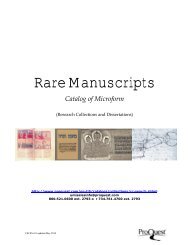
ProQuest - Digital Sanborn Maps Brochure (PDF)
ProQuest - Digital Sanborn Maps Brochure (PDF)
ProQuest - Digital Sanborn Maps Brochure (PDF)

You also want an ePaper? Increase the reach of your titles
YUMPU automatically turns print PDFs into web optimized ePapers that Google loves.
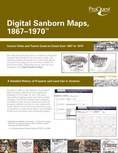
<strong>Digital</strong> <strong>Sanborn</strong> <strong>Maps</strong>,<br />
1867–1970 <br />
Covers Cities and Towns Coast-to-Coast from 1867 to 1970<br />
No maps are consulted more in academic and public<br />
libraries than <strong>Sanborn</strong> ® fire insurance maps—the<br />
detailed property and land-use records that depict<br />
the grid of everyday life in more than 12,000 U.S.<br />
towns and cities. Today they are as close as your<br />
computer, with <strong>Digital</strong> <strong>Sanborn</strong> <strong>Maps</strong> .<br />
A Detailed History of Property and Land Use in America<br />
Founded in 1867 by D.A. <strong>Sanborn</strong>, the <strong>Sanborn</strong><br />
Map Company was the primary American<br />
publisher of fire maps for over 100 years,<br />
repeatedly mapping towns and cities as they<br />
changed. The <strong>Sanborn</strong> <strong>Maps</strong> were originally<br />
compiled to help insurers assess the value of<br />
property, identify risk factors, and underwrite<br />
losses. But this vital American resource is just<br />
as essential to researchers today, and available<br />
online from <strong>ProQuest</strong> with enhanced images.<br />
“Navigating the database is quite easy… its electronic interface<br />
allows for much easier access to maps of specific location …<br />
Summing Up: Recommended…”<br />
– J.A. Coombs, Missouri State University, CHOICE, July 2007
A Living Snapshot of History<br />
Recording a century of change, <strong>Digital</strong> <strong>Sanborn</strong> <strong>Maps</strong><br />
are valuable historical tools for urban and social<br />
historians, architects, city planners, genealogists,<br />
local historians, and anyone else who needs to know<br />
more about the history, growth, and development<br />
of American cities, towns, and neighborhoods by<br />
pinpointing the streets, landmarks, and other places<br />
noted in the map’s index.<br />
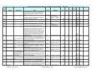
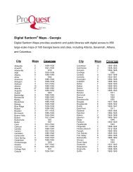
Over 660,000 maps are included in the <strong>Digital</strong> <strong>Sanborn</strong><br />
<strong>Maps</strong> collection, and they can be manipulated,<br />
expanded, printed, and downloaded.<br />
The maps provide a wealth of information, such as<br />
building outline, size and shape, construction materials,<br />
height, building use, windows and doors, street and<br />
sidewalk widths, boundaries, house numbers, and<br />
more. Also depicted are pipelines, railroads, wells,<br />
water mains, dumps, and heavy machinery.<br />
Combined with other reference sources, such as city<br />
directories, photographs, small-scale maps, census<br />
records, genealogies, and statistical data, <strong>Digital</strong><br />
<strong>Sanborn</strong> <strong>Maps</strong> provide an unparalleled picture of<br />
life in American towns and cities—especially with:<br />
<strong>Digital</strong> <strong>Sanborn</strong> <strong>Maps</strong> have many uses:<br />
• Genealogists and local historians can pinpoint<br />
buildings and neighborhoods<br />
• Architectural historians can study construction<br />
materials and methods<br />
• Urban planners can draw on the past to design<br />
for the future<br />
• Historians and geographers can trace the relative<br />
development of urban areas within or across<br />
regions<br />
• Demographers can chart population shifts<br />
• Transportation researchers can study road, rail,<br />
and water connections<br />
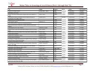
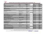
• <strong>ProQuest</strong> ® <strong>Sanborn</strong> <strong>Maps</strong> Geo Edition (1867-1970)<br />
provides digital access to thousands of large-scale<br />
maps of select American cities and states, searchable<br />
by address and GPS coordinates.<br />
• Historic Map Works Library Edition pairs nicely<br />
with <strong>Digital</strong> <strong>Sanborn</strong> <strong>Maps</strong> to create an entire sense<br />
of place—from personal and residential, to business<br />
and commercial.<br />
• Ancestry ® Library Edition, powered by Ancestry.com,<br />
delivers billions of records in census data, vital<br />
records, directories, photos, and more.<br />
• HeritageQuest Online is a comprehensive, Webbased<br />
treasury of American genealogical sources—<br />
rich in primary sources, local and family histories,<br />
and finding aids.<br />
• <strong>ProQuest</strong> Historical Newspapers offers full-text<br />
and full-image articles for significant newspapers<br />
dating back to the 18th century.<br />
OPTIONS FOR EVERY LIBRARY<br />
<strong>Digital</strong> <strong>Sanborn</strong> <strong>Maps</strong> is also available in custom<br />
packages. Select individual states, or the entire U.S.<br />
collection, and choose from permanent access or a<br />
subscription, based on your usage needs.<br />
“Because cities were mapped several times, the maps enable researchers to trace the architectural history of individual buildings or entire communities.<br />
Social historians have used them for analyzing everything from the commuting patterns of 19th century domestic workers to the evolution of major and<br />
minor league baseball parks. They are also extremely valuable for studying the impact on the environment of past uses of buildings on or adjacent to a<br />
specific location. THE MOST DETAILED GRAPHIC RECORD OF THE GROWTH OF URBAN AMERICA.”<br />
– Library of Congress<br />
To learn more or to sign up for a free trial of <strong>Digital</strong> <strong>Sanborn</strong> <strong>Maps</strong>, call your sales<br />
representative at 800-521-0600, ext. 3344, email pqsales@proquest.com, or visit<br />
our website at www.proquest.com.<br />
P6504/SJ-KN/07-10<br />
789 E. Eisenhower Parkway • P.O. Box 1346 • Ann Arbor, MI 48106-1346 • USA • 800-521-0600 • www.proquest.com