The EUREF-IP Ntrip Broadcaster: Real-time GNSS data for ... - IGS
The EUREF-IP Ntrip Broadcaster: Real-time GNSS data for ... - IGS
The EUREF-IP Ntrip Broadcaster: Real-time GNSS data for ... - IGS

Create successful ePaper yourself
Turn your PDF publications into a flip-book with our unique Google optimized e-Paper software.
<strong>The</strong> <strong>EUREF</strong>-<strong>IP</strong> <strong>Ntrip</strong> <strong>Broadcaster</strong>: <strong>Real</strong>-<strong>time</strong> <strong>GNSS</strong> <strong>data</strong> <strong>for</strong> Europe<br />
Denise Dettmering and Georg Weber,<br />
Federal Agency <strong>for</strong> Cartography and Geodesy, BKG, Frankfurt<br />
Abstract<br />
<strong>The</strong> Internet is an excellent medium <strong>for</strong> the real-<strong>time</strong> collection and exchange of <strong>GNSS</strong> <strong>data</strong>. It is best<br />
qualified <strong>for</strong> broadcasting differential corrections as well as other observed or derived <strong>GNSS</strong> products.<br />
<strong>The</strong> <strong>EUREF</strong> community, as being responsible <strong>for</strong> the regional densification of <strong>IGS</strong> in Europe, decided<br />
to set up and maintain a real-<strong>time</strong> <strong>GNSS</strong> infrastructure on the Internet using stations of its European<br />
GPS/GLONASS Permanent Network EPN. A pilot project has been established called <strong>EUREF</strong>-<strong>IP</strong> (<strong>IP</strong><br />
<strong>for</strong> Internet Protocol). <strong>The</strong> purpose of this project is the dissemination of Differential GPS corrections<br />
(DGPS) <strong>for</strong> precise positioning and navigation and the dissemination of raw <strong>GNSS</strong> <strong>data</strong> in support of<br />
various other real-<strong>time</strong> activities.<br />
<strong>The</strong> <strong>EUREF</strong>-<strong>IP</strong> real-<strong>time</strong> <strong>GNSS</strong> <strong>data</strong> service uses a new dissemination technique called “Networked<br />
Transport of RTCM via Internet Protocol” (<strong>Ntrip</strong>). <strong>Ntrip</strong> stands <strong>for</strong> an HTTP application-level<br />
protocol streaming <strong>GNSS</strong> <strong>data</strong> over the Internet. <strong>The</strong> main component of the service is an Internet<br />
<strong>Broadcaster</strong> which currently provides access to about 140 real-<strong>time</strong> <strong>data</strong> streams.<br />
This paper introduces the <strong>EUREF</strong>-<strong>IP</strong> <strong>Ntrip</strong> <strong>Broadcaster</strong> with its available real-<strong>time</strong> <strong>data</strong> streams from<br />
different networks. It focuses on <strong>data</strong> availability and latency, positioning accuracy, and service<br />
monitoring aspects.<br />
Introduction<br />
Due to the increased capacity of the Internet, applications which transfer continuous <strong>data</strong>-streams by<br />
<strong>IP</strong>-packages, such as Internet Radio, have become well-established services. Compared to these<br />
applications, the bandwidth required <strong>for</strong> the transfer of real-<strong>time</strong> <strong>GNSS</strong> <strong>data</strong> is relatively small. As a<br />
consequence, the dissemination of <strong>GNSS</strong> real-<strong>time</strong> <strong>data</strong> streams via Internet and mobile <strong>IP</strong>-Networks<br />
becomes an alternative to the usage of conventional terrestrial broadcasting techniques. No significant<br />
degradation of per<strong>for</strong>mance has to be expected, but some remarkable advantages. Wireless or mobile<br />
Internet access is available nowadays almost everywhere. In addition, <strong>data</strong> streams from various<br />
reference station networks can be received with one single hardware tool like a Laptop or a PDA with<br />
integrated GPRS modem.<br />
<strong>Ntrip</strong><br />
<strong>The</strong> BKG, in cooperation with the University of Dortmund, has developed a HTTP-based technique<br />
<strong>for</strong> streaming DGPS <strong>data</strong>, or other kinds of <strong>GNSS</strong> <strong>data</strong>, to mobile receivers via the Internet. This<br />
technique establishes a <strong>for</strong>mat called “Networked Transport of RTCM via Internet Protocol” (<strong>Ntrip</strong>).<br />
<strong>Ntrip</strong> stands <strong>for</strong> an application-level protocol streaming Global Navigation Satellite System (<strong>GNSS</strong>)<br />
<strong>data</strong> over the Internet. <strong>Ntrip</strong> is a generic, stateless protocol based on the Hypertext Transfer Protocol<br />
HTTP/1.1. <strong>The</strong> HTTP objects are enhanced to <strong>GNSS</strong> <strong>data</strong> streams.
<strong>Ntrip</strong> is designed <strong>for</strong> disseminating differential correction <strong>data</strong> (e.g in the RTCM-104 <strong>for</strong>mat) or other<br />
kinds of <strong>GNSS</strong> streaming <strong>data</strong> to stationary or mobile users over the Internet, allowing simultaneous<br />
PC, Laptop, PDA, or receiver connections to a broadcasting host. <strong>Ntrip</strong> supports wireless Internet<br />
access through Mobile <strong>IP</strong> Networks like GSM, GPRS, EDGE, or UMTS.<br />
<strong>Ntrip</strong> is implemented in three system software components: <strong>Ntrip</strong>Clients, <strong>Ntrip</strong>Servers and<br />
<strong>Ntrip</strong>Casters. <strong>The</strong> <strong>Ntrip</strong>Caster is the actual HTTP server program whereas <strong>Ntrip</strong>Clients and<br />
<strong>Ntrip</strong>Servers are acting as HTTP clients.<br />
<strong>Ntrip</strong>’s system components are<br />
<strong>Ntrip</strong>Client 1<br />
<strong>Ntrip</strong>Client N<br />
• <strong>Ntrip</strong>Clients, receiving <strong>data</strong> of desired<br />
sources from the caster<br />
HTTP Streams<br />
<strong>Ntrip</strong>Caster<br />
Administration<br />
HTTP/Telnet<br />
• <strong>Ntrip</strong>Caster, the major stream-splitting<br />
and broadcasting system component<br />
HTTP Streams<br />
<strong>Ntrip</strong>Server 1<br />
<strong>Ntrip</strong>Source 1<br />
<strong>Ntrip</strong>Server M<br />
…… <strong>Ntrip</strong>Source M<br />
• <strong>Ntrip</strong>Servers, which transfer the <strong>data</strong><br />
from one or multiple sources in <strong>Ntrip</strong><br />
<strong>for</strong>mat<br />
• <strong>Ntrip</strong>Sources, which generate DGPS<br />
<strong>data</strong>-streams at a specific location<br />
Fig. 1: <strong>Ntrip</strong> Streaming System<br />
<strong>Ntrip</strong> is meant to be an open none-proprietary protocol. Major characteristics of <strong>Ntrip</strong>’s dissemination<br />
technique are:<br />
• Based on the popular HTTP streaming standard; comparatively easy to implement when<br />
having limited client and server plat<strong>for</strong>m resources available.<br />
• Application not limited to one particular plain or coded stream content; ability to distribute<br />
any kind of <strong>GNSS</strong> <strong>data</strong>.<br />
• Potential to support mass usage; disseminating hundreds of streams simultaneously <strong>for</strong> up to<br />
thousand users possible when applying modified Internet Radio broadcasting software.<br />
• Considering security needs; stream providers and users don’t necessarily get into contact,<br />
HTTP streaming often not blocked by firewalls or proxyservers protecting Local Area<br />
Networks.<br />
• Enables streaming over any fixed-line or mobile <strong>IP</strong> network because of using TCP/<strong>IP</strong>.
Available <strong>data</strong> streams<br />
As of March 2004, about 140 <strong>GNSS</strong> real-<strong>time</strong> <strong>data</strong> streams are available through <strong>Ntrip</strong> from reference<br />
stations of various institutions.<br />
<strong>The</strong> European Permanent Network (EPN), comprising approx. 160 GPS permanent stations distributed<br />
over the whole continent and operated by European National Mapping Agencies (within the scope of<br />
the IAG Sub-commission <strong>EUREF</strong>), constitutes an appropriate source <strong>for</strong> <strong>data</strong> streams straddling<br />
national borders. In June 2002 <strong>EUREF</strong> adopted a resolution to provide real-<strong>time</strong> RTCM <strong>data</strong> via<br />
Internet to serve DGPS positioning and navigation applications. In this way, a continental DGPS<br />
service is being set up known as <strong>EUREF</strong>-<strong>IP</strong>. EPN stations operated at close proximity to Internet ports<br />
and using GPS receivers that can generate RCTM correction <strong>data</strong> are considered <strong>for</strong> integration into<br />
<strong>EUREF</strong>-<strong>IP</strong>.<br />
In Germany, a continuously operated network called GREF, comprising about 20 GPS/GLONASS<br />
reference stations monitored by BKG on a daily basis, is currently converted to real-<strong>time</strong> operation.<br />
<strong>The</strong> stations involved will be successively networked over leased lines or Internet connections with a<br />
central processing unit. Based on these networked reference stations a service called GREF-<strong>IP</strong> (<strong>IP</strong> <strong>for</strong><br />
Internet Protocol) has been created, which derives DGPS correction <strong>data</strong> <strong>for</strong> about 20 virtual reference<br />
stations spread over the territory of the Federal Republic of Germany. This service feeds its RTCM<br />
<strong>data</strong> into the Internet through the <strong>EUREF</strong>-<strong>IP</strong> <strong>Ntrip</strong>Caster.<br />
In addition, a number of public or private institutions from all over the world, have indicated an<br />
interest in providing DGPS, RTK or raw measurement <strong>data</strong> over the Internet. Many of them already<br />
make available real-<strong>time</strong> <strong>data</strong> streams through <strong>EUREF</strong>-<strong>IP</strong> <strong>Ntrip</strong> <strong>Broadcaster</strong>.<br />
An overview on today’s real-<strong>time</strong> <strong>GNSS</strong> <strong>data</strong> availability on <strong>EUREF</strong>-<strong>IP</strong> <strong>Ntrip</strong> <strong>Broadcaster</strong> in Europe<br />
is given in Fig. 2 .<br />
Fig. 2: Available <strong>GNSS</strong> <strong>data</strong> streams, Europe, March 2004
<strong>The</strong> <strong>EUREF</strong>-<strong>IP</strong> <strong>Ntrip</strong> <strong>Broadcaster</strong> supports the dissemination of real-<strong>time</strong> <strong>data</strong> streams from reference<br />
stations, Virtual Reference Stations (VRS) or networking solutions in various <strong>for</strong>mats. Its purpose is to<br />
duplicate <strong>GNSS</strong> <strong>data</strong> or derived products <strong>for</strong> up to thousand simultaneously connected clients<br />
accessing up to a few hundred different sources. <strong>The</strong> <strong>Broadcaster</strong> does not alter the <strong>data</strong>.<br />
At the moment it provides<br />
• Raw <strong>GNSS</strong> receiver <strong>data</strong>, different <strong>for</strong>mats (about 5 kbit/s per stream)<br />
• RTK corrections, RTCM <strong>for</strong>mat (about 5 kbit/s per stream)<br />
• D<strong>GNSS</strong> corrections, RTCM <strong>for</strong>mat (about 0.5 kbit/s per stream)<br />
• D<strong>GNSS</strong> corrections, RTCA <strong>for</strong>mat, EGNOS and WAAS<br />
• <strong>Real</strong>-<strong>time</strong> Orbit in<strong>for</strong>mation, SP3-<strong>for</strong>mat<br />
• <strong>Real</strong>-<strong>time</strong> RINEX <strong>data</strong><br />
<strong>GNSS</strong> Internet Radio<br />
<strong>The</strong> client software <strong>for</strong> receiving the real-<strong>time</strong> <strong>data</strong> streams from an <strong>Ntrip</strong>Caster could be integrated in<br />
rover equipments. <strong>The</strong> <strong>Ntrip</strong> protocol is already part of the geodetic GPS rover of a major vendor. A<br />
good number of other vendors are working on the implementation. Thus, in the future, the <strong>Ntrip</strong>Server<br />
and <strong>Ntrip</strong>Client programs will become part of your reference or rover equipment or DGPS/RTK<br />
software.<br />
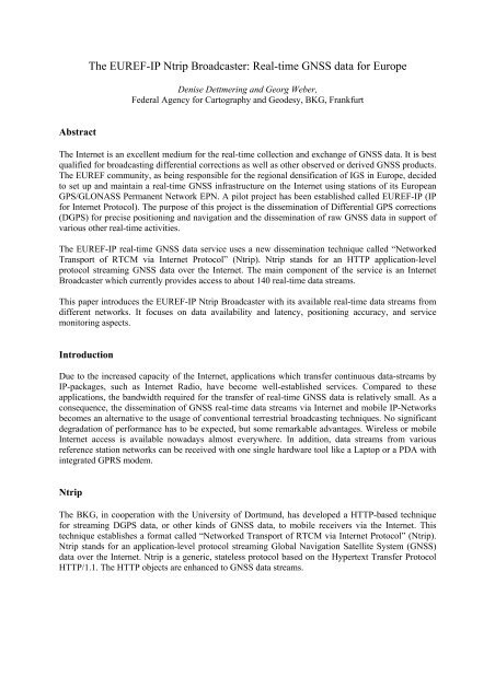
Fig. 3: Pocket PC with <strong>GNSS</strong> Internet Radio / GPRS modem<br />
It seems expedient to implement the client software on a separate device in particular when using<br />
simple C/A code receivers. A Pocket PC (Personal Digital Assistants, PDA, see Fig. 3) under the<br />
operating system Windows CE is a suited component in this respect. When equipped with PCMCIA-
Modem slots <strong>for</strong> Internet connections via mobile radio, it may serve as an efficient and convenient<br />
plat<strong>for</strong>m <strong>for</strong> “Location Based Services“.<br />
<strong>The</strong> BKG, in cooperation with the University of Dortmund, has developed an <strong>Ntrip</strong>Client program <strong>for</strong><br />
the access to real-<strong>time</strong> <strong>data</strong> from <strong>Ntrip</strong> <strong>Broadcaster</strong>s. <strong>The</strong> so-called “<strong>GNSS</strong> Internet Radio” is available<br />
<strong>for</strong> different operating systems and can be downloaded from BKG’s website.<br />
Monitoring System<br />
<strong>The</strong> function of the <strong>EUREF</strong>-<strong>IP</strong> <strong>Ntrip</strong> <strong>Broadcaster</strong> is continuously monitored by an alarm system that<br />
generates "Notice Advisories to <strong>Broadcaster</strong> Users" (NABUs). If a <strong>data</strong> stream is unavailable <strong>for</strong><br />
several minutes due to any reason, the monitor system generates a NABU message and sends it by e-<br />
mail to the affected stream provider. An additional message is sent when the stream becomes available<br />
again. All messages are stored in a NABU Archive. Daily-generated Outages Graphics as well as daily<br />
and monthly-generated Outage Tables show the overall availability of <strong>data</strong> streams.<br />
<strong>The</strong> outage in<strong>for</strong>mation is based on a minute by minute check of a separate monitoring system and not<br />
on recordings of the broadcaster: Stream interruptions shorter than 60 seconds as well as failures of the<br />
monitoring system or its Internet connection may leave some outages undetected.<br />
<strong>The</strong> broadcaster outages usually remain below 3 %. <strong>The</strong>y mainly reflect problems of the monitoring<br />
system, only a small portion is due to problems of the Casters or its Internet connection. In the near<br />
future the <strong>Broadcaster</strong> will be shifted to a professional Internet Service Provider (ISP) <strong>for</strong> improving<br />
the overall per<strong>for</strong>mance of the whole system. <strong>The</strong> temporal availability of individual <strong>data</strong> streams is<br />
quite varying and depends mainly on the different Internet Service Providers used. <strong>The</strong> mean outage<br />
<strong>time</strong> reachs 10 %, but individual network and streams are much better, continuously providing <strong>data</strong> <strong>for</strong><br />
more than 99 % of the <strong>time</strong>.<br />
100<br />
90<br />
80<br />
Number of Datas Streams [%]<br />
70<br />
60<br />
50<br />
40<br />
30<br />
20<br />
10<br />
0<br />
0 2 4 6 8 10 12 14 16 18 20 22 24 26 28 30 40 50 60 80 100<br />
Outages Time [%]<br />
Fig. 4: Stream Outages, February 2004, All Data Streams
In February 2004 the Boadcaster was fould unavailable <strong>for</strong> 2.9% of the <strong>time</strong> (mainly due to<br />
networking problems or failures of the monitoring system). More than 50% of the <strong>data</strong> streams reach a<br />
temporal availability of better than 95%, 35% even more than 99%. Only 5% of the streams show<br />
outage <strong>time</strong>s <strong>for</strong> more than 50% (Fig. 4).<br />
Data latency and accuracy<br />
For any kind of transmission technique the travel <strong>time</strong> of <strong>GNSS</strong> real-<strong>time</strong> <strong>data</strong> is of decisive<br />
importance. <strong>The</strong> software on the user side requires the relevant <strong>data</strong> almost instantaneously<br />
(depending, to a certain degree, on the application). Considerably delayed, missing or irregularly<br />
arriving <strong>data</strong> will degrade product latency and/or position accuracy.<br />
When using the open Internet <strong>for</strong> communication, the <strong>GNSS</strong> real-<strong>time</strong> <strong>data</strong> streams share resources of<br />
an ISP with other applications and hence the bandwidth cannot be controlled. <strong>The</strong> question arises in<br />
this context as to what extent the usual resources offered by professional ISPs meet the requirements<br />
of real-<strong>time</strong> <strong>GNSS</strong> applications.<br />
100<br />
90<br />
80<br />
70<br />
occurance [%]<br />
60<br />
50<br />
40<br />
30<br />
20<br />
10<br />
Internet<br />
Internet + mobile (GPRS)<br />
0<br />
0 0.5 1 1.5 2 2.5 3 3.5 4<br />
max. latency [sec]<br />
Fig. 5: Latencies of Pseudorange corrections from BRUS0 (Bruessels), Time Interval 2h<br />
Fig. 5 presents statistics on the latencies of DGPS correction <strong>data</strong> (<strong>for</strong>mat RTCM 2.0) as derived from<br />
empirical tests. <strong>The</strong> communication over Internet and fixed-line as well as wireless phone networks<br />
(GPRS) has been investigated. Latencies in the order of less than two seconds are typical <strong>for</strong> the<br />
situation in Europe. <strong>The</strong> latency of correction <strong>data</strong> caused by the inclusion of wireless Internet<br />
networks can there<strong>for</strong>e be considered as so low that no noticeable influence on the achievable<br />
positioning accuracy exists.<br />
By means of Fig. 6, results of an exemplary 1s-recording of a static position determination at a known<br />
site are presented. RTCM corrections were received via the Internet and mobile radio (GPRS). <strong>The</strong>
figure shows differences to a known reference position over a period of one hour. Neither <strong>for</strong> DGPS<br />
nor <strong>for</strong> RTK applications the achievable accuracies were degraded by RTCM <strong>data</strong> transmission via<br />
mobile communication.<br />
Fig. 6:Accuracy of RTK over Internet and GPRS<br />
Summary and Outlook<br />
<strong>Ntrip</strong> is a new technology to transfer <strong>GNSS</strong> <strong>data</strong> (<strong>for</strong> example RTCM correction <strong>data</strong>) via the Internet<br />
and mobile <strong>IP</strong> networks. Practical tests do not show a significant degradation of per<strong>for</strong>mance<br />
compared to using other transportation media. RTCM’s Special Committee 104 has set up a Working<br />
Group “Internet Protocol” to further develop <strong>Ntrip</strong> towards an international standard. Due to its almost<br />
worldwide availability and the widespread hardware <strong>for</strong> wireless Internet access, <strong>Ntrip</strong> is the <strong>GNSS</strong><br />
<strong>data</strong> streaming method of the future.<br />
<strong>EUREF</strong> has set up and maintains an <strong>Ntrip</strong> <strong>Broadcaster</strong> which provides <strong>GNSS</strong> real-<strong>time</strong> <strong>data</strong> (raw<br />
measurement <strong>data</strong> as well as RTCM correction <strong>data</strong> and derived products) <strong>for</strong> Europe. Further<br />
<strong>Broadcaster</strong> implementations have been build up by various institutions. <strong>The</strong> goal is to establish a<br />
network of <strong>Ntrip</strong>Casters all linked with each other. Each <strong>Ntrip</strong>Caster will provide access to regional as<br />
well as global <strong>data</strong> streams. With this concept, gapless distributed streams could be reached from<br />
everywhere at low latency level while sharing the broadcasting workload. At the moment eight<br />
<strong>Ntrip</strong>Casters exist in four European countries. Further implementations will follow.
References<br />
<strong>EUREF</strong>-<strong>IP</strong> <strong>Real</strong>-<strong>time</strong> Pilot Project<br />
http://www.epncb.oma.be/_organisation/projects/euref_<strong>IP</strong>/index.html<br />
Networked Transport of RTCM via Internet Protocol (<strong>Ntrip</strong>), Documentation<br />
http://igs.ifag.de/root_ftp/software/<strong>Ntrip</strong>Documentation.zip<br />
<strong>EUREF</strong>-<strong>IP</strong> <strong>Ntrip</strong> <strong>Broadcaster</strong><br />
http://igs.ifag.de/index_ntrip_cast.htm<br />
Distribution Maps of <strong>Real</strong>-Time <strong>GNSS</strong> Data Availability in Europe<br />
http://igs.ifag.de/root_ftp/misc/ntrip/maps<br />
<strong>Ntrip</strong> Software Downloads<br />
http://igs.ifag.de/ntrip_down.htm<br />
Notice Advisory to <strong>Broadcaster</strong> Users (NABU)<br />
http://igs.ifag.de/root_ftp/misc/ntrip/nabu