5.6MB PDF - IGS - NASA
5.6MB PDF - IGS - NASA
5.6MB PDF - IGS - NASA

You also want an ePaper? Increase the reach of your titles
YUMPU automatically turns print PDFs into web optimized ePapers that Google loves.
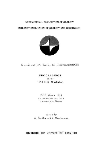
INTERNATIONAL ASSOCIATION OF GEODESY<br />
INTERNATIONAL UNION OF GEODESY AND GEOPHYSICS<br />
International GPS Service for Geodynalnics (<strong>IGS</strong>)<br />
PROCEEDINGS<br />
of the<br />
1993 <strong>IGS</strong> Workshop<br />
25-26 March 1993<br />
Astronomical Institute<br />
University of Berne<br />
Edited by<br />
G. Bcutler and E. Brockmann<br />
DRUCKEREI DER UNIVERSITAT BERN 1993
TABLE OF CONTENTS<br />
Chapter 1: Development, Present Structure, and Future of <strong>IGS</strong><br />
The International GPS Service for Geodynarnics: An Introduction . . . . . . . . . . . . . . . . . . . 1<br />
1,1. Mueller<br />
The 1992 <strong>IGS</strong> Test Campaign, Epoch ’92, and the <strong>IGS</strong> PILOT Service:<br />
An Overview . . . . . . . . . . . . . . . . . . . . . . . . . . . . . . . . . . . . . . . . . . . . . . . . . . . . . . . . . . . . . . . . . . . . . . 3<br />
G. Beutler<br />
International GPS Service for Geodynarnics: Terms of Reference . . . . . . . . . . . . . . . . . . . 10<br />
1.1. Mueller<br />
The Future Role of the <strong>IGS</strong> Central Bureau:<br />
Proposed Functions, Organization and Responsibilities . . . . . . . . . . . . . . . . . . . . . . . . . . . . . 15<br />
R.E. Neilan, W.G. Melbourne, T. I’. Yunck<br />
The 4th <strong>IGS</strong> Oversight Committee Meeting and the Joint IERS and<br />
<strong>IGS</strong>Meeting in Bern, 24-27 March 1993 . . . . . . . . . . . . . . . . . . . . . . . . . . . . . . . . . . . . . . . . . . . 19<br />
G. Beutler<br />
Chapter 2: Networks (Core and Fiducial) and Data Management<br />
<strong>IGS</strong> Service: Epoch ’92 Regional Center in Brazil . . . . . . . . . . . . . . . . . . . . . . . . . . . . . . . . . . 25<br />
E.W. Bergamimi<br />
The <strong>IGS</strong> Core and the Fiducial Networks:<br />
Current Status and Future Plans . . . . . . . . . . . . . . . . . . . . . . . . . . . . . . . . . . . . . . . . . . . . . . . . . . 32<br />
R.E Neilan, C.E. Nell<br />
The Italian GPS Fiducial Network . . . . . . . . . . . . . . . . . . . . . . . . . . . . . . . . . . . . . . . . . . . . . . . . 4.2<br />
G. Bianco, A. Cenci, L. Garramone, 1’. Vespe<br />
Canadian Active Control System Data Acquisition and Validation . . . . . . . . . . . . . . . . . . 49<br />
P. Heroux, M. Caissy, J. Gallace<br />
Activity of Borowiec <strong>IGS</strong>Ficlucial Station . . . . . . . . . . . . . . . . . . . . . . . . . . . . . . . . . . . . . . . . . 59<br />
W. Jaks, K. Zeller<br />
<strong>IGS</strong> Related Activities at the Geodynamic Observatory Graz Lustbuhel . . . . . . . . . . . . 68<br />
P. Pesec, G. Stangl<br />
The <strong>IGS</strong> Polyhedron: Fiducial Sites and their Significance . . . . . . . . . . . . . . . . . . . . . . . . . . 76<br />
1.1. Mueller<br />
i
CDDIS Data Archiving and Distribution Activities for the 1992 <strong>IGS</strong> Campaign . . . . 82<br />
C.E. Nell, M.P. Dube<br />
GPS Global Tracking Network Operations at JPL During the 1992 <strong>IGS</strong> Experiment<br />
and Beyond . . . . . . . . . . . . . . . . . . . . . . . . . . . . . . . . . . . . . . . . . . . . . . . . . . . . . . . . . . . . . . . . . . . . . . 92<br />
D. Starr, S. DiNardo, G. Franklin, I,. Iriks, U. I,indqwister, T. Lockhart, M. Smith<br />
Chapter 3: Processing Centers Reports<br />
SCRIPPS Orbit and Permanent Array Center: Report<br />
to ’93 <strong>IGS</strong> Bern Workshop . . . . . . . . . . . . . . . . . . . . . . . . . . . . . . . . . . . . . . . . . . . . . . . . . . . . . . 101<br />
Y. Bock, P. Fang, K. Stark, J .Zhang, J. Genrich, S. Wdowinski, S. Marquez<br />
The ESOC GPS Facility: Report on the <strong>IGS</strong> 1992 Campaign and Outlook . . . . . . . . 111<br />
J.M. Dow, T.J. Martin Mur, J. Feltens, C.G. Martinez<br />
<strong>IGS</strong> Data Processing at the EMR Master Control System Centre . . . . . . . . . . . . . . . . . 123<br />
J. Kouba, P. T6treault, R. Ferland, F. l,ahaye<br />
Results of the <strong>IGS</strong> Data Processing at the<br />
“Center for Orbit I)etermination in Europe’’(CODE) . . . . . . . . . . . . . . . . . . . . . . . . . . . . . 133<br />
M. Rothacher, G. Beutler, W. Gurtner, S. Ilotton, C. Boucher<br />
CSRResults from <strong>IGS</strong>and Rpocll.92 . . . . . . . . . . . . . . . . . . . . . . . . . . . . . . . . . . . . . . . . . . . . . 145<br />
B. Schutz<br />
Global Geometric Parameters Determined from Multi-Months GPS Data . . . . . . . . . 148<br />
S.Y. Zhu, C. Reigber, D. Angermann, R. Galas, G. Gendt, W. Sommerfeld,<br />
T. Nischan<br />
Jet Propulsion Laboratory <strong>IGS</strong> Analysis Center Report, 1992 . . . . . . . . . . . . . . . . . . . . 154<br />
J.F. Zumberge, D.C. Jefferson, G. Illewitt,<br />
M.B. Heflin, F,H. Webb<br />
Chapter 4: Comparisons (Orbits, Earth Rotation Parameters) and<br />
Reference Frame Aspects<br />
The Earth Viewed as a Deforming Polyhedron: Method and Results . . . . . . . . . . . . . . 165<br />
G. Blewitt, M.B. Heflin, Y. Vigue, J.F. Zumberge D. Jefferson, F.H. Webb<br />
Contribution of <strong>IGS</strong> 92 to the Terrestrial Reference Frame . . . . . . . . . . . . . . . . . . . . . . . . 175<br />
C. Boucher, Z. Altamimi<br />
ii
Determination of Earth Rotation Parameters Using GPS:<br />
Experiments Using two Weeks of Data from the 1992 <strong>IGS</strong> Test Campaign . . . . . . . . 184<br />
S. Fankhauser, G. Beutler, M. Rothacher<br />
<strong>IGS</strong>’ 92 Campaign, Comparisons of GPS, SI,R, and VI,BI Earth Orientation<br />
Determination, Final Report . . . . . . . . . . . . . . . . . . . . . . . . . . . . . . . . . . . . . . . . . . . . . . . . . . . . 194<br />
M. Feissel<br />
Sub-Daily Earth Rotation During Epoch ’92 . . . . . . . . . . . . . . . . . . . . . . . . . . . . . . . . . . . . . 202<br />
A.P. Freedman, R. Ibanez-Meier, J.O. Dickey, S.M. Lichten, T.A. Herring<br />
Universal Time Derived from VLB1, SLR, and GPS . . . . . . . . . . . . . . . . . . . . . . . . . . . . . . 212<br />
D. Gambis, N. Essalfi, E. Eisop, M. Feissel<br />
<strong>IGS</strong> Orbit Comparisons . . . . . . . . . . . . . . . . . . . . . . . . . . . . . . . . . . . . . . . . . . . . . . . . . . . . . . . . . . 218<br />
C. Goad<br />
Short-Term Polar Motion and UT1 Variations Observed by <strong>IGS</strong> . . . . . . . . . . . . . . . . . . 226<br />
J. Hefty<br />
The Use of GPS Earth Orientation Data by the International Earth Rotation<br />
Service Sub-Bureau for Rapid Service and Predictions . . . . . . . . . . . . . . . . . . . . . . . . . . . . 236<br />
D.D. McCarthy<br />
Towards an Ofhcial <strong>IGS</strong> Orbit by Combining the Results of All<br />
<strong>IGS</strong> Processing Centers . . . . . . . . . . . . . . . . . . . . . . . . . . . . . . . . . . . . . . . . . . . . . . . . . . . . . . . . . . 242<br />
T.A, Springer, G. Ileutler<br />
Chapter 5: Epoch ’92<br />
Solutions Using European GPS Observations Produced at the<br />
“Center for Orbit Determination in Europe” (CODE) During the <strong>IGS</strong> Campaign . 251<br />
E. Brockmann, G. Beutler, W. Gurtner, M. Rothacher, T. Springer, I,. Mervart<br />
Precise Ephemeris and Geodetic Campaigns in Sweden 1992 . . . . . . . . . . . . . . . . . . . . . 261<br />
G. Hedling<br />
Scientific Contributions of the Swedish <strong>IGS</strong> Activities . . . . . . . . . . . . . . . . . . . . . . . . . . . . . 265<br />
J.M. Johansson, R.T.K. Jaldehag, J. I,. Davis, M. Ekman, G. Elgered, G. Hedling,<br />
J.X. Mitrovica, B. Jonsson, B.O. Ronnang, 1.1, Shapiro<br />
ESOC Station Coordinate Solutions for the <strong>IGS</strong>’92 Campaign, Including Epoch ’92 275<br />
T.J. Martin Mur, J.M. Dow, J. Feltens, C. Garcia Martinez<br />
Ambiguity Resolution Strategies Using the Results of the International<br />
GPS Geodynamic Service . . . . . . . . . . . . . . . . . . . . . . . . . . . . . . . . . . . . . . . . . . . . . . . . . . . . . . . 285<br />
L. Mervart, G. Beutler, M. Rothacher, U. Wild<br />
.,,<br />
111
NAL/ERI Ephemerides for Epoch’92 . . . . . . . . . . . . . . . . . . . . . . . . . . . . . . . . . . . . . . . . . . . . 300<br />
M. Murata, T. Tsujii, T. Kate, S. Nakao<br />
Comparison of Globally and Locally Determined Site Ties of Metsahovi GPS<br />
Station . . . . . . . . . . . . . . . . . . . . . . . . . . . . . . . . . . . . . . . . . . . . . . . . . . . . . . . . . . . . . . . . . . . . . . . . . . 310<br />
M. Paunonen<br />
Programme of Research Works at the <strong>IGS</strong> at the <strong>IGS</strong> Fiducial Station J6zefoslaw<br />
and the <strong>IGS</strong> Evaluation Centre of the IG&GA WUT . . . . . . . . . . . . . . . . . . . . . . . . . . . . . 318<br />
J. Sledzifiski, J. Rogowski<br />
Results of the GPS Campaigns Extended Saget and the <strong>IGS</strong> Epoch ’92<br />
for the Region of Central Europe . . . . . . . . . . . . . . . . . . . . . . . . . . . . . . . . . . . . . . . . . . . . . . . . 327<br />
J. ~ledzifiski, J. Rogowski, M. Piraszewski M. I?igurski, J. Walo<br />
Computation of EPOCH ’92 Data at Graz . . . . . . . . . . . . . . . . . . . . . . . . . . . . . . . . . . . . . . . 337<br />
G. Stangl, P. Pesec<br />
Evaluation of <strong>IGS</strong>-Distributed GPS Ephemerides by Regional Baseline<br />
Analysis in Japan . . . . . . . . . . . . . . . . . . . . . . . . . . . . . . . . . . . . . . . . . . . . . . . . . . . . . . . . . . . . . . . 344<br />
H. Tsuij, Y. Hatanaka, A. Itabashi, H. I)oi, Y. Abe<br />
Ionospheric Monitoring Using <strong>IGS</strong> Data . . . . . . . . . . . . . . . . . . . . . . . . . . . . . . . . . . . . . . . . . 351<br />
I,. Wanninger<br />
Ionosphere and Ambiguity Resolution . . . . . . . . . . . . . . . . . . . . . . . . . . . . . . . . . . . . . . . . . . . 361<br />
U. Wild<br />
iv
Chapter 1<br />
Development, Present structure~<br />
and Future of <strong>IGS</strong>
THE INTERNATIONALGPS SERVICE FOR GEODYNAMICS:<br />
AN INTRODUCTION<br />
Ivan I Mueller<br />
Department of Geodetic Science and Surveying<br />
The Ohio State University<br />
Columbus,OH 43210-1247, USA<br />
At the request of the organizers of this Workshop it is my pleasure to give some<br />
introductory remarks on the evolution of the International GPS Service for Geod ynamics<br />
(lGS), although its history probably is well known to most participants.<br />
At the 20th General Assembly of the IIJGG in Vienna, Austria in August 1991<br />
Resolution No.5 recommended that the concept of the lGS be explored over the next<br />
several years, that campaigns be conducted to test the practicality of the concept.<br />
The primary goals of the lGS are to provide the scientific community with high quality<br />
GPS orbits on a rapid basis, to provide earth rotation parameters of high resolution as a<br />
byproduct, to expand geographically the current international Terrestrial Reference<br />
Frame (lTRF) maintained by the International Earth Rotation Service (IERS), and to<br />
monitor the global deformations of the earth’s crust.<br />
The emphasis being on the word service, the above products are to be available on a<br />
regu]ar and time]y basis through the Central Bureau (currently the Jc( Propulsion<br />
I.aboratory) and through the Network Data Centers (currently <strong>NASA</strong>’s Clustal Dynamics<br />
Data Information System, the lnstitut Geographique National in France, and the Scripps<br />
Institution of Oceanography).<br />
The “Call for Participation“ in the 1992 test campaign (June 21-September 23) was<br />
responded to by more than 100 organizations around the world and resulted in the design<br />
of the first <strong>IGS</strong> structure consisting of the above Bureau and Network Data Centers,<br />
seven data Processing Centers and a Core network of some 30 GPS observatories<br />
equipped with precise so called P-code receivers and the important efficient data<br />
communication links to assure rapid data flow to the various data centers. More<br />
information on the early phase of <strong>IGS</strong> may bc found in (Mueller, 1992; Mueller and<br />
Beutler, 1992).<br />
The purpose of the 1992 test campaign was to verify the proposing organizations’<br />
ability and willingness to perform. The Campaign is being followed by the “ICJS Pilot<br />
Service” phase until <strong>IGS</strong> becomes fully operational.<br />
Scientific results of the campaign will be presented at this Workshop and the publication<br />
of the Proceedings will mark the end of the <strong>IGS</strong> Campaign. These Proceedings will form<br />
a part of the proposal to be submitted to the International Association of Geodesy for the<br />
establishment of the Service proper,<br />
lGS Workshop Berne
Although the lGS is not approved yet as an international service it appears to be certain<br />
that continuous GPS observations will greatly contribute to geodynamics of the future. In<br />
fact since October 1992 GPS products have been introduced in the computations of the<br />
IERS and thus will have a beneficial effect on the future ITRF as well. Preliminary results<br />
indicate uncertainties in the daily coordinates of the pole ranging between 0.5 - 1.5 mas.<br />
Agreements in the orbits produced by the various Processing Centers are on the submcter<br />
level after the removal of biases duc to inconsistencies in the reference frames<br />
inherent in the calculations.<br />
It is hoped that eventually the lGS networks will include well over hundred stations<br />
which will then significantly improve our knowledge of the deformation of the globe and<br />
expand the geographic coverage of the present ITRF.<br />
This introduction would not be complete without emphasizing the role of the IAG in<br />
these activities. In the past as well in the present the lAG managed to accomplish similar<br />
tasks despite of many setbacks due to international politics. As J..I, Lcvallois former<br />
Secretary General of the IAG noted in the 1980 Geodesist’s Handbook: “History of the<br />
International Association of Geodesy”, the JAG<br />
“has overcome them all, despite international struggles, despite differences<br />
in nationality and scientific training, because .gcodesists feel at home in it.<br />
The mutual respect that arises out of continued direc! contact and shared<br />
scientific concerns creates enduring ties of, friendship fhat tmnsccnd<br />
political jealousies and ideologies . . . . .These relationships, and thcfruifl~[<br />
exchanges of idem born of thcnl, arc extremely power-ul, forces for<br />
scientific progress, and one of the main reasons the association can be so influential. ”<br />
In other words, the IAG has this unique unifying role because it has authority to<br />
influence, expertise based on free exchansze of ‘ideas, trust based on mutual rcsncct of<br />
friends and it ‘serves as a protective shelter ~ccause scientists feel home in it.<br />
References<br />
Mueller, Ivan 1. ( 1992) Planning an international Service LJsins the Global<br />
System (GPS) for Geodynarnic ~pplications, “Pernlancnt Satelli~ “Ilacking Networks fo~<br />
Geoedesy And Geodynamics”, Proc. IAG Symposium 109, Springer Verlag, Hcidclbcrg.<br />
Mueller, Ivan 1. and G. Beutler ( 1992) “The lntcrnationai GPS Service for Gcodynamics -<br />
Development and Current Structure”, Proc. 6th lnt. Symp. on Satellite Positioning, OSU,<br />
Columbus, Ohio.<br />
1993 lCS Mbrkshop Berne
The 1992 <strong>IGS</strong> Test CaInpaigIl, Epoc]I’92, and ~llc lGS PILOT<br />
Service: AI] Overview<br />
Gcrharcl Beutler *<br />
Abstract<br />
This report covers the time period between April 1992 and March 1993. The<br />
readers interested in the development and the structure of <strong>IGS</strong> are referred<br />
to (Mueller, 1992, 1993; Mueller and Ileutler, 1992).<br />
The 1992 <strong>IGS</strong> Test Campaign (21 June-23 September 1992) and the intensive<br />
observation campaign called Epoch’92 were organized by the <strong>IGS</strong><br />
Campaign Oversight Committee. The declared goal of the three-month 1992<br />
<strong>IGS</strong> Test Campaign was the routine production of accurate GPS orbits and<br />
of earth orientation parameters using the observations of about 30 globally<br />
distributed <strong>IGS</strong> Core Sites. The <strong>IGS</strong> Core Network is a relatively sparse<br />
global network. <strong>IGS</strong> fiducial sites (in future there should be about 200 of<br />
them) should serve as a first densificatiou of this core network, which could<br />
then serve as a readily available terrestrial reference frame for geodynarnics.<br />
Results of the Epoch’92 campaign may be found in these proceedings. The<br />
processing of Epoch’92 should be finished by mid-1993.<br />
At the 3rd <strong>IGS</strong> Oversight Committee meeting in October 1992 at the Goddard<br />
Space Flight Center it was decided to establish the <strong>IGS</strong> Pilot Service<br />
to bridge the gap between the 1992 <strong>IGS</strong> Campaign and the routine <strong>IGS</strong><br />
service, which should start on 1 January 1994. This means that beginning<br />
with 21 June 1992 there is an uninterrupted series of high accuracy GPS<br />
orbits and earth rotation parameters available for regional and local crustal<br />
dynamics investigations using the GPS.<br />
The 1992 <strong>IGS</strong> Test Campaign and Epoch’92<br />
The essential events are summarized in ‘l’able 1. The communications test in May 1992<br />
showed that the capacity of the international scientific data network was sufficient to handle<br />
30 sec data from the entire core network; this fact was the basis for the success of the 1992<br />
<strong>IGS</strong> operations.<br />
The communication between the <strong>IGS</strong> participants was made through the <strong>IGS</strong> (e-)mailbox<br />
at the University of 13erne. This mailbox proved to be the essential tool to have the 1992<br />
<strong>IGS</strong> experiments under control. Such a mailbox will be absolutely mandatory for the routine<br />
<strong>IGS</strong> service to be established.<br />
“Astronomical Institute University of Berne, Sidlerstmsse 5, CH-3012 Bern, Switzerland<br />
JGS Workshop Ikrne 1993 3
Table 1: Chronicle of events<br />
Starting date<br />
17-Mar-92<br />
04-May-92<br />
21-May-92<br />
15-Jun-92<br />
23-Jun-92<br />
5-JuI-92<br />
27-Ju1-92<br />
l-Aug-92<br />
23-Sep-92<br />
15-oct-92<br />
1-Nov-92<br />
10-Dec-92<br />
24-Mar-93<br />
25-Mar-93<br />
Event<br />
2nd <strong>IGS</strong> OSC Meeting at OSU<br />
One-week Communication Tests<br />
<strong>IGS</strong> e-mailbox installed<br />
Start of Data Transmission<br />
Start of <strong>IGS</strong> Test Campaign<br />
First results from processing centers<br />
Start of Epoch’92 (2 weeks)<br />
First weekend with AS on<br />
end of official campaign<br />
3rd <strong>IGS</strong> OSC meeting at Goddard<br />
Start of <strong>IGS</strong> Pilot Service<br />
<strong>IGS</strong> OSC Business Meeting at AGU Meeting<br />
4th <strong>IGS</strong> OSC Meeting in Bern<br />
<strong>IGS</strong> Workshop in Bern<br />
<strong>NASA</strong>’s Crustal Dynamics Data Information System (CDDIS) and Scripps Institution of<br />
Oceanography (SIO) were available as network centers right from the beginning of the campaign,<br />
the French Institut G60graphique National (IGN) started operating end of July (Table<br />
2). The observations, but also the results (orbits and earth rotation parameters) were<br />
and are readily available at these centers. There were no serious complaints concerning the<br />
availability of data and results by the processing centers or by the steadily growing <strong>IGS</strong><br />
user community.<br />
At the beginning of July 1992 the processing centers gradually started delivering their<br />
products to CDDIS, S10, IGN , and to several regional data centers. in addition the eart}l<br />
orientation information was sent to the IERS Rapid Service and to the IERS Central Ilurcau.<br />
Seven processing centers became operational before the end of the campaign (Table 2).<br />
Epoch’92 was taking place as scheduled (27 July - 9 August) the results are lmcomming<br />
available now. FJpoch’92 was severely handicapped by AS, the so-called “Anti-Spoofing”,<br />
which was turned on for 7 satellites over the weekend of August 1. (AS was on during most<br />
of the weekends thereafter for the rest of the <strong>IGS</strong> Test Campaign, the number of affected<br />
satellites was variable). Unfortunately the principal receiver of the core network did not<br />
handle the 1,2 phase observations properly under AS. The problem was not a trivial one, a<br />
receiver firmware upgrade which should handle AS data in a better way was sent out and<br />
installed at the beginning of February 1993.<br />
The Transition Phase to the Routine <strong>IGS</strong><br />
On 23 September 1992 the 1992 <strong>IGS</strong> Campaign ofllcially ended. Data collection, transmission,<br />
and analysis however went on afterwards on a best effort basis. At the third <strong>IGS</strong><br />
Campaign Oversight Committee Meeting at Goddard Space Flight Center in October 1992<br />
4 lGS Workshop Ekrnc
Table 2: Network and Processing Centers of the 1992 <strong>IGS</strong> Campaign<br />
Abbreviation Institution Center Type<br />
CDDIS Crustal Dynamics Data Information System Network<br />
IGN Intitut G40graphique National Network<br />
SIO Scripps Institution of Oceanography Network<br />
UTX University of Texas at Austin Processing<br />
CODE Center for Orbit Det. in Europe Processing<br />
GFZ German Geod. Research institute Processing<br />
Esoc European Space Operations Center Processing<br />
JPL Jet Propulsion Laboratory, USA Processing<br />
S10 Scripps Inst. of Oceanography, USA Processing<br />
EMR Energy, Mines, Resources, Canada Processing<br />
it was decidied to establish the <strong>IGS</strong> PILOT SERVICE starting November 1 to bridge the<br />
gap between the 1992 <strong>IGS</strong> Campaign and the start of the routine <strong>IGS</strong>. It was stated that<br />
In the new undertaking the emphasis is on the SERVICE, meaning that (a) a better adherence<br />
to standards on all levels has to be reached and that (b) the core and the fiducial<br />
network have to be completed. In these coordination tasks the Central Bureau (JPI)) and<br />
the Analysis Center Coordinator (Prof. Clyde Goad) have to play important roles, the jormer<br />
concentrating on observational aspects, the latter on processing aspects. In particular<br />
it is expected that a routine quality control for the orbits is set up by the analysis center<br />
coordinator for the period of the <strong>IGS</strong> PILOT SE]{ VICE.<br />
The routine orbit control was set up by the Analysis Center Coordinator. Since 1 November<br />
1993 orbit comparisons (through 7-paratneter I[elmcrt transformations) between all the<br />
analysis centers are performed for e~ch day and made available on a weekly basis by the<br />
Analysis Center Coordinator through the <strong>IGS</strong> report series (e-mail distributed through the<br />
Astronomical Institute, Bern).<br />
Results of the 1992 Test Campaign and the <strong>IGS</strong> PILOT Service<br />
The main purpose of the 1992 <strong>IGS</strong> Campaign was to check the ability of participating<br />
institutions to produce orbits regularly. This goal was reached : all seven centers were<br />
able to process one day of observational data in one calendar day over long time intervals<br />
(months, eventually years). The campaign was a challenge for all participants.<br />
In a first analysis (Beutler, 1992) the orbit files from all centers available in October 1992 at<br />
CDDIS were taken and 7-parameter I[eltnert transformations were performed between the<br />
common satellite positions found in each pair of files. The rms of one satellite coordinate<br />
may be considered to be a measure of consistency of the orbit sets involved. The other<br />
measures consist of the transformation parameters themselves : Ideally they should be all<br />
zero because all centers are supposed to use the same reference frame. Table 3 contains the<br />
number of common orbit files found (in October 1992) in the time interval 21 June - 17<br />
October (a total of 119 days). From two centers orbits are available for all days. Columns<br />
(a) show the total number of files available, columns (b) those of “good quality”, i.e. files<br />
lGS \{Torkshop 13erne
Table 3: Number ofcomn~o nl-dayorbit s(21Junc- 170ctober 1992) (a) All days used(b)<br />
Flad quality days removed<br />
COD SIO J P L Ulx ItMR GFZ ESA<br />
a babababab a b a b<br />
COD - - 105 88 100 85 75 69 48 46 95 87 119 113<br />
S10 105 88 - - 88 74 64 55 47 44 90 82 105 99<br />
JPL 100 85 88 74 - - 72 66 48 46 88 82 100 92<br />
UTX 75 69 64 55 72 66 - - 28 28 68 62 75 73<br />
EMR 48 46 47 44 48 46 28 28 - - 48 47 48 48<br />
GFZ 95 87 90 82 88 82 68 62 48 47 - - 95 91<br />
ESA 119 113 105 99 100 92 75 73 48 48 95 91 - -<br />
Table 4: Mean ofRMS errors in meters of7-paranleter IIelmert transformations between<br />
pairs of processing centers (21 June- 17 October 1992) (a)All days used (b) Had quality<br />
days removed<br />
COD SIO JPL UTX EMIL GFZ<br />
—<br />
ESA<br />
a bababab ababab<br />
COD - - .99 .62 .70 .50 .76 .64 .49 .43 .80 .68 1.09 1.00<br />
SIO .99 .62 - - .74 .47 .74 .53 .68 .50 .87 .70 1.24 1.06<br />
JP1, .70 .50 .74 .47 - - .56 .45 .45 .35 .62 .54 .98 .86<br />
UTX .76 .64 .74 .53 .56 .45 - - .41 .41 .68 .62 .91 .87<br />
EMR .49 .43 .68 .50 .45 .35 .41 .41 - - .58 .56 .76 .76<br />
GFZ .80 .68 .87 .70 .62 .54 .68 .62 .58 .56 - - 1.08 1.01<br />
ESA 1.09 1.00 1.24 1.06 .98 .86 .91 .87 .76 .76 1.08 1.01 - -<br />
forwllich theactual rmserror ofoxiesatellite coordirlate waswithi]l the confidence interval.<br />
Table 4 shows the mean of the rms errors of transformation for the two populations. It can<br />
be concluded that all the centers were working in the sub-meter level, some even below the<br />
50 cm level. The comparison of the transformation parameters (scale factors and rotations)<br />
revealed reference system differences. l’his technical issue was addressed during the <strong>IGS</strong><br />
Pilot Service phase (see below).<br />
The IG S earth rotation parameters were ana]yzed regularly by the IERS Rapid Service<br />
(McCarthy, 1992) and by the lERS Central Bureau (Feissel,1992). The message is clear :<br />
The uncertainty of the daily polar position was estimated to range between 0.5 and 1.5<br />
mas . Also encouraging are the LoI) or UT1-UTC-drift estimates delivered by some of the<br />
processing centers (Feissel, 1992), (Gambis et al, 1993).<br />
Based on this first analysis of the orbit quality a routine orbit comparison was set up by the<br />
<strong>IGS</strong> analysis center coordinator (Goad, 1993). Table 5 gives the number of common orbit<br />
files routinely processed between 1 November 1992 and 15 February 1993, Table 6 shows the<br />
mean rms (per coordinate and satellite) for each pair of processing centers. The comparison<br />
1993 lGS Workshop Berne
Table 5: Number of common l-day orbits (1 November 1992-15 February 1993)<br />
C O D S10 JPI, EMR ESA<br />
COD - 47 88 94 107<br />
S10 47 - 38 47 47<br />
JPL 88 38 - 85 88<br />
EMR 94 47 85 - 94<br />
ESA 107 47 88 94 -<br />
Table 6: Mean of RMS errors of 7-parameter Helmert transformations between pairs of<br />
processing centers 1 November 1992-15 November 1993<br />
COD S10 JP1, EMR ESA<br />
COD - .43 .46 .38 .87<br />
SIO .43 - .48 .39 .81<br />
J PI, .46 .48 - .33 .75<br />
EMR .38 .39 .33 - .70<br />
ESA .87 .81 .75 .70 .-<br />
of Table 6 with Table 4 (columns (a)) clearly indicates that there is a steady improvement<br />
of results since the start of the <strong>IGS</strong> experiment in June 1992.<br />
It should be mentioned that only the routine orbit comparisons appearing regularly as <strong>IGS</strong><br />
reports were used to generate Tables 5 and 6. This is why some centers, from which today<br />
orbits are available for, the entire time period, do not show up at all (e.g. GFZ) and some<br />
(e.g. S10) have only relatively few days of data in Tables 5 and 6.<br />
It seemed worthwile to compare the day-to-day rotations of the orbit systems delivered<br />
by two processing centers (in the earth fixed reference frame) with the differences of their<br />
day-to-day pole estimates. Figure 1 shows that the rotation of the orbit systems around the<br />
y-axis is very strongly correlated with the differences of the x-component estimates of the<br />
pole; the CODE and EMR processing centers (Table 2) were used as examples. Figure 2<br />
shows that a similar statement holds for the rotation of the orbit systems about the x-axis<br />
and the difference of the y-estimates of the pole. Similar Figures can be produced for any<br />
pair of processing centers, usually a very high degree of correlation between the two curves<br />
as in Figures 1 and 2 is the result. The two figures also tell us that there are usually no<br />
significant rotations between the orbit systems of two <strong>IGS</strong> processing centers, if we compare<br />
them in t}le inertial reference frame (remember that the estimated pole positions have to<br />
be used for the transformation between the inertial and the earth fixed system).<br />
lG’S Workshop Berne 1993 7
CODE<br />
- EMR<br />
48941 489s9 48978 48Q07 40016<br />
MJD<br />
---- ~-wb,~<br />
— x-de<br />
490ss<br />
Figure 1: Differences (in mas) of x-Pole Estimates and of Rotations<br />
Orbit Systems of the CODE and EMR Processing Centers<br />
about y-Axis between<br />
CODE - EMR<br />
2<br />
1<br />
1<br />
-1<br />
-2<br />
-4 1 , , , I<br />
48041 48950 48978 48997 40016 4909s<br />
y-pole<br />
MJD<br />
---- ~-w~,~<br />
Figure 2: Differences (in mas) of y-Pole Estimates<br />
Orbit Systems of the CODE and EMR Processing<br />
and of Rotations about x-Axis between<br />
Centers<br />
Conclusions<br />
The proof of the concept for <strong>IGS</strong> was achieved through the 1992 <strong>IGS</strong> Campaign and the <strong>IGS</strong><br />
Pilot Service. The solutions delivered by the seven processing centers are of good quality:<br />
1 mas was achieved for the position of the pole, 50 cm for the orbits. It is the goal of the<br />
8 1993 lGS Workshop Berne
<strong>IGS</strong> Pilot Service to reach the level of consistency between processing agencies necessary<br />
for science. First results indicate that wc are actually moving into this direction.<br />
The 1992 <strong>IGS</strong> Campaign was a great cxpcritncnt. It was successful to an extent nobody had<br />
expected. This was due to an excellent international cooperation. There can be no doubt<br />
that, if we continue working into the same direction, <strong>IGS</strong> will be a fine tool for geodesy and<br />
geodynamics.<br />
References<br />
Mueller, 1.1. (1992). “Planning an International Service using the Global Positioning Systcm<br />
(GPS) for Geodynamic Applications.” l’ermanent Satellite Tracking Networks for Geodesy<br />
and Geodynamics, IAG Symposium 109, Springer Vcrlag, IIcidelbcrg, 1992.<br />
Mueller, 1.1. (1993). “The international G1’S Service for Gcoclynamics: An Introduction.”,<br />
Proceedings of the 1993 Bern <strong>IGS</strong> Workshop (this Volume).<br />
Mueller, 1.1., G. Bcut]er (1992). “’1’hc International GI’S Service for Geodynamics - Development<br />
and Current Status. ” Procecdiligs, Sixth International Geodetic Syl[lposiunl on<br />
Satellite Positioning, Columbus, Ohio, March 1992, pp. 823-835.<br />
BeutIer, G. (1992). “q’hc 1992 Activities of the International GI’S Gcodynamics Service<br />
(<strong>IGS</strong>)”, Proceedings, 7th International Symposium on Geodesy and l’hysic.s of the Earth,<br />
Potsdam 1992.<br />
McCarthy, D. (1992). “Accuracy of lligh-frequency observations of earth oricl~tatio]l.”, 7th<br />
International Symposium on C;codcsy and l’hysics of tlic Earth, IAG Symposium No. 112.<br />
Feissel, M. (1992). “<strong>IGS</strong>’92 Campaign, Comparison of G] ’S, S1,1{, and VLU1 Earth Orientation<br />
Iletcrminations. ”, IERS Central IIurcau, l’inal Report, November 1992.<br />
Garnbis, D., N. Essaifi, E. Eisop, hf. 1+’cisscl (1993). “Universal l’imc l)crivcd from VI,III,<br />
SLR, and GPS. “, Proceedings of the 1993 IIcrn <strong>IGS</strong> Workshop (this Volume).<br />
Goad, C.C. (1993 ).’’<strong>IGS</strong> Orbit Com])arisons.”, Proceedings of tile 1993 IIcrll <strong>IGS</strong> Workshop<br />
(this Volume).<br />
<strong>IGS</strong> Workshop Berme
INTERNATIONAI> GPS SERVICE FOR GEODYNAMICS<br />
TERMS OF REFERENCE<br />
A proof of concept for the international Global Positioning System Service for<br />
Geodynamics (lGS) was conducted with a three-month campaign during JuneSeptember<br />
1992, and was continued through a Pilot-service until the formal establishment of the lGS<br />
in 1993 by the International Association of Geodesy (lAG). The routine <strong>IGS</strong> started on 1<br />
January, 1994. <strong>IGS</strong> is a member of the Federation of Astronomical and Geophysical Data<br />
Analysis Services (FAGS) and it operates in close cooperation with the International Earth<br />
Rotation Service (IERS).<br />
The primary objective of the <strong>IGS</strong> is to provide a service to support, through GPS data<br />
products, geodetic and geophysical research activities. Cognizant of the imnlensc growth in<br />
GPS applications the secondary objective of the lGS is to support a broad spectrum of<br />
operational activities performed by governmental or selected commercial organizations. ‘l’he<br />
Service also develops the necessary standards/specifications and encourages international<br />
adherence to its conventions.<br />
<strong>IGS</strong> collects, archives and distributes GPS observation data sets of sufficient accuracy<br />
to satisfy the objectives of a wide range of applications and experimentation. These data<br />
sets arc used by the lGS to generate the following-data products:<br />
- high accuracy GPS satellite ephemerides<br />
- earth rotation parameters<br />
- coordinates and velocities of the lGS tracking stations<br />
- GPS satellite and tracking station clock information<br />
- ionospheric information.<br />
The accuracies of these products are sufficient to support current scientific objectives<br />
including<br />
realization of global accessibility to and the improvement of the<br />
international Tcrrrcstrial Reference Frame (l”I’RF)<br />
- monitoring deformations of the solid earth<br />
- monitoring earth rotation<br />
- monitoring variations in the liquid earth (sea Icvcl, icc-sheets, etc.)<br />
- scientific satellite orbit dctcrmina(ions<br />
- ionosphere monitoring.<br />
The lGS accomplishes its mission through the following components:<br />
- networks of tracking stations<br />
- data centers<br />
- Analysis and Associate Analysis Centers<br />
- Analysis Coordinator<br />
- Central Bureau<br />
- Governing 130ard.<br />
10 1993 lGS’ Workshop IJerne
NETWORKS OF TRACKING STATIONS<br />
The networks consists of 30-40 Core Stations and 150-200 Fiducial Stations. The<br />
Core Stations provide continuous tracking for the primary purposes of computing satellite<br />
ephemerides, monitoring the terrestrial reference frame and determining earth rotation<br />
parameters. The Fiducial Stations may be occupied intermittently and repeatedly at certain<br />
epochs for the purposes of extending the terrestrial reference frame to all parts of the globe<br />
and to monitor the deformation of a polyhedron (designated as the <strong>IGS</strong> Polyhedron)<br />
defined by the Core and Fiducial Stations located at the vertices.<br />
DATA CENTERS<br />
The data centers required fall into three categories: Operational, Regional, and Global<br />
Data Centers.<br />
The Operational Data Centers are in direct contact with the tracking sites. Their tasks<br />
include suitable data reformatting into a uniform format, compression of data files,<br />
maintenance of a local archive of the tracking data in its original receiver and in its<br />
reformatted format, and the electronic transmission of data to a Regional or Global Data<br />
Center. The Operational Data Center must down load data from the receivers located at the<br />
Core sites on a timely (e.g., daily) basis, without interruption.<br />
The Regional Data Centers reduce traffic on electronic networks. They collect<br />
refcu-mat[ed tracking data from several Operational Data Centers, maintain a local archive of<br />
the data received and transmit these data to the Global Data Centers. Regional Data Centers<br />
may also meet the operational requirements (as defined in the above paragraph) of strictly<br />
regional network operations.<br />
The Global Data Centers are the main interfaces to the Analysis Centers and the outside<br />
user community. Their primary tasks include the following:<br />
- receive/~etrieve, archive and provide on line access to tracking data rcccivcd from<br />
the Operational/Regional Data Centers<br />
- provide on-line access to ancillary information, such as site infornlation,<br />
occupation histories, etc.,<br />
- receive/retrieve, archive and provicle online access to lGS products received from<br />
the Analysis Centers<br />
- backup and secure <strong>IGS</strong> data and products.<br />
ANALYSIS CENTERS<br />
The analysis centers fall into two catcgorics: Analysis Centers and Associate Analysis<br />
Centers.<br />
The Analysis Centers receive and process tracking data from one or more data centers<br />
for the purpose of producing lGS products. The Analysis Centers are committed to<br />
produce daily products, without interruption, and at a specified time lag to meet <strong>IGS</strong><br />
requirements, The products are delivered to the Global Data Centers and to the lERS (as<br />
per bilateral agreements), and to other bodies, using designated standards.<br />
lG’S Workshop Berm 1993 11
The Analysis Centers provide as a minimum, ephemeris information and earth rotation<br />
parameters on a weekly basis, as well as other products, such as coordinates, on a<br />
quarterly basis. The Analysis Centers forward their products to the Global Data Centers.<br />
Associate Analysis Centers are organizations that produce unique products, e.g.,<br />
ionospheric information or Fiducial Station coordinates and velocities within a certain<br />
geographic region. Organizations with the desire of becoming Analysis Centers may also<br />
be designated as Associate Analysis Centers by the Governing Board until they are ready<br />
for full scale operation.<br />
ANAI.YSIS COORDINATOR<br />
The Analysis Centers are assisted by the Analysis Coordinator.<br />
The responsibility of the Analysis Coordinator is to monitor the Analysis Centers’<br />
activities to ensure that the <strong>IGS</strong> objectives are carried out. Specific expectations include<br />
quality control, performance evaluation, and continued development of appropriate analysis<br />
standards. The Analysis Coordinator is also responsible for the appropriate combination of<br />
the Analysis Centers’ products into a single set of products. As a minimum a single <strong>IGS</strong><br />
ephemeris for each GPS satellite is to be produced. In addition, IERS will produce lTRF<br />
station coordinates/velocities and earth rotation parameters to bc used with the ICIS orbits.<br />
The Analysis Coordinator is to fully interact with the Central Bureau and the 113RS.<br />
Generally the responsibilities for the Analysis Coordinator shall rotate between the Analysis<br />
Centers with appointments and terms specified by the Governing Board.<br />
CENI’RA1 . BLJREALJ<br />
Tf]e Central Bureau (CR) is responsible for the general management of the lGS<br />
consistent with the directives and policies set by the Governing Board. The primary<br />
functions of the CR arc to facilitate communications, coordinate <strong>IGS</strong> activities, establish<br />
and promote compliance to lCJS network standards, monitor network operations and<br />
quality assurance of data, maintain documentation, and organize reports. meetings and<br />
workshops, and insure the compability of lGS and l!iRS by continuous interfacilig with<br />
the IERS. To accomplish these tasks the C13 fully interacts with the independent Analysis<br />
Coordinator described above.<br />
Although the Chairperson of the Governing Board is the official representative of the<br />
<strong>IGS</strong> at external organizations, the CB, consonant with the directives established by the<br />
Governing Board, is responsible for the day-to-day liaison with such organizations.<br />
Through the existing reciprocity agreement between lGS and IERS the (33 serves as<br />
the GPS Coordinating Center for lERS, and as such its designated representative is a<br />
member of the lERS Directing Board. in turn, the 113RS Directing Board designates a<br />
representative to the <strong>IGS</strong> Governing Board (see below). This arrangement is to assure full<br />
cooperation between the two services.<br />
The CB coordinates and publishes all documents required for the satisfactory planning<br />
and operation of the Service, including standards/specifications regarding the performance,<br />
functionality and configuration requirements of all elements of the Service inc]uding user<br />
interface functions.<br />
12 1993 <strong>IGS</strong> Workshop Berne
The CB operates the communication center for the <strong>IGS</strong>. It maintains a hierarchy of<br />
clocuments and reports, both hard copy and electronic, including network information,<br />
standards, newsletters, electronic bulletin board, directories, summaries of <strong>IGS</strong><br />
performance and products, and an Annual Report.<br />
In summary, the Central Bureau performs primarily a long term coordination and<br />
communication role to ensure that <strong>IGS</strong> participants contribute to the Service in a consistent<br />
and continuous manner and adhere to <strong>IGS</strong> standards.<br />
GOVERNING BOARD<br />
The Governing Board (GB) consists of nine voting members distributed as follows:<br />
Analysis Centers’ representatives 3<br />
data centers’ representative<br />
networks’ representatives ;<br />
director of the CB 1<br />
lERS representative 1<br />
IAG representative 1<br />
The last three members are considered ex officio and are not subject to institutional<br />
restrictions. The other six persons must be members of different organizations and are<br />
nominated for each position by the <strong>IGS</strong> components they represent as listed above for a<br />
staggered four year term renewabie once. (Initially one representative of each component is<br />
electecl for a full term, the other three for half a term.)<br />
The election for each position is by the number of nominations received from the<br />
relevant lCJS component, i.e., from the networks (for this purpose organizations operating<br />
two or more Core Stations are considered a network), from the Analysis Centers and from<br />
(he data centers. in case of a tie, the election is by the members of the Governing Board<br />
and the <strong>IGS</strong> Associate Members (see below) by a simple majority of votes received.<br />
The Chairperson is one of the members of the GB elected by the Board for a term of<br />
four years with the possibility of reelection for onc additional term. The Chairperson does<br />
not vote, excep( in case of a tie. He/she is the official rcprcscntative of lGS to external<br />
organizations.<br />
The lAG representative is appointed by the President of the lAG for a maximum of two<br />
four-year terms. The IAG representative is responsible (o initiate and conduct the elections<br />
for the Governing Board membership at the appropriate times. Members of the GB are<br />
considered IAG Fellows with the appropriate rights and privileges ft(~ tW nc:o(ia(cd vith the lAG<br />
by August, 1[}>3)<br />
The GB exercises general control over the activities of the Service including<br />
modifications to the organization that would be appropriate to maintain efficiency and<br />
reliability, while taking full advantage of the advances in technology and theory.<br />
Most GB decisions are to bc made by consensus or by a simple majority vote of those<br />
present, provided that there is a quorum consisting of at least six members of the GB. In<br />
case of lack of a quorum the voting is by mail. Changes in the structure, membership and<br />
Chairperson of the GB can be made by a 2/3 majority of the full GB, i.e., by six or more<br />
votes.<br />
<strong>IGS</strong> Workshop Berne 1993 13
The secretariat of the G13 is provided by the Central Bureau.<br />
The Board shall meet at least annually and at such other times as shall be considered<br />
appropriate by the Chairperson or at the request of three members.<br />
<strong>IGS</strong> ASSOCIATE MEMBERS<br />
Persons representing organizations which participate in any of the lGS components and<br />
who are not members of the Governing Board are considered lGS Associate Members.<br />
They are generally invited to attend non executive sessions of the GB meetings with voice<br />
but without vote.<br />
lGS Associate Members together with the GB vote for the incoming members of the<br />
GB every two years, unless the membership has already been determined on the basis of<br />
the number of nominations received for each vacant position as described above.<br />
<strong>IGS</strong> Associate Members are considered IAG Affiliates with the appropriate rights and<br />
privileges (10 be nc~otiakd \vitll llIC IA~ t)} Au@, 19!!).<br />
lGS CORRESPOND13NN<br />
<strong>IGS</strong> Correspondents are persons on a mailing list maintained by the Central Bureau,<br />
who do not actively participate in the lGS but express interest in rccciving <strong>IGS</strong><br />
publications, wish to participate in workshops or scientific meetings organized by the <strong>IGS</strong>,<br />
or generally are interested in ]~Js activities. EX officio ]GS Correspondents are the<br />
following persons:<br />
- IAG General Secretary<br />
- President of lAG Section 11<br />
- President of IAG Section V<br />
- President of IAG Commission VIII<br />
- Representative of FAGS<br />
14 <strong>IGS</strong> Workshop Berne
THE FUTURE ROLE OF THE <strong>IGS</strong> CENTRAL BUREAU:<br />
PROPOSED FUNCTIONS,<br />
ORGANIZATION AND RESPONSIBILITIES<br />
Ruth E. Neilan~ , Wiiiiam G. Meibourne~, and Thomas P. Yunck*<br />
This paper proposes the functions and responsibiiities of the Central<br />
Bureau of the International GPS Service for Geodynamics (<strong>IGS</strong>) and<br />
describes how the Centrai Bureau is to be organized to support the<br />
permanent and routine activities of the iGS beginning in January 1994.<br />
iNTRODUCTION<br />
Since 1991 the Central Bureau (C13) of the proposed International GPS Service for<br />
Geodynamics (<strong>IGS</strong>) has been at the Jet Propulsion Laboratory, which is administered by<br />
the California Institute of Technology and functions as a <strong>NASA</strong> research center. The role<br />
of the CB has been limited to communications and coordination as necessary for the<br />
successful planning and execution of the demonstration <strong>IGS</strong> Campaign ’92 [1]. In<br />
reviewing this role within the <strong>IGS</strong>, particulady over the last year, we have come to believe<br />
that <strong>IGS</strong> would benefit from a more active Central Bureau Office to assist in maintaining,<br />
supporting and coordinating the ongoing efforts of the many participating agencies and<br />
institutions committed to the <strong>IGS</strong>. We propose that the Central Bureau functions described<br />
here be in place for the <strong>IGS</strong> beginning in January 1994.<br />
CENTRAL BUREAU FUNCTIONS<br />
‘I’he Central Bureau is responsible for the general management of the International GPS<br />
Geodynarnics Service. These responsibilities will be consistent with the directives and<br />
policies set by the <strong>IGS</strong> Governing Board. The primary functions of the CB are to facilitate<br />
communications, coordinate day-to-day <strong>IGS</strong> activities, coordinate the establishment of <strong>IGS</strong><br />
standards, promote compliance with the standards, monitor quality assurance of the data<br />
and products, maintain documentation, and organize reports, meetings and workshops.<br />
We propose that these functions become formally operative at the commencement of the<br />
routine service, currently slated for January 1994. To date the contributions to the <strong>IGS</strong> by<br />
all participants have been purely voluntary; no-one has been funded specifically to support<br />
the <strong>IGS</strong>. The extent of the expanded and proactive role of the CB proposed here will<br />
depend on successfully obtaining the required resources from <strong>NASA</strong>. The proposed CB<br />
functions are described in further detail below.<br />
~ Tcl~ornrnunimtiOns Scicnw and Engineering Division, Jet Propulsion Laboratory, California Institute<br />
of Technology, Maii Stop 238-540,4800 Oak Grove Drive, Pasadena, CA 91109.<br />
Fax: 818-393-6686, Tel: 818-354-8330, IntcmcC rcn@logos.jpl.nasa. gov<br />
* Tracking Systems and Applications Section, Jet Propulsion Laboratory, California Institute of<br />
Technology, Mail Stop 238-638,4800 Oak Grove Drive, Pasadena, CA 91109.<br />
<strong>IGS</strong> Workshop Berne 1993
Facilitate commu~<br />
The CB will operate the communications center for the <strong>IGS</strong>. It will maintain a library of<br />
documents and reports, both hard copy and electronic, to include network station<br />
information, network status reports, standards, quarterly newsletters, electronic mailing<br />
and bulletin board services, directories of GPS contacts, monthly summaries of <strong>IGS</strong><br />
performance and data products, and an annual report to the <strong>IGS</strong> Governing Board. It will<br />
also organize workshops, annually or as needed, to promote enhanced performance of the<br />
service.<br />
The CB will provide coordination of the <strong>IGS</strong> internal affairs, which is essential to the<br />
successful implementation and operation of the Service. Although the chairperson of the<br />
Governing Board is the official representative of the <strong>IGS</strong>, the Central Bureau, consonant<br />
with the directives established by the Governing Board, will act as the day-to-day liaison<br />
with the external organizations.<br />
Coordlnat i on of<br />
<strong>IGS</strong> Standards<br />
The Central Bureau will coordinate the development and modification of the <strong>IGS</strong> standards,<br />
which are a body of specifications regarding the performance, functionality and<br />
configuration requirements of all elements of the Service, including user interface<br />
functions.<br />
The original Call for Participation in the <strong>IGS</strong> included two attachments which addressed the<br />
preliminary <strong>IGS</strong> standards: 1) Standards for Sites and Data Acquisition and 2) Standards<br />
for Data Analysis. These standards were intended to shape the initial campaign, and, in the<br />
light of our experience during the campaign, are now being revised and expanded. These<br />
standards will also support the utilization of the GPS technique within the International<br />
Earth Rotation Service (IERS). The CB is not responsible for generating all of these<br />
standards, but will coordinate the appropriate working groups to compile complete<br />
documents with the following divisions:<br />
1) Sites & Surveys: physical and environmental characteristics of the GPS stations,<br />
including monumentation specifications, collocations and survey ties.<br />
2) Stations: instrumental standards for the stations, including hardware, software,<br />
frequency standards, and on-site data storage capacities.<br />
3) Dam Systems: specifications and procedures for communications and transfers of<br />
data from operational centers to regional or network centers; detailed user<br />
dcmmentation for access to and utilization of <strong>IGS</strong> data.<br />
4) Data Formats: fomlat specifications for RINEX (Receiver Independent Exchange),<br />
the agreed to GPS data exchange protocol, definitions and validity time periods for<br />
all previous versions of RINEX, and infom~ation on available translators.<br />
5) Analysis: standards for data analysis such as models, constants and appendices<br />
from each center describing processing technique and philosophy.<br />
16 1993 lGS Workshop Bcxme
6)<br />
7)<br />
8)<br />
Product Formats: specifications for products format, such as the National Geodetic<br />
Survey’s SP2 or SP3, formats for clock information, etc., with inclusion of<br />
standards from the IERS for generating and reporting earth orientation parameters.<br />
Network Configuration: procedures for maintaining network and station<br />
configuration, procedures for changes or variance from the standards, as well as a<br />
standard reporting format for network/station health and analysis status.<br />
Interface with lhe IERS: specification of standards and procedures to be followed<br />
by <strong>IGS</strong> Analysis Centers ;n transmitting Earth rotation and terrestrial reference<br />
frame products to the IERS Central Bureau.<br />
Mon itor Qua IiW Assurance of Data and Data products<br />
The CB (and/or its surrogates) will monitor all elements of the Service-Network, Data<br />
and Analysis Centers—to ensure compliance with the <strong>IGS</strong> standards; it will also effect<br />
remedial action within available <strong>IGS</strong> resources to mitigate or correct problem areas in a<br />
timely manner. The CB will conduct and coordinate quality assurance exercises for the<br />
principal <strong>IGS</strong> user products and procedures, and will monitor all <strong>IGS</strong> user interfaces to<br />
facilitate effective communication.<br />
Nlainta in<br />
Documental iof?<br />
The CB will coordinate and publish all documents required for the satisfactory planning<br />
and operation of the Service, including newsletters, catalogs, standards and any documents<br />
necessary to provide information to users. It will collect and deposit all pertinent <strong>IGS</strong><br />
information at a central location and either make such information readily available to <strong>IGS</strong><br />
users, or direct users to the location of requested information.<br />
Oraanize Meetinas nd Worksho a DS<br />
The CB will organize annual meetings and workshops as required or as directed by the <strong>IGS</strong><br />
Governing Board.<br />
CENTRAL BUREAU ORGANIZATION<br />
The CB Office will be internally organized at JPL to assume and execute these functions<br />
described above. This office is still being developed, but the proposed plans include<br />
maintaining dedicated personnel with primary tasks related to the <strong>IGS</strong> and to the smooth<br />
implementation and operation of a robust, end-to-end global GPS tracking system. We<br />
also propose to solicit and support, as appropriate and within available resources, the<br />
sharing of certain responsibilities with other centers, designated as sub-Bureaus or sub-<br />
Groups, to assist in achieving and maintaining satisfactory performance of the <strong>IGS</strong>. To<br />
date sub-Bureaus or groups for Network Data System, <strong>IGS</strong> Analysis Products, and Epoch<br />
Cataloging have been proposed.<br />
CONCLUSION<br />
In summary, the Central Bureau performs what is primarily a long term coordination and<br />
communications role to ensure that <strong>IGS</strong> participants voluntarily contribute to the Service in<br />
lGS Workshop .Berne 1993
a consistent and continuous manner, adhere to <strong>IGS</strong> standards, and to ensure that these<br />
participants and other users have ready access to the wealth of infomlation provided by the<br />
Service.<br />
ACKNOWLEDGMENT<br />
The authors wish to acknowledge the efforts of Professor Gerhard Beutler, Chair of the<br />
Oversight Committee and his supporting staff at the Astronomical Institute of the<br />
University of Bern, Switzerland. His efforts as Chair during the past year and the<br />
responsibilities that he assumed went beyond the call of duty. The <strong>IGS</strong> community and<br />
especially the Central Bureau are indebted to him for his contribution. We also wish to<br />
acknowledge the efforts of Professor Ivan I. Mueller, the IAG Representative to the <strong>IGS</strong>,<br />
whose vision, dedication and organizational talent brought the <strong>IGS</strong> into being.<br />
REFERENCES<br />
[1] Mueller, Ivan I. and Gerhard Beutler “The International GPS Service for<br />
Geodynamics -- Development and Current Structure,” Proceedings, sixth<br />
International Geodetic Symposium on Satellite Positioning, Vol. II, 823-833, 1992.<br />
18 1993 ]G’h5’ Workshop Bmie
The 4th <strong>IGS</strong> Oversight Committee Meetir<br />
IERS and <strong>IGS</strong> Meeting in Bern, 24-27<br />
Gerhard Beutlcr *<br />
g and the Joir t<br />
March 1993<br />
Abstract<br />
The 1993 Bern <strong>IGS</strong> Workshop took place from 25 to 26 hlarch, 1993. It was<br />
surrounded by the 4th <strong>IGS</strong> Oversight Committee Meeting, consisting of an<br />
opening session, several working group meetings (24 March), of a summary<br />
meeting, and, last but not least, of a business meeting, where the future<br />
<strong>IGS</strong> structure was discussed (27 March). Very fruitful were the discussions<br />
between the IERS Directing Board and the <strong>IGS</strong> Oversight Committee. In<br />
these discussions a close collaboration (avoiding any duplication of efforts)<br />
between the future <strong>IGS</strong> and the IERS was agreed upon.<br />
The most important results and the progress made since the Berne workshop<br />
are sutnmarized below.<br />
The 4th Oversight Committee Meeting<br />
About 90 participants attended the 1993 <strong>IGS</strong> Worksllop in Ilern. ‘i’he workshop was interesting<br />
and stimulating. Many participants of the workshop also attended the sessions<br />
and the discussions in the working groups of the 4th Oversight Com]nittce Meeting. This<br />
demonstrated on the one hand the great interest of the campaign participants in the development,<br />
of <strong>IGS</strong>, it created on the other Iland a very lively and fruitful atmosphere in the<br />
meetings.<br />
The Opening Session (24 March)<br />
Carey NoII, whose personal initiative in making <strong>NASA</strong>’s Crustal Dynamics Data Information<br />
System (CDDIS) available for <strong>IGS</strong> was a key to the success of the 1992 <strong>IGS</strong> campaign, was<br />
elected as a new member of the <strong>IGS</strong> Oversight Committee.<br />
Then the time period between the 3rd and the 4th <strong>IGS</strong> Oversight Committee Meetings,<br />
essentially the time period since the start. of the newly established <strong>IGS</strong> PII,OT Service, was<br />
reviewed (Beutler, 1993).<br />
It was stated that the number of users of <strong>IGS</strong> products was (and is) steadily increasing.<br />
Most users stem from scientific organizations or government agencies already collaborating<br />
with <strong>IGS</strong>, but there are also commercial users of <strong>IGS</strong> products. Later on during the Bern<br />
“Astronomical Institute University of Betne, Sidlerstr~we 5, CH-3012 Bern, Switzerland<br />
<strong>IGS</strong> Workshop Berne 1993
<strong>IGS</strong> Meetings the rules for commercial requests during the <strong>IGS</strong> I’lLOT Phase were specified<br />
by the <strong>IGS</strong> Oversight Committee. They are available on request from the <strong>IGS</strong> chairman.<br />
It was then stated that the writing of the proposal to IAG (International Association of<br />
Geodesy) to establish the routine <strong>IGS</strong> service would be the most urgent action item in<br />
the months following the Bern <strong>IGS</strong> Meetings. The proposal should be ready for the IAG<br />
Meeting in Beijing (August 1993).<br />
Table 1 shows the working groups formed at the end of the plenary session. In a business<br />
meeting of the Oversight Committee later in the evening the working group leaders gave a<br />
short overview over the work accomplished.<br />
Table 1: Working Groups at the 4th <strong>IGS</strong> Oversight Committee<br />
Working Group<br />
IIeaded by<br />
Formats and Data Transfer Werner Gurtner<br />
Epoch Events<br />
Peter Morgan<br />
Networks and Standards Ruth Neilan<br />
Analysis Center Coordination Clyde Goad<br />
Proposal to IAG (Guidelines) Ivan Mueller<br />
The Summary Session and the Business Meeting (27 March)<br />
The working group reports were presented by the working group leaders (see ‘~ablc 1 ) on<br />
Saturday morning in an open plenary session, which, in view of the fine weather in Bern,<br />
was again very well attended. ‘~he concrete action items were then fixed in the business<br />
meeting, where only the oversight committee members were present.<br />
Formats and Data ‘IYansfer<br />
Residual problems with the Rinex Format (operation under AS) could be resolved (Gurtner,<br />
1993). Today the <strong>IGS</strong> uses for its data transfer a considerable part of capacity of the<br />
international scientific data links. It is our interest to reduce our data transfer to the volume<br />
actually necessary. Several measures were proposed :<br />
Observation of the hierarchical structure of the network (station + operational center<br />
+ regional center ~ network center). Avoid multiple downloads of receivers within<br />
<strong>IGS</strong>.<br />
Processing centers should get their observations from the nearest network center (e.g.<br />
European centers from IGN, Paris).<br />
Only the data of the core network (about 40 stations) are available at the three network<br />
centers. A complete catalogue of regional permanent tracking data is available at the<br />
20<br />
1993 <strong>IGS</strong> Workshop Bernc
three network centers. Data from permanently operated regional sites (we might call<br />
them regional Core Sites) are available at regional centers.<br />
● Reduce the volume of the <strong>IGS</strong> e-mail series (<strong>IGS</strong> mail, <strong>IGS</strong> Reports): Only the <strong>IGS</strong><br />
Mail should be distributed (now by the AIUB, later on by the Central Bureau) to the<br />
full distribution list; the Reports are made available through anonymous FTP and<br />
sent by e-mail to the data- and analysis- centers only.<br />
The last item is already operational now. <strong>IGS</strong> Reports (and <strong>IGS</strong> Mail messages, if required)<br />
may be retrieved from the anonymous FTI’ account:<br />
130.92.4.10, directories [.astronomy.igsreport] and [.astronomy.igsmail]<br />
The messages and the indices (files igsmess.index and igsreport.index) are available in the<br />
respective directories.<br />
Epoch Campaigns<br />
It was first clearly stated that ljpoch events have to he an integrated part of the future <strong>IGS</strong>.<br />
On the other hand it is also clear that, ij the <strong>IGS</strong> orbits are used, and if the observations of<br />
some nearby <strong>IGS</strong> sites (core or fiducial sites within a radius of 2000 km,) are included in a<br />
regional GPS ana[ysis, and ij the coordinates oj these <strong>IGS</strong> sites are kept fixed, it would not<br />
be necessary to organize world-wide coordinated Epoch campaigns in future. It is absolutely<br />
necessary however to define the set of <strong>IGS</strong> fiducial sites. These sites together with the <strong>IGS</strong><br />
core network may be called the IA G Polyhedron. Ivan Mueller (Mueller, 1993a) strongly<br />
advocates that such an IAG polyhedron should be defined and maintained by the <strong>IGS</strong>.<br />
Peter Morgan, in collaboration with Ivan Mueller and with Claude Iloucher, was declared<br />
responsible for the definition of this polyhedron. The decision wbethcr or not to organim<br />
an Epoch campaign in the year 1993 was postponed to the <strong>IGS</strong> business meeting.<br />
Networks and Standards<br />
The <strong>IGS</strong> community and the users of its products (in particular orbits, coordinates, site<br />
information ) badly need an ofllcial <strong>IGS</strong> Site Cat slog. Also needed is a cat slog where the requirements<br />
for <strong>IGS</strong> Core and Fiducial Sites are listed. The editing and maintenance of these<br />
catalogues were confirmed to be responsibilities of the Central Bureau. The responsibilities<br />
of the <strong>IGS</strong> Central Bureau, at present at JPI,, were discussed at length. The discussions<br />
were controversial, but in the end fruitful: two documents included in this Volume (Neilan,<br />
1993), (Mueller, 1993b) demonstrate the convergence on this issue.<br />
Analysis Center Coordination<br />
The usefulness of the regular orbit<br />
parisons show that the consistency<br />
comparisons was generally acknowledged. These comof<br />
the daily orbit systems from different centers soon<br />
lGS Workshop Berne<br />
1993
approaches the 20 cm level, after a 7-parameter l[elmert transformation. A colnparison of<br />
the rotations between the orbit systems and the pole parameters of these centers reveals,<br />
that in general there are no significant rotations between the orbit systems in the inertial<br />
reference frame, but that there arc such rotations (up to I-5’ rnas) in the terrestrial rejerence<br />
frame. I,arger transformation errors occasionally occur, but usually these maybe attributed<br />
to single satellites, where for one reason or another different centers used different criteria<br />
to reject observations. In view of these results it seems not only feasible but it was recommended<br />
to combine these different solutions into one combined <strong>IGS</strong> solution. These oficial<br />
<strong>IGS</strong> orbits would meet the needs of the largest part of the <strong>IGS</strong> user community. An example<br />
for the combination of <strong>IGS</strong> orbits may be found in (Springer et al, 1993).<br />
In order to detect the reason for the systematic differences between the results of different<br />
<strong>IGS</strong> processing centers the Analysis Center Coordinator in collaboration with the processing<br />
centers selected the two weeks<br />
17-30 January 1993 (GPS weeks 680, 681)<br />
to be reprocessed by all lG S processing centers, using exactly the same coordinates (and<br />
local ties, antenna heights) for the coordinates held fixed. ‘1’he list of coordinates (including<br />
the related information) was to be defined by Zuheir Altamimi and Claude I]oucher, Peter<br />
Morgan was responsible for the site information. ]t will be interesting to see whether or not<br />
the systematic rotations between the orbit systems of the different centers will disappear<br />
or not. If the results will be satisfactory, this coordinate set (plus the related information)<br />
will be used by all <strong>IGS</strong> processing centers in future.<br />
‘Me opportunity will be taken by the processing centers to process these data using many<br />
different processing options. A variety of questions may be addressed. Jan Kouba was asked<br />
to coordinate such activities directly between the processing centers, and to stimulate discussions<br />
and the exchange of ideas and results.<br />
<strong>IGS</strong> Proposal to the IAG<br />
In view of the success of the 1992 <strong>IGS</strong> Campaign and of the <strong>IGS</strong> PILOT Service, everybody<br />
agreed that the official <strong>IGS</strong> Service should start as soon as possible, but not later than 1<br />
January 1994. Ivan Mueller was declared responsible to set up the guidelines, then to write<br />
the first draft of the proposal to lAG (international Association of Geodesy). Due to the<br />
circumstance that nobody becatne hungry during the business meeting (it started around 11<br />
a.m. on Saturday and ended around 4 p.m., without lUIICII or coffee break (!)) an agreement<br />
could be reached for most of the critical items. A draft for the Terms of Reference for the<br />
future Service (the second iteration) is included in these proceedings (Mueller, 1993 b). Ivan<br />
Mueller was assisted by the members of the Oversight Committee when writing this draft.<br />
I,et me summarize here the tentative schedule jor the establishment of the International<br />
GPS Geodynamics Service (<strong>IGS</strong>):<br />
● First draft of the Proposal available end of April (done, see (Mueller, 1993b))<br />
. Letters asking the participants of the 1992 <strong>IGS</strong> Campaigns to confirm their participation<br />
in the future <strong>IGS</strong> (duty of the chairman, letter sent out 31 March 1993, responses<br />
22 1993
due 15 May 1993).<br />
● Letters asking the participants of the 1992 <strong>IGS</strong> Campaigns for nominations of the first<br />
<strong>IGS</strong> Governing Board (duty of the chairman, letter sent out 1 April 1993, answers to<br />
1.1. Mueller by 19 May 1993).<br />
e Finalize the interface between IERS and <strong>IGS</strong> (after the meeting of the IF,RS Directing<br />
Board in Paris)<br />
● Business meeting of the <strong>IGS</strong> Oversight Committee end of May in Baltimore: Prepare<br />
the documents to be sent to IAG with the goal to start the <strong>IGS</strong> on 1 January 1994,<br />
possibly election of the first Governing Iloard of the <strong>IGS</strong>.<br />
● Proposal (including these proceedings as a documentation of the 1992 <strong>IGS</strong> events, and<br />
the letters of confirmation) to be sent to IAG in June.<br />
Joint Meeting of the IERS and the <strong>IGS</strong> (26 March)<br />
A joint meeting of the IERS directing board (led by Martine Feissel replacing the Chairman<br />
of the I13RS Directing hoard) and selected “members of the <strong>IGS</strong> Oversight Committee took<br />
place Friday, hiarch 26.<br />
‘1’he <strong>IGS</strong> chairman first pointed out that the collaboration between the <strong>IGS</strong> and the IERS<br />
was excellent right from the beginning of the 1992 <strong>IGS</strong> campaign. ‘1’he regular analyses<br />
of all sets of <strong>IGS</strong> earth rotation parameters by the IERS Rapid Service Subbureau (Mc.-<br />
Carthy, 1992), and the analyses by the IERS Central Ilureau were] ~articularly helpful and<br />
stimulating for the <strong>IGS</strong>.<br />
Martine Feissel then presented the IERS Directing I]oard’s ideas of tlie interface bet wcen the<br />
future <strong>IGS</strong> and IERS: The lERS wishes the <strong>IGS</strong> to be responsible for the GPS observations<br />
and their organization in future, the I13RS on the other hand will establish direct contacts<br />
with the <strong>IGS</strong> processing centers in order to continue the fruitful collaboration that already<br />
exists. ‘1’he IERS wishes that the <strong>IGS</strong> rules include provision for the interfacing with the<br />
lERS. The <strong>IGS</strong> will adopt (as a matter of fact already has adopted) the II;RS standards and<br />
will help developing them if necessary. The IF,RS will also be responsible for the maintenance<br />
of the terrestrial reference frame used by the <strong>IGS</strong>.<br />
This concept was considered to be very reasonable, and the hope was expressed that it will<br />
get the official blessing from the full IERS directing I]oard.<br />
Summary<br />
The agenda of the 4th <strong>IGS</strong> oversight Committee meeting was heavily leaden. hluch of<br />
the work necessary for the establishment of the IC; S could be accomplished (e.g. proposal<br />
to IAG), further activites could be initiated (e.g. combined orbits, definition of the lAG<br />
Polyhedron).<br />
The interface between the future <strong>IGS</strong> and the IERS could be defined. If accepted by the<br />
Directing Board of IERS in hfay, it will be an excellent basis for a fruitful collaboration<br />
between the two organisations.<br />
<strong>IGS</strong> M’orkshop 13ernc 1993 23
References<br />
Beutler, G. (1993). “The 1992 <strong>IGS</strong> Test Campaign, Epoch’92, and the <strong>IGS</strong> PILOT Service:<br />
An Overview.”, Proceedings of the 1993 Bern <strong>IGS</strong> Workshop, this Volume.<br />
F’eissel, M., E. Eisop, N. Essaifi, D. Gambis (1992). “<strong>IGS</strong>’92 Campaign, Comparison of<br />
GPS, SLR, and VLIII Earth Orientation I)cterminations.”, lERS Central Bureau, Final<br />
Report, November 1992.<br />
McCarthy, D. (1992). “Accuracy of high-frequency observations of earth orientation.”, 7th<br />
International Symposium on Geodesy and Physics of the Earth, IAG Symposium No. 112.<br />
Mueller, 1.1. (1993a). “The <strong>IGS</strong> Polyhedron: Fiducial Sites and their Significance.”, Proceedings<br />
of the 1993 Bern <strong>IGS</strong> Workshop, this Volume.<br />
Mueller, 1.1. (1993 b). “International GPS Service for Geodynamics: Terms of Reference,<br />
Draft 23 April, 1993.”, Proceedings of the 1993 Bern <strong>IGS</strong> Workshop, this Volume.<br />
Neilan, R. E., W.G. Nfelhourne, T.P. Yunck (1993). “The future Role of the <strong>IGS</strong> Central<br />
Bureau: Proposed Functions, Organization, and Responsibilities.”, Proceedings of the 1993<br />
Bern <strong>IGS</strong> Workshop, this Volume.<br />
Springer, T., G. Beutler ( 1993). “Towards an Official <strong>IGS</strong> Orbit by Combining the Results<br />
of all <strong>IGS</strong> Processing Centers. ” Proceedings of the 1993 Bern <strong>IGS</strong> Workshop, this<br />
Volume.<br />
24 1993 1 Gs Workshop Bclme
Chapter 2<br />
The Networks (Core and Fiducial)<br />
and Data Management
<strong>IGS</strong> SERVICE: EPOCH ’92 REGIONAL CENTER IN BRAZIL<br />
Eduardo W. Bergan~ini*<br />
The basic topology, organization, operation and results obtained with the<br />
configuration of a Brazilian Fiducial GPS network and a Regional Center,<br />
in support to the <strong>IGS</strong> Service EPOCH ’92 Campaign, is presented in this<br />
paper. Essentially, based on Internet and, even, on Bitnet data<br />
communication services, it was possible, in a relatively short period, at a<br />
very low cost, to achieve the goals of the EPOCH ’92 Campaign. It is felt<br />
that considerable experience was obtained in the Campaign, probably,<br />
with direct benefit in future <strong>IGS</strong> Service activities that may involve Brazil<br />
in its worldwide topology.<br />
INTRODUCTION<br />
The decision of Brazilian institutions to gather effort to participate of the EPOCH ’92<br />
Campaign was motivated by a genuine spirit of cooperation. With very limited resources,<br />
inspired on a docun~entl issued by IAG, it was possible to start a coordinated plan,<br />
among seven different organizations which led to the effective participation of Brazil in<br />
the mentioned Campaign, with a network of Fiducial GPS stations and a Regional<br />
Center.<br />
A brief presentation is given of the involved institutions and of their” functional<br />
participation in the Campaign. It is followed by the <strong>IGS</strong> Service topology characterized<br />
in Brazil, with such involvement. The basic scheduling and operational management of<br />
the service executed in support to EPOCH ’92 is, then, presented. This is followed by a<br />
brief compiling of the data products that were obtained. At the conclusion of this work,<br />
limitations and problems encountered are commented. Considerations on the continuity<br />
of the service are also made, in view of future <strong>IGS</strong> Service activities.<br />
PARTICIPATING INSTITUTIONS<br />
The only way to materialize the Brazilian participation in the EPOCH ’92 Campaign in<br />
view of the shortage of time and, by far, of financial resources for it, was to obtain the<br />
support, to the best extent, of the existing topology of the Brazilian academic and<br />
research data network infrastructure As a result, according to the plan established by the<br />
<strong>IGS</strong> Service Steering Committee 1 , the following entities, described in Table 1,<br />
* Line of R&D in Computer Engineering, lnstituto National de Pcsquisas Espaciais, Av. dos Astronautas<br />
1758, 12227-010 !Mo JOS6 dos Campos, SP, Brazil<br />
<strong>IGS</strong> Workshop Ikrne 1993 25
espectively, enumerated with their Functional Capability and Institutional Identity, were<br />
those effectively involved in the realization of the EPOCH ’92 Campaign.<br />
Table 1<br />
PARTICIPATING INSTITUTIONS<br />
~ FUNCTIONAL CAPABILIW<br />
1. GPS Fiducial Station<br />
‘PARR ; TRIMBLE Ll, L2<br />
with P-Code; at UFPr,<br />
Curitiba, PR, Brazil.<br />
2. GPS Fiducial Station<br />
‘BRAS; TRIMBLE Ll, L2<br />
without P-Code; at<br />
IBGE, Brasilia, DF,<br />
Brazil.<br />
3. GPS Fiducial Station<br />
‘UEPP’; TRIMBLE Ll, L2<br />
without P-Code; at<br />
UNESP, President<br />
Prudente, SP, Brazil.<br />
4. <strong>IGS</strong> Service Network<br />
Regional Center, at<br />
INPE, Sao JOS6 dos<br />
Campos, SP, Brazil.<br />
5. <strong>IGS</strong> Service Network<br />
(Data) Center, at <strong>NASA</strong><br />
Greenbelt, MD, USA.<br />
6. Center Node of ‘An<br />
Academic Network at<br />
S~o Paulo - ANSP’,<br />
at S50 Paulo, SP,<br />
Brazil.<br />
7. Node of ‘National<br />
Research Network -<br />
RNP’, at CNPq,<br />
Brasilia, DF, Brazil.<br />
INSTITUTIONAL IDENTITY<br />
Department of Geosciences,<br />
Federal University of Paranti<br />
(UFPr), Curitiba, PR, Brazil.<br />
Research and Analysis Division,<br />
Department of Geodesy, IBGE,<br />
Rio de Janeiro, RJ, Brazil.<br />
Dep. of Cartography, UNESP,<br />
President Prudente, SP and<br />
Dep. of Transport Engineering,<br />
EPUSP-PTR, S50 Paulo, SP, both<br />
institutions, in Brazil.<br />
REDACE-<strong>IGS</strong> and RECODI-<strong>IGS</strong><br />
Services, ENCOMP/lNPE, !SZio<br />
JOS6 dos Campos, SP, Brazil.<br />
Crustal Dynamics Data<br />
Information System - CDDIS,<br />
GSFC, <strong>NASA</strong>, Greenbelt, MD, USA,<br />
ANSP/FAPESP - ‘Funda@o de<br />
Amparo a Pesquisa do Estado de<br />
S~o Paulo’, S~o Paulo, Brazil.<br />
RNP/CNPq - ‘National Center<br />
for Scientific and<br />
Technological Research’,<br />
Brasilia, DF, Brazil.<br />
In the above list, items (l), (2) and (3) characterized the Fiducial GPS network which<br />
was configured. The management of the centralized, data acquisition and product<br />
elaboration was executed by the resources indicated in item (4), who represented the <strong>IGS</strong><br />
Service Network Regional Center. Item (5) mentions the entity who played as the<br />
26 <strong>IGS</strong> Workshop Berne
corresponding <strong>IGS</strong> Service Network (Data) Center to the Regional Center, indicated in<br />
item (4). The entity presented in item (6) acted the physical resource who: concentrated<br />
and stored data managed by the Regional Center (item (4)); was accessed by ‘PARA’ and<br />
‘UEPP’ GPS Fiducial stations, remotely; was accessed by the data network node entity<br />
mentioned in itetn (7) which, in turn, was accessed, “off line”, by the GPS Fiducial<br />
station ‘BRAS’ (item (2)).<br />
SERVICE TOPOLOGY<br />
The effective topology of the network configured by INPE <strong>IGS</strong> Service Regional Center<br />
for EPOCH ’92 is represented by its basic structure in Fig. 1. It is interesting to notice<br />
that even Bitnet, text oriented data transfer e-mail service, had to be used in order to<br />
obtain a viable configuration of the network, for the ‘PARA’ GPS Fiducial Station. Even<br />
more serious limitation had to be faced with use of an “off line” (floppy disk media)<br />
access, to incorporate the ‘BRAS’ GPS Fiducial Station in the network.<br />
SERVICE SCHEDULING AND OPERATIONAL MANAGEMENT<br />
The basic functional phases and time scheduling followed by the Regional Center, in<br />
coordination with the network of Fiducial Stations in order to transfer data files, is<br />
represented in the scheme of Fig. 2. The same scheme also considers the scheduling of<br />
data transfer from the Regional Center to the so called Network Center. However, due to<br />
operational limitations, this last aspect could not be observed on a daily basis, as planned.<br />
It is expected that, with the same basic detail, such operational data transfer sequencing<br />
management and time scheduling will serve for future <strong>IGS</strong> Service Campaigns, on an<br />
end-to-end basis, among all the participating entities of the network, with the Regional<br />
Center.<br />
DATA PRODUCTS<br />
The Directory of da~a product files generated by the INPE <strong>IGS</strong> Regional Center, as a<br />
result of the EPOCH ’92 Campaign, are classified in four (4) different types, defined by:<br />
1. PRODUCT 00: General Information.<br />
This PRODUCT contains: list of complete addresses of the participating institutions<br />
and their main contacts; abstract description of the so called “<strong>IGS</strong> EPOCH” ’92<br />
Campaign Regional Archive Catalog”; abstract description of the Campaign<br />
(fiducial) station data files (S, O and N) addressing; pertinent comments.<br />
2. PRODUCT 01: <strong>IGS</strong> EPOCH ’92 Campaign Regional Archive Catalog.<br />
The PRODUCT contains a table indicating the (3) Station Data contents available,<br />
from 1992 Julian days 207 to 221, in the Regional Center. This table follows the<br />
specific fo ‘mat recommended by the <strong>IGS</strong> EPOCH ’92 Campaign Steering<br />
Committee i.<br />
lGS Workshop Berne 1993 27
‘B RAS’ GPS FIDUCIAL STATION FERMILAB,USA lGS NETWORK C ENTER<br />
BRASfLIA, DF , BRAZlL<br />
I RNET N ODE <strong>NASA</strong>/GSFC,GREEN, ,MD,USA<br />
m<br />
RNP NODE AT CNPQ<br />
BRASILIA,DF.BRAZIL<br />
\<br />
\<br />
‘OFF L!NE’ AC CESS<br />
\<br />
VIA F LOPPY D ISK<br />
\<br />
\<br />
~ VIA*:E-<br />
64 KBPS<br />
TCP/lP IN TERNET<br />
INTERNATIONAL D IRECT C ONNECTION<br />
ANSP/FAPESP DATA N ETWORK<br />
C ENTRAL N ODE<br />
SAO PAULO, SP , BRAZIL<br />
9600 BPS<br />
TCP/IP IN TERNET<br />
DIRECT CONNECTION<br />
Y<br />
‘U E P P’ GPS FIDUCIAL S TATION<br />
P RESIDENT P RUDENTE,SP.BRAZIL<br />
A<br />
/<br />
I G S REGIONAL C ENTER<br />
Sho JO SE DOS CAMPOS,SP,BRAZIL<br />
1200 BPS 1200 BPS<br />
lNTERNET/BITNET<br />
IN TERNET /BIT NET<br />
R EMOTE A CCESS<br />
R EMOTE A CCESS<br />
P’<br />
9600 BPS(lNTERNET/BITNET) DIRECT CONNECTIO N<br />
iW;’D;TA NETWORK N ODE (UNISYS)<br />
SAO PAULO,SP,BRAZIL<br />
o<br />
1200 BPS ( RE MOTE A CCESS WITH B ITNET)<br />
UFPR DATA PROC, CENTER (UNSSYS)<br />
CURITIBA , PR , BRAZIL<br />
/9600 BPS (REMOTE A CCESS)<br />
r-+‘P A<br />
U F P R<br />
R A’ GPS FID UCIAL S TATION<br />
CURITIBA , PR , BRAZIL<br />
Fig. l BasicTopology ofthcRegiotlu lCcntcr Network.<br />
28 1993 <strong>IGS</strong> W’orkshopBerne
I<br />
I<br />
•1<br />
h •1<br />
T-w’’”’’’-’””<br />
E srART OF kQUISITION BY !3ATIw<br />
❑<br />
lh---<br />
Ht+ ENO<br />
S TART OF PERIOD-OF-SERVICE<br />
S TART OF CCWUWATKN BY S TATIONS<br />
STwOF@ttkilCJfT1w BY~ATION<br />
WITH kGIONAL CENTER<br />
OF AXJLHSITKN BY sATh3N<br />
1 I ~ M OF C13t4UW104TlcN BY STATIO N<br />
WITH kGIWAL &fWER<br />
* END OF CCM4JW1CATIW BY STATU3NS<br />
WITH REGICNALC.ENTER<br />
+ STAR’<br />
r~ARTOF @M!JNICATION<br />
BY REGKNAL CENTER<br />
I<br />
OF &WIWilC-AT1014 OF<br />
REG1ONAL WITH kTW3RK CENT”<br />
+ 13uIoF mlcAT1Ct40F<br />
kGIOtiAL WITH mRK &NTER<br />
t--’---<br />
~OF C@MJNICATION<br />
BY REGIONAL CENTER<br />
+ END OF PERIOD-OF-SERVICE<br />
DATA<br />
ACQUISITION<br />
PH4SE<br />
J-<br />
II<br />
PKIDlicr<br />
DISSEMINATIIN<br />
PtWE<br />
I<br />
FEN(KI<br />
OF<br />
SERVICE<br />
XL<br />
u<br />
T I M E<br />
Fig. 2 Basic Time Scheduling for <strong>IGS</strong> Service Data Trartsport Management by the<br />
Regional Center (INPE, Brazil).<br />
lGS Workshop Berne 1993 29
3. PRODUCT 02: <strong>IGS</strong> EPOCH ’92 Campaign Station Data.<br />
Contains the set of three (S, O and N) data files for each Julian day, from 207 to 221,<br />
in RINEX Format, Version 2, as generated by each of the three pallicipating Fiducial<br />
Stations (’BRAS’, ‘PARA’ and ‘UEPP’), with the original Summary (S) files added<br />
with a header, generated by the (INPE) Regional Center, containing brief<br />
explanation of the standardized file naming scheme.<br />
4. PRODUCT FT2: RINEX Format Version 2 Data Description Records (DDRs).<br />
Contains on a table like fornlat2, in plain English language, the descriptors of the<br />
Header and Data Records for the RINEX (Version 2) Observation and Navigation<br />
Data Files.<br />
All the contents of the above mentioned PRODUCTS 00,01 and 02 files were duplicated<br />
at the CDDIS <strong>IGS</strong> Network Center, located at <strong>NASA</strong>/GSFC, Greenbelt, MD, USA,<br />
besides being kept in the current Directory of Products of INPE <strong>IGS</strong> Regional Center.<br />
CONCLUSIONS<br />
The decision of participating in the <strong>IGS</strong> EPOCH ’92 on the part of Brazil was<br />
significantly healthy, in spite of possible, pending odds at that time which, at the end, did<br />
not prevail, in view of extreme shortage in financial resources and of an all new initiative<br />
it demanded, although in a modest scale, if compared with the worldwide involvement.<br />
Not to mention other critical situations, instances like: transporting bit oriented files<br />
through simple (partial) Bitnet links, in a reliable fashion, which demanded special<br />
encoding/decoding schemes, compatible with different machines and operating systems<br />
environment, across the data network nodes and accesses, which had to be faced and<br />
solved in a short time, in view of the natumlly rigid scheduling of the EPOCH ’92<br />
Campaign. By far, besides acquiring and delivering all expected data, (with exception of<br />
the first, 207 Julian day of 1992, for one of the three GPS Fiducial Stations) originated<br />
from the networked Fiducial Stations, perhaps the best result is that it can be. said that a<br />
pioneering <strong>IGS</strong> Service Regional Network with its local Regional Center could be<br />
assembled and become operational although, yet, in a modest scale. Plans are under way<br />
to expand, gradually, the current network. It is concretely expected that a fourth GPS<br />
Fiducial Station, originated from NOAA/Geosciences Laboratory (Rockville, MD; USA),<br />
to be located at INPEfiortaleza, C13, Brazil, may be joining the current Brazilian<br />
network, in the near future. Internally to IN1>E, the so called REDACE-<strong>IGS</strong> (for Data<br />
Acquisition) and RECODI-<strong>IGS</strong> (for product Collection and Dissemination) Services are<br />
those being maintained to honor the institutional compromise as a Regional Center for<br />
the <strong>IGS</strong> Service, not only for internal, genuinely Brazilian, GPS mission oriented<br />
initiatives, but, naturally, for predictable, upcoming, new <strong>IGS</strong> Service Campaigns,<br />
inaugurated with EPOCH ’92, in support to the international <strong>IGS</strong> community.<br />
ACKNOWLEDGMENTS<br />
The author wishes to explicitly express his gratitude not only for the institutional support<br />
received in this initiative but also, not the least, to all other institutions mentioned in<br />
Table 1, of this text, The spirit of cooperation among all the mentioned institutions was<br />
the vital guarantee for the results obtained. In pallicular, the author also expresses his<br />
30 1993 <strong>IGS</strong> Workshop Ilerne
gratitude to Mr. Fernando Acedo Del Olmo Imossi and Mr. J050 B. Diehl, for their<br />
support in the final preparation of this paper. Mr. Diehl had a fundamental participation<br />
in the technical work at INPE, that led to the assembly and operation of the <strong>IGS</strong> Regional<br />
Center for EPOCH ’92.<br />
REFERENCES<br />
[1] Mueller, I. I. et Al, “Selection of Participants for lGS Test Campaign”, IAG letter and<br />
Enclosures, issued in June 28, 1991.<br />
[2] “RINEX Format Version 2“, GPS Bulletin, Ed. by Commission VIII/CSTG/IUG,<br />
under Vol. 3/No. 3, Sept-Ott 1990.<br />
<strong>IGS</strong> Workshop Bernc
THE <strong>IGS</strong> CORE AND FIDUCIAL NETWORKS:<br />
CURRENT STATUS AND FUTURE PLANS<br />
Ruth E. Neilanl and Carey E. NO112<br />
The backbone of the <strong>IGS</strong> is the global network of continuously operating<br />
stations that contribute data to the <strong>IGS</strong> processing centers for generation<br />
of the precise products. In addition, the densification of the network for<br />
the extension of the common GPS terrestrial reference frame is currently<br />
dependent on the periodic occupation of some sites to establish known<br />
points easily accessible to users. This paper will describe the current<br />
status of the global network, the future implementation plans of the<br />
continuous network and provide a summary of the Epoch’92 GPS<br />
campaigns.<br />
IN’I’ROIJUC’JION<br />
Since the beginning of the <strong>IGS</strong> in 1990, the continuous GPS global tracking network has<br />
increased in size from aboul 15 stations to (1w current network of over 40 precision<br />
stations, all continuously operating with near-real time data retrieval and access.<br />
Subsequent processing of the da[a from these stations by the seven <strong>IGS</strong> processing centers<br />
provides information to the lERS for the determination of GPS station locations in the<br />
common terrestrial rcfcrcncc frame, curfcntly ITRF’91. lmportmtly, users who tic local or<br />
regional GPS networks into the JGS network Can then Cnsurc that res~llts are consistent<br />
with ITRF’91 enabling meaningful comparison of results bctwccn various users of the <strong>IGS</strong><br />
data and data products. During Epoch ’92, July 27 to August 8, 1992, many agcncics<br />
deployed regional campaigns to tic to the <strong>IGS</strong> frame and to establish ‘fiducial’ <strong>IGS</strong> points<br />
that could bc occupied at a later time. The activities of the <strong>IGS</strong> continuous llCtWOrk and the<br />
Epoch measurements arc sun~n~ari~.cd below, as well as a pcrspcctivc on the future<br />
distribution of the network required to support <strong>IGS</strong> activities and objectives.<br />
THE <strong>IGS</strong> N1tlWOllK<br />
The current <strong>IGS</strong> network of operational stations is shown in Figure 1 and listed in Table 1.<br />
1 Ruth E. Ncilan, <strong>IGS</strong> Central IIurcau, ‘1’clcco!~lll~ul~icatiot~s Scicncc and lhginecring I )ivision, Jet<br />
Propulsion Laboratory, California lnsti(utc of I’ccbnology. Mail Stop 238-540, 4800 Oak Grove<br />
Drive, Pasadena, CA 91109, tJSA.<br />
Internet rcn@logos.jpl.nasa.gov, Tel: 818-354-8330, FAX: 818-393-6686.<br />
2<br />
Carey E. Nell, <strong>IGS</strong> Network Data Ccn(cr, Goddard Distributed Active Archive Center, <strong>NASA</strong> Goddard<br />
Space Flight Center, Code 902.2, Grccnbclt Mll 20771, USA.<br />
Intcrnc(: noll@cddis.gsfc. nasa.gov, Tel: 301-286-9283, FAX: 301-286-4943<br />
32 1993 <strong>IGS</strong> Workshop Bcrne
The current definition of an <strong>IGS</strong> Core station is a station instrumented with a precision P-<br />
code receiver necessary for the orbit determination process which complies with the <strong>IGS</strong><br />
standards and is capable of delivering data within a specified time period to the data centers<br />
(nominally within 24 hours to the operational data center and within 72 to the network data<br />
centers). Many stations have been implemented recently which meet the quality standards<br />
and criteria for data delivery; however, not all are necessary for the orbit detem~ination, due<br />
to geographic location. At the Bern workshop in March ’93, it was clear that there are<br />
major gaps in the network: the Southern hemisphere (only 9 of the 42 stations are located<br />
here), and poor coverage within Russia, China and India, which have no stations. Figure<br />
2 shows the proposed expansion of the network over the next two years. Table 2 lists the<br />
<strong>IGS</strong> interagency draft implementation plan which is still being developed and discussed.<br />
THE I; POCH’92 NIITWORK STATIONS<br />
The planning of the <strong>IGS</strong> campaign included a time period where the <strong>IGS</strong> routine processing<br />
could be depended upon for the dcnsification of the network in support of scientific<br />
investigations. One of the questions that faced the Oversight Committee planning the<br />
campaign was how to handle all of the <strong>IGS</strong> Epoch’92 data -- no agency wanted to be<br />
responsible for, nor could afford, the massive task of collecting all of the data. JPL’s<br />
previous experience with the GIG’91 GPS campaign in support of the IERS demonstrated<br />
that this was an extremely difficult and costly task and the <strong>IGS</strong> recommended that regional<br />
coordinators bc established to catalog the data for a particular global region. It was up to<br />
the regional coordinator to decide whether or not to collect all of the data at a regional data<br />
center, or simply to keep track of the location of the data. This scheme has met with limited<br />
success and wc arc still in the process of cataloging the data from Epoch ’92.<br />
We would like to conlpletc the Epoch ’92 catalog as soon as possible and therefore solicit<br />
the information below from [ill participants. Each regional coordinator and mponsibic<br />
agency participating in the campaign is requested to collect the information dcscribcd in<br />
Table 3, as well as providing the following:<br />
- GPS data location (RINEX format)<br />
- GPS Observation and Daily Log Sheets<br />
- GPS Station Information Report<br />
- Map of the Network<br />
Figure 3 maps the location of Epoch’92 measurements that the authors have compiled to<br />
date. Table 4 lists these Epoch’92 locations and responsible agencies.<br />
Epoch ’92 was also a time when anti-spoofing (AS) was activated on the NAVSTAR GPS<br />
constellation for a number of days. This caused some serious problems in the regular<br />
processing of the GPS data.<br />
lGS Workshop Berne 1993 33
Fig. 1 Current <strong>IGS</strong> international GPS tracking network (June 1993).<br />
A precision P-code receiver network consisting of 41 stations.
THE <strong>IGS</strong> GLOBAL TRACKING NETWORK<br />
CURRENT OPERATING STATIONS<br />
*DenotesIG SCoreSta[ion, 1992<br />
Table 1<br />
Site Name Location<br />
= *12 Algonquin Ontario, Canada<br />
Alberlhcad B. C., Canada<br />
*3 Fairbanks Alaska, USA<br />
4 Fortale7a Brad<br />
*5 Goldstonc California USA<br />
67 Graz<br />
Austria<br />
Grecnbelt Maryland, USA<br />
*8 Hartcbecsthock South Africa<br />
9 Hersttnonceux EM Sussex, U.K.<br />
10 Hobti Tamania<br />
11 JPL Mesa Pasadena, CA, USA<br />
*12 Kokec Park Kuai, Hawaii, USA<br />
*13 Kootwijk Delft, Netherlands<br />
*14 Kcmrou<br />
French Guyana<br />
*15 Madrid<br />
Spain<br />
16 Maspalomas Can,ary Islands<br />
17 Matera<br />
Italy<br />
18 McDonald Texas, USA<br />
*I9 McMurdo Antarctica<br />
20 Mctsahovi Finland<br />
21 North Liberty Iowa, USA<br />
*22 Ny Alesund Spitzbcrgcn Island<br />
23 Onsa[a<br />
Sweden<br />
*24 Pamatc<br />
French Polynesia<br />
25 Pcnticton B. C., Canadfi<br />
26 E%e Town Ncw Mexico, USA<br />
27 Pinyon Flat California, (JSA<br />
28 Quincy California, [JSA<br />
*29 Richmond Florida, l.JSA<br />
30 Saint John’s Ncwfoundland, Canada<br />
*31 Santiago Chile<br />
32 Scripps California, USA<br />
33 ‘raipci<br />
Taiwan<br />
*34 Tldbinbilla Australia<br />
*35 Tromso Norway<br />
*36 Usuda<br />
Japan<br />
37 Vandcntwrg California, USA<br />
*38 Westhrd Massachuscm, USA<br />
*39 Wettzell Gcnnany<br />
*4O Yarragadec Australia<br />
*41 Yellowknife NW Terr., Canada IMU<br />
42 Zinuncrwatd Switzerland<br />
IMJ<br />
Agency<br />
EMIUCGS<br />
EMR/GSC<br />
<strong>NASA</strong>/JPI.<br />
<strong>NASA</strong>/JPL<br />
<strong>NASA</strong>/JPL<br />
ISRO<br />
<strong>NASA</strong>/JPI.-GSFC<br />
CNES<br />
RGO<br />
NOAA<br />
<strong>NASA</strong>/JPL<br />
<strong>NASA</strong>/JPL<br />
m-r<br />
ESA/ESOC<br />
<strong>NASA</strong>/J PI.<br />
EsA/Esoc<br />
ISA<br />
<strong>NASA</strong>/JPL<br />
<strong>NASA</strong>/JPl.<br />
Fcil<br />
<strong>NASA</strong>/JP1/<br />
SK<br />
0s0<br />
CNIIS<br />
EMR/GSC<br />
<strong>NASA</strong>/JPI.<br />
SIO/JPL<br />
<strong>NASA</strong>/JPL<br />
NOAA/NGS<br />
L;MI<<br />
<strong>NASA</strong>/JPL<br />
SIO<br />
11;s<br />
<strong>NASA</strong>/JPL<br />
SK<br />
ISAS<br />
SIO/JPI,<br />
NOM<br />
IfAG<br />
<strong>NASA</strong>/JPL<br />
Longitude<br />
W7804<br />
W 12329<br />
W 14729<br />
W 3835<br />
W11647<br />
E1529<br />
W7649<br />
E2742<br />
EO020<br />
E 14726<br />
WI181O<br />
E 20020<br />
E 0548<br />
W 5237<br />
W041S<br />
W 1538<br />
E 1642<br />
w 10401<br />
E 16640<br />
1;2423<br />
W91 30<br />
EI151<br />
1;1155<br />
W 15102<br />
W11937<br />
W 10807<br />
W11627<br />
W 12056<br />
W 8023<br />
W 5241<br />
w 7040<br />
W11715<br />
E 13132<br />
E 14858<br />
E 1856<br />
E 13822<br />
W 12029<br />
W71 29<br />
E 1252<br />
E 11520<br />
W11428<br />
E 0727<br />
Latitude<br />
N4557<br />
N 4823<br />
N6458<br />
s 0345<br />
N 3514<br />
N4704<br />
N3901<br />
S 2553<br />
N5052<br />
S4248<br />
N34 12<br />
N 2210<br />
N 5210<br />
N0508<br />
N4025<br />
N2746<br />
N4038<br />
N3040<br />
S7751<br />
N60 13<br />
N41 48<br />
N7855<br />
N 5723<br />
S 1644<br />
N49 19<br />
N34 18<br />
N 3336<br />
N3958<br />
N 2536<br />
N 4736<br />
s 3309<br />
N 3252<br />
N2501<br />
S 3523<br />
N6940<br />
N3608<br />
N 3433<br />
N4237<br />
N4908<br />
S 2902<br />
N6228<br />
N4652<br />
JGS Workshop l?erne 1993 35
Fig. 2 Future expansion of the <strong>IGS</strong> international GPS tracking network. A proposed<br />
implementation of a precision P-code receiver network consisting<br />
of 31 additional stations. Underlined stations are to be implemented<br />
in 1993. .<br />
Cwo’?lm
Table 2<br />
Tm Kx GLOBAL TRACKING Wrwom<br />
FUTIJRE PROPOSED STATIONS<br />
* Station installed, resolving communications problems.<br />
Site Name<br />
Areqrip.?<br />
Badari<br />
Rmga]ore<br />
Dar Giyyora<br />
*lkrlnuda<br />
J@OLT<br />
D’arnlsLldt<br />
*l:%xcr Island<br />
Galapagos Islands<br />
Guarn/Kwajatcin<br />
I Iofn<br />
Kcrguclcn<br />
Kiruna<br />
*K i Eib<br />
1 .a Plata<br />
1 .ibrcville<br />
Malindi<br />
Novosibirsk<br />
Norlisk/I’iksil<br />
() ’i[iggins<br />
l’erth<br />
Ikxropavlosk<br />
IU yadh<br />
Seychelkx<br />
Svct]oc<br />
Tristm I)c Cunha<br />
Tsukuba<br />
LJlarrn Baa(ar<br />
lJssuriisk<br />
Villafranca<br />
Wellington<br />
Location<br />
Peru<br />
Russia<br />
India<br />
Israel<br />
Caribbean<br />
Columbia<br />
Germany<br />
Chile<br />
Ecuador<br />
U.S. Territory<br />
Iceland<br />
French Tcrrilory<br />
Sweden<br />
Uzbekistan<br />
Ar.gcntina<br />
Gabon, Africa<br />
Kenya, Africa<br />
Russia<br />
Russia<br />
Ant,arclic:i<br />
Aus!ralia<br />
Ud&is(an<br />
Saudi Aratila<br />
Island<br />
Russia<br />
LJ.K. Territory<br />
Japan<br />
Mongolia<br />
Russia<br />
Spain<br />
Ncw ZMland<br />
Agency<br />
<strong>NASA</strong>/JPL<br />
[AA/JPL<br />
GIL?.<br />
Survey of Israel<br />
NOAA/NGS<br />
<strong>NASA</strong>/JPI.<br />
Esm.soc<br />
<strong>NASA</strong>/J PI.<br />
<strong>NASA</strong>/J PI.<br />
<strong>NASA</strong>/JPI .<br />
SK<br />
CNIIS<br />
[;SM:SOC<br />
Gl%<br />
~1 :?’<br />
CNES<br />
ESM;SOC<br />
GI’Z<br />
ESA/l;SOC<br />
lt’AG<br />
ESMXiOC<br />
GIW<br />
<strong>NASA</strong>/JPl.<br />
lAA/Jl’l/<br />
Cisr<br />
Gl:z<br />
ESMNOC<br />
1)0s!>1<br />
Lon.gitudc<br />
W71 29<br />
E 10214<br />
1;7740<br />
133505<br />
W6439<br />
w7405<br />
E0840<br />
w 10923<br />
W8937<br />
1116728<br />
W1500<br />
1; 7016<br />
1;20 15<br />
1; 6653<br />
w 5730<br />
J;y) 16<br />
1;4008<br />
1; 8305<br />
1;8802<br />
w 5954<br />
1; 11549<br />
1; 6908<br />
E4642<br />
1; 5530<br />
1;2024<br />
111230<br />
1; 14005<br />
1; 10652<br />
1; 13234<br />
110240<br />
1; 17447<br />
Latitude<br />
S 1627<br />
N5146<br />
N 1259<br />
N3143<br />
N3221<br />
N(M38<br />
N4951<br />
S 2708<br />
s 0054<br />
N0923<br />
N6430<br />
s 4921<br />
N 6753<br />
N 3908<br />
s 3515<br />
NO()]4<br />
s 0314<br />
N 5500<br />
N6921<br />
S 6319<br />
S 3158<br />
I; 5432<br />
N2441<br />
S0441<br />
N 5430<br />
s 3715<br />
N 3606<br />
N 4754<br />
N4404<br />
I?42 15<br />
S41 16<br />
Date<br />
1/94<br />
93<br />
4/93<br />
1/94<br />
4/93<br />
1/94<br />
10/93<br />
6/92<br />
1 /94<br />
12/93<br />
12/93<br />
’94<br />
’93<br />
’93<br />
’94<br />
lG&9 Workshop Berne<br />
37
Table 3<br />
EPOCH CATALOG INFORMATION FIELDS<br />
Sample station information<br />
I@ucsted Fteld<br />
Information<br />
4-Character ID<br />
PARA<br />
Station Nan~e/Geographic Location Pamna<br />
Country<br />
Brazil<br />
Mark Inserip[ion &/or 2591105<br />
Monument Number<br />
Latitude -25.4479<br />
Longitude @ast) -49.2305<br />
Receiver Type<br />
Trimble 4000 SID<br />
Receiver Source Agency<br />
UFPR<br />
Observing Agency<br />
UFPR<br />
Data Center<br />
uFPR<br />
Processing Ccn(cr<br />
lBGEflFPR<br />
Start Date<br />
25-July-92<br />
End Date<br />
08-August-92<br />
Number of Days 15<br />
Rcceivcd by Regional Coordinator or - IIWE<br />
other location (mark with X)<br />
Observing Logs<br />
x<br />
Station Information<br />
x<br />
(WS Data:<br />
x<br />
Formal<br />
l
lGS \Vorkshop Berne<br />
1993<br />
39
CONCLUSION<br />
As more and more permanent, continuously operating stations are installed, the number of<br />
stations which can be considered ‘core’ also increases. Already we are realizing an<br />
incredible expansion of this network, which has grown from about 15 stations in early<br />
1991 to over 40 stations in early 1993. We expect that <strong>IGS</strong> Analysis Centers will<br />
ultimately select a subset of the available network stations best suited for generating their<br />
products. This selection will depend on the reliability and data quality of the stations, as<br />
well as stations with the most desirable global distribution. The location of new,<br />
additional stations will no doubt be driven by economics and politics, but it is the issue of<br />
communications that really must be addressed in the future for economical, efficient and<br />
rapid data retrieval.<br />
ACKNOWLIII)GMI;N’1<br />
The authors would like to recognize and thank all of the participants in the <strong>IGS</strong> who have<br />
made the <strong>IGS</strong> Campaign and Pilot Service and Epoch’92 such a success. On behalf of the<br />
<strong>IGS</strong>, we also want to express our appreciation to the many station operators and their<br />
agencies who have worked to collect and transmit such high quality data for the<br />
geodynamics community. Wc also thank Peter Morgan for his efforts in collecting the<br />
Epoch ’92 data, this is truly a difficult task and his enthusiasm is greatly appreciated.<br />
AIl}lRIiVIATIONS<br />
ACRONYM<br />
AUSLIG<br />
BfL<br />
CDDIS<br />
CGS<br />
CNES<br />
DMA<br />
DOSLI<br />
DUT<br />
EMR<br />
ERI<br />
ESA<br />
ESOC<br />
FGI<br />
GFZ<br />
GSC<br />
GSFC<br />
GSI<br />
IAA<br />
IBGE<br />
IES<br />
lfAG<br />
IGN<br />
AGENCY<br />
Australian Survev and Land Information Groun<br />
Bundesamt fur L&dcstopographie (Federal T~pography), Switzerland<br />
Crustal Dynamics Data information System, GSFC, USA -<br />
Canadian Geodetic Survey, EMR, Canada<br />
Centre National de Etudes, Toulouse, France<br />
Defense Mapping Agency, USA<br />
Department of Survey and Land Information, Wellington, New<br />
Zealand<br />
Dclft University of Technology, Netherlands<br />
Energy Mines and Resources, Canada<br />
Earthquake Research ]nstitutc, University of Tokyo<br />
European Spaece Agency<br />
European Space Operations Center<br />
Finnish Geodetic Institute, Finland<br />
GeoforschungsZentrum Institute, Potsdam, Germany<br />
Geological Survey of Canada, EMR, Canada<br />
Goddard Space Flight Center, USA<br />
Geographical Survey Institute, Tsukuba, Japan<br />
Institute of Applied Astronomy, St. Petersburg , Russia<br />
Instituto Brasileiro de Gcografia de Estatistica, Brazil<br />
Academia Sinica, Institute of Earth Sciences, Taiwan<br />
Institut fur Angcwandte Geodasie, Frankfurt, Germany<br />
Institut Gcographiquc National, Paris, France<br />
40
INPE<br />
ISA<br />
ISAS<br />
ISRO<br />
JPL<br />
<strong>NASA</strong><br />
NGS<br />
NOAA<br />
0s0<br />
RGO<br />
ROB<br />
SIO<br />
SK<br />
UFPR<br />
lnstituto National de Pcsquisas Espaciais, Brazil<br />
Italian Space Agency, Matcra, Italy<br />
Institute for Space and Astronautic Science, Sagarnihara, Japan<br />
Institute for Space Research Observatory, Graz, Austria<br />
Jet Propulsion Laboratory, USA<br />
National Air and Space Administration, USA<br />
National Geodetic Survey, USA<br />
National Oceanic and Atmospheric Administration, USA<br />
Onsala Space Observatory, Sweden<br />
Royal Greenwich Observatory, UK<br />
Observatoirc Royal de Belgium, Brussels, Belgium<br />
Scripps Institution of Oceanography, San Diego, CA, USA<br />
Stiitens Kartvcrk, Norwegian Mapping Authority, Norway<br />
University Federal de Parana, Brazil<br />
lGS Workshop Ek-ne 1993 41
THE ITALIAN GPS FIDUCIAL NETWORK<br />
G. Biancol, A. Cenci2, L. Garramone 3 , F. Vespel<br />
1 Agenzia Spaziale Italiana, Centro di Geodesia Spaziale, Matera<br />
~ (Italy)<br />
s Telespazio S.p.A., Roma (Italy)<br />
Telespazio S.p.A, c/o ASI/CGS, Matera (Italy)<br />
ABSTRACT<br />
Within 1993 the Italian Space Agency (ASI) will establish a<br />
Fiducial GPS network in Italy in order to locally densify the<br />
global <strong>IGS</strong> network and support local studies concerning: crustal<br />
movements, GPS Orbit predictions, local geoid, sea level<br />
measurements, monitoring of seismic and volcanic sites.<br />
In the first part we will describe some scientific projects of<br />
local interest in which ASI is directly involved and how the<br />
fiducial network will support them. In the second part we will<br />
summarize the main features of the network.<br />
INTRODUCTION<br />
Since 1990 the ASI’S Center for Space Geodesy (CGS), located near<br />
Matera, is involved in several national and international GPS<br />
projects.<br />
In 1991 the CGS took part in the first global international GPS<br />
GIG/IERS campaign and a proposal to participate in the <strong>IGS</strong> as<br />
Core Station, Regional data Center and Analysis Center, was<br />
submitted to the IAG and accepted by the Oversight Committee. In<br />
particular the CGS’ role was confirmed as: Core Station for the<br />
collocation of the most important Space Geodesy Techniques (SLR<br />
and VLBI); Regional Data Center for the data collections of<br />
Spanish and Italian Fiducial stations during the “EPOCH 92”<br />
campaign; Associate Analysis Center for products of regional<br />
interest. We are currently planning to increase our contribution<br />
to the Service as the experience of the CGS team in data<br />
archiving and processing activities matures.<br />
Moreover AS I has developed a national GPS receiver and is<br />
currently developing the “HIPPO-SIM” software package for<br />
multipurpose GPS mission simulation and analysis (Geodesy,<br />
Orbital Prediction of GPS and LEO satellites).<br />
The present work will enhance the importance of the establishment<br />
of a fiducial GPS network for the strong scientific interest of<br />
the Mediterranean area from the geophysical point of view.<br />
THE REGIONAL PROJECTS<br />
In the last few years ASI has been involved in some projects of<br />
Regional interest. In particular two campaigns (1991-92) have<br />
been performed in the framework of the TYRGEONET (TYRrhenian<br />
GEOdetic NETwork) Consortium. The goal is to investigate the<br />
tectonic behavior of the Tyrrhenian area, the Southern part of<br />
ltaly (Sicily, Calabrian arc) and the Appennines traverse. The<br />
42 1993 lGSVVorkshop Bern e
large size tectonic movements due to the friction between the<br />
African and Eurasian plate is presently much better understood<br />
thanks to the the continuous efforts performed by the WEGENER<br />
Consortium. TyrGeoNet, on the other hand, is aiming to the<br />
understanding of tectonics of smaller areas.<br />
Major geodynamic events regarding the central Mediterranean area<br />
are the Alpine orogenesis, the rotation of the Sardo–Corso<br />
continental block, the oceanization of the Tyrrhenian continental<br />
crust and its collapse with the formation of an internal basin<br />
[1][2].<br />
The seismicity is particularly high along the Calabrian arc and<br />
in the eastern part of Sicily. This activity is both due to the<br />
tectonic movements that are still bending the area and a<br />
gravitational deepening of tile lithosphere toward the<br />
sub–lithospheric mantle. The deep seismic activity is interrupted<br />
in the southern part of the Taormina fault, so it could be<br />
supposed that it breaks the subduction plane between the Adriatic<br />
and the African plate. The southern part of Appennines has a<br />
tensional axis SW–NE oriented; while the northern and central<br />
parts show both tensional and compressional behavior [1].<br />
The most dramatic Alpine seismic area is the Friuli. Its axis of<br />
compressional stress is N–S oriented.<br />
TyrGeoNet aims to create an historical series of data in order to<br />
well understand how the Tyrrhenian sea opening is occurring and<br />
so looking at the deformation field of the Italian peninsula<br />
where tectonic stress is still active and induces strong<br />
seismicity [1].<br />
The sites involved in the TyrGeoNet campaigns are mainly<br />
distributed along the West–East axis crossing the Appennines<br />
( range of latitudes: 38°–420) and in the Tyrrhenian area. Some<br />
SLR sites are included in the network, such as Matera, Cagliari,<br />
Lampedusa and Grasse. This large size network collected with SLR<br />
site should improve the dete~minat.ion of the GPS satellites<br />
orbital parameters.<br />
Another project concerns the study of the effects of ground<br />
subsidence occurring in the area of Venice. The magnitude of such<br />
height variations is of few centimeters/year (i.e. smaller than<br />
the height precision of GPS measurements) and therefore an<br />
historical time series of data is needed. We cannot achieve these<br />
absolute information by only establishing a local network<br />
because the Venice surroundings are unstable. The only way to<br />
have this information is to include Venice in a fiducial GPS<br />
network to get the absolute height variations and then to tie it<br />
to a network of tide gauges for the monitoring of the mean sea<br />
level.<br />
The national defense mapping agency (IGM) is re-building a<br />
geodetic dense network by means of GPS. Within the 1995 the whole<br />
Italian territory will be surveyed. The network consists of about<br />
860 points at a distance of about 20 Km. IGM plans to introduce<br />
in the network sites where other Space Geodetic techniques are<br />
located.<br />
Finally a GPS task–force is ready at CGS in order to monitor<br />
periodically the areas of seismic, volcanic and hydrogeological<br />
interest.<br />
1(2S Workshop Berne 1993 43
THE GPS FIDUCIAL NETWORK<br />
A Regional permanent network, such as the one we are establishing<br />
in Italy, must comply with some critical requirements. In<br />
particular, the points of the network must be in sites of<br />
geophysical interest and suitable to enhance the effects which<br />
are under investigation. It must include some sites (three at<br />
least) connected to a larger global network (VLBI, SLR or GPS) in<br />
order to avoid mis–rotations of the local one and to improve the<br />
quality the GPS orbits over the area. Another requirement is to<br />
make the data quickly available to the users in order to support<br />
studies involving smaller size networks. Finally the sites must<br />
be preferably included in a manned structure to assure at least a<br />
low level of maintenance and protection.<br />
The Master station will be located at the CGS where a fixed GPS<br />
receiver is operating, collocated to an SLR and a VLBI station.<br />
The whole data set of the network will be collected, processed,<br />
archived and distributed together with the products. We are<br />
planning to use several electronic communication links for the<br />
distribution of the products. Other fixed receivers will be<br />
installed at Medicina (northern Italy) and Noto (Sicily) where<br />
VLBI antennas are located, and at the mobile SLR site of Cagliari<br />
(Sardinia).<br />
Other two stations will be installed at Venice (ISDGM/CNR) and<br />
Geneva under the management of the “Istituto Idrografico dells<br />
Marina” where a tide gauge has been operating for about 50 years.<br />
The last two stations are suitable to connect the measurements of<br />
the mean sea level to the network (fig. 1).<br />
TECHNICAL CHARACTERISTICS<br />
The Italian GPS fiducial network will be based on high<br />
performance GPS receivers. In particular, we are currently<br />
evaluating the performances of the Italian receivers, designed<br />
and built by Elettronica under ASI management.<br />
The receivers will be remotely controlled by the Master Center<br />
through a Personal Computer, modem and telephone line (as shown<br />
in fig. 2). An archiving facility for the data storage and<br />
distribution will be located at the Master Center as well.<br />
The external links for the data distribution will be assured by<br />
DECnet and/or Internet connections.<br />
The receivers will be full time operational. A power supply<br />
battery with its charger is foreseen in order to allow the<br />
continuity of the acquisition. The technical characteristics of<br />
the Italian GPS fiducial network are summarized in Tab. 1.<br />
It is planned that the installation of the receivers will be<br />
completed within 1993.<br />
REFERENCES<br />
[1] Achilli V., Anzidei M., Baldi P., Marsella M., Salemi G.,<br />
Vespe F., “ The TyrGeoNet Project”; Proceedings of the<br />
Symposium on “Permanent Satellite Tracking Networks for<br />
44 1993 <strong>IGS</strong> Workshop Berne
Geodesy and Geodynamics”, IAG Wien, August 16th (1991).<br />
[2] Kaniuth K., Tremel H., Stuber K., Drewes Baldi<br />
P .;’’Evaluation of the Tyrrhenian Pelagian ( &;E ) GPS<br />
Campaign”; Proceedings of “Fourth International Conference on<br />
the WEGENER/MEDLAS Project”, Scheveningen, June (1989).<br />
<strong>IGS</strong> \VorkshopBerne 1993 45
. ●<br />
‘.. ‘.* “. ●.<br />
-. ‘. ‘<br />
. . . ‘. Matera<br />
D ~~ . . . *<br />
‘.. “..<br />
-.. ., W1/-w?l=)<br />
.-. . . . .<br />
. . .<br />
-----<br />
------- @ ,<br />
----- , .<br />
----#----<br />
--------- :<br />
.<br />
.- .<br />
...---”<br />
----- .<br />
,’<br />
. -------- ,<br />
--- -“ 4’<br />
.<br />
Cagliari<br />
..<br />
.<br />
SLR (mob.) ,’<br />
W?v”su?(hnaw<br />
Fig. 2- THE SITES OF THE ITALIAN GPS NETWORK<br />
46 1993 <strong>IGS</strong> Workshop Bmme
., I<br />
$<br />
‘k<br />
TELEPHONE LINE<br />
I<br />
.{<br />
Fig. 2- REMOTE CONTROL AND DATA ARCHIVING: BASIC CONCEPT
TABLE 1, -- GPS FIDUCIAL NETWORK: TECHNICAL FEATURES<br />
$ITES<br />
RECEIVERS<br />
RECEIVER<br />
CONTROL<br />
Medicina (Bologna), Noto (Sicily), Cagliari, Venezia,<br />
Geneva, Matera<br />
High performance geodetic GPS receivers ( Turbo Rogue or<br />
The Italian GPS Receiver: AEGEOS-P )<br />
Remote from the Master Station by using a Pers. Computer<br />
ACQUISITION<br />
24 hours/day<br />
\lASTER AND<br />
DATA Cl? N~ItR<br />
MAT13RA<br />
CONNECTION<br />
rO THE DATA<br />
OENTER<br />
Modem and Telephone line<br />
DATA<br />
DISTRIBUTION<br />
Electronic Mail (DECNET, SPAN and INIXRNET)<br />
INSTALLATION<br />
Within 1993<br />
48 lGS Workshop Berne
CANADIAN ACTIVE CONTROL SYSTEM<br />
DATA ACQUISITION AND VALIDATION<br />
PIERRE HEROUX, MARK CAISSY, JOE GALLACE<br />
CANADA CENTRE FOR SURVEYING<br />
DEPARTMENT OF ENERGY, MINES AND RESOURCES<br />
615 BOOTH STREET<br />
OITAWA, ONTARIO, CANADA KIA 0E9<br />
The Geodetic Survey Division of the Canada Centre for Surveying<br />
in collaboration with the Geological Survey of Canada is<br />
implementing a network of remotely controled stations tracking<br />
Global Positioning System (GPS) satellites which is known as the<br />
Active Control System (ACS). Stations located in Algonquin Park<br />
(ONT.), Yellowknife (N. W.T.), Penticton (B.C.), St John’s<br />
(NFLD.) and Albert Head (B. C.) are presently operational. Each<br />
station of this network is equipped with a high precision dual<br />
frequency GPS receiver and an atomic time standard. The data is<br />
transfered daily to a central processing and storage facility in Ottawa<br />
via ground or satellite communication links.<br />
The front end data analysis is done at the ACS station level in two<br />
phases. The first phase assesses the quality of GPS dual-frequency<br />
code and carrier phase observations by forming two inter-frequency<br />
linear combinations of the raw observable. These combinations are<br />
essentially free of any biases common to both frequencies and have<br />
been used successfully to detect carrier phase cycle slips, establish<br />
code multipath levels and monitor daily ionospheric activity. The<br />
second phase is a single-point positioning program that uses the<br />
knowledge of the ACS station position and atomic clock behavior to<br />
monitor GPS/ACS system performance and integrity. The EMR<br />
precise GPS ephemeris and clock corrections are used during postprocessing<br />
in the single-point positioning program to analyse<br />
internal consistency and achievable accuracy.<br />
ACS DATA ACQUISITION<br />
The current ACS configuration consists of five remotely controled Active Control<br />
Points (ACPS) located near Algonquin Park (ONT.), Yellowknife (N. W.T.), Penticton<br />
(B.C.), St John’s (NFLD.) and Albert Head (B. C.) with communication links to the<br />
processing centre in Ottawa. The ACPS are equipped with Rogue dual frequency GPS<br />
receivers. At predetermined times, data is transferred from the acquisition sites to the<br />
Master ACS (MACS) centre in Ottawa. Once the data has been received from all sites for a<br />
given 24 hour period, processing is begun. Information produced during this preprocessing<br />
phase is stored in files for quick reference and problem detection.<br />
<strong>IGS</strong> W&kshop l?erne 1993 49
In Yellowknife, a micro-computer is connected directly to a Rogue receiver which<br />
extracts the data at regularly scheduled intervals. The computer then transmits the data to<br />
Ottawa over a DECNET satellite link. In Penticton, St John’s and Albert Head, Rogue<br />
receivers are connected to high speed modems and accessed through conventional phone<br />
lines. Data from Algonquin Park is relayed via satellite to a public packet switching<br />
network (DATAPAC). Data from all sites are also sent to the Crustal Dynamics Data<br />
Infomlation Service (CDDIS) using an automated File Transfer Protocol (FTP) over<br />
INTERNET.<br />
For the purpose of daily data validation and performance monitoring, two separate<br />
programs have been developed to evaluate and report on GPS data quality. The first one<br />
uses combinations of dual-frequency code arid carrier phase measurements to assess the<br />
level of ionospheric activity and multipath. This program also detects and corrects cycle<br />
slips of the carrier phase to a level corresponding to code quality and ionospheric activity.<br />
The second program is a single-point positioning program that uses dual-frequency code<br />
observations and broadcast ephemeris to evaluate receiver position and clock parameters.<br />
A priori knowledge of the receiver location and clock behavior is used to assess the<br />
performance of the GPS system and the effects of Selective Availability (SA) and Anti-<br />
Spoofing (AS). The information obtained is subsequently used in precise orbit<br />
computations. Finally, the precise orbits and clock corrections from EMR daily orbit<br />
processing , based on the GIPSY II package developed at the Jet Propulsion Laboratory<br />
are fed back into the single point positioning algorithm. This post-processing provides a<br />
quality check on the daily solutions for satellite precise orbits and clocks as well as station<br />
clock performance monitoring.<br />
ACS DATA VALIDATION<br />
The QPS Ionosphere and ~ultipath program (GIMP) has been developed for the<br />
ACS to evaluate and report the ionospheric and code multipath conditions prevailing at a<br />
site where GPS dual frequency carrier phase and code observations are collected. It also<br />
detects and estimates cycle slips in the carrier phase from the ionospheric delay and<br />
widelane combinations of the carrier and code measurements. This program uses single<br />
station observations, is fast to execute and gives a quick look at receiver tracking<br />
performance.<br />
Program GIMP uses two linear combinations of dual frequency code and carrier<br />
observations from a single station and one satellite. The first is a combination of L1/L2<br />
carrier phases representing the ambiguous inter-frequency ionospheric delay also known as<br />
the narrowlane combination. The second is a combination of L1/L2 code and carrier<br />
observations known as the widelane 1 . While this combination is essentially free of<br />
ionospheric effects, it is affected by code multipath. Nevertheless, because of interfrequency<br />
differencing, both combinations are to a large extent free of receiver and satellite<br />
clock effects as well as orbital errors. Non-dispersive effects such as tropospheric delays<br />
also cancel out. Given stable ionospheric conditions and a low multipath environment,<br />
these time series can be used for cycle slip detection and correction.<br />
IONOSPHERIC EFFECTS<br />
The change in inter-frequency carrier phase observation over a time interval At can<br />
be written :<br />
Where: k $2-1 (At) = change in inter-frequency carrier phases ?@2-1<br />
50 1993 lGS Workshop Berne
dion2.1(At) =change inionospheric delay dion2. ]<br />
e~2-l(At) =change incarrier multipath and noise e~2-1<br />
LN2-l(t) =initial inter-frequency carrier phase ambiguity<br />
We see that over the time interval At, the change in inter-frequency carrier phases<br />
1~2- 1 equals the sum of the changes in ionospheric delay dion2- 1, carrier multipath and<br />
noise E@- 1. The initial inter-frequency carrier phase ambiguity LN2- 1 remains constant<br />
as long as the data is cycle slip free. A cycle slip on either L 1 or L2 will cause a step of 5.4<br />
cm (L2 - k 1 ) in the time series. In order to detect cycle slips with this narrowlane<br />
combination, it is essential that the ionospheric and carrier rnultipath variations over the<br />
time interval At be below this threshold.<br />
Assessing the level of ionospheric activity is important if this combination of dualfrequency<br />
carrier phases is used to detect cycle slips. As mentioned earlier, cycle slips on<br />
L1 or L2 will introduce discontinuities that are multiples of 5.4 cm. To ensure detection at<br />
the cycle level, variations of less than this threshold over the sampling interval are required.<br />
The ionospheric delay variations observed from the dual-frequency carrier phases<br />
of all satellites tracked daily are combined to obtain an average daily ionospheric gradient<br />
for each ACP. This value is normalised to mntisec to accotnmodate various sampling rates.<br />
Figure 1 shows the daily ionospheric gradients for Yellowknife and Algonquin ACP’S.<br />
Yellowknife is at 62.5 degrees of northern latitude in the auroral zone while Algonquin is in<br />
the southern part of Canada at 46 degrees north. The ionospheric gradient in Yellowknife<br />
varies from 1-2 mm/see and can display large daily variations. As for Algonquin, the<br />
gradient varies between .4 and .8 mm/see and is relatively stable. With these figures, one<br />
can expect ionospheric variations over 30 seconds of the order of 3-6 cm in Yellowknife<br />
and 1-3 cm in Algonquin. This can affect cycle slip detection<br />
capability.<br />
~——<br />
YELLOWKNIFE -+ -- ALGONQUIN<br />
2.5><br />
2 “’”””””””””””’”””<br />
1,5 ““”””’ ““”’”””<br />
1 ““””’” “<br />
I<br />
*<br />
● ✎☛ ✚<br />
0.5 -“””i;”;,<br />
0 0<br />
‘e. :<br />
. . . . . . . . . . . . . . ..$..S4 ...*....<br />
e<br />
J+<br />
. +.+ .<br />
1 ‘o li 2 0 2 i 30<br />
Day of Fel uary, 1993<br />
Figure 1. ionospheric Gradient - February 1993- Yeliowknife & Algonquin<br />
lGS Workshop Berne 3993<br />
51
MULTIPATH EVALUATION<br />
as:<br />
The time variation of the code and carrier widelane 2 combination can be expressed<br />
14 [$2(At) -$1 (At)]+ [~2(At) + Z1 (At)]c/2 = 0.03 dion2- 1 (At) + ~~path (At)<br />
+ 14 [N2(t) - Nl(t) ]<br />
Where:<br />
k4 [$2(At) - @l(At)] =<br />
[z2(At) + ‘tl (At)] c/2 =<br />
widelane combination of dual frequency carrier phase<br />
average pseudorange<br />
0.03 dion2- 1 (At) = ionospheric delay<br />
%npath (At) = combination of code and carrier noise and multipath<br />
k4 [N2(t) - Nl(t) ] = initial carrier widelane ambiguity<br />
As long as the carrier phases are cycle slip free, the code/carrier widelane<br />
ambiguity remains constant for a given satellite. Therefore, it is possible to look at<br />
observed widelane ambiguity variations over the sampling interval or with respect to a mean<br />
value computed for an arbitrary reference time. By setting the reference time to the arc’s<br />
initial epoch, an arc multipath variation estimate is obtained by differencing the multipath<br />
observed at each epoch and the updated mean arc value. The interval variations show<br />
mainly the high frequency component of rnultipath whereas the arc value will represent the<br />
low frequency component.<br />
The quality of the widelane combination is important for cycle slip detection and<br />
correction, as cycle slips in the L1 or 1.2 carriers introduce steps that are multiples of 86 cm<br />
into the widelane time series. However, if cycle slips occur simultaneously on both<br />
frequencies, they cannot be detected by the widelane combination. Given this 86 cm<br />
threshold for cycle slip detection, widelane time series variations smaller than 20-3-0 cm are<br />
desirable. Figure 2 shows code multipath variations for two satellite arcs observed at<br />
Algonquin on February 26, 1993. The first arc is for PRN 13 and was tracked in P-code<br />
mode. Generally, the quality of ranges observed in this mode is 10-20 cm RMS over the<br />
arc, with multipath effects varying between 5 and 50 cm depending on satellite elevation.<br />
The second arc is for satellite PRN 25, observed in cross-correlation mode due to antispoofing.<br />
The C/A code range errors are at 2 metre RMS over the arc and multipath at<br />
lower elevations causes range errors of several metres. This significantly affects our ability<br />
to detect cycle slips from the code/carrier widelane combination.<br />
While this approach to monitoring the quality of the observable is useful, it is<br />
limited by the fact that an initial bias on either code or phase cannot be resolved due to the<br />
time differencing technique used. In order to resolve this ambiguity, a known receiver<br />
position must be introduced.<br />
52 1993 <strong>IGS</strong> Workshop Berne
+<br />
A<br />
1 0“<br />
5 ““”””””””””’”””””””’”””<br />
o---*<br />
PRN 13- CODE TRACKING<br />
PRN 25- CROSS-CORRELATION<br />
-Ink<br />
;A<br />
if’<br />
;A<br />
. . .<br />
-5 ““”’””””””””’””””-”””””<br />
-1 % -ị<br />
——<br />
. . . . . . . . . . . . . . . . ..A . . . . . . . . . . . . . . . . . . . . . ..} A. . . . . . . . . . . .<br />
{A<br />
~m<br />
) 15 2$ : 5<br />
TIME (HOURS)<br />
Fipure 2. P-CODE .VS. CROSS CORRELATION TRACKING -..<br />
“ PRNs 1.7 and 25- Algonquin ACP - February 26, 199.3 -<br />
RECEIVER TRACKING PERFORMANCE<br />
A summary of GPS receiver tracking performance is provided by GIMP on a daily<br />
basis for all ACP’S. Figure 3 shows a sample of the summary for the Yellowknife ACP on<br />
February 26, 1993. The header gives the data file name and station with the observing date<br />
and data rate. The receiver tracking performance is repor(ed by arc and satellite PRN<br />
number. The arc statistics include the start and end epoch, the number of data points per<br />
arc, the number of gaps and cycle slips detected. The ionospheric gradient is represented<br />
by RMS (cm.) for the sampling interval in rnntisec. The one second gradient is useful for<br />
comparing ionospheric activity from receivers using different sampling rates. The RMS for<br />
the interval and arc multipath are given in metres in the last 2 columns. The last line of the<br />
table combines information from all observed arcs and is entered into a monthly station file.<br />
A 24 hour tracking table provides a visual representation of observed satellite arcs<br />
in ascending PRN order. Any asterisk (*) represents 20 minutes of P-code data while the<br />
(x) indicates cross-correlation tracking. The hat sign (A) shows the occurrence of cycle<br />
slips. Such satellite tracking table may be used to weight ranges in the precise orbit<br />
solution. For Rogue receivers, a channel tracking table identifying the PRN number<br />
tracked on each channel is also provided.<br />
lGS W’orkshop Berne 1993 53
-------------------------------------------------------------------------------<br />
GPS Ionosphere and Multipath Program (GIMP-18/06/1992)<br />
-------------------------------------------------------------------------------<br />
File : data/93feb26algo.std Data Rate: 30 sec.<br />
Station: ALGO SPACE COMPLEX ALGONQUIN PARK ONT : Date : 26/ 2/1993<br />
-------------------------------------------------------------------------------<br />
SAT START END #OBS. #GAP #C.S. IONOSPHERIC MULTIPATH<br />
PRN # TIME TIME VARIATIONS INTVL ARC<br />
(hh:mm:ss) (hh:mm:ss) (cm.) (mm./s.) (m.) (m.)<br />
-------------------------------------------------------------------------------<br />
1 12:15:30. 19:14: 0. 827 2 2 1.87 .62 1.45 1.51<br />
2 0: 0: 0. 5:10:30. 622 0 0 .75 .25 .09 .08<br />
3 7:23: 0. 12:29:30. 610 1 0 1.11 .37 11 10<br />
3 18: 4:30. 19:59:30. 231 0 0 2.61 .87 :27 :22<br />
●<br />
.<br />
29 4:37:30. 6:.53: 0. 273 1 0 88 .29 .19 .15<br />
29 17: 3: 0. 22:45: 0. 685 0 0 1:73 .58 1.66 1.67<br />
-------------------------------------------------------------------------------<br />
o: 0: 0. 23:59:30. 18671 54 27 1.71 .57 1.17 1.18<br />
----------------------------------- --------------------------------------------<br />
SATELLITE TRACKING TABLE<br />
-------------------------------------------------------------------------------<br />
1 Xxxxxxxxxxxxxxxxxxxxxx<br />
2 *************** *<br />
3 **************** ******<br />
11 ******* A********* **********<br />
12 *A********* *************** ~<br />
13 ***************** *****<br />
14 *6************ Xxxxxxxxxxxxxxx<br />
15 ***********A* Xxxxxxxxxx ****<br />
16 ************** ******<br />
17. ***********~~~~~~~ xx<br />
18 *********** *****A*+**~A*A* 6*<br />
19 *****A ./.<br />
Xxxxxxxxxxxxx<br />
20 ********** *A **************A<br />
21<br />
.**~~xx~~~xx~~~~xxx<br />
22<br />
*~~ **************** ****<br />
23<br />
******~xx~~x~~~~~x.<br />
24<br />
A*********** *********6<br />
25<br />
Xxxxxxxxxxxxxxxxxxxxxx<br />
26 ****** *************~~xxx~ A<br />
27<br />
* * * * * * * * * *******A<br />
Xxxxxxxx<br />
28<br />
* *<br />
.***x***** ***<br />
29 *******. Xxxxxxxxxxxxxxxxxx<br />
776788666666666888666567768977767888998888988878877866788878666776667656<br />
-----+----+-----+-----+-----+-----+-----+-----+-----+-----+-----+-----+-----+-<br />
0 2 4 6 8 10 12 14 16 18 20 22 24<br />
-------------------------------------------------------------------------------<br />
(*) P-Code Tracking, (x) Cross-Correlation Tracking, (“) Cycle-Slip<br />
Figure3. Receiver Tracking Pe~ormance<br />
AlgonquinACP -February 26,1993<br />
54<br />
lGS Workshop Bern e
SINGLE POINT POSITIONING<br />
A near real-time single-point positioning program using GPS pseudo-ranges and<br />
broadcast ephemeris provides valuable information for ACS data validation and system<br />
performance monitoring. Observed GPS pseudo-ranges for all satellites at an epoch are<br />
used to derive the receiver’s three dimensional position and clock offset with respect to<br />
GPS time. The unconstrained solution, where the receiver’s coordinates and clock offset<br />
are considered unknown provides time series of estimated range residuals, receiver<br />
positions and clock offsets. The pre-processing mode, where the receiver’s coordinates<br />
and clock offset are fixed is also used for troubleshooting. With stable clocks, the offset<br />
and drift can usually be predicted from previous day.<br />
Single-point positioning using GPS pseudo-ranges, broadcast ephemeris and<br />
precise positions of tracking stations is used:<br />
● to assess and monitor the quality of the broadcast ephemeris using range corrections<br />
computed from a network of known stations. This allows for the estimation of the<br />
effects of Selective Availability (SA) and allows for GPS system performance<br />
evaluation;<br />
● to eval’uate receiver clock perfomlance;<br />
● to provide a priori estimates of receiver and satellite clock corrections for 13MR orbit<br />
processing;<br />
● to identify periods where Anti-Spoofing is activated and assign corresponding<br />
weight to range and phase measurements for P or C/A code tracking;<br />
● to independently assess the quality of the precise ephemeris and clock corrections<br />
derived from EMR orbit calculations using a global tracking network. This is the<br />
final and effective test of the precise orbits and clocks. It also facilitates precise<br />
monitoring of the station clocks.<br />
The post-processing is conlpletely independent of EMR orbit solution and simulates<br />
the usual navigation software that computes position and local receiver clock offset at each<br />
epoch when 4 or more satellites are visible. The precise satellite positions and clock offsets<br />
in the SP3 format are presently available at 15 minute intervals for which station positions<br />
are also computed. The ionospheric free cotnbination of the dual frequency ranges was<br />
computed after removing the receiver inter-frequency calibration delay. The tropospheric<br />
delay was obtained using Hopfield’s model for mean atmospheric parameters (tempemture<br />
= -10 deg. C., pressure = 950 millibars, relative humidity = 1O$%). Such simplifications<br />
are likely responsible for some of the systematic trends in the mean daily positions.<br />
Incorporating the precise orbit and clock corrections into the single-point positioning<br />
software improved precision considerably and required amendments to the reduction model<br />
to account for effects which were previously neglected.<br />
lGS It’orkshop 13erne 1993 55
Figure 4 shows ionospheric and tropospheric delay along the signal path of PRN<br />
21 during a 6 hour arc over station Algonquin on January 19, 1993. Effects of periodic<br />
relativity term and range residuals are also presented. When the systematic effects are<br />
removed range residuals vary between -23.6 and 69.7 cm with 20.0 cm RMS which<br />
corresponds to the P-Code tracking multipath error estimated earlier.<br />
+<br />
A<br />
15<br />
RELATIVITY<br />
IONOSPHERE<br />
x TROPOSPHERE<br />
o RANGE RESIDUAL<br />
10<br />
5<br />
0<br />
<<br />
.<br />
"""`x" """'" """i" "`'`' """"` ```'" ;"""" ""`"" "`'"" "``:" """"" ""`"` """"" +`'"" """""A" ""A:"" : A . . . . . . ..j..+...! . . . . . . . ..j<br />
JA~gA fib;AAA;AAA~A<br />
~++ ~<br />
‘~xxx~xx’~xx:<br />
$,<br />
,<br />
I<br />
?...o..o..o.&.& @.:o&o.oo.o..o.Q. Q.. .Q.o..c<br />
-5<br />
. — i L — — — i . - . . —i—....;..—i~<br />
-1od<br />
0 0 0 0 0 Y o Ii) v m o J - 0<br />
4 G G G < -G 5 0<br />
r r T-- r r r .<br />
Figure 4. Range Residuals - PRN 21- Algonquin - Ja;uary 19, ]993<br />
Relativity, Ionospheric and Tropospheric Effects<br />
Figure 5 shows the differences between calculated positions at 15 minute intervals<br />
and the <strong>IGS</strong> adopted ITRF 1992.5 coordinates for station Algonquin on January 1 - 9, 1993.<br />
Each one of the positions presented here is independent and was computed using satellites<br />
above the 15 degree elevation angle mask at the specified epoch. Obviously, during the<br />
day a number of different satellite combinations of varying geometry were used. Using<br />
precise ephemeris and clock corrections does not produce discontinuities when combination<br />
of satellites changes. Along the X, Y and Z axis, the RM S of the variations about the mean<br />
are 31.8, 59.1, 45.9 cm. These variations are consistent with a 20 cm code error when<br />
considering the geometric dilution of precision. The daily mean offsets from the adopted<br />
coordinates of Algonquin were -10.6 cm, -25.4, and -2.7 cm in the X, Y and Z<br />
components, which is likely due to the simple tropospheric modeling combined with<br />
mult i path and orbit/clock errors.<br />
56 lGS \VorJishop Bcrnc
IMY<br />
C3z<br />
o.<br />
-o.<br />
-1.<br />
Olr)lnou)ou)omo<br />
oo~o~ooq. cqKfo. m.o<br />
0C9-30SC 3...... . . . . . . . . . . . . . .<br />
““o-mxfu)~mm l-m<br />
O;ciititicoyv.<br />
l-----ml N<br />
Figure5. Single Point Po.vitioning -Algonql~irl -Jarl[dary 19, I993<br />
To show the consistency of results the observations from January 17 to 26 were<br />
processed for station Algonquin and the results are presented in Figure 6. Most daily<br />
means agreed with the adopted Algonquin position at the 10 cm level aIong all 3<br />
components with the exception of January 18 and 24, when differences for the X and Y<br />
coordinates reached the 20-30 cm level. These differences have not been explained yet and<br />
further investigation is required. Nevertheless, the precision presently attainable with the<br />
use of precise ephemeris in a single-point mode is remarkable. This will greatly enhance<br />
the ability to analyze errors affecting wide area differential GPS.<br />
CONCLUSION<br />
ACS data acquisition processes have been automated and data validation procedures<br />
incorporated to monitor the quality of GPS data in support of the precise orbit<br />
computations. Navigation type single-point positioning using precise orbits and clock<br />
corrections during post-processing provides precision better than 1 rnetre and daily means<br />
agree with a priori coordinates at the 20 cm level.<br />
lGS Workshop Berne 1993 57
❑ x ❑ Y ❑ lz<br />
l!! :,:, ,.:<br />
?--<br />
N 8<br />
z7<br />
REFERENCES<br />
[1]<br />
Figure 6. Single Point Positioning - Algonquin - January 17-26,1993<br />
131ewitt, G. %<br />
(1989). Carrier Phase Ambiguity Resolution for the Global Positioning<br />
System Applied to Geodetic Baselines up to 2000 km., Journal of Geophysical<br />
Research, Vol. 94, pp. 10,187-10,203.<br />
[2]<br />
[3]<br />
[4]<br />
Hatch,R.R. (1982), The synergism of GPS code and carrier measurements,<br />
Proceedings of the Third International Geodetic Symposium on Satellite Doppler<br />
Positioning, 1213-1229, University of New Mexico, Las Cruces.<br />
Wells, D. E., N. Beck, D. Delikaraoglou, A. Kleusberg, E.J. Krakiwsky, G.<br />
Lachapelle, R.B. Langley, M. Nakiboglou, K.P. Schwartz, J. Tranquilly and P.<br />
Vanicek (1986), Guide to GPS Positioning, Canadian GPS Associates, Fredericton,<br />
N. B., Canada.<br />
Kouba, J., P. T6treault, R. Ferland, F. Lahaye. <strong>IGS</strong> Data Processing at the EMR<br />
Master Active Control System Centre (1 993), <strong>IGS</strong> Workshop and Oversight<br />
Committee Meeting, Berne, Switzerland, March 24-27.<br />
58 1993 <strong>IGS</strong> Workshop 3?erne
Activity of Borowiec <strong>IGS</strong> Fiducial Station<br />
Waldemar Jak4, Krzysztof Zeller<br />
Astronomical Latitude Observatory<br />
Space Research Centre<br />
Polish Academy of Sciences<br />
Borowiec, POLAND<br />
This paper presents few facts from the history of the Astronomical<br />
Latitude Observatory Borowiec, connected with its different activity areas.<br />
Next we focus on the International Geodynamics Service tasks and show<br />
some results of works aimed at hardware and software improvement.<br />
Present state of the equipment is shown here and campaigns in which<br />
Borowiec observatory took part are mentioned. In the last part of this<br />
work there are plans for the nearest future in the frame of <strong>IGS</strong> activitiy.<br />
,><br />
Photo. 1. General view of Borowiec Observatory.<br />
lGS Workshop Berne 1993 59
INTRO13UC1’10N.<br />
Astronomical Latitude Observatory in Ilorowiec (photo. 1) was established in<br />
1957. At the very beginning only classical optical observations were performed<br />
witl~ transit instrument and zenith telcscopc, but later Danjon’s astro]abie was<br />
used as well. Few years later also photographic technics was introduced to take<br />
pictures of satellites against a background of stars with SBG camera. As the<br />
weight of classical observations decreased new observation technics were<br />
introcluced. Such steps were: satellite laser ranging (initially in 1975 of first<br />
generation, later second ancl since 1991 third generation systcm). Now Borowiec,<br />
observatory has the laser PY-S2-1O manufidctured by COhT~INIJIJM (p]loto. 2).<br />
It is tile unit of fol]owing parameters:<br />
I.aser transmitter - N(I: YAG<br />
pulse energy -100 mJ (green Iigllt)<br />
pulse widtil -100 ps<br />
repetition rate - 10 IIz<br />
divergence -0.4 mrad<br />
‘%--<br />
A-- --..>”- -.. “.<br />
Photo. 2. PY-82- 10 tl~irc] generation laser in Borowiec.<br />
60<br />
1993 lGS Workshop Berne
Moount<br />
tracking - 1.AG130S and low satellites; step by step mode<br />
encoder resolution - 1.8 arcsec<br />
Receiver<br />
diameter of mirrors -65 cm (primary), 20 cm (secondary)<br />
field of view -5 arcmin<br />
Photomultiplier - RCA 8852<br />
Time Interval Counter - 100ps accuracy<br />
‘riIlle Base - GPS Time Receiver, Cesium Frequency Standard<br />
Its contol software is a results of cooperation between Borowiec ancl Kootwijk,<br />
I-lolland observatories.<br />
Observations of the Navy Navigation Satellite System satellites with cloppler<br />
receivers DOG-2 and DOG-3 were performed from 1977 to 1990. These receivers<br />
were made in Poland by Space Research Centre in cooperation with Institute<br />
of Aviation Warsaw, Polancl. When the cloppler observations were terminated,<br />
instead of them observations of the Global Positioning System (GPS) satellites<br />
startecl. Participation in many international and national observation campaign<br />
gave us different technics observation clata. “Ilis material was usecl not only for<br />
our own elaboration but was open to other persons ancl institutions. In this way<br />
the points locatecl on Borowiec icrritory were connected to all Polish<br />
observatories, a number of European stations ancl few out of Europe points. Of<br />
course olcler technics results are interesting only from historical point of view.<br />
Presently we have got two important technics in our observatory: Satellite Laser<br />
Ranging ancl Global Positioning System. There are 7811 laser station and two G1’S<br />
sites: BORO (also markecl as 0216 EUREF network point ) ancl BOR1. The<br />
second one was estab]ishecl specially for participation in International<br />
Gcodynamics Service works.<br />
IIOROWIEC ACTIVITY IN <strong>IGS</strong> PROGRAM.<br />
After few years of GPS technics clevelopnlent which was visible in groving<br />
number ancl range of GPS observation campaigns, number of solcl receivers<br />
and hardware and software improvement, an initative was presented to establish<br />
global frame of GPS monitoring and control. Space Research Centre of Polish<br />
Academy of Science owneci two dual frequency TRIMBLE 4000SST receivers ancl<br />
TRIMV13C + firm software bought with receiver . (Now we have got also<br />
Bernese ver.3.4 program). On Borowiec observatory area we have calibration<br />
point network. One point is situatecl on astronomical pillar, two of them on steel<br />
pipe tops and and others on concrete plates buried 1 meter below ground level.<br />
Map 1 shows the calibration network points. We decicled to response for<br />
Presiclent Ivan Mueller call and expressed our readiness to carry on core station<br />
and processing center tasks in Borowiec. Finaly our proposal was accepted but<br />
as fiducial not core station.<br />
<strong>IGS</strong> Workshop 13erne
\<br />
/<br />
I<br />
I<br />
/<br />
/<br />
/<br />
I<br />
/<br />
/<br />
/<br />
/<br />
I<br />
/<br />
/<br />
/<br />
/<br />
/<br />
I<br />
‘\<br />
\<br />
‘\ /’<br />
‘d<br />
)<br />
/’<br />
Map 1. The GPS calibration network ill 130rowiec.<br />
62<br />
1993 1(;S Workshop Berne
Sending answer we decided to meet the installation and equipment<br />
requirements. Because of this reason the new marker 130RI was fixed. It is<br />
situated on the main building roof (photo. 4). The previous main GPS marker<br />
BORO which is known also as 0216 13UR13F is 150 meters away. Concrete 30<br />
years old astronomical pillar (photo. 3), at which BORO GPS point is fixed,<br />
secures antenna fixing repeatability with accuracy of 0.5 mm, its stability and<br />
resistance against ground water and meteorological conditions changes. They total<br />
height is 3 meters but only 1 meter is above ground level. The GPS point 130R1 is<br />
on the top of internal carry wall. In this case the receiver is in the building in the<br />
mom 7 meters below antenna level, which causes that 10 meter antenna cable can<br />
be used. The bui]ding has got 220V AC outlets and emergency power source<br />
(diesel generator). Rooms are dry, their relative humidity never exceecls 50%.<br />
There is no ferromagnetic materials ins.icie the wall on which BOR1 is situated.<br />
U[]til March 1993 E30rowiec station has had two dual frequency<br />
‘1-r{ Ih4B1.E 4000SST receivers which will be replaced by 4000SSE<br />
l’he Borowiec observatory has got two cesium frequency stanclards: Rhode and<br />
Schwarz and since last week OSCIILOQARTZ Eudics 3020. Each of them can<br />
be used instead of internal receiver frequency stanclard. OLIr local time scale is<br />
connected to BIPM Paris with accuracy up till 50 nsec using, GPS time signal<br />
receiver made by NAVI Poznaii Poland (photo. 5) and LORAN C receiver.<br />
Photo. 3. The BORO GPS site against a background of laser building.<br />
lGS Workshop Ilerne 63
NAV1 is Borowiec observatory permanent partner. NAVI makes prototype high<br />
parameters electronic equipment. Its team has rich eq]eriences originated from<br />
DOG -2 ancl DOG-3 dopp]er receivers.<br />
Comunicaton lines with 130rowiec arc realized throught INTERNET and<br />
131ThTET networks. We have access to their outlets in Poznafi city (20 km north of<br />
130rowiec). At the spot we have J]lOdelll EV13REX with some ~P.<br />
Ilorowiec took part in GPS observation campaign also before <strong>IGS</strong>. The first<br />
campaign was Organized on vector Borowiec - J6zefoslaw (about 300 km length)<br />
using borrowed from Germany WM102 receivers. The next campaigns were<br />
ljA1.TNAV’90 and I~ahiC sea LeVel ’90. Ill bOth Of thelll We had TRIMB1.~ CIUa]<br />
frequency receivers borrofved from Germany and two OWJ1 ‘1’RIMBJ.E 4000SS-~<br />
rcweitfcrs in 13 S1.’90 campaign. The BALTNAV canlpaign vectors (vectors<br />
beltJ’ceJl stations hl”owiec, 1.anlk6wko, po]and and Potsclam, Germany ) wel”e<br />
elaborated using ‘l-R IMVEC+ software but BS1.’9O campaign was elaborated lvith<br />
both ‘1-11 lM\~l~C and Bcrncse softivare. We get soJnc experiences with<br />
ASII-I’EC11 rcceivcrs duril]g observations on Borowiec -- IloroIva G6ra basis.<br />
They lJere carried on in frame of cooperation wif]] Il]stitute of Geodesy and<br />
Ca rtograplly Warsaw, PoIand using four dual frequency rcccivcrs: t~vo g’RIMBLE<br />
a]~d tt~o AS] I-l-lX1 I. The results were obtained using following proguams: 13ernes,<br />
‘l-I< IAIVEC+ and GPPS. In 1992 EUREF-POL GPS observation campaign was<br />
org:tnizeci. ‘l-his project ain]cd at the creation of the fundamental] geodetic network<br />
for Poland connected with tl]e [;U1O]MJJI reference frame.<br />
I’lloto. 4. Tile BOR1 GPS site on tl]e main building roof.<br />
64<br />
19!73 1(;s WiXA-shop Ik2rl)e
In frame of IG S act ivity Borowicc station took part both in two global<br />
GPS campaigns: first GIG’91 and 131’OCI1’92. During GIG’91 campaign we<br />
observed in Borowiec and Kiev tJkraina with TRIMRIJ3 40000 SST dual<br />
frequency receivers. All day observation data we have sent to the Data<br />
Center in University of Colorado Boulclcr, USA. We also computed vector<br />
Borowiec - Kiev using TRIMVEC+ software. We have obtained following results<br />
as average values of all days:<br />
d x sig dy sig dz sig (111 sig<br />
-225510.292 .135 920696.3S4 .1S2 -132850.996 .160 105.5f35 .197<br />
During EPOCI 1’92 campaign we carried oJJ obsclvat ion only in 130rowiec using<br />
also lUJO dual frequency mccivers (OJIC Of them, borrowed from Warsaw<br />
LJniversily of “l-CC.llJlOlOgy, Jvith 1’ code. on 110111 point). We have sent data to the<br />
rcgiona] ]>ata Ccntcl” in Institute for Space I
The surveing among laser, main and auxiliary GPS points are performed<br />
periodically. BORO site coordinates are known from BSL’90 campaign results<br />
with accuracy of few centimeters in ITRF-91 coordinate system.<br />
37383;6.939 11482;6.001 5021;52.057<br />
Below vector BORO - BOR1 is shown. The results are averaged from several<br />
GPS sessions in March 1992.<br />
dx sig dy sig dz sig dh sig<br />
-38.386 .006 -112.264 .006 63.405 .003 7.544 .007<br />
Coordinates of vector from BORO to 7811 (laser) are computed from optical<br />
surveying that was performed with few millimetre accuracy.<br />
dx dy dz dh<br />
-64.110 -39.603 63.725 5.793<br />
FUTURE PLANS.<br />
Taking into account real possibilities GPS Borowiec observatory group has in view<br />
as follow:<br />
- Carrying on permanent GPS observations.<br />
- Performing of Associate Processing Center tasks for regional geodynamic<br />
research.<br />
- Determination of Borowiec coordinates in Terrestrial Reference Frame using<br />
SLR and GPS observation data.<br />
- Monitoring of Central European geodynamic points vectors.<br />
- Modelling of Satellites time scale changes to improve broadcast data quality<br />
- Technical improvement:<br />
Upbraiding TRIMBLE 4000SST receivers to P-code units.<br />
Purchase of high quality meteo sensor unit<br />
Purchase of new equipped with modem computer system to increase<br />
reliability of connections to INTERNET and BITNET nets.<br />
CONCLUSIONS.<br />
Borowiec observatory is prepared to function as permanent fiducial GPS station.It<br />
is the only Polish site with two technics SLR and GPS. Experiences gathered<br />
during earlier campaigns with different technics and results of GPS data analysis<br />
are good forecast for playing an important role in the <strong>IGS</strong> program.<br />
66 1993 <strong>IGS</strong> Workshop Rrne
REFERENCES.<br />
[1] Cllrollicle of Borowiec Astrollolllical btitllde Observatory.<br />
[2] Call forparticipation attacl~l~~ellt <strong>IGS</strong>AIG, IUGGAprill99l.<br />
[3] I. I. Mueller (letter) Sclectioll ofparticipants for <strong>IGS</strong>Test Ca1~lpaigl~28J~lly<br />
1991<br />
[4] Researcl~Anno~lncel~leI~tDy:~aI~~icsoftl~eSolidEartl~,<strong>NASA</strong>Novel~~ber'9O<br />
[5] G. Beutler et al. (1989) Considerations Concerning GPS Software<br />
Development: Structure, Moclels, Algoritlm~s, Workshop GPS for Geodesy<br />
and Geodynamics, Luxembourg, 1989.<br />
[6] J. K. katka, W. JakS, L. Jaworski, M. Rutkowska, S. Scl~ilak, J. B. Zielifiski<br />
(manuscript) Recent results of tl~e geodynamics program in Borowiec station.<br />
lGS Workshop .Berne 1993 67
<strong>IGS</strong> RELATED ACTIVITIES AT THE<br />
GEODYNAMIC OBSERVATORY GRAZ LUSTB~HEL<br />
Peter Pesec*, Gunter Stangl**<br />
Considerable work and financial resources have been invested<br />
in preparing the observatory Graz LustbWel for a solid<br />
participation in the <strong>IGS</strong> test campagn. This paper gives an<br />
excerpt of the preparatory works and operational aspects<br />
during the test campagn. It further summarizes the<br />
organ”~at-km of that part of EPOCH’92 for which our institute<br />
took over the responsibility, and comments on the “voluntary<br />
observation period” having been added to the official<br />
campaign. Finally some problem areas are addressed wh-kh<br />
may become significant during the forthcoming phase of the<br />
<strong>IGS</strong> service, especially in the context of geodynamics research.<br />
INTRODUCTION<br />
Having been involved in the business of satellite geodesy for now more than-25 years the<br />
geodynamic observatory Graz-Lustbi.ihel has been established as the primary Austrian<br />
reference site for space–related activities. It is connected to the Ist order national<br />
triangulation and precise levelling network, it is part of the Austrian absolute gravity<br />
network, and it joins respective ionospheric research projects conducted by the Institute<br />
for Meteorology and Geophysics of the University at Graz and tropospheric modelling<br />
undertaken by the Central Institute for Meteorology and Geodynamics in Vienna.<br />
11 years ago a 3rd generation laser ranging station was set to operation. In a continuous<br />
update process the accuracy of this laser has been improved to sub-centimeter level, the<br />
‘ hstitute for Space Research, Dept. Satellite Oeodesy, LustbihelstraBe 46, A-8042 Oraz<br />
** F&al Of fim for Metrology and Suveying, LustbWelstra6e 46, A–8C142 ~az<br />
68<br />
1993 lGS Workshop Berne
present efforts aim at touching the millimeter level by introducing two wavelengths in<br />
order to account for the dry part of the troposphere.<br />
GPS-activities started 8 years ago with first Micrometer measurements in the vicinity of<br />
the observatory followed by the first large-scale GPS-campaign D~NAV, where 14 TI-<br />
4100 receivers were used to measure 54 sites in Germany, Austria and some neighboring<br />
countries. Since then Graz participated in numerous regional campaigns and organized the<br />
first attempt to determine an Austrian geodynamic network. In order to reduce time and<br />
manpower consumption the TI-41OO was interfaced to a PC. The monitoring software<br />
allowed for a completely unattended operation which proved to be very valuable during<br />
the <strong>IGS</strong> precursor campaign GIG 91, In the same year Graz applied for acting as a corestation<br />
and a regional data center within the planned <strong>IGS</strong> test-campaign<br />
1<br />
.<br />
PREPARATORY WORK<br />
Hardware Innovations<br />
Beginning of February 1992 we ordered three ROGUE SNR-8C receivers, which were<br />
delivered mid of March 1992. One receiver which is shared by the Federal Office for<br />
Metrology and Surveying, Vienna was installed at the observatory, its antenna is centered<br />
to the primary reference point, thus increasing the height eccentricity from formerly 1.873<br />
m (TI-41OO) to 2.068 m (ROGUE antenna ground plate). Two further receivers are<br />
designated for monitoring local crustal movements as part of the program “National<br />
Decade for Natural Desaster Reduction”. All three ROGUE receivers were tested locally<br />
showing agreement with the “ground truth” within + 2 mm in all components. First regular<br />
observations started mid of May 1992.<br />
Mid of February 1992 a new IBM 32011 Rise System 6000 (AIX 3.1) was installed. The<br />
original capacity of 1.420 CJByte is presently being extended by adding a second external 2<br />
GByte disc. 5 PC’S linked to the Rise System and a microwave bridge by ethernet thin wire<br />
TCP/IP allow for optional internal FTP/Telnet operations as well as external FTP<br />
transfer, incoming mail and data are served by the Rise System and distributed to the local<br />
PCs (Fig. 1).<br />
Software Improvement<br />
The first step was to create an adequate software for automatic data downloading (via<br />
CONAN), Rinex conversion, and data storage. This menu driven software is written in<br />
quick-basic, operates on a PC-486, and takes benefit of the Procomm X-modem transfer<br />
protocol. Procomm command files are optionally created in such a way that binary data<br />
are automatically downloaded every 12 hours at O UT and 12 UT. After distribution of<br />
these files to potential users the data are converted to ASCII, rinexed and stored as 12-<br />
hour files. At midnight UT the two files are merged to a Rinex day-file and transferred to<br />
<strong>IGS</strong> Workshop Berm 1993
the IBM workstation. The UNIX “cron” controls the further operation. It checks and<br />
compresses the data-file, stores it into the public memory, and initiates FTP data-transfer<br />
to any preselected destination. In this software-version the proper operation of the<br />
ROGUE-receiver is controlled by a notebook in the field-mode.<br />
The second task was to include facilities for automatic input of certain options like eg.<br />
changing the sample rate and receiving the operating status, just by using a notebook as a<br />
single external device. The problem was simply solved by extending the Procomm<br />
command-file to switch between and and incorporating certain<br />
commands which enable special interrogation sequences with the receiver like eg. to<br />
detect the receiver time for immediate actions as data-downloading and storage capacity<br />
control.<br />
Further activities concern the updating of the UNIX-version of the Bernese Software 3.4,<br />
which is still under way and not yet completely solved, as our UNIX-FORTRAN compiler<br />
reacts very sensitively on non-standard FORTRAN programming.<br />
Site Control<br />
In order to meet the requirements of <strong>IGS</strong> site-standards a great deal of work has been<br />
done on site control as the observatory is located on alluvial sediments. Two fiducial<br />
networks were designed to connect the observatory to neighboring sites monumented in<br />
outcropped rocks. The first configuration consists of 3 additional sites with average<br />
distances of 20 km which will be remeasured on an annual basis (student training). The<br />
second configuration uses 4 sites of the Austrian geodynamic reference network with<br />
average distances of about 40 km. This control network will be reobserved every 5 years.<br />
THE 1992 <strong>IGS</strong> TEST CAMPAIGN<br />
The ROGUE receiver at Graz started quasi-continuous measurements on a try and error<br />
basis on DOY 147 (May 26th, 1992). During this period the download software was tested<br />
and updated. In parallel first communication links were examined and tested. We<br />
remember well, when the system manager of the University Berne set the internet address<br />
if our workstation on the watch-list as our “cron” continuously interrogated the Bernese<br />
“root”. The momentary solution was very easy ! We changed our device and thus changed<br />
the internet number.<br />
By DOY 161 (June 9th, 1992) all the software-tests were completed, the receiver started its<br />
regular observations. First successful communications to AIUB in automatic mode were<br />
demonstrated mid of June, just in time !<br />
?0 1993 IGs workshoJJ Bmle
Measurements and Data Archiving<br />
During the whole <strong>IGS</strong> test campaign the ROGUE-receicer operated very satisfactorily.<br />
Some data-loss occurred during a weekend when, after reinitialization, the receiver could<br />
not overcome the open sky search mode during antispoofing. A second day was devoted to<br />
the remeasurement of the centering elements between the GPS- and the Laser-site, as<br />
Werner Gurtner urged us to reduce the residuals between the Laser- and the GPS-solution<br />
by all means. By the way, he was partly right ! We found a trivial mistake in the centering<br />
elements communicated about 10 years ago which reduced the residuals in the castings<br />
from 35 mm to 15 mm - a fine example of the confidence of GPS-methods on a<br />
continental scale.<br />
As it was reported that the CONAN software did not reproduce the data correctly in case<br />
of antispoofing we changed our program for downloading data in “hidden” mode during<br />
weekends. For a 1 Mbyte storage capacity this resulted in a maximal download interval of<br />
about 90 minutes and a multiple merging of Rinex-files.<br />
On 3rd of August we installed an additional P-code Ashtech receiver, which was placed at<br />
disposal by Ashtech Inc. This receiver operated continuously until October 10th, 1992.<br />
Probiems emerged during some weekends when antispoofing prevented full P-code<br />
operation. Further problems came up when we tried to connect the receiver to an external<br />
frequency standard, which resulted in a continuous lock-on lock-off procedure in L1.<br />
Thus we were forced to use the internal wrist-watch.<br />
Data storage was accomplished in a twofold way. Binary data were simply stored on<br />
floppies, Rinex-data were stored at the IBM workstation for further distribution and<br />
saved on cartridges at a later stage.<br />
Communication<br />
As stated earlier the first communication link was established to AIUB Berne. This link<br />
was used during waiting for the operation of the data center at IFAG. Unfortunately, even<br />
then it was very difficult to send data to Frankfurt on a regular scale as the slow<br />
transmission rate led, very frequently, to timeout problems, Thus we contacted IGN to<br />
retrieve our data in order to speed up the data-flow. Finally, IFAG could improve the<br />
communication lines considerably giving only some problems during weekends.<br />
EPOCH ’92: PART CENTRAL EUROPE<br />
During the Columbus meeting our department announced its willingness to act as a data<br />
collection center for up to 25 stations and to compute baseline-solutions for these stations.<br />
In particular, we proposed to serve stations in Austria, Bulgaria, Croatia, CSFR, Hungary,<br />
Romania, Northern Italy, Poland, Slovenia and the Union of Independent States. It was<br />
lGS Workshop Berne 1993
further stated that epoch ’92 would provide an excellent opportunity to establish a basic<br />
geodynamic reference-network, which is supported by precise orbits and which could be<br />
used for the control of already existing networks like e.g. EUREF-East and the<br />
determination of new stations in ITRF. In order to establish a reasonable station<br />
distribution it was announced to merge the forwarded national proposals and to<br />
recommend further stations for filling available gaps. The position of the fiducial stations<br />
should ultimately depend on the national needs, but, following the specifications of <strong>IGS</strong>,<br />
they should provide an excellent “geodynamic” monument ation and firm ties to the<br />
national horizontal networks and levelling lines.<br />
Station Distribution<br />
April 1992 a questionnaire was sent out to ail available potential candidates in the above<br />
mentioned countries. We received response from about 70 ‘k of the addressees. Kiev, Sofia<br />
and Bucharest indicated their interest, but without having own receivers at their disposal.<br />
Finally, the Geodetic/Cartographic Institute in Warsaw provided one receiver for the<br />
observations in Plana near Sofia. Altogether 20 stations took part in the measurements,<br />
some receivers changed their position between week 1 and week 2 of epoch ’92. The<br />
geographical distribution of the sites is shown in Fig. 2. The main oberservation period<br />
was defined between 06.45 UT and 17.45 UT for the first week and between 06.15 UT and<br />
17.15 UT for the second week. An optional observation period was proposed between 20.00<br />
UT and 03.00 UT. No definite sample rate was suggested except that it had to be a divisor<br />
of 30 seconds, starting with a full minute.<br />
Data–Management<br />
We received the data through various channels (FTP, floppies, ..) and in different formats<br />
(raw data, Rinex). By October 10th all data have been merged in a common format and<br />
placed at disposal in compressed form. Due to the antispoofing problem just arising during<br />
the weekend between the first and the second week we decided to cancel all weekend-data<br />
and to form two data-blocks for week 1 and week 2 for each station. The termination of<br />
data preprocessing was communicated by lGS-mail no. 119.<br />
Receiver Comparison<br />
It could be expected that a bulk of different receiver-types would contribute to this<br />
campaign. Therefore, we felt it to be our duty to check various receiver combinations in<br />
local “error-free” networks as well as over a medium size distance, and, eventually, to<br />
belie the popular concept of receiver-homogeneity. Pairs of all available receiver-types<br />
observed in two mini-networks located in Graz and about 50 km west of Graz. The results<br />
72 <strong>IGS</strong> Workshop Bcrne
show clearly that the influence of co~bining different receiver-types is below the<br />
measurement noise for arbitrary distances .<br />
First Computations<br />
A report on first results is given during this workshop 3 .<br />
“VOLUNTARY CONTINUATIONn<br />
The <strong>IGS</strong> test campaign 1992 officially ended in October 1992. As we found out that the<br />
continuation of the measurements and the regular data-transfer did not restrict the<br />
efficiency of our department in any way - except some routine controls during weekends<br />
and holidays - we decided to continue this service for, presently, unlimited time. By end of<br />
1992 we received a request from JPL to provide binary ROGUE data in quasi-real-time.<br />
We started regular distribution to JPL during the first week of January 1993, but<br />
maintaining the regular data transfer of rinexed data to IFAG Frankfurt. The direct datatransfer<br />
from Graz to JPL has proved to be very reliable except that the “import” directory<br />
linked to our account at JPL has refused direct access for about 10 % of all transmissions.<br />
DISCUSSION AND OUTLOOK<br />
Leafing in the bulk of <strong>IGS</strong> mails and reports coming in nearly every day everbody can see<br />
that the enthusiasm and effort of the whole community seems to be unbroken by now,<br />
thus, providing excellent conditions for the planned regular ICJS service.<br />
In this context we would like to address a future problem area which will affect<br />
permanently observing observatories. It has been clearly demonstrated that such ,a<br />
worldwide undertaking can work and will work. However, concentrating on the word<br />
“geodynamic” in <strong>IGS</strong> we have to face to problem of tropospheric modelling .as a limiting<br />
factor of height determination. Strictly speaking each observatory has to provide, together<br />
with the GPS phase-data, the tropospheric delay along the line of sight. This implies that<br />
each station should feel responsible for acquiring meteo-data within a cylinder of say 40<br />
km around the station in a four-dimensional digital model. Corrections should be<br />
computed according to a well-defined procedure (Iike laser normal-points) and added to<br />
the phase-data (eventually we need RINEX 3).<br />
We at Graz will follow this idea. A four-dimensional digital meteo-model is already<br />
available. It is, furthermore, planned to install a water vapour radiometer at the<br />
observatory within the next year.<br />
lGS l~orkshop IIerne 73
REFERENCES<br />
[1] Pesec P., ‘(Contribution of the Observatory Graz-Lustbuhel to the Planned<br />
<strong>IGS</strong>-Activities”, Veroff. d. Bayerischen Kommision f. d. Int. Erdmessung,<br />
Astronomisch-Geodatische Arbeiten, Heft Nr. 52, pp. 253-255, 1992.<br />
[2] Stangl G., P. Pesec, “Comparison and Combination of Different GPS-Receiver<br />
Types at a Distance of 50 km”, Proc, of 7th Int. Symp. on Geodesy and Physics<br />
of the Earth, Potsdam, October 1992, in press.<br />
[3] Stangl G., P. Pesec, “Computation of Epoch ’92 Data at Graz”, Int. <strong>IGS</strong><br />
Workshop 1993, Berne, March 1993.<br />
FIGURE CAPTIONS<br />
Figure 1: EDV environment at the geodynamic observatory Graz-Lustbiihel<br />
Figure 2: Final station distribution for the part of Epoch ’92 coordinated by Graz.<br />
74<br />
1993 lGS Workshop Berne
8080<br />
IBM RS/6000<br />
80386 320 H<br />
& ~@l jfp~ — 1<br />
4CONET<br />
v<br />
Microwave<br />
I l-e<br />
Orldge<br />
HP-1OOO<br />
I<br />
ula-=<br />
p“mda<br />
.,. —._<br />
HP De8klet 00486 80486<br />
‘(D3<br />
Rogue<br />
I x+<br />
Fig. 1<br />
@ <strong>IGS</strong>-SThllllNS<br />
● EPflCli ’92 (G-az)<br />
/-<br />
J-i? iiL K<br />
[ITWIJK<br />
%-”~----.<br />
7 B<br />
FRG<br />
FRANCE<br />
Y<br />
WCTTZE<br />
●<br />
L<br />
!lMMERWA<br />
lGS Workshop Berne<br />
75
THE <strong>IGS</strong> POLYHEDRON:<br />
FIDUCIAL SITES AND THEIR SIGNIFICANCE<br />
Ivan I. Mueller<br />
Department of Geodetic Science<br />
The Ohio State [University, Columbus,OH 43210-1247, LJSA<br />
The <strong>IGS</strong> Polyhedron is defined by lGS Fiducial Stations at its<br />
vertices. According to the <strong>IGS</strong> nomenclature such sites may be<br />
occupied intermittently and repeatedly at certain well defined<br />
epochs for the purposes of determining the site’s coordinates and<br />
monitoring changes in the baseline-lengths, i.e., the deformation of<br />
the polyhedron.<br />
The significance of such a network of stations is two fold: The<br />
geometric significance is in the global extension of the<br />
International Terrestrial Reference Frame for better accessibility<br />
and increased accuracy. The geophysical significance is in the<br />
monitoring of the deformation of the polyhedron for the purpose of<br />
better understanding our active planet.<br />
To accomplish these goals the Fiducial stations must be distributed<br />
over the entire globe in some geometrically well defined pattern.<br />
Additional sites are also required in dynamically active areas of<br />
our planet.<br />
INTRODUCTION<br />
The <strong>IGS</strong> Polyhedron is defined by lGS Fiducial Stations at its vertices. According to the<br />
<strong>IGS</strong> Campaign nomenclature such sites are occupied repeatedly and intermittently at<br />
certain well defined epochs, rather than continuously as the Core Stations are. The<br />
purposes of GPS observations at the Fiducial sites are the repeated determinations of<br />
coordinates and baseline-lengths between the sites to monitor the deformation of the<br />
polyhedron.The significance or scientific goals of such a network of Fiducial stations are<br />
both geodetic (geometric) and geophysical.<br />
The geodetic goals are the global extension (for better access) of the International<br />
Terrestrial Reference Frame (ITRF) maintained by the International Farth Rotation<br />
Service (IERS), and to increase its accuracy. The key factor to increase the ITRF’s<br />
accuracy is in the better determination of the sites’ velocities which, as it is explained<br />
below, can be accomplished primarily by increasing the number of vertices of the<br />
polyhedron (representing the surface of the earth) and thereby its robustness.<br />
The geophysical goal is the monitoring of the deformation of the <strong>IGS</strong> Polyhedron to<br />
improve the understanding of our active planet, more specifically the structure of the<br />
continents and their evolution, the interaction between the solid earth and its fluid<br />
envelopes (sea level and ice monitoring), etc.<br />
76 1993 <strong>IGS</strong> Workshop llerne
Flgur’e 1. Examples of Optimal or Near-optimal Polyhedra<br />
12<br />
20*<br />
Octahedron<br />
Faces<br />
8 triangles<br />
Vertices<br />
~, each with 4<br />
edges meetin9<br />
Edges<br />
12<br />
Dihedral angle:<br />
109”28’<br />
Icosahedron<br />
Faces:<br />
20triangles<br />
Vertices<br />
12, each with.5<br />
edges meetin9<br />
Edges:<br />
30<br />
Dihedral angle:<br />
138” 11’<br />
Dodecahedron<br />
Faces:<br />
12 pentagons<br />
Vertices:<br />
20, each with 3<br />
edges meetin9<br />
Edges:<br />
30<br />
Dihedra!angk<br />
116°34’<br />
8<br />
/<br />
-—<br />
@<br />
J4ntiprism<br />
14*<br />
7 \<br />
—<br />
/<br />
t<br />
‘ % Y<br />
@<br />
cube:<br />
6 faces, 8 vertices, 12 edges<br />
octahedron:<br />
8 faces, 6 verlices, 12 edges<br />
32*<br />
24<br />
Snub cuboctahedron<br />
Faces:<br />
32 triangles 38 total<br />
6 squares 1<br />
Vertices:<br />
.24, each with 5<br />
edges meeting<br />
Edges<br />
60<br />
Dihedial angleS:<br />
142”59’ (square-triangle)<br />
153” 14’ (triangle-triangle)<br />
Dodecahedron:<br />
12 faces, 20 vertites, 30 edges<br />
Icosahedron: -<br />
20 faces, 12 vertices, 30 edges<br />
J?e]es Toth ,1964 , Regular Fi~res<br />
<strong>IGS</strong> Workshop Berne<br />
1993<br />
77
To accomplish these goals the Fiducial Stations ideally should be distributed over the<br />
entire globe in a well defined geometric’ pattern discussed below. Additional sites are also<br />
required in the dynamically active regions of our planet.<br />
One of the shortcomings of the lGS 1992 Campaign has been the lack of observations at<br />
significant number of Fiducial Sites during the L-poch 1992 phase of the campaign<br />
designated with the above goals in mind. The purpose of this brief presentation is to<br />
generate more interest and subsequent participation in this aspect of the future Service.<br />
GEODETIC CONSIDERATIONS<br />
On the Terrestrial Reference Frame<br />
The internationally accepted terrestrial reference frames are to be defined by an adopted<br />
set of spatial coordinates of global networks of observatories and their motions, or by<br />
some equivalent way (Mueller, 1989; Kovalevsky and Mueller, 1981 ). The observing<br />
stations define the vertices of a fundamental polyhedron whose deformation and<br />
movement with respect to a Terrestrial Reference Frame (TRF) is monitored through<br />
periodic re-observations.<br />
The functions of the TRF are twofold. The first, requiring only a subset of the polyhedron<br />
vertices (Core Stations), is to monitor the motions common to all stations (e. g.,polar<br />
motion and earth rotation) of the polyhedron. The second, involving all (Core and<br />
Fiducial) stations, is to monitor the internal motions or deformations of the polyhedron.<br />
Of course, both functions are integrally related.<br />
The latter function raises the problem of how tl~e observatories should be distributed on<br />
the surface of the earth so that the polyhedron is geometrically optima]. Of course, the<br />
distribution of “real world” stations are always constrained by practical considerations.<br />
However, it still seems useful to first find the optimal distribution disregarding these<br />
constraints and then a “real world” network’s anticipated performance can be estimated<br />
by comparing it to the optimal network.<br />
Such a study on optimal polyhedrons was conducted in colljuction with the MERIT<br />
Campaign (Mueller et.al., 1982). The purpose of the study was to recommend the<br />
disposition of satellite laser ranging (SLR) stations and Very Long Baseline<br />
Interferometers (VLBI) available or anticipated at the time to rncet the above optimality<br />
considerations. These observatories formed the basis of the ITRF in 1988 when the IERS<br />
started its official role. The results of this study are valid, although somewhat incomplete,<br />
today and arc repeated below as a reminder that “nothing is really ncw under the sky”.<br />
On Optimal Polyhedra<br />
If a global network of stations is to well define a robust polyhedron (or a TRF), then it is<br />
plausible that choosing their optimal locations reduces to the problem of distributing<br />
them on the surface so that they are, in some sense, as far apart as possible from one<br />
another. On the sphere, although it may not be obvious, this translates to the requirement<br />
that the polyhedron of n vertices should be regular, i.e., all of its faces should be of one<br />
kind of congruent regular polygon. Only five such polyhedra exist the Platonic solids<br />
(see Fig. 1): The tetrahedron (11=4), octahedron (6), cube (8), icosahcdron (12), and the<br />
dodecahedron (20). Setniregular polyhedra that can be inscribed in a sphere exist for<br />
other n values (Pearce and Pearce, 1978). It can be shown that the geometric criterion of<br />
regularity is well represented Statistically by n~il)inlizing the determinant of the<br />
78 3993 <strong>IGS</strong> kVorkshop Berne
fi~ure 2. Design Measures of optimality<br />
(Assumed baseline-precision: 10 cm)<br />
“o (3o.<br />
ccl<br />
\<br />
\<br />
(u<br />
=:<br />
(-).<br />
- o<br />
=<br />
w<br />
I<br />
4)”. 00<br />
c<br />
i i I<br />
12.00 2C.00 36.00 %’.00 1’2.00~36.00<br />
Ku. OF VERTICES NO. OF VERTICES<br />
o 0<br />
0<br />
=(u<br />
-1<br />
0 0.<br />
--<br />
N1<br />
‘ o<br />
=:<br />
L)(2 I<br />
-m<br />
- i<br />
(l-l<br />
a<br />
L!J<br />
E<br />
c1<br />
-L—_————<br />
.,<br />
ccl’. oil<br />
KG.<br />
I<br />
12.00 2L.OCI 3’6.<br />
CF VERTICES<br />
0<br />
00 R1’.oo<br />
i<br />
12.00 2’14.ocl 3’6.00<br />
NO. (3F VERTICES<br />
lGS WorJishop Berne 3993 79
covariancc matrix of the deformation (change of the coordinates of the n points as<br />
determined from changes in the baseline-lengths) raised to the power of 1 /3n-6. This<br />
optimality is referred to as the D-Measure. However, in general broader optimal criteria<br />
dealing with the set of baselines defining the polyhedra can be established, instead of the<br />
regularity consideration.<br />
An accepted definition for distributing n points on a sphere so that they are as far apart as<br />
possible from each other is that the shortest distance between any two vertices is<br />
maximized (Fejes Toth, 1964). This geometric criterion, which is the statistical<br />
equivalent of minimizing the average variance of the deformation is referred to as the A-<br />
Measure. This problem has not been solved in general, but exact solutions have been<br />
proposed for n = 13 through 16,20,42 and 122.<br />
A second criterion is that the average distance between vertices is maximized. It turns out<br />
that only the regular polyhedra with triangular faces (n = 4, 6, 12) meet both distance<br />
criteria, the cube the second, and the dodecahcdron neither. This geometric criterion is the<br />
statistical equivalent to both the maximum eigenvaluc (E-Measure) and the ratio of<br />
minimum and maximum eigenvalues (C-A4easure).<br />
The <strong>IGS</strong> Polyhedron<br />
The above referenced study (Mueller et.al., 1982) calculated all four Measures for J] = 14,<br />
18, and 32 as well as for the SIX and VLB1 stations contemplated at the time (see Fig. 2).<br />
It is seen that Measures A and D strongly indicate improvement in optimality with<br />
increasing n. Measure f also indicates improvement but much slower, while Measure C<br />
appears to be independent of the number of vertices.<br />
Simple-minded extrapolation of the results could lead to an estimate of n where<br />
optimality, usi~]g any of the above measures, could be reached (based on Fig.2, say<br />
around .S0-60). There would be little point of increasing the number of Core and Fiducial<br />
Stations beyond this number for the purposes described. It would be useful to repeat the<br />
computations to reflect current needs vs. 1982, find the optimal n number and draw the<br />
map of the. “ideal” ICIS Polyhedron. Such a plan should he part of the <strong>IGS</strong> proposal to the<br />
IAG.<br />
GI?OI’HYSICA1. CONSH)ERAI’IONS<br />
The <strong>IGS</strong> Polyhedron as described above may need to be amended by Fiducial Stations in<br />
dynamically active regions of the earth to understand better our active planet. Such<br />
regions include those of post glacial rebound and of current tectonic activity. Additional<br />
sites may be the bases of monitoring global sea level changes and movements of large ice<br />
sheets.<br />
Reasons for such additional stations and suggestions for their locations is beyond the<br />
scope of this presentation. important material may be found in (National Research<br />
Council, 1992 and 1993).<br />
REIT.RENCES<br />
Fejcs Toth, 1.. (1964), “Regular Figures”, McMillan, Ncw York.<br />
1993 lGS Workshop I?erne
Kovalevsky, J. and Ivan I. Mueller ( 1981 ), Comments on Conventional Terrestrial and<br />
Quasi-Inertial Reference Systems, “Reference Coordinate Systems for Earth<br />
Dynamics”, E.M.Gaposchkin and J3.Kolaczek eds., Reidel, Dordrecht.<br />
Mueller, Ivan I. (1989), Reference Coordinate Systems: An Update, “Theory of Satellite<br />
Geodesy and Gravity Field Determination”, F. Sanso and R. Rtlnlmel eds..<br />
Springer Verlag, Heidelberg.<br />
Mueller, Ivan I., Sheng Yuan Zhu and Y.Bock (1982), “Reference Frame Requirements<br />
and the MERIT Campaign”, Dept. Geod.Sci. Rep.329, The Ohio State University,.<br />
Columbus.<br />
Pearce, P. and S. Pearce ( 1978), “Polyhedra Primer”, Van Nostrand Reinhold, New York.<br />
National Research Council ( 1992),’’1ntemational Global Network of Fiducial Stations”,<br />
National Academy Press, Washington, D.C.<br />
National Research Council (1993), “Solid Farth Sciences and Society’’,National<br />
Academy Press, Washington, D.C.<br />
l~S YVorkshop l?erne 1993
CDDIS DATA ARCHIVING AND DISTRIBUTION ACTIVITIES<br />
FOR THE 1992 <strong>IGS</strong> CAMPAIGN<br />
Carey E. Noll~<br />
Maurice P. Dube*<br />
The Crustal Dynamics Data information System (CDDIS) has<br />
served as a giobal data center for the international GPS<br />
Geodynamics Service (iGS) since its start in June 1992. iGS<br />
anaiysis centers and users of their products have access to the oniine<br />
and near-iine archive of GPS data avaiiable on the CDDiS.<br />
The facility is accessible from remote, woridwide iocations through<br />
various electronic networks permitting users to easiiy transfer data.<br />
The fiow of iGS data to the CDDIS, the system’s architecture, and<br />
its archiving and access procedures are described.<br />
iNTRODUCTION<br />
The Crustal Dynamics Data Information System (CDDIS) has been operational since<br />
September 1982, serving the international space geodesy and geodynamics community.<br />
This data archive was initially conceived to support <strong>NASA</strong>’s Crustal Dynamics Project;<br />
since the end of this successful program in 1991, the CDDIS has continued to support the<br />
science community through the follow-on program, the Dynamics of the Solid Earth<br />
(DOSE). The main objectives of the CDDIS are to store all geodetic data products<br />
acquired by <strong>NASA</strong> programs in a central data bank, to maintain information about the<br />
archival of these data, and to disseminate these data and information in a timely manner<br />
to authorized investigators and cooperating institutions. Furthermore, science support<br />
groups analyzing these data sets submit their resulting data sets to the CDDIS on a<br />
regular basis. Thus, the CDDIS is a central facility providing users access to raw and<br />
analyzed data to facilitate scientific investigation. An on-line, interactive menu-chiven<br />
system has been designed which allows users to browse information about the system and<br />
contents of the archive.<br />
In mid-1991, the CDDIS responded to the Call for Participation issued by the<br />
International Association of Geodesy (IAG) of the International Union of Geodesy and<br />
Geophysics (IUGG). This call requested proposals for participation in the International<br />
Global Positioning System (GPS) Geodynamics Service (<strong>IGS</strong>). The main objective of the<br />
<strong>IGS</strong> is to demonstrate the near real-time capacity of the global GPS community to<br />
retrieve data and produce products (e.g., satellite ephemerides, Earth rotation parameters,<br />
etc.) that are of value to a broader community. Proposals were requested for agencies to<br />
become hosts of GPS receivers, serve as data centers on various levels of collection,<br />
archive, and dissemination, and perform data processing and analysis activities for the<br />
t Carey E. Noli, Goddard DAAC Faciiity, <strong>NASA</strong>/Goddard Space Flight Center, Code 902.2, Greenbelt,<br />
MD 20771.<br />
●<br />
Dr. Maurice P. Dube, Hughes/STX Corporation, 4400 Forbes Bouievard, Lanham, MD 20706.<br />
82 <strong>IGS</strong> Workshop I?crne
generation of <strong>IGS</strong> products. In the fall of 1991 the CDDIS was selected to serve as one<br />
of three global, or network, data centers for the <strong>IGS</strong>, supporting daily GPS data from the<br />
core observatories. The Scripps Institution of Oceanography (S10) in La Jolla,<br />
California and the Institut G60graphique National (IGN) in Paris, France were also<br />
designated as <strong>IGS</strong> global data centers.<br />
The first ICJS campaign, known as the 1992 <strong>IGS</strong> Test Campaign, was held June 21<br />
through September 23, 1992. Data from over thirty “core” sites were regularly retrieved<br />
and archived during this period; in addition, many fiducial stations located worldwide<br />
participated in Epoch ’92, a more intense two-week period during the middle of the test<br />
campaign. The CDDIS began support of the <strong>IGS</strong> at the start of the <strong>IGS</strong> test campaign;<br />
the system continues to archive data for the <strong>IGS</strong> at the present time.<br />
COMPUTER ARCHITECTURE<br />
The CDDIS is operational on a dedicated Digital Equipment Corporation (DEC) VAX<br />
4000 Model 200 currently running the VMS operating system. This facility currently has<br />
over two Gbytes of on-line magnetic disk storage and 650 Mbytes of on-line rewriteable<br />
optical disk storage. The CDDIS is located at <strong>NASA</strong>’s Goddard Space Flight Center and<br />
is accessible to users 24 hours per day, seven days per week. The CDDIS is available to<br />
users globally through the electronic networks using DECnet (VAX/VMS networking<br />
protocol) and TCP/lP (Transmission Control Protocol/Internet Protocol), through dial-in<br />
service (300-, 1200-, 2400- and 9600-baud) and through the GTE SprintNet system.<br />
Furthermore, users can communicate with the CDDIS staff from other global electronic<br />
networks such as TELEMAIL, IIITnet, and MARK III, or through the fax and TELEX<br />
systems.<br />
In 1990a rewriteable optical disk system was procured and installed on the CDDIS VAX<br />
system 4 . This unit contains two 5.25” optical disk drives with a capacity of 325 Mbytes<br />
per platter. Additional 650 Mbyte (325 Mbytes on each of two disk sides) disks are nearline<br />
by simply dismounting a disk and flipping it over to access the other side; a library of<br />
previously created and archived optical disks is also near-line. To users of the system<br />
these drives appear like any other magnetic disk drives. The device supports a typical<br />
VMS directory file structure and allows files created thereto be deleted with full recovery<br />
of space allocation after deletion. These optical disks have been the primary media<br />
utilized to store GPS data for the <strong>IGS</strong> campaign. Approximately three weeks of GPS<br />
tracking data can be stored on a single side of one of these platters; hence, four to six<br />
weeks of the most recent data are accessible to the <strong>IGS</strong> community at one time. As the<br />
platters become full, they are taken off-line and new platters are initialized and made<br />
available for processing. The older data continues to be stored on these optical disks and<br />
thus can easily be requested for mounting and downloading, providing the request will<br />
not severely impact the access to the current data set.<br />
ARCHIVE CONTENT<br />
The CDDIS began archiving GPS tracking data in early 1992 in support of the <strong>NASA</strong><br />
program, Fiducial Laboratories for an International Natural Science Network (FLINN).<br />
The user community for this archive has now expanded to include the International GPS<br />
Geodynamics Service, <strong>IGS</strong>. The role of the CDDIS in the <strong>IGS</strong> is to serve as one of three<br />
global data centers that archive the daily GPS data from the observatories located<br />
worldwide. In this capacity, the CDDIS is responsible for archiving and providing access<br />
to both GPS data from core <strong>IGS</strong> sets as well as the products derived from the analysis of<br />
<strong>IGS</strong> Workshop 13erne 83
these data. The CDDIS has also archived data from sites not designated as core sites but<br />
could be of interest to the <strong>IGS</strong> community. In addition, the CDDIS has supported data<br />
from selected Epoch ’92 sites.<br />
GPS Tracking Data<br />
Subscribers to the <strong>IGS</strong> have access to the on-line and near-line archive of GPS data<br />
available through the three network archives. Regional data centers were also selected by<br />
the <strong>IGS</strong>. The charter of these institutions is to interface directly to the GPS receiver,<br />
transmit the data, convert the data to the Receiver INdependent EXchange (RINEX)<br />
format, compress the RINEX files, and transfer the data to a designated global data<br />
center. To minimize traffic on the electronic networks and to provide consistently reformatted<br />
data, a single regional data center is responsible for interfacing to a particular<br />
site for the <strong>IGS</strong> and then forwarding these data to one of the three global data centers.<br />
For the CDDIS, the Jet Propulsion Laboratory (JPL) in Pasadena, California, NOAA’s<br />
Cooperative International GPS Network (CIGNET) Information Center (CIC) in<br />
Rockville, Maryland, the Energy, Mines and Resources (EMR) in Ottawa, Canada, and<br />
the European Space Agency (ESA) in Darmstadt, Germany submit data from selected<br />
receivers on a daily basis. In addition, the CDDIS accesses the remaining two global data<br />
centers, S10 and IGN, to retrieve data holdings not routinely transmitted to the CDDIS by<br />
a regional data center. These data are summarized and archived to rewriteable optical<br />
disk in daily subdirectories; the sumn~ary/inventory information is also loaded into an online<br />
data base. The map in Fig. 1 depicts the global sites participating in the <strong>IGS</strong><br />
campaigns thus far whose data is available from the CDDIS; Table 1 lists in detail these<br />
sites with data availability and classification information.<br />
In general, the data delivered to and archived on the CDDIS during the <strong>IGS</strong> Test<br />
Campaign was available to the user community within 72 hours after the observation day,<br />
well within the requirements established by the <strong>IGS</strong>.<br />
The CDDIS GPS tracking archive consists of observation and navigation files in<br />
compressed RINEX format as well as summaries of the observation files used for data<br />
inventory and reporting purposes. During the <strong>IGS</strong> Test campaign, a total of nearly 5,400<br />
observations were received, processed, and archived from an average of 40 sites per day.<br />
Since the start of the <strong>IGS</strong> Pilot in November 1992, the CDDIS manages data from<br />
approximately 35 sites per day. Each site produces approximate y 0.5 Mbytes of data per<br />
day; thus, one day’s worth of GPS tracking data, including CDDIS inventory information,<br />
totals nearly 20 Mbytes. The entire <strong>IGS</strong> Test Campaign totals approximately 2.5 Gbytes<br />
in size.<br />
J@3 products<br />
Data analysis centers, such as JPL, ESA, EMR, the University of Texas at Austin/Center<br />
for Space Research, the Geodatishes Forschungs Zentrum (GFZ) in Germany, and others,<br />
retrieve the GPS tracking data daily to produce <strong>IGS</strong> data products. The CDDIS also<br />
archives these <strong>IGS</strong> products, such as the daily and weekly precise satellite ephemerides<br />
and the Earth rotation parameters. These files are sent to the CDDIS by the <strong>IGS</strong> analysis<br />
centers, stored in individual accounts, and are then copied to a central disk archive,<br />
generally in uncompressed ASCII format. The Analysis Coordinator for the <strong>IGS</strong> can then<br />
access the CDDIS on a regular basis to retrieve these products and generate reports on<br />
data quality and statistics on product comparisons. Furthermore, users interested in<br />
obtaining precision orbits for use in general surveys and regional experiments can also<br />
obtain these data. The ephemerides and Earth rotation parameters are typically delivered<br />
to the CDDIS within one to three weeks of the end of the observation week.<br />
84 3993 <strong>IGS</strong> Workshop Berne
l~S \Vorkstlop l?crne<br />
1993<br />
85
Table 1<br />
GPS NETWORK DATA HOLDINGS OF THE CDDIS<br />
(June 14, 1992 through March 13, 1993)<br />
Site Name<br />
Albert Head, Canada<br />
Algonquin, Canada<br />
Bar Giyorra, Israel<br />
Beijing, China<br />
Brasilia, Brazil<br />
Carr Hill, CA<br />
Curitiba, Brazil<br />
Darwin, Australia<br />
Fairbanks, AK<br />
Goldstone, CA<br />
Graz, Austria<br />
Hartebeesthoek, S. Africa<br />
Harvest Platform, CA<br />
Herstmonceux, Gr. Britain<br />
Hobart, Tasmania<br />
Kitab, Uzbekistan<br />
Kokee Park, HI<br />
Kootwijk, The Netherlands<br />
Kourou, French Guiana<br />
Madrid, Spain<br />
Maspalomas, Canary Is.<br />
Matera, Italy<br />
McMurdo, Antartica<br />
Metsahovi, Finland<br />
Mojave, CA<br />
Nanjing, China<br />
North Liberty, 1A<br />
Ny Alesund, Norway<br />
Onsala, Sweden<br />
Orroral, Australia<br />
Pamate, French Polynesia<br />
Pasadena, CA<br />
Penticton, Canada<br />
Pie Town, NM<br />
Pinyon Flat, CA<br />
President Prudente, Brazil<br />
Quincy, CA<br />
Richmond, FL<br />
Saint John’s, Canada<br />
Santiago, Chile<br />
Shanghai, China<br />
North East Mon. she<br />
start End No.<br />
Latitude Longitude Name Type Recaiver Type Date Date Ohs.<br />
4W 23’<br />
45”57’<br />
31”43’<br />
39”37’<br />
-1 5“ 57’<br />
35”53’<br />
-25”27’<br />
-12”50’<br />
64”58’<br />
35”25’<br />
47”04’<br />
-25”53’<br />
24”28’<br />
50”52’<br />
-42”48’<br />
39”08’<br />
22”07’<br />
52”10’<br />
05”17’<br />
40”25’<br />
27”45”<br />
40”38’<br />
-7750’<br />
60” 13’<br />
35”19’<br />
32”04’<br />
41”46’<br />
78”55”<br />
57’23”<br />
-35”38’<br />
-1734’<br />
34’12’<br />
49”19’<br />
34”18’<br />
33”36’<br />
-22”07’<br />
39”58’<br />
25”36’<br />
47’35’<br />
-33”09’<br />
31”06’<br />
-123”29<br />
-78”04’<br />
35” OY<br />
115“ 89’<br />
-47”53<br />
-120”43<br />
-49”14’<br />
131”07’<br />
-147”29’<br />
-116” 53’<br />
15”29’<br />
27”42’<br />
-120” 41’<br />
00”20<br />
147”26’<br />
66”53<br />
-159”39’<br />
05”48<br />
-52”43<br />
-04”14’<br />
-15”37<br />
16”42’<br />
166”40’<br />
24 “ 23<br />
-116”53<br />
118”50’<br />
-91 “ 35’<br />
11” 51’<br />
11”55<br />
148”56’<br />
-149”34’<br />
-118”10’<br />
-119”37<br />
-108”07<br />
-116”27<br />
-51”25<br />
-120”56’<br />
-80”23<br />
-52”40<br />
-70”40<br />
12t” 12’<br />
ALBH<br />
ALGO<br />
BARG<br />
GV2A<br />
BRAS<br />
CARR<br />
PARA<br />
DARW<br />
FAIR<br />
GOLD<br />
GRAZ<br />
GRAA<br />
HART<br />
HARV<br />
HERS<br />
HOBA<br />
HOB1<br />
KITA<br />
KOKB<br />
KOK2<br />
KOSG<br />
KOUR<br />
MADR<br />
MASP<br />
MATE<br />
MCMU<br />
METS<br />
MOJ 1<br />
HT15<br />
NLIB<br />
NYAL<br />
ONSA<br />
ORRO<br />
PAMA<br />
JPLM<br />
DRAO<br />
PIE1<br />
PIN1<br />
PINY<br />
UEPP<br />
QUIN<br />
RCM2<br />
RCM3<br />
RCMA<br />
STJO<br />
SANT<br />
SHAN<br />
s<br />
P<br />
E<br />
E<br />
E<br />
s<br />
E<br />
c<br />
P<br />
P<br />
s<br />
c<br />
P<br />
c<br />
s<br />
P<br />
P<br />
s<br />
P<br />
P<br />
P<br />
P<br />
P<br />
P<br />
P<br />
P<br />
s<br />
c<br />
E<br />
s<br />
P<br />
P<br />
c<br />
P<br />
s<br />
P<br />
s<br />
s<br />
s<br />
E<br />
s<br />
P<br />
P<br />
P<br />
s<br />
P<br />
c<br />
Rogue SNR-8C<br />
Rogue SNR-8<br />
Trimble 4000ST<br />
Ashtech LM-XIIOC<br />
Tnmble 4000SST<br />
Rogue SNR-8000<br />
Trimble 4000SST<br />
Ashtech LM-XI13<br />
Rogue SNR-8<br />
Rogue SNR-8<br />
Rogue SNR-8<br />
Ashtech LM-XI13<br />
Rogue SNR-8<br />
Rogue SNR-8000<br />
Rogue SNR-8C<br />
MiniMac 2816AT<br />
Rogue SNR-6000<br />
Rogue SNR-8<br />
Rogue SNR-8<br />
Rogue SNR-8<br />
Rogue SNR-8<br />
Rogue SNR-8C<br />
Rogue SNR-8<br />
Rogue SNR-8C<br />
Rogue SNR-800<br />
Rogue SNR-8<br />
Rogue SNR-eC<br />
MiniMac 2816AT<br />
Ashtech LM-XIIOC<br />
Rogue SNR-8000<br />
Rogue SNR-8<br />
Rogue SNR-600<br />
Ashtech LM-XI13<br />
Rogue SNR-600<br />
Rogue SNR-8<br />
Rogue SNR-8<br />
Rogue SNR-8000<br />
Ashtech P/LM-Xl13<br />
Rogue<br />
Trimble 4000SST<br />
Rogue SNR-8000<br />
Rogue SNR-8<br />
Rogue SNR-8000<br />
MiniMac 2816AT<br />
Rogue SNR-8C<br />
Rogue SNR-8<br />
MiniMac 2816AT<br />
07-May-92<br />
23-Feb-92<br />
30-JuI-92<br />
27-JuI-92<br />
25-JuI-92<br />
15-Nov-92<br />
26-JuI-92<br />
17-Jun-92<br />
01-Jan-92<br />
01-Jan-92<br />
15-Jun-92<br />
14-Aug-92<br />
01-Jan-92<br />
01 -Sep-92<br />
14-Feb-92<br />
26-Apr-92<br />
01-Mar-93<br />
1O-JUI-92<br />
01-Jan-92<br />
02-Feb-93<br />
01 -Jan-92<br />
0$-Aug-92<br />
01-Jan-92<br />
22-Jun-92<br />
04-Apr-92<br />
21-Feb-92<br />
26-Apr-92<br />
22-Jun-92<br />
24-JIJ-92<br />
05-Mar-93<br />
01-Jan-92<br />
01-Jan-92<br />
21-Jun-92<br />
01-Jan-92<br />
01-Jan-92<br />
14-Jun-92<br />
30-Dec-92<br />
19-oct-92<br />
01-Jan-92<br />
26-JuI-92<br />
07-Sep-92<br />
18-JuI-92<br />
01-Mar-93<br />
26-Apr-92<br />
01-Mar-92<br />
24-Feb92<br />
25-JuI-92<br />
—<br />
—<br />
08-Aug-92<br />
05-Aug-92<br />
08-Aug-92<br />
05-Dec-92<br />
09-Aug-92<br />
06-Aug-92<br />
—<br />
—<br />
—<br />
10-Ott-92<br />
—<br />
—<br />
—<br />
01-Feb-93<br />
—<br />
04-Sep-92<br />
—<br />
09-Feb-93<br />
—<br />
—<br />
—<br />
—<br />
—<br />
—<br />
—<br />
30-Sep-92<br />
09-Aug-92<br />
—<br />
—<br />
—<br />
17-JuI-92<br />
—<br />
—<br />
—<br />
—<br />
—<br />
19-Aug-92<br />
08-Aug-92<br />
—<br />
—<br />
—<br />
29-JuI-92<br />
—<br />
—<br />
10-AUO-92<br />
298<br />
375<br />
7<br />
9<br />
15<br />
13<br />
15<br />
51<br />
414<br />
422<br />
267<br />
53<br />
414<br />
177<br />
279<br />
235<br />
11<br />
67<br />
325<br />
8<br />
424<br />
118<br />
431<br />
260<br />
325<br />
361<br />
315<br />
100<br />
17<br />
7<br />
329<br />
432<br />
45<br />
414<br />
414<br />
272<br />
73<br />
123<br />
223<br />
14<br />
148<br />
150<br />
13<br />
50<br />
351<br />
367<br />
16<br />
86 19!93 1(;S Workshop }?erne
Table 1 (continued)<br />
Scripps, CA<br />
Slmeiz, Ukraine<br />
North East Mon. Site Start End No.<br />
Site Name Latitude Longitude Name Type Receiver Type Date Date Ohs.<br />
Taiwan<br />
Tidbinbilla, Australia<br />
Townsville, Australia<br />
Tromso, Norway<br />
Tsukuba, Japan<br />
Usuda, Japan<br />
Vandenberg, CA<br />
Victoria, Canada<br />
Wellington, New Zealand<br />
Westford, MA<br />
Wettzell, Germany<br />
Wuhan, China<br />
Yaragadee, Australia<br />
Yellowknife, Canada<br />
Zimmerwald, Switzerland<br />
32’52’<br />
44’43’<br />
25’01’<br />
-35”23<br />
-19”15’<br />
69’39’<br />
3s 06’<br />
36’07’<br />
34”33’<br />
48”38’<br />
-41”16’<br />
42’36’<br />
49”08’<br />
3W 30’<br />
-2902’<br />
62”28’<br />
46’52’<br />
-117’16’<br />
34’01’<br />
121”32’<br />
148’58’<br />
146”48’<br />
18”56<br />
140”05”<br />
138”21”<br />
-120”36<br />
-123”27<br />
174”46’<br />
-71”29<br />
12’52<br />
114”30’<br />
115”20’<br />
-114”28<br />
07’27’<br />
Slol<br />
SI02<br />
SI02<br />
SIME<br />
TAIW<br />
TIDB<br />
TOWN<br />
TROM<br />
TSUK<br />
USUD<br />
VNDP<br />
VNDP<br />
PGC1<br />
WELL<br />
WES1<br />
WES2<br />
WETT<br />
WUHA<br />
YARI<br />
YELL<br />
ZIMM<br />
ZIMA<br />
s<br />
s<br />
s<br />
c<br />
P<br />
P<br />
s<br />
P<br />
s<br />
P<br />
s<br />
s<br />
c<br />
s<br />
P<br />
P<br />
P<br />
c<br />
P<br />
P<br />
s<br />
c<br />
Rogue<br />
Ashtech P/LM-Xl13<br />
Trimble 4000 SSE<br />
Trimble 4000ST<br />
Rogue SNR-600<br />
Rogue SNR-8<br />
Trimble 4000ST<br />
Rogue SNR-8<br />
MiniMac 2816AT<br />
Rogue SNR-8<br />
Ashtech P/LM-Xl13<br />
Rogue<br />
Rogue SNR-8C<br />
Trimble 4000ST<br />
MiniMac 2816AT<br />
Rogue SNR-8000<br />
Rogue SNR-800<br />
MiniMac 2816AT<br />
Rogue SNR-8<br />
Rogue SNR-8C<br />
Trimble 4000SST<br />
Ashtech P/LM-Xl13<br />
02-Jan-92<br />
18-Ott-92<br />
19-Jan-93<br />
28-Aug-92<br />
26-Apr-92<br />
01-Jan-92<br />
26-Apr-92<br />
01-Jan-92<br />
19-Jun-92<br />
01-Jan-92<br />
18-Ott-92<br />
22-Jan-93<br />
14-Jan-92<br />
26-Apr-92<br />
22-Jun-92<br />
01-Mar-93<br />
19-Jan-92<br />
23-Jun-92<br />
01-Jan-92<br />
10-Jan-92<br />
15-Jun-92<br />
28-JuI-92<br />
18-Jun-92<br />
18-Jan-93<br />
—<br />
23-oct-d2<br />
—<br />
—<br />
05-Dec-92<br />
—<br />
—<br />
12-Jan-93<br />
—<br />
21 -Aug-92<br />
05-Dec-92<br />
02-Nov-92<br />
—<br />
—<br />
30-Sep-92<br />
—<br />
—<br />
03-oct-92<br />
Totala: 69 occupations at 58 sites 13,591 ohs.<br />
93<br />
72<br />
48<br />
42<br />
301<br />
416<br />
174<br />
421<br />
257<br />
416<br />
76<br />
12<br />
152<br />
176<br />
133<br />
13<br />
402<br />
71<br />
402<br />
425<br />
184<br />
58<br />
Type of <strong>IGS</strong> Site: P Primary Core site S Secondary Core site C Contributing site E Epoch ’92 site<br />
Sutmortinct information<br />
The CDDIS also copies all <strong>IGS</strong> MAIL and <strong>IGS</strong> REPORT messages to central disk areas.<br />
Index files to these messages were created and are updated as new messages are posted to<br />
the <strong>IGS</strong> community. Users can search the appropriate index file by date of message,<br />
author, institution, or title string to determine the number of the message of interest.<br />
Users can then list the contents of any selected message and, if required, electronically<br />
transfer the message to their home computer.<br />
ARCHiVE PROCEDURES<br />
As stated previously, the <strong>IGS</strong> data are deposited daily on the CDDIS computer system<br />
from the four regional, or processing, data centers, JPL, CIGNET, EMR, and ESA.<br />
These data are transferred via network communications, typically using the TCP/IP<br />
protocol, in compressed RINEX format and are placed into four individual accounts on<br />
the CDDIS.<br />
Fiow of Data<br />
Software was written to automatically process the incoming <strong>IGS</strong> data on a daily basis.<br />
The programs are run on the CDDIS VAX system in batch mode, and are queued to run<br />
automatically at certain times of the day, every day, to check the receiving areas for new<br />
<strong>IGS</strong> Workshop 13erne 1993 87
<strong>IGS</strong> data. These new GPS data files are then processed; that is, the data are transferred to<br />
the correct daily subdirectories on the optical disk, the observation data are then<br />
decompressed and summarized, and finally the summary information is loaded into the<br />
CDDIS data base. The summary process performs elementary data checking and extracts<br />
information that can be used to inventory the data in the CDDIS. These data archiving<br />
procedures are illustrated in Fig. 2. -<br />
. . . . . . .<br />
COL?#~41<br />
. . . ..%w%<br />
‘FL ChiE<br />
*R{ESA<br />
‘5<br />
Sunm$y ms<br />
-1<br />
m<br />
Ot.s files<br />
Cw@sx<br />
m N.<br />
UMCOUPRES9<br />
Olx. Nw files<br />
Ww’<br />
REPORTS<br />
k<br />
CONCATENATE<br />
cw&6E<br />
AIdive<br />
NM 61=<br />
contents<br />
1<br />
v’ , , I<br />
-..., ”<br />
~“’l!ml I I ln:l<br />
.Iw%uN<br />
-.W&”<br />
)}s E<br />
I ———. . . . . . . I I<br />
~un<br />
Sks!s:emls<br />
Fig. 2 Flow of <strong>IGS</strong> GPS data through the CDDIS.<br />
The main idea of this archive software is to obtain the current date from the computer<br />
system, convert this date to day of the year, and then use this day to check for new - <strong>IGS</strong><br />
data files (which contains the day of the year in the <strong>IGS</strong> filename). The day of the year<br />
also appears in the name of the daily subdirectories on the optical disks. The program has<br />
a list of given <strong>IGS</strong> data file names and for a given day will automatically go down the list<br />
and denote which files are or are not on the optical disk. Then the program will check the<br />
receiving areas for new <strong>IGS</strong> data, that is, data that is not already on the optical disk. New<br />
<strong>IGS</strong> data will then be processed as described above. Therefore, once the current date is<br />
known, it is easy for the program to check for several days of new <strong>IGS</strong> data in the<br />
receiving areas. In this case, the software starts from six days back from the current date<br />
and ends with the previous day. For example, if the current date is 20-Feb- 1993<br />
(corresponding to day051) the program will then look for all new <strong>IGS</strong> data from day 045<br />
to day 050.<br />
The directories of the regional data center accounts on the CDDIS are also checked<br />
manually every day to verify that all the <strong>IGS</strong> data has been processed properly. Data that<br />
has not been processed by the automated programs (such as older or replacement data)<br />
are then processed manually. Occasionally, replacement data is supplied by a processing<br />
center, and in this case, the original <strong>IGS</strong> data file is deleted from the optical disk and is<br />
replaced with the new one. Difficulties, however, can arise if regional centers do not<br />
explicitly notify the CDDIS that replacement data has been sent. Often duplicate data<br />
files are delivered which then requires manual intervention in the data processing<br />
6% 1993 lGS Workshop Berne
procedures to determine if in fact the files are duplicates or replacements of previously<br />
issued files.<br />
For each day, there is one observation and, typically, one ephemeris data file for each <strong>IGS</strong><br />
site. The ephemeris data files for a given day are decompressed and then concatenated<br />
into one large ephemeris file, which contains all the ephemeris information for that day.<br />
This daily ephemeris data file, in compressed form and named BRDCdddO.yyN_Z (where<br />
ddd is the day of year and yy is the year), is then copied to the optical disk In the<br />
ephemeris subdirectory for that day.<br />
The regional data centers also deposit status files every day to the CDDIS. These status<br />
files contain information, such as file size, status, and satellite information, for each <strong>IGS</strong><br />
site processed for that day by the center. The CDDIS merges the individual status files<br />
together to make one daily file. The daily status files are then copied to the optical disk<br />
archive. Users can list the contents of these files to determine general information about<br />
the daily observations.<br />
A majority of the GPS data utilized by <strong>IGS</strong> analysis centers are deposited by the four<br />
processing centers. The CDDIS also retrieves data from the other two Global Data<br />
Centers, S10 and IGN, supporting the <strong>IGS</strong>. In addition, these two data centers access the<br />
CDDIS on a daily basis to extract any data not delivered to or retrieved by their<br />
institutions.<br />
The CDDIS generates weekly reports utilizing the summary information available in the<br />
on-line data base. These reports are stored on optical disk with the GPS data and are also<br />
sent to the <strong>IGS</strong> community via the <strong>IGS</strong> MAIL and REPORT facilities.<br />
Timeliness<br />
An important goal of the <strong>IGS</strong> is to provide analysis centers timely access to the GPS<br />
tracking data. The initial requirements stated that data from core sites was to be available<br />
for analysis through the global data centers within 72 hours of the end of the observation<br />
day. The <strong>IGS</strong> Pilot Service tightened this requirement and has requested that data be<br />
made available within 48 hours. To meet this objective it is imperative that regional data<br />
collection centers retrieve data from the receivers as regularly and in as automated a<br />
fashion as possible. Data retrieval and transmission must be routine and programmed to<br />
allow for consistent flow of data on a daily basis. Upon arrival at the CDDIS, these data<br />
must be processed quickly and made available to the user community. The CDDIS<br />
typically processes data within hours of receipt via automated procedures. The graphs<br />
shown in Fig. 3 illustrate the timeliness of the global tracking network for the 1992 <strong>IGS</strong><br />
Test Campaign. These statistics are shown for three groups of sites: the full complement<br />
archived at the CDDIS, those sites designated as “prime” or “secondary” core sites, and<br />
those sites designated as “prime” core sites only. Table 1 lists the designation of all sites<br />
archived in the CDDIS. These statistics were derived by comparing the time tag on the<br />
file delivered to the CDDIS with the actual date of the data. The line graph shown as an<br />
overlay shows the number of distinct sites represented in each category.<br />
ACCESS PROCEDURES AND REQUESTING DATA<br />
The CDDIS has established a general user account which permits remote access to the<br />
archive of <strong>IGS</strong> data and products to the analysis groups. Authorized users of this account<br />
can retrieve data currently on-line by establishing remote connections from their home<br />
institution. The CDDIS supports the DECnet and TCP/IP network protocols as well as<br />
<strong>IGS</strong> lVorksAop Berne 1993 89
the KERMIT and XMODEM data transfer programs for dial-up access. The chart shown<br />
in Fig. 4 illustrates access statistics for the CDDIS data archive during a recent month<br />
(statistics for the <strong>IGS</strong> Test Campaign itself were unavailable for use). The line graph<br />
overlay shows the total number of host accesses per day, whether for general browsing or<br />
actual file transfer. During the <strong>IGS</strong> Test, the CDDIS was accessed on a daily basis by<br />
five distinct computers; since the start of the <strong>IGS</strong> Pilot Service, this access has increased<br />
to an average of fourteen hosts.<br />
100%<br />
60%<br />
40%<br />
20%<br />
0%“[<br />
r<br />
1 Day Delay<br />
I 4 1 L 4 # I A<br />
All Sites All Cow Prime Core<br />
Type of Site<br />
1100<br />
w<br />
80<br />
70<br />
t?<br />
5<br />
‘G<br />
so:<br />
ii<br />
‘n<br />
30 z<br />
s<br />
20<br />
10<br />
0<br />
Fig. 3 Data delivery statistics for the <strong>IGS</strong> Test (14-Jun-92 through 31-Ott-92)<br />
Users interested in data from time periods currently not on-line can submit a special<br />
request to the CDDIS. The staff will then attempt to satisfy this request in the most<br />
efficient method possible, either by temporarily placing the requested data on-line or by<br />
sending magnetic tapes to users.<br />
The CDDIS is an open archive which serves a wide user community interested-in space<br />
geodesy and geodynamics data. Therefore, any interested users are permitted access to<br />
the archive of GPS data and products. The <strong>IGS</strong> Steering Committee has drafted policies<br />
for the distribution of <strong>IGS</strong> data and products. The CDDIS in principle agrees with the<br />
general policy which states that the <strong>IGS</strong> archives are open to all users but that the data<br />
and products are not to be sold by any group after retrieval.<br />
FUTURE PLANS<br />
The CDDIS staff is currently investigating alternatives for providing improved access to<br />
the archive of GPS tracking data. One option is to increase the amount of on-line disk<br />
space available for storage of the tracking data. Because the current archive has been<br />
written to rewriteable optical disk, the CDDIS is studying optical disk jukebox<br />
technology. These devices can hold anywhere from sixteen to over eighty platters at one<br />
time, thus providing on-line access to many gigabytes of data.<br />
A second alternative is the use of CD-ROM technology for data distribution. The CDDIS<br />
staff could utilize a CD-ROM pre-mastering facility which would also have the capability<br />
90 1993 <strong>IGS</strong> Workshop Berne<br />
I
to write a limited number of CD-ROMs. Approximately four to six weeks worth of GPS<br />
tracking data would fit on a single CD. This CD-ROM technology could provide a<br />
convenient, affordable alternative to users who do not require near real-time access to the<br />
GPS tracking data.<br />
1600<br />
20<br />
1400<br />
1200<br />
16<br />
200<br />
0<br />
1!<br />
62<br />
4<br />
2<br />
0<br />
01020304050607060910 11121314151617181 s20 2122232425262728<br />
my of Monlh<br />
Fig. 4 Statistics of CDDIS archive access (February 199.?)<br />
CONCLUSION<br />
The proposed concepts of the <strong>IGS</strong>, in particular the real-time availability of a global set of<br />
GPS tracking data, were realized during the 1992 <strong>IGS</strong> Test Campaign. The three global<br />
data centers successfully provided the main interface between the <strong>IGS</strong> data and the user.<br />
The CDDIS, in particular, learned a great deal from the test campaign. New archiving<br />
procedures, such as automation of data transfers, were developed for the <strong>IGS</strong> and are now<br />
utilized in other CDDIS activities. The success of the 1992 <strong>IGS</strong> Test Campaign lives on<br />
in the current <strong>IGS</strong> Pilot Service; the CDDIS continues to serve the <strong>IGS</strong> community and to<br />
improve user access to the data archive.<br />
REFERENCES<br />
[1] Nell, C. E., “Data Archiving and Distribution for the Crustal Dynamics Project:<br />
The CDDIS”, To be published in a special American Geophysical Union<br />
Monograph Space Geodesy and Geodynamics in 1993.<br />
[2] Mueller, I. I., “International Global Positioning System Geodynamics Service Call<br />
for Participation”, p. 7, IAG/IUGG, 1991.<br />
[3] Nell, C. E., “CDDIS Selected to Support <strong>IGS</strong>”, CDDIS Bulletin, Vol. 7 No. 4, p.<br />
2, <strong>NASA</strong>/GSFC, 1992.<br />
[4] Nell, C. E., “Erasable Optical Disk System Installed”, CDDIS Bulletin, Vol. 6 No.<br />
5, p. 2, <strong>NASA</strong>/GSFC, 1991a.<br />
<strong>IGS</strong> Workshop Berne
GPS GLOBAL TRACKING NETWORK OPERATIONS<br />
AT JPL DURING THE 1992 <strong>IGS</strong> EXPERIMENT AND<br />
BEYOND<br />
INTRODUCTION<br />
Dave Star~, Steve DiNardo*, Garth Franklin*, Lucia lriks*, Ulf<br />
LlndqwisteF, Tom LoekharP, and Mark Smith**<br />
The JPL GPS Network Operations center provides resource in personnel<br />
and equipment to support the activities of maintaining, collecting and<br />
sharing data from a global network of GPS receivers. This is done in<br />
cooperation with many agencies around the world with data being<br />
exchanged via networks, During the <strong>IGS</strong> campaign, from 21 June 1992 to<br />
23 September 1992, JPL collected approximately 1000 station days of<br />
data from 10 globally distributed GPS sites. The average time of data<br />
acquisition from the receiver to final distribution of the data was 27 hours<br />
during the campaign. Currently data is collected, processed and<br />
distributed from a 15 globally distributed stations. It is our intention for the<br />
foreseeable future to support and keep up the operation of the GPS<br />
Global Tracking Network.<br />
The GPS Network Operations center at JPL provides resources for the collection,<br />
distribution and maintenance of GPS data from a global network of GPS receivers. This<br />
includes the ability to remotely diagnosis receiver problems, communicate with receivecs<br />
and operators of receivers, to automatically collect, process and distribute data for 14<br />
stations in the <strong>IGS</strong> network. This amounts to 35 megabytes of raw, finished data and<br />
products daily.<br />
JPL GPS NETWORK OPERATIONS<br />
Station SupDort<br />
As part of our effort in the development, deployment and maintenance of the FLINN<br />
network and other <strong>NASA</strong> owned receivers Rogue depoting operation has been created at<br />
JPL. The depot provides for receiver diagnostics and repair. This facility includes the<br />
ability to test, repair and calibrate the Rogue SNR-8, SNR-800 and SNR-8000 (Turbo<br />
Rogue) GPS receivers. The ability to provide working spares to keep the network up and<br />
running is also another requirement for maintaining a continuous data flow from each<br />
site. The depot also maintains a history on each receiver’s performance and problems so<br />
that failure modes and trends can be identified and corrected either in hardware or for<br />
future releases of the firmware.<br />
ln addition to the hardware maintenance, software maintenance and diagnostics also<br />
continue at JPL. An example is on August 8 1992 Anti Spoofing was turned on for the<br />
*<br />
Tracking Systems and Applications Section, Jet Propulsion Laboratory, California Institute of<br />
Technology, Mail Stop 238-700,4800 Oak Grove Drive, Pasadena, CA 91109<br />
92 1993 lGS Workshop Ilerne
first of many times to come. This serendipitously uncovered an anomaly in the Rogue<br />
receiver software. A team of was formed at JPL to address the problem. The error was<br />
isolated, corrected and tested. Once the new code was validated firmware (PROM’s) were<br />
made and distributed to 28 Rogue sites within the GPS Global Network. A general<br />
network upgrade was planned for and implemented on 5 February 1993. Currently 27 of<br />
the 28 Rogue sites are known to have been upgraded to the new software ( Menix 7.3).<br />
Support by telephone for local operations or directly to remote Rogue’s are continuing for<br />
diagnosing receiver problems. This support of the global network is primarily for the<br />
<strong>NASA</strong> owned or operated receivers but is available to other users of the Rogue receivers.<br />
Rogue experts at JPL with the aid of local personnel can often resolve receiver problems<br />
at remote Iocat ions [ref 1]. This prevents the receiver from having to be returned for<br />
repair and keeps the site up time maximized. For <strong>NASA</strong> owned or operated sites (and<br />
other sites on request) the receivers periodically -called over telephone lines using<br />
modems for preventative maintenance. In addition telephone communication upload logs,<br />
when available, and data files are analyzed for indications of receiver or other site<br />
problems. In many cases a call to the local personnel will then allow for the confirmation<br />
and correction of the problem and coordination for the receipt of replacement parts can be<br />
performed.<br />
Site Catalog<br />
A network of this complexity naturally produces a significant amount of site<br />
information. A.s a result we have developed a site catalog for the global network. The text<br />
portion of this catalog has five tables similar to that of the Crustal Dynamics VLBI<br />
catalog. Information in the text portion of the catalog contains site names, locations,<br />
contacts, coordinates both geodetic and geocentric, monument information, site tie<br />
information and contacts, as well as receiver information (hardware type), and antenna<br />
height. Other information soon to be added in a database includes site occupation history,<br />
software and hardware configuration, communications paths and survey information.<br />
Much of this information will be put on-line the near future. Currently it resides on hard<br />
copy only.<br />
1
Communications<br />
b LJ<br />
Dial~r<br />
● CC*<br />
00<br />
— “’+=’-’’’’’’’’’’’””<br />
ti-operating<br />
;~~i:t:hat +<br />
JPL<br />
@.@ @EFJ)4=<br />
JPL Data Center<br />
(BODHI)<br />
\<br />
t $<br />
r)<br />
other users<br />
‘x+ (send, get)<br />
data<br />
FiR 2. The JPL Data Handling Facility has 3 basic parts; data acquisition, data<br />
processing and storage, and data distributwn. -<br />
As of this writing JPL, is obtaining data from 35 Rogue receivers globally of which<br />
JPL/<strong>NASA</strong> provides data from 15. The remaining 20 receivers are operated by various<br />
other agencies around the world in which data sharing is common place. The volume of<br />
data that flows in and out of the data center is ammximately . .<br />
70 megabytes of raw and<br />
}inished- d~ta daily. The<br />
data arrives via the phone<br />
JPL/<strong>NASA</strong> Dialed Sites - phone line transfer<br />
Fairbanks, Harvest, JPL Mesa, Kokee, North Liberty, Pie<br />
Town, Quincy, Santiago, Usuda, Vandenberg, Yaragadee<br />
JPL/<strong>NASA</strong> DSN Sites - network transfer<br />
Goldstone, Madrid, Tidbinbilla<br />
JPL/<strong>NASA</strong> Contracted Sites - network transfer<br />
McMurdo<br />
Sites Provided by Other Agencies - network transfer<br />
Kootwick, Onsala, Graz, Metsahovi, NyAlison, Tromso,<br />
MasPalomas, Kouru,Hartebestok, Pamati, Hersmoncueax,<br />
Materia, Taiwain, Westford, Hobart, Alberthead,<br />
Algonquin, Penticton, St.John, Yellowknife<br />
Fig 3. How station data arrives at JPL<br />
system and computer<br />
networks. The data leaves<br />
via computer networks to<br />
other users. Agencies with<br />
which we share data are<br />
CDDIS, CNES, DELFT,<br />
EMR, ESOC, GFZ, IFAG,<br />
NGS, 0S0, S10 and SK.<br />
These agencies either allow<br />
us to retrieve data from<br />
their computers or place<br />
data onto our computers in<br />
a timely manner. And in<br />
turn we place data onto<br />
other computers or allow<br />
others to retrieve data from<br />
our systems.<br />
Of the 15 sites that we<br />
provide data from 11 of the<br />
sites are called up over the<br />
phone, 3 are associated<br />
with the Deep Space<br />
Network and 1 is operated<br />
under contract and the data<br />
is delivered to JPL. A<br />
94 1993 <strong>IGS</strong> Workshop Berne
typical daily phone call to one of the 11 sites for data off-loading takes approximately 12<br />
minutes and transfem about 350 kilobytes of CONAN binary format data ( the data spans<br />
24 hours at a 30 second sample rate) . At 6 hour intervals the data is off loaded from the<br />
dialing computer to the processing computers. What is happening here is shown in figure<br />
4. The remaining 4 sites arrive via a combination of networks that are part of JPL or<br />
contracted out. Some of the sites for which we provide data is provided as a courtesy of<br />
other on going projects that use GPS data (such as the Topex/Poseidon Experiment).<br />
Data from the remaining 20 sites is provided by other agencies and the raw data arrives at<br />
JPL via global computer networks.<br />
Data Handling<br />
The goal of the JPL GPS Data Handling Facility is to provide a consistently handled set<br />
of data and products to its customers in a timely manner. The GPS data collected and<br />
txocessed bv JPL is used bv many m-oiects both within and outside of JpL of which the<br />
iGS commufiity is one sign~iicantktistdmer.<br />
Macintosh 11<br />
9.3 GigaBytc Disk Space<br />
2.3 gigabye processing<br />
2.3 raw data storagel dose<br />
4.6 rinexed data storage<br />
7/<br />
Intcmct<br />
.<br />
//<br />
I<br />
Stroragc<br />
HP 345 work<br />
\\ slation<br />
5000/200<br />
) !<br />
<strong>IGS</strong> \VoJ-kdIop klerne 3993 95
The data processing at JPL is performed cm a VAX cluster using the VMS 5.5 operating<br />
system. The data communications is handled by one node using TGV Multinet Software.<br />
The data being deposited into the import area by any of several agencies is scanned once<br />
an hour at 35 minutes past the hour. If new data has arrived during the previous hour, all<br />
the relative information for each site-day is collected together and scheduled for<br />
execution on one of the batch queues. The impact on the computer resources for the<br />
conversion is minimal owing to coincidental fact the UT midnight time tag occur$ as the<br />
staff at JPL is finishing for the day. The conversion process from raw data to RINEX<br />
format starts shortly after zero UT when the first data files arrives from some of the<br />
cooperating agencies. By 16:00 UT most of the data that is going to arrive for the<br />
previous day has arrived and has been processed into the RINEX format [ref 2].<br />
The transmission of data from JPL to the CDDIS (the GPS archive at Goddard Space<br />
Flight Center) occurs during the night, and is so timed as to cause minimal network<br />
impact at both JPL and at CDDIS. This distribution process is fully automated and sends<br />
a UNIX compressed version of the RINEX formatted daily data files plus a listing of<br />
what files where made available for a given day and the size of the data files. The<br />
transmission of 15 stations of compressed RINEX data to CDDIS prior to the 1st of<br />
March 1993 used to take about 50 minutes of clock time. On the 28th of February we<br />
connected to the JPL fiber optic network (FFDI) ring which allows a 100 megabit per<br />
second data transfer out of the data center. Data transmission now requires about 15<br />
minutes of clock time for a normal days worth of data. The overall performance of our<br />
network is such that RINEX files for 12 of the sites arrive at CDDIS within 12 hours of<br />
being collected. The other 4 sites are delayed to when the data is being collected. The<br />
average data turn around time for the entire 35 station network is on average a little over<br />
26 hours at JPL.<br />
At the Data Handling Facility the data flows from the import directories to a processing<br />
directory to the finished products area, and to the data transmission area. The processing<br />
of the data from raw to compressed RINEX takes approximately 12 minutes of CPU time<br />
on a VAX 8550 and about 22 minutes of clock time per 24 hour station file. The<br />
processing sequence first decompresses the raw data then scans the data for start and stop<br />
times, and finally renames the file to an internal format. The data for this site is then<br />
merged with data from the previous day to generate the RINEX file. This merging of the<br />
data allowed us to account for any overlap of midnight if the data file has multiple parts<br />
or is not terminated on the midnight UT boundary. The data files are then compressed<br />
using a VMS version of the UNIX compression routine.<br />
<strong>IGS</strong> 92 SUPPORT<br />
The JPL Data Handling Facility has been on-line since late 1991 and is capable of<br />
processing all Rogue receiver data to RINEX received at JPL. During the 1992<br />
campaigns starting with the extended <strong>IGS</strong> campaign on June 21st and the intensive 2<br />
week Epoch 92 campaign starting on July 28 we processed into RINEX all Rogue GPS<br />
data received. This allowed the center to serve as a backup site for other centers that may<br />
have experienced difficulty during the campaigns. However only a subset of this data was<br />
provided to CDDIS during this time frame as requested. Data from the following sites<br />
was provided during the campaign: Goldstone California, Madrid Spain, Tidbinbilla<br />
Australia, Fairbanks Alaska, JPL Mesa California, Kokee Hawaii, McMurdo Antarctica,<br />
Santiago Chile, Usuda Japan, and Yaragadee Australia. For the 105 day period starting<br />
with 21 June 1992, Figure 5 shows the number of available days, all of which was<br />
delivered to the CDDIS. The average data turnaround was less than 27 hours during<br />
EPOCH 92.<br />
<strong>IGS</strong> l\’orkshop Berms
In addition to providing data to the <strong>IGS</strong> community, technical support was provided<br />
during the entire<br />
<strong>IGS</strong> campaign ( and<br />
beyond) to help<br />
keep the receivers<br />
100<br />
up and running.<br />
This proved to be a<br />
80<br />
substantial amount<br />
60<br />
of work as Anti<br />
‘5<br />
Spoofing (AS ) was<br />
40<br />
turned on and an<br />
error was<br />
20<br />
discovered in the<br />
Rogue code. A<br />
0<br />
work around was<br />
found by off<br />
loading the receiver<br />
every four hours<br />
which bypassed the<br />
Fig 5 Days of data per site delivered to CDDIS<br />
erroneous software<br />
loop. The software<br />
for the Rogue<br />
portion of the global network has now been corrected and upgraded to new software.<br />
BEYOND TOMORROW<br />
As the clock rolls into the future, we will continue operate a viable and expanding<br />
network of GPS receivers. & the network currently exist with a number of stations being<br />
owned and or operated by JPL/<strong>NASA</strong> and others being owned and operated by other<br />
agencies so it will be in the future. Sharing of the resulting data will improve the<br />
robustness of the solutions and products. JPL envisions a network of nearly 200 stations<br />
globally, being operated and maintained much as the current network is using cooperation<br />
with other agencies. We have recently installed Turbo Rogues at North Liberty Iowa and<br />
Pie Town New Mexico(part of the North American Fiducial network). At Easter Island<br />
another installation is currently underway (in cooperation with the Chilean University<br />
Centero de Estudios Espaciales). Other global sites to be installed in the future may<br />
include Kwajalein, Seychelles, Arequipa and Bogota as well as continued expansion in<br />
the North American Fiducial Network [ref 3].<br />
/4.s the data continues to be received from around the globe we will continue to process<br />
the data into RINEX for redistribution, continue to provide precise orbits and other<br />
products that are currently being produced as well as adding more Earth platform<br />
products. One of the products we hope to add in the near future is precision baselines<br />
between stations. In addition to the work currently being done for the geodetic<br />
community we are supporting a number of other efforts that will require faster data<br />
turnaround, which the geodetic community will benefit from. This includes the<br />
acquisition of more powerful computers and additional disk space at our processing<br />
center.<br />
JGS Wodishop Berne 1993 97
)<br />
F>g 6 Current data rco-ieval<br />
methods.<br />
via the networks for processing at the center.<br />
The ability to get this much data in and out of anywhere<br />
requires a sophisticated network. Data arriving via the<br />
telephone lines does not only tax the telephone network<br />
but also has become expensive. Although the telephone<br />
network is reliable in many parts of the world, it is not as<br />
reliable or of the quality required for data transmission in<br />
other parts of the globe. Even though computer networks<br />
are becoming more prevalent globally they are not every<br />
where we would like to place a receiver. As a result a<br />
combination of solutions will be required to return GPS<br />
data in a timely manner and at reasonable cost from the<br />
more remote areas of the world. In some cases an unusual<br />
solution may have to be found. There are a number of<br />
ways to off load receiver data. The phone network usually<br />
involves a modem and expensive overseas phone calls. In<br />
many cases a local area network such as InterNet is<br />
available nearby, hence all that is required is a local<br />
~hone call to brin~ the data to the nearest InterNet node..<br />
~he data would tken be retrieved from the remote node<br />
As the Rogue and Turbo Rogue receivers are not currently capable of interfacing to a<br />
network an intermediary is required. This intermediary may be a terminal server which<br />
speaks the appropriate protocols for<br />
the network it is attached to, or another<br />
computer that has data gathering<br />
capabilities. The computer allows for a<br />
number of different options such as<br />
local storage of the data if the<br />
communications network ( phone or<br />
other ) goes out for extended periods<br />
of time. The retrieving data from other<br />
collocated instruments may require<br />
periodic or even continuos off loads of<br />
the data). Or the computers may<br />
operate as a regional dialer, where<br />
network connections are not practical<br />
at each site in an area of the world.<br />
Hefty over seas phone charges could<br />
be avoided by installing a computer at<br />
a site with network access in the<br />
desired region, and then using the local L /<br />
Fig 7. Future connections for data retrieval.<br />
telephone lines to access the rest of the<br />
sites. The data for the entire region<br />
would then be off loaded over the<br />
network from one computer and take just a few minutes as opposed to several hours of<br />
phone calls.<br />
Once this data is in house there is a signiilcant amount of other data that is required to<br />
make use of the GPS data. This other data called Meta data consists of some of the<br />
information in the site catalog and on other bulletin boards. In the not so distant future we<br />
hope to have available an on-line database with most if not all of the required information<br />
98 1993 <strong>IGS</strong> Workshop Berne
not only for the geodetic community but for all of the other tasks we currently and in the<br />
future will be supporting.<br />
ACKNOWLEDGMENT:<br />
We would like to thank the various agencies for their contributions of data and<br />
information to the many different tasks and projec~s being developed or underway at JPL.<br />
These agencies include CDDIS, CNES, DELFT, EMR, ESOC, GFZ, IFAG, NGS, 0S0,<br />
S10 and SK. In addition we extend our thanlcs to the many individuals who without their<br />
efforts this experiment and program would not have succeeded. The work described in<br />
this paper was performed at the Jet Propulsion Laboratory, California Institute of<br />
Technology, under contract with the National Aeronautical and Space Administration.<br />
REFERENCES<br />
[1] T. K. Meehan, etal., “ The Turbo Rogue GPS receiver”, Proc. 6th Intl. Geodetic<br />
symposium on Satellite Positioning, Vol. 1. p.209 March 1992<br />
~1<br />
2 W Gurtner, etal., “ Receiver Independent Exchange Format Version 2“, Commission<br />
III, International Coordination of Space Techniques For Geodesy and Geodynamics”,<br />
Vol. 111 September-October 1990.<br />
[3] G. Blewitt, etal., “ Routine GPS Global Analysis and Reference Frame Studies”, JPL<br />
preprint to appear in Proc. of the iRis’93 workshop, Tokyo, Japan, January, 1993<br />
<strong>IGS</strong> Workshop Ilerne 99
Chapter 3<br />
Processing Centers Reports
SCRIPPS ORBIT AND PERMANENT ARRAY CENTER:<br />
REPORT TO ’93 <strong>IGS</strong> BERN WORKSHOP<br />
Yehuda Bock, Peng Fang, Keith Stark, Jie Zhang,<br />
Joachim Genrich, Shimon Wdowinski and Shelley Marquezl<br />
The Scripps Orbit and Permanent Array Center (SOPAC) began<br />
producing, in August 1991, daily precise GPS satellite<br />
ephemerides and polar motion in support of the Permanent GPS<br />
Geodetic Array (PGGA) in southern California. Scripps had<br />
already served as an independent archive of GPS tracking data for<br />
the scientific community since 1990. In June 1992 we joined the<br />
International GPS and Geodynamics Service (<strong>IGS</strong>) as one of three<br />
Global Data Centers and one of several Analysis Centers. In<br />
August 1992, we became the Orbit Facility for the University<br />
NAVSTAR Consortium (UNAVCO) with the task of providing<br />
precise GPS satellite ephemerides for worldwide ctwstal<br />
deformation projects, funded by the U.S. National Science<br />
Foundation. We have supplied our products on a regular basis to<br />
other groups such as the International Earth Rotation Service<br />
(IERS) and the North American Rapid Earth Orientation Service<br />
(NEOS), and to individual scientific investigators. Our products<br />
are especially valuable to users of the GAMIT/GLOBK suite of<br />
GPS software since dispatate regional campaigns can be rigorously<br />
linked to the International Terrestrial Reference Frame through the<br />
full variance-covariance matrices output from our routine<br />
PGGA/<strong>IGS</strong> solutions. We disseminate our data and products to the<br />
scientific community by means of anonymous ftp over INTERnet.<br />
We also disseminate orbital and other positioning information to<br />
non-scientific users (primarily in California), for example, through<br />
the Southern California Earthquake Center (SCEC) Outreach<br />
Program. We have installed a PC-based bulletin board service<br />
(BBS) to disseminate these products to general subscribers. We<br />
desclibe in this paper the components of an “integrated positioning<br />
system” that we have developed over the last four years.<br />
INTRODUCTION<br />
The Scripps Orbit and Permanent Array Center (SOPAC) is the culmination of nearly<br />
four years of research and development in support of the Permanent GPS Geodetic Array<br />
(PGGA) in southern Californial’2~3.<br />
1 Yelluda Bock, I[l~titu[e of Geophysics an(l Planetary Physics, IGPP A-0225, SCl~PPS Institution of<br />
Oceanograpl~y, 9500 Gihnm Drive, lJniversit y of California San Diego, La Jolla, CA 92093, USA.<br />
lGS Workdop l?erne 1993 101
The PGGA is a network of continuously operating P-code receivers providing an<br />
uninterrupted record of crustal motion in near real time (Figure 1). Except for occasional<br />
(but too frequent) equipment failures, we monitor data at a 30 second sampling rate to all<br />
visible satellites, 24 hours a day, 7 days a week. Once a day the previous 24 hours of<br />
data are collected from each site; routine GPS processing of the PGGA and <strong>IGS</strong>1 data<br />
then provides the site position averaged over the day (0-24h UTC). The time series of<br />
these daily positions provides the standard record of crustal deformation. The<br />
components of our operational system are depicted in Figure 2.<br />
The near real time aspect of the PGGA and the stringent accuracy requirements demand<br />
the rapid determination of precise GPS ephemerides. Before the start of the <strong>IGS</strong> in June<br />
1992, we were obliged to compute GPS ephemerides at Scripps since there were none<br />
available to the scientific community of sufficient regularity, timeliness, nor precision.<br />
The estimation of daily polar motion with sub milliarcsecond precision became a<br />
straightforward byproduct of this process.<br />
The ability of the PGGA to monitor crustal deformation due to seismicity was<br />
demonstrated during the Landers earthquake sequence in June 1992, when small far-field<br />
coscismic displacements were accurately detcctcd at all PGGA stations with respect to<br />
the International Terrestrial Reference Frames’6.<br />
The infrastructure that we have developed in support of PGGA is useful for any regionalscale<br />
GPS network, whether campaign oriented or permanent. We have developed an<br />
“integrated positioning system” whereby we supply on line all the necessary components<br />
to accurately and efficiently position a GPS receiver (or network of receivers) in any part<br />
of the world, consistent y within the ITRF91 reference frame. This is particularly useful<br />
to geophysical investigators since ihe tremendous overhead of computing satellite<br />
ephemerides and cleaning phase data is dramatically reduced, while ensuring that all<br />
regional campaigns can be easily interrelated in a consistent reference frame.<br />
Figure 1: The current <strong>IGS</strong> tracking network and the southern California PGGA<br />
102 19$’3 JGS M’orlwhop Berne
GPS Receiver<br />
High Baud-rate<br />
Modem<br />
Backup Battery<br />
& Charger<br />
II<br />
Other Global ~<br />
Tracking Data 1<br />
Gc&ud<br />
.“ . space -<br />
Fl)ght<br />
I Ccnwr<br />
[<br />
CDDIS<br />
A<br />
\<br />
r<br />
Commercial Telephone Lines J<br />
L<br />
Y<br />
. . . . . . . . . . . . . . . ..-... -.-...22”-””=”-”.<br />
. . . . . . . . . . . . . . . . . . . . . . . . . . . . . . . . . . . . --------- -------------- --<br />
.!<br />
~ S10 Operations - bHigh Baud-rate Modem ,, . .%<br />
. .<br />
Figure 2: Schematic overview of operations at Scripps Orbit and Permanent Array Center<br />
<strong>IGS</strong> Workshop Berne<br />
1993
Processing Procedures<br />
Data collection<br />
Raw data<br />
Archive<br />
[ J<br />
E<br />
GAMIT(weighted least squares)<br />
n: ‘ “<br />
B<br />
Rinex<br />
Doubly-differenced Dual-frequency Phases<br />
Precise P-code pseudoranges<br />
Station positions<br />
Orbit positions/velocities<br />
Solar radiation pressure parameters<br />
Station zenith tropospheric parameters<br />
Phase ambiguities<br />
v<br />
GLOBK (Kalman filter)<br />
Variance covariance matrix of<br />
loosely constrained daily solutions<br />
Station positions/velocities<br />
Orbital arcs<br />
Polar Motion<br />
lGS/lERS ~<br />
Figure 3: OLlt}inc of processing proccdums at SOPAC.<br />
1993 <strong>IGS</strong> Workshop Berne
ANALYSIS & PRODUCTS<br />
The analysis procedure at Scripps has evolved over the last two years and is based on the<br />
cumulative set of more than 500 daily solutions processed since the GIG’91 campaign in<br />
early 1991. The processing procedure is shown schematically in Figure 3.<br />
The PGGA and <strong>IGS</strong> data are analyzed simultaneously, in independent twenty-four hour<br />
(0-24h UTC) segments using the GAMIT GPS software7. All parameters (Fig. 3) are<br />
given very loose constraints in the GAMIT adjustment and the variance-covariance<br />
matlix for station and orbital parameters is recorded in an auxiliary file. ln this stage of<br />
the processing, therefore, the terrestrial reference frame is essentially undefined. The<br />
auxiliary files containing the variance-covariance matrices are then input to the GLOBK<br />
software8 which uses a Kalman filter formulation to estimate some combination of<br />
station positions and velocities, orbital elements and earth orientation.<br />
In December 1992, we performed a large GLOBK solution with more than 500 daily<br />
solutions computed since January 1991 to estimate a consistent set of coordinates for the<br />
PGGA and <strong>IGS</strong> stations. We attempted to solve for station velocities at all stations but<br />
found that these were not well determined. We performed a seven-parameter Helmert<br />
transformation between our coordinates and the ITRF91 coordinates determined by the<br />
IERS, and chose a subset of stations where the agreement in positions was reasonable<br />
(less than 20 mm rms) after transformation. The coordinates of these sites (transformed<br />
into ITRF91 ) and the corresponding IERS velocities (essential y NNR NUVEL- 1 ) then<br />
defined one realization of the ITRF91 terrestrial reference frame that we denote as<br />
pgga_921205.itrf91.<br />
Using this reference frame (by applying tight coordinate constraints), we then performed<br />
a GLOBK back filter solution to estimate a consistent set of daily satellite orbits and<br />
polar motion for each day since mid-August 1991 when we began routine PGGA<br />
analysis. These products were announced in <strong>IGS</strong> mail # 226. In this solution, we (1)<br />
constrained UT1-AT to daily values obtained from IERS Bulletin Al”, (2) solved for one<br />
(direct) solar radiation pressure parameter per day and allowed small variations in theybias<br />
radiation pressure parameter from day to day.<br />
Since the beginning of 1993, we have computed our products as follows. We accumulate<br />
7 days of daily GAMIT solutions within one GPS week. We perform a GLOBK solution<br />
using pgga_921205.itrf91 as station constraints, with station positions of the <strong>IGS</strong> stations<br />
treated dcterministically and (daily) polar motion, satellite orbits and PGGA station<br />
coordinates treated as stochastic parameters that are able to adjust freely from day to day.<br />
The GLOBK back filter produces a consistent weekly set of daily polar motion, orbits<br />
and PGGA station positions with respect to ITRF91. No estimate is made of UT1-AT<br />
since these deviations are absorbed into the orbital parameters; rather we constrain the<br />
daily earth rotation value according to the rapid service tables mailed each Thursday by<br />
the USNO.<br />
We plan to evaluate (and possibly redefine) our realization of the ITRF91 reference frame<br />
at approximately three month intervals. The GAMIT/GLOBK approach allows this to be<br />
done conveniently and to easily recompute the entire history of orbits and polar motion<br />
within this new reference frame.<br />
Our weekly products at-e archived and mailed to <strong>IGS</strong>, CDDIS, IERS and USNO. The<br />
summation file lists the sites used in the analysis, orbit overlap statistics, earth orientation<br />
estimates and repeatttbility statistics for the PGGA sites.<br />
<strong>IGS</strong> Workshop Berne 1993 105
In Figure 4, we show as an example, orbit overlap for PRN 19 for the period since August<br />
1991. The overlap is based on 1 ii hours of rms differences between orbits computed on<br />
adjacent days. The spikes in the summer of 1992 correspond to weekends when antispoofing<br />
(AS) was turned on. Note that the overlap precision improves in time which<br />
corresponds to the growth of the global tracking network from about 12 stations in<br />
August 1991 to about 30 stations in early 1993.<br />
OLw daily determination of pole position is plotted in Figure 5 for the period 14 August,<br />
1991 to 6 March, 1993. Also, indicated are polar motion estimates during GIG ’91.<br />
In Figure 6, wc show the time history of the north component of PGGA stations relative<br />
to ITRF91, over a two year period starting with GIG ’91. We distinguish clearly: (1)<br />
intcrseismic deformation due to plate motion in southern California, and (2) coseismic<br />
deformation during the 28 June (day 180) Landers/Big Bear earthquakes which appears<br />
clearly as step functions. The Landers earthquake (M w<br />
7.3, June 28, 1992, 1158 UTC,<br />
34.200N, 116.44°W), which was closely followed by the Big Bear earthquake (M w<br />
6.2<br />
1507 UTC), generated surface slip of up to 6 metersl 1; the associated elastic deformation<br />
affected all the PGGA sites.<br />
ARCHIVE<br />
We have been archiving PGGA and global tracking data since 1990. We archive the<br />
following:<br />
(1) Raw tracking data (when available).<br />
(2) Tracking data in RINEX format<br />
(3) <strong>IGS</strong> products (.eph, .erp., sum files)<br />
(4) Ephe]mcris and solution files for GAMIT users.<br />
(5) Clean RINEX files from GPS week 678 onward. Clean RINEX data before this pctiod<br />
are available upon request.<br />
(6) Site and antenna information.<br />
(7) Assorted utilities.<br />
All data collected since 1990 are maintained on line and are accessible by the scientific<br />
community via anonymous ftp. We have also established a PC-based bulletin board to<br />
provide our products to non-scientific users.<br />
To access oLlr archive:<br />
ftp teddy @ucsd.cdu (1 32.239. 13.4)<br />
login: anonymous<br />
password: your name<br />
dircctolies: igs_products<br />
problems: contact stark@ pgga.ucsd.edu<br />
106 1993 <strong>IGS</strong> Workshop Bcrne
n w<br />
8<br />
Q I 1, 1<br />
RMS of Orbit Overlap for Satellite PRN 19<br />
1 .,,,,,,,., I<br />
2<br />
6<br />
4<br />
2<br />
n VI<br />
1 I<br />
I I I I I<br />
8 1# I I<br />
1 I<br />
day number (1<br />
= Jan. 1, 1992)
GPS Polar Motion<br />
Aug. 14, 1991<br />
0.5<br />
0.4<br />
0.3<br />
0.2<br />
0.1<br />
GIG (Jan.-Feb.,1991)<br />
0.0<br />
-0.2 -0.1 0.0 0.1<br />
0.2 0.3<br />
X-pole (arcsec)<br />
Figure 5<br />
108 1993 lGS Workshop Berne
N component<br />
I I I I<br />
100 100 I<br />
80<br />
60 60<br />
40 40<br />
20 20 *<br />
-20<br />
-40 -40<br />
-60 -60<br />
-80 -80<br />
-100 I -100 I I I i I<br />
-400 -200 0 200 400 -400 -200 0 200 400<br />
100 I ! 1 I I<br />
@ - --4~o<br />
L -200 0 200 400<br />
60<br />
40<br />
20<br />
0<br />
““G”*<br />
* ~.<br />
-3L_----J<br />
-400 -200 0 200 400<br />
100 I 1 I I I 100 t<br />
80 VNDP<br />
60 60<br />
40 40<br />
! I I<br />
20 “+”” 2: *4<br />
o !$’$<br />
*“<br />
-20 -20<br />
-40 -40<br />
-60 -60<br />
-80 -80<br />
-1oo [ I I I I -1oo I I I I I<br />
-400 -200 0 200 400 -400 -200 0 200 400<br />
day number, 1992<br />
Figure 6<br />
<strong>IGS</strong> Workshop Berne
CONCLUSION<br />
The Scripps Orbit and Permanent Array Center provides an integrated positioning system<br />
to support high precision geodetic and geodynamic applications worldwide. Our<br />
products include raw and clean RINEX data, GPS ephemerides, polar motion, a reference<br />
frame based on nearly two years of GPS tracking data, variance-covariance matrices of<br />
our daily GPS solutions, and a variety of auxiliary information. All the data generated to<br />
date are on line and accessible via anonymous ftp. The use of these products in<br />
monitoring the 28 June, 1992 Landers and Big Bear earthquakes by the PGGA indicates<br />
that we are able to detect sub-centimeter geophysical signals with respect to the ITRF91<br />
frame.<br />
ACKNOWLEDGMENT<br />
We thank our colleagues at the Jet Propulsion Laboratory, especially Steve Dinardo, for<br />
their role in maintaining the quality of the PGGA and much of the global tracking<br />
network, the CIGNET Information Center at NOS/NOAA, and Energy, Mines and<br />
Resources Canada, and all of the participants in the Intcmational GPS campaign (<strong>IGS</strong>) for<br />
their contribution of data and resources. We appreciate the assistance of Bob King and<br />
Tom Herring. This work is supported by the National Aeronautics and Space<br />
Administration (NAGW-2641 and NAG 5-1917), the National Science Foundation (EAR<br />
92 08447), the Southern California Earthquake Center USGS cooperative agreement (14-<br />
08-()()001 -A0899) and the U.S. Geological Survey (1434 -92-G2196).<br />
REFERENCES<br />
[1] Bock, Y., and Shimada, S., Continuously monitoring GPS networks for deformation<br />
measummcnts, Global Positioning System: An Ouerview, Bock, Y. & Lcppard N., cd.,<br />
Springer Verlag, New York, 40-56, 1990.<br />
[2] Lindqwister, U., Blewitt G., Zumbcrge J. and Webb F. , Millimeter-level baseline<br />
precision results from the California permanent GPS Geodetic Away, Geophys. Res.<br />
Lett. 18, 1135-113!3, 1991.<br />
[3] Bock, Y., Continuous monitoring of crustal deformation, GPS Wor/d, Aster<br />
Publishing Corporation, Eugene, Oregon, 40-47, June Issue, 1991.<br />
[4] Beutlcr, G. (1992), The 1992 activities of the International GPS Geodynamics<br />
Service, Eos, Trans. Amer. Geophys. Union, 73, 134.<br />
[5] Bock. Y., Agnew, D. C., Fang, P., J.F. Gcnrich, B.H. Hager, T.A. Herring, K.W.<br />
Hudnut, R.W. Kil~g, S. Larsen, J-B. Minster, K. Stark, S. Wdowinski and Wyatt,<br />
F. K., Detection of crustal deformation from the Landers earthquake sequence using<br />
continuous geodetic mcasurcmcnts, Nafure, 361, 337-340, 1993.<br />
[6] Blewitt, G., M.B. Heilin, K.J. Hurst, D.C. Jefferson, F.H. Webb and J.F. Zumberge,<br />
Absolute fw-field displacements from the June 28, 1992, Landers earthquake<br />
scquencc, N{lture, 361, 340-342, 1993.<br />
[7] King R.W. and Bock, Y., Docunwnttation of the GAMIT GPS Analysis Software,<br />
Mass. Inst. of Technology and Scripps Inst. of Oceanography, 1993.<br />
[8] ~~~,ng, T. A., Documentation of the GLOBK Software, Mass. Inst. of Technology,<br />
[9] Hcr~i~lg, T.H., Davis, J.L. and Shapiro, 1.1, (1990), Geodesy by radio interferornetry:<br />
The application of Kalman Filtering to the analysis of very long baseline<br />
intcrfcromctry data J. Geophys. Res. 9S, 12,561-12,583.<br />
[10] International EardI Rotation Service, Bulletins B, Observatoirc de Paris (1991-<br />
1993), B1/lle/ins A , U.S. Naval Observatory (1991-1993).<br />
[11 ] Landers Earthquake Response Team, Near-field investigations of the Landers<br />
earthquake sequence, April-July, 1992, Science , in press, 1993.<br />
110
THE ESOC GPS FACILITY: REPORT ON THE <strong>IGS</strong> 1992<br />
CAMPAIGN AND OUTLOOK<br />
J.M. Dow’, T.J. Martin Mur 2 , J. Feltens3, C. Garcia Martinez*<br />
The ESOC group participated actively throughout the <strong>IGS</strong> 1992 campaign,<br />
both as an Analysis Centre and through the operation of receivers in two<br />
stations (Maspalomas and Kourou) which significantly improved the<br />
network strength in the Atlantic/South American regions. The paper will<br />
discuss the data flow and the processing strategies adopted, and give an<br />
overview of the results obtained for orbital and spacecraft parameters,<br />
station positions and earth orientation during the period June 1992 until<br />
March 1993. The outlook for the future in terms of further receiver<br />
deployments and software developments will be outlined. Plans include a<br />
continuing contribution to the International GPS Geodynamics Service<br />
when the current pilot project terminates.<br />
iNTRODUCTION<br />
Having participated in some of the early discussions concerning the establishment of an<br />
operational service for generation of high precision GPS orbit parameters (Edinburgh<br />
1989, Ottawa 1990), a proposal was submitted by ESOC in May 1991 in response to the<br />
“Call for Participation: International Global Positioning System Geodynamics Service<br />
(<strong>IGS</strong>)”, issued by the International Association of Geodesy/International Union of Geodesy<br />
and Geophysics (IAG/IUGG). Our proposal was based on two starting points which<br />
could provide a significant contribution to the development of such a service:<br />
“ the existence of a network of globally distributed ESA ground stations, already<br />
equipped with communications, caesium standard timing systems and other relevent<br />
infrastructure. Some of these stations are located in regions which were poorly or not at<br />
all covered by active GPS receivers;<br />
“ a state-of-the-art orbit and geodetic determination software package developed over a<br />
number of years at ESOC which was already well proven through extensive processing<br />
of data from many satellites, including satellite laser ranging (SLR) from Lageos and<br />
1. EM/European Space Operations f&ntre (IZSOC), Robert-Bosch-Strasse 5.6100 Darmstadt, Germany<br />
2. GMV S.A. (Spain) at ESOC<br />
3. mbp GmbH at ESOC<br />
lGS Workshop 13erne 1993
Starlette. Although at that time not able to handle GPS data types (pseudo-range and<br />
phase), a multi-satellite solution capability was already implemented. Important aspects<br />
here were the independence of this software from others in use for GPS analysis, and<br />
the possibility of consistent processing of other geodetic satellite data with a single<br />
package (SLR and GPS).l<br />
As a first step towards deploying receivers, two Mini-Rogue receivers were ordered, and<br />
after testing at ESOC in the spring of 1992 were dispatched to the ESA stations in<br />
Maspalomas (Gran Canaria, Spain), and Kourou (French Guyana). In parallel, a major<br />
effort was undertaken to develop GPS capabilities in our software, and to implement the<br />
data communications needed to handle the vast amounts of data involved. The Maspalomas<br />
receiver was operational just before the start of the <strong>IGS</strong> ’92 Campaign, and that at<br />
Kourou has supplied data regularly to the <strong>IGS</strong> community since November 1992, following<br />
only sporadic success in August of that year due to data communications problems.<br />
Almost all of the active <strong>IGS</strong> analysis centres are now regulruly including data from<br />
Maspalomas or Kourou or both in their daily computations.<br />
Our first solutions for orbital and polar motion parameters were transmitted to the <strong>IGS</strong><br />
data base at <strong>NASA</strong>/GSFC (and polar motion to the IERS) on 24 July 1992 (see <strong>IGS</strong> Electronic<br />
Mail No. 51), about one month after the start of the campaign. By early August the<br />
delay with respect to real time was reduced to about 10 days2. Along with several other<br />
centres, ESOC continued to process <strong>IGS</strong> data after the decision of the <strong>IGS</strong> Campaign<br />
Committee in October 1992 to continue the <strong>IGS</strong> activity in the form of an “<strong>IGS</strong> Pilot Service”,<br />
which would guarantee continuity of the <strong>IGS</strong> preparations after the success of the<br />
first campaign.<br />
<strong>IGS</strong> DATA FLOW AT ESOC<br />
Figure 1 summarises the flow of <strong>IGS</strong> data as far as our activities are concerned. A PC<br />
located at ESOC communicates daily shortly after midnight UTC with the ~eceivers at<br />
Maspalomas and Kourou. The Maspalomas connection is via high-speed Telebit modems<br />
and public telephone lines, while the Kourou link involves an X.25 line which connects<br />
the station with ESOC. About 500 kb ytes/day per station are involved, and data rates are<br />
typically 6 kbit/s over the telephone line 9 kbhs/s via the X.25. The compressed, raw<br />
Rogue data is transferred by FTP from the PC to the mainframe computer where our processing<br />
is performed. The data is decompressed and transformed into standard RINEX ~<br />
format, compressed again (this time with Lenlpel-Ziv coding), and sent to a mainframe<br />
(“XPROFS”) from which data transfer to the external community is initiated by Ff’P. The<br />
compressed RINEX files are sent to the Crustal Dynamics Data Information System<br />
CDDIS at <strong>NASA</strong>/GSFC. The total delay between the last measurements being taken at the<br />
station and delivery of the preprocessed data to CDDIS is normally less than 5 hours .<br />
Special requests from JPL and NGS for raw data files are also currently included in this<br />
daily cycle. Data rates between ESOC and <strong>NASA</strong>/GSFC are typically around 15-25<br />
kbytes/s, which is considerably higher than is at present possible in some inter-European<br />
routes.<br />
1993 <strong>IGS</strong> Workshop Berne
Computation of orbits and earth orientation parameters (EOP’S) has up till now been on a<br />
weekly basis, with seven 24 hour solutions being obtained on Wednesday to Friday for the<br />
GPS week ending at midnight on the previous Saturday. Data from up to 26 stations in<br />
addition to the two ESA stations are obtained by FTP from CDDIS. Initial values for polar<br />
motion and UT 1 are obtained weekly from the IERS/USNO <strong>IGS</strong> Rapid Service (which in<br />
turn uses <strong>IGS</strong> results in its predictions). The results for the week can then no~ally be sent<br />
out to CDDIS and IERS (Central Bureau in Paris and Washington Sub-Bureau) within 6<br />
days of the end of the week. The orbits are contained in daily files in NGS SP1 format.<br />
The naming convention is (for example) for GPS week 687: E-SA06877.SUM for a text<br />
summary file describing the analysis; ESA06877.ERP for earth orientation results; and<br />
ESA0687*.EPH for the orbits (where *=O is Sunday,..., 6 is Saturday).<br />
Esoc<br />
ESA GM Rogue receivem<br />
l==’]<br />
L———r— ,E:s==~<br />
-1 ,4’ ~ —–-<br />
“----’--k!!!!m’’k!!!!m \i!E<br />
t<br />
N.4S.4/3SFC<br />
CDPIS<br />
[<br />
‘“,*<br />
X.25 /P.A.D. @ Kbi&~)<br />
. . .<br />
!<br />
J30P’ S’”’., \<br />
.1<br />
Pm @Ut) pIdlG@,<br />
‘“’h<br />
+1--’--<br />
... ,11......<br />
Phone /Modem (6 Kbitsfi)<br />
INTHRNET (180 Kbit#s)<br />
BITNET<br />
FIGURE 1. <strong>IGS</strong> data jlo~~” {[[ ESOC<br />
MASPALOMAS<br />
AND KOUROU INSTALLATIONS<br />
The sites at Maspalomas and Kourou are equipped with Mini-Rogue receivers of type<br />
SNR-8C (rack-mounted), with associated Dome Margolin antennas of type C 146-6-1 with<br />
choke rings. Each receiver takes a 5 MHz input signal from the station timing system,<br />
which is based on Oscilloquarz caesium clocks, with long-term drift corrected by a GPS<br />
lGS Workshop Berne 1993 113
timing receiver. The Rogue receiver and a Telebit 2500 modem are mounted in a rack in<br />
the Main Control Room (MCR) of the station.<br />
The Maspalomas installation was made in the week before the start of the <strong>IGS</strong> campaign,<br />
and data was available from 22 June 1992. The antenna is mounted on top of a concrete<br />
geodetic monument located some 45 m west of the MCR. The bottom edge of the backplate<br />
of the choke-rings is 122 mm directly above the marker on the monument.<br />
Major problems were experienced with down-loading of data from Kourou initially, due to<br />
the high noise level in the public telephone lines between Europe and French Guyana.<br />
Attempts made from Pasadena to dial up the Kourou modem were also unsuccessful. The<br />
installation was made in late July, and data was obtained for a period of 10 days in August,<br />
and sporadically thereafter. Only with a completely different approach has it been possible<br />
to obtain a reliable data flow. A PC is now connected to the 9.6 kbits/s port of the receiver,<br />
and a communications program makes an automatic download into the PC with the XMO-<br />
DEM protocol. This PC is connected to an X.25 line via a PAD (packet assembler-disassembler).<br />
The PC at ESOC which dials up the Maspalomas receiver is also connected to<br />
the X.25 via a PAD, and the communications software makes a daily automatic download<br />
of the Kourou Rogue data using the ZMODEM protocol. At least 160 days of data can be<br />
buffered in the Kourou PC, making the download much less time-critical than in the case<br />
of Maspalomas.<br />
During the period when communications with the Kourou were not possible, a permanent<br />
concrete rnonutnent was constructed for the antenna there (see <strong>IGS</strong> Mail No. 144). The<br />
antenna was moved by about -3.0, -1.1, 1.1 m in longitude, latitude, and height respectively<br />
from its previous position. The GPS reference point is a mark at the centre of a horizontal<br />
metal plate embedded on the concrete monument. The vertical displacement from<br />
the reference mark to the backplate of the antenna is 132 mm. The monument is located<br />
about 25 m from the MCR Building.<br />
Of the 272 days between day 174 of 1992 and day 79 of 1993, Maspalomas data was lost<br />
on only 5 occasions (days 258,360,361,362,363), due in all cases to public telephone line<br />
problems. For the same reason, data for days 364-366 (1992), 001-005 (1993) had to be<br />
stored locally and transmitted to ESOC on day 007 when telephone communication with<br />
the station could be re-established. (A similar problem occurred on day 074 (1993), due to<br />
storm conditions at the station. The data were sent to the GPS data bases on day 076.)<br />
Overall, 98.2% of the Maspalomas data could be retrieved at ESOC and distributed.<br />
In the case of Kourou, a total of 15 days in August and October could be retrieved via<br />
modem, though only days 222-231 (1992) were sent to CDDIS. Since the current autonomous<br />
download via PAD was installed on day 323 (1992), until day 79 of 1993 data was<br />
lost only during one continuous period between day 363 (1992) and day 003 (1993) due to<br />
a receiver PROM replacement problem. The overall data availability was thus 93.1 YO<br />
since November 1992, and no data at all was lost in this time due to data link problems.<br />
114 <strong>IGS</strong> Workshop Bcrne
1<br />
DESCRIPTION OF THE SOLUTIONS OBTAINED<br />
GPS data acquired since the beginning of the <strong>IGS</strong> 1992 campaign on 21 June 1992 have<br />
been analysed to obtain orbits, earth orientation parameters and ground station positions.<br />
The terrestrial reference frame is defined by fixing a set of 11 stations whose coordinates<br />
have been provided by Boucher and Altamimi3 in ITRF91. The celestial frame used is<br />
J2000.0, and the transformation to the terrestrial frame includes the celestial pole offsets<br />
from IERS Bulletin A.<br />
The measurement input consists of double-differenced phase, in the ionosphere-free combination.<br />
Linearly independent double-differences are computed starting using the sites<br />
shown in Figure 2. Six minute sampling and 20 degree minimum elevation cut-off is<br />
applied. Solutions have been computed on all days, including those when AS (anti-spoofing)<br />
was applied.<br />
--- —=. . .- .-<br />
.,-<br />
sa_b,~ Mdsahovi<br />
I<br />
Models and Constants Used<br />
The recommended IERS Standards4 are generall y followed. Exceptions are that the<br />
Nuvel- 1 NNR (no net rotation) model is used consistently, and that ocean loading and relativistic<br />
corrections are not applied. The GEM-T3 gravity field is used, to n=m=8, includkg<br />
C21=-O.1YX1O ‘ 9 , Szl=l.lgx 1 O ‘ 9 With , GM=398600,4415 km3/s2, Direct luni-solar<br />
lGS Workshop I)erne 3993 315
gravity and solid earth and ocean tides are modelled. The ROCK4(2) radiation pressure<br />
and thermal models are used in the formulation of Fliegel et al.s<br />
Adiusted Parameters<br />
The parameters adjusted in each daily run are:<br />
Satellite parameters per spacecraft:<br />
● satellite position and velocity at each daily epoch<br />
● scaling factor for the solar radiation pressure model (T 10 or T20)<br />
● Y-bias acceleration<br />
Station-related parameters per ground station:<br />
● station position (if not one of the fixed stations)<br />
● 3-hourly atmospheric zenith delays parameters<br />
● double-difference phase ambiguities as real-valued parameters<br />
Earth orientation parameters<br />
. pole coordinates Xp, yp and the rate of change of UT1 (“LOD”, change in length of day)<br />
per day as step function<br />
The solar pressure scaling factors Gxand GZ in spacecraft X- and Z-axes are held fixed to<br />
the value 1. The coordinates of the following sites are held fixed: Algonquin, Fairbanks,<br />
Goldstone, Hartebeesthoek, Madrid, Matera, Onsala, Santiago de Chile, Wettzell, Yaragadee<br />
and Yellowknife.<br />
Changes in Processing Strategy<br />
The history of the changes in the processing strategy since the beginning of <strong>IGS</strong> ’92 areas<br />
follows:<br />
“ 9 August 1992 (see <strong>IGS</strong> Mail No. 78): an updated set of coordinates was adopted from<br />
<strong>IGS</strong> Mail No. 65.<br />
● 18 August 1992 (see <strong>IGS</strong> Mail No. 108): data processing in 30 hour arcs centred on the<br />
24 hours of each UTC day.<br />
● 3 September 1992 (see <strong>IGS</strong> Mail No. 93): updated station coordinates from <strong>IGS</strong> Mail<br />
No. 90.<br />
● 20 September 1992 (see <strong>IGS</strong> Mail No. 114): a priori constraints are given to the estimated<br />
parameters (satellite position 100 m, velocity 1 m/s, radiation pressure scaling<br />
factor 5%, Y-bias 2X10 -6 N, pole coordinates 5 masec, station positions 20 cm).<br />
. 11 October 1992 (see <strong>IGS</strong> Mail No. 123): elevation cut-off changed from 10 to 20<br />
degrees.<br />
116 1993 <strong>IGS</strong> Workshop Bcrne
●<br />
15 November 1992 (<strong>IGS</strong> Report No. 27): data span reset to 24 hours. LOD estimatd<br />
daily, with a priori constraint of 0.5 ins/d.<br />
Early in the campaign about 14 stations were being processed daily, but by August 1992,<br />
this had increased to more than 20, and since November 1992 between 24 and 28 stations<br />
have been included in the daily solutions.<br />
Outline of the Solutions<br />
Earth Orientation.<br />
Figures 3 and 4 are plots of the polar motion and LOD obtained. The results are compared<br />
with IERS Bulletin A.<br />
m fly<br />
c1<br />
c<br />
N.-<br />
C<br />
GPS Orbits,<br />
I I I I I I I i I<br />
.10 0.1!5 0.20 0.25 0.30 0.35 0.40 0.45 0.50 0.55<br />
YP (“) . . . . . . . . lERS Bulletin A<br />
Position of the pole —<br />
l~goc solution<br />
FIGURE 3. Polar motion 21 June 1992 to March 1993, EOP(ESOC)92 P 02<br />
Whereas at the start of the <strong>IGS</strong> campaign, orbits were being computed for 17 orbiting<br />
spacecraft, currently (March 1993) 22 satellite orbits are being determined in each daily<br />
run of the software.<br />
<strong>IGS</strong> Workshop Berne<br />
1993<br />
117
One potential way of improving the accuracy of the solutions could be to process longer<br />
arcs of data, with possibly finer resolution in some parameters. Figure 5 illustrates a test of<br />
-1.8<br />
-2.0<br />
1<br />
-2.2<br />
6,<br />
g _3 ,0<br />
-3.2<br />
,., ..––-. -—— --—– - .- ..-. . . . ..-<br />
-3.4<br />
.3,6 ------ –.-._., . . . . . . . . . . . . . ..- .--... . . . . . . ..- _ ..–_,.__. . . ..-..<br />
[<br />
--_.T ___________<br />
Nov. 14 Dec. 4 Dec. 24 Jan, 13 Feb. 2 Feb. 22 Mar. 14<br />
~~ - --I ERSBulletinA<br />
- — Esoc solution<br />
FIGURE 4. UT1 rate 21 June 1992 to March 1993, EOP(ESOC)92 P O<br />
COMPARISON FOR SATELLITE - PRN#23 ON DAY 020/93<br />
c~QE<br />
~‘‘$ti<br />
,ys. ESOC..(24 lIOW. WC),, ,. :<br />
, ,---- . . ,.;3<br />
\\. .’ ‘L ,, /“ /.:><br />
/<br />
T<br />
:+ ./: ::<br />
~:‘<br />
:.::5:” :; ‘?. -:-<br />
,0 ,> ,’ ,B ,,* la, ,b,l ,,.8 ,>, J./, m<<br />
CODE VS. ESOC (48 hour W-C)<br />
n“- -–-– -- -- --- - .- --- ----- —----.—- –– -. .<br />
,,.‘-, .— . ~e,. ____<br />
,... .<br />
..* >-.%. .*-. .–—. -.=+ -- -.. ---<br />
-,, . ——- -— .>. ,––<br />
-..,<br />
+., —<br />
-4 0<br />
. . .<br />
,,. .,, CODE .<br />
VS. JI?L . . ,,, ,,,<br />
;.;.””<br />
, ,,- ..- .;y_,r ___ __<br />
: 1(..<br />
; O*<br />
x.<br />
-...._ .<br />
A5~-A -—-.<br />
/- -.. ,<br />
~ -,6.<br />
\ #<br />
, ,, s.-.<br />
i-c,.<br />
;. &*,, .al w. ..,* KM ,,, ,,MD IA, am 2!4> ,En n.u<br />
Differences in meters with time in hours from 00:00:00<br />
L-d : . R* .CKSSllnd( +A~la@ x TdII difkmmcz<br />
FIGURE 5. Comparison of 24,36 atld 48 hour orbit solutions<br />
118<br />
1993 lGS W’orkshop Berne
this. Solutions of 24, 36 and 48 hours are compared with the solutions of the University of<br />
Bern (CODE) and JPL, showing that 24 hour arcs are not optimalThe approximate times<br />
of orbital maintenance manoeuvres of the GPS spacecraft are usually announced in<br />
advance, and can cause major degradation in the solution if not properly modelled. The<br />
effect of manoeuvres is easily recognised in the residuals of the double-differences, and<br />
even better in triple differences (see Figure 6). The time of the manoeuvre can be determined<br />
very accurately from such a plot. Our orbit determination software allows estimation<br />
of manoeuvres, so that we are not constrained to omit spacecraft from the solution for<br />
this reason. Several cases were announced in our weekly <strong>IGS</strong> Reports.<br />
Difference between observed and com uted triple differences<br />
for stations Fairbanks and Ko Y‘ee Park and<br />
satellites PRN#l 6 and PRN#19<br />
2.03,<br />
:<br />
.$)<br />
Q 1.75 ! — l@<br />
5 1.50+__<br />
I<br />
1.25 ~<br />
1 . 0 0 - — —<br />
“h,**<br />
!3.75 : * .<br />
!<br />
050 ~<br />
0.25 I !<br />
?!<br />
I JPȦ-’ ~x‘f W% %y<br />
-0.25 +____ ,<br />
0 6 12 18 24 30 36 42 48 54<br />
Minutes from 00:01:00 of 16.01.1993<br />
A manoeuvre was estimated at 00:33:30 for satellite PRN#19<br />
FIGURE 6. GPS spacccvwft nmluwvre idctl(~icatiotl llsi]lg triple diflerctlccsStatioit<br />
Coordillotc Sohltions<br />
Daily estimates of the coordinates of a number of stations are obtained in the solution.<br />
Figure 7displays the offsets obtained for Maspalomas and Kourou. The coordinates of the<br />
latter are significantly less stable, reflecting its isolated position in the network.<br />
A more systematic approach to deriving a consistent and improved set of station coordinates<br />
has been tried recently by combining a total of 33 days of data in a simultaneous<br />
solution for the coordinates of 30 stations (Martin Mur et al.6). Various approaches were<br />
tried in order to optimise the application of constraints, in order to maintain a close agree-<br />
<strong>IGS</strong> Workshop 13erne 1993 119
ment with ITRF91 in origin, orientation and scale. These coordinates are now (March<br />
1993) being held fixed in our daily solutions.<br />
25<br />
!j<br />
$ 203 ~~<br />
{1<br />
i,<br />
-1OO+* ; I I I<br />
-x?(-) -+x) .360<br />
L,” L., . -- . ,---<br />
I 1<br />
400 . 440<br />
25 7<br />
“~<br />
‘i<br />
100<br />
“~ 5<br />
g o –----””-----”-”-”-”-”-”””--”””<br />
s -5<br />
–l(m-<br />
Kourou<br />
-150 I I I I I<br />
240 280 320 ,360 400 440<br />
FIGURE 7. Daily estimates of h4as?]alomas and Kourou positions (days from beginning<br />
of 1992)<br />
120<br />
1993 <strong>IGS</strong> Workshop Berne
OUTLOOK<br />
The <strong>IGS</strong> 1992 campaign was a success to an extent which could not be predicted even<br />
shortly before it began. It clearly demonstrated the capabilities of GPS for routine monitoring<br />
of earth orientation and station positions with high accuracy and temporal resolution.<br />
The daily determinations of the GPS orbits are providing a good foundation for the<br />
use of GPS for determining the orbits of near-earth satellites.<br />
Future developments at ESOC in the context of <strong>IGS</strong> will include further receiver deployments,<br />
and improvements in the software capabilities and in the way the software is operated.<br />
Receiver Deployments<br />
The network of stations at which receiver deployment is foreseen is shown in Figure 8. A<br />
key site for augmenting the almost zero coverage of the African continent is the Malindi<br />
station. A suitable location for a GPS antenna on the Malindi site has been identified, and<br />
the installation is planned for late 1993. Installations at Kiruna (Sweden), Perth (Western<br />
Australia), Villafranca (Spain) and Odenwald (Germany) will be carried out during spring<br />
and summer 1993. Apart from their application to <strong>IGS</strong>, there is a strong interest in using<br />
GPS to improve ionospheric modelling at these sites, which all track ESA satellites in S-<br />
band frequencies.<br />
FIGURE 8. ESA ground stations to be equipped with GPS receivers<br />
<strong>IGS</strong> Workshop Berne 121
Software U~arades<br />
Upgrades to software and processing techniques will include the following:<br />
“ Optimisation of the arc length and parameter selection<br />
● Continuing improvement of the station coordinate solutions<br />
● Automation of the <strong>IGS</strong> operation, in order to allow more time for software development<br />
and off-line analysis of special problems. Significant steps have been made in this<br />
direction, and preliminary results suggest that automatic operation should soon be possible<br />
routinely.<br />
“ Conversion of the orbit determination software to a Unix workstation environment is in<br />
progress. This will simplify our internal computer interfaces, which currently involve<br />
two mainframes and a PC.<br />
. Additional modelling efforts, e.g. ocean loading and better velocity field modelling for<br />
all stations; non-gravitational forces.<br />
REFERENCES<br />
[1] J.M. Dow, “Current Activities and Future Plans for GPS Applications”, Proc. of ESA<br />
Symp. on Spacecraft Flight Dynamics, Darmstadt, 1991, (ESA SP-326, December 1991).<br />
[2] J.M. Dow, J. Feltens, T. Martin Mur, S. Frey, C. Garcia Martinez, S. Casotto, “Satellite<br />
Determinations of Earth Orientation with Emphasis on GPS”, Adv. Space Res., in press<br />
(World Space Congress, Washington, 28 August-9 September 1992).<br />
[3] C. Boucher and Z. Altamimi, “<strong>IGS</strong> Site Information and Coordinates”, <strong>IGS</strong> Mail No.<br />
90, September 1992.<br />
[4] D.D. McCarthy (cd.),: “IERS Standards”, Paris 1992.<br />
[5] H.F. Fliegel, T.E. Gallini and E.R. Swift, “Global Positioning System Radiation Force<br />
Model for Geodetic Applications, JGR, 97, B 1, pp. 559-568, January 1992.<br />
[6] T.J. Martin Mur, J.M. Dow, J. Feltens, C. Garcia Martinez, “ESOC Station Coordinate<br />
Solutions for the <strong>IGS</strong> ’92 Campaign, including Epoch ‘92”, these proceedings.<br />
322 1993 JGS Workshop l?erne
<strong>IGS</strong> DATA PROCESSING AT THE EMR MASTER ACTIVE<br />
CONTROL SYSTEM CENTRE<br />
J. Kouba, P. T&reault, R. Ferland and F. Lahaye<br />
Geodetic Survey Division (GSD),<br />
Surveys, Mapping and Remote Sensing Sector (SMRSS),<br />
Energy Mines and Resources (EMR),<br />
615 Booth St., Ottawa, Ont. Canada, KIA 0E9<br />
ABSTRACT<br />
The EMR Master Active Control System Centre at the Geodetic<br />
Survey Division has been processing GPS data from six Canadian<br />
sites and selected <strong>IGS</strong> global core stations and generating precise<br />
orbits and EOP on regular basis using GIPSY II since August 1992.<br />
The EMR precise orbits and EOP results have been contributed<br />
weekly to the <strong>IGS</strong> Coordinating Centre and the International Earth<br />
Orientation Service (IERS). Internal and external comparisons and<br />
analysis indicate the precision of the EMR orbit/EOP solutions<br />
approaching 20 cm and 0.5 mas, respectively. This precision<br />
corresponds to an orbit error contribution of about 2ppb for baseline<br />
determinations, which is consistent with the repeatability of EMR<br />
daily solutions for unknown station positions.<br />
INTRODUCTION<br />
The Geodetic Survey Division (GSD), SMRSS acquired state of the art computer hardware<br />
and software for precise orbit computation to support the Active Control System (ACS).<br />
Two orbit determination software packages, MicroCosm (a commercial version of <strong>NASA</strong><br />
Geodyn 11) and the GIPSY H/ OASIS system developed by the Jet Propulsion Laboratory,<br />
were acquired and installed on HP9000/700 series UNIX platforms, The two independent<br />
orbit determination systems and the global GPS data set available from the International<br />
Geodynamics GPS Service (<strong>IGS</strong>) have been used to develop EMR orbit estimation<br />
strategies. In this way the <strong>IGS</strong> project considerably enhanced the ACS capabilities and<br />
precision.<br />
Since August 1992 the GSD’S Master Active Control System (MACS) center has been<br />
reducing GPS data from the six Canadian ACS stations augmented with data from up to 12<br />
stations of the <strong>IGS</strong> global core network. Both GIPSY 11 and MicroCosm were used initially<br />
<strong>IGS</strong> Workshop Berne 1993 123
for comparison of results and after extensive testing, GIPSY II has been adopted for daily<br />
processing. The GIPSY 11 processing has been highly automated using UNIX scripts to<br />
consolidate and integrate procedures into a single run, greatly simplifying and speeding up<br />
the processing. The processing system set up permits addition/deletion of stations, tolerates<br />
missing stations/satellites, allows different weighting on different stations, changes of<br />
reference station for timing, uses default or specific data directories, archival of the orbit/<br />
EOP solutions in selected <strong>IGS</strong> formats, etc. Initially, since the prime objective was to<br />
generate precise GPS orbits over Canada in the shortest time possible, we used data from<br />
all Canadian ACS stations and some 10 globally distributed <strong>IGS</strong> core stations, from which<br />
five stations were constrained at the <strong>IGS</strong> coordinates (ALGO, FAIR, TROM, WETT’, YAR1<br />
in Figure 1). Since October 1992 we have been including three additional stations (HOLB,<br />
MCMU and PAMA in Figure 1) and increased the number of constrained stations to 12;<br />
DRAO,ALBH, STJO, PAMA, HOLB, KOKB are not constrained. All constrained station<br />
coordinates, adopted constants, gravity and radiation pressure models conform to the <strong>IGS</strong>/<br />
IERS standards [2] [8]. The global ocean loading model due to Pagiatakis [9] has been<br />
adopted.<br />
ESTIMATION STRATEGY<br />
The EMR processing is based on undifferenced phase and smoothed pseudorange data at 5<br />
minute sampling intervals using 15“ elevation angle cut off. Both phase and pseudorange<br />
observations are considered uncorrelated and weighted according to sigmas(a) computed<br />
from the following exponential model first suggested by Euler [4]:<br />
where E is the elevation angle in degrees EO = 20, ~. = a~~, CJl = 15mn for phase<br />
measurements at all stations and GO = 180rnm, crl = 780rnm for pseudoranges-at most<br />
stations, Some stations (e.g. PAMA, STJO, YELL) have higher pseudorange noise due to<br />
multipath and are being weighted accordingly. We have also enhanced the GIPSY H<br />
software to allow different weighting of satellites, data segment deletion and corrections of<br />
biases. This proved to be useful for data reduction as AS satellites can be down weighted,<br />
deleted or bias corrected.<br />
We have adopted 24h arcs without any data overlap. For each 24h arc, the initial a priori<br />
state vector is taken from the previous day solution and propagated to the beginning of the<br />
current day making our estimation process self contained, Broadcast orbits are used only<br />
when introducing a new satellite, or after large gaps such as those due to early receiver<br />
hardware problems associated with AS tracking. Use of the previous arc solution is not only<br />
more accurate than the broadcast orbit initialization, but it also offers a self check on daily<br />
solutions and an early indication of orbit errors and/or problems relating to a particular<br />
satellite. The differences between the state vector estimates for successive days are<br />
typically below lm and values larger than 1.5m are usually reported in the weekly summary<br />
files. In most cases” larger differences have been found for eclipsing satellites. This<br />
(1)<br />
124 1993 <strong>IGS</strong> Workshop 13erne
approach also facilitates another type of orbit modelling and estimation of DUT1.<br />
Assigning a priori orbit sigmas of Im and 0.5mmls in fact approximates a random walk<br />
stochastic process with daily updates and sigmas of 1 m/dday and (.5mm/s)/dday. This is<br />
due to the fact that the other sigmas are much smaller, typically below 10cm and 0.03mm/<br />
s. As a consequence of the collinearity between DUT1 and the R.A. of ascending orbit<br />
nodes, the estimated DUT1 contains the DUT1 changes as well as the orbit node errors<br />
common to all satellites with sigmas and correlation characteristic of a random walk<br />
process, i.e. the covariance between day i and i+l is:<br />
cfi+l = +i. (2)<br />
The variance @ i increases approximately with the ~i, where i is the number of days since<br />
the DUT1 initialization. DUT1 is initialized the first non AS day of the GPS week using the<br />
most current USNO/lERS Bull. A values. The summary of estimated parameters, their a<br />
priori values and sigmas are listed in Table 1.<br />
Table 1<br />
Summary of estimated parameters, a priori values and sigmas<br />
Parameters Type A, priori values A priori sigma<br />
Stations (X,Y,Z) Constant <strong>IGS</strong>/ITRF91 (1 992.5) 50rn/.002-.02m<br />
Pole (x,y) Constant IERS/USNO Bull. A 3m<br />
DUT1 Constant IERS/USNO Bull. A 3m/Fixed: each week<br />
Trop. Zenit. delay Constant 2.Om .2m<br />
Satellites states Constant Previous day solution 1 km, 0.005 m/s<br />
(X,Y,Z,dX,dY,dZ)<br />
or 1 m, 0.0005ntis<br />
Sol. rad. (Gx,Gz) Constant 1.0 (100.0%) .1 (lo%)<br />
Sol. rad. Gy Constant 0.0 ntisz 1.010-9 m/s2<br />
Phase ambiguity Constant 0.0 km 300000km<br />
Tropospheric bias Rand. walk O.Okm .Olm/dh<br />
Station Clock White 0.0 s. 1 s/Fixed:ALGO<br />
noise<br />
Maser<br />
Satellite Clock White 0.0 s. Block I: 0.001 S.<br />
noise<br />
Block II: 0.0001s.<br />
PRODUCTS<br />
For every day, on a weekly cycle, EMR has been generating and contributing to <strong>IGS</strong>/IERS<br />
precise orbits/clock in sp3 format and the EOP estimates. In 1992 the days when AS was<br />
invoked were not contributed. EMR orbit/EOP results are uploaded weekly onto the <strong>NASA</strong><br />
CDDIS and the EOP to IERS and USNO. Typically, our products are submitted within one<br />
lGS Jvorkshop 13erne 125
week from the last observation. The orbits/EOP products are also available locally from the<br />
EMR analysis centre through anonymous ftp to authorized users. The orientation and to a<br />
large extent the scale of the EMR orbit/EOP solutions are nominally those of ITRF91<br />
(epoch 1992.5) as realized through the set of up to 12 stations constrained at the ITRF91<br />
coordinates which are primarily based on VLBI solutions. Also the DUT 1, wtilch is<br />
initialized once a week using the most current IERS/USNO Bull. A predictions, is derived<br />
mainly from VLBI DUTI solutions. The satellite clock information included in EMR sp3<br />
orbits is given with respect to the ALGO station which uses a Hydrogen Maser frequency.<br />
The ALGO clock error estimates, with respect to GPS time, have typically been within 1<br />
microsecond and are reported with EMR results. The EMR clock solutions in the orbit files<br />
had a scale error of 1.0006923 until Jan 10, 1993. When ALGO is not observing, the time<br />
reference uncertainty may cause an apparent drift common to all satellites. To prevent<br />
possible problems it has been decided to omit such clock solutions and report an error of<br />
99999 microseconds in the sp3 orbit files. Currently we are introducing a new clock<br />
estimation strategy and in the future satellite clock errors in EMR orbit/clock solutions will<br />
be referred to a mean time reference based on a priori timing information for all GPS<br />
satellites and based on selected stable station clocks. A priori clock information is<br />
generated daily during the preprocessing and data validation [6]. In this way clock error<br />
gaps present in EMR sp3 orbits will be eliminated and the clock errors will be closely<br />
related to the GPS time.<br />
Due to the independent daily arc orbit estimation, there are discontinuities between arcs.<br />
Typically these are below 1 m and are caused mainly by the current orbit modelling;<br />
discontinuities larger than 1.5m are usually reported in the summary reports. Smaller<br />
discontinuities between days are also caused by the introduction of a priori EOP drifts<br />
derived for a 24h period from the Bulletin A for the pole and DUT1. While this does not<br />
affect the EOP solutions based on the full 24h period referred to the middle of the day, it<br />
may increase the magnitude of discontinuities when the a priori EOP drifts are incorrect.<br />
Since we do take care to utilize the latest EOP predictions, the drift errors are expected to<br />
be less than 1 mas ( 12cm) for the estimated (24h) period.<br />
QUALITY CONTROL AND RESULTS<br />
Quality control is performed in several stages. First, as already mentioned above, the orbit<br />
corrections to previous day solutions are typically below 1 m and in effect compare the two<br />
adjacent arcs. Secondly, the pseudorange single point positioning based on the precise<br />
orbit/clock corrections provides a simple but effective test and quality control at the submeter<br />
level in addition to accurate monitoring of station clock/receiver performance [6].<br />
The most stringent quality analysis is performed by our collaborators at the Pacific<br />
Geoscience Centre (PGC) who utilize the EMR precise orbit/clock corrections, on a daily<br />
basis for crustal deformation monitoring of the Cascadia subduction zone on Canada’s west<br />
coast. Repeatability of a few ppb on baselines ranging from 300 to 600kn~ (ALBH-DRAO,<br />
HOLB-DRAO) are routinely obtained using special software and estimation strategies [3],<br />
which implies orbit accuracies of a few decimeters. It is interesting to note that systematic<br />
126 1 9%’ lGS Workshop Ikrne
trends of a few ppb/year can be seen in observations spanning only several months. Any<br />
problems with orbit modelling and EOP solutions are apparent in their results and have<br />
been reported to us by PGC. This application demonstrates the importance of global<br />
services such as <strong>IGS</strong>/IERS and the use of independent techniques such as VLBI, SLR for<br />
local crustal deformation studies. From the Canadian cluster of stations we are solving for<br />
four unknown stations daily (ALBH, DRAO, HOLB and STJO). Figure 2 and 3 summarize<br />
the daily repeatability in latitude, longitude, height and distance for the DRAO-YELL<br />
(1496km) baseline as compiled from the daily solutions. These are expressed with respect<br />
to the ITRF91 (1992.5) coordinates for YELL, and the following improved set of<br />
coordinates for DRAO:<br />
x= -2059164 .587m, y= -3621 108.390m and z= 48 14432.423m,<br />
The repeatability is ranging from about 4.2 mm (2.8 ppb) in distance up to 11 .3mnl in<br />
height. It also indicates a latitude error of a few cm for the YELL ITRF91/<strong>IGS</strong> coordinates.<br />
Figure 4 shows a summary of repeatability for baselines involving all four unconstrained<br />
Canadian stations. Table 2 summarizes the individual solutions with respect to the ITRF91<br />
(1992.5) for the same four stations compiled from our daily processing.<br />
Table 2<br />
Repeatability in mm of daily solutions with respect to ITRF91 (1992.5) for all<br />
unconstrained Canadian stations<br />
Station Latitude Latitude Longitude Longitude Height Height #of sol.<br />
Mean a Mean a Mean o<br />
ALBH -29 10 -20 13 16 17 112<br />
DRAO 5 9 18 11 -3 16 111<br />
HOLB 14 11 8 14 21 17 108<br />
STJO 24 5 11 15 -16 14 116<br />
The larger sigmas for STJO in Figure 4, are likely due to poor hardware performance and<br />
uncorrected cycle slips, in particular in the first half of the sample.<br />
Both <strong>IGS</strong> and IERS rapid service bureau also provide valuable quality control and feedback<br />
on a weekly basis. Orbit comparisons between different series are regularly distributed by<br />
the <strong>IGS</strong>. From variances of the differences obtained by comparison of at least three<br />
independent orbit/EOP series one can deduce the RMS of individual series. Using the<br />
reported rms ~z of the differences between the series 1 and 2, and rrnslq, rtnszq for the<br />
respective differences with the series 3, the rmsl is:<br />
rms~ = (rms~z + rms~q - rms~) /2 (3)<br />
Having more than three series provides a check on the implied assumption of zero<br />
I(IS Workshop Berne 127
correlation between the series. The RMS mean values and their standard deviation based<br />
on <strong>IGS</strong> orbit comparisons for GPS weeks 670-684 for the five analysis centres reporting<br />
during this period are given in Table 3. Figure 5 shows the daily variations of the mean<br />
RMS analysis for the five analysis centres for the same period; gaps are due to AS related<br />
difficulties with the data acquisition and processing.<br />
Table 3<br />
RMS estimates based on <strong>IGS</strong> orbit comparisons for the GPS weeks of 670 to 684<br />
for AIUB/CODE (Astronomical Inst. Univ. of Bern), EMR, ESA (European<br />
Space Agency) JPL (Jet Propulsion Laboratory) and S10 (Scripps Institute of<br />
Oceanography).<br />
Centre<br />
Mean RMS (cm.)<br />
AIUB/CODE 32<br />
EMR 18<br />
ESA 68<br />
JPL 26<br />
I S10 I 32<br />
Standard dev. (cm.) I #of sol.<br />
14 91<br />
5 91<br />
12 83<br />
17 78<br />
9 48<br />
The RMS values in Table 3 have been obtained after 7 parameter transformations between<br />
series pairs. The RMS of rotations, scale and translations between the series are usually<br />
well below lmas, lppb and 10cm respective y. A random orbital error of 20 cm represent<br />
about 2ppb [7] which is consistent with the baseline repeatability seen in Figures 2, 3, 4.<br />
Similar precision is also obtained for the navigation solutions with precise orbit/clock [6]<br />
corrections.<br />
The EOP solutions by the <strong>IGS</strong> analysis centres are compared regularly by the central and<br />
the rapid service bureau of the IERS. Figure 6 shows differences between EMR -and the<br />
IERS (EOP90C04.92 and EOP90C04.93) series. The mean pole coordinate differences are<br />
1.4mas for x and 1.1 mas for y while computed sigmas around the mean are respectively<br />
0.7mas and 0.6mas. Similarly, mean differences of -7.8mas for x and 5.6mas for y, and<br />
sigmas of 0.7mas and 0.6mas have been obtained from comparison with the VLBI (NGS)<br />
pole coordinate series as reported in the IERS in Bulletin B(60). The large x coordinate<br />
difference on January 16, 1993 is most likely due to the low number and weak distribution<br />
of stations (13) in the EMR solution. The periodic variations of the LOD differences<br />
derived from DUT1 solutions can be attributed to weekly re-initialization of DUT1 using<br />
rapid service values and the lack of absolute orientation reference in the GPS system.<br />
CONCLUSIONS<br />
The active participation in the <strong>IGS</strong>, which promoted standards, facilitated effective data<br />
exchange and comparison of results world wide, has enabled EMR to advance the ACS<br />
developments, improve accuracy and revise the original system design [1]. The high<br />
128 <strong>IGS</strong> Workshop llerne
accuracy of GPS ephemeris obtainable from a relatively sparse network of global core <strong>IGS</strong><br />
stations (15 to 30) can support wide range of applications and simplify procedures for<br />
integration of regional station clusters and field GPS surveys while significantly reducing<br />
the need for conventional geodetic control monuments. The <strong>IGS</strong> 1992 campaign has<br />
demonstrated that sub-meter accuracy of GPS ephemeris is practically achievable if (a)<br />
high quality of GPS data is assured by using state of the art dual frequency receivers and<br />
atomic frequency standards at sites with favorable conditions (low multipath and radio<br />
interferences), (b) the global core stations network contains a sufficient number (>15) of<br />
fiducial points for which the coordinates are constrained to a consistent set of a priori values<br />
derived from complementary space techniques (VLBI, SLR, LLR), and (c) the system<br />
orientation is regularly updated using the IERS UT1 determinations based mainly on VLBI<br />
which provides the necessary connection to the quasar inertial reference. Further<br />
improvement in orbit modelling, near real-time data communication, processing and orbit<br />
forecasting will increase accuracy of the results and facilitate their proper integration on the<br />
global as well as regional scales. Establishment of a permanent <strong>IGS</strong> will form the<br />
foundation for effective and economical exploitation of GPS for both practical and<br />
scientific applications in the future.<br />
REFERENCES<br />
[1]<br />
[2]<br />
[3]<br />
[4]<br />
[5]<br />
[6]<br />
[7]<br />
[8]<br />
[9]<br />
Boal, J. D., J. Kouba and J. Popelar, Evolution of the Canadian Active Control<br />
System (ACS), A paper submitted to the IAG General Meeting, Peking, China,<br />
August, 1993 (in prep)<br />
Boucher, C., Z. Altamimi, J.P. Dufour and H. Fagard, The IERS terrestrial<br />
reference frame and its extensions by <strong>IGS</strong> and DORIS, presented at <strong>NASA</strong> DOSE<br />
meeting, GSFC Greenbelt, Md, October, 1992.<br />
Chen, Xin, H. Dragert and J. Kouba, Monitoring crustal deformation with GPS, a<br />
paper to be presented at the Annual Meeting of the Canadian Geophysical Union,<br />
to be held in Banff, Alta, May 1993 (in prep).<br />
Euler Hans-Juergen and C.C Goad, On optimal filtering of GPS dual frequency<br />
observations without orbit information, Bull. Geod. Vol. 65(2),130-143, 1990.<br />
Gross, R.S. and U. Lindqwister, Comparison of GIG’9 1 polar motion results with<br />
atmospheric angular momentum CHI functions, in Proc. of Sixth Inter. Geod.<br />
Symp. on satell. positioning, Columbus, Oh., March 17-20, 1992,449-454.<br />
Heroux, P., M. Caissy and J. Gallace, Canadian Active Control System data<br />
acquisition and validation, a paper presented at the <strong>IGS</strong> workshop and Oversight<br />
Committee meeting, to be held in Bern, Switz., March 24-27,1993.<br />
Lichten, S.M. and W.I. Bertiger, Demonstration of sub-meter GPS orbits<br />
determination and 1.5 parts in 108 three dimensional baseline accuracy, Bull.<br />
Geod., VOI.63, 167-189, 1989.<br />
McCarthy, D.D. (cd), IERS Technical Note No. 13, Observatoire de Paris, 1992.<br />
Pagiatakis, S. D., Ocean loading, body tides and polar motion effects on very long<br />
baseline interferometry UNB Technical Rep. No. 2, Dept. of Surv. Engineering,<br />
Univ. of New Brunswick, Fredericton, N. B., 1982.<br />
1(2S Workshop l?erne 1993 129
Figure 1: Global Network Used for the EMR Precise Orbit Computation<br />
8-<br />
6-<br />
* North v East ● Height<br />
4-<br />
6 ~:<br />
w<br />
G<br />
u<br />
G o-<br />
8 u<br />
*.’+<br />
-2-<br />
n<br />
-4-<br />
-6-<br />
●<br />
●<br />
●<br />
-8 I 1 I I<br />
Jul 1,92 Sep 1,92 NOV 1,92 Jan 1,93 Marl,93<br />
Figure 2: Repeatability of Coordinate Differences for DRAO-YELL Baseline (1496 km)<br />
130 1993 <strong>IGS</strong> Workshop Berne
‘iJ<br />
w<br />
+<br />
4? +<br />
I<br />
+<br />
I<br />
-4.5 I I I<br />
Nov 1,92 Jan 1,93 Mar 1,93<br />
Jul 1,92 Sep 1,92<br />
Figure 3: DRAO-YELL Baseline Length Repeatability (1496 km)<br />
20<br />
1<br />
● North ~ East ~ Height H Length<br />
Figure 4: Daily Repeatability of Coordinates Differences<br />
and Lengths for Canadian Baselines<br />
J 31
150 -1<br />
jpl . code O sio + esa<br />
50<br />
I<br />
125<br />
+<br />
100<br />
75<br />
+ I-t +<br />
*<br />
o! I i I ‘-l<br />
NOV 1,92 Dec 1,92 Jan 1,93 Feb 1,93 Marl,93<br />
Figure 5: <strong>IGS</strong> Orbits Comparison<br />
*<br />
Jul i, 92<br />
—x - % - Y + LoD<br />
I<br />
, I , I I<br />
Sep 1,92 Nov 1,92 Jan 1,93 Marl,93<br />
Figure 6: EMR - IERS(EOP90C04.92,EOP90C04.93 series)<br />
132 1993 lGS Workshop Ilerne
Results of the <strong>IGS</strong> Data Processing at the “Center for Orbit<br />
Determination in Europe” (CODE)<br />
M. Rothacher, G. Beutler, W. Gurtner *<br />
S. Botton, C. Boucher $<br />
Since the oficial start of the 1992 lGS Campaign on June 21, 1992, till<br />
now the <strong>IGS</strong> processing center CODE (Center for Orbit Determination in<br />
Europe) has computed sateJlite ephemerides and earth rotation parameters<br />
(ERPs) for all days, including the days when AS (anti-spoofing] was turned<br />
on. ‘The highJy automated daily processing produces as final results overlapping<br />
3-days solutions using 3-days arcs and the GPS data from about 30<br />
sites of the <strong>IGS</strong> tracking network. The quality of the ERPs and the consistency<br />
of the orbit results over a period of 9 months are presented. As an<br />
interesting by-product the estimates of the solar radiation pressure parameters<br />
(direct radiation pressure coefficient and y-bias) are avm”lable for the<br />
same period of time giving valuable information on the long-term variations<br />
of these parameters.<br />
During the Epoch ’92 Campaign, .Jrrly 26- August 9, 12 gJobaHy distributed<br />
DORIS sites were equipped with Ashtech and !IYimble receivers by the<br />
lnstit u t G&ographique National, Paris. The <strong>IGS</strong> data of the two weeks were<br />
reprocessed at CODE including the additional 12 DORIS sites to study,<br />
first }<br />
the impact of the better site distribution (especially in the southern<br />
hemisphere) on the ERP and orbit results, secondly, the improvements to<br />
be expected from a stochastic orbit modelling. The results of these studies<br />
are disc ussed in this paper.<br />
INTRODUCTION<br />
The Center for Orbit Determination in Europe (CODE) was established by the Astronomical<br />
Institute, University of Berne (AIU13), the Federal Institute of Topography (L+ T), the<br />
Institut G60graphique National (IGN), the Institute of Applied Geodesy (IfAG) to contribute<br />
to the <strong>IGS</strong> (International Geodynamics and GPS Service, see [1, Bew!ler G. 1992]) as<br />
one of the processing centers. In order to process the GPS data of about 30 sites from the<br />
<strong>IGS</strong> tracking network day by day a highly automated procedure was set up at CODE (see<br />
[2, Gurtner W. 1992]) using as the main tool the Bernese GPS Software Version 3.4 (see<br />
[3, Rothacher M. 1993]). The routine processing at CODE started with the beginning of<br />
the 1992 <strong>IGS</strong> Campaign (June 21, 1992). Up to now every day (including all AS days) was<br />
● Astronomical Institute, University of Berne<br />
!In~tit~t G~ographique National, paris<br />
<strong>IGS</strong> Wu-kshop Berne 1993
processed and ERP results, satellite ephemerides, and station coordinates were delivered to<br />
the <strong>IGS</strong> network centers.<br />
In autumn 1992 we decided to recompute the <strong>IGS</strong> data of the Epoch’92 Campaign (July<br />
26 - August 9) as recommended by the <strong>IGS</strong> oversight committee. In the course of these<br />
recomputations we included 12 additional global sites, namely the DORIS sites that were<br />
occupied by Ashtech and Trimble receivers during the Epoch’92 event. The IGN organized<br />
the observations and the data collection at these additional sites. The data processing was<br />
performed jointly by IGN and AIUB. This Epoch’92 data set was then used to compute the<br />
coordinates of the DORIS sites to obtain improved orbits for this important time interval,<br />
and to test new processing strategies together with a much better global site distribution.<br />
The stochastic orbit modelling was one of these new strategies to be tested.<br />
ROUTINE <strong>IGS</strong> DATA PROCESSING AT<br />
CODE<br />
Routine Processing Strategies and Options<br />
The main products of the CODE processing center result from overlapping 3-days solutions<br />
according to the following scheme, where the result for the middle day of every 3-days<br />
solution is extracted to be delivered to the <strong>IGS</strong> data centers:<br />
L _ -<br />
first 3-days solution<br />
IT’]<br />
I<br />
second 3-days solution<br />
third 3-days solution<br />
resulting orbit<br />
The 3-days solutions are computed using double difference phase observations and the<br />
ionosphere-free linear combination. The modelling follows the IG S standards given in [4,<br />
Goad C. 1992], i.e. the ROCK4/42 radiation pressure model, the GEMT3 earth potential<br />
coefficients up to degree and order 8, the gravity of sun and moon, the solid earth tides are<br />
used. Every 3-days solution is covered by 3-days satellite arcs. A 3 minute data sampling<br />
and an elevation cut-off angle of 20 degrees are used. Most of the VLBI/SLR sites are kept<br />
fixed to their ITRF91 coordinate values taking into account the ITRF91 velocity model.<br />
For such a 3-days solution the following parameters are estimated:<br />
- Coordinates of the non-VLBI/SLR sites<br />
-6 orbital elements plus the direct radiation pressure coeff. and the y-bias per satellite<br />
-4 troposphere zenith delays per day and site<br />
- Daily values of x- and y-pole coordinates and length of day (LOD)<br />
- Initial carrier phase ambiguities<br />
The approximate size of one 3-days solution may be characterized by 30 sites, 3000 parameters,<br />
80000 double difference observations and a processing time of about 70 minutes on<br />
a VAX 4000/90 system (data formatting and preprocessing excluded).<br />
134 1993 <strong>IGS</strong> Workshop %-ne
Earth Rota&n Parameter RcsU1t~<br />
Our series of ERP values over the entire period are given in Figure 1 and show a quality of<br />
about 1 mas and 0.8 mas respectively for the x- and y-coordinate of the pole compared to<br />
the IERS solution C04 (see [5, Feissel M. 1993]).<br />
ERP<br />
DIFFERENCE CODE – IERS(C04): DAYS 170/1992 – 094/1993<br />
3<br />
Y–POLE<br />
3<br />
2<br />
1<br />
0<br />
–1<br />
- 2<br />
/!<br />
ii<br />
i?!<br />
2<br />
1<br />
0<br />
- 1<br />
–2<br />
–3<br />
- 3<br />
-4<br />
I@.) m 300 4C0 Soo 10J m 300 403 503<br />
Day of Year 1932 Day of Year 1592<br />
UT1 – UTC DRIFT<br />
0.23 5<br />
Lfrl - Lrrc<br />
0.18<br />
$<br />
0.13<br />
4<br />
!<br />
.s 0.0s<br />
!<br />
.G 3<br />
5 o.~ %<br />
E<br />
-0.02<br />
$2<br />
~<br />
: -0,07 5<br />
‘5 1<br />
-0.12<br />
-0.17 0 $<br />
Ico 200 m 400 Soo 100 200 m ‘co m<br />
Day of Yow 1992<br />
Oayof Yea1992<br />
Figure 1: ERPs estimated from CODE Using 3-Days Solutions.<br />
From the very beginning of the 1992 <strong>IGS</strong> Campaign LOD values were determined at CODE.<br />
The estimates of LOD from the 3-days solutions agree with the values of IERS on the 0.05<br />
ins/day level. This LOD accuracy from 3-days solutions is the main reason to use arcs<br />
longer than one day. The pole coordinates as well as the orbit results are not considerably<br />
improved by using 3-days instead of l-day solutions. By integrating the LOD values over<br />
l~S l~orkshop Berne 1993
time we obtain a UT] -UTC series. Although these UT1-UTC values are deviating more and<br />
more from the IERS solution (as it may be expected from a random walk resulting from<br />
the integration of the LOD values) and show some long-term variations, the stability is still<br />
considerable, compared also to the results obtained using SLR techniques (see [6, Gambis<br />
D. 1993]). It is clear, however, that the long-term stability of our UT1-UTC estimates has<br />
to be taken from VLBI solutions.<br />
Orbit Consistency<br />
Because there is no direct method to estimate the orbit quality, most centers use overlapping<br />
intervals between subsequent solutions to check the orbit consistency. We perform a check<br />
by taking the middle days of three consecutive (overlapping) 3-days solutions and by fitting<br />
a new arc of 3 days through these 3 middle days. The rms of this fit is a measure for the<br />
consistency (or inconsistencies at the day boundaries) of the orbits. Figure 2 presents results<br />
of this check for the entire time interval for satellite 19. In general the consistency is on<br />
the 30-40 cm level. The orbit quality becomes somewhat worse during eclipse seasons (days<br />
170-190 and 332-366). This consistency is very similar to the one obtained by comparing<br />
our orbits to the orbits of other processing centers (see [7, Goad C. 1993]).<br />
ORBIT CHECK FOR SATELUTE 19: DAYS 170/1992 – 09311993<br />
————<br />
100 200 300 403 500<br />
Oay d Yw 1992<br />
Figure 2: Rms Values of 3-Days Arc Fits Through Three Middle Days of Overlapping 3-Days<br />
Solutions for Satellite 19 (eclipse seasons days 170-190 and 332-366).<br />
Radiation Pressure Model Parameters<br />
As a by-product of our 3-days solutions we obtain very accurate estimates of the direct<br />
136 1993 <strong>IGS</strong> Workshop l?erne
adiation pressure parameter and the y-bias (acceleration in the direction of the solar panel<br />
axis) for each satellite. Having saved the values since the beginning of the 1992 <strong>IGS</strong><br />
Campaign we dispose now of a time series of about 9 months. This enables us to study the<br />
long-term behaviour of these parameters.<br />
In Figure 3 the direct radiation pressure parameters (difference to an a priori value) are<br />
presented for two different satellites.<br />
W=3<br />
mm+<br />
5K-to~——————l<br />
m all Kll tn $0 tm a m a w<br />
~dkucw<br />
@+dkzW<br />
Figure 3: Direct radiation pressure parameters from 3-days solutions for satellites 3 and 21.<br />
Both satellites (and all the other satellites not displayed here) show a common change of<br />
radiation pressure over time. This general behaviour common to all satelHtes reflects the<br />
change of solar radiation pressure with the varying distance between the sun and the earth<br />
(eccentricity of the earth orbit around the sun) according to the simple formula<br />
where<br />
PO(T) = Po(ro) .$, (1)<br />
~, To: Distance between sun and satellite and distance of one 1 AU (astronomical unit)<br />
respectively<br />
PO(T), po(~o): Direct radition pressure parameter at a distance r resp. To from the sun<br />
The earth’s perihelion passage (the point nearest to the sun) near the beginning of January,<br />
when radiation pressure is expected to be maximal, very neatly coincides with the maxima<br />
seen in Figure 3. According to Eqn. (1) the maximum difference A p. in radiation pressure<br />
between perihelion and apohelion should be<br />
Ap o<br />
= 4. e “pO(rO) , (2)<br />
where e denotes the eccentricity of the earth orbit with a value of 0.0167. The resulting<br />
maximum difference of about 6.7 percent of po(ro) or approximately 6.7. 10–grn/s2 (setting<br />
po(ro) = 1 “ 10-7m/s2) is in good agreement with Figure 3.<br />
lGS Workshop Berne 1993 137
After having removed the effect of the eccentricity of the earth orbit there still remain<br />
considerable systematic in the direct radiation pressure estimates as can be seen from<br />
Figure 4 especially for satellite 21 (different scale).<br />
wFllllE=3<br />
SwlE:zl<br />
m-w~ 1<br />
2(!M<br />
[r~,,,,,,,,,lf,’ r,,,,,<br />
2n-m<br />
m-m<br />
tawl<br />
lx-m<br />
tmo<br />
tm-11<br />
-m-m<br />
-ME-m<br />
Figure 4: Direct radiation pressure parameters for satellites 3 and 21 after having corrected<br />
the eccentricity effect of the earth orbit.<br />
These systematic do not coincide with eclipse seasons. A possible reason might be the<br />
changing orientation of the satellite orbit plane with respect to the longitude of the sun<br />
causing a variation in the cross-section and the parts of the satellite being irradiated. Obviously<br />
the ROCK4 /42 models, used as a priori models, do not efficiently correct these<br />
variations. After having removed the systematic part the rms scatter of the po-estimates is<br />
about 10 10 -10 rn/s2.<br />
The y-bias estimates show an even higher consistency of about 4010-1 lrn/s2 as can be seen<br />
from the two examples in Figure 5.<br />
wum=3<br />
Ill<br />
m m m al ml al ax Sn UQ a<br />
Cqd’b’el?<br />
@d&W<br />
Figure 5: Y-bias parameters for satellites 3 and 20. Eclipse season: days 146-178 and 324-356<br />
for satellite 3, days 214-266 and 387-434 for satellite 20.<br />
136’ 1993 <strong>IGS</strong> l~orkshop Berne
Problems are encountered, however, during eclipse seasons (days 146-178 and 324-356 for<br />
satellite 3, days 214-266 and 387-434 for satellite 20) indicating that the solar panels of<br />
the satellite might be badly oriented during these periods or that still other effects pose<br />
difllculties in orbit modelling. Because of the precision of the estimates and the sensitivity<br />
of this parameter, it might be used as an indicator of satellite problems.<br />
Figure 6 finally shows the p. and y-bias estimates for satellite 29 that was launched on<br />
December 18, 1992, and made available on January 5, 1993. The “warming-up” effect is<br />
visible in both radiation pressure parameters. Its cause is not clear yet (compare [8, Fliegel H.<br />
1992] ). Approximately one month after launch the radiation pressure parameter estimates<br />
are becoming stable.<br />
FwwEs=cm IWILM FEwE<br />
I NM{<br />
———<br />
lwl’m=Y-ws<br />
j WE-m<br />
~ M-m<br />
k m-m<br />
d w-m<br />
; WE-m<br />
G 1.UE-M<br />
UK-(SI<br />
3m3m3utm40atm m<br />
~dbflt?<br />
nmxalmelol w<br />
~dti~<br />
Figure 6: Direct radiation pressure and y-bias parameters for satellite 29<br />
“warming-up” effect after the launch on December 18, 1992.<br />
showing the<br />
EPOCH’92 PROCESSING<br />
The Epoch’92 Network<br />
The Epoch’92 Campaign took place from July 26- August 9, 1992. The global<br />
for the recomputation of this period are shown in Figure 7. Besides these <strong>IGS</strong><br />
DORIS sites, observed by IGN, have been included into the network giving a<br />
sites we used<br />
core sites 12<br />
much better<br />
global distribution of sites (especially in the southern hemisphere). These additional 12 sites<br />
were equipped with 5 Trimble and 7 Ashtech receivers (most of them having P-code on Lz,<br />
but not on Ll).<br />
Epoch’92 Solution Types<br />
Apart from the necessity to compute the best possible orbits for this important time period<br />
IGs workshop Bane 3993 139
~.—— ——. — .- ——— ——— —— —-— -<br />
NETWORK OF EPOCH’92 STATIONS<br />
KOKO<br />
=><br />
PAmMA<br />
● <strong>IGS</strong> CORE SITES<br />
~ DORIS SITES<br />
Figure 7: Global Network of <strong>IGS</strong> Sites plus 12 DORIS Sites.<br />
rSolution Network<br />
Orbit Modelling<br />
1 <strong>IGS</strong> Network Deterministic<br />
2 <strong>IGS</strong> Network + 12 DORIS Sites Deterministic<br />
3 <strong>IGS</strong> Network Stochastic<br />
4 <strong>IGS</strong> Network + 12 DORIS Sites Stochastic<br />
Table 1: Epoch’92 Solution Types.<br />
(because of the many regional campaigns taking place during Epoch’92), it was the main<br />
goal of the reprocessing to study<br />
● the impact of adding the 12 DORIS sites (probably comparable to a future <strong>IGS</strong> network)<br />
on the ERPs, orbits, and coordinates<br />
● the quality of the results, if the satellite orbits are modelled “stochastically”.<br />
In our “stochastic” approach small velocity changes are estimated once or several times per<br />
revolution of the satellite. These velocity changes are set up with a priori constraints. If<br />
many of these velocity changes are estimated per revolution, the term “stochastic” becomes<br />
meaningfi-d. In the solutions computed here small velocity changes were estimated only<br />
once per revolution and only in the radial and along track directions. These changes were<br />
constrained by 1.10- 5m/s. All the other options and parameters were the same as the ones<br />
outlined in section for the routine processing.<br />
Table 1 lists the 4 solutions that were produced.<br />
140 3993 <strong>IGS</strong> Workshop t)erne
&rth Rotation Parameter Results<br />
In Figure 8 the ERP results of the 4 solutions are plotted. The y-coordinate and (less clearly)<br />
the x-coordinate of the pole are somewhat smoother if the DORIS sites are included in the<br />
solutions. The stochastic orbit modelling on the other hand does not seem to have significant<br />
influence on the ERP results. This strong decorrelation between orbit and ERP parameters<br />
has been demonstrated by [9, Springer T. 1993] as well.<br />
X-PIE<br />
y-Ry.E<br />
Figure 8: ERPs Differences “CODE” - IERS(C04) obtained from the Epoch’92 Solutions.<br />
Orbit Overlapping Tests<br />
The picture is a totally different one for the orbit quality as can be seen from the rms of the<br />
differences between two consecutive 3-days solutions in the along track and radial direction<br />
within a 2-hour overlapping interval. given in Figure 9 for all satellites on day 219. Whereas<br />
the addition of the 12 DORIS sites does not lead to a large difference in the orbit overlap<br />
test (stochastic solution with and without DORIS sites), a drastic improvement is obtained<br />
in both components (along track and radial) by estimating stochastic orbit parameters. No<br />
improvement is visible in the out-of-plane component, for which no small velocity changes<br />
were estimated. With one exception (satellite 17) the orbits of all satellites benefit from the<br />
stochastic estimation. To correctly interpret these results it has to be said, too, that due<br />
to the estimation of stochastic parameters, the degree of freedom is increased so that the<br />
orbits tend to fit better the observations.<br />
lGS Workshop 13erne 1993 1’31
2- HOUR OVERLAPPING OF 3 – DAY ORBITS<br />
DAY OF YE).R = 219 ORBIT COMPONENT= RADIAL<br />
__ —-_–— -... . -<br />
050<br />
1.8<br />
045 [1<br />
u 16<br />
040<br />
o<br />
14 [<br />
2 035 ,, .)<br />
[<br />
$ 12<br />
g 030 8 0<br />
c, ~ s 10<br />
,= O 25 c<br />
L,<br />
s 08<br />
S 020<br />
c) ~“ U<br />
‘g c)~<br />
~ 015<br />
cl .<br />
010 0 0<br />
005:<br />
~. ● O<br />
.0<br />
~’”” :.$: , :;<br />
OWL==== -:.->======.>.:--:=?. -=! ..-.: .!. +.:.7 “ =. . -. > 00++<br />
2- HOUR OVERLAPPING OF 3- DAY ORBITS<br />
DAY OF YEAR= 219 ORBIT COMPONENT= ALONG TRACK<br />
mum<br />
?)<br />
c1<br />
u<br />
o<br />
Figure 9: 2-hour Overlapping Tests of Consecutive 3-Days Solutions for day 219 and all<br />
satellites.<br />
Baseline Length Repeatabilities<br />
A further indication of whether or not the estimation of stochastic orbit parameters helps, is<br />
given by comparing the baseline length repeatabilities for all the global baselines (including<br />
the 12 DORIS sites) in the deterministic and stochastic case. Although the improvement<br />
from 5.2 ppb to 3.6 ppb is not dramatic, it clearly shows that the modelling of GPS satellites<br />
with 3-days arcs may not be achieved by just estimating the initial conditions and two<br />
radiation pressure parameters per satellite if highest accuracy is required. At present we are<br />
working on model improvement.<br />
CONCLUSIONS<br />
Routine <strong>IGS</strong> Data Processing<br />
Since the beginning of the 1992 <strong>IGS</strong> Campaign 9 month of global GPS data were successfully<br />
processed at CODE in a highly automated way. The anaysis of the tremendous amount of<br />
data shows that global GPS orbits may be obtained with a very stable quality of 0.2 to<br />
0.5 meters. The time series of the direct solar radiation pressure and y-bias estimates from<br />
3-days solutions demonstrate a consistency of about 1.10- 10m/s2 and 4. 10-10rn/s2 for the<br />
direct radition pressure parameters and the y-bias respectively. The change of solar radiation<br />
pressure with the changing distance between the sun and the earth (eccentricity of the earth<br />
orbit) is clearly visible. After removing this term relatively large systematic, that might<br />
142 lGS workshop ml-lx?
e due to the changing orientation of the satellite orbit plane with respect to the sun, still<br />
remain. The y-bias estimates show problems during eclipse seasons. Due to the sensitivity of<br />
this parameter type it could be used to detect satellites with badly modelled orbits e.g. due<br />
to misalignments of solar panels, small thrusts, problems during eclipse seasons (batteries<br />
low).<br />
The daily estimates of the pole coordinates agree with VLBI values below the 1 mas level.<br />
The rms of the LOD values determined at CODE is about 0.05 msec, showing the strength<br />
of the 3-days solutions for LOD estimation.<br />
Epoch’92 Data Processing<br />
The reprocessing of the Epoch’92 IG S data at CODE has shown t hat the more homogeneous<br />
and dense site distribution obtained by adding the 12 DORIS sites considerably improves<br />
the quality of the ERP results. Therefore it is important that the present <strong>IGS</strong> network (with<br />
almost no sites in the southern hemisphere) is ameliorated in an International cooperative<br />
effort. The gain in orbit accuracy because of the additional sites is small, however. The<br />
estimation of stochastic orbit parameters has a considerable impact on the quality of the<br />
orbit overlapping tests and improves baseline repeatabilities. An comparable improvement<br />
of the ERP results cannot to be seen.<br />
References<br />
[1]<br />
[2]<br />
[3]<br />
[4]<br />
[5]<br />
[6]<br />
[7]<br />
13eutler, G.: The 1992 Activities of the International GPS Geodynamics Service (<strong>IGS</strong>),<br />
IAG-Symposium No. 112, Potsdam 1992.<br />
Gurtner, W., G. 13eutler, E. Ilrockmann, S. Fankhauser, M. Rothacher, T. Springer, S.<br />
Botton, L. Mervart, A. Wiget, U. Wild: Automated Data Flow and Processing at the<br />
“Center for Orbit Determination in Europe” (CODE) during the 1992 <strong>IGS</strong> Campaign,<br />
IAG-Symposium No. 112, Potsdam 1992.<br />
Rothacher, M., G. Beutler, W. Gurtner, E. Brockmann, 1A Mervart: Documentation of<br />
the Bernese GPS Software Version 3.4, May 1993, Astronomical Institute, University<br />
of Berne (in print).<br />
Goad, C.: Analysis Standards for the <strong>IGS</strong> Processing Centers, The Ohio State University,<br />
Columbus, 011, June 5, 1992.<br />
Feissel, M.: <strong>IGS</strong>’92 Campaign, Comparison of GPS,SLR, and VLBI Earth Orientation<br />
Determination, final report, Proceedings of the <strong>IGS</strong> Workshop in Berne, March 25-26,<br />
1993, this Volume.<br />
Gambis, D.: Universal Time Derived from VLBI, SLR, and GPS, Proceedings of the<br />
<strong>IGS</strong> Workshop in Berne, March 25-26, 1993, this Volume.<br />
Goad, C.: <strong>IGS</strong> Orbit Comparisons, Proceedings of the <strong>IGS</strong> Workshop in Berne, March<br />
25-26, 1993, this Volume.<br />
<strong>IGS</strong> Workshop Berne 1993 143
[8] Fliegel, H., T. Il. Gallini, E.R. Swift: Global Positioning System Radiation Force Model<br />
for Geodetic Applications, Journal of Geophysical Research, Vol. 97, No. Ill, pp. 559-<br />
568, January 10, 1992.<br />
[9] Springer, T., G. Beutler: Towards an Official <strong>IGS</strong> Orbit by Combining the Results of<br />
all <strong>IGS</strong> Processing Centers, Proceedings of the <strong>IGS</strong> Workshop in Berne, March 25-26,<br />
1993, this Volume.<br />
144 1993 <strong>IGS</strong> Workshop Berne
CSR Results from <strong>IGS</strong> and EPOCH-92<br />
B. Schutz, P. Abusali, M. Watkins *<br />
This paper summarizes the participation of the University of Texas/Center<br />
for Space Research (UT/CSR) in the <strong>IGS</strong> campaign of June 21 to %@ember<br />
21, 1992. The models and parameters used in the regular operations during<br />
the <strong>IGS</strong> are documented. An adjustment to the reference frame and a new<br />
polar motion series were derived in a post-campaign analysis mode and<br />
preliminary investigations into orbit effects have been conducted. The <strong>IGS</strong><br />
data and orbits were used to support network solutions during EPOCH-92.<br />
OPERATIONS DURING <strong>IGS</strong><br />
‘1’he solution approach used explicit double difference ionosphcrically corrected phase n~easurements,<br />
One-day arcs were used throughout the campaign in which the (3PS position<br />
and velocity vectors at 00:00 GI’S time of each day were estimated, along with daily pole<br />
position, selected stations, GPS y-bias and scale parameter for ROCK4, 2.5 hour zenith<br />
delays for each station and double difference ambiguity parameters.<br />
The reference frame used for operations during the campaign was based on the VLB1 reference<br />
frame (GSF’C G1,B- 718; Ma et al., 1991 ) translated, rotated and scaled into the SLR<br />
reference frame (UT/CSR 91 1, 03; 13anes et al., 1991 ). The local ties between S1,R, VLIII<br />
and GPS were taken from Boucher and Altamimi (1992). in the regular solutions; the following<br />
Rogue sites were held fixed: Algonquin, Goldstone, Fairbanks, Kauai, IIartebeestoek,<br />
Onsala, Pinyon, Wettzell and Yaragadee. The following Rogue sites were adjusted: Kootwijk,<br />
Kourou, Madrid, Mas Palomas, McMurdo, Ny Alesund, Santiago, St. Johns, Tahiti, Taiwan,<br />
Tidbinbilla, Usuda, and Yellowknife. The following codeless receivers were used regularly<br />
after Anti-Spoofing was activated on August 1: I[obart, Mojave, Townsville and Wellington.<br />
Solutions were performed for Day 173 (Week 650) through Day 259 (Week 662), except<br />
for some AS days. Solutions were performed on the following days when AS was activated:<br />
Days 214-216 and Day 221. The solutions generally used all Block-I and lllock-11 satellites;<br />
furthermore, PRN 26 was included for the first time in Week 659. Apparent thrusts or other<br />
anomalies occurred from time to time and these satellites were excluded from the solution<br />
on the day of occurrence.<br />
The IERS Standards (McCarthy, 1992) were generally followed. UT1 was not estimated and<br />
the Lageos-SLR series was used in the GPS solutions. The software used was the TEXGAP<br />
set of programs.<br />
“all at Center for Space Research, University of Texas at Austin, Austin, TX 78712<br />
lGS V70rkshop Berne 1993 145
ADJUSTED REFERENCE FRAME AND POLAR MOTION<br />
A 54-day subset from Weeks 650-662 was used to determine the site positions of all sites,<br />
except Wettzell, Kauai and Fairbanks, which were held fixed. In addition, daily GPS position<br />
and velocity vectors, force model y-bias and ROCK4 scale, x and y pole position, 2.5 hour<br />
zenith delay and ambiguity parameters were estimated. ‘l’he resulting solution was reported<br />
by Watkins et al. in <strong>IGS</strong> Electronic Report No. 16. A comparison of 1TRF91 to the resulting<br />
coordinates shows an RMS difference in the adjusted stations of 13 mm in x, 29 mm in y<br />
and 43 mm in z. After removing a bias in the x and y polar motion series, the weighted<br />
RMS of the new GPS series with respect to the Lageos-SLR series was 0.71 milliarcseconds<br />
in x and 0.59 milliarcseconds in y.<br />
Experiments with estimating diurnal and semi-diurnal polar motion and dUTl were performed<br />
using one day arcs. The resulting series for dUTl shows good agreement with Lageosderived<br />
series (results to be presented at Spring 1993 AGU by M. Watkins).<br />
ORBIT ANALYSIS<br />
Although one-day arcs were used for the operational activities, longer arcs were used to<br />
investigate the fidelity of the force and kinematic models. These longer arcs included a 7-<br />
day continuous orbital arc with estimation of sub-arc daily polar motion. With a 7-day arc<br />
spanning Week 651, each day contained 19-20 of the previously identified station set and<br />
contributed about 17,000 to 19,000 double difference measurements at a 2-n~in interval. For<br />
comparison with the 7-day arc, the operational one-day arcs produced double difference<br />
RMS values of approximately 12 mm to 18 mm.<br />
Several 7-day arcs were studied, each of which used a different set of estimated parameters.<br />
Two cases are presented here:<br />
Case 1) 7-day arc with 12-hr sub-arc parameters of ROCK4 scale and y-bias, daily sub-arc<br />
polar motion<br />
Case 2) 7-day arc with empirical once per orbital revolution along track and cross track<br />
forces in which amplitude and phase were estimated as daily sub-arc parameters; daily<br />
sub-arc polar motion estimated<br />
Approximately 5000 parameters were simultaneously estimated for each case. The double<br />
difference RMS of fit for Case 1 was 34 mm and the fit for Case 2 was 14 mm, approximately<br />
equivalent to the one-day arc fits. The higher RMS for Case 1 is one indicator of<br />
probIems with the modeling, presumably errors in the nongravitationa] modeling are the<br />
major contributor. Evidence to support this presumption can be drawn from SLR analyses<br />
of the EtaIon satellites which have an altitude similar to GPS (except they are not in deep<br />
resonance like G PS ). The Et alon satellites are spherical with low area-to-mass ratios. The<br />
ability of the empirical models to absorb model errors is indicated by the RMS of Case 2.<br />
EPOCH-92<br />
The data and the orbits for Weeks 653-654 were used to support analyses of a Trimble SST<br />
network operated in the Southwest Pacific by M. Bevis et al. This network spans the Tonga<br />
146 1993 <strong>IGS</strong> Workshop I?erne
Trench and extends to the New Hebrides and includes baselines ranging in length from a<br />
few hundred kilometers to 3500 km, The daily repeatability in baseline length (L) for Days<br />
196-203 (just prior to EPOCH-92), represented by a + b L, was a = 9.7 mm and b =<br />
1.3 ppb. Preliminary solutions during EPOCH-92, which included several AS days, tended<br />
to produce higher noise in the double differences by a factor of two. These preliminary<br />
solutions suggest some degradation in the network solutions caused by AS effects on the<br />
global network, however, the analysis is incomplete and a definitive statement cannot yet<br />
be made.<br />
ACKNOWLEDGEMENTS<br />
Without the dedicated work of the field operators and the data collection centers, none of<br />
the results given in this paper would have been possible. Furthermore, the contributions<br />
of Da Kuang, Y. S.-Nam, K. Byun, H. J. Rim, M. Lo and Dr. Roberto Gutierrez in data<br />
preprocessing is acknowledged. This study was supported, in part, by <strong>NASA</strong>/DOSE. Some<br />
computing resources were provided by the University of Texas System Center for High<br />
Performance Computing.<br />
References<br />
Boucher, C., and Z. Altamimi (1992), <strong>IGS</strong> Site Information and Coordinates, <strong>IGS</strong>-Mail 90.<br />
Eanes, R., M. Watkins, B. Schutz, (1991) Earth orientation and site coordinates from<br />
the Center for Space Research solution CSR91 1,03, in International Earth Rotation<br />
Service Technical Report.<br />
Ma, C., J. Ryan, T. Clark, (1991) VLIII GLB718 solution from Goddard Space Flight<br />
Center, in International Earth Rotation Service Technical Report.<br />
McCarthy, D. (cd.), IERS Standards, International Earth Rotation Service Technical Report<br />
13, Observatoire de Paris, July 1992.<br />
lG’S 1470rlmhop l%rne 1 fw3 147
GLOBAL GEOMETRIC PARAMETERS DETERMINED<br />
FROM MULTI-MONTHS GPS DATA<br />
S. Y. Zhu, Ch. Reigber, D. Angermann, R. Galas, G. Gemlt,<br />
W. Sommerfeld, T. Nischan<br />
GPS data acquired from 16 core stations during <strong>IGS</strong>92 test campaign have been reanalyzed<br />
in order to obtain a homogeneous solution of station coordinates and polar motions.<br />
The time duration is from June 21 to October 30. Altogether 3,318,050 (phase plus<br />
code) observations with 4 minutes data sampling time have been used in this analysis.<br />
The data type used in the processing software is undifferenced ionospheric free con~bination<br />
of phases (and of pseudo–ranges).<br />
The solution is a quasi–long arc one. The overall number of solved for parameters are<br />
around 66,000. They are:<br />
1. Daily state vectors of GPS satellites;<br />
2. Daily pole coordinates;<br />
3. Daily solar radiation scale and y-bias for each space vehicle;<br />
4. Tropospheric zenith path delay of each station in a six hour interval;<br />
5. Ambiguities;<br />
6. Station and satellite clock corrections at each epoch;<br />
7. Coordinates of all 16 stations;<br />
8. C20 (and GE);<br />
9. Center of mass corrections of the satellite antenna.<br />
The dynamical models used are:<br />
1. Earth gravity: GEM T3(8*8), with C21 = -O. 19 E-9 and ~ = 1. 19E-9;<br />
2. Solid Earth tide: ERS_l Standard (revised Wahr model);<br />
3. Third bodies: Moon and Sun;<br />
4. Ocean tides: PEGM 121, Schwiderski(19*4);<br />
5. Solar radiation: Rock4, Rock42 + ~’_bias;<br />
6. Relativistic model: IERS Standard.<br />
The station coordinates are solved as a free net. Three rotation conditions are applied to<br />
reduce the singularity problem and to determine the reference frame. Various solutions<br />
are generated by using different rotation conditions and/or setting some solved for parameters<br />
as fixed. The effect of these different choices on the station coordinate solutions<br />
are not significant.<br />
GeoForschungsZentrum Potsdam, Depart. 1, Telegrafenberg Al 7, Potsdam, Germany<br />
148<br />
1993 1(IS Workshop Berne
There is a position shift of Usuda station beginning from August, 10. Consequently, two<br />
sets of coordinates for this station are estimated with the name Usd 1 and Usd2, respectively.<br />
The station coordinate solution is given in Table 1. Plate tectonic model is not applied,<br />
accordingly the coordinates solved should be the mean values during the time span, or<br />
in other words the solution refers to the mean epoch M.JD 48860.5. The information of<br />
local ties and antenna heights we received may not be completely correct. In order to<br />
avoid this difficulty, the coordinates given in Table 1 refer to L1 phase center. Table 2<br />
aeives the comparisons of a few solutions. The rms in various directions are ~ivcn in unit<br />
cm. Solutions 1 to 3 are computed at GFZ, in which 1 refers to the results of Table 1,<br />
while 2 and 3 arc the station coordinate solutions when first half and the last half of the<br />
data are used, respectively. Solution 4 is from S10 (see <strong>IGS</strong> Electronic Report, hlessage<br />
No. 97, 16/01/93); only 10 stations are used for the comparison, since other stations seem<br />
to have local tie and/or antenna height problem.<br />
Table 1.<br />
Gl?Z station coordinate solution<br />
Abbr<br />
x<br />
Y<br />
z<br />
-2281621.427<br />
918129.605<br />
-1224452.454<br />
-2333614.177<br />
-5543838.324<br />
2102941.243<br />
4075578.714<br />
-2389025.456<br />
1769693.278<br />
5084633.335<br />
-5245202.240<br />
-1310696.291<br />
-3024782.829<br />
-4460996.176<br />
-3855262.763<br />
1202431.688<br />
-3855263.161<br />
-1453595.684<br />
-4346071.229<br />
-2689216.035<br />
-4641385.419<br />
-2054587.490<br />
721569.783<br />
931852.774<br />
5043317.133<br />
-5044574.161<br />
2670370.835<br />
-3080476.399<br />
310469.252<br />
4928938.520<br />
2682557.302<br />
3427432.413<br />
252626.983<br />
3427432.761<br />
5756962.014<br />
4561977.829<br />
5633638.335<br />
3676976.455<br />
2387809.550<br />
5958194.300<br />
4801569.929<br />
-3078531.137<br />
-3468321.327<br />
-2768498.470<br />
-1912828.194<br />
-6213368.457<br />
2681235.204<br />
-3674444.103<br />
3741020.912<br />
6237772.517<br />
3741020.396<br />
As afore mentioned the station USUD has a position change during the <strong>IGS</strong> test Campaign.<br />
Two sets of coordinates for the same station have been computed. Accordingly,<br />
the position shift can be detem~ined. Table 3 gives the results computed by GFZ and S10,<br />
respectively. The differences are at lcm level. Since the differences are not affected by<br />
the definition of local tie and/or antenna height, it is adequate to use [hem as an indicator<br />
of the accuracy of both S10 and GFZ solutions.<br />
<strong>IGS</strong> Workshop Berne 1993 149
Table 2.<br />
Comparison of station coordinate solutions (unit cm)<br />
I Solutions I H N E x Y z<br />
I<br />
I 1 vs. 2 I 0.7 0.3 0.4 0.5 0.5 0.4 I<br />
I 1 VS. 3 I 0.8 0.6 0.5 0.4 0.7 0.7 I<br />
I 2vs.3 I 1.4 0.8 0.9 1.1 1.1 1.0 I<br />
I 1 VS .4 I 4.1 1.2 1,7 1.4 2.8 3.3 I<br />
Table 3.<br />
Position shift of USUD station<br />
USD 1- USD 2 Ax AY AZ<br />
SIO -.409 m .357 m –.498 m<br />
GFZ -.398 m .349 m -.516 m<br />
S10 -GFZ -.011 m .008 m .018 m<br />
Anyway, from the comparison results one-may expect that the actual accuracy of the station<br />
coordinates of Table 1 is at lcm level in horizontal direction, and a few cm in height.<br />
The pole results are given in Table 4. Figure 1 gives the comparison of the poles of various<br />
analyzing centers. The reference is the IERS solution. As we know that the pole solution<br />
is sensitive to the underlying reference frame (realized through given station coordinates).<br />
In daily solutions if the station coordinates and/or relevant antenna heights provided<br />
are not accurate enough, the pole solutions will be distorted consequently.<br />
Multi_months long arc solution improves the situation: although the pole is somehow<br />
a “local” parameter, the accumulation of n~ulti_days observation does not really reduce<br />
the standard error of the pole, but the solution is greatly benifited from the station solution,<br />
which provides a homogeneous and accurate reference frame. Comparing our old<br />
daily pole products the improvement of the long arc solution is significant. The accuracy<br />
of the poles (and of the orbit) depends also largely on the station number and their distribution.<br />
In some days, we did not receive data from two southern stations, many data<br />
from other southern stations can not be properly used since their clock corrections could<br />
not be solved accordingly. As a result, only few data from southern are really used in the<br />
solution, In this case the pole and orbit accuracy is degradated. The pole and orbit at AS<br />
days are also of lower quality. Beside those days the actual accuracy of the pole solution<br />
given in Table 4 can be estimated as at 0.5 mas level or better.<br />
150<br />
1993 <strong>IGS</strong> Workshop Bane