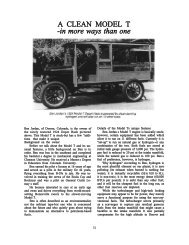
Printable Report - Northwest Vintage Speedsters
Printable Report - Northwest Vintage Speedsters
Printable Report - Northwest Vintage Speedsters

Create successful ePaper yourself
Turn your PDF publications into a flip-book with our unique Google optimized e-Paper software.
many antique shops. Here we also enjoyed welcome relief of<br />
coffee, juice and sweet choices that stuffed the cockpits even<br />
further. We continued south paralleling the Willamette River’s<br />
East Side as far south as the Clackamas River. At the confluence<br />
of the Willamette and Clackamas River navigators had to learn<br />
what to do in case of an earthquake in Clackamette Park. You<br />
guessed it… RUN !! It was also here that we reached the<br />
southern most point of the route in Oregon City. Crossing the<br />
Willamette River again and north along the West Side of the<br />
great river to Mary S. Young park for lunch.<br />
On the “U-Park-It” lunch was served, where else, in a Park.<br />
Here, a huge submarine sandwich was the centerpiece of every<br />
kind of food that makes a great picnic in the park. But, don’t<br />
forget, just because it was lunch didn’t mean you didn’t have to<br />
answer questions. Upon exiting the parking lot we were asked to<br />
count blue disabled parking spots on the pavement.<br />
One of the most interesting sights in the George Rogers Park was<br />
the 32-foot high pig iron smelting furnace. I know it was 32 feet<br />
high because that was one of the questions on the instructions.<br />
Our route continued north to Lake Oswego to the massive Tryon<br />
Creek State Park where we learned inside the “Nature House”<br />
that we all live in a watershed. Can you imagine the sight of<br />
white coverall bedecked navigators rushing about, with a look of<br />
panic, trying to find this answer?? Still further north and now<br />
west of I-5 at Council Crest Park we answered what the Indian<br />
name for Mt. Adams is. Don’t know?? You can look it up!! Mt.<br />
Adams is visible from this vantagepoint, but was shrouded in<br />
cloud cover only 75-miles away. That steep low band<br />
smokin’climb was worth the view.<br />
We maintained our altitude along Skyline Blvd seeing why folks<br />
in Portland like to live there. The views were stupendous. But,