OKC Plan, 2000-2020 - City of Oklahoma City
OKC Plan, 2000-2020 - City of Oklahoma City
OKC Plan, 2000-2020 - City of Oklahoma City

You also want an ePaper? Increase the reach of your titles
YUMPU automatically turns print PDFs into web optimized ePapers that Google loves.
The <strong>City</strong> <strong>of</strong><br />
<strong>Oklahoma</strong> <strong>City</strong><br />
<strong>OKC</strong> <strong>Plan</strong>,<br />
<strong>2000</strong>-<strong>2020</strong>
TABLE OF CONTENTS<br />
Vision ....................................................................................................................... 1<br />
Land Use and Design ............................................................................................. 9<br />
Rural Area ............................................................................................................ 12<br />
Urban Growth Area .............................................................................................. 14<br />
Traditional Neighborhoods .................................................................................. 19<br />
Downtown ............................................................................................................ 21<br />
Regional Commercial Centers and Major Activity Corridors ............................. 22<br />
Regional Mobility Corridors ................................................................................ 23<br />
Industrial Areas .................................................................................................... 24<br />
<strong>City</strong>-wide Policies ................................................................................................ 25<br />
Housing and Neighborhood Revitalization .............................................................................. 27<br />
Transportation ........................................................................................................................... 33<br />
Public Services ............................................................................................................................ 47<br />
Parks and Open Space ............................................................................................................... 57<br />
Education .................................................................................................................................... 65<br />
Historic Preservation ................................................................................................................. 71<br />
Culture ........................................................................................................................................ 77<br />
Community Appearance ........................................................................................................... 83<br />
Economic Development ............................................................................................................. 93<br />
Environmental Concerns .......................................................................................................... 97<br />
Regional Context ...................................................................................................................... 103<br />
Implementation ........................................................................................................................ 109<br />
i
Explanatory Notes<br />
This plan provides general direction to public and private decision makers as to growth,<br />
development, redevelopment, and revitalization in <strong>Oklahoma</strong> <strong>City</strong>. Specific development<br />
requirements will be contained within <strong>City</strong>’s ordinances and regulations.<br />
Directions are general statements <strong>of</strong> the basic approaches to be carried out in the plan and are<br />
equivalent to goals in other plans. Actions are more specific statements indicating steps/programs to<br />
carry out the directions and are equivalent to policies in other plans. <strong>Plan</strong> conformance <strong>of</strong><br />
development proposals will be evaluated according to action statements.<br />
The Development Areas map (page 10) and the Land Use <strong>Plan</strong> map (page 11) are generalized and<br />
are not intended to be parcel specific and may be adjusted in relation to specific development<br />
requests.<br />
This plan is not intended to be all inclusive as to actions for accomplishing the <strong>Plan</strong>’s directions.<br />
The absence <strong>of</strong> a direct reference in the <strong>Plan</strong> to any specific action does not limit the <strong>City</strong> in taking<br />
actions reasonably related to accomplishing the directions set forth in the <strong>Plan</strong>.<br />
ii
Vision
Rural Neighborhoods<br />
Rural areas are primarily used for agricultural, forestry, mining purposes and scattered<br />
residential development. Rural areas for the purposes <strong>of</strong> the plan are areas that do not require a full<br />
range <strong>of</strong> essential city services. Essential services are defined in the 1990 <strong>OKC</strong> <strong>Plan</strong> as Water,<br />
Waste Water, and urban fire protection. For the purposes <strong>of</strong> this discussion, “rural” will be defined<br />
as all areas <strong>of</strong> <strong>Oklahoma</strong> <strong>City</strong> that presently lack one or more essential service and where such<br />
services are not anticipated to be made available for at least 20 years. Areas in which it is anticipated<br />
that all essential services are to be made available during the <strong>Plan</strong>ning period will be defined as<br />
Growth areas, even if the present character is Rural.<br />
Assets<br />
Because <strong>of</strong> the large incorporated area and its location between the woodlands to the east and the<br />
rolling prairie to the west, <strong>Oklahoma</strong> <strong>City</strong> has a wide variety <strong>of</strong> rural areas. These areas include the<br />
wooded areas to the east and northeast, the rolling and partially wooded countryside east <strong>of</strong> Draper<br />
Lake, the scenic areas south <strong>of</strong> Mustang, and gentle prairie topography in the north and northwestern<br />
parts <strong>of</strong> the city. All these areas provide a rich and scenic context for the urban area and contain a<br />
variety <strong>of</strong> assets that are in critical need <strong>of</strong> protection. These assets include the following:.<br />
The agricultural, ranching and oil and gas extraction uses contribute significantly to the<br />
<strong>Oklahoma</strong> <strong>City</strong> economy.<br />
Rural areas provide locations for people who choose to live close to the city but enjoy the peace<br />
and quiet <strong>of</strong> the countryside.<br />
The surrounding rural areas provide a scenic context for the city. Properly protected, the<br />
surrounding rural areas can pleasantly contrast with the intense development <strong>of</strong> the city and be a<br />
source <strong>of</strong> community enjoyment and pride.<br />
Many <strong>of</strong> the rural areas are in the watershed areas <strong>of</strong> <strong>Oklahoma</strong> <strong>City</strong>’s lakes (and surrounding<br />
lakes, such as Thunderbird and Arcadia) that provide storage for the region's water supply.<br />
Protection <strong>of</strong> these areas was a reason for the aggressive annexation program <strong>of</strong> the 1960's.<br />
The rural areas include recharge areas for the region's aquifers, such as Garber-Wellington.<br />
Directions<br />
The historic uses, such as agricultural, ranching, and oil and gas extraction (where they are not<br />
detrimental to the environment or neighboring properties), should be encouraged to continue and<br />
be supported by appropriate services in rural areas.<br />
Natural assets, such as wooded areas, natural topography, wildlife habitat, creeks and wetlands<br />
should be protected.<br />
An appropriate level <strong>of</strong> rural public services should be provided in an efficient and economical<br />
manner.<br />
1
Urban Growth Neighborhoods<br />
Urban growth is the area <strong>of</strong> <strong>Oklahoma</strong> <strong>City</strong> where all city services are presently available or<br />
are anticipated to be made available during the horizon <strong>of</strong> the Comprehensive <strong>Plan</strong> (minus the<br />
revitalization area.) This area was mostly developed after 1946 and is characterized by its<br />
accessibility by motorized vehicles, low density single family housing, and commercial strip<br />
development. The majority <strong>of</strong> <strong>Oklahoma</strong> <strong>City</strong>'s growth and development in recent years has<br />
continued to occur in this area.<br />
Assets<br />
Much <strong>of</strong> <strong>Oklahoma</strong> <strong>City</strong>'s recent economic expansion has occurred in this area.<br />
Public school quality is rated highly by residents.<br />
Residents perceive fewer crime and social problems.<br />
Housing quality and property maintenance is better than in some <strong>of</strong> the older parts <strong>of</strong> the <strong>City</strong>.<br />
The variety <strong>of</strong> retail facilities and services are diverse and convenient.<br />
Growth areas are close to the edge <strong>of</strong> the <strong>City</strong> or to rural areas.<br />
Growth areas included are close to major parks and lakes.<br />
There is an abundance <strong>of</strong> fully served land ready to be developed.<br />
Capital Improvements Program (CIP) policies subsidize development costs.<br />
Directions<br />
Encourage “Traditional Neighborhood Development” in which higher density and more efficient<br />
use <strong>of</strong> the infrastructure (streets, water lines, sanitary sewers) is achieved through the use <strong>of</strong> grid<br />
plats similar to those in the Traditional Neighborhoods development area.<br />
Provide a full range <strong>of</strong> public services to ensure long term desirability <strong>of</strong> the growth areas<br />
As the areas mature, assure that they evolve into mature self-sustaining communities by<br />
developing more public and civic uses.<br />
Improve the appearance <strong>of</strong> strip commercial streets, with appropriate facade improvements,<br />
landscaping, parking lot improvements and enhanced signage limitations.<br />
Encourage a greater mix <strong>of</strong> land uses within growth neighborhoods to provide convenience and<br />
reduce automobile trips.<br />
Meet the market demand for a wide variety <strong>of</strong> housing types conveniently located to<br />
employment centers.<br />
Encourage development <strong>of</strong> vacant parcels adjacent to areas <strong>of</strong> existing development.<br />
2
Traditional Neighborhoods<br />
The Traditional Neighborhoods development area includes <strong>Oklahoma</strong> <strong>City</strong>'s historic town<br />
site and surrounding neighborhoods that were developed along the early transit lines. Most <strong>of</strong> these<br />
areas are characterized by the simple geometry <strong>of</strong> “grid” streets with some diagonal boulevards.<br />
They contain a rich variety <strong>of</strong> architectural styles and a mixture <strong>of</strong> land uses. Recent decades have<br />
seen many <strong>of</strong> these areas, which radiate from downtown, go through a period <strong>of</strong> gradual but<br />
persistent economic decline. They house a disproportionate number <strong>of</strong> <strong>Oklahoma</strong> <strong>City</strong>'s poorest<br />
residents, suffer from higher crime rates and have lacked consistent private investment in recent<br />
decades. Most <strong>of</strong> these areas are in need <strong>of</strong> revitalization.<br />
Assets<br />
A wide variety <strong>of</strong> architectural styles that adds lasting texture and interest to historical<br />
neighborhoods.<br />
Conveniently located close to downtown and in the center <strong>of</strong> the region.<br />
Lack <strong>of</strong> traffic congestion due to the overlapping capacity <strong>of</strong> the grid street system, convenient<br />
access to freeway system, and outmigration.<br />
Proximity to the MAPS projects<br />
Mature trees that create an urban forest<br />
Ethnic diversity that adds variety and interest to the area.<br />
Organized neighborhoods and business associations which are actively involved in the area's<br />
revitalization.<br />
Neighborhood oriented elementary schools and quality magnet schools.<br />
The availability <strong>of</strong> special funds and programs to assist in the area's revitalization, such as<br />
CDBG (Community Development Block Grant) and HOME (Home Investment Partnership<br />
Program).<br />
A grid layout that is convenient for pedestrians, bicyclists and transit users.<br />
Large inventory <strong>of</strong> quality historic housing stock available for rehabilitation.<br />
Development patterns with street orientation that is easily adaptable to neighborhood watch and<br />
community policing programs.<br />
Proximity to major employment centers, such as downtown, Capitol-Medical Center, Shepherd<br />
Mall, Tinker Air Force Base/General Motors, and Reno-Meridian area.<br />
Directions<br />
Continue programs designed to preserve historic assets, while allowing appropriate change as<br />
historic neighborhoods are revitalized.<br />
Take advantage <strong>of</strong> the natural assets <strong>of</strong> the area by encouraging redevelopment that supports the<br />
character and charm <strong>of</strong> the traditional city.<br />
3
Continue supporting the capacity <strong>of</strong> neighborhood, non-pr<strong>of</strong>it and business organizations that<br />
support revitalization programs with performance measures.<br />
Support the redevelopment <strong>of</strong> neighborhood oriented elementary schools to provide a focus for<br />
neighborhood revitalization.<br />
Develop a CIP (Capital Improvements Program) that supports and encourages private investment<br />
in revitalization areas.<br />
Encourage redevelopment by removing regulatory barriers.<br />
Encourage middle income families to return to the revitalization areas.<br />
Provide incentives to develop infill housing and businesses on the large inventory <strong>of</strong> vacant lots<br />
in the revitalization areas and maintenance <strong>of</strong> existing stock.<br />
Reduce crime through increased enforcement activity and community policing.<br />
Improve the appearance <strong>of</strong> strip commercial streets, with appropriate facade improvements,<br />
landscaping, parking lot improvements and enhanced signage limitations.<br />
Downtown<br />
<strong>Oklahoma</strong> <strong>City</strong>’s downtown, like downtowns throughout the nation, experienced a decline in<br />
economic vitality in the period following World War II. A number <strong>of</strong> factors contributed to this<br />
decline—plentiful land available for development at the <strong>City</strong>’s periphery, flat terrain with an<br />
absence <strong>of</strong> natural geographical boundaries, school desegregation, increased reliance on the<br />
automobile, an improved middle class standard <strong>of</strong> living, and competition from adjoining cities.<br />
In an effort to redress the decline <strong>of</strong> downtown <strong>Oklahoma</strong> <strong>City</strong>, over a thousand buildings<br />
were torn down between the 1960s and the 1980s to create a platform for renewal. This renaissance<br />
effort had been only partially realized when the oil bust <strong>of</strong> the early 1980s hit, sending downtown<br />
into an economic tailspin. In order to reverse the trend <strong>of</strong> decline, voters, in 1993, approved a series<br />
<strong>of</strong> bold new construction and refurbishment projects, collectively referred to as MAPS (Metropolitan<br />
Area Projects). The 1995 bombing <strong>of</strong> the Alfred P. Murrah Federal Building interrupted the<br />
momentum for renewal, but with the completion <strong>of</strong> the first MAPS projects and the finalization <strong>of</strong><br />
bombing repairs and reconstruction, investment interest in downtown is resurging.<br />
The challenge now is to capitalize on the gains made in the last few years in order to create<br />
reinvestment momentum that will continue indefinitely. New investment must be able to build <strong>of</strong>f<br />
what already exists; it must be able to successfully compete with the suburban market; and it must<br />
contribute to the creation <strong>of</strong> a self sustaining, down-turn resistant downtown community that<br />
functions beyond the 9 to 5 work day. There are no short term fixes. Any new investment must be<br />
focused on the long term and must be sustainable.<br />
4
areas:<br />
Achieving sustainable downtown revitalization requires an emphasis on development in three<br />
residential development and the creation <strong>of</strong> a permanent downtown urban neighborhood,<br />
improved occupation rates for <strong>of</strong>fice and commercial buildings, and diversification <strong>of</strong> core<br />
downtown functions, and<br />
continued development <strong>of</strong> an Entertainment/Cultural district.<br />
A revised view <strong>of</strong> the <strong>City</strong>’s role in providing supporting infrastructure and services is also needed.<br />
<strong>Oklahoma</strong> <strong>City</strong> downtown is presently divided into several semi-distinct districts. While the<br />
success <strong>of</strong> downtown as a whole is a top priority, the separate identity <strong>of</strong> each <strong>of</strong> these districts is<br />
important and needs to be emphasized in future redevelopment efforts. These districts are:<br />
Downtown core<br />
North Downtown (N. 4th to N. 13th, Classen to I-235)<br />
Bricktown entertainment district<br />
Harrison-Walnut area<br />
Cultural district (including the area from the Civic Center to the Myriad Gardens).<br />
Initial redevelopment efforts will need to focus on these districts because they have already<br />
been supported by MAPS and bombing funds. It will be difficult to plan for revitalization <strong>of</strong> the<br />
south downtown area (the area between the present alignment <strong>of</strong> I-40 and the river) until the<br />
proposed route for I-40 has been finalized and funds set aside for construction. Redevelopment <strong>of</strong><br />
this area is unlikely to be successful until the downtown core and contiguous districts are stable and<br />
growing on their own accord. Furthermore, strategic alliances should be formed and planning<br />
assistance should be provided to the contiguous neighboring districts to help facilitate their stability<br />
and encourage redevelopment.<br />
Assets<br />
MAPS projects<br />
Reconstruction in wake <strong>of</strong> the Murrah bombing<br />
Bricktown vitality and capacity for further growth<br />
Public support for downtown revitalization (citizen survey).<br />
Excellent regional access (I-40, I-35, I-235, I-44 and renewed Amtrak service)<br />
Enterprise Community designation and possible Empowerment Zone designation.<br />
Potential additional Federal bombing recovery funds<br />
Vacant land, much <strong>of</strong> it in the control <strong>of</strong> the Urban Renewal Authority<br />
Reconstruction <strong>of</strong> I-40<br />
Automobile Alley revitalization<br />
5
New Federal Campus<br />
Murrah National Memorial<br />
New YMCA<br />
St. Anthony Hospital complex<br />
Nonpr<strong>of</strong>it community development and improvement organizations such as Automobile Alley<br />
Main Street, Midtown Redevelopment Corporation and Historic Preservation, Inc., Downtown<br />
Now, Inc., Myriad Gardens Foundation, and others.<br />
Arts Council <strong>of</strong> <strong>Oklahoma</strong> <strong>City</strong> Cultural Complex and <strong>Oklahoma</strong> <strong>City</strong> Art Museum (to be<br />
located in the Centre Theater building)<br />
Potential for the development <strong>of</strong> a Cultural District.<br />
Directions<br />
Make downtown an attractive, desirable and efficient center for business and regional<br />
entertainment and cultural activities.<br />
Make downtown the priority location for government <strong>of</strong>fices, high rise <strong>of</strong>fice buildings, business<br />
retail, and cultural and athletic attractions.<br />
Focus the revitalization strategy on residential development, improved occupancy rates and<br />
quality <strong>of</strong> commercial space, enhancing cultural/entertainment options and supporting<br />
infrastructure (parking and parking management, streets, access, signage, green space,<br />
streetscaping, and other amenities and services).<br />
Encourage an economic mix <strong>of</strong> downtown housing that will lead to sustainable growth. Provide<br />
public incentives and support for residential development.<br />
Make all forms <strong>of</strong> transportation safe, easy and pleasant downtown.<br />
Improve downtown appearance.<br />
Support diversification <strong>of</strong> downtown economic and cultural activities. Promote downtown as a<br />
“Second Neighborhood” or “Central Social District.”<br />
Promote public-private cooperation to support redevelopment. Provide public and encourage<br />
private support for nonpr<strong>of</strong>it civic organizations working on behalf <strong>of</strong> the different downtown<br />
sub-districts.<br />
Promote, protect, cherish, honor, value, safeguard, and revitalize our historical resources.<br />
Ensure downtown education facilities and experiences are the highest quality.<br />
6
Regional Shopping Centers<br />
The <strong>City</strong> <strong>of</strong> <strong>Oklahoma</strong> <strong>City</strong> makes a significant investment in taxpayer funds to support the<br />
<strong>City</strong>’s three regional shopping centers. Support is provided in the form <strong>of</strong> roads, sewer and water,<br />
ongoing maintenance, fire support, and other services provided directly to the centers and to the<br />
catchments <strong>of</strong> residential development that provide the centers’ customers. In return, the <strong>City</strong><br />
benefits from the sales tax revenues generated by the centers.<br />
The <strong>City</strong>’s mission is to protect and enhance this reciprocal cycle <strong>of</strong> mutual benefit as much<br />
as it can (within its jurisdictional limitations) to ensure that the quality <strong>of</strong> life we enjoy in <strong>Oklahoma</strong><br />
<strong>City</strong> is maintained.<br />
There are three regional shopping centers in <strong>Oklahoma</strong> <strong>City</strong>—Crossroads Mall,<br />
Quail Springs Mall and Penn Square Mall. Each <strong>of</strong> these attracts large numbers <strong>of</strong> shoppers<br />
annually, generating substantial sales tax revenues. By their presence, the malls act as a community<br />
anchor, and therefore a construction generator since they provide a substantial incentive for<br />
residential and other development within the mall’s customer catchment. Not insignificantly, the<br />
malls also provide a form <strong>of</strong> “main street” social outlet for the suburban shopper.<br />
Assets<br />
High quality, diverse retail outlets<br />
Primary generator <strong>of</strong> sales tax revenue<br />
Primary generator <strong>of</strong> development in surrounding neighborhoods<br />
Community anchor<br />
Social meeting place<br />
Direction<br />
To sustain and enhance the viability <strong>of</strong> existing regional shopping centers wherever possible by<br />
maintaining existing <strong>City</strong> services and infrastructure and providing additional services and<br />
infrastructure when justified because <strong>of</strong> Center expansion or improvements.<br />
Industrial Areas<br />
Although manufacturing employment has been declining in recent years as a share <strong>of</strong> total<br />
employment in our nation, the industrial sector remains a significant employer and generator <strong>of</strong><br />
wealth for many <strong>Oklahoma</strong>ns, and will no doubt continue to be so for the foreseeable future.<br />
Following the oil bust <strong>of</strong> the mid-1980’s, <strong>Oklahoma</strong> <strong>City</strong> business and government leaders actively<br />
worked to diversify our economy. The <strong>City</strong> will continue its efforts to foster new growth and a<br />
diversified economy.<br />
7
<strong>Oklahoma</strong> <strong>City</strong> faces stiff competition in our attempts to attract high pr<strong>of</strong>ile wealth<br />
generators, such as high tech industry and tourism. The <strong>City</strong>, therefore, needs to continue focusing<br />
on its particular strengths—an industrious work force, its highly rated universities, the availability <strong>of</strong><br />
developable land, low cost <strong>of</strong> living, minimal environmental constraints, and three major interstate<br />
highways, including the NAFTA (North American Free Trade Act) corridor. To remain competitive<br />
with other communities, the <strong>City</strong> will also need to focus more attention on its overall appearance.<br />
Assets<br />
Abundance <strong>of</strong> affordable, easily developable land<br />
Proximity to major interstate transportation routes, including NAFTA corridor<br />
Stable economy<br />
Major universities and Vo-Tech facilities<br />
Plentiful water supply<br />
Participation in the Brownfields program to clean up polluted sites<br />
Diversified production capacity<br />
Directions<br />
Ensure adequate supply <strong>of</strong> land and infrastructure to support continued industrial growth.<br />
Attract development that optimizes the <strong>Oklahoma</strong> <strong>City</strong> economy via high employment, high<br />
wages, low environmental impact, significant growth potential and long term viability.<br />
Improve the aesthetic appearance <strong>of</strong> industrial areas.<br />
Review existing barriers to industrial expansion with view to mitigating these wherever possible.<br />
Address any historic environmental issues that may be hindering development in industrially<br />
zoned areas.<br />
Aggressively market <strong>Oklahoma</strong> <strong>City</strong> strengths for industrial development to out <strong>of</strong> state<br />
companies.<br />
Provide public infrastructure support as required to support expansion and new industrial<br />
development.<br />
Encourage the development <strong>of</strong> industrial parks to accommodate varying land use needs.<br />
Protect land designated for industrial development from encroachment by conflicting uses.<br />
8
Land Use<br />
and Design
Every era brings new conditions and new policies to meet them. The coming <strong>of</strong> the<br />
automobile led to the 1910 plan for a Grand Boulevard loop around the city. Frantic growth in the<br />
1920s and pent-up development pressure in the 1940s each produced city plans calling for orderly<br />
development.<br />
The post-war boom brought freeways, suburbs, strip development, annexations and<br />
downtown demolition. A new comprehensive plan in 1977 tried to stabilize neighborhoods and deal<br />
with the implications <strong>of</strong> unrestricted outward development.<br />
A 1990 plan responded to early concerns about the city’s appearance and its capacity to<br />
attract industry. This plan sharpened the criteria for approving outer development, created industrial<br />
reserves, and encouraged attractive development along highways.<br />
The end <strong>of</strong> the century brings stronger mandates to revitalize the central area and improve<br />
appearances. There is also a call to begin restoring a sense <strong>of</strong> community. The land use and design<br />
policies below respond to these new imperatives.<br />
The land use policies in this plan address the location, types, and intensity <strong>of</strong> growth and<br />
redevelopment anticipated in <strong>Oklahoma</strong> <strong>City</strong> for the next twenty years (<strong>2000</strong>-<strong>2020</strong>). These policies<br />
are intended to serve as a guide for decisions by citizens, businesses, and <strong>City</strong> <strong>of</strong>ficials in their<br />
decisions affecting our <strong>City</strong>’s future growth. The <strong>Plan</strong>’s land use policies will also direct efforts to<br />
ensure that public services including water supply, sewage treatment, police and fire protection, and<br />
transportation facilities are adequate to meet anticipated growth and redevelopment.<br />
Design policies address how land, structures, and transportation links will be built to achieve<br />
a high-quality community. Design policies are thus an essential compliment to land use policies<br />
which address where, how much, and what type development should occur at various locations. The<br />
key elements <strong>of</strong> community design include street widths, intersection treatments, sidewalks, lighting,<br />
parking arrangements, landscaping, buildings, and architectural characteristics. Making these design<br />
elements work together in a cohesive, comfortable, and engaging manner is the challenge <strong>of</strong> shaping<br />
our <strong>City</strong>’s environment.<br />
Properly implemented, good community design and land use policies can conserve land, keep<br />
infrastructure and public service costs under control, and lead to more satisfying, livable<br />
communities. To the extent possible, design and land use policies should be implemented through<br />
the development regulations <strong>of</strong> basic zoning districts.<br />
The Development Areas Map (page 10) and the Land Use <strong>Plan</strong> Map (page 11) indicate the<br />
location <strong>of</strong> various areas to which particular plan policies will apply.<br />
9
Rural Area<br />
The Rural Area contains open country with very low intensity development. The<br />
predominant uses are agriculture, open space, and residential on large lots. These neighborhoods lie<br />
beyond the reach <strong>of</strong> most urban services for the next 20 years or more.<br />
Determining the suitable intensity for development is a key factor in planning for the Rural<br />
Area. This will include decisions as to appropriate density for residential development and the scale<br />
and character <strong>of</strong> commercial, industrial, and other non-residential development.<br />
There is no single standard for appropriate residential density, given the broad expanse <strong>of</strong> the<br />
Rural Area, varying levels <strong>of</strong> public services throughout the area, and wide differences in the scale<br />
and character <strong>of</strong> existing development. A near-urban density <strong>of</strong> one dwelling unit per acre may be<br />
appropriate where public services are generally available at close to urban area levels. In locations<br />
where public services are minimal to absent, the appropriate standard may be lots <strong>of</strong> five acres and<br />
larger. At locations with intermediate service levels, densities between one and five acres per<br />
dwelling unit may be appropriate. Factors to be considered in decisions regarding appropriate levels<br />
<strong>of</strong> development in the Rural Area are examined in the following sections.<br />
Compatibility with existing development. Rural residents and property owners have invested<br />
in their properties, in large part, because <strong>of</strong> a desire for “country living.” These existing property<br />
owners may view development proposals with smaller lot sizes than their own or with greater<br />
amounts <strong>of</strong> commercial uses as impacting their preferred rural lifestyle. However, compatibility<br />
should not be so strictly interpreted as to entirely preclude development, or force all development<br />
within an area to be within a very narrow range <strong>of</strong> lot sizes.<br />
Adequacy <strong>of</strong> services. Residential and commercial development replaces natural ground<br />
cover with impervious surfaces (streets, parking areas, and ro<strong>of</strong>tops) and increases the amount <strong>of</strong><br />
stormwater run-<strong>of</strong>f. The increased run-<strong>of</strong>f can overload area creeks and lead to downstream<br />
flooding. In addition, the time required for police and fire units to respond calls in outlying rural<br />
areas is generally greater than the response times in other areas <strong>of</strong> the <strong>City</strong>. As development<br />
increases in rural areas, some residents and property owners may request better police and fire<br />
protection. Meeting these requests would likely require increasing the number <strong>of</strong> police patrol units<br />
and the construction <strong>of</strong> new fire stations.<br />
Water quality and quantity. Water wells provide water supply for most <strong>of</strong> the Rural Area and<br />
sewage treatment is generally provided by septic tanks. Soil types and subsurface geology differ<br />
from location to location and this variability greatly impacts suitability for water wells and septic<br />
tanks. Tight soils in some areas can increase the size <strong>of</strong> drain fields required for suitable operation<br />
<strong>of</strong> septic tanks. Other areas may require alternative systems for sewage treatment. In other locations<br />
underground water may be nearly absent or severely limited with only a small number <strong>of</strong> suitable<br />
water well locations.<br />
12
Traffic considerations. In some locations unpaved or poorly paved roads may be unsuitable<br />
for the increased traffic volumes resulting from proposed development. In addition, the increased<br />
traffic volumes accompanying increased development may lead to increased wear on roadways.<br />
Current residents may perceive the increased traffic as a threat to their rural life-style. In areas <strong>of</strong><br />
hilly topography great care is needed in locating entry streets for proposed developments to avoid<br />
traffic hazards from inadequate sight lines.<br />
Public health and safety considerations. Aging oil and gas wells in the vicinity <strong>of</strong> proposed<br />
rural developments may indicate possible contamination <strong>of</strong> underground water supplies. This<br />
equipment can also be dangerous to children and animals. Sand mining operations and industrial<br />
activities adjacent to rural residential development can create problems with noise, odors, blowing<br />
dust, and trucks wearing down area roads.<br />
Costs for <strong>City</strong> Services. Approval <strong>of</strong> rural development in areas where <strong>City</strong> services are not<br />
adequate may lead to requests by some area residents and property owners for service<br />
improvements. Meeting these requests may require the <strong>City</strong> to construct new facilities including fire<br />
stations, road improvements, or extension <strong>of</strong> water and sewer service. The <strong>City</strong> could also face<br />
increased operational costs from far-flung rural development including road maintenance and<br />
vehicle expenses for police and fire response.<br />
Additional factors. Increased development in rural areas will increase the number <strong>of</strong><br />
residents and business customers leading to possible conflicts with adjoining agricultural uses.<br />
Overly porous soils and rock layers may increase the likelihood that water wells would be<br />
contaminated from improperly located septic tanks and surface run<strong>of</strong>f <strong>of</strong> lawn and agricultural<br />
chemicals. Efforts to preserve historic sites may be more difficult with the increased housing units<br />
and businesses.<br />
The Rural Area is shown on the Development Areas Map (page 10) and the Land Use <strong>Plan</strong><br />
Map (page 11).<br />
Directions<br />
Maintain the rural character <strong>of</strong> natural areas, open fields, pastures, forests, farmland, and<br />
scattered farmhouses while allowing for rural development.<br />
Establish residential densities that support rural lifestyles while providing levels <strong>of</strong> public<br />
services appropriate for rural development. Relate residential densities to the following factors:<br />
• Compatibility with existing development in the vicinity<br />
• Adequacy <strong>of</strong> public services including water supply, sewage treatment, police and fire<br />
protection, emergency services, and streets and roadways<br />
• Potential hazards to public health and safety such as oil wells, oilfield equipment, and<br />
mining operations<br />
• Impact on surface water, aquifers, adjacent agricultural operations, or historic sites<br />
Relate the scale and character <strong>of</strong> commercial uses and other uses that support residential<br />
development to the needs <strong>of</strong> residents in the vicinity.<br />
13
Create density and design options and preserve rural open areas through clustering <strong>of</strong> residential<br />
uses on lots smaller than the density standard.<br />
Provide limited amounts <strong>of</strong> commercial development in rural areas appropriate to meet the needs<br />
<strong>of</strong> rural residents<br />
Preserve attractive views, retain drainageways in a natural state, and maintain floodplains as<br />
undeveloped areas (subject to Action statement on page 19).<br />
Actions<br />
Require subdivisions in rural areas to meet standards for services in rural areas, dedicate utility<br />
easements, and pave streets according to standards for rural areas.<br />
Limit residential development in the Rural Area to densities <strong>of</strong> 1.00 dwelling units per acre or<br />
less. Urban density residential development (R-1 and higher densities) should occur in the<br />
Urban Growth, Traditional Neighborhoods, or Downtown Areas as designated in the<br />
Development Areas map where public water and sewage disposal facilities are available and<br />
fire protection meets urban standards.<br />
Allow residential densities within the R-A zoning district to increase from a minimum <strong>of</strong> 0.70<br />
up to 1.00 dwelling units per acre, as open space areas are incorporated into proposed<br />
developments. Allow the option <strong>of</strong> clustering acreage or sub-acreage lots within this overall<br />
density standard provided water supply and sewage disposal requirements are met.<br />
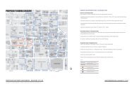
Conventional Lots<br />
Cluster Development<br />
Reprinted with permission from Zoning News, Chicago: American <strong>Plan</strong>ning Association,<br />
October 1994.<br />
Establish a new rural residential zoning district that would allow housing development at<br />
densities between those allowed under the R-A and AA zoning districts. Encourage clustering <strong>of</strong><br />
residential units within developments allowed under the new zoning district to reduce the impact<br />
<strong>of</strong> the development on adjacent areas, provide open space and recreational amenities, and protect<br />
natural areas.<br />
13-1
Evaluate applications for rural residential development according to the following factors:<br />
• Whether the density proposed is compatible with existing land uses, lot sizes, and uses<br />
permitted on property in the immediate vicinity.<br />
• Whether adequate services exist, or can be provided, to serve the proposed development.<br />
Among the services to be addressed are storm drainage, sewage treatment, water supply,<br />
police and fire protection, and emergency services.<br />
• Whether water quality and quantity is sufficient to serve the development, and required<br />
water wells and sanitary services will not negatively impact nearby properties. Data related<br />
to water sufficiency could include aquifer draw down and recharge rates, water flow rates in<br />
pounds per square inch, and tests to determine pH (acidity), and concentrations <strong>of</strong> coliform<br />
bacteria, dissolved solids, chlorides, nitrates, sulfur compounds, and arsenic.<br />
• Whether the proposed development at build-out will have a negative impact on vehicular<br />
traffic and traffic safety based on the current capacity and design <strong>of</strong> adjacent public roads.<br />
• Whether oil and gas wells, mining operations, or industrial activity in the vicinity <strong>of</strong> the<br />
proposed development raise safety or quality-<strong>of</strong>-life concerns.<br />
• Whether the proposed development will have a positive or negative fiscal impact on the<br />
<strong>City</strong>’s finances. The evaluation <strong>of</strong> the fiscal impact <strong>of</strong> proposed development should<br />
consider both the <strong>City</strong>’s cost <strong>of</strong> providing additional levels <strong>of</strong> public services and the<br />
anticipated revenues generated. Both costs and revenues will vary based on the size and<br />
location <strong>of</strong> the proposed development.<br />
• Whether the proposed development will have other undesired impacts including impacts on<br />
natural areas, surface water, aquifers, adjacent agricultural operations, or historic sites.<br />
Continue to protect water supplies by retaining sensitive reservoir watersheds as Environmental<br />
Conservation areas.<br />
Limit use within designated Environmental Conservation areas to public open space, crops and<br />
grazing, recreation, and five-acre tract residential. Develop standards within designated<br />
Environmental Conservation areas that ensure that proposed uses do not adversely affect the<br />
quality <strong>of</strong> public water supplies and water wells on adjoining properties.<br />
Allow the option <strong>of</strong> cluster development as a means to preserve drainageways as rural open<br />
space.<br />
Increase building setbacks along arterials to reduce the impact <strong>of</strong> development in rural settings.<br />
Two-lane roads should be maintained in a way that provides safe transportation and preserves<br />
rural character.<br />
Support limited amounts <strong>of</strong> commercial (one-to-two acres per use) and recreational uses<br />
appropriate to the needs <strong>of</strong> rural residents.<br />
Create a rural commercial zoning district designed for rural needs.<br />
Continue to enforce adopted rural fire protection policies.<br />
13-2
Urban Growth Area<br />
The Urban Growth Area (shown on the Development Areas Map, page 10) includes areas <strong>of</strong><br />
more recent and on-going development which are served by the three basic urban services—public<br />
provided water supply, sewage treatment, and fire protection or where such services will be made<br />
available within the time period covered by the <strong>Plan</strong>. Predominant uses are single-family homes,<br />
apartments <strong>of</strong> moderate densities, regional and community shopping centers, low-rise <strong>of</strong>fice<br />
buildings and industrial development in selected areas.<br />
Within the Urban Growth Area residential densities usually exceed one dwelling unit per<br />
acre. To achieve more compact residential areas, large-scale residential developments consisting <strong>of</strong><br />
a mixture <strong>of</strong> housing types and densities may range up to eight dwelling units per acre for an overall<br />
project density.<br />
Development is generally suburban in scale and modern, having mostly occurred over the<br />
past 30 years. Construction markets are healthy, highway access is good, and household incomes<br />
are moderate to high. Much bypassed or undeveloped land remains.<br />
Direction<br />
Encourage a variety <strong>of</strong> land uses, intensities, and development patterns, including the use <strong>of</strong> grid<br />
plats, to provide more diverse residential options, a wider variety <strong>of</strong> commercial goods and<br />
services and a more efficient use <strong>of</strong> public services.<br />
Promote high-quality, desirable residential neighborhoods which are compact and pedestrianfriendly<br />
with a mix <strong>of</strong> uses within walking distance. Neighborhood streets should be safe for<br />
children, comfortable for bicycling, and pleasant for walking.<br />
Promote high-quality commercial, <strong>of</strong>fice, institutional, and multi-family residential development<br />
which is compatible with adjoining land uses, adequately served by the transportation network<br />
and other public services, and scaled to the size <strong>of</strong> projected markets in the surrounding area.<br />
Such development should contribute to, rather than detract from, the area’s appearance and<br />
desirability, preserve natural features and topography, and have positive fiscal and other impacts<br />
on the community.<br />
Build and maintain a high-quality transportation system within the Urban Growth Area that is<br />
adequate to the traffic needs generated by adjoining development, is cost-effective to build and<br />
maintain, provides a full range <strong>of</strong> transportation alternatives, and enhances rather than detracts<br />
from the Area’s appearance and livability.<br />
Require new development to use public water supply, sewage disposal and fire protection<br />
according to established policies.<br />
14
Actions<br />
Encourage a variety <strong>of</strong> land uses, intensities, and development patterns through the following<br />
actions:<br />
• Encourage development at higher residential densities than in the past.<br />
• Encourage new residential construction which achieves higher densities and a mixture <strong>of</strong><br />
housing types within a unified development. Establish a density standard which would allow<br />
large-scale, multi-type residential developments to achieve an overall project density <strong>of</strong> eight<br />
dwelling units per acre. Under this standard apartment and higher-density residential areas<br />
exceeding eight units per acre could be built when <strong>of</strong>fset by lower density construction on<br />
other portions within a unified project. Overall project densities exceeding eight dwelling<br />
units per acre could be allowed through approved zoning for one or more <strong>of</strong> the following<br />
situations:<br />
- for bypassed parcels (see next policy statement),<br />
- for development located along or within major activity corridors and major activity<br />
centers, and<br />
- as part <strong>of</strong> major mixed use development projects.<br />
• Promote responsible development <strong>of</strong> bypassed parcels (vacant areas which remain<br />
undeveloped several years after development has occurred on adjoining property) through<br />
the following actions.<br />
- Allow development at somewhat higher intensities than exist on adjoining developed<br />
parcels.<br />
- Adopt building compatibility guidelines for new infill construction. Negotiate effective<br />
buffers and design features on infill development proposals to protect adjoining areas,<br />
particularly adjoining residential neighborhoods.<br />
- Continue promoting the re-use, redevelopment, and revitalization <strong>of</strong> low-performing or<br />
declining commercial centers.<br />
- Review the <strong>City</strong>’s development regulations, permit process, and fees to determine<br />
appropriate changes which would encourage development <strong>of</strong> bypassed parcels.<br />
• Encourage higher density and mixed-use development along arterial streets.<br />
• Encourage higher densities, shorter setbacks and smaller lot sizes in passed-over areas that<br />
feature smaller lots.<br />
• Replace minimum lot sizes with average lot sizes to encourage development in passed-over<br />
areas that feature larger tracts.<br />
• Amend the zoning code to reduce lot size and setback requirements in order to promote<br />
additional design options and greater variety and densities <strong>of</strong> housing.<br />
• Encourage mixed-use commercial/residential buildings by allowing higher densities than<br />
would otherwise apply.<br />
• Amend zoning codes to allow multi-family residential and mixed residential/commercial<br />
development in commercial districts.<br />
15
Promote high-quality, desirable residential neighborhoods in the Urban Growth Area through the<br />
following actions:<br />
• Support street design which slows traffic, creates safer streets, produces a better relationship<br />
between land use and traffic, and lowers the costs <strong>of</strong> development and public maintenance.<br />
• Ensure that trees are used in all developments in accordance with landscaping regulations.<br />
• Ensure that sidewalks are used in all urban developments.<br />
• Encourage street layouts in new subdivisions which provide direct connections to nearby<br />
destinations, such as local parks, schools, commercial districts, and adjacent neighborhoods,<br />
without requiring every trip to go onto the arterial network.<br />
• Encourage design concepts that minimize the visual impact <strong>of</strong> garages on the streetscape.<br />
16
Promote high-quality commercial and high-intensity development in the Urban Growth Area<br />
through the following actions:<br />
• Provide incentives to encourage commercial districts rather than linear, strip development as<br />
the preferred pattern for new commercial development. A commercial district is similar to<br />
the traditional “main street” with multi-story buildings, service alleys, shared parking,<br />
narrow facades, and an<br />
occasional parking lot. These<br />
commercial uses should have<br />
a combination <strong>of</strong> uses<br />
including residential.<br />
Buildings, drives, parking<br />
areas, and walkways should<br />
be laid out in patterns which<br />
encourage pedestrian activity.<br />
Commercial districts should<br />
be interconnected with<br />
surrounding neighborhoods<br />
for easy and convenient<br />
access. As an incentive,<br />
developers would be allowed<br />
to dedicate larger amounts <strong>of</strong><br />
land to commercial use than<br />
typically allowed in strip<br />
commercial developments.<br />
• Smaller-scale commercial development serving adjoining neighborhoods should locate at<br />
major intersections in order to allow arterial streets to move volumes <strong>of</strong> traffic efficiently<br />
and safely.<br />
• Require that small-scale PUD’s address concerns related to building size and location,<br />
landscaping, and signage in sufficient detail through specific development regulations and<br />
development or site plans to ensure that the proposed development is compatible with<br />
surrounding areas and is coordinated with nearby street, open space and utility patterns.<br />
• Provide incentives (e.g. reduced parking requirements) for commercial buildings to be<br />
placed close to streets and sidewalks, with parking areas placed away.<br />
• Re-evaluate parking standards for large developments with the aim <strong>of</strong> reducing parking<br />
requirements where appropriate and revise ordinances accordingly. Consider requiring<br />
traffic impact studies for large developments which model fully developed conditions.<br />
• Encourage shared parking among contiguous developments.<br />
• Include on-street parking in the calculation for required parking for commercial, <strong>of</strong>fice and<br />
church uses.<br />
17
• Improve the appearance <strong>of</strong> commercial and <strong>of</strong>fice areas through the following actions.<br />
- Establish a ten percent requirement for landscaping in commercial and <strong>of</strong>fice<br />
development (new building and renovation).<br />
- Encourage landscaping to be concentrated on the street side, especially between the<br />
street and parking areas.<br />
- Allow a reduction in parking space requirements for developments which provide<br />
landscaping above the basic requirements.<br />
- Require that landscaped areas be <strong>of</strong> sufficient size to allow full growth <strong>of</strong> vegetation and<br />
to prevent interference with the quality <strong>of</strong> surrounding structures or paved areas.<br />
- Encourage the use <strong>of</strong> native plants and xeriscaping techniques.<br />
• Review <strong>Oklahoma</strong> <strong>City</strong>’s sign regulations to determine changes which would enhance<br />
community appearance while maintaining the economic viability <strong>of</strong> businesses.<br />
Work with neighborhood, community, and business groups in traditional neighborhoods to<br />
develop community partnerships and resources that support neighborhood based cultural,<br />
recreational, and educational programs.<br />
Build and maintain a high-quality transportation system within the Urban Growth Area through<br />
the following actions:<br />
• Include streetscape elements in all street capital improvement projects. This includes<br />
sidewalks separated from the street, street trees, bus shelters, pedestrian-scale lighting, and<br />
bike lanes.<br />
• Evaluate street width design guidelines to determine if they could be reduced.<br />
• Require sidewalks to be installed along all streets within new urban development and ensure<br />
that these sidewalks are properly maintained.<br />
- When a new residential development goes in next to an existing retail or commercial<br />
development, require the residential developer to construct sidewalk access up to the<br />
property line to the existing retail/commercial area.<br />
- When a new commercial development goes in next to an existing residential area, require<br />
the commercial developer to construct sidewalk access up to the property line to connect<br />
to the existing residential area.<br />
All development within the Urban Growth Area should be served by urban water and sewer<br />
utility systems in accordance with existing standards.<br />
Encourage unified planning for all adjoining land owned or controlled by a project’s developer<br />
to ensure proper land use and street relationships. Developers could submit sketch plans for<br />
those portions <strong>of</strong> a development on which planned uses are not definitely known or on which<br />
development will not occur for several years.<br />
Evaluate landscape regulations to determine if more effective guidelines could be developed.<br />
18
Retain flood plains in their natural, unaltered condition unless proven to be detrimental to<br />
existing buildings or no other alternatives for remediation exist. Instead <strong>of</strong> concrete channels,<br />
provide flood control with increased flood plains, on-site detention, reduction <strong>of</strong> impervious<br />
surfacing, and preservation <strong>of</strong> the 100-year flood plain.<br />
Traditional Neighborhoods<br />
The Traditional Neighborhoods Area (shown on the Development Areas Map, page 10) is<br />
located in the central portion <strong>of</strong> <strong>Oklahoma</strong> <strong>City</strong>. This area consists <strong>of</strong> mature neighborhoods and<br />
commercial buildings built at least 30 years ago. Many <strong>of</strong> the area’s neighborhoods and structures<br />
are historic and architecturally significant. Urban services are available and cost effective due to<br />
more concentrated development patterns.<br />
A broad range <strong>of</strong> land uses is present. Renovation and restoration activities are common.<br />
There are moderate levels <strong>of</strong> new construction involving infill development on bypassed parcels or<br />
demolition and replacement <strong>of</strong> older structures.<br />
Directions<br />
Protect the character and promote the desirability <strong>of</strong> the Area’s established neighborhoods and<br />
commercial districts.<br />
Identify and preserve historic neighborhoods and landmarks. Build upon the Area’s historic<br />
character by encouraging redevelopment that supports the style and charm <strong>of</strong> the older city.<br />
Support increased residential densities for infill development or in selected areas.<br />
Revitalize low-performing or declining commercial and mixed-use districts.<br />
Apply appropriate design and construction controls to ensure that new construction is compatible<br />
with existing development.<br />
Provide for the needs <strong>of</strong> major institutions such as universities, hospitals and museums while<br />
ensuring that the institutions function as an anchor for their neighborhoods on the basis <strong>of</strong><br />
mutual benefit.<br />
19
Support programs which enable resident and business groups to maintain and enhance the<br />
appearance and desirability <strong>of</strong> their neighborhoods.<br />
Actions<br />
Protect the character <strong>of</strong> existing neighborhoods through the following actions:<br />
• Maintain the traditional grid street pattern within these neighborhoods and keep alleys open<br />
and functioning. When improving older streets in neighborhoods, maintain original street<br />
widths and turning radii.<br />
• Retain the traditional orientation <strong>of</strong> structures to the street.<br />
• Preserve mature trees within the neighborhoods, remove dead trees, and promote the<br />
planting <strong>of</strong> new street trees where needed.<br />
• Maintain historical lot and block sizes.<br />
• Ensure consistency and compatibility <strong>of</strong> construction materials and architectural styles.<br />
Protect the area’s historic neighborhoods and buildings by continuing programs designed to<br />
preserve historic assets. Allow appropriate change as historic areas are revitalized.<br />
Work with neighborhood, community, and business groups in traditional neighborhoods to<br />
develop community partnerships and resources that support neighborhood based cultural,<br />
recreational, and educational programs.<br />
Promote responsible infill development on vacant parcels through the following actions:<br />
• Approve zoning requests for infill housing <strong>of</strong> higher but suitable densities on vacant lots<br />
within established neighborhoods.<br />
• Establish a revitalization zoning district or special overlay zoning that would put in place a<br />
design review process. The design review process would ensure architectural compatibility<br />
for infill development.<br />
• Review the <strong>City</strong>’s development regulations, permit process, and fees to determine<br />
appropriate changes which would encourage infill development.<br />
Promote quality commercial, <strong>of</strong>fice, institutional, and multi-family residential development in<br />
the Area which supports and is compatible with the Area’s residential neighborhoods. The<br />
following actions can promote this goal:<br />
• Continue promoting the re-use, redevelopment, and revitalization <strong>of</strong> low-performing or<br />
declining commercial centers.<br />
• Create additional Main Street districts to revitalize older commercial areas.<br />
• Allow homes facing arterial streets to convert to <strong>of</strong>fice use only if the proposed <strong>of</strong>fice use is<br />
located in an area designated for conversion and only under the condition <strong>of</strong> combining<br />
several lots into a single planned development.<br />
• Amend home occupation rules to allow homes facing arterial streets to employ up to two<br />
outside employees and to affix name plates to the front <strong>of</strong> the home.<br />
20
• Support universities, hospitals and museums when expansion is needed, subject to<br />
appropriate plans and controls which would minimize adverse impacts on adjoining<br />
neighborhoods and maintain the long-term viability <strong>of</strong> both the institutions and their<br />
neighbors.<br />
• Consider reduced parking requirements for commercial developments in Traditional<br />
Neighborhood areas.<br />
Support resident and business groups in maintaining and enhancing the appearance and<br />
desirability <strong>of</strong> their neighborhoods through the actions outlined below. The Housing and<br />
Neighborhood Revitalization Element provides further detail on these actions.<br />
• Assist neighborhoods and commercial associations in organizing for neighborhood<br />
improvement efforts.<br />
• Continue programs that provide grants to neighborhood and business groups for physical<br />
improvements. Improvements to consider include replacing crumbling sidewalks and curbs,<br />
installing street trees and pedestrian-scale lighting, making park and school improvements,<br />
and providing seed money for facade improvements.<br />
• Look for ways to deal with life, safety, and handicap access issues with regard to older<br />
buildings and areas. Currently, these regulations can place older buildings into economic<br />
obsolescence and aggravate blighting conditions.<br />
• Expand low income assistance programs to resolve exterior maintenance problems.<br />
Downtown<br />
Downtown <strong>Oklahoma</strong> <strong>City</strong> (shown on the Development Areas Map, page 10) lies at the<br />
center <strong>of</strong> a metro area <strong>of</strong> more than one million people. Office, retail, and cultural and entertainment<br />
uses predominate. Preserving and enhancing Downtown’s role as an employment, cultural,<br />
residential, and entertainment center is a primary goal <strong>of</strong> this <strong>Plan</strong>.<br />
Directions<br />
Make downtown an attractive, comfortable, and exciting place to work, live, and visit.<br />
Make traveling downtown safe, easy, and pleasant whether by vehicle or on foot.<br />
Actions<br />
Increase employment and housing densities in the Downtown Area.<br />
Create a Downtown Appearance Improvement <strong>Plan</strong>. The focus would be on such issues as<br />
property maintenance, streetscaping, increased open space, improved public spaces, litter<br />
control, and reduced surface parking lots.<br />
Expand the Urban Design District to include all <strong>of</strong> downtown.<br />
21
Review existing street and traffic patterns to make driving, walking, or transit use easier, safer<br />
and more enjoyable. Incorporate the findings <strong>of</strong> this review in the design and construction <strong>of</strong><br />
Downtown street projects. Study the one-way street system to identify unintended results.<br />
Consider coordinating traffic lights and using intersection bump-outs. (Bump-outs are walkways<br />
extended into an intersection with restrictions on vehicle parking and traffic. Bump-outs cut<br />
down the distance and time required to cross a street.)<br />
Provide design features in new downtown developments which promote pedestrian activities<br />
such as benches, trees, transit shelters, and plazas.<br />
Develop incentives to encourage development or redevelopment <strong>of</strong> downtown with a preference<br />
for mixed uses, greater densities, and elements that contribute to the existing fabric and are<br />
consistent with the downtown master plan.<br />
Develop incentives to encourage buildings six stories and higher to be constructed in downtown.<br />
Encourage the development <strong>of</strong> a master plan with all key downtown constituents to address key<br />
issues relating to downtown and its future including, but not limited to:<br />
• residential development;<br />
• commercial development;<br />
• entertainment, sporting, and cultural events;<br />
• social issues (including homelessness);<br />
• transportation;<br />
• education; and<br />
• infrastructure.<br />
Regional Commercial Centers<br />
Major Activity Corridors<br />
Regional Commercial Centers and Major Activity Corridors (shown on the Land Use Map,<br />
page 11) are areas <strong>of</strong> concentrated commercial activities serving customers from throughout the <strong>City</strong><br />
and region. Land use is predominately commercial with some <strong>of</strong>fice uses mixed in. Higher density<br />
residential uses are appropriate within Activity Corridors and are encouraged as part <strong>of</strong> mixed use<br />
developments within Regional Commercial Centers.<br />
Directions<br />
Promote large-scale commercial development serving regional markets which is economically<br />
viable, provides a pleasant, attractive work and shopping environment, and complements<br />
surrounding development.<br />
Extend a human scale and pedestrian friendliness throughout large-scale commercial<br />
development.<br />
22
Actions<br />
Maintain residential zoning for existing residential areas along major activity corridors. Allow<br />
commercial, <strong>of</strong>fice, or institutional development within these areas only upon adoption <strong>of</strong> a<br />
transition plan for a specifically defined area. The transition plan should include design<br />
treatments and implementation measures to protect adjoining residential areas.<br />
Allow buildings six stories and higher to locate within Regional Commercial Centers and along<br />
Major Activity Corridors subject to development requirements which ensure compatibility with<br />
adjoining development and minimize adverse impacts on nearby neighborhoods.<br />
Investigate incentives to encourage enhancement <strong>of</strong> facility appearance. In particular, large<br />
expanses <strong>of</strong> blank walls should be interrupted by vertical elements, doors, windows, or other<br />
architectural elements.<br />
Examine existing parking regulations for shopping centers to determine if these requirements<br />
are excessive. Consider allowing alternative parking lot surfaces for peak-use overflow.<br />
Increase landscaping requirements for surface parking. <strong>Plan</strong>ting islands should be increased in<br />
size to ensure trees do not “out grow” the space available.<br />
Designate certain key routes into and through the <strong>City</strong> as Appearance Corridors. Implement<br />
programs to maintain an attractive appearance within these corridors including litter control,<br />
property and roadway maintenance, and special appearance controls on new development.<br />
Regional Mobility Corridors<br />
After this <strong>Plan</strong> is adopted, the <strong>City</strong> will evaluate major activity corridors for designation as<br />
Regional Mobility Corridors. Those corridors selected as Regional Mobility Corridors will be<br />
programmed for concentrated housing, commercial, and <strong>of</strong>fice development with supporting<br />
expanded transit programs <strong>of</strong>fering a variety <strong>of</strong> transportation choices. Regional Mobility Corridors<br />
will link downtown <strong>Oklahoma</strong> <strong>City</strong> with outlying areas and other metro communities.<br />
The following policies serve as a starting point for selecting Regional Mobility Corridors.<br />
These policies will be expanded as part <strong>of</strong> the corridor planning process.<br />
Directions<br />
Encourage high concentrations <strong>of</strong> housing, commercial and <strong>of</strong>fice development along the select<br />
corridors.<br />
Provide infrastructure improvements and expanded public services to designated corridors to<br />
attract and support higher levels <strong>of</strong> development.<br />
Provide special transit programs for the select corridors.<br />
23
Actions<br />
Adopt land use policies tailored for each designated corridor that protect existing centers, allow<br />
sufficient space for major development, provide attractive designs, and mitigate impacts within<br />
the corridor and on adjacent areas.<br />
Encourage new development and seek intensification <strong>of</strong> existing uses along designated corridors<br />
in conjunction with programmed street and transit improvements designed to increase volumes<br />
and facilitate both vehicular and pedestrian movements.<br />
Adopt special zoning districts for designated corridors that allow multiple types <strong>of</strong> uses by right,<br />
high-rise buildings, and higher densities for housing; that reduce or eliminate parking<br />
requirements for intensive development; and that require attractive appearances and transition<br />
and buffering treatments to minimize adverse impacts on adjoining areas.<br />
Distinguish these corridors with special names and place distinctive signs along the corridors to<br />
prominently display the names.<br />
Industrial Areas<br />
Industrial Areas (shown on the Land Use Map, page 11) contain the primary locations for<br />
manufacturing activities within <strong>Oklahoma</strong> <strong>City</strong>. These areas are also associated with major<br />
transportation facilities serving the manufacturing activities including major highways, railways,<br />
airports, and freight terminals.<br />
Direction<br />
Promote industrial areas which are economically viable, well-served by transportation and public<br />
infrastructure, and is compatible with surrounding development.<br />
Improve the appearance <strong>of</strong> industrial areas.<br />
Actions<br />
Designate sufficient lands for major industry and for industrial parks.<br />
Create a Technology Park/Research and Development zoning classification. The development<br />
regulations for this zoning classifications should provide for specialized communications<br />
technology, underground utilities, enhanced landscaping including berms and trees, and other<br />
amenities including sidewalks and trails.<br />
Encourage industrial development around airports.<br />
Confine heavy industrial zoning to established industrial districts and farther than a quarter-mile<br />
from designated appearance corridors.<br />
Encourage oil drilling in industrial areas to locate near major streets so as to keep interior areas<br />
free <strong>of</strong> obstructions that could hinder industrial development.<br />
24
Increase landscaping and screening requirements and develop a program to address screening<br />
and landscaping needs adjacent to residential areas and along highways and arterial streets<br />
abutting industrial uses.<br />
Apply special design controls to areas designated for Protected Industrial development. These<br />
controls could be implemented through <strong>Plan</strong>ned Unit Developments (PUDs) or by creation <strong>of</strong> a<br />
new zoning district. Encourage industrial park design which includes sensitive design and<br />
placement <strong>of</strong> buildings, screening or prohibiting outdoor storage, parcel sizes which allow for<br />
long term expansion for individual users, special landscaping requirements, and buffering<br />
treatments for truck access and loading facilities.<br />
Facilitate high quality industrial development which brings about significant public benefits<br />
including expanded employment opportunities through targeted extension <strong>of</strong> public utilities and<br />
transportation services. High-technology developments may have special service needs<br />
including fiber optic communications, grade separated highway access, rail access, proximity to<br />
airports, and high volume demand for electric, natural gas, water, and sewer utilities.<br />
<strong>City</strong>-wide Policies<br />
The following policies apply throughout the <strong>City</strong> and supplement the policies previously<br />
outlined for designated areas.<br />
Direction<br />
Support a variety <strong>of</strong> housing types and densities throughout the city<br />
Promote land use development which is economically viable, beneficial for the community, and<br />
compatible among uses.<br />
Improve <strong>Oklahoma</strong> <strong>City</strong>’s appearance and livability.<br />
Actions<br />
Encourage apartment development in the downtown, in established centers <strong>of</strong> intensive<br />
development, on open land around major shopping centers, and along major arterials and<br />
highways.<br />
Support mobile home parks and manufactured housing developments where that pattern is<br />
already established or where compatible with the character <strong>of</strong> surrounding development. These<br />
developments should have attractive layouts and adverse impacts on surrounding neighborhoods<br />
should be minimized.<br />
Review land uses for their impacts on surrounding development and determine which uses may<br />
need tighter controls to minimize impacts.<br />
25
Protect airport runway approach zones and restrict residential and commercial development<br />
under the approach path <strong>of</strong> airport runways.<br />
Restrict commercial uses with exterior displays to areas on the edge <strong>of</strong> downtown, along selected<br />
sections <strong>of</strong> freeway frontages, adjacent to industrial districts, areas away from residential<br />
districts, or along arterial streets where external display is well established.<br />
Amend the zoning code to require new churches in the urbanized area to screen parking lots<br />
against adjoining residential areas.<br />
Place public buildings in visible and accessible locations.<br />
Review sign regulations to enhance community appearance and ensure compatibility with other<br />
urban design elements while maintaining business viability.<br />
Enhance the appearance <strong>of</strong> major gateways into the <strong>City</strong>.<br />
Support regulations and procedures which provide quality open space within development<br />
projects and which ensure the long-term maintenance <strong>of</strong> these open areas.<br />
Develop and implement a Tree Master <strong>Plan</strong> as a key element in the <strong>City</strong>’s program to enhance<br />
the appearance <strong>of</strong> neighborhoods and business areas. The Tree Master <strong>Plan</strong> effort should include<br />
the adoption <strong>of</strong> appropriate standards for planting and maintaining street trees and these<br />
standards should be incorporated into the <strong>City</strong>’s Subdivision and street design standards.<br />
Among the topics to be included in the Tree Master <strong>Plan</strong> are<br />
• the benefits <strong>of</strong> trees,<br />
• standards related to the location <strong>of</strong> trees and the relationship <strong>of</strong> trees to street paving and<br />
sidewalks,<br />
• standards identifying who should plant trees, when trees should be planted during the<br />
development process, and who should be responsible for maintaining trees,<br />
• <strong>City</strong> role in planting trees as part <strong>of</strong> neighborhood improvement programs and in promoting<br />
tree planting and preservation, and<br />
• resources to be utilized in planting and maintaining trees.<br />
Implement design requirements through appropriate changes to the development regulations <strong>of</strong><br />
basic zoning districts.<br />
26
Housing and<br />
Neighborhood<br />
Revitalization
Housing and neighborhoods are two basic and closely related building blocks <strong>of</strong> a<br />
community. Adequate housing provides the foundation for creating healthy and viable<br />
neighborhoods. In turn, strong neighborhoods are the underpinning <strong>of</strong> a vital community.<br />
Despite its importance, sound housing is not the only indicator <strong>of</strong> neighborhood quality.<br />
Other factors such as friendly neighbors, proximity to schools and transportation, retail stores,<br />
services, natural beauty, and population diversity may be equally or more important than housing<br />
quality. Neighborhood quality, therefore, is somewhat intangible and may have different meanings<br />
depending on individual preferences.<br />
Housing and neighborhood preservation policies, therefore, must account for the particular<br />
factors that shape both city-wide and neighborhood housing markets. In addition, these policies<br />
must incorporate citizen needs and preferences for adequate housing and neighborhood quality.<br />
<strong>City</strong>-Wide Housing Policies<br />
All residents <strong>of</strong> <strong>Oklahoma</strong> <strong>City</strong>, regardless <strong>of</strong> income levels and where they live within the<br />
<strong>City</strong>, desire a broad selection <strong>of</strong> decent housing in safe and pleasant neighborhoods.<br />
Directions<br />
Provide adequate and affordable housing for all residents <strong>of</strong> <strong>Oklahoma</strong> <strong>City</strong>.<br />
Ensure that residents <strong>of</strong> <strong>Oklahoma</strong> <strong>City</strong> will have a wide choice <strong>of</strong> desirable neighborhood<br />
environments and housing styles.<br />
Promote housing patterns which make efficient use <strong>of</strong> existing investments in public and private<br />
services and facilities and which minimize the need for additional investments.<br />
Actions<br />
Provide adequate and affordable housing for residents <strong>of</strong> all income levels by promoting new<br />
housing construction and rehabilitation <strong>of</strong> existing housing stock at a wide range <strong>of</strong> housing<br />
prices.<br />
Establish programs to assist prospective homeowners in overcoming barriers to home ownership<br />
including down payment assistance, subsidies to lower interest payments, and assistance in<br />
obtaining property insurance.<br />
Promote housing choice by providing a variety <strong>of</strong> architectural styles and materials throughout<br />
the <strong>City</strong> and in individual neighborhoods.<br />
Adopt housing and development regulations which allow quality, non-traditional housing (such<br />
as granny flats, backyard rental units, manufactured housing, and l<strong>of</strong>t development) within<br />
typical neighborhoods while maintaining compatibility with existing housing.<br />
Establish land use patterns and transportation networks which promote efficient use <strong>of</strong> public<br />
resources and promote choice among residents as to living and working arrangements.<br />
Develop programs to redistribute locations for subsidized housing not requiring supportive<br />
services throughout the metro region.<br />
27
Provide the communications infrastructure needed for anticipated increases in home-based work<br />
and review regulations including zoning codes and neighborhood covenants which may unduly<br />
restrict home-based work.<br />
Promote patterns <strong>of</strong> new housing construction, infill development, and preservation <strong>of</strong> existing<br />
housing stock which make efficient use <strong>of</strong> existing investments in public services and facilities<br />
and which minimize the need for additional investments.<br />
Continue working with the Enterprise Community governing board, the Community Council <strong>of</strong><br />
Central <strong>Oklahoma</strong>, and social service agencies to continue and expand current programs<br />
providing housing, employment opportunities, and supportive medical, mental health, and social<br />
services for <strong>Oklahoma</strong> <strong>City</strong>’s homeless.<br />
Provide an adequate supply <strong>of</strong> special housing for the elderly, handicapped, mentally ill, those<br />
recovering from addictions, and other groups with special housing and social service needs<br />
subject to the following standards:<br />
• Locate such housing near the populations needing services, within a reasonable proximity to<br />
community facilities providing services and treatment, and in areas where public<br />
transportation is accessible.<br />
• Avoid an over-concentration <strong>of</strong> such facilities in any one area <strong>of</strong> the <strong>City</strong>.<br />
• Design and locate such facilities so as to ensure appropriate opportunities to participate<br />
within the life <strong>of</strong> the surrounding neighborhood.<br />
Review current zoning and development regulations to determine appropriate changes which<br />
would promote an adequate supply <strong>of</strong> special needs housing satisfying the criteria set forth in the<br />
preceding policy, while ensuring that the location and operation <strong>of</strong> such facilities does not<br />
adversely impact the surrounding neighborhood.<br />
Neighborhood Revitalization<br />
In some areas within the <strong>City</strong>’s traditional (central city) neighborhoods, the housing market<br />
has been weak and neighborhood quality has been difficult to maintain. These problems may be<br />
compounded because a weak housing market <strong>of</strong>ten reflects the presence <strong>of</strong> other social, political,<br />
and economic problems. Therefore, housing policies for revitalizing these neighborhoods must<br />
address a broad range <strong>of</strong> factors related to neighborhood health or decline.<br />
Directions<br />
Promote the preservation <strong>of</strong> existing housing stock.<br />
Promote the revitalization <strong>of</strong> older neighborhoods through a variety <strong>of</strong> efforts aimed at<br />
increasing the desirability <strong>of</strong> these neighborhoods as places to live and own homes.<br />
Work with neighborhood organizations to develop a comprehensive strategy for improving older<br />
neighborhoods.<br />
Review <strong>City</strong> policies, procedures, staff capabilities, and authority under state legislation and<br />
pursue needed changes to promote neighborhood revitalization efforts.<br />
28
Actions<br />
Promote the preservation <strong>of</strong> existing housing stock through the following actions:<br />
• Emphasize preservation <strong>of</strong> existing housing stock through rehabilitation over demolition.<br />
• Strengthen the enforcement <strong>of</strong> property maintenance codes.<br />
• Provide financial assistance through loan programs and tax incentives to owners for<br />
rehabilitation <strong>of</strong> both renter- and owner-occupied properties.<br />
• Assist in the creation <strong>of</strong> tax-exempt neighborhood organizations which could receive<br />
donations <strong>of</strong> properties which owners can no longer afford to maintain.<br />
• Develop other programs to provide incentives for rehabilitating, rather than tearing down<br />
older homes.<br />
Promote the revitalization <strong>of</strong> older neighborhoods through a variety <strong>of</strong> efforts aimed at<br />
increasing the desirability <strong>of</strong> these neighborhoods as places to live and own homes through the<br />
following actions:<br />
• Promote safety through neighborhood based programs to reduce crime including<br />
neighborhood policing and neighborhood crime watch.<br />
• Improve schools in older neighborhoods by repairing or replacing existing school buildings<br />
and involving neighborhood, business, volunteer, and civic groups, social agencies, and<br />
other governmental entities in major programs to improve educational quality.<br />
• Promote closer ties between schools, neighborhoods, and other community groups by<br />
expanding the use <strong>of</strong> school facilities for neighborhood groups and programs.<br />
• Repair or replace streets and sidewalks in poor condition, construct new sidewalks where not<br />
now present, provide additional street lighting, preserve existing trees and plant new trees<br />
where needed, and improve neighborhood parks and recreation programs.<br />
• Replace water and sewer lines in older neighborhoods which are deteriorating and which are<br />
inadequate in capacity.<br />
• Improve the appearance <strong>of</strong> neighborhoods and the condition <strong>of</strong> housing through concentrated<br />
code enforcement efforts.<br />
• Provide assistance to residents for housing and neighborhood improvements including<br />
training in property maintenance skills where needed.<br />
• Identify and encourage neighborhood designs which promote participation <strong>of</strong> neighborhood<br />
residents in outside activities and increase residents= perception <strong>of</strong> comfort and safety and<br />
emphasize the relationship <strong>of</strong> the house to the street.<br />
• Work with schools, neighborhood groups, and real estate pr<strong>of</strong>essionals, and financial<br />
institutions to convey the positive accomplishments <strong>of</strong> neighborhood revitalization efforts<br />
and the benefits <strong>of</strong> living in older neighborhoods with a particular emphasis on attracting<br />
higher income residents.<br />
• Work with <strong>Oklahoma</strong> <strong>City</strong> employers to develop incentives to encourage their employees to<br />
purchase houses and rent units within the center city.<br />
29
Work with neighborhood organizations to develop a comprehensive strategy for improving<br />
traditional neighborhoods through the following actions:<br />
• Evaluate individual neighborhoods to assess housing needs and neighborhood strengths and<br />
weaknesses.<br />
• Based on neighborhood evaluations, select specific neighborhoods for targeted resources to<br />
maximize the results from neighborhood improvement efforts.<br />
• Provide assistance and training to neighborhood leaders in forming and operating<br />
neighborhood organizations.<br />
• Assist neighborhood organizations to build capacity for taking an active and effective role in<br />
neighborhood improvement efforts.<br />
• Transfer responsibility for neighborhood improvement programs to neighborhood<br />
organizations as neighborhood organizations increase their capacity for effective<br />
neighborhood action and provide financial assistance for their efforts.<br />
Review <strong>City</strong> policies, procedures, staff capabilities, and authority under state legislation and<br />
pursue needed changes to promote neighborhood revitalization efforts. The following actions<br />
are among those which should be instituted based on this review:<br />
• Review Building Code requirements for rehabilitating older structures to promote<br />
rehabilitation efforts while providing adequate protections for public safety.<br />
• Establish <strong>City</strong> staff persons to serve as liaison and facilitators to neighborhood groups and<br />
business interests working on neighborhood improvement efforts.<br />
• Develop <strong>City</strong> staff capabilities to provide specialized assistance to property owners and<br />
neighborhood organizations involved in neighborhood improvement efforts including loan<br />
packaging, identifying and marketing vacant properties in older neighborhoods, and<br />
promoting neighborhood programs.<br />
• Seek changes in state legislation to enhance the <strong>City</strong>’s ability to maintain and improve its<br />
neighborhoods including:<br />
- laws which would strengthen the <strong>City</strong>’s ability to obtain specific performance <strong>of</strong><br />
property owners cited for code violations,<br />
- laws which would speed up the demolition process for long-time boarded properties that<br />
can not be rehabilitated,<br />
- laws which would strengthen the <strong>City</strong>s ability to require property owners to rehabilitate<br />
or sell neglected, boarded-up properties, and<br />
- laws which would expedite the clearing <strong>of</strong> properties involved in probate.<br />
30
Neighborhood Business Development<br />
The vitality <strong>of</strong> neighborhood business districts is a vital component <strong>of</strong> neighborhood<br />
stability. Strong neighborhood commercial areas provide convenient shopping and services for area<br />
residents and provide employment opportunities for area and <strong>City</strong> residents. Declining businesses<br />
not only fail to provide these positive benefits, but <strong>of</strong>ten detract from the neighborhood’s<br />
attractiveness due to structural deterioration and poor property maintenance.<br />
Directions<br />
Preserve and strengthen business districts in traditional neighborhoods as a vital component in<br />
the <strong>City</strong>’s overall program to build and maintain desirable neighborhoods.<br />
Strengthen existing businesses within traditional neighborhoods and promote the development <strong>of</strong><br />
new businesses to provide additional jobs and higher incomes for central city residents.<br />
Actions<br />
Encourage cooperation among neighborhood residents and business owners to promote<br />
redevelopment <strong>of</strong> existing neighborhood commercial areas and development <strong>of</strong> new businesses<br />
in older neighborhoods which benefit both residents and business owners.<br />
Improve the appearance <strong>of</strong> business districts and the condition <strong>of</strong> business structures through<br />
concentrated code enforcement efforts.<br />
Promote cooperative arrangements among business owners within identified neighborhood<br />
commercial areas to identify common concerns and work toward solutions. Models for such<br />
agreements include Main Street programs, Business Improvement Districts, and Business Owner<br />
Associations.<br />
Develop land use and development regulations which minimize adverse impacts <strong>of</strong> commercial<br />
development on adjoining residential areas.<br />
Assist neighborhood business owners in identifying potential markets and promoting appropriate<br />
development to serve these identified markets.<br />
Work with business owners to provide building, street, and parking improvements to maintain<br />
and enhance the viability <strong>of</strong> neighborhood commercial areas.<br />
Provide assistance and incentives to businesses and developers seeking to establish, relocate, or<br />
expand in older neighborhoods.<br />
Link incentives for business development to locating within older areas or hiring low- and<br />
moderate- income residents.<br />
Assist potential business owners with training in entrepreneurial and management skills and with<br />
information about franchise and other business start-up opportunities.<br />
Develop job training and education programs to build job skills <strong>of</strong> residents <strong>of</strong> older<br />
neighborhoods and provide employees for businesses within older areas.<br />
31
Provide transportation linkages, trails, and other connections between commercial areas in older<br />
neighborhoods and MAPS projects and between commercial areas and adjoining residential<br />
neighborhoods to stimulate commercial redevelopment.<br />
Promote locations for economic development in the Traditional Neighborhoods (outside <strong>of</strong><br />
downtown and regional shopping centers).<br />
Create a Traditional Neighborhood Commercial District Inventory. List the number <strong>of</strong> spaces,<br />
size <strong>of</strong> spaces, features <strong>of</strong> existing buildings, or size <strong>of</strong> land parcel (for undeveloped land).<br />
Areas to canvass for the inventory include, but are not limited to:<br />
• Bricktown<br />
• Automobile Alley<br />
• MidTown<br />
• Capitol Hill<br />
• Plaza District<br />
• NE and NW 23rd Street<br />
• Deep Deuce<br />
• Paseo<br />
• Stockyards <strong>City</strong><br />
• Farmers Market<br />
• Culbertson Place<br />
• N. Western Ave<br />
Promote operating programs or organizations that provide assistance for businesses. These<br />
programs and organizations include, but are not limited to:<br />
• Bricktown Merchants Association<br />
• Automobile Alley Urban Main Street Program<br />
• Midtown Redevelopment Corporation<br />
• Capitol Hill Urban Main Street Program<br />
• Capitol Chamber <strong>of</strong> Commerce<br />
• Uptown 23rd Street<br />
• Paseo Artists Association/Spanish Village Property Owners Associations<br />
• Stockyards <strong>City</strong> Urban Main Street Program<br />
Promote incentives that are available only for this area <strong>of</strong> town or for this age <strong>of</strong> buildings.<br />
These incentives include, but are not limited to:<br />
• Historic preservation investment tax credits.<br />
• Low-income residential tax credits.<br />
• Enterprise Community incentives.<br />
• Special incentives <strong>of</strong>fered in certain districts such as design assistance in the Main Street<br />
areas and low interest loan pools.<br />
Promote development within nodes or districts that are on major public transportation routes.<br />
Alter routes, if necessary, to support the districts noted above.<br />
32
Transportation
Transportation systems are responsible for moving people, goods and services from one<br />
location to another within a community and beyond. Transportation systems are generally<br />
composed <strong>of</strong> streets and highways, transit lines—both bus and rail, airports, railroads as well as<br />
walking and bicycle trails.<br />
Transportation systems have a pr<strong>of</strong>ound effect on the urban form and development patterns<br />
<strong>of</strong> a city. Transportation systems that facilitate access to employment, labor, goods and services are<br />
crucial to the economic and social well being <strong>of</strong> a community. No other public service so affects<br />
development patterns or is so affected by them.<br />
Careful planning <strong>of</strong> transportation systems is becoming increasingly more important as<br />
capital and social costs for most transportation systems rise. The construction <strong>of</strong> a single roadway<br />
will cost millions <strong>of</strong> dollars and can open an area for more intense urbanization. Other consequences<br />
can include increased air and water quality problems, faster storm water run<strong>of</strong>f, and less efficient<br />
development patterns.<br />
Assets<br />
Local Street Network<br />
<strong>Oklahoma</strong> <strong>City</strong> classifies its street network into a hierarchy <strong>of</strong> facilities based upon land accessibility<br />
and traffic mobility. The classification system includes arterial, collector, and local streets. The<br />
arterial streets are those streets that serve the longest trips and move the highest traffic volumes, with<br />
access to individual properties being a secondary function. Collector streets provide middle-level<br />
traffic volumes and access to property. Local streets primarily provide access to individual lots and<br />
move lower levels <strong>of</strong> traffic.<br />
In <strong>Oklahoma</strong> <strong>City</strong>’s traditional neighborhoods, the network <strong>of</strong> local streets is generally in a grid<br />
configuration with section line roads serving as arterial streets and quarter section roads being used<br />
as collector streets. In this configuration, virtually all local streets have access to an arterial street.<br />
The street pattern changes in the urban growth area and local streets become more curvilinear in<br />
character. The curvilinear local streets feed into collector streets. This system <strong>of</strong> local and collector<br />
streets is framed by arterial section line roads. Access to the local street network from the arterial<br />
streets is limited by a restricted number <strong>of</strong> intersections with collector streets.<br />
33
Interstate Highways<br />
<strong>Oklahoma</strong> <strong>City</strong> is at the crossroads <strong>of</strong> three <strong>of</strong> the nation’s major interstate highways.<br />
These interstate highways link <strong>Oklahoma</strong> <strong>City</strong> with cities far away such as Minneapolis, MN;<br />
San Antonio, TX; Los Angeles, CA; Raleigh, NC; and St. Louis, MO. In addition, the interstate<br />
highways connect <strong>Oklahoma</strong> <strong>City</strong> with its suburban communities. These freeways make it possible<br />
to travel anywhere in the metropolitan area within a matter <strong>of</strong> minutes. This ease <strong>of</strong> accessibility has<br />
enabled suburban expansion and out migration trends.<br />
<strong>Oklahoma</strong> <strong>City</strong> Location Map<br />
34
The following map shows the <strong>Oklahoma</strong> <strong>City</strong> Expressway network.<br />
<strong>Oklahoma</strong> <strong>City</strong> Highway Network<br />
<strong>Oklahoma</strong> <strong>City</strong> has moderate traffic congestion problems only during peak travel times in a few<br />
locations on its highway network. These locations include:<br />
Northwest Expressway,<br />
I-40 between I-35 and I-44,<br />
Broadway Extension between Edmond and <strong>Oklahoma</strong> <strong>City</strong>,<br />
I-35 between Norman and <strong>Oklahoma</strong> <strong>City</strong>; and<br />
I-44 between I-240 and NW Expressway.<br />
35
The map on page 37 shows that most <strong>of</strong> these locations either have major improvements planned or<br />
have improvements under construction to address the congestion problems. The improvements<br />
include the following:<br />
timing <strong>of</strong> traffic signals along the Northwest Expressway,<br />
construction <strong>of</strong> traffic separation walls along I-44 and widening <strong>of</strong> I-44 near Airport Road,<br />
reconstruction <strong>of</strong> I-35 to add traffic lanes,<br />
reconstruction <strong>of</strong> the Broadway Extension to add traffic lanes, and<br />
relocation and widening <strong>of</strong> I-40 south <strong>of</strong> downtown.<br />
To accommodate future traffic demand, the Kilpatrick Turnpike Extension (extending westward<br />
from Portland Avenue to County Line Road, then southward to I-40 near Sara Road) is currently<br />
under construction. Possible routes for a southwest segment <strong>of</strong> the Outer loop are being evaluated<br />
by the Association <strong>of</strong> Central <strong>Oklahoma</strong> Governments, <strong>Oklahoma</strong> Turnpike Authority, and the<br />
<strong>Oklahoma</strong> Department <strong>of</strong> Transportation as part <strong>of</strong> a Major Investment Study. The <strong>City</strong> <strong>of</strong><br />
<strong>Oklahoma</strong> <strong>City</strong> supports locating this segment <strong>of</strong> the Outer Loop immediately west <strong>of</strong> the<br />
Will Rogers World Airport as shown on the map on page 37.<br />
36
37<br />
<strong>Oklahoma</strong> <strong>City</strong> Highway Improvements
Airports<br />
<strong>Oklahoma</strong> <strong>City</strong> contains eight public and private airports that include Will Rogers World Airport,<br />
Tinker Air Force Base, Wiley Post Airport, C.E. Page Airport, Downtown Airpark, Expressway<br />
Airpark, Sundance Airport, and one private airport called Pilot’s Haven in southeast <strong>Oklahoma</strong> <strong>City</strong>.<br />
<strong>Oklahoma</strong> <strong>City</strong> Airports<br />
Railroads<br />
Burlington Northern/Santa Fe and Union Pacific are the two primary rail freight carriers serving<br />
<strong>Oklahoma</strong> <strong>City</strong>. Amtrak reinstated passenger rail service once a day each way between<br />
<strong>Oklahoma</strong> <strong>City</strong> and Ft. Worth, Texas in June 1999. Over 100 miles <strong>of</strong> heavy rail lines and/or rail<br />
right-<strong>of</strong>-way currently exist within the city limits <strong>of</strong> <strong>Oklahoma</strong> <strong>City</strong>. Many <strong>of</strong> these lines and/or<br />
rights-<strong>of</strong>-way are currently owned by <strong>Oklahoma</strong> <strong>City</strong> or the State <strong>of</strong> <strong>Oklahoma</strong>.<br />
38
Transit Services (bus)<br />
Metro Transit provides transit services for <strong>Oklahoma</strong> <strong>City</strong>. Metro Transit operates a fleet composed<br />
<strong>of</strong> approximately 100 vehicles providing public transportation to metro area residents and<br />
businesses. The transit bus system, shown on the following map, has 27 routes that service all areas<br />
<strong>of</strong> the city. Included in these routes are four express routes to suburban areas.<br />
Metro Transit Fixed Route Service Area<br />
Metro Transit has contracted with a private company to provide van service to supplement existing<br />
bus services. This new service will be available to selected areas under the welfare to work<br />
program. It will be provided from 6:00 p.m. until 11:00 p.m., Monday through Saturday. Several<br />
other additions are being made to existing routes. During the 1999-<strong>2000</strong> Fiscal Year, 70 additional<br />
hours <strong>of</strong> public transit per day are being added.<br />
39
In addition, Metro Transit <strong>of</strong>fers special assistance programs which include:<br />
carpooling,<br />
discounts for elderly and handicapped,<br />
lift-equipped buses and vans,<br />
congregate meal transportation,<br />
services related to the RSVP (Retired Senior Volunteer Program),<br />
Share-A-Fare service,<br />
Ride Share vans, and<br />
use <strong>of</strong> <strong>City</strong> buses by public schools.<br />
Light Rail/Trolleys<br />
The trolley has made a terrific comeback in the United States. Many municipalities are looking at<br />
funding for trolley operations, and others have interested private groups, which have funded city<br />
approved operations on reclaimed trackage. Operations with classic original trolleys, have <strong>of</strong>ten<br />
been the precursor, to expanded service on newly dedicated light rail, with modern equipment.<br />
The first electric trolleys in <strong>Oklahoma</strong> <strong>City</strong> operated on the first Sunday <strong>of</strong> February, 1903. The last<br />
operated between Norman and <strong>Oklahoma</strong> <strong>City</strong> and ended operation in 1947. Tracks on open<br />
medians <strong>of</strong> city streets and some rural rights-<strong>of</strong>-way, were removed thereafter, as well as the<br />
overhead wiring.<br />
However, even today remnants <strong>of</strong> the lines still exist in the inner city as well as in El Reno, Guthrie,<br />
and Edmond. Much <strong>of</strong> the trackage, which was laid in the brick streets and later in improved<br />
concrete, are still there, preserved beneath only a thin layer <strong>of</strong> asphalt overlay. It is this very<br />
trackage, some <strong>of</strong> which has been dormant for over 50 years, which could be the operational base for<br />
a “heritage trolley” operation.<br />
Abundant, original ex-<strong>Oklahoma</strong> Railway right-<strong>of</strong>-way exists in nearly every divided boulevard in<br />
the city. Since the service has been discontinued, most <strong>of</strong> these medians have yielded tracks to trees.<br />
However, these medians would convert easily to effective, and attractive, light rail, or heritage<br />
service, and the only cost would be the purchasing <strong>of</strong> equipment and the laying <strong>of</strong> tracks, as the <strong>City</strong><br />
already owns the right <strong>of</strong> way.<br />
40
Trails (walking, biking, and riding)<br />
<strong>Oklahoma</strong> <strong>City</strong> is in the process <strong>of</strong> implementing the <strong>Oklahoma</strong> <strong>City</strong> Trails Master <strong>Plan</strong>. The master<br />
plan recommends constructing a network <strong>of</strong> trails for improving transportation efficiency and the<br />
community’s access to recreational resources. The <strong>Plan</strong>, shown on the following map, recommends<br />
constructing 208 miles <strong>of</strong> <strong>of</strong>f-road multi-purpose trails along 28 specifically identified corridors<br />
throughout the city.<br />
<strong>OKC</strong> Trails Master <strong>Plan</strong><br />
Directions<br />
Traditionally, the primary focus <strong>of</strong> transportation planning in the <strong>Oklahoma</strong> <strong>City</strong> metropolitan area<br />
has been on building streets and highways. As traffic volumes have increased new roads have been<br />
built or additional lanes have been constructed to reduce traffic congestion. However, building new<br />
streets has become a spiraling function as new capacity has been added, additional traffic has been<br />
generated to occupy the added capacity thereby causing a need for still more capacity.<br />
The two most recent transportation funding authorization laws, TEA-21 (Transportation Equity Act<br />
for the 21st Century) and its predecessor ISTEA (Intermodal Surface Transportation Efficiency Act)<br />
have recognized this pattern and encourage states and communities to develop multi-modal<br />
transportation programs by <strong>of</strong>fering funding for the development <strong>of</strong> alternative modes <strong>of</strong><br />
transportation in addition to constructing highways.<br />
41
In addition to the increasing expense <strong>of</strong> continuous road construction, environmental concerns are an<br />
ever more important consideration in transportation planning. A transportation system which relies<br />
less on the automobile is becoming a necessity as the Environmental Protection Agency’s air quality<br />
standards become more stringent. <strong>Oklahoma</strong> <strong>City</strong> may be in jeopardy <strong>of</strong> losing its attainment<br />
designation for ozone (O 3 ) from the Environmental Protection Agency. Attainment designation<br />
refers to the levels <strong>of</strong> six criteria pollutants in the air. Losing this designation will create a need to<br />
develop and implement a mitigation plan which may include costly and inconvenient mitigation<br />
measures. Pursuit <strong>of</strong> several actions in this section will help preserve air quality.<br />
Finally, the <strong>OKC</strong> <strong>Plan</strong> (1989-2010) contains policies that call for a balance <strong>of</strong> transportation<br />
alternatives, based on regional cooperation, that include walking, driving, biking, and travel by bus,<br />
air, rail and water.<br />
One key feature <strong>of</strong> a balanced transportation system is transit services. Metro Transit is pursuing the<br />
expansion <strong>of</strong> its services by increasing the frequency and convenience <strong>of</strong> bus services along major<br />
transit corridors. The following map shows potential regional mobility corridors where bus services<br />
should be expanded in the short-term Later rail service could be established along one or more <strong>of</strong><br />
these corridors. Mobility corridors may extend through urban areas within <strong>Oklahoma</strong> <strong>City</strong> or link<br />
suburban areas to the city. An objective <strong>of</strong> regional mobility corridors is promoting higher intensity<br />
land uses and attractive mixed use areas that make transit usage more desirable and likely.<br />
Potential Regional Mobility Corridors<br />
42
Actions<br />
General<br />
Continue to pursue a more balanced and integrated transportation system for <strong>Oklahoma</strong> <strong>City</strong> that<br />
provides for a wide range <strong>of</strong> transportation alternatives that include driving, biking, walking, as<br />
well as transit (both bus and trolley), rail, light rail, and air services.<br />
Make those dependent on transit (the handicapped, the elderly, and youth) a top consideration in<br />
planning and implementing transportation facilities and services.<br />
Establish an action plan with dates and a method <strong>of</strong> funding.<br />
Reclaim the area around Union Station for redevelopment.<br />
Streets, Highways, and Freeways (including I-40 realignment)<br />
Review <strong>Oklahoma</strong> <strong>City</strong>’s functional classification street plan and subdivision regulations to<br />
explore the use <strong>of</strong> narrower paved streets, and require sidewalks and landscaping.<br />
Prohibit large trucks from traveling through the central city. Route these trucks around the<br />
central city via existing bypasses. Alert truck drivers about these mandatory bypasses at weigh<br />
stations upon entering the state.<br />
Consider the cost <strong>of</strong> maintaining current roads before beginning to build new roads. Set aside<br />
maintenance funds for roads.<br />
Explore alternatives to building new highways. Implement and finance alternative modes <strong>of</strong><br />
transportation before building new roadways. Look to other communities for examples <strong>of</strong> coordinated<br />
transportation planning.<br />
Preserve, to the maximum extent possible, existing rail infrastructure in relocating the<br />
I-40/Crosstown Expressway.<br />
Restrict large trucks from using neighborhood streets.<br />
Continue ongoing air quality improvement and traffic congestion mitigation measures,<br />
specifically traffic signal timing and High Occupancy Vehicle or car pool lanes as warranted.<br />
Identify regional mobility corridors and develop supportive transit and land use strategies for<br />
each.<br />
43
Railroads<br />
Union Station, at 300 SW 7th, stands at the nexus <strong>of</strong> existing rail lines linking downtown <strong>Oklahoma</strong><br />
<strong>City</strong> to other major activity centers and transportation terminals (both urban and suburban). The<br />
station and its grade-separated railway yard and corridors are assets <strong>of</strong> great potential value in<br />
developing high-quality, low-cost multi-modal transport for <strong>Oklahoma</strong> <strong>City</strong>. Union Station is<br />
owned by the Central <strong>Oklahoma</strong> Transportation and Parking Authority (COTPA) and several <strong>of</strong> the<br />
rail corridors serving it are now owned either by the <strong>City</strong> or the State <strong>of</strong> <strong>Oklahoma</strong>.<br />
Consider plans to develop Union Station as a modern, multi-modal transportation center for<br />
intercity passenger trains and buses as well as regional rail and bus transit.<br />
Preserve, to the maximum extent possible, existing rail access corridors and yard facilities<br />
serving Union Station.<br />
Transit<br />
The citizens working group that assisted in developing this element concluded (by consensus) that<br />
the current <strong>Oklahoma</strong> <strong>City</strong> bus system is inadequate to serve the needs <strong>of</strong> the citizens who are transit<br />
dependent and is inadequate to attract choice riders.<br />
Seek funding to increase Metro Transit’s fleet to 150 vehicles and aggressively explore the<br />
possibilities <strong>of</strong> developing rail and/or light rail transit in <strong>Oklahoma</strong> <strong>City</strong>.<br />
Provide timely and more frequent bus service with 15 minute headways.<br />
Provide bus service connecting Will Rogers World Airport to downtown, the health sciences<br />
center, museums, and to hotels to enhance the image <strong>of</strong> <strong>Oklahoma</strong> <strong>City</strong> as a first class city that is<br />
concerned about its citizens and visitors.<br />
Establish crosstown routes with grid concept transfer points to make it easier to travel across<br />
town on transit.<br />
Increase service and add extended Saturday and Sunday service.<br />
Ensure that routes provide access to all large employers.<br />
Expand park and ride programs and increase the number <strong>of</strong> park-and-ride lots to improve transit<br />
ridership. Inform the public about park-and-ride programs and the location <strong>of</strong> park-and-ride lots.<br />
Establish park and ride service at the Fairgrounds.<br />
Provide suburb to suburb transfers.<br />
Seek to provide covered bus stops.<br />
Provide more trash containers at the stops.<br />
Make transfer stations comfortable for transit riders. Provide restrooms.<br />
Post schedules route maps at each bus stop.<br />
Post route schedules and maps on the <strong>City</strong>’s web site.<br />
Integrate buses and van pools into the whole transportation system.<br />
44
Incorporate schools and school bus routes into <strong>City</strong> transit routes.<br />
Run smaller buses during non-peak hours and on less used routes.<br />
Reconsider the painted ads on the exterior <strong>of</strong> buses. Some <strong>of</strong> the participants in the Update<br />
process expressed the opinion that the painted buses do not add to a good image for the <strong>City</strong>.<br />
Use CNG (compressed natural gas) vehicles on bus routes, particularly during heavy congestion.<br />
Apply for all possible Federal funds.<br />
Identify and implement a source <strong>of</strong> local funds to use as leverage for Federal funds. Possible<br />
sources include:<br />
• Ear-marked tax.<br />
• Hotel-motel room tax.<br />
• Interest on the reserve account held by the airport trust for buses to Will Rogers<br />
World Airport and or support from local hotels and motels.<br />
Trolley Service<br />
Even with frequent road widening, highways will not be able to keep up with the increasing volume<br />
<strong>of</strong> traffic. However, with light rail all that needs to be done to meet increasing traffic levels is to add<br />
additional trains, or equipment to haul more riders on one line. Light rail improvements and<br />
increased transit ridership would reduce the congestion, noise, and air pollution problems which will<br />
come with increased automobile traffic. As the population continues to grow over the next twenty<br />
years, we will quickly begin to overwhelm the existing highway infrastructure.<br />
Identify areas in need <strong>of</strong> mass transit. Integrate bus, trolley and light rail in planning for these<br />
areas.<br />
Give priority to light rail planning and development over road widening projects, such as the<br />
Broadway Extension and I-35.<br />
Consider establishing light rail service connecting downtown and the Will Rogers World<br />
Airport/Reno-Meridian area. This service would give convention goers easy access to other<br />
activities and shopping in the Downtown area.<br />
Expand rail access to Union Station if and when Option D to the I-40 relocation plan is<br />
implemented and save, to the maximum extent possible, existing rail access corridors and<br />
facilities, so that they might be used in future light rail expansion or converted to pedestrian trail<br />
crossings.<br />
Trails, Walkways, and Bikeways<br />
Pursue the implementation <strong>of</strong> the Trails Master <strong>Plan</strong> using local and TEA-21 funding.<br />
Integrate and coordinate trails into the total transportation system with linkages to buses,<br />
trolleys, and trains.<br />
Keep trails safe by providing good lighting with regular police patrols.<br />
Prepare and implement a bike routes plan.<br />
45
Provide a definite division between bike and auto lanes for the safety <strong>of</strong> both bike riders and<br />
cars.<br />
Require a pedestrian plan as a part <strong>of</strong> the platting process including sidewalks along collector<br />
and arterial streets.<br />
46
Public Services
The quality and availability <strong>of</strong> public services is a primary factor in determining a<br />
community's quality <strong>of</strong> life. Public services provided by the <strong>City</strong> <strong>of</strong> <strong>Oklahoma</strong> <strong>City</strong> include police<br />
and fire protection, water supply, sewage treatment, drainage, solid waste collection, and street<br />
maintenance.<br />
These services influence the level <strong>of</strong> satisfaction that residents have regarding their<br />
community and affect the image <strong>of</strong> the community held by those outside the area. Public services<br />
have a major impact on local capacity to sustain neighborhood quality and enhance economic<br />
development.<br />
Directions<br />
Establish standards for the level and availability <strong>of</strong> public service in urban and rural areas which<br />
maintain quality services while appropriately balancing citizens’ expectations for services with<br />
the <strong>City</strong>’s limited resources.<br />
Maintain a high level <strong>of</strong> public services in areas <strong>of</strong> existing development to preserve<br />
neighborhood quality.<br />
Promote the revitalization <strong>of</strong> declining neighborhoods and commercial areas through a targeted<br />
program <strong>of</strong> public service improvements.<br />
Concentrate new urban residential and commercial development in areas where public services<br />
are currently available at the service levels established for urban areas.<br />
When new urban development occurs in areas where service levels do not meet established<br />
requirements, ensure that adequate services are provided at the time <strong>of</strong> development and that the<br />
cost <strong>of</strong> extending public services to such an area are funded in such a manner as to minimize the<br />
impact on the <strong>City</strong>’s ability to provide public services to areas <strong>of</strong> existing development.<br />
Establish priorities for funding and expenditures for public services within the <strong>City</strong>’s budgeting<br />
and CIP (capital improvements programming) processes which respond to anticipated growth<br />
and development in conformance with <strong>City</strong> plans, which support the preservation and<br />
redevelopment <strong>of</strong> currently developed areas, and which maintain quality services while<br />
appropriately balancing citizens’ expectations for services with the <strong>City</strong>’s limited resources.<br />
47
Police Protection<br />
The Police Department <strong>of</strong> the <strong>City</strong> <strong>of</strong> <strong>Oklahoma</strong> <strong>City</strong> protects lives and property throughout<br />
the <strong>City</strong>’s 621 square miles through community education, a focus on neighborhood policing and<br />
preventing associated gang activity, an aggressive investigation, and the rigorous enforcement <strong>of</strong><br />
laws. As shown in the map below, the <strong>City</strong> is divided into four patrol divisions with a briefing<br />
station in each division, plus a central facility in downtown <strong>Oklahoma</strong> <strong>City</strong>.<br />
POLICE DIVISIONS AND STATION LOCATIONS<br />
Service Standards<br />
Maintain an average response time <strong>of</strong> six minutes for top priority service calls.<br />
Maintain actual unassigned available patrol time at 50 percent to allow pro-active patrol time for<br />
crime prevention.<br />
Actions<br />
Promote public safety in <strong>Oklahoma</strong> <strong>City</strong>’s neighborhoods through neighborhood based programs<br />
to reduce crime including neighborhood policing and neighborhood crime watch.<br />
Seek a permanent funding source to cover the costs for repair and replacement <strong>of</strong> police<br />
equipment.<br />
Continually review records <strong>of</strong> service calls (location, type, priority, and time involved) and<br />
anticipated growth and development to determine the most effective allocation <strong>of</strong> police<br />
resources and implement changes as indicated.<br />
48
Fire Protection<br />
The Fire Department <strong>of</strong> the <strong>City</strong> <strong>of</strong> <strong>Oklahoma</strong> <strong>City</strong> provides fire and emergency medical<br />
response services for <strong>City</strong> residences and businesses throughout the <strong>City</strong>’s 621 square miles,<br />
educates the public in fire and injury prevention, enforces <strong>City</strong> and State fire codes, and investigates<br />
arson incidents. The map below shows the location and the 3- minute response area for each <strong>of</strong> the<br />
<strong>City</strong>’s 35 fire stations.<br />
FIRE STATION LOCATIONS<br />
AND FIRE RESPONSE AREAS<br />
Service Standards<br />
A property is served with fire protection when it is located within the fire response areas set<br />
forth below, when the required fire flow is within that specified for the fire zone in accordance<br />
with existing standards, and when vehicle access is by two separate all-weather hard-surface<br />
routes.<br />
Fire Response Time for <strong>OKC</strong> <strong>Plan</strong> Development Areas<br />
Development Area<br />
Traditional Neighborhoods<br />
and Urban Growth Area<br />
Rural Area: RA development<br />
(0.34 - 0.85 dwelling units per acre)<br />
Rural Area: AA development<br />
(up to 0.34 dwelling units per acre)<br />
Response Time<br />
3½ minutes<br />
5 minutes<br />
6 minutes<br />
49
Actions<br />
Review fire response standards and fire safety standards for different areas and types <strong>of</strong><br />
development.<br />
Conduct a fire station location study to determine the need for and location <strong>of</strong> additional fire<br />
stations based on anticipated growth and development.<br />
Continue cooperative arrangements with other municipalities in the metro area to provide fire<br />
response assistance as needed and to identify and address mutual concerns.<br />
For proposed development outside the base response time area or where fire flow available from<br />
the public water supply system does not meet the fire flow requirements, additional private fire<br />
protection facilities should be required.<br />
Emergency Response<br />
EMSA provides emergency medical response throughout <strong>Oklahoma</strong> <strong>City</strong>.<br />
Service Standard<br />
Respond to all Priority 1 (life-threatening) calls within 8 minutes and 59 seconds from receipt <strong>of</strong><br />
call.<br />
Actions<br />
Identify and enact a permanent source <strong>of</strong> funding to cover the difference between the costs <strong>of</strong><br />
providing emergency medical response and the amounts collected as fees for service.<br />
Evaluate warning systems to determine whether these systems are providing sufficient warning<br />
to citizens <strong>of</strong> natural disasters, particularly in rural areas and determine what changes or<br />
equipment is needed.<br />
Encourage the construction <strong>of</strong> additional emergency shelters, including the building <strong>of</strong><br />
“safe rooms” or storm shelters for existing homes and newly constructed residences.<br />
Develop and implement a “311” phone number for non-emergency (requests for information)<br />
calls from citizens. Educate citizens as to the proper uses <strong>of</strong> the “911” and “311” systems.<br />
50
Water Supply<br />
The <strong>City</strong> <strong>of</strong> <strong>Oklahoma</strong> <strong>City</strong> provides water supply to some 165,000 customers within the area<br />
shown on the map below. Commercial and industrial users make up 18,000 <strong>of</strong> the total customers.<br />
In the rural areas <strong>of</strong> <strong>Oklahoma</strong> <strong>City</strong>, beyond the reach <strong>of</strong> the public water systems, water supply is<br />
provided by private water wells.<br />
WATER SERVICE AREA<br />
Areas within ½ mile <strong>of</strong> trunk mains<br />
Service Standards<br />
180 gallons per person per day for all uses, average consumption; 100 gallons per person per day<br />
for developments which contain only residential uses<br />
25 pounds per square inch minimum water pressure for all fire flow and peak usage conditions<br />
12,000 gallons per minute water flow in the Central Business District<br />
3,500 gallons per minute water flow through section-line grid mains adjacent to newly<br />
developing areas<br />
500 gallons per minute water flow through fire hydrants in residential areas<br />
51
Actions<br />
Replace water lines in older neighborhoods which are deteriorating and which are inadequate in<br />
capacity.<br />
Require all new development within the Urban Growth and Traditional Neighborhoods<br />
Development Areas to connect to public water supply systems in accordance with existing<br />
standards.<br />
Continue cooperative arrangements with other municipalities in the metro area to identify and<br />
address regional water issues.<br />
Continue ongoing studies <strong>of</strong> water supply and facilities to ensure adequate water supply and<br />
treatment capacity to meet future needs.<br />
Sewage Treatment<br />
The <strong>City</strong> <strong>of</strong> <strong>Oklahoma</strong> <strong>City</strong> provides sewage treatment service to some 151,000 customers<br />
within the area shown on the map below. In the rural areas <strong>of</strong> <strong>Oklahoma</strong> <strong>City</strong>, beyond the reach <strong>of</strong><br />
the public systems, sewage treatment water supply is provided by septic tanks.<br />
SEWER SERVICE AREA<br />
Areas within ½ mile <strong>of</strong> trunk mains<br />
52
Service Standards<br />
100 gallons per person per day treatment capacity for residential development; other uses as<br />
prescribed in technical standards applied by the Water/Wastewater Utilities Department<br />
sufficient main capacity to convey all wastewater to the sewage treatment plants<br />
Actions<br />
Replace sewer lines in older neighborhoods which are deteriorating and which are inadequate in<br />
capacity.<br />
Require all new development within the Urban Growth and Traditional Neighborhoods<br />
Development Areas to connect to public sewage treatment systems in accordance with existing<br />
standards.<br />
Continue cooperative arrangements with other municipalities in the metro area to identify and<br />
address regional sewage treatment issues.<br />
Solid Waste<br />
The <strong>City</strong> <strong>of</strong> <strong>Oklahoma</strong> <strong>City</strong> provides solid waste collection and disposal services to 153,000<br />
households and small commercial customers throughout <strong>Oklahoma</strong> <strong>City</strong>.<br />
Service Standard<br />
Once a week collection at the street curb for single family and duplex residential customers<br />
Actions<br />
Continue the curb-side recycling program and seek expanded participation by citizens.<br />
Pursue cooperative arrangements with other municipalities in the metro area to identify and<br />
address regional solid waste issues.<br />
Storm Drainage<br />
Publicly maintained drainage improvements enhance public safety and minimize property<br />
and structure loss due to flooding. These improvements are generally concentrated in areas <strong>of</strong> urban<br />
development.<br />
Service Standards<br />
In accordance with existing regulations, all area below the 50-year floodplain shall be dedicated<br />
as a park, or drainage and utility easement.<br />
53
In accordance with existing regulations, drainage channels sufficient to contain run-<strong>of</strong>f from a<br />
50-year frequency rainfall shall be shown on development plans and developed according to <strong>City</strong><br />
standards. Primary drainage channels are those which handle surface water from an area greater<br />
than 500 acres. Secondary drainage channels are defined as those handling water from less than<br />
500 acres.<br />
Stormwater detention facilities should be constructed in those drainage basins with known<br />
downstream flooding or in those which are projected to flood when fully developed for the uses<br />
and intensities indicated by the Land Use Policies <strong>of</strong> this <strong>Plan</strong>. To apply this standard, flooding<br />
is defined as the flooding <strong>of</strong> structures. Detention must be designed to accommodate a 100-year<br />
frequency flood and should release stormwater at a rate not greater than that which existed prior<br />
to development.<br />
Actions<br />
Pursue cooperative arrangements with other municipalities in the metro area to identify and<br />
address regional storm drainage issues.<br />
Roads, Streets, and Bridges<br />
<strong>Oklahoma</strong> <strong>City</strong>’s road and street system provides for the movement <strong>of</strong> persons and freight<br />
within the community and between <strong>Oklahoma</strong> <strong>City</strong> and other cities. These streets should be<br />
improved and maintained to appropriate standards based on traffic volumes, the character <strong>of</strong> the land<br />
served, the need for enhanced neighborhood quality, and functional classification.<br />
Actions<br />
Review street classification and design standards to ensure that the <strong>City</strong>’s street system provides<br />
for efficient traffic flow and enhances neighborhood quality. Incorporate the design guidelines<br />
set forth in the Land Use and Design element into the <strong>City</strong>’s street classification standards and<br />
subdivision regulations.<br />
Require that new street construction comply with the design guidelines contained in the Land<br />
Use and Design element and with corresponding requirements <strong>of</strong> the <strong>City</strong>’s street classification<br />
standards and subdivision regulations. Bring existing streets up to these guidelines and<br />
standards when such streets are improved or reconstructed through capital improvements or<br />
other street projects.<br />
Place a high priority on replacing bridges in rural areas to maintain access for emergency<br />
vehicles.<br />
Work with county <strong>of</strong>ficials to clearly establish responsibilities for maintaining roads in rural<br />
areas.<br />
54
Animal Welfare<br />
The Animal Welfare Division <strong>of</strong> the Neighborhood Services Department is responsible for<br />
control <strong>of</strong> the excess population <strong>of</strong> unwanted and vicious animals; containing and monitoring<br />
animals involved in human bites in accordance with State health laws; and disposing <strong>of</strong> unwanted or<br />
vicious animals through adoption, reclamation, or euthanasia.<br />
Actions<br />
Seek the resources needed to more effectively deal with the large number <strong>of</strong> stray animals in<br />
<strong>Oklahoma</strong> <strong>City</strong>.<br />
55
Parks and<br />
Open Space
Open space and a well-balanced park system provide more than opportunities for recreation<br />
and leisure. Open space is a vital component <strong>of</strong> a balanced, attractive, and desirable urban<br />
environment. The role <strong>of</strong> leisure in our culture expands when a park system reaches into<br />
neighborhoods, work places, and cultural and educational facilities, and provides the transportation<br />
corridors between these sites. In this context, a park system can enhance property values, expand<br />
local businesses, attract new or relocating businesses, increase local tax revenues, and promote a<br />
sense <strong>of</strong> community.<br />
Amenities, such as attractive views, open space preservation, and convenient recreation<br />
opportunities, are valued by people. This can be reflected in increased property values and increased<br />
marketability for property located near such amenities. Developers recognizing these values<br />
incorporate open space into their planning, design, and marketing <strong>of</strong> new and redeveloped<br />
properties.<br />
Increasing population and changing demographic characteristics will continue to impose<br />
increasing demands on urban open space. A balanced and adequate system <strong>of</strong> parks and open space<br />
is essential. <strong>Oklahoma</strong> <strong>City</strong> must commit to improving and maintaining the system for present and<br />
future generations.<br />
<strong>Oklahoma</strong> <strong>City</strong> Parks are shown on the map on page 58. A list <strong>of</strong> parks is included at the end<br />
<strong>of</strong> this element on pages 61-63.<br />
Directions<br />
Create stable and attractive neighborhoods by developing parks that are enjoyable, visually<br />
appealing, safe, and easily accessible. Maintain a system <strong>of</strong> parks that assures all residents<br />
access to recreational opportunities by providing parks, athletic and play fields, special use<br />
facilities, and recreation programs.<br />
When feasible, develop a linked open space system that is accessible to neighborhoods, serves<br />
all age groups, and is the physical framework around which the majority <strong>of</strong> parks and public<br />
facilities are developed.<br />
<strong>Plan</strong> for the acquisition, funding, and development <strong>of</strong> land for parks and recreation amenities<br />
including sufficient resources for maintenance. Look for alternative methods <strong>of</strong> increasing the<br />
level <strong>of</strong> park maintenance.<br />
Promote well-maintained private common lot open spaces within neighborhoods and in<br />
surrounding commercial areas, allowing for trail access when feasible.<br />
57
58<br />
OKLAHOMA CITY PARKS
Actions<br />
Parks <strong>Plan</strong><br />
Prepare a Parks, Recreation, and Open Space <strong>Plan</strong> for <strong>Oklahoma</strong> <strong>City</strong> for adoption by the Parks<br />
Commission and <strong>Plan</strong>ning Commission. The <strong>City</strong> <strong>of</strong> <strong>Oklahoma</strong> <strong>City</strong> has begun the process <strong>of</strong><br />
selecting a parks planning consulting firm to develop such a plan. This plan will include<br />
standards for parks and open space in <strong>Oklahoma</strong> <strong>City</strong>.<br />
Conduct a survey <strong>of</strong> <strong>Oklahoma</strong> <strong>City</strong> residents to determine the type <strong>of</strong> parks and park facilities<br />
citizens want and incorporate the findings <strong>of</strong> this survey into the Parks, Recreation, and Open<br />
Space <strong>Plan</strong>.<br />
Identify unneeded parks, determine appropriate uses for the properties, and take appropriate<br />
action to accomplish the reuse and redevelopment <strong>of</strong> the properties.<br />
As part <strong>of</strong> a Parks <strong>Plan</strong>, develop a program for acquiring and developing parks and open space to<br />
serve all new residential developments. Implement the program for acquiring and developing<br />
parks and open space through appropriate changes to the <strong>City</strong>'s subdivision regulations and<br />
through projects within the <strong>City</strong>'s CIP (capital improvements program).<br />
Development Regulations<br />
Request the designation <strong>of</strong> open space when considering <strong>Plan</strong>ned Unit Development (PUD)<br />
zoning.<br />
To enhance and ensure the longevity <strong>of</strong> proposed private common areas, <strong>City</strong> development<br />
regulations should include standards that must be met prior to Council's acceptance <strong>of</strong> a final<br />
plat containing common areas. The standards might include the filing <strong>of</strong> relevant covenants,<br />
provisions to pay for maintenance, and the placement <strong>of</strong> signs marking the common area<br />
boundaries. Standards such as these will help ensure that these semi-private parks are more<br />
easily managed by neighborhood associations.<br />
Provide incentives for developers who provide parks and open space within their developments.<br />
Encourage public recreational facilities such as playground equipment, ball fields, and trails<br />
within flood plains.<br />
Identify areas having natural beauty, environmental sensitivity, or special ecosystems deserving<br />
<strong>of</strong> preservation.<br />
Parks Program<br />
Work to increase public awareness <strong>of</strong> the location <strong>of</strong> <strong>City</strong> parks, the facilities and programs<br />
available at these locations, and the needs <strong>of</strong> the <strong>City</strong>'s parks program.<br />
Conduct an assessment <strong>of</strong> security needs during the planning stage <strong>of</strong> proposed parks and<br />
recreation areas. Locate new parks in areas that are highly visible and accessible from<br />
surrounding residential streets and utilize trails to increase activity and visibility in parks,<br />
thereby improving security and decreasing vandalism.<br />
59
Identify new revenue sources and increase revenues allocated to parks and open space operating<br />
budgets and capital improvements. Consider additional funding options including additional<br />
funding within the <strong>City</strong>’s budget, county funds, dedicated sales tax, general obligation bonds,<br />
impact fees, federal, state, private, corporate, and foundation grants, tax increment financing<br />
districts, and assessment districts.<br />
Encourage corporate and private sponsorships and/or partnerships for acquiring, developing, and<br />
maintaining parks and open space.<br />
• Continue seeking maintenance partnerships with neighborhood associations and other<br />
organizations to increase the level <strong>of</strong> maintenance within the <strong>City</strong>'s park system.<br />
• Encourage private development that will retain or create open space areas or expand<br />
recreation opportunities.<br />
• Work to create public/private partnerships that lead to the development <strong>of</strong> urban plazas.<br />
Continue to participate in joint planning by the city and the school district for preservation,<br />
development, and upgrading <strong>of</strong> open space and recreational facilities.<br />
• Continue to seek opportunities to co-locate public uses such as schools with parks. This<br />
could include co-locating elementary schools with neighborhood parks or middle and high<br />
schools with community and regional parks or enhancing existing school grounds to<br />
accommodate wider public usage.<br />
• Establish minimum selection criteria for joint school-park sites to encourage development<br />
for multiple uses.<br />
Open Space, Trails, and Greenways<br />
Continue implementing the <strong>Oklahoma</strong> <strong>City</strong> Trails Master <strong>Plan</strong>.<br />
Develop a system <strong>of</strong> linear parks or greenways, which extend through developments connecting<br />
adjacent greenways and the <strong>Oklahoma</strong> <strong>City</strong> Trail System.<br />
Identify drainage ways and flood plain areas that could be used as greenways and developed<br />
with flood control, environmental protection, and recreation in mind.<br />
Encourage the use <strong>of</strong> some vacant parcels in existing developed areas as common recreation<br />
spaces.<br />
Provide bike parking at all public facilities and include it as an amenity <strong>of</strong>fered in key locations.<br />
Encourage businesses to provide bike parking.<br />
Support community gardening programs by allowing gardening activities on under-used <strong>City</strong><br />
properties where appropriate.<br />
Explore designation <strong>of</strong> <strong>Oklahoma</strong> <strong>City</strong> as a Tree <strong>City</strong>.<br />
Explore establishing a program for designating developments as “Tree Preservation<br />
Developments.”<br />
60
OKLAHOMA CITY PARKS FACILITIES<br />
Neighborhood Parks<br />
Airport Heights Park<br />
SW 36th and Shawnee<br />
3.40 acres<br />
Draper Memorial Park<br />
SW 3rd and Broadway<br />
0.50 acres<br />
Guilchester Park<br />
Guilford Ln and Dorchester<br />
0.50 acres<br />
Lela Park<br />
1829 N. Lela<br />
5.00 acres<br />
Bob Akers Park<br />
SE 11th and Fairmount<br />
5.00 acres<br />
Bicenntenial Park<br />
east <strong>of</strong> Civic Center<br />
2.00 acres<br />
J.B. Black Park<br />
NW 22nd and Council<br />
10.00 acres<br />
Britton Park<br />
NW 96th and University<br />
1.40 acres<br />
Britton Triangle Park<br />
NW 97th and Shartel<br />
0.70 acres<br />
Brookwood Village Park<br />
SW 93rd and Shartel<br />
4.90 acres<br />
Burton Triangle Park<br />
NW 97th and Shartel<br />
0.50 acres<br />
Campbell Park<br />
Park Place & Broadway<br />
2.50 acres<br />
Chisholm Creek Park<br />
NW 117th and Walker<br />
7.75 acres<br />
Corbin Park<br />
NW 12th and Tulsa<br />
4.25 acres<br />
Creston Hills Park<br />
2240 NE 19th<br />
7.80 acres<br />
Denniston Park<br />
NW 25th and Drexel<br />
4.20 acres<br />
Douglas Park<br />
NW 45th and Walker<br />
8.40 acres<br />
Dulaney Park<br />
NW 41st and Drexel<br />
6.00 acres<br />
Edgemere Park<br />
NW 33rd and Harvey<br />
Elm Grove Park<br />
SW 8th and Penn<br />
6.60 acres<br />
Florence Park<br />
NW 15th and Classen<br />
1.30 acres<br />
Flower Garden Park<br />
NW 46th and Classen<br />
4.00 acres<br />
Frost Heights Park<br />
SE 26th and Phillips<br />
1.50 acres<br />
Geraldine Park<br />
3229 N. Geraldine<br />
6.25 acres<br />
Girvin Park<br />
NW 14th and Woodward<br />
6.40 acres<br />
Glen Ellyn Park<br />
NE 22nd and Glen Ellyn<br />
2.50 acres<br />
Syl Goldman Park<br />
5333 S. Independence<br />
8.80 acres<br />
Goodholm Park<br />
NW 25th and Robinson<br />
6.30 acres<br />
Greens Tot Lot<br />
Spyglass and Burlingame<br />
0.70 acres<br />
Grove Park<br />
NW 30th and Grove<br />
5.35 acres<br />
Harden Park<br />
NE 27th and Creston<br />
2.10 acres<br />
Harlow Park<br />
NW 19th and Harlow<br />
7.50 acres<br />
Alice Harn Park<br />
NW 14th and Classen<br />
Harndale Park<br />
NW 14th and Classen<br />
4.80 acres<br />
Harvest Hills Park<br />
NW 104th and Harvest Hill<br />
4.50 acres<br />
Highley Park<br />
NW 8th and Virginia<br />
1.60 acres<br />
Irving Park<br />
NE 4th and Central<br />
0.50 acres<br />
Guy James Park<br />
NW 33rd and Harvey<br />
20.00 acres<br />
E.B. Jeffrey Park<br />
NW 16th and Meridian<br />
4.20 acres<br />
John F. Kennedy Park<br />
NE 16th and Missouri<br />
8.00 acres<br />
Robert S. Kerr Park<br />
Broadway and Robert S.<br />
Kerr<br />
acres<br />
L.D. Lacy Park<br />
NE 43rd and Stonewall<br />
10.00 acres<br />
Lakeshore Estates Park<br />
8000 Lakeshore Dr<br />
0.60 acres<br />
Lippert Park<br />
5500 S. Shartel<br />
3.90 acres<br />
Joe Louis Park<br />
Renner and Jordan Aves<br />
Lytle Park<br />
N W. 7th and Greenvale<br />
10.00 acres<br />
May Park<br />
SW 33rd and May Ave<br />
2.00 acres<br />
Mayfair Park<br />
NW 43rd and May Ave<br />
1.70 acres<br />
Mayview Park<br />
NW 71st and Drexel<br />
1.70 acres<br />
McCracken Park<br />
SE 64th and Stiles<br />
9.10 acres<br />
Dean A. McGee Park<br />
NW 111th and Shartel<br />
McKinley Park<br />
NW 12th and McKinley<br />
10.00 acres<br />
McMechan Park<br />
NE 15th and McMechan<br />
3.00 acres<br />
McNabb Park<br />
NE 33rd and Kelley<br />
1.50 acres<br />
Meadowbrook Park<br />
NW 10th and Quapah<br />
1.75 acres<br />
Merrel Medley Park<br />
Kingsridge and S. Penn<br />
20.70 acres<br />
Perle Mesta Park<br />
NW 18th and Lee<br />
2.60 acres<br />
61
Military Park<br />
NW 24th and Classen<br />
1.50 acres<br />
Redland Park<br />
NW 141st and Kiowa Rd<br />
10.46 acres<br />
Siler Park<br />
SW 95th and Fairview<br />
4.90 acres<br />
Victory Acres Park<br />
SE 36th and Highland<br />
2.00 acres<br />
R.R. "Pat" Murphy Park<br />
Hefner Rd and Meridian<br />
10.00 acres<br />
Reed Park<br />
NW 12th and May<br />
3.00 acres<br />
Skyranch Park<br />
SW 95th and Western<br />
5.00 acres<br />
Hosea Vinyard Park<br />
SW 41st and Walker<br />
6.80 acres<br />
North Britton Park<br />
NW 115th & Blackwelder<br />
5.00 acres<br />
Rhode Island Park<br />
NE 70th & Rhode Island<br />
1.70 acres<br />
Sparrow Park<br />
NW 28th and Harvey<br />
2.00 acres<br />
Wayman's Park<br />
NW 19th and Drexel<br />
1.50 acres<br />
North Highland Park<br />
NW 82nd and Harvey<br />
2.00 acres<br />
River Park<br />
SW 8th and Agnew<br />
14.00 acres<br />
Stiles Circle Park<br />
NE 8th and Harrison<br />
0.70 acres<br />
Dolphin Wharton Park<br />
NW 63rd and Braniff<br />
20.00 acres<br />
Oliver Park<br />
SW 29th and Broadway<br />
26.00 acres<br />
Riverside Park<br />
E. Reno and Stiles<br />
9.60 acres<br />
Swatek Park<br />
NW 29th & Youngs Blvd<br />
4.00 acres<br />
Winans Park<br />
NW 20th and Broadway<br />
3.00 acres<br />
O'Neil Park<br />
NW 13th and Shartel<br />
0.50 acres<br />
Manuel Perez Park<br />
SW 14th and Harvey<br />
2.00 acres<br />
Perry Park<br />
NE 48th and Lottie<br />
2.50 acres<br />
Phillips Park<br />
NE 27th and Prospect<br />
4.00 acres<br />
Pied Piper Park<br />
NW 100th and University<br />
6.70 acres<br />
Pilot Parl<br />
1435 NW 2nd<br />
1.50 acres<br />
Quail Creek Park<br />
Quail Creek and May<br />
10.30 acres<br />
Rockwell Park<br />
600 N. Rockwell<br />
Rose Park<br />
2100 SE 40th<br />
7.40 acres<br />
Ross Park<br />
NW 62nd and Ross<br />
9.60 acres<br />
Rotary Playground Park<br />
SE 15th and Byers<br />
8.50 acres<br />
St. Clair Park<br />
NW 22nd and St. Clair<br />
0.60 acres<br />
Sertoma Park<br />
SW 15th and Portland<br />
acres<br />
Shallowbrook Park<br />
SE 48th and Rhode Island<br />
8.00 acres<br />
Lorraine Thomas Park<br />
SW 22nd & Independence<br />
3.90 acres<br />
Tinsley Park<br />
NW 63rd & Independence<br />
2.75 acres<br />
Tolan Park<br />
W. Reno and Blackwelder<br />
10.00 acres<br />
Top <strong>of</strong> the Town Park<br />
SE 19th and Stonewall<br />
4.20 acres<br />
Tulsa Park<br />
SW 24th and Tulsa<br />
8.00 acres<br />
Mark Twain Park<br />
2401 NW 1st<br />
0.30 acres<br />
Mark Twain Elementary<br />
School<br />
2451 W. Main<br />
1.90 acres<br />
Woodland Park<br />
NE 46th and Lincoln<br />
6.70 acres<br />
Woodrun Park<br />
Hollyrock and Czech Hall<br />
Rd<br />
acres<br />
Youngs Park<br />
4510 S. Youngs Blvd<br />
11.12 acres<br />
Zurline Park<br />
SW 26th and Woodward<br />
4.80 acres<br />
Unnamed<br />
SW 54th and Mackleman<br />
5.40 acres<br />
Unnamed<br />
NE 66th and Eastern<br />
Unnamed<br />
Hefner and Meridian<br />
Unnamed<br />
NW 120th and Western<br />
Community Parks<br />
Red Andrews Park<br />
NW 7th and Shartel<br />
2.30 acres<br />
Brock Park<br />
SW 29th and Penn<br />
40.00 acres<br />
Crossroads Sports Complex<br />
SE 89th and Santa Fe<br />
Crown Heights Park<br />
NW 37th and Shartel<br />
19.70 acres<br />
Diggs Park<br />
NE 22nd and Coltrane Rd<br />
15.00 acres<br />
Draper Park<br />
SW 38th and Robinson<br />
32.00 acres<br />
Edwards Park<br />
NE 14th and Bryant<br />
49.10 acres<br />
H.B. Foster Center<br />
622 NE 4th<br />
0.70 acres<br />
62
Harn Garden<br />
NE 16th and Stiles<br />
9.30 acres<br />
Memorial Park<br />
NW 35th and Classen<br />
16.00 acres<br />
Wiley Post Park<br />
SW 17th and Robinson<br />
50.00 acres<br />
Southern Oaks Park<br />
SW 67th and Walker<br />
21.20 acres<br />
Harrison Park<br />
NE 82nd and Walnut<br />
30.90 acres<br />
Hathaway Park<br />
SE 38th and Lindsey<br />
13.20 acres<br />
Hiram Park<br />
Happy Lane & NE Smith<br />
15.00 acres<br />
Lightning Creek Soccer<br />
Complex<br />
SW 81st and Western<br />
34.60 acres<br />
Macklanburg Park<br />
NW 117th and Stratford<br />
10.00 acres<br />
Melrose Park<br />
6700 Melrose Lane<br />
9.00 acres<br />
Minnis Lakeview Park<br />
NE 36th and Adair<br />
20.00 acres<br />
Northwest Optimist Park<br />
NW 73rd and Grand<br />
40.00 acres<br />
North <strong>OKC</strong> Rotary Park<br />
NW 56th and Tulsa<br />
18.50 acres<br />
Northeast Center<br />
NE 33rd and Lottie<br />
11.50 acres<br />
Overholser Park<br />
NW 16th and Eagle Lane<br />
Pitts Park<br />
NE 20th and Kate<br />
12.50 acres<br />
Progressive Community<br />
Park<br />
NE 42nd and Lennox<br />
12.50 acres<br />
Ted Reynolds Park<br />
Reno and Grand Blvd<br />
18.00 acres<br />
Rotary Park<br />
SW 15th and Rotary Drive<br />
40.00 acres<br />
Schillings Park<br />
SE 25th and Durland<br />
8.50 acres<br />
Sellers Park<br />
SW 82nd and Villa<br />
10.00 acres<br />
Smitty's Park<br />
NW 44th and Billen<br />
15.00 acres<br />
Stars & Stripes Park<br />
Wilshire and Portland<br />
42.70 acres<br />
Taylor Park<br />
1115 SW 70th<br />
7.20 acres<br />
Topping Park<br />
NW 50th and Santa Fe<br />
17.00 acres<br />
Washington Park<br />
NE 4th and High<br />
19.00 acres<br />
Wheeler Park<br />
SW 9th and Shartel<br />
43.00 acres<br />
Large Urban Parks<br />
Dolese Youth Park<br />
NW 50th and Meridian<br />
139.00 acres<br />
Will Rogers Park<br />
NW 35th and Grand Blvd<br />
122.00 acres<br />
Douglass Center<br />
NE 10th and Carverdale<br />
120.00 acres<br />
Woodson Park<br />
SW 33rd and May Ave<br />
132.00 acres<br />
Regional Parks<br />
Earlywine Park<br />
SW ll9th and May Ave<br />
453.00 acres<br />
Lincoln Park<br />
NE 36th and Lincoln<br />
632.00 acres<br />
Trosper Park<br />
SE 29th and Eastern<br />
640.00 acres<br />
Lake Hefner Park<br />
N. Meridian & Lakeshore<br />
4,000.00 acres<br />
(incdg water)<br />
Lake Overholser Park<br />
NW 16th & Overholser Dr<br />
2,800.00 acres<br />
(incdg water)<br />
Lake Draper Park<br />
SE 89th & Midwest Blvd<br />
Other Facilities<br />
Martin Park Nature Center<br />
4700 W. Memorial Rd<br />
140.00 acres<br />
Stinchcomb Wildlife Refuge<br />
north <strong>of</strong> Lake Overholser<br />
Myriad Botanical Gardens<br />
W. Reno and Robinson<br />
63
Education
Education is a critically important issue in <strong>Oklahoma</strong> <strong>City</strong>. The quality <strong>of</strong> schools was rated<br />
by participants in the <strong>OKC</strong> <strong>Plan</strong> Citizen Survey as one <strong>of</strong> the three most important factors (along<br />
with quality neighborhoods and high-paying jobs) contributing to quality <strong>of</strong> life. Considering the<br />
strong interest <strong>of</strong> citizens in education, <strong>City</strong> <strong>of</strong>ficials should consider a more active role in<br />
supporting schools.<br />
The <strong>City</strong> has a vital interest in the results <strong>of</strong> education, but has a limited responsibility for<br />
how education is provided. Clearly, better educated children make better leaders, employees, and<br />
parents tomorrow. Neighborhood stability depends upon the reputation <strong>of</strong> schools. The education<br />
system provides a trained workforce which attracts employers. Vocational-technical schools,<br />
colleges, and universities are very important to the regional economy, not just as places where<br />
people are trained and retrained, but as employment and research centers.<br />
The <strong>City</strong>’s relationship with the <strong>Oklahoma</strong> <strong>City</strong> Public School District (I-89) is the primary<br />
key to addressing educational needs in <strong>Oklahoma</strong> <strong>City</strong>. This district contains nearly half <strong>of</strong> the<br />
90,000-plus school age persons living in <strong>Oklahoma</strong> <strong>City</strong>. Lower-income children and families make<br />
up a higher proportion relative to total population than in other districts, but other districts are not<br />
immune to the educational problems associated with lower incomes and older housing. Although<br />
large strides have been made toward improving the <strong>Oklahoma</strong> <strong>City</strong> Public School System, with the<br />
use <strong>of</strong> magnet and other specialized schools, much work remains including the need for improving<br />
many older facilities.<br />
The quality <strong>of</strong> education, particularly as it is perceived by area citizens, has a major impact<br />
on where residents choose to build and buy housing. Some home buyers choose homes in outlying<br />
school districts because they sense that these homes will have higher resale value than comparable<br />
homes located in the <strong>Oklahoma</strong> <strong>City</strong> district. Such perceptions contribute to further growth on the<br />
outer edges <strong>of</strong> the <strong>City</strong>. The resulting spread-out development patterns lead to higher costs for<br />
providing <strong>City</strong> services such as police and fire protection, water supply, sewer treatment, trash<br />
collection, and street maintenance to new residents and businesses. A stronger <strong>Oklahoma</strong> <strong>City</strong><br />
Public School District could relieve some <strong>of</strong> the problems associated with urban sprawl by attracting<br />
home buyers back to the central city.<br />
Assets<br />
Schools drive housing markets and provide area identity among residents.<br />
Schools are the focal point <strong>of</strong> many neighborhoods or areas, and remain one <strong>of</strong> the most<br />
compelling reasons for unity, involvement, and interaction among nearby residents.<br />
65
OKLAHOMA CITY AREA SCHOOL DISTRICTS<br />
HOUSING CONSTRUCTION AND LOSS, 1990-1996<br />
(<strong>Oklahoma</strong> <strong>City</strong> portions only)<br />
66
OKLAHOMA CITY AREA SCHOOL DISTRICTS<br />
Median Household Income in 1989<br />
The twenty-four public school districts within <strong>Oklahoma</strong> <strong>City</strong>’s corporate limits (map on<br />
page 66) <strong>of</strong>fer households a wide choice <strong>of</strong> residential location and educational opportunity,<br />
ranging from small rural districts to small urban districts to large urban districts.<br />
The <strong>Oklahoma</strong> <strong>City</strong> Public School District has made large strides in recent years through the<br />
resurgence <strong>of</strong> neighborhood schools, the development <strong>of</strong> magnet schools, and increasing<br />
enrollments.<br />
School architecture and landscapes provide visual interest and variety within neighborhoods.<br />
Private schools contribute to stability in the central city, in terms <strong>of</strong> both their physical condition<br />
and their ability to help attract middle class families to older neighborhoods.<br />
Cooperative relationships exist among the <strong>City</strong> and various school districts.<br />
Public schools, colleges, and vo-tech schools all support our city’s economic development<br />
potential by providing an educated, skilled labor force.<br />
School buildings and grounds provide opportunities for locating a variety <strong>of</strong> neighborhood and<br />
social programs.<br />
67
Directions<br />
Initiate more support for education <strong>of</strong> residents <strong>of</strong> all ages.<br />
Place a particular emphasis on improving educational quality in, and public perception <strong>of</strong>, the<br />
<strong>Oklahoma</strong> <strong>City</strong> Public School District.<br />
Develop intergovernmental agreements and cooperative relationships with local school districts<br />
and other educational institutions to address a broad range <strong>of</strong> common planning concerns.<br />
Strengthen neighborhood schools in all districts as local neighborhood centers, providing<br />
community-related programs.<br />
Implement the education component <strong>of</strong> the <strong>City</strong>’s empowerment zone application and work<br />
toward expanding this component in all areas <strong>of</strong> the city in need <strong>of</strong> redevelopment.<br />
Pursue co-location, or the sharing <strong>of</strong> sites, when planning for new schools and parks.<br />
Expand the <strong>City</strong>’s role in providing interaction and cooperation between city agencies, school<br />
districts and business.<br />
Actions<br />
<strong>City</strong>-School Agreements<br />
The <strong>City</strong> should develop intergovermental agreements and cooperative relationships with local<br />
school districts and other educational institutions to address a broad range <strong>of</strong> common planning<br />
concerns.<br />
Provide projections <strong>of</strong> the amount and location <strong>of</strong> anticipated growth to the school districts to<br />
enable the acquisition <strong>of</strong> school sites in advance <strong>of</strong> need, at lower cost, and at locations closer to<br />
new housing areas.<br />
Establish a process for consulting with school districts regarding school closings or <strong>of</strong>fering<br />
properties for reuse.<br />
Establish a framework for the <strong>City</strong> and schools to develop, fund, and operate joint school-park<br />
and school-neighborhood facilities.<br />
The <strong>City</strong> and higher education and vocational-technical institutions could undertake joint<br />
planning efforts to ensure that major facility improvements and expansions meet the needs <strong>of</strong> the<br />
institutions and support the continued vitality <strong>of</strong> surrounding neighborhoods.<br />
Relationship with <strong>City</strong> Public School Districts<br />
Emphasize the <strong>Oklahoma</strong> <strong>City</strong> Public School District in <strong>City</strong> efforts to support education.<br />
Explore means and methods to market and promote the <strong>City</strong>’s school systems.<br />
68
Seek means to contribute to maintenance and construction <strong>of</strong> school facilities. Possible actions<br />
might include<br />
• establishing local tax assessment or other revenue districts for schools,<br />
• continue encouraging development and reinvestment to increase the I-89 tax base through<br />
programs like the Empowerment Zone and municipal capital improvements,<br />
• prioritizing municipal improvements to reinforce major school initiatives such as magnet,<br />
charter, and federal grant recipient schools,<br />
• providing recreational, fire safety, and other joint-school programs which can benefit youth,<br />
especially those from lower income households, and<br />
• identifying alternative means <strong>of</strong> financing school construction and improvements. If <strong>City</strong><br />
funding sources such as a temporary sales tax are proposed, suitable management and<br />
oversight structures involving the <strong>City</strong> and the schools should be developed.<br />
Consider cost sharing with the <strong>Oklahoma</strong> <strong>City</strong> public schools using federal grants, volunteers,<br />
and other means to help maintain joint-use facilities.<br />
Continue efforts to institute programs outlined in the education component <strong>of</strong> <strong>City</strong>’s<br />
Empowerment Zone (EZ) including:<br />
• providing educational programs and activities to help EZ residents secure better jobs, decent<br />
housing, and affordable healthcare,<br />
• modifying EZ area schools for after-hours and weekend programs,<br />
• providing day-care facilities before and after regular school hours and on Saturdays to help<br />
residents gain employment and job training, and<br />
• establishing a School-and-Neighborhood Council at each school.<br />
Work to expand the scope <strong>of</strong> the education component <strong>of</strong> the <strong>City</strong>”s Empowerment Zone (EZ)<br />
application to include all areas <strong>of</strong> the <strong>City</strong> based on a detailed analysis <strong>of</strong> the needs and<br />
opportunities <strong>of</strong> additional areas and on the availability <strong>of</strong> funding.<br />
Expand the use <strong>of</strong> Metro Transit for school bus routes in the <strong>Oklahoma</strong> <strong>City</strong> district, when<br />
feasible, including free bus passes to students to encourage them to use buses at other times.<br />
Continue the school guard crossing program currently operated by the <strong>City</strong> and I-89.<br />
Neighborhood and Community Programs<br />
Work with school districts to promote the use <strong>of</strong> school facilities for adult education, community<br />
programs, and neighborhood and public meetings.<br />
Continue and expand existing public and private programs with <strong>Oklahoma</strong> <strong>City</strong> schools targeting<br />
benefits to children <strong>of</strong> lower and moderate income households.<br />
Continue joint police and school programs to address gangs and other law enforcement problems<br />
associated with schools.<br />
69
Continue public safety educational programs provided by fire and police personnel.<br />
Establish more partnerships to improve neighborhood environments near schools through<br />
landscaping, code enforcement, sidewalk improvements, and other efforts.<br />
Work with appropriate agencies to develop and implement additional programs through the<br />
schools and higher education agencies to help immigrant adults learn English and to help all<br />
adults improve reading and job skills.<br />
70
Historic<br />
Preservation
OKLAHOMA CITY HISTORIC DISTRICTS<br />
Existing and Potential HP Districts
Most <strong>Oklahoma</strong> <strong>City</strong> residents know the basics <strong>of</strong> our city’s history—a quiet railroad station<br />
on the morning <strong>of</strong> April 22, 1889, a bustling tent city <strong>of</strong> several thousand by nightfall. We know too<br />
<strong>of</strong> our city’s dramatic and successful effort to become the capitol city after statehood in 1907. Many<br />
citizens also know <strong>of</strong> significant properties across the city and the story behind their construction or<br />
demolition. Downtown <strong>Oklahoma</strong> <strong>City</strong> also has many wonderful buildings which are representative<br />
<strong>of</strong> particular historic architectural styles or periods. We have a significant collection <strong>of</strong> historic<br />
commercial structures and landmark buildings, including the Skirvin Hotel, the First National<br />
Building, the Braniff Building, and the Colcord Building. <strong>Oklahoma</strong> <strong>City</strong> has real strengths in<br />
historic preservation in the residential properties found in many <strong>of</strong> our neighborhoods. Thousands <strong>of</strong><br />
homes that were built during the rapid growth <strong>of</strong> the 1910s and 1920s, still stand today. Large and<br />
small well-constructed houses <strong>of</strong> masonry and/or wood line many <strong>of</strong> our city’s streets.<br />
Residential neighborhoods have distinguished themselves as historic districts and are<br />
experiencing their first population growth since the 1950s. Commercial districts such as<br />
Stockyards <strong>City</strong>, Capitol Hill, and Automobile Alley, guided by Main Street Programs, have<br />
benefited from a significant increase in reinvestment due largely to the practices <strong>of</strong> historic<br />
preservation as implemented by local design review bodies. The map on the facing page shows<br />
existing and potential historic districts in <strong>Oklahoma</strong> <strong>City</strong>.<br />
The value <strong>of</strong> historic buildings has been recognized and appreciated during the planning and<br />
construction <strong>of</strong> the Metropolitan Area Projects, several <strong>of</strong> which are based in historic districts or<br />
centered around historic buildings. The cultural community has also demonstrated the value <strong>of</strong><br />
adaptive use by renovating the historic Center Theatre as the centerpiece <strong>of</strong> its new art museum.<br />
And all around the Murrah Memorial, historic structures have been rehabilitated using federal design<br />
guidelines.<br />
Historic preservation is about educating a property owner on the appropriate solutions for<br />
repairing intact historic fabric and altering his/her building to accommodate the modern function.<br />
Historic preservation is used as a tool for the revitalization <strong>of</strong> <strong>Oklahoma</strong> <strong>City</strong>’s older districts.<br />
Additionally, historic preservation is about teaching our children about their heritage. Like most<br />
disciplines, preservation practice has matured. Initially, towns like Williamsburg were frozen in<br />
time or reconstructed for educational purposes to <strong>of</strong>fer a setting in which visitors could imagine<br />
living in another place and time without any visual reference to modern life. The National Historic<br />
Preservation Act <strong>of</strong> 1966, as amended, legislated programs for preserving our heritage and defined a<br />
new direction based on the idea that historic places enrich our quality <strong>of</strong> life and provide a sense <strong>of</strong><br />
stability for communities. The Preservation Act advises us to retain significant historic fabric as a<br />
living part <strong>of</strong> our daily life. Historic preservation allows us to live in a community with visual<br />
reminders <strong>of</strong> our past. It <strong>of</strong>fers us a sense that our values expressed in the built environment are part<br />
<strong>of</strong> a continuum influenced by those who have gone before us and provide the foundation for future<br />
development.<br />
71
Appreciation <strong>of</strong> Historical Resources<br />
Story telling is one <strong>of</strong> the significant cultural functions <strong>of</strong> any society. In contrast to constructing<br />
memorials intended to honor persons or events, preserving significant features <strong>of</strong> the structures and<br />
areas where history-changing events occurred keeps our stories alive, giving them a context,<br />
confirming their value and clarifying their relevance. Physical evidence <strong>of</strong> the past keeps these<br />
stories accurate and allows us to re-evaluate events from our diverse and changing perspectives.<br />
By giving ourselves and future generations opportunities to experience those stories in place, we<br />
provide a solid, positive image <strong>of</strong> who we are. Perhaps as important, we provide a place for healing<br />
the wounds <strong>of</strong> history as well. Historic preservation gives a sense <strong>of</strong> maturity within a context <strong>of</strong><br />
change.<br />
One <strong>of</strong> the first steps in any preservation program is to identify historic properties. Historians work<br />
with community groups to examine the historic significance <strong>of</strong> a property, based on established<br />
criteria. This historic information is used in the evaluation <strong>of</strong> the historic integrity <strong>of</strong> a property.<br />
Historic integrity refers to the ability <strong>of</strong> a historic property to convey its significance. For example,<br />
a Craftsman bungalow that has been severely renovated with new features from a different historic<br />
period would no longer be an authentic example <strong>of</strong> the original architectural style, and therefore, the<br />
property would have lost its historic integrity. This process <strong>of</strong> identifying and evaluating properties<br />
is the basis for recording our stories and preserving the fabric that verifies them.<br />
Directions<br />
Continue <strong>Oklahoma</strong> <strong>City</strong>’s participation in the State Historic Preservation Office’s<br />
Certified Local Governments (CLG) Program.<br />
Document and designate <strong>Oklahoma</strong> <strong>City</strong>’s architectural heritage.<br />
Preserve <strong>Oklahoma</strong> <strong>City</strong>’s stories, telling these stories in exciting ways that promote interest in<br />
them and make them accessible.<br />
Actions<br />
Identify buildings, places, and structures <strong>of</strong> historical or architectural significance for historical<br />
designation and documentation.<br />
Work with citizens and preservation pr<strong>of</strong>essionals to identify culturally and historically<br />
significant properties that are endangered.<br />
Give immediate attention to the historic designation and documentation <strong>of</strong> key buildings<br />
warranting preservation. Reevaluate priorities on an annual basis.<br />
72
Promotion <strong>of</strong> Historic Neighborhoods<br />
The preservation <strong>of</strong> historic areas can be secured only through their continued promotion,<br />
revitalization and appropriate rehabilitation. Homeowners in HP (Historic Preservation) or<br />
HL (Historic Landmark) zoned areas have organized, prepared the necessary documentation, formed<br />
a consensus, and lobbied to establish protection for the historic integrity <strong>of</strong> their districts and the<br />
personal investment necessary in rehabilitating their homes. To help insure this protection, all<br />
property owners and potential owners must have an understanding <strong>of</strong> ordinance requirements,<br />
procedures for obtaining a Certificate <strong>of</strong> Appropriateness and resources for technical information<br />
concerning appropriate rehabilitation techniques. Materials and tradespersons must be accessible,<br />
available, and affordable in order to repair and maintain significant historic features, reconstruct<br />
missing features based on documentation and create new elements that are compatible with the<br />
historic character <strong>of</strong> the districts. Property owners must have a clear understanding <strong>of</strong> incentive<br />
programs requiring local and/or federal design review to avoid costly mistakes and to encourage<br />
potential home ownership.<br />
Directions<br />
Promote awareness <strong>of</strong> incentive programs for historic neighborhoods.<br />
Promote awareness <strong>of</strong> the goals and purposes <strong>of</strong> preservation, as well as current preservation<br />
technology, HP and HL zoning requirements and the benefits to homeowners and property<br />
owners <strong>of</strong> adhering to those requirements.<br />
Identify and promote the unique historic character <strong>of</strong> each district and the charm <strong>of</strong> living in<br />
historic areas.<br />
Actions<br />
Develop an informational clearinghouse for historic preservation and revitalization issues.<br />
Hire additional staff members, as needed for the <strong>City</strong>’s historic preservation programs and create<br />
a <strong>City</strong>/neighborhood liaison position.<br />
Create promotional documents called HP Living which include guidelines (do’s and don’ts) with<br />
an emphasis on the unique character defining features <strong>of</strong> individual districts.<br />
Sponsor special events showcasing particular areas, house styles and rehabilitation techniques.<br />
Develop or facilitate programs that encourage residents <strong>of</strong> all income levels to purchase or<br />
rehabilitate homes in existing and potential HP/HL areas. The following incentives could be<br />
investigated:<br />
• tax incentives,<br />
• down payment programs/low interest loan programs,<br />
• graded property taxes,<br />
• Community Development Block Grants,<br />
• TEA 21 (transportation grant funds),<br />
73
• private investment pools,<br />
• subsidies for craftpersons practicing traditional building techniques,<br />
• Housing Replacement Tax Increment District, and<br />
• Community Housing Development Organization activities.<br />
Development and Revitalization in Historic Areas<br />
Regulations addressing development in historic areas must serve a dual purpose—preserving the<br />
historic character <strong>of</strong> each district while facilitating change that is necessary for growth. Generally,<br />
retaining the original function <strong>of</strong> a building is preferable for preserving the historic character <strong>of</strong> a<br />
building because this usually requires minimal change to the significant features <strong>of</strong> the property<br />
and/or district. Most residential buildings that retain their historic integrity should continue to be<br />
used for their original purpose. Changes to the property for the purpose <strong>of</strong> retaining the residential<br />
use in an environment <strong>of</strong> change due to adjacent new development or traffic conditions must be<br />
accommodated with sensitivity. However, in some circumstances, a change in use may be<br />
appropriate when fewer changes to the significant historic features <strong>of</strong> the building are required.<br />
Additionally, there are vacant lots within and at the edges <strong>of</strong> historic districts. The Secretary <strong>of</strong> the<br />
Interior’s Standards for Rehabilitation advises that any new construction must respect the historic<br />
character <strong>of</strong> a district by creating compatible new features/structures that are differentiated from the<br />
historic fabric. In addition to new construction, adaptive use needs to be promoted as a means <strong>of</strong><br />
providing creative opportunities for facilitating appropriate mixed use, new residential and new<br />
commercial development.<br />
Directions<br />
Promote the revitalization <strong>of</strong> historic areas by encouraging appropriate infill development.<br />
Encourage appropriate mixed-use development for historic properties.<br />
Encourage appropriate new uses that require minimal change to the significant historic features<br />
<strong>of</strong> a property.<br />
Retain the vitality <strong>of</strong> existing residential uses at the edges <strong>of</strong> residential historic districts by<br />
accommodating location-specific property alterations that respond to new development and<br />
changing traffic patterns at the perimeter <strong>of</strong> the districts.<br />
Actions<br />
Develop design guidelines for individual neighborhoods based on the unique, character-defining<br />
features <strong>of</strong> each district within a framework <strong>of</strong> basic guidelines adopted by the <strong>City</strong>.<br />
Encourage conversion <strong>of</strong> unused parts (or all) <strong>of</strong> historic non-residential buildings for residential<br />
use, in order to extend economic vitality <strong>of</strong> properties and to increase housing stock.<br />
Consider limited conversion <strong>of</strong> selected residential buildings to commercial uses including home<br />
businesses and conversion <strong>of</strong> residences facing busy thoroughfares.<br />
74
Develop vacant parcels with appropriate infill construction that is consistent with the character<br />
<strong>of</strong> the district and differentiated from the historic fabric. This development is subject to existing<br />
historic preservation design review.<br />
Review traffic patterns and related environment with the intent <strong>of</strong> finding and implementing<br />
solutions to changing transportation needs while retaining the unique character <strong>of</strong> each historic<br />
districts.<br />
Work with building code <strong>of</strong>ficials to identify and implement alternate regulations with the intent<br />
<strong>of</strong> preserving historic structures while achieving the intent and purposes <strong>of</strong> current and future<br />
codes affecting life/safety issues.<br />
Work with <strong>City</strong> <strong>of</strong>ficials to insure that any infrastructure improvements that effect the character<br />
<strong>of</strong> the district respond to existing design guidelines.<br />
Non-Residential Buildings and Districts<br />
The character <strong>of</strong> a great city is, to many, defined by its commercial districts, particularly its<br />
downtown. Although half <strong>of</strong> <strong>Oklahoma</strong> <strong>City</strong>’s downtown core was demolished in the 1970s,<br />
significant buildings remain. Recent capital expenditures in the downtown core and Bricktown have<br />
already resulted in a noticeable increase in economic activity there.<br />
Neighborhood commercial districts are part <strong>of</strong> the identity <strong>of</strong>, and provide amenities for, their nearby<br />
residential areas. Three historic commercial districts (Stockyards <strong>City</strong>, Automobile Alley, and<br />
Capitol Hill) have established Main Street programs, utilizing organization, historic design<br />
guidelines, economic restructuring, and promotion activities.<br />
Government facilities are important visual elements in the cityscape. Included are facilities <strong>of</strong> the<br />
city, county, state, and federal governments, as well as schools. They include such diverse elements<br />
as parks, bridges, schools, dams, airports, and water works, as well as public buildings. Many <strong>of</strong><br />
these facilities retain their historic integrity.<br />
Directions<br />
Document and preserve significant historic non-residential buildings and districts.<br />
Use incentives, as well as regulations to facilitate preservation.<br />
Actions<br />
Inventory and establish design review for significant commercial, public, and educational<br />
buildings and districts.<br />
Prioritize those historic properties based on significance, integrity and endangerment.<br />
Develop local tax incentives, including business improvement districts, tax increment financing,<br />
and rebates specifically designed to serve historic preservation goals. Promote federal historic<br />
tax credits.<br />
75
Encourage listings in the National Register <strong>of</strong> Historic Places, including government buildings,<br />
for recognition and for availability <strong>of</strong> federal tax credits for income-producing properties.<br />
Maintain the historic integrity <strong>of</strong> historic government facilities. Establish and/or implement an<br />
appropriate design review process.<br />
Encourage participation in the <strong>Oklahoma</strong> Main Street Program.<br />
Develop incentives and marketing strategies to promote economic activity in historic<br />
commercial districts and buildings. Continue to promote Bricktown and the downtown core.<br />
Encourage the development <strong>of</strong> neighborhood cultural districts.<br />
Allocate capital funds to renew infrastructure and other works to facilitate revitalization <strong>of</strong><br />
historic commercial districts.<br />
Examine and adopt as appropriate alternate building codes for historic structures. Investigate<br />
established codes developed by other cities to supplement existing codes.<br />
Stabilize historic dilapidated buildings as an alternative to demolition.<br />
Zone districts and high-priority individual properties to require design review based on<br />
established preservation practice.<br />
76
Culture
<strong>Oklahoma</strong> <strong>City</strong> is uniquely positioned as the cultural center <strong>of</strong> the metropolitan region and<br />
has a significant advantage over surrounding communities in the number and strength <strong>of</strong> cultural<br />
events, facilities and organizations. Cultural activity is a vital asset to economic development;<br />
revitalization <strong>of</strong> neighborhoods and to the overall quality <strong>of</strong> life for citizens in our community. <strong>City</strong><br />
plans and programs should support and encourage public/private (non-pr<strong>of</strong>it and business)<br />
partnerships and community efforts that are visionary, high quality and built upon the diverse<br />
cultural assets <strong>of</strong> our city and the broadly shared values upholding the worth <strong>of</strong> those assets.<br />
Citizens have expressed a desire and expectation for more quality cultural programs. Persons<br />
who create and develop cultural programs and events share these same desires, and through the<br />
recent community-wide cultural planning process have identified goals and partnerships that will be<br />
required to meet these expectations.<br />
< In the written and phone surveys conducted by the <strong>City</strong> to gauge citizen desire in planning for<br />
the future, 73.3% <strong>of</strong> citizens expressed a very strong desire to see more cultural <strong>of</strong>ferings, and<br />
65.8% also expressed a desire for more arts education opportunities for their children.<br />
< An extensive cultural planning process sponsored by the Allied Arts Foundation, Arts Council <strong>of</strong><br />
<strong>Oklahoma</strong> <strong>City</strong> and the Greater <strong>Oklahoma</strong> <strong>City</strong> Chamber <strong>of</strong> Commerce has established a need<br />
for a public/private partnership in cultural development.<br />
< In the voter survey conducted by Tom Kielhorn Associates for the Cultural <strong>Plan</strong> Steering<br />
Committee, 84% <strong>of</strong> the individuals surveyed said they participated directly in a cultural activity.<br />
< The need to address access and equity issues is key to the development <strong>of</strong> cultural activity in<br />
<strong>Oklahoma</strong> <strong>City</strong>. The <strong>City</strong> has already identified this as a key issue and can play an integral role<br />
to assure citizens that diverse cultural programs are available from and for all ethnic groups in<br />
our community.<br />
< Recognizing their cultural assets (including ethnic diversity) as an important part <strong>of</strong> their efforts,<br />
citizens= groups are revitalizing older commercial areas.<br />
< The MAPS effort is a clear indication that the community is willing to invest in itself when<br />
presented with a quality program and plan.<br />
< Arts education is already having a positive outcome on neighborhood involvement, student<br />
learning and school image. The effects <strong>of</strong> this positive influence at Wilson and Cleveland<br />
Elementary and Classen School for Advanced Studies are visible.<br />
< Cultural organizations now recognize that a public/private effort is required to raise cultural<br />
activity to a competitive level in order to compete with other cities for business and convention<br />
business.<br />
< Preliminary economic survey results show that annual attendance for cultural events and<br />
activities in <strong>Oklahoma</strong> <strong>City</strong> exceeds 2.4 million people. Over 9,000 individuals volunteer<br />
114,400 hours annually to cultural organizations in our community.<br />
77
OKLAHOMA CITY<br />
Cultural Resources<br />
Downtown/Bricktown Area<br />
Civic Center Music Hall<br />
Stage Center Theater<br />
Bricktown Ballpark<br />
Canal<br />
Myriad Convention Center<br />
Myriad Gardens<br />
Arts Council<br />
Library/Learning Center (to be constructed)<br />
Indian Cultural center (proposed)<br />
Art Museum (proposed for Centre Theatre site)<br />
Fairgrounds<br />
State Fairgrounds<br />
Arenas and Exhibit Areas<br />
<strong>Oklahoma</strong> <strong>City</strong> Art Museum<br />
<strong>City</strong> Arts Center<br />
Northeast <strong>Oklahoma</strong> <strong>City</strong><br />
<strong>Oklahoma</strong> <strong>City</strong> Zoo<br />
Kirkpatrick Center and Omniplex<br />
Cowboy Hall <strong>of</strong> Fame<br />
Remington Park<br />
Firefighters Museum<br />
S<strong>of</strong>tball Hall <strong>of</strong> Fame<br />
Other Locations<br />
Lyric Theater 4444 N. Classen Blvd<br />
Jewel Box Theater 3700 N. Walker Ave<br />
Enterprise Square (<strong>Oklahoma</strong> Christian University)<br />
State History Museum (State Capitol area)<br />
<strong>Oklahoma</strong> <strong>City</strong> University<br />
<strong>Oklahoma</strong> <strong>City</strong> Community College<br />
<strong>Oklahoma</strong> Christian University<br />
University <strong>of</strong> Central <strong>Oklahoma</strong><br />
Rose State University<br />
Paseo Cultural District<br />
78
Assets<br />
<strong>Oklahoma</strong> <strong>City</strong>’s cultural assets provide a strong foundation for a public/private partnership that will<br />
enhance cultural activity in <strong>Oklahoma</strong> <strong>City</strong>.<br />
<strong>Oklahoma</strong> <strong>City</strong> is the cultural center <strong>of</strong> central <strong>Oklahoma</strong>, with facilities, events and programs<br />
attracting people from throughout the region and beyond. The map on page 78 shows the wide<br />
range <strong>of</strong> cultural facilities available in <strong>Oklahoma</strong> <strong>City</strong>.<br />
Arts and culture play a vital role in bringing businesses and tourists to <strong>Oklahoma</strong> <strong>City</strong>.<br />
Three major concentrations <strong>of</strong> cultural facilities—downtown/Bricktown, the Fairgrounds, and<br />
the museums/racetrack/zoo area, have had major facility improvements since the last plan<br />
update.<br />
Publicly owned cultural facilities include the Civic Center Music Hall, the new Ballpark, Zoo,<br />
Fairgrounds, recreation centers, State history museum, Myriad Gardens, libraries, school<br />
auditoriums and park amphitheaters.<br />
Privately owned or operated facilities have and continue to provide the focus for cultural activity<br />
which include the <strong>Oklahoma</strong> <strong>City</strong> Art Museum, <strong>City</strong> Art Center, Omniplex, Enterprise Square,<br />
Arts Council Complex, Stage Center, Jewel Box Theater and amphitheater, and the future<br />
facility for the Lyric Theatre.<br />
Additionally, college and university facilities including <strong>Oklahoma</strong> <strong>City</strong> University,<br />
<strong>Oklahoma</strong> <strong>City</strong> Community College, Rose State College, Southern Nazarene University, and<br />
<strong>Oklahoma</strong> Christian University are centers for community cultural activity.<br />
Neighborhood and business groups provide cultural identity to commercial areas (including<br />
ethnic diversity), and support programs to honor <strong>Oklahoma</strong> <strong>City</strong>’s history by preserving<br />
significant sites and buildings.<br />
The <strong>City</strong> government’s current level <strong>of</strong> service includes support for community events and<br />
facilities; basic arts and cultural programs in community centers for children and seniors; work<br />
with Downtown Now to coordinate services and knowledge <strong>of</strong> events; recognition <strong>of</strong> the need<br />
for public art; and support <strong>of</strong> partnership programs such as Play in the Park.<br />
The Greater <strong>Oklahoma</strong> <strong>City</strong> Cultural <strong>Plan</strong> provides a framework for a public/private partnership<br />
that outlines goals developed with input from cultural organizations, artists, citizens and<br />
community volunteer leadership.<br />
<strong>Oklahoma</strong> <strong>City</strong> has an outstanding “human capital” <strong>of</strong> artists and artisans, and cultural<br />
organizational leadership, both staff and volunteer leaders. Plus, a more recent development <strong>of</strong><br />
collaboration and citizen cooperation and trust are additional resources for the region’s<br />
development.<br />
79
Directions<br />
Increase public awareness and support for cultural activity and improve public and private<br />
cultural facilities to<br />
• enrich the quality <strong>of</strong> life for <strong>Oklahoma</strong> <strong>City</strong> residents,<br />
• promote tourism and strengthen business recruitment, and<br />
• support community growth and redevelopment.<br />
Enhance the visual appeal <strong>of</strong> cultural facilities and sites by addressing aesthetic issues including<br />
design, beautification, and public art.<br />
Preserve community history, architecture and neighborhood integrity.<br />
Recognize and promote the community’s unique cultural assets and rich ethnic identity.<br />
Expand the role <strong>of</strong> <strong>City</strong> government to become a partner in the design and development <strong>of</strong><br />
cultural activity in our community.<br />
Actions<br />
Cultural Awareness<br />
Seek to develop public/private partnerships to support and stabilize cultural programs.<br />
Encourage the Convention and Visitors Bureau to include in materials distributed to visitors<br />
more in-depth information on the variety <strong>of</strong> cultural <strong>of</strong>ferings in <strong>Oklahoma</strong> <strong>City</strong>.<br />
Provide leadership and resources to support an environment that promotes appreciation and<br />
understanding <strong>of</strong> <strong>Oklahoma</strong> <strong>City</strong>’s diverse cultural resources.<br />
Develop a consistent and effective city-wide standard for design <strong>of</strong> directional signage to direct<br />
traffic to public and private cultural facilities.<br />
Investment in Cultural Assets<br />
Participate with the non-pr<strong>of</strong>it cultural community in an effort to develop a “revenue stream” to<br />
support and stabilize cultural programs.<br />
Commit to financial support <strong>of</strong> arts education in our public schools.<br />
Cultural Districts<br />
Establish neighborhood cultural districts throughout the city to unite and celebrate<br />
<strong>Oklahoma</strong> <strong>City</strong>”s unique character and culturally diverse neighborhoods. These cultural districts<br />
should be keyed to predominant cultural activities and/or ethnic identity. Possible districts<br />
include:<br />
• downtown Capitol Hill (Latino ethnic area and country-western music),<br />
• Deep Deuce (African-American history and jazz),<br />
• NW 23rd and Classen (Asian ethnic identity),<br />
• Paseo (arts and Spanish architecture), and<br />
• Stockyards <strong>City</strong> (western).<br />
80
Establish a Cultural District Designation and develop criteria for applying this designation to<br />
neighborhood cultural districts.<br />
• Establish design review for major cultural districts, including signage, materials, and<br />
landscaping.<br />
• Encourage pedestrian-oriented design within cultural districts.<br />
• Dedicate tax revenue from designated cultural districts for improvements and maintenance<br />
within the district.<br />
Recognize and enhance the downtown core as the cultural heart <strong>of</strong> the city.<br />
Create incentives for new cultural facilities to locate in existing districts to help the districts to<br />
reach a critical mass necessary for stimulating additional development.<br />
Identify cultural districts and facilities by installing markers or banners to identify each district,<br />
install directional signage to the districts (and individual facilities), and encourage the naming <strong>of</strong><br />
these districts on maps <strong>of</strong> the <strong>City</strong>.<br />
<strong>City</strong> Involvement and Investment<br />
Establish a public/private task force to assess current and future cultural facility needs.<br />
Provide leadership to establish and maintain communication among the 23 school districts in<br />
order to develop more arts education opportunities for the children in our community.<br />
Develop aesthetic standards for new cultural, public, and sports facilities which recognize the<br />
role <strong>of</strong> public facilities in expressing the community’s artistic and cultural values. Involve the<br />
public in the design <strong>of</strong> new public structures.<br />
Develop integrated approach and working relationship within <strong>City</strong> departments to address issues<br />
<strong>of</strong> community design and appearance.<br />
Develop a comprehensive approach within the <strong>City</strong>’s programs and operations to coordinate the<br />
cultural activities that the <strong>City</strong> is currently undertaking. The <strong>City</strong>’s current approach is<br />
piecemeal and a comprehensive and cohesive environment needs to be established for the <strong>City</strong> to<br />
undertake a leadership role in cultural development.<br />
• Establish a dedicated <strong>City</strong> staff position with appropriate qualifications to serve as a liaison<br />
between the <strong>City</strong> and private organizations involved in developing and carrying out cultural<br />
programs.<br />
• Include cultural research and information gathering in existing city process or systems for<br />
gathering community information.<br />
81
Historic Preservation<br />
Designate public, cultural, and education buildings as Landmarks.<br />
• List those public buildings on the National Register <strong>of</strong> Historic Places which are eligible and<br />
are not already listed.<br />
• Provide local design review <strong>of</strong> those public buildings by zoning them “Historical Landmark”<br />
or placing within design review districts; this would include historic school facilities.<br />
• Create local tax credit programs for rehabilitation <strong>of</strong> historic buildings.<br />
Public Art<br />
Increase public art, which is still minimal in <strong>Oklahoma</strong> <strong>City</strong>. This art is not limited to sculpture,<br />
but could include murals, plazas, and horticultural landscapes. This could be a primary focus <strong>of</strong><br />
the <strong>Oklahoma</strong> <strong>City</strong> Arts Commission.<br />
Develop a consistent source for funding public art projects. Consider a policy for setting aside a<br />
portion <strong>of</strong> the cost <strong>of</strong> constructing public buildings for public art.<br />
Develop provisions for maintaining public art pieces.<br />
82
Community<br />
Appearance
Surveys <strong>of</strong> <strong>Oklahoma</strong> <strong>City</strong> residents conducted early in the plan process noted a general<br />
disquiet about the appearance <strong>of</strong> the city. This was a hot button issue for many residents who<br />
expressed dismay with the attractiveness <strong>of</strong> the downtown, <strong>of</strong> neighborhoods, <strong>of</strong> streets, <strong>of</strong><br />
commercial areas. Less than one-fourth <strong>of</strong> those surveyed rated appearances in the city as excellent<br />
or good. Too many would seem to agree that the city’s appearance suffers in comparison to Tulsa,<br />
Wichita, Dallas-Fort Worth, Denver, and San Antonio.<br />
The people greatly impact a city’s appearance positively through beautification efforts and<br />
negatively through thoughtless, careless acts <strong>of</strong> littering and neglect <strong>of</strong> property maintenance. In<br />
turn, a city’s appearance affects its people. Pride <strong>of</strong> place can affect one’s outlook on life and how<br />
one relates to people from other places. Community appearance whether attractive, unremarkable or<br />
poor, burns an enduring image in the minds <strong>of</strong> people who visit or travel through the city. For<br />
visitors, the image forms much <strong>of</strong> their opinion <strong>of</strong> the city.<br />
The city’s appearance is important in attracting new industry or bolstering the tourist trade.<br />
When appearance is poor, efforts to attract industry and tourism may be unsuccessful. But when<br />
there is pride in a community’s appearance these efforts are bolstered by a confidence that can win<br />
the day.<br />
Assets<br />
A vast geographic area with a landscape that varies from wooded rolling hills to large lakes to<br />
level prairie with long vistas and tree-studded streams.<br />
Tremendous tourism potential due to the city’s position as a crossroads <strong>of</strong> the nation with<br />
highways entering from all directions and the recent development <strong>of</strong> major attractions.<br />
A growing awareness by the citizenry <strong>of</strong> the importance <strong>of</strong> appearance and image <strong>of</strong> the city and<br />
a growing commitment to strong efforts for improvement<br />
Ample sunshine and generally warm temperatures throughout the year<br />
Pockets <strong>of</strong> interesting architectural styles in commercial and residential areas<br />
Open space with available land for beatification and preservation<br />
The MAPS Program Improvements including the ballpark, canal, and Bricktown<br />
The State Capitol<br />
The Health Science Center<br />
On-going Main Street Programs<br />
Historical Neighborhoods<br />
School <strong>of</strong> Science and Mathematics Campus<br />
Public Parks<br />
Attractions such as the <strong>Oklahoma</strong> <strong>City</strong> Zoo, the Myriad Botanical Gardens, and museums<br />
83
Liabilities<br />
An unclear sense <strong>of</strong> identity because <strong>of</strong> a brief history that began with overnight development at<br />
a location not clearly in any one identifiable region <strong>of</strong> the country.<br />
A history <strong>of</strong> not maintaining property and careless disposal <strong>of</strong> trash<br />
Unsightly sign clutter greeting highway travelers and city motorists<br />
Unsightly industrial storage yards at highly visible locations along gateways (highways entering<br />
the city)<br />
Landfills, ever increasing in height, which dominate in select areas<br />
Large metal structures which are deteriorated and/or lack attractive exterior finish materials at<br />
highly visible locations along city gateways<br />
Poor appearance along arterial streets due to the buildup <strong>of</strong> trash and weeds and the absence <strong>of</strong><br />
streetscape improvements such as landscaping and well-maintained sidewalks<br />
Abandoned signs and signs in disrepair which mar the view along streets and highways<br />
Poor maintenance and upkeep <strong>of</strong> structures and property in both urban and rural neighborhoods<br />
A substantial number <strong>of</strong> vacant buildings and properties, particularly in older areas <strong>of</strong> the city,<br />
which are unsightly due to neglected maintenance<br />
Climate that limits some types <strong>of</strong> landscaping<br />
Lighting on interstate highways that is out <strong>of</strong> scale with surroundings and distractive both to<br />
drivers and nearby residents<br />
No requirements for continual upkeep <strong>of</strong> landscaping and replacement <strong>of</strong> dead plant material<br />
Need for stronger requirements to preserve trees and vegetative cover during development.<br />
New frontier political mentality that landowner can do anything they want with property they<br />
own<br />
Tendency to place all parking in front <strong>of</strong> commercial retail buildings<br />
Carelessness and thoughtlessness on the part <strong>of</strong> the public and some motorists who throw items<br />
from vehicles, dump trash in rural areas, and fail to cover loads in the back <strong>of</strong> trucks<br />
Weak landscaping requirements in city regulations and no landscaping requirements for<br />
industrial buildings<br />
84
Directions<br />
Improve the appearance <strong>of</strong> public facilities with capital expenditures for beautifying municipal<br />
buildings and open spaces, transit stations, bus storage lots, bridge designs, fire and police<br />
stations, drainage ways, airports, recreational facilities, public events venues, utility facilities,<br />
city equipment storage yards and maintenance facilities. The <strong>City</strong> should set an example <strong>of</strong><br />
methods to improve public appearance.<br />
Improve design <strong>of</strong> city constructed projects, bridges, roadways to enhance aesthetics,<br />
landscaping by requiring design review by a citizen/pr<strong>of</strong>essional committee for aesthetics <strong>of</strong> all<br />
public projects.<br />
Make landscaping requirements for public and private improvements on going with requirements<br />
for maintenance, watering and replanting <strong>of</strong> dead plant material.<br />
Improve the appearance <strong>of</strong> new private development through enhanced standards for<br />
landscaping, signage, and project and building design.<br />
Expand ordinance requirements and develop <strong>City</strong> programs to promote the preservation <strong>of</strong> trees<br />
and vegetative cover during development.<br />
Create a comprehensive Beautification Master <strong>Plan</strong> for the <strong>City</strong> <strong>of</strong> <strong>Oklahoma</strong> <strong>City</strong>.<br />
Improve the appearance along city gateways by restricting sign clutter and strong continual<br />
enforcement <strong>of</strong> specific development and construction standards for new private development<br />
along these highly visible corridors.<br />
Expand on the impact <strong>of</strong> MAPS and riverfront investments by improving the appearance <strong>of</strong><br />
major thoroughfares into downtown <strong>Oklahoma</strong> <strong>City</strong> and along the North Canadian River with<br />
concentrated clean-up, streetscape and landscape beautification efforts.<br />
Improve the appearance <strong>of</strong> older neighborhoods and commercial areas by preparing<br />
neighborhood appearance master plans and encouraging a style <strong>of</strong> redevelopment that supports<br />
the character and charm <strong>of</strong> the traditional city.<br />
Promote pedestrian travel throughout the city by building sidewalks and trails.<br />
Encourage the protection <strong>of</strong> the city’s natural assets including open vistas, views <strong>of</strong> streams and<br />
rivers, wooded areas, scenic terrain, wildlife habitat, creeks and wetlands. Enhance the popular<br />
image <strong>of</strong> the prairie as a unique place <strong>of</strong> beauty.<br />
Improve the appearance <strong>of</strong> areas throughout the city by enforcing laws against littering and<br />
working with community and neighborhood groups on cleanup and fix up efforts.<br />
Make providing resources to take care <strong>of</strong> more established neighborhoods a top priority <strong>of</strong> <strong>City</strong><br />
programs and budgets and emphasize revitalization.<br />
85
Actions<br />
<strong>City</strong> Gateways<br />
Establish capital programs for corridor landscaping and streetscape beautification <strong>of</strong> established<br />
boulevards throughout the city and along selected roadways leading into downtown/Bricktown,<br />
the Capitol Area, fairgrounds, northeast tourist attractions and Capitol Hill, and from the airport,<br />
and also for future roadwork and extensions. Look at alternative ways to water using water<br />
wells or tertiary treated water.<br />
Implement a Viewscape Masterplan for interstate corridors in <strong>Oklahoma</strong> <strong>City</strong>. (This is a<br />
metropolitan effort to improve the appearance <strong>of</strong> 90 miles <strong>of</strong> interstate corridors by improving<br />
landscaping, codes, and policies.)<br />
Adopt standards for the appearance <strong>of</strong> commercial and industrial structures along designated<br />
gateways by indicating approved construction materials and suggesting preferred design<br />
treatments for building surfaces visible from the gateways.<br />
Develop appropriate sign standards for signs along new interstate highway segments.<br />
Make retaining and sound-buffering walls along expressways more attractive by promoting<br />
textured finishes and screening the walls with spreading vines, trees, and shrubbery.<br />
Neighborhood Appearance<br />
Actions to improve the appearance <strong>of</strong> the city’s neighborhoods and business areas are included in the<br />
Housing and Neighborhood Revitalization Element <strong>of</strong> the <strong>Plan</strong>. The following actions from that<br />
element have particular relevance to community appearance are repeated here for emphasis:<br />
Strengthen the enforcement <strong>of</strong> property maintenance codes.<br />
Repair or replace streets and sidewalks in poor condition, construct new sidewalks where not<br />
now present, provide additional street lighting, preserve existing trees and plant new trees where<br />
needed, and improve neighborhood parks and recreation programs.<br />
Improve the appearance <strong>of</strong> neighborhoods and the condition <strong>of</strong> housing through concentrated<br />
code enforcement efforts.<br />
Provide assistance to residents for housing and neighborhood improvements including training in<br />
property maintenance skills where needed.<br />
Identify and encourage neighborhood designs which promote participation <strong>of</strong> neighborhood<br />
residents in outside activities and increase residents’ perception <strong>of</strong> comfort and safety and<br />
emphasize the relationship <strong>of</strong> the house to the street.<br />
Review Building Code requirements for rehabilitating older structures to promote rehabilitation<br />
efforts while providing adequate protections for public safety.<br />
Review appearance problems in rural areas and change <strong>City</strong> codes and enforcement practices as<br />
appropriate to address the specific needs and characteristics <strong>of</strong> rural areas.<br />
86
Seek changes in state legislation to enhance the <strong>City</strong>’s ability to maintain and improve its<br />
neighborhoods including:<br />
• Laws which would speed up the demolition process for long-time boarded properties that can<br />
not be rehabilitated and<br />
• Laws which would strengthen the <strong>City</strong>’s ability to require property owners to rehabilitate or<br />
sell neglected, boarded-up properties.<br />
Develop land use and development regulations and encourage development practices that<br />
minimize adverse impacts <strong>of</strong> commercial development on adjoining residential areas and<br />
enhance positive impacts <strong>of</strong> commercial development on adjacent properties.<br />
Work with business owners to provide building, street, and parking improvements to maintain<br />
and enhance the viability <strong>of</strong> neighborhood commercial areas.<br />
Also change code enforcement policy to pro-active enforcement rather than reactive from<br />
personal complaint basis.<br />
Trash, Litter Control, and Enforcement<br />
Place an increased emphasis on the enforcement <strong>of</strong> laws against littering. Impose fines against<br />
littering in a uniform and consistent manner to build in citizens a perception that littering does<br />
carry a definite risk. Develop a co-coordinated community service program to pick up trash and<br />
place litter violators on pick up crews.<br />
Increasing the reporting <strong>of</strong> littering incidents and emphasize the issuance <strong>of</strong> citations and create<br />
and fund special enforcement teams <strong>of</strong> litter (trash) cops and encourage citizens to report<br />
littering.<br />
Support and enhance educational programs and advertising campaigns to build awareness among<br />
the public <strong>of</strong> the problems associated with littering and a commitment among citizens to stop<br />
littering. This education should begin at the elementary level and continue through high school<br />
and adult education.<br />
Continue and expand voluntary litter cleanup programs such as adopt-a-street, adopt-a-park and<br />
neighborhood cleanup days.<br />
Investigate methods for faster and direct communication to litter (trash) cops through high<br />
technology.<br />
Develop a cohesive strategy to deal with solid waste disposal including urban, rural, city, county,<br />
and all government levels.<br />
Streetscapes<br />
Encourage community and neighborhood groups to participate in existing programs to adopt a<br />
section <strong>of</strong> public area to landscape, mow and edge, and generally beautify and keep clean.<br />
Establish capital programs for enhancing the appearance <strong>of</strong> major street intersections throughout<br />
the developed city with landscaping and sidewalks.<br />
87
Adopt and enforce an ordinance that increases required landscaping for new commercial and<br />
industrial facilities alongside highways and arterial streets, including along street frontages, at<br />
entrances, and alongside visible storage yards and above-ground parking areas. The landscaping<br />
should include indigenous materials native to the area. A program <strong>of</strong> on-going maintenance <strong>of</strong><br />
the landscaping and the timely replacement <strong>of</strong> dead and dying trees and shrubs should be<br />
provided.<br />
Maintain streetscapes by mowing grass and weeds, and regular street sweeping.<br />
Sign Regulations<br />
Review the <strong>City</strong>’s sign regulations and adopt changes as needed to improve the appearance and<br />
effectiveness <strong>of</strong> signage throughout the <strong>City</strong>. The following proposals are among the topics that<br />
should be addressed in this review.<br />
• Cover the poles on pole signs.<br />
• Adopt limits on the size <strong>of</strong> signs that meet the advertising needs <strong>of</strong> merchants while<br />
maintaining the attractiveness <strong>of</strong> the community.<br />
• Limit the percentage <strong>of</strong> commercial window area that can be covered with business signage.<br />
• Limit temporary signs and banners to 21 days.<br />
Initiate an enhanced and proactive enforcement <strong>of</strong> the <strong>City</strong>’s sign regulations to curtail the<br />
placement <strong>of</strong> illegal signs and to ensure that signs are adequately maintained and also that<br />
unused, unsightly and broken business signs are removed.<br />
Eliminate vehicles and trailers with names on them parked in front <strong>of</strong> parking lots and right <strong>of</strong><br />
way.<br />
Enforce removal <strong>of</strong> campaign and other illegal signs, prohibit the use <strong>of</strong> adhesive signs and<br />
support the city’s sign removal sweeps.<br />
Public Facilities<br />
Develop comprehensive design guidelines for all elements <strong>of</strong> <strong>City</strong> capital projects to include<br />
streetscapes, sidewalks along both sides <strong>of</strong> all streets and bridges, variations in paving materials,<br />
street furniture and amenities, bus stops, street lighting, traffic signals and signage, landscaping<br />
installation and maintenance, and attractive bridge design.<br />
Develop a program to beautify the exterior <strong>of</strong> public parking garages using vegetation such as<br />
spreading vines, trees, and shrubbery and encouraging more attractive facade treatments.<br />
Enhance public bus stops and bus shelters with trash containers and landscaping. Provide<br />
adequate trash containers on buses.<br />
88
Private Development<br />
Enhance the appearance <strong>of</strong> older metal buildings and other large structures (including grain<br />
elevators) by painting with a palette <strong>of</strong> earth tones or other pleasing colors, retr<strong>of</strong>itting with more<br />
attractive exterior finishes, or by extensive landscaping <strong>of</strong> trees between buildings and streets.<br />
Review parking regulations and design standards and adopt changes as needed to improve the<br />
appearance <strong>of</strong> the city’s business areas. Excessive parking requirements and the need for<br />
increased landscaping in parking lots are two concerns that should be addressed in such a<br />
review.<br />
Require hard surfaces for paving for church and business parking lots in the Downtown,<br />
Traditional Neighborhoods, and Urban Growth Areas as designated on the <strong>OKC</strong> <strong>Plan</strong><br />
Development Areas map.<br />
Require landfills to be aesthetically pleasing by contouring the tops and sides into natural shapes<br />
with some areas <strong>of</strong> lesser height and grass landscaping required.<br />
Change regulations to encourage less parking in front <strong>of</strong> commercial buildings and more in back<br />
or on sides.<br />
Change regulations to reduce the number <strong>of</strong> parking spaces by allowing part <strong>of</strong> the land<br />
necessary to meet the required number to be landscaped instead.<br />
Natural Assets<br />
Identify areas having natural beauty that are deserving <strong>of</strong> preservation.<br />
Continue planting <strong>of</strong> native plant material, grasses and wildflowers and seasonal color beds in<br />
pr<strong>of</strong>usion along gateway highways, in thoroughfare medians, and along the rights-<strong>of</strong>-way <strong>of</strong><br />
arterial streets.<br />
Explore the possibility <strong>of</strong> <strong>City</strong> acquisition <strong>of</strong> property to preserve special and unique natural<br />
assets for public use.<br />
Immediately identity the areas <strong>of</strong> natural beauty visual from the gateways and develop policies<br />
to preserve naturally beautiful areas along the gateways.<br />
Develop and implement a tree preservation ordinance consistent with the Tree Master <strong>Plan</strong><br />
(page 19).<br />
Beautification <strong>Plan</strong>s<br />
Work with civic, business, neighborhood, <strong>City</strong>, and state organizations to develop and<br />
implement a Comprehensive Beautification Master <strong>Plan</strong> for the city (see page 91) in which all<br />
entities take part and have ownership.<br />
Work with building and property owners, businesses, and community groups to create and carry<br />
out a downtown appearance improvement plan focusing on property maintenance, streetscaping,<br />
increased open space, improved public spaces and litter control.<br />
89
Promote the formation <strong>of</strong> Downtown appearance improvement plans such as Business<br />
Improvement Districts and Tax Increment Finance Districts that would gather moneys and<br />
organize resources for improving the appearance <strong>of</strong> the downtown, Bricktown, Capitol Hill, and<br />
other commercial centers around the city.<br />
Support beautification efforts being promoted by civic groups in order to accomplish/implement<br />
beautification plans.<br />
Encourage displaying the <strong>City</strong>’s architectural or aesthetic heritage by incorporating icons or<br />
symbols <strong>of</strong> the <strong>City</strong>’s past, intensive landscaping with indigenous materials and tasteful public<br />
art or graphics.<br />
90
Beautification Master <strong>Plan</strong><br />
A comprehensive beautification master plan is essential as a blueprint for all future efforts<br />
to improve the appearance <strong>of</strong> <strong>Oklahoma</strong> <strong>City</strong>. The following elements are key:<br />
• The city needs a vision.<br />
• Our city’s personality and pride should be projected through a positive image.<br />
• The image goes beyond Interstates, gateways and landscaping.<br />
• Land managers (state, county, city) must be involved.<br />
• The process needs a champion to lead it.<br />
• Financial resources must be committed.<br />
In February 1999 the Beautification Coalition, a group <strong>of</strong> community leaders actively<br />
developing programs to beautify the <strong>Oklahoma</strong> <strong>City</strong> region, voted to support the master<br />
plan concept. A master plan for highway viewscapes is in progress. While this step is a<br />
positive one, we need to build upon it and go on to the bigger picture. The Master <strong>Plan</strong><br />
should include a comprehensive image related to gateways, Interstates and boulevards,<br />
revitalization, litter and urban blight control, design elements, plant materials, trails, code<br />
and zoning concerns, etc.<br />
The Mayor and other public <strong>of</strong>ficials have stated that improving community appearance is<br />
essential to economic development and the overall quality <strong>of</strong> life in our area.<br />
Mayor Humphreys is the obvious leader to champion such a plan and to find funding for the<br />
implementation <strong>of</strong> it, even if it must wait for a new bond issue or sales tax vote. There is<br />
also the possibility <strong>of</strong> securing federal TEA-21 financing, which would tie in nicely with<br />
future Interstate projects such as I-40.<br />
The plan alone, because <strong>of</strong> its scope, the size <strong>of</strong> <strong>Oklahoma</strong> <strong>City</strong> and the need for quality,<br />
should be a <strong>City</strong> project supported by various interested civic groups such as the<br />
Beautification Coalition and a Mayor’s committee. The <strong>City</strong> <strong>of</strong> <strong>Oklahoma</strong> <strong>City</strong> could request<br />
proposals from local landscape design firms partnered with experienced national groups.<br />
In order to make a significant improvement in community appearance, <strong>City</strong>, State, and<br />
other governmental <strong>of</strong>ficials need to work closely with the private sector to implement a<br />
comprehensive strategy for beautification.<br />
91
Economic<br />
Development
Oil production, agriculture, transportation, and state government provided the economic<br />
foundation for <strong>Oklahoma</strong> <strong>City</strong> throughout the twentieth century. Following World War II, air travel,<br />
military operations, and manufacturing provided a growing share <strong>of</strong> total employment. In the last<br />
decade, firms such as General Motors, AT&T, Seagate, and America Online with the expanded use<br />
<strong>of</strong> automated manufacturing and telecommunications have introduced a “high-tech” dimension to<br />
the local employment market. Most recently, cultural and recreational facilities as well as medical<br />
and educational institutions have been recognized for their potential in expanding the economy.<br />
Over time, certain concentrated areas <strong>of</strong> employment have become critically important to the<br />
local economy. These areas are shown on the map below and briefly described in the table which<br />
follows.<br />
Downtown <strong>Oklahoma</strong> <strong>City</strong> serves as a center for financial, <strong>of</strong>fice, and government employment<br />
and is a focus for cultural and people-oriented activities.<br />
MAJOR EMPLOYMENT CENTERS<br />
The Capitol/Medical Center contains the State Capitol and five major medical institutions.<br />
Two major employers in close proximity, Tinker Air Force Base and General Motors, have a<br />
combined total <strong>of</strong> over 25,000 employees which is approximately 5% <strong>of</strong> total metro area<br />
employment.<br />
93
Will Rogers Airport and the accompanying Federal Aviation Administration not only provide<br />
significant employment opportunities but function as a center <strong>of</strong> transportation services and<br />
freight movement.<br />
The I-40 Industrial Area centered near Interstate 40 and County Line Road contains several<br />
major industrial employers: AT&T, Firestone, Seagate, and CMI Corporation.<br />
The Memorial Road/Broadway Extension area in <strong>Oklahoma</strong> <strong>City</strong> and Edmond has experienced<br />
rapid growth in the past five years. This area contains a mix <strong>of</strong> commercial and industrial uses<br />
and is anchored on the west by Quail Springs Mall, a regional shopping center.<br />
The Northwest Expressway corridor is an area <strong>of</strong> intense commercial and <strong>of</strong>fice development.<br />
This area is anchored on the east by Penn Square Mall, a regional shopping center and includes<br />
the Integris Baptist Medical Center at Northwest Expressway/NW 50th/Lake Hefner Parkway.<br />
The I-240 corridor from I-35 to I-44 is an area <strong>of</strong> intensive commercial development. It is<br />
anchored on the east by Crossroads Mall, a regional shopping center.<br />
Despite the trend toward greater economic diversity in <strong>Oklahoma</strong> <strong>City</strong> and in the state,<br />
economic health in the region has fluctuated dramatically from decade to decade. This pattern is due<br />
both to the cyclical nature <strong>of</strong> agriculture and to the heavy reliance on the energy industry for jobs,<br />
capital formation, and tax revenue. Future economic development efforts, therefore, must continue<br />
to broaden the base <strong>of</strong> economic activities and avoid dependance on a few sectors for viability and<br />
growth.<br />
Both the public and private sectors need to be actively involved in efforts to develop and<br />
enhance the local economy. Private sector actions are needed to interpret market conditions and to<br />
initiate investment decisions. The public sector assists by maintaining and monitoring economic<br />
data and by providing infrastructure, supportive regulations, and other public programs to encourage<br />
economic development. By balancing private sector needs and the public interest, a dynamic<br />
economy can be maintained for present and future generations.<br />
Directions<br />
Work with other metro cities, area chambers <strong>of</strong> commerce, business district groups, the State and<br />
other entities to promote job and income growth throughout the <strong>Oklahoma</strong> <strong>City</strong> region.<br />
Within the context <strong>of</strong> cooperative regional economic development efforts, place special<br />
emphasis on the redevelopment <strong>of</strong> Downtown <strong>Oklahoma</strong> <strong>City</strong> and the surrounding core areas by<br />
encouraging reuse <strong>of</strong> larger vacant sites and buildings convenient to the central city and<br />
promoting reuse <strong>of</strong> brown field locations.<br />
Increase worker productivity, versatility, and wages by improving education at all levels.<br />
Support economic development efforts by improving the overall quality <strong>of</strong> life in the<br />
<strong>Oklahoma</strong> <strong>City</strong> region by improving community appearance and public safety, expanding<br />
recreational and cultural opportunities, and promoting patterns <strong>of</strong> growth and development<br />
which make efficient use <strong>of</strong> existing investments in public services and infrastructure.<br />
Maintain the ability to respond to future business development needs through supportive<br />
planning policies and targeted capital improvements while protecting existing residential and<br />
commercial areas and recognizing the <strong>City</strong>’s limited fiscal resources.<br />
94
Actions<br />
Public-Private Initiatives<br />
< Coordinate <strong>City</strong> economic development efforts carried out under this <strong>Plan</strong> with the economic<br />
development efforts <strong>of</strong> the Greater <strong>Oklahoma</strong> <strong>City</strong> Chamber <strong>of</strong> Commerce as outlined in<br />
Forward <strong>Oklahoma</strong> <strong>City</strong>—The New Agenda (1996-<strong>2000</strong>) and Forward <strong>Oklahoma</strong> <strong>City</strong> II<br />
(2001-2005) to grow the economy and improve the overall quality <strong>of</strong> life in <strong>Oklahoma</strong> <strong>City</strong>.<br />
Form partnerships combining <strong>City</strong> departments, trusts, and authorities with local firms, area<br />
chambers <strong>of</strong> commerce, and the State to jointly pursue economic development initiatives<br />
including<br />
• land acquisition and infrastructure improvements,<br />
• establishing technology transfer programs,<br />
• creating and implementing Business Improvement Districts, Tax Increment Finance districts,<br />
tax abatement incentives, and other methods for financing economic development and<br />
redevelopment efforts.<br />
Seek additional resources to fund an aggressive, ongoing economic development effort.<br />
Work with chambers <strong>of</strong> commerce, universities and vo-techs, and financial institutions to assist<br />
existing businesses in expanding their operations and entrepreneurs in starting new businesses.<br />
Programs to support these businesses include assistance with developing business plans,<br />
providing marketing and site selection data, advising business owners about governmental and<br />
other programs, providing small business loans, and developing business incubators for small<br />
business startups.<br />
Emphasize technology-based enterprises in industrial recruitment and business development<br />
efforts.<br />
Identify and pursue industrial development opportunities in freight movement and other sectors<br />
created by the designation <strong>of</strong> I-35 as a NAFTA (North American Free Trade Agreement)<br />
corridor.<br />
Encourage the development <strong>of</strong> a Regional Growth Dynamics Study that highlights the airport as<br />
the economic development hub <strong>of</strong> Central <strong>Oklahoma</strong>.<br />
Promote the availability and further enhancement <strong>of</strong> natural resources (water) especially along<br />
the banks <strong>of</strong> the Canadian River.<br />
95
<strong>Plan</strong>ning and Capital Improvements<br />
Identify key areas for new and expanding employers needing larger tracts (30+ acres). Areas to<br />
be considered include<br />
• Will Rogers World Airport and vicinity,<br />
• along the North Canadian River from Sooner Rd to MacArthur Blvd,<br />
• along I-240 between Tinker Air Force Base and Crossroads Mall,<br />
• along Broadway Extension from I-44 north to the Edmond-<strong>Oklahoma</strong> <strong>City</strong> corporate limits,<br />
• along I-40 between Mustang Road and May Avenue,<br />
• along I-35 between NE 23rd St and the <strong>Oklahoma</strong> <strong>City</strong>-Edmond corporate limits, and<br />
• along I-44 between the Broadway Extension and I-35.<br />
Create a Technology Park/Research and Development zoning classification. The development<br />
regulations for this zoning classifications should provide for specialized communications<br />
technology, underground utilities, enhanced landscaping including berms and trees, and other<br />
amenities including sidewalks and trails.<br />
Direct additional infrastructure improvements for economic development including water and<br />
sanitary sewer lines, roads, traffic signals, transit, telecommunications facilities, and other<br />
private utilities to locations within the Urban Growth area. Establish priorities within the <strong>City</strong>’s<br />
capital improvements program which support this policy.<br />
Education Initiatives<br />
Within existing educational programs emphasize technology training, especially in the fields<br />
such as aerospace, vehicle assembly, bio-medicine, heavy equipment production, and<br />
communications which already have a strong presence within the <strong>Oklahoma</strong> <strong>City</strong> area economy.<br />
Continue and expand workforce development programs <strong>of</strong>fering job-training, transportation<br />
access, and child care for lower-income residents, especially those in the Enterprise Community<br />
area to promote increased job participation and higher incomes among these residents.<br />
Center <strong>City</strong> Redevelopment<br />
Encourage redevelopment, revitalization, and enhancement <strong>of</strong> all areas inside the “loop” (area<br />
bounded by I-44 on the north and west, I-240 on the south, and I-35 on the east) including<br />
“downtown” housing.<br />
Promote the reuse <strong>of</strong> larger vacant sites convenient to the central city including brown field<br />
locations as business locations through appropriate land use decisions and supportive<br />
infrastructure improvements.<br />
Identify key sites for business development within the central city and prepare pr<strong>of</strong>iles on their<br />
conditions and assets.<br />
Promote the formation <strong>of</strong> Business Improvement Districts and Tax Increment Financing areas as<br />
a means <strong>of</strong> financing Center <strong>City</strong> redevelopment.<br />
96
Environmental<br />
Concerns
From an environmental perspective, <strong>Oklahoma</strong> <strong>City</strong> has several special qualities.<br />
<strong>Oklahoma</strong> <strong>City</strong> is positioned along two unique physiographic areas called the Cross Timbers and the<br />
Reddish Prairies. These features contain distinct land forms and vegetation types that mark an<br />
important biological transition between the eastern woodlands and western plains. The city also<br />
falls within the basin <strong>of</strong> three major river systems; the North Canadian, Canadian, and Cimarron.<br />
Finally, eastern <strong>Oklahoma</strong> <strong>City</strong> lies atop the Central <strong>Oklahoma</strong> Aquifer, an important and sensitive<br />
drinking water source for the metropolitan area, that contains numerous public water supply wells.<br />
The Central <strong>Oklahoma</strong> Aquifer is commonly known as the Garber-Wellington from the Garber<br />
Sandstone and Wellington rock formations.<br />
Together, these environmental resources provide substantial opportunities to enhance our<br />
quality <strong>of</strong> life while posing significant challenges to the <strong>City</strong> and development community in<br />
safeguarding their qualities.<br />
Assets and Concerns<br />
Air Quality<br />
Air pollution has been shown to be a major contributor to environmental health problems in the<br />
United States. In addition, air quality can be a major factor in limiting or promoting area economic<br />
growth.<br />
Air quality within buildings is increasingly becoming a health concern as well. Creating “tighter”<br />
buildings for energy efficiency may result in trapping irritants and allergic materials inside buildings<br />
producing what has become known as the “sick building” syndrome.<br />
The <strong>Oklahoma</strong> <strong>City</strong> metropolitan area is currently designated as “attainment” with regard to air<br />
quality by the Environmental Protection Agency. Areas can be designated as attainment or nonattainment<br />
based on National Ambient Air Quality Standards for six criterial pollutants that include<br />
carbon monoxide (CO), lead (Pb), nitrogen dioxide (NO 2 ), ozone (O 3 ), sulfur dioxide (SO 2 ), and two<br />
levels <strong>of</strong> particulate matter (PM). The benefits <strong>of</strong> “attainment” include a reduced risk for air<br />
pollution related health conditions and the designation can be used for industrial recruitment and<br />
other promotions.<br />
The Environmental Protection Agency recently implemented higher air quality standards which<br />
place the <strong>Oklahoma</strong> <strong>City</strong> metropolitan area precariously close to falling out <strong>of</strong> attainment for<br />
ozone (O 3 ). Losing attainment status would require the implementation <strong>of</strong> a mitigation plan that<br />
could include stricter vehicle inspections, fuel pump vapor recovery equipment, and the use <strong>of</strong><br />
reformulated fuels. These higher air quality standards are currently being challenged in the courts<br />
and by members <strong>of</strong> Congress.<br />
97
Water Resources<br />
Drinking water in the <strong>Oklahoma</strong> <strong>City</strong> metropolitan area is supplied from both surface and ground<br />
water sources. <strong>Oklahoma</strong> <strong>City</strong> relies on surface sources that include Lake Hefner, Lake Overholser,<br />
and Lake Stanley Draper within <strong>Oklahoma</strong> <strong>City</strong> as well as Lake Canton and Lake Atoka and the<br />
McGee Creek Reservoir located outside the metro area. Reservoirs for other metropolitan area<br />
communities include Lake Thunderbird, Lake Wes Watkins, and Lake Arcadia.<br />
The primary ground water source for other cities within the <strong>Oklahoma</strong> <strong>City</strong> metropolitan area is the<br />
Central <strong>Oklahoma</strong> Aquifer (shown below). Some metropolitan communities have their well fields<br />
located within the corporate limits <strong>of</strong> <strong>Oklahoma</strong> <strong>City</strong> and, thus do not have the authority to regulate<br />
land uses that may effect their water supply. Additional aquifers in the <strong>Oklahoma</strong> <strong>City</strong> metropolitan<br />
area are alluvial and terrace aquifers related to the Cimarron and North Canadian Rivers. The<br />
watersheds for these reservoirs and aquifer recharge zones are environmentally sensitive areas that<br />
require special protection from intensive urban development to avoid contamination.<br />
Groundwater Resources in the <strong>Oklahoma</strong> <strong>City</strong> Area<br />
Solid Waste Management<br />
The <strong>Oklahoma</strong> <strong>City</strong> Water and Wastewater Utilities Department provides Total Trash Service for its<br />
urban customers, which includes weekly trash collection, curbside recycling, collection <strong>of</strong> yard<br />
wastes and bulky trash. Trash collection services are also provided for approximately 10,300 rural<br />
households.<br />
98
In addition, the Solid Waste Management Division (<strong>of</strong> the Water and Wastewater Department) and<br />
the Public Works Department are responsible for various environmental services including<br />
hazardous waste disposal days, street sweeping, and clean-up <strong>of</strong> trash illegally dumped along rights<strong>of</strong>-way.<br />
Private solid waste disposal facilities in <strong>Oklahoma</strong> <strong>City</strong> include:<br />
BFI <strong>Oklahoma</strong> Landfill<br />
East Oak Landfill<br />
Newcastle Landfill<br />
OLS Inc. Midwest Landfill<br />
Southeast Landfill Authority<br />
Directions<br />
7600 SW 15th Street<br />
3000 Mosley Road<br />
1741 N. Portland Ave in Newcastle<br />
9400 SE 49th Street<br />
7001 S. Bryant Avenue (I-240 & S. Bryant)<br />
A safe and healthy environment is one <strong>of</strong> the most important legacies that we can provide to future<br />
generations. The President’s Council on Sustainable Communities believes that communities should<br />
exist in harmony with the natural environment. Growth and development should be based on the<br />
ability <strong>of</strong> the area to maintain high environmental quality.<br />
<strong>Plan</strong>ning and design can help <strong>Oklahoma</strong> <strong>City</strong> move toward this vision by promoting development in<br />
areas that make efficient use <strong>of</strong> existing infrastructure, energy, materials, and land, as well as<br />
minimizing adverse environmental impacts. Numerous communities have already demonstrated the<br />
benefits <strong>of</strong> this approach in terms <strong>of</strong> reduced development costs, lower maintenance costs for<br />
residents and an improved environment.<br />
Actions<br />
Air Quality<br />
Reduce air emissions by promoting the use <strong>of</strong> alternative modes <strong>of</strong> transportation and alternative<br />
fuels.<br />
Develop incentives for improving air quality that may include expanded use <strong>of</strong> free bus days,<br />
ride sharing programs, and increased housing density.<br />
Increase tree planting and urban landscaping especially along highways and section line roads to<br />
improve air quality.<br />
Maintain existing and create new green spaces and green belts.<br />
Water Quality and Drainage<br />
Discourage development in environmentally sensitive areas <strong>of</strong> the city and avoid development<br />
that would seriously impact sensitive areas such as watersheds <strong>of</strong> public water supply reservoirs.<br />
Protect riparian buffer areas along lakes and streams from being destroyed as well as reestablish<br />
those buffers that have been damaged to reduce risks related to flooding, control erosion,<br />
improve water quality, increase wildlife habitat acreage, and provide additional land for<br />
recreation.<br />
99
Limit and reduce the use <strong>of</strong> pesticides and fertilizers in recharge areas and sensitive watersheds.<br />
Promote retention <strong>of</strong> natural watercourses rather than channelization, protect wetlands and build<br />
detention facilities to reduce flooding.<br />
Discourage development within 100-year flood plains as determined by approved development<br />
and drainage plans. Alteration in stream courses may be necessary in some cases with a<br />
resulting change in the designated flood plain, however such changes should be limited so as to<br />
maintain drainageways in as natural a condition as possible.<br />
Seek the introduction and adoption <strong>of</strong> strong State legislation to protect ground and surface<br />
water from animal wastes associated with Concentrated Animal Feeding Operations (CAFO) .<br />
Require industrial plants located above the Central <strong>Oklahoma</strong> Aquifer to remove pollutants from<br />
wastewater discharges.<br />
Prohibit industrial development with a high potential for polluting groundwater resources from<br />
occurring within the recharge area <strong>of</strong> the Central <strong>Oklahoma</strong> Aquifer.<br />
Establish overlay zoning regulations for the protection <strong>of</strong> public water supply wells (ie. well<br />
head protection).<br />
Solid Waste<br />
Regulate the construction and operation <strong>of</strong> landfills and other waste disposal facilities to protect<br />
public health and safety, protect water supplies, and maintain community appearance.<br />
Promote recycling and develop incentives to reduce solid waste, especially yard waste.<br />
Incentives may include “pay as you throw” and different sized trash container options, and the<br />
promotion <strong>of</strong> mulching.<br />
Locate landfills in non-urban sites and limit landfills in height to prevent “waste mountains”<br />
from dominating the landscape.<br />
Establish a central collection site supported by satellite collection sites throughout the city for<br />
collecting hazardous waste. Such sites should operate 7 days a week.<br />
Expand the current recycling program to include curbside collection <strong>of</strong> grass clippings, tree<br />
limbs, and other yard waste.<br />
Consider a program for collecting and composting materials as an alternative to landfilling.<br />
Provide quarterly pickup and grinding on site <strong>of</strong> dead trees and branches.<br />
Establish an educational program on recycling throughout the city. Such a program should<br />
include the schools, literature through the mail, and retail business sales.<br />
Sod all landfill sites.<br />
Work and coordinate with County Trash Cops.<br />
Expand the recycling program to include apartment projects.<br />
100
Brownfield Redevelopment<br />
Establish ongoing forums to bring together lending institutions, insurance companies, real estate<br />
developers, business, environmentalist, and community groups, federal agencies, and locally<br />
elected <strong>of</strong>ficials to identify barriers to brownfield redevelopment; provide potential solutions;<br />
and, identify potential properties for redevelopment.<br />
Aggressively seek the reduction <strong>of</strong> unnecessary federal and state environmental regulations that<br />
serve as a barrier to brownfield redevelopment.<br />
Aggressively seek the adoption <strong>of</strong> federal and state banking regulations that encourage banks<br />
and other lending institutions to lend to redevelopers <strong>of</strong> brownfields.<br />
General Environmental<br />
Adopt zoning and subdivision regulations and building permitting requirements that provide<br />
incentives to promote efficient land use patterns and encourage mixed use and infill<br />
development.<br />
Develop land use policies that promote higher density development and enable a wider range <strong>of</strong><br />
transportation alternatives, including mass transit, walking and bicycle paths.<br />
Aggressively seek funding through State and Federal programs to cleanup and redevelop<br />
“brownfields”, and land with potential contamination problems.<br />
Support on-going Department <strong>of</strong> Environmental Quality programs to mitigate contaminated sites<br />
that include Voluntary Cleanup and Superfund Programs.<br />
Conduct energy audits on all <strong>City</strong> owned facilities and implement indicated building<br />
improvements through capital improvements programs to increase energy efficiency.<br />
Develop performance standards and best management practices in conjunction with the<br />
Department <strong>of</strong> Environmental Quality in relation to mitigating point and non-point source<br />
pollution and maintaining ground water quality.<br />
Promote and encourage voluntary restrictions on development <strong>of</strong> critical private and public<br />
green spaces, especially those existing in urban areas. Maintain as green belts or parks.<br />
Develop and implement incentives which encourage businesses and residents to locate within<br />
currently developed urban areas, especially into the inner city area.<br />
Create more parks, expand and refurbish existing parks, and preserve green space. Encourage<br />
green space in new residential, industrial and commercial developments.<br />
101
Regional<br />
Context
The <strong>Oklahoma</strong> <strong>City</strong> region is a complex mosaic <strong>of</strong> overlapping governmental units. The<br />
<strong>Oklahoma</strong> <strong>City</strong> metropolitan area, as defined by the U.S. Census Bureau encompasses six counties<br />
and 70 municipalities. In addition, the <strong>Oklahoma</strong> <strong>City</strong> corporate limits include portions <strong>of</strong> some 30<br />
school districts. While the individual interests <strong>of</strong> these governmental units may <strong>of</strong>ten conflict, all<br />
residents <strong>of</strong> the <strong>Oklahoma</strong> <strong>City</strong> region share, for better or worse, a common identity and future.<br />
And yet, competition <strong>of</strong>ten seems to be the prevailing dynamic in the relationship among the<br />
region=s cities, counties, school districts, and other governmental units. Cities and counties compete<br />
with each other to capture the newest and biggest retail businesses and industrial facilities to beef up<br />
their sales and property tax collections. The added revenues are quickly used up in meeting the costs<br />
<strong>of</strong> providing a full range <strong>of</strong> public services—police and fire protection, water supply, sewage<br />
treatment, and road construction and maintenance, to ever growing populations and developed areas.<br />
Despite the many impulses toward competition, the case for regional cooperation is<br />
compelling. Nationally-renowned urban affairs writer Neal Peirce, in his book Citistates, notes that<br />
regions—not cities, counties, or states, have become the primary units which compete in the global<br />
economy. Residents <strong>of</strong> the region are not only citizens <strong>Oklahoma</strong> <strong>City</strong>, Edmond, Norman, Moore,<br />
Midwest <strong>City</strong>, etc. We are all citizens <strong>of</strong> the Central <strong>Oklahoma</strong> Region.<br />
No longer may outlying metro communities claim to be isolated from housing, poverty,<br />
joblessness, and educational problems in the central city. Not only do these problems affect the<br />
entire region’s global competitiveness, but many <strong>of</strong> these “urban” ills are cropping up in the suburbs<br />
as well.<br />
The <strong>City</strong> and its municipal authorities cooperate with other jurisdictions in many ways,<br />
including the provision <strong>of</strong> facilities and services which benefit the region such as water, the zoo, arts<br />
and cultural facilities, roadway improvements, airports, and more. Joint efforts with the Association<br />
<strong>of</strong> Central <strong>Oklahoma</strong> Governments, suburbs, and county governments have helped address many<br />
regional issues, such as 911 phone service.<br />
The <strong>City</strong>’s experience serving 600-plus square miles for more than thirty years gives it<br />
unique abilities and perspectives in dealing with issues over a large and varied area. The <strong>City</strong> can<br />
lend the benefits <strong>of</strong> this experience to region-wide multi-jurisdictional agencies. <strong>Oklahoma</strong> <strong>City</strong>’s<br />
current status as water supplier for much <strong>of</strong> the region, may make it the logical choice to be the<br />
regional water source.<br />
Much potential remains for growth in the city and for cooperative ways to achieve mutually<br />
beneficial development patterns with adjacent communities. The plans <strong>of</strong> all cities in the region<br />
should reflect interdependent cooperation by addressing region-wide issues and relationships with<br />
other cities. Opportunities exist for joint services. Some communities may find a specialized<br />
service niche to fill for other municipalities, such as electricity utility service, code enforcement,<br />
animal control, or construction inspection. Prospects are promising for the reduction <strong>of</strong> competition<br />
and for the positive evolution <strong>of</strong> cooperative arrangements while cities retain unique identities as<br />
separate units.<br />
103
OKLAHOMA CITY AREA<br />
New Housing Construction, 1990-1997<br />
SINGLE FAMILY CONSTRUCTION, 1980-1997<br />
<strong>Oklahoma</strong> <strong>City</strong> and Other Metro Cities<br />
MULTI-FAMILY CONSTRUCTION, 1980-1997<br />
<strong>Oklahoma</strong> <strong>City</strong> and Other Metro Cities<br />
Sources:<br />
Central <strong>Oklahoma</strong> Homebuilders Association<br />
And <strong>City</strong> <strong>of</strong> <strong>Oklahoma</strong> <strong>City</strong> <strong>Plan</strong>ning Department<br />
104
Current Situation<br />
The map on page 108 shows the location <strong>of</strong> new housing construction in the <strong>Oklahoma</strong> <strong>City</strong><br />
region during the period 1990-1997. The North/Northwest <strong>OKC</strong>-Edmond area has experienced<br />
the highest concentration <strong>of</strong> new housing over this period. A second concentration has occurred<br />
in the South <strong>OKC</strong>-Moore- Norman area. <strong>Oklahoma</strong> <strong>City</strong>’s share <strong>of</strong> all new hosing construction<br />
in the region has increased from 46 percent in 1990 to 55 percent in 1997. This increase has<br />
corresponded with a resurgence in multi-family construction and is due in large part to<br />
<strong>Oklahoma</strong> <strong>City</strong>’s predominant share (70-80 percent) <strong>of</strong> multi-family construction.<br />
<strong>Oklahoma</strong> <strong>City</strong>’s share <strong>of</strong> metro employment has declined from 70 percent in 1990 to 68 percent<br />
in 1995.<br />
<strong>Oklahoma</strong> <strong>City</strong><br />
Employment<br />
Metro Total<br />
1990 302,800 430,600<br />
1995 325,900 476,500<br />
Sources:<br />
US Bureau <strong>of</strong> Labor Statistics for Metro Totals;<br />
Association <strong>of</strong> Central <strong>Oklahoma</strong> Governments<br />
for <strong>Oklahoma</strong> <strong>City</strong> employment<br />
<strong>Oklahoma</strong> <strong>City</strong> is the major center for retail sales in the region, although its position in the<br />
region has declined somewhat in recent years as shown in the graphs below. In 1990, the <strong>City</strong><br />
had 62 percent <strong>of</strong> metro area sales subject to sales tax. Also in 1990, <strong>City</strong> businesses generated<br />
$10,160 in sales per capita, which was 1.92 times the $5,328 per capita generated in all other<br />
metro cities. By 1997, the <strong>City</strong>’s share <strong>of</strong> metro sales had declined to just under 60 percent and<br />
the <strong>City</strong>’s per capita <strong>of</strong> $12,525 had fallen to 1.77 times the $7,095 per capita for other cities.<br />
SALES SUBJECT TO SALES TAX<br />
SALES PER CAPITA<br />
Sources:<br />
ORIGINS, <strong>Oklahoma</strong> Department <strong>of</strong> Commerce and<br />
Center <strong>of</strong> Economic and Management Research, <strong>Oklahoma</strong> University<br />
Cooperative intergovernmental arrangements started years ago with the Association <strong>of</strong> Central<br />
<strong>Oklahoma</strong> Governments (ACOG), other communities, fire departments, and <strong>Oklahoma</strong> County<br />
and yet sprawl, competition, and political fragmentation endure.<br />
105
The <strong>City</strong> has several key public trusts which address regional water and wastewater matters,<br />
public transit, air traffic, the zoo, the fairgrounds, and financing for other regional facilities such<br />
as hospitals and museums.<br />
Directions<br />
Explore the benefits <strong>of</strong> more regional intergovernmental cooperation and structures within which<br />
cooperation can occur to address regional challenges.<br />
Pursue opportunities for mutual services with county, school, and other municipal jurisdictions.<br />
Promote people’s awareness and support <strong>of</strong> their common bond as city-regional citizens.<br />
Work cooperatively with other municipalities to adopt and implement policies which support<br />
sound regional policies and promote efficient public services.<br />
Actions<br />
Maintaining <strong>Oklahoma</strong> <strong>City</strong>’s Viability within the Region<br />
Encourage expansion <strong>of</strong> the <strong>Oklahoma</strong> <strong>City</strong> area economy and examine prospects <strong>of</strong> regional tax<br />
base sharing so that cities can improve the delivery <strong>of</strong> regional services and infrastructure.<br />
Pursue methods for allocating to non-<strong>Oklahoma</strong> <strong>City</strong> residents their share <strong>of</strong> the cost <strong>of</strong> key<br />
regional services and facilities provided by <strong>Oklahoma</strong> <strong>City</strong> including downtown cultural and<br />
entertainment facilities and maintenance <strong>of</strong> major traffic arteries.<br />
Intergovernmental Cooperation<br />
Work closely with ACOG and all nearby municipalities to identify regional issues warranting<br />
more cooperation such as environmental protection, quality and capacity <strong>of</strong> transportation<br />
systems, municipal services, cultural facilities, and educational quality.<br />
Initiate discussions to identify services which can be more efficiently and effectively provided<br />
through a coordinated, unified regional approach working with municipal and county<br />
governments to develop the structure, operating arrangements, and finance mechanisms<br />
necessary to make shared approaches work. Initial candidates for this evaluation could include<br />
• water utility service and wastewater treatment,<br />
• solid waste management, especially the siting and development <strong>of</strong> landfills,<br />
• emergency medical response or ambulance services,<br />
• public transit, and<br />
• fire protection services.<br />
106
Municipal Boundaries and Regional Growth Patterns<br />
Continue to follow adopted <strong>City</strong> policies regarding mutually agreeable annexations and<br />
deannexations when supported by adequate planning studies, but discourage piecemeal,<br />
small-scale boundary changes with no significant benefit to the <strong>City</strong>.<br />
Work cooperatively with other municipalities to provide for more effective roadway<br />
maintenance and enforcement <strong>of</strong> traffic regulations by consolidating portions <strong>of</strong> boundary street<br />
rights-<strong>of</strong>-way within one jurisdiction.<br />
107
Implementation
Implementation is the process <strong>of</strong> putting a plan into action. <strong>Plan</strong>ning policies are expanded<br />
in scope and specific actions are detailed for accomplishing <strong>Plan</strong> goals.<br />
Implementation efforts include specific projects referenced in the <strong>Plan</strong> and undertaken within<br />
a specified time frame upon completion and approval <strong>of</strong> the <strong>Plan</strong>. These efforts are outlined in the<br />
next section. Other implementation efforts are accomplished as part <strong>of</strong> on-going planning programs<br />
and are outlined in a following section. Figure 1 on the facing page indicates lead agencies,<br />
planning projects, and schedule for implementing the <strong>Plan</strong>.<br />
<strong>Plan</strong> Implementation Projects<br />
This outline <strong>of</strong> implementation projects and <strong>of</strong> related planning policies is not intended to be an<br />
exclusive listing. As planning efforts move from the <strong>Plan</strong> Update to specific implementation<br />
actions, other implementation projects may be identified. Similarly, as specific projects are started,<br />
other <strong>Plan</strong> policies not listed below may be included as relevant.<br />
Budgetary requirements/implications are shown for projects which would require additional<br />
expenditures within the <strong>City</strong>’s budget over and above current levels. These budget figures are<br />
preliminary estimates only.<br />
Budgetary requirements are not shown when the project would be an extension <strong>of</strong> a department’s<br />
ongoing functions, although this may require some shift among current work tasks. Nor are specific<br />
requirements shown for projects which specifically call for identifying new sources <strong>of</strong> revenue. It is<br />
assumed that there would be no impact on existing budgets, since the new revenues would cover<br />
program costs.<br />
Zoning Ordinance and Subdivision Regulations; Revisions to Zoning Map<br />
Review the <strong>City</strong>’s Zoning Ordinance and Subdivision Regulations and Zoning Map and adopt<br />
changes as indicated to implement plan policies.<br />
Schedule: three year project beginning in FY <strong>2000</strong>-2001<br />
Coordinated by: <strong>City</strong> <strong>of</strong> <strong>Oklahoma</strong> <strong>City</strong> <strong>Plan</strong>ning Department<br />
Also involving: development pr<strong>of</strong>essionals, neighborhood and business groups, and other<br />
<strong>City</strong> departments<br />
Review/Approval by: <strong>Plan</strong>ning Commission and <strong>City</strong> Council<br />
Budgetary requirements/implications: up to $300,000 for consultant services over three years<br />
109
<strong>Plan</strong> policies:<br />
• Incorporate the 0.33 dwelling units per acre density standard for rural residential<br />
development into the zoning district structure. (Land Use and Design)<br />
• Incorporate the 0.85 dwelling units per acre density standard for the acreage residential<br />
development into the zoning district structure and preserving open areas. (Land Use and<br />
Design)<br />
• Incorporate the 8 dwelling units per acre density standard for the Urban Growth Area into<br />
the zoning district structure and encouraging concurrent, up-front zoning <strong>of</strong> all parts <strong>of</strong> a<br />
proposed development. (Land Use and Design)<br />
• Establish special zoning regulations to encourage intensified development <strong>of</strong> major<br />
corridors. (Land Use and Design)<br />
• Develop incentives to encourage buildings six stories and higher to be constructed in<br />
downtown. (Land Use and Design)<br />
• Create a revitalization zoning district including a design review process to guide<br />
redevelopment and infill development in designated areas. (Land Use and Design)<br />
• Create a Research and Development/Technology Park zoning district to promote high tech,<br />
low intensity industrial development in a park-like setting. (Land Use and Design and<br />
Economic Development)<br />
• Increase landscaping requirements and establish standards for landscaping. (Land Use and<br />
Design; Community Appearance)<br />
• Develop standards for locating special needs housing including housing for the elderly,<br />
handicapped, mentally ill, and drug dependent. (Land Use and Design)<br />
• Establish requirements for street connections between subdivisions. (Land Use and Design)<br />
• Establish design principles for streets, sidewalks, and trees. (Land Use and Design)<br />
• Create a Cultural District designation and develop and implement appropriate regulations.<br />
(Culture)<br />
• Promote the development <strong>of</strong> walking and biking trails within new developments.<br />
(Transportation)<br />
• Protect flood plains and preserve stream courses in as natural condition as possible.<br />
(Land Use and Design; Environmental Concerns)<br />
• Establish overlay zoning regulations for the protection <strong>of</strong> public water supply wells.<br />
(Environmental Concerns)<br />
<strong>City</strong> Budget<br />
Review <strong>OKC</strong> <strong>Plan</strong> recommendations for budgetary requirements and impacts and determine<br />
priorities for funding indicated cost increases within the <strong>City</strong>=s overall budgetary priorities.<br />
Budgetary commitments and limited funding resources may restrict the <strong>City</strong>=s ability to address<br />
recommendations contained in this plan.<br />
Schedule: begin with preparations for the FY <strong>2000</strong>-2001 Budget and continue as an on-going<br />
activity with subsequent budgets.<br />
Coordinated by: Office <strong>of</strong> Management and Budget, Finance Department<br />
110
Also involved: <strong>Plan</strong>ning Department, other <strong>City</strong> departments; Boards and Trusts, citizens,<br />
neighborhood groups, and representatives <strong>of</strong> industry groups likely to be affected<br />
Review/Approval: <strong>City</strong> Council<br />
<strong>Plan</strong> policies:<br />
The following list includes <strong>Plan</strong> recommendations calling for new <strong>City</strong> programs, a significant<br />
increase in existing programs, or a search for new sources <strong>of</strong> revenue.<br />
• Review the <strong>City</strong>’s Zoning Ordinance and Subdivision Regulations and Zoning Map and<br />
adopt changes as indicated to implement plan policies. (Implementation)<br />
• Strengthen code enforcement throughout the <strong>City</strong> and move toward a pro-active rather than<br />
complaint driven program (Housing and Neighborhood Revitalization; Community<br />
Appearance)<br />
• Identify additional funding sources for parks operation and maintenance and take needed<br />
measures to put these funding sources in place. (Parks and Open Space)<br />
• Conduct appearance plans for gateways/corridors, Downtown, and city-wide to develop<br />
policies and programs for improving the <strong>City</strong>’s appearance. (Community Appearance)<br />
• Appoint a special group to identify additional source for funding maintenance and<br />
construction <strong>of</strong> school facilities and recommend actions to secure the funding. (Education)<br />
• Implement and, if possible, expand the education component <strong>of</strong> the <strong>City</strong>’s Empowerment<br />
Zone application. (Education)<br />
• Establish process to allow tax revenues from Cultural Districts to be dedicated for<br />
improvements and maintenance within the districts. (Culture)<br />
• Seek funding to increase Metro Transit’s fleet to 150 vehicles and aggressively explore the<br />
possibilities <strong>of</strong> developing rail and/or light rail transit in <strong>Oklahoma</strong> <strong>City</strong>. (Transportation)<br />
• Provide timely and more frequent bus service with 15 minute headways. Increase service<br />
and add extended Saturday and Sunday service. (Transportation)<br />
• Identify and implement a source <strong>of</strong> local funds to use as leverage for Federal funds.<br />
(Transportation)<br />
• Seek a permanent funding source to cover the costs for repair and replacement <strong>of</strong> police<br />
equipment. (Public Services)<br />
• Develop and implement “311” phone number for non-emergency (requests for information)<br />
calls from citizens and develop a comprehensive education program for all citizens on how<br />
to properly use both “911” and “311” systems. (Public Services)<br />
• Increase the number <strong>of</strong> animal control <strong>of</strong>ficers to more effectively control the large number<br />
<strong>of</strong> stray animals in <strong>Oklahoma</strong> <strong>City</strong>. (Public Services)<br />
• Hire additional staff members, as needed for the <strong>City</strong>’s historic preservation programs and<br />
create a <strong>City</strong>/neighborhood liaison position. (Historic Preservation)<br />
111
Capital Improvements Program (CIP) and Bond Issues<br />
Develop, adopt, and implement a process for evaluating projects included within proposed<br />
Capital Improvements Programs and bond issues in relation to plan policies. An initial outline<br />
<strong>of</strong> a CIP/Bond Issue process is included in the section on on-going planning programs.<br />
Schedule: Develop the process during FY <strong>2000</strong>-2001. The adopted process would then be used<br />
for reviewing proposed projects beginning in FY 2001-2002 and in following years.<br />
Coordinated by: Office <strong>of</strong> Management and Budget, Finance Department and<br />
<strong>Plan</strong>ning Department, <strong>City</strong> <strong>of</strong> <strong>Oklahoma</strong> <strong>City</strong><br />
Also involved: other <strong>City</strong> departments; <strong>Oklahoma</strong> <strong>City</strong> Bond Advisory Committee; Boards and<br />
Trusts<br />
Review/Approval: <strong>Plan</strong>ning Commission and <strong>City</strong> Council<br />
<strong>Plan</strong> policies:<br />
• Provide infrastructure improvements and expanded public services to designated corridors to<br />
attract and support higher levels <strong>of</strong> development. (Land Use and Design)<br />
• Replace water and sewer lines in older neighborhoods which are deteriorating and which are<br />
inadequate in capacity. (Housing and Neighborhood Revitalization)<br />
• Work with business owners to provide building, street, and parking improvements to<br />
maintain and enhance the viability <strong>of</strong> neighborhood commercial areas. (Housing and<br />
Neighborhood Revitalization)<br />
• Provide transportation linkages, trails, and other connections between commercial areas in<br />
older neighborhoods and MAPS projects and between commercial areas and adjoining<br />
residential neighborhoods to stimulate commercial redevelopment. (Housing and<br />
Neighborhood Revitalization)<br />
• Continue to pursue a balanced transportation system for <strong>Oklahoma</strong> <strong>City</strong> that provides a wide<br />
range <strong>of</strong> transportation alternatives. (Transportation; Environmental Concerns)<br />
• Provide funding through the CIP process for acquiring and developing parks. (Parks and<br />
Open Space)<br />
• Establish priorities within the <strong>City</strong>’s budgeting and CIP processes which respond to<br />
anticipated growth and development in conformance with <strong>City</strong> plan, which support the<br />
preservation and redevelopment <strong>of</strong> currently developed areas, and which maintain quality<br />
services while appropriately balancing citizens’ expectations for services with the <strong>City</strong>’s<br />
limited resources. (Public Services)<br />
• Improve neighborhood environments near schools through sidewalk and other<br />
improvements. (Education)<br />
• Consider a policy <strong>of</strong> setting aside a portion <strong>of</strong> the cost <strong>of</strong> constructing public buildings for<br />
public art. (Culture)<br />
• Establish capital programs for landscaping and beautification <strong>of</strong> established boulevards<br />
throughout the city and selected roadways leading into downtown, into Capitol Hill, and<br />
from the airport. (Community Appearance)<br />
• Establish capital programs for enhancing the appearance <strong>of</strong> major street intersections<br />
throughout the developed city by installing street furniture, landscaping, sidewalks, and other<br />
improvements. (Community Appearance)<br />
112
• Develop comprehensive design guidelines for <strong>City</strong> capital proje2cts to enhance the<br />
appearance <strong>of</strong> these projects. (Community Appearance)<br />
• Establish CIP priorities which direct additional infrastructure improvements for economic<br />
development to locations within the <strong>City</strong>’s Urban Growth, Traditional Neighborhoods, and<br />
Downtown development areas. (Economic Development)<br />
Sign Regulations<br />
Complete the process <strong>of</strong> determining compliance with existing sign regulations through<br />
enhanced enforcement and educating businesses as to sign requirements which was ongoing at<br />
the time <strong>of</strong> the <strong>Plan</strong> Update. Follow this effort with a determination by an appointed study group<br />
as to whether changes are needed in the sign regulations.<br />
Schedule: all efforts to be completed during FY 2001-2002<br />
Coordinated by: <strong>City</strong> <strong>of</strong> <strong>Oklahoma</strong> <strong>City</strong> <strong>Plan</strong>ning Department for enhanced enforcement and<br />
education program; determination as to whether changes are needed in sign regulations will be<br />
carried out by a study group to be appointed by <strong>City</strong> Council<br />
Also involving: development pr<strong>of</strong>essionals; neighborhood and business groups; individuals and<br />
groups concerned with community appearance<br />
Review/Approval by: <strong>Plan</strong>ning Commission and <strong>City</strong> Council (for any revisions to sign<br />
regulations)<br />
<strong>Plan</strong> policies:<br />
• Enhance community appearance while maintaining the economic viability <strong>of</strong> businesses.<br />
(Land Use and Design; Community Appearance)<br />
Street Standards<br />
Review the <strong>City</strong>’s Functional Classification <strong>Plan</strong> and design standards for streets and adopt<br />
changes as indicated to implement plan policies.<br />
Schedule: one year project beginning in FY 2001-2002; to start after street design standards are<br />
determined as part <strong>of</strong> the review <strong>of</strong> the Subdivision Regulations.<br />
Coordinated by: <strong>City</strong> <strong>of</strong> <strong>Oklahoma</strong> <strong>City</strong> Public Works/Traffic Management<br />
Also involving: <strong>Plan</strong>ning Department, development pr<strong>of</strong>essionals<br />
Review/Approval by: Traffic Commission and <strong>Plan</strong>ning Commission<br />
<strong>Plan</strong> policies:<br />
• Incorporate design principles for streets developed during the review <strong>of</strong> the Subdivision<br />
Regulations into the <strong>City</strong>’s construction and classification standards for streets. (Land Use<br />
and Design; Transportation)<br />
113
Drainage Regulations<br />
Review the <strong>City</strong>’s drainage regulations and design standards for drainage improvements and<br />
adopt changes as indicated to implement plan policies.<br />
Schedule: one year project beginning in FY 2001-2002<br />
Coordinated by: Public Works/Storm Drainage, <strong>City</strong> <strong>of</strong> <strong>Oklahoma</strong> <strong>City</strong><br />
Also involving: <strong>Plan</strong>ning Department, development pr<strong>of</strong>essionals<br />
Review/Approval by: <strong>Plan</strong>ning Commission and <strong>City</strong> Council<br />
<strong>Plan</strong> policies:<br />
• Protect flood plains and preserve stream courses in as natural condition as possible. (Land<br />
Use and Design; Environmental Concerns)<br />
Regional Mobility Corridor <strong>Plan</strong><br />
This plan would be a major component <strong>of</strong> the <strong>City</strong>’s Transit <strong>Plan</strong><br />
Evaluate major activity corridors as identified on the Land Use <strong>Plan</strong> map for designation as<br />
Regional Mobility Corridors and develop plans and supporting development regulations for<br />
selected corridors.<br />
Schedule: one year project beginning in FY 2001-2002<br />
Coordinated by: <strong>City</strong> <strong>of</strong> <strong>Oklahoma</strong> <strong>City</strong> <strong>Plan</strong>ning and Transit Services Departments<br />
Also involving: development pr<strong>of</strong>essionals; neighborhood and business groups; individuals and<br />
groups concerned with transportation systems<br />
Review/Approval by: <strong>Plan</strong>ning Commission and Central <strong>Oklahoma</strong> Transportation and Parking<br />
Authority (COTPA) Board; <strong>City</strong> Council<br />
Budgetary requirements/implications: up to $100,000 for consultant services; federal<br />
transportation grants could cover all or part <strong>of</strong> this cost<br />
<strong>Plan</strong> policies:<br />
• Adopt land use policies tailored for each designated corridor that protect existing centers,<br />
allow sufficient space for major development, provide attractive designs, and mitigate<br />
impacts within the corridor and on adjacent areas. (Land Use and Design)<br />
• Seek intensification along designated corridors in conjunction with programmed street and<br />
transit improvements designed to increase volumes and facilitate both vehicular and<br />
pedestrian movements. (Land Use and Design)<br />
• Adopt special zoning districts for designated corridors that allow multiple types <strong>of</strong> uses by<br />
right, high-rise buildings, and higher densities for housing; that reduce or eliminate parking<br />
requirements for intensive development; and that require attractive appearances and<br />
transition and buffering treatments to minimize adverse impacts on adjoining areas. (Land<br />
Use and Design)<br />
• Identify regional mobility corridors and develop supportive transit and land use strategies for<br />
each. (Transportation)<br />
114
Parks <strong>Plan</strong><br />
As this plan element was being drafted, the Parks Department was negotiating a Scope <strong>of</strong> Services<br />
Agreement with the consultant selected to work on the Parks <strong>Plan</strong>.<br />
Conduct a Parks <strong>Plan</strong> and incorporate plan policies related to parks and open space into the<br />
Parks <strong>Plan</strong>.<br />
Schedule: beginning in FY <strong>2000</strong>-2001; to be completed during FY 2001-2002<br />
Coordinated by: <strong>City</strong> <strong>of</strong> <strong>Oklahoma</strong> <strong>City</strong> Parks Department<br />
Also involving: <strong>Oklahoma</strong> <strong>City</strong> Water Utilities Trust, <strong>Plan</strong>ning Department, citizens and<br />
community groups interested in parks, recreational, and open space issues<br />
Review/Approval by: <strong>Plan</strong>ning Commission, Parks Commission, and <strong>Oklahoma</strong> <strong>City</strong> Water<br />
Utilities Trust for policies related to designated watersheds, reservoirs, and reservations<br />
Budgetary requirements/implications: up to $100,000 for consultant services; funds are<br />
available in FY 1999-<strong>2000</strong> Budget<br />
<strong>Plan</strong> policies:<br />
• Identify programs for acquiring and maintaining parks in newly developing areas and<br />
incorporate into Subdivision Regulations, budget, and capital improvements program (CIP).<br />
(Parks and Open Space)<br />
• Identify additional funding sources for parks operation and maintenance and take needed<br />
measures to put these funding sources in place. (Parks and Open Space)<br />
• Identify unneeded park properties and developing plans for disposition and/or reuse <strong>of</strong> these<br />
properties. (Parks and Open Space)<br />
• Develop and implement a program for developing and operating joint school-parks facilities.<br />
(Parks and Open Space; Education)<br />
Building Codes<br />
Review the <strong>City</strong>’s Building Codes and adopt changes as needed to implement plan policies.<br />
Schedule: one year project beginning in FY 2001-2002<br />
Coordinated by: <strong>City</strong> <strong>of</strong> <strong>Oklahoma</strong> <strong>City</strong> Public Works/Development Center<br />
Also involving: Fire Department; <strong>Plan</strong>ning Department; Neighborhood Services Department;<br />
individuals and businesses engaged in rehabilitating older structures; neighborhood and business<br />
groups<br />
Review/Approval by: Board <strong>of</strong> Building Code Appeals and <strong>City</strong> Council<br />
<strong>Plan</strong> policies:<br />
• Evaluate existing requirements for rehabilitating older structures to promote rehabilitation<br />
efforts while providing adequate protections for public safety. (Housing and Neighborhood<br />
Revitalization)<br />
115
Code Enforcement<br />
Evaluate the <strong>City</strong>’s city-wide code enforcement program and institute changes as needed to<br />
implement plan policies.<br />
Schedule: continual program with initial steps taken in FY 1999-<strong>2000</strong><br />
Coordinated by: <strong>City</strong> departments with code enforcement responsibilities including <strong>Plan</strong>ning,<br />
Neighborhood Enhancement, and Public Works<br />
Also involving: Municipal Counselor’s Office; Municipal Courts; Action Center; neighborhood,<br />
business, and community groups<br />
Review/Approval by: <strong>City</strong> Council for additional personnel and other budgetary resources<br />
Budgetary requirements/implications: $60,000 per added position in personnel and equipment<br />
costs to support an expanded level <strong>of</strong> code enforcement (There were 34 inspector positions in the<br />
FY 1999-<strong>2000</strong> Budget in the <strong>Plan</strong>ning and Neighborhood Services departments.)<br />
<strong>Plan</strong> policies:<br />
• Strengthen code enforcement throughout the <strong>City</strong> and move toward a pro-active rather than<br />
complaint driven program (Housing and Neighborhood Revitalization; Community<br />
Appearance)<br />
The need for upgraded code enforcement was continually expressed by a broad range <strong>of</strong> citizen<br />
groups throughout the <strong>Plan</strong> update process. Although stronger code enforcement can be an<br />
invaluable tool in maintaining quality in most neighborhoods, it is not a “magic bullet” for solving<br />
all neighborhood problems throughout the city. Some neighborhoods will need organizational and<br />
financial assistance to halt decline, before stronger code enforcement can be effective in stabilizing<br />
conditions.<br />
Community Appearance<br />
Carry out planning projects related to improving community appearance including<br />
• Gateway/Corridor Appearance <strong>Plan</strong> (A Viewscape <strong>Plan</strong> for expressway entrances into<br />
<strong>Oklahoma</strong> <strong>City</strong> was underway as this element was being drafted.)<br />
• Downtown Appearance <strong>Plan</strong><br />
• <strong>City</strong>-wide Appearance <strong>Plan</strong><br />
• landscaping requirements<br />
• changes to sign regulations<br />
• stepped-up code enforcement<br />
• design guidelines for <strong>City</strong> capital projects and projects and buildings along gateways and<br />
within areas covered by appearance plans<br />
Schedule: <strong>Plan</strong>ning efforts should begin in FY <strong>2000</strong>-2001 and be carried out over several years.<br />
The Gateway/Corridor Appearance <strong>Plan</strong> should be the first plan to be carried out, followed by<br />
the Downtown Appearance <strong>Plan</strong>. The <strong>City</strong>-wide Appearance <strong>Plan</strong> can then incorporate the first<br />
two planning efforts.<br />
116
Coordinated by: Community Appearance Coalition and <strong>City</strong> <strong>of</strong> <strong>Oklahoma</strong> <strong>City</strong> <strong>Plan</strong>ning<br />
Department<br />
Also involving: other <strong>City</strong> departments; development pr<strong>of</strong>essionals; neighborhood and business<br />
groups; individuals and groups concerned with community appearance<br />
Review/Approval by: <strong>Plan</strong>ning Commission and <strong>City</strong> Council<br />
Budgetary requirements/implications: up to $100,000 for consultant services for each planning<br />
effort (Gateways, Downtown, <strong>City</strong>-wide); public-private sharing <strong>of</strong> costs may be a possibility<br />
<strong>Plan</strong> policies:<br />
• Conduct appearance plans for gateways/corridors, Downtown, and city-wide to develop<br />
policies and programs for improving the <strong>City</strong>’s appearance. (Community Appearance)<br />
• Increase landscaping requirements and establish standards for landscaping. (Land Use and<br />
Design; Community Appearance)<br />
• Strengthen code enforcement throughout the <strong>City</strong> and move toward a pro-active rather than<br />
complaint driven program. (Housing and Neighborhood Revitalization; Community<br />
Appearance)<br />
• Adopt standards for the appearance <strong>of</strong> commercial and industrial structures along designated<br />
gateways. (Community Appearance)<br />
• Develop comprehensive design guidelines for all elements <strong>of</strong> <strong>City</strong> capital projects.<br />
(Community Appearance)<br />
• Review appearance problems in rural areas and change <strong>City</strong> codes and enforcement practices<br />
as appropriate to address the specific needs and characteristics <strong>of</strong> rural areas. (Community<br />
Appearance)<br />
Public Services<br />
Explore regional cooperation in providing public services.<br />
Schedule: Initial contacts with ACOG and other service providers should begin during<br />
FY <strong>2000</strong>-2001. Discussions would continue during subsequent years with regionalization <strong>of</strong><br />
selected public services dependent on a satisfactory resolution <strong>of</strong> details.<br />
Coordinated by: Initial contacts would be made by <strong>City</strong> departments involved in delivering<br />
services<br />
Also involved: ACOG; other cities and service providers<br />
Review/Approval: <strong>City</strong> Council to authorize <strong>City</strong> participation in newly-created regional<br />
organizations or to expand the services <strong>of</strong> an existing <strong>City</strong> department or agency to provide<br />
region-wide services, and to fund the <strong>City</strong>’s share <strong>of</strong> a regional organization’s expenses.<br />
Budgetary requirements/implications: There is a possibility that regionalizing services could<br />
lead to cost savings. Expanding existing <strong>City</strong> operations to serve the region would lead to<br />
increased costs, but would provide additional revenues for enterprise services.<br />
<strong>Plan</strong> policies:<br />
Policy statements supporting this action are contained in the Public Services and Regional<br />
Context elements.<br />
117
Education<br />
Establish cooperative planning programs involving the <strong>City</strong> <strong>of</strong> <strong>Oklahoma</strong> <strong>City</strong> and area school<br />
districts.<br />
Schedule: begin in FY <strong>2000</strong>-2001; once established the cooperative planning programs would<br />
be ongoing<br />
Coordinated by: <strong>City</strong> <strong>of</strong> <strong>Oklahoma</strong> <strong>City</strong> <strong>Plan</strong>ning Department<br />
Also involved: pr<strong>of</strong>essional staff with school districts<br />
Economic Development<br />
Identify key sites for business development within the central city and prepare pr<strong>of</strong>iles on their<br />
conditions and assets.<br />
Schedule: begin and complete during FY 2001-2002<br />
Coordinated by: <strong>City</strong> <strong>of</strong> <strong>Oklahoma</strong> <strong>City</strong> <strong>Plan</strong>ning Department<br />
Also involved: Chambers <strong>of</strong> Commerce, downtown building and property owners, downtown<br />
business groups<br />
Environmental Concerns<br />
Identify sensitive environmental areas, indicate these areas on plan maps, and adopt changes as<br />
needed in <strong>City</strong> policies and regulations to protect these areas.<br />
Schedule: Identify sensitive areas during FY 2001-2002. Develop and adopt plan amendments<br />
and changes to regulations during FY 2002-2003.<br />
Coordinated by: <strong>Plan</strong>ning Department, <strong>City</strong> <strong>of</strong> <strong>Oklahoma</strong> <strong>City</strong><br />
Also involved: Public Works Department, development pr<strong>of</strong>essionals, and citizens concerned<br />
with environmental protection <strong>of</strong> sensitive areas<br />
Review/Approval: <strong>Plan</strong>ning Commission and <strong>City</strong> Council<br />
118
<strong>Plan</strong> Monitoring<br />
Devise a system <strong>of</strong> benchmarks to measure the success <strong>of</strong> <strong>OKC</strong> <strong>Plan</strong> Update policies during the<br />
plans implementation phase. For example, compare future urban densities with current urban<br />
density to measure the success <strong>of</strong> efforts to promote more efficient growth patterns. (See<br />
<strong>Plan</strong> Monitoring, page 123 for more details.)<br />
Schedule: Develop benchmarks and begin comparisons during FY <strong>2000</strong>-2001. Once developed<br />
the benchmarks would be monitored on an ongoing basis.<br />
Coordinated by: <strong>Plan</strong>ning Department, <strong>City</strong> <strong>of</strong> <strong>Oklahoma</strong> <strong>City</strong><br />
Also involved: The results and conclusions from comparing actual conditions against the<br />
benchmarks would be reported to the <strong>Plan</strong>ning Commission and Council on an annual basis.<br />
This report would also be distributed to the public.<br />
119
120
A <strong>Plan</strong>ning Program for <strong>Oklahoma</strong> <strong>City</strong><br />
The <strong>OKC</strong> <strong>Plan</strong> will be implemented and monitored through a wide range <strong>of</strong> planning programs<br />
carried out by the <strong>Plan</strong>ning Commission and staff <strong>of</strong> the <strong>City</strong> <strong>of</strong> <strong>Oklahoma</strong> <strong>City</strong>. Figure 2, page 120<br />
illustrates the inter-relationships <strong>of</strong> these planning activities. The next section outlines basic<br />
planning activities which are carried out to accomplish the goals and policies <strong>of</strong> the <strong>OKC</strong> <strong>Plan</strong>.<br />
<strong>Plan</strong> Monitoring<br />
A program for the continuous monitoring <strong>of</strong> geographic-based data keyed to planning issues and<br />
policies will assist public <strong>of</strong>ficials in making decisions which are consistent with the <strong>OKC</strong> <strong>Plan</strong>.<br />
This program will also help keep the <strong>Plan</strong> current in its assumptions.<br />
A <strong>Plan</strong> Monitoring program would track the performance <strong>of</strong> selected measures <strong>of</strong> community<br />
conditions including population, housing quality, and construction activity. These measures could<br />
then be compared with established targets.<br />
If actual conditions fall short <strong>of</strong> or exceed projected conditions, the policy implications should be<br />
discussed. Any new policies and strategies which result should be incorporated into the <strong>OKC</strong> <strong>Plan</strong><br />
through appropriate <strong>Plan</strong> amendments. This approach will make the <strong>Plan</strong> a more effective<br />
management and decision-making tool and will be preferable to the approach <strong>of</strong> updating the <strong>Plan</strong><br />
only at specified intervals.<br />
<strong>Plan</strong> Amendments<br />
<strong>Plan</strong> amendments allow the <strong>Plan</strong>ning Commission and <strong>City</strong> Council to respond to changing<br />
conditions affecting growth and development in <strong>Oklahoma</strong> <strong>City</strong>. Amendments allow the <strong>Plan</strong> to<br />
remain an effective and reasonable guide for decision-making by citizens and public <strong>of</strong>ficials.<br />
All <strong>Plan</strong> amendments will follow the following process:<br />
1. Requests for amendment may be made by the <strong>Plan</strong>ning Commission or <strong>City</strong> Council or by a<br />
property owner. If approval <strong>of</strong> a particular request for rezoning or platting would represent a<br />
major deviation from plan policies, <strong>Plan</strong>ning staff might recommend that the Commission<br />
consider a plan amendment. If a plan amendment is requested by a property owner, the property<br />
owner should state in writing how conditions have changed in the area <strong>of</strong> the request since<br />
applicable planning policies were approved, what changes in land use and/or development area<br />
designations are being requested, and how the <strong>City</strong> <strong>of</strong> <strong>Oklahoma</strong> <strong>City</strong> and its citizens would<br />
benefit from the proposed changes. The request for rezoning or plat approval may be processed<br />
by the <strong>Plan</strong>ning Commission concurrently with consideration <strong>of</strong> the plan amendment.<br />
2. The request is presented to <strong>Plan</strong>ning Commission which determines whether to proceed with a<br />
<strong>Plan</strong> Amendment Study. If the <strong>Plan</strong>ning Commission decides to proceed with a <strong>Plan</strong><br />
Amendment Study, then the Study is scheduled as an agenda item at a regular Commission<br />
meeting.<br />
121
3. <strong>Plan</strong>ning staff conducts a <strong>Plan</strong> Amendment Study and prepares a report for the <strong>Plan</strong>ning<br />
Commission on its findings. The report will address whether conditions have changed in the<br />
area <strong>of</strong> the request, what changes in land use and/or development area designations are<br />
appropriate, and how the <strong>City</strong> <strong>of</strong> <strong>Oklahoma</strong> <strong>City</strong> and its citizens would benefit from<br />
recommended changes.<br />
4. If <strong>Plan</strong>ning Commission determines that amending the plan may be warranted, the Commission<br />
will set a date for a public hearing on the plan amendment. The Commission will also determine<br />
what changes in plan designation or policies are to be considered and the area to be considered<br />
for the proposed changes. <strong>Plan</strong>ning staff will then proceed with notice for the public hearing as<br />
required by law or as determined by <strong>Plan</strong>ning Commission’s adopted procedures.<br />
5. At the public hearing, the <strong>Plan</strong>ning Commission will receive public comment on the proposed<br />
plan amendment, reach its decision, and direct staff to incorporate the decision with appropriate<br />
changes to plan maps and/or text.<br />
Annual <strong>Plan</strong> Review<br />
The <strong>Plan</strong>ning Commission will conduct an annual review <strong>of</strong> the <strong>OKC</strong> <strong>Plan</strong>. This review would<br />
incorporate the <strong>Plan</strong> Amendments approved during the preceding year into the published <strong>Plan</strong><br />
documents. Further amendments to the <strong>Plan</strong> could be developed and adopted during the review.<br />
This review will be summarized in an annual report on the <strong>OKC</strong> <strong>Plan</strong> from the <strong>Plan</strong>ning<br />
Commission to the <strong>City</strong> Council and the citizens <strong>of</strong> <strong>Oklahoma</strong> <strong>City</strong>. This report will present a yearly<br />
snapshot <strong>of</strong> conditions in <strong>Oklahoma</strong> <strong>City</strong> and summarize significant planning accomplishments and<br />
concerns. The report could also identify issues to be studied by the <strong>Plan</strong>ning Commission and by<br />
<strong>City</strong> staff over the following year.<br />
Possible topics which could be included in the Annual Report are:<br />
• Growth and Development in <strong>Oklahoma</strong> <strong>City</strong><br />
• Statistical Report on <strong>Oklahoma</strong> <strong>City</strong> including population, housing, economic, and<br />
socio-demographic data<br />
• Economic Development and Community Finance<br />
• <strong>Plan</strong>ning Administration<br />
• Development Regulation and Policies<br />
• Status <strong>of</strong> Neighborhoods<br />
• Transportation <strong>Plan</strong>ning<br />
• <strong>Plan</strong>ning Program: Progress Report and Proposed Work Program<br />
Capital Improvements Program (CIP)<br />
The <strong>City</strong> <strong>of</strong> <strong>Oklahoma</strong> <strong>City</strong> adopts five-year CIP plans, which are reviewed and amended biennially<br />
(every two years). Projects to be included within CIP <strong>Plan</strong>s should be reviewed according to the<br />
process outlined below:<br />
1. The <strong>City</strong> Council and <strong>City</strong> Manager will develop CIP policies to direct the selection, funding,<br />
and construction <strong>of</strong> capital improvements to insure that CIP projects conform to Council<br />
priorities and advance the goals and policies <strong>of</strong> the <strong>OKC</strong> <strong>Plan</strong>.<br />
122
2. Based on the Council=s CIP policies, <strong>City</strong> departments will submit proposed CIP projects to the<br />
<strong>City</strong>=s Office <strong>of</strong> Management and Budget. Information on CIP projects submitted by the<br />
departments should include the location and description <strong>of</strong> proposed improvements and cost<br />
estimates. In addition, departments should detail how the proposed improvements conform to<br />
CIP priorities, <strong>OKC</strong> <strong>Plan</strong> policies, and recommendations within departmental/agency plans.<br />
(See Functional <strong>Plan</strong>s, page 127.)<br />
3. The Office <strong>of</strong> Management and Budget will review departmental submissions, determine<br />
potential funding sources for CIP projects, and compile the proposed projects into a unified CIP<br />
proposal.<br />
4. The CIP proposal will then be presented to the <strong>Plan</strong>ning Commission for review as mandated by<br />
state statute (O.S. Title 11 §47-109). The <strong>Plan</strong>ning Department will review the proposed CIP for<br />
conformance to <strong>OKC</strong> <strong>Plan</strong> policies and include its findings in a staff report to the <strong>Plan</strong>ning<br />
Commission.<br />
5. The CIP proposal will then be forwarded to the <strong>City</strong> Council along with the <strong>Plan</strong>ning<br />
Commission’s recommendation. <strong>City</strong> Council will have the final consideration <strong>of</strong> the proposed<br />
Capital Improvements Program.<br />
Bond Issues<br />
Projects to be included within CIP <strong>Plan</strong>s should be reviewed according to the process outlined<br />
below:<br />
1. Based on the Council’s CIP priorities, <strong>OKC</strong> <strong>Plan</strong> policies, and recommendations within<br />
departmental/agency plans, <strong>City</strong> departments will submit proposed bond issue projects to the<br />
<strong>City</strong>’s Office <strong>of</strong> Management and Budget. Information on bond issue projects submitted by the<br />
departments should include the location and description <strong>of</strong> proposed improvements and cost<br />
estimates. In addition, for projects not included within the current CIP <strong>Plan</strong>, departments should<br />
detail how the proposed improvements conform to CIP priorities, <strong>OKC</strong> <strong>Plan</strong> policies, and<br />
recommendations within departmental/agency plans. (See Functional <strong>Plan</strong>s, page 127.)<br />
2. The Office <strong>of</strong> Management and Budget will review departmental submissions and compile the<br />
proposed projects into a unified bond issue proposal.<br />
3. The bond issue proposal will then be presented to the <strong>Plan</strong>ning Commission for review as<br />
mandated by state statute (O.S. Title 11 §47-109). The <strong>Plan</strong>ning Department will review the<br />
proposed bond issue projects for conformance to <strong>OKC</strong> <strong>Plan</strong> policies and include its findings in a<br />
staff report to the <strong>Plan</strong>ning Commission. Projects included within the currently approved CIP<br />
<strong>Plan</strong> will be deemed to conform to the <strong>OKC</strong> <strong>Plan</strong> based on the prior CIP review.<br />
4. The bond issue proposal will then be forwarded to the <strong>City</strong> Council along with the <strong>Plan</strong>ning<br />
Commission’s recommendation. <strong>City</strong> Council will have the final consideration <strong>of</strong> the proposed<br />
bond issue.<br />
123
124
Functional <strong>Plan</strong>s<br />
<strong>City</strong> departments and agencies regularly adopt work programs, design standards, and plans for<br />
facility improvements. All <strong>of</strong> these plans should conform to and be closely integrated with the<br />
policies <strong>of</strong> the <strong>OKC</strong> <strong>Plan</strong>. Examples <strong>of</strong> functional plans include (but are not limited to) the<br />
following:<br />
• Fire Station Location Study,<br />
• establishing Police divisions and building briefing stations,<br />
• locating and building libraries,<br />
• plans for water and sewer treatment facilities,<br />
• Parks <strong>Plan</strong>, and<br />
• Functional Classification and Streets plans.<br />
The recommendations included in these plans be evaluated for conformance to the <strong>OKC</strong> <strong>Plan</strong>. In<br />
addition, portions <strong>of</strong> these plans may need to be incorporated into the <strong>OKC</strong> <strong>Plan</strong> as plan<br />
amendments.<br />
Regional Transportation <strong>Plan</strong>ning<br />
Transportation planning and programs in the <strong>Oklahoma</strong> <strong>City</strong> area are carried out within a regional<br />
context. Agencies involved in regional transportation planning include area municipalities, counties,<br />
the <strong>Oklahoma</strong> Department <strong>of</strong> Transportation, and the Association <strong>of</strong> Central <strong>Oklahoma</strong><br />
Governments. Regional transportation projects and programs should be effectively coordinated with<br />
the <strong>OKC</strong> <strong>Plan</strong> goals and policies, the <strong>City</strong>'s Capital Improvements Program, and the Major Streets<br />
and Highways <strong>Plan</strong>.<br />
Neighborhood <strong>Plan</strong>ning Assistance<br />
The <strong>City</strong> staff will continue to provide technical assistance to neighborhood groups upon request.<br />
Ways <strong>of</strong> responding to neighborhood needs include assisting in the development <strong>of</strong> self-help<br />
programs for neighborhood preservation and rehabilitation, providing socio-demographic<br />
information to neighborhood groups, and carrying out neighborhood land use and transportation<br />
studies.<br />
Development Review<br />
<strong>City</strong> staff will continue to review development proposals for conformance to the <strong>OKC</strong> <strong>Plan</strong> and<br />
report its findings to the <strong>Plan</strong>ning Commission and <strong>City</strong> Council.<br />
Future Updates <strong>of</strong> the <strong>OKC</strong> <strong>Plan</strong><br />
The <strong>OKC</strong> <strong>Plan</strong> should be updated at ten-year intervals with a formal process including citizen<br />
involvement and an in-depth inventory and policy review. Figure 3, page 124 shows how future<br />
<strong>Plan</strong> Updates will be integrated with the ongoing schedule <strong>of</strong> planning programs in <strong>Oklahoma</strong> <strong>City</strong>.<br />
125