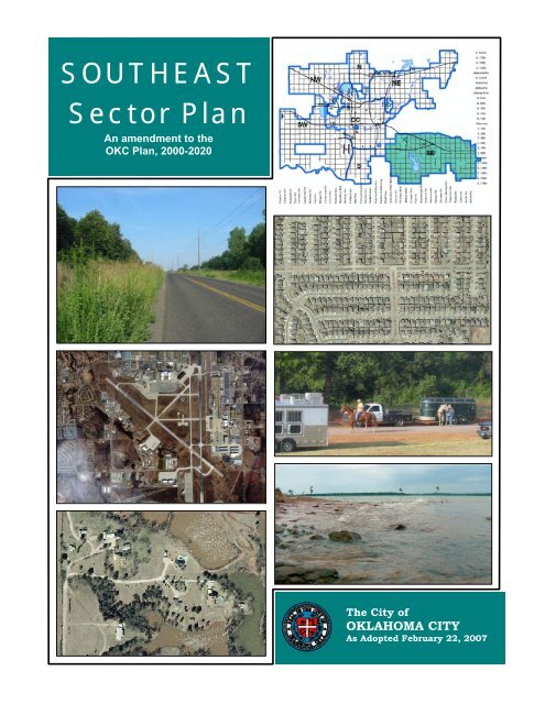
SOUTHEAST Sector Plan - City of Oklahoma City
SOUTHEAST Sector Plan - City of Oklahoma City
SOUTHEAST Sector Plan - City of Oklahoma City

You also want an ePaper? Increase the reach of your titles
YUMPU automatically turns print PDFs into web optimized ePapers that Google loves.
<strong>SOUTHEAST</strong><br />
<strong>Sector</strong> <strong>Plan</strong><br />
An amendment to the<br />
OKC <strong>Plan</strong>, 2000-2020<br />
The <strong>City</strong> <strong>of</strong><br />
OKLAHOMA CITY<br />
As Adopted February 22, 2007
Southeast <strong>Sector</strong> <strong>Plan</strong><br />
CONTRIBUTORS<br />
Southeast <strong>Sector</strong> <strong>Plan</strong> Team Members<br />
Sen. Cliff Aldridge<br />
Jim Allen<br />
Derrick Ashong<br />
Rep. Gary Banz<br />
Betty Bauer<br />
J. Dwight Burchett<br />
Ed Burnett<br />
John M. Byrd<br />
Carol Cline<br />
JJ Cook<br />
Roy Copeland<br />
Jeremy Cox<br />
Steve Cusack<br />
Bill Dalke<br />
Ryan Epley<br />
Kristi Gifford<br />
Linda Harrell<br />
Mike Houlette<br />
James Jordan<br />
Sunnie Killian<br />
Robert Krueger<br />
Walt Kula<br />
Tom Leatherbee<br />
Wilburn Lee<br />
Michelle Liu<br />
Paul McDoulett<br />
Jim McWhirter<br />
Gregory T. Metty<br />
Tracy J Moore Brice<br />
LouAnna Munkres<br />
Carol Murray<br />
Fran Olsen Sharp<br />
Marilyn Petricek<br />
William & Barbara Phelps<br />
Dan Reeves<br />
John Sharp<br />
Art Snider<br />
Michael Starega<br />
Carl Sullivan<br />
Gene Thomas<br />
Miles Walker<br />
James Wheatley<br />
Councilman Pete White<br />
Ray & LeAnn White<br />
Perry L Williams<br />
<strong>City</strong> <strong>of</strong> <strong>Oklahoma</strong> <strong>City</strong> <strong>Plan</strong>ning Department<br />
John Dugan, <strong>Plan</strong>ning Director<br />
Aubrey Hammontree, Project <strong>Plan</strong>ner<br />
Kelly Driscoll<br />
Lanc Gross<br />
Other Assistance<br />
Charles Allen, Major, Santa Fe Division, <strong>Oklahoma</strong> <strong>City</strong> Police Department<br />
Bob Fabian, Geologist, <strong>Plan</strong>ning &Management Division, <strong>Oklahoma</strong> Water Resources Board<br />
Monte Hannon, Water Quality Superintendent, <strong>Oklahoma</strong> <strong>City</strong> Water / Wastewater Utilities<br />
Department<br />
Bryan Heirston, Deputy Chief, <strong>Oklahoma</strong> <strong>City</strong> Fire Department<br />
Allen Jones, Chief <strong>Plan</strong>t Operator, <strong>Oklahoma</strong> <strong>City</strong> Water Department<br />
James Linn II, <strong>Oklahoma</strong> <strong>City</strong> Water and Wastewater, Solid Waste Management Division<br />
Shea Otley, State Historic Preservation Office<br />
Paul Ryckbost, Project Manager, GO Bond Program, <strong>Oklahoma</strong> <strong>City</strong> Public Works<br />
Bret Weingart, Assistant Director, <strong>Oklahoma</strong> <strong>City</strong> Water / Wastewater Utilities Department<br />
Special Thanks<br />
Senior Minister Kevin Pigg and Robert Krueger for hosting all SE <strong>Sector</strong> <strong>Plan</strong> Team and<br />
Community Meetings at Harmony Christian Church.
Southeast <strong>Sector</strong> <strong>Plan</strong><br />
EXECUTIVE SUMMARY<br />
The increased rate <strong>of</strong> suburban growth and acreage development have presented<br />
new challenges to our expanding city. The previous Comprehensive <strong>Plan</strong>, adopted in 2000,<br />
outlined general policies for rural and urban growth that were not adequate to address the<br />
distinctly different issues within specific areas <strong>of</strong> the city. Therefore, the <strong>Plan</strong>ning<br />
Commission requested that the <strong>Plan</strong>ning Department develop detailed plans to aid them in<br />
making decisions about the numerous developments proposed in the city’s highest areas <strong>of</strong><br />
growth. The <strong>Plan</strong>ning Department divided the outlying areas <strong>of</strong> <strong>Oklahoma</strong> <strong>City</strong> into six<br />
geographic boundaries, or sectors. The Southeast <strong>Sector</strong> <strong>Plan</strong> addresses one <strong>of</strong> these six<br />
sectors.<br />
The <strong>Sector</strong> <strong>Plan</strong>s are formed through an open public process utilizing a volunteer<br />
“<strong>Plan</strong> Team” composed <strong>of</strong> interested parties from the community. The <strong>Plan</strong> Team identifies<br />
the issues and concerns that they perceive will impact the future growth and development <strong>of</strong><br />
the sector within a 30 year period, and develop strategies and recommendations to address<br />
these concerns. This plan is divided into six chapters that include the purpose and intent <strong>of</strong><br />
the plan, background information about the area, issues <strong>of</strong> concern within the planning<br />
period, and strategies and policy recommendations to accomplish the goals in the plan.<br />
The next several paragraphs highlight the major issues that are specific to the<br />
Southeast <strong>Sector</strong>. This <strong>Sector</strong> is experiencing moderate residential growth, and has enough<br />
undeveloped land to accommodate the housing needs anticipated within the next 30 years.<br />
However, the <strong>Plan</strong> Team feels that it is imperative to maintain the sector’s low density and<br />
rural character to protect economic and environmental resources. Major features within the<br />
Southeast <strong>Sector</strong> include Lake Stanley Draper, the West Elm Creek Reservoir preserve,<br />
North Deer Creek Reservoir and Tinker Air Force Base (Tinker), which is a major economic<br />
contributor to the Central <strong>Oklahoma</strong> region.<br />
There is a clear separation between the urban growth and rural/agricultural land use<br />
areas within the <strong>Sector</strong>. The western and northwestern portion <strong>of</strong> the sector is serviced by<br />
city water and sewer, and supports a concentration <strong>of</strong> commercial, residential and industrial<br />
development surrounding and including Tinker. The remainder <strong>of</strong> the <strong>Sector</strong> is blanketed by<br />
rural acreage development and includes two reservoirs and a future reservoir preserve<br />
supported by a network <strong>of</strong> creeks and streams. Between these two distinctly different<br />
development areas, conflicts may occur when proposed development challenges the<br />
characteristics that make them unique.<br />
There is limited area remaining in the western and northwestern portion <strong>of</strong> the <strong>Sector</strong><br />
that can support new commercial, industrial and higher density residential development.<br />
The <strong>Plan</strong> Team designated the area east <strong>of</strong> Tinker, between I-240 and I-40 to be ideal for<br />
future expansion <strong>of</strong> the Air Force Base and supporting uses, and new high-tech industrial<br />
development. This designation supports anticipated transportation and access needs and<br />
minimizes the existing traffic and circulation challenges within this area. Such development<br />
<strong>of</strong> this section <strong>of</strong> land is essential, considering its confinement within two interstate<br />
highways and an active military base.<br />
The existing infrastructure has constraints that challenge the Southeast <strong>Sector</strong>’s<br />
ability to effectively support increasing densities within its rural areas. New development<br />
only should be allowed with careful consideration <strong>of</strong> its impacts, and the incorporation <strong>of</strong><br />
i
Southeast <strong>Sector</strong> <strong>Plan</strong><br />
EXECUTIVE SUMMARY<br />
necessary mitigation measures and improvements. The low densities within the eastern twothirds<br />
<strong>of</strong> the sector are beneficial to the health and sustainability <strong>of</strong> the natural environment,<br />
which includes a distinctly unique forest ecotype, numerous species <strong>of</strong> flora and fauna, and<br />
an abundant supply <strong>of</strong> high quality surface and ground water. In addition, this undeveloped<br />
land area serves to recharge a major aquifer that provides water to several municipalities.<br />
Fortunately, the Southeast <strong>Sector</strong>’s primary framework is structured in a way that can<br />
support its critical functions and provide for the future sustainability <strong>of</strong> both the natural and<br />
built environment. The success <strong>of</strong> Tinker, in part, depends upon the compatibility <strong>of</strong> its<br />
surrounding development. Although the Military Base itself requires and generates a certain<br />
amount <strong>of</strong> industrial, commercial and residential development activity, the surrounding lowdensity<br />
development, Lake Draper, and the West Elm Creek Reserve are beneficial to Tinker.<br />
These large areas <strong>of</strong> natural open space provide important habitat for wildlife, which<br />
otherwise would be drawn to Tinker. Wildlife can create hazards for airfield operations, such<br />
as deer on runways or birds in flight paths. Additionally, the proximity <strong>of</strong> these large natural<br />
open spaces are beneficial for the Base’s operations, which are best suited to occur within<br />
low-density areas <strong>of</strong> a city.<br />
The major issues presented within the Southeast <strong>Sector</strong> are addressed by these<br />
fundamental recommendations:<br />
Protect, preserve and enhance the sector’s natural resources and the recreational<br />
amenities they present (including Lake Draper, West Elm Creek Reservoir, North Deer<br />
Creek Reservoir, stream corridors and undeveloped open space) to provide for<br />
− the future benefit <strong>of</strong> the community and<br />
− the sustainability <strong>of</strong> the environment.<br />
Protect and preserve the rural character <strong>of</strong> the sector by considering all impacts <strong>of</strong><br />
development proposals, and providing necessary improvements to infrastructure<br />
concurrent with new development to<br />
− sustain quality in the built environment,<br />
− provide efficient and effective delivery <strong>of</strong> services, and<br />
− promote the health and safety <strong>of</strong> the community.<br />
Allow for the expansion <strong>of</strong> Tinker and the expansion <strong>of</strong> specialized industrial<br />
development within a strategic area to<br />
− promote economic development,<br />
− sustain continued success <strong>of</strong> the Air Force Base, and<br />
− prevent adverse impacts <strong>of</strong> development.<br />
Strategies to accomplish these goals are contained within the recommended policies<br />
and actions outlined in the individual chapters <strong>of</strong> this plan. The <strong>Plan</strong> Team developed many<br />
strategies involving the participation and coordination <strong>of</strong> multiple special interest groups<br />
and agencies. The <strong>Plan</strong> Team identified Capital Improvements projects that should be<br />
considered a priority by <strong>City</strong> Council, and those that should be included in the next General<br />
Obligation Bond Issue. This plan intends to serve as a guide to enable more informed<br />
development, investment, and policy decisions shaping the quality <strong>of</strong> life in the Southeast<br />
<strong>Sector</strong>’s future.<br />
ii
Southeast <strong>Sector</strong> <strong>Plan</strong><br />
TABLE OF CONTENTS<br />
1. INTRODUCTION .............................................................................................. 1<br />
1.1 Purpose ............................................................................................. 1<br />
1.2 <strong>Plan</strong>ning Process ............................................................................... 2<br />
1.3 Description ........................................................................................ 3<br />
1.4 Vision................................................................................................. 6<br />
2. ENVIRONMENTAL AND NATURAL RESOURCES ............................................. 7<br />
SUMMARY..............................................................................................................................7<br />
2.1 Goals ................................................................................................. 7<br />
2.2 Assessment Of The Issues ................................................................. 7<br />
2.2.1 Environmental Assets........................................................................................ 7<br />
2.2.2 Water Quality and Water Resources ................................................................ 8<br />
2.2.3 Preservation <strong>of</strong> Trees and Open Space............................................................ 9<br />
2.3 Assessment Of The Environment........................................................ 9<br />
2.3.1 Ecoregion............................................................................................................ 9<br />
2.3.2 Climate..............................................................................................................10<br />
2.3.3 Soils ..................................................................................................................11<br />
2.3.4 Floodplains and Stream Corridors..................................................................11<br />
2.3.5 Impaired Lakes and Streams..........................................................................12<br />
2.3.6 Threatened and Endangered Species............................................................13<br />
2.3.7 Groundwater ....................................................................................................13<br />
2.3.8 Oil / Gas and Storage Tanks...........................................................................15<br />
2.3.9 Hazardous Materials .......................................................................................16<br />
2.3.10 Department <strong>of</strong> Environmental Quality Permits.............................................17<br />
2.4 History And Landmarks....................................................................19<br />
2.4.1 Historical Features...........................................................................................19<br />
2.4.2 Lake Stanley Draper ........................................................................................20<br />
2.4.3 West Elm Creek Reservoir...............................................................................22<br />
CONCERNS.......................................................................................................................... 23<br />
ACTIONS.............................................................................................................................. 24<br />
3. DEVELOPMENT AND DESIGN ....................................................................... 27<br />
SUMMARY........................................................................................................................... 27<br />
3.1 Development Issues, Influences and Opportunities..........................27<br />
3.1.1 Tinker Air Force Base.......................................................................................27<br />
3.1.2 Former General Motors Site............................................................................27<br />
3.1.3 Economic Development / Employment Corridors .........................................28<br />
3.2 Current Land Use & Zoning ..............................................................28<br />
3.2.1 Land Use...........................................................................................................28<br />
iii
Southeast <strong>Sector</strong> <strong>Plan</strong><br />
TABLE OF CONTENTS<br />
3.2.2 Zoning...............................................................................................................29<br />
3.3 Land Use Analysis............................................................................33<br />
3.4 Proposed Land Use <strong>Plan</strong> ..................................................................34<br />
CONCERNS.......................................................................................................................... 39<br />
ACTIONS.............................................................................................................................. 39<br />
4. PUBLIC SERVICES AND INFRASTRUCTURE.................................................... 45<br />
SUMMARY........................................................................................................................... 45<br />
4.1 Police Protection .............................................................................45<br />
4.1.1 Police Staffing within the Southeast <strong>Sector</strong> ..................................................46<br />
4.1.2 Crime Incidents ................................................................................................46<br />
4.2 Fire Protection And Emergency Services..........................................48<br />
4.2.1 Fire Stations within the Southeast <strong>Sector</strong> .....................................................48<br />
4.2.2 Emergency Medical Response........................................................................48<br />
4.2.3 Fire Control and Prevention Measures...........................................................49<br />
4.2.4 Additional Fire Protection Requirements .......................................................49<br />
4.2.5 Public Safety Capital Sales Tax.......................................................................50<br />
4.3 Transportation .................................................................................50<br />
4.3.1 Current Conditions...........................................................................................50<br />
4.3.2 Assessment <strong>of</strong> Transportation Needs ............................................................52<br />
4.4 Water Supply ...................................................................................54<br />
4.5 Sanitary Sewer.................................................................................55<br />
4.6 Solid Waste .....................................................................................56<br />
4.7 Parks, Recreation And Open Space..................................................57<br />
4.8 Schools ............................................................................................58<br />
CONCERNS.......................................................................................................................... 59<br />
ACTIONS.............................................................................................................................. 61<br />
5. COMMUNITY INVOLVEMENT ....................................................................... 65<br />
SUMMARY........................................................................................................................... 65<br />
5.1 Neighborhood Associations..............................................................65<br />
5.2 Public Notifications .........................................................................66<br />
5.2.1 Rezoning...........................................................................................................66<br />
5.2.2 Plat Approval ....................................................................................................66<br />
CONCERNS.......................................................................................................................... 66<br />
ACTIONS.............................................................................................................................. 66<br />
iv
Southeast <strong>Sector</strong> <strong>Plan</strong><br />
TABLE OF CONTENTS<br />
6. PLAN IMPLEMENTATION............................................................................... 69<br />
6.1 One-time <strong>Plan</strong> Actions .....................................................................69<br />
6.1.1 Zoning Ordinance and Subdivision Regulations............................................69<br />
6.1.2 Recommended Capital Improvements Projects (CIP) ...................................70<br />
6.2 Ongoing <strong>Plan</strong> Actions.......................................................................71<br />
6.2.1 Environment.....................................................................................................71<br />
6.2.2 Land Use and Development Standards .........................................................72<br />
6.2.3 Parks and Recreation......................................................................................73<br />
6.2.4 Public Services.................................................................................................73<br />
6.2.5 Schools .............................................................................................................74<br />
6.2.6 Community Involvement..................................................................................75<br />
7. APPENDIX..................................................................................................... 77<br />
7.1 References ......................................................................................77<br />
7.2 Resources ........................................................................................77<br />
INDEX OF MAPS<br />
Map 1: Project Boundary Map ........................................................................................... 3<br />
Map 2:<br />
Ecoregions............................................................................................................10<br />
Map 3: Soils ......................................................................................................................11<br />
Map 4: Floodplains ...........................................................................................................12<br />
Map 5: Aquifers and Recharge Rates .............................................................................14<br />
Map 6: Oil / Gas and Storage Tanks ...............................................................................16<br />
Map 7:<br />
Hazardous Materials............................................................................................17<br />
Map 8: Department <strong>of</strong> Environmental Quality Permits ..................................................18<br />
Map 9: Lake Draper <strong>Plan</strong>ned Unit Development Conceptual Map ..............................20<br />
Map 10: Lake Draper <strong>Plan</strong> ................................................................................................21<br />
Map 11: West Elm Creek Reservoir...................................................................................23<br />
Map 12: Land Use (June, 2005) ........................................................................................31<br />
Map 13: Zoning (August, 2006).........................................................................................32<br />
Map 14: Land available for development .........................................................................37<br />
Map 15: Proposed Land Use <strong>Plan</strong>, 2030..........................................................................38<br />
Map 16: Police Patrol Divisions and Briefing Stations .....................................................46<br />
Map 17: Concentration <strong>of</strong> Major Crimes by quarter section, 2000 - 2005....................47<br />
Map 18: Fire Stations and Fire District Location Map......................................................48<br />
v
Southeast <strong>Sector</strong> <strong>Plan</strong><br />
TABLE OF CONTENTS<br />
Map 19: Major Streets and Traffic Signals........................................................................51<br />
Map 20: Capital Improvements Projects, 1995-2000 .....................................................51<br />
Map 21: Traffic Volumes, Bryant Avenue to Hiwasse Road, 2004..................................53<br />
Map 22: Traffic Volumes, Henney Road to Harrah Road, 2004......................................54<br />
Map 23: Water Mains .........................................................................................................55<br />
Map 24: Sanitary Sewer .....................................................................................................56<br />
Map 25: Solid Waste Collection and Landfill Location.....................................................57<br />
Map 26: Parks and Recreational Facilities .......................................................................57<br />
Map 27: Southeast <strong>Sector</strong> Area Trails...............................................................................58<br />
Map 28: School Districts, Types, and Location.................................................................59<br />
Map 29: Neighborhood Associations.................................................................................65<br />
Map 30: Recommended Capital Improvement Projects (CIP) .........................................71<br />
INDEX OF TABLES<br />
Table 1: Population and Housing Growth .......................................................................... 4<br />
Table 2: Selected Demographic Data, US Census 2000 .................................................. 5<br />
Table 3: Tests for Water Quality ......................................................................................... 9<br />
Table 4: Climate Summaries ............................................................................................10<br />
Table 5: Impaired Waterbodies ........................................................................................13<br />
Table 6: Threatened and Endangered Species ...............................................................13<br />
Table 7: Department <strong>of</strong> Environmental Quality Permits, Address and Type .................18<br />
Table 8: Land Use in the Southeast <strong>Sector</strong>, June 2005 .................................................28<br />
Table 9: Zoning in the Southeast <strong>Sector</strong> (March, 2006) ................................................29<br />
Table 10: Housing Units Needed, 2006 – 2030 ...............................................................33<br />
Table 11: Land Available for Development within <strong>Plan</strong> Designations .............................33<br />
Table 12: Land Needed to Accommodate Expected Growth ............................................34<br />
Table 13: Average Number <strong>of</strong> Officers on Duty, Santa Fe Division ..................................46<br />
Table 14: Major Crime Incidence by Crime Category, 2005 .............................................47<br />
Table 15: Additional Fire Protection Requirements ..........................................................50<br />
Table 16: School Enrollment by District .............................................................................58<br />
vi
Southeast <strong>Sector</strong> <strong>Plan</strong><br />
CHAPTER 1<br />
1. INTRODUCTION<br />
1.1 PURPOSE<br />
The <strong>Plan</strong>ning Department’s ultimate role is to develop a Comprehensive <strong>Plan</strong> to guide<br />
the development <strong>of</strong> the city. On September 28, 2000, the <strong>Oklahoma</strong> <strong>City</strong> <strong>Plan</strong>ning<br />
Commission adopted the <strong>Oklahoma</strong> <strong>City</strong> Comprehensive <strong>Plan</strong> 2000-2020. Four years later,<br />
the <strong>Plan</strong>ning Commission saw a need to update the Comprehensive <strong>Plan</strong>’s policies and<br />
recommendations addressing growth in<br />
outlying areas <strong>of</strong> the city, and initiated the<br />
process for developing <strong>Sector</strong> <strong>Plan</strong>s.<br />
The <strong>Plan</strong>ning Department is charged<br />
with facilitating the development <strong>of</strong> <strong>Sector</strong><br />
<strong>Plan</strong>s for six areas <strong>of</strong> the <strong>City</strong> (*excluding<br />
the Central <strong>City</strong>). <strong>Plan</strong> updates for the<br />
Central <strong>City</strong> will be handled through<br />
neighborhood and corridor plans.<br />
Each <strong>of</strong> the city’s six sectors has<br />
unique social, historic and environmental<br />
characteristics, specific growth and<br />
development concerns, and public service<br />
needs. The sector planning process will<br />
develop policies, strategies and land use<br />
designations to support, promote and<br />
advocate detailed plans within those areas.<br />
<strong>City</strong> <strong>of</strong> <strong>Oklahoma</strong> <strong>City</strong> – <strong>Sector</strong> <strong>Plan</strong>ning Areas<br />
There are six sector planning areas defined within the city<br />
limits. This document addresses the Southeast <strong>Sector</strong><br />
(shown as SE) *Central <strong>City</strong> (shown as CC in darker shade)<br />
is excluded from sector plans and will be addressed<br />
through special area and corridor plans.<br />
These plans will include recommendations for the types <strong>of</strong> new development that can<br />
occur, where this growth will be, and what services and facilities will be needed to serve this<br />
growth. When completed, the sector plans will be used by <strong>City</strong> <strong>of</strong>ficials, citizens, and private<br />
businesses to guide long-term decisions about future growth and development in the <strong>City</strong>’s<br />
fastest growing areas.<br />
The sector planning process is a collaborative effort led by <strong>Plan</strong>ning Staff and<br />
involving <strong>City</strong> Council and <strong>Plan</strong>ning Commission members, neighborhood leaders, area<br />
developers, school representatives, and other interested persons. An initial public meeting<br />
is held, at which participants can express their ideas about their area’s growth and<br />
development. Participants also have an opportunity to volunteer for a <strong>Plan</strong> Team that<br />
develops the policies to be included in the area’s long range plan in a series <strong>of</strong> small group<br />
meetings. After the <strong>Plan</strong> Team completes its work, the draft sector plans are presented at<br />
follow-up public meetings for citizen review. When this public phase is completed, the plans<br />
are presented to <strong>Plan</strong>ning Commission for approval and Council for acceptance as<br />
amendments to the <strong>City</strong>’s Comprehensive <strong>Plan</strong>.<br />
This document addresses the Southeast <strong>Sector</strong>. <strong>Plan</strong>ning Commission adopted the<br />
Southwest <strong>Sector</strong> plan on March 23, 2006. <strong>Sector</strong> <strong>Plan</strong>s for Northeast, North, Northwest,<br />
and South will follow.<br />
INTRODUCTION 1
Southeast <strong>Sector</strong> <strong>Plan</strong><br />
CHAPTER 1<br />
1.2 PLANNING PROCESS<br />
The Southeast <strong>Sector</strong> planning process began on November 8, 2005 with a public<br />
meeting at Harmony Christian Church, at 7100 S. Choctaw Road. 67 area residents,<br />
property owners, business interests, public & elected <strong>of</strong>ficials and others interested in plans<br />
for the growth and development <strong>of</strong> <strong>Oklahoma</strong> <strong>City</strong>’s Southeast <strong>Sector</strong> attended the meeting.<br />
At the meeting, the <strong>Plan</strong>ning Department made a short presentation summarizing<br />
development trends and potential issues within the area. This was followed by a question<br />
and answer period, and discussion <strong>of</strong> other concerns and ideas about the area’s future<br />
growth and development. The <strong>Plan</strong>ning Department distributed a questionnaire to capture<br />
attendees’ primary concerns and expectations for the <strong>Plan</strong>, and sign-up sheets for<br />
interested parties to volunteer to be a part <strong>of</strong> a <strong>Plan</strong> Team.<br />
At this meeting and over the next several weeks, over forty individuals volunteered to<br />
serve on the Southeast <strong>Sector</strong> <strong>Plan</strong> Team. From November 22, 2005 through May 16,<br />
2006, the <strong>Plan</strong> Team carried out extensive discussions on a wide array <strong>of</strong> planning issues<br />
related to the growth and development <strong>of</strong> the Southeast <strong>Sector</strong>. Among the issues<br />
discussed by the <strong>Plan</strong> Team were:<br />
→ Amount and location <strong>of</strong> expected growth in the Southeast <strong>Sector</strong> over the next thirty years;<br />
→ Public facility and service improvements, such as streets and roads, parks, fire and police service,<br />
water and sewer availability and systems, and solid waste service;<br />
→ Water quality and quantity related to private water wells serving rural residences;<br />
→ Protecting natural resources, wooded areas, streams, and lakes;<br />
→ Promoting high-quality development through such measures as protecting views, creating<br />
appearance corridors, and the incorporating more landscaping, open space, and trails in new<br />
development; and<br />
→ Keeping area residents and businesses informed about development proposals in the area.<br />
The <strong>Plan</strong> Team developed a draft plan incorporating recommended policies<br />
addressing these and other issues in the Southeast <strong>Sector</strong>. Reviews from <strong>City</strong> Departments,<br />
Public Agencies, and the Mayor’s Quality Housing Task Force contributed to the<br />
development <strong>of</strong> the plan. The <strong>Plan</strong>ning Department and <strong>Plan</strong> Team presented the final draft<br />
plan in a public meeting on December 19, 2006 to receive comments from residents and<br />
property owners within the Southeast <strong>Sector</strong>.<br />
On February 8, 2007, the <strong>City</strong> <strong>of</strong> <strong>Oklahoma</strong> <strong>City</strong> <strong>Plan</strong>ning Commission held a public<br />
hearing to receive citizen comments on the Southeast <strong>Sector</strong> <strong>Plan</strong>. On February 22, 2007,<br />
the <strong>Plan</strong>ning Commission adopted the Southeast <strong>Sector</strong> <strong>Plan</strong> as part <strong>of</strong> the <strong>City</strong>’s<br />
Comprehensive <strong>Plan</strong>. The Mayor and <strong>City</strong> Council received the plan on March 6, 2007.<br />
The Southeast <strong>Sector</strong> <strong>Plan</strong> provides direction for decisions by <strong>Plan</strong>ning Commission,<br />
<strong>City</strong> Council, and private developers as to the amount and location <strong>of</strong> future growth and<br />
development in the Southeast <strong>Sector</strong>. The <strong>Plan</strong> will also guide the location and timing <strong>of</strong><br />
public improvements to meet current needs and the demands created by future growth. The<br />
priorities for capital improvements outlined in the <strong>Plan</strong> will be implemented through<br />
proposed projects in the <strong>City</strong>’s Capital Improvement Programs and expenditures for public<br />
services in the <strong>City</strong>’s annual budgets.<br />
2 INTRODUCTION
Southeast <strong>Sector</strong> <strong>Plan</strong><br />
CHAPTER 1<br />
1.3 DESCRIPTION<br />
The Southeast <strong>Sector</strong> <strong>Plan</strong>ning area includes 142.2 square miles located in the far<br />
southeastern portion <strong>of</strong> <strong>Oklahoma</strong> <strong>City</strong>. Distinguishing features within the sector include<br />
Tinker Air Force Base, Lake Stanley Draper, and a predominant land use <strong>of</strong> rural acreage<br />
and agricultural development.<br />
Map 1: Project Boundary Map<br />
<strong>Plan</strong> Team members characterize the area as largely rural with vast amounts <strong>of</strong> open<br />
space and desirable views <strong>of</strong> rolling hills and woodlands. They describe this area as having<br />
many natural assets deserving <strong>of</strong> preservation. Members <strong>of</strong> the <strong>Plan</strong> Team stated that they<br />
are proud <strong>of</strong> the diverse character the Southeast <strong>Sector</strong> <strong>of</strong>fers its residents and visitors.<br />
<strong>Plan</strong> Team members and members <strong>of</strong> the community characterized the sector<br />
differently based on individual perspectives as developers, rural or urban residents. Despite<br />
seemingly conflicting interests, these groups expressed a common desire for growth that is<br />
well-planned, with appropriate densities and development standards that highlight and<br />
protect the character <strong>of</strong> the sector.<br />
Overlapping city boundaries and school districts lend a mixed identity to the<br />
Southeast <strong>Sector</strong>. Within the sector, eight separate school districts are represented. The<br />
Southeast <strong>Sector</strong> is adjacent to cities such as: Midwest <strong>City</strong>, Del <strong>City</strong>, Valley Brook, Choctaw,<br />
Nicoma Park, Harrah, Moore, Norman, and McLoud.<br />
INTRODUCTION 3
Southeast <strong>Sector</strong> <strong>Plan</strong><br />
CHAPTER 1<br />
The area has experienced steady growth over the past ten years. The rate <strong>of</strong> growth<br />
is projected to slightly decrease throughout the 30-year planning period.<br />
Table 1: Population and Housing Growth<br />
Year Housing Units Population Source<br />
1990 7,580 21,731 US Census, 1990<br />
2000 10,143 26,860 US Census, 2000<br />
2006 12,483 30,999 <strong>Plan</strong>ning Dept estimate (July 2006)<br />
2010 13,731 35,000 <strong>Plan</strong>ning Dept projections<br />
2020 16,779 41,872 <strong>Plan</strong>ning Dept projections<br />
2030 19,910 48,735 <strong>Plan</strong>ning Dept projections<br />
Comparing year 2000 Census data to all <strong>of</strong> <strong>Oklahoma</strong> <strong>City</strong> shows higher household<br />
incomes, housing values, and owner occupied percentages, along with lower vacancy rates<br />
within the Southeast <strong>Sector</strong>.<br />
The median age is nearly the same for all <strong>of</strong> <strong>Oklahoma</strong> <strong>City</strong> and the Southeast <strong>Sector</strong>,<br />
although the population aged 65 and over is lower within the Southeast <strong>Sector</strong>.<br />
Percentages in the 5-17, 25-44, and 45-64 age groups are all higher in the Southeast<br />
<strong>Sector</strong> than <strong>Oklahoma</strong> <strong>City</strong> as a whole. Thus, the Southeast <strong>Sector</strong> has a higher proportion<br />
<strong>of</strong> young to middle-aged families with school-aged children than compared with <strong>Oklahoma</strong><br />
<strong>City</strong>. Average household size is higher in the Southeast <strong>Sector</strong> (2.84) than <strong>Oklahoma</strong> <strong>City</strong><br />
(2.41) and the national average <strong>of</strong> 2.59. The percentage <strong>of</strong> single parent families is<br />
significantly lower in the Southeast <strong>Sector</strong> than for <strong>Oklahoma</strong> <strong>City</strong> and the metro.<br />
The Southeast <strong>Sector</strong> is less ethnically diverse than compared with <strong>Oklahoma</strong> <strong>City</strong><br />
and the metro area, with only 20.3% minorities (other than non-Hispanic white).<br />
The Southeast <strong>Sector</strong> median household income is nearly $14,000 higher than<br />
<strong>Oklahoma</strong> <strong>City</strong> as a whole. The percentage <strong>of</strong> persons below poverty in <strong>Oklahoma</strong> <strong>City</strong> is two<br />
times higher than those below poverty in the Southeast <strong>Sector</strong>.<br />
The sector’s percentage unemployed is significantly less than <strong>Oklahoma</strong> <strong>City</strong>. High<br />
median income, housing values and owner occupancy levels coupled with low<br />
unemployment indicate a strong housing and economic base for the Southeast <strong>Sector</strong>.<br />
4 INTRODUCTION
Southeast <strong>Sector</strong> <strong>Plan</strong><br />
CHAPTER 1<br />
Table 2: Selected Demographic Data, US Census 2000<br />
INTRODUCTION 5
Southeast <strong>Sector</strong> <strong>Plan</strong><br />
CHAPTER 1<br />
1.4 VISION<br />
The mission <strong>of</strong> the <strong>Plan</strong> Team is “to plan for future growth and orderly development<br />
<strong>of</strong> the Southeast <strong>Sector</strong>, so that we can preserve the environment and protect our quality <strong>of</strong><br />
life”. The <strong>Plan</strong> Team developed a vision <strong>of</strong> how the Southeast <strong>Sector</strong> would be described if<br />
planning goals are met.<br />
Effective <strong>Plan</strong>ning for Future Growth<br />
The Southeast <strong>Sector</strong> is a well-planned area<br />
− with development that conforms to the plan;<br />
− where development and infrastructure are coordinated and compatible;<br />
− where infrastructure improvements are strategically implemented by areas <strong>of</strong> priority;<br />
− and where full and timely planning and development information is provided to those<br />
involved and affected by planning decisions.<br />
Character and Natural Resources<br />
As the Southeast <strong>Sector</strong> grows and develops,<br />
− its rural character and open space are preserved and<br />
− its environmental resources are protected.<br />
Emergency Services and Infrastructure<br />
Within the Southeast <strong>Sector</strong>,<br />
− citizens and property are safe and protected, with efficient and timely emergency<br />
response to calls for service from rural residents and businesses;<br />
− high quality streets and well-planned access points for new development promote<br />
efficient traffic circulation;<br />
− roads are repaired and maintained through coordination between <strong>City</strong> and County<br />
agencies to increase safety and ease <strong>of</strong> travel while decreasing delays; and<br />
− the quality <strong>of</strong> infrastructure (roads, water, sewer, fire and police facilities and<br />
schools) is adequate for current development and anticipated growth, with facilities<br />
in place as development occurs.<br />
Transportation and Development Corridors<br />
Within the Southeast <strong>Sector</strong>,<br />
− transportation corridors along Interstate-240 (I-240) and Interstate-40 (I-40) provide<br />
desired, commercial development that preserves view sheds and protects the rural<br />
character <strong>of</strong> the area; and<br />
− the transportation system provides choices to residents and businesses as to modes<br />
<strong>of</strong> travel and travel routes that provide good access within and between area<br />
neighborhoods and to outside destinations, including jobs.<br />
Involved Community<br />
The Southeast <strong>Sector</strong> has strong citizen involvement with<br />
− full participation by residents and area businesses in making planning decisions that<br />
affect the area; and<br />
− strong neighborhood associations that engender quality, safety, and pride in<br />
ownership.<br />
6 INTRODUCTION
Southeast <strong>Sector</strong> <strong>Plan</strong><br />
CHAPTER 2<br />
2. ENVIRONMENTAL AND NATURAL RESOURCES<br />
SUMMARY<br />
The <strong>Plan</strong> Team expressed that the natural environment within the Southeast <strong>Sector</strong><br />
is a strong part <strong>of</strong> the area’s identity and a unifying characteristic that should be preserved.<br />
Its diverse character is illustrated in the western part <strong>of</strong> the sector by an urban and<br />
industrial development pattern, and a largely rural character in the eastern two-thirds <strong>of</strong> the<br />
sector. The <strong>Plan</strong> Team identified basic concerns, and developed recommendations and<br />
strategies that support, promote and advocate the protection <strong>of</strong> environmental and natural<br />
resources, and aimed at preserving the sector’s character.<br />
This section provides information about the environmental baseline in the Southeast<br />
<strong>Sector</strong> and highlights its significant natural and historical assets. Baseline information is<br />
also provided for potential environmental constraints such as hazardous materials locations<br />
and floodplains. The major concerns developed by the <strong>Plan</strong> Team are largely related to<br />
negative impacts <strong>of</strong> unmanaged development. Without proper guidance, development could<br />
negatively impact the existing cultural and natural resources and jeopardize the character<br />
and ecological value <strong>of</strong> the existing and proposed reservoirs. Specific actions recommended<br />
to address these concerns call for the<br />
incorporation <strong>of</strong> water quality test and standards into zoning regulations;<br />
preservation <strong>of</strong> natural areas and open space, and<br />
implementation <strong>of</strong> measures to preserve and enhance natural resources in concert with<br />
new development.<br />
2.1 GOALS<br />
The team’s assessment <strong>of</strong> the environmental issues within the Southeast <strong>Sector</strong><br />
culminated with the following goals:<br />
Maintain high environmental standards in order to<br />
− preserve a rural character and appropriate rural density for development;<br />
− protect the development and uses around Lake Draper; and<br />
− maintain the availability and quality <strong>of</strong> groundwater as new development occurs.<br />
2.2 ASSESSMENT OF THE ISSUES<br />
During <strong>Plan</strong> Team meetings, discussions <strong>of</strong> planning policies <strong>of</strong>ten came back to<br />
environmental and natural resource concerns. The <strong>Plan</strong> Team categorized these issues into<br />
three categories: Environmental Assets; Water Quality and Water Resources; and the<br />
Preservation <strong>of</strong> Trees and Open Space.<br />
2.2.1 Environmental Assets<br />
The <strong>Plan</strong> Team identified several unique environmental assets and natural resources<br />
within the Southeast <strong>Sector</strong>. These assets help define the character <strong>of</strong> the sector, and are<br />
important features to retain and preserve as new development occurs.<br />
ENVIRONMENTAL AND NATURAL RESOURCES 7
Southeast <strong>Sector</strong> <strong>Plan</strong><br />
CHAPTER 2<br />
Abundance <strong>of</strong> natural geological formations called “Rose Rocks”<br />
Lake Draper and recreational amenities<br />
Potential West Elm Creek Reservoir<br />
Dedicated Motor Cross Trails<br />
Crosstimbers Campsite<br />
Multi-modal Trails (hiking, biking, equestrian, etc.)<br />
Potential for “Agritourism”<br />
Presence <strong>of</strong> numerous Archeological Sites<br />
Abundance <strong>of</strong> undeveloped land<br />
Possible Historical Sites & Buildings eligible for Historic Register<br />
Tinker Air Force Base<br />
Presence <strong>of</strong> Native American Tribes<br />
Cemeteries<br />
The <strong>Plan</strong> Team identified both positive and negative issues related to these assets.<br />
Future policy decisions should support the continued development <strong>of</strong> the positive issues,<br />
and be sensitive to the negative issues listed below.<br />
Positive<br />
− Natural Resources within the sector may direct increased attention to the area that<br />
could draw new development and spur more community involvement.<br />
− Increased development and community involvement could empower developers,<br />
investors, and businesses within the Southeast <strong>Sector</strong> with an increased ability to<br />
market, educate, and maintain the quality <strong>of</strong> the area. In turn, this could increase the<br />
ability <strong>of</strong> the sector’s residents and businesses to preserve the sector’s natural<br />
resources and environmental assets.<br />
Negative<br />
− Development within the sector may have adverse affects on the environment, such as<br />
water, noise and air pollution, soil erosion, litter, and disruption <strong>of</strong> wildlife.<br />
− Some <strong>of</strong> the area’s assets, such as the Motor Cross Trails and possible Agritourism<br />
practices and enterprises may generate these negative effects.<br />
− Extension <strong>of</strong> city services for the expansion <strong>of</strong> Tinker Air Force Base could encourage<br />
increased residential and commercial development that may encroach on the base.<br />
Increased development adjacent to the base may impact habitat and displace wildlife.<br />
The base is negatively affected by encroachment <strong>of</strong> wildlife into areas <strong>of</strong> operation, and<br />
by residential development within its flight patterns and noise contours.<br />
2.2.2 Water Quality and Water Resources<br />
Residents within the largely rural area <strong>of</strong> the Southeast <strong>Sector</strong> obtain water from<br />
wells, as city water service only extends to just east <strong>of</strong> Tinker Air Force Base. As<br />
development within the Southeast <strong>Sector</strong> increases, there is a perceived threat to the<br />
quality and availability <strong>of</strong> groundwater. Additionally, the Southeast <strong>Sector</strong> has many natural<br />
and man-made bodies <strong>of</strong> surface water, including one <strong>of</strong> the city’s three urban reservoirs –<br />
Lake Stanley Draper. Maintaining a high water quality and availability is a primary concern<br />
for those who reside, work, farm and recreate within the area.<br />
8 ENVIRONMENTAL AND NATURAL RESOURCES
Southeast <strong>Sector</strong> <strong>Plan</strong><br />
CHAPTER 2<br />
A variety <strong>of</strong> tests can be conducted for water wells to determine if undesirable<br />
constituents are present. Tests for coliform are the only water quality test required when<br />
selling a property with a well. Table 3 lists the cost and types <strong>of</strong> water quality tests<br />
available.<br />
Table 3: Tests for Water Quality<br />
Type <strong>of</strong> test Requirement Cost<br />
Coliform Currently required when selling property with a well $10.00<br />
pH, dissolved solids, chlorides, nitrates,<br />
and sulfur compounds<br />
Not currently required $75.00<br />
Arsenic Not currently required $30.00<br />
Coliform bacteria in water can come from septic tank leakage, from rainwater picking up<br />
animal wastes that then seep into the aquifer, or overflow <strong>of</strong> public sewer systems.<br />
Coliform bacteria can cause intestinal diseases such as cholera.<br />
pH refers to the acidity <strong>of</strong> the water. Pure water has a pH <strong>of</strong> 7.0 and desirable levels lie<br />
in the range <strong>of</strong> 6.5 to 8.5. Water with pH levels lower or higher than this range can cause<br />
corrosion <strong>of</strong> water pipes.<br />
Dissolved solids come from chemical compounds naturally occurring in the aquifer.<br />
These can give water a cloudy or milky appearance.<br />
Chlorides indicate salty water. All groundwater in aquifers becomes salty below a certain<br />
depth. High chlorides can also be caused by oilfield contaminants. Chlorides affect the<br />
taste <strong>of</strong> water.<br />
Nitrates are picked up from fertilizer on lawns or from agricultural activities. Nitrates<br />
affect the ability <strong>of</strong> hemoglobin in the blood to transmit oxygen, people affected by nitrate<br />
levels will complain <strong>of</strong> tiredness.<br />
Sulfur compounds in water come from chemicals naturally occurring in the aquifer, most<br />
commonly gypsum. Sulfate acts as a diuretic in the body. It can turn water white and as<br />
hydrogen sulfide will produce a rotten egg like odor.<br />
2.2.3 Preservation <strong>of</strong> Trees and Open Space<br />
The Southeast <strong>Sector</strong> has an abundance <strong>of</strong> open space, typified by rolling hills and<br />
wooded areas. As development increases, residents and property owners foresee the<br />
preservation <strong>of</strong> trees and open space to be essential in maintaining the character <strong>of</strong> the<br />
area and comfort <strong>of</strong> its citizens.<br />
2.3 ASSESSMENT OF THE ENVIRONMENT<br />
2.3.1 Ecoregion<br />
Ecoregions are defined as “relatively homogenous areas that can be mapped using<br />
factors such as land surface form, soils, land use and potential natural vegetation.” The<br />
majority <strong>of</strong> the Southeast <strong>Sector</strong> area lies within the Crosstimbers Ecoregion. This region<br />
includes a mixture <strong>of</strong> tall grass prairies and oak woodlands in roughly the central one-third <strong>of</strong><br />
<strong>Oklahoma</strong>. The Crosstimbers vegetation is made up <strong>of</strong> open stands <strong>of</strong> trees (Blackjack Oak<br />
and Post Oak), with an understory <strong>of</strong> woody plants, mid and tall grasses, and forbs. The<br />
westernmost portion <strong>of</strong> the Southeast <strong>Sector</strong> is within the Central Great Plains ecoregion.<br />
ENVIRONMENTAL AND NATURAL RESOURCES 9
Southeast <strong>Sector</strong> <strong>Plan</strong><br />
CHAPTER 2<br />
This ecoregion is dominated by mixed grass prairie, with trees concentrated along streams.<br />
Map 2 illustrates the Southeast <strong>Sector</strong>’s ecoregions.<br />
Map 2: Ecoregions<br />
2.3.2 Climate<br />
The Southeast <strong>Sector</strong> is almost evenly divided between <strong>Oklahoma</strong> and Cleveland<br />
counties, with a very small eastern portion in Pottawatomie County. Table 4 includes<br />
climate summaries for Cleveland and <strong>Oklahoma</strong> counties.<br />
Table 4: Climate Summaries<br />
Climate Variables <strong>Oklahoma</strong> County Cleveland County<br />
Temperature<br />
Average annual 61° F 61° F<br />
Average maximum 72° F 73° F<br />
Average minimum 49° F 49° F<br />
Precipitation<br />
Other<br />
Average annual 36.21 inches 37.29 inches<br />
Average annual snowfall 7.0 inches 6.8 inches<br />
Average wind speed 7 mph 10 mph<br />
Tornadoes (1950 – 2003) 86 55<br />
Sunshine 55-80% 55-80%<br />
Thunderstorm Days 49 49<br />
10 ENVIRONMENTAL AND NATURAL RESOURCES
Southeast <strong>Sector</strong> <strong>Plan</strong><br />
2.3.3 Soils<br />
CHAPTER 2<br />
There are two major soil series within the Southeast <strong>Sector</strong>, Stephenville and<br />
Renfrow. The Stephenville soil series, which is present in the majority <strong>of</strong> the Southeast<br />
<strong>Sector</strong>, is moderately deep, well-drained moderately permeable upland soils, with slight to<br />
moderate slopes. The Renfrow soil series is very deep, well-drained, very slowly permeable<br />
soils, with very slight slopes. Map 3 shows the distribution <strong>of</strong> these soil series.<br />
Map 3: Soils<br />
2.3.4 Floodplains and Stream Corridors<br />
A considerable amount <strong>of</strong> land within the Southeast <strong>Sector</strong> is within the 100-year<br />
floodplain, as shown in Map 4. Careful consideration should be given to any development<br />
within these areas, as it could increase flooding downstream by replacing vegetated areas<br />
with ro<strong>of</strong>tops and paving. The same consideration should be given for developments<br />
adjacent to any <strong>of</strong> the numerous stream corridors within the Southeast <strong>Sector</strong>. Vegetation<br />
along streams filters pollutants from surface water, reducing the amount contaminants<br />
carried into the streams by run<strong>of</strong>f. If vegetated areas are reduced or removed, it could lead<br />
to an increase in stream contaminants that could have detrimental effects on wildlife and<br />
human health.<br />
Within the area a stakeholder group named “Greenprint: East Metro Watershed” has<br />
formed to address water quality and quantity issues in the areas <strong>of</strong> Crutcho, Soldier and<br />
Cherry Creek tributaries.<br />
The undesirable effects <strong>of</strong> increased stormwater run <strong>of</strong>f can be mitigated in many<br />
ways. Detention ponds are one method <strong>of</strong> controlling stormwater run<strong>of</strong>f from developments.<br />
A detention pond stores accumulated stormwater run<strong>of</strong>f from a development and slowly<br />
releases it downstream. Under the <strong>City</strong>’s current drainage regulation, on-site detention is<br />
only required <strong>of</strong> developments in watersheds with known or projected flooding <strong>of</strong> structures.<br />
ENVIRONMENTAL AND NATURAL RESOURCES 11
Southeast <strong>Sector</strong> <strong>Plan</strong><br />
CHAPTER 2<br />
Map 4 shows that detention is required in the northwest portion <strong>of</strong> the Southeast <strong>Sector</strong>,<br />
near Crutcho Creek and Tinker Air Force Base.<br />
Other methods include retention/infiltration ponds, underground tanks and vaults,<br />
and swales. A retention/infiltration pond collects stormwater and allows the water to soak<br />
into the soil, recharging the groundwater. Underground tanks and vaults can function like a<br />
detention pond, slowly releasing the water downstream, or can allow the water to infiltrate<br />
into the soil. Swales can be used in combination with other stormwater methods. They<br />
<strong>of</strong>ten act as the first filter on contaminants before the water moves to the next stormwater<br />
management structure.<br />
Map 4: Floodplains<br />
2.3.5 Impaired Lakes and Streams<br />
According to The State <strong>of</strong> <strong>Oklahoma</strong> 2004 Water Quality Assessment Report by the<br />
Department <strong>of</strong> Environmental Quality (DEQ), two water bodies within the Southeast <strong>Sector</strong><br />
are impaired; Lake Draper and Crutcho Creek. As detailed in Table 5, the only impairment<br />
reported for Lake Draper was turbidity <strong>of</strong> the water. Many large bodies <strong>of</strong> water in this region<br />
experience turbidity. It should be noted that no chemical or biological impairments were<br />
reported for Lake Draper, and overall the lake has exceptional water quality.<br />
12 ENVIRONMENTAL AND NATURAL RESOURCES
Southeast <strong>Sector</strong> <strong>Plan</strong><br />
CHAPTER 2<br />
Table 5: Impaired Waterbodies<br />
Water Body Impairment Source<br />
Lake Draper Turbidity Unknown<br />
Crutcho Creek<br />
Dissolved Oxygen,<br />
Enteroccoccus,<br />
Escherichia coli, Oil and<br />
Grease<br />
2.3.6 Threatened and Endangered Species<br />
Unknown, Land application <strong>of</strong> wastewater biosoilds (nonagricultural,<br />
Municipal (urbanized high density area), Municipal<br />
point source discharge, Discharges from biosoilds (SLUDGE)<br />
storage, application or disposal<br />
There are at least seven threatened or endangered species that are likely to inhabit<br />
areas within the Southeast <strong>Sector</strong>. The sector’s low density and abundance <strong>of</strong> tree cover<br />
and water provides a suitable habitat for many <strong>of</strong> these species. The <strong>Plan</strong> Team has<br />
targeted Lake Draper and undeveloped wooded areas around the lake and stream corridors<br />
as areas <strong>of</strong> preservation and careful development practices in order to protect fish and<br />
wildlife. According to the US Fish and Wildlife Service, the following threatened or<br />
endangered bird and fish species are present in Cleveland, <strong>Oklahoma</strong> and Pottawatomie<br />
counties.<br />
Table 6: Threatened and Endangered Species<br />
Common Name<br />
American peregrine falcon<br />
Arkansas River shiner<br />
Bald eagle<br />
Black-capped Vireo<br />
Least Tern<br />
Piping Plover<br />
Whooping Crane<br />
Listing Status<br />
Delisted, recovered, being monitored for 5 years<br />
Threatened<br />
Proposed delisting, threatened<br />
Endangered<br />
Endangered<br />
Endangered, threatened<br />
Endangered, Experimental population, non-essential<br />
Several “<strong>Oklahoma</strong> Species <strong>of</strong> Special Concern” are found within the area. Species<br />
with this ranking are found to be especially vulnerable to extirpation because <strong>of</strong> limited<br />
range, low population, and other factors. Or the species have been identified by technical<br />
experts as possibly threatened <strong>of</strong> extirpation but additional information is needed. Some <strong>of</strong><br />
these sensitive species within the area include the Texas horned lizard, loggerhead shrike,<br />
Swainson’s hawk, barn owl and burrowing owl.<br />
2.3.7 Groundwater<br />
The majority <strong>of</strong> the Southeast <strong>Sector</strong> is not serviced by the city’s water system.<br />
Residents and property owners outside <strong>of</strong> the city water service boundary use groundwater<br />
wells served by the Central <strong>Oklahoma</strong> Aquifer (also known as the Garber-Wellington Aquifer).<br />
A report from the Association <strong>of</strong> Central <strong>Oklahoma</strong> Governments (ACOG) shows that<br />
domestic wells drilled within the aquifer from 1981 to 2005 averaged a depth <strong>of</strong> 150 feet.<br />
ENVIRONMENTAL AND NATURAL RESOURCES 13
Southeast <strong>Sector</strong> <strong>Plan</strong><br />
CHAPTER 2<br />
The Central <strong>Oklahoma</strong> aquifer covers approximately 2,900 square miles <strong>of</strong> central<br />
<strong>Oklahoma</strong> and all or part <strong>of</strong> the following counties; Cleveland, Logan, <strong>Oklahoma</strong>, and<br />
Pottawatomie. The main source for groundwater recharge is by infiltration <strong>of</strong> precipitation<br />
and percolation <strong>of</strong> surface water into permeable layers <strong>of</strong> rock or sand. Map 5 shows<br />
aquifers that serve the Southeast <strong>Sector</strong> and their average recharge rate where known.<br />
Map 5: Aquifers and Recharge Rates<br />
A portion <strong>of</strong> the North Canadian alluvial aquifer is found in the Southeast <strong>Sector</strong> near<br />
the North Deer Creek Reservoir. Alluvial aquifers are particularly vulnerable to drought and<br />
the infiltration <strong>of</strong> pollutants.<br />
The Central <strong>Oklahoma</strong> Aquifer is approximately 280 million years old and was formed<br />
by ancient river systems. These ancient rivers deposited nearly 1,000 feet <strong>of</strong> sandstone and<br />
shale while flowing from east to west. Garber Sandstone and the Wellington Formation<br />
make up a large portion <strong>of</strong> the aquifer, which has a maximum thickness <strong>of</strong> 1,000 feet with a<br />
base <strong>of</strong> freshwater found between 500 and 1,000 feet. In places, Permian rocks <strong>of</strong> the<br />
Chase, Council Grove and the Admire groups are a part <strong>of</strong> the Central <strong>Oklahoma</strong> Aquifer.<br />
Wells in the Central <strong>Oklahoma</strong> Aquifer can yield 100 to 300 gallons per minute, with some<br />
capable <strong>of</strong> more than 500 gallons per minute.<br />
Bob Fabian, a Geologist in the <strong>Plan</strong>ning and Management Division at the <strong>Oklahoma</strong><br />
Water Resources Board, commented about the quality and capacity <strong>of</strong> the Garber-Wellington<br />
aquifer during a phone interview with <strong>Plan</strong>ning staff:<br />
Quality<br />
– The Garber-Wellington consists <strong>of</strong> alternating layers <strong>of</strong> sandstone and shale with<br />
water being stored in many <strong>of</strong> the sandstone layers. Many <strong>of</strong> the common water<br />
quality and contamination issues are associated with people storing chemicals<br />
around wells, applying too much fertilizer or yard chemicals around their well, and<br />
conducting other activities around the well. In addition many <strong>of</strong> the older domestic<br />
14 ENVIRONMENTAL AND NATURAL RESOURCES
Southeast <strong>Sector</strong> <strong>Plan</strong><br />
CHAPTER 2<br />
water wells, those constructed prior to the 1980’s, might not be constructed to<br />
current standards and thus provide a potential pathway for chemicals to reach the<br />
aquifer. There may be areas within the SE <strong>Sector</strong> where contamination associated<br />
with various industries has occurred.<br />
– Contamination usually occurs at the shallowest layers. If a well becomes<br />
contaminated, then that well should be properly plugged. New water wells drilled in<br />
areas where contamination is suspected can still be safely used by sealing <strong>of</strong>f the<br />
contaminated water zones and obtaining water from the water zones below the<br />
contamination. Within the Garber-Wellington aquifer, there are isolated problems<br />
with arsenic, but these areas are primarily in the western portion <strong>of</strong> <strong>Oklahoma</strong><br />
County.<br />
– More development increases the potential for water quality issues, but individuals<br />
can do a number <strong>of</strong> things to help reduce the risk <strong>of</strong> contamination to the aquifer.<br />
There is a “Blue Thumb” program developed by the Department <strong>of</strong> Environmental<br />
Quality aimed educating individuals and communities on how to protect their sources<br />
<strong>of</strong> water. The USGS <strong>of</strong>fice in <strong>Oklahoma</strong> <strong>City</strong> has conducted detailed studies on water<br />
quality <strong>of</strong> the aquifer.<br />
Capacity<br />
– As a general rule, the aquifer is thick and contains large quantities <strong>of</strong> water. Water<br />
use from the aquifer has not reached the levels where the aquifer is experiencing any<br />
depletion.<br />
– Most <strong>of</strong> the problems with accessing water through wells are associated with the<br />
fluctuation <strong>of</strong> the water table during times <strong>of</strong> drought. Many older wells are shallow,<br />
and can be affected during those times <strong>of</strong> drought. New wells should be drilled to<br />
adequate depths to avoid potential contaminant plumes near the surface <strong>of</strong> the<br />
aquifer, and to protect against seasonal fluctuations in water levels caused by<br />
drought.<br />
Due to the substantial thickness and capacity <strong>of</strong> this aquifer, it should provide ample<br />
groundwater for years to come. Approximately 90 percent <strong>of</strong> the Southeast <strong>Sector</strong> serves as<br />
an aquifer recharge area. By preserving the natural environment within the Southeast<br />
<strong>Sector</strong> these recharge areas are supported and maintained.<br />
2.3.8 Oil / Gas and Storage Tanks<br />
There are several registered and closed oil and gas and storage tanks within the<br />
Southeast <strong>Sector</strong>, as shown in Map 6. The majority <strong>of</strong> these are concentrated in the<br />
industrial area bounded by SE 59th Street on the north, SE 89th Street on the south,<br />
Sunnylane on the east and Bryant Avenue on the west. Oil and gas and storage tanks are<br />
sources <strong>of</strong> potential groundwater and surface water contamination. The <strong>Plan</strong> Team has<br />
expressed this concern, particularly in reference to the close proximity <strong>of</strong> industrial<br />
developments to Lake Draper and the future West Elm Creek Reservoir area.<br />
ENVIRONMENTAL AND NATURAL RESOURCES 15
Southeast <strong>Sector</strong> <strong>Plan</strong><br />
CHAPTER 2<br />
Map 6: Oil / Gas and Storage Tanks<br />
*Note: This map does not include any storage tanks within Tinker Air Force Base property.<br />
2.3.9 Hazardous Materials<br />
Map 7 shows the businesses within the Southeast <strong>Sector</strong> that the Fire Department<br />
reports as storing hazardous materials. Similar to the oil and gas tanks, hazardous material<br />
storage is concentrated in the industrial areas within the northwest portion <strong>of</strong> the Southeast<br />
<strong>Sector</strong>. There are additional sites not shown on this map where spills and cleanup activity<br />
has been reported to the Environmental Protection Agency (EPA), many <strong>of</strong> which have<br />
occurred in this same portion <strong>of</strong> the sector. The location <strong>of</strong> these sites can be found on the<br />
EPA’s website at www.epa.gov/enviro/emef.<br />
16 ENVIRONMENTAL AND NATURAL RESOURCES
Southeast <strong>Sector</strong> <strong>Plan</strong><br />
CHAPTER 2<br />
Map 7: Hazardous Materials<br />
*Note: This map does not include any hazardous materials within Tinker Air Force Base property.<br />
2.3.10 Department <strong>of</strong> Environmental Quality Permits<br />
Map 8 shows the location and type <strong>of</strong> permits issued by the <strong>Oklahoma</strong> Department <strong>of</strong><br />
Environmental Quality (DEQ). Permits are issued for regulated activities as well as pollution<br />
incidents. The <strong>Oklahoma</strong> DEQ issues permits dealing with air and water quality. Air quality<br />
permits must be issued for facilities with air contaminant emissions greater than five tons<br />
per year. Water quality permits are issued for municipal and industrial wastewater and<br />
stormwater discharges. Wastewater permits are issued for discharges, disposals, retention<br />
facilities and land applications. Stormwater permits are issued for industrial facilities,<br />
construction activities and small municipal discharges.<br />
Maps 6, 7, and 8 all show a concentration <strong>of</strong> activity in the northwest portion <strong>of</strong> the<br />
<strong>Sector</strong>. This is to be expected, since the area is currently zoned industrial and is also<br />
designated as such in the 2020 general land use plan.<br />
ENVIRONMENTAL AND NATURAL RESOURCES 17
Southeast <strong>Sector</strong> <strong>Plan</strong><br />
CHAPTER 2<br />
Map 8: Department <strong>of</strong> Environmental Quality Permits<br />
*Note: This map does not include DEQ Permits issued within Tinker Air Force Base property.<br />
Table 7: Department <strong>of</strong> Environmental Quality Permits, Address and Type<br />
Permit Facility Name and Address Year Type<br />
AQ-3 6500 S Interpace 1999<br />
AQ-1 Painting Facility, 6501 SE 74th St 1999<br />
AQ-2 Chassis Products PLT, 4500 SE 59th St 1999<br />
TX-1 Bodycote (Southwest) Inc., 6924 S Eastern Ave 1999 Ammonia<br />
TX-1 Lamson & Sessions, 6500 S Interpace 1999 Anitmony Compounds<br />
TX-4 Electric Submersible Pumps Inc, 5500 SE 59th St 1999 Chromium, Copper Nickel, Manganese<br />
PD-1 Dolese Bros Co, 7000 S Sunnylane Rd 1999 Chromium, Copper Nickel, Manganese<br />
PD-1 Georgia Gulf Chemicals & Vinyl, 5200 SE 59th 1999 Chromium, Copper Nickel, Manganese<br />
TR-1 Barnes School, 10551 SE 29th St 1999 Lagoon (Total Retention)<br />
TR-1 Imperial Oaks Mobile Home Park, 9628 SE 29th 1999 Lagoon (Total Retention)<br />
TR-1 Lucky Food Mart, 14944 S Sunnylane Rd 2001 Total Retention<br />
TR-1 Southwest Electric Company, 6501 SE 74th St 2001 Total Retention<br />
18 ENVIRONMENTAL AND NATURAL RESOURCES
Southeast <strong>Sector</strong> <strong>Plan</strong><br />
CHAPTER 2<br />
Permit Facility Name and Address Year Type<br />
PD-1 TAFB Batch P, Midwest Blvd & SE 59th St 1999 Chromium, Copper Nickel, Manganese<br />
PD-15 Tinker AFB- SW Treatment <strong>Plan</strong>t, 7701 Arnold St 1999 Chromium, Copper Nickel, Manganese<br />
TS-1 Tinker Air Force Base, 7701 E 2nd St 2001 Total Retention<br />
2.4 HISTORY AND LANDMARKS<br />
2.4.1 Historical Features<br />
There have been considerable archeological assets unearthed throughout the Central<br />
<strong>Oklahoma</strong> region. These findings illustrate how prehistoric peoples lived and further<br />
illuminate our region’s history. Tinker Air Force Base has two prehistoric archeological sites<br />
and two historic archeological sites. It is advisable that any development that would<br />
potentially disturb archeological sites within the Southeast <strong>Sector</strong> should first contact the<br />
<strong>Oklahoma</strong> Archeological Survey online at http://www.ou.edu/cas/archsur/home.htm or by<br />
calling (405) 325-7211.<br />
In the 1830’s <strong>Oklahoma</strong> served as<br />
the relocation area <strong>of</strong> Native Americans<br />
living east <strong>of</strong> the Mississippi River as a<br />
part <strong>of</strong> the Indian Removal Act. The map<br />
below illustrates <strong>Oklahoma</strong> and Indian<br />
territories as <strong>of</strong> 1894. The Southeast<br />
<strong>Sector</strong>, and <strong>Oklahoma</strong> <strong>City</strong> as a whole<br />
were a part <strong>of</strong> the “unassigned lands” that<br />
the Creek and Seminoles ceded to the US<br />
government, and did not serve as part <strong>of</strong><br />
the relocation area.<br />
According to the <strong>Oklahoma</strong> State<br />
Historic Preservation Office, there are no areas within the sector on the Register <strong>of</strong> Historic<br />
Places. Tinker Air Force Base has five individually eligible buildings and one historic district<br />
with seven contributing buildings. The preservation <strong>of</strong>fice also keeps records <strong>of</strong> Centennial<br />
Farms, those that have been operated for one hundred years or more by members <strong>of</strong> the<br />
same family. The following is a list <strong>of</strong> centennial farms by county.<br />
Cleveland<br />
Bugher Forty<br />
James C. Burkett Farm<br />
The Hall Homestead<br />
Howell Farm<br />
Hughes Farm<br />
John D. Shroyer Homestead<br />
Burkett Williamson Farm<br />
W. Williamson Farm<br />
<strong>Oklahoma</strong><br />
Boling Farm<br />
Circle Bar K Ranch<br />
Craun Farm<br />
Kelly Farm<br />
Mason Homestead<br />
Moore Acres<br />
Mounts Farm<br />
Nordstrom Farm<br />
Spencer's Homestead<br />
Pottawatomie<br />
Bartosh Ranch<br />
Bradburn-Akin Farm<br />
Joseph Almeron Ford Farm<br />
Neal Farms<br />
Peters Farm<br />
Arthur Pratt Farm<br />
States Home Place<br />
ENVIRONMENTAL AND NATURAL RESOURCES 19
Southeast <strong>Sector</strong> <strong>Plan</strong><br />
CHAPTER 2<br />
2.4.2 Lake Stanley Draper<br />
Lake Draper, built in 1963 as a reservoir, has a 34-foot average depth, with the<br />
maximum depth at 98 feet. The lake measures 2,900 surface acres and features the<br />
following recreational opportunities; picnicking, fishing, jet skiing, boating, sailing, camping,<br />
and the Crosstimbers Motorized Off Road Vehicle Facility. Map 10, from the <strong>Oklahoma</strong> <strong>City</strong><br />
Water and Wastewater Utilities Department, shows the location <strong>of</strong> these features. Because<br />
the lake supplies drinking water, swimming is prohibited.<br />
The <strong>Oklahoma</strong> Water Resources Board (OWRB) 2003-2004 Beneficial Uses Report,<br />
states that Lake Draper supports the beneficial uses <strong>of</strong> Agriculture, Primary Body Contact<br />
Recreation, Fish Consumption, and Aesthetics (for its color), and is currently sustaining Fish<br />
and Wildlife Propagation.<br />
A <strong>Plan</strong>ned Unit Development (PUD) was submitted by the <strong>Oklahoma</strong> <strong>City</strong> Water<br />
Utilities Trust for the north shore <strong>of</strong> Lake Draper. The PUD was accepted on May 4, 2004.<br />
Map 9 illustrates the conceptual plans for the Lake Draper PUD. The PUD includes plans for<br />
a retail area, golf course, passive recreation and RV/camping area.<br />
Map 9: Lake Draper <strong>Plan</strong>ned Unit Development Conceptual Map<br />
20 ENVIRONMENTAL AND NATURAL RESOURCES
Southeast <strong>Sector</strong> <strong>Plan</strong><br />
CHAPTER 2<br />
Map 10: Lake Draper <strong>Plan</strong><br />
ENVIRONMENTAL AND NATURAL RESOURCES 21
Southeast <strong>Sector</strong> <strong>Plan</strong><br />
CHAPTER 2<br />
2.4.3 West Elm Creek Reservoir<br />
The proposed West Elm Creek Reservoir located on West Elm Creek southwest <strong>of</strong><br />
Lake Stanley Draper, is a potential future water supply for <strong>Oklahoma</strong> <strong>City</strong> in 20 to 35 years.<br />
Due to its limited watershed <strong>of</strong> 16 square miles, the lake is not anticipated to have a<br />
dependable yield. If fully developed, the lake would impound 3,300 acres at normal<br />
conservation pool and have conservation storage <strong>of</strong> 103,600 acre-feet.<br />
The <strong>Plan</strong> Team requests that a full land use and environmental study be conducted<br />
to assess the following:<br />
Utilization <strong>of</strong> land use and future opportunities for development<br />
Future water needs (area, volume, economics <strong>of</strong> reservoir)<br />
Preservation <strong>of</strong> environmental conservation area<br />
This process should be initiated by the <strong>Oklahoma</strong> <strong>City</strong> Water Trust, involving<br />
stakeholders and experts, such as Tinker Air Force Base, and <strong>Oklahoma</strong> Department <strong>of</strong><br />
Wildlife Conservation. The <strong>Plan</strong> Team recommends that any land within the take area for<br />
the proposed reservoir that may become available for development should first be <strong>of</strong>fered to<br />
the previous landowners to purchase.<br />
The watershed area for the West Elm Creek Reservoir is designated as an<br />
Environmental Conservation area in The OKC <strong>Plan</strong>, 2000-2020. The <strong>Plan</strong> limits land uses to<br />
residential acreage, agricultural and recreation within Environmental Conservation areas.<br />
Future development proposals within this area should be reviewed on a case-by-case basis<br />
to protect water quality and quantity, trees and open space.<br />
Lake Stanley Draper and a large portion <strong>of</strong> the proposed reservoir are within overlay<br />
zoning districts containing development restrictions that protect airport environs. These<br />
overlays, called Airport Environs 1 (AE-1) and Airport Environs 2 (AE-2), are based on flight<br />
paths and noise contours from Tinker air traffic. Tinker’s flight paths and noise contours<br />
have been modified due to changes in aircraft and technologies. However, the <strong>City</strong>’s<br />
overlays have not been updated to reflect these modifications.<br />
The Department <strong>of</strong> Defense, along with the <strong>City</strong> <strong>of</strong> <strong>Oklahoma</strong> <strong>City</strong>, the <strong>City</strong> <strong>of</strong> Midwest<br />
<strong>City</strong>, <strong>Oklahoma</strong> County, and the Association <strong>of</strong> Central <strong>Oklahoma</strong> Governments (ACOG) have<br />
partnered in a Joint Land Use Study (JLUS) to address the West Elm Creek area and other<br />
interface issues. The West Elm Creek area is beneficial to base operations, and Tinker is<br />
investigating potential mechanisms for its preservation, such as through conservation<br />
easements. JLUS may recommend land uses that encourage the preservation <strong>of</strong> the<br />
Environmental Conservation area and AE Zones in their existing configuration. This process<br />
will include significant stakeholder input, which will include the <strong>Plan</strong> Team’s goals and<br />
objectives.<br />
The <strong>Plan</strong> Team feels that land uses within the West Elm Creek Reservoir area and the<br />
Airport Environs Overlay Zoning District should restrict higher density residential or<br />
commercial development. The <strong>Plan</strong> Team desires for the area to be preserved in its natural<br />
state to serve as a safe haven for wildlife and protect Tinker from encroachment. Map 11<br />
22 ENVIRONMENTAL AND NATURAL RESOURCES
Southeast <strong>Sector</strong> <strong>Plan</strong><br />
CHAPTER 2<br />
shows the location <strong>of</strong> the proposed West Elm Creek Reservoir, its take boundary, and the<br />
Airport Environs Overlay Zoning Districts.<br />
Map 11: West Elm Creek Reservoir<br />
CONCERNS<br />
The future growth <strong>of</strong> Tinker AFB may spur new private industrial, commercial or higher<br />
density residential development within environmentally sensitive areas <strong>of</strong> the Southeast<br />
<strong>Sector</strong>. If not regulated, this new development could contribute to an unnecessary loss <strong>of</strong><br />
trees, open space, and wildlife.<br />
Unmanaged development may compromise the character <strong>of</strong> the sector by decreasing<br />
open space and trees and increasing traffic and noise.<br />
Future development may have negative impacts on groundwater and drainage, such as<br />
− Decreased quantity and quality <strong>of</strong> aquifer reserves;<br />
− Decreased groundwater and surface water quality due to contamination from oil/gas<br />
wells and tanks, hazardous material storage, and non-point source pollution around<br />
water wells;<br />
− Decreased streamside vegetation leading to increases in stream pollution;<br />
− Increased stormwater run-<strong>of</strong>f to neighboring properties from construction; and<br />
ENVIRONMENTAL AND NATURAL RESOURCES 23
Southeast <strong>Sector</strong> <strong>Plan</strong><br />
CHAPTER 2<br />
− Increased channelization and engineering <strong>of</strong> natural floodways and streams.<br />
The loss <strong>of</strong> historic assets in the face <strong>of</strong> development pressures will compromise the<br />
sense <strong>of</strong> community within the Southeast <strong>Sector</strong>.<br />
The <strong>Plan</strong>ned Unit Development for the north shore <strong>of</strong> Lake Draper allows higher intensity<br />
development than desired by the <strong>Plan</strong> Team, and may cause negative environmental<br />
impacts to the lake.<br />
Undesirable development may occur around the future West Elm Creek Reservoir, and<br />
may impact the character and environmental soundness <strong>of</strong> the area by the time it is<br />
constructed.<br />
ACTIONS<br />
Water Quality and Quantity<br />
Developers should provide water flow and water quality results from test wells drilled on<br />
the proposed development property. The testing should be performed in accordance<br />
with all applicable federal and state statutes, as well as <strong>City</strong> <strong>of</strong> <strong>Oklahoma</strong> <strong>City</strong> ordinances<br />
and regulations. The testing should be conducted, and the results presented in<br />
accordance with policy guidelines and recommendations established by the <strong>Oklahoma</strong><br />
<strong>City</strong> <strong>Plan</strong>ning Commission.<br />
Develop specific standards for groundwater analysis and for acceptable measures to<br />
remediate identified water supply or water quality problems. Incorporate these<br />
standards into the R-A zoning district regulations and the subdivision regulations for rural<br />
development through appropriate amendments.<br />
Continue to promote the actions set forth in the 2000-2020 <strong>Oklahoma</strong> <strong>City</strong><br />
Comprehensive <strong>Plan</strong> to preserve and protect water quality.<br />
Restrict agricultural land within Environmental Conservation areas from crop production<br />
to protect watersheds from pesticides and fertilizers.<br />
Preservation <strong>of</strong> Trees and Open Space<br />
The landscape character (rolling hills, native prairie, Post and Blackjack Oaks) should be<br />
preserved to the extent reasonable and feasible.<br />
Designate specific areas for tree, water and open space preservation through overlay<br />
districts. Establish remediation measures when development does not preserve existing<br />
trees and open space. Remediation measures could include but are not limited to:<br />
− Tree banking (areas set aside as a permanent receiver sites for tree plantings);<br />
− <strong>Plan</strong>ting <strong>of</strong> trees similar in species, character, and quantity; and<br />
− Wetlands preservation and creation<br />
Encourage private and/or public preservation <strong>of</strong> wooded areas, native prairie, and<br />
wetlands as a focus <strong>of</strong> neighborhood open space, recreational areas, and for viewing<br />
wildlife. Public preservation programs will be subject to the availability <strong>of</strong> funds.<br />
Environmental Effects <strong>of</strong> Development<br />
<strong>Plan</strong>ning Commission should consider disturbances <strong>of</strong> noise, the landscape or the<br />
character <strong>of</strong> the Southeast <strong>Sector</strong> when approving development proposals.<br />
Maintain at least a 50-foot building setback from stream banks. The required setback<br />
will be increased when the area within a floodplain extends outward from the stream<br />
bank more than 50 feet. Alternatively, place structures outside <strong>of</strong> the 100-year<br />
floodplain, whichever requirement provides the greater protected area for stream<br />
24 ENVIRONMENTAL AND NATURAL RESOURCES
Southeast <strong>Sector</strong> <strong>Plan</strong><br />
CHAPTER 2<br />
corridors and wetlands. These setbacks should be maintained in a natural or enhanced<br />
condition as to control erosion, improve water quality, protect prime wildlife habitat, slow<br />
run-<strong>of</strong>f and reduce flooding. This statement is not intended to restrict the placement <strong>of</strong><br />
trails or other recreational facilities along stream courses or water bodies.<br />
Encourage trails, preservation <strong>of</strong> stream corridors, open space, and trees in new<br />
neighborhoods.<br />
Identify, preserve and maintain community and historic assets, and explore the use <strong>of</strong><br />
easements through the Farmland Protection program to preserve historic farms from<br />
urban or acreage development.<br />
Protect the areas surrounding Tinker Air Force Base from encroachment. The<br />
Department <strong>of</strong> Defense and adjacent communities are engaged in a Joint Land Use<br />
Study (JLUS) to define compatible development. The recommendations <strong>of</strong> the study<br />
should be incorporated into the Southeast <strong>Sector</strong> <strong>Plan</strong>.<br />
Lake Stanley Draper<br />
Establish a design overlay for the Lake Draper PUD that contains additional design<br />
standards and regulations addressing the aesthetics <strong>of</strong> the proposed development and<br />
mitigating negative impacts on surrounding development.<br />
Restrict commercial and industrial development around Lake Draper to preserve the<br />
natural environment.<br />
Limit residential development around Lake Draper to low densities with septic service.<br />
Require the preservation <strong>of</strong> significant trees impacted by new development around Lake<br />
Draper.<br />
Encourage the revegetation <strong>of</strong> shorelines and continued monitoring by the <strong>City</strong> <strong>of</strong><br />
<strong>Oklahoma</strong> <strong>City</strong> and the <strong>Oklahoma</strong> Water Resources Board to promote a balanced<br />
ecosystem within and around Lake Draper.<br />
Confine <strong>of</strong>f road vehicles to the Crosstimbers Motorized Off Road Vehicle Facility, and<br />
prohibit the further expansion <strong>of</strong> the facility.<br />
Develop Lake Draper as a Regional Park with educational opportunities for children, the<br />
development <strong>of</strong> additional low impact recreational uses such as hiking, walking, and<br />
equestrian trails and facilities such as campgrounds, and preserve the natural character<br />
<strong>of</strong> the lake to the maximum extent possible. This type <strong>of</strong> development is compatible with<br />
Tinker’s recommendations within the overlapping Accident Potential Zones (APZ).<br />
Improve lighting around public access points, parking areas and trails around Lake<br />
Draper to help reduce crime.<br />
Explore developing User Access Fees through car tags, membership associations, and or<br />
volunteer groups to generate funds for ongoing maintenance.<br />
West Elm Creek Reservoir<br />
Perform an Environmental and Land Use Study to determine the appropriate utilization <strong>of</strong><br />
the land and potential for future development.<br />
Consider partnering with Tinker to establish a conservation easement or similar<br />
arrangement that would safeguard the area from development.<br />
Consider implementing appropriate interim uses that benefit the public until the reservoir<br />
is developed. Potential uses include:<br />
− public campgrounds,<br />
− hiking,<br />
ENVIRONMENTAL AND NATURAL RESOURCES 25
Southeast <strong>Sector</strong> <strong>Plan</strong><br />
CHAPTER 2<br />
− horseback riding trails,<br />
− tree bank, and<br />
− drop zone for Tinker Air Force Base.<br />
Improve access from interstates and surrounding areas to West Elm Creek Reservoir if<br />
and when it is developed.<br />
26 ENVIRONMENTAL AND NATURAL RESOURCES
Southeast <strong>Sector</strong> <strong>Plan</strong><br />
CHAPTER 3<br />
3. DEVELOPMENT AND DESIGN<br />
SUMMARY<br />
This section describes the existing land use and zoning framework guiding<br />
development. A large amount <strong>of</strong> land area within the Southeast <strong>Sector</strong> remains<br />
undeveloped, with residential acreages comprising most <strong>of</strong> the developed areas. An analysis<br />
<strong>of</strong> land use and development patterns indicates ample capacity for additional residential,<br />
industrial, and commercial development within the Southeast <strong>Sector</strong> over the planning<br />
period.<br />
The <strong>Plan</strong> Team expressed concerns that increased development in the area could<br />
burden existing infrastructure and natural areas. Increased zoning conflicts and a potential<br />
for negative aesthetic impacts is another concern as the area continues to develop.<br />
Additionally, the <strong>Plan</strong> Team expressed concern that environmental conservation areas are<br />
not performing their most beneficial use for citizens and flora/fauna. Recommended actions<br />
include:<br />
adopting measures to facilitate a higher quality in urban and rural developments;<br />
enhancing existing appearance corridors and creating secondary appearance corridors<br />
along major arterials;<br />
limiting future residential development and promoting high-tech industrial development<br />
immediately east <strong>of</strong> Tinker; and<br />
protecting and enhancing existing conservation areas.<br />
3.1 DEVELOPMENT ISSUES, INFLUENCES AND OPPORTUNITIES<br />
3.1.1 Tinker Air Force Base<br />
Tinker AFB occupies 5,033 acres and supports over 25,000 military, contractor, and<br />
civilian personnel. There are 15.9 million square feet <strong>of</strong> development within its 716<br />
facilities and 730 dwelling units. It is important to protect Tinker AFB against<br />
encroachment, and to support its future growth. There is limited open land available for<br />
development within the base; therefore, base planners are considering alternatives and<br />
opportunities for expansion onto adjacent land. Areas <strong>of</strong> focus occur east <strong>of</strong> Douglas<br />
Boulevard to allow direct access and functionality with existing properties, and south for the<br />
expansion or relocation <strong>of</strong> community facilities. Tinker <strong>of</strong>ficials are working with neighboring<br />
communities on a Joint Land Use Study. This study will address the land use needs <strong>of</strong><br />
Tinker and surrounding communities within a long term time frame and a comprehensive<br />
scope.<br />
3.1.2 Former General Motors Site<br />
The vacated General Motors plant is a major opportunity for industrial development<br />
within the Southeast <strong>Sector</strong>. The site is located south <strong>of</strong> Tinker Air Force Base, bounded by S<br />
Air Depot Boulevard, SE 74 th , and S Midwest Boulevard. If not re-instated as an automobile<br />
manufacturing facility or similar use, this site would be a prime opportunity for expansion <strong>of</strong><br />
Tinker facilities.<br />
DEVELOPMENT AND DESIGN 27
Southeast <strong>Sector</strong> <strong>Plan</strong><br />
CHAPTER 3<br />
3.1.3 Economic Development / Employment Corridors<br />
The section <strong>of</strong> I-240 leading east to Tinker AFB is a densely developed commercial<br />
and industrial corridor. This area’s economic development potential will continue to drive<br />
additional employment and residential growth in adjacent areas. There is limited land<br />
available for Urban Growth adjacent to this corridor outside <strong>of</strong> the Environmental<br />
Conservation designation.<br />
3.2 CURRENT LAND USE & ZONING<br />
3.2.1 Land Use<br />
Although the Southeast <strong>Sector</strong> has been experiencing growth, thirty-two percent <strong>of</strong><br />
the area is available for future development. Table 8 tabulates land area by land use<br />
categories within the <strong>Sector</strong>. The category labeled “available for future development”<br />
includes land that is currently undeveloped or in agricultural use, but does not include area<br />
within the West Elm Creek Reservoir’s take boundary. Map 12 shows the land use in the<br />
Southeast <strong>Sector</strong> as <strong>of</strong> 2005.<br />
Table 8: Land Use in the Southeast <strong>Sector</strong>, June 2005<br />
Land Use Category Acres Percent<br />
Total Residential 37,829.23 43.74<br />
− Acreage 36,504.6 42.21<br />
− Duplex/townhouse 341.48 .39<br />
− Urban single family 983.14 1.14<br />
Open space 3,762.22 4.35<br />
Public and Institutional 4,597.60 5.32<br />
Office 8.67 0.01<br />
Commercial 958.20 1.11<br />
Transportation 14.23 0.02<br />
Utilities 126.62 0.15<br />
Industrial 1,554.25 1.80<br />
Oil and Gas 185.35 0.21<br />
Right-<strong>of</strong>-way 4,482.52 4.93<br />
Water 3067.20 3.55<br />
West Elm Creek take area 6,686.73 7.73<br />
Available for future development* 27,677.18 32<br />
90,950<br />
* Note: This includes properties that are not currently available for purchase and land that is not<br />
developable due to terrain or other constraints.<br />
28 DEVELOPMENT AND DESIGN
Southeast <strong>Sector</strong> <strong>Plan</strong><br />
3.2.2 Zoning<br />
CHAPTER 3<br />
The predominant zoning category for the Southeast <strong>Sector</strong> is Agricultural (AA). Since<br />
AA is the <strong>City</strong>’s default zoning category for properties in rural fringe areas, this is in keeping<br />
with the area’s largely undeveloped nature.<br />
<strong>Plan</strong>ned Unit Development is a category <strong>of</strong> zoning that involves special regulations<br />
tailored to the unique characteristics <strong>of</strong> individual parcels. This district provides for flexibility<br />
in the development <strong>of</strong> property not available under the regulations <strong>of</strong> standard zoning<br />
districts. These properties are <strong>of</strong>ten subject to special provisions intended to ensure that<br />
the proposed development is compatible with surrounding properties. These provisions may<br />
include limitations on permitted uses and intensity <strong>of</strong> development, controls on traffic<br />
access, additional landscaping signage restrictions, extra setbacks, height limitations, and<br />
specifications as to building materials. These developments are generally large scale and<br />
<strong>of</strong>ten include a mix <strong>of</strong> residential and non-residential uses.<br />
A large portion <strong>of</strong> the Southeast <strong>Sector</strong> surrounding Tinker Air Force Base lies within<br />
the Airport Environs Zones. The overlay zones <strong>of</strong> Airport Environs are meant to protect<br />
public health, safety and welfare <strong>of</strong> residents living around airports. Areas within Airport<br />
Environs Zone 1 are exposed to a projected annual average noise level in excess <strong>of</strong> sixty-five<br />
decibels (as measured by weighted day-night sound level methodology). Areas within Airport<br />
Environs Zone 2 are exposed to a projected annual average noise level in excess <strong>of</strong> sixty<br />
decibels. Within Airport Environs Zone 1 one and two family residential uses and<br />
institutional uses such as schools and churches are prohibited. Both Airport Environs Zones<br />
allow agricultural, industrial, commercial, open space and recreational land uses.<br />
Table 9 provides an analysis <strong>of</strong> Zoning within the Southeast <strong>Sector</strong>.<br />
Table 9: Zoning in the Southeast <strong>Sector</strong> (March, 2006)<br />
Zoning Category Zoning Districts Acres Percent<br />
Agricultural AA 58,064.70 68.01<br />
Commercial C-1, C-2, C-3, C-4, C-HC 257.85 0.30<br />
Industrial I-1, I-2, I-3 3,187.81 3.73<br />
<strong>Plan</strong>ned Unit Development PUD, SPUD 4,572.71 5.36<br />
Single Family R-1, R-1ZL 14,720.92 17.24<br />
Other Urban R-2, R-3, R-3M, R-MH1, R-MH2 4,576.73 5.36<br />
85,380.73<br />
It should be noted that the total acres calculated in Table 7 and Table 8 have a<br />
discrepancy <strong>of</strong> 5,569 acres. This land is not calculated into the zoning categories tabulated<br />
in Table 8, since zoning district designations do not apply within street rights-<strong>of</strong>-way. In<br />
comparing land use and zoning data for the Southeast <strong>Sector</strong>, the following may be<br />
concluded:<br />
DEVELOPMENT AND DESIGN 29
Southeast <strong>Sector</strong> <strong>Plan</strong><br />
CHAPTER 3<br />
The amount <strong>of</strong> land in residential use greatly exceeds the amount zoned as residential.<br />
This is due to the largely rural character <strong>of</strong> the eastern portion <strong>of</strong> the sector. There are<br />
many acreage residences on land zoned as agricultural.<br />
The area zoned as industrial exceeds <strong>of</strong> the amount <strong>of</strong> land currently developed as<br />
industrial. Industrial land use represents just less than 50 percent <strong>of</strong> the area zoned as<br />
industrial.<br />
The area <strong>of</strong> land in commercial use greatly exceeds the amount zoned as commercial.<br />
This is in large part due to commercial uses within industrial zoned areas.<br />
30 DEVELOPMENT AND DESIGN
Southeast <strong>Sector</strong> <strong>Plan</strong><br />
CHAPTER 3<br />
Map 12: Land Use (June, 2005)<br />
LAND USE MAP<br />
DEVELOPMENT AND DESIGN 31
Southeast <strong>Sector</strong> <strong>Plan</strong><br />
CHAPTER 3<br />
Map 13: Zoning (August, 2006)<br />
ZONING MAP<br />
32 DEVELOPMENT AND DESIGN
Southeast <strong>Sector</strong> <strong>Plan</strong><br />
CHAPTER 3<br />
3.3 LAND USE ANALYSIS<br />
Map 14 provides a basis for comparing expected housing growth over the next<br />
twenty-five years with the amount <strong>of</strong> land available for new housing development. The nonresidential<br />
category on the map includes current commercial, industrial, <strong>of</strong>fice and public<br />
uses, as well as property already zoned for these uses. The area shown as Environmental<br />
Conservation on Map 14 is not included in the total land available for development<br />
calculations. The results <strong>of</strong> an analysis <strong>of</strong> housing needs and land availability prepared by<br />
<strong>Plan</strong>ning Department staff are summarized in Tables 10, 11 and 12.<br />
Table 10: Housing Units Needed, 2006 – 2030<br />
Housing Needs<br />
# <strong>of</strong> Units<br />
Projected number <strong>of</strong> total housing units in 2030 19,910<br />
− less housing units in 2006 (July planning department estimate) 12,483<br />
Units estimated will be added during planning period 7,427<br />
− less housing unit capacity <strong>of</strong> lots available for building permits 449<br />
− less housing unit capacity <strong>of</strong> lots in plats currently being processed 1,740<br />
Additional units to be accommodated within land available for development 5,238<br />
Table 11 shows the land available for development within the <strong>Plan</strong> Designations <strong>of</strong><br />
Rural and Urban Growth Areas. From the total acres within the Rural and Urban Growth<br />
areas existing residential lots, preliminary plats, existing non-residential and floodplains are<br />
subtracted to arrive at a total acreage available for development. The non-residential<br />
category in the table includes current commercial, industrial, <strong>of</strong>fice and public uses, as well<br />
as property already zoned for these uses.<br />
Table 11: Land Available for Development within <strong>Plan</strong> Designations<br />
Area in Acres Rural Urban Growth<br />
Total 54,867 3,478<br />
− less existing residential lots 17,959 800<br />
− less preliminary plats 841 82<br />
− less existing non-residential 122 36<br />
− less floodplain 4,946 99<br />
Total land available within <strong>Plan</strong> Designation 30,999 2,461<br />
Total land available for development = 33,460 acres<br />
As evidenced in Table 12, the total land available (33,460 acres) to accommodate<br />
the additional 5,238 housing units estimated to be needed by 2030 has the capacity to<br />
support more than twice that number <strong>of</strong> units. Therefore, the amount <strong>of</strong> land available<br />
within the Southeast <strong>Sector</strong> is more than adequate to meet the projected housing needs for<br />
2030 and beyond.<br />
DEVELOPMENT AND DESIGN 33
Southeast <strong>Sector</strong> <strong>Plan</strong><br />
CHAPTER 3<br />
Table 12: Land Needed to Accommodate Expected Growth<br />
<strong>Plan</strong><br />
Designation<br />
Rural<br />
Urban<br />
Growth<br />
Total Land<br />
Available<br />
30,999 acres<br />
2,461 acres<br />
Maximum Number <strong>of</strong><br />
Housing Units<br />
Feasible<br />
6,200<br />
(at 0.2 units per acre)<br />
7,383<br />
(at 3.0 units per acre)<br />
Estimated Number <strong>of</strong><br />
Housing Units Needed<br />
2006-2030<br />
Land Needed<br />
786 (15%) 3,930 acres<br />
4,452 (85%) 1,484 acres<br />
Total 33,460 acres 13,583 units 5,238 units 5,414 acres<br />
3.4 PROPOSED LAND USE PLAN<br />
The Proposed Land Use <strong>Plan</strong> and accompanying map are meant to guide<br />
development and give a general overview <strong>of</strong> land uses to the year 2030.<br />
Areas designated as Urban Growth on Map 15: Proposed Land Use <strong>Plan</strong>, 2030<br />
include areas <strong>of</strong> more recent and on-going development which are served by the three basic<br />
urban services or where such service will be made available within the time period covered<br />
by the <strong>Plan</strong>:<br />
public provided water supply,<br />
sewage treatment and<br />
fire protection.<br />
Predominant uses within the Urban Growth Area are single-family homes, apartments<br />
<strong>of</strong> moderate densities, regional and community shopping centers, low-rise <strong>of</strong>fice buildings<br />
and industrial development in selected areas. This designation has been expanded north <strong>of</strong><br />
I-40 to Anderson Road.<br />
The <strong>Plan</strong> Team recommends that the area bounded by I-40 on the north, I-240 on the<br />
south, S Post Road on the west, and S Anderson Road on the east be designated as<br />
specialized Urban Growth. This designation encourages a predominant use <strong>of</strong> high-tech<br />
industrial/<strong>of</strong>fice parks developed as <strong>Plan</strong>ned Unit Developments (PUD) that are compatible<br />
with and complementary to surrounding residential development. The specialized Urban<br />
Growth designation discourages residential subdivisions, but allows for limited residential<br />
development as part <strong>of</strong> a PUD.<br />
This plan recommends that transportation studies be conducted for the interstates<br />
and section line roads adjacent to the proposed specialized Urban Growth designation.<br />
Currently, traffic congestion and access issues exist due to the volume <strong>of</strong> traffic generated<br />
by the Base and residential subdivisions. Limiting future residential development within the<br />
specialized Urban Growth area will help address future traffic demands.<br />
Areas designated as Industrial are meant to capitalize on existing transportation<br />
corridors <strong>of</strong> Interstates 40 and 240 for manufacturing activities. An aircraft maintenance<br />
and repair facility, called the Maintenance Repair Overhaul and Technology Center (MROTC),<br />
has recently been constructed at S Douglas Boulevard and SE 59 th Street. The MROTC is a<br />
34 DEVELOPMENT AND DESIGN
Southeast <strong>Sector</strong> <strong>Plan</strong><br />
CHAPTER 3<br />
major military and commercial aircraft facility containing several hangars along with<br />
education and training facilities. Industrial land use designation has been expanded to<br />
include the area contiguous with the MROTC east <strong>of</strong> Tinker to Post Road. As recommended<br />
in the Actions <strong>of</strong> the Public Services and Infrastructure section <strong>of</strong> this plan, a study should<br />
be conducted to determine the feasibility <strong>of</strong> closing Douglas Boulevard to address future<br />
needs for Tinker expansion and security.<br />
The bulk <strong>of</strong> the Southeast <strong>Sector</strong> planning area is designated as Rural. These areas<br />
are predominately agriculture, open space and large lot residential uses. Developments in<br />
this area are beyond city sewer and water service for the next 20 years or more. Rural areas<br />
are to remain no to very low intensity development in order to preserve the <strong>Sector</strong>’s natural<br />
character.<br />
A large area surrounding Lake Draper and the proposed West Elm Creek Reservoir is<br />
designated as Environmental Conservation. This designation limits development to open<br />
space, large lot residential and recreational uses. Development proposals within this area<br />
will be examined on a case-by-case basis to determine environmental impacts and<br />
compatibility.<br />
Interstates 40 and 240 are designated as Major Activity Corridors to S Henney Road.<br />
These corridors support concentrated commercial activities serving customers throughout<br />
the <strong>City</strong> and region. Commercial Nodes have been designated at the I-40 intersections <strong>of</strong> S<br />
Choctaw Road, S Anderson Road and S Post Road. Appearance corridors and their design<br />
controls are further explained in the Actions section <strong>of</strong> Area-wide Development and Design.<br />
DEVELOPMENT AND DESIGN 35
Southeast <strong>Sector</strong> <strong>Plan</strong><br />
CHAPTER 3<br />
Map 14: Land available for development<br />
DEVELOPMENT STATUS MAP<br />
DEVELOPMENT AND DESIGN 37
Southeast <strong>Sector</strong> <strong>Plan</strong><br />
CHAPTER 3<br />
Map 15: Proposed Land Use <strong>Plan</strong>, 2030<br />
PROPOSED LAND USE MAP<br />
Note: This map is general in nature, and is<br />
not intended to depict particular land uses<br />
for specific parcels.<br />
38 DEVELOPMENT AND DESIGN
Southeast <strong>Sector</strong> <strong>Plan</strong><br />
CHAPTER 3<br />
CONCERNS<br />
Area-wide Development and Design<br />
Future urbanization and development will negatively impact water, sewer, roads and<br />
traffic circulation in transportation corridors, if left unaddressed.<br />
Future development may detract from the character and beauty <strong>of</strong> the sector if materials,<br />
building siting, screening and general appearance are not considered.<br />
New commercial and industrial development will not provide adequate buffering and<br />
screening against neighboring residential areas and view corridors, which results in a<br />
loss <strong>of</strong> open space.<br />
There are inconsistencies in road standards between private and public roads,<br />
contributing to uneven road surfaces and increased deterioration on certain streets.<br />
Future residential development should maintain a quality that protects surrounding<br />
housing values and promotes pride <strong>of</strong> ownership.<br />
There is not a clear understanding <strong>of</strong> property ownership and the responsibility for<br />
mowing and maintaining rural rights-<strong>of</strong> way, resulting in high grass growth and an<br />
increased fire danger, which is already at high risk due to the volume <strong>of</strong> undeveloped and<br />
agricultural land within the Southeast <strong>Sector</strong>.<br />
Future development may compromise environmentally valued areas, such as Hog Creek<br />
and heavily wooded areas surrounding stream banks.<br />
Rural Areas<br />
Conflicts and compatibility issues have arisen and may continue to arise as agricultural<br />
zoned properties (AA) are rezoned to the higher density single-family rural residential (RA)<br />
district designations.<br />
Allowing residential developments that are perceived as incompatible to develop<br />
adjacent to each other produces incongruent views, discordant character, and a potential<br />
for decreased property values, resulting in degraded quality <strong>of</strong> the Southeast <strong>Sector</strong>.<br />
Urban Growth and Industrial Areas<br />
New traffic-generating developments along I-240 and I-40 exits will cause major traffic<br />
problems if left unaddressed.<br />
If not addressed, future development and expansion <strong>of</strong> Tinker Air Force Base will<br />
generate increased traffic on adjacent roads, and increased interest in residential<br />
development due to the expansion <strong>of</strong> infrastructure east <strong>of</strong> the Base.<br />
Environmental Conservation Areas<br />
Environmental Conservation areas under <strong>City</strong> ownership are being preserved that could<br />
be utilized for environmental benefits, such as wildlife habitat/refuge, wetland banking,<br />
expansion <strong>of</strong> low-impact trails or other recreational use.<br />
ACTIONS<br />
Area-wide Development and Design<br />
Designate the following section line roads as “Secondary Appearance Corridors”:<br />
Sunnylane Road, Sooner Road, Douglas Boulevard, Post Road, Anderson Road, Choctaw<br />
Road, Peebly Road, Harrah Road, SE 29 th Street , SE 59 th Street, and SE 149 th Street.<br />
Maintain attractive appearance within these corridors by applying special controls on<br />
new development. These appearance controls should include:<br />
DEVELOPMENT AND DESIGN 39
Southeast <strong>Sector</strong> <strong>Plan</strong><br />
CHAPTER 3<br />
−<br />
−<br />
−<br />
−<br />
−<br />
Limitations on more intense uses;<br />
Increased setbacks as the number <strong>of</strong> lanes <strong>of</strong> section line road increases;<br />
Specifying building materials and attractive design treatments for building surfaces<br />
visible from the corridors;<br />
Enhanced landscaping; and<br />
Sign restrictions.<br />
Continue the designation <strong>of</strong> I-40 and I-240 as “Appearance Corridors”. Maintain an<br />
attractive appearance within these corridors by applying all appearance controls on new<br />
development that are listed for Secondary Appearance Corridors, with additional<br />
consideration for the following:<br />
− Greenbelts;<br />
− Extra setbacks; and<br />
− Height limitations.<br />
Allow commercial development in areas designated as Commercial Nodes on Map 15:<br />
Proposed Land Use <strong>Plan</strong> 2030 (I-40 at intersections <strong>of</strong> Choctaw Road, Anderson Road<br />
and Post Road).<br />
Promote parking lot designs that contribute to the attractiveness <strong>of</strong> the area and<br />
minimize the visual, noise, and air pollution impacts on adjoining properties.<br />
− Treatments could include berms and landscaping along parking lot edges, ample<br />
landscaping placed throughout the interior <strong>of</strong> the parking area to break up the<br />
expanse <strong>of</strong> concrete, and locating parking areas behind buildings.<br />
Apply special protective measures to new development proposed for locations adjacent<br />
to existing areas <strong>of</strong> residential development, view corridors, or open space. These<br />
measures could include:<br />
− Locating larger lots adjacent to existing acreage development;<br />
− Providing greenbelts along the urban-acreage development boundaries;<br />
− Buffering commercial and industrial developments with greenspace; and<br />
− Preserving natural features, including trees and streams.<br />
Provide an appropriate mix and pattern <strong>of</strong> residential development that<br />
− Promotes a sense <strong>of</strong> neighborhood and livability;<br />
− Integrates effectively with surrounding development;<br />
− Allows for efficient vehicular and pedestrian access;<br />
− Efficiently utilizes available public services; and<br />
− Maintains property values.<br />
Encourage existing neighborhood associations to acquire adjacent properties along<br />
stream banks as neighborhood-owned private open spaces. Acquisition <strong>of</strong> land and<br />
construction <strong>of</strong> trails could be funded through assistance from foundation grants or<br />
establishing neighborhood assessment programs.<br />
Adopt appropriate changes to the Subdivision Regulations to ensure that neighborhood<br />
trails are built in all new developments. When feasible, link neighborhood trails between<br />
neighborhoods and ultimately to the <strong>Oklahoma</strong> <strong>City</strong> trails system.<br />
Provide open spaces and preserve natural features including existing trees and<br />
drainageways within new subdivisions. Consider adopting changes to the Zoning<br />
Ordinance and Subdivision Regulations to allow density bonuses for providing open<br />
space.<br />
40 DEVELOPMENT AND DESIGN
Southeast <strong>Sector</strong> <strong>Plan</strong><br />
CHAPTER 3<br />
Encourage “Conservation” Subdivisions through the use <strong>of</strong> density bonuses for the<br />
preservation <strong>of</strong> open space, trees and natural resources.<br />
Adopt changes to the <strong>Oklahoma</strong> <strong>City</strong> Code requiring that the smooth side <strong>of</strong> fencing<br />
should face outward (posts facing inside) on all fences located adjacent to streets.<br />
Provide private and/or public sidewalks, bike paths, and pedestrian trails throughout<br />
residential areas as connections from residential areas to recreational areas, public<br />
spaces, open spaces, and commercial development. Public ownership and maintenance<br />
<strong>of</strong> these facilities should be subject to the availability <strong>of</strong> <strong>City</strong> funds.<br />
Encourage partnerships with non-pr<strong>of</strong>it organizations for the maintenance <strong>of</strong> common<br />
areas and facilities not maintained by a public entity or homeowners association.<br />
Require new developments abutting Hog Creek to incorporate environmental<br />
preservation controls extending 100 feet from the drainage area <strong>of</strong> the creek basin, and<br />
develop greenbelt access and trails.<br />
Rural Areas<br />
Evaluate residential densities and land uses in rural development proposals using the<br />
following considerations:<br />
− Is the proposed development compatible with the types and intensities <strong>of</strong><br />
development in adjoining areas?<br />
− Are police and fire protection and other public services adequate to serve the<br />
proposed development?<br />
− Are the streets and roads adequate to handle the increased traffic volumes<br />
associated with the proposed development? Are there safety /emergency access<br />
considerations associated with the proposed street layout?<br />
− What impact will the proposed development have on the cost <strong>of</strong> providing <strong>City</strong><br />
services including fire and police protection, sewer, waste collection, and streets and<br />
roads?<br />
− Are there any environmental preservation or protection areas that may be impacted<br />
by the proposed development?<br />
− Are there any flight paths in the area that would effect the proposed development?<br />
− Are there other impacts specific to the proposed development?<br />
Require landscape buffering along frontages <strong>of</strong> rural residential subdivisions to improve<br />
the appearance <strong>of</strong> adjacent transportation corridors.<br />
Allow limited commercial development within rural areas that is appropriate to the rural<br />
context and is scaled to serve the needs <strong>of</strong> residents in the vicinity.<br />
As part <strong>of</strong> the development approval process, subdivision plats should address the<br />
immediate and long-term traffic circulation patterns within the subdivision and at points<br />
<strong>of</strong> access onto arterial streets.<br />
− Internal circulation shall provide alternatives for traffic to enter or exit the<br />
subdivision.<br />
− Access onto arterial streets shall not impact traffic speed, flow, sight distance or<br />
safety.<br />
− Include provisions for pedestrian and bicycle circulation.<br />
− Consider connections to adjacent subdivisions.<br />
Adopt increased road standards<br />
DEVELOPMENT AND DESIGN 41
Southeast <strong>Sector</strong> <strong>Plan</strong><br />
CHAPTER 3<br />
−<br />
−<br />
Three inches <strong>of</strong> paving on either ten inches <strong>of</strong> stabilized subgrade, or six inches <strong>of</strong><br />
stabilized aggregate base over six inches <strong>of</strong> compacted subgrade ; and<br />
Require thickened / reinforced edges or roll-over curbs to maintain edges on internal<br />
roads.<br />
Urban Growth and Industrial Areas<br />
Encourage clustered, mixed use development that decreases residents’ dependence on<br />
automobiles and preserves open space. This would promote decreased air pollution and<br />
reduced costs for street and road improvements.<br />
Allow commercial development within the urban growth area that is appropriate to an<br />
urban context, enhances community appearance, is limited to uses providing<br />
neighborhood services, and is scaled to serve the needs <strong>of</strong> residents in adjacent areas.<br />
Discourage strip commercial development along section line roads.<br />
Work with Tinker Air Force Base to address traffic, infrastructure and residential<br />
development needs as expansion occurs and endorse future recommendations from the<br />
Joint Land Use Study. The expansion <strong>of</strong> infrastructure should be in keeping with the<br />
overall Southeast <strong>Sector</strong> vision.<br />
Limit new development spurred by the extended water service to the MROTC to be<br />
Industrial Office Parks or High Tech Industrial.<br />
Encourage industrial development in the area bounded by I-40 on the north, the<br />
Environmental Conservation boundary on the south, S Douglas Boulevard on the west,<br />
and S Post Road on the east (shown on Map 15: Proposed Land Use <strong>Plan</strong> 2030).<br />
Developments should not be approved unless water and sewer exists or is extended<br />
concurrently with the proposed development.<br />
Encourage industrial park design, through PUDs, or the creation <strong>of</strong> a new zoning category<br />
which includes the following elements:<br />
− sensitive design and placement <strong>of</strong> buildings,<br />
− screening or prohibiting outdoor storage,<br />
− parcel sizes which allow for long term expansion for individual users,<br />
− special landscaping requirements,<br />
− buffering treatments for truck access, loading facilities, and utilities.<br />
Increase distance, screening and landscaping requirements and limit industrial light<br />
pollution adjacent to residential areas, along highways and arterial streets. Industrial<br />
PUDs located along the boundaries <strong>of</strong> highways and arterial streets adjacent to<br />
residential developments should include special protections, such as, but not limited to<br />
the following:<br />
− Greenbelts;<br />
− Extra setbacks;<br />
− Step-down in use intensities;<br />
− Height limitations;<br />
− Sign restrictions;<br />
− Lighting restrictions; and<br />
− Specification <strong>of</strong> building materials.<br />
Facilitate high quality industrial development that brings about significant public benefits<br />
including expanded employment opportunities through targeted extension <strong>of</strong> public<br />
utilities and transportation services. High technology developments may have special<br />
42 DEVELOPMENT AND DESIGN
Southeast <strong>Sector</strong> <strong>Plan</strong><br />
CHAPTER 3<br />
service needs including fiber optic communications, grade separated highway access,<br />
rail access, proximity to airports, and high volume demand for electric, natural gas, water<br />
and sewer utilities.<br />
Employ <strong>Plan</strong>ned Unit Development (PUD) zoning where extra care is warranted to<br />
minimize adverse impacts on surrounding properties. Such impacts may include (but are<br />
not limited to) traffic volumes, noise, dust, fumes, proliferation in the number and size <strong>of</strong><br />
signs, and unsightly appearance. Special situations include industrial development<br />
adjoining appearance corridors and industrial development adjoining residential areas.<br />
Environmental Conservation Areas<br />
Actively enforce the actions within the OKC <strong>Plan</strong> 2000-2020 for existing designations <strong>of</strong><br />
Environmental Conservation Areas, and consider expanding these designations along<br />
stream corridors and areas where natural resources exist.<br />
Limit use within designated Environmental Conservation areas to public open space,<br />
recreation, and five-acre tract residential. To protect watersheds from chemical<br />
pollutants, discourage crops as an allowable practice within agricultural parcels.<br />
Evaluate new development on a case-by-case basis to ensure environmental quality and<br />
compatibility <strong>of</strong> development.<br />
Develop standards within designated Environmental Conservation areas that ensure that<br />
proposed uses do not adversely affect the quality <strong>of</strong> public water supplies and water<br />
wells on adjoining properties.<br />
Coordinate with the Water Trust in studying the environmental and land use feasibility <strong>of</strong><br />
the West Elm Creek Reservoir to define the extent <strong>of</strong> the Environmental Conservation<br />
boundary. Examine the appropriateness <strong>of</strong> the Environmental Conservation designation<br />
in the general area <strong>of</strong> SE 89 th /S Air Depot/SE 119 th /S Sunnylane, to determine if this<br />
area could be utilized for Urban Growth.<br />
DEVELOPMENT AND DESIGN 43
Southeast <strong>Sector</strong> <strong>Plan</strong><br />
CHAPTER 4<br />
4. PUBLIC SERVICES AND INFRASTRUCTURE<br />
SUMMARY<br />
Increased growth and development in rural areas poses a challenge to the <strong>City</strong> in<br />
maintaining the efficiency <strong>of</strong> public services and quality <strong>of</strong> infrastructure. The <strong>Plan</strong> Team<br />
already perceives that this balance has been <strong>of</strong>fset within the Southeast <strong>Sector</strong>. This section<br />
<strong>of</strong> the plan addresses police and fire services, the transportation network, water, sewer and<br />
solid waste services, parks, open space and schools. The <strong>Plan</strong> Team identified the concerns<br />
that currently impact them, and that may pose additional strain on the city and community<br />
as increased development occurs.<br />
One <strong>of</strong> the <strong>Plan</strong> Team’s major concerns was a delayed emergency response in rural<br />
areas. The <strong>Plan</strong> Team attributes the transportation network throughout the sector as one <strong>of</strong><br />
the contributing factors. This network includes several dead-end section line roads, which<br />
may complicate the most direct and expedient route for emergency response, and which<br />
may limit the accessibility to residents living in certain subdivisions. This is <strong>of</strong> particular<br />
concern for fire protection, since the majority <strong>of</strong> the sector does not have access to city<br />
water service, and is susceptible to large grass fires occurring in agricultural areas.<br />
Although the limited access to city water causes certain challenges to fire-fighting,<br />
the <strong>Plan</strong> Team does not support extending city water or sewer service east past Anderson<br />
Road. The availability <strong>of</strong> city water and sewer service supports urban densities, which would<br />
open the door to the broad spread development <strong>of</strong> subdivisions, retail, <strong>of</strong>fice and other<br />
support services. The <strong>Plan</strong> Team does not support expanding the current landfill or sewer<br />
treatment plants for these reasons as well.<br />
The <strong>Plan</strong> Team feels strongly that the transportation network and other city services<br />
must keep pace as new development is approved within the <strong>Sector</strong>. Recommendations to<br />
achieve this include: specific Capital Improvements <strong>of</strong> road widenings, road improvements,<br />
bridges and traffic signals; increased standards <strong>of</strong> water sources and fire protection for new<br />
developments; improved circulation routes for both vehicular traffic and pedestrian traffic<br />
via an open space and trails network; and the institution <strong>of</strong> various public education<br />
programs. Other recommendations and strategies addressing current and future needs<br />
related to Public Services and Infrastructure are outlined in the Action statements <strong>of</strong> this<br />
Chapter.<br />
4.1 POLICE PROTECTION<br />
The Southeast <strong>Sector</strong> is served by the <strong>Oklahoma</strong> <strong>City</strong> Police Department, Santa Fe<br />
patrol division, which covers approximately 300 square miles. The briefing station is located<br />
at 900 S. Santa Fe Avenue. (See location <strong>of</strong> Briefing Station and Patrol Divisions on Map<br />
16.) Tinker Air Force Base is not within jurisdiction <strong>of</strong> the <strong>Oklahoma</strong> <strong>City</strong> Police Department.<br />
The <strong>Oklahoma</strong> <strong>City</strong> Police Department has jurisdiction in criminal and traffic law<br />
enforcement within the incorporated limits <strong>of</strong> <strong>Oklahoma</strong> <strong>City</strong>. County Sheriff’s departments<br />
have criminal and traffic law enforcement jurisdiction in their respective counties. If within a<br />
city’s incorporated limits, County Sheriff’s departments generally defer investigations to the<br />
municipality.<br />
PUBLIC SERVICES AND INFRASTRUCTURE 45
Southeast <strong>Sector</strong> <strong>Plan</strong><br />
CHAPTER 4<br />
Map 16: Police Patrol Divisions and Briefing Stations<br />
4.1.1 Police Staffing within the Southeast <strong>Sector</strong><br />
Area residents are concerned about the time taken by Police to respond to calls for<br />
service. However, the Police Department has no data to indicate whether or not response<br />
times are longer in the Southeast <strong>Sector</strong> than in the rest <strong>of</strong> the city. Response times are<br />
related to staffing levels, the volume <strong>of</strong> calls for service, and the priority level (seriousness)<br />
<strong>of</strong> the call. As shown in the table, due to an overlap in shifts, 36 to 40 <strong>of</strong>ficers would be on<br />
duty between 9:30pm and 2:00am. Table 12 shows police staffing levels in the Southeast<br />
<strong>Sector</strong>. Staffing levels vary by shift and by day <strong>of</strong> the week.<br />
Table 13: Average Number <strong>of</strong> Officers on Duty, Santa Fe Division<br />
Shift # Shift time Number <strong>of</strong> <strong>of</strong>ficers on duty<br />
Shift 1 7:00am to 5:00pm 18-20<br />
Shift 2 4:00pm to 2:00am 20-22<br />
Shift 3 9:30pm to 7:30am 16-18<br />
4.1.2 Crime Incidents<br />
Map 17 shows the concentration <strong>of</strong> major crimes by quarter section from 2000 to<br />
2005. Higher density areas in the northwest portion <strong>of</strong> the sector show a higher<br />
concentration <strong>of</strong> crime. The concentration <strong>of</strong> major crime incidents are grouped into four<br />
categories, by number <strong>of</strong> incidences occurring within a quarter section mile.<br />
46 PUBLIC SERVICES AND INFRASTRUCTURE
Southeast <strong>Sector</strong> <strong>Plan</strong><br />
CHAPTER 4<br />
Map 17: Concentration <strong>of</strong> Major Crimes by quarter section, 2000 - 2005<br />
As shown in Table 14, major crime rates (number <strong>of</strong> incidents per 100,000 persons)<br />
in the Southeast <strong>Sector</strong> for the year 2005 are lower than the citywide rates for <strong>Oklahoma</strong><br />
<strong>City</strong>. When compared with <strong>Oklahoma</strong> <strong>City</strong>, the Southeast <strong>Sector</strong> has low crime rates for<br />
robbery, weapons <strong>of</strong>fenses, and narcotics. For the year 2005 the Southeast <strong>Sector</strong> had no<br />
homicides. Though larceny, burglary and auto theft are the three highest major crime rates<br />
in the Southeast <strong>Sector</strong>, there is a less than fifty percent chance <strong>of</strong> these crimes to occur.<br />
Table 14: Major Crime Incidence by Crime Category, 2005<br />
July 1, 2005<br />
Crime Category<br />
Southeast <strong>Sector</strong><br />
Population 30,999<br />
Number <strong>of</strong><br />
Incidents<br />
Yearly Rate<br />
per 100,000<br />
persons<br />
INDEX<br />
SE <strong>Sector</strong> Rate/<br />
<strong>City</strong> Rate<br />
<strong>City</strong> <strong>of</strong> <strong>Oklahoma</strong> <strong>City</strong><br />
Population 531,600<br />
Number <strong>of</strong><br />
Incidents<br />
Yearly Rate per<br />
100,000<br />
persons<br />
Total, all types 1,171 3,777.5 0.34 58,696 11,041.4<br />
− Homicide 0 0 0.00 58 10.9<br />
− Rape 7 22.6 0.32 380 71.5<br />
− Robbery 13 41.9 0.19 1,192 224.2<br />
− Assault 132 425.8 0.29 7,16 1,470.3<br />
− Burglary 276 890.4 0.54 8,813 1,657.8<br />
− Larceny 496 1,600.1 0.30 27,902 5,248.7<br />
− Auto Theft 175 564.5 0.57 5,282 993.6<br />
− Weapons Offenses 6 19.4 0.17 614 115.5<br />
− Vandalism 30 96.8 0.24 2,117 398.2<br />
− Sex Offenses 14 45.2 0.40 602 113.2<br />
− Narcotics 22 71.0 0.10 3,920 737.4<br />
Source: Crime incidence date maintained by <strong>Oklahoma</strong> <strong>City</strong> Police Department. Population estimates<br />
from <strong>Oklahoma</strong> <strong>City</strong> <strong>Plan</strong>ning Department. Crime rate and indices are based on crime incidents for which<br />
location can be determined.<br />
PUBLIC SERVICES AND INFRASTRUCTURE 47
Southeast <strong>Sector</strong> <strong>Plan</strong><br />
CHAPTER 4<br />
4.2 FIRE PROTECTION AND EMERGENCY SERVICES<br />
4.2.1 Fire Stations within the Southeast <strong>Sector</strong><br />
The Fire Department is conducting a fire station location study, which should be<br />
complete by mid-summer 2006. It will examine near-term fire station needs in <strong>Oklahoma</strong><br />
<strong>City</strong>, and will evaluate the development trends to recommend locations and timing for<br />
constructing new fire stations, and closing or transferring existing stations within certain<br />
areas.<br />
All <strong>of</strong> the Southeast <strong>Sector</strong> is serviced by <strong>Oklahoma</strong> <strong>City</strong> Fire District 603, which has<br />
three fire stations within the sector’s boundaries at the following locations:<br />
Station No. 13, 6901 SE 74th<br />
Station No. 28, 7101 S. Anderson Road<br />
Station No. 36, SE 104th & Peebly Rd<br />
Map 18: Fire Stations and Fire District Location Map<br />
4.2.2 Emergency Medical Response<br />
Eighty percent <strong>of</strong> all <strong>Oklahoma</strong> <strong>City</strong> Fire Department responses are to emergency<br />
medical services calls. The Fire Department currently has 20 Advance Life Support (ALS)<br />
engine companies in service, and has plans to add more in the near future. These engine<br />
companies carry paramedics and manual defibrillators on them and are placed in areas<br />
where a need has been determined by past emergency responses.<br />
Emergency Medical Services Authority (EMSA) is the exclusive emergency medical<br />
service provider for more than 1.1 million people in Central and Northeast <strong>Oklahoma</strong>. EMSA<br />
was established in Tulsa in 1977. The service area was expanded to include Bixby, Jenks,<br />
and Sand Springs, and then into <strong>Oklahoma</strong> <strong>City</strong> and Edmond in 1990. EMSA now has two<br />
48 PUBLIC SERVICES AND INFRASTRUCTURE
Southeast <strong>Sector</strong> <strong>Plan</strong><br />
CHAPTER 4<br />
divisions; the eastern division, supporting Tulsa as its major city, and the western division<br />
centered on <strong>Oklahoma</strong> <strong>City</strong>.<br />
In Tulsa, <strong>Oklahoma</strong> <strong>City</strong> and Edmond, EMSA must respond to 90 percent <strong>of</strong> all priority<br />
one calls (life threatening emergencies) within 9 minutes and to 90 percent <strong>of</strong> all priority<br />
two calls (non-life threatening emergencies) in less than 13 minutes.<br />
EMSA’s average response time* last year to calls in the Western Division (Yukon,<br />
Bethany, Mustang, The Village, Warr Acres, Nichols Hills Piedmont and <strong>Oklahoma</strong> <strong>City</strong>)<br />
was 6 minutes, 46 seconds.<br />
* Average response time is measured from the moment a dispatcher answers a call to the time<br />
an ambulance arrives on scene. Includes all priority one and two calls.<br />
4.2.3 Fire Control and Prevention Measures<br />
The Fire Department is also analyzing the most effective control measures for fire<br />
prevention. For rural areas with no access to city water, the fire department recommends<br />
residential sprinklers.<br />
Options For Rural Development<br />
– Provide OKC Public Water Supply with hydrants<br />
– Provide Other Public Water Supply with hydrants<br />
– Residential Sprinklers<br />
– 15,000 gal. Storage Tank*<br />
– Water from a NFPA 1142 (was 1231) approved source*<br />
*These options will supply a limited amount <strong>of</strong> water at the following rates:<br />
– Structures 3,600 s.f. 1,500 gallons per minute for 30 minutes<br />
4.2.4 Additional Fire Protection Requirements<br />
If the projected emergency response time exceeds the <strong>Oklahoma</strong> <strong>City</strong> Service<br />
Standard (3 ½ minutes for urban developments or five minutes for rural), the <strong>City</strong> currently<br />
applies additional development requirements as set forth in Table 15.<br />
PUBLIC SERVICES AND INFRASTRUCTURE 49
Southeast <strong>Sector</strong> <strong>Plan</strong><br />
CHAPTER 4<br />
Table 15: Additional Fire Protection Requirements<br />
Type <strong>of</strong> development Size <strong>of</strong> residential lots Fire Protection Requirements<br />
Urban development Less than one acre If fire response time exceeds 3 ½ minutes:<br />
− fire retardant ro<strong>of</strong>ing<br />
Acreage development One to two acres If fire response time exceeds 5 minutes:<br />
− fire retardant ro<strong>of</strong>ing<br />
− 60 foot separation between structures<br />
− alternative water supply source<br />
Large lot development Larger than two acres If fire response time exceeds 5 minutes:<br />
− fire retardant ro<strong>of</strong>ing<br />
− 60 foot separation between structures<br />
4.2.5 Public Safety Capital Sales Tax<br />
The <strong>City</strong> is in the process <strong>of</strong> implementing improvements funded through the Public<br />
Safety Capital Sales Tax. As a part <strong>of</strong> this, new storm sirens were installed and a new state<strong>of</strong>-the-art<br />
911 and dispatch facility completed with a new computer-aided dispatch system.<br />
A major upgrade <strong>of</strong> new 800 mega-hertz digital communications systems is underway, which<br />
includes new hand-held radios. Additionally, new radios and new mobile data computers will<br />
be installed within each fire rig by the end <strong>of</strong> the year. These computers will enable vehicle<br />
locators and Geographic Information System (GIS) mapping technology to assist firefighters<br />
in the field. This mapping technology will enable firefighters to more easily locate specific<br />
buildings hydrants, and roads. Currently, companies in outlying areas update maps for<br />
streets, private roads, hydrants and buildings regularly.<br />
4.3 TRANSPORTATION<br />
4.3.1 Current Conditions<br />
Two interstate highways, I-240 and I-40, provide east-west access through the<br />
Southeast <strong>Sector</strong> as part <strong>of</strong> the federal interstate highway system. The planning, design and<br />
construction <strong>of</strong> these thoroughfares is managed by the <strong>Oklahoma</strong> Department <strong>of</strong><br />
Transportation (ODOT). Section line roads provide local access within the Southeast <strong>Sector</strong>.<br />
Map 19 shows existing traffic signals and the number <strong>of</strong> lanes for section line roads in the<br />
Southeast <strong>Sector</strong>.<br />
There are several section line roads that are not connected due to natural barriers,<br />
such as streams and steep terrain. With a limited number <strong>of</strong> continuous section line roads<br />
providing connectivity to the interstate, these routes serve as the main transportation routes<br />
to residents and businesses within the outlying areas. The <strong>Plan</strong> Team expressed that<br />
circulation within this partially disconnected network can be problematic for the infrequent<br />
traveler, and can impact emergency response time.<br />
Poor street condition is readily noticeable and is the most common complaint <strong>of</strong> rural<br />
residents. Heavy farming equipment, tractors, trucks and sport utility vehicles are common<br />
vehicle types to travel on rural streets. However, rural section line roads are not always built<br />
to urban road standards. Repairs and overlays are common on rural roads that were built to<br />
50 PUBLIC SERVICES AND INFRASTRUCTURE
Southeast <strong>Sector</strong> <strong>Plan</strong><br />
CHAPTER 4<br />
the minimum thickness, and contain no curb to reinforce the street edge. The <strong>Plan</strong> Team<br />
feels strongly that all new roads, whether public or private, should meet the highest<br />
construction standards.<br />
Map 19: Major Streets and Traffic Signals<br />
Map 20 shows bond issued Capital Improvement Projects between 1995 and 2000<br />
for the Southeast <strong>Sector</strong>.<br />
Map 20: Capital Improvements Projects, 1995-2000<br />
PUBLIC SERVICES AND INFRASTRUCTURE 51
Southeast <strong>Sector</strong> <strong>Plan</strong><br />
CHAPTER 4<br />
4.3.2 Assessment <strong>of</strong> Transportation Needs<br />
The <strong>Plan</strong> Team requests the following transportation studies be conducted::<br />
<strong>Oklahoma</strong> Department <strong>of</strong> Transportation (ODOT)<br />
− Number and proximity <strong>of</strong> the multiple access points along I-40 between S Anderson<br />
Rd to S Choctaw Road, and<br />
− Traffic flow and access to ramps and interchanges along I-40 and I-240.<br />
<strong>City</strong> <strong>of</strong> <strong>Oklahoma</strong> <strong>City</strong>, <strong>City</strong> <strong>of</strong> Midwest <strong>City</strong> and Tinker AFB<br />
− Impacts from gate reconfigurations and security requirements east <strong>of</strong> Tinker, and<br />
− Closure <strong>of</strong> Douglas and alternative transportation configurations.<br />
If an Eastern Outer Loop or interstate bypass is developed in the future, the <strong>Plan</strong><br />
Team does not support that such a transportation corridor be located within the Southeast<br />
<strong>Sector</strong>. The <strong>Plan</strong> Team is concerned that additional development would occur as<br />
improvements increasing traffic capacity are made to serve a future interstate bypass.<br />
The highest traffic volumes for north-south section line roads are along Sooner,<br />
Anderson, Choctaw, Peebly and Harrah Roads. The highest traffic volumes on east-west<br />
section line roads are along SE 149th, SE 59th, SE 44th and SE 29th Streets. The<br />
<strong>Oklahoma</strong> <strong>City</strong> Public Works Department determines a possible need to widen a two-lane<br />
street to four lanes when a two-lane road segment reaches a threshold <strong>of</strong> 7,000 or more<br />
vehicle trips per day. Maps 21 and 22 show average daily trips (ADT) for section line roads<br />
within the Southeast <strong>Sector</strong> for the year 2004.<br />
52 PUBLIC SERVICES AND INFRASTRUCTURE
Southeast <strong>Sector</strong> <strong>Plan</strong><br />
CHAPTER 4<br />
Map 21: Traffic Volumes, Bryant Avenue to Hiwasse Road, 2004<br />
PUBLIC SERVICES AND INFRASTRUCTURE 53
Southeast <strong>Sector</strong> <strong>Plan</strong><br />
CHAPTER 4<br />
Map 22: Traffic Volumes, Henney Road to Harrah Road, 2004<br />
4.4 WATER SUPPLY<br />
The <strong>City</strong> <strong>of</strong> <strong>Oklahoma</strong> <strong>City</strong> provides municipal water for residential and business use<br />
and for fire protection in the far northwestern portion <strong>of</strong> the Southeast <strong>Sector</strong>. Groundwater<br />
wells supply water for those areas not served by the <strong>Oklahoma</strong> <strong>City</strong> water system. Extension<br />
<strong>of</strong> city water mains serving the recently approved Maintenance Repair Overhaul and<br />
Technology Center (MROTC) development at Douglas and SE 59 th Street may provide<br />
options for water service to potential new developments west <strong>of</strong> Post Road and north <strong>of</strong> SE<br />
74 th Street.<br />
The <strong>Plan</strong> Team supports further extension <strong>of</strong> city water into the area bounded by I-40<br />
on the north, I-240 on the south, Post on the east, and Douglas on the west. The <strong>Plan</strong> Team<br />
54 PUBLIC SERVICES AND INFRASTRUCTURE
Southeast <strong>Sector</strong> <strong>Plan</strong><br />
CHAPTER 4<br />
would like development within this area to be limited to industrial development, such as<br />
high-tech industrial parks, only if city water and sewer is available.<br />
Map 23: Water Mains<br />
4.5 SANITARY SEWER<br />
The <strong>City</strong> <strong>of</strong> <strong>Oklahoma</strong> <strong>City</strong> provides wastewater treatment for homes and businesses<br />
in the far northwestern portion <strong>of</strong> the Southeast <strong>Sector</strong>. Wastewater from the northwestern<br />
portion <strong>of</strong> the sector flows to the North Canadian Wastewater Treatment <strong>Plan</strong>t. The North<br />
Canadian Wastewater Treatment <strong>Plan</strong>t has a daily average flow <strong>of</strong> 50 million gallons per day<br />
(mgd), with a peak treatment capacity <strong>of</strong> 120 mgd.<br />
Sewer service is not available in the eastern portion <strong>of</strong> the sector. Septic tanks and<br />
lagoons provide wastewater treatment in these areas. The extension <strong>of</strong> sewer for the MROTC<br />
development will also provide services into an expanded area that the <strong>Plan</strong> Team promotes<br />
for high-tech industrial development (see area designated as Industrial between South<br />
Douglas Boulevard and South Post Road, and Interstates 40 and 240 on Map 15: Proposed<br />
Land Use <strong>Plan</strong>, 2030).<br />
PUBLIC SERVICES AND INFRASTRUCTURE 55
Southeast <strong>Sector</strong> <strong>Plan</strong><br />
CHAPTER 4<br />
Map 24: Sanitary Sewer<br />
4.6 SOLID WASTE<br />
Waste Management, Inc provides solid waste collection services for residential<br />
customers in the Southeast <strong>Sector</strong> with some supplemental service provided by the <strong>City</strong> <strong>of</strong><br />
<strong>Oklahoma</strong> <strong>City</strong>. Waste management on Tinker Air Force Base is contracted by Sea Coast<br />
Disposal, and uses the landfill at SW 59 th Street. The landfill at 7540 SW 59th Street is<br />
owned and operated by Allied Waste Industries.<br />
In August <strong>of</strong> 2005, Allied Waste reported that the capacity <strong>of</strong> the Southeast Landfill<br />
will be reached in 22.7 years. Since capacity is expected to be met near the extent <strong>of</strong> the<br />
planning period, the <strong>Plan</strong> Team does not support expanding the existing landfill or approving<br />
additional landfill sites to be located within the sector. The <strong>Plan</strong> Team requested that the<br />
<strong>Plan</strong>ning Department conduct a study to determine recreational redevelopment<br />
opportunities for the landfill site upon its closing.<br />
56 PUBLIC SERVICES AND INFRASTRUCTURE
Southeast <strong>Sector</strong> <strong>Plan</strong><br />
CHAPTER 4<br />
Map 25: Solid Waste Collection and Landfill Location<br />
Solid Waste Services<br />
for Residential<br />
Customers<br />
Urban area:<br />
Weekly for cart<br />
collection,<br />
supplemental<br />
bags and<br />
recycling;<br />
monthly for<br />
bulky collection<br />
Rural area:<br />
Weekly cart<br />
collection;<br />
monthly bulk<br />
collection<br />
4.7 PARKS, RECREATION AND OPEN SPACE<br />
Map 26: Parks and Recreational Facilities<br />
There are two small public parks<br />
within the Southeast <strong>Sector</strong>, including a<br />
children’s park (classified as a<br />
metropolitan park) that was constructed<br />
near Lake Draper as part <strong>of</strong> the 2000<br />
Bond Issue; and one open space area<br />
located at Sooner Road and SE 59th<br />
Street.<br />
Mackleman Park, classified as a<br />
neighborhood park, lies just outside the<br />
sector at SE 59th Street and Mackleman<br />
Drive. Tinker Air Force Base has Charles<br />
B Hall Tuskegee Air Park, which is open<br />
to the public during daylight hours. The<br />
air base has plans for future trails to<br />
connect the Air Park with regional trails.<br />
The <strong>Plan</strong> Team believes Lake<br />
Stanley Draper has ample space and<br />
encourages it to be developed with park<br />
amenities serving residents and visitors<br />
<strong>of</strong> the Southeast <strong>Sector</strong>.<br />
PUBLIC SERVICES AND INFRASTRUCTURE 57
Southeast <strong>Sector</strong> <strong>Plan</strong><br />
CHAPTER 4<br />
Map 27: Southeast <strong>Sector</strong> Area Trails<br />
Three trails, as a part <strong>of</strong> the <strong>Oklahoma</strong> <strong>City</strong> Trails Master <strong>Plan</strong> are planned within the<br />
Southeast <strong>Sector</strong>, Draper Lake Trail, 104 St Trail and Tinker-Draper Trail. The Tinker-Draper<br />
trail has funding. Map 27 shows the location <strong>of</strong> <strong>Oklahoma</strong> <strong>City</strong> trails along with Choctaw<br />
and Norman’s bike trails. Opportunities exist to link <strong>Oklahoma</strong> <strong>City</strong>’s trail system with<br />
adjacent communities.<br />
4.8 SCHOOLS<br />
The MAPS for Kids program is a joint effort by the <strong>City</strong> <strong>of</strong> <strong>Oklahoma</strong> <strong>City</strong> and area<br />
schools to improve educational facilities. This program funds school capital projects through<br />
a special, dedicated sales tax. There are nine school districts within the Southeast <strong>Sector</strong>,<br />
shown in Table 16 and Map 28.<br />
Table 16: School Enrollment by District<br />
School District Enrollment (as <strong>of</strong> 10/05)<br />
Choctaw-Nicoma Park Schools 4,787<br />
Harrah Public Schools 2,321<br />
Little Axe Public Schools 1,271<br />
58 PUBLIC SERVICES AND INFRASTRUCTURE
Southeast <strong>Sector</strong> <strong>Plan</strong><br />
CHAPTER 4<br />
School District Enrollment (as <strong>of</strong> 10/05)<br />
McLoud Public Schools 1,787<br />
Midwest <strong>City</strong> – Del <strong>City</strong> Schools 14,552<br />
Moore Public Schools 20,028<br />
Norman Public Schools 13,128<br />
<strong>Oklahoma</strong> <strong>City</strong> Public Schools 40,322<br />
Robin Hill Public School 172<br />
Map 28: School Districts, Types, and Location<br />
CONCERNS<br />
Police Protection<br />
Area residents perceive there to be a lengthy police response time and low police<br />
presence within rural areas <strong>of</strong> the Southeast <strong>Sector</strong>.<br />
Jurisdictional boundaries for police service are unclear to rural residents.<br />
Future growth will increase the demand for emergency services, and stretch already thin<br />
resources as evident by its few police stations and police patrols within the sector.<br />
Inadequate lighting and low densities (resulting in fewer ‘eyes’ watching the area)<br />
creates a hospitable environment for crime incidents.<br />
Fire Protection and Emergency Services<br />
There are inadequate fire protection standards for rural properties.<br />
Emergency and fire response time exceeds standards desired by rural residents.<br />
PUBLIC SERVICES AND INFRASTRUCTURE 59
Southeast <strong>Sector</strong> <strong>Plan</strong><br />
CHAPTER 4<br />
Residents perceive there to be jurisdictional issues impeding emergency responses.<br />
Transportation<br />
The transportation network within the Southeast <strong>Sector</strong> does not keep pace with<br />
development. Many subdivisions exit onto major arterials causing traffic congestion in<br />
the surrounding areas.<br />
The limited number <strong>of</strong> continuous section line roads results in traffic congestion on the<br />
streets that are connected to the rest <strong>of</strong> the <strong>City</strong> and to the interstates.<br />
There are very few alternative transportation options, such as bike trails, bus service, and<br />
park and ride facilities within the Southeast <strong>Sector</strong>.<br />
The interstate interchanges have inadequate capacity and signalization at high traffic<br />
points, such as on I-40 from Air Depot Boulevard to the east.<br />
Water, Sewer and Solid Waste<br />
Growth is limited by the extent <strong>of</strong> <strong>City</strong> water lines, which only serve as far east as Douglas<br />
Boulevard. However, increased growth within this area will cause the demand for water in<br />
surrounding areas.<br />
Extending <strong>City</strong> water and sewer services for the Maintenance Repair Overhaul and<br />
Technology Center (MROTC) development at Tinker AFB may open new opportunities for<br />
development in the immediate area.<br />
The lack <strong>of</strong> <strong>City</strong> water in rural areas impacts fire-fighting capabilities.<br />
The location <strong>of</strong> a new sewage treatment plant and/or the expansion <strong>of</strong> sewer services<br />
eastward would increase development capacity in rural areas.<br />
There are currently no plans for addressing the landfill when its capacity is reached.<br />
Continued population growth outside <strong>of</strong> the Southeast <strong>Sector</strong> contributes to the landfill.<br />
The <strong>City</strong>’s large trash pick-up and burn guidelines don’t differentiate between urban and<br />
rural areas, although rural residents require different types <strong>of</strong> service than urban<br />
residents. Many rural residents are not aware <strong>of</strong> the <strong>City</strong>’s large trash pick-up policies or<br />
burn guidelines.<br />
The <strong>City</strong> has increased trash collection rates, and yet provides fewer services to rural<br />
customers, such as no curbside recycling or collection <strong>of</strong> yard debris.<br />
Parks, Recreation and Open Space<br />
The lack <strong>of</strong> parks, open spaces, trails, and meeting places within the Southeast <strong>Sector</strong><br />
impact the area’s ability to build a sense <strong>of</strong> community and enhance neighborhood<br />
livability and housing values.<br />
A Motor Racetrack is not supported as a land use or activity within the Southeast <strong>Sector</strong>.<br />
Schools<br />
There are growing safety concerns caused by traffic problems and inadequate streets<br />
around schools in the sector.<br />
Continued population growth paired with limited capacities <strong>of</strong> schools within the<br />
Southeast <strong>Sector</strong> will cause increased traffic and pedestrian conflicts around school<br />
properties and a greater demand on school districts.<br />
60 PUBLIC SERVICES AND INFRASTRUCTURE
Southeast <strong>Sector</strong> <strong>Plan</strong><br />
CHAPTER 4<br />
ACTIONS<br />
Police Protection<br />
Evaluate crime incidence levels, response times, and projected growth on a continuing<br />
basis to determine if additional public safety measures or resources are needed. When<br />
evaluations <strong>of</strong> service levels confirm that a problem exists, increasing the number <strong>of</strong><br />
<strong>of</strong>ficers assigned to the Southeast <strong>Sector</strong> and implementing staggered, random patrols,<br />
if feasible, will be the initial strategy for addressing these concerns.<br />
The Police Department should engage in community education programs and the <strong>City</strong> <strong>of</strong><br />
<strong>Oklahoma</strong> <strong>City</strong> should distribute publications clarifying police jurisdictions for residents<br />
within the Southeast <strong>Sector</strong>.<br />
Establish criteria for new development, redevelopment, and subdivision approval based<br />
on Crime Prevention Through Environmental Design (CPTED) standards.<br />
Require lighting at subdivision entrances and major street intersections and encourage<br />
lighting on private roads to deter crime.<br />
Promote cooperative neighborhood crime prevention strategies involving area residents,<br />
businesses, Sheriff’s Department and <strong>Oklahoma</strong> <strong>City</strong> Police Department. Possible<br />
approaches include:<br />
− Neighborhood crime watch;<br />
− Neighborhood patrols by residents and property owners;<br />
− Police take-home vehicles; and<br />
− Supplemental patrols by private security firms.<br />
Fire Protection and Emergency Services<br />
Offer “trade-<strong>of</strong>fs” or other incentives to encourage developers to provide supplemental<br />
water sources (tanks, ponds, swimming pools) and/or sprinklers in residential units.<br />
Trade-<strong>of</strong>fs could include density bonuses.<br />
Require larger tank standards for fire protection as follows:<br />
− Structures < 3,600 sq. ft. require a minimum 30,000 gallon tank<br />
− Structures > 3,600 sq. ft. require a minimum 45,000 gallon tank<br />
Install public well-water towers at strategic locations within rural areas with no access to<br />
city water to serve fire tank truck needs. These towers should be located within a<br />
reasonable distance to subdivisions.<br />
Ensure that Fire Department Capital Safety upgrades for radios and mobile data<br />
computers are available for vehicles within the field in the outermost areas first.<br />
The <strong>Oklahoma</strong> <strong>City</strong> Fire Department should engage in community education programs<br />
and distribute publications addressing fire suppression, prevention techniques, and<br />
jurisdictional issues to residents and businesses within the Southeast <strong>Sector</strong>.<br />
Transportation<br />
Increase capacity <strong>of</strong> Post Road from SE 29 th Street to I-240 to accommodate high tech<br />
industrial development and North/South access in the area.<br />
Work with the county and state to address future transportation plans for the Tinker Air<br />
Force Base expansion area.<br />
PUBLIC SERVICES AND INFRASTRUCTURE 61
Southeast <strong>Sector</strong> <strong>Plan</strong><br />
CHAPTER 4<br />
Partner with ODOT to address capacity issues <strong>of</strong> I-40 at Air Depot Boulevard eastward,<br />
and consider improvements in ramps, overpasses and interchanges along I-40 and I-240<br />
to better handle traffic flow and improve access to section line roads.<br />
Prioritize Capital Improvements for repairs, and widening for the following roads:<br />
− North/South:<br />
▪ Sooner Road from SE 29th Street to SE 149th Street<br />
▪ Anderson Road from SE 29th Street to SE 104th Street<br />
▪ Choctaw Road from SE 29th Street to SE 149th Street<br />
▪ Peebly Road from SE 44th Street to SE 149th Street<br />
▪ Harrah Road from SE 29th Street to SE 164th Street<br />
− East/West:<br />
▪ SE 29th Street from Sooner Road to Choctaw Road<br />
▪ SE 149th Street from Sunnylane Road to Pottawatomie Road, taking into account<br />
location <strong>of</strong> West Elm Creek Reservoir intake area<br />
Prioritize Capital Improvements for signalization at the following intersections:<br />
− SE 82nd Street and Sooner Road<br />
− SE 71st Street and Choctaw Road<br />
Consider ways to promote greater utilization <strong>of</strong> transportation options other than<br />
automobiles, such as a park and ride service that provides an express transit service,<br />
and extending bus service into the Southeast <strong>Sector</strong>.<br />
Water, Sewer and Solid Waste<br />
Preserve the rural character <strong>of</strong> the Southeast <strong>Sector</strong> by not extending <strong>City</strong> water and<br />
sewer services east <strong>of</strong> Anderson Road and south <strong>of</strong> I-240, nor allowing a new sewage<br />
treatment plant to be located within the sector.<br />
The <strong>Oklahoma</strong> <strong>City</strong> Fire Department and <strong>City</strong> Manager’s Office should examine the<br />
feasibility and cost <strong>of</strong> installing public well-water towers at strategic locations within rural<br />
areas with no access to city water to aid fire fighting.<br />
The <strong>City</strong> <strong>Plan</strong>ning Department should work with the community and landfill property<br />
owners to develop a plan to utilize the landfill for passive recreation when its capacity is<br />
reached and the landfill is closed and capped.<br />
Promote and pursue solid waste disposal alternatives such as: composting facilities,<br />
recycling programs, incinerators, and conversion <strong>of</strong> trash to energy. Consider selling<br />
methane gas emitted from trash decomposition as an alternative fuel source for<br />
industries surrounding the landfill.<br />
Prohibit a new landfill from being developed within the Southeast <strong>Sector</strong>.<br />
Increase the frequency <strong>of</strong> large trash pick ups in rural areas when burn bans are in<br />
effect, and increase the allotted volume <strong>of</strong> yard debris for curb side pick ups. The <strong>City</strong><br />
should also include educational inserts in city service bills to rural residents regarding<br />
bulk and yard waste pick up services and times.<br />
Parks, Recreation and Open Space<br />
Develop Lake Draper as a regional park with various amenities for active and passive<br />
recreation, adequate lighting and connections from neighborhoods.<br />
Require open spaces, park areas, recreational facilities, trails, and public meeting places<br />
to be included into area developments, where feasible. Encourage developers <strong>of</strong> new<br />
62 PUBLIC SERVICES AND INFRASTRUCTURE
Southeast <strong>Sector</strong> <strong>Plan</strong><br />
CHAPTER 4<br />
housing areas to provide connectivity to private parks and/or trail systems within their<br />
developments and public points <strong>of</strong> interest.<br />
Encourage <strong>City</strong> partners and developers to construct trail systems in Floodplains along<br />
area creeks, and look for opportunities to link with surrounding trail systems and<br />
recreational opportunities, such as linking Lake Draper with Lake Thunderbird in Norman<br />
via Douglas Boulevard, and North Deer Creek via SE 104 th Street, Peebly Road and SE<br />
59 th Street.<br />
Utilize any existing unused rights-<strong>of</strong>-way on section line roads for the installation <strong>of</strong><br />
dedicated bike lanes and trails, and install dedicated bike lanes on low traffic four- to<br />
five-lane arterials, such as SE 59 th Street, Air Depot Boulevard, and SE 74 th Street.<br />
Schools<br />
Prioritize improvements, widenings and repairs on streets around school properties<br />
within the Southeast <strong>Sector</strong>.<br />
<strong>Oklahoma</strong> <strong>City</strong> MAPS should work proactively with the <strong>Plan</strong>ning Department in the<br />
expansion <strong>of</strong> school facilities or construction <strong>of</strong> additional facilities to keep pace with the<br />
anticipated growth in school-age population.<br />
School Districts with schools in the Southeast <strong>Sector</strong> should work with the <strong>City</strong>’s Traffic<br />
Department to develop solutions to traffic and circulation problems associated with<br />
student drop-<strong>of</strong>f and pick-up.<br />
PUBLIC SERVICES AND INFRASTRUCTURE 63
Southeast <strong>Sector</strong> <strong>Plan</strong><br />
CHAPTER 5<br />
5. COMMUNITY INVOLVEMENT<br />
SUMMARY<br />
Communication between neighbors on acreage developments isn’t as easily<br />
accomplished as those living in the higher density neighborhoods. This, in combination with<br />
the unavailability <strong>of</strong> internet service, poses challenges to rural residents in gaining<br />
knowledge <strong>of</strong> what is happening in their community. In order to improve community<br />
awareness, decrease crime, and improve property maintenance, the <strong>Plan</strong> Team<br />
recommends that all new subdivisions be required to instate neighborhood or homeowner’s<br />
associations.<br />
The <strong>Plan</strong> Team is concerned that rural residents are not adequately informed about<br />
proposals for development. They state that the current system <strong>of</strong> notification is not<br />
appropriate for reaching all <strong>of</strong> the residents in rural areas who would be potentially impacted<br />
by development proposals. The <strong>Plan</strong> Team recommends adjusting the notification process<br />
for Rural areas and instating additional notification methods for rural residents.<br />
5.1 NEIGHBORHOOD ASSOCIATIONS<br />
Neighborhood associations are the primary means by which residents and business<br />
interests can work together to achieve common planning goals. Neighborhood associations<br />
also provide a means for communication among area residents, business interests, and <strong>City</strong><br />
<strong>of</strong>ficials and staff. As shown in Map 29, there are currently nine active neighborhood<br />
associations within the Southeast <strong>Sector</strong>. Neighborhood associations listed as inactive were<br />
at one time active associations; there are six such inactive associations within the Southeast<br />
<strong>Sector</strong>.<br />
Map 29: Neighborhood Associations<br />
COMMUNITY INVOLVEMENT 65
Southeast <strong>Sector</strong> <strong>Plan</strong><br />
CHAPTER 5<br />
5.2 PUBLIC NOTIFICATIONS<br />
Pending verification as to legality, the <strong>Plan</strong> Team requests that boundaries and<br />
extent for public notification are increased to capture more property owners within sparsely<br />
populated rural areas. The following summarizes the current requirements for public<br />
notification <strong>of</strong> <strong>City</strong> Council and <strong>Plan</strong>ning Commission hearings, as set forth in the <strong>City</strong>’s<br />
zoning code.<br />
5.2.1 Rezoning<br />
Notice <strong>of</strong> <strong>City</strong> Council and <strong>Plan</strong>ning Commission hearing shall be given at least 20<br />
days prior to such hearing by mailing written notice to all owners <strong>of</strong> property within a 300-<br />
foot radius <strong>of</strong> the exterior boundary <strong>of</strong> the subject property, said radius to be extended by<br />
increments <strong>of</strong> 100 linear feet until the list <strong>of</strong> property owners includes not less than 15<br />
individual property owners <strong>of</strong> separate parcels or until a maximum radius <strong>of</strong> 1,000 feet has<br />
been reached.<br />
5.2.2 Plat Approval<br />
Notice shall be mailed to the owners <strong>of</strong> land immediately adjoining the platted land,<br />
as their names appear upon the plats in the County Clerk's <strong>of</strong>fice and their addresses<br />
appear in the <strong>City</strong> Directory or on the tax records <strong>of</strong> the County in which the property is<br />
located.<br />
CONCERNS<br />
The lack <strong>of</strong> active, well-organized, neighborhood and business associations and crime<br />
watches leads to a weak sense <strong>of</strong> community and promotes vulnerable areas for crimes<br />
to occur.<br />
Current notification standards are not adequate in rural areas <strong>of</strong> the city with low<br />
population densities. Some area residents and businesses are not informed <strong>of</strong> zoning<br />
cases for nearby properties to be heard by the <strong>City</strong>’s <strong>Plan</strong>ning Commission.<br />
ACTIONS<br />
Improve existing, develop new, and reform inactive neighborhood associations and crime<br />
watches. Enlist help from capacity-building organizations and/or neighborhood resource<br />
non-pr<strong>of</strong>its (such as Council <strong>of</strong> Neighborhoods and Neighborhood Alliance) to strengthen<br />
existing Neighborhood Associations and develop new ones.<br />
Target high crime neighborhoods for the formation <strong>of</strong> Neighborhood Associations and<br />
crime watches.<br />
Institute a “Light the Night” program, which encourages businesses and residents to<br />
leave outdoor lights turned on throughout the night.<br />
Change the notification process for <strong>Plan</strong>ning Commission cases in areas <strong>of</strong> the city<br />
defined in The OKC <strong>Plan</strong>, 2000-2020 as “Rural” according to the following:<br />
− When rezoning properties from AA Agricultural to any higher density residential use<br />
unit, notice <strong>of</strong> <strong>City</strong> Council and <strong>Plan</strong>ning Commission hearing shall be given at least<br />
20 days prior to such hearing by mailing written notice to all owners <strong>of</strong> property<br />
within 300 linear feet <strong>of</strong> the exterior boundary <strong>of</strong> the subject property. The<br />
notification area is to be extended by increments <strong>of</strong> 100 linear feet until the list <strong>of</strong><br />
property owners includes not less than 25 individual, unique property owners <strong>of</strong><br />
66 COMMUNITY INVOLVEMENT
Southeast <strong>Sector</strong> <strong>Plan</strong><br />
CHAPTER 5<br />
separate parcels or until a maximum notification area <strong>of</strong> ¼ mile from the exterior<br />
boundary <strong>of</strong> subject property has been reached.<br />
− When rezoning properties from AA Agricultural to any commercial or higher intensity<br />
use other than residential, notice <strong>of</strong> <strong>City</strong> Council and <strong>Plan</strong>ning Commission hearing<br />
shall be given at least 20 days prior to such hearing by mailing written notice to all<br />
owners <strong>of</strong> property within 300 linear feet <strong>of</strong> the exterior boundary <strong>of</strong> the subject<br />
property. The notification area is to be extended by increments <strong>of</strong> 100 linear feet<br />
until the list <strong>of</strong> property owners includes not less than 25 individual, unique property<br />
owners <strong>of</strong> separate parcels or until a maximum notification area <strong>of</strong> ½ mile from<br />
exterior boundary <strong>of</strong> subject property has been reached.<br />
Require that all rezoning applicants:<br />
− Acquire notification list through certified abstracts;<br />
− Post signs on the subject property stating the proposed zoning change, hearing date<br />
and time; and<br />
− Supply a map demarcating the notification area surrounding the subject property and<br />
the notified properties.<br />
Maintain a current <strong>Plan</strong>ning Commission docket on the <strong>City</strong>’s website with tools to search<br />
or sort the cases by sector or area.<br />
Partner with non-pr<strong>of</strong>it organizations (such as Neighborhood Alliance) to establish a<br />
voluntary email notification <strong>of</strong> <strong>Plan</strong>ning Commission and <strong>City</strong> Council items pertaining to<br />
the area.<br />
COMMUNITY INVOLVEMENT 67
Southeast <strong>Sector</strong> <strong>Plan</strong><br />
CHAPTER 6<br />
6. PLAN IMPLEMENTATION<br />
Implementation is the process <strong>of</strong> making a plan’s recommended actions come to life.<br />
The Southeast <strong>Sector</strong> <strong>Plan</strong>’s Actions are summarized and divided as either One-time <strong>Plan</strong><br />
Actions or Ongoing <strong>Plan</strong> Actions. For each Action, the chapter and subheading from which it<br />
was taken in the <strong>Plan</strong> is listed in parenthesis.<br />
6.1 ONE-TIME PLAN ACTIONS<br />
<strong>Plan</strong> Actions in this section are divided into two categories: Zoning Code and<br />
Subdivision Regulations; and Recommended Capital Improvements Projects. They involve<br />
specific one-time actions necessary to carry out <strong>Plan</strong> goals.<br />
6.1.1 Zoning Ordinance and Subdivision Regulations<br />
<strong>Plan</strong> Actions listed in this section either require changes to the <strong>City</strong>’s Zoning Code,<br />
Subdivision Regulations.<br />
Coordinated by: <strong>Oklahoma</strong> <strong>City</strong> <strong>Plan</strong>ning Department<br />
Also involving: Development pr<strong>of</strong>essionals<br />
Review/Approval by: <strong>Plan</strong>ning Commission and <strong>City</strong> Council<br />
Actions:<br />
– Require groundwater analysis and remediation measures within R-A zoning district.<br />
(Chapter 2: Water Quality and Water Resources)<br />
– Restrict crop production within the Environmental Conservation designation. (Chapter<br />
2: Water Quality and Water Resources)<br />
– Develop tree, water and open space preservation overlays and establish remediation<br />
measures. (Chapter 2: Preservation <strong>of</strong> Trees and Open Space)<br />
– Establish a design overlay for the Lake Draper PUD. (Chapter 2: Lake Stanley Draper)<br />
– Require increased road standards for repairs and new construction.(Chapter 3: Rural)<br />
– Require rural subdivision plats to address internal circulation and access onto<br />
arterial streets. (Chapter 3: Rural)<br />
– Require all new developments to construct neighborhood trails and preserve open<br />
spaces and natural features. Consider allowing density bonuses for providing open<br />
space. (Chapter 3: Area-wide Development and Design)<br />
– Require that the smooth side <strong>of</strong> fencing faces outward (posts facing inside) on all<br />
fences located adjacent to streets. (Chapter 3: Area-wide Development and Design)<br />
– Require landscape buffering along frontages <strong>of</strong> rural residential subdivisions<br />
adjacent to transportation corridors. (Chapter 3: Rural Areas)<br />
– Create new zoning category for industrial park design. Encourage sensitive design<br />
controls and special boundary protections through PUDs (Chapter 3: Urban Growth<br />
and Industrial Areas)<br />
– Require lighting at all subdivision entrances and major street intersections and<br />
encourage lighting on private roads to deter crime. (Chapter 4: Police Protection)<br />
PLAN IMPLEMENTATION 69
Southeast <strong>Sector</strong> <strong>Plan</strong><br />
CHAPTER 6<br />
– Establish criteria for new development, redevelopment, and subdivisions to conform<br />
with CPTED standards. (Chapter 4: Police Protection)<br />
– Require larger tank standards for fire protection in rural residential developments as<br />
outlined in the plan. (Chapter 4: Fire Protection and Emergency Services)<br />
– Change the notification process for <strong>Plan</strong>ning Commission cases in rural areas <strong>of</strong> the<br />
city. (Chapter 5: Community Involvement)<br />
6.1.2 Recommended Capital Improvements Projects (CIP)<br />
<strong>Plan</strong> Team members recommended Capital Improvements Projects by first, second<br />
and third priority. Map 30 shows project locations for the Recommended Capital<br />
Improvements Projects. There are several recommended improvements for section line<br />
roads that extend into adjacent municipalities or county jurisdictions. <strong>Oklahoma</strong> <strong>City</strong>’s Public<br />
Works department should collaborate with adjacent municipalities and county <strong>of</strong>ficials on<br />
the implementation <strong>of</strong> these improvements.<br />
Coordinated by: <strong>Oklahoma</strong> <strong>City</strong> <strong>Plan</strong>ning Department<br />
Also involving: Public Works, Traffic Design and Engineering and Traffic Management<br />
divisions, <strong>Oklahoma</strong> Department <strong>of</strong> Transportation, <strong>Oklahoma</strong> <strong>City</strong> Water Trust<br />
Review/Approval by: <strong>Plan</strong>ning Commission and <strong>City</strong> Council<br />
Actions: Recommend prioritization <strong>of</strong> projects as follows:<br />
First Priority<br />
– Signalize at SE 82nd Street and Sooner Road<br />
– Repair, widen and/or signalize Sooner Road from SE 29th Street to SE 149th Street<br />
– Partner with ODOT for interchange improvements, adequate acceleration and<br />
deceleration lanes and overpasses along I-40 and I-240 to improve access to section<br />
line roads<br />
– Signalize SE 71st Street and Choctaw Road<br />
– Repair, widen and/or signalize Choctaw Road from SE 29th Street to SE 149th Street<br />
– Repair, widen and/or signalize Anderson Road from SE 29th Street to SE 104th<br />
Street<br />
– Connect and pave Henney Road from SE 89th Street to SE 74th Street to provide<br />
another point <strong>of</strong> access for the several subdivisions in the area<br />
Second Priority<br />
– Repair, widen and/or signalize Post Road from SE 29th Street to I-240<br />
– Repair, widen and/or signalize Peebly Road from SE 44th Street to SE 149th Street<br />
– Repair, widen and/or signalize Harrah Road from SE 29th Street to SE 164th Street<br />
– Repair, widen and/or signalize SE 29th Street from Sooner Road to Choctaw Road<br />
– Repair, widen and/or signalize SE 149th Street from Sunnylane Road to<br />
Pottawatomie Road (taking into account proposed location <strong>of</strong> West Elm Creek<br />
Reservoir)<br />
– Pave and light existing Park and Ride facilities at Choctaw Road and I-40<br />
70 PLAN IMPLEMENTATION
Southeast <strong>Sector</strong> <strong>Plan</strong><br />
CHAPTER 6<br />
Third Priority<br />
– Install public well-water towers at strategic locations within rural areas with no access<br />
to city water to serve fire tank truck needs<br />
– Construct trail systems in Floodplains along area creeks, and look for opportunities to<br />
link with surrounding communities trail systems and recreational opportunities, such<br />
as linking Lake Draper Trail with Lake Thunderbird in Norman via Douglas Boulevard,<br />
and North Deer Creek via SE 104th Street, Peebly Road and SE 59th Street<br />
– Develop Lake Draper as a regional park with various amenities for active and passive<br />
recreation, adequate lighting and connections from neighborhoods<br />
– Target low traffic 4 to 5 lane arterials such as SE 59th Street / Air Depot Boulevard /<br />
SE 74th Street for installation <strong>of</strong> dedicated bike lanes<br />
– Utilize existing, unused ROW on section line roads for dedicated bike lanes/trails<br />
Map 30: Recommended Capital Improvement Projects (CIP)<br />
Location not specified:<br />
- Public well-water towers<br />
- Low traffic arterial bike lanes<br />
- ROW bike lanes/trails<br />
6.2 ONGOING PLAN ACTIONS<br />
The <strong>Plan</strong> Actions outlined in this section are meant to be carried out throughout the<br />
planning period. They serve as a guide for development to occur within the Southeast<br />
<strong>Sector</strong> <strong>Plan</strong>’s overall vision.<br />
6.2.1 Environment<br />
Coordinated by: <strong>Oklahoma</strong> <strong>City</strong> <strong>Plan</strong>ning Department<br />
Also involving: Development pr<strong>of</strong>essionals, <strong>Oklahoma</strong> Water Resources Board, <strong>Oklahoma</strong><br />
<strong>City</strong> Water Trust<br />
Review/Approval by: <strong>Plan</strong>ning Commission, <strong>City</strong> Council<br />
Actions:<br />
PLAN IMPLEMENTATION 71
Southeast <strong>Sector</strong> <strong>Plan</strong><br />
CHAPTER 6<br />
– Promote the actions set forth in The OKC <strong>Plan</strong>, 2000-2020 to preserve and protect<br />
water quality. (Chapter 2: Water Quality and Quantity)<br />
– Encourage private and/or public preservation <strong>of</strong> neighborhood open space. (Chapter<br />
2: Preservation <strong>of</strong> Trees and Open Space)<br />
– Restrict commercial and industrial development around Lake Draper. (Chapter 2:<br />
Lake Stanley Draper)<br />
– Limit residential development around Lake Draper to low densities with septic<br />
service. (Chapter 2: Lake Stanley Draper)<br />
– Require the preservation <strong>of</strong> significant trees around Lake Draper. (Chapter 2: Lake<br />
Stanley Draper)<br />
– Encourage revegetation and continued monitoring around Lake Draper. (Chapter 2:<br />
Lake Stanley Draper)<br />
– Require new developments abutting Hog Creek to establish easements for and<br />
greenbelts and trails. (Chapter 3: Area-wide Development and Design)<br />
– Expand Environmental Conservation designations along stream corridors and areas<br />
where natural resources exist. (Chapter 3: Environmental Conservation)<br />
– Evaluate new development proposals within the Environmental Conservation area on<br />
a case-by-case basis to ensure environmental quality and compatibility <strong>of</strong><br />
development. (Chapter 3: Environmental Conservation)<br />
– Develop standards for new development to protect quality <strong>of</strong> public water supplies<br />
and water wells within Environmental Conservation areas. (Chapter 3: Environmental<br />
Conservation)<br />
– Initiate a study to assess the environmental and land use feasibility <strong>of</strong> West Elm<br />
Creek Reservoir, and define the extent <strong>of</strong> Environmental Conservation boundary in<br />
the general area <strong>of</strong> SE 89th/S Air Depot/SE 119th/S Sunnylane. (Chapter 3:<br />
Environmental Conservation)<br />
6.2.2 Land Use and Development Standards<br />
Coordinated by: <strong>Oklahoma</strong> <strong>City</strong> <strong>Plan</strong>ning Department<br />
Also involving: Development pr<strong>of</strong>essionals<br />
Review/Approval by: <strong>Plan</strong>ning Commission, <strong>City</strong> Council<br />
Actions:<br />
– Identify, preserve and maintain community and historic assets. Explore the use <strong>of</strong><br />
easements through the Farmland Protection program to preserve historic farms.<br />
(Chapter 2: Environmental Effects <strong>of</strong> Development)<br />
– Protect the natural areas around Tinker from encroachment. (Chapter 2:<br />
Environmental Effects <strong>of</strong> Development)<br />
– Designate “Secondary Appearance Corridors” to section line roads, and “Appearance<br />
Corridors” along I-40 and I-240 as shown in Map 15: Proposed Land Use <strong>Plan</strong>, 2030.<br />
(Chapter 3: Area-wide Development and Design)<br />
– Promote parking lot designs that contribute to the attractiveness and minimize<br />
negative impacts on adjoining properties. (Chapter 3: Area-wide Development and<br />
Design)<br />
72 PLAN IMPLEMENTATION
Southeast <strong>Sector</strong> <strong>Plan</strong><br />
CHAPTER 6<br />
– Apply special protective measures to new development adjacent to existing<br />
residential development, view corridors, or open space. (Chapter 3: Area-wide<br />
Development and Design)<br />
– Allow commercial development around the intersections where Commercial Nodes<br />
are identified as shown on Map 15: Proposed Land Use <strong>Plan</strong>, 2030. (Chapter 3: Areawide<br />
Development and Design)<br />
– Encourage clustered, mixed use development through density bonus incentives.<br />
(Chapter 3: Area wide Development and Design)<br />
– Evaluate residential densities and land uses in rural development proposals using<br />
the considerations outlined in this plan. (Chapter 3: Rural Areas)<br />
– Allow limited commercial development within rural areas that is appropriate in<br />
context and scale to the rural vicinity. (Chapter 3: Rural Areas)<br />
– Encourage PUD zoning where extra care is warranted to minimize adverse impacts on<br />
surrounding properties. (Chapter 3: Urban Growth and Industrial Areas)<br />
– Encourage development within the specialized Urban Growth designation to be<br />
complementary in design and intensity with adjacent developments. (Chapter 3:<br />
Urban Growth and Industrial Areas)<br />
– Apply special design controls for commercial development within the urban growth<br />
area. (Chapter 3: Urban Growth and Industrial Areas)<br />
– Discourage strip commercial development along section line roads. (Chapter 3:<br />
Urban Growth and Industrial Areas)<br />
– Work with Tinker Air Force Base to address traffic, infrastructure and residential<br />
development needs as expansion occurs and endorse future recommendations from<br />
the Joint Land Use Study. (Chapter 3:Urban Growth and Industrial Areas)<br />
6.2.3 Parks and Recreation<br />
Coordinated by: <strong>Oklahoma</strong> <strong>City</strong> <strong>Plan</strong>ning Department<br />
Also involving: <strong>Oklahoma</strong> <strong>City</strong> Water Trust, development pr<strong>of</strong>essionals<br />
Review/Approval by: <strong>Plan</strong>ning Commission, <strong>City</strong> Council<br />
Actions:<br />
– Confine <strong>of</strong>f road vehicles to the Crosstimbers Motorized Off Road Vehicle Facility, and<br />
prohibit the further expansion <strong>of</strong> the facility. (Chapter 2: Lake Stanley Draper)<br />
– Develop Lake Draper as a Regional Park and preserve the natural character <strong>of</strong> the<br />
lake to the maximum extent possible. (Chapter 2: Lake Stanley Draper)<br />
– Develop the West Elm Creek area with appropriate interim uses that benefit the<br />
public as outlined in the plan. (Chapter 2: West Elm Creek)<br />
– Require public amenities to be included into area developments, where feasible.<br />
(Chapter 4: Parks and Recreation)<br />
– Encourage connectivity within new residential subdivisions to private parks, trail<br />
systems and public points <strong>of</strong> interest. (Chapter 4: Parks and Recreation)<br />
6.2.4 Public Services<br />
Coordinated by: <strong>Oklahoma</strong> <strong>City</strong> <strong>Plan</strong>ning Department<br />
Also involving: <strong>Oklahoma</strong> <strong>City</strong> Police and Fire departments, development pr<strong>of</strong>essionals<br />
PLAN IMPLEMENTATION 73
Southeast <strong>Sector</strong> <strong>Plan</strong><br />
CHAPTER 6<br />
Review/Approval by: <strong>Plan</strong>ning Commission, <strong>City</strong> Council<br />
Actions:<br />
– Evaluate crime stats and projected growth on a continuing basis to determine if<br />
additional resources or implementation strategies are needed. (Chapter 4: Police<br />
Protection)<br />
– Engage in community education programs and distribute publications clarifying<br />
police jurisdictions for residents within the Southeast <strong>Sector</strong>. (Chapter 4: Police<br />
Protection)<br />
– Promote cooperative neighborhood crime prevention strategies involving area<br />
residents, businesses, Sheriff’s Department and <strong>Oklahoma</strong> <strong>City</strong> Police Department.<br />
(Chapter 4: Police Protection)<br />
– Offer incentives for supplemental water sources (tanks, ponds, swimming pools<br />
and/or sprinklers) in residential units. (Chapter 4: Fire Protection and Emergency<br />
Services)<br />
– Ensure that Fire Department Capital Safety upgrades for radios and mobile data<br />
computers are available for vehicles within the field in the outermost areas first.<br />
(Chapter 4: Fire Protection and Emergency Services)<br />
– Engage in community education programs on fire suppression, prevention<br />
techniques, and jurisdictional issues with residents and businesses within the<br />
Southeast <strong>Sector</strong>. (Chapter 4: Fire Protection and Emergency Services)<br />
– Discourage extending <strong>City</strong> water and sewer services east <strong>of</strong> Anderson Road and<br />
south <strong>of</strong> I-240, or developing a new sewage treatment plant within the sector.<br />
(Chapter 4: Water, Sewer and Solid Waste)<br />
– Develop a plan to utilize the existing landfill as a passive recreation when its capacity<br />
is reached and the landfill is closed and capped. (Chapter 4: Water, Sewer and Solid<br />
Waste)<br />
– Promote and pursue solid waste disposal alternatives. Consider selling methane gas<br />
emitted from trash decomposition as an alternative fuel source for industries<br />
surrounding the landfill. (Chapter 4: Water, Sewer and Solid Waste)<br />
– Prohibit a new landfill from being developed within the Southeast <strong>Sector</strong>. (Chapter 4:<br />
Water, Sewer and Solid Waste)<br />
– Increase the frequency <strong>of</strong> large trash pick ups in rural areas when burn bans are in<br />
effect, and increase the allotted volume <strong>of</strong> yard debris for curb side pick ups.<br />
(Chapter 4: Water, Sewer and Solid Waste)<br />
– Include educational inserts in city service bills regarding bulk and yard waste pick up<br />
services and times to rural residents. (Chapter 4: Water, Sewer and Solid Waste)<br />
6.2.5 Schools<br />
Coordinated by: <strong>Oklahoma</strong> <strong>City</strong> <strong>Plan</strong>ning Department<br />
Also involving: <strong>Oklahoma</strong> <strong>City</strong> Public School <strong>of</strong>ficials, <strong>Oklahoma</strong> <strong>City</strong> School District,<br />
Public Works Traffic and Engineering and Traffic Management divisions<br />
Review/Approval by: <strong>Plan</strong>ning Commission, <strong>City</strong> Council<br />
Actions:<br />
74 PLAN IMPLEMENTATION
Southeast <strong>Sector</strong> <strong>Plan</strong><br />
CHAPTER 6<br />
– <strong>Oklahoma</strong> <strong>City</strong> MAPS should work proactively with the <strong>Plan</strong>ning Department in the<br />
expansion <strong>of</strong> school facilities or construction <strong>of</strong> additional facilities to keep pace with<br />
the anticipated growth in school-age population. (Chapter 4: Schools)<br />
– Prioritize improvements, widenings and repairs on streets around schools. (Chapter<br />
4: Schools)<br />
– School Districts with schools in the Southeast <strong>Sector</strong> should work with the <strong>City</strong>’s<br />
Traffic Department to develop solutions to traffic and circulation problems. (Chapter<br />
4: Schools)<br />
6.2.6 Community Involvement<br />
Coordinated by: <strong>Oklahoma</strong> <strong>City</strong> <strong>Plan</strong>ning Department<br />
Also involving: Council <strong>of</strong> Neighborhoods, Neighborhood Alliance, area property owners<br />
Actions:<br />
– Improve existing, develop new, and reform inactive neighborhood associations and<br />
crime watches. (Chapter 5: Community Involvement)<br />
– Form Neighborhood Associations and crime watches within targeted high crime<br />
neighborhoods. (Chapter 5: Community Involvement)<br />
– Maintain a current <strong>Plan</strong>ning Commission docket on the <strong>City</strong>’s website with tools to<br />
search or sort the cases by sector or area. (Chapter 5: Community Involvement)<br />
– Partner with non-pr<strong>of</strong>it organizations (such as Neighborhood Alliance) to establish a<br />
voluntary email notification <strong>of</strong> <strong>Plan</strong>ning Commission and <strong>City</strong> Council items pertaining<br />
to the area. (Chapter 5: Community Involvement)<br />
– Institute a “Light the Night” program, which encourages businesses and residents to<br />
leave outdoor lights turned on throughout the night. (Chapter 5: Community<br />
Involvement)<br />
PLAN IMPLEMENTATION 75
Southeast <strong>Sector</strong> <strong>Plan</strong><br />
CHAPTER 7<br />
7. APPENDIX<br />
7.1 REFERENCES<br />
<strong>Oklahoma</strong> Conservation Commission. 2000. The <strong>Oklahoma</strong> Wetlands Reference Guide (James<br />
Henley and Mark S. Harrison, authors). <strong>Oklahoma</strong> Conservation Commission, <strong>Oklahoma</strong><br />
<strong>City</strong>, <strong>Oklahoma</strong>.<br />
<strong>Oklahoma</strong> Climatological Survey. http://www.ocs.ou.edu.<br />
US Fish and Wildlife Service. http://www.fws.gov.<br />
Association <strong>of</strong> Central <strong>Oklahoma</strong> Governments (ACOG).<br />
http://www.acogok.org/Programs_and_Services/Water_Resources/Ground_Water.asp<br />
USGS Groundwater Atlas <strong>of</strong> the United States. http://capp.water.usgs.gov/gwa/ch_e/Etext9.html#cenok<br />
<strong>Oklahoma</strong> Water Resources Board. http://www.owrb.state.ok.us/<br />
<strong>Oklahoma</strong> Archeological Survey. http://www.ou.edu/cas/archsur/home.htm<br />
American Memory, Library <strong>of</strong> Congress. http://memory.loc.gov/ammem/index.html<br />
7.2 RESOURCES<br />
Association <strong>of</strong> Central <strong>Oklahoma</strong><br />
Governments<br />
21 E Main Street, Suite 100<br />
<strong>Oklahoma</strong> <strong>City</strong>, OK 73104-2405<br />
405-234-2264<br />
405-234-2200 (fax)<br />
acog@acogok.org<br />
http://www.acogok.org/<br />
<strong>Oklahoma</strong> Archeological Survey<br />
111 E Chesapeake<br />
Norman, OK 73019-5111<br />
405-325-7211<br />
archsurvey@ou.edu<br />
http://www.ou.edu/cas/archsur/hom<br />
e.htm<br />
<strong>Oklahoma</strong> Department <strong>of</strong><br />
Environmental Quality<br />
707 N Robinson<br />
<strong>Oklahoma</strong> <strong>City</strong>, OK 73102<br />
405-702-1000<br />
405-702-1001 (fax)<br />
http://www.deq.state.ok.us/<br />
1-800-522-0206 24-Hour Emergency<br />
Response & Environmental<br />
Complaints Hotline<br />
<strong>Oklahoma</strong> Department <strong>of</strong> Transportation<br />
200 N. E. 21st Street<br />
<strong>Oklahoma</strong> <strong>City</strong>, OK 73105<br />
405-522-8000<br />
odotinfo@odot.org<br />
http://www.okladot.state.ok.us/<br />
<strong>Oklahoma</strong> Historic Preservation Office<br />
2401 North Laird Avenue<br />
<strong>Oklahoma</strong> <strong>City</strong>, OK 73105<br />
405-521-6249<br />
405-522-0816 (fax)<br />
http://www.okhistory.org/<br />
<strong>Oklahoma</strong> Water Resources Board<br />
3800 North Classen Blvd.<br />
<strong>Oklahoma</strong> <strong>City</strong>, OK 73118<br />
405-530-8800<br />
405-530-8900 (fax)<br />
http://www.owrb.state.ok.us/<br />
APPENDIX 77