Backgrounder - Ontario Parks
Backgrounder - Ontario Parks
Backgrounder - Ontario Parks

You also want an ePaper? Increase the reach of your titles
YUMPU automatically turns print PDFs into web optimized ePapers that Google loves.
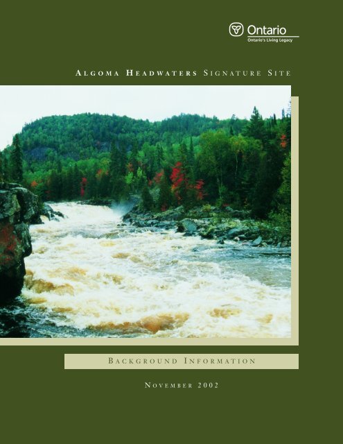
A LGOMA H EADWATERS S IGNATURE S ITE<br />
B ACKGROUND<br />
I NFORMATION<br />
N OVEMBER 2002
A LGOMA H EADWATERS S IGNATURE S ITE<br />
B ACKGROUND<br />
I NFORMATION<br />
N OVEMBER 2002
© 2002, Queen’s Printer for <strong>Ontario</strong><br />
Printed in <strong>Ontario</strong>, Canada<br />
TABLE OF C ONTENTS<br />
S UMMARY OF B ACKGROUND I NFORMATION ....................................................iv<br />
A L G O M A H E A D W A T E R S S I G N A T U R E S I T E<br />
This publication may be obtained on-line at<br />
www.ontarioslivinglegacy.com or from the address<br />
noted below.<br />
Ministry of Natural Resources<br />
64 Church Street<br />
Sault Ste. Marie, ON<br />
P6A 3H3<br />
Current publications of the <strong>Ontario</strong> Ministry of<br />
Natural Resources, and price lists are available from<br />
the address listed below. Bulk orders may involve<br />
charges.<br />
Ministry of Natural Resources<br />
Natural Resources Information Centre<br />
300 Water Street<br />
Peterborough, ON<br />
K9J 8M5<br />
Telephone inquiries about ministry programs and<br />
services should be directed to the Natural<br />
Resources Information Centre;<br />
General Inquiry 1-800-667-1940 (English)<br />
1-800-667-1840 (Français)<br />
Fax (705) 755 1677<br />
Find the Ministry of Natural Resources on<br />
line at: www.mnr.gov.on.ca<br />
Le présent document d’information, dont la distribution<br />
est limitée, n’est disponsible qu’en anglais en<br />
vertu du réglement 44/97, en application de la Loi<br />
sur les services en français. Il en existe cependant un<br />
sommaire en français, où nos lecteurs francophones<br />
trouveront une description des points principaux du<br />
document original. Il suffit pour l’obtenir de<br />
R ÉSUMÉ DU DOCUMENT D’ INFORMATION ......................................................vi<br />
A LGOMA H EADWATERS S IGNATURE S ITE V ISION S TATEMENT..........................viii<br />
1.0 I NTRODUCTION ...............................................................................1<br />
1.1 S IGNATURE S ITE P LANNING P ROCESS..........................................3<br />
1.2 S UMMARY OF S IGNIFICANT F EATURES<br />
W ITHIN THE S IGNATURE S ITE ...................................................5<br />
2.0 P ROTECTED A REAS WITHIN THE S IGNATURE S ITE.................................13<br />
2.1 A LGOMA H EADWATERS P ROVINCIAL P ARK (42,745 hectares) ..................13<br />
2.2 G OULAIS R IVER P ROVINCIAL P ARK (5,084 hectares)............................14<br />
2.3 A UBINADONG-NUSHATOGAINI R IVERS P ROVINCIAL P ARK<br />
(4,928 hectares)...........................................................................15<br />
2.4 R ANGER N ORTH C ONSERVATION R ESERVE (6,869 hectares) ..................15<br />
3.0 R EGIONAL S ETTING ........................................................................17<br />
3.1 P OPULATION C ENTRES............................................................17<br />
3.2 A CCESS ................................................................................18<br />
4.0 P LANNING A REA.............................................................................20<br />
4.1 L AND U SE/TENURE................................................................20<br />
4.2 E XISTING D EVELOPMENT ........................................................21<br />
4.3 P LANNING H ISTORY ...............................................................21<br />
4.3.1 M EGISAN L AKE A REA E NVIRONMENTAL A SSESSMENT............21<br />
4.3.2 O NTARIO’ S L IVING L EGACY ............................................23<br />
4.4 S OCIO-ECONOMIC C ONTEXT ....................................................24<br />
A L G O M A H E A D W A T E R S S I G N A T U R E S I T E<br />
s’adresser au ministère des Richesses naturelles<br />
(MRN) à l’adresse ci-dessus ou de consulter le site<br />
Web du MRN, également ci-dessus.<br />
51708<br />
(1.0k P.R., 05 12 02)<br />
ISBN 0-7794-3676-8<br />
Printed on recycled paper<br />
i
5.0 I NVENTORY AND E VALUATION OF N ATURAL & CULTURAL R ESOURCES ......25<br />
L IST OF F IGURES<br />
5.1 C LIMATE ..............................................................................25<br />
5.2 E ARTH S CIENCE ....................................................................25<br />
F IGURE 1: R EGIONAL C ONTEXT .......................................................7<br />
5.2.1 B EDROCK G EOLOGY .......................................................25<br />
F IGURE 2: A LGOMA H EADWATERS S IGNATURE S ITE P ROTECTED<br />
5.2.2 S URFICIAL G EOLOGY......................................................26<br />
A REA D ESIGNATIONS .......................................................8<br />
5.3 T OPOGRAPHY ........................................................................27<br />
F IGURE 2 A : A LGOMA H EADWATERS P ROVINCIAL P ARK ............................9<br />
A L G O M A H E A D W A T E R S S I G N A T U R E S I T E<br />
5.4 D RAINAGE ............................................................................27<br />
5.5 W ATER Q UALITY....................................................................28<br />
5.6 L IFE S CIENCE .......................................................................28<br />
5.6.1 V EGETATION ................................................................28<br />
5.6.2 F OREST F IRE................................................................31<br />
5.6.3 W ILDLIFE ....................................................................32<br />
5.6.4 B IRDS .........................................................................33<br />
5.6.5 F ISHERIES....................................................................33<br />
5.7 C ULTURAL R ESOURCES............................................................34<br />
5.8 R ECREATIONAL R ESOURCES......................................................37<br />
6.0 M ARKETING/CLIENT S ERVICES..........................................................40<br />
7.0 P LANNING I SSUES...........................................................................41<br />
7.1 A CCESS ................................................................................41<br />
7.2 A DJACENT L AND U SES AND A CTIVITIES .....................................41<br />
7.3 D EVELOPMENT/COMMERCIAL T OURISM ......................................41<br />
F IGURE 2 B : G OULAIS R IVER P ROVINCIAL P ARK ...................................10<br />
F IGURE 2 C : A UBINADONG-NUSHATOGAINI R IVERS P ROVINCIAL P ARK ......11<br />
F IGURE 2 D : R ANGER N ORTH C ONSERVATION R ESERVE ..........................12<br />
F IGURE 3: A CCESS AND R ECREATIONAL/CANOE R OUTES......................47<br />
F IGURE 4: L AND T ENURE..............................................................48<br />
F IGURE 5: B EDROCK G EOLOGY .......................................................49<br />
F IGURE 6: S URFICIAL G EOLOGY......................................................50<br />
F IGURE 7: M EGISAN EA AND THE A LGOMA H EADWATERS<br />
S IGNATURE S ITE ...........................................................51<br />
F IGURE 8: W ATERSHEDS AND D RAINAGE ..........................................52<br />
F IGURE 9: V EGETATION E CODISTRICTS............................................53<br />
F IGURE 10: V EGETATION C OMMUNITIES ............................................54<br />
F IGURE 11: O LD G ROWTH P INE.......................................................55<br />
F IGURE 12: F OREST F IRE H ISTORY ...................................................56<br />
F IGURE 13: F ISHERIES ( SPECIES BY LAKE) ..........................................57<br />
L IST OF TABLES<br />
A L G O M A H E A D W A T E R S S I G N A T U R E S I T E<br />
7.4 S OCIAL AND E CONOMIC O PPORTUNITIES, BENEFITS AND I MPACTS ..41<br />
1. S IGNATURE S ITE P LANNING P ROCESS..........................................4<br />
7.5 P ROTECTION.........................................................................42<br />
7.6 R EHABILITATION OF S ITES A FFECTED BY P AST L AND U SES ............42<br />
7.7 V ISITOR M ANAGEMENT AND C USTOMER S ERVICE .........................42<br />
7.8 F OREST F IRE M ANAGEMENT P LAN.............................................42<br />
7.9 P ARTNERSHIPS.......................................................................43<br />
7.10 I MPLEMENTATION ..................................................................43<br />
7.11 R ESEARCH AND M ONITORING ...................................................43<br />
8.0 S ELECTED R EFERENCES ...................................................................44<br />
ii<br />
iii
A LGOMA H EADWATERS S IGNATURE S ITE:<br />
S UMMARY OF B ACKGROUND<br />
I NFORMATION<br />
A L G O M A H E A D W A T E R S S I G N A T U R E S I T E<br />
The Algoma Headwaters Signature Site is a 60,000<br />
hectare protected area encompassing three provincial<br />
parks and one conservation reserve. These<br />
components are: Algoma Headwaters Natural<br />
Environment Class Provincial Park and two waterway<br />
class provincial parks (the Goulais River and<br />
Aubinadong-Nushatogaini Rivers), as well as the<br />
Ranger North Conservation Reserve).<br />
The Algoma Headwaters Signature Site is<br />
located within the greater Algoma area, approximately<br />
90 kilometres northeast of Sault Ste. Marie,<br />
and 50 kilometres south of Chapleau. This signature<br />
site was identified as one of nine featured areas<br />
within <strong>Ontario</strong>’s Living Legacy – Land Use Strategy<br />
(1999). These special areas all contain significant<br />
natural and cultural features with high-quality<br />
recreational and backcountry opportunities.<br />
The scenic Algoma Headwaters Signature Site<br />
consists of diverse landscapes of rolling hills, forests<br />
and wetlands, with a network of interconnecting<br />
waterways. The area exhibits a variety of significant<br />
natural, cultural and recreational features, including<br />
a diversity of plant and animal species, as well as old<br />
growth red and white pine forests. The Algoma<br />
forests are renowned for their beautiful fall foliage,<br />
and are often a destination for sightseeing and<br />
wildlife viewing. The signature site region is used<br />
by the forestry and mining sectors, as well as by<br />
hunters, fishermen and recreationists.<br />
A signature site strategy is being prepared for<br />
Algoma Headwaters, which will guide the protection<br />
and management of resources, visitor use and<br />
overall development within the site. The strategy<br />
will set the direction for plan implementation,<br />
including protection, zoning, management and<br />
operations. It is a dynamic planning tool, looking<br />
forward over a 20-year period. There are currently<br />
no public services offered within the signature site.<br />
The Algoma Headwaters Signature Site contains<br />
some of the oldest and largest stands of white pine<br />
in <strong>Ontario</strong>, some of which are up to 350 years old<br />
and 15 stories high. These stands are particularly<br />
evident in the vicinity of Megisan, Gord, Prairie<br />
Grass and Dyson Lakes. The protection of old<br />
growth pine is also the primary reason for the<br />
establishment of the Ranger North Conservation<br />
Reserve. The signature site straddles the transition<br />
zone where the boreal forest to the north overlaps<br />
with the Great Lakes – St. Lawrence Forest to the<br />
The waterways within the protected area vary<br />
from small creeks to large lakes and whitewater<br />
rivers. The Goulais River Provincial Park is a 67<br />
kilometre section of scenic waterway, while the<br />
Aubinadong - Nushatogaini Rivers Provincial Park<br />
encompasses an 85 kilometre network of lakes and<br />
rivers. The signature site is so named since it<br />
encompasses the headwaters of several significant<br />
rivers within the administrative district of Algoma,<br />
notably the Batchawana, Goulais, Garden, Montreal<br />
and Mississagi rivers.<br />
Cultural heritage sites are found within the signature<br />
site and surrounding Crown land. Heritage<br />
features associated with the site include original<br />
portages and campsites along ancient travel routes.<br />
These are important places and sites that<br />
supported pre-contact activities. More recent<br />
historic cultural features include evidence of<br />
logging and mining.<br />
Aboriginal and treaty rights within the Algoma<br />
From 1992 to1996, the Ministry of Natural<br />
Resources carried out an individual environmental<br />
assessment (EA), which examined potential forest<br />
management impacts on commercial tourism in the<br />
vicinity of Megisan Lake. A significant portion<br />
(approximately 40 per cent) of the ‘area of the<br />
undertaking’ that was the subject of the Megisan<br />
Lake Area Environmental Assessment has been<br />
incorporated and protected within the Algoma<br />
Headwaters Signature Site. Because main issues of<br />
this EA have been resolved, the Ministry of the<br />
Environment (MOE) has recently approved a declaration<br />
order which lifted the requirements of this<br />
individual EA. The protected status of the signature<br />
site will now proceed, and timber harvesting will<br />
continue on the remainder of the area outside the<br />
Algoma Headwaters Signature Site.<br />
The signature site strategy planning process will<br />
incorporate full public consultation and will be<br />
developed by completing the following stages:<br />
preparation and release of the terms of reference,<br />
background information, management options,<br />
preliminary management strategy and approved signature<br />
site strategy.<br />
A L G O M A H E A D W A T E R S S I G N A T U R E S I T E<br />
south. The Life Science Inventory of the Signature<br />
Headwaters Signature Site will continue to be<br />
Site (North-South Environmental Inc., 2001) docu-<br />
respected. The entire signature site is located<br />
ments the presence of 24 vegetation communities<br />
within the Robinson-Huron Treaty Area.<br />
and approximately 400 plant species.<br />
Traditional natural resource activities by Status<br />
Indians with treaty rights for subsistence and<br />
ceremonial purposes will continue within the signature<br />
site.<br />
iv<br />
v
R ÉGION CARACTÉRISTIQUE DES EAUX D’ AMONT D’ALGOMA :<br />
R ÉSUMÉ DU DOCUMENT<br />
D ’ INFORMATION<br />
On continuera de respecter les droits<br />
A L G O M A H E A D W A T E R S S I G N A T U R E S I T E<br />
La région caractéristique des eaux d’amont<br />
d’Algoma est un territoire protégé de 60 000<br />
hectares qui englobe trois parcs provinciaux et une<br />
réserve de conservation. Ces composantes sont : le<br />
parc provincial Algoma Headwaters (catégorie parc<br />
naturel) et deux parcs provinciaux de catégorie parc<br />
aquatique (Goulais River et Aubinadong-<br />
Nushatogaini Rivers), ainsi que la réserve de<br />
conservation Ranger North.<br />
La région caractéristique des eaux d’amont<br />
d’Algoma se situe dans le secteur d’Algoma, soit à<br />
environ 90 kilomètres au nord-est de Sault Ste<br />
Marie et à 50 kilomètres au sud de Chapleau. Il<br />
s’agit d’une des neuf régions caractéristiques<br />
désignées dans le cadre de la stratégie d’utilisation<br />
des terres du Patrimoine vital de l’<strong>Ontario</strong> (1999).<br />
Ces régions particulières abritent des caractéristiques<br />
naturelles et culturelles importantes<br />
présentant d’excellentes possibilités de loisirs et<br />
d’activités en arrière-pays et, par conséquent, méritent<br />
un degré avancé de planification, d’exploitation<br />
et de promotion.<br />
La région caractéristique des eaux d’amont<br />
d’Algoma présente un paysage pittoresque et varié<br />
de collines, de forêts et de marécages, avec un<br />
réseau de voies d’eau reliées les unes aux autres.<br />
La région contient une variété d’importantes<br />
caractéristiques naturelles, culturelles et récréatives,<br />
parmi lesquelles une grande diversité de plantes et<br />
d’espèces fauniques, des forêts anciennes de pin<br />
blanc et de pin rouge, dans un cadre primitif. Les<br />
forêts de l’Algoma sont renommées pour leurs<br />
magnifiques couleurs automnales et sont souvent la<br />
destination d’amateurs de paysages et d’observation<br />
de la faune. La région caractéristique intéresse à la<br />
fois les secteurs forestier et minier, ainsi que les<br />
La stratégie en cours d’élaboration pour la<br />
région caractéristique des eaux d’amont d’Algoma<br />
servira de guide aux mesures de protection et d’exploitation<br />
des ressources, aux activités offertes aux<br />
visiteurs et à tout aménagement du terrain. La<br />
stratégie apportera aussi l’orientation de la mise en<br />
œuvre du plan, y compris la protection, le zonage et<br />
la gestion des opérations. Il s’agit d’un outil de<br />
planification dynamique établi sur un calendrier de<br />
vingt ans. Actuellement aucun service public n’est<br />
offert à l’intérieur de la région caractéristique.<br />
La région caractéristique des eaux d’amont<br />
d’Algoma contient quelques uns des peuplements<br />
les plus anciens et les plus importants de pin blanc<br />
en <strong>Ontario</strong>, dont certains ont près de 350 ans et<br />
atteignent une hauteur de quinze étages. On note<br />
en particulier les peuplements des alentours des lacs<br />
Megisan, Gord, Prairie Grass et Dyson. Protéger<br />
les pins blancs anciens est également l’un des motifs<br />
principaux de l’établissement de la réserve de conservation<br />
Ranger North. La région caractéristique<br />
chevauche la zone de transition dans laquelle la<br />
forêt boréale au nord, se fond à la forêt des Grands<br />
Lacs et du Saint-Laurent, au sud. L’inventaire des<br />
sciences de la terre de la région caractéristique<br />
(North-South Environmental Inc., 2001) fait état de la<br />
Les étendues et cours d’eau du territoire protégé<br />
varient de petits ruisseaux à des lacs importants,<br />
avec des torrents. Le parc provincial Goulais River<br />
suit un segment pittoresque de 67 kilomètres de la<br />
rivière, tandis que le parc provincial des rivières<br />
Aubinadong-Nushatogaini est un réseau de<br />
85 kilomètres de lacs et de rivières. La région<br />
caractéristique doit son nom au fait qu’elle englobe<br />
plusieurs rivières importantes du district administratif<br />
d’Algoma dont notamment la Batchawana, la<br />
Goulais, la Garden, la Montréal et la Mississagi.<br />
On trouve des lieux historiques à l’intérieur du<br />
périmètre de la région caractéristique et des terres<br />
de la Couronne environnantes. Ce sont notamment<br />
des portages et des camps le long d’anciens sentiers.<br />
Il s’agit de lieux sacrés et d’emplacements d’activités<br />
autochtones datant d’avant l’arrivée des Européens.<br />
Plus récemment, des activités telles que la coupe du<br />
bois et la mine ont produit quelques lieux historiques.<br />
autochtones et les droits issus de traités dans la<br />
région caractéristique des eaux d’amont d’Algoma.<br />
La région entière se situe à l’intérieur de la zone<br />
visée par le traité Robinson-Huron. Les activités<br />
traditionnelles relatives aux ressources pratiquées<br />
par les Indiens de plein droit, aux fins de subsistance<br />
et de cérémonie pourront se poursuivre dans<br />
la région caractéristique.<br />
Entre 1992 et 1996, le ministère des Richesses<br />
naturelles s’est livré à une évaluation environnementale<br />
qui visait à examiner les effets de<br />
l’exploitation forestière sur le tourisme commercial<br />
dans les alentours du lac Megisan. Une portion<br />
importante (environ 40 pour 100) du territoire considéré<br />
dans l’évaluation environnementale de la<br />
région du lac Megisan a été incorporée et est maintenant<br />
protégée au sein de la région caractéristique<br />
des eaux d’amont d’Algoma. Étant donné que les<br />
principales questions de l’évaluation environnementale<br />
ont été résolues, le ministère de<br />
l’Environnement (ME) a récemment approuvé une<br />
ordonnance de déclaration qui a mis fin aux exigences<br />
de l’évaluation environnementale. La<br />
protection de la région caractéristique sera maintenant<br />
reconnue et la récolte de bois d’œuvre se<br />
poursuivra sur le reste du territoire situé en dehors<br />
de la région caractéristique des eaux d’amont<br />
d’Algoma.<br />
Le processus de planification de la région caractéristique<br />
comprendra une consultation publique<br />
dans les règles et se déroulera par les étapes<br />
suivantes : rédaction et publication du mandat, des<br />
documents d’information, des options de gestion,<br />
de la stratégie préliminaire de gestion et de la<br />
stratégie approuvée de la région caractéristique.<br />
A L G O M A H E A D W A T E R S S I G N A T U R E S I T E<br />
chasseurs, les pêcheurs et les amateurs de nature.<br />
présence de 24 communautés végétales soit environ<br />
400 espèces de plantes.<br />
vi<br />
vii
The scenic Algoma Headwaters Signature Site is<br />
composed of diverse landscapes of rolling hills,<br />
forests and wetlands, with a network of interconnecting<br />
waterways. The area exhibits a variety of<br />
significant natural, cultural and recreational fea-<br />
A L G O M A H E A D W A T E R S S I G N A T U R E S I T E<br />
A LGOMA H EADWATERS S IGNATURE S ITE<br />
V ISION S TATEMENT<br />
“THE A LGOMA H EADWATERS S IGNATURE S ITE WILL PROVIDE LONG-<br />
TERM PROTECTION FOR THE AREA’ S NATURAL AND CULTURAL<br />
LANDSCAPES, WHILE PROVIDING PRESENT AND FUTURE GENERATIONS<br />
WITH HIGH- QUALITY, YEAR- ROUND RECREATIONAL OPPORTUNITIES. IN<br />
A REMOTE YET ACCESSIBLE SETTING, THE SIGNATURE SITE PROVIDES<br />
THE OPPORTUNITY TO EXPERIENCE OLD GROWTH FORESTS AND SCENIC<br />
WATERWAYS, AS WELL AS TO APPRECIATE ABORIGINAL HERITAGE VALUES.<br />
T HE SITE IS DEDICATED IN PERPETUITY TO THE PEOPLE OF O NTARIO<br />
AND OTHERS FOR THEIR ENJOYMENT, EDUCATION AND BENEFIT.”<br />
1.0 I NTRODUCTION<br />
The Algoma Headwaters Signature Site is a 60,000<br />
hectare protected area encompassing three provincial<br />
parks and one conservation reserve. These<br />
components are: Algoma Headwaters Provincial<br />
Park (Natural Environment Class) and two<br />
Waterway Class Provincial <strong>Parks</strong> (the Goulais River<br />
and Aubinadong-Nushatogaini Rivers), as well as<br />
the Ranger North Conservation Reserve (Figure 2).<br />
The Algoma Headwaters Signature Site is<br />
located within the greater Algoma area, approximately<br />
90 kilometres northeast of Sault Ste. Marie<br />
and 50 kilometres south of Chapleau (Figure 1).<br />
This was identified as one of nine ‘Featured Areas’<br />
within <strong>Ontario</strong>’s Living Legacy - Land Use Strategy<br />
(1999). Signature sites have significant resource,<br />
tourism and recreational potential that merit an<br />
increased level of planning, management and promotion.<br />
These special areas all contain significant<br />
natural and cultural features with high-quality<br />
recreational and backcountry opportunities.<br />
tures. The Algoma forests are renowned for their<br />
beautiful fall foliage, and are often a destination for<br />
sightseeing and wildlife viewing. The Algoma region<br />
is used by the forestry and mining sectors, as well as<br />
by hunters, anglers and recreationists.<br />
While some areas within the signature site are<br />
accessible by road, it is predominantly remote and<br />
undeveloped. In general, access becomes more limited<br />
farther north, and the northern sector is<br />
accessible only by air or canoe.<br />
There are currently no public services offered<br />
by <strong>Ontario</strong> <strong>Parks</strong> within the signature site.<br />
The Algoma Headwaters Signature Site is characterized<br />
by surficial glacial deposits overlying<br />
Precambrian rock, and is located entirely within the<br />
Western Abitibi sub-province of the Superior structural<br />
province of the Canadian Shield. The surficial<br />
deposits are made up of ground moraine which was<br />
deposited by glacial ice of the late Wisconsinan age,<br />
which retreated from the area about 10,000 years<br />
ago. The most prominent features include segments<br />
of the regionally significant Cartier moraine,<br />
provincially significant deltaic and valley ‘train’<br />
deposits of the west Aubinadong River, and a<br />
provincially significant ice contact delta on the<br />
Goulais River.<br />
The Algoma Headwaters Signature Site contains<br />
some of the largest and oldest stands of white and red<br />
pine in <strong>Ontario</strong>, some of which are up to 350 years<br />
old and 15 stories high. These stands are particularly<br />
evident in the vicinity of Megisan, Gord, Prairie<br />
Grass and Dyson Lakes. The protection of old<br />
growth pine is also the primary reason for the establishment<br />
of the Ranger North Conservation Reserve.<br />
The Life Science Inventory of the Signature<br />
Site (North-South Environmental Inc., 2001) documents<br />
24 vegetation communities and<br />
approximately 400 plant species that occur within<br />
the site. Bog and fen wetlands are common, and<br />
B A C K G R O U N D I N F O R M A T I O N S U M M A R Y<br />
O LD GROWTH WHITE PINE SITUATED WEST OF G ORD L AKE.<br />
viii<br />
1
support seasonal blooms of cranberries (vaccinium),<br />
orchids (orchidacea) and Labrador tea (rhododendron).<br />
The signature site straddles the transition zone<br />
since it encompasses the headwaters of several significant<br />
rivers within the Administrative District of<br />
Algoma, notably the Batchawana, Goulais, Garden,<br />
ine the potential impacts of forest management<br />
activities on the area’s remote commercial tourism<br />
facilities. Tourist outfitters initiated the process in<br />
1.1 S IGNATURE S ITE<br />
P LANNING P ROCESS<br />
A L G O M A H E A D W A T E R S I G N A T U R E S I T E<br />
where the Boreal Forest to the north overlaps with<br />
the Great Lakes - St. Lawrence Forest to the south.<br />
This means that forest cover generally changes in a<br />
northerly direction from predominantly deciduous<br />
to mainly coniferous. The Boreal Forest types<br />
which dominate the signature site include jack pine<br />
(Pinus banksiana), black spruce (Picea mariana) and<br />
white birch (Betula papyrifera), while the deciduous<br />
forests are comprised of sugar maple (Acer saccharum)<br />
and yellow birch (Betula alleghaniensis). Sugar<br />
maple stands are most notable on hilltops in the fall<br />
when the colours shift to seasonal red and orange.<br />
The Great Lakes - St. Lawrence Forest types<br />
account for 20 per cent of the forests in the signature<br />
site.<br />
The Algoma Headwaters Signature Site remains<br />
heavily forested and relatively undisturbed, with<br />
minimal development. Current land use activities<br />
within the signature site and the surrounding area<br />
are mainly related to recreation and tourism. These<br />
activities include backcountry camping, fishing,<br />
hunting, canoeing, and general recreation, with the<br />
area offering both commercial fly-in outpost facilities<br />
and opportunities for self-oufitted campers.<br />
Timber harvesting is the primary industry in the<br />
region, but is not permitted within the signature<br />
site. Trapping, which occurs throughout the signature<br />
site, will be permitted to continue, except in<br />
those areas designated as nature reserve zones.<br />
Although mineral prospecting occurs throughout<br />
the area, it is no longer permitted within the signature<br />
site.<br />
The waterways in the protected area vary from<br />
small creeks to whitewater rivers to small and large<br />
lakes. The Goulais River Provincial Park is a 67-<br />
kilometre section of scenic waterway, while the<br />
Aubinadong - Nushatogaini Rivers Provincial Park<br />
encompasses an 85-kilometre loop of lakes and<br />
rivers. Both waterways offer challenging opportunities<br />
for canoeing. However, both routes are most<br />
navigable in spring, when water levels are highest.<br />
The Algoma Headwaters Signature Site is so named<br />
Montreal and Mississagi Rivers.<br />
There are approximately 175 lakes and over 200<br />
rivers and streams within the signature site. Some<br />
of these waterways have ideal conditions for lake<br />
trout (Salvelinus namaycush) and brook trout<br />
(Salvelinus fontinalis) fisheries, while others support<br />
warmer water species of walleye (Stizostedion vitreum)<br />
and northern pike (Esox lucius). Thus, the<br />
area is a popular fishing destination, with fishing<br />
opportunities accessible by road, snowmobile and<br />
floatplane.<br />
Wildlife is plentiful in the signature site, with<br />
the Life Science Inventory for Algoma Headwaters<br />
Signature Site recording 43 species of mammals,<br />
197 species of birds and 28 species of reptiles and<br />
amphibians. The signature site area is home to a<br />
number of animal species that MNR has listed as<br />
‘endangered, threatened or vulnerable’, including<br />
peregrine falcon (Falco peregrinus), bald eagle<br />
(Haliaeetus leucocephalus) and wood turtle (Clemmys<br />
insculpta).<br />
Cultural heritage sites are found within the signature<br />
site and surrounding Crown land. Heritage<br />
features that are associated with the site include<br />
original portages and campsites along ancient travel<br />
routes. More recent historic features include evidence<br />
of mining and logging.<br />
Algoma Headwaters Signature Site is situated in<br />
the ‘Height of Land’ climatic region, which is characterized<br />
by a moderate, warm boreal ‘modified<br />
continental’ climate. The Algoma region has some of<br />
the highest levels of precipitation in the province.<br />
These high levels of rain and snow make for rich<br />
growing conditions that benefit many species,<br />
including towering eastern white pine (Pinus strobus)<br />
which grow taller than 15 stories (50 metres) high.<br />
From 1992 to 1996, before this area was identified<br />
as a signature site, the Ministry of Natural<br />
Resources carried out an individual environmental<br />
assessment on two blocks of land totalling 54,000<br />
hectares in the vicinity of Megisan Lake (Figure 7).<br />
This precedent-setting EA was carried out to exam-<br />
order to examine the effects of forest management<br />
activities on remote tourism operations. A significant<br />
portion (approximately 40 per cent) of the<br />
‘area of the undertaking’ that was the subject of the<br />
Megisan Lake Area Environmental Assessment has<br />
now been incorporated and protected within the<br />
Algoma Headwaters Signature Site. The details of<br />
this EA process are documented in the draft report<br />
entitled: “An Environmental Assessment of Timber<br />
Management on Crown Lands in the Megisan Lake<br />
Area (1996)” which was submitted to the Minister<br />
of Environment in 1996.<br />
Because the issues of the EA have been resolved,<br />
a Declaration Order was issued in February 2002<br />
which removed the requirements and legal status of<br />
the individual EA for the Megisan Lake area. Thus,<br />
protection of the Algoma Headwaters Signature<br />
Site can now proceed. Forest management activities<br />
can occur on the remainder of the land base that<br />
was formerly encompassed by the EA area (Refer to<br />
Section 4.3.1.)<br />
Aboriginal and treaty rights within the Algoma<br />
Headwaters Signature Site will continue to be<br />
respected. The entire signature site is located<br />
within the Robinson-Huron Treaty Area.<br />
Traditional natural resource activities by Status<br />
Indians with treaty rights for subsistence and ceremonial<br />
purposes will be permitted to continue<br />
within the signature site.<br />
The concept of protected areas known as ‘signature<br />
sites’ is a key part of the <strong>Ontario</strong>’s Living Legacy<br />
(OLL) initiative, which represents MNR’s biggest<br />
ever expansion of the parks and protected areas system.<br />
The Algoma Headwaters Signature Site is one<br />
of nine signature sites established by the OLL<br />
process across <strong>Ontario</strong> (refer to Section 4.3 -<br />
Planning History.) In accordance with <strong>Ontario</strong>’s<br />
Living Legacy - Land Use Strategy (1999), the strategy<br />
will recognize and permit the continuation of<br />
most existing activities, including current commercial<br />
tourism licensed within the area.<br />
While the approved strategy will set the overall<br />
management direction for Algoma Headwaters,<br />
specific actions required for initiating the strategy<br />
will be provided in subsequent directives known as<br />
‘Implementation Plans.’ These specific plans will provide<br />
further detailed guidance for the protection,<br />
management and operation of the signature site.<br />
Implementation plans which may be prepared for<br />
the Algoma Headwaters could include: Operations,<br />
Vegetation Management, Fisheries, Wildlife, and<br />
Forest Fire Management Plans.<br />
The Algoma Headwaters Signature Site Strategy<br />
will be approved as a park management ‘parent<br />
plan’ for all three regulated provincial parks within<br />
the area defined by the OLL Land Use Strategy<br />
(1999). The strategy will be a dynamic planning<br />
tool, looking forward for a 20-year period.<br />
Planning for the Ranger North Conservation<br />
Reserve will be included in the signature site strategy<br />
planning process. (This conservation reserve<br />
was set aside in 1997, prior to the initiation of<br />
<strong>Ontario</strong>’s Living Legacy.) A ‘Statement of<br />
Conservation Interest’ (SCI) was prepared in 1999<br />
to establish interim direction for the Ranger North<br />
Conservation Reserve. As part of the planning<br />
process for Algoma Headwaters Signature Site<br />
Strategy, and with full public consultation, resource<br />
management direction will be determined for the<br />
Ranger North Conservation Reserve. Because the<br />
Ranger North Conservation Reserve is adminis-<br />
A L G O M A H E A D W A T E R S S I G N A T U R E S I T E<br />
2<br />
3
A L G O M A H E A D W A T E R S S I G N A T U R E S I T E<br />
tered under the Public Lands Act, <strong>Ontario</strong> <strong>Parks</strong> will<br />
work jointly with MNR Sault Ste. Marie District to<br />
plan and manage the Ranger North Conservation<br />
Reserve.<br />
The process and schedule to develop the signature<br />
site strategy appears in Table 1.<br />
T ABLE 1: S IGNATURE S ITE S TRATEGY: P ROCESS AND S CHEDULE<br />
Item Requirements/Notes Tentative Dates Public Consultation<br />
Interim Management<br />
Statement<br />
Terms of Reference<br />
Invitation to Participate<br />
Background Information<br />
Document<br />
Management Options<br />
Preliminary Management<br />
Strategy<br />
Recommended<br />
Management Strategy<br />
Approved<br />
Management Strategy<br />
Ongoing distribution throughout the<br />
planning process.<br />
Approval by Managing Director,<br />
<strong>Ontario</strong> <strong>Parks</strong> and MNR Regional<br />
Director, Northeast Region.<br />
Core team orientation.<br />
Public notification inviting<br />
participation in signature site<br />
planning process, and to inspect<br />
approved Terms of Reference.<br />
Compile, analyze and integrate all<br />
pertinent information from Sault Ste.<br />
Marie and Chapleau District Offices,<br />
MNDM, consultant reports, etc.<br />
Prepare document and GIS products.<br />
Additions/revisions based on public<br />
input.<br />
Preparation of document which<br />
includes all options for planning and<br />
management of site.<br />
Production of GIS products (maps,<br />
posters, displays, etc.).<br />
Analysis of public input.<br />
Selection of recommended strategy<br />
& preparation of document based on<br />
analysis of public input.<br />
GIS product development.<br />
Incorporate changes as per public<br />
review.<br />
Submitted as recommended strategy<br />
for final approval.<br />
Production and printing of Signature<br />
Site Strategy.<br />
August 2001<br />
Spring/Summer 2002<br />
Summer 2002<br />
Spring/Summer/Fall<br />
2002<br />
Fall/Winter 2002<br />
Spring/Summer 2003<br />
Summer 2003<br />
Fall 2003<br />
Public Notification:<br />
EBR Notice of Proposal.<br />
Newspaper ads, update OLL<br />
website, mail-outs.<br />
Review period (45 days)<br />
Public Notification:<br />
EBR Notice of Proposal.<br />
Newspaper ads, update OLL<br />
website, mail-outs.<br />
Information Centres:<br />
(15 day prior notice)<br />
Review period (45 days)<br />
Public Notification:<br />
EBR Notice of Proposal.<br />
Newspaper ads, update OLL<br />
website, mail-outs.<br />
Information Centres:<br />
(15 day prior notice)<br />
Review period (45 days)<br />
Public Notification:<br />
EBR Notice of Proposal.<br />
Newspaper ads, update OLL<br />
website, mail-outs.<br />
Information Centres:<br />
(15 day prior notice)<br />
Review period (45 days)<br />
Public Notification:<br />
EBR Notice of Proposal.<br />
Newspaper ads, update OLL<br />
website, mail-outs.<br />
Review period (45 days)<br />
1.2 S UMMARY OF<br />
S IGNIFICANT F EATURES<br />
W ITHIN THE<br />
S IGNATURE S ITE<br />
The Algoma Headwaters Signature Site has a wide<br />
range of significant values and features requiring<br />
protection and/or management. These include, but<br />
are not limited to:<br />
• Representative glacial features and landscapes<br />
(ground moraine, delta, valley sand and gravel<br />
deposits)<br />
• 24 documented vegetation community types,<br />
with more than 400 species of plants. Boreal<br />
Forest types are dominant, but the Great Lakes<br />
- St. Lawrence Forest species (with only<br />
20 per cent coverage), occur in prominent locations<br />
such as lakeshores and hilltops, and are<br />
thus quite visible<br />
• Old growth red pine (Pinus resinosa) and white<br />
pine (Pinus strobus), some up to 350 years old<br />
and 15 to 20 stories high (50 metres)<br />
• The headwaters of major rivers in the District of<br />
Algoma, most notably the Montreal,<br />
Batchawana, Goulais, Garden and Mississagi.<br />
Smaller rivers that have headwaters in the signature<br />
site include the East Goulais, Chippewa,<br />
West Aubinadong and the Nushatogaini<br />
• More than 176 small to medium-sized lakes and<br />
approximately 200 rivers and streams which support<br />
fish populations dominated by lake trout,<br />
brook trout, walleye and northern pike<br />
• A variety of wildlife species and their habitats<br />
occur in the signature site: 50 species of mammals,<br />
25 species of reptiles and amphibians,<br />
143 species of breeding birds. Moose and whitetailed<br />
deer populations intermix in the site<br />
• Species of ‘Special Concern’ and those considered<br />
‘vulnerable’, ‘endangered’ or ‘threatened’ (e.g.<br />
peregrine falcon, bald eagle and wood turtle)<br />
• Prehistoric & historic cultural features, including<br />
traditional aboriginal sites<br />
• Recreational features, including a diversity of<br />
waterways, canoe routes, beaches, car accessible<br />
and backcountry campsites<br />
• Settings with wilderness qualities, which are<br />
accessible but retain a sense of remoteness, and<br />
offer potential for backcountry travel in extensive<br />
settings with no roads<br />
More information about significant ecological,<br />
biological and cultural features within the site is<br />
being gathered continually, adding to the information<br />
base for signature site planning.<br />
A L G O M A H E A D W A T E R S S I G N A T U R E S I T E<br />
4<br />
5
F IGURE 1: R EGIONAL C ONTEXT<br />
Please see separate PDF file for map<br />
A L G O M A H E A D W A T E R S S I G N A T U R E S I T E<br />
6<br />
7
F IGURE 2: P ROTECTED A REA D ESIGNATIONS<br />
F IGURE 2 A : A LGOMA H EADWATERS P ROVINCIAL PARK<br />
Please see separate PDF file for map<br />
Please see separate PDF file for map<br />
A L G O M A H E A D W A T E R S S I G N A T U R E S I T E<br />
8<br />
9
F IGURE 2 B : G OULAIS R IVER P ROVINCIAL P ARK F IGURE 2 C : A UBINADONG-NUSHATOGAINI R IVERS P ROVINCIAL PARK<br />
Please see separate PDF file for map<br />
Please see separate PDF file for map<br />
A L G O M A H E A D W A T E R S S I G N A T U R E S I T E<br />
A L G O M A H E A D W A T E R S S I G N A T U R E S I T E<br />
10<br />
11
F IGURE 2 D : R ANGER N ORTH C ONSERVATION R ESERVE<br />
Please see separate PDF file for map<br />
2.1 A LGOMA H EADWATERS<br />
P ROVINCIAL P ARK<br />
(42,745 hectares)<br />
The largest protected area within the signature site<br />
is Algoma Headwaters Provincial Park (Figure 2a),<br />
A L G O M A H E A D W A T E R S S I G N A T U R E S I T E<br />
2.0 P ROTECTED A REAS<br />
W ITHIN THE<br />
S IGNATURE S ITE<br />
The Algoma Headwaters Signature Site is made up<br />
of four distinct but connected, protected areas:<br />
Algoma Headwaters Provincial Park, Goulais River<br />
Provincial Park, Aubinadong - Nushatogaini Rivers<br />
Provincial Park, and the Ranger North Conservation<br />
Reserve. Given their interconnected nature,<br />
the Ministry of Natural Resources will protect and<br />
plan all four areas within the signature site in an<br />
integrated manner. A more complete description of<br />
each area follows.<br />
which is renowned for its beautiful and rugged<br />
scenery, towering white pines and diverse forest<br />
species. Vegetation varies widely within the provincial<br />
park, from the mixed hardwood stands typical<br />
of the Great Lakes - St. Lawrence Forest Region<br />
(white and red pine, spruce, maple, birch, and<br />
cedar) to pure stands of jack pine carpeted with<br />
moss, that are more typical of the Boreal Forest<br />
Region.<br />
A newly established provincial park, the Algoma<br />
Headwaters was recognized during the Megisan<br />
Lake Area EA as having significant natural and cultural<br />
environments with a high potential for<br />
recreation and tourism. A significant portion of the<br />
EA ‘area of the undertaking’ has been incorporated<br />
into the Algoma Headwaters natural environment<br />
class park (Figure 7).<br />
Camping, canoeing, hiking, fishing, hunting,<br />
snowmobiling, and wildlife viewing are some of the<br />
recreational activities that attract people to the area.<br />
Remote, yet accessible, there are numerous natural<br />
and recreational features here, including 160 lakes,<br />
scenic rolling hills, white pine forests, the facilities<br />
of four remote tourism operators, and a limited network<br />
of roads.<br />
In the eastern portion of the park, the forests<br />
provide good examples of at least seven major forest<br />
types, growing on low hills composed of sandy till<br />
deposits. The impressive stands of white pine in the<br />
Gord and Megisan Lakes area contain some of the<br />
largest and oldest trees of this species in <strong>Ontario</strong>.<br />
Sugar maple, white pine, black spruce, balsam fir<br />
(Abies balsamea), white birch (Betula papyrifera) and<br />
eastern white cedar (Thuja occidentalis) communities<br />
also occur within this area.<br />
The Dyson Lake Natural Heritage Area is protected<br />
in the most westerly node of this provincial<br />
park, and was identified in an MNR study called<br />
‘Natural Heritage Area and Proposed Park<br />
A L G O M A H E A D W A T E R S S I G N A T U R E S I T E<br />
12<br />
13
A L G O M A H E A D W A T E R S S I G N A T U R E S I T E<br />
Alternatives’ (Jones & Crins, 1998). Consisting of a<br />
landscape of scenic rolling hills, it exhibits the most<br />
diverse vegetation in the ecodistrict.<br />
2.2 G OULAIS R IVER<br />
P ROVINCIAL P ARK<br />
(5,084 hectares)<br />
The Goulais River flows through the heart of<br />
Algoma country, and is renowned for its picturesque<br />
beauty, rugged landscapes, and fine brook<br />
trout fishing (Figure 2b). The name ‘Goulais’ is<br />
thought to have been derived from the French word<br />
‘goulet,’ (gully), which likely refers to the impressive<br />
topography of the Goulais River valley. With<br />
the exception of two nodes in Daumont and Hynes<br />
Township, the park boundary extends 200 metres<br />
inland from the water’s edge.<br />
Abundant opportunities for camping, canoeing,<br />
fishing, hiking, mountain biking, and sightseeing<br />
make the Goulais River valley a popular destination<br />
for recreationists. The waterway includes scenic<br />
falls, whitewater rapids, lake sections, and a variety<br />
of areas with talus slopes and rock gardens. The<br />
river passes over gravel bars and through shoreline<br />
wetlands, and apart from high water levels during<br />
spring run-off, is generally quite shallow. The area<br />
is particularly scenic in the fall, during the height of<br />
the brilliant fall foliage.<br />
Flowing in a southerly direction out of the<br />
Algoma Headwaters Provincial Park, the Goulais<br />
River flows approximately 67 kilometres from<br />
Goulais Lake to the Searchmont area, where it<br />
flows out of the protected area and continues in a<br />
southwesterly direction to Lake Superior. The river<br />
originates in Eel Lake, just north of the signature<br />
site in Carton Township. The park includes the<br />
Goulais River in LaVerendrye and Brule<br />
Townships, as well as the Searchmont Delta Natural<br />
Heritage Area. This prehistoric delta, which was<br />
created at the outlet of a massive channel of glacial<br />
melt-waters, is a significant geological feature<br />
within this provincial park. This feature provides<br />
representation of both the Rawhide Moraine and<br />
the post-Algonquin Lake Wyebridge, and was identified<br />
in a Survey of Candidate Earth Science Sites<br />
(Noble, 1998).<br />
As the Goulais River flows southward through<br />
the signature site, it passes out of the more<br />
northerly vegetation types of spruce and jack pine<br />
dominated Boreal forests, and enters the hardwood<br />
and white pine forests of the Great Lakes - St.<br />
Lawrence Forest Region. Dominant landform types<br />
are characterized by moderately rolling hills, glacial<br />
outwash landforms and several series of oxbows,<br />
which support forests of balsam fir, white birch,<br />
black spruce, white spruce (Picea glauca), balsam<br />
poplar (Populus balsamifera), sugar maple, silver<br />
maple (Acer saccharinum) and black ash (Fraxinus<br />
nigra) swamps.<br />
The Goulais River is renowned for its self-sustaining<br />
brook trout population, which makes it a<br />
popular fishing destination. The river has extremely<br />
variable water levels, and fluctuates widely according<br />
to levels of precipitation and associated run-off.<br />
The park area contains snowmobile and mountain<br />
biking trails which use forest access roads adjacent<br />
to the Goulais River.<br />
A major canoe route in Sault Ste. Marie District,<br />
the Goulais River offers a variety of opportunities<br />
for canoeing and kayaking, particularly in the spring<br />
when the water level is at its highest. The character<br />
and topography of the river varies widely along its<br />
course, including a short canyon, ‘rock gardens’,<br />
scenic waterfalls and magnificent rugged hills. The<br />
northerly portion of the newly designated waterway<br />
class park includes Witchdoctor and Ragged Lakes<br />
and is generally smooth, easy paddling, with some<br />
short portages around rapids and falls. South of this<br />
area, at the Mile 23 Bridge, the river narrows to a<br />
stretch of generally continuous rapids for almost 10<br />
kilometres. After the Saddle Lake Bridge, the river<br />
changes to swift current for some distance until<br />
after Whitman Dam Falls. Closer to Searchmont<br />
and beyond, the river slows, widens, and meanders,<br />
with numerous gravel bars and oxbows.<br />
Portions of a primary forest access road (the<br />
Whitman Dam Road) are within Goulais River<br />
Provincial Park. There are three permanent water<br />
crossings in the park, with bridges at Saddle Lake,<br />
Mile 23, and Tepee Lake. These crossings, along<br />
with identified forest access roads, will continue to<br />
be utilized by the forest industry. These roads will<br />
also continue to provide access to recreational users.<br />
2.3 A UBINADONG-<br />
N USHATOGAINI R IVERS<br />
P ROVINCIAL P ARK<br />
(4,928 hectares)<br />
This waterway class park is home to a network of<br />
river and lake sections, a portion of which is part of<br />
the 85 kilometre ‘Ranger Lake Loop Canoe Route’<br />
(Figure 2c). The Aubinadong-Nushatogaini Rivers<br />
flow from the Algoma Headwaters Provincial Park<br />
southward until the two rivers merge, then flow<br />
into the East Aubinadong which eventually empties<br />
into the Mississagi River. The route continues<br />
through a series of interconnecting small lakes,<br />
eventually flowing into Saymo Lake at the south<br />
end of the park. (From the Saymo Lake Dam, the<br />
canoe route extends downstream into Ranger Lake<br />
to the south, but this section lies outside the signature<br />
site.) In general, the park boundary extends<br />
200 metres from the water’s edge, along the course<br />
of the waterway.<br />
W HITMAN D AM F ALLS - GOULAIS R IVER P ROVINCIAL P ARK<br />
The west branch of the Aubinadong River<br />
drains Megisan Lake, which is one of the largest<br />
lakes in the signature site. The east branch of the<br />
Aubinadong River is located farther east. It is not<br />
contained within this park boundary, but is protected<br />
as another waterway park.<br />
The waterway has a varied and rugged terrain,<br />
and includes both flatwater and whitewater sections.<br />
This canoe route exhibits interesting vegetation<br />
patterns along its course, with alternating areas typical<br />
of both the Boreal and Great Lakes - St.<br />
Lawrence Forests. The rivers are small with sand<br />
bottoms, and have rocky, bedrock controlled rapids<br />
in some sections.<br />
The Ranger North Road provides access to various<br />
lakes within the vicinity of this waterway park,<br />
including Gong, Island, Friendly and Saymo Lakes.<br />
The rugged Torrance Lake Road provides access to<br />
Torrance Lake, and is sometimes used by hunters,<br />
fishermen and canoeists travelling into the heart of<br />
the signature site. Forest access roads throughout<br />
this area receive moderate use by ATV’s and snowmobiles.<br />
2.4 R ANGER N ORTH<br />
C ONSERVATION<br />
(6,869 hectares)<br />
R ESERVE<br />
The Ranger North Conservation Reserve was<br />
established in 1997 under the Public Lands Act. It is<br />
located in the west of the signature site and is contiguous<br />
with Algoma Headwaters Provincial Park in<br />
portions of Gapp, Gaudry, Wlasy, Bracci, Schembri<br />
and Scriven Townships (Figure 2d). The reserve is<br />
the result of an amalgamation of three old-growth<br />
white and red pine areas, identified in 1990 (Iles,<br />
1990). It includes the Quinn Lake, Bliss Lake, and<br />
the eastern half of the Galloway Lake old growth<br />
red and white pine forests.<br />
Old growth stands constitute approximately 25<br />
per cent of the Ranger North Conservation<br />
Reserve, and are among the largest concentration of<br />
A L G O M A H E A D W A T E R S S I G N A T U R E S I T E<br />
14<br />
15
(which touches the southeast corner of the<br />
25 townships. They are: Beckett, Bracci, Butcher,<br />
Conservation Reserve). In accordance with conser-<br />
Carruthers, Carton, Daumont, Ewen, Ferrier,<br />
vation reserve policy, mechanized means of travel,<br />
Gapp, Gaudette, Gaudry, Handleman, Havrot,<br />
including snowmobiles and all terrain vehicles<br />
Hoffman, Hynes, LaVerendrye, Lunkie, McIlveen,<br />
(ATV’s), is permitted only on existing authorized<br />
Patenaude, Reilly, Schembri, Scriven, Sherratt,<br />
roads or trails. The remoteness of this reserve, as<br />
Way-White, and Wlasy.<br />
A L G O M A H E A D W A T E R S S I G N A T U R E S I T E<br />
( TOP) SEGMENT OF THE A UBINADONG-<br />
N USHATOGAINI R IVERS P ROVINCIAL P ARK<br />
old growth red and white pine forests in northeastern<br />
<strong>Ontario</strong>. About 37 per cent of the forests in the<br />
Ranger North Conservation Reserve are estimated<br />
to be greater than 100 years old. The old growth<br />
hardwoods average 150 to 200 years in age, while<br />
cedar stands are about 180 years old, with the average<br />
age of the white and red pine being 150 to 180<br />
years. This reserve is believed to be one of the oldest<br />
pine forest complexes in <strong>Ontario</strong>. Some white<br />
pine are estimated to be more than 350 years old.<br />
The Ranger North Conservation Reserve was<br />
established prior to the release of <strong>Ontario</strong>’s Living<br />
Legacy - Land Use Strategy (1999). A ‘Statement of<br />
Conservation Interest’ (SCI) was prepared in 1999<br />
to guide direction for management of this significant<br />
area. Most recreational and non-commercial<br />
activities that have traditionally occurred in this<br />
area are permitted to continue, provided they pose<br />
no threat to the reserve’s natural features and<br />
ecosystems. However, no commercial timber harvesting,<br />
mining, or commercial hydroelectric power<br />
development is permitted in the Ranger North<br />
Conservation Reserve.<br />
Roads in the vicinity of the Ranger North<br />
Conservation Reserve include the Ranger North<br />
Road (which parallels the west boundary of the<br />
Conservation Reserve), and the Point Lake Road<br />
well as the limited accessibility to areas within the<br />
reserve, will be protected.<br />
3.0 R EGIONAL S ETTING<br />
The Algoma Headwaters Signature Site is located<br />
in the District of Algoma, approximately 90 kilometres<br />
northeast of Sault Ste. Marie and approximately<br />
75 kilometres east of Lake Superior (Figure 1). The<br />
town of Chapleau lies 50 kilometres to the north of<br />
the site, while Thessalon lies 140 kilometres to the<br />
southeast.<br />
The signature site is approximately 60,000<br />
hectares, and includes lands and waters north of<br />
Ranger Lake surrounding Megisan Lake and the<br />
area encompassing Dyson, Point, and Goulais<br />
Lakes. It also includes the Nushatogaini-<br />
Aubinadong Rivers and Goulais River Waterway<br />
<strong>Parks</strong>, as well as the Ranger North Conservation<br />
Reserve.<br />
The signature site is named “Algoma<br />
Headwaters” because the area contains the headwaters<br />
of a number of major rivers that drain the<br />
District of Algoma, notably the Batchawana,<br />
Goulais, Garden, Montreal and Mississagi Rivers.<br />
The signature site encompasses all, or portions of,<br />
The Algoma Headwaters Signature Site lies<br />
within the Sault Ste. Marie and Chapleau Districts<br />
of the Ministry of Natural Resources. To the north<br />
and east, the boundary of Algoma Headwaters<br />
Provincial Park is shared with Chapleau District.<br />
On the east, the boundaries of the Algoma<br />
Headwaters Provincial Park and the Aubinadong-<br />
Nushatogaini Rivers Provincial Park are within the<br />
jurisdiction of the Blind River Area Office of the<br />
Sault Ste. Marie District.<br />
3.1 P OPULATION C ENTRES<br />
There are no communities or settlements situated<br />
within the signature site. The nearest community is<br />
the village of Searchmont (population 250), which<br />
is situated on Highway 532, just south of the terminus<br />
of Goulais River Provincial Park. The most<br />
notable facility in this community is a well known<br />
alpine and Nordic ski resort. There is also a general<br />
store, public school, and several lodges/bed and<br />
breakfast accommodations. The hamlet of Ranger<br />
Lake, a summer resort and cottage community, is<br />
situated at the south end of Ranger Lake on<br />
Highway 556, south of Saymo Lake and the<br />
Algoma Headwaters.<br />
Southeast of Algoma Headwaters Signature Site,<br />
the closest community is the village of Wharncliffe,<br />
while Thessalon lies 140 kilometres farther south of<br />
the signature site. The cities of Sault Ste. Marie,<br />
Wawa, Chapleau and Blind River are also within<br />
the region of the signature site.<br />
A L G O M A H E A D W A T E R S S I G N A T U R E S I T E<br />
16<br />
17
3.2 A CCESS<br />
and Coppens Lakes Road, Dead Lake Road, and<br />
the Megisan Lake Road. Use restriction signs are<br />
A L G O M A H E A D W A T E R S S I G N A T U R E S I T E<br />
Access to the signature site area can be gained primarily<br />
from the south and east. Perhaps most<br />
commonly used, the Ranger Lake Road and<br />
Searchmont Highway provide access to the signature<br />
site area via the Whitman Dam Road, and<br />
Laughing Lake Road. The Algoma Headwaters<br />
Signature Site can also be reached from the east via<br />
Highway 129 (linking Thessalon to Chapleau), then<br />
via the Ranger Lake Road to the Domtar Road, and<br />
finally to the Ranger North Road East (Figure 3).<br />
In general, access to Algoma Headwaters<br />
decreases from being relatively easy in the southern<br />
part of the site, to almost non-existent in the northern<br />
reaches. Traditional access to the area, before<br />
the advent of aircraft, was solely by canoe. In the<br />
mid-1900s, float-equipped aircraft became an alternative<br />
means of access to the area.<br />
A limited road network was constructed in the<br />
mid-1960s to provide access for timber harvesting.<br />
Many of these roads have since become impassable,<br />
as water crossings have deteriorated, and road beds<br />
have become overgrown with vegetation. The forest<br />
industry will continue to have access on existing<br />
roads within, and adjacent to, the signature site.<br />
The primary and secondary forest access roads in<br />
the vicinity of the Algoma Headwaters provide<br />
access for anglers, hunters, canoeists and recreationists<br />
in summer, and for snowmobiles and ice<br />
fishermen in winter. There is also some ATV use of<br />
the park area throughout much of the year.<br />
Algoma Headwaters Provincial Park is bisected<br />
by the Point Lake Road. The western side is encircled<br />
by the Ranger North and Domtar Roads. The<br />
Torrance Lake Road is a poorly maintained forest<br />
access road from the 1960s. It is commonly used by<br />
anglers, hunters and canoeists to reach the south<br />
end of Torrance Lake, which then affords water<br />
access to Megisan Lake. Other passable roads in the<br />
vicinity of the Algoma Headwaters Signature Site<br />
include: the Whitman Dam, Domtar, Ranger North<br />
Rd. West, Ranger North Rd. East, Shortcut, and<br />
the Laughing Lake Roads.<br />
There are several tertiary logging roads that are<br />
now closed to vehicular traffic, including the Eileen<br />
posted on these roads to prevent unlawful access to<br />
the designated tourism lakes: Megisan, Affleck,<br />
Patter (also known as Patterson) and Goulais Lakes.<br />
The road located north of Dead Lake (which runs<br />
west towards Goulais Lake) granted access for harvesting<br />
operations on the east side of Goulais Lake<br />
in the late 1980s and early 1990s. However, this<br />
road has since been closed with a berm and has also<br />
been posted with ‘no access’ signs. A forest access<br />
road system was also built in Ferrier Township,<br />
which crossed the Nushatogaini River in the east<br />
part of the signature site. However, in order to<br />
restrict access, this bridge was removed in 1992.<br />
Because ground access is difficult, most of the<br />
northeast portion of the signature site, including<br />
Patter(son) Lake, Goulais Lake and Prairie Grass<br />
Lake (sometimes called Redwood Lake) are all<br />
accessed almost exclusively by air, predominantly by<br />
tourist fly-in operators which have tourism camps<br />
on these lakes.<br />
In summary, access can be gained to the Algoma<br />
Headwaters Signature Site as follows:<br />
• F ROM THE WEST AND SOUTH: Access is<br />
from the communities of Sault Ste. Marie and<br />
Searchmont via the Whitman Dam Road and<br />
subsequently the Domtar Road and Laughing<br />
Lake Road, to the Ranger North Road.<br />
• F ROM THE EAST AND SOUTH: Access is<br />
from the town of Thessalon, north on Highway<br />
129 to the Ranger Lake Road and north onto<br />
the Ranger North Rd. E. (northeast side)<br />
• A IR A CCESS: Most major water bodies in the<br />
signature site are currently accessible by private<br />
and commercial aircraft. Although air access<br />
enables private sport fishing and other recreational<br />
uses, most air traffic is by commercial<br />
tourist operators.<br />
• W ATER A CCESS: Motorboat use is common<br />
in the signature site, and occurs on lakes where<br />
there is road access, aircraft accessibility, and<br />
where commercial tourist facilities are found.<br />
Canoeists also use major water bodies, as well as<br />
some of the less accessible waterways within the<br />
signature site.<br />
F LOAT PLANES PROVIDE ACCESS TO REMOTE LAKES IN THE SIGNATURE SITE.<br />
A L G O M A H E A D W A T E R S S I G N A T U R E S I T E<br />
18<br />
19
‘mini’ Land Use Permits were issued to tourist outfitters<br />
for tent platforms (used for hunting purposes<br />
only) on such lakes as Nokomis, Lance, Firetrail<br />
Forest reserves are designations where protection<br />
of natural heritage and special landscapes is a<br />
priority, but some resource use can take place, with<br />
4.2 E XISTING<br />
D EVELOPMENT<br />
A L G O M A H E A D W A T E R S S I G N A T U R E S I T E<br />
4.0 P LANNING A REA<br />
4.1 L AND U SE/TENURE<br />
There is minimal development in the Algoma<br />
Headwaters Signature Site. Present land use activities<br />
adjacent to the signature site are generally<br />
limited to timber harvesting, trapping, remote commercial<br />
tourism and general public recreation.<br />
Existing recreational and tourism uses include<br />
canoeing, camping, fishing and hunting. Many of<br />
the land use policies and permitted uses are defined<br />
in <strong>Ontario</strong>’s Living Legacy - Land Use Strategy (LUS,<br />
1999), and are outlined below. Where required,<br />
more detailed planning will be undertaken to determine<br />
site specific policies that will maintain the<br />
identified values.<br />
The Algoma Headwaters Signature Site contains<br />
various tourism establishments, including lodges on<br />
Megisan, Goulais and Patter(son) Lake. There are<br />
five outpost camps, including those on Gord Lake,<br />
Prairie Grass Lake, Affleck Lake, Nushatogaini<br />
River and Nushatogaini Lake. In the past, several<br />
and Affleck. These were not active at the time the<br />
signature site was designated.<br />
As stated in the <strong>Ontario</strong>’s Living Legacy - Land<br />
Use Strategy, the existing tourist facilities will be<br />
permitted to continue to operate within the protected<br />
area. In addition to the commercial tourism<br />
establishments, there are a number of private Land<br />
Use Permits. Patented parcels are excluded from<br />
the signature site. There are 16 private recreation<br />
camps which are for personal (i.e. non-commercial)<br />
use only, most of which are patented and thus<br />
excluded from the signature site. These include the<br />
camps on Saymo, Ragged, Patter(son), Goulais,<br />
Megisan, Prairie Grass, Gong and Nushatogaini<br />
Lakes, as well as on the Nushatogaini River.<br />
There are three trapping cabins: one on the<br />
Goulais River to the north of Saddle Lake Road,<br />
one on the Aubinadong River in Ewen Township,<br />
and another at the west end of Dead Lake. In the<br />
Ranger North Conservation Reserve, there is a parcel<br />
of private property on an island in Quinn Lake.<br />
A small MNR camp is situated on Gong Lake with<br />
another located on the north shore of Little Quinn<br />
Lake in Bracci Township. There are remnants of an<br />
old trap cabin on Dyson Lake in Wlasy Township.<br />
Areas adjacent to the protected area remain<br />
important to the forest industry. Forestry activities<br />
in these adjacent areas will be carried out in accordance<br />
with the requirements of the Crown Forest<br />
Sustainability Act.<br />
Mineral exploration and mining are not permitted<br />
within Algoma Headwaters Signature Site.<br />
There are a number of leased mining claims in<br />
Gapp Township, in the vicinity of Hanes and Butter<br />
Tin Lakes. Two patented mining claims occur in<br />
Lunkie Township, and another is located in<br />
Daumont Township. Both abut the boundaries of<br />
Goulais River Waterway Park. Existing mining<br />
claims adjacent to and outside the boundaries of<br />
Algoma Headwaters Signature Site have been designated<br />
as forest reserves, and encompass<br />
approximately 600 hectares.<br />
appropriate conditions. Commercial forest harvesting<br />
and peat extraction is not allowed. Mining and<br />
related access are permitted within forest reserves.<br />
(Land Use Strategy, 1999).<br />
In accordance with <strong>Ontario</strong>’s Living Legacy -<br />
Land Use Strategy (1999), access through the signature<br />
site to mining lands (i.e. forest reserves and<br />
mining patents) will be permitted for purposes of<br />
mineral exploration, development or operations. All<br />
existing mining land tenure within <strong>Ontario</strong>’s Living<br />
Legacy sites, including mining claims, leases and<br />
patents, remain protected under the Mining Act<br />
and will be treated as any others within the<br />
province. Access, as it relates to mineral exploration<br />
and mining, will be determined through management<br />
planning, and will be in accordance with the<br />
requirements of the Environmental Assessment Act.<br />
Aggregate extraction will not be permitted in<br />
the signature site except where:<br />
• There is an existing aggregate permit,<br />
• Aggregate is required in support of mineral<br />
exploration or mining within the Forest Reserve<br />
and there are no feasible sources outside the<br />
reserve, or<br />
• An aggregate permit is required under the<br />
Aggregate Resources Act for the production of<br />
industrial minerals and ‘building stone’.<br />
There are three pre-existing waste disposal sites<br />
within the vicinity of the signature site. The Ragged<br />
Lake dump in Gaudry Township is situated just<br />
inside the signature site. Two additional sites are<br />
situated outside, but adjacent to, the protected area<br />
boundary. These include one west of Gong Lake in<br />
McIlveen Township, and the other is along the<br />
Whitman Dam Road in Hodgins Township.<br />
A long term Land Use Permit is issued to<br />
<strong>Ontario</strong> Hydro Services for their utility corridor<br />
with high-tension transmission lines that bisect the<br />
Aubinadong-Nushatogaini Rivers Provincial Park.<br />
This line is visible on the canoe route where it<br />
crosses Gong Creek, just northeast of Gong Lake,<br />
and over Fyfe Lake along the Ranger North East<br />
Road.<br />
Apart from several commercial tourism establishments,<br />
there is little development and few facilities<br />
within the signature site. Many lakes have landings<br />
with developed campsites accessible by car (e.g.<br />
Friendly Lake). There are currently 64 documented<br />
camping areas or campsites in the signature site.<br />
Many areas have not yet been surveyed to document<br />
all existing campsites.<br />
Access points are located on the following lakes:<br />
Hanes, Quinn, Butter Tin, Dyson, Point, Chubb,<br />
Graham, Tepee, Torrance, Ragged, Gong,<br />
Witchdoctor, Fyfe and Hound Lakes, as well as<br />
near Dyson Lake, and on the Point Lake Road.<br />
There has been long term, traditional use of the<br />
area, which is very evident from the condition of<br />
some of the landings and access points.<br />
MNR and <strong>Ontario</strong> <strong>Parks</strong> have no facilities or<br />
services which operate within the signature site.<br />
The intent of the signature site strategy will be to<br />
protect signature site resources, manage visitor use,<br />
and ensure that operations are sustainable in an<br />
environmentally, socially and economically acceptable<br />
manner.<br />
4.3 P LANNING H ISTORY<br />
4.3.1 M EGISAN L AKE A REA<br />
E NVIRONMENTAL<br />
A SSESSMENT<br />
The origins of the Megisan Lake Area<br />
Environmental Assessment (EA) date back to 1989,<br />
when forest management activities were being<br />
planned for the Megisan Lake area (Figure 7). The<br />
five-year Megisan Lake Area Environmental<br />
Assessment was a groundbreaking process as it was<br />
the first (and to date, only) ‘individual timber EA’<br />
carried out for forest management activities in<br />
<strong>Ontario</strong>.<br />
On March 3, 1989, a group of tourism operators<br />
active in the area submitted a request to the forest<br />
A L G O M A H E A D W A T E R S S I G N A T U R E S I T E<br />
20<br />
21
management planning team for the Ranger Lake<br />
be carried out in the Megisan Lake area, and if so,<br />
4.3.2 O NTARIO’ S L IVING L EGACY<br />
within <strong>Ontario</strong>’s Living Legacy sites, including<br />
Crown Management Unit (CMU). A map entitled<br />
how it should occur.<br />
Algoma Headwaters Signature Site.<br />
“Tourism Operators’ Proposed Buffer Zone for<br />
In 1997, with the pending announcement of the<br />
<strong>Ontario</strong>’s Living Legacy - Land Use Strategy (1999)<br />
Planning and implementation for Algoma<br />
Protection of Remote Tourism Value” was prepared<br />
‘Lands for Life’ land use planning exercise, MNR<br />
evolved from the ‘Lands for Life’ planning process<br />
Headwaters Signature Site commenced in the fall of<br />
by the tourist operators for consideration by the<br />
decided to complete this new planning exercise<br />
which was carried out from June 1997 to July 1999.<br />
2000. A Project Description and Project Plan were<br />
forest management planning team. This showed a<br />
first, and then re-evaluate the draft Megisan Lake<br />
The most ambitious planning initiative ever<br />
developed to outline the process and method by<br />
A L G O M A H E A D W A T E R S S I G N A T U R E S I T E<br />
proposed “buffer zone” containing 16 full townships<br />
and four half townships, comprising a 1,663 squarekilometre<br />
area. The tourism operators requested that<br />
timber operations and new road construction be precluded<br />
from this area. Later, the group asked the<br />
Minister of Environment to order an individual EA<br />
relating to the Ranger Lake Crown Timber<br />
Management Plan (1990 to 2010).<br />
In late 1991, the Ministry of Environment<br />
(MOE) granted the tourism operators’ revised<br />
request, and MNR subsequently accepted MOE’s<br />
requirement to undertake an individual EA for the<br />
Megisan Lake area. The focus of the EA was to<br />
analyze the impacts of forest management activities<br />
on the remote fly-in tourism industry, particularly<br />
the impacts of primary and secondary road construction<br />
in the area. There was a strong concern<br />
that this would diminish the ‘wilderness experience’<br />
for fly-in clients, and negate the need for air travel<br />
Area EA in light of any land use decisions that arose<br />
from Lands for Life. <strong>Ontario</strong>’s Living Legacy (which<br />
evolved from the ‘Lands for Life’ process) was<br />
released in 1999. This document identified the<br />
Algoma Headwaters Signature Site as a proposed<br />
protected area, which encompassed more than 40<br />
per cent of the Megisan Lake Area EA ‘area of the<br />
undertaking.’<br />
It is recognized that since the draft Megisan<br />
Lake EA was prepared, there have been numerous<br />
developments aimed at improving forest management<br />
practices on Crown Land. These include new<br />
protection guidelines for tourism and revised silvicultural<br />
requirements, including the approval of the<br />
Class EA for Timber Management on Crown<br />
Lands (May 1994), with its 115 terms and conditions.<br />
In addition, new requirements for compliance<br />
with the Crown Forest Sustainability Act and other<br />
current forest management practices are also in<br />
launched by the MNR, <strong>Ontario</strong>’s Living Legacy<br />
resulted in the proposed establishment of 378 new<br />
protected areas and elicited widespread public<br />
involvement, while integrating forestry and mining<br />
interests on the landscape.<br />
As part of the <strong>Ontario</strong>’s Living Legacy initiative,<br />
nine featured areas known as ‘signature sites’ were<br />
proposed. These special areas were identified as<br />
having significant tourism and recreational potential,<br />
which warrant increased levels of planning,<br />
management and promotion. These sites complement<br />
<strong>Ontario</strong>’s system of protected areas<br />
representative of natural heritage and special landscapes.<br />
Besides Algoma Headwaters, the remaining<br />
eight signature sites are: Great Lakes Heritage<br />
Coast, Lake Nipigon Basin, Woodland Caribou, St.<br />
Raphael, Nagagamisis Central Plateau, Killarney,<br />
Spanish River Valley and Kawartha Highlands.<br />
A 60,000 hectare area in central Algoma will be<br />
which a signature site strategy would be developed.<br />
An MNR/<strong>Ontario</strong> <strong>Parks</strong> Project Team is in place to<br />
prepare the Algoma Headwaters Signature Site<br />
Strategy. A terms of reference and communications<br />
plan have been completed to guide the project team<br />
in the development of the signature site strategy.<br />
Until the signature site strategy is approved, an<br />
Interim Management Statement (IMS) is in place<br />
for the Algoma Headwaters Signature Site. The<br />
IMS consolidates direction for the signature site as<br />
provided in <strong>Ontario</strong>’s Living Legacy - Land Use<br />
Strategy, District Land Use Guidelines, Crown<br />
Land Atlas, Ranger North Conservation Reserve<br />
and Provincial Park Management Planning Policies.<br />
Various field inventories were carried out in<br />
2000 and 2001 which contribute to the knowledge<br />
and use patterns within the signature site. These<br />
identify significant features and values within the<br />
Algoma Headwaters Signature Site, including: earth<br />
A L G O M A H E A D W A T E R S S I G N A T U R E S I T E<br />
to locations that had been formerly remote.<br />
place.<br />
protected by three provincial parks: Algoma<br />
and life science reports, recreation inventories, and<br />
The area that was officially delineated to be the<br />
On February 6, 2002, MOE approved a<br />
Headwaters (a natural environment class park) and<br />
a cultural heritage assessment. Consultation and<br />
subject of the EA comprised portions of 10 town-<br />
‘Declaration Order’ which has removed the require-<br />
two waterway class parks: Goulais River and<br />
field assessment have allowed MNR to refine the<br />
ships in Sault Ste. Marie and Chapleau Districts<br />
ments for an individual EA for the Megisan Lake<br />
Aubinadong - Nushatogaini Rivers. These parks,<br />
Algoma Headwaters Signature Site to ensure that an<br />
and consisted of two distinct blocks (Figure 7). The<br />
area, making it no longer applicable to the area.<br />
along with the Ranger North Conservation Reserve<br />
appropriate boundary has been defined for the area.<br />
western block encompassed 12,830 hectares in the<br />
This means the candidate provincial parks within<br />
(regulated in 1997), collectively comprise the<br />
vicinity of Goulais Lake, and the eastern block was<br />
the signature site can now be regulated, and forest<br />
Algoma Headwaters Signature Site (Figure 2).<br />
a large area centred around Megisan Lake, with an<br />
management activities (with practices that meet<br />
As outlined in <strong>Ontario</strong>’s Living Legacy - Land Use<br />
area of 40,974 hectares. The total area of these two<br />
current forest management planning requirements<br />
Strategy (1999), signature site planning will recog-<br />
blocks which comprised the ‘area of the undertak-<br />
for Northern <strong>Ontario</strong>) can now proceed on the<br />
nize most existing uses, including authorized<br />
ing’ was 53,804 hectares. From the beginning of the<br />
remainder of the land base lying outside the<br />
commercial tourist licences. Hunting, fishing, and<br />
EA process, forestry operations and road building<br />
Algoma Headwaters Signature Site boundary.<br />
trapping are permitted in all newly created pro-<br />
were suspended in the ‘area of the undertaking’,<br />
tected areas through <strong>Ontario</strong>’s Living Legacy,<br />
pending a resolution to the issue.<br />
including Algoma Headwaters, subject to zoning<br />
Between 1992 and 1996, MNR prepared the EA<br />
and management planning prescriptions.<br />
draft document entitled “An Environmental<br />
Commercial timber harvesting and commercial<br />
Assessment of Timber Management on Crown Lands in<br />
hydroelectric development are prohibited in these<br />
the Megisan Lake Area (1996)”, and released it for<br />
new <strong>Ontario</strong>’s Living Legacy areas. There will be no<br />
public review in early 1996. The goal of the process<br />
mining or mineral exploration on untenured land<br />
was to determine whether timber harvesting should<br />
O UTPOST CAMP ON G ORD L AKE<br />
22<br />
23
A L G O M A H E A D W A T E R S S I G N A T U R E S I T E<br />
4.4 S OCIO-ECONOMIC<br />
C ONTEXT<br />
The Algoma Headwaters Signature Site is a newly<br />
established protected area under <strong>Ontario</strong>’s Living<br />
Legacy. At present the site receives use with limited<br />
management of services and facilities (e.g. access,<br />
camping). As such, there is potential, with future<br />
management, to enhance use with benefits to the<br />
surrounding communities. In terms of commercial<br />
tourism, existing remote hunting and fishing experiences<br />
will continue as premium services. Future<br />
approaches to management through the implementation<br />
of the signature site strategy will retain<br />
existing services and add new opportunities while<br />
sustaining this outstanding wilderness setting.<br />
Local anglers and hunters contribute to the<br />
economy through taxes and licences, as well as by<br />
purchasing equipment and supplies they use while<br />
visiting the signature site. Based on surveys carried<br />
out for the Megisan EA, the average daily expenditure<br />
for anglers and hunters is estimated to be<br />
about $90 per day. In general the place of origin of<br />
recreationists who use the area is 55 to 60 per cent<br />
from the local area, while 40 to 45 per cent are<br />
from elsewhere, most commonly from the United<br />
States (Deloitte & Touche, 1993).<br />
Once the boundary is legally regulated, and the<br />
signature site strategy is in place, a level of public<br />
service will be provided through a marketing,<br />
tourism and recreation plan. The signature site will<br />
be promoted for its significant natural and cultural<br />
heritage values, and the high quality, backcountry<br />
recreational opportunities it affords.<br />
Recreationists tend to be attracted to remote<br />
backcountry areas. As wilderness becomes increasingly<br />
scarce in today’s world, it is likely that this<br />
attribute will draw greater numbers of people to the<br />
Algoma Headwaters Signature Site. As the area<br />
becomes more popular, the closest communities of<br />
Searchmont and, perhaps, Wharncliffe could expect<br />
to derive more economic benefit from their location<br />
en route to Algoma Headwaters. Sault Ste. Marie,<br />
Chapleau, Thessalon and Wawa may also benefit<br />
from their proximity to the signature site.<br />
5.0 I NVENTORY AND<br />
E VALUATION OF<br />
N ATURAL &<br />
C ULTURAL R ESOURCES<br />
5.1 C LIMATE<br />
The Algoma Headwaters Signature Site is situated<br />
within the ‘mid-humid’ humidity belt and ‘warmboreal’<br />
thermal belt known as the ‘Height of Land’<br />
climatic region (Chapman and Thomas, 1968). The<br />
climate affecting the signature site is described as<br />
‘modified continental’, which is characterized by<br />
long, cold winters and short, warm summers. In<br />
winter, cold polar air masses produce dry, clear<br />
weather. In the summer, a succession of air masses<br />
crosses the area, with warm, humid air from the<br />
south, alternating with colder, drier air from the<br />
north.<br />
Climate is somewhat variable within the signature<br />
site, primarily due to the variation in relief.<br />
The average January temperature is -12° C, while<br />
the average temperature in July is 17° C. Annual<br />
precipitation is approximately 906 mm, and the<br />
mean annual number of annual freeze-free days is<br />
approximately 160. Freeze-up of lakes usually<br />
occurs from late November to early December,<br />
while ice-out occurs in late April to early May.<br />
The Ministry of Natural Resources maintains<br />
seasonal weather stations at Ranger Lake and Flame<br />
Lake (south of Chapleau). Based on multi-year<br />
averages taken at these stations, the prevailing wind<br />
in early summer is out of the west, however, winds<br />
from the south, southwest and northwest are also<br />
common. Normal summer wind speeds range from<br />
seven to 25 kilometres per hour. Average summertime<br />
relative humidity ranges from 48 to 80<br />
per cent.<br />
5.2 E ARTH S CIENCE<br />
5.2.1 B EDROCK G EOLOGY<br />
The Algoma Headwaters Signature Site is entirely<br />
within the western Abitibi Subprovince of the<br />
Superior Province, which are structural subdivisions<br />
of the Canadian Shield (Figure 5). Almost all of the<br />
Precambrian bedrock underlying the signature site<br />
solidified approximately 2.75 to 2.6 billion years<br />
ago, making it some of the oldest rocks to form on<br />
the surface of our ancient molten planet.<br />
The rocks of the eastern, central and most of<br />
the western portions of the signature site are varieties<br />
of granitic gneisses and migmatites,<br />
components of the Ramsey Gneiss Domain. In the<br />
southern section, most of the Goulais River<br />
Provincial Park contains younger granitic intrusions<br />
of the Algoma Plutonic Domain. A small area of the<br />
western part of the signature site contains an assemblage<br />
of metamorphosed volcanic rocks, part of the<br />
Batchawana greenstone belt.<br />
All of the preceding rock units are intruded by<br />
two clusters of diabase dikes. The older is the<br />
northeast-striking Preissac quartz diabase cluster,<br />
which is about 2.15 billion years old. The younger<br />
Sudbury dike cluster strikes west-northwest and<br />
intruded almost 900 million years later. The two<br />
sets of dikes occupy large linear fractures or faults,<br />
A L G O M A H E A D W A T E R S S I G N A T U R E S I T E<br />
24<br />
25
which are products of major crustal deformations.<br />
Mineral Deposit Inventory records of the<br />
exhibit cooler than normal site conditions.<br />
these waterways are a reflection of the pervasive con-<br />
The Ramsey Geniss Domain consists mainly of<br />
Ministry of Northern Development and Mines list<br />
Distinct areas of glacio-fluvial outwash deposits,<br />
trol of the underlying bedrock structure.<br />
gneisses of granitic composition, granitic plutons<br />
32 mineral occurrences within the eastern<br />
consisting of gravel and sand occur in small patches<br />
The area is characterized by moderately broken<br />
and xenoliths and larger inclusions of metavolcanic<br />
Batchawana greenstone belt. Of these occurrences,<br />
in the Algoma Headwaters Signature Site. The<br />
terrain of bedrock-controlled uplands, covered by a<br />
and metasedimentary rocks. It also contains<br />
seventeen are for copper-zinc and five are for gold.<br />
most extensive deposits are found between Dyson<br />
discontinuous layer of stony, sandy till. Local<br />
migmatites, rocks of mixed plutonic and metamor-<br />
There are no documented mineral occurrences in<br />
and Dismal Lakes, along the southern portion of<br />
scarps are common on rocky uplands.<br />
A L G O M A H E A D W A T E R S S I G N A T U R E S I T E<br />
phic history.<br />
The Algoma Plutonic Domain rocks are primarily<br />
coarse-grained granites, emplaced as several<br />
intrusions after the deformation and metamorphism<br />
of the Ramsey Gneiss Domain and Batchawana<br />
greenstone belt. They are part of one of the larger<br />
areas of similar rocks within the western Abitibi<br />
Subprovince.<br />
Although only a small eastern portion of the<br />
Batchawana greenstone belt occurs within the<br />
Algoma Headwaters Signature Site, it contains most<br />
of the components of a typical greenstone assemblage<br />
in the Abitibi Subprovince: rocks of lava flow<br />
and pyroclastic (explosive) origin. Their composition<br />
ranges from mafic to felsic and is dominantly<br />
mafic, in the form of massive and pillow texture<br />
flows from surficial and submarine eruptions,<br />
respectively. The pyroclastic rocks are mainly<br />
intermediate to felsic in composition and consist of<br />
the gneissic granite terrain underlying the eastern<br />
portion of the Algoma Headwaters Signature Site.<br />
Further detail on specific earth science features<br />
within the site can be found in the Earth Science<br />
Inventory provided as background information to<br />
this report (see Frey & Duba, 2002 in selected references).<br />
5.2.2 S URFICIAL G EOLOGY<br />
Surficial deposits within Algoma Headwaters<br />
Signature Site are mainly ground moraine deposited<br />
by continental glacial ice of the Late Wisconsinan<br />
age (Figure 6). The area became ice-free about<br />
10,000 years ago. The deposits are usually less than<br />
one metre thick on middle and upper slopes, but<br />
may be deeper on lower slopes below high ridges.<br />
Bare bedrock exposures are common.<br />
the Goulais River, around the northern sectors of<br />
Megisan Lake, and adjacent to the Nushatogaini<br />
River north of Gong Lake.<br />
An Ice Age delta, known as the Searchmont<br />
Delta, is a Natural Heritage Area within the<br />
Goulais River waterway park. It formed at the outlet<br />
of a massive channel of glacial meltwater, and<br />
could be two small delta surface remnants that may<br />
have fronted a moraine ridge that was deposited in<br />
a cross-valley position. This feature provides representation<br />
of both the Rawhide Moraine and the<br />
post-Algonquin Lake Wyebridge, and was identified<br />
in a Survey of Candidate Earth Science Sites<br />
(Noble, 1998).<br />
The Algoma Headwaters Signature Site also<br />
contains shallow organic deposits on poorly drained<br />
upland sites, with deeper deposits in poorly drained<br />
depressions or flat low-lying terrain. Areas with<br />
poor drainage, such as swamps, marshes, bogs and<br />
Lakes and streams are numerous in the Algoma<br />
Headwaters area, and their shape, size and patterns<br />
reveal the control of the underlying bedrock structure.<br />
Wetlands occupy approximately five per cent<br />
of the signature site and are usually found in lowlying<br />
areas. Those wetlands associated with lakes<br />
and streams tend to be small, occupying narrow<br />
channels created by faults in the underlying<br />
bedrock.<br />
5.4 D RAINAGE<br />
The Algoma Headwaters Signature Site has a variety<br />
of waterbodies, including wetlands, small and<br />
large lakes, small streams and navigable rivers<br />
(Figure 8). The site contains approximately 200<br />
streams and 175 lakes. Some of the largest lakes are<br />
A L G O M A H E A D W A T E R S S I G N A T U R E S I T E<br />
a variety of material ejected from ancient volcanoes,<br />
The most prominent geological features in the<br />
fens, have developed organic soils.<br />
Gong, Saymo and Megisan. The area also contains<br />
ranging in size from ash to coarse fragments of<br />
area include: segments of the regionally significant<br />
the headwaters of several rivers, including: the<br />
breccia.<br />
Cartier Moraine, the deltaic and valley ‘train’<br />
Goulais, Aubinadong, Nushatogaini, Batchawana,<br />
deposits of the West Aubinadong River, and an ice<br />
Chippewa, and Montreal rivers (which drain into<br />
contact delta on the Goulais River (known as the<br />
5.3 T OPOGRAPHY<br />
Lake Superior), as well as the Mississagi and<br />
Searchmont Delta Natural Heritage Area.) Both of<br />
Garden River (which flow into Lake Huron).<br />
these latter features are provincially significant.<br />
The topography of the Algoma Headwaters<br />
Drainage in the sgnature site tends to flow to the<br />
The uplands of the Algoma Headwaters<br />
Signature Site is dominated by bedrock-controlled<br />
south and west.<br />
Signature Site are covered by a mantle of variable<br />
uplands, and varies from gently rolling to hilly ter-<br />
The Ministry of Natural Resources has respon-<br />
depths of stony, bouldery, sandy till. Soil textures<br />
rain. Landforms in the area are typical of the<br />
sibility for two dams situated within the signature<br />
range from loamy sand to sandy loam. There are<br />
southern Canadian Shield. The area has rugged<br />
site at the following locations: the southeast corner<br />
limited areas of glacio-fluvial deposits in the form of<br />
topography, including rolling hills, rocky barren<br />
of Dyson Lake in the Algoma Headwaters<br />
outwash plains and channels, and southward trending<br />
knobs, cliffs, scarps and associated talus slopes, with<br />
Provincial Park, and at the south end of Saymo<br />
eskers. These eskers are characterized by deposits of<br />
some exposed bedrock.<br />
Lake in the Aubinadong-Nushatogaini Rivers<br />
sand, gravel and boulders, and generally appear as<br />
Elevations range from 450 to 600 metres above<br />
Provincial Park. Both dams were constructed in the<br />
sinuous ridges on the landscape. The dry lacustrine<br />
sea level, with areas of high relief being greater than<br />
1940s. The dam on Dyson Lake is quite dilapi-<br />
and glacio-fluvial sand flats typically yield extensive<br />
60 metres, while areas of moderate relief are<br />
dated, and now holds back little water.<br />
tracts of jack pine forests. Peatlands have developed<br />
between 15 and 60 metres.<br />
The Saymo Lake dam, although functional, is in<br />
in a few depressional flats on these sand plains, and<br />
The signature site contains a latticework of lakes,<br />
poor condition, and an emergency plan is in effect<br />
B EDROCK FORMATIONS ON THE G OULAIS R IVER<br />
rivers and streams. The shape, size and pattern of<br />
in case it fails. There are plans to replace this struc-<br />
26<br />
27
ture. An Environmental Assessment has been pre-<br />
significant features of the signature site are its old<br />
Owing to its remote location and relative inac-<br />
pared, recommending that a new rock weir be<br />
growth stands of both white and red pine, as well as<br />
cessibility, the signature site is a largely undisturbed<br />
constructed to replace the existing structure. The<br />
some hardwood species. (In this part of <strong>Ontario</strong>,<br />
landscape, with some pristine areas. Timber harvest-<br />
provision of an overflow weir would still allow for<br />
white and red pine are considered to be ‘old<br />
ing has not occurred in recent times within the site.<br />
the upstream impoundment of water, thereby main-<br />
growth’ when they reach 140 to 150 years of age.<br />
However, some areas have been affected by natural<br />
taining existing water levels in Saymo Lake. An<br />
Refer to Figure 11).<br />
disturbances such as forest fire, disease and insect<br />
A L G O M A H E A D W A T E R S S I G N A T U R E S I T E<br />
‘overtoppable’ weir would require no manual operation<br />
and very limited maintenance. It would provide<br />
an opportunity for fish migration from Ranger Lake<br />
to Saymo Lake.<br />
Major structural geological features, readily visible<br />
from space, define the topography and relief,<br />
and control the drainage patterns of the Algoma<br />
Headwaters Signature Site.<br />
5.5 W ATER Q UALITY<br />
Lakes in the signature site are predominantly oligotrophic<br />
(nutrient poor), and have excellent water<br />
quality (i.e. free of contaminants). Limited shoreline<br />
development has meant that nutrient input and<br />
associated water quality deterioration resulting from<br />
algae growth has not occurred. The general area of<br />
N ORTHERN YELLOW- EYED GRASS (Xyris montana)<br />
5.6 L IFE S CIENCE<br />
The diverse habitat of the signature site supports<br />
numerous species of plants and animals. During<br />
recent fieldwork, 403 plant species were identified,<br />
of which 316 were vascular plants, and 87 were<br />
A comprehensive list of tree species found in the<br />
Algoma Headwaters Signature Site (in descending<br />
order of occurrence) is as follows: white birch, black<br />
spruce, sugar maple, jack pine, poplar (primarily<br />
trembling aspen (Populus tremuloides), some balsam<br />
poplar (Populus balsamifera), with a few large<br />
toothed aspen (Populus grandidentata), white pine,<br />
eastern white cedar, balsam fir, yellow birch, white<br />
spruce, red maple (Acer rubrum), red pine and tamarack<br />
(Larix laricina) (North-South Environmental<br />
Inc., 2001). Some tree species occur within the<br />
Algoma Headwaters at the northern limit of their<br />
range, including red oak (Quercus rubra).<br />
Forests cover approximately 82 per cent of the<br />
signature site (Figure 10), and are generally in the<br />
range of 50 to 100 years old. Wetlands comprise<br />
five per cent of the protected area (average wetland<br />
size is 2.5 hectares), with half of wetlands being<br />
forested, usually with black spruce. Open water<br />
outbreaks (North-South Environmental Inc., 2001).<br />
<strong>Ontario</strong>’s rich natural diversity is divided into 14<br />
‘eco-regions’, which have areas of similar forest and<br />
landform types. These eco-regions are subdivided<br />
into 67 ‘eco-districts’, which are delineated based<br />
on similar characteristic patterns, such as climate,<br />
vegetation and physiography. Ecoregion 4E consists<br />
of a band of transitional forest (approximately 100<br />
kilometres wide), stretching from Sault Ste. Marie<br />
to Temagami. The Algoma Headwaters Signature<br />
Site straddles the boundary between eco-districts<br />
5E-13 and 4E-3 (Figure 9). The Algoma<br />
Headwaters protected area lies within the transition<br />
zone where the Boreal Forest and the Great Lakes -<br />
St. Lawrence Forest regions overlap. During fieldwork<br />
in the Algoma Headwaters, numerous vascular<br />
plant species were recorded that were not previously<br />
reported in eco-district 4E-3.<br />
A L G O M A H E A D W A T E R S S I G N A T U R E S I T E<br />
the signature site and Ranger Lake receives a mod-<br />
mosses and lichens. Only seven non-native vascular<br />
(lakes and rivers) makes up about 13 per cent of the<br />
erate amount of acidic deposition, mainly<br />
plants were identified (primarily at access points,<br />
area of Algoma Headwaters.<br />
attributable to long-range transport from the mid-<br />
roadsides, and other disturbed locations), which is a<br />
The Great Lakes - St. Lawrence Forest ele-<br />
western United States. Water sampling conducted<br />
very low occurence compared with other areas of<br />
ments comprise about 20 per cent of the landscape<br />
by MNR on lakes in the vicinity of Megisan Lake<br />
<strong>Ontario</strong>. This is an indication of the pristine nature<br />
within the signature site. These are represented by<br />
suggests an adequate buffering capacity.<br />
of habitats within the signature site.<br />
mixed stands made up of varying proportions of<br />
Water clarity within the signature site, although<br />
The greatest diversity of plant species was iden-<br />
white and red pine, sugar and red maple, and yellow<br />
variable, tends to be generally good, with most<br />
tified in wetlands, particularly within fens. Rock<br />
birch, all of which occur on warmer sites, such as<br />
water bodies exhibiting clear water. However, as<br />
barrens and beaches also exhibit a high diversity of<br />
hill crests and south-facing slopes.<br />
with many areas in Northern <strong>Ontario</strong>, the waters<br />
species. Wetlands occur on only five per cent of the<br />
Species within the signature site exhibiting more<br />
tend to have a slight tannin stain. (Tannin is a natu-<br />
land base, and rock barrens and beaches occupy an<br />
boreal affinities include: black spruce, white spruce,<br />
rally occurring dark substance found in organic<br />
even smaller percentage.<br />
jack pine, balsam fir, white birch and trembling<br />
matter.) Some elevated headwater lakes such as<br />
aspen. Typically, forests of black spruce (with some<br />
Foxwell and Moon Lakes are particularly clear.<br />
tamarack) grow on lowland sites, with jack pine<br />
5.6.1 V EGETATION<br />
occurring on the drier uplands. Sand flats also support<br />
extensive stands of jack pine.<br />
Situated between the Boreal Forest to the north,<br />
and the Great Lakes - St. Lawrence Forest to the<br />
south, the Algoma Headwaters Signature Site<br />
exhibits characteristics of both. One of the most<br />
T YPICAL MIXED OLD GROWTH PINE AND BIRCH FORESTS IN A LGOMA H EADWATERS<br />
S IGNATURE<br />
S ITE<br />
28<br />
29
The upland communities within the Algoma<br />
are dominated by early successional tree species,<br />
Headwaters Signature Site are characterized by<br />
such as poplar and birch. According to records kept<br />
coniferous forests, mixed forests, rock barrens and<br />
since 1976, no significant fires have been recorded<br />
cliffs. Shoreline, thicket swamp, treed bog, treed<br />
in the Ranger North Conservation Reserve.<br />
fen, open fen, beaver meadows, marsh and aquatic<br />
However, there have been a number of small fires<br />
marshes are all part of the wetland associations that<br />
less than 200 hectares in size.<br />
A L G O M A H E A D W A T E R S S I G N A T U R E S I T E<br />
F EN AND QUAKING BOG AT H ANES L AKE<br />
White pine is present throughout much of the<br />
signature site on a wide variety of site conditions.<br />
Large diameter trees often occur as a canopy<br />
species in mixed stands. In contrast, red pine is<br />
found on the shallow soils and exposed ridges, while<br />
jack pine grows on both shallow soiled ridge sites<br />
and on the deep sandy sites. Sugar maple and red<br />
have been identified. Dismal Lake is the only<br />
known open marshland in the signature site.<br />
A variety of vascular plants occur in the signature<br />
site which are typical of the transition forest<br />
between the Boreal and the Great Lakes - St.<br />
Lawrence Forest Regions. These include: pink<br />
lady’s slipper (Cypripedium acaule), star flower<br />
(Trientalis borealis), twinflower (Linnaea borealis), yellow<br />
clintonia (Clintonia borealis), pitcher plant<br />
(Sarracenia purpurea), bunchberry (Cornus canadensis),<br />
downy yellow violet (Viola pubescens), wild<br />
lily-of-the-valley (Maianthemum canadense),<br />
goldthread (Coptis trifolia), rose twisted stalk<br />
(Streptopus roseus), wild sarsaparilla (Aralia nudicaulis),<br />
large-leaved aster (Aster macrophyllus), purple<br />
fringed orchid (Platanthera psycodes), rose pogonia<br />
(Pogonia ophioglossoides), and fireweed (Epilobium<br />
angustifolium). Commonly occurring shrubs are<br />
mountain maple (Acer spicatum), blueberry<br />
M ANY SPECIES OF MOSSES AND LICHENS<br />
ARE FOUND THROUGHOUT THE SIGNATURE<br />
SITE<br />
5.6.2 F OREST F IRE<br />
Forest fires have affected a large portion of the<br />
Algoma Headwaters Signature Site (Figure 12).<br />
Fire management planning will be a part of the<br />
implementation planning process for the signature<br />
site, during which a fire management plan will be<br />
prepared. Values within the signature site such as<br />
commercial tourism facilities, as well as timber<br />
resources located outside the signature site boundary,<br />
will continue to be protected by fire<br />
management programs.<br />
The incorporation of some form of fire disturbance<br />
into the signature site may be considered.<br />
Fire is known to protect old-growth white pine values,<br />
by developing conditions for snags and<br />
providing adequate site conditions for white pine<br />
regeneration. As part of the preparation of a fire<br />
management plan, the intensive fire suppression<br />
approach of the past may be reviewed to examine<br />
the possibility of adapting a more measured<br />
approach to fire. That could include permitting<br />
some limited burning.<br />
A L G O M A H E A D W A T E R S S I G N A T U R E S I T E<br />
maple become increasingly restricted to higher ele-<br />
(Vaccinium angustifolium and vaccinium myrtilloides),<br />
The upper reaches of Goulais River Provincial Park<br />
Although it is recognized that some burning may<br />
vations as they reach the northern limits of their<br />
cranberry (Vaccinium spp.), wintergreen (Gaultheria<br />
(in the vicinity of Tepee Lake) burned in 1925, 1926<br />
be beneficial to the signature site, the fact remains<br />
range. These species often occur in mixed stands<br />
procumbens), and beaked hazel (Corylus cornuta).<br />
and 1935. Areas south and east of Patter(son) Lake<br />
that the site is relatively small with an irregular<br />
with white birch, white pine, white spruce or bal-<br />
Mosses and lichens found here that have been<br />
were burned in 1936. Much of the east portion of<br />
boundary. Thus, it is acknowledged that, given the<br />
sam fir. Yellow birch often occurs in association<br />
identified as rare, both regionally and provincially<br />
the signature site, as well as the gap between the<br />
wide variability of wildfire, in terms of size, intensity<br />
with white cedar on lower slopes and in swamps.<br />
include hylocomnium moss (Rhytidiadelphus squarro-<br />
Aubinadong and the Nushatogaini River, was<br />
and spread, this may lead to undesirable impacts on<br />
Moist, rich sites support mixed forests of white<br />
sus) and coral lichen (Stereocaulon dactylophyllum).<br />
burned in 1948. This fire was part of the massive<br />
the signature site and surrounding area.<br />
cedar, poplar, spruce and black ash.<br />
The lichen, Lobaria pulmonaria, an indicator species<br />
‘Mississagi Fire’, which affected hundreds of thou-<br />
Conifer species typical of more northerly envi-<br />
of old-growth forests in the eastern United States,<br />
sands of hectares east of the signature site.<br />
ronments include black spruce, tamarack and white<br />
has also been identified in the signature site. It<br />
Fire-origin jack pine stands have since re-vegetated<br />
5.6.3 W ILDLIFE<br />
cedar and are present in cold, wet peatlands. Black<br />
occurs on old pine stands with associations of sugar<br />
most of this area.<br />
spruce and white cedar commonly occur in upland<br />
maple and large-toothed aspen, and on the lower<br />
The largest recent fire occurred in 1967, and<br />
There are approximately 50 different species of<br />
sites on soils of variable depth, as do mixed forests<br />
trunks of understory hardwoods.<br />
burned almost nine per cent of the Algoma<br />
mammals whose range extends within the Algoma<br />
of white birch, poplar, white spruce and balsam fir.<br />
Headwaters Signature Site. This fire burned from<br />
Headwaters Signature Site. About 16 of the 20<br />
Vegetation site types range from cliffs and rock<br />
the northern part of the Goulais River northeast to<br />
furbearers commonly found in <strong>Ontario</strong> are present<br />
barrens to upland coniferous, mixed and deciduous<br />
the western end of Patter(son) Lake. This fire left<br />
in the signature site.<br />
forest to bogs, fens and aquatic communities. The<br />
some areas devoid of trees, which now appear as<br />
The most common species found here are: moose<br />
area contains a variety of wetlands, including black<br />
rock barrens. Some salvage logging and replanting<br />
(Alces alces), white-tailed deer (Odocoileus virginianus),<br />
spruce bogs and aquatic fens.<br />
of pine was undertaken to reduce the impacts of<br />
black bear (Ursus americanus), wolf (Canis lupus), coy-<br />
this large fire. Other areas affected by recent burns<br />
ote (Canis latrans), beaver (Castor canadensis), muskrat<br />
30<br />
31
(Ondatra zibethicus), mink (Mustela vison), river otter<br />
are found within the signature site, including: wood<br />
leucocephalus), osprey (Pandion habiaetus), red-shoul-<br />
ern saw-whet (Aegolius acadicus). Woodland warblers<br />
(Lontra canadensis), lynx (Lynx canadensis), porcupine<br />
turtle (Clemmys insculpta), midland painted turtle<br />
dered hawk (Buteo lineatus), northern goshawk<br />
such as the black-throated green (Dendroica virens)<br />
(Erethizon dorsatum), raccoon (Procyon lotor) and<br />
(Chrysemys picta) and common snapping turtle<br />
(Accipiter gentilis) and peregrine falcon (Falco peregri-<br />
and blackburnian (Dendroica fusca) are common.<br />
American marten (Martes americana). Smaller mam-<br />
(Chelydra serpentina).<br />
nus). Sandhill crane (Grus canadensis), merlin (Falco<br />
mals include: eastern chipmunk (Tamius striatus), grey<br />
The wood turtle (Clemmys insculpta) has been<br />
columbarius) and pileated woodpecker (Dryocopus<br />
squirrel (Sciurus carolinensis), red squirrel (Tamiascurus<br />
found along the southern portion of Goulais River<br />
pileatus) are also present. Approximately 143 breed-<br />
5.6.5 F ISHERIES<br />
A L G O M A H E A D W A T E R S S I G N A T U R E S I T E<br />
hudsonicus), northern flying squirrel (Glaucomys sabrinus),<br />
deer mouse (Peromyscus maniculatus), shrew<br />
(Sorex spp.) and vole (Microtus spp.).<br />
The cougar (Felix concolor) is a provincially significant<br />
mammal that may live in the vicinity of the<br />
Algoma Headwaters Signature Site. Sightings were<br />
reported in 1986 and 1993. The occurrence of<br />
cougar in <strong>Ontario</strong> has not been verified, and these<br />
reported sightings have not been confirmed. Two<br />
other provincially significant mammals, the<br />
Southern Bog Lemming (Synaptomys cooperi) and<br />
Smoky Shrew (Sorex fumeus), have been detected in<br />
neighbouring townships, and they may also be<br />
found within the signature site.<br />
Moose are common in the signature site area<br />
because it is a good habitat, and includes a mix of<br />
aquatic feeding areas. Hunting of moose occurs in<br />
the signature site, with some commercial outpost<br />
camps used for this purpose. There are deer within<br />
Provincial Park. It has been identified by the<br />
‘Committee On the Status of Endangered Wildlife<br />
in Canada’ (COSEWIC) as a species of ‘Special<br />
Concern’ and by MNR’s ‘Committee for the Status<br />
of Species at Risk in <strong>Ontario</strong>’ (COSSARO) as being<br />
‘vulnerable’. Another significant species, the fourtoed<br />
salamander (Hemidactylum scutatum) has also<br />
been seen in the area of the signature site. Fifteen<br />
of the 25 reptile and amphibian species recorded in<br />
the vicinity of the signature site area occur at the<br />
northern limit of their range.<br />
5.6.4 B IRDS<br />
The Algoma Headwaters is frequented by a great<br />
variety of birds both for nesting and during migration.<br />
Bird species commonly seen here are common<br />
loon (Gavia immer), gray jay (Perisoreus canadensis),<br />
ing birds have been identified in the vicinity of the<br />
Algoma Headwaters Signature Site.<br />
Most birds in the signature site nest widely in<br />
deciduous, coniferous and mixed forests, and forest<br />
edges. There are approximately 32 species that are<br />
wetland-dependant, nesting in mats of marsh vegetation,<br />
or in low shrubs or riparian thickets. Heron and<br />
osprey nests are commonly found in dead and decaying<br />
pine trees in certain areas of the signature site.<br />
A few bird species that occur in the signature<br />
site are considered ‘species at risk’ in <strong>Ontario</strong>,<br />
including peregrine falcon and bald eagle. The<br />
provincially significant great gray owl (Strix nebulosa)<br />
is also found within the signature site.<br />
Migrants from the northern tundra, such as lapland<br />
longspur (Calcarius lapponicus), horned lark<br />
(Eremophila alpestris), and water pipit (Anthus spinoletta),<br />
are common regular migrants. Winter<br />
resident birds include red-breasted nuthatch (Sitta<br />
There are 25 species of fish which are known to<br />
occur within the Algoma Headwaters Signature<br />
Site. Seven species are game fish: northern pike,<br />
walleye, lake trout, brook trout, rainbow trout<br />
(Oncorhynchus mykiss), pink salmon (Oncorhynchus<br />
gorbuscha) and chinook salmon (Oncorhynchus<br />
tshawytscha). Lake sturgeon (Acipenser fulvescens),<br />
rainbow trout, pink salmon and chinook salmon<br />
travel up the Goulais River to spawn below<br />
Whitman Dam Falls, and are found only in this<br />
small portion of the signature site.<br />
Baitfish species that occur in the signature site<br />
are: lake herring (Coregonus artedi), brook stickleback<br />
(Culaea inconstans), common shiner (Luxilus<br />
cornutus), blacknose shiner (Notropis heterolepis),<br />
northern red belly dace (Phyxinus eos), finescale dace<br />
(Phoxinus neogaeus), pearl dace (Margariscus margarita),<br />
creek chub (Semotilus atromaculatus), Iowa<br />
A L G O M A H E A D W A T E R S S I G N A T U R E S I T E<br />
the signature site, however, there is no hunting of<br />
boreal chickadee (Parus hudsonicus), common raven<br />
canadensis), boreal and black-capped chickadees<br />
darter (Etheostoma exile), blacknose dace (Rhinichthys<br />
deer permitted. Algoma Headwaters falls within<br />
(Corvus corax) and ruffed grouse (Bonasa umbellus).<br />
(Parus atricapillus), blue jay (Cyanocitta cristata), gray<br />
atraulus) and fathead minnow (Pimephales promeslas).<br />
Wildlife Management Unit (WMU) #35, which<br />
Sightings of raptors include: bald eagle (Haliaeetus<br />
jay (Perisoreus canadensis) and various woodpeckers,<br />
(Source: MNR Lake Surveys.)<br />
does not have an open deer season.<br />
including downy (Picoides pubescens) and pileated<br />
Fish communities are, for the most part, lake<br />
There are 14 existing traplines and eight bear<br />
(Dryocopus pileatus). Owl species include barred<br />
trout-dominated in the larger lakes, and brook<br />
management areas contained within, or partially<br />
(Strix varia), great gray (Strix nebulosa), and north-<br />
trout-dominated in the smaller lakes (10 to 100<br />
within, the signature site. Trapping occurs for<br />
hectares). Lakes containing lake trout within the<br />
beaver, otter, marten, mink and fox (Vulpes vulpes).<br />
Algoma Headwaters are: Gong, Saymo, Megisan,<br />
Based on trapper harvest data, beaver, marten, and<br />
Gord, Lance, Prairie, Nushatogaini, Goulais,<br />
mink are the species most commonly taken.<br />
Ninegee, Patter(son), Mystery and Torrance Lakes.<br />
Twenty-five species of reptiles and amphibians<br />
There was an unlawful introduction of walleye into<br />
have been reported within the Algoma Headwaters<br />
Goulais Lake, which was first discovered in 1989,<br />
Signature Site. Amphibians documented within the<br />
and this species has since spread into Witchdoctor<br />
site include frogs (seven species), American toad<br />
and Ragged Lakes.<br />
(Bufo americanus), salamanders (4 species), red-spot-<br />
The elevation and headwaters location of most<br />
ted newt and snakes (seven species). Snake species<br />
lakes in the signature site have resulted in relatively<br />
include garter (Thamnophis sirtalis), northern water<br />
simple fish communities. Because it is a ‘headwa-<br />
snake (Nerodia sipedon) and eastern milk snake<br />
ters’ area, most lakes in the vicinity of the signature<br />
(Lampropeltis triangulum). Three species of turtles<br />
site area are small (i.e. less than 10 hectares in size),<br />
M OOSE ARE COMMON IN A LGOMA H EADWATERS.<br />
R UFFED GROUSE ARE COMMON THROUGHOUT THE S IGNATURE S ITE.<br />
32<br />
33
Falls on the Goulais River, walleye and sauger have<br />
portation corridor for transporting logs from the<br />
are in close proximity to the West Aubinadong<br />
a shortened open season and a reduced catch limit.<br />
Algoma hinterland to the mills at Searchmont,<br />
River. Therefore, this area would have had consid-<br />
Heyden, and Sault Ste. Marie. An old logging camp<br />
erable significance for the aboriginal people who<br />
and foundry is thought to have been situated in the<br />
used these waterways as their primary transporta-<br />
vicinity of the Mile 23 Bridge crossing of the<br />
tion routes.<br />
5.7 C ULTURAL R ESOURCES<br />
Goulais River.<br />
The Mississagi First Nation, whose main settle-<br />
A L G O M A H E A D W A T E R S S I G N A T U R E S I T E<br />
and many of the very small lakes do not contain<br />
game fish.<br />
According to the Sault Ste. Marie District Land<br />
Use Guidelines (1983), waterways within the signature<br />
site that contain sensitive fish habitat include:<br />
Goulais and West Aubinadong Rivers, as well as<br />
Hanes, Dyson, Quinn, Little Quinn, Hound, Fyfe,<br />
Affleck and Torrance Lakes.<br />
The Nushatogaini River, a sub-watershed of the<br />
Mississagi River, is somewhat atypical in Algoma<br />
Headwaters because some lakes in the Nushatogaini<br />
River system contain walleye and northern pike.<br />
However, since there are at least two impassable<br />
obstructions to fish on the Nushatogaini watershed,<br />
it is likely that both these species were introduced,<br />
first showing up in substantial numbers in the fishery<br />
in 1985.<br />
Some fish habitats are critical to the maintenance<br />
of fish populations, especially in areas where spawning<br />
beds are present. In the Algoma Headwaters,<br />
these include headwater streams of the Goulais and<br />
Mississagi Rivers, spawning areas on Goulais and<br />
Megisan Lakes, and numerous wetland areas.<br />
<strong>Ontario</strong> fishing regulations apply in the signature<br />
site, including a special season in Gong Lake<br />
within Handleman and McIlveen Townships. This<br />
lake is designated a trophy lake trout lake, with slot<br />
sizes, lower limits, and a shortened season.<br />
The lakes within Way-White, Schembri, Wlasy,<br />
Scriven and Bracci Townships are designated highquality<br />
fishing areas (<strong>Ontario</strong> Fishery Regulations,<br />
1989 as amended). Therefore, live baitfish is not<br />
permitted in these lakes, lake trout catch and possession<br />
limits are reduced, and special sanctuary<br />
status (shortened season) applies.<br />
There is a small section of the East Goulais<br />
River within Goulais River Provincial Park which is<br />
designated as fly fishing only. Below Whitman Dam<br />
The Algoma Headwaters Signature Site area was<br />
traditionally used by First Nations people, and is<br />
rich in pre-European and post-European contact<br />
cultural history. This area was important for aboriginal<br />
people, and was extensively utilized for<br />
multi-family summer villages. This traditional use<br />
by First Nations peoples included the Mississagi,<br />
Thessalon, Garden River, Batchawana,<br />
Michipicoten, and Chapleau Ojibway. Historically,<br />
several small groups, such as the Wenebegon Lake<br />
band, also used the area, and family groups based in<br />
Franz (situated at Mile 195 on the Algoma Central<br />
Railway), Wakami Lake and Chapleau areas (Dalla<br />
Bona, 2002).<br />
Based on studies, it is likely that there are<br />
numerous aboriginal heritage sites within the signature<br />
site and on surrounding Crown lands, although<br />
few have been verified officially. There are no<br />
known fur trade posts that existed within the<br />
boundaries of the Algoma Headwaters Signature<br />
Site, however, it appears that the Algoma<br />
Headwaters area may have been an important setting<br />
in the region for native land use during the<br />
Historic Period (since 1600 A.D.) Aboriginal trappers<br />
were very active in the area from the beginning<br />
of the fur trade in the late 1600s, until about 1915,<br />
when fur trading activity began to decline.<br />
Logging and remote tourism activities became<br />
the activities of commerce in the area around the<br />
mid-1900s. Many of the original tourist camps,<br />
which had their origins in the 1940s, are still operating<br />
today, while remnants of the lumber camps<br />
have now all but disappeared. However, the possibility<br />
exists throughout the signature site area for<br />
encountering remnants of early logging camps and<br />
associated materials (e.g. old foundations, dams,<br />
artifacts). The Goulais River acted as a major trans-<br />
( TOP) BROOK TROUT ARE THE MOST COMMON SPORT FISH IN A LGOMA H EADWATERS<br />
S IGNATURE S ITE.<br />
Dams and chutes were constructed at various<br />
locations on rivers and lakes to better control water<br />
levels and assist in floating logs downriver. There is<br />
an old dam at the south end of Saymo Lake, and<br />
the remains of an old dam can be found at the outflow<br />
of Dyson Lake. An extensive dam and log<br />
chute was built at Whitman Dam Falls (hence the<br />
name), however, little remains of this today.<br />
A cultural heritage assessment has been carried<br />
out for the Algoma Headwaters Signature Site<br />
(Dalla Bona, Woodland Heritage Services, 2002).<br />
This study concluded that there is sufficient evidence<br />
to suggest that a high density and large<br />
diversity of cultural heritage resources may exist<br />
within the boundaries of the signature site.<br />
During the Megisan EA process in the early<br />
1990s, cultural heritage areas were assessed, and<br />
two documents were prepared: “Potential Cultural<br />
Heritage Areas” and “Ethnohistory and Aboriginal<br />
Land Use” (1991). Two specific traditional use sites<br />
were identified on Megisan Lake, and it was verified<br />
that the area was once an important centre for<br />
multi-family summer villages. In addition, two registered<br />
archaeological sites were identified on<br />
Wabos Lake, which is situated just northeast of the<br />
signature site.<br />
The signature site area is characterized as the<br />
headwaters of several interior canoe routes which<br />
link to both Lake Huron and Lake Superior, over<br />
the height of land. Both the Goulais River and,<br />
indirectly, the Batchawana River, link the Algoma<br />
Headwaters Region to Lake Superior. The West<br />
Aubinadong is not only a tributary of the Mississagi<br />
River, but also connects through Ranger Lake with<br />
the upper portions of the Garden, Echo and<br />
Thessalon rivers. To the west and north, the Upper<br />
Goulais, Batchawana and Montreal rivers are all<br />
easily accessible from the Algoma Headwaters area.<br />
The headwaters of the Montreal River, which flows<br />
into the south end of Agawa Bay on Lake Superior,<br />
ments lie near Blind River, had traditional lands<br />
along the Mississagi River on both sides of what is<br />
now Highway 129. According to interviews with<br />
elders, members of the Babiwash family trapped on<br />
portions of the Aubinadong River, while other families<br />
trapped at Ranger and Witchdoctor Lakes.<br />
Fred Pine related that Sam Babiwash, a locally<br />
famed herbalist, built his trapping headquarters at<br />
Witchdoctor Lake (originally called ‘Mushkiiki<br />
Sagagen’ meaning ‘source of herbs’ or ‘plant medicine’<br />
lake). During the 1930s, four families lived at<br />
Witchdoctor Lake. The native women stayed at the<br />
lake during the winter trapping season, while the<br />
men alternated between the base camps and travelling<br />
the traplines. The trapping ground was large<br />
enough to require overnight camps.<br />
The Garden River First Nation used the upper,<br />
middle and lower Garden River valley, below<br />
Ranger and Garden Lakes. When forest fire or<br />
other similar disturbances had an impact on hunting,<br />
trapping and fishing, the Garden River and<br />
Mississagi First Nations sometimes made agreements<br />
to exchange land occupancy in each other’s<br />
territories. For example, Saymo Lake at the very<br />
south end of the signature site, was used for this<br />
purpose. The greater Algoma Headwaters region<br />
was also once part of the hunting grounds of the<br />
Michipicoten Band.<br />
The present-day Batchawana First Nation<br />
includes the descendants of native groups who used<br />
the Agawa, Batchawana and Goulais River valleys,<br />
as well as adjacent portions of eastern Lake<br />
Superior. The original territory of these groups<br />
extended far up each of these rivers. By the 1930s,<br />
many of these groups had been decimated by epidemics,<br />
and most had relocated to Batchawana Bay.<br />
Megisan Lake is considered to have high potential<br />
for cultural values, since it has served as a hub<br />
for traditional aboriginal transportation routes. It<br />
has also been well documented as an important<br />
A L G O M A H E A D W A T E R S S I G N A T U R E S I T E<br />
34<br />
35
spiritual location for the First Nations, as well as a<br />
branch of the Goulais River. Chubb Lake and<br />
ing pictographs to treating the dead during burial.<br />
also used for ice fishing in winter. Hunting activities<br />
plant collection and trapping location. According to<br />
Hanes Lakes could be easily reached by this route,<br />
There is a large amount of recorded cultural<br />
generally extend from mid-September to the end of<br />
several elders, there was a central settlement located<br />
and would have been used as fishing and hunting<br />
heritage activity on both Prairie Grass and<br />
October. The commercial tourist operators within the<br />
on Megisan Lake which linked winter and summer<br />
areas. It is likely that this canoe route was used by<br />
Nushatogaini Lakes. Trails come into these lakes<br />
signature site offer fly-in trips for visitors who want to<br />
travel routes to the other aboriginal communities<br />
the native families who summered in the Chapleau<br />
from the east and west and a number of areas of<br />
experience a variety of recreational opportunities.<br />
from Chapleau and Franz areas.<br />
and Franz areas, to reach their wintering grounds at<br />
high archaeological potential are also noted. There<br />
Duration of recreational activities typically<br />
A L G O M A H E A D W A T E R S S I G N A T U R E S I T E<br />
William Sherman, a non-native trapper, operated<br />
his trapping business out of Megisan Lake in<br />
the 1930s, and in 1974 he was interviewed about<br />
the time he lived on the lake. He said he built a<br />
camp on a large island in Megisan Lake, where the<br />
natives also camped. On the north shore, opposite<br />
the island, was an Indian birch-bark canoe building<br />
site. At that time, he observed depressions in the<br />
ground in the shape of canoes, and wooden pegs<br />
and canoe ribs were laid out around these forms.<br />
He also found balls of split spruce roots on a<br />
portage to a neighbouring lake. Sherman recalled<br />
stretchers for skins which had been processed on<br />
the site (these lay covered under a few inches of<br />
moss and leaves). He also found a Remington double-barrelled<br />
gun, which was wrapped in canvas.<br />
Sherman identified several important food<br />
resources in the area of Megisan Lake, including a<br />
large cranberry marsh frequented by native families.<br />
Megisan Lake.<br />
The Goulais River is a major travel corridor<br />
from Lake Superior to the interior of Algoma. In<br />
pre-contact times, the river provided reliable travel<br />
by canoe, interrupted only by falls and rapids. At<br />
the larger rapids and falls, camps could be expected<br />
at either or both ends of the portage trails, and for<br />
particularly long portages, camps would sometimes<br />
be set up along the trail itself. Unfortunately, there<br />
are no known archaeological sites on the Goulais<br />
River and the changing nature of the river makes it<br />
difficult to locate anything but the most recent sites<br />
along its banks. (It is possible that earlier occupations<br />
occurred on higher terraces, but it is also<br />
possible that these have eroded and, as a result, the<br />
earlier sites may no longer exist.)<br />
Copper deposits are found in the vicinity of the<br />
Goulais River. The use of copper tools is associated<br />
with occupations as far back as the Archaic period<br />
are no recorded archaeological sites on the east<br />
Aubinadong River, but significant potential does<br />
exist here (Dalla Bona, 2002).<br />
If more intensive archaeological studies were<br />
conducted within the Algoma Headwaters<br />
Signature Site, cultural heritage sites would<br />
undoubtedly be discovered ranging as far back as<br />
7,000 to 8,000 years ago. These sites could include<br />
campsites, ancient mine workings, pictograph sites,<br />
canoe building sites, additional trails, portages and,<br />
possibly, features such as culturally modified trees.<br />
5.8 R ECREATIONAL<br />
R ESOURCES<br />
The Algoma Headwaters Signature Site features<br />
scenic backcountry landscapes of mixed forests with<br />
ranges from part of a day to four or five days, with<br />
relatively few long-term visitors. Some recreationists<br />
camp for extended periods at landings and<br />
campsites, accessible by road. However, the Public<br />
Lands Act currently limits Crown land camping to<br />
21 days.<br />
A recreational use survey, conducted by MNR<br />
during the Megisan Lake EA, identified the following<br />
characteristics as the main contributors to<br />
positive recreational experiences in this area’s backcountry<br />
setting:<br />
• abundance of fish and other game<br />
• type of fish available (lake trout)<br />
• access to rivers and lakes<br />
• remoteness, solitude<br />
• natural beauty of the ecosystem (e.g. flora and<br />
fauna, intrinsic value of backcountry)<br />
Several remote commercial tourist outfitters are<br />
currently operating in the Algoma Headwaters<br />
A L G O M A H E A D W A T E R S S I G N A T U R E S I T E<br />
Fred Pine, who travelled extensively in the area<br />
(5000 to 500 BC). Ancient copper mines might exist<br />
numerous lakes and waterways. It is considered to<br />
Signature Site, including <strong>Ontario</strong> Wilderness<br />
east of Lake Superior, described the aboriginal<br />
at or near these copper deposits. People mined the<br />
have high recreational value, including a wide vari-<br />
Vacations, Megisan Lake Wilderness Lodge and<br />
travel routes of the area. People from the Garden<br />
copper, then brought it back to their campsites for<br />
ety of backcountry recreational opportunities.<br />
Northwoods Air. Air service operations are based<br />
River settlement on the St. Mary’s River could<br />
further processing.<br />
Recreational activities the area offers include: fish-<br />
mainly in the communities of Ranger Lake, Hawk<br />
travel up the Garden River to Ranger Lake and<br />
A trail runs to the south shore of Tepee Lake,<br />
ing, hunting, camping, canoeing, kayaking, motor<br />
Junction and Chapleau. Commercial tourist camps<br />
Saymo Lake. Portages lead to the Goulais Lake or<br />
and this trail system continues to the west and<br />
boating, berry picking, hiking, mountain biking,<br />
are located on Megisan, Goulais, Gord, Prairie<br />
to the Aubinadong River. Mr. Pine also recalled<br />
northwest to Hanes Creek, Hanes Lake, and further<br />
snowshoeing, cross-country skiing, snowmobiling,<br />
Grass, Affleck and Nushatogaini Lakes, as well as<br />
that native families could reach the upper part of<br />
to the west to Red Pine Lake. On Hanes Lake,<br />
ATVing, nature appreciation, wildlife viewing and<br />
on the Nushatogaini River. These remote tourism<br />
the Montreal River to travel to Lake Superior or,<br />
there are no known cultural sites, although historic<br />
sightseeing.<br />
locations vary in size and land tenure (patented vs.<br />
alternatively, they could descend the Goulais River.<br />
campsites may exist here, and perhaps even pic-<br />
Limited road access increases the area’s value for<br />
land use permit). A private facility on Patter(son)<br />
There were canoe and winter travel routes which<br />
tographs, due to the steep relief (Dalla Bona, 2002).<br />
recreationists and others who are interested in a set-<br />
Lake previously operated as a commercial lodge.<br />
followed the Mississagi River valley and the<br />
There are trails in Way-White Township from<br />
ting which offers a backcountry or ‘near wilderness’<br />
Limited road access to the area increases the<br />
Aubinadong River, as well as the arduous portages<br />
Wlasy Townships that are a continuation of trails<br />
experience. The various recreational waterways in<br />
potential for further eco-tourism and remote<br />
leading from the Mississagi River westward to the<br />
connecting with the Chippewa River, providing a<br />
the signature site present opportunities for canoe-<br />
tourism activities. Several lakes in the signature site<br />
country near and beyond Ranger Lake.<br />
water route to Lake Superior to the west either<br />
ing, boating and remote fly-in lodge and outpost<br />
have been identified in the Sault Ste. Marie District<br />
Mr. Pine also documented an original canoe<br />
directly or via the Batchawana River.<br />
tourism. The signature site is a popular moose<br />
Land Use Guidelines as ‘commercial tourism lakes’.<br />
route used by native people from the greater Sault<br />
Hematite was used by native people as an<br />
hunting area, and the area’s coldwater fishery sup-<br />
These include: Megisan, Gord, Goulais, Affleck,<br />
Ste. Marie area to reach Chapleau or the Moose<br />
important mineral, and four hematite deposits have<br />
ports significant sport fishing values.<br />
Dyson, Patter(son), Nokomis, Ragged, Gong and<br />
River drainage system. This canoe route to<br />
been identified in Gaudry Township within the sig-<br />
Sport fishing, especially for trout, is most popu-<br />
Prairie Grass.<br />
Chapleau went up the Aubinadong River (referred<br />
nature site. Its rich red colour was used as a<br />
lar in spring when the waters are cold. The area is<br />
Planning for the signature site will include an<br />
to as the Sand River by Aboriginals) by the east<br />
pigment for a wide variety of purposes, from paint-<br />
36<br />
37
examination of the tourism capabilities and carrying<br />
Once the canoeist has reached the southern bound-<br />
The Algoma Headwaters Signature Site has a<br />
capacity of the area, to determine if there are<br />
ary of Goulais River Provincial Park, the river<br />
system of existing snowmobile and ATV routes<br />
opportunities for new commercial tourism. Until<br />
becomes slow moving and meandering through the<br />
along trails and forest access roads throughout the<br />
that review is completed, and pending the direction<br />
remaining length of approximately 50 kilometres on<br />
area. A map produced by the Sault Ste. Marie Trail<br />
given in the signature site strategy, no development<br />
its way to Lake Superior.<br />
Blazers and Algoma Forest Coalition indicates a<br />
A L G O M A H E A D W A T E R S S I G N A T U R E S I T E<br />
of new facilities or services will be permitted.<br />
The Algoma Headwaters has gained a reputation<br />
for high-quality wilderness canoeing in a<br />
backcountry setting that is both remote and accessible.<br />
Almost 150 kilometres of interconnecting<br />
canoe routes link many of the site’s lakes and rivers.<br />
Many of these canoe routes are suitable for day<br />
trips or short overnight trips. Some of the signature<br />
site waterways also link to other canoe routes, most<br />
significantly to the Batchawana and Mississagi<br />
rivers, and canoeists travelling these rivers may<br />
begin their trip in the signature site. Canoeing<br />
opportunities are generally categorized as ‘flat<br />
water’. However, during spring run-off conditions,<br />
many rapids on the Goulais River may be classified<br />
as Class I through Class IV whitewater.<br />
There are two major canoe routes in the<br />
Algoma Headwaters Signature Site: the Goulais<br />
River and the Aubinadong - Nushatogaini Rivers<br />
(also known as the Ranger Lake Loop canoe route).<br />
The A UBINADONG<br />
– NUSHATOGAINI<br />
C ANOE R OUTE is the second significant canoe<br />
route in the Algoma Headwaters Signature Site, following<br />
sections of the Aubinadong and<br />
Nushatogaini Rivers. The starting point for this<br />
route is either at Gong Lake or from Ranger Lake<br />
(through Saymo, Friendly, and Mystery Lakes to<br />
Gong Lake). The route runs north up Gong Creek<br />
to the junction of the Aubinadong and<br />
Nushatogaini Rivers, then upstream on the<br />
Aubinadong to Torrance Lake. From here, the<br />
route goes through Megisan and Prairie Grass<br />
Lakes, down Firetrail Creek to where the route<br />
joins the Nushatogaini River. It then flows south<br />
(downstream) to the junction of Gong Creek, and<br />
then upstream back into Gong Lake (continuing<br />
south to Ranger Lake, outside of the provincial<br />
park.) Both the Aubinadong and the Nushatogaini<br />
Rivers are slow moving, and their water levels are<br />
greatly influenced by precipitation. This canoe<br />
snowmobile trail that runs between Sault Ste. Marie<br />
and Wawa through the Algoma Headwaters<br />
Signature Site. The use of snowmobiles and ATV’s<br />
will be permitted to continue along authorized trails<br />
(OLL - LUS, 1999).<br />
There are over 200 kilometres of mountain bike<br />
trails in the Searchmont area, many of which follow<br />
old logging roads. Some small sections of trails are<br />
located in the Goulais River Waterway Park.<br />
The Algoma Headwaters Signature Site offers a<br />
variety of recreational experiences for a variety of<br />
users, such as flatwater and whitewater canoeing,<br />
remote backcountry and car camping, and fly-in<br />
outpost camps. The signature site will continue to<br />
offer year-round recreational enjoyment in a scenic<br />
backcountry setting.<br />
A L G O M A H E A D W A T E R S S I G N A T U R E S I T E<br />
The route descriptions of these waterways are<br />
route is commonly referred to as the “Ranger Lake<br />
included in several canoeing guides and paddling<br />
Loop”.<br />
Web sites.<br />
Some examples of shorter canoe routes in the<br />
The G OULAIS R IVER C ANOE R OUTE is<br />
area are:<br />
117 kilometres, beginning at Witchdoctor Lake,<br />
• Megisan Lake to Gord, Lance and Nokomis<br />
meandering south to the village of Searchmont and<br />
Lakes<br />
eventually draining into Lake Superior. (Note: Only<br />
• Megisan Lake to Affleck Lake<br />
the 67 kilometre portion north of Searchmont is in<br />
• Gong Lake to Anvil, Mystery and Friendly<br />
Goulais River Provincial Park.) The Goulais River<br />
Lakes<br />
has gained wide acceptance as a remote but accessi-<br />
• Firetrail Lake to Nushatogaini Lake<br />
ble canoe route, most commonly reached from the<br />
• Quinn Lake to Dyson Lake<br />
Whitman Dam Road.<br />
• Quinn Lake to Little Quinn Lake<br />
From Witchdoctor Lake, the Goulais River<br />
• Hanes Lake to Goulais River<br />
Canoe Route heads in a southwesterly direction<br />
• Graham Lake to Goulais River<br />
across the south end of Algoma Headwaters<br />
• Goulais Lake to surrounding lakes (e.g. Lakes<br />
Provincial Park. Within Goulais River Provincial<br />
35 and 36)<br />
Park, where substantial gradient occurs, there is a<br />
The outpost operators on various lakes, such as<br />
variety of swifts, rapids and waterfalls. The river’s<br />
Goulais, Gord, Megisan and Prairie Grass Lakes,<br />
water levels are strongly influenced by precipitation<br />
have constructed trails and portages that provide<br />
and reach their maximum during spring run-off.<br />
access to surrounding waterways.<br />
38<br />
39
A L G O M A H E A D W A T E R S S I G N A T U R E S I T E<br />
6.0 M ARKETING/CLIENT<br />
S ERVICES<br />
Detailed literature may be developed describing the<br />
signature site’s features and resources, and providing<br />
additional general information about access and<br />
safety, etc. A signature site map may be produced<br />
highlighting various recreational opportunities,<br />
access locations, canoe routes, hiking trails, camping<br />
areas, location of old growth pine sites, nature<br />
appreciation and interpretation, as well as areas<br />
where no mechanized travel is permitted. Details on<br />
these opportunities will follow directives from the<br />
approved signature site strategy.<br />
The signature site will be promoted by distributing<br />
materials telling the public about features and<br />
activities in the site. The profile of the area will be<br />
heightened by publicity from the signature site<br />
planning process, including newspaper advertisements,<br />
mail-outs and the Environmental Bill of Rights<br />
(EBR) postings.<br />
When the signature site planning process is<br />
complete, a marketing, recreation and tourism<br />
strategy will be prepared for the Algoma<br />
Headwaters Signature Site. The site will be marketed<br />
as a unique and distinctive natural area with<br />
significant earth and life science values, and recreational<br />
features. This strategy will be prepared in<br />
conjunction with area residents, local organizations<br />
and tourist operators, in order to enhance recreational<br />
and tourism opportunities available in this<br />
important signature site.<br />
For now, client services will continue to focus<br />
primarily on requests for information, related to<br />
such items as canoe routes, access locations, natural<br />
heritage appreciation, wildlife viewing opportunities<br />
and signature site boundaries.<br />
7.0 P LANNING I SSUES<br />
The planning process for the signature site will<br />
address the issues described below.<br />
7.1 A CCESS<br />
There is a need to integrate the variety of access<br />
routes in the site, including:<br />
• Canoe routes (designated and additional)<br />
• Existing road access through the signature site<br />
• Mechanized off-road travel<br />
• ATV and snowmobile access<br />
• Private and commercial aircraft access<br />
7.2 A DJACENT L AND U SES<br />
AND<br />
A CTIVITIES<br />
The existing Ranger North access road, and other<br />
identified existing authorized roads necessary for<br />
forest industry use, may be maintained for use by<br />
the forest industry and recreational users. No new<br />
aggregate pits will be permitted within the Algoma<br />
Headwaters Signature Site. Associated issues<br />
include:<br />
• Management of signature site-related values on<br />
adjacent lands and waters<br />
• Supportive landscape management within the<br />
context of the greater surrounding ecosystems<br />
• Preparation and implementation of a marketing,<br />
tourism and recreation plan for the Algoma<br />
Headwaters, and its integration with management<br />
planning<br />
7.3 D EVELOPMENT/<br />
C OMMERCIAL T OURISM<br />
It must be determined how much, if any, new development<br />
should be permitted within the signature<br />
site. More specifically, there must be a decision<br />
about what constitutes an appropriate level of commercial<br />
tourism.<br />
7.4 S OCIAL AND E CONOMIC<br />
O PPORTUNITIES,<br />
B ENEFITS AND I MPACTS<br />
Opportunities may exist for potential partnerships<br />
and business agreements with area First Nations<br />
and other communities, stakeholders, and businesses.<br />
A socio-economic study will be prepared to<br />
determine present use, impact, and future opportunities<br />
within Algoma Headwaters Signature Site.<br />
A L G O M A H E A D W A T E R S S I G N A T U R E S I T E<br />
40<br />
41
7.5 P ROTECTION<br />
7.7 V ISITOR M ANAGEMENT<br />
AND C USTOMER S ERVICE<br />
7.9 P ARTNERSHIPS<br />
7.11 R ESEARCH AND<br />
M ONITORING<br />
The signature site strategy will address manage-<br />
It must be determined what activities could be<br />
ment of natural and cultural values through:<br />
An operations plan is needed to provide informa-<br />
undertaken by partners with the MNR and <strong>Ontario</strong><br />
Research and monitoring priorities will be set, as<br />
• Identification, assessment and management of<br />
tion to visitors to the signature site, including:<br />
<strong>Parks</strong>, and what partnerships would be appropriate<br />
required, to identify, assess and appropriately man-<br />
heritage resources<br />
• Signage<br />
for the signature site.<br />
age the natural and cultural resources of the<br />
A L G O M A H E A D W A T E R S S I G N A T U R E S I T E<br />
• Research and monitoring priorities<br />
• Growing angling pressure on the signature site’s<br />
fisheries<br />
• Appropriate zoning designations within the signature<br />
site<br />
• Involvement with the First Nations communities<br />
and other area communities to ensure the<br />
protection of natural and cultural heritage values<br />
are identified<br />
• ‘Species at Risk’ identification, monitoring and<br />
appropriate management measures<br />
7.6 R EHABILITATION OF<br />
S ITES A FFECTED BY<br />
P AST L AND U SES<br />
• Education, information and compliance<br />
• Needs assessment: individual campers, commercial<br />
outfitters, youth camps<br />
• Visitor distribution<br />
• Visitor entry, registration and fee collection<br />
• Standard for backcountry operations<br />
• Establishment and compliance of best practices<br />
for low-impact backcountry travel<br />
• Visitor safety<br />
• Integration with recreational use and travel patterns<br />
on adjacent Crown lands<br />
7.8 F OREST F IRE<br />
M ANAGEMENT<br />
P LAN<br />
A forest fire management plan will be prepared for<br />
7.10 I MPLEMENTATION<br />
The appropriate level of operations and management<br />
for the site must be determined. For example,<br />
should a work centre be located on the site? Or<br />
should more camping areas be considered?<br />
Algoma Headwaters Signature Site.<br />
A L G O M A H E A D W A T E R S S I G N A T U R E S I T E<br />
The signature site strategy will facilitate:<br />
the Algoma Headwaters Signature Site.<br />
• Ecological restoration requirements of signature<br />
• Wildfire is a natural process, and can be critical<br />
site fisheries and aquatic habitats<br />
to natural succession and rejuvenation of the<br />
• Rehabilitation of unnecessary resource extrac-<br />
forest<br />
tion roads<br />
• The appropriate level of forest fire protection<br />
• Restoration and management of altered forest<br />
must be determined.<br />
stands, and plantations<br />
• Further research and monitoring<br />
S UNSET IN A LGOMA H EADWATERS P ROVINCIAL P ARK<br />
42<br />
43
Crins, W. J., Life Science Gap Analysis for Site District<br />
Kershaw, H.M. Natural Establishment and Early<br />
OMNR Canoe Routes of <strong>Ontario</strong> (re: Ranger Lake<br />
4E-3, <strong>Ontario</strong> Ministry of Natural Resources,<br />
Growth of Eastern White Pine and Red Pine in the<br />
loop), Toronto, 1981 (reprinted 1992)<br />
Central Region, Huntsville, 1996<br />
Great Lakes - St. Lawrence Forest: An Annotated<br />
Bibliography, <strong>Ontario</strong> Forest Research Institute,<br />
OMNR Nature’s Best - <strong>Ontario</strong>’s <strong>Parks</strong> & Protected<br />
Crowe, R.B., G.A. McKay, W.M. Baker The Tourism<br />
OMNR, Forest Fragmentation and Biodiversity<br />
Area: Framework and Action Plan, 1997<br />
and Outdoor Recreation Climate of <strong>Ontario</strong><br />
Project, Technical Report Series # 8, Sault Ste.<br />
A L G O M A H E A D W A T E R S S I G N A T U R E S I T E<br />
8.0 S ELECTED<br />
R EFERENCES<br />
Acres International Ltd. Emergency Preparedness<br />
Plan: Saymo Lake Dam (Draft), Niagara Falls,<br />
<strong>Ontario</strong>, 2001<br />
(Volumes 1, 2 & 3), Atmospheric Environment<br />
Service, Department of Fisheries and<br />
Environment, 1977<br />
Dalla Bona, Luke (Woodland Heritage Services<br />
Ltd.) Algoma Headwaters Signature Site: Stage<br />
One - Cultural Heritage Assessment - Pre-field<br />
Phase (Draft), Sault Ste. Marie, July 2001<br />
Deloitte & Touche Quantification of the Economic<br />
Value of Forestry, Tourism, Recreation and Other<br />
Industries and Activities within the Megisan Area -<br />
Final Report (prepared for Megisan Lake EA<br />
project), Guelph, September 1993<br />
Frey, E. and D. Duba Earth Science Reconnaissance<br />
Survey of the Algoma Headwaters Signature Site,<br />
Kelowna, B.C., 2002<br />
Geomatics International Inc. Field Survey of Life<br />
Science Resource Features for the Megisan Lake<br />
Area Environmental Assessment, Burlington,<br />
Marie, 1993<br />
Knudsen, R. Recreation Inventory Report: Algoma<br />
Headwaters Signature Site - (January 2002)<br />
<strong>Ontario</strong> <strong>Parks</strong>, Sault Ste. Marie, 2002<br />
Munn, Richard - Web Master for Web site:<br />
www.canadiancanoeroutes.com (for Aubinodadong<br />
River canoe route description), Sudbury,<br />
<strong>Ontario</strong><br />
Noble, T. Earth Science Theme Study of Glacial and<br />
Contemporary Landforms of the Eastern Lake<br />
Superior, Northern Lake Huron and Timiskaming<br />
Basins: A Reconnaissance Survey of Candidate<br />
Earth Science Sites Earth Science Series, Open<br />
File Report 9801, OMNR Natural Heritage<br />
Section, Peterborough, 1998<br />
North-South Environmental Inc. Life Sciences<br />
Report: Algoma Headwaters and Adjoining<br />
Waterway Provincial <strong>Parks</strong>, Burlington, <strong>Ontario</strong>,<br />
OMNR <strong>Ontario</strong>’s Living Legacy - Land Use Strategy,<br />
July 1999<br />
OMNR Project Description: A Study of the Social and<br />
Economic Benefits Associated with the Nine OLL<br />
Signature Site, Peterborough, 2001<br />
OMNR Chapleau:<br />
• District Land Use Guidelines, 1983<br />
• Fisheries Management Plan 1989-2000<br />
OMNR Sault Ste. Marie:<br />
• District Land Use Guidelines, 1983<br />
• Fisheries Management Plan 1988-2000<br />
• District ‘Lake Survey’ files<br />
• District Values mapping (NRVIS)<br />
OMNR Blind River<br />
• District Land Use Guidelines, 1983<br />
OMNR <strong>Ontario</strong> Provincial <strong>Parks</strong> Management<br />
Planning Policies (1992 update), Toronto, 1992<br />
A L G O M A H E A D W A T E R S S I G N A T U R E S I T E<br />
Acres International Ltd. Saymo Lake Dam: Class EA<br />
- Project Plan Report (Draft), Niagara Falls,<br />
<strong>Ontario</strong>, 2001<br />
<strong>Ontario</strong>, 1993<br />
Grunsky, E.C., Geology of the Batchawana Area,<br />
District of Algoma <strong>Ontario</strong> Geological Survey<br />
2001<br />
Noble, T. Assessment of Natural Areas and Features<br />
for the Northern Portion of the Northern Deciduous-<br />
OMNR <strong>Ontario</strong> Provincial Park Management<br />
Planning Manual, Toronto, 1994<br />
Banfield, A.W.F. The Mammals of Canada, National<br />
Museum of Natural Sciences, University of<br />
Toronto Press, Toronto, 1974<br />
Open File Report 5791, 1991<br />
Iles, N. Reconnaissance Inventory to Locate Old White<br />
and/or Red Pine Stands in Site Region 4E of the<br />
Evergreen Forest - Site Region 5E (prepared for<br />
OMNR, Northeast Region, Sudbury, Ont.),<br />
Thunder Bay, 1991<br />
Pollock, J. W. (Settlement Surveys Ltd.)<br />
Ethnohistory and Aboriginal Peoples’ Land Use:<br />
Megisan Lake Area Environmental Assessment,<br />
New Liskeard, 1993<br />
Chapman, L.J. & M.K. Thomas The Climate of<br />
Northern <strong>Ontario</strong>, Department of Transport,<br />
Meteorological Branch, Toronto, 1968<br />
Ministry of Natural Resources, OMNR,<br />
Northeastern Region, Sudbury, 1990<br />
Jones, S. and W. Crins Natural Heritage Areas and<br />
OMNR/<strong>Ontario</strong> <strong>Parks</strong> - Algoma Headwaters Signature<br />
Site documents, 2001-2002:<br />
• Interim Management Statement<br />
• Terms of Reference<br />
Roed, M.A. & Hallet, D.R. Northern <strong>Ontario</strong><br />
Engineering Geology Terrain Study: Wenebegon<br />
Lake (Map 5016), <strong>Ontario</strong> Geological Survey,<br />
Crins, W.J. Ecozones, Ecoregions and Ecodistricts of<br />
<strong>Ontario</strong>, Prepared for ELC Working Group,<br />
OMNR / <strong>Ontario</strong> <strong>Parks</strong>, Peterborough, 2000<br />
Proposed Park Alternatives for Eco-District 4E3,<br />
Ministry of Natural Resources, 1998<br />
• Fact Sheet<br />
OMNR An Environmental Assessment of Timber<br />
Management on Crown Lands in the Megisan Lake<br />
Toronto, 1979<br />
Smith, G. “Air Pollution and Forests: The Turkey Lake<br />
Watershed Study” in Forestry Newsletter - <strong>Ontario</strong><br />
Area (Draft), Sault Ste. Marie, January 1996<br />
Region (Winter / Spring 1991), Forestry Canada,<br />
Sault Ste. Marie, 1991<br />
44<br />
45
F IGURE 3: A CCESS AND R ECREATIONAL/CAMOE R OUTES<br />
Tortosa, D. Reconnissance Geology of the Granitic and<br />
Gneissic Terranes in the Algoma District, Part 1<br />
<strong>Ontario</strong> Geological Survey, Open File Report<br />
5595, 1986<br />
Please see separate PDF file for map<br />
A L G O M A H E A D W A T E R S S I G N A T U R E S I T E<br />
Wildlands League and Friends of Algoma<br />
Highlands Park Recommendations for the Algoma<br />
Headwaters Provincial Park Management Plan,<br />
Toronto/Sault Ste. Marie, September 2000<br />
Wildlands League, A Sense of Place: People and<br />
Communities on the Road to a New Northern<br />
Economy, Toronto, 1998<br />
Wildlands League, Toronto/Sault Ste. Marie, 2000<br />
• Goulais River Watershed News (tabloid: “Flowing<br />
to the Future”; also newsletters: Winter 2000,<br />
Summer 2000)<br />
• Map information: Algoma Headwaters Park<br />
(P273, P253, P277), scale 1:150,000<br />
46<br />
47
F IGURE 4: L AND T ENURE F IGURE 5: B EDROCK G EOLOGY<br />
Please see separate PDF file for map<br />
Please see separate PDF file for map<br />
48 49
F IGURE 6: S URFICIAL G EOLOGY F IGURE 7: M EGISAN EA AREA AND THE A LGOMA H EADWATERS S IGNATURE S ITE<br />
Please see separate PDF file for map<br />
Please see separate PDF file for map<br />
50 51
F IGURE 8: W ATERSHEDS AND D RAINAGE F IGURE 9: V EGETATION E CODISTRICTS<br />
Please see separate PDF file for map<br />
Please see separate PDF file for map<br />
52<br />
53
F IGURE 10: V EGETATION C OMMUNITIES F IGURE 11: O LD G ROWTH P INE<br />
Please see separate PDF file for map<br />
Please see separate PDF file for map<br />
54 55
F IGURE 12: F OREST F IRE H ISTORY F IGURE 13: F ISHERIES ( SPECIES BY LAKE)<br />
Please see separate PDF file for map<br />
Please see separate PDF file for map<br />
56 57