Dalston Design Statement Supplementary Planning Document in ...
Dalston Design Statement Supplementary Planning Document in ...
Dalston Design Statement Supplementary Planning Document in ...

Create successful ePaper yourself
Turn your PDF publications into a flip-book with our unique Google optimized e-Paper software.
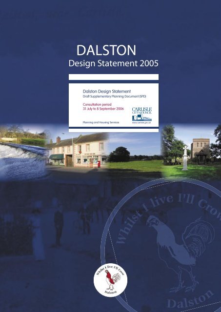
DALSTON<br />
<strong>Design</strong> <strong>Statement</strong> 2005<br />
<strong>Dalston</strong> <strong>Design</strong> <strong>Statement</strong><br />
Draft <strong>Supplementary</strong> <strong>Plann<strong>in</strong>g</strong> <strong>Document</strong> (SPD)<br />
Consultation period<br />
31 July to 8 September 2006<br />
<strong>Plann<strong>in</strong>g</strong> and Hous<strong>in</strong>g Services<br />
www.carlisle.gov.uk
DALSTON<br />
<strong>Design</strong> <strong>Statement</strong><br />
CONTENTS<br />
The <strong>Design</strong> <strong>Statement</strong><br />
Aims<br />
What is the Parish<br />
The Landscape<br />
Rivers<br />
Woodland and Trees<br />
Footpaths, Bridleways and cycle paths<br />
The Built Enviroment<br />
The Square<br />
Individual Dwell<strong>in</strong>gs<br />
Estate Houses<br />
Industrial & Commercial<br />
Railways<br />
Artificial Light<strong>in</strong>g<br />
Appendices<br />
Appendix 1 Listed Build<strong>in</strong>gs<br />
Appendix 2 Tree Preservation Orders<br />
Appendix 3 Maps<br />
ACKNOWLEDGEMENTS<br />
<strong>Dalston</strong> Parish Council thanks:<br />
The <strong>Design</strong> <strong>Statement</strong> Team<br />
The Historical Information Researcher<br />
Carlisle City Council<br />
Cumbria County Council<br />
The Countryside Agency<br />
And anyone who has helped <strong>in</strong> any way to<br />
produce this <strong>Design</strong> <strong>Statement</strong>
THE DESIGN STATEMENT<br />
Aims<br />
This <strong>Design</strong> <strong>Statement</strong> takes account of op<strong>in</strong>ions<br />
received from the public participation <strong>in</strong> the<br />
preparation of the Parish Plan, and forms an <strong>in</strong>tegral<br />
part of that Plan. It has been written by residents<br />
of the Parish, and adopted by the Parish Council,<br />
to provide guidance to those wish<strong>in</strong>g to build or<br />
alter properties <strong>in</strong> the Parish, even <strong>in</strong> a m<strong>in</strong>or way<br />
and to encourage susta<strong>in</strong>able development, which<br />
would make a positive contribution to its life, work,<br />
and character. This <strong>Design</strong> <strong>Statement</strong> follows the<br />
Carlisle District Local Plan and the Cumbria and Lake<br />
District Jo<strong>in</strong>t Structure Plan, and is be<strong>in</strong>g submitted<br />
to the City Council for adoption as supplementary<br />
plann<strong>in</strong>g guidance. It particularly applies to those<br />
policies, which refer to developments that might<br />
affect the scale and character of exist<strong>in</strong>g build<strong>in</strong>gs<br />
or have an adverse effect on the amenity, character<br />
and appearance of the area. Any development<br />
should allow for appropriate car park<strong>in</strong>g and access,<br />
not generate traffic that would affect the highway<br />
network, and safeguard wildlife. It is also for local<br />
householders and owners of bus<strong>in</strong>ess premises when<br />
mak<strong>in</strong>g relatively m<strong>in</strong>or alteration to their premises,<br />
which do not require statutory approvals.<br />
bodies of water flowed down the valley, especially<br />
through ‘The Mires’ as the ice sheet retreated from<br />
west to east across the Solway Pla<strong>in</strong>. Other local<br />
place names are also Celtic, such as ‘shaw’ mean<strong>in</strong>g<br />
‘wood’ as <strong>in</strong> Shawk Quarries, ‘caer’ mean<strong>in</strong>g fort and<br />
‘dhu’ mean<strong>in</strong>g black as <strong>in</strong> Cardew. Additional evidence<br />
of these people is the stone circle (now removed) at<br />
Chapel Flat and Iron Age work<strong>in</strong>gs near <strong>Dalston</strong> Hall.<br />
The Romans first occupied the area <strong>in</strong> 78AD. They<br />
had a camp to the west of <strong>Dalston</strong> Hall, one of their<br />
ma<strong>in</strong> roads ran through the village and they quarried<br />
sandstone at Shawk. By the fourth century this area<br />
was a peaceful Roman prov<strong>in</strong>ce. From then until<br />
medieval times the area was fought over by Picts,<br />
Scots, Danes, Anglo Saxons and Normans until Border<br />
Reiv<strong>in</strong>g died out <strong>in</strong> the fourteenth century. As late as<br />
1346 Scottish raiders attacked <strong>Dalston</strong>. <strong>Dalston</strong> men<br />
enjoyed free graz<strong>in</strong>g on ‘st<strong>in</strong>ts’ <strong>in</strong> return for furnish<strong>in</strong>g<br />
horses and armour to defend the settlements. Some<br />
‘st<strong>in</strong>ts’ from that time still belong to Cardew Farm and<br />
Warnell means ‘place where stallions graze’.<br />
(Please note all historical text is shown <strong>in</strong> italics)<br />
Cumbria and Lake District Jo<strong>in</strong>t Structure Plan<br />
- Policy 13: ‘development will normally be permitted<br />
which <strong>in</strong> its use, sit<strong>in</strong>g, scale and design is well related<br />
to exist<strong>in</strong>g developed areas of the countryside and<br />
does not harm dist<strong>in</strong>ctive features of local landscape<br />
significance. In the undeveloped open countryside,<br />
development will not normally be permitted except<br />
when it is required to meet local <strong>in</strong>frastructure needs<br />
which cannot be located elsewhere, and provided it is<br />
sited to m<strong>in</strong>imize environmental impacts and meets<br />
high standards of design’.<br />
The first proper settlers <strong>in</strong> <strong>Dalston</strong> were Brigantian<br />
Celts or Britons, whose life was based on graz<strong>in</strong>g<br />
cattle, sheep and horses. The name probably stems<br />
from the British word ‘dwr’, pronounced ‘dor’ and<br />
mean<strong>in</strong>g ‘by the water’. In post glacial times enormous<br />
There is strong evidence that residents greatly value<br />
the character, convenience, and communal spirit<br />
of the Parish, and it is <strong>in</strong>tended that this <strong>Design</strong><br />
<strong>Statement</strong> will help to preserve and enhance what is<br />
already appreciated.<br />
3
and veter<strong>in</strong>ary practices, garage, two public houses<br />
with restaurants, primary and secondary schools,<br />
railway station, build<strong>in</strong>g society, offices for legal and<br />
<strong>in</strong>surance practices, market garden, hous<strong>in</strong>g estates,<br />
<strong>in</strong>dividual houses on ma<strong>in</strong> routes, a garden centre,<br />
a large milk process<strong>in</strong>g factory and other <strong>in</strong>dustrial<br />
build<strong>in</strong>gs. The River Caldew is an important element<br />
<strong>in</strong> the landscape and the Green which adjo<strong>in</strong>s it near<br />
the centre of the village, has a perpetual restriction<br />
aga<strong>in</strong>st build<strong>in</strong>g<br />
What is the Parish?<br />
The Parish lies to the south of the city of Carlisle.<br />
Most of the land is used for agriculture and much of<br />
the landscape has a parkland character. Apart from<br />
those employed <strong>in</strong> farm<strong>in</strong>g or local <strong>in</strong>dustries, and<br />
those work<strong>in</strong>g from home, most residents commute<br />
to Carlisle and other places. While local <strong>in</strong>dustries<br />
and the schools generate a certa<strong>in</strong> amount of traffic,<br />
a large number of vehicles pass<strong>in</strong>g through are us<strong>in</strong>g<br />
the Parish as a short-cut to elsewhere.<br />
Buckabank<br />
Although once bigger than <strong>Dalston</strong> itself, it is now a<br />
small group<strong>in</strong>g of a variety of types of houses and it is<br />
difficult to def<strong>in</strong>e a boundary between the two with the<br />
build<strong>in</strong>g of newer houses.<br />
With<strong>in</strong> the Parish are recognisable <strong>in</strong>dividual<br />
settlements, generally set well apart: these are:-<br />
Raughton Head and Stockdalewath<br />
These are predom<strong>in</strong>antly agricultural. As well as farm<br />
build<strong>in</strong>gs there are <strong>in</strong>dividual houses, two churches, a<br />
primary school, a board<strong>in</strong>g school and Rose Castle,<br />
the Bishop’s residence. There is a small estate of<br />
bungalows <strong>in</strong> Stockdalewath. The River Caldew and<br />
its tributary the Roe are predom<strong>in</strong>ant features of the<br />
landscape here.<br />
<strong>Dalston</strong><br />
By far the largest, with services enjoyed by all <strong>in</strong><br />
the Parish, as well as some from beyond. It has<br />
shops, a post office, two churches, bowl<strong>in</strong>g club,<br />
tennis club, recreation ground, show field, medical<br />
4
Gaitsgill and Raughton<br />
Two small adjacent hamlets with farms, a village hall,<br />
and <strong>in</strong>dividual houses. Gaitsgill is largely free from<br />
pass<strong>in</strong>g traffic.<br />
enlarged. There is a country house hotel, market<br />
garden, caravan site, 9-hole golf course and some<br />
small <strong>in</strong>dustrial units. Brow Nelson <strong>in</strong> L<strong>in</strong>gey marks<br />
the northern limit of dwell<strong>in</strong>gs <strong>in</strong> the Parish, with open<br />
agricultural land between it and the city.<br />
Cardewlees and Orton Grange<br />
This area is close to the A595. There are a transport<br />
depot, a quarry which will eventually be put to<br />
recreational use, large glassed horticultural centre,<br />
farms, residential caravan park and a number of<br />
<strong>in</strong>dividual dwell<strong>in</strong>gs.<br />
Nether Welton<br />
This is a very small settlement close to Welton, which<br />
is <strong>in</strong> the adjo<strong>in</strong><strong>in</strong>g Parish.<br />
Cumdivock<br />
Predom<strong>in</strong>antly agricultural with <strong>in</strong>dividual houses<br />
mostly beside the ma<strong>in</strong> routes. It has a church and<br />
small community build<strong>in</strong>g<br />
Unthank<br />
Predom<strong>in</strong>antly agricultural with a few <strong>in</strong>dividual<br />
houses, and not on a busy traffic route.<br />
L<strong>in</strong>gey<br />
Mostly of dwell<strong>in</strong>gs <strong>in</strong> large plots of land, orig<strong>in</strong>ally<br />
land settlement houses, but now a good number<br />
Broadfield<br />
This is relatively isolated on the southeastern limit of<br />
the Parish. There are a few houses and the Crown<br />
Inn with bar and restaurant, together with a residential<br />
caravan park <strong>in</strong> the neighbour<strong>in</strong>g Parish.<br />
Recommendation<br />
Restrict build<strong>in</strong>g development to with<strong>in</strong> the limits<br />
of exist<strong>in</strong>g settlements.<br />
1.0 INTRO<br />
5
THE LANDSCAPE<br />
Predom<strong>in</strong>ately <strong>in</strong> agricultural use, the landscape is<br />
gently undulat<strong>in</strong>g with frequent hedgerows, numerous<br />
trees and small woodland areas.<br />
The Cumbria Structure Plan 2004 classifies the<br />
majority of the Parish as Lowland – Ridge and Valley<br />
or Low Valley<br />
The River Caldew and other watercourses are<br />
significant and attractive landscape features. The<br />
majority of farm<strong>in</strong>g activity comprises beef and dairy<br />
farms and sheep rear<strong>in</strong>g. Other notable rural uses<br />
of land are horticulture, a garden centre and gravel<br />
extraction. The landscape adjacent to Rose Castle<br />
is one example of attractive open fields with mature<br />
hedgerows, scattered trees and a riverside pathway<br />
(Cumbrian Way).<br />
S<strong>in</strong>ce the manorial system, agriculture has cont<strong>in</strong>ued<br />
to change <strong>in</strong> <strong>Dalston</strong> Parish. The enclosure of land <strong>in</strong><br />
the seventeenth century, culm<strong>in</strong>at<strong>in</strong>g <strong>in</strong> the Enclosure<br />
Act of 1803, deprived many cottagers of their land. In<br />
the twentieth century the number of viable farms fell<br />
dramatically, from over 250 <strong>in</strong> the 1950s to fewer than<br />
50 today and that drift cont<strong>in</strong>ues. The last farm <strong>in</strong> the<br />
middle of the village was Church Farm, which had a<br />
dairy herd until the late 1950s<br />
Recommendations<br />
1 Ensure that there is very little change <strong>in</strong> land<br />
use.<br />
2 Any new build<strong>in</strong>gs needed for agricultural<br />
purposes to be sited as discreetly as possible<br />
and to be of neutral colours.<br />
3 Ensure that views towards the fells are not<br />
impaired.<br />
Rivers<br />
The River Caldew has played a important role <strong>in</strong> the<br />
life of the village. In the past its clean fresh water<br />
provided power to many mills and resulted <strong>in</strong> the early<br />
expansion of <strong>Dalston</strong> village. Today the river is no<br />
longer used for power or dr<strong>in</strong>k<strong>in</strong>g but is an important<br />
popular and very attractive feature of the Parish.<br />
The River Caldew, together with its tributaries, Pow<br />
Beck and the River Roe, form major and attractive<br />
features of the landscape <strong>in</strong> the Parish. Areas<br />
alongside the Caldew south of <strong>Dalston</strong>, and Roe from<br />
the confluence upstream to Stockdalewath are high<br />
quality river valley landscapes. The Cumbrian Way<br />
footpath follows the river for much of its length through<br />
fields and parkland as it traverses the Parish from<br />
the south of the county towards Carlisle. Common<br />
land alongside the river <strong>in</strong> the village provides direct<br />
access to the riverside and its abundance of wildlife<br />
creates an amenity for both residents and visitors. To<br />
the north of <strong>Dalston</strong>, west of the Caldew is a 9-hole<br />
golf course which is a valuable local amenity.<br />
The mill weir just upstream from Hawksdale Bridge<br />
and others outside the Parish, have been barriers to<br />
migratory fish s<strong>in</strong>ce they were built. Fish passes were<br />
opened <strong>in</strong> 1987 and salmon have now returned to the<br />
River Caldew.<br />
The land on the western side of the Parish forms<br />
the head of the River Wampool catchment. At<br />
Cardewlees, where the river has been diverted, sand<br />
and gravel have been extracted. These works will,<br />
when extraction ceases, provide an opportunity for<br />
restoration to establish an attractive wetland feature<br />
and wildlife refuge.<br />
The nature conservation value of the rivers is<br />
recognised at both national and European level.<br />
The River Caldew forms part of the River Eden and<br />
Tributaries Site of Special Scientific Interest and has<br />
been designated at European level as a Special Area<br />
of Conservation. The Environment Agency is opposed<br />
to gravel abstraction, historically carried out at Bridge<br />
End, <strong>in</strong> order to protect the native white-clawed<br />
crayfish.<br />
6
Footpaths, Bridleways & Cycle tracks<br />
Bank erosion can be observed at many locations.<br />
The Eden Rivers Trust has been promot<strong>in</strong>g “soft”<br />
environmental methods of bank stabilisation,<br />
<strong>in</strong>clud<strong>in</strong>g a stretch at Cummersdale, which could have<br />
wider application <strong>in</strong> <strong>Dalston</strong> Parish. The Ive and Roe<br />
Conservation Society (with l<strong>in</strong>ks to the Eden Rivers<br />
Trust) aims are to ensure the preservation and active<br />
management of Ive Beck and the River Roe.<br />
Recommendations<br />
1 Ensure that wildlife by the rivers is preserved.<br />
2 Limit gravel extraction (except at Cardewlees<br />
quarry).<br />
3 Ensure that the weir upstream from Hawksdale<br />
Bridge is preserved.<br />
4 Ensure that bank erosion is properly<br />
controlled.<br />
5 Implement plans for the management of the<br />
future uses of Cardewlees quarry.<br />
6 Ensure that river corridor landscape and views,<br />
both with<strong>in</strong> it and from it, are not impaired.<br />
Woodland & Trees<br />
There are commercial woodlands at L<strong>in</strong>gey, on the<br />
southern edge of the Parish, and other small areas,<br />
but these are not dom<strong>in</strong>ant features of the landscape.<br />
Quite a number of trees, and some woodland, have<br />
preservation orders on them, and these are listed <strong>in</strong><br />
the appendix.<br />
Recommendations<br />
The <strong>in</strong>dustrial age has left <strong>Dalston</strong> the precious legacy<br />
of a maze of footpaths created by the mill workers on<br />
their way to and from work.<br />
There are many of these paths and bridleways <strong>in</strong> all<br />
parts of the Parish, with local maps available, and<br />
there is a cycle track l<strong>in</strong>k<strong>in</strong>g <strong>Dalston</strong> village to Carlisle.<br />
The Cumbria Way passes through the Parish. The<br />
Redspearlands Footpath Group has been established<br />
to promote walk<strong>in</strong>g, monitor and record deficiencies<br />
on rights of way and pass on the <strong>in</strong>formation as<br />
necessary for action.<br />
Recommendations<br />
1 Ensure that all footpaths and bridleways are<br />
passable.<br />
2 Improve the <strong>Dalston</strong> to Carlisle cycle track<br />
by <strong>in</strong>creas<strong>in</strong>g visibility at some corners,<br />
limit<strong>in</strong>g access po<strong>in</strong>ts for illegal motor cycle<br />
use, improv<strong>in</strong>g the end of the track beside St<br />
Michael’s School, repair<strong>in</strong>g defective parts of<br />
the surface, and by restrict<strong>in</strong>g the spread of<br />
vegetation over, and close to, the track.<br />
3 Re-appraise all footpaths and recommend<br />
amendments to routes as necessary.<br />
4 Consider the creation of new footpaths<br />
and cycle tracks to l<strong>in</strong>k Townhead Road to<br />
the station, and from the centre of <strong>Dalston</strong><br />
to Cardewlees when the quarry is put to<br />
recreational use.<br />
5 Extend footways from <strong>Dalston</strong> to L<strong>in</strong>gey, along<br />
Station Road to the railway bridge, and at<br />
corners or other places where there is danger<br />
to pedestrians walk<strong>in</strong>g on the highway.<br />
1 Limit commercial timber grow<strong>in</strong>g unless well<br />
screened with native trees.<br />
2 All commercial woodland to be screened by<br />
native trees.<br />
3 Arrange public access to woodlands.<br />
4 Ensure that preservation orders are<br />
observed.<br />
5 Where trees with preservation orders are near<strong>in</strong>g<br />
the end of their lives, plant replacements.<br />
1.0 INTRO<br />
7
THE BUILT ENVIRONMENT<br />
The Square<br />
Most build<strong>in</strong>gs are of two stories, though there are four<br />
with three and two which are s<strong>in</strong>gle storey. The variety<br />
<strong>in</strong> the heights of build<strong>in</strong>gs give <strong>in</strong>terest. Most build<strong>in</strong>gs<br />
are stone faced, some also pa<strong>in</strong>ted, with double hung<br />
sash w<strong>in</strong>dows with dressed stone surrounds. The<br />
three-storey Co-op build<strong>in</strong>g is smooth rendered and<br />
pa<strong>in</strong>ted whereas its neighbour of the same size is not.<br />
The two small s<strong>in</strong>gle-storey cottages are roughcast<br />
and pa<strong>in</strong>ted . Most commercial premises have large<br />
plate glass w<strong>in</strong>dows. Uncontrolled and undiscipl<strong>in</strong>ed<br />
park<strong>in</strong>g takes place on the tarmac surface of the<br />
whole of The Square, and there is danger from<br />
traffic pass<strong>in</strong>g through. The centre of <strong>Dalston</strong> is a<br />
conservation area, and is def<strong>in</strong>ed by the black l<strong>in</strong>e on<br />
the adjacent map.<br />
The Square would orig<strong>in</strong>ally have been cottages<br />
around a village green. Whether this was for social or<br />
defensive reasons is not known. St Michael’s Church,<br />
dat<strong>in</strong>g from 1196, is the oldest build<strong>in</strong>g, followed by two<br />
clay dabb<strong>in</strong> cottages (25 and 26 The Square) dat<strong>in</strong>g<br />
from the fifteenth century. Most of the other properties<br />
date from the eighteenth century. Gardens beh<strong>in</strong>d the<br />
east side sloped down to the River Caldew prior to it<br />
chang<strong>in</strong>g its course <strong>in</strong> the n<strong>in</strong>eteenth century.<br />
In <strong>Dalston</strong>’s <strong>in</strong>dustrial heyday there were six pubs <strong>in</strong><br />
The Square - the Indian K<strong>in</strong>g, the African Queen and<br />
the Crown and Mitre on the west side, the Blue Bell<br />
and the Temperance Hotel on the east side and the<br />
Swan on the south side. <strong>Dalston</strong> had three breweries:<br />
one at Green Lane, another, Wilson’s, opposite<br />
Caldew School and a third <strong>in</strong> Indian K<strong>in</strong>g Yard. The<br />
latter was also used as a dance hall before the Victory<br />
Hall was built <strong>in</strong> 1922.<br />
Recommendations<br />
1 Any alterations to the height of build<strong>in</strong>gs<br />
should not be such as to harm the variety and<br />
<strong>in</strong>terest which exists at present.<br />
2 Any replacement w<strong>in</strong>dows to be as near <strong>in</strong><br />
appearance to the orig<strong>in</strong>als as possible .<br />
3 When possible reduce the number of plate<br />
glass w<strong>in</strong>dows.<br />
8
4 Prohibit dormer and roof w<strong>in</strong>dows at the front<br />
of build<strong>in</strong>gs <strong>in</strong> The Square.<br />
5 Enhance the general environment of The<br />
Square.<br />
Individual dwell<strong>in</strong>gs<br />
Throughout the Parish, these vary greatly <strong>in</strong> character,<br />
and are all typical of the times <strong>in</strong> which they were<br />
built<br />
Recommendations<br />
1 While recognis<strong>in</strong>g the current design<br />
preferences, the new houses should respect<br />
local characteristics.<br />
2 As chimneys may no longer be required,<br />
<strong>in</strong>troduce simple variations <strong>in</strong> roofl<strong>in</strong>es where<br />
there are no chimneys.<br />
3 Do not have open plan front gardens<br />
everywhere.<br />
4 Where possible ensure that cars and caravans<br />
can be parked beh<strong>in</strong>d build<strong>in</strong>g l<strong>in</strong>es or <strong>in</strong><br />
separate screened areas.<br />
5 Most new low-cost hous<strong>in</strong>g should be as<br />
near as possible to the centre of <strong>Dalston</strong> and<br />
the number of such dwell<strong>in</strong>gs should be as<br />
recommended <strong>in</strong> the Hous<strong>in</strong>g Needs Survey.<br />
6 Provide variations <strong>in</strong> density with<strong>in</strong> estates,<br />
with irregular spaces between groups of<br />
houses.<br />
Recommendations<br />
1 Resist the build<strong>in</strong>g of houses <strong>in</strong> isolated<br />
positions. Any extensions to be similar <strong>in</strong><br />
design to the house be<strong>in</strong>g extended.<br />
2 Require adequate landscap<strong>in</strong>g around<br />
build<strong>in</strong>gs, with tree-plant<strong>in</strong>g where<br />
appropriate.<br />
3 Ensure that there is adequate park<strong>in</strong>g<br />
provision with<strong>in</strong> all premises.<br />
4 Give careful consideration to any new<br />
build<strong>in</strong>gs or extensions on the flood pla<strong>in</strong><br />
5 Preserve spaces between exist<strong>in</strong>g build<strong>in</strong>gs.<br />
Estate houses<br />
The designs of houses <strong>in</strong> the five major estates are<br />
typical of the times <strong>in</strong> which they were built. Because<br />
of the desirability of the Parish as a place to live there<br />
are demands for more hous<strong>in</strong>g land, and the hous<strong>in</strong>g<br />
needs survey has established that there is a need for<br />
some social hous<strong>in</strong>g.<br />
Industrial & Commercial<br />
The largest and highest <strong>in</strong>dustrial build<strong>in</strong>g, on the<br />
northern fr<strong>in</strong>ge of <strong>Dalston</strong> Village is Nestlés factory,<br />
there is an estate of workshops and office build<strong>in</strong>gs<br />
on the western fr<strong>in</strong>ge at Barras Lane, a factory, once<br />
powered by water from the Caldew to the east of<br />
The Green, and small isolated <strong>in</strong>dustrial units <strong>in</strong><br />
various parts of the Parish. The present road system,<br />
particularly Barras Lane with the narrow railway<br />
bridge, and the junction of Station Road with Carlisle<br />
Road, is not suitable for traffic generated by <strong>in</strong>dustry<br />
and even with a restriction on traffic pass<strong>in</strong>g through;<br />
the level of <strong>in</strong>dustrial traffic is unacceptable.<br />
The River Caldew has always played a fundamental<br />
part <strong>in</strong> <strong>Dalston</strong>’s prosperity. The Romans established<br />
9
a corn mill on the River and the woollen <strong>in</strong>dustry<br />
boomed <strong>in</strong> the fifteenth century. In 1666 a bay at<br />
Lakeheughs diverted water from the Caldew <strong>in</strong>to a<br />
mill race. Water from this race or dam, as it was known<br />
locally, could be directed <strong>in</strong>to the Forge Pond (where<br />
The Forge houses now stand) to power Bishop’s Corn<br />
Mill or to water wheels and trip hammers further down<br />
stream. Another bay was built across the Caldew<br />
below the churchyard and this directed water to Low<br />
Green and Low Mill.<br />
The first cotton mill was built <strong>in</strong> 1782 at Mill Ellers and<br />
by 1830 there were four cotton mills, two corn mills<br />
and a forge. The forge made tools for agricultural use<br />
and was on two sites: one at the Pond and the other at<br />
Walk Mill where f<strong>in</strong>ish<strong>in</strong>g took place. There was a dye<br />
works at the New Rookery, near Walk Mill, together with<br />
a block of cottages. Mill Ellers burnt down <strong>in</strong>1901, but<br />
the four-storey shell was rebuilt as the two-storey mill,<br />
which rema<strong>in</strong>s today. The sixteen-foot wheel rema<strong>in</strong>ed<br />
until 1970. There have been no corn or cotton mills<br />
s<strong>in</strong>ce the 1960s and the forge closed <strong>in</strong> 1918.<br />
6 Site any w<strong>in</strong>d generators so as not to impair<br />
important views.<br />
7 Permanent caravan sites to be limited and<br />
well screened.<br />
Railway<br />
The Carlisle to Barrow l<strong>in</strong>e runs through the Parish,<br />
with a request stop at <strong>Dalston</strong> Station. The Station<br />
approach is shared by commercial build<strong>in</strong>gs and not<br />
easily identified.<br />
Recommendations.<br />
1 Improve the approach to the station from<br />
Station Road.<br />
2 Improve the approach to the station from the<br />
<strong>in</strong>dustrial estate with better signage.<br />
3 Improve the car park designated for rail<br />
users.<br />
Artificial Light<strong>in</strong>g<br />
Recommendations<br />
1 Colour of new build<strong>in</strong>gs to be as neutral as<br />
possible.<br />
2 Height of new build<strong>in</strong>gs to be as low as<br />
possible, consistent with the practical needs<br />
of the processes with<strong>in</strong>.<br />
3 Landscap<strong>in</strong>g around build<strong>in</strong>gs to be <strong>in</strong>cluded<br />
<strong>in</strong> design proposals, and to provide as much<br />
screen<strong>in</strong>g as possible. Screen<strong>in</strong>g may need<br />
to be on property owned by others.<br />
4 Limit <strong>in</strong>dustrial expansion until the Carlisle<br />
Southern Environment Route is constructed.<br />
5 Provide sufficient park<strong>in</strong>g spaces with<strong>in</strong> all<br />
premises for all staff and visitors.<br />
The highway light<strong>in</strong>g varies throughout the Parish.<br />
There is very little, or none, <strong>in</strong> the smaller settlements,<br />
and some of a high standard <strong>in</strong> <strong>Dalston</strong> Village. The<br />
sports field of Caldew School has light<strong>in</strong>g of a high<br />
standard to allow for sport after dark, and similar<br />
light<strong>in</strong>g may be <strong>in</strong>troduced for the tennis club. There<br />
is security light<strong>in</strong>g on many build<strong>in</strong>gs. Much of this<br />
light<strong>in</strong>g provision causes unnecessary glare and<br />
pollution. Light<strong>in</strong>g on private property is often <strong>in</strong>trusive<br />
and out of character with the neighbourhood.<br />
Recommendations<br />
1 Require those responsible for highway and<br />
estate light<strong>in</strong>g to elim<strong>in</strong>ate light pollution.<br />
2 Require owners to limit the extent of light<strong>in</strong>g to<br />
with<strong>in</strong> their own premises and to keep light<strong>in</strong>g<br />
levels as low as possible.<br />
3 As highway light<strong>in</strong>g can harm the rural<br />
character of the remoter parts of the Parish, it<br />
should be limited.<br />
10
APPENDIX 1 Listed Build<strong>in</strong>gs<br />
Beech House and adjo<strong>in</strong><strong>in</strong>g build<strong>in</strong>gs,<br />
Stockdalewath Grade II<br />
The Blue Bell 6 The Square, <strong>Dalston</strong> Grade II<br />
Brackenhow, <strong>Dalston</strong> Grade II<br />
Brecon Hill, <strong>Dalston</strong> Grade II<br />
Bridge End Inn, Bridge End Grade II<br />
Caldew Bank, Bridge End Grade II<br />
Caldew House, Carlisle Road Grade II<br />
Cardew Hall, Cardew Grade II<br />
Lodge South-East of Cardew Lodge,<br />
Cardew Grade II<br />
Cardew Farmhouse, Cardew Grade II<br />
Cardew Lodge, Cardew Grade II<br />
Chapel House, Raughton Head Grade II<br />
Chilterns 22 The Green, <strong>Dalston</strong> Grade II<br />
All Sa<strong>in</strong>ts Church, Raughton Head Grade II<br />
Church Farmhouse, 2, The Square Grade II<br />
Church House, 1, the Square Grade II<br />
Church of St Michael and all Angels,<br />
The Square Grade II*<br />
Church View 16&17 The Square, <strong>Dalston</strong> Grade II<br />
Coronation Seat, The Green Grade II<br />
Corsica Cottage and adjo<strong>in</strong><strong>in</strong>g out build<strong>in</strong>gs known<br />
as Orchard Cottage, Buckabank Grade II<br />
<strong>Dalston</strong> Bridge, <strong>Dalston</strong> Grade II<br />
<strong>Dalston</strong> Hall , <strong>Dalston</strong> Grade II*<br />
Fieldhead, <strong>Dalston</strong> Grade II<br />
Flanders, <strong>Dalston</strong> Grade II<br />
Founta<strong>in</strong> Head and adjo<strong>in</strong><strong>in</strong>g barn,<br />
Hawksdale Grade II<br />
Gardener’s Cottage Garden Wall to South-East of<br />
Cardew Lodge, Cardew Grade II<br />
Gaitsgill Hall, Gaitsgill Grade II<br />
Gardener’s Cottage adj gateway gatetower and<br />
outbuild<strong>in</strong>gs to E of C.L, Cardew Grade II<br />
The Gill, Cumdivock Grade II<br />
Green Lane Cottage (formerly listed as thatched<br />
cottage at Green Lane), <strong>Dalston</strong> Grade II<br />
Barn to NE of Green Lane Cottage, <strong>Dalston</strong> Grade II<br />
Green Lane House, <strong>Dalston</strong> Grade II<br />
Stables and Barn to West of Green Lane House,<br />
<strong>Dalston</strong> Grade II<br />
Green Park, <strong>Dalston</strong> Grade II<br />
Hawkesdale Hall, Hawkesdale Grade II*<br />
Former Stables to South-East of Hawkesdale Hall,<br />
Hawkesdale Grade II<br />
Outbuild<strong>in</strong>g to North-West of Hawkesdale Hall,<br />
Hawkesdale Grade II<br />
1&2 Haythwaite Cottages, Raughton Head Grade II<br />
Haythwaite, Raughton Head Grade II<br />
Holme House and adjo<strong>in</strong><strong>in</strong>g Barn, <strong>Dalston</strong> Grade II<br />
Holmhill Farmhouse, Hawkesdale Grade II<br />
Hudbeck and adjo<strong>in</strong><strong>in</strong>g outbuild<strong>in</strong>gs, <strong>Dalston</strong> Grade II<br />
Boundary stone on the Ivegill Road SE of<br />
Stockdalewath, Stockdalewath Grade II<br />
Lime House School, Hawkesdale Grade II<br />
Middle Farm and adjo<strong>in</strong><strong>in</strong>g outbuild<strong>in</strong>gs,<br />
Cumdivock Grade II<br />
Nook House and adjo<strong>in</strong><strong>in</strong>g Barn, <strong>Dalston</strong> Grade II<br />
The Oaks, Hawkesdale Grade II<br />
The Old Vicarage, Carlisle Road Grade II<br />
Barn and Byres adjo<strong>in</strong><strong>in</strong>g to North-East of P<strong>in</strong>quay’s,<br />
<strong>Dalston</strong> Grade II<br />
P<strong>in</strong>quay’s, Raughton Grade II<br />
Barn to West of Poplar House, Cumdivock Grade II<br />
Poplar House, Cumdivock Grade II<br />
Pow Bank, <strong>Dalston</strong> Grade II<br />
Raughton Farmhouse, Raughton Grade II<br />
Outbuild<strong>in</strong>g attach to S.W. Gable of former<br />
farmhouse, <strong>Dalston</strong> Grade II<br />
Farm Outbuild<strong>in</strong>gs,(formerly farmhouse, N.W.<br />
Raughton Head Hill Farmhouse),<br />
Raughton Head Hill Grade II<br />
Farm outbuild<strong>in</strong>gs attached to N.E.Gable of former<br />
farmhouse, <strong>Dalston</strong> Grade II<br />
Farm Outbuild<strong>in</strong>g N.N.W.of Raughtonhead Hill<br />
Farmhouse, <strong>Dalston</strong> Grade II<br />
Raughton Head House, Raughton Head Grade II<br />
Red Spears , <strong>Dalston</strong> Grade II<br />
Roewath, Stockdalewath Grade II<br />
Rose Bridge, <strong>Dalston</strong> Grade II<br />
Rose Castle, <strong>Dalston</strong> Grade I<br />
Curta<strong>in</strong> Walls surround<strong>in</strong>g Rose Castle,<br />
<strong>Dalston</strong> Grade I<br />
Dovecote to N.E. of Rose Castle (formerly listed with<br />
Rose Castle), <strong>Dalston</strong> Grade II*<br />
Gate with Flank<strong>in</strong>g Lodge and Tower to North of<br />
Rose Castle, <strong>Dalston</strong> Grade I<br />
Royal Oak and adjo<strong>in</strong><strong>in</strong>g house, Gaitsgill Grade II<br />
Country Kitchen 4&5 The Square, <strong>Dalston</strong> Grade II<br />
19 The Square, <strong>Dalston</strong> Grade II<br />
27 The Square, <strong>Dalston</strong> Grade II<br />
3 The Square, <strong>Dalston</strong> Grade II<br />
Stockdalewath Bridge, Stockdalewath Grade II<br />
Stonethwaite and adjo<strong>in</strong><strong>in</strong>g former barns and byers,<br />
Cardew Grade II<br />
The Swan Salon and Branch Library,<br />
<strong>Dalston</strong> Grade II<br />
Thackwood, <strong>Dalston</strong> Grade II<br />
1&2 The Green, <strong>Dalston</strong> Grade II<br />
Thethwaite and adjo<strong>in</strong><strong>in</strong>g Barn, <strong>Dalston</strong> Grade II<br />
Thrangholme Bridge, <strong>Dalston</strong> Grade II<br />
Thwaite Nook, Buckabank Grade II<br />
Unthank Farm (formerly Townhead) and adjo<strong>in</strong><strong>in</strong>g<br />
Barns, Unthank Grade II<br />
Unnamed House and Outbuild<strong>in</strong>gs to North-West of<br />
Hill House, Buckabank Grade II<br />
Village Hall and Primrose Cottage (Nos 1&2),<br />
Gaitsgill Grade II<br />
The Willows 7 The Green, <strong>Dalston</strong> Grade II<br />
Wythmoor House and adjo<strong>in</strong><strong>in</strong>g barns,<br />
Stockdalewath Grade II<br />
Dover House 24 The Square, <strong>Dalston</strong> Grade II<br />
Forge Green, <strong>Dalston</strong> Grade II<br />
Terrace wall to East of Rose Castle (formerly listed<br />
with Rose Castle), <strong>Dalston</strong> Grade II<br />
High Bridge, <strong>Dalston</strong> Grade II<br />
Byres and Barn adjo<strong>in</strong><strong>in</strong>g to North of Cardew Hall,<br />
Cardew Grade II<br />
Thrash<strong>in</strong>g Mill, Hawksdale Pasture Grade II<br />
11
APPENDIX 2 Tree Preservation Orders<br />
TPO Address Date Made Date Trees<br />
No<br />
Confirmed<br />
20 Watt Wood, Raughton Head 11/11/1949 14/04/1950 W1 - woodland consist<strong>in</strong>g of<br />
mixed deciduous trees and<br />
conifers, known as Watt Wood<br />
situated near Raughton<br />
- approx 23.3 acres.<br />
29 Land adjacent to Buckabank 11/11/1996 T1 - T4 - beech<br />
T5 - limeT6 - horse chestnut<br />
34 Townhead Road (1) 19/09/1980 11/11/1980 T1 - beech<br />
T2 - lime<br />
T3 - fern leafed beech<br />
T4 - horse chestnut<br />
Group 1<br />
7 common lime,<br />
2 small leafed lime, 16 beech,<br />
3 horse chestnut, 2 wych elm,<br />
2 holly, 2 yew<br />
35 Hilltop, Buckabank 23/10/1980 16/12/1980 T1 - T4 - common beech<br />
37 Ellerslea, Bridge End 25/11/1980 09/01/1981 T1 - oak<br />
T2 - ash<br />
T3 - oak<br />
T4 - ash<br />
T5 - well<strong>in</strong>gtonia<br />
38 Caldew Bank, Bridge End 01/12/1980 10/02/1981 T1 - atlas cedar<br />
41 Townhead Road (2) 15/01/1981 20/03/1981 T1 - copper beech<br />
42 Madam Banks 20/01/1981 20/03/1981 T1 - common oak<br />
T2 - common oak<br />
T3 - common ash<br />
T4 - T7 - common oak<br />
44 Manor House Farm, The Square 27/01/1981 20/03/1981 T1 - T3 common lime,<br />
T4 - T5 - horse chestnut<br />
T6 - T7 - common lime<br />
T8 - ash<br />
A1 - tree belt of approximately<br />
40 trees, mixture of Scots p<strong>in</strong>e<br />
and Colorado white fir<br />
12
TPO Address Date Made Date Trees<br />
No<br />
Confirmed<br />
46 Cardew Lodge, Cumdivock 27/02/1981 14/04/1981 T1 - beech<br />
T2 - T21 - oak<br />
T22 - beech<br />
T24 - T49 - oak<br />
T50 - beech<br />
T51 - oak<br />
T52 - noble fir<br />
T53 - lime<br />
T54 - oak<br />
T55 - beech<br />
T56 - T58 - oak<br />
T59 - lime<br />
T60 - T61 – oak<br />
Group1<br />
7 sycamore, 3 beech,<br />
2 lime, 1 oak, 1 alder.<br />
Group 2<br />
2 lime, 10 oak, 1 sycamore,<br />
4 beech.<br />
Group 3<br />
3 Scots p<strong>in</strong>e, 1 ash,<br />
1 sycamore, 2 oak.<br />
Group 4<br />
1 sycamore, 11 oak,<br />
1 Scots p<strong>in</strong>e, 1 lime.<br />
Group 5 - 5 oak.<br />
48 Ellers Mill 02/04/1981 02/06/1981 T1 - oak<br />
T2 - T5 - lime<br />
T6 - oak<br />
T7 - T8 - beech<br />
T9 - T14 - lime<br />
T15 - T17 - oak<br />
T18 - lime<br />
T19 - silver birch<br />
T20 - beech<br />
97 No7 The Green 01/02/1990 19/04/1991 T1 - beech<br />
129 Station House, Station Road 02/08/1996 T1 - beech<br />
177 Glebe Close 16/07/2003 23/09/2003 T1-Oak<br />
179 Glebe Close / Nook Lane Close 23/07/2003 19/01/2004 T1 oak<br />
T2 oak<br />
T3 oak<br />
182 Land between 53 & 55 09/02/2004 19/04/2004 T1. Oak<br />
Madam Banks Road<br />
190 29 The Green 16/02/2005 29/04/2005 Group 1<br />
consist<strong>in</strong>g of two Scots p<strong>in</strong>es<br />
13
APPENDIX 3 Maps<br />
<strong>Dalston</strong><br />
L<strong>in</strong>gey<br />
Cumdivock<br />
14
Raughton Head<br />
Stockdalewath<br />
& Highbridge<br />
Gaitsgill<br />
Cardewlees<br />
& Orton Grange<br />
All maps are reproduced from The<br />
English Lakes (North-eastern area)<br />
and Carlisle (Brampton, Longtown<br />
& Gretna Green) 1:25 000 scale by<br />
permission of Ordnance Survey®<br />
on behalf of The Controller of<br />
Her Majesty’s Stationery Office.<br />
© Crown copyright. All rights<br />
reserved. Licence No. 100044842.<br />
15
DALSTON<br />
<strong>Design</strong> <strong>Statement</strong><br />
<strong>Dalston</strong> Parish Plan 2005<br />
Bannerdale, Unthank, <strong>Dalston</strong>, Carlisle, Cumbria CA5 7BA<br />
Tel: 01228 712920, Fax: 01228 712920, Email: liza@carlisle-city.gov.uk<br />
<strong>Design</strong>ed & Pr<strong>in</strong>ted by Fullpo<strong>in</strong>t 015394 47100 www.fullpo<strong>in</strong>tdesign.com