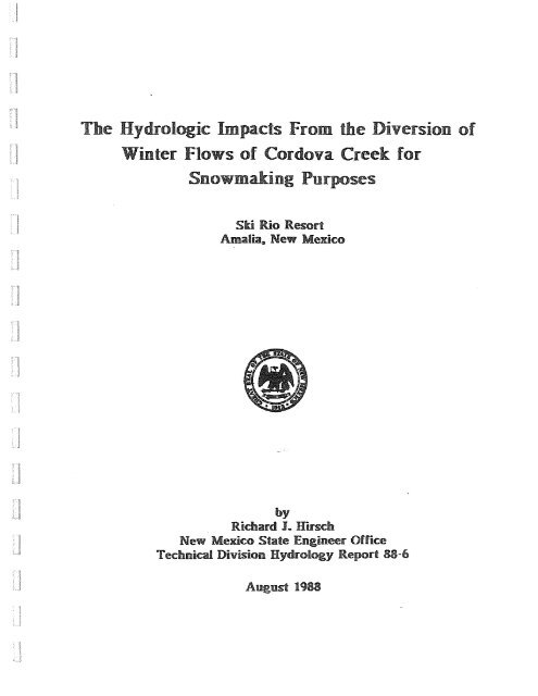
The Hydrologic Impacts From the Diversion of Winter Flows of ...
The Hydrologic Impacts From the Diversion of Winter Flows of ...
The Hydrologic Impacts From the Diversion of Winter Flows of ...

Create successful ePaper yourself
Turn your PDF publications into a flip-book with our unique Google optimized e-Paper software.
<strong>The</strong> <strong>Hydrologic</strong> <strong>Impacts</strong> <strong>From</strong> <strong>the</strong> <strong>Diversion</strong> <strong>of</strong><br />
<strong>Winter</strong> <strong>Flows</strong> <strong>of</strong> Cordova Creek for<br />
Snowmaking Purposes<br />
Ski Rio Resort<br />
Amalia. New Mexico<br />
by<br />
Richard 1. Hirsch<br />
New Mexico State Engineer Office<br />
Technical Division Hydrology Report 88-6<br />
August 1988
TABLE OF CONTENTS<br />
INTRODUCTION ............................................. " 1<br />
SNOWMAKING AT SKI RIO...................................... 3<br />
Consumptive Use <strong>of</strong> Water Used for Snowmaking ............ 4<br />
GEOLOGY AND HYDROGEOLOGY.. . . . . . . . . . . . . . . . . . . . . . . . . . . . . . . . .. 6<br />
Western Technologies Aquifer Test ....................... 7<br />
SEO Field Investigation <strong>of</strong> Closest Non-Applicant Wells .. 8<br />
CORDOVA CREEK WATERSHED HyDROLOGy .......................... 9<br />
Annual Run<strong>of</strong>f <strong>From</strong> Cordova Creek ........................ 9<br />
Monthly Run<strong>of</strong>f <strong>of</strong> Cordova Creek ......................... 9<br />
Ground Water Surface Water Relationship ................. 11<br />
Run<strong>of</strong>f Scenarios ........................................ 12<br />
Closest Water Right Owners .............................. 14<br />
IMPACTS TO THE RIO GRANDE .................................. 17<br />
CONCLUSIONS ................................................ 20<br />
REFERENCES ................................................. 22<br />
APPENDICES ................................................ .
TABLE OF FIGURES AND TABLES<br />
Figure 1. <strong>Diversion</strong>s from Cordova Creek <strong>Winter</strong> 1987-88<br />
Figure 2.<br />
Figure 3.<br />
Figure 4 .<br />
Figure 5.<br />
Figure 6 .<br />
Figure 7 .<br />
Figure 8.<br />
Average Consumptive Use <strong>of</strong> <strong>Winter</strong> <strong>Diversion</strong>s from<br />
Snowmaking Operation<br />
Estimated Monthly Run<strong>of</strong>f from upper Cordova Creek<br />
Watershed for High, Average, and Low Water Years<br />
Ski Rio Trail Map<br />
Ski Rio Water well Location Map<br />
Geologic Map and Outline <strong>of</strong> cordova Creek Watershed<br />
Legend for Geologic Map<br />
Normal Annual Precipitation Map For Taos County<br />
Figure 9.<br />
Albuquerque Journal Article "snowmaking Keeps Ski<br />
Off Rocks"<br />
Areas<br />
Figure 10. New Mexico Water Supply snowpack and Precipitation<br />
Graphs for <strong>Winter</strong> 1987-88<br />
Figure 11. Closest Non-Applicant Well Owners<br />
Figure 12. <strong>The</strong>is solution conditions, Glover-Balmer paper<br />
& 13.<br />
Table 1. Percentage Annual Run<strong>of</strong>f vs. Estimated Monthly Run<strong>of</strong>f<br />
Table 2. Estimated Monthly Run<strong>of</strong>f for High, Average, and Low<br />
Water Years<br />
Table 3. Estimated Account <strong>of</strong> Flow at Ski Rio Pond, Average Water<br />
Year<br />
Table 4. Estimated Account <strong>of</strong> Flow at ski Rio Pond, Low Water<br />
Year<br />
Table 5. Flow <strong>of</strong> Cordova Creek at Archuleta Property<br />
Table 6. <strong>Impacts</strong> to Gallegos Well<br />
Table 7. <strong>Impacts</strong> to Gonzales Well<br />
Table 8. Table <strong>of</strong> Closest Well Owners<br />
Table 9. Glover-Balmer Estimates <strong>of</strong> <strong>Impacts</strong> to <strong>the</strong> Rio Grande
INTRODUCTION<br />
To lure business during <strong>the</strong> early season and to establish<br />
independence from<br />
unpredictable winter precipitation,<br />
many nor<strong>the</strong>rn New Mexico ski areas have turned to artificial<br />
snowmaking to cover <strong>the</strong>ir slopes. <strong>The</strong> various owners<br />
(under<br />
three names since 1983) <strong>of</strong> Ski Rio Ski Area have acquired<br />
storage rights from nearby Costilla Reservoir, purchased<br />
snowmaking equipment and buried three water lines adjacent<br />
to <strong>the</strong>ir major ski runs<br />
with <strong>the</strong> intention <strong>of</strong> carrying out<br />
this process.<br />
Ski Rio is located on <strong>the</strong> north flank <strong>of</strong> Latir Peak,<br />
situated on <strong>the</strong> western slope <strong>of</strong> <strong>the</strong> sangre de Cristo<br />
Mountains 6.5 miles south <strong>of</strong> Amalia, New Mexico. Temperatures<br />
<strong>of</strong> <strong>the</strong> area range from a mean winter low <strong>of</strong> 21 degrees<br />
(F) to a mean summer high <strong>of</strong> 65 degrees ( F) • <strong>The</strong> average<br />
precipitation for <strong>the</strong> area is 20-28 inches per year and most<br />
<strong>of</strong> <strong>the</strong> annual precipitation (55-70%) falls from May<br />
through<br />
October in <strong>the</strong> form <strong>of</strong> thundershowers (Wilson, 1978).<br />
Rio Costilla Recreational Development Corporation filed<br />
application RG-37787 & RG-37787-S thru S-3 to divert 159<br />
acre-feet <strong>of</strong> ground water with 17 acre-feet <strong>of</strong><br />
consumptive<br />
use (CU) in 1982. In January, 1983 <strong>the</strong> State Engineer Office<br />
approved <strong>the</strong> application for 17<br />
acre-feet/annum <strong>of</strong> diversion.<br />
Attached to <strong>the</strong> permit were <strong>the</strong> conditions that: 1) up<br />
to 159 acre-feet/annum (maximum <strong>of</strong> 17 acre-feet/annum <strong>of</strong> CU)<br />
could be diverted if <strong>the</strong> applicant could prove return flow<br />
1
and 2) <strong>the</strong> resort has to release 10.6 acre-feet <strong>of</strong> storage<br />
right (from<br />
159 acre-feet/year <strong>of</strong> <strong>the</strong>ir storage right in<br />
costilla Reservoir) and 6.4 acre-feet <strong>of</strong> direct flow in<br />
costilla Creek to <strong>of</strong>fset <strong>the</strong> 17 acre-feet/year <strong>of</strong> cu.<br />
<strong>The</strong> ski area encompasses <strong>the</strong> Cordova<br />
Creek (fka Rito<br />
Ballegos) watershed. Because production from nine ski area<br />
wells is so poor <strong>the</strong> third owner, Miracle Mountain Inc.,<br />
filed application 4149 & RG-37787 thru RG-37787-S-3 in<br />
December 1986 to capture flows <strong>of</strong><br />
<strong>the</strong> creek to supplement<br />
groundwater use. <strong>The</strong> application proposed to include<br />
snowmaking<br />
in addition to <strong>the</strong> permitted use for construction,<br />
commercial, domestic, and recreational purposes.<br />
While <strong>the</strong> application was pending Miracle Mountain Inc.<br />
built a storage pond (capacity 2.3 acre feet) on Cordova<br />
Creek near <strong>the</strong> main lodge and ticket <strong>of</strong>fice to dam flows for<br />
snowmaking and filed an emergency application to divert<br />
flows for <strong>the</strong> winter <strong>of</strong> 1987-88. <strong>The</strong> permit was approved and<br />
<strong>the</strong> resort (Ski Rio) diverted 54.5 acre-feet <strong>of</strong> surface flow<br />
for snowmaking and<br />
3.34 acre-feet <strong>of</strong> ground water for <strong>the</strong><br />
ski resort operations from November through April 1987-88.<br />
<strong>The</strong> closest non-applicant water rights are 1.47 acres<br />
<strong>of</strong> surface right from Onesimo Archuleta acequia, in Cordova<br />
Canyon, and two domestic wells owned by Alfonso Gonzales<br />
(RG-23532) and Arturo Gallegos (RG-36174) near <strong>the</strong> mouth<br />
<strong>of</strong><br />
<strong>the</strong> canyon. <strong>The</strong> purpose <strong>of</strong> this report will be to determine<br />
2
whe<strong>the</strong>r winter diversions from Cordova Creek for snowmaking<br />
will impact <strong>the</strong> nearest existing water rights.<br />
SNOWMAKING AT SKI RIO<br />
Ski resorts generally produce most artificial snow in<br />
<strong>the</strong> early season and depend upon natural snow through <strong>the</strong><br />
rest <strong>of</strong> <strong>the</strong> season (personal communication, Louis Abruzzo,<br />
Sandia Peak Corp., 1988). Ski Rio's records indicate continuous<br />
snowmaking throughout <strong>the</strong> 1987-88 ski season .<br />
,-<br />
'''''<br />
......... -<br />
U."<br />
'....<br />
,....<br />
r"<br />
Figure 1. "...<br />
I:<br />
....<br />
....<br />
....<br />
...<br />
<strong>From</strong> mid-November to late March approximately 54.5<br />
acre-feet <strong>of</strong> Cordova creek water was diverted for snowmaking<br />
at <strong>the</strong> resort. Ski Rio reported to Mike Pitel, with <strong>the</strong> New<br />
Mexico Economic Development & Tourism Department, that <strong>the</strong>ir<br />
base snowpack was 45 percent below normal for <strong>the</strong> winter <strong>of</strong><br />
1987-88 (Figure 9). Records from <strong>the</strong> New Mexico water Supply<br />
Outlook (May 15, 1988) confirm that snowpack and<br />
precipitation for <strong>the</strong> Rio Grande Basin were below<br />
for late winter 1987-88 (Figure 10).<br />
average<br />
3
Kevin Beardsly, Ski Rio mountain manager, (personal<br />
communication) suggests<br />
that last winters diversion was<br />
enough to cover <strong>the</strong>ir slopes but, <strong>the</strong> resort had plans to<br />
expand <strong>the</strong>ir water lines fur<strong>the</strong>r up <strong>the</strong> mountain. <strong>The</strong><br />
purpose <strong>of</strong> <strong>the</strong> expansion would<br />
be to help bridge <strong>the</strong> gap<br />
between <strong>the</strong> natural snowpack on <strong>the</strong> upper mountain and <strong>the</strong><br />
artificial snowpack on <strong>the</strong> lower mountain during water<br />
low<br />
years.<br />
Ski Rio has<br />
water lines that parallel <strong>the</strong> three main<br />
ski slopes. Snowmaking equipment can be hooked into <strong>the</strong><br />
mains and used to make snow on <strong>the</strong> adjacent ski runs. In<br />
order to produce artificial snow <strong>the</strong> water is funneled<br />
through a misting device that sprays <strong>the</strong> water particles up<br />
into <strong>the</strong> air where crystalization takes place. <strong>The</strong> process<br />
at Ski Rio has used up to one acre foot per night to produce<br />
snow (November 19, 1987). Artificial snow was produced on 55<br />
acres at Ski Rio in <strong>the</strong> winter <strong>of</strong> 1987-88 (Slingerland,<br />
1988).<br />
Consumptive Use <strong>of</strong> water Used for snowmaking<br />
Smart and Fleming (1985) designed an experiment to<br />
estimate <strong>the</strong> cu <strong>of</strong> water during artificial snowrnaking for<br />
<strong>the</strong> Santa Fe Ski Area in <strong>the</strong> Santa Fe National Forest,<br />
near<br />
Santa Fe, New Mexico. <strong>The</strong> study used a mass balance approach<br />
to determine <strong>the</strong> cu from <strong>the</strong> evaporation (2.5 percent)<br />
occuring during <strong>the</strong> snowrnaking process and <strong>the</strong> CU from <strong>the</strong><br />
evaporation and sublimation (7.5 percent) <strong>of</strong> <strong>the</strong><br />
artificial<br />
4
snowpack for fall and spring conditions. Smart and Fleming's<br />
1985 estimate <strong>of</strong> 10 percent CU for <strong>the</strong> Santa Fe Ski Area may<br />
be a reasonable estimate <strong>of</strong> <strong>the</strong> CU at Ski Rio. <strong>The</strong> ski areas<br />
are situated on like soils and topography with<br />
similiar<br />
slope orientation.<br />
Wright Water Engineers and Leaf (1986, p. 9)<br />
investigated <strong>the</strong> CU <strong>of</strong> water used to make artificial snow<br />
for Colorado Ski Country USA. <strong>The</strong> study assembled data from<br />
six different ski resorts throughout Colorado and<br />
modeled<br />
<strong>the</strong> watershed loss associated with <strong>the</strong> snowmaking.<br />
<strong>The</strong><br />
average CU from <strong>the</strong> six resorts for<br />
was 22 percent, 6 percent initial<br />
an average water ye~r<br />
loss and 16 percent<br />
watershed loss.<br />
Ski Rio is located halfway between<br />
Santa Fe Ski Area<br />
and <strong>the</strong> resorts studied in Colorado. <strong>The</strong><br />
conditions and<br />
settings from both studies are similiar and so an<br />
average<br />
between <strong>the</strong> two CU estimates has been used in this study.<br />
<strong>The</strong> estimate for CU <strong>of</strong> Cordova creek water at ski Rio is 16<br />
percent <strong>of</strong> <strong>the</strong> total diversion.<br />
Figure 2.<br />
5
GEOLOGY AND HYDROGEOLOGY<br />
<strong>The</strong> following briefly summarizes <strong>the</strong> geology and<br />
hydrogeology <strong>of</strong> <strong>the</strong> area. For more detailed descriptions <strong>of</strong><br />
<strong>the</strong> geology <strong>the</strong> reader is referred to <strong>the</strong> list <strong>of</strong> references<br />
in this report. A few <strong>of</strong> <strong>the</strong> suggested readings are ;<br />
McKinlay, 1956, Clark, 1966, and Wilson and Associates, 1978<br />
& 1981.<br />
<strong>The</strong> Rio Costilla ski Area<br />
is located south <strong>of</strong> Amalia,<br />
New Mexico. <strong>The</strong> total area <strong>of</strong> <strong>the</strong> ski resort is encompassed<br />
within <strong>the</strong> Cordova Creek watershed,<br />
a tributary to <strong>the</strong> Rio<br />
Costilla.<br />
<strong>The</strong> dominant geology <strong>of</strong><br />
<strong>the</strong> watershed is Pre-Cambrian<br />
metamorphosed quartzite, schist, gneiss and plutonic granite<br />
overlain by Tertiary volcanic and associated rocks (McKinlay,<br />
1956, Figure 6). Quaternary and Tertiary alluvium fills<br />
<strong>the</strong> valleys and hollows <strong>of</strong> <strong>the</strong> flanks <strong>of</strong> <strong>the</strong> mountains<br />
down<br />
to <strong>the</strong> Rio Costilla Valley.<br />
<strong>The</strong> mountain valley alluvial deposits are <strong>of</strong><br />
limited<br />
areal extent but are <strong>the</strong> primary aquifers for most all <strong>of</strong><br />
<strong>the</strong> wells in <strong>the</strong> mountains<br />
(Wilson, 1978). Some wells have<br />
been finished in <strong>the</strong> underlying hard rock but drillers<br />
report no increase in yield associated with <strong>the</strong> plutonic,<br />
volcanic and metamorphic rocks (personnal communication, Joe<br />
Arguello, local driller).<br />
6
Nine wells were located in alluvium throughout <strong>the</strong> ski<br />
area in search <strong>of</strong> ground water. Western Technologies (1987)<br />
logged four wells drilled in 1987 but <strong>the</strong> remaining five<br />
wells have no known logs. Western's report indicates that<br />
<strong>the</strong> nine wells range from 158 to 292 feet deep and yield<br />
from
thickness <strong>of</strong> alluvium) from one<br />
location to ano<strong>the</strong>r in <strong>the</strong><br />
channel.<br />
SE~<br />
Field Investigation <strong>of</strong> Closest Non-Applicant Wells<br />
<strong>The</strong> closest water right owners to ski Rio are those<br />
in<br />
<strong>the</strong> Rio Costilla Valley near Amalia 2,000 feet lower in<br />
elevation (Figure 11). <strong>The</strong>se rights are situated in an<br />
aquifer system probably influenced primarily by <strong>the</strong> flows <strong>of</strong><br />
<strong>the</strong> Rio costilla and to a certain extent by contributions<br />
from tributaries to <strong>the</strong> river valley. Cordova Creek is one<br />
<strong>of</strong> those tributaries.<br />
Very little downhole data exists for wells in <strong>the</strong><br />
Amalia area as drillers have failed to submit well logs<br />
for<br />
<strong>the</strong> numerous wells <strong>of</strong> <strong>the</strong> area. SEQ staff ga<strong>the</strong>red water<br />
level data for nine wells (Table<br />
confluence <strong>of</strong> Cordova Creek and<br />
8) in <strong>the</strong> vicinity <strong>of</strong> <strong>the</strong><br />
<strong>the</strong> Rio costilla in April,<br />
1988. <strong>The</strong> wells ranged in depth from 25 to 160 feet with<br />
water at 4 to 18 feet BLS. <strong>The</strong> wells are emplaced in<br />
alluvial sediments deposited by <strong>the</strong> river. Joe Arguello, <strong>of</strong><br />
Arguello Drilling, suggested (personal communication)<br />
alluvial valley sediments are extensive and that none <strong>of</strong> <strong>the</strong><br />
wells <strong>of</strong> <strong>the</strong> area had penetrated <strong>the</strong> entire thickness.<br />
8
CORDOVA CREEK WATERSHED HYDROLOGY<br />
<strong>The</strong> Cordova Creek watershed encompasses 6 square miles<br />
on <strong>the</strong> north flank <strong>of</strong> Latir Peak. Of interest are 3.1 square<br />
miles <strong>of</strong> <strong>the</strong> watershed which will contribute to <strong>the</strong> creek's<br />
flows at <strong>the</strong> Ski Rio pond site. <strong>The</strong> elevation <strong>of</strong> this<br />
segment <strong>of</strong> <strong>the</strong> watershed ranges from 9480 to 11,437 feet<br />
above sea level.<br />
Annual Run<strong>of</strong>f <strong>From</strong> Cordova Creek<br />
<strong>The</strong> New Mexico Interstate Stream Commission (ISC, 1981)<br />
has developed an altitude-run<strong>of</strong>f relationship for watersheds<br />
<strong>of</strong> nor<strong>the</strong>rn New Mexico. This method uses regression analysis<br />
for 28 years (1950-1978) <strong>of</strong> gaged data from eight different<br />
watersheds in <strong>the</strong> nor<strong>the</strong>rn part <strong>of</strong> <strong>the</strong> state to determine<br />
a<br />
relationship between altitude and run<strong>of</strong>f. <strong>The</strong> data indicate<br />
a high correlation with a regression coefficient <strong>of</strong> fIr =<br />
0.97."<br />
This study focuses on <strong>the</strong> upper half (52 per cent)<br />
<strong>of</strong><br />
<strong>the</strong> Cordova Creek watershed. <strong>The</strong> average elevation is 10,458<br />
feet and <strong>the</strong> average run<strong>of</strong>f per square mile from <strong>the</strong> ISC<br />
relationship is 193<br />
acre-feet/year. In an<br />
average year an<br />
estimated 600<br />
acre-feet will flow through<br />
<strong>the</strong> pond<br />
site.<br />
Monthly Run<strong>of</strong>f <strong>of</strong> Cordova Creek<br />
Although monthly flows <strong>of</strong> Cordova Creek have never been<br />
gaged, flows in adjacent and similiar stream systems<br />
have.<br />
<strong>The</strong> relationship between <strong>the</strong> flows <strong>of</strong> similiar stream<br />
systems, namely Latir Creek near Cerro, Rio Hondo near<br />
9
valdez, and Red River (RR) below Zwergle damsite were<br />
compared for years when<br />
on all three. <strong>The</strong> purpose<br />
gages were operated simultaneously<br />
<strong>of</strong> this comparison was to determine<br />
similarities in <strong>the</strong> run<strong>of</strong>f pattern between <strong>the</strong> watersheds<br />
on a seasonal basis.<br />
<strong>The</strong> averages<br />
<strong>of</strong> <strong>the</strong> percentage <strong>of</strong> <strong>the</strong> total annual<br />
run<strong>of</strong>f per month (e.g. assume run<strong>of</strong>f = Q, [May Q<br />
Latir/annual Q Latir + May Q Hondo/annual Q Hondo + May Q<br />
RR/annual Q RR]/3 = average percentage <strong>of</strong> <strong>the</strong> total annual Q<br />
for month <strong>of</strong> May) are tabulated below. <strong>The</strong> pattern <strong>of</strong><br />
percentages were very similiar for <strong>the</strong> time period measured<br />
(water years 1963-68). <strong>The</strong> averages below should be a<br />
reasonable approximation <strong>of</strong> <strong>the</strong> run<strong>of</strong>f patterns in <strong>the</strong><br />
Cordova Creek watershed.<br />
Table 1.<br />
Percentage Annual Run<strong>of</strong>f vs. Estimated Monthly Run<strong>of</strong>f<br />
(acre-feet)<br />
Oct Nov Dec Jan Feb Mar Apr May Jun luI Aug Sep Ttl<br />
% annual Q 5.3 4.2 3.6 3.3 2.9 3.6 6.5 17.7 22.5 11.1 11.5 7.3 100<br />
estimate Q 32 25 22 20 17 22 39 106 134 70 69 44 600<br />
In an effort to estimate high and low run<strong>of</strong>f conditions<br />
for Cordova Creek<br />
watershed, historical records for Latir<br />
Creek were examined. Latir was chosen because <strong>of</strong> its<br />
proximity to Cordova (directly adjacent) and because <strong>of</strong><br />
<strong>the</strong><br />
large number <strong>of</strong> years its gage has been in operation<br />
10
(1937-1969). <strong>The</strong> run<strong>of</strong>f for 1941-42 was 218 percent <strong>of</strong> <strong>the</strong><br />
average and 1956-57 was 48 percent <strong>of</strong> <strong>the</strong> average. If <strong>the</strong>se<br />
percentages are applied to <strong>the</strong> average run<strong>of</strong>f at <strong>the</strong> Ski Rio<br />
pond (600 acre-feet/year) <strong>the</strong> estimates for <strong>the</strong> high and low<br />
conditions would be 1308 and 288 acre-feet/year<br />
respectively. If <strong>the</strong> flow patterns also mimicked those<br />
and low flow years <strong>the</strong>n flows might occur as follows:<br />
high<br />
Table 2,<br />
Estimated Monthly Run<strong>of</strong>f for High, Average,<br />
and Low ~ater Years<br />
(acre-feet)<br />
Oct Nov Dec Jan Feb Kar Apr Kay Jun Jul Aug<br />
Sep<br />
Ttl<br />
HIGH 65 39 26 26 26 26 68 261 497 157 65<br />
AVER 32 25 22 20 17 22 39 106 134 70 69<br />
LOW 30 26 20 17 17 20 26 40 29 20 26<br />
52 1308<br />
!4 600<br />
17 288<br />
...... .,--_--=........<br />
=:..:'''''"=.:::""::..c-=::.."""'::;;:::. __-,<br />
1=<br />
Figure 3. 5"""<br />
a, ....<br />
,""-"<br />
Ground water Surface water Relationship<br />
Cordova Creek is perennial. <strong>The</strong> relationship between<br />
ground water and surface water in <strong>the</strong> mountains is dependent<br />
11
upon run<strong>of</strong>f. During periods <strong>of</strong> excess<br />
run<strong>of</strong>f <strong>the</strong> stage <strong>of</strong><br />
<strong>the</strong> creek is greater than <strong>the</strong> head in <strong>the</strong> aquifer such<br />
that<br />
it recharges <strong>the</strong> aquifer. During periods <strong>of</strong> minimal run<strong>of</strong>f<br />
<strong>the</strong> stage <strong>of</strong> <strong>the</strong> creek is very low relative to <strong>the</strong> head<br />
in<br />
<strong>the</strong> aquifer. During <strong>the</strong>se periods aquifer contributions make<br />
up most <strong>of</strong> <strong>the</strong> baseflow in <strong>the</strong> creek (Wilson, 1978).<br />
<strong>Winter</strong> recharge is a very small fraction <strong>of</strong> total<br />
annual recharge to <strong>the</strong> aquifer. This generally is attributed<br />
to greater head in <strong>the</strong> aquifer (relative to <strong>the</strong> stage in <strong>the</strong><br />
creek) during winter months and lower temperatures which<br />
increase water viscosity and freeze some flows. When snow<br />
melts in <strong>the</strong> late spring and early summer, more water<br />
percolates to ground water and run<strong>of</strong>f increases flows in <strong>the</strong><br />
surface water system.<br />
Run<strong>of</strong>f Scenarios<br />
If Miracle Mountain is allowed to divert winter<br />
from Cordova Creek for snowmaking <strong>the</strong>n flow patterns<br />
change. <strong>Winter</strong> flows will decrease (below <strong>the</strong> pond)<br />
flows<br />
will<br />
and<br />
spring flows will increase .. If it is assumed that 16 percent<br />
<strong>of</strong> <strong>the</strong> water used to make snow<br />
will be consumptively used<br />
<strong>the</strong>n 84 percent will return to <strong>the</strong> system in <strong>the</strong> middle to<br />
late spring.<br />
Actual diversions made during <strong>the</strong> winter <strong>of</strong> 1987-88 can<br />
serve as an estimate <strong>of</strong> how future diversions may be<br />
made.<br />
Two different scenarios have been examined; <strong>the</strong> case <strong>of</strong> an<br />
average water year and that <strong>of</strong> a low water year. <strong>The</strong><br />
amount<br />
12
<strong>of</strong> water diverted during 1987-88 is a reasonable estimate <strong>of</strong><br />
<strong>the</strong> average that may<br />
be diverted in an average water year<br />
(see next paragraph).<br />
Table 1.<br />
Average Water Year<br />
Estimated Account <strong>of</strong> Flow At Ski Rio Pond<br />
(acre-feet)<br />
Oct Nov Dec Jan Feb lIar Apr Kay Jun Jul Aug<br />
A - -,<br />
J. 25 22 20 20 22 19 103 134 70 69<br />
B - 10 H 12 0 0 0 0 0<br />
C + 0 0 0 1 15 27 0<br />
D - 1<br />
11 15 12 9 11 117 160 69 68<br />
Sep Ttl<br />
44 500<br />
0 51<br />
45<br />
12<br />
43 579<br />
A- €stinated monthly flow condition for Cordova Creek<br />
B- flow diverted for snowmaking, <strong>Winter</strong> 1987-88<br />
c- artificial snowmelt run<strong>of</strong>f, total diverted - 16 percent<br />
D- ground-water diversion Iconsidered CU until proven o<strong>the</strong>rwise)<br />
E- approximate flow when snownaking operation in operation<br />
Ski Rio reported that snowfall for <strong>the</strong> area (1987-88)<br />
was 110 inches and suggested<br />
(Figure 9) that snowfall was<br />
45 percent below average. Actually, 1987-88 snowfall may be<br />
close to average. Wilson (1978), suggests that 30 to 45<br />
percent <strong>of</strong> <strong>the</strong> precipitation in Taos<br />
county falls from<br />
october to May. An isopluvial map (Figure 8) for Taos county<br />
indicates <strong>the</strong> average precipitation for <strong>the</strong> Ski Rio area<br />
is<br />
25 inches per year. So, preCipitation for October through<br />
May should range from 7.50 to 11.25 inches. A general rule<br />
<strong>of</strong> thumb for converting moisture to snow is I· to 10.<br />
That<br />
13
is, 1 inch <strong>of</strong> rain equals 10 inches <strong>of</strong> snow. This applies to<br />
freshly fallen snow and is a function <strong>of</strong> a number <strong>of</strong> factors<br />
(humidity, temperature, etc.). Using this relationship one<br />
might reason that 110 inches <strong>of</strong> snow for <strong>the</strong> area should be<br />
about average.<br />
Thus, in a water low year it would be reasonable to<br />
assume that more artificial snow will have to be made to<br />
make up for a lack <strong>of</strong> natural snowfall. For this study it<br />
was assumed that up to fifty percent more water (worst<br />
case<br />
scenario) may need to be diverted.<br />
Table 4-<br />
Low Water Year<br />
Estimated Account <strong>of</strong> Flow At Ski Rio Pond Site<br />
lacre-feet)<br />
oct 1I0v Dec Jan reb Mar Apr May Jun Jul Aug sep Ttl<br />
A- 30 26 20 17 17 20 26 !O 29 20 26 17 288<br />
B - 0 14 15 15 16 19 0 0 0 0 79<br />
C + 0 0 0 0 ! 23 39 0 66<br />
D - 1 1 - 1 12<br />
~ .. _w _______ .w __ ~ _________ • ___________________________ ____________________________ • _____ • __<br />
E 29 11 0 0 29 62<br />
67<br />
19 25 16 263<br />
A- estimated monthly flow condition for Cordova Creek<br />
B- flow diverted for snowmaking, <strong>Winter</strong> 1987-88 x 150 percent<br />
c- artificial snowmelt run<strong>of</strong>f, total diverted - 16 percent<br />
D- ground-water diversion Iconsidered CU until proven o<strong>the</strong>rwise)<br />
8- approximate flow when snowmaking operation in operation<br />
Closest Water Right Owners<br />
<strong>The</strong> closest surface water right to Ski Rio is 1.47<br />
acres <strong>of</strong> right in cordova Canyon owned by Onesimo Archuleta.<br />
14
<strong>The</strong> pre-snowmaking average monthly flow in Cordova Creek<br />
at<br />
<strong>the</strong> point <strong>of</strong> this diversion is compared with post snowmaking<br />
monthly flow below. <strong>The</strong> estimates for a water poor year were<br />
used to examine a worst case scenario.<br />
Table 5.<br />
Flow <strong>of</strong> Cordova Creek at Archuleta Property<br />
(acre-feet/month)<br />
Oct NO'I Dec<br />
A- 7 4<br />
Jan Feb Mar Apr Kay Jun<br />
4 6 8 6<br />
Jul Aug Sep Ttl<br />
4 4 61<br />
E- 31 11 4<br />
0 0 29 62 67 19 25 16 265<br />
-----------------------------------------------------------------------------------------.<br />
C- 38 16 8 35 70 73 23 30 20 326<br />
D- 36 30 23 20 20 23 31 47 35 23 30 20 338<br />
-------------------------------------------------------------------------------------------<br />
E- -2 -\4 -15 -15 -16 -19 +4 +23 +38 +0 +0 +0 -12<br />
~- Cordova flow, water low year(WLY) from watershed below pond site<br />
B- WLY flow in Cordova from watershed above pond with snownaking<br />
c- total flow in WLY at Archuleta property with snowmaking<br />
D- flow in WLY 1f snowmaking not under way<br />
E- annual difference in flow pattern at Archuleta property with snowmaking under way<br />
<strong>The</strong> closest well owners to <strong>the</strong> mouth <strong>of</strong> Cordova<br />
Creek<br />
are Arturo Gallegos (RG-36174) and Alfonso Gonzales<br />
(RG-23532). <strong>The</strong> two wells are 85 and 70 feet deep respectively.<br />
SE~ measurements in April 1988 indicate 58 and 53<br />
feet <strong>of</strong> saturated thickness in <strong>the</strong> two wells (Table 11).<br />
To estimate a worst case scenario a hypo<strong>the</strong>tical<br />
pumping well was located in Cordova Creek Canyon and used to<br />
divert 17 acre-feet/year. Textbook examples <strong>of</strong> hydraulic<br />
conductivity and specific yield from like sedimentary<br />
deposits in New Mexico (Trauger, 1972 p. 65) combined with<br />
15
known saturated thicknesses were used to derive an<br />
estimate<br />
<strong>of</strong> <strong>the</strong> hydrologic parameters (T= 58 ft 2 /day and s= 0.07)<br />
<strong>of</strong><br />
<strong>the</strong> area. <strong>The</strong> <strong>The</strong>is solution (Figure 12) was used to<br />
estimate <strong>the</strong> impacts <strong>of</strong> pumping this well at 17 acre-feet/<br />
year over time. <strong>The</strong> results are given below.<br />
Table 6.<br />
RG-36114, Arthur R. Gallegos<br />
(radius from pumping well , 600 ftl<br />
Time<br />
saturated<br />
Thickness<br />
Drawdown<br />
Remaining<br />
10 years 20 years 30 years<br />
55.0 ft 55.0 ft. 55.0 ft.<br />
8.3 ft 10.2 ft. 11.3 ft.<br />
16.1 ft. 14.8 ft. 11.1 ft.<br />
10 years<br />
55.0 ft<br />
12.1 ft.<br />
42.9 ft.<br />
Tine<br />
saturated<br />
Thickness<br />
Drawdown<br />
Rmining<br />
Table 1.<br />
RG-23532, Alfonso Gonzales<br />
(radius from pumping well , 1100 ftl<br />
10 years 20 years 30 years<br />
53.0 ft. 53.0 st. 53.0 ft.<br />
4.6 ft. 6.4 ft. 1.5 it.<br />
48.4 ft. 46.6 ft. 45.5 ft.<br />
40 years<br />
53.0 ft.<br />
8.3 ft.<br />
44.7 ft.<br />
<strong>The</strong>se results are conservative as; 1) <strong>the</strong> estimate for<br />
transmissivity is very low, 2) <strong>the</strong> Rio Costilla and/or<br />
Cordova Creek are not considered as sources to <strong>the</strong> wells, 3)<br />
it has been assumed that <strong>the</strong> 17 acre-feet cu would have<br />
all<br />
come from ground water, and 4) <strong>the</strong> hypo<strong>the</strong>tical well has<br />
been located only 600 and 1200 feet from <strong>the</strong> existing wells.<br />
16
IMPACTS TO THE RIO GRANDE<br />
<strong>The</strong> Rio Grande is used for irrigation along most <strong>of</strong><br />
it's length. In fact, flows in <strong>the</strong> Rio Grande at <strong>the</strong><br />
Colorado-New Mexico border are primarily returns from<br />
irrigation in <strong>the</strong> San Luis Valley <strong>of</strong> Colorado (Wilson,<br />
1978). <strong>The</strong> river is also known to gain as it passes through<br />
Taos county. Wilson (1978, p. V-3) suggests that flows are<br />
doubled, by <strong>the</strong> addition <strong>of</strong> 250,000 to 300,000 acre-feet in<br />
a "typical year", by <strong>the</strong> time <strong>the</strong>y leave <strong>the</strong> county.<br />
<strong>The</strong> gains experienced by <strong>the</strong> Rio Grande in Taos<br />
County<br />
are from groundwater<br />
flux from <strong>the</strong> east. <strong>The</strong> accretion is<br />
derived from aquifers east <strong>of</strong> <strong>the</strong> river fed by mountain<br />
front recharge in <strong>the</strong> Sangre de Cristo Mountains. Cordova<br />
Creek contributes to recharge<br />
in <strong>the</strong> Costilla Valley which<br />
in turn contributes to groundwater flux to <strong>the</strong> Rio Grande.<br />
While inflow from Cordova Creek and <strong>the</strong> associated<br />
alluvium do recharge sediments<br />
<strong>of</strong> <strong>the</strong> Rio costilla Valley,<br />
17 acre-feet/year <strong>of</strong> CU should not significantly impact <strong>the</strong><br />
valley aquifer system. Wilson (1980) suggests that a<br />
typical value for recharge in Taos County is 1-2 inches<br />
per<br />
year. This translates into 320 to 640 acre-feet/year <strong>of</strong><br />
recharge from cordova Creek to <strong>the</strong> Rio Costilla Valley.<br />
Thus, 17 acre-feet/year CU from ski resort operations<br />
amounts to 2.6 to 5.3 percent <strong>of</strong> <strong>the</strong> total recharge estimate<br />
to <strong>the</strong> costilla Valley and 0.0068 to 0.000057 percent <strong>of</strong> <strong>the</strong><br />
average flux to <strong>the</strong> Rio Grande.<br />
17
<strong>The</strong> amount <strong>of</strong> CU is so small compared to annual<br />
variations in climate and <strong>the</strong> overall flux to <strong>the</strong> Rio Grande<br />
that we will probably not see significant impacts on <strong>the</strong> Rio<br />
Grande. However, this study examines a worst case<br />
scenario.<br />
An analytical model, that assumes <strong>The</strong>issian conditions,<br />
was<br />
used to estimate <strong>the</strong> impacts to <strong>the</strong> river from <strong>the</strong><br />
subtraction <strong>of</strong> 17 acre-feet/year <strong>of</strong> recharge from <strong>the</strong><br />
system. <strong>The</strong> Glover-Balmer equation estimates <strong>the</strong> impacts<br />
to<br />
a river system over time from nearby pumping wells. <strong>The</strong> 17<br />
acre-feet/year <strong>of</strong> CU (potential recharge) was modeled as a<br />
pumping well and pumped for forty years to determine <strong>the</strong><br />
impacts to <strong>the</strong> Rio Grande (Figure 13). Estimates for <strong>the</strong><br />
hydrologic parameters input for <strong>the</strong> model were taken from<br />
Wilson (1978, p. VI-23). Results are tabulated below:<br />
Table 8.<br />
Glover'3almer Estimates <strong>of</strong> <strong>Impacts</strong> to <strong>the</strong> Rio Grande<br />
Rate <strong>of</strong> Accumulated Depletion Volume<br />
Time Jepletion Depletion Volume in Tine Period<br />
(years) (ac-ft/yr) (acre-feet) (acre-feet)<br />
10 10.8 59.9 59.9<br />
20 11.8 191.1 131.2<br />
30 16.2 347.3 156.2<br />
40 15.7 512.4 165.1<br />
According to <strong>the</strong> conditions <strong>of</strong> <strong>the</strong> water rights permit <strong>the</strong><br />
ski resort is required to <strong>of</strong>fset <strong>the</strong> cu <strong>of</strong><br />
<strong>the</strong> diversions. Ski<br />
Rio owns 159 acre-feet/year <strong>of</strong> storage right in costilla Reservoir.<br />
Thus, <strong>the</strong> resort should release storage waters to <strong>of</strong>fset<br />
CU from <strong>the</strong> reservoir at <strong>the</strong> beginning <strong>of</strong> <strong>the</strong> irrigation season.<br />
18
A part <strong>of</strong> <strong>the</strong> water released from <strong>the</strong> reservoir will recharge<br />
<strong>the</strong> Costilla Valley aquifer system. <strong>The</strong><br />
irrigators or continue down river. This<br />
rest may be consumed by<br />
study has not attempted<br />
to quantify <strong>the</strong> recharge from <strong>the</strong> releases nor <strong>the</strong> returns to<br />
<strong>the</strong> system after <strong>the</strong> water has been used by irrigators.<br />
19
CONCLUSIONS<br />
1. <strong>The</strong> consumptive use <strong>of</strong> Cordova Creek water from snowmaking<br />
operations is approximately 16 percent <strong>of</strong> <strong>the</strong><br />
total water diverted to make snow.<br />
2. In an average year approximately 600 acre-feet/year <strong>of</strong><br />
surface water flows past <strong>the</strong> Ski Rio pond site. In a<br />
water low year approximately 290<br />
acre-feet flow past <strong>the</strong><br />
pond site.<br />
3. <strong>The</strong> creek and aquifer system are interconnected. <strong>Diversion</strong>s<br />
from ei<strong>the</strong>r will diminish flow in <strong>the</strong> system.<br />
4. <strong>The</strong> diversion <strong>of</strong> 54 acre-feet <strong>of</strong> surface water and 12<br />
acre-feet/year <strong>of</strong> ground water from <strong>the</strong> Cordova Creek<br />
system during winter months in an average water year will<br />
reduce flow'at <strong>the</strong> pond site by 10 to 15 acre-feet/month<br />
and increase spring and early summer flows by 2 to 26<br />
acre-feet/month (Taple 3),<br />
<strong>The</strong> section <strong>of</strong> Cordova Creek<br />
watershed below <strong>the</strong> pond site continues to contribute to<br />
flows throughout <strong>the</strong> year.<br />
5 . Flow in <strong>the</strong> creek at <strong>the</strong> ,pond site in a<br />
will be reduced in December and January<br />
water low year<br />
to 4 acre-feet/<br />
month and in February and March to 0 acre-feet/month<br />
assuming Ski Rio<br />
diverts 82 acre-feet/season <strong>of</strong> surface<br />
flow and 12 acre-feet/year ground water (Table 4). <strong>The</strong><br />
section <strong>of</strong> Cordova<br />
Creek watershed below <strong>the</strong> pond site<br />
will continue to contribute to flow throughout <strong>the</strong> year.<br />
20
6. <strong>The</strong> run<strong>of</strong>f associated with snowmaking diversions will<br />
increase irrigation season flows. <strong>The</strong> available early<br />
irrigation season flow for Onesimo Archuleta will<br />
increase by 4 to 49 acre-feet/month in a water low year.<br />
7. <strong>The</strong> closest wells in <strong>the</strong> valley, RG-36174 and RG-23532,<br />
near <strong>the</strong> mouth <strong>of</strong> Cordova Cre k<br />
maximum <strong>of</strong> 12.1 and 8.3 feet<br />
canyon will experience a<br />
respectively <strong>of</strong> drawdown<br />
after 40 years <strong>of</strong> diversions.<br />
8. <strong>Impacts</strong> on <strong>the</strong> Rio Grande from <strong>the</strong> diversions will be a<br />
maximum <strong>of</strong> 16.7 acre-feet/year after 40 years. This<br />
assumes no recharge or returns from costilla Reservoir<br />
storage releases and Cordova creek run<strong>of</strong>f. Spring run<strong>of</strong>f<br />
and reservoir release recharge have not been quantified<br />
but <strong>the</strong>se returns combined with seasonal fluctuations<br />
should diminish <strong>the</strong> above estimate <strong>of</strong> annual impacts to<br />
<strong>the</strong> Rio Grande.<br />
21
REFERENCES<br />
clark, K.F., 1966. Geology <strong>of</strong> <strong>the</strong> Sangre de Cristo Mountains and<br />
Adjacent Areas, Between Taos and Raton, New Mexico. New Mexico<br />
Geological Society, GUidebook 17th Fleld Conference. Taos-Raton<br />
Spanish Peaks Country, pp. 56-65.<br />
Freeze, R.A. and J.A. Cherry, 1979. Groundwater. Englewood<br />
N.J.: Prentlce-Hall, 1979. 604 p.<br />
Cliffs,<br />
Glover, R.E. and C.G. Balmer, 1954. River Depletion Resulting <strong>From</strong><br />
pumping a Well Near a Rive~, American Geophysical Union Trans.,<br />
Vol. 35, Pt. 3, pp. 468-470.<br />
Green, M.H., W.P. Murphy and A. seVilla, 1987. water Resource<br />
Study, Rio Costilla aecrea~ional Area, Costilla, New Mexico,<br />
Consul ting Report For Mirac Ie Mountain Inc., Job No. 2377 J002 .<br />
western Technologies Inc., 1987. 17 p.<br />
Gustafson, w.G., D.G. Bryant, & T.L. Evans, 1966. Geology<strong>of</strong> <strong>the</strong><br />
Questa Holybdenite Deposit, Taos County, New Mexico. New Mexico<br />
Geological society, Guidebook 17th Field Conference, Taos-Raton<br />
Spanish Peaks Country, pp. 51-55.<br />
Jenkins, C.T., 1968. computation <strong>of</strong> Rate<br />
Depletion <strong>of</strong> wells. united States Gelogical<br />
water Resources Investigation, Book 4, Chap.<br />
and Volume <strong>of</strong> Stream<br />
Survey Techniques <strong>of</strong><br />
Dl, 17 p.<br />
Kruseman, G.P. and N.A. Ridder, 1979. Analysis and Evaluation <strong>of</strong><br />
pumping Test Data. International Institute For Land Reclamation and<br />
Improvement, Bulletin II, 200 p.<br />
Lambert, W., 1966. Notes on <strong>the</strong> Late Cenozoic Geology <strong>of</strong> <strong>the</strong><br />
Taos-Questa Area, New Hexlcc. New Mexico Geological Society,<br />
Guidebook 17th Field Conference, Taos-Raton-Spanish peaks Country,<br />
pp. 43-50.<br />
Leaf, C.F. and G.E. Brink, :973. <strong>Hydrologic</strong> Slmulation Model <strong>of</strong><br />
colorado Subalpine Forest, USDA Forest Service Research Paper<br />
RM-I07, May 1973, Rocky Mountain Forest and Range Experiment<br />
station Fort Collins, colorado. 23 p.<br />
Logan, P., 1988.<br />
Albuquerque Journal,<br />
"Snowmaking<br />
15 Hay 1988/<br />
Keeps Ski Areas Off<br />
Business Section D: 2.<br />
Rocks",<br />
McKinlay, P.F.,<br />
Quadrangles, Taos<br />
Hineral Resources<br />
42, 23 p.<br />
1956. Geology <strong>of</strong> costilla and Latir Peak<br />
County, New Mexico. New Mexico Bureau <strong>of</strong> Mlnes &<br />
and <strong>the</strong> United States Geological survey, Bulletin<br />
~iller, J.P., 1958. High Mountain Streams: Effects <strong>of</strong> Geology on<br />
C11annel CLal-acteris ': L:8 ar,d Bed Ha terial, Inte-rpretation <strong>of</strong><br />
Quantitative Measurements Hade in <strong>the</strong> Sangre de Cristo Range,<br />
IJorth-cerrtral New Mexico, state Bureau <strong>of</strong> Mi~es and Mineral Resources,<br />
New Mexico Institute <strong>of</strong> Mining and Technology, Memoir 4, 53 ?<br />
22
New Mexico Interstate stream Commission, 1981. Altitude-Run<strong>of</strong>f<br />
Relationships, Defendants Exhibit F-20, Co'orado Vs. New Mexico,<br />
Vermejo River Litigation. introduced January 20, 1981.<br />
Reiland, L.J .• 1980. Low-Flow Characteristics For: Red River Below<br />
Red River village, N.M., Red River Below Questa, N.M., and Rio<br />
Hondo at Twining, N.M .. Louis J. Reiland, Hydrologist, Jan 1980,<br />
7 p.<br />
schilling, J.H., 1960. Mineral Resources <strong>of</strong> Taos County, New<br />
Mexico. state Bureau <strong>of</strong> Mines and Mineral Resources, New Mexico<br />
Institute <strong>of</strong> Mining & Technology, Bulletin 71, 124 p.<br />
slingerland, C., 19G8. Preliminary Assessment <strong>of</strong> <strong>Hydrologic</strong> Data<br />
and Related Concerns, Rio costilla Recreational Area, Consulting<br />
Report prepared for Miracle Mountain Incorporated, 31 p .<br />
............... , 1988. Assessment <strong>of</strong> <strong>Hydrologic</strong> Data and<br />
Concerns, Rio Costilla Recreational Area, Consulting<br />
Prepared for Miracle Mountain Incorporated, 33 p.<br />
smart, A.W. and W.M. Fleming, 1985. consumptive Water<br />
Artificial Snowmaking, Santa Fe Ski Area, New Mexico, New<br />
state Engineer Office Technical Report #45, 14 p.<br />
Related<br />
Report<br />
Use in<br />
Mexico<br />
Trauger, F.D., 1972. Water Resources<br />
County, New Mexico. <strong>Hydrologic</strong> Report<br />
Mines and Mineral Resources. 212 p.<br />
and General Geology <strong>of</strong> Grant<br />
2, New mexico state Bureau <strong>of</strong><br />
united states Department <strong>of</strong> Agriculture Soil Conservation<br />
1988. New Mexico Water supply Outlook. May, 1988. 12 p.<br />
Service,<br />
united states Geological Survey, 1963-1986. Water Resources Data<br />
for New Mexico, Water Years 1963-1986. u.s. Geological Survey<br />
Water-Data Report NM-63-1 thru NM-86-1.<br />
Wilson, L., S.T. Anderson, A. Claassen, C. Cristiano, D. Flock, &<br />
D. Jenkins, 1980. Future water Issues, Taos County, New Mexico,<br />
Consulting "phase B" Report to <strong>the</strong> Taos County Board <strong>of</strong><br />
commissioners. Lee Wilson & Associates, 50+ p., mixed numeral<br />
Wilson, L., S.T. Anderson, D. Jenkins, and P. Lovato, 1978. \vater<br />
Availablity & Water Quality, Taos County, New Mexico. Consulting<br />
"phase An Report to <strong>the</strong> Taos County Board <strong>of</strong> Commissioners, Lee<br />
Wilson & Associates Inc., 100+ p., mixed numeral<br />
Wright Water Engineers and C.F. Leaf, 1986. <strong>The</strong> Colorado Ski<br />
Country USA Water Management Research Project. Consulting Report to<br />
Colorado Ski country USA, wright Water Engineers & Leaf, 12 p.
APPENDICES
~<br />
f#<br />
'"d<br />
[<br />
p: 1-"<br />
"j<br />
o 1-"<br />
'" 1-"<br />
rt<br />
ro<br />
~~<br />
a<br />
n 1-"<br />
.<br />
if<br />
1-" I-' ..,..<br />
ro<br />
(:l..<br />
~<br />
'"d
"~t ,d~i~ "'1:,1<br />
. 1<br />
~<br />
!<br />
I<br />
t<br />
f;<br />
,<br />
I ,<br />
i<br />
I<br />
!<br />
I ! I<br />
Figure 5.<br />
Ski Area Well Location Map<br />
(Western Tech, 1987)
Figure 6.<br />
Geologic tr,ap <strong>of</strong> Area<br />
Cordova Creek Watershed
Figure 7.<br />
Legend for Geologic MEp<br />
(:McKinlay, 1956)<br />
~<br />
Valley alluvium<br />
Stream grovel, talus and glacial debris.<br />
Coarse fan grovels<br />
Grovels and sands along <strong>the</strong> mOllntain<br />
front and 200 fa 300 fee/above <strong>the</strong><br />
present stream channels.<br />
l:~<br />
Quaternary andesite<br />
Dikes <strong>of</strong> gray<br />
••<br />
porphyritic andesile.<br />
Quaternary basalt<br />
Gray to dark gray basalt flows.<br />
>-<br />
0:<br />
L I 1<br />
1<br />
~!<br />
I ~.<br />
~I<br />
~l<br />
1.1 _1<br />
1/<br />
.\<br />
'.<br />
PRECIPITATION IN INCHES<br />
WEATHER STATIONS<br />
o 2 4 6 •<br />
M Im5;;;J<br />
!<br />
SCALE. I" = 8 MILES<br />
NOTE' CONTOUR INTERAL= 500'<br />
Figure 8.<br />
Normal Annual Precipitation<br />
Map<br />
0Nilson and Associates. 1978)<br />
8ASE lilA? PREPARED bY· MIMBRES a ASSOCIATES, SANTA
Snowmaking Keeps Ski Areas Off Roc·<br />
By Paul Logan<br />
JOURNAL STAFF WRITER<br />
Although New Mexico's ski areas<br />
suffered a 15 percent drop in average<br />
snowfall last winter, <strong>the</strong> state<br />
still enjoyed its fourth best skierday<br />
volume in <strong>the</strong> nine years <strong>of</strong><br />
keeping such statistics.<br />
"If our snowmaking systems had<br />
been up for an Academy Award this<br />
year, <strong>the</strong>y'd have walked <strong>of</strong>f with an<br />
Oscar for best performance," said<br />
Mike Pitel <strong>of</strong> <strong>the</strong> Economic Development<br />
& Tourism Department.<br />
New Mexico had 1,017,025 skier<br />
days, about a 10 percent drop from<br />
last year's record total <strong>of</strong> 1,129,867,<br />
according to Pitel, a marketing<br />
analyst who compiled statistics<br />
from <strong>the</strong> state's 11 ski areas. A skier<br />
day represents a full-day lift ticket. ,<br />
Pitel cited Cloudcr<strong>of</strong>t, which only<br />
had 41 inches <strong>of</strong> snow for <strong>the</strong><br />
season. Using its snowmaking<br />
equipment, Cloudcr<strong>of</strong>t had 12,450<br />
skier days, ,iI 33 percent increase<br />
over last year's 9,370.<br />
During <strong>the</strong> 1985-86 season, <strong>the</strong><br />
snowpack was 30 percent below its<br />
average, according to Pitel. <strong>The</strong><br />
state only had 708,466 skier days.<br />
During <strong>the</strong> summer and fall <strong>of</strong><br />
1986, ski areas spent nearly $5<br />
million to expand existing snowmaking<br />
systems, Pitel said.<br />
"What happened this year just<br />
underscores <strong>the</strong> value <strong>of</strong> investing<br />
in snow making equipment," he said.<br />
Many years ago, New Mexico was<br />
, , first Rocky Mountain state to<br />
Ake this investment, Pitel said.<br />
Chonge<br />
'987- ....<br />
l.ocatlon '988 '''''''7<br />
ANGEL ARE 118,570 -22%<br />
CLOUDCROFT 12,450 +33%<br />
PA.1ARtTO 43,115 -21%<br />
RED RIVER 83,.624 ....<br />
SANDIA PEAK ...... -4,%<br />
SANTA FE ,...... -&%<br />
Sll'APU ..... +33%<br />
SKJAPAaiE 22 .....<br />
-'0%<br />
SKI RIO 37_ ...,.<br />
SUGARfTE 2,946 ~16%<br />
TAOS 265,300<br />
..<br />
"<br />
jRJ.~~l~:; :j::i
Rio Grande Basin<br />
Mountain snowpack* (inches)<br />
Precipitation" (percent <strong>of</strong> normal)<br />
200<br />
4 0<br />
.<br />
35-<br />
c:<br />
c;;<br />
.2:<br />
'Ii<br />
i'<br />
•<br />
.'<br />
~<br />
l. "'<br />
("l<br />
J-'<br />
~O<br />
g~<br />
Qen<br />
Ul.,-<<br />
~~<br />
P-orj<br />
O'ti"?<br />
lila;}<br />
J-'rt<br />
1-"<br />
.P'~<br />
~~<br />
~en<br />
RG-3T7B'I' Field Investigation or Wells In <strong>the</strong> Vicinity or <strong>the</strong> Connuence oC Cordova Creek and Costilla Creek, Aprll 26, 1988<br />
Key Map State Date Name or Log "Total Depth Log/Rep't Measured Depth Size or Elevation<br />
'I Well Owner's Name Engineer Drilled Driller "In File Log/Rep't. ~Depth to to Water Casing at W .. e~J~J ______ ~<br />
Number FIle » im--lreetl Water neeD (reF'1 r<br />
(teet)<br />
uavTa-ArgueJl0 Ra=T.J92s--3=:FaO Arguello 160,120 unabltrrOI11-e&SUre---:-:t'!-p"<br />
~<br />
9ri1r"<br />
.. e 1/ ~~~ :, r<br />
(Jo,e Arg~:U~'3 ,30n). E~"""i·. ',- ". .C, . d·" ",.,. .0' ~.'-i': '0 '
Figure 12.<br />
<strong>The</strong>is Solution:<br />
<strong>The</strong>issian Conditions<br />
An analytical solution developed by <strong>The</strong>is has <strong>the</strong> underlying<br />
assumptions:<br />
1) <strong>The</strong> aquifer has a semmingly infinite areal extent<br />
2) <strong>The</strong> aquifer is homogeneous, isotropic and <strong>of</strong> uniform<br />
thickness over <strong>the</strong> area.<br />
3) <strong>The</strong> piezometric surface are (nearly) horizontal over <strong>the</strong><br />
area<br />
4) <strong>The</strong> aquifer is pumped at Q constant discharge rate<br />
5) <strong>The</strong> pumped "ell penetrates <strong>the</strong> entire aquifer on<br />
receives water from <strong>the</strong> entire thickness <strong>of</strong> <strong>the</strong> aquifer<br />
horizontal flow.<br />
6) <strong>The</strong> aquifer is confined<br />
7) <strong>The</strong> flow to <strong>the</strong> well is in unsteady state<br />
thus<br />
by<br />
8) <strong>The</strong> water removed from storage is discharged instantaneously<br />
"ith <strong>the</strong> decline in head<br />
9) <strong>The</strong> diameter <strong>of</strong> <strong>the</strong> pumped lIell is very small<br />
10) <strong>The</strong> well is perfectly efficient<br />
1= (jW{U)<br />
tf-rr (Ao- h )<br />
*, tu{u.)<br />
~d<br />
t5:: Lful{:<br />
N·t<br />
4Tf;<br />
9~ dl%h~1.e<br />
T-:::.<br />
t;;<br />
r ~<br />
radlf/5<br />
h() -h '" 5" d("~dvwY]
,,"'<br />
Figure 13.<br />
Glover-Balmer Paper<br />
\<br />
Vplume 35, ;;un".ber 3<br />
June I1J5rt E. G!o"/cr and Glenn G. Balmcr<br />
hh.st1:l!£1--A w('l1 :ldj:1ccmt to a river ~;[11 t.:lke a portion <strong>of</strong> its supply (rom t!1C' river.<br />
A <strong>the</strong>el'eUca! formula 1$ d,.;vPolol:ed which plJrmits <strong>the</strong> draft on <strong>the</strong> river to be computed in<br />
tC'rms <strong>of</strong> <strong>the</strong> dlst:Ulce uf U:c well from <strong>the</strong> river <strong>the</strong> properties <strong>of</strong> tile aquifer, and tim~.<br />
<strong>The</strong> formula nppli('$ where <strong>the</strong> rtvcr can be consid~rcd to flmv in a straigb'. COl1~'SC which<br />
extends fora consict?rabJe di!:ltance b:)th upstream and downstream frOal <strong>the</strong> .... e'l1location.<br />
When pumping <strong>of</strong> a we:ll near a river begins. water is drawn, at flrst, from <strong>the</strong> water table in<br />
<strong>the</strong> immedIate neighborhood <strong>of</strong> <strong>the</strong> well. As <strong>the</strong> zone <strong>of</strong> influence widens, howe\'cr, it begins to<br />
draw a part <strong>of</strong> its flO\, from <strong>the</strong> river arId. ultimately, <strong>the</strong> river supplies <strong>the</strong> enUre flow. It is <strong>the</strong><br />
... plll'PO~(~ <strong>of</strong> thLs ~nali'sis to clevE!lop a formula [01" estimating <strong>the</strong> amount <strong>of</strong> flow drawn from <strong>the</strong><br />
.j' rh'cr at any lime after pumping her;ins.<br />
'::; Notation:<br />
I.<br />
",<br />
,<br />
",<br />
D saturated thickness c( thtl water-bearing stratum or aquifer. feet<br />
K permeability, ft/sec<br />
Q flow <strong>of</strong> <strong>the</strong> well ftJ/sec<br />
ql flow cro:5sin~ a stl":ljg~t liM' at a distJ.nce Xl .feet from <strong>the</strong> well ilno river is present,<br />
ft3/sec<br />
q <strong>the</strong> flow t;l;o(cn from a rh''=l' at a distance xl feet from <strong>the</strong> weH, ft3/sec<br />
r a radius measure':.] frolr. <strong>the</strong> c
, ,<br />
~~.<br />
170 GLOVER and DAU,fEIl [Trans. AGU, v. 35 - 3J<br />
wlll zupply an adcUltonal !low to tJ!(~ well. <strong>The</strong>se factors can be accounted (or II a recharge well<br />
Is placed at <strong>the</strong> point where <strong>the</strong> pumped Wf!ll is imaeed by <strong>the</strong> riverbank. A t:.imlbr form to (11)<br />
would apply to <strong>the</strong> recharge well also, "lith tho result Ulat tile Clow across <strong>the</strong> line x'" Xl Is doubled.<br />
<strong>The</strong>n <strong>the</strong> total flow across <strong>the</strong> line If <strong>the</strong> river mlltntains <strong>the</strong> 1e\'el Is<br />
q IQ = 1 - P (x/ '1i4'C
[l!ydrolo~Yl<br />
We make <strong>the</strong> substit'..ltion <strong>of</strong> variable<br />
mVEH DEP!.ETIOS CAU:;ED 8Y II WELL<br />
. ,00<br />
5 = {Q/4-rr KD} .1_2<br />
r /40:t<br />
We obtain at once<br />
s = (Q/2". KD) .1_ ,<br />
,00 2<br />
r/v'1C't<br />
« -u /u) du<br />
Eq. (4) is a form <strong>of</strong> <strong>the</strong> e>'llonenU::l.J integral [INGEHSOLL and O<strong>the</strong>rs, 1948] which can be<br />
evaluated from tables [FEDERAL WOHKS AGENCY, ID40j JAHNKE and EMDE, 19451 by use <strong>of</strong><br />
<strong>the</strong> relation "\.....<br />
,<br />
co --<br />
/, {e- u2 /u)du =-0.5El (- r 2 /4 ",t) ••.•••••••••.••• (5)<br />
r/v'1C't . . .<br />
<strong>The</strong> draw-down produced in an aqUifer <strong>of</strong> infinile extent due to a well pumped at <strong>the</strong> rale Q 1s<br />
given by (4). This expression is Yalid if s/D is small compared to unity.<br />
We return now to (1) and set r2 = x 2 + y2. T!:C'n <strong>the</strong> flow <strong>of</strong> water across <strong>the</strong> lir.e x = Xl due<br />
to <strong>the</strong> withdrawal Qd>.. is obtained from <strong>the</strong> relaUon<br />
aq/a' = - !ill J<br />
-00<br />
-00<br />
(a 2 s!axa') dy<br />
"<br />
"<br />
I-I)<br />
I -,;<br />
---,,1'<br />
.. ..-.....<br />
= [2Qxe-x2/4c«t-')/16" c«t - ,)2 J/+ ro .-y2/4"'(t-') dy .............. (6)<br />
-00<br />
<strong>The</strong> ti '.egral in this last expression is a form <strong>of</strong> <strong>the</strong> probability integral [FEDERAL WORKS<br />
AGENCY, 1941; JAHNKE a."1d E1~E, 1945j PElflCE, 1£129J. This permits an evaluation or this<br />
expression in <strong>the</strong> form<br />
aq/a~ = 2Qc