Dam Name: Emergency Action Plan (Based on Model Plan) Yes Not ...
Dam Name: Emergency Action Plan (Based on Model Plan) Yes Not ...
Dam Name: Emergency Action Plan (Based on Model Plan) Yes Not ...

You also want an ePaper? Increase the reach of your titles
YUMPU automatically turns print PDFs into web optimized ePapers that Google loves.
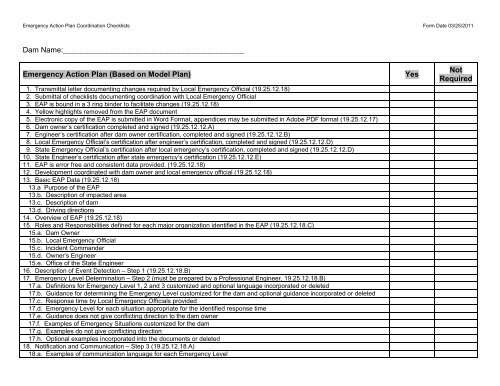
<str<strong>on</strong>g>Emergency</str<strong>on</strong>g> <str<strong>on</strong>g>Acti<strong>on</strong></str<strong>on</strong>g> <str<strong>on</strong>g>Plan</str<strong>on</strong>g> Coordinati<strong>on</strong> Checklists Form Date 03/25/2011<br />
<str<strong>on</strong>g>Dam</str<strong>on</strong>g> <str<strong>on</strong>g>Name</str<strong>on</strong>g>:___________________________________________<br />
<str<strong>on</strong>g>Emergency</str<strong>on</strong>g> <str<strong>on</strong>g>Acti<strong>on</strong></str<strong>on</strong>g> <str<strong>on</strong>g>Plan</str<strong>on</strong>g> (<str<strong>on</strong>g>Based</str<strong>on</strong>g> <strong>on</strong> <strong>Model</strong> <str<strong>on</strong>g>Plan</str<strong>on</strong>g>) <strong>Yes</strong><br />
1. Transmittal letter documenting changes required by Local <str<strong>on</strong>g>Emergency</str<strong>on</strong>g> Official (19.25.12.18)<br />
2. Submittal of checklists documenting coordinati<strong>on</strong> with Local <str<strong>on</strong>g>Emergency</str<strong>on</strong>g> Official<br />
3. EAP is bound in a 3 ring binder to facilitate changes (19.25.12.18)<br />
4. Yellow highlights removed from the EAP document<br />
5. Electr<strong>on</strong>ic copy of the EAP is submitted in Word Format, appendices may be submitted in Adobe PDF format (19.25.12.17)<br />
6. <str<strong>on</strong>g>Dam</str<strong>on</strong>g> owner’s certificati<strong>on</strong> completed and signed (19.25.12.12.A)<br />
7. Engineer’s certificati<strong>on</strong> after dam owner certificati<strong>on</strong>, completed and signed (19.25.12.12.B)<br />
8. Local <str<strong>on</strong>g>Emergency</str<strong>on</strong>g> Official’s certificati<strong>on</strong> after engineer’s certificati<strong>on</strong>, completed and signed (19.25.12.12.D)<br />
9. State <str<strong>on</strong>g>Emergency</str<strong>on</strong>g> Official’s certificati<strong>on</strong> after local emergency’s certificati<strong>on</strong>, completed and signed (19.25.12.12.D)<br />
10. State Engineer’s certificati<strong>on</strong> after state emergency’s certificati<strong>on</strong> (19.25.12.12.E)<br />
11. EAP is error free and c<strong>on</strong>sistent data provided. (19.25.12.18)<br />
12. Development coordinated with dam owner and local emergency official (19.25.12.18)<br />
13. Basic EAP Data (19.25.12.18)<br />
13.a Purpose of the EAP<br />
13.b. Descripti<strong>on</strong> of impacted area<br />
13.c. Descripti<strong>on</strong> of dam<br />
13.d. Driving directi<strong>on</strong>s<br />
14. Overview of EAP (19.25.12.18)<br />
15. Roles and Resp<strong>on</strong>sibilities defined for each major organizati<strong>on</strong> identified in the EAP (19.25.12.18.C)<br />
15.a. <str<strong>on</strong>g>Dam</str<strong>on</strong>g> Owner<br />
15.b. Local <str<strong>on</strong>g>Emergency</str<strong>on</strong>g> Official<br />
15.c. Incident Commander<br />
15.d. Owner’s Engineer<br />
15.e. Office of the State Engineer<br />
16. Descripti<strong>on</strong> of Event Detecti<strong>on</strong> – Step 1 (19.25.12.18.B)<br />
17. <str<strong>on</strong>g>Emergency</str<strong>on</strong>g> Level Determinati<strong>on</strong> – Step 2 (must be prepared by a Professi<strong>on</strong>al Engineer, 19.25.12.18.B)<br />
17.a. Definiti<strong>on</strong>s for <str<strong>on</strong>g>Emergency</str<strong>on</strong>g> Level 1, 2 and 3 customized and opti<strong>on</strong>al language incorporated or deleted<br />
17.b. Guidance for determining the <str<strong>on</strong>g>Emergency</str<strong>on</strong>g> Level customized for the dam and opti<strong>on</strong>al guidance incorporated or deleted<br />
17.c. Resp<strong>on</strong>se time by Local <str<strong>on</strong>g>Emergency</str<strong>on</strong>g> Officials provided<br />
17.d. <str<strong>on</strong>g>Emergency</str<strong>on</strong>g> Level for each situati<strong>on</strong> appropriate for the identified resp<strong>on</strong>se time<br />
17.e. Guidance does not give c<strong>on</strong>flicting directi<strong>on</strong> to the dam owner<br />
17.f. Examples of <str<strong>on</strong>g>Emergency</str<strong>on</strong>g> Situati<strong>on</strong>s customized for the dam<br />
17.g. Examples do not give c<strong>on</strong>flicting directi<strong>on</strong><br />
17.h. Opti<strong>on</strong>al examples incorporated into the documents or deleted<br />
18. <strong>Not</strong>ificati<strong>on</strong> and Communicati<strong>on</strong> – Step 3 (19.25.12.18.A)<br />
18.a. Examples of communicati<strong>on</strong> language for each <str<strong>on</strong>g>Emergency</str<strong>on</strong>g> Level<br />
<strong>Not</strong><br />
Required
<str<strong>on</strong>g>Emergency</str<strong>on</strong>g> <str<strong>on</strong>g>Acti<strong>on</strong></str<strong>on</strong>g> <str<strong>on</strong>g>Plan</str<strong>on</strong>g> Coordinati<strong>on</strong> Checklists Form Date 03/25/2011<br />
<str<strong>on</strong>g>Emergency</str<strong>on</strong>g> <str<strong>on</strong>g>Acti<strong>on</strong></str<strong>on</strong>g> <str<strong>on</strong>g>Plan</str<strong>on</strong>g> (<str<strong>on</strong>g>Based</str<strong>on</strong>g> <strong>on</strong> <strong>Model</strong> <str<strong>on</strong>g>Plan</str<strong>on</strong>g>) <strong>Yes</strong><br />
18.b. <strong>Not</strong>ificati<strong>on</strong> Flow Chart for each <str<strong>on</strong>g>Emergency</str<strong>on</strong>g> Level with correct numbers<br />
18.c. Other <str<strong>on</strong>g>Emergency</str<strong>on</strong>g> Services C<strong>on</strong>tact Numbers<br />
19. Expected <str<strong>on</strong>g>Acti<strong>on</strong></str<strong>on</strong>g>s – Step 4 (19.25.12.18.B and D)<br />
19.a. Expected <str<strong>on</strong>g>Acti<strong>on</strong></str<strong>on</strong>g>s defined at each <str<strong>on</strong>g>Emergency</str<strong>on</strong>g> Level<br />
19.b. Examples of <str<strong>on</strong>g>Emergency</str<strong>on</strong>g> Remedial <str<strong>on</strong>g>Acti<strong>on</strong></str<strong>on</strong>g>s appropriate for the dam (must be prepared by a Professi<strong>on</strong>al Engineer)<br />
20. Terminati<strong>on</strong> resp<strong>on</strong>sibilities of each organizati<strong>on</strong> identified – Step 5 (19.25.12.18.C)<br />
21. EAP Maintenance (19.25.12.18.C)<br />
21.a. Annual Review and Revisi<strong>on</strong> Form<br />
21.b. <str<strong>on</strong>g>Plan</str<strong>on</strong>g>s for exercise of the EAP (Tabletop 3 year and Functi<strong>on</strong>al 5 year frequency)<br />
21.c. List of Official Record Holders of the c<strong>on</strong>trol copies of the EAP and mailing addresses<br />
21.d. List of Revisi<strong>on</strong>s and Updates Form<br />
21.e. C<strong>on</strong>currence Form if required by the Local <str<strong>on</strong>g>Emergency</str<strong>on</strong>g> Official. All parties having a major resp<strong>on</strong>sibility for implementing<br />
the EAP, not identified in the certificati<strong>on</strong>s, are included (19.25.12.18)<br />
22. Appendices (19.25.12.18)<br />
22.a C<strong>on</strong>tact Checklist Form<br />
22.b. Unusual or <str<strong>on</strong>g>Emergency</str<strong>on</strong>g> Event Log Form<br />
22.c. <str<strong>on</strong>g>Dam</str<strong>on</strong>g> <str<strong>on</strong>g>Emergency</str<strong>on</strong>g> Situati<strong>on</strong> Report Form<br />
22.d Any other form required by the Local <str<strong>on</strong>g>Emergency</str<strong>on</strong>g> Official (Opti<strong>on</strong>al)<br />
22.e. Glossary of Terms<br />
22.f. List of Resources available<br />
22.g. Locati<strong>on</strong> and Vicinity Map<br />
22.h. Evacuati<strong>on</strong> Maps (19.25.12.18.E)<br />
22.h.i. Extend until the c<strong>on</strong>sequences of dam failure no l<strong>on</strong>ger requires evacuati<strong>on</strong> or restricting access<br />
22.h.ii. Informati<strong>on</strong> at critical locati<strong>on</strong>s downstream as directed by the Local <str<strong>on</strong>g>Emergency</str<strong>on</strong>g> Official including any critical<br />
assumpti<strong>on</strong>s made when identifying the evacuati<strong>on</strong> z<strong>on</strong>e.<br />
22.h.iii Disclaimer of any limitati<strong>on</strong>s of the evacuati<strong>on</strong> map<br />
22.h.iv. GIS Shape files provided if created. Geo-referenced to NAD 1983 UTM Z<strong>on</strong>e 13N for submittal to OSE.<br />
22.i. Residents/Business/Highways at risk indentified<br />
22.j. Inundati<strong>on</strong> Maps (19.25.12.18.F)<br />
22.j.i. At critical locati<strong>on</strong>s downstream, the distance, arrival time of the leading edge of the flood wave, peak flow depth,<br />
incremental rise, water surface elevati<strong>on</strong> and average or peak velocity are included<br />
22.j.ii. Inundati<strong>on</strong> map identifies key assumpti<strong>on</strong>s from the breach analysis and disclaimer of limitati<strong>on</strong>s provided.<br />
22.j.iii Metadata documentati<strong>on</strong> for Inundati<strong>on</strong> Maps providing key assumpti<strong>on</strong>s<br />
22.k. <str<strong>on</strong>g>Plan</str<strong>on</strong>g> and profile view of dam<br />
22.l. Reservoir elevati<strong>on</strong>/storage data and max. outlet and spillway capacity or rating table<br />
<strong>Not</strong><br />
Required
<str<strong>on</strong>g>Emergency</str<strong>on</strong>g> <str<strong>on</strong>g>Acti<strong>on</strong></str<strong>on</strong>g> <str<strong>on</strong>g>Plan</str<strong>on</strong>g> Coordinati<strong>on</strong> Checklists Form Date 03/25/2011<br />
EAP Breach Analysis and Flood Routing Report<br />
1. Breach Analysis and Flood Routing Report (19.25.12.18.F)<br />
2. Engineer’s certificati<strong>on</strong>, completed and signed (19.25.12.12.B)<br />
3. State Engineer’s certificati<strong>on</strong> (19.25.12.12.E)<br />
4. Is purpose of the Report identified? A report that identifies the purpose is<br />
intended for EAP preparati<strong>on</strong> <strong>on</strong>ly will result in a less rigorous review.<br />
Reports without this clarificati<strong>on</strong> will result in a rigorous review that supports<br />
design level analysis.<br />
5. Hydrologic analysis to determine the maximum reservoir water level during<br />
the spillway design flood. Use Design Report Checklist 6.a through 6.k. <strong>Not</strong><br />
required if a simplified dam breach analysis approach is approved by the<br />
state engineer.<br />
6. Discussi<strong>on</strong> of methodology used to model the dam breach and versi<strong>on</strong> of<br />
computer program used.<br />
7. Discussi<strong>on</strong> of and justificati<strong>on</strong> for breach scenarios analyzed<br />
8. Discussi<strong>on</strong> and justificati<strong>on</strong> of all model input parameters used in the breach<br />
program<br />
9. Copies of all computer input and output computati<strong>on</strong>s and digital files for the<br />
breach model<br />
10. Discussi<strong>on</strong> of methodology used to route the flood wave downstream and<br />
versi<strong>on</strong> of computer program used<br />
11. Discussi<strong>on</strong> and justificati<strong>on</strong> of all model input parameters used to route the<br />
flood wave downstream.<br />
12. Copies of all computer input and output computati<strong>on</strong>s and electr<strong>on</strong>ic files of<br />
each failure scenario<br />
13. Inundati<strong>on</strong> Maps<br />
13.a. Extended downstream to the point where c<strong>on</strong>sequences of failure no<br />
l<strong>on</strong>ger requires evacuati<strong>on</strong> or restricting access<br />
13.b. Indentify critical assumpti<strong>on</strong>s made during flood routing<br />
13.c. At critical locati<strong>on</strong>s downstream include distance, arrival time of the<br />
leading edge of the flood wave, peak flow depth, incremental rise, water<br />
surface elevati<strong>on</strong> and peak velocity<br />
13.d. GIS Shape files of the plan view of the inundati<strong>on</strong> map, if created. Georeferenced<br />
to NAD 1983 UTM Z<strong>on</strong>e 13N<br />
Check if addressed and identify locati<strong>on</strong> with a<br />
page number if applicable<br />
<strong>Not</strong><br />
Required
<str<strong>on</strong>g>Emergency</str<strong>on</strong>g> <str<strong>on</strong>g>Acti<strong>on</strong></str<strong>on</strong>g> <str<strong>on</strong>g>Plan</str<strong>on</strong>g> Coordinati<strong>on</strong> Checklists Form Date 03/25/2011<br />
<str<strong>on</strong>g>Emergency</str<strong>on</strong>g> Elements of the EAP<br />
EAP Preparer’s documentati<strong>on</strong> of coordinati<strong>on</strong> with Local <str<strong>on</strong>g>Emergency</str<strong>on</strong>g> Official<br />
<str<strong>on</strong>g>Emergency</str<strong>on</strong>g> Elements of the EAP Checklist<br />
Meeting Date and Locati<strong>on</strong>:___________________________________________<br />
Role and Resp<strong>on</strong>sibility of the Local <str<strong>on</strong>g>Emergency</str<strong>on</strong>g> Official<br />
Role and Resp<strong>on</strong>sibility of the Incident Commander<br />
<str<strong>on</strong>g>Emergency</str<strong>on</strong>g> Level 2 and 3 Communicati<strong>on</strong> customized<br />
<str<strong>on</strong>g>Emergency</str<strong>on</strong>g> Level 2 and 3 <strong>Not</strong>ificati<strong>on</strong> Flow Charts customized<br />
<str<strong>on</strong>g>Emergency</str<strong>on</strong>g> Services C<strong>on</strong>tacts<br />
Terminati<strong>on</strong> customized<br />
Exercise Frequencies<br />
C<strong>on</strong>trolled copies provided to appropriate emergency resp<strong>on</strong>ders and<br />
affected stakeholders<br />
C<strong>on</strong>currence page<br />
Additi<strong>on</strong>al <str<strong>on</strong>g>Emergency</str<strong>on</strong>g> Forms (Appendix A-4)<br />
Residents/Business/Highways at Risk<br />
See OSE Paper “<str<strong>on</strong>g>Emergency</str<strong>on</strong>g> <str<strong>on</strong>g>Acti<strong>on</strong></str<strong>on</strong>g> <str<strong>on</strong>g>Plan</str<strong>on</strong>g>s for <str<strong>on</strong>g>Dam</str<strong>on</strong>g>s” for additi<strong>on</strong>al guidance.<br />
Verified by Local <str<strong>on</strong>g>Emergency</str<strong>on</strong>g> Official<br />
<strong>Yes</strong>/No<br />
EAP Preparer’s Signature and Date: __________________________________________<br />
Print EAP Preparer’s <str<strong>on</strong>g>Name</str<strong>on</strong>g>: _________________________________________________<br />
Print EAP Preparer’s Title: __________________________________________________<br />
Document the Local <str<strong>on</strong>g>Emergency</str<strong>on</strong>g> Official’s requested<br />
change from the <strong>Model</strong> EAP
<str<strong>on</strong>g>Emergency</str<strong>on</strong>g> <str<strong>on</strong>g>Acti<strong>on</strong></str<strong>on</strong>g> <str<strong>on</strong>g>Plan</str<strong>on</strong>g> Coordinati<strong>on</strong> Checklists Form Date 03/25/2011<br />
Professi<strong>on</strong>al Engineer’s documentati<strong>on</strong> of coordinating<br />
the EAP with the Local <str<strong>on</strong>g>Emergency</str<strong>on</strong>g> Official<br />
Engineering Elements of the EAP Checklist<br />
Meeting Date and Locati<strong>on</strong>:___________________________________________<br />
Guidelines for determining the <str<strong>on</strong>g>Emergency</str<strong>on</strong>g> Level <strong>Yes</strong> Comments<br />
Local <str<strong>on</strong>g>Emergency</str<strong>on</strong>g> Official provided the estimated time needed to notify<br />
closest downstream residents<br />
Local <str<strong>on</strong>g>Emergency</str<strong>on</strong>g> Official provided the estimated time needed to<br />
evacuate the closest downstream residents<br />
Evacuati<strong>on</strong> Map<br />
Extends to a locati<strong>on</strong> where c<strong>on</strong>sequences of dam failure no l<strong>on</strong>ger<br />
requires evacuati<strong>on</strong><br />
Cross-secti<strong>on</strong>s show distance from the dam<br />
Cross-secti<strong>on</strong>s show travel time of the leading edge of the flood wave<br />
Cross-secti<strong>on</strong>s show peak flow in cfs<br />
Cross-secti<strong>on</strong>s show incremental rise of water surface elevati<strong>on</strong> above<br />
base flow in feet.<br />
Cross-secti<strong>on</strong>s show water surface elevati<strong>on</strong> in feet<br />
Cross-secti<strong>on</strong>s show average or peak velocity of the flood wave<br />
Road, bridge, railroad or trail blockages identified for closure<br />
Critical facilities or infrastructure identified<br />
Evacuati<strong>on</strong> routes identified<br />
Locati<strong>on</strong> of evacuati<strong>on</strong> centers identified or described if outside the<br />
map extents<br />
Shape files of map requested and appropriately geo-referenced for<br />
local needs<br />
Engineer’s Stamp, signature and Date:<br />
Required by the Local <str<strong>on</strong>g>Emergency</str<strong>on</strong>g> Official<br />
<strong>Yes</strong> Comments