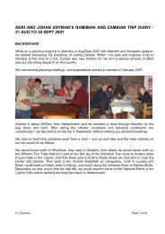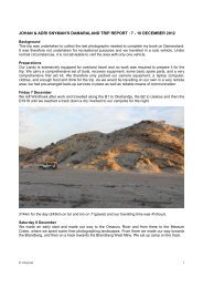
JOHAN & ADRI SNYMAN'S DAMARALAND TRIP REPORT : 9 - 26 ...
JOHAN & ADRI SNYMAN'S DAMARALAND TRIP REPORT : 9 - 26 ...
JOHAN & ADRI SNYMAN'S DAMARALAND TRIP REPORT : 9 - 26 ...

You also want an ePaper? Increase the reach of your titles
YUMPU automatically turns print PDFs into web optimized ePapers that Google loves.
<strong>JOHAN</strong> & <strong>ADRI</strong> SNYMAN’S <strong>DAMARALAND</strong> <strong>TRIP</strong> <strong>REPORT</strong> : 9 - <strong>26</strong> DECEMBER 2011<br />
WARNING !<br />
Please do not try to emulate the first part of this trip. It was not undertaken for recreational<br />
purposes and we travelled in a solo vehicle. Under normal circumstances, you will not be able<br />
to cover these distances, nor is it advisable to visit the area with only one vehicle.<br />
Background<br />
This trip consisted of 3 different parts. We are presently verifying the location and condition of all the<br />
roads and tracks in Damaraland for a book that I am writing, and at the same time are also compiling a<br />
complete photographic record of all the roads, points of interest, and the commonly seen fauna and<br />
flora in the region. We would also be spending some time with family along the coast and finish off the<br />
trip camping along the Ugab River for a few days.<br />
Preparations<br />
For this trip I had to prepare 2 vehicles. Our Landy is extensively equipped for overland travel and<br />
some time was spent in ensuring that everything in, and on, the vehicle was serviceable. We carried a<br />
comprehensive set of tools, recovery equipment, some basic spare parts for the vehicle, and a very<br />
comprehensive first aid kit. As we would be travelling on our own in a very remote area, we had prearranged<br />
back-up services in place as well as reliable means of communication.<br />
I built a VHF radio and a Garmin Nuvi 500 GPS into Adri’s Daihatsu Terios and loaded a second spare<br />
wheel and some basic recovery gear into it.<br />
A lot of time was spent in determining the route we would follow on the first part of the trip to ensure<br />
that we did not miss a single road and track of the ones still needed for the book. Furthermore camera<br />
equipment, a laptop computer, clothes, and enough food and drink were loaded.<br />
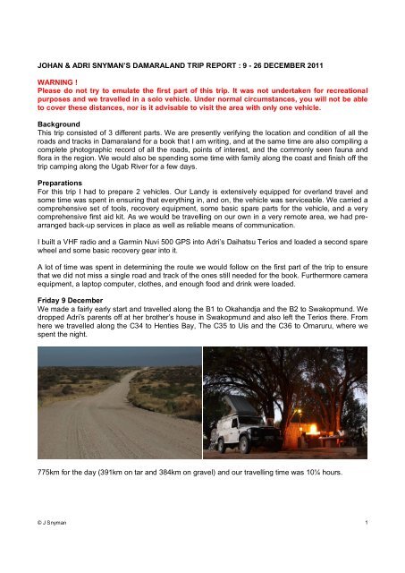
Friday 9 December<br />
We made a fairly early start and travelled along the B1 to Okahandja and the B2 to Swakopmund. We<br />
dropped Adri’s parents off at her brother’s house in Swakopmund and also left the Terios there. From<br />
here we travelled along the C34 to Henties Bay, The C35 to Uis and the C36 to Omaruru, where we<br />
spent the night.<br />
775km for the day (391km on tar and 384km on gravel) and our travelling time was 10¼ hours.<br />
© J Snyman 1
Saturday 10 December<br />
After a peaceful night we made a fairly early start, and continued on our way. This would be a very<br />
long day in which we covered a substantial number of roads, i.e. the D2344, D3712, D3719, D3718,<br />
D3713, a section of the C35, D<strong>26</strong>12, D<strong>26</strong>28, D3254 and a number of smaller unnumbered/unnamed<br />
tracks. The left rear wheel developed a puncture on the D3254, but once again the tyre pressure<br />
monitoring system warned me in time before the tyre was damaged and I repaired it without removing<br />
the wheel from the vehicle. We pitched camp at the Aba-Huab Community Campsite and watched a<br />
beautiful full moon rising with a chorus of barking geckos clicking away in the background.<br />
483km for the day (6km on tar and 477km on gravel) and our travelling time was 11¾ hours.<br />
© J Snyman 2
Sunday 11 December<br />
We made an early start on yet another long day. On this day we covered the D3254, D<strong>26</strong>12, C39,<br />
D<strong>26</strong>25, the Sout River 4wd-trail between the D<strong>26</strong>25 and the D<strong>26</strong>33, the D<strong>26</strong>33 and another portion of<br />
the C39 before making our way to the start of the Upper Huab 4wd-trail.<br />
We passed through some beautiful scenery with many interesting flowering trees and a variety of<br />
birds. Near our campsite in the Huab River, we came across the fairly fresh carcass of a kudu, and it<br />
was obvious that it had been poached as a trophy as only its neck and head had been removed.<br />
© J Snyman 3
324km for the day (5km on tar and 319km on gravel, sand and rocky roads and tracks) and our<br />
travelling time was 11¼ hours.<br />
Monday 12 December<br />
After a very quiet night, with not a sound to be heard, we made our way upstream in the Huab River.<br />
There are a number of permanent fountains resulting in some swampy areas and there are thousands<br />
of small tilapia fish to be seen. We travelled in the riverbed up to the Monte Carlo (Huab) Lodge and<br />
from there it was a steep rocky climb to the D<strong>26</strong>70 which we followed to the C35 before proceeding to<br />
Kamanjab. We pitched our tent at the Kamanjab Rest Camp.<br />
© J Snyman 4
190km for the day (3km on tar and 187km on gravel, sand and rocky roads and tracks) and our<br />
travelling time was 10 hours.<br />
Tuesday 13 December<br />
We had another long day and travelled on the D<strong>26</strong>67, D<strong>26</strong>50, the Ruspoort 4wd-trail between the<br />
D<strong>26</strong>50 and the Upper Huab River (in both directions) and the D<strong>26</strong>46 before making our way along the<br />
C40 to Palmwag, where we would be spending the night.<br />
© J Snyman 5
316km for the day (1km on tar and 315km on gravel, sand and rocky roads and tracks) and our<br />
travelling time was 11 hours.<br />
Wednesday 14 December<br />
After obtaining a permit to do so, we drove the Crowther’s 4wd-trail through the Palmwag Concession<br />
Area. This 4wd-trail passes through a very scenic part of Damaraland and does not see a lot of<br />
visitors. It ends near a man-made waterhole next to the Hoanib River, and it was good to see that the<br />
waterhole is in working order again after being destroyed by elephants about 2 years ago. We<br />
encountered a number of giraffe and a lot of elephants in the Hoanib River. We turned left into the<br />
Ganamub River after we passed through the Poort and pitched our camp on high ground next to this<br />
river.<br />
Along the way the Landy’s odometer reached the 300 000km mark. It has been a 3 rd vehicle in our<br />
household since we purchased it “out of the box” 13 years ago and has basically only been used on<br />
4x4 routes and overland trips during this period. Ownership has been problem free to date and we<br />
have been to some truly amazing places with it. It is fitting that it reached this landmark whilst on tour<br />
in our favourite part of Southern Africa.<br />
© J Snyman 6
© J Snyman 7
© J Snyman 8
198km for the day (all of it on gravel, sand and rocky roads and tracks) and our travelling time was 12<br />
hours.<br />
Thursday 15 December<br />
We continued driving upstream in the Ganamub River until we reached the D3707, which we followed<br />
to Fort Sesfontein. After refuelling the Landy we made our way to the Otjiheka Eco trail. We followed<br />
the trail for some distance, made a detour through the area known as the Klein Serengeti where we<br />
encountered a few large herds of springbok. We then continued along the Otjiheka trail to the C40<br />
which we followed to Kamanjab, and once again pitched our tent at the Kamanjab Rest camp. The last<br />
part of the Otjiheka trail follows a river bed with flowing water and groves of makalani palm trees. You<br />
have to pass through a veterinary control gate before reaching the C40. Please note that you may not<br />
pass from west to east through this gate with raw red meat and dairy products in your possession.<br />
© J Snyman 9
301km for the day (all of it on gravel, sand and rocky roads and tracks) and our travelling time was<br />
10¾ hours.<br />
Friday 16 December<br />
We followed the C40 and C43 until we once again reached the Huab River. We now turned west and<br />
followed the river downstream until we reached the Desolation Valley 4wd-trail. The river is negotiable<br />
for most of the way but in the lower reaches it is a swamp and completely overgrown with reeds and<br />
here we followed a track on the southern side of the river. We travelled south on the Desolation Valley<br />
4wd-trail to the Gai-As fountains, visited a small Petrified Forest and pitched our tent in a nearby<br />
canyon.<br />
© J Snyman 10
© J Snyman 11
284km for the day (all of it on gravel, sand and rocky roads and tracks) and our travelling time was 11<br />
hours.<br />
Saturday 17 December<br />
We continued along the Desolation Valley 4wd-trail, crossed the Ubab River at the Ugab Rhino Camp<br />
and followed the D2303 to the C34. From here we drove to Swakopmund to collect the Terios before<br />
returning to Henties Bay, where we would be spending the next few days fishing with family.<br />
© J Snyman 12
351km for the day (all of it on gravel, sand and rocky roads and tracks) and our travelling time was 5<br />
hours.<br />
Sunday 18 December to Thursday 22 December<br />
For the next few days we rose early and spent most of the daylight hours with fishing rods in our<br />
hands. A westerly wind blew every day and was not conducive to good fishing as it churned up the<br />
water. We still had great fun, and managed to land some fish. During this time the Terios served duty<br />
as the “granny van”. We now had three 80-year olds with us, and Adri transported them along the<br />
coast. As soon as we reached a favourable fishing spot in the morning I would SMS our co-ordinates<br />
and once the older folks were ready to travel she would bring them to us. The Terios performed<br />
brilliantly on the loose sand and was able to reach any place along the coast. It also received a<br />
number of incredulous looks from people with big 4x4’s along the way.<br />
© J Snyman 13
693 km for this period (all of it on salt road and loose sea sand).<br />
© J Snyman 14
Friday 23 December<br />
As Adri’s brother, Nico, departed for home in Bloemfontein we prepared to leave on the next part of<br />
our trip. We would now be accompanied by Adri’s oldest brother and his family, and an ex-colleague<br />
from South Africa, Julian Kruger and family, would be travelling with us for the day. After installing 2-<br />
way radios in the 2 new vehicles, we made our way to an old rose quartz mine, a mica mine and the<br />
old Strathmore tin mine. The excavation of the tin mine is partially filled with extremely salty water and<br />
you can easily float on top of it. From there we made our way to the Messum Crater and from there to<br />
the D2342, which we followed to a “stone elephant” that can be seen at a site to the south of the<br />
Brandberg. Along the way, the VW Syncro of Julian experienced some mechanical problems. First,<br />
the left front brake calliper vibrated loose, but could be re-secured, and then the right-rear shock<br />
absorber snapped its shaft. As it was beyond repair we removed it from the vehicle and he drove the<br />
vehicle like that back to Walvisbay from there. We followed a track skirting the south and east of the<br />
Brandberg to the Ugab River where we would be camping at the White Lady Lodge for the next 3<br />
days.<br />
© J Snyman 15
247km for the day (all of it on gravel, sand and rocky roads and tracks) and our travelling time was<br />
10¼ hours.<br />
Saturday 24 December<br />
We visited the White Lady rock painting in the morning and I went for a drive during the afternoon to<br />
charge the fridge batteries. I travelled upstream in the Ugab River up to the C35 and from there<br />
proceeded north on the C35 before returning to camp via the D2319 and some gravel tracks.<br />
© J Snyman 16
183km for the day (all of it on gravel, sand and rocky roads and tracks).<br />
Sunday 25 December<br />
We spent Christmas day relaxing, and in the afternoon I went for a short drive downstream in the<br />
Ugab River to charge the fridge batteries.<br />
© J Snyman 17
63km for the day (all of it in a river bed with thick loose sand and sections of marshland).<br />
Monday <strong>26</strong> December<br />
It was time to head for home, and we made an early start after saying good bye to the rest of the of<br />
the family. We travelled along the D2359 and C35 to Uis, where we refuelled the vehicles before<br />
heading south on the D1930 to the Spitzkoppe. We circumnavigated the Spitzkoppe and then headed<br />
home via the D3716, B2 and B1. I must admit that it felt strange to be driving on high-speed tarred<br />
roads with vehicles all around us.<br />
433km for the day (256km on tar and 177km on gravel) and our travelling time was 7¼ hours.<br />
Conclusion<br />
This was yet another trip with my favourite travelling companion to a spectacular part of Namibia.<br />
The weather on this trip was absolutely amazing. We encountered no rain, daytime temperatures were<br />
never higher than mid 30°C and at nights we had to sleep inside our sleeping bags. We encountered<br />
very few tourists during the time spent in Damaraland and on most days we did not encounter a single<br />
vehicle on the roads and tracks we travelled on – just the way we prefer and like it.<br />
We have now covered every single road and track in Damaraland north of the Brandberg, east of the<br />
Skeleton Coast, south of Fort Sesfontein and west of Kamanjab and Khorixas and visited every place<br />
of interest. We have also covered approximately 90% of the area to the south of the Brandberg and<br />
north of the B2. Fortunately the remaining sections can be reached over normal weekends, although it<br />
© J Snyman 18
will involve a lot of driving. There are now a couple of thousand photographs, several thousand km of<br />
GPS tracklogs and piles of papers waiting to be sorted out ….<br />
With the Landy we drove a total distance of 4841km in the 18 days, of which 664km was on tarred<br />
roads and 4179km on gravel, sand, and rocky roads and tracks. With the Terios we drove a total<br />
distance of 1550km of which 716km was on tarred roads and 834km was on gravel, sand and rocky<br />
roads and tracks. For the period along the coast, when the Terios did a lot of sand driving, its fuel<br />
consumption was 11.22km/l. Apart from the single puncture on the Landy, we experienced no<br />
problems whatsoever, and are already looking forward to the next trip to this remarkable region.<br />
------------------------<br />
© J Snyman 19