Copyright Her Majesty the Queen in Right of Canada
Copyright Her Majesty the Queen in Right of Canada
Copyright Her Majesty the Queen in Right of Canada

You also want an ePaper? Increase the reach of your titles
YUMPU automatically turns print PDFs into web optimized ePapers that Google loves.
FORT HENRY NATIONAL HISTORIC SITE OF CANADA<br />
Management Plan<br />
4.1.2 Archaeological Sites<br />
S<strong>in</strong>ce <strong>the</strong> transfer <strong>of</strong> Fort Henry to Parks <strong>Canada</strong>,<br />
archaeological research has contributed to <strong>the</strong><br />
understand<strong>in</strong>g <strong>of</strong> <strong>the</strong> site’s structural evolution from<br />
1812 to present. Archaeological <strong>in</strong>vestigations have<br />
identified two primary archaeological sites, each<br />
hav<strong>in</strong>g a host <strong>of</strong> support<strong>in</strong>g components. One dates to<br />
<strong>the</strong> War <strong>of</strong> 1812 while <strong>the</strong> o<strong>the</strong>r is associated with <strong>the</strong><br />
1832-1848 re-model<strong>in</strong>g <strong>of</strong> <strong>the</strong> site’s defenses.<br />
Level 1 archaeological resources are those associated<br />
with <strong>the</strong> 1832 - 1848 fort. They <strong>in</strong>clude: <strong>the</strong> ordnance<br />
storehouse no. 1 and wharf, <strong>the</strong> west branch ditch<br />
tower latr<strong>in</strong>e, <strong>the</strong> ordnance yard guard house, <strong>the</strong><br />
clerk <strong>of</strong> cheque’s house, ordnance storehouse no. 2<br />
and wharf, <strong>the</strong> ordnance storekeeper’s house, <strong>the</strong><br />
hospital and privy, and <strong>the</strong> east branch ditch tower<br />
latr<strong>in</strong>e. O<strong>the</strong>r elements <strong>in</strong>clude <strong>the</strong> entrance ramp<br />
reta<strong>in</strong><strong>in</strong>g walls, ditch and parade dra<strong>in</strong>s, landscape<br />
features (macadamized pavement and glacis <strong>in</strong>fill),<br />
and related occupation layers. Level 2 archaeological<br />
resources, associated with <strong>the</strong> 1812 fort, consist <strong>of</strong> <strong>the</strong><br />
1816 powder magaz<strong>in</strong>e, <strong>the</strong> <strong>of</strong>ficers’ barracks, and<br />
landscape features such as <strong>the</strong> macadamised pav<strong>in</strong>g<br />
with<strong>in</strong> <strong>the</strong> 1812 fort.<br />
Archaeological resources at Fort Henry are valued<br />
because <strong>the</strong>y contribute to an understand<strong>in</strong>g <strong>of</strong> <strong>the</strong><br />
site. They assist <strong>in</strong> our appreciation <strong>of</strong> <strong>the</strong> 1832<br />
construction and provide <strong>in</strong>sights <strong>in</strong>to aspects <strong>of</strong><br />
garrison life and help to def<strong>in</strong>e <strong>the</strong> role played by <strong>the</strong><br />
Commissariat, Ordnance and <strong>the</strong> Royal Eng<strong>in</strong>eer<br />
departments.<br />
Studies to Date<br />
Archaeology was first undertaken at Fort Henry <strong>in</strong><br />
1994 to monitor sewer l<strong>in</strong>e <strong>in</strong>stallations to <strong>the</strong> redoubt<br />
and stockade complex. Additional monitor<strong>in</strong>g<br />
occurred <strong>in</strong> 1995 dur<strong>in</strong>g gas l<strong>in</strong>e <strong>in</strong>stallation. As part<br />
<strong>of</strong> a public archaeology program, <strong>the</strong> Cataraqui<br />
Archaeological Research Foundation <strong>in</strong>vestigated <strong>the</strong><br />
Fort Henry garrison hospital and privy between 2000<br />
and 2002.<br />
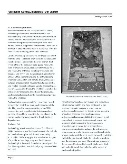
Archaeological excavation, advanced battery - Parks <strong>Canada</strong><br />
Parks <strong>Canada</strong>’s archaeology survey and excavation<br />
efforts started <strong>in</strong> 2001 and have cont<strong>in</strong>ued to <strong>the</strong><br />
present. The ma<strong>in</strong> purpose is to develop an<br />
archaeological <strong>in</strong>ventory for <strong>the</strong> site while assess<strong>in</strong>g<br />
impacts <strong>of</strong> proposed structural repairs on<br />
archaeological resources. While <strong>the</strong> <strong>in</strong>ventory is not<br />
complete, it is comprehensive enough to provide<br />
<strong>in</strong>formed advice regard<strong>in</strong>g <strong>the</strong> management,<br />
protection and presentation <strong>of</strong> archaeological<br />
resources. Areas studied <strong>in</strong>clude: <strong>the</strong> entranceway<br />
ramp reta<strong>in</strong><strong>in</strong>g walls, <strong>the</strong> west and east branch ditch<br />
towers, portions <strong>of</strong> <strong>the</strong> west glacis, <strong>the</strong> north reta<strong>in</strong><strong>in</strong>g<br />
wall <strong>of</strong> <strong>the</strong> east branch ditch, <strong>the</strong> redoubt terreple<strong>in</strong>,<br />
and <strong>the</strong> stockade gun shed The dra<strong>in</strong>age systems <strong>of</strong><br />
<strong>the</strong> advanced battery ditch, south ditch, ma<strong>in</strong> ditch<br />
and redoubt parade have also been <strong>the</strong> subject <strong>of</strong><br />
study and mitigation.<br />
page 12