Copyright Her Majesty the Queen in Right of Canada
Copyright Her Majesty the Queen in Right of Canada
Copyright Her Majesty the Queen in Right of Canada

Create successful ePaper yourself
Turn your PDF publications into a flip-book with our unique Google optimized e-Paper software.
FORT HENRY NATIONAL HISTORIC SITE OF CANADA<br />
Management Plan<br />
• <strong>the</strong> historic access route to <strong>the</strong> west gate <strong>of</strong><br />
<strong>the</strong> fortification; and<br />
• <strong>the</strong> road/pathway to <strong>the</strong> swale.<br />
The viewscapes that convey <strong>the</strong> site’s 19th<br />
century military role and purpose and<br />
re<strong>in</strong>force <strong>the</strong> concept <strong>of</strong> <strong>in</strong>ter-connect<strong>in</strong>g<br />
fields <strong>of</strong> fire are:<br />
• East across Deadman Bay to Cartwright<br />
Po<strong>in</strong>t and Cedar Island;<br />
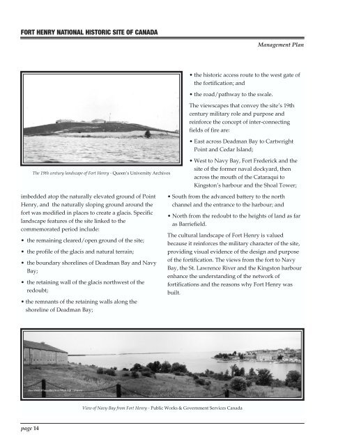
The 19th century landscape <strong>of</strong> Fort Henry - <strong>Queen</strong>’s University Archives<br />
• West to Navy Bay, Fort Frederick and <strong>the</strong><br />
site <strong>of</strong> <strong>the</strong> former naval dockyard, <strong>the</strong>n<br />
across <strong>the</strong> mouth <strong>of</strong> <strong>the</strong> Cataraqui to<br />
K<strong>in</strong>gston’s harbour and <strong>the</strong> Shoal Tower;<br />
imbedded atop <strong>the</strong> naturally elevated ground <strong>of</strong> Po<strong>in</strong>t<br />
Henry, and <strong>the</strong> naturally slop<strong>in</strong>g ground around <strong>the</strong><br />
fort was modified <strong>in</strong> places to create a glacis. Specific<br />
landscape features <strong>of</strong> <strong>the</strong> site l<strong>in</strong>ked to <strong>the</strong><br />
commemorated period <strong>in</strong>clude:<br />
• <strong>the</strong> rema<strong>in</strong><strong>in</strong>g cleared/open ground <strong>of</strong> <strong>the</strong> site;<br />
• <strong>the</strong> pr<strong>of</strong>ile <strong>of</strong> <strong>the</strong> glacis and natural terra<strong>in</strong>;<br />
• <strong>the</strong> boundary shorel<strong>in</strong>es <strong>of</strong> Deadman Bay and Navy<br />
Bay;<br />
• <strong>the</strong> reta<strong>in</strong><strong>in</strong>g wall <strong>of</strong> <strong>the</strong> glacis northwest <strong>of</strong> <strong>the</strong><br />
redoubt;<br />
• <strong>the</strong> remnants <strong>of</strong> <strong>the</strong> reta<strong>in</strong><strong>in</strong>g walls along <strong>the</strong><br />
shorel<strong>in</strong>e <strong>of</strong> Deadman Bay;<br />
• South from <strong>the</strong> advanced battery to <strong>the</strong> north<br />
channel and <strong>the</strong> entrance to <strong>the</strong> harbour; and<br />
• North from <strong>the</strong> redoubt to <strong>the</strong> heights <strong>of</strong> land as far<br />
as Barriefield.<br />
The cultural landscape <strong>of</strong> Fort Henry is valued<br />
because it re<strong>in</strong>forces <strong>the</strong> military character <strong>of</strong> <strong>the</strong> site,<br />
provid<strong>in</strong>g visual evidence <strong>of</strong> <strong>the</strong> design and purpose<br />
<strong>of</strong> <strong>the</strong> fortification. The views from <strong>the</strong> fort to Navy<br />
Bay, <strong>the</strong> St. Lawrence River and <strong>the</strong> K<strong>in</strong>gston harbour<br />
enhance <strong>the</strong> understand<strong>in</strong>g <strong>of</strong> <strong>the</strong> network <strong>of</strong><br />
fortifications and <strong>the</strong> reasons why Fort Henry was<br />
built.<br />
View <strong>of</strong> Navy Bay from Fort Henry - Public Works & Government Services <strong>Canada</strong><br />
page 14