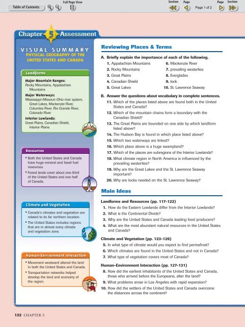
Chp. 5 Assessment
Chp. 5 Assessment
Chp. 5 Assessment

Create successful ePaper yourself
Turn your PDF publications into a flip-book with our unique Google optimized e-Paper software.
132-133-Chapter5 10/16/02 10:16 AM Page 132<br />
PHYSICAL GEOGRAPHY OF THE<br />
UNITED STATES AND CANADA<br />
Major Mountain Ranges:<br />
Rocky Mountains, Appalachian<br />
Mountains<br />
Major Waterways:<br />
Mississippi-Missouri-Ohio river system,<br />
Great Lakes, Mackenzie River,<br />
Columbia River, Rio Grande River,<br />
Colorado River<br />
Interior Lowlands:<br />
Great Plains, Canadian Shield,<br />
Interior Plains<br />
• Both the United States and Canada<br />
have huge mineral and fossil fuel<br />
resources.<br />
• Forest lands cover about one-third<br />
of the United States and one-half<br />
of Canada.<br />
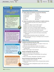
Reviewing Places & Terms<br />
A. Briefly explain the importance of each of the following.<br />
1. Appalachian Mountains 6. Mackenzie River<br />
2. Rocky Mountains 7. prevailing westerlies<br />
3. Great Plains 8. Everglades<br />
4. Canadian Shield 9. lock<br />
5. Great Lakes 10. St. Lawrence Seaway<br />
B. Answer the questions about vocabulary in complete sentences.<br />
11. Which of the places listed above are found both in the United<br />
States and Canada?<br />
12. Which of the mountain chains form a boundary with the<br />
Canadian Shield?<br />
13. The Great Plains are bounded on one side by which landform<br />
listed above?<br />
14. The Hudson Bay is found in which place listed above?<br />
15. Which two waterways are linked?<br />
16. Which place above is a huge swampland?<br />
17. Which of the places are subregions of the Interior Lowlands?<br />
18. What climate region in North America is influenced by the<br />
prevailing westerlies?<br />
19. Why are the Great Lakes and the St. Lawrence Seaway<br />
important?<br />
20. Why are locks needed on the St. Lawrence Seaway?<br />
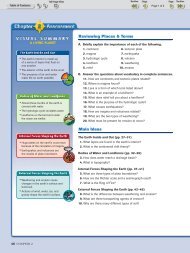
Main Ideas<br />
• Canada’s climates and vegetation are<br />
related to its far northern location.<br />
• The United States includes regions<br />
that are in almost every climate<br />
and vegetation zone.<br />
• Movement westward altered the land<br />
in both the United States and Canada.<br />
• Transportation networks helped<br />
develop the land and economy of<br />
the region.<br />
Landforms and Resources (pp. 117-122)<br />
1. How do the Eastern Lowlands differ from the Interior Lowlands?<br />
2. What is the Continental Divide?<br />
3. Why are the United States and Canada leading food producers?<br />
4. What are the most abundant natural resources in the United States<br />
and Canada?<br />
Climate and Vegetation (pp. 123-126)<br />
5. In what type of climate would you expect to find permafrost?<br />
6. Which climates are found in the United States and not in Canada?<br />
7. What type of vegetation covers most of Canada?<br />
Human-Environment Interaction (pp. 127-131)<br />
8. How did the earliest inhabitants of the United States and Canada,<br />
those who arrived before the Europeans, alter the land?<br />
9. What problems arose in Los Angeles with rapid expansion?<br />
10. How did the settlers of the United States and Canada overcome<br />
the distances across the continent?<br />
132 CHAPTER 5
132-133-Chapter5 10/16/02 10:16 AM Page 133<br />
Critical Thinking<br />
1. Using Your Notes<br />
Use your completed chart to answer these questions.<br />
Landforms<br />
Resources<br />
a. How is the location of cities related to landforms<br />
and to climate?<br />
b. How is Canada’s economy affected by its climate<br />
and vegetation?<br />
2. Geographic Themes<br />
a. MOVEMENT Write a sentence describing the<br />
movement of people and goods across the United<br />
States and Canada over the last 200 years.<br />
b. PLACE How have the Great Lakes contributed to the<br />
development of both the United States and Canada?<br />
Geographic Skills: Interpreting Maps<br />
3. Identifying Themes<br />
In developing their city, how did the people of Montreal<br />
solve the problems of a severe climate? Which of the five<br />
themes apply to this situation?<br />
4. Making Inferences<br />
What aspects of physical geography have contributed to<br />
the economic success of the United States and Canada?<br />
5. Seeing Patterns<br />
How did the presence of north-to-south flowing rivers in<br />
the United States affect its development?<br />
Additional Test Practice,<br />
pp. S1–S37<br />
TEST PRACTICE<br />
CLASSZONE.COM<br />
US & CANADA<br />
Physical Profile of the United States<br />
Use the map below to answer the following questions.<br />
1. REGION What might be said about the land between the Appalachians<br />
and the Mississippi?<br />
2. PLACE What is the difference in altitude between the Coastal ranges<br />
and the Sierra Nevada?<br />
3. REGION What happens to the land as you move west of the Mississippi?<br />
Profile<br />
line<br />
Create a three-dimensional model<br />
of the cross section on this page.<br />
Use colors to indicate elevations<br />
and label the physical features<br />
you show. Create a legend for<br />
your model.<br />
Coast<br />
Ranges<br />
Sierra<br />
Nevada<br />
Rocky Mts.<br />
Great Plains<br />
Appalachian Mts.<br />
4,000 m<br />
Pikes Peak<br />
Mississippi River<br />
13,100 ft<br />
3,000 m<br />
9,800 ft<br />
2,000 m<br />
6,600 ft<br />
1,000 m<br />
3,300 ft<br />
0 m<br />
2,640 mi<br />
0 ft<br />
Use the links at classzone.com to conduct research on<br />
the landforms of the United States and Canada. Focus on<br />
finding pictures of major and well-known landforms and<br />
waterways.<br />
Creating a Multimedia Presentation From your<br />
research, select a series of pictures to include in a<br />
presentation on the theme “A Land of Contrasts.” List<br />
the Web sites you used in preparing your report.<br />
A Land of Contrasts 133