From the Editors - Southern Trails Chapter
From the Editors - Southern Trails Chapter
From the Editors - Southern Trails Chapter

You also want an ePaper? Increase the reach of your titles
YUMPU automatically turns print PDFs into web optimized ePapers that Google loves.
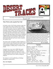
Newsletter of <strong>the</strong> Southwest <strong>Chapter</strong> of <strong>the</strong> Oregon-California <strong>Trails</strong> Association January, 2004<br />
<strong>From</strong> <strong>the</strong> <strong>Editors</strong><br />
In this newsletter we give <strong>the</strong> report of<br />
SWOCTA’s fall mapping trip along <strong>the</strong> Gila<br />
River in <strong>the</strong> vicinity of Oatman Flats. The<br />
ongoing task of mapping <strong>the</strong> sou<strong>the</strong>rn emigrant<br />
trails is being carried out by SWOCTA’s Trail<br />
Turtles. Rose Ann Tompkins comments, “The<br />
Turtles are a talented bunch who enjoy <strong>the</strong> days<br />
that we spend in <strong>the</strong> field away from <strong>the</strong> hectic<br />
pace of daily living, and at <strong>the</strong> same time who<br />
contribute to <strong>the</strong> long term task we have set for<br />
ourselves.” We can attest from our own<br />
experience that <strong>the</strong> Trail Turtles also are a tough<br />
bunch. We, <strong>the</strong> editors, set out in late<br />
November, 1998, to find <strong>the</strong> Oatman graves,<br />
toge<strong>the</strong>r with a second car of people who we met<br />
at Painted Rocks. They appeared interested in<br />
exploring <strong>the</strong> site, but <strong>the</strong>y were not in good<br />
physical condition. Despite <strong>the</strong> directions we<br />
obtained from a local rancher, we got hopelessly<br />
lost in <strong>the</strong> maze of very dusty roads in <strong>the</strong><br />
vicinity of <strong>the</strong> site. And despite <strong>the</strong> time of year,<br />
one member of <strong>the</strong> o<strong>the</strong>r party fainted from <strong>the</strong><br />
heat and had to be rushed to a Yuma hospital,<br />
one hundred miles away. Those who are<br />
interested in <strong>the</strong> sou<strong>the</strong>rn emigrant trails need to<br />
be in good condition and well-prepared for <strong>the</strong><br />
desert outback!<br />
SWOCTA <strong>Chapter</strong> Dues<br />
Dues for 2004 are now due. Please send a check for $10 for each mailing unit (individual<br />
or couple) to<br />
Harland Tompkins<br />
1125 W. Mission Dr.<br />
Chandler AZ 85224<br />
The check should be made out to “Harland Tompkins.” If you have an email address,<br />
please send it as well. Please remit by March 1, 2004. After March 1, postcards will be<br />
sent to current members who have not sent in <strong>the</strong>ir renewal dues.<br />
1
Strongbox Custodian’s Report<br />
The last Treasurer’s report appeared in <strong>the</strong><br />
January 2003 newsletter. At that time <strong>the</strong><br />
treasury contained a balance of $952.31.<br />
Spending for 2002 was small and at that time <strong>the</strong><br />
officers decided not to ask for dues from <strong>the</strong><br />
membership for 2003.<br />
Receipts during 2003 were $22.88 which<br />
consisted of two new membership dues and<br />
interest. Disbursements during 2003 were<br />
$471.98 (newsletter expenses, $256.03; mapping<br />
report expenses, $215.95). As of 1/29/04, <strong>the</strong><br />
treasury contains a balance of $504.23.<br />
In <strong>the</strong> two years prior to 2003, expenses were<br />
minimal (no newsletters were published, and<br />
mapping expenses were small) and <strong>the</strong> officers<br />
chose to omit <strong>the</strong> annual dues collection. It is<br />
my sense that for a viable chapter, <strong>the</strong> treasury<br />
balance should be at least $500 and not more<br />
than $1000. Accordingly, we make a call for<br />
dues for 2004 in this newsletter.<br />
Strongbox Custodian<br />
Harland Tompkins<br />
Desert Tracks: <strong>the</strong> Newsletter of <strong>the</strong> Southwest<br />
<strong>Chapter</strong> of <strong>the</strong> Oregon-California <strong>Trails</strong><br />
Association<br />
Past newsletters and a color version of this<br />
newsletter can be found at:<br />
http://www.physics.uci.edu/~jmlawren/SWOCTA.html<br />
http://members.cox.net/htompkins2/SWOCTA.htm<br />
<strong>Chapter</strong> President:<br />
Vice President:<br />
Treasurer:<br />
Secretary:<br />
Charles Townley<br />
Tracey DeVault<br />
Harland Tompkins<br />
Marie Greene<br />
New Membership: $10/year<br />
Make checks payable to Harland Tompkins<br />
Mail to : Harland Tompkins<br />
1125 W. Mission Drive, Chandler AZ 85224<br />
<strong>Editors</strong>: Deborah and Jon Lawrence<br />
Submit correspondence and o<strong>the</strong>r material to:<br />
SWOCTA<br />
44 Harvey Court, Irvine CA 92612<br />
dlawrence@fullerton.edu<br />
jmlawren@uci.edu<br />
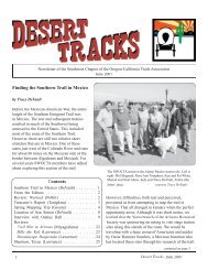
TURTLES' TRAIL TROVE<br />
Mapping trip on <strong>the</strong> Gila River<br />
October 27 to November 2, 2003<br />
by Richard Greene<br />
The Trail Turtles for this trip included<br />
Tracy DeVault (AZ), Richard and Marie Greene<br />
(NM), Dave Hollecker (NV), Kay Kelso (AZ),<br />
Rose Ann Tompkins (AZ) and Ken and Pat<br />
White (AZ). Before we started, Neal and Marion<br />
John e-mailed us photos of <strong>the</strong> forest fire that<br />
was creeping towards <strong>the</strong>ir home in Lytle Creek,<br />
CA. They had to stand by to see <strong>the</strong> outcome and<br />
although <strong>the</strong> fire came within feet of <strong>the</strong>ir home,<br />
<strong>the</strong>y and <strong>the</strong> house came through it safely. Then<br />
we learned that Don Buck had broken an elbow<br />
while loading his truck for <strong>the</strong> mapping trip. He<br />
had elbow reconstruction but could not drive.<br />
This was not a good beginning! We missed <strong>the</strong>m<br />
and <strong>the</strong>y missed one of our most incredible<br />
outings. What made this such an incredible trip?<br />
First, Rose Ann’s aerial photos, her analysis of<br />
<strong>the</strong>m and her action plan made finding trail easy<br />
for us. Second, we saw more grooves and rust<br />
on rocks than on any prior trip. Artifacts were<br />
scattered everywhere we went. There were<br />
petroglyphs, inscriptions, <strong>the</strong> Oatman Massacre<br />
site and a “hidden” pocket of trail paradise.<br />
Also, <strong>the</strong>re was Dave’s portable shower stall and<br />
instant hot water heater that added to <strong>the</strong><br />
pleasure of a great week of mapping. And,<br />
despite some rough driving, <strong>the</strong>re were no flat<br />
tires. It was a Trail Turtle's dream come true!<br />
2
DAY 1 - MONDAY, OCTOBER 27<br />
The Turtles met as planned at 4 PM at<br />
<strong>the</strong> Butterfield Stage cistern just west of<br />
Butterfield Pass. We’ve gotten to know this<br />
place well; it is a good place to meet and a nice<br />
place to camp out. We could see <strong>the</strong> lights of<br />
Gila Bend, <strong>the</strong> flares from a military range as<br />
<strong>the</strong>y performed mysterious exercises and<br />
shooting stars and speeding satellites. We all felt<br />
good to be back toge<strong>the</strong>r and on <strong>the</strong> trail again.<br />
DAY 2 - TUESDAY, OCTOBER 28<br />
Butterfield Trail Cistern to Painted Rock<br />
The group shuttled <strong>the</strong> vehicles to<br />
Highway 85 and walked back to meet Tracy and<br />
Richard, who were hiking a section of trail from<br />
<strong>the</strong> final GPS reading that we took last spring.<br />
Kay’s Subaru had no problem except for a<br />
couple of rocky areas where clearance was<br />
tricky. The trail was easy to follow to <strong>the</strong><br />
highway with lots of rust. However, we had no<br />
luck on <strong>the</strong> o<strong>the</strong>r side of <strong>the</strong> highway where road<br />
construction, farming and a canal had destroyed<br />
<strong>the</strong> trail. At that point <strong>the</strong> trail follows <strong>the</strong> Gila<br />
River Valley where flooding and farming make<br />
locating <strong>the</strong> trail nearly impossible until it climbs<br />
out of <strong>the</strong> valley near Painted Rock.<br />
<strong>From</strong> <strong>the</strong> highway we drove to Gila<br />
Bend, had lunch, and <strong>the</strong>n went on to <strong>the</strong> Painted<br />
Rocks campground. There was just one o<strong>the</strong>r<br />
camper. That afternoon we followed trail<br />
heading west from <strong>the</strong> campground, which was<br />
ano<strong>the</strong>r easy effort. Back at camp we saw <strong>the</strong><br />
dust from Dave’s van coming to join us. We<br />
were pleased to see him. He had been telling us<br />
about <strong>the</strong> shower that he was bringing and we<br />
were eager to check it out. Ken, Pat, Kay and<br />
Richard left to GPS a section east of <strong>the</strong> road<br />
into Painted Rocks that had been mapped<br />
without GPS readings. Once again <strong>the</strong> trail was<br />
quite visible, with rust, grooves and some<br />
Carsonite markers.<br />
The trail petered out once it dropped from <strong>the</strong><br />
mesa into <strong>the</strong> river valley and back east towards<br />
Gila Bend.<br />
After that evening's group buffet we<br />
explored Dave’s shower. The shower tent is 7 ft.<br />
high and about 3 feet square; this is just right,<br />
<strong>the</strong>re is no awkward bending. Chairs were used<br />
for sitting and getting in and out of clo<strong>the</strong>s.<br />
There were floor mats to stand on. The best part<br />
was that <strong>the</strong>re was instant hot water! The heater<br />
uses propane and has a switch for self ignition.<br />
The water is pumped from a plastic container<br />
and runs through narrow copper tubing where it<br />
is heated in passing. The shower head is at <strong>the</strong><br />
end of a flexible hose and <strong>the</strong> water is pumped<br />
up. When soaping you put <strong>the</strong> shower head back<br />
in <strong>the</strong> container so that <strong>the</strong>re is no waste. It was<br />
wonderful! Dave said he bought <strong>the</strong> heater at<br />
Sam’s Club for under a $100. The tent is<br />
optional but <strong>the</strong> heater system is essential. After<br />
enjoying our showers we sat and chatted under<br />
<strong>the</strong> stars.<br />
3
THE OATMAN MASSACRE<br />
On August 10, 1850, Royce Oatman with his wife and seven children left Independence, Missouri, in a<br />
wagon train led by James C. Brewster, a member of <strong>the</strong> Church of Jesus Christ of Latter-Day Saints,<br />
whose disagreements with <strong>the</strong> church leadership in Salt Lake City, Utah, had caused him to break with<br />
Brigham Young and lead his followers to California. There were about fifty people in <strong>the</strong> nine-wagon<br />
party. The emigrants crossed into New Mexico where dissension caused <strong>the</strong> group to split near Santa Fe.<br />
Brewster headed north and Royce and several o<strong>the</strong>r families took <strong>the</strong> sou<strong>the</strong>rn route through Socorro,<br />
Santa Cruz, and Tucson. Part of <strong>the</strong> company resolved to stay in Tucson, and <strong>the</strong> rest proceeded down <strong>the</strong><br />
Santa Cruz to <strong>the</strong> Gila and <strong>the</strong> Pima villages. The Oatman family on <strong>the</strong>ir own left <strong>the</strong> Pima villages to<br />
make <strong>the</strong> trip down <strong>the</strong> Gila into California. At <strong>the</strong> site west of Gila Bend <strong>the</strong>ir wagon was too heavy to<br />
be pulled up <strong>the</strong> steep slope to <strong>the</strong> top of <strong>the</strong> mesa, so <strong>the</strong>y unloaded it and moved <strong>the</strong> contents up by<br />
hand. While <strong>the</strong> Oatmans were resting on top, a group of Indians approached and asked for food. What<br />
<strong>the</strong>y gave was not enough to satisfy <strong>the</strong> Indians, who <strong>the</strong>n attacked. All of <strong>the</strong> family were killed with <strong>the</strong><br />
exception of two daughters, Olive and Mary Ann, and a son, Lorenzo who was clubbed, thrown off <strong>the</strong><br />
mesa and left for dead. Lorenzo survived and made it back to <strong>the</strong> Pima villages and from <strong>the</strong>re to<br />
Calfornia, where he spent <strong>the</strong> next five years in an effort to find Olive and Mary Ann. Olive and Mary<br />
Ann were taken into captivity and sometime later <strong>the</strong> girls were traded to <strong>the</strong> Mohave Indian tribe. Mary<br />
Ann died in captivity, but Olive survived and was ransomed in 1856 by <strong>the</strong> United States Government at<br />
Ft. Yuma. After Olive and Lorenzo were reunited <strong>the</strong>y met Reverend R. B. Stratton, who prepared a book<br />
recounting <strong>the</strong>ir tale; this is <strong>the</strong> main source book on <strong>the</strong> massacre. Olive later gave a series of lectures in<br />
<strong>the</strong> eastern U.S., which are reprinted in <strong>the</strong> work by Pettid.<br />
Both Olive and Lorenzo asserted that <strong>the</strong>ir attackers were Apache. However, in 1903, ethnographer A.C.<br />
Kroeber interviewed an Indian named Tokwaea, who claimed to have been one of <strong>the</strong> Mojave warriors<br />
who escorted Olive to Fort Yuma after her release. Tokwaea said <strong>the</strong> Indians who had attacked <strong>the</strong><br />
Oatmans were Yavapai.<br />
The Bartlett Boundary Survey party came across <strong>the</strong> massacre site in <strong>the</strong> summer of 1852 and noted<br />
fragments of trunks, boxes, clothing, and human bones. In <strong>the</strong> fall of 1858, Waterman Ormsby, traveling<br />
on <strong>the</strong> first westbound Butterfield stage, reported seeing <strong>the</strong> graves of Royce Oatman and his wife.<br />
A good deal of information concerning <strong>the</strong> Oatmans and <strong>the</strong> massacre can be obtained on <strong>the</strong> web by a<br />
search on Oatman Massacre, including information provided by descendants of <strong>the</strong> Oatman family. A<br />
brief account can be found in Edwin Corle’s book “The Gila, River of <strong>the</strong> Southwest” (Bison, 1964).<br />
Detailed directions to <strong>the</strong> site, updated by Chuck Oatman in January 2004, can be found on <strong>the</strong> web page<br />
www.sentex.net/~cdoatman/479site.html.<br />
Bibliography<br />
Derounian-Stodola, Kathryn Zabelle. “The Captive and Her Editor: The Ciphering of Olive Oatman and<br />
Royal B. Stratton.” Prospects: An Annual of American Studies 23 (1998): 171–92.<br />
Pettid, Edward J., ed. “Olive Ann Oatman’s Lecture Notes and <strong>the</strong> Oatman Bibliography.” San<br />
Bernardino Museum Association Quarterly 16 (1968): 1–39.<br />
Stratton, R.B. Captivity of <strong>the</strong> Oatman Girls. NY: Carlton & Porter, 1857; reprint, with foreword by<br />
Wilcomb Washburn, Lincoln: U of Nebraska Press, 1983.<br />
4
DAY 3 - WEDNESDAY, OCTOBER 29<br />
Painted Rock to Sentinel Flats<br />
Our plan was to proceed to <strong>the</strong> Oatman<br />
grave site through <strong>the</strong> alfalfa fields in <strong>the</strong> Gila’s<br />
flood plain. We wound our way down dirt roads<br />
and had to backtrack here and <strong>the</strong>re as we<br />
worked through <strong>the</strong> maze of fields. We had a<br />
close call when dust clouds hid our caravan of<br />
vehicles from a truck hauling alfalfa bales. As<br />
he was not expecting to see a parade of vehicles,<br />
<strong>the</strong> truck driver pulled out after just one vehicle<br />
passed. Along <strong>the</strong> way Richard missed a turn<br />
because of <strong>the</strong> dust clouds; <strong>the</strong> caravan appeared<br />
to vanish down a slope. Following radio contact<br />
Richard was soon back with <strong>the</strong> group.<br />
We took in <strong>the</strong> Fourr family graves and<br />
<strong>the</strong> nearby wagon road going up to <strong>the</strong> top of <strong>the</strong><br />
mesa. William Fourr built a toll road from<br />
Painted Rock and lived in a stage station in<br />
Oatman Flats. Not far away is a DAR marker<br />
that memorializes <strong>the</strong> site and <strong>the</strong> purported<br />
graves of <strong>the</strong> massacred Oatmans. (There is<br />
conjecture as to whe<strong>the</strong>r <strong>the</strong> Oatmans are<br />
actually buried here.)<br />
<strong>From</strong> <strong>the</strong> flats you could see <strong>the</strong> cross<br />
signifying <strong>the</strong> Oatman Massacre on <strong>the</strong> top of <strong>the</strong><br />
mesa. After scrambling through dense<br />
underbrush Pat and Richard took <strong>the</strong> rocky trail<br />
up to <strong>the</strong> top where <strong>the</strong>y arrived at about <strong>the</strong><br />
same time as <strong>the</strong> rest of <strong>the</strong> group, who had<br />
driven <strong>the</strong> vehicles up by a circuitous route.<br />
Plenty of rust and great grooves told of <strong>the</strong> heavy<br />
traffic on this section.<br />
After a lunch under <strong>the</strong> EZ-UP shelter<br />
and Tracy’s truck-tarp (shade makes such a<br />
difference on <strong>the</strong> desert!) we broke up into<br />
groups to explore <strong>the</strong> mesa. Once again Rose<br />
Ann’s aerials guided us to several traces across<br />
<strong>the</strong> very rocky mesa. There were big rocky cairns<br />
scattered over <strong>the</strong> area and we were curious<br />
about <strong>the</strong>ir origin. We encountered a large chasm<br />
and moved parallel to it which led us to a<br />
“cemetery” of artifacts. There were hundreds of<br />
items scattered around in a cleared flat. This<br />
must have been a major camping area. Nearby<br />
<strong>the</strong> trail crossed upstream of <strong>the</strong> chasm. At <strong>the</strong><br />
crossing <strong>the</strong> rocks showed grooves and rust and<br />
led on west.<br />
We decided that <strong>the</strong> “cemetery” was a<br />
good place to camp for <strong>the</strong> night. The wind was<br />
picking up so we had to tie down Dave’s shower<br />
to Tracy’s truck to stop it from being bent out of<br />
shape before we took our showers. After<br />
cleaning up we sat down to <strong>the</strong> feast that Pat and<br />
Ken had brought and stored in <strong>the</strong>ir cooler. Even<br />
though it was windy we stayed up and chatted.<br />
DAY 4 - THURSDAY, OCTOBER 30<br />
Sentinel Flats to Abandoned Conde Ranch<br />
The wind had died down and so far <strong>the</strong><br />
wea<strong>the</strong>r had been good to us. It had been<br />
cloudy and hazy quite a bit of <strong>the</strong> time, mostly<br />
due to smoke from <strong>the</strong> CA fires.<br />
Once again we broke up into groups.<br />
Pat and Ken followed <strong>the</strong> main trail as it headed<br />
west, Dave and Kay were doing <strong>the</strong> same, while<br />
5
Tracy and Richard followed ano<strong>the</strong>r trail that led<br />
down a slope to <strong>the</strong> upper and shallower end of<br />
<strong>the</strong> chasm. Richard couldn’t believe his eyes at<br />
what he saw: a pool of water with petroglyphs all<br />
around. Tracy discovered an inscription “O. W.<br />
Randall 1849.”<br />
The rest of <strong>the</strong> group was called on <strong>the</strong> radio and<br />
ga<strong>the</strong>red in this “pocket of paradise”. We soaked<br />
up everything we saw: <strong>the</strong> pool of water, mortar<br />
holes, petroglyphs, <strong>the</strong> path down from <strong>the</strong> o<strong>the</strong>r<br />
side (near our campground). Wagons could not<br />
have used this trail, but pack animals could have,<br />
and o<strong>the</strong>rs could have brought stock here to<br />
water.<br />
Dave saw a Spanish cross glyph; <strong>the</strong>re were<br />
o<strong>the</strong>r initials close by to <strong>the</strong> 1849 inscription;<br />
<strong>the</strong>re was a 1915 inscription; and as we explored<br />
<strong>the</strong> canyon we found that <strong>the</strong>re was abundant<br />
grass and trees. Travelers through <strong>the</strong> area must<br />
have used this spot. There is no place like it<br />
anywhere that we have visited in this area. It<br />
was with great reluctance that we left this Trail<br />
Turtle heaven. We have a new task: to find any<br />
information on “O. W. Randall 1849” and any<br />
mention in a dairy about this spot. Does <strong>the</strong><br />
BLM even know about it?<br />
The rest of <strong>the</strong> day we followed trail to<br />
a power line. Rose Ann shuttled people to <strong>the</strong>ir<br />
vehicles. Beyond <strong>the</strong> power line <strong>the</strong>re were many<br />
traces leading to some flats. At this point Kay<br />
(who had planned a short trip) left for home, Ken<br />
and Pat left for a motel in Gila Bend while Rose<br />
Ann, Marie and Dave headed for <strong>the</strong> abandoned<br />
Conde Ranch that some had visited earlier. Tracy<br />
and Richard continued to follow trail until it was<br />
time to call it a day and <strong>the</strong>n went on to <strong>the</strong><br />
Conde Ranch.<br />
The abandoned Conde Ranch buildings<br />
are at <strong>the</strong> edge of a mesa with a grand view of<br />
<strong>the</strong> Gila valley and <strong>the</strong> country on top. The<br />
valley here is narrow with rock bluffs on both<br />
sides, causing travelers to use <strong>the</strong> mesa top.<br />
Scattered around were remnants of ranching:<br />
wire, miscellaneous iron, broken glass, a water<br />
tower, rock buildings and <strong>the</strong> inscription “D.<br />
CONDE 1911-65” all within a fenced enclosure.<br />
The rock buildings had window openings that<br />
offered fine views. We set up camp for <strong>the</strong> night<br />
near <strong>the</strong>se buildings.<br />
6
DAY 5 – FRIDAY, OCTOBER 31<br />
Conde Ranch back to Sentinel Flats<br />
We awoke to a sunrise of vivid colors.<br />
Pat and Ken, who we located via cell phone on<br />
<strong>the</strong>ir way to <strong>the</strong> ranch, told us that <strong>the</strong>y had met a<br />
game warden who said to look out for hunters as<br />
this was <strong>the</strong> first day of <strong>the</strong> Deer season.<br />
Hunters, guns and Trail Turtles are not a good<br />
combination.<br />
We could see equipment that <strong>the</strong> ranch<br />
had used below <strong>the</strong> mesa and we decided to<br />
investigate. There was a large steam boiler<br />
(wood fueled), mining draglines, iron rods in<br />
rocks and a rock structure but only one<br />
petroglyph. On top of <strong>the</strong> mesa <strong>the</strong>re was<br />
ano<strong>the</strong>r furnace. It appeared that <strong>the</strong> ranch was<br />
busy in its time trying to make life more<br />
comfortable and productive.<br />
We followed <strong>the</strong> power lines out across<br />
a combination of rock surfaces, sandy soft spots<br />
and challenging deep cross drainages. We<br />
encountered hunters’ vehicles and passed a<br />
campsite of trailers with power generators and<br />
ATVs ready for <strong>the</strong> hunt. We arrived at a parking<br />
place that was close to where Tracy and Richard<br />
had ended up on <strong>the</strong> previous day.<br />
There was good trail and, coming down<br />
<strong>the</strong> rocky trail from <strong>the</strong> mesa and into <strong>the</strong> sandy<br />
valley, Pat, Ken and Richard found plenty of<br />
wagon artifacts. But this time <strong>the</strong> trail petered<br />
out as we approached a high berm. It had to be<br />
man-made because it did not fit <strong>the</strong> terrain and<br />
started and stopped without reason. The water it<br />
collected stimulated <strong>the</strong> grass and brush growing<br />
on one side of it. There were cattle grazing in <strong>the</strong><br />
brush and a cowbell could be heard ringing. Pat<br />
and Ken found some trail on <strong>the</strong> o<strong>the</strong>r side of <strong>the</strong><br />
berm but we put off exploration until <strong>the</strong> next<br />
day.<br />
Over dinner, we talked about our next<br />
mapping trip. The sentiment was expressed that<br />
we might return to previously mapped areas so<br />
that we could enjoy <strong>the</strong> trail without having to<br />
search for it.<br />
DAY 6 – SATURDAY, NOVEMBER 1<br />
<strong>From</strong> Sentinel Flats to Indian Point<br />
It was overcast and cool which made for<br />
pleasant hiking. We picked up <strong>the</strong> trail that Pat<br />
and Ken had found beyond <strong>the</strong> berm, discovered<br />
some artifacts and ran into a graveyard for old<br />
equipment. There was an old bulldozer, a car,<br />
and miscellaneous junk, but <strong>the</strong> trail disappeared<br />
in <strong>the</strong> sand and brush. The decision was made to<br />
drive across country following <strong>the</strong> direction of<br />
<strong>the</strong> trail to Agua Caliente. We drove on<br />
precarious sandy paths and got whacked and<br />
scraped by <strong>the</strong> brush and trees that were spilling<br />
over <strong>the</strong> route. We blindly followed our leader,<br />
Rose Ann, who with great skill and continual<br />
navigational aid from Marie, brought us out of<br />
<strong>the</strong> jungle into cultivated cotton fields. Soon we<br />
were relieved to see farm buildings and <strong>the</strong> dirt<br />
road that led us into Agua Caliente (which was<br />
just a stop in <strong>the</strong> road with no obvious<br />
conveniences). A good asphalt road took us to<br />
Sentinel at <strong>the</strong> junction with Interstate 8.<br />
After lunch we headed for Indian and<br />
Sears Point. We approached Sears Point on a<br />
well-used graded road. Using <strong>the</strong> aerial photos<br />
Rose Ann took a side road that led us to <strong>the</strong> trail.<br />
Pat and Ken went one way and Tracy, Dave and<br />
Richard in <strong>the</strong> opposite direction. We all found<br />
<strong>the</strong> trail quite visible and saw all <strong>the</strong> rust and<br />
artifacts that we could hope for. At this point we<br />
were getting so used to finding artifacts that we<br />
almost stopped peering for rust. Tracy’s group<br />
ended up at a gravel pit where <strong>the</strong>ir section of<br />
trail faded out as <strong>the</strong>y approached <strong>the</strong> flats.<br />
Back at camp two men in a dune buggy<br />
drove by and asked Rose Ann what we were<br />
doing. Rose Ann replied that we were on <strong>the</strong><br />
emigrant trail to CA and not hunting. They were<br />
perplexed about rut nuts. Later, a small black<br />
cloud appeared overhead, which surprised us<br />
with a sprinkle; every o<strong>the</strong>r place we could see<br />
was clear and <strong>the</strong> stars were out. It was cool and<br />
a good night for sleeping.<br />
DAY 6 - SUNDAY NOVEMBER 6<br />
Indian Point -- our last day -- home<br />
Dave, Ken and Pat followed <strong>the</strong> trail<br />
along <strong>the</strong> mesa top and down into <strong>the</strong> flats. This<br />
was an easy stretch. Along <strong>the</strong> way Dave found<br />
an 1862 inscription.<br />
Tracy and Richard explored Indian<br />
Point. Scrambling along <strong>the</strong> side of <strong>the</strong> mesa<br />
among <strong>the</strong> huge masses of fallen rocks <strong>the</strong>y<br />
discovered many petroglyphs and some<br />
inscriptions (one from 1886 and some from early<br />
1900). They dutifully recorded <strong>the</strong> inscription<br />
information and <strong>the</strong> GPS reading. <strong>From</strong> one site<br />
on <strong>the</strong> top, an exceptionally large number of<br />
petroglyphs could be seen. mesa.<br />
While we ate lunch, Rose Ann<br />
downloaded our GPS units for <strong>the</strong> final time, and<br />
we said our “Goodbyes.” It had been an<br />
incredibly rewarding mapping trip. Thanks,<br />
Dave, for all those wonderful showers!<br />
7
SPRING MAPPING TRIP<br />
The Sou<strong>the</strong>rn <strong>Trails</strong> Mapping Committee will have a mapping week this<br />
spring from April 6 to 12, 2004. The group will return to <strong>the</strong> same area along <strong>the</strong><br />
Gila River as last fall to fill in gaps and look for alternate routes. This will be<br />
rugged work, with dry camping that will not be in established campgrounds. A<br />
self-contained 4WD vehicle with high clearance is required. It is recommended<br />
that you have <strong>the</strong> ability to sleep in your vehicle.<br />
If you would like to obtain more information, contact:<br />
Rose Ann Tompkins<br />
1125 W. Mission Drive<br />
Chandler AZ 85224<br />
480-963-3565<br />
rt37pkin@cox.net<br />
Southwest <strong>Chapter</strong><br />
California-Oregon <strong>Trails</strong> Association<br />
44 Harvey Court<br />
Irvine CA 92612<br />
8