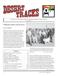
From the Editors - Southern Trails Chapter
From the Editors - Southern Trails Chapter
From the Editors - Southern Trails Chapter

Create successful ePaper yourself
Turn your PDF publications into a flip-book with our unique Google optimized e-Paper software.
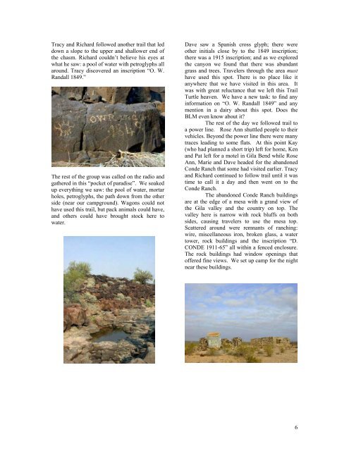
Tracy and Richard followed ano<strong>the</strong>r trail that led<br />
down a slope to <strong>the</strong> upper and shallower end of<br />
<strong>the</strong> chasm. Richard couldn’t believe his eyes at<br />
what he saw: a pool of water with petroglyphs all<br />
around. Tracy discovered an inscription “O. W.<br />
Randall 1849.”<br />
The rest of <strong>the</strong> group was called on <strong>the</strong> radio and<br />
ga<strong>the</strong>red in this “pocket of paradise”. We soaked<br />
up everything we saw: <strong>the</strong> pool of water, mortar<br />
holes, petroglyphs, <strong>the</strong> path down from <strong>the</strong> o<strong>the</strong>r<br />
side (near our campground). Wagons could not<br />
have used this trail, but pack animals could have,<br />
and o<strong>the</strong>rs could have brought stock here to<br />
water.<br />
Dave saw a Spanish cross glyph; <strong>the</strong>re were<br />
o<strong>the</strong>r initials close by to <strong>the</strong> 1849 inscription;<br />
<strong>the</strong>re was a 1915 inscription; and as we explored<br />
<strong>the</strong> canyon we found that <strong>the</strong>re was abundant<br />
grass and trees. Travelers through <strong>the</strong> area must<br />
have used this spot. There is no place like it<br />
anywhere that we have visited in this area. It<br />
was with great reluctance that we left this Trail<br />
Turtle heaven. We have a new task: to find any<br />
information on “O. W. Randall 1849” and any<br />
mention in a dairy about this spot. Does <strong>the</strong><br />
BLM even know about it?<br />
The rest of <strong>the</strong> day we followed trail to<br />
a power line. Rose Ann shuttled people to <strong>the</strong>ir<br />
vehicles. Beyond <strong>the</strong> power line <strong>the</strong>re were many<br />
traces leading to some flats. At this point Kay<br />
(who had planned a short trip) left for home, Ken<br />
and Pat left for a motel in Gila Bend while Rose<br />
Ann, Marie and Dave headed for <strong>the</strong> abandoned<br />
Conde Ranch that some had visited earlier. Tracy<br />
and Richard continued to follow trail until it was<br />
time to call it a day and <strong>the</strong>n went on to <strong>the</strong><br />
Conde Ranch.<br />
The abandoned Conde Ranch buildings<br />
are at <strong>the</strong> edge of a mesa with a grand view of<br />
<strong>the</strong> Gila valley and <strong>the</strong> country on top. The<br />
valley here is narrow with rock bluffs on both<br />
sides, causing travelers to use <strong>the</strong> mesa top.<br />
Scattered around were remnants of ranching:<br />
wire, miscellaneous iron, broken glass, a water<br />
tower, rock buildings and <strong>the</strong> inscription “D.<br />
CONDE 1911-65” all within a fenced enclosure.<br />
The rock buildings had window openings that<br />
offered fine views. We set up camp for <strong>the</strong> night<br />
near <strong>the</strong>se buildings.<br />
6