From the Editors - Southern Trails Chapter
From the Editors - Southern Trails Chapter
From the Editors - Southern Trails Chapter

You also want an ePaper? Increase the reach of your titles
YUMPU automatically turns print PDFs into web optimized ePapers that Google loves.
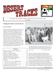
DAY 3 - WEDNESDAY, OCTOBER 29<br />
Painted Rock to Sentinel Flats<br />
Our plan was to proceed to <strong>the</strong> Oatman<br />
grave site through <strong>the</strong> alfalfa fields in <strong>the</strong> Gila’s<br />
flood plain. We wound our way down dirt roads<br />
and had to backtrack here and <strong>the</strong>re as we<br />
worked through <strong>the</strong> maze of fields. We had a<br />
close call when dust clouds hid our caravan of<br />
vehicles from a truck hauling alfalfa bales. As<br />
he was not expecting to see a parade of vehicles,<br />
<strong>the</strong> truck driver pulled out after just one vehicle<br />
passed. Along <strong>the</strong> way Richard missed a turn<br />
because of <strong>the</strong> dust clouds; <strong>the</strong> caravan appeared<br />
to vanish down a slope. Following radio contact<br />
Richard was soon back with <strong>the</strong> group.<br />
We took in <strong>the</strong> Fourr family graves and<br />
<strong>the</strong> nearby wagon road going up to <strong>the</strong> top of <strong>the</strong><br />
mesa. William Fourr built a toll road from<br />
Painted Rock and lived in a stage station in<br />
Oatman Flats. Not far away is a DAR marker<br />
that memorializes <strong>the</strong> site and <strong>the</strong> purported<br />
graves of <strong>the</strong> massacred Oatmans. (There is<br />
conjecture as to whe<strong>the</strong>r <strong>the</strong> Oatmans are<br />
actually buried here.)<br />
<strong>From</strong> <strong>the</strong> flats you could see <strong>the</strong> cross<br />
signifying <strong>the</strong> Oatman Massacre on <strong>the</strong> top of <strong>the</strong><br />
mesa. After scrambling through dense<br />
underbrush Pat and Richard took <strong>the</strong> rocky trail<br />
up to <strong>the</strong> top where <strong>the</strong>y arrived at about <strong>the</strong><br />
same time as <strong>the</strong> rest of <strong>the</strong> group, who had<br />
driven <strong>the</strong> vehicles up by a circuitous route.<br />
Plenty of rust and great grooves told of <strong>the</strong> heavy<br />
traffic on this section.<br />
After a lunch under <strong>the</strong> EZ-UP shelter<br />
and Tracy’s truck-tarp (shade makes such a<br />
difference on <strong>the</strong> desert!) we broke up into<br />
groups to explore <strong>the</strong> mesa. Once again Rose<br />
Ann’s aerials guided us to several traces across<br />
<strong>the</strong> very rocky mesa. There were big rocky cairns<br />
scattered over <strong>the</strong> area and we were curious<br />
about <strong>the</strong>ir origin. We encountered a large chasm<br />
and moved parallel to it which led us to a<br />
“cemetery” of artifacts. There were hundreds of<br />
items scattered around in a cleared flat. This<br />
must have been a major camping area. Nearby<br />
<strong>the</strong> trail crossed upstream of <strong>the</strong> chasm. At <strong>the</strong><br />
crossing <strong>the</strong> rocks showed grooves and rust and<br />
led on west.<br />
We decided that <strong>the</strong> “cemetery” was a<br />
good place to camp for <strong>the</strong> night. The wind was<br />
picking up so we had to tie down Dave’s shower<br />
to Tracy’s truck to stop it from being bent out of<br />
shape before we took our showers. After<br />
cleaning up we sat down to <strong>the</strong> feast that Pat and<br />
Ken had brought and stored in <strong>the</strong>ir cooler. Even<br />
though it was windy we stayed up and chatted.<br />
DAY 4 - THURSDAY, OCTOBER 30<br />
Sentinel Flats to Abandoned Conde Ranch<br />
The wind had died down and so far <strong>the</strong><br />
wea<strong>the</strong>r had been good to us. It had been<br />
cloudy and hazy quite a bit of <strong>the</strong> time, mostly<br />
due to smoke from <strong>the</strong> CA fires.<br />
Once again we broke up into groups.<br />
Pat and Ken followed <strong>the</strong> main trail as it headed<br />
west, Dave and Kay were doing <strong>the</strong> same, while<br />
5