Work on the Apache Pass Trail - Southern Trails Chapter
Work on the Apache Pass Trail - Southern Trails Chapter
Work on the Apache Pass Trail - Southern Trails Chapter

You also want an ePaper? Increase the reach of your titles
YUMPU automatically turns print PDFs into web optimized ePapers that Google loves.
Newsletter of <strong>the</strong> Southwest <strong>Chapter</strong> of <strong>the</strong> Oreg<strong>on</strong>-California <strong>Trail</strong>s Associati<strong>on</strong><br />
December 2007<br />
More <str<strong>on</strong>g>Work</str<strong>on</strong>g> <strong>on</strong> <strong>the</strong> <strong>Apache</strong> <strong>Pass</strong> <strong>Trail</strong><br />
In October, twelve <strong>Trail</strong> Turtles returned to map more<br />
of <strong>the</strong> <strong>Apache</strong> <strong>Pass</strong> <strong>Trail</strong> in southwest New Mexico<br />
and sou<strong>the</strong>ast Ariz<strong>on</strong>a. We met at Ft. Bowie to begin<br />
our week, welcomed as always by SWOCTA member<br />
and ranger, Larry Ludwig. Tracy DeVault was <strong>the</strong> trail<br />
boss again and kept us organized in working some of<br />
<strong>the</strong> places where <strong>the</strong> trail is hard to find ‒ and hard to<br />
get to. We did make progress and now have completed<br />
mapping much of <strong>the</strong> trail between Soldiers Farewell<br />
and <strong>the</strong> actual pass near Fort Bowie. Little has been<br />
d<strong>on</strong>e between <strong>the</strong> pass and Tucs<strong>on</strong> where it rejoined<br />
<strong>the</strong> Sou<strong>the</strong>rn <strong>Trail</strong>.<br />
The group works well toge<strong>the</strong>r, whe<strong>the</strong>r sleuthing out<br />
where to look for trail, driving <strong>the</strong> back roads to reach<br />
trail crossings, dividing up <strong>the</strong> spots to look, record<br />
and photograph, or making camp. No slackers in this<br />
bunch!<br />
Al<strong>on</strong>g <strong>the</strong> way we saw more wildlife than usual,<br />
including a hawk dining <strong>on</strong> a snake, a number of<br />
small antelope herds (which we seldom see), and a<br />
rattlesnake quietly coiled <strong>on</strong> <strong>the</strong> trail. Not so wild was<br />
a group of pinto horses who visited us looking for<br />
handouts.<br />
We c<strong>on</strong>tinue to work <strong>on</strong> publishing our findings,<br />
though that is going slowly.<br />
Rose Ann Tompkins<br />
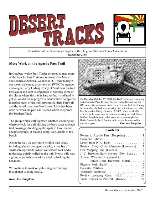
On Thursday, October 19, 2000, <strong>the</strong> <strong>Trail</strong> Turtles were mapping<br />
east of <strong>Apache</strong> <strong>Pass</strong>. Richard Greene realized he had lost his<br />
FRS radio. Attempts were made to call it while he looked al<strong>on</strong>g<br />
<strong>the</strong> area where he had been working. We left without <strong>the</strong> radio.<br />
Fast forward to Friday, October 12, 2007, when we finally<br />
returned to <strong>the</strong> same area to c<strong>on</strong>tinue working <strong>the</strong> trail. Tracy<br />
DeVault found <strong>the</strong> radio, a bit worse for wear (see photo).<br />
Marie Greene declared that <strong>the</strong> radio should be returned for<br />
warranty repair.<br />
Rose Ann Tompkins<br />
C<strong>on</strong>tents<br />
Return to <strong>Apache</strong> <strong>Pass</strong> (Tompkins) . . . . . . . . 1<br />
From <strong>the</strong> Editors . . . . . . . . . . . . . . . . . 2<br />
Letter from P. A. Etter . . . . . . . . . . . . . . 2<br />
Review: Camp Grant Massacre (Lawrence) . . 3<br />
Fall Mapping Trip (Greene) . . . . . . . . . . 4<br />
J. C. Brewster Early History (Text Box) . . . . 8<br />
Article: Whatever Happened to<br />
James Colin Brewster? (Vitale) . . . . 9<br />
Picacho Peak Battle . . . . . . . . . . . . . 15<br />
Brewster Petitit<strong>on</strong> . . . . . . . . . . . . . 16<br />
Tompkins Interview . . . . . . . . . . . . . 17<br />
Review: Amazing Girls (Hill) . . . . . . 27<br />
<strong>Trail</strong>s Classes in Prescott (Krizek) . . . . . . 27<br />
1<br />
Desert Tracks, December 2007
From <strong>the</strong> Editors<br />
Rose Ann and Harland Tomkins, founding<br />
and guiding members of SWOCTA and <strong>the</strong><br />
<strong>Trail</strong> Turtles, are deeply committed to and<br />
knowledgeable about <strong>the</strong> historic trails of <strong>the</strong><br />
West. The interview with <strong>the</strong>m in our December<br />
issue provides insight into <strong>the</strong>ir thinking about<br />
<strong>the</strong> role of trail organizati<strong>on</strong>s in general, and<br />
about OCTA in particular. They give <strong>the</strong>ir<br />
opini<strong>on</strong>s <strong>on</strong> topics such as preservati<strong>on</strong>,<br />
membership, and <strong>the</strong> future of SWOCTA. We<br />
feel certain that <strong>the</strong> Tomkins’ ideas will be<br />
thought provoking to trail enthusiasts.<br />
This fall, <strong>the</strong> <strong>Trail</strong> Turtles c<strong>on</strong>tinued mapping in<br />
<strong>the</strong> vicinity of western New Mexico and eastern<br />
Ariz<strong>on</strong>a. Richard Greene provides an account<br />
of <strong>the</strong> trip. While we have edited his report for<br />
<strong>the</strong> general readership, our versi<strong>on</strong> deletes many<br />
delightful details. Those who are interested<br />
will be able to read more in <strong>the</strong> <strong>Trail</strong> Turtles’<br />
upcoming book.<br />
In a number of past issues, we have included<br />
articles <strong>on</strong> <strong>the</strong> Oatman massacre and captivity.<br />
One of <strong>the</strong> enigmas c<strong>on</strong>cerning <strong>the</strong> Oatman<br />
story has been <strong>the</strong> mystery surrounding James<br />
Colin Brewster’s later life. Gary Vitale, a<br />
professor of history in Springfield, Illinois,<br />
has unear<strong>the</strong>d a good deal of informati<strong>on</strong> <strong>on</strong><br />
this topic. The article by Professor Vitale in<br />
this issue shows that Brewster remained a<br />
fascinating character even after he returned to<br />
<strong>the</strong> East.<br />
We welcome to <strong>the</strong>se pages John Krizek and<br />
Patricia Etter, SWOCTA members who are<br />
currently <strong>on</strong> <strong>the</strong> OCTA Board of Directors.<br />
In additi<strong>on</strong> to <strong>the</strong> news items which <strong>the</strong>y<br />
c<strong>on</strong>tributed to this issue, <strong>the</strong>y informed us of <strong>the</strong><br />
Picacho Peak c<strong>on</strong>troversy, for which we have<br />
given an update. Our book reviewers for this<br />
issue include Walter Drew Hill, an artist and<br />
retired engineer from Sacramento, California.<br />
Deborah and J<strong>on</strong> Lawrence<br />
A Letter to SWOCTA from Patricia Etter<br />
One of my goals, as a new member of OCTA’s<br />
Board, is to promote <strong>the</strong> interests of <strong>the</strong> Southwest<br />
<strong>Chapter</strong> of OCTA. In c<strong>on</strong>necti<strong>on</strong> with that, I would<br />
like to know your thoughts, ideas, and opini<strong>on</strong>s<br />
in a number of areas. To this end, I plan to ask all<br />
SWOCTA members to complete a survey, to be<br />
mailed in early January. Your answers will help me<br />
prepare for <strong>the</strong> OCTA Board Meeting in March.<br />
I hope that all members will participate in <strong>the</strong><br />
upcoming survey and perhaps offer to help in o<strong>the</strong>r<br />
ways.<br />
It seems impossible, but in 2008 <strong>the</strong> <strong>Chapter</strong> will<br />
become 20 years old – how many miles have we<br />
covered in those years? One natural questi<strong>on</strong> <strong>on</strong> <strong>the</strong><br />
survey will be: “How shall we celebrate?”<br />
My interest in trails goes back a l<strong>on</strong>g way. Living in<br />
California provided me opportunities to spend time<br />
in Anza Borrego and <strong>the</strong> surrounding area where, as<br />
you all know, General Kearny and Lieutenant Emory<br />
trekked toward Los Angeles in 1846. Following<br />
<strong>the</strong>m, emigrants came by <strong>the</strong> thousands and left<br />
<strong>the</strong>ir footsteps in what we know as a beautiful desert<br />
park. In 1982, I had <strong>the</strong> distinct pleasure of riding<br />
horseback over Guadalupe <strong>Pass</strong> and photographing<br />
it. By <strong>the</strong>n I was definitely hooked <strong>on</strong> trails, and my<br />
first book, American Odyssey, recalls that adventure.<br />
I joined SWOCTA when it was first organized, and<br />
can say that I enjoyed <strong>the</strong> outings and <strong>the</strong> fellowship<br />
enormously, while uncovering trail bits all over<br />
Ariz<strong>on</strong>a and New Mexico. Now that I am retired<br />
from Ariz<strong>on</strong>a State University, where I ran <strong>the</strong><br />
American Indian Research Library, I have a little<br />
extra time to devote to OCTA.<br />
Before signing off, I want to announce <strong>the</strong><br />
publicati<strong>on</strong> of my new book: California Odyssey:<br />
The Overland Journey of William R. Goulding<br />
and <strong>the</strong> Knickerbocker Exploring Company, 1849<br />
(The Arthur H. Clark Company, an imprint of <strong>the</strong><br />
University of Oklahoma Press, 2008). It covers an<br />
exciting adventure over sou<strong>the</strong>rn trails, starting at<br />
Fort Smith, Arkansas, and ending in San Francisco,<br />
California.<br />
Desert Tracks, December 2007 2
Book Review<br />
Massacre at Camp Grant: Forgetting and<br />
Remembering <strong>Apache</strong> History<br />
by Chip Colwell-Chanthaph<strong>on</strong>h<br />
Tucs<strong>on</strong>: University of Ariz<strong>on</strong>a Press, 2007.<br />
ISBN-13: 978-0-8165-2585-0. 159 pages: maps,<br />
charts, photographs, bibliography, index.<br />
Paperback, $17.95.<br />
On April 30, 1871, a group of Anglo-Americans<br />
and Mexican Americans from Tucs<strong>on</strong>, toge<strong>the</strong>r<br />
with Toh<strong>on</strong>o O’odham allies, massacred more<br />
than a hundred Pinal and Aravaipa <strong>Apache</strong> men,<br />
women, and children near Camp Grant <strong>on</strong> <strong>the</strong><br />
San Pedro River. Somewhere between eleven and<br />
thirty-five <strong>Apache</strong> children were also stolen. Under<br />
<strong>the</strong> leadership of haské bahnzin (Eskiminzin), <strong>the</strong>se<br />
<strong>Apache</strong>s had recently surrendered to <strong>the</strong> U.S. Army<br />
and were living as pris<strong>on</strong>ers of war near <strong>the</strong> camp.<br />
Colwell-Chanthaph<strong>on</strong>h argues that <strong>the</strong> official<br />
history of <strong>the</strong> massacre is <strong>on</strong>e-sided because it<br />
is taken solely from Anglo-American sources,<br />
sources which discount <strong>Apache</strong> perspectives.<br />
From Helen Hunt Jacks<strong>on</strong>’s A Century of Dish<strong>on</strong>or<br />
(1881) to Larry McMurtry’s Oh What a Slaughter<br />
(2005), authors have used n<strong>on</strong>-<strong>Apache</strong> sources<br />
to document <strong>the</strong> event. In Massacre at Camp<br />
Grant, Colwell-Chanthaph<strong>on</strong>h, examines six<br />
<strong>Apache</strong> narratives to provide new insights into<br />
<strong>the</strong> massacre. These narratives, he argues, are<br />
critical for understanding <strong>the</strong> massacre because<br />
<strong>the</strong>y offer accounts from <strong>the</strong> standpoint of <strong>the</strong><br />
Western <strong>Apache</strong>. Three of <strong>the</strong>se accounts are<br />
oral histories, eyewitness accounts which come<br />
from <strong>the</strong> unpublished notebooks of ethnographer<br />
Grenville Goodwin. The o<strong>the</strong>r three accounts<br />
are oral traditi<strong>on</strong>s that were passed from mouth<br />
to mouth, for a period bey<strong>on</strong>d <strong>the</strong> lifetime of<br />
<strong>the</strong> informants. These later oral traditi<strong>on</strong>s come<br />
from a disc<strong>on</strong>tinued magazine, an obituary, and<br />
an interview. Taken toge<strong>the</strong>r, <strong>the</strong> six narratives<br />
provide glimpses of <strong>the</strong> massacre in its particulars:<br />
<strong>the</strong> coming into Camp Grant, <strong>the</strong> celebrati<strong>on</strong> <strong>on</strong> <strong>the</strong><br />
night prior to <strong>the</strong> massacre, <strong>the</strong> attack itself, and<br />
<strong>the</strong> escape to <strong>the</strong> mountains after <strong>the</strong> attack.<br />
3<br />
An anthropologist, Colwell-Chanthaph<strong>on</strong>h<br />
uses an interdisciplinary approach, combining<br />
anthropology, history, and archaeology. In additi<strong>on</strong><br />
to <strong>the</strong> <strong>Apache</strong> narratives, Colwell-Chanthaph<strong>on</strong>h’s<br />
story of <strong>the</strong> massacre incorporates ethnographic<br />
and archaeological research, documentary sources<br />
including army records, newspaper articles, military<br />
and civilian maps. These allow him to look at <strong>the</strong><br />
massacre in new ways. For example, he counters <strong>the</strong><br />
accusati<strong>on</strong> that <strong>the</strong> Aravaipa were raiding during <strong>the</strong><br />
period <strong>the</strong>y were pris<strong>on</strong>ers of war at Camp Grant by<br />
comparing <strong>the</strong> dates and locati<strong>on</strong>s of <strong>the</strong> raids to <strong>the</strong><br />
dates <strong>the</strong>y were in camp receiving rati<strong>on</strong>s.<br />
Since an overview of <strong>the</strong> history is not given<br />
until <strong>Chapter</strong> 3, <strong>the</strong> book will be easier to follow<br />
for those who have some prior knowledge of <strong>the</strong><br />
massacre. The history and ethnographic material is<br />
framed by an extensive a meditati<strong>on</strong> <strong>on</strong> <strong>the</strong> making<br />
of history, <strong>the</strong> ways in which history is used as<br />
a political tool, and a plea for <strong>the</strong> incorporati<strong>on</strong><br />
of multiple viewpoints when rec<strong>on</strong>structing past<br />
events. While this material is typical of academic<br />
discourse, it is well-written without excessive jarg<strong>on</strong><br />
and will be accessible to <strong>the</strong> general reader.<br />
The Camp Grant Massacre was <strong>on</strong>e of <strong>the</strong> worst<br />
massacres in <strong>the</strong> history of <strong>the</strong> American West,<br />
but <strong>on</strong>e of <strong>the</strong> least studied. Expanding <strong>on</strong> our<br />
understanding of <strong>the</strong> massacre, Chip Colwell-<br />
Chanthaph<strong>on</strong>h’s Massacre at Camp Grant provides<br />
readers with an opportunity to rethink <strong>the</strong> event<br />
from <strong>the</strong> <strong>Apache</strong> viewpoint. This book will appeal<br />
to any<strong>on</strong>e interested in <strong>the</strong> history of <strong>the</strong> Southwest,<br />
but it will be essential reading for those interested in<br />
<strong>the</strong> complex history of nineteenth-century fr<strong>on</strong>tier<br />
massacres.<br />
Deborah and J<strong>on</strong> Lawrence<br />
Look for our interview with Chip<br />
Colwell-Chanthph<strong>on</strong>h in <strong>the</strong><br />
upcoming issue of Desert Tracks<br />
Desert Tracks, December 2007
<strong>Trail</strong> Turtles Fall 2007 Mapping Trip<br />
Fort Bowie, Rooster Comb, Rattlesnake<br />
Point, Separ, Lordsburg<br />
by Richard Greene<br />
The <strong>Trail</strong> Turtles in attendance: Rose Ann Tompkins,<br />
Neal Johns, Judy and Tracy DeVault, Pat and Ken<br />
White, Cam Wade, Marie and Richard Greene,<br />
Charles Townley, Levida and Brock Hileman. Tracy<br />
and Judy are now organizing and leading our trips,<br />
with Rose Ann providing <strong>the</strong> aerials and helping<br />
navigate to <strong>the</strong> mapping areas.<br />
Wednesday, October 10 By 4:30 p.m. we had all<br />
arrived at Fort Bowie. Tracy led us in a discussi<strong>on</strong><br />
of mapping plans while we ate dinner. He told us<br />
that Quentin Gilliam would join us <strong>on</strong> <strong>the</strong> mapping<br />
trip with his metal detector. Towards dusk, Larry<br />
Ludwig, Fort Bowie Head Ranger, arrived from a<br />
c<strong>on</strong>ference in Douglas and visited with us briefly.<br />
The view from Fort Bowie – <strong>the</strong> mountains and<br />
San Sim<strong>on</strong> Valley – is breathtaking. There was<br />
a spectacular sunset that lit up <strong>the</strong> clouds, and<br />
as darkness set in, <strong>the</strong>re was<br />
a display of lightning in <strong>the</strong><br />
distance. It was a starry night<br />
and Cam, who has a Ph. D. in<br />
astr<strong>on</strong>omy, enlightened us about<br />
everything we could see in <strong>the</strong><br />
night sky. He supplemented <strong>the</strong><br />
less<strong>on</strong> by pulling up astr<strong>on</strong>omical<br />
data and photos of <strong>the</strong> planets <strong>on</strong><br />
his Palm Pilot.<br />
dashed into <strong>the</strong> road – a local resident exercising his<br />
unleashed dog had spooked <strong>the</strong>m. Off I-10 we took<br />
<strong>the</strong> sec<strong>on</strong>d exit to San Sim<strong>on</strong> and hit familiar ground<br />
bey<strong>on</strong>d irrigated fields and levies. We took a dirt road<br />
that Gilliam said was a better way to Rooster Comb<br />
and <strong>the</strong> pipeline juncti<strong>on</strong>. The road was rocky and<br />
rough in spots but proved to be manageable, even for<br />
Richard in his low clearance minivan and for Charles,<br />
who was pulling an ALiner trailer. We parked near <strong>the</strong><br />
Rooster Comb.<br />
We split into two groups. Pat, Ken, and Cam went east<br />
where <strong>the</strong>y found an old canteen and rust. The rest<br />
of us headed west to meet up with Gilliam, who used<br />
his metal detector to keep us <strong>on</strong> <strong>the</strong> trail and to find<br />
artifacts, including two unfired Spencer cartridges,<br />
chain links, nails, hooks, and forged ir<strong>on</strong> handles. By<br />
early afterno<strong>on</strong>, after two and a half miles, Gilliam’s<br />
group wasn’t finding anything fur<strong>the</strong>r and had lost<br />
c<strong>on</strong>tact with <strong>the</strong> trail. The terrain was sandy and<br />
covered with brush, and <strong>the</strong>re were many eroded<br />
channels crisscrossing <strong>the</strong> area, making it tough to find<br />
evidence of trail. Gilliam called it a day and returned<br />
to Silver City.<br />
Thursday, October 11 (42 miles<br />
traveled today) We were up at<br />
6 a.m. Larry Ludwig drove in<br />
around 7:30 a.m. He showed<br />
us informati<strong>on</strong> <strong>on</strong> and photos<br />
of artifacts of <strong>the</strong> Cor<strong>on</strong>ado<br />
expediti<strong>on</strong> through Ariz<strong>on</strong>a.<br />
We left Ludwig and Fort Bowie<br />
around 8:00 a.m. Some of us<br />
at <strong>the</strong> back of <strong>the</strong> c<strong>on</strong>voy were<br />
delayed when eight horses<br />
The darkness doesn’t stop <strong>the</strong> work of downloading data into a laptop. Left to right:<br />
Ken White, Pat White, Cam Wade, Tracy DeVault, Neal Johns, Rose Ann Tompkins,<br />
Richard Greene.<br />
photo by Judy DeVault<br />
Desert Tracks, December 2007 4
<strong>Trail</strong> Turtles looking at landmarks from <strong>the</strong> top of Rattlesnake Point. There are a<br />
number of mortar holes at this site. Left to right: Tracy DeVault, Neal Johns, Pat<br />
White, Ken White.<br />
photo by Charles Townley<br />
Charles, Neal, Tracy, and Richard headed out to GPS<br />
waypoints where we had recorded rust <strong>on</strong> our previous<br />
trip. They found <strong>the</strong> tape markers we had left, but no<br />
rust. Looking for <strong>the</strong> cairns that Gilliam had told us<br />
about, <strong>the</strong> group walked <strong>on</strong> to a levee about a mile<br />
away, but found nothing. Tracy called Rose Ann <strong>on</strong><br />
his radio to pick <strong>the</strong>m up at <strong>the</strong> levee, and she and<br />
Ken drove down. Neal needed rest; he was probably<br />
suffering from dehydrati<strong>on</strong> and warm wea<strong>the</strong>r. It had<br />
been a warm day with no breeze to cool us down. Rose<br />
Ann’s truck <strong>the</strong>rmometer recorded 93 degrees when<br />
she picked us up. Charles said he would remember to<br />
carry more water.<br />
We had decided to camp close to Rooster Comb<br />
and <strong>the</strong> pipeline juncti<strong>on</strong>. Those of us who initially<br />
parked near <strong>the</strong> pipeline had sec<strong>on</strong>d thoughts when we<br />
smelled gas. We also found an active hive of wasps<br />
<strong>on</strong> <strong>the</strong> pipeline. We finally got settled and had a great<br />
view of <strong>the</strong> Rooster Comb and <strong>the</strong> spectacular castleshaped<br />
mountains around <strong>the</strong> western exit of Doubtful<br />
Cany<strong>on</strong>. Dinner would have been perfect, but we<br />
discovered we had put <strong>the</strong> dinner table over an ant hill.<br />
Friday, October 12 (26 miles) It had been a nice cool<br />
night for sleeping. We left camp early and retraced<br />
yesterday’s drive al<strong>on</strong>g <strong>the</strong> nine miles of dirt road to<br />
<strong>the</strong> cultivated fields beside San Sim<strong>on</strong>’s 3rd Street. We<br />
<strong>the</strong>n drove south <strong>on</strong> a gravel road towards<br />
Rattlesnake Point within <strong>the</strong> shadow of<br />
<strong>the</strong> Cochise Head landmark. We left <strong>the</strong><br />
gravel road and got <strong>on</strong> to a ranch road<br />
that had some tricky dips and rocky spots<br />
to negotiate. We found a campsite about<br />
a half mile from where we planned to<br />
map. A group of horses came to check us<br />
out and were bold enough to walk right<br />
up to <strong>the</strong> windows of <strong>the</strong> vehicles, much<br />
to our amusement. One of those horses<br />
was definitely a Missouri mule. We left<br />
Richard’s van and Charles’s trailer at <strong>the</strong><br />
campsite and drove <strong>on</strong> to <strong>the</strong> Rattlesnake<br />
Point area.<br />
We were last here seven years ago. This<br />
time we wanted to cover more area.<br />
We started by rediscovering <strong>the</strong> trail<br />
from previously taken waypoints. We followed <strong>the</strong><br />
trail until it petered out in <strong>the</strong> proximity of a derelict<br />
bulldozer by a road at <strong>the</strong> top of a hill. Unfortunately,<br />
<strong>the</strong> digging associated with ranch water lines had<br />
destroyed traces of <strong>the</strong> trail in this area. We also were<br />
distracted by hunters looking for javelina. Despite<br />
<strong>the</strong>se difficulties, by <strong>the</strong> time we called it a day we had<br />
indeed mapped a lot more trail than <strong>on</strong> <strong>the</strong> previous<br />
trip. In additi<strong>on</strong>, we had seen many artifacts: bolts, an<br />
old bottle neck, half of an ir<strong>on</strong> saucepan, a U-shaped<br />
strap. Perhaps <strong>the</strong> most exciting discovery was made<br />
by Tracy: <strong>the</strong> crushed radio that Richard had dropped<br />
in <strong>the</strong> vicinity seven years ago (2000) and had searched<br />
for in vain before giving it up for lost.<br />
Some of <strong>the</strong> group drove up to <strong>the</strong> rock outcropping<br />
that is Rattlesnake Point. On top of <strong>the</strong> rock is a great<br />
view of <strong>the</strong> flats to Fort Bowie, but even more thrilling<br />
is <strong>the</strong> cluster of mortar holes that Indians had used to<br />
grind <strong>the</strong>ir corn. There were a couple of manos by <strong>the</strong><br />
holes.<br />
The wea<strong>the</strong>r was pleasant: in <strong>the</strong> low 90’s with a light<br />
breeze. Although at camp <strong>the</strong> wind eventually became<br />
gusty, it was a mild evening. The friendly lights of<br />
San Sim<strong>on</strong> were not far away, as well as those of <strong>the</strong><br />
vehicles traveling I-10 towards Railroad <strong>Pass</strong> and<br />
Lordsburg.<br />
5<br />
Desert Tracks, December 2007
groups – Ken and Pat headed west, while Neal, Cam,<br />
Brock, Levida, and Judy went east to meet up with<br />
Tracy and Richard. Rose Ann dropped Tracy and<br />
Richard off at a waypoint taken <strong>on</strong> <strong>the</strong> last trip. Tracy<br />
and Richard found plenty of rust and <strong>the</strong> trail was easy<br />
to follow. Quentin had told Tracy to look for <strong>the</strong> cairns<br />
that he had put <strong>on</strong> <strong>the</strong> trail and we saw plenty of <strong>the</strong>m.<br />
We started around 10:00 a.m. and were d<strong>on</strong>e by 2:00<br />
p.m. Everybody had found trail!<br />
A flattened military canteen, found al<strong>on</strong>g <strong>the</strong> trail near Doubtful<br />
Cany<strong>on</strong>.<br />
photo by Ken White<br />
Saturday, October 13 (110 miles) We got going<br />
by 7:30 a.m., splitting into two groups. Tracy, Ken,<br />
Pat, and Richard walked from <strong>the</strong> bulldozer to <strong>the</strong><br />
already menti<strong>on</strong>ed gravel road. The o<strong>the</strong>rs drove 1.9<br />
miles <strong>on</strong> <strong>the</strong> ranch road to <strong>the</strong> gravel road. Neal and<br />
Cam walked to meet us, while Rose Ann, Judy, and<br />
Charles mapped fur<strong>the</strong>r east to a wash that was 100<br />
yards wide and 20 feet deep. Rose Ann radioed that<br />
she had seen a snake and had flagged its locati<strong>on</strong>.<br />
Judy found a perfect old bottle. We all found trail<br />
and <strong>the</strong> swale was easily seen. By 10:00 a.m. we<br />
had finished for <strong>the</strong> day.<br />
A cowboy, who lived nearby, stopped to chat. He<br />
told us about an old ox-shoeing blacksmith shop <strong>on</strong><br />
<strong>the</strong> way to <strong>the</strong> fort and a story about homesteaders<br />
who discovered a skelet<strong>on</strong> in a cave with saddle and<br />
gear – a man had been shot and was hiding from his<br />
attackers when he died. The homesteaders kept <strong>the</strong><br />
skelet<strong>on</strong> but a superstitious maid got rid of it.<br />
We traveled at our own speed to Deming’s Grand<br />
Hotel. After dinner at <strong>the</strong> Palma Italian Restaurant,<br />
we agreed to meet <strong>the</strong> next day at 8:00 a.m.<br />
Sunday, October 14 (62 miles) We left at 8:00 a.m.<br />
We hit I-10 and got off at <strong>the</strong> Separ exit. We headed<br />
for <strong>the</strong> 96 Ranch. The gravel roads were fine until<br />
we got to a pipeline road, at which point it got really<br />
rough with some challenging dips. We split into three<br />
Around 2:30 p.m. we drove down <strong>the</strong> lower pipeline<br />
until it met a power line road, which we took through<br />
some deep sandy washes to where <strong>the</strong> trail crossed.<br />
We found a good camping spot that was not that far<br />
from <strong>the</strong> I-10 freeway. We could see <strong>the</strong> lights of<br />
Lordsburg about 15 miles away. We heard a train and<br />
<strong>the</strong> hum of <strong>the</strong> power lines. We were so close and yet<br />
so far from civilizati<strong>on</strong>. Tracy downloaded all our<br />
GPS waypoints, and by 7:30 p.m. we were in bed.<br />
M<strong>on</strong>day, October 15 (45 miles) Our power line camp<br />
proved to be just 12 miles from Lordsburg. It had been<br />
a nice cool night and we wore jackets to keep warm<br />
in <strong>the</strong> early morning. We broke up into two groups.<br />
Neal, Ken, and Pat headed east to complete <strong>the</strong> secti<strong>on</strong><br />
from yesterday’s last waypoint to camp. Tracy, Cam,<br />
and Richard headed west towards Lordsburg with <strong>the</strong><br />
distant Steins Peak as <strong>the</strong>ir focal point.<br />
Tracy’s group initially plodded through high grass that<br />
turned to brush and sand with lots of cross drainages.<br />
An eight-foot-wide sandy wash led in a “straight”<br />
line to Steins Peak; it was <strong>the</strong> trail seen <strong>on</strong> <strong>the</strong> aerials.<br />
Unknown to Tracy, a young rancher, whose family<br />
owned <strong>the</strong> land that we were <strong>on</strong>, had seen our vehicles<br />
and was not happy. Luckily <strong>on</strong>ly Rose Ann, Marie,<br />
and Judy were in camp, and, according to Rose Ann,<br />
he had “pity <strong>on</strong> <strong>the</strong> old women.” However, Rose Ann<br />
radioed Tracy that we should return. Tracy wanted<br />
<strong>the</strong> vehicles shuttled to pick his group up at a nearby<br />
pumping stati<strong>on</strong> by I-10, but nobody wanted to drive<br />
four miles of bad dips <strong>on</strong> <strong>the</strong> powerline road, and<br />
fur<strong>the</strong>rmore, Cam had locked his vehicle and had <strong>the</strong><br />
keys with him. Cam left first. As Tracy and Richard<br />
started back towards camp, <strong>the</strong>y could not raise Cam<br />
<strong>on</strong> his radio and became quite worried. When <strong>the</strong>y<br />
arrived in camp, Cam said his radio batteries had died.<br />
Desert Tracks, December 2007 6
dinner, we ga<strong>the</strong>red around Tracy as he downloaded<br />
our GPS and reviewed <strong>the</strong> day’s activity. We<br />
discussed <strong>the</strong> elusiveness of <strong>the</strong> trail – after all, <strong>the</strong>re<br />
surely had to be something around a stage stati<strong>on</strong>. It<br />
was a nice, cool evening and we wore our jackets.<br />
Tuesday, October 16 Pat had badly blistered feet,<br />
so she, Ken, and Cam left for home around 7:00 a.m.<br />
Neal stuck around l<strong>on</strong>g enough to help with mapping,<br />
lending Tracy an “engineer” scale – <strong>on</strong>ly <strong>the</strong> two of<br />
<strong>the</strong>m could value its intrinsic benefit. Neal <strong>the</strong>n left<br />
around 7:30 a.m. Our group had shrunk by half.<br />
Steins Stage Stati<strong>on</strong> ruins with Steins Peak in <strong>the</strong> background.<br />
photo by Cam Wade<br />
He could hear Tracy and Richard but couldn’t answer<br />
<strong>the</strong>ir calls. Rose Ann told every<strong>on</strong>e about <strong>the</strong> upset<br />
rancher, so we hurried to get out of <strong>the</strong>re.<br />
Returning to Lordsburg, we followed <strong>the</strong> rough<br />
powerline road which hit a good dirt road that went<br />
by a big pumping stati<strong>on</strong> close to I-10. After lunch,<br />
we drove I-10 and got off at <strong>the</strong> Steins exit. The<br />
Ghost Town was closed for business. We crossed <strong>the</strong><br />
railroad tracks and headed for Steins Peak Stati<strong>on</strong>.<br />
Richard left his van at <strong>the</strong> campsite and rode with<br />
Rose Ann and Marie to <strong>the</strong> ruins of <strong>the</strong> stage stati<strong>on</strong>.<br />
We all spread out in <strong>the</strong> area and looked for trail.<br />
We c<strong>on</strong>centrated al<strong>on</strong>g <strong>the</strong> wide, sandy, rock strewn<br />
wash where Ken and Pat had recorded waypoints<br />
from our last trip. There was spotty rust <strong>on</strong> <strong>the</strong> south<br />
side of <strong>the</strong> wash but nothing c<strong>on</strong>clusive about a trail.<br />
We checked by <strong>the</strong> stage stati<strong>on</strong> but <strong>the</strong> trail was not<br />
obvious. Several hours of searching had not given us<br />
much for our efforts.<br />
The rest of us set off for Steins Peak Stati<strong>on</strong>. We<br />
looked between <strong>the</strong> stati<strong>on</strong> and some ranch buildings,<br />
around <strong>the</strong> surroundings of <strong>the</strong> stati<strong>on</strong>, and <strong>the</strong>n<br />
searched about two miles east of <strong>the</strong> stati<strong>on</strong> – but<br />
found nothing c<strong>on</strong>clusive. Judy kept finding rust<br />
specks but rust specks could mean cowboys riding<br />
<strong>the</strong> range. Tracy found a wag<strong>on</strong> part and Richard<br />
found <strong>the</strong> bottom of an old broken bottle, but no trace<br />
was visible even though we were following a topo<br />
track <strong>on</strong> Tracy’s GPS. The area was rocky and had so<br />
many deep washes cutting across that it was hard to<br />
accept this as a stage route.<br />
At 11:30 a.m. we called it a day. We shuttled back to<br />
our vehicles, and we all kept in touch <strong>on</strong> <strong>the</strong> radio as<br />
we drove out to I-10. The fall mapping trip was over.<br />
Two young and easy-going cowboys stopped to say<br />
“Hi” and “What you doing?” They were caretakers<br />
for <strong>the</strong> Steins Peak Ranch. The ranch was owned by<br />
two military officers stati<strong>on</strong>ed in Afghanistan.<br />
We all got back to camp where Tracy put up his<br />
shower. Our campsite viewed a playa over which <strong>the</strong><br />
trail crossed to <strong>the</strong> east. Steins Peak was <strong>on</strong> our west.<br />
Hills were all around <strong>the</strong> flat where we camped. After<br />
7<br />
Richard and Marie Greene in <strong>the</strong> shade, with Steins<br />
Peak in <strong>the</strong> background. photo by Rose Ann Tompkins<br />
Desert Tracks, December 2007
Early history of James Colin Brewster<br />
James Colin Brewster spent his early years in<br />
<strong>the</strong> Morm<strong>on</strong> community at Kirtland, Ohio, <strong>the</strong><br />
site of Joseph Smith’s first temple. Brewster<br />
emigrated with his family to Springfield, Illinois,<br />
in 1838 when he was not quite 12 years old.<br />
The 29-year-old Abraham Lincoln had come<br />
to Springfield <strong>the</strong> year before. About this time,<br />
Colin had visi<strong>on</strong>s of an angel, who commanded<br />
him to write <strong>the</strong> lost Books of Esdras. (“Esdras”<br />
is <strong>the</strong> Greek name for <strong>the</strong> Hebrew Ezra, who<br />
appears both in <strong>the</strong> Old Testament and in <strong>the</strong><br />
Apocrypha.) In 1842 Brewster published a<br />
pamphlet, The Words of Righteousness to All<br />
Men, which he asserted to be an abridgment<br />
of seven of <strong>the</strong>se lost books. In this and later<br />
pamphlets, he opposed polygamy, wanting to<br />
return <strong>the</strong> Morm<strong>on</strong> faith to its original purity.<br />
He said that Esdras commanded that <strong>the</strong> faithful<br />
should establish a Zi<strong>on</strong> in <strong>the</strong> Land of Bashan,<br />
which was in California. Such revelati<strong>on</strong>s<br />
were str<strong>on</strong>gly opposed by <strong>the</strong> LDS leadership,<br />
and Joseph Smith is reported to have said,<br />
“Brewster may set out for California, but he<br />
will not get <strong>the</strong>re unless some body shall pick<br />
him up by <strong>the</strong> way and feed him….” Brewster<br />
was dis-fellowshiped from <strong>the</strong> LDS church in<br />
1842. He lost c<strong>on</strong>siderable credibility when<br />
his translati<strong>on</strong>s of recently discovered Central<br />
American tomb inscripti<strong>on</strong>s, as well as of <strong>the</strong><br />
so-called Kinderhook Plates of Pike County,<br />
Illinois, were shown to be fraudulent. After<br />
Joseph Smith’s death, several LDS leaders<br />
‒ such as Sydney Rigd<strong>on</strong> and James Jesse Strang<br />
‒ started churches of <strong>the</strong>ir own, each claiming<br />
courtesy Gary Vitale<br />
to be <strong>the</strong> true Morm<strong>on</strong> church and refusing to<br />
follow Brigham Young to Utah. During this volatile period, Colin Brewster organized <strong>the</strong> Church of Christ,<br />
<strong>the</strong> original name of <strong>the</strong> Morm<strong>on</strong> Church. Its newspaper, The Olive Branch, was published in Springfield<br />
and Kirtland beginning in August, 1848, and for a period, Brewster’s Church of Christ took over <strong>the</strong> Kirtland<br />
Temple. The Olive Branch immediately began <strong>the</strong> call for <strong>the</strong> faithful to move to <strong>the</strong> Land of Bashan.<br />
c<strong>on</strong>densed from a talk by Gary Vitale<br />
Desert Tracks, December 2007 8
9<br />
Whatever Happened to James Colin<br />
Brewster, <strong>the</strong> Boy Morm<strong>on</strong> Prophet?<br />
by Gary C. Vitale<br />
[Editor’s note: Gary Vitale is a Professor of English<br />
and Speech at Springfield College/Benedictine<br />
University in Springfield, Illinois, and an active<br />
member of <strong>the</strong> Sangam<strong>on</strong> County Historical Society,<br />
as well as a board member of <strong>the</strong> Illinois State<br />
Historical Society. He is <strong>the</strong> author of Letters to Mollie<br />
from her Morm<strong>on</strong> Past: 1860-1912 (Springfield, IL:<br />
Mill Creek Press, 2003). The following article is a<br />
shortened versi<strong>on</strong> of a paper presented at <strong>the</strong> John<br />
Whitmer Historical Associati<strong>on</strong>’s c<strong>on</strong>ference in<br />
Kirtland, Ohio, in September 2007. The full article<br />
gives James Colin Brewster’s early history, prior to <strong>the</strong><br />
effort to reach California in which <strong>the</strong> Oatman family<br />
participated. We provide a synopsis of this early<br />
history in <strong>the</strong> preceding text box. Readers interested in<br />
<strong>the</strong> details should c<strong>on</strong>tact Professor Vitale directly.]<br />
One of <strong>the</strong> most enthusiastic members of <strong>the</strong> Brewster<br />
church was Roys Oatman, a restless soul who had<br />
moved his family from <strong>the</strong> east to Hancock County,<br />
Illinois, near LaHarpe. There he was c<strong>on</strong>verted<br />
to Morm<strong>on</strong>ism by Zenas Gurley, Sr. But after <strong>the</strong><br />
Morm<strong>on</strong> War, Roys became a Rigd<strong>on</strong>ite, taking his<br />
family to “Adventure Farm” in Pennsylvania. When<br />
that failed, he came west again to Whiteside County,<br />
Illinois, where he became a Brewsterite. It may have<br />
been that <strong>the</strong> discovery of gold in California was<br />
an added inducement for <strong>the</strong> Oatman family to be<br />
members of <strong>the</strong> first group of Brewsterites to lead <strong>the</strong><br />
way to <strong>the</strong> Land of Bashan, but <strong>the</strong>re was little doubt<br />
that Roys was sincere in his belief. Oatman was <strong>on</strong>e<br />
of <strong>the</strong> first families to reach Independence, Missouri,<br />
<strong>the</strong> traditi<strong>on</strong>al embarkati<strong>on</strong> point for wag<strong>on</strong>s heading<br />
west. While waiting for <strong>the</strong> o<strong>the</strong>rs, Roys managed<br />
to baptize c<strong>on</strong>verts into <strong>the</strong> faith, just as he had been<br />
doing in Illinois. Roys Oatman was both believer and<br />
adventurer.<br />
In 1850, Oatman and o<strong>the</strong>r Brewsterites were<br />
preparing to find Zi<strong>on</strong> in <strong>the</strong> Land of Bashan. It was<br />
time. About 90 of <strong>the</strong>m, in about 56 wag<strong>on</strong>s, toge<strong>the</strong>r<br />
with hundreds of cattle, provisi<strong>on</strong>s, water, pers<strong>on</strong>al<br />
bel<strong>on</strong>gings (Colin had suggested that <strong>the</strong>y bring a<br />
printing press as well) ga<strong>the</strong>red at Independence to<br />
make for <strong>the</strong> west. They got a late start. Some of <strong>the</strong><br />
prairie grass was already brown from <strong>the</strong> heat in what<br />
was to prove to be a dry year. At <strong>on</strong>e point <strong>the</strong>y had<br />
to decide whe<strong>the</strong>r to take a l<strong>on</strong>ger but safer, nor<strong>the</strong>rly<br />
route, or a shorter but more hazardous sou<strong>the</strong>rly route.<br />
They chose <strong>the</strong> quicker way, despite <strong>the</strong> desert ahead.<br />
There was dissensi<strong>on</strong> al<strong>on</strong>g <strong>the</strong> way. Jacks<strong>on</strong> Goodale<br />
was removed as wag<strong>on</strong> master; Colin Brewster wanted<br />
to take a l<strong>on</strong>ger way towards Santa Fe, New Mexico,<br />
to collect some letters. The wag<strong>on</strong> train broke into two<br />
groups. Roys Oatman and three o<strong>the</strong>r families went <strong>on</strong><br />
into Ariz<strong>on</strong>a. He was determined to get to California.<br />
The two o<strong>the</strong>r families traveling with <strong>the</strong> Oatmans<br />
decided to camp some miles east of Camp Yuma.<br />
A message was sent to <strong>the</strong> army garris<strong>on</strong> at Yuma<br />
asking for horses and help. Roys Oatman decided to<br />
push <strong>on</strong> with his family al<strong>on</strong>e. On a bluff near <strong>the</strong><br />
Gila River, a party of Indians approached, <strong>on</strong> foot.<br />
The Indians asked for food and tobacco; <strong>the</strong> drought<br />
in <strong>the</strong> southwest had been severe. The Oatmans<br />
gave <strong>the</strong>m some of <strong>the</strong>ir provisi<strong>on</strong>s, but <strong>the</strong> Indians<br />
wanted more. When <strong>the</strong>y were refused, <strong>the</strong>y huddled<br />
toge<strong>the</strong>r, and <strong>the</strong>n suddenly with a deafening yell, <strong>the</strong>y<br />
attacked with clubs. Within minutes, Roys Oatman,<br />
his pregnant wife Mary Ann, his young s<strong>on</strong>s Roys,<br />
Jr., and Roland, and his youngest daughters Lucy and<br />
Charity were beaten to death. His oldest boy, Lorenzo,<br />
was bloody and unc<strong>on</strong>scious, and left for dead. The<br />
older girls, Mary Ann and Olive, were taken captive. 1<br />
The Oatman massacre and captivity occurred February<br />
18, 1851. Although Lorenzo recovered and with<br />
help eventually reached California, Olive and Mary<br />
Ann remained Indian captives until 1855, when <strong>the</strong><br />
younger Mary Ann died of starvati<strong>on</strong>. The next year,<br />
1856, Olive Oatman was returned to civilizati<strong>on</strong>, and<br />
her ordeal was reported and published.<br />
In <strong>the</strong> meantime, <strong>the</strong> Brewster wag<strong>on</strong>s had reached<br />
Socorro, New Mexico, where, <strong>on</strong> <strong>the</strong> last day of<br />
1850, <strong>the</strong> census taker found <strong>the</strong>m. There were<br />
Zephaniah and Jane, Colin’s parents, with Zephaniah’s<br />
occupati<strong>on</strong> noted as a carpenter. In <strong>the</strong> family,<br />
<strong>the</strong>re were girls: Letitia, Amaretta, and young Mary<br />
Alwildal, and <strong>the</strong> boys William Amsbury and Orlando<br />
Desert Tracks, December 2007
Brewster family members, from <strong>the</strong> 1850 Federal census, Socorro, New Mexico.<br />
courtesy Gary Vitale<br />
Hamilt<strong>on</strong> (whose middle name was written “Hamlet”<br />
for some reas<strong>on</strong>). 2 Notably, <strong>the</strong> census taker listed <strong>the</strong><br />
occupati<strong>on</strong> of J. Colin Brewster, age 24, as “Morm<strong>on</strong><br />
Prophet.” Only Colin could have told him that.<br />
In <strong>the</strong> Brewster household was Neville Stuart, a<br />
printer who managed to get counted twice that<br />
census year, <strong>on</strong>ce in Springfield where he was<br />
living next to editor Sime<strong>on</strong> Francis, probably <strong>on</strong><br />
a street known as “Printers Row,” and <strong>the</strong>n again<br />
<strong>on</strong> New Year’s Eve in New Mexico. Living nearby<br />
<strong>the</strong> Brewsters were <strong>the</strong> Jacks<strong>on</strong> Goodales and <strong>the</strong><br />
William Wilders. Wilder was a bookbinder. So with<br />
a printer in <strong>the</strong> house and bookbinder next door, J.<br />
Colin Brewster was prepared to publish more Lost<br />
Books of Esdras.<br />
It was not to be. That 1850 New Mexico census<br />
record was <strong>on</strong>e of <strong>the</strong> last bits of evidence we have<br />
of James Colin Brewster. He did establish “Col<strong>on</strong>ia”<br />
near Socorro, and he sent letters and reports to<br />
Hazen Aldrich in Kirtland who was still publishing<br />
The Olive Branch for <strong>the</strong> Church, but if Colin ever<br />
reached California, <strong>the</strong> Land of Bashan, no <strong>on</strong>e has<br />
recorded it. Instead, <strong>the</strong>re was a massive defecti<strong>on</strong> of<br />
his followers, some of <strong>the</strong>m reaching San Francisco<br />
in July 1852, many m<strong>on</strong>ths after <strong>the</strong> last issue of<br />
The Olive Branch appeared. 3 As Brian McGinty<br />
summarizes in The Oatman Massacre:<br />
The attack <strong>on</strong> <strong>the</strong> Oatman family sounded <strong>the</strong> death<br />
knell for Brewsterism: to a man and a woman, all<br />
of Brewster’s followers aband<strong>on</strong>ed his movement<br />
after <strong>the</strong>y received news of <strong>the</strong> deaths of Roys and<br />
Mary Ann and <strong>the</strong>ir children and of <strong>the</strong> capture of<br />
Olive and little Mary Ann by <strong>the</strong> Indians. After <strong>the</strong>y<br />
moved <strong>on</strong> from <strong>the</strong> Colorado River regi<strong>on</strong>, most<br />
of <strong>the</strong>m went <strong>on</strong> to live ordinary lives, in Illinois,<br />
California, and elsewhere…. 4<br />
But was this true of Colin Brewster, himself? Was<br />
Joseph Smith’s predicti<strong>on</strong> borne out? Did he never<br />
reach California? In a letter to a Bro<strong>the</strong>r Alst<strong>on</strong>,<br />
dated January 25, 1853, Hazen Aldrich writes:<br />
J.C. Brewster has returned to <strong>the</strong> States & says<br />
he is going to remain until that meeting is held in<br />
<strong>the</strong> Temple .... I have sent him <strong>the</strong> names of <strong>the</strong><br />
subscribers to <strong>the</strong> Olive Branch & as so<strong>on</strong> as he<br />
can he will issue it again. He is now agoing to take<br />
charge of <strong>the</strong> affairs of <strong>the</strong> church for I now expect<br />
to go to <strong>the</strong> Land of Peace in <strong>the</strong> spring. 5<br />
Desert Tracks, December 2007 10
If Aldrich was accurate, Colin was not giving up<br />
his missi<strong>on</strong>, at least through <strong>the</strong> year 1852 and <strong>the</strong><br />
beginning of 1853. Yet, we have no direct evidence<br />
of his whereabouts for about four years, from 1852 to<br />
1856, <strong>the</strong> year Olive Oatman was returned to her bro<strong>the</strong>r<br />
Lorenzo and <strong>the</strong> ordeal of her captivity began to be<br />
published to <strong>the</strong> world. In 1856, James Colin Brewster<br />
was living in M<strong>on</strong>tgomery County, Illinois, working as<br />
a farm laborer and, at times, a schoolteacher. <str<strong>on</strong>g>Work</str<strong>on</strong>g>ing<br />
with him was his younger bro<strong>the</strong>r, Orlando Hamilt<strong>on</strong>.<br />
They were in <strong>the</strong> far sou<strong>the</strong>astern part of M<strong>on</strong>tgomery<br />
County, known as Card’s Grove, named for <strong>the</strong> early<br />
settler James Card. Colin’s parents, Zephaniah and Jane,<br />
and his youngest sister, Mary, were living in Litchfield,<br />
<strong>on</strong>e of <strong>the</strong> two larger cities in <strong>the</strong> county. Significantly,<br />
he was no l<strong>on</strong>ger using <strong>the</strong> name Colin Brewster. Now<br />
he was just plain James Brewster. It was obvious that he<br />
had given up “propheteering.”<br />
When <strong>the</strong> Civil War erupted, he and his bro<strong>the</strong>r,<br />
Orlando, resp<strong>on</strong>ded to <strong>the</strong> call from Charles E.<br />
Lippincott of Chandlerville, Illinois, and <strong>the</strong>y both<br />
joined <strong>the</strong> 33 rd Illinois Volunteer Infantry, both in<br />
Company K. The 33 rd Illinois Volunteers were organized<br />
by Charles E. Hovey, <strong>the</strong> founder of <strong>the</strong> Illinois Normal<br />
Teachers College, later Illinois State University. Hovey<br />
was so dismayed at seeing <strong>the</strong> debacle of <strong>the</strong> first Bull<br />
Run battle that he determined to organize and lead a<br />
regiment of volunteers that he knew best – teachers. It<br />
was said that <strong>the</strong> so-called “Teachers Brigade” would<br />
not obey a written order that was not grammatically<br />
correct.<br />
Both James and Orlando were mustered into <strong>the</strong><br />
Company K at Camp Butler, Illinois, just outside<br />
of Springfield, in August 1861. The regiment saw<br />
its first real acti<strong>on</strong> in Ir<strong>on</strong>t<strong>on</strong>, Missouri, when <strong>on</strong>e<br />
of its companies, Company E, was attacked by Jeff<br />
Thomps<strong>on</strong>’s cavalry while keeping watch <strong>on</strong> a railroad<br />
line. Company K and o<strong>the</strong>rs resp<strong>on</strong>ded to help, and<br />
during <strong>the</strong> fighting, Orlando had his index finger shot<br />
off, was kicked to <strong>the</strong> ground, and shattered his kneecap.<br />
He was taken pris<strong>on</strong>er briefly, but <strong>the</strong>n “paroled <strong>on</strong><br />
<strong>the</strong> battlefield,” which meant that he could be returned<br />
to his unit if he promised (gave his word, or “parole”)<br />
not to engage in active fighting henceforth. He was<br />
discharged from <strong>the</strong> army so<strong>on</strong> afterwards.<br />
11<br />
James suffered a worse disaster. With his regiment in<br />
Batesville, Arkansas, he developed a severe fever and<br />
diarrhea. Never<strong>the</strong>less, he must march with his unit all<br />
<strong>the</strong> way to Helena, Arkansas. In his words:<br />
The march from Batesville to Helena <strong>on</strong> <strong>the</strong><br />
Mississippi occupied, including delays, some three<br />
weeks, and was attended with many hardships:<br />
excessive heat, scarcity of good water, short rati<strong>on</strong>s<br />
etc. prostrated men who, when <strong>the</strong>y started, were in<br />
perfect health. The c<strong>on</strong>stant danger of capture by<br />
<strong>the</strong> Bushwhackers who prowled al<strong>on</strong>g our line of<br />
march and in <strong>the</strong> rear was enough to make <strong>on</strong>e exert<br />
himself to <strong>the</strong> utmost to keep with <strong>the</strong> column. It was<br />
this painful over-exerti<strong>on</strong> toge<strong>the</strong>r with lack of food,<br />
exposure to rain in <strong>the</strong> night after <strong>the</strong> extreme heat of<br />
<strong>the</strong> day in my weak c<strong>on</strong>diti<strong>on</strong> which broke me down. 6<br />
Although hundreds of thousands were killed in <strong>the</strong><br />
Civil War battles, many more, died of illness or<br />
disease, or, like James Brewster, suffered <strong>the</strong> rest<br />
of <strong>the</strong>ir lives with illnesses c<strong>on</strong>tracted during <strong>the</strong>ir<br />
time in <strong>the</strong> service. After two hospital stays, he was<br />
h<strong>on</strong>orably discharged, December 1, 1862.<br />
For about nine m<strong>on</strong>ths, he lived with his parents in<br />
Litchfield, Illinois, but he was unable to work. Then<br />
in August 1863, he rejoined <strong>the</strong> army as part of <strong>the</strong><br />
Veterans Reserve Corps. Organized near <strong>the</strong> end of <strong>the</strong><br />
war, <strong>the</strong> Veterans Reserve Corps was a corps of injured<br />
or partially disabled veterans who were supposed to be<br />
held in reserve in case <strong>the</strong>y were needed in an extreme<br />
emergency. Some of <strong>the</strong> more able-bodied were<br />
used as pris<strong>on</strong> or camp guards. O<strong>the</strong>rs were hospital<br />
orderlies or clerks. Popularly, <strong>the</strong> Veterans Reserve<br />
Corps was known as <strong>the</strong> “Invalid Corps.” Luckily,<br />
James was given “detached duty” at Camp Butler, near<br />
Springfield. Camp Butler had a hospital, a pris<strong>on</strong>, and<br />
a cemetery for both Uni<strong>on</strong> and C<strong>on</strong>federate soldiers.<br />
James worked as a clerk and orderly. 7<br />
He was at Camp Butler when <strong>the</strong> funeral train bringing<br />
<strong>the</strong> slain Abraham Lincoln back to Springfield<br />
arrived in May 1865. Though o<strong>the</strong>r members of <strong>the</strong><br />
Veterans Reserve Corps were assigned to accompany<br />
<strong>the</strong> body from Washingt<strong>on</strong>, D. C., to Springfield,<br />
James was not <strong>on</strong>e of <strong>the</strong>m. Instead, he was most<br />
probably assigned to issue <strong>the</strong> clean uniforms and new<br />
Desert Tracks, December 2007
gloves that <strong>the</strong> Michigan Ir<strong>on</strong> Brigade was ordered to<br />
wear for Lincoln’s funeral in Oak Ridge Cemetery.<br />
The funeral cerem<strong>on</strong>y was solemn and extensive,<br />
despite <strong>the</strong> heat. No doubt James was <strong>the</strong>re.<br />
In November 1865, James was h<strong>on</strong>orably discharged<br />
from <strong>the</strong> Veterans Reserve Corps in St. Paul,<br />
Minnesota. After discharge, he returned to Litchfield,<br />
living with his parents again and “unable to work.”<br />
He was 39 years old. For <strong>the</strong> bulk of his life after<br />
discharge from <strong>the</strong> army, James found whatever<br />
work he could as he seemed to travel up and down<br />
<strong>the</strong> Mississippi River flyway. In Minnesota he<br />
found work as a mail hack driver, but this work<br />
proved too strenuous. So did light farmwork,<br />
that he hoped would actually streng<strong>the</strong>n him. He<br />
prevailed up<strong>on</strong> old army buddies for something he<br />
could make a living at. He worked as an “office<br />
boy” clerking for <strong>the</strong> Hardenburg Foundry in<br />
Minneapolis. He left that job, <strong>on</strong>ly to return to it later<br />
and be given watchman duties as well.<br />
In December 1865, his bro<strong>the</strong>r Orlando had become<br />
a carpetbagger by moving to Louisiana during <strong>the</strong><br />
Rec<strong>on</strong>structi<strong>on</strong> Period. There, Orlando was elected to<br />
<strong>the</strong> Louisiana state legislature, eventually becoming<br />
speaker of <strong>the</strong> house. Orlando was appointed U.S.<br />
Surveyor by <strong>the</strong> Ulysses S. Grant administrati<strong>on</strong>, and<br />
he worked under Captain James Eads improving <strong>the</strong><br />
Mississippi delta jetties. Orlando began, however,<br />
as superintendent of schools in Oauchita Parish,<br />
and James followed him to Louisiana, becoming<br />
a schoolteacher in a “colored school,” probably<br />
employed by <strong>the</strong> Freedman’s Bureau. From 1872<br />
to 1876 he was superintendent of Schools of <strong>the</strong> 5 th<br />
District, Louisiana.<br />
The years that both James and Orlando spent in<br />
Louisiana were turbulent <strong>on</strong>es. Louisiana, South<br />
Carolina, and Florida were <strong>the</strong> <strong>on</strong>ly three Sou<strong>the</strong>rn<br />
states that still had garris<strong>on</strong>ed Federal troops that<br />
were periodically called out to quell armed c<strong>on</strong>flicts<br />
between white supremacists ‒ usually Democrats<br />
‒ and Republicans, some of <strong>the</strong>m black. Twice,<br />
Louisiana had two governors and two legislatures,<br />
each claiming legitimacy. There were bloody battles<br />
in which unarmed men were shot and stabbed. The<br />
Federal troops could hardly keep up with <strong>the</strong> White<br />
League. Finally, <strong>the</strong> disputed presidential electi<strong>on</strong> of<br />
1876 ended Rec<strong>on</strong>structi<strong>on</strong> in Louisiana. Ru<strong>the</strong>rford<br />
B. Hayes persuaded Sou<strong>the</strong>rners to give him <strong>the</strong> 20<br />
disputed electoral votes in exchange for his promise<br />
that all Federal troops would be removed from<br />
Louisiana, South Carolina, and Florida. That is how<br />
we came to have a President Ru<strong>the</strong>rford B. Hayes<br />
instead of a President Samuel J. Tilden, who had easily<br />
w<strong>on</strong> <strong>the</strong> popular vote.<br />
With <strong>the</strong> troops g<strong>on</strong>e, Sou<strong>the</strong>rn Democrats gained<br />
c<strong>on</strong>trol of <strong>the</strong> governor’s office and <strong>the</strong> legislature<br />
in Louisiana, even erasing <strong>the</strong> records of <strong>the</strong><br />
Rec<strong>on</strong>structi<strong>on</strong> legislatures before <strong>the</strong>m. While<br />
Orlando moved his family to Florida and opened<br />
a hotel in a resort city called Lake Charm, James<br />
Brewster still struggled in Louisiana, trying to employ<br />
blacks to cultivate or share in <strong>the</strong> crops of a farm<br />
he had in Pine Hills, Ouachita Parish. “But,” as he<br />
wrote later, “<strong>the</strong> Bulldozers [made] <strong>the</strong> colored people<br />
afraid to work for me or live <strong>on</strong> my land, c<strong>on</strong>sequently<br />
I am left helpless.” 8<br />
On February 17, 1880, James Brewster applied for a<br />
disability pensi<strong>on</strong>. He was back in Springfield. He was<br />
53. His applicati<strong>on</strong> was not received until April 1880.<br />
James left for Minneapolis and two years later, he<br />
resubmitted his applicati<strong>on</strong> for disability pensi<strong>on</strong>. The<br />
applicati<strong>on</strong> required what seems to be an unusually<br />
large number of affidavits in order to be approved. On<br />
his official certificate of disability for discharge <strong>on</strong><br />
December 1, 1862, was a surge<strong>on</strong>’s notati<strong>on</strong> that he<br />
was admitted with a “cough and much debilitated<br />
inside, which he has been under treatment without<br />
improvement – has Tuberculosis of left lung, probably<br />
predisposed to it before he entered <strong>the</strong> service – is<br />
entirely incapacitated for duty as a soldier.” [italics<br />
added]<br />
If James was predisposed to tuberculosis before he<br />
entered <strong>the</strong> service, he would not be eligible for a<br />
military pensi<strong>on</strong>. He had to prove that, before he<br />
courtesy Gary Vitale<br />
Desert Tracks, December 2007 12
entered <strong>the</strong> army, he was fit, and it was <strong>the</strong> Batesville<br />
to Helena three-week march that “broke him down.”<br />
The first set of affidavits was from four people<br />
who knew him before he enlisted. Mrs. Edith Pack<br />
wrote in an official affidavit that James “...lived in<br />
M<strong>on</strong>tgomery County, Illinois, for three years before he<br />
enlisted ... and during that time he worked as a farmer<br />
except a few m<strong>on</strong>ths spent teaching school and that he<br />
was not subject to any chr<strong>on</strong>ic or o<strong>the</strong>r diseases….”<br />
She added that she was “well acquainted with <strong>the</strong> said<br />
James Brewster from <strong>the</strong> year 1856 to <strong>the</strong> spring of<br />
1867, meeting him almost daily before and after his<br />
service in <strong>the</strong> army and seeing him frequently while<br />
he was <strong>on</strong> detached duty at Springfield, Illinois, in <strong>the</strong><br />
Veterans Res Corps.” If she was truthful, she had seen<br />
James almost daily for 15 years, from <strong>the</strong> time she was<br />
21 and he 30 to <strong>the</strong> time she was 36 – an indicati<strong>on</strong> of<br />
a family member or perhaps a former Brewsterite.<br />
O<strong>the</strong>rs who attested to James’s health before he<br />
enlisted were Dennis P. Brophy, who wrote that he<br />
and James worked toge<strong>the</strong>r <strong>on</strong> <strong>the</strong> farm of William<br />
H. Russell and that both roomed at James I. Taylor’s<br />
house. Dennis claimed he “did not know at that<br />
Nati<strong>on</strong>al Soldiers home, Northwestern Branch.<br />
courtesy Gary Vitale<br />
time nor had any cause to believe that [James] was<br />
affected by any chr<strong>on</strong>ic Diseases.” James’ sister, Mary<br />
Goinges, also presented an affidavit, without revealing<br />
her maiden name. Finally, Dr George Rex, who had<br />
examined James before his enlistment, pr<strong>on</strong>ounced<br />
him “a sound, able-bodied man.” Clearly, James was<br />
not predisposed to tuberculosis. 9<br />
The o<strong>the</strong>r affidavits, from employers and fellow<br />
workers, all attested to James’ problems after <strong>the</strong><br />
service, his inability to do manual labor, his jobs as<br />
orderly and “office boy.” All attested to his inability<br />
to sustain manual labor or to make his living with it.<br />
After submitting 13 affidavits, four of <strong>the</strong>m attesting<br />
to his healthiness before his service and nine of <strong>the</strong>m<br />
after he was discharged, James’ applicati<strong>on</strong> was<br />
approved ‒ for $8.00 a m<strong>on</strong>th.<br />
Five years after he received his pensi<strong>on</strong>, he was<br />
admitted to <strong>the</strong> Nati<strong>on</strong>al Home for Disabled and<br />
Volunteer Soldiers, Northwestern Branch, at<br />
Milwaukee, Wisc<strong>on</strong>sin. (The establishment of homes<br />
for disabled volunteer soldiers – those not members<br />
of <strong>the</strong> regular army – had been <strong>on</strong>e of <strong>the</strong> last acts<br />
that Lincoln had signed before he was killed.) James<br />
was 61 years old. And <strong>the</strong>re, in Milwaukee, at what<br />
was popularly known as a Soldiers and Sailors home,<br />
James Brewster remained until he died.<br />
courtesy Gary Vitale<br />
There is no indicati<strong>on</strong> that he ever took up prophecy<br />
– or even <strong>the</strong> Morm<strong>on</strong> faith – after 1855. He did teach<br />
school, and he did work <strong>on</strong> a political newspaper<br />
in Indiana until an electi<strong>on</strong>, but <strong>the</strong>re were no more<br />
lost books of Esdras published, no more issues<br />
of The Olive Branch. Jacks<strong>on</strong> Goodale, who had<br />
13<br />
Desert Tracks, December 2007
enthusiastically sold The Olive Branch in Iowa, came<br />
back to Barry in Pike County, Illinois. The Goodales<br />
stayed <strong>the</strong>re for many years. But <strong>the</strong>re is no evidence<br />
that James Brewster ever communicated with him.<br />
Orlando Hamilt<strong>on</strong> Brewster operated a resort hotel in<br />
Lake Charm, Florida, near <strong>the</strong> city of Orlando. There,<br />
he was apparently successful. President Chester A.<br />
Arthur was <strong>on</strong>ce a guest. 10 But <strong>the</strong>re is no evidence<br />
that bro<strong>the</strong>r James was ever in Florida.<br />
So what can we finally say about James Colin<br />
Brewster, now that we know what he did, where he<br />
went, who he was with, and where he died? For <strong>the</strong><br />
first third of his life, until about 1852, he was a viable<br />
religious leader, intent <strong>on</strong> restoring <strong>the</strong> Morm<strong>on</strong> faith<br />
to its roots in <strong>the</strong> Book of Morm<strong>on</strong> and <strong>the</strong> original<br />
Book of Commandments. In this respect, he was doing<br />
what his inspirati<strong>on</strong>, <strong>the</strong> prophet Ezra, did for <strong>the</strong> Jews<br />
after <strong>the</strong>ir Babyl<strong>on</strong>ian captivity, calling <strong>the</strong>m back<br />
to <strong>the</strong> law of Moses, telling <strong>the</strong>m to put away <strong>the</strong>ir<br />
“hea<strong>the</strong>n wives” and return to <strong>the</strong> site of <strong>the</strong> temple<br />
to rebuild it. To <strong>the</strong> Morm<strong>on</strong> historian, however, <strong>the</strong><br />
last two-thirds of Brewster’s life c<strong>on</strong>firms him as just<br />
ano<strong>the</strong>r failed leader of a splinter sect. His gullibility<br />
and arrogance in translating <strong>the</strong> fraudulent Kinderhook<br />
plates and <strong>the</strong> Central American tomb writing, and<br />
his immense error in seeing an Eden-like Zi<strong>on</strong> in <strong>the</strong><br />
deserts of <strong>the</strong> southwest, reveal him as so much of a<br />
failed “prophet” that some might call him “charlatan.”<br />
Was he charlatan or prophet? Did he h<strong>on</strong>estly<br />
believe he saw <strong>the</strong> angel and that <strong>the</strong> words he was<br />
dictating were from those lost books of Esdras? Did<br />
he h<strong>on</strong>estly believe knowing what Esdras had written<br />
millennia ago would save <strong>the</strong> Latter Day Saints in his<br />
day? Or was it all just a scam to sell pamphlets and<br />
newspapers, and perhaps build a city in <strong>the</strong> southwest<br />
that would rival Nauvoo, and for him to become as<br />
renowned as Joseph had been?<br />
The answer lies within those four dark years between<br />
1852 and 1856, <strong>the</strong> same years that Olive Oatman was<br />
held captive by <strong>the</strong> Indians. During that time he must<br />
have learned about <strong>the</strong> massacre and Olive’s ordeal.<br />
During that time he must have seen <strong>the</strong> regi<strong>on</strong> at <strong>the</strong><br />
c<strong>on</strong>fluence of <strong>the</strong> Gila and Colorado rivers, <strong>the</strong> place<br />
that he had described as an Eden, <strong>the</strong> place that was<br />
mostly desert. His followers left him, claiming to<br />
have been hoodwinked. Did he make <strong>the</strong> same terrible<br />
judgment <strong>on</strong> himself? Or was it just a case of giving<br />
up when you realize <strong>the</strong> game is up? In ei<strong>the</strong>r case,<br />
sometime during those four dark years between 1852<br />
and 1856, Colin Brewster, Boy Prophet, was laid to<br />
rest and plain James Brewster went <strong>on</strong> with life.<br />
In 1903, Olive Oatman Fairchild died at her home in<br />
Sherman, Texas. She had l<strong>on</strong>g ago ended her lecture<br />
tours, and any<strong>on</strong>e visiting her was cauti<strong>on</strong>ed never<br />
to menti<strong>on</strong> <strong>the</strong> massacre or <strong>the</strong> captivity, and to try to<br />
ignore <strong>the</strong> tattoos <strong>on</strong> her face that she had learned to<br />
hide with cosmetics. 11 Did James Brewster ever attend<br />
<strong>on</strong>e of her lectures? Was he never tempted to send her<br />
his visiting card or a slip of paper with his name <strong>on</strong> it<br />
so that <strong>the</strong>y could sit across from <strong>on</strong>e ano<strong>the</strong>r, perhaps,<br />
in a polite 19 th -century parlor and see face-to-face<br />
what <strong>the</strong>y had both endured? There is no proof <strong>the</strong>y<br />
ever met or communicated with each o<strong>the</strong>r after <strong>the</strong><br />
Oatmans in <strong>the</strong>ir wag<strong>on</strong> separated from <strong>the</strong> Brewsters<br />
and went <strong>on</strong> to face <strong>the</strong> <strong>Apache</strong>s in 1851.<br />
In 1909 James Brewster died at <strong>the</strong> Northwestern<br />
Branch of <strong>the</strong> Nati<strong>on</strong>al Home for Disabled Volunteer<br />
Veterans, Milwaukee, Wisc<strong>on</strong>sin. He had lived <strong>the</strong>re for<br />
nearly 22 years. He had an enlarged prostate, a double<br />
hernia, and because of his heart c<strong>on</strong>diti<strong>on</strong>, his left side<br />
was slightly larger than his right. He was 5 feet 8 inches<br />
tall and he weighed a mere 125 pounds. During his fight<br />
with <strong>the</strong> government to increase his pensi<strong>on</strong> allotment<br />
from $12 to $20 a m<strong>on</strong>th, he said he had adopted<br />
<strong>the</strong> daughter of a widowed German washerwoman,<br />
probably <strong>on</strong>e who worked at <strong>the</strong> Home. That adopted<br />
daughter, who lived just outside <strong>the</strong> grounds, got a<br />
check for <strong>the</strong> $3.35 he had <strong>on</strong> his pers<strong>on</strong>, but she was<br />
denied his $160 pensi<strong>on</strong>, “under [<strong>the</strong> federal] act of<br />
July 1, 1902.” 12 His religi<strong>on</strong> was listed as “Protestant,”<br />
probably to indicate to <strong>the</strong> chaplain what kind of service<br />
– Catholic or Protestant – should be celebrated in <strong>the</strong><br />
Home’s n<strong>on</strong>-denominati<strong>on</strong>al chapel, which had facilities<br />
for both. 13<br />
A caiss<strong>on</strong> was used to transport his flag-draped coffin to<br />
Wood Cemetery, where <strong>the</strong> men whose families had not<br />
requested <strong>the</strong>ir remains were buried. Some of <strong>the</strong> men<br />
in his company were pallbearers. There were muffled<br />
Desert Tracks, December 2007 14
drums and an eight-man rifle squad. Flags were at<br />
half-staff. The chaplain at <strong>the</strong> gravesite said what was<br />
appropriate. It was <strong>the</strong> sec<strong>on</strong>d week in January and<br />
probably cold. Three volleys from <strong>the</strong> firing squad<br />
ended <strong>the</strong> cerem<strong>on</strong>y. 14 The coffin was lowered into<br />
Grave #124 of Block 17. It was 1909. The Boy Prophet<br />
had lived 82 years, 2 m<strong>on</strong>ths, and 8 days.<br />
Endnotes<br />
1. Summarized from The Oatman Massacre: A Tale of<br />
Desert Captivity and Survival by Brian McGinty<br />
(Norman: University of Oklahoma Press, 2005), 30-<br />
76.<br />
2. Federal census 1850. Socorro, New Mexico, December<br />
31, 1850.<br />
3. San Francisco Herald, July 30, 1852, as noted in<br />
McGinty, p. 197.<br />
4. McGinty, op. cit., p. 198.<br />
5.Hazen Aldrich to Bro. Alst<strong>on</strong>, January 25, 1853, as<br />
quoted in “James Colin Brewster: <strong>the</strong> Boy Prophet<br />
Who Challenged Morm<strong>on</strong> Authority” by Dan Vogel<br />
in Differing Visi<strong>on</strong>s: Dissenters in Morm<strong>on</strong> History,<br />
Roger D. Launius and Linda Thatcher, eds. (Urbana<br />
and Chicago: University of Illinois Press, 1994) 133.<br />
6. Pvt. James Brewster pensi<strong>on</strong> record request #356.174.<br />
7. Ibid. Affidavit of John F. Pogue, fellow clerk.<br />
8. Brewster pensi<strong>on</strong> record request #356.174. The<br />
term “bulldozers” was applied first to those bullies<br />
of newly freed slaves who were pushed around by<br />
white supremacists; <strong>on</strong>ly later was it taken up by<br />
c<strong>on</strong>structi<strong>on</strong> machinery manufacturers.<br />
9. Ibid. Affidavits of Edith Pack, Dennis P. Brophy, Mary<br />
Goinges, and Dr. George Rex.<br />
10. Seminole County Historical Marker, Lake Charm,<br />
Florida.<br />
11.McGinty, p. 198.<br />
12.Northwestern Branch Nati<strong>on</strong>al Home for Disabled<br />
Volunteer Soldiers, James Brewster #732, p.67.<br />
13. Zahn, Jill. “Soldiers Home Chapel, 1889” in<br />
Reclaiming our Heritage 2007 (Publicati<strong>on</strong> of <strong>the</strong><br />
Soldiers Home Foundati<strong>on</strong>, Inc.) p. 9.<br />
14. Typical volunteer soldier’s funeral as published in<br />
Souvenir of <strong>the</strong> Nati<strong>on</strong>al Soldiers Home, Northwestern<br />
Branch (Milwaukee County, Wisc<strong>on</strong>sin:1912) p. 16.<br />
15<br />
Copyright 2007 by Gary C. Vitale<br />
The Picacho Peak Rail Yard Battle<br />
On Wednesday, November 14, 2007, <strong>the</strong> Pinal County<br />
Board of Supervisors voted to clear <strong>the</strong> way for a<br />
c<strong>on</strong>troversial six-mile railroad switching yard. The<br />
Uni<strong>on</strong> Pacific Railroad proposes to build what would<br />
be <strong>the</strong> nati<strong>on</strong>’s sixth largest switch yard adjacent to<br />
Picacho Peak State Park, about 45 miles northwest<br />
of Tucs<strong>on</strong>. Supporters of <strong>the</strong> proposal assert that <strong>the</strong><br />
complex would promise at least 290 jobs and would<br />
provide Ariz<strong>on</strong>a with much needed rail facilities<br />
The proposal has o<strong>the</strong>r people worried. Park officials<br />
assert that tourists will no l<strong>on</strong>ger want to visit <strong>the</strong><br />
area because of <strong>the</strong> rail yard’s unregulated noise and<br />
chemical polluti<strong>on</strong>. Envir<strong>on</strong>mentalists are c<strong>on</strong>cerned<br />
that <strong>the</strong> increase in diesel exhaust and o<strong>the</strong>r pollutants<br />
will affect <strong>the</strong> regi<strong>on</strong>’s sensitive wildlife habitat<br />
and vegetati<strong>on</strong>. They are especially worried about a<br />
populati<strong>on</strong> of l<strong>on</strong>g-nosed bats, a species that reside in<br />
caves in <strong>the</strong> nearby mountains.<br />
In additi<strong>on</strong>, <strong>the</strong> switching yard would also endanger<br />
<strong>the</strong> historical importance of <strong>the</strong> area. A magnificent<br />
2,000-foot-tall volcanic plug, <strong>the</strong> Peak has been a<br />
desert landmark for explorers, fr<strong>on</strong>tiersmen, soldiers,<br />
gold rushers, and stage travelers. It was menti<strong>on</strong>ed in<br />
<strong>the</strong> 17 th -century journals of Jesuit priest Fa<strong>the</strong>r Kino.<br />
In 1775, D<strong>on</strong> Juan Bautista de Anza’s expediti<strong>on</strong>s<br />
passed by <strong>the</strong> Peak. In 1846, <strong>the</strong> Morm<strong>on</strong> Battali<strong>on</strong>,<br />
<strong>on</strong> <strong>the</strong>ir way to California, c<strong>on</strong>structed a wag<strong>on</strong> road<br />
through <strong>the</strong> pass. Forty-niners passed by <strong>on</strong> <strong>the</strong>ir way<br />
to California, and in 1858, <strong>the</strong> Butterfield Overland<br />
Stage traveled through. In <strong>the</strong> Battle of Picacho <strong>Pass</strong><br />
<strong>on</strong> April 15, 1862, Uni<strong>on</strong> soldiers from California<br />
attacked a party of C<strong>on</strong>federate pickets from Tucs<strong>on</strong>;<br />
three Uni<strong>on</strong> soldiers were killed. The grave of<br />
Lieutenant James Barrett, commander of <strong>the</strong> Uni<strong>on</strong><br />
patrol who was killed in acti<strong>on</strong> during <strong>the</strong> battle, is<br />
located <strong>on</strong> <strong>the</strong> railroad right of way.<br />
The rail yard would not <strong>on</strong>ly be built by <strong>the</strong>se historic<br />
sites, but it would also be very near <strong>the</strong> remains of<br />
ancient Hohokan Indian villages. Opp<strong>on</strong>ents argue<br />
that <strong>the</strong> railroad should select a less sensitive area, <strong>on</strong>e<br />
that is not next to a natural and historical landmark.<br />
Desert Tracks, December 2007
Descripti<strong>on</strong> of <strong>the</strong> march, in James Brewster’s handwriting, from his pensi<strong>on</strong> record request.<br />
courtesy Gary Vitale<br />
Desert Tracks, December 2007 16
Interview with<br />
Harland and Rose Ann Tompkins<br />
started. In 1986, we were living in Austin, Texas, and<br />
my parents had <strong>the</strong>ir fiftieth wedding anniversary in<br />
Missouri. At that time Greg Franzwa 1 lived in Gerald,<br />
Missouri, and ran <strong>the</strong> Patrice Press and <strong>the</strong> Overland<br />
Journal out of his basement. My sister-in-law and I<br />
went to his place because I wanted to buy some of <strong>the</strong><br />
William Jacks<strong>on</strong> 2 prints that he had. I joined OCTA<br />
while I was <strong>the</strong>re.<br />
The chapter got started in 1987 when Jack Root, who<br />
lived in Tucs<strong>on</strong>, c<strong>on</strong>tacted all of <strong>the</strong> OCTA members<br />
who lived in <strong>the</strong> Southwest and asked <strong>the</strong>m if <strong>the</strong>y<br />
would be interested in having a Southwest <strong>Chapter</strong>.<br />
He suggested that <strong>the</strong>y get toge<strong>the</strong>r for lunch and we<br />
formed a chapter <strong>the</strong>n.<br />
[Editors Note: Harland and Rose Ann Tompkins were<br />
born, educated, and married in Missouri. They joined<br />
OCTA in 1986 in <strong>the</strong> basement of Greg Franzwa’s<br />
home. In Ariz<strong>on</strong>a, where Harland was employed as a<br />
physicist, <strong>the</strong>y became charter members of SWOCTA.<br />
Rose Ann has served as editor of Desert Tracks and<br />
News from <strong>the</strong> Plains, as a member of <strong>the</strong> OCTA<br />
Board of Directors, and as an active participant in <strong>the</strong><br />
COED program of document surveys. She received<br />
OCTA’s Meritorious Achievement Award in 1994.<br />
Harland, who as part of his scientific career published<br />
several books <strong>on</strong> ellipsometry and vacuum physics,<br />
has been president of SWOCTA and organizer<br />
of chapter symposia; he is currently <strong>the</strong> chapter<br />
treasurer.<br />
Surrounded by Rose Ann’s quilts and photographs, and<br />
Harland’s woodworking and collecti<strong>on</strong>s in <strong>the</strong> history<br />
of science, we interviewed <strong>the</strong> Tompkins at <strong>the</strong>ir<br />
home in Chandler, Ariz<strong>on</strong>a, <strong>on</strong> March 29, 2007. The<br />
interview focuses <strong>on</strong> southwestern trails, <strong>the</strong> Oreg<strong>on</strong>-<br />
California <strong>Trail</strong> Associati<strong>on</strong>, SWOCTA, and <strong>the</strong> <strong>Trail</strong><br />
Turtles’ mapping project.]<br />
DT (Desert Tracks) How did you get interested in<br />
historic trails, <strong>the</strong> southwestern trails in particular,<br />
and what got you into <strong>the</strong> Oreg<strong>on</strong>-California <strong>Trail</strong>s<br />
Associati<strong>on</strong> (OCTA)?<br />
RT (Rose Ann Tompkins) Harland’s parents joined<br />
OCTA back in 1985, <strong>on</strong>ly three years after OCTA<br />
17<br />
HT (Harland Tompkins) Originally it was called <strong>the</strong><br />
Ariz<strong>on</strong>a <strong>Chapter</strong>, but later we decided to call it <strong>the</strong><br />
Southwest <strong>Chapter</strong>.<br />
DT Harland, we read your discussi<strong>on</strong> of broadening <strong>the</strong><br />
chapter in <strong>the</strong> “President’s Column” in an early issue of<br />
Desert Tracks. And it made a lot of sense. Many of <strong>the</strong><br />
SWOCTAns were, and are, Californians.<br />
RT We have had quite a few California members,<br />
but o<strong>the</strong>r than <strong>the</strong> Bucks, <strong>the</strong> Reeds, <strong>the</strong> Johns, and<br />
Dave Holliker from Reno, very few of <strong>the</strong>m were very<br />
active. In any case, we were beginning to understand<br />
that <strong>the</strong> sou<strong>the</strong>rn trails represented a broader c<strong>on</strong>cept<br />
than just Ariz<strong>on</strong>a. Also, <strong>the</strong>re weren’t enough people<br />
to have separate Ariz<strong>on</strong>a, New Mexico, and Sou<strong>the</strong>rn<br />
California chapters.<br />
DT Describe <strong>the</strong> early history of SWOCTA, and how<br />
that led to <strong>the</strong> current <strong>Trail</strong> Turtles mapping project.<br />
HT In order to understand <strong>the</strong> c<strong>on</strong>text of <strong>the</strong> mapping,<br />
you need to understand what we did earlier. Early <strong>on</strong><br />
we had what could be described as “go look at it and<br />
say gee whiz” weekend outings. For example, Betty<br />
Lee led an outing to a place where Kearny 3 camped <strong>on</strong><br />
<strong>the</strong> Gila River. There was a marker which she knew<br />
about, so we all got toge<strong>the</strong>r and went out <strong>the</strong>re.<br />
DT We saw in Desert Tracks that you went with Jack<br />
Smith 4 <strong>on</strong> <strong>the</strong> Beale Road. 5<br />
Desert Tracks, December 2007
HT Yes, we had several outings <strong>on</strong> <strong>the</strong> Beale Road and<br />
Jack Smith was <strong>on</strong>e of our resource people al<strong>on</strong>g with Ed<br />
Edwards and Loren Wils<strong>on</strong> in Kingman. After about ten<br />
years, we had pretty well exhausted most possible “gee<br />
whiz” sites, and some of <strong>the</strong> people were asking, “Is this all?<br />
When do we start doing preservati<strong>on</strong>?” That led to <strong>the</strong> <strong>Trail</strong><br />
Turtles eventually.<br />
DT During <strong>the</strong> early years of SWOCTA, before you<br />
started <strong>the</strong> mapping project, <strong>the</strong> group not <strong>on</strong>ly had <strong>the</strong>se<br />
educati<strong>on</strong>al field trips, but it also held regular symposia <strong>on</strong>ce<br />
a year, similar to what <strong>the</strong> California-Nevada <strong>Chapter</strong> does.<br />
RT They say <strong>the</strong>y actually got <strong>the</strong> idea from us.<br />
HT There are two c<strong>on</strong>stituencies for such symposia. One is<br />
<strong>the</strong> audience, for whom you simply put <strong>on</strong> a show. If you are<br />
doing that, you have invited speakers, and o<strong>the</strong>r features to<br />
entertain <strong>the</strong> audience. But that’s not <strong>the</strong> way we organized<br />
it. The o<strong>the</strong>r c<strong>on</strong>stituency is <strong>the</strong> speakers. Our symposia<br />
were c<strong>on</strong>sidered to be a forum for people to present <strong>the</strong><br />
results of <strong>the</strong>ir historical efforts. The idea that people<br />
would enjoy listening to it was sec<strong>on</strong>dary. You can’t have<br />
a symposium without an audience, but we didn’t design it<br />
just to dazzle <strong>the</strong> audience. It was primarily for <strong>the</strong> speakers.<br />
Initially, I organized it with that in mind. We had an invited<br />
speaker or two and <strong>the</strong>n various people would present <strong>the</strong><br />
results of <strong>the</strong>ir efforts.<br />
RT The way we encouraged <strong>the</strong> speakers was to say, “We<br />
would like to know what you are doing. It doesn’t have to<br />
be fancy. It doesn’t have to be a Power Point presentati<strong>on</strong>.”<br />
C<strong>on</strong>sequently, people gave book reports. Or <strong>the</strong>y would<br />
spend a weekend looking for a particular site and <strong>the</strong>n tell<br />
us what <strong>the</strong>ir results were and what research <strong>the</strong>y had d<strong>on</strong>e<br />
<strong>on</strong> it. The symposium could go anywhere. We didn’t try to<br />
discourage people.<br />
HT We held a symposium a sec<strong>on</strong>d year, and again it was<br />
successful. We had a total of four symposia.<br />
RT We held <strong>the</strong> symposia in different places. We had<br />
<strong>the</strong>m in Tucs<strong>on</strong>, Casa Grande, Safford, and Las Cruces.<br />
After <strong>the</strong> first <strong>on</strong>e, we usually did it in c<strong>on</strong>juncti<strong>on</strong> with<br />
a local historical society, so <strong>the</strong>y would make <strong>the</strong> local<br />
arrangements. And that worked out well because a lot of<br />
<strong>the</strong>ir people would come.<br />
DT As we were reading through <strong>the</strong> old issues of Desert<br />
Tracks, we noted that <strong>the</strong> symposia fizzled out. We guessed<br />
that you couldn’t get enough people and had insufficient<br />
attendance.<br />
HT No, that’s not true. My hope was that I would show <strong>the</strong><br />
o<strong>the</strong>rs <strong>the</strong> way to run a symposium, and <strong>the</strong>n somebody<br />
else would pick it up. But nobody did. After four symposia,<br />
I was feeling pretty well burnt out, so I stopped.<br />
DT If somebody were willing to take this <strong>on</strong> anew, do you<br />
think it would still be well attended?<br />
HT I think it would be well attended. The reas<strong>on</strong> that <strong>the</strong><br />
symposia didn’t c<strong>on</strong>tinue is <strong>the</strong> same reas<strong>on</strong> that <strong>the</strong> field<br />
trip outings didn’t c<strong>on</strong>tinue: <strong>the</strong>re was a lack of people<br />
willing to lead <strong>the</strong>se activities. For many years we would<br />
have a summer planning meeting. At <strong>the</strong> meeting we would<br />
plan <strong>the</strong> next year’s outings and o<strong>the</strong>r activities. But it got<br />
to be where <strong>the</strong> people coming were <strong>the</strong> same old people.<br />
The reas<strong>on</strong> we stopped doing <strong>the</strong> “gee-whiz” things is that<br />
we essentially used up <strong>the</strong> given group of people that were<br />
willing to lead. We ran out of new ideas. And it’s a mistake<br />
to drag something like this <strong>on</strong>. But, we had a good ten years<br />
of “gee-whiz” outings. People liked <strong>the</strong>m.<br />
RT People would come to <strong>the</strong>m if we organized <strong>the</strong>m.<br />
HT We d<strong>on</strong>’t lack audience ‒ we simply lack leaders. We<br />
c<strong>on</strong>tinue to hear people suggest things that we ought to<br />
do, but we d<strong>on</strong>’t hear any<strong>on</strong>e say, “I will lead <strong>the</strong> activity.”<br />
This group has lots of good ideas, but unless some<strong>on</strong>e is<br />
willing to lead, it doesn’t fly.<br />
DT It’s a lot of work to run a symposium.<br />
HT Actually leading a symposium isn’t particularly<br />
difficult. I’ve d<strong>on</strong>e it as a scientist. And <strong>the</strong>re are plenty of<br />
people to give advice and mentor and so forth. Again, <strong>the</strong><br />
thing that is lacking is some<strong>on</strong>e who will lead. After having<br />
two or three planning meetings where nobody came except<br />
<strong>the</strong> same core group, we became discouraged.<br />
DT Let’s turn to <strong>the</strong> history of <strong>the</strong> <strong>Trail</strong> Turtles’ mapping<br />
project. What was its inspirati<strong>on</strong> and how has it evolved?<br />
What are <strong>the</strong> areas left to be mapped, and who has been<br />
involved with <strong>the</strong> project?<br />
Desert Tracks, December 2007 18
RT Well, <strong>the</strong> subject came up of <strong>the</strong> possibility of <strong>the</strong><br />
Sou<strong>the</strong>rn <strong>Trail</strong> getting nati<strong>on</strong>al historic trail status. And<br />
how do we go about doing that? We would have to<br />
c<strong>on</strong>vince <strong>the</strong> Park Service that <strong>the</strong>re is a trail here to<br />
preserve. I was told that apparently years ago <strong>the</strong> NPS had<br />
looked at it and said, “There’s not enough here to bo<strong>the</strong>r<br />
with.” We wanted to prove that wr<strong>on</strong>g so we decided that<br />
we would start mapping and see whe<strong>the</strong>r we could have it<br />
made into a nati<strong>on</strong>al historic trail.<br />
That seemed like a pretty big project. Nobody wanted to<br />
be <strong>the</strong> head of <strong>the</strong> whole thing. What we came up with is<br />
that I would chair <strong>the</strong> field trips and Reba Grandrud would<br />
handle <strong>the</strong> politics, <strong>the</strong> c<strong>on</strong>tacting of landowners, BLM,<br />
etc. Then we asked D<strong>on</strong> Buck to come and do a weekend<br />
workshop using <strong>the</strong> MET Manual 6 to teach us mapping.<br />
We held it in Flagstaff. We did both classroom work,<br />
where D<strong>on</strong> explained <strong>the</strong> different procedures, and <strong>the</strong>n we<br />
went out and mapped for an afterno<strong>on</strong>. The next morning<br />
we came back and put our informati<strong>on</strong> <strong>on</strong> <strong>the</strong> map. He<br />
took us through <strong>the</strong> whole process.<br />
HT D<strong>on</strong> had been mapping for years <strong>on</strong> <strong>the</strong> nor<strong>the</strong>rn trails.<br />
In hindsight it appears that he essentially was tired of that<br />
and wanted something fresh and new to do. D<strong>on</strong> realized<br />
we were enthusiastic so he essentially started teaching us<br />
his method, which is to classify categories all <strong>the</strong> way from<br />
<strong>on</strong>e extreme where <strong>the</strong>re are pristine swales to <strong>the</strong> idea that<br />
“<strong>the</strong>y probably came through here somewhere.”<br />
DT This was before GPS?<br />
HT D<strong>on</strong> wasn’t using GPS at <strong>the</strong> time. I guess I kind of<br />
take credit for bringing it in. Rose Ann’s bro<strong>the</strong>r used GPS<br />
in Florida. He was a boater, and he kept <strong>the</strong> waypoints<br />
of his favorite scuba spots for fishing and underwater<br />
photography. I saw that and said, “I’ve got to have <strong>on</strong>e of<br />
those.” I paid $800 for <strong>the</strong> first <strong>on</strong>e; it was user-vicious<br />
and ate batteries.<br />
RT I never did learn to use it. [laughs]<br />
HT Later, <strong>on</strong> a chapter outing, <strong>the</strong> group got lost. I took a<br />
reading that suggested to me that we should go down this<br />
road and up this hill and <strong>the</strong>re ought to be a great big p<strong>on</strong>d<br />
over <strong>the</strong>re. And we did, and sure enough, <strong>the</strong>re was a great<br />
big p<strong>on</strong>d <strong>the</strong>re. Now Harland’s toy had become a tool. But<br />
19<br />
we still plotted <strong>the</strong> co-ordinates manually for a l<strong>on</strong>g time.<br />
D<strong>on</strong> Buck would plot <strong>the</strong>m for <strong>the</strong> previous day <strong>the</strong> next<br />
morning before we would head out. And <strong>the</strong>n I introduced<br />
<strong>the</strong>m to <strong>the</strong> c<strong>on</strong>cept of plotting <strong>the</strong>m with a computer.<br />
The waypoint is simply an XY coordinate. That was quite<br />
straightforward. Some resisted, but D<strong>on</strong> accepted <strong>the</strong>se<br />
new technologies very well. He appreciated <strong>the</strong> stimulus,<br />
I think. O<strong>the</strong>rs have since learned to plot <strong>the</strong> data with a<br />
computer.<br />
RT Initially we went out <strong>on</strong> weekends, which were <strong>the</strong><br />
<strong>on</strong>ly times employed members could come. We quickly<br />
found out that because we had to travel so far during<br />
mapping, a weekend wasn’t enough time. We weren’t<br />
getting anywhere with it, so we decided to have <strong>the</strong><br />
mapping weeks. For <strong>the</strong> most part, <strong>on</strong>ly people who are<br />
retired could come, but it has worked well. D<strong>on</strong> started us<br />
dry camping wherever we were, so we didn’t have to do a<br />
lot of extra driving. “<strong>Trail</strong> Turtles,” as a name, came from<br />
<strong>the</strong> idea of carrying our homes with us as we slept in our<br />
vehicles, and moving slowly as we walked looking for<br />
trail.<br />
HT The <strong>Trail</strong> Turtles have a high level of requirement<br />
before you can take part. They aren’t willing to take care of<br />
people who go out <strong>the</strong>re. You have to be in a self-c<strong>on</strong>tained<br />
4WD vehicle and able to take care of yourself.<br />
RT If some<strong>on</strong>e is really seriously interested, we try to have<br />
<strong>the</strong>m go with us and see how we are doing it. We need<br />
people who can get out <strong>the</strong>re and walk for hours and can<br />
look for stuff and know how to record and photograph<br />
any findings. Richard Greene and Tracy DeVault can walk<br />
all day – some of us are not that hardy. We let <strong>the</strong>m off<br />
at <strong>on</strong>e place and pick <strong>the</strong>m up someplace else. We divide<br />
<strong>the</strong> group and do different secti<strong>on</strong>s of trail between access<br />
points. I’m often <strong>the</strong> <strong>on</strong>e to do <strong>the</strong> shuttling because I have<br />
a rugged truck.<br />
DT How much have you completed? Have you mapped<br />
from <strong>the</strong> Rio Grande all <strong>the</strong> way to Warner’s Springs? 7<br />
RT We have d<strong>on</strong>e a little bit al<strong>on</strong>g <strong>the</strong> Rio Grande; we<br />
haven’t g<strong>on</strong>e all <strong>the</strong> way to Santa Fe, but we mapped<br />
near San Ant<strong>on</strong>io and Truth or C<strong>on</strong>sequences.<br />
DT Have you mapped <strong>the</strong> Jornada? 8<br />
Desert Tracks, December 2007
RT No, we haven’t d<strong>on</strong>e <strong>the</strong> Jornada. We have<br />
completed almost all <strong>the</strong> route from <strong>the</strong> Rio Grande<br />
to <strong>the</strong> Ariz<strong>on</strong>a border, with <strong>the</strong> excepti<strong>on</strong> of doing <strong>the</strong><br />
Kearny route. We have d<strong>on</strong>e <strong>the</strong> <strong>Apache</strong> <strong>Pass</strong> route<br />
from <strong>the</strong> Ariz<strong>on</strong>a border through <strong>Apache</strong> <strong>Pass</strong>, but<br />
not <strong>on</strong> to Tucs<strong>on</strong>. And we haven’t d<strong>on</strong>e <strong>the</strong> part of <strong>the</strong><br />
Sou<strong>the</strong>rn <strong>Trail</strong> in Mexico.<br />
DT Isn’t that corner of New Mexico that goes down<br />
towards Guadalupe <strong>Pass</strong> <strong>on</strong>e of <strong>the</strong> most remote<br />
counties in <strong>the</strong> whole country?<br />
RT Yes, in fact, we couldn’t even get <strong>on</strong> some of<br />
<strong>the</strong> private land <strong>the</strong>re. The landowner just absolutely<br />
wouldn’t let us <strong>on</strong>. She has since sold it to ano<strong>the</strong>r<br />
family that owns <strong>the</strong> o<strong>the</strong>r part of <strong>the</strong> land; <strong>the</strong>y were<br />
very receptive to our being <strong>the</strong>re. Now with this whole<br />
border situati<strong>on</strong>, a lot of <strong>the</strong> gates are locked and you<br />
really have to be careful when you are down <strong>the</strong>re.<br />
HT When you are out <strong>the</strong>re you get some interesting<br />
looks. Planes fly overhead, staring down at you. When<br />
some<strong>on</strong>e sees a group of people out <strong>the</strong>re, he w<strong>on</strong>ders<br />
whe<strong>the</strong>r <strong>the</strong>y are illegals.<br />
RT [Looking at map] This is <strong>the</strong> porti<strong>on</strong> here. The trail<br />
goes into Guadalupe <strong>Pass</strong>, crosses from New Mexico<br />
into Ariz<strong>on</strong>a, <strong>the</strong>n goes into Mexico. It runs al<strong>on</strong>g <strong>the</strong><br />
border; <strong>the</strong>n it comes up <strong>the</strong> Santa Cruz Valley into<br />
Ariz<strong>on</strong>a.<br />
DT When do you intend to do that?<br />
RT I d<strong>on</strong>’t know. Not so<strong>on</strong>, unless things change.<br />
HT Going into Mexico is not practical at this time.<br />
Similarly, while Maricopa Wells 9 is a very historic site,<br />
it’s <strong>on</strong> <strong>the</strong> Gila Indian reservati<strong>on</strong> and it is difficult to<br />
get permissi<strong>on</strong> to map <strong>the</strong>re.<br />
RT We haven’t d<strong>on</strong>e from <strong>the</strong> Mexican border to <strong>the</strong><br />
Gila River. Ken and Pat White went to <strong>the</strong> border area<br />
and did an overview up to Tucs<strong>on</strong>. The Anza <strong>Trail</strong><br />
people 10 have d<strong>on</strong>e work al<strong>on</strong>g <strong>the</strong> Santa Cruz River.<br />
But I d<strong>on</strong>’t know whe<strong>the</strong>r <strong>the</strong>y think this was <strong>the</strong> trail<br />
or <strong>the</strong> corridor. For us <strong>the</strong>re is a difference between <strong>the</strong><br />
two.<br />
We haven’t d<strong>on</strong>e anything from Tucs<strong>on</strong> up to <strong>the</strong> Gila;<br />
<strong>the</strong>re is a lot of development and <strong>the</strong>n <strong>the</strong> Gila Indian<br />
reservati<strong>on</strong>. And, as we said, we haven’t d<strong>on</strong>e <strong>the</strong><br />
reservati<strong>on</strong> area al<strong>on</strong>g <strong>the</strong> Gila. But we have mapped<br />
from where <strong>the</strong> trail comes out of <strong>the</strong> reservati<strong>on</strong> south<br />
of Maricopa Wells over <strong>the</strong> Forty-mile Desert, through<br />
Painted Rocks, Oatman Flats and Sears Point. Just<br />
bey<strong>on</strong>d Sears Point <strong>the</strong> trail goes back into <strong>the</strong> Gila<br />
River valley, and our research has not covered <strong>the</strong> trail<br />
all <strong>the</strong> way to <strong>the</strong> Colorado River. We haven’t d<strong>on</strong>e<br />
anything al<strong>on</strong>g <strong>the</strong>re.<br />
Some of us recently went down to Baja with <strong>the</strong><br />
Ariz<strong>on</strong>a Historical Society to where <strong>the</strong> trail runs<br />
south of <strong>the</strong> California border. 11 We didn’t see actual<br />
trail, but we did see <strong>the</strong> way <strong>the</strong> land looked, with <strong>the</strong><br />
dunes up to <strong>the</strong> north and sites where diarists wrote of<br />
digging for water. We’ve d<strong>on</strong>e some trail through <strong>the</strong><br />
Anza Borrego desert in California, but not all <strong>the</strong> way<br />
to Warner’s Ranch. Several years ago, Phil Brigandi 12<br />
guided us <strong>on</strong> <strong>the</strong> trail corridor from near Chino Ranch<br />
to New River.<br />
DT You’ve d<strong>on</strong>e so much ‒ it’s a l<strong>on</strong>g trail!<br />
RT We also have d<strong>on</strong>e several rec<strong>on</strong>naissance trips,<br />
from Fort Smith to Santa Fe, <strong>the</strong> Santa Fe <strong>Trail</strong>,<br />
Bo<strong>on</strong>e’s Lick <strong>Trail</strong>, plus <strong>the</strong> Texas Upper and Lower<br />
Roads.<br />
DT In <strong>the</strong> recent mapping report, <strong>the</strong>re is talk of a book.<br />
RT Yes: “The book.”<br />
HT In some of our meetings, we discussed <strong>the</strong><br />
possibility of writing a book to chr<strong>on</strong>icle <strong>the</strong> mapping<br />
efforts and results. My functi<strong>on</strong> was primarily to get<br />
<strong>the</strong> group to make certain decisi<strong>on</strong>s. One was to ask<br />
<strong>the</strong>m, “Is this going to be a book about <strong>the</strong> trail, or is<br />
this going to be a book about <strong>the</strong> activities of <strong>the</strong> <strong>Trail</strong><br />
Turtles?” I got a very succinct answer, different than I<br />
had expected. This is a book about <strong>the</strong> activities of <strong>the</strong><br />
<strong>Trail</strong> Turtles. The Turtles are in <strong>the</strong> process of putting<br />
it toge<strong>the</strong>r. It will be a mixture of <strong>the</strong> <strong>Trail</strong> Turtles’<br />
experiences and <strong>the</strong> emigrants’ experiences, as recorded<br />
in diaries. It is not simply ano<strong>the</strong>r story about <strong>the</strong><br />
Sou<strong>the</strong>rn <strong>Trail</strong>.<br />
Desert Tracks, December 2007 20
RT The book will include <strong>the</strong> history of <strong>the</strong> group’s<br />
formati<strong>on</strong> and all of <strong>the</strong> different people who have<br />
participated over <strong>the</strong> years.<br />
DT Will it also include <strong>the</strong> maps that <strong>the</strong> Turtles are<br />
producing?<br />
HT It will certainly include maps of various kinds.<br />
It is going to include descripti<strong>on</strong>s of each of <strong>the</strong><br />
individual outings, but it is also going to have a<br />
c<strong>on</strong>tiguous perspective <strong>on</strong> <strong>the</strong> trail.<br />
RT In this draft of <strong>the</strong> table of c<strong>on</strong>tents, you can see<br />
how <strong>the</strong> story of <strong>the</strong> trail is divided into groupings<br />
or chapters, following <strong>the</strong> trail from Santa Fe to<br />
Warner’s Ranch. The appendices will include all of<br />
<strong>the</strong> mapping trips in chr<strong>on</strong>ological order and include<br />
trail photographs.<br />
DT Will <strong>the</strong>re be <strong>on</strong>e narrative voice behind it?<br />
RT Different Turtles are writing different secti<strong>on</strong>s.<br />
People who have d<strong>on</strong>e different secti<strong>on</strong>s have<br />
approached it differently. Harland will edit it. He will<br />
keep <strong>the</strong> flavor of <strong>the</strong> individual author’s voice, but<br />
at <strong>the</strong> same time, he will make it coherent. He w<strong>on</strong>’t<br />
take away from what each author c<strong>on</strong>tributes, but he<br />
will make all of <strong>the</strong> secti<strong>on</strong>s flow.<br />
HT One of <strong>the</strong> difficulties with having multiple<br />
authors is that some people make it so difficult for<br />
<strong>the</strong>mselves that <strong>the</strong>y never get it d<strong>on</strong>e. You have to be<br />
careful to avoid that, simplifying it enough that <strong>the</strong>y<br />
are actually able to finish it.<br />
DT It might be <strong>on</strong>e of <strong>the</strong> charms of <strong>the</strong> book to have<br />
<strong>the</strong> different voices.<br />
RT Well, it creates a problem of organizati<strong>on</strong>. For<br />
example, Brock and Levida Hileman wrote up <strong>the</strong><br />
secti<strong>on</strong> al<strong>on</strong>g <strong>the</strong> Rio Grande. They did a nice job,<br />
even though we haven’t mapped most of it. They<br />
wrote: “We haven’t actually mapped this secti<strong>on</strong>, but<br />
here is <strong>the</strong> historical perspective for it.” They did<br />
a good job of describing <strong>the</strong> route, and <strong>the</strong>y put in<br />
some quotes. On <strong>the</strong> o<strong>the</strong>r hand, Tracy DeVault wrote<br />
up ano<strong>the</strong>r secti<strong>on</strong>, and he described what he saw as<br />
21<br />
if he were walking al<strong>on</strong>g <strong>the</strong> route, which he actually<br />
did. When <strong>the</strong> Whites wrote <strong>the</strong>ir secti<strong>on</strong>s, <strong>the</strong>y<br />
divided it into localities al<strong>on</strong>g <strong>the</strong> Santa Cruz and <strong>the</strong><br />
Gila, including some of <strong>the</strong> missi<strong>on</strong>s. They did it a<br />
little differently. And so I’m not sure how to handle<br />
some of <strong>the</strong>se differences.<br />
DT So <strong>the</strong>re is no model, a prototype that every<strong>on</strong>e<br />
uses as an example of what to do?<br />
HT No. I’m not sure that that would even necessarily<br />
be good because different people have different<br />
styles. We’ll have to live with <strong>the</strong>se differences. It<br />
might degrade it if I were to try to modify it.<br />
DT Are you writing for a general audience?<br />
RT I think we are mostly writing for ourselves and to<br />
have it as a resource for o<strong>the</strong>r people.<br />
HT It will be an archive, perhaps in a university<br />
library.<br />
DT OCTAns would certainly be interested! Do you<br />
have a publisher?<br />
HT If we can’t find <strong>on</strong>e, I’ll arrange to publish it. We<br />
will see that it gets out.<br />
DT A primary purpose of trail organizati<strong>on</strong>s like<br />
OCTA and <strong>the</strong> Old Spanish <strong>Trail</strong> Associati<strong>on</strong> (OSTA)<br />
is to c<strong>on</strong>serve <strong>the</strong> scenery and <strong>the</strong> natural and historic<br />
sites and objects al<strong>on</strong>g <strong>the</strong> route so that future<br />
enthusiasts can enjoy <strong>the</strong> trail as well. You have said<br />
that an original impetus for <strong>the</strong> <strong>Trail</strong> Turtles was<br />
preservati<strong>on</strong>. On <strong>the</strong> o<strong>the</strong>r hand, resource protecti<strong>on</strong><br />
and public use can be in c<strong>on</strong>flict with <strong>on</strong>e ano<strong>the</strong>r.<br />
How do you suggest that trail organizati<strong>on</strong>s maintain<br />
a balance between resource protecti<strong>on</strong> and public<br />
use?<br />
HT There is a lot of insight in <strong>the</strong> questi<strong>on</strong>. If you<br />
propose to <strong>the</strong> government agencies that a trail<br />
be recognized, things can get very complicated.<br />
Sometimes <strong>the</strong> best thing is to c<strong>on</strong>tinue to work<br />
<strong>on</strong> <strong>the</strong> project and see how <strong>the</strong> political climate<br />
progresses.<br />
Desert Tracks, December 2007
RT That’s why, despite <strong>the</strong> fact that our original goal<br />
was to map so that we could make this a nati<strong>on</strong>al<br />
historic trail, now I d<strong>on</strong>’t think I pers<strong>on</strong>ally want that<br />
to happen. I saw what happened when <strong>the</strong> Oreg<strong>on</strong><br />
<strong>Trail</strong> and <strong>the</strong> California <strong>Trail</strong> became historic trails.<br />
There is a management plan and a lot of bureaucracy.<br />
If OCTA wants m<strong>on</strong>ey, <strong>the</strong>y have to court <strong>the</strong> NPS,<br />
NFS, and BLM to get a grant, but that grant comes<br />
with strings attached. Maybe those c<strong>on</strong>diti<strong>on</strong>s are<br />
in OCTA’s interest and maybe <strong>the</strong>y aren’t. We have<br />
tried working with <strong>the</strong> agencies down here. The<br />
BLM in New Mexico, specifically in Las Cruces,<br />
was very unwelcoming. I think <strong>the</strong>y thought we were<br />
pot hunters or artifact collectors, because <strong>the</strong>y had<br />
never heard of OCTA. We eventually brought <strong>the</strong>m<br />
around.<br />
HT I think Betty Lee put a bug in some<strong>on</strong>e’s ear.<br />
RT Yes, Betty Lee and Reba Grandrud helped a lot<br />
<strong>the</strong>re. On <strong>the</strong> o<strong>the</strong>r hand, Larry Ludwig 13 at Fort<br />
Bowie was very helpful. He actually called me and<br />
said, “How much do you charge to come down and<br />
map?” He has since joined OCTA and SWOCTA.<br />
When we go down <strong>the</strong>re, he goes out with us show<br />
us what he has found. We exchange informati<strong>on</strong>.<br />
We have put up an OCTA trail marker in <strong>the</strong> <strong>Apache</strong><br />
<strong>Pass</strong> area, <strong>on</strong> <strong>the</strong> trail. The idea is not necessarily to<br />
put <strong>the</strong>m by <strong>the</strong> highway where people are going to<br />
read <strong>the</strong>m and drive <strong>on</strong>, but to put <strong>the</strong>m where <strong>the</strong><br />
site is located. Like <strong>the</strong> trail gravesites, OCTA has<br />
markers <strong>the</strong>re, and perhaps nothing goes by <strong>the</strong>m but<br />
cattle for m<strong>on</strong>ths. We’d like to put up more markers.<br />
The m<strong>on</strong>ey is available, but when we tried to work<br />
with <strong>the</strong> BLM here to put a marker up at Sears Point<br />
or at Painted Rocks or <strong>on</strong>e of those sites al<strong>on</strong>g <strong>the</strong><br />
trail, but <strong>the</strong>y just d<strong>on</strong>’t seem to want to work with<br />
us. We finally gave up <strong>on</strong> that. However, Larry<br />
Ludwig was very receptive, and we got a marker<br />
put up down <strong>the</strong>re. We’d like to put some in New<br />
Mexico, at Cooke’s Spring and o<strong>the</strong>r trail landmarks.<br />
DT What we have seen, especially al<strong>on</strong>g <strong>the</strong> Oreg<strong>on</strong><br />
<strong>Trail</strong> out in <strong>the</strong> dry country, is that <strong>the</strong> BLM does a<br />
good job of preserving <strong>the</strong> trail. And <strong>the</strong>y interpret it<br />
well. They make it possible to find it, but <strong>the</strong>y also<br />
try to keep it historic.<br />
RT D<strong>on</strong> Buck told us that he and o<strong>the</strong>rs would go out<br />
with BLM or Forest Service people who were new at<br />
<strong>the</strong>ir jobs, and show <strong>the</strong>m <strong>the</strong> trail and talk to <strong>the</strong>m<br />
about what <strong>the</strong>y were doing and every<strong>on</strong>e would get<br />
all enthused. Well, two years later that pers<strong>on</strong> is g<strong>on</strong>e<br />
and <strong>the</strong>y have ano<strong>the</strong>r pers<strong>on</strong> in. They had to keep<br />
re-educating <strong>the</strong>se people, because for <strong>the</strong>m, this was<br />
just a job. It isn’t necessarily a passi<strong>on</strong> as it is with<br />
OCTA people. It’s a job, so when <strong>the</strong>ir job took <strong>the</strong>m<br />
somewhere else, that was <strong>the</strong> end of it.<br />
HT They d<strong>on</strong>’t work <strong>on</strong> weekends ei<strong>the</strong>r.<br />
RT Yes. There was a BLM employee in Flagstaff who<br />
we wanted to come out with us <strong>on</strong> an outing which<br />
was scheduled for a weekend. But she didn’t work <strong>on</strong><br />
weekends.<br />
DT What we have seen is that <strong>on</strong>ce you’ve got<br />
nati<strong>on</strong>al historic trail status you can bring <strong>the</strong> Nati<strong>on</strong>al<br />
Park Service (NPS) and BLM <strong>on</strong> board. We saw this<br />
recently in a little dispute in <strong>the</strong> California Valley<br />
west of Las Vegas where <strong>the</strong> Old Spanish <strong>Trail</strong> first<br />
crosses into California. You can see traces of what is<br />
probably <strong>the</strong> Morm<strong>on</strong> Wag<strong>on</strong> Road versi<strong>on</strong> of <strong>the</strong> Old<br />
Spanish <strong>Trail</strong>. The Needles BLM office was going to<br />
encourage ranchers to run some pipelines and water<br />
troughs that were going to destroy those traces. There<br />
is a BLM employee in Barstow who is part of OSTA.<br />
He explained to <strong>the</strong> Needles Office that, hey, this is<br />
part of <strong>the</strong> nati<strong>on</strong>al historic trail now and you can’t do<br />
that sort of thing. If you can get <strong>the</strong> BLM <strong>on</strong> board,<br />
<strong>the</strong>n you can get some serious preservati<strong>on</strong>. But <strong>the</strong>re<br />
is no historic trail status for <strong>the</strong> sou<strong>the</strong>rn trails, so it’s<br />
not going to happen.<br />
RT I said something like that to Dave Welch 14<br />
<strong>on</strong>e time. I said, “We d<strong>on</strong>’t have any protecti<strong>on</strong>.”<br />
And he said, “Yes, you do. Any piece of trail<br />
that’s crossing existing federal land is already<br />
protected.”<br />
DT By <strong>the</strong> Antiquities Act?<br />
RT I guess so; I’m not sure. It would seem that<br />
all lands that ranchers have <strong>the</strong> grazing rights to<br />
are technically protected. But <strong>on</strong>e of <strong>the</strong> problems<br />
Desert Tracks, December 2007 22
that comes up is educating <strong>the</strong> federal agencies<br />
about where <strong>the</strong> trail is located, as we have talked<br />
about. Ano<strong>the</strong>r problem is that things happen<br />
when nobody is around. We lost a nice piece of<br />
trail down in New Mexico that we had mapped.<br />
We went back ano<strong>the</strong>r time to do some more work,<br />
and some<strong>on</strong>e had run a water line for cattle and<br />
dug a trench right down <strong>the</strong> trail to bury <strong>the</strong> line.<br />
HT It’s a little c<strong>on</strong>fusing just who is your friend and<br />
who is your enemy in all of this. And while perhaps<br />
you shouldn’t set it up as “friends versus enemies,”<br />
it’s not at all clear whe<strong>the</strong>r government agencies<br />
have <strong>the</strong> same interests that you have. In fact, it’s<br />
not even clear that OCTA has our same interests. For<br />
example, we c<strong>on</strong>sidered what we would do with all<br />
<strong>the</strong> maps and informati<strong>on</strong> we have ga<strong>the</strong>red from our<br />
mapping. Do we put <strong>the</strong>m in an OCTA repository?<br />
But would it <strong>the</strong>n be available for somebody to<br />
write a guidebook for profit, and <strong>the</strong>n we would<br />
have beaucoup people out <strong>the</strong>re? I’m not sure that’s<br />
necessarily good.<br />
DT You have really answered our questi<strong>on</strong>. You<br />
come down <strong>on</strong> <strong>the</strong> side of not making it too publicly<br />
available.<br />
HT That’s right! There has to be a filter to keep out<br />
<strong>the</strong> artifact hunters.<br />
DT Even we trail enthusiasts participate in trail<br />
destructi<strong>on</strong> when we take field trips. For example,<br />
last spring we went out to <strong>the</strong> Oatman massacre and<br />
grave site 15 with <strong>the</strong> Ariz<strong>on</strong>a Historical Society at<br />
Yuma. There were at least 60 vehicles out <strong>the</strong>re!<br />
RT The ranchers in New Mexico and <strong>the</strong> BLM<br />
do not get al<strong>on</strong>g very well because of <strong>the</strong> issue of<br />
grazing rights. The ranchers c<strong>on</strong>sider <strong>the</strong> land <strong>the</strong>irs.<br />
It isn’t really <strong>the</strong>irs, but that’s <strong>the</strong> way <strong>the</strong>y think of<br />
it. So when we approach a rancher, we are always<br />
careful to say that we are historically interested in<br />
<strong>the</strong> trail and we have no c<strong>on</strong>necti<strong>on</strong> with any federal<br />
agency. We are not going to write a guidebook, so<br />
that <strong>the</strong>re will not be people traipsing across <strong>the</strong> area<br />
all <strong>the</strong> time. I feel that it’s important that we say that<br />
and that we mean it.<br />
23<br />
Of course, we do want to preserve <strong>the</strong> trail. But I’m<br />
not sure that if we see a place where <strong>the</strong> trail is being<br />
destroyed, we can do anything about it. For example,<br />
<strong>the</strong>re’s development all up and down <strong>the</strong> corridor<br />
between here and Tucs<strong>on</strong> that can’t be stopped.<br />
HT On <strong>the</strong> o<strong>the</strong>r hand, out in <strong>the</strong> wilds of New Mexico<br />
and Ariz<strong>on</strong>a, it’s sometimes remote enough that sites will<br />
hopefully c<strong>on</strong>tinue to be undisturbed for many years.<br />
.<br />
DT Although <strong>the</strong>re was more travel <strong>on</strong> <strong>the</strong> nor<strong>the</strong>rn<br />
emigrant trails, travel <strong>on</strong> <strong>the</strong> sou<strong>the</strong>rn route was quite<br />
significant. The total history of <strong>the</strong> route, including <strong>the</strong><br />
Morm<strong>on</strong> Battali<strong>on</strong>, <strong>the</strong> boundary surveys, emigrant<br />
travel, cattle drives, <strong>the</strong> Butterfield <strong>Trail</strong>, and civil war<br />
military travel, is very important.<br />
HT The Morm<strong>on</strong> Battali<strong>on</strong> <strong>Trail</strong> and <strong>the</strong> Butterfield <strong>Trail</strong><br />
get all <strong>the</strong> attenti<strong>on</strong> down here. But <strong>the</strong> Morm<strong>on</strong> march<br />
was a <strong>on</strong>e shot thing and <strong>the</strong> Butterfield <strong>Trail</strong> lasted <strong>on</strong>ly<br />
a couple of years. Nobody notices that that thousands of<br />
emigrants used it.<br />
DT That leads us to <strong>the</strong> next questi<strong>on</strong>. The sou<strong>the</strong>rn<br />
route appears to receive less attenti<strong>on</strong> in OCTA than<br />
merited. How do you see <strong>the</strong> relati<strong>on</strong>ship of OCTA to<br />
<strong>the</strong> sou<strong>the</strong>rn trails, and how can we improve it? HT You<br />
are going to hear a lot of feelings, as well as specific<br />
facts, in resp<strong>on</strong>se to this questi<strong>on</strong>. We have made several<br />
efforts to inform “<strong>the</strong> powers that be” in OCTA about <strong>the</strong><br />
sou<strong>the</strong>rn trail.<br />
RT In <strong>the</strong> first couple of years that I was <strong>on</strong> <strong>the</strong> OCTA<br />
Board of Directors, I asked if I could have a block of<br />
time at a mid-year board meeting to inform <strong>the</strong> board<br />
members about <strong>the</strong> sou<strong>the</strong>rn route. They reluctantly gave<br />
me about fifteen minutes. I showed pictures and tried to<br />
talk about it, just to bring it to <strong>the</strong>ir attenti<strong>on</strong>.<br />
HT We even hosted an OCTA board meeting down here<br />
five or six years ago.<br />
RT We had a recepti<strong>on</strong> here at <strong>the</strong> house <strong>on</strong> Friday night.<br />
Some of our chapter members came, fixed food, went to<br />
<strong>the</strong> board meeting, and really helped. On Sunday we led<br />
an outing. We took board members and o<strong>the</strong>rs <strong>on</strong> a 4WD<br />
trip <strong>on</strong> <strong>the</strong> trail through Pima <strong>Pass</strong> and near Painted Rock.<br />
Desert Tracks, December 2007
At <strong>the</strong> end of <strong>the</strong> day, Ross Marshall said, “I had no idea<br />
you had all of this trail down here.”<br />
HT In additi<strong>on</strong> to that, Rose Ann gave an invited talk<br />
about <strong>the</strong> Sou<strong>the</strong>rn <strong>Trail</strong> at <strong>the</strong> 2002 OCTA C<strong>on</strong>venti<strong>on</strong> in<br />
Reno.<br />
RT Despite all this, I feel like I have beaten my head<br />
against <strong>the</strong> wall. OCTA makes nice sounding words asking<br />
what <strong>the</strong>y can do to help <strong>the</strong> chapters. However, it seems<br />
to me that <strong>the</strong>re are more things that <strong>the</strong>y want <strong>the</strong> chapters<br />
to do for <strong>the</strong> nati<strong>on</strong>al organizati<strong>on</strong>. In my opini<strong>on</strong>, <strong>the</strong>y put<br />
obstacles in <strong>the</strong> way of <strong>the</strong> chapters. There are too many<br />
rules. “You should have a membership chairman. You<br />
should have a preservati<strong>on</strong> officer.” We d<strong>on</strong>’t hardly have<br />
enough people to have four officers.<br />
HT For <strong>the</strong> first ten years or so, we would have an<br />
electi<strong>on</strong> every two years. We’ve had probably five<br />
different presidents. Most of <strong>the</strong> time we didn’t have two<br />
candidates; we just had <strong>the</strong> pers<strong>on</strong> that would agree to be<br />
an officer.<br />
DT The Old Spanish <strong>Trail</strong> Associati<strong>on</strong> also has a lot<br />
of rules for <strong>the</strong>ir chapters. It seems unnecessary to us,<br />
since <strong>the</strong>y have <strong>on</strong>ly nine or ten people in several of <strong>the</strong><br />
chapters.<br />
RT OCTA doesn’t have a way to enforce rules like “you<br />
have to be a member of nati<strong>on</strong>al to join a chapter.” From<br />
being <strong>on</strong> <strong>the</strong> board, I can understand why <strong>the</strong>y want that<br />
– I really can. But I feel that <strong>the</strong> membership perspective<br />
in OCTA is all wr<strong>on</strong>g, and that is why <strong>the</strong>y are losing<br />
members. What <strong>the</strong>y are trying to say is “We have to get<br />
more members.” They go out and recruit, and <strong>the</strong>y get<br />
people to join, but many people <strong>on</strong>ly stay in it for a year<br />
and <strong>the</strong>n <strong>the</strong>y leave. However, if you have an organizati<strong>on</strong><br />
where people say, “I’d like to be a part of that, it’s an<br />
interesting organizati<strong>on</strong>,” people come in because <strong>the</strong>y<br />
want to, not because <strong>the</strong>y have been coerced. I joined<br />
OCTA because I wanted to join. We need to have c<strong>on</strong>tent<br />
that makes people want to be members and c<strong>on</strong>tinue to be<br />
members.<br />
HT One of SWOCTA’s difficulties is that when “<strong>the</strong><br />
powers that be” – <strong>the</strong> movers and shakers of <strong>the</strong> nati<strong>on</strong>al<br />
organizati<strong>on</strong> – describe to <strong>the</strong> rest of <strong>the</strong> world what OCTA<br />
is about, and <strong>the</strong>y list <strong>the</strong> states involved, <strong>the</strong>y <strong>on</strong>ly list <strong>the</strong><br />
nor<strong>the</strong>rn <strong>on</strong>es. The sou<strong>the</strong>rn area has been systematically<br />
ignored. An outsider would get <strong>the</strong> impressi<strong>on</strong>, from<br />
what OCTA presents to <strong>the</strong> rest of <strong>the</strong> world, that all <strong>the</strong><br />
emigrants used <strong>the</strong> nor<strong>the</strong>rn trails.<br />
RT The new OCTA map 16 was used in <strong>the</strong> recent OCTA<br />
brochure. The back of <strong>the</strong> brochure is taken right off <strong>the</strong><br />
OCTA map. Notice how it just cuts off <strong>the</strong> lower part of<br />
<strong>the</strong> total map so <strong>the</strong>y could fit it to <strong>the</strong> brochure space.<br />
How can this brochure be used to encourage people in<br />
Texas and Oklahoma, with <strong>the</strong>ir hundreds of miles of<br />
emigrant trails, to join OCTA? When we did our rec<strong>on</strong><br />
trips in Oklahoma and Texas, we met local people who<br />
were researching and mapping <strong>the</strong>ir trails. They had never<br />
heard of OCTA.<br />
DT More generally, what we are interested in is <strong>the</strong><br />
southwestern trails. And we are interested in getting<br />
serious people to know about <strong>the</strong>m and know how<br />
to get informati<strong>on</strong> about <strong>the</strong>m. And we are interested<br />
in preservati<strong>on</strong> wherever it can happen. But in fact,<br />
development is going <strong>on</strong> everywhere. Private ranchers<br />
destroy trail traces if <strong>the</strong>y are not interested. The trail is big<br />
and l<strong>on</strong>g and <strong>the</strong>re is a lot in between. And <strong>the</strong>re aren’t a<br />
lot of people involved. What is <strong>the</strong> directi<strong>on</strong> that interested<br />
people should be going to try to preserve, protect, and<br />
interpret <strong>the</strong> trail? And what do you see as <strong>the</strong> directi<strong>on</strong> for<br />
SWOCTA?<br />
HT I see two possible scenarios here. One scenario is that<br />
<strong>the</strong> people who are interested will c<strong>on</strong>tinue working <strong>on</strong> it,<br />
and <strong>the</strong>n <strong>the</strong>y will die. That is a very likely scenario.<br />
RT When we started <strong>the</strong> chapter, Bob and Betty Lee were<br />
very active. Aubrey and Wilma Haines were very active.<br />
They are all g<strong>on</strong>e now. Jack and Ruth Root, who started<br />
<strong>the</strong> chapter and used to come to everything, are not able to<br />
participate as <strong>the</strong>y <strong>on</strong>ce did.<br />
HT This may seem like a fatalistic attitude, but to my<br />
mind, it is not necessary that an organizati<strong>on</strong> c<strong>on</strong>tinue<br />
forever in order to have been successful. We were<br />
members of a camera club back in Columbus, Ohio, that<br />
was really good, but eventually it fell by <strong>the</strong> wayside. Still,<br />
it was a very good thing while it lasted. SWOCTA may<br />
very well be something like that.<br />
Desert Tracks, December 2007 24
RT There was an organizati<strong>on</strong> before OCTA – <strong>the</strong> <strong>on</strong>e<br />
that Ezra Meeker and William Jacks<strong>on</strong> were part of – and<br />
it eventually went by <strong>the</strong> wayside. SWOCTA has actually<br />
discussed whe<strong>the</strong>r we should ultimately disband.<br />
HT Now if some<strong>on</strong>e came al<strong>on</strong>g and said, “I think we<br />
should do this, and I’m willing to be president,” <strong>the</strong><br />
current officers would be more than willing to give up<br />
<strong>the</strong> job. If we felt that somebody was willing to work,<br />
we would readily support <strong>the</strong>m. So <strong>the</strong> o<strong>the</strong>r scenario is<br />
getting people involved and interested. But most members<br />
seem to <strong>on</strong>ly be interested in hearing about <strong>the</strong> activities<br />
of SWOCTA, and <strong>the</strong>y w<strong>on</strong>’t carry it <strong>on</strong>. I think that <strong>the</strong><br />
current chapter leadership has d<strong>on</strong>e all that <strong>the</strong>y can to get<br />
people actively involved.<br />
DT We’ve seen this in OSTA as well. There is a small<br />
core of active people. The core would be larger if <strong>the</strong><br />
organizati<strong>on</strong> itself were larger. Part of <strong>the</strong> problem is<br />
getting more members. And that includes young people.<br />
RT From <strong>the</strong> time I was <strong>on</strong> <strong>the</strong> OCTA board, it’s been<br />
that way.<br />
HT Let me make a distincti<strong>on</strong> here. As <strong>the</strong> chapter<br />
treasurer, I keep <strong>the</strong> membership list. And I would<br />
distinguish between two kinds of members: <strong>the</strong> active<br />
members, that is those who participate in something, and<br />
<strong>the</strong> vicarious members, <strong>the</strong> people who d<strong>on</strong>’t participate<br />
in anything, but just like to hear about it. Early in <strong>the</strong><br />
chapter, a policy decisi<strong>on</strong> was made by <strong>the</strong> officers that<br />
<strong>the</strong> decisi<strong>on</strong>s would be made by <strong>the</strong> active members.<br />
We can <strong>on</strong>ly have a decisi<strong>on</strong> made if it is a regularly<br />
scheduled meeting. We d<strong>on</strong>’t send out absentee ballots to<br />
<strong>the</strong> vicarious members because <strong>the</strong> people who ought to<br />
be deciding what we are doing are <strong>the</strong> people who show<br />
up. It is not at all clear to me that we gain anything by<br />
having more vicarious members. Of course, <strong>the</strong> dues from<br />
our vicarious members help take care of paying for <strong>the</strong><br />
newsletter and that’s what <strong>the</strong>y get out of it.<br />
RT It has been very frustrating: too many nati<strong>on</strong>al and<br />
chapter members just want to read <strong>the</strong> newsletter. And<br />
that’s fine. I mean, that’s what we do with <strong>the</strong> Old Spanish<br />
<strong>Trail</strong> Associati<strong>on</strong>. I want to be a vicarious member. I’m<br />
interested, but I’m not going to put an effort into it at this<br />
point because I’m doing all I can with <strong>the</strong> <strong>Trail</strong> Turtles.<br />
25<br />
DT Given <strong>the</strong> very small active core, we think you made<br />
a very intelligent decisi<strong>on</strong> to focus <strong>on</strong> <strong>the</strong> Turtles.<br />
HT Initially it was supposed to be simply a small side<br />
group of people doing mapping, while <strong>the</strong> rest of <strong>the</strong><br />
group c<strong>on</strong>tinued what <strong>the</strong>y were doing. Except <strong>the</strong> rest<br />
of <strong>the</strong> group just evaporated.<br />
RT It has been a very focused effort and it is too bad<br />
that <strong>the</strong>re aren’t o<strong>the</strong>rs who want to do it. Twice, at <strong>the</strong><br />
beginning of a mapping week, we decided to have a day<br />
trip outing for <strong>the</strong> general membership of <strong>the</strong> chapter,<br />
where we showed people a piece of trail we were<br />
working <strong>on</strong>. We had a reas<strong>on</strong>able number of people who<br />
came. We showed <strong>the</strong>m <strong>the</strong> rust and <strong>the</strong> grooves and <strong>the</strong><br />
things we do. Those were things that I had hoped people<br />
would pick up <strong>on</strong> and say, “Can I join you?”<br />
DT In <strong>the</strong> l<strong>on</strong>g run, <strong>the</strong> health of <strong>the</strong> trails will depend<br />
<strong>on</strong> people who are now young. How can we involve<br />
young people in <strong>the</strong> trail organizati<strong>on</strong>s?<br />
RT That is a questi<strong>on</strong> that OCTA has asked for years:<br />
How do we get young people in? At <strong>on</strong>e OCTA<br />
c<strong>on</strong>venti<strong>on</strong> <strong>the</strong>y had a children’s program. Of course,<br />
not a lot of children come to <strong>the</strong> c<strong>on</strong>venti<strong>on</strong>s, but <strong>the</strong>y<br />
thought maybe <strong>the</strong>y could get people to bring <strong>the</strong>ir<br />
grandchildren and get <strong>the</strong>m interested in <strong>the</strong> trail. I think<br />
<strong>on</strong>e year was about it for that. There just doesn’t seem<br />
to be a way to make that happen. And, frankly, I think<br />
it is difficult. I myself wasn’t interested in history when<br />
I was young. I started doing genealogy and got into <strong>the</strong><br />
history of where my ancestors lived at certain times.<br />
That’s how I came in. But I was already in my 50s.<br />
HT Since I have retired, I have d<strong>on</strong>e a lot of reading <strong>on</strong><br />
<strong>the</strong> history of science, particularly my part of science.<br />
And I have c<strong>on</strong>cluded that you <strong>on</strong>ly become interested<br />
in history when you yourself are history.<br />
DT So, if you can’t get young people interested, you<br />
have to get people who are about to retire, and early<br />
retirees, interested.<br />
RT From your 50s to your 70s is about as l<strong>on</strong>g as you<br />
can maintain this. So you have to keep people coming<br />
in, because <strong>the</strong> older <strong>on</strong>es are falling off <strong>the</strong> o<strong>the</strong>r end.<br />
Desert Tracks, December 2007
DT It has been a pleasure hearing your views. Can you<br />
leave us with a final word?<br />
.<br />
HT I have enjoyed associating with <strong>the</strong>se people. I d<strong>on</strong>’t<br />
go out with <strong>the</strong>m -- I am primarily computer and financial<br />
support ‒ but I am <strong>on</strong>e of <strong>the</strong>ir best cheerleaders.<br />
RT When I am out <strong>on</strong> <strong>the</strong> trail all day, I may never see<br />
ano<strong>the</strong>r pers<strong>on</strong> besides our group. I look around, and <strong>the</strong><br />
scenery is phenomenal. It is so w<strong>on</strong>derful just to be out<br />
<strong>the</strong>re. Mapping is fun for me and gives me something to<br />
do while I am enjoying <strong>the</strong> out of doors. The Turtles work<br />
well toge<strong>the</strong>r and enjoy each o<strong>the</strong>r. There is a feeling of<br />
satisfacti<strong>on</strong> after <strong>the</strong> mapping trips.<br />
Endnotes<br />
1. Historian and publisher, Gregory M. Franzwa is <strong>the</strong> author of<br />
more than seventeen books, mostly <strong>on</strong> <strong>the</strong> highways, byways,<br />
and trails of <strong>the</strong> American West. He was also <strong>the</strong> founder<br />
of <strong>the</strong> current day Oreg<strong>on</strong>-California <strong>Trail</strong>s Associati<strong>on</strong>. He<br />
is perhaps best known as <strong>the</strong> author of The Oreg<strong>on</strong> <strong>Trail</strong><br />
Revisited, a history and driving guide to <strong>the</strong> Oreg<strong>on</strong> <strong>Trail</strong> from<br />
Independence, Missouri, to Oreg<strong>on</strong> City, Oreg<strong>on</strong>.<br />
2. William Henry Jacks<strong>on</strong> (April 1843-1942) was an American<br />
painter, photographer and explorer famous for his images of <strong>the</strong><br />
American West.<br />
3. Stephen Watt Kearny (1794-1848) was a United States Army<br />
officer, best known for his acti<strong>on</strong> in <strong>the</strong> Southwest during <strong>the</strong><br />
Mexican-American War. He c<strong>on</strong>quered New Mexico and helped<br />
win California during <strong>the</strong> Mexican War.<br />
4. Jack Smith, a Flagstaff historian, began work <strong>on</strong> tracing <strong>the</strong><br />
historic Beale Wag<strong>on</strong> Road across Ariz<strong>on</strong>a as part of his<br />
master’s <strong>the</strong>sis in 1974. Since that time he has published a<br />
number of articles and books <strong>on</strong> <strong>the</strong> Beale Wag<strong>on</strong> Road.<br />
5. Established in <strong>the</strong> late 1850’s by U. S. Navy Lt. Edward F.<br />
Beale, Beale’s road roughly followed Lt. Amiel Whipple’s trail<br />
west across Ariz<strong>on</strong>a through <strong>the</strong> Flagstaff area and <strong>the</strong>n headed<br />
west and a little north through Peach Springs and Truxt<strong>on</strong> Wash,<br />
and <strong>the</strong>n through <strong>the</strong> Kingman area to <strong>the</strong> Colorado River.<br />
6. Mapping Emigrant <strong>Trail</strong>s (MET) is <strong>the</strong> OCTA mapping manual,<br />
edited by D<strong>on</strong> Buck, a retired California educator and expert <strong>on</strong><br />
trails leading into California.<br />
7. In 1844, John Warner was awarded ownership of <strong>the</strong> 48,000-<br />
acre Valle de San Jose, which is located east of Lake Henshaw<br />
<strong>on</strong> State Highway 79. He changed <strong>the</strong> name of <strong>the</strong> regi<strong>on</strong> to<br />
Warner’s Springs Ranch and established a trading post <strong>on</strong> his<br />
land. His ranch was an important stopping place between Yuma<br />
Crossing and Los Angeles for wag<strong>on</strong> trains, gold seekers,<br />
soldiers and <strong>the</strong> Butterfield stagecoach line.<br />
8. The Jornada del Muerto was <strong>the</strong> name given by <strong>the</strong> Spanish<br />
c<strong>on</strong>quistadors to <strong>the</strong> roughest part of <strong>the</strong> Camino Real from<br />
Mexico to Santa Fe. The desert stretch between Las Cruces and<br />
Socorro, New Mexico, offered no amenities to travelers for over<br />
90 miles.<br />
9. During <strong>the</strong> Spanish and Mexican periods, Maricopa Wells was<br />
used as a camping ground. When <strong>the</strong> Americans occupied <strong>the</strong><br />
area, it was an important stop <strong>on</strong> <strong>the</strong> southwestern trail between<br />
Texas and <strong>the</strong> Pacific Ocean. And with <strong>the</strong> coming of <strong>the</strong><br />
stage lines in 1857, <strong>the</strong> Wells was a trading and supply stati<strong>on</strong><br />
– most travelers going through sou<strong>the</strong>rn and central regi<strong>on</strong>s of<br />
territorial Ariz<strong>on</strong>a would stop, rest, and resupply.<br />
10. Founded in 1992, <strong>the</strong> Anza <strong>Trail</strong> Coaliti<strong>on</strong> of Ariz<strong>on</strong>a is<br />
dedicated to <strong>the</strong> restorati<strong>on</strong>, protecti<strong>on</strong>, and interpretati<strong>on</strong> of <strong>the</strong><br />
Juan Bautista de Anza Nati<strong>on</strong>al Historic <strong>Trail</strong>.<br />
11. A report <strong>on</strong> this trip by Tracy DeVault is given in <strong>the</strong> June 2007<br />
issue of Desert Tracks.<br />
12. Orange County’s Archivist, Phil Brigandi has been researching<br />
and writing local history since 1975. He has authored numerous<br />
articles and more than a dozen books <strong>on</strong> Sou<strong>the</strong>rn California<br />
history.<br />
13. Larry Ludwig is <strong>the</strong> permanent park ranger at Fort Bowie.<br />
14. Dave Welch has served as <strong>the</strong> Nati<strong>on</strong>al Preservati<strong>on</strong> Officer of<br />
<strong>the</strong> Oreg<strong>on</strong>-California <strong>Trail</strong>s Associati<strong>on</strong> (OCTA) since 2001.<br />
15. In 1851, a band of southwestern Indians attacked <strong>the</strong> Oatman<br />
family <strong>on</strong> a cliff overlooking <strong>the</strong> Gila River in present-day<br />
Ariz<strong>on</strong>a, eighty miles east of Yuma. All but three members<br />
of <strong>the</strong> family were killed. The attackers took thirteen-yearold<br />
Olive and eight-year-old Mary Ann captive and left <strong>the</strong>ir<br />
wounded fourteen-year-old bro<strong>the</strong>r Lorenzo for dead. For more<br />
informati<strong>on</strong> <strong>on</strong> <strong>the</strong> Oatmans, see Brian McGinty’s The Oatman<br />
Massacre: A Tale of Desert Captivity and Survival (Norman:<br />
University of Oklahoma Press, 2005).<br />
16. Here <strong>the</strong> Tompkins refer to OCTA’s newest map, issued in<br />
August 2005.<br />
Desert Tracks, December 2007 26
BookReview<br />
Amazing Girls of Ariz<strong>on</strong>a<br />
Jan Cleere<br />
Helena, M<strong>on</strong>tana: Two Dot, 2008<br />
$12.95. Paperback. 185 pages<br />
ISBN: 978-0-7627-4135-9<br />
Jan Cleere’s collecti<strong>on</strong> of eleven fascinating real<br />
life accounts of early Ariz<strong>on</strong>a girls is for young<br />
readers, aged ten to fourteen, who are interested<br />
in Ariz<strong>on</strong>a women’s history. These biographical<br />
sketches offer a view of southwestern history that is<br />
often overlooked: childhood. C<strong>on</strong>nected intimately<br />
to place, <strong>the</strong> stories of <strong>the</strong>se girls enliven our<br />
understanding of what it was like to grow up <strong>on</strong> <strong>the</strong><br />
Ariz<strong>on</strong>a fr<strong>on</strong>tier.<br />
Readers of Desert Tracks will surely be interested<br />
in <strong>the</strong> first of Cleere’s subjects: Olive Oatman,<br />
a young woman with Mojave facial tattoos who<br />
gives pause to every reader who comes across<br />
her photograph. Ano<strong>the</strong>r biographical sketch is of<br />
Laurette Lovell. Born in 1869 with a severe leg<br />
deformity, Lovell started <strong>on</strong> her path to becoming a<br />
well-known pottery artist and painter at age thirteen.<br />
The true story of Edith Bass tells of a girl who began<br />
wrangling mules before <strong>the</strong> age of nine, leading<br />
pack strings up and down <strong>the</strong> dangerous paths<br />
into <strong>the</strong> Grand Cany<strong>on</strong>. Ano<strong>the</strong>r short biography<br />
that readers will certainly enjoy is <strong>the</strong> account of<br />
Helen Sekaquaptewa. Sekaquaptewa was born in<br />
<strong>the</strong> c<strong>on</strong>servative Hopi village Oraibi in nor<strong>the</strong>rn<br />
Ariz<strong>on</strong>a, and although she was educated at <strong>the</strong><br />
Phoenix Indian School, she never relinquished<br />
her Hopi identity and retained a deep interest in<br />
traditi<strong>on</strong>al Hopi ways. Atanacia Santa Cruz married<br />
Samuel Hughes when she was eleven or twelve years<br />
old. The Hughes h<strong>on</strong>eymo<strong>on</strong>ed in San Francisco<br />
and brought back <strong>the</strong> first Singer Sewing Machine<br />
in Tucs<strong>on</strong>. Atanacia so<strong>on</strong> became an accomplished<br />
seamstress. O<strong>the</strong>r subjects of Amazing Girls of<br />
Ariz<strong>on</strong>a include Anna Magdalena Box, Edith Olive<br />
Stratt<strong>on</strong>, and Mildred Back.<br />
Cleere’s book includes photographs, pictures, and a<br />
biography. A historical researcher and <strong>the</strong> author of<br />
27<br />
More Than Petticoats: Remarkable Nevada Women,<br />
Cleere writes with enthusiasm for her subjects, and<br />
c<strong>on</strong>sequently she has succeeded in making <strong>the</strong>se<br />
Ariz<strong>on</strong>a girls come alive. Each sketch is adventureintensive<br />
and interesting.<br />
Amazing Girls of Ariz<strong>on</strong>a is certain to tickle <strong>the</strong><br />
imaginati<strong>on</strong> of readers with an interest in <strong>the</strong> ways in<br />
which young girls participated in <strong>the</strong> shaping of <strong>the</strong><br />
Southwest.<br />
Walter Drew Hill<br />
Emigrant <strong>Trail</strong>s Classes in Prescott<br />
Tracy DeVault and I recently teamed up to present a<br />
series of classes titled “Exploring Emigrant <strong>Trail</strong>s”<br />
for <strong>the</strong> Osher Lifetime Learning Institute (OLLI) in<br />
Prescott, Ariz<strong>on</strong>a. OLLI provides Prescott’s active<br />
retirement community with a full range of learning<br />
experiences. While most sessi<strong>on</strong>s are at Yavapai<br />
College, this <strong>on</strong>e was moved to <strong>the</strong> Sharlot Hall<br />
Museum auditorium, which was full to capacity for<br />
<strong>the</strong> sessi<strong>on</strong>s. We showed <strong>the</strong> OCTA film Saving<br />
A Legacy, dem<strong>on</strong>strated <strong>the</strong> COED process for<br />
people interested in family histories, and talked<br />
about <strong>the</strong> trails in general. We also showed <strong>the</strong> film<br />
Forgotten Journey. Tracy provided a program <strong>on</strong><br />
<strong>the</strong> Sou<strong>the</strong>rn Emigrant Road and <strong>the</strong> work of <strong>the</strong><br />
<strong>Trail</strong> Turtles to find and map <strong>the</strong> trail. We handed<br />
out a lot of OCTA literature, including copies of<br />
<strong>the</strong> Overland Journal with articles by Pat Etter <strong>on</strong><br />
<strong>the</strong> sou<strong>the</strong>rn trails through Ariz<strong>on</strong>a. As a result of<br />
<strong>the</strong> enthusiasm for this course, we’ve been asked<br />
to host a six-week sessi<strong>on</strong> in <strong>the</strong> spring <strong>on</strong> Ariz<strong>on</strong>a<br />
Historic <strong>Trail</strong>s. In additi<strong>on</strong>, we will give a special<br />
presentati<strong>on</strong>, “How Death Valley Got Its Name,” <strong>on</strong><br />
February 5.<br />
John Krizek<br />
[Editors’ note: Krizek is a current OCTA Board<br />
member and is producer of <strong>the</strong> documentary film<br />
Forgotten Journey <strong>on</strong> <strong>the</strong> Stephens-Townsend-<br />
Murphy party of 1844.]<br />
Desert Tracks, December 2007
Desert Tracks: Newsletter of <strong>the</strong> Southwest <strong>Chapter</strong><br />
of <strong>the</strong> Oreg<strong>on</strong>-California <strong>Trail</strong>s Associati<strong>on</strong><br />
members.cox.net/htompkins2/SWOCTA.htm<br />
Past newsletters can be found at<br />
www.physics.uci.edu/~jmlawren/SWOCTA.html<br />
<strong>Chapter</strong> President:<br />
Vice President:<br />
Treasurer:<br />
Secretary:<br />
Charles Townley<br />
Tracy DeVault<br />
Harland Tompkins<br />
Marie Greene<br />
New Membership: $10/year. Make checks payable to<br />
Harland Tompkins<br />
1125 W. Missi<strong>on</strong> Drive<br />
Chandler, AZ 85224<br />
Editors: Deborah and J<strong>on</strong> Lawrence<br />
Submit corresp<strong>on</strong>dence, articles, reviews, etc. to<br />
SWOCTA<br />
44 Harvey Court<br />
Irvine, CA 92617<br />
dlawrence@fullert<strong>on</strong>.edu<br />
Tour of <strong>the</strong> Camino Real de Tierra Adentro<br />
Dr. Hal Jacks<strong>on</strong>, author of Following <strong>the</strong> Royal<br />
Road: A Guide to <strong>the</strong> Historic Camino Real de<br />
Tierra Adentro, and Maestro Luis Urías, noted<br />
Chihuahua historian, will lead a tour of Mexican<br />
porti<strong>on</strong>s of <strong>the</strong> Camino Real, beginning <strong>on</strong><br />
February 14, 2008. The tour will begin in El Paso,<br />
pass through <strong>the</strong> col<strong>on</strong>ial cities of Chihuahua,<br />
Parral, Durango, and Zacatecas, <strong>the</strong>n return<br />
to El Paso <strong>on</strong> February 25. Many sites will be<br />
visited, providing participants with <strong>the</strong> fullest<br />
understanding of <strong>the</strong> ec<strong>on</strong>omic, political, and<br />
cultural significance of <strong>the</strong> trail as a whole. For<br />
fur<strong>the</strong>r informati<strong>on</strong>, visit <strong>the</strong> web site:<br />
tourelcaminoreal.com<br />
Southwest <strong>Chapter</strong><br />
Oreg<strong>on</strong>-California <strong>Trail</strong>s Associati<strong>on</strong><br />
44 Harvey Court<br />
Irvine, CA 92617<br />
Desert Tracks, December 2007 28