Executive Summary - City of Plantation
Executive Summary - City of Plantation
Executive Summary - City of Plantation

You also want an ePaper? Increase the reach of your titles
YUMPU automatically turns print PDFs into web optimized ePapers that Google loves.
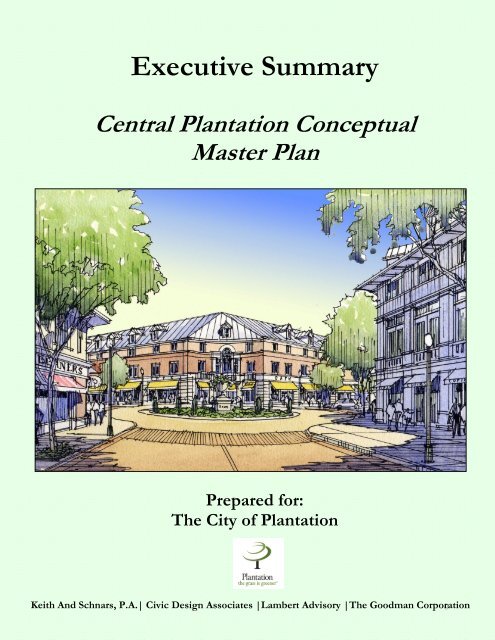
<strong>Executive</strong> <strong>Summary</strong><br />
Central <strong>Plantation</strong> Conceptual<br />
Master Plan<br />
Prepared for:<br />
The <strong>City</strong> <strong>of</strong> <strong>Plantation</strong><br />
Keith And Schnars, P.A.| Civic Design Associates |Lambert Advisory |The Goodman Corporation 0
Central <strong>Plantation</strong> Conceptual Master Plan<br />
Central <strong>Plantation</strong> (the District) has reached a point in<br />
its development such that the <strong>City</strong> <strong>of</strong> <strong>Plantation</strong> is now<br />
planning for revitalization and new economic<br />
development opportunities for the area. The <strong>City</strong> has<br />
initiated this process by having the Keith and Schnars,<br />
P.A. consultant team prepare a Conceptual Master Plan.<br />
Location<br />
Central <strong>Plantation</strong> is framed between University Drive<br />
on the east, Pine Island Road on the west and Cleary<br />
Boulevard and Interstate I-595 (I-595) on the north and<br />
south, respectively. Central <strong>Plantation</strong> encompasses<br />
approximately 860 acres and measures approximately ¾<br />
mile from east to west and two miles from the north to<br />
south.<br />
Purpose <strong>of</strong> Plan<br />
The purpose <strong>of</strong> the Central <strong>Plantation</strong> Conceptual Master<br />
Plan is to provide the <strong>City</strong> <strong>of</strong> <strong>Plantation</strong> with a vision<br />
and strategies to guide economic revitalization efforts,<br />
urban design, public improvements, transportation<br />
systems, and other development activities for years to<br />
come in the District.<br />
This project involved a comprehensive approach by<br />
defining the District’s existing conditions, constraints,<br />
and potential opportunities. With an understanding <strong>of</strong><br />
the District’s needs, the Master Plan has been designed<br />
to foster economic sustainability and enhance mobility<br />
through the transformation <strong>of</strong> the District’s suburban<br />
development pattern to a new urban form and character.<br />
The sections presented with this <strong>Executive</strong> <strong>Summary</strong><br />
and within the Conceptual Master Plan include:<br />
• Existing Development Patterns<br />
• Market Analysis and Conditions<br />
• Development Potential and Development Program<br />
• Conceptual Master Plan<br />
• Sub-District and Prototype Site Plans<br />
• Mobility and Transit<br />
• Capital Improvements<br />
• Plan Implementation<br />
This report is intended to provide a summary <strong>of</strong> the<br />
findings and recommendations resulting from the Central<br />
<strong>Plantation</strong> Conceptual Master Plan project.<br />
2002 Aerial Photo <strong>of</strong> Central <strong>Plantation</strong><br />
Keith And Schnars, P.A. | Civic Design Associates | Lambert Advisory| The Goodman Corporation 1
I. Existing Development Patterns<br />
Central <strong>Plantation</strong>’s development patterns can be<br />
generally characterized as typical suburban<br />
development. These existing physical conditions<br />
present many opportunities for sustainable<br />
improvements in the future. The following is a<br />
summary <strong>of</strong> the District’s opportunities and<br />
constraints.<br />
Opportunities:<br />
• District has market and physical potential to<br />
provide redevelopment, infill, and economic<br />
development opportunities.<br />
• Existing corporate <strong>of</strong>fices and national<br />
retailers provide a stable economic<br />
foundation.<br />
• Large parking areas, private roadways, and<br />
wide public roadways can facilitate mixed<br />
modes <strong>of</strong> transportation and streetscape<br />
amenities.<br />
• Large corporate <strong>of</strong>fices provide good base for<br />
regional transit ridership.<br />
• Pine Island Park can become a civic/urban<br />
open space.<br />
• Central Broward location has good access to<br />
regional transportation.<br />
• Super blocks reduce need for land assembly.<br />
• Quality and stable neighborhoods in the <strong>City</strong><br />
attract quality businesses.<br />
• Large parking lots provide excellent infill<br />
development opportunities.<br />
• <strong>City</strong> is active in promoting planned economic<br />
development and has established a<br />
Development District.<br />
Constraints:<br />
• Lack <strong>of</strong> central place and public spaces.<br />
• Large super blocks with no organizing street<br />
grid.<br />
• Segregated land uses with limited residential<br />
development.<br />
• No entrance or defining features to the<br />
District.<br />
• Streetscape is not articulated and lacks<br />
amenities.<br />
• Mobility is dependent upon the arterial system<br />
and automobiles.<br />
• Lack <strong>of</strong> continuous and connecting streets.<br />
• Poor interconnectivity between buildings and<br />
sites.<br />
Existing Land Use Map<br />
Keith And Schnars, P.A. | Civic Design Associates | Lambert Advisory| The Goodman Corporation 2
II. Market Analysis and Conditions<br />
Central <strong>Plantation</strong>’s solid economic foundation, geographic location, and historic trends in the local real estate<br />
market indicate there is a strong opportunity for future growth and development. Central <strong>Plantation</strong> exhibits strong<br />
market dynamics and trends, which enhances the Districts ability to capture or recapture demand for retail, <strong>of</strong>fice,<br />
and residential markets. In addition, the District’s market dynamics and trends will only strengthen as a result <strong>of</strong> the<br />
Conceptual Master Plan. The following is a summary <strong>of</strong> the critical economic indictors and real estate market<br />
trends for the District, <strong>City</strong> <strong>of</strong> <strong>Plantation</strong>, and Broward County using the available data.<br />
Economic Overview<br />
• Population: The <strong>City</strong>’s population as a whole is 83,000<br />
people. The District’s population is 1,600 people.<br />
• Population Growth: The <strong>City</strong>’s current annual<br />
population growth is 2.2% (County’s 2.6%) and is<br />
expected to grow at a rate <strong>of</strong> 2.4% in the future.<br />
• Employment Base: The District’s current employment<br />
base equals 20,500 + employees.<br />
• Employment Growth: The <strong>City</strong>’s 10-year employment<br />
growth rate has been close to 3.1% and is expected to<br />
grow at a rate <strong>of</strong> 2.1% in the next ten years.<br />
• Median Household Income: The <strong>City</strong>’s median<br />
household income is $54,000 ($42k for the County).<br />
• Average/Median Home Price: The average home price<br />
surrounding the Central <strong>Plantation</strong> area has increased 20%<br />
from 1999-2001 and the median home price is estimated<br />
to be $200,000 (County’s average home price $168,000).<br />
$60,000<br />
$50,000<br />
$40,000<br />
$30,000<br />
$20,000<br />
$10,000<br />
$0<br />
1990 & 2000 Median Household Income<br />
$41,832<br />
1990 Median HH<br />
Income<br />
<strong>City</strong> <strong>of</strong> <strong>Plantation</strong><br />
$30,571<br />
$53,574<br />
2000 Median HH<br />
Income<br />
Broward County<br />
$41,691<br />
Real Estate Market Overview<br />
• Vacant Land Values: The current vacant land values are estimated at $10-$18 per sq. ft.<br />
• Retail: There is no new net demand for significant retail in the foreseeable future, but there are opportunities<br />
for redeveloping existing retail into lifestyle retailers and “MainStreet’ storefronts. The existing retail occupancy<br />
rates are at 85%. In the next five years, the retail rents are estimated to be $25-$35 per sq. ft. (assuming this<br />
space is designed according to the standards set forth in the Conceptual Master Plan).<br />
• Office: The <strong>City</strong>’s <strong>of</strong>fice market comprises over 4.5 million sq. ft. <strong>of</strong> space and is one <strong>of</strong> the largest/strongest<br />
<strong>of</strong>fice submarkets in the County with an occupancy rate <strong>of</strong> 92%. The District alone comprises 3.0 million sq. ft.<br />
<strong>of</strong> space, nearly 2/3 <strong>of</strong> which is Class A <strong>of</strong>fice, and the occupancy rate is 91%. In the next five years, the <strong>of</strong>fice<br />
rents are estimated to be $20-$23 per sq. ft. (gross). Within ten years, it is estimated that the <strong>of</strong>fice market will<br />
have the ability to absorb an additional 750,000 sq. ft. <strong>of</strong> Class A/B+ <strong>of</strong>fice space.<br />
• For-Sale Residential: The <strong>City</strong>’s central area median home values are approaching $200,000. In the next five<br />
years, the for-sale prices are estimated to be on average $180,000-$225,000. Within ten years, it is estimated that<br />
the for-sale market will have the ability to absorb an additional 950 units.<br />
• For-Rent Residential: The <strong>City</strong>’s rental apartment market remains strong and is expected to continue<br />
strengthening during the next few years. In the next five years, the average rent prices are estimated to be<br />
between $1,000-$1,200. Within ten years, it is estimated that the rental market in the District will have the<br />
ability to absorb an additional 1,050 units.<br />
• Hotel: The District has approximately 1,500+ total hotel rooms. In the next ten years, it is estimated that the<br />
hotel market will have the ability to absorb an additional 400 mid-level hotel rooms.<br />
Keith And Schnars, P.A. | Civic Design Associates | Lambert Advisory| The Goodman Corporation 3
III. Development Potential and Development Program<br />
Existing development patterns, architectural styles,<br />
building conditions, and land uses (in conjunction with<br />
market forces) are factors that provide insight to the<br />
development potential in the Central <strong>Plantation</strong> area.<br />
An evaluation <strong>of</strong> the existing conditions found that<br />
approximately 279 acres <strong>of</strong> the 860 acres in the<br />
District could be redeveloped during the next 20 years.<br />
The market conditions and development timing for<br />
the 279 developable acres <strong>of</strong> land includes:<br />
Immediate Development Opportunities<br />
Undeveloped land where there has not been a building<br />
permit issued for development is available for<br />
immediate development (approximately 41 acres).<br />
Near Term Redevelopment Opportunities<br />
Due to market conditions, and/or obsolete or<br />
deteriorated buildings and site conditions, and/or site<br />
demand, redevelopment <strong>of</strong> this property is likely to<br />
occur in the next ten year period (approximately 136<br />
acres).<br />
Long Term Redevelopment Opportunities<br />
Current market and physical conditions are healthy<br />
enough such that additional time will be needed to<br />
increase the need for redevelopment. Redevelopment<br />
is likely to occur during the 10-20 year time frame<br />
(approximately 66 acres).<br />
Infill Opportunities<br />
Properties where owner/tenant needs and/or<br />
locational advantages may be the critical factors for<br />
redevelopment. No specific timing for redevelopment<br />
is predicted (approximately 36 acres).<br />
The remaining 581 acres in the District are considered<br />
to be in sustainable physical and market conditions.<br />
Development Program<br />
Based on the District’s market analysis and<br />
development potential a strategic development<br />
program has been outlined. The planned development<br />
program is separated into three time phases and four<br />
land use categories, all <strong>of</strong> which correspond with the<br />
Conceptual Master Plan and the Transit Plans.<br />
The four land uses are Residential, Office,<br />
Commercial, and Hotel. The table to the right<br />
describes the future development program with<br />
development intensities and densities.<br />
Planning<br />
Phase<br />
Development Potential Map<br />
<strong>Summary</strong> <strong>of</strong> CPDD Development Program<br />
Residential Office Commercial<br />
(D.U.) (S.F.) (S.F.)<br />
Hotel<br />
(Rooms)<br />
2002 985 3,600,000 2,800,000 1,250<br />
Phase I<br />
2003-2007<br />
1,935 3,850,000 2,800,000 1,400<br />
Phase II<br />
2008-2012<br />
2,985 4,350,000 2,950,000 1,650<br />
Phase III<br />
2013-2025<br />
3,995 5,400,000 3,200,000 1,800<br />
Increase<br />
from 2002<br />
3,010 1,800,000 400,000 550<br />
% Increase 306% 50% 14.30% 44%<br />
Note: The numbers shown are cumulative totals using 2002 as the base year.<br />
Keith And Schnars, P.A. | Civic Design Associates | Lambert Advisory| The Goodman Corporation 4
IV. Conceptual Master Plan<br />
The Conceptual Master Plan is delineated into three continuous<br />
phases, Phase I: 2003-2007, Phase II: 2008-2012, and Phase III:<br />
2013-2025.<br />
Each phase includes public and private investments that are critical<br />
in the timing and development <strong>of</strong> the future land use, street<br />
network, mobility/transit, public open space, parks and plazas,<br />
redevelopment opportunities, building typologies and locations.<br />
The following is a list <strong>of</strong> the guiding and defining principals that<br />
are used to meet the objectives <strong>of</strong>:<br />
Land Use and Urban Design<br />
• Land uses will be tightly integrated within an urbanized, mixeduse<br />
development pattern.<br />
• Development will cluster around several key nodes that will<br />
form the centers <strong>of</strong> distinct Sub-Districts.<br />
• Park and civic activities will take place in various plaza and<br />
urban open space venues.<br />
• New residential development will increase the supply and type<br />
<strong>of</strong> dwelling units in Central <strong>Plantation</strong>.<br />
• Streetscapes will be enhanced with building placement along<br />
the street, wide sidewalks, on-street parking, and landscaping.<br />
Economic Development<br />
• Redevelopment and infill development will be used to increase<br />
the variety <strong>of</strong> business activities and to provide sustainable<br />
economic development.<br />
• Commercial/retail venues will evolve as mixed-use,<br />
“MainStreet” environments.<br />
• New uses and infrastructure will enhance the area’s<br />
opportunities and prominence as a major regional <strong>of</strong>fice<br />
center.<br />
Transportation and Mobility<br />
• Transportation and mobility will involve a multi-modal<br />
approach that is less dependent on the automobile.<br />
• Traffic circulation will be improved with the development <strong>of</strong> a<br />
modified grid street network and a new internal North South<br />
(N/S) roadway.<br />
• Land uses and streets will be integrated to facilitate pedestrian<br />
activity and local/regional transit systems.<br />
Finance and Implementation<br />
• Development District revenues will be utilized to maximize<br />
grant opportunities and to encourage planned private<br />
development.<br />
• Implementation <strong>of</strong> the Conceptual Master Plan will involve key<br />
investment programs by the <strong>City</strong>, development community,<br />
and grant agencies in a coordinated and cooperative manner.<br />
• New development regulations, Capital Improvements Plans<br />
(CIP) and transit programs for the District will be needed to<br />
implement the Plan.<br />
Phase I: 2003-2007<br />
Planned Growth:<br />
• Residential: 950<br />
additional dwelling<br />
units<br />
• Office: 250,000 s.f. <strong>of</strong><br />
additional development<br />
• Commercial:<br />
Redevelopment and<br />
reconfiguration <strong>of</strong><br />
existing properties<br />
Phase II: 2008-2012<br />
Planned Growth:<br />
• Residential: 1,050<br />
additional dwelling<br />
units<br />
• Office: 500,000 s.f. <strong>of</strong><br />
additional development<br />
• Commercial: 150,000<br />
s.f. <strong>of</strong> additional<br />
development<br />
Phase III: 2013-2025<br />
Planned Growth:<br />
• Residential: 1,010<br />
additional dwelling<br />
units<br />
• Office: 1,050,000 s.f. <strong>of</strong><br />
additional development<br />
• Commercial: 250,000<br />
s.f. <strong>of</strong> additional<br />
development<br />
Keith And Schnars, P.A. | Civic Design Associates | Lambert Advisory| The Goodman Corporation 5
V. Sub-District and Prototype Site Plans<br />
Sub-Districts and Prototype Site Plans are provided to graphically present more specific concepts to guide the <strong>City</strong><br />
during the implementation <strong>of</strong> the Conceptual Master Plan. There are five proposed Sub-Districts, each <strong>of</strong> which<br />
incorporates economic development, quality urban design and improved mobility. Each Sub-District focuses on a<br />
geographic area with specific planning concepts. These concepts are further defined, quantified and illustrated with<br />
Prototype Site Plans. The Prototype Site Plans describe land uses, planned growth, site and building concepts, and<br />
infrastructure and redevelopment strategies.<br />
North Village: The North Village<br />
centers around the areas near the<br />
intersection <strong>of</strong> American<br />
Expressway and NW 82 nd Ave.<br />
Town Center North: The Town<br />
Center North includes the areas<br />
north <strong>of</strong> Broward Blvd. and<br />
primarily involves the two major<br />
properties, the Westside Regional<br />
Medical Center and the Fashion<br />
Mall.<br />
North Village<br />
Town Center North<br />
Town Center South: The Town<br />
Center South includes the areas<br />
south <strong>of</strong> Broward Blvd., which<br />
contain the Broward Mall and<br />
Pine Island Park.<br />
South Village: The South Village<br />
centers around the redevelopment<br />
<strong>of</strong> the existing Fountains<br />
shopping center and adjacent<br />
properties.<br />
Town Center South<br />
South Village<br />
South Business District: The<br />
South Business District includes<br />
the areas south <strong>of</strong> Peters Rd.<br />
down to I-595 and includes a<br />
regional transit center.<br />
South Business District<br />
Sub-Districts Map<br />
Keith And Schnars, P.A. | Civic Design Associates | Lambert Advisory| The Goodman Corporation 6
V. Sub-District and Prototype Site Plans Continued<br />
The following is a summary <strong>of</strong> the enhancements and<br />
improvements that are included within each Sub-District.<br />
The North Village<br />
• New mixed-use developments at American Expressway and<br />
NW 82 nd Ave.<br />
• Formalization <strong>of</strong> an enhanced and extended street network<br />
with American Expressway and NW 5 th Street.<br />
• Redevelopment <strong>of</strong> residential properties to include new<br />
townhouses and condominiums.<br />
• Roundabout at intersection <strong>of</strong> American Expressway and NW<br />
82 nd Ave.<br />
The Town Center North and South<br />
• Improvements to Pine Island Park to create civic/activity<br />
center.<br />
• Formalization <strong>of</strong> an enhanced and extended street network<br />
with NW 82 nd Ave., Federated Rd., and NW 78 th Ave.<br />
• Reconfiguration and improved connections between the<br />
Fashion Mall and Broward Mall through enhanced pedestrian<br />
activity.<br />
• Creation <strong>of</strong> a “MainStreet” environment at Broward Mall with<br />
surrounding streets lined with storefronts and outdoor plazas.<br />
• Renovation/expansion/use diversification <strong>of</strong> the Fashion Mall.<br />
• North Village pedestrian/greenway connecting east and west.<br />
• Expansion and enhancement <strong>of</strong> institutional uses such as The<br />
Broward County Library, Westside Regional Hospital, and<br />
Broward County Transit (BCT) West Terminal site.<br />
The South Village<br />
• Redevelopment to include mixed-use with residential, retail,<br />
and <strong>of</strong>fice spaces.<br />
• Esplanade concept at The Fountains with water features,<br />
pedestrian orientation, and street level storefronts.<br />
• Thematic development that includes live/work space in l<strong>of</strong>t<br />
style apartments and lifestyle retail uses.<br />
• Reconfiguration <strong>of</strong> SW 78 th Ave. to enhance the street<br />
network.<br />
• Enhancement <strong>of</strong> SW 6 th St. from University Dr. to Pine Island<br />
Rd. to include streetscaping/landscaping amenities.<br />
• Enhancement <strong>of</strong> the lakeside to include a promenade with a<br />
boardwalk and additional open space.<br />
Town Center North at Broward Blvd<br />
Pine Island Park Amphitheater at Town Center South<br />
Bricktown Concept at the South Village<br />
The South Business District<br />
• Regional transit center at I-595 to enhance transit and mobility.<br />
• Enhance and extend street network with enhancements along<br />
Peters Rd., SW 82 nd Ave. extension, and South Transit Rd. to<br />
provide access to the regional transit center at I-595.<br />
• Redevelopment <strong>of</strong> the residential site to include transitoriented<br />
development that includes <strong>of</strong>fice, service retail,<br />
residential, and a transit center.<br />
The Regional Transit Center at I-595<br />
Keith And Schnars, P.A. | Civic Design Associates | Lambert Advisory| The Goodman Corporation 7
VI. Mobility and Transit<br />
A multi-modal approach to improve mobility in the<br />
District is planned. This approach is intended to<br />
improve traffic circulation, encourage pedestrian<br />
activities, reduce dependence on automobiles and<br />
provide alternate modes <strong>of</strong> transportation. This<br />
multi-modal approach includes:<br />
• Pedestrian oriented land uses and<br />
streetscapes.<br />
• Greenway paths throughout the District for<br />
pedestrians and bicycles.<br />
• A modified grid street network to improve<br />
traffic circulation.<br />
• Transportation demand practices to<br />
encourage the use <strong>of</strong> carpools and transit.<br />
• Local and regional transit facilities and<br />
service.<br />
The local component <strong>of</strong> the transit element involves<br />
a circulator system within the District. The regional<br />
transit component plans for a premium (high<br />
capacity, light rail or bus rapid transit) system routed<br />
along the I-595 corridor.<br />
The implementation <strong>of</strong> the local transit service will<br />
be coordinated with the development <strong>of</strong> the<br />
improved internal roadway and route structure,<br />
transit oriented development, connections to the I-<br />
595 regional transit system, and ridership. It is<br />
anticipated that with these factors in play, the<br />
funding resources necessary to implement the transit<br />
facilities and services will be borne primarily by<br />
applicable grant agencies. The regional transit<br />
system will be planned and implemented by<br />
Regional, State and Federal transit agencies.<br />
There are three planning phases for local transit that<br />
correspond with the Conceptual Master Plan<br />
development phases. These phases include: Transit<br />
Demonstration Project Phase I: 2003-2007, Transit<br />
Plan Phase II: 2008-2012, and Transit Plan Phase<br />
III: 2013-2025.<br />
Phase I and II Transit Plan<br />
Phase I: Transit Demonstration Project<br />
The Phase I Transit Demonstration project is<br />
intended to test the demand and technology for a<br />
local transit circulator within Central <strong>Plantation</strong>.<br />
The routes identified for the demonstration project<br />
link large employers, regional shopping centers,<br />
institutional uses and Broward County Transit.<br />
Enhanced 2-Lane<br />
Roadway with Transit<br />
Keith And Schnars, P.A. | Civic Design Associates | Lambert Advisory| The Goodman Corporation 8
VI. Mobility and Transit (Continued)<br />
Phase II: Local Transit Plan<br />
The second phase <strong>of</strong> the local transit plan will<br />
expand the demonstration project routes and<br />
provide an overall transit circulator system to<br />
service the District. The planned routes and<br />
transit stops will provide efficient and timely<br />
service for commuter and local riders. The<br />
routes include stops that connect the largest<br />
employers and businesses in the District with<br />
vital connections to future regional transit<br />
linkages.<br />
Phasing the transit plans will enable the <strong>City</strong><br />
to participate in future transit grant<br />
opportunities. A coordinated and cooperative<br />
effort between the <strong>City</strong> and development<br />
community will produce the necessary<br />
roadway improvements for the transit routes<br />
and increased economic development that will<br />
generate increased transit ridership.<br />
Phase III: Local Transit Plan<br />
The Phase III transit service will expand the<br />
local circulator routes and connect to a<br />
premium east-west regional transit service<br />
along I-595. The regional transit system will<br />
provide significant commuter service for<br />
employees in the District. The commuters<br />
will in turn utilize the expanded local transit<br />
circulator system to efficiently access<br />
businesses and destinations in the District.<br />
An important component <strong>of</strong> the District’s<br />
new transit facilities will be a regional transit<br />
center at I-595. This center will incorporate a<br />
transit oriented development that will include<br />
businesses, <strong>of</strong>fices and residences.<br />
Phase III Transit Plan with Regional Service at I-595<br />
Regional Transit Center at I-595<br />
Keith And Schnars, P.A. | Civic Design Associates | Lambert Advisory| The Goodman Corporation 9
VI. Mobility and Transit (Continued)<br />
Vehicle Technology<br />
There are various types <strong>of</strong> transit vehicles and<br />
technologies that can be considered by the <strong>City</strong> and<br />
transit agencies for the local circulator system. The<br />
actual selection <strong>of</strong> a vehicle and technology will be made<br />
with more specific evaluation at the time <strong>of</strong> the planned<br />
implementation. The preferred vehicle type is a<br />
modified rubber tire vehicle (examples are shown on the<br />
right). Some <strong>of</strong> the unique attributes <strong>of</strong> the preferred<br />
vehicle type and technology should include:<br />
• Seating Capacity – A manageable/efficient vehicle<br />
size <strong>of</strong> 30 to 45 seats/vehicles.<br />
• Environmental Factors – Electric powered,<br />
alternative fuels, and hybrid vehicles provide lower<br />
emissions and greater fuel efficiency.<br />
Modified Rubber Tire Vehicle<br />
• Comfort and Ease <strong>of</strong> Use – Low step boarding,<br />
wide entrances and seating dimensions with a<br />
climate controlled environment.<br />
• Circulation and Distribution Capability – Designed<br />
for shuttle service on roadways in urbanized areas<br />
without requiring special guide ways.<br />
• Reliability – Vehicle technologies should have an<br />
acceptable history <strong>of</strong> providing reliable service in<br />
several urban settings.<br />
Intelligent Transportation Vehicle<br />
• Roadway Impacts – Minimal need to alter roadways,<br />
acquire property, or modify street frontage.<br />
• Aesthetics/Attractiveness – The appearance <strong>of</strong> the<br />
vehicle should enhance the service area and be<br />
attractive for both users and non-users.<br />
Street Network and Traffic Circulation<br />
The Street Network currently relies on the arterial<br />
roadway system for traffic circulation and parking lot<br />
driveways for connectivity. The Conceptual Master Plan<br />
identifies various new streets, street extensions, and<br />
roadway enhancements to improve traffic circulation,<br />
connectivity, and pedestrian activities. The development<br />
<strong>of</strong> these streets will also provide on-street parking,<br />
transit routes, and redevelopment opportunities.<br />
Future Street Network Map<br />
Keith And Schnars, P.A. | Civic Design Associates | Lambert Advisory| The Goodman Corporation 10
VII. Capital Improvements<br />
The Conceptual Master Plan includes four different types <strong>of</strong> capital improvements. They include: Street<br />
Improvements and or Enhancements, Greenway Projects, Public Parks and Plaza Projects, and Transit Related<br />
Projects. Implementation <strong>of</strong> the capital improvements will occur in a coordinated and cooperative approach<br />
between the <strong>City</strong>, private developers, and other public agencies. The following is a summary <strong>of</strong> the capital<br />
improvements as presented in the Capital Improvement Plan (CIP).<br />
Street Improvements and/or Enhancements: streets<br />
lined with lighting, bench seating, brick paver crosswalks,<br />
large sidewalks, trees, on-street parking, and landscaping.<br />
• American Expy/NW 82 nd Ave Improvements (ST 01).<br />
• NW 5 th St Extension (ST 02).<br />
• North/South Perimeter Rd (ST 03).<br />
• Broward Mall/Perimeter Dr/Federated Rd (ST 04).<br />
• SW 82 nd Ave Extension (ST 05).<br />
• SW 78 th Ave Improvements (ST 06).<br />
• SW 78 th Ave Realignment (ST 07).<br />
• SW 17 th St Extension (ST 08).<br />
• SW 6 th St Enhancements (ST 09).<br />
• Fountains East-West Roadway (ST 10).<br />
• District Gateways/Way Finding Signage (ST 11). *<br />
• NW/SW 84 th Ave Improvements (ST 12).<br />
Greenway Projects: multi-use enhanced paths connecting<br />
the Sub-Districts and other adjacent developments.<br />
• E/W Greenway from Library to Univ. Dr. (GW 01).<br />
• Broward Blvd Greenway (GW 02).<br />
• Other Greenway Connectors (GW 03 – Not<br />
specifically shown).<br />
Public Parks and Plaza Projects: an amphitheater,<br />
plazas and landscaped pocket parks, fountains, public art,<br />
and a lakeside promenade.<br />
• Public Squares at Broward Mall/SW 82 nd Ave (PK 01).<br />
• Pine Island Park Improvements (PK 02).<br />
• Lakeside Promenade (PK 03).<br />
Transit Related Projects: transit routes, transit vehicles,<br />
and transit centers.<br />
• Broward County Transit Center (TR 01).<br />
• Regional Multi-Modal Transit Center (TR 02).<br />
• Transit Routes/Vehicles for the Local Circulator (TR<br />
03 – Not specifically shown).<br />
Capital Improvement Map (CIP)<br />
The CIP envisions a balanced District budget as a result <strong>of</strong><br />
a multi-funding strategy. This strategy includes funds from<br />
District revenues, the private sector, and other public<br />
agencies. As the implementation <strong>of</strong> the project<br />
approaches, more detailed project costs will need to be<br />
assessed and evaluated.<br />
Keith And Schnars, P.A. | Civic Design Associates | Lambert Advisory| The Goodman Corporation 11
VIII. Plan Implementation<br />
Implementation <strong>of</strong> the plan utilizes a multi-faceted approach <strong>of</strong> regulatory incentives, design guidelines, revenue<br />
enhancements, public improvements and working in cooperation with the private sector to maximize public and<br />
private investments. The following is a list <strong>of</strong> projects and programs that are recommended for implementation by<br />
the Conceptual Master Plan. A schedule for the implementation activities is described on the proceeding page.<br />
Land Use<br />
Adopt amendments to the Future Land Use Plan that<br />
will provide new opportunities for redevelopment,<br />
mixed-use, housing and infill.<br />
• Utilize the Broward County Planning Council’s<br />
Residential Flexibility Rules to increase residential<br />
capacity.<br />
• Designate the District as a Regional Activity<br />
Center (RAC) to allow for planned uses and<br />
densities.<br />
Zoning<br />
Revise the Zoning regulations to guide planned<br />
development.<br />
• Create Overlay Zones to implement the concepts<br />
for the Sub-Districts.<br />
• Allow mixed-use and increase residential density<br />
from 25 to 40 dwelling units per acre.<br />
Urban Design<br />
Adopt new design guidelines to promote urban form<br />
and streetscapes.<br />
• Define planned building types, scale, massing and<br />
placement.<br />
• Establish urban streetscape standards.<br />
Transportation Concurrency<br />
Pursue an approach to obtain District-wide<br />
transportation concurrency approval from Broward<br />
County.<br />
• Preserve the remaining development rights<br />
vested by the Gulfstream DRI for the District.<br />
• Adopt a Transit-based Action Plan that uses a<br />
multi-modal approach to traffic mitigation.<br />
Capital Projects<br />
Prepare and implement a CIP for the District that will<br />
promote planned private development and economic<br />
opportunities.<br />
• Establish urban standards for streets and public<br />
spaces.<br />
• Prioritize street enhancement, connection and<br />
extension projects.<br />
Capital Projects (Continued)<br />
• Create public parks and plazas incorporated with<br />
public and private developments.<br />
• Include urban street enhancements with roadway<br />
improvements.<br />
CIP Funding<br />
Pursue a balanced funding strategy to share CIP costs<br />
with grant agencies and land developers.<br />
• Include the main internal N/S roadway and<br />
transit improvements in the MPO TIP.<br />
• Leverage District revenues with grants and<br />
private development.<br />
• Secure a “Letter <strong>of</strong> No Prejudice” (LONP) to<br />
leverage public improvements with transit grants.<br />
• Adopt a “Payment-in-Lieu-<strong>of</strong>-Parking” fee and a<br />
District-wide impact fee to augment District<br />
revenues and grants.<br />
Transit and Mobility<br />
Support local and regional transit planning, facilities<br />
and services.<br />
• Plan for a premium regional transit facility and<br />
service along I-595.<br />
• Provide a local transit circulator system that<br />
connects to regional transit systems.<br />
• Prioritize the development <strong>of</strong> the main internal<br />
N/S roadway to facilitate transit, improved<br />
circulation and pedestrian streetscape.<br />
• Encourage transit-oriented development and<br />
support Transportation Demand Management<br />
(TDM) practices.<br />
• Consider a local circulator demonstration project<br />
to test transit connectivity and technologies.<br />
• Plan for pedestrian friendly streets and on-street<br />
parking.<br />
• Plan for congestion management improvements<br />
at arterial intersections.<br />
• Plan for the upgrade and relocation <strong>of</strong> the<br />
Westside BCT terminal.<br />
Keith And Schnars, P.A. | Civic Design Associates | Lambert Advisory| The Goodman Corporation 12
Central <strong>Plantation</strong> Conceptual Master Plan Implementation Schedule for Public Projects and Programs<br />
The development <strong>of</strong> the<br />
Conceptual Master Plan is<br />
expected to occur over a 25-<br />
year period. The initial years <strong>of</strong><br />
plan implementation will focus<br />
on regulatory changes, grant<br />
applications and administration,<br />
and capital programs. The<br />
subsequent years will be<br />
dedicated to implementation <strong>of</strong><br />
these projects and programs.<br />
The Implementation Schedule<br />
contains a list <strong>of</strong> strategically<br />
planned public improvements<br />
and regulatory projects that are<br />
vital to the success <strong>of</strong> the<br />
Conceptual Master Plan. The<br />
<strong>City</strong> is primarily responsible for<br />
initiating and implementing the<br />
regulatory and CIP projects.<br />
Year 2003<br />
Year 2004<br />
Year 2005<br />
Year 2006<br />
Revise policies/<br />
codes to allow the<br />
use <strong>of</strong> residential<br />
flex units<br />
Adopt district-wide<br />
impact fee and<br />
“payment-in-lieu <strong>of</strong><br />
parking” programs<br />
RAC Future Land<br />
Use Plan<br />
Amendment<br />
Revise zoning code to allow<br />
for mixed-use developments<br />
and increased residential<br />
density<br />
Adopt urban design<br />
guidelines for subdistricts<br />
Adopt<br />
subdistrict<br />
overlay<br />
zone<br />
concepts<br />
Adopt<br />
greenways plan<br />
Adopt<br />
CIP for<br />
District<br />
Prepare corridor<br />
action plan for<br />
the internal N/S<br />
roadway - N.W.<br />
78 th Avenue<br />
Build gateways<br />
and way finding<br />
signage<br />
Design / build<br />
lakeside promenade<br />
Adopt<br />
future<br />
roadway<br />
plan<br />
Establish<br />
design<br />
standards for<br />
street sections<br />
and<br />
Design / build<br />
Pine Island<br />
Park<br />
amphitheatre<br />
and park<br />
improvement<br />
Plan/<br />
Design<br />
gateway<br />
and way<br />
finding<br />
signage<br />
Adopt<br />
TDM<br />
ordinances<br />
Obtain<br />
Districtwide<br />
transportation<br />
concurrency<br />
Submit grant<br />
applications for<br />
expanded local<br />
transit system<br />
Secure<br />
LONP<br />
Submit grant<br />
applications for<br />
transit<br />
demonstration<br />
project<br />
Local Transit<br />
Demonstration<br />
Project<br />
The development community<br />
and transit agencies are<br />
significant contributors to the<br />
transit infrastructure elements<br />
<strong>of</strong> the Plan. Therefore, the<br />
timing <strong>of</strong> these components<br />
may vary depending upon<br />
coordination and participation<br />
<strong>of</strong> each key role player. The<br />
<strong>City</strong>’s most immediate and<br />
significant influence will be the<br />
planning, regulatory, and capital<br />
elements <strong>of</strong> the plan.<br />
Year 2008<br />
Year 2010<br />
Year 2012<br />
Year 2014<br />
Year 2016<br />
Year 2020<br />
Year 2025<br />
Relocate and<br />
update BCT<br />
Center<br />
Expand<br />
local transit<br />
circulator<br />
service<br />
Premium<br />
regional transit<br />
service on<br />
I-595<br />
Legend<br />
Regulatory<br />
CIP<br />
Transit<br />
Transit center<br />
at I -595<br />
Keith And Schnars, P.A. | Civic Design Associates | Lambert Advisory| The Goodman Corporation 13
Central <strong>Plantation</strong> Conceptual Master Plan<br />
Project Goals<br />
• Develop a Conceptual Master Plan that reflects the<br />
vision and ideas <strong>of</strong> the citizens, community leaders<br />
and <strong>City</strong> <strong>of</strong>ficials.<br />
• Improve the transportation system to reduce traffic<br />
congestion, improve circulation, and provide alternate<br />
modes <strong>of</strong> transportation through a multi-modal<br />
approach.<br />
• Create vital transportation linkages within the area and<br />
to other parts <strong>of</strong> the <strong>City</strong> and County.<br />
• Plan for a sustainable mix <strong>of</strong> uses, businesses,<br />
residences, public services, and activities to serve the<br />
area and the entire <strong>City</strong> <strong>of</strong> <strong>Plantation</strong>.<br />
• Define appropriate and desired building types and<br />
concepts for streetscapes, plazas, and public places to<br />
create pedestrian-oriented environments.<br />
• Provide the necessary infrastructure to encourage<br />
strategic economic development and revitalization in<br />
the area.<br />
• Provide a framework for the implementation <strong>of</strong> the<br />
Central <strong>Plantation</strong> Master Plan.<br />
Keith And Schnars, P.A. | Civic Design Associates | Lambert Advisory| The Goodman Corporation 0
ERROR: stackunderflow<br />
OFFENDING COMMAND: ~<br />
STACK: