Nicholas R. Steele - Pacific Lutheran University
Nicholas R. Steele - Pacific Lutheran University
Nicholas R. Steele - Pacific Lutheran University

You also want an ePaper? Increase the reach of your titles
YUMPU automatically turns print PDFs into web optimized ePapers that Google loves.
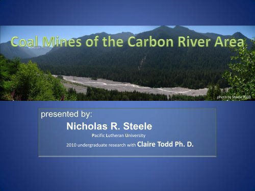
photo by <strong>Steele</strong> 2010<br />
presented by:<br />
<strong>Nicholas</strong> R. <strong>Steele</strong><br />
<strong>Pacific</strong> <strong>Lutheran</strong> <strong>University</strong><br />
2010 undergraduate research with Claire Todd Ph. D.
• Ask an original research question<br />
• Use skills gained from PLU education to<br />
answer this question<br />
• Share this information with others<br />
• Learn
165<br />
Carbon River<br />
5mi<br />
Maps created with ARC GIS
28 27<br />
Coke<br />
Ovens<br />
Wilkeson Creek<br />
165<br />
N<br />
Map from ARC GIS
Wilkeson Creek<br />
N<br />
Map P1 A - Schasse et al. 1994
Bunker house to<br />
load train cars<br />
Coke ovens<br />
http://www.wa-trust.org/mostendangered/current_photos.htm
photo by <strong>Steele</strong> 2010
photos by <strong>Steele</strong> 2010
• Relationship between PLU and Wilkeson<br />
• Develop ‘learning kit’<br />
• Future opportunities for PLU students:<br />
already have opportunities for Environmental Studies,<br />
Biology, Chemistry, Business, Education, Performing Arts,<br />
History, and other majors
This research was made possible by the generous contributions from the<br />
WIANCKO Charitable Foundation, thank you.<br />
I would also like to extend a sincere thanks to the many individuals who contributed<br />
to this project, especially Burt Gonzales and Mayor Donna Hogerhuis.<br />
Finally, thanks to Claire Todd Ph. D., Dr. Rebekah Mergenthal Ph. D., William Teska<br />
Ph. D.,<br />
and my fellow researchers Trevor Perkins, Matthew Hegland, Michael Vermeulen,<br />
and the PLU Environmental Studies Department.
Green, S.H. 1947, Coal and Coal Mining in Washington, Department of Conservation and Development, Division of Mines and Geology, Olympia State Printing Plant pp 34-37<br />
Gonzales, B (2010) personal interview, Wilkeson, July 7, 2010.<br />
Hall, N.I. (1986) South Willis, Carbon River Heritage, issue 2, monthly periodical published by Heritage Quest, pp 1-5.<br />
Hall, N.I. (1986) South Willis, How Coke is made, issue 2, monthly periodical published by Heritage Quest, pp 12.<br />
Hall, N.I. (1980) Carbonado Centennial 1880-1980 celebrated August 2 nd , 1980, pamphlet, PLU library NISQ<br />
899 C37 H35X 1980.<br />
Hall, N.I. (1980) Carbon River Coal Country, 227 Courier Herald Pub. Co. Enumclaw, WA.<br />
Kendra, W. (1987), Effects of infiltration and inflow on Wilkeson Wastewater Treatment Plant: findings of a limited class II inspection and receiving water survey, 18 pp., WA<br />
Ecology., Olympia, WA.<br />
Kombol, W (unk) Coal Mining in an east Pierce County area known as Pittsburg (1889-1909), Spiketon (1910-1916), and finally Morristown (1917-1927), Historylink.org, Essay<br />
8262, accessed Aug 13, 2010, http://www.historylink.org/index.cfm?DisplayPage=output.cfm&file_id=8262<br />
McBroom, M. (2004), Washington Undermined: the toxic legacy of abandoned metal mines in Washington State, 20 pp., Washington Private Interest Research Group<br />
Foundation, Seattle, WA.<br />
Martinson, A.D., 1966, Mount Rainier National Park: First Years: Forest History, Vol. 10, No. 3 (Oct. 1966), pp. 26-33<br />
Merryman, K. (2010), Endangered history: Wilkeson’s Coke Oven Park, The News Tribune<br />
Norman, D. K., 2000, Washington’s inactive and abandoned metal mine inventory and database: Washington Geology, v. 28, no. 1/2, p. 16-18.<br />
Pringle, P.T. (2008), Roadside Geology of Mount Rainier National Park and Vicinity, Information Circular 107, 190pp., Washington Division of Geology and Earth Resources,<br />
Olympia, WA.<br />
Schasse, H.W.; Koler, M.L.; Eberle, N.A.; Christie, R.A., 1994 The Washington Coal Mine Map Collection: A Catalog, Index, and User’s Guide. Washington Division of Geology<br />
and Earth Resources, Open File Report 94-7<br />
Thorson, G.W., 1961, Information Circular No. 35: Directory of Washington Mining Operation 1960: State of Washington, Department of Conservation, Division of Mines and<br />
Geology<br />
Thompson, E.N., 1981 (book) Mount Rainier National Park, Washington, historic resource study, National Park Service, U.S. Dept. of the Interior<br />
Valentine, G. M. (1960), Inventory of Washington Minerals Part I Second Edition - Nonmetallic Minerals, Volume I Text, Bulletin No. 37, 175 pp., WA Department of<br />
Conservation, Olympia, WA.<br />
Washington Geological Survey, Bulletin 23, 1921 pp 311-313<br />
Wolff, F. (2010) personal interview, Olympia, June 25, 2010
Burnett bridge looking south on<br />
HWY 165 over South Prairie Creek<br />
photo by <strong>Steele</strong> 2010
Burnett mines 1918. Taken before the bridge was<br />
built. Cars came out of the mine and across the<br />
gulch on the tracks<br />
A Pictorial History of Pierce County, Vol. II.
Foundations for former Burnett bridge leading to mine<br />
photosby <strong>Steele</strong> 2010
Lower Burnett, early 1900’s, the original town.<br />
A Pictorial History of Pierce County, Vol. II.
photos by <strong>Steele</strong> 2010
photos by <strong>Steele</strong> 2010<br />
A Pictorial History of<br />
Pierce County, Vol. II.
• What are the possibilities for these mining<br />
relics?
• Which plants are more adept at<br />
recolonizing the coal- rich mining wastes?<br />
• What are the larger implications ?<br />
photo by <strong>Steele</strong> 2010
Wilkeson mine area<br />
Primary mine entrance (bellow)<br />
flooded when beaver dam was<br />
constructed<br />
photos by <strong>Steele</strong> 2010
photos by <strong>Steele</strong> 2010<br />
Remnants in Wilkeson<br />
Creek in the vicinity<br />
of Wilkeson Mine
Example of standard slant of<br />
Puget Group deposits of the Eocene age<br />
50 to 60⁰<br />
photo by <strong>Steele</strong> 2010
410<br />
Buckley<br />
South<br />
Prairie<br />
Burnett<br />
Wilkeson<br />
† Pittsburg / Spiketon / Morristown<br />
† South Willis<br />
Puyallup River<br />
Carbonado<br />
(Carbondale)<br />
† Melmont<br />
† Montezuma<br />
† Fairfax<br />
† Manley-Moore<br />
165<br />
Carbon River<br />
161
South Willis<br />
photos by <strong>Steele</strong> 2010
Double Rainbow Lake<br />
(now known as Kepka Pond)<br />
Located 1.5 mi East/North-East of<br />
Wilkeson on Railroad Ave (Quinnon<br />
Ext. Rd.). Within the boundaries of<br />
Sunset Lake Camp*<br />
10 +/- Coal seams in Spiketon /<br />
South Willis area<br />
The mining operation which opened<br />
South Willis would continue on to<br />
establish Spiketon as well.<br />
N<br />
South Willis coke ovens<br />
* Visitors must request permission to access Sunset Lake Camp, (360) 829-0311
photo by <strong>Steele</strong> 2010<br />
South Willis coke ovens (1903), picture from North side
photos by <strong>Steele</strong> 2010<br />
South Willis coke ovens,<br />
picture from South side
photo by <strong>Steele</strong> 2010