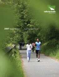
ILLINOIS' TUNNEL HILL STATE TRAIL
ILLINOIS' TUNNEL HILL STATE TRAIL
ILLINOIS' TUNNEL HILL STATE TRAIL

Create successful ePaper yourself
Turn your PDF publications into a flip-book with our unique Google optimized e-Paper software.
The Gem in<br />
Little Egypt: ILLINOIS’<br />
<strong>TUNNEL</strong> <strong>HILL</strong><br />
<strong>STATE</strong> <strong>TRAIL</strong><br />
I<br />
t feels a bit spooky as I straddle my touring bike,<br />
gazing at the entrance to the namesake passageway of<br />
the Tunnel Hill State Trail, a hidden gem in southern<br />
Illinois. On this mild, sunny afternoon in late<br />
November, roots dangle from the shale outside the<br />
opening on either side of the path, which is carpeted<br />
with russet leaves. Birds cry in the distance and water<br />
trickles musically off the rocks. I see the light at<br />
the other end of the 543-foot tunnel, but I’ve been<br />
warned that if you’re not careful you can get mesmerized<br />
when you’re pedaling through the darkness<br />
within, and crash into the walls.<br />
Most people think of the Land of Lincoln as<br />
Chicago skyscrapers plus pancake-flat prairie, but<br />
the southern end of the state is completely different.<br />
The region, nicknamed “Little Egypt” because it’s<br />
located at the delta of the Mississippi and Ohio rivers,<br />
is blanketed by the lush Shawnee National Forest<br />
and roller-coaster hills, which makes it a beautiful<br />
destination for bicycle travel. Down here the culture<br />
seems more Southern than Midwestern. Fried<br />
chicken and grits show up on breakfast menus, and<br />
the lilting speech of the friendly locals makes me feel<br />
like I’m in Kentucky, which is just across the Ohio,<br />
instead of in the same state as the Windy City.<br />
By John Greenfield<br />
8<br />
railstotrails ◆ spring/summer.13
Steep rock faces carved<br />
out by the early railway<br />
builders on either side<br />
of the tunnel now shade<br />
riders, hikers and joggers.<br />
The Tunnel Hill State Trail, a crushed<br />
limestone path, stretches 45 miles<br />
southwest from Harrisburg to Karnak,<br />
Ill., with an additional 2.5-mile spur<br />
to Cache River State Natural Area’s<br />
Barkhausen Wetlands Center. Another<br />
recently completed bike trail extends 7.5<br />
miles north form Harrisburg to Eldorado<br />
(pronounced “Eldoraydo”). The tunnel,<br />
located at the midway point of the<br />
main path, is literally and figuratively the<br />
highpoint. While Harrisburg is at 370<br />
feet above sea level and Karnak is at 340<br />
feet, the tunnel is at 680. There’s a barely<br />
noticeable uphill grade to the tunnel from<br />
each endpoint. Another attraction of the<br />
trail is its 23 trestles, ranging from 34 feet<br />
to 450 feet in length.<br />
Prairie flowers and grasses line the<br />
Tunnel Hill pathway, and a variety of<br />
trees—hickory, oak, cottonwood, tulip<br />
poplar and sweet gum—rustle in the<br />
breeze. Birds are plentiful and varied<br />
along the trail, ranging from doves, bluebirds,<br />
and white killdeer (a medium-size<br />
plover) to quail and wild turkey. You may<br />
see opossums, eastern cottontail rabbits,<br />
red foxes, and white-tailed deer too.<br />
The most picturesque section of the<br />
path, a 9.3-mile segment from the tunnel<br />
to the town of Vienna, crosses several<br />
other well known routes: the River-to-<br />
River hiking trail from the Mississippi<br />
to the Ohio; the American Discovery<br />
cross-county route; Adventure Cycling’s<br />
TransAmerica bike trail; and the Trail of<br />
Tears National Historic Route.<br />
“We’re very proud of the trail,” says<br />
Larry Mizell, one of its early boosters.<br />
“There’s a lot of diversity: flatlands to<br />
bluffs to swamps to creeks and a few<br />
lakes. The tunnel makes it spectacular.”<br />
railstotrails ◆ spring/summer.13 9
Brian Weiss of<br />
Carbondale rides<br />
across the Breeden<br />
Trestle; (right)<br />
local Tony Gerard<br />
leads a nature<br />
hike through<br />
the surrounding<br />
wetlands; (belowright)<br />
the restored<br />
depot at Stonefort<br />
provides a historic<br />
backdrop for Kevin<br />
MacDonald and his<br />
service dog, Buck.<br />
Taking Roots<br />
The trail’s origins go back to Reconstruction,<br />
when Ambrose Burnside, an incompetent<br />
Civil War general who gave his<br />
name to sideburn whiskers, and partners<br />
built the Vincennes and Cairo Railroad.<br />
Named for its termini in Vincennes, Ind.,<br />
and Cairo, Ill., the line opened in 1872,<br />
when trains began transporting coal, lumber,<br />
salt, apples, peaches and passengers.<br />
Enterprising locals collected turtles out<br />
of nearby creeks and bayous and packed<br />
them in barrels to be shipped up to<br />
Chicago to be made into soup.<br />
The railroad changed hands several<br />
times over the next century, with Norfolk<br />
Southern as the final owner. After creation<br />
of the interstate highway system in the<br />
1950s, shipping goods to market via truck<br />
rather than train became more common,<br />
and by the 1960s traffic along the line<br />
had slowed to a trickle. Norfolk Southern<br />
ended operations on the line in 1988.<br />
Phillip Morris, a rail fan who worked<br />
as a barber in Vienna for 50 years,<br />
dreamed of running an excursion and<br />
dining train on the dormant railroad.<br />
“The Norfolk Southern said, ‘We’re in<br />
the freight business, not the tourism<br />
business,’” he recalls. “They told me if I<br />
wanted to buy it I could have it for seven<br />
million dollars.’ That’s a lot of haircuts.”<br />
Understandably, Morris didn’t buy.<br />
Nowadays he runs Kornbread Junction,<br />
a dinner theater a stone’s throw from the<br />
trail in the village of Tunnel Hill.<br />
But others had ideas for the corridor<br />
too. Mizell, now the director of a local<br />
family-counseling center, was a member<br />
of the Johnson County Revitalization<br />
Corporation when the trains stopped<br />
running. Much of the corridor was in<br />
Johnson County and, he says, “When we<br />
heard that Norfolk Southern was pulling<br />
up the tracks, we had the idea to build a<br />
bike trail. I contacted George Camille, a<br />
vice president and lobbyist from the railroad.<br />
I bought him lunch and told him<br />
the county was going to lose $30,000<br />
in tax revenue from the railroad leaving.<br />
That’s how I persuaded him [that the<br />
company should donate the right-ofway].<br />
He and I talked to Governor Jim<br />
Edgar’s office,” says Mizell, and the idea<br />
took hold.<br />
In 1991 Norfolk Southern donated to<br />
Illinois the rail line right-of-way between<br />
Harrisburg and Karnak. At the time, says<br />
Morris,“I had no idea what a rail-trail<br />
was. I researched the John Wayne Trail<br />
[in eastern Washington] and the Elroy-<br />
Sparta Trail [in southern Wisconsin] and<br />
decided this would be a good thing for<br />
the community. Rural people don’t like<br />
change, and there were folks who were<br />
against it because they thought people<br />
would come from out of town and start<br />
stealing things. I said, ‘My God, it’s hard<br />
to steal a plow on a bicycle.’ I got people<br />
to sign petitions to develop the trail.”<br />
To help fund trail construction, the<br />
state legislature passed a bill in the early<br />
1990s raising the license plate fee by<br />
$3. Over the next decade the Illinois<br />
Department of Natural Resources<br />
(IDNR) worked to develop the path, surfacing<br />
the trail and installing privy toilets<br />
and water fountains at various trailheads.<br />
The first segments opened in 1998 and<br />
the trail was completed in 2001.<br />
Bill Reynolds, the IDNR site supervisor<br />
for the Tunnel Hill State Trail, agrees<br />
with Morris that it took a while for some<br />
locals to appreciate the path’s benefits.<br />
“Early on people were asking, ‘Where are<br />
all these bicyclists going to come from?’<br />
But there’s nothing else like it in this part<br />
of the state and people come here from<br />
all over the world. The trail goes through<br />
seven communities and they’ve all got restaurants<br />
and gas stations, so they’ve had<br />
some economic benefits. It’s been nice to<br />
see the nonbelievers come around to see<br />
the value of the trail.”<br />
Trail Charms<br />
After catching Amtrak’s Saluki train from<br />
Chicago to Carbondale, home of Southern<br />
Illinois University, and pedaling 40 miles<br />
east, I arrived in Harrisburg. This town of<br />
9,120, county seat of Saline County, was<br />
established in the 1820s when James A.<br />
Harris built a mule barn and sawmill here.<br />
The Saline County Pioneer Village &<br />
Museum, located in a former poor house<br />
two blocks north of the trail, offers more<br />
background on the area.<br />
That night I chowed down on a<br />
toothsome pulled-pork sandwich at the<br />
Barbecue Barn and enjoyed a pint at E.L.<br />
10<br />
railstotrails ◆ spring/summer.13
williamson<br />
county<br />
Lake of<br />
Egypt<br />
MAP BY DANIELLE MARKS<br />
Tunnel Hill<br />
State Trail<br />
Total trail length:<br />
47.5 miles<br />
Trail surface:<br />
Crushed stone<br />
County line<br />
Trailhead<br />
Parking<br />
Restrooms<br />
Tunnel<br />
map illustration by<br />
daniellemarks.com<br />
0 1 2<br />
miles<br />
166<br />
tunnel<br />
hill<br />
Little Cache breeden trestle<br />
Reservoirs<br />
Number 1 Number<br />
5<br />
johnson<br />
county<br />
37<br />
Vienna<br />
Reservoir<br />
37<br />
146<br />
Cache River<br />
Cache River<br />
34<br />
stonefort<br />
new<br />
burnside<br />
45<br />
barkhausen<br />
cache river<br />
wetlands center<br />
45<br />
45<br />
142<br />
harrisburg<br />
carrier<br />
mills<br />
Grassy Creek Rd.<br />
13<br />
Li t tle Cache Creek<br />
vienna<br />
eldorado<br />
45<br />
South Fork Saline River<br />
169<br />
saline<br />
county<br />
Middle Fork Saline River<br />
12<br />
147<br />
heron<br />
cache river pond<br />
state natural preserve<br />
area<br />
belknap<br />
Main St.<br />
section eight woods<br />
nature preserve<br />
Veterans<br />
Dr.<br />
karnak<br />
3<br />
34<br />
145<br />
24<br />
3<br />
146<br />
pulaski<br />
county<br />
142<br />
13<br />
N<br />
shawnee<br />
national<br />
forest<br />
illinois<br />
cave creek glade<br />
nature preserve e<br />
45<br />
169<br />
r<br />
Ohio River<br />
TRAVEL<br />
FACTS<br />
GETTING THERE: Amtrak<br />
is a great option for travel<br />
to Southern Illinois. The<br />
Saluki, Illini and City<br />
of New Orleans trains<br />
each stop once a day in<br />
Carbondale, 40 miles west<br />
of Harrisburg. Amtrak’s<br />
lines in Illinois offer “rollon”<br />
service, meaning you<br />
can bring an unboxed<br />
bicycle onboard for an additional<br />
$10. I bicycled from<br />
Carbondale to Harrisburg<br />
on State Road 13, which<br />
has wide, paved shoulders.<br />
From the wetlands center<br />
I stair-stepped 40 miles<br />
northwest on country roads<br />
to Carbondale and caught<br />
the train home.<br />
Another car-free<br />
option from Carbondale is<br />
Greyhound, which offers<br />
daily bus service to Vienna.<br />
Bicycles may be stowed in<br />
the baggage area under<br />
the bus; bikes must be<br />
boxed and there may be<br />
an additional charge.<br />
Harrisburg is a 90-<br />
minute drive west of<br />
Evansville Regional<br />
Airport in Indiana, and<br />
a 2.5-hour drive southeast<br />
of Lambert-St. Louis<br />
International Airport. The<br />
wetlands center is an hour<br />
drive northwest of the<br />
Barkley Regional Airport<br />
in Paducah, Ky., 3 hours<br />
northeast of Memphis<br />
International Airport,<br />
and 3 hours northwest of<br />
Nashville’s John C. Tune<br />
Airport.<br />
To reach the Harrisburg<br />
trailhead from I-57, take<br />
State Route 13 east about<br />
24 miles. Turn left on US<br />
45 and head north for 0.15<br />
mile. Turn left on Walnut<br />
Street, then right on<br />
Industrial Drive. The trailhead<br />
is on the right.<br />
To reach the trailhead at<br />
Tunnel Hill (the midpoint),<br />
take I-24 to US 45 and head<br />
north. Turn left on Tunnel<br />
Hill Road and look for the<br />
trailhead on the right, just<br />
before Possum Rd.<br />
To access the wetlands<br />
center, take Interstate 57<br />
to State Route 146 and<br />
proceed east for about 9.5<br />
miles. Turn right on State<br />
Route 37 and continue for<br />
9 miles. Pass through the<br />
town of Cypress and look<br />
for the center on the left.<br />
BIKE RENTALS AND<br />
OUTFITTERS: In Harrisburg,<br />
You’re So Vane (618-294-<br />
8623, tinyurl.com/youre<br />
sovane) sells handcrafted<br />
weather vanes and rents<br />
3-speed, shaft-driven<br />
(chainless) cruiser bikes for<br />
$15 a day. All rentals come<br />
with helmet and lock. Store<br />
visits and rentals are available<br />
by appointment only.<br />
The store also offers bike<br />
shuttle service along the<br />
trail at the rate of $2/mile<br />
for one or two passengers.<br />
Sandburn Junction<br />
(618-771-2825, sandburn<br />
junction.com), a mile south<br />
of the tunnel, offers a variety<br />
of rental bikes, mostly<br />
by Specialized, for $20 a<br />
day, helmets included. The<br />
store also does simple bike<br />
repairs at no charge.<br />
WHERE TO STAY: There<br />
are several hotels in<br />
Harrisburg. Vienna has a<br />
hotel and a nearby B & B:<br />
Country Schemes B & B<br />
(illinoisbnb.com/displayinn.php?id=17).<br />
Contact<br />
the Southernmost Illinois<br />
Tourism Bureau (800-248-<br />
4373, southernmostillinois.<br />
com) for recommendations.<br />
PERMISSIBLE USES:<br />
Hiking, jogging, bicycling<br />
and cross-country skiing<br />
are permitted on the<br />
trail. Motorized vehicles,<br />
horses and hunting are<br />
not allowed. Camping is<br />
not permitted on the trail<br />
but Shawnee National<br />
Forest has three campgrounds<br />
within 10 miles<br />
of the trail: Lake of Egypt,<br />
north of Tunnel Hill; and<br />
Teal Pond and Bell Smith<br />
Springs, both southeast of<br />
New Burnside. Sandburn<br />
Junction plans to open a<br />
trailside campground in<br />
2013.<br />
MAPS: Download a trail<br />
map and other trail information<br />
at the IDNR website:<br />
tinyurl.com/tunnelhill.<br />
An interactive GIS map is<br />
available at traillink.com,<br />
Rails-to-Trails Conservancy’s<br />
free trail-finder website.<br />
FOR MORE<br />
INFORMATION: The trail<br />
headquarters is located<br />
in Vienna at 302 East Vine<br />
Street, or State Route 146<br />
East (618-658-2168, dnr.<br />
state.il.us/Lands/land<br />
mgt/parks/R5/tunnel.<br />
htm). Information about<br />
the Cache River Wetlands<br />
Center is available at 618-<br />
657-2064, tinyurl.com/<br />
cacheriver.<br />
TrailLink<br />
By Rails-to-Trails Conservancy<br />
railstotrails ◆ spring/summer.13 11
Shagwell’s, a friendly tavern where my<br />
helmet on the bar sparked conversation<br />
with a couple of townsfolk.<br />
Not wanting to miss riding any of<br />
the nearby rail-trails, next morning I<br />
completed the 15-mile roundtrip on the<br />
Harrisburg to Eldorado Bike Trail. On<br />
the way north I passed four guys on randonneuring<br />
(long-distance cycling) bikes<br />
in the middle of a 125-mile “brevet” ride.<br />
In keeping with randonneuring’s retro<br />
aesthetic, most of them had old-timey<br />
facial hair. Bearded Miles Stoneman, who<br />
lives in nearby Marion, told me the best<br />
thing about the Tunnel Hill State Trail is<br />
how well maintained it is. “The fountains<br />
and the bathrooms are always clean,” he<br />
said. “I’m not a big fan of big government<br />
but I’ve got to say this is tax money<br />
well-spent.”<br />
El Dorado is a careworn old mining<br />
town with 4,122 residents, according<br />
to the last census. Although the town’s<br />
name appears to be Spanish, it actually<br />
was originally “Elder-Reado,” in honor<br />
of founders Judge Samuel Elder and<br />
Joseph Read. (Fun fact: In 1963, before<br />
the Beatles became international sensations,<br />
George Harrison performed at the<br />
Eldorado VFW hall with a local rock<br />
band. He was in the area visiting his<br />
sister, who lived nearby.)<br />
I turned around and rolled back to<br />
Harrisburg to start riding the Tunnel Hill<br />
proper.<br />
Heading south from the trailhead at<br />
Walnut Street, for the first few miles the<br />
route is a mix of paths and sidewalks running<br />
through neighborhoods and past<br />
farm fields. There were many slope mines<br />
in Saline County near the railroad, and<br />
black patches marking the former locations<br />
of mines, loading areas and coal<br />
spills can still be seen from the trail.<br />
Five miles in I passed Ledford, a<br />
former coal boomtown with quite a history.<br />
Charlie Birger, a Russian-Jewish<br />
immigrant who had worked as a soldier<br />
and cowboy in South Dakota, came to<br />
Saline County to mine in 1912, and then<br />
opened a saloon here. After Prohibition<br />
passed in 1920, Birger ran a bootlegging<br />
and organized crime operation out<br />
of Ledford. He became a folk hero after<br />
his gang murdered several leaders of<br />
the nativist, anti-alcohol Ku Klux Klan,<br />
greatly reducing the Klan’s power in the<br />
region. In 1928 Birger was executed for<br />
ordering the killing of West City’s mayor.<br />
Three miles past Ledford I stopped<br />
in Carrier Mills, another mining and<br />
railroad town, to refuel with biscuits and<br />
gravy at the Mills Cafe. By coincidence,<br />
one of the women I met at the bar the<br />
night before was waiting tables, and the<br />
other, an older lady named Joan, was sitting<br />
down to bacon and eggs. She invited<br />
me to join her and told me about how<br />
the tough economic times had impacted<br />
the local economy.<br />
Not far from Carrier Mills I pedaled<br />
into the Shawnee National Forest.<br />
The surrounding terrain gets hilly<br />
here, although the trail retains a gentle<br />
uphill grade. After a scenic 6.7-mile<br />
ride through thick forest, I came to<br />
Stonefort. Settled in 1858, the small<br />
town boasts a well-restored railroad depot<br />
containing three mini-museums—the<br />
Railroad Depot Museum, the Stonefort<br />
Community Museum, and the Hardware<br />
Store Museum. The walls are covered<br />
with photos from the area’s past, and one<br />
of the building’s original walls is still visible,<br />
featuring names and dates carved<br />
into the wood with pocketknives by railroad<br />
workers as long ago as the 1890s.<br />
It’s another 4.4 miles to New<br />
Burnside, a former mining and orchard<br />
town of 242 people named for the general.<br />
By 1917 it was the nation’s largest<br />
shipping point for early-harvested<br />
apple varieties. South of town, near the<br />
Catholic cemetery, four hound dogs<br />
approached me but seemed more curious<br />
than threatening; a minute later I saw<br />
12<br />
railstotrails ◆ spring/summer.13
captions<br />
The Cache River Wetlands Center offers an<br />
extra dimension to a visit to the Tunnel Hill State<br />
Trail.<br />
The wetlands center has become a popular<br />
attraction for locals and visitors alike, including<br />
Ryan O'Neal and his son Matthew. This raccoon<br />
skull is part of the many displays interpreting the<br />
unique natural and cultural history of the area.<br />
three whitetails bounding through the<br />
woods.<br />
At points farther on, the rail embankment<br />
rose 25 feet above the forest floor. In<br />
other places, the path cuts right through<br />
small hills, revealing striated sandstone on<br />
either side. Rust-colored rocks along the<br />
way contrasted nicely with the cobalt sky.<br />
I came to the trail’s namesake tunnel<br />
6.2 miles past New Burnside. To maintain<br />
a railroad-friendly grade here, the planners<br />
burrowed through a massive hill instead of<br />
building over it. Originally 800 feet long,<br />
the passage was shortened by more than<br />
250 feet when part of it collapsed in 1929.<br />
Although pedaling through the dark tunnel<br />
was a little eerie, with my headlight on<br />
I enjoyed the long, solitary passage.<br />
A mile past the tunnel is Sanburn<br />
Junction, a greenhouse/nursery with a<br />
trailside snack shop. Since the owners are<br />
usually out tending their plants, the store<br />
operates on the honor system: Help yourself<br />
to chips, sandwiches and ice cream,<br />
check the price list and leave cash in the<br />
money can. “If somebody steals something<br />
I figure they need it more than me,”<br />
explained owner Brian Aldrich.<br />
I’d crossed several other railroad bridges<br />
along the way, but by far the most memorable<br />
was the Breeden Trestle, just south<br />
of Sandburn. Raised 90 feet above the<br />
forest floor on X-shaped girders, it’s an<br />
impressive bit of engineering. Riding over<br />
it provides breathtaking views of the valley<br />
below. The setting sun cast a golden glow<br />
on the diagonal wooden bridge planks as I<br />
crossed and, even though I’m normally not<br />
afraid of heights, riding across the bridge<br />
was a little unsettling, in a fun way.<br />
I passed through the most surreal scenery<br />
of the trip as I pedaled into the forest<br />
beyond the bridge. Mighty oaks towered<br />
above me. A tiny stream gurgled to my<br />
left; moss-covered bluffs rose to my right.<br />
A big, freestanding boulder beckoned, and<br />
I almost parked my bike to go rock climbing.<br />
A crescent moon hung in the sky.<br />
Local Color<br />
About 9.3 miles south of the tunnel I<br />
reached Vienna, where I’d spend the night.<br />
Incorporated in 1834, this town of 1,234<br />
is the seat of Johnson County. I grabbed<br />
dinner at the Jumbo Restaurant, a truck<br />
stop near Interstate 24 that features a<br />
hearty Southern-style buffet, with fried<br />
chicken, catfish, and corn bread.<br />
In the morning I checked out the trail’s<br />
headquarters at the intersection with State<br />
Route 146 East. Rail fan Phillip Morris<br />
donated much of the railroad memorabilia<br />
on display here, including lanterns, keys,<br />
locks, documents, photos, rail spikes and<br />
signaling equipment. The building is located<br />
across from a pleasant park that would make<br />
a good picnic stop, especially for families<br />
with kids. A totem pole stands in the park<br />
as a memorial to the hundreds of Native<br />
Americans who died on the Trail of Tears,<br />
the forced march of the Cherokee people in<br />
the winter of 1838–39 from their homeland<br />
in the Smokey Mountains to Oklahoma.<br />
A few miles south of Vienna is Forman,<br />
once home to a large lumber company and<br />
now a ghost town. After the surrounding<br />
timber supply became depleted in the early<br />
1900s, the population dwindled, and in 1957<br />
a tornado drove out the remaining residents.<br />
From there I rode 2.8 miles to Karnak,<br />
population 619. Like Cairo and Thebes,<br />
Ill. (as well as Memphis, Tenn.), it’s named<br />
for an ancient Egyptian city. The Main<br />
Brothers Box & Lumber Company moved<br />
here in 1905 and for decades made cypress<br />
lumber, egg crates and other containers that<br />
were sent to businesses around the country<br />
by railroad.<br />
Outside Karnak I took the 2.5-mile spur<br />
of the Tunnel Hill State Trail northwest to<br />
visit the Cache River Wetlands Center, the<br />
endpoint of the trail. The center features<br />
dioramas and aquariums depicting the<br />
surrounding wetlands environment, as<br />
well as taxidermied specimens of local<br />
birds and animals, such as the wild geese<br />
suspended from the ceiling. Bright green<br />
algae forms a layer on the river beneath a<br />
short railroad trestle. Elsewhere ancient<br />
cypress and tupelo trees grow out of the<br />
water, forming an atmospheric scene<br />
reminiscent of a Louisiana bayou.<br />
At the center I chatted with Molie<br />
Oliver, site superintendent for the trail<br />
from 1994 to 2005 and now an IDNR<br />
natural resource coordinator. “I really<br />
enjoyed getting out and maintaining the<br />
Tunnel Hill Trail,” she said, “learning the<br />
history of the communities and the legends<br />
of the railroad.” Enjoying the natural<br />
beauty of the area was another benefit<br />
of working on the trail. “This time of<br />
year,” she said, “with most of the foliage<br />
gone, you can really see the river valleys<br />
and the bluffs. You can see the forest floor<br />
and realize how high up you are.” But<br />
after my spectacular journey, I’m convinced<br />
any season is a great time to visit<br />
the Tunnel Hill State Trail.<br />
John Greenfield edits the transportation news<br />
website Streetsblog Chicago and writes a weekly<br />
column about walking, biking and transit issues<br />
in Chicago’s Newcity magazine. He has pedaled<br />
the entire perimeter of the state of Illinois.<br />
railstotrails ◆ spring/summer.13 13