Paulinskill Valley Trail (2011) - Rails-to-Trails Conservancy
Paulinskill Valley Trail (2011) - Rails-to-Trails Conservancy
Paulinskill Valley Trail (2011) - Rails-to-Trails Conservancy

You also want an ePaper? Increase the reach of your titles
YUMPU automatically turns print PDFs into web optimized ePapers that Google loves.
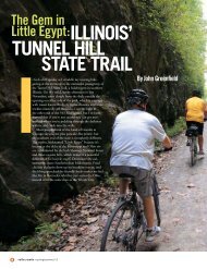
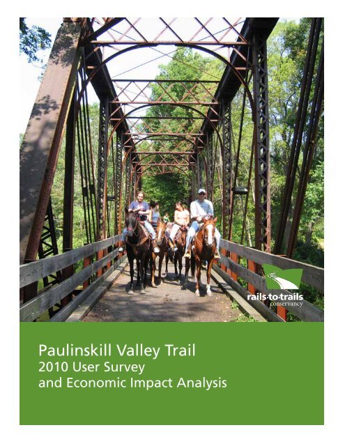
<strong>Paulinskill</strong> <strong>Valley</strong> <strong>Trail</strong><br />
2010 User Survey<br />
and Economic Impact Analysis
Contents<br />
Executive Summary........................................................................2.<br />
His<strong>to</strong>rical Perspective......................................................................4<br />
Location Analysis...........................................................................5<br />
<strong>Paulinskill</strong> <strong>Valley</strong> <strong>Trail</strong> Area Demographics.......................................7<br />
<strong>Paulinskill</strong> <strong>Valley</strong> <strong>Trail</strong> Map..............................................................8<br />
Qualitative Values of the <strong>Paulinskill</strong> <strong>Valley</strong> <strong>Trail</strong>...............................9<br />
Survey Results..............................................................................10<br />
Methodology and Analysis...........................................................14<br />
Comparative Analysis...................................................................16<br />
<strong>Paulinskill</strong> <strong>Valley</strong> <strong>Trail</strong> User Estimates.............................................2.0<br />
Economic Impact.........................................................................2.1<br />
<strong>Trail</strong> Maintenance, Surface and Security.......................................2.4<br />
Appendix A—<strong>Trail</strong> Counter Data..................................................2.6<br />
This report was developed with assistance from the Pennsylvania Department of Conservation and Natural<br />
Resources, Bureau of Recreation and Conservation, Community and Conservation Partnerships Program.<br />
We would like <strong>to</strong> thank the following pho<strong>to</strong>graphers for sharing their pho<strong>to</strong>s with us for this report: Boyd Loving (front cover and pages<br />
7, 15,17, 18, 19, 2.1, 2.2. <strong>to</strong>p, and 2.5); Teresa Rose (page 6); Kim Darst (page 2.2. bot<strong>to</strong>m); Susan Data-Smatak (page 2.3 <strong>to</strong>p and bot<strong>to</strong>m).
<strong>Paulinskill</strong> <strong>Valley</strong> <strong>Trail</strong> 2010 User<br />
Survey and Economic Impact Analysis<br />
Carl Knoch, Manager of <strong>Trail</strong> Development<br />
Northeast Regional Office<br />
March <strong>2011</strong><br />
<strong>Rails</strong>-<strong>to</strong>-<strong>Trail</strong>s <strong>Conservancy</strong><br />
Northeast Regional Office<br />
2.133 Market Street, Suite 2.2.2.<br />
Camp Hill, PA 17011<br />
tel 717.2.38.1717 / fax 717.2.38.7566<br />
National Headquarters<br />
2.12.1 Ward Court, NW, 5th Floor<br />
Washing<strong>to</strong>n, DC 2.0037<br />
tel 2.02..331.9696 / fax 2.02..2.2.3.92.57<br />
www.rails<strong>to</strong>trails.org
Executive Summary<br />
The <strong>Paulinskill</strong> <strong>Valley</strong> <strong>Trail</strong> is a multi-use trail that<br />
runs 27 miles in New Jersey from Brugler Road in<br />
Knowl<strong>to</strong>n Township, Warren County, <strong>to</strong> Sparta<br />
Junction in Sussex County.<br />
During 2010, <strong>Rails</strong>-<strong>to</strong>-<strong>Trail</strong>s <strong>Conservancy</strong> (RTC)<br />
conducted this study of the users of the <strong>Paulinskill</strong><br />
<strong>Valley</strong> <strong>Trail</strong> under a grant from the F. M. Kirby<br />
Foundation. This study utilized a survey methodology<br />
previously tested on Pennsylvania trails and<br />
documented in RTC’s <strong>Trail</strong> User Survey Workbook<br />
(www.rails<strong>to</strong>trails.org/resources/documents/resource_<br />
docs/UserSurveyMethodology.pdf).<br />
This survey was designed <strong>to</strong> moni<strong>to</strong>r trail user<br />
characteristics and economic impact.<br />
Survey forms were available at six locations along<br />
the <strong>Paulinskill</strong> <strong>Valley</strong> <strong>Trail</strong> from the beginning of<br />
June through Oc<strong>to</strong>ber 2010. Completed responses<br />
were mailed back <strong>to</strong> RTC. In all, 374 completed<br />
survey forms are included in this analysis.<br />
ZIP codes indicate a large majority of trail users<br />
on the <strong>Paulinskill</strong> <strong>Valley</strong> <strong>Trail</strong> are from the local<br />
communities in Warren and Sussex counties (72.8<br />
percent). <strong>Trail</strong> users from other New Jersey counties<br />
represented 16.5 percent of the sample. The<br />
remaining trail users came from other states (9.7<br />
percent).<br />
The majority of respondents (45.3 percent) reported<br />
using the trail more than twice a week. Nearly 10<br />
percent were on the <strong>Paulinskill</strong> <strong>Valley</strong> <strong>Trail</strong> for the<br />
first time.<br />
The age profile of users is similar <strong>to</strong> that seen in<br />
other trail surveys, with the majority of users (62.5<br />
percent) in the range of 46 <strong>to</strong> 65 years old.<br />
The male/female ratio is also typical of what we<br />
have surveyed on other rail-trails, with 50.3 percent<br />
male and 49.7 percent female.<br />
The <strong>Paulinskill</strong> <strong>Valley</strong> <strong>Trail</strong> is used primarily for<br />
walking and bicycling, with biking slightly more<br />
2. / <strong>Paulinskill</strong> <strong>Valley</strong> <strong>Trail</strong> 2.010 User Survey
common (39.7 percent) than walking (33.3<br />
percent). Another 6.2 percent of respondents<br />
indicated horseback riding as a primary activity.<br />
Most survey respondents (41.2 percent) spent one<br />
<strong>to</strong> two hours on the trail. More than 35 percent of<br />
respondents spent more than two hours on the trail.<br />
This time-on-trail breakdown is fairly typical on<br />
trails that exceed 20 miles in length in rural areas.<br />
More than half of survey respondents (55.4 percent)<br />
indicated they considered their use of the trail <strong>to</strong><br />
be for health and exercise. Only a little more than a<br />
third (36.8 percent) indicated they considered their<br />
use of the trail recreational. These responses further<br />
validate the high percentage of respondents who use<br />
the trail more than twice a week.<br />
Most respondents (63.5 percent) learned about the<br />
trail primarily through “word of mouth” or because<br />
they drove by the trail. Another 10.3 percent cited<br />
information from <strong>Rails</strong>-<strong>to</strong>-<strong>Trail</strong>s <strong>Conservancy</strong> and<br />
their trail-finder website, www.traillink.com.<br />
The survey included seven questions about expenditures<br />
in order <strong>to</strong> develop a profile of trail user<br />
spending habits. Seventy percent of respondents<br />
indicated they had purchased some form of durable<br />
good, also known as a “hard good,” for use while<br />
on the trail (shoes, bike supplies, etc.), with users<br />
spending an average of $371.91 per person in the<br />
previous 12 months. Consumable goods, or “soft<br />
goods” such as snacks and drinks, were purchased<br />
by 36.5 percent, for an average of $9.93 per person,<br />
per trip. Lodging was the third fac<strong>to</strong>r examined for<br />
economic analysis. Slightly less than 3 percent of the<br />
<strong>Paulinskill</strong> <strong>Valley</strong> <strong>Trail</strong> survey respondents indicated<br />
they paid for lodging at a hotel or bed-and-breakfast<br />
for an average of $104.44 per night; the largest<br />
percentage of respondents (59.3 percent) indicated<br />
they stayed with family or friends at no cost.<br />
Overall maintenance on the <strong>Paulinskill</strong> <strong>Valley</strong> <strong>Trail</strong><br />
was rated good <strong>to</strong> excellent by 80.3 percent of<br />
respondents, and safety and security along the trail<br />
was rated good <strong>to</strong> excellent by 80 percent.<br />
Eighty percent of respondents felt the trail surface<br />
was good <strong>to</strong> excellent.<br />
The respondents’ willingness <strong>to</strong> donate a voluntary<br />
annual fee <strong>to</strong> help maintain the trail was divided,<br />
with 59.4 percent in support and 40.2 percent<br />
opposed.<br />
The segment of trail used most often by<br />
respondents was around Blairs<strong>to</strong>wn. The Airport<br />
Road, Footbridge Road and East Crisman Road<br />
access points accounted for nearly 40 percent of<br />
respondents (39.6 percent). Lowest usage was at<br />
the far western edge of the <strong>Paulinskill</strong> <strong>Valley</strong> <strong>Trail</strong><br />
at Brugler Road. This access point may become<br />
more popular as knowledge of a connection <strong>to</strong> the<br />
pedestrian bridge across the Delaware River between<br />
Columbia, N.J., and Portland, Pa., becomes more<br />
widespread.<br />
The <strong>Paulinskill</strong> <strong>Valley</strong> <strong>Trail</strong> is part of an evolving<br />
130-mile trail network across the state of New<br />
Jersey. The Liberty-Water Gap <strong>Trail</strong>, when<br />
completed, will stretch from Liberty Park on the<br />
Hudson River in Jersey City <strong>to</strong> Columbia on the<br />
Delaware River. Liberty-Water Gap <strong>Trail</strong> signage<br />
appears all along the <strong>Paulinskill</strong> <strong>Valley</strong> <strong>Trail</strong> at<br />
trailheads and road crossings. However, only 41<br />
percent of survey respondents acknowledged<br />
awareness of the Liberty-Water Gap <strong>Trail</strong>.<br />
<strong>Rails</strong>-<strong>to</strong>-<strong>Trail</strong>s <strong>Conservancy</strong> / 3
His<strong>to</strong>rical Perspective*<br />
The New York Susquehanna and Western Railroad<br />
right-of-way, the foundation for the <strong>Paulinskill</strong><br />
<strong>Valley</strong> <strong>Trail</strong>, extends from near Columbia, N.J., on<br />
the Delaware River in Warren County, along the<br />
banks of the <strong>Paulinskill</strong> River <strong>to</strong> Sparta Junction in<br />
Sussex County.<br />
The New York Susquehanna and Western Railroad<br />
abandoned the corridor in August 1962. The<br />
tracks and ties were removed, and in 1963 the city<br />
of Newark purchased the right-of-way. The city<br />
planned <strong>to</strong> use the right-of-way <strong>to</strong> lay a water pipeline<br />
from the proposed Tocks Island Reservoir <strong>to</strong><br />
their watershed area near West Milford. When the<br />
plans for the reservoir fell through, Newark put the<br />
right-of-way up for sale.<br />
The New Jersey Department of Environmental<br />
Protection (NJDEP) held a public meeting in<br />
Blairs<strong>to</strong>wn on June 13, 1985, <strong>to</strong> announce their<br />
intention <strong>to</strong> purchase the site. Local community<br />
members came out in droves. The most outspoken<br />
voices were anti-trail. There were a fair number of<br />
trail supporters present, but they were not prepared<br />
for anything like the s<strong>to</strong>rm of opposition they encountered.<br />
Such strong opposition set proponents,<br />
including the NJ DEP, reeling. Landowners with<br />
property adjacent <strong>to</strong> the trail had organized, calling<br />
themselves the “Railroad Right-of-Way Repurchase<br />
Association.”<br />
<strong>Trail</strong> opponents also had the backing of many other<br />
local landowners, some of them long-time citizens<br />
of Warren County, as well as the state sena<strong>to</strong>r, two<br />
state assemblymen, the three freeholders from<br />
Warren County, and all the politicians from the<br />
bordering <strong>to</strong>wns—mayors, councilmen and planning<br />
board members.<br />
The task for trail proponents was <strong>to</strong> prove that<br />
strong local backing, especially political backing, did<br />
exist in the trail’s home district. Under Len Frank’s<br />
leadership, an ad hoc committee began meeting.<br />
Frank was a long-time leader in the local Sierra<br />
Club chapter and was well-prepared <strong>to</strong> coordinate<br />
this effort.<br />
4 / <strong>Paulinskill</strong> <strong>Valley</strong> <strong>Trail</strong> 2.010 User Survey
Proponents began leading hikes on the trail <strong>to</strong> show<br />
what a wonderful experience the trail could deliver.<br />
Information booths were manned at the county fairs<br />
in Sussex and Warren and at the Sussex Air Show.<br />
Roberta Bramhall created large displays with huge<br />
maps of the trail accented by many pho<strong>to</strong>graphs.<br />
Eventually, proponents became organized as the<br />
<strong>Paulinskill</strong> <strong>Valley</strong> <strong>Trail</strong> Committee (www.pvtc-kvsp.<br />
org), soliciting memberships at $10 a year. With this<br />
money, they printed a pamphlet <strong>to</strong> help promote the<br />
trail cause.<br />
In the summer of 1986, the Sussex Voice issued a<br />
readers’ poll on the trail project.<br />
The poll was printed just in time for the Sussex Fair<br />
in August 1986. The poll consisted of nine questions.<br />
Copies were printed and used at the <strong>Paulinskill</strong><br />
<strong>Valley</strong> <strong>Trail</strong> Committee booth and the Voice booth<br />
at the fair. The poll was promoted vigorously, and<br />
as a result of the 650 responses, 90.6 percent were<br />
in favor of the trail. A second readers’ poll in 1987<br />
delivered 968 responses with 92.5 percent in favor.<br />
In 1988, the trail committee printed their own<br />
poll under the sponsorship of the County Federation<br />
of Sportsmen’s Clubs. This poll resulted in 614<br />
responses with 97 percent in favor of the trail.<br />
Public backing for the trail had been amply demonstrated,<br />
but there was still insufficient political<br />
support. The trail committee wrote <strong>to</strong> and contacted<br />
elected officials without results. Wally Wirths of<br />
Wantage in Sussex County contacted the Sussex<br />
Freeholders, and <strong>to</strong>ld them about the trail and the<br />
results of the polls. The three freeholders drew up<br />
and signed a resolution that the state should buy<br />
the corridor. This political support helped persuade<br />
Governor Thomas Kean, and he authorized NJDEP<br />
<strong>to</strong> purchase the corridor.<br />
Through the efforts of the <strong>Paulinskill</strong> <strong>Valley</strong> <strong>Trail</strong><br />
Committee, the trail was purchased by New<br />
Jersey Green Acres and became a state park on<br />
Oc<strong>to</strong>ber 3, 1992.<br />
*His<strong>to</strong>ry excerpted from articles written by Len Frank and Bill Weiler courtesy of The <strong>Paulinskill</strong> <strong>Valley</strong> <strong>Trail</strong><br />
Committee.<br />
<strong>Rails</strong>-<strong>to</strong>-<strong>Trail</strong>s <strong>Conservancy</strong> / 5
Locational Analysis<br />
The <strong>Paulinskill</strong> <strong>Valley</strong> <strong>Trail</strong> is located in Warren and<br />
Sussex counties in northwestern New Jersey. The<br />
trail begins in Knowl<strong>to</strong>n Township near Columbia<br />
and extends 27 miles roughly north and east <strong>to</strong><br />
Sparta Junction in Sussex County, just outside of<br />
New<strong>to</strong>n. For most of its length, the trail follows the<br />
banks of the <strong>Paulinskill</strong> River. At Warbasse Junction<br />
near Lafayette, the <strong>Paulinskill</strong> <strong>Valley</strong> <strong>Trail</strong> intersects<br />
with the Sussex Branch <strong>Trail</strong>.<br />
The <strong>Paulinskill</strong> <strong>Valley</strong> <strong>Trail</strong> passes through a primarily<br />
rural landscape. The state-owned portion of the trail<br />
begins just outside of Columbia in Knowl<strong>to</strong>n Township.<br />
In December 2010, Knowl<strong>to</strong>n Township completed<br />
an extension of the <strong>Paulinskill</strong> <strong>Valley</strong> <strong>Trail</strong><br />
<strong>to</strong> the pedestrian bridge between Columbia and<br />
Portland, Pa., across the Delaware River just south<br />
of the Delaware Water Gap National Recreation<br />
Area. This extension utilizes a dirt road through<br />
the NJDEP Columbia Wildlife Management Area.<br />
From Columbia Lake, a pathway leads <strong>to</strong> NJ Route<br />
46. Crossing the <strong>Paulinskill</strong> River on the highway<br />
bridge, a ramp takes the trail down <strong>to</strong> water level,<br />
where the path has been constructed in the river<br />
bot<strong>to</strong>m <strong>to</strong> take users under the highway. A ramp up<br />
<strong>to</strong> street level leads <strong>to</strong> Washing<strong>to</strong>n Street and meets<br />
the pedestrian bridge at Green Street.<br />
The only community the trail passes directly<br />
through is Blairs<strong>to</strong>wn (population 5,747) in Warren<br />
County. The trail passes through a large parking lot<br />
for Blairs<strong>to</strong>wn’s Footbridge Park. Heading north of<br />
the parking lot and across the footbridge over the<br />
<strong>Paulinskill</strong> leads <strong>to</strong> the business district. The trail<br />
also passes by the Blairs<strong>to</strong>wn Airport, which is a<br />
renowned location for gliders.<br />
The trail runs around the outskirts of New<strong>to</strong>n<br />
(population 8,244), the Sussex County seat. To<br />
reach the central business district requires a road<br />
ride of a couple of miles. The most direct route is<br />
County Route 622 <strong>to</strong> Mill Street.<br />
The woodlands the trail passes through provide<br />
ample opportunity for the enjoyment of nature’s<br />
bounty. More than 100 different species of birds have<br />
been identified along the trail during the <strong>Paulinskill</strong><br />
<strong>Valley</strong> <strong>Trail</strong> Committee’s annual bird census. These<br />
rich woodlands are also home <strong>to</strong> more than 100<br />
different species of wildflowers that have also been<br />
identified by members of the trail committee.<br />
With the <strong>Paulinskill</strong> River in such close proximity,<br />
the trail offers ample opportunities for fishing. The<br />
state s<strong>to</strong>cks the <strong>Paulinskill</strong> with brown and rainbow<br />
trout. Some of the property along the river is private,<br />
so visi<strong>to</strong>rs should be aware of posted areas.<br />
The trail also helps <strong>to</strong> highlight some of the his<strong>to</strong>ry<br />
of Warren and Sussex counties. Foundations of<br />
creameries and ice houses that were served by the<br />
railroad can been seen along the length of the<br />
corridor. The trail utilizes eight of the original<br />
railroad bridges across the <strong>Paulinskill</strong>. Original<br />
whistle and mileage markers can also be seen along<br />
the route.<br />
<strong>Paulinskill</strong> <strong>Valley</strong><br />
6 / <strong>Paulinskill</strong> <strong>Valley</strong> <strong>Trail</strong> 2.010 User Survey
<strong>Paulinskill</strong> <strong>Valley</strong> <strong>Trail</strong><br />
Area Demographics<br />
The <strong>Paulinskill</strong> <strong>Valley</strong> <strong>Trail</strong> is located in Warren and Sussex counties in New Jersey.<br />
<strong>Paulinskill</strong> <strong>Valley</strong> <strong>Trail</strong> Region Demographic Profile (by county)<br />
Warren County<br />
Sussex County<br />
Population (2.009 est.) 109,638 151,118<br />
Median Household Income (2.008) $74,72.1 $79,393<br />
Households (2.000) 38,660 50,831<br />
Persons per Household (2.000) 2..61 2..80<br />
Persons per Square Mile (2.000) 2.86.1 2.76.7<br />
<strong>Paulinskill</strong> <strong>Valley</strong> <strong>Trail</strong> Region Population Projections (projected by County)<br />
2000 (actual U.S. Census) 2010 2015 2020 2030<br />
Warren County 102.,438 116,437 12.0,759 12.7,792. 132.,502.<br />
Sussex County 144,166 161,881 N/A 178,635 N/A<br />
<strong>Rails</strong>-<strong>to</strong>-<strong>Trail</strong>s <strong>Conservancy</strong> / 7
<strong>Paulinskill</strong> <strong>Valley</strong> <strong>Trail</strong> Map<br />
8 / <strong>Paulinskill</strong> <strong>Valley</strong> <strong>Trail</strong> 2.010 User Survey
Qualitative Values<br />
of the <strong>Paulinskill</strong> <strong>Valley</strong> <strong>Trail</strong><br />
The best way <strong>to</strong> summarize the qualitative values of the <strong>Paulinskill</strong> <strong>Valley</strong> <strong>Trail</strong> is <strong>to</strong> let trail users describe how<br />
they feel about their experience. The following are verbatim comments taken from the 2010 <strong>Paulinskill</strong> <strong>Valley</strong><br />
<strong>Trail</strong> User Survey forms.<br />
The trail is one <strong>to</strong> the greatest assets <strong>to</strong> my area & I treasure it!!!<br />
Love this trail. Don’t know where I would run without it!<br />
What a great idea converting these RR’s <strong>to</strong> rail trails! The P-skill is a beautiful bike ride from one end <strong>to</strong> the other!<br />
And a lot safer than riding on roads!<br />
More benches or seating along the trail would be helpful.<br />
We purchased our property 10+ yrs ago so we could live right on the trail. We hike & bike many times several times a<br />
day. We have purchased extra bikes <strong>to</strong> accommodate friends/family visi<strong>to</strong>rs.<br />
Add markers <strong>to</strong> indicate mileage, also a bench or two would be nice.<br />
Horse riders should clean up droppings!<br />
<strong>Trail</strong> could use some maintenance.<br />
Also enjoy horseback riding on trail.<br />
I love walking my dog on the trail. My 7 yr. old son rides his bike along with us. We can’t wait <strong>to</strong> go on the trail<br />
again!<br />
Totally enjoy the beauty and solitude of the trail.<br />
Need mileage markers — Horse riders clean up after horses.<br />
This trail was a major draw for me <strong>to</strong> move back <strong>to</strong> the area. Truly one of the finest parts of the state.<br />
Need more signs as <strong>to</strong> yielding <strong>to</strong> bike, joggers, horses.<br />
Needs a lot of work on the western end of the trail!<br />
Too many horses on weekends!! They leave a mess <strong>to</strong>o.<br />
We love living in an area with easy access <strong>to</strong> the trail.<br />
We have tried <strong>to</strong> walk the entire trail in segments. This is the greatest trail — finding the order of the trail from<br />
beginning <strong>to</strong> end with places <strong>to</strong> park cars — the map overlaps are confusing — one clear map with clearly marked<br />
segments showing parking and mileage between segments is needed very badly.<br />
The trails are a community treasure.<br />
<strong>Rails</strong>-<strong>to</strong>-<strong>Trail</strong>s <strong>Conservancy</strong> / 9
2010 Survey Results<br />
10 / <strong>Paulinskill</strong> <strong>Valley</strong> <strong>Trail</strong> 2.010 User Survey
Question 1<br />
What is your ZIP code?<br />
37.5% Warren County<br />
35.3% Sussex County<br />
5.9% Morris County<br />
2.7% Essex County<br />
2.2% Bergen County<br />
5.7% Other New Jersey counties<br />
9.7% Other states<br />
Question 2<br />
How did you get <strong>to</strong> the trail?<br />
65.8% Drive<br />
12.3% Bike<br />
10.7% Walk<br />
6.1% Run/jog<br />
5.1% Horseback<br />
Question 3<br />
How often, on average, do you use the trail?<br />
3.5% Daily<br />
21.3% More than twice a week<br />
20.5% Twice a week<br />
7.2% Once a week<br />
16.3% A couple times a month<br />
5.3% Once a month<br />
16.0% Few times a year<br />
9.9% First time<br />
Question 4<br />
Please identify your age group.<br />
0.8% 15 and under<br />
4.0% 16–25<br />
7.0% 26–35<br />
13.4% 36–45<br />
34.3% 46–55<br />
28.2% 56–65<br />
12.1% 66 or older<br />
Question 5<br />
Were any children 15 years of age or younger with<br />
you on your trail experience <strong>to</strong>day?<br />
12.5% Yes<br />
87.5% No<br />
Question 5a<br />
How many children in each age category?<br />
22.7% Under 5<br />
34.9% 5 <strong>to</strong> 9<br />
42.4% 10 <strong>to</strong> 15<br />
Question 6<br />
What is your gender?<br />
50.3% Male<br />
49.7% Female<br />
Questions 7<br />
What is your primary activity on the trail?<br />
33.3% Walking/hiking<br />
39.7% Biking<br />
12.2% Jogging/running<br />
6.2% Horseback riding<br />
8.7% Pet walking<br />
2.7% Other<br />
Question 8<br />
Generally, when do you use the trail?<br />
11.6% Weekdays<br />
31.6% Weekends<br />
56.8% Both<br />
Question 9<br />
What time of day do you generally use the trail?<br />
37.3% Morning<br />
27.8% Afternoon<br />
3.9% Evening<br />
31.0% Anytime<br />
Question 10<br />
How much time do you generally spend on the<br />
trail on each visit?<br />
1.1% Less than 30 minutes<br />
22.1% 30 minutes <strong>to</strong> 1 hour<br />
41.2% 1 <strong>to</strong> 2 hours<br />
35.6% More than 2 hours<br />
<strong>Rails</strong>-<strong>to</strong>-<strong>Trail</strong>s <strong>Conservancy</strong> / 11
Question 11<br />
Would you consider your main use of the trail <strong>to</strong><br />
be for…<br />
36.8% Recreation<br />
55.4% Health and exercise<br />
6.6% Training<br />
0.3% Commuting<br />
1.0% Other<br />
2.6% Walk the dog<br />
16.5% Other: Socialize<br />
Question 12<br />
Have you used other rail-trails in New Jersey?<br />
67.8% Yes<br />
32.2% No<br />
Question 13<br />
How did you find out about the trail?<br />
43.1% Word of mouth<br />
12.0% Roadside signage<br />
20.4% Driving past<br />
2.1% Newspaper<br />
3.1% NJDEP<br />
7.0% <strong>Rails</strong>-<strong>to</strong>-<strong>Trail</strong>s <strong>Conservancy</strong><br />
3.3% www.traillink.com<br />
6.2% Other website<br />
1.7% Bike shop<br />
1.2% Tourist information<br />
Question 14<br />
Has your use of the trail influenced your purchase<br />
of…?<br />
17.2% Bike<br />
15.9% Bike supplies<br />
10.4% Au<strong>to</strong> accessories (bike rack, etc.)<br />
16.9% Footwear<br />
14.6% Clothing<br />
1.6% Fishing equipment<br />
23.9% Nothing<br />
Question 15<br />
Approximately how much did you spend on the<br />
items above in the past year?<br />
The average for those who indicated they had<br />
made a purchase and provided a dollar amount<br />
was $371.91 (n=219).<br />
Question 16<br />
In conjunction with your most recent trip <strong>to</strong> the<br />
trail, did you purchase any of the following?<br />
22.6% Beverages<br />
11.1% Candy/snack foods<br />
6.7% Sandwiches<br />
2.6% Ice cream<br />
11.7% Meals at a restaurant along the trail<br />
0.0% Bike rental<br />
3.5% Other<br />
41.7% None of these<br />
Question 17<br />
Approximately how much did you spend per person<br />
on the items above?<br />
The average for those who indicated they had<br />
made a purchase and provided a dollar amount<br />
was $9.93 (n=162).<br />
Note that this is an average amount spent per person,<br />
per trip.<br />
Question 18<br />
Did your visit <strong>to</strong> the trail involve an overnight stay<br />
in one of the following types of accommodations<br />
(n=35)?<br />
7.4% Motel/Hotel<br />
7.4% Bed-and-Breakfast<br />
59.3% Friend or relative’s home<br />
22.2% Campground<br />
3.7% Other<br />
Question 19<br />
How many nights did you stay in conjunction with<br />
your visit <strong>to</strong> the trail?<br />
Average number of nights per stay was 1.7.<br />
Question 20<br />
Approximately how much did you spend on overnight<br />
accommodations per night?<br />
Average expenditure per night for those who provided<br />
an amount was $104.44 (n=9).<br />
Question 21<br />
In your opinion, the maintenance of the trail is…<br />
30.7% Excellent<br />
49.6% Good<br />
15.4% Fair<br />
4.3% Poor<br />
12. / <strong>Paulinskill</strong> <strong>Valley</strong> <strong>Trail</strong> 2.010 User Survey
Question 22<br />
In your opinion, the surface of the trail is…<br />
25.6% Excellent<br />
55.0% Good<br />
14.0% Fair<br />
5.4% Poor<br />
Question 23<br />
In your opinion, the safety and security along the<br />
trail is…<br />
28.8% Excellent<br />
51.8% Good<br />
16.2% Fair<br />
2.8% Poor<br />
Question 24<br />
Which section of the trail do you use most often?<br />
4.9% Brugler Road<br />
8.3% Station Road<br />
13.3% Airport Road<br />
14.9% Footbridge Road<br />
11.4% East Crisman Road<br />
9.4% Spring <strong>Valley</strong> Road<br />
7.8% Cedar Ridge Road<br />
7.7% New<strong>to</strong>n Swartswood Road<br />
7.0% New<strong>to</strong>n Halsey<br />
8.7% Morris Farm<br />
6.9% Warbasse Junction<br />
Question 25<br />
Are you aware of the Liberty-Water Gap <strong>Trail</strong>?<br />
41.0% Yes<br />
59.0% No<br />
Question 26<br />
Would you be willing <strong>to</strong> pay a voluntary fee <strong>to</strong><br />
help maintain the trail?<br />
59.8% Yes<br />
40.2% No<br />
8.7% Ross<strong>to</strong>n<br />
41.7% Ford City<br />
32.5% Kittanning<br />
6.0% Cowanshannock<br />
1.3% Lock & Dam #8<br />
4.2% Temple<strong>to</strong>n<br />
5.5% Other<br />
<strong>Rails</strong>-<strong>to</strong>-<strong>Trail</strong>s <strong>Conservancy</strong> / 13
Methodology and Analysis<br />
Utilizing <strong>Rails</strong>-<strong>to</strong>-<strong>Trail</strong>s <strong>Conservancy</strong>’s <strong>Trail</strong> User<br />
Survey Workbook template as a starting point, this<br />
survey form was refined with input from the superintendent<br />
of Kittatinny <strong>Valley</strong> State Park, which<br />
manages the <strong>Paulinskill</strong> <strong>Valley</strong> <strong>Trail</strong>. The sample<br />
was self-selecting, meaning trail users could pick<br />
up survey forms that were available at each of the<br />
trail’s primary trailheads between Brugler Road and<br />
Warbasse Junction. The survey forms themselves<br />
were folded in<strong>to</strong> a postage-paid self-mailer that was<br />
addressed <strong>to</strong> <strong>Rails</strong>-<strong>to</strong>-<strong>Trail</strong>s <strong>Conservancy</strong>’s national<br />
office in Washing<strong>to</strong>n, D.C. Survey collection<br />
was conducted from the beginning of June 2010<br />
through the beginning of November 2010.<br />
For the purpose of this analysis, 374 survey forms<br />
were completed. Because several questions called<br />
for multiple responses, and some survey respondents<br />
did not answer all of the questions, the percentages<br />
presented in this analysis are based on the <strong>to</strong>tal<br />
number of responses <strong>to</strong> each individual question.<br />
(Disclaimer: As a self-selecting survey, these findings<br />
are not absolute, and no one can predict with any<br />
certainty how trail users will act in the future. That<br />
said, the findings track very closely with similar<br />
surveys and other published reports, as well as<br />
anecdotal evidence).<br />
The Ghost Town <strong>Trail</strong> and the Perkiomen <strong>Trail</strong> were<br />
chosen for comparison because they share similar<br />
characteristics of length and type of surrounding.<br />
The Ghost Town <strong>Trail</strong> is a multi-use trail that runs<br />
36 miles east <strong>to</strong> west between Ebensburg in Cambria<br />
County and Black Lick in Indiana County. The<br />
Ghost Town <strong>Trail</strong> is co-managed by Indiana County<br />
Parks and the Cambria County Conservation<br />
Authority. The trail is primarily rural, running<br />
parallel <strong>to</strong> Blacklick Creek and game lands and<br />
passing through the <strong>to</strong>wn of Ebensburg, as well as a<br />
few small residential communities.<br />
The Perkiomen <strong>Trail</strong> is a 19-mile multi-use trail in<br />
the southeast section of Pennsylvania. The Perkiomen<br />
<strong>Trail</strong> is managed by the Montgomery County<br />
Parks Department. Surrounded by suburban communities<br />
and interstate highways, the trail passes<br />
through several small <strong>to</strong>wns as well as rural areas, all<br />
within 30 miles of Philadelphia.<br />
Like the <strong>Paulinskill</strong> <strong>Valley</strong> <strong>Trail</strong>, both the Ghost Town<br />
and Perkiomen trails demonstrate characteristics of<br />
a local community trail.<br />
For the purpose of this analysis, the data from<br />
the <strong>Paulinskill</strong> <strong>Valley</strong> <strong>Trail</strong> User Survey will be<br />
compared with data collected in a 2008 survey<br />
of users on the Perkiomen <strong>Trail</strong> in Montgomery<br />
County, Pa., and a 2009 survey of users on the<br />
Ghost Town <strong>Trail</strong> in Indiana and Cambria counties<br />
in Pennsylvania. The data collection methodology<br />
and the survey questions from the Perkiomen and<br />
Ghost Town trail surveys are in most cases identical<br />
<strong>to</strong> those in the <strong>Paulinskill</strong> <strong>Valley</strong> <strong>Trail</strong> survey.<br />
14 / <strong>Paulinskill</strong> <strong>Valley</strong> <strong>Trail</strong> 2.010 User Survey
Distribution of survey respondents based on ZIP code.<br />
<strong>Rails</strong>-<strong>to</strong>-<strong>Trail</strong>s <strong>Conservancy</strong> / 15
Comparative Analysis<br />
The age profile for the users of the <strong>Paulinskill</strong> <strong>Valley</strong> <strong>Trail</strong> is very similar <strong>to</strong> the age profile of users of the Ghost<br />
Town and Perkiomen trails. The highest percentage of users of the <strong>Paulinskill</strong> <strong>Valley</strong> <strong>Trail</strong> fall in the 46 <strong>to</strong> 55-<br />
year age range, which is slightly higher than the comparable trails in this analysis. The <strong>Paulinskill</strong> <strong>Valley</strong> <strong>Trail</strong><br />
had the lowest percentage of users under the age of 35. In all three of the studies, the majority of trail users<br />
are over the age of 45.<br />
What is your age group?<br />
35<br />
30<br />
25<br />
20<br />
15<br />
Percent<br />
10<br />
5<br />
0<br />
66<br />
<strong>Paulinskill</strong> <strong>Valley</strong> <strong>Trail</strong><br />
Percent<br />
Comparison with other trails<br />
35<br />
30<br />
25<br />
20<br />
15<br />
10<br />
5<br />
0<br />
66<br />
<strong>Paulinskill</strong> <strong>Valley</strong> <strong>Trail</strong> Perkiomen <strong>Trail</strong> Ghost Town <strong>Trail</strong><br />
As with most rail-trails, the primary activities on the <strong>Paulinskill</strong> <strong>Valley</strong> <strong>Trail</strong> are walking and bicycling, with<br />
cycling the most common; the length of the trail lends itself <strong>to</strong> all-day cycling adventures. Horseback riding is<br />
also a very popular activity on the <strong>Paulinskill</strong> <strong>Valley</strong> <strong>Trail</strong>. There are a number of stables close <strong>to</strong> the trail that<br />
provide easy access.<br />
What is your primary activity?<br />
Comparison with other trails<br />
40<br />
70<br />
35<br />
60<br />
30<br />
50<br />
25<br />
40<br />
20<br />
30<br />
15<br />
10<br />
20<br />
5<br />
10<br />
0<br />
0<br />
Walk Bike Run Equestrian Pet Other Walk Bike Run Other<br />
Walk<br />
<strong>Paulinskill</strong> <strong>Valley</strong> <strong>Trail</strong> <strong>Paulinskill</strong> <strong>Valley</strong> <strong>Trail</strong> Perkiomen <strong>Trail</strong> Ghost Town <strong>Trail</strong><br />
Percent<br />
Percent<br />
16 / <strong>Paulinskill</strong> <strong>Valley</strong> <strong>Trail</strong> 2.010 User Survey
All three trails in this comparison pass through a combination of natural ‘wilderness’ areas as well as residential<br />
and retail areas. The <strong>Paulinskill</strong> <strong>Valley</strong> <strong>Trail</strong> passes through the smallest percentage of populated areas and has<br />
the second-longest distance of unbroken trail. The most dramatic difference in time spent by users of all three<br />
trails can be seen in the number of people who are on the trail for more than two hours. The <strong>Paulinskill</strong> <strong>Valley</strong><br />
<strong>Trail</strong> has the second-largest percentage of people on the trail for two hours or more. This result is typical for<br />
trails of this length, and where cycling is a primary activity.<br />
How much time did you spend on each trail visit?<br />
Comparison with other trails<br />
45<br />
50<br />
40<br />
35<br />
40<br />
30<br />
25<br />
30<br />
20<br />
15<br />
20<br />
10<br />
10<br />
5<br />
0<br />
2 hrs<br />
0<br />
2 hrs<br />
Percent<br />
Percent<br />
<strong>Paulinskill</strong> <strong>Valley</strong> <strong>Trail</strong> <strong>Paulinskill</strong> <strong>Valley</strong> <strong>Trail</strong> Perkiomen <strong>Trail</strong> Ghost Town <strong>Trail</strong><br />
Nearly 60 percent of users of the <strong>Paulinskill</strong> <strong>Valley</strong> <strong>Trail</strong> purchased consumable items in conjunction with<br />
their trail visit. For the purpose of this survey, these purchases included items such as snacks, water, ice cream<br />
and meals. This percentage is slightly lower than what we see on the Ghost Town <strong>Trail</strong>, yet higher than on<br />
the more populated Perkiomen <strong>Trail</strong>. The percentage of purchases relates <strong>to</strong> the length of the trail and the<br />
environment through which the trail passes (as in feeling a need <strong>to</strong> be prepared by carrying some nourishment<br />
on more remote or longer trails). The Ghost Town <strong>Trail</strong> is isolated from services in many places, while the<br />
Perkiomen is always within easy distance of food and water. The <strong>Paulinskill</strong> <strong>Valley</strong> <strong>Trail</strong> is somewhere in the<br />
middle with the amount of available retail establishments from which <strong>to</strong> purchase items.<br />
Number of people who purchased “soft goods”<br />
Comparison with other trails<br />
Percent<br />
60<br />
50<br />
40<br />
30<br />
20<br />
10<br />
0<br />
Percent<br />
0<br />
Yes No Yes No<br />
80<br />
70<br />
60<br />
50<br />
40<br />
30<br />
20<br />
10<br />
<strong>Paulinskill</strong> <strong>Valley</strong> <strong>Trail</strong> <strong>Paulinskill</strong> <strong>Valley</strong> <strong>Trail</strong> Perkiomen <strong>Trail</strong> Ghost Town <strong>Trail</strong><br />
<strong>Rails</strong>-<strong>to</strong>-<strong>Trail</strong>s <strong>Conservancy</strong> / 17
Respondents <strong>to</strong> the <strong>Paulinskill</strong> <strong>Valley</strong> <strong>Trail</strong> User Survey reported spending an average of $9.93 while on the<br />
trail, somewhat less than users on the Ghost Town and Perkiomen trails. Again, the distance traveled on the<br />
trail, the amount of time spent and the environment through which the trail passes all influence the amount<br />
of money spent on consumable goods. Other fac<strong>to</strong>rs corresponding <strong>to</strong> the amount of spending while on the<br />
trail can be the economy in general and the type of trailside retail (full-service restaurants versus quick-s<strong>to</strong>p<br />
snack shops).<br />
Average $ spent per person on “soft goods”<br />
10<br />
$9.93<br />
Average Dollars<br />
8<br />
6<br />
4<br />
2<br />
0<br />
$<br />
Average Dollars<br />
14<br />
12<br />
10<br />
8<br />
6<br />
4<br />
2<br />
0<br />
Comparison with other trails<br />
<strong>Paulinskill</strong> <strong>Valley</strong> <strong>Trail</strong> <strong>Paulinskill</strong> <strong>Valley</strong><strong>Trail</strong> Perkiomen <strong>Trail</strong> Ghost Town <strong>Trail</strong><br />
$9.93<br />
$11.09<br />
$<br />
$13.62<br />
In the case of all three studies, use of the rail-trail has influenced purchase of durable goods by nearly 80<br />
percent of respondents. For the purpose of these studies, durable or “hard goods” included bikes, bike<br />
supplies, au<strong>to</strong> accessories (bike racks, etc.), footwear and clothing. The percentage of respondents <strong>to</strong> the<br />
<strong>Paulinskill</strong> <strong>Valley</strong> <strong>Trail</strong> User Survey purchasing “hard goods” is comparable <strong>to</strong> other user surveys done in<br />
Pennsylvania.<br />
Number of people who purchased “hard goods”<br />
80<br />
100<br />
Comparison with other trails<br />
Percent<br />
60<br />
40<br />
20<br />
0<br />
Percent<br />
0<br />
Yes No Yes No<br />
80<br />
60<br />
40<br />
20<br />
<strong>Paulinskill</strong> <strong>Valley</strong> <strong>Trail</strong> <strong>Paulinskill</strong> <strong>Valley</strong> <strong>Trail</strong> Perkiomen <strong>Trail</strong> Ghost Town <strong>Trail</strong><br />
18 / <strong>Paulinskill</strong> <strong>Valley</strong> <strong>Trail</strong> 2.010 User Survey
The amount respondents reported spending on durable goods such as bicycles and clothing is averaged at<br />
$371.91 per person on the <strong>Paulinskill</strong> <strong>Valley</strong> <strong>Trail</strong>. The difference in the amount spent by survey respondents<br />
on these trails is less than $40. The percentage of respondents who reported purchasing durable goods varies<br />
by only 12 percent between the three trails (<strong>Paulinskill</strong>, 76.1percent; Perkiomen, 81.5 percent; and Ghost<br />
Town, 88.4 percent).<br />
Average $ spent on “hard goods” per person?<br />
Comparison with other trails<br />
400<br />
400<br />
350<br />
$371.91<br />
390<br />
$396.89<br />
300<br />
380<br />
250<br />
370<br />
200<br />
$371.91<br />
360<br />
150<br />
$357.63<br />
100<br />
350<br />
50<br />
340<br />
0<br />
330<br />
$ $<br />
Average Dollars<br />
Average Dollars<br />
<strong>Paulinskill</strong> <strong>Valley</strong> <strong>Trail</strong> <strong>Paulinskill</strong> <strong>Valley</strong> <strong>Trail</strong> Perkiomen <strong>Trail</strong> Ghost Town <strong>Trail</strong><br />
<strong>Rails</strong>-<strong>to</strong>-<strong>Trail</strong>s <strong>Conservancy</strong> / 19
<strong>Paulinskill</strong> <strong>Valley</strong> <strong>Trail</strong><br />
User Estimate<br />
During the summer and fall of 2010, passive infrared counters were placed at two locations along the <strong>Paulinskill</strong><br />
<strong>Valley</strong> <strong>Trail</strong>. The first counter was placed on the trail at the Spring <strong>Valley</strong> Road trailhead on June 1. This<br />
counter was moved on August 10 because the trailhead was closed for construction. The counter was placed<br />
on the trail at the Warbasse Junction Road trailhead on August 10, where it remained until November 4.<br />
These counters collect data on the number of trail users passing the counter by detecting each user’s “heat<br />
signature.”<br />
In order <strong>to</strong> develop an annual user estimate for these two locations, the data collected was extrapolated <strong>to</strong> a<br />
12-month estimate using a User Visit Model developed by <strong>Rails</strong>-<strong>to</strong>-<strong>Trail</strong>s <strong>Conservancy</strong>. This model examines<br />
data collected using electronic counters at 58 different locations on rail-trails across the United States.<br />
<strong>Trail</strong> Counter Actual Estimated Adjusted for Adjusted for<br />
Location Count 12-Month Missing Out-&-Back<br />
Count* Counts Trips<br />
Spring <strong>Valley</strong> Road<br />
June 1, 2.010 <strong>to</strong> August 10, 2.010 3,703 14,453 17,344 9,12.8<br />
Warbasse Junction Road<br />
August 10, 2.010 <strong>to</strong> November 4, 2.010 4,768 18,077 2.1,692. 11,416<br />
2.0 / <strong>Paulinskill</strong> <strong>Valley</strong> <strong>Trail</strong> 2.010 User Survey
Economic Impact<br />
The economic impact of the <strong>Paulinskill</strong> <strong>Valley</strong> <strong>Trail</strong><br />
is comprised of a number of elements.<br />
From the survey, the percentage of respondents who<br />
have purchased “hard goods” (bikes, bike equipment,<br />
running/walking shoes, etc.) was determined. Many<br />
of these respondents also revealed how much they<br />
spent on these types of purchases during the past 12<br />
months.<br />
Also, from the survey it was determined how much<br />
trail users spent on “soft goods” (water, soda, snacks,<br />
ice cream, lunches, etc.) while using the trail. Again,<br />
the percentage of respondents who made these types<br />
of purchases provides an important aspect for determining<br />
the economic impact.<br />
Very few respondents <strong>to</strong> the <strong>Paulinskill</strong> <strong>Valley</strong> <strong>Trail</strong><br />
User Survey indicated that an overnight stay was<br />
part of their trail experience. Of the 374 completed<br />
survey forms, only 35 indicated an overnight stay.<br />
Of those indicating an overnight stay, 59 percent<br />
were with family or friends and did not result in an<br />
out-of-pocket expenditure.<br />
Estimates of the economic impact of the <strong>Paulinskill</strong><br />
<strong>Valley</strong> <strong>Trail</strong> are presented in the following tables.<br />
These estimates are based on the potential spending<br />
of trail users who passed the Spring <strong>Valley</strong> Road and<br />
Warbasse Junction Road trail counters. They do not<br />
represent what the <strong>to</strong>tal economic impact for the<br />
full length of the <strong>Paulinskill</strong> <strong>Valley</strong> <strong>Trail</strong> may be.<br />
Hard Goods<br />
Has your use of the trail influenced your purchase<br />
of? (check all that apply)<br />
Bike<br />
17.2.%<br />
Bike supplies 15.9%<br />
Au<strong>to</strong> accessories 10.4%<br />
Running/walking/hiking shoes 16.9%<br />
Clothing 14.6%<br />
Fishing equipment 1.6%<br />
Nothing<br />
2.3.9%<br />
Approximately how much did you spend on the<br />
items above in the past year? (enter dollar amount)<br />
Average “hard goods” purchase $371.91<br />
(n=2.19)<br />
Soft Goods<br />
In conjunction with your most recent trip <strong>to</strong> the<br />
trail, did you purchase any of the following? (check<br />
all that apply)<br />
Beverages<br />
2.2..6%<br />
Candy/snack foods 11.1%<br />
Sandwiches 6.7%<br />
Ice cream<br />
2..6%<br />
Meals at a restaurant along the trail 11.7%<br />
Bike rental 0.0%<br />
Other 3.5%<br />
None of these 41.7%<br />
<strong>Rails</strong>-<strong>to</strong>-<strong>Trail</strong>s <strong>Conservancy</strong> / 2.1
Approximately how much did you spend per person<br />
on the items above? (enter dollar amount)<br />
Average “soft goods” purchase $9.93<br />
(n=162.)<br />
Note that this is an average amount spent per person,<br />
per trip.<br />
Lodging<br />
Did your visit <strong>to</strong> the trail involve an overnight stay<br />
in one of the following types of accommodations?<br />
(circle one response)<br />
Motel/hotel 7.4%<br />
Bed-and-Breakfast 7.4%<br />
Friend or relative’s home 59.3%<br />
Campground<br />
2.2..2.%<br />
Other 3.7%<br />
How many nights did you stay in conjunction with<br />
you visit <strong>to</strong> the trail?<br />
Average number of nights per stay 1.7<br />
Approximately how much did you spend on overnight<br />
accommodations per night?<br />
Average expenditure per night for those<br />
providing an amount $104.44 (n=9)<br />
The following chart takes the data provided above<br />
and extrapolates the purchases for the trail users<br />
who passed the Spring <strong>Valley</strong> Road and Warbasse<br />
Junction Road counters. While “hard good”<br />
purchases may not be made on an annual basis,<br />
they represent a significant expenditure figure. The<br />
purchase of “soft goods” does represent an annual<br />
expenditure, because these purchases are made on a<br />
per-trip basis by users. The percentage of trail users<br />
paying for an overnight stay may vary significantly<br />
from year <strong>to</strong> year.<br />
2.2. / <strong>Paulinskill</strong> <strong>Valley</strong> <strong>Trail</strong> 2.010 User Survey
<strong>Paulinskill</strong> <strong>Valley</strong> <strong>Trail</strong> Economic Impact Analysis<br />
Annual User Est. (Rounded) Spring <strong>Valley</strong> Road (9,182.) / Warbasse Junction (11,416)<br />
Category % Usage Avg. $ Avg. Life Avg. # of trips Avg. # of nights Spring <strong>Valley</strong> / Warbasse<br />
Hard Goods* 70.0% $371.91 6 years 2.4.6 $16,195 / $2.0,136<br />
Soft Goods 36.5% $9.93 $33,2.80 / $41,376<br />
Lodging 2..9% $104.44 1.7 $47,2.2.7 / $58,780<br />
Hard Goods = (% Usage X (Avg. $ ÷ Avg. Life) X (# Users ÷ Avg. Number of Trips)*<br />
In the above example, the calculation for Spring <strong>Valley</strong> Road would look like this:<br />
((.700 X ($371.91÷6)) X (9,182÷24.6) = $16,195<br />
Soft Goods = (% Usage X Users Avg. $ X # Users)<br />
In the above example, the calculation for Warbasse Junction Road would look like this:<br />
(.365 X $9.93 X 11,416) = $41,376<br />
Accommodations= (% Usage X Users Avg. $ X # Users x Avg. # Nights)<br />
In the above example, the calculation for Spring <strong>Valley</strong> Road would look like this:<br />
(.029 X $104.44 X 9,182 X 1.7) = $47,277<br />
*Major “hard good” purchases such as a bike may be replaced every five <strong>to</strong> 10 years. Running shoes may be<br />
replaced every couple months. For the purpose of this analysis, the average life of a “hard good” is assumed <strong>to</strong><br />
be six years. To get a figure that is usable on an annual user basis, the “hard goods” need <strong>to</strong> be broken down <strong>to</strong><br />
a per-trip figure. What this amounts <strong>to</strong> is working the average spending on a “hard good” down <strong>to</strong> a per-use<br />
depreciation amount.<br />
<strong>Rails</strong>-<strong>to</strong>-<strong>Trail</strong>s <strong>Conservancy</strong> / 2.3
<strong>Trail</strong> Maintenance,<br />
Surface and Cleanliness<br />
One of the most important aspects of the trail user survey is that it allows the trail’s management organization<br />
<strong>to</strong> receive feedback, both positive and negative, from trail users. The 2010 <strong>Paulinskill</strong> <strong>Valley</strong> <strong>Trail</strong> User Survey<br />
can serve as a benchmark against which future maintenance, trail surface and cleanliness issues can be compared.<br />
The questions on maintenance and cleanliness were also asked on the 2008 Perkiomen <strong>Trail</strong> Study and the<br />
2009 Ghost Town <strong>Trail</strong> Study. To provide a basis of comparison for the management of the <strong>Paulinskill</strong> <strong>Valley</strong><br />
<strong>Trail</strong>, the responses from those studies have been included in this section of the analysis. No comparative<br />
analysis is available for the question concerning the trail surface.<br />
Opinion of trail maintenance<br />
Comparison with other trails<br />
60<br />
50<br />
70<br />
60<br />
40<br />
50<br />
40<br />
30<br />
30<br />
20<br />
20<br />
10<br />
10<br />
0<br />
0<br />
Excellent Good Fair Poor Excellent Good Fair Poor<br />
Percent<br />
Percent<br />
<strong>Paulinskill</strong> <strong>Valley</strong> <strong>Trail</strong> <strong>Paulinskill</strong> <strong>Valley</strong> <strong>Trail</strong> Perkiomen <strong>Trail</strong> Ghost Town <strong>Trail</strong><br />
According <strong>to</strong> respondents <strong>to</strong> this survey, the <strong>Paulinskill</strong> <strong>Valley</strong> <strong>Trail</strong> is fairly well maintained. The high standard<br />
set by the Perkiomen <strong>Trail</strong> represents a significant amount of work on the part of the Montgomery<br />
County Department of Parks and Heritage Service. The Ghost Town <strong>Trail</strong> is also maintained by the county<br />
department of parks.<br />
Opinion of trail surface<br />
60<br />
Percent<br />
50<br />
40<br />
30<br />
20<br />
10<br />
0<br />
Excellent Good Fair Poor<br />
<strong>Paulinskill</strong> <strong>Valley</strong> <strong>Trail</strong><br />
More than 80 percent of respondents rated the<br />
trail surface Excellent or Good. In the comments<br />
there were references <strong>to</strong> specific sections of the trail<br />
where surface repairs were needed. These responses<br />
may have come from surveys completed after rain<br />
s<strong>to</strong>rms or other natural occurrences that impacted<br />
the trail surface. Some of the surface comments<br />
may also be related <strong>to</strong> the many comments regarding<br />
horse manure on the trail.<br />
2.4 / <strong>Paulinskill</strong> <strong>Valley</strong> <strong>Trail</strong> 2.010 User Survey
The feeling of security that trail users have is influenced by the presence of other trail users, visual observation<br />
of rangers, familiarity with the trail, and each user’s general perception of how safe the overall environment is.<br />
From the chart, it appears that survey respondents <strong>to</strong> the <strong>Paulinskill</strong> <strong>Valley</strong> <strong>Trail</strong> User Survey feel somewhat<br />
less safe than users of the Perkiomen <strong>Trail</strong> and the Ghost Town <strong>Trail</strong>.<br />
Opinion of safety and security of the trail<br />
60<br />
Percent<br />
50<br />
40<br />
30<br />
20<br />
10<br />
0<br />
Percent<br />
0<br />
Excellent Good Fair Poor Excellent Good Fair Poor<br />
60<br />
50<br />
40<br />
30<br />
20<br />
10<br />
Comparison with other trails<br />
<strong>Paulinskill</strong> <strong>Valley</strong> <strong>Trail</strong> <strong>Paulinskill</strong> <strong>Valley</strong> <strong>Trail</strong> Perkiomen <strong>Trail</strong> Ghost Town <strong>Trail</strong><br />
<strong>Rails</strong>-<strong>to</strong>-<strong>Trail</strong>s <strong>Conservancy</strong> / 2.5
Appendix A—<strong>Trail</strong> Counter Data<br />
2.6 / <strong>Paulinskill</strong> <strong>Valley</strong> <strong>Trail</strong> 2.010 User Survey
TRAFx REPORT:<br />
Project: <strong>Paulinskill</strong> <strong>Trail</strong> User Survey 2010 Start: 2010-06-01 Location: Spring <strong>Valley</strong> Road <strong>Trail</strong>head<br />
Counter: Spring <strong>Valley</strong> Road Finish: 2010-08-10 Comment:<br />
180<br />
160<br />
140<br />
120<br />
100<br />
80<br />
60<br />
40<br />
20<br />
0<br />
2010-06-01<br />
2010-06-03<br />
2010-06-05<br />
2010-06-07<br />
2010-06-09<br />
2010-06-11<br />
2010-06-13<br />
2010-06-15<br />
2010-06-17<br />
2010-06-19<br />
2010-06-21<br />
2010-06-23<br />
2010-06-25<br />
2010-06-27<br />
2010-06-29<br />
2010-07-01<br />
2010-07-03<br />
2010-07-05<br />
2010-07-07<br />
2010-07-09<br />
2010-07-11<br />
2010-07-13<br />
2010-07-15<br />
2010-07-17<br />
2010-07-19<br />
2010-07-21<br />
2010-07-23<br />
2010-07-25<br />
2010-07-27<br />
2010-07-29<br />
2010-07-31<br />
2010-08-02<br />
2010-08-04<br />
2010-08-06<br />
2010-08-08<br />
2010-08-10<br />
Total Counts: 3,703 Daily Mean Weekday: 36.0 Total (1) : 3,703<br />
Total Periods: 71 Daily Mean Weekend: 93.3 Total (2) : 0<br />
Period Length: 1 day Mean Monday 30.7 Percentage (1) : 100.0<br />
Mean: 52.2 Mean Tuesday 36.0 Percentage (2) : 0.0<br />
Mode: 35.0 Mean Wednesday 31.5 Mean (1) : 52.2<br />
Median: 43.0 Mean Thursday 40.6 Mean (2) : 0.0<br />
Standard Deviation: 38.9 Mean Friday 41.2 Max/Min (1) : 167 / 3<br />
Maximum: 167 Mean Saturday 93.2 Max/Min (2) : 0 / 0<br />
Minimum: 3 Mean Sunday 93.5<br />
Total Weekday: 1,836<br />
Total Weekend: 1,867<br />
Daily Max/Min Weekday: 75 / 3<br />
Daily Max/Min Weekend: 167 / 21<br />
FIVE PEAK PERIODS: 2010-07-03 (167), 2010-07-11 (167), 2010-07-18 (146), 2010-06-19 (139), 2010-06-26 (134)<br />
<strong>Rails</strong>-<strong>to</strong>-<strong>Trail</strong>s <strong>Conservancy</strong> / 2.7
TRAFx REPORT:<br />
Project: <strong>Paulinskill</strong> <strong>Valley</strong> <strong>Trail</strong> User Survey 2010 Start: 2010-08-10 Location: Warbasse Junction <strong>Trail</strong>head<br />
Counter: <strong>Paulinskill</strong>_Warbasse Finish: 2010-11-04 Comment:<br />
200<br />
180<br />
160<br />
140<br />
120<br />
100<br />
80<br />
60<br />
40<br />
20<br />
0<br />
2010-08-10<br />
2010-08-12<br />
2010-08-14<br />
2010-08-16<br />
2010-08-18<br />
2010-08-20<br />
2010-08-22<br />
2010-08-24<br />
2010-08-26<br />
2010-08-28<br />
2010-08-30<br />
2010-09-01<br />
2010-09-03<br />
2010-09-05<br />
2010-09-07<br />
2010-09-09<br />
2010-09-11<br />
2010-09-13<br />
2010-09-15<br />
2010-09-17<br />
2010-09-19<br />
2010-09-21<br />
2010-09-23<br />
2010-09-25<br />
2010-09-27<br />
2010-09-29<br />
2010-10-01<br />
2010-10-03<br />
2010-10-05<br />
2010-10-07<br />
2010-10-09<br />
2010-10-11<br />
2010-10-13<br />
2010-10-15<br />
2010-10-17<br />
2010-10-19<br />
2010-10-21<br />
2010-10-23<br />
2010-10-25<br />
2010-10-27<br />
2010-10-29<br />
2010-10-31<br />
2010-11-02<br />
2010-11-04<br />
Total Counts: 4,768 Daily Mean Weekday: 34.3 Total (1) : 4,768<br />
Total Periods: 87 Daily Mean Weekend: 108.6 Total (2) : 0<br />
Period Length: 1 day Mean Monday 41.3 Percentage (1) : 100.0<br />
Mean: 54.8 Mean Tuesday 32.1 Percentage (2) : 0.0<br />
Mode: 46.0 Mean Wednesday 31.8 Mean (1) : 54.8<br />
Median: 41.0 Mean Thursday 28.8 Mean (2) : 0.0<br />
Standard Deviation: 45.1 Mean Friday 38.5 Max/Min (1) : 188 / 0<br />
Maximum: 188 Mean Saturday 106.8 Max/Min (2) : 0 / 0<br />
Minimum: 0 Mean Sunday 110.4<br />
Total Weekday: 2,161<br />
Total Weekend: 2,607<br />
Daily Max/Min Weekday: 173 / 0<br />
Daily Max/Min Weekend: 188 / 19<br />
FIVE PEAK PERIODS: 2010-09-04 (188), 2010-09-05 (179), 2010-09-06 (173), 2010-09-26 (152), 2010-09-11 (144)<br />
2.8 / <strong>Paulinskill</strong> <strong>Valley</strong> <strong>Trail</strong> 2.010 User Survey
<strong>Rails</strong>-<strong>to</strong>-<strong>Trail</strong>s <strong>Conservancy</strong> / 2.9
Northeast Regional Office<br />
2.133 Market Street, Suite 2.2.2.<br />
Camp Hill, PA 17011<br />
tel 717.2.38.1717<br />
fax 717.2.38.7566<br />
National Headquarters<br />
2.12.1 Ward Court, NW, 5th Floor<br />
Washing<strong>to</strong>n, DC 2.0037<br />
tel 2.02..331.9696<br />
fax 2.02..2.2.3.92.57<br />
www.rails<strong>to</strong>trails.org