Town of Richmond Hill Proposed New Official Plan (July 2010)
Town of Richmond Hill Proposed New Official Plan (July 2010)
Town of Richmond Hill Proposed New Official Plan (July 2010)

Create successful ePaper yourself
Turn your PDF publications into a flip-book with our unique Google optimized e-Paper software.
4<br />
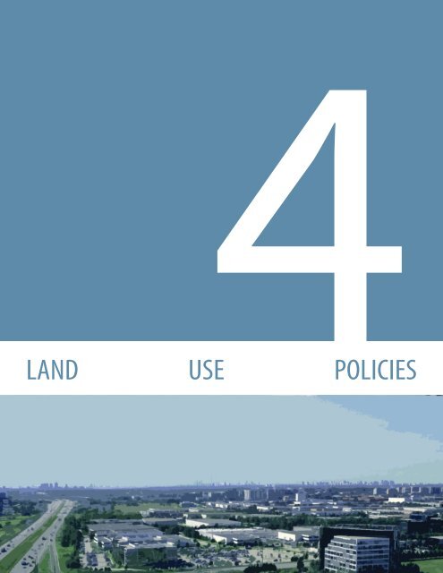
LAND USE POLICIES
1<br />
2<br />
3<br />
LAND USE POLICIES<br />
4. LAND USE POLICIES<br />
This chapter sets out the land use and design policies associated with each land<br />
use designation as shown on Schedule A2 (Land Use) to this <strong>Plan</strong>. The policies <strong>of</strong><br />
each section must be read together with the policies <strong>of</strong> Chapter 3 (Building a <strong>New</strong><br />
Kind <strong>of</strong> Urban) and all other relevant sections <strong>of</strong> this <strong>Plan</strong>.<br />
4.1 COMMUNITY USES<br />
Community uses include public, private and not for pr<strong>of</strong>it institutions, facilities<br />
and services that support the health, educational, recreational and socio-cultural<br />
needs <strong>of</strong> the <strong>Town</strong>. Community uses are generally permitted within the land use<br />
designations in the settlement area. A range <strong>of</strong> community uses shall be directed<br />
to appropriate locations within the <strong>Town</strong> to contribute to a complete community.<br />
4.1.1 LAND USE<br />
4<br />
5<br />
6<br />
7<br />
It is the policy <strong>of</strong> Council that:<br />
1. A range <strong>of</strong> community uses shall generally be permitted within the<br />
settlement area, with the broadest range <strong>of</strong> community uses directed to<br />
the centres and corridors. A more limited range <strong>of</strong> community uses may<br />
be permitted in the Neighbourhood, Employment Area and Employment<br />
Corridor designations as set out in the policies <strong>of</strong> this section.<br />
2. Within the centres and corridors, the following community uses shall be<br />
permitted:<br />
a. Hospitals and healthcare centres and ancillary uses such as <strong>of</strong>fices and<br />
pharmacies;<br />
b. Post-secondary institutions and ancillary uses such as <strong>of</strong>fices;<br />
c. Public secondary schools, in accordance with policy 4.1.1.6 <strong>of</strong> this <strong>Plan</strong>;<br />
d. Public elementary schools, in accordance with policy 4.1.1.5 <strong>of</strong> this<br />
<strong>Plan</strong>;<br />
e. Private secondary schools, in accordance with policy 4.1.1.4 <strong>of</strong> this<br />
<strong>Plan</strong> ; and<br />
f. Private elementary schools, in accordance with policy 4.1.1.4 <strong>of</strong> this<br />
<strong>Plan</strong>.<br />
g. Government facilities including:<br />
i. Government <strong>of</strong>fices;<br />
ii. Public community facilities, such as libraries, community<br />
centres, and recreation centres;<br />
iii. Fire and emergency services; and<br />
iv. Other public facilities.<br />
h. Places <strong>of</strong> worship, in accordance with policy 4.1.1.7 <strong>of</strong> this <strong>Plan</strong>;<br />
RICHMOND HILL OFFICIAL PLAN 4-1 JULY <strong>2010</strong>
LAND USE POLICIES<br />
i. Arts and cultural facilities;<br />
j. Day Nurseries;<br />
k. Private-home day care facilities; and<br />
l. Long-term care facilities.<br />
3. Within the Neighbourhood designation, the following community uses<br />
shall be permitted provided that the site is located:<br />
a. Fronting onto a street:<br />
i. Private-home daycare facilities.<br />
b. Fronting onto an arterial street:<br />
i. Public secondary schools, in accordance with policy 4.1.1.6 <strong>of</strong><br />
this <strong>Plan</strong>, which shall be encouraged to locate adjacent to a<br />
park or the Greenway System;<br />
ii. Private secondary and elementary schools, in accordance with<br />
policy 4.1.1.4 <strong>of</strong> this <strong>Plan</strong>, which shall be encouraged to locate<br />
adjacent to a park or the Greenway System;<br />
iii. Places <strong>of</strong> worship in accordance with policy 4.1.1.7 <strong>of</strong> this <strong>Plan</strong>;<br />
iv. Government facilities limited to government <strong>of</strong>fices, public<br />
community facilities such as libraries, community centres,<br />
recreation centres, and fire and emergency services;<br />
v. Arts and cultural facilities;<br />
vi. Day Nurseries;<br />
vii. Private-home day care facilities; and<br />
viii. Long-term care facilities.<br />
c. Fronting onto a collector street:<br />
i. Public elementary schools, in accordance with policy 4.1.1.5 <strong>of</strong><br />
this <strong>Plan</strong>, which shall be encouraged to locate adjacent to a park<br />
or the Greenway System;<br />
ii. Government facilities limited to public community facilities<br />
such as libraries, community centres, and recreation centres;<br />
and<br />
iii. Day Nurseries integrated with or adjacent to another community<br />
use or adjacent to a park or the Greenway System.<br />
4. Private secondary and elementary schools, where permitted, shall be<br />
located at the intersection <strong>of</strong> an arterial street and a collector street. Midblock<br />
sites on arterial streets may be considered only where they abut<br />
the Greenway System, a park, educational facility, commercial or retail use<br />
subject to the following requirements:<br />
a. Minimum <strong>of</strong> two access points are provided;<br />
b. The site size shall be a minimum <strong>of</strong> 1 hectare and a maximum <strong>of</strong> 2.5<br />
hectares;<br />
c. Transportation studies shall be submitted in accordance with Section<br />
5.26;<br />
d. Impact on adjacent residential areas is minimized by providing<br />
1<br />
2<br />
3<br />
4<br />
5<br />
6<br />
7<br />
JULY <strong>2010</strong><br />
4-2<br />
RICHMOND HILL OFFICIAL PLAN
LAND USE POLICIES<br />
1<br />
2<br />
3<br />
4<br />
5<br />
6<br />
7<br />
adequate parking, landscaping, setbacks and buffering; and<br />
e. Adequate on-site vehicular pick-up and drop-<strong>of</strong>f.<br />
5. Public elementary schools, where permitted, shall be subject to the<br />
following requirements:<br />
a. Frontage on a collector street;<br />
b. Sited on a straight segment <strong>of</strong> a street with good visibility and sufficient<br />
frontage to meet School Board requirements;<br />
c. Adequate on-site vehicular pick-up and drop-<strong>of</strong>f;<br />
d. The campusing <strong>of</strong> schools with parks, the Greenway System or<br />
public community facilities such as libraries, community centres and<br />
recreation centres is encouraged; and<br />
e. Residential driveways opposite school sites shall be minimized<br />
wherever possible.<br />
6. Public secondary schools, where permitted, shall be subject to the<br />
following requirements:<br />
a. Frontage on an arterial street or a collector street in close proximity to<br />
public transit;<br />
b. Located on a straight segment <strong>of</strong> a street with good visibility and<br />
sufficient frontage to meet School Board requirements;<br />
c. The campusing <strong>of</strong> schools with parks, the Greenway System or<br />
public community facilities such as libraries, community centres and<br />
recreation centres is encouraged; and<br />
d. Residential driveways opposite school sites shall be minimized<br />
wherever possible.<br />
7. Places <strong>of</strong> Worship, where permitted, shall be located at the intersection <strong>of</strong><br />
two arterial streets or at the intersection <strong>of</strong> an arterial street and a collector<br />
street. Mid-block sites on arterial streets may be considered only where<br />
they abut the Greenway System, a park, educational facility, commercial<br />
or retail use.<br />
8. Within the Employment Area and Employment Corridor designations, the<br />
following community uses shall be permitted provided that the viability<br />
and planned function <strong>of</strong> the employment lands are maintained:<br />
a. Government facilities such as government <strong>of</strong>fices, fire and<br />
emergency services and other public facilities; and<br />
b. Day Nurseries, provided the use is contained within a major <strong>of</strong>fice<br />
building.<br />
4.1.2 DESIGN<br />
It is the policy <strong>of</strong> Council that:<br />
1. Where community uses are permitted, development for such uses shall be<br />
subject to the following requirements:<br />
RICHMOND HILL OFFICIAL PLAN 4-3 JULY <strong>2010</strong>
LAND USE POLICIES<br />
a. The proposed development shall be designed to be compatible and<br />
integrated with the surrounding area; and<br />
b. The site is <strong>of</strong> an appropriate size to accommodate:<br />
i. Sufficient on-site pick-up/drop-<strong>of</strong>f facilities, access and parking;<br />
ii. Sufficient buffering and landscaping; and<br />
iii. Sufficient amenity space.<br />
2. The campusing or co-location <strong>of</strong> community uses shall be encouraged.<br />
3. The policies <strong>of</strong> this section are to be read in conjunction with the land use<br />
and design policies <strong>of</strong> the applicable land-use designation and Chapter<br />
3 (Building a <strong>New</strong> Kind <strong>of</strong> Urban) within which the proposed community<br />
use is located. In the event <strong>of</strong> a conflict, the more restrictive policies shall<br />
apply.<br />
4.2 RICHMOND HILL CENTRE<br />
The <strong>Richmond</strong> <strong>Hill</strong> Centre is intended to develop into a compact, mixed-use<br />
urban centre supported by a high quality public realm, walkable streets and<br />
transit-oriented development. As an increasingly regional focal point, <strong>Richmond</strong><br />
<strong>Hill</strong> Centre will be a major residential and employment destination, a meeting<br />
place, and the primary location for cultural facilities, public institutions and major<br />
services. The Centre will be a prominent, major transit node in <strong>Richmond</strong> <strong>Hill</strong> and in<br />
York Region due to its scale, planned density, function and identity. It will continue<br />
to be the primary focal point for transit infrastructure investment and will be a<br />
destination point attracting people from all parts <strong>of</strong> the Region as it evolves into a<br />
vibrant and distinct urban centre.<br />
4.2.1 LAND USE<br />
1<br />
2<br />
3<br />
4<br />
5<br />
It is the policy <strong>of</strong> Council that:<br />
1. The <strong>Town</strong> shall prepare a Secondary <strong>Plan</strong> for the <strong>Richmond</strong> <strong>Hill</strong> Centre in<br />
accordance with the policies <strong>of</strong> Section 5.1 <strong>of</strong> this <strong>Plan</strong> and the land use<br />
and design guidelines which have been endorsed by Council as set out<br />
in the <strong>Richmond</strong> <strong>Hill</strong> Regional Centre Design and Land Use Study Final<br />
Recommendations Report, February <strong>2010</strong>.<br />
2. Until such time as Council approves a Secondary <strong>Plan</strong> for the <strong>Richmond</strong><br />
<strong>Hill</strong> Centre, applications for development in the interim shall be assessed<br />
on the basis <strong>of</strong> conformity with the policies <strong>of</strong> this section and the land<br />
use and design guidelines which have been endorsed by Council as set<br />
out in the <strong>Richmond</strong> <strong>Hill</strong> Regional Centre Design and Land Use Study Final<br />
Recommendations Report, February <strong>2010</strong>.<br />
6<br />
7<br />
JULY <strong>2010</strong><br />
4-4<br />
RICHMOND HILL OFFICIAL PLAN
LAND USE POLICIES<br />
1<br />
2<br />
3<br />
4<br />
5<br />
6<br />
7<br />
<strong>Richmond</strong> <strong>Hill</strong> Centre Model<br />
3. The predominant use <strong>of</strong> land within the <strong>Richmond</strong> <strong>Hill</strong> Centre designation<br />
shown on Schedule A2 (Land Use) shall be mixed-use, transit-oriented<br />
development.<br />
4. The permitted uses within the <strong>Richmond</strong> <strong>Hill</strong> Centre designation shall<br />
include a broad range and mix <strong>of</strong> residential and employment uses in a<br />
well-integrated, compact urban form. The mix <strong>of</strong> uses shall generally be<br />
integrated in the same building and provide connections to public transit<br />
to ensure a high level <strong>of</strong> connectivity.<br />
5. The following land uses shall be permitted within the <strong>Richmond</strong> <strong>Hill</strong> Centre:<br />
a. High density residential;<br />
b. Medium density residential in accordance with policy 4.2.1.6;<br />
c. Major <strong>of</strong>fice;<br />
d. Office;<br />
e. Commercial;<br />
f. Major retail in accordance with policy 4.2.1.7;<br />
g. Retail;<br />
h. Community uses in accordance with Section 4.1 <strong>of</strong> this <strong>Plan</strong>;<br />
i. Parks and urban open spaces in accordance with Section 3.4.4 <strong>of</strong> this<br />
<strong>Plan</strong>; and<br />
j. Live-work units in accordance with policies 3.3.3.2.9 and 3.3.3.2.10 <strong>of</strong><br />
this <strong>Plan</strong>.<br />
6. Medium density residential shall be permitted within the <strong>Richmond</strong> <strong>Hill</strong><br />
Centre designation only as a transitional form <strong>of</strong> development where the<br />
lands abut the Neighbourhood designation.<br />
7. It is a long-term objective <strong>of</strong> this <strong>Plan</strong> that intensification <strong>of</strong> existing major<br />
retail uses occur through redevelopment into a more compact built form.<br />
<strong>New</strong> major retail development shall be permitted in the <strong>Richmond</strong> <strong>Hill</strong> Centre<br />
only where it can be demonstrated that the use is to be integrated into the<br />
base <strong>of</strong> buildings as part <strong>of</strong> mixed-use, transit-oriented development.<br />
8. Major <strong>of</strong>fice and <strong>of</strong>fice development shall be directed to and promoted in<br />
the <strong>Richmond</strong> <strong>Hill</strong> Centre to support the long term employee-to-resident<br />
target ratio <strong>of</strong> 1:1 as set out in this <strong>Plan</strong> and to promote the centre as a<br />
major business destination in the <strong>Town</strong> and York Region.<br />
9. The <strong>Richmond</strong> <strong>Hill</strong> Centre shall be planned to achieve the minimum<br />
population and employment growth targets in accordance with the<br />
policies <strong>of</strong> Section 3.1.3.7 <strong>of</strong> this <strong>Plan</strong>.<br />
10. Development in the <strong>Richmond</strong> <strong>Hill</strong> Centre shall support the integration <strong>of</strong><br />
public rapid transit including the planned extension <strong>of</strong> the Yonge Street<br />
subway, 407 Transitway, VIVA rapid transit, York Region Transit and GO Rail<br />
service to the greatest extent possible.<br />
RICHMOND HILL OFFICIAL PLAN 4-5 JULY <strong>2010</strong>
LAND USE POLICIES<br />
11. An integrated transit hub station shall be planned and located in the<br />
general area <strong>of</strong> High Tech Road, east <strong>of</strong> Yonge Street and west <strong>of</strong> the CN<br />
Rail line, generally as shown on Appendix 5 (Public Rapid Transit) <strong>of</strong> this<br />
<strong>Plan</strong> and in accordance with the approved Environmental Assessment.<br />
12. The phasing <strong>of</strong> development shall, to the greatest extent possible, be<br />
coordinated with the provision <strong>of</strong> transit and servicing infrastructure.<br />
Detailed phasing policies for development shall be set out in the Secondary<br />
<strong>Plan</strong> for the <strong>Richmond</strong> <strong>Hill</strong> Centre.<br />
13. The street network in the <strong>Richmond</strong> <strong>Hill</strong> Centre shall include proposed<br />
north-south and east-west collector streets and local streets as shown<br />
on Schedule A8 (Street Classification) to this <strong>Plan</strong> promoting a fine grain<br />
street network.<br />
Height & Density<br />
14. The highest and most dense forms <strong>of</strong><br />
development shall be located at the planned<br />
integrated transit hub with progressively<br />
lower, less dense buildings at the edges <strong>of</strong><br />
the <strong>Richmond</strong> <strong>Hill</strong> Centre so as to provide<br />
an appropriate transition to the abutting<br />
Neighbourhood designation.<br />
1<br />
2<br />
3<br />
4<br />
15. Development in <strong>Richmond</strong> <strong>Hill</strong> Centre shall<br />
achieve a minimum density <strong>of</strong> 2.5 FSI per<br />
development block. The boundaries <strong>of</strong><br />
development blocks shall be identified in the<br />
Secondary <strong>Plan</strong> for the <strong>Richmond</strong> <strong>Hill</strong> Centre in<br />
accordance with the policies <strong>of</strong> this <strong>Plan</strong>.<br />
Areas <strong>of</strong> the <strong>Richmond</strong> <strong>Hill</strong> Centre<br />
5<br />
6<br />
7<br />
<strong>Richmond</strong> <strong>Hill</strong> Centre density gradient<br />
JULY <strong>2010</strong><br />
4-6<br />
RICHMOND HILL OFFICIAL PLAN
LAND USE POLICIES<br />
1<br />
2<br />
3<br />
4<br />
5<br />
6<br />
7<br />
Stepback on Yonge Street in the <strong>Richmond</strong> <strong>Hill</strong> Centre<br />
Yonge Street<br />
16. The density <strong>of</strong> a development block on the west side <strong>of</strong> Yonge Street and<br />
east <strong>of</strong> the proposed north-south street, south <strong>of</strong> Carrville Road, as shown<br />
on Schedule A8 (Street Classification) shall have a minimum density <strong>of</strong> 2.0<br />
FSI and a maximum density <strong>of</strong> 2.5 FSI.<br />
17. The following height requirements shall apply to development on the west<br />
side <strong>of</strong> Yonge Street and east <strong>of</strong> the proposed north-south local street,<br />
south <strong>of</strong> Carrville Road, as shown on Schedule A8 (Street Classification):<br />
a. A minimum building height <strong>of</strong> 4 storeys;<br />
b. A base building height ranging from 4 storeys to a maximum <strong>of</strong> 6<br />
storeys;<br />
c. A maximum building height <strong>of</strong> 15 storeys; and<br />
d. The tallest building(s) directed to the Yonge Street frontage.<br />
18. The density <strong>of</strong> a development block fronting on the east side <strong>of</strong> Yonge<br />
Street shall:<br />
a. For lands located north <strong>of</strong> Beresford Drive, be a minimum density <strong>of</strong><br />
2.5 FSI and a maximum density <strong>of</strong> 3.0 FSI;<br />
b. For lands located south <strong>of</strong> Beresford Drive, be a minimum density <strong>of</strong><br />
3.5 FSI. The intensity <strong>of</strong> development shall generally increase towards<br />
the planned integrated transit hub to a maximum density <strong>of</strong> 5.0 FSI;<br />
and<br />
c. For lands located at the integrated transit hub station be a maximum<br />
density <strong>of</strong> 6.5 FSI.<br />
19. The following height requirements shall apply to development fronting on<br />
the east side <strong>of</strong> Yonge Street:<br />
a. A minimum building height <strong>of</strong> 4 storeys;<br />
b. A base building height ranging from 4 storeys to a maximum <strong>of</strong> 6<br />
storeys;<br />
c. A maximum building height <strong>of</strong> 15 storeys; and<br />
d. The tallest building(s) directed to the Yonge Street frontage.<br />
Integrated Transit Hub<br />
20. To ensure that lands are protected for the establishment <strong>of</strong> the planned<br />
integrated transit hub, lands within the general proximity <strong>of</strong> the planned<br />
integrated transit hub may be placed under a Holding Symbol “H” in the<br />
Zoning By-law in accordance with Section 36 <strong>of</strong> the <strong>Plan</strong>ning Act. The<br />
holding provision shall remain in effect until such time as Council is<br />
satisfied that the conditions for removal <strong>of</strong> the Holding Symbol “H” as set<br />
out in the Holding By-law have been met.<br />
21. Interim uses in the <strong>Richmond</strong> <strong>Hill</strong> Centre on lands subject to a holding<br />
provision shall be determined by the Zoning By-law or by a Temporary<br />
RICHMOND HILL OFFICIAL PLAN 4-7 JULY <strong>2010</strong>
LAND USE POLICIES<br />
Use By-law in accordance with the requirements <strong>of</strong> Section 39 <strong>of</strong> the<br />
<strong>Plan</strong>ning Act provided that any interim use shall not preclude or hinder the<br />
establishment <strong>of</strong> the planned integrated transit hub.<br />
22. The density <strong>of</strong> a development block within the area <strong>of</strong> the planned<br />
integrated transit hub shall be a minimum <strong>of</strong> 3.5 FSI and a maximum<br />
<strong>of</strong> 6.5 FSI. The maximum density <strong>of</strong> 6.5 FSI within a development block<br />
shall be located at the integrated transit hub station and the density shall<br />
progressively decrease away from the integrated transit hub station.<br />
23. The following height requirements shall apply to development within the<br />
area <strong>of</strong> the planned integrated transit hub:<br />
a. A minimum building height <strong>of</strong> 4 storeys; and<br />
b. A maximum building height <strong>of</strong> 40 storeys.<br />
Edges <strong>of</strong> the <strong>Richmond</strong> <strong>Hill</strong> Centre<br />
24. The density <strong>of</strong> a development block abutting a Neighbourhood designation<br />
west <strong>of</strong> Yonge Street shall have a minimum <strong>of</strong> 2.0 FSI and a maximum <strong>of</strong><br />
2.5 FSI. The density <strong>of</strong> a development block abutting a Neighbourhood<br />
designation east <strong>of</strong> Yonge Street shall have a minimum <strong>of</strong> 2.5 FSI and a<br />
maximum <strong>of</strong> 3.0 FSI.<br />
25. Development abutting the Neighbourhood designation shall have a<br />
maximum height <strong>of</strong> 4 storeys except where it abuts existing mid-rise or<br />
high-rise residential buildings in the Neighbourhood designation, subject<br />
to the angular plane policies <strong>of</strong> Section 4.2.2.11 <strong>of</strong> this <strong>Plan</strong>. Building heights<br />
may progressively increase away from lands within the Neighbourhood<br />
designation and shall not exceed a maximum building height <strong>of</strong> 15 storeys.<br />
1<br />
2<br />
3<br />
4<br />
5<br />
4.2.2 DESIGN<br />
It is the policy <strong>of</strong> Council that:<br />
Building a Strong, Vibrant Identity and Character<br />
1. The <strong>Town</strong> shall promote the planned integrated transit hub as a landmark<br />
public destination expressing excellence in design through its architecture<br />
and public space while providing functional transit connectivity.<br />
2. Applications for development shall be required to submit concept plans for<br />
a development block which demonstrate how the proposed development<br />
meets the land use and design policies <strong>of</strong> this <strong>Plan</strong> and the land use and<br />
design guidelines which have been endorsed by Council as set out in the<br />
<strong>Richmond</strong> <strong>Hill</strong> Centre Design and Land Use Study Final Recommendations<br />
Report, February <strong>2010</strong>.<br />
6<br />
7<br />
JULY <strong>2010</strong><br />
4-8<br />
RICHMOND HILL OFFICIAL PLAN
LAND USE POLICIES<br />
1<br />
3. A linear parks and urban open space system shall<br />
be established to provide connections within<br />
the <strong>Richmond</strong> <strong>Hill</strong> Centre and the abutting<br />
neighbourhoods.<br />
Walkable Streets and People Places<br />
2<br />
3<br />
Desirable built form adjacent to bridges<br />
4. Development adjacent to existing or new bridges<br />
shall be designed to establish the main floor<br />
building level at the street/bridge level. Ground<br />
floor uses should be associated with variations in<br />
grades leading up to the bridge infrastructure.<br />
5. Proponents <strong>of</strong> development shall be encouraged<br />
to provide connections to public transit stops.<br />
Where possible, transit waiting areas should be<br />
integrated into the ground floor <strong>of</strong> buildings.<br />
6. A fine grain street network shall be established to facilitate the flexible and<br />
efficient movement <strong>of</strong> people and goods.<br />
4<br />
5<br />
7. Parks shall be framed by buildings that have entrances or outdoor amenity<br />
areas facing a park or urban open space.<br />
8. Within the <strong>Richmond</strong> <strong>Hill</strong> Centre, parking shall be required to locate below<br />
grade or in structured parking integrated at the rear or side <strong>of</strong> a building.<br />
9. Development <strong>of</strong> the integrated transit hub shall be designed to maximize<br />
transit connectivity, integration and access below grade where feasible.<br />
10. Below grade building connections shall be required, where appropriate,<br />
to maximize underground connectivity to transit stations, other buildings<br />
and parking areas within the <strong>Richmond</strong> <strong>Hill</strong> Centre.<br />
Transition to Neighbourhoods<br />
6<br />
7<br />
11. Development that has frontage on Red Maple Road, High Tech Road east<br />
<strong>of</strong> Red Maple Road, Beresford Drive and the proposed north local street<br />
south <strong>of</strong> Carrville Road as shown on Schedule A8 (Street Classification) to<br />
this <strong>Plan</strong>, shall maintain a maximum 450 angular plane from the edge <strong>of</strong><br />
the adjacent property line on the opposite side <strong>of</strong> the street.<br />
4.3 LOCAL CENTRES<br />
Local Centres are historic mixed-use areas <strong>of</strong> the <strong>Town</strong> that will continue to evolve<br />
over time. <strong>Richmond</strong> <strong>Hill</strong> has two Local Centres: Downtown and Oak Ridges.<br />
Located on Yonge Street, which serves as the <strong>Town</strong>’s historic commercial spine<br />
RICHMOND HILL OFFICIAL PLAN 4-9 JULY <strong>2010</strong>
LAND USE POLICIES<br />
and main street, each Local Centre will evolve into a pedestrian-oriented, humanscaled,<br />
vibrant area with its own unique identity. The identity <strong>of</strong> these areas is<br />
intimately tied to their historic use as main street centres and service areas for<br />
the surrounding neighbourhoods. The policies <strong>of</strong> this <strong>Plan</strong> seek to strengthen<br />
and enhance the character <strong>of</strong> each Local Centre by promoting context-sensitive<br />
development. As a result <strong>of</strong> locational differences and context, each Local Centre<br />
will include varying levels <strong>of</strong> activity and intensity.<br />
4.3.1 DOWNTOWN LOCAL CENTRE<br />
The Downtown Local Centre is focused on Yonge Street between Levendale<br />
Road and Harding Boulevard. It is serviced by public rapid transit on Yonge<br />
Street and, over the long term, will be serviced by planned public rapid transit<br />
on Major Mackenzie Drive. The policies <strong>of</strong> this <strong>Plan</strong> provide direction for the<br />
protection, promotion, and enhancement <strong>of</strong> the Downtown as the historic,<br />
symbolic, cultural and civic heart <strong>of</strong> <strong>Richmond</strong> <strong>Hill</strong>. The Village character<br />
<strong>of</strong> the area is to be protected and enhanced by fostering the protection <strong>of</strong><br />
cultural heritage resources, significant views, and mature trees. Mixed-use<br />
intensification will support the economic vitality <strong>of</strong> the area as a destination<br />
within the <strong>Town</strong> and the larger Region. The character <strong>of</strong> the Downtown Local<br />
Centre will be enhanced by appropriately transitioned development to the<br />
adjacent neighbourhoods, encouraging the establishment <strong>of</strong> new parks,<br />
courtyards and mews, and by enhancing pedestrian connections within the<br />
area. As a whole, the Downtown will continue to be a compact, pedestrianoriented<br />
mixed-use centre.<br />
The Downtown Local Centre has three distinct districts: the Uptown District,<br />
the Village District, and the Civic District as shown on Schedule A9 (Downtown<br />
Local Centre Districts). The Uptown District will be a mixed-use residential area<br />
with mid-rise to high-rise street related buildings. The Village District will be<br />
a low-rise, smaller-format, niche market main street shopping area. A linked<br />
system <strong>of</strong> courtyards will be created to the rear <strong>of</strong> buildings fronting onto<br />
Yonge Street, establishing a unique people-oriented destination. Cultural<br />
heritage resources will be preserved and adaptive re-use solutions encouraged<br />
to compliment the Village character. The Civic District is the civic heart <strong>of</strong><br />
the <strong>Town</strong> and provides opportunities for new development to complement<br />
the <strong>Town</strong>’s Central Library. Mid-rise to high-rise street-related buildings will<br />
be directed to this area to protect the character and significant views to the<br />
church spires in the Village District. Together, the character <strong>of</strong> each district<br />
contributes to the Downtown’s unique identity as the heart <strong>of</strong> <strong>Richmond</strong> <strong>Hill</strong>.<br />
4.3.1.1 LAND USE<br />
It is the policy <strong>of</strong> Council that:<br />
1<br />
2<br />
3<br />
4<br />
5<br />
6<br />
7<br />
1. The <strong>Town</strong> shall prepare a Secondary <strong>Plan</strong> for the Downtown Local Centre<br />
in accordance with the policies <strong>of</strong> Section 5.1 <strong>of</strong> this <strong>Plan</strong> and the land use<br />
JULY <strong>2010</strong><br />
4-10<br />
RICHMOND HILL OFFICIAL PLAN
LAND USE POLICIES<br />
1<br />
2<br />
3<br />
4<br />
5<br />
6<br />
7<br />
Downtown Districts<br />
and design guidelines which have been approved by Council as set out in<br />
the Downtown Design and Land Use Strategy Recommendations Report,<br />
May 2009.<br />
2. Until such time as Council approves a Secondary <strong>Plan</strong> for the Downtown<br />
Local Centre, applications for development in the interim shall be assessed<br />
on the basis <strong>of</strong> conformity with the policies <strong>of</strong> this section and the land use<br />
and design guidelines which have been approved by Council as set out in<br />
the Downtown Design and Land Use Strategy Recommendations Report,<br />
May 2009.<br />
3. The predominant use <strong>of</strong> land in the Downtown Local Centre designation<br />
shown on Schedule A2 (Land Use) shall be for mixed-use, transit-oriented<br />
development. The land uses shall be directed within the Downtown<br />
Local Centre designation to correspond with the three districts shown on<br />
Schedule A9 (Downtown Local Centre Districts).<br />
4. The following land uses shall be permitted within the Downtown Local<br />
Centre:<br />
a. Community uses in accordance with Section 4.1 <strong>of</strong> this <strong>Plan</strong>;<br />
b. Parks and urban open spaces in accordance with Section 3.4.4 <strong>of</strong> this<br />
<strong>Plan</strong>; and<br />
c. Live-work units in accordance with policies 3.3.3.2.9 and 3.3.3.2.10 <strong>of</strong><br />
this <strong>Plan</strong>.<br />
5. The following land uses shall be permitted for lands fronting on Yonge<br />
Street in the Downtown Local Centre:<br />
a. Residential apartments in the form <strong>of</strong> low-rise and mid-rise buildings;<br />
b. Office;<br />
c. Commercial;<br />
d. Retail; and<br />
e. Major <strong>of</strong>fice which shall only be permitted in the Uptown and Civic<br />
Districts.<br />
6. Development fronting on Yonge Street shall include retail, commercial,<br />
or community uses at grade in order to foster an animated, pedestrianoriented<br />
main street character.<br />
7. The following land uses shall be permitted for lands without direct frontage<br />
on Yonge Street in the Downtown Local Centre:<br />
a. in the Village District, shall include low density residential and<br />
medium density residential. Small scale <strong>of</strong>fice, commercial and retail<br />
uses that compliment the residential character <strong>of</strong> the area shall only<br />
be permitted on the lands shown on Schedule A9 (Downtown Local<br />
Centre Districts) to this <strong>Plan</strong> as “small-scale <strong>of</strong>fice, commercial and<br />
retail use sites”.<br />
b. in the Uptown District, shall include low density residential and<br />
RICHMOND HILL OFFICIAL PLAN 4-11 JULY <strong>2010</strong>
LAND USE POLICIES<br />
medium density residential. Small scale <strong>of</strong>fice, commercial and retail<br />
uses that compliment the residential character <strong>of</strong> the area shall only<br />
be permitted on the lands shown on Schedule A9 to this <strong>Plan</strong> as<br />
“small-scale <strong>of</strong>fice, commercial and retail use sites”.<br />
c. in the Civic District, shall include low density residential and medium<br />
density residential. Small scale <strong>of</strong>fice, commercial and retail uses<br />
that compliment the residential character <strong>of</strong> the area shall only be<br />
permitted on lands adjacent to Major Mackenzie Drive.<br />
8. For lands that are through-lots and have frontage<br />
on Yonge Street and on a public street to the<br />
rear, development shall generally maintain the<br />
intent <strong>of</strong> policies 4.3.1.1.5 to 4.3.1.1.7 <strong>of</strong> this <strong>Plan</strong>.<br />
Commercial and retail uses shall only be directed<br />
to the Yonge Street frontage.<br />
9. Notwithstanding policy 4.3.1.1.7 (b) above,<br />
high density residential uses may be permitted<br />
in the Uptown District on the lands shown on<br />
Schedule A9 (Downtown Local Centre Districts)<br />
to this <strong>Plan</strong> as “Exception Area” provided that the<br />
proposed development is consistent with all other<br />
relevant policies <strong>of</strong> this <strong>Plan</strong>.<br />
10. To help maintain the character <strong>of</strong> smaller-format, niche-market shops in<br />
the Downtown Local Centre, the following policies shall apply:<br />
a. Retail development shall be limited to a maximum gross floor area <strong>of</strong><br />
2,500 square metres; and<br />
b. Retail development with a gross floor area greater than 2,500 square<br />
metres shall only be permitted on lands fronting on Yonge Street,<br />
subject to a Zoning By-law amendment where it can be demonstrated<br />
that:<br />
i. There is a need for the proposed use as demonstrated<br />
through a Commercial Needs Study conducted by a qualified<br />
pr<strong>of</strong>essional;<br />
ii. The proposed development enhances the character <strong>of</strong> the<br />
area; and<br />
iii. The proposed development is not in an enclosed mall.<br />
11. The maximum density <strong>of</strong> a development block within the Downtown<br />
Local Centre shall be 2.0 FSI. The boundaries <strong>of</strong> development blocks shall<br />
be identified in the Secondary <strong>Plan</strong> for the Downtown Local Centre.<br />
12. Applications for development may be required to submit a concept plan<br />
in accordance with the requirements <strong>of</strong> Section 5.2 <strong>of</strong> this <strong>Plan</strong> which<br />
demonstrates how the development meets the land use and design policies<br />
<strong>of</strong> this <strong>Plan</strong> for areas identified as a development block by the <strong>Town</strong>.<br />
Height strategy for the Downtown Local Centre<br />
1<br />
2<br />
3<br />
4<br />
5<br />
6<br />
7<br />
JULY <strong>2010</strong><br />
4-12<br />
RICHMOND HILL OFFICIAL PLAN
LAND USE POLICIES<br />
1<br />
2<br />
3<br />
Base building heights for Uptown and Civic Districts<br />
13. Building heights shall provide a transition from taller buildings<br />
in the Uptown District and the Civic District to lower buildings<br />
in the Village District.<br />
14. The highest and most dense forms <strong>of</strong> development within the<br />
Downtown Local Centre shall be located at the north end <strong>of</strong> the<br />
Uptown District and at the south end <strong>of</strong> the Civic District with<br />
heights ranging from 9 storeys to a maximum <strong>of</strong> 15 storeys and<br />
in accordance with the relevant angular view plane policies <strong>of</strong><br />
this <strong>Plan</strong>.<br />
15. Building heights in the south end <strong>of</strong> the Uptown District and<br />
the north end <strong>of</strong> the Civic District shall be progressively lower<br />
towards the Village District ranging between 6 storeys to a<br />
maximum <strong>of</strong> 8 storeys.<br />
16. The Village District shall contain building heights ranging from<br />
2 storeys to a maximum <strong>of</strong> 5 storeys.<br />
4<br />
Base building heights for the Village District<br />
17. In the Village District the base building height shall be a<br />
maximum <strong>of</strong> 3 storeys. In the Uptown District and the Civic<br />
District, the base building height shall be a maximum <strong>of</strong> 6<br />
storeys.<br />
4.3.1.2 DESIGN<br />
5<br />
6<br />
7<br />
Example <strong>of</strong> “mews” in front <strong>of</strong> a building<br />
It is the policy <strong>of</strong> Council that:<br />
Leadership in Design<br />
1. The <strong>Town</strong> may work with landowners, public agencies, or nonpr<strong>of</strong>it<br />
agencies to undertake a demonstration project to act as<br />
a catalyst for the creation <strong>of</strong> or extension <strong>of</strong> a linked system <strong>of</strong><br />
courtyards.<br />
2. The <strong>Town</strong> may establish a coordinated palette <strong>of</strong> unique paving,<br />
lighting, planting, and signage for the public realm including a<br />
linked system <strong>of</strong> courtyards.<br />
Building a Strong, Vibrant Identity and Character<br />
3. The character, identity and heritage attributes <strong>of</strong> the three<br />
distinct districts shown on Schedule A9 (Downtown Local<br />
Centre Districts) shall be reinforced through appropriate height,<br />
massing, and architectural detailing.<br />
RICHMOND HILL OFFICIAL PLAN 4-13 JULY <strong>2010</strong>
LAND USE POLICIES<br />
4. Proponents <strong>of</strong> development for lands fronting on Yonge<br />
Street shall prepare a concept plan demonstrating that the<br />
proposed development achieves the following in addition to<br />
the requirements <strong>of</strong> Section 5.2 <strong>of</strong> this <strong>Plan</strong>:<br />
a. The creation <strong>of</strong> or extension <strong>of</strong> a linked system <strong>of</strong><br />
courtyards providing a series <strong>of</strong> informal dual-use spaces<br />
for pedestrians and cars;<br />
b. The creation <strong>of</strong> or extension <strong>of</strong> a linked system <strong>of</strong><br />
courtyards within the existing or planned parking areas<br />
located in the rear and side yard <strong>of</strong> the development<br />
site;<br />
c. The creation <strong>of</strong> or extension <strong>of</strong> a linked system <strong>of</strong><br />
courtyards that has a coordinated palette <strong>of</strong> unique<br />
paving, lighting, planting, and signage; and<br />
d. A secondary entrance located in the rear or side yard<br />
<strong>of</strong> the proposed development site that provides public<br />
access to a linked system <strong>of</strong> courtyards.<br />
Walkable Streets and People Places<br />
5. Buildings fronting onto Yonge Street shall be oriented to<br />
and accessed from the public street generally creating a<br />
continuous street wall.<br />
6. Vehicular access to Yonge Street shall be limited and<br />
generally provided from side or rear streets or the linked<br />
system <strong>of</strong> courtyards.<br />
7. Buildings may be designed to create breaks in the street<br />
wall along Yonge Street to provide pedestrian mews,<br />
courtyards, urban squares, parks, or other appropriate<br />
pedestrian amenities to the satisfaction <strong>of</strong> the <strong>Town</strong>.<br />
8. In the Village District, development shall be designed so as<br />
to provide building façade treatments that are consistent<br />
with the historic treatment <strong>of</strong> façades along Yonge Street.<br />
45 0 View Angular <strong>Plan</strong>e<br />
30 0 angular plane on Church Street<br />
1<br />
2<br />
3<br />
4<br />
5<br />
6<br />
9. Wherever possible, heritage buildings shall be incorporated<br />
into the design <strong>of</strong> new development.<br />
Transition to Neighbourhoods<br />
7<br />
10. Development within the Downtown Local Centre shall be<br />
subject to the following angular view plane policies:<br />
45 0 angular viewplane projected from the adjacent low or medium density<br />
residential property line<br />
JULY <strong>2010</strong><br />
4-14<br />
RICHMOND HILL OFFICIAL PLAN
LAND USE POLICIES<br />
1<br />
2<br />
3<br />
4<br />
a. Development fronting on Yonge Street shall maintain a maximum 45<br />
degree angular view plane projected from the adjacent property line<br />
on the opposite side <strong>of</strong> Yonge Street to maintain the significant views<br />
to the church spires;<br />
b. Development fronting on Church Street in the Village District shall<br />
maintain a 30 0 angular plane projected from the edge <strong>of</strong> the adjacent<br />
property line on the opposite side <strong>of</strong> Church Street; and<br />
c. A maximum 45 degree angular view plane projected from the<br />
adjacent low density residential or medium density residential property<br />
line shall be maintained for all other development on the edges <strong>of</strong> the<br />
Downtown Local Centre.<br />
4.3.2 OAK RIDGES LOCAL CENTRE<br />
The Oak Ridges Local Centre is focused around the existing commercial<br />
corridor in Oak Ridges generally located on Yonge Street between Blackforest<br />
Drive and Old Colony Road and on King Road east <strong>of</strong> Parker Avenue. Within<br />
the larger Region, the area continues to function as a centre for environmental,<br />
recreational and tourism activities on the Oak Ridges Moraine (ORM). Oak<br />
Ridges is envisioned as a low-rise, pedestrian-oriented, human-scaled, mixeduse<br />
centre servicing the Oak Ridges community. It is the intent <strong>of</strong> this <strong>Plan</strong> that<br />
the identity <strong>of</strong> Oak Ridges be enhanced, taking an environment-first approach<br />
through innovative landscape, built form, and environmental design.<br />
4.3.2.1 LAND USE<br />
5<br />
6<br />
7<br />
It is the policy <strong>of</strong> Council that:<br />
1. The <strong>Town</strong> shall prepare a Secondary <strong>Plan</strong> for the Oak Ridges Local Centre<br />
in accordance with the policies <strong>of</strong> Section 5.1 <strong>of</strong> this <strong>Plan</strong>.<br />
2. The predominant use <strong>of</strong> land in the Oak Ridges Local Centre designation<br />
shown on Schedule A2 (Land Use) shall be for mixed-use development.<br />
3. The following land uses shall be permitted in the Oak Ridges Local Centre:<br />
a. Medium density residential;<br />
b. Office;<br />
c. Commercial;<br />
d. Retail;<br />
e. Automotive service commercial in accordance with policy 3.4.1.47 <strong>of</strong><br />
this <strong>Plan</strong>;<br />
f. Community uses in accordance with Section 4.1 <strong>of</strong> this <strong>Plan</strong>;<br />
g. Parks and urban open spaces in accordance with Section 3.4.4 <strong>of</strong> this<br />
<strong>Plan</strong>; and<br />
h. Live-work units in accordance with policies 3.3.3.2.9 and 3.3.3.2.10 <strong>of</strong><br />
this <strong>Plan</strong>.<br />
RICHMOND HILL OFFICIAL PLAN 4-15 JULY <strong>2010</strong>
LAND USE POLICIES<br />
4. To promote a pedestrian-oriented character, the following policies shall<br />
apply to retail in the Oak Ridges Local Centre:<br />
a. Retail development shall be limited to a maximum gross floor area <strong>of</strong><br />
5,000 square metres; and<br />
b. Retail development with a gross floor area greater than 5,000 square<br />
metres shall only be permitted subject to a Zoning By-law Amendment<br />
where it can be demonstrated that:<br />
i. There is a need for the proposed use as demonstrated through a<br />
Commercial Needs Study conducted by a qualified pr<strong>of</strong>essional;<br />
ii. The proposed development enhances the character <strong>of</strong> the area;<br />
and<br />
iii. The proposed development is not in an enclosed mall.<br />
5. The maximum density <strong>of</strong> a development block within the Oak Ridges<br />
Local Centre shall be 1.0 FSI. The boundaries <strong>of</strong> a development block shall<br />
be identified in a Secondary <strong>Plan</strong> for the Oak Ridges Local Centre.<br />
1<br />
2<br />
3<br />
6. Development shall be encouraged to provide commercial, retail, <strong>of</strong>fice or<br />
community uses at grade in a mixed-use building form.<br />
7. Until such time as Council approves a Secondary <strong>Plan</strong> for the Oak Ridges<br />
Local Centre, applications for development shall be required to submit<br />
a concept plan, in accordance with Section 5.2 <strong>of</strong> this <strong>Plan</strong>, which<br />
demonstrates how the development meets the land use and design policies<br />
<strong>of</strong> this <strong>Plan</strong> for areas identified as a development block by the <strong>Town</strong>.<br />
8. Development shall have a maximum building height <strong>of</strong> 4 storeys, with the<br />
tallest massing <strong>of</strong> buildings oriented to the Yonge Street or King Road<br />
frontage.<br />
4<br />
5<br />
4.3.2.2 DESIGN<br />
It is the policy <strong>of</strong> Council that:<br />
Building a Strong, Vibrant Identity and Character<br />
1. Development shall enhance the character and identity <strong>of</strong> the Oak Ridges<br />
Local Centre through landscaping, site, and built form design that should<br />
be inspired by the natural features <strong>of</strong> the Oak Ridges area through such<br />
measures as maintaining views to the skyline to the south, views and<br />
connections to natural features and low impact development technologies.<br />
6<br />
7<br />
2. Applications for development shall be in keeping with the design guidelines<br />
prepared as part <strong>of</strong> the Secondary <strong>Plan</strong> for the Oak Ridges Local Centre.<br />
Until such time as Council approves the Secondary <strong>Plan</strong>, applications for<br />
JULY <strong>2010</strong><br />
4-16<br />
RICHMOND HILL OFFICIAL PLAN
LAND USE POLICIES<br />
1<br />
development in the interim shall be assessed on the basis <strong>of</strong> conformity<br />
with the polices <strong>of</strong> this <strong>Plan</strong> and the urban design guidelines which have<br />
been approved by Council as set out in the North Yonge Street Urban<br />
Design Study, 2001.<br />
Walkable Streets and People Places<br />
2<br />
3. Built form shall provide limited setbacks to Yonge Street to enhance the<br />
sense <strong>of</strong> enclosure along Yonge Street and to create a pedestrian-oriented<br />
main street character.<br />
4. Vehicular access to Yonge Street shall be limited and generally provided<br />
from side to rear streets.<br />
3<br />
5. Surface parking areas should be designed to include native, non-invasive<br />
landscaping and low impact development techniques that enhance the<br />
ecological character <strong>of</strong> the Oak Ridges Moraine.<br />
Transition to Neighbourhoods<br />
4<br />
6. Development shall transition to a compatible built form adjacent to lowrise<br />
residential areas.<br />
4.4 KEY DEVELOPMENT AREAS<br />
5<br />
6<br />
7<br />
Key Development Areas (KDAs) are intensification areas located on a Regional<br />
Corridor where public rapid transit services intersect with major nodes <strong>of</strong><br />
retail and commercial development activity, and where opportunities exist for<br />
redevelopment <strong>of</strong> large sites that can support new public streets, parks and urban<br />
open space connections. Two KDAs have been designated on Yonge Street: at the<br />
intersection <strong>of</strong> Yonge Street and Carville/16 th Avenue and at the intersection <strong>of</strong><br />
Yonge Street and Bernard Avenue. The KDAs are envisioned as “sub-centres” or<br />
“inter-modal nodes” between the Local and Regional Centres. The purpose <strong>of</strong> the<br />
KDA designation is to establish mixed-use service centres serving the surrounding<br />
neighbourhoods and future intensification along Yonge Street. The Yonge Street<br />
and 16 th Avenue KDA will be a sub-centre for mixed-use high density development<br />
due to its proximity to public rapid transit on Yonge Street and the opportunity to<br />
intensify underutilized lands in the area. The Yonge Street and Bernard Avenue KDA<br />
will be a sub-centre for mixed-use high density development due to its proximity to<br />
public rapid transit on Yonge Street, including the Bernard transit terminal, and the<br />
opportunity to intensify underutilized lands in the area.<br />
RICHMOND HILL OFFICIAL PLAN 4-17 JULY <strong>2010</strong>
LAND USE POLICIES<br />
4.4.1 LAND USE<br />
It is the policy <strong>of</strong> Council that:<br />
1<br />
1. The <strong>Town</strong> shall prepare a Secondary <strong>Plan</strong> for the Yonge Street and 16 th<br />
Avenue Key Development Area (KDA) and the Yonge Street and Bernard<br />
Avenue KDA in accordance with the policies <strong>of</strong> Section 5.1 <strong>of</strong> this <strong>Plan</strong>.<br />
2. The predominant use <strong>of</strong> land in the KDA designation shown on Schedule<br />
A2 (Land Use) shall be for mixed-use, transit-oriented development.<br />
3. The following land uses shall be permitted in the KDA designation:<br />
a. Medium density residential;<br />
b. High density residential;<br />
c. Major Office;<br />
d. Office;<br />
e. Commercial;<br />
f. Major retail;<br />
g. Retail;<br />
h. Community uses in accordance with Section 4.1 <strong>of</strong> this <strong>Plan</strong>;<br />
i. Parks and urban open spaces in accordance with Section 3.4.4 <strong>of</strong> this<br />
<strong>Plan</strong>; and<br />
j. Live-work units in accordance with policies 3.3.3.2.9 and 3.3.3.2.10 <strong>of</strong><br />
this <strong>Plan</strong>.<br />
4. It is a long term objective <strong>of</strong> this <strong>Plan</strong> that intensification <strong>of</strong> existing major<br />
retail uses occur through redevelopment into a more compact built form.<br />
<strong>New</strong> major retail development shall be permitted in the Key Development<br />
Areas only where it can be demonstrated that the use is to be integrated into<br />
the base <strong>of</strong> buildings as part <strong>of</strong> mixed-use, transit-oriented development.<br />
Expansions to <strong>Hill</strong>crest Mall in the Yonge Street and 16 th Avenue KDA shall<br />
be encouraged to integrate new development in a mixed-use format.<br />
5. Development fronting on Yonge Street, 16 th Avenue and Bernard Avenue<br />
shall be required to provide commercial, retail or community uses at grade<br />
in a mixed-use building format.<br />
6. The density <strong>of</strong> a development block within a KDA shall be a minimum <strong>of</strong><br />
2.5 FSI and a maximum <strong>of</strong> 3.0 FSI. The boundaries <strong>of</strong> development blocks<br />
shall be identified in a Secondary <strong>Plan</strong>.<br />
7. Until such time as Council approves a Secondary <strong>Plan</strong> for the KDAs,<br />
applications for development shall be required to submit a concept plan,<br />
in accordance with Section 5.2 <strong>of</strong> this <strong>Plan</strong>, which demonstrates how the<br />
development meets the land use and design policies <strong>of</strong> this <strong>Plan</strong> for areas<br />
identified as a development block by the <strong>Town</strong>.<br />
Sample building massing for a Key Development Area<br />
2<br />
3<br />
4<br />
5<br />
6<br />
7<br />
8. The following height requirements shall apply to development in the Yonge<br />
JULY <strong>2010</strong><br />
4-18<br />
RICHMOND HILL OFFICIAL PLAN
LAND USE POLICIES<br />
1<br />
2<br />
3<br />
4<br />
Street and 16th Avenue KDA:<br />
a. A minimum building height <strong>of</strong> 3 storeys;<br />
b. A maximum base building height <strong>of</strong> 6 storeys;<br />
c. A maximum building height <strong>of</strong> 20 storeys; and<br />
d. The tallest buildings shall be directed towards the intersection <strong>of</strong><br />
Yonge Street and Carville Road/16 th Avenue.<br />
9. The following height requirements shall apply to development in the Yonge<br />
Street and Bernard Avenue KDA:<br />
a. A minimum building height <strong>of</strong> 3 storeys;<br />
b. A maximum base building height <strong>of</strong> 6 storeys;<br />
c. A maximum building height <strong>of</strong> 15 storeys; and<br />
d. The tallest buildings shall be directed towards the intersection <strong>of</strong><br />
Yonge Street and Bernard Avenue.<br />
10. Development abutting the Neighbourhood designation shall have a<br />
maximum height <strong>of</strong> 3 storeys except where it abuts existing mid-rise or<br />
high-rise residential buildings in the Neighbourhood designation, subject<br />
to the angular plane policies <strong>of</strong> Section 3.4.1.55 <strong>of</strong> this <strong>Plan</strong>. Building heights<br />
may progressively increase away from lands within the Neighbourhood<br />
designation.<br />
11. Medium density residential development within the Key Development Area<br />
designation shall not be permitted to front directly onto Yonge Street, 16th<br />
Avenue and Bernard Avenue.<br />
4.4.2 DESIGN<br />
5<br />
6<br />
7<br />
It is the policy <strong>of</strong> Council that:<br />
Building a Strong, Vibrant Identity and Character<br />
1. Development shall be designed to promote the character and function <strong>of</strong><br />
the KDA as a destination that is pedestrian-oriented by:<br />
a. Providing distinctive gateway buildings, features and amenity spaces<br />
oriented towards the intersections <strong>of</strong> Yonge Street and Carville/16 th<br />
Avenue, and Yonge Street and Bernard Avenue;<br />
b. Creating visual focal points with coordinated building materials,<br />
streetscape elements, landscaped spaces and public art that contribute<br />
to a unified theme; and<br />
c. Enhancing or providing a fine grain street network promoting walkable<br />
streets.<br />
Walkable Streets and People Places<br />
2. Within the Key Development Areas, parking for new major retail<br />
development shall be required to locate below grade or in structured<br />
RICHMOND HILL OFFICIAL PLAN 4-19 JULY <strong>2010</strong>
LAND USE POLICIES<br />
parking integrated at the rear or side <strong>of</strong> a building.<br />
3. <strong>New</strong> local streets shall be provided where feasible to encourage a fine grain<br />
street network to support connections within the KDA and to adjacent<br />
neighbourhoods.<br />
4. On-street parking shall be encouraged wherever possible on local streets<br />
within the KDAs.<br />
5. Development shall provide urban open space connections within the<br />
KDA and to abutting neighbourhoods to support pedestrian and cycling<br />
mobility.<br />
4.5 LOCAL DEVELOPMENT AREAS<br />
Local Development Areas (LDAs) are areas where a cluster <strong>of</strong> land uses or public<br />
transit services intersect with a Local Corridor providing a local destination. LDAs<br />
will accommodate a more intensive and wider range <strong>of</strong> uses along the Local<br />
Corridor, but at a scale that is compatible with the context <strong>of</strong> each LDA. Three LDAs<br />
exist along the Major Mackenzie Drive Local Corridor: Trench Street LDA (at York-<br />
Central Hospital); <strong>New</strong>kirk LDA (at the <strong>New</strong>kirk GO Station); and Bayview LDA (at<br />
the intersection <strong>of</strong> Bayview Avenue and Major Mackenzie Drive East). The purpose<br />
<strong>of</strong> the LDA designation is to establish a series <strong>of</strong> smaller-scale, mixed-use service<br />
centres along the Major Mackenzie Local Corridor to support intensification at key<br />
nodes on the corridor and to service the surrounding neighbourhoods. The Trench<br />
Street LDA will be a mixed-use employment node focused around community<br />
uses with particular emphasis on health-related services associated with the York<br />
Central Hospital. The <strong>New</strong>kirk LDA will be a pedestrian-oriented centre focused<br />
on access to transit and building on the existing employment uses and residential<br />
form <strong>of</strong> development that is in proximity to the <strong>New</strong>kirk GO Transit station. The<br />
Bayview LDA is to remain a mixed-use node that builds on the current commercial<br />
and retail focus <strong>of</strong> the area.<br />
4.5.1 LAND USE<br />
It is the policy <strong>of</strong> Council that:<br />
1. The <strong>Town</strong> may prepare a Tertiary <strong>Plan</strong> for each <strong>of</strong> the Local Development<br />
Areas (LDAs) in accordance with the policies <strong>of</strong> Section 5.2 <strong>of</strong> this <strong>Plan</strong>.<br />
Sample building massing for a Local Development<br />
Area<br />
1<br />
2<br />
3<br />
4<br />
5<br />
6<br />
2. The predominant use <strong>of</strong> land within the Local Development Areas (LDAs)<br />
shown on Schedule A2 (Land Use) shall be for mixed-use, transit-oriented<br />
development.<br />
3. The following land uses shall be permitted within the LDA designation:<br />
a. Medium density residential;<br />
b. High density residential;<br />
7<br />
JULY <strong>2010</strong><br />
4-20<br />
RICHMOND HILL OFFICIAL PLAN
LAND USE POLICIES<br />
1<br />
2<br />
3<br />
4<br />
5<br />
6<br />
7<br />
c. Office;<br />
d. Commercial;<br />
e. Retail;<br />
f. Automotive service commercial in accordance with policy 3.4.1.47 <strong>of</strong><br />
this <strong>Plan</strong>;<br />
g. Community uses in accordance with Section 4.1 <strong>of</strong> this <strong>Plan</strong>;<br />
h. Parks and urban open spaces in accordance with Section 3.4.4 <strong>of</strong> this<br />
<strong>Plan</strong>; and<br />
i. Live-work units in accordance with policies 3.3.3.2.9 and 3.3.3.2.10 this<br />
<strong>Plan</strong>.<br />
4. In addition to the permitted uses in policy 4.5.1.3 <strong>of</strong> this <strong>Plan</strong>, major retail<br />
shall be permitted on lands within the Bayview LDA located on the north<br />
side <strong>of</strong> Major Mackenzie Drive East and east <strong>of</strong> Bayview Avenue. <strong>New</strong><br />
major retail uses shall be encouraged to integrate in a mixed-use format.<br />
5. Notwithstanding Policy 4.5.1.3, permitted uses on lands located within<br />
the designated Employment Corridor shown on Schedule A2 (Land Use)<br />
abutting the <strong>New</strong>kirk LDA shall only be in accordance with the Employment<br />
Corridor land use policies in Section 4.8.2 <strong>of</strong> this <strong>Plan</strong>.<br />
6. Development fronting on Major Mackenzie Drive shall be required to<br />
provide commercial, retail, <strong>of</strong>fice or community uses at grade.<br />
7. The maximum density <strong>of</strong> a development block within the Trench Street<br />
LDA and the Bayview LDA shall be 1.5 FSI. The boundaries <strong>of</strong> a development<br />
block shall be determined by the <strong>Town</strong> through an approved Tertiary <strong>Plan</strong><br />
or through the submission and review <strong>of</strong> an appropriate concept plan in<br />
accordance with Section 5.2 <strong>of</strong> this <strong>Plan</strong>.<br />
8. The maximum density <strong>of</strong> a development block within the <strong>New</strong>kirk LDA<br />
shall be 2.0 floor space index (FSI). An additional 0.5 FSI may be provided<br />
where proponents <strong>of</strong> development integrate <strong>of</strong>fice, commercial or retail<br />
uses in a mixed-use form. The boundaries <strong>of</strong> development block shall be<br />
determined by the <strong>Town</strong> through a Tertiary <strong>Plan</strong> or through the review <strong>of</strong><br />
a concept plan.<br />
9. The following height requirements shall apply to development in the LDAs:<br />
a. A minimum building height <strong>of</strong> 3 storeys;<br />
b. A maximum building height <strong>of</strong> 8 storeys in the Trench Street LDA;<br />
c. A maximum building height <strong>of</strong> 6 storeys in the Bayview LDA;<br />
d. A maximum building height <strong>of</strong> 15 storeys in the <strong>New</strong>kirk LDA;<br />
e. Within the <strong>New</strong>kirk LDA, a maximum base building height <strong>of</strong> 4 storeys;<br />
and<br />
f. The tallest buildings shall be directed to the Major Mackenzie Drive<br />
frontage.<br />
10. Development abutting the Neighbourhood designation shall have a<br />
RICHMOND HILL OFFICIAL PLAN 4-21 JULY <strong>2010</strong>
LAND USE POLICIES<br />
maximum height <strong>of</strong> 3 storeys except where it abuts existing mid-rise or<br />
high-rise residential buildings in the Neighbourhood designation, subject<br />
to the angular plane policies <strong>of</strong> Section 3.4.1.55 <strong>of</strong> this <strong>Plan</strong>. Building heights<br />
may progressively increase away from lands within the Neighbourhood<br />
designation.<br />
4.5.2 DESIGN<br />
It is the policy <strong>of</strong> Council that:<br />
1<br />
2<br />
Building a Strong, Vibrant Identity and Character<br />
1. The submission <strong>of</strong> concept plans, in accordance with Section 5.2 <strong>of</strong> this <strong>Plan</strong>,<br />
shall be required in support <strong>of</strong> applications for development demonstrating<br />
how the development meets the land use and design policies <strong>of</strong> this <strong>Plan</strong>.<br />
2. Development shall be designed so as to promote the character and function<br />
<strong>of</strong> the LDA by:<br />
a. Creating entrance features oriented towards public street frontages;<br />
and<br />
b. Providing a series <strong>of</strong> focal points with coordinated streetscape<br />
elements that contribute to a unified theme.<br />
3<br />
4<br />
4.6 REGIONAL MIXED-USE CORRIDORS<br />
Sample building massing for a Regional Mixed Use Corridor<br />
<strong>Richmond</strong> <strong>Hill</strong>’s urban structure includes two Regional Corridors: Yonge Street and<br />
Highway 7. The Regional Mixed-Use Corridor designation supports a broad range<br />
and mix <strong>of</strong> land uses and activities in a compact, pedestrian-friendly and transitoriented<br />
built form. The Regional Mixed-Use Corridor designation does not apply<br />
across the entire length <strong>of</strong> the Regional Corridor. This <strong>Plan</strong> recognizes that the<br />
character <strong>of</strong> development along the Regional Mixed-Use Corridor designation will<br />
not be uniform along all segments. The designation <strong>of</strong> additional Regional Mixed-<br />
Use Corridor lands shall be initiated only by the <strong>Town</strong> and only at the time <strong>of</strong> a<br />
municipal comprehensive review.<br />
4.6.1 LAND USE<br />
5<br />
6<br />
It is the policy <strong>of</strong> Council that:<br />
1. The predominant use <strong>of</strong> land within the Regional Mixed-Use Corridor<br />
designation shown on Schedule A2 (Land Use) shall be for mixed-use,<br />
transit-oriented development.<br />
7<br />
2. The following uses shall be permitted within the Regional Mixed-Use<br />
Corridor designation:<br />
JULY <strong>2010</strong><br />
4-22<br />
RICHMOND HILL OFFICIAL PLAN
LAND USE POLICIES<br />
1<br />
2<br />
3<br />
4<br />
5<br />
6<br />
7<br />
a. Medium density residential;<br />
b. High density residential;<br />
c. Major <strong>of</strong>fice;<br />
d. Office;<br />
e. Commercial;<br />
f. Major retail;<br />
g. Retail;<br />
h. Automotive service commercial in accordance with policy 3.4.1.47 <strong>of</strong><br />
this <strong>Plan</strong>;<br />
i. Community uses in accordance with Section 4.1 <strong>of</strong> this <strong>Plan</strong>;<br />
j. Parks and urban open spaces in accordance with Section 3.4.4 <strong>of</strong> this<br />
<strong>Plan</strong>; and<br />
k. Live-work units in accordance with policies 3.3.3.2.9 and 3.3.3.2.10 <strong>of</strong><br />
this <strong>Plan</strong>.<br />
3. Medium density residential development in the form <strong>of</strong> ground-related units<br />
within the Regional Mixed-Use Corridor designation shall not be permitted<br />
to front directly onto Yonge Street or Highway 7.<br />
4. Development shall be encouraged to provide a mix <strong>of</strong> uses integrated<br />
physically within the same building or in separate buildings that are<br />
functionally integrated on the same site.<br />
5. The maximum site density on lands within the portion <strong>of</strong> the Regional<br />
Mixed-Use Corridor designation located on Highway 7 and on Yonge<br />
Street south <strong>of</strong> the Downtown Local Centre designation shall be 2.5 FSI.<br />
6. The following height requirements shall apply to development on lands<br />
within the portion <strong>of</strong> the Regional Mixed-Use Corridor designation located<br />
on Yonge Street south <strong>of</strong> the Downtown Local Centre designation:<br />
a. A minimum building height <strong>of</strong> 3 storeys;<br />
b. A maximum base building height <strong>of</strong> 4 storeys;<br />
c. A maximum building height <strong>of</strong> 15 storeys; and<br />
d. The tallest buildings shall be directed to the Yonge Street frontage.<br />
7. The following height requirements shall apply to development on lands<br />
within the portion <strong>of</strong> the Regional Mixed-Use Corridor designation located<br />
on Highway 7:<br />
a. A minimum building height <strong>of</strong> 3 storeys;<br />
b. A maximum base building height <strong>of</strong> 4 storeys;<br />
c. A maximum building height <strong>of</strong> 11 storeys; and<br />
d. The tallest buildings shall be directed to the Highway 7 frontage.<br />
8. The maximum site density on lands within the portion <strong>of</strong> the Regional<br />
Mixed-Use Corridor designation on Yonge Street located north <strong>of</strong> the<br />
Downtown Local Centre designation shall be 2.0 FSI.<br />
RICHMOND HILL OFFICIAL PLAN 4-23 JULY <strong>2010</strong>
LAND USE POLICIES<br />
9. The following height requirements shall apply to development on lands<br />
within the portion <strong>of</strong> the Regional Mixed-Use Corridor designation located<br />
on Yonge Street north <strong>of</strong> the Downtown Local Centre designation and<br />
south <strong>of</strong> the Key Development Area designation at Yonge Street and<br />
Bernard Avenue:<br />
a. A minimum building height <strong>of</strong> 3 storeys;<br />
b. A maximum base building height <strong>of</strong> 4 storeys;<br />
c. A maximum building height <strong>of</strong> 15 storeys; and<br />
d. The tallest buildings shall be directed to the Yonge Street frontage.<br />
10. The following height requirements shall apply to development on lands<br />
within the portion <strong>of</strong> the Regional Mixed-Use Corridor designation located<br />
north <strong>of</strong> the Key Development Area designation at Yonge Street and<br />
Bernard Avenue and south <strong>of</strong> <strong>Town</strong>wood Drive:<br />
a. A minimum building height <strong>of</strong> 2 storeys;<br />
b. A maximum building height <strong>of</strong> 8 storeys; and<br />
c. The tallest buildings shall be directed to the Yonge Street frontage and<br />
shall be encouraged to have a base building height <strong>of</strong> 4 storeys.<br />
11. The following height requirements shall apply to development on lands<br />
within the portion <strong>of</strong> the Regional Mixed-Use Corridor designation located<br />
north <strong>of</strong> <strong>Town</strong>wood Drive and south <strong>of</strong> the Oak Ridges Local Centre<br />
designation:<br />
a. A minimum building height <strong>of</strong> 2 storeys;<br />
b. A maximum building height <strong>of</strong> 6 storeys; and<br />
c. The tallest buildings shall be directed to the Yonge Street frontage.<br />
12. Development abutting the Neighbourhood designation shall provide a<br />
transition, except where it abuts existing mid-rise or high-rise residential<br />
buildings in the Neighbourhood designation, subject to the angular plane<br />
policies <strong>of</strong> Section 3.4.1.55 <strong>of</strong> this <strong>Plan</strong>. Building heights may progressively<br />
increase away from lands within the Neighbourhood designation.<br />
1<br />
2<br />
3<br />
4<br />
5<br />
4.6.2 DESIGN<br />
It is the policy <strong>of</strong> Council that:<br />
Building a Strong, Vibrant Identity and Character<br />
1. The submission <strong>of</strong> concept plans may be required for applications for<br />
development to demonstrate how the development meets the land use and<br />
design policies <strong>of</strong> this <strong>Plan</strong> in accordance with Section 5.2 <strong>of</strong> this <strong>Plan</strong>.<br />
Walkable Streets and People Places<br />
6<br />
7<br />
2. Built form may be designed to create breaks in the streetwall to provide<br />
pedestrian-oriented parks and urban open spaces or other appropriate<br />
JULY <strong>2010</strong><br />
4-24<br />
RICHMOND HILL OFFICIAL PLAN
LAND USE POLICIES<br />
1<br />
2<br />
3<br />
4<br />
pedestrian amenities to the satisfaction <strong>of</strong> the <strong>Town</strong>. Access routes may<br />
also be permitted to create breaks in the streetwall within the Regional<br />
Mixed-Use Corridor designation in accordance with policy 3.4.1.31 <strong>of</strong> this<br />
<strong>Plan</strong>.<br />
3. Built form shall provide limited setbacks to Yonge Street to enhance the<br />
sense <strong>of</strong> enclosure along Yonge Street and to create a pedestrian-oriented<br />
main street character.<br />
4.7 LOCAL MIXED-USE CORRIDOR<br />
The Local Mixed-Use Corridor designation functions as a smaller-scale, urban<br />
main street connecting the Local Development Areas (LDAs) and providing<br />
opportunities for east-west regional connection and the movement <strong>of</strong> people,<br />
goods and services by way <strong>of</strong> planned, long-term public rapid transit. The Local<br />
Mixed-Use Corridor designation envisions a more limited range and mix <strong>of</strong> land<br />
uses and activities in compact, pedestrian-oriented built form. The Local Mixed-Use<br />
Corridor designation does not apply across the entire length <strong>of</strong> the Local Corridor.<br />
This <strong>Plan</strong> recognizes that the character <strong>of</strong> development within the Local Mixed-Use<br />
Corridor designation will not be uniform across all segments. The identification<br />
<strong>of</strong> additional Local Corridors in the <strong>Town</strong>’s urban structure and the designation <strong>of</strong><br />
additional Local Mixed-Use Corridor lands shall be initiated only by the <strong>Town</strong> and<br />
only at the time <strong>of</strong> a municipal comprehensive review.<br />
4.7.1 LAND USE<br />
5<br />
6<br />
7<br />
It is the policy <strong>of</strong> Council that:<br />
1. The predominant use <strong>of</strong> land within the Local Mixed-Use Corridor<br />
designation shown on Schedule A2 (Land Use) to this <strong>Plan</strong> shall be for<br />
mixed-use, transit-oriented development.<br />
2. The following uses shall be permitted within the Local Mixed-Use Corridor<br />
designation:<br />
a. Medium density residential;<br />
b. Office;<br />
c. Small-scale commercial and small-scale retail uses that compliment<br />
the residential character <strong>of</strong> the area;<br />
d. Community uses in accordance with Section 4.1 <strong>of</strong> this <strong>Plan</strong>;<br />
e. Parks and urban open spaces in accordance with Section 3.4.4 <strong>of</strong> this<br />
<strong>Plan</strong>; and<br />
f. Live-work units in accordance with policies 3.3.3.2.9 through 3.3.2.2.10<br />
<strong>of</strong> this <strong>Plan</strong>.<br />
3. Development shall be encouraged to be mixed-use and to be integrated<br />
RICHMOND HILL OFFICIAL PLAN 4-25 JULY <strong>2010</strong>
LAND USE POLICIES<br />
physically within the same building or in separate buildings that are<br />
functionally integrated on the same site.<br />
1<br />
4. The maximum site density for development in the Local Corridor designation<br />
shall be 1.5 FSI.<br />
5. Development shall have a maximum building height <strong>of</strong> 4 storeys.<br />
4.7.2 DESIGN<br />
2<br />
It is the policy <strong>of</strong> Council that:<br />
Building a Strong, Vibrant Identity and Character<br />
1. Applications for development may be required to submit a concept plan,<br />
in accordance with Section 5.2 <strong>of</strong> this <strong>Plan</strong>, which demonstrates how the<br />
proposed development meets the land use and design policies <strong>of</strong> this <strong>Plan</strong><br />
and how it fits with the existing context <strong>of</strong> the site and surrounding area.<br />
3<br />
Walkable Streets and People Places<br />
2. Where possible, built form may be designed to create breaks in the<br />
streetwall along the Local Mixed-Use Corridor designation to provide<br />
pedestrian-oriented parks and urban open spaces or other appropriate<br />
pedestrian amenities to the satisfaction <strong>of</strong> the <strong>Town</strong>. Access routes may<br />
also be permitted to create breaks in the streetwall along the Local Mixed-<br />
Use Corridor designation in accordance with policy 3.4.1.31 <strong>of</strong> this <strong>Plan</strong>.<br />
4.8 EMPLOYMENT LANDS<br />
Employment lands are integral to the <strong>Town</strong>’s long-term employment growth<br />
providing a balanced mix <strong>of</strong> business activities that include a range <strong>of</strong> high<br />
performance industrial activity and <strong>of</strong>fice uses. The <strong>Town</strong>’s urban structure<br />
includes two employment land designations: Employment Areas and Employment<br />
Corridors. The primary purpose <strong>of</strong> these designations is to maximize economic<br />
potential by ensuring a long-term, stable supply <strong>of</strong> employment land in strategic<br />
locations <strong>of</strong> the <strong>Town</strong>. These designations provide a place in the <strong>Town</strong> for current<br />
and future business and industrial operations, not able to locate elsewhere in the<br />
<strong>Town</strong>. Given the limited availability <strong>of</strong> land to expand <strong>Richmond</strong> <strong>Hill</strong>’s employment<br />
lands, this <strong>Plan</strong> recognizes the need to protect designated employment lands from<br />
conversion to non-employment uses. In an effort to maximize the economic-based<br />
land uses in the Employment Area and Employment Corridor and to create a more<br />
sustainable place-based business environment, these designations encourage<br />
intensification <strong>of</strong> employment uses, where feasible, and innovative approaches to<br />
enhancing the design <strong>of</strong> streetscapes, lots and buildings.<br />
4<br />
5<br />
6<br />
7<br />
JULY <strong>2010</strong><br />
4-26<br />
RICHMOND HILL OFFICIAL PLAN
LAND USE POLICIES<br />
1<br />
2<br />
3<br />
4.8.1 EMPLOYMENT AREA<br />
The <strong>Town</strong>’s designated Employment Area lands are located adjacent to<br />
Highway 404 (also known as the Beaver Creek, Headford, and Barker Business<br />
Parks) and within the <strong>New</strong>kirk Business Park shown on Figure 3 in Section<br />
3.3.1 <strong>of</strong> this <strong>Plan</strong>. The purpose <strong>of</strong> the Employment Area designation is to<br />
provide a range <strong>of</strong> high performance industrial and <strong>of</strong>fice uses that may not<br />
be accommodated elsewhere in the <strong>Town</strong>, such as high-tech industries and<br />
knowledge-based businesses in the form <strong>of</strong> advanced manufacturing plants,<br />
corporate headquarters, and research and development facilities. The <strong>Town</strong>’s<br />
Employment Area lands are strategically located in close proximity to the<br />
400-series highways, Buttonville Airport, C.N. Railway and public transit.<br />
4.8.1.1 LAND USE<br />
It is the policy <strong>of</strong> Council that:<br />
1. The predominant use <strong>of</strong> land within the Employment Area designation<br />
shown on Schedule A2 (Land Use) shall be for high performance industrial,<br />
<strong>of</strong>fice and major <strong>of</strong>fice uses.<br />
4<br />
5<br />
6<br />
7<br />
2. The following uses shall be permitted within the Employment Area<br />
designation:<br />
a. High performance industrial uses contained within wholly enclosed<br />
buildings including activities such as manufacturing, assembling,<br />
processing (including information such as research and development),<br />
fabricating, servicing, wholesaling, and employee training facilities;<br />
b. Warehousing and enclosed storage <strong>of</strong> goods associated with a high<br />
performance industrial use;<br />
c. Major <strong>of</strong>fice and <strong>of</strong>fice uses, including research and development which<br />
are encouraged to front on an arterial street;<br />
d. Hotels, convention centres and banquet facilities which are encouraged<br />
to front on an arterial street;<br />
e. Community uses as permitted in Section 4.1.1.8 <strong>of</strong> this <strong>Plan</strong>;<br />
f. Linear parks and urban squares in accordance with Section 3.4.4 <strong>of</strong> this<br />
<strong>Plan</strong>; and<br />
g. Automotive service commercial in accordance with policy 3.4.1.47 <strong>of</strong><br />
this <strong>Plan</strong>; and<br />
h. Automotive repair and service types <strong>of</strong> uses, including an auto body<br />
repair shop or public garage, limited to Enford Road, and Industrial<br />
Road within the <strong>New</strong>kirk Business Park west <strong>of</strong> the Canadian National<br />
Railway.<br />
3. The following secondary uses may be permitted in the Employment Area<br />
designation provided that the uses are secondary to and integrated with<br />
an industrial or <strong>of</strong>fice development and in no case shall any such uses be<br />
located in a stand alone building:<br />
RICHMOND HILL OFFICIAL PLAN 4-27 JULY <strong>2010</strong>
LAND USE POLICIES<br />
a. Accessory retail involving limited sales <strong>of</strong> retail goods up to 15% <strong>of</strong> the<br />
total ground floor area <strong>of</strong> any building provided that the goods are<br />
manufactured, processed and/or assembled on the premises.<br />
b. Day Nursery accessory to a major <strong>of</strong>fice development subject to policies<br />
4.1.1.8 and 4.8.1.1.4, <strong>of</strong> this <strong>Plan</strong>.<br />
c. Ancillary commercial uses involving limited types <strong>of</strong> personal service<br />
uses, up to a maximum <strong>of</strong> 500 square metres <strong>of</strong> a building’s floor<br />
area, that serve the <strong>of</strong>fice and industrial function <strong>of</strong> the Employment<br />
Area such as copy shops, banks, financial institutions, fitness centres,<br />
restaurants, dry cleaners and similar compatible uses intended to<br />
serve the needs <strong>of</strong> businesses in the employment lands.<br />
d. Gift shop provided it is ancillary and integrated with a hotel.<br />
4. Sensitive land uses shall not be permitted to locate near significant known<br />
air emissions sources such as controlled access Provincial 400-series<br />
highways. Development <strong>of</strong> sensitive land uses, where permitted, shall<br />
demonstrate compliance with the Ministry <strong>of</strong> Environment’s land use<br />
compatibility guidelines for sensitive land uses and shall not inhibit the<br />
development <strong>of</strong> Employment Area lands for the purposes permitted by this<br />
<strong>Plan</strong>.<br />
5. The <strong>Town</strong> shall require proponents <strong>of</strong> development on lands in proximity<br />
to a residential area to undertake studies in accordance with the Ministry<br />
<strong>of</strong> Environment’s land use compatibility guidelines for sensitive land uses<br />
to demonstrate how the proposed development will mitigate any adverse<br />
effects that may be caused by the employment use such as dust, odour,<br />
noise, particulate matter or lighting.<br />
6. Limited outdoor storage shall only be permitted within the <strong>New</strong>kirk<br />
Business Park area in accordance with the following:<br />
a. The lands have frontage on Enford Road, Industrial Road, or Ohio Road<br />
or is abutting the C.N. Railway west <strong>of</strong> <strong>New</strong>kirk Road and north <strong>of</strong><br />
Crosby Avenue;<br />
b. The lands do not have frontage on an arterial street;<br />
c. The outdoor storage is accessory to an employment use on the<br />
property; and<br />
d. Appropriate screening and buffering is provided in accordance with<br />
policy 4.8.1.2.5 <strong>of</strong> this <strong>Plan</strong>.<br />
7. The following height requirements shall apply to the Employment Area:<br />
a. A maximum building height <strong>of</strong> 10 storeys for major <strong>of</strong>fice, <strong>of</strong>fice and<br />
hotels; and<br />
b. A maximum building height <strong>of</strong> 5 storeys for all other development in<br />
the Employment Area designation.<br />
1<br />
2<br />
3<br />
4<br />
5<br />
6<br />
7<br />
8. Transport terminals, excluding truck terminals which are not permitted,<br />
shall only be permitted within the interior <strong>of</strong> the Employment Area<br />
designation east <strong>of</strong> Leslie Street and shall not abut an arterial street.<br />
JULY <strong>2010</strong><br />
4-28<br />
RICHMOND HILL OFFICIAL PLAN
LAND USE POLICIES<br />
1<br />
4.8.1.2 DESIGN<br />
It is the policy <strong>of</strong> Council that:<br />
Leadership in Urban Design<br />
2<br />
1. Development shall be designed to conserve water and energy and to<br />
protect, enhance and actively manage the Greenway System in order to<br />
promote the <strong>Town</strong>’s vision for sustainable economic growth.<br />
Building a Strong, Vibrant Identity and Character<br />
3<br />
4<br />
2. Development shall be designed to promote a prestige image and business<br />
environment by:<br />
a. Creating distinctive gateways at the primary entrances to the business<br />
parks and considering opportunities for minor gateway features at<br />
secondary entrances; and<br />
b. Providing a series <strong>of</strong> focal points with coordinated streetscape<br />
elements that contribute to a unified theme.<br />
3. Applications for development shall be assessed on the basis <strong>of</strong> conformity<br />
with the policies <strong>of</strong> this <strong>Plan</strong> and the applicable urban design guidelines<br />
which have been approved by Council as set out in the Headford Business<br />
Park Urban Design Guidelines and the Barker Business Park Urban Design<br />
Guidelines.<br />
Walkable Streets and People Places<br />
5<br />
4. Development shall be designed to provide outdoor amenity space for<br />
employees that is generally oriented towards public streets, parks, trails or<br />
other focal points.<br />
Transition to Neighbourhoods<br />
6<br />
7<br />
5. In addition to the policies <strong>of</strong> 3.4.1.55, development shall be designed to<br />
ensure that buffering and screening is provided in accordance with the<br />
following:<br />
a. Buffering in the form <strong>of</strong> fencing, planting, and other similar<br />
means to ensure visual compatibility and where necessary, safety<br />
between uses; and<br />
b. Enhancing the quality <strong>of</strong> the public realm by providing appropriate<br />
screening, landscaping and streetscaping along public streets.<br />
RICHMOND HILL OFFICIAL PLAN 4-29 JULY <strong>2010</strong>
LAND USE POLICIES<br />
4.8.2 EMPLOYMENT CORRIDOR<br />
The <strong>Town</strong>’s designated Employment Corridor lands are located along the<br />
southern boundary <strong>of</strong> the Beaver Creek Business Park on Highway 7 and<br />
within the Employment Corridor lands fronting on Major MacKenzie Drive East<br />
and on Yonge Street. The purpose <strong>of</strong> this designation is to provide a range<br />
<strong>of</strong> higher density employment uses such as <strong>of</strong>fice, hotel, convention centres,<br />
banquet facilities, and ancillary uses that have direct access to a Regional<br />
Corridor serviced by existing or planned public rapid transit.<br />
1<br />
2<br />
4.8.2.1 LAND USE<br />
It is the policy <strong>of</strong> Council that:<br />
1. The predominant use <strong>of</strong> land within the Employment Corridor designation<br />
shown on Schedule A2 (Land Use) shall be for <strong>of</strong>fice and major <strong>of</strong>fice uses.<br />
2. The following uses shall be permitted within the Employment Corridor<br />
designation:<br />
a. Major <strong>of</strong>fice and <strong>of</strong>fice uses, including research and development;<br />
b. Hotels, convention centres and banquet facilities;<br />
c. Automotive service commercial in accordance with policy 3.4.1.47 <strong>of</strong><br />
this <strong>Plan</strong>;<br />
d. Community uses as permitted in Section 4.1.1.8 <strong>of</strong> this <strong>Plan</strong>; and<br />
e. Linear parks and urban squares in accordance with Section 3.4.4 <strong>of</strong> this<br />
<strong>Plan</strong>.<br />
3. The following secondary uses may be permitted in the Employment<br />
Corridor designation provided that the uses are integrated with an <strong>of</strong>fice<br />
development, hotel, convention centre or banquet facility and in no case<br />
shall such uses be located in a stand alone building:<br />
a. Day Nursery accessory to a major <strong>of</strong>fice development subject to policies<br />
4.1.1.8 and 4.8.2.1.4 <strong>of</strong> this <strong>Plan</strong>;<br />
b. Ancillary commercial uses which serve the function and needs <strong>of</strong> the<br />
primary business uses in the employment lands such as limited types <strong>of</strong><br />
personal service uses that serve the <strong>of</strong>fice, hotel and convention centre<br />
uses such as copy shops, banks, financial institutions, fitness centres,<br />
restaurants, dry cleaners and similar compatible uses intended to<br />
serve the needs <strong>of</strong> businesses in the employment lands; and<br />
c. Ancillary retail uses which serve the function and needs <strong>of</strong> the primary<br />
business uses in the employment lands such as convenience stores, gift<br />
shops, boutiques, stationary outlets, print shops, and sales and service<br />
<strong>of</strong> computers and other <strong>of</strong>fice supplies.<br />
d. Ancillary commercial and ancillary retail uses shall generally be directed<br />
to the ground floor.<br />
3<br />
4<br />
5<br />
6<br />
7<br />
JULY <strong>2010</strong><br />
4-30<br />
RICHMOND HILL OFFICIAL PLAN
LAND USE POLICIES<br />
1<br />
2<br />
4. Sensitive land uses shall not be permitted to locate near significant known<br />
air emissions sources such as controlled access Provincial 400-series<br />
highways. Development <strong>of</strong> sensitive land uses, where permitted, shall<br />
demonstrate compliance with the Ministry <strong>of</strong> Environment’s land use<br />
compatibility guidelines for sensitive land uses and shall not inhibit the<br />
development <strong>of</strong> Employment Area lands for the purposes permitted by this<br />
<strong>Plan</strong>.<br />
5. Major retail shall not be permitted in the Employment Corridor.<br />
6. No outdoor storage shall be permitted in the Employment Corridor.<br />
3<br />
4<br />
5<br />
6<br />
7. The maximum site density shall be 2.5 FSI. The greatest density shall<br />
be directed to the Yonge Street, Highway 7 and Major Mackenzie Drive<br />
frontages.<br />
8. The following height requirements shall apply to the Employment Corridor<br />
on Yonge Street:<br />
a. A minimum building height <strong>of</strong> 3 storeys;<br />
b. A maximum building height <strong>of</strong> 15 storeys; and<br />
c. The tallest buildings shall be directed to the Yonge Street frontage.<br />
9. The following height requirements shall apply to the Employment Corridor<br />
on Highway 7:<br />
a. A minimum building height <strong>of</strong> 3 storeys;<br />
b. A maximum building height <strong>of</strong> 11 storeys; and<br />
c. The tallest buildings shall be directed to the Highway 7 frontage.<br />
10. The following height requirements shall apply to the Employment Corridor<br />
on Major Mackenzie Drive East within the <strong>New</strong>kirk Business Park:<br />
a. A minimum building height <strong>of</strong> 3 storeys;<br />
b. A maximum building height <strong>of</strong> 15 storeys; and<br />
c. The tallest buildings shall be directed to the Major Mackenzie frontage.<br />
11. The following height requirements shall apply to the Employment Corridor<br />
on Major Mackenzie Drive East located east <strong>of</strong> Leslie Street:<br />
a. A minimum building height <strong>of</strong> 3 storeys;<br />
b. A maximum building height <strong>of</strong> 10 storeys; and<br />
c. The tallest buildings shall be directed to the Major Mackenzie frontage.<br />
4.8.2.2 Design<br />
7<br />
It is the policy <strong>of</strong> Council that:<br />
Leadership in Urban Design<br />
1. Development shall be designed to conserve water and energy and to<br />
RICHMOND HILL OFFICIAL PLAN 4-31 JULY <strong>2010</strong>
LAND USE POLICIES<br />
protect, enhance and actively manage the Greenway System in order to<br />
promote the <strong>Town</strong>’s vision for sustainable economic growth.<br />
1<br />
Building a Strong, Vibrant Identity and Character<br />
2. Development shall be designed so as to promote a prestige image and<br />
business environment by:<br />
a. Creating distinctive gateways at the primary entrances to the business<br />
parks and considering opportunities for secondary gateway features<br />
at secondary entrances; and<br />
b. Providing a series <strong>of</strong> focal points with coordinated streetscape<br />
elements that contribute to a unified theme.<br />
3. Applications for development shall be assessed on the basis <strong>of</strong> conformity<br />
with the policies <strong>of</strong> this <strong>Plan</strong> and the applicable urban design guidelines<br />
which have been approved by Council as set out in the Headford Business<br />
Park Urban Design Guidelines, and the Barker Business Park Urban Design<br />
Guidelines.<br />
2<br />
3<br />
Walkable Streets and People Places<br />
4. Development shall provide outdoor amenity space for employees that is<br />
generally oriented towards public streets, parks, trails or other focal points.<br />
4<br />
5. Development <strong>of</strong> the GO Station lands within the <strong>New</strong>kirk Employment Area<br />
shall be encouraged to provide structured parking.<br />
Transition to Neighbourhoods<br />
6. In addition to the policies <strong>of</strong> 3.4.1.55, development shall be designed to<br />
ensure that buffering and screening is provided in accordance with the<br />
following:<br />
a. Buffering in the form <strong>of</strong> fencing, planting, and other similar means to<br />
ensure visual compatibility and where necessary, safety between uses;<br />
and<br />
b. Enhancing the quality <strong>of</strong> the public realm by providing appropriate<br />
screening, landscaping and streetscaping along public streets.<br />
5<br />
6<br />
4.9 NEIGHBOURHOOD<br />
<strong>Richmond</strong> <strong>Hill</strong>’s neighbourhoods are generally characterized by low density<br />
residential areas and a range <strong>of</strong> service uses and facilities including neighbourhood<br />
commercial plazas, schools, day nurseries, places <strong>of</strong> worship, community centres<br />
and parks and urban open spaces. Opportunities for small-scale infill development<br />
will bring about some change to neighbourhoods as they continue to evolve over<br />
time. The neighbourhood policies <strong>of</strong> this <strong>Plan</strong> will enhance and strengthen the<br />
7<br />
JULY <strong>2010</strong><br />
4-32<br />
RICHMOND HILL OFFICIAL PLAN
LAND USE POLICIES<br />
1<br />
character <strong>of</strong> existing areas and promote connectivity and excellence in design.<br />
Compatible new development should represent a “good fit” within the physical<br />
context and character <strong>of</strong> the surrounding area.<br />
4.9.1 LAND USE<br />
2<br />
3<br />
4<br />
5<br />
6<br />
It is the policy <strong>of</strong> Council that:<br />
1. The predominant use <strong>of</strong> land within the Neighbourhood designation<br />
shown on Schedule A2 (Land Use) shall be for low-rise residential uses.<br />
2. The following uses shall be permitted in the Neighbourhood designation:<br />
a. Low-density residential uses such as low-rise single detached, semidetached<br />
and duplex dwellings;<br />
b. Medium-density residential uses such as low rise townhouses and walkup<br />
apartments in accordance with the policies <strong>of</strong> Section 4.9.1.2 <strong>of</strong> this<br />
<strong>Plan</strong>;<br />
c. Neighbourhood commercial uses in accordance with the policies <strong>of</strong><br />
Section 4.9.1.3 <strong>of</strong> this <strong>Plan</strong>;<br />
d. Community uses in accordance with the policies <strong>of</strong> Section 4.1 <strong>of</strong> this<br />
<strong>Plan</strong>;<br />
e. Parks and urban open spaces in accordance with the policies <strong>of</strong> Section<br />
3.4.4 <strong>of</strong> this <strong>Plan</strong>; and<br />
f. Automotive service commercial in accordance with policy 3.4.1.47 <strong>of</strong><br />
this <strong>Plan</strong>.<br />
3. Development shall be compatible with the character <strong>of</strong> the adjacent and<br />
surrounding area in accordance with policy 4.9.2.4 <strong>of</strong> this <strong>Plan</strong>.<br />
4. Development within the Neighbourhood designation shall have a<br />
maximum building height <strong>of</strong> 3 storeys, except on an arterial street where<br />
the maximum building height shall be 4 storeys;<br />
5. Existing buildings greater than 3 storeys which legally existed on the date<br />
<strong>of</strong> adoption <strong>of</strong> this <strong>Plan</strong> shall be permitted. <strong>New</strong> development greater than<br />
3 storeys shall only be permitted in accordance with the policies <strong>of</strong> this<br />
<strong>Plan</strong>.<br />
4.9.1.1 Priority Infill Areas<br />
7<br />
It is the policy <strong>of</strong> Council that:<br />
1. The following areas are priority infill areas generally for low-density<br />
residential development:<br />
a. The area bounded by Elgin Mills Road, Bathurst Street, the rear <strong>of</strong> the<br />
lot line on the south side <strong>of</strong> Oxford Street and Yonge Street;<br />
RICHMOND HILL OFFICIAL PLAN 4-33 JULY <strong>2010</strong>
LAND USE POLICIES<br />
b. The area bounded by the rear <strong>of</strong> the lot line on the north side <strong>of</strong> May<br />
Avenue and Stockdale Crescent, Bathurst Street, Weldrick Road and<br />
Yonge Street;<br />
c. The area bounded by Carville Road, Bathurst Street, the rear <strong>of</strong> the lot<br />
line on the south side <strong>of</strong> Birch Avenue, and Avenue Road;<br />
d. The area bounded by Carville Road, Avenue Road, Edgar Avenue, Scott<br />
Drive, Pearson Avenue, and Yonge Street;<br />
e. The area bounded by both sides <strong>of</strong> Garden Avenue between Pearson<br />
Avenue and Cambridge Crescent.<br />
f. The area bounded by Sixteenth Avenue, Little Don River and the lots<br />
south <strong>of</strong> Duncan Road and Bayview Avenue;<br />
g. The area bounded by the rear <strong>of</strong> the lots on the north side <strong>of</strong> <strong>Hill</strong>sview<br />
Drive and the south side <strong>of</strong> Harding Boulevard;<br />
h. The area bounded by the rear <strong>of</strong> the lots on the west side <strong>of</strong> Fairview<br />
Avenue;<br />
i. The area bounded by Yonge Street to the west, Stouffville Road to the<br />
south, the rear <strong>of</strong> the lots on the north side <strong>of</strong> Muirhead Crescent to<br />
the north and the limits <strong>of</strong> <strong>Plan</strong> 349 to the east, known as Muirhead<br />
Crescent;<br />
j. The area bounded by Jefferson Road to the north, Yonge Street to the<br />
east, the northern boundary <strong>of</strong> 65M-3754 and including the limits <strong>of</strong><br />
<strong>Plan</strong> 1916, known as the Harris-Beech neighbourhood;<br />
k. The area bounded by Bathurst Street, King Road, McCachen Street,<br />
Vitlor Drive and Puccini Drive within the area <strong>of</strong> the Infill Residential<br />
Study for Puccini Drive Neighbourhood which is approved by Council;<br />
l. The area bounded by Bathurst Street, Puccini Drive and the rear <strong>of</strong> the<br />
lot lines north <strong>of</strong> Vitlor Drive within the Residential Infill Study for the<br />
Bathurst Street Neighbourhood, as updated by the Hughey West Infill<br />
<strong>Plan</strong>, which is approved by Council;<br />
m. The area bounded by Grovewood Street, Timbervalley Avenue, Yonge<br />
Street and King Road within the Bond Crescent Neighbourhood Infill<br />
Development Report which is approved by Council;<br />
n. The area bounded by Sunset Beach Road, Lakeland Crescent and<br />
Dunn Drive within the Residential Infill Study for the Douglas Road<br />
Neighbourhood which is approved by Council;<br />
o. The area bounded by Yonge Street, 19 th Avenue and the valley lands<br />
to the north and east <strong>of</strong> Anglin Drive within the Anglin Drive /Longhill<br />
Drive/ 19th Avenue Residential Infill Study which is approved by<br />
Council; and<br />
p. The area bounded by Parker Avenue, George Street, Elm Grove Avenue<br />
and the rear <strong>of</strong> the lot lines on the west side <strong>of</strong> Yonge Street within<br />
the Elm Grove/Maple Grove/Aubrey Residential Infill Study which is<br />
approved by Council.<br />
2. Council may require the approval <strong>of</strong> infill studies for the priority infill areas<br />
listed in policies 4.9.1.1.1 (a) through (j), or in other areas as determined by<br />
Council, to guide infill over the long-term in accordance with the policies<br />
<strong>of</strong> this <strong>Plan</strong>.<br />
1<br />
2<br />
3<br />
4<br />
5<br />
6<br />
7<br />
JULY <strong>2010</strong><br />
4-34<br />
RICHMOND HILL OFFICIAL PLAN
LAND USE POLICIES<br />
1<br />
2<br />
3. Development within a priority infill area shall be subject to the applicable<br />
infill study listed in policies 4.9.1.1.1 (k) through (p) and shall be assessed<br />
based on conformity with the infill and urban design guidelines which<br />
have been approved by Council for that area.<br />
4.9.1.2 Medium Density Residential<br />
It is the policy <strong>of</strong> Council that:<br />
1. Existing medium density residential buildings which legally existed on the<br />
date <strong>of</strong> adoption <strong>of</strong> this <strong>Plan</strong> shall be permitted.<br />
3<br />
4<br />
2. Development <strong>of</strong> medium density residential uses may be permitted:<br />
a. On lands that have frontage on an arterial street;<br />
b. On lands that have frontage on a collector street and are within<br />
walking distance to a public transit stop and as identified in a Tertiary<br />
<strong>Plan</strong> undertaken by the <strong>Town</strong> and approved by Council; and<br />
c. On lands that have frontage on a local street and only in proximity to<br />
an existing medium density residential development as identified in a<br />
Tertiary <strong>Plan</strong> undertaken by the <strong>Town</strong> and approved by Council.<br />
3. Medium density residential development shall have a maximum site density<br />
<strong>of</strong> 50 units per hectare (20 units per acre).<br />
4.9.1.3 Neighbourhood Commercial<br />
5<br />
6<br />
7<br />
It is the policy <strong>of</strong> Council that:<br />
1. Existing neighbourhood commercial sites as shown on Appendix 7<br />
(Existing Neighbourhood Commercial Sites) shall be retained to serve the<br />
commercial needs <strong>of</strong> the neighbourhood and shall not exceed a maximum<br />
gross leasable floor area (GLA) <strong>of</strong> 5,575 square metres (60,000 square feet).<br />
Neighbourhood commercial uses shall include:<br />
a. Small-scale retail;<br />
b. Commercial;<br />
c. Office; and<br />
d. Community uses in accordance with Section 4.1 <strong>of</strong> this <strong>Plan</strong>.<br />
2. In addition to the permitted uses and notwithstanding the maximum GLA<br />
requirement in policy 4.9.1.3.1 <strong>of</strong> this <strong>Plan</strong>, major retail shall be permitted<br />
on lands within the Neighbourhood designation located south <strong>of</strong> High<br />
Tech Road and west <strong>of</strong> Bayview Avenue. <strong>New</strong> major retail uses shall be<br />
encouraged to integrate in a mixed-use format.<br />
3. The development <strong>of</strong> existing neighbourhood commercial sites or the<br />
RICHMOND HILL OFFICIAL PLAN 4-35 JULY <strong>2010</strong>
LAND USE POLICIES<br />
addition <strong>of</strong> lands to an existing neighbourhood commercial site shall<br />
provide a concept plan in accordance with Section 5.2 <strong>of</strong> this <strong>Plan</strong> to the<br />
satisfaction <strong>of</strong> the <strong>Town</strong>.<br />
4. The development <strong>of</strong> existing neighbourhood commercial sites to include<br />
residential development uses in a mixed-use form, as permitted in the land<br />
use policies <strong>of</strong> Section 4.9.1, shall be encouraged subject to the design<br />
policies <strong>of</strong> Section 4.9.2 and in accordance with the following policies:<br />
a. The proposed development shall retain the existing gross leasable floor<br />
area (GLA) devoted to commercial, retail, or <strong>of</strong>fice uses; and<br />
b. Where the proposed development has frontage on an arterial street,<br />
residential uses shall be encouraged to be located above the ground<br />
floor.<br />
5. Development <strong>of</strong> new neighbourhood commercial sites not shown<br />
on Appendix 7 (Existing Neighbourhood Commercial Sites) may be<br />
permitted only where:<br />
a. The lands have frontage on an arterial street at the intersection <strong>of</strong> an<br />
arterial street or a collector street;<br />
b. There is a need for the proposed use as demonstrated through a<br />
Commercial Needs Study conducted by a qualified pr<strong>of</strong>essional and<br />
the proposed development does not exceed a maximum gross leasable<br />
floor area (GLA) <strong>of</strong> 5,575 square metres (60,000 square feet);<br />
c. The maximum site density shall be 1.0 FSI;<br />
d. The proposed development has a maximum <strong>of</strong> one supermarket or one<br />
anchor tenant and no department stores;<br />
e. There is no outdoor storage <strong>of</strong> materials and/or goods; and<br />
f. The proposed development provides adequate on-site parking, access<br />
and circulation.<br />
6. The development <strong>of</strong> new neighbourhood commercial sites to include<br />
residential or <strong>of</strong>fice development in a mixed-use form shall be encouraged<br />
subject to the policies <strong>of</strong> Section 4.9.2 <strong>of</strong> this <strong>Plan</strong>.<br />
4.9.1.4 David Dunlap Observatory Lands<br />
It is the policy <strong>of</strong> Council that:<br />
1. Permitted uses on lands known as Part <strong>of</strong> lots 42 and 43 Concession 1<br />
E.Y.S. (former <strong>Town</strong>ship <strong>of</strong> Markham) more specifically described as<br />
Part 1, 65R-29959 - David Dunlap Observatory (DDO) lands, within the<br />
Neighbourhood designation, Natural Core Area designation and Natural<br />
Linkage designation as shown on Schedule A2 (Land Use) shall be subject<br />
to the policies <strong>of</strong> this section (Neighbourhood) and the policies <strong>of</strong> Section<br />
4.10 (Greenway System).<br />
1<br />
2<br />
3<br />
4<br />
5<br />
6<br />
7<br />
2. Development on the DDO lands shall include low density residential<br />
JULY <strong>2010</strong><br />
4-36<br />
RICHMOND HILL OFFICIAL PLAN
LAND USE POLICIES<br />
1<br />
2<br />
3<br />
4<br />
5<br />
6<br />
7<br />
development that is compatible with adjacent neighbourhoods. Medium<br />
density residential development shall only be permitted on the portion <strong>of</strong><br />
the DDO lands fronting onto and in close proximity to Bayview Avenue.<br />
3. Applications for development shall be assessed on the basis <strong>of</strong> conformity<br />
with the policies <strong>of</strong> this <strong>Plan</strong> and the planning and design principles as set<br />
out in the David Dunlap Observatory Lands <strong>Plan</strong>ning and Conservation<br />
Management Study, January <strong>2010</strong> which has been endorsed by Council.<br />
4. The limits <strong>of</strong> the Greenway System shall be determined through the<br />
completion <strong>of</strong> an MESP in accordance with the policies <strong>of</strong> Section 5.23 to<br />
this <strong>Plan</strong>.<br />
5. Development shall be oriented to protect and enhance key natural heritage<br />
features and key hydrological features.<br />
6. Development shall orient and site public streets, pedestrian and cycling<br />
trails, parks, stormwater management works and built form to create public<br />
views that frame key natural heritage features, key hydrological features,<br />
significant views, cultural heritage resources, and other landmarks as well<br />
as connections to the Greenway System.<br />
7. Development shall respect the cultural heritage landscape designation on<br />
the David Dunlap Observatory (DDO) lands and shall be permitted only<br />
where it can be demonstrated that the cultural heritage resources and<br />
associated attributes and buffers on the DDO lands are protected and<br />
enhanced, and the cohesiveness <strong>of</strong> the cultural heritage resources are<br />
maintained to the satisfaction <strong>of</strong> the <strong>Town</strong>.<br />
8. Prior to development the <strong>Town</strong> shall determine the limits, including<br />
associated buffers, <strong>of</strong> the cultural heritage conservation area within the<br />
cultural heritage landscape designation as generally depicted in the David<br />
Dunlap Observatory Lands <strong>Plan</strong>ning and Conservation Management<br />
Study, January <strong>2010</strong> which has been endorsed by Council.<br />
9. Notwithstanding policy 4.9.1.4.1 <strong>of</strong> this <strong>Plan</strong>, within the cultural heritage<br />
conservation area, generally as depicted in the David Dunlap Observatory<br />
Lands <strong>Plan</strong>ning and Conservation Management Study, January <strong>2010</strong><br />
which has been endorsed by Council, permitted uses shall be limited to<br />
the following:<br />
a. Observatory and related facilities;<br />
b. Post secondary institutions and ancillary uses such as <strong>of</strong>fices;<br />
c. Public secondary schools;<br />
d. Public elementary schools;<br />
e. Government facilities; and<br />
f. Arts and cultural facilities.<br />
10. Development shall be designed in a manner that preserves and promotes<br />
public views to the cultural heritage resources including the provision <strong>of</strong><br />
adequate setbacks.<br />
RICHMOND HILL OFFICIAL PLAN 4-37 JULY <strong>2010</strong>
LAND USE POLICIES<br />
11. Development shall be designed so as to limit the impacts <strong>of</strong> light pollution<br />
on the observatory building and the operation <strong>of</strong> the Great Telescope.<br />
1<br />
12. Development shall be designed in a manner that maximizes connections<br />
between the cultural heritage landscape and the natural heritage features<br />
by use <strong>of</strong> linkages and urban open spaces to enable public access<br />
throughout the site.<br />
13. Streets, walkways and trails shall be designed and oriented to link the DDO<br />
lands with the surrounding neighbourhoods including the integration<br />
with existing and planned pedestrian and cycling trails. Within the cultural<br />
heritage landscape, new streets, walkways or trails shall be designed so as<br />
to not adversely impact the cultural heritage resources.<br />
14. A grade separated pedestrian crossing <strong>of</strong> the CN Railway extending from<br />
the 19 th century access laneway westward towards Yonge Street shall be<br />
provided subject to the approval <strong>of</strong> the <strong>Town</strong> and CN Rail.<br />
2<br />
3<br />
15. Buildings, streets, walkways, parks and stormwater management works<br />
shall be designed in a manner which showcases the uniqueness <strong>of</strong> the<br />
DDO lands.<br />
16. The design and orientation <strong>of</strong> buildings, structures and urban open<br />
spaces shall showcase and compliment the architecture <strong>of</strong> the existing<br />
built structures and physical attributes <strong>of</strong> the DDO lands.<br />
17. Urban design guidelines shall be approved by the <strong>Town</strong> to ensure quality<br />
community, site and built form design including variation and use <strong>of</strong><br />
exterior materials and finishes that are <strong>of</strong> a high quality and which reflect<br />
the unique identity <strong>of</strong> the DDO lands.<br />
4<br />
5<br />
4.9.2 DESIGN<br />
It is the policy <strong>of</strong> Council that:<br />
Leadership in Urban Design<br />
1. Site design which would inhibit future infill development shall not be<br />
permitted.<br />
6<br />
Building a Strong, Vibrant Identity and Character<br />
2. Applications for development may be required to submit concept plans,<br />
in accordance with Section 5.2 <strong>of</strong> this <strong>Plan</strong>, which demonstrate how the<br />
development meets the land use and design policies <strong>of</strong> this <strong>Plan</strong>.<br />
3. Development shall be assessed on the basis <strong>of</strong> conformity with the<br />
relevant urban design guidelines which have been approved by Council in<br />
accordance with the policies <strong>of</strong> Section 3.4.1.2 <strong>of</strong> this <strong>Plan</strong>.<br />
7<br />
JULY <strong>2010</strong><br />
4-38<br />
RICHMOND HILL OFFICIAL PLAN
LAND USE POLICIES<br />
1<br />
2<br />
4. Development shall be compatible with the existing character <strong>of</strong> adjacent<br />
and surrounding areas with respect to the following:<br />
a. Predominant building forms and types;<br />
b. Massing;<br />
c. General patterns <strong>of</strong> streets, blocks, lots and lanes;<br />
d. Landscaped areas and treatments;<br />
e. General pattern <strong>of</strong> yard setbacks; or<br />
f. Other criteria as set out in an infill plan or a tertiary plan approved by<br />
Council.<br />
5. Built-form in designated greenfield areas shall support a mix and range <strong>of</strong><br />
housing types and affordability in order to meet the needs <strong>of</strong> the whole<br />
community.<br />
3<br />
Walkable Streets and People Places<br />
6. Urban open space connections within the Neighbourhood and to abutting<br />
areas shall be encouraged to provide pedestrian and cycling mobility.<br />
4<br />
5<br />
6<br />
7<br />
4.10 GREENWAY SYSTEM<br />
The Greenway System is a legacy <strong>of</strong> environmental, agricultural, and urban open<br />
space lands. The Greenway System includes natural heritage system components,<br />
including natural core and natural linkage areas both on and <strong>of</strong>f the Oak Ridges<br />
Moraine (ORM), rural areas in the ORM countryside, lands within the Greenbelt<br />
and the Parkway Belt West <strong>Plan</strong> area, and urban open space areas. <strong>Richmond</strong><br />
<strong>Hill</strong>’s Greenway System includes the following land use designations as shown on<br />
Schedule A2 (Land Use) <strong>of</strong> this <strong>Plan</strong>: ORM Natural Core, ORM Natural Linkage, ORM<br />
Countryside, Greenbelt <strong>Plan</strong> Protected Countryside, Natural Core, Natural Linkage,<br />
Countryside, Parkway Belt West, and Major Urban Open Space.<br />
4.10.1 ORM NATURAL CORE<br />
The ORM Natural Core designation area has a high concentration <strong>of</strong> key<br />
natural heritage features, key hydrological features and landform conservation<br />
areas. The purpose <strong>of</strong> the ORM Natural Core area is to maintain and, wherever<br />
possible, improve or restore the ecological integrity <strong>of</strong> the Oak Ridges Moraine<br />
Conservation <strong>Plan</strong> (ORMCP) area. The ORM Natural Core areas are some <strong>of</strong> the<br />
most ecologically significant areas <strong>of</strong> the Greenway System. The ecological<br />
character and qualities <strong>of</strong> the ORM Natural Core areas shall be protected and<br />
enhanced over the long term.<br />
RICHMOND HILL OFFICIAL PLAN 4-39 JULY <strong>2010</strong>
LAND USE POLICIES<br />
4.10.1.1 LAND USE<br />
It is the policy <strong>of</strong> Council that:<br />
1. The following uses shall be permitted in the ORM Natural Core designation<br />
shown on Schedule A2 (Land Use) <strong>of</strong> this <strong>Plan</strong>:<br />
a. Fish, wildlife and forest management;<br />
b. Conservation projects and flood and erosion control projects;<br />
c. Agricultural uses;<br />
d. Transportation, infrastructure, and utilities, subject to the policies in<br />
Section 41 <strong>of</strong> the Oak Ridges Moraine Conservation <strong>Plan</strong> (ORMCP), but<br />
only if the need for the project has been demonstrated and there is no<br />
reasonable alternative;<br />
e. Home businesses in accordance with policy 3.2.1.1.17 <strong>of</strong> this <strong>Plan</strong>;<br />
f. Home industries in accordance with policy 3.2.1.1.17 <strong>of</strong> this <strong>Plan</strong>;<br />
g. Bed and breakfast establishments in accordance with policy 3.2.1.1.17<br />
<strong>of</strong> this <strong>Plan</strong>;<br />
h. Farm vacation homes in accordance with policy 3.2.1.1.17 <strong>of</strong> this <strong>Plan</strong>;<br />
i. Low-intensity recreational uses, subject to the policies in Section 37 <strong>of</strong><br />
the ORMCP;<br />
j. Unserviced parks;<br />
k. Uses accessory to the uses set out in policy 4.10.1.1.1 (a) through (j);<br />
and<br />
l. Existing uses permitted in policies 3.2.1.1.10 through 3.2.1.1.15 <strong>of</strong> this<br />
<strong>Plan</strong>.<br />
2. The permitted uses shall be in accordance with the provisions <strong>of</strong> Section<br />
11(1) and (2) <strong>of</strong> the Oak Ridges Moraine Conservation <strong>Plan</strong> (ORMCP).<br />
3. Permitted uses shall be subject to the requirements <strong>of</strong> Parts III and IV <strong>of</strong> the<br />
Oak Ridges Moraine Conservation <strong>Plan</strong> (ORMCP) and Section 3.2.1.1 <strong>of</strong> this<br />
<strong>Plan</strong>. The provisions <strong>of</strong> Parts IV <strong>of</strong> the ORMCP that shall apply are:<br />
a. Sections 32 to 34;<br />
b. Sections 36, 37 and 39;<br />
c. Subsections 41(1), (3), (4), (5) and (6); and,<br />
d. Sections 42 to 47.<br />
1<br />
2<br />
3<br />
4<br />
5<br />
6<br />
4.10.1.2 DESIGN<br />
It is the policy <strong>of</strong> Council that:<br />
Leadership in Design<br />
1. The <strong>Town</strong> may develop a strategy to enhance the physical presence<br />
<strong>of</strong> woodlands and wetlands by identifying priority areas to undertake<br />
naturalized plantings, restoration works, or other appropriate ecological<br />
design measures to strengthen the natural character <strong>of</strong> the ORM landscape.<br />
7<br />
JULY <strong>2010</strong><br />
4-40<br />
RICHMOND HILL OFFICIAL PLAN
LAND USE POLICIES<br />
1<br />
Building a Strong, Vibrant Identity and Character<br />
2. Development shall be designed to enhance the physical presence <strong>of</strong><br />
woodlands and wetlands through naturalized plantings, restoration<br />
strategies or works, or other appropriate ecological design measures to<br />
strengthen the natural character <strong>of</strong> the ORM landscape.<br />
2<br />
3<br />
4<br />
5<br />
6<br />
7<br />
3. The <strong>Town</strong> shall encourage the linkage <strong>of</strong> a trail system through the Oak<br />
Ridges Moraine Conservation <strong>Plan</strong> (ORMCP) area in accordance with the<br />
provisions <strong>of</strong> the ORMCP.<br />
4.10.2 ORM NATURAL LINKAGE<br />
The ORM Natural Linkage designation area forms part <strong>of</strong> a central corridor<br />
system that supports or has the potential to support the movement <strong>of</strong> plants<br />
and animals between the ORM Natural Core, the ORM Natural Linkage, river<br />
valleys, and stream corridors. The purposes <strong>of</strong> the ORM Natural Linkage area are<br />
to maintain, and wherever possible, improve or restore the ecological integrity<br />
<strong>of</strong> the Oak Ridges Moraine Conservation <strong>Plan</strong> (ORMCP) area, and to maintain<br />
and, wherever possible, improve or restore, regional-scale open space linkages<br />
between the ORM Natural Core and river valleys and stream corridors. The<br />
ORM Natural Linkage area is envisioned as the ecological connectors <strong>of</strong> the<br />
Greenway System.<br />
4.10.2.1 LAND USE<br />
It is the policy <strong>of</strong> Council that:<br />
1. The following uses shall be permitted in the ORM Natural Linkage<br />
designation shown on Schedule A2 (Land Use) <strong>of</strong> this <strong>Plan</strong>:<br />
a. Fish, wildlife and forest management;<br />
b. Conservation projects and flood and erosion control projects;<br />
c. Agricultural uses;<br />
d. Transportation, infrastructure, and utilities, subject to the policies in<br />
Section 41 <strong>of</strong> the Oak Ridges Moraine Conservation <strong>Plan</strong> (ORMCP), but<br />
only if the need for the project has been demonstrated and there is no<br />
reasonable alternative;<br />
e. Home businesses in accordance with policy 3.2.1.1.17 <strong>of</strong> this <strong>Plan</strong>;<br />
f. Home industries in accordance with policy 3.2.1.1.17 <strong>of</strong> this <strong>Plan</strong>;<br />
g. Bed and breakfast establishments in accordance with policy 3.2.1.1.17<br />
<strong>of</strong> this <strong>Plan</strong>;<br />
h. Farm vacation homes in accordance with policy 3.2.1.1.17 <strong>of</strong> this <strong>Plan</strong>;<br />
i. Low-intensity recreational uses subject to the policies in Section 37 <strong>of</strong><br />
the ORMCP;<br />
RICHMOND HILL OFFICIAL PLAN 4-41 JULY <strong>2010</strong>
LAND USE POLICIES<br />
j. Unserviced parks;<br />
k. Mineral aggregate operations;<br />
l. Wayside pits;<br />
m. Uses accessory to the uses set out in policy 4.10.2.1.1 (a) through (l);<br />
and<br />
n. Existing uses permitted in policies 3.2.1.1.10 through 3.2.1.1.15 <strong>of</strong> this<br />
<strong>Plan</strong>.<br />
2. The permitted uses shall be in accordance with the provisions <strong>of</strong> Section<br />
12 (1) and (2) <strong>of</strong> the Oak Ridges Moraine Conservation <strong>Plan</strong> (ORMCP).<br />
3. Permitted uses shall be subject to the requirements <strong>of</strong> Parts III and IV <strong>of</strong> the<br />
Oak Ridges Moraine Conservation <strong>Plan</strong> (ORMCP) and with Section 3.2.1.1<br />
<strong>of</strong> this <strong>Plan</strong>. The provisions <strong>of</strong> Parts IV <strong>of</strong> the ORMCP that shall apply are:<br />
a. Sections 32 to 37 and 39;<br />
b. Subsections 41(1), (2), (4), (5) and (6), and<br />
c. Sections 42 to 47.<br />
1<br />
2<br />
3<br />
4.10.2.2 DESIGN<br />
It is the policy <strong>of</strong> Council that:<br />
Leadership in Design<br />
1. The <strong>Town</strong> may develop a strategy to enhance the physical presence <strong>of</strong><br />
meadows, woodlands, hedgerows and treelines by identifying priority<br />
areas to undertake naturalized plantings, restoration works, or other<br />
appropriate ecological design measures to strengthen the natural<br />
character <strong>of</strong> the ORM landscape.<br />
2. The <strong>Town</strong> will work with the Province, York Region and the Conservation<br />
Authority to maintain and enhance the Oak Ridges Corridor Park and the<br />
Oak Ridges Trail as a natural reserve and a natural gateway to the ORM,<br />
including investigating opportunities for connections across public streets<br />
to facilitate pedestrian and wildlife crossings.<br />
Building a Strong, Vibrant Identity and Character<br />
3. Development shall be designed to enhance the physical presence <strong>of</strong><br />
meadows, woodlands, hedgerows and treelines through naturalized<br />
plantings, restoration strategies or works, or other appropriate ecological<br />
design measures to strengthen the natural character <strong>of</strong> the ORM landscape.<br />
4. The <strong>Town</strong> shall encourage the linkage <strong>of</strong> a trail system through the Oak<br />
Ridges Moraine Conservation <strong>Plan</strong> (ORMCP) area in accordance with the<br />
provisions <strong>of</strong> the ORMCP.<br />
4<br />
5<br />
6<br />
7<br />
JULY <strong>2010</strong><br />
4-42<br />
RICHMOND HILL OFFICIAL PLAN
LAND USE POLICIES<br />
1<br />
2<br />
4.10.3 ORM COUNTRYSIDE<br />
The ORM Countryside designation area includes rural land uses such as<br />
agriculture, recreation, rural settlements, mineral aggregate operations, parks,<br />
and open spaces. The purpose <strong>of</strong> the ORM Countryside area is to encourage<br />
agricultural and other rural uses that support the objectives <strong>of</strong> the ORMCP. The<br />
ORM Countryside is envisioned as the rural area <strong>of</strong> the Greenway System. The<br />
rural character <strong>of</strong> the ORM Countryside shall be sustained over the long term.<br />
4.10.3.1 LAND USE<br />
It is the policy <strong>of</strong> Council that:<br />
3<br />
4<br />
5<br />
6<br />
7<br />
1. The following uses shall be permitted in the ORM Countryside designation<br />
shown on Schedule A2 (Land Use) <strong>of</strong> this <strong>Plan</strong>:<br />
a. Fish, wildlife and forest management;<br />
b. Conservation projects and flood and erosion control projects;<br />
c. Agricultural uses;<br />
d. Transportation, infrastructure, and utilities subject to the policies in<br />
Section 41 <strong>of</strong> the Oak Ridges Moraine Conservation <strong>Plan</strong> (ORMCP);<br />
e. Home businesses in accordance with policy 3.2.1.1.17 <strong>of</strong> this <strong>Plan</strong>;<br />
f. Home industries in accordance with policy 3.2.1.1.17 <strong>of</strong> this <strong>Plan</strong>;<br />
g. Bed and breakfast establishments in accordance with policy 3.2.1.1.17<br />
<strong>of</strong> this <strong>Plan</strong>;<br />
h. Farm vacation homes in accordance with policy 3.2.1.1.17 <strong>of</strong> this <strong>Plan</strong>;<br />
i. Low-intensity recreational uses, subject to the policies in Section 37 <strong>of</strong><br />
the ORMCP;<br />
j. Major recreational uses, subject to the policies in Section 38 <strong>of</strong> the<br />
ORMCP;<br />
k. Unserviced parks;<br />
l. Mineral aggregate operations;<br />
m. Wayside pits;<br />
n. Agriculture-related uses;<br />
o. Small-scale commercial and institutional uses as described in Section<br />
40 <strong>of</strong> the ORMCP shall only be permitted in the Hamlet <strong>of</strong> Gormley<br />
shown as a Rural Settlement Area on Schedule A2 (Land Use) <strong>of</strong> this<br />
<strong>Plan</strong>;<br />
p. Uses accessory to the uses set out in policies 4.10.3.1.1 (a) through (o);<br />
and<br />
q. Existing uses permitted in policies 3.2.1.1.10 through 3.2.1.1.15 <strong>of</strong> this<br />
<strong>Plan</strong>.<br />
2. The permitted uses shall be in accordance with the provisions <strong>of</strong> Section<br />
13 (1) and (2) <strong>of</strong> the Oak Ridges Moraine Conservation <strong>Plan</strong> (ORMCP).<br />
3. Permitted uses shall be subject to the requirements <strong>of</strong> Parts III and IV <strong>of</strong> the<br />
Oak Ridges Moraine Conservation <strong>Plan</strong> (ORMCP)and Section 3.2.1.1 <strong>of</strong> this<br />
RICHMOND HILL OFFICIAL PLAN 4-43 JULY <strong>2010</strong>
LAND USE POLICIES<br />
<strong>Plan</strong>. The provisions <strong>of</strong> Parts IV <strong>of</strong> the ORMCP that shall apply are:<br />
a. Sections 32 to 34;<br />
b. Subsections 35(1), (4), (5) and (6);<br />
c. Sections 36 to 40;<br />
d. Subsections 41(1), (4), (5) and (6); and,<br />
e. Sections 42 to 47.<br />
4. Lot creation shall be prohibited except as permitted by Section 32 <strong>of</strong> the<br />
Oak Ridges Moraine Conservation <strong>Plan</strong> (ORMCP).<br />
1<br />
2<br />
Oak Ridges Moraine Rural Settlement Area<br />
5. The Hamlet <strong>of</strong> Gormley shall be identified as a Rural Settlement Area<br />
within the ORM Countryside designation <strong>of</strong> the Oak Ridges Moraine<br />
Conservation <strong>Plan</strong> (ORMCP) as shown on Schedule A2 (Land Use) to this<br />
<strong>Plan</strong>. The hamlet is a long established community with many cultural<br />
heritage resources. The purpose <strong>of</strong> the Rural Settlement Area shall be to<br />
preserve the rural character <strong>of</strong> the Hamlet <strong>of</strong> Gormley while allowing those<br />
uses permitted by the ORM Countryside designation.<br />
6. The following uses shall be permitted within the area shown as Rural<br />
Settlement Area on Schedule A2 (Land Use) <strong>of</strong> this <strong>Plan</strong>:<br />
a. All uses and accessory uses as permitted in policy 4.10.3.1.1 <strong>of</strong> this <strong>Plan</strong>;<br />
b. Minor residential infill in accordance with Section 5.12 (Consents) <strong>of</strong><br />
this <strong>Plan</strong>; and<br />
c. Small-scale commercial, institutional or industrial uses which do not<br />
alter the residential character <strong>of</strong> the area.<br />
7. Permitted uses shall be subject to the requirements <strong>of</strong> Parts III and IV <strong>of</strong> the<br />
Oak Ridges Moraine Conservation <strong>Plan</strong> (ORMCP) and Section 3.2.1.1 <strong>of</strong> this<br />
<strong>Plan</strong>. The provisions <strong>of</strong> Parts IV <strong>of</strong> the ORMCP that shall apply are:<br />
a. Sections 32 to 34;<br />
b. Subsections 35(1), (4), (5) and (6);<br />
c. Sections 36 to 39;<br />
d. Subsections 41(1), (4), (5), and (6); and<br />
e. Sections 42 to 47.<br />
8. <strong>New</strong> small-scale commercial, institutional or industrial development<br />
may only be permitted by way <strong>of</strong> a Zoning By-law amendment that<br />
demonstrates the following:<br />
a. The uses do not require large-scale modification <strong>of</strong> terrain, vegetation<br />
or both or large-scale buildings and structures; and<br />
b. The buildings and structures will be planned, designed and constructed<br />
so as to not adversely affect:<br />
i. The rural character <strong>of</strong> the ORM Countryside Areas; and<br />
ii. The ecological integrity <strong>of</strong> the Oak Ridges Moraine Conservation<br />
<strong>Plan</strong> (ORMCP) area.<br />
3<br />
4<br />
5<br />
6<br />
7<br />
JULY <strong>2010</strong><br />
4-44<br />
RICHMOND HILL OFFICIAL PLAN
LAND USE POLICIES<br />
1<br />
2<br />
Previously Authorized Uses in ORM Countryside Areas<br />
9. In accordance with Section 17(1) <strong>of</strong> the Oak Ridges Moraine Conservation<br />
<strong>Plan</strong> (ORMCP), nothing in this plan applies to prevent the use or the erection<br />
or location <strong>of</strong> a place <strong>of</strong> worship on Part <strong>of</strong> Lot 1, Concession 3 EYS, more<br />
particularly known as Parts 2 and 3, 65R-11373 provided that the applicant<br />
has demonstrated to the <strong>Town</strong>’s satisfaction that all the requirements set<br />
out in Section 17 (1) a), c) and d) <strong>of</strong> the ORMCP have been met.<br />
4.10.3.2 DESIGN<br />
It is the policy <strong>of</strong> Council that:<br />
3<br />
4<br />
5<br />
6<br />
Leadership in Design<br />
1. The <strong>Town</strong> may develop a strategy to enhance the physical presence <strong>of</strong><br />
open fields, meadows, agricultural areas, hedgerows, and treelines by<br />
identifying priority areas to undertake naturalized plantings, restoration<br />
works, or other appropriate ecological design measures to strengthen the<br />
rural character <strong>of</strong> the ORM Countryside area.<br />
Building a Strong, Vibrant Identity and Character<br />
2. Development shall be designed to enhance the physical presence <strong>of</strong> open<br />
fields, meadows, agricultural areas, hedgerows, and treelines through<br />
naturalized plantings, restoration strategies or works, or other appropriate<br />
ecological design measures to sustain and strengthen the rural character<br />
<strong>of</strong> the ORM Countryside area.<br />
3. Development within the Hamlet <strong>of</strong> Gormley Conservation <strong>Plan</strong> Area shown<br />
on Appendix 8 (Gormley Heritage Conservation District) <strong>of</strong> this <strong>Plan</strong><br />
shall be designed to sustain and strengthen the rural heritage character<br />
<strong>of</strong> the area over the long term in accordance with the Gormley Heritage<br />
Conservation District Study and <strong>Plan</strong> which has been approved by Council.<br />
4. The <strong>Town</strong> shall encourage the linkage <strong>of</strong> a trail system through the Oak<br />
Ridges Moraine Conservation <strong>Plan</strong> (ORMCP) area in accordance with the<br />
provisions <strong>of</strong> the ORMCP.<br />
4.10.4 GREENBELT PLAN PROTECTED COUNTRYSIDE<br />
7<br />
The Greenbelt <strong>Plan</strong> policies apply within <strong>Richmond</strong> <strong>Hill</strong> only to those lands<br />
within major river valleys as defined by Provincial regulations and shown on<br />
Schedule A2 (Land Use) <strong>of</strong> this <strong>Plan</strong>. There are two land use designations for<br />
the lands within the Greenbelt <strong>Plan</strong> Area: Natural Core and Greenbelt <strong>Plan</strong><br />
Protected Countryside. Lands within the Natural Core designation are subject<br />
RICHMOND HILL OFFICIAL PLAN 4-45 JULY <strong>2010</strong>
LAND USE POLICIES<br />
to the policies <strong>of</strong> Section 4.10.5 (Natural Core) <strong>of</strong> this <strong>Plan</strong>. Lands within the<br />
Greenbelt <strong>Plan</strong> Protected Countryside designation area are subject to the<br />
policies <strong>of</strong> this Section.<br />
Greenbelt Protected Countryside areas include those lands within the Greenbelt<br />
<strong>Plan</strong> area lying outside <strong>of</strong> the Natural Core areas shown on Schedule A2 (Land<br />
Use) <strong>of</strong> this <strong>Plan</strong>. The purpose <strong>of</strong> the Greenbelt <strong>Plan</strong> Protected Countryside<br />
designation area is to maintain and, wherever possible, improve or restore<br />
the ecological integrity <strong>of</strong> natural features and functions within the Greenbelt<br />
<strong>Plan</strong> area. Lands within the Greenbelt <strong>Plan</strong> Protected Countryside designation<br />
area shall be protected over the long term to maintain and, wherever possible,<br />
enhance the size, diversity, health, connectivity, and resiliency <strong>of</strong> the Greenway<br />
System.<br />
4.10.4.1 LAND USE<br />
It is the policy <strong>of</strong> Council that:<br />
1. The following uses shall be permitted in the Greenbelt <strong>Plan</strong> Protected<br />
Countryside designation shown on Schedule A2 (Land Use) <strong>of</strong> this <strong>Plan</strong>:<br />
a. Fish, wildlife and forest management;<br />
b. Conservation projects and flood and erosion control projects;<br />
c. Transportation, infrastructure, and utilities subject to the policies in<br />
Section 4.10.4.1.4 <strong>of</strong> this <strong>Plan</strong>;<br />
d. Low-intensity recreational uses; and<br />
e. Unserviced parks.<br />
1<br />
2<br />
3<br />
4<br />
2. The permitted uses shall be in accordance with the Greenbelt <strong>Plan</strong>.<br />
3. It is intended that lands within the Greenbelt <strong>Plan</strong> Protected Countryside<br />
designation area are to be set aside for environmental protection and shall<br />
eventually be acquired by the <strong>Town</strong> or another appropriate public agency.<br />
4. Street crossings, where necessary, may be permitted provided that the<br />
need and appropriate location <strong>of</strong> the street has been addressed in the<br />
MESP.<br />
5. Stormwater management works may be permitted subject to the following<br />
criteria:<br />
a. The stormwater management works are appropriate to its location,<br />
design and sizing in respect <strong>of</strong> achieving best management practices;<br />
b. The location, dimensions, design and technical requirements for<br />
stormwater management works are addressed in the MESP on a<br />
community wide basis;<br />
c. The stormwater management works are designed to enhance the<br />
adjacent context <strong>of</strong> the area and maintains the ecological integrity or<br />
hydrological integrity <strong>of</strong> the Greenway System;<br />
5<br />
6<br />
7<br />
JULY <strong>2010</strong><br />
4-46<br />
RICHMOND HILL OFFICIAL PLAN
LAND USE POLICIES<br />
1<br />
2<br />
3<br />
d. The stormwater management works have sufficient street access to<br />
allow for the maintenance <strong>of</strong> the pond;<br />
e. The design and location <strong>of</strong> the stormwater management works form a<br />
linkage between the settlement area and the Greenway System; and<br />
f. The requirements <strong>of</strong> Section 4.2.3 <strong>of</strong> the Greenbelt <strong>Plan</strong> have been<br />
addressed.<br />
6. The <strong>Town</strong> is not required to, but may, accept the dedication <strong>of</strong> lands within<br />
the Greenbelt <strong>Plan</strong> Protected Countryside designation area in fulfillment<br />
<strong>of</strong> parkland dedication requirements under the <strong>Plan</strong>ning Act.<br />
7. Lands identified as part <strong>of</strong> the Greenbelt <strong>Plan</strong> Protected Countryside<br />
designation area shall be zoned in an appropriate environmental<br />
protection or open space zone satisfactory to the <strong>Town</strong> at such time as<br />
applications for Zoning By-law amendment or draft plan <strong>of</strong> subdivision<br />
are submitted. Prohibited uses in the Greenbelt Protected Countryside<br />
area shall include any urban use or any use associated with, accessory<br />
to, or serving, an urban use, such as schools, community centres, arenas,<br />
libraries, parks, condominiums and subdivisions.<br />
4.10.4.2 DESIGN<br />
4<br />
5<br />
6<br />
7<br />
It is the policy <strong>of</strong> Council that:<br />
1. Prior to development occurring within the North Leslie Secondary <strong>Plan</strong> Area,<br />
urban design guidelines shall be undertaken and approved by the <strong>Town</strong> for<br />
the North Leslie Secondary <strong>Plan</strong> Area including a Parks Master <strong>Plan</strong> and Block<br />
<strong>Plan</strong> completed as part <strong>of</strong> the comprehensive MESP.<br />
4.10.5 NATURAL CORE<br />
The Natural Core designation includes natural core areas located within the<br />
settlement area both on and <strong>of</strong>f the Oak Ridges Moraine (ORM) that include<br />
key natural heritage features, key hydrological features and their functions and<br />
landform conservation areas. This designation does not include lands within<br />
the ORM Natural Core designation that are located outside <strong>of</strong> the settlement<br />
area. The purpose <strong>of</strong> Natural Core areas is to maintain and, wherever possible,<br />
improve or restore the ecological integrity <strong>of</strong> natural features and functions<br />
outside <strong>of</strong> the central corridor <strong>of</strong> the ORM. Lands within the Natural Core<br />
designation shall be protected over the long term in order to maintain and,<br />
wherever possible, enhance the size, diversity, health, connectivity, and<br />
resiliency <strong>of</strong> the Greenway System.<br />
4.10.5.1 LAND USE<br />
It is the policy <strong>of</strong> Council that:<br />
1. The following uses shall be permitted in the Natural Core designation<br />
shown on Schedule A2 (Land Use) <strong>of</strong> this <strong>Plan</strong>:<br />
RICHMOND HILL OFFICIAL PLAN 4-47 JULY <strong>2010</strong>
LAND USE POLICIES<br />
a. Fish, wildlife and forest management;<br />
b. Conservation projects and flood and erosion control projects other<br />
than stormwater management works;<br />
c. Essential transportation, infrastructure, and utilities, subject to the<br />
policies in Section 4.10.5.1.2 <strong>of</strong> this <strong>Plan</strong>;<br />
d. Low-intensity recreational uses;<br />
e. Unserviced parks; and<br />
f. Uses accessory to the uses set out in policy 4.10.5.1.1 (a) through (e).<br />
2. The establishment, expansion or upgrade <strong>of</strong> transportation, infrastructure<br />
or utilities may be permitted in Natural Core areas where the need for<br />
the project can be demonstrated and only where there is no reasonable<br />
alternative, and planning, design, construction and management practices<br />
are incorporated so that they:<br />
a. Do not adversely affect the ecological integrity or hydrological integrity<br />
<strong>of</strong> the Greenway System;<br />
b. Maximize the amount <strong>of</strong> natural vegetation cover restored within the<br />
right-<strong>of</strong>-way <strong>of</strong> the proposed infrastructure, transportation or utility<br />
use; and<br />
c. Maintain and, wherever possible, improve the ability <strong>of</strong> plant and<br />
animal species to move within the Natural Core area <strong>of</strong> the Greenway<br />
System.<br />
3. Existing stormwater management works that abut or are located within<br />
Natural Core areas will continue to be used for the purpose they were<br />
designed for and will be evaluated and, where appropriate, may be<br />
modified to implement naturalization and/or restoration plans to enhance<br />
the ecological integrity or hydrological integrity <strong>of</strong> Natural Core areas and<br />
the larger Greenway System.<br />
4. Minor expansions to an existing building or structure may be permitted<br />
only where the proponent <strong>of</strong> development can demonstrate that:<br />
a. The proposed expansion will not adversely affect the ecological<br />
integrity or hydrological integrity <strong>of</strong> the Greenway System; and<br />
b. The proposed expansion will enhance the ecological integrity or<br />
hydrological integrity <strong>of</strong> the site and/or the larger Greenway System.<br />
5. The limits <strong>of</strong> Natural Core areas are based on the information available at<br />
the time <strong>of</strong> the adoption <strong>of</strong> this <strong>Plan</strong>. The outer boundaries <strong>of</strong> these areas<br />
may be refined as a result <strong>of</strong> a Natural Heritage Evaluation completed in<br />
accordance with Section 5.24 this <strong>Plan</strong>.<br />
6. An amendment to this <strong>Plan</strong> shall not be required where the limits <strong>of</strong><br />
a Natural Core area, as shown on Schedule A2 (Land Use), have been<br />
refined as determined through a Natural Heritage Evaluation completed<br />
in accordance with Section 5.24 <strong>of</strong> this <strong>Plan</strong> to the satisfaction <strong>of</strong> the <strong>Town</strong><br />
and the Conservation Authority.<br />
1<br />
2<br />
3<br />
4<br />
5<br />
6<br />
7<br />
JULY <strong>2010</strong><br />
4-48<br />
RICHMOND HILL OFFICIAL PLAN
LAND USE POLICIES<br />
1<br />
4.10.5.2 DESIGN<br />
It is the policy <strong>of</strong> Council that:<br />
Building a Strong, Vibrant Identity and Character<br />
2<br />
1. The <strong>Town</strong> shall encourage the linkage <strong>of</strong> a trail system within the Greenway<br />
System provided that the ecological and hydrological functions <strong>of</strong> the<br />
Greenway System are maintained or, where possible, enhanced.<br />
4.10.6 NATURAL LINKAGE<br />
3<br />
4<br />
The Natural Linkage designation includes natural linkage areas located<br />
within the settlement area both on and <strong>of</strong>f the Oak Ridges Moraine (ORM).<br />
This designation does not include lands within the ORM Natural Linkage area<br />
that are located outside <strong>of</strong> the settlement area. Natural Linkage areas function<br />
as movement corridors between natural features and functions within the<br />
Greenway System and the larger Regional Greenlands System. Natural Linkage<br />
areas establish connections to improve or restore regional scale open space<br />
linkages and connect urban open spaces located within the settlement area<br />
to the larger Greenway System. Natural Linkage areas may be established<br />
among stormwater management works, parks, public lands, hedgerows, utility<br />
corridors, or other open space features.<br />
4.10.6.1 LAND USE<br />
5<br />
6<br />
7<br />
It is the policy <strong>of</strong> Council that:<br />
1. The following uses shall be permitted in the Natural Linkage designation<br />
shown on Schedule A2 (Land Use) <strong>of</strong> this <strong>Plan</strong>:<br />
a. Fish, wildlife and forest management;<br />
b. Conservation and flood and erosion control including stormwater<br />
management works subject to policies 4.10.6.1.3 and 4.10.6.1.4;<br />
c. Low intensity recreational uses;<br />
d. Essential public works including transportation, and utilities, subject<br />
to policy 4.10.6.1.2;<br />
e. Legally existing uses, buildings and structures, subject to policy<br />
4.10.6.1.5 <strong>of</strong> this <strong>Plan</strong>; and<br />
f. Uses accessory to the uses set out in policy 4.10.6.1.1 (a) through (e).<br />
2. Essential public works may be permitted on lands within the Natural Linkage<br />
designation where the need for the project is demonstrated and there is<br />
no reasonable alternative, and where planning, design, construction and<br />
management practices are incorporated so that the proposed works:<br />
a. Do not adversely affect the ecological integrity or hydrological integrity<br />
<strong>of</strong> the Greenway System;<br />
RICHMOND HILL OFFICIAL PLAN 4-49 JULY <strong>2010</strong>
LAND USE POLICIES<br />
b. Maximize the amount <strong>of</strong> natural vegetation cover restored within the<br />
right-<strong>of</strong>-way <strong>of</strong> the proposed infrastructure, transportation or utility<br />
use; and<br />
c. Maintain or, wherever possible, improve the ability <strong>of</strong> plant and animal<br />
species to move within and between the Greenway System and<br />
adjacent municipalities.<br />
3. Existing stormwater management works that abut or are located within<br />
Natural Linkage areas will continue to be used for the purpose they<br />
were designed for and will be evaluated and, where appropriate, may be<br />
modified to implement naturalization or restoration plans to enhance the<br />
ecological integrity or hydrological integrity <strong>of</strong> Natural Linkage areas and<br />
the larger Greenway System.<br />
4. The <strong>Town</strong> shall require that new stormwater management works be located<br />
outside <strong>of</strong> Natural Linkage areas. Such works may be considered within<br />
Natural Linkage areas where there is a need and there is no feasible<br />
alternative and where it can be demonstrated that:<br />
a. <strong>Plan</strong>ning, design, construction and management practices can be<br />
incorporated that maintain or enhance the ecological integrity or<br />
hydrological integrity <strong>of</strong> the Natural Linkage area and the Water<br />
Resource Management System; and<br />
b. The new stormwater management works will have no negative impact<br />
on key natural heritage features or key hydrological features or their<br />
functions.<br />
5. Expansions <strong>of</strong> legally existing uses, buildings or structures may be<br />
permitted only where proponents <strong>of</strong> development can demonstrate that:<br />
a. The proposed expansion will not adversely affect the ecological<br />
integrity or hydrological integrity <strong>of</strong> the Greenway System;<br />
b. The proposed expansion will improve the <strong>Town</strong>’s ability to achieve the<br />
environmental policies <strong>of</strong> this <strong>Plan</strong>;<br />
c. The proposed expansion will improve the ability <strong>of</strong> plants and animals<br />
to move within the Greenway System;<br />
d. The proposed expansion will enhance the ecological integrity or<br />
hydrological integrity <strong>of</strong> the site and the larger Greenway System; and<br />
e. Where the proposed expansion is located within the Regulatory<br />
Floodline, the policies <strong>of</strong> Sections 3.2.2.3 through 3.2.2.5 have been<br />
met.<br />
6. The limits <strong>of</strong> Natural Linkage areas are based on the information available<br />
at the time <strong>of</strong> the adoption <strong>of</strong> this <strong>Plan</strong>. The outer boundaries <strong>of</strong> these areas<br />
may be refined as a result <strong>of</strong> a Natural Heritage Evaluation completed in<br />
accordance with Section 5.24 this <strong>Plan</strong>.<br />
1<br />
2<br />
3<br />
4<br />
5<br />
6<br />
7<br />
7. An amendment to this <strong>Plan</strong> shall not be required where the limits <strong>of</strong> a<br />
Natural Linkage area, as shown on Schedule A2 (Land Use), have been<br />
JULY <strong>2010</strong><br />
4-50<br />
RICHMOND HILL OFFICIAL PLAN
LAND USE POLICIES<br />
1<br />
refined as determined through a Natural Heritage Evaluation completed<br />
in accordance with Section 5.24 <strong>of</strong> this <strong>Plan</strong> to the satisfaction <strong>of</strong> the <strong>Town</strong><br />
and the Conservation Authority.<br />
4.10.6.2 DESIGN<br />
It is the policy <strong>of</strong> Council that:<br />
2<br />
Building a Strong, Vibrant Identity and Character<br />
1. Where a Natural Linkage area functions as a visual gateway to a Natural<br />
Core area, the <strong>Town</strong> will encourage development to incorporate landscape<br />
designs that highlight, enhance, and frame views to the Natural Core area.<br />
3<br />
2. The <strong>Town</strong> shall encourage the linkage <strong>of</strong> a trail system within the Greenway<br />
System provided that the ecological and hydrological functions <strong>of</strong> the<br />
Greenway System are maintained or, where possible, enhanced.<br />
4.10.7 COUNTRYSIDE<br />
4<br />
5<br />
6<br />
7<br />
Countryside areas are rural areas between the Oak Ridges Moraine Conservation<br />
<strong>Plan</strong> (ORMCP) area and the portion <strong>of</strong> the settlement area located south <strong>of</strong> the<br />
ORM. The Countryside is envisioned as an extension <strong>of</strong> the ORM Countryside<br />
and as a rural area <strong>of</strong> the Greenway System.<br />
4.10.7.1 LAND USE<br />
It is the policy <strong>of</strong> Council that:<br />
1. The following uses shall be permitted in the Countryside designation<br />
shown on Schedule A2 (Land Use) <strong>of</strong> this <strong>Plan</strong>:<br />
a. Fish, wildlife and forest management;<br />
b. Conservation projects and flood and erosion control projects;<br />
c. Agricultural uses;<br />
d. Transportation, infrastructure, and utilities;<br />
e. Single detached dwellings;<br />
f. Home businesses;<br />
g. Home industries;<br />
h. Bed and breakfast establishments;<br />
i. Farm vacation homes;<br />
j. Low-intensity recreational uses;<br />
k. Unserviced parks;<br />
l. Agriculture-related uses; and<br />
m. Uses accessory to the uses set out in policy 4.10.7.1.1 (a) through (l) <strong>of</strong><br />
this <strong>Plan</strong>.<br />
RICHMOND HILL OFFICIAL PLAN 4-51 JULY <strong>2010</strong>
LAND USE POLICIES<br />
4.10.8 PARKWAY BELT WEST<br />
The Parkway Belt West designation includes lands within <strong>Richmond</strong> <strong>Hill</strong> that<br />
are subject to and governed by the Provincial Parkway Belt West <strong>Plan</strong>, <strong>July</strong><br />
1978, as amended.<br />
1<br />
It is the policy <strong>of</strong> Council that:<br />
1. The permitted uses within the Parkway Belt West designation shown on<br />
Schedule A2 (Land Use) <strong>of</strong> this <strong>Plan</strong> shall be governed by the Parkway Belt<br />
West <strong>Plan</strong>, as amended from time to time.<br />
2. Where lands are removed by the Province from the Parkway Belt West<br />
<strong>Plan</strong>, it is the intent <strong>of</strong> this <strong>Plan</strong> that such lands which contain key natural<br />
heritage features or key hydrological features and their functions or that<br />
provide connections between or within the <strong>Town</strong>’s Greenway System and<br />
the Regional Greenlands System shall remain within the Greenway System<br />
in either a Natural Core or Natural Linkage designation.<br />
3. Where lands are removed by the Province from the Parkway Belt West <strong>Plan</strong>,<br />
proponents <strong>of</strong> development shall be required to submit an <strong>Official</strong> <strong>Plan</strong><br />
Amendment which demonstrates to the satisfaction <strong>of</strong> the <strong>Town</strong> that:<br />
a. Adequate demand and need exists for the proposed land uses in<br />
relation to the land use permissions outlined in this <strong>Plan</strong>;<br />
b. The proposed development is compatible with the surrounding area;<br />
c. Key natural heritage features or key hydrological features and their<br />
functions have been protected and enhanced; and<br />
d. The proposed development enhances the ecological integrity <strong>of</strong> the<br />
Regional Greenlands System and the <strong>Town</strong>’s Greenway System.<br />
2<br />
3<br />
4<br />
5<br />
4.10.9 MAJOR URBAN OPEN SPACE<br />
The urban open space system includes a network <strong>of</strong> parks, stormwater<br />
management ponds, cemeteries and urban linkages such as walkways, trails,<br />
utility corridors and boulevards. The Major Urban Open Space designation<br />
includes large areas <strong>of</strong> land within the urban open space system that serve<br />
specialized recreational or cultural functions and provide focal points within<br />
the <strong>Town</strong>.<br />
4.10.9.1 LAND USE<br />
It is the policy <strong>of</strong> Council that:<br />
6<br />
7<br />
1. The following uses shall be permitted on lands designated Major Urban<br />
Open Space shown on Schedule A2 (Land Use) <strong>of</strong> this <strong>Plan</strong>:<br />
JULY <strong>2010</strong><br />
4-52<br />
RICHMOND HILL OFFICIAL PLAN
LAND USE POLICIES<br />
1<br />
2<br />
3<br />
a. Fish, wildlife and forest management;<br />
b. Conservation projects and flood and erosion control projects including<br />
stormwater management works;<br />
c. Low-intensity recreational uses;<br />
d. Active recreation and cultural facilities; and<br />
e. Public parks.<br />
2. Secondary uses, including any necessary buildings or structures, which<br />
may be permitted subject to a Zoning By-law Amendment include the<br />
following:<br />
a. Botanical and zoological gardens; and<br />
b. Small-scale retail or commercial uses accessory to other permitted uses.<br />
3. Permitted uses on lands known as Part <strong>of</strong> Lot 24 and Part <strong>of</strong> Lot 25,<br />
Concession 3 E.Y.S. (1591-1753 Elgin Mills Road East} designated as Major<br />
Urban Open Space as shown on Schedule A2 (Land Use) <strong>of</strong> this <strong>Plan</strong> shall<br />
include a cemetery, mausolea, columbaria, visitation/chapel reception<br />
centre and crematoria facilities.<br />
4.10.9.2 DESIGN<br />
4<br />
It is the policy <strong>of</strong> Council that:<br />
Building a Strong, Vibrant Identity and Character<br />
5<br />
1. The <strong>Town</strong> shall encourage the linkage <strong>of</strong> Major Urban Open Space lands<br />
to the Greenway System through pedestrian and cycling connections to<br />
encourage mobility.<br />
4.11 UTILITY CORRIDOR<br />
6<br />
7<br />
4.11.1 LAND USE<br />
It is the policy <strong>of</strong> Council that:<br />
1. The following uses shall be permitted in the Utility Corridor designation<br />
shown on Schedule A2 (Land Use) <strong>of</strong> this <strong>Plan</strong>:<br />
a. Stormwater management works;<br />
b. Electrical transformer and distribution stations;<br />
c. District heating distribution stations and related facilities;<br />
d. Trails and linear parks;<br />
e. Existing automotive service commercial uses as <strong>of</strong> the date <strong>of</strong> the<br />
adoption <strong>of</strong> this <strong>Plan</strong>; and<br />
f. Parking.<br />
RICHMOND HILL OFFICIAL PLAN 4-53 JULY <strong>2010</strong>
LAND USE POLICIES<br />
2. Written approval from Ontario Hydro shall be required as part <strong>of</strong> a<br />
complete application for development proposals within the Utility Corridor<br />
designation.<br />
1<br />
4.11.2 DESIGN<br />
It is the policy <strong>of</strong> Council that:<br />
Building a Strong, Vibrant Identity and Character<br />
1. The <strong>Town</strong> shall encourage the linkage <strong>of</strong> a trail system within the Greenway<br />
System provided that the ecological and hydrological functions <strong>of</strong> the<br />
Greenway System are maintained or, where possible, enhanced.<br />
2<br />
3<br />
4<br />
5<br />
6<br />
7<br />
JULY <strong>2010</strong><br />
4-54<br />
RICHMOND HILL OFFICIAL PLAN
This page intentionally left blank
![Canada Day Program [PDF] - Town of Richmond Hill](https://img.yumpu.com/25764872/1/167x260/canada-day-program-pdf-town-of-richmond-hill.jpg?quality=85)


![Ward 4 Profile [PDF] - Town of Richmond Hill](https://img.yumpu.com/25764780/1/190x245/ward-4-profile-pdf-town-of-richmond-hill.jpg?quality=85)


![Statistics Fact Sheet - Fall 2009 [PDF] - Town of Richmond Hill](https://img.yumpu.com/25764746/1/190x146/statistics-fact-sheet-fall-2009-pdf-town-of-richmond-hill.jpg?quality=85)