minmi|Link road and Stockrington - Rio Tinto Coal Australia
minmi|Link road and Stockrington - Rio Tinto Coal Australia
minmi|Link road and Stockrington - Rio Tinto Coal Australia

Create successful ePaper yourself
Turn your PDF publications into a flip-book with our unique Google optimized e-Paper software.
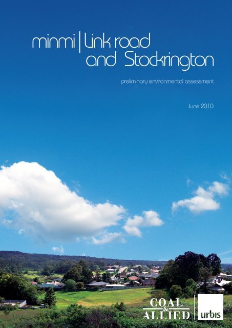
<strong>minmi|Link</strong> <strong>road</strong><br />
<strong>and</strong> <strong>Stockrington</strong><br />
preliminary environmental assessment<br />
June 2010
xdisclaimerx<br />
DISCLAIMER<br />
This report is prepared on the instructions of the party to whom or which it is addressed <strong>and</strong> is thus not suitable for<br />
use other than by that party. As the report involves future forecasts, it can be affected by a number of unforeseen<br />
variables. It represents for the party to whom or which it is addressed the best estimates of Urbis Pty Ltd, but no<br />
assurance is able to be given by Urbis Pty Ltd that the forecasts will be achieved.<br />
URBIS STAFF RESPONSIBLE FOR THIS REPORT WERE:<br />
Director<br />
Associate Director<br />
Job Code<br />
Report Number<br />
Tim Blythe<br />
Sarah Gray<br />
1976G<br />
R1<br />
Copyright © Urbis Pty Ltd<br />
ABN 50 105 256 228<br />
All Rights Reserved. No material may be reproduced without prior permission.<br />
While we have tried to ensure the accuracy of the information in this publication,<br />
the Publisher accepts no responsibility or liability for any errors, omissions or<br />
resultant consequences including any loss or damage arising from reliance in<br />
information in this publication.<br />
URBIS<br />
<strong>Australia</strong> Asia Middle East<br />
www.urbis.com.au
TABLE OF CONTENTS<br />
1 Introduction.......................................................................................................................................1<br />
2 Background.......................................................................................................................................3<br />
3 Site Description ................................................................................................................................5<br />
3.1 Regional <strong>and</strong> Local Context ....................................................................................................5<br />
3.2 The Site ...................................................................................................................................5<br />
4 Description of the proposal.............................................................................................................9<br />
4.1 Overview..................................................................................................................................9<br />
4.2 Concept Plan Application ........................................................................................................9<br />
4.3 State Significant Site Listing..................................................................................................13<br />
5 Relevant Planning Instruments <strong>and</strong> Controls .............................................................................15<br />
5.1 Relevant Planning Provisions & Policies...............................................................................15<br />
5.2 Existing Zoning Provisions ....................................................................................................15<br />
5.3 Lower Hunter Regional Strategy ...........................................................................................16<br />
5.4 Lower Hunter Regional Conservation Plan ...........................................................................17<br />
5.5 Draft Newcastle Lake Macquarie Western Corridor Planning Strategy ................................17<br />
6 Requirements of Environmental Planning & Assessment Act 1979 <strong>and</strong> Major Development<br />
SEPP 2005 .......................................................................................................................................19<br />
6.1 Class of Development/Capital Investment Value ..................................................................19<br />
6.2 Demonstration of Planning Merit ...........................................................................................19<br />
6.3 State <strong>and</strong> Regional Planning Significance ............................................................................19<br />
6.3.1 Criterion (a) of the SSS Guidelines .......................................................................................20<br />
6.3.2 Criterion (b) of the SSS Guidelines .......................................................................................20<br />
6.3.3 Criterion (d) of the SSS Guidelines .......................................................................................21<br />
7 Preliminary Environmental Assessment .....................................................................................23<br />
7.1 Strategic Justification.............................................................................................................23<br />
7.2 Compliance with Statutory Plans...........................................................................................23<br />
7.3 Urban Design, development controls <strong>and</strong> l<strong>and</strong> uses.............................................................23<br />
7.4 Visual Impact .........................................................................................................................23<br />
7.5 Conservation l<strong>and</strong>s & Conservation Corridors ......................................................................24<br />
7.6 Biodiversity ............................................................................................................................24<br />
7.7 Traffic <strong>and</strong> Transport .............................................................................................................25<br />
7.8 Air Quality ..............................................................................................................................26<br />
7.9 Mine Subsidence <strong>and</strong> Former Mining Activities ....................................................................26<br />
7.10 Geotechnical <strong>and</strong> Contaminated L<strong>and</strong>..................................................................................27<br />
7.11 Heritage .................................................................................................................................28<br />
7.11.1 Potential Aboriginal Heritage Impacts ...................................................................................28<br />
7.11.2 Potential Historic Heritage Impacts .......................................................................................28<br />
7.12 Utilities <strong>and</strong> infrastructure......................................................................................................29<br />
7.13 Surface Water <strong>and</strong> Groundwater Quality ..............................................................................29<br />
7.14 Sustainability <strong>and</strong> Ecologically Sustainable Development (ESD) .........................................30<br />
7.15 Bushfire..................................................................................................................................30<br />
7.16 Acoustic Impact .....................................................................................................................31<br />
7.17 Social Infrastructure...............................................................................................................31<br />
7.18 Planning Agreements/Developer Contributions ....................................................................32<br />
Minmi PEA final
TABLE OF CONTENTS<br />
7.19 Staging...................................................................................................................................32<br />
7.20 Site Suitability ........................................................................................................................32<br />
8 Conclusion ......................................................................................................................................33<br />
Appendix A Quantity Surveyor Certificate .................................................................................35<br />
Appendix B<br />
Appendix C<br />
Appendix D<br />
Appendix E<br />
Ecological Statement...............................................................................................37<br />
Traffic Statement......................................................................................................39<br />
Air Quality Statement...............................................................................................41<br />
Mine Subsidence, Contamination <strong>and</strong> Geotechnical Statement.........................43<br />
Appendix F Heritage Statement ..................................................................................................45<br />
Appendix G Infrastructure Statement .........................................................................................47<br />
Appendix H<br />
Drainage, Stormwater Management, Climate Change <strong>and</strong> Flooding Statement49<br />
Appendix I ESD Statement .........................................................................................................51<br />
Appendix J Bushfire Statement ..................................................................................................53<br />
Appendix K<br />
Appendix L<br />
Acoustic Statement..................................................................................................55<br />
Social Infrastructure Statement..............................................................................57<br />
FIGURES:<br />
Figure 1 – Proposed Development <strong>and</strong> Conservation Areas........................................................................... 10<br />
Figure 2 – Proposed Minmi/Link Road & <strong>Stockrington</strong> Concept Plan.............................................................. 11<br />
Figure 3 – Proposed Minmi/Link Road & <strong>Stockrington</strong> Indicative Lot Layout Plan .......................................... 12<br />
Minmi PEA final
INTRODUCTION<br />
1 Introduction<br />
This report has been prepared on behalf of <strong>Coal</strong> & Allied Industries Ltd (<strong>Coal</strong> & Allied), the owner of the<br />
Minmi/Link Road & <strong>Stockrington</strong> sites.<br />
<strong>Coal</strong> & Allied propose to develop 520ha of Minmi/Link Road for residential development with a<br />
maximum yield of 3,300 dwelling lots. The balance of the Minmi/Link Road site (17ha) <strong>and</strong> 2,247ha<br />
(100%) of <strong>Stockrington</strong> (less 300 ha biodiversity offset l<strong>and</strong> to be transferred to RTA <strong>and</strong> then to the<br />
Department of Environment, Climate Change <strong>and</strong> Water (DECCW)) is proposed to be dedicated to the<br />
New South Wales Government (NSWG) for conservation purposes. Other <strong>Coal</strong> & Allied owned sites in<br />
the Lower Hunter region are the subject of similar but separate Part 3A applications to the Department<br />
of Planning (DoP). Overall <strong>Coal</strong> & Allied proposes to dedicate approximately 3,260ha of <strong>Coal</strong> & Allied<br />
l<strong>and</strong> to the NSWG to provide <strong>and</strong> enhance important conservation corridors identified in the Lower<br />
Hunter Regional Strategy (LHRS) <strong>and</strong> Lower Hunter Regional Conservation Plan (LHRCP).<br />
The purpose of this report is to request that:<br />
1. The Minister for Planning agree to consider the subject l<strong>and</strong> at Minmi/Link Road <strong>and</strong> <strong>Stockrington</strong><br />
as a potential State Significant Site (SSS) for rezoning/listing under Schedule 3 of State<br />
Environmental Planning Policy (Major Development) 2005 (Major Development SEPP) to facilitate<br />
the residential development of the Minmi Link Road site <strong>and</strong> conservation <strong>and</strong> proposed dedication<br />
of <strong>Stockrington</strong> to NSWG.<br />
2. The Minister for Planning form an opinion that the Minmi/Link Road <strong>and</strong> <strong>Stockrington</strong> proposal is of<br />
a kind described in Group 5 in Schedule 1 (classes of development) of State Environmental<br />
Planning Policy - Major Development (2005) (Major Development SEPP).<br />
3. Provided the Minister forms the opinion that the project is one to which Part 3A of the<br />
Environmental Planning <strong>and</strong> Assessment Act, 1979 (EP&A Act) applies, the Minister authorise the<br />
proponent to submit a Concept Plan Application for the proposed development at Minmi/Link Road<br />
<strong>and</strong> <strong>Stockrington</strong>.<br />
4. The Director General issue the Director General’s Requirements to inform an Environmental<br />
Assessment to accompany the Concept Plan for the proposed development.<br />
5. The Director General issues the requirements for a State Significant Site Study.<br />
To support the request for the Director General’s Requirements, this submission includes a Preliminary<br />
Environmental Assessment (PEA). This PEA identifies the relevant planning policies <strong>and</strong> provides a<br />
justification for the site to be categorised as being of State or regional environmental planning<br />
significance, that Part 3A of the EP&A Act applies <strong>and</strong> for authorisation of the Concept Plan request.<br />
Finally, it provides a brief outline of the anticipated key issues of the proposed development <strong>and</strong> the<br />
approach to address these matters as part of the Environmental Assessment.<br />
Minmi PEA final Page 1
INTRODUCTION<br />
Minmi PEA final Page 2
BACKGROUND<br />
2 Background<br />
<strong>Coal</strong> & Allied has been operating in the Hunter Valley for more than 150 years, with the earliest coal<br />
mining operations located in the East Maitl<strong>and</strong> area dating back to 1844. Numerous mergers,<br />
expansions <strong>and</strong> acquisitions since then have led to <strong>Coal</strong> & Allied becoming a regionally significant<br />
mining company.<br />
Since 2004 <strong>Coal</strong> & Allied has been majority owned <strong>and</strong> managed by <strong>Rio</strong> <strong>Tinto</strong> <strong>Coal</strong> <strong>Australia</strong> (RTCA).<br />
<strong>Coal</strong> & Allied today is one of the major coal producers in the Hunter Valley, employing around 1,500<br />
people across three operations. With annual coal production of around 30 million tonnes, <strong>Coal</strong> & Allied<br />
continues to evolve as it strives to achieve a vision of being a safe <strong>and</strong> highly successful business<br />
valued by customers, employees, shareholders <strong>and</strong> the community.<br />
<strong>Coal</strong> & Allied has seven separate holdings in the Lower Hunter totalling approximately 4,078 hectares.<br />
Four are located in the northern area comprising Black Hill, Tank Paddock, <strong>Stockrington</strong> <strong>and</strong> Minmi<br />
(including l<strong>and</strong> north <strong>and</strong> south of Link Road). Three are located in the southern area comprising<br />
Gw<strong>and</strong>alan, Catherine Hill Bay (Middle Camp) <strong>and</strong> Nords Wharf. The l<strong>and</strong>holdings are located in four<br />
local government areas of Lake Macquarie, Wyong, Newcastle <strong>and</strong> Cessnock.<br />
The northern l<strong>and</strong>s are located approximately 20 kilometres west of Newcastle <strong>and</strong> are almost halfway<br />
between Newcastle <strong>and</strong> Cessnock. The Minmi l<strong>and</strong> adjoins the existing Minmi township <strong>and</strong> is close to<br />
the emerging Glendale Town Centre <strong>and</strong> the Glendale/Cardiff renewal corridor identified in the Lower<br />
Hunter Regional Strategy (LHRS). These l<strong>and</strong>s are close to the F3 Freeway <strong>and</strong> Newcastle Link Road<br />
transportation corridors. The Minmi l<strong>and</strong>s are adjacent to the Blue Gum Hills Regional Park <strong>and</strong><br />
Hexham Swamp.<br />
The Black Hill site is located at the intersection of the F3 Freeway <strong>and</strong> John Renshaw Drive. Tank<br />
Paddock <strong>and</strong> <strong>Stockrington</strong> are located east <strong>and</strong> west of F3 Freeway <strong>and</strong> fall within the Watagan-<br />
Stockton conservation corridors identified in the LHRS <strong>and</strong> Lower Hunter Regional Conservation Plan.<br />
Gw<strong>and</strong>alan adjoins Lake Macquarie State Conservation Area <strong>and</strong> Chain Valley Bay. Gw<strong>and</strong>alan is on<br />
the western side of Crangan Bay, Lake Macquarie <strong>and</strong> Nords Wharf is on the eastern side. Catherine<br />
Hill Bay <strong>and</strong> Nords Wharf are located between Wallarah National Park <strong>and</strong> Munmorah State<br />
Conservation Area. Catherine Hill Bay is located on the east coast halfway between Swansea Heads<br />
<strong>and</strong> the Budgewoi Peninsula.<br />
Minmi PEA final Page 3
BACKGROUND<br />
Minmi PEA final Page 4
SITE DESCRIPTION<br />
3 Site Description<br />
3.1 Regional <strong>and</strong> Local Context<br />
Minmi/Link Road is located within the Lower Hunter Region. The Minmi/Link Road site is positioned<br />
partly within the Lake Macquarie City Council <strong>and</strong> Newcastle City Council areas <strong>and</strong> is located<br />
approximately 145 km from Sydney <strong>and</strong> approximately 17kms northwest of the Newcastle City Centre.<br />
Outer lying suburbs such as Wallsend are within 5km of the Minmi Township, which includes a district<br />
centre commercial core. New residential subdivisions have been approved to the north, south <strong>and</strong> east<br />
of the Minmi/Link Road estates, which also contribute to providing some of the forecast growth in the<br />
LHRS to be accommodated within new release areas, such as Cameron Park.<br />
The Minmi/Link Road site, comprising Minmi <strong>and</strong> the l<strong>and</strong> to the north <strong>and</strong> south of the Link Road is<br />
bounded by the F3 Freeway to the west, Blue Gum Hills Regional Park to the east, Hexham Swamp to<br />
the north <strong>and</strong> traverses the Newcastle Link Road to its southern boundary with Cameron Park. Minmi is<br />
an historic mining town with a current population of approximately 732 people.<br />
The <strong>Stockrington</strong> site, located mostly within the Cessnock Council area, adjoins the Mount Sugarloaf<br />
Recreation Reserve <strong>and</strong> the Heaton State Forest to the southwest <strong>and</strong> the Pambalong Nature Reserve<br />
(part of Hexham Swamp) to the north east <strong>and</strong> forms part of this sizable vegetation corridor. It also<br />
adjoins the small settlement of Seahampton to the southeast. <strong>Stockrington</strong> forms part of the Watagan<br />
Ranges to Port Stephens conservation area identified in the Lower Hunter Regional Conservation Plan<br />
(LHRCP).<br />
The <strong>Coal</strong> & Allied owned l<strong>and</strong> at <strong>Stockrington</strong> that is proposed to be dedicated for conservation will play<br />
a significant role in securing in perpetual ownership the Watagan Ranges to Port Stephens<br />
conservation area. The proposed l<strong>and</strong> dedication is a positive conservation step that will protect an<br />
important array of vegetation communities, flora <strong>and</strong> fauna species, <strong>and</strong> natural l<strong>and</strong>scape assets,<br />
including threatened species <strong>and</strong> endangered ecological communities in the conservation l<strong>and</strong>s. The<br />
environmental gain from the environmental l<strong>and</strong> offset package is a once in a generation opportunity<br />
that will provide an enduring legacy for the community <strong>and</strong> future generations.<br />
3.2 The Site<br />
The Minmi/Link Road site is owned by Minmi L<strong>and</strong> Pty Ltd, a wholly owned subsidiary of <strong>Coal</strong> & Allied<br />
Industries Ltd (<strong>Coal</strong> & Allied) <strong>and</strong> comprises approximately 538ha. The Minmi/Link Road estates<br />
comprise the allotments with the following legal description:<br />
• Part Lot 71 DP 1065169<br />
• (Lot 711 DP 1113237 is proposed to be sold to the Roads <strong>and</strong> Traffic Authority).<br />
• Lot 351 DP 1108608; (previously known as Lot 35 DP 800036).<br />
• Lot 6 DP 1044574.<br />
• Lot 2 DP 877349.<br />
• Lot 3 DP 877349.<br />
• Lot 48 DP 115128<br />
These lots are known as Link Road North, Link Road South <strong>and</strong> Minmi l<strong>and</strong>s.<br />
The <strong>Stockrington</strong> l<strong>and</strong> that is proposed to be dedicated to NSWG as conservation l<strong>and</strong>s has a total area<br />
of 2,247ha. The l<strong>and</strong> parcels contained in the table below comprise the <strong>Stockrington</strong> l<strong>and</strong>s for<br />
conservation.<br />
The current title descriptions for the <strong>Coal</strong> & Allied owned <strong>Stockrington</strong> l<strong>and</strong>holding are:<br />
Minmi PEA final Page 5
SITE DESCRIPTION<br />
83//DP755260 Part 71//DP1065169 2//DP551917 12//DP1078246<br />
84//DP755260 2//DP250339 30//DP1085228 1//DP250339<br />
8//DP755260 2//DP124209 96//DP755260 82//DP755260<br />
51//DP1095513 1//DP155446 3//DP250339 1//DP877416<br />
89//DP755260 1//DP503566 79//DP755260 1//DP505578<br />
13//DP1078246 3//DP977096 1//DP1126627 4//DP877416<br />
72//DP755260 2//DP877416 1//DP123945 126//DP755262<br />
125//DP755260 1//DP1039968 5//DP250339 2//1126627<br />
1//DP124209 9//DP1078246 3//DP877416<br />
4//DP977096<br />
1//DP119630<br />
95//DP755260<br />
4//DP250339<br />
The key aspects of the site are:<br />
Minmi:<br />
101//DP881099<br />
The Minmi Township was originally a cattle station which was converted into a coal mine in the 1850s.<br />
The l<strong>and</strong> is underlain by coal mine workings in two seams, the Young Wallsend <strong>and</strong> the Borehole<br />
seams. Underground mining first commencing in the mid 1800’s where it is understood that mining<br />
continued to operate as such until 1925. In 1900’s open cut mining commenced for a further 5 years,<br />
primarily around Minmi Creek <strong>and</strong> Back Creek.<br />
The l<strong>and</strong> has been owned by <strong>Coal</strong> & Allied for many years for coal mining. The lease for underground<br />
<strong>and</strong> surface mining for the site has been relinquished.<br />
L<strong>and</strong> ownership within Minmi is highly fragmented, with most allotments within the township privately<br />
owned, however the surrounding l<strong>and</strong> is held generally held in single ownership by <strong>Coal</strong> & Allied.<br />
The key aspects of the Minmi Township <strong>and</strong> surrounding l<strong>and</strong>s are:<br />
• There are several existing privately owned houses within the development areas, which are<br />
proposed to be accommodated within the future residential subdivision.<br />
• The Minmi township includes several heritage items.<br />
• The distinct character of the existing built environment of Minmi comprises :<br />
−<br />
−<br />
−<br />
Single storey dwellings along Woodford Street.<br />
Dwellings positioned on hillsides.<br />
Dwellings are predominantly timber clad <strong>and</strong> fibro with metal roofs with evidence of more recent<br />
brick construction dwellings.<br />
• Past mining activity in Minmi is evident through the presence of filled embankments <strong>and</strong> cuttings<br />
that formed the former rail lines; the presence of open cut mines <strong>and</strong> capped shafts <strong>and</strong> other<br />
mining infrastructure.<br />
Minmi PEA final Page 6
SITE DESCRIPTION<br />
• Access to Minmi from the north is via Lenaghans Drive <strong>and</strong> via Newcastle Link Road <strong>and</strong> Woodford<br />
Street from the south. Minmi Road provides access from the east <strong>and</strong> intersects with Woodford<br />
Street.<br />
• The terrain ranges from gentle slopes through to steep topography <strong>and</strong> consists of cleared areas<br />
through to dense vegetation.<br />
• Several watercourses run through the site, which drain into Hexham Swamp, a large wetl<strong>and</strong><br />
system of the Hunter River Estuary. The main channel of Minmi Creek flows through Minmi West, to<br />
the west of the existing Minmi village area. Other additional tributaries on the Minmi East area<br />
discharge directly to Hexham Swamp.<br />
Link Road North <strong>and</strong> South<br />
The Link Road North area is a densely vegetated area which is disconnected from the Conservation<br />
L<strong>and</strong>s by the existing <strong>road</strong> network. Similarly, the Link Road South l<strong>and</strong> is densely vegetated <strong>and</strong><br />
disconnected from surrounding conservation areas by other residential subdivisions such as Edgeworth<br />
<strong>and</strong> Cameron Park, as well as the existing <strong>road</strong> network.<br />
The Link Road North <strong>and</strong> South l<strong>and</strong> has remained relatively undeveloped <strong>and</strong> undisturbed to date.<br />
Underground mining activities of the late 1800s present some stability issues for the l<strong>and</strong> which consists<br />
of moderately to steeply undulating terrain. However vegetation clearing has occurred to accommodate<br />
transmission lines within transmission easements <strong>and</strong> fire access tracks.<br />
L<strong>and</strong> relating to an unformed <strong>road</strong> reserve was recently transferred from the Crown to the control of<br />
Lake Macquarie City Council under the Roads Act 1993 <strong>and</strong> extends along the eastern portion of the<br />
Link Road North area.<br />
Surface levels of the Link Road North <strong>and</strong> South areas range from about 20m AHD at the northern <strong>and</strong><br />
southern boundaries to about 90m AHD at the Link Road. Evidence of previous mining activities<br />
includes two capped shafts <strong>and</strong> remnants of previous structures including a number of old slabs <strong>and</strong><br />
footings.<br />
Back Creek, a major tributary of Minmi Creek, rises on the Link Road North estate <strong>and</strong> flows north<br />
though Minmi East area, before entering Minmi Creek just prior to discharging into Hexham Swamp.<br />
Brush Creek rises on the Link Road South estate <strong>and</strong> flows south through Edgeworth to Cockle Creek,<br />
ultimately discharging into Lake Macquarie adjacent to Boolaroo.<br />
The l<strong>and</strong> is all held within single ownership by <strong>Coal</strong> & Allied which enables it to be developed as a<br />
single area.<br />
<strong>Stockrington</strong>:<br />
The <strong>Stockrington</strong> site is located within three Council areas. The site incorporates listed heritage items<br />
associated with the former Richmond Vale Railway <strong>and</strong> collieries in <strong>Stockrington</strong>. The site is highly<br />
constrained by topography <strong>and</strong> watercourses <strong>and</strong> parts of the site are highly remote with restricted<br />
access. It is a regionally significant parcel of l<strong>and</strong> given its ecological significance, size <strong>and</strong> single<br />
ownership. The site is predominantly vegetated with some cleared areas. The Hunter Expressway<br />
(previously known as F3 to Branxton Link) will traverse the site.<br />
Minmi PEA final Page 7
SITE DESCRIPTION<br />
Minmi PEA final Page 8
DESCRIPTION OF THE PROPOSAL<br />
4 Description of the proposal<br />
4.1 Overview<br />
It is requested that the Director General issue the requirements for a comprehensive environmental<br />
assessment to accompany a proposal for the listing of the Minmi/Link Road <strong>and</strong> <strong>Stockrington</strong> sites as a<br />
State Significant Site under Schedule 3 of the Major Development SEPP <strong>and</strong> for the lodgement of a<br />
concurrent Part 3A Concept Plan application for the entire site.<br />
4.2 Concept Plan Application<br />
The Concept Plan for a residential subdivision of the Minmi/Link Road site will apply to the entire<br />
approximately 537ha Minmi/Link Road site <strong>and</strong> 2,247ha <strong>Stockrington</strong> site. The key parameters for the<br />
proposed development of the site are as follows:<br />
• Dedication of 2,264ha of conservation l<strong>and</strong> (less 300 ha biodiversity offset l<strong>and</strong> to be transferred to<br />
RTA <strong>and</strong> then to DECCW) to the NSWG that is identified in the LHRS <strong>and</strong> Lower Hunter Regional<br />
Conservation Plan, comprising 100% of the <strong>Stockrington</strong> site <strong>and</strong> approximately 17ha of the<br />
Minmi/Link Road site.<br />
• Maximum dwelling yield of 3,300 dwellings over 520ha.<br />
• Indicative development staging.<br />
• The provision of associated infrastructure.<br />
• Torrens title subdivision of the Minmi/Link Road site. The Torrens title subdivision of <strong>Coal</strong> & Allied<br />
l<strong>and</strong> will enable the following:<br />
−<br />
−<br />
To dissect l<strong>and</strong> on either side of the F3 Freeway <strong>and</strong> to separate the development lot from the<br />
conservation l<strong>and</strong>.<br />
To enable the transfer of approximately 17ha of l<strong>and</strong> at Minmi/Link Road to the North of the<br />
Minmi Rural Fire shed to NSWG for conservation purposes.<br />
Approval will not be sought under the Concept Plan for a specific lot or <strong>road</strong> layout. An indicative lot<br />
<strong>and</strong> <strong>road</strong> layout will indicate how the maximum dwelling yield of 3,300 dwellings could be achieved on<br />
the site.<br />
Similarly, approval will not be sought under the Concept Plan for subdivision or construction of<br />
individual houses. However, the desired future character of the proposed concept plan will be included<br />
in Urban Design Guidelines. Urban Design Guidelines will be prepared to inform the Concept Plan for<br />
Stage 1, the Minmi East precinct, in respect of urban form, built form, open space <strong>and</strong> l<strong>and</strong>scape,<br />
access <strong>and</strong> movement <strong>and</strong> visual impact for the site.<br />
Five developable precincts are proposed under the Concept Plan, located around the Minmi township<br />
<strong>and</strong> to the north <strong>and</strong> south of Link Road. The proposed developable areas have been established on<br />
the basis of detailed investigations in respect to existing environmental constraints <strong>and</strong> opportunities for<br />
future sustainable growth. The proposed developable precincts are:<br />
• Minmi East: Proposed to be located between existing Minmi township <strong>and</strong> The Outlook, to act as a<br />
“gateway” to the east.<br />
• Minmi Extension: Proposed to be located west of existing Minmi township incorporating existing<br />
Garden House <strong>and</strong> Workshop heritage parks.<br />
• Village Centre: Proposed to be located in the centre of the site, <strong>and</strong> is proposed as a new activity<br />
hub for the area.<br />
Minmi PEA final Page 9
DESCRIPTION OF THE PROPOSAL<br />
• Link Road North: Proposed to be located along the northern boundary of the Newcastle Link Road,<br />
acting as “gateway” to existing <strong>and</strong> future development in the south.<br />
• Link Road South: Proposed to be located south of Newcastle Link Road, including a connector<br />
<strong>road</strong> linking the proposed development with Cameron Park <strong>and</strong> other future developments.<br />
It is proposed to dedicate l<strong>and</strong> for conservation purposes as part of the Major Project Application via a<br />
Voluntary Planning Agreement (VPA) between <strong>Coal</strong> & Allied <strong>and</strong> the NSWG in accordance with s.93F<br />
of the Environmental Planning & Assessment Act, 1979 (EP&A Act).<br />
The proposed Concept Plan seeks to facilitate residential development that is generally not permissible<br />
under the existing planning provisions <strong>and</strong> therefore a State Significant listing/rezoning is proposed<br />
under the Major Development SEPP, which will provide the statutory mechanism for approval of the<br />
Concept Plan <strong>and</strong> associated future development. This is discussed at Section 4.3.<br />
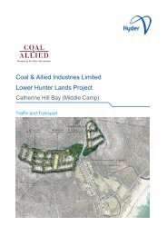
A Plan showing the proposed development areas <strong>and</strong> conservation areas is shown at Figure 1. The<br />
proposed Concept Plan for the site is shown at Figure 2. The Indicative Lot Layout Plan is shown at<br />
Figure 3.<br />
Figure 1 – Proposed Development <strong>and</strong> Conservation Areas<br />
Minmi PEA final Page 10
DESCRIPTION OF THE PROPOSAL<br />
Figure 2 – Proposed Minmi/Link Road & <strong>Stockrington</strong> Concept Plan<br />
Minmi PEA final Page 11
DESCRIPTION OF THE PROPOSAL<br />
Figure 3 – Proposed Minmi/Link Road & <strong>Stockrington</strong> Indicative Lot Layout Plan<br />
Minmi PEA final Page 12
DESCRIPTION OF THE PROPOSAL<br />
4.3 State Significant Site Listing<br />
It is proposed that the entire <strong>Coal</strong> & Allied owned Minmi/Link Road <strong>and</strong> <strong>Stockrington</strong> sites be<br />
rezoned/listed as a ‘State Significant Site’ (SSS) in Schedule 3 of State Environmental Planning Policy<br />
(Major Development) 2005. A draft Schedule 3 listing will be prepared with the Concept Plan<br />
Application. The proposed zoning for the sites are:<br />
• Residential areas zoned R2 Low Density Residential Zone, with the following uses permissible with<br />
consent:<br />
−<br />
Advertisements; advertising structures; attached dwellings; bed <strong>and</strong> breakfast accommodation;<br />
car parking; child care centres; community facilities; dwelling houses; environmental facilities;<br />
filming; food <strong>and</strong> drink premises (not exceeding floor space 200m 2 ); group homes; health<br />
consulting rooms (not exceeding floor space 200m 2 ); home based child care or family day care<br />
homes; home business; home industries; information <strong>and</strong> education facilities; multi dwelling<br />
housing; neighbourhood shops; places of public worship; recreation areas; recreation facilities<br />
(outdoor); residential care facilities; schools; seniors housing; semi detached dwellings;<br />
signage; takeaway food premises (not exceeding floor space 200m 2 ).<br />
• Village centres in Minmi East Precinct <strong>and</strong> Minmi Village Centre Precinct zoned B2 Local Centre,<br />
with the following uses permissible with consent:<br />
−<br />
Advertisements; advertising structures; business premises; car parks; child care centres;<br />
community facilities; entertainment facilities; environmental facilities; filming; food <strong>and</strong> drink<br />
premises; function centres; funeral chapels; funeral homes; health consulting rooms; home<br />
business; hotel or motel accommodation; information <strong>and</strong> education facilities; kiosks; markets;<br />
medical centres; mixed use development; neighbourhood shops; office premises; passenger<br />
transport facilities; places of public worship; public administration buildings; pubs; recreation<br />
area, recreation facilities (indoor); recreation facilities (outdoor), registered clubs; residential flat<br />
buildings; restaurants; retail premises; schools; seniors housing; service stations; shop top<br />
housing; signage; take away food <strong>and</strong> drink premises; tourist <strong>and</strong> visitor accommodation;<br />
veterinary hospitals.<br />
• <strong>Stockrington</strong> <strong>and</strong> the northern 17ha tip of Minmi to be zoned E1 National Parks <strong>and</strong> Nature<br />
Reserves. This l<strong>and</strong> is proposed to be dedicated to the NSWG.<br />
It is proposed that the SSS listing/rezoning for the sites delineate zones <strong>and</strong> associated development<br />
controls as well as establish the future approval/consent authority regimes. This will set in place what<br />
areas are to be developed <strong>and</strong> what areas are to be conserved <strong>and</strong> the future planning controls that will<br />
apply.<br />
A new planning regime is required to rezone the sites to upgrade the permissible l<strong>and</strong> uses <strong>and</strong> to<br />
enable the development of the site for residential uses.<br />
It is proposed that the Schedule 3 amendment to the SEPP introduce a new statutory planning<br />
framework for the Minmi/Link Road <strong>and</strong> <strong>Stockrington</strong> sites that includes:<br />
• Aims <strong>and</strong> objectives for each site.<br />
• Zoning <strong>and</strong> permissible uses.<br />
• Key development controls.<br />
• The future consent/approval regime.<br />
Minmi PEA final Page 13
DESCRIPTION OF THE PROPOSAL<br />
Minmi PEA final Page 14
RELEVANT PLANNING INSTRUMENTS AND CONTROLS<br />
5 Relevant Planning Instruments <strong>and</strong> Controls<br />
The project has already been referred to the Commonwealth Department of the Environment, Water<br />
Heritage <strong>and</strong> the Arts pursuant to the Environment Protection <strong>and</strong> Biodiversity Conservation Act 1999<br />
(EPBC Act) provisions <strong>and</strong> has not been declared a “controlled action”. No further referrals are<br />
required for this project under the EPBC Act.<br />
5.1 Relevant Planning Provisions & Policies<br />
The following current <strong>and</strong> draft state, regional <strong>and</strong> local planning controls <strong>and</strong> policies apply to the site:<br />
• Lower Hunter Regional Strategy;<br />
• Lower Hunter Regional Conservation Plan;<br />
• SEPP Major Development;<br />
• SEPP 71 - Coastal Protection;<br />
• SEPP 14 - Coastal Wetl<strong>and</strong>s;<br />
• SEPP 44 - Koala Habitat Protection;<br />
• SEPP 55 - Remediation of L<strong>and</strong>;<br />
• SEPP (Mining, Petroleum Production <strong>and</strong> Extractive Industries) 2007;<br />
• SEPP (Building Sustainability Index: BASIX) 2004;<br />
• SEPP (Infrastructure) 2007;<br />
• Review of Infrastructure Contributions Planning Circular PS08-017;<br />
• Hunter Regional Environmental Plan 1989 (Heritage);<br />
• Draft NSW Centres Policy;<br />
• Lake Macquarie Local Environmental Plan 2004;<br />
• Newcastle Local Environmental Plan 2003;<br />
• Cessnock Local Environmental Plan 1989;<br />
• Draft Newcastle Lake Macquarie – Western Corridor Planning Strategy; <strong>and</strong><br />
• Planning for Bushfire Protection 2006.<br />
5.2 Existing Zoning Provisions<br />
Newcastle Local Environmental Plan 2003 (NLEP 2003) applies to the northern portion of the<br />
Minmi/Link Road site. Under the NLEP 2003, the following zones apply to the Minmi/Link Road site:<br />
• 2 (a) Residential Zone<br />
• 7 (b) Environmental Protection Zone<br />
• 7 (c) Environmental Investigation Zone<br />
Lake Macquarie Local Environmental Plan 2004 (LEP 2004) applies to the southern portion of the<br />
Minmi/Link Road site. Under the Lake Macquarie LEP 2004, the following zones apply to the<br />
Minmi/Link Road site:<br />
• 7(2) Conservation (Secondary).<br />
Minmi PEA final Page 15
RELEVANT PLANNING INSTRUMENTS AND CONTROLS<br />
• 10 Investigation (Urban/ Conservation Zone).<br />
• 5 Infrastructure Zone.<br />
The <strong>Stockrington</strong> l<strong>and</strong> proposed for dedication to the NSWG is situated within Lake Macquarie City<br />
Council <strong>and</strong> Cessnock local government areas <strong>and</strong> is currently subject to the following zones:<br />
• 7(2) Conservation (Secondary) <strong>and</strong> 5 Infrastructure Zone under the Lake Macquarie LEP 2004.<br />
• 1(a) Rural <strong>and</strong> 5(b) Special Uses (Railways Zone) under the Cessnock LEP 1989.<br />
Under the draft Cessnock LEP 2009 (which has been publicly exhibited), the site is proposed to be<br />
zoned as follows:<br />
• E3 Environmental Management Zone;<br />
• E2 Environmental Conservation Zone; <strong>and</strong><br />
• SP 2 Infrastructure Zone (Railway <strong>and</strong> Hunter Expressway).<br />
The proposed Concept Plan seeks to facilitate residential development that is not currently permissible<br />
over the majority of the Minmi/Link Road l<strong>and</strong> under the existing planning provisions (except for a<br />
portion of l<strong>and</strong> that is currently zoned 2(a) residential under NLEP 2003) <strong>and</strong> therefore a State<br />
Significant listing is proposed under the Major Development SEPP, which will provide the statutory<br />
mechanism for rezoning of the l<strong>and</strong> <strong>and</strong> approval of the Concept Plan <strong>and</strong> associated future<br />
development.<br />
The current Cessnock Council rural zoning of <strong>Stockrington</strong> (dating from 1989) which covers about 70%<br />
of the site is considered inappropriate to ensure suitable long term conservation for this ecologically<br />
sensitive site. Furthermore, <strong>Stockrington</strong> is in private ownership. Consequently, <strong>Stockrington</strong> cannot<br />
be protected in accordance with NPWS best practice. If however the l<strong>and</strong> is rezoned to the highest<br />
conservation zoning available under the St<strong>and</strong>ard Instrument – Principal LEP (E1 National Parks <strong>and</strong><br />
Nature Reserves) <strong>and</strong> dedicated to NSWG, it will be locked away permanently <strong>and</strong> protected in<br />
perpetuity. This is a significant gain to the community.<br />
5.3 Lower Hunter Regional Strategy<br />
The Lower Hunter Regional Strategy (LHRS) is the key planning policy to guide the growth in the Lower<br />
Hunter to 2031 by identifying future development areas, principal l<strong>and</strong> use types, settlement patterns<br />
<strong>and</strong> conservation outcomes. It is the principal document upon which Environmental Planning<br />
Instruments <strong>and</strong> major l<strong>and</strong> use <strong>and</strong> development decisions should be based.<br />
The NSWG released the final LHRS on 17 October 2006. It is understood that Cabinet re-endorsed it in<br />
December 2009. The LHRS plans for population growth of 160,000 people by the year 2031.<br />
The LHRS identifies the Minmi/Link Road <strong>and</strong> <strong>Stockrington</strong> site for proposed urban development <strong>and</strong><br />
proposed conservation l<strong>and</strong> dedications. The proposal is entirely consistent with the LHRS.<br />
The Minmi/Link Road site is one of the four <strong>Coal</strong> & Allied sites in the northern <strong>and</strong> southern l<strong>and</strong>s<br />
proposed for residential development which will assist in achieving the forecast growth in the Lower<br />
Hunter. Whilst geographically separate they will make a significant contribution to the overall growth of<br />
the Lower Hunter region.<br />
The securing, protection <strong>and</strong> management of conservation corridors is a key focus of both the LHRS<br />
<strong>and</strong> the companion LHRCP. The proposed development of 520ha of l<strong>and</strong> at Minmi/Link Road <strong>and</strong><br />
proposed dedication of 2,264ha (less 300 ha biodiversity offset l<strong>and</strong> to be transferred to RTA <strong>and</strong> then<br />
to the DECCW) of l<strong>and</strong> at Minmi/Link Road <strong>and</strong> <strong>Stockrington</strong> is crucial in achieving the State<br />
Government’s objective of securing major conservation corridors identified in the LHRS, most notably<br />
the Watagan to Stockton Green Corridor. The proposed development of the Minmi/Link Road site <strong>and</strong><br />
proposed substantial l<strong>and</strong> dedication of the <strong>Stockrington</strong> site is an integral element of the LHRS.<br />
Minmi PEA final Page 16
RELEVANT PLANNING INSTRUMENTS AND CONTROLS<br />
5.4 Lower Hunter Regional Conservation Plan<br />
The Lower Hunter Regional Conservation Plan provides a focus for conservation efforts until 2031 by<br />
identifying priority biodiversity areas in the Lower Hunter. As discussed, the securing, protection <strong>and</strong><br />
management of conservation corridors is a key focus of the LHRCP. The proposed dedication of<br />
2,264ha (less 300 ha of biodiversity offset l<strong>and</strong> to be transferred to RTA <strong>and</strong> then to the DECCW) of the<br />
<strong>Coal</strong> & Allied owned Minmi/Link Road <strong>and</strong> <strong>Stockrington</strong> site for conservation purposes as an offset for<br />
the proposed development of 520ha of l<strong>and</strong> is crucial in achieving the state government’s objective of<br />
securing major conservation corridors, most notably the long sought after Watagans to Stockton Green<br />
Corridor.<br />
5.5 Draft Newcastle Lake Macquarie Western Corridor Planning<br />
Strategy<br />
Identified as regionally significant under the LHRS, the Western Corridor stretches from Beresfield to<br />
Killingworth, <strong>and</strong> has l<strong>and</strong> in both Newcastle <strong>and</strong> Lake Macquarie Local Government Areas, including<br />
the Minmi/Link Road estates. The Newcastle – Lake Macquarie Western Corridor Planning Strategy<br />
(draft Western Corridor Planning Strategy) was released in October 2008. A revised Consultation Draft<br />
of the Western Corridor Strategy was issued by DoP in April 2009 <strong>and</strong> placed on public exhibition.<br />
The draft Western Corridor Strategy identifies planning principles that will assist in sustainably meeting<br />
the projected housing densities included in the draft Western Corridor Planning Strategy. These<br />
principles were developed with due consideration to environmental constraints, existing l<strong>and</strong> use<br />
patterns <strong>and</strong> stakeholder consultation. There is a strong environmental focus in the planning principles,<br />
with the preservation of vegetation corridors, sustainability <strong>and</strong> heritage conservation all to be<br />
considered in future development in the Corridor. A key feature of the draft Western Corridor Planning<br />
Strategy is the Watagans to Stockton Green Corridor that runs through the centre of the Western<br />
Corridor.<br />
An assessment against each of the development criteria <strong>and</strong> planning principles listed in draft Western<br />
Corridor Planning Strategy will be undertaken in the Environmental Assessment for Minmi to illustrate<br />
its suitability for future residential <strong>and</strong> conservation purposes. In summary, the development of the<br />
Minmi/Link Road site for residential purposes is consistent with the planning principles contained in the<br />
draft Western Corridor Planning Strategy as it will:<br />
• Assist in meeting the projected housing densities included in the draft Western Corridor Planning<br />
Strategy, which will facilitate a major contribution to residential development within the Newcastle<br />
<strong>and</strong> Lake Macquarie Local Government Areas.<br />
• Provide increased <strong>and</strong> improved social infrastructure to meet the dem<strong>and</strong>s of the new <strong>and</strong> existing<br />
residents.<br />
• Result in the dedication of 2,264ha of conservation l<strong>and</strong> (less 300 ha biodiversity offset l<strong>and</strong> to be<br />
transferred to RTA <strong>and</strong> then to DECCW) to NSWG for conservation, which will help secure the<br />
conservation corridor between the Watagan Ranges <strong>and</strong> Stockton Bight.<br />
• Provide a ‘green entry statement’ along Newcastle Link Road collectively on the RTA (Link Road)<br />
<strong>and</strong> <strong>Coal</strong> & Allied development l<strong>and</strong>s. It is envisaged this corridor will provide for arboreal <strong>and</strong><br />
highly mobile faunal guilds movement through the local l<strong>and</strong>scape into larger patches of offsite<br />
habitat.<br />
Minmi PEA final Page 17
RELEVANT PLANNING INSTRUMENTS AND CONTROLS<br />
•<br />
Minmi PEA final Page 18
REQUIREMENTS OF ENVIRONMENTAL PLANNING & ASSESSMENT ACT 1979 AND<br />
MAJOR DEVELOPMENT SEPP 2005<br />
6 Requirements of Environmental Planning &<br />
Assessment Act 1979 <strong>and</strong> Major Development<br />
SEPP 2005<br />
6.1 Class of Development/Capital Investment Value<br />
Schedule 1, Clause 13 of the Major Development SEPP lists the types or classes of development that<br />
may be considered as Part 3A projects.<br />
The relevant type or class for this project is listed in ‘Group 5 - Residential, commercial or retail projects’<br />
<strong>and</strong> as provided below:<br />
(1) Development for the purpose of residential, commercial or retail projects with a capital<br />
investment of more than $100 million.<br />
(2) This clause does not apply to major development within the meaning of section 31 of<br />
the City of Sydney Act 1988.<br />
The Capital Investment Value (CIV) for Minmi/Link Road, as defined in the Major Development SEPP,<br />
has been determined by Davis Langdon <strong>and</strong> their assessment of the CIV for the project is $839.65m.<br />
A copy of the advice is included at Appendix A.<br />
The proposal is therefore clearly of a kind that satisfies the definition of a ‘residential project’.<br />
6.2 Demonstration of Planning Merit<br />
Given the size <strong>and</strong> complexity of the proposal, a Concept Plan for Minmi/Link Road <strong>and</strong> <strong>Stockrington</strong><br />
would enable key site parameters associated with l<strong>and</strong> use, infrastructure delivery <strong>and</strong> timing, <strong>and</strong><br />
environmental conservation to be resolved up front, with subsequent detailed stages being submitted<br />
for approval as the site develops progressively.<br />
Under the provisions of the Environmental Planning <strong>and</strong> Assessment Regulation 2000, the Minister has<br />
discretion to determine whether or not to authorise a Concept Plan to be accepted under Part 3A of the<br />
EP&A Act if any part of the project would otherwise be prohibited by an environmental planning<br />
instrument.<br />
In this case, the Concept Plan proposal for residential development at Minmi/Link Road is currently<br />
prohibited across the majority of the site.<br />
Therefore, to assist the Minister’s consideration of the proposal <strong>and</strong> authorise the proponent to submit a<br />
Concept Plan Application for the proposed development at Minmi/Link Road <strong>and</strong> <strong>Stockrington</strong>, Sections<br />
5.3, 5.4 <strong>and</strong> 5.5 of this report seeks to demonstrate the planning merits of the project having regard to<br />
the relevant strategic planning policy.<br />
6.3 State <strong>and</strong> Regional Planning Significance<br />
The Department of Planning’s (DoP’s) ‘Guideline for State Significant Sites under the Major<br />
Development SEPP’, provides that when considering whether a site can be categorised as being of<br />
State significance, the Minister will consider whether the site meets one or more of the following criteria:<br />
(a) be of regional or state importance because it is in an identified strategic location (in a State or<br />
regional strategy), its importance to a particular industry sector, or its employment, infrastructure,<br />
service delivery or redevelopment significance in achieving government policy objectives; or<br />
(b) be of regional or state environmental conservation or natural resource importance in achieving State<br />
or regional objectives. For example protecting sensitive wetl<strong>and</strong>s or coastal areas; or<br />
Minmi PEA final Page 19
REQUIREMENTS OF ENVIRONMENTAL PLANNING & ASSESSMENT ACT 1979 AND<br />
MAJOR DEVELOPMENT SEPP 2005<br />
(c) be of regional or state importance in terms of amenity, cultural, heritage, or historical significance in<br />
achieving State or regional objectives. For example sensitive redevelopment of heritage precincts; or<br />
(d) need alternative planning or consent arrangements where:<br />
(i) added transparency is required because of potential conflicting interests.<br />
(ii) more than one local council is likely to be affected.<br />
It is considered that the proposal for the Minmi/Link Road <strong>and</strong> <strong>Stockrington</strong> sites directly meet criteria<br />
(a), (b) <strong>and</strong> (d).<br />
6.3.1 Criterion (a) of the SSS Guidelines<br />
Criterion (a) of the SSS Guidelines states that a site can be categorised as being of State significance if<br />
the Minister considers it to be of regional or State importance because it is in an identified strategic<br />
location (in a State or regional strategy), its importance to a particular industry sector, or its<br />
employment, infrastructure, service delivery or redevelopment significance in achieving government<br />
policy objectives.<br />
The <strong>Coal</strong> & Allied owned Minmi/Link Road <strong>and</strong> <strong>Stockrington</strong> sites have been recognised for their State<br />
<strong>and</strong> regional significance based on the inclusion in the LHRS for proposed urban development <strong>and</strong><br />
conservation purposes.<br />
<strong>Coal</strong> & Allied propose to develop 520ha of Minmi/Link Road for residential development with a<br />
maximum yield of 3,300 dwelling lots. The balance of the Minmi/Link Road (17ha) <strong>and</strong> <strong>Stockrington</strong><br />
(2,247ha - less 300ha of biodiversity offset l<strong>and</strong> to be transferred to RTA <strong>and</strong> then to DECCW) is<br />
proposed to be dedicated to the NSWG for conservation purposes. The conservation l<strong>and</strong> proposed to<br />
be dedicated to NSWG will provide <strong>and</strong> enhance vitally important conservation corridors identified in the<br />
LHRS <strong>and</strong> LHRCP, most notably the Watagans to Stockton Green Corridor.<br />
The proposed dedication of l<strong>and</strong> to the NSWG for conservation purposes will significantly contribute to<br />
ensuring that key strategic parcels of l<strong>and</strong> that complete long sought-after regional biodiversity<br />
conservation corridors are retained in perpetuity by NSWG.<br />
The proposal for Minmi/Link Road <strong>and</strong> <strong>Stockrington</strong> is considered to meet the criteria for a State<br />
Significant Site both as an individual parcel <strong>and</strong> as an integral part of the overall <strong>Coal</strong> & Allied<br />
environmental l<strong>and</strong> package that will achieve substantial conservation outcomes through proposed l<strong>and</strong><br />
dedication as set out in the LHRS <strong>and</strong> LHRCP.<br />
Furthermore, the proposed 3,300 dwellings at Minmi/Link Road will help achieve the State<br />
Government’s objective to cater for the predicted population growth for the Lower Hunter Region until<br />
2031.<br />
In our opinion, the proposal for Minmi/Link Road <strong>and</strong> <strong>Stockrington</strong> sites satisfies criterion (a) of the SSS<br />
Guidelines.<br />
6.3.2 Criterion (b) of the SSS Guidelines<br />
Criterion (b) of the SSS Guidelines states that a site can be categorised as being of state significance if<br />
the Minister considers the site to be of regional or state environmental conservation or natural resource<br />
importance in achieving State or regional objectives.<br />
As stated, the expansion, management <strong>and</strong> protection of the Watagans to Stockton Green Corridor for<br />
conservation <strong>and</strong> biodiversity is a key focus of the LHRS <strong>and</strong> the companion LHRCP. <strong>Coal</strong> & Allied is<br />
proposing to dedicate approximately 2,264ha of Minmi/Link Road <strong>and</strong> <strong>Stockrington</strong> (less 300ha of<br />
biodiversity offset l<strong>and</strong> to be transferred to RTA <strong>and</strong> then to DECCW) to the NSWG as ‘conservation<br />
l<strong>and</strong>’ to provide an important component of the Watagans to Stockton Green Corridor. The proposed<br />
<strong>Coal</strong> & Allied l<strong>and</strong> dedication will clearly help exp<strong>and</strong> <strong>and</strong> enhance the biodiversity <strong>and</strong> conservation<br />
values of the Watagans to Stockton Green Corridor.<br />
Minmi PEA final Page 20
REQUIREMENTS OF ENVIRONMENTAL PLANNING & ASSESSMENT ACT 1979 AND<br />
MAJOR DEVELOPMENT SEPP 2005<br />
<strong>Coal</strong> & Allied is also proposing to dedicate approximately 147ha of the Tank Paddock to the NSWG as<br />
‘conservation l<strong>and</strong>’ as part of a separate Part 3A application. The proposed <strong>Coal</strong> & Allied l<strong>and</strong><br />
dedications will clearly help protect, exp<strong>and</strong> <strong>and</strong> enhance the biodiversity <strong>and</strong> conservation values of<br />
the Watagans to Stockton Green Corridor.<br />
The 2,264ha of Minmi/Link Road <strong>and</strong> <strong>Stockrington</strong> (less 300ha of biodiversity offset l<strong>and</strong> to be<br />
transferred to RTA <strong>and</strong> then to DECCW) that is proposed to be dedicated for conservation provides<br />
substantial areas of contiguous vegetation, some of which has state <strong>and</strong> regional ecological value. The<br />
proposed dedication of l<strong>and</strong> to NSWG will also ensure substantial <strong>and</strong> significant l<strong>and</strong> will be protected<br />
from inappropriate development by locking away this l<strong>and</strong> as ‘conservation l<strong>and</strong>’ in public ownership<br />
<strong>and</strong> perpetuity. The environmental gain from the proposed environmental l<strong>and</strong> offset package is a once<br />
in a generation opportunity that will provide an enduring legacy for the community. The proposed<br />
dedication of 2,264ha of Minmi/Link Road <strong>and</strong> <strong>Stockrington</strong> sites to the NSWG by <strong>Coal</strong> & Allied is<br />
clearly of state <strong>and</strong> regional significance.<br />
Importantly the proposal for Minmi/Link Road <strong>and</strong> <strong>Stockrington</strong> site will also result in the establishment<br />
of ecological corridors across the site, encompassing riparian corridors <strong>and</strong> linking to Blue Gum Hills<br />
Regional Park <strong>and</strong> Hexham Swamp.<br />
In our opinion, the proposal for Minmi/Link Road <strong>and</strong> <strong>Stockrington</strong> clearly satisfies criterion (b) of the<br />
SSS Guidelines.<br />
6.3.3 Criterion (d) of the SSS Guidelines<br />
Criterion (d) of the SSS Guidelines states that a site can be categorised as being of State significance if<br />
the Minister considers that the site needs alternative planning or consent arrangements where:<br />
• Added transparency is required because of potential conflicting interests; <strong>and</strong><br />
• More than one local council is likely to be affected.<br />
Alternative planning consent arrangements are necessary because the Minmi/Link Road <strong>and</strong><br />
<strong>Stockrington</strong> l<strong>and</strong> forms an important part of an overall environmental l<strong>and</strong> offset package proposed for<br />
the Lower Hunter by <strong>Coal</strong> & Allied which includes seven <strong>Coal</strong> & Allied owned sites in the Lower Hunter<br />
<strong>and</strong> spans four local government areas (Newcastle, Lake Macquarie, Cessnock <strong>and</strong> Wyong Councils).<br />
This creates complications given the likely differing views of the respective Councils as to how <strong>and</strong><br />
whether or not the proposals for each site should proceed. Separate consent arrangements are unlikely<br />
to enable an appropriate conservation <strong>and</strong> l<strong>and</strong> use framework to be achieved in a timely, effective <strong>and</strong><br />
efficient manner. All the <strong>Coal</strong> & Allied sites, including Minmi/Link Road <strong>and</strong> <strong>Stockrington</strong> need to be<br />
considered in a regional context rather than a Council-by-Council basis to allow for the coordinated<br />
protection of priority areas of biodiversity. This will result in a more targeted conservation action, than<br />
an uncoordinated approach to the sites.<br />
It is therefore important that Minmi/Link Road <strong>and</strong> <strong>Stockrington</strong> be considered in a coordinated manner<br />
by NSWG to achieve permanent preservation of the Watagans to Stockton Green Corridor. Given the<br />
overall environmental l<strong>and</strong> offset package proposed for the Lower Hunter by <strong>Coal</strong> & Allied spans four<br />
local government areas, the environmental gains to the community would not be achieved if each site<br />
was separately considered by the individual Councils.<br />
In our opinion, the proposal for Minmi/Link Road <strong>and</strong> <strong>Stockrington</strong> satisfies criterion (d) of the SSS<br />
Guidelines.<br />
In summary, the proposed development <strong>and</strong> proposed conservation l<strong>and</strong> dedication of Minmi/Link Road<br />
<strong>and</strong> <strong>Stockrington</strong> clearly meets the criteria of the SSS Guidelines as outlined above. The listing of the<br />
site on Schedule 3 of the Major Development SEPP will facilitate the orderly use, development <strong>and</strong><br />
conservation of regionally important sites of environmental <strong>and</strong> social significance to the State.<br />
Minmi PEA final Page 21
REQUIREMENTS OF ENVIRONMENTAL PLANNING & ASSESSMENT ACT 1979 AND<br />
MAJOR DEVELOPMENT SEPP 2005<br />
Minmi PEA final Page 22
PRELIMINARY ENVIRONMENTAL ASSESSMENT<br />
7 Preliminary Environmental Assessment<br />
This section of the report has been prepared to assist the Director General in identifying the likely<br />
general <strong>and</strong> key environmental issues to be addressed as part of the project.<br />
7.1 Strategic Justification<br />
As stated the LHRS identifies the site for proposed urban development <strong>and</strong> proposed conservation l<strong>and</strong><br />
dedications. The proposal is entirely consistent with the LHRS.<br />
The Environmental Assessment to accompany the Concept Plan will provide adequate strategic<br />
justification for the proposal. The proposed residential development of Minmi/Link Road will assist in<br />
achieving the forecast growth of the Lower Hunter region.<br />
The securing, protection <strong>and</strong> management of conservation corridors is a key focus of both the LHRS<br />
<strong>and</strong> the companion LHRCP. The proposed development of 520ha of Minmi/Link Road <strong>and</strong> proposed<br />
dedication of 2,264ha of l<strong>and</strong>s at Minmi/Link Road <strong>and</strong> <strong>Stockrington</strong> (less 300ha of biodiversity offset<br />
l<strong>and</strong> to be transferred to RTA <strong>and</strong> then to DECCW) is crucial in achieving the State Government’s<br />
objective of securing major conservation corridors identified in the LHRS, most notably the Watagans to<br />
Stockton Green Corridor.<br />
7.2 Compliance with Statutory Plans<br />
The Environmental Assessment to accompany the Concept Plan will consider all the relevant Acts,<br />
Regulations, State <strong>and</strong> Regional Environmental Planning Polices, Regional Strategies <strong>and</strong> Plans,<br />
applicable planning instruments, relevant legislation <strong>and</strong> policies.<br />
The current local planning policies affecting Minmi/Link Road prohibit the proposed residential<br />
development across the majority of the site. A new planning regime is therefore required to facilitate<br />
the development of the site for residential purposes. The Concept Plan will be lodged concurrently with<br />
an application for an amendment to Schedule 3 of the Major Development SEPP to rezone/list the site<br />
as a State Significant Site.<br />
7.3 Urban Design, development controls <strong>and</strong> l<strong>and</strong> uses<br />
Design guidelines will be prepared as part of the Concept Plan for Stage 1, the Minmi East precinct.<br />
Given the anticipated timeframe for the development of the estate, of some 25 years, it is most<br />
appropriate to present the design <strong>and</strong> built form controls relative to the first stage only. Subsequent<br />
stages of the project, which would be subject to future applications, will be accompanied by design<br />
controls <strong>and</strong> guidelines that reflect the relevant stage <strong>and</strong> market. A Draft Statement of Commitments<br />
will also be prepared which will commit future residential development to adhere to the Urban Design<br />
Guidelines.<br />
7.4 Visual Impact<br />
The Environmental Assessment will address visual impacts of the proposal, particularly in regard to the<br />
heritage significance <strong>and</strong> recreational amenity of the area.<br />
The visual impact considerations have been a fundamental element in defining the proposed<br />
developable areas. This has included the importance of ensuring acceptable visual impacts to key<br />
heritage places <strong>and</strong> respective outlooks. A Visual Impact Assessment of the proposed development will<br />
be submitted with the Concept Plan which will consider the impact on views from the listed heritage<br />
item, the Court House as well as the l<strong>and</strong>scape character of the Minmi township <strong>and</strong> the Link Road<br />
character.<br />
Minmi PEA final Page 23
PRELIMINARY ENVIRONMENTAL ASSESSMENT<br />
7.5 Conservation l<strong>and</strong>s & Conservation Corridors<br />
An Ecological Assessment Report will be submitted with the Concept Plan to address the extent,<br />
location <strong>and</strong> timing of the proposed dedication of conservation l<strong>and</strong>. The Ecological Assessment<br />
Report will also discuss any edge effects between the proposed development area <strong>and</strong> the proposed<br />
conservation area <strong>and</strong>/or surrounding l<strong>and</strong>. In summary, an ongoing management program for the<br />
interface, or “edge effects” between the proposed conservation l<strong>and</strong>s <strong>and</strong> surrounding <strong>and</strong>/or the<br />
developable l<strong>and</strong>s will be prepared as part of a Statement of Interim Management Intent (SIMI) which<br />
will form part of a draft Statement of Commitments.<br />
In addition to the proponent’s contribution to the Watagan Range to Stockton Bight regional corridor, the<br />
proposed Concept Plan scheme incorporates a matrix of corridor links in <strong>and</strong> around the proposed<br />
development estate.<br />
7.6 Biodiversity<br />
An Ecological Assessment Report will be submitted with the Concept Plan to address the following:<br />
• Assess the impact of the proposed rezoning <strong>and</strong> l<strong>and</strong> clearing on existing native flora <strong>and</strong> fauna, on<br />
the site <strong>and</strong> surrounding areas. The assessment must be conducted in accordance with the<br />
Department of Environment, Climate Change <strong>and</strong> Water (DECCW’s) “Threatened Species<br />
Assessment Guidelines” (DECC Aug 2007) <strong>and</strong> include a field study.<br />
• Describe the actions that would be taken to avoid or mitigate impacts on biodiversity, threatened<br />
species, their habitat <strong>and</strong> ecological corridors.<br />
• Identify proposed riparian areas <strong>and</strong> future management options.<br />
• Demonstrate the linkages between proposed conservation l<strong>and</strong>s <strong>and</strong> adjoining l<strong>and</strong>s <strong>and</strong> the<br />
benefits in providing biodiversity habitats in these locations.<br />
The proposed development will require the removal of intact vegetation <strong>and</strong>/or be concentrated in<br />
already disturbed environs. In either case it is considered that impacts to the existing ecological<br />
environment will result. However <strong>and</strong> of key note is the proposal to offset these impacts through the<br />
proposed dedication of l<strong>and</strong> for conservation purposes, pursuant to s.93F of the EP&A Act.<br />
Although the proposed development will require the removal of intact vegetation at Minmi, the proposed<br />
Concept Plan scheme incorporates a matrix of vegetation corridor links in the proposed development<br />
estate. Furthermore, a key environmental component to the project is the proposed dedication of<br />
2,247ha of <strong>Stockrington</strong> (less 300 ha biodiversity offset l<strong>and</strong> to be transferred to RTA <strong>and</strong> then to<br />
DECCW) <strong>and</strong> 17ha of Minmi/Link Road to NSWG for conservation purposes. This l<strong>and</strong> will help<br />
consolidate the long sought after regional corridor for the Lower Hunter running from the Watagan<br />
Range to Stockton Bight. This corridor is identified as a highly significant regional link between<br />
southern s<strong>and</strong>stone ranges <strong>and</strong> the coastal heaths <strong>and</strong> wetl<strong>and</strong>s of Port Stephens in the LHRS <strong>and</strong><br />
LHRCP.<br />
The nature of the l<strong>and</strong>form settings to be conserved, varying from coastal ranges forests <strong>and</strong><br />
woodl<strong>and</strong>s to wetl<strong>and</strong>s, provides a diverse array of habitats <strong>and</strong> resources for native fauna. The<br />
conservation l<strong>and</strong>s are known to contain important populations of numerous threatened fauna species,<br />
including birds, mammals <strong>and</strong> herpetofauna. The proposed dedication <strong>and</strong> conservation of <strong>Stockrington</strong><br />
site will provide secure regional biodiversity gene pools, <strong>and</strong> also through linkages facilitate valuable<br />
genetic material exchange <strong>and</strong> other key processes associated with sustainable ecological population<br />
dynamics.<br />
Considering the large area of conservation l<strong>and</strong> that is proposed to be set aside as part of the proposed<br />
development, overall it is considered that the proposal will provide positive ecological outcomes.<br />
The PEA will be exp<strong>and</strong>ed upon to include rigorous field survey <strong>and</strong> associated reporting that complies<br />
with relevant guiding policy <strong>and</strong> legislation in a suitable scientific format to inform the final<br />
Environmental Assessment. For further details refer to Appendix B.<br />
Minmi PEA final Page 24
PRELIMINARY ENVIRONMENTAL ASSESSMENT<br />
7.7 Traffic <strong>and</strong> Transport<br />
Hyder has reviewed the available data <strong>and</strong> anticipates that the following traffic issues are likely to form<br />
the basis of future examination of traffic <strong>and</strong> transport for Minmi/Link Road <strong>and</strong> <strong>Stockrington</strong><br />
development. They are:<br />
• Journey to Work data indicates that journeys to <strong>and</strong> from work for residents living near to the Minmi<br />
site was predominantly by private car (78%). Travel by public transport amounted to a further 2.5%<br />
of trips.<br />
• Recent crash data indicates that the majority of crashes were distributed across the major <strong>road</strong>s,<br />
<strong>and</strong> in particular the F3 Freeway, Newcastle Link Road <strong>and</strong> Minmi Road. The data suggested that<br />
the additional traffic generated by a development at Minmi is unlikely to have significant impact on<br />
the number or severity of crashes.<br />
• Recent data indicated Newcastle Link <strong>road</strong> carried over 22,000 vehicles per day during a weekday,<br />
with weekend traffic around a third lower than on an average weekday. This implied that the Link<br />
Road carried a high proportion of commuter traffic dem<strong>and</strong> to/from Newcastle. The heavy vehicles<br />
on the Link Road were recorded between 1,600 <strong>and</strong> 2,200 vehicles per day comprising between<br />
7% <strong>and</strong> 9% of total traffic. Minmi Road (through Edgeworth), south of Newcastle Link Road carried<br />
approximately 14,000 vehicles per day during a weekday. Woodford Street, Leneghans Drive <strong>and</strong><br />
Minmi Road (through Minmi, Fletcher) carried between 3,500 <strong>and</strong> 5,300 vehicles per day.<br />
• Traffic data indicates currently two key intersections on the Newcastle Link Road at Woodford<br />
Street <strong>and</strong> Minmi Road operate at good level of service during both the morning <strong>and</strong> evening peak<br />
periods.<br />
• Traffic on Newcastle Link Road is expected to increase significantly in the future due to cumulative<br />
background growth in the Lower Hunter <strong>and</strong> the proposed Hunter Expressway. The Minmi<br />
development could generate in the order of additional 1,800 to 2,400 vehicles in the one peak hour<br />
depending on the level of self containment. The additional traffic will impact on the operation of both<br />
Minmi Road/Newcastle Link Road <strong>and</strong> Newcastle Link Road/Woodford Street roundabouts.<br />
The issues identified above will be addressed as part of the Environmental Assessment. For further<br />
details refer to Appendix C. A Traffic Study will be prepared to accompany the Concept Plan in<br />
accordance with RTA’s Guide To Traffic Generating Developments that includes (but is not limited to)<br />
the following:<br />
• Impacts on regional <strong>road</strong> networks during construction <strong>and</strong> operation.<br />
• Opportunities to minimise traffic on sensitive <strong>road</strong> frontages during construction <strong>and</strong> operation.<br />
• Efficiency of emergency vehicle access/egress.<br />
• Proposed access from the wider <strong>road</strong> network as well as the opportunities <strong>and</strong> constraints of<br />
alternative vehicular access points.<br />
• Measures to introduce <strong>and</strong> promote public transport usage <strong>and</strong> mode share.<br />
• Proposed pedestrian <strong>and</strong> cycle access within <strong>and</strong> to the site that connects to all relevant transport<br />
services <strong>and</strong> key off-site locations.<br />
• Traffic signal <strong>and</strong> intersection upgrades underpinned by an intersection analysis <strong>and</strong> microsimulation<br />
model.<br />
• Road design that is responsive to the proposed l<strong>and</strong> use <strong>and</strong> associated urban form including<br />
proposed transport linkages between the subject l<strong>and</strong> <strong>and</strong> surrounding key destination points such<br />
as existing centres, recreational areas <strong>and</strong> employment/industrial centres.<br />
Minmi PEA final Page 25
PRELIMINARY ENVIRONMENTAL ASSESSMENT<br />
7.8 Air Quality<br />
An Air Quality Report will be submitted with the Concept Plan which will assess the odour <strong>and</strong> air<br />
quality impacts of the nearby existing development <strong>and</strong> any proposed development on the site <strong>and</strong> in<br />
light of any potential coal-bed methane extraction on the subject l<strong>and</strong>.<br />
A desktop review of aerial photography, the National Pollutant Inventory (NPI) database <strong>and</strong> information<br />
provided via <strong>Coal</strong> & Allied reveal the following significant local sources of emissions to air that could<br />
potentially impact on the proposed Minmi/Link Road development:<br />
• Odour <strong>and</strong> dust emissions from l<strong>and</strong>fill activities at the Summerhill Waste Management Facility<br />
(WMF). The Summerhill WMF operates on approximately 220,000 tonnes per year of municipal<br />
waste of which approximately 70,000 tonnes is inert waste; <strong>and</strong><br />
• Industrial/commercial air emissions from the nearby Cameron Park Business Park.<br />
In summary:<br />
• Odour <strong>and</strong> dust emissions from the Summerhill Waste Management Facility (WMF) is not expected<br />
to impact on the future Minmi/Link Road estates due the facility’s current configuration <strong>and</strong> hours of<br />
operation.<br />
• No significant industrial or commercial sources of air emissions are generated from the Cameron<br />
Park business park based on a search of the National Pollutant Inventory database.<br />
• <strong>Coal</strong>-bed methane extraction will not be occurring on the l<strong>and</strong>. All existing wells on the subject l<strong>and</strong><br />
will remain capped, <strong>and</strong> as such, residual emissions of methane from the wells should be negligible.<br />
• No sewage treatment plant facility is proposed for the Minmi/Link Road estates. Therefore an<br />
assessment will not be required relative to a sewage treatment plant facility.<br />
For further details refer to Appendix D.<br />
7.9 Mine Subsidence <strong>and</strong> Former Mining Activities<br />
A Geotechnical, Contamination <strong>and</strong> Mine Subsidence Report will be submitted with the Concept Plan,<br />
which will:<br />
• Identify the potential for subsidence, hazards associated with subterranean gases <strong>and</strong><br />
contamination <strong>and</strong> other associated risks for development <strong>and</strong> propose restrictions <strong>and</strong> limitations<br />
for building in areas that are geotechnically sub-optimal.<br />
• Identify the impacts of the development of the proposal <strong>and</strong> conservation offsets on the future<br />
recovery of resources of coal <strong>and</strong> coal-seam methane below the site.<br />
Recorded traces of former mine workings indicate that the site is underlain by coal mine workings in two<br />
seams, the Young Wallsend Seam <strong>and</strong> the Borehole Seam. The workings are complex <strong>and</strong> have been<br />
undertaken by several different collieries. The site also formerly contained open-cut mining operations<br />
<strong>and</strong> mine surface infrastructure on various parts of the site including various shafts <strong>and</strong> tunnel entries,<br />
buildings <strong>and</strong> rail lines.<br />
The mine subsidence risk assessment will assess the potential effects of the former mining on the<br />
proposed development. This risk assessment will include the following:<br />
• Review of Mine Subsidence Board (MSB) <strong>and</strong> Department of Industry <strong>and</strong> Investment (DII) records<br />
relating to the mining.<br />
• Mapping of former mining relative to the site.<br />
• Identification of mine stability mechanisms for the site, associated risks <strong>and</strong> potential subsidence.<br />
• Location <strong>and</strong> assessment of the condition of shaft <strong>and</strong> tunnel entry capping/backfilling.<br />
Minmi PEA final Page 26
PRELIMINARY ENVIRONMENTAL ASSESSMENT<br />
• Potential development restrictions.<br />
• Remedial measures, if required.<br />
The potential for future mining below the site will also be assessed, although it is noted there are no<br />
mining tenements in place over the subject site.<br />
The Environmental Assessment, Draft Statement of Commitments <strong>and</strong> a Building Height Map will also<br />
detail how future development will comply with any MSB requirements <strong>and</strong> respond to any mining<br />
constraints. For further details refer to Appendix E.<br />
7.10 Geotechnical <strong>and</strong> Contaminated L<strong>and</strong><br />
A Geotechnical, Contamination <strong>and</strong> Mine Subsidence Report will be submitted with the Concept Plan,<br />
which will:<br />
• Assess the capability of the l<strong>and</strong> for the proposed development including with respect to erosion<br />
potential, slope stability, sodicity <strong>and</strong> salinity <strong>and</strong> the presence of potential <strong>and</strong> actual acid sulphate<br />
soils if any.<br />
• Outline actions, management <strong>and</strong> mitigation measures required <strong>and</strong> address contamination issues<br />
if any, in accordance with SEPP 55 <strong>and</strong> other relevant legislation <strong>and</strong> guidelines.<br />
The site has been subject to disturbance from former mining activities <strong>and</strong> as such is likely to contain<br />
uncontrolled filling. The site is also likely to contain soft alluvial soils <strong>and</strong> reactive clay soils, all of which<br />
present a potential hazard to building <strong>and</strong> <strong>road</strong> foundations. Mapping also indicated the presence of<br />
acid sulphate soils which have potential to generate acidic leachate upon disturbance <strong>and</strong> there is some<br />
risk of aggressive soils conditions. The site is also likely to contain chitter/coal reject which is potentially<br />
combustible. The site also contains moderate slopes <strong>and</strong> likely shallow coal seams <strong>and</strong> therefore there<br />
may be potential for slope instability.<br />
Therefore the following information/assessment will be provided as part of the Geotechnical,<br />
Contamination <strong>and</strong> Mine Subsidence Report:<br />
• Delineation of the extent, depth <strong>and</strong> nature of filling across the site; Extent, depth <strong>and</strong> nature of soft<br />
unsuitable soils in alluvial areas.<br />
• Presence of acid sulphate soils, soil aggressivity <strong>and</strong> erosion potential of soil.<br />
• Presence of combustible material <strong>and</strong> improvement measures.<br />
• Slope stability.<br />
These issues should be assessed <strong>and</strong> general guidelines provided for appropriate management of the<br />
issues with respect to the proposed development.<br />
Former activities at the site include surface infrastructure associated with coal mining operations <strong>and</strong><br />
much of the site may have been disturbed by these activities. Therefore there is potential for the<br />
presence of soil contamination associated with these activities. A preliminary contamination<br />
assessment will be provided in accordance with SEPP 55 <strong>and</strong> relevant DECCW Guidelines, in order to<br />
provide the following information:<br />
• Presence of contaminated soils.<br />
• Additional investigation requirements.<br />
• Remedial measures required, if any, to protect human health <strong>and</strong> the environment with respect to<br />
the proposed development.<br />
The potential for hazards associated with subterranean gases will also be assessed.<br />
These issues will all be assessed <strong>and</strong> general guidelines provided for appropriate management of the<br />
issues with respect to the proposed development. For further details refer to Appendix E.<br />
Minmi PEA final Page 27
PRELIMINARY ENVIRONMENTAL ASSESSMENT<br />
7.11 Heritage<br />
A Heritage Impact Assessment (HIA) will be prepared <strong>and</strong> submitted with the Concept Plan in<br />
accordance with NSW Heritage Office guidelines. The HIA will:<br />
• Address the requirements set out in DECCW’s “Guidelines for Aboriginal Cultural Heritage Impact<br />
Assessment <strong>and</strong> Community Consultation” <strong>and</strong> assess the heritage significance of the area.<br />
• Provide detail of how the development will incorporate <strong>and</strong> not negatively impact on site setting,<br />
l<strong>and</strong>scapes, l<strong>and</strong>mark elements, heritage items, views <strong>and</strong> vistas.<br />
• Assess the impact of potential development on the historic setting <strong>and</strong> visual catchment of Minmi<br />
<strong>and</strong> demonstrate how proposed development is to be integrated with the existing development in<br />
Minmi.<br />
7.11.1 Potential Aboriginal Heritage Impacts<br />
One Aboriginal site is recorded within the north eastern section of the Minmi portion of the study area.<br />
Three other sites are recorded along the southern <strong>and</strong> eastern boundaries of the Link Road South<br />
portion of the study area. These are all stone artefact sites. Four axe grinding groove sites are also<br />
recording in close proximity to the east of the study area. The potential for Aboriginal sites to occur<br />
around Minmi is considered extremely low due to the extent of disturbance caused by mining,<br />
particularly the open cut mining that was carried out in the early 1950s. There is some potential for<br />
sites to occur within the Link Road portion, particularly along creek lines <strong>and</strong> in less disturbed areas.<br />
Due to the level of disturbance around Minmi caused by mining it is considered unlikely for Aboriginal<br />
sites to occur on the northern or Minmi portions of the study area. However, the Link Road portions of<br />
the study area <strong>and</strong> the eastern part of the Minmi study area have some potential for previously<br />
unrecorded Aboriginal sites to occur. A survey will therefore be provided with the Environmental<br />
Assessment to determine if any sites occur in these areas.<br />
7.11.2 Potential Historic Heritage Impacts<br />
Minmi contains several items <strong>and</strong> places of local heritage value as evidenced by the range of NLEP<br />
2003 heritage listings that apply to the area. The historic character of the town is evidenced by the<br />
mining affected l<strong>and</strong>scape setting <strong>and</strong> the heritage buildings along Woodford Street, which the<br />
Newcastle DCP 2005 aims to protect in any new development.<br />
The heritage values of Minmi are embodied in the character of the heritage buildings focussed on<br />
Woodford Street <strong>and</strong> the immediate l<strong>and</strong>scape setting surrounding the township that provides some<br />
evidence of the previous mining activity that occurred in the area for over one hundred years.<br />
The heritage items <strong>and</strong> places listed under the NLEP 2003 have been included for their role in the<br />
mining history of Minmi <strong>and</strong> the surrounding region <strong>and</strong> include former railway alignments <strong>and</strong> relics.<br />
The Link Road portions of the study area are considered unlikely to contain items or places of potential<br />
European heritage value.<br />
The desk-top literature review <strong>and</strong> searches indicate that additional survey work to ground truth the<br />
extent of the Duckenfield Colliery Railway <strong>and</strong> associated archaeological sites <strong>and</strong> any mitigation<br />
measures that may subsequently be required is needed as part of the Environmental Assessment.<br />
In summary, the Concept Plan has been sensitively designed to address potential heritage impacts of<br />
the proposed development. The design has ensured no impact to built heritage items within the<br />
development footprint. The l<strong>and</strong>scape values have been respected by not encroaching on the ridgelines<br />
<strong>and</strong> preserving significant views such as to the courthouse. The HIA <strong>and</strong> Draft Statement of<br />
Commitments that will accompany the Concept Plan will detail mitigation measures to ensure that the<br />
heritage values of the study area in terms of built heritage, historical archaeological heritage <strong>and</strong><br />
Aboriginal heritage will be protected <strong>and</strong> preserved. For further details refer to Appendix F.<br />
Minmi PEA final Page 28
PRELIMINARY ENVIRONMENTAL ASSESSMENT<br />
7.12 Utilities <strong>and</strong> infrastructure<br />
An Infrastructure Report will be prepared to:<br />
• Identify existing utilities <strong>and</strong> infrastructure.<br />
• Assess the capacity of utility infrastructure to service the proposed development in conjunction with<br />
existing uses, proposed uses <strong>and</strong> potential future uses (including fire suppression).<br />
• Demonstrate compliance with the requirements of any public authorities.<br />
• Detail technologies which may reduce the dem<strong>and</strong> or need for servicing or provide for the supply of<br />
sustainable services.<br />
• Identify the types of infrastructure <strong>and</strong> community facilities required for proposed development <strong>and</strong><br />
assess the adequacy of the existing level of infrastructure services <strong>and</strong> community facilities for each<br />
stage of proposed development.<br />
• Justify any staging of proposed infrastructure works.<br />
Preliminary investigations show that electricity to the site will be reticulated from the existing zone<br />
substation at Maryl<strong>and</strong> <strong>and</strong> the proposed zone substation at Cameron Park.<br />
The northern portion of the site drains to the Shortl<strong>and</strong> Sewerage Treatment Plant (STP) while the<br />
southern portion of the site drains to the Edgeworth STP. Neither STP has capacity to accommodate<br />
the proposed development hence upgrades to the treatment plants will be required. Further, upgrade<br />
<strong>and</strong> augmentation to the existing sewer pump stations (SPSs) will be required to accommodate the<br />
development.<br />
The northern portion of the site is located in the Minmi/Maryl<strong>and</strong> Water Supply Scheme while the<br />
southern portion of the site is located within the South Wallsend Water Supply Scheme. Neither<br />
Scheme has incorporated dem<strong>and</strong> from the proposed development hence upgrade works will be<br />
required.<br />
A number of gas mains exist near the development site. It is likely that reticulated natural gas will be<br />
provided to the development.<br />
Key Service Authorities will be consulted as part of the Environmental Assessment to identify <strong>and</strong><br />
assess issues relating to:<br />
• Existing infrastructure <strong>and</strong> capacity.<br />
• Current proposals for upgrade <strong>and</strong>/or augmentation of existing infrastructure.<br />
• Requirements for infrastructure upgrade/duplication.<br />
• Staging of the proposed development <strong>and</strong> impacts upon any existing capacity <strong>and</strong>/or proposed<br />
upgrades to infrastructure.<br />
The Concept Plan will be accompanied by Draft Statement of Commitments which will detail the scope<br />
<strong>and</strong> timing of contribution for or delivery of necessary infrastructure <strong>and</strong> other matters. For further<br />
details refer to Appendix G.<br />
7.13 Surface Water <strong>and</strong> Groundwater Quality<br />
Much of the l<strong>and</strong> within Minmi/Link Road <strong>and</strong> <strong>Stockrington</strong> has areas of steep gradient. In addition<br />
drainage catchments discharge at a number of locations from the site. Slopes are highly variable <strong>and</strong><br />
generally reflect a terrain that has been modified by past mining activity. The Link Road North site is<br />
located to the south of the existing Minmi village, at the extent of the Hexham Swamp catchment. This<br />
site slopes steeply towards the north. The Link Road South site, located south of Link Road, comprises<br />
more gentle slopes <strong>and</strong> drains towards the south <strong>and</strong> Lake Macquarie.<br />
Minmi PEA final Page 29
PRELIMINARY ENVIRONMENTAL ASSESSMENT<br />
The watercourses draining the Minmi <strong>and</strong> Link Road North sites discharge into Hexham Swamp, a large<br />
wetl<strong>and</strong> system of the Hunter River estuary.<br />
The main channel of Minmi Creek flows to the west of the existing Minmi village area. Back Creek, a<br />
major tributary of Minmi Creek, rises on the Link Road North site, flows north through the Minmi East<br />
Precinct, before entering Minmi Creek just prior to discharging into sensitive receiving environment of<br />
Hexham Swamp. There are a number of additional tributaries on the Minmi East Precinct, discharging<br />
directly to Hexham Swamp.<br />
The Link Road South site gives rise to a number of tributaries, which converge into Brush Creek. Brush<br />
Creek eventually flows through the urban areas of Edgeworth <strong>and</strong> Argenton <strong>and</strong> enters Cockle Creek at<br />
the Waratah Golf Club. Cockle Creek flows into the northwest corner of Lake Macquarie.<br />
The Environmental Assessment will deal with climate change <strong>and</strong> flooding. Flooding of Minmi Creek<br />
<strong>and</strong> the other tributaries across the site is a risk that needs to be considered <strong>and</strong> managed. Flooding<br />
will be associated with a number of the tributaries draining towards <strong>and</strong> through the site. In the lower<br />
reaches, backwater effects from the Hunter River <strong>and</strong> Hexham Swamp will potentially affect flood risk.<br />
A flood study will define existing flood regimes <strong>and</strong> would determine flood levels extents, flow velocities.<br />
In particular the flood study will define flooding for the 100-year ARI event to inform development levels<br />
<strong>and</strong> other infrastructure requirements <strong>and</strong> the Probable Maximum Flood to define flood liable l<strong>and</strong> <strong>and</strong><br />
inform flood evacuation planning. The flood study will be prepared in accordance with the NSW<br />
Floodplain Development Manual 2005 <strong>and</strong> will consider Climate Change impacts on rainfall peaks <strong>and</strong><br />
volume.<br />
A Water Sensitive Urban Design (WSUD) <strong>and</strong> Stormwater Management Assessment will be submitted<br />
with the Concept Plan which will quantify <strong>and</strong> identify the management facilities to manage stormwater<br />
from the site, before discharge to the receiving environment. The study will also demonstrate that the<br />
design criteria in appropriate guidelines are met, <strong>and</strong> present a plan for management of stormwater<br />
runoff.<br />
In addition, the Environmental Assessment will consider the existing groundwater flow regimes on site<br />
<strong>and</strong> the potential impacts of the proposed development on groundwater flow <strong>and</strong> quality. For further<br />
details refer to Appendix H <strong>and</strong> E.<br />
7.14 Sustainability <strong>and</strong> Ecologically Sustainable Development (ESD)<br />
An ESD Report will be prepared to support the concept plan for Minmi/Link Road <strong>and</strong> <strong>Stockrington</strong>. The<br />
report will demonstrate that the project can commit to principles of ESD including water reuse, waste<br />
minimisation, minimisation of energy use <strong>and</strong> car dependency.<br />
An Energy <strong>and</strong> Water Savings Action Plan for Minmi/Link Road <strong>and</strong> <strong>Stockrington</strong> will also be prepared<br />
to address both energy <strong>and</strong> water from a householder’s perspective not from a developer’s perspective.<br />
This approach is consistent with <strong>Coal</strong> & Allied’s development approach, that of selling freehold lots.<br />
The Energy <strong>and</strong> Water Savings Action Plan will demonstrate that the proposed future 3,300 dwellings at<br />
Minmi/Link Road <strong>and</strong> <strong>Stockrington</strong> can achieve BASIX energy <strong>and</strong> water compliance. For further detail<br />
refer to Appendix I.<br />
In summary, the proposed development of the 520ha of Minmi/Link Road <strong>and</strong> <strong>Stockrington</strong> <strong>and</strong><br />
dedication of 2,264ha of conservation l<strong>and</strong>s at Minmi/Link Road <strong>and</strong> <strong>Stockrington</strong> provides the<br />
opportunity to create new communities for the Lower Hunter region <strong>and</strong> in doing so, implement key<br />
objectives of the LHRS <strong>and</strong> LHRCP associated with accommodating sustainable population <strong>and</strong><br />
employment growth <strong>and</strong> environmental outcomes.<br />
7.15 Bushfire<br />
A Bushfire Threat Assessment will be submitted with the Concept Plan, which will demonstrate<br />
compliance with the current version of Planning for Bush Fire Protection <strong>and</strong> <strong>Australia</strong>n St<strong>and</strong>ard 3959<br />
(Building in Bush Fire Prone Areas). It will also identify ongoing management arrangements of any<br />
proposed Asset Protection Zones (APZs).<br />
Minmi PEA final Page 30
PRELIMINARY ENVIRONMENTAL ASSESSMENT<br />
Minmi/Link Road <strong>and</strong> <strong>Stockrington</strong> sites constitute Bushfire Prone L<strong>and</strong>. Planning for the proposed<br />
dwellings will therefore take into consideration bushfire planning principles to minimise the overall risk to<br />
life <strong>and</strong> property, consistent with the relevant guidelines <strong>and</strong> specifications. These principles will be<br />
reflected in the design of the overall Concept Plan with specific measures such as the location <strong>and</strong><br />
extent of APZs determined. For further detail refer to Appendix J.<br />
7.16 Acoustic Impact<br />
An Acoustic Report will be submitted with the Concept Plan. The Acoustic Report will demonstrate that<br />
the proposal will be designed, constructed, operated <strong>and</strong> maintained so that there are no unacceptable<br />
impacts from noise.<br />
Noise emissions from external sources potentially impacting the proposed residential subdivision of the<br />
Minmi/Link Road site include:<br />
• F3 Sydney-Newcastle Freeway – approximately 800 metres west of the site.<br />
• Newcastle Link Road – located to the south of the northern areas of the sites <strong>and</strong> to the north of the<br />
southern areas of the site;<br />
• Lenaghans Drive – running along part of the north eastern boundary of the site.<br />
• Minmi Road (north) – running through the existing Minmi township <strong>and</strong> the north eastern part of the<br />
site.<br />
• Minmi Road (south) – running along the western boundary of the southern area of the site.<br />
• Woodford Street – running through the southern <strong>and</strong> northern parts of the site.<br />
• Summer Hill Waste Management Facility – approximately 200-500m east of the site, directly to the<br />
north east of the northern areas of the site <strong>and</strong> approx 1 km north of the southern areas of the site.<br />
• Cameron Park Business Park – on the southern side of Newcastle Link Road <strong>and</strong> west of Cameron<br />
Park Drive <strong>and</strong> approx 500 metres from the site.<br />
• Mount Sugarloaf Kart Raceway – located approximately 1.3–1.5km from the northern areas of the<br />
sites, <strong>and</strong> approximately 2.8km from the southern areas of the site.<br />
In addition to external noise sources impacting the site, future residential subdivisions of the Minmi/Link<br />
Road site may potentially impact residences in the existing Minmi Township <strong>and</strong> proposed residences<br />
that form part of the subdivision. Noise impacts as a result of the site may include:<br />
• Traffic along Woodford Street <strong>and</strong> Minmi Road (north) as a result of the proposed residential<br />
subdivision. Noise from the additional traffic along Woodford Street <strong>and</strong> Minmi Road (north) may<br />
potentially affect residences in the existing Minmi Township; <strong>and</strong><br />
• Potential noise impact from mechanical plant (air conditioner units, exhaust fans etc) associated<br />
with the proposed residential subdivision onto residences within the subdivision.<br />
These will all be considered in the Environmental Assessment. For further details refer to Appendix K.<br />
7.17 Social Infrastructure<br />
A Social Infrastructure Assessment will be provided to support the Concept Plan. It will identify the<br />
types of infrastructure <strong>and</strong> community facilities required for proposed development <strong>and</strong> assess the<br />
adequacy of the existing level of infrastructure services <strong>and</strong> community facilities for each stage of<br />
proposed development.<br />
A social infrastructure assessment is intended to ensure that the proposed development provides<br />
sufficient support for existing <strong>and</strong> future households to meet their social needs. Social infrastructure is<br />
Minmi PEA final Page 31
PRELIMINARY ENVIRONMENTAL ASSESSMENT<br />
required in order to create viable <strong>and</strong> sustainable communities, <strong>and</strong> services <strong>and</strong> facilities are critical to<br />
the well-being, health <strong>and</strong> prosperity of local communities.<br />
The likely scope of a planning agreement <strong>and</strong>/or developer contributions between <strong>Coal</strong> & Allied, Council<br />
<strong>and</strong> other agencies for matters such as community, regional <strong>and</strong> local infrastructure, public transport<br />
provision, social infrastructure <strong>and</strong> facilities either onsite or within the LGA will also be detailed. The<br />
social infrastructure report will assist in informing the appropriate provisions or contributions required.<br />
For further details refer to Appendix L.<br />
7.18 Planning Agreements/Developer Contributions<br />
A Draft Statement of Commitments will be prepared to support the Concept Plan detailing the various<br />
contributions, additional studies, etc the proponent commits to undertake in association with the project.<br />
This may involve the implementation of various Voluntary Planning Agreements (VPAs) between <strong>Coal</strong> &<br />
Allied, NSWG, other agencies <strong>and</strong> relevant Councils for matters such as community, regional <strong>and</strong> local<br />
infrastructure. A Draft Statement of Commitments will also provide details of the proposed ownership<br />
arrangements for publicly accessible l<strong>and</strong> including <strong>road</strong>s, parks, riparian corridors, etc.<br />
7.19 Staging<br />
Consideration will be given to the staging of the proposed development at Minmi/Link Road in the<br />
Environmental Assessment. The number of lots <strong>and</strong> extent of staging for release areas will be largely<br />
dictated by the service infrastructure requirements as well as responding to market forces.<br />
7.20 Site Suitability<br />
The suitability of the site for the proposed residential development <strong>and</strong> associated local retail services<br />
will be demonstrated by a range of technical assessments undertaken to inform the proposed rezoning<br />
of the site <strong>and</strong> Concept Plan design.<br />
Environmental investigations to date demonstrate that all potential adverse impacts of the project can<br />
be sustainably managed, resulting in significant social, environmental <strong>and</strong> economic benefits.<br />
Notwithst<strong>and</strong>ing this, the environmental, social <strong>and</strong> economic factors arising from the project will be<br />
addressed in detail in the Concept Plan.<br />
Minmi PEA final Page 32
CONCLUSION<br />
8 Conclusion<br />
In conclusion <strong>Coal</strong> & Allied request that the Minister for Planning consider listing the subject l<strong>and</strong> at<br />
Minmi/Link Road <strong>and</strong> <strong>Stockrington</strong> as a State Significant Site (SSS) on Schedule 3 of the Major<br />
Development SEPP to introduce new zoning <strong>and</strong> planning controls for the Minmi/Link Road <strong>and</strong><br />
<strong>Stockrington</strong> sites<br />
Under the provisions of Part 3A of the EP& A Act, <strong>Coal</strong> & Allied formally seek the Minister’s<br />
confirmation that the proposal is to be declared a Major Project <strong>and</strong> that authorisation be given to<br />
submit a Concept Plan application.<br />
<strong>Coal</strong> & Allied also request the Director General issue Environmental Assessment Requirements for the<br />
proposal to assist in the preparation of the Environmental Assessment documentation for a Concept<br />
Plan approval <strong>and</strong> a State Significant Study.<br />
This PEA report has been prepared to provide the Department of Planning with an underst<strong>and</strong>ing of the<br />
project <strong>and</strong> how it satisfies strategic planning policy. As identified in this report, the proposal satisfies a<br />
number of the key directions <strong>and</strong> actions of the LHRS <strong>and</strong> Lower Hunter Regional Conservation Plan.<br />
The Minmi/Link Road <strong>and</strong> <strong>Stockrington</strong> site will achieve substantial conservation outcomes through the<br />
proposed dedication of 2,264ha of conservation l<strong>and</strong>.<br />
In summary, the proposed Minmi/Link Road <strong>and</strong> <strong>Stockrington</strong> project will:<br />
• Conserve in perpetuity key strategic parcels of l<strong>and</strong> that complete long sought-after regional<br />
biodiversity conservation corridors <strong>and</strong> buffer areas.<br />
• Establish ecological corridors across the site, encompassing riparian corridors, linking Blue Gum<br />
Hills Regional Park <strong>and</strong> Hexham Swamp.<br />
• Incorporate water sensitive urban design features into the development.<br />
• Protect sensitive riparian corridors.<br />
• Preserve the historic integrity of Minmi.<br />
• Establish a <strong>road</strong> network that will accommodate the anticipated development <strong>and</strong> cumulative<br />
regional growth.<br />
• Respect the existing township through the establishment of urban design guidelines for new<br />
housing, addressing proportion, size <strong>and</strong> l<strong>and</strong>scape elements.<br />
• Provide housing to help achieve the Lower Hunter Strategy dwelling targets to cater for the<br />
predicted population growth for the Region by 2031.<br />
• Increase <strong>and</strong> improve social infrastructure to meet the dem<strong>and</strong>s of the new <strong>and</strong> existing residents.<br />
In summary, the Minmi/Link Road <strong>and</strong> <strong>Stockrington</strong> proposal is of clear significance to the region <strong>and</strong><br />
state in terms of its significant delivery of environmental gain from the proposed conservation l<strong>and</strong><br />
dedication <strong>and</strong> the implementation of the objectives of the LHRS <strong>and</strong> LHRCP. For these reasons, we<br />
conclude that there is sufficient planning merit <strong>and</strong> community benefit for the Minister to consider listing<br />
the site as a State Significant Site, determine that Part 3A of the EP&A Act applies, authorise the<br />
proponent to prepare a Concept Plan application <strong>and</strong> issue Director General’s requirements.<br />
Minmi PEA final Page 33
CONCLUSION<br />
Minmi PEA final Page 34
xoffiofficetionsx<br />
Sydney<br />
Level 21, 321 Kent Street<br />
Sydney, NSW 2000<br />
Tel: +612 8233 9900<br />
Fax: +612 8233 9966<br />
Brisbane<br />
Level 12, 120 Edward Street<br />
Brisbane, QLD 4000<br />
Tel: +617 3007 3800<br />
Fax: +617 3007 3811<br />
Dubai<br />
Level 4, Attareen Building,<br />
Saaha Offices, Old Town Isl<strong>and</strong><br />
Downtown Burj Dubai, UAE<br />
Tel: +971 4 4200212<br />
Fax: +971 4 4200209<br />
Melbourne<br />
Level 12, 120 Collins Street<br />
Melbourne, VIC 3000<br />
Tel: +613 8663 4888<br />
Fax: +613 8663 4999<br />
Perth<br />
Ground Floor, 53 Ord Street<br />
West Perth, WA 6005<br />
Tel: +618 9346 0500<br />
Fax: +618 9321 7790<br />
<strong>Australia</strong> • Asia • Middle East<br />
www.urbis.com.au<br />
info@urbis.com.au