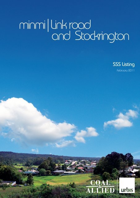
minmi|Link road and Stockrington - Rio Tinto Coal Australia
minmi|Link road and Stockrington - Rio Tinto Coal Australia
minmi|Link road and Stockrington - Rio Tinto Coal Australia

Create successful ePaper yourself
Turn your PDF publications into a flip-book with our unique Google optimized e-Paper software.
<strong>minmi|Link</strong> <strong>road</strong><br />
<strong>and</strong> <strong>Stockrington</strong><br />
SSS Listing<br />
February 2011
xdisclaimerx<br />
URBIS STAFF RESPONSIBLE FOR THIS REPORT WERE:<br />
Director<br />
Associate Director<br />
Job Code<br />
Report Number<br />
Tim Blythe<br />
Tom Goode<br />
SA1976G<br />
MINMI_SSS_FINAL<br />
Copyright © Urbis Pty Ltd<br />
ABN 50 105 256 228<br />
All Rights Reserved. No material may be reproduced without prior permission.<br />
While we have tried to ensure the accuracy of the information in this publication,<br />
the Publisher accepts no responsibility or liability for any errors, omissions or<br />
resultant consequences including any loss or damage arising from reliance in<br />
information in this publication.<br />
URBIS<br />
<strong>Australia</strong> Asia Middle East<br />
www.urbis.com.au
TABLE OF CONTENTS<br />
Executive Summary ..................................................................................................................................i<br />
1 Request for Listing – Schedule 3 SEPP Major Development ......................................................1<br />
1.1 Background .............................................................................................................................1<br />
1.1.1 Context ....................................................................................................................................2<br />
1.1.2 Regional Planning Context......................................................................................................2<br />
1.2 The Minmi/Link Road <strong>and</strong> <strong>Stockrington</strong> Site ...........................................................................3<br />
1.2.1 Minmi .......................................................................................................................................5<br />
1.2.2 Link Road North <strong>and</strong> South .....................................................................................................6<br />
1.2.3 <strong>Stockrington</strong>:............................................................................................................................6<br />
1.3 Voluntary Planning Agreement................................................................................................7<br />
2 State <strong>and</strong> Regional Planning Significance ....................................................................................9<br />
2.1 Criteria (a) of the SSS Guidelines ...........................................................................................9<br />
2.2 Criteria (b) of the SSS Guidelines .........................................................................................10<br />
2.3 Criteria (d) of the SSS Guidelines .........................................................................................10<br />
3 The Suitability of the Site ..............................................................................................................13<br />
3.1 Environmental........................................................................................................................13<br />
3.1.1 Regional context....................................................................................................................13<br />
3.1.2 Local context .........................................................................................................................14<br />
3.2 Social.....................................................................................................................................16<br />
3.3 Economic...............................................................................................................................17<br />
3.4 Ecologically Sustainable Development .................................................................................17<br />
3.4.1 <strong>Coal</strong> & Allied sustainability commitment................................................................................17<br />
3.4.2 Sustainability Framework for Minmi/Link Road <strong>and</strong> <strong>Stockrington</strong>.........................................18<br />
3.5 State or Regional Policies .....................................................................................................21<br />
3.5.1 Lower Hunter Regional Strategy ...........................................................................................21<br />
3.5.2 Lower Hunter Regional Conservation Plan ...........................................................................22<br />
4 The Implications for L<strong>and</strong> Use, Infrastructure, Service Delivery <strong>and</strong> Natural Resource<br />
Planning ..........................................................................................................................................25<br />
4.1 L<strong>and</strong> Use Implications ...........................................................................................................25<br />
4.2 Infrastructure <strong>and</strong> Service Delivery .......................................................................................25<br />
4.3 Natural Resource Planning ...................................................................................................27<br />
4.3.1 Agriculture .............................................................................................................................27<br />
4.3.2 Previous <strong>and</strong> Future Mining ..................................................................................................27<br />
4.3.3 Bushfire..................................................................................................................................29<br />
4.3.4 Contamination .......................................................................................................................29<br />
4.3.5 Water Sensitive Urban Design, Flooding <strong>and</strong> Stormwater Management..............................30<br />
5 The Means by which Developer Contributions should be Secured in Respect of the Site....33<br />
6 The Local <strong>and</strong> Regional Economic Impacts of the Proposed Development............................35<br />
7 State Government’s Regional Strategies <strong>and</strong> the Newcastle – Lake Macquarie Western<br />
Corridor Planning Strategy ...........................................................................................................37<br />
8 Recommended L<strong>and</strong> Uses <strong>and</strong> Development Controls for the Site .........................................41<br />
9 Those Parts of the Site which should be Subject to Part 4 of the EP&A Act...........................43<br />
SA1976G_MINMI_SSS_Feb2011
TABLE OF CONTENTS<br />
10 Appropriate Arrangements (if relevant) for the Management of L<strong>and</strong> for Open Space<br />
Purposes .........................................................................................................................................45<br />
11 SEPP Major Development – Clauses 2 <strong>and</strong> 8 ..............................................................................47<br />
12 Conclusion ......................................................................................................................................49<br />
Appendix A<br />
Letter from the Minister...............................................................................................<br />
Appendix B Proposed Listing in Major Development SEPP – Schedule 3 .................................<br />
FIGURES:<br />
Figure 1 – Regional Context: <strong>Coal</strong> & Allied L<strong>and</strong> Holdings in the Lower Hunter <strong>and</strong> Central Coast.................. 3<br />
Figure 2 – Local Context: Minmi/Link Road ....................................................................................................... 4<br />
TABLES:<br />
Table 1 – Sustainability Criteria <strong>and</strong> Relevant Outcome.................................................................................. 18<br />
Table 2 –Western Corridor Development Criteria <strong>and</strong> Planning Principles Assessment ................................. 37<br />
SA1976G_MINMI_SSS_Feb2011
EXECUTIVE SUMMARY<br />
Executive Summary<br />
This report has been prepared in support of an application for listing <strong>and</strong> rezoning of the <strong>Coal</strong> & Allied<br />
Industries Limited (<strong>Coal</strong> & Allied) owned Minmi/Link Road <strong>and</strong> <strong>Stockrington</strong> sites as a ‘State Significant<br />
Site’ (SSS) in Schedule 3 of State Environmental Planning Policy (Major Development) 2005 (the<br />
“Major Development SEPP”). It has been prepared on behalf of <strong>Coal</strong> & Allied as owners of the<br />
Minmi/Link Road <strong>and</strong> <strong>Stockrington</strong> sites to facilitate residential <strong>and</strong> associated development that is not<br />
currently permissible under existing planning provisions. A draft Schedule 3 listing is attached.<br />
The report details the basis upon which the SSS listing is proposed <strong>and</strong> includes consideration of:<br />
• The Department of Planning’s (DoP’s) ‘Guideline for State Significant Sites under the Major<br />
Development SEPP’; <strong>and</strong><br />
• The matters listed in the Minister for Planning’s correspondence dated 19 August 2010; <strong>and</strong><br />
• Clauses 2, 7 <strong>and</strong> 8 of the Major Development SEPP.<br />
A Concept Plan has been separately but concurrently prepared for the Minmi/Link Road <strong>and</strong><br />
<strong>Stockrington</strong> site <strong>and</strong> lodged with Department of Planning (DoP). This report should be read in<br />
conjunction with the Environmental Assessment that supports the Concept Plan.<br />
In parallel, a draft Voluntary Planning Agreement (VPA) between <strong>Coal</strong> & Allied <strong>and</strong> the New South<br />
Wales Government (NSWG) has been prepared in accordance with Section 93F of the Environmental<br />
Planning & Assessment 1979 (“EP&A Act”).<br />
Under the draft VPA <strong>Coal</strong> & Allied propose to develop 520ha at Minmi/Link Road for residential <strong>and</strong><br />
associated development with a yield of approximately 3,300 dwelling lots. The balance of the<br />
Minmi/Link Road site together with part of <strong>Coal</strong> & Allied’s l<strong>and</strong> at <strong>Stockrington</strong> (1,561Ha) is proposed to<br />
be dedicated to the New South Wales Government (NSWG) for conservation purposes.<br />
Other <strong>Coal</strong> & Allied sites in the Lower Hunter <strong>and</strong> Central Coast regions are subject to similar but<br />
separate Part 3A applications to the Department of Planning (DoP). Overall, <strong>Coal</strong> & Allied propose to<br />
dedicate approximately 2,956ha of <strong>Coal</strong> & Allied l<strong>and</strong> to the NSWG to provide <strong>and</strong> enhance important<br />
conservation corridors identified in the Lower Hunter Regional Strategy (LHRS), Lower Hunter Regional<br />
Conservation Plan (LHRCP) <strong>and</strong> Central Coast Regional Strategy (CCRS).<br />
This dedication of conservation l<strong>and</strong>s will make a significant contribution to the Watagan-Stockton<br />
corridor identified in the LHRS <strong>and</strong> LHRCP.<br />
The proposed l<strong>and</strong> dedication is a positive conservation step that will protect an important array of<br />
vegetation communities, flora <strong>and</strong> fauna species, <strong>and</strong> natural l<strong>and</strong>scape assets, including threatened<br />
species <strong>and</strong> endangered ecological communities in the conservation l<strong>and</strong>s. The environmental gain<br />
from the environmental l<strong>and</strong> offset package is a once in a generation opportunity that will provide an<br />
enduring legacy for the community <strong>and</strong> future generations in perpetuity.<br />
The Minmi/Link Road <strong>and</strong> <strong>Stockrington</strong> site is considered to meet the criteria for a State Significant Site<br />
set out in the DoP’s Guideline for State Significant Sites under the Major Development SEPP, both as<br />
an individual parcel <strong>and</strong> as an integral part of the <strong>Coal</strong> & Allied l<strong>and</strong> offset package, in achieving key<br />
regional conservation outcomes through substantial l<strong>and</strong> dedication.<br />
Furthermore, over 800ha of <strong>Coal</strong> & Allied owned l<strong>and</strong> in the Lower Hunter has been identified for urban<br />
development in the LHRS. The future 4,235 dwellings (including the 3,300 dwellings at Minmi/Link<br />
Road) will help achieve the State Government’s objective to cater for the predicted population growth<br />
for the Region by 2031.<br />
SA1976G_MINMI_SSS_Feb2011<br />
Page i
EXECUTIVE SUMMARY<br />
SA1976G_MINMI_SSS_Feb2011<br />
Page ii
REQUEST FOR LISTING – SCHEDULE 3 SEPP MAJOR DEVELOPMENT<br />
1 Request for Listing – Schedule 3 SEPP Major<br />
Development<br />
This report has been prepared on behalf of <strong>Coal</strong> & Allied in support of an application for listing of the<br />
<strong>Coal</strong> & Allied owned Minmi/Link Road estate as a ‘State Significant Site’ (SSS) in Schedule 3 of the<br />
Major Development SEPP. The report has been prepared in accordance with the considerations<br />
provided by the Department of Planning in Appendix A. A draft Schedule 3 listing is attached in<br />
Appendix B.<br />
The report details the basis upon which the SSS listing is proposed <strong>and</strong> includes consideration of:<br />
• The Department of Planning’s (DoP’s) ‘Guideline for State Significant Sites under the Major<br />
Development SEPP;<br />
• The matters listed in the Minister for Planning’s correspondence dated 19 August 2010; <strong>and</strong><br />
• Clauses 2, 7 <strong>and</strong> 8 of the Major Development SEPP.<br />
It is proposed that the SSS listing/rezoning for the site delineates zones <strong>and</strong> associated development<br />
controls as well as establishes the future approval/consent authority regimes. The proposed SSS listing<br />
/ rezoning for the site proposes areas that are to be developed <strong>and</strong> areas to be conserved <strong>and</strong> the<br />
future planning controls that will apply.<br />
A new planning regime is required to rezone the sites to b<strong>road</strong>en the permissible l<strong>and</strong> uses <strong>and</strong> to<br />
enable the proposed development of the site for residential <strong>and</strong> conservation uses.<br />
It is proposed that the Schedule 3 amendment to the Major Development SEPP will introduce a new<br />
statutory planning framework for the Minmi/Link Road <strong>and</strong> <strong>Stockrington</strong> site that includes:<br />
• Aims <strong>and</strong> objectives for each site;<br />
• Zoning <strong>and</strong> permissible uses;<br />
• Key development controls;<br />
• The future consent/approval regime.<br />
1.1 Background<br />
In response to a request from <strong>Coal</strong> & Allied, on 15 June 2010, the Minister for Planning determined that<br />
the proposed Minmi/Link Road <strong>and</strong> <strong>Stockrington</strong> project constitutes ‘Major Development’, <strong>and</strong><br />
authorised the submission of a ‘Concept Plan’ under Part 3A of the EP&A Act. The Minister also<br />
determined to consider listing the site under Schedule 3 of the SEPP by letter dated 16th August 2010<br />
<strong>and</strong> signed 19 August 2010 (included at Appendix A), subject to consideration of various matters.<br />
These matters have formed the basis of this submission, <strong>and</strong> each major heading herein is a reference<br />
to one of the matters raised in the Minister’s letter, being:<br />
(a) The State or regional planning significance of the site (having regard to the Guideline for State<br />
Significant sites under the Major Development SEPP);<br />
(b) The suitability of the site for any proposed l<strong>and</strong> use taking into consideration environmental, social<br />
or economic factors, the principles of ecologically sustainable development <strong>and</strong> any State or<br />
regional planning strategy;<br />
(c) The implications of any proposed l<strong>and</strong> use for local <strong>and</strong> regional l<strong>and</strong> use, infrastructure, service<br />
delivery <strong>and</strong> natural resource planning;<br />
(d) The means by which developer contributions should be secured in respect of the site;<br />
(e) The local <strong>and</strong> regional economic impacts of the proposed development;<br />
SA1976G_MINMI_SSS_Feb2011 Page 1
REQUEST FOR LISTING – SCHEDULE 3 SEPP MAJOR DEVELOPMENT<br />
(f) The likelihood of the proposed rezoning for residential purposes achieving the desired outcomes of<br />
the State Government’s regional strategies <strong>and</strong> the Western Corridor Planning Strategy;<br />
(g) The recommended l<strong>and</strong> uses <strong>and</strong> development controls for the site that should be included in<br />
Schedule 3 of the Major Development SEPP;<br />
(h) Those parts of the site which should be subject to Part 4 of the Act with Newcastle Council is the<br />
consent authority; <strong>and</strong><br />
(i) Appropriate arrangements (if relevant) for the management of l<strong>and</strong> for open space purposes,<br />
including consultation with the relevant Council.<br />
1.1.1 Context<br />
<strong>Coal</strong> & Allied has been operating in the Hunter Valley for more than 150 years, with the earliest coal<br />
mining operations located in the East Maitl<strong>and</strong> area dating back to 1844. Numerous mergers,<br />
expansions <strong>and</strong> acquisitions since then have led to <strong>Coal</strong> & Allied becoming a regionally significant<br />
mining company.<br />
Since 2004, <strong>Coal</strong> & Allied has been majority owned <strong>and</strong> managed by <strong>Rio</strong> <strong>Tinto</strong> <strong>Coal</strong> <strong>Australia</strong> (RTCA).<br />
<strong>Coal</strong> & Allied today is one of the major coal producers in the Hunter Valley, employing around 1,500<br />
people across three operations. With annual coal production of around 30 million tonnes, <strong>Coal</strong> & Allied<br />
continues to evolve as it strives to achieve a vision of being a safe <strong>and</strong> highly successful business<br />
valued by customers, employees, shareholders <strong>and</strong> the community.<br />
<strong>Coal</strong> & Allied has seven separate holdings in the Lower Hunter totalling approximately 4,078 hectares.<br />
Three are located in the southern area comprising Catherine Hill Bay (Middle Camp), Nords Wharf <strong>and</strong><br />
Gw<strong>and</strong>alan. Four are located in the northern area comprising <strong>Stockrington</strong> <strong>and</strong> Minmi (including l<strong>and</strong><br />
north <strong>and</strong> south of Link Road), Black Hill <strong>and</strong> Tank Paddock. The l<strong>and</strong>holdings are located in four local<br />
government areas of Lake Macquarie, Wyong, Newcastle <strong>and</strong> Cessnock.<br />
The northern l<strong>and</strong>s are located approximately 20 kilometres west of Newcastle <strong>and</strong> are almost halfway<br />
between Newcastle <strong>and</strong> Cessnock. The Minmi l<strong>and</strong> adjoins the existing Minmi township <strong>and</strong> is close to<br />
the emerging Glendale Town Centre <strong>and</strong> the Glendale/Cardiff renewal corridor identified in the Lower<br />
Hunter Regional Strategy. These l<strong>and</strong>s are close to the F3 Freeway <strong>and</strong> Newcastle Link Road<br />
transportation corridors. The Minmi l<strong>and</strong>s are adjacent to the Blue Gum Hills Regional Park <strong>and</strong><br />
Hexham Swamp.<br />
The Black Hill site is located at the intersection of the F3 Freeway <strong>and</strong> John Renshaw Drive. Tank<br />
Paddock <strong>and</strong> <strong>Stockrington</strong> are located east <strong>and</strong> west of F3 Freeway <strong>and</strong> fall within the Watagan-<br />
Stockton conservation corridors identified in the LHRS <strong>and</strong> LHRCP.<br />
In terms of the <strong>Coal</strong> & Allied southern l<strong>and</strong>s, Catherine Hill Bay (Middle Camp) <strong>and</strong> Nords Wharf are<br />
located between Wallarah National Park <strong>and</strong> Munmorah State Conservation Area. Gw<strong>and</strong>alan adjoins<br />
Lake Macquarie State Conservation Area <strong>and</strong> Chain Valley Bay. Gw<strong>and</strong>alan is on the western side of<br />
Crangan Bay, Lake Macquarie <strong>and</strong> Nords Wharf is on the eastern side. Catherine Hill Bay (Middle<br />
Camp) is located on the east coast halfway between Swansea Heads <strong>and</strong> the Budgewoi Peninsula.<br />
1.1.2 Regional Planning Context<br />
The Minmi/Link Road <strong>and</strong> <strong>Stockrington</strong> site has been recognised for its regional significance to the<br />
Lower Hunter Region based on its inclusion in the LHRS for proposed urban development <strong>and</strong> in the<br />
LHRCP for proposed conservation l<strong>and</strong> dedications. The proposal is entirely consistent with the LHRS<br />
<strong>and</strong> LHRCP.<br />
Minmi/Link Road <strong>and</strong> <strong>Stockrington</strong> must be considered in the b<strong>road</strong>er strategic <strong>and</strong> geographic context,<br />
rather than just which council area or region it falls within, in order to realise the State Government<br />
objective of securing emerging major conservation corridors.<br />
SA1976G_MINMI_SSS_Feb2011 Page 2
REQUEST FOR LISTING – SCHEDULE 3 SEPP MAJOR DEVELOPMENT<br />
Figure 1 – Regional Context: <strong>Coal</strong> & Allied L<strong>and</strong> Holdings in the Lower Hunter <strong>and</strong> Central Coast<br />
1.2 The Minmi/Link Road <strong>and</strong> <strong>Stockrington</strong> Site<br />
The Minmi/Link Road estate, comprising Minmi, <strong>and</strong> the l<strong>and</strong> to the north <strong>and</strong> south of the Link Road, is<br />
situated to the east of the F3 Freeway <strong>and</strong> straddles the Newcastle Link Road. These l<strong>and</strong>s are<br />
anticipated to accommodate approximately 3,300 dwellings to be facilitated in the proposed Concept<br />
Plan, which will adjoin the existing Minmi Township <strong>and</strong> the arterial <strong>road</strong> system. The Minmi/Link Road<br />
estate is adjacent to the Blue Gum Hills Regional Park <strong>and</strong> Hexham Swamp.<br />
SA1976G_MINMI_SSS_Feb2011 Page 3
REQUEST FOR LISTING – SCHEDULE 3 SEPP MAJOR DEVELOPMENT<br />
Newcastle CBD is approximately 17km east of the Minmi/Link Road estate, however outer lying<br />
suburbs such as Wallsend are within 5km of the Township, which includes a district centre commercial<br />
core. New residential subdivisions have been approved to the north, south <strong>and</strong> east of the Minmi/Link<br />
Road estate, which also contribute to providing some of the 69,000 dwellings identified in the LHRS to<br />
be accommodated within new release areas, such as Cameron Park <strong>and</strong> Britannia Estate. The<br />
Minmi/Link Road estate will connect these new release areas, while still respecting the F3 Freeway as<br />
the residential/urban development boundary of the Newcastle Metropolitan area.<br />
The Minmi/Link Road site is owned by Minmi L<strong>and</strong> Pty Ltd, a wholly owned subsidiary of <strong>Coal</strong> & Allied<br />
Industries Ltd (<strong>Coal</strong> & Allied) <strong>and</strong> comprises approximately 537ha, including approximately 17ha<br />
proposed to be transferred to the NSW Government as conservation l<strong>and</strong>.<br />
Figure 2 – Local Context: Minmi/Link Road<br />
The Minmi/Link Road estate comprise the allotments with the following legal description:<br />
• Part Lot 71 DP 1065169 (aka 712 DP1113237);<br />
• Lot 351 DP 1108608; (previously known as Lot 35 DP 800036);<br />
• Lot 6 DP 1044574;<br />
• Lot 2 DP 877349;<br />
• Lot 3 DP 877349;<br />
• Lot 48 DP 115128;<br />
There are a number of unmade <strong>road</strong>s in the Link Road North area which are owned by the Crown. The<br />
<strong>road</strong>s do not exist physically <strong>and</strong> the Crown has no required use for the <strong>road</strong>s <strong>and</strong> as a result, <strong>Coal</strong> &<br />
Allied has applied for the closure of the <strong>road</strong>s (known as Lot 1 DP 1156243) <strong>and</strong> to purchase the l<strong>and</strong>.<br />
SA1976G_MINMI_SSS_Feb2011 Page 4
REQUEST FOR LISTING – SCHEDULE 3 SEPP MAJOR DEVELOPMENT<br />
The Concept Plan has been prepared without regard for the locations of these <strong>road</strong>s. These lots are<br />
known as Link Road North, Link Road South <strong>and</strong> Minmi l<strong>and</strong>s.<br />
The <strong>Stockrington</strong> l<strong>and</strong> that is proposed to be dedicated to NSWG as conservation l<strong>and</strong>s has a total area<br />
of 1,544Ha The current title descriptions for the <strong>Coal</strong> & Allied owned <strong>Stockrington</strong> l<strong>and</strong>holding are:<br />
• 83//DP755260 • Part 71//DP1065169 • 2//DP551917 • 12//DP1078246<br />
• 84//DP755260 • 2//DP250339 • 30//DP1085228 • 1//DP250339<br />
• 8//DP755260 • 2//DP124209 • 96//DP755260 • 82//DP755260<br />
• 51//DP1095513 • 1//DP155446 • 3//DP250339 •<br />
• 89//DP755260 • 1//DP503566 • • 1//DP505578<br />
• Pt 13//DP1078246 • 3//DP977096 • 1//DP1126627 •<br />
• 72//DP755260 • • 1//DP123945 • 126//DP755262<br />
• 125//DP755260 • 1//DP1039968 • 5//DP250339 • 2//1126627<br />
• 1//DP124209 • 9//DP1078246 • 4//DP250339 •<br />
• • 4//DP977096 • 1//DP119630 • 95//DP755260<br />
L<strong>and</strong> at <strong>Stockrington</strong> transferred to RTA (approx 305Ha) which in turn will be transferred to DECCW<br />
includes the following lots:<br />
• 2/DP551917;<br />
• Pt 1 & 3 / DP1126627<br />
• 126/DP755262;<br />
• Pt 13/ DP1078246<br />
This SSS Study seeks to rezone the future RTA l<strong>and</strong>s as part of this proposal.<br />
1.2.1 Minmi<br />
The Minmi Township was originally a cattle station which was converted into a coal mine in the 1850s.<br />
The l<strong>and</strong> is underlain by coal mine workings in two seams, the Young Wallsend <strong>and</strong> the Borehole<br />
seams. Underground mining first commencing in the mid 1800’s where it is understood that mining<br />
continued to operate as such until 1925. In the 1900s, open cut mining commenced for a further 5<br />
years, primarily around Minmi Creek <strong>and</strong> Back Creek.<br />
The l<strong>and</strong> has been owned by <strong>Coal</strong> & Allied for many years for coal mining. The lease for underground<br />
<strong>and</strong> surface mining for the site has been relinquished.<br />
L<strong>and</strong> ownership within Minmi is highly fragmented, with most allotments within the township privately<br />
owned, however the surrounding l<strong>and</strong> is held generally held in single ownership by <strong>Coal</strong> & Allied.<br />
The key aspects of the Minmi Township <strong>and</strong> surrounding l<strong>and</strong>s are:<br />
• There are several existing privately owned houses within the development areas, which are<br />
proposed to be accommodated within the future residential subdivision;<br />
• The Minmi township includes several heritage items;<br />
• The distinct character of the existing built environment of Minmi comprises :<br />
−<br />
−<br />
−<br />
Single storey dwellings along Woodford Street;<br />
Dwellings positioned on hillsides;<br />
Dwellings are predominantly timber clad <strong>and</strong> fibro with metal roofs with evidence of more recent<br />
brick construction dwellings.<br />
SA1976G_MINMI_SSS_Feb2011 Page 5
REQUEST FOR LISTING – SCHEDULE 3 SEPP MAJOR DEVELOPMENT<br />
• Past mining activity in Minmi is evident through the presence of filled embankments <strong>and</strong> cuttings<br />
that formed the former rail lines; the presence of open cut mines <strong>and</strong> capped shafts <strong>and</strong> other<br />
mining infrastructure;<br />
• Access to Minmi from the north is via Lenaghans Drive <strong>and</strong> Newcastle Link Road, <strong>and</strong> Woodford<br />
Street from the south. Minmi Road provides access from the east;<br />
• The terrain ranges from gentle slopes through to steep topography <strong>and</strong> consists of cleared areas<br />
through to dense vegetation;<br />
• Several watercourses run through the site, which drain into Hexham Swamp, a large wetl<strong>and</strong><br />
system of the Hunter River Estuary. The main channel of Minmi Creek flows through Minmi West, to<br />
the west of the existing Minmi village area. Other additional tributaries on the Minmi East area<br />
discharge directly to Hexham Swamp.<br />
1.2.2 Link Road North <strong>and</strong> South<br />
The Link Road North area is a densely vegetated area which is disconnected from the Conservation<br />
L<strong>and</strong>s by the existing <strong>road</strong> network. Similarly, the Link Road South l<strong>and</strong> is densely vegetated <strong>and</strong><br />
disconnected from surrounding conservation areas by other residential subdivisions such as Edgeworth<br />
<strong>and</strong> Cameron Park, as well as the existing <strong>road</strong> network.<br />
The Link Road North <strong>and</strong> South l<strong>and</strong> has remained relatively undeveloped <strong>and</strong> undisturbed to date.<br />
Previous underground mining activities present some stability issues for the l<strong>and</strong> which consists of<br />
moderately to steeply undulating terrain. Vegetation clearing has occurred to accommodate<br />
transmission lines within transmission easements <strong>and</strong> fire access tracks.<br />
L<strong>and</strong> relating to an unformed <strong>road</strong> reserve was recently transferred from the Crown to the control of<br />
Lake Macquarie City Council under the Roads Act 1993 <strong>and</strong> extends along the eastern portion of the<br />
Link Road North area.<br />
Surface levels of the Link Road North <strong>and</strong> South areas range from about 20m AHD at the northern <strong>and</strong><br />
southern boundaries to about 90m AHD at the Link Road. Evidence of previous mining activities<br />
includes two capped shafts <strong>and</strong> remnants of previous structures including a number of old slabs <strong>and</strong><br />
footings.<br />
Back Creek, a major tributary of Minmi Creek, rises on the Link Road North estate <strong>and</strong> flows north,<br />
before entering Minmi Creek just prior to discharging into Hexham Swamp. Brush Creek rises on the<br />
Link Road South estate <strong>and</strong> flows south through Edgeworth to Cockle Creek, ultimately discharging into<br />
Lake Macquarie adjacent to Boolaroo.<br />
The l<strong>and</strong> is all held within single ownership by <strong>Coal</strong> & Allied which enables it to be developed as a<br />
single area.<br />
1.2.3 <strong>Stockrington</strong>:<br />
The <strong>Stockrington</strong> site is located within three Council areas. The site incorporates listed heritage items<br />
associated with the former Richmond Vale Railway <strong>and</strong> collieries in <strong>Stockrington</strong>. The site is highly<br />
constrained by topography <strong>and</strong> watercourses <strong>and</strong> parts of the site are remote with restricted access.<br />
The site is predominantly densely vegetated with some cleared areas. It is a regionally significant<br />
parcel of l<strong>and</strong> given its ecological significance, size <strong>and</strong> single ownership. The Hunter Expressway<br />
(previously known as F3 to Branxton Link) will traverse the site as part of future regional transport<br />
plans.<br />
SA1976G_MINMI_SSS_Feb2011 Page 6
REQUEST FOR LISTING – SCHEDULE 3 SEPP MAJOR DEVELOPMENT<br />
1.3 Voluntary Planning Agreement<br />
<strong>Coal</strong> & Allied propose to dedicate l<strong>and</strong> for conservation purposes via a Voluntary Planning Agreement<br />
(VPA) between <strong>Coal</strong> & Allied <strong>and</strong> the NSWG in accordance with s.93F of the EP&A Act.<br />
The Draft VPA will set out contributions towards State infrastructure.<br />
A Draft Statement of Commitments will be prepared to support the Concept Plan <strong>and</strong> associated<br />
Environmental Assessment.<br />
SA1976G_MINMI_SSS_Feb2011 Page 7
REQUEST FOR LISTING – SCHEDULE 3 SEPP MAJOR DEVELOPMENT<br />
SA1976G_MINMI_SSS_Feb2011 Page 8
STATE AND REGIONAL PLANNING SIGNIFICANCE<br />
2 State <strong>and</strong> Regional Planning Significance<br />
The Department of Planning’s (DoP’s) ‘Guideline for State Significant Sites under the Major<br />
Development SEPP’, provides that when considering whether a site can be categorised as being of<br />
State significance, the Minister will consider whether the site meets one or more of the following criteria:<br />
(a) be of regional or state importance because it is in an identified strategic location (in a State or<br />
regional strategy), its importance to a particular industry sector, or its employment, infrastructure,<br />
service delivery or redevelopment significance in achieving government policy objectives; or<br />
(b) be of regional or state environmental conservation or natural resource importance in achieving State<br />
or regional objectives. For example protecting sensitive wetl<strong>and</strong>s or coastal areas; or<br />
(c) be of regional or state importance in terms of amenity, cultural, heritage, or historical significance in<br />
achieving State or regional objectives. For example sensitive redevelopment of heritage precincts; or<br />
(d) need alternative planning or consent arrangements where:<br />
(i) added transparency is required because of potential conflicting interests.<br />
(ii) more than one local council is likely to be affected.<br />
It is considered that proposed development of Minmi/Link Road <strong>and</strong> <strong>Stockrington</strong> site directly meets<br />
criteria (a), (b) <strong>and</strong> (d).<br />
2.1 Criteria (a) of the SSS Guidelines<br />
Criteria (a) of the SSS Guidelines states that a site can be categorised as being of State significance if<br />
the Minister considers it to be of regional or State importance because it is in an identified strategic<br />
location (in a State or regional strategy), its importance to a particular industry sector, or its<br />
employment, infrastructure, service delivery or redevelopment significance in achieving government<br />
policy objectives.<br />
The <strong>Coal</strong> & Allied owned Minmi/Link Road <strong>and</strong> <strong>Stockrington</strong> sites have been recognised for their State<br />
<strong>and</strong> regional significance based on their inclusion in the LHRS for urban development <strong>and</strong> conservation.<br />
<strong>Coal</strong> & Allied propose to develop 520ha of Minmi/Link Road for residential development with a<br />
maximum yield of 3,300 dwelling lots. The balance of the Minmi/Link Road (17ha) <strong>and</strong> part of the<br />
<strong>Stockrington</strong> site (1,544ha) is proposed to be dedicated to the NSWG for conservation purposes. The<br />
conservation l<strong>and</strong> proposed to be dedicated to the NSWG will provide <strong>and</strong> enhance vitally important<br />
conservation corridors identified in the LHRS <strong>and</strong> LHRCP, most notably the Watagans to Stockton<br />
Green Corridor.<br />
The proposed dedication of l<strong>and</strong> to the NSWG for conservation purposes will contribute key strategic<br />
parcels of l<strong>and</strong> that complete long sought-after regional biodiversity conservation corridors for retention<br />
in perpetuity by the NSWG.<br />
The proposal for Minmi/Link Road <strong>and</strong> <strong>Stockrington</strong> is considered to meet the criteria for a State<br />
Significant Site both as an individual parcel <strong>and</strong> as an integral part of the overall <strong>Coal</strong> & Allied<br />
environmental l<strong>and</strong> dedication that will achieve substantial conservation outcomes as set out in the<br />
LHRS <strong>and</strong> LHRCP.<br />
Furthermore, the proposed 3,300 dwellings at Minmi/Link Road will help achieve the State<br />
Government’s objective to cater for the predicted population growth for the Lower Hunter Region until<br />
2031.<br />
In our opinion, the proposal for Minmi/Link Road <strong>and</strong> <strong>Stockrington</strong> satisfies criteria (a) of the SSS<br />
Guidelines.<br />
SA1976G_MINMI_SSS_Feb2011 Page 9
STATE AND REGIONAL PLANNING SIGNIFICANCE<br />
2.2 Criteria (b) of the SSS Guidelines<br />
Criteria (b) of the SSS Guidelines states that a site can be categorised as being of state significance if<br />
the Minister considers the site to be of regional or state environmental conservation or natural resource<br />
importance in achieving State or regional objectives.<br />
As stated, the expansion, management <strong>and</strong> protection of the Watagans to Stockton Green Corridor for<br />
conservation <strong>and</strong> biodiversity is a key focus of the LHRS <strong>and</strong> the companion LHRCP. <strong>Coal</strong> & Allied are<br />
proposing to dedicate approximately 1,561ha of Minmi/Link Road <strong>and</strong> <strong>Stockrington</strong> l<strong>and</strong> to the NSWG<br />
as ‘conservation l<strong>and</strong>’ to provide an important component of the Watagans to Stockton Green Corridor.<br />
The proposed <strong>Coal</strong> & Allied l<strong>and</strong> dedication will clearly facilitate the expansion <strong>and</strong> enhancement of the<br />
biodiversity <strong>and</strong> conservation values of the Watagans to Stockton Green Corridor.<br />
As part of their northern l<strong>and</strong>s, <strong>Coal</strong> & Allied also propose to dedicate approximately 147ha of the Tank<br />
Paddock <strong>and</strong> an additional 398ha at <strong>Stockrington</strong> to the NSWG as ‘conservation l<strong>and</strong>’. The proposed<br />
<strong>Coal</strong> & Allied l<strong>and</strong> dedication will clearly help protect, exp<strong>and</strong> <strong>and</strong> enhance the biodiversity <strong>and</strong><br />
conservation values of the Watagans to Stockton Green Corridor.<br />
The 2,106ha of Minmi/Link Road, Tank Paddock <strong>and</strong> <strong>Stockrington</strong> that is proposed to be dedicated for<br />
conservation provides substantial areas of contiguous vegetation, some of which has state <strong>and</strong> regional<br />
ecological value. The proposed dedication of l<strong>and</strong> to NSWG will also ensure substantial <strong>and</strong> significant<br />
l<strong>and</strong> will be protected from inappropriate development by locking away this l<strong>and</strong> as ‘conservation l<strong>and</strong>’<br />
in public ownership in perpetuity. The environmental gain from the proposed environmental l<strong>and</strong> offset<br />
package is a once in a generation opportunity that will provide an enduring legacy for the community.<br />
The proposed dedication of 1,561ha of Minmi/Link Road <strong>and</strong> <strong>Stockrington</strong> site to the NSWG by <strong>Coal</strong> &<br />
Allied is clearly of state <strong>and</strong> regional significance.<br />
Importantly the proposal for Minmi/Link Road <strong>and</strong> <strong>Stockrington</strong> site will also result in the establishment<br />
of ecological corridors across the site, encompassing riparian corridors <strong>and</strong> linking to Blue Gum Hills<br />
Regional Park <strong>and</strong> Hexham Swamp.<br />
In our opinion, the proposal for Minmi/Link Road <strong>and</strong> <strong>Stockrington</strong> clearly satisfies criteria (b) of the<br />
SSS Guidelines.<br />
2.3 Criteria (d) of the SSS Guidelines<br />
Criteria (d) of the SSS Guidelines states that a site can be categorised as being of State significance if<br />
the Minister considers that the site needs alternative planning or consent arrangements where:<br />
• Added transparency is required because of potential conflicting interests; <strong>and</strong><br />
• More than one local council is likely to be affected.<br />
Alternative planning consent arrangements are necessary because the Minmi/Link Road <strong>and</strong><br />
<strong>Stockrington</strong> l<strong>and</strong> forms an important part of an overall environmental l<strong>and</strong> offset package proposed for<br />
the Lower Hunter <strong>and</strong> Central Coast by <strong>Coal</strong> & Allied which includes seven <strong>Coal</strong> & Allied owned sites<br />
across four local government areas (Newcastle, Lake Macquarie, Cessnock <strong>and</strong> Wyong Councils). This<br />
creates complications given the likely differing views of the respective Councils as to how <strong>and</strong> whether<br />
or not the proposals for each site should proceed. Separate consent arrangements are unlikely to<br />
enable an appropriate conservation <strong>and</strong> l<strong>and</strong> use framework to be achieved in a timely, effective <strong>and</strong><br />
efficient manner. All of the <strong>Coal</strong> & Allied sites, including Minmi/Link Road <strong>and</strong> <strong>Stockrington</strong> need to be<br />
considered in a regional context rather than a Council-by-Council basis to allow for the coordinated<br />
protection of priority areas of biodiversity. This will result in a more targeted conservation action, rather<br />
than an uncoordinated approach to the sites.<br />
It is therefore important that Minmi/Link Road <strong>and</strong> <strong>Stockrington</strong> be considered in a coordinated manner<br />
by the NSWG to achieve permanent preservation of the Watagans to Stockton Green Corridor. Given<br />
the overall environmental l<strong>and</strong> offset package proposed for the Lower Hunter <strong>and</strong> Central Coast by<br />
<strong>Coal</strong> & Allied spans four local government areas, the environmental gains to the community would not<br />
be achieved if each site was separately considered by the individual Councils.<br />
SA1976G_MINMI_SSS_Feb2011 Page 10
STATE AND REGIONAL PLANNING SIGNIFICANCE<br />
In our opinion, the proposal for Minmi/Link Road <strong>and</strong> <strong>Stockrington</strong> satisfies criteria (d) of the SSS<br />
Guidelines.<br />
In summary, the proposed development <strong>and</strong> proposed conservation l<strong>and</strong> dedication of Minmi/Link Road<br />
<strong>and</strong> <strong>Stockrington</strong> clearly meets the criteria of the SSS Guidelines as outlined above. The listing of the<br />
site on Schedule 3 of the Major Development SEPP will facilitate the orderly use, development <strong>and</strong><br />
conservation of regionally important sites of environmental <strong>and</strong> social significance to the State.<br />
SA1976G_MINMI_SSS_Feb2011 Page 11
STATE AND REGIONAL PLANNING SIGNIFICANCE<br />
SA1976G_MINMI_SSS_Feb2011 Page 12
THE SUITABILITY OF THE SITE<br />
3 The Suitability of the Site<br />
Detailed considerations to mitigate the environmental, social <strong>and</strong> economic impacts arising from the<br />
proposed residential development permitted in the proposed SSS listing are included in the<br />
accompanying Concept Plan <strong>and</strong> supporting Environmental Assessment, rather than the proposed SSS<br />
listing. The Environmental Assessment accompanying the Concept Plan demonstrates that the<br />
proposed residential (<strong>and</strong> ancillary) development arising from the proposed SSS listing can be<br />
accommodated without unreasonable environmental, social or economic impacts. Notwithst<strong>and</strong>ing this,<br />
the environmental, social <strong>and</strong> economic factors arising from the proposed rezoning <strong>and</strong> the principles of<br />
Ecologically Sustainable Development (ESD) are addressed below.<br />
3.1 Environmental<br />
3.1.1 Regional context<br />
Minmi/Link Road is located within the Lower Hunter Region. The Minmi/Link Road site is positioned<br />
partly within the Lake Macquarie City Council <strong>and</strong> Newcastle City Council areas, <strong>and</strong> is located<br />
approximately 145 km from Sydney <strong>and</strong> approximately 17kms northwest of the Newcastle City Centre.<br />
Outer lying suburbs such as Wallsend are within 5km of the Minmi Township, which includes a district<br />
centre commercial core. New residential subdivisions have been approved to the north, south <strong>and</strong> east<br />
of the Minmi/Link Road estate, which also contribute to providing some of the forecast growth in the<br />
LHRS to be accommodated within new release areas, such as Cameron Park <strong>and</strong> Britannia Estate.<br />
The Minmi/Link Road site, comprising Minmi <strong>and</strong> the l<strong>and</strong> to the north <strong>and</strong> south of the Link Road is<br />
bounded by the F3 Freeway to the west, Blue Gum Hills Regional Park to the east, Hexham Swamp<br />
Wetl<strong>and</strong> to the north <strong>and</strong> the Newcastle Link Road to the south. Minmi is an historic mining town with a<br />
current population of approximately 732 people.<br />
The <strong>Stockrington</strong> site adjoins the Mount Sugarloaf Recreation Reserve <strong>and</strong> the Heaton State Forest to<br />
the southwest <strong>and</strong> the Pambalong Nature Reserve (part of Hexham Swamp Wetl<strong>and</strong>) to the north east,<br />
<strong>and</strong> forms part of this sizable vegetation corridor. It also adjoins the small settlement of Seahampton to<br />
the southeast. <strong>Stockrington</strong> forms part of the Watagan Ranges to Port Stephens conservation area<br />
identified in the LHRCP. It is positioned primarily within the City of Cessnock, however has parts<br />
included in the Cities of Newcastle <strong>and</strong> Lake Macquarie.<br />
The <strong>Coal</strong> & Allied owned l<strong>and</strong> at <strong>Stockrington</strong> that is proposed to be dedicated for conservation will play<br />
a significant role in securing in perpetual ownership the Watagan Ranges to Port Stephens<br />
conservation area. The proposed l<strong>and</strong> dedication is a positive conservation step that will protect an<br />
important array of vegetation communities, flora <strong>and</strong> fauna species, <strong>and</strong> natural l<strong>and</strong>scape assets,<br />
including threatened species <strong>and</strong> endangered ecological communities in the conservation l<strong>and</strong>s. The<br />
environmental gain from the proposed conservation l<strong>and</strong> dedication is a once in a generation<br />
opportunity that will provide an enduring legacy for the community <strong>and</strong> future generations.<br />
2,106ha will be dedicated to the NSWG as ‘conservation l<strong>and</strong>’ across the <strong>Coal</strong> & Allied northern l<strong>and</strong>s.<br />
This includes 100% of Tank Paddock (147ha) <strong>and</strong> <strong>Stockrington</strong> sites (1,942ha), as well as 17ha of<br />
Minmi. This l<strong>and</strong> provides an important component of the Watagan to Stockton Corridor. The<br />
conservation l<strong>and</strong> dedication is crucial in achieving the State Government’s objective of securing major<br />
conservation corridors, most notably the Watagan to Stockton Corridor. It is crucial to note that 75%<br />
l<strong>and</strong> dedication for conservation purposes is well in excess of traditional conservation outcomes from<br />
VPA processes.<br />
The preservation of large vegetated areas that are linked to other similar areas has been recognised as<br />
fundamentally important to achieving long term regional biodiversity outcomes. The two most valued of<br />
these areas in the Lower Hunter contain large l<strong>and</strong> areas owned <strong>and</strong> controlled by <strong>Coal</strong> & Allied:<br />
• The corridor that links the Watagan <strong>and</strong> Yengo National Parks with the coastal plains of the<br />
Tomago S<strong>and</strong>beds, Stockton Bight <strong>and</strong> Port Stephens; <strong>and</strong><br />
SA1976G_MINMI_SSS_Feb2011 Page 13
THE SUITABILITY OF THE SITE<br />
• The Wallarah Peninsula l<strong>and</strong>s provide a regionally significant break between urban areas, <strong>and</strong><br />
contain areas of high biodiversity, scenic amenity <strong>and</strong> heritage value.<br />
The <strong>Coal</strong> & Allied l<strong>and</strong>s to be dedicated form large vegetated areas in their own right, <strong>and</strong> complete the<br />
linkage of identified regional corridors in key areas.<br />
In addition to their important strategic location in a wider l<strong>and</strong>scape context, the proposed conservation<br />
l<strong>and</strong>s contain valuable biodiversity resources. They contain <strong>and</strong> will conserve a range of important<br />
vegetation communities, including areas of Endangered Ecological Communities (EEC) <strong>and</strong> other<br />
vegetation types that have been depleted in the region. Several threatened plant species have been<br />
recorded within the Conservation Estates, including Arthropteris palisotii, Tetratheca juncea (Black-eyed<br />
Susan), Grevillea parviflora subsp. parviflora, Eucalyptus nicholii, Rutidosis heterogama, Syzygium<br />
paniculatum <strong>and</strong> Callistemon linearifolius. Two of the threatened flora species recorded in the<br />
Conservation Estates are considered to be planted specimens <strong>and</strong> not naturally occurring, being<br />
Eucalyptus nicholii <strong>and</strong> Syzygium paniculatum, although S. paniculatum may have been transported to<br />
its position in a disturbed area by natural means. In addition to these threatened species two rare<br />
(ROTAP) species Callistemon shiressii <strong>and</strong> Eucalyptus fergusonii subsp. dorsiventralis were also<br />
identified within the Conservation Estates.<br />
The diverse nature of both the l<strong>and</strong>form settings, varying from coastal ranges forests <strong>and</strong> woodl<strong>and</strong>s to<br />
coastal heath to wetl<strong>and</strong>s, provides a diverse array of habitats <strong>and</strong> resources for native fauna. The<br />
proposed conservation l<strong>and</strong>s are known to contain important populations of numerous threatened fauna<br />
species, including birds, mammals <strong>and</strong> herpetofauna. The conservation of these l<strong>and</strong>s will provide<br />
secure regional biodiversity gene pools, <strong>and</strong> also through linkages facilitate valuable genetic material<br />
exchange <strong>and</strong> other key processes associated with sustainable ecological population dynamics.<br />
The proposed dedication of the 17ha l<strong>and</strong> at Minmi together with the 1,544ha of <strong>Coal</strong> & Allied l<strong>and</strong> at<br />
<strong>Stockrington</strong> will:<br />
• Conserve in perpetuity key strategic parcels of l<strong>and</strong> that complete long sought after regional<br />
biodiversity conservation corridors <strong>and</strong> buffer areas;<br />
• Provide large intact areas of conserved habitat that will function as regional biodiversity gene pools;<br />
• Protect an important array of vegetation communities, flora <strong>and</strong> fauna species, <strong>and</strong> natural<br />
l<strong>and</strong>scape assets, including threatened species <strong>and</strong> EEC’s;<br />
• Contribute significantly to the successful implementation of the Lower Hunter Regional<br />
Conservation Plan; <strong>and</strong><br />
• Achieve additional conservation benefits within Development Estates via appropriate urban design<br />
<strong>and</strong> management practices.<br />
3.1.2 Local context<br />
The Ecological Assessment Report for Minmi/Link Road <strong>and</strong> <strong>Stockrington</strong> prepared by RPS <strong>and</strong><br />
included in the Concept Plan EA demonstrates that that the proposed developable footprint areas have<br />
regard to the ecological constraints of the site.<br />
The assessment was undertaken within respect to the EP&A Act 1979, the Threatened Species<br />
Conservation Act 1995 <strong>and</strong> the Fisheries Management Act 1994. Consideration of potential constraints<br />
has also been undertaken in relation to the Commonwealth Environment Protection <strong>and</strong> Biodiversity<br />
Conservation Act 1999 <strong>and</strong> guidelines associated with the NSW Department of Environment,Climate<br />
Change <strong>and</strong> Water.<br />
The Ecological Assessment concludes that the quantum of the offset l<strong>and</strong>s, when viewed holistically<br />
with proximate existing <strong>and</strong> proposed conservation reserve areas, provides a robust long-term outcome<br />
for all species <strong>and</strong> communities. Furthermore, suitable actions are proposed to minimise potentially<br />
deleterious permanent <strong>and</strong> ongoing impacts to the conservation l<strong>and</strong>s.<br />
SA1976G_MINMI_SSS_Feb2011 Page 14
THE SUITABILITY OF THE SITE<br />
The field <strong>and</strong> desktop studies have recorded the following parameters of ecological significance within<br />
both the proposed conservation l<strong>and</strong>s <strong>and</strong> the proposed development areas:<br />
• native vegetation commensurate with those listed as EEC’s;<br />
• threatened flora species recorded within <strong>and</strong> adjacent to the proposed development;<br />
• threatened fauna species recorded within <strong>and</strong> adjacent to the proposed development;<br />
• habitat for threatened flora <strong>and</strong> fauna species known from within <strong>and</strong> adjacent to the proposed<br />
development; <strong>and</strong><br />
• other areas containing native vegetation with varying degrees of modification / degradation.<br />
A series of recommendations have been outlined to aid in the reduction of potential impacts associated<br />
with the proposal.<br />
Given that measures have been taken to avoid ecological impacts <strong>and</strong> that where native vegetation<br />
may be affected, efforts have been made to avoid particularly sensitive areas where practical, it is<br />
considered unlikely that any significant impacts would occur upon threatened species, communities or<br />
populations. The large areas of l<strong>and</strong> at <strong>Stockrington</strong> that will be set aside for conservation as part of<br />
the development provide excellent ecological outcomes across the site. The proposed <strong>Stockrington</strong><br />
conservation l<strong>and</strong>s will contribute a large portion of l<strong>and</strong> to conservation in perpetuity, which will in<br />
essence formalise the Watagan to Stockton Corridor. This large tract of native vegetation will provide<br />
protected habitat for a wide variety of native flora <strong>and</strong> fauna.<br />
In addition, conservation outcomes will also be achieved within the proposed Minmi/Link Road<br />
development area by best practice approaches to urban design <strong>and</strong> use of l<strong>and</strong>scaping, feature<br />
retention, <strong>and</strong> considered development edge treatments. Such approaches <strong>and</strong> techniques include:<br />
• Retaining vegetation along ridges to reinforce the existing local bushl<strong>and</strong> backdrop;<br />
• Respecting the existing townships through complimentary design of the character of new housing,<br />
addressing proportion, size, building elements <strong>and</strong> materials;<br />
• A water sensitive urban design strategy for the Minmi/Link Road estate has been provided in the<br />
Environmental Assessment of the Concept Plan;<br />
• Protecting natural attributes of the site as well as areas of aboriginal cultural significance.<br />
Furthermore, in accordance with the DGEAR’s issued on 19 August 2010 for Minmi/Link Road the<br />
Environmental Assessment that supports the proposed Concept Plan for the site addresses the<br />
following environmental issues:<br />
• Urban Design, development controls <strong>and</strong> l<strong>and</strong> uses;<br />
• Staging of Development;<br />
• Commercial / retail development;<br />
• Topography <strong>and</strong> site preparation;<br />
• Conservation l<strong>and</strong>s;<br />
• Biodiversity;<br />
• Geotechnical <strong>and</strong> mining activities;<br />
• Transport <strong>and</strong> accessibility;<br />
• Noise;<br />
• Air Quality;<br />
• Heritage;<br />
SA1976G_MINMI_SSS_Feb2011 Page 15
THE SUITABILITY OF THE SITE<br />
• Water quality, groundwater <strong>and</strong> riparian corridors;<br />
• Flooding;<br />
• Visual impact;<br />
• Bushfire Risk Assessment;<br />
• Future public l<strong>and</strong>;<br />
• Utilities;<br />
• Ecologically Sustainable Development (ESD);<br />
• Social Impact <strong>and</strong> social infrastructure;<br />
• Subdivision.<br />
It has been concluded that the proposed development should not significantly impact upon threatened<br />
or regionally significant flora <strong>and</strong> fauna, ecological communities or populations <strong>and</strong> the implementation<br />
of operative environmental management practices should also ensure that the ecological impact of the<br />
project is minimised.<br />
3.2 Social<br />
The l<strong>and</strong> identified for future residential <strong>and</strong> associated development is considered to be an extension<br />
of the existing townships at Minmi, <strong>and</strong> Cameron Park to the west. The site is in close proximity to an<br />
existing range of services <strong>and</strong> facilities at Minmi, Fletcher Maryl<strong>and</strong>, Cameron Park, Glendale <strong>and</strong> New<br />
Lambton Heights including shops, schools, sporting <strong>and</strong> recreation facilities, hospitals <strong>and</strong> childcare.<br />
An assessment of social impacts associated with the proposed development of Minmi/Link Road <strong>and</strong> a<br />
social infrastructure assessment has been undertaken by Urbis as part of the Part 3A concept plan<br />
preparation <strong>and</strong> SSS reporting. The assessment is contained within the submitted Social Impact<br />
Assessment attached to the Environment Assessment report. The report provides an assessment of the<br />
social impacts <strong>and</strong> mitigation measures as well as the social infrastructure needs <strong>and</strong> provision as a<br />
response.<br />
To ensure effective contribution of identified social infrastructure <strong>Coal</strong> & Allied will enter into separate<br />
agreements with LMCC <strong>and</strong> NCC to:<br />
• Pay Section 94 Contributions as per the appropriate Plan at the time of development of each stage<br />
of the project. Payment may be Works in Kind, cash or a combination of both;<br />
• Agree mechanisms for l<strong>and</strong> dedications including parks, riparian corridors, sportsfields, community<br />
facilities etc;<br />
• Include any ongoing management arrangements determined necessary by <strong>Coal</strong> & Allied <strong>and</strong> the<br />
Councils;<br />
• The requirements tabled in for each respective Section 94 Plan (for Newcastle City Council <strong>and</strong><br />
Lake Macquarie City Council) have the potential to change over time as new Plans are prepared by<br />
Councils to align with new population projections <strong>and</strong> community dem<strong>and</strong>s for as needed<br />
community infrastructure.<br />
In addition to the Section 94 contributions, <strong>Coal</strong> & Allied has offered to enter into a Voluntary Planning<br />
Agreement (VPA) with the NSW State Government. The proposed VPA offer by <strong>Coal</strong> & Allied includes<br />
relevant commitments from its statement of commitments. A Draft Statement of Commitments is<br />
included in the Concept Plan EA submitted for the site. This details the contributions, additional studies,<br />
applications <strong>and</strong> works the proponent commits to undertake in association with the project. This also<br />
provides details of the VPAs between <strong>Coal</strong> & Allied <strong>and</strong> the State <strong>and</strong> Local Governments relating to<br />
the proposed contributions under s93F of the EP&A Act.<br />
SA1976G_MINMI_SSS_Feb2011 Page 16
THE SUITABILITY OF THE SITE<br />
In addition, <strong>Coal</strong> & Allied has allocated an amount of $10 million for initiatives associated with the<br />
delivery of social infrastructure to support the existing <strong>and</strong> future communities at Minmi/Link Road <strong>and</strong><br />
Black Hill. The $10 million is proposed to be directed at initiatives that would not ordinarily be provided<br />
as part of the development of a new residential or employment estate <strong>and</strong>, are considered to be ‘over<br />
<strong>and</strong> above’ what is reasonably necessary to satisfy State <strong>and</strong> Local Government approval<br />
requirements.<br />
The $10 million may be used for sustainability initiatives for future residents, additional infrastructure to<br />
support existing <strong>and</strong> future residents, educational <strong>and</strong> or community programs. The final list of initiatives<br />
for Minmi/Link Road is submitted with the Concept Plan proposal for the Minmi/Link Road estate <strong>and</strong> is<br />
subject to on-going consultation <strong>and</strong> final approval by the <strong>Coal</strong> & Allied Board.<br />
3.3 Economic<br />
An Economic Impact Assessment has been prepared by Sphere to support the Concept Plan for the<br />
site. This report concludes that the proposed development of Minmi/Link Road will result in the<br />
following economic impacts:<br />
• Injection of an estimated $862m of new, capital investment into the economy from expenditure on<br />
housing, commercial <strong>and</strong> retail space plus infrastructure services both internal <strong>and</strong> external to the<br />
site including <strong>road</strong>, energy services, water, sewer <strong>and</strong> communication works (2010 dollar terms);<br />
• Create an estimated 3,662 direct, full time equivalent jobs of which up to half are expected to be in<br />
the Hunter <strong>and</strong> will extend over a 20 year period to 2032;<br />
• Support a further 9,400 jobs (up to half local) over the project life resulting from the multiplied<br />
employment stimulus among construction related industries flowing on from the primary<br />
expenditure;<br />
• Provide additional flow-on economic effects over 20 years of around $1,250 million from<br />
expenditure by recipients of the primary income;<br />
• Create a project that demonstrates a net, direct benefit to the economy from a forecast BCR of 1.31<br />
using NSW Treasury methodology.<br />
3.4 Ecologically Sustainable Development<br />
3.4.1 <strong>Coal</strong> & Allied sustainability commitment<br />
<strong>Coal</strong> & Allied is committed to sustainable development. The three principles of <strong>Coal</strong> & Allied’s approach<br />
are:<br />
Social wellbeing<br />
• Protect human health <strong>and</strong> safety;<br />
• Stakeholder engagement <strong>and</strong> transparency;<br />
• Communities; <strong>and</strong><br />
• Education.<br />
Environmental stewardship<br />
• Resource stewardship;<br />
• Pollution prevention; <strong>and</strong><br />
• Product stewardship.<br />
Economic prosperity<br />
SA1976G_MINMI_SSS_Feb2011 Page 17
THE SUITABILITY OF THE SITE<br />
• Shareholder return;<br />
• Economic contribution; <strong>and</strong><br />
• Customer focus.<br />
3.4.2 Sustainability Framework for Minmi/Link Road <strong>and</strong> <strong>Stockrington</strong><br />
The proposed development of 520 ha at the Minmi/Link Road site <strong>and</strong> the proposed dedication of<br />
1,544ha for conservation at <strong>Stockrington</strong> together with 17hectares at Minmi (total 1561ha) provides the<br />
opportunity to create new communities for the Lower Hunter region <strong>and</strong> in doing so, implement key<br />
objectives <strong>and</strong> outcomes of the LHRS <strong>and</strong> LHRCP associated with accommodating sustainable<br />
population <strong>and</strong> employment growth <strong>and</strong> environmental outcomes.<br />
Minmi/Link Road <strong>and</strong> <strong>Stockrington</strong> are identified in the LHRS <strong>and</strong> LHRCP for urban development <strong>and</strong><br />
conservation. It is important to note that LHRS clearly states that the sustainability criteria in the LHRS<br />
will not apply to proposals for development in the areas identified as conservation corridors on the<br />
strategy map (i.e. the Stockton Watagan conservation corridor). Notwithst<strong>and</strong>ing that the Minmi/Link<br />
Road site has been identified for urban purposes, an assessment against each of the sustainability<br />
criteria listed in Appendix 1 of the LHRS has been undertaken for Minmi/Link Road to illustrate its<br />
suitability for future residential <strong>and</strong> conservation purposes. The assessment in the following Table<br />
shows that the subject l<strong>and</strong> comprehensively satisfies the sustainability criteria.<br />
Table 1 – Sustainability Criteria <strong>and</strong> Relevant Outcome<br />
Sustainability Criteria<br />
Infrastructure Provision<br />
• Mechanisms in place to ensure utilities,<br />
transport, open space <strong>and</strong> communication are<br />
provided in a timely <strong>and</strong> efficient way.<br />
Relevant Outcome for Development<br />
A detailed assessment of the proposed development of<br />
Minmi/Link Road <strong>and</strong> <strong>Stockrington</strong> against all relevant<br />
regional strategies, sub regional strategies, etc is<br />
provided in Environmental Assessment for the site<br />
Concept Plan.<br />
The concept plan commits to the funding <strong>and</strong> delivery of<br />
all on-site infrastructure <strong>and</strong> services including the<br />
following specific infrastructure prior to or in conjunction<br />
with the initial stages of the proposed development such<br />
that the following infrastructure is available when lots are<br />
subdivided:<br />
• Electricity services.<br />
• Water.<br />
• Sewer.<br />
• Natural gas.<br />
• Telephone cabling service.<br />
The Concept Plan will ensure that sufficient l<strong>and</strong> is<br />
provided within new <strong>road</strong> reserves for utilities <strong>and</strong> l<strong>and</strong><br />
dedicated will be at no cost to the NSWG.<br />
The Concept Plan also commits to:<br />
• The upgrade of Link Road <strong>and</strong> the intersection of<br />
Minmi Road, Cameron Park <strong>and</strong> Woodford Street <strong>and</strong><br />
Link Road intersection as required.<br />
• The implementation of local traffic management<br />
measures within the development.<br />
• Open space will be established in the different stages<br />
of the development.<br />
Contributions will be made to improve local <strong>and</strong> regional<br />
infrastructure. This may involve the implementation of<br />
various VPAs with State <strong>and</strong> Local Government prior to<br />
SA1976G_MINMI_SSS_Feb2011 Page 18
THE SUITABILITY OF THE SITE<br />
Sustainability Criteria<br />
Access<br />
• Accessible transport options for efficient <strong>and</strong><br />
sustainable travel between homes, jobs,<br />
services <strong>and</strong> recreation to be existing or<br />
provided.<br />
Housing Diversity<br />
• Provide a range of housing choices to ensure a<br />
b<strong>road</strong> population can be housed.<br />
Employment L<strong>and</strong>s<br />
• Provide regional/local employment opportunities<br />
to support the Lower Hunter’s exp<strong>and</strong>ing role in<br />
the wider regional <strong>and</strong> NSW economies.<br />
Avoidance of Risk<br />
• L<strong>and</strong> use conflicts, <strong>and</strong> risk to human health <strong>and</strong><br />
life, avoided.<br />
Relevant Outcome for Development<br />
final approval of a construction certificate for subdivision.<br />
Access is available along Minmi Road, Woodford Street<br />
<strong>and</strong> Lenaghans Drive. Access is also available via the<br />
Link Road.<br />
Pedestrian/cycle access will be incorporated within the<br />
development.<br />
At Minmi, bus services are limited. Route 260 is<br />
operated by Blue Ribbon Bus Company <strong>and</strong> links Minmi<br />
with Fletcher <strong>and</strong> Maryl<strong>and</strong> to Wallsend. The size of the<br />
proposed development site, together with development at<br />
Edgeworth is such that there could be a strong case<br />
made for increasing the 260 service level to serve the<br />
existing <strong>and</strong> additional residents.<br />
The proposed Concept Plan offers opportunity for<br />
housing diversification at Minmi/Link Road. Furthermore,<br />
the <strong>Coal</strong> & Allied overall environmental l<strong>and</strong> package for<br />
the Lower Hunter will easily permit the provision of a<br />
range of dwelling houses across the region.<br />
The proposed rezoning is for residential <strong>and</strong> conservation<br />
purposes only. No employment l<strong>and</strong> is proposed at<br />
Minmi/Link Road other than the provision of local retailing<br />
<strong>and</strong> community facilities.<br />
The proposed development will create an estimated<br />
3,555 direct, full time equivalent jobs of which up to half<br />
are expected to be in the Hunter <strong>and</strong> will extend over a<br />
20 year period to 2030. The project will also support a<br />
further 9,904 jobs (up to half local) over the project life<br />
resulting from the multiplied employment stimulus among<br />
construction related industries flowing on from the<br />
primary expenditure.<br />
The proposed development involves no l<strong>and</strong> use conflicts<br />
with the adjacent <strong>and</strong> existing community areas.<br />
Overall it is submitted that the proposed development is<br />
suitable for existing <strong>and</strong> future predicated climate <strong>and</strong><br />
flooding conditions.<br />
GHD has investigated potential flooding impacts as part<br />
of the Concept Plan EA, including assessment of climate<br />
change impacts on flooding. The areas of inundation<br />
relative to the 100-year ARI flood <strong>and</strong> the proposed<br />
Concept Plan structure are primarily associated with<br />
riparian corridors. In a few isolated areas in the northern<br />
precincts the 100-year ARI event extends into the<br />
development footprint. Minor filling of the flood fringe<br />
would be required to ensure <strong>road</strong>ways <strong>and</strong> lots remain<br />
flood free. Dwelling floor levels would need to consider<br />
these impacts <strong>and</strong> be located above these flood levels. It<br />
is recommended that Flood Planning Levels be adopted<br />
that locate floor levels of dwellings with a freeboard of<br />
500 mm above 100- year ARI flood levels.<br />
Flood hazard impacts will be minimised by designing the<br />
capacity of both the overl<strong>and</strong> flow paths <strong>and</strong> underground<br />
stormwater system to provide a level of service that<br />
minimises the flood risk; whilst a flood evacuation<br />
strategy would be provided for all areas inundated by the<br />
PMF.<br />
SA1976G_MINMI_SSS_Feb2011 Page 19
THE SUITABILITY OF THE SITE<br />
Sustainability Criteria<br />
Natural Resources<br />
• Natural resource limits not exceeded.<br />
• Environmental footprint minimised <strong>and</strong><br />
managed.<br />
Environmental Protection<br />
Protect <strong>and</strong> enhance biodiversity, air quality,<br />
heritage <strong>and</strong> waterway health.<br />
Relevant Outcome for Development<br />
A more detailed Floodplain Risk Management Study is<br />
recommended to be undertaken in future sub-division<br />
design stages of the project, supported by more detailed<br />
flood modelling <strong>and</strong> flood mapping.<br />
The former use of the site for coal mining operations is<br />
associated with a number of potential constraints,<br />
including subsidence, subterranean gases, contamination<br />
<strong>and</strong> other associated risks. Douglas Partners has<br />
undertaken surface <strong>and</strong> subsurface investigations to<br />
identify constraints <strong>and</strong> measures required to respond to<br />
the site constraints relative to the former coal mining use.<br />
Douglas Partners have also assessed the capability of<br />
the l<strong>and</strong> for the proposed development with respect to<br />
erosion potential, slope stability, sodicity <strong>and</strong> salinity <strong>and</strong><br />
the presence of potential <strong>and</strong> actual acid sulphate soils.<br />
Refer to the Environmental Assessment report for further<br />
details.<br />
Minmi/Link Road constitutes Bushfire Prone L<strong>and</strong>. A<br />
Bushfire Threat Assessment has been undertaken by<br />
RPS to accompany the Concept Plan. This report<br />
provides recommendations that have been incorporated<br />
into the concept plan design to meet relevant legislative<br />
requirements in terms of APZs, <strong>road</strong>s, fire fighting<br />
capability <strong>and</strong> future dwelling design.<br />
None of the l<strong>and</strong> is zoned for agricultural purposes.<br />
Future mining at the site is unlikely but possible. Future<br />
mining at the site, if it occurred, may affect the st<strong>and</strong>ard<br />
guidelines outlined. Restrictions on development due to<br />
future mining are provided by the DARZL committee <strong>and</strong><br />
a formal application to the MSB is required.<br />
Monitoring of borehole gas concentrations was<br />
undertaken to assess the potential for future extraction of<br />
coal seam methane. The results indicated low<br />
concentrations of methane in some of the bores<br />
immediately following drilling, however subsequent<br />
monitoring indicated no measurable concentrations<br />
suggesting any methane which was present was limited<br />
<strong>and</strong> quickly dissipated. Therefore the site is not expected<br />
to be suitable for methane extraction from the former<br />
mine workings.<br />
The environmental footprint will be designed to maximise<br />
the water management <strong>and</strong> quality thereof.<br />
Future development will reduce Greenhouse Gas<br />
emissions to at least BASIX compliance.<br />
As detailed in the Environmental Assessment, the<br />
proposed rezoning <strong>and</strong> development for residential <strong>and</strong><br />
conservation purposes should not significantly impact<br />
upon threatened or regional significant flora <strong>and</strong> fauna,<br />
ecological communities or populations.<br />
In fact, the <strong>Coal</strong> & Allied conservation dedications<br />
provide outcomes that contribute to meeting the<br />
environmental protection goals outlined in the<br />
sustainability criteria of the LHRS, including:<br />
• Conserve in perpetuity key strategic parcels of l<strong>and</strong><br />
that complete long sought after regional biodiversity<br />
conservation corridors <strong>and</strong> buffer areas;<br />
• Provide large intact areas of conserved habitat that<br />
will function as regional biodiversity gene pools;<br />
SA1976G_MINMI_SSS_Feb2011 Page 20
THE SUITABILITY OF THE SITE<br />
Sustainability Criteria<br />
Quality <strong>and</strong> Equity in Services<br />
• Quality health, education, legal, recreational,<br />
cultural <strong>and</strong> community development <strong>and</strong> other<br />
Government services are accessible.<br />
Relevant Outcome for Development<br />
• Protect an important array of vegetation communities,<br />
flora <strong>and</strong> fauna species, <strong>and</strong> natural l<strong>and</strong>scape assets,<br />
including threatened species <strong>and</strong> EEC’s;<br />
• Contribute significantly to the successful<br />
implementation of the LHRCP;<br />
• Maintains environmental areas for air & water quality;<br />
• Protects areas of Aboriginal cultural heritage value<br />
<strong>and</strong> historical heritage value; <strong>and</strong><br />
• Achieves additional conservation benefits within<br />
Development Estates via appropriate urban design<br />
<strong>and</strong> management practices.<br />
The proposal will contribute significantly to the successful<br />
implementation of the LHRCP. The transfer of the<br />
substantial <strong>Coal</strong> & Allied owned l<strong>and</strong> for conservation will<br />
play a significant role in realising the objectives of the<br />
LHRS <strong>and</strong> the LHRCP, which clearly identifies these<br />
l<strong>and</strong>s as conservation priorities <strong>and</strong> acknowledges the<br />
contribution the transfers provide to achieving successful<br />
implementation of the two plans.<br />
Water sensitive urban design features will be<br />
incorporated into the development to manage<br />
stormwater, pollutants <strong>and</strong> sediments according to<br />
ANZECC <strong>and</strong> local government guidelines.<br />
The l<strong>and</strong> at Minmi proposed for residential development<br />
adjoins the existing township at Minmi. It is considered to<br />
be an appropriate extension of the existing township <strong>and</strong><br />
is in proximity to an existing range of services <strong>and</strong><br />
facilities at Minmi, Edgeworth <strong>and</strong> Maryl<strong>and</strong>, including<br />
shops, schools, sporting <strong>and</strong> recreation facilities, <strong>and</strong><br />
childcare.<br />
In addition, contributions will be made to improve local<br />
<strong>and</strong> regional infrastructure.<br />
3.5 State or Regional Policies<br />
A detailed assessment of the proposed development of Minmi/Link Road against all relevant<br />
Environmental Planning Instruments is provided in Environmental Assessment for the site Concept<br />
Plan.<br />
3.5.1 Lower Hunter Regional Strategy<br />
The Lower Hunter Regional Strategy (LHRS) is the key planning policy to guide the growth in the Lower<br />
Hunter to 2031 by identifying future development areas, principal l<strong>and</strong> use types, settlement patterns<br />
<strong>and</strong> conservation outcomes. It is the principal document upon which Environmental Planning<br />
Instruments <strong>and</strong> major l<strong>and</strong> use <strong>and</strong> development decisions should be based.<br />
The NSWG released the final LHRS on 17 October 2006. It is understood that Cabinet re-endorsed it in<br />
December 2009. The LHRS plans for population growth of 160,000 people by the year 2031.<br />
The LHRS identifies the Minmi/Link Road <strong>and</strong> <strong>Stockrington</strong> site for proposed urban development <strong>and</strong><br />
proposed conservation l<strong>and</strong> dedications. The proposal is entirely consistent with the LHRS.<br />
The Minmi/Link Road <strong>and</strong> <strong>Stockrington</strong> site is one of the four <strong>Coal</strong> & Allied sites in the northern <strong>and</strong><br />
southern l<strong>and</strong>s proposed for residential development which will assist in achieving the forecast growth<br />
in the Lower Hunter. Whilst geographically separate they will make a significant contribution to the<br />
overall growth of the Lower Hunter region.<br />
SA1976G_MINMI_SSS_Feb2011 Page 21
THE SUITABILITY OF THE SITE<br />
The securing, protection <strong>and</strong> management of conservation corridors is a key focus of both the LHRS<br />
<strong>and</strong> the companion Lower Hunter Regional Conservation Plan. The proposed development of 520ha of<br />
l<strong>and</strong> at Minmi/Link Road <strong>and</strong> proposed dedication of 1,561Ha (excludes 305 ha biodiversity offset l<strong>and</strong><br />
to be transferred to RTA) <strong>and</strong> then to the DECCW) of l<strong>and</strong> at Minmi/Link Road <strong>and</strong> <strong>Stockrington</strong> is<br />
crucial in achieving the State Government’s objective of securing major conservation corridors identified<br />
in the LHRS, most notably the Watagan to Stockton Green Corridor. The proposed development of the<br />
Minmi/Link Road <strong>and</strong> <strong>Stockrington</strong> site <strong>and</strong> proposed substantial l<strong>and</strong> dedication is an integral element<br />
of the LHRS.<br />
3.5.2 Lower Hunter Regional Conservation Plan<br />
The NSWG released the Lower Hunter Regional Conservation Plan (LHRCP) in December 2009. The<br />
plan is a key <strong>and</strong> complimentary component of the Lower Hunter Regional Strategy as it establishes the<br />
key principles <strong>and</strong> actions proposed to achieve the biodiversity <strong>and</strong> conservation outcomes that have<br />
been outlined in the LHRS.<br />
The LHRCP is focused on the next 25 years <strong>and</strong> seeks to establish a framework to guide conservation<br />
efforts in the Lower Hunter. Stage 1 of the RCP was announced in late 2006. This included the<br />
establishment of new conservation reserves to be managed by the then Department of Environment<br />
<strong>and</strong> Climate Change (DECC, now DECCW).<br />
These new reserves comprise approximately 20,000 hectares of various high conservation value<br />
Government l<strong>and</strong>s to form the backbone of major new conservation corridors including:<br />
• A new ‘Green Corridor’ stretching from the Watagan Ranges, through Hexham Swamp to Port<br />
Stephens (approximately 14,600 hectares);<br />
• Important areas around Port Stephens in the Karuah area (3,000 hectares);<br />
• A large addition to Werakata National Park near Cessnock (2,200 hectares).<br />
These public l<strong>and</strong> transfers are a significant step in creating the necessary conservation outcomes for<br />
the Lower Hunter, including important linkages for biodiversity. Future proposed developments in the<br />
Lower Hunter will be assessed against current legislation.<br />
Priority for offsets will be in areas that make the most significant conservation contribution in the Lower<br />
Hunter. Such freehold l<strong>and</strong> will contribute to the creation of the three priority corridors within:<br />
• The Watagan Ranges to Port Stephens;<br />
• The South Wallarah Peninsula;<br />
• Werakata National Park.<br />
<strong>Coal</strong> & Allied’s surplus ‘Northern L<strong>and</strong>s’, including Minmi/Link Road <strong>and</strong> <strong>Stockrington</strong> are located within<br />
the area identified in the Draft Conservation Plan as a green conservation corridor. The proposed<br />
dedication of the <strong>Stockrington</strong> site will make a significant contribution to the Watagan Ranges to Port<br />
Stephens Green Corridor.<br />
Relative to the LHRCP, the Minmi/Link Road <strong>and</strong> <strong>Stockrington</strong> proposal <strong>and</strong> the overall development of<br />
the <strong>Coal</strong> & Allied l<strong>and</strong>s in the Lower Hunter will provide the following benefits:<br />
• The future development of <strong>Coal</strong> & Allied l<strong>and</strong> will be more than offset through the dedication of<br />
2,956ha over all <strong>Coal</strong> & Allied l<strong>and</strong>s in the Lower Hunter. This includes the 2,106ha of l<strong>and</strong> for the<br />
Northern Estates <strong>and</strong> the 1,561ha of l<strong>and</strong> specifically at Minmi/Link Road <strong>and</strong> <strong>Stockrington</strong>;<br />
• The dedication will make a significant contribution to exp<strong>and</strong>ing <strong>and</strong> strengthening the value of key<br />
corridor linkages.<br />
The LHRCP provides a focus for conservation efforts by 2031 by identifying priority biodiversity areas in<br />
the Lower Hunter. The conservation l<strong>and</strong> to be dedicated to the NSWG will provide <strong>and</strong> enhance vitally<br />
important conservation corridors identified in the LHRCP.<br />
SA1976G_MINMI_SSS_Feb2011 Page 22
THE SUITABILITY OF THE SITE<br />
The securing, protection <strong>and</strong> management of conservation corridors is a key focus of the LHRCP. The<br />
proposed dedication of <strong>Stockrington</strong> for conservation purposes as an offset for the proposed<br />
development at Minmi/Link Road is crucial in achieving the state government’s objective of the green<br />
conservation corridor that links the Watagans <strong>and</strong> Yengo National Parks with the coastal plains of the<br />
Tomago S<strong>and</strong>beds, Stockton Bight <strong>and</strong> Port Stephens.<br />
SA1976G_MINMI_SSS_Feb2011 Page 23
THE SUITABILITY OF THE SITE<br />
SA1976G_MINMI_SSS_Feb2011 Page 24
THE IMPLICATIONS FOR LAND USE, INFRASTRUCTURE, SERVICE DELIVERY AND<br />
NATURAL RESOURCE PLANNING<br />
4 The Implications for L<strong>and</strong> Use, Infrastructure,<br />
Service Delivery <strong>and</strong> Natural Resource Planning<br />
The implications (including the cumulative impacts) of any proposed l<strong>and</strong> use for local <strong>and</strong> regional<br />
infrastructure, social infrastructure, service delivery <strong>and</strong> natural resource planning are considered below<br />
in detail.<br />
4.1 L<strong>and</strong> Use Implications<br />
As recognised in the relevant Regional Strategies, the site is of significance to the region <strong>and</strong> indeed<br />
the State in terms of the provision of residential (<strong>and</strong> associated non-residential uses) as well as<br />
environmental l<strong>and</strong> provision.<br />
The Minmi/Link Road <strong>and</strong> <strong>Stockrington</strong> site has been recognised for its regional significance to the<br />
Lower Hunter Region based on its inclusion in the LHRS for proposed urban development <strong>and</strong> in the<br />
LHRCP for proposed conservation l<strong>and</strong> dedications. The proposal is entirely consistent with the LHRS<br />
<strong>and</strong> LHRCP.<br />
It is important to note that the total Concept Plan is a long term direction for the l<strong>and</strong>s <strong>and</strong> will take<br />
some time to implement, with lots being incrementally released to the market over time. This will allow<br />
the established market to gradually absorb the impact of the additional l<strong>and</strong> supply.<br />
The Concept Plan is as a result of extensive constraints <strong>and</strong> capacity mapping. The proposal seeks<br />
additional urban development to l<strong>and</strong>s that have the capacity <strong>and</strong> do not result in any undue<br />
environmental impact.<br />
4.2 Infrastructure <strong>and</strong> Service Delivery<br />
The existing infrastructure servicing the Minmi/Link Road estate includes:<br />
• Drainage – The watercourses draining the Minmi <strong>and</strong> Link Road North sites eventually discharge<br />
into Hexham Swamp Wetl<strong>and</strong> to the north, while Link Road South drains southward into Brush<br />
Creek which eventually flows into Cockle Creek at the Waratah Golf Club;<br />
• Water – reticulated potable water supply is available to the existing developed area;<br />
• Sewer – Existing developed areas of Minmi drain to the Shortl<strong>and</strong> Sewage Treatment Plant (STP);<br />
• Energy – Electrical supply is available to the area from the zone substation at Maryl<strong>and</strong>s. Overl<strong>and</strong><br />
electricity transmission lines traverse the Link Road south site within two easements 60m <strong>and</strong> 30m<br />
wide;<br />
• Gas – The nearest gas mains are located at Woodford Street, Minmi, <strong>and</strong> at the corner of Minmi<br />
Road <strong>and</strong> Northlakes Drive;<br />
• Telecommunications – Telstra st<strong>and</strong>ard telephone service is available to the existing developed<br />
areas. There are existing copper cables within the development site which will require relocation.<br />
The site has good mobile coverage. The National B<strong>road</strong>b<strong>and</strong> Network (NBN), as announced by the<br />
Federal Government is committed to the provision of fibre optic telecommunications to 90% of<br />
existing <strong>Australia</strong>n dwellings over the next 8 years;<br />
• Transport Access – The Newcastle interchange is located 800m to the northwest of the intersection<br />
of Newcastle Link Road <strong>and</strong> Woodford Street, just to the south of the Minmi/Link Road estate. The<br />
site can be divided into three areas to consider transport access: Minmi; Link Road North; <strong>and</strong> Link<br />
Road South;<br />
−<br />
Minmi can be accessed from the north via Lenaghans Drive, from the south via Newcastle Link<br />
Road, <strong>and</strong> from the east via Minmi Road;<br />
SA1976G_MINMI_SSS_Feb2011 Page 25
THE IMPLICATIONS FOR LAND USE, INFRASTRUCTURE, SERVICE DELIVERY AND<br />
NATURAL RESOURCE PLANNING<br />
−<br />
−<br />
Access to the Link Road North site can be obtained via Newcastle Link Road, Woodford Street<br />
<strong>and</strong> Minmi Road (at Edgeworth). Currently, access is restricted from Newcastle Link Road;<br />
Link Road South is located directly adjacent to an existing residential area at Cameron Park.<br />
Minmi Road (at Edgeworth) can provide direct access to the proposed Southern site.<br />
• Transport Services – A limited private bus service operates between Minmi <strong>and</strong> Wallsend via<br />
Fletcher <strong>and</strong> Maryl<strong>and</strong> with seven services to Wallsend on weekdays with the last around 4.30pm,<br />
<strong>and</strong> eight services from Wallsend on weekdays finishing around 8pm. There are three services to<br />
<strong>and</strong> from Wallsend per day on weekends;<br />
• Social Infrastructure – Minmi has limited existing social infrastructure:<br />
− Education – Minmi contains a small primary school with approximately 110 students <strong>and</strong> 5<br />
permanent teachers. There is no preschool or high school, with the closest high school being<br />
West Wallsend High School;<br />
−<br />
−<br />
−<br />
−<br />
−<br />
−<br />
Health – there is no General Practitioner or Hospital in Minmi. The closest Hospital is John<br />
Hunter Hospital in New Lambton;<br />
Child Care – There are no child care facilities in Minmi, with the closest being in Wallsend;<br />
Recreation – There are two parks including one with sporting fields <strong>and</strong> amenities. Both parks<br />
contain children’s playground equipment;<br />
Emergency Services – Minmi has a rural fire station situated at the northern entry to Minmi. The<br />
closest ambulance stations to Minmi are located in Beresfield <strong>and</strong> Boolaroo;<br />
Aged Care – No aged care facilities currently exist in Minmi, with the nearest location in<br />
Wallsend;<br />
Retail – Minmi has limited retail facilities, including a general store / newsagency, hotel, liquor<br />
outlet <strong>and</strong> restaurant.<br />
The proposed development at Minmi/Link Road can be accommodated within the existing infrastructure<br />
capacity <strong>and</strong> planned augmentation financed by the proponents noting that:<br />
• No significant service delivery problems have been identified;<br />
• The future development of the site will be appropriately serviced with water <strong>and</strong> sewer infrastructure<br />
by lead-in works, upgrades <strong>and</strong> major infrastructure;<br />
• Servicing Strategies will be prepared in consultation with Hunter Water after approval of future<br />
applications for each stage;<br />
• The new Cameron Park zone substation will augment existing electrical supply to the development<br />
when the existing supply is exhausted;<br />
• Gas mains, Telstra cabling <strong>and</strong> electricity supply will be provided to each development stage<br />
through shared trench arrangements;<br />
• Contributions will be made (via monetary contribution or works in kind) to improve local <strong>and</strong> regional<br />
infrastructure as part of any development of the site. A Draft Statement of Commitments is included<br />
in the Concept Plan Environmental Assessment submitted for the site. This details the various<br />
contributions, <strong>and</strong> works the proponent commits to undertake in association with the project.<br />
SA1976G_MINMI_SSS_Feb2011 Page 26
THE IMPLICATIONS FOR LAND USE, INFRASTRUCTURE, SERVICE DELIVERY AND<br />
NATURAL RESOURCE PLANNING<br />
4.3 Natural Resource Planning<br />
4.3.1 Agriculture<br />
None of the subject l<strong>and</strong> is zoned for agricultural purposes.<br />
4.3.2 Previous <strong>and</strong> Future Mining<br />
The site has been subject to extensive open cut <strong>and</strong> underground mining. Constraints mapping has<br />
been provided to assist in urban design of the proposed development, <strong>and</strong> details of investigation <strong>and</strong><br />
analyses have been provided for consideration of the proposed development by the Mine Subsidence<br />
Board. The final development restrictions applied by the MSB may vary from these <strong>and</strong> formal<br />
application will be made to the MSB at the Development Application/Major Project Application stage to<br />
confirm requirements.<br />
The constraints are summarised below for each area of the site:<br />
Minmi North<br />
• Minmi North has no mapped workings <strong>and</strong> is expected to be free of Mine Subsidence Constraints.<br />
Minmi West<br />
• Minmi West contains a range of constraints.<br />
• The northern parts of the area have no known mine workings, however does contain filling from<br />
previous mining operations to the south;<br />
• The former Purple Hill Open Cut mine is located on the central parts of the site <strong>and</strong> contains<br />
significant filling within <strong>and</strong> to the north of the mine. Shallow unmapped workings to the north of the<br />
former open cut mine are possible, however unlikely;<br />
• High pothole risk zone on the central parts of the area to the south of the former open cut pit;<br />
• Low pothole risk zone on the southern central parts of the area;<br />
• Limited Subsidence is expected on the southern parts of the area;<br />
• A number of capped shafts have been located in this area.<br />
Minmi East<br />
• Former open cut mine on western parts of area;<br />
• Low pothole risk to north of former open cut mine <strong>and</strong> High pothole risk to the south;<br />
• Former open cut mine on eastern part of site containing filling which will need to be re-compacted;<br />
• High subsidence risk within the former open cut mine due to underlying Borehole Seam workings;<br />
• High pothole risk <strong>and</strong> numerous shafts surrounding the open cut mine on eastern part of site.<br />
Minmi South<br />
• Former Back Creek open cut mine on north east boundary of area;<br />
• High pothole risk adjacent to former open cut mine in north east part of area;<br />
• Pothole risk in gully running down central northern parts of the area;<br />
• Strip of low pothole risk;<br />
SA1976G_MINMI_SSS_Feb2011 Page 27
THE IMPLICATIONS FOR LAND USE, INFRASTRUCTURE, SERVICE DELIVERY AND<br />
NATURAL RESOURCE PLANNING<br />
• The north western parts of the site are mapped as limited subsidence (two storey brick veneer or<br />
equivalent) based on the low likelihood of pillar failure. The magnitude of subsidence in the unlikely<br />
case of pillar failure would be high <strong>and</strong> if the MSB require a ‘no risk’ profile then this area would<br />
need to be re-mapped as High Subsidence;<br />
• The mid <strong>and</strong> eastern parts of the area are mapped as High subsidence risk (specialised single<br />
storey clad construction);<br />
• The southern parts of the this area are mapped as moderate subsidence risk (one storey brick<br />
veneer or equivalent);<br />
• This area contains several capped shafts.<br />
Link Road North<br />
• The northern parts of the area are mapped as High subsidence risk (specialised single storey clad<br />
construction);<br />
• The southern parts of this area are mapped as Moderate subsidence risk (one storey brick veneer<br />
or equivalent);<br />
• This area contains several capped shafts.<br />
Link Road South<br />
• The northern parts of this area are mapped as Moderate subsidence risk (one storey brick veneer<br />
or equivalent);<br />
• The southern parts of the area are mapped as Limited subsidence (two storey brick veneer or<br />
equivalent) generally based on the absence of mapped workings;<br />
• There are some small zones mapped as High subsidence risk (specialised single storey clad<br />
construction) on the central parts of the site coinciding with remnant pillars in the Gretley workings.<br />
The proposed development footprint has been determined by a number of site constraints, including the<br />
geotechnical constraints influenced by previous mining activities discussed above. Previous mining<br />
activities have also influenced the proposed built form, height <strong>and</strong> bulk as detailed in the Urban Design<br />
Guidelines included in Concept Plan Environmental Assessment report.<br />
High risk pothole areas are required to be managed appropriately to reduce the risk to public safety.<br />
This may include fencing <strong>and</strong>/or signage in particular for high risk areas such as the creek <strong>and</strong> drainage<br />
lines or where the depth of cover is less than 15m. Pedestrian access to riparian corridors could still be<br />
maintained by constructing suitably designed boardwalks with appropriate fencing <strong>and</strong> footings<br />
designed to span a potential pothole. A plan of management is to be prepared for areas subject to<br />
shallow mining<br />
Future mining at the site is unlikely but possible. Future mining at the site, if it occurred, may affect the<br />
st<strong>and</strong>ard guidelines outlined above. Restrictions on development due to future mining are provided by<br />
the DARZL committee <strong>and</strong> a formal application to the MSB is required for consideration by DARZL.<br />
Monitoring of borehole gas concentrations was undertaken to assess the potential for future extraction<br />
of coal seam methane. The results indicated low concentrations of methane in some of the bores<br />
immediately following drilling, however subsequent monitoring indicated no measurable concentrations<br />
suggesting any methane which was present was limited <strong>and</strong> quickly dissipated. Therefore the site is<br />
not expected to be suitable for methane extraction from the former mine workings.<br />
SA1976G_MINMI_SSS_Feb2011 Page 28
THE IMPLICATIONS FOR LAND USE, INFRASTRUCTURE, SERVICE DELIVERY AND<br />
NATURAL RESOURCE PLANNING<br />
4.3.3 Bushfire<br />
The Bushfire investigation <strong>and</strong> assessment of the Minmi Link Road site has determined that it<br />
constitutes ‘Bushfire Prone L<strong>and</strong>’. Therefore, the proposed future development will have to be carried<br />
out in accordance with the specifications contained within 'Planning for Bushfire Protection' (RFS, 2006)<br />
as assessed <strong>and</strong> presented within the Bushfire Assessment submitted with the Environmental<br />
Assessment report.<br />
Adequate APZs are proposed within the development site to protect from bushfire risk. Refer to the<br />
Bushfire Threat Assessment included in the Concept Plan Environmental Assessment report.<br />
4.3.4 Contamination<br />
A Preliminary Contamination <strong>and</strong> Geotechnical Assessment has been prepared by Douglas Partners<br />
<strong>and</strong> is included in the Concept Plan Environmental Assessment report. The contamination assessment<br />
by Douglas Partners was carried out in accordance with the NSW EPA “Guidelines for Consultants<br />
Reporting on Contaminated Sites” <strong>and</strong> SEPP 55 “Remediation of L<strong>and</strong>” <strong>and</strong> is contained within the<br />
Preliminary Contamination <strong>and</strong> Geotechnical Assessment report included in the Environmental<br />
Assessment Report.<br />
Relative to the investigation precincts nominated in the Douglas Partners report the following<br />
contamination assessment identified the presence of:<br />
• Lead <strong>and</strong> Benzo(a)pyrene at the southern extent of Minmi North;<br />
• Deleterious surface material from opportunistic tipping along the north-south orientated central track<br />
that bisects Minmi East. Building rubble containing fibro sheeting was found north of the former<br />
Browns Colliery Open Cut in Minmi East;<br />
• Metals, TRH, Benzo(a)pyrene <strong>and</strong> Total PAH in Minmi West in the areas of the former Pit C<br />
workshops, the former rail line <strong>and</strong> rail sidings <strong>and</strong> screens, <strong>and</strong> an area that appears to have been<br />
a former residential development at Pit 6. Asbestos in fibro sheet fragments <strong>and</strong> in soil filling was<br />
also found in Minmi West near the former screening building <strong>and</strong> in the former rail line to<br />
Duckenfield Colliery;<br />
• Arsenic <strong>and</strong> lead on the site of a capped former shaft. Asbestos fragments identified on the surface<br />
of Pitt 144 in Minmi South;<br />
• Asbestos fragments <strong>and</strong> fibres in soil at Pit 149 <strong>and</strong> 152 from opportunistic dumping of fill in Link<br />
Road North <strong>and</strong> South.<br />
Overall, based on the results of the preliminary assessment the following works are required to enable<br />
the future residential development of Minmi:<br />
• Site remediation will be required in Minmi West, concentrated on the workshops, rail lines <strong>and</strong><br />
sidings/screens;<br />
• Localised remedial works are expected in Minmi North, East <strong>and</strong> South, including cisterns or<br />
cesspits which can be expected in areas previously containing miners’ cottages. Additional<br />
investigation is recommended across the site prior to development to provide additional delineation<br />
of affected areas.<br />
A remedial action plan (RAP) for remediation works will be required to detail appropriate excavation <strong>and</strong><br />
removal/disposal/capping or contaminated soil. This would be followed by validation sampling <strong>and</strong><br />
analysis in accordance with SEPP 55 <strong>and</strong> NSW DECCW guidelines.<br />
The site is considered to be generally suitable for residential development in accordance with SEPP 55<br />
<strong>and</strong> NSW DECCW guidelines, providing that the following conditions are met:<br />
• Remediation is undertaken to remove identified contaminants including asbestos fragments <strong>and</strong><br />
asbestos impacted fill material, <strong>and</strong> areas of soil contamination;<br />
SA1976G_MINMI_SSS_Feb2011 Page 29
THE IMPLICATIONS FOR LAND USE, INFRASTRUCTURE, SERVICE DELIVERY AND<br />
NATURAL RESOURCE PLANNING<br />
• Deleterious materials <strong>and</strong> possible associated surface impact are removed;<br />
• Further detailed assessment across the site prior to construction to confirm the location of localised<br />
contamination “hot spots”;<br />
• Validation testing <strong>and</strong> verification through the NSW DECCW site auditor process is undertaken<br />
where required.<br />
Other recommendations by Douglas Partners include:<br />
• Additional waste classification testing to classify materials prior to disposal to a licensed facility;<br />
• Validation of asbestos contamination should be conducted by a qualified asbestos consultant.<br />
4.3.5 Water Sensitive Urban Design, Flooding <strong>and</strong> Stormwater Management<br />
GHD have investigated a number of opportunities for management of stormwater quality, quantity <strong>and</strong><br />
flooding at the Minmi <strong>and</strong> Link Road sites.<br />
The proposal would benefit from the implementation of Water Sensitive Urban Design (WSUD)<br />
practices. WSUD encompasses all aspects of urban water cycle management including water supply,<br />
wastewater <strong>and</strong> stormwater management that promotes opportunities for linking water infrastructure,<br />
l<strong>and</strong>scape design <strong>and</strong> the urban built form to minimize the impacts of development upon the water cycle<br />
<strong>and</strong> achieve sustainable outcomes.<br />
A WSUD strategy for management of stormwater quality, quantity <strong>and</strong> flooding has been developed for<br />
the sites, that nominates on-lot treatment before discharge to the street stormwater system, vegetated<br />
swales <strong>and</strong> precinct scale co-located detention/ bio-retention basins at key locations. These systems<br />
would essentially comprise a dry basin (to provide detention function) combined with bio-retention (to<br />
provide water quality treatment function) situated in the invert of the basin. Gross pollutant traps <strong>and</strong><br />
other structural measures are recommended at key locations. Rainwater tanks should be provided<br />
where possible.<br />
Results of simulation studies for the 100-year future climate (2100), which allow for a 30% increase in<br />
rainfall intensity <strong>and</strong> volume indicate that in a 100-year ARI event, flood levels adjacent to the site are<br />
expected to increase by less than 0.3m in the upper reaches <strong>and</strong> 0.7m in the lower reaches where the<br />
creeks discharge to Hexham Swamp. While this does not cause a significant increase in flood extent,<br />
dwelling floor levels <strong>and</strong> flood planning levels would need to consider these impacts, <strong>and</strong> dwelling floor<br />
levels be located above these levels.<br />
The areas of inundation relative to the 100-year ARI flood <strong>and</strong> the proposed Concept Plan structure are<br />
primarily associated with riparian corridors. In a few isolated areas in the northern precincts the 100-<br />
year ARI event extends into the development footprint. Minor filling of the flood fringe would be<br />
required to ensure <strong>road</strong>ways <strong>and</strong> lots remain flood free. Dwelling floor levels would need to consider<br />
these impacts <strong>and</strong> be located above these flood levels. It is recommended that proposed Flood<br />
Planning Levels be adopted that locate floor levels of dwellings with a freeboard of 500 mm above 100-<br />
year ARI flood levels.<br />
Flood hazard impacts will be minimised by designing the capacity of both the overl<strong>and</strong> flow paths <strong>and</strong><br />
underground stormwater system to provide a level of service that minimises the flood risk; whilst a flood<br />
evacuation strategy would be provided for all areas inundated by the PMF.<br />
A more detailed Floodplain Risk Management Study is recommended to be undertaken in future subdivision<br />
design stages of the project, supported by more detailed flood modelling <strong>and</strong> flood mapping.<br />
Overall, numerical modelling was used to test the effectiveness of the proposed WSUD strategy <strong>and</strong><br />
included consideration of flood peaks <strong>and</strong> flood levels for the creeks within the site. The results<br />
indicated that the proposed WSUD strategy together with the flood plain management adequately<br />
satisfies the requirements of the Newcastle City Council <strong>and</strong> Lake Macquarie City Council <strong>and</strong> the NSW<br />
Floodplain Development Manual for management of stormwater quantity, quality <strong>and</strong> flooding.<br />
SA1976G_MINMI_SSS_Feb2011 Page 30
THE IMPLICATIONS FOR LAND USE, INFRASTRUCTURE, SERVICE DELIVERY AND<br />
NATURAL RESOURCE PLANNING<br />
The 2m contour information used in the preparation of the Concept Plan was commissioned by <strong>Coal</strong> &<br />
Allied <strong>and</strong> is based on high resolution aerial photography. For this concept stage of the project, flooding<br />
based on 2m contour information is sufficient, in recognition of:<br />
• The deeply incised creek corridors for most of the site;<br />
• The rapidly rising l<strong>and</strong> adjacent to floodplains;<br />
• All other planning associated with the concept plans are based on the same information.<br />
In some of the lower lying areas, minor filling maybe required on the edge of the flood plain. Flood<br />
mapping is provided in the Environmental Assessment Report which should be read in conjunction with<br />
the following extraction from the GHD report:<br />
“At the site the majority of lots are located above the 100-year existing climate <strong>and</strong> 2100-climate<br />
change flood levels. For flood management, floor levels of dwellings should be above the flood<br />
planning level (500 mm above the 100-year ARI event flood levels). A minor affectation of internal<br />
<strong>road</strong>s <strong>and</strong> lots in isolated areas is expected. In a few isolated areas in the northern precincts the<br />
100-year ARI event extends into the development footprint. In these locations, minor filling of the<br />
flood fringe would be required to ensure <strong>road</strong>ways <strong>and</strong> lots remain flood free. In addition, in a<br />
number of locations, minor tributaries, would be incorporated in the development footprint as part of<br />
the stormwater system. In these cases, the capacity of both the overl<strong>and</strong> flow paths <strong>and</strong><br />
underground stormwater system will be designed to provide a level of service that minimises the<br />
flood hazard. A flood evacuation strategy would be provided for all areas inundated by the Probable<br />
Maximum Flood”.<br />
SA1976G_MINMI_SSS_Feb2011 Page 31
THE IMPLICATIONS FOR LAND USE, INFRASTRUCTURE, SERVICE DELIVERY AND<br />
NATURAL RESOURCE PLANNING<br />
SA1976G_MINMI_SSS_Feb2011 Page 32
THE MEANS BY WHICH DEVELOPER CONTRIBUTIONS SHOULD BE SECURED IN<br />
RESPECT OF THE SITE<br />
5 The Means by which Developer Contributions<br />
should be Secured in Respect of the Site<br />
A Draft Statement of Commitments is included in the Concept Plan Environmental Assessment<br />
submitted for the site. This details the various contributions, additional studies, applications <strong>and</strong> works<br />
the proponent commits to undertake in association with the project. The mechanics of how <strong>and</strong> when<br />
these commitments will be confirmed <strong>and</strong> delivered will be subject to ongoing consultation. This will<br />
involve the implementation of various VPAs with State <strong>and</strong> Local Government prior to final approval of a<br />
construction certificate for subdivision under s93F of the EP&A Act.<br />
A Draft Voluntary Planning Agreement has been negotiated with the NSW Government (NSWG) which<br />
includes details of developer contributions to the NSWG. Local developer contributions will be<br />
negotiated with Newcastle City Council (NCC) <strong>and</strong> Lake Macquarie City Council (LMCC) based on the<br />
applicable Section 94 Plans.<br />
SA1976G_MINMI_SSS_Feb2011 Page 33
THE MEANS BY WHICH DEVELOPER CONTRIBUTIONS SHOULD BE SECURED IN<br />
RESPECT OF THE SITE<br />
SA1976G_MINMI_SSS_Feb2011 Page 34
THE LOCAL AND REGIONAL ECONOMIC IMPACTS OF THE PROPOSED DEVELOPMENT<br />
6 The Local <strong>and</strong> Regional Economic Impacts of the<br />
Proposed Development<br />
An Economic Impact Assessment has been prepared by Sphere to support the Concept Plan for the<br />
site. This report concludes that the proposed development of Minmi/Link Road will result in the<br />
following economic impacts:<br />
• Injection of an estimated $839,656,600 of new, capital investment into the economy from<br />
expenditure on housing, commercial <strong>and</strong> retail space plus infrastructure services both internal <strong>and</strong><br />
external to the site including <strong>road</strong>, energy services, water, sewer <strong>and</strong> communication works (2008<br />
dollar terms).<br />
• Create an estimated 3,555 direct, full time equivalent jobs of which up to half are expected to be in<br />
the Hunter <strong>and</strong> will extend over a 20 year period to 2030.<br />
• Support a further 9,904 jobs (up to half local) over the project life resulting from the multiplied<br />
employment stimulus among construction related industries flowing on from the primary<br />
expenditure.<br />
• Provide additional flow-on economic effects over 20 years of around $1,215 million from<br />
expenditure by recipients of the primary income.<br />
• Create a project that demonstrates a net, direct benefit to the economy from a forecast BCR of 1.28<br />
using NSW Treasury methodology.<br />
SA1976G_MINMI_SSS_Feb2011 Page 35
THE LOCAL AND REGIONAL ECONOMIC IMPACTS OF THE PROPOSED DEVELOPMENT<br />
SA1976G_MINMI_SSS_Feb2011 Page 36
STATE GOVERNMENT’S REGIONAL STRATEGIES AND THE NEWCASTLE – LAKE<br />
MACQUARIE WESTERN CORRIDOR PLANNING STRATEGY<br />
7 State Government’s Regional Strategies <strong>and</strong> the<br />
Newcastle – Lake Macquarie Western Corridor<br />
Planning Strategy<br />
Identified as regionally significant under the LHRS, the Western Corridor stretches from Beresfield to<br />
Killingworth, <strong>and</strong> has l<strong>and</strong> in both Newcastle <strong>and</strong> Lake Macquarie Local Government Areas, including<br />
the Minmi/Link Road estate. The Newcastle – Lake Macquarie Western Corridor Planning Strategy<br />
(Western Corridor Strategy) provides a framework to guide growth <strong>and</strong> development in the Western<br />
Corridor over the next 25 years.<br />
Under the LHRS, 115,000 new dwellings <strong>and</strong> 66,000 new jobs are to be accommodated in the Lower<br />
Hunter Region by 2031 <strong>and</strong> the Western Corridor is expected to play a significant role in achieving<br />
these targets. The Western Corridor Strategy identifies future employment l<strong>and</strong>s in the Corridor’s far<br />
north <strong>and</strong> south, whilst residential development will be concentrated around existing urban areas in the<br />
centre. For residential development, the Western Corridor Strategy specifies a yield of between 5 <strong>and</strong> 9<br />
dwellings per hectare, lower than that determined in the LHRS due to the various environmental<br />
constraints of the area. With a projected yield of 6.4 dwelling per hectare, <strong>Coal</strong> & Allied’s Minmi/Link<br />
Road estate will meet this target comfortably.<br />
The <strong>Coal</strong> & Allied proposal for Minmi/Link Road & <strong>Stockrington</strong> is consistent with the strategy <strong>and</strong> the<br />
amended Planning Principles in the Western Corridor Strategy as demonstrated in the table below:<br />
Table 2 –Western Corridor Development Criteria <strong>and</strong> Planning Principles Assessment<br />
Principle Relevant Development criteria Response<br />
A range of l<strong>and</strong><br />
uses to provide<br />
the right mix of<br />
houses, jobs,<br />
open space,<br />
recreational<br />
space <strong>and</strong> green<br />
space<br />
• Future l<strong>and</strong> use shall be generally in accordance<br />
with Map 4—Indicative preferred l<strong>and</strong> uses.<br />
• New development shall incorporate<br />
environmentally sustainable development<br />
practices in accordance with existing legislation,<br />
councils’ policies <strong>and</strong> best practice. Consultation<br />
<strong>and</strong> negotiations with the DECC at rezoning<br />
stage will determine the vegetation offsets for<br />
conservation.<br />
• New development shall also consider the<br />
implications of climate change in their designs<br />
<strong>and</strong> function such as rainfall intensity, localised<br />
flooding, rising<br />
• Detailed assessments will determine the required<br />
attenuation measures for future residential areas<br />
adjoining main <strong>road</strong>s, employment l<strong>and</strong>s <strong>and</strong><br />
other noise sources. The F3 Freeway, other Main<br />
Roads, future rail corridors <strong>and</strong> employment<br />
l<strong>and</strong>s have the potential to create noise <strong>and</strong><br />
vibration issues for future residential<br />
development.<br />
• State Environmental Planning Policy<br />
(Infrastructure) 2007 provides specific noise <strong>and</strong><br />
vibration requirements for residential<br />
developments adjoining classified <strong>road</strong>s <strong>and</strong> rail<br />
corridors.<br />
• Detailed acoustic <strong>and</strong> odour assessments will<br />
determine the required setback/buffers to the<br />
existing Summer Hill Waste Management Facility<br />
<strong>and</strong> nearby mining operations. To exp<strong>and</strong> the<br />
Summer Hill Waste Management Facility it will be<br />
necessary to assess the potential noise <strong>and</strong><br />
odour impacts. It will be necessary to maintain an<br />
acceptable level of amenity to residential areas.<br />
The Concept Plan for Minmi/Link Road is in<br />
accordance with the Indicative preferred<br />
l<strong>and</strong> use map in the Strategy, as the<br />
proposed residential <strong>and</strong> conservation areas<br />
mirror the ‘residential investigation’ <strong>and</strong><br />
conservation areas.<br />
The Concept Plan has been prepared<br />
having regard to the relevant detailed<br />
investigations in this Environmental<br />
Assessment with regard to:<br />
• The impact of the proposed F32B <strong>road</strong><br />
extension;<br />
• Acoustics <strong>and</strong> odour assessment;<br />
• Flooding <strong>and</strong> climate change;<br />
• ESD <strong>and</strong> sustainability.<br />
The l<strong>and</strong> <strong>Coal</strong> & Allied is proposing to<br />
dedicate for community services in the<br />
centre of the estate in the Village Centre, is<br />
a flatter area of the estate <strong>and</strong> will become a<br />
new activity hub for the area.<br />
On other flatter areas of the estate, school<br />
facilities <strong>and</strong> playing fields are proposed.<br />
The l<strong>and</strong> identified for the future expansion<br />
of the existing school <strong>and</strong> playing fields are<br />
located in close proximity to the existing<br />
Minmi Township.<br />
An acoustic <strong>and</strong> air assessment has been<br />
undertaken <strong>and</strong> forms part of the<br />
Environmental Assessment documentation.<br />
SA1976G_MINMI_SSS_Feb2011 Page 37
STATE GOVERNMENT’S REGIONAL STRATEGIES AND THE NEWCASTLE – LAKE<br />
MACQUARIE WESTERN CORRIDOR PLANNING STRATEGY<br />
Principle Relevant Development criteria Response<br />
Jobs available<br />
locally <strong>and</strong><br />
regionally,<br />
reducing the<br />
dem<strong>and</strong> for<br />
transport<br />
services<br />
Public transport<br />
networks that<br />
link frequent<br />
buses into the<br />
rail system<br />
Easy access to<br />
major town<br />
centres with a<br />
full range of<br />
shops,<br />
recreational<br />
facilities, <strong>and</strong><br />
services along<br />
with smaller<br />
village centres<br />
<strong>and</strong><br />
neighbourhood<br />
shops. Streets<br />
<strong>and</strong> suburbs<br />
planned so that<br />
residents can<br />
walk to shops for<br />
their daily needs.<br />
• Future provision of business/commercial zoned The Concept Plan supports this principle<br />
l<strong>and</strong> to be based on dem<strong>and</strong>s for local through:<br />
retail/service needs of the projected<br />
• The provision of up to 3,300 new dwellings<br />
population, level of existing services <strong>and</strong> retail at Minmi/Link Road will play an important<br />
hierarchy.<br />
role in providing increased housing<br />
• The role of existing <strong>and</strong> future centres such as opportunities for workers in the planned<br />
Glendale, Pambulong/Edgeworth, West employment l<strong>and</strong>s <strong>and</strong> centres.<br />
Wallsend <strong>and</strong> Wallsend are to be considered • Existing/proposed centres within the region<br />
when determining capacity – particularly for will assist in providing a full range of retail<br />
regional scale dem<strong>and</strong>s.<br />
<strong>and</strong> commercial services for Minmi/Link<br />
Road residents, supported provision of a<br />
Village Centre which is located in the centre<br />
of the estate, <strong>and</strong> will be a new activity hub<br />
for the area.<br />
• A neighbourhood structure with the majority<br />
of dwellings within walking distance of daily<br />
needs <strong>and</strong> close to a public transport route;<br />
• Enhancement of the economic vitality of the<br />
existing township through provision of<br />
complementary retail uses to enhance the<br />
economic vitality of Minmi.<br />
• The establishment of a more coordinated <strong>and</strong><br />
integrated bus service with the wider area to<br />
improve connectivity <strong>and</strong> usage on the<br />
subregional scale. A further 8000 dwellings will<br />
generate the need to exp<strong>and</strong> the existing bus<br />
service to link existing <strong>and</strong> future employment<br />
areas, schools <strong>and</strong> other activity nodes.<br />
• The future <strong>road</strong> network shall be planned <strong>and</strong><br />
designed to cater for future bus routes <strong>and</strong><br />
stops. Consultation with the Ministry of<br />
Transport will be necessary to plan these<br />
connections.<br />
• Direct access off the major transport corridors<br />
such as the F3 Freeway, Newcastle Link Road<br />
<strong>and</strong> George Booth Drive will be limited to<br />
maintain the efficiency of the transport<br />
network.<br />
• New interchange opportunities in the south of<br />
the western corridor to access the employment<br />
l<strong>and</strong>s has been identified.<br />
• Consultation with the RTA for development<br />
within the western corridor is essential. Access<br />
proposals shall be consistent with Map 3—<br />
Access infrastructure map <strong>and</strong> utilise existing<br />
intersections <strong>and</strong> limit new intersection points.<br />
• Priority shall be given to the co-location <strong>and</strong>/or<br />
focus of State agency buildings (e.g. schools,<br />
emergency services) in central locations to<br />
assist in developing community hubs <strong>and</strong> a<br />
strong sense of place for emerging areas.<br />
• Priority shall be given to the co-location <strong>and</strong>/or<br />
focus of State agency buildings (e.g. schools,<br />
emergency services) in central locations to<br />
assist in developing community hubs <strong>and</strong> a<br />
strong sense of place for emerging areas.<br />
• High order l<strong>and</strong> uses (proposed community<br />
services such as schools, community<br />
buildings, emergency services <strong>and</strong> playing<br />
fields) shall be given priority over residential<br />
A public transport strategy is proposed in the<br />
Hyder traffic report included in the Concept<br />
Plan EA that entails providing new bus routes<br />
<strong>and</strong> enhancing existing bus services.<br />
The proposal incorporates sound<br />
neighbourhood planning principles as follows:<br />
• Provision of a Village Centre which is<br />
located in the centre of the estate, <strong>and</strong> will<br />
be a new activity hub for the area.<br />
• The establishment of a neighbourhood<br />
structure with the majority of dwellings<br />
within walking distance of daily needs <strong>and</strong><br />
close to a public transport route;<br />
• The subdivision is designed to encourage<br />
walking <strong>and</strong> cycling through the provision of<br />
safe walkways <strong>and</strong> cycleways <strong>and</strong> a<br />
permeable network of streets <strong>and</strong> pathways.<br />
• The Concept Plan has been designed to colocate<br />
where possible community <strong>and</strong> other<br />
social facilities across the development.<br />
• The provision of all retail <strong>and</strong> commercial<br />
l<strong>and</strong> uses have been based on the dem<strong>and</strong>s<br />
of the projected population.<br />
SA1976G_MINMI_SSS_Feb2011 Page 38
STATE GOVERNMENT’S REGIONAL STRATEGIES AND THE NEWCASTLE – LAKE<br />
MACQUARIE WESTERN CORRIDOR PLANNING STRATEGY<br />
Principle Relevant Development criteria Response<br />
development for the use of the flatter l<strong>and</strong>.<br />
• Future provision of business/commercial zoned<br />
l<strong>and</strong> to be based on dem<strong>and</strong>s for local<br />
retail/service needs of the projected<br />
population, level of existing services <strong>and</strong> retail<br />
hierarchy.<br />
• High order l<strong>and</strong> uses (proposed community<br />
services such as schools, community<br />
buildings, emergency services <strong>and</strong> playing<br />
fields) shall be given priority over residential<br />
development for the use of the flatter l<strong>and</strong>.<br />
• A regional cycle path route has been identified<br />
on Map 3—Access infrastructure map <strong>and</strong><br />
appropriate connections shall be implemented<br />
by councils.<br />
A wide range of<br />
housing choices<br />
to provide for<br />
different needs<br />
<strong>and</strong> different<br />
incomes.<br />
Traditional<br />
houses on<br />
individual blocks<br />
will be available<br />
along with<br />
smaller, lower<br />
maintenance<br />
homes, units <strong>and</strong><br />
terraces for older<br />
people <strong>and</strong><br />
young singles or<br />
couples.<br />
Conservation of<br />
l<strong>and</strong> in <strong>and</strong><br />
around the<br />
development<br />
sites, to help<br />
protect<br />
biodiversity <strong>and</strong><br />
provide open<br />
space for<br />
recreation<br />
• It is projected that it will be possible to achieve<br />
a density between five <strong>and</strong> nine dwellings per<br />
hectare for the estimated yield of around 8000<br />
dwellings due to site constraints such as mine<br />
subsidence, slope <strong>and</strong> vegetation. These<br />
estimates take into consideration potential infill<br />
development, the renewal corridor along Main<br />
Road Edgeworth <strong>and</strong> housing mix.<br />
• New zoning regimes <strong>and</strong> density controls<br />
should allow for a range of housing types.<br />
Higher densities closer to transport,<br />
employment areas <strong>and</strong> other activity nodes are<br />
encouraged.<br />
• Urban development will need to respect the<br />
heritage character of Minmi <strong>and</strong> other localities<br />
<strong>and</strong> be sympathetic to the listed heritage items<br />
by complying with relevant heritage design<br />
requirements. Items or places/areas of local or<br />
State heritage significance will be identified by<br />
council’s LEP <strong>and</strong> the State Heritage Register<br />
respectively.<br />
• Regional conservation l<strong>and</strong>s—the Lower<br />
Hunter Regional Strategy <strong>and</strong> the Lower<br />
Hunter Regional Conservation Plan identify the<br />
Watagan to Stockton green corridor. These<br />
regionally significant conservation l<strong>and</strong>s are<br />
identified in the maps <strong>and</strong> principles within this<br />
document.<br />
• Subregional/local conservation corridors—<br />
subregional corridors (as shown on Map 2)<br />
linking the Watagans to other significant<br />
vegetation may be required in the southern<br />
part of the western corridor. The need to<br />
balance the importance of establishing urban<br />
areas identified in the Lower Hunter Regional<br />
Strategy with establishing subregional<br />
conservation corridors will need to be<br />
managed carefully. Environmental studies<br />
undertaken as part of the rezoning process will<br />
identify other subregional <strong>and</strong> local<br />
conservation areas <strong>and</strong> corridors.<br />
The Concept Plan promotes:<br />
• Enhancement of the existing demographic<br />
diversity by providing a range of housing<br />
requirements to cater for singles to young<br />
couples, families, <strong>and</strong> retirees to allow<br />
population to remain in the local community;<br />
• A projected yield of 6.4 dwellings per<br />
hectare.<br />
Assessment of the European heritage<br />
significance of the Minmi / Link Road estate<br />
relative to the proposed Concept Plan has<br />
been undertaken by ERM <strong>and</strong> is contained<br />
within the Concept Plan EA Heritage Impact<br />
Assessment.<br />
It is assessed that the Concept Plan will result<br />
in some impact to assessed heritage values,<br />
the cultural l<strong>and</strong>scape <strong>and</strong> some heritage sites.<br />
However, the analysis by ERM identifies that<br />
the Concept Plan design accommodates for<br />
the conservation <strong>and</strong> interpretation of the most<br />
important local heritage items <strong>and</strong> l<strong>and</strong>scapes<br />
to preserve the overall heritage values of the<br />
Minmi. Furthermore, the proposed Concept<br />
Plan protects the scale <strong>and</strong> character of<br />
housing within the Minmi Village Catchment.<br />
It is proposed to provide a green corridor along<br />
the southern side of the Link Road. This will<br />
ensure that a green corridor is maintained<br />
along the southern sides of the Link Road.<br />
Most importantly a green corridor is provided<br />
along the ridge line of Link Road North. This<br />
corridor includes l<strong>and</strong> of high Aboriginal<br />
archaeological potential, which will therefore be<br />
conserved for the future.<br />
Overall, it must be recognised that the <strong>Coal</strong> &<br />
Allied Concept contributes to the important<br />
Watagan Stockton conservation corridor <strong>and</strong><br />
entails a b<strong>road</strong>er <strong>and</strong> regional approach to the<br />
provision of wildlife corridors. The Watagan<br />
Ranges to Port Stephens conservation area is<br />
identified in the LHRCP to be a “highly<br />
significant link between southern s<strong>and</strong>stone<br />
ranges <strong>and</strong> the coastal heaths <strong>and</strong> wetl<strong>and</strong>s of<br />
Port Stephens.” The large areas of<br />
<strong>Stockrington</strong> that will be set aside for<br />
SA1976G_MINMI_SSS_Feb2011 Page 39
STATE GOVERNMENT’S REGIONAL STRATEGIES AND THE NEWCASTLE – LAKE<br />
MACQUARIE WESTERN CORRIDOR PLANNING STRATEGY<br />
Principle Relevant Development criteria Response<br />
• Green entry statements—the role of ‘green<br />
entry’ visual statements into areas or along<br />
certain transport routes is recognised. The<br />
need to provide a green entry statement along<br />
the F3 from the south (Killingworth) to Black<br />
Hill for the proposed employment zones <strong>and</strong><br />
the importance of retaining the visual<br />
l<strong>and</strong>scape corridor from the F3 toward Hexham<br />
Swamp is also recognised. The Newcastle<br />
Link Road <strong>and</strong> George Booth Drive provide<br />
important green entry statements into the city<br />
of Newcastle. The character of these entry<br />
statements should be retained as much as<br />
possible.<br />
conservation as part of the development<br />
provide excellent ecological outcomes across<br />
the site. This large tract of native vegetation<br />
will provide protected habitat for a wide variety<br />
of native flora <strong>and</strong> fauna.<br />
Due to the dedication of much larger tracts of<br />
vegetation within strategic regional corridors,<br />
the nature of existing <strong>and</strong> proposed vegetation<br />
corridors along Link Road should not<br />
significantly impact upon threatened or<br />
regionally significant flora <strong>and</strong> fauna, ecological<br />
communities or populations.<br />
SA1976G_MINMI_SSS_Feb2011 Page 40
RECOMMENDED LAND USES AND DEVELOPMENT CONTROLS FOR THE SITE<br />
8 Recommended L<strong>and</strong> Uses <strong>and</strong> Development<br />
Controls for the Site<br />
The proposed zones have been based upon the Department of Planning’s recently gazetted St<strong>and</strong>ard<br />
Instrument—Principal Local Environmental Plan.<br />
The proposed zonings for the site are:<br />
• Residential areas zoned R2 Low Density Residential Zone, with the following uses permissible with<br />
consent:<br />
−<br />
Advertisements, advertising structures, attached dwellings; bed <strong>and</strong> breakfast accommodation,<br />
car parking, child care centres; community facilities; dwelling houses; environmental facilities,<br />
filming, food <strong>and</strong> drink premises (not exceeding floor space 200sqm), group homes; health<br />
consulting rooms (not exceeding floor space 200sqm), home based child care of family day<br />
care homes, home business, home industries, information <strong>and</strong> education facilities, multi<br />
dwelling housing; neighbourhood shops; places of public worship; recreation areas, recreation<br />
facilities (outdoor); residential care facilities; schools, seniors housing; semi detached dwellings,<br />
signage, takeaway food premises (not exceeding floor space 200sqm)<br />
• Village centres in Minmi East Precinct <strong>and</strong> Minmi Village Centre Precinct zoned B2 Local Centre,<br />
with the following uses permissible with consent:<br />
−<br />
Advertisements, advertising structures, business premises; car parks, child care centres;<br />
community facilities; entertainment facilities; environmental facilities, filming, food <strong>and</strong> drink<br />
premises, function centres; funeral chapels, funeral homes, health consulting rooms, home<br />
business, hotel or motel accommodation; information <strong>and</strong> education facilities; kiosks, markets,<br />
medical centres, mixed use development, neighbourhood shops, office premises; passenger<br />
transport facilities; places of public worship, public administration buildings, pub, recreation<br />
area, recreation facilities (indoor); recreation facilities (outdoor), registered clubs; residential flat<br />
buildings, restaurants, retail premises; schools, seniors housing; service stations, shop top<br />
housing, signage, take away food <strong>and</strong> drink premises, tourist <strong>and</strong> visitor accommodation,<br />
veterinary hospitals.<br />
• <strong>Stockrington</strong> <strong>and</strong> the northern tip of Minmi to be zoned E1 National Parks <strong>and</strong> Nature Reserves.<br />
This l<strong>and</strong> is proposed to be dedicated to the NSWG.<br />
This zoning is proposed for the following reasons:<br />
• Given the overall low density charter of the development estate, a R2 Low Density Residential Zone<br />
can be adopted for the residential areas;<br />
• It is proposed to zone <strong>road</strong>s, open space <strong>and</strong> the riparian corridors within the site as Residential R2<br />
Low Density Residential but allow for <strong>road</strong>s, recreation areas <strong>and</strong> facilities to be permissible uses.<br />
Future detailed subdivision planning will entail finalisation of the lot layout, <strong>road</strong> layout <strong>and</strong> the<br />
positioning of park boundaries <strong>and</strong> therefore flexibility within the zoning of the site is required at this<br />
stage;<br />
• There is potential for an E2 zone to cover riparian corridor <strong>and</strong> RE1 Public Recreation to cover<br />
open space in the future once final subdivision alignments are know;<br />
• The most appropriate zone for the village centres of Minmi East Precinct <strong>and</strong> Village Centre<br />
Precinct is B2 Local Centre. The draft Centres Policy states that:<br />
“Local centres should be zoned either B2 (Local Centre) or B4 (Mixed Use). The choice will<br />
depend on the dem<strong>and</strong> <strong>and</strong> supply of retail <strong>and</strong> commercial floor space <strong>and</strong> the interaction with<br />
the dem<strong>and</strong> <strong>and</strong> supply for residential development. A local centre will be expected to have low<br />
traffic impacts <strong>and</strong> could serve a largely walkable catchment <strong>and</strong> have retail that serves daily<br />
<strong>and</strong> weekly convenience shopping needs”.<br />
SA1976G_MINMI_SSS_Feb2011 Page 41
RECOMMENDED LAND USES AND DEVELOPMENT CONTROLS FOR THE SITE<br />
• Given, that the Minmi/Link Road site will contain regional sporting facilities <strong>and</strong> is adjacent to the<br />
Blue Gum Hills Regional Park the two centres will have to cater for the needs of incoming visitors<br />
from surrounding areas <strong>and</strong> not just the needs of people who live or work in the surrounding<br />
neighbourhood. This is in keeping with the objectives of the B2 Local Centre Zone;<br />
• The size of the proposed centres <strong>and</strong> mix of uses to meet the anticipated retail <strong>and</strong> consumer<br />
dem<strong>and</strong> for additional retail <strong>and</strong> commercial services at Minmi is more in keeping with a Local<br />
Centre rather than a Neighbourhood Centre;<br />
• The proposed centres at Minmi/Link Road will offer employment opportunities in accessible<br />
locations. This is keeping with the objectives of the Local Centre Zone;<br />
• The centres are located on more heavily trafficked <strong>road</strong>s to assist with economic viability, but are<br />
also located to enable walkability of residents, central to the community. This is also in keeping<br />
with the objectives of the Local Centre Zone.<br />
The justification for attached dwellings <strong>and</strong> multi unit housing within the proposed R2 Low Density<br />
Residential Zone is based on the following:<br />
• There is an increasing dem<strong>and</strong> for smaller lots. This is supported by the demographic studies<br />
submitted with the Concept Plan;<br />
• These uses provide for increased housing choice across a large site, which caters for changing<br />
housing needs <strong>and</strong> affordability through the provision of a diversity of housing stock;<br />
• The attached dwellings <strong>and</strong> multi unit housing will be a maximum 1 to 2 storeys in height <strong>and</strong> will<br />
not constitute medium density development;<br />
• Assist in meeting the projected housing densities included in the Western Corridor Planning<br />
Strategy.<br />
The draft Schedule 3 listing <strong>and</strong> zoning plan is included in Appendix B.<br />
SA1976G_MINMI_SSS_Feb2011 Page 42
THOSE PARTS OF THE SITE WHICH SHOULD BE SUBJECT TO PART 4 OF THE EP&A<br />
ACT<br />
9 Those Parts of the Site which should be Subject to<br />
Part 4 of the EP&A Act<br />
The Minister for Planning has already determined that the development proposal for the site is of State<br />
or regional environmental planning significance <strong>and</strong> that Part 3A of the Act applies. On 7 July 2010, the<br />
Minister declared the project to be a ‘Major Development’, for which he is the consent authority under<br />
Part 3A of the Act. No change is proposed to this regime.<br />
The proposed approvals process for future development is set out below.<br />
Future development Process Consent Authority<br />
Residential development <strong>and</strong> other<br />
permissible development in the<br />
residential subdivision<br />
Major Development Application<br />
(Concept Plan/Project Application)<br />
• Part 3A if the development<br />
meets state significant<br />
development criteria<br />
• Minister for Planning/Planning<br />
Assessment Commission<br />
Local development<br />
• Part 4 Complying development –<br />
if it meets the Complying<br />
Development provisions of the<br />
State Environmental Planning<br />
Policy (Exempt <strong>and</strong> Complying<br />
Development Codes) 2008.<br />
Local Development<br />
• Part 4 Development consent – if<br />
the development does not meet<br />
the provisions of the State<br />
Environmental Planning Policy<br />
(Exempt <strong>and</strong> Complying<br />
Development Codes) 2008.<br />
• Accredited Certifier<br />
• The relevant Council or Joint<br />
Regional Planning Panel<br />
depending on threshold.<br />
If the Minister determines under Section 75P(1) of the Act that future stages of the project will be<br />
assessed under the provisions of Part 4, then it is considered appropriate for the following to occur:<br />
• Determination of any future development application should be generally consistent with the terms<br />
of approval of the Concept Plan <strong>and</strong> the associated Statement of Commitments;<br />
• The future stages of the project are not to be considered as integrated development;<br />
• The assessment of the future development applications is to be undertaken in accordance with the<br />
requirements determined by the Minister when approving the Concept Plan.<br />
The provisions of any environmental planning instruments that prohibit or restrict the carrying out of the<br />
project or stage of the project do not have effect if the Minister so directs.<br />
SA1976G_MINMI_SSS_Feb2011 Page 43
THOSE PARTS OF THE SITE WHICH SHOULD BE SUBJECT TO PART 4 OF THE EP&A<br />
ACT<br />
SA1976G_MINMI_SSS_Feb2011 Page 44
APPROPRIATE ARRANGEMENTS (IF RELEVANT) FOR THE MANAGEMENT OF LAND FOR<br />
OPEN SPACE PURPOSES<br />
10 Appropriate Arrangements (if relevant) for the<br />
Management of L<strong>and</strong> for Open Space Purposes<br />
Public open space or recreational areas, including riparian corridors <strong>and</strong> community infrastructure<br />
created through each subdivision will be developed <strong>and</strong> then dedicated to the relevant council after the<br />
completion of each stage of the development or 5 years – whichever comes later. All local <strong>road</strong><br />
reserves to be constructed will be dedicated to the relevant <strong>road</strong> authority.<br />
A l<strong>and</strong> acquisition clause has been included in the draft Schedule 3 listing under Appendix B. It has<br />
been based upon the Department’s recently gazetted St<strong>and</strong>ard Instrument—Principal Local<br />
Environmental Plan.<br />
SA1976G_MINMI_SSS_Feb2011 Page 45
APPROPRIATE ARRANGEMENTS (IF RELEVANT) FOR THE MANAGEMENT OF LAND FOR<br />
OPEN SPACE PURPOSES<br />
SA1976G_MINMI_SSS_Feb2011 Page 46
SEPP MAJOR DEVELOPMENT – CLAUSES 2 AND 8<br />
11 SEPP Major Development – Clauses 2 <strong>and</strong> 8<br />
With regard to SEPP Major Development itself, the aims of the SEPP stated at Clause 2 are:<br />
(a) to identify development to which the development assessment <strong>and</strong> approval process under Part 3A<br />
of the Act applies,<br />
(b) to identify any such development that is a critical infrastructure project for the purposes of Part 3A of<br />
the Act,<br />
(c) to facilitate the development, redevelopment or protection of important urban, coastal <strong>and</strong> regional<br />
sites of economic, environmental or social significance to the State so as to facilitate the orderly use,<br />
development or conservation of those State significant sites for the benefit of the State<br />
(d) to facilitate service delivery outcomes for a range of public services <strong>and</strong> to provide for the<br />
development of major sites for a public purpose or redevelopment of major sites no longer appropriate<br />
or suitable for public purposes,<br />
(e) to rationalise <strong>and</strong> clarify the provisions making the Minister the approval authority for development<br />
<strong>and</strong> sites of State significance, <strong>and</strong> to keep those provisions under review so that the approval process<br />
is devolved to councils when State planning objectives have been achieved.<br />
In respect to these matters:<br />
• Regardless of whether the project is listed under Schedule 3 (pursuant to Clause 7 of the Major<br />
Development SEPP), the proposal for Minmi/Link Road <strong>and</strong> <strong>Stockrington</strong> is a Major Development to<br />
which Part 3A of the EP&A Act applies pursuant to clause 75B(1) of the Act. Under section<br />
75B(1)(b), development may be declared by a Ministerial Order to be a project to which Part 3A<br />
applies. This is on the basis that the Minmi/Link Road <strong>and</strong> <strong>Stockrington</strong> proposal is essential to<br />
ensure the delivery of environmental gain. In particular, the proposed dedication of 1,561ha,<br />
including <strong>Stockrington</strong> site (1,544ha) <strong>and</strong> 17ha of the Minmi site to the NSWG as ‘conservation<br />
l<strong>and</strong>s’ provides a significant <strong>and</strong> important contribution to the vitally important Watagan-Stockton<br />
Conservation Corridor as identified in the LHRS <strong>and</strong> the companion LHRCP. It will also enable<br />
NSWG to develop a coordinated framework to ensure that the overall <strong>Coal</strong> & Allied conservation<br />
dedications in the Lower Hunter be achieved in a timely, effective <strong>and</strong> efficient manner;<br />
• As discussed, Minmi/Link Road <strong>and</strong> <strong>Stockrington</strong> form an important part of an environmental l<strong>and</strong><br />
dedication for the Lower Hunter <strong>and</strong> Central Coast by <strong>Coal</strong> & Allied which spans four local<br />
government areas. Given the complexities of the environmental l<strong>and</strong> offset package <strong>and</strong> in order for<br />
Government to effectively manage <strong>and</strong> achieve the l<strong>and</strong> transfers, all of the <strong>Coal</strong> & Allied sites need<br />
to be considered in a coordinated manner as Major Development. For the reasons outlined, the<br />
proposals for each of the three sites clearly meets the criteria as being of State <strong>and</strong> regional<br />
planning significance;<br />
• The project has recently been declared by the Minister to be a Major Development;<br />
• Schedule 3 listing of the site will facilitate the orderly use, development <strong>and</strong> conservation of<br />
regionally important sites of environmental <strong>and</strong> social significance to the state;<br />
• Schedule 3 listing will provide clarity as to which future applications will be determined by Council<br />
<strong>and</strong> which will be determined by the Minister for Planning.<br />
SA1976G_MINMI_SSS_Feb2011 Page 47
SEPP MAJOR DEVELOPMENT – CLAUSES 2 AND 8<br />
Clause 8 of SEPP Major Development provides that the Minister may initiate an investigation into<br />
whether development on a particular site should be declared to be a project to which Part 3A of the Act<br />
applies, <strong>and</strong> the appropriate development controls for the site. It also requires that any such study is to<br />
assess:<br />
(a) the State or regional planning significance of the site, <strong>and</strong><br />
(b) the suitability of the site for any proposed l<strong>and</strong> use taking into consideration environmental, social<br />
<strong>and</strong> economic factors, the principles of ecologically sustainable development <strong>and</strong> any State or regional<br />
planning strategy, <strong>and</strong><br />
c) the implications of any proposed l<strong>and</strong> use for local <strong>and</strong> regional l<strong>and</strong> use, infrastructure, service<br />
delivery <strong>and</strong> natural resource planning, <strong>and</strong><br />
(d) any other matters required by the Director-General.<br />
These matters were incorporated into the request by the Minister to the Director-General, <strong>and</strong> have<br />
been addressed above. However, we note that Clause 8 is explicit that it does not preclude an<br />
amendment of Schedule 3 without compliance with this clause.<br />
In view of the above consideration of the matters that the Minister has requested the Director General to<br />
consider, in our opinion listing of the site on Schedule 3 of the Major Development SEPP will facilitate<br />
the orderly use, development <strong>and</strong> conservation of a regionally important site of environmental <strong>and</strong><br />
social significance to the state.<br />
SA1976G_MINMI_SSS_Feb2011 Page 48
CONCLUSION<br />
12 Conclusion<br />
The Minmi/Link Road <strong>and</strong> <strong>Stockrington</strong> proposal will achieve substantial conservation outcomes<br />
through the proposed dedication of 1,561Ha of <strong>Coal</strong> & Allied l<strong>and</strong> at Minmi <strong>and</strong> <strong>Stockrington</strong> in the<br />
Lower Hunter to the NSWG.<br />
It is proposed to dedicate <strong>Stockrington</strong> (1,544Ha) <strong>and</strong> 17ha of Minmi for inclusion in the important<br />
Watagan Stockton conservation corridor <strong>and</strong> development of 520 ha of Minmi/Link Road. This is a<br />
significant opportunity for the Government to secure valuable conservation corridor links in public<br />
ownership for future generations.<br />
It is noted that approximately 70% of the <strong>Stockrington</strong> site is currently zoned for rural purposes, which<br />
<strong>Coal</strong> & Allied is proposing to rezone for conservation purposes. Thus, although this l<strong>and</strong> has been<br />
recognised as providing a conservation corridor, its current zoning under Cessnock LEP 1989 does not<br />
reflect this. In this regard it is important to note that whilst the l<strong>and</strong> remains in private ownership <strong>and</strong> is<br />
zoned 1(a) Rural “A” Zone the potential exists for it to be used or developed for purposes other than<br />
conservation. The proposed State Significant Site listing for <strong>Stockrington</strong> will facilitate the rezoning of<br />
the l<strong>and</strong> to E1 – National Parks <strong>and</strong> Nature Reserves, the highest level of conservation zoning available<br />
under the St<strong>and</strong>ard Instrument (Local Environmental Plans) Order 2006.<br />
The sites are considered to meet the criteria for a State Significant Site both as individual parcels <strong>and</strong><br />
as an integral part of the overall <strong>Coal</strong> & Allied l<strong>and</strong> package that will achieve substantial conservation<br />
outcomes through l<strong>and</strong> dedication via a series of VPAs in accordance with S93F of the EP&A Act.<br />
Other matters of relevance are:<br />
• The sites are of regional importance with the proposed dedication of 1,561 ha of conservation l<strong>and</strong><br />
to include as a significant part of the vitally important component of the Watagan Ranges to<br />
Hexham Swamp conservation corridor. This environmental gain is a once in a generation<br />
opportunity that will provide an enduring legacy for the community;<br />
• Alternative planning consent arrangements are necessary because the Minmi/Link Road estate also<br />
forms an important part of an environmental l<strong>and</strong> offset package for the Lower Hunter by <strong>Coal</strong> &<br />
Allied which spans four local government areas. Separate consent arrangements are unlikely to<br />
enable an appropriate conservation <strong>and</strong> l<strong>and</strong> use framework to be achieved in a timely, effective<br />
<strong>and</strong> efficient manner;<br />
• The proposal will ensure the protection of areas of aboriginal cultural significance <strong>and</strong> past mining<br />
heritage;<br />
• The proposal will ensure the protection of riparian zones; <strong>and</strong><br />
• The proposal will ensure the provision of housing to help achieve the Lower Hunter Regional<br />
Strategy dwelling targets to cater for the predicted population growth for the Region to 2031.<br />
In summary, the listing of the site on Schedule 3 of the Major Development SEPP will facilitate the<br />
orderly use, development <strong>and</strong> conservation of a regionally important site of environmental <strong>and</strong> social<br />
significance to the State. We therefore request that the Minister include the attached listing of the site in<br />
Schedule 3 of the Major Development SEPP.<br />
SA1976G_MINMI_SSS_Feb2011 Page 49
CONCLUSION<br />
SA1976G_MINMI_SSS_Feb2011 Page 50
APPENDICES<br />
Appendix A<br />
Letter from the Minister<br />
SA1976G_MINMI_SSS_Feb2011 Page 51
APPENDICES<br />
SA1976G_MINMI_SSS_Feb2011 Page 52
APPENDICES<br />
Appendix B<br />
Proposed Listing in Major<br />
Development SEPP –<br />
Schedule 3<br />
SA1976G_MINMI_SSS_Feb2011 Page 53
APPENDICES<br />
SA1976G_MINMI_SSS_Feb2011 Page 54
APPENDICES<br />
Proposed Listing in SEPP Major Development – Schedule 3<br />
Minmi/Link Road <strong>and</strong> <strong>Stockrington</strong> Estates<br />
Division 1 Preliminary<br />
1. L<strong>and</strong> to which Part applies<br />
This Part applies to the l<strong>and</strong> identified on the L<strong>and</strong> Zoning Map to this Part, referred to in this Schedule<br />
as the Minmi/Link Road <strong>and</strong> <strong>Stockrington</strong> site.<br />
2. Definitions<br />
1. A word or expression used in this Part has the same meaning as it has in the st<strong>and</strong>ard instrument<br />
prescribed by the St<strong>and</strong>ard Instrument (Principal Local Environmental Plan) unless it is otherwise<br />
defined in this part.<br />
2. In this part L<strong>and</strong> Zoning Map means the map marked “State Environmental Planning Policy (Major<br />
Development) 2005 (Amendment No, XXX) – Minmi/Link Road <strong>and</strong> <strong>Stockrington</strong> – L<strong>and</strong> Zoning<br />
Map.<br />
Division 2 Permitted or prohibited development<br />
3. Zoning of l<strong>and</strong> to which part applies<br />
For the purposes of this Part, l<strong>and</strong> is within the zones shown on the L<strong>and</strong> Zoning Map.<br />
4. Zone objectives <strong>and</strong> l<strong>and</strong> use Table<br />
Zone objectives <strong>and</strong> l<strong>and</strong> use table<br />
(1) The Table at the end of this Division specifies for each zone:<br />
• the objectives for development, <strong>and</strong><br />
• development that may be carried out without consent, <strong>and</strong><br />
• development that may be carried out only with consent, <strong>and</strong><br />
• development that is prohibited.<br />
(2) The consent authority must have regard to the objectives for development in a zone when<br />
determining a development application in respect of l<strong>and</strong> within the zone.<br />
L<strong>and</strong> Use Table <strong>and</strong> Objectives<br />
For the purposes of this part, l<strong>and</strong> within the Minmi/Link Road estate is zoned:<br />
• R2 – Low Density Residential Zone<br />
• B2 – Local Centre Zone<br />
• E1 – National Parks <strong>and</strong> Nature Reserves<br />
Zone R2 Low Density Residential<br />
1 Objectives of Zone<br />
• To provide for the housing needs of the community within a low density residential environment.<br />
• To enable other l<strong>and</strong> uses that will provide facilities or services to meet the day to day needs of<br />
residents.<br />
SA1976G_MINMI_SSS_Feb2011 Page 55
APPENDICES<br />
2 Permitted without consent<br />
Bushfire protection requirements, earthworks, electricity generating works, environmental protection<br />
works, drainage, flood mitigation works, home occupation, public utility undertakings, <strong>road</strong>s, sewerage<br />
system, telecommunication facilities, water supply system.<br />
3 Permitted with consent<br />
Advertisements, advertising structures, attached dwellings; bed <strong>and</strong> breakfast accommodation, car<br />
parking, child care centres; community facilities; dwelling houses; environmental facilities, filming, food<br />
<strong>and</strong> drink premises (not exceeding floor space 200sqm), group homes; health consulting rooms (not<br />
exceeding floor space 200sqm), home based child care or family day care homes, home business,<br />
home industries, information <strong>and</strong> education facilities, multi dwelling housing; neighbourhood shops;<br />
places of public worship; recreation areas, recreation facilities (outdoor); residential care facilities;<br />
schools, seniors housing; semi detached dwellings, signage, takeaway food premises (not exceeding<br />
floor space 200sqm)<br />
4 Prohibited<br />
Except as otherwise provided by this Policy, development is prohibited within the R2 Low Density<br />
Residential Zone unless it is permitted by subclause (2) <strong>and</strong> (3).<br />
4. If development for the purposes of a neighbourhood shop is permitted under this Part, the retail floor<br />
area must not exceed 200sqm.<br />
Zone B2<br />
Local Centre Zone<br />
1. Objectives of Zone<br />
• To provide a range of retail, business, entertainment, residential <strong>and</strong> community uses that serve the<br />
needs of people who live in, work in <strong>and</strong> visit the local area.<br />
• To encourage employment opportunities in accessible locations.<br />
• To maximise public transport patronage <strong>and</strong> encourage walking <strong>and</strong> cycling.<br />
2. Permitted without consent<br />
Bushfire protection requirements, earthworks, electricity generating works, environmental protection<br />
works, drainage, flood mitigation works, home occupation, public utility undertakings, <strong>road</strong>s, sewerage<br />
system, telecommunication facilities, water supply system.<br />
3. Permitted with consent<br />
Advertisements, advertising structures, business premises; car parks, child care centres; community<br />
facilities; entertainment facilities; environmental facilities, filming, food <strong>and</strong> drink premises, function<br />
centres; funeral chapels, funeral homes, health consulting rooms, home business, hotel or motel<br />
accommodation; information <strong>and</strong> education facilities; kiosks, markets, medical centres, mixed use<br />
development, neighbourhood shops, office premises; passenger transport facilities; places of public<br />
worship, public administration buildings, pub, recreation area, recreation facilities (indoor); recreation<br />
facilities (outdoor), registered clubs; residential flat buildings, restaurants, retail premises; schools,<br />
seniors housing; service stations, shop top housing, signage, take away food <strong>and</strong> drink premises,<br />
tourist <strong>and</strong> visitor accommodation, veterinary hospitals.<br />
4 Prohibited<br />
Except as otherwise provided by this Policy, development is prohibited within the Local Centre Zone<br />
unless it is permitted by subclause (2) <strong>and</strong> (3).<br />
SA1976G_MINMI_SSS_Feb2011 Page 56
APPENDICES<br />
Zone E1<br />
National Parks <strong>and</strong> Nature Reserves<br />
1. Objectives of Zone<br />
• To enable the management <strong>and</strong> appropriate use of l<strong>and</strong> that is reserved under the National Parks<br />
<strong>and</strong> Wildlife Act 1974 or that is acquired under Part 11 of that Act.<br />
• To enable uses authorised under the National Parks <strong>and</strong> Wildlife Act 1974.<br />
• To identify l<strong>and</strong> that is to be reserved under the National Parks <strong>and</strong> Wildlife Act 1974 <strong>and</strong> to protect<br />
the environmental significance of that l<strong>and</strong>.<br />
2. Permitted without consent<br />
• Uses authorised under the National Parks <strong>and</strong> Wildlife Act 1974.<br />
• Public utility undertaking<br />
3. Permitted with consent<br />
• Nil.<br />
4. Prohibited<br />
Any development not specified in item 2 or 3<br />
Division 3 Miscellaneous<br />
5. Exempt <strong>and</strong> Complying Development<br />
Development on l<strong>and</strong> within the Minmi/Link Road estate that satisfies the requirements for exempt<br />
development or complying development specified in State Environmental Planning Policy (Exempt <strong>and</strong><br />
Complying Development) 2008 is exempt development or complying development as per the provisions<br />
of the State Environmental Planning Policy (Exempt <strong>and</strong> Complying Development Codes) 2008.<br />
6. Public & Private (e.g. Gas) Utility Undertakings excepted<br />
Development for the purpose of a public <strong>and</strong> private utility undertaking that is carried out on l<strong>and</strong> within<br />
the Minmi/Link Road site does not require development consent.<br />
Note. As a consequence of the removal of the requirement for development consent under Part 4 of the<br />
Act, development for the purposes of public utility undertakings is subject to the environmental<br />
assessment <strong>and</strong> approval requirements of Part 5 of the Act or, if it is applicable, Part 3A of the Act.<br />
7. Subdivision<br />
(1) L<strong>and</strong> to which this Plan applies may be subdivided, but only with consent.<br />
(2) However, consent is not required for a subdivision for the purpose only of any one or more of<br />
the following:<br />
(a) widening a public <strong>road</strong>,<br />
(b) a minor realignment of boundaries that does not create:<br />
(i) additional lots or the opportunity for additional dwellings, or<br />
(ii) lots that are smaller than the minimum size as illustrated in the layout of the Minmi/Link<br />
Road Concept Plan Design Guidelines, Drawing A.1.4 in relation to the l<strong>and</strong><br />
concerned,<br />
(c) consolidation of lots that does not create additional lots or the opportunity for additional<br />
dwellings,<br />
(d) rectifying an encroachment on a lot,<br />
SA1976G_MINMI_SSS_Feb2011 Page 57
APPENDICES<br />
(e) creating a public reserve,<br />
(f) excising from a lot l<strong>and</strong> that is, or is intended to be used for public purposes, including<br />
drainage purposes, rural fire brigade or other emergency service purposes or public toilets.<br />
Subdivision of any l<strong>and</strong> into a lot less than 280 square metres is permissible only if:<br />
• the l<strong>and</strong> is 2,000 square metres or more <strong>and</strong>/or the subdivision is integrated with dwelling<br />
development.<br />
• in relation to shop top housing lots, it relates to the subdivision of a dwelling from the shop.<br />
8. Relationship with other environmental planning instruments<br />
The only environmental planning instruments that apply, according to their terms, to or in respect of<br />
development within the Minmi/Link Road estate are as follows:<br />
(a) in the case of development that is a project to which Part 3A of the Act applies—this Policy <strong>and</strong> all<br />
other State environmental planning policies otherwise applicable to the l<strong>and</strong>, except State<br />
Environmental Planning Policy No 1—Development St<strong>and</strong>ards,<br />
(b) in the case of all other development—all environmental planning instruments otherwise applicable to<br />
the l<strong>and</strong>, except State Environmental Planning Policy No 1—Development St<strong>and</strong>ards, but only to the<br />
extent that those instruments are not inconsistent with this Policy.<br />
9. Subsequent Applications<br />
The proposed approvals process for future development is set out below.<br />
Future development Process Consent Authority<br />
Residential development <strong>and</strong><br />
other permissible development in<br />
the residential subdivision<br />
Major Development Application<br />
(Concept Plan/Project Application)<br />
• Part 3A if the development meets<br />
state significant or development<br />
criteria<br />
• Minister for Planning/Planning<br />
Assessment Commission<br />
Local development<br />
• Part 4 Complying development – if<br />
it meets the Complying<br />
Development provisions of the<br />
State Environmental Planning<br />
Policy (Exempt <strong>and</strong> Complying<br />
Development Codes) 2008.<br />
• Accredited Certifier<br />
Local development<br />
• Part 4 Development consent – if • The relevant Council or Joint<br />
the development does not meet the Regional Planning Panel (or any<br />
provisions of the State<br />
alternative) depending on<br />
Environmental Planning Policy threshold.<br />
(Exempt <strong>and</strong> Complying<br />
Development Codes) 2008.<br />
The Minister of Planning is the consent authority to consider any modifications to the concept plan<br />
approval.<br />
For future stages of the project assessed under the provisions of Part 4, the following is to occur:<br />
• Determination of any future development application should be generally consistent with the terms<br />
of approval of the Concept Plan <strong>and</strong> the associated Statement of Commitments.<br />
• The future stages of the project are not to be considered as integrated development.<br />
SA1976G_MINMI_SSS_Feb2011 Page 58
APPENDICES<br />
10. L<strong>and</strong> acquisitions within certain zones<br />
(1) The objective of this clause is to identify, for the purposes of section 27 of the Act, the authority<br />
of the State that will be the relevant authority to acquire l<strong>and</strong> reserved for certain public purposes if the<br />
l<strong>and</strong> is required to be acquired under Division 3 of Part 2 of the L<strong>and</strong> Acquisition (Just Terms<br />
Compensation) Act 1991 (the owner-initiated acquisition provisions).<br />
Note. If the l<strong>and</strong>holder will suffer hardship if there is any delay in the l<strong>and</strong> being acquired by the<br />
relevant authority, section 23 of the L<strong>and</strong> Acquisition (Just Terms Compensation) Act 1991<br />
requires the authority to acquire the l<strong>and</strong>.<br />
(2) The authority of the State that will be the relevant authority to acquire l<strong>and</strong> within Minmi/Link<br />
Road <strong>and</strong> <strong>Stockrington</strong>, if the l<strong>and</strong> is required to be acquired under the owner-initiated acquisition<br />
provisions, is the authority of the State specified below in relation to the l<strong>and</strong> shown on the L<strong>and</strong><br />
Reservation Acquisition Map (or, if an authority of the State is not specified in relation to l<strong>and</strong> required<br />
to be so acquired, the authority designated or determined under those provisions).<br />
Type of l<strong>and</strong> shown on Map<br />
Public open space or recreational areas, including<br />
riparian corridors within Zone R2 Low Density<br />
Residential <strong>and</strong> B2 Local Centre<br />
Authority of the State<br />
To be in accordance with the l<strong>and</strong> ownership<br />
map<br />
Zone E1 National Parks <strong>and</strong> Nature Reserves <strong>and</strong><br />
marked “National Park”<br />
Minister administering the National Parks <strong>and</strong><br />
Wildlife Act 1974<br />
Local Roads within Zone R2 Low Density<br />
Residential <strong>and</strong> B2 Local Centre<br />
The relevant council<br />
(3) Development on l<strong>and</strong> acquired by an authority of the State under the owner-initiated acquisition<br />
provisions may, before it is used for the purpose for which it is reserved, be carried out, with<br />
development consent, for any purpose.<br />
Note. If l<strong>and</strong>, other than the l<strong>and</strong> specified in the Table to subclause (2), is required to be acquired<br />
under the owner-initiated acquisition provisions, this clause is required to be amended to designate the<br />
acquiring authority for that l<strong>and</strong> (see section 27 of the Act). The Minister of Planning is required to take<br />
action to enable the designation of the acquiring authority of that l<strong>and</strong>, the acquiring authority is to be<br />
the authority determined by order of the Minister for Planning (see section 21 of the L<strong>and</strong> Acquisition<br />
Just Terms Compensation Act 1991).<br />
11. Definitions<br />
The dictionary in the St<strong>and</strong>ard Instrument (Principal Local Environmental Plan) defines words <strong>and</strong><br />
expressions for the purpose of controls affecting the l<strong>and</strong> covered by the concept plan<br />
SA1976G_MINMI_SSS_Feb2011 Page 59
xoffice locationsx<br />
Sydney<br />
Level 21, 321 Kent Street<br />
Sydney, NSW 2000<br />
Tel: +612 8233 9900<br />
Fax: +612 8233 9966<br />
Brisbane<br />
Level 12, 120 Edward Street<br />
Brisbane, QLD 4000<br />
Tel: +617 3007 3800<br />
Fax: +617 3007 3811<br />
Melbourne<br />
Level 12, 120 Collins Street<br />
Melbourne, VIC 3000<br />
Tel: +613 8663 4888<br />
Fax: +613 8663 4999<br />
Perth<br />
Level 1, 55 St Georges Terrace<br />
Perth, WA 6000<br />
Tel: +618 9346 0500<br />
Fax: +618 9321 7790<br />
<strong>Australia</strong> • Asia • Middle East<br />
www.urbis.com.au<br />
info@urbis.com.au