Fall / Winter 2012 - Rochester Institute of Technology
Fall / Winter 2012 - Rochester Institute of Technology
Fall / Winter 2012 - Rochester Institute of Technology

You also want an ePaper? Increase the reach of your titles
YUMPU automatically turns print PDFs into web optimized ePapers that Google loves.
Focus Area | Imaging the Earth<br />
Imaging the Earth<br />
by Susan Gawlowicz<br />
NASA’s Earth-observing satellites in the Landsat program have demonstrated<br />
the capabilities <strong>of</strong> remote sensing on a global scale and provided previously<br />
unavailable data on global climate change. Imaging scientist John Schott’s<br />
30-year involvement with the program calibrating and simulating the technology<br />
won RIT its first major research grant in 1981 and laid the cornerstone<br />
for the university’s imaging science program.<br />
Landsat and RIT<br />
Imagery data from the Landsat series <strong>of</strong> satellites represents<br />
the largest widely used, annually updated source <strong>of</strong> global<br />
data at the human scale, where roads and individual<br />
agriculture fields can be seen. It also provides a wealth<br />
<strong>of</strong> historical information on environmental, land, and<br />
temp erature changes that are greatly enhancing research<br />
in agriculture, climate change, and atmospheric science.<br />
RIT has a long history <strong>of</strong> supporting the Landsat program<br />
with many students, faculty, and alumni contributing to the<br />
satellites’ design and operation.<br />
The originator <strong>of</strong> RIT’s relationship with Landsat is<br />
John Schott, the Frederick and Anna B. Wiedman Pr<strong>of</strong>essor<br />
in Imaging Science. Schott won a proposal from NASA in<br />
1981 to assist in the development <strong>of</strong> Landsat 4, the fourth<br />
satellite in the series. It was RIT’s first major research grant<br />
from NASA and marked the beginning <strong>of</strong> Schott’s 30-year<br />
history with the land-satellite program. The remote sensing<br />
initiative would also become the cornerstone <strong>of</strong> RIT’s<br />
Chester F. Carlson Center for Imaging Science.<br />
Today, Schott continues to play an integral role in<br />
the Landsat program, which includes service on the<br />
U.S. Geological Survey’s (USGS) Landsat Science Team,<br />
providing expert advice and technical support that has<br />
greatly advanced the use and impact <strong>of</strong> the data collected.<br />
Utilizing Historical Data<br />
One <strong>of</strong> Schott’s longest running efforts with the program<br />
has involved the use <strong>of</strong> calibration techniques to better utilize<br />
temperature data collected by the program over its history.<br />
In 1999, NASA and the USGS asked Schott to cast his<br />
calibration net backward 15 years to capture data starting<br />
with Landsat 4 and Landsat 5, which were launched in<br />
1982 and 1984, respectively. Schott and graduate student<br />
Frank Padula investigated how to calibrate the satellites<br />
by looking at instrumented buoys in the Great Lakes and<br />
the Atlantic Ocean that belong to the National Oceanic and<br />
Atmospheric Administration (NOAA). While the Landsat<br />
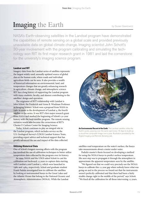
An Environmental Record <strong>of</strong> the Earth: The Landsat satellite orbits the<br />
Earth’s poles, passing over the same spot every 16 days to build up<br />
a cloud-free composite image over a year. Illustration provided by the<br />
Digital Imaging and Remote Sensing Lab.<br />
satellites read temperature on the water’s surface, the buoys<br />
take measurements about a meter under water.<br />
Padula’s master’s thesis focused on developing a method<br />
for using the NOAA buoys to predict surface temperature.<br />
His next step was to propagate it through the atmosphere to<br />
approximate the apparent temperature seen by the satellite.<br />
“We figured out that we could very precisely use the NOAA<br />
buoys to calibrate this 15-year gap where nobody knew what was<br />
going on and in the process we found out that the instruments<br />
weren’t perfectly calibrated and that there had been a fairly<br />
sizable change right in the middle <strong>of</strong> the period,” says Schott.<br />
“We fixed all the calibration for all those intervening 15 years.<br />
Research at RIT<br />
15