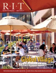
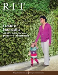
Fall / Winter 2012 - Rochester Institute of Technology
Fall / Winter 2012 - Rochester Institute of Technology
Fall / Winter 2012 - Rochester Institute of Technology

Create successful ePaper yourself
Turn your PDF publications into a flip-book with our unique Google optimized e-Paper software.
Related Research<br />
Predicting Space Weather<br />
Roger Dube, pr<strong>of</strong>essor in the<br />
Chester F. Carlson Center for<br />
Imaging Science at <strong>Rochester</strong><br />
<strong>Institute</strong> <strong>of</strong> <strong>Technology</strong>, is<br />
developing an early warning<br />
system for space weather<br />
Roger Dube<br />
storms on Earth. His NASAfunded<br />
research initially focused on the<br />
protection <strong>of</strong> future Mars colonists.<br />
“My original space weather project was<br />
oriented toward the colonization <strong>of</strong> Mars,”<br />
Dube says. “Because I’ve had to step back and<br />
look at the data on Earth, we’ve come to realize<br />
that there is a big problem even here in terms<br />
<strong>of</strong> our potential sensitivity to severe space<br />
weather storms. I think the level <strong>of</strong> awareness<br />
has increased because we’re seeing more data<br />
that says this is not that rare an event.”<br />
During a space storm, the equivalent <strong>of</strong><br />
hurricane-force gusts flow through interplanetary<br />
space carrying X-rays and particles<br />
emitted from solar flares and coronal mass<br />
ejections—high-energy explosions on the<br />
surface <strong>of</strong> the sun.<br />
Dube and his team <strong>of</strong> seven students have<br />
developed a neural network that digests the<br />
massive amount <strong>of</strong> data taken from different<br />
types <strong>of</strong> variables, such as electricity and<br />
The sun is the source <strong>of</strong> radiation and particles that can disrupt satellite communication and radio<br />
waves. Predicting space weather can allow for the prevention <strong>of</strong> damage to the sensitive satellite<br />
infrastructure that orbits Earth.<br />
magnetism, to better predict when a storm<br />
will occur. They are also analyzing features<br />
on the sun for use in predicting storms and<br />
linking activity on the sun (such as sunspots)<br />
with other types <strong>of</strong> impacts on Earth (such<br />
as the Aurora Borealis and radio storms).<br />
“What’s happening is that we’re able to<br />
recognize these precursors in this data that<br />
are within half a day <strong>of</strong> the event. That’s good,<br />
but we’d really like to have it several days in<br />
advance so that we could do something about<br />
it,” Dube says. “For example, with enough<br />
warning we can turn our satellites away<br />
from the sun so they don’t get hurt by the<br />
particles that hit them as the storm passes.”<br />
Knowledge Management Tool Aids UN Disaster Management<br />
Brian Tomaszewski<br />
Using space-based technologies<br />
and a colorful interactive<br />
Flash-based matrix developed<br />
at RIT, United Nations agencies<br />
involved in providing support to<br />
countries in the area <strong>of</strong> disaster<br />
risk management can specifically<br />
keyword searches that were used before,”<br />
says Tomaszewski. “The information is now<br />
much easier to access.”<br />
The tool allows users to select from a variety<br />
<strong>of</strong> hazards, ranging from fires to oil spills to<br />
epidemics, providing to disaster managers<br />
information on how they can utilize spacebased<br />
identify space-based technology solutions to<br />
support the disaster management cycle.<br />
Brian Tomaszewski, an assistant pr<strong>of</strong>essor in<br />
RIT’s department <strong>of</strong> information sciences and<br />
technologies, and several students have teamed<br />
with the United Nations Platform for Spacebased<br />
Information for Disaster Management<br />
and Emergency Response (UN-SPIDER),<br />
a programme being implemented by the<br />
United Nations Office for Outer Space Affairs<br />
(UNOOSA), to create a Web-based tool that<br />
provides information, communication, and<br />
process reporting to disaster managers.<br />
This tool, called the Space Application Matrix,<br />
takes existing information available—mostly<br />
case studies, guides, and product information—<br />
and makes it easier to access and retrieve.<br />
“The Space Application Matrix has an<br />
intuitive, visual interface as opposed to the<br />
technologies in the various phases <strong>of</strong><br />
the disaster management cycle (mitigation,<br />
preparedness, response, and recovery). These<br />
technologies include satellite communication—<br />
useful when there is no cell phone coverage<br />
in an area—satellite navigation and Earth<br />
observation/remote sensing technologies.<br />
Tomaszewski began working on the tool<br />
in the summer <strong>of</strong> 2009 with the help <strong>of</strong> RIT<br />
students. He spent three months in Bonn,<br />
Germany, immersed in the knowledge portal<br />
and other geographic information science and<br />
technology projects for the United Nations.<br />
It was completed in January 2011, after he<br />
recruited information science and technology<br />
students Joseph Spens and Beytullah Sarcia<br />
to put the finishing touches on the project.<br />
Results <strong>of</strong> his research with the UN-SPIDER<br />
Programme ensure that all relevant information<br />
The Space Application Matrix, a tool the United<br />
Nations uses to aid disaster management, was<br />
developed by Brian Tomaszewski, an assistant<br />
pr<strong>of</strong>essor <strong>of</strong> information sciences and<br />
technologies, and two RIT students.<br />
is available and accessible to all those interested<br />
in understanding how space-based technologies<br />
could contribute to their everyday needs.<br />
Research at RIT<br />
19