

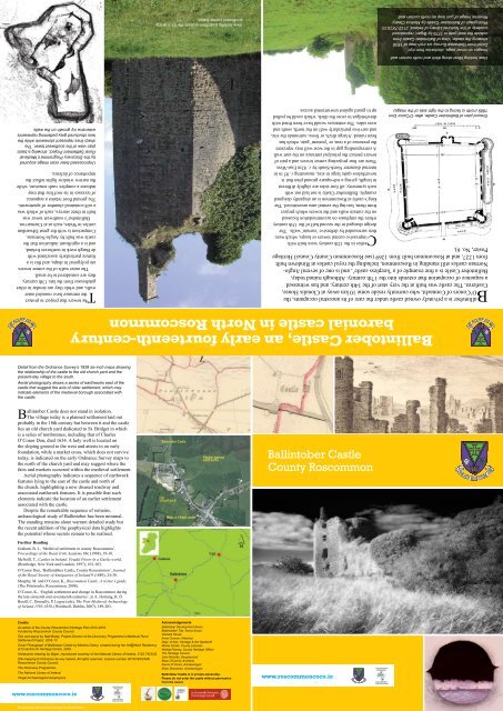
Ballintober Castle.pdf - Roscommon County Council
Ballintober Castle.pdf - Roscommon County Council
Ballintober Castle.pdf - Roscommon County Council

Create successful ePaper yourself
Turn your PDF publications into a flip-book with our unique Google optimized e-Paper software.
<strong>Ballintober</strong> <strong>Castle</strong>, an early fourteenth-century<br />
baronial castle in North <strong>Roscommon</strong><br />
<strong>Ballintober</strong> is a privately owned castle under the care of its ancestral occupants, the<br />
O’Conors of Connacht, who currently reside some 10 km away at Clonalis House,<br />
<strong>Castle</strong>rea. The castle was built at the very start of the 14th century, and has witnessed<br />
a sequence of occupation that extends into the 17th century. Although ruined today,<br />
<strong>Ballintober</strong> <strong>Castle</strong> is a fine example of a ‘keepless castle’, and is one of several Anglo-<br />
Norman castles still standing in <strong>Roscommon</strong>, including the royal castles at Rindown built<br />
from 1227, and at <strong>Roscommon</strong> built from 1269 (see <strong>Roscommon</strong> <strong>County</strong> <strong>Council</strong> Heritage<br />
Poster, No. 6).<br />
Ground plan of <strong>Ballintober</strong> <strong>Castle</strong>, after O’Conor Don<br />
1889 (north is facing to the right side of the image).<br />
<strong>Castle</strong>s in the 12th century were built with<br />
impressive central towers or keeps, which were<br />
then surrounded by defensive ‘curtain’ walls. The<br />
design changed in the second half of the 13th century<br />
where the emphasis on accommodation focussed<br />
on the curtain walls and the towers which project<br />
from them, leaving the central area unrestricted. The<br />
king’s castle at <strong>Roscommon</strong> is an elegantly designed<br />
example. <strong>Ballintober</strong> <strong>Castle</strong> is not laid out with<br />
such symmetry; all four sides are slightly different<br />
in length, giving a sub-square ground plan that is<br />
nevertheless quite large in size, measuring c. 85 m in<br />
internal diameter North-South by c. 82m East-West.<br />
There are four projecting corner towers and a pair of<br />
towers protect the principal entrance on the east wall.<br />
A corresponding gap in the west wall may represent<br />
the presence of a rear, or ‘postern’ gate, which has<br />
been ruined. A large ditch, or fosse, surrounds the site,<br />
and survives particularly well on the north, south and<br />
west sides. The entrances would have been fitted with<br />
drawbridges to cross the ditch, which could be pulled<br />
up to guard against unwarranted access.<br />
The towers that project to protect<br />
the entrance have rounded outer<br />
walls, and while they are similar to other<br />
gatehouses from the late 13th century,<br />
they are considered to be small.<br />
The outer walls of the corner towers<br />
are polygonal in shape, and this is a<br />
feature particularly associated with<br />
de Burgh work in northwest Ireland,<br />
and is a significant indication that the<br />
castle was built by Anglo-Normans.<br />
Comparison is with the great Edwardian<br />
castles in Wales, such as at Caernarvon.<br />
<strong>Ballintober</strong>’s southwest tower was<br />
built in three storeys, each of which was<br />
a self-contained chamber of apartments.<br />
The ground floor retains a sequence<br />
of recesses in its roof line that may<br />
indicate a complex vault structure, while<br />
the narrow window lights reflect the<br />
importance of defence.<br />
Unprocessed laser scan image acquired<br />
by the Discovery Programme’s Medieval<br />
Rural Settlement Project, showing a basic<br />
plan view of the southwest tower. The<br />
sharp lines represent stonework while the<br />
less structured grey patterning represents<br />
extensive ivy growth on the walls.<br />
View looking West along ditch and north curtain wall.<br />
Images on cover page, clockwise from top:<br />
Detail from Ordnance Survey six-inch map of 1838<br />
showing the castle; View of <strong>Ballintober</strong> <strong>Castle</strong> from<br />
outside the east gate in 1779 by Bigari, reproduced<br />
courtesy of the National Library of Ireland, 2122.TX(3)33;<br />
Photograph of <strong>Ballintober</strong> <strong>Castle</strong> by Martina Cleary;<br />
Reverse image of gun loop on north curtain wall.<br />
View looking East from outside the ditch at the<br />
southwest corner tower.<br />
Detail from the Ordnance Survey’s 1838 six-inch maps showing<br />
the relationship of the castle to the old church yard and the<br />
present-day village to the south.<br />
Aerial photography shows a series of earthworks east of the<br />
castle that suggest the axis of older settlement, which may<br />
indicate elements of the medieval borough associated with<br />
the castle.<br />
<strong>Ballintober</strong> <strong>Castle</strong> does not stand in isolation.<br />
The village today is a planned settlement laid out<br />
probably in the 18th century but between it and the castle<br />
lies an old church yard dedicated to St. Bridget in which<br />
is a series of tombstones, including that of Charles<br />
O’Conor Don, died 1634. A holy well is located on<br />
the sloping ground to the west and attests to an early<br />
foundation, while a market cross, which does not survive<br />
today, is indicated on the early Ordnance Survey maps to<br />
the north of the church yard and may suggest where the<br />
fairs and markets occurred within the medieval settlement.<br />
Aerial photography indicates a sequence of earthwork<br />
features lying to the east of the castle and north of<br />
the church, highlighting a now disused roadway and<br />
associated earthwork features. It is possible that such<br />
elements indicate the location of an earlier settlement<br />
associated with the castle.<br />
Despite the remarkable sequence of remains,<br />
archaeological study of <strong>Ballintober</strong> has been minimal.<br />
The standing remains alone warrant detailed study but<br />
the recent addition of the geophysical data highlights<br />
the potential whose secrets remain to be realised.<br />
<strong>Ballintober</strong> <strong>Castle</strong><br />
<strong>County</strong> <strong>Roscommon</strong><br />
Further Reading<br />
Graham, B. J., ‘Medieval settlement in county <strong>Roscommon</strong>’,<br />
Proceedings of the Royal Irish Academy 88c (1988), 19-38.<br />
McNeill, T., <strong>Castle</strong>s in Ireland. Feudal Power in a Gaelic world,<br />
(Routledge, New York and London, 1997), 101-103.<br />
O’Conor Don, ‘Ballintubber <strong>Castle</strong>, <strong>County</strong> <strong>Roscommon</strong>’, Journal<br />
of the Royal Society of Antiquaries of Ireland 9 (1889), 24-30.<br />
Murphy, M. and O’Conor, K., <strong>Roscommon</strong> <strong>Castle</strong>. A visitor’s guide,<br />
(The Printworks, <strong>Roscommon</strong>, 2008).<br />
O’Conor, K., ‘English settlement and change in <strong>Roscommon</strong> during<br />
the late sixteenth and seventeenth centuries’, in A. Horning, R. Ó<br />
Baoill, C. Donnelly, P. Logue (eds), The Post-Medieval Archaeology<br />
of Ireland 1550-1850, (Wordwell, Dublin, 2007), 189-203.<br />
Credits<br />
An action of the <strong>County</strong> <strong>Roscommon</strong> Heritage Plan 2012-2016.<br />
Funded by <strong>Roscommon</strong> <strong>County</strong> <strong>Council</strong>.<br />
Text and layout by Niall Brady, Project Director of the Discovery Programme’s Medieval Rural<br />
Settlement Project, 2002-10.<br />
Cover Photograph of <strong>Ballintober</strong> <strong>Castle</strong> by Martina Cleary, created during her Art@Work Residency<br />
at Cruachan Aí Heritage Centre, 2009.<br />
Antiquarian drawing by Bigari, reproduced courtesy of the National Library of Ireland, 2122.TX(3)33.<br />
OSi mapping © Ordnance Survey Ireland. All rights reserved. Licence number 2010/18/CCMAl<br />
<strong>Roscommon</strong> <strong>County</strong> <strong>Council</strong>.<br />
The Discovery Programme;<br />
The National Library of Ireland;<br />
Irish Lady’s Tresses<br />
Target Archaeological Geophysics.<br />
Acknowledgements<br />
<strong>Ballintober</strong> Development Assoc.<br />
Ballintubber Tidy Towns Assoc.<br />
Clonalis House<br />
Anne Connon, Historian<br />
Dept. of Arts, Heritage & the Gaeltacht<br />
Richie Farrell, <strong>County</strong> Librarian<br />
Nollaig Feeney, <strong>County</strong> Heritage Officer<br />
The Heritage <strong>Council</strong><br />
John Nicholls, Geophysicist<br />
Brian O’Carroll, Architect<br />
Kieran O’Conor, Archaeologist<br />
Brian Shanahan, Archaeologist<br />
<strong>Ballintober</strong> <strong>Castle</strong> is in private ownership.<br />
Please do not enter the castle without permission<br />
from the owner.<br />
Produced by <strong>Roscommon</strong> <strong>County</strong> <strong>Council</strong> © 2012
<strong>Ballintober</strong> <strong>Castle</strong>, built to impose the king’s presence<br />
on Gaelic lands but quickly passing to O’Conor hands<br />
The Anglo-Norman castles in <strong>Roscommon</strong> were designed to contain the Gaelic lordships<br />
in the north of the county. The construction of <strong>Ballintober</strong> castle is not documented and<br />
it has been suggested that it was built by the O’Conors, but current thinking is that the great<br />
earl of Ulster, Richard de Burgh, whose family was closely connected to the court of King<br />
Edward I, is responsible for its construction. As the most northerly of the great castles in the<br />
county, <strong>Ballintober</strong> was built to impose a presence on the O’Conor lands. The 13th century<br />
was a time of expansion in Ireland and across Europe, but this trend was not continued into<br />
the 14th century, and during this time de Burgh interests were curtailed with the result that the<br />
O’Conors took possession of <strong>Ballintober</strong> <strong>Castle</strong> by 1362.<br />
After the O’Conors split into two distinct lines in 1385, <strong>Ballintober</strong> became the principal<br />
place for the O’Conor Don, while nearby Tulsk was the centre for the O’Conor Roe.<br />
The castle remained a setting for political intrigue, between O’Conor factions, and between<br />
Gaelic and English interests.<br />
The narrative of ownership, construction, attack and rebuilding that can be pieced<br />
together from a series of entries made in the contemporary chronicles can also be seen in the<br />
archaeology and architecture of the standing remains. The gaps in one source are filled in<br />
part by the evidence from the other, making <strong>Ballintober</strong> <strong>Castle</strong> a most useful place in which<br />
to learn about the complex relationships between the different cultural groups that lived in<br />
later medieval Ireland.<br />
Unprocessed laser scan image acquired by the Discovery<br />
Programme’s Medieval Rural Settlement Project, showing a basic plan<br />
view of the northwest tower. It is entered by a doorway in the southeast<br />
corner, with a stairwell rising through the building in the southwest<br />
corner, leading to the principal chambers in the northern section.<br />
View looking west into the northwest tower<br />
through a fracture in the wall, revealing a tier of<br />
two tall windows, with curving ashlar lintels on<br />
the upper storey.<br />
The ornate principal fireplace on the third<br />
floor is one of several features<br />
that attest to the opulence of the O’Conor<br />
residence.<br />
The northwest tower was substantially<br />
reworked in the 17th century. Its four-floor<br />
structure is described as a seven-room fortified<br />
house. Large mullioned windows and stairs are<br />
finished in elegant ashlar stonework, and the<br />
principal fireplace, located on the third floor<br />
has an inscription of 1627.<br />
The O’Conors were now significnant<br />
landowners in the early modern period,<br />
and their investment in such building is a<br />
testimony to their growing wealth.<br />
The eastern corner towers are more ruinous<br />
today but that on the northeast angle was also<br />
a chamber tower.<br />
Much of the cut stonework has been removed from the castle but many<br />
elements remain that reflect the quality of the design, such as this door<br />
jamb leading from the stairway into the second storey of the northwest<br />
tower. Its tooled margin sets out the interior punch dressing, where the<br />
mason would have used a chisel to score the stone’s surface, with the<br />
resulting play of light on the surface contributing to the quality of the<br />
architecture.<br />
View across the grassy interior looking at the north curtain wall<br />
At first sight, the vast interior space or bawn<br />
of the castle today seems empty, but there<br />
are gable features built into the west curtain<br />
wall indicating the presence of buildings<br />
nestled beneath. A series of platform features<br />
may represent ruined buildings, and a large<br />
irregular hollow lies over the central area;<br />
overall however the grassy space gives little<br />
indication of what occurred within the castle’s<br />
interior.<br />
Geophysical survey is a technique that is<br />
widely used to ‘look’ below the surface<br />
levels to assess the nature of the buried<br />
deposits. Surveys conducted in 2008 and<br />
2009 by Target Archaeological Geophysics<br />
were made possible by grants from the<br />
Heritage <strong>Council</strong> and are the first use of<br />
this technology at <strong>Ballintober</strong>; revealing a<br />
remarkable sequence of information.<br />
A large curving ditch feature in the<br />
southwest quadrant may indicate the presence<br />
of a pre-existing enclosure on the castle site.<br />
Important locations were continually used<br />
and reused over time. In the present instance,<br />
the curving ditch might represent a former<br />
Gaelic residence that was destroyed and built<br />
upon by de Burgh, to establish his mark and<br />
that of his king on ancestral O’Conor lands.<br />
The resistance survey in turn revealed a<br />
series of clearly defined buildings arranged<br />
around a central courtyard. The structure in<br />
the northwest measures c. 12 by 8 m in size<br />
and appears to have buttresses, suggesting<br />
it is a church. The building in the southwest<br />
is much more substantial, and measures c.<br />
30-35 m long and 15 m wide. Subsequent<br />
survey identified that the foundations are not<br />
continuous, and seem to represent a series of<br />
piers, and these may have supported a timberframed<br />
structure. It is tempting to see here<br />
the sequence of buildings referred to in the<br />
Inquisition of 1333, which included a hall,<br />
chamber and kitchen.<br />
Magnetic gradiometry highlights cuts and fills in clay.<br />
Anomalies are highlighted as darker patches. Many represent<br />
pits. A significant anomaly in the southwest quadrant is a<br />
curving ditch feature that may indicate the presence of a precastle<br />
enclosure.<br />
Resistance survey in this limestone landscape is useful for<br />
detecting stone features, and has revealed a series of large<br />
internal structures arranged around a central courtyard.<br />
<strong>Ballintober</strong> may be a keepless castle, but the geophysical data<br />
illuminates the nature of settlement within the walls.<br />
Ground penetrating radar provides an<br />
indication of the depth of the builldings.<br />
The red highlights the extent of the<br />
foundations at a depth of 90-110 cm below<br />
the surface. The foundations continue<br />
beyond the depth of survey at 150 cm.<br />
The O’Conor lands of Sil Murray are divided between O’Conor Don and O’Conor Roe<br />
The first reference<br />
to <strong>Ballintober</strong> is<br />
when a mercenary<br />
killed a Gruelach/<br />
warrior, and was<br />
himself killed. It<br />
does not suggest<br />
who owned the<br />
castle at that time.<br />
An Inquisition following the death of<br />
the Earl of Ulster records ‘an old castle<br />
surrounded by a stone wall, which<br />
would be very useful for keeping the<br />
peace of those parts...In the castle are<br />
ruinous buildings, a hall, a chamber,<br />
a kitchen, and other houses, worth<br />
nothing beyond cost of repairs,<br />
because they need great repairs’.<br />
The first annal entry<br />
indicating that the Irish<br />
possessed <strong>Ballintober</strong><br />
notes that Cathal Óc<br />
and Aodh son of Felim<br />
O’Conor, king of Connacht,<br />
from the family that was<br />
later to be O’Conor Roe,<br />
seized <strong>Ballintober</strong>.<br />
O’Kelly, Mac Dermot, and Teige son of O’Conor<br />
Roe attack <strong>Ballintober</strong>; a battle was fought in<br />
which many were wounded, both within and<br />
without the town. One of the attackers took a<br />
chip from the end of a wattle and set fire to it,<br />
casting the wattle into the bawn. It stuck in the<br />
side of a house, and was burned, as was the<br />
adjoining house, and finally the greater part of<br />
the town. The bawn was also burned.<br />
Sir Richard Bingham,<br />
President of<br />
Connacht, captured<br />
<strong>Ballintober</strong>. Sir<br />
Edward Fyton desired<br />
a ward to be placed<br />
there.<br />
<strong>Ballintober</strong> is<br />
among a list of<br />
English castles<br />
burned by rebels<br />
in the Nine<br />
Years War of the<br />
Elizabethan Age.<br />
The <strong>Castle</strong> of<br />
<strong>Ballintober</strong> is<br />
the demesne<br />
of Sir Hugh<br />
O’Conor Don.<br />
1311 1333<br />
1362 1385<br />
1434/5 1570<br />
1596 1617<br />
<strong>Roscommon</strong> Heritage Poster Series, No. 7. Produced by <strong>Roscommon</strong> <strong>County</strong> <strong>Council</strong> © 2012. An action of the <strong>County</strong> <strong>Roscommon</strong> Heritage Plan 2012-2016. Funded by <strong>Roscommon</strong> <strong>County</strong> <strong>Council</strong>. Text and layout by Niall Brady.<br />
Cover Photograph of <strong>Ballintober</strong> <strong>Castle</strong> by Martina Cleary. Antiquarian drawing by Bigari, reproduced courtesy of the National Library of Ireland, 2122.TX(3)33. OSi mapping © Ordnance Survey Ireland. All rights reserved.<br />
Licence number 2010/18/CCMAl <strong>Roscommon</strong> <strong>County</strong> <strong>Council</strong>. The Discovery Programme. Target Archaeological Geophysics. <strong>Ballintober</strong> <strong>Castle</strong> is in private ownership. Please do not enter the castle without permission from the owner.<br />
Sustainable Forests - the wood used to make the pulp for the paper for this poster has been sourced from a protected forest. Printed on FSC paper. Heritage Series designed by: www.creativefreedom.ie


