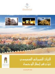
Heritage Dams: The Arabian Peninsula was not characterized by ...
Heritage Dams: The Arabian Peninsula was not characterized by ...
Heritage Dams: The Arabian Peninsula was not characterized by ...

Create successful ePaper yourself
Turn your PDF publications into a flip-book with our unique Google optimized e-Paper software.
<strong>Heritage</strong> <strong>Dams</strong>:<br />
<strong>The</strong> <strong>Arabian</strong> <strong>Peninsula</strong> <strong>was</strong> <strong>not</strong> <strong>characterized</strong> <strong>by</strong> droughts, as is the case today. <strong>The</strong> rains were<br />
abundant and were an important factor in shaping the nature of the land. Lakes were covered<br />
on parts of the <strong>Arabian</strong> <strong>Peninsula</strong> in the west to the Empty Quarter. Before 35,000 to 17,000<br />
years ago mammals and livestock multiplied, nurtured and roamed in the land of green grass<br />
around the lakes. Although it <strong>was</strong> <strong>characterized</strong> <strong>by</strong> drier climate during the past six thousand<br />
years, the <strong>Arabian</strong> <strong>Peninsula</strong> had experienced periods of rains and showers, but it <strong>was</strong> well<br />
marked <strong>by</strong> lasting droughts.<br />
Consequences related to the lack of rain dramatically affected the lives of the <strong>Arabian</strong> <strong>Peninsula</strong>,<br />
and led to a frantic search for water resources. <strong>The</strong> ancient residents’ concern for securing<br />
water resources is reflected in establishment of channels and digging water wells and ponds,<br />
building reservoirs and dams along the seasonal rivers and valleys. <strong>The</strong> need to build dams<br />
continued until the early Islamic period, although <strong>by</strong> now, most of them are completely<br />
destroyed due to the vagaries of nature.<br />
Construction of dams <strong>was</strong> well developed in the era of Islam, and they used to build dams in the<br />
tracks of flooding valleys as reservoirs of water for agricultural use, irrigation, and to inundate<br />
the groundwater wells or to limit the floods that threaten people's lives and homes.<br />
<strong>The</strong> dams were usually built of large uncut and irregular stones, in pyramidal shape. <strong>The</strong>se were<br />
large at the base and smaller in the upper part, and the faces towards the water force were<br />
graded. <strong>The</strong>y were also covered with a thick layer of plaster. <strong>Dams</strong> of great heights had their<br />
walls reinforced with fine gravel, while large stone slabs were added to the front and tops. Some<br />
of these dams have drainage outlets in addition to the channels that carry water to agricultural<br />
land.<br />
<strong>Dams</strong> were of varying length, height, width and thickness according to the nature of the land, as<br />
well as the quantity of water restriction. <strong>The</strong>se dams in various sizes and construction types are<br />
a testament to the outstanding civilization established <strong>by</strong> the early Muslims in the field of<br />
architecture.<br />
Some of the most important dams in the <strong>Arabian</strong> <strong>Peninsula</strong> are:<br />
Al-Samlagi Dam:<br />
It is located in the south-east of Taif on Thamalah Valley, 35 km from the city of Taif. This is the<br />
ancient heritage dam. It is likely to have been built in the period prior to Islam to the raise of<br />
Islam. This dam is <strong>characterized</strong> <strong>by</strong> its enormity, built of huge rectangular blocks of stones<br />
structured together. It is approximately 212 meters in length, and 10 meters width, and the its<br />
altitude is 10.8 meters.<br />
Dama Dam:
It is located 140 km south-east of Taif in Bani al-Harith land in the Dama Valley. It <strong>was</strong> built <strong>by</strong><br />
using big and locally cut red rocks arranged in long rows. <strong>The</strong> dam <strong>was</strong> made of four zigzag walls<br />
and its length reaches to 11.30 meters, width 2 meters and its height 4 meters. It has terraced<br />
tops at the south-eastern side. Also it has an un-dated inscription on one of the rocks at a<br />
height.<br />
Grygeer Dam:<br />
It is located in the Grygeer Valley, which represents integrated building style with the exception<br />
of some rocks that spread beneath it. This dam is considered to be a unique in its design and its<br />
top surface serving as the outlet and the flood drainage channel in its base. Its length is about 37<br />
meters, 2 meters width and a height of 18 meters.<br />
Al Lusb Dam:<br />
It is located to the east of the highway about 10 km from the Waddi Ardah. It represents a thick<br />
built wall. It <strong>was</strong> built on a rocky outcrop in the middle of a narrow channel of five meters width.<br />
Now it is completely destroyed in the middle, leaving only a small part on the eastern side. <strong>The</strong><br />
remaining antiquities show the height of the dam must have been over than 50 meters. Along<br />
its neighborhood are the remains of some abandoned houses. Pottery bits have been found at<br />
sites dating back to the pre-Islamic era.<br />
Thalbah Dam:<br />
This dam is located about seven kilometers from Taif. It <strong>was</strong> built of cut square stones, in the<br />
form two parallel walls covered <strong>by</strong> sand and lime mortar. When built, its length is believed to<br />
have been 78.9 meters, width 9.60 meters and a height of 9 meters at its maximum altitude in<br />
the middle.<br />
Seesid Dam:<br />
It is located in the Seesid Valley in the north-east of Taif. It is built of stones as large rectangular<br />
building blocks laid horizontally. <strong>The</strong> dam has a length of 58 meters, 4.10 meters width and 8.5<br />
meters height. <strong>The</strong> dam is popular because it <strong>was</strong> built in the era of Umayyad Caliph Muawiya<br />
bin Abi Sufyan, that is revealed on an inscription dating back to the year 58 H/677-678 CE,<br />
stating the text ion as follows:<br />
This dam is for Abdullah Muawiya<br />
Commander of the Faithful, built <strong>by</strong> Abdullah bin Saqr<br />
In the name of the God in the fifty-eighth year<br />
God forgive Abdullah Muawiya
Amir of the believers, May God secure and support him and the believers profit from<br />
him<br />
Wrote Omer Bin Al Habab<br />
Al Agrab Dam:<br />
This dam <strong>was</strong> established on Al Agrab Valley, approximately twenty kilometers in the north-east<br />
of Taif city. It is one of the two-parallel walls of dam, filled with pebbles. It is <strong>characterized</strong> <strong>by</strong><br />
the presence of an outlet to regulate the flow of water from<br />
the middle. Its total length is 113 meters and the width 5 meters. <strong>The</strong> dam is in good condition<br />
even today. Two kilometers on the north-western side is an undated inscription. Perhaps the<br />
inscription is related to this dam considering that there were no suitable engraving stones<br />
nearer to the dam.<br />
Al Haseed Dam:<br />
It is located 14 kilometers from Khybar Municipality on a branch of Ghars Valley. Its total length<br />
is 60 meters, and its lowest altitude is 6 meters. It <strong>was</strong> built <strong>by</strong> using stone blocks from Al Hurah<br />
site and it is graded on both sides. Its front façade is divided into two parts. <strong>The</strong> walls on top are<br />
raised on each side to provide a corridor across the dame and in the middle at the bottom is an<br />
arched hole, a conduit to control the discharge of water.<br />
Al Mashquq Dam:<br />
It is an ancient dam in Khyber located to the east of Al Shareef and to the north of the Khyber<br />
Municipality. <strong>The</strong> dam <strong>was</strong> built on one of the branches of Shaib Halhal valley. Its total length is<br />
about 100 meters. <strong>The</strong> plaster covering the dam wall has been peeled. <strong>The</strong> western façade of<br />
the dam is graded. In the southern end there are still remains of a draining hole or a channel. As<br />
a result of the accumulation of silt gradually with the passage of time, the dam is unable to store<br />
large amounts of water.<br />
Al Qusaibah Dam:<br />
It is also called Sa'd Al Bent (<strong>The</strong> Girl Dam) which <strong>was</strong> built on the course of a narrow stream of<br />
Al Gharas Valley in Hura't Khyber, 30 kilometers to the southeast of Khyber city. It is considered<br />
as one of the largest and most ancient heritage dams in the Kingdom. <strong>The</strong> original length of it<br />
<strong>was</strong> around 205 meters. But only 170 meters of it remains. Its height, from the bottom of the<br />
valley reaches approximately 30 meters. <strong>The</strong> dam is built in the form of a graded phased<br />
approach on both the sides. A layer of mortar is added to the side, parallel to the reservoir. <strong>The</strong><br />
dam had experienced several kinds of ravages and destructions and therefore some of its<br />
facilities have disappeared. It seems that the dam had a large lake on the rear, which led to the<br />
escalation of the water level in the Hura't Khyber in addition to reclamation of agricultural land<br />
and increasing its fertility.
Al Zaidiah Dam:<br />
It is one of the small dams in the Khyber but with a particular importance. It <strong>was</strong> built on Al<br />
Zaidiah Strait in the north-east of the Khyber. <strong>The</strong> approximate length is about 25 meters, its<br />
nearest height is 4 meters and the thickness of the wall is about 8 meters. <strong>The</strong> dam and the<br />
basin are covered with silt now. <strong>The</strong> importance of the dam, as well as to the reservoir of the<br />
flood water for agriculture, comes from the inscriptions found in the northern bank of the valley<br />
which oversees the dam. <strong>The</strong> date of this inscription could be of the first century AH<br />
Dam of Ranon'a Valley:<br />
<strong>The</strong> dam is attributed to Abdullah Bin Amr Bin Omer Bin Othman Bin Afan (died in Egypt in the<br />
year 96 AH. <strong>The</strong> dam is located on the Ranon'a Valley to the south of Qab'a scheme (Al Hijir'a<br />
district). It extends along the course of the valley from east to west. <strong>The</strong> valley is composed of<br />
three related dams with joint total length reaching 83.5 meters. <strong>The</strong> largest dam in the main<br />
body is located to the west, the length of its side is amounting 47 meters and its width 17.70<br />
meters. <strong>The</strong> facade of the dam has a drainage hole on the eastern side. <strong>The</strong>re is an inscription<br />
on the rock façade in the eastern side in a poetical text. <strong>The</strong> history of the dam is estimated to<br />
be between the end of first century and the beginning of the second century AH.<br />
Muawiya Dam in Al Khang Valley:<br />
It is located on the Al Khang Valley to the east of Al Madinah Al Monawarah, 15 km to the east<br />
of Al A'qoul village. <strong>The</strong> length of the dam is about 30 meters. Its height from the bottom of the<br />
valley until the level of the surrounding area is about 20 meters. <strong>The</strong> width of the dam’s wall at<br />
the base is about 10 meters. <strong>The</strong> dam has experienced, in it is midpoint, a collapse as a result of<br />
earthquake that struck the region over ages, in addition to the flash floods in the narrow<br />
corridor of the valley. In the vicinity of the dam there is a<strong>not</strong>her longer and lower height dam<br />
which must have been built to reserve more water from the floods that flood the lake of the<br />
first dam. Dam’s foundation stone is found at the top, on which is written the name of Muawiya<br />
bin Abi Sufyan and the names of those who have taken part in the construction of the dam and<br />
their supervisors.<br />
Aothal Dam:<br />
One of the three remaining dams in Mecca, built <strong>by</strong> Al Hajjaj bin Yusuf Althagqafi in the years 73<br />
to 74 Hijri, in the north of Al Muaisam on the road to Al Esailah Valley. <strong>The</strong> length of the dam is<br />
abuts 140 meters. Its width reaches 6 meters at the top and it has a hierarchical interface. <strong>The</strong><br />
dam is divided into five layers. People who are arriving from Makkah, can see Islamic<br />
inscriptions on the rocks on its left side along its two faces. <strong>The</strong> inscriptions belong to the<br />
Umayyad period.<br />
Al Madeeq Dam:
It is located near the Najran Valley which represents a modern irrigation system devoted to<br />
divert flood water from sweeping the fields and orchards located to the east of the valley's<br />
mouth. <strong>The</strong> water is let out through the channels carved into the rock to a depth of two meters<br />
and 90 cm, and length 125 meters. Some constructions related to irrigation system were found,<br />
in which the plaster might have been used as part of the gate to control the water.<br />
Wadi Numar Dam:<br />
It is located on one of the sloped ditches of Numar Valley on the western edge of Riyadh city. Its<br />
total length is 34.40 meters and the thickness of the wall at the bases is 6.2 meters, while the<br />
height of the dam is about 5.85 meters. It has arched pillared bases to ease the water flow that<br />
comes from the top. <strong>The</strong> dam is built of cut stones. But the dam has collapsed from the middle<br />
due to the lack of maintenance.<br />
Wadi Hagar Dam:<br />
It is located at Um Hazm in the northern municipality. It is comprised of two stone walls spread<br />
out from the south-east to the north-west with a length of 229 meters, approximately two<br />
meters width and 1.10 meters height. <strong>The</strong> dam contains flood outlets during the water rush. A<br />
large quantity of green clay fractures were found near it dating back to the early Islamic period.<br />
Al Subeen Dam:<br />
It is located on Rawdat Sidair. It is also called Al Subeen dam because of its seventy sluices. <strong>The</strong><br />
dam is partially destroyed and only fifty sluices remain. It <strong>was</strong> built on Sidair Valley in the form a<br />
series of packed stones placed on top of each other in the form of building blocks. <strong>The</strong> total<br />
length of the dam from the north to the south is 233 meters and the height is about two to<br />
three meters, and thickness ranges from 80 to 120 cm. <strong>The</strong> dam is one of the most ancient dams<br />
in Najd which still exist in good condition.<br />
Al Rowaidah Dam:<br />
It is located in the south of Al Rowaidah in Al Majmah Municipality, which <strong>was</strong> built of trimmed<br />
stones. Stones are lined up as the basic building blocks in a regular session. It is built on a stream<br />
bed of Al Rowaidah and Al Khais Valley. <strong>The</strong> dam extends from south to north with 9 building<br />
blocks. <strong>The</strong> length of the dam is about 260 meters. <strong>The</strong>re are four sluices and each sluice with a<br />
width of 3 meters. <strong>The</strong>re are two rows of stones filled in between the sluices.