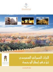
Heritage Dams: The Arabian Peninsula was not characterized by ...
Heritage Dams: The Arabian Peninsula was not characterized by ...
Heritage Dams: The Arabian Peninsula was not characterized by ...

You also want an ePaper? Increase the reach of your titles
YUMPU automatically turns print PDFs into web optimized ePapers that Google loves.
<strong>Heritage</strong> <strong>Dams</strong>:<br />
<strong>The</strong> <strong>Arabian</strong> <strong>Peninsula</strong> <strong>was</strong> <strong>not</strong> <strong>characterized</strong> <strong>by</strong> droughts, as is the case today. <strong>The</strong> rains were<br />
abundant and were an important factor in shaping the nature of the land. Lakes were covered<br />
on parts of the <strong>Arabian</strong> <strong>Peninsula</strong> in the west to the Empty Quarter. Before 35,000 to 17,000<br />
years ago mammals and livestock multiplied, nurtured and roamed in the land of green grass<br />
around the lakes. Although it <strong>was</strong> <strong>characterized</strong> <strong>by</strong> drier climate during the past six thousand<br />
years, the <strong>Arabian</strong> <strong>Peninsula</strong> had experienced periods of rains and showers, but it <strong>was</strong> well<br />
marked <strong>by</strong> lasting droughts.<br />
Consequences related to the lack of rain dramatically affected the lives of the <strong>Arabian</strong> <strong>Peninsula</strong>,<br />
and led to a frantic search for water resources. <strong>The</strong> ancient residents’ concern for securing<br />
water resources is reflected in establishment of channels and digging water wells and ponds,<br />
building reservoirs and dams along the seasonal rivers and valleys. <strong>The</strong> need to build dams<br />
continued until the early Islamic period, although <strong>by</strong> now, most of them are completely<br />
destroyed due to the vagaries of nature.<br />
Construction of dams <strong>was</strong> well developed in the era of Islam, and they used to build dams in the<br />
tracks of flooding valleys as reservoirs of water for agricultural use, irrigation, and to inundate<br />
the groundwater wells or to limit the floods that threaten people's lives and homes.<br />
<strong>The</strong> dams were usually built of large uncut and irregular stones, in pyramidal shape. <strong>The</strong>se were<br />
large at the base and smaller in the upper part, and the faces towards the water force were<br />
graded. <strong>The</strong>y were also covered with a thick layer of plaster. <strong>Dams</strong> of great heights had their<br />
walls reinforced with fine gravel, while large stone slabs were added to the front and tops. Some<br />
of these dams have drainage outlets in addition to the channels that carry water to agricultural<br />
land.<br />
<strong>Dams</strong> were of varying length, height, width and thickness according to the nature of the land, as<br />
well as the quantity of water restriction. <strong>The</strong>se dams in various sizes and construction types are<br />
a testament to the outstanding civilization established <strong>by</strong> the early Muslims in the field of<br />
architecture.<br />
Some of the most important dams in the <strong>Arabian</strong> <strong>Peninsula</strong> are:<br />
Al-Samlagi Dam:<br />
It is located in the south-east of Taif on Thamalah Valley, 35 km from the city of Taif. This is the<br />
ancient heritage dam. It is likely to have been built in the period prior to Islam to the raise of<br />
Islam. This dam is <strong>characterized</strong> <strong>by</strong> its enormity, built of huge rectangular blocks of stones<br />
structured together. It is approximately 212 meters in length, and 10 meters width, and the its<br />
altitude is 10.8 meters.<br />
Dama Dam:
It is located 140 km south-east of Taif in Bani al-Harith land in the Dama Valley. It <strong>was</strong> built <strong>by</strong><br />
using big and locally cut red rocks arranged in long rows. <strong>The</strong> dam <strong>was</strong> made of four zigzag walls<br />
and its length reaches to 11.30 meters, width 2 meters and its height 4 meters. It has terraced<br />
tops at the south-eastern side. Also it has an un-dated inscription on one of the rocks at a<br />
height.<br />
Grygeer Dam:<br />
It is located in the Grygeer Valley, which represents integrated building style with the exception<br />
of some rocks that spread beneath it. This dam is considered to be a unique in its design and its<br />
top surface serving as the outlet and the flood drainage channel in its base. Its length is about 37<br />
meters, 2 meters width and a height of 18 meters.<br />
Al Lusb Dam:<br />
It is located to the east of the highway about 10 km from the Waddi Ardah. It represents a thick<br />
built wall. It <strong>was</strong> built on a rocky outcrop in the middle of a narrow channel of five meters width.<br />
Now it is completely destroyed in the middle, leaving only a small part on the eastern side. <strong>The</strong><br />
remaining antiquities show the height of the dam must have been over than 50 meters. Along<br />
its neighborhood are the remains of some abandoned houses. Pottery bits have been found at<br />
sites dating back to the pre-Islamic era.<br />
Thalbah Dam:<br />
This dam is located about seven kilometers from Taif. It <strong>was</strong> built of cut square stones, in the<br />
form two parallel walls covered <strong>by</strong> sand and lime mortar. When built, its length is believed to<br />
have been 78.9 meters, width 9.60 meters and a height of 9 meters at its maximum altitude in<br />
the middle.<br />
Seesid Dam:<br />
It is located in the Seesid Valley in the north-east of Taif. It is built of stones as large rectangular<br />
building blocks laid horizontally. <strong>The</strong> dam has a length of 58 meters, 4.10 meters width and 8.5<br />
meters height. <strong>The</strong> dam is popular because it <strong>was</strong> built in the era of Umayyad Caliph Muawiya<br />
bin Abi Sufyan, that is revealed on an inscription dating back to the year 58 H/677-678 CE,<br />
stating the text ion as follows:<br />
This dam is for Abdullah Muawiya<br />
Commander of the Faithful, built <strong>by</strong> Abdullah bin Saqr<br />
In the name of the God in the fifty-eighth year<br />
God forgive Abdullah Muawiya
Amir of the believers, May God secure and support him and the believers profit from<br />
him<br />
Wrote Omer Bin Al Habab<br />
Al Agrab Dam:<br />
This dam <strong>was</strong> established on Al Agrab Valley, approximately twenty kilometers in the north-east<br />
of Taif city. It is one of the two-parallel walls of dam, filled with pebbles. It is <strong>characterized</strong> <strong>by</strong><br />
the presence of an outlet to regulate the flow of water from<br />
the middle. Its total length is 113 meters and the width 5 meters. <strong>The</strong> dam is in good condition<br />
even today. Two kilometers on the north-western side is an undated inscription. Perhaps the<br />
inscription is related to this dam considering that there were no suitable engraving stones<br />
nearer to the dam.<br />
Al Haseed Dam:<br />
It is located 14 kilometers from Khybar Municipality on a branch of Ghars Valley. Its total length<br />
is 60 meters, and its lowest altitude is 6 meters. It <strong>was</strong> built <strong>by</strong> using stone blocks from Al Hurah<br />
site and it is graded on both sides. Its front façade is divided into two parts. <strong>The</strong> walls on top are<br />
raised on each side to provide a corridor across the dame and in the middle at the bottom is an<br />
arched hole, a conduit to control the discharge of water.<br />
Al Mashquq Dam:<br />
It is an ancient dam in Khyber located to the east of Al Shareef and to the north of the Khyber<br />
Municipality. <strong>The</strong> dam <strong>was</strong> built on one of the branches of Shaib Halhal valley. Its total length is<br />
about 100 meters. <strong>The</strong> plaster covering the dam wall has been peeled. <strong>The</strong> western façade of<br />
the dam is graded. In the southern end there are still remains of a draining hole or a channel. As<br />
a result of the accumulation of silt gradually with the passage of time, the dam is unable to store<br />
large amounts of water.<br />
Al Qusaibah Dam:<br />
It is also called Sa'd Al Bent (<strong>The</strong> Girl Dam) which <strong>was</strong> built on the course of a narrow stream of<br />
Al Gharas Valley in Hura't Khyber, 30 kilometers to the southeast of Khyber city. It is considered<br />
as one of the largest and most ancient heritage dams in the Kingdom. <strong>The</strong> original length of it<br />
<strong>was</strong> around 205 meters. But only 170 meters of it remains. Its height, from the bottom of the<br />
valley reaches approximately 30 meters. <strong>The</strong> dam is built in the form of a graded phased<br />
approach on both the sides. A layer of mortar is added to the side, parallel to the reservoir. <strong>The</strong><br />
dam had experienced several kinds of ravages and destructions and therefore some of its<br />
facilities have disappeared. It seems that the dam had a large lake on the rear, which led to the<br />
escalation of the water level in the Hura't Khyber in addition to reclamation of agricultural land<br />
and increasing its fertility.
Al Zaidiah Dam:<br />
It is one of the small dams in the Khyber but with a particular importance. It <strong>was</strong> built on Al<br />
Zaidiah Strait in the north-east of the Khyber. <strong>The</strong> approximate length is about 25 meters, its<br />
nearest height is 4 meters and the thickness of the wall is about 8 meters. <strong>The</strong> dam and the<br />
basin are covered with silt now. <strong>The</strong> importance of the dam, as well as to the reservoir of the<br />
flood water for agriculture, comes from the inscriptions found in the northern bank of the valley<br />
which oversees the dam. <strong>The</strong> date of this inscription could be of the first century AH<br />
Dam of Ranon'a Valley:<br />
<strong>The</strong> dam is attributed to Abdullah Bin Amr Bin Omer Bin Othman Bin Afan (died in Egypt in the<br />
year 96 AH. <strong>The</strong> dam is located on the Ranon'a Valley to the south of Qab'a scheme (Al Hijir'a<br />
district). It extends along the course of the valley from east to west. <strong>The</strong> valley is composed of<br />
three related dams with joint total length reaching 83.5 meters. <strong>The</strong> largest dam in the main<br />
body is located to the west, the length of its side is amounting 47 meters and its width 17.70<br />
meters. <strong>The</strong> facade of the dam has a drainage hole on the eastern side. <strong>The</strong>re is an inscription<br />
on the rock façade in the eastern side in a poetical text. <strong>The</strong> history of the dam is estimated to<br />
be between the end of first century and the beginning of the second century AH.<br />
Muawiya Dam in Al Khang Valley:<br />
It is located on the Al Khang Valley to the east of Al Madinah Al Monawarah, 15 km to the east<br />
of Al A'qoul village. <strong>The</strong> length of the dam is about 30 meters. Its height from the bottom of the<br />
valley until the level of the surrounding area is about 20 meters. <strong>The</strong> width of the dam’s wall at<br />
the base is about 10 meters. <strong>The</strong> dam has experienced, in it is midpoint, a collapse as a result of<br />
earthquake that struck the region over ages, in addition to the flash floods in the narrow<br />
corridor of the valley. In the vicinity of the dam there is a<strong>not</strong>her longer and lower height dam<br />
which must have been built to reserve more water from the floods that flood the lake of the<br />
first dam. Dam’s foundation stone is found at the top, on which is written the name of Muawiya<br />
bin Abi Sufyan and the names of those who have taken part in the construction of the dam and<br />
their supervisors.<br />
Aothal Dam:<br />
One of the three remaining dams in Mecca, built <strong>by</strong> Al Hajjaj bin Yusuf Althagqafi in the years 73<br />
to 74 Hijri, in the north of Al Muaisam on the road to Al Esailah Valley. <strong>The</strong> length of the dam is<br />
abuts 140 meters. Its width reaches 6 meters at the top and it has a hierarchical interface. <strong>The</strong><br />
dam is divided into five layers. People who are arriving from Makkah, can see Islamic<br />
inscriptions on the rocks on its left side along its two faces. <strong>The</strong> inscriptions belong to the<br />
Umayyad period.<br />
Al Madeeq Dam:
It is located near the Najran Valley which represents a modern irrigation system devoted to<br />
divert flood water from sweeping the fields and orchards located to the east of the valley's<br />
mouth. <strong>The</strong> water is let out through the channels carved into the rock to a depth of two meters<br />
and 90 cm, and length 125 meters. Some constructions related to irrigation system were found,<br />
in which the plaster might have been used as part of the gate to control the water.<br />
Wadi Numar Dam:<br />
It is located on one of the sloped ditches of Numar Valley on the western edge of Riyadh city. Its<br />
total length is 34.40 meters and the thickness of the wall at the bases is 6.2 meters, while the<br />
height of the dam is about 5.85 meters. It has arched pillared bases to ease the water flow that<br />
comes from the top. <strong>The</strong> dam is built of cut stones. But the dam has collapsed from the middle<br />
due to the lack of maintenance.<br />
Wadi Hagar Dam:<br />
It is located at Um Hazm in the northern municipality. It is comprised of two stone walls spread<br />
out from the south-east to the north-west with a length of 229 meters, approximately two<br />
meters width and 1.10 meters height. <strong>The</strong> dam contains flood outlets during the water rush. A<br />
large quantity of green clay fractures were found near it dating back to the early Islamic period.<br />
Al Subeen Dam:<br />
It is located on Rawdat Sidair. It is also called Al Subeen dam because of its seventy sluices. <strong>The</strong><br />
dam is partially destroyed and only fifty sluices remain. It <strong>was</strong> built on Sidair Valley in the form a<br />
series of packed stones placed on top of each other in the form of building blocks. <strong>The</strong> total<br />
length of the dam from the north to the south is 233 meters and the height is about two to<br />
three meters, and thickness ranges from 80 to 120 cm. <strong>The</strong> dam is one of the most ancient dams<br />
in Najd which still exist in good condition.<br />
Al Rowaidah Dam:<br />
It is located in the south of Al Rowaidah in Al Majmah Municipality, which <strong>was</strong> built of trimmed<br />
stones. Stones are lined up as the basic building blocks in a regular session. It is built on a stream<br />
bed of Al Rowaidah and Al Khais Valley. <strong>The</strong> dam extends from south to north with 9 building<br />
blocks. <strong>The</strong> length of the dam is about 260 meters. <strong>The</strong>re are four sluices and each sluice with a<br />
width of 3 meters. <strong>The</strong>re are two rows of stones filled in between the sluices.