Brayton - pdf - Selby District Council
Brayton - pdf - Selby District Council
Brayton - pdf - Selby District Council

Create successful ePaper yourself
Turn your PDF publications into a flip-book with our unique Google optimized e-Paper software.
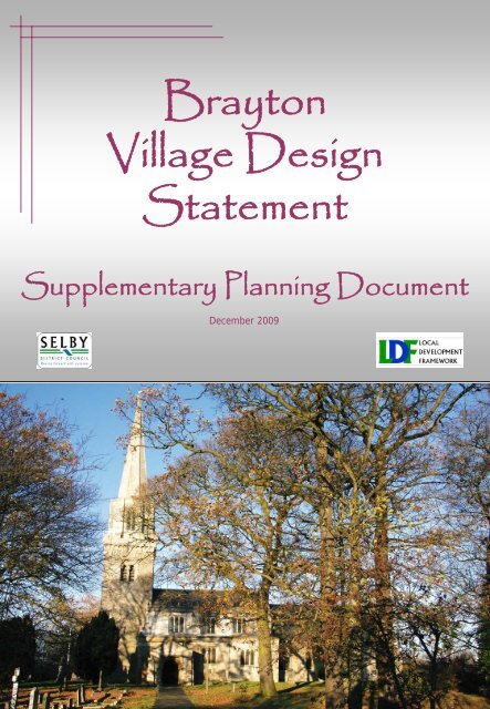
<strong>Brayton</strong><br />
Village Design<br />
Statement<br />
Supplementary Planning Document<br />
December 2009
Contents<br />
Purpose of a Village Design Statement<br />
The <strong>Brayton</strong> Village Design Statement<br />
Map of <strong>Brayton</strong><br />
Summary of Design Characteristics<br />
Conservation Areas & Listed Buildings<br />
Introduction to <strong>Brayton</strong><br />
Development of <strong>Brayton</strong><br />
House Type 1<br />
House Type 2<br />
Appendices<br />
What is a Village Design Statement and<br />
how do I use it?<br />
General advice for prospective<br />
developers<br />
1<br />
1<br />
2<br />
3<br />
4<br />
5<br />
6<br />
7<br />
8<br />
9<br />
11<br />
VDS Objectives<br />
To Provide a record of local distinctiveness by<br />
describing the unique qualities and character of<br />
the village.<br />
To identify the key features and characteristics<br />
of the local natural and built environment to be<br />
respected and protected from the impact of<br />
inappropriate development.<br />
To provide design guidance for new<br />
development so that change is managed and<br />
development is in harmony with its setting.<br />
To achieve a higher standard of sustainable<br />
design and where possible to enhance the local<br />
environment.<br />
To increase the involvement and influence of the<br />
local community in the planning system.<br />
Location Map<br />
Reproduced from the Ordnance Survey mapping with the permission of the<br />
controller of Her Majesty's Stationary Office. ©Crown Copyright.<br />
Unauthorised reproduction infringes crown copyright and may lead to<br />
prosecution or civil proceedings. <strong>Selby</strong> <strong>District</strong> <strong>Council</strong> 100018656
Purpose of a Village Design Statement<br />
Purpose of a Village Design Statement<br />
1.0 Our villages all occupy a unique position in<br />
the surrounding countryside, and have evolved<br />
over hundreds of years to suit the needs and<br />
circumstances of the people who lived there<br />
through the ages. As a result of this, we are<br />
naturally drawn to the elements that make our<br />
own village different for others, and those<br />
things that make it unique.<br />
1.1 More recently, volume house building and<br />
standardisation has failed to reflect both the<br />
subtle and obvious elements that create this<br />
local distinctiveness. Coupled with this,<br />
political ideology, personal tastes and cultural<br />
changes have all played their part in the design<br />
of buildings. It is now recognised that local<br />
distinctiveness is vital in helping to integrate<br />
new development and in creating sustainable<br />
communities. This can be achieved through an<br />
understanding of local character, and ensuring<br />
that this understanding is shared with anyone<br />
considering development.<br />
1.2 A Village Design Statement (VDS) is<br />
such a method. It is intended to explain the<br />
context or character of the village so that<br />
anyone who is considering any form of<br />
development in the village - no matter how large<br />
or small - can do it sympathetically. The VDS<br />
covers relatively straightforward work such as<br />
replacing doors and windows as well as more<br />
significant work such as building extensions and<br />
complete new buildings. It sets out the<br />
elements that make up character in order to<br />
improve the quality of design in any new<br />
development.<br />
1.3 The description of local character in this<br />
VDS is not intended to be prescriptive - new<br />
development should not be designed to “look<br />
old”. Instead the VDS should be used as<br />
inspiration to design new modern development<br />
that is respectful to its surroundings. In this<br />
context, that means using the appropriate<br />
building materials and architectural styles, and<br />
respecting the importance of spaces, building<br />
orientation and size. Overall, new development<br />
should<br />
look new, and should not slavishly copy the old<br />
buildings. However, new development should<br />
“fit in” with the context of the village.<br />
1.4 The VDS is written so that all developers<br />
can avoid lengthy discussion in the planning<br />
application process, as the design context is<br />
clearly set out from the beginning. Where<br />
design is not respectful to the village, the<br />
VDS can be used as evidence to justify the<br />
refusal of planning permission.<br />
1.5 Therefore the Local Planning Authority<br />
welcomes early discussion with anyone<br />
considering undertaking any work so that a<br />
consensus can be achieved, and local character<br />
can be maintained.<br />
<strong>Brayton</strong> Village Design Statement<br />
1.6 <strong>Brayton</strong> is a small village on the western<br />
edge of <strong>Selby</strong> town. Originally a farming<br />
community with links to <strong>Selby</strong> Abbey, it is now<br />
a suburban commuter settlement serving <strong>Selby</strong>,<br />
Leeds, York and Doncaster. The village has<br />
its traditional design in a Georgian style, but<br />
over the years a more suburban style of<br />
housing has taken hold resulting in a vast array<br />
of different house styles.<br />
1.7 Despite the range of house designs in<br />
<strong>Brayton</strong>, there are two principal styles that<br />
have prevailed: the more traditional Georgian<br />
design and a grander detached “villa” type<br />
house design. With strong layout, massing and<br />
material commonality, this VDS concentrates<br />
on these two broad styles, while leaving the<br />
architectural detail to the individual proposal.<br />
1.8 The Parish of <strong>Brayton</strong> also includes the<br />
southern suburbs of <strong>Selby</strong> Town. These are<br />
mostly post-war volume estate houses. The<br />
VDS considers these, but focuses on the two<br />
main house types (above) to influence<br />
development throughout the Parish.
Map of <strong>Brayton</strong><br />
North<br />
0 300m<br />
Reproduced from the Ordnance Survey mapping with the permission of the<br />
controller of Her Majesty's Stationary Office. ©Crown Copyright.<br />
Unauthorised reproduction infringes crown copyright and may lead to<br />
prosecution or civil proceedings. <strong>Selby</strong> <strong>District</strong> <strong>Council</strong> 100018656
Summary of Design Characteristics<br />
Summary of Design Characteristics<br />
The list below summarises the important elements that help to define the village. Successful<br />
development will utilise these points to blend seamlessly in to the existing built form.<br />
Type 1<br />
· Detached, semi-detached and non-identical terraces<br />
· Modest, simple, “traditional” designs<br />
· No two buildings are alike (next to each other) - Keep the properties looking individual<br />
· Front facing set behind short forecourt defined by low wall, railings and hedges with strong<br />
building line<br />
· Rough faced (hand made) brick or cream render<br />
· Red pan tile or rough grey slate, no roof windows<br />
· Houses low and squat<br />
· Chimneys one metre high with pots<br />
· Door cases simple – no fancy surrounds<br />
· Windows multiple pane, with timber frames – vertical sliding sash<br />
· Brick Dentil course below eaves<br />
· Variation in eaves and ridge heights<br />
Type 2<br />
· Semi detached or detached Individually designed “villas” on large plots.<br />
· Neighbouring buildings are different which keeps the properties looking individual<br />
·Front facing<br />
· Set back around 6m with strong building line<br />
· Intricate roof shapes – multiple pitches, non-square footprints create elaborate roofs, but without<br />
roof windows<br />
· Tall Chimneys with pots<br />
· Doors are often emphasised with side windows, porches, canopies<br />
· Windows are multiple pane, with timber frames<br />
· Leafy gardens with dense vegetation borders
Conservation Area & Listed Buildings<br />
VDS and Conservation<br />
2.0 The village has a designated "Conservation Area"; a planning tool similar to Listing a building,<br />
except that it covers a larger area. Conservation Areas are designated in an attractive historic area<br />
where there is a demonstrable character that it is "desirable to preserve or enhance" in the national<br />
interest.<br />
2.1 The aims of the Conservation Area are similar to those of a VDS, but is undertaken using<br />
different planning legislation. Conservation Areas are concerned with historic environments, with an<br />
emphasis on managing change progressively, maintaining the historic fabric and layout. The<br />
Conservation<br />
Area designation is set out in a different policy and ultimately carries more weight than the VDS<br />
SPD (see hierarchy in appendix 1).<br />
2.2 The VDS on the other hand is less focussed on the historic aspects. It often covers more<br />
modern areas and considers those aspects that make up the existing character, which may not be so<br />
squarely focussed on the<br />
historic elements. It<br />
considers those aspects that<br />
may not be of concern to the<br />
national interest, but are<br />
important to local people.<br />
2.3 There is clearly a<br />
crossover of the two<br />
mechanisms, particularly<br />
where much of the village’s<br />
character is derived from the<br />
historic environment. But<br />
the two mechanisms can work<br />
alongside each other to help<br />
to improve the quality of new<br />
development.<br />
2.4 A map of the village’s<br />
Conservation Area is<br />
included in the VDS purely<br />
for information. For more<br />
information<br />
about<br />
Conservation Areas,<br />
contact <strong>Selby</strong> <strong>District</strong><br />
<strong>Council</strong> Development<br />
Management service on<br />
01757 705101.<br />
Reproduced from the Ordnance Survey mapping with the permission of the<br />
controller of Her Majesty's Stationary Office. ©Crown Copyright.<br />
Unauthorised reproduction infringes crown copyright and may lead to<br />
prosecution or civil proceedings. <strong>Selby</strong> <strong>District</strong> <strong>Council</strong> 100018656<br />
North<br />
Not to scale
Introduction to <strong>Brayton</strong><br />
Introduction and History:<br />
3.0 The name <strong>Brayton</strong> originally comes from<br />
the Domesday book in 1076 ‘Breton’ and a<br />
map of 1577 gives ‘Braton’ by 1775 ‘<strong>Brayton</strong>’<br />
originated and is used today. <strong>Brayton</strong> is a<br />
small former farming community located around<br />
two miles south west of <strong>Selby</strong> in the flat fertile<br />
land of the River Ouse floodplain. The<br />
original village settlement is centred around a<br />
small green on the <strong>Selby</strong>-Doncaster road.<br />
Around the green can be found the primary<br />
school, opened in 1872. <strong>Brayton</strong> offers two<br />
19 th century public houses and a shop,<br />
although many former commercial units have<br />
been converted into homes.<br />
3.1 St Wilfrid’s Church is to the north of the<br />
village, originally a Saxon church attached to a<br />
manor house. William the Conqueror granted<br />
land in <strong>Brayton</strong> to <strong>Selby</strong> Abbey soon after<br />
the conquest, and affairs of <strong>Brayton</strong> church<br />
were closely linked with the Abbey up to the<br />
Dissolution in 1539 The oldest parts of the<br />
church are believed to date from around 1100.<br />
3.2 The traditional development pattern of the<br />
village is around the central green, and then in a<br />
ribbon style along each of the four roads that<br />
lead away from the village green. Post-war<br />
suburban development has made the village<br />
much more substantial by filling in the gaps to<br />
create a large, attractive addition to the main<br />
<strong>Selby</strong> town.<br />
3.3 Although the Parish of <strong>Brayton</strong> includes<br />
some of the houses in <strong>Selby</strong>, the village<br />
remains separated by a few hundred yards of<br />
fields. In the 1997 Local Plan this was<br />
designated a strategic gap, intended to prevent<br />
the coalescence of <strong>Selby</strong> and <strong>Brayton</strong> village.<br />
Top: The Primary School and St. Wilfrid’s Church<br />
Middle: View of the village green<br />
Bottom: St. Wilfrid’s across the strategic gap.
Development of <strong>Brayton</strong><br />
Development of <strong>Brayton</strong>:<br />
4.0 <strong>Brayton</strong> has gown considerably since 1920<br />
with almost continual suburban estate style<br />
building taking place. The result is a significant<br />
variation in detailing of buildings and no one<br />
character, although most styles share some<br />
common themes such as building shape and plot<br />
layout.<br />
4.1 <strong>Brayton</strong> is simply laid out with logical street<br />
patterns rather than cul-de-sacs. Footpaths<br />
feature on both sides of the road with main<br />
roads incorporating grass verges. Streets are<br />
relatively free of parked cars due to the large<br />
gardens that provide off-road parking. In order<br />
to continue this important visual aspect, the<br />
maximum parking standards should be applied<br />
to ensure that the streets remain free of cars.<br />
4.2 Houses face the street to form logical<br />
roads, and corner plots are laid out to face the<br />
principal road on both sides. <strong>Brayton</strong> benefits<br />
from a low visual density, and wide gaps<br />
between buildings with views to trees, hedges<br />
and open spaces that give a soft backdrop to<br />
the houses<br />
4.3 Although there are over 100 different<br />
house types, and each of these is subject to<br />
variation in finishes and other subtle<br />
differences, there are just two common themes<br />
that create the <strong>Brayton</strong> character and<br />
accommodate the myriad of styles: traditional<br />
Georgian-esque houses and larger “villa” type<br />
houses.<br />
4.4 What ties them together is a similar scale,<br />
commonality of roof height, and a maximum of<br />
two storeys. Where roof voids are utilised for<br />
habitable space, successful conversions place<br />
windows in the gable walls or on the rear<br />
elevations so as to maintain the low street<br />
appearance.<br />
4.5 This VDS identifies those characteristics<br />
that help to shape the wider street scene rather<br />
than prescribing specific architectural details.<br />
Views of the suburban houses in a myriad of<br />
styles. However, large gardens, greenery and a<br />
spacious layout are evident in each.
House Type One<br />
Type 1: Traditional buildings<br />
5.0 These are found along the main roads in<br />
<strong>Brayton</strong>, and are generally pre-war individually<br />
designed houses. Probably built by traders and<br />
merchants to meet the needs of his business,<br />
there is a common Georgian style to the<br />
buildings but no two are identical.<br />
5.1 These buildings are principally found lining<br />
the main roads, developed in a ribbon fashion.<br />
To the rear, many feature courtyards,<br />
outbuildings and stables to conduct the main<br />
business, but these are now usually converted<br />
and subdivided to create new uses and dwellings.<br />
5.2 These properties are either detached, or<br />
attached in non-identical terraces to form a<br />
continuous frontage. The traditional, simple<br />
designs are front-facing, set behind a short front<br />
garden, defined by a low wall or hedge.<br />
5.3 The dwellings are two-storey with a<br />
traditional gabled roof, built in rough-faced,<br />
hand-made red/brown brick with a red pan tile or<br />
rough cut grey slate roof covering. The front<br />
elevations are generally square or rectangular so<br />
they are wider than they are tall, and feature 1m<br />
tall chimneys at either end of the gable.<br />
5.4 The elevations are relatively modest, with<br />
large, vertical, multiple paned timber windows<br />
with a simple cill and header detail either in a<br />
brick arch, or splayed. Doors are also modest<br />
“cottage style” without elaborate surrounds or<br />
porches.<br />
Top: The simple Georgian style of houses.<br />
Middle: Typical architectural features.<br />
Bottom: More typical buildings in this simple<br />
Georgian-esque style.<br />
5.5 Variation in eaves and ridge level, along with<br />
the addition of small flourishes such as a dentil<br />
course below the eaves, change in the roof pitch,<br />
or the size and positioning of windows creates a<br />
huge variety of houses that are united in a<br />
<strong>Brayton</strong> style. However there are no windows<br />
in the roof space which maintains the low, wide<br />
appearance.
House Type Two<br />
Type 2: Modern “villa” houses<br />
6.0 Away from the main roads, house building<br />
has taken on a less traditional approach by<br />
introducing significantly more materials and<br />
architectural details to houses. Construction<br />
in small pockets has ensured that no single<br />
house type or style has been used and this<br />
creates its own collective character.<br />
6.1 Dwellings maintain several layout principles<br />
of the traditional properties: front-facing, large<br />
detached and semi-detached properties on<br />
large plots. Neighbouring buildings are<br />
different from each other but they maintain a<br />
commonality in scale, massing and size.<br />
Other development<br />
7.0 A small number of houses of much later<br />
construction are made in a standardised house<br />
type, with a uniform appearance and layout.<br />
These are “anywhere” houses that do not add<br />
to the sense of belonging to <strong>Brayton</strong>, and<br />
should not be replicated. There is sufficient<br />
scope within the two character types to<br />
accommodate a vast array of designs and so it<br />
is unnecessary to produce monotonous<br />
swathes of housing.<br />
6.2 However, these dwellings have introduced<br />
a larger front garden that facilitates off-road<br />
parking. There is also a much greater range of<br />
brick types and render finishes, although stone<br />
still is not used.<br />
6.3 The key difference in these dwellings<br />
however is the change from a simple, modest<br />
square footprint to a much more intricate<br />
design. More depth to elevations through the<br />
use of porches, wings, annexes and extensions<br />
gives a much more intricate dwelling, and<br />
therefore the associated roof shapes are more<br />
complex. The roofs still mainly use gable and<br />
hip designs for the basic shape, but the<br />
intricate house shape gives a variety in ridges<br />
and valleys, which coupled with tall brick<br />
chimneys makes every dwelling interesting and<br />
unique. It is of note however that the roof<br />
variation does not feature dormer windows or<br />
other punctuation. This maintains the low,<br />
wide appearance of the dwellings and creates<br />
much of its character.<br />
6.4 The dwellings are then given far more<br />
elaborate detailing than the traditional houses.<br />
Door cases are wide, and often feature<br />
canopies side windows, porches and steps,<br />
while windows take a variety of shapes and<br />
finishes.
Appendix A: What is a Village Design Statement<br />
and how do I use it?<br />
Appendix A: What is a Village Design Statement and how do I use it?<br />
A1 This Village Design Statement (VDS) is intended to give advice and guidance to anyone who is<br />
considering any form of development in the village no matter how large or small. It covers simple<br />
works such as replacing doors and windows as well as more significant works such as extensions<br />
and new buildings. It is not only concerned with housing, but covers all types of development with<br />
the intention of improving the quality of design in new development.<br />
A2 It is not about whether development should take place, instead, the VDS is intended to expand<br />
upon the policies in the Adopted <strong>Selby</strong> <strong>District</strong> Local Plan in order to explain it and give greater detail<br />
as to what is meant by the Policies within it. This helps developers and Planning Officers agree on<br />
some details that are not specifically set out in the policy itself: in this case the VDS sets out how<br />
development should be undertaken so as to respect the local identity.<br />
A3 The VDS is a “Supplementary Planning Document” (SPD) which is a legal document that sits in a<br />
hierarchy of plans and strategies called the Local Development Framework (LDF).<br />
A4 The different types of document in the LDF cover topical issues as well as area-based issues,<br />
and contain policies for making planning decisions. This is a relatively new system that replaces the<br />
old Local Plan system, however this is a period of transition and so the 2005 <strong>Selby</strong> <strong>District</strong> Local<br />
Plan has been “saved” as a ‘Local Development Document’ until such time that newer documents<br />
can replace it.<br />
A5 This Village Design Statement SPD is therefore based on Policy ENV1 of the Saved <strong>Selby</strong><br />
<strong>District</strong> Local Plan 2005, which states:<br />
“ENV1: Proposals for development will be permitted provided a good quality of development<br />
would be achieved. In considering proposals the <strong>District</strong> <strong>Council</strong> will take account of:<br />
the effect upon the character of the area or the amenity of adjoining neighbours<br />
the relationship of the proposal to the highway network, the proposed means of access, the<br />
need for road/junction improvements in the vicinity of the site, and the arrangements to be<br />
made for car parking;<br />
the capacity of local services and infrastructure to serve the proposal, or the arrangements to<br />
be made for upgrading, or providing services and infrastructure;<br />
the standard of layout, design and materials in relation to the site and its surroundings and<br />
associated landscaping;<br />
the potential loss, or adverse effect upon, significant buildings, related spaces, trees, wildlife<br />
habitats, archaeological or other features important to the character of the area;<br />
the extent to which the needs of disabled and other inconvenienced persons have been<br />
taken into account;<br />
the need to maximise opportunities for energy conservation through design, orientation and<br />
construction; and<br />
any other material consideration”
Appendix A: What is a Village Design Statement<br />
and how do I use it?<br />
The diagram shows the hierarchy of plans.<br />
National Policy (PPS/PPG)<br />
The Local Development Framework<br />
Informs<br />
Regional Spatial Strategy (RSS)<br />
Informs<br />
Local Development Documents (LDD)<br />
Explains<br />
Supplementary Planning Documents<br />
Strategic Regional<br />
thinking<br />
<strong>Council</strong> Planning<br />
Policies (inc <strong>Selby</strong><br />
Local Plan 2005)<br />
Advice and guidance<br />
(including VDS) to<br />
explain Policies<br />
A6 When preparing development proposals, the developer should refer to this VDS in a “Design and<br />
Access Statement” to demonstrate how its advice and guidance has been used. This will help<br />
people understand how a particular design for the development has come about. Where a site lies<br />
on or near the “border” of two or more character areas, the advice of each should be taken in to<br />
consideration and used appropriately.<br />
A7 If planning permission is required, the <strong>District</strong> <strong>Council</strong>’s Planning Officer will also use the VDS to<br />
assess the design of the application. If it cannot be demonstrated that the advice has been used, or<br />
it is considered that it has not been used correctly, it could result in the refusal of planning<br />
permission.<br />
A8 Even if planning permission is not required, it is still very much in the interests of the village to<br />
undertake any development work in sympathy to the village’s character. It will increase the appeal<br />
and the value of the development and ensure that the aesthetic qualities of the village continue for<br />
future generations to enjoy.
Appendix B: General Advice For<br />
Prospective Developers<br />
Appendix B: General advice for prospective<br />
developers<br />
B1 This section considers more than just the<br />
aesthetic issues and offers advice and<br />
guidance for prospective developers in<br />
achieving a suitable development proposal.<br />
General good design<br />
B2 There are lots of conflicting issues in<br />
considering new development, but whatever<br />
the compromise, the village character should<br />
always be maintained.<br />
B3 The character described in the VDS does<br />
not restrict new designs or materials or insist<br />
that everything is designed to “look old”.<br />
Instead, it is the job of the developer to design<br />
and build a modern building that satisfies<br />
modern needs, exploits new technology and<br />
building methods, and uses them to create a<br />
desirable, profitable development that works<br />
with its environment to seamlessly integrate<br />
with the local area. Modern, but appropriate<br />
development is encouraged.<br />
B4 It is helpful to consider the visual impact of<br />
developments from all angles and from longer<br />
distance. Accurate perspective (isometric)<br />
drawings or street scene views to show how<br />
new developments would appear in relation to<br />
their neighbouring properties and in the wider<br />
street scene could be very useful.<br />
B5 There is an emphasis on evolution not<br />
revolution in the village, and so multiple smaller<br />
developments will have less impact than a<br />
single large-scale development. This approach<br />
reflects the way the village has grown in the<br />
past.<br />
B6 Examples of inappropriate designs,<br />
materials and layouts within the village should<br />
not be used as a precedent for further<br />
inappropriate use of these features.<br />
The Planning Process<br />
B7 Anyone considering development should<br />
contact the <strong>District</strong> <strong>Council</strong> for planning advice<br />
before submitting an application. This will<br />
help to iron out potential issues and lead to a<br />
smoother planning process. The Parish<br />
<strong>Council</strong> would also welcome early discussion<br />
and to help wherever they can.<br />
B8 Discussion with neighbours before applying<br />
for planning permission will give them an<br />
opportunity to discuss any concerns, and that<br />
may avoid unnecessary neighbour disputes.<br />
B9 Some development does not need planning<br />
permission, but the need for good design<br />
remains. Understanding of the local character<br />
and applying it may increase the value of a<br />
development and ensure that the important<br />
local character remains.<br />
Repairs and maintenance of buildings<br />
B10 Many buildings in the villages are old,<br />
having been built long before building<br />
regulations came in to effect, before plastics<br />
were invented, and before cars began<br />
damaging structures through impact, chemical<br />
attack via exhaust gases, and water damage<br />
from splashing through puddles. The need to<br />
maintain and repair our older buildings is never<br />
more apparent, but it is essential that the<br />
correct materials and methods are used to<br />
maintain character, but also to ensure that the<br />
building continues to live.<br />
B11 Bricks and stone may be bonded together<br />
using a mortar, but up until the Great War, most<br />
buildings used a lime mortar mix rather than a<br />
sand-and-cement mortar used today. Cement<br />
mortar is extremely hard and does not flex<br />
which can lead to cracks appearing, particularly<br />
where foundations are shallow or soft. The<br />
rain cannot penetrate cement easily and so it is<br />
found that the bricks and stone wear out faster<br />
than the mortar joints leaving the mortar<br />
exposed. This accelerates wear and<br />
buildings will become damp, unstable and<br />
ultimately collapse. A lime mortar is no more<br />
expensive and no more difficult to use than<br />
cement, but it is the better choice for many<br />
buildings in the district. Where stone is used,<br />
a sand and cement mortar should never be<br />
used.<br />
B12 When installing modern features on a<br />
traditional building such as satellite receiver<br />
dishes, conservatories, replacement guttering<br />
and fascias etc, new windows and doors, and
Appendix B: General Advice For<br />
Prospective Developers<br />
damp proofing can all seriously affect the<br />
integrity of both the appearance and the way<br />
traditional buildings function. Modern<br />
materials are often cheaper to buy, but may<br />
have a shorter operational life, and also lack<br />
the physical qualities that are needed in<br />
traditional buildings. However advice is<br />
available from HELM (English Heritage’s<br />
Historic Environment Local Management arm)<br />
who offer a wealth of information to help make<br />
an informed choice about materials and<br />
methods of repair to older buildings. See<br />
www.helm.org.uk.<br />
Highway and parking advice<br />
B13 Safety is paramount, but modern<br />
standardised road designs do not always sit<br />
comfortably within historic areas. When<br />
designing road layouts it is important that a<br />
balance is achieved to allow safe access<br />
without detriment to the local character. This<br />
means that a bespoke design will be needed.<br />
B14 Historic areas were never designed for the<br />
private car and so these environments are<br />
spoiled by inappropriate and ill considered<br />
parking arrangements. Rural villages often<br />
feature heavy machinery such as combine<br />
harvesters and on-street parking is therefore<br />
problematic. Bespoke solutions will be<br />
required to minimise highway disruption and to<br />
maintain local character and amenity.<br />
B15 New accesses should be designed to<br />
minimise the loss of boundary vegetation and<br />
achieve an appropriate balance between<br />
highway safety and amenity.<br />
Energy conservation and sustainable<br />
development<br />
B16 New development can play its part in<br />
reducing the risk and impact of climate change.<br />
Installing modern environmental systems in an<br />
attractive setting can have a serious<br />
detrimental impact on the character of the<br />
village. Therefore domestic wind turbines,<br />
solar panels and photovoltaic cells should be<br />
carefully sited to reduce their visual impact. If<br />
they cannot be placed sympathetically to limit<br />
their visual impact, then consideration of<br />
alternatives should be made. Ground source<br />
heating and better insulation may be just as<br />
effective by reducing consumption instead of<br />
generating more power.<br />
B17 In order to reduce carbon emission, it is<br />
not only the ongoing costs that should be<br />
considered, as methods in construction may<br />
also limit environmental impact. Timber,<br />
stone, slate and labour from local sources will<br />
reduce the amount of travelling required overall<br />
thus cutting emissions and maintaining local<br />
employment. More information about<br />
sustainable construction can be seen at<br />
www.bre.co.uk.<br />
The natural environment<br />
B18 Any new development on the edge of the<br />
village should conserve or enhance the soft<br />
landscaped edge by the provision of<br />
appropriate tree and hedgerow planting. Hard<br />
edges of walls, fences or other structures<br />
should be avoided. <strong>Selby</strong> <strong>District</strong> <strong>Council</strong> has<br />
a landscape Character Assessment that will<br />
assist in understanding the landscape around<br />
the villages.<br />
B19 Hedges and trees within the village are an<br />
essential part of the character. These should<br />
be conserved and reinforced through new<br />
planting in any new development whether small<br />
or large.<br />
B20 Even small areas of hard landscaping can<br />
lead to a sharp decline in local wildlife with the<br />
removal of nesting, breeding or feeding<br />
habitats. This has a drastic effect on our<br />
natural ecosystems and so hard landscaping<br />
and removal of vegetation is strongly<br />
discouraged.<br />
B21 Many plant and animal species that have<br />
declined in the wider landscape in recent years<br />
are increasingly dependent on the<br />
opportunities provided to them through the built<br />
environment, such as putting up bird and bat<br />
boxes, making ponds, and planting native<br />
trees, shrubs and wildflowers. Indirect actions<br />
such as using peat free or home-made<br />
compost also benefit wildlife. Further<br />
information can be found from the Natural<br />
England website: www.naturalengland.org.uk.
Appendix B: General Advice For<br />
Prospective Developers<br />
Flooding<br />
B22 Much of the <strong>District</strong> lies in the severe flood<br />
risk area, but it is not just those areas that are<br />
susceptible to flooding. Flooding can include<br />
short term flash flooding after a heavy<br />
downpour which can cause localised damage.<br />
There are two considerations when designing<br />
out flood risk: a) the impact of flooding on a<br />
development, and b) the impact of the<br />
development on flooding. The following advice<br />
is generic, but does not imply that all areas are<br />
at risk of severe flooding. Detailed advice<br />
about how to cope with flood risk - including<br />
maps showing those areas most at risk - can<br />
be found on the Environment Agency’s website<br />
www.environment-agency.gov.uk.<br />
B23 To reduce the impact of flooding on a<br />
development, consider the plot in relation to<br />
slopes, water courses and known flood risk<br />
areas. If a flood is likely or possible, how<br />
would the water affect the development?<br />
Building on stilts and raising the ground floor<br />
level of the building may not be the answer, as<br />
the dry occupants would still be trapped<br />
because they would still be surrounded by<br />
water.<br />
overlooked, removing potential hiding places,<br />
and designing buildings that are not easily<br />
broken in to.<br />
B26 “Secured by Design” is a publication by<br />
the Association of Chief Police Officers that<br />
sets out these and other simple but effective<br />
methods of reducing the opportunities for<br />
crime. Schemes that meet the criteria set out<br />
are eligible for awards, and may attract lower<br />
insurance premiums. A copy may be<br />
obtained here:<br />
ACPO CPI<br />
First floor,<br />
10 Victoria Street,<br />
London<br />
SW1H 0NN<br />
Phone: 0207 084 8962<br />
Email: acpocpi@acpo.pnn.police.uk<br />
B27 In addition, North Yorkshire Police<br />
Community Safety Partnership have specialist<br />
Officers who would be pleased to help prepare<br />
development proposals. They may be<br />
contacted on 01757 341 029.<br />
B24 Water storage capacity is particularly<br />
important; hard landscaped areas such as<br />
paved parking areas and driveways should be<br />
avoided, instead a permeable surface such as<br />
gravel is able to absorb water much more<br />
easily and hold it, prevent it escaping and<br />
building up elsewhere. It will also slow any<br />
flowing water down, and this will reduce the<br />
risk of impact damage. Collecting water from<br />
the down pipe in a butt may also assist in<br />
reducing the amount of water that the ground<br />
has to cope with. Trees and large vegetation<br />
help to bind soil together to prevent land<br />
collapse, so in areas where there are no trees,<br />
consider planting some to make sure the land<br />
can take the weight of water it holds.<br />
Crime prevention<br />
B25 <strong>Selby</strong> is generally a low crime area, but<br />
there are simple steps that can be taken to<br />
reduce the risk of crime further still in new<br />
development. For example, clear definition<br />
between public and private spaces, siting<br />
buildings to prevent areas that are not
<strong>Selby</strong> <strong>District</strong> <strong>Council</strong><br />
Development Policy<br />
Civic Centre<br />
Portholme Road<br />
SELBY<br />
YO8 4SB<br />
01757 705101