2.4m - Northwest Power & Conservation Council
2.4m - Northwest Power & Conservation Council
2.4m - Northwest Power & Conservation Council

You also want an ePaper? Increase the reach of your titles
YUMPU automatically turns print PDFs into web optimized ePapers that Google loves.
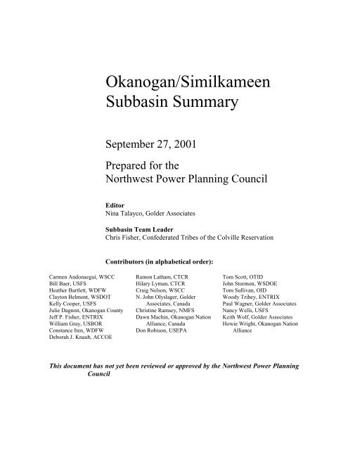
Okanogan/Similkameen<br />
Subbasin Summary<br />
September 27, 2001<br />
Prepared for the<br />
<strong>Northwest</strong> <strong>Power</strong> Planning <strong>Council</strong><br />
Editor<br />
Nina Talayco, Golder Associates<br />
Subbasin Team Leader<br />
Chris Fisher, Confederated Tribes of the Colville Reservation<br />
Contributors (in alphabetical order):<br />
Carmen Andonaegui, WSCC<br />
Bill Baer, USFS<br />
Heather Bartlett, WDFW<br />
Clayton Belmont, WSDOT<br />
Kelly Cooper, USFS<br />
Julie Dagnon, Okanogan County<br />
Jeff P. Fisher, ENTRIX<br />
William Gray, USBOR<br />
Constance Iten, WDFW<br />
Deborah J. Knaub, ACCOE<br />
Ramon Latham, CTCR<br />
Hilary Lyman, CTCR<br />
Craig Nelson, WSCC<br />
N. John Olyslager, Golder<br />
Associates, Canada<br />
Christine Ramsey, NMFS<br />
Dawn Machin, Okanogan Nation<br />
Alliance, Canada<br />
Don Robison, USEPA<br />
Tom Scott, OTID<br />
John Stormon, WSDOE<br />
Tom Sullivan, OID<br />
Woody Trihey, ENTRIX<br />
Paul Wagner, Golder Associates<br />
Nancy Wells, USFS<br />
Keith Wolf, Golder Associates<br />
Howie Wright, Okanogan Nation<br />
Alliance<br />
This document has not yet been reviewed or approved by the <strong>Northwest</strong> <strong>Power</strong> Planning<br />
<strong>Council</strong>
Okanogan/Similkameen Subbasin Summary<br />
Table of Contents<br />
Executive Summary ........................................................................................................................... 1<br />
U.S. Okanogan/Silmilkammen Subbasin Description ....................................................................... 5<br />
General Description ................................................................................................................... 5<br />
Fish and Wildlife Resources............................................................................................................ 41<br />
Fish and Wildlife Status........................................................................................................... 41<br />
Wildlife .................................................................................................................................... 60<br />
Watershed Assessment............................................................................................................. 66<br />
Limiting Factors....................................................................................................................... 69<br />
Artificial Production ................................................................................................................ 69<br />
Existing and Past Efforts.......................................................................................................... 72<br />
Proposed Actions by Management Agencies........................................................................... 76<br />
Subbasin Habitat Reports (Limiting Factors Analysis) ................................................................... 77<br />
Introduction.............................................................................................................................. 78<br />
Okanogan Watershed Characteristics and Conditions............................................................. 81<br />
Fish Distribution and Status..................................................................................................... 93<br />
Methodology For Developing Habitat Limiting Factors Assessments By Subwatershed In The<br />
Okanogan Watershed ............................................................................................................... 97<br />
Fisheries Resources and Habitat Limiting Factors Ratings by Subwatershed....................... 112<br />
Summary of Action Item Recommendations by Sub-basin ................................................... 213<br />
Literature Cited ...................................................................................................................... 215<br />
Subbasin Management ................................................................................................................... 224<br />
Chinook.................................................................................................................................. 224<br />
Sockeye .................................................................................................................................. 225<br />
Steelhead ................................................................................................................................ 225<br />
USDA Forest Service............................................................................................................. 225<br />
USDI Bureau of Land Management....................................................................................... 226<br />
Washington Department of Natural Resources...................................................................... 226<br />
Washington Department of Fish and Wildlife ....................................................................... 226<br />
Confederated Tribes of the Colville Reservation................................................................... 227<br />
Upper Columbia Salmon Recovery Board............................................................................. 228<br />
Okanagan/Similkameen Subbasin Summary ii<br />
September 27, 2001
Upper Columbia Salmon Recovery Board (UCSRB) ............................................................ 228<br />
Transborder Coordination and Ecosystem Planning Processes ............................................. 229<br />
Goals, Objectives, and Strategies........................................................................................... 232<br />
Statement of Fish and Wildlife Needs ................................................................................... 237<br />
Canadian Okanagon/Similkameen Subbasin Description.............................................................. 243<br />
General Description ............................................................................................................... 243<br />
Fish and Wildlife Resources.......................................................................................................... 248<br />
Fish and Wildlife Status......................................................................................................... 248<br />
Habitat Areas and Quality...................................................................................................... 259<br />
Watershed Assessment........................................................................................................... 350<br />
Limiting Factors..................................................................................................................... 351<br />
Artificial Production .............................................................................................................. 351<br />
Existing and Past Efforts........................................................................................................ 351<br />
Present Subbasin Management ...................................................................................................... 355<br />
Existing Management............................................................................................................. 355<br />
Subbasin Recommendations .................................................................................................. 360<br />
References...................................................................................................................................... 360<br />
LIST OF APPENDICES<br />
Appendix A Culverts<br />
Appendix B Dams in the Okanogan Basin as Identified by WDFW<br />
Appendix C Fish Species<br />
Appendix D Endangered Species Act Listings for Steelhead Trout and Spring Chinook<br />
Salmon<br />
Appendix E Wildlife Species of the Okanogan<br />
Appendix F State Listed Wildlife Species<br />
Appendix G Hatchery and Genetic Management Plan (HGMP) for Upper Columbia<br />
Appendix H Confirmed Methow/Upper Columbia Agreement on Abundant Hatchery<br />
Returns<br />
Appendix I USDA Forest Service Schedule of Proposed Actions for 2001<br />
Appendix J Subbasin Maps<br />
Appendix K Confederated Tribes of the Colville Reservation Strategic Options for<br />
Okanogan Spring Chinook<br />
Appendix L CTCR Strategic Options for Okanogan Summer/Fall Chinook<br />
Okanagan/Similkameen Subbasin Summary iii<br />
September 27, 2001
LIST OF LFA APPENDICES<br />
Appendix A Okanogan Overview Maps for Fish Distribution within the Entire Basin<br />
Appendix B Chinook, Sockeye, and Steelhead Fish Distribution Maps Of The<br />
Washington Okanogan/Similkameen Sub-Basins<br />
Appendix C Photographs of Select Sub-Basin Conditions<br />
Appendix D Canadian Okanagan/Similkameen Subbasin Summary<br />
Appendix E Chinook, Sockeye, and Steelhead Fish Distribution Maps of The Canadian<br />
Okanogan/Similkameen Sub-Basins<br />
LIST OF TABLES<br />
Table 1: Selected Subbasins of the Okanogan/Similkameen Watersheds...................................... 11<br />
Table 2: Forests of the Okanogan Basin.........................................................................................15<br />
Table 3: USGS Flow Records for Okanogan and Similkameen Rivers, 1911 – 1996 (USGS, 1995).<br />
................................................................................................................................................. 17<br />
Table 4: Base Flows (cfs) for the Okanogan River, as Set by WSDOE in 1976 (NMFS, 1998). .. 18<br />
Table 5: Okanogan Subbasin City Populations and Growth Rates 1990-1998. (OFM, 1998)...... 19<br />
Table 6: Okanogan Subbasin Land Ownership (NRCS, 2000). ..................................................... 21<br />
Table 7: Approximate Total Acreage of Land Use Types in the Okanogan Basin ........................ 22<br />
Table 8: Grazing Use in the Okanogan Subbasin. .......................................................................... 23<br />
Table 9: Summary of USFS Riparian Area Acreage Monitored in 1997. (Percent of total acreage<br />
that meets or is moving towards forest plan objectives.) ........................................................ 25<br />
Table 10: Road Miles within 200 feet of U.S. Streams in the Okanogan Subbasin....................... 29<br />
Table 11: Roads within 50 Feet of Streamchannels in the Okanogan Subbasin (USDA, 2000).... 29<br />
Table 12: Chemicals Applied to Railroad Right-of-ways for Maintenance by the Cascade &<br />
Columbia River Railroad As Needed...................................................................................... 30<br />
Table 13: Irrigation Districts of the Okanogan Basin..................................................................... 31<br />
Table 14: Summary of Water Rights in the Okanogan Basin (WSDOE, 1995)............................. 32<br />
Table 15: Dams in the U.S. Okanogan Basin (Streamnet, 2000). .................................................. 32<br />
Table 16: Okanogan Basin Water bodies on the Washington State 1998 303(d) List. .................. 33<br />
Table 17: US Sport Fishery Harvest of Adult Summer Steelhead Trout in the Okanogan Basin,<br />
1965 – 1994 (Streamnet, 2001). .............................................................................................. 44<br />
Table 18: Spawner Counts for Summer Chinook Salmon in the Okanogan River (Mile 0 to Mile<br />
81.9) 1977 - using Fish per Mile; estimation method unknown (Streamnet, 2001)................ 46<br />
Table 19: Redd Counts for Summer Chinook Salmon in the Okanogan River (Mile 0 to Mile 77.2)<br />
and Similkameen River (Mile 0 to Mile 27.8) 1956-1996 (Streamnet, 2001). ....................... 46<br />
Table 20: Spawner Counts of Sockeye Salmon in the Okanogan River (Mile 0 to Mile 81.9) 1956<br />
– 1966; 1977 – 1988 (Streamnet, 2001).................................................................................. 49<br />
Table 21: Fish Distribution in the Okanogan Basin (Streamnet, 2001). ........................................ 51<br />
Table 22: Federal and State Listed Wildlife Species Present or Potentially Present in the<br />
Okanogan Basin. ..................................................................................................................... 60<br />
Table 23: Okanogan Subbasin Introduced Wildlife Species. ......................................................... 66<br />
Table 24: Hatcheries that Supply the Okanogan Basin. ................................................................. 70<br />
Okanagan/Similkameen Subbasin Summary iv<br />
September 27, 2001
Table 25: Artificial production in the Okanogan Subbasin – year 2000 (Streamnet, 2000). ......... 70<br />
Table 26: Projected Releases of Steelhead for 2001. ..................................................................... 71<br />
Table 27: Historic Hatchery Release Data for the Okanogan Basin, 1983 – 1998......................... 71<br />
Table 28: Recent and Existing BPA projects in the Okanogan Basin............................................ 76<br />
Table 29: Washington State Wildlife Areas in the Okanogan Basin............................................ 226<br />
Table 30: Global and Provincial Status of “At Risk” Fish Species in the Okanagan Basin......... 250<br />
Table 31: Global and Provincial Status of “At Risk” Wildlife Species in the Okanagan Basin. . 251<br />
Table 32: Chute Creek Limiting Factors Matrix .......................................................................... 259<br />
Table 33: Eneas Creek Limiting Factors Matrix .......................................................................... 261<br />
Table 34: Equesis Creek Limiting Factors Matrix........................................................................ 262<br />
Table 35: Inkaneep Creek Limiting Factors Matrix ..................................................................... 265<br />
Table 36: Kelowna Creek Limiting Factors Matrix...................................................................... 266<br />
Table 37: Lambly Creek Limiting Factors Matrix........................................................................ 273<br />
Table 38: Mission Creek Limiting Factors Matrix ....................................................................... 276<br />
Table 39: Naramata Creek Limiting Factors Matrix .................................................................... 282<br />
Table 40: Naswhito Creek Limiting Factors Matrix..................................................................... 286<br />
Table 41: Okanagan Mainstem Limiting Factors Matrix ............................................................. 288<br />
Table 42: Peachland Creek Limiting Factors Matrix.................................................................... 293<br />
Table 43: Penticton Creek Limiting Factors Matrix..................................................................... 301<br />
Table 44: <strong>Power</strong>s Creek Limiting Factors Matrix ........................................................................ 305<br />
Table 45: Robinson Creek Limiting Factors Matrix..................................................................... 307<br />
Table 46: Similkameen Creek Limiting Factors Matrix............................................................... 310<br />
Table 47: Trepanier Creek Limiting Factors Matrix .................................................................... 324<br />
Table 48: Trout Creek Limiting Factors Matrix ........................................................................... 330<br />
Table 49: Vaseux Creek Limiting Factors Matrix........................................................................ 334<br />
Table 50: Vernon Creek Limiting Factors Matrix........................................................................ 338<br />
LIST OF FIGURES<br />
Figure 1: Site Map. ........................................................................................................................... 7<br />
Figure 2: Chinook Distribution......................................................................................................... 8<br />
Figure 3: Sockeye Distribution ......................................................................................................... 9<br />
Figure 4: Steelhead Trout Distribution........................................................................................... 10<br />
Figure 5: Soils Map for the Okanogan Basin.................................................................................. 13<br />
Figure 6: Major Landowners in the Okanogan Basin..................................................................... 19<br />
Figure 7: Land Use Types in the Okanogan Basin (NRCS, 2000). ................................................ 22<br />
Figure 8: Major Crops of the Okanogan Basin (NCRS, 1998)....................................................... 26<br />
Figure 9: Erosion Rates in 30 Okanogan Subwatersheds (NRCS, 1998)....................................... 38<br />
Figure 10: Canadian Subbasin Location Map................................................................................ 244<br />
Okanagan/Similkameen Subbasin Summary v<br />
September 27, 2001
LIST OF ACRONYMS<br />
ACCOE<br />
BLM<br />
BMPs<br />
BOD<br />
BPA<br />
CBFWA<br />
CTCR<br />
CDC<br />
cfs<br />
DFO<br />
DO<br />
EA<br />
EAP<br />
ENTRIX<br />
ERSPP<br />
ESU<br />
FERC<br />
LFA<br />
MELP<br />
MTCA<br />
NEPA<br />
NID<br />
NOAA<br />
NMFS<br />
NPDES<br />
NPPC<br />
NRCS<br />
NTU<br />
NWCO<br />
Army Corps of Engineers<br />
Bureau of Land Management<br />
Best Management Practices<br />
Biological Oxygen Demand<br />
Bonneville <strong>Power</strong> Association<br />
Columbia Basin Fish and Wildlife Authority<br />
Confederated Tribes of the Colville Reservation<br />
Center for Disease Control<br />
cubic feet per second<br />
Department of Fisheries and Oceans<br />
dissolved oxygen<br />
Environmental Assessment<br />
Early Action Plan<br />
(not an antonym)<br />
Columbia Basin Ecoprovince Review and Subbasin<br />
Planning Process<br />
Evolutionarily Significant Unit<br />
Federal Energy Regulatory Commission<br />
Limiting Factors Analysis<br />
Ministry of Environment, Land, and Parks<br />
Model Toxics Control Act<br />
National Environmental Policy Act<br />
National Inventory of Dams<br />
National Oceanic and Atmospheric Association<br />
National Marine Fisheries Service<br />
National Pollutant Discharge Elimination System<br />
<strong>Northwest</strong> <strong>Power</strong> Planning <strong>Council</strong><br />
Natural Resources <strong>Conservation</strong> Service<br />
Nephelometric Turbidity Units<br />
Noxious Weed Control Office<br />
Okanagan/Similkameen Subbasin Summary vi<br />
September 27, 2001
LIST OF ACRONYMS (Continued)<br />
OCD<br />
OCHD<br />
OID<br />
ONA<br />
ONF<br />
OSS<br />
OTID<br />
OWSAC<br />
PNRBC<br />
PSIAC<br />
PST<br />
PUD<br />
RM<br />
SOSCP<br />
TAC<br />
TAG<br />
TMDL<br />
TPN<br />
U.S.<br />
USBIA<br />
USDA<br />
USDI<br />
USEPA<br />
USFS<br />
USFWS<br />
USGS<br />
WAC<br />
WDFW<br />
WDNR<br />
Working Group<br />
Okanogan <strong>Conservation</strong> District<br />
Okanogan County Health District<br />
Okanogan Irrigation District<br />
Okanogan Nations Alliance<br />
Okanogan National Forest<br />
On-site Sewage<br />
Oroville Tonasket Irrigation District<br />
Okanogan Watershed Stakeholders Advisory Committee<br />
Pacific <strong>Northwest</strong> River Basins Commission<br />
Pacific Southwest Interagency Committee<br />
Pacific Salmon Treaty<br />
Public Utility District<br />
River Mile<br />
South Okanagon-Silmilkameen <strong>Conservation</strong> Program<br />
Technical Advisory Committee<br />
Technical Advisory Group<br />
Total Maximum Daily Loads<br />
Total Per Sulfate Nitrogen<br />
United States<br />
U.S. Bureau of Indian Affairs<br />
United States Department of Agriculture<br />
United States Department of the Interior<br />
U.S. Environmental Protection Agency<br />
United States Forest Service<br />
U.S. Fish and Wildlife Service<br />
United States Geological Survey<br />
Washington Administrative Code<br />
Washington Department of Fish and Wildlife<br />
Washington Department of Natural Resources<br />
Okanagon Basin Technical Working Group<br />
Okanagan/Similkameen Subbasin Summary vii<br />
September 27, 2001
LIST OF ACRONYMS (Continued)<br />
WRIA<br />
WSCC<br />
WSDOE<br />
WSDOT<br />
WSOFM<br />
Water Resource Inventory Area<br />
Washington State <strong>Conservation</strong> Commission<br />
Washington Department of Ecology<br />
Washington Department of Transportation<br />
Washington State Office of Fiscal Management<br />
Okanagan/Similkameen Subbasin Summary viii<br />
September 27, 2001
Executive Summary<br />
In October of 2000, the <strong>Northwest</strong> <strong>Power</strong> Planning <strong>Council</strong> adopted a revised Fish and<br />
Wildlife Program for the Columbia River Basin. The new program is intended to be more<br />
comprehensive than, but complimentary to, regional efforts related to the Endangered<br />
Species Act, State-sponsored recovery and watershed planning and coordination efforts,<br />
and tribal recovery initiatives. The revised Program calls for an ecosystem-based approach<br />
for planning and implementing fish and wildlife recovery.<br />
To accomplish this, the Program divides the Columbia Basin into ecological<br />
provinces that are further divided into individual subbasins. At the heart of the Program is<br />
the subbasin plan consisting of a comprehensive description of the basin general ecology<br />
including the identification of specific fish and wildlife needs. Future action strategies and<br />
project funding are to be based upon these identified needs. Subbasin summaries are an<br />
interim step to allow near-term implementation of the revised Fish and Wildlife Program<br />
until comprehensive subbasin plans can be completed. The information provided in this<br />
document satisfies the summary requirements for the Okanogan subbasin.<br />
Accordingly, this report presents a compilation of known and existing data on<br />
anadromous fish and fish habitat for the United States and Canadian portions of the<br />
Okanogan River Watershed. Seventy-two subwatersheds were examined. The report also<br />
provides data and context for wildlife, land use, human population patterns, and overall<br />
resource management issues. Portions of the Similkameen watershed are included where<br />
additional anadromous fish distribution and access dictate. The Okanogan Subbasin<br />
Summary is the first report being generated from within the Columbia Cascade<br />
Ecoprovince. The Methow, Wenatchee, Lake Chelan, Entiat, and Upper (mainstem)<br />
Columbia subbasins comprise the remainder of this province.<br />
Because this report represents the largest single subwatershed in the entire<br />
Columbia Basin, and is one of the only “transborder” watersheds, the document is lengthy.<br />
Great effort was expended to include all pertinent data and information focusing on the key<br />
ecological attributes and overall processes in the Okanogan. This was done while<br />
attempting to keep the document “manageable.” While there will be differing opinions as<br />
to the success of this endeavor, the information presented has been scrutinized within the<br />
context of its general applicability for use in a focused and credible subbasin planning<br />
effort. The broad utility of this document will therefore be more useful in establishing<br />
interim actions as development of the final Subbasin Plan proceeds. This summary report<br />
will also provide guidance for developing regional priorities and processes.<br />
The information and data presented in this document have been assembled and<br />
reviewed by a 22-member technical advisory committee and have been augmented with<br />
specific input from expert sources such as tribal staffs, state, provincial, and federal agency<br />
biologists, hydrologists, and local government staffs. This broad-based approach was<br />
necessary to compile the fundamental data and information in support of an ecosystembased<br />
approach for fish, wildlife, and their diverse habitats.<br />
This report also contains a final draft version of the Okanogan/Similkameen<br />
Limiting Factors Analysis (LFA). The LFA is sponsored by the Confederated Tribes of the<br />
Okanagan/Similkameen Subbasin Summary 1 July 30, 2001
Colville Reservation (CTCR) and is being developed in conjunction with the Washington<br />
State <strong>Conservation</strong> Commission (WCC) as provided for in Engrossed Substitute House<br />
Bill 2496. The LFA technical effort is led by input from over 25 technical advisors<br />
representing state, federal, and local governments, and the public. The information<br />
contained within this report will be used for numerous applications, including providing<br />
critical habitat information for subbasin planning.<br />
The report is organized according to the format developed by the Columbia Basin<br />
Fish and Wildlife Authority (CBFWA) and approved by the <strong>Northwest</strong> <strong>Power</strong> Planning<br />
<strong>Council</strong>. A summary of the major sections in this report includes:<br />
• Fish and Wildlife Resources,<br />
• Limiting Factors Analysis,<br />
• Subbasin Habitat Reports,<br />
• Recommended Actions,<br />
• Goals, Objectives and Strategies,<br />
• Existing Management,<br />
• Proposed Actions by Management Agencies,<br />
• Research, Monitoring and Evaluation Activities,<br />
• Statements of Fish and Wildlife Needs,<br />
• Subbasin Planning Maps (72 subbasins, including extent of anadromous ranges), and<br />
• Pertinent Appendix Materials.<br />
Taken together, these sections, and the detail contained within individual<br />
subsections, provide a focal point to be used by the reader and planner to accomplish the<br />
following general goals:<br />
1. Establish actions, priorities, and guidance for development of specific project<br />
proposals for the intervening 3-year period between this report and final Subbasin<br />
Plan development;<br />
2. Initiate an in-depth technical analysis of the information presented;<br />
3. Identify major data gaps and assessment needs, and<br />
4. Culminate these efforts into actions and final Subbasin Plan development.<br />
Thus, in the near term, projects and actions will be determined by a review of the<br />
fish and wildlife needs and recommendations contained herein. The longer-term effort will<br />
require a more thorough and sophisticated approach employing tools such as the Ecosystem<br />
Diagnosis and Treatment Model and an expanded analysis of needs.<br />
To sufficiently address the complex nature of the Okanogan Watershed, it was<br />
necessary to view this ecosystem as uniquely contiguous. This point cannot be<br />
overemphasized. International treaties and agreements, as well as language within the<br />
<strong>Northwest</strong> <strong>Power</strong> Act dictate a broad response to fish and wildlife recovery and protection<br />
in the Okanogan subbasin. Cooperation across the shared boarder and within the<br />
Okanogan watershed is required from both a legal and biological/ecological perspective.<br />
Okanagan/Similkameen Subbasin Summary 2<br />
September 27, 2001
Consequently, and, in order to facilitate continued transborder collaboration throughout the<br />
region, we have provided perspectives on how efforts between U.S. and Canadian<br />
management entities and stakeholders can be incorporated into the subbasin planning<br />
process. These features are unique to the Okanogan subbasin and contribute to the overall<br />
complexity, and utility, of this document and to the subbasin planning process.<br />
This approach required that the subbasin summary effort incorporate a vast amount<br />
of information and data from the entire watershed, two-thirds of which is found within<br />
Canada. To retain the overall focus of the effort, and for the designated purposes and focus<br />
of this subbasin summary, we have limited some of the detail to the geographic extent of<br />
anadromous fish access. We recognize and acknowledge that Canadian and U.S. resident<br />
fish and wildlife issues may go beyond the detail provided in this report to date.<br />
Major themes derived from the subbasin summary:<br />
• The Okanogan watershed comprises one the of the largest geographic subbasins in the<br />
Columbia River Basin;<br />
• The Factors influencing salmon survival and population status extend beyond the<br />
geographic boundaries of the Okanogan, and of the United States. Thus, coordination<br />
between basins, and in the Canadian portion of the watershed, is essential.<br />
• There are significant needs and factors identified across all species, lands, and habitats<br />
that will require substantive actions in this basin;<br />
• Near-term actions are needed in key subwatersheds;<br />
• Land ownership throughout the watershed/subbasin is predominantly in private<br />
ownership;<br />
• The basin is reasonably data rich in terms of geology, land use and climate, however,<br />
gaps in data for key environmental attributes, especially basin hydrology, land use<br />
impacts, and riparian and rangeland function, exist;<br />
• Because of the geography of the basin, it is doubtful that salmon can be recovered, or<br />
overall ecological functions improved, without near-term actions, followed by longterm<br />
strategic planning;<br />
• The use of artificial production strategies, such as supplementation, is an inextricable<br />
part of recovery planning;<br />
• The effects of harvest in relation to this subbasin are poorly defined;<br />
• Recovery efforts will have to be closely linked with passage improvements at all<br />
mainstem hydroelectric projects as well as with existing tributary and Okanogan river<br />
mainstem water withdrawal and diversions;<br />
• All species of anadromous salmonids have experienced a long-term, and in most cases,<br />
severe decline in abundance, diversity and habitat productivity;<br />
• Many resident fishes are also in decline, especially in the Canadian subbasins.<br />
• Sockeye and steelhead represent the primary species for recovery and protection focus;<br />
spring chinook the best opportunity for restoration and reintroduction.<br />
• Many issues are also applicable to summer/fall chinook salmon;<br />
• Temperature issues predominate the factors influencing salmon survival in the<br />
mainstem Okanogan River;<br />
Okanagan/Similkameen Subbasin Summary 3<br />
September 27, 2001
• Resident and Wildlife related habitat issues are ill-defined, but impacts to ecological<br />
function are pervasive;<br />
• Passage is a key component of the Canadian watershed limiting factors;<br />
• The Okanogan Basin is fortunate to have a sophisticated and coordinated infrastructure<br />
focused on salmon recovery. The Upper Columbia Salmon Recovery Board provides<br />
one example that integrates many efforts;<br />
• The Canadian portion of the watershed suffers from a lack of funding mechanisms,<br />
however, it is not lacking an overall impetus to address critical fish and wildlife issues;<br />
• The subbasin planning process represents one of the best opportunities to support the<br />
Canadian tribes, citizenry, and governmental entities in initiating a host of new<br />
recovery options and funding strategies that will benefit the US portions of several fish<br />
and wildlife needs;<br />
• The Okanogan basin has lacked detailed and coordinated assessment effort in the past.<br />
Thus, many new needs have been identified, and<br />
• Goals, objectives, and strategies need, and will receive, continued refinement.<br />
Okanagan/Similkameen Subbasin Summary 4<br />
September 27, 2001
United States Okanogan/Similkameen Subbasin<br />
Summary<br />
U.S. Okanogan/Silmilkammen Subbasin Description<br />
General Description<br />
Subbasin Location<br />
The Okanogan River originates in British Columbia and flows south through a series of six<br />
large lakes before reaching the U.S. border (Figure 1) where it enters Washington State.<br />
The basin covers approximately 8,200 square miles, with 2,500 square miles in the United<br />
States. The eastern and western boundaries are steep, jagged, forested ridges at elevations<br />
ranging from 1,500 feet to over 5,000 feet above the basin floor. Tiffany Mountain is the<br />
highest peak in the drainage, at 8,242 feet above sea level.<br />
The floodplain of the Okanogan River averages approximately one mile in width.<br />
The elevation of the valley floor ranges from 920 feet at the international boundary, to<br />
about 780 feet at Lake Pateros. Lake Osoyoos covers the northernmost 4 miles of the<br />
valley floor in the U.S., and extends several miles into Canada. Natural terraces, created<br />
mostly of glacially deposited gravel and sands, rise as much as 500 feet above the<br />
floodplain to the foot of, and between, the lateral ridges (WSDOE, 1995).<br />
The river joins the Columbia River at river mile (RM) 533.5, between Chief Joseph<br />
and Wells dams, near the town of Brewster, Washington. The Okanogan River is the<br />
northernmost geologic dividing line between the Cascade and Rocky Mountain ranges.<br />
Within Washington State the watershed is about 65 miles long, averages about 35<br />
miles wide, and covers about 1.65 million acres. There are 32 subbasins within<br />
Washington (Table 1 and Figure 1). Several of these do not have surface flow into the<br />
Okanogan River. The Similkameen River, located primarily in Canada, contributes 75<br />
percent of the flow to the Okanogan River.<br />
The coastal and Cascade Mountains cast a rain shadow on the basin, giving it a dry<br />
climate. The interior portion of the Okanogan is considered true desert – it receives about<br />
3.0 to 3.3 inches of rain annually. The open waters of the Okanogan’s finger lakes<br />
moderate local temperatures, however, cooling the air in summer and warming it in winter.<br />
The basin is home to over two dozen species of plants and animals that are<br />
currently listed in the U.S. and Canada as nationally Threatened, Endangered, or<br />
Vulnerable. A full one-third of all Red-listed species in British Columbia reside in the<br />
Okanogan, and the National Marine Fisheries Service has concluded that the upper<br />
Columbia, where spring chinook and steelhead are listed as endangered, is the first priority<br />
for recovery planning efforts in the Columbia Basin. Additionally, the Okanogan supports<br />
one of only two viable populations of sockeye salmon left in the entire Columbia Basin.<br />
The Okanogan Basin is an important ecological corridor for migratory megafauna<br />
as well. Species such as mule deer utilize the north-south corridor that connects the dry<br />
landscapes of British Columbia’s interior with the grasslands to the south. In addition to<br />
Okanagan/Similkameen Subbasin Summary 5<br />
September 27, 2001
salmon and megafauna this corridor is a crucial part of the flight path for many species of<br />
birds during annual migrations between summer and winter ranges.<br />
Climate<br />
Cold, snowy winters and hot, dry summers characterize the semi-arid climate of the<br />
Okanogan River Watershed. The climate is influenced by the barrier to marine air that the<br />
Cascade Mountain Range provides, as well as by the mountain and valley formations of the<br />
region. Precipitation in the watershed ranges from more than 40 inches in the western<br />
mountain region to approximately 8 inches at the confluence of the Okanogan and<br />
Columbia Rivers. Precipitation in the main river valley averages approximately 12 inches<br />
annually (NOAA, 1994). The Okanogan Highlands, in the easternmost part of the basin,<br />
receives an average of 25-35 inches per year. About 50 to 75 percent of annual<br />
precipitation falls as snow during the winter months. Okanogan County's forestlands<br />
receive approximately 75 percent of the total annual precipitation (Gullidge, 1977). July,<br />
August, and September are the driest months.<br />
Mean annual temperature for the Okanogan Watershed is 49° F. The average<br />
temperature for January is 21° F and the July average is 73° F. Temperatures and weather<br />
conditions vary widely by elevation. Wind velocities throughout the region are calm to<br />
moderate, and winds generally originate from the north or south. Thunderstorms occur<br />
occasionally in the watershed during late spring and early summer. Summer months have<br />
approximately 5 cloudy days per month, and winter has about 20 cloudy days per month.<br />
On average, there are 150 frost-free days each year in the main Okanogan River Valley,<br />
and about 75 frost-free days in the surrounding uplands (NOAA, 1994).<br />
Geology<br />
The bedrock geology of the basin is composed primarily of granitic, andesitic,<br />
metamorphosed sedimentary and basaltic rocks. These rocks form a complex arrangement<br />
of geologic terrains that are highly fractured, folded, and faulted.<br />
During the last large-scale glaciation, the entire Okanogan drainage was covered by<br />
the Okanogan Lobe of the Cordilleran ice sheet. As the glacier melted, it deposited<br />
sequences of silt, sand, gravel, and cobbles. These sequences of unconsolidated materials<br />
are present as valley fill and form the walls of terraces. More recently, rivers have scoured<br />
the bedrock and glacial deposits and redeposited them as additional sand and gravel<br />
terraces and plains, and volcanic eruptions have deposited ash.<br />
Soils<br />
Most of the soils in the valley derived from volcanic ash and glaciation within the last<br />
10,000 years. In that time, there has been accumulation of organic matter and translocation<br />
of carbonates, iron, aluminum, and small amounts of clay. Well logs and soil reports<br />
indicate that valley fill and terrace deposits may be more than 500 feet thick in areas<br />
(WSDOE, 1995). There are ash layers from the geologically recent eruptions of Mt.<br />
Mazama, Glacier Peak, and Mt. St. Helens. Depth and degree of mixing of the ash mantle<br />
varies with aspect and topography.<br />
Okanagan/Similkameen Subbasin Summary 6<br />
September 27, 2001
Figure 1: Site Map.<br />
Okanagan/Similkameen Subbasin Summary 7<br />
September 27, 2001
Figure 2: Chinook Distribution.<br />
Okanagan/Similkameen Subbasin Summary 8<br />
September 27, 2001
Figure 3: Sockeye Distribution<br />
Okanagan/Similkameen Subbasin Summary 9<br />
September 27, 2001
Figure 4: Steelhead Trout Distribution.<br />
Okanagan/Similkameen Subbasin Summary 10<br />
September 27, 2001
Table 1: Selected Subbasins of the Okanogan/Similkameen Watersheds.<br />
U.S. Subbasins<br />
U.S. Subbasins (cont’d.)<br />
Aeneas Creek<br />
Omak Creek<br />
Antoine Creek<br />
Osoyoos Lake<br />
Bonaparte Creek<br />
Salmon Creek<br />
Chewiliken Creek<br />
Silmilkameen River<br />
Chiliwist Creek<br />
Siwash Creek<br />
Dudley Lakes/Joseph Flats Tonasket Creek<br />
Felix Creek<br />
Tunk Creek<br />
Johnson Creek<br />
Wanacut Creek<br />
Loup Loup Creek<br />
Whitestone Creek<br />
Nine Mile Creek<br />
Canadian Subbasins Canadian Subbasins (cont’d.)<br />
Bellevue Creek<br />
Ninemile Creek (U.S./Canada)<br />
Deep Creek<br />
Osoyoos Lake (U.S./Canada)<br />
Ellis Creek<br />
Park Riff Creek<br />
Enear Creek<br />
Peachland Creek<br />
Equesis Creek<br />
Penticton Creek<br />
Haynes Creek<br />
<strong>Power</strong>s Creek<br />
Irish Creek<br />
Okanogan Lake East Shore<br />
Irrigation Creek/Vastux Lake Skaha Creek<br />
Keefe Creek<br />
Shingle Creek<br />
Kelowna Creek (Mill) Shuttleworth Creek<br />
Lake Osoyoos/West Shore Shorts Creek<br />
Lamby Creek<br />
Similkameen River (US/Canada)<br />
MacDonald Creek<br />
Trepainer Creek<br />
Madeline Lake<br />
Trout Creek<br />
Maron River<br />
Unnamed #1 (north)<br />
Matheson Creek<br />
Unnamed #2 (south)<br />
McLean Creek<br />
Vaseux Creek<br />
Mission Creek<br />
Vernon Creek/Kalamalka Lake<br />
Naramata Creek/Lake Whiteman Creek<br />
Nashwito Creek<br />
Wolfcub Creek<br />
Newport Creek<br />
The Okanogan valley is narrow and steep-walled and many of the soils are loose.<br />
This condition contributes to streambank instability and sediment delivery. The most<br />
erosive soils along the Okanogan River are the Colville silt loams and Bosel fine sandy<br />
loams.<br />
The soils of the watershed have been placed into three major groups:<br />
• Soils of steep and very steep mountainous lands. Soils are slightly acid to extremely<br />
acid, sandy loam to silt loam soils formed in volcanic ash, glacial materials, and<br />
Okanagan/Similkameen Subbasin Summary 11<br />
September 27, 2001
weathered granite, schist, limestone, shale, and gneiss. These soils are predominantly<br />
forested.<br />
• Soils of the nearly level to strongly sloping valleys, terraces, plateaus, and till plains.<br />
These soils are moderately deep and deep loam, silt loam, and sandy loam formed in<br />
glacial outwash, alluvium, ash, and pumice. Some bottomland soils are sandy loam<br />
formed in glacial outwash, alluvium and lake sediments. Also included in this group<br />
are moderately deep and deep loam soils formed in glacial till with some wind-laid<br />
silts, ash, and pumice overlay. These soils are mainly used for forage and crop<br />
production; some areas also have shrub and forest cover.<br />
• Soils of gently sloping to steep uplands. These are deep silt loam and loam soils formed<br />
in volcanic ash and glacial till and underlain by granite, basalt, andesite, and limestone.<br />
They are primarily in grassland cover (Pacific <strong>Northwest</strong> River Basins Commission,<br />
1977).<br />
For a map of soil types, Figure 5.<br />
Vegetation<br />
There are 71 species of state and federally listed plants in Okanogan County. (this list is<br />
available at http://www.wa.gov/dnr/htdocs/fr/nhp/refdesk/lists/plantsxco/okanogan.html).<br />
These plants are vitally important to the quality of the fish and wildlife habitat of the<br />
region. Virtually every plant in the region is important to the CTCR and tribal membership<br />
for their cultural, historic, and subsistence value. The CTCR do plant inventories of the<br />
region. Many species are declining due to land use practices.<br />
Forest<br />
Forestland comprises approximately 47 percent of the Okanogan River Basin. Dominant<br />
forest species include ponderosa pine, Douglas-fir, lodgepole pine, Englemann spruce,<br />
western larch, subalpine fir, and aspen. Whitebark pine and subalpine larch occupy alpine<br />
settings. Dominant riparian species include black cottonwood, water birch, and white and<br />
thinleaf alder (Arno, 1977), but riparian forests and shrub steppe have been virtually<br />
eliminated in the basin. Table 2 summarizes the forest types in the Okanogan Basin that<br />
would be present under natural conditions.<br />
Prior to European settlement, frequent fires in the mid elevations, (2000 to 4500 ft)<br />
created open stands of predominantly mature, fire-resistant Ponderosa pine, with a smaller<br />
larch component above 3,000 feet. Unpublished preliminary data of forest reconstruction<br />
plots in North Central Washington indicate 12 to 20 percent canopy closure at these<br />
elevations. In the 1900s, fire suppression led to a dramatic increase in seedling survival,<br />
creating stands with 100 percent canopy closure. Shade tolerant, fire sensitive Douglas-fir<br />
is now favored over fire-tolerant, but shade-intolerant pine and larch.<br />
Harvest of large trees has also contributed to the current condition of dense stands<br />
dominated by small, suppressed Douglas-fir that is prone to insect infestation, disease, and<br />
catastrophic fire. An extensive road system in the forest has increased the sediment<br />
delivery to the stream channels. Sediment-laden runoff is exacerbated by the<br />
predominance of loose soil types that have high erosion potential. The road system is also<br />
a major source of weed transport, and weed infestations are present throughout the basin.<br />
Okanagan/Similkameen Subbasin Summary 12<br />
September 27, 2001
Figure 5: Soils Map for the Okanogan Basin.<br />
Okanagan/Similkameen Subbasin Summary 13 September 27, 2001
Shrub Steppe<br />
Shrub-steppe habitat was originally a major component of the landscape in the Okanogan<br />
Basin, extending from the outer edge of the floodplain to the beginning of the lower<br />
elevation forest, at roughly 2500-foot elevation. Native shrub-steppe habitat is dominated<br />
by shrubs and perennial bunch grasses, with a microbiotic crust of lichens and mosses on<br />
the soil surface. Sagebrush was the dominant shrub; bitterbrush was also an important<br />
component (Oregon-Washington Partners in Flight, 2000).<br />
Native shrub-steppe communities have been diminished in both extent and<br />
condition as a result of overgrazing by livestock, invasion of non-native plants, agricultural<br />
conversion, and wildfire suppression. Most extant shrub-steppe may appear to be in a<br />
natural condition, but it is actually a considerably altered ecosystem, compositionally and<br />
functionally different than pre-European settlement conditions (Partners in Flight, 2000).<br />
Riparian/Floodplain<br />
The Okanogan River valley is broad and flat. Given the topography and geology, the river<br />
probably once meandered across the valley, and riparian habitat formed an extensive<br />
mosaic of diverse species. It was dominated by some combination of grass-forbs, shrub<br />
thickets, and mature forests with tall, deciduous trees. Common shrubs included willows,<br />
red-osier dogwood, hackberry, mountain alder, Wood’s rose, snowberry, and currant.<br />
Trees included cottonwood, aspen, and water birch (Oregon-Washington Partners in Flight,<br />
2000).<br />
Since European settlement, the river has been channelized from the mouth to<br />
beyond the U.S. border. State and county highways parallel the river at close proximity for<br />
its entire length in the U.S., except for a reach from Riverside to Janis, Washington. This<br />
is the only largely undeveloped reach in the U.S. along the Okanogan River floodplain.<br />
Agriculture, primarily orchards, livestock feed, and wheat, dominates the valley bottom.<br />
There are also several population centers and municipalities along the river and the lower<br />
reaches of the tributaries. Riparian vegetation such as cottonwood, spruce, alder and a<br />
dense shrub layer are virtually nonexistent. Agriculture, residences, and associated roads<br />
contribute chemical contaminants and sediments to the streams and rivers.<br />
Hydrology<br />
The hydrology of the Okanogan River Watershed is characterized by high spring run-off<br />
and low flows occurring from late summer through winter. Peak flows coincide with<br />
spring rains and melting snowpack. Low flows coincide with minimal summer<br />
precipitation, compounded by the reduction of mountain snowpack. Irrigation diversions<br />
in the lower valley also contribute to summer low flows.<br />
Okanagan/Similkameen Subbasin Summary 14 September 27, 2001
Table 2: Forests of the Okanogan Basin<br />
Forest Type<br />
(i) = shade intolerant<br />
* = dominant species<br />
Low-elevation, dry<br />
Ponderosa pine zone<br />
Dominant Disturbances<br />
Location and Habitat<br />
Type<br />
Characteristic Plant<br />
Species<br />
Characteristic Wildlife<br />
Species<br />
* ponderosa pine (i)<br />
Douglas-fir<br />
Frequent, low-intensity<br />
ground fires are typical but<br />
not universal (mixed- and<br />
high-intensity fires<br />
uncommonly occur).<br />
Localized outbreaks of<br />
western pine beetle in<br />
stressed ponderosa pine.<br />
Other pathogens of<br />
ponderosa pine include<br />
Armillaria root disease and<br />
western dwarf mistletoe.<br />
Located between 1,500'<br />
and ~3,000' elevation,<br />
higher on s-facing slopes<br />
and ridgetops. These<br />
forests are generally open<br />
and park-like due to<br />
frequent ground fires,<br />
dominated by large/old<br />
pines. Tree regeneration is<br />
in small, scattered pockets,<br />
including both ponderosa<br />
pine and Douglas-fir.<br />
Shrubs: antelope bitterbrush,<br />
big sagebrush,<br />
snowbrush ceanothus,<br />
kinnikinnick, wax<br />
currant, serviceberry<br />
Forbs: bluebunch<br />
wheatgrass, Idaho<br />
fescue, arrowleaf<br />
balsamroot, Lyall's<br />
mariposa lily<br />
Birds: white-headed<br />
woodpecker, pygmy<br />
nuthatch, gray<br />
flycatcher,<br />
flammulated owl<br />
Mammals: yellow pine<br />
chipmunk, silverhaired<br />
bat, sagebrush<br />
vole, mule deer<br />
(winter range)<br />
Mid-elevation, moist<br />
mixed conifer zone<br />
* Douglas-fir<br />
ponderosa pine (i)<br />
lodgepole pine (i)<br />
western larch (i)<br />
west/white pine (i)<br />
grand fir<br />
Mixed severity fires are<br />
typical, w/fire intensity and<br />
size determined by<br />
complex interaction of<br />
weather, fuels, and terrain.<br />
Species-specific pathogens<br />
(e.g., root diseases, bark<br />
beetles, dwarf mistletoe)<br />
can be important in<br />
localized areas.<br />
Located between 2,000'<br />
and 5,500' elevation,<br />
usually mid-slope locations<br />
on all aspects and<br />
topographic positions.<br />
Variable stand structure,<br />
ranging from relatively<br />
open and park-like to<br />
dense, multi-storied. Trees<br />
in understory are shadetolerant<br />
species.<br />
Shrubs: boxwood,<br />
Oregon grape, wood<br />
rose, shinyleaf<br />
spiraea, common<br />
snowberry<br />
Forbs: heartleaf arnica,<br />
coltsfoot, broadleaf<br />
lupine, western<br />
sweetroot, showy<br />
aster, little sunflower<br />
Birds: northern<br />
goshawk, pileated<br />
woodpecker,<br />
Townsend's warbler,<br />
western tanager<br />
Mammals: Pacific fisher,<br />
porcupine, red<br />
squirrel, pygmy shrew<br />
Okanagan/Similkameen Subbasin Summary 15 September 27, 2001
Forest Type<br />
(i) = shade intolerant<br />
* = dominant species<br />
High-elevation, wet<br />
Subalpine fir zone<br />
Dominant Disturbances<br />
Location and Habitat<br />
Type<br />
Characteristic Plant<br />
Species<br />
Characteristic Wildlife<br />
Species<br />
* subalpine fir<br />
* Engelmann spruce<br />
* lodgepole pine (i)<br />
subalpine larch (i)<br />
Pacific silver fir<br />
mtn. hemlock<br />
whitebark pine (i)<br />
Rocky Mtn. juniper<br />
Sitka alder (i)<br />
Infrequent, high-intensity<br />
fires are typical in dense,<br />
continuous forests;<br />
intensity is reduced on<br />
open, rocky sites. Snow<br />
avalanches occur in steep<br />
terrain, widespread<br />
outbreaks of mountain pine<br />
beetle occur in older,<br />
stressed stands of<br />
lodgepole pine.<br />
Between 5,000' and 8,500'<br />
elevation, on upper slope<br />
positions and in cold air<br />
drainages. Growth is slow<br />
in these forests and<br />
nutrients may be limiting.<br />
Standing dead and downed<br />
trees may persist for a long<br />
time because cool<br />
temperatures slow<br />
decomposition rates.<br />
Shrubs: mountain<br />
huckleberry, Cascade<br />
azalea, rusty<br />
menziesia, mountain<br />
ash<br />
Forbs: Sitka valerian,<br />
mountain heather,<br />
partridgefoot,<br />
pasqueflower,<br />
one-sided wintergreen<br />
Birds: Clark's<br />
nutcracker, gray jay,<br />
hermit thrush, spruce<br />
grouse<br />
Mammals: lynx, pine<br />
marten, wolverine,<br />
snowshoe hare<br />
(in winter), moose<br />
Riparian<br />
* black cottonwood<br />
* quaking aspen<br />
* willow spp.<br />
mountain alder<br />
Douglas maple<br />
western red cedar<br />
Pacific yew<br />
water birch<br />
black hawthorne<br />
Riparian areas most often<br />
burn at low intensity, due<br />
to their valley bottom<br />
position and abundant<br />
moisture. Occasional<br />
moderate to high intensity<br />
fires do occur, with the risk<br />
increasing with decreasing<br />
area of riparian forest and<br />
increasing elevation.<br />
Floods are also important<br />
disturbance events,<br />
rearranging the stream<br />
channel and setting back<br />
forest development. All of<br />
these disturbances generate<br />
large woody debris, which<br />
plays a critical role in the<br />
aquatic ecosystem.<br />
Stream-side locations in<br />
valley bottoms at all<br />
elevations. Low-elevation,<br />
bottomland locations have<br />
the most extensive, welldeveloped<br />
forests. Species<br />
composition of deciduous<br />
broadleaf trees and shrubs<br />
changes gradually with<br />
elevation, stream gradient,<br />
and moisture availability.<br />
Species diversity of both<br />
plants and animals is<br />
extremely high in these<br />
forests. Structural<br />
complexity generally<br />
increases with increasing<br />
time following a major<br />
disturbance event.<br />
Shrubs: redosier<br />
dogwood, prickly<br />
currant, twinberry<br />
honeysuckle,<br />
thimbleberry<br />
Herbs: horsetail, bog<br />
orchid, tiger lily, false<br />
hellebore, baneberry,<br />
monkshood, starry<br />
Solomon's seal, fairy<br />
bells<br />
Birds: American dipper,<br />
belted kingfisher,<br />
yellow warbler,<br />
willow flycatcher,<br />
red-eyed vireo, veery<br />
Mammals: mink, Pacific<br />
water shrew, beaver,<br />
numerous bat spp.<br />
Amphibians: tailed<br />
frog, Columbian<br />
spotted frog<br />
Source: Forests of the Methow Valley, Evan Frost, 1999.<br />
Okanagan/Similkameen Subbasin Summary 16<br />
September 27, 2001
The hydrologic function of the watershed has changed over the last century in<br />
response to human activity. The Okanogan River has been channelized for its entire length<br />
in the U.S., and is no longer connected to its floodplain. Forest and range management<br />
practices have altered forest species composition, age class mix, and soil conditions.<br />
Formerly, Douglas-fir was confined to wet areas or areas where topography limited<br />
fire intensity. Frequent low-intensity fires favored survival of mature pine and larch while<br />
increasing mortality rates for seedlings, younger trees, and Douglas-fir. This condition<br />
maximizes interception loss, and minimizes the snowpack on the ground (OWSAC, 2000).<br />
Streamflow<br />
The average annual flow for the Okanogan River, measured at Ellisforde, is 3200 cubic<br />
feet per second (cfs). About 75 percent of the flow comes from the Similkameen River,<br />
located primarily in Canada. The gradient on the U.S. portion of the mainstem Okanogan<br />
averages about 0.04 percent. The first 17 miles of the river are within the backwater of<br />
Wells Dam (NMFS, 2000).<br />
Stream flow in the U.S. portion of the Okanogan River is controlled by a series of<br />
13 dams in British Columbia, and the Zosel Dam on Osoyoos Lake in Washington. Water<br />
releases to meet fishery needs are negotiated yearly by a consortium of fisheries and<br />
irrigation managers from both Canada and the U.S.<br />
The USGS has been recording flows in the Okanogan Basin continuously since<br />
1911. Table 3 summarizes USGS flow data for the basin.<br />
Table 3: USGS Flow Records for Okanogan and Similkameen Rivers, 1911 – 1996<br />
(USGS, 1995).<br />
Station # Location Year<br />
Started<br />
Average<br />
Flow (cfs)<br />
High<br />
Flow (cfs)<br />
Low<br />
Flow (cfs)<br />
12438700 Oliver, B.C. 1944 639 3,740 55.9<br />
12439500 Oroville, WA 1942 676 3,730 -2,270*<br />
12445000 Tonasket, WA 1929 2,940 44,700 126<br />
12447200 Malott, WA 1958 3,063 45,600 288 **<br />
12442500 Nighthawk (Similk. R.), WA 1911 2,289 45,800 65<br />
*During high flows, backflow from the Similkameen River results in negative flow values<br />
on the Okanogan at this station.<br />
**This record was observed.<br />
The WSDOE established base flows for the Okanogan and Similkameen rivers in<br />
1976 (Table 4). Data are based on measurements made at the USGS Tonasket gaging<br />
station and snow survey data collected by NRCS. This table is a simplified version of the<br />
flow standards set in the Washington Administrative Code. At the time these base flows<br />
were established, WSDOE ruled that no further appropriations of surface water shall be<br />
made from the Okanogan River and its tributaries if they would conflict with these base<br />
flows (NOAA, 2000).<br />
Okanagan/Similkameen Subbasin Summary 17 September 27, 2001
Table 4: Base Flows (cfs) for the Okanogan River, as Set by WSDOE in 1976 (NMFS,<br />
1998).<br />
Reach April* May* June* July* August* September* October*<br />
Lower Okanogan<br />
RM 17.4 - 51<br />
1120<br />
1,250<br />
1,400<br />
4,000<br />
4,000<br />
4,000<br />
2,400<br />
1,400<br />
1,050<br />
800<br />
800<br />
800<br />
940<br />
1,100<br />
Middle Okanogan<br />
RM 51 - 70<br />
910<br />
1,070<br />
1,200<br />
3,800<br />
3,800<br />
3,800<br />
2,150<br />
1,200<br />
840<br />
600<br />
600<br />
600<br />
730<br />
900<br />
Upper Okanogan<br />
RM 70 - 77.6<br />
330<br />
340<br />
350<br />
500<br />
500<br />
500<br />
420<br />
350<br />
320<br />
300<br />
300<br />
300<br />
330<br />
370<br />
Similkameen RM 0<br />
- 27.3 (Canadian<br />
510<br />
640<br />
800<br />
3,000<br />
3,000<br />
3,000<br />
1,650<br />
900<br />
590<br />
400<br />
400<br />
400<br />
450<br />
500<br />
border)<br />
*The top value is for the first half of the month, the bottom value for the latter half of the month.<br />
Groundwater<br />
There have been several groundwater studies conducted in the watershed, but little is<br />
known about the deep, hard-rock aquifers. The shallow aquifers are characterized in the<br />
following quotation from a WSDOE report:<br />
Alluvial and glacial sedimentary deposits, ranging from a few feet to several<br />
hundred feet thick, contain the main volume of groundwater in the basin, with sand<br />
and gravel layers constituting the principal water-bearing zones. Most of the<br />
sedimentary deposits occur in or adjacent to major valleys and are underlain by<br />
rather impermeable bedrock which consists principally of granitic and various<br />
metamorphic rocks; limestone, dolomite, and basalt form the bedrock in small<br />
areas. Generally, the bedrock establishes the floor of the groundwater reservoir,<br />
although cracks in the bedrock below the water table become filled with water, and<br />
limestone, dolomite, and basalt formations yield small quantities of water to<br />
springs and wells.<br />
In some places, the sedimentary deposits are thick and consist almost entirely of<br />
sand and gravel containing large quantities of groundwater. In other cases, the<br />
deposits hold little water, being thin or consisting mostly of clay or poorly<br />
permeable glacial till. (WSDOE, 1974)<br />
Groundwater in the Okanogan tends to be more mineralized than surface water, and<br />
the chemical composition varies more. There have been occurrences of excessive iron and<br />
sulfates, but generally the water is usable for most purposes. Groundwater in the basin is<br />
typically hard to very hard. Ground water temperature ranges from 11 0 C to 16 0 C; the<br />
shallower zones tend to produce cooler water. Nitrate levels in tested wells ranged from 0.3<br />
to 4.9 parts per million (Walters, 1974).<br />
The shallow aquifers tend to be high in sediments, indicating that it is fairly<br />
susceptible to pollution during ground-disturbing activities.<br />
Okanagan/Similkameen Subbasin Summary 18<br />
September 27, 2001
The coarse soils in the basin create hydraulic continuity between the ground and<br />
surface waters. Most municipal water is supplied from wells that penetrate the<br />
groundwater aquifers. Supplies are probably adequate, given the current demand, but<br />
groundwater tables are dropping in some areas.<br />
Population<br />
The population of Okanogan County in 1998 was approximately 38,400, according to the<br />
Washington State Office of Financial Management (WOFM, 1999). Population figures<br />
have never been collected specifically for the Okanogan River Watershed. Table 5 displays<br />
recent changes in population in cities in the basin.<br />
Table 5: Okanogan Subbasin City Populations and Growth Rates 1990-1998. (OFM,<br />
1998)<br />
City 1990 1998 % Increase<br />
Brewster 1,633 2,050 25.5%<br />
Conconully 174 205 17.8%<br />
Okanogan 2,370 2,415 1.9%<br />
Omak 4,117 4,435 7.7%<br />
Oroville 1,505 1,595 5.9%<br />
Pateros 570 595 4.3%<br />
Riverside 223 365 63.7%<br />
Tonasket 900 995 10.6%<br />
Land Ownership<br />
Land within the Okanogan River Basin is split almost evenly among public, private, and<br />
Tribal ownership (Figure 6 and Table 6). Colville tribal lands include both private and<br />
Tribal ownership. The diverse ownership complicates resource management in the basin.<br />
The USFS manages 58 percent of commercial forests on public lands, the Bureau of<br />
Indian Affairs manages 24 percent, and the WDNR manages 16 percent. Most privately<br />
owned commercial forests are small blocks. Conversion of privately owned timber areas<br />
into other uses, such as residential subdivisions, is a trend, but not on the large scale that it<br />
is further south, in Wenatchee and Entiat (NMFS, 1998). During a recent four-year period<br />
(1994-1997), approximately 11,000 acres of forestland were subdivided (OWSAC, 2000).<br />
Total Private<br />
34%<br />
USDA Forest Service<br />
21%<br />
USDI BLM<br />
3%<br />
WDNR<br />
15%<br />
Tribal<br />
25%<br />
WDFW<br />
2%<br />
Figure 6: Major Landowners in the Okanogan Basin.<br />
Okanagan/Similkameen Subbasin Summary 19<br />
September 27, 2001
Land Use<br />
History<br />
Humans have been living in the Okanogan Basin for at least 7,000 years (Wilson, 1990).<br />
Before European settlement, native tribes lived in small, autonomous bands or villages<br />
(Honey, 1979). Most of the natives of the region spoke Salish, but there were seven<br />
languages in the Okanogan area alone (Wilson, 1990).<br />
The Okanagan Tribe<br />
The word “Okanogan” is derived from a Salish word which refers to the place on the<br />
Okanogan River which marks the furthest ascent of salmon up the river. Okanogan<br />
territory stretched from where the Okanogan River flows into the Columbia in the south, to<br />
beyond Lake Okanogan in the north. The tribe’s territory stretched east from the crest of<br />
the Cascades for one hundred miles. Okanogans did not recognize the United<br />
States/Canadian border as a demarcation dividing the tribe, but the boundary has created<br />
somewhat different lifestyles for those north and south of the border.<br />
At least five bands of Okanogans lived south of the United States/Canadian border<br />
in at least twelve villages. Okanogans hunted, fished and gathered throughout that<br />
territory. There were salmon traps at locations near Oroville, Monse, Malott, and Omak.<br />
Other fish were caught in various locations inland from the Okanogan River. Bear, deer,<br />
mountain goats, rabbits and other small game, ducks, geese and grouse were hunted<br />
throughout Okanogan territory. Foods gathered included service berries, thorn berries,<br />
huckleberries, blueberries, raspberries, strawberries, Oregon Grape. Bitterroot was also<br />
dug as was some Camas. Various native medicines were also gathered. Soapstone, dyes<br />
and paints were also collected at locations west of the Okanogan River. The stretch of<br />
Okanogan River controlled by the Okanogan also constituted a portion of an important<br />
trade route, with the mouth of the Okanogan being an especially important trading location.<br />
The Okanogan bands were not parties to any treaty with the United States, and<br />
remained relatively isolated from Whites until the Moses Columbia Reservation was<br />
established in 1879-80. In 1886 the reservation was opened to non-Indian settlement, but a<br />
few Okanogans received allotments west of the Okanogan River and continued to live<br />
there. Most Okanogans moved onto the Colville Reservation and became one of the<br />
Confederated Colville Tribes. Today there are still a few allotments west of the Columbia<br />
River, but most people continue to live on the Colville Reservation. Tribal members<br />
continue to utilize their traditional food resources throughout their territory, fishing for<br />
salmon, digging camas, and gathering berries within their ancient territory (Hart, 2001).<br />
Winter housing sites, located on southern aspects close to water, likely received<br />
heavy use, as did the summer housing sites at the fishing grounds. However, these areas<br />
were not occupied year around and were likely quite small. In the spring, small family<br />
groups dispersed to gather roots (Ray, 1933). Due to the dispersed activity and the small<br />
group size, root gathering had little to no effect on water quality in the watershed.<br />
Okanagan/Similkameen Subbasin Summary 20<br />
September 27, 2001
Table 6: Okanogan Subbasin Land Ownership (U.S. Only) (NRCS, 2000).<br />
Ownership Agency Acreage<br />
USDA Forest Service 357,000<br />
Federal USDI BLM 48,000<br />
USDI FWS 2,750<br />
USDI Dept of Defense 375<br />
Total Federal Lands 408,125<br />
WDNR 245,000<br />
Washington State WDFW 29,873<br />
Department of Parks &<br />
600<br />
Recreation<br />
Total State Lands 275,473<br />
Other Public Lands Okanogan County 300<br />
Municipal 2,900<br />
Total Public Lands 686,798<br />
Tribal 422,000<br />
Private 559,000<br />
Total Land Area 1,667,798<br />
Trappers and traders moved to the area in the early to mid 1800s. Orcharding<br />
gradually became the mainstay of the local economy; growth was slow due to limited<br />
transportation and the lack of irrigation (Wilson, 1990).<br />
Gold mining brought a major influx of people to the valley in the late 1800s. Many<br />
boom towns sprang up. The most famous town was Ruby, which became the first county<br />
seat of Okanogan County in 1888. The county seat was moved eleven months later to<br />
Salmon City (now named Conconully). Soon afterwards the gold diminished, the miners<br />
moved away, and the boom towns declined in size and distinction. Mining in the Fraser<br />
River basin in British Columbia spurred large cattle drives up the Okanogan River Valley.<br />
The British customs station at Osoyoos collected duty on 22,256 head of beef cattle<br />
between 1859 and 1870. It is likely that as many cattle or more escaped the collector's<br />
attention (Wilson, 1990). This activity suggests over-grazing occurred along the river's<br />
floodplains (Wissmar et al., 1994).<br />
The mining economy was replaced by dry land farming and ranching. During high<br />
spring flows, paddle-wheel riverboats traveled up the Okanogan River to the town of<br />
Riverside to offload goods and new settlers. In 1914, the Great Northern Railroad came to<br />
the basin, virtually replacing the paddle-wheelers. Following in the footsteps of the<br />
railroad was the extensive expansion of irrigation systems throughout the valley. With the<br />
relatively fast and reliable railroad service to the area, farmers were able to convert more<br />
and more land into agricultural production, most notably orchards. Better transportation<br />
and a solid economic base allowed the communities to become more settled and<br />
permanent.<br />
Okanagan/Similkameen Subbasin Summary 21<br />
September 27, 2001
Current Conditions<br />
Land use in the Okanogan Basin includes timber, rangeland, agriculture, and residential.<br />
Forestry and range are by the far the major uses of land in the Okanogan Basin,<br />
followed by croplands (Table 7 and Figure 7). Most of the landscape, from the riparian<br />
areas to the upper elevation forests, have been used extensively for agriculture and resource<br />
extraction. The valley bottom is dominated by agriculture, primarily orchards and<br />
livestock feed. The benches are dominated by livestock grazing, and the lower to midupper<br />
elevation forests have been harvested for timber and used for livestock grazing. The<br />
Okanogan Basin contains six state wildlife areas, a natural preserve in the DNR’s Loomis<br />
Forest, and a portion of the USFS’s Pasayten Wilderness.<br />
Table 7: Approximate Total Acreage of Land Use Types in the Okanogan Basin (U.S. Only)<br />
Land Use<br />
Acreage (approx.)<br />
Forest 787,070<br />
Range 754,996<br />
Cropland 101,930<br />
Urban 5,737<br />
Other 18,065<br />
Total Land Area 1,667,798<br />
Cropland<br />
6%<br />
Urban<br />
0%<br />
Other<br />
1%<br />
Forest<br />
48%<br />
Range<br />
45%<br />
Figure 7: Land Use Types in the Okanogan Basin (U.S. Only) (NRCS, 2000)<br />
Timber<br />
Most of the forested land is publicly owned, and most of it is managed for timber.<br />
The major timber-producing areas in the basin are Toats Coulee, managed by the USFS,<br />
and the Loomis Forest, managed by WDNR. Forest productivity in the basin is relatively<br />
low due to the arid climate, the short growing season at high elevations, and steep, rocky<br />
terrain (NMFS, 1998).<br />
Okanagan/Similkameen Subbasin Summary 22<br />
September 27, 2001
Range<br />
Livestock production is a major part of the economic base in the county. There are 754,996<br />
acres of rangeland in the Okanogan Subbasin, owned and managed by USFS, BLM, DNR,<br />
CTCR, and private owners. Cattle are grazed on forested lands as well as grass lands.<br />
Much of the Okanogan floodplain is used for forage crops and livestock wintering grounds<br />
(PNRBC, 1977). The Okanogan River corridor has limited grazing in the Ellisforde area<br />
(less than 2,000 acres). During the summer, cattle graze at high elevations, on state,<br />
federal, and private lands. Historically, sheep were grazed on public lands, but in 1998 the<br />
last band of sheep grazed on public lands was sold off. Currently small flocks of sheep and<br />
goats, and some horses, are grazed on private parcels in the lower basin (Keller, 2001).<br />
A federal grazing allotment system began in the early 1900s in response to<br />
complaints about the grazing and burning of the forests. Eligible ranchers were granted<br />
permits to graze on federal lands at specific times of the year at a fee for each animal per<br />
month. In the Toats Coulee area, now DNR and USFS lands, between 1906 and 1925 1,096<br />
cattle grazed the area from June 1 to November 15 each year.<br />
Table 8 lists nine grazing areas in the Okanogan Watershed. Forage quantity is<br />
summarized by Animal Units Months (AUM). DNR lands are divided into two categories,<br />
permitted land and leased land. All of the DNR permit land was inventoried between 1989<br />
and 1996. Few of the DNR lease parcels have had recent range inventories.<br />
Private lands that have not been inventoried in the past ten years are given an AUM of<br />
Unknown.<br />
Table 8: Grazing Use in the U.S. Okanogan Subbasin.<br />
Subbasins Ownership AUM Acres<br />
Similkameen & Sinlahekin USFS permit 1,577 1,577<br />
BLM 4,178 4,178<br />
DNR lease Unknown Unknown<br />
DNR permit 13,640 13,640<br />
WDF&W 60 60<br />
Private not Unknown Unknown<br />
Inventoried<br />
Spectacle Lake, Wannacut<br />
Lake, Aeneas Lake, Aeneas<br />
Creek<br />
Bonaparte, Siwash, Antoine,<br />
Mosquito, Tonasket, Nine<br />
Mile creeks<br />
BLM Unknown Unknown<br />
DNR lease Unknown 10,520<br />
DNR permit 300 1,497<br />
Private inventoried 2,778 19,068<br />
Private not Unknown Unknown<br />
Inventoried<br />
USFS permit 7,234 74,842<br />
BLM Unknown Unknown<br />
DNR lease Unknown 10,500<br />
Okanagan/Similkameen Subbasin Summary 23<br />
September 27, 2001
Subbasins Ownership AUM Acres<br />
Private inventoried 4,423 10,689<br />
Private not Inventoried Unknown Unknown<br />
Omak, Wannacut, Tunk, BLM Unknown 600<br />
Chewiliken Creeks<br />
CTCR 5,100 86,766<br />
DNR lease Unknown 4,160<br />
DNR permit 900 7,860<br />
Joseph Flats, Omak Lake, CTCR Unknown Unknown<br />
East WRIA<br />
WA State Parks Not grazed 600<br />
Private Unknown Unknown<br />
West WRIA USFS permit Unknown 5,100<br />
BLM Unknown 2,084<br />
DNR lease 304 1,329<br />
Inventoried<br />
DNR lease not Unknown Unknown<br />
Inventoried<br />
WDF& W N/A 2,660<br />
Private inventoried 2,127 12,676<br />
Private not Unknown Unknown<br />
Inventoried<br />
Loup Loup, Tallant, Chiliwist<br />
Creeks<br />
Salmon Creek, North Fork<br />
Pine Creek, Brown Lake, Fish<br />
Lake<br />
USFS Unknown 920<br />
BLM Unknown Unknown<br />
DNR permit 6,017 38,520<br />
WDF&W 400 5,040<br />
Private not inventoried Unknown Unknown<br />
USFS permit 4,566 59,500<br />
BLM 1,651 9,463<br />
DNR lease Unknown Unknown<br />
DNR permit 650 7,004<br />
WDF&W 210 14,464<br />
WA State Park N/A 120<br />
Private inventoried 2,858 14,205<br />
Private not inventoried Unknown Unknown<br />
Okanogan River mainstem BLM Unknown Unknown<br />
CTCR Unknown Unknown<br />
DNR Unknown Unknown<br />
Private not Unknown Unknown<br />
Inventoried<br />
Pasayten Wilderness USFS Permit waived in 1999<br />
Livestock grazing practices have led to trampled streambanks, increased bank<br />
erosion and sedimentation, and changes in vegetation, including loss of native grasses,<br />
impacts to woody vegetation, and establishment of noxious weeds.<br />
Okanagan/Similkameen Subbasin Summary 24<br />
September 27, 2001
A 1970s rangeland evaluation indicated that 25 percent of rangeland in the basin<br />
was in good condition, 34 percent in fair condition, and 41 percent was in poor condition<br />
(PNRBC, 1977).<br />
According to NRCS definitions, rangelands in fair to excellent condition provide<br />
adequate ground cover to protect the soil resource. Rangeland in poor to fair condition<br />
may not protect the soil, depending on the species composition and density. Areas in poor<br />
to fair condition may be prone to accelerated erosion. Accelerated erosion will likely<br />
degrade water quality.<br />
Tonasket Ranger District Range Conditions<br />
Tonasket Ranger District Range Conditions<br />
Habitat conditions in range allotments on National Forest lands are in an upward trend.<br />
Most allotments have at least one localized area of overgrazing and trampling, and the<br />
Tonasket Ranger District focuses monitoring and restoration efforts on these areas. The<br />
District monitors range allotment conditions using a 1960s inventory as a baseline. In 1999<br />
the District began conducting environmental analyses on all allotments. The allotments are<br />
assessed in clusters based on geologic features, and are being completed at a rate of one per<br />
year (Messerlie, 2001).<br />
The USFS standards used to assess the condition of the riparian zones are contained<br />
in the Okanogan Forest Plan (USDA, 1989). On a forest wide basis, 24 percent of the all<br />
riparian acreage was monitored in 1997, a total of 268 acres (Table 9).<br />
Table 9: Summary of USFS Riparian Area Acreage Monitored in 1997. (Percent of total<br />
acreage that meets or is moving towards forest plan objectives.)<br />
% of Total<br />
Acreage<br />
Currently Meets FPO Moving Towards<br />
FPO<br />
Verified Estimated Verified Estimated<br />
Undetermined<br />
status<br />
9 49 4 36 2<br />
Livestock grazing no longer occurs in the Pasayten Wilderness. The existing<br />
allotment was created in 2000. The allotment still exists, but it would require an<br />
environmental analysis to reestablish grazing, and it is considered extremely unlikely to<br />
occur (Messerlie, personal communication, 2001).<br />
Data gaps on range conditions on The Okanogan National Forest are centered<br />
around the lack of baseline monitoring data on water quality for riparian and stream<br />
systems. This type of information would include but is not limited to stream temperature,<br />
turbidity, and photo plots (OWSAC, 2000).<br />
Cropland<br />
Most of the Okanogan River valley bottom has been converted to agricultural uses,<br />
including cropland and orchards. Cropland in the Okanogan Basin is devoted to row crops,<br />
close-grown field crops, orchards, rotation hay and pasture, improved hayland, and summer<br />
Okanagan/Similkameen Subbasin Summary 25<br />
September 27, 2001
fallow (Figure 8). Vegetables, berries, and nuts are also grown, but acreage figures were<br />
not available.<br />
Orchard land<br />
37%<br />
Non-irrigated<br />
Small Grains<br />
29%<br />
Irrigated Hay<br />
13%<br />
Non-irrigated<br />
Hay<br />
21%<br />
Figure 8: Major Crops of the Okanogan Basin (NCRS, 1998).<br />
Mining<br />
The only major placer mine in the Okanogan Basin is located on the Similkameen River,<br />
between Oroville and Nighthawk. That mine was active until recently.<br />
The extraction of non-metallic minerals, including sand, gravel, gypsum, and<br />
limestone, is more extensive in the basin than hard rock mining, and has played a larger<br />
role in the economy of the region. There are a few gravel mine sites on the National Forest.<br />
The County maintains numerous gravel mines. The WDNR also maintains a few, and<br />
there are several on private property. Existing gravel mines are located well away from<br />
stream channels, and are probably not a major contributor of sediments to the streams.<br />
Hard rock mines also have minimal impact on water quality and channel<br />
conditions. Most are small in size and are located away from stream channels. Some<br />
leaching may occur; it is not known if substances reach ground or surface water.<br />
The Jessie Moore mine, in the North Fork Salmon Creek drainage, is the only<br />
patented claim within the National Forest boundary. Several claims have had plans for<br />
ground-disturbing activities in the last quarter-century, including the Silversmith Group in<br />
1981, Quimine in 1981, and the Day Star Group in 1981. The Mar-Mac received got<br />
approval on its plans for road construction in 1983. That mine was restaked in 1993, and<br />
renamed Plata #1 (USDA, 1997).<br />
In 1995, Okanogan County Health District conducted site hazard assessments on 25<br />
mine sites in the Okanogan Basin:<br />
• 6 sites were dropped because they were either active, or judged too insignificant to<br />
warrant full investigation.<br />
• 3 sites were determined to be clean, and no further action was taken<br />
Okanagan/Similkameen Subbasin Summary 26<br />
September 27, 2001
• 16 sites were tested, and some elements were found at levels recommended for cleanup<br />
under the Model Toxics Control Act (MTCA). These elements included lead, arsenic,<br />
zinc, cadmium, copper, and antimony.<br />
• A number of sites were identified as presenting physical danger to the public due to a<br />
variety of causes including rotten or inadequate shoring, or unstable rock masses.<br />
Lead and arsenic in both soil and water were the metals more frequently found<br />
above the MTCA’s recommended cleanup levels. Lead binds to soil particles and tends to<br />
not move significantly in the soil column. Arsenic is more prone to a slow migration<br />
through the soil column and into the groundwater.<br />
The WSDOE will conduct site hazard assessments at each of the identified sites, as<br />
time and staffing allow, to determine the severity of the problem, rank the sites, and initiate<br />
remediation, if required (OWSAC, 2000).<br />
The USEPA recently closed the Texas Kaaba mine, upstream of the Enloe Dam.<br />
Transportation System<br />
History<br />
The road and rail systems in the Okanogan Basin were established around the turn of the<br />
century. A web of routes was developed along traditional travel corridors, typically along<br />
rivers and streams. Many of the current road locations were established at that time<br />
(Okanogan <strong>Conservation</strong> District).<br />
During the 1920s and 1930s a number of railroad lines were built in the forested<br />
drainages of the basin. The most notable and by far the longest lasting of these was the<br />
narrow-gauge rail line into the Omak Creek watershed (Lewis, 1980). The construction of<br />
this line included a railroad grade through Omak Creek Canyon near St. Mary's Mission,<br />
and hard rock excavation was required. The crew removed 10,000 cubic yards of rock<br />
from the canyon (Lewis, 1980). Much of this was blasted or dropped into Mission Falls<br />
directly below. The extra material blocked anadromous fish passage to the waters above<br />
the falls until 1999, when the Colville Tribe and NRCS finished removing the material<br />
from the channel.<br />
The Biles-Colman narrow-gauge railroad was unusual in that it was well<br />
maintained throughout its history. The railroad ties were not treated with creosote, as is<br />
common still, because of the ready access to timber at the mill (Lewis, 1980).<br />
Current Condition<br />
There are approximately 85.5 miles of railroad in the Okanogan River Watershed<br />
(OWSAC, 2000). Almost all of the lines are located in the Okanogan River corridor. The<br />
main line is located within one half mile of the Okanogan River, from its confluence with<br />
the Columbia River to Oroville. There is no new construction of railroad lines planned in<br />
the Okanogan River Watershed.<br />
There are 4,357 miles of road in the Okanogan Watershed (WDNR, 1996). The<br />
Okanogan County road system includes less than 900 miles, with about 33 miles of county<br />
road within 200 feet of a stream or river. There is no comprehensive database quantifying<br />
Okanagan/Similkameen Subbasin Summary 27<br />
September 27, 2001
the unimproved roads currently within the watershed. Unimproved roads are unpaved, and<br />
may or may not be graveled.<br />
Roads are considered to be the greatest contributing source of sediment to streams<br />
in the basin. Sedimentation is highest at road crossings over stream channels, along roads<br />
in close proximity to streams, along cut and fill slopes, and at roads and ditches that drain<br />
to stream channels. Private roads that access multiple parcels often do not have a<br />
coordinated maintenance program, leading to increased erosion and sedimentation.<br />
Roads affect streams by accelerating erosion and sediment delivery, altering<br />
channel morphology, and changing the runoff characteristics of watersheds (Furniss et al.,<br />
1991). In addition, noxious weeds tend to spread along roads, increasing erosion potential.<br />
Herbicide treatment of noxious weeds along roadsides can lead to contamination of nearby<br />
streams through accidental spills, direct runoff, or infiltration (USDA, 2000).<br />
Road construction is one of the largest impacts in terms of water pollution in the<br />
basin. Several thousand acres of land have been stripped of vegetation during the initial<br />
construction phases and subsequent maintenance operations, leaving the underlying soil<br />
exposed to the forces of wind and water.<br />
Roads composed of native material with little rock also do not hold their shape well<br />
when soft and wet, as they often are during the autumn, winter breakup, and spring. Road<br />
use at these times can cause rutting of the road surface, compromising road drainage and<br />
greatly increasing erosion. Follow-up grading of the road surface improves driveability but<br />
simply disguises the chronic erosion, which may regularly damage water quality. Grading<br />
off soft, wet road surfaces produces sunken roads with few opportunities for drainage.<br />
Water crossing and fill failures have occurred regularly during high water periods,<br />
degrading water quality and requiring expensive repairs. In places, erosion of road fills is<br />
chronic, due to faulty road drainage or lack of fill protection such as rock armoring or<br />
vegetation.<br />
In addition to sediments, runoff from road surfaces carry contaminants such as<br />
heavy metals, litter, rubber particles, asphalt materials, herbicides, de-icing compounds,<br />
and asphalt sealant.<br />
The Washington State Department of Transportation (WSDOT) maintains almost<br />
175 miles of highway in the watershed and has made significant changes to their<br />
maintenance operations in the past several years to provide better protection to the water<br />
resource. These measures include:<br />
• Use of vacuum trucks to clean catch basins and bridge drains rather than flushing them<br />
out, with the material being recycled or properly disposed of.<br />
• Application of liquid deicers in the fall and spring, in lieu of sanding.<br />
• Modification of sand specifications so a "cleaner" sand is being used.<br />
The Endangered Species Act listing of the steelhead trout influenced WSDOT<br />
maintenance operations, including weed control operations, culvert cleaning, sanding and<br />
deicing practices (OWSAC, 2000). WSDOT has numerous culverts in need of cleaning.<br />
Okanagan/Similkameen Subbasin Summary 28<br />
September 27, 2001
Appendix A includes a list of all culverts identified by Washington State Department of<br />
Fish and Wildlife (WDFW). Many stretches of state highway are in close proximity to<br />
streams, and it is difficult for WSDOT to keep the roads safe for travel while protecting the<br />
streams from contaminants.<br />
Although Okanogan County Public Works does not have in place written<br />
procedures for roadway maintenance practices, the department is in the process of<br />
developing guidelines (OWSAC, 2000).<br />
Road density<br />
Information on road density (miles per square mile)is available for two subbasins:<br />
• Salmon Creek - 2.2-miles/sq. mile (USDA, unpublished data)<br />
• Omak Creek - 6.38 miles/sq. mile (NRCS, 1995)<br />
Road density in most subbasins in the basin is exceeds 4 miles/sq. mile, which is<br />
the figure above which sediment delivery is considered to be greater than natural erosion<br />
rates (Cederholm, 1981). Sediment delivery from roads also depends on factors such as<br />
distance from the stream, slope, vegetative cover, and precipitation.<br />
Roads in Riparian Areas<br />
The USFS determined the miles of road within 200 feet of stream channels for seven<br />
sub-watersheds (Table 10). At this proximity, roads are likely to increase sediment<br />
delivery to streams considerably. However, site characteristics and maintenance standards<br />
play a role in sediment delivery also.<br />
Table 10: Road Miles within 200 feet of U.S. Streams in the Okanogan Subbasin.<br />
Sub-watershed Non-USFS Closed<br />
USFS<br />
Open<br />
USFS<br />
Total<br />
Miles of Road<br />
Bonaparte Creek 41.4 1.7 5.1 48.2<br />
Mainstem Okanogan 56.0 4.7 1.5 62.2<br />
NE Okanogan 52.4 2.4 10.7 65.5<br />
SE Okanogan 25.4 0.9 0.7 27.0<br />
SW Okanogan 31.1 0.1 0.7 31.9<br />
Salmon Creek 19.6 6.6 19.9 46.1<br />
Similkameen River 43.1 0.2 7.2 50.5<br />
Source: USFS, 2000<br />
Another Okanogan National Forest (ONF) analysis calculated the USFS road miles<br />
within 50 feet of a stream, as well as the total number of road crossings over streams by<br />
subbasin (Table 11).<br />
Table 11: Roads within 50 Feet of Streamchannels in the Okanogan Subbasin (USDA,<br />
2000).<br />
Okanagan/Similkameen Subbasin Summary 29<br />
September 27, 2001
Drainage<br />
Miles of road within<br />
50 Feet of Stream<br />
Road Crossings over<br />
Streams<br />
Bonaparte 2.9 47<br />
Myers 2.5 41<br />
NE Okanogan River 4.3 46<br />
Okanogan Mainstem 4.5 87<br />
Salmon 6.4 109<br />
Similkameen 0.5 16<br />
Toroda 12.2 85<br />
WF Granite 2 25<br />
WF Sanpoil 9.5 131<br />
Many unimproved roads in the basin are constructed of native material with little<br />
ballast or surfacing. Such road surfaces erode readily, creating a need for frequent cross<br />
drainage.<br />
Railroads<br />
Railroads in close proximity to streams also increase sediment delivery. Herbicide use<br />
along right of ways creates a risk of water contamination. The only active railroad is the<br />
Cascade-Columbia River Railroad. This amounts to 0.3 mile of active railroad per square<br />
mile in the entire Okanogan River Basin. For this reason, railroads contribute very little to<br />
sediment and contaminant delivery to streams.<br />
There is no new railroad construction planned in the Okanogan Basin. The current<br />
emphasis is on maintaining the (100-foot average) right-of-ways. Maintenance includes<br />
periodic brush cutting, and chemical application of herbicides (Table 12), and occasional<br />
track or railroad tie replacement.<br />
Table 12: Chemicals Applied to Railroad Right-of-ways for Maintenance by the Cascade<br />
& Columbia River Railroad As Needed<br />
Chemical Application Rate Chemical Application Rate<br />
Diuron 6-8 lbs./acre 2-4-D 1-2 qt/acre<br />
Oust 2-3 oz/acre Tordon 1-2 qt/acre<br />
Telar 1-3 oz/acre Banvel 1-2 pt/acre<br />
Krovar 6-8 lbs./acre Escort 0.5-1.5 oz/acre<br />
Round Up<br />
2 qt/acre<br />
Noxious Weeds<br />
Current Conditions<br />
Location and extent of noxious weed infestations are currently being mapped by the<br />
Okanogan County Noxious Weed Control Office using the Geographic Positioning System<br />
(GPS). All Class A and some Class B designates were mapped in 2000. In 2001, they will<br />
continue to map Class B weeds (Sheila Kennedy, personal communication, 2001).<br />
Okanagan/Similkameen Subbasin Summary 30<br />
September 27, 2001
The Okanogan National Forest has mapped noxious weed infestations on the GIS<br />
system, and continues to add more sites. They currently have 31,000 acres weed<br />
infestations across the forest, including 24,000 acres of very dense knapweed.<br />
The ONF completed environmental assessments for their Integrated Weed<br />
Management Program in 1996, 1999, and 2001. The 1996 EA covered 34 sites, on a total<br />
of 3000 acres. The 1999 EA covered 15-18 sites, a total of 75 acres. The 2001 primarily<br />
covers the road system, a total of 1700 miles of road.<br />
Effects on Water Quality and Riparian and Aquatic Habitat<br />
Noxious weeds alter riparian vegetative cover by reducing the complexity of vegetative<br />
layering and diversity, on which indigenous aquatic and semi-aquatic species rely (USDA,<br />
2000). Infestations on stream banks may lead to increased sediment delivery when weeds<br />
replace native, fibrous-rooted plants with tap-rooted weeds, such as knapweed. The weeds<br />
use available water, but do not provide enough ground cover to prevent erosion. (USDA,<br />
2000).<br />
Herbicide treatment of weeds also impacts streams if the herbicide reaches the<br />
channel. Herbicides may enter surface or shallow ground water when sprayed directly on<br />
running or standing water, or through drift or soil erosion, or in the case of an accidental<br />
spill.<br />
Herbicides may indirectly affect surface waters by reducing the riparian zone<br />
vegetation, leading to increased water temperatures (USDA, 2000). Herbicides may<br />
contaminate water through accidental spills, direct application to water bodies, surface<br />
runoff or movement through the soil (USDA, 2000).<br />
Weed treatment under the ONF preferred alternative for the Integrated Weed<br />
Management program would use a combination including herbicides and hand pulling,<br />
flower head removal, mowing and scraping. In riparian areas, glycophosphate would be<br />
sprayed during spring or fall.<br />
Irrigation Districts<br />
There are nine irrigation districts, reclamation districts, and canal companies operating in<br />
the Okanogan Watershed (Table 13). These water providers comprise the bulk of irrigation<br />
water delivery from surface water sources to approximately 24,710 acres (OCD, 1989).<br />
Table 14 displays information about surface and groundwater rights in the basin.<br />
Table 13: Irrigation Districts of the Okanogan Basin.<br />
Irrigation District Source Irrigated<br />
Acres<br />
Okanogan Irrigation District<br />
Oroville Tonasket Irrigation<br />
Project<br />
Salmon Ck,<br />
Okanogan R.<br />
Similkameen R., Lk<br />
Osoyoos,<br />
Okanogan R.<br />
Length<br />
5,032 50 mi. piped.<br />
7.6 mi. lined canal<br />
10,300 110 mi. pipe<br />
10 mi. canal<br />
Flow<br />
15,000<br />
acre ft/yr.<br />
41,200 ac<br />
ft/yr.<br />
Whitestone Irrigation and<br />
<strong>Power</strong> Company<br />
Toats Coulee<br />
3,000 16 mi. pipe<br />
14 mi. lined canal<br />
45 cfs<br />
max<br />
Okanagan/Similkameen Subbasin Summary 31<br />
September 27, 2001
Irrigation District Source Irrigated<br />
Acres<br />
Pleasant Valley Irrigation<br />
Project<br />
Helensdale Irrigation District<br />
Brewster Flat Irrigation<br />
Project<br />
Loup Loup Creek,<br />
Okanogan River<br />
Loup Loup Ck.,<br />
Okanogan River<br />
Columbia River @<br />
Chief Joseph Dam<br />
Length<br />
2,000 3 mi. pipe<br />
3 mi. canal<br />
225 2 mi. pipe<br />
Flow<br />
17 cfs<br />
max<br />
2,832 28 mi. pipe 60 cfs<br />
max<br />
Aeneas Lk. Irrigation District Aeneas Lake 1400 4 mi. pipe 12 cfs<br />
Alta Vista 40 1 mi. pipe 1 cfs<br />
Black Bear Sinlahekin Ck 105 2.5 mi. pipe 2 cfs<br />
Table 14: Summary of Water Rights in the Okanogan Basin (U.S. Only) (WSDOE, 1995).<br />
Water<br />
source<br />
Number of<br />
permits<br />
Quantity<br />
(acre feet)<br />
Area<br />
(acres)<br />
Percent<br />
Used for<br />
Irrigation<br />
Surface 470 105,414 67,443 98%<br />
Ground 307 39,344 10,437 56%<br />
The most common irrigation system is a permanent solid-set sprinkler using micro<br />
sprinklers or conventional impact sprinklers. Overhead permanent sprinkler systems are<br />
selectively used. Some irrigation systems may be used for spring frost control efforts and<br />
for summer temperature modification. Irrigation methods have changed from rills and<br />
clean cultivation to grass cover crops with sprinklers to micro-sprinkler systems. Advances<br />
in soil moisture monitoring technology have accompanied these advances in irrigation<br />
methods, although not all growers are taking advantage of them. These advances have<br />
increased the overall efficiency of the application of water.<br />
DAMS<br />
There are 20 dams in the U.S. portion of the basin: 9 state, 7 private, 3 federal, and 1 PUD<br />
(Table 15 and Appendix B). There are 13 vertical drop structures on the Canadian side<br />
(NMFS, 2000). Zosel Dam (RM 78) controls the level of Osoyoos Lake. Reconstruction<br />
work in 1987 improved fish passage into the lake.<br />
A McIntyre Dam on the Okanogan River below Lake Vaseauex, B.C., is the<br />
upstream barrier to migratory fish most years. In high water years fish may access Lake<br />
Vaseauex.. The Similkameen River is impassable at Enloe Dam, an abandoned power<br />
generation facility 8.8 miles above the mouth. It blocks access to more than 95 percent of<br />
the potential anadromous fish habitat in the Similkameen River. Recently there has been<br />
interest in relicensing the Enloe Dam, and fish passage alternatives are being investigated.<br />
Table 15: Dams in the U.S. Okanogan Basin (Streamnet, 2000).<br />
Okanagan/Similkameen Subbasin Summary 32<br />
September 27, 2001
Dam Name Stream Name Ownership Year Dam<br />
Normal Max<br />
completed Length Height Storage Storage<br />
(ft) (ft)t (acft) (acft)<br />
Fanchers Dam Antoine Cr Private 1926 450 68 500 600<br />
Bonaparte Lake Dam Bonaparte Cr Private 1957 180 9 535 995<br />
Stout Reservoir Dam Chiliwist Cr Private 1958 250 25 18 24<br />
Horse Spring Coulee Dam Columbia River Private 1924 650 67 7,000<br />
Fish Lake Dam Johnson Cr State 1920 50 7 2815 2,815<br />
Schallow Lake Dam Johnson Cr State 1954 330 13 46 76<br />
Osoyoos Lk. Control Dam Okanogan R State 1986 321 40 1,700 55,000<br />
(Zosel)<br />
Leader Lake Dam Okanogan R & tribs Private 1910 300 53 5,900 6,750<br />
Leader Lake Saddle Dam Okanogan R & tribs Private 1910 650 11 1,000 1,850<br />
Little Green Lake Dam Okanogan R & tribs State 1959 88 11 400 730<br />
Salmon Lake Dam Okanogan R & tribs Federal 1921 1,250 54 15,700 17,280<br />
Sasse Reservoir Dam Okanogan R & tribs State 1910 140 10 60 60<br />
Spectacle Lake Dike Okanogan R & tribs Federal 1969 1,110 25 13,450 14,080<br />
Whitestone Lake Dam Okanogan R & tribs Private 1930 375 9 2,144 2,720<br />
Conconully Salmon Cr Federal 1910 1,075 72 13,000 16,570<br />
Enloe Similkameen R PUD 1923 316 54 400 400<br />
Blue Lake Dam Similkameen R & tribs State 1923 1,500 32 4,416 4,416<br />
Sinlahekin Dam No. 1 Sinlahekin Cr State 1949 180 14 175 333<br />
Sinlahekin Dam No. 2 Sinlahekin Cr State 1949 248 18 52 82<br />
Sinlahekin Dam No. 3 Sinlahekin Cr State 1950 285 9 304 593<br />
Fish Passage<br />
Fish passage is blocked by dewatering in Salmon Creek, by elevated temperatures in the<br />
Okanogan River, and by Enloe Dam on the Similkameen River. Until 1999, fish passage<br />
was blocked on Omak Creek at two sites.<br />
Water Quality<br />
There are serious water quality concerns in the Okanogan Basin. The Okanogan River and<br />
several of its tributaries are on the Washington State 303(d) 1998 list (Impaired and<br />
Threatened Waterbodies Requiring Additional Pollution Controls) for “failure to meet<br />
water quality standards including temperature, dissolved oxygen, pH, and fecal coliform”<br />
(WSDOE, 1998) (Table 16).<br />
Table 16: Okanogan Basin Water bodies on the Washington State 1998 303(d) List.<br />
Water Body<br />
Okanogan River<br />
Similkameen River Temperature, arsenic<br />
Salmon Creek<br />
Instream flow<br />
Nine-mile Creek DDT<br />
Tallant Creek<br />
DDT<br />
Lake Osoyoos<br />
4,4’-DDE*, 4,4’-DDD*<br />
*break-down products of DDT<br />
Water Quality Issues<br />
temperature, DO, fecal coliform, PCB-1260, PCB-1254,<br />
4,4’-DDE*, 4,4’-DDD*<br />
Okanagan/Similkameen Subbasin Summary 33<br />
September 27, 2001
WSDOT is currently in the technical assessment phase of developing total<br />
maximum daily loads (TMDLs) for PCB and DDT in the Okanogan Basin. This is<br />
preliminary data-gathering step to assess the extent of contamination. The WSDOE<br />
establishes TMDLs as the foundation of a basin-specific strategy to improve water quality.<br />
The WSDOE may establish statewide TMDLs for temperature-related parameters.<br />
The Okanogan and Similkameen rivers are classified by the State of Washington as<br />
Class A waters (Chapter 173-201-A-130 WAC, 1992). Classes range from A to AAA,<br />
with AAA being the highest quality. Class A waters are required to meet, or exceed, the<br />
standards established for the various uses including: water supply, recreation, fish<br />
(migration, rearing, spawning, and harvesting), wildlife, agriculture, and commercial uses.<br />
Compliance for Class A waters includes:<br />
• Temperature should not exceed 18 0 C, and pH should occur within the range of 6.5 to<br />
8.5.<br />
• Dissolved oxygen should not fall below 8 mg/L.<br />
• Fecal coliform counts should be below the geometric mean of 100/100ml.<br />
When natural conditions result in water temperatures exceeding 18 0 C, no<br />
discharges will be allowed which raise the receiving water temperature by greater than<br />
0.3 0 C. In addition, the USEPA has established the drinking water standard for nitrate at 10<br />
parts per million.<br />
Surface erosion from clean cultivation and rill irrigation was a serious problem in<br />
the Okanogan Valley during the 1960s and 1970s. This soil loss has been greatly reduced<br />
as row crops have changed to alfalfa hay and irrigation has been converted to overhead<br />
sprinklers. Adoption of "Best Management Practices" (BMPs) by the USDA has also<br />
contributed to reduction of soil losses and erosion. Best Management Practices are defined<br />
as "a practice or combination of practices, which are the most effective means of<br />
preventing or reducing the amount of pollution generated by non-point sources to a level<br />
compatible with water quality goals" (USDA, 1998).<br />
Water Quality Monitoring<br />
There are several water quality monitoring projects in the Okanogan Basin:<br />
• The WSDOE monitors ambient water quality conditions on the Okanogan River at<br />
Malott and Okanogan. These sites were established in 1977. Data collection has been<br />
sporadic at times, but sufficient data has been collected to demonstrate general<br />
conditions and trends.<br />
• The USGS collects water quality information at Malott on a monthly basis. This<br />
station was established in the mid 1970s.<br />
• The Okanogan <strong>Conservation</strong> District (OCD) began a water quality monitoring program<br />
in May 2000. There are 38 sites in 11 subdrainages. All sites are tested for pH,<br />
Okanagan/Similkameen Subbasin Summary 34<br />
September 27, 2001
dissolved oxygen (DO), temperature, turbidity, conductivity, and total dissolved solids.<br />
Seven of the sites are also tested for ammonia-nitrogen, nitrate-nitrite, total per sulfate<br />
nitrogen (TPN), dissolved phosphorus, total phosphorus, total alkalinity, total<br />
suspended solids, and fecal coliform. During storm events sites are tested for the<br />
presence of heavy metals. OCD also manages a pesticide and organochloride scan, and<br />
a macroinvertebrate survey.<br />
• In 1995, the WDNR and the WSDOE cooperatively established several water quality<br />
monitoring sites on the Loomis State Forest. The purpose of these monitoring sites is<br />
to detect long-term changes in water quality (if any) as a result of management<br />
practices on the forest. A macro-invertebrate assessment and stream channel condition<br />
assessment is conducted annually at each of the study sites. The project was developed<br />
in response to the Loomis Forest Landscape Plan (WDNR, 1996). Three treatment<br />
sites and two control sites are measured annually for water quality parameters such as<br />
temperature, DO, pH, salinity, and stream flow. In addition, stream channel conditions<br />
are assessed, macroinvertebrates sampled, and there are established photo points.<br />
The following discussion is based on the WSDOE and USGS data.<br />
Nitrogen<br />
The nitrate values recorded on the Okanogan and Similkameen Rivers are well below any<br />
action level for health standards and are thus acceptable for all Class A water uses.<br />
Common sources for nitrogen include on-site sewage disposal systems, discharges from<br />
municipal sewer treatment plants, irrigation system return flows, fertilizer applications for<br />
both agricultural and residential uses, waterfowl congregating on the waterbody, and<br />
atmospheric deposition.<br />
Dissolved Oxygen<br />
Dissolved oxygen (DO) in the Okanogan River system is generally at or above saturation<br />
levels at all sites, even during the summer months when the water temperatures are<br />
elevated. The Malott has the lowest saturation values. This is predictable, since the<br />
monitoring station is located downstream of the largest municipalities in the basin, where<br />
sewage and stormwater impacts are highest. In addition, there is very little turbulent water<br />
between the Okanogan monitoring station and the Malott station to facilitate reaeration.<br />
There are a few data sets available for the Malott site that include values over the<br />
course of a single day. These data sets show a 10 to 12 percent increase in DO levels from<br />
the morning to mid-day readings. This may indicate the presence of algae in the river that<br />
produce oxygen during the daylight hours.<br />
Temperature<br />
The Okanogan and Similkameen rivers both have elevated temperatures during the months<br />
of July and August, and the Okanogan maintains elevated temperatures into September.<br />
Water temperatures are also high on the Canadian portion of the drainage (Province of<br />
British Columbia, 1996). Temperatures in the Canadian portion of the river were recorded<br />
to remain higher than 21 0 C for many days in July and August (Hansen, 1993). Elevated<br />
temperatures are considered to be a result of both natural conditions, such as the north-<br />
Okanagan/Similkameen Subbasin Summary 35<br />
September 27, 2001
south orientation and the low gradient, and human-influenced conditions, including lack of<br />
riparian vegetation, elevated sediment delivery, dam operations, and irrigation withdrawals<br />
(NMFS, 2000).<br />
pH<br />
The average pH values measured in the basin have risen approximately 0.3 point over the<br />
last 20 to 30 years. This puts pH at the upper limits of the desired range. This alkaline<br />
condition may exert a stabilizing effect on the heavy metals by keeping the metals sorbed<br />
onto the soil particles and sediments, and out of solution (WATERSHEDSS, 1997).<br />
Influences on the pH level include acid mine drainage, atmospheric deposition (acid rain),<br />
calcium, calcium carbonate, effluent water, and land use practices.<br />
Fecal Coliform<br />
Data collected from 1977 to 1997 indicate that fecal coliform is not a concern at existing<br />
monitoring sites. The Malott station had 9 exceedences in 163 recorded samples; the<br />
Okanogan station had 5 exceedences in 128 observations; and the Oroville stations had 0<br />
exceedences out of 190 observations on the Okanogan, and 1 exceedence out of 208<br />
observations on the Similkameen (DOE - EAP Lab, 1977-1997). These results are all well<br />
below the the State water quality standards, which allow for up to 10 percent of the<br />
samples to exceed the published standard as long as the mean value of the samples is<br />
below 100 colonies per 100 ml.<br />
Values recorded varied widely, with high peak values interspersed with very low<br />
values. This suggests that the source was not a constant contributor, such as a regular<br />
sewage treatment plant discharge. The source could be the result of flood events that<br />
caused overloading of the sewage treatment plants with a subsequent discharge of less than<br />
fully treated wastes. Other possible sources of contamination include an animal carcass in<br />
or near the river; rain events that cause surface runoff from animal stockyards or feedlots;<br />
wildlife feces adjacent to streams; or a concentration of waterfowl in the vicinity of the<br />
monitoring station.<br />
Turbidity<br />
Turbidity was low at Malott, Okanogan, and Oroville for the months of May, June, and<br />
July (1978-1996). The May average for the stations was 16.5, 7.7, and 2.9 nephelometric<br />
turbidity units (NTUs), respectively, on the Okanogan, and 8.7 NTUs on the Similkameen.<br />
During June (peak flow month), the values were 17.1, 21.8, and 2.2 NTUs on the<br />
Okanogan and 13.7 NTUs on the Similkameen.<br />
The peak values recorded on the free-flowing sections of the Okanogan and<br />
Similkameen were collected in the late fall and winter months. It appears that the highest<br />
sediment loads are produced during extreme storm events rather than from normal<br />
snowmelt.<br />
Sand has been reported to be a problem with irrigation pumps withdrawing water<br />
from the river system. The months of May and June have the highest average readings of<br />
suspended sediment, a period during which significant quantities of water are withdrawn.<br />
Additional monitoring of the river for sediment over the entire vertical water column<br />
Okanagan/Similkameen Subbasin Summary 36<br />
September 27, 2001
would be desirable and a grain size analysis conducted to assist in identifying the sources.<br />
Primary sources for sediment are erosion from forest fire burn areas, agricultural practices,<br />
cut and fill slopes on roadways, highway maintenance practices, construction sites, logging<br />
operations, and strip mines (including gravel operations).<br />
Sedimentation<br />
Sedimentation is a major water quality concern in the Okanogan Basin. Naturally erosive<br />
soils coupled with high road density, timber harvest practices, and livestock grazing<br />
practices have resulted in accelerated sediment delivery to the stream system.<br />
Several historical developments have affected sediment and runoff rates since<br />
European settlement in the basin. Major impacts began in the 1880s when mining and<br />
timber removal began. Some hillsides were denuded, resulting in high sediment yields in<br />
the 1894 flood, and subsequent high flows. At low elevations, overgrazing coupled with<br />
low precipitation has resulted in lower infiltration rates and higher runoff. As described<br />
above, roads are considered to be primary causes of increased sediment delivery to<br />
Okanogan Basin stream channels.<br />
The effects of sedimentation include channel widening; loss of pool habitat;<br />
shallower, broader channels; elevated water temperatures; and loss of spawning and rearing<br />
habitat.<br />
Surface erosion on agricultural bottomlands and mass wasting on adjacent hill<br />
slopes were serious problems in the 1970s, when clean cultivation and rill irrigation were<br />
extensively used in the U.S. part of the Okanogan Basin. This soil loss has been reduced,<br />
though not eliminated, through a change of crops, and the adoption of Best Management<br />
Practices (BMPs) by the USDA (NMFS, 1998). The sub-watersheds with the highest<br />
levels of sheet and rill erosion are the Similkameen River, Bonaparte Creek, upper Salmon<br />
Creek, and Sinlahekin Creek.<br />
The subwatersheds of Bonaparte Creek, Salmon Creek, Antoine Creek, and, to a<br />
lesser degree, Omak Creek had noticeable streambank failures. Some of these areas have<br />
high width to depth ratios, and lack streambank vegetation and woody debris (NRCS,<br />
1998).<br />
In 1998 NRCS assessed the sediment yields of 30 subwatersheds in the Okanogan<br />
Basin using the Pacific Southwest Interagency Committee (PSIAC) sediment yield model<br />
(cite), a road bank erosion assessment model, and a watershed yield comparison method<br />
(OWSAC, 2000). The drainage area upstream of Lake Osoyoos was not included because<br />
the lake acts as a sediment trap. This study was a broad assessment, and the estimates are<br />
best used as a relative comparison of yields between large subwatersheds. The PSIAC<br />
model is most effective when an interdisciplinary approach is used to evaluate the factors<br />
that affect the movement of sediment.<br />
Okanagan/Similkameen Subbasin Summary 37<br />
September 27, 2001
Figure 9: Erosion Rates in 30 Okanogan Subwatersheds (NRCS, 1998).<br />
Key:<br />
Tl-Similkameen River K -Omak Creek XX-Columbia inter-WRIA<br />
G -Bonaparte Creek M -Loup-Loup Creek R -Aeneas Creek<br />
01-Salmon Upper (NW) T2-Ashnola P -Browns Lake<br />
Q -Sinlahekin River T3-Pasayten S -Spectacle Lake/Whitestone<br />
D -Mosquito Creek J -Wannacut Creek X5-Aeneas Lake<br />
I -Tunk Creek L -Chiliwist Creek X6-Wanacut Lake<br />
E -Antoine Creek N -Tallant Creek X4-N. Fork Pine Creek<br />
02-Salmon-Lower B -Nine Mile Creek XI-Omak Lake<br />
C -Tonasket Creek H -Chewiliken Creek X2-Duley Lakes/J. Flats Area<br />
F -Siwash Creek A -Okanogan Interfluve X3-Fish Lake Basin Area<br />
The Similkameen River and Bonaparte Creek are the largest sediment contributors<br />
to the Okanogan River, yielding 531,295 tons/year, or 33 percent of the total yield. These<br />
two subdrainages account for 9.5 percent of the total land area modeled. These drainages<br />
have the highest levels of road bank erosion per unit area. The Similkameen has the<br />
highest erosion rate, at 3.5 tons per acre (NRCS, 1998).<br />
The Okanogan mainstem contributes 12.4 percent of the total sediment yield, and<br />
accounts for 12.4 percent of the total area modeled.<br />
In 1972, the USGS studied the Enloe Reservoir to determine how the Similkameen<br />
and Okanogan rivers would be affected by removal, transport, and deposition of sediment<br />
deposited behind Enloe Dam if the dam were removed. The average annual suspended<br />
Okanagan/Similkameen Subbasin Summary 38<br />
September 27, 2001
sediment discharge at Nighthawk, located 6 miles above the Enloe Dam, was 134,000 tons<br />
per year. Over a 51-year period, 2.4 million tons of sediment, primarily sand, settled into<br />
the Enloe Reservoir. The average yearly amount of sedimentation from 1920 to 1972 in the<br />
Enloe Reservoir was 47,000 tons. Depth at the Enloe dam rose an average of 0.65 feet per<br />
year from 1920 to 1972 (USGS, 1972).<br />
Mass Wasting<br />
Landslides have been noted on steep glacial outwash terrace escarpments and silty glacial<br />
lake deposits in some of the forest basins in the western portion of the basin.<br />
Follow-up analysis of a slide which occurred in the Cecile Creek drainage in May<br />
1995 points both to localized natural soil instability and loss of tree root strength following<br />
harvest as contributing factors.<br />
Stormwater<br />
The volume and rate of stormwater runoff is directly related to how much of the basin is<br />
covered by asphalt and other impervious surfaces. Okanogan Basin in primarily rural, and<br />
the area covered with impervious surfaces is low compared to urban areas. However, road<br />
density is high in the population centers, and these tend to be located close to major rivers<br />
and streams. Several stream channels are paralleled by roads. Also, there is a number of<br />
rural land use activities that contribute to stormwater, such as culvert discharge and<br />
overland surface flow.<br />
Neither Okanogan County nor any of the incorporated communities within the<br />
watershed have a comprehensive stormwater management plan or erosion and sediment<br />
control ordinance in place to provide water quality protection. However, floodplain,<br />
shoreline, and zoning regulations are routinely used to review and adapt land use<br />
applications to control surface water runoff (OWSAC, 2000). The WSDOE requires that<br />
all disturbed sites greater than 5 acres obtain National Pollutant Discharge Elimination<br />
System (NPDES) coverage under the General Permit issued for this activity. This entails<br />
the filing of a Notice of Intent to conduct land disturbing activity, and the use of Best<br />
Management Practices with regard to erosion and sediment control.<br />
The cumulative effects of development have the potential to impact stormwater in<br />
the Okanogan River Watershed. There are hundreds of vacant parcels within the watershed<br />
and most of them were created from short plats that did not require erosion control<br />
drainage plans. As development occurs on these lots, cumulative stormwater and erosion<br />
problems may develop that will not be addressed by drainage plans for single family<br />
residences. Without an overall plan or outline for movement of stormwater over and<br />
through the landscape, solutions to stormwater problems will not be comprehensive or an<br />
efficient use of funds. Regional stormwater management planning conducted on a<br />
basin-wide scale is beneficial because it incorporates the entire watershed and allows for<br />
analysis and planning to address cumulative stormwater impacts (Okanogan <strong>Conservation</strong><br />
District, 2000).<br />
Nine sites in the Okanogan Basin were identified on the WSDOE 1998 Hazardous<br />
Sites List. Five of these sites were service stations, and seven had completed a remedial<br />
Okanagan/Similkameen Subbasin Summary 39<br />
September 27, 2001
action plan or were in process. The two sites without a remedial action plan in place were<br />
the Tonasket Post and Rail operation and the Loomis Chevron (both were ranked as a level<br />
5 site - the lowest ranking).<br />
There are 56 active stormwater permitted industries in the Okanogan River<br />
Watershed. The amount of impact from the unpermitted industries is unknown (Okanogan<br />
<strong>Conservation</strong> District, 2000).<br />
Stormwater management within the urban areas of the watershed is the<br />
responsibility of the individual towns and cities.<br />
Sewage<br />
Historically, on-site sewage (OSS) disposal systems have been used for the treatment and<br />
disposal of human wastes in the unincorporated areas of the Okanogan River Watershed. In<br />
the incorporated cities and towns of the watershed, this was also true until the development<br />
of collection and centralized treatment systems. These were established in Okanogan,<br />
Omak, and Tonasket in the late 1940s, and in Conconully in 1980.<br />
The Okanogan County Health District (OCHD) oversees on-site systems under<br />
3,500 gallons per day. Design standards take into consideration soil type and depth, slope,<br />
and proximity to water bodies when approving the siting and design of a system (Okanogan<br />
County Health District, 1996). On-site systems between 3,500 gallons and 14,500 gallons<br />
per day are permitted by the Washington State Department of Health. Systems over 14,500<br />
gallons per day require WSDOE approval. All systems over 3,500 gallons per day require<br />
approval by the Okanogan County Public Works Department prior to construction.<br />
The CTCR oversees the installation and maintenance of on-site systems on<br />
reservation lands. The Tribe prepared an Onsite Wastewater Management Plan in 1982 as<br />
part of their 208 Water Quality Management Plan. This document outlines the procedures<br />
for the design, installation, and maintenance of on-site systems on reservation lands. The<br />
County Health District works in close cooperation with the CTCR on sewage disposal<br />
issues that involve nontribal members that own land within the reservation boundary<br />
(Montgomery, 1982).<br />
The OCHD has a database of on-site systems (OWSAC, 2000).<br />
The disposal of the biosolids (septage) removed from septic tanks, as well as toilet<br />
vaults and porta-potties during routine maintenance is typically handled in Okanogan<br />
County through land application. The biosolids are spread on the surface of the ground,<br />
lime is applied to stabilize the material and reduce odors and pest attraction, and it is then<br />
tilled in. Each septic tank pumper in Okanogan County has one or more permitted sites for<br />
the disposal of septage. This is necessitated in part by the fact that none of the publicly<br />
owned treatment plants is designed to treat septage (OWSAC, 2000).<br />
The publicly owned sewage treatment facilities in Omak, Okanogan, Oroville,<br />
Tonasket, and Conconully are all operated by the respective municipalities under the<br />
guidelines and overview of the WSDOE. Oroville and Omak employ oxidation ditch<br />
technology, Okanogan uses rotating biological contactors, and both Conconully and<br />
Tonasket use lagoon systems.<br />
Okanagan/Similkameen Subbasin Summary 40<br />
September 27, 2001
Like on-site sewage systems, treatment plant effluent can have detrimental impacts<br />
on receiving water quality. In the Okanogan Basin in the U.S., the Omak and Okanogan<br />
municipal treatment plants discharge to the Okanogan River, and the Oroville plant<br />
discharges to the Similkameen River. The WSDOE, through NPDES permit process, sets<br />
the monitoring requirements and testing schedule for each of the treatment plants, and<br />
collates and reviews the collected data. The Conconully system is a lagoon treatment<br />
process that employs land application for disposal of the effluent by means of irrigation.<br />
The Tonasket treatment plant discharges its effluent to groundwater rather than directly to<br />
the river, although the discharge point is only 50 to 60 feet from the Okanogan River.<br />
There is some conflicting information regarding fecal coliform contamination in the<br />
Okanogan River Watershed. The 1994 supporting documents to the §305(b) report<br />
(WSDOE, 1994), state that the Okanogan and Similkameen are both impaired for use<br />
because of fecal coliform contamination. The 1996 §305(b) report (WSDOE, 1996), does<br />
not list fecal coliform as one of the parameters exceeding standards on the Okanogan or<br />
Similkameen, nor does the 1996 §303(d) list (Millam, correspondence, 1996). A review of<br />
the WSDOE EAP data collected over the past 20 years at Malott, Okanogan, and Oroville<br />
shows occasional samples that exceed parameter standards but no pattern of violation<br />
(WSDOE, 1977-1997).<br />
In 1988, the WSDOE conducted a receiving water survey at the Okanogan<br />
wastewater treatment plant to determine the effects of the treatment plant discharge on<br />
water quality during low-flow periods. The results, while not conclusive, did demonstrate<br />
that the effluent grab samples contained higher fecal coliform counts than were permitted<br />
(Carey, 1990). In the last year, the effluent fecal coliform counts have averaged<br />
considerably lower than the permitted values, reflecting improved disinfection of the<br />
effluent prior to discharge. The river reach containing the Okanogan wastewater treatment<br />
plant outfall has been proposed for the 1998 §303(d) list for fecal coliform contamination<br />
as a result of this study.<br />
All soil types in the Okanogan River Watershed have been identified by the NRCS<br />
as having features unfavorable for effective sewage drainfield use. A review of the Soil<br />
Survey of Okanogan County Area shows that all soil types existing on a side slope of 8<br />
percent or more were listed as having moderate restrictions for siting septic tank absorption<br />
fields. This classification was done when leachfields were typically installed as level beds<br />
and therefore slope became a consideration. The technology utilized in the construction of<br />
an OSS has advanced greatly over the last 30 years, and the restriction imposed by slope is<br />
no longer a major concern.<br />
Fish and Wildlife Resources<br />
Fish and Wildlife Status<br />
History<br />
Over hundreds of years northwest Native American tribes developed an economic and<br />
social dependence upon Columbia River salmon. Fishing areas such as Celilo Falls and<br />
Kettle Falls were focal points from May through August, during salmon runs that reached<br />
Okanagan/Similkameen Subbasin Summary 41<br />
September 27, 2001
7.5 million per year. Several tribes gathered to net, spear, dry, and trade salmon. Early<br />
European explorers and trappers remarked at the "millions" of salmon ascending Kettle<br />
Falls. As many as 40,000 salmon may have been taken by native fishermen around Kettle<br />
Falls in the early 1800s. In the mid-1800s there was a marked drop in the size of some<br />
salmon runs. Major salmon shortages in the mid-Columbia were noted by whites in the<br />
late 1820s, and early 1830s and at Kettle Falls in the 1880s. Indians were starving and had<br />
abandoned some of the traditional fishing spots due to lack of returning adult salmon. This<br />
points to the unpredictability of ocean rearing and survival conditions, which could be a<br />
contributing factor in today's declining runs (Schalk, 1986).<br />
By the mid-1800s, European settlers in the Columbia River area established net<br />
sites and built commercial canneries in the central and lower reaches of the Columbia<br />
River. This harvest peaked at 2.3 million fish in 1883. From 1889 to 1922, the resource<br />
sustained an average annual harvest of 25 million pounds. Average yield was<br />
approximately 1.3 million fish from 1890-1920. Runs continued to decline steadily, and by<br />
1958, the harvest was down to about 5 million pounds. The early canneries depleted some<br />
of the salmon runs before the first dams were built.<br />
As spring and summer chinook runs declined at the turn of the century, the harvest<br />
shifted to fall chinook. By 1912, the ocean commercial fishery was established in the<br />
Columbia River delta, with a fleet of 1,000 trolling boats.<br />
Ten dams were planned for the Columbia River during the 1930s to control<br />
flooding and produce cheap electricity. In 1933, Rock Island Dam was the first completed,<br />
followed by Bonneville Dam in 1938, and Grand Coulee Dam in 1941. Fish passage was<br />
not provided at Grand Coulee Dam, although the biology and engineering were available at<br />
the time. As a result, salmon spawning was eliminated upstream of the dam.<br />
In 1956, the pool behind The Dalles Dam was flooded, eliminating Celilo Falls, the<br />
traditional tribal fishing area (NW <strong>Power</strong> Planning <strong>Council</strong>, 1992). By 1958, all non-Indian<br />
commercial fishing in the Columbia River above Bonneville Dam had ended. In 1967,<br />
Hells Canyon Dam was completed and blocked upstream migration of adult chinook<br />
salmon on the upper Snake River (NW <strong>Power</strong> Planning <strong>Council</strong>, 1992). During this<br />
period, the human population in the Columbia Basin grew as a result of the cheap electric<br />
rates and improved irrigation.<br />
The remaining runs were lost or reduced due to hydroelectric dams, irrigation<br />
diversion dams, and commercial fishing, and a shift was made to hatchery production.<br />
Today hatchery-raised salmon make up 80 percent of the total harvest in the Columbia<br />
Basin.<br />
Current Conditions<br />
The Okanogan Watershed currently supports anadromous runs of summer chinook salmon<br />
(Oncorhynchus tshawytscha), sockeye salmon (Oncorhynchus nerka), and steelhead trout<br />
(Oncorhyncus mykiss). There are 6 nonanadromous salmonids in the basin, and 24 species<br />
of nonsalmonids. See Appendix C for a species list.<br />
Okanagan/Similkameen Subbasin Summary 42<br />
September 27, 2001
ESA Listed Species<br />
The Okanogan summer chinook stock is listed as Depressed based on a short-term severe<br />
decline in escapement. The Okanogan sockeye stock is listed as Healthy based on<br />
escapement. The Methow/Okanogan summer steelhead stock is listed as Depressed based<br />
on chronically low numbers (WDF and WDW, 1993).<br />
Upper Columbia River steelhead trout and Upper Columbia River spring chinook<br />
salmon were listed as Endangered under the Endangered Species Act in August 1997 and<br />
March 1999, respectively. The steelhead listing includes both wild and hatchery stocks.<br />
The Okanogan Basin was not included as critical habitat for listed spring chinook because<br />
the species was extirpated at the time of listing. Bull trout were listed as Threatened in<br />
1998. Westslope cutthroat trout were recently judged to be not warranted for listing. See<br />
Appendix D for excerpts of the ESA determinations.<br />
Spring Chinook<br />
Spring chinook have been extirpated from the Okanogan Subbasin. Suitable habitat for<br />
spring chinook exists above Enloe Dam and possibly in Salmon and Omak creeks.<br />
Historical records indicate spring chinook in Salmon Creek prior to 1906 (Craig &<br />
Suomela, 1941), tributaries upstream of Lake Osoyoos (Chapman, et al., 1994), and<br />
possibly in Omak and Similkameen Creeks (Fulton, 1968; Craig & Suomela, 1941). There<br />
is no clear evidence that chinook passed the natural falls on the Similkameen River<br />
(NMFS, 1998). Chinook currently do not have access to upper Salmon Creek because the<br />
lower 4 miles are dewatered.<br />
Historically, chinook in the Okanogan may have included the following life history<br />
types:<br />
1. Spawn, rear, overwinter in Salmon Creek.<br />
2. Spawn and rear in Salmon Creek, overwinter in mainstem Okanogan River.<br />
3. Spawn, rear in tributaries above Lake Osoyoos; overwinter in the lake.<br />
4. Spawn, rear, overwinter in mainstem Okanogan above Lake Osoyoos.<br />
5. Spawn, rear, and overwinter in Omak Creek.<br />
In 2001, the USFWS Winthrop Hatchery released Carson stock spring chinook<br />
smolts and fry into Omak Creek.<br />
Steelhead Trout<br />
The historical record for steelhead trout in the Okanogan Basin is incomplete (Mullan, et<br />
al., 1992), but it is likely that very few ever used the Okanogan River. Salmon Creek,<br />
Omak Creek, and the Similkameen River supported small runs, but these were eliminated<br />
or reduced by passage barriers (NMFS, 1998). Few wild steelhead currently spawn<br />
successfully in the Okanogan Basin because many of the tributaries with spawning habitat<br />
are dewatered during the summer months. Furthermore, elevated temperatures and<br />
sedimentation in the Okanogan River limit quality and quantity of cold water refugia.<br />
In the spring of 2001, Heather Barlett, WDFW fisheries biologist, and Chris Fisher,<br />
CTCR fisheries biologist, observed 2 steelhead redds in Bonaparte Creek and witnessed a<br />
Okanagan/Similkameen Subbasin Summary 43<br />
September 27, 2001
steelhead spawning in Tonasket Creek. Whether or not the environmental conditions of<br />
Bonaparte Creek remained conducive for steelhead this year is unknown, however,<br />
Tonasket Creek is dry (Fisher, 2001).<br />
The river is primarily used as a migration corridor to clearer, colder tributaries.<br />
Current habitat conditions in the migration corridor are poor for most if not all history<br />
types.<br />
Five life history types are identified:<br />
1. Spawn, rear and overwinter in Salmon Creek, outmigrate in spring.<br />
2. Spawn and rear in Salmon Creek, overwinter in Okanogan River; outmigrate in<br />
spring.<br />
3. Spawn and rear in Okanogan River and tributaries upstream of Lake Osoyoos,<br />
overwinter in the lake, and outmigrate in spring.<br />
4. Spawn, rear, and overwinter in Omak Creek, outmigrate in spring.<br />
5. Spawn and rear in Omak Creek, overwinter in Okanogan River, outmigrate in<br />
spring.<br />
In the early 1960s, the Washington State Department of Game (now WDFW) began<br />
the steelhead hatchery program. This resulted in over-harvests of wild steelhead in mixed<br />
stock fisheries (Douglas, Chelan, and Grant PUDs, 1998). By the 1980s, it was standard<br />
practice to clip the adipose fin on hatchery stock, in order to distinguish the two<br />
populations and spare the wild steelhead. Table 17 summarizes steelhead sport fishery<br />
harvest from 1965 – 1994.<br />
Table 17: US Sport Fishery Harvest of Adult Summer Steelhead Trout in the Okanogan<br />
Basin, 1965 – 1994 (Streamnet, 2001).<br />
Stream Name From Mile Production Begin Date End Date No.<br />
Okanogan River 0 - 77.2Hatchery 5/1/86 4/30/87 706<br />
Hatchery 5/1/87 4/30/88 159<br />
Hatchery 5/1/88 4/30/89 131<br />
Hatchery 5/1/89 4/30/90 317<br />
Hatchery 5/1/90 4/30/91 78<br />
Hatchery 5/1/91 4/30/92 489<br />
Hatchery 5/1/92 4/30/93 516<br />
Hatchery 5/1/93 4/30/94 107<br />
Mixed 5/1/65 4/30/66 20<br />
Mixed 5/1/66 4/30/67 129<br />
Mixed 5/1/67 4/30/68 10<br />
Mixed 5/1/68 4/30/69 22<br />
Mixed 5/1/69 4/30/70 6<br />
Mixed 5/1/70 4/30/71 31<br />
Mixed 5/1/71 4/30/72 66<br />
Mixed 5/1/72 4/30/73 12<br />
Mixed 5/1/73 4/30/74 6<br />
Okanagan/Similkameen Subbasin Summary 44<br />
September 27, 2001
Stream Name From Mile Production Begin Date End Date No.<br />
Mixed 5/1/74 4/30/75 2<br />
Mixed 5/1/75 4/30/76 2<br />
Mixed 5/1/76 4/30/77 8<br />
Mixed 5/1/77 4/30/78 9<br />
Mixed 5/1/78 4/30/79 4<br />
Mixed 5/1/79 4/30/80 10<br />
Mixed 5/1/80 4/30/81 7<br />
Mixed 5/1/81 4/30/82 2<br />
Mixed 5/1/82 4/30/83 6<br />
Mixed 5/1/83 4/30/84 34<br />
Mixed 5/1/84 4/30/85 397<br />
Mixed 5/1/85 4/30/86 1193<br />
Natural 5/1/86 4/30/87 336<br />
Natural 5/1/87 4/30/88 2<br />
Natural 5/1/88 4/30/89 0<br />
Natural 5/1/89 4/30/90 0<br />
Natural 5/1/90 4/30/91 0<br />
Natural 5/1/91 4/30/92 4<br />
Natural 5/1/92 4/30/93 26<br />
Natural 5/1/93 4/30/94 0<br />
Similkameen River 0 - 27.8Hatchery 5/1/86 4/30/87 314<br />
Hatchery 5/1/87 4/30/88 72<br />
Hatchery 5/1/88 4/30/89 128<br />
Hatchery 5/1/89 4/30/90 164<br />
Hatchery 5/1/90 4/30/91 139<br />
Hatchery 5/1/91 4/30/92 447<br />
Hatchery 5/1/92 4/30/93 256<br />
Hatchery 5/1/93 4/30/94 76<br />
Mixed 5/1/81 4/30/82 10<br />
Mixed 5/1/82 4/30/83 13<br />
Mixed 5/1/83 4/30/84 17<br />
Mixed 5/1/84 4/30/85 339<br />
Mixed 5/1/85 4/30/86 746<br />
Natural 5/1/86 4/30/87 40<br />
Natural 5/1/87 4/30/88 0<br />
Natural 5/1/88 4/30/89 0<br />
Natural 5/1/89 4/30/90 0<br />
Natural 5/1/90 4/30/91 0<br />
Natural 5/1/91 4/30/92 0<br />
Natural 5/1/92 4/30/93 11<br />
Natural 5/1/93 4/30/94 0<br />
Okanagan/Similkameen Subbasin Summary 45<br />
September 27, 2001
Summer Chinook<br />
The summer chinook run has declined slightly in the Okanogan River over the last 20<br />
years, and has increased slightly in the Similkameen River (Chapman et al., 1994). The<br />
increase in the Similkameen population is at least partially due to the presence of the<br />
hatchery there, built in 1989. Summer chinook are managed for natural production and<br />
spawn in limited areas between Zosel Dam and Malott in the mainstem Okanogan River.<br />
In the Similkameen River, they spawn from Enloe Dam downstream to Driscoll Island.<br />
Many juveniles rear in the mid-Columbia impoundments after spending 1 to 4 months in<br />
the Okanogan. Table 18 lists summer chinook spawning survey results, and Table 19 lists<br />
redd count survey results.<br />
Table 18: Spawner Counts for Summer Chinook Salmon in the Okanogan River (Mile 0 to<br />
Mile 81.9) 1977 - using Fish per Mile; estimation method unknown (Streamnet, 2001).<br />
Begin Date End Date N<br />
1/1/77 12/31/77 24<br />
1/1/78 12/31/78 29<br />
1/1/79 12/31/79 19<br />
1/1/80 12/31/80 18<br />
1/1/81 12/31/81 11<br />
1/1/82 12/31/82 5<br />
1/1/83 12/31/83 6<br />
1/1/84 12/31/84 33<br />
1/1/85 12/31/85 28<br />
1/1/86 12/31/86 31<br />
1/1/87 12/31/87 18<br />
1/1/88 12/31/88 14<br />
1/1/89 12/31/89 25<br />
1/1/90 12/31/90 10<br />
1/1/91 12/31/91 7<br />
Table 19: Redd Counts for Summer Chinook Salmon in the Okanogan River (Mile 0 to<br />
Mile 77.2) and Similkameen River (Mile 0 to Mile 27.8) 1956-1996 (Streamnet, 2001).<br />
Stream Name Begin Date End Date No.<br />
Okanogan River 1-Jan-56 31-Dec-56 37<br />
1-Jan-57 31-Dec-57 53<br />
1-Jan-58 31-Dec-58 94<br />
1-Jan-59 31-Dec-59 50<br />
1-Jan-60 31-Dec-60 29<br />
1-Jan-63 31-Dec-63 9<br />
1-Jan-64 31-Dec-64 112<br />
1-Jan-65 31-Dec-65 109<br />
1-Jan-66 31-Dec-66 389<br />
1-Jan-67 31-Dec-67 149<br />
1-Jan-68 31-Dec-68 232<br />
1-Jan-69 31-Dec-69 103<br />
Okanagan/Similkameen Subbasin Summary 46<br />
September 27, 2001
Stream Name Begin Date End Date No.<br />
1-Jan-70 31-Dec-70 656<br />
1-Jan-71 31-Dec-71 310<br />
1-Jan-72 31-Dec-72 182<br />
1-Jan-73 31-Dec-73 138<br />
1-Jan-74 31-Dec-74 112<br />
1-Jan-75 31-Dec-75 273<br />
1-Jan-76 31-Dec-76 107<br />
1-Jan-77 31-Dec-77 276<br />
1-Jan-78 31-Dec-78 195<br />
1-Jan-79 31-Dec-79 173<br />
1-Jan-80 31-Dec-80 118<br />
1-Jan-81 31-Dec-81 55<br />
1-Jan-82 31-Dec-82 23<br />
1-Jan-83 31-Dec-83 36<br />
1-Jan-84 31-Dec-84 235<br />
1-Jan-85 31-Dec-85 138<br />
1-Jan-86 31-Dec-86 197<br />
1-Jan-87 31-Dec-87 201<br />
1-Jan-88 31-Dec-88 113<br />
1-Jan-89 31-Dec-89 134<br />
1-Jan-90 31-Dec-90 88<br />
1-Jan-91 31-Dec-91 55<br />
1-Jan-92 31-Dec-92 35<br />
1-Jan-93 31-Dec-93 144<br />
1-Jan-94 31-Dec-94 372<br />
1-Jan-95 31-Dec-95 260<br />
1-Jan-96 31-Dec-96 100<br />
Similkameen River 1-Jan-57 31-Dec-57 30<br />
1-Jan-58 31-Dec-58 30<br />
1-Jan-59 31-Dec-59 31<br />
1-Jan-60 31-Dec-60 23<br />
1-Jan-63 31-Dec-63 17<br />
1-Jan-64 31-Dec-64 51<br />
1-Jan-65 31-Dec-65 67<br />
1-Jan-66 31-Dec-66 154<br />
1-Jan-67 31-Dec-67 77<br />
1-Jan-68 31-Dec-68 107<br />
1-Jan-69 31-Dec-69 83<br />
1-Jan-70 31-Dec-70 357<br />
1-Jan-71 31-Dec-71 210<br />
1-Jan-72 31-Dec-72 55<br />
1-Jan-73 31-Dec-73 64<br />
1-Jan-74 31-Dec-74 130<br />
1-Jan-75 31-Dec-75 201<br />
1-Jan-76 31-Dec-76 184<br />
1-Jan-77 31-Dec-77 139<br />
Okanagan/Similkameen Subbasin Summary 47<br />
September 27, 2001
Stream Name Begin Date End Date No.<br />
1-Jan-78 31-Dec-78 268<br />
1-Jan-79 31-Dec-79 138<br />
1-Jan-80 31-Dec-80 172<br />
1-Jan-81 31-Dec-81 121<br />
1-Jan-82 31-Dec-82 59<br />
1-Jan-83 31-Dec-83 57<br />
1-Jan-84 31-Dec-84 301<br />
1-Jan-85 31-Dec-85 309<br />
1-Jan-86 31-Dec-86 300<br />
1-Jan-87 31-Dec-87 164<br />
1-Jan-88 31-Dec-88 191<br />
1-Jan-89 31-Dec-89 221<br />
1-Jan-90 31-Dec-90 94<br />
1-Jan-91 31-Dec-91 68<br />
1-Jan-92 31-Dec-92 48<br />
1-Jan-93 31-Dec-93 152<br />
1-Jan-94 31-Dec-94 463<br />
1-Jan-95 31-Dec-95 337<br />
1-Jan-96 31-Dec-96 252<br />
Sockeye Salmon<br />
The Okanogan River sockeye run is one of two remaining major sockeye runs in the lower<br />
48 states. The Wenatchee River supports the other run. Lake Osoyoos is the primary<br />
rearing area for sockeye salmon in the Okanogan Basin. The lake is eutrophic and the good<br />
food supply produces good-sized smolts. Run strength is variable, ranging from a low of<br />
1,662 in 1994 to a high of 127,857 in 1966, measured at Wells Dam. The 10-year average<br />
from 1986 to 95 is 28,460. Sockeye salmon spawn in the fall in an 4.97-mi reach of the<br />
river upstream of Osoyoos Lake (Hagen and Grette, 1994).<br />
Upstream migration of adult sockeye to Lake Osoyoos is sometimes delayed by<br />
high water temperatures in the lower Okanogan River during July and August (Pratt, 1991).<br />
Schools of adult sockeye will stage at the mouth of the river to wait for a drop in water<br />
temperatures, which is often brought on by an upstream rain event.<br />
Sockeye life history types include:<br />
1. Spawn in Okanogan River downstream of McIntyre Dam, rear to a subyearling<br />
stage in Lake Osoyoos, outmitgrate in spring.<br />
2. Spawn in Okanogan River upstream of McIntyre Dam, rear to a subyearling stage in<br />
Lake Osoyoos, outmigrate in spring.<br />
3. Spawn in Okanogan River below McIntyre Dam, rear to a subyearling or yearling<br />
stage in Okanogan River downstream of Lake Osoyoos, outmigrate in spring.<br />
4. Spawn in lower Similkameen River, rear to a subyearling stage in Okanogan River<br />
downstream of Lake Osoyoos, outmigrate in spring.<br />
Okanagan/Similkameen Subbasin Summary 48<br />
September 27, 2001
According to Fulton (1970), sockeye historically spawned in Palmer Lake and<br />
Sinlahekin Creek. Table 20 lists sockeye spawning survey data from 1956 to 1988.<br />
Table 20: Spawner Counts of Sockeye Salmon in the Okanogan River (Mile 0 to Mile<br />
81.9) 1956 – 1966; 1977 – 1988 (Streamnet, 2001).<br />
Begin End Date N<br />
Date<br />
1/1/56 12/31/56 39,256<br />
1/1/57 12/31/57 25,350<br />
1/1/58 12/31/58 31,035<br />
1/1/59 12/31/59 40,650<br />
1/1/60 12/31/60 8,600<br />
1/1/61 12/31/61 2,440<br />
1/1/65 12/31/65 4,970<br />
1/1/66 12/31/66 24,166<br />
1/1/77 12/31/77 2020<br />
1/1/78 12/31/78 620<br />
1/1/79 12/31/79 2170<br />
1/1/80 12/31/80 2270<br />
1/1/81 12/31/81 2320<br />
1/1/82 12/31/82 1320<br />
1/1/83 12/31/83 1970<br />
1/1/84 12/31/84 5550<br />
1/1/85 12/31/85 4100<br />
1/1/86 12/31/86 2490<br />
1/1/87 12/31/87 3110<br />
1/1/88 12/31/88 7580<br />
1/1/89 12/31/89 1230<br />
1/1/90 12/31/90 700<br />
1/1/91 12/31/91 2080<br />
Bull Trout<br />
Salmon Creek and Loup Loup Creek historically supported bull trout populations<br />
(Salvelinus confluentus). The introduction of brook trout and resulting hybridization of the<br />
two species has resulted in the extinction of bull trout in the Okanogan River Basin<br />
(NMFS, 1998).<br />
Inland Species: Residents, Fluvials, and Adfluvials<br />
Important inland species include mountain whitefish (Prosopium williamsoni), rainbow<br />
trout (Oncorhynchus mykiss), cutthroat trout (Oncorhynchus clarki), and eastern brook<br />
trout (Salvelinus fontinalis).<br />
Rainbow Trout<br />
Rainbow trout are the freshwater variety of steelhead trout (O. mykiss). They are present in<br />
Salmon Creek, Omak Creek, Toats Coulee, Sinlahekin Creek, Bonaparte Creek, and<br />
Okanagan/Similkameen Subbasin Summary 49<br />
September 27, 2001
Tonasket Creek, as well as other smaller tributaries. They appear to have one life history<br />
pattern: to spawn and rear in upper tributaries. The population size and distribution of<br />
rainbow trout in these streams is not known (NMFS, 1998).<br />
Westslope Cutthroat Trout<br />
The status of westslope cutthroat in the basin is unknown. They are present in the North<br />
Fork Salmon Creek subbasin, the Sinlahekin headwaters, and in numerous alpine lakes. In<br />
at least some locations, these waters were stocked with cutthroat in the past. They may not<br />
be native to the watershed.<br />
Eastern Brook Trout<br />
Eastern Brook trout are an introduced species that is present throughout the basin. In<br />
drainages where brook trout and bull trout are both present, they hybridize. Brook trout<br />
appear to be more tolerant to disturbed habitat conditions than bull trout.<br />
Other species in the watershed include: bridgelip sucker (Catostomus<br />
columbianus), largescale sucker (C. macrocheilus), sculpin (Cottus rhotheus and confusus),<br />
chiselmouth (Acrocheilus alutaceus), peamouth (Mylocheilus caurinus), northern<br />
squawfish (Ptychocheilus oregonensis), longnose dace (Rhinichthys cataractae), redside<br />
shiner (Richardsonius balteatus), and burbot (Lota Lota) (Pacific Rivers <strong>Council</strong>, 1996).<br />
Several warm water species which have been introduced into the Okanogan<br />
Watershed include: largemouth bass (Micropterus salmoides), smallmouth bass<br />
(Micropterus dolomelui), white crappie (Pomoxis annularis), bluegill (Lepomis<br />
macrochirus), yellow perch (Perca flavescens), pumpkinseed sunfish (Lepomis gibbosus),<br />
black bullhead (Ictalurus melas), and walleye (Stizostedion vitreum). These species are<br />
favorites of many sports anglers. They also provide a large biomass of fish in the basin, and<br />
contribute to predation on juvenile salmon in the pools behind the mid-Columbia dams.<br />
The recently released WDFW Wild Salmonid Policy Draft Environmental Impact<br />
Statement proposes to restore wild salmonid runs to historical habitats blocked by dams<br />
and diversion ditches. Nearly 3,000 miles of salmon and steelhead spawning streams in<br />
Washington State are currently inaccessible by fish (WDFW, 1997).<br />
Table 21 displays a summary of salmonid distribution in the Okanogan Basin.<br />
Okanagan/Similkameen Subbasin Summary 50<br />
September 27, 2001
Table 21: Fish Distribution in the Okanogan Basin (Streamnet, 2001).<br />
Salmonid<br />
Species<br />
Sockeye<br />
Subbasin<br />
Canadian<br />
mainstem<br />
Current Known<br />
Upstream<br />
Distribution<br />
Water<br />
management/<br />
high flows<br />
occasionally<br />
allow fish to<br />
pass above<br />
Lake Osoyoos.<br />
Occasional fish<br />
passage also<br />
occurs<br />
upstream of<br />
McIntyre Dam,<br />
12.5 miles<br />
upstream of L.<br />
Osoyoos. End of<br />
current<br />
distribution is<br />
Okanogan Falls,<br />
approximately<br />
12 miles<br />
upstream of<br />
McIntyre Dam.<br />
Current<br />
Presumed<br />
Upstream<br />
Distribution<br />
Presumed<br />
distribution<br />
equivalent to<br />
known<br />
distribution.<br />
Historic<br />
Upstream<br />
Distribution<br />
(first natural<br />
barrier)<br />
Okanogan<br />
Falls<br />
represents<br />
historic<br />
upstream<br />
distribution<br />
Potential Upstream<br />
Distribution<br />
(assumes no<br />
natural barriers)<br />
Headwaters of<br />
Okanogan Lake--<br />
assuming fish<br />
passage above<br />
Okanogan Falls<br />
could be<br />
engineered.<br />
Barriers Comments Sources<br />
(1) McIntyre<br />
Dam, 12.5 miles<br />
upstream of L.<br />
Osoyoos [partial<br />
barrier some<br />
years, complete<br />
block in others],<br />
artificial.<br />
(2) Okanogan<br />
Falls (natural,<br />
complete block).<br />
(1) Temperatures are too Howie Wright,<br />
high for spawning near Okanagan Nation<br />
Driscoll Inlet<br />
Fisheries<br />
(2) Currently, some Commission.<br />
spawning occurs above Supporting<br />
L. Osoyoos, in between literature to<br />
Skaha Lake and McIntyre review: BC<br />
Dam in the main river Environment.<br />
channel during high flow<br />
years. It is not known if<br />
spawning occurs in<br />
tributaries of Skaha Lake,<br />
although they are thought<br />
to be too small.<br />
(3) No spawning occurs<br />
in the McLean Delta.<br />
(4) Kokanee in Skaha<br />
Lake spawn in Shingle<br />
Creek.<br />
Okanagan/Similkameen Subbasin Summary 51 September 27, 2001
Salmonid<br />
Species<br />
Sockeye<br />
Sockeye<br />
Subbasin<br />
Current Known<br />
Upstream<br />
Distribution<br />
Similkameen Similkameen<br />
Delta<br />
Other<br />
tributaries<br />
Not known<br />
Current<br />
Presumed<br />
Upstream<br />
Distribution<br />
Presumed<br />
distribution to<br />
Enloe Dam<br />
on<br />
Similkameen<br />
(T. Scott<br />
harvested<br />
sockeye<br />
below dam in<br />
years past).<br />
Presumed<br />
use of all<br />
tributary<br />
deltas with<br />
cool<br />
groundwater<br />
contributions.<br />
Historic<br />
Upstream<br />
Distribution<br />
(first natural<br />
barrier)<br />
Likely similar<br />
to current<br />
distribution<br />
because no<br />
lake systems<br />
within<br />
Similkameen<br />
to support<br />
early life<br />
stages. Some<br />
sockeye<br />
stocked into<br />
Palmer Lake<br />
in the early<br />
1900s (Chris<br />
F.); could<br />
sockeye have<br />
distributed into<br />
Palmer Lake?<br />
not known.<br />
Not known,<br />
assumed<br />
equivalent to<br />
presumed<br />
distribution.<br />
Potential Upstream<br />
Distribution<br />
(assumes no<br />
natural barriers)<br />
Palmer Lake and<br />
tributaries<br />
Rearing and refuge<br />
potential up to<br />
impassable barriers.<br />
Barriers Comments Sources<br />
Dam on the<br />
Similkameen<br />
Barriers<br />
presumed<br />
equivalent to<br />
chinook barriers.<br />
Mouth of Similkameen is<br />
used as a holding station<br />
for migrating sockeye.<br />
Refugia as cool water<br />
holding station may be<br />
critically important.<br />
Olfactory clues may have<br />
been introduced into the<br />
Similkameen from Lake<br />
Osoyoos sockeye when<br />
they were initially stocked<br />
into Palmer Lake in the<br />
early 1900s (1910).<br />
Tom Scott,<br />
Oroville-<br />
Tonasket<br />
Irrigation District;<br />
NMFS ESA<br />
status report;<br />
Douglas County<br />
PUD telemetry<br />
report;<br />
Dissertation of<br />
Jeff Fryer.<br />
TAC group<br />
consensus<br />
Okanagan/Similkameen Subbasin Summary 52<br />
September 27, 2001
Salmonid<br />
Species<br />
Summer/<br />
Fall<br />
Chinook<br />
Subbasin<br />
Canadian<br />
mainstem<br />
Current Known<br />
Upstream<br />
Distribution<br />
To McIntyre<br />
Dam<br />
(Department of<br />
Fisheries and<br />
Ocean (DFO)<br />
1-day float for<br />
sockeye in<br />
October<br />
identified ~4<br />
dead Chinook<br />
below McIntyre<br />
Dam).<br />
Current<br />
Presumed<br />
Upstream<br />
Distribution<br />
McIntyre<br />
Dam in good<br />
flow years<br />
Historic<br />
Upstream<br />
Distribution<br />
(first natural<br />
barrier)<br />
Headwaters of<br />
Okanogan<br />
Lake (historic<br />
fishery at<br />
Kettle Falls<br />
indicates<br />
passage into<br />
lake system).<br />
Potential Upstream<br />
Distribution<br />
(assumes no<br />
natural barriers)<br />
Okanogan Lake and<br />
tributaries (with<br />
engineered fish<br />
passage)<br />
Barriers Comments Sources<br />
(1) Zosel Dam<br />
(2) McIntyre<br />
Dam<br />
(3) Okanogan<br />
Falls<br />
(1) Mission Creek<br />
tributary to Okanogan<br />
Lake could provide<br />
spawning habitat for<br />
chinook if they could get<br />
into the lake (H. Wright)<br />
(2) Some spawning may<br />
have occurred above<br />
Osoyoos Lake, as<br />
juveniles were captured<br />
just below Zosel Dam<br />
(outlet of Osoyoos L.) in<br />
1997 smolt trapping<br />
efforts. These juveniles<br />
could also have been<br />
derived from spawning<br />
below the dam.<br />
Perhaps juvenile<br />
residents below.<br />
Dept. of<br />
Fisheries and<br />
Oceans<br />
Okanagan/Similkameen Subbasin Summary 53<br />
September 27, 2001
Salmonid<br />
Species<br />
Summer/<br />
Fall<br />
Chinook<br />
Subbasin<br />
Tonasket<br />
Creek<br />
Current Known<br />
Upstream<br />
Distribution<br />
Known<br />
distribution not<br />
established with<br />
survey data for<br />
any life stage.<br />
Current<br />
Presumed<br />
Upstream<br />
Distribution<br />
Presumed<br />
distribution to<br />
first passage<br />
barrier at<br />
~RM 1.0.<br />
Habitat for<br />
refugia and<br />
rearing<br />
presumed;<br />
no spawning<br />
habitat<br />
available.<br />
Historic<br />
Upstream<br />
Distribution<br />
(first natural<br />
barrier)<br />
Unknown<br />
Potential Upstream<br />
Distribution<br />
(assumes no<br />
natural barriers)<br />
Likely equivalent to<br />
historic distribution<br />
Barriers Comments Sources<br />
Approximately 1<br />
mile up from<br />
mouth a<br />
falls/cascade of<br />
large metal<br />
debris would<br />
restrict further<br />
fish passage<br />
upstream (N.<br />
Wells, T. Scott).<br />
Barrier status<br />
requires field<br />
confirmation.<br />
(1) Dewatered during Tom Scott,<br />
spawning season; Nance Wells, C.<br />
dewatering due to natural Fisher,<br />
conditions and<br />
withdrawals. (2) CREP<br />
map says 1 mile distance<br />
up from mouth.<br />
(3) Likely juvenile rearing<br />
habitat only (TAC<br />
consensus). (4) Water<br />
quality limited<br />
(temperature, sediment<br />
C. Fisher). No<br />
summers/fall adults seen<br />
in mouth/delta surveys by<br />
Colville Tribe (C. Fisher).<br />
Rearing not observed in<br />
summer surveys (C.<br />
Fisher). (5) Limited<br />
potential use of this<br />
habitat supports priority<br />
screening of restoration<br />
projects (S. Higby).<br />
Summer/<br />
Fall<br />
Chinook<br />
Summer/<br />
Fall<br />
Chinook<br />
Similkameen Enloe Dam<br />
Bonaparte<br />
Creek<br />
Unknown<br />
Enloe Dam--<br />
same as<br />
current<br />
distribution.<br />
Presumed<br />
rearing and<br />
refugia at<br />
mouth; no<br />
spawning.<br />
Likely<br />
extensive use<br />
up to natural<br />
barriers.<br />
Unknown Enloe Dam (1) Spawning occurs up<br />
to Enloe Dam<br />
Unknown Unknown (1) Flow likely<br />
restricts<br />
spawning<br />
and migration (C.<br />
Fisher).<br />
(2) Falls at ~ RM<br />
1.0<br />
(1) Flow likely restricts<br />
spawning<br />
and migration (C. Fisher)<br />
(2) Confirmation helpful<br />
(J. Fisher)<br />
C. Fisher<br />
Okanagan/Similkameen Subbasin Summary 54<br />
September 27, 2001
Salmonid<br />
Species<br />
Summer/<br />
Fall<br />
Chinook<br />
Summer/<br />
Fall<br />
Chinook<br />
Summer/<br />
Fall<br />
Chinook<br />
Subbasin<br />
Aeneas<br />
Creek<br />
Omak<br />
Creek<br />
Salmon<br />
Creek<br />
Current Known<br />
Upstream<br />
Distribution<br />
Unknown<br />
Known rearing<br />
to ~ RM 0.5 (C.<br />
Fisher)<br />
Unknown 1/2<br />
mile from<br />
mouth?<br />
Current<br />
Presumed<br />
Upstream<br />
Distribution<br />
Presumed<br />
juvenile<br />
rearing and<br />
refugia from<br />
mouth to ~<br />
RM 0.5<br />
Presumed<br />
limit of<br />
distribution<br />
equivalent to<br />
known;<br />
needs<br />
confirmation.<br />
Presumed<br />
use of<br />
mainstem to<br />
confluence of<br />
3 forks for<br />
rearing under<br />
high flow<br />
years ?<br />
Presumed<br />
use of delta<br />
for rearing to<br />
RM ~ 0.5?<br />
Historic<br />
Upstream<br />
Distribution<br />
(first natural<br />
barrier)<br />
To falls at ~<br />
RM 1.25<br />
Historic<br />
evidence of<br />
Spring<br />
Chinook<br />
(Chapman et<br />
al. 1941)<br />
Historic use<br />
by spring<br />
chinook to<br />
confluence of<br />
the west and<br />
south forks.<br />
Presumed use<br />
by<br />
fall/summer<br />
chinook to<br />
confluence of<br />
all three forks.<br />
Potential Upstream<br />
Distribution<br />
(assumes no<br />
natural barriers)<br />
Unknown (1) Highway 7<br />
barrier (box<br />
culvert) ~ ½ mile<br />
upstream<br />
(2) Falls ~ ¾<br />
mile upstream of<br />
culvert<br />
Likely equivalent to<br />
historic distribution<br />
Unknown, limited<br />
likely by flow and<br />
prohibitive gradients<br />
upstream.<br />
Barriers Comments Sources<br />
no known<br />
barriers<br />
(1) North Fork<br />
Barrier = gradient<br />
>10%<br />
(2) West Fork<br />
barrier at ~ ¼ to<br />
½ mile from<br />
Conconully Lake<br />
(1) Good water quality<br />
for rearing--some of the<br />
best of the tribs (C. Iten)<br />
(2) Probably flow limited<br />
(C. Fisher)<br />
Uncertain if spring<br />
chinook could have used<br />
system at all (info from<br />
affidavits, Mullen et al.,<br />
1992 case).<br />
C. Fisher/C. Iten<br />
Chapman et al.,<br />
1941<br />
K. Williams<br />
Summer/F<br />
all<br />
Chinook<br />
Bull Trout Canadian<br />
waters<br />
Loup-Loup Unknown Presumed<br />
rearing to ~<br />
RM 1/8<br />
Unknown; not<br />
demonstrated<br />
Unknown Unknown (1) Old Highway<br />
97 ~ 1/8 river<br />
mile, and at<br />
Mallott (double<br />
culverts)<br />
Unknown Unknown Unknown no known<br />
barriers?<br />
W. Trihey and C.<br />
Fisher<br />
J. Olyslager<br />
Okanagan/Similkameen Subbasin Summary 55<br />
September 27, 2001
Salmonid<br />
Species<br />
Subbasin<br />
Current Known<br />
Upstream<br />
Distribution<br />
Bull Trout Ruby Creek not<br />
demonstrated -<br />
USFS reports<br />
Bull Trout Salmon<br />
Creek<br />
Bull Trout Loup-Loup<br />
Steelhead Canadian<br />
waters<br />
not<br />
demonstrated -<br />
USFS reports<br />
not<br />
demonstrated<br />
Angler survey in<br />
May: Hatchery<br />
Steelhead<br />
(tagged) just<br />
above Osoyoos<br />
Lake.<br />
Current<br />
Presumed<br />
Upstream<br />
Distribution<br />
Unknown<br />
presumed<br />
absent<br />
Presumed<br />
distribution to<br />
McIntyre<br />
Dam, in<br />
between L.<br />
Osoyoos and<br />
Skaha Lake.<br />
Historic<br />
Upstream<br />
Distribution<br />
(first natural<br />
barrier)<br />
lower extent at<br />
Ruby Creek<br />
up to inlet of<br />
Conconnully<br />
North Fork:<br />
between<br />
headwater<br />
falls and falls<br />
on Pelican<br />
Creek. West<br />
Fork: to<br />
Salmon Creek<br />
Falls. South<br />
fork: to<br />
barrier before<br />
Forest Service<br />
Property<br />
Falls was<br />
historic lower<br />
extent (near<br />
where K.<br />
Williams<br />
lives);<br />
presumed<br />
historic<br />
distribution to<br />
headwaters<br />
Historic<br />
distribution to<br />
headwaters of<br />
Okanogan<br />
Lake.<br />
Potential Upstream<br />
Distribution<br />
(assumes no<br />
natural barriers)<br />
Likely equivalent to<br />
historic distribution<br />
Likely equivalent to<br />
historic distribution<br />
Likely equivalent to<br />
historic distribution<br />
Likely equivalent to<br />
historic distribution<br />
Barriers Comments Sources<br />
no known<br />
barriers?<br />
(1) Barrier on<br />
West Fork<br />
(Salmon Creek<br />
falls).<br />
(2) South Fork<br />
Barrier before F.<br />
Service Property<br />
no known<br />
barriers?<br />
no known<br />
barriers?<br />
Rainbow and brook trout<br />
introductions may be, in<br />
part, responsible for loss<br />
(?) of bull trout.<br />
Uncertain if tagged<br />
steelhead was a resident<br />
fish or migrant. No data<br />
on specific life stages<br />
supported in Canadian<br />
waters.<br />
W. Trihey & C.<br />
Fisher<br />
N. Wells, C.<br />
Fisher<br />
K. Williams<br />
H. Wright<br />
Okanagan/Similkameen Subbasin Summary 56<br />
September 27, 2001
Salmonid<br />
Species<br />
Subbasin<br />
Current Known<br />
Upstream<br />
Distribution<br />
Steelhead Tonasket Distribution to<br />
below large<br />
metal debris<br />
falls (Dave B.).<br />
Spawning not<br />
supported<br />
currently.<br />
Rearing and<br />
refugia at the<br />
mouth<br />
Steelhead Similkameen Current<br />
distribution to<br />
Enloe dam<br />
Steelhead Bonaparte<br />
Steelhead Antoine<br />
Creek<br />
Steelhead Aeneas<br />
Creek<br />
to first barrier at<br />
falls (river mile<br />
1.0), possible<br />
ascension<br />
above at right<br />
flow<br />
Currently not<br />
used.<br />
Current<br />
distribution to<br />
Highway 7<br />
(bridge at about<br />
RM 0.5)<br />
Current<br />
Presumed<br />
Upstream<br />
Distribution<br />
Presumed<br />
equivalent to<br />
known<br />
distribution.<br />
Presumed<br />
distribution<br />
equivalent to<br />
known<br />
distribution.<br />
Presumed<br />
distribution<br />
equivalent to<br />
known<br />
distribution.<br />
Presumed<br />
distribution<br />
equivalent to<br />
known<br />
distribution.<br />
Same as<br />
current<br />
distribution<br />
Historic<br />
Upstream<br />
Distribution<br />
(first natural<br />
barrier)<br />
Unknown.<br />
Historically<br />
probably not<br />
able to<br />
support<br />
spawning<br />
Unknown.<br />
Historically<br />
likely to<br />
prohibitive<br />
gradients.<br />
Historic<br />
distribution is<br />
the same as<br />
current and<br />
presumed<br />
distribution<br />
Historic use<br />
likely to ~ RM<br />
3.5 (N. Wells)<br />
To ~ RM 1.25,<br />
at falls<br />
Potential Upstream<br />
Distribution<br />
(assumes no<br />
natural barriers)<br />
Likely equivalent to<br />
historic distribution<br />
Likely equivalent to<br />
historic distribution<br />
Unknown available<br />
habitat above falls.<br />
Unknown, limited<br />
likely by flow and<br />
prohibitive gradients<br />
upstream.<br />
Unknown distance<br />
above natural falls<br />
Barriers Comments Sources<br />
Approximately 1<br />
mile up from<br />
mouth a<br />
falls/cascade of<br />
large metal<br />
debris may<br />
restrict further<br />
fish passage<br />
upstream (N.<br />
Wells, T. Scott).<br />
no known<br />
barriers?<br />
(1) falls at RM<br />
1.0.<br />
(1) Highway 7<br />
barrier (box<br />
Culvert) ~ ½ mile<br />
upstream<br />
(2) Falls ~ ¾<br />
mile upstream of<br />
culvert<br />
Barrier status requires<br />
field confirmation.<br />
(1) no spawning surveys<br />
have been conducted in<br />
the subbasin. (2) good<br />
water quality, could<br />
support rearing if the<br />
steelhead spawned (T.<br />
Neslen)<br />
(1) low flows from<br />
natural conditions and<br />
private withdrawals limit<br />
the current use of the<br />
subbasin (N. Wells).<br />
(1) Good water quality<br />
for rearing--some of the<br />
best of the tribs (C. Iten)<br />
(2) Probably flow limited<br />
(C. Fisher)<br />
Dave B.<br />
TAC group<br />
consensus<br />
C. Fisher,<br />
N. Wells<br />
C. Fisher and N.<br />
Wells<br />
Okanagan/Similkameen Subbasin Summary 57<br />
September 27, 2001
Salmonid<br />
Species<br />
Subbasin<br />
Steelhead Siwash<br />
Creek<br />
Steelhead Chiliwist<br />
Creek<br />
Steelhead Omak<br />
Creek<br />
Steelhead Salmon<br />
Creek<br />
Current Known<br />
Upstream<br />
Distribution<br />
Currently not<br />
used.<br />
Unknown<br />
Distribution to<br />
mouth of Trail<br />
Creek (RM 17) ;<br />
Lower 1 mile of<br />
Trail accessible<br />
(mainstem<br />
Omak not<br />
possible above).<br />
Known use to 1<br />
mile from<br />
confluence with<br />
Okanogan<br />
mainstem;<br />
(telemetry study,<br />
Bickford et al.-<br />
PUD, 1999<br />
siting)<br />
Current<br />
Presumed<br />
Upstream<br />
Distribution<br />
Presumed<br />
distribution<br />
equivalent to<br />
known<br />
distribution.<br />
Presumed to<br />
~ RM 0.5.<br />
Presumed<br />
distribution<br />
equivalent to<br />
known<br />
distribution.<br />
Presumed<br />
distribution to<br />
first tributary<br />
upstream of<br />
Mission<br />
Falls.<br />
Possible<br />
presumed<br />
current use<br />
in high water<br />
years only to<br />
Conconully<br />
Historic<br />
Upstream<br />
Distribution<br />
(first natural<br />
barrier)<br />
Historic<br />
distribution<br />
likely to about<br />
RM 0.5<br />
About the<br />
same<br />
Same as<br />
current<br />
distribution<br />
Potential Upstream<br />
Distribution<br />
(assumes no<br />
natural barriers)<br />
Unknown, likely to<br />
where flow and<br />
gradients<br />
cumulatively<br />
prohibitive.<br />
Unknown, likely to<br />
where flow and<br />
gradients<br />
cumulatively<br />
prohibitive.<br />
Same as current<br />
distribution<br />
Same as Same as spring<br />
spring chinook chinook<br />
Barriers Comments Sources<br />
no known<br />
barriers?<br />
(1) natural<br />
gradient on old<br />
97 blocks access<br />
through<br />
orchards.<br />
(2) Culvert at ~<br />
RM 0.5.<br />
(3)<br />
Channelization in<br />
lower reach<br />
No barriers to<br />
about river mile<br />
17 (C. Fisher).<br />
Same as Spring<br />
Chinook<br />
Dewatering likely restricts<br />
current use.<br />
Tagged fish recovered for<br />
upstream (about river<br />
mile 10)<br />
T. Neslen,<br />
Okanogan Cons.<br />
Dist.<br />
Okanagan/Similkameen Subbasin Summary 58<br />
September 27, 2001
Salmonid<br />
Species<br />
Subbasin<br />
Steelhead Loup-Loup<br />
Steelhead Whitestone<br />
Creek<br />
Current Known<br />
Upstream<br />
Distribution<br />
To first barrier in<br />
Mallott, about<br />
RM 1/8 mile<br />
(same as<br />
chinook)<br />
To river loop<br />
road, barriers =<br />
culverts<br />
Steelhead Tunk Creek About ½ mile<br />
from mouth to<br />
McAllister Falls<br />
Current<br />
Presumed<br />
Upstream<br />
Distribution<br />
Presumed<br />
equivalent to<br />
known<br />
distribution.<br />
Presumed<br />
equivalent to<br />
known<br />
distribution.<br />
Presumed<br />
equivalent to<br />
known<br />
distribution.<br />
Historic<br />
Upstream<br />
Distribution<br />
(first natural<br />
barrier)<br />
To falls by<br />
Ken Williams;<br />
need to<br />
confirm RM.<br />
unknown<br />
McAllister<br />
Falls<br />
Potential Upstream<br />
Distribution<br />
(assumes no<br />
natural barriers)<br />
Unknown, likely to<br />
where flow and<br />
gradients<br />
cumulatively<br />
prohibitive.<br />
Unknown, likely to<br />
where flow and<br />
gradients<br />
cumulatively<br />
prohibitive.<br />
Unknown, likely to<br />
where flow and<br />
gradients<br />
cumulatively<br />
prohibitive.<br />
Barriers Comments Sources<br />
(1) Old highway<br />
97 ~ 1/8 river<br />
mile, and at<br />
Mallott (double<br />
culverts)<br />
Highly channelized along<br />
Loomis Highway<br />
Okanagan/Similkameen Subbasin Summary 59<br />
September 27, 2001
Wildlife<br />
The Okanogan River watershed supports a wide range of wildlife, as its varied topography<br />
and vegetation would suggest. Plant communities in the basin range from the sub-alpine in<br />
the high elevations of the Tiffany Mountain area and Pasayten Wilderness to shrub-steppe<br />
in the lower elevations along the Similkameen and Okanogan rivers. See Appendix E for a<br />
complete list of wildlife species in the basin.<br />
Humans have impacted wildlife since before recorded history. Records begin with<br />
European exploration and settlement. Activities of the early European settlers that<br />
impacted wildlife and wildlife habitat included mining, cattle drives, fur trapping,<br />
agriculture, and orcharding, fire suppression, and forest management activities. Farms and<br />
orchards fragmented wildlife habitats and hindered movement of many species.<br />
Wildlife species listed under the Endangered Species Act that are present or may be<br />
present in the Okanogan Basin are listed in Table 22. Both federal and state status are<br />
listed. Species that are included on the Washington State list but not listed on the<br />
Endangered Species Act are listed in Appendix F.<br />
Table 22: Federal and State Listed Wildlife Species Present or Potentially Present in the<br />
Okanogan Basin.<br />
Species Federal Listing State listing<br />
Grizzly bear Threatened Endangered<br />
Grey Wolf Endangered Endangered<br />
Wolverine Concern Concern<br />
Lynx Threatened Threatened<br />
Fisher Concern Endangered<br />
California Bighorn sheep<br />
Concern<br />
Western gray squirrel Concern Threatened<br />
Long-eared myotis Concern Monitor<br />
Fringed myotis Concern Monitor<br />
Long-legged myotis Concern Monitor<br />
Yuma myotis Concern Monitor<br />
Small-footed myotis Concern Monitor<br />
Pacific Townsend's big-eared bat Concern Concern<br />
Bald Eagle Threatened Threatened<br />
Northern goshawk Concern Concern<br />
Ferruginous hawk Concern Threatened<br />
Peregrine Falcon Concern Endangered<br />
Burrowing owl Concern Concern<br />
Sharp-tailed grouse Concern Threatened<br />
Harlequin duck<br />
Concern<br />
Loggerhead shrike Concern Concern<br />
Black Tern Concern Monitor<br />
Tailed frog Concern Monitor<br />
Columbia spotted frog Concern Concern<br />
Oregon Spotted frog Candidate Endangered<br />
Western toad Concern Concern<br />
Okanagan/Similkameen Subbasin Summary 60 September 27, 2001
Species Federal Listing State listing<br />
Sagebrush lizard<br />
Concern<br />
Giant Columbia spire snail Concern Concern<br />
Sage grouse<br />
Concern<br />
Willow flycatcher<br />
Concern<br />
White-breasted nuthatch Concern Concern<br />
The CTCR’s main concern for this subbasin and other areas on the Reservation is<br />
to maintain viable populations of native and desired non-native species of wildlife, and<br />
their supporting habitats, while providing wildlife in sufficient numbers to meet cultural,<br />
subsistence, and recreational needs of the Colville Tribal members.<br />
The WDFW maintains an active management program for species of special<br />
concern in the basin. Following are discussions of these species and the WDFW<br />
management activities.<br />
Forest Carnivores and other Fur-bearers<br />
Fur bearing animals were extensively trapped in the early 1800s and by the turn of the<br />
century were practically nonexistent. Reintroduction and protective management has<br />
restored harvestable populations of some of these animals (Pacific <strong>Northwest</strong> River Basins<br />
Commission, 1977). The WDFW conducts snow tracking surveys to assess populations of<br />
lynx, wolverine, fisher, and other forest carnivores. Lynx, wolverine, and fisher are state<br />
and federally listed species. Several of these populations declined dramatically as a result<br />
of trapping in the early 1800s. Later, timber harvest and other resource activities further<br />
impacted remaining populations.<br />
The CTCR participates in ongoing cooperative studies of forest carnivores with<br />
both WFWD and Forest Service including the lynx tracking study and a proposed marten<br />
habitat and prey base diet suitability study for the Okanogan Highland area. As previously<br />
stated, all native and desired non-native species are of concern to the CTCR. Forest<br />
carnivores, specifically: Grizzly bear, black bear, wolf, coyote, fox, cougar, lynx, bobcat,<br />
wolverine, fisher, marten, badger, mink, and weasel, are all very important in spiritual,<br />
cultural, economic, and ecological ways. It is a priority to the tribes that the predators<br />
continue to persevere here in a biologically balanced way. These animals are of high<br />
regard ceremonially as are the furbearers, which includes otter, beaver, muskrat, raccoon,<br />
and rabbits. The status of these animals in remains unknown.<br />
Mule Deer<br />
Mule deer populations have varied dramatically throughout recorded history of the region.<br />
In the 1800s mule deer populations were reported to be extremely low (OWSAC, 2000). In<br />
the 1900s, deer populations fluctuated widely, with historic highs in the 1950s and 1960s.<br />
Population lows are due to a number of factors, including severe weather conditions,<br />
overused winter range, and hunting pressure. Severe winter weather conditions have<br />
significantly reduced mule deer populations since 1992. The winter of 1996-97 was<br />
Okanagan/Similkameen Subbasin Summary 61<br />
September 27, 2001
especially hard on the local herds. "Qualitative observations from land managers,<br />
biologists, and long time residents, as well as harvest figures, suggest the populations may<br />
be half of what it was in the mid 1980s and early 1990s” (OWSAC, 2000). A shorter<br />
season and reduced number of hunters in 1997 along with easier overwintering conditions<br />
during the 1997-98 winter has been beneficial to the herds (OWSAC, 2000).<br />
"Deer damage is a chronic problem in the Omak district. During severe winters,<br />
deer are often forced onto low elevation private property in close proximity to human<br />
development. At such times, damage to orchards, haystacks, and landscaping can be<br />
significant" (OWSAC, 2000).<br />
The WDFW conducts annual mule deer and white-tail deer population surveys, and<br />
manages its wildlife areas for winter mule deer range. The USFS and WDNR also manage<br />
portions of their lands for winter deer range.<br />
The CTCR is a major financial contributor to, and is involved in, an ongoing longterm<br />
mule deer study with WFWD, Chelan Co. PUD, Forest Service, Inland NW Wildlife<br />
<strong>Council</strong>, WSU, UW, and UI. CTCR is actively monitoring habitat, limiting factors and<br />
population trends. CTCR performs annual aerial surveys, regulates tribal hunting seasons<br />
and manages hunter check stations. Mule deer on the reservation are suffering long –term<br />
declines attributed to habitat changes, habitat fragmentation, severe weather conditions and<br />
overgrazing. Data from CTCR aerial trend counts indicate severe declines in both mule<br />
deer and white-tail populations. (Sanpoil Subbasin Summary). Mule deer are important<br />
for cultural and subsistence reasons.<br />
Elk<br />
Elk populations in Eastern Washington are strong and relatively stable due<br />
primarily to the large amount of elk winter range controlled by WDFW. Data compiled by<br />
CTCR indicate that elk numbers appear to be declining reservation-wide while the<br />
population is becoming more distributed. The Omak Creek drainage provides good elk<br />
habitat and hunter report records verify that elk are being harvested in that area. CTCR<br />
collect information on herd size and structure, regulate tribal member hunting seasons, and<br />
utilize check stations. Elk are extremely important to the tribes for subsistence and<br />
ceremonial purposes.<br />
Bighorn sheep<br />
Prior to 1900, bighorn sheep roamed over much of the area, but by the turn of the century<br />
had all but disappeared. The last native bighorn sheep was killed near Loomis about 1915<br />
(Pacific <strong>Northwest</strong> River Basins Commission, 1977). They were reintroduced to the basin<br />
starting in 1957. (WDFW, 1995). Currently The WDFW is transplanting bighorn sheep to<br />
the basin. There are isolated herds of bighorn sheep on both the North Half and on the<br />
reservation portion of the Okanogan Subbasin. The CTCR does manage a tribal member<br />
bighorn sheep hunt with a drawing for one tag per year. Current information regarding<br />
total numbers and structure of the Omak Reserve herd is incomplete.<br />
Okanagan/Similkameen Subbasin Summary 62<br />
September 27, 2001
Small Mammals<br />
Small mammals of particular interest to the Tribes in the Okanogan drainage area, are the<br />
myotis and pallid bats, the western gray squirrel, and Merriam’s shrew. Tribal<br />
management efforts extend to supporting and enhancing existing and potential habitat<br />
through reduced fragmentation of wildlife habitat necessary to provide for the life<br />
requisites of viable populations of terrestrial, avian, and aquatic species (CTCR, 1999).<br />
The Tribes goal of increasing numbers of lagomorphs and small mammals to help support<br />
recovery of the lynx may in turn provide a prey diet base for coyote and cougar. This could<br />
help to lessen pressure on deer and elk populations.<br />
Raptors<br />
There are currently 21 known active bald eagle nesting territories on the Colville<br />
Reservation (Bald Eagle Survey 2000). Nesting activity appears to be expanding due to an<br />
increase in breeding adults produced in previous years and presence of abundant potential<br />
habitat. Nests are checked twice annually: once in April for occupancy and again in July<br />
for production (Annual Report 2000.) The CTCR was an active participant in a 5 year<br />
peregrine falcon reintroduction project, concluded in 1997 (CTCR, 1998). The hope is that<br />
the falcons have dispersed throughout the reservation. Additionally, golden eagle,<br />
goshawk, ferruginous hawk, merlin, prairie falcon, and flammulated owl, as well as other<br />
birds of prey, are currently or have been known to inhabit the Okanogan Subbasin area of<br />
the reservation. The CRCT holds as a guideline the protection of raptor nest sites that are<br />
currently being used, as well as important roost trees and associated habitat in the area<br />
surrounding the nest trees (CTCR, 1999). Status of all raptors is, other than bald eagles, is<br />
virtually unknown. Raptors are particularly important to the Tribes culturally and<br />
spiritually.<br />
Columbia Sharp-tailed Grouse<br />
Columbian sharp-tailed grouse numbers have drastically declined in Washington over the<br />
past 100 years, and they are now a federally and state listed species. The breeding<br />
population of sharp-tailed grouse in Washington is currently estimated at 380. Shrubsteppe<br />
and riparian habitat are critical habitat for sharp-tailed grouse, and both have been<br />
heavily manipulated in the basin (OWSAC, 2000). The USFWS recently issued a 90-day<br />
Finding on a petition to list sharp-tailed grouse as Threatened under the ES (USFWS,<br />
1999).<br />
According to early explorers sharp-tails used to be plentiful in Eastern Washington.<br />
A total of 112 sharp-tailed grouse leks (courtship areas) were documented between 1954<br />
and 1994. Lek counts are used to estimate population size and stability. The number of<br />
males per lek and active leks also indicate stability of the population. Males per lek<br />
declined from 13 in 1954 to 5 in 1994. In Douglas County from 1954 to 1994, 46 percent<br />
of active leks disappeared, 65 percent disappeared in Okanogan County, and 61 percent<br />
disappeared in Lincoln County.<br />
Several environmental and habitat changes appear to have led to improved sage<br />
grouse and sharp-tailed grouse populations. Sharp-tails are present in Douglas, Lincoln,<br />
and Okanogan counties. Areas supporting the most sharp-tails include West Foster Creek,<br />
Okanagan/Similkameen Subbasin Summary 63<br />
September 27, 2001
East Foster Creek, Cold Springs Basin, and Dyer Hill in Douglas County; Swanson Lakes<br />
Wildlife Area in Lincoln County; and the Tunk Valley and Chesaw Units of the Scotch<br />
Creek Wildlife Area in the Okanogan Basin. Ziegler (1979) documented a 51 percent<br />
decline in waterbirch and aspen from 1945 to 1977 in Johnson Creek. Waterbirch buds are<br />
the primary food of sharp-tailed grouse during the winter (Hays et al., 1988). In addition,<br />
13 percent of landowners contacted in Okanogan County were planning to remove<br />
waterbirch or aspen (OWSAC, 2000). Much winter habitat in Okanogan County has been<br />
lost to residential development. One lek was destroyed by a recreational subdivision<br />
(OWSAC, 2000). Hofmann and Dobler (1988a) also reported the loss of waterbirch in two<br />
locations in Okanogan County in less than three months of observation. Sharp-tails no<br />
longer used these areas after waterbirch was removed (Hofmann and Dobler, 1988a).<br />
WDFW has an active survey and management program for sharp-tailed grouse due<br />
to their state-listed status, and the Okanogan population is considered to be one of the last<br />
strongholds for the species. There is an augmentation program underway. Populations and<br />
habitat are surveyed annually. Birds are transplanted from elsewhere, research is<br />
underway, and WDFW is pursuing land acquisition for habitat.<br />
The CTCR is currently managing sharp-tailed grouse within the Reservation<br />
boundaries to eliminate habitat alteration, fragmentation, and human-caused events that put<br />
these populations at risk. The CTCR has recently begun a study of this species in<br />
coordination with Washington State University to address limiting factors and habitat<br />
restoration within the region.<br />
Upland and Game Birds<br />
There are numerous upland birds and small game animals in the Okanogan Basin. Most of<br />
these species are dependent upon the riparian zone along rivers and creeks.<br />
Upland game bird populations increased in the early years of dry-land farming, which<br />
provided winter feed for the birds and fence rows for cover. More recently, bird<br />
populations have been negatively impacted by changes in crops, farming methods, grazing,<br />
and abandonment of upland dry-land farms. (Pacific <strong>Northwest</strong> River Basins Commission,<br />
1977).<br />
The CTCR reservation supports many species of upland and other game birds. The<br />
CTCR wildlife staff run annual grouse and dove counts, in cooperation with the USFWS.<br />
The Tribes provide an annual non-member game bird hunt. Dove numbers on the<br />
Okanogan route are down from the early 1990’s and chukar numbers are depressed as well<br />
(CTCR, 2001). Dove are particularly important in a cultural aspect. Tribal members<br />
engage in turkey and grouse hunting and all game birds hold economic, subsistence and<br />
cultural value for the tribal membership. Status of birds, other than doves and chukar, is<br />
unknown.<br />
Waterfowl<br />
The 1997-98 midwinter waterfowl inventory was completed by WDFW and U.S. Fish and<br />
Wildlife Service (USFWS). During the 1980s, ducks declined in the Pacific Flyway<br />
Okanagan/Similkameen Subbasin Summary 64<br />
September 27, 2001
midwinter survey, from about 7,000,000 in the 1970s. Numbers increased from 5,473,691<br />
in 1996-97 to 6,607,263 in 1997-98.<br />
Principal waterfowl species of the Okanogan Basin include Canada goose, mallard,<br />
wood duck, common merganser, coot, teal, green-winged teal, American widgeon,<br />
common goldeneye, Barrow's goldeneye, ruddy, ring-necked duck, lesser scaup, and<br />
bufflehead. Less common species included northern pintail, shoveler, harlequin duck,<br />
redhead, canvasback, blue-winged teal, cinnamon teal, gadwall, and whistling swan.<br />
The CTCR performs annual waterfowl surveys which have indicated that waterfowl<br />
numbers peaked on the Colville Reservation during the mid-80’s and though numbers are<br />
still low by comparison, they seem to be slowly increasing (CTCR, 2001) Waterfowl are<br />
also part of the non-member hunt and are important not only economically but culturally as<br />
well.<br />
Common Loon<br />
Common loons have been nesting on the Twin Lakes, in the eastern portion of the<br />
reservation, for at least 20 years on record, though likely much longer historically. Two<br />
nesting sites are known and protected. The CTCR participates in an annual international<br />
loon banding program and actively protects and manages loon nesting sanctuaries, in<br />
conjunction with public education and tribal enforcement of no-wake zones. Large<br />
numbers of migratory loons do also utilize many other bodies of water on the reservation,<br />
potentially including the Okanogan drainage area. The CTCR have and will continue to<br />
demonstrate dedication to the protection of nesting and migratory loons.<br />
Neotropical birds<br />
Surveys for neotropical birds and their habitats have been done only in recent times on<br />
forested uplands. There is little or no existing data on which to base trends that might<br />
relate to watershed condition. Wild turkeys are being transplanted to the area to augment<br />
existing populations.<br />
The CTCR is planning to conduct surveys to assess neotropical bird populations<br />
and their habitat. There is presently little data available to determine the limiting factors on<br />
neotropical birds.<br />
Reptiles and Amphibians<br />
Very little is currently known of the herptile (reptile and amphibian) in the Okanogan<br />
subbasin area. Sagebrush lizard and western toad, both federally listed, have been<br />
documented in this area. The CTCR Wildlife department acknowledges the need to survey<br />
and does plan collect that information and develop management objectives as resources<br />
allow.<br />
Exotic Species<br />
There are numerous introduced species in the basin. Many of these were introduced as<br />
game animals. The practice of stocking exotic wildlife for hunting ended in 1983<br />
Okanagan/Similkameen Subbasin Summary 65<br />
September 27, 2001
(OWSAC, 2000). Declines in pheasant and chukar populations since may be a result of this<br />
policy change as well as changes in habitat and weather conditions. Table 23 is a listing of<br />
the species introduced into the Okanogan River Watershed.<br />
Table 23: Okanogan Subbasin Introduced Wildlife Species.<br />
Species When Introduced Current Status/Remarks<br />
California bighorn sheep<br />
Native – reintroduced<br />
in 1957, 1970, and currently<br />
Chukar Unknown Unknown<br />
Hungarian partridge Unknown Unknown<br />
Ring-necked pheasant Unknown Unknown<br />
Turkey (Rio Grande subspecies) 1991 through 1995 Stable<br />
California quail Unknown Unknown<br />
Red fox Unknown Documented<br />
Program to supplement native<br />
populations<br />
Watershed Assessment<br />
Numerous assessments have been completed by federal, state, tribal, and local agencies<br />
over the last several years. They are listed here, followed by a brief excerpt from each<br />
introduction, describing the contents.<br />
USDI Bureau of Land Management and USDA Forest Service. 2000. The<br />
Interior Columbia Basin Ecosystem Management Project DRAFT.<br />
This project was implemented to develop a scientifically sound and ecosystembased<br />
strategy for management of eastside forests. The draft EIS focuses on critical needs<br />
at a broad scale: landscape health; aquatic habitat; terrestrial habitat; and human needs,<br />
products, and services. The management direction in the EIS describes desired outcomes,<br />
and defines a network of important areas from which to anchor fish and wildlife<br />
conservation and ecosystem restoration efforts.<br />
USDA Forest Service. 1999. Antoine & Siwash Creeks Watershed Analysis<br />
Draft. Tonasket Ranger District, Okanogan National Forest, Okanogan, WA.<br />
USDA Forest Service. 1999. Tonasket Creek Watershed Analysis Draft.<br />
Tonasket Ranger District, Okanogan National Forest, Okanogan, WA.<br />
USDA Forest Service. 1998. Bonaparte Creek Watershed Analysis Draft.<br />
Tonasket Ranger District, Okanogan National Forest, Okanogan, WA.<br />
USDA Forest Service. 1997. Salmon Creek Watershed Analysis Draft.<br />
Tonasket Ranger District, Okanogan National Forest, Okanogan, WA<br />
Beginning in 1995, the Okanogan National Forest has conducted watershed<br />
analyses on all major drainages on the forest. These assessments document the existing<br />
condition of the resources, and recommend activities that would help to meet management<br />
direction pertaining to the watershed.<br />
Okanagan/Similkameen Subbasin Summary 66<br />
September 27, 2001
USDA Forest Service. 2000. Integrated Weed Management Environmental<br />
Assessment. Okanogan National Forest, Okanogan, WA.<br />
This assessment documents the analysis and potential effects of implementing an<br />
integrated weed management program in the Okanogan National Forest. Current<br />
conditions and environmental consequences of the proposed alternative action plans are<br />
described.<br />
National Marine Fisheries Service, et al. 1998. Aquatic Species and Habitat<br />
Assessment: Wenatchee, Entiat, Methow, and Okanogan Watersheds.<br />
This document summarizes information on aquatic species and their habitats in the<br />
four major tributaries to the mid-Columbia River. The emphasis is on anadromous<br />
salmonids. The report is based on the knowledge of local parties, fisheries and aquatic<br />
scientists, and from historical and recent studies.<br />
Washington Department of Ecology. 1995. Initial Watershed Assessment,<br />
Water Resource Inventory Area 49, Okanogan River Watershed. Open file Report<br />
95-14. Prepared by Montgomery Water Group, Inc., Kirkland, WA.<br />
This report is the product of a recent initiative by the WSDOE to assess the<br />
availability of ground and surface water for each watershed within Washington State. This<br />
initiative is part of a larger overall effort to make the water rights decision-making process<br />
more efficient. The watershed assessment process will not only reduce the time needed to<br />
make decisions, but also will allow WSDOE to make better informed decisions based on a<br />
more comprehensive understanding of each watershed. WSDOE also believes these<br />
reports will be useful to local governments for planning purposes.<br />
The scope of this report was limited to a review of existing information. No new<br />
field work or data collection efforts were conducted. Numerous data exist providing<br />
information on the geology and groundwater resources of the Okanogan area. The<br />
information is primarily in the form of reports and maps by the United States Geological<br />
Survey (USGS), the State of Washington Department of Natural Resources (WDNR) and<br />
the State of Washington Department of Ecology (WSDOE). Other sources of data include<br />
master's theses performed in the area, water well logs on file with WSDOE, and<br />
miscellaneous data collected by various agencies. A complete list of the data reviewed for<br />
this report is contained in the bibliography.<br />
Washington State <strong>Conservation</strong> Commission. Salmon, Steelhead, and Bull<br />
Trout Habitat Limiting Factors. Water Resources Inventory Area 49. Prepared by<br />
ENTRIX and Golder Associates, Inc. Due to be released in June 2001.<br />
This document will assess the habitat conditions in the Okanogan Basin as they<br />
affect the capacity of the habitat to sustain naturally producing salmonid populations.<br />
Confederated Tribes of the Colville Indian Reservation and Natural Resource<br />
<strong>Conservation</strong> Service. 1995. Omak Creek Restoration Plan. Okanogan County,<br />
Washington.<br />
Okanagan/Similkameen Subbasin Summary 67<br />
September 27, 2001
Confederated Tribes of the Colville Indian Reservation, Okanogan County,<br />
NRCS. 1995. Omak Creek Watershed Plan and Environmental Assessment.<br />
Okanogan, Washington.<br />
During 1995 a watershed assessment was completed for Omak Creek. The<br />
assessment was prepared under the authority of the Watershed Protection and Flood<br />
Prevention Act (16U.S.C 1001-1008), known as Public Law 566 (PL 566). The plan was<br />
prepared by the CTCR, Natural Resources <strong>Conservation</strong> Service (NRCS) and the Bureau of<br />
Indian Affairs (BIA). The plan was formulated to achieve watershed improvement and to<br />
restore fish habitat for anadromous fish.<br />
Colville Confederated Tribe. 1997. F. Phase I: Inventory and Analysis<br />
Reports. Okanogan County, WA.<br />
Okanogan <strong>Conservation</strong> Districts and Okanogan Watershed Stakeholders’<br />
Advisory Committee. 2000. Okanogan Watershed Water Quality Management Plan.<br />
Okanogan, WA.<br />
This document was developed to characterize the environments of the Okanogan<br />
River Watershed and recommend action items necessary to protect or improve water<br />
quality conditions. A water quality monitoring plan is outlined in this document, and was<br />
implemented in fall 2000.<br />
Loomis State Forest Final Landscape Plan. 1996. Washington State<br />
Department of Natural Resources. Olympia.<br />
Upper Columbia Salmon Recovery Board (UCSRB). 2001 A Strategy to<br />
Protect an Restore Salmonid Habitat in the upper Columbia Region. Discussion<br />
draft, July 12, 2001<br />
This document outlines a proposed strategy to protect and restore salmonid habitat<br />
in the Upper Columbia Region. The intent of the document is to provide a technical<br />
foundation to set regional priorities for habitat protection and restoration, based on<br />
available information and the professional judgement of fisheries biologists familiar with<br />
the region. This report was developed by a Regional Technical Team (RTT), which was<br />
established by the Upper Columbia Salmon Recovery Board (UCSRB). Recommendations<br />
contained herein may be used by decision-makers to more effectively allocate resources to<br />
contribute to the recovery of salmonids listed under the federal Endangered Species Act<br />
(ESA). This report is an update to an initial document provided to the UCSRB (RTT<br />
2000). It provides more detail than the previous reports on the types of habitat protection<br />
and restoration measures, and suggests means to incorporate various habitat and fish<br />
production assessments into an interim regional effectiveness-monitoring program. The<br />
RTT will release a companion report on assessment and effectiveness monitoring in early<br />
2002.<br />
Okanagan/Similkameen Subbasin Summary 68<br />
September 27, 2001
Proposed Actions by Management Agencies<br />
Appendix K lists projects proposed by the Confederated Tribes of the Colville Reservation.<br />
A Strategy to Protect and Restore Salmonid Habitat in the Upper Columbia<br />
Region<br />
A Report to the Upper Columbia Salmon Recovery Board (USCRB) from the<br />
Upper Columbia Regional Technical Team (RTT)<br />
This document outlines a proposed strategy to protect and restore salmonid habitat<br />
in the Upper Columbia Region. The intent of the document is to provide a technical<br />
foundation to set regional priorities for habitat protection and restoration, based on<br />
available information and the professional judgement of fisheries biologists familiar with<br />
the region.<br />
The RTT considers this report to be iterative. New and more refined biological<br />
priorities could be developed when key policy directives are made, or when new biological<br />
data are gathered. The priorities suggested in this report are consistent with the July 2000<br />
report released by the RTT. This version provides greater detail and suggests a more<br />
strategic approach for protection and restoration of habitat.<br />
This document complements the Habitat Limiting Factors Analyses (HLFA)<br />
conducted by the Washington <strong>Conservation</strong> Commission. It uses the information in the<br />
completed HLFA reports (Entiat, Foster Creek/Moses Coulee, and Methow) and the draft<br />
HLFA reports (Wenatchee and Okanogan) to establish a common framework throughout<br />
the region, rather than on an individual WRIA basis.<br />
Limiting Factors<br />
Barriers to fish migration, elevated temperatures, and sedimentation are some of the<br />
primary limiting factor to anadromous fish reproductive success in the Okanogan Basin.<br />
The Okanogan River and most of the tributaries have human made barriers, including<br />
dams, culverts, and dewatered stream channels. High water temperatures in the mainstem<br />
Okanogan River limit fish reproduction and migration.<br />
The CTCR is currently conducting a limiting factors analysis in conjunction with<br />
WSCC for the Okanogan Basin.<br />
Artificial Production<br />
There are four hatcheries that supply salmonids to the Okanogan Basin streams (Table 24).<br />
Wells Dam supplies steelhead and chinook. The Omak Hatchery produces rainbow trout,<br />
eastern brook trout, Lahontan cutthroat trout, and kokanee, all for the sports fishery. The<br />
CTCR runs a resident trout hatchery, from which they supply Lahontan cutthroat to Omak<br />
Lake. The CTCR also managed the Cassimer Bar Hatchery on the Columbia River to<br />
produce sockeye salmon, until 2001, when the Douglas PUD discontinued funding to that<br />
facility. There are several reasons for the decision to withdraw funding. The CTCR is<br />
currently considering management options, including using the facility to raise locally<br />
adapted steelhead for the basin.<br />
Okanagan/Similkameen Subbasin Summary 69<br />
September 27, 2001
Table 24: Hatcheries that Supply the Okanogan Basin.<br />
Hatchery Management<br />
Drainage<br />
Fish<br />
Agency<br />
Omak Hatchery WDFW Omak Trout, Kokanee<br />
Similkameen Rearing<br />
Pond<br />
WDFW<br />
Similkameen<br />
Wells Dam Hatchery WDFW Columbia Steelhead, chinook<br />
CTCR trout hatchery<br />
CTCR<br />
Columbia (Chief Joseph<br />
Bar)<br />
Trout<br />
Artificial production in the basin for 2000 is outlined in Table 25. Projections for<br />
artificial production of steelhead in 2001 are displayed in Table 26. Artificial production<br />
from 1983 – 1998 is summarized in Table 27. See Appendix G for the Hatchery and<br />
Genetic Management Plan for Okanogan Subbasin production programs.<br />
Table 25: Artificial production in the Okanogan Subbasin – year 2000 (Streamnet, 2000).<br />
Agency Species Age Size<br />
#/lb.<br />
CTCR Sockeye 1 56 21,557 Cassimer<br />
Bar<br />
WDFW<br />
WDFW<br />
WDFW<br />
WDFW<br />
WDFW<br />
Summer<br />
Steelhead<br />
Summer<br />
Steelhead<br />
Summer<br />
Chinook<br />
Summer<br />
Chinook<br />
Summer<br />
Chinook<br />
# Rls'd Facility Release Location Comments<br />
L. Osoyoos/<br />
Okanogan River<br />
1 6.2 68,580 Wells Similkameen<br />
Rearing Pond<br />
100% left ventral clipped<br />
100% adipose clipped<br />
1 6.2 76,070 Wells Okanogan River 100% adipose clipped<br />
19,400 Wells Omak Creek 100% adipose clipped<br />
10,395 Wells Salmon Creek 100% adipose clipped<br />
1 9 293,064 Wells Similkameen<br />
Rearing Pond/<br />
Okanogan River<br />
100% adipose clipped and coded<br />
wire tagged.<br />
0 70 85 WDFW Okanogan River Released by Brewster School<br />
District Unmarked<br />
0 80 196 WDFW Similkameen<br />
Rearing Pond/<br />
Okanogan River<br />
Released by Oroville Elem. School<br />
in Similkameen River. Unmarked<br />
Okanagan/Similkameen Subbasin Summary 70<br />
September 27, 2001
Table 26: Projected Releases of Steelhead for 2001.<br />
Stream Name Projected<br />
Release<br />
Omak Creek 20,000<br />
Salmon Creek 15,000<br />
Similkameen 50,000<br />
Okanogan River 75,000<br />
Total for all streams 160,000<br />
In March 2001, 140,000 Carson stock spring chinook smolts were released into<br />
Omak Creek. These fish were the progeny of surplus returning adults at the USFWS<br />
hatchery in Winthrop, Washington.<br />
An agreement between NMFS and CTCR on the use of Carson Stock spring<br />
chinook is included in Appendix O. There is an ongoing discussion about the use of outof-basin<br />
stocks.<br />
Table 27: Historic Hatchery Release Data for the Okanogan Basin, 1983 – 1998.<br />
Stream Name Species Run Release<br />
Year<br />
Number<br />
Released<br />
Bonaparte Creek Chinook Summer 1995 384<br />
Bonaparte Creek Sockeye 1995 30,100<br />
1996 30,000<br />
1998 30,228<br />
Okanogan River Chinook Summer 1995 480<br />
Okanogan River Sockeye 1993 38,200<br />
Okanogan River Steelhead Summer 1987 95,550<br />
1988 91,620<br />
1989 102,300<br />
1990 98,400<br />
1991 72,830<br />
1992 66,645<br />
1993 60,660<br />
1994 38,700<br />
1995 40,875<br />
1996 37,500<br />
1997 49,920<br />
1998 39,998<br />
Omak Creek Steelhead Summer 1989 10,500<br />
1991 6,290<br />
Okanagan/Similkameen Subbasin Summary 71<br />
September 27, 2001
Stream Name Species Run Release<br />
Year<br />
Number<br />
Released<br />
1992 5,400<br />
1993 6,460<br />
1994 7,410<br />
1998 10,005<br />
Palmer Creek Sockeye N/A 1995 100,100<br />
Palmer Creek Sockeye N/A 1998 115,416<br />
Similkameen River Chinook Fall 1994 828<br />
1996 466<br />
Similkameen River Chinook Summer 1991 352,600<br />
1992 540,000<br />
1993 675,690<br />
1994 547,182<br />
1995 586,532<br />
1996 536,299<br />
1997 587,000<br />
1998 507,913<br />
Similkameen River Steelhead Summer 1983 99,639<br />
1984 76,080<br />
1985 59,439<br />
1986 50,984<br />
1987 90,410<br />
1988 81,528<br />
1989 89,674<br />
1990 97,494<br />
1991 90,320<br />
1992 47,215<br />
1993 51,360<br />
1994 49,800<br />
1995 50,350<br />
1996 37,500<br />
1997 49,800<br />
1998 49,901<br />
Existing and Past Efforts<br />
Okanogan River Streambank Restoration<br />
A streambank restoration demonstration project was completed in 1995 along 500 meters<br />
of highly erosive bank near Ellisforde. The restoration included bank sloping, rootwads,<br />
rock placement, and willow/cottonwood plantings. By 1997, much of this streambank<br />
restoration has failed in flood conditions due to inadequate size and placement of barbs<br />
(NRCS, 1994).<br />
Okanagan/Similkameen Subbasin Summary 72<br />
September 27, 2001
Okanogan River Floodplain Acquisition<br />
The Washington Department of Fish and Wildlife has talked to landowners in the<br />
Okanogan floodplain between Riverside and Janis. This is the only intact riparian area<br />
along the Okanogan in the U.S. Landowners are interested in selling, but as yet the state<br />
does not have funds to make the purchase.<br />
Okanogan River Sockeye Population<br />
To address stabilizing and rebuilding the population of Okanogan River sockeye, an<br />
experimental re-introduction of sockeye salmon in Skaha Lake is proposed. This study<br />
would assess the potential risks (disease transfer, exotic species introduction, competition)<br />
and benefits (strengthening an indigenous stock, increased commercial, sport and tribal<br />
fisheries) of reintroducing sockeye salmon. The results of this study would be the basis for<br />
developing a strategy for re-introducing the species into Okanogan Lake, the farthest<br />
upriver lake. Okanogan Lake (34,997 ha) is considerably larger than Osoyoos Lake (2,332<br />
ha) and Lake Wenatchee (995 ha), and consequently has the potential for a substantial<br />
increase in rearing capacity.<br />
Omak Creek Instream And Riparian Habitat Restoration<br />
The CTCR and NRCS have ongoing efforts to restore instream and riparian habitat in<br />
Omak Creek. Restoration efforts include<br />
• Point bar and log weir construction on the mainstem Omak Creek to divert flow from<br />
exposed banks.<br />
• Riparian planting on Omak Creek and tributaries.<br />
• Removal of two passage barriers in 1998.<br />
• Redesign of the stream channel in lower Omak Creek to address severe erosion and<br />
lateral migration of the channel.<br />
• In 2001, 2 more miles of the creek will be inventoried in order to develop further<br />
restoration plans.<br />
Omak Creek projects are funded by the National Fish and Wildlife Federation, the<br />
Salmon Recovery Funding Board (Project #00-1683-D), and BPA (Project #200000100).<br />
Upper Columbia River Salmonid Spawning Habitat Assessment<br />
The CTCR is conducting an assessment of spawning habitat for anadromous salmonids<br />
from Chief Joseph Dam to Grand Coulee Dam. This project is funded by CTCR and<br />
conducted by Batelle, Inc.<br />
Omak Creek Upland Restoration<br />
The CTCR is restoring upland habitat. Efforts include:<br />
• Road decommissioning – including pulling culverts and seeding roads.<br />
Okanagan/Similkameen Subbasin Summary 73<br />
September 27, 2001
• Changes in logging practices to minimize sediment delivery and to lessen the impact on<br />
hydrologic cycle.<br />
• Fencing riparian areas in upland grazing allotments.<br />
• Altering allotment sizes to better utilize existing vegetation.<br />
• Incorporating grazing strategies such as rest-rotation and deferred grazing.<br />
Salmon Creek Instream Habitat Restoration<br />
For the past 90 years, the Okanogan Irrigation District (OID) has diverted 100 percent of<br />
the flow from Salmon Creek leaving 3.5 miles downstream of the diversion dam dry.<br />
The CTCR, OID, and NRCS are involved in an effort to restore instream and<br />
riparian habitat in lower Salmon Creek. The primary goal is to restore fish passage for<br />
spring chinook and steelhead. Restoration efforts include:<br />
• In May 1998, the CTCR and the OID formed a partnership to study the feasibility of<br />
providing water downstream of the diversion dam while maintaining the OID water<br />
delivery service.<br />
• In 2000, acquired 1500 acre-feet of water from irrigators, to be spilled at the time of<br />
spring chinook smolt migration to allow downstream passage.<br />
• In 2001, Phase 1 of the restoration of the lower 4.3 miles of Salmon Creek will begin.<br />
This will involve public outreach, field studies, NEPA, project design, and permitting.<br />
Protection of existing spawning and rearing habitat along with alleviation of<br />
survival problems in summer rearing/overwintering in the lower tributaries are critical<br />
objectives of the strategy. Specific recommendations of habitat protection activities are<br />
being developed and pursued through the Mid-Columbia Habitat <strong>Conservation</strong> Plan<br />
currently under development. There is significant potential for increasing spawning and<br />
rearing habitat available to anadromous fish in this subbasin by addressing passage barriers<br />
such as Enloe Dam.<br />
Supplementation is being implemented primarily through mid-Columbia PUD<br />
funding.<br />
Scotch Creek Wildlife Area Upland Restoration<br />
As a working cattle ranch, much of the uplands in this Wildlife Area were converted from<br />
native shrub-steppe grassland to grain fields of rye or wheat. Later these fields were seeded<br />
for livestock grazing. The native rangeland has been severely over-grazed, allowing the<br />
encroachment of diffuse knapweed and Russian knapweed. Deciduous trees (primarily<br />
water birch) were removed along the riparian corridor to accommodate alfalfa production.<br />
This practice drastically reduced critical wintering habitat for sharp-tailed grouse.<br />
The Scotch Creek Wildlife Area management plan was approved by BPA in 1997.<br />
Since that time restoration and enhancement efforts have included planting shrubs, weed<br />
control, and grassland seedings.<br />
Okanagan/Similkameen Subbasin Summary 74<br />
September 27, 2001
Sinlahekin Wildlife Area Ecosystem Assessment And Restoration<br />
The Sinlahekin Wildlife Area will conduct vegetation and small mammal inventories in<br />
2001. They are in the preliminary stages of reintroducing fire the forest habitat. This<br />
involves thinning dense stands of ponderosa pine and Douglas-fir.<br />
Loomis Forest Water Quality Monitoring<br />
Loomis Water Quality Monitoring Project is in its fifth year. In 1995, the Washington<br />
Department of Natural Resources (WDNR) and the Washington Department of Ecology<br />
(WSDOE) cooperatively established several water quality monitoring sites on the Loomis<br />
State Forest. The purpose of these monitoring sites is to detect long-term changes in water<br />
quality (if any) as a result of management practices on the forest. A macroinvertebrate<br />
assessment and stream channel condition assessment is conducted annually at each of the<br />
study sites.<br />
Loomis/Pasayten Forest Carnivores Tracking Survey<br />
A forest carnivore study is being funded by WFDW and USFS in the mid-elevation forests<br />
of the eastern Pasayten Wilderness and the western Loomis Forest. The project is being<br />
managed by a University of Washington graduate student, and will run from Winter 2000-<br />
01 to Winter 2001-02.<br />
Basin-Wide Water Quality Assessment<br />
The Okanogan <strong>Conservation</strong> District (OCD) began a water quality monitoring program in<br />
May 2000. There are 38 monitoring sites in 11 subdrainages. All sites are tested for pH,<br />
DO, temperature, turbidity, conductivity, and total dissolved solids. Seven of the sites are<br />
also tested for ammonia-nitrogen, nitrate-nitrite, total per sulfate (TPN), dissolved<br />
phosphorous, total phosphorus, total alkalinity, total suspended solids, and fecal coliform.<br />
During storm events sites are tested for the presence of heavy metals. There is also a<br />
pesticide and organochloride scan, and a macroinvertebrate survey.<br />
Bonneville <strong>Power</strong> Administration<br />
The Bonneville <strong>Power</strong> Administration has several recent and ongoing efforts in the<br />
Okanogan Basin (Table 28).<br />
Okanagan/Similkameen Subbasin Summary 75<br />
September 27, 2001
Table 28: Recent and Existing BPA projects in the Okanogan Basin.<br />
Location State Proj. #<br />
Project<br />
Description Agency ProjTitle Milestones Short Project Description<br />
Okanogan<br />
Tributary<br />
basin BC 198347700 Passage<br />
IEC BEAK<br />
Cnslts.<br />
Enloe Dam<br />
passage<br />
Project biologists inventoried the aquatic<br />
habitat of 4 major tributaries and 59<br />
stream reaches in the mainstem of the<br />
Similkameen River in northeastern<br />
Washington above Enloe Dam.<br />
Streamflows were measured and water<br />
samples analyzed for contaminants.<br />
Study of passage issues at Enloe Dam<br />
and potential salmonid habitat above the<br />
dam. Develop a preferred alternative.<br />
Okanogan<br />
basin WA 199604200 Planning CCT<br />
Okanogan<br />
basin WA 199505600<br />
Upper<br />
Columbia<br />
basin WA 199506700<br />
Land<br />
Purchase /<br />
Enhanceme<br />
nt<br />
WDFW<br />
Land<br />
Purchase /<br />
Enhanceme<br />
nt<br />
CCT<br />
Upper<br />
Facility<br />
Columbia<br />
Design /<br />
Basin WA 198503800 Construction CCT<br />
Okanogan<br />
Focus<br />
Watershed<br />
Due to a water quality study currently<br />
underway by the Okanogan County Public<br />
Works and the Okanogan <strong>Conservation</strong><br />
which would serve some functions similar<br />
to this project, it was decided to postpone<br />
the focus watershed effort for the whole<br />
basin and conce<br />
Scotch Ck<br />
Wildlife<br />
Area<br />
enhancem<br />
ent Not recorded<br />
CCT<br />
Perfomanc<br />
e contract<br />
CCT<br />
hatchery<br />
Purchased 11,720 acres for $6,401,516<br />
from the Berg Brothers. The tract lies<br />
between Whitmore Mtn and the Columbia<br />
River and is part of the Hellsgate Winter<br />
Range. Baseline HEP field work and<br />
analysis completed for about 4,800 acres.<br />
The Colville Confederated Tribes received<br />
the construction contract for the resident<br />
fish hatchery in July 1988. Construction<br />
was completed October 1, 1989.<br />
Initiate the coordination of a watershed<br />
planning project that will assist with the<br />
restoration and enhancement of the<br />
anadromous fish resources of the<br />
Okanogan River basin. Gather data<br />
pertinent to current, and desired<br />
watershed conditions.<br />
Purchase and initiate enhancement<br />
activities on at the Scotch Creek Wildlife<br />
Area sites: Scotch Creek, Pogue Mtn,<br />
Chesaw and Tunk Valley Units in the<br />
Okanogan Basin.<br />
Acquire minimum habitat units to be<br />
permanently protected for wildlife as<br />
outlined in a MOA with the Colville Tribe.<br />
The Berg Brothers Habitat Area between<br />
Whitmore Mtn and the Columbia River is<br />
one tract.<br />
Produce 22,679 kg (50,000 lbs.) of<br />
resident fish that include brook trout,<br />
rainbow trout and lahontan cutthroat trout.<br />
All the fish will be released into reservation<br />
waters, including boundary waters in an<br />
effort to provide a successful<br />
subsistence/recre<br />
Upper<br />
Columbia<br />
Basin WA 198503801 Education CCT<br />
CCT<br />
cultural<br />
training<br />
program<br />
Six individuals were trained in the field of<br />
fish culture to operate the Colville Tribal<br />
Trout Hatchery. Two individuals were<br />
chosen to assist the hatchery manager in<br />
operation and maintenance of the facility.<br />
The training was completed in July 1989.<br />
Training of 6 members of the Colville Tribe<br />
to operate the Colville Tribal Trout<br />
Hatchery.<br />
Upper<br />
Columbia<br />
Basin WA 199404100<br />
Mitigation /<br />
Recovery<br />
CCT<br />
CCT<br />
wildlife<br />
The CCT developed and implemented a<br />
public involvement program to review<br />
Develop and implement a public<br />
involvement program to reveiw wildlife<br />
mitigation wildlife mitigation proposals. This included mitigation proposals on the Colville<br />
coordinatio an Information Hot Line, brochures, maps, Reservation. Coordinate such activities<br />
n and committee and general meetings. with BPA to facilitate NEPA requirements.<br />
Okanogan<br />
Basin BC 20001300 CCT<br />
Okanogan<br />
Basin WA 200000100 CCT<br />
Evaluation of experimental re-introduction<br />
of sockeye salmon into Skaha Lake<br />
Improvement of anadromous fish habitat<br />
and passage in Omak Creek<br />
Habitat <strong>Conservation</strong> Plan for Wells, Rocky Reach and Rock Island Hydroelectric<br />
Projects<br />
The CTCR is in the process of creating Habitat <strong>Conservation</strong> Plans (HCPs) for the three<br />
Columbia River hydroelectric projects.<br />
Proposed Actions by Management Agencies<br />
Okanogan River Sockeye Population<br />
An experimental re-introduction of sockeye salmon in Skaha Lake has been proposed. The<br />
goal is to stabilize and rebuild the Okanogan River sockeye population. This study would<br />
assess the potential risks and benefits of reintroducing sockeye salmon. Potential risks<br />
include disease transfer, exotic species introduction, competition. Potential benefits<br />
include increased commercial, sport and tribal fisheries. The results of the study would be<br />
Okanagan/Similkameen Subbasin Summary 76<br />
September 27, 2001
the basis for developing a strategy for reintroduction sockeye into Okanogan Lake, the<br />
farthest upriver lake. Okanogan Lake is considerably larger than Lake Osoyoos and Lake<br />
Wenatchee, and has the potential for a substantial increase in rearing capacity.<br />
Other Proposed Actions<br />
Appendix J includes the Okanogan National Forest Schedule of Proposed Actions (SOPA)<br />
for 2001. Appendix O lists projects proposed by the Confederated Tribes of the Colville<br />
Reservation.<br />
Subbasin Habitat Reports (Limiting Factors Analysis)<br />
Notice to Readers<br />
This report chapter contains a final draft version of the Okanogan/Similkameen<br />
Limiting Factors Analysis (LFA) 1 . This report is sponsored by the Confederated Colville<br />
Tribes and being developed in conjunction with the Washington State <strong>Conservation</strong><br />
Commission as provided for in Engrossed Substitute House Bill 2496 (1998). Some<br />
material is duplicated. However, the stand-alone report provides additional detail in key<br />
areas.<br />
1 Fisher J. S. & K. S. Wolf, et al. 2001. Golder Associates/ENRIX: Report to the Confederated Colville<br />
Tribes Limiting Factors Analysis for the Okanogan Watershed.<br />
Okanagan/Similkameen Subbasin Summary 77<br />
September 27, 2001
Introduction<br />
Under the Salmon Recovery Act—RCW 75.46, passed as House Bill 2496, and later revised as<br />
Senate Bill 5595, the Washington <strong>Conservation</strong> Commission (WCC) is charged with<br />
administrating the identification of the habitat factors limiting the production of salmonids<br />
throughout the watersheds of the State of Washington. This information is intended as a tool to<br />
guide Lead Entity groups and the Salmon Recovery Funding Board (SRFB) in prioritizing<br />
salmonid habitat restoration and protection projects seeking state and federal funds. Specifically,<br />
ESHB 2496 in part:<br />
• directs the WCC, in consultation with local government and the tribes, to invite private,<br />
federal, state, tribal and local government personnel with appropriate expertise to act as a<br />
technical advisory group (section 090, subsection 1, RCW 75.46);<br />
• directs the assembled technical advisory group to identify limiting factors for salmonid<br />
production that relate specifically to habitat (section 090, subsection 3, RCW 75.46);<br />
• defines limiting factors as “conditions that limit the ability of habitat to fully sustain<br />
populations of salmon.” (section 010, subsection 5, RCW 75.46);<br />
• defines salmon as “all members of the family Salmonidae that are capable of self-sustaining,<br />
natural production.” (section 010, subsection 7, RCW 75.46).<br />
The overall goal of the limiting factors assessments overseen throughout the state by the WCC is<br />
to identify habitat factors limiting production of anadromous salmonids in Washington’s major<br />
watersheds. The responsibilities assigned to the WCC under ESHB 2496 do not constitute a full<br />
limiting factors analysis, as the exercise does not identify which factors limiting production are<br />
most limited—at either the watershed or sub-watershed scale. Furthermore, the process focuses<br />
on the habitat elements of a watershed only, and does not consider in depth how hatcheries,<br />
hydropower, water quantity and harvest management potentially affect salmonid production.<br />
Collateral watershed planning efforts detailed under ESHB 2514 heavily focus on water quantity<br />
evaluations, with some examination of habitat as well.<br />
Beginning in October 2000, a technical advisory group (TAG) consisting of persons with<br />
technical/professional knowledge of the Okanogan watershed was convened. Through a series of<br />
meetings held between late 2000 and July 2001, input was solicited from TAG participants<br />
regarding existing data, published reports, and their professional knowledge of habitat conditions<br />
in the watershed. The information was then assembled into draft chapters of the report and<br />
circulated for review and comments. The TAG was then reconvened in August 2001 to critique<br />
the draft final document, consider limiting factor ratings on the sub-watershed level, and develop<br />
associated action item recommendations. This September 2001 final draft of the Okanogan LFA<br />
reflects the reviews of the draft distributed in August 2001to the TAG for comment.<br />
Given the limited data on fish habitat conditions in the Okanogan watershed, professional<br />
knowledge was heavily relied upon in rating habitat at the sub-watershed and/or reach level. Subwatershed<br />
habitat conditions were rated as “Good”, “Fair” or “Poor” based on criteria outlined in<br />
chapter 4 of this document. A quantitative reach-by-reach assessment of habitat conditions in<br />
most of the Okanogan sub-watersheds was not funded and therefore could not be performed for<br />
this current effort. Such analyses are needed in some Okanogan sub-watersheds to refine the<br />
coordinated, watershed-level strategy that appropriately protects and restores salmonid habitat.<br />
Coordinated on-the-ground habitat assessment and rehabilitation efforts will ultimately facilitate<br />
the sustainability of anadromous salmonids in the naturally suitable habitats of the Okanogan<br />
watershed.<br />
Okanagan/Similkameen Subbasin Summary 78 September 27, 2001
The Role of Habitat in the Natural Reproduction of Salmonids<br />
Washington State anadromous salmonid populations have evolved in their specific habitats<br />
during the last 10,000 years (Miller 1965). While there continues to be debate over the specific<br />
numeric tolerance and preferences of habitat conditions required by salmonids, the following<br />
elements of habitat are generally accepted as necessary for the continued survival of all salmonid<br />
species:<br />
• cool, clean, well-oxygenated water free of toxic pollutant concentrations;<br />
• in-stream flows that resemble the natural hydrology of the watershed, maintaining<br />
adequate flows during low flow periods and minimizing the frequency and magnitude of<br />
peak flows (e.g., stormwater);<br />
• clean spawning gravels with limited fine sediment embeddness, and lacking toxic<br />
materials;<br />
• sufficient pool area and frequency to support juvenile rearing and dispersal, and<br />
resting/staging areas for returning adults;<br />
• in-stream large woody debris or other suitable in-stream cover that is of sufficient size<br />
given a stream’s channel morphology and flow to provide cover, create pools, and<br />
provide habitat diversity;<br />
• unobstructed migration for juveniles and adults to and from their stream of origin;<br />
• riparian stands of sufficient height and breadth to provide cover, shade, LWD<br />
recruitment, and organic enrichment, ; and<br />
• estuarine conditions that support the production of prey organisms for juvenile<br />
outmigrants as well as for rearing and returning adults.<br />
Water chemistry, flow, and the physical attributes unique to each stream have helped shape the<br />
characteristics of each salmonid population in Washington’s waters, including those that persist<br />
in the Okanogan watershed. These unique physical attributes resulted in distinct salmonid stocks<br />
for each salmonid species throughout their range. Stocks are considered “population units” of a<br />
species that do not extensively interbreed because of run timing specificity, or because of a<br />
stream's unique chemical and physical characteristics in a stocks natal spawning grounds.<br />
Spawning ground fidelity thereby minimizes the potential for genetic drift during reproduction,<br />
thus preserving the distinctiveness of each stock.<br />
Salmonid stock survival requires that habitat needs are met for egg incubation, juvenile rearing,<br />
migration of juveniles to saltwater, estuary rearing, ocean rearing, adult migration to spawning<br />
areas, and spawning. These needs vary slightly by species and even by stock. The most critical<br />
components of salmonid habitat include water quality, water quantity and hydrology, basin<br />
geology, fluvial geomorphology, vegetation and riparian conditions. Changes in stream flows can<br />
alter water quality by affecting temperatures, decreasing the amount of available dissolved<br />
oxygen, sediment accumulation, and concentrating toxic materials. For example, water quality<br />
can be reduced by heavy sediment loads, which in turn can result in increased channel instability<br />
and decreased spawner success. The riparian zone interacts with the stream environment,<br />
providing nutrients and a food web base, woody debris for habitat and flow control (channel<br />
complexity), filtering runoff prior to surface water entry (water quality), and providing shade to<br />
aid in water temperature control. In turn, the riparian zone is affected by flows; thus, unnaturally<br />
dewatered reaches will, over time, be expected to have altered riparian habitats relative to their<br />
potential.<br />
When adults return to spawn, they not only need adequate flows and water quality, but also<br />
unimpeded passage to natal grounds. They need pools with overhanging vegetative cover and instream<br />
structures such as root wads to provide for resting and shelter from predators. Successful<br />
Okanagan/Similkameen Subbasin Summary 79<br />
September 27, 2001
spawning and incubation further requires clean, unimbedded gravel areas of appropriate patch<br />
size and diameter for each species. After entering freshwater, salmon have a limited time to<br />
migrate and spawn, sometimes as little as 2-3 weeks. Thus, delays may result in pre-spawn<br />
mortalities from disease or predation, or spawning in suboptimal locations.<br />
During incubation floods can have great impacts on salmon populations by scouring<br />
and/embedding the gravel nests (redds) where salmon have deposited their eggs. Human<br />
activities have been shown to increase the amplitude and frequency of such flood flows whereas<br />
in undisturbed systems, upland vegetation stores water and shades snowpack slowing the rate of<br />
water runoff into the stream. A healthy river also has sinuosity with large pieces of wood<br />
contributed by an intact, mature riparian zone. The uplands and riparian areas both act to slow<br />
the speed of water downstream. Natural systems have access to floodplains where wetlands store<br />
flood water and later discharge this storage back to the river during lower flows. Under natural<br />
conditions, erosion and sediment transport are balanced to provide a constant supply of new<br />
gravel for spawning and incubation without increasing overall channel instability.<br />
When the young fry emerge from the gravels, some species of salmonids such as chum, pink and<br />
‘ocean-type’ chinook migrate quickly downstream toward the estuary while other species such as<br />
‘stream-type’ chinook, coho and steelhead trout search for suitable rearing habitat within side<br />
channels and sloughs, tributaries, spring-fed "seep" areas, stream margins, or lakes (sockeye);<br />
the freshwater residency of these species may last for two years before smoltification. Quiet<br />
water margins and off channel areas are vital for early juvenile habitat. The presence of woody<br />
debris and overhead cover aid in food and nutrient inputs as well as provide protection from<br />
predators. As growth continues, the juvenile salmonids (parr) will move away from the quiet<br />
shallow areas into deeper, faster water.<br />
During the winter, salmonids require habitat that will sustain growth and protect them from<br />
predators and harsh winter conditions. Habitat use is determined by behavior changes associated<br />
with declining temperatures in the fall and winter. Behavior changes vary by species and life<br />
stage (Bjornn and Reiser 1991). In a study of seasonal habitat use of juvenile chinook salmon<br />
and steelhead in the Wenatchee River (Don Chapman Consultants 1989) juveniles were located<br />
along the stream margin in boulder zones from October to March. During the day they hid in<br />
interstitial spaces among boulders; at night both species stationed on boulders and sand adjacent<br />
to their daytime habitat. When water temperatures dropped below 50° F (10° C), juveniles were<br />
not observed in the water column during the daytime, but remained in the substrate. Adult<br />
steelhead that overwinter in the upper-Columbia region are thought to generally seek refuge in<br />
the mainstem Columbia River. Some adults will also seek refuge in deep pools of the mainstem<br />
tributaries to the Columbia River (C. Peven, personal communication) but may return to the<br />
Columbia River if instream water temperatures become too harsh (L. Brown, personal<br />
communication).<br />
The following spring, smolts begin their seaward migration. Flows, food and cover that provides<br />
protection from predators are critical. Once again the unique natural flow regime in each river<br />
that shaped the population's characteristics through adaptation over the last 10,000 years, plays<br />
an important role in the salmonids behavior and survival. In contrast to natural flow regimes,<br />
salmonids from the upper-Columbia region must migrate through a river system that has been<br />
highly altered by hydroelectric development. Hydropower dams converted the free-flowing<br />
Columbia River to a series of reservoirs upstream from the Bonneville Dam. Subyearling summer<br />
chinook salmon produced in upper-Columbia tributaries tend now to spend several weeks in the<br />
Okanagan/Similkameen Subbasin Summary 80<br />
September 27, 2001
eservoirs before they arrive at Priest Rapids Dam beginning in August (Chapman et al. 1994a).<br />
Delaying migration time can potentially increase mortality of juveniles salmonids or convert<br />
their life pattern from migratory to residual. Such residualism has been widely documented in<br />
Yakima river steelhead (Pearsons et al. 1996).<br />
Once reaching the estuary, adequate natural habitat must exist to support the detritus-based food<br />
web upon which salmonids depend during the early portions of their marine life history. Habitat<br />
elements of greatest importance to juvenile salmonids in the marine environment include eelgrass<br />
beds, mudflats, and salt marshes. The processes that contribute nutrients and woody debris to<br />
these environments must be maintained to provide cover from predators and to sustain the food<br />
web. Common disruptions to these habitats include dikes, bulkheads, dredging and filling<br />
activities, pollution, and alteration of downstream components such as woody debris and<br />
sediment loads.<br />
The distribution, seasonal abundance and migratory behavior of salmon and steelhead exiting the<br />
estuary for the nearshore and offshore ocean environment varies considerably (Groot and<br />
Margolis 1991; Chapman et al. 1994b). The movements of chinook at sea are more complicated<br />
than those of sockeye and pink salmon. Ocean residence for spring chinook last from 2-4 years<br />
compared to 3-4 years for summer/fall chinook. First-year chinook remain along the continental<br />
shelf north to the Gulf of Alaska more than other first-year salmon species (Chapman et al.<br />
1995). In contrast, distribution of young steelhead differ in time and space from any salmon.<br />
Steelhead do not remain along the coastal belt but move directly seaward during their first ocean<br />
summer (Chapman et al. 1994b).<br />
In addition to the relationships between various salmonid species and their habitats, there are<br />
also interactions between the species that have evolved over the last 10,000 years. These<br />
interactions represent a delicate balance affected by habitat quality and habitat quantity. In the<br />
Okanogan watershed, this relationship is complicated by the introduction of non-native salmonid<br />
and centrarchid species (e.g., brook trout, smallmouth bass), the introduction of salmonid<br />
hatchery stocks, and the extirpation of native coho and bull trout stocks. Salmonids exhibit a<br />
variety of life history patterns often as a result of their adaptability to a complex and fluctuating<br />
environment (Lestelle et al. 1996). Maintaining access to sufficient quantities of high quality<br />
habitat contributes to supporting multiple life history stages for all salmonid species, thereby<br />
increasing a population’s resiliency to environmental change, whether that change was natural or<br />
human-caused.<br />
Okanogan Watershed Characteristics and Conditions<br />
Watershed Overview<br />
The Okanogan River originates in British Columbia and flows through a series of four large lake<br />
systems or impoundments before reaching the United States (Figure 2-1). These lakes, from the<br />
headwaters progressing downstream include: Okanogan Lake, Skaha Lake, Lake Vaseaux and<br />
Lake Osoyoos. The river eventually flows into the Columbia River at Columbia River mile<br />
533.5. The mainstem Okanogan River within Washington State, stretches some 79 miles from its<br />
confluence with the Columbia River to outlet of Lake Osoyoos (WDNR 1982). The watershed<br />
encompasses about 2,600 square miles within the state of Washington, and about 6,300 square<br />
miles within the Canadian province of British Columbia (WDOE 1995). Using a modified 5 th<br />
field hydrologic unit scale (i.e., HUC 5), the watershed was delineated into 19 sub-watersheds for<br />
this LFA (Figure 2-2). Sub-watershed characteristics are described in Chapter 5.<br />
Okanagan/Similkameen Subbasin Summary 81<br />
September 27, 2001
The eastern and western boundaries of the mainstem Okanogan basin are steep, jagged ridgelines<br />
at elevations ranging from 1,500 feet to more than 6,000 feet above the basin floor (WDOE<br />
1995). The average width of the drainage area for the mainstem is approximately 35 miles, and<br />
the floodplain of the Okanogan River valley averages about a mile in width. The mainstem’s<br />
elevation descends from an elevation of about 920 feet at the international boundary to about 780<br />
feet at the river’s confluence with the Columbia River. Osoyoos Lake occupies the northernmost<br />
four miles of the Okanogan valley floor in Washington and extends several miles into Canada.<br />
Multiple natural terraces formed mostly of glacially deposited gravel rise locally as much as 500<br />
feet above the valley floor to the foot of, and between, the lateral ridges.<br />
Land Ownership and Use<br />
The Okanogan/Similkameen watershed is the largest and most complex of the four mid-<br />
Columbia River tributaries: Entiat, Okanogan, Methow and Wenatchee. A large portion of the<br />
watershed within the U.S. is privately owned (Figure 2-2). The Colville Indian Reservation,<br />
located in the southeast part of the watershed, comprises about 25 percent of the watershed<br />
(OWC 2000). Public ownership comprises 41 percent of the watershed, including 21 percent<br />
owned by the USFS, 17 percent owned by the State of Washington, 3 percent owned by the<br />
Bureau of Land Management, and the rest owned by miscellaneous agencies (Table 2-1). The<br />
remaining 34 percent of the watershed is under private ownership (OWC 2000).<br />
Land use in the Okanogan River watershed includes agriculture, range, timber, residential and<br />
recreation, and some industrial and commercial (Table 2-2, Figure 2-3). Forest and rangelands<br />
about equally dominate land use. The watershed contains approximately 36,000 to 40,000 acres<br />
of irrigated area. About 60 percent of that acreage (24,421 acres) is contained within irrigation<br />
districts or ditch companies (WDOE 1995): Okanogan Irrigation District represents about 20% of<br />
the irrigation district lands in the Okanogan River Basin. Timber production for the Okanogan<br />
National Forest increased from World War II until the mid-1960s (USFS 1997). Timber<br />
production since the 60’s has declined somewhat.<br />
Table 2-1. Okanogan Watershed Land Ownership<br />
Land Owners<br />
Approximate Acres<br />
Department of Agriculture - Forest Service 357,000<br />
Department of the Interior<br />
Bureau of Land Management 48,000<br />
Fish and Wildlife Service 2,750<br />
Department of Defense 375<br />
Federal Subtotal 408,125<br />
Washington State<br />
Department of Natural Resources 245,000<br />
Department of Fish & Wildlife 29,873<br />
Department of Parks & Recreation 600<br />
State Subtotal 275,473<br />
County 300<br />
Municipal 2,900<br />
Total Public (federal, state, & local) 686,798<br />
Tribal 422,000<br />
Total Private 559,000<br />
Total Land Area 1,667,798<br />
Source: USDA Natural Resources <strong>Conservation</strong> Service GIS data, unpublished<br />
Okanagan/Similkameen Subbasin Summary 82<br />
September 27, 2001
Table 2-2. Okanogan Watershed Land Cover and Use<br />
Land Use<br />
Approximate Acres<br />
Forest 787,070<br />
Range 754,996<br />
Cropland 101,930<br />
Urban 5,737<br />
Other 18,065<br />
Total Land Area 1,667,798<br />
Source: USDA Natural Resources <strong>Conservation</strong> Service GIS data, unpublished<br />
Irrigation Districts<br />
There are nine irrigation districts, reclamation districts and canal companies operating in the<br />
Okanogan Watershed (Table 2-3). These water providers comprise the bulk of irrigation water<br />
delivery from surface water sources to approximately 24,710 acres (OCD, 1989). Table 2-4<br />
displays information about surface and ground water rights in the basin. .<br />
Table 2-3. Irrigation Districts of the Okanogan Watershed<br />
Irrigation District Source Irrigated<br />
Acres<br />
Okanogan Irrigation District<br />
Oroville Tonasket Irrigation<br />
Project<br />
Whitestone Irrigation and <strong>Power</strong><br />
Company<br />
Pleasant Valley Irrigation<br />
Project<br />
Helensdale Irrigation District<br />
Brewster Flat Irrigation Project<br />
Salmon Ck,<br />
Okanogan R.<br />
Similkameen R., Lk<br />
Osoyoos, Okanogan<br />
R.<br />
Length<br />
5,032 50 mi. piped. 7.6 mi.<br />
lined canal<br />
10,300 110 mi. pipe 10 mi.<br />
canal<br />
Toats Coulee 3,000 16 mi. pipe 14 mi<br />
lined canal<br />
Loup Loup Creek,<br />
Okanogan River<br />
Loup Loup Ck.,<br />
Okanogan River<br />
Columbia River @<br />
Chief Joseph Dam<br />
Flow<br />
15,000 acre<br />
ft/yr<br />
41,200 ac<br />
ft/yr<br />
45 cfs max<br />
2,000 3 mi. pipe 3 mi. canal 17 cfs max<br />
225 2 mi. pipe<br />
2,832 28 mi. pipe 60 cfs max<br />
Aeneas Lk. Irrigation District Aeneas Lake 1400 4 mi. pipe 12 cfs<br />
Alta Vista 40 1 mi. pipe 1 cfs<br />
Black Bear Sinlahekin Ck 105 2.5 mi. pipe 2 cfs<br />
Table 2-4. Summary of Water Rights in the Okanogan Watershed (WDOE 1995)<br />
Water Source Number of permits Quantity (acre feet) Area (acres) Percent used for Irrigation<br />
Surface 470 105,414 67,443 98%<br />
Ground 307 39,344 10,437 56%<br />
Geology and Topography<br />
The Okanogan River basin geology and geomorphology is influenced by the Cascade Range,<br />
Northern Rockies and Columbia Plateau Systems which border it on the west and south sides,<br />
respectively. During the Quaternary Period, glaciers sculpted the landscape below 5,000 feet,<br />
covering large areas with glacial drift and fluviolacustrine sediments. Small alpine glaciers were<br />
also active at higher elevations. Cascade volcanoes were active during the Pleistocene and into<br />
the Holocene. Deposits of volcanic ash from these eruptions occur within the area (Hansen<br />
Okanagan/Similkameen Subbasin Summary 83<br />
September 27, 2001
1998). Due to glacial activity, rock outcrops were exposed in many places and formed a complex<br />
pattern with the materials deposited by glaciation. Much of the bedrock has been weathered to<br />
shallow soils (SCS 1980).<br />
The erosive action at the base of the glacial ice create unconsolidated and unsorted mixtures of<br />
silt, sand, gravel, and stones. Glacial fluvial meltwater streams carried large quantities of sand<br />
and gravel, creating thick deposits of sorted materials. In areas of low gradient or local<br />
impoundment, glacial meltwater created lacustrine deposits of clay soils. Some deposits of<br />
glacial drift are mantled by volcanic ash (SCS 1980).<br />
Soils and Vegetation<br />
Most Okanogan County soils are formed in materials derived mainly from volcanic ash and<br />
glaciation from the last 10,000 years (Figure 2-4). Those soils most influenced by ash are in the<br />
northern part, at elevations above 3,000 feet (SCS 1980). Because the Okanogan Valley is<br />
narrow with steep slopes, there is a high amount of runoff into the river. High rates of drainage<br />
are also attributed to streambank instability, which introduces a large amount of sedimentation.<br />
The most erosive soils along the Okanogan River are the Colville silt loams, and the Bosel fine<br />
sandy loams. Some factors that accelerate erosion are over grazing, mining sites, logging<br />
activities, roadwork and irrigation. The lack of woody vegetation on the streambanks along the<br />
Okanogan may be increasing erosion rates. Soils are slightly acid to alkaline, and originate from<br />
sandy loam to silt loam soils formed in volcanic ash, glacial materials, and weathered granite,<br />
schist, limestone, shale and gneiss.<br />
A semiarid climate, with dry warm summers and moderately cold winters supports such native<br />
species as big sagebrush, rabbitbrush, and bitterbrush in the valleys and on terraces (SCS 1980).<br />
The climate is influenced by the barrier to marine air that the Cascade Mountain Range provides,<br />
as well as by the mountain and valley formations of the region. Precipitation in the watershed<br />
ranges from more than 40 inches in the western mountain region to approximately 8 inches at the<br />
confluence of the Okanogan and Columbia Rivers.<br />
Where annual precipitation is 8 to 11 inches, grassland is the dominant type of vegetation. In<br />
areas where the annual precipitation is 11 to 14 inches (such as in the middle and lower reaches<br />
of the Salmon watershed), the importance of Idaho fescue and bluebunch wheatgrass in the plant<br />
community increases. Perennial grasses include bluebunch wheatgrass, and giant wildrye. Nonnative<br />
plant species include wheatgrass, Russian thistle, common mullein and wooley plantain.<br />
Forested lands comprise approximately 47% of the Okanogan watershed and receive<br />
approximately 75% of the total annual precipitation (Gullidge 1977) The density of the forest<br />
vegetation increases at elevations above 3,000 feet, where the annual precipitation is greater than<br />
14 inches. Yellow pine (Pinus ponderosa) dominates in areas where the annual precipitation is<br />
14 to 16 inches (e.g., the upper Salmon watershed). Douglas-fir (Pseudotsuga douglasi) is<br />
dominant in areas where the annual precipitation is 16 to 18 inches (SCS 1980).<br />
Mean annual temperature for the Okanogan Watershed is 49 0 F. The average temperature for<br />
January is 21 0 F. and the July average is 73 0 F. Wind velocities throughout the region are calm to<br />
moderate and generally originate from the north or south. Thunderstorms occur occasionally in<br />
the watershed during late spring and early summer. Summer months see approximately five<br />
cloudy days per month compared to winter months, which average approximately 20 cloudy days<br />
per month. On average, there are 150 frost-free days each year in the main Okanogan River<br />
Okanagan/Similkameen Subbasin Summary 84<br />
September 27, 2001
Valley. The number of frost-free days reaches only about 75 days in the surrounding hills and<br />
uplands (NOAA, 1994).<br />
Water Quantity/Hydrology<br />
Snowfall represents about 50-75% of the annual precipitation during the winter months. Rainfall<br />
and snowmelt runoff contribute approximately 3% to the average annual gauged streamflow of<br />
the Okanogan River at Mallot (USGS Gauge No. 12447200) with the remainder provided from<br />
Canadian contributions upstream (Figure 2-5). Average annual runoff for the Okanogan River as<br />
measured at Mallot is 2,220,000 acre-ft. With about 2,150,000 acre-ft contributed annually from<br />
the Canadian province of British Columbia and from the Similkameen tributary (OWC 2000).<br />
Annual runoff at Mallot has ranged between a minimum of 860,000 acre-ft and maximum of<br />
4,000,000 acre-ft. Average annual flows on the Okanogan and Similkameen Rivers have not<br />
changed significantly since gauging began in 1911 (WDOE 1995). However, seasonal low<br />
streamflows are very much affected by water usage for irrigation, water supply, and other<br />
activities.<br />
Peak annual flows occur usually occur during a two or three week period in late May and early<br />
June, but the timing of the peak can vary substantially based on snow pack. On average, these<br />
hydrographic peaks account for approximately one-half of the annual runoff volume into the<br />
watershed. Minimum annual flows occur in early fall to mid-winter (September through March).<br />
In arid climates such as the Okanogan valley, almost all precipitation occurring during the warm<br />
months either evaporates or is absorbed by the soil layer. Usually only a very small amount of<br />
precipitation directly contributes to streamflow from late June through October. However,<br />
isolated summer thunderstorms in discrete sub-watersheds can yield flash flooding, resulting in<br />
devastating consequences to riparian habitats and aquatic biota. Such flooding events are nonuniform<br />
in their distribution among tributary drainages, with occurrence intervals approximately<br />
every 2 years in the Okanogan watershed overall. These events play a highly significant role in<br />
shaping aquatic habitats in the Okanogan watershed, especially within its tributaries.<br />
Watershed hydrology within the Okanogan watershed is affected by the road network and other<br />
impervious surfaces. According to GIS interpretations, there are 153 miles of Washington State<br />
highways, 1,774 miles of county roads, and 70 miles of railroad in Okanogan county. Relative to<br />
more urbanized counties, these estimates are low in proportion to the total watershed area<br />
encompassed by the Okanogan watershed. Notwithstanding, significant impacts to watershed<br />
hydrology are realized when total impervious surface area in a watershed approaches 10%<br />
(Booth and Jackson 1997).<br />
Water Quality<br />
Ecology’s 1997 Section 303(d) list (Impaired and Threatened Waterbodies Requiring Additional<br />
Pollution Controls) includes the Okanogan River for “failure to meet water quality standards for<br />
temperature, dissolved oxygen, pH, and fecal coliform” (WDOE 1998). There is a “consistent<br />
late summer water temperature criteria violation (annual violations from 1983-1993) (Table 2-5).<br />
Fish within the watershed are subject to poor water quality and low flow conditions, as well as<br />
critically high water temperatures during summer months” (WDOE 1998). Temperature and flow<br />
listings pose the most significant problems to salmon recovery in the Okanogan watershed.<br />
WDOE is currently in the technical assessment phase of developing Total Maximum Daily Loads<br />
(TMDLs) for PCBs and DDT in the Okanogan watershed.<br />
Okanagan/Similkameen Subbasin Summary 85<br />
September 27, 2001
Table 2-5. Okanogan Watershed TMDL listings<br />
Water Body<br />
Parameter<br />
Okanogan River Temperature, DO, pH, fecal coliform, PCB-1260,<br />
PCB-1254, 4,4’-DDE*, 4,4’-DDD<br />
Similkameen River Temperature, arsenic<br />
Salmon Creek<br />
Instream flow<br />
NinemileCreek DDT<br />
Elgin Cr. (“unnamed”) DDT<br />
Tallant Creek<br />
DDT<br />
Lake Osoyoos<br />
4,4’-DDE*, 4,4’-DDD*<br />
*break-down products of DDT<br />
Nitrogen<br />
Detectable nitrogen in surface waters most often is measured in the form of nitrate, the final<br />
oxidized form of ammonia. By itself, nitrate is essentially non-toxic to aquatic life, but is<br />
indicative of nutrient enrichment that can lead to eutrophication and ultimately shift the<br />
distribution and abundance of aquatic life towards species more tolerant of nutrient rich systems.<br />
The nitrate values recorded on the Okanogan and Similkameen Rivers are well below any action<br />
level for health standards and thus acceptable for all Class A water uses. Common sources for<br />
nitrogen include on-site sewage disposal systems, discharges from municipal sewer treatment<br />
plants, irrigation system return flows, fertilizer applications for both agricultural and residential<br />
uses, waterfowl congregating on the waterbody, and atmospheric deposition.<br />
Dissolved Oxygen<br />
Dissolved oxygen concentrations below approximately 5 mg/L are considered stressful to<br />
salmonids and generally are not observed in fluvial environments where aeration should ensure<br />
adequate saturation (Fisher 2000). Saturation levels at altitudes and maximum temperatures seen<br />
in the Okanogan watershed (e.g., 1,000 ft and 75 degrees Farenheit) would approximate 8.4<br />
mg/L. Dissolved oxygen (DO) concentrations in the Okanogan River system are generally at or<br />
above saturation levels at all sites, even during the summer months when the water temperatures<br />
are elevated. Dissolved oxygen concentrations in Malott have had the lowest saturation values<br />
detected. This is predictable, since the monitoring station is located downstream of the major<br />
municipalities in the basin, where sewage and stormwater releases increase the biological oxygen<br />
demand (BOD). In addition, there is very little turbulent water between the Okanogan monitoring<br />
station and the Malott station to facilitate reaeration. Backwaters from the Wells Pool will also<br />
limit the potential aeration of Okanogan mainstem waters in this reach.<br />
Temperature<br />
Okanogan River water temperatures have regularly exceeded lethal tolerance levels for<br />
salmonids in the mid-to-late summer. These exceedences are partly a result of natural conditions<br />
of low gradient and solar radiation on the natural upstream lakes, but are exacerbated by dam<br />
impoundments along the mainstem, sedimentation, and irrigation withdrawals that reduce<br />
baseflows. Temperatures of the mainstem are significantly elevated prior to entering Washington<br />
State. High water temperatures in late summer and fall often form a thermal barrier, effectively<br />
excluding juvenile salmon from rearing in most of the basin, except during the first few weeks<br />
after emergence (Chapman et al. 1994a). At times, high water temperatures in the lower<br />
Okanogan River have also blocked adult anadromous salmonid passage. For example, adult<br />
sockeye that are sometimes thermally blocked through the lower Okanogan River downstream of<br />
Okanagan/Similkameen Subbasin Summary 86<br />
September 27, 2001
Lake Osoyoos during late July and early August (Pratt et al. 1991). Thus, such water quality<br />
limitations represent passage barriers when they exist.<br />
Water temperatures pose the most difficult problem for increasing survival of most ocean-type<br />
and stream-type salmonids in the watershed. Chapman et al. (1994a) plotted water temperature in<br />
the Okanogan River at Oroville and Tonasket, showing that mean mid-summer daily<br />
temperatures were frequently well over 70° F in 1986 and 1987. Hansen (1993) also confirmed<br />
temperatures in that range or higher near Zosel Dam and Lake Osoyoos during 1992. Hansen<br />
(1993) speculated that the alteration of flow regimes by the upstream dam in Lake Osoyoos have<br />
exacerbated the problem of thermal barriers.<br />
pH<br />
pH defines the measure of acidity in a solution. The pH values measured in Okanogan waters are<br />
routinely measured in the slightly to moderately alkaline range of 7.5 to 9 (C. Nelson, TAG),<br />
primarily as a result of the highly calcareous soils found over much of the region that exceed<br />
even those of the “limebelt region” (C. Nelson, TAG). Recorded pH values have risen<br />
approximately 0.3 points over the last 20-30 years, and, in some cases, are at the upper limits of<br />
the desired range for salmonid health. This alkaline condition may exert a stabilizing effect on<br />
the potential toxicity of some of the heavy metals released into the watershed by limiting their<br />
particles and sediments, and out of solution (WATERSHEDS 1997). Influences on the pH level<br />
include acid mine drainage, atmospheric deposition (acid rain), calcium, calcium carbonate,<br />
effluent water and land use practices. The effects of surface water withdrawals on pH values has<br />
not been fully evaluated, but could potentially result in a gradual elevation by concentrating<br />
alkaline solutes from groundwater contributions into surface waters.<br />
Fecal coliform<br />
Evidence of fecal coliform in surface waters are primarily indicative of sewage or livestock<br />
contamination, and can be used as a surrogate for nutrient enrichment. Direct effects of fecal<br />
coliform on salmonid health and abundance have not been established, so this metric only an<br />
indirect measure of water quality suitability for salmonids in the Okanogan watershed. Data<br />
collected from 1977 to 1997 indicate that fecal coliform is not a concern at most existing water<br />
quality monitoring sites. Currently, high counts of fecal coliform have been recorded from<br />
Bonaparte Creek for which a livestock source is suspected. The Malott station had 9<br />
exceedances of water quality criteria in 163 recorded samples; the Okanogan station had 5<br />
exceedences in 128 observations; and the Oroville stations had 0 exceedences out of 190<br />
observations on the Okanogan, and 1 exceedence out of 208 observations on the Similkameen<br />
(WDOE 1997c). These results are all well below state water quality standards, which allow for<br />
up to 10% of the samples to exceed the published standard as long as the mean value of the<br />
samples is below 100 colonies per 100 ml.<br />
Sedimentation<br />
Sediment recruitment into the Okanogan mainstem and tributary systems is contributed from<br />
roads, logging, agricultural practices, and hydrological manipulations. When sediment<br />
recruitment into a stream channel exceeds the downstream sediment transport rate streambeds fill<br />
and spread, creating shallow water habitats more susceptible to thermal radiation and chronicly<br />
elevated temperatures. Unnaturally warmer waters, low velocities and heavy sedimentation in the<br />
mainstem favor non-anadromous species, which can outcompete native stocks. Sediments<br />
deposited on spawning gravels can entomb salmon redds and cause the direct mortality of eggs<br />
and larvae residing therein. Sediment deposition in riffle zones, normally cleared of fine<br />
Okanagan/Similkameen Subbasin Summary 87<br />
September 27, 2001
sediments by natural sediment transport processes, can reduce macroinvertebrate habitat quality,<br />
resulting in a shift towards species tolerant of disturbed habitats (e.g., Chironomidae) in lieu of<br />
species that require cleaner waters (e.g., Ephemeroptera, Tricoptera). Such shifts in<br />
macroinvertebrate abundance and diversity can indirectly affect salmonids by compromising<br />
food supplies needed by rearing salmonids.<br />
Roads are likely the greatest contributing source of sediment to streams in the Okanogan<br />
watershed. Sedimentation is highest at road crossings over stream channels, along roads in close<br />
proximity to streams, along cut and fill slopes, and at roads and ditches that drain to stream<br />
channels. Private roads that access multiple parcels often do not have a coordinated maintenance<br />
program, leading to increased erosion and sedimentation. Roads affect streams by accelerating<br />
erosion and sediment delivery, altering channel morphology, and changing the runoff<br />
characteristics of watersheds (Furniss et al. 1991). Sediment delivery from roads also depends on<br />
factors such as distance from the slope, vegetation cover, and precipitation. In addition, noxious<br />
weeds tend to spread along roads because of the routinely disturbed habitat conditions found<br />
there that favor invasive species. Herbicide treatment of noxious weeds along roadsides can lead<br />
to contamination of nearby streams through accidental spills, direct runoff, or infiltration<br />
(USDA, USDI 2000).<br />
Sediment delivery into streams is considered to be greater than natural erosion rates when road<br />
densities exceed 4 miles/sq.mile (Cederholm et al. 1981). Road density in most Okanogan subwatersheds<br />
in the basin exceeds 4 miles/sq. mile. For example, there are an estimated 6.38 miles<br />
of road/sq mile in the Omak Creek sub-watershed, a system with significant sedimentation<br />
issues. Other systems are less impacted by the road network (e.g., Salmon Creek 2.2 miles/sq.<br />
mile (USDA, unpublished data) Omak Creek 6.38 miles/sq.mile (NRCS 1995).<br />
Streams are particularly vulnerable to road-derived sediments when roads are located within the<br />
riparian zone buffers of streams. Tables 2-6 and 2-7 provide estimates of road miles near or<br />
within the riparian corridors of the Okanogan mainstem and select tributaries.<br />
Table 2-6. Road Miles within 200 Feet of Streams in the Okanogan Basin<br />
Sub-watershed<br />
Non-Forest Closed Open Total<br />
Service Forest<br />
Service<br />
Forest<br />
Service<br />
Bonaparte Creek 41.4 1.7 5.1 48.2<br />
Mainstem Okanogan 56.0 4.7 1.5 62.2<br />
NE Okanogan 52.4 2.4 10.7 65.5<br />
SE Okanogan 25.4 0.9 0.7 27.0<br />
SW Okanogan 31.1 0.1 0.7 31.9<br />
Salmon Creek 19.6 6.6 19.9 46.1<br />
Similkameen River 43.1 0.2 7.2 50.5<br />
Source: Unpublished data from USFS<br />
Table 2-7. Road Miles within 50 feet of Streams in the Okanogan Basin (USDA, USDI 2000)<br />
Sub-watershed<br />
Miles of road<br />
within 50 feet of<br />
Road crossings<br />
over streams<br />
stream<br />
Bonaparte Creek 2.9 47<br />
NE Okanogan River 4.3 46<br />
Okanogan mainstem 4.5 87<br />
Salmon Creek 6.4 109<br />
Similkameen River 0.5 16<br />
Okanagan/Similkameen Subbasin Summary 88<br />
September 27, 2001
Figure 2-1. The Okanogan River Basin. Showing the Canadian and US portion of the watershed.<br />
Source: Okanogan Water Quality Management Plan, OWC 2000)
Private Ownership<br />
34%<br />
Public Ownership<br />
41%<br />
State of Washington<br />
17%<br />
USFS<br />
21%<br />
Colville Indian<br />
Reservation<br />
25%<br />
Bureau of Land<br />
Management<br />
3%<br />
Figure 2-2. Land Ownership in the US portion of the Okanogan River Basin. Public<br />
ownership for federal and state are not listed if the percent acreage is less that 1%.<br />
Figure 2-3: Major Crops of the Okanogan Basin (OWC 2000).<br />
Orchard land<br />
37%<br />
Non-irrigated<br />
Small Grains<br />
29%<br />
Irrigated Hay<br />
13%<br />
Non-irrigated<br />
Hay<br />
21%<br />
Okanagan/Similkameen Subbasin Summary 90<br />
September 27, 2001
Figure 2-4. The soils found in the Okanogan River Basin. The soils are listed according to the USDA<br />
codes.<br />
Source: Okanogan Water Quality Management Plan, OWC 2000)<br />
Okanagan/Similkameen Subbasin Summary 91<br />
September 27, 2001
2500000<br />
Similkameen at<br />
Nighthawk<br />
2000000<br />
Flow (acre-ft)<br />
1500000<br />
1000000<br />
500000<br />
0<br />
US Contribution<br />
Okanogan River at the<br />
US-Canadian Border<br />
Figure 2-5. The USGS recording stations of annual flow for the Okanogan River. The contribution from<br />
each are calculated as the following:<br />
Canada: Flow measured near the US/Canada border at Oroville, Washington Gage Station + flow<br />
measured on the Similkameen at Nighthawk, Washington.<br />
US: Flow measured at Malott, Washington – Candadian calculated contribution.<br />
Okanagan/Similkameen Subbasin Summary 92<br />
September 27, 2001
Fish Distribution and Status<br />
Fisheries Resources of the Okanogan River Watershed<br />
The Okanogan River represents the uppermost tributary of the Columbia River currently<br />
accessible to anadromous salmonids. The upper Columbia supports anadromous stocks of<br />
chinook and sockeye salmon, and steelhead trout (Figure A-1, A-2, A-3). Chinook salmon stocks<br />
of the Columbia River basin are differentiated as ocean-type or stream-type fish, based on<br />
juvenile life history out-migration strategies. Ocean-type chinook juveniles migrate to sea as<br />
subyearlings, spend most of their ocean life in coastal waters and return to freshwater as adults a<br />
few months prior to spawning. Stream-type chinook migrate to sea as yearlings, exhibit extensive<br />
offshore migrations, and return to freshwater many months before spawning (Healey 1991).<br />
Within the Columbia River Basin, stream-type chinook tend to occur in upper tributaries and<br />
ocean-type chinook are produced in mainstem areas and lower tributaries (Waknitz et al. 1995).<br />
Stocks are further classified by their adult migrational patterns as spring-run, summer-run, and<br />
fall-run. Sockeye salmon exhibit a summer-run migrational pattern only. Steelhead in the<br />
Columbia river are divided into winter-run and summer-run stocks, based primarily on their state<br />
of sexual maturity at the time they enter freshwater and the duration of their spawning migration.<br />
The Okanogan watershed of the Columbia system specifically supports anadromous fish runs of<br />
summer run chinook salmon, sockeye salmon (O. nerka), and a remnant run of summer<br />
steelhead. In addition, a variety of resident species occupy habitats upstream of anadromous<br />
barriers in the system.<br />
Stock status information on Okanogan fisheries resources is detailed in Table 3-1, and further<br />
described below. Sub-watershed information on species’ use and distribution is provided in the<br />
sub-watershed summaries in chapter 4.<br />
Table 3-1. SASSI Stock Status and Escapement numbers for chinook, sockeye and<br />
steelhead (WDFW and WWTIT 1994).<br />
Species and Subbasin SASSI Stock Status Stock Origin ESA Status Maximum Upriver<br />
Okanogan<br />
Distribution<br />
Okanogan<br />
Spring Chinook Depressed Native Endangered, Considered<br />
Mean<br />
Escapement<br />
1999 Extirpated<br />
Summer Chinook Depressed Not listed RM 26-77 363-2,300<br />
(1977-1991)<br />
Sockeye Healthy Native Not listed RM 90-106 65,000-64,700<br />
(1977-1991)<br />
Steelhead Depressed Mixed Endangered,<br />
1997<br />
Source: Washington State Salmon and Steelhead Stock Inventory, 1992.<br />
Not definitively<br />
established<br />
NA<br />
114-837<br />
(1982-1991)<br />
Okanagan/Similkameen Subbasin Summary 93 September 27, 2001
Chinook Salmon Stock Status and Distribution in the Okanogan Watershed<br />
Chinook salmon currently using the Okanogan generally are considered a summer run stock.<br />
However, Utter (1993) was unable to ascertain a genetic distinction between summer and fall<br />
chinook populations above Wells Dam (includes all Methow and Okanogan chinook), and past<br />
spawning ground surveys have referenced the Okanogan chinook stock as a summer/fall run<br />
(Miller and Hillman 1996, 1997, 1998). Spring chinook are considered extirpated from the<br />
Okanogan River drainage, although historical records indicate that they occurred in at least three<br />
systems: (1) Salmon Creek, prior to construction of the irrigation diversion dam (Craig and<br />
Suomela 1941), (2) tributaries upstream of Lake Osoyoos (Chapman et al. 1995), and (3)<br />
possibly Omak Creek (Fulton 1968). The Similkameen River, the largest tributary to the<br />
Okanogan, also likely supported spring chinook, but there is no conclusive evidence to support<br />
this theory. There were probably several life history strategies that historically existed in the<br />
Similkameen Watershed, prior to construction of Enloe Dam in 1920, although there is no clear<br />
evidence that chinook salmon passed the natural falls on the lower Similkameen River. Fall-run<br />
chinook are not known to have ever utilized the Okanogan watershed, perhaps due to the long<br />
migration involved.<br />
According to the most recent salmon and steelhead stock status inventory (SASSI) (WDFW &<br />
WWTIT 1994), the summer chinook in the Okanogan are considered “depressed” (Table 3-1),<br />
although they have not been formally listed under the Endangered Species Act by the National<br />
Marine Fisheries Service. Both hatchery origin and wild (naturally-derived) chinook spawn in the<br />
Okanogan and Similkameen drainages, but native stocks (i.e., completely lacking hatchery-strain<br />
genetics) are not known to persist in the system. No sub-watershed characterization of summerrun<br />
Chinook stocks in the Okanogan watershed was considered in the original SASSI report, and<br />
long term monitoring of population trends is inadequate in most Okanogan tributaries to draw<br />
strong conclusions regarding the trends of sub-watershed Chinook stocks in the watershed.<br />
The overall run strength of summer chinook salmon declined slightly in the mainstem Okanogan<br />
River, and increased slightly in the Similkameen River (its largest tributary) in the 1970s and<br />
1980s (Chapman et al. 1994a). Summer chinook run sizes in the Okanogan averaged 532 fish in<br />
1977 and 617 in 1985 (WDOE 1995). In 1998, the Colville Indian Nation harvested 759 chinook<br />
from a total population of 4,560 fish available to spawn in the Methow and Okanogan (inc.<br />
Similkameen) rivers (Murdoch and Miller 1999). Miller and Hilman (1998) estimated that<br />
between 14-72% of the chinook that pass Wells dam spawned in the Methow and Okanogan<br />
systems between 1980 and 1997. In 1998 Murdoch and Miller (1999) observed 88 and 276 redds<br />
in the Okanogan and Similkameen Rivers, respectively, representing an estimated escapement to<br />
these spawning grounds of 317 and 994 chinook, respectively (escapement figures assume 3.6<br />
fish/redd). Thus, the most recent escapement estimates to the Okanogan system identified for this<br />
LFA indicates approximately 1,300 chinook are spawning in the system. Carcass retrievals, a<br />
subsample of the total spawning population, revealed that 33 and 52% of the spawners in the<br />
Okanogan mainstem and Similkameen, respectively, are of hatchery origin.<br />
Adults enter the Okanogan River from July through late September, and spawn from late<br />
September through early November, peaking in mid-October (Peven and Duree 1997, Murdoch<br />
and Miller 1999). Current chinook spawning occurs in spatially discontinuous areas from the<br />
town of Malott upstream to Zosel Dam, approximately RM 64 of the Okanogan River (Murdoch<br />
and Miller 1999). Usually 50% or more of spawning adults have a total age of 5 years, with the<br />
remainder predominantly 4 year old fish (Murdoch and Miller 1999). In the past, sporadic reports<br />
of chinook spawning above Lake Osoyoos have been recorded during sockeye salmon spawning<br />
Okanagan/Similkameen Subbasin Summary 94<br />
September 27, 2001
ground surveys. Spawning ground data In the Similkameen River indicate that summer chinook<br />
spawn from Enloe Dam to Driscoll Island, a total distance of 14 km.<br />
Emergence timing probably occurs from January through April, although specific data on<br />
emergence studies was not identified in reviews for this LFA. Juveniles generally emigrate to the<br />
ocean as subyearling fry, leaving the Okanogan River from one to four months after emergence.<br />
However, there is evidence that some fish undergo an extended residence period, with a<br />
protracted downstream migration. Many subyearlings rear in the mid-Columbia impoundments<br />
for various periods of time during their outmigration (Peven and Duree 1997).<br />
Steelhead Stock Status and Distribution in the Okanogan Watershed<br />
Only summer-run steelhead utilize the Okanogan watershed. Winter-run steelhead were not<br />
known to ever use this system, likely owing to the long migration involved. The summer run<br />
steelhead of the Okanogan are considered part of the upper Columbia summer steelhead ESU,<br />
and were listed as endangered on August 18, 1997. Upper Columbia steelhead in the Okanogan<br />
are considered depressed according to SASSI (WDFW & WWTIT 1994). Although the historical<br />
record for steelhead in the Okanogan Watershed is not complete, Mullan et al. (1992) asserts that<br />
few steelhead historically used the Okanogan River. Salmon Creek historically supported selfsustaining<br />
steelhead runs, but lack of flow currently restricts access in most years. Some<br />
evidence suggests that steelhead may also have historically used other tributaries in the<br />
Okanogan Basin (Chapman et al. 1994b). Current habitat conditions in the Okanogan basin are<br />
generally poor to support most life history requirements of steelhead.<br />
Although steelhead were probably never abundant in the Okanogan River due to natural habitat<br />
limitations, an estimated half of the steelhead production may have been lost as a result of fish<br />
access restrictions to Salmon Creek by irrigation water withdrawals (WDF and WDFW 1993). In<br />
1955-56, the escapement estimate to the Okanogan was about 50 fish, from a total run size of<br />
about 97 fish (WDFW 1990). Assuming a 50 percent loss in production from Salmon Creek since<br />
1916, the average run-size prior to the extensive hydroelectric development in the mid-Columbia<br />
River reach is believed to have been about 200 fish. The estimated total run-size of naturally<br />
produced summer steelhead to the Okanogan Subbasin declined to between 4 and 34 fish, from<br />
1977 to 1988 (WDFW 1990).<br />
Given that stock status at the sub-watershed level has not been definitively established in the<br />
Okanogan, describing the relative importance of specific steelhead stocks throughout the<br />
Okanogan watershed has great uncertainty. Nevertheless, 19 adult summer steelhead were<br />
trapped in Omak Creek in 2001 (C. Fisher, TAG). When considered against a total escapement to<br />
the entire system of between 4 to 34 fish from 1977 to 1988 (WDFW 1990), such populations,<br />
although small, become disproportionately important. Regardless whether the 2001 Omak Creek<br />
steelhead returns originated from earlier smolt transplants from the Wells Hatchery into the<br />
system, the creek may be especially important for the reestablishment/recovery of the summerrun<br />
steelhead ESU within the Okanogan watershed. Similarly, as indicated in the preceding<br />
paragraph, steelhead production from Salmon Creek was estimated to represent roughly 50% of<br />
the native production throughout the watershed prior to the erection of Conconully Dam.<br />
Finally, habitat in the upper Similkameen drainage, the largest tributary of the Okanogan basin, is<br />
restricted by Enloe Dam, approximately 8.5 mi from its confluence with the mainstem Okanogan.<br />
Although it has not been established that steelhead historically were able to ascend Enloe Falls,<br />
enhancements to the Similkameen, could benefit this species’ recovery. Access to habitat above<br />
Enloe Falls would provide miles of suitable habitat for steelhead, in addition to benefiting<br />
Okanagan/Similkameen Subbasin Summary 95<br />
September 27, 2001
chinook. Such an endeavor would need to consider potential species interactions with resident<br />
stocks upstream of Enloe Dam.<br />
Sockeye Salmon<br />
According to SASSI (1992), a “healthy” stock of sockeye salmon continues to use the Okanogan<br />
basin for spawning and rearing. The Okanogan sockeye are not currently listed under the ESA,<br />
but the population is limited by reduced rearing habitat in the North Basin of Lake Osoyoos (C.<br />
Fisher, TAG). Spawning population escapement estimates ranged from 20,202 to 34,679 fish in<br />
1993, depending on the methodology used to calculate spawning population size (Hansen 1993).<br />
Sockeye spawning in the Okanogan occurs in tributaries of Lake Osoyoos under high flow years,<br />
but predominantly in the mainstem of the Okanogan river, upstream of Lake Osoyoos. McIntyire<br />
Dam, 12.5 miles upstream of Lake Osoyoos, usually represents the upstream limit of spawning<br />
under typical flow years. Under high flow years sockeye may pass the dam and have been<br />
observed spawning up to Skaha Lake (Howie Wright, TAG). Spawning may occur as early as<br />
September 15, with timing tied tightly to water temperatures. Peak spawning activity in the<br />
Okanogan occurs at temperatures of approximately 11 degrees Celsius and lower (Hatch et al.<br />
1993, as cited in Hansen 1993). In Hansen’s study, approximately 58% of the spawning<br />
population was male and 42% female, 3,4 and 5 year old age classes represented. Four year old<br />
sockeye in the Okanogan spend either one or two years in freshwater residency before<br />
smoltification and sea-ward outmigration (Hansen 1993).<br />
Resident Fish Species Stock Status and Distribution in the Okanogan Watershed<br />
Important resident species in the Okanogan watershed include mountain whitefish (Prosopium<br />
willamsoni), rainbow trout (O. mykiss), westslope cutthroat trout (O. clarki clarki) and Pacific<br />
lamprey (Entosphenus tridentatus). Stock status and distribution of resident salmonids is not<br />
fully understood and was not a primary focus of this LFA, but a brief summary is provided here.<br />
Bull trout are documented to have used only Salmon Creek and Loup Loup Creek in the<br />
Okanogan basin. Historically, bull trout were reported in creel census records from the 1940s and<br />
1950s in the north fork of Salmon Creek (Ken Williams, WDFW retired, personal<br />
communication to Nance Wells, TAG). The ‘distinct population segment’ (DPS) for bull trout,<br />
incorporating the entire Columbia (i.e., upper and lower), was listed as endangered on June 20,<br />
1999. An assessment of bull trout stock status on a watershed basis is currently under<br />
preparation, however, no such assessments are provided in SASSI (WDF &WWTIT 1994).<br />
Resident rainbow trout, cutthroat trout and non-native brook trout occupy many of the waters<br />
above the anadromous zone in the Okanogan watershed. Stock status of these species is not<br />
known; however, it has been thought that the non-native brook trout occupy waters otherwise<br />
suitable for bull trout (Okanogan TAG). The extent to which such introductions may have<br />
displaced bull trout cannot be determined.<br />
Fish Passage<br />
Dams<br />
There are 21 dams in the U.S. portion of the Okanogan watershed: 9 state, 7 private, 3 federal,<br />
and 1 PUD (Table 3-2). There are 13 Vertical Drop Structures on the Canadian side (NMFS<br />
2000). Zosel Dam (RM 78) controls the levels of Osoyoos Lake. Reconstruction work in 1987<br />
improved fish passage into the lake.<br />
Okanagan/Similkameen Subbasin Summary 96<br />
September 27, 2001
A diversion dam on the mainstem Okanogan River above Oliver, B.C. is the upper terminus to<br />
migratory fish. The Similkameen River is impassable to all anadromous salmonids at Enloe Dam,<br />
an abandoned power generation facility approximately 8.5 miles above the mouth. It blocks<br />
access to more than 95% of the fish habitat potentially available in the Similkameen River.<br />
Diversions in Loup Loup, Salmon Creek and Antoine Creek, prevent the full use of the habitat<br />
potentially available in these systems. Recently there has been interest in relicensing the Enloe<br />
Dam, and fish passage alternatives are being investigated.<br />
Table 3-2. Summary of Water Impoundment Rights in the Okanogan Basin (WDOE 1995)<br />
Dam Name Stream Name Ownership Year<br />
Completed<br />
Dam Length NID<br />
Height<br />
Normal<br />
Storage<br />
Max<br />
Storage<br />
Fanchers Dam Antoine Creek Private 1926 450 68 500 600<br />
Bonaparte Lake Dam Bonaparte Creek Private 1957 180 9 535 995<br />
Stout Reservation Dam Chiliwist Creek Private 1958 250 25 18 24<br />
Horse Spring Coulee Dam Columbia River Private 1924 650 67 7,000<br />
Fish Lake Dam Johnson Creek State 1920 50 7 2,815 2,815<br />
Schallow Lake Dam Johnson Creek State 1954 330 13 46 76<br />
Osoyoos Lake Control Okanogan River State 1986 321 40 1,700 55,000<br />
Dam<br />
Leader Lake Dam Okanogan R & Tribs Private 1910 300 53 5,900 6,750<br />
Leader Lake Saddle Dam Okanogan R & Tribs Private 1910 650 11 1,000 1,850<br />
Little Green Lake Dam Okanogan R & Tribs State 1959 88 11 400 730<br />
Salmon Lake Dam Okanogan R & Tribs Federal 1921 1250 54 15,700 17,280<br />
Sasse Reservoir Dam Okanogan R & Tribs State 1910 140 10 60 60<br />
Spectacle Lake Dam Okanogan R & Tribs Federal 1969 1110 25 13,450 14,080<br />
Whitestone Lake Dam Okanogan R & Tribs Private 1930 375 9 2,144 2,720<br />
Conconully Dam Salmon Creek Federal 1910 1075 72 13,000 16,570<br />
Enloe Dam Similkameen River PUD 1923 316 54 400 400<br />
Blue Lake Dam Similkameen R & Tribs State 1923 1500 32 4,416 4,416<br />
Sinlahekin Dam No. 1 Sinlahekin Creek State 1949 180 14 175 333<br />
Sinlahekin Dam No. 2 Sinlahekin Creek State 1949 248 18 52 82<br />
Sinlahekin Dam No. 3 Sinlahekin Creek State 1950 285 9 304 593<br />
Methodology For Developing Habitat Limiting Factors Assessments By<br />
Subwatershed In The Okanogan Watershed<br />
This chapter summarizes the methods used to characterize the habitat and its limitations for<br />
salmon production in each of the Okanogan subwatersheds south of the U.S.-Canada border.<br />
Results from these assessments are provided in chapter 5 of this document. Habitat conditions in<br />
the Canadian waters of the Okanogan, approximately 60% of the total watershed area, are<br />
summarized in Appendix A. The subwatersheds of WRIA 49 within the United States include:<br />
Chiliwist Creek, Dan Canyon, Felix Creek, Duley Lakes, Salmon Creek, Omak Creek, Wanacut<br />
Creek, Johnson Creek, Tunk Creek, Chewiliken Creek, Aeneas Creek, Whitestone Creek,<br />
Bonaparte Creek, Siwash Creek, Antoine Creek, Tonasket Creek, Osoyoos Lake and Ninemile<br />
Creek. The subwatershed boundaries delineated for this LFA for both the U.S. and Canadian subwatersheds<br />
are generally consistent with the USFS Hydrologic Unit Code (HUC) 5 th field<br />
boundaries and with most of the subwatershed boundaries used in the Okanogan Watershed<br />
Water Quality Management Plan (OWC 2000). Sub-watershed maps, including fish distributions<br />
by species, are provided in Appendix B. At the end of each watershed section, a “Habitat<br />
Limiting Factors Assessment” is provided that describes how the current condition of the habitat<br />
affects salmonid performance within the watershed. The information presented in this chapter<br />
reflects field biologists’ observations that may or may not have been published. The absence of<br />
Okanagan/Similkameen Subbasin Summary 97<br />
September 27, 2001
information for a stream does not necessarily imply that the stream is in good “health” but may<br />
instead indicate a lack of available information. All references to River Miles (RM) are<br />
approximate, based upon map-wheel projections recorded from USGS topographic maps of the<br />
area (1:100,000), or GIS interpretations (where indicated). Uncertainties in the subbasin<br />
analyses, data gaps, and action item recommendations are summarized for each subwatershed in<br />
chapter 5.<br />
Habitat Rating Criteria Adopted For The Okanogan Watershed<br />
Identifying the extent to which a habitat factor may be limiting salmonid productivity requires a<br />
set of habitat rating criteria. These criteria can then be used to assess the functioning condition of<br />
selected habitat factors. In turn, this information can be used to promote an understanding of the<br />
relative significance of different habitat factors and allow for consistency in evaluating habitat<br />
conditions in each WRIA throughout the state.<br />
Twelve habitat criteria most likely to affect salmonid productivity in WRIA 49 were selected by<br />
the Okanogan TAG as most applicable for rating habitat conditions on the basis of existing data.<br />
Habitat criteria represent those environmental conditions that best describe the relationship<br />
between biological performance and the environment (Mobrand Biometrics 1999). The National<br />
Marine Fisheries Service recognizes these criteria as “indicators” of habitat quality (NMFS<br />
1996). The 12 habitat criteria selected by the TAG for evaluating habitat conditions in the<br />
Okanogan were: 1) dissolved oxygen, 2) temperature, 3) turbidity, 4) suspended sediment, 5)<br />
chemical contamination/nutrients, 6) fine sediment (substrate), 7) large woody debris, 8) percent<br />
pool, 9) fish passage, 10) change in peak or base flows, 11) riparian, and 12) streambank<br />
stability. These habitat attributes were grouped into five categories according to their relationship<br />
to the physical environment: 1) Water Quality; 2) In-Channel Habitat; 3) Habitat Access; 4)<br />
Flow; and 5) Channel Conditions. These categories are consistent with the “pathways”<br />
considered relevant to sustaining salmonid productivity by the NMFS (1996).<br />
Numeric and/or narrative standards of several agencies have been developed for the habitat<br />
criteria selected by the Okanogan TAG, and these were reviewed for their applicability in rating<br />
salmonid habitat conditions in the Okanogan watershed (Table 4-1). It was decided to rate<br />
habitat conditions for each criterion as “good”, “fair” or “poor” in accordance with numeric<br />
qualifiers for the 12 criteria (Table 4-1). For habitat criteria that had wide agreement on how to<br />
rate habitat condition, an accepted and appropriate standard for the ecoregion was adopted by the<br />
Okanogan TAG for the purpose of the assessment exercise. Where local conditions warranted<br />
deviation from rating standards developed elsewhere, alternate criteria were used. These ratings<br />
were not, and are not intended to be used as thresholds for regulatory purposes, but as a coarse<br />
screen to identify the most significant habitat limiting factors in the WRIA. They provide a level<br />
of consistency between WRIAs that allows habitat conditions to be compared across the state.<br />
The following criteria in Table 4-1 were selected by the Okanogan TAG as acceptable for rating<br />
habitat elements on a reach and/or sub-watershed level in the Okanogan watershed (WRIA 49).<br />
These criteria are to be applied (based on) reviews of existing data sources, or, alternatively from<br />
the combined professional expertise of the TAG where data is unavailable or where analysis of<br />
data has not been conducted. It is assumed that both the interpretation of existing data sources<br />
and the application of professional knowledge to sub-watershed ratings will require best<br />
professional judgement. When using these criteria in the assessment process, the user will clarify<br />
whether quantitative studies or published reports or qualitative, professional knowledge was used<br />
for rating the habitat factors.<br />
Okanagan/Similkameen Subbasin Summary 98<br />
September 27, 2001
Table 4-1. Salmonid Habitat Rating Criteria Adopted by the Okanogan TAG<br />
Pathway Habitat Factor<br />
(Indicator)<br />
Source of<br />
Criteria<br />
Parameter/Unit Parameter<br />
Qualifiers<br />
Water Quality Dissolved Oxygen<br />
(D.O.)<br />
Water Quality Temperature WSP<br />
(= WAC 173-<br />
201A)<br />
Water Quality Turbidity Assorted<br />
authors, (see<br />
text)<br />
WAC173-201A Measured as<br />
milligrams per liter in<br />
the water column.<br />
Degrees Fahrenheit,<br />
(Celsius in Parens.).<br />
Measured in<br />
nephelometric units<br />
(NTUs)<br />
Water Quality pH WAC 173-201A Measured on unitless<br />
scale of 1 to 14, with<br />
a neutral reading of 7<br />
Evaluate %<br />
saturation to<br />
reflect altitude &<br />
temperature<br />
effects on<br />
dissolved oxygen<br />
levels. There are<br />
only Class A<br />
waters in the<br />
watershed.<br />
Assumes 7 day<br />
average<br />
temperature, not<br />
instantaneous<br />
measure. There<br />
are only Class A<br />
waters in the<br />
watershed.<br />
Could be assessed<br />
visually if hard<br />
data do not exist.<br />
Channel Type Poor Fair Good<br />
Class A waters<br />
Class A waters<br />
All waters in<br />
watershed<br />
Measured All waters in<br />
instantaneously, the watershed<br />
using field<br />
probes, or<br />
anayzed under lab<br />
conditions.<br />
Values above 7<br />
are alkaline,<br />
below 7 acidic.<br />
D.O. < 7.0 mg/l,<br />
and/or < 80%<br />
saturation<br />
D.O. 7.0-8.0 mg/l,<br />
and/or between 80<br />
and 90% saturation<br />
o F > 75 (23.9 o C) 64.4 < o F< 75<br />
(18 < o C< 23.9)<br />
Greater than 100 20 to 100 NTUs for<br />
NTUs for extended durations.<br />
extended durations<br />
(> 48 hours<br />
continuous)<br />
Below 5.5 or<br />
above 9, human<br />
caused variation<br />
greater than 0.5.<br />
5.5-6.5 or 8.5 to 9,<br />
human caused<br />
variation less than<br />
0.5.<br />
D.O. > 8.0 mg/l,<br />
and/or > 95 %<br />
saturation<br />
< 64.4 o F<br />
(
Pathway<br />
Water Quality<br />
Water Quality<br />
Habitat Factor<br />
(Indicator)<br />
Suspended<br />
Sediment<br />
Chemical<br />
Contamination/<br />
Nutrient Loading<br />
Source of<br />
Criteria<br />
See Newcomb<br />
and Jensen 1996<br />
(N. American<br />
Journal of<br />
Fisheries Mngt.).<br />
a) Ecology pub.<br />
97-14 (impaired<br />
and threatened<br />
surface waters<br />
requiring<br />
additional<br />
pollution<br />
controls)<br />
Parameter/Unit<br />
Suspended sediment<br />
measured in mg/L.<br />
Clays: < 2 um<br />
Silts: 2 to < 50 um<br />
Sand: 50 to 2000 um.<br />
(Most suspended<br />
particles are between<br />
0.1 to ~ 200 um).<br />
Generally measured in<br />
mg/l (ppm) or ug/l<br />
(ppb) for water<br />
criteria.<br />
Parameter<br />
Qualifiers<br />
Use appropriate All waters in<br />
effects threshold watershed<br />
for evaluating<br />
suspended<br />
sediment data.<br />
Or, model effect<br />
of conc. &<br />
exposure duration<br />
(Newcomb &<br />
Jensen 1996).<br />
Channel Type Poor Fair Good<br />
a) All waters in<br />
watershed/<br />
subbasin/ reach<br />
Suspended<br />
sediment<br />
concentrations<br />
exceed relevant<br />
risk thresholds<br />
frequently (e.g., 1-<br />
2z/month, for<br />
extended<br />
durations)<br />
a) High levels of<br />
chemical<br />
contamination<br />
from agricultural<br />
and other sources.<br />
Greater than one<br />
303(d) listing in<br />
sub-watershed<br />
(reach)<br />
Suspended sediment<br />
concentrations<br />
exceed relevant risk<br />
thresholds<br />
occasionally.<br />
a) Moderate levels of<br />
chemical<br />
contamination from<br />
agricultural and other<br />
sources. One (1)<br />
303(d) listing in subwatershed<br />
(reach)<br />
Suspended<br />
sediment<br />
concentrations<br />
and durations do<br />
not exceed<br />
relevant risk<br />
thresholds.<br />
a) Low levels of<br />
chemical<br />
contamination<br />
from agricultural<br />
and other<br />
sources. No<br />
303(d) listings in<br />
the subwatershed<br />
(reach)<br />
In-Channel Habitat<br />
Fine Sediment<br />
(Sedimentation)<br />
b) WAC 173-<br />
204 (Sediment<br />
Mngt.<br />
Standards)<br />
c) Summary of<br />
guidelines for<br />
contaminated<br />
freshwater<br />
sediments<br />
(WDOE 1995).<br />
NMFS<br />
Sediment criteria<br />
measured in mg/kg<br />
(ppm), ug/kg (ppb).<br />
Some criteria are<br />
normalized to (%)<br />
organic carbon. SMS<br />
criteria are for marine<br />
sediments, therefore<br />
other freshwater<br />
criteria [c] may be<br />
more applicable.<br />
Fines < 0.85 mm in<br />
spawning gravel<br />
Measured<br />
preferentially by:<br />
All waters in<br />
watershed<br />
b) Sediment<br />
quality does not<br />
meet SQC and<br />
currently exceeds<br />
other accepted<br />
freshwater effects<br />
thresholds (see c).<br />
b) Sediment quality<br />
currently meets SQC<br />
but has record of not<br />
meeting SQC or<br />
other accepted<br />
freshwater effects<br />
thresholds (see c).<br />
b)Sediment<br />
quality meets<br />
SQC and other<br />
freshwater effects<br />
thresholds (see<br />
c).<br />
> 20% 12-20% < 12%<br />
Okanagan/Similkameen Subbasin Summary 100<br />
September 27, 2001
Pathway<br />
Habitat Factor<br />
(Indicator)<br />
In-Channel Habitat Large Wood Debris<br />
(LWD)*<br />
Source of<br />
Criteria<br />
NMFS<br />
(originally<br />
derived from<br />
PACFISH)<br />
Parameter/Unit Parameter<br />
Qualifiers<br />
(criteria to be applied (1) core sample,<br />
to lower gradient or (2) surficial<br />
reaches only, where embeddedness<br />
spawning might evaluation.<br />
naturally occur [1-3%<br />
gradient])<br />
Pieces/mile >12” dia.,<br />
and >35’ length<br />
In-Channel Habitat Percent Pool WSP/WSA % pool, by surface<br />
area<br />
In-Channel Habitat (con.) % pool, by surface<br />
area<br />
In-Channel Habitat (con.) % pool, by surface<br />
area<br />
Habitat Access Fish Passage NMFS<br />
(WDFW<br />
Measure jump heights<br />
by inches, velocity in<br />
ft/seconds.<br />
Overton et al.<br />
(1995) provide<br />
LWD loading<br />
stratified to<br />
channel type,<br />
width, and<br />
geology. TAG<br />
members are<br />
encouraged to<br />
consider these<br />
criteria when<br />
NMFS criteria<br />
appear<br />
inappropriate.<br />
P1a = WSA pool<br />
definition<br />
P1b = USFS pool<br />
definition<br />
P1c = Colville<br />
tribe .<br />
P2 = Prof.<br />
Judgement<br />
Passage<br />
restrictions will<br />
vary by species<br />
Channel Type Poor Fair Good<br />
All waters in<br />
watershed<br />
Waters of 30%<br />
Any artificial<br />
barriers present do<br />
not allow<br />
Any artificial barriers<br />
present do not allow<br />
upstream and/or<br />
Any artificial<br />
barriers present<br />
provide upstream<br />
Okanagan/Similkameen Subbasin Summary 101<br />
September 27, 2001
Pathway<br />
Flow<br />
Habitat Factor<br />
(Indicator)<br />
Resembles Natural<br />
Hydrograph<br />
Source of<br />
Criteria<br />
SHEAR<br />
Program<br />
[WDFW<br />
1997a,b]<br />
provides data on<br />
juvenile passage<br />
criteria)<br />
Parameter/Unit<br />
Numeric criteria for<br />
passage through<br />
culverts from WDFW<br />
1997b are found in<br />
the appendix to this<br />
document.<br />
Parameter<br />
Qualifiers<br />
and between<br />
juvenile and adult<br />
stages.<br />
NMFS Hydrograph change Professional<br />
judgement<br />
required<br />
Channel Type Poor Fair Good<br />
All waters in<br />
watershed<br />
upstream and/or<br />
downstream<br />
passage at all<br />
flows<br />
Pronounced<br />
changes in peak<br />
flow, baseflow<br />
and/ or flow<br />
timing relative to<br />
an undisturbed<br />
reference<br />
watershed.<br />
downstream passage<br />
at low flows<br />
and downstream<br />
passage at all<br />
flows<br />
Some evidence of Watershed<br />
altered peak flow, hydrograph<br />
baseflow and/or flow indicates peak/<br />
timing relative to an base flow and<br />
undisturbed reference flow timing are<br />
watershed. comparable to an<br />
undisturbed<br />
reference<br />
watershed.<br />
Impervious Surface<br />
Channel Condition Riparian Vegetation NMFS A variety of metrics<br />
can be applied to<br />
address riparian<br />
condition.<br />
Interpretation should<br />
include aerial<br />
photograph and/or<br />
ground survey.<br />
Greater than 10%<br />
impervious<br />
surface.<br />
Riparian reserve<br />
system is<br />
fragmented,<br />
poorly connected,<br />
or provides<br />
inadequate<br />
protection of<br />
habitats and<br />
refugia for<br />
sensitive aquatic<br />
species (< 70%<br />
intact), and/or for<br />
grazing impacts:<br />
From 3 to 10%<br />
impervious surface.<br />
There is a moderate<br />
loss of connectivity<br />
or function (shade,<br />
LWD recruitment,<br />
etc.) of riparian<br />
reserve system, or<br />
incomplete<br />
protection of habitats<br />
and refugia for<br />
sensitive aquatic<br />
species (~70-80%<br />
intact), and/or for<br />
grazing impacts:<br />
Less than 3%<br />
impervious<br />
surface.<br />
The riparian<br />
provides<br />
adequate shade,<br />
LWD<br />
recruitment, and<br />
habitat protection<br />
and connectivity<br />
in all areas, and<br />
buffers include<br />
known refugia<br />
for sensitive<br />
aquatic species<br />
(>80% intact),<br />
Okanagan/Similkameen Subbasin Summary 102<br />
September 27, 2001
Pathway<br />
Channel Condition<br />
Channel Condition<br />
Habitat Factor<br />
(Indicator)<br />
Streambank<br />
Stability<br />
Floodplain<br />
Connectivity<br />
Source of<br />
Criteria<br />
Parameter/Unit<br />
Parameter<br />
Qualifiers<br />
Channel Type Poor Fair Good<br />
percent similarity<br />
of riparian<br />
vegetation to the<br />
potential natural<br />
community/<br />
composition 50%<br />
80-90% stable >90% stable<br />
Reduced linkage of<br />
wetland, floodplains,<br />
and riparian areas to<br />
main channel;<br />
overbank flows are<br />
reduced relative to<br />
historic frequency, as<br />
evidenced by<br />
moderate degradation<br />
of wet-land function,<br />
riparian vegetation/<br />
succession<br />
Off-channel areas<br />
are frequently<br />
hydrologically<br />
linked to main<br />
channel;<br />
overbank flows<br />
occur and<br />
maintain wetland<br />
functions,<br />
riparian<br />
vegetation and<br />
succession<br />
NMFS = National Marine Fisheries Service, matrix of pathways and indicators, 1996<br />
WSP = Wild Salmonid Policy (WDFW 1998)<br />
WSA = Watershed Analysis (WDNR 1997)<br />
WAC = Washington Administrative Code<br />
*The TAG were unanimous in their discomfort with the LWD criteria indicated, but could not agree upon appropriate surrogate for the NMFS<br />
criteria indicated. Shrub-steppe habitats and arid conditions of the Okanogan cannot naturally achieve these loading conditions except in the most<br />
select locations in the watershed. Additional study is needed to define properly functioning wood loading conditions for Okanogan habitats.<br />
Loadings proposed by Overton et al. (1995) reflect channel type, width and flow from Idaho habitats perhaps more similar to those in the<br />
Okanogan. These wood loading conditions could represent a good starting point for initiating a study in the Okanogan region.<br />
Okanagan/Similkameen Subbasin Summary 103<br />
September 27, 2001
Role of Pathways and Indicators on Salmonid Health and Habitat<br />
Water Quality.<br />
A limited array of water quality parameters primarily dictate the suitability of aquatic habitats for<br />
salmonid fishes. The water quality indicators described below represent those considered most<br />
influential to salmonid health and habitat. In general, cool, well-oxygenated water is required.<br />
As stream temperatures rise, their dissolved oxygen content is reduced. Temperature increases<br />
and consequent reductions in bioavailable oxygen tend to have deleterious effects on fish and<br />
other organisms by: 1) inhibiting their growth and disrupting their metabolism; 2) amplifying the<br />
effects of toxic substances; 3) increasing susceptibility to diseases and pathogens; 4) encouraging<br />
an overgrowth of bacteria and algae which further consume available oxygen; 5) creating thermal<br />
barriers to fish passage, and 6) reducing available food organisms. In addition to temperature<br />
and dissolved oxygen, fine sediment, pH, nutrient loading, and toxicants can affect water quality<br />
to the point at which salmonid abundance and distribution are affected. The most common stream<br />
pollutants include nutrients such as nitrates and phosphates, fecal coliform bacteria, heavy metals<br />
(e.g. from mine wastes), and agricultural and industrial chemicals such as insecticides,<br />
herbicides, and petroleum-based hydrocarbons. The following discussion provides further detail<br />
on the water quality parameters of particular relevance to salmonid health and habitat in the<br />
Okanogan watershed.<br />
Dissolved Oxygen<br />
Dissolved oxygen is essential for fish survival. Requirements of salmonids vary by life stage, but<br />
are generally considered stressful to juvenile and adult salmonids at and below a concentration of<br />
approximately 5 mg/L, with lethality occurring at levels around 2-3mg/L. Growth rates may<br />
begin to be reduced at concentrations below 7 mg/L. Absolute requirements for dissolved<br />
oxygen in salmonids are greatest at the time of hatching (Alderdice et al. 1958). For example, it<br />
has been reported that Atlantic salmon eggs near hatching (at 10C) require dissolved oxygen<br />
levels of 7.5 mg/L, in comparison to post-hatch alevin (larval) requirements of 4.5 mg/L (Hays et<br />
al. 1951). Requirements in Pacific salmon will not substantively differ from those reported by<br />
Hays for the Atlantic salmon.<br />
Dissolved oxygen saturation decreases with increasing temperature, altitude, and salinity. The<br />
absolute requirement for oxygen in fish is driven by the partial pressure differences between fish<br />
blood and the dissolved oxygen concentration in the water (Fisher 2000). Thus, fish use of<br />
dissolved oxygen is maximal and independent of environmental oxygen concentrations when the<br />
partial pressure of oxygen is sufficiently high. For steelhead and related salmonids, a minimum<br />
partial pressure of 118 mmHg in water is required to prevent hypoxia (Forteath 1988).<br />
Temperature<br />
This water quality indicator addresses high or low instream water temperatures that negatively<br />
affect salmonid migration or survival during any life history stage. Water temperature varies with<br />
time of day, season, and water depth. Although temperatures are particularly dependent on direct<br />
solar radiation, they are also influenced by water velocity, climate, elevation, location of stream<br />
in the watershed network, amount of streamside vegetation providing shade, water source,<br />
temperature and volume of groundwater input, the dimensions of the stream channel, and human<br />
impact. Water temperature strongly influences the composition of aquatic communities, with<br />
salmonids thriving or surviving only within a limited temperature range. Water temperatures of<br />
approximately 23-25°C (73-77°F) are lethal to salmon and steelhead (Theurer et al. 1985) and<br />
genetic abnormalities or mortality of salmonid eggs occurs above 11°C (51.8°F). .Physiological<br />
Okanagan/Similkameen Subbasin Summary 104 September 27, 2001
functions are commonly influenced by temperature, some behaviors are linked to temperature,<br />
and temperature is closely associated with many life cycle changes. Temperature indirectly<br />
influences oxygen solubility, nutrient availability, and the decomposition of organic matter; all of<br />
which affect the structure and function of biotic communities. As water warms, oxygen and<br />
nutrient availability decrease, whereas many physiological and material decomposition rates<br />
increase. These temperature-moderated processes can influence the spatial and temporal<br />
distribution of fish species and aquatic organisms (Bain and Stevenson 1999).<br />
PH<br />
The pH is a measure of the acidity of a solution and is reflective of the solute components<br />
dissolved within it. It is measured on a logarithmic scale such that a 1 point difference in pH<br />
reflects a 10-fold difference in acidity. Waters are considered acidic at pH values below 7 and<br />
alkaline at pH values above 7. As stated by Fisher (2000), “It (pH) is controlled by the carbonic<br />
acid cycle, the buffering capacity of the water, and the amount of carbon dioxide liberated into<br />
and out of the water via respiration and aeration, respectively in waters of inadequate buffering<br />
capacity, the production of carbon dioxide (from respiration) will drive the bicarbonate/<br />
carbonate/carbonic acid cycle toward the production of carbonic acid, which will ultimately<br />
depress pH.” Additional acidic contributions, such as nitric or sulphuric acid from acid<br />
precipitation, can also depress pH. At pH values below 5, aluminum, the most common element<br />
in the earth’s crust, becomes bioavailable and toxic (Baker and Schofield 1982); other metals, in<br />
particular the divalent cations (e.g., copper) also become much more toxic at depressed pH<br />
values. In the Okanogan watershed, soil conditions are generally well buffered, and calcareous<br />
solutes generally result in alkaline waters. Indeed, waters in the region can be hyper-alkaline,<br />
exceeding conditions tolerated by salmonids (pH 9). At pH values in excess of 9, swimming can<br />
become erratic and blindness and/or mortality may result (Piper et al. 1982). Other constituents<br />
potentially found in surface waters such as ammonia become significantly more toxic at higher<br />
pH as their chemical equilibria shift towards unionized, bioavailable forms. Elevated pH<br />
coupled with high temperatures can be especially problematic in this regard.<br />
Turbidity/Suspended Sediment<br />
This water quality indicator addresses the potential impacts of turbidity and suspended sediments<br />
on fish health, behavior and food supply. As reviewed in Fisher (2000), sublethal effects of<br />
reduced growth, gill flaring, coughing, reduced prey capture efficiency and habitat displacement<br />
have been documented in salmonids at turbidities ranging from 20 to 265 nephelometric turbidity<br />
units (NTUs). These turbidity values would equate to suspended sediment concentrations of<br />
roughly 190 to 3,000 mg/L (Berg and Northcote 1985, Servizi 1988, Sigler 1988). Chronically<br />
elevated turbidities at and above approximately 20 NTUs can reduce the photosynthetic<br />
capacities of surface waters, ultimately depressing food supplies and feeding behaviors upon<br />
which salmonids directly depend (Gregory 1994).<br />
A risk assessment methodology to address suspended sediment risks to aquatic biota has been<br />
recently completed that evaluates risks relative to exposure concentration, duration, particle size,<br />
and life stage sensitivity (Newcomb and Jensen 1996). As indicated by Newcomb and Jensen,<br />
specific tolerance values for suspended sediments vary greatly among fish species, salmonid life<br />
stage and particle size. This variation is largely reflective of the various environmental<br />
conditions under which salmonids are found in nature (e.g., glacial melt vs. spring fed streams).<br />
Within the Okanogan, no studies on salmonid tolerance levels to turbidity and suspended<br />
sediments have been conducted, therefore an interpretation of impacts to aquatic habitats from<br />
this water quality indicator is subject to the uncertainty inherent in the threshold criteria. A risk<br />
Okanagan/Similkameen Subbasin Summary 105 September 27, 2001
assessment paradigm may be needed to fully ascertain risks to salmonid production in the<br />
Okanogan watershed from turbidity and/or suspended sediment. The application of such a<br />
paradigm could be used to back-calculate acceptable sediment loading into sub-watersheds, and<br />
subsequently address land use practices responsible for sediment delivery. In the interim, unless<br />
specific water quality data were available, rating of this indicator at the sub-watershed/reach<br />
level was largely subjective and based upon visual observation of recurrent incidents of turbid<br />
waters.<br />
Nutrient/Contaminant Loading<br />
Nutrients can alter the trophic structure of aquatic systems by enriching aspects unfavorable to<br />
salmonids. High nitrate and phosphate loading can lead to eutrophication, choking fluvial<br />
systems with aquatic vegetation and subsequently affecting physical parameters such as<br />
dissolved oxygen and temperature that have direct physiological implications on salmonid health.<br />
Chemical contaminants may lead to sub-lethal or lethal consequences in salmonids through a<br />
variety of direct and indirect mechanisms (e.g., immunosuppression, behavioral alterations,<br />
reproductive disorders, etc.). Collectively and/or individually, these elements can limit or<br />
preclude the use of habitat otherwise suitable to salmonids for spawning or rearing.<br />
In-Channel Habitat<br />
This pathway considers habitat indicators of stream channel integrity that contribute to habitat<br />
complexity. These elements in turn translate to an increased potential for density dependent<br />
salmonid productivity.<br />
Fine Sediment (Sedimentation atop substrate)<br />
This habitat indicator was selected to evaluate the impacts of fine sediments on rearing and<br />
spawning habitat. Substrate refers to the mineral and organic material forming the bed of a<br />
stream channel or waterbody. The composition and size of the substrate determines the<br />
roughness of stream channels, and the roughness, in turn, has a large influence on channel<br />
hydraulics (e.g., water depth, width, and current velocity) of stream habitat. Clean gravel-sized<br />
substrates provide the micro-conditions needed by salmonids for effective spawning and rearing<br />
(Bjornn and Reiser 1991).<br />
An increase in fine sediment recruitment into a stream channel above the rate of sediment<br />
transport out of the system can reduce pool depth, alter substrate composition, reduce interstitial<br />
space, and cause streambank instability through channel aggradation. Fine sediment particles that<br />
settle atop and into salmon redds during incubation reduce water exchange, thereby lowering the<br />
amount of oxygen available to the embryos, increasing the concentration of embryo wastes (toxic<br />
ammonia), and delaying the emergence of fry. Fry that manage to survive and emerge from such<br />
incubation environments are often smaller than fry incubated under optimal conditions, or they<br />
exhibit abnormalities (Emadi 1973). Rearing juvenile salmon and steelhead have also been<br />
observed to use the interstitial spaces between boulders in the substrate (interstitial space) for<br />
cover from predators and during low instream temperatures (50° F/10° C; Don Chapman<br />
Consultants 1989). A high percent of fine sediment in a stream channel can fill the interstitial<br />
spaces, eliminating such rearing habitat and contributing to a decreased survivability.<br />
Roads can affect streams directly by accelerating erosion and sediment loading, by altering<br />
channel morphology, and by changing the runoff characteristics of watersheds. These changes<br />
can later affect physical processes in streams, leading to changes in streamflow regimes,<br />
sediment transport and storage, channel bank and bed configurations, substrate composition and<br />
Okanagan/Similkameen Subbasin Summary 106 September 27, 2001
stability of slopes adjacent to streams (Furniss et al. 1991). Sediment entering stream is delivered<br />
chiefly by mass soil movements and surface erosion processes (Swanson 1991). Failure of stream<br />
crossings, diversion of streams by roads, washout of road fills, and accelerated scour at culvert<br />
outlets are also important sources of sedimentation in streams within roaded watersheds (Furniss<br />
et al. 1991).<br />
Large Woody Debris (LWD)<br />
This habitat indicator addresses impacts resulting from the removal or the lack of LWD, and the<br />
decrease or the loss in LWD recruitment and/or recruitment potential. Large woody debris<br />
(LWD) provides important physical and biological functions in the wide variety of habitats used<br />
by all salmonids. Nelson (1998) states that the abundance of LWD is often associated with the<br />
abundance of salmonids and is thought to be the most important structural component of salmon<br />
habitat. The biological functions of LWD include predation and velocity refuge, and shade. The<br />
presence of LWD in the floodplain creates the diversity of habitat conditions that support<br />
multiple life stages of salmonids. LWD creates lateral channel migration and complexity. It sorts<br />
gravels, stores sediment and gravel, contributes to channel stabilization and energy dissipation<br />
and maintains floodplain connectivity. Large accumulations of LWD in the lower floodplain can<br />
direct flow into meander loops and result in formation of riverine ponds and other off-channel<br />
habitat features, providing for the recruitment of new LWD from these side channel areas. Large<br />
woody debris can also indirectly function as a formative factor in channel processes. When<br />
considering channel conditions in fish-bearing streams, the potential contribution or recruitment<br />
of LWD from non-fish-bearing tributaries is also an important factor. In small streams, LWD<br />
traps sediment, causes local bed and bank scour, and creates pools. Small channels are thus<br />
particularly dependent on in-channel woody debris structure for stability.<br />
The anticipated location and size of LWD accumulations within a stream channel and its<br />
floodplain are a function of the stream’s hydrology, its physical characteristics (geomorphology)<br />
and the surrounding physical/vegetative environment. Size standards and properly functioning<br />
criteria recommended for LWD loading have varied between agencies, largely in reflection of the<br />
natural conditions where their management actions are focused. For example, large woody debris<br />
east of the Cascades has been described as wood material greater than 12 in diameter and 35 ft<br />
long (NMFS 1996). Such criteria are not particularly relevant in the shrub-steppe habitats that<br />
predominant in the lower elevations of the Okanogan watershed, and they have not been<br />
validated for even the upper portions of many of the watershed’s tributaries. In many locations,<br />
soil conditions and moisture are inadequate to achieve trees of this size, even in the absence of<br />
riparian disturbance (C. Nelson, TAG). For this reason, the TAG accepted the NMFS wood<br />
loading criteria for properly functioning conditions only by default (see Table 4-1 footnotes) and<br />
acknowledges that additional data are needed to accurately define natural potential wood loading<br />
conditions for the Okanogan watershed.<br />
Percent Pool<br />
Pools function to provide adult holding habitat, juvenile rearing habitat, and thermal refuge for<br />
both adults and juveniles. Pools are formed by the interaction of flow with solid and loose<br />
boundaries, such as LWD, boulders, bends, streambed and other flows (Nelson 1998). Pool<br />
formation primarily occurs during moderate to high flow events. The interaction of flow with<br />
these boundaries causes flow to converge and accelerate, increasing bed scour though increases<br />
in bed shear stress. Pools form around channel obstructions (i.e. boulders, bridge piers, culverts,<br />
LWD), at meander bends, and at tributary channel junctions (Nelson 1998). Sediment levels,<br />
LWD levels, and human-made channel obstructions can alter the pattern and frequency of pool<br />
Okanagan/Similkameen Subbasin Summary 107 September 27, 2001
development within the geologic and hydrologic confines of the channel. Pool area is a function<br />
of LWD and channel slope (Nelson 1991). Although there are several indices of pool quality, the<br />
areal estimate of ‘percent pool’ was selected by the TAG as the metric of pool quality which was<br />
the most appropriate given the paucity of data on pool conditions throughout the watershed,<br />
particularly in the sub-watersheds. Further investigations into the habitat conditions of<br />
Okanogan sub-watersheds could provide data on pool frequency and residual pool depth that will<br />
provide much needed information reflective of pool quality currently lacking.<br />
Habitat Access<br />
This pathway addresses the need to access existing habitat if salmonid production is to be<br />
maintained and enhanced. Throughout the historic range of the Salmonidae, barriers have been<br />
constructed that have restricted or prevented juvenile and adult fish from gaining access to<br />
formerly accessible spawning and rearing habitat. These barriers include dams and diversions<br />
with no passage facilities, culverts poorly installed or designed, and dikes that isolate floodplain<br />
off-channel habitat. Additional factors that can affect access include low stream flow or<br />
inhospitable temperature conditions that function as barriers during certain times of the year.<br />
Changes in flow conditions can have a variety of effects on the accessibility to salmonid habitat;<br />
thus, evaluations of habitat access must also consider flow indicators (4.2.4). In general, spring<br />
spawning species (rainbow/steelhead) take advantage of high spring flows, accessing smaller<br />
tributaries, headwater streams and spring snowmelt-fed streams not accessible later in the year.<br />
Reproduction of late summer and fall-spawning species (spring chinook, summer chinook, and<br />
fluvial bull trout) occurs most frequently in alluvial reaches of larger streams and rivers where<br />
groundwater recharge strongly buffers local interstitial and surface water conditions from<br />
decreasing flows and increasing or decreasing water temperatures. Incubation of salmonid eggs<br />
and fry occurs within the interstitial spaces of gravels in the beds of cool, clean streams and<br />
rivers. Once emergence from the gravel is complete, young salmon are mobile, which increases<br />
their flexibility to cope with environmental variation by seeking suitable habitat conditions.<br />
Mobility is limited however, particularly for fry, so that suitable habitat and food resources must<br />
be available in proximity to spawning areas for successful first-year survival. Ideal rearing<br />
habitat affords low-velocity cover, a steady supply of small food particles, and refuge from larger<br />
predatory fishes, birds and mammals (Williams et al. 1996).<br />
Flow<br />
Stream flows are affected by the removal of surface waters for domestic, agricultural and<br />
municipal use, by groundwater withdrawals—particularly from shallow wells in direct<br />
connectivity with surface waters, and by impervious surfaces in a drainage basin that can alter<br />
groundwater recharge and surface water run-off rates. The impacts of reduced flows vary<br />
depending on a combination of fish use in the affected reach and the extent and duration of<br />
reduced flows. Decreased flows can reduce the availability of summer rearing habitat and<br />
contribute to temperature and access problems, while increased peak flows can scour or fill<br />
spawning redds. Other alterations to seasonal hydrology can strand fish or limit the availability<br />
of habitat at various life stages. Extended periods of low flows can delay the movement of adults<br />
into streams, draining their limited energy reserves, affecting upstream distribution and spawning<br />
success. High winter flows can cause egg mortalities by scouring and/or sedimentation of the<br />
spawning beds. Low winter flows can contribute to anchor ice formation and result in the<br />
freezing of eggs or stranding of fry. The overwinter survival of juvenile fish can be negatively<br />
affected by the reduction in the quantity and quality of winter rearing habitat as a result of low<br />
flows.<br />
Okanagan/Similkameen Subbasin Summary 108 September 27, 2001
Stream flow is moderated by riparian vegetation as well as vegetative cover in the uplands. The<br />
removal of upland and riparian vegetation through timber harvest, road development, and<br />
through the conversion of land for agriculture and residential/urban use alters surface water<br />
runoff patterns and ground water storage patterns. Riparian areas, in particular, assist in<br />
regulating stream flow by intercepting rainfall, contributing to water infiltration, and using water<br />
via evapotranspiration. Plant roots increase soil permeability, and vegetation helps to trap water<br />
flowing on the surface, thereby aiding infiltration. Water stored in the subsurface sediments is<br />
later released to streams through subsurface flows. Through these processes, riparian and upland<br />
vegetation aid in moderating storm-related flows and reduce the magnitude of peak flows and the<br />
frequency of flooding.<br />
Impervious Surface<br />
This indicator reflects the impacts of impervious surfaces on the frequency and magnitude of<br />
high and low flows.<br />
Resembles Natural Hydrograph<br />
This habitat indicator addresses changes in peak or base flows and/or flow timing relative to<br />
what one would expect to see in an undisturbed watershed of similar area, geomorphology and<br />
climate (precipitation regime). The quantity of available water and the rate at which it reaches<br />
the stream channel and passes through the channel system are influenced by precipitation<br />
regimes, watershed size, vegetation cover, and certain topographic consideration (Swanston<br />
1991). Altering the vegetative component of a watershed and diverting instream flows for out-ofstream<br />
uses can have a significant effect on the timing and magnitude of peak and low flows.<br />
Changes in percent cover, species composition, and/or stand age class can change interception,<br />
evapotranspiration and soil water retention rates. Timber harvest activities, conversion of land to<br />
agricultural and urban/residential use, and fire are all actions that have the potential to disturb the<br />
vegetative community of a drainage to the extent that there is a noticeable affect on the stream<br />
flow regime. High road densities, soil compaction associated with agricultural activities, timber<br />
harvest, and grazing all contribute to increased surface water runoff and decrease soil<br />
permeability and water retention. The diversion of instream flows have the potential to alter the<br />
magnitude and duration of low flows, affecting stream channel conditions and decreasing total<br />
wetted area.<br />
Channel Condition<br />
A stream channel represents the integration of physical processes occurring at the watershed<br />
level: hydrologic (i.e. precipitation, snow melt); erosional (i.e. debris flows); and tectonic<br />
processes (i.e. mass wasting events). The physical processes determine sediment, water, and<br />
LWD input to the channel. At the same time channel form or morphology is naturally constrained<br />
both laterally and vertically by valley form, riparian conditions and geology. The ability of the<br />
channel to transport and manage sediment, water and LWD is a function of the channel’s<br />
morphology and roughness and the input of sediment and LWD (i.e . source, transport or<br />
response reaches; Montgomery and Buffington 1993). Channel form will change when any of<br />
these inputs are altered or when the channel is artificially confined or constrained.<br />
Riprapping, originally installed for flood control, can reduce the river’s ability to access its<br />
floodplain and migrate laterally, thereby dissipating high flow energy. Loss of floodplain access<br />
and opportunity for lateral channel migration can lead to channel downcutting that further<br />
reduces access to the floodplain (USFS Mainstem Wenatchee River Watershed Assessment<br />
Okanagan/Similkameen Subbasin Summary 109 September 27, 2001
1999) and changes the sediment and LWD transport regimes of the river system. Riprapping and<br />
stream downcutting can also lead to accelerated bank erosion by diverting flow energies to<br />
opposite banks and weakening the toes of banks causing slumping.<br />
Human land use activities within a watershed (i.e. road development, vegetation removal, water<br />
diversion) can alter the outcome of physical processes on channel formation and alter the ability<br />
of the channel to develop both laterally and vertically. For example, the quality and quantity of<br />
salmonid rearing and spawning habitat in a stream channel is controlled by the interaction of<br />
sediment and LWD with water and the transport of all three components through the channel<br />
network. Altering LWD levels or increasing sediment input can result in a decrease in the<br />
number and quality of pools, a decrease in the ability of the channel to retain sediment and<br />
organic matter, and an increasing width to depth ratio in low gradient reaches. Confining or<br />
constricting the stream channel can affect the rate and type of sediment, LWD, and water<br />
transport through the system. It is important to note that habitat conditions in fish-bearing<br />
streams are intimately influenced by contributions of sediment and LWD from non-fish-bearing<br />
streams within a watershed. In the Pacific <strong>Northwest</strong>, LWD has been found to have a significant<br />
influence on the formation of pools and channel form (Nelson 1998).<br />
Agricultural practices and residential/urban development can also affect streams by accelerating<br />
erosion and sediment loading to streams and by changing the runoff characteristics of<br />
watersheds. Farmed fields left fallow (i.e. barren of vegetative cover) cause much surface erosion<br />
and sediment movement to streams as winter snow melts and runs off carrying soil into stream<br />
channels (Committee on Protection and Management of Pacific <strong>Northwest</strong> Anadromous<br />
Salmonids et al. 1996). This is particularly a problem where riparian vegetation has been<br />
removed and the land is farmed to the bank’s edge. The conversion of riparian habitat to<br />
landscaped lawns has the same effect, removing bank stabilizing root mass thereby contributing<br />
to accelerated streambank erosion. Riparian vegetation naturally functions as a filter, captures<br />
sediment and buffers the flow of surface runoff into stream channels.<br />
Riparian Vegetation<br />
This channel condition indicator addresses factors that limit the ability of native riparian<br />
vegetation to provide shade, nutrients, bank stability, and a source for LWD into the active<br />
channel. Human impacts to riparian function include timber harvest, clearing for agriculture or<br />
development, and direct access of livestock to stream channels. The riparian ecosystem is a<br />
bridge between upland habitats and the aquatic environment and includes the land adjacent to<br />
streams that interacts with the aquatic environment. Riparian forest characteristics in ecologically<br />
healthy watersheds are strongly influenced by climate, channel geomorphology, and location of<br />
the channel in the drainage network. For example, fires, severe windstorms, and debris flows can<br />
dramatically alter riparian characteristics. The width of the riparian zone and the extent of the<br />
riparian zone’s influence on the stream are strongly related to stream size and drainage basin<br />
morphology.<br />
Riparian habitats include side channels which offer refuge from adverse winter conditions such<br />
as rain-on-snow events/flooding and icing, and often influence the water quality of adjacent<br />
aquatic systems. Riparian vegetation provides shade which shields the water from direct solar<br />
radiation thereby moderating extreme temperature fluctuations during summer and keeping<br />
streams from freezing during winter. Riparian vegetation helps stabilize banks by maintaining<br />
masses of living roots which reduce surface erosion, mass wasting of stream banks and<br />
consequently reducing sediment delivered to the stream channel (Platts 1991). Riparian<br />
vegetation also contributes to the recruitment of large woody debris (LWD). Large woody debris<br />
Okanagan/Similkameen Subbasin Summary 110 September 27, 2001
contributes to channel complexity, including pool development, and sediment storage. Riparian<br />
ecosystems act as reservoirs, storing run-off in soil spaces and wetland areas and diminishing<br />
erosive forces caused by high flow events. The presence of stream-side vegetation also reduces<br />
pollutants, such as phosphorous and nitrates through filtration and binding them to the soil.<br />
Riparian vegetation contributes nutrients to the stream channel from leaf litter and terrestrial<br />
insects, which fall into the water.<br />
Riparian zones are impacted by all types of land use practices. Riparian forests can be completely<br />
removed, broken longitudinally by roads, and their widths can be reduced by land use practices.<br />
Further, species composition can be dramatically altered when native, old-growth, coniferous<br />
trees are harvested, allowing for the establishment of a younger seral stage of hardwood,<br />
deciduous tree species and young, smaller diameter conifers. Deciduous trees are typically of<br />
smaller diameter and shorter lived than coniferous species. They decompose faster than conifers<br />
so they do not persist as long in streams and are vulnerable to washing out from lower magnitude<br />
floods. Once impacted, the recovery of a riparian zone can take many decades as the forest cover<br />
reestablishes and matures and coniferous species colonize. In the more arid, narrower riparian<br />
zones common in the steep canyons of the lower Wenatchee basin watersheds, reestablishing<br />
conditions that support the regrowth of native riparian vegetation can be an even more difficult<br />
once the soil is disturbed.<br />
Salmonids habitat requirements are met in part by healthy, functioning riparian habitat. For<br />
example: adequate stream flows must be present in order for fish to access and use pools and<br />
hiding cover provided by root wads and LWD positioned at the periphery of the stream channel.<br />
Microclimate, soil hydration, and groundwater influence stream flow; these factors are in turn<br />
influenced by riparian and upland vegetation. Vegetation and the humus layer intercept rainfall<br />
and surface flows. This moisture is later released in the form of humidity and gradual, metered<br />
outflow through groundwater where the geology supports the groundwater/surface water<br />
interaction. Through this process, stream flows may be maintained through periods of drought<br />
(Knutson and Naef 1997).<br />
Streambank Stability<br />
This channel condition indicator was selected to consider the role of the streambank in providing<br />
long-term stability to aquatic habitats needed by anadromous salmonids. Natural stream channel<br />
stability is achieved by allowing the river to develop a stable dimension, pattern, and profile such<br />
that over time, channel features are maintained and the stream system neither aggrades or<br />
degrades (Rosgen 1996; Leopold et al. 1992, Fluvial Processes in Geomorphology). For a stream<br />
to be stable it must be able to consistently transport its sediment load, both size and type (Rosgen<br />
1996; Leopold et al. 1992). When the stream laterally migrates, but maintains its bankfull width<br />
and width/depth ratio, stability is achieved even though the river is considered to be an “active”<br />
and “dynamic” system (Rosgen 1996). Changes in discharge and sediment supply result in a<br />
limited number of possible channel adjustments, which vary with channel form and position<br />
within the stream network (Montgomery and Buffington 1993). Potential adjustments include<br />
changes in width, depth, velocity, slope, roughness and sediment size (Leopold et al. 1992).<br />
Channel instability occurs when, over a period of years, the scouring process leads to degradation<br />
(downcutting), or excessive sediment deposition results in aggradation.<br />
Floodplain Connectivity.<br />
This channel condition indicator was selected to evaluate the direct loss of aquatic habitat from<br />
human activities in floodplains (such as filling) and disconnection of main channels from<br />
Okanagan/Similkameen Subbasin Summary 111 September 27, 2001
floodplains with dikes, levees, and revetments. Disconnection can also result from channel<br />
degradation (downcutting) caused by changes in hydrology or sediment inputs. Floodplains are<br />
relatively flat areas adjacent to larger streams and rivers that are periodically inundated during<br />
high flows. In a natural state, they allow for the development of productive aquatic habitats<br />
through lateral movement of the main channel. Floodplains also provide storage for floodwaters,<br />
sediment, and large woody debris. Floodplains often contain numerous sloughs, side channels,<br />
and other features that provide important spawning habitat, rearing habitat, and refugia during<br />
high flows.<br />
The alluvial fans of floodplains are an important feature of the floodplain, dissipating flow<br />
energy and maintaining and creating suitable rearing and spawning habitat over a wide range of<br />
flows. Large woody debris in a floodplain creates conditions necessary for plant colonization<br />
within an alluvial plain. Large woody debris is a primary determinant of channel morphology,<br />
forming pools, creating low velocity zones, regulating the transport of sediment, gravel, organic<br />
matter and nutrients and providing habitat and cover for fish (Bisson et al. 1987).<br />
There are two major types of human impacts to floodplain functions. First, channels are<br />
disconnected from their floodplain laterally as a result of the construction of dikes and levees,<br />
which often occur simultaneously with the construction of roads, and longitudinally as a result of<br />
the construction of road crossings. Riparian forests are typically reduced or eliminated as levees<br />
and dikes are constructed. Channels can also form artificial high velocities as a result of<br />
downcutting and incision (degrading of riparian vegetation) of the channel if there is no good<br />
input of LWD, decreased sediment supplies, and increased high flow events. Reduced overbank<br />
flooding resulting from increased entrenchment can reduce groundwater recharge and alter the<br />
flow regime (Naiman et al. 1992, as cited in USFS Mainstem Wenatchee River Watershed<br />
Assessment 1999).<br />
The second major type of impact to floodplains results from a loss of natural riparian and upland<br />
vegetation. Conversion of mature vegetated cover to impervious surfaces, early-mid seral<br />
deciduous riparian stands, pasture, and farmed fields has occurred as floodplains have been<br />
converted to urban/residential and agricultural uses. This has: 1) eliminated off-channel habitats<br />
such as sloughs and side channels, 2) increased flow velocity during flood events due to the<br />
constriction of the channel, 3) reduced subsurface flows, and 4) simplified channels since LWD<br />
is lost and channels are often straightened when levees are constructed.<br />
Elimination of off-channel habitats can result in the loss of important rearing habitats for juvenile<br />
salmonids such as sloughs and backwaters that function as overwintering habitat for spring<br />
chinook, steelhead and bull trout. The loss of LWD from channels reduces the amount of rearing<br />
habitat available for juveniles. Disconnection of the stream channels from their floodplain due to<br />
levee and dike construction increases water velocities, which in turn increases scour of the<br />
streambed. Salmon that spawn in these areas may have reduced egg to fry survival due to the<br />
scour. Removal of riparian zones can increase stream temperatures in channels, which can stress<br />
both adult and juvenile salmon. Sufficiently high temperatures can increase mortality.<br />
Fisheries Resources and Habitat Limiting Factors Ratings by<br />
Subwatershed<br />
The following subbasin assessments evaluate subwatersheds where salmon or steelhead are<br />
known to occur, or where habitat conditions in the stream(s) have the potential to degrade habitat<br />
downstream, in salmonid-bearing waters. Ratings of “Good”, “Fair” or “Poor” were assigned<br />
Okanagan/Similkameen Subbasin Summary 112 September 27, 2001
during the assessment using the Okanogan Watershed Habitat Rating Criteria outlined in chapter<br />
4, (Table 4-1). The information upon which the assessments were based was derived from<br />
published sources, technical reports and the combined professional knowledge of the TAG<br />
participants. Therefore, each rating incorporates how biologist(s) judged the quality of habitat for<br />
the various stream reaches from available information. The number “1” assigned to the rating<br />
indicates quantitative studies or published reports exist to support the rating. The number “2”<br />
assigned to the rating indicates the professional knowledge of the TAG was used to rate the<br />
condition and data analysis, data, or published reports were not available. Where “DG” (Data<br />
Gap) appears in the table, there was so little information available on the habitat condition<br />
(published or professional knowledge) that the TAG members did not feel confident making even<br />
a qualitative determination of condition for the habitat criteria. The absence of a stream on the<br />
list does not necessarily indicate salmon or steelhead do not occur in the stream or imply that the<br />
stream is in good (or poor) condition. Summaries of some subwatershed are highly truncated<br />
because they have not been documented to support salmon or steelhead, or they have not been<br />
surveyed. Where possible, reach breakdowns were incorporated into the rating schema, reflecting<br />
geomorphic constraints or other logical boundaries for evaluating habitat conditions within a<br />
subwatershed.<br />
This chapter provides assessments of the habitat conditions and fisheries resources in the US<br />
sub-watersheds of the Okanogan watershed. Rankings of habitat indicators utilize the<br />
methodology and numeric and/or narrative standards outlined in Chapter 4. Reaches are<br />
delineated where possible. Drainage area, stream order classifications, river miles, and<br />
impervious surface area estimates for each of the Okanogan River sub-watersheds south of the<br />
U.S.-Canada border examined in this LFA are provided in Tables 5-1 and 5-2. Photographic<br />
representation of habitat conditions around the mouths of most of these sub-watersheds is<br />
provided in Appendix C.<br />
Table 5-1 Area and tributary status of Okanogan River sub-watersheds<br />
Area (acres) Tributary to:<br />
Okanogan River – Interfluve 204,398 Columbia River<br />
Nine Mile Creek 13,516 Okanogan River Interfluve<br />
Tonasket Creek 37,874 Okanogan River Interfluve<br />
Mosquito Creek 1 6,093 Okanogan River Interfluve<br />
Antoine Creek 46,690 Okanogan River Interfluve<br />
Siwash Creek 31,032 Okanogan River Interfluve<br />
Bonaparte Creek 97,877 Okanogan River Interfluve<br />
Chewilken Creek 17,125 Okanogan River Interfluve<br />
Tunk Creek 45,586 Okanogan River Interfluve<br />
Wanacut Creek 12,595 Okanogan River Interfluve<br />
Omak Creek 90,691 Okanogan River Interfluve<br />
Chiliwist Creek 27,842 Okanogan River Interfluve<br />
Loup Loup Creek 40,868 Okanogan River Interfluve<br />
Tallant Creek 1 9,832 Okanogan River Interfluve<br />
Salmon Creek 98,625 Okanogan River Interfluve<br />
Johnson Creek 28,694 Okanogan River Interfluve<br />
Fish Lake Basin Area 1 23,124 Self Contained Basin<br />
North Fork Pine Creek 1 23,841 Self Contained Basin<br />
Aeneas Creek 6,890 Okanogan River Interfluve<br />
Aeneas Lake 1 21,246 Self Contained Basin<br />
Whitestone Creek (Spectacle Lake) 27,333 Okanogan River Interfluve<br />
Similkameen River 228,536 Okanogan River Interfluve<br />
Okanagan/Similkameen Subbasin Summary 113 September 27, 2001
Area (acres) Tributary to:<br />
Sinlahekin Creek 1 189,521 Similkameen River<br />
Wanacut Lake 1 13,853 Self Contained Basin<br />
Omak Lake 68,685 Self Contained Basin<br />
Duley Lakes/Joseph Flats Area 51,319 Self Contained Basin<br />
Swamp Creek 64,158 Columbia River<br />
Columbia River Interfluve - East<br />
WRIA A<br />
139,955 Columbia River<br />
Sub-watershed<br />
Total 1,667,798<br />
1: included within spatial boundaries of sub-watershed listed above it for the LFA. To calculate<br />
total area of LFA sub-watershed the totals must be added (e.g., total Loup Loup area, with<br />
Tallant Creek drainage area is 40,868 + 9,832 acres = 50,700 acres).<br />
Table 5-2 Stream order, river and road miles, and estimate of impervious surface area of<br />
Okanogan watershed sub-watersheds.<br />
Stream<br />
Order<br />
Mainstem of<br />
Subwatershed<br />
River Miles 1<br />
Mainstem<br />
w/Tributary<br />
River Miles 1<br />
Total<br />
Subwatershed<br />
River<br />
Miles 1,2<br />
Total<br />
Road<br />
Miles 1<br />
Total<br />
Road<br />
Miles 3<br />
Total<br />
Impervious<br />
Surface<br />
(acres) 1,4<br />
Percent<br />
Impervious<br />
Surface 5<br />
Chiliwist 2 3.7 19.3 34.5 108.4 69.2 420.6 1.5<br />
Dan Canyon 3 5.5 21.6 30.1 33.9 19.5 131.6<br />
Felix Creek 2 2.6 6.0 62.4 56.8 64.8 220.1 6.5<br />
Duley Lakes 0 0.0 0.0 0.0 70.5 34.1 273.5 0.5<br />
Loup-Loup 4 16.8 62.0 93.9 141.3 107.1 548.0 1.1<br />
Tallant Creek 6 2 5.9 8.8 8.8<br />
Salmon 4 38.1 137.1 156.3 295.6 269.0 1146.7 1.2<br />
Omak 4 22.4 155.4 273.8 264.6 183.4 1026.4 0.6<br />
Wanacut 3 7.6 27.6 53.6 3.8 37.3 14.9 0.1<br />
Tunk 3 3.7 67.5 76.4 96.5 87.6 374.2 0.8<br />
Johnson 2 7.9 17.9 62.8 207.3 148.2 803.9 1.1<br />
N/S Fk Pine Creek 6 2 13.3 13.3 13.3<br />
Chewiliken 2 10.9 84.7 252.3 57.8 49.9 224.2 1.3<br />
Bonaparte 4 24.1 117.6 126.1 202.5 152.5 785.5 0.8<br />
Aeneas 2 8.0 23.8 26.9 39.8 31.6 154.3 0.5<br />
Whitestone 2 2.8 25.9 83.4 162.5 142.6 630.3 2.3<br />
Siwash 3 20.8 38.1 42.5 76.7 60.2 297.6 1.0<br />
Antoine 3 16.6 54.0 55.1 94.5 103.9 366.5 0.8<br />
Tonasket 3 7.3 41.0 74.7 130.9 173.3 507.6 1.2<br />
Ninemile 2 6.8 11.4 13.8 21.1 26.3 81.9 0.6<br />
Osoyoos Lake 0 0.0 0.0 3.8 25.9 14.7 100.4<br />
Similkameen River 20.56 199.1<br />
Sinlahekin River 23.47<br />
1<br />
Data from map-wheel projections of USGS 1:100,000 scale quadrangles. Each estimate performed three<br />
times. Coefficient of variation of estimates was less than 10%.<br />
2 Includes stream channels within sub-watershed area unconnected (at the surface) to the principal stream in<br />
the sub-watershed (e.g., Chiliwist Creek sub-watershed also includes the independent drainage Sullivan<br />
Creek).<br />
3 Golder, Associates GIS database of highway and county road measurements. High confidence in WSDOT<br />
highway interpretations, lower confidence in county road measurements.<br />
4Average road width to calculate impervious surface estimate assumed to be 40ft. Estimate based on roads<br />
alone, and does not consider impervious surfaces created by buildings and other structures.<br />
5 Calculated by dividing impervious surface acres by total sub-watershed acreage (see Table 5-1), and<br />
multiplying by 100.<br />
6 Considered within sub-basin boundary of adjacent watershed listed in directly above in Table.<br />
Okanagan/Similkameen Subbasin Summary 114 September 27, 2001
Okanogan mainstem<br />
Overview of Habitat Characteristics in Okanogan Mainstem<br />
Mainstem conditions of the Okanogan watershed were described in detail in Section 2. The<br />
following discussion focuses specifically on the analysis of habitat factors within the mainstem<br />
that might limit anadromous salmonid production. For this analysis the mainstem Okanogan<br />
River was divided into four reaches. Reach one includes the extent of inundation from Wells<br />
Dam, from RM 0 – 17. Reach 2 runs from RM 17 to the outlet of Lake Osoyoos (RM 77.4).<br />
Reach 3 begins at the lower end of a series of large lakes (Lake Osoyoos), and ends at the current<br />
extent of anadromy at the base of McIntyre Dam (downstream of Vaseaux Lake). Reach 4<br />
begins at the current extent of anadromy (McIntyre Dam), and ends at the historic extent of<br />
anadromy, the upper reaches of Okanogan Lake (RM ).<br />
Reach 1<br />
Reach 1 of the Okanogan River is shaped by the Wells Dam on the Columbia River, which<br />
creates a lentic influence to the lowermost 17 miles of the Okanogan River for approximately 17<br />
miles. Consequently, the majority of the reach is essentially an elongated pool. Water level<br />
fluctuates frequently due to operational changes (power generation, storage) at Wells Dam. The<br />
stream banks are rarely exposed to high energy flows and remain relatively intact, due to low<br />
gradient and storage influences. Substrate consists almost entirely of mud, silt, and sand.<br />
Riparian vegetation consists of a dense layer of shrubs and saplings, which further protect the<br />
banks from scouring and erosion. There are few mature trees.<br />
Reach 2<br />
Reach 2 is a broad, shallow, low gradient, channel with relatively homogenous habitat. There<br />
are few pools, and limited large woody debris. Sediment levels are high and substrate<br />
embeddedness is relatively widespread. There are highways on either side of the river for most<br />
of the length of Reach 2, and several communities along the river. Agricultural fields and<br />
residential areas are adjacent to the river.<br />
Limiting Factors Assessment in Okanogan Mainstem Reaches<br />
Table 5-3 Limiting Factors By Reach in Mainstem Okanogan River<br />
Habitat Attribute and Indicator Reach 1<br />
RM 0 - 17<br />
confluence to upper<br />
end of inundation<br />
Reach 2<br />
RM 1 - 77.4<br />
end of inundation<br />
to Lake Osoyoos<br />
outlet<br />
Water Quality<br />
Dissolved Oxygen G1 F1<br />
Stream Temperature F1 F1<br />
Turbidity/Suspended Sediment G2 P2<br />
Nutrient Loading P1 P1<br />
In Channel Habitat<br />
Fine Sediment (substrate) P2 P2<br />
Large Woody Debris P2 P2<br />
Percent Pool G1 P2<br />
Reach 3<br />
RM 77.4 -<br />
Lake Osoyoos<br />
outlet to Ok Falls<br />
(current extent of<br />
anadromy)<br />
Reach 4<br />
RM -<br />
Oka Falls to<br />
historic<br />
extent of<br />
anadromy<br />
Okanagan/Similkameen Subbasin Summary 115 September 27, 2001
Habitat Attribute and Indicator Reach 1<br />
RM 0 - 17<br />
confluence to upper<br />
end of inundation<br />
Reach 2<br />
RM 1 - 77.4<br />
end of inundation<br />
to Lake Osoyoos<br />
outlet<br />
Reach 3<br />
RM 77.4 -<br />
Lake Osoyoos<br />
outlet to Ok Falls<br />
(current extent of<br />
anadromy)<br />
Reach 4<br />
RM -<br />
Oka Falls to<br />
historic<br />
extent of<br />
anadromy<br />
Habitat Access<br />
Fish Passage G1 G1 F2 P2<br />
Stream Flow<br />
Resembles Natural Hydrograph P2 P2 P2 P2<br />
Impervious Surface P2 P2 P2<br />
Stream Corridor<br />
Riparian Vegetation P2 P2<br />
Stream Bank Stability G2 F2<br />
Floodplain Connectivity P2 P2<br />
Support for Limiting Habitat Factors Ratings in Mainstem Reaches<br />
Water Quality<br />
Reach 1<br />
Dissolved oxygen (DO) was rated as Good in Reach 1. Data records from the WDOE monitoring<br />
site near the town of Monse, Washington, indicate adequate DO levels. Stream temperature was<br />
rated fair because the Okanogan River is on the WDOE 303d list for numerous water temperature<br />
measurements collected at Monse, which exceed Washington State water quality standards.<br />
Sediment sources along this reach are not extensive and relative to the rest of the basin<br />
considered good. The water level in Reach 1 is influenced by Wells Dam so high velocities are<br />
attenuated thus minimizing sediment input from stream banks. Reach 1 was rated poor for<br />
nutrient loading. The river is on the WDOE 303d list for fecal coliform, PCBs, and DDT. The<br />
presence of these toxins were found in fish tissues in a variety of data collections from 1983<br />
through 1995.<br />
Reach 2<br />
The Okanogan River is on the State 303(d) list for dissolved oxygen, temperature, fecal coliform,<br />
and DDT based upon sampling conducted near the community of Okanogan, Washington.<br />
United States Geological Survey (USGS) collected water quality data near Malott, Washington.<br />
The instantaneous measurements were collected during the months of February, June, August,<br />
and October from 1990 – 1994. These data show late summer water temperatures in excess of<br />
70 o F in each year from 1990 – 1993. More recently water temperatures were measured in excess<br />
of 83 o F (C. Fisher, Colville Confederate Tribes, unpublished data). Dissolved oxygen levels<br />
were always over 8 mg/L, and turbidity levels were always less than 25 NTUs. The river was<br />
rated Fair for DO and water temperature based on more current DOE data, and “poor” for<br />
nutrient loading. Turbidity was rated as “poor” based on observations (C. Fisher, Colville<br />
Confederated Tribes, personal communication). While five dams on the Okanogan River system<br />
act as sediment traps, the Okanogan River is still subject to elevated levels of suspended<br />
sediment during high spring flows and other rain events. (C. Fisher, Colville Confederated<br />
Tribes, personal communication).<br />
Okanagan/Similkameen Subbasin Summary 116 September 27, 2001
Reach 3<br />
Reach 4<br />
In-Channel Habitat<br />
Reach 1<br />
The substrate in Reach 1 was rated “poor”, as it is composed almost entirely fine sediments, silt,<br />
and mud (A. Murdoch, personal communication, 2001). Large woody debris (LWD) is virtually<br />
nonexistent in Reach 1 but rated “fair”. However, although mature vegetation, mostly<br />
cottonwood, is limited along the banks of the Okanogan River, it is suspected all LWD deposited<br />
in the River would float and be carried downstream. Pool habitat was rated as fair due to the<br />
absence of hydrological complexity created by the influence Wells Dam. Pools in this reach are<br />
probably used by salmonids as holding areas during migration.<br />
Reach 2<br />
Reach 2 reach was rated “poor” for all three in-channel habitat attributes. Large woody debris<br />
and pool habitat are scarce, and fine sediments are abundant. Historic levels of woody debris<br />
and pool habitat are not known, but a low gradient system such as the Okanogan would<br />
accumulate large woody debris along the shoreline for extended periods of time.<br />
Reach 3<br />
Reach 4<br />
Habitat Access<br />
Reach 1<br />
Reach 1 was rated “good” for habitat access as there are no barriers to fish passage.<br />
Reach 2<br />
Reach 2 was rated “good” for habitat access as there are no barriers to fish passage<br />
Reach 3<br />
Reach 3 was rated “poor” for habitat access. McIntyre Dam near the outlet of Vaseaux Lake is a<br />
barrier to migrating salmonids in virtually all years.<br />
Reach 4<br />
Reach 4 was rated “poor” for fish passage. At the outlet of Skaha Lake, a dam exists which<br />
provides added storage for irrigation and flood control. A fish way is incorporated at the<br />
structure but is not currently activated.<br />
Stream Flow<br />
Reach 1<br />
Reach 1 does not resemble the natural hydrograph due to the influence of storage created by<br />
Wells Dam and consequently was rated “poor”. Flow in this reach is dictated by operation of the<br />
dam. The reach was rated “fair” for impervious surfaces, as highways parallel the river on both<br />
sides in Reach 1. State highway 97 is periodically located within the floodplain on the east bank,<br />
and County Road 9155 lies beyond the floodplain on the west bank.<br />
Okanagan/Similkameen Subbasin Summary 117 September 27, 2001
Reach 2<br />
Stream flow in the Okanogan River, as well as most of the tributaries, has been altered for flood<br />
control, irrigation, and recreation activities. As a result the natural hydrograph has been severely<br />
altered and is rated “poor”. Impervious surfaces within the floodplain of the mainstem include<br />
State Highway 20, State Highway 97, and County Roads #9437 and #9320, as well as pavement<br />
in the communities of Malott, Okanogan, Omak, Riverside, Tonasket and Oroville. The reach<br />
was rated “poor” for this attribute.<br />
Reach 3<br />
Reach 4<br />
Stream Corridor<br />
Reach 1<br />
Reach 1 was rated as “poor” for riparian vegetation due to the scarcity of mature tree species.<br />
Stream bank stability was rated “good”. A dense riparian shrub layer protects the bank from<br />
erosion, as does the attenuation of high flows caused by Wells Dam. Floodplain connectivity is<br />
“poor” due to the presence of Highway 97. In addition, in this reach the River is slightly<br />
entrenched and the control of the water level does not allow the channel to overflow its banks<br />
into the floodplain.<br />
Reach 2<br />
Riparian vegetation in Reach 2 was rated “poor”. As in Reach 1, the climax species and mature<br />
age classes are scarce. There is little recruitment of large woody debris. Streambank stability<br />
was rated “fair” in this reach due to areas of eroding banks, where exposed mineral soil is easily<br />
delivered to the River. Floodplain connectivity was rated “poor” because flood control<br />
measures (dikes, levees) have isolated the channel from its floodplain. Since the high volumes of<br />
water (flood flows) cannot disperse and dissipate energy laterally, the result is incision or<br />
eroding of the streambed. Channel incision further separates the river from the floodplain.<br />
Reach 3<br />
Reach 4<br />
Chiliwist Creek Watershed<br />
Sub-watershed Overview.<br />
The Chiliwist Creek sub-watershed comprises approximately 27,842 acres, representing<br />
approximately 1.7% of the Okanogan watershed (OWC 2000). It is located in the southwestern<br />
corner of the Okanogan watershed, and is the lowest Okanogan sub-watershed upstream of the<br />
Columbia River confluence that drains lands from the west (Figure B-1). Chiliwist Creek enters<br />
the Okanogan River on its western side at approximately RM 15.1 (WDNR 1982). The subwatershed<br />
includes all the habitat along the southeast border of the sub-watershed (i.e., the<br />
western shore of the mainstem Okanogan) for approximately 27 km (before entering the<br />
Columbia. The principal stream within this sub-watershed area is Chiliwist Creek, a second order<br />
tributary of the Okanogan. However, the sub-watershed also includes Sulivan Creek, Smith<br />
Lake, and Starzman Lake. None of these other waters within the sub-watershed regularly convey<br />
surface waters to the Okanogan.<br />
Okanagan/Similkameen Subbasin Summary 118 September 27, 2001
Land Use and Ownership.<br />
Forestry, livestock grazing, and irrigated agriculture are the primary uses of the Chiliwist subwatershed<br />
(WDFW 1990). Forests account for roughly 61.6 percent of the basin (17,142 acres),<br />
rangeland comprises approximately 36.1 percent (10,053 acres), and the remaining lands are<br />
irrigated and non-irrigated cropland (632 acres) (OWC 2000). Apples are the main crop<br />
cultivated in the Chiliwist valley and lower Chiliwist Creek sub-watershed. The upper portion of<br />
the Chiliwist sub-watershed is part of the National Forest Service and offers a host of<br />
recreational activities, in addition to timber resources. The majority of the sub-watershed is<br />
owned by the Washington State Department of Natural Resources and the Washington<br />
Department of Fish and Wildlife.<br />
Topography, Geology & Soils.<br />
Glacial activity created the Chiliwist sub-watershed. The central portion of the sub-watershed<br />
forms a valley at approximately 500 ft that rises to 1000 ft around the western border of the subwatershed.<br />
The Okanogan National Forest portion of the Chiliwist sub-watershed is part of the<br />
eastern slopes of the Cascade Range (LMEA 1997). Four mountains demarcate the subwatershed’s<br />
western and northern borders: Cook Mountain (1189 ft), Woody Mountain (1398 ft),<br />
Thrapp Mountain (1300 ft) and Dent Mountain (956 ft).<br />
The lower Chiliwist sub-watershed is principally a quaternary alluvium with terrace deposits<br />
(USGS 1954). This strata is characterized by unconsolidated gravels, sand, silt and clay<br />
deposited by modern streams and by glacial melt. The central Chiliwist valley is principally<br />
composed of glacial till (granite, volcanic and sedimentary parent material) and bare bedrock.<br />
Within the Chiliwist Creek valley the bedrock surface is irregular and often exposed; however,<br />
unconsolidated glacial deposits overlying the bedrock may be up to 200 ft thick. In the upper<br />
portion of the basin above the Chiliwist valley the geology has been characterized as<br />
undifferentiated igneous and metamorphic rock which is generally non water bearing (USGS<br />
1954).<br />
Fluvial Geomorphology & In-Channel Habitat.<br />
No formal studies were identified that quantified or otherwise characterized fluvial<br />
geomorphology or in-channel habitat conditions in the Chiliwist sub-watershed. The lower<br />
Chiliwist sub-watershed represents a small portion of the U-shaped unconfined alluvial valley<br />
through which the Okanogan River flows. The lower portion of the Okanogan River flows<br />
through sinuous, broad, low gradient channels depositing large accumulations of sediment into<br />
the alluvial fans of lower tributaries such as Chiliwist Creek (WDFW 1990).<br />
Vegetation and Riparian Condition.<br />
No formal studies were identified that quantified or otherwise characterized riparian condition in<br />
the Chiliwist sub-watershed. In the lower Chiliwist sub-watershed, along the Okanogan River,<br />
shrub/grass land dominate the plant community. Further upstream, in the Chiliwist valley, the<br />
soils and dry valley climate generate little vegetation and organic matter (WDFW 1990). Yellow<br />
pine and mountain alder dominates Okanogan National Forest lands in the upper basin.<br />
Water Quantity/Hydrology<br />
Surface Water<br />
No gauges operating on Chiliwist Creek or Sullivan Creeks were identified in the review process<br />
for this LFA. During much of the growing season all surficial flows from lower Chiliwist Creek<br />
are diverted for irrigation (Walters 1974). Within and downstream of the Chiliwist valley the<br />
Okanagan/Similkameen Subbasin Summary 119 September 27, 2001
flow in Chiliwist Creek becomes erratic and often subterranean. Surface flows measured<br />
sporadically in Chiliwist Creek between 1968 and 1970 ranged from 0.55 to 0.59 cfs in the upper<br />
basin above the Chiliwist valley (near center sec. 14, T. 32 N., R. 24 E; n = 5), 0.6 to 1.16 cfs in<br />
the mid-basin (NE ¼ SW ¼ sec.13, T. 32 N., R. 24 E.; n = 6) and 0.75 to 3.30 cfs (SE ¼ SE ¼<br />
sec. 18, T. 32 N., R. 25 E., n = 4) under highway 97 approximately 0.5 km from the mouth<br />
(Walters 1974). Recent monthly measurements conducted by the Okanogan <strong>Conservation</strong><br />
District between May and December of 2000 recorded a range of 0.037 to 0.987 cfs in the upper<br />
Chiliwist basin, and a range of 1.27 to 8.488 in the lower basin (T. Neslen, TAG, OCD<br />
unpublished data). These latter data represent the first year’s results from a 3-year monitoring<br />
program recently undertaken by the OCD.<br />
Much of Chiliwist creek downstream of the Chiliwist valley has been channelized, and flows<br />
have been directed through at least a dozen culverts (Figure B-1). There are at least five<br />
irrigation diversion dams in lower Chiliwist, downstream of the valley (www.streamnet.com).<br />
No information on surface flows in Sullivan creek was reviewed for this LFA. This creek flows<br />
into the Chiliwist valley and then becomes subterranean. The contributions of this creek to<br />
recharging the valley aquifer and supplementing flows in lower Chiliwist Creek are not known.<br />
Groundwater<br />
Pumping records from 1969 recorded 80 million gallons (250 acre-feet) of groundwater<br />
withdrawn for irrigation for all land use (Walters 1974). Deep unconsolidated deposits within the<br />
Chiliwist valley may yield up to 300 gallons per minute of flow and the combined Chiliwist-<br />
Loup-Loup sub-watersheds were estimated to store approximately 35,000 acre-feet of water<br />
(Walters 1974). Current pumping records were not reviewed for this LFA.<br />
The relationship between surface flows and groundwater recharge has not been formally<br />
investigated in Chiliwist Creek. According to MWG et al. 1995), there are 21 permitted surface<br />
water rights for a total withdrawal of 11.8 cfs (2,688 ac-ft/yr). There are an additional 66 surface<br />
water claims for 5.6 cfs (1,006 ac-ft/yr). There are 2 groundwater permits (560 gpm) and 11<br />
additional groundwater claims (99 gpm).<br />
Water Quality.<br />
Historic data on conventional water quality or chemical pollutants in the Chiliwist sub-watershed<br />
were not identified. The Okanogan <strong>Conservation</strong> District (T. Neslen, TAG, unpublished OCD<br />
data) has conducted recent conventional water quality monitoring in upper and lower Chiliwist<br />
Creek. In monthly monitoring between mid-May and early July of 2000 in the upper Chiliwist,<br />
dissolved oxygen concentrations appear to be at or near saturation, ranging from 9.35 to 10.71<br />
mg/L. The pH of the upper basin’s surface waters in this period were alkaline, ranging from 8.34<br />
to 9. Turbidity was low, ranging from 1.2 to 9.32 NTUs. Temperatures ranged from 14.2 to 15.5<br />
degrees Celsius. Subsequent monitoring in the upper basin through the duration of the year could<br />
not be performed due to lack of flow.<br />
In the lower Chiliwist basin, where flows permitted monthly monitoring through hydrologic year<br />
2000, the OCD measured dissolved oxygen values between 9.86 and 14.53 mg/L, pH values of<br />
8.35 to 8.92, turbidity ranging from 2.37 to 5.1 NTUs, temperatures of 1.4 to 14.5, and<br />
conductivity of 54 to 411 uS/cm (T. Neslen, TAG, unpublished OCD data). As expected,<br />
temperatures were highest and dissolved oxygen was lowest in August. These values are all<br />
within a range acceptable by salmonids for rearing and other life stage functions.<br />
Okanagan/Similkameen Subbasin Summary 120 September 27, 2001
Data on nutrients and/or contaminants in the Chiliwist surface or groundwaters were not<br />
identified in review efforts for this LFA.<br />
Fisheries Resources in Chiliwist Creek Sub-watershed<br />
Only about the lower ½ mile of Chiliwist Creek is accessible to anadromous salmonids (Figure<br />
B-1) because a natural gradient barrier likely prevents further access upstream (Okanogan TAG).<br />
The use of this area for juvenile rearing or refuge by chinook, steelhead and sockeye has not been<br />
formally determined. However, water quality in the lower basin would not preclude its use by<br />
any of the salmonid species in the basin for these functions. The cooler waters found within this<br />
tributary relative to the mainstem Okanogan suggest that it may be important in providing<br />
thermal staging during summer migrations of adult chinook, steelhead and sockeye, with<br />
permissible flows.<br />
Sockeye salmon do not use the Chiliwist sub-watershed for spawning. No data are available on<br />
the use of Chiliwist Creek for spawning by steelhead, but it is very unlikely given the low run<br />
size in the Okanogan River, and the limited use of more suitable habitat elsewhere in the<br />
Okanogan watershed. Summer chinook do not spawn in the Chiliwist sub-watershed; the current<br />
chinook run spawn upstream of Mallott (Okanogan RM 16.9) to Zosel Dam (RM 78), with the<br />
majority near the confluence of Omak creek, and in the Similkameen region by the town of<br />
Oroville. Thus, no chinook redds were found in the Chiliwist sub-watershed, or mainstem<br />
portions of the Okanogan river downstream from the Chiliwist confluence in 1998 ground and<br />
aerial surveys (Murdoch and Miller 1999). The mainstem Okanogan River downstream of the<br />
Chiliwist Creek confluence is inundated with backwater from the Wells Dam hydroelectric<br />
project and therefore offers unsuitable habitat for mainstem spawning of all salmonid species.<br />
Rankings of Habitat Limiting Factors in the Chiliwist Sub-watershed<br />
Habitat condition ratings of the Chiliwist sub-watershed are provided in Table 5-4. The numeric<br />
standards used to evaluate existing habitat literature and/or professional judgment from the<br />
Chiliwist subbasin are provided in Table 5-4. Two reaches were considered for habitat ranking,<br />
an upper Chiliwist reach above the anadromous zone, and a lower Chiliwist reach, including all<br />
waters downstream of the first anadromous barrier in the system at approximately RM 0.5 from<br />
the Okanogan confluence.<br />
Water Quality<br />
With the exception of information on chemical contamination and nutrients, current information<br />
on the conventional water quality parameters known to affect fish health and distribution are<br />
favorable for salmonids. For this reason, the indicators of dissolved oxygen, turbidity and<br />
temperature were rated as “good” in both the upper and lower reaches of Chiliwist Creek. The<br />
pH values measured to date by the OCD are moderately alkaline and occasionally above the<br />
values considered good. pH values have not, however, exceeded 9.0. Thus, pH was ranked as<br />
“fair”. Chemical contamination and nutrient impacts in the sub-watershed are not known, and<br />
are therefore indicated as data gaps for both reaches. Additional monitoring data forthcoming in<br />
2002 and 2003 could alter these ratings; however, the standard deviation of the near-monthly<br />
measurements collected to date were minimal.<br />
Okanagan/Similkameen Subbasin Summary 121 September 27, 2001
Table 5-4: Chiliwist Creek Limiting Factors Assessment<br />
Habitat Pathway and Indicator* Limiting Habitat Factor Ranking<br />
Reach 1—Lower Chiliwist<br />
(RM 0-0.5)<br />
Limiting Habitat Factor Ranking<br />
Reach 2—Upper Chiliwist<br />
Water Quality<br />
Dissolved Oxygen G1 G1<br />
Stream Temperature G1 G1<br />
pH F1 F1<br />
Turbidity/Suspended Sediment G1 G1<br />
Chemical Contamination/<br />
DG<br />
DG<br />
Nutrient Loading<br />
In Channel Habitat<br />
Fine Sediment (substrate) DG DG<br />
Large Woody Debris DG DG<br />
Percent Pool by Area DG DG<br />
Habitat Access<br />
Fish Passage G2 DG<br />
Stream Flow<br />
Resembles Natural<br />
Hydrograph<br />
Impervious Surface F1 F1<br />
Stream Corridor<br />
Riparian Vegetation DG DG<br />
Stream Bank Stability DG DG<br />
Floodplain Connectivity DG DG<br />
Support for Limiting Habitat Factor Rankings in Chiliwist Creek Sub-watershed<br />
P1<br />
P1<br />
In-Channel Habitat<br />
Because no formal habitat studies have been conducted in the Chiliwist basin, in-channel habitat<br />
conditions could not be rated, and the indicators of habitat pathways considered for this LFA<br />
were listed as ‘data gaps’.<br />
Habitat Access<br />
Below the dam at RM 0.5 there are no passage barriers recognized, hence, the lower Chiliwist<br />
reach received a rating of good. The passage barrier at river mile 0.5 remains to be officially<br />
investigated and it is not known whether some flow conditions in the creek might pass<br />
anadromous fish. Data from Streamnet reveal numerous culverts and diversions in the upper<br />
Chiliwist sub-watershed (Figure B-1). These water manipulations have not been formally<br />
evaluated, to our knowledge, for their ability to pass fish. For this reason, it was conservatively<br />
assumed that fish migrations within the upper basin may be compromised, as historic culvert<br />
placements did not regard juvenile fish passage criteria. Since data have not been fully<br />
evaluated, however, a ranking of F was supported. A qualifier of ½ indicates both data and<br />
professional judgement were considered in the ranking.<br />
Stream Flow<br />
Upstream water withdrawals allocate all surface flows from this drainage, thereby affecting<br />
potential rearing of all fish species over the entire basin area downstream of the withdrawals.<br />
While natural conditions also contribute to dewatering, current data support the rankings of poor<br />
for streamflow indicators (normal hydrograph) in both the upper and lower reach.<br />
Okanagan/Similkameen Subbasin Summary 122 September 27, 2001
Estimates of impervious surface area (Table 5.1) indicate a ‘fair’ rating based upon numeric<br />
qualifiers provided in Table 4.1<br />
Floodplain Connectivity<br />
No data are available with which to evaluate the functionality of floodplain indicators relative to<br />
the numeric and narrative qualifiers of Table 4.1. For this reason, the indicators of floodplain<br />
connectivity in both the upper and lower reaches of Chiliwist Creek were listed as ‘data gaps’.<br />
Indian Dan Canyon Watershed Description<br />
Sub-watershed Overview<br />
Dan Canyon is an intermittent, third-order tributary to the Okanogan River located entirely on the<br />
southwest plateau of the Colville Indian Reservation (Figure B-2). The southwest plateau also<br />
incorporates the Duley Lakes and Felix Creek sub-watersheds that have been delineated for this<br />
LFA. The Dan Canyon sub-watershed covers 9,081 acres and drains to the west. Dan Canyon<br />
enters the eastern side of the Okanogan River at approximately RM 5, although surface flows<br />
from Dan Canyon rarely (if ever) reach the Okanogan River. The watershed is a dense network<br />
of small, Type 4 and 5 intermittent streams, with a total stream length of 40.4 miles.<br />
Land Use and Ownership<br />
Rangeland, and crop production are the primary land uses in Dan Canyon (CCT 2001). No data<br />
were reviewed to provide a more refined percentage breakdown of land use activities. Dan<br />
Canyon drains lands owned entirely by the Confederated Tribes of the Colville Reservation.<br />
Topography, Geology and Soils<br />
Dan Canyon is part of the southwest plateau portion of the Colville Reservation that also<br />
includes the Felix Creek and Duley Lakes sub-watersheds. The sub-watershed’s elevation ranges<br />
from 820 feet at the Okanogan River confluence to 2,620 feet (USGS 1954, CCT 2001). From<br />
the river, slopes rise moderately until leveling out at the top of the southwestern plateau. The<br />
plateau is an area of mid-elevation rangeland located in the southern portion of the Colville<br />
Reservation.<br />
The upper portion of the sub-watershed is composed of undifferentiated igneous and<br />
metamorphic rocks with low water bearing potential (USGS 1954), and the lower portion of the<br />
basin adjacent to the river is comprised principally of a quaternary alluvium with terrace<br />
deposits. The plateau area is composed chiefly of range soils formed in basaltic glacial till and<br />
material weathered from basalt, with a mantle or component of loess. Most soils in the northwest<br />
part of the plateau escarpment derive from glacial till, weathered granite, and loess. Soils were<br />
principally formed in glacial outwash and eolian sand with a component of loess occur at lower<br />
elevations on terraces, terrace escarpments, and dunes, along the Columbia and Okanogan<br />
Rivers. Most of the area was glaciated over a layer of basalt, which probably accounts for the<br />
many isolated lakes (CCT 1997). Soil erosion potential is low.<br />
Fluvial Geomorphology & In-Channel Habitat<br />
No quantitative or qualitative studies on channel morphology and habitat were found in reviews<br />
conducted for this LFA. Moderate to low channel gradients (0-10%) prevail in the lower basin.<br />
Channel complexity is likely low due to the sparse tree layer naturally available to recruit wood<br />
(large or small) into the stream network. Intensive grazing pressure in the sub-watershed may<br />
Okanagan/Similkameen Subbasin Summary 123 September 27, 2001
have exacerbated this situation. The potential may exist for off-channel habitat at the confluence<br />
of Dan Canyon, although this has not been confirmed.<br />
Vegetation and Riparian Habitat<br />
No quantitative or qualitative studies have been conducted on the vegetative communities in the<br />
Dan Canyon sub-watershed. Sagebrush-steppe probably dominated the area historically. Riparian<br />
areas were historically dominated by deciduous vegetation (cottonwood and willow), with a very<br />
minor conifer component at the uppermost elevations. Presently, the area is heavily grazed (CCT<br />
1997).<br />
Water Quantity/Hydrology<br />
A series of potholes dotting the landscape along the upper (eastern) margin of the Dan Canyon<br />
sub-watershed are the principal water sources in the sub-watershed. No formal studies have been<br />
conducted to determine the storage capacity of these waters, or to ascertain the link between<br />
groundwater and surface water flows. These potholes are fed by intermittent streams and<br />
groundwater, and hold water seasonally or year-round. The potholes may recharge groundwater<br />
that is ultimately conveyed towards the Okanogan River as Dan Canyon surface water, however,<br />
this scenario has not been confirmed with field study. Most of the plateau does not have surface<br />
flows to the Okanogan River.<br />
There are no surface water permits in Indian Dan Canyon, but 20 surface water claims that could<br />
account for a withdrawal of 1 cfs (158 ac-ft/yr) (MWG et al. 1995).<br />
Water Quality<br />
No studies were identified for this LFA that formally documented water quality in Dan Canyon’s<br />
lentic or lotic waters. They are generally known to be highly alkaline, with high summer<br />
temperatures generally outside of the range acceptable to salmonids (CCT 2001).<br />
Fisheries Resources in Dan Canyon Sub-watershed<br />
Fish presence in this area is minimal, as most streams are intermittent, and most lakes are highly<br />
alkaline or saline. Productivity in the pothole lakes is limited currently and historically by the<br />
alkaline waters condition, high water temperatures, and the fact that most of the lakes have no<br />
outlet, so no flushing can occur (CCT 2001). There are no anadromous species in the streams of<br />
the southwest plateau, including Dan Canyon (Figure B-2). There is no historical information on<br />
fish presence, but anecdotal reports suggest that the creek may never have supported fish (CCT<br />
2001).<br />
The Colville Tribe used the Unified Watershed Assessment Categories (UWAC), a part of the<br />
EPA Clean Water Action Plan Criteria (EPA 1998) to characterize the condition of the<br />
watersheds on the reservation. Dan Canyon received a Category I rating, indicating that the subwatershed<br />
does not meet clean water and other natural resource goals, and needs restoration. This<br />
rating was based on general knowledge of the area, and should be field checked (CCT 2001).<br />
Habitat Limiting Factors Assessment of the Dan Canyon Sub-watershed<br />
No assessment was done, as there are no anadromous fish presently or historically in Dan<br />
Canyon. Dan Canyon rarely if ever has an impact on the Okanogan River, because its flow does<br />
not reach the river. The primary habitat concern in Dan Canyon is flow alteration caused by<br />
natural conditions, agricultural practices and the road construction.<br />
Okanagan/Similkameen Subbasin Summary 124 September 27, 2001
Loup-Loup Watershed Description<br />
Subwatershed Overview<br />
Loup Loup Creek enters the Okanogan River at RM 16.9, in the small community of Malott, WA<br />
(Figure B-3). Nearly the entire watershed (40,868 acres) is categorized as forested (86.5%). Peak<br />
elevation in the sub-watershed is approximately 6,100 feet (Buck Mt.), with several other peaks<br />
nearing 5,000 ft. Land ownership includes the Bureau of Land Management (BLM), Washington<br />
Department of Natural Resources (WDNR), United States Forest Service (USFS) and private<br />
owners, with WDNR responsible for managing 31,506 acres.<br />
Land Use and Ownership<br />
The Loup Loup Creek watershed (40,868 acres) contains a variety of land uses including<br />
forestry, rangeland, non-irrigated pasture, irrigated orchard, urban and open water. However, the<br />
majority of the land use is forest (86.5%). Land ownership is primarily privately owned and<br />
managed by the Washington Department of Natural Resources (31,506 acres (C. Dibble personal<br />
communication). However, there are smaller parcels of public land managed by the Bureau of<br />
Land Management (BLM) and United States Forest Service (USFS).<br />
Included in this watershed is the unincorporated community of Malott, Washington located<br />
adjacent to the confluence of Loup Loup Creek and the Okanogan River. According to the 2000<br />
census the population of the voting precinct is 712 and approximately 83 within the city limits<br />
(T. Murray personal communication). The lowermost area of the watershed is primarily urban<br />
development and orchards. The mid-range area of the watershed consists of range land-type and<br />
the uppermost is forested. Two lakes, Leader and Buzzard, are destination points in the<br />
watershed with the former noted for trout fishing.<br />
Water Quantity/Hydrology<br />
Waters in Loup Loup creek and the sub-watershed are heavily diverted and used for irrigation.<br />
There are a total 3 groundwater permits and 5 groundwater claims. The permits specify a total<br />
withdrawal of 350 gpm (18-acre-ft/yr) while the claims could support a withdrawal of 45 gpm<br />
(MWG et al. 1995). Surface water withdrawals permitted account for only 0.1 cfs, but claims<br />
amount to 2,366.9 cfs (473,168 ac-ft/yr). The system is over allocated and is usually dry in its<br />
lower reaches in the summer, preventing its use by salmonids.<br />
Fisheries Resources in Loup Loup Creek Sub-watershed<br />
Historically, cutthroat trout likely existed in the upper reaches of Loup Loup Creek, and reliable<br />
anecdotal evidence of bull trout presence in the upper drainage reaches have also been reported<br />
(K. Williams, WDFS [retired], personal communication to N. Wells [Okanogan TAG]).<br />
Anadromous and resident forms of rainbow trout existed in Loup Loup Creek. The anadromous<br />
forms of rainbow trout (i.e. steelhead) migrated as far as the falls (approximately RM 2.5)<br />
(Figure B-3). Currently fish species in Loup Loup Creek include rainbow trout and brook trout.<br />
The rainbow trout are likely remnants of a historical anadromous form. Eastern brook trout were<br />
planted by the Washington Department of Fish & Wildlife and have either hybridized or outcompeted<br />
the native bull trout. Today, the range of anadromous fish in Loup Loup Creek is<br />
limited by man-made fish passage barriers and discontinuous flows. The lowermost barrier is a<br />
perched culvert at approximately RM .1. At ~ RM 2.0 water is diverted for irrigation. Typically<br />
the lower reach becomes dry during early summer (June/July), thus voiding all possible natural<br />
reproduction.<br />
Okanagan/Similkameen Subbasin Summary 125 September 27, 2001
Leader Lake in the Loup Loup sub-watershed is a popular recreational sport fishery. Washington<br />
Department of Fish and Wildlife (WDFW) stock the Lake annually with 25,000 rainbow trout<br />
fry. During 1998 the WDFW rehabilitated Leader Lake to remove largemouth bass introduced<br />
by an unauthorized planting. Species known to exist in the upper reaches of the basin include<br />
rainbow and brook trout. There have been accounts of large fish utilizing the lower reaches of<br />
Loup Loup Creek and are presumed to be steelhead.<br />
Habitat Limiting Factors Assessment for Loup Loup Sub-watershed<br />
For this analysis two reaches were evaluated in Loup Loup Creek (Table 5-5). The lower reach<br />
extends from the confluence with the Okanogan mainstem to the base of a pair of falls<br />
approximately 12 feet high at ~ RM 2.5. These falls were likely the extent of the historical<br />
range of steelhead in Loup Loup Creek. The upper reach extends from the falls to the<br />
headwaters of Loup Loup Creek. The source of habitat and water quality information provided<br />
for this analysis of Loup Loup Creek was from reconnaissance-level surveys by the Colville<br />
Confederated Tribes Fish and Wildlife staff, data collection by Okanogan <strong>Conservation</strong> District<br />
(T. Neslen, OCD [Okanogan TAG]), or personal communication with Ken Williams, formerly<br />
regional fish biologist for Washington Department of Fish and Wildlife.<br />
Table 5-5: Loup-Loup Creek Habitat Limiting Factors Assessment Rating<br />
Habitat Pathway and Indicator*<br />
Limiting Habitat Factor<br />
Rankings--Reach 1<br />
RM 0 to 2.5<br />
Limiting Habitat Factor<br />
Rankings--Reach 2<br />
RM 2.5 to 19.8<br />
Water Quality<br />
Dissolved Oxygen G1 G1<br />
Stream Temperature G1 G1<br />
Turbidity/Suspended Sediment F2 G1<br />
pH F1 G1<br />
Chemical<br />
P1**<br />
G1<br />
Contamination/Nutrient Loading<br />
In Channel Habitat<br />
Fine Sediment (substrate) F2 DG<br />
Large Woody Debris P2 DG<br />
Percent Pool P2 DG<br />
Habitat Access<br />
Fish Passage P1 DG<br />
Stream Flow<br />
Resembles Natural Hydrograph P1 P1<br />
Impervious Surface G2 G2<br />
Stream Corridor<br />
Riparian Vegetation F2 F2<br />
Stream Bank Stability F2 F2<br />
Floodplain Connectivity F2 G2<br />
*pathways are emboldened, indicators in plain type<br />
**Due to Tallant Creek DDT water quality exceedance<br />
Okanagan/Similkameen Subbasin Summary 126 September 27, 2001
Support for Limiting Habitat Factor Rankings in the Loup Loup Creek Sub-watershed<br />
Water Quality<br />
Reach 1<br />
Water quality data were provided by the Okanogan <strong>Conservation</strong> District from their ongoing<br />
monitoring of Okanogan tributary monitoring. The data were collected at monthly intervals from<br />
May 17 through July 5, 2000 and from January 17 to May 16, 2001. From August 9 through<br />
December 20, 2000 the lower reach of Loup Loup Creek was dry, which therefore prevented<br />
rating all water quality indicators at that time. Thus, as with all sub-watershed assessments,<br />
ratings were performed on the basis of the existing data alone. (Flow limitations are reflected in<br />
the ranking of the streamflow criteria).<br />
When flows were present, dissolved oxygen averaged 11.05 mg/L and ranged from 9.79 to 13.79<br />
mg/l. Thus, this indicator was rated good in reach 1.<br />
Water temperature was never recorded above 58.1 o F. However, flows were discontinued in this<br />
reach by August 9, 2000, when elevated water temperatures could possibly occur. However, data<br />
which do not exist could not be rated. Thus, temperature received a rating of good, based on the<br />
existing data.<br />
Turbidity was evaluated 8 times during the period from May 17, 2000 to May 16, 2001. NTUs’s<br />
varied from 0.3 to 5.69. These measurements all fall within the good range adopted for rating<br />
this habitat indicator by the Okanogan TAG. Reduced flows during typical peak spring runoff<br />
may be the reason for reduced turbidity found in the lower reaches of this stream. Furthermore,<br />
total suspended solids have exceeded 144 mg/L for 4 of 7 measurements taken by the OCD.<br />
These higher recordings were measured when flows continued after a 5-month absence. The<br />
higher total dissolved solid measurements could possibly be attributed to increased levels of<br />
calcium carbonate due to the discontinuation of flow during the previous 5 months (T. Neslen<br />
personal communication). These collective data support a rating of fair, based on professional<br />
opinion.<br />
The pH in reach 1 in monitoring conducted to date has routinely exceeded 8.5 (range 8.19 –8.84,<br />
average 8.59). Thus, this habitat indicator was rated as fair.<br />
Tallant Creek is a small, perennial independent tributary within the boundaries of the Loup Loup<br />
sub-watershed area that also conveys surface waters to the Okanogan River (Figure B-3). The use<br />
of Tallant Creek by anadromous salmonids is not known, but thought minimal, if used at all. If<br />
habitat is used, it is that near the confluence, hence, it is described within Reach 1 of the Loup<br />
Loup drainage. Notwithstanding, the Washington Department of Ecology conducted a 1995<br />
study to assess DDT in tributaries in the Okanogan River (Johnson et al., 1997) and found<br />
concentrations substantially exceeded the state’s chronic surface water quality standard of 0.001<br />
ug/L (parts per billion) in Tallant Creek (range: 0.19 – 0.50). These levels also exceed<br />
concentrations found in other drainages where DDT was historically applied. Currently the<br />
Washington Department of Ecology is sampling for DDT and PCBs throughout the Okanogan<br />
River watershed to better identify sources. This sampling is part of a TMDL investigation for the<br />
Okanogan River.<br />
Okanagan/Similkameen Subbasin Summary 127 September 27, 2001
Reach 2<br />
Water quality measurements, in the upper reach were taken upstream of the diversion to Leader<br />
Lake (~ RM 11.6) on the same dates as monitoring was conducted in reach 1 (T. Neslen, OCD<br />
unpublished data [Okanogan TAG]).<br />
Dissolved oxygen has not been measured at levels that would be detrimental to salmonid<br />
populations, ranging from 9.28 to 13.49 mg/l (T. Neslen TAG, OCD unpublished data). Based<br />
upon grab samples, water temperatures in Loup Loup Creek are conducive to salmonids. Water<br />
temperatures ranged from 32.5 o F to 54.0 o F (T. Neslen TAG, personal communication).<br />
Turbidity samples were very low, ranging from 0.4 to 2.3 NTUs. Suspended sediment measured<br />
8 times from June 7, 2000 to May 16, 2001, ranged from 20 to 119 ppm. These low levels of<br />
turbidity and total dissolved solids suggest that erosion is not excessive in the upper watershed.<br />
However, habitat surveys in Loup Loup tributaries suggest that fine sediment delivery into the<br />
streambed is greater than that which can be flushed out of the system, based on the amount of fin<br />
sediments deposited in the streambed (see channel condition summary).<br />
The pH in upper Loup Loup creek is closer to neutral than the moderately alkaline conditions<br />
measured downstream. The pH measured (when flows were present) from 5/17/00 to 1/17/01,<br />
ranged from 7.56 to 8.2, and averaged 7.99. These data support a good rating for this indicator.<br />
In-Channel Habitat<br />
Reach 1<br />
Information regarding in-channel habitat in Loup Loup Creek is limited to reconnaissance-level<br />
surveys conducted by this author. This lower reach of Loup Loup Creek lies amongst orchards<br />
and the rural community of Malott, Washington. Where adjacent to orchards, the stream is<br />
largely channelized. Streambanks are typically grass covered and no actively eroding banks<br />
were observed. Fine sediment is less than expected possibly due to altered hydrology (i.e., flow<br />
discontinued or reduced throughout most of the year). During surveys, no large wood was<br />
observed in the lower reach. Due to development and bordering orchards, large wood is likely in<br />
lower amounts than was historically. Although not measured, pool frequency is expected to be<br />
substantially less than historical conditions due to channelization and the lack of pool forming<br />
material (i.e. large woody debris). Further data collection is required, however, reconnaissance<br />
level observations support poor ratings for both LWD and pool area, and a fair rating for fine<br />
sediments.<br />
Reach 2<br />
Environmental education workshops have been conducted on Rock Creek, a tributary of Loup<br />
Loup Creek, since 1997. Pebble counts on Rock Creek have indicated that fine sediment was<br />
found in frequencies greater than 50%. Possible sources of sediment could be roads into area<br />
lakes (Rock, Buzzard), logging roads and private drives. Also, there are areas that indicate<br />
concentrated cattle use along the stream and tributaries. It is not known if large wood debris<br />
surveys have been conducted along Loup Loup Creek or connected tributaries. It is suspected<br />
that large wood recruitment is lacking along certain reaches because of rural and recreational<br />
development. The amount of pool habitat in Loup Loup Creek is unknown. Based upon<br />
extremely limited information collected along Rock Creek, pool habitat in that tributary appears<br />
adequate. However, since no observations specific to the mainstem channel of Loup Loup Creek<br />
channel conditions have been recorded to our knowledge. Flow withdrawals from upper Loup<br />
Loup have likely had profound effects on riparian integrity in Loup Loup Creek which, in turn,<br />
would effect wood loading, pool area and fine sediment recruitment and distribution. Until<br />
further data collection or modeling or conducted, ranking these indicators as data gaps is prudent.<br />
Okanagan/Similkameen Subbasin Summary 128 September 27, 2001
Habitat Access<br />
Reach 1<br />
Currently, three barriers to anadromous fish passage exist on the mainstem of Loup Loup Creek.<br />
The lowermost two barriers are culverts and the uppermost barrier (~ RM 2.5) is a set of falls.<br />
The first culvert is located within the city limits of Malott, Washington and is approximately<br />
1/8 th mile upstream from the confluence. This culvert is perched approximately 30” above the<br />
water surface and would impede adult steelhead from accessing habitat upstream. The second<br />
culvert is located approximately ¼ mile upstream from the confluence. This culvert routes Loup<br />
Loup Creek under Old Highway 97. This culvert is approximately 100 feet in length and has an<br />
estimated gradient of 1 to 2%, and is likely limits passage by adult steelhead due to increased<br />
velocities. Finally, a pair of falls, approximately each 12 feet high, exist at ~ RM 2.5. These<br />
falls are the historical extent of anadromous fish in Loup Loup Creek. These artificial passage<br />
barriers justify a ranking of poor for this habitat indicator.<br />
Reach 2<br />
From approximately RM 2.5 (natural falls) to the headwaters there are no known barriers to fish<br />
passage. However, there are no known surveys conducted to assess fish passage upstream of RM<br />
2.5. Thus, fish passage in reach 2 has been ranked as a data gap.<br />
Stream Flow<br />
Reach 1<br />
Resembles Natural Hydrograph—The natural hydrology in Loup Loup Creek has been severely<br />
altered since the early 1900’s. Flows are reduced in lower Loup Loup Creek from a diversion<br />
located in upper Loup Loup at approximately RM 11.6. This diversion routes approximately<br />
3,472 acre-feet of water from Loup Loup Creek to Leader Lake from October 1 st to May 1 st each<br />
year. This water is used for irrigation during the following year. The water right connected to<br />
this diversion has been in existence since 1913 (Water Claim Right No. 33138). In addition<br />
another diversion exists at ~ RM 2.0, and is also for the purpose of irrigation. Typically flows are<br />
non-existent downstream of RM 2.0 by mid-July. Currently, the altered hydrology of Loup Loup<br />
Creek impedes access by adult steelhead and without the reestablishment of flows this system<br />
offers no effective advantage to perpetuate or enhancing the species in the Okanogan watershed.<br />
Impervious Surface—Estimates of impervious surface area rate the reach as ‘good’ (Table 5.2).<br />
Reach 2<br />
Resembles Natural Hydrograph—Approximately 3,500 acre-feet of Loup Loup Creek is annually<br />
diverted into Leader Lake, a storage reservoir used for irrigation. This water is diverted to Leader<br />
Lake at approximately RM 11.6, from October 1 st to May 1 st during the calendar year. Typically,<br />
due to water withdrawals, the lower reach of Loup Loup Creek is dry by mid-summer, and<br />
baseflows in the upper reach are also reduced. As for reach 1, withdrawals limit the ability for<br />
this creek to support anadromous or resident salmonids throughout the year. Reduced wintertime<br />
flows may limit juvenile salmonid survival by reducing habitat increasing the likelihood of<br />
anchor ice to form.<br />
Impervious Surface—Road densities may have an effect on changes in peak run off and base<br />
flows. However, estimates of impervious surface area conducted for this LFA rate the reach as<br />
‘good’ for this indicator (Table 5.2). Road densities, as of 1997, within WDNR managed lands<br />
in the basin were 1.9 miles/sq. mile and 2.7 miles/sq. mile on privately-owned lands (C. Dibble,<br />
WDNR, personal communication). Higher road density on a limited amount of private land,<br />
Okanagan/Similkameen Subbasin Summary 129 September 27, 2001
suggests there is a higher percentage of impervious surface in this area (southeast) of the<br />
watershed. Further data collection are required to confirm this speculation, so the rating of good<br />
for this indicator is justified for the present.<br />
Channel Condition<br />
Reach 1<br />
Riparian vegetation along the lower 2.5 miles of Loup Loup Creek is altered and fragmented.<br />
Canopy closure is reduced, because riparian vegetation was noticeably removed where orchards<br />
are adjacent to the stream channel. Because of discontinuous flows, the current riparian<br />
vegetation is compromised in quantity and quality when compared to historical conditions, but<br />
still provides fair functionality.<br />
Bank stability has not been evaluated in Loup Loup Creek. However, based upon<br />
reconnaissance-level surveys actively eroding banks were not observed along Loup Loup Creek.<br />
Grasses cover much of the streambanks and interrupted flows eliminate much of the erosive<br />
nature from spring run-off events.<br />
Floodplain connectivity is limited in the lower 2.5.miles of Loup Loup Creek. Due to the<br />
apparent channelization of the lower reach of Loup Loup Creek the floodplain connectivity is<br />
absent. However, based upon the nearby landform it appears that Loup Loup Creek was<br />
naturally a relatively high-gradient stream. Therefore, although the floodplain connectivity is<br />
currently non-existent, it is likely that because of the high gradient the floodplain was never<br />
extensive.<br />
Reach 2<br />
Like the lower reach, there are sections within the upper reach that are visually absent of riparian<br />
vegetation. Exploratory surveys point towards rural development and concentrated livestock use<br />
as the cause of reduced canopy closure. As in the lower reach, Loup Loup Creek is a high<br />
gradient stream with little floodplain development. Some minimal reduction in floodplain<br />
connectivity exists, primarily from loss of riparian vegetation. The incision or bedload<br />
movement is reduced due to attenuated peak flows by water being diverted for irrigation.<br />
Duley Lake/Joseph Flats Watershed Description<br />
Sub-watershed Overview<br />
The Duley Lakes/Joseph Flats sub-watershed covers 51,000 acres, and is located in the southwest<br />
plateau of the Colville Indian Reservation, in the southeastern corner of the Okanogan River<br />
watershed (Figure B-4). This area covers about 51,000 acres. Pothole lakes and ponds make up<br />
over 1300 acres of open water and there are no surface water connections to the Okanogan River<br />
from this sub-watershed.<br />
Land Use and Ownership<br />
Most of the basin is low-elevation mixed rangeland and shrub rangeland. Livestock grazing<br />
occurs on 90% of the land in the basin. About 6% of the land area is in non-irrigated small grain<br />
production. There are less than 300 acres of forest in the basin, and some timber harvest occurs.<br />
There is no rural development in the basin. Dirt roads parallel many of the lakes and ponds<br />
(OWC 2000).<br />
Okanagan/Similkameen Subbasin Summary 130 September 27, 2001
Topography, Geology and Soils<br />
The entire portion of the Duley Lakes/Joseph Flats sub-watershed rests atop the southwestern<br />
plateau of the Colville Indian Reservation, in the southeastern edge of the Okanogan watershed.<br />
Atop the plateau, there is minimal variation in topography relative to many of the other<br />
Okanogan sub-watersheds, with elevations ranging from about 2,000 ft to 2,600 ft. Much of the<br />
sub-watershed is composed of tertiary volcanic rocks, which range from a dark-gray to a reddishbrown<br />
basalt. Pockets of quaternary alluvium and terrace deposits left over from glacial activity<br />
can also be found in this sub-watershed. Soils are generally alkaline, rocky, and limited to<br />
grazing.<br />
Vegetation and Riparian Condition<br />
Vegetation is similar to the shrub-steppe and mixed rangeland found in Dan Canyon, although<br />
there is a slight increase in conifers, owing to the generally higher elevations found there. Cattle<br />
have access to the banks of the lakes, resulting in siltation and sedimentation, nutrient loading,<br />
and loss of riparian habitat. Formal studies of the degree of riparian damage were not identified<br />
in the review for this LFA.<br />
Water Quantity/Hydrology<br />
The potholes that dot the landscape in this sub-watershed are fed by intermittent streams and<br />
groundwater, and hold water seasonally or year round. They are more abundant in this subwatershed<br />
than found in the adjacent Dan Canyon or Felix Creek sub-watersheds. No surface<br />
flows from the sub-watershed convey waters to the Okanogan River. Based upon map-wheel<br />
projections.<br />
Water Quality<br />
Waters in the sub-watershed are known to be highly alkaline (CCT 1997). The high alkalinity of<br />
the lakes in the sub-watershed likely limits their productivity, along with extreme summer and<br />
winter temperatures, nutrient loading, and lack of flushing most of the lakes have no outlet, so no<br />
flushing can occur (CCT 1997). For example, Duley Lake is eutrophic, probably due to both<br />
natural causes and nutrient loading (OWC 2000). The Colville Tribe used the Unified Watershed<br />
Assessment Categories (UWAC), a part of the EPA Clean Water Action Plan Criteria (EPA<br />
1998), to characterize the condition of the watersheds on the reservation. Duley Lake received a<br />
Category I rating, indicating that the watershed does not meet clean water and other natural<br />
resource goals, and needs restoration.<br />
Fisheries Resources in the Duley Lake Sub-watershed<br />
There are no anadromous species in the streams of the plateau (Figure B-4). Resident fish<br />
presence in this sub-watershed is minimal as most lakes are highly alkaline or saline. Carp are<br />
likely the only fish species in Duley Lake. Rainbow trout and largemouth bass have been planted<br />
in the past, but are no longer present. The lake is alkaline and does not support most species of<br />
fish. This is true of most of the lakes in the area. Little Goose Lake, north of Duley Lake, is<br />
relatively deep, and does support a population of stocked rainbow trout (J. Marco, personal<br />
communication, 2001).<br />
Habitat Limiting Factors Assessment in the Duley Lake/Joseph Flats Sub-watershed<br />
No limiting factors assessment was done for Duley Lake/Joseph Flats sub-watershed because<br />
there is no anadromous fish use, and the basin is self-contained. The sub-watershed’s water<br />
quality is heavily impacted by livestock grazing. The Duley Lake sub-watershed’s numerous<br />
Okanagan/Similkameen Subbasin Summary 131 September 27, 2001
pothole lakes may affect overall basin hydrology by providing a source of groundwater to<br />
perennial and/or ephemeral streams outside of the sub-watershed’s boundaries.<br />
Felix Creek Watershed Description<br />
Sub-watershed Overview<br />
The Felix Creek sub-watershed comprises a variety of intermittent tributaries to the Okanogan<br />
River that drain the southwestern plateau of the Colville Indian Reservation on the eastern side of<br />
the Okanogan River. The sub-watershed is adjacent and north of the Dan Canyon sub-watershed<br />
(Figure B-5). Felix Creek, a second-order stream for which the sub-watershed has been named,<br />
is the largest of the Okanogan tributaries within the sub-watershed and no others have been<br />
named. Felix Creek enters the Okanogan River along the eastern side at approximately RM 24.<br />
Surface flows from Felix Creek rarely reach the Okanogan River. The mainstem of Felix Creek is<br />
2.9 miles long, and, based on USGS map-wheel projects, there are approximately 6 miles of<br />
stream channel in Felix Creek when its tributaries are included. Within the sub-watershed as a<br />
whole, a total of 56 miles of stream channel have been identified from the USGS, although most<br />
of these channels are generally dry or ephemeral.<br />
The Felix Creek sub-watershed area is 3,405 acres, and elevation ranges from 820 feet at the<br />
mouth, to approximately 3,120 feet at the edge of the plateau from which surface waters could<br />
convey to the creek. (CCT 2001). A series of potholes dot the landscape in the Felix Creek subwatershed,<br />
the largest of which is Soap Lake. The potholes in the basin are fed by intermittent<br />
streams and groundwater, and hold water seasonally or year round. Fish presence in this area is<br />
presumed minimal to non-existent, as most streams are intermittent, and most lakes are highly<br />
alkaline or saline.<br />
Land Use and Ownership<br />
Land cover includes deciduous forest along the Okanogan River, crop, pasture and range lands at<br />
low to mid elevations, and mixed forests at upper elevations. Agriculture is the dominant land<br />
use in the watershed. Crop production and pastureland dominate the lower part of the watershed.<br />
The mid to high elevations are used for livestock grazing, and limited timber harvest occurs in<br />
the forested area at the upper elevations as well (OWC 2000). All lands within the Felix Creek<br />
sub-watershed lie within the Colville Indian Reservation.<br />
Topography, Geology and Soils<br />
The southwestern plateau portion of the of the Colville Reservation that includes the Felix Creek<br />
sub-watershed is mostly mid-elevation rangeland located in the southern portion of the Okanogan<br />
watershed. The geology is dominated by undifferentiated igneous and metamorphic rocks (USGS<br />
1954). The plateau is composed chiefly of range soils formed in basaltic glacial till and material<br />
weathered from basalt, with a mantle or component of loess. Most soils in the northwest part of<br />
the plateau escarpment derive from glacial till, weathered granite, and loess. Soils formed in<br />
glacial outwash and eolian sand with a component of loess occur at lower elevations on terraces,<br />
terrace escarpments, and dunes, along the Columbia and Okanogan Rivers. Most of the area was<br />
glaciated over a layer of basalt, which probably accounts for the many isolated lakes (CCT<br />
1997).<br />
Okanagan/Similkameen Subbasin Summary 132 September 27, 2001
Fluvial Geomorphology & In-Channel Habitat<br />
No quantitative or qualitative studies have been conducted on the drainages in the Felix Creek<br />
sub-watershed that characterized stream channel geomorphology or in-channel habitat.<br />
Vegetation and Riparian Conditions<br />
No quantitative or qualitative studies were reviewed for this LFA that characterized vegetation<br />
communities or riparian conditions in the Felix Creek sub-watershed. Sagebrush-steppe probably<br />
dominated the area historically. Riparian areas were historically dominated by deciduous<br />
vegetation, with a very minor conifer component at upper elevations. Presently, the area is<br />
heavily grazed (CCT 2001).<br />
Water Quantity/Hydrology<br />
Felix Creek is an intermittent tributary that does not flow into the Okanogan River for most of<br />
the year. Stream flow measurements taken from March through September, 1998, were less than<br />
1 cfs throughout the season (CCT 2000). The hydrology of the basin has been altered by timber<br />
harvest and livestock grazing practices, and by road construction, and the historic flow regime is<br />
not known. There are no water rights on Felix Creek, but there is one instance of illegal<br />
withdrawal currently under investigation. In the past, all flow was diverted from the channel for<br />
agricultural use (Trevino, personal communication, 2001).<br />
Water Quality<br />
Felix Creek has water quality impairments due to agricultural and grazing practices (CCT 2001).<br />
The Colville Tribe used the Unified Watershed Assessment Categories (UWAC), a part of the<br />
EPA Clean Water Action Plan Criteria (EPA 1998) to characterize the condition of the<br />
watersheds on the reservation. Felix Canyon received a Category I rating, indicating that the<br />
watershed does not meet clean water and other natural resource goals, and needs restoration. This<br />
rating was based on general knowledge of the area, and should be field checked (CCT 2001).<br />
Grazing pressures likely contribute fecal coliform and nutrients into the tributaries of the subwatershed.<br />
Fisheries Resources in the Felix Creek Sub-watershed<br />
No anadromous species are known to utilize any of the streams in the Felix Creek sub-watershed<br />
(Figure B-6). However, presence/absence has not been recently confirmed in formal studies, and<br />
there is no historical information on fish presence (CCT, 2001). Access would appear to be<br />
prevented by naturally inadequate flows under most conditions.<br />
Productivity in the lakes of the Felix Creek subbasin are limited presently and historically by the<br />
alkaline condition, high water temperatures, and the fact that most of the lakes have no outlet,<br />
preventing flushing from occurring (OWC 2000).<br />
Habitat Limiting Factors Assessment in the Felix Creek Sub-watershed<br />
This limiting factors assessment is based on observations by tribal personnel and water quality<br />
data collected since 1995 by the Colville Tribe at approximately river mile 1.5 (CCT 2001)<br />
(Table 5-6). Felix Creek has minimal impact on the Okanogan River because the stream rarely<br />
flows to the river during most of the year. Thus, only one reach was evaluated, the lowermost<br />
1.5 miles.<br />
Okanagan/Similkameen Subbasin Summary 133 September 27, 2001
Table 5-6: Felix Creek Limiting Factors Assessment<br />
Habitat Pathway and Indicator*<br />
Water Quality<br />
Dissolved Oxygen<br />
Stream Temperature<br />
Turbidity/Suspended Sediment<br />
pH<br />
Nutrient Loading<br />
In Channel Habitat<br />
Fine Sediment (substrate)<br />
Large Woody Debris<br />
Percent Pool<br />
Habitat Access<br />
Fish Passage<br />
Stream Flow<br />
Resembles Natural Hydrograph<br />
Impervious Surface<br />
Stream Corridor<br />
Riparian Vegetation<br />
Stream Bank Stability<br />
Floodplain Connectivity<br />
Habitat Limiting Factor<br />
Ranking<br />
(RM 0-1.3)<br />
F1<br />
F1<br />
G1/F2<br />
DG<br />
DG<br />
DG<br />
DG<br />
DG<br />
P2<br />
P2<br />
DG<br />
DG<br />
DG<br />
DG<br />
Support for Limiting Habitat Factor Rankings in the Felix Creek Sub-watershed<br />
Water Quality<br />
Dissolved Oxygen—Three dissolved oxygen (DO) values were collected by the CCT in 1998<br />
monitoring. Dissolved oxygen recorded in March, May, and August of 1998 measured 11.6. 10.4<br />
and 7.8 mg/L, respectively. These data suggest that saturation during the summer months may be<br />
slightly below saturation. Felix Creek was given a ‘fair’ rating for DO, although further<br />
monitoring could support an upgrade of this ranking.<br />
Temperature—Stream temperatures ranged from 4.5 to 20.9 degrees C. Summer water<br />
temperatures were generally over 15 degrees, and the stream was given a rating of ‘fair’.<br />
Turbidity—Turbidity levels ranged from 1 to 77 NTUs, and were generally below 10 NTUs. On<br />
this basis, turbidity in Felix Creek was rated as ‘good’. Specific information on suspended<br />
sediment loads was not available.<br />
pH—No data were available from which to rate pH, although alkaline conditions are expected,<br />
consistent with water quality through much of the Okanogan watershed.<br />
Nutrient Loading/Chemical Contamination—There is a data gap in regards to nutrient loading.<br />
Agriculture and range activity in the basin probably contributes nutrients to the stream. Felix<br />
Creek is not on the Washington State 303(d) list (Hunner, CCT, Personal Communication to C.<br />
Fisher [Okanogan TAG] 2001).<br />
Okanagan/Similkameen Subbasin Summary 134 September 27, 2001
In-Channel Habitat<br />
There are no data on fine sediment, large woody debris, or percent pool area from the streams in<br />
the sub-watershed, thus, these habitat indicators were listed as ‘data gaps’ (DG).<br />
Habitat Access<br />
The existing habitat is limited by dewatering in the lower end of the stream during summer<br />
months as previously described. Fish passage was therefore rated as ‘poor’.<br />
Streamflow<br />
Stream flows measured 0.54 to .70 cfs in monitoring conducted by the CCT from (Hunner,<br />
personal communication to C. Fisher, CCT [Okanogan TAG]). The natural hydrograph is<br />
assumed to have been affected by water withdrawal as well as land use practices. Felix Creek<br />
was therefore rated as ‘poor’ for this habitat indicator.<br />
There are roads adjacent to stream channels in the Felix Creek drainage, but there are no<br />
quantitative data available. Extrapolations from map-wheel projections suggest the road network<br />
occupies 6.5% of the watershed area (Table 5.2), and therefore the impervious surface area rating<br />
was listed as ‘fair’.<br />
Stream Corridor<br />
There is a data gap in regards to the habitat indicators of stream corridor condition evaluated in<br />
this LFA for this sub-watershed.<br />
Omak Creek Watershed Description<br />
Sub-watershed Overview<br />
Omak Creek is a fourth order tributary of the Okanogan River that flows into the mainstem at<br />
RM 31. Of the 90,683 acres in this watershed, 73,029 acres are owned and managed by the<br />
Colville Confederated Tribes (CCT) (NRCS 1995). The climate of the sub-watershed varies from<br />
arid to mountain, with an average annual precipitation of 12 inches in the lower elevations to<br />
over 45 inches at Moses Mountain. Average daily temperatures range from 23 o F in winter to 70 o<br />
F in the summer. The average growing-season in the watershed lasts 120 days.<br />
Approximately 8,112 (~9%) of the 90,683 acres within the Omak Creek watershed were burned<br />
or affected by the St. Mary’s fire complex during August of 2001. The misapplication of fireretardant<br />
chemicals inadvertently applied to Omak Creek and its riparian habitat resulted in a<br />
total fish kill from RM 8.4 to RM 2.9. A partial fish kill continued to nearly the confluence of<br />
the creek with the Okanogan River (RM 2.9 to RM 1.2). Over this length of creek, an estimated<br />
10,400 fish were killed, principally resident rainbow trout, sculpin, and brook trout (Fisher and<br />
Fisher 2001). It is presumed that all offspring from the steelhead that successfully spawned in<br />
the creek in the spring of 2001 were also killed from the retardant. Trout densities recorded<br />
upstream of the spill zone yet within the burn zone (1.12/m) were higher than the highest density<br />
of trout recorded in surveys of 25 arid-mountain streams of Owyhee county Oregon (1.05/m)<br />
(Allen et al. 1998). These data indicated the loss of trout within and downstream of the retardant<br />
spill zone were attributed to the retardant and not other fire-related effects.<br />
Land Use and Ownership<br />
The Omak Creek watershed has 63,565 acres of commercial forest managed by the CCT (NRCS<br />
1995). Past logging practices and fire suppression have changed the forest species composition,<br />
Okanagan/Similkameen Subbasin Summary 135 September 27, 2001
structure and density. These practices have led to over-stocked forest stands throughout the<br />
watershed that are susceptible to disease, insects and fire. Current logging practices include<br />
prescribed burning, pre-commercial thinning, and harvest of disease-stricken trees. Livestock<br />
producers utilize most of the forest and range areas in the watershed. Sixty percent of the<br />
rangeland in the watershed currently supports a heavy concentration of livestock, and excessive<br />
grazing along riparian areas has significantly degraded riparian conditions in some areas. Fifteen<br />
percent of the rangeland is in fair condition and only 25 percent is in either good or excellent<br />
condition (NRCS 1995). Water distribution in the uplands is inadequate to meet most agricultural<br />
and rangeland needs (NRCS 1995).<br />
Topography, Geology and Soils<br />
Omak creek drains lands from the east of the Okanogan river, descending from its headwaters at<br />
approximately 4,000 ft to its confluence with the Okanogan river at elevation 860 ft.. The highest<br />
peaks within the sub-watershed area drain into tributaries of Omak Creek and include Moses<br />
Mountain at the northeastern edge of the sub-watershed (6,753 ft.) and Omak Mt to the north<br />
(5,729 ft.). The riverbed and riparian areas are composed principally of quaternary alluvium and<br />
terrace deposits (Walters 1974), with adjacent hill slopes and drainage areas composed of<br />
undifferentiated igneous and metamorphic rocks. Soils are primarily derived from glacial till and<br />
material weathered from granitic rock. The soils have a mantle or component of volcanic ash or<br />
loess. Terrace soils developed in glacial outwash, eolian sand, and glacial lake sediments Soils in<br />
the watershed have a moderately low erosion potential (CCT 2001).<br />
Fluvial Geomorphology & In-Channel Habitat<br />
Physical habitat conditions within the Omak Creek watershed are being addressed recently<br />
through restoration practices implemented by the Colville Confederated Tribes and Natural<br />
Resource <strong>Conservation</strong> Service. Improvements have included a reduction in road density,<br />
removing two fish passage barriers, installing instream structures, planting riparian vegetation<br />
and implementing livestock management practices.<br />
Vegetation and Riparian Condition<br />
Riparian area vegetation in the watershed is estimated to be 54% deciduous and 46% coniferous.<br />
Riparian vegetation along the lower 5.1 miles of Omak Creek is fragmented. Lack of spring<br />
developments and inadequate fencing allows livestock access to stream corridors. This results in<br />
severe over-use of riparian vegetation and streambank failure (NRCS 1995). Reconnaissancelevel<br />
and quantitative surveys have been conducted within the lower reaches of Omak Creek,<br />
identifying several lengths of eroding stream bank. Often the cause of the eroding banks was loss<br />
of riparian vegetation due to over-grazing by livestock.<br />
Water Quantity/Hydrology<br />
According to MWG et al. (1995) there are only 4 surface water permits on Omak Creek,<br />
amounting to a total potential withdrawal of 1 cfs or 243 acre-ft/yr. There are an additional 18<br />
surface water claims, which could yield a withdrawal of 1.8 cfs or 332 acre-ft/yr. In addition to<br />
these surface water uses, there are 7 groundwater claims, which could account for a withdrawal<br />
of 135 gpm (0.3 cfs) or 48 acre-ft/yr. There is only 1 currently permitted groundwater<br />
withdrawal from the sub-watershed for 5 gpm.<br />
A crest gauge maintained on a tributary to Omak Creek at Disautel (Omak Creek RM recorded<br />
annual peak flows of 1 to 13 cfs between 1956 and 1965 (Walters 1974). In an analysis of<br />
streamflows in sub-watersheds of the Colville Indian Reservation, Osborne (2000) estimated the<br />
Okanagan/Similkameen Subbasin Summary 136 September 27, 2001
2 yr, 50 yr and 100 yr daily flows of 367, 897, and 1020 cfs. In that same study, the peak<br />
discharge for those flow intervals were estimated at 403, 1080, and 1200 cfs. Based upon<br />
channel measurements, (W. Trihey, ENTRIX, Inc.[Okanogan TAG]) bankfull flows in Omak<br />
Creek were estimated at 225 cfs, and the 25 yr flood flow was estimated at 790 cfs. Relative to<br />
historic conditions, flooding beyond bankfull widths has increased in recent years in the Omak<br />
Creek sub-watershed.<br />
An extensive road transportation system exists throughout the sub-watershed as identified in<br />
WSDOT and county records (Table 5.2). Roads have been identified as a significant source of<br />
sediment (NRCS 1995) and are likely contribute to the streams “flashy” discharge via the<br />
impervious surfaces they have created. It has been estimated that there are more than 900 miles<br />
of roads within the watershed, although only approximately 265 miles of these roads in the subwatershed<br />
are paved (Table 5-2). The Omak Creek sub-watershed inherent sensitivity has been<br />
ranked as low, and the current sensitivity rating is moderate (CCT 1996); these ratings reflect<br />
surface erosion potential. The current increase in sensitivity is considered the result of adverse<br />
road-related impacts (CCT 1996).<br />
Water Quality<br />
Water quality has been regularly evaluated by CCT-Environmental Trust in Omak Creek for<br />
several years (W. Hunter, personal communication, 2001). This monitoring has indicated<br />
dissolved oxygen levels appropriate for salmonid species (see Table 4.1).<br />
Recorded temperatures can be stressful in the lower Omak Creek basin during the warmer<br />
months, exceeding both values suitable for optimal growth (Fisher 2000) and even survival (Brett<br />
1952). All locations examined in Omak Creek and its tributaries received habitat quality index<br />
ratings of moderate to poor for temperature in previous studies (CCT 1996). Temperature<br />
information continues to be collected and tribal restoration efforts are directed towards reaches<br />
that contribute to warm water conditions.<br />
Accelerated sediment yields from uplands and streambanks was identified as one of the main<br />
factors affecting water quality in Omak Creek (NRCS 1995).<br />
Fisheries Resources in Omak Creek<br />
The Omak Creek watershed supports a variety of fish species, including resident rainbow and<br />
brook trout, and the federally endangered anadromous steelhead trout. Other species (e.g., Cottis<br />
sp., Prosopium williamsoni) also inhabit the creek, particularly in its lower reaches. In an effort<br />
to reestablish a locally adapted steelhead stock the CCT Fish and Wildlife Department, in a<br />
coordinated effort with Washington Department of Fish and Wildlife, has been stocking<br />
steelhead smolts in Omak Creek since 1980. The CCT has also recently embarked upon the reintroduction<br />
of spring chinook salmon into the creek, and some 100,000 fry and 40,000 smolts<br />
were released into the upper watershed in the spring of 2001. (The National Marine Fisheries<br />
Service has considered spring chinook to be extinct in the upper Columbia for many years).<br />
Historically, Omak Creek supported steelhead and chinook salmon which were culturally<br />
important to the members of the Colville Confederated Tribes. It is presumed that steelhead<br />
utilized most of the perennial stream channels within the watershed, although Mission Falls (RM<br />
8) was likely an effective barrier to Chinook salmon.<br />
Okanagan/Similkameen Subbasin Summary 137 September 27, 2001
Habitat Limiting Factors Assessment of the Omak Sub-watershed<br />
For this analysis two reaches were evaluated in Omak Creek (Table 5-7). The lower reach<br />
extends from the confluence to the base of Mission Falls (~ RM 5.1). Mission Falls was likely<br />
the extent of the historical range of Chinook salmon in Omak Creek. The upper reach extends<br />
from Mission Falls to the upper end of Omak Creek. The source of habitat and water quality<br />
information provided for this analysis of Omak Creek and associated tributaries was from<br />
surveys conducted by the Colville Confederated Tribes Fish and Wildlife staff or Environmental<br />
Trust and the Natural Resources <strong>Conservation</strong> Service.<br />
Table 5-7: Omak Creek Limiting Factors Assessment<br />
Habitat Pathway and Indicator* 0.0 to 5.1<br />
Reach1<br />
5.1 to 25.0<br />
Reach 2<br />
Water Quality<br />
Dissolved Oxygen F2 G2<br />
Stream Temperature P1 F1<br />
Turbidity/Suspended Sediment P1 P1<br />
pH F2 F1<br />
Nutrient Loading F1 F1<br />
In Channel Habitat<br />
Fine Sediment (substrate) P1 F2<br />
Large Woody Debris F1 F1<br />
Percent Pool G1 F1<br />
Habitat Access<br />
Fish Passage G1 F1<br />
Streamflow<br />
Resembles Natural Hydrograph P2 P2<br />
Impervious Surface F2 F2<br />
Stream Corridor<br />
Riparian Vegetation P1 F2<br />
Streambank Stability P1 F2<br />
Floodplain Connectivity P2 F2<br />
*Pathway in bold, indicator in plain type<br />
Additional Support for Limiting Factors Assessment Ratings in the Omak Creek Sub-watershed<br />
Water Quality<br />
Reach 1<br />
Dissolved oxygen has not been identified as problematic in the lower reach, but was rated as<br />
‘fair’ because of high nutrient loading in this reach that likely reduces saturation through<br />
elevated biological oxygen demand (BOD).<br />
Water temperature has exceeded lethal levels for steelhead (75 o F; Bell 1986) and is marginal for<br />
chinook salmon (79 o F; Brett 1952) in the lower reaches of Omak Creek in the summer months<br />
(78 o F, 1997; 79.9 o F, 1998; 78 o F, 1999; 75.5 o F, 2000, CCT, unpublished data). For this reason,<br />
temperature was listed as ‘poor’ in reach 1.<br />
Turbidity was evaluated twice during an 8-day period in 1990. NTUs’s varied from 24.0 to 39.0<br />
NTUs. Most of the year (10 months) value is less than 20 NTUs, but some samples (13) have<br />
exceeded 100 NTUs and several have been between 20 and 100 NTUs but only during the<br />
months of April and May (W. Hunter, CCT – Environmental Trust, unpublished data). It is<br />
Okanagan/Similkameen Subbasin Summary 138 September 27, 2001
suspected that the major source of turbidity originates in the watershed from upstream of Mission<br />
Falls. Total suspended solids have exceeded 130 mg/l during April and May, corresponding with<br />
peak spawning times for steelhead (W. Hunter, CCT – Environmental Trust, unpublished data).<br />
No data were reviewed from which to rate pH values in reach 1; however, measurements<br />
upstream of reach 1 have exceeded 8.5, and it is not expected that conditions would likely differ<br />
in the upper portion of the stream with respect to alkaline contributions and conditions. For this<br />
reason, pH was rated as fair in reach 2.<br />
Besides thermal and turbidity impairments, fecal coliform was detected in high concentrations<br />
and found to be the cause of water quality standard non-compliance (NRCS 1995). Fecal<br />
coliform, nutrients (nitrate, phosphate) and ammonia have been recorded in lower and upper<br />
reaches of Omak Creek, primarily from livestock and also septic tanks (W. Hunter, CCT –<br />
Environmental Trust, unpublished data). In August of 2001 reach 1 of Omak Creek also received<br />
an excessive “dose” of fire retardant accidentally applied to the creek during fire suppression<br />
activities in reach 2. The active ingredient of the retardant, ammonium polyphosphate, resulted<br />
in a complete fish kill for the majority of waters captured by reach 1, and the lower portion of<br />
reach 2. The impacts of this spill have been described in detail elsewhere (Fisher and Fisher<br />
2001), but it is noted here that a significant amount of retardant landed within the riparian<br />
corridor and atop stream bed sediments outside the wetted perimeter, but within the bankfull<br />
width of the stream. Although the retardant that landed in the creek was diluted rapidly due its<br />
soluble chemical formulation, the residual contamination of the riparian zone and shoreline<br />
habitats will likely serve as a source of recontamination, and thereby increase the nutrient<br />
enrichment for some time. For this reason, the nutrients/contaminants habitat indicator was rated<br />
as ‘fair’, recognizing that the system is at risk from elevated nutrients, and that a more complete<br />
data set is needed to establish potential effects on habitat function for salmonids.<br />
Reach 2<br />
Dissolved oxygen - has not been measured by the CCT at levels that would be detrimental to<br />
salmonid performance (See reach 1). For this reason, it was rated as good.<br />
Water temperature - data has been collected at four locations (Disautel, Haley Creek confluence,<br />
Stapaloop Creek, Trail Creek) within this reach since 1999. Water temperatures exceeding 70 o F<br />
during the 2-year time period were recorded in Stapaloop Creek during 1999 and at the Haley<br />
Creek confluence during both years. For this reason, reach 2 was rated fair for temperature.<br />
Turbidity - samples were collected on May 14, 1990 ranged from 18 (Hwy 155 bridge near Trail<br />
Creek) to 42 (Disautel). On May 23, 1990 turbidity samples ranged from 4 NTUs in Stapaloop<br />
Creek to 21 NTUs at Haley Creek. During April 23, 1990 turbidity was sampled and ranged from<br />
50 NTUs at Hwy 155 to 29 NTUs at Haley Creek (See reach 1). Sampling the volume of<br />
sediment in pools (V*) was conducted during August 2000. Although the collected data has not<br />
been analyzed, depths within an upstream reach often exceeded 2 feet, indicating a high amount<br />
sediment delivered to Omak Creek. These data support a rating of poor for this indicator. Based<br />
upon an observation of approximately 6” of sediment deposited there is evidence that suspended<br />
sediment may, at times, exceed levels appropriate for salmonid health and habitat.<br />
pH was measured in excess of 8.5 during field investigations of the retardant-induced fish kill in<br />
Omak Creek during August 2001. For this reason, the pH was rated as “fair”. Other monitoring<br />
by the CCT prior to the spill has also measured pH values in excess of 8.5. Values in excess of<br />
9.0 have not been recorded to our knowledge.<br />
Okanagan/Similkameen Subbasin Summary 139 September 27, 2001
In-Channel Habitat<br />
Reach 1<br />
A fish spawning substrate evaluation was conducted by CCT - Fish and Wildlife staff during<br />
1989. The results of this study found fine sediment tightly packed around the larger materials and<br />
it was causing a cementing effect in the downstream reaches. Percent fines averaged 14.2%<br />
across two sample sites in this reach. This percentage appears relatively low, however, sampling<br />
occurred in riffles, or areas of fast flowing water. Thus areas of lower stream velocities and<br />
preferred spawning sites by salmonids (pool tail-out) are likely to have greater amount of fine<br />
sediment.<br />
A Timber Fish and Wildlife (TFW) Ambient Monitoring Stream Survey was conducted by CCT-<br />
Fish and Wildlife Department personnel during 1992. The survey was divided into 5 segments<br />
(based on valley form) and conducted over 12.2 miles of Omak Creek. For the habitat survey<br />
large wood was counted if it exceeded 2 meters in length and a diameter of at least 10 cm. The<br />
frequency of large woody debris was not recorded within the lower 3 reaches (RM 0.0 to 5.1).<br />
However, it is suspected that there is a deficiency in the frequency of large wood when compared<br />
to historical conditions. During the 1920’s a railroad was routed along Omak Creek and is a<br />
likely cause of the current deficiency of large woody debris. Beaver dams were also identified as<br />
one of the main factors contributing to pool formation, which may also be a cause to the<br />
deficiency in LWD in Omak Creek. However, LWD, as defined by these criteria, may not be as<br />
critical a factor in Omak Creek. Channel bedform created as much as 38% of the pools in one<br />
segment. Rootwads and roots of standing trees also contributed to creating pools. However,<br />
Omak Creek is considered to have sufficient amount of large wood and is properly functioning<br />
(i.e., ‘good’) for this parameter but may be deficient compared to what may have been present<br />
historically. Because of the reduced recruitment potential, the large wood loading conditions<br />
were rated as fair.<br />
Percent pool habitat was measured as good (>50% of habitat) for both segments (55.4%, 51.6%)<br />
in this reach (CCT 1992). Ruggles (1966) and Platts et al. (1983) considered a stream with 50%<br />
pools is generally considered to possess good habitat attributes. The main factors contributing to<br />
pool formation in both segments were beaver dams and channel bedform. The prevalence of<br />
beaver is likely a contributing factor to limited large woody debris in the lower reach.<br />
Reach 2<br />
Again as stated earlier, sediment yield models indicated overland erosion was one of the main<br />
factors affecting water quality in Omak Creek (NRCS 1995). A fish spawning substrate<br />
evaluation found fines averaged 18.3% across 6 sample sites upstream of Mission Falls (J.<br />
Hansen, CCT, 1992). This percentage appears relatively low, however, sampling occurred in<br />
riffles, or areas of fast flowing water. Thus areas of lower stream velocities and preferred<br />
spawning sites by salmonids (pool tail-out) are likely to have greater amount of fine sediment.<br />
Also, the percentage of fine sediment was determined by weight. Therefore, there was likely a<br />
large amount of fine sediment to equal 18.3% by weight. More recently, V* (V star) sampling<br />
was conducted along 2 reaches of Omak Creek upstream of Mission Falls. One reach, near the<br />
confluence of Trail Creek, revealed depths of sediment often exceeding 2 ft. (C. Fisher, CCT,<br />
unpublished data).<br />
A likely source of sediment in this reach is from roads. Approximately 900 miles of road were<br />
recognized within the Omak Creek watershed (141.7 square miles). However, it is known that<br />
more than 900 miles of road exist in the watershed.<br />
Okanagan/Similkameen Subbasin Summary 140 September 27, 2001
During 1995 a habitat survey was conducted in Trail Creek, a perennial tributary of Omak Creek<br />
with its source from Moses Mountain. Large woody debris was in abundance within the lower<br />
three reaches of Trail Creek (156, 270 and 218 pieces/mile). However this was likely an<br />
overestimate because pieces with lengths over 6 feet were recorded (CCT, unpublished data).<br />
Based upon reconnaissance level surveys it appears that woody debris occurs in Trail Creek in<br />
sufficient frequency to provide adequate habitat complexity (pool formation, fish cover, nutrient<br />
input, etc.) and bank stability. During a 1992 survey LWD was evaluated upstream of Mission<br />
Falls for 4 miles. The frequency of large wood was 16 and 31 pieces per mile for diameters > 20<br />
cm and > 10 cm, respectively.<br />
In two reaches (4.0 and 3.2 miles) upstream of Mission Falls pool area was estimated at 31.3%<br />
and 35.8%.<br />
Habitat Access<br />
Reach 1<br />
Formerly two barriers to anadromous fish passage existed on the mainstem of Omak Creek. The<br />
lowermost barrier was created by a timber mill, which routed Omak Creek through<br />
approximately 1600 feet of corrugated metal pipe (cmp). This barrier was virtually impassable<br />
for both steelhead and Chinook salmon. Omak Creek was relocated in an open channel<br />
approximately 100 feet away from the mill site during the spring of 1999. The second barrier, at<br />
~ RM 5.1, was created from the rubble and cribbing used in the construction of a rail system<br />
along Omak Creek during the 1920’s. This railroad material was deposited into the canyon at<br />
Mission Falls and made the upstream reach inaccessible to anadromous salmonids. During the<br />
fall of 1998, approximately 28,000 cubic yards of rubble and cribbing material was removed<br />
from Mission Falls. Currently, the Mission Falls reach is being evaluated for fish passage by<br />
steelhead. Because of the gradient (approximately 12%) and reduced streamflow during June and<br />
July, it is assumed that Mission Falls was always impassable to spring Chinook salmon.<br />
Reach 2<br />
One barrier to fish passage is a culvert, which routes Stapaloop Creek, a perennial tributary to<br />
Omak Creek, under Highway 155. This culvert exists at approximately RM 0.5 and prevents<br />
access to about 4 miles of Stapaloop Creek. Currently, it is unknown if other artificial barriers<br />
exist which prevent anadromous fish access to habitat in upstream reaches.<br />
Flow<br />
Reaches 1 & 2<br />
During 1998, peak flows, in response to mild air temperatures and spring rains, have been of<br />
short duration and have exceeded bank full discharge. This peak flow response was known to<br />
occur three times during the spring of 1998 and indicates the natural hydrograph is impaired. The<br />
pronounced changes in timing and discharge (e.g., multiple peak flows) suggest that alterations<br />
and disturbances exist which modified the hydrological characteristics in the basin from its<br />
natural hydrograph. Thus, both reaches were rated as poor, although additional data collection to<br />
support this rating are needed.<br />
Based upon map wheel projections from USGS 1:100,000 maps, and GIS interpretations, the<br />
paved road network meets the ‘good’ criteria. However, because this estimate does not include<br />
non-paved roads that may bring this total to (at least) 900 miles this habitat indicator of<br />
hydrology was rated as ‘fair’, with the qualifier of professional judgement (i.e., ‘2’).<br />
Okanagan/Similkameen Subbasin Summary 141 September 27, 2001
Channel Condition<br />
Reach 1<br />
Canopy closure was evaluated at random sites downstream of Mission Falls (C. Fisher, CCT,<br />
unpublished data). The survey indicated riparian vegetation was scarce along this 2-mile reach<br />
and likely caused by poor livestock management. Along the lowermost 2-miles riparian<br />
vegetation is minimal. This reach contains approximately 0.5 miles of newly-constructed stream<br />
channel where riparian vegetation is being established and the remaining 1.5 miles is channelized<br />
with limited riparian vegetation.<br />
Bank stability has not been evaluated in Omak Creek. However, in the Omak Creek Watershed<br />
Plan/Environmental Assessment (NRCS 1995) bank stability measures were identified. Recent<br />
observations indicate bank erosion occurring along several isolated reaches. Again, downstream<br />
of Mission Falls several areas of vertical bank cutting are actively eroding. The most common<br />
cause of this erosion appears from poor livestock management. The reduction of woody plant<br />
species and the associated root systems have also caused banks to become unstable. Within the<br />
lowermost 2 miles, severe erosion is occurring along 0.5 mile reach that was constructed during<br />
the winter of 1998. This severe erosion is due to poor lateral channel stability. Surveys along the<br />
stream have allowed for estimates of 80% of the bank vegetated and stable. Parts of the Omak<br />
Creek Watershed Plan/Environmental Assessment are being implemented and include grazing<br />
management practices, which will allow the over-utilized areas to become reestablished with<br />
woody vegetation. Professional judgment considers the current condition for bank stability to be<br />
functioning at risk.<br />
Floodplain connectivity is limited in the lower 5.1 miles of Omak Creek. Floodplain connectivity<br />
is absent along an approximately 3-mile reach downstream of Mission Falls where severe bank<br />
erosion exists. However, where bank erosion is not evident and gradient is not high (> 2%),<br />
floodplain connectivity does exist. Restoration efforts are being directed to improve bank<br />
stability, reduce erosion and reestablish floodplain connectivity.<br />
Reach 2<br />
As in the lower reach, there are areas in the upper reach that are obviously absent of riparian<br />
vegetation. Canopy closure, which was 46 and 57% along two stream segments, substantiates this<br />
condition (TFW 1992).<br />
Where vegetation is absent, bank stability is poor. Several reaches containing actively eroding<br />
banks have been observed near the community of Disautel (~ RM 16.0). Upstream of Mission<br />
Falls (RM 5.1), particularly near the community of Disautel, Omak Creek has been disconnected<br />
from the floodplain. The cause appears to be from loss of riparian vegetation and residential<br />
development that drained most of the adjacent wetlands.<br />
Salmon Creek Watershed Description<br />
Sub-watershed Overview<br />
Salmon Creek is a perennial tributary of the Okanogan River with a total watershed area of about<br />
167 square miles. It enters the Okanogan River at the town of Okanogan. Mountains surround<br />
Salmon Creek forming its hydrologic divides. The basin is generally oriented on a northwestsoutheast<br />
axis, with a broad upper watershed about 8 to 10 miles wide and 12 to 15 miles long.<br />
The North Fork, West Fork, and South Fork of Salmon Creek converge at Conconully draining<br />
the 119 square-mile upper Salmon watershed. This portion of watershed is inaccessible to<br />
anadromous fish because of Conconully Dam and Reservoir. Conconully Dam is approximately<br />
Okanagan/Similkameen Subbasin Summary 142 September 27, 2001
15 miles upstream from the mouth of Salmon Creek. Although data or written references are<br />
unavailable to define historic use of the upper watershed by anadromous salmonids, professional<br />
opinion is that it was probably limited to less than three miles above the damsite.<br />
The Okanogan Irrigation District (OID) manages Conconully Reservoir to serve District lands<br />
east of the watershed. Controlled releases for irrigation deliveries are made from Conconully<br />
Reservoir between April and October. These releases are conveyed through 11 miles of natural<br />
and modified stream channel (referred to as the middle reach of Salmon Creek) to the OID<br />
diversion dam, located 4.3 stream miles above the mouth of Salmon Creek. For more than eighty<br />
years, the 4.3 miles of Salmon Creek downstream of the OID diversion dam (referred to as lower<br />
Salmon Creek), have been dewatered, except during snowmelt events that result in uncontrolled<br />
spill at the OID diversion dam.<br />
Land Use and Ownership<br />
Land use within this semi-arid region has been, and continues to be, tied directly to water use<br />
including: transportation, mineral exploration, irrigation, domestic use, livestock, and recreation.<br />
In 1886 mining activities began. Mining in the Salmon Creek area continued until 1983; most<br />
notably from 1937 through 1939, and from 1958 through 1964 (USFS 1997). Also, in 1886 water<br />
was diverted for irrigation. Water diversions increased until 1921 and resulted in the construction<br />
of two dams: Conconully in 1908 and Salmon Lake Dam in 1921. Extensive Livestock grazing<br />
throughout the watershed began in the late 1800s and continued through the early 1900s.<br />
Generally during this time period, cattle grazed the lower elevations while sheep were driven into<br />
the higher ranges (Bennett 1979, USFS 1997).<br />
Present land ownership and use in the upper Salmon watershed is dominated by the USFS (80<br />
percent), with a minor area (2 percent) managed by the Bureau of Land Management (USFS<br />
1997). Land ownership in the middle and lower reaches is primarily private. However, some state<br />
and local lands exist in riparian areas, such as near the OID dam and Watercress Springs.<br />
Topography, Geology & Soils<br />
Elevations of the upper Salmon watershed range from 2,318 feet at Conconully to 8,242 feet at<br />
Tiffany Mountain (USFS 1997). The valley floor along the middle reach decreases from about<br />
2,200 feet at Conconully dam to 1,350 feet at the OID dam. Ridge elevations along the west and<br />
east watershed divides are about 4,900 and 3,700 feet, respectively. The elevation of Salmon<br />
Creek at its confluence with the Okanogan River is about 800 feet.<br />
Three major geologic events have played a leading role in shaping the topography and soil<br />
characteristics of the Salmon Creek watershed: granitic uplifting during the Cretaceous period,<br />
glacial activity during the Quaternary period, and post-glacial volcanic activity (USFS 1997).<br />
The higher elevations in the upper watershed are dominated by cirque headlands and basins,<br />
which flow outward to form glacial troughs and valleys. Pleistocene glaciation and ice-margin<br />
streams carved the valleys of the upper watershed. Soils are close to bedrock and extensive rock<br />
outcrops exist. The lower sideslopes and foothills are dominated by deep glacial deposits that<br />
have been influenced and affected to some degree by mixed colluvium and alluvium deposition<br />
that followed the retreat of the glaciers about 10 to 15 thousand years ago (USFS 1997).<br />
Okanagan/Similkameen Subbasin Summary 143 September 27, 2001
The Salmon Creek valley gradually widens downstream of Conconully Dam and becomes<br />
underlain by clay, sand, gravel, and boulders. Thick deposits of glacial till and outwash occur;<br />
particularly along the lower 2 miles of Salmon Creek.<br />
Water Quantity/Hydrology<br />
Water supply<br />
Annual average precipitation in the upper Salmon watershed ranges from about 15 inches near<br />
Conconully to 30 inches in the mountains along the western edge of the watershed. Annual<br />
precipitation in the middle and lower portions of the watershed averages 12 to 15 inches. Near<br />
the confluence of Salmon Creek with the Okanogan River (800 ft msl), precipitation in the form<br />
of snowfall typically occurs from November to March. Trace amounts of snowfall may occur in<br />
October and April. At elevations above 1,500 feet, snowfall is two to four times greater than that<br />
occurring at lower elevations. Rainfall between May and September is low, generally less than<br />
1.5 inches.<br />
Annual runoff from the Salmon Creek basin is highly variable. This variability is so extreme that<br />
although all surface runoff from the upper watershed flows into Conconully Reservoir or Salmon<br />
Lake, it has often been insufficient to fill the reservoirs. Conconully reservoir has seen<br />
everything from record floods to extended dry periods. The longest dry period extended from<br />
1917 until 1938 (Yates 1968).<br />
Municipal water use in the vicinity of Salmon Creek is limited to the City of Okanogan, which<br />
relies principally on groundwater wells. However, the municipal water supply is supplemented<br />
by extraction from Watercress Springs located along Salmon Creek about 2 miles upstream from<br />
its mouth. Groundwater also provides domestic water for of the residents of Conconully and<br />
other valley residents. According to MWG et al. (1995) there are a total of 190 groundwater<br />
claims and 39 confirmed permits. Permitted withdrawals could account for 9,134 gpm of water<br />
(20.36 cfs). Additional groundwater claims could account for the additive withdrawal of 7,056<br />
gpm (15.7) if exercised. There are an additional 5 applications pending for which another 845<br />
gpm could be permitted.<br />
Today, a substantial portion of Salmon Creek flows are diverted and/or stored (e.g., Conconully<br />
Dam). In addition, direct withdrawal for irrigation and home use is permitted within the basin.<br />
There are 89 permits for surface water withdrawals currently granted on Salmon Creek, which<br />
could yield a total 2.9 cfs (MWG et al. 1995). In addition, there are another 137 claims for a<br />
total of 408 cfs.<br />
Streamflow<br />
Salmon Creek contributes about 2% to the average annual streamflow of the Okanogan River at<br />
Malott (WDOE 1995). Prior to regulation by impoundment (1904-1909) the annual average<br />
discharge of Salmon Creek was recorded as being from 35 to 80 cfs, and averaged 49 cfs (35,500<br />
acre-feet per year) (WDOE 1976). Monthly discharge ranged from about 15 cfs August through<br />
March to approximately 114 cfs April through July (Walters 1974).<br />
It is important to note that streamflow data recorded prior to construction of Conconully Dam<br />
represent a period of record containing only average and above average water years (as compared<br />
to the full 1904-1998 period of record). For the long-term period of record (1904-1998), the<br />
average annual runoff is 21,700 acre-feet (30 cfs) or 63% less than the 1904 to 1909 average.<br />
Okanagan/Similkameen Subbasin Summary 144 September 27, 2001
August through March flows range between 5 and 10 cfs rather than near the 15 cfs reported in<br />
the early 1900 record (Dames and Moore 1999).<br />
There is a general tendency for streamflow gain between Conconully Reservoir and the OID<br />
diversion, and for streamflow loss between the OID diversion and the mouth of Salmon Creek.<br />
The loss of streamflow was first documented by Monk and Fisher (1998) then confirmed by<br />
Trihey and Mahacek (Dames and Moore 1999). The 24 percent loss measured by Monk and<br />
Fisher in April 1998 during a 19.8 cfs spill at the OID diversion dam is of a similar magnitude as<br />
the 31 percent loss measured during a 19.2 cfs release in March 1999.<br />
It is expected that antecedent moisture conditions and weather patterns have a significant<br />
influence on streamflow losses in lower Salmon Creek. Antecedent moisture conditions affect<br />
groundwater contributions to baseflow, and are likely to vary between months and between water<br />
year types. The 1999 study was conducted in the spring following two relatively high<br />
precipitation years. The 1998 study was also conducted in the spring following a relatively high<br />
precipitation year. Therefore, the stream flow losses measured in 1998 and 1999 may be<br />
significantly less than what would be measured in late fall or during drier years. However, it is<br />
possible that returning permanent streamflow to Salmon Creek below the OID diversion dam<br />
would eventually recharge the streambed and reach losses would become less than the measured<br />
values.<br />
Fisheries Resources in Salmon Creek<br />
There are three races/demes of chinook salmon in the Columbia River basin: spring, summer, and<br />
fall; and two races of steelhead: summer and winter. Steelhead runs in the Columbia River<br />
upstream of the Deschutes River (including the Snake River) are exclusively summer-run fish<br />
(Peven 1990). However, there are two subgroups of summer-run steelhead that are differentiated<br />
by their time of entry into the Columbia River. The “A” group enters the river in June and July,<br />
where as the “B” group enters the river during August and September. The mid-and upper<br />
Columbia River steelhead, that could potentially enter Salmon Creek, belong to the “A” group<br />
(Chrisp and Bjornn 1978).<br />
Anadromous Salmonids known to have historically occurred in Salmon Creek include spring<br />
chinook (Oncorhynchus tshawytscha) and summer steelhead (O. mykiss). Before the construction<br />
of Conconully Dam in 1910, these anadromous fish may have utilized the north, west and south<br />
forks of Salmon Creek for two or three miles above the dam site. Both spring chinook and<br />
summer steelhead have recently been listed as “endangered” under the Endangered Species Act.<br />
Spring chinook are thought to be extirpated from Salmon Creek. Summer steelhead are<br />
occasionally observed in the creek during high water years (Figure B-7).<br />
NMFS considers all Columbia River steelhead returning to spawning areas upstream of the<br />
Yakima river confluence as belonging to the same ESU (NMFS 1997). This ESU is currently<br />
listed as “endangered,” and includes the Wenatchee, Entiat, Methow, and Okanogan watersheds.<br />
The Wells Hatchery steelhead stock is also included in this ESU because it is considered<br />
essential for the recovery of the natural population.<br />
Habitat Limiting Factors Assessment of the Salmon Creek Sub-watershed<br />
For purposes of this limiting factor assessment, the 15 mile (approximate) segment of Salmon<br />
Creek between Conconully Dam and the Okanogan river has been divided into three reaches<br />
(Table 5-8). These reaches are necessary because of significant differences in streamflow above<br />
Okanagan/Similkameen Subbasin Summary 145 September 27, 2001
and below the OID diversion dam that dramatically affect the character of the stream channel and<br />
the availability and quality of salmonid habitats. Past and present land use practices are also an<br />
important factor influencing stream corridor conditions and salmonid habitats but the adverse<br />
effects of these practices are small relative to the adverse influence of streamflow alterations.<br />
Reach 1 begins at the mouth of Salmon Creek and extends upstream 1.75 miles to below<br />
Watercress Springs. Reach 2 is 2.55 miles in length and extends from the lower end of<br />
Watercress Springs to the OID Diversion Dam RM 4.3. Reach 3 extends from the OID diversion<br />
dam upstream 11 miles to Conconully Dam a distance of eleven miles.<br />
Table 5-8. Salmon Creek Limiting Factors Assessment.<br />
Habitat Pathway and<br />
Indicator*<br />
Limiting Habitat Factor Ranking by Reach<br />
Okanogan River<br />
Reach 1<br />
Mouth to 1.75 miles<br />
OID Diversion Dam and<br />
Watercress Springs<br />
Reach 2<br />
1.75-4.30 miles<br />
Conconully Dam<br />
Reach 3<br />
4.30-15.3 miles<br />
Water Quality<br />
Dissolved Oxygen DG DG DG<br />
Stream Temperature DG DG P1<br />
Turbidity/Suspended<br />
P2 P2 P2<br />
Sediment<br />
pH DG DG DG<br />
Nutrient Loading DG DG DG<br />
In Channel Habitat<br />
Fine Sediment<br />
P2 P2 P2<br />
(sedimentation)<br />
Large Woody Debris P2 P2 P2<br />
Percent Pool P1 P1 P1<br />
Habitat Access<br />
Fish Passage P1 P1 P2<br />
Streamflow<br />
Resembles Natural<br />
P1 P1 P1<br />
Hydrograph<br />
Impervious Surface G2 G2 G2<br />
Stream Corridor<br />
Riparian Vegetation P1 P1 P1<br />
Streambank Stability P1 P1 P1<br />
Floodplain<br />
P1 P1 P1<br />
Connectivity<br />
*pathway in bold, indicator in plain type<br />
Additional Support for Limiting Factors Assessment Ratings in the Salmon Creek Sub-watershed<br />
Reach 1<br />
Nearly all stream corridor attributes considered in Reach 1 are poor. Most notable in Reach 1 is<br />
the absence of riparian vegetation and persistence of an incised and unstable stream channel.<br />
Both are attributable to the prolonged absence of base streamflow and the periodic occurrence of<br />
flood events (i.e. large uncontrolled spills at Conconully Dam).<br />
Okanagan/Similkameen Subbasin Summary 146 September 27, 2001
When observed at moderate streamflow levels (15 to 30 cfs) this reach provided poor to fair adult<br />
passage because of excessive channel width and lack of pool habitat for resting area. However,<br />
the complexity of the boulder/cobble channel boundary and associated hydraulic conditions<br />
provided excellent potential living space for juvenile salmonids.<br />
At moderate streamflows (15 to 30 cfs) streambanks were not eroding and water clarity was<br />
good. At high streamflows such as would occur during snowmelt runoff water clarity is expected<br />
to be fair or poor due to surface runoff above Danker Cutoff Road and streambank erosion<br />
between RM 0.75 and RM 1.75.<br />
Reach 2<br />
When streamflow exceeding 10 cfs is present in Reach 2, dissolved oxygen and stream<br />
temperature are probably adequate to support salmonids. However, data should be collected to<br />
verify or correct this impression. Watercress springs, at the lower end of Reach 2, should provide<br />
water of nearly uniform temperature throughout the year and hot temperature should be very<br />
close to the mean annual air temperature.<br />
Suspended sediment concentrations or turbidity levels have not been cited in prior assessments as<br />
being of concern. Data are not available and observations have not been made by this author to<br />
support informed judgement. An initial opinion is that elevated turbidity and suspended sediment<br />
levels probably occur with snowmelt runoff events. The degree to which these events might<br />
adversely affect fish or fish habitat is unknown. Most sand sized and larger particles originating<br />
in Segment 3 are captured by the sand traps at OID’s diversion dam. Thus, most coarse grained<br />
suspended sediment and fine grained bedload present in Reach 2 would have to originate in this<br />
reach. Fine grained suspended sediment, that which influences turbidity, could originate in either<br />
Reach 3 or Reach 2. Hansen (1995) and Fisher and Fedderson (1998) reported undesirably high<br />
amounts of fine sediment in spawning gravel in Reach 3.<br />
Informal observations by this author indicate that small discontinuous patches of usable<br />
spawning gravel exist in Reach 2 but, in general, spawning habitat is limited in quantity and<br />
quality by substrate size or percent fines. Substrate is generally large and clean enough in the<br />
vicinity of Danker cutoff road and watercress springs to provide good cover for juvenile<br />
salmonids.<br />
Large woody debris is typically absent from the channel. The absence of LWD is probably as<br />
attributable to landowner behavior as it is to poor recruitment potential.<br />
Channel complexity is fair between the OID diversion dam and Danker cutoff. Run, riffle and<br />
pool habitats exist but habitat quality is suppressed by very low streamflow. At moderate<br />
streamflow this sub reach is dominated by good quality riffle and run habitats. From Danker<br />
cutoff to Watercress Springs channel complexity improves considerably due to substrate<br />
composition. This sub reach is dominated by large bed element, riffle run and pocket water<br />
habitats. The quality of these habitats is typically suppressed by very low streamflow. However<br />
at moderate streamflows excellent rearing habitat exists in this reach.<br />
If streamflow exists in Reach 2 it is present because of spill at the OID diversion dam. Thus<br />
streamflow in Reach 2 can be described as seasonal, sporadic and unreliable. In wet years<br />
seepage, leakage and shallow groundwater inflow maintains a wet channel with isolated shallow<br />
pools for a mile or so below the diversion dam. Watercress springs contributes to a wet channel<br />
Okanagan/Similkameen Subbasin Summary 147 September 27, 2001
in that area but continuous streamflow seldom exists year round in Reach 2. As a result, fish<br />
passage and habitat conditions are typically poor throughout the reach.<br />
Riparian vegetation in Segment 2 ranges from poor to good. Good conditions exist near<br />
Watercress Springs. Elsewhere the condition of riparian vegetation is quite poor; possibly being<br />
fair in a few small areas. Flood plain function is uniformly poor due to land use practices.<br />
Reach 3<br />
Neither dissolved oxygen or water temperature have been suggested as being problematic in prior<br />
studies (albeit data are very limited).<br />
Data have not been collected on dissolved oxygen but the visual appearances of the reach do not<br />
suggest low oxygen levels are likely to be of concern (e.g., good aeration). It is possible for low<br />
level releases from Conconully Dam to have a low oxygen content but the steep channel gradient<br />
and large bed material would likely result in streamflow being oxygenated within a couple miles.<br />
The collection of seasonal dissolved oxygen profiles near the outlet from Conconully lake would<br />
indicate whether dissolved oxygen data should be collected in Salmon Creek.<br />
Stream temperature data collected by CCT fisheries staff during 1997 and 1998 indicate that the<br />
temperature of Reach 3 did not exceed 68°F (Fisher & Fedderson 1998).<br />
The Okanogan Watershed Water Quality Plan (OWC 2000) does not identify suspended<br />
sediment concentrations (or turbidity) as being of concern in Salmon Creek. This author’s<br />
observation of the general condition of the Salmon Creek corridor in Reach 3 indicate that<br />
elevated turbidity, suspended sediment and BOD loading is likely during April and May due to<br />
snowmelt runoff from agricultural lands in the flood plain. Whether or not these inputs are high<br />
enough to be harmful to fish or their habitats in this reach is unknown. Data would need to be<br />
collected before an informed opinion will exist.<br />
The most extensive survey of stream morphology and associated habitat conditions was<br />
conducted in 1999 by Barry Sutherland (NRCS 1999).<br />
Construction and operation of Conconully Reservoir has altered the shape of the natural<br />
hydrograph in Reach 3 but, as described below, it is unlikely that the nature or magnitude of<br />
these alterations are detrimental to the utilization of this reach by salmonids. Both Conconully<br />
Reservoir and Conconully Lake (Salmon Lake) are operated as irrigation storage reservoirs.<br />
Decisions are made each spring by the Okanogan Irrigation District regarding reservoir operation<br />
during the snowmelt runoff season. However no formal agreement exists regarding reservoir<br />
operation for flood control. Although efforts are made to provide storage during the anticipated<br />
period of peak runoff, the reservoirs fill and spill during normal and above normal snowpack<br />
years. The timing, duration and magnitude of spill is strongly influenced by water year type.<br />
During the irrigation season (April – October) Reach 3 of Salmon Creek conveys water released<br />
from Conconully Dam for irrigation delivery. Stream flows during May and June are<br />
substantially lower than what would occur naturally; and they are notably higher during August,<br />
September and October. Streamflow conditions for Spring Chinook and Summer Steelhead<br />
migration, spawning and rearing are considered good. Winter streamflows (November – March)<br />
may be about the same or somewhat lower than natural. This is a topic area yet to be<br />
investigated.<br />
Okanagan/Similkameen Subbasin Summary 148 September 27, 2001
In general, riparian vegetation and flood plain function varies from good to poor depending upon<br />
location with in the reach. The stream corridor is too inaccessible, narrow, and steep within the 4<br />
miles below Conconully Dam to support extensive utilization of the stream corridor by man.<br />
Thus, the general condition of its riparian vegetation and floodplain function is quite good.<br />
Between the former town of Ruby and the OID diversion dam, a distance of approximately six<br />
miles, the stream corridor is extensively utilized for livestock, pasture, or hay, wheat, and barley<br />
fields. In some locations the stream appears to have been moved from its natural water course.<br />
The general condition of riparian vegetation and flood plain varies from good to poor depending<br />
upon location. The general condition of the riparian vegetation and degree of flood plain<br />
development undoubtedly has a negative effect (albeit unquantified) on streambank stability and<br />
sediment/BOD loading from overland and rill flow. The general condition of riparian vegetation<br />
in Segment 3 may have some negative influence on stream temperature, oloconous input, benthic<br />
production and cover. However, this author’s observation of Reach 3 would suggest that more<br />
than half of this 11 mile stream reach has good riparian shade and potential for oloconous input.<br />
Wanacut Creek Watershed Description<br />
Sub-watershed Overview<br />
Wanacut Creek is a third order intermittent tributary to the Okanogan River located on the<br />
Colville Indian Reservation immediately north of the Omak Creek sub-watershed. Wanacut<br />
Creek flows westward, entering the eastern side of the Okanogan River at approximately RM 30,<br />
(CCT 2001). The total area of the Wanacut Creek sub-watershed is 12,595 acres, representing<br />
0.76% of the total Okanogan watershed (OWC 2000). The Wanacut Creek mainstem is<br />
approximately 7.6 miles long, with a total of approximately 38.7 miles of stream channel in the<br />
sub-watershed (Table 5.2).<br />
Land Use and Ownership<br />
Land use in the Wanacut drainage includes timber harvest, livestock grazing and pastureland,<br />
industry, and residential development. The lower portion of the Wanacut watershed is used for<br />
crop production and pasture. The uplands consist of rangeland and residential development.<br />
According to the OCD (2000), 44.5 % (5,599 acres) of the sub-watershed is in forest production,<br />
52.3 % is in rangeland (6,586 acres), 3.2% (411 acres) is in crop production—primarily irrigated<br />
hay and non-irrigated pasture. At higher elevations, mixed rangeland, mixed forest, and<br />
coniferous forest dominate (CCT 2001). See Table 5-9 for land use types percentages.<br />
Table 5-9: Land Use/Types in the Wanacut Creek Watershed by Acreage and Percentage of<br />
Total Watershed Area (OWC, 2000)<br />
Land Use/Land Type Acreage Percentage<br />
Range 6586 52%<br />
Forest 5598 49%<br />
Irrigated hay 317.7 2.5%<br />
Non-irrigated pasture,<br />
hay or feedlots<br />
92.8 0.7%<br />
Topography, Geology and Soils<br />
Elevations within the sub-watershed range from 860 feet at the Okanogan River confluence, to<br />
5749 feet, the summit of Omak Mountain. On the basis of USGS 1:100,000 scale mapping, the<br />
main channel headwaters of the sub-watershed begin at an elevation of approximately 4,250 ft.,<br />
Okanagan/Similkameen Subbasin Summary 149 September 27, 2001
yielding an average elevation drop in Wanacut Creek is 446 feet/mile. The average drainage<br />
gradient is thus approximately 8.5%.<br />
Geology in the Wanacut Creek sub-watershed is composed primarily of undifferentiated igneous<br />
and metamorphic rocks of various ages that do not generally bear water (USGS 1954). Soils are<br />
primarily derived from glacial till and material weathered from granitic rock. The soils have a<br />
mantle or component of volcanic ash or loess. Terrace soils developed in glacial outwash, eolian<br />
sand, and glacial lake sediments Soils in the watershed have a moderately low erosion potential<br />
(CCT 2001).<br />
Fluvial Geomorphology & In-Channel Habitat<br />
No formal studies were reviewed that quantified or otherwise characterized fluvial<br />
geomorphology or in-channel habitat conditions in the Wanacut Creek sub-watershed.<br />
Vegetation and Riparian Condition<br />
No formal studies were reviewed that quantified or otherwise characterized riparian condition in<br />
the Chiliwist sub-watershed. Vegetation communities within the Wanacut sub-watershed are<br />
presumed similar to those found within the adjacent Omak Creek sub-watershed.<br />
Water Quantity/Hydrology<br />
Wanacut Creek is an intermittent stream, but may have flowed year round historically. Average<br />
annual precipitation in the sub-watershed is 16 inches. The hydrology in the basin has been<br />
altered by timber harvest, road construction, livestock grazing, and other land use practices in the<br />
uplands and riparian corridor, but unlike many of the other sub-watersheds, surface and<br />
groundwater withdrawals are minimal. One irrigator in the drainage has a water right claim in the<br />
sub-watershed for a 10 th of a cfs (MWG et al. 1995. This water is apparently diverted from the<br />
Okanogan River. Another instance of illegal water withdrawal from Wanacut Creek is currently<br />
under investigation (Trevino, personal communication, 2001). Groundwater claims amount to<br />
only 9 gpm (MWG et al. 1995). Presently the creek usually does not flow year round in the<br />
lower reaches (Hunner, CCT, personal communication, 2001). Base flows at the water quality<br />
monitoring station near the mouth of Wanacut Creek are less than 1 cfs. The highest recorded<br />
flow at this station is 26 cfs (CCT 2000.)<br />
Water Quality<br />
Wanacut Creek has water quality impairments due to livestock grazing, residential and industrial<br />
development, removal of riparian vegetation and grazing practices. The effect of these<br />
impairments on water quality in the mainstem Okanogan River has not been established. The<br />
Colville Tribe used the Unified Watershed Assessment Categories (UWAC), a part of the EPA<br />
Clean Water Action Plan Criteria (EPA 1998) to characterize the condition of the watersheds on<br />
the reservation. Wanacut Creek received a Category I rating, indicating that the watershed does<br />
not meet clean water and other natural resource goals, and needs restoration.<br />
Fisheries Resources in Wanacut Creek<br />
Brook trout, an introduced species, is the only fish species recorded in Wanacut Creek, both<br />
currently and historically (CCT 1997). There may be rainbow trout in the upper reaches (Figure<br />
B-8) (Marco, personal communication, 2001). The stream is not currently stocked, but the<br />
presence of brook trout suggests that it was stocked in the past. There are several culverts in the<br />
Okanagan/Similkameen Subbasin Summary 150 September 27, 2001
lower reaches, some of which may be passage barriers to fish (Marco, personal communication,<br />
2001).<br />
Habitat Limiting Factors Assessment of the Wanacut Creek Sub-watershed<br />
The following limiting factors analysis is based primarily on water quality data collected from<br />
1992 to the present (CCT 2000) and observations made by tribal personnel (Table 5-10). There<br />
are no anadromous species using the drainage, and there are no historical records of anadromy.<br />
There are 5 to 10 miles of road adjacent to stream channels in the watershed.<br />
Table 5-10: Limiting Factors Assessment for Wanacut Creek (Reach I: 0.0 - 0.75)<br />
Habitat Pathway and Indicator*<br />
Water Quality<br />
Dissolved Oxygen<br />
Stream Temperature<br />
Turbidity/Suspended Sediment<br />
pH<br />
Nutrient Loading/Chemical<br />
Contamination<br />
In Channel Habitat<br />
Fine Sediment (substrate)<br />
Large Woody Debris<br />
Percent Pool<br />
Habitat Access<br />
Fish Passage<br />
Stream Flow<br />
Resembles Natural<br />
Hydrograph<br />
Impervious Surface<br />
Stream Corridor<br />
Riparian Vegetation<br />
Stream Bank Stability<br />
Floodplain Connectivity<br />
F1<br />
F1<br />
F2<br />
F2<br />
P1<br />
F2<br />
DG<br />
DG<br />
P2<br />
P2<br />
DG<br />
DG<br />
DG<br />
DG<br />
Support for Limiting Habitat Factor Rankings in the Wanacut Creek Sub-watershed<br />
Water Quality<br />
Dissolved oxygen (DO) values ranged from 7.62 to 14.46 mg/l. Because DO levels during<br />
summer months occasionally dropped below 8.0, the creek was rated ‘fair’ for DO.<br />
Stream temperatures ranged from 0.2 to 26.8 degrees C, with the average summer temperatures<br />
over 14 degrees C. The creek was rated Fair for this parameter because 7-day average values did<br />
not reach the poor criteria.<br />
Turbidity levels ranged from 0 to 103 NTUs, but turbidities at the upper end of this range were<br />
not of long duration. Values were generally less than 20 NTUs, which would qualify the stream<br />
as ‘good’. Suspended sediment levels are elevated during peak flows (Hunner, CCT. personal<br />
communication, 2001). Because of the uncertainty in the duration of events that yield turbidities<br />
above 20, the stream was rated as fair for this indicator until further data collection supports<br />
altering this rating.<br />
Okanagan/Similkameen Subbasin Summary 151 September 27, 2001
Agriculture and range activity in the basin contribute nutrients to the stream. Wanacut Creek is<br />
not on the Washington State 303(d) list.<br />
In-Channel Habitat (fine sediment, large woody debris, percent pools)<br />
There is a data gap in regards to in-channel habitat condition indicators. There are qualitative<br />
observations recorded that sediment levels are elevated. There is no data on large woody debris<br />
quantities or pool habitat. Rangeland dominates the lower elevations in the watershed, and upper<br />
elevations are dominated by dry, sparse forest. Large woody debris levels are likely to be<br />
naturally low.<br />
Fish Passage<br />
Habitat access is limited by dewatering in the lower end of the stream during summer months<br />
(Hunner, Personal Communication, 2001). Also, as stated above, some culverts in the lower<br />
reaches may be passage barriers to fish.<br />
StreamFlow<br />
Land use practices as well as water withdrawal have affected stream flow. Stream flow ranged<br />
from 0.1 to 16.6 cfs and average summer flow was below 5 cfs. There are 5-10 miles of road<br />
adjacent to streams in the Wanacut watershed.<br />
Channel Condition (riparian habitat, streambank stability, floodplain connectivity)<br />
There is a data gap in regards to stream corridor habitat conditions. Further study of the<br />
conditions in this sub-watershed are warranted.<br />
Johnson Creek Watershed Description<br />
Sub-watershed Overview<br />
The Johnson Creek sub-watershed area delineated for this LFA includes the self-contained basins<br />
of Fish Lake and Pine Creek (Table 5-1) that do not flow into the Okanogan River (Figure B-10).<br />
The Johnson Creek sub-watershed, independent of Fish Lake and Pine Creek, comprises<br />
approximately 28,694 acres. When these basins are included, the sub-watershed area comprises<br />
75,659 acres. It is located on the western portion of the Okanogan Watershed with the Okanogan<br />
River as its eastern boundary, the Sinlahekin State Wildlife Recreation Area as its northwest<br />
boundary, and the Salmon Creek sub-watershed to southwest (Figure B-9). Johnson Creek joins<br />
the Okanogan River along its western shore at approximately RM 35, just south of town of<br />
Riverside. The Johnson Creek sub-watershed runs parallel to the Okanogan River for about 11<br />
miles. There is a series of 21 lakes found in the south-central terraced region of this subwatershed<br />
(USGS 1984).<br />
The climate within the Johnson Creek valley is semiarid. The highest mountain reaches change<br />
to a subhumid, but most of the sub-watershed topography is below 800 m. There are large<br />
seasonal temperature extremes and daily temperature and precipitation variations. For example,<br />
temperature can range annually between 112°F - -31°F in the valley. Annual precipitation is less<br />
than 12.5 inches in the main valley (MWG et al. 1995).<br />
Land Use and Ownership<br />
The majority of land in the Johnson Creek sub-watershed is used for agricultural crops such as<br />
apple, cherry or other fruit orchards and hay crops (NWPPC 2001). There is also some<br />
Okanagan/Similkameen Subbasin Summary 152 September 27, 2001
angeland and timber harvesting done in the area. The population of Riverside along the<br />
Okanogan in the Johnson Creek sub-watershed has increased 63.7% between 1990 and 1998 (an<br />
increase of 223-365 residents; NWPPC 2001).<br />
The majority of land in the Johnson Creek sub-watershed is privately owned agricultural land. In<br />
the northwest corner of the sub-watershed approximately 11 mi 2 is WDFW land (the Sinlahekin<br />
State Wildlife Recreation Area; USGS 1984).<br />
Topography, Geology & Soils<br />
The Johnson Creek sub-watershed is primarily flat land in the Okanogan floodplain with limited<br />
topographic relief relative to the other sub-watersheds in the Okanogan. The highest elevation<br />
within the Johnson Creek drainage of the sub-watershed is Dunn Mt., at 5,559 ft, although the<br />
mainstem channel of Johnson Creek originates at only about 1,500 ft. Within the forested terrace<br />
that supports the 21 lakes, altitudes vary minimally between about 2,300 and 2,500 ft.. The<br />
altitudes of the sub-watershed overall range from 1,635 to 2,452 ft., up to 3,270 ft in the northern<br />
reaches, and 4,087 ft in a western pocket of the Fish Lake area (USGS 1984). Carter Mountain,<br />
in the northeast quadrant of the Pine Creek drainage reaches a height of approximately 3,008 ft.<br />
The largest portion of woodland is in the lakes area and lies at a consistent terrace of 750 ft<br />
(USGS 1984).<br />
The soils in the Okanogan Basin are formed from glacial activity 10,000 years ago with the<br />
Cordilleran ice sheet. The bedrock is primarily granitic andesitic, metamorphosed sedimentary<br />
and basaltic rocks. As the glacier melted, it deposited a series of silt, sand, gravel and cobbles<br />
(NWPPC 2001). Some tributaries have taken the glacial deposits and deposited them as sand and<br />
gravel terraces and plains (MWG et al. 1995). The Johnson Creek sub-watershed is an example<br />
of the terraces formed during these processes. Valley soils are comprised of course and well<br />
drained glacial soils, which contributes to the leaching into the Okanogan from agricultural lands<br />
(USDA 1995). The valley and terrace soils are moderately deep and deep loam, silt loam and<br />
sandy loam from glacial outwash, alluvium and lake sediments (NWPPC 2001). Higher<br />
elevations are made up of volcanic ash that hold moisture but erode very easily (USDA 1995).<br />
Fluvial Geomorphology & In-Channel Habitat<br />
No formal studies were reviewed that quantified or otherwise characterized fluvial<br />
geomorphology or in-channel habitat conditions in the Johnson Creek sub-watershed. The<br />
Okanogan Valley and Johnson Creek tributary is broad and flat, except for the lower most 2 - 2<br />
½ miles where the gradient is very high (NWPPC 2001). This creates large meanders in the river<br />
and a mosaic of grass-forbs, shrub thickets, and deciduous trees where agriculture crops and<br />
pasturelands have not altered the riparian habitat (NWPPC 2001).<br />
Vegetation and Riparian Condition<br />
No formal studies were reviewed that quantified or otherwise characterized riparian condition in<br />
the Johnson Creek sub-watershed. Common native vegetation communities potentially found<br />
along the stream-side in the Johnson Creek valley are black cottonwood, quaking aspen, willow<br />
spp., maple, cedar and birch (NWPPC 2001). The construction of highways and roads following<br />
the river has permanently destroyed stream-side vegetation and created more erosion and runoff.<br />
As a result of these extreme climate shifts, the vegetation found within the valley is made up of a<br />
sage and grass community and a minor contribution of bitterbrush (Ecology 1995, NWPPC<br />
Okanagan/Similkameen Subbasin Summary 153 September 27, 2001
2001). However, most of the native shrub-steppe communities have been removed for fruit<br />
orchards hay and pastureland (USDA 1995, NWPPC 2001).<br />
Water Quantity/Hydrology<br />
There are 94 surface water right claims within the Johnson Creek/Scotch Creek sub-watershed<br />
(Scotch Creek is tributary to Johnson Cr.), and another 91 in the self-contained Pine Creek<br />
portion of the sub-watershed. The Johnson Creek/Scotch surface water withdrawal permits<br />
amount to a total of 24.5 cfs, or 10,911 acre-ft per year (MWG et al. 1995). In addition to these<br />
surface water rights, there are 93 groundwater claims, and 36 permits in the Johnson<br />
Creek/Scotch Creek basin. The currently permitted withdrawals would yield 6,766 gallons per<br />
minute (15.1 cfs). Thus, there are a total of roughly 40 cfs of surface and ground water<br />
potentially removed from Johnson Creek for consumptive use.<br />
No gauges operating on Johnson Creek were identified in the review process for this LFA. Flows<br />
at the gaging station closest to Johnson Creek in the mainstem record past flows of 2,907 cfs<br />
(2,101,100 ac-ft) at Tonasket. Minimum flows established by Ecology in the Okanogan<br />
mainstem near Johnson Creek (Mallott) range from 860 to 3,800 cfs (MWG et al. 1995). Snow<br />
melt is the primary source of surface and ground water in the Johnson Creek sub-watershed.<br />
Snow melts between May and June when streamflow and groundwater is at its peak (MWG et al.<br />
1995).<br />
Within Johnson Creek, flows have been recently measured by the OCD in monthly monitoring,<br />
(May to November 2000) and have ranged from 2.72 to 5.9 cfs in the lower basin near the mouth.<br />
In the upper basin, concurrent monitoring measured flows that ranged from 12.8 to 16.6 cfs,<br />
averaging 14.4 cfs. The large discrepancy between up-river flows and those near the mouth<br />
largely reflect the substantial water withdrawals from this basin.<br />
Water Quality<br />
Historic data on conventional water quality or chemical pollutants in the Chiliwist sub-watershed<br />
were not identified. Recent water data have been collected. The main problems associated with<br />
the section of the Okanogan, that runs east of the Johnson Creek sub-watershed, is water<br />
temperature and sedimentation. Sediment loads flowing from the Similkameen River and other<br />
northern reaches increase water temperature and degrade spawning and rearing habitat (MWG et<br />
al. 1995). Other sources of sedimentation influx is from irrigation runoff, agricultural activities,<br />
overgrazing and logging.<br />
Fisheries Resources in Johnson Creek<br />
All runs of summer/fall chinook, sockeye and summer steelhead occur in the mainstem<br />
Okanogan River (Figure B-9). No spawning, rearing or migratory activities are known to occur<br />
in the Johnson Creek tributary (Okanogan TAG). According to the 1998 study on the Methow<br />
and Okanogan Basins, the section of the Okanogan River that is in the vicinity of Johnson Creek<br />
contains the third highest density (0.8) of summer chinook redds within the Okanogan (Murdoch<br />
and Miller 1999). A total of 21 redds were documented in ground surveys, of the section<br />
between the Riverside Bridge and the Tonasket Bridge, completed during the study. There is no<br />
documentation of sockeye salmon spawning in this area.<br />
The thermal barriers and irrigation diversions found along the length of the Okanogan adjacent to<br />
the Johnson Creek sub-watershed provide migration barriers that may decrease the number of<br />
returns. Sedimentation, cover, and high temperatures provide additional constraints to overall<br />
Okanagan/Similkameen Subbasin Summary 154 September 27, 2001
survival and reproduction of the salmon population (MWG et al. 1995). Adult sockeye will not<br />
migrate in waters higher than 69-70°F (MWG et al. 1995).<br />
The Johnson Creek sub-watershed has two dams within its network of waterways: Fish Lake<br />
Dam and Schallow Lake Dam (NWPPC 2001). Both dams are state-owned. The three main<br />
species of concern do not utilize tributaries within Johnson Creek, therefore these dams are not<br />
of direct concern.<br />
Habitat Limiting Factors Assessment of the Johnson Sub-watershed<br />
The following table (Table 5-11) and text discusses the factors affecting fish distribution in the<br />
Johnson Creek Sub-watershed. No reach delineations were considered for this draft of the LFA.<br />
Table 5-11: Johnson Creek Limiting Factors Assessment<br />
Habitat Pathway and Indicator* Limiting Habitat Factor<br />
Condition<br />
Water Quality<br />
Dissolved Oxygen<br />
G1<br />
Stream Temperature<br />
G1<br />
Turbidity/Suspended Sediment<br />
G1<br />
pH<br />
F1<br />
Nutrient Loading/Chemical<br />
DG<br />
Contamination<br />
In Channel Habitat<br />
Fine Sediment (substrate)<br />
DG<br />
Large Woody Debris<br />
DG<br />
Percent Pool<br />
DG<br />
Habitat Access<br />
Fish Passage<br />
DG<br />
Stream Flow<br />
Resembles Natural Hydrograph<br />
P<br />
Impervious Surface<br />
G2<br />
Stream Corridor<br />
Riparian Vegetation<br />
DG<br />
Stream Bank Stability<br />
DG<br />
Floodplain Connectivity<br />
DG<br />
* Pathway in bold, indicator in plain type<br />
Support for Limiting Habitat Factor Rankings in the Johnson Creek Sub-watershed<br />
Water Quality<br />
Dissolved oxygen—The OCD has measured dissolved oxygen in monthly monitoring from lower<br />
Johnson Creek with measurements ranging from 9.07 to 12.02 between May 2000 and January<br />
2001 (T. Neslen, OCD unpublished data, [Okanogan TAG]). Values recorded are at saturation,<br />
and within the nominal range to receive a good rating for this habitat indicator. The maximum<br />
temperature recorded over this time period, expectedly corresponding with the lowest dissolved<br />
oxygen reading, was 17.4 degrees, with an average of 11.6 degrees Celsius. Tubidity recorded<br />
during the monthly monitoring by the OCD averaged 3.39 NTUs, and did not exceed 5.26. No<br />
data have been collected for suspended sediment concentrations in the watershed to our<br />
knowledge, but total dissolved solids have ranged from 44 to 237 mg/L. Collectively, these data<br />
support good ratings for all the water quality indicators, except pH, which has received a fair<br />
Okanagan/Similkameen Subbasin Summary 155 September 27, 2001
ating because of one measurement recorded above 8.5 during the monthly monitoring of all the<br />
parameters.<br />
Preliminary Water Quality Monitoring Data in lower Johnson Creek (courtesy of<br />
Okanogan <strong>Conservation</strong> District [OCD])<br />
Sample Time Dissolved pH Turbidity Temperature TDS Conductivit<br />
mg/L units NTU celsius ppm uS/cm<br />
5/18/00 931 12.8 8.4 6.5 15.0<br />
6/12/00 1149 10.3 9.0 8.5 13.6 64.0 129.0<br />
7/10/00 1255 9.8 8.9 3.6 12.1 46.0 94.0<br />
8/10/00 928 9.6 8.9 3.6 18.1 * *<br />
9/21/00 955 10.5 8.9 4.4 11.8 * *<br />
10/19/00 831 10.7 8.7 3.9 7.8 * *<br />
11/30/00 838 12.3 8.3 4.4 3.2 255.0 512.0<br />
12/21/00 845 # # # # # #<br />
1/18/01 833 14.0 8.7 2.2 0.7 267.0 537.0<br />
average 11.2 8.7 4.6 10.3 158.0 318.0<br />
st. dev. 1.6 0.3 2.0 6.0 119.3 239.1<br />
*meter not working; # creek frozen<br />
In-Channel Habitat<br />
In the lower, accessible reach of Johnson Creek the substrate has been reported as armored<br />
cobble with no sand or gravels (T. Neslen OCD, [Okanogan TAG]). This armoring may be<br />
reflective of the elevated pH in the system, a possible result of concentrated magnesium and<br />
carbonate salts from evaporation. The average depth observed by the OCD during the nine<br />
months of monitoring in 2000 (when not frozen) was only .270 feet. This depth would restrict<br />
the use of the habitat to juvenile salmonids. A quantitative habitat assessment is clearly needed<br />
in both upper and lower reaches of Johnson Creek, hence, all the habitat indicators reflective of<br />
the quality of in-channel habitat considered by the Okanogan TAG were listed as data gaps.<br />
Habitat Access<br />
The first barrier to Johnson Creek occurs at the culvert underlying highway 97, restricting fish<br />
use to the lowermost ½ mile of stream. A canyon reach leading along Conconully Rd may<br />
naturally restrict access upstream based on the gradient, although this has not been determined.<br />
Stream Corridor<br />
Habitat indicators of stream corridor integrity could not be rated due to lack of data.<br />
Notwithstanding, floodplain connectivity is compromised in several areas of the drainage.<br />
Tunk Creek Watershed<br />
Sub-watershed Overview<br />
Tunk Creek is a 3 rd order tributary of the Okanogan River with a total watershed area of<br />
approximately 45,585.7 acres (OWC 2000). The 3.7 mile creek (Table 5-2) enters the Okanogan<br />
River approximately 5 miles north of the town of Riverside, draining lands east of the river. The<br />
basin is generally oriented on an east-west axis. The watershed consists primarily of forest (40%)<br />
and rangeland (59.1%). Resource information regarding this sub-watershed is very limited.<br />
(OWC 2000).<br />
Okanagan/Similkameen Subbasin Summary 156 September 27, 2001
Land Use and Ownership<br />
There is rural development adjacent to the stream near the mouth, but no urban areas within the<br />
watershed. The main land use within the watershed is range, with areas of agricultural including<br />
non-irrigated pasture hay and/or feed lots, irrigated hay and orchards. The small acreage<br />
landowners allow livestock uncontrolled direct access to the creek. There are roads adjacent to<br />
the stream with steep cut banks.<br />
Tunk Creek is a part of the sub-watershed network that includes Wanacut, Omak and Chewiliken<br />
Creeks that have a breakdown of grazing lands. Within this group BLM owns 600 acres, CCT<br />
owns 86,766 acres, DNR leased lands include 4,160 acres and DNR permit lands include 7,860<br />
acres (NWPPC 2001).<br />
Part of the Scotch Creek Wildlife Area (total acreage is 15,469) owned by WDFW crosses into<br />
the Tunk Creek sub-watershed. The Scotch Creek Wildlife Area is a refuge for sharp-tailed<br />
grouse. It was converted to cattle grounds and then restored with shrub planting, weed control<br />
and grassland seedings (NWPPC 2001). The southeastern portion of the sub-watershed lies<br />
within the Okanogan National Forest, approximately 18 mi 2 . Half of the area to the southeast is<br />
within the Confederated Tribes of the Colville Reservation (USGS 1984).<br />
Topography, Geology & Soils<br />
The Tunk Creek sub-watershed rises gradually from the Okanogan River through a series of<br />
broad plateaus, with the headwaters of the main channel initially identifiable at approximately<br />
4,900 ft. The streambed and riparian zones are consistent with much of the remainder of the<br />
Okanogan watershed’s geology, in their composition of quaternary alluvium and terraced<br />
deposits that will include till, sand, silt and other glacially deposited substrates. Outside of the<br />
stream corridor, but within the sub-watershed area the geology is represented by undifferentiated<br />
igneous and metamorphic rocks (USGS Okanogan 1:250,000, 1954). The area is dominated by<br />
glacially deposited soils that do not tolerate much disturbance. This characteristic increases the<br />
potential risk to temperature, fecal coliform, and dissolved oxygen/nutrients, and a moderate risk<br />
to turbidity/sediment. The erosion rate within the Tunk Creek sub-watershed is 0.54 ac-ft/mi 2 .<br />
Fluvial Geomorphology & In-Channel Habitat<br />
The mainstem stream channel of Tunk Creek is approximately 3.7 miles long (Table 5.2).<br />
Stream habitat in the lower mile consists of gravel/cobble substrate with adequate riparian<br />
vegetation. Impacts to stream habitat in the lower mile include a ford crossing at approximately<br />
0.2 mile and 4-5 houses located within 15 feet of the OHWM, which pose risk to temperature,<br />
dissolved oxygen/nutrients, and turbidity/sediment as well as a limited risk to fecal coliform,<br />
instream flows, and toxicity (e.g., from land application of pesticides, etc).<br />
Vegetation and Riparian Condition<br />
Streams in the forested areas of the watershed are receiving good shade. Log skidding has been<br />
done in the intermittent streambeds in the sub-watershed. This causes some limited risk to<br />
temperature, dissolved oxygen/nutrients, and turbidity/sediment. Within the lower mile of Tunk<br />
Creek the riparian vegetation in somewhat intact and consists mostly of a cottonwood/willow<br />
overstory. Upstream, the riparian vegetation is interrupted by agricultural development and range<br />
use.<br />
Okanagan/Similkameen Subbasin Summary 157 September 27, 2001
Water Quantity/Hydrology<br />
There are 22 permitted surface withdrawals for a total of 1.6 cfs (168 ac-ft/yr). Additionally,<br />
there are another 112 surface water claims that could amount to an additional 8.8 cfs (1,554 acft/yr)<br />
(MWG et al. 1995). Groundwater withdrawals permitted amount to an additional potential<br />
loss of water from the sub-watershed of 74 gpm; groundwater claims amount to a potential<br />
withdrawal of 1,728 gpm.<br />
Local knowledge indicates that the lower half to 3/4 mile of the creek is dry throughout the late<br />
spring, summer and fall months. In general water is supplied through snowmelt and<br />
precipitation. Low flows occur from late summer through winter (NWPPC 2001).<br />
Recent monitoring by the OCD in the upper Tunk Creek watershed measured flows ranging from<br />
0.83 to 17.7 cfs, with peaks occurring in May or June (T. Neslen OCD, [Okanogan TAG]).<br />
Baseflows in the summer and fall appear to fluctuate between around 1 to 1.5 cfs. Data from the<br />
confluence area were not available.<br />
Water Quality<br />
Dissolved oxygen measurements in upper Tunk Creek between May 2000 and January 2001<br />
ranged from 9.4 to 13.2 (T Neslen OCD, [Okanogan TAG]). Temperature values recorded in<br />
upper Tunk Creek reached a maximum of 15.9 degrees celsius in the July monitoring by the<br />
OCD. The pH values averaged 8.56, but did not exceed 9.0 in the upper basin. Turbidity<br />
recorded over these time points was maximal in May (9.8 NTU), and averaged just below 5<br />
NTUs. These turbidity data, slightly above background, suggest there may be a potential<br />
problem with sediment recruitment into the system.<br />
As depicted below, water quality in lower Tunk Creek reflects a slight decline in quality over<br />
that measured in the upper part of the basin. In particular, there was a slight increase in pH and<br />
turbidity.<br />
Nutrient indicators of ammonia, nitrates and phosphates, as well as metal elements have been<br />
analyzed in the upper and lower Tunk Creek basin as well. None of the measurements recorded<br />
by the OCD exceeded the ‘good’ thresholds adopted by the TAG or other aquatic risk thresholds.<br />
Preliminary Water Quality Data from Lower Tunk Creek 2000/01 (OCD unpublished<br />
data)<br />
Sample<br />
Date<br />
Dissolved<br />
Oxygen<br />
pH Turbidity Temp. TDS Conductivity<br />
Lower Tunk Creek<br />
mg/L units NTU celsius ppm uS/cm<br />
5/9/00 11.2 7.8 14.8 7.8 nr nr<br />
6/13/00 9.2 8.6 13.0 10.4 27.0 54.0<br />
7/11/00 10.3 8.8 0.5 14.7 33.0 66.0<br />
8/15/00 9.7 8.6 0.4 11.6 * *<br />
9/12/00 9.3 8.9 2.7 11.4 * *<br />
10/10/00 10.5 8.8 0.5 7.8 * *<br />
11/14/00 13.8 8.5 0.8 0.6 * *<br />
12/12/00 16.7 9.0 0.8 0.2 238.0 469.0<br />
1/9/01 16.5 8.3 0.9 0.5 213.0 424.0<br />
Average-> 11.7 8.6 3.8 7.2 127.8<br />
St Dev-> 3.0 0.4 5.8 5.5 113.4 224.0<br />
Okanagan/Similkameen Subbasin Summary 158 September 27, 2001
Fisheries Resources in Tunk Creek<br />
Two of the main species of concern (chinook and sockeye) do not migrate or spawn in Tunk<br />
Creek. Steelhead have a current distribution to McAllister Falls, approximately ¾ to 1 mile from<br />
the Okanogan confluence. The use of lower mile Tunk Creek below the falls is predicated upon<br />
adequate flows, thus, it is generally accessible to anadromous salmonids during the winter and<br />
spring months.<br />
Resident rainbow trout occupy habitats upstream of the anadromous zone.<br />
Habitat Limiting Factors Assessment of the Tunk Creek Sub-watershed<br />
Table 5-12 following table discusses factors affecting salmonid fish distribution in the Tunk<br />
Creek sub-watershed (Table 5-12).<br />
Table 5-12: Tunk Creek Limiting Factors Assessment<br />
Habitat Pathway and Indicator Limiting Habitat Factor<br />
Ranking<br />
Limiting Habitat Factor<br />
Ranking<br />
Reach 1—Mouth to<br />
McAllister Falls<br />
Reach 2—Upstream of<br />
McAllister Falls<br />
Water Quality<br />
Dissolved Oxygen G1 G1<br />
Stream Temperature G1 G1<br />
Turbidity/Suspended Sediment G1 G1<br />
pH F1 F1<br />
Nutrient Loading/Chemical<br />
G1<br />
G1<br />
Contamination<br />
In Channel Habitat<br />
Fine Sediment (substrate) DG DG<br />
Large Woody Debris DG DG<br />
Percent Pool DG DG<br />
Habitat Access<br />
Fish Passage G1 DG<br />
Stream Flow<br />
Resembles Natural Hydrograph F2 F2<br />
Impervious Surface G1 G1<br />
Stream Corridor<br />
Riparian Vegetation DG DG<br />
Stream Bank Stability DG DG<br />
Floodplain Connectivity DG DG<br />
Okanagan/Similkameen Subbasin Summary 159 September 27, 2001
Aeneas Creek Watershed Description<br />
Sub-watershed Overview<br />
Aeneas Creek, enters the Okanogan River along the west side at approximately river mile 50. The<br />
subwatershed comprises approximately 0.41% percent of the total Okanogan watershed (OWC<br />
2000). Aeneas Creek flows in a southeasterly direction from the slopes of Aeneas Mountain<br />
(3,106.5 m el.) to the Okanogan River (approx. 900 ft el.). It has a total stream length of, and flows<br />
through an area referred to as the “lime belt region.” The affect of this lime belt land-type region is<br />
evident by the accumulation of calcium carbonate along the streambed channel.<br />
Land Use and Ownership<br />
The majority of the 6,890 acre Aeneas Creek watershed is privately owned. Land use consists<br />
primarily of rural development, farming and ranching. Land type consists primarily of rangeland<br />
(66%) forested lands (26.5%), and cropland (6.6%) (OWC 2000). Most crops grown are hay or<br />
alfalfa. Ranching occurs at a relatively small scale, with approximately 400 head grazing within<br />
the watershed annually (L. Andrews, personal communication, 2001). Of the 400 head,<br />
approximately 300 cattle graze the lower elevation range during the spring (mid-April to June).<br />
The remaining 100 head graze within the basin throughout the year.<br />
Topography, Geology and Soils<br />
According to soils mapping conducted by the USDA NRCS, soils in the Aeneas Cr. sub-watershed<br />
are principally of the WA 346 type. (SCS 1980).<br />
Fluvial Geomorphology and In-Channel Habitat<br />
Based upon reconnaissance-level surveys conducted by the Colville Confederated Tribes in May<br />
of 1998, the channel condition from the Pine Creek road bridge (~ RM 2) downstream to the<br />
confluence is undisturbed except for isolated areas where the stream has been crossed by roads,<br />
driveways or routed through irrigation pipes.<br />
Vegetation and Riparian Conditions<br />
The majority of the vegetation type in the Aeneas sub-watershed is shrub-steppe. In the upper<br />
basin, a low density forest of Ponderosa pine is present.<br />
Streambank erosion was evident in two major areas during summer 1998 surveys conducted by the<br />
Colville Confederated Tribes. The first section, approximately 1/8 of a mile of streambank, is<br />
located between the natural falls (~ RM 0.75) and Pine Creek road. The second section, a total<br />
length of approximately two river miles, is located from the Pine Creek Road crossing to near<br />
Lemanaski Lake. The cause of this erosion appears to be from overgrazing by livestock as depicted<br />
by the absence of riparian vegetation, hoof shear, and streambank collapse. Bank erosion between<br />
the falls and Pine Creek Road is currently being addressed through a fencing project funded in part<br />
by the local Regional Fisheries Enhancement Group. In areas not otherwise impacted, riparian<br />
habitat appears to be functionally representative of undisturbed conditions for the ecoregion.<br />
Water Quantity/Hydrology<br />
Aeneas Creek is primarily spring fed, thus there is little seasonal variation in the hydrograph<br />
relative to other Okanogan tributaries influenced primarily by snowmelt runoff. A weathered<br />
section of 100 ft of corrugated metal pipe currently conveys water in the lower one half mile of the<br />
creek, downstream of the highway 7 bridge (Tonasket:Oroville westside rd), but returns it to the<br />
Okanagan/Similkameen Subbasin Summary 160 September 27, 2001
creek. The presence of this pipe suggests that flows from Aeneas Creek were formerly used for<br />
irrigation.<br />
Water Quality<br />
Water temperature data indicates Aeneas Creek is contrastingly cooler compared to water<br />
temperature in the Okanogan River. In a long term water temperature monitoring study conducted<br />
by the Colville Confederated Tribes between 3/16/00 and 2/20/01 the maximum temperature<br />
recorded at the mouth of Aeneas Creek was 65.7 o F (18.7 o C) which compared to a maximum of 83<br />
o F, (28 o C) recorded over the same period in the Okanogan River in Malott 23.31 (C. Fisher,<br />
unpublished data).<br />
Turbidity increases rapidly in the creek following summer thunderstorms and rapid snow melt. The<br />
causes of this turbidity appear to be related to bank erosion of riparian habitat upstream of the<br />
falls, in the locations previously discussed .<br />
There is no evidence to suggest that other conventional water quality parameters (e.g., dissolved<br />
oxygen, pH) are compromised from their natural conditions by land management in the subwatershed.<br />
No data were available to evaluate whether nutrient contributions or contaminants effect water or<br />
sediment quality in the sub-watershed to a degree that would affect the use of the sub-watershed by<br />
salmonids.<br />
Anadromous Salmonid Fisheries Resources in Aeneas Creek<br />
Historical and existing stocks<br />
Information regarding the aquatic resources of Aeneas Creek is limited. Most information that<br />
does exist originates from reconnaissance surveys and anecdotal observations (L. Hoffman 1998,<br />
C. Fisher 1998). A private trout farm once operated in the system upstream of the falls<br />
approximately 1 mile above the Pine Creek Rd bridge crossing (~ RM 3). It is not known whether<br />
this was simply a grow-out facility, or a complete hatchery operation.<br />
Long-time resident of the basin, Jerry Jones, has stated cutthroat trout inhabit Aeneas creek<br />
upstream of the falls and a variety of size classes have been caught. Rainbow and eastern brook<br />
trout have been observed downstream of the falls (J. Jones, personal communication to C. Fisher,<br />
4/6/01) (Figure B-12). The observation of multiple size classes suggests that natural reproduction<br />
is occurring within the basin. Evidence of cutthroat trout spawning in the basin supports the<br />
conclusion that water quality is adequate to support the spawning of other salmonid species, if<br />
other habitat factors (e.g., substrate size, etc.) were suitable. Recent concern has been raised by<br />
local landowners, however, that the cutthroat trout population is not as abundant as formerly<br />
thought.<br />
Fish Passage and Habitat<br />
Two adult fish passage barriers were identified during joint surveys conducted by the Colville<br />
Confederated Tribes and Washington Department of Fish Wildlife during the summer of 1998<br />
(Okanogan TAG). The lowermost barrier is a concrete box culvert located approximately ¼ mile<br />
upstream from the mouth. In 1998 this culvert was reviewed for possible replacement for fish<br />
passage by the WDFW hydraulic engineers participating in the summer survey (B. Heiner and L.<br />
Hoffman); at that time costs were considered prohibitive with respect to the potential habitat<br />
gained from the culvert replacement action. The second barrier is a natural falls located<br />
approximately 3/4 mile from the mouth. Although these barriers to adult fish passage also<br />
Okanagan/Similkameen Subbasin Summary 161 September 27, 2001
constitute barriers to juvenile fish, additional potential velocity and jump-height passage barriers<br />
to juvenile salmonids have not been addressed in the watershed.<br />
During the spring of 2000 a picket-weir trap was installed near the mouth of Aeneas Creek and<br />
monitored for approximately 8 weeks to address the potential use of the this sub-watershed by<br />
steelhead trout. During the sampling period no adult steelhead were collected. During 1999 adult<br />
sockeye salmon were implanted with radio-tags to determine travel time through the Okanogan<br />
River. Adult sockeye were located for short periods of time at the confluence of Aeneas Creek<br />
during the migration from the mouth of the Okanogan River to Lake Osoyoos (S. Bickford 2000).<br />
It was presumed adult sockeye salmon were utilizing the confluence area of Aeneas Creek as a<br />
thermal refuge during their migration up the Okanogan River.<br />
Habitat Limiting Factors Assessment of the Aeneas Sub-watershed<br />
The assessment of limiting factors in Aeneas Creek considered three distinct reaches as described<br />
below (Table 5-14). Habitat conditions were rated in each reach in accordance with the criteria<br />
developed by the TAG, as previously described.<br />
Table 5-14. Aeneas Creek Limiting Factors Assessment<br />
Attribute Considered<br />
0-0.25 miles<br />
Reach 1<br />
0.25-0.75 miles<br />
Reach 2<br />
Water Quality<br />
Dissolved Oxygen G1 G1<br />
Stream Temperature G1 G1<br />
Turbidity/Suspended Sediment G2 G2<br />
Nutrient Loading G2 G2<br />
In Channel Habitat<br />
Fine Sediment (substrate) F2 F2<br />
Large Woody Debris DG DG<br />
Percent Pool DG DG<br />
Habitat Access<br />
Fish Passage P1 DG<br />
Streamflow<br />
Resembles Natural Hydrograph G2 G2<br />
Summer Flow Level G2 G2<br />
Winter Base Flow G2 G2<br />
Impervious Surface G2 G2<br />
Stream Corridor<br />
Riparian Vegetation G2 F2<br />
Streambank Stability G2 F2<br />
Floodplain Connectivity G2 G2<br />
Support for Limiting Habitat Factor Rankings in the Aeneas Creek Sub-watershed<br />
Reach 1: RM 0 to ~0.25-mouth to impassable box culvert barrier underlying Tonasket-<br />
Oroville Rd<br />
Water Quality<br />
Water quality in this reach is affected by upstream influences nearly completely. Backwater from<br />
the Okanogan river could affect approximately the lowermost 100 ft of water quality in the creek.<br />
Okanagan/Similkameen Subbasin Summary 162 September 27, 2001
Turbidity and suspended sediment loads from upstream are visible for extended durations. Other<br />
conventional water quality parameters are presumed to be functioning properly because of the<br />
predominant groundwater influence in the system and naturally high alkalinity.<br />
In-Channel Habitat<br />
There are no quantitative data available to address substrate sedimentation, large woody debris, or<br />
percent pools in this reach.<br />
Habitat Access<br />
Within the reach access is not restricted until the upstream end of the reach (the impassable box<br />
culvert).<br />
Flow<br />
There is no evidence of hydrograph change in the sub-watershed with respect to either changes in<br />
peak flows, base flows or flow timing.<br />
Channel Condition<br />
Channel conditions in this reach are generally stable, with no evidence of streambank erosion or<br />
loss of floodplain connectivity. Riparian conditions exhibit a managed herb layer (grasses) which<br />
may be either mowed or otherwise controlled by herbicide application (plate 1). The shrub layer in<br />
this reach is sparse and the tree layer is effectively absent, thus, wood recruitment from riparian<br />
vegetation is not currently occurring in this reach.<br />
Reach 2: ~ RM 0.25 to 0.75—impassable box culvert to natural falls<br />
Water Quality<br />
Water quality in this reach is affected by upstream influences, however, bank erosion within the<br />
reach is contributing sediments, causing visible turbidity. Although no quantitative data exist,<br />
other water quality parameters are thought to be functioning properly.<br />
In-Channel Habitat<br />
No data, data gap.<br />
Habitat Access<br />
There are no habitat access problems for adult fish within this reach. Passage for juvenile<br />
salmonids within this reach is not known.<br />
Flow<br />
There is no evidence of an altered hydrograph in this reach of the system. Groundwater dominance<br />
of flows buffers against impacts from altered channel conditions.<br />
Channel Condition<br />
Riparian conditions are generally intact except where overgrazing has impacted the stream<br />
corridor. Floodplain connectivity is not affected by channelization.<br />
Okanagan/Similkameen Subbasin Summary 163 September 27, 2001
Reach 3: RM 0.75 to Source—all habitat upstream of the natural falls<br />
Water Quality<br />
Turbidity is generated in this reach by an extensive corridor of eroding banks. Other conventional<br />
water quality parameters are assumed to be functioning properly, but no formal data exist with<br />
which to compare to the criteria established by the TAG. Water quality in this reach is affected by<br />
overgrazing along riparian corridors, however, bank erosion within the reach is contributing<br />
sediments, causing visible turbidity. Although no quantitative data exist, excessive nutrients and<br />
contaminants in this sub-watershed are not known to be a problem.<br />
In-Channel Habitat<br />
No data, data gap.<br />
Habitat Access<br />
No data, data gap.<br />
Flow<br />
No data, data gap.<br />
Channel Condition<br />
No data, data gap.<br />
Reach 1<br />
Aeneas Creek is a small stream, approximately a bankful width of 10 feet at the mouth. Two active<br />
beaver dams exist within Reach 1 downstream of the highway 7 bridge. It appears that one beaver<br />
pond was formerly utilized as a reservoir to withdrawal water for irrigation. Currently the pipe<br />
routes about 20% of the flow downstream approximately 50 feet where it spills back into the<br />
channel.<br />
State highway 7 crosses Aeneas Creek at approximately 0.5 mile. Between the mouth and highway<br />
7, an apple orchard exists along north side of the creek. Agriculture, along with the beaver activity,<br />
has likely influenced the limited riparian vegetation along both sides of Aeneas Creek downstream<br />
of the highway 7 bridge. At the downstream side of the highway 7 crossing there are rubble and<br />
spoils in the stream channel, likely from the concrete culvert installation. These spoils, along with<br />
the change in streambed elevation has created a barrier to upstream fish passage. Observation of<br />
the concrete boxed culvert indicates the culvert would likely be a velocity barrier to fish passage as<br />
well.<br />
Between the highway bridge and the falls (approximately 0.5 mile), the riparian vegetation is<br />
mature and in areas virtually impenetrable. Human-induced effects in this area appear to be<br />
negligible.<br />
Reach 2<br />
Within Reach 2 the area is interspersed with private residences. Along this reach there are areas of<br />
concentrated livestock use. The livestock effects upon Aeneas Creek include hoof shear, bank<br />
collapse and loss of riparian vegetation. Along one reach there is a livestock feeding area. This<br />
reach is approximately 300 feet long and is basically absent of all riparian vegetation. area where<br />
there is a limestone area. There are also isolated areas where farming (hay, alfalfa, etc.) are being<br />
conducted and reducing bank stability and riparian vegetation.<br />
Okanagan/Similkameen Subbasin Summary 164 September 27, 2001
Several springs contribute to the flow of Aeneas Creek. These springs provide a constant coldwater<br />
source to Aeneas Creek, so much so that formerly there was a fish hatchery located near the<br />
headwaters of Aeneas Creek, which raised trout.<br />
Whitestone Creek Watershed Description<br />
Sub-watershed Overview<br />
The Whitestone Creek Watershed encompasses six main bodies of water (from north to south):<br />
Blue Lake, Wanacut Lake, Spectacle Lake, Whitestone Creek, Whitestone Lake, and Stevens Lake<br />
(DOI 1976). The Okanogan River flows along its eastern border, running 33.1 km along the<br />
subbasin from Oroville to Tonasket (Murdoch and Miller 1999). The Whitestone Creek subbasin is<br />
an island surrounded by larger subbasins of the Okanogan watershed. To the west is the<br />
Similkameen River subbasin, to the southwest is the Aeneas Creek, to the southeast is the Siwash<br />
Creek, to the east is the Antoine Creek and to the northeast is the Tonasket Creek.<br />
Land Use and Ownership<br />
Agriculture and livestock production are the two main economic sources to Okanogan County and<br />
Whitestone Creek subbasin specifically (LMEA 1997). Native vegetation is cleared most often in<br />
the flood plains and lower terraces for apple (Malus) orchards (DOI 1976). The main crop<br />
produced is apple, and other fruit trees such as cherry and pear, and crops such as wheat, barley,<br />
oats, corn and hay are additional agricultural uses of the land (LMEA 1997).<br />
Topography, Geology & Soils<br />
The rock types found within the glacial valley are Permian to Triassic metasediments, which<br />
include argillite, quartzite, and marble (DOI 1976). Soils originate from alluvial and glacial<br />
outwash deposits with a high percentage of silt and sand (DOI 1976). The terraced land<br />
surrounding the Okanogan River are coarse deposits of glacial outwash with a consistency of<br />
cobble and gravel (DOI 1976). The texture of the terraces range from loamy fine sand, fine sandy<br />
loam and very fine sandy loam (DOI 1976).<br />
Fluvial Geomorphology & In-Channel Habitat<br />
The subbasin valley is made up of glacially-formed terraces and narrow flood plains, surrounded<br />
by mountainous terrain (DOI 1976). The land lining the Okanogan River to the east is a flood plain<br />
and gently rises to sloping and undulating terraces (DOI 1976). Elevation from the Okanogan<br />
River in the east to the surrounding mountains gradually increases to 1000 ft. The majority of the<br />
agricultural lands in this region range from 50 to 600 ft above the river (DOI 1976).<br />
Vegetation and Riparian Condition<br />
Whitestone Creek subbasin is positioned in the rain shadow of the Cascade Mountains. The<br />
resulting low annual precipitation (12.3 inches) (www.worldclimate.com, 5/4/01) creates a<br />
semiarid region, evident by its transition between shrub-steppe and pine forest (DOI,1976). Along<br />
the riverbanks and the flood plain the dominant tree species is black cottonwood (Populus<br />
trichocarpa). The lowest elevation above the river, on the eastside of the subbasin, is a big<br />
sagebrush (Artemisia tridentata)-blue bunch wheatgrass (Agropyron spicatum) vegetation<br />
association (DOI 1976). Above this shrub network at higher elevations to the west are the cutleaf<br />
sagebrush (Artemisia tripartita)-Idaho fescue (Festuca idahoensis) zone (DOI 1976). Above the<br />
sagebrush-fescue association is the lower timberline of ponderosa pine (Pinus ponderosa).<br />
Okanagan/Similkameen Subbasin Summary 165 September 27, 2001
Water Quantity/Hydrology<br />
Water supply<br />
Whitestone Creek Subbasin rests in a valley surrounded by mountainous reaches. The majority of<br />
the water that flows from the higher elevations to form the lake and river system of the subbasin is<br />
from snowmelt (WDFW 1990). Annual precipitation to this area does not contribute much water<br />
(12.3 inches) (www.worldclimate.com, 5/4/01).<br />
Streamflow<br />
The Okanogan River flows along the eastern edge of the Whitestone Creek subbasin. Although no<br />
information is available for Whitestone Creek flows specifically, the range of flow from the<br />
Okanogan north to south of the subbasin is representative of the smaller tributary trends. The<br />
Okanogan River at Oroville (located at the north end of Whitestone Creek subbasin) has a flow of<br />
129 ft 3 /s, and at the lower reach of the Whitestone Creek subbasin near Tonasket, the Okanogan<br />
River flows are 887 ft 3 /s (http://wa.water.usgs.gov, 4/23/01).<br />
Water Quality<br />
The general trend of lower alkalinity values in the northeastern portions of Washington hold for<br />
both Spectacle and Whitestone Lakes. In a 1997 report by Ecology, Spectacle Lake supported an<br />
alkalinity range of 77-70 mg/l CaCO3 and Whitestone Lake a slightly higher range of 110-114<br />
mg/l CaCO3 (Ecology 1997).<br />
Aquatic weeds in the Spectacle and Whitestone Lake areas are of interest. In 1997 Whitestone<br />
Lake was found to house the noxious weed species Myriophyllum spicatum (Eurasian milfoil) and<br />
Lythrum salicaria (purple loosestrife); Spectacle Lake did not support any listed noxious plants of<br />
concern (Ecology 1997). The plant species found to be regularly supported in both Spectacle and<br />
Whitestone Lake was Zannichellia palustris, an aquatic plant with mid-range alkalinity level<br />
tolerance.<br />
The majority of the sediment load into the Whitestone Creek subbasin originate from surface<br />
erosion in the Similkameen River two miles to the north (WDFW 1990). High sediment loads and<br />
a low gradient channel accumulate sediments which causes thermal heating (WDFW 1990).<br />
Thermal barriers form in areas of accumulated sediment blocking anadromous fish runs. For<br />
example, chinook salmon require temperatures below 66º F before they migrate from the Columbia<br />
into the Okanogan in September (DOI 1976). Sockeye salmon migrate between July and August<br />
and cannot travel through waters in excess of 66º F to 68º F (DOI 1976). A high influx of<br />
sediments also degrade spawning habitat (WDFW 1990).<br />
Anadromous Salmonid Fisheries Resources in Whitestone Creek<br />
This northern section of the Okanogan River and related tributaries is part of the river structure<br />
that represents an upper terminus of anadromous salmonids in the Columbia River Basin (WDFW<br />
1990) (Figure B-13). These water systems of the Okanogan support anadromous species such as<br />
summer chinook (Oncorhynchus tshawytscha), sockeye (Oncorhynchus nerka), and Coho salmon<br />
(Oncorhynchus kisutch), and steelhead trout (Salmo gairdneri) (DOI 1976).<br />
Summer chinook spawn from about early October to early November in the Okanogan and related<br />
tributaries. The 33.1 km of the Okanogan River that runs along the Whitestone Creek subbasin’s<br />
eastern border supported the highest density of summer chinook redds throughout the Okanogan<br />
River in 1998 (Murdoch and Miller 1999). The ground and aerial survey taken from September to<br />
November counted a total of 29 redds, 33% of the total found that year (Murdoch and Miller<br />
Okanagan/Similkameen Subbasin Summary 166 September 27, 2001
1999). The 1998 study estimated that, based on a 3.6 fish/redd ratio, 317 Redds expanded through<br />
tributary escapements. Compared to the total of 88 Redds found in the Okanogan, the tributaries<br />
potentially play a more dominant role in summer chinook spawning than the Okanogan itself.<br />
The main run of the Okanogan River through the Whitestone Creek Subbasin is the majority of the<br />
chinook, sockeye and steelhead migration through the region (Figure B-13). Steelhead are shown<br />
to branch off into the Whitestone Creek at the main tributary to the Okanogan River, but no other<br />
documented records show a further extent for either chinook or sockeye Figure B-13).<br />
Habitat Limiting Factors Analysis of the Whitestone Creek Sub-watershed<br />
The following information addresses the factors affecting fish distribution in the Whitestone Creek<br />
sub-watershed (Table 5-15).<br />
Table 5-15: Whitestone Creek Limiting Factors Assessment<br />
Attribute Considered<br />
Water Quality<br />
Dissolved Oxygen<br />
Stream Temperature<br />
Turbidity/Suspended Sediment<br />
Nutrient Loading<br />
In Channel Habitat<br />
Fine Sediment (substrate)<br />
Large Woody Debris<br />
Percent Pool<br />
< 2%<br />
2-5%<br />
>5%<br />
Habitat Access<br />
Fish Passage<br />
Stream Flow<br />
Resembles Natural Hydrograph<br />
Impervious Surface<br />
Stream Corridor<br />
Riparian Vegetation<br />
Stream Bank Stability<br />
Floodplain Connectivity<br />
Anadromous potential, Water<br />
Quality concerns<br />
Support for Limiting Habitat Factor Rankings in the Whitestone Creek Sub-watershed<br />
Bonaparte Creek Watershed Assessment<br />
Sub-watershed Overview<br />
The Bonaparte Creek watershed encompasses 102,120 acres of mixed ownership. The acres are a<br />
mixed ownership as follows: Private ownership, 59,000 acres (58%); Washington Department of<br />
Natural Resources, 9000 acres (9%); Bureau of Land Management managed lands, 1000 acres<br />
(1%); and the remaining 33,000 acres (32%) are managed by the US Forest Service (USFS).<br />
Okanagan/Similkameen Subbasin Summary 167 September 27, 2001
Bonaparte Creek enters the Okanogan River in the city of Tonasket, Washington, at River Mile<br />
(RM) 56.7 of the Okanogan River. The watershed at its longest axis is approximately 20 miles<br />
long; its widest point is approximately 17 miles wide.<br />
Land Use and Ownership<br />
Private lands adjacent to Bonaparte Creek are used primarily as rangelands, home sites, or for<br />
agriculture (hay fields). Primary use of USFS, DNR and BLM lands are timber production and/or<br />
livestock allotments.<br />
State Highway 20 runs parallel to Bonaparte Creek for approximately 15 miles, and County Road<br />
4953 runs parallel to the creek for almost 6 miles. There are many more roads adjacent to streams<br />
in this watershed.<br />
Topography, Geology & Soils<br />
Tonasket, Antoine, Siwash and Bonaparte watersheds are all part of the Okanogan sub-continent<br />
(Alt and Hyndman 1984). The Columbia River forms the eastern and southern boundaries. The<br />
western boundary, the Okanogan River valley, is geologically known as the Okanogan trench. The<br />
Okanogan sub-continent extends hundreds of miles north into British Columbia, Canada.<br />
The Okanogan sub-continent was an island about the size of California that crashed into the<br />
Kootenay Arc (which was then the western edge of the continent), about 100 million years ago.<br />
Following this "docking" of the sub-continent came the filling of what was then the "coastal area"<br />
on the west edge of the Okanogan sub-continent, the Okanogan trench (now the Okanogan Valley)<br />
(Alt and Hyndman 1984). The intersection of these two geologic features (the Okanogan subcontinent<br />
and the Okanogan trench) appears to be where barriers of waterfalls or high gradient<br />
stream channels occur. These barriers preclude upstream migration of anadromous salmonids.<br />
The elevation of the confluence of Bonaparte Creek with the Okanogan River is 880 feet. The<br />
highest point in the Bonaparte Creek watershed is Bonaparte Mountain at 7,240 feet. The<br />
Bonaparte Watershed is oriented on an east to west axis.<br />
Tectonic uplifting: continental glaciations, and volcanic ash deposition all played major roles in<br />
shaping the existing topography and soils characteristics of this watershed.<br />
Continental glaciations have had the greatest impact. Large areas of exposed rock and shallow<br />
soils were left as a result of the flow and retreat of the Okanogan and Sanpoil lobes of this<br />
cordilleran ice sheet. Bedrock is overlain by Quaternary glacial till outwash and glaciolacustrine<br />
sedimentary deposits of varying thickness.<br />
The upper elevation bedrock is tertiary medium to coarse grain grandiorite and granite of the Mt.<br />
Bonaparte pluton.<br />
The lower elevations are underlain with pre-tertiary banded gneiss and schist of the Tonasket<br />
gneiss. Both rock types are included in a metamorphosed and structural uplift called the Okanogan<br />
gneiss dome (USFS 1998 and 1999).<br />
Fluvial Geomorphology & In-Channel Habitat<br />
Due to channel alterations, more water is transported during spring runoff and storm events than<br />
before. By increasing the force of the stream, affects to channel morphology and channel stability<br />
Okanagan/Similkameen Subbasin Summary 168 September 27, 2001
have occurred. As mentioned before, this has had the great impact to water quality. Large amounts<br />
of sandy sediment are transported to the lower reaches of Bonaparte Creek and into the Okanogan<br />
River from the channel erosion occurring between river miles 5.1 to river mile 10.8.<br />
Riparian Vegetation and Riparian Condition<br />
Streamside vegetation has been altered greatly in the reaches where land uses are agricultural, and<br />
pastureland in the upper portion. Home sites, and commercial uses in the Tonasket area have<br />
altered the lowest reach.<br />
In-channel large woody debris appears to be lacking in much of Bonaparte Creek. Non-forested<br />
habitat types, rock and shrub steppe, occur frequently along Bonaparte Creek. It is unlikely large<br />
woody debris recruitment would occur from those sites.<br />
Water Quantity/Hydrology<br />
The following is from the Tonasket Watershed Assessment (USFS 1998) hydrology section and<br />
applies to Bonaparte Creek watershed: Tonasket Creek watershed is characterized by high spring<br />
runoff due to melting snowpack that accumulates in late fall and the winter months. Summer and<br />
fall runoff is low, fed by the release of stored water from riparian areas in floodplains, seeps, and<br />
springs at the headwater tributary streams.<br />
Stream flow timing has changed through channel alterations in headwater tributary streams and on<br />
Bonaparte Creek. These alterations have cut the channels deeper resulting in reduced ground water<br />
recharge.<br />
The road network has influenced the timing of run-off. Several roads intercept ground water and<br />
re-routes the water overland through ditches. This interception reduces the amount of late season<br />
flow by routing water from storm and melt water directly to stream channels. Using the USFS<br />
existing road layer, seventy-eight miles of road (20% of roads in watershed) were found to be<br />
within 100 meters of the one hundred, ninety miles of streams. Surface water also reaches these<br />
road drainage ways and leaves more quickly than if it were to recharge ground water storage areas.<br />
Altered floodplains exceed 300 acres. These areas could hold more water than at present, and<br />
stored it for later release.<br />
Irrigation withdrawals from the creek are made from Bonaparte Creek and its tributaries. Uses of<br />
water from withdrawals are irrigation of hayfields, stock watering and household water. Five<br />
documented water withdrawals were found from two sources. permit is for The Bonaparte Water<br />
Users Association has water right to 1080 acre-feet of water from Bonaparte Lake. (An<br />
unpublished memorandum, USFS 1967) Four other withdrawals from Bonaparte Creek are<br />
documented on the Washington State Department of Ecology’s Water Rights Tracking web page<br />
http://www.ecy.wa.gov/programs/wr/info/wrats/Wria-ok.htm.<br />
Water Quality<br />
Due to channel alterations more surface water flows downstream during spring runoff and storm<br />
events. This increase in stream energy erodes areas where bank stability is poor, and degrades the<br />
water quality by increasing the amount of fine sediment.<br />
Functioning depositional areas exist on Bonaparte Creek to allow these fine sediments to fall out<br />
and deposit on the streams banks and channel bottom. The “new” soil is then held in place by<br />
Okanagan/Similkameen Subbasin Summary 169 September 27, 2001
opportunistic plants. Identified functional depositional areas are approximately at river mile 10.8,<br />
12.9, both near the confluence of Peony and Bonaparte Creek. In Upper Bonaparte Sub-watershed<br />
functioning depositional areas exist on Bonaparte Creek approximately at river mile 20.0,<br />
downstream from intersection of Bonaparte Lake road and Hwy. #20, river mile 23.0, confluence<br />
with Lightning Creek, river mile 24.5, non-channeled portion of Bonaparte Meadows. Peony Creek<br />
has two depositional areas. Both are located near Aeneas Valley road crossing (Figure 5-1).<br />
Figure 5-1. These areas effectively improve water quality by slowing the stream.<br />
Water quality discussion will be limited to the portions downstream of this last depositional area.<br />
Water quality is altered down stream of River Mile 10.8. Discussion of water quality will be<br />
limited to the reaches between river miles 0.00 and 10.8, focusing on the limiting factors to<br />
salmon, steelhead and bull trout production.<br />
Large amounts of fine sediment are produced downstream of the last functioning depositional area.<br />
A large area beginning at river mile 5.1 and continuing for more than a 5 miles upstream is down<br />
cutting, and has created tall vertical banks confining the stream to a trench. The most significant<br />
example of this is located within a riparian enclosure approximately at river mile 5.1 to 6.3. This<br />
area was identified by the OCCD for project work to reduce sediment delivery to the Okanogan<br />
River in 1987. Here the stream still has 10-foot tall bare vertical upper banks. Sediment generating<br />
from this portion of the stream is carried to anadromous fishes redds below.<br />
Downstream of from the sediment source Bonaparte Creek flows through a narrow canyon. Within<br />
the canyon the creek flows over 3 large waterfalls on its way to the Okanogan River. Sufficient<br />
mixing occurs in this area to replenish oxygen content in the water for fisheries below.<br />
Water Quality is altered again in the lowest reach of Bonaparte Creek. Here urban impacts of street<br />
and parking lot runoff, combined with septic leach fields and apple shed effluents alter the water<br />
quality.<br />
Bonaparte Creek is not on the Washington State List of Threatened and Imperiled Waterbodies<br />
(the 303d list) (M. Linden, personal communication, 2001).<br />
Okanagan/Similkameen Subbasin Summary 170 September 27, 2001
Anadromous Salmonid Fisheries Resources of Bonaparte Creek<br />
Anadromous fisheries resources are restricted to the lower 1.0 mile of the Bonaparte Creek subwatershed<br />
due to an impassible waterfall (Figure B-14). By estimate less than 100 square meters<br />
of suitable spawning habitat occurs in Bonaparte Creek. A large area, 200 square meters, with<br />
suitable spawning substrate is 300 meters downstream in the Okanogan River.<br />
Steelhead<br />
No data is available about the use of Bonaparte Creek for rearing or spawning of Upper Columbia<br />
River Summer Steelhead. It is assumed that passage of adults is not restricted up to river mile 1.0,<br />
at the first falls.<br />
Chinook Salmon<br />
Summer/fall chinook salmon are known to use the mainstem Okanogan River as well as the<br />
Similkameen River to Enloe Falls (Figure 5-2). . The mainstem Okanogan River is used for<br />
migration northward to Canadian waters. Most of the known summer/fall chinook spawning areas<br />
are in the Similkameen River. It is unlikely that chinook salmon use Bonaparte Creek, as flows in<br />
the fall are less than 5 cubic feet per second (cfs), but spawning has occurred in the mainstem<br />
Okanogan River below Bonaparte Creek. Note about the spawning below the Bonaparte creek<br />
portion talk to Linda Hoffman.<br />
Figure 5-2. Chinook Salmon Spawning Habitat in Bonaparte Creek.<br />
Spring Chinook Salmon<br />
Adult spring chinook salmon (Oncorhynchus tshawytscha) in the Upper Columbia Basin are not<br />
currently known to use the Okanogan River. The temperature regime at the time spring chinook<br />
salmon spawn in the mainstem Okanogan River is too high for successful spawning and rearing.<br />
Water temperatures are elevated due to irrigation water withdrawals (K. Williams and J. Spotts,<br />
personal communication). In their Endangered Status of One Chinook Salmon ESU Final Rule<br />
(U.S. Federal Register, 1999), the National Marine Fisheries Service excluded the Okanogan River<br />
from their Endangered species listing for the Upper Columbia Evolutionarily Significant Unit<br />
Okanagan/Similkameen Subbasin Summary 171 September 27, 2001
(ESU) of spring chinook salmon. The Okanogan River was excluded from the listing because<br />
spring chinook adults are collected as they migrate upstream at Wells Dam on the Columbia River,<br />
approximately 20 miles downstream of the confluence of the Okanogan River. The adult salmon<br />
are transported to the Winthrop National Hatchery in Winthrop, Washington, and are spawned<br />
there. The eggs and resulting fry are raised at the hatchery and later released into the Methow<br />
River.<br />
Sockeye salmon<br />
Sockeye salmon are known to use the mainstem Okanogan River as a migration pathway to their<br />
spawning areas in Lake Osoyoos and the upstream reaches of the Canadian Okanogan River.<br />
Sockeye salmon are not known to use Bonaparte Creek.<br />
Bull trout<br />
There are no data or anecdotal information indicating bull trout ever were, or that bull trout<br />
currently are, in the Bonaparte Creek watershed. Data that does exist suggests that bull trout did<br />
not exploit the Okanogan River north of the city of Omak, approximately 30 river miles downriver<br />
of the confluence of Bonaparte Creek with the Okanogan River (K. Williams, personal<br />
communication). The Okanogan River is not suitable habitat for bull trout due to the bull trout<br />
requirement of very cold, clean waters with clean gravel/cobble substrate for successful spawning<br />
and rearing.<br />
Scott and Crossman (1973) reported that bull trout are not present within the Canadian Okanogan<br />
River system.<br />
Habitat Limiting Factors Analysis of the Bonaparte Creek Sub-watershed<br />
Bonaparte Creek was divided into four reporting units (reaches) addressing potential limiting<br />
factors to salmonid production in Bonaparte Creek and in the Okanogan River.<br />
Reach 1 (from the mouth of Bonaparte Creek to River Mile 1.0) is considered usable anadromous<br />
salmonid habitat provided that there is adequate flow. Reach 1 ends at the base of a waterfall that<br />
is a natural passage barrier.<br />
Reach 2 (River Mile 1.0 to RM 4.8) includes the steep gradient channel. This reach ends at State<br />
Highway 20 bridge. The channel gradient is greater than 5% in this reach. This reach is considered<br />
a transport reach, but is not considered to be usable habitat for anadromous fish because of the<br />
natural barriers.<br />
Reach 3 (River Mile 4.8 to RM 10.8) Water Quality is greatly altered in this reach. This reach is<br />
the major source of fine sediment delivered to the downstream fishery.<br />
Reach 4 (River Mile 10.8 to Bonaparte Lake) Water quantity, timing and amount, and water<br />
quality, temperature, are important factors to track in this reach.<br />
The following rankings reference habitat criteria accepted by the Okanogan TAG group as most<br />
relevant to the production potential of anadromous salmonid fishes in the Okanogan (Table 5-16).<br />
Okanagan/Similkameen Subbasin Summary 172 September 27, 2001
Table 5-16: Bonaparte Creek Limiting Factors Assessment<br />
Attribute Considered Anad potential Water Quality Water Quality Water Quality<br />
Reach 1 Reach 2 Reach 3 Reach 4<br />
Water Quality<br />
Dissolved Oxygen G1 G2 D.G. F1<br />
Stream Temperature G1 D.G. D.G. G1<br />
Turbidity/Suspended Sediment F1 D.G. G1<br />
Nutrient Loading ? D.G. D.G. ?<br />
In Channel Habitat<br />
Fine Sediment (substrate) P2 P2 P2 D.G.<br />
Large Woody Debris P2 P2 P2 D.G.<br />
Percent Pool<br />
< 2% D.G. D.G. D.G.<br />
2-5% D.G. D.G. D.G.<br />
>5% D.G. D.G.<br />
Habitat Access<br />
Fish Passage F2 N/A N/A N/A<br />
Stream Flow<br />
Resembles Natural Hydrograph F2 F2 F2 F2<br />
Impervious Surface P2 F2 G2 F2<br />
Stream Corridor<br />
Riparian Vegetation P2 F2 F2 F2<br />
Stream Bank Stability F2 F2 P1 G2<br />
Floodplain Connectivity P2 F2 P2 F2<br />
Support for Limiting Habitat Factor Rankings in the Bonaparte Creek Sub-watershed<br />
Reach 1-<br />
Water Quality<br />
Data was collected in the same time period for dissolved oxygen, temperature, turbidity, and<br />
nutrient information.<br />
1) Dissolved Oxygen - Dissolved oxygen is rated Good based on greater than 95% saturation<br />
levels as represented in data collected by the Okanogan <strong>Conservation</strong> District (OCD) spot<br />
checks in 2000.<br />
2) Stream Temperature.- Stream temperatures were below 18°C with a maximum temperature of<br />
15.5°C recorded on 7/12/2000.<br />
3) Turbidity - Turbidity measurements were all less that 100 NTUs. Two ratings greater than 20<br />
NTUs on 5/10/2000 and 6/14/2000 were recorded. The maximum was 35.7 NTUs. This reach<br />
is rated fair for turbidity.<br />
4) Nutrient Loading - Chemical Contamination/Nutrient Loading for dissolved nitrates, nitrites,<br />
Fecal coliform, phosphates and calcium carbonate and bicarbonate were recorded by OCD in<br />
2000.<br />
In-Channel Habitat<br />
Fine Sediment - The substrate in the channel on the private lands has not been extensively<br />
observed, but while fishing in the Okanogan River at the confluence and while walking up the<br />
street along Bonaparte Creek I have noticed large amounts of fine substrate. The creek runs brown<br />
with silts and sands regularly in spring and on occasion in the summer and fall.<br />
Okanagan/Similkameen Subbasin Summary 173 September 27, 2001
Large Woody Debris - Sites with potential for providing large woody debris (LWD) are depicted<br />
on Figure 5-3. Non-forested habitat types, shrub steppe, and/or rock comprise 83% of 50 meter<br />
wide buffers on each side of Bonaparte Creek. Conifer trees of a size to be classified as LWD, 35<br />
feet long with a diameter of 12 inch, are not likely to grow in these non-forested habitat types.<br />
Bonaparte Creek is not large enough to transfer LWD downstream to this reach. The potential for<br />
large woody debris recruitment is lower naturally in this reach because of this. By the matrix<br />
definitions, this reach rates poor for large woody debris.<br />
Figure 5-3. Potential for large conifers<br />
Percent Pools - Figure 5-4 depicts where the stream channel is of a gradient of 2% or less, where<br />
it is 2-5%, and where it is greater than 5%. The total stream length in this Reach is 1.0 mile. The<br />
amount of stream channel that has 2% or less gradient is .15 miles (15% of the channel length in<br />
this reach). The amount of stream channel that is of 2-5 % gradient is .85 miles ( 85% of the<br />
channel length in this reach). None of stream channel is greater than 5% gradient in this reach.<br />
Remote sensing using a 10-meter digital elevation models was used to make these determinations.<br />
Where the gradient is 5% or greater, there is less likelihood of large pools than in gradients of 5%<br />
or less. The numbers of pools in this reach are few; the actual number of pools in this reach is a<br />
Data Gap.<br />
Figure 5-4. Stream Channel Gradients<br />
Okanagan/Similkameen Subbasin Summary 174 September 27, 2001
Habitat Access<br />
This criterion rated fair because two culverts are velocity barriers at times, and the channel itself,<br />
in areas, is a velocity barrier. Bonaparte Creek has been confined to a channeled trench through the<br />
town of Tonasket.<br />
Stream Flow<br />
Resembles Natural Hydrograph - The stream flow in Reach 1 is altered as a result of water<br />
withdrawals upstream in most years. The channel alterations upstream have changed timing of<br />
runoffs reducing summer thermal refuge at the confluence with the Okanogan River for steelhead<br />
smolt and adult sockeye salmon.<br />
Impervious Surfaces - City streets and large parking lots along this reach of Bonaparte Creek<br />
create quick runoff and little interaction with the floodplain. This parameter has been rated poor.<br />
Stream Corridor<br />
Riparian Vegetation - The riparian vegetation in this reach rated poor, based on spot visual<br />
observations by myself. Shade has been greatly reduced in the lower portion of Reach 1; homes<br />
and lawns, and parking lots have replaced the natural vegetation. Trees and other vegetation have<br />
also been removed for clearing of the road right-of-ways.<br />
Stream Bank Stability - Little or no channel bank erosion occurs in this reach. Stream bank<br />
stability is rated fair because stability of the channel is not maintained by vegetation. The stream<br />
bank is maintained in a stable condition with rip-rap through the city of Tonasket.<br />
Floodplain Connectivity - Flood plain connectivity is rated as poor based on spot visual<br />
observations. Bonaparte Creek has been channeled through the city of Tonasket.<br />
Reach 2-<br />
Reach 2 affects the water quality downstream in Reach 1, but due to its steep gradient and an<br />
impassible barrier at the beginning, Reach 1 is not considered anadromous fish habitat.<br />
Water Quality<br />
No data was collected for dissolved oxygen, temperature, turbidity, and nutrient information in this<br />
reach. Best guesses are made on personal observations.<br />
Okanagan/Similkameen Subbasin Summary 175 September 27, 2001
Dissolved Oxygen - Dissolved oxygen (DO) data was not collected, but the average channel<br />
gradient is greater than 3% in this reach and there are 3 waterfalls greater than 10 feet high.<br />
Sufficient mixing occurs in this reach to saturate DO levels in the water, and a rating of good is my<br />
determination.<br />
Stream Temperature - No data for stream temperature is available in this reach. In the Limiting<br />
Factors Table DO for Reach 3 is a Data Gap (DG). Temperatures taken downstream rated good.<br />
This area is a deep canyon and the stream is shaded much of the day from brush small trees and the<br />
canyon walls itself. Stream temperatures taken downstream in Reach 1 and upstream in Reach 4<br />
rated good. It is unlikely that stream temperatures rise above 18°C in this reach and a rating of<br />
good is suggested.<br />
Turbidity - No data for turbidity is available in this reach. It is likely in poor condition in years that<br />
have normal rainfall conditions, and fair condition in years with lesser rainfall or slow snowmelt.<br />
Nutrient Loading - No data for nutrient loading and chemical contamination information is<br />
available in this reach. A few homes and State Highway 20 are the only developments along the<br />
stream in this reach. Runoff from State Highway 20 leads directly to the stream in this reach, and if<br />
any spills were to occur on the road the material would enter the water. This parameter is a Data<br />
Gap.<br />
In-Channel Habitat<br />
Substrate - Because Reach 2 is not considered to provide anadromous fish habitat, the substrate<br />
condition criterion does not apply to spawning substrate. This reach does contain fine sediment<br />
and it is transported to the fisheries below. Sanding of State Highway 20 in this reach adds to the<br />
amount of fine sediment delivered to the fisheries below.<br />
Large Wood - Using a Plant Association Group cover generated for use by the U.S. Forest Service,<br />
determination of suitable habitat for conifer growth was made. In Reach 2 non-forested habitat<br />
types, rock mainly, comprise 23% of 50-meter wide buffers on each side of Bonaparte Creek.<br />
There is a Data Gap regarding the number of pieces of large woody debris within this reach.<br />
Percent Pools - Figure 2 depicts where the stream channel is of a gradient of 2% or less, where it is<br />
2-5%, and where it is greater than 5%. The total stream length in this Reach is 3.8 miles. None of<br />
stream channel gradient is 2% or less in this reach. The amount of stream channel that is of 2-5 %<br />
gradient is 2.9 miles (76% of the channel length in this reach). The amount of stream channel that<br />
is greater than 5% gradient is 0.9 miles (24% of this reach). Remote sensing using a 10-meter<br />
digital elevation models was used to make these determinations. Where the gradient is 5% or<br />
greater, there is less likelihood of large pools than in gradients of 5% or less. The numbers of pools<br />
in this reach are few; the actual number of pools in this reach is a Data Gap.<br />
Habitat Access<br />
Fish Passage - This criterion is not applicable. Anadromous fish habitat ends at the waterfall at the<br />
beginning of the reach.<br />
Okanagan/Similkameen Subbasin Summary 176 September 27, 2001
Stream Flow<br />
Resembles Natural Hydrograph - Stream flow information was not collected in this reach. Flows in<br />
this reach and the other reaches were determined to be in fair condition using the criteria that flow<br />
timing and amount are altered but not drastically so.<br />
Impervious Surfaces - State Highway 20 along this Reach is the largest unnatural impervious<br />
surfaces. The length and proximity of the road was used to determine a ranking of fair.<br />
Stream Corridor<br />
Riparian Vegetation - The vegetation has been altered, but still appears to be within 25-50% of the<br />
potential natural community composition. The vegetation composition of this Reach is rated as<br />
fair.<br />
Stream Bank Stability - Bonaparte Creek is well shaded in this reach and banks are held stable<br />
from deciduous vegetation in most locations. Other locations are held stable from rip-rap. Driving<br />
State Highway 20,one sloughing area is noticeable. Bank stability is rated fair for this reach.<br />
Floodplain Connectivity - The construction and maintenance of the State Highway 20 has altered<br />
the sideslopes and narrowed the floodplain in places. In places where the sideslopes are quite<br />
steep, the floodplain and the road share limited space. This criterion is considered as fair.<br />
Reach 3-<br />
Water Quality<br />
Reach 3 affects the water quality downstream in Reach 1. Although the gradient in much of the<br />
reach is less than 2%, the water in the stream interacts with the floodplain in few locations. The<br />
channel is confined to a narrow 10 foot deep cut through sandy-loam from river mile 5.1 to 6.3.<br />
From river mile 6.3 to 10.8 the channel is downcut but to a smaller degree. Due to its steep<br />
gradient and an impassible barrier at the beginning of Reach 2, Reach 3 is not considered<br />
anadromous fish habitat. Reach 3 water quality parameters of; stream temperature, turbidity and<br />
nutrient loading have the potential to affect the anadromous fisheries downstream in Bonaparte<br />
Creek and in the Okanogan River. No data was collected for dissolved oxygen, temperature,<br />
turbidity, and nutrient information in this reach. Best guesses are made on personal observations.<br />
Dissolved Oxygen - Dissolved oxygen (DO) data was not collected. The average channel gradient<br />
is near 2% in this reach. In the Limiting Factors Table DO for Reach 3 is a Data Gap (DG). It is<br />
likely that insufficient mixing occurs to saturate DO levels in the water. A rating of fair is<br />
suggested.<br />
Stream Temperature - No data for stream temperature is available in this reach. In the Limiting<br />
Factors Table DO for Reach 3 is a Data Gap (DG). This area is a deep canyon and the stream is<br />
shaded much of the day from brush small trees and the canyon walls itself. Stream temperatures<br />
taken downstream in Reach 1 and upstream in Reach 4 rated good. It is unlikely that stream<br />
temperatures rise above 18°C in this reach and a rating of good is suggested.<br />
Turbidity - No data for turbidity is available in this reach. In the Limiting Factors Table DO for<br />
Reach 3 is a Data Gap (DG). The stream flows through a downcut trench from river mile 5.1 to<br />
6.3. The channel upper channel banks range from 6 to 12 feet tall through this portion of the reach.<br />
In many areas these banks are not stable, more than 20% unstable total. Turbidity rating is likely in<br />
poor condition in years that have normal rainfall and snow conditions, and fair condition in years<br />
Okanagan/Similkameen Subbasin Summary 177 September 27, 2001
with lesser rainfall or slow snowmelt. In the Limiting Factors Table DO for Reach 3 is a Data Gap<br />
(DG).<br />
Nutrient Loading - No data for nutrient loading and chemical contamination information is<br />
available in this reach. A few homes and State Highway 20, hay fields and some livestock yards<br />
are the identified developments along the stream in this reach. In the Limiting Factors Table DO<br />
for Reach 3 is a Data Gap (DG). No suggestion is made in this reach for this parameter.<br />
In-Channel Habitat<br />
Substrate - Because Reach 3 is not considered to provide anadromous fish habitat, the substrate<br />
condition criterion does not apply to spawning substrate. This reach does contain and generate fine<br />
sediment. It is transported to the fisheries below. The eroding channel throughout the reach adds to<br />
the amount of fine sediment delivered to the fisheries below. Large amounts of fine sediment are<br />
produced downstream of the last functioning depositional area (river mile 10.8). A large area<br />
beginning at river mile 5.1 and continuing for more than a 5 miles upstream is down cutting, and<br />
has created tall vertical banks confining the stream to a trench. The most significant example of<br />
this is located within a riparian enclosure approximately at river mile 5.1 to 6.3. This area was<br />
identified by the OCCD for project work to reduce sediment delivery to the Okanogan River in<br />
1987. Here the stream still has 10-foot tall bare vertical upper banks. Sediment generating from<br />
this portion of the stream is carried to anadromous fishes redds below.<br />
Large Wood - Using a Plant Association Group cover generated for use by the U.S. Forest Service,<br />
determination of suitable habitat for conifer growth was made. In Reach 2 non-forested habitat<br />
types, shrub steppe, comprise 48% of 50-meter wide buffers on each side of Bonaparte Creek.<br />
Much of the reach can be seen from State Highway 20. No pieces of wood seen in Bonaparte<br />
Creek in this reach meet the criteria and a rating of poor is given. Large woody debris that may fall<br />
into the channel upstream of the wet meadow (river mile 10.8) is not likely to be delivered<br />
downstream to other reaches.<br />
Percent Pools - Figure 2 depicts where the stream channel is of a gradient of 2% or less, where it is<br />
2-5%, and where it is greater than 5%. The total stream length in this Reach is 6 miles. The amount<br />
of stream channel gradient is 2% or less is 5.3 miles (89% of the channel length in this reach). The<br />
amount of stream channel that is of 2-5 % gradient is .7 miles (11% of the channel length in this<br />
reach). None of stream channel that is greater than 5% gradient in this reach. Remote sensing using<br />
a 10-meter digital elevation models was used to make these determinations. Where the gradient is<br />
5% or greater, there is less likelihood of large pools than in gradients of 5% or less. The numbers<br />
of pools and amount of pool habitat is a Data Gap.<br />
Habitat Access<br />
Fish Passage - This criterion is not applicable. Anadromous fish habitat ends at the waterfall at the<br />
beginning of the Reach 2.<br />
Stream Flow<br />
Resembles Natural Hydrograph - Stream flow information was not collected in this reach. Flows in<br />
this reach and the other reaches were determined to be in fair condition using the criteria that flow<br />
timing and amount are altered but not drastically so.<br />
Okanagan/Similkameen Subbasin Summary 178 September 27, 2001
Impervious Surfaces - State Highway 20 along this Reach is the largest unnatural impervious<br />
surface. Runoff and ditching is not extensive even though State Highway is very near Bonaparte<br />
Creek. This parameter deserves a ranking of good.<br />
Stream Corridor<br />
Riparian Vegetation - Riparian vegetation is in fair to poor condition (Tonasket Ranger District<br />
1996), with the potential natural community and composition being at or near 20%. State Highway<br />
20, agriculture, housing, and livestock grazing pastures all have contributed to the alterations of<br />
vegetation along the stream in this reach.<br />
Stream Bank Stability - Stream bank stability is in poor condition. From 1988 OCCD survey<br />
information and personal experience. The 1988 survey listed 1.5 miles of the riparian as having<br />
severe erosion. Restoration efforts by the Okanogan County <strong>Conservation</strong> District in 1989 built a<br />
riparian enclosure fence. Since then alder and dogwood has vegetated the area. Bare vertical banks<br />
still exist in much of the area. “Problem” beaver have been removed while trying to recolonize this<br />
area (D. Swedberg, personal communication, 2001). Moderate erosion was noted in 8 areas,<br />
totaling 1.6 miles of this reach. One mile of moderate erosion from grazing impacts was identified.<br />
It was noted that improvement in the riparian habitat in 4 of these areas, nearly 1 mile of stream,<br />
would improve water quality.<br />
Floodplain Connectivity - The floodplain connectivity is currently in poor condition from the lack<br />
of stream water interaction due to the downcutting that has and still occurs in this reach.<br />
Reach 4-<br />
Water Quality-<br />
Dissolved Oxygen (DO)-: Stream Temperature-: Turbidity-: Nutrient Loading-<br />
Reach 4 includes Bonaparte Creek and it tributaries upstream of a braided channel woodland in<br />
T39N, R28E, Section 23, NE 1/4. The braided channel area intercepts much of the sediment that<br />
might be delivered, the DO and temperature and nutrient loading are altered as a result of the<br />
transport through the 6 miles of Reach 3 and the 3.8 miles of Reach 2. Water quality parameters;<br />
DO, temperature, turbidity and nutrient loading, of Reach 1 is not affected to a discernable degree<br />
by the relatively small amount of pollutants in generated in Reach 4. These criteria are not<br />
applicable, and are not discussed here. The Limiting Factors Table for reach 4 is populated with<br />
the data supplied by the OCD. The water collection area for the OCD data is upstream of the<br />
Aeneas Valley road on Bonaparte Creek.<br />
In-Channel Habitat<br />
Fine Sediment - Little fine sediment from this reach is delivered to the spawning area in Reach 1.<br />
Fine sediment falls out of solution in the spread channel wetland river mile 10.8 to 11.4. Sand<br />
from road maintenance in winter along State Highway 20 directly enters the stream in at least .8<br />
miles of this reach. This material likely drops out of the water column at or before river mile 10.8.<br />
Large Wood - Sites with potential for providing large woody debris (LWD) were not done for<br />
Reach 4. Conifer trees of a size to be classified as LWD, 35 feet long with a diameter of 12 inch,<br />
are likely to grow along Bonaparte Creek, but the creek is not large enough to transfer LWD<br />
downstream to other reaches. The amount of LWD in Reach 4 is a Data Gap.<br />
Okanagan/Similkameen Subbasin Summary 179 September 27, 2001
Percent Pools - Figure 2 depicts where the stream channel is of a gradient of 2% or less, where it is<br />
2-5%, and where it is greater than 5%. The total length of streams in this reach is 21.9 miles. The<br />
amount of stream channel gradient is 2% or less is miles (83% of the channel length in this reach).<br />
The amount of stream channel that is of 2-5 % gradient is 3.1 miles (14% of the channel length in<br />
this reach). The amount of stream channel that is greater than 5% gradient is .6 miles (3% of the<br />
channel length in this reach). Remote sensing using a 10-meter digital elevation models was used<br />
to make these determinations. Where the gradient is 5% or greater, there is less likelihood of large<br />
pools than in gradients of 5% or less. The numbers of pools and amount of pool habitat is a Data<br />
Gap.<br />
Habitat Access<br />
Fish Passage - This criterion is not applicable. Anadromous fish habitat ends at the waterfall at the<br />
beginning of the Reach 2.<br />
Stream Flow<br />
Resembles Natural Hydrograph - Flows in this reach and the other reaches were determined to be<br />
in fair condition using the criteria that flow timing and amount are altered but not drastically so.<br />
The Bonaparte Water Users Association has water right to 1080 acre-feet of water from Bonaparte<br />
Lake. (An unpublished memorandum, USFS, 1967).<br />
Impervious Surfaces - State Highway 20 along this Reach is the largest unnatural impervious<br />
surface. Runoff and ditching is not extensive, but one area along State Highway is adjacent to<br />
Bonaparte for .8 miles. This area has direct runoff to the creek, for this reason; this parameter<br />
deserves a ranking of fair.<br />
Stream Corridor<br />
Riparian Vegetation - Maintenance of State Highway 20 right of way, agricultural development<br />
and livestock grazing have altered the riparian vegetation in this reach, but still appears to be<br />
within 25-50% of the potential natural community composition. The vegetation composition of this<br />
Reach is rated as fair.<br />
Stream Bank Stability - Stream bank stability is in good condition. The survey by OCCD in 1988<br />
identified 1.5 miles of heavy grazing on 12.8 mile of stream surveyed. It is unknown if these areas<br />
have been restored to a better condition. From observations along State Highway 20 this area has<br />
sufficient vegetation to stabilize the stream banks where State Highway 20 is adjacent to<br />
Bonaparte Creek and vegetation is lacking the channel is stabilized with rip-rap.<br />
Floodplain Connectivity - The floodplain connectivity is currently in fair condition. Several large<br />
areas in this reach have downcutt or straightened channels. Bonaparte Meadows, just below<br />
Bonaparte Lake, have been and currently are being mined for peat. This area still becomes<br />
saturated with water. Other areas where channel alterations are evident occur in hay fields near the<br />
confluence with Peony Creek and upstream of the County Road 4953, Bonaparte Lake road, on a<br />
tributary to Bonaparte Creek. State Highway 20 in areas has also reduced the streams<br />
coconnectedness to the floodplain. These areas have reduced the creeks interaction with the<br />
floodplain, and overbank flows are reduced but are still present in this reach, that is the reason for<br />
the fair rating.<br />
Okanagan/Similkameen Subbasin Summary 180 September 27, 2001
Siwash Creek Watershed Assessment<br />
Sub-watershed Overview<br />
The Siwash Watershed is 30,946 acres. Of these acres, 10,567 (34%) acres are managed by the<br />
USFS, the remaining 20,379 (66%) acres are a combination of ownership that includes private<br />
owners (60%), Washington Department of Natural Resources (5.5%), and Bureau of Land<br />
Management managed lands (
In-channel large woody debris appears to be lacking in much of Siwash Creek. Non-forested<br />
habitat types, shrub steppe, occur frequently along Siwash Creek. It is unlikely large woody debris<br />
recruitment would occur from those sites.<br />
Water Quantity/Hydrology<br />
Water Quantity is the main limiting factor associated with Siwash Creek Watershed. Data from the<br />
downstream OCD site show that Siwash Creek was completely dry from July 10, 2000 through<br />
November 30, 2000.<br />
Irrigation withdrawals peak at this time and may be the reason for such reduced surface flows.<br />
Another hypothesis is that Siwash Creek recharges groundwater draining to Antoine Creek, and<br />
Siwash Creek will only have surface flows during times when the groundwater “aquifer” is<br />
sufficiently recharged to spill water into the Siwash rivulet (Figure 5-5). This data gap should be<br />
resolved before attempts of summer and fall flow predications in the downstream reach of Siwash<br />
Creek are made.<br />
Figure 5-5. Groundwater recharge questions.<br />
The following is from the Tonasket Watershed Assessment (USFS 1998) hydrology section and<br />
applies to Siwash Creek watershed: Tonasket Creek watershed is characterized by high spring<br />
runoff due to melting snowpack that accumulates in late fall and the winter months. Summer and<br />
fall runoff is low, fed by the release of stored water from riparian areas in floodplains, seeps, and<br />
springs at the headwater tributary streams.<br />
Stream flow timing has changed through channel alterations in headwater tributary streams and on<br />
Siwash Creek. These alterations have cut the channels deeper resulting in reduced ground water<br />
recharge to a small extent in this watershed.<br />
The road network has influenced the timing of run-off. Several roads intercept ground water and<br />
re-routes the water overland through ditches. This interception reduces the amount of late season<br />
flow by routing water from storm and melt water directly to stream channels. Using the USFS<br />
existing road layer, twenty-eight miles of road (24% of roads in watershed) were found to be<br />
Okanagan/Similkameen Subbasin Summary 182 September 27, 2001
within 100 meters of the seventy-six miles of streams. Surface water also reaches these road<br />
drainage ways and leaves more quickly than if it were to recharge ground water storage areas.<br />
Although channel alterations have altered the drainage of surface water in the Siwash Creek<br />
Watershed, a large agricultural complex functions, during spring runoff, to slow water velocities<br />
and allow for groundwater recharge. Road network effects downstream of this recharge area seen<br />
but to a much smaller extent.<br />
Irrigation withdrawals from the creek are made from Siwash Creek and its tributaries. Uses of<br />
water from withdrawals are irrigation of fields, stock watering and household water. One<br />
withdrawal from Siwash Creek and one withdrawal from North Fork Siwash are documented on<br />
the Washington State Department of Ecology’s Water Rights Tracking web page<br />
http://www.ecy.wa.gov/programs/wr/info/wrats/Wria-ok.htm.<br />
Water Quality<br />
Channel alterations have altered the drainage of surface water in the Siwash Creek Watershed to a<br />
small extent. An agricultural area located in Township 37 Range 27 section 12, functions during<br />
spring runoff to slow water velocities and allow for groundwater recharge.<br />
OCD has data for water quality at two locations on Siwash Creek (Figure 5-6). There was no<br />
water in the channel from July to November at the downstream location. In Reach 1, a turbidity<br />
value of 6.84 NTU (good rating) was recorded on June 12, 2000. On the same day in Reach 3 the<br />
turbidity value was over 160.00 NTU (poor rating).<br />
Figure 5-6. Data Collection areas for determination of Water Quality on Siwash Creek.<br />
Areas upstream of this agricultural area in Township 37 Range 27 section 12 will have no<br />
influence on the water quality parameters of dissolved oxygen, nutrient loading, pH, and turbidity<br />
within the historical range of anadromous fishes on Siwash Creek or the Okanogan River. Late<br />
summer and fall flows from Siwash Creek could effect the stream temperatures and create summer<br />
thermal refuge in the Okanogan River at the confluence with Siwash Creek and immediately<br />
downstream.<br />
Okanagan/Similkameen Subbasin Summary 183 September 27, 2001
Water quality conditions in Siwash Creek, downstream from the groundwater<br />
recharge/depositional area changes as it flows downstream. Trout are found in the creek<br />
immediately downstream of this area, suggesting that water is present year around at this location.<br />
Downstream from this point Siwash Creek flows through deeply incised glacial till deposits.<br />
Direct road runoff from Count Road 9467 is likely but for only a short distance and is not likely to<br />
alter water quality conditions with exceptions, (i.e. resurfacing, transport spills) Runoff from the<br />
USFS parking lot enters Siwash Creek. Several home sites are adjacent to the stream and it is<br />
likely that septic systems drain to the creek. Agricultural lands are located on lands up to the break<br />
in slope along much of Siwash Creek, and runoff from these orchards and fields is likely to enter<br />
Siwash Creek. All have potential to affects water quality of Siwash Creek.<br />
Siwash Creek is not on the Washington State List of Threatened and Imperiled Waterbodies (the<br />
303d list).<br />
Anadromous Salmonid Fisheries Resources of Siwash Creek<br />
Anadromous fisheries resources are restricted to the lower 1.4 miles of the Siwash Creek subwatershed<br />
due to an impassible steep gradient channel (Figure B-15). Suitable spawning habitat<br />
occurs in Siwash Creek only when flows are sufficient to allow migration upstream.<br />
Steelhead<br />
No data is available about the use of Siwash Creek for rearing or spawning of Upper Columbia<br />
River Summer Steelhead. It is assumed that passage of adults is not restricted up to river mile 1.4,<br />
to the steep gradient channel area. Juvenile fish, either resident rainbow trout or steelhead do<br />
invade the lower reaches in the spring.<br />
Chinook Salmon<br />
Summer/fall chinook salmon are known to use the mainstem Okanogan River as well as the<br />
Similkameen River to Enloe Falls. . The mainstem Okanogan River is used for migration<br />
northward to Canadian waters. Most of the known summer/fall chinook spawning areas are in the<br />
Similkameen River. Chinook salmon do not use Siwash Creek for spawning, and juvenile use is a<br />
data gap.<br />
Spring Chinook Salmon<br />
Adult spring chinook salmon (Oncorhynchus tshawytscha) in the Upper Columbia Basin are not<br />
currently known to use the Okanogan River. The temperature regime at the time spring chinook<br />
salmon spawn in the mainstem Okanogan River is too high for successful spawning and rearing.<br />
Water temperatures are elevated due to irrigation water withdrawals (K. Williams and J. Spotts,<br />
personal communications). In their Endangered Status of One Chinook Salmon ESU Final Rule<br />
(U.S. Federal Register 1999), the National Marine Fisheries Service excluded the Okanogan River<br />
from their Endangered species listing for the Upper Columbia Evolutionarily Significant Unit<br />
(ESU) of spring chinook salmon. The Okanogan River was excluded from the listing because<br />
spring chinook adults are collected as they migrate upstream at Wells Dam on the Columbia River,<br />
approximately 20 miles downstream of the confluence of the Okanogan River. The adult salmon<br />
are transported to the Winthrop National Hatchery in Winthrop, Washington, and are spawned<br />
there. The eggs and resulting fry are raised at the hatchery and later released into the Methow<br />
River.<br />
Okanagan/Similkameen Subbasin Summary 184 September 27, 2001
Sockeye salmon<br />
Sockeye salmon are known to use the mainstem Okanogan River as a migration pathway to their<br />
spawning areas in Lake Osoyoos and the upstream reaches of the Canadian Okanogan River.<br />
Sockeye salmon adults do not use Siwash Creek, and juvenile use is a data gap.<br />
Bull trout<br />
There are no data or anecdotal information indicating bull trout ever were, or that bull trout<br />
currently are, in the Siwash Creek watershed. Data that does exist suggests that bull trout did not<br />
exploit the Okanogan River north of the city of Omak, approximately 30 river miles down-river of<br />
the confluence of Siwash Creek with the Okanogan River (K. Williams, personal communication).<br />
The Okanogan River is not suitable habitat for bull trout due to the bull trout requirement of very<br />
cold, clean waters with clean gravel/cobble substrate for successful spawning and rearing.<br />
Scott and Crossman (1973) reported that bull trout are not present within the Canadian Okanogan<br />
River system.<br />
Limiting Factors Assessment<br />
Siwash Creek was divided into three reporting units (reaches) addressing potential limiting factors<br />
to salmonid production in Siwash Creek and in the Okanogan River.<br />
Reach 1 (from the mouth of Siwash Creek to River Mile 1.4) is considered usable anadromous<br />
salmonid habitat provided that there is adequate flow. Reach 1 ends at a natural channel gradient<br />
break. The channel gradient is 14%, and most likely the extent of adult and juvenile fish.<br />
Reach 2 (River Mile 1.4 to RM 4.4) includes the steep gradient channel. This reach ends at County<br />
Road 9467 bridge upstream of the depositional area. This reach has potential to affect water<br />
quality to the anadromous fishery, but is not considered to be usable habitat for anadromous fish<br />
because of the natural barriers.<br />
Reach 3 (River Mile 4.4 and above) Water quantity, timing and amount, is important factors to<br />
track in this reach.<br />
The following rankings reference habitat criteria accepted by the Okanogan TAG group as most<br />
relevant to the production potential of anadromous salmonid fishes in the Okanogan (Table 5-17).<br />
Table 5-17: Siwash Creek Limiting Factors Assessment<br />
Attribute Considered<br />
Water Quality<br />
Dissolved Oxygen<br />
Stream Temperature<br />
Turbidity/Suspended Sediment<br />
Nutrient Loading<br />
In Channel Habitat<br />
Fine Sediment (substrate)<br />
Large Woody Debris<br />
Percent Pool<br />
< 2%<br />
2-5%<br />
Anadromous potential, Water<br />
Quality concerns<br />
Okanagan/Similkameen Subbasin Summary 185 September 27, 2001
Attribute Considered<br />
>5%<br />
Habitat Access<br />
Fish Passage<br />
Stream Flow<br />
Resembles Natural Hydrograph<br />
Impervious Surface<br />
Stream Corridor<br />
Riparian Vegetation<br />
Stream Bank Stability<br />
Floodplain Connectivity<br />
Anadromous potential, Water<br />
Quality concerns<br />
Support for Limiting Habitat Factor Rankings in the Siwash Creek Sub-watershed<br />
Reach 1-<br />
Water Quality<br />
Data was collected in the same time period for dissolved oxygen, temperature, turbidity, and<br />
nutrient information (Figure 5-7).<br />
Figure 5-7. OCD water quality data collection location in Reach 1.<br />
Dissolved Oxygen - Dissolved oxygen is rated Good based on greater than 95% saturation levels<br />
as represented in data collected by the Okanogan <strong>Conservation</strong> District (OCD) spot checks in<br />
2000.<br />
Stream Temperature - Stream temperatures were below 18°C with a maximum temperature of<br />
15.3°C recorded on 5/18/2000.<br />
Turbidity - Turbidity measurements were all less that 100 NTUs. Two ratings both less than 20<br />
NTUs on 5/18/2000 and 6/12/2000 were recorded. The maximum was 6.84 NTUs. This reach is<br />
rated good for turbidity.<br />
Nutrient Loading - No data for Chemical Contamination/Nutrient Loading for dissolved nitrates,<br />
nitrites, Fecal coliform, phosphates and calcium carbonate and bicarbonate were recorded by OCD<br />
in 2000 and is listed in the table as a Data Gap (DG).<br />
Okanagan/Similkameen Subbasin Summary 186 September 27, 2001
In-Channel Habitat<br />
Fine Sediment - The substrate in the channel on the private lands has not been extensively<br />
observed, but while fishing in the Okanogan River at the confluence and while walking along<br />
Siwash Creek at the Tonasket Ranger District, I have noticed some sand and silt in the creek. The<br />
creek runs clear regularly in spring. A rating of fair for this category was given because 12-20% of<br />
the streambed composition is smaller than 0.85mm in likely spawning locations.<br />
Large Woody Debris - Non-forested habitat types, shrub steppe, and/or rock comprise 53% of 50<br />
meter wide buffers on each side of Siwash Creek in this reach. Conifer trees of a size to be<br />
classified as LWD, 35 feet long with a diameter of 12 inch, are not likely to grow in these nonforested<br />
habitat types. Siwash Creek is not large enough to transfer LWD downstream to this<br />
reach. The potential for large woody debris recruitment is lower naturally in this reach because of<br />
this. The actual numbers of LWD is unknown. This reach rates poor for large woody debris using<br />
the matrix definitions.<br />
Percent Pools - Figure 5-8 depicts where the stream channel is of a gradient of 2% or less, where<br />
it is 2-5%, and where it is greater than 5%. The total stream length in this Reach is 1.4 miles. The<br />
amount of stream channel that has 2% or less gradient is .2 miles (15% of the channel length in<br />
this reach). The amount of stream channel that is of 2-5 % gradient is 1.2 miles (85% of the<br />
channel length in this reach). None of stream channel is greater than 5% gradient in this reach.<br />
Remote sensing using a 10-meter digital elevation models was used to make these determinations.<br />
Where the gradient is 5% or greater, there is less likelihood of large pools than in gradients of 5%<br />
or less. The number of pools in this reach is a Data Gap.<br />
Figure 5-8. Stream Channel Gradients<br />
Okanagan/Similkameen Subbasin Summary 187 September 27, 2001
Habitat Access<br />
Fish Passage - Fish passage is assumed good. Siwash Creek has been confined to a channeled<br />
trench through the town of Tonasket, but the width of the trench allows for some sinuosity<br />
lowering velocities and allowing upstream movement by juvenile fishes. One stream crossing,<br />
identified on aerial photo, could pose a passage problem (Figure 5-9).<br />
Figure 5-9. This area has not been visited, and is a Data Gap.<br />
Stream Flow<br />
Resembles Natural Hydrograph - The stream flow in Reach 1 is dewatered as a result of water<br />
withdrawals upstream in most years. Reduced summer thermal refuge at the confluence with the<br />
Okanogan River for steelhead smolt, adult chinook salmon, and adult sockeye salmon is a result.<br />
Impervious Surfaces - City streets and large parking lots along this reach of Siwash Creek create<br />
quick runoff and little interaction with the floodplain. This parameter has been rated fair because<br />
of the relatively small amount of the reach in this condition.<br />
Stream Corridor<br />
Riparian Vegetation - The riparian vegetation in this reach rated fair, based on spot visual<br />
observations by myself. Shade has been reduced in the lower portion of Reach 1; homes and<br />
lawns, and parking lots have replaced the natural vegetation. The upper half has steeper banks and<br />
was not developed for home sites. Overall the reach has moderate loss of connectivity, and<br />
moderate loss of shade.<br />
Stream Bank Stability - Little or no channel bank erosion occurs in this reach. Stream bank<br />
stability is rated fair because stability of the channel is not maintained by vegetation in many areas.<br />
The stream bank is maintained in a stable condition with rip-rap through the city of Tonasket.<br />
Okanagan/Similkameen Subbasin Summary 188 September 27, 2001
Floodplain Connectivity - Flood plain connectivity is rated as poor based on spot visual<br />
observations. Siwash Creek has been channeled through the city of Tonasket, and vegetation<br />
succession has altered significantly.<br />
Reach 2-<br />
Reach 2 affects the water quality downstream in Reach 1, but due to its steep gradient and an<br />
impassible barrier at the beginning, Reach 2 is not considered anadromous fish habitat.<br />
Water Quality<br />
No data was collected for dissolved oxygen, temperature, turbidity, and nutrient information in this<br />
reach. No guesses are made because of the variety of uses and the lack of knowledge of water<br />
withdrawals.<br />
Dissolved Oxygen - Dissolved oxygen (DO) data was not collected, and is listed as a Data Gap<br />
(DG).<br />
Stream Temperature - Stream temperature data was not collected, and is listed as a Data Gap (DG).<br />
Turbidity - Turbidity data was not collected, and is listed as a Data Gap (DG).<br />
Nutrient Loading - Nutrient loading and chemical contamination data was not collected, and is<br />
listed as a Data Gap (DG).<br />
In-Channel Habitat<br />
Substrate - Because Reach 2 is not considered to provide anadromous fish habitat, the substrate<br />
condition criterion does not apply to spawning substrate. No data was not collected, and is listed as<br />
a Data Gap (DG).<br />
Large Wood - Using a Plant Association Group cover generated for use by the U.S. Forest Service,<br />
determination of suitable habitat for conifer growth was made. In Reach 2 non-forested habitat<br />
types comprise 75% of 50-meter wide buffers on each side of Siwash Creek. There is a Data Gap<br />
regarding the number of pieces of large woody debris within this reach.<br />
Percent Pools - Figure xxx depicts where the stream channel is of a gradient of 2% or less, where it<br />
is 2-5%, and where it is greater than 5%. The total stream length in this Reach is 3.0 miles. The<br />
amount of stream channel that has 2% or less gradient is 1.7 miles (57% of the channel length in<br />
this reach). The amount of stream channel that is of 2-5 % gradient is 1.2 miles (40% of the<br />
channel length in this reach). The amount of stream channel that is greater than 5% gradient is 0.1<br />
miles (3% of this reach). Remote sensing using a 10-meter digital elevation models was used to<br />
make these determinations. Where the gradient is 5% or greater, there is less likelihood of large<br />
pools than in gradients of 5% or less. The numbers of pools in this reach is a Data Gap.<br />
Habitat Access<br />
Fish Passage - This criterion is not applicable. Anadromous fish habitat ends at the steep gradient<br />
channel at beginning of the Reach 2.<br />
Stream Flow<br />
Resembles Natural Hydrograph - Stream flow information was not collected in this reach, and is<br />
listed as a Data Gap (DG).<br />
Impervious Surfaces - Little impervious surface was identified from the aerial photograph. This is<br />
rated to be in fair condition as some alteration was noticed.<br />
Okanagan/Similkameen Subbasin Summary 189 September 27, 2001
Stream Corridor<br />
Riparian Vegetation - The vegetation has been altered. Most notably the 300 acre depositional area<br />
has been converted to a series of hayfields with some natural vegetation occurring. The reach<br />
appears to be within 25-50%, likely 25%, of the potential natural community composition. The<br />
vegetation composition of this Reach is rated as fair.<br />
Stream Bank Stability - Siwash Creek is well shaded in this reach and banks are held stable from<br />
deciduous vegetation in most locations. The depositional area is held stable from grasses and<br />
shrubs. At least 80% of the banks are stable and an argument that 90% of the banks are stable<br />
could be made. The bank stability is rated fair for this reach and could be rated good.<br />
Floodplain Connectivity - Turbidity data in reach 3 upstream of the depositional area and the<br />
resulting data in Reach 1 is the best evidence that this floodplain remains connected, at least in<br />
part. The riparian vegetation succession does not occur here and for this reason this reach is<br />
considered as fair for this parameter.<br />
Reach 3-<br />
Water Quality-<br />
The water flowing form Reach 3 does not affect the water quality in Reach 1. The timing of the<br />
water release in Reach 3 may have an effect on the water temperatures later in the year. The table<br />
is populated with water quality data from OCD but is not discussed for the reasons mentioned.<br />
In-Channel Habitat<br />
Substrate - Because Reach 3 is not considered to provide anadromous fish habitat, the substrate<br />
condition criterion does not apply to spawning substrate. This reach does contain and generate fine<br />
sediment. It is not transported to the fisheries below.<br />
Large Wood - This parameter was not analyzed in this reach. No numbers of LWD are available<br />
for this reach. For these reasons this is a Data Gap (DG).<br />
Percent Pools - This parameter was not analyzed in this reach. No numbers of pools or stream are<br />
available for this reach. For these reasons this is a Data Gap (DG).<br />
Habitat Access<br />
Fish Passage - This criterion is not applicable. Anadromous fish habitat ends at the steep gradient<br />
channel at beginning of the Reach 2.<br />
Stream Flow<br />
Resembles Natural Hydrograph - Flows in this reach were determined to be in fair condition using<br />
the criteria that flow timing and amount are altered but not drastically so.<br />
Impervious Surfaces - For much of the length of the creeks in this reach gravel roads parallel the<br />
stream. For this reason a rating of fair is given for this parameter.<br />
Stream Corridor<br />
Riparian Vegetation - Riparian vegetation is in fair with the potential natural community and<br />
composition being at or near above 50% but, roads that parallel the streams creates in-complete<br />
protection of habitats and refugia for aquatic species.<br />
Okanagan/Similkameen Subbasin Summary 190 September 27, 2001
Stream Bank Stability - Siwash Creek is well shaded in this reach and banks are held stable from<br />
deciduous vegetation in hotter dryer locations, and from conifers in forested environments. The<br />
roads have reduced the amount of floodplain that streams use in the lower elevations of this reach<br />
and undoubtedly erode during higher bankfull flows. 80% of the banks are stable in most years.<br />
The bank stability is rated fair for this reach.<br />
Floodplain Connectivity - The floodplain connectivity is currently in poor condition from the lack<br />
of stream water interaction due to the downcutting that has and still occurs in this reach.<br />
Reach 4-<br />
Water Quality-<br />
Dissolved Oxygen (DO)-: Stream Temperature-: Turbidity-: Nutrient Loading-<br />
Reach 4 includes Siwash Creek and it tributaries upstream of a braided channel woodland in<br />
T39N, R28E, Section 23, NE 1/4. The braided channel area intercepts much of the sediment that<br />
might be delivered, the DO and temperature and nutrient loading are altered as a result of the<br />
transport through the 6 miles of Reach 3 and the 3.8 miles of Reach 2. Water quality parameters;<br />
DO, temperature, turbidity and nutrient loading, of Reach 1 is not affected to a discernable degree<br />
by the relatively small amount of pollutants in generated in Reach 4. These criteria are not<br />
applicable, and are not discussed here. The Limiting Factors Table for reach 4 is populated with<br />
the data supplied by the OCD. The water collection area for the OCD data is upstream of the<br />
Aeneas Valley road on Siwash Creek.<br />
In-Channel Habitat<br />
Fine Sediment - Little fine sediment from this reach is delivered to the spawning area in Reach 1.<br />
Fine sediment falls out of solution in the spread channel wetland river mile 10.8 to 11.4. Sand<br />
from road maintenance in winter along State Highway 20 directly enters the stream in at least .8<br />
miles of this reach. This material likely drops out of the water column at or before river mile 10.8.<br />
Large Wood - Sites with potential for providing large woody debris (LWD) were not done for<br />
Reach 4. Conifer trees of a size to be classified as LWD, 35 feet long with a diameter of 12 inch,<br />
are likely to grow along Siwash Creek, but the creek is not large enough to transfer LWD<br />
downstream to other reaches. The amount of LWD in Reach 4 is a Data Gap.<br />
Percent Pools - Figure 2 depicts where the stream channel is of a gradient of 2% or less, where it is<br />
2-5%, and where it is greater than 5%. The total length of streams in this reach is 21.9 miles. The<br />
amount of stream channel gradient is 2% or less is miles (83% of the channel length in this reach).<br />
The amount of stream channel that is of 2-5 % gradient is 3.1 miles (14% of the channel length in<br />
this reach). The amount of stream channel that is greater than 5% gradient is .6 miles (3% of the<br />
channel length in this reach). Remote sensing using a 10-meter digital elevation models was used<br />
to make these determinations. Where the gradient is 5% or greater, there is less likelihood of large<br />
pools than in gradients of 5% or less. The numbers of pools and amount of pool habitat is a Data<br />
Gap.<br />
Habitat Access<br />
Fish Passage - This criterion is not applicable. Anadromous fish habitat ends at the waterfall at the<br />
beginning of the Reach 2.<br />
Stream Flow<br />
Resembles Natural Hydrograph - Flows in this reach and the other reaches were determined to be<br />
in fair condition using the criteria that flow timing and amount are altered but not drastically so.<br />
Okanagan/Similkameen Subbasin Summary 191 September 27, 2001
The Bonaparte Water Users Association has water right to 1080 acre-feet of water from Bonaparte<br />
Lake. (An unpublished memorandum, USFS, 1967).<br />
Impervious Surfaces - State Highway 20 along this Reach is the largest unnatural impervious<br />
surface. Runoff and ditching is not extensive, but one area along State Highway is adjacent to<br />
Siwash for .8 miles. This area has direct runoff to the creek, for this reason; this parameter<br />
deserves a ranking of fair.<br />
Stream Corridor<br />
Riparian Vegetation - Maintenance of State Highway 20 right of way, agricultural development<br />
and livestock grazing have altered the riparian vegetation in this reach, but still appears to be<br />
within 25-50% of the potential natural community composition. The vegetation composition of this<br />
Reach is rated as fair.<br />
Stream Bank Stability - Stream bank stability is in good condition. The survey by OCCD in 1988<br />
identified 1.5 miles of heavy grazing on 12.8 mile of stream surveyed. It is unknown if these areas<br />
have been restored to a better condition. From observations along State Highway 20 this area has<br />
sufficient vegetation to stabilize the stream banks where State Highway 20 is adjacent to Siwash<br />
Creek and vegetation is lacking the channel is stabilized with rip-rap.<br />
Floodplain Connectivity - The riparian vegetation succession does not occur where roads parallel<br />
the channel and for this reason the floodplain connectivity is currently in fair condition.<br />
Antoine Creek Watershed Assessment<br />
Sub-watershed Overview<br />
The Antoine Creek watershed encompasses 46,695 acres of mixed ownership. The acres are a<br />
mixed ownership as follows: Private ownership, 30,000 acres (72%); Washington Department of<br />
Natural Resources, 2800 acres (6%); Bureau of Land Management managed lands, 459 acres<br />
(
Roads parallel Antoine Creek (approximately 5 miles) and Whiskey Cache Creek (approximately 4<br />
miles). There may be more roads adjacent to these streams. Available maps do not depict all the<br />
roads to residences in the area.<br />
Fancher Dam is on private land and has been in place for almost 90 years. The reservoir behind the<br />
dam is used for private land irrigation purposes. Most of the water stored in the reservoir is used<br />
for irrigation of large hayfields. There is flow from the reservoir at spring run-off when the water<br />
level of the reservoir reaches and overtops the spillway.<br />
There are other private land irrigation withdrawals made downstream of Fancher Dam. There is<br />
also a cement diversion structure at approximately RM 1 on Antoine Creek, on private land. The<br />
stream below this point is often dry or “near dry” in the summer and early fall months (D. Van<br />
Woert, personal communication).<br />
There may also be some domestic use withdrawals from Antoine Creek.<br />
Topography, Geology & Soils<br />
Tonasket, Antoine, Siwash and Bonaparte watersheds are all part of the Okanogan sub-continent<br />
(Alt and Hyndman 1984). The eastern and southern boundaries are formed by the Columbia River.<br />
The western boundary, the Okanogan River valley, is geologically known as the Okanogan trench.<br />
The Okanogan sub-continent extends hundreds of miles north into British Columbia, Canada.<br />
The Okanogan sub-continent was an island about the size of California that crashed into the<br />
Kootenay Arc (which was then the western edge of the continent), about 100 million years ago.<br />
Following this “docking” of the sub-continent came the filling of what was then the “coastal area”<br />
on the west edge of the Okanogan sub-continent, the Okanogan trench (now the Okanogan Valley)<br />
(Alt and Hyndman 1984). The intersection of these two geologic features (the Okanogan subcontinent<br />
and the Okanogan trench) appears to be where barriers of waterfalls or high gradient<br />
stream channels occur. These barriers preclude upstream migration of anadromous salmonids.<br />
The elevation of the confluence of Tonasket Creek with the Okanogan River is 885 feet. The<br />
highest point in the Tonasket Creek watershed is Bonaparte Mountain at 7,258 feet. The Antoine<br />
Watershed is oriented on a northeast to southwest axis.<br />
Tectonic uplifting, continental glaciation, and volcanic ash deposition all played major roles in<br />
shaping the existing topography and soils characteristics of this watershed. Continental glaciation<br />
has had the greatest impact. Large areas of exposed rock and shallow soils were left as a result of<br />
the flow and retreat of the Okanogan and Sanpoil lobes of the Cordilleran Icesheet. Bedrock is<br />
overlain by Quaternary glacial till outwash and glaciolacustrine sedimentary deposits of varying<br />
thickness.<br />
The upper elevation bedrock is tertiary medium to coarse grain grandiorite and granite of the Mt.<br />
Bonaparte pluton.<br />
The lower elevations are underlain with pre-tertiary banded gneiss and schist of the Tonasket<br />
gneiss. Both rock types are included in a metamorphosed and structural uplift called the Okanogan<br />
gneiss dome (USFS 1998 and 1999).<br />
Okanagan/Similkameen Subbasin Summary 193 September 27, 2001
Vegetation and Riparian Condition<br />
In-channel large woody debris appears to be lacking in much of Antoine Creek. Non-forested<br />
habitat types do occur along Antoine Creek and its tributaries, but the agricultural use of adjacent<br />
lands may preclude large woody debris recruitment to the stream. Shrub and forb vegetation are<br />
present along much of Antoine Creek, providing some bank stability and shade cover.<br />
Water Quantity/Hydrology<br />
Antoine Creek is characterized by high spring runoff from snowmelt (USFS 1999). Summer and<br />
fall runoff is low, fed by the release of stored water from riparian areas in floodplains, seeps, and<br />
springs at the headwater tributary streams. As indicated in USFS (1999), “the timing of some runoff<br />
has been influenced by the road network that intercepts ground water and re-routes it overland.<br />
Some of that surface water reaches drainage ways and leaves more quickly than ground water<br />
flow. The interception reduces the amount of late season flow”.<br />
Fancher Dam reservoir entrains water from both Antoine and Mill Creeks and their tributaries. The<br />
water in Fancher Dam reservoir is used for crop irrigation on Fancher Flats during the months of<br />
May to October, annually. During this time, flow at the mouth of Antoine Creek is minimal, and<br />
sometimes non-existent (D. Van Woert, personal communication). “Surface stream flows in the<br />
lowest reach of Antoine Creek is often reduced to no flow during the driest part of the year.<br />
Antoine Creek has sometimes been completely dewatered in dry years due primarily to irrigation<br />
withdrawals” (USFS 1999).<br />
Other irrigation withdrawals occur downstream of Fancher Dam. Known withdrawal devices are at<br />
T38N, R28E, Section 31, SW 1 / 4 , NE 1 / 16 , and T38N, R27E, Section 35 NW 1 / 4, NW 1 / 16. The second<br />
withdrawal device may have an associated fish passage barrier. Water from Antoine Creek is also<br />
used in the early spring months for frost abatement on orchards (D. Van Woert, personal<br />
communication) Other withdrawals may also be occurring.<br />
Water Quality<br />
Antoine Creek is not on the Washington State List of Threatened and Imperiled Waterbodies (the<br />
303d list). About 0.6 miles of stream channel in the Antoine Watershed are classified as sediment<br />
source reaches (USFS 1999). All of these sediment source reaches are upstream of functional<br />
depositional areas. A single sediment source reach approximately 0.40 miles long is situated<br />
upstream of Fancher Dam reservoir in an unnamed tributary to Antoine Creek. The remaining<br />
sediment source reaches (each about 0.05 miles long) are in unnamed tributaries to Antoine Creek<br />
and Whiskey Cache Creek. Whiskey Cache Creek, prior to its confluence with Antoine Creek (at<br />
approximately RM 4 of Antoine Creek) has a large wetland that filters sediment that might be<br />
delivered from upstream.<br />
Anadromous Salmonid Fisheries Resources of Antoine Creek<br />
Potential anadromous salmonid use of Antoine Creek is restricted to the lower 11.5 miles of the<br />
sub-watershed due waterfalls and a steep gradient channel that begins at RM 11.5 (Figure B-16).<br />
Steelhead adults are known to use the confluence area of Antoine Creek with the Okanogan River<br />
(C. Hinkley, personal communication). Sockeye and chinook salmon are not known to use<br />
Antoine Creek, but their use of the accessible habitat near the confluence for holding and limited<br />
rearing cannot be precluded. There are no data or anecdotal information indicating bull trout ever<br />
used the Antoine Creek watershed, likely because of inhospitable temperatures.<br />
Okanagan/Similkameen Subbasin Summary 194 September 27, 2001
Rankings of Habitat Limiting Factors in the Antoine Sub-watershed<br />
Antoine Creek was divided into three reporting units (reaches) to address potentially limiting<br />
factors to salmonid production for this document.<br />
Reach 1 (from the mouth of Antoine Creek to River Mile 11.5) is considered usable salmonid<br />
habitat provided that there is adequate flow and the irrigation withdrawal structure is passable.<br />
Reach 1 ends at the base of a waterfalls that is considered to be a natural passage barrier.<br />
Reach 2 (River Mile 11.5 to RM 12.0) includes the waterfalls and associated steep gradient<br />
channel. This reach ends at the base of Fancher Dam. This reach has an affect on downstream<br />
water quality, but is not considered to be usable habitat for anadromous fish.<br />
Reach 3 (River Mile 12.0 and above) includes Fancher Dam reservoir and all of Antoine Creek and<br />
all its tributaries upstream of the reservoir. These places are inaccessible to fish moving upstream<br />
from the Okanogan River.<br />
The following rankings reference habitat criteria accepted by the Okanogan TAG group as most<br />
relevant to the production potential of anadromous salmonid fishes in the Okanogan (Table 5-18).<br />
Table 5-18. Antoine Creek Limiting Factors Assessment<br />
Attribute Considered<br />
Anadromous<br />
Potential Reach<br />
(RM 0 – 11.5)<br />
Water Quality Reach<br />
(RM 11.5-12.0)<br />
Non-Issue<br />
Reach<br />
(> RM<br />
12.0)<br />
Water Quality<br />
Dissolved Oxygen F1 P1 N/A<br />
Stream Temperature G1 G1 N/A<br />
Turbidity/Suspended Sediment G1 G1 N/A<br />
Nutrient Loading DG DG DG<br />
In Channel Habitat<br />
Fine Sediment (substrate) F2 N/A N/A<br />
Large Woody Debris P2 DG N/A<br />
Percent Pool DG N/A N/A<br />
Habitat Access<br />
Fish Passage F2 N/A N/A<br />
Streamflow<br />
Resembles Natural Hydrograph P1 P1 G2<br />
Impervious Surface G2 DG G2<br />
Stream Corridor<br />
Riparian Vegetation F2 DG G2<br />
Streambank Stability F2 G2 P2<br />
Floodplain Connectivity F2 G2 F2<br />
Support for Limiting Habitat Factor Rankings in the Antoine Creek Sub-watershed<br />
Okanagan/Similkameen Subbasin Summary 195 September 27, 2001
Reach 1-<br />
Water Quality<br />
Dissolved Oxygen - Dissolved oxygen is Fair based on the saturation level found during the<br />
summer months, as represented by data collected by the Okanogan <strong>Conservation</strong> District (OCD)<br />
from May 2000 to February 2001. Dissolved oxygen information is collected only when sufficient<br />
flowing water was present.<br />
Stream Temperature - Stream temperatures were well below 18 o C., in the same time period as the<br />
DO information was collected.<br />
Turbidity - Turbidity measurements were all less that 20 NTUs. Data was collected in the same<br />
time period as the dissolved oxygen information.<br />
Nutrient Loading - A data gap exists for Chemical Contamination/Nutrient Loading.<br />
In-Channel Habitat<br />
Fine Sediment - The substrate in the channel on the private lands has not been extensively<br />
observed. Spot visual observations (K. Cooper, personal communication) at potential spawning<br />
sites reveal the substrate to be in a Fair condition.<br />
Large Woody Debris - Sites with potential for providing large woody debris (Figure 5-10).<br />
Determination was made by remote sensing (GIS/Arcview mapping), not from on-the-ground<br />
collected data. Non-forested habitat types comprise 37% of 50 meter wide buffers on each side of<br />
Antoine Creek. This indicates that the potential for large woody debris recruitment is low. By the<br />
matrix definitions, this reach rates Poor for large woody debris, but this rating must be tempered<br />
by considering the potential natural condition (non-forested) along this reach. Trees of a size to be<br />
classified as large woody debris are unlikely to grow in non-forested habitat types.<br />
Figure 5-10. Potential for large conifers<br />
Okanagan/Similkameen Subbasin Summary 196 September 27, 2001
Percent Pools - Figure 5-11 depicts where the stream channel is of a gradient of 2% or less, where<br />
it is 2-5%, and where it is greater than 5%. The total stream length in this Reach is 11.5 miles. The<br />
amount of stream channel that has 2% or less gradient is 1.6 miles (14% of the channel length in<br />
this reach). The amount of stream channel that is of 2-5 % gradient is 8.8 miles (77% of the<br />
channel length in this reach). The amount of stream channel that is greater than 5% gradient is 1.0<br />
miles (9% of the channel length in this reach). These determinations were made by remote sensing.<br />
Where the gradient is 5% or greater, there is less likelihood of large pools than in gradients of 5%<br />
or less. The actual number of pools in this reach is a Data Gap.<br />
Figure 5-11. Stream Channel Gradients<br />
Habitat Access<br />
Fish passage is assumed beyond the two known irrigation diversions downstream of Fancher Dam.<br />
This is a Data Gap needing answered to fully appreciate available fish habitat in Antoine Creek.<br />
Because barriers are known to exist, but the extent of a barrier they present is not known, because<br />
the water levels in Reach 1 are known to fluctuate and at times to go dry, this criterion rated as<br />
Fair.<br />
Stream Flow<br />
Resembles Natural Hydrograph - The stream flow in Reach 1 is altered greatly by the operation of<br />
Fancher Dam for irrigation. In low water years, there is little, but more often no flow at the<br />
confluence of Antoine Creek with the Okanogan River (D. VanWoert, personal communication).<br />
This reach rates Poor for this criterion.<br />
Stream Corridor<br />
Riparian Vegetation - The riparian vegetation in this reach rated Fair, based on spot visual<br />
observations (K. Cooper, personal communication). Shade has been reduced in places due to<br />
Okanagan/Similkameen Subbasin Summary 197 September 27, 2001
agricultural conversion of lands to orchards, pastures, and crop lands, but the vegetative<br />
community appears to be within 25-50% of the potential natural vegetation.<br />
Stream Bank Stability - Stream bank stability also seems Fair. Stability may have been modified by<br />
agricultural uses, either weakened by removal of vegetation, or perhaps reinforced by rip-rap.<br />
Floodplain Connectivity - Flood plain connectivity is rated as Fair based on spot visual<br />
observations (K. Cooper, personal communication). Due to agricultural conversion of adjacent<br />
lands, the channel may be down-cutting somewhat.<br />
The lowest portion of Antoine Creek was re-routed by Great Northern Railroad in the 1920s. The<br />
confluence was originally about ¼ mile south of where it is today (D. Van Woert, personal<br />
communication). Thus, the half mile of stream from the east side of Highway 97 to the confluence<br />
with the Okanogan River is a dug channel with no opportunity created for a flood plain. The<br />
exception is where the current Antoine Creek channel meets the floodplain of the Okanogan River,<br />
but it must be noted that the Okanogan River floodplain has also been influenced by the placement<br />
of the railroad line, Highway 97, and conversions of adjacent lands to agricultural use.<br />
Reach 2-<br />
Reach 2 affects the water quality downstream in Reach 1, but due to its steep gradient is not<br />
considered anadromous fish habitat.<br />
Water Quality<br />
Dissolved Oxygen - Dissolved oxygen, as shown in the OCD data for their sample site in Reach 2<br />
indicates a saturation level of 60% (7.39 mg/l at 12. o C., data collected from May of 2000 to<br />
February 2001). This gives this criterion a rating of Poor. However, the OCD collection site is<br />
above the waterfall. The waterfall mixes oxygen back into the water, as it continues downstream,<br />
raising the DO content as a result.<br />
Stream Temperature - Stream temperature was in the Good category according to the OCD data.<br />
Turbidity - Turbidity was also in the Good range according to OCD data.<br />
Nutrient Loading - Nutrient loading and Chemical Contamination information is a data gap for<br />
Reach 2, as well.<br />
In-Channel Habitat<br />
Substrate - Because Reach 2 is not considered to provide anadromous fish habitat, the substrate<br />
condition criterion does not apply.<br />
Large Wood - Determination was made by remote sensing, not from on-the-ground data collection.<br />
Non-forested habitats are not present within 50 meter buffers on each side of Antoine Creek. There<br />
is a data gap regarding the numbers of large woody debris currently present in this reach.<br />
Percent Pools - The total stream length in this Reach is 0.5 miles. The amount of stream channel<br />
that has 2% or less gradient is 0.3 miles (60% of the channel length in this reach). The amount of<br />
stream channel that is of 2-5 % gradient is 0.1 miles (20% of the channel length in this reach). The<br />
amount of stream channel that is greater than 5% gradient is 0.1 miles (20% of the channel length<br />
in this reach). These determinations were made by remote sensing. Where the gradient is 5% or<br />
greater, there is less likelihood of large pools than in gradients of 5% or less. The actual number of<br />
Okanagan/Similkameen Subbasin Summary 198 September 27, 2001
pools in this reach is a Data Gap. The portion of the channel that is 2% or less in gradient, and the<br />
portion that is 2-5% gradient are both located above the fish barrier waterfall, and not available as<br />
anadromous fish habitat. Thus, this criterion does not apply.<br />
Habitat Access<br />
Fish Passage - This criterion is not applicable because the reach, due to its high gradient, is not<br />
considered to provide anadromous fish habitat.<br />
Stream Flow<br />
Resembles Natural Hydrograph - Stream flow information collected by OCD indicates that this<br />
criterion rates Poor, due to the operation of Fancher Dam reservoir for irrigation, which often<br />
totally dewaters the channel. In 2000, in addition to being used for irrigation, Fancher Dam<br />
reservoir supplied water to extinguish a large wildfire (helicopter buckets, as well as water tender<br />
trucks), essentially emptying the reservoir. The OCD sampling site in Reach 2 (below the dam) has<br />
had no water between September 2000 and February 2001. The reservoir is being allowed to<br />
recharge, with no water being released.<br />
Stream Corridor<br />
Riparian Vegetation - A Data Gap exists regarding the vegetative composition of this reach.<br />
Stream Bank Stability - The stream banks, due to the sideslope steepness have not been altered<br />
much over the years. Also due to the steep sideslopes, the channel is confined without much of a<br />
flood plain. This criterion rates Good.<br />
Floodplain Connectivity - The stream banks, due to the sideslope steepness have not been altered<br />
much over the years. Also due to the steep sideslopes, the channel is confined without much of a<br />
flood plain. This criterion rates Good.<br />
Reach 3-<br />
Water Quality-<br />
Dissolved Oxygen - Stream Temperature - Turbidity-<br />
Reach 3 includes all the stream and its tributaries above Fancher dam and its reservoir. The mixing<br />
of water in the reservoir changes the oxygen content and the temperature, but that gets changes<br />
again upon exit from the reservoir into Reach 2. The water quality of Reach 1 is not affected by<br />
that of Reach 3. These criteria are not applicable.<br />
Nutrient Loading - Chemical Contamination and Nutrient Loading for this reach is a Data Gap.<br />
In-Channel Habitat<br />
Fine Sediment - Fine sediment that is delivered down Reach 3 settles in Fancher Dam reservoir, so<br />
this criterion is not applicable.<br />
Large Wood - Due to the presence of Fancher Dam and reservoir, the amount of woody debris that<br />
may be present in Reach 3 does not affect Reach 1. This criterion is not apply.<br />
Percent Pools - This reach does not affect the reach of Antoine Creek used by anadromous<br />
salmonids, so this criterion is not applicable.<br />
Habitat Access<br />
Reach 3 is above two natural fish barriers (a water fall and high gradient riffle), as well as a manmade<br />
barrier, Fancher Dam. Thus, this reach is not usable anadromous fish habitat.<br />
Okanagan/Similkameen Subbasin Summary 199 September 27, 2001
Stream Flow<br />
Resembles Natural Hydrograph - Reach 3 flows are not known to be altered. A Data Gap exists<br />
regarding the withdrawal of water from Antoine Creek above Fancher reservoir, or from Mill<br />
Creek, a major tributary to Antoine Creek. This criterion is rated Good.<br />
Stream Corridor<br />
Riparian Vegetation - Riparian vegetation is in Fair condition , having been altered by agriculture<br />
on private lands, road building, and older timer harvest units adjacent to streams on USFS<br />
managed lands.<br />
Stream Bank Stability - Stream bank stability is in Poor condition due to livestock movement (hoof<br />
shear), roads (Tonasket Ranger District 1996), and conversion of riparian areas to agricultural uses<br />
in the private lands.<br />
Floodplain Connectivity - The floodplain connectivity is currently in Fair condition, but is<br />
observed to be in a downward trend in the private land portions of Antoine Creek (K. Cooper,<br />
personal communication), where livestock appear to have increasing access to the stream channel<br />
in the aspen stands and meadows near Havillah.<br />
Tonasket Creek Watershed Assessment<br />
Sub-watershed Overview<br />
The Tonasket Creek watershed encompasses 35,460 acres of mixed ownership. The acres are a<br />
mixed ownership as follows: Private ownership, 20,000 acres (56%); Washington Department of<br />
Natural Resources, 5700 acres (16%); Bureau of Land Management managed lands, 960 acres<br />
(3%); and the remaining 8,800 acres (25%) are managed by the US Forest Service (USFS).<br />
Tonasket Creek enters the Okanogan River east of the city of Oroville, Washington, at River Mile<br />
(RM) 77.8 of the Okanogan River. The watershed at its longest axis is approximately 12 miles<br />
long and its widest point is approximately 8 miles wide.<br />
Land Use and Ownership<br />
Private lands adjacent to Tonasket Creek are used primarily for orcharding, as range lands, or for<br />
agriculture (hay fields). Primary use of USFS, DNR and BLM lands are timber production and/or<br />
livestock allotments.<br />
County Road 9480 parallels Tonasket Creek for approximately 9 miles, and a Forest Road<br />
parallels the creek for almost 1 mile on the USFS managed lands. There may be more roads<br />
adjacent to streams in this watershed. Available maps do not depict all the roads to residences in<br />
the area, or for the subdivision being established at Nine Mile Ranch.<br />
Topography, Geology & Soils<br />
Tonasket, Antoine, Siwash and Bonaparte watersheds are all part of the Okanogan sub-continent<br />
(Alt and Hyndman 1984). The eastern and southern boundaries are formed by the Columbia River.<br />
The western boundary, the Okanogan River valley, is geologically known as the Okanogan trench.<br />
The Okanogan sub-continent extends hundreds of miles north into British Columbia, Canada.<br />
Okanagan/Similkameen Subbasin Summary 200 September 27, 2001
The Okanogan sub-continent was an island about the size of California that crashed into the<br />
Kootenay Arc (which was then the western edge of the continent), about 100 million years ago.<br />
Following this “docking” of the sub-continent came the filling of what was then the “coastal area”<br />
on the west edge of the Okanogan sub-continent, the Okanogan trench (now the Okanogan Valley)<br />
(Alt and Hyndman 1984). The intersection of these two geologic features (the Okanogan subcontinent<br />
and the Okanogan trench) appears to be where barriers of waterfalls or high gradient<br />
stream channels occur. These barriers preclude upstream migration of anadromous salmonids.<br />
The elevation of the confluence of Tonasket Creek with the Okanogan River is 910 feet. The<br />
highest point in the Tonasket Creek watershed is Wilcox Mountain at 4,378 feet. The Tonasket<br />
Watershed is oriented on a southeast to northwest axis.<br />
Tectonic uplifting, continental glaciation, and volcanic ash deposition all played major roles in<br />
shaping the existing topography and soils characteristics of this watershed. Continental glaciation<br />
has had the greatest impact. Large areas of exposed rock and shallow soils were left as a result of<br />
the flow and retreat of the Okanogan and Sanpoil lobes of the Cordilleran Icesheet. Bedrock is<br />
overlain by Quarternary glacial till outwash and glaciolacustrine sedimentary deposits of varying<br />
thickness.<br />
The upper elevation bedrock is tertiary medium to coarse grain grandiorite and granite of the Mt.<br />
Bonaparte pluton.<br />
The lower elevations are underlain with pre-tertiary banded gneiss and schist of the Tonasket<br />
gneiss. Both rock types are included in a metamorphosed and structural uplift called the Okanogan<br />
gneiss dome (USFS 1998 and 1999).<br />
Vegetation and Riparian Condition<br />
In-channel large woody debris appears to be lacking in much of Tonasket Creek. Non-forested<br />
habitat types occur frequently along Tonasket Creek and its tributaries, so it is unlikely large<br />
woody debris recruitment would occur from those sites. Streamside vegetation has been altered<br />
greatly in the lowest reach where land uses are agricultural. Shrub and forb vegetation are present<br />
along much of Tonasket Creek, providing some bank stability and shade cover.<br />
Water Quantity/Hydrology<br />
The following is from the Tonasket Watershed Assessment (USFS 1998) hydrology section:<br />
Tonasket Creek watershed is characterized by high spring runoff due to melting snowpack<br />
that accumulates in late fall and the winter months. Summer and fall runoff is low, fed by<br />
the release of stored water from riparian areas in floodplains, seeps, and springs at the<br />
headwater tributary streams.<br />
The timing of some run-off has been influenced by the road network that intercepts ground<br />
water and re-routes it overland. Some of that surface water reaches drainage ways and leaves<br />
more quickly than ground water flow. The interception reduces the amount of late season flow.<br />
Irrigation withdrawals are made in the lower part of the creek. There are likely other water<br />
withdrawals from Tonasket Creek and its tributaries in the Nine Mile Ranch subdivision area, as<br />
well as Mud Lake Valley and Dry Creek areas. These withdrawals may be for irrigation, stock<br />
watering or perhaps domestic use. Tonasket Creek has been channelized through the orchards, and<br />
Okanagan/Similkameen Subbasin Summary 201 September 27, 2001
through the alluvial fan to the Okanogan River (K. Williams, personal communication). There may<br />
be some domestic use water withdrawals also made from Tonasket Creek.<br />
Water Quality<br />
Tonasket Creek is not on the Washington State List of Threatened and Imperiled Waterbodies (the<br />
303d list).<br />
The following is from the Tonasket Watershed Assessment (USFS 1998) hydrology section:<br />
Surface stream flow in the lowest reach of Tonasket Creek is often reduced to no flow during<br />
the driest part of the year. Tonasket Creek has sometimes been completely dewatered in dry<br />
years due primarily to irrigation withdrawals.<br />
About 1.5 miles of stream channel in the Tonasket Watershed are classified as sediment source<br />
reaches (USFS 1998). Of that, about 0.75 miles of these reaches are upstream of functional<br />
depositional areas. The remaining 0.75 miles of sediment source reaches do not have a functional<br />
depositional area between them and the confluence of Tonasket Creek with the Okanogan River.<br />
There is a large wetland on the US Forest Service (USFS) managed lands (at approximately River<br />
Mile 13.5) this area filters sediment that might be delivered from upstream.<br />
Anadromous Salmonid Fisheries Resources of Tonasket Creek<br />
Anadromous fisheries resources are restricted to the lower 1.9 miles of the Tonasket Creek subwatershed<br />
due to the steep gradient of the channel that initiates at this point and continues to<br />
approximately RM 2.3. Above RM 2.3 (Figure B-17), it is suspected that eastern brook trout are<br />
present, though some fish shocking done in preparation for the replacement of a culvert on the<br />
paralleling County Road 9480 did not reveal any fish (L. Hofmann, personal communication).<br />
Steelhead<br />
Steelhead fry are observed in the confluence area where Tonasket Creek joins the Okanogan River<br />
by Ken Williams, Area Fish Biologist Region 2 Washington Department Fish and Wildlife<br />
(retired). He surmised that the fry were using the confluence area for rearing, and to evade<br />
predators found in the mainstem Okanogan River, and perhaps to make use of relatively warmer<br />
water temperatures in Tonasket Creek compared to the Okanogan River (K. Williams, personal<br />
communication). An adult steelhead was caught at approximately RM 1.8 in the late 1970s (D.<br />
Buckmiller, personal communication).<br />
Chinook Salmon<br />
Summer/fall chinook salmon are known to use the mainstem Okanogan River as well as the<br />
Similkameen River to Enloe Falls. The mainstem Okanogan River is used for migration northward<br />
to Canadian waters. Most of the known summer/fall chinook spawning areas are in the<br />
Similkameen River.<br />
Adult spring chinook salmon (Oncorhynchus tshawytscha) in the Upper Columbia Basin are not<br />
currently known to use the Okanogan River. The temperature regime at the time spring chinook<br />
salmon spawn in the mainstem Okanogan River is too high for successful spawning and rearing.<br />
Water temperatures are elevated due to irrigation water withdrawals (K. Williams and J. Spotts,<br />
personal communication).<br />
Okanagan/Similkameen Subbasin Summary 202 September 27, 2001
In their Endangered Status of One Chinook Salmon ESU Final Rule (US Federal Register 1999),<br />
the National Marine Fisheries Service excluded the Okanogan River from their Endangered<br />
species listing for the Upper Columbia Evolutionarily Significant Unit (ESU) of spring chinook<br />
salmon. The Okanogan River was excluded from the listing because spring chinook adults are<br />
collected as they migrate upstream at Wells Dam on the Columbia River, approximately 20 miles<br />
downstream of the confluence of the Okanogan River. The adult salmon are transported to the<br />
Winthrop National Hatchery in Winthrop, Washington, and are spawned there. The eggs and<br />
resulting fry are raised at the hatchery and later released into the Methow River.<br />
Sockeye salmon<br />
Sockeye salmon are known to use the mainstem Okanogan River as a migration pathway to their<br />
spawning areas in Lake Osoyoos and the upstream reaches of the Canadian Okanogan River.<br />
Sockeye salmon are not known to use Tonasket Creek.<br />
Bull trout<br />
There are no data or anecdotal information indicating bull trout ever were, or that bull trout<br />
currently are, in the Tonasket Creek watershed. Data that does exist suggests that bull trout did not<br />
exploit the Okanogan River north of the city of Omak, approximately 30 river miles down-river of<br />
the confluence of Tonasket Creek with the Okanogan River (K. Williams, personal<br />
communication). The Okanogan River is not suitable habitat for bull trout due to the bull trout<br />
requirement of very cold, clean waters with clean gravel/cobble substrate for successful spawning<br />
and rearing.<br />
Scott and Crossman (1973) reported that bull trout are not present within the Canadian Okanogan<br />
River system.<br />
Habitat Limiting Factors Assessment of the Tonasket Sub-watershed<br />
Tonasket Creek was divided into three reporting units (reaches) in addressing potentially limiting<br />
factors to salmonid production for this document (Table 5-19).<br />
Reach 1 (from the mouth of Tonasket Creek to River Mile 1.9) is considered usable salmonid<br />
habitat provided that there is adequate flow. Reach 1 ends at the base of a long, steep gradient<br />
channel that is considered to be a natural passage barrier.<br />
Reach 2 (River Mile 1.9 to RM 13.2) includes the steep gradient channel. This reach ends at a<br />
large wet meadow on lands managed by the USFS. This reach has an affect on downstream water<br />
quality, but is not considered to be usable habitat for anadromous fish.<br />
Reach 3 (River Mile 13.2 and above) includes Tonasket Creek and all its tributaries above RM<br />
13.2. This reach is entirely on lands managed by the USFS. This reach is inaccessible to fish<br />
moving upstream from the Okanogan River.<br />
The following rankings reference habitat criteria accepted by the Okanogan TAG group as most<br />
relevant to the production potential of anadromous salmonid fishes in the Okanogan (Table 5-19).<br />
Okanagan/Similkameen Subbasin Summary 203 September 27, 2001
Table 5-19. Tonasket Creek Limiting Factors Assessment<br />
Attribute Considered<br />
Anad potential<br />
reach<br />
0.0 - 1.9<br />
Reach 1<br />
Water quality<br />
reach<br />
1.9 - 13.2<br />
Reach 2<br />
Non-issue reach<br />
above 13.2<br />
Reach 3<br />
Water Quality<br />
Dissolved Oxygen G1* G1* N/A<br />
Stream Temperature G1* G1* N/A<br />
Turbidity/Suspended Sediment G1* G1* N/A<br />
Nutrient Loading DG DG DG<br />
In Channel Habitat<br />
Fine Sediment (substrate) G2 N/A N/A<br />
Large Woody Debris P2 DG N/A<br />
Percent Pool DG DG N/A<br />
Habitat Access<br />
Fish Passage F2 N/A N/A<br />
Stream Flow<br />
Resembles Natural Hydrograph F2 2 G2<br />
Impervious Surface G2 G2 G2<br />
Stream Corridor<br />
Riparian Vegetation P2 F2 G2<br />
Stream Bank Stability G2 F2 G2<br />
Floodplain Connectivity P2 F2 G2<br />
* Okanogan <strong>Conservation</strong> District (OCD) data<br />
Support for Limiting Habitat Factor Rankings in the Tonasket Creek Sub-watershed<br />
Reach 1-<br />
Water Quality<br />
Dissolved Oxygen - Dissolved oxygen is rated Good based on the 110% saturation level (10.98<br />
mg/l at 15.4 o C), as represented in data collected by the Okanogan <strong>Conservation</strong> District (OCD)<br />
from May of 2000 to February 2001. Dissolved oxygen information was collected only when<br />
sufficient flowing water is present.<br />
Stream Temperature - Stream temperatures were below 18 o C., in the same time period as the DO<br />
information was collected.<br />
Turbidity - Turbidity measurements were all less that 20 NTUs. Data was collected in the same<br />
time period as the dissolved oxygen information.<br />
Nutrient Loading - A data gap exists for Chemical Contamination/Nutrient Loading.<br />
In-Channel Habitat<br />
Fine Sediment - The substrate in the channel on the private lands has not been extensively<br />
observed. Spot visual observations (K. Cooper, personal communication) at potential spawning<br />
sites reveal the substrate to be in a Good condition.<br />
Large Woody Debris - Sites with potential for providing large woody debris (Figure 5-12).<br />
Determination was made by remote sensing (GIS/Arcview mapping), not from on-the-ground<br />
collected data. Non-forested habitat types comprise 75% of 50 meter wide buffers on each side of<br />
Okanagan/Similkameen Subbasin Summary 204 September 27, 2001
Tonasket Creek. This indicates that the potential for large woody debris recruitment is low. By the<br />
matrix definitions, this reach rates Poor for large woody debris, but this rating must be tempered<br />
by considering the potential natural condition (non-forested_ along this reach. Trees of a size to be<br />
classified as large woody debris are unlikely to grow in non-forested habitat types.<br />
Figure 5-12. Potential for large conifers<br />
Percent Pools – Figure 5-13 depicts where the stream channel is of a gradient of 2% or less, where<br />
it is 2-5%, and where it is greater than 5%. The total stream length in this Reach is 1.9 miles. The<br />
amount of stream channel that has 2% or less gradient is 0.9 miles (48% of the channel length in<br />
this reach). The amount of stream channel that is of 2-5 % gradient is 0. miles (26% of the channel<br />
length in this reach). The amount of stream channel that is greater than 5% gradient is 0.5 miles<br />
(26% of the channel length in this reach). These determinations were made by remote sensing.<br />
Where the gradient is 5% or greater, there is less likelihood of large pools than in gradients of 5%<br />
or less. The actual number of pools in this reach is a Data Gap.<br />
Figure 5-13. Stream Channel Gradients<br />
Okanagan/Similkameen Subbasin Summary 205 September 27, 2001
Habitat Access<br />
Fish passage is assumed to RM 1.9, the bottom end of the steep gradient channel, whether useable<br />
habitat is available beyond that point is a Data Gap. This criterion rated Fair, because the water<br />
levels in Reach 1 are known to fluctuate and at times to go dry, though the exact location of the<br />
withdrawal(s) is not known.<br />
Stream Flow<br />
Resembles Natural Hydrograph - The stream flow in Reach 1 is altered as a result of water<br />
withdrawal, though the exact location of the withdrawal(s) is not known. It is unknown if the<br />
withdrawals are direct from the stream channel, or if they are indirect, from the hyporheic zone<br />
adjacent to the stream channel(s) (C. Fisher, personal communication). This reach rates Poor for<br />
this criterion.<br />
Stream Corridor<br />
Riparian Vegetation - The riparian vegetation in this reach rated Poor, based on spot visual<br />
observations (K. Cooper, personal communication). Shade has been greatly reduced in the lower<br />
portion of Reach 1, the natural vegetation has been replaced by orchards. In other places<br />
agricultural conversion of lands to pastures, and crop lands, has occurred. Trees and other<br />
vegetation have also been removed for clearing of the right of way for County Road 9480.<br />
Stream Bank Stability - Stream bank stability is Good, but this is based in part on observation of<br />
some rip-rapped stream sideslopes, and trapezoidal maintained stream channel through orchards.<br />
Floodplain Connectivity - Flood plain connectivity is rated as Poor based on spot visual<br />
observations (K. Cooper, personal communication). Tonasket Creek has been channelized through<br />
orchards and along County Road 9480 for at least 1 mile to the Okanogan River. No flood plain<br />
was created when the channel was constructed.<br />
Reach 2-<br />
Reach 2 affects the water quality downstream in Reach 1, but due to its steep gradient is not<br />
considered anadromous fish habitat.<br />
Water Quality<br />
Dissolved Oxygen - Dissolved oxygen (DO), as shown in the OCD data (collected May 2000-<br />
February 2001) for their sample site in Reach 2 indicates a saturation level of 95% (10.16 mg/l at<br />
13.3 o C.), rating this Reach as Good for DO.<br />
Stream Temperature - Stream temperature was in the Good category according to the OCD data.<br />
Turbidity - Turbidity was also in the Good range according to OCD data.<br />
Nutrient Loading - Nutrient loading and Chemical Contamination information is a data gap for<br />
Reach 2, as well.<br />
In-Channel Habitat<br />
Substrate - Because Reach 2 is not considered to provide anadromous fish habitat, the substrate<br />
condition criterion does not apply.<br />
Okanagan/Similkameen Subbasin Summary 206 September 27, 2001
Large Wood - Determination was made by remote sensing (GIS/Arcview mapping), not from onthe-ground<br />
collected data. In Reach 2, non-forested habitat types comprise 13% of 50 meter wide<br />
buffers on each side of Tonasket Creek. There is a Data Gap regarding the number of pieces of<br />
large woody debris within this reach. It appears the potential for producing large woody debris size<br />
class material may be present in this reach.<br />
Percent Pools - The total stream length in this Reach is 11.3 miles. The amount of stream channel<br />
that has 2% or less gradient is 2.4 miles (22% of the channel length in this reach). The amount of<br />
stream channel that is of 2-5 % gradient is 6.2 miles (56% of the channel length in this reach). The<br />
amount of stream channel that is greater than 5% gradient is 2.6 miles (23% of the channel length<br />
in this reach). These determinations were made by remote sensing. Where the gradient is 5% or<br />
greater, there is less likelihood of large pools than in gradients of 5% or less. The actual number of<br />
pools in this reach is a Data Gap.<br />
Habitat Access<br />
Fish Passage - This criterion is not applicable because the reach, due to its high gradient, is not<br />
considered to provide anadromous fish habitat.<br />
Stream Flow<br />
Resembles Natural Hydrograph - Stream flow information collected by OCD indicates that this<br />
criterion rates Fair. Timing of upstream withdrawals may be the problem.<br />
Impervious Surfaces - Casual observations along this Reach indicate a lack of impervious surfaces,<br />
ranking this Reach as being in Good condition.<br />
Stream Corridor<br />
Riparian Vegetation - The vegetation composition of this Reach is rated as Fair, the vegetation has<br />
been altered, but still appears to be within 25-50% of the potential natural community<br />
composition.<br />
Stream Bank Stability - Because of some streamside alteration of vegetation types, the stream bank<br />
stability is considered Fair.<br />
Floodplain Connectivity - The construction and maintenance of the County Road has altered the<br />
sideslopes of the creek in places, and as well, the construction of the County Road usurped part of<br />
the flood plain. In places where the sideslopes are quite steep, the sideslopes have not been altered<br />
much over the years, but in those places, the channel is confined without much of a flood plain.<br />
This criterion is considered as Fair.<br />
Reach 3-<br />
Water Quality-<br />
Dissolved Oxygen - Stream Temperature - Turbidity-<br />
Reach 3 includes Tonasket Creek and it tributaries above and inclusive of the wet meadow in<br />
T39N, R28E, Section 23, NE¼. The wet meadow intercepts any sediment that might be delivered,<br />
and the DO and temperature are altered as a result of the transport in the 11.3 miles of Reach 2.<br />
Thus, the water quality (DO, temperature and turbidity) of Reach 1 is not affected by that of Reach<br />
3. The above criteria are not applicable.<br />
Nutrient Loading - Chemical Contamination and Nutrient Loading for this reach is a data gap.<br />
Okanagan/Similkameen Subbasin Summary 207 September 27, 2001
In-Channel Habitat<br />
Fine Sediment - Fine sediment that is delivered down Reach 3 settles in the wet meadow, so this<br />
criterion is not applicable.<br />
Large Wood - Large woody debris that may fall into the channel above the wet meadow is not<br />
likely to be delivered through the meadow and downstream to Reach 1, so this criterion is not<br />
applicable.<br />
Percent Pools - This reach does not affect the reach of Tonasket Creek used by anadromous<br />
salmonids, so this criterion is not applicable.<br />
Habitat Access<br />
Reach 3 is above one natural fish barrier (long high gradient riffle), as well as two man-made<br />
barriers (a culvert under County Road 9480, and another culvert on Forest Road 3524-100), thus,<br />
this Reach is not usable or accessible by anadromous fish.<br />
Stream Flow<br />
Resembles Natural Hydrograph - Reach 3 flows are not known to be altered, so this criterion rates<br />
Good.<br />
Impervious Surfaces - Impervious surfaces are not known to be present in Reach 3 (Tonasket<br />
Ranger District 1996).<br />
Stream Corridor<br />
Riparian Vegetation - Riparian vegetation is in Good condition (Tonasket Ranger District 1996),<br />
with the potential natural community and composition being greater than 50%.<br />
Stream Bank Stability - Stream bank stability is in Good (Tonasket Ranger District 1996).<br />
Floodplain Connectivity - The floodplain connectivity is currently in Good condition (Tonasket<br />
Ranger District 1996).<br />
Similkameen River Basin<br />
Sub-watershed Overview<br />
The Similkameen River is the largest tributary to the Okanogan River that originates in the<br />
Washington Cascades, flows north into Canada, and loops around to the south into the northern<br />
reaches of Okanogan County, Washington. The Similkameen Basin is 666.53 square miles,<br />
containing 17 rivers and streams, with a perimeter of 226.89 miles (EPA website). The<br />
Similkameen drainage basin is 3600 square miles, 80 percent of which is in the Canadian portion<br />
of the watershed (Interim Instream Flow Report, 1986). It is bordered to the south by the<br />
Sinlahekin River, which joins the larger tributary at the Palmer Lake Reservoir. The Similkameen<br />
watershed is ranked by the USDA as a high priority sub-watershed with a 303(d) listing from the<br />
Washington Department of Ecology (WDOE) in 1997 (WDOE 1997).<br />
Land Use and Ownership<br />
The Similkameen River Basin is primarily comprised of forested lands and rangelands. Just as in<br />
the Okanogan River Basin, ownership of the Similkameen encompasses public and private lands.<br />
The public sector is made up of the US Forest Service, Washington Department of Natural<br />
Resources (WDNR) and the US Bureau of Land Management.<br />
Okanagan/Similkameen Subbasin Summary 208 September 27, 2001
There is a total of about 210,000 acres (private and WDF&W estimates not known) of land in the<br />
Similkameen and Sinlahekin Basins currently used for grazing. As a result of present and historical<br />
overgrazing, the land around the Similkameen shows signs of degradation; in 1982, the Bureau of<br />
Land Management classified 32% of the rangeland condition as poor. The livestock cause hoof<br />
shear as they travel along the water’s edge, and graze out the native plants that would add stability.<br />
These two combined activities cause erosion of the streambank and sediment deposition into the<br />
river. In 1982, 111.6 miles of the Similkameen and Sinlahekin were assessed for streambank<br />
stability, and almost 3% were found to be unstable due to grazing impacts.<br />
Other factors that promote instability in the streambank are active mining, road construction and<br />
irrigation. According to the USFS, there are a total of 50.5 miles of road within 200 ft of the<br />
Similkameen (WQ management, 2000). These activities lead to increased runoff and less<br />
infiltration.<br />
Topography, Geology & Soils<br />
Steep mountainous regions characterize the shape of the Similkameen Basin. The basin is a<br />
transitional zone between the Cascade Mountains to the west and Okanogan Highlands to the east<br />
(Enloe Hydroelectric Project, 2000). The valley was carved out through glacial activity during the<br />
Pleistocene ice age (www.env.gov.bc.ca website). Cordilleran ice sheets and their meltwater also<br />
effected the basin’s drainage patterns. During the ice sheets migration south from the interior of<br />
British Columbia, the advance and retreat activity cut deep narrow canyons. The valley walls<br />
climb to elevations around 2,800 ft from the water’s edge. There is little water storage, and runoff<br />
and floods are quite common.<br />
The Similkameen Basin has a semi-arid climate, with the exception of the western mountainous<br />
regions that are relatively wet (Enloe Hydroelectric Project, 1989). The soils in the basin that<br />
result from this climate display an assorted diversity.<br />
Fluvial Geomorphology & In-Channel Habitat<br />
The noxious weed, Diffuse knapweed, is an invader species and a serious water quality threat in<br />
the Similkameen watershed. The watershed is listed as a Class C river for in-channel vegetation.<br />
The introduced species crowd out the native vegetation and create instability along the riverbanks.<br />
Noxious weeds are characteristic for having deep tap root systems as opposed to the fibrous roots<br />
of the native species. Woody vegetation increases stability by deflecting the water energy away<br />
from the bank, thereby retaining the bank soils during high flows.<br />
The Similkameen has the greatest impact on the Okanogan in terms of erosion problems, with an<br />
erosion rate of 1.18 acre-ft per square mile. In a Pacific Southwest Interagency Committee<br />
(PSIAC) model study in 1998, the Bonaparte Creek and the Similkameen subwatersheds yielded<br />
33% of the total sedimentation yield, even though they cover only 9.5% of the total modeled land<br />
area. In 1972 at Nighthawk, six miles above Enloe Dam, average annual suspended-sediment<br />
discharge was 134,000 tons per year. The recorded accumulation of sediment from 1920-1972<br />
created an average water level rise of 0.65 feet per year.<br />
Vegetation and Riparian Condition<br />
The vegetation in this semi-arid climate is a mixture of three steppe vegetation zones within four<br />
major vegetation communities. High hillsides promote the growth of ponderosa pine with<br />
bitterbrush as the dominant understory. On the lower slopes big, sagebrush/bluebunch wheatgrass<br />
Okanagan/Similkameen Subbasin Summary 209 September 27, 2001
are found on the gentle rises, while bitterbrush/Idaho fescue community thrives on the steeper,<br />
rocky regions. Treetip sagebrush, rubber rabbitbrush, arrowleaf balsamroot, prickly pear, and a<br />
variety of grasses are considered to be associate species. The fourth community is made up of<br />
smooth sumac and cheatgrass on the slopes above the reservoir.<br />
Water Quantity/Hydrology<br />
Water supply<br />
The total drainage area for the Similkameen River is 3550 mi 2 , mostly in the Canadian portion of<br />
the basin (Enloe Hydroelectric Project, 1989). This includes two principal drainages on the<br />
Washington side: the Pasayten and Ashnola.<br />
There is no principal aquifer in the majority of the Similkameen River Basin, but there are 29<br />
square miles of Pacific <strong>Northwest</strong> fill aquifers composed of unconsolidated sand and gravel<br />
(USGS 1998). There is also a metamorphic, granitic and consolidated sedimentary rock component<br />
that has low permeability and porosity (Enloe Hydroelectric Project, 1989).<br />
Streamflow<br />
The Similkameen provides 75% of the average flow to the Okanogan River Basin. Peak flows<br />
occur around May to June (8,000-9,000 cfs), with a constant flow around 600-900 cfs the rest of<br />
the year. The peak makes up about 61 percent of the annual flow, while the months of August<br />
through March make up between 2.2 to 3.3 percent of the total annual discharge (Enloe<br />
Hydroelectric Project, 2000). Suspended Sediment flows closely follow streamflow peaks, forming<br />
a plateau of 11,500 mg/L between April and June (Okanogan Water Quality Management Plan,<br />
2000). Because it is such a major contributor, the problem of suspended sediment transported in<br />
the Similkameen is magnified.<br />
Water Quality<br />
There is one 303(d) listing because of four excursions past the standard out of 34 samples for<br />
water temperature between 1991-1996 (Proposed 1998 Section 303(d) List), 1997). The<br />
Similkameen River is a Class A River and must hold to these water quality standards. The standard<br />
temperature for Class A is 18° C. The Similkameen has been measured above this temperature<br />
through most of August and into July. Temperatures required for successful salmon spawning<br />
range from 3.9° - 20° C. The Similkameen has temperatures of 22° C (as high as 26 C) in midsummer,<br />
precluding summer rearing by juvenile salmonids (WQ management, 2000).<br />
Anadromous Salmonid Fisheries Resources of the Similkameen Basin<br />
Even though there are problems with sedimentation and water temperature, chinook salmon runs<br />
have increased slightly in the Similkameen River and declined in the Okanogan (WQ<br />
Management, 2000) (Figure B-18). This could be due to the migration barrier that the Conconully<br />
Dam provides; passage for salmon runs have been constructed through abandoned power plant,<br />
Enloe Dam, 8.8 miles above the confluence with the Okanogan River.<br />
Excess silt and sedimentation has degraded salmon spawning habitat by reducing pool sizes. As<br />
the pools become shallower and wider, more surface area is exposed to direct sunlight, increasing<br />
temperatures.<br />
Habitat Limiting Factors Assessment of the Similkameen Basin<br />
The following information discusses the factors affecting fish distribution in the Similkameen<br />
River (Table 5-20).<br />
Okanagan/Similkameen Subbasin Summary 210 September 27, 2001
Table 5-20. Similkameen River Limiting Factors Assessment<br />
Attribute Considered<br />
Water Quality<br />
Dissolved Oxygen<br />
Stream Temperature<br />
Turbidity/Suspended Sediment<br />
Nutrient Loading<br />
In Channel Habitat<br />
Fine Sediment (substrate)<br />
Large Woody Debris<br />
Percent Pool<br />
< 2%<br />
2-5%<br />
>5%<br />
Habitat Access<br />
Fish Passage<br />
Stream Flow<br />
Resembles Natural Hydrograph<br />
Impervious Surface<br />
Stream Corridor<br />
Riparian Vegetation<br />
Stream Bank Stability<br />
Floodplain Connectivity<br />
Anadromous potential, Water<br />
Quality concerns<br />
Ninemile Creek Watershed<br />
Sub-watershed Overview<br />
Ninemile Creek Subbasin is in the Northeast corner of the Washington-Canada border of the<br />
Okanogan Watershed. The main tributary that forms the subbasin generates from Osoyoos Lake on<br />
its western border. The majority of the Ninemile Creek subbasin is in Canada, to the northeast of<br />
Osoyoos Lake. The land ranges from arid desert to coniferous forest. No other major bodies of<br />
water are found on the Canadian side besides Ninemile Creek.<br />
Land Use and Ownership<br />
The close proximity of Osoyoos Lake to this arid region provides the irrigation needs for orchards<br />
in both the US and Canada portions of Ninemile Creek (www.ncw.wsu.edu/PNWTrees, 4/30/01).<br />
The major crops consist of apples, pears, sweet cherries, and peaches, while wine grapes are<br />
considered more minor crops (www.ncw.wsu.edu/PNWTrees, 4/30/01).<br />
Topography, Geology & Soils<br />
The altitude varies from 300 to 1000 ft from west to east across the subbasin. The Ninemile Valley<br />
is comprised of arid terraced land rising across the valley to forested regions on the east edge of<br />
the subbasin (www.ncw.wsu.edu/PNWTrees, 4/30/01).<br />
Due to continental and alpine glacial activity, Pleistocene glacial deposits and Holocene alluvial<br />
deposits make up the soil structure of the Okanogan watershed (Ecology, 1999). Bedrock is<br />
composed primarily of granitic and andesitic rocks, and metamorphosed sedimentary rocks<br />
(Ecology, 1999).<br />
Okanagan/Similkameen Subbasin Summary 211 September 27, 2001
Vegetation and Riparian Condition<br />
Ninemile Creek subbasin is in a Montane Cordillera terrestrial ecozone (www.atlas.gc.ca,<br />
4/30/01). On the Washington of the Ninemile subbasin there are two main vegetation types: forest<br />
land and shrub/grass land. Along with the elevation gain, the grasslands become forested areas<br />
along the eastern fringe. The nearness of the Cascade Range provides a rain shadow for the<br />
Ninemile Creek subbasin, forming dry, arid lands with an abundance of water due to snowmelt<br />
into the adjacent Osoyoos Lake and Ninemile Creek region (www.ncw.wsu.edu/PNWTrees,<br />
4/30/01).<br />
Water Quantity/Hydrology<br />
Water supply<br />
Streamflow<br />
Water Quality<br />
Ninemile Creek was added to the Washington State 1998 303(d) list for DDT (NW <strong>Power</strong> <strong>Council</strong>,<br />
2001). Another parameter of concern is the sedimentation rate, which is at 0.33 ac-ft/mi2.<br />
Sedimentation degrades habitat for salmonid species and increases temperatures (NW <strong>Power</strong><br />
<strong>Council</strong>, 2001). Ninemile Creek is further north from the confluence of the Similkameen with the<br />
Okanogan and so is not influenced by the high levels of sedimentation coming from the<br />
Similkameen River.<br />
Anadromous Salmonid Fisheries Resources of Ninemile Creek<br />
The Zosel Dam/Osoyoos Lake region is important during the summer chinook spawning months of<br />
September to November (Figure B-19). The Similkameen is one of the most productive areas for<br />
summer chinook, and according to the 1998 survey of summer chinook redds, a total of 238 redds<br />
were counted during the spawning season (Murdoch and Miller 1999). The influence of the<br />
Similkameen and Okanogan River close to Zosel Dam creates great potential for tributary<br />
escapement into Ninemile Creek branching off to the east of Osoyoos Lake.<br />
Habitat Limiting Factors Assessment of the Ninemile Creek Sub-watershed<br />
The following information addresses the factors affecting fish distribution in the Ninemile Creek<br />
sub-watershed (Table 5-21).<br />
Table 5-21. Ninemile Creek Limiting Factors Assessment<br />
Habitat Pathway and Indicator*<br />
Water Quality<br />
Dissolved Oxygen<br />
Stream Temperature<br />
Turbidity/Suspended Sediment<br />
Nutrient Loading<br />
In Channel Habitat<br />
Fine Sediment (substrate)<br />
Large Woody Debris<br />
Percent Pool<br />
Habitat Access<br />
Fish Passage<br />
Stream Flow<br />
Limiting Habitat Factor<br />
Rankings<br />
Okanagan/Similkameen Subbasin Summary 212 September 27, 2001
Habitat Pathway and Indicator*<br />
Resembles Natural Hydrograph<br />
Impervious Surface<br />
Stream Corridor<br />
Riparian Vegetation<br />
Stream Bank Stability<br />
Floodplain Connectivity<br />
Limiting Habitat Factor<br />
Rankings<br />
Summary of Action Item Recommendations by Sub-basin<br />
This chapter provides a bulleted summary of the action item recommendations by sub-watershed,<br />
based upon the limiting factors assessment results and data gaps identified in chapter 5. The<br />
recommendations provided here are not prioritized, and are based upon the current technical<br />
understanding of the Okanogan TAG. Action items are listed for only those sub-watersheds where<br />
a significant consensus was secured. Action item recommendations for the Canadian subwatersheds<br />
are beyond the scope of this current effort, but will be addressed in other related<br />
forums.<br />
Okanogan Mainstem Action Items<br />
• Address impacts of non-native fishes (e.g., smallmouth bass) on anadromous resource survival.<br />
• Characterize sediment budget<br />
• Secure functional riparian habitats and identify specific areas in need of restoration.<br />
• Reduce mainstem temperatures to tolerable levels<br />
Chiliwist Creek Sub-watershed Action items<br />
• Stabilize flow to ensure cold year-round water at the mouth of the creek. High flows are not<br />
necessary.<br />
• Restore sinuosity, decrease channelization.<br />
• Decrease sediment load from roads.<br />
Loup Loup Sub-watershed Action items<br />
As evidenced by the current use of the upper reach of Loup Loup Creek by eastern brook trout and<br />
resident rainbow trout, water quality conditions are generally conducive for salmonids to exist.<br />
However, passage barriers and altered hydrology effectively eliminate the use of this system by<br />
anadromous salmonids except at the confluence of the system with the Okanogan mainstem.<br />
Based upon the limiting factors discussion and tabulation provided in section 5.3, the following<br />
(unprioritized) action items are recommended to improve habitat conditions in the Loup Loup subwatershed.<br />
in contrast, the lower reach (RM 0 to ~ 2.5) of Loup Loup Creek has several factors<br />
that limit the ability for salmonids to become reestablished. Two fish passage barriers (~ RM 0.1<br />
and 0.25) impede upstream migration by adult steelhead thus preventing natural reproduction for<br />
this endangered species. Furthermore, flows at ~ RM 2.0 are diverted for irrigation during the<br />
irrigation season and thus causing flows to become non-existent in this lower reach by midsummer.<br />
Thus, before Loup Loup Creek can be beneficial to the recovery of anadromous<br />
salmonids particularly for summer steelhead, continuous flows need to be provided in the lower<br />
reach in sufficient amount for incubation and juvenile survival and current barriers need to<br />
modified or removed for migrating adult steelhead to access this lower reach.<br />
Okanagan/Similkameen Subbasin Summary 213 September 27, 2001
• Formally evaluate fish passage conditions in system proceeding from the mouth upstream to<br />
the first natural blockage (RM 2.5).<br />
• Examine water use in basin and eliminate excess uses water to re-establish flow regimes where<br />
possible in naturally anadromous zones<br />
• Correct human-caused fish passage blockages as identified from further study, in concert with<br />
flow remediation to lower creek below falls at RM 2.5.<br />
• Conduct quantitative habitat assessment study to identify functional and non-functional<br />
reaches and to prioritize habitat reaches for practicable in-channel and stream corridor (i.e.,<br />
riparian) restoration.<br />
• Examine Tallant Creek for potential habitat value through quantitative study. Identify<br />
source(s) of DDT contamination and determine if continued DDT contamination prevents or<br />
limits function of system for anadromous salmonids<br />
• Reestablish anadromous fish by eradicating brook trout in upper waters. Reestablish historic<br />
steelhead routes by establishing stable flow.<br />
Felix Creek Action Items<br />
• Address report of illegal water withdrawal.<br />
Omak Creek Action Items<br />
• Create a sediment control program to limit sedimentation rates.<br />
• Explore land use ordinances to improve water temperatures in lower reach (RM 0-5.1).<br />
Implement fencing, planting, and livestock management programs.<br />
• Reduce road densities, decommission roads in the upper basin.<br />
Salmon Creek Action Items<br />
• Restore hydrologic regime that supports life cycles through Salmon Creek in the reach below<br />
the diversion dam (RM ). Would support spring chinook and summer steelhead migration.<br />
• Improve passage facilities at the OID diversion dam (RM ).<br />
Wanacut Creek Action Items<br />
• Regulate irrigation water withdrawals to maintain consistent flows through subbasin.<br />
Johnson Creek Action Items<br />
Tunk Creek Action Items<br />
Chewiliken Creek Action Items<br />
Aeneas Creek Action Items<br />
• Maintain water temperature. Aeneas Creek is a good rearing/refuge for sockeye migrating up<br />
to Osoyoos Lake.<br />
• Create land use regulations to ensure good water quality.<br />
• Maintain low irrigation use (low number of diversions).<br />
• Gain more flow.<br />
• Passage issues reach #1. If barrier is removed would there be spawning in Aeneas Creek?<br />
Removal would only open ¼ mile up to the falls (natural barrier). There are high CaCO 3 levels<br />
in Aeneas Creek.<br />
Okanagan/Similkameen Subbasin Summary 214 September 27, 2001
• Improve wood loading (low priority item).<br />
Whitestone Creek Action Items<br />
Bonaparte Creek Action Items<br />
• Control sediment delivery. Identify sediment source control.<br />
• Plant in areas of bank erosion next to roads.<br />
• Create land management policies for private owners (i.e. fences to prevent cattle from going in<br />
the stream).<br />
Siwash Creek Action Items<br />
Antoine Creek Action Items<br />
• Build storage reservoir to permit better flow regulation downstream of the dam. For example,<br />
improving flows through Fancher dam would help passage issues.<br />
• Reestablish the natural channel in Reach 1 (RM 0-1.5).<br />
Tonasket Creek Action Items<br />
• Improve low streamflows by limiting/regulating water withdrawals.<br />
• Preserve condition that benefit aquatic resources created by isolated events.<br />
• Maintain habitat quality/quantity.<br />
Similkameen River Action Items<br />
Ninemile Creek Action Items<br />
Literature Cited<br />
Alderdice, D.F., W.P. Wickett, and J.R. Brett. 1958. Some effects of temporary exposure to low<br />
dissolved oxygen levels on Pacific salmon eggs. Journal of Fisheries Research Board of<br />
Canada 15:229-250.<br />
Alt, D.P. and D.W. Hyndman, 1884. Roadside Geology of Washington. Mountain Press Publishing<br />
Company, PO Box 2399, Missoula, Montana.<br />
Bain, M.B. and N.J. Stevenson (eds.). 1999. Aquatic Habitat Assessment: Common Methods.<br />
American Fisheries Society, Bethesda, Maryland. 216 pp.<br />
Baker, J.P. and C.L. Schofield. 1982. Aluminum toxicity to fish in acidic waters. Water, Air and<br />
Soil Pollution 18:289-309.<br />
Baxter, C.V., C.A. Frissell and F.R. Hauer. 1999. Geomorphology, logging roads, and the<br />
distribution of bull trout spawning in a forested river basin: implications for management and<br />
conservation. Transactions of the American Fisheries Society. 128(5): 854-867.<br />
Bell, M.C. 1986. Fisheries handbook of engineering requirements & biological criteria. Portland,<br />
Or. Fish Passage Development and Evaluation Program, Corps of Engineers, North Pacific<br />
Division.<br />
Okanagan/Similkameen Subbasin Summary 215 September 27, 2001
Bennett, L.A. 1979. Cultural Resources Overview, USDA Forest Service, Okanogan National<br />
Forest.<br />
Bickford, S. 2000. Personal Communication. Douglas County Public Utility District. Regarding:<br />
Adult sockeye migration in Aeneas Creek.<br />
Bisson, P.A., R.E. Bilby, M.D. Bryant, C.A. Dolloff, G.B. Grette, R.A. House, M.L. Murhphy,<br />
K.V. Koski, and J.R. Sedell. 1987. Large woody debris in forested streams in the Pacific<br />
northwest: Past, present, and future. Pages 143-190 IN: Streamside management: Forestry and<br />
Fishery Interactions, (eds.) E.O. Salo and T.W. Cundy, University of Washington Institute of<br />
Forest Resources, Seattle, WA.<br />
Bjornn, T.C. and D.W. Reiser. 1991. Habitat requirements of salmonids in streams. Pages 83 – 138<br />
IN: Influences of Forest and Rangeland Management on Salmonid Fishes and Their Habitats.<br />
W.R. Meehan, editor. American Fisheries Society Special Publication 19, Bethesda,<br />
Maryland. 751 pp.<br />
Brett, J.R. 1952. Temperature tolerance of young Pacific Salmon, genus Oncorhynchus. Journal<br />
of the Fisheries Research Board of Canada. 19:265-323.<br />
Brown, L. 2001. Personal Communication. Regarding: steelhead migration in the Upper-Columbia<br />
River.<br />
Buckmiller, Dave. 2001. Personal Communication. Tonasket District Wilderness Ranger.<br />
Regarding: steelhead resources in Tonasket Creek.<br />
Caldwell, B. and D.Catherson. 1992. Methow River Basin fish habitat analysis using the instream<br />
flow incremental methodology. Report by the Washington State Department of Ecology,<br />
Olympia, Washington.<br />
Cederholm, C. J.; Reid, L. M.; and Salo, E. 0. 1981. Cumulative Effects of Logging Road<br />
Sediment on Salmonid Populations of the Clearwater River, Washington: A Project Summary.<br />
Pages 373-398 in WWRC.<br />
Chapman, D., A. Giorgi, T. Hillman, D. Deppert, M. Erho, S. Hays, C. Peven, B. Suzumoto, and R.<br />
Klinge. 1994a. Status of Summer/Fall Chinook Salmon in the Mid-Columbia Region. Don<br />
Chapman Consultants, Boise, ID. 412 p.<br />
Chapman, D. W., C. Peven , T. Hillman, A. Giorgi , F. Utter. 1994b. Status of summer steelhead in<br />
the mid-Columbia river. Don Chapman Consultants, Boise, ID.<br />
Chapman, D.W., C. Peven, A. Giorgi, T. Hillman, F. Utter. 1995. Status of spring chinook<br />
salmon in the mid-Columbia region. Don Chapman Consultants, Boise, ID.<br />
Chrisp Y.A. and T.C. Bjornn. 1978. Parr-smolt transformation and seaward migration of wild and<br />
hatchery steelhead trout in Idaho. Idaho Cooperative Fishery Research Unit, Final Report<br />
Project F-49-12, University of Idaho, Moscow, Idaho.<br />
Columbia Basin System Planning Production Plan for Salmon and Steelhead, Methow and<br />
Okanogan River Sub-basins, Sept. 1, 1990.<br />
Okanagan/Similkameen Subbasin Summary 216 September 27, 2001
Colville Confederated Tribes. 1992. Timber Fish and Wildlife Survey. Okanogan County,<br />
Washington.<br />
Colville Confederated Tribes. 1997. Integrated Resources Management Plan. Phase I: Inventory<br />
and Analysis Reports. Okanogan County, Washington.<br />
Colville Confederated Tribes. 2000. Environmental Trust Department database. November, 2000.<br />
Okanogan County.<br />
Colville Confederated Tribes. 2001. Water Quality Assessment and Management Program 305B<br />
Report. Okanogan County, Washington.<br />
Committee on Protection and Management of Pacific <strong>Northwest</strong> Anadromous Salmonids et al.<br />
1996. (pg. 7 of 74).<br />
Cooper, Kelly. 2001. Personal Communication. Tonasket Ranger District Fish Technician.<br />
Regarding: in-channel habitat (i.e. substrate) of Tonasket Creek.<br />
Craig, J and A. Suomela. 1941. History and Development of the Fisheries of the Columbia River.<br />
Dames and Moore, 1999. Joint Study on Salmon Creek.<br />
Department of the Interior and Bureau of Reclamation. 1976. Final Environmental Statement:<br />
Oroville-Tonasket Unit Extension Okanogan-Similkameen Division Chief Joseph Dam<br />
Project.<br />
Dibble, C. 2001. Personal Communication. Washington Department of Natural Resources.<br />
Regarding: land ownership in Loup-Loup Creek.<br />
Don Chapman Consultants, Inc. 1989. Summer and winter ecology of juvenile chinook salmon and<br />
steelhead trout in the Wenatchee River, Washington. Final Report to Chelan County Public<br />
Utility District, Wenatchee, Washington. 301 p.<br />
Emadi, H. 1973. Yolk-sac malformation in Pacific salmon in relation to substrate, temperature,<br />
and water velocity. Journal of the Fisheries Research Board of Canada 30:1249-1250.<br />
EPA. 1998. Environmental Protection Agency Clean Water Action Plan. Washington, D.C.<br />
Fisher, C.J. and L. Fedderson. 1998. An Estimate of the Quantity of Spawning Habitat and<br />
Associated Embryo Production for Summer Steelhead and Spring Chinook in the Salmon<br />
Creek, Washington. Colville Confederated Tribes 15p<br />
Fisher, Chris. 2001. Personal Communication with Jerry Jones. Fish Biologist, Colville<br />
Confederated Tribes. Regarding: fisheries resources in Aeneas Creek. April 6, 2001.<br />
Fisher, Chris. 2001. Personal Communication. Fish Biologist, Colville Confederated Tribes.<br />
Regarding: habitat conditions in Bonaparte Creek.<br />
Fisher, Chris. 2001. Personal Communication. Fish Biologist, Colville Confederated Tribes.<br />
Regarding: habitat conditions and fisheries resources in Omak Creek.<br />
Okanagan/Similkameen Subbasin Summary 217 September 27, 2001
Fisher, Chris. 2001. Personal Communication. Fish Biologist, Colville Confederated Tribes.<br />
Regarding: stream flow in Tonasket Creek.<br />
Fisher, J.P. 2000. Facilities and Husbandry (Large Fish Models). In: The Laboratory Fish.<br />
Academic Press, London, pp 1-39.<br />
Forteath, N. (1988) In Fish Diseases, pp. 145-163. Post graduate committee in veterinary science,<br />
University of Sydney, Australia.<br />
Fraley, J. and B. Shepard. 1989. Life history, ecology and population status of migratory bull trout<br />
(Salvelinus confluentus) in the Flathead Lake and River system, Montana. <strong>Northwest</strong> Science<br />
63:133 143.<br />
Fryer, J. 1995. Columbia Basin Sockeye Salmon: Causes of their Past Decline, Factors<br />
Contributing to their Present Low Abundance, and the Future Outlook. Doctoral dissertation,<br />
University of Washington, Seattle.<br />
Fulton, L. 1968. Spawning Areas and Abundance of Chinook Salmon (O. tshawytscha) in the<br />
Columbia River Basin – Past and Present. U.S. Fish and Wildlife Service, Special Scientific<br />
Report – Fisheries No. 571.<br />
Furniss, M.J.; Roelofs, T.D.; and Yee, C.S. 1991. Road Construction and Maintenance. American<br />
Fisheries Society Special Technical Publication 19:297-323.<br />
Garrigues, R. S. and B. Carey. 1999. Ground-water data compilation for the Okanogan watershed.<br />
Washington State Department of Ecology.<br />
Gregory, R.S.. 1994. The influence of ontogeny, perceived risk of predation, and visual ability on<br />
the foraging behavior of juvenile chinook salmon. Pages 271-284 in Vol. 18, D.K. Stouder,<br />
K.L. Fresh and R.J. Feller, editors. Theory and application in fish feeding ecology.<br />
University of South Carolina, Columbia.<br />
Groot, C. and L. Margolis (Editors). 1991. Pacific salmon life histories. UBC Press, University of<br />
British Columbia, Vancouver, BC. 564 p.<br />
Gullidge, E.J., 1977. The Okanogan River Basin Level B Study of the Water and Related Land<br />
Resources. Washington State Department of Ecology.<br />
Hansen, J.M. 1993. Upper Okanogan River sockeye salmon spawning ground survey-1992.<br />
Colville Confederated Tribes. Prepared for: Douglas County Public Utility District.<br />
Hansen J.M. 1995. Abundance and Quality of Salmonid Fish Spawning Habitat is Salmon Creek,<br />
Washington. Colville Confederated Tribes 9p<br />
Hansen., Phillip J. June 1998. Geologic Design Data Report for Safety of Dams Program Salmon<br />
Lake Dam. Okanogan Project, Washington. Volume I.<br />
Hatch, D.A., A. Wand. A. Porter, and M. Schwartzberg. 1992. The feasibility of estimating<br />
sockeye salmon escapement at Zosel Dam using underwater video technology. Columbia<br />
River Intertribal Fisheries Commission. 29 pp.<br />
Okanagan/Similkameen Subbasin Summary 218 September 27, 2001
Hays, F.R., I.R. Wilmot, and D.A. Livingston. 1951. The oxygen consumption of the salmon egg<br />
in relation development and activity. Journal of Experimental Zoology 116:377-395.<br />
Healey, M.C. 1991. Life history of chinook salmon. Pages 311-393, in, Groot, C. and L. Margolis<br />
(eds.). Pacific salmon life histories. UBC Press, Vancouver.<br />
Hoffman. 1998. UDFW.<br />
Hunner, W. 2001. Personal Communication. Colville Confederated Tribes Hydrologist. Okanogan<br />
County, Washington.<br />
Labor Market and Economic Analysis (LMEA) Branch Employment Security Department. 1997.<br />
Okanogan County Profile.<br />
Leath, A. 2001. Personal Communication. Landowner, former WSE extension agent.<br />
Leopold, B.L., M.G. Wolman, and J.P. Miller. 1992. Fluvial Processes in Geomorphology. Dover<br />
Publications, Inc. Mineola, New York. 522 pp.<br />
Linden, M. 2001. Personal Communication. Regarding: habitat conditons of Bonaparte Creek.<br />
Marco, J. 2001. Personal Communication. Colville Confederated Tribes Fisheries Biologist.<br />
Okanogan County, Washington.<br />
Matthews and Cannings. 2001. Personal Communication.<br />
Miller, R. R. 1965. Quaternary freshwater fishes of North America. In: The Quaternary of the<br />
United States. Princeton University Press, Princeton, New Jersey. Pp. 569-581.<br />
Miller, M.D. and T.W. Hillman. 1996. Summer/fall chinook salmon spawning ground surveys in<br />
the Methow and Okanogan river basins, 1995. Report to Chelan County Public Utility<br />
District. BioAnalysts, Inc., Boise, Idaho.<br />
Miller, M.D. and T.W. Hillman. 1997. Summer/fall chinook salmon spawning ground surveys in<br />
the Methow and Okanogan river basins, 1996. Report to Chelan County Public Utility<br />
District. BioAnalysts, Inc., Boise, Idaho.<br />
Miller, M.D. and T.W. Hillman. 1998. Summer/fall chinook salmon spawning ground surveys in<br />
the Methow and Okanogan river basins, 1997. Report to Chelan County Public Utility<br />
District. BioAnalysts, Inc., Boise, Idaho.<br />
Monk, Patrick. Okanogan Irrigation District. April 7, 1998. Fax Memo to Chris Fisher, CCT re:<br />
Flow Data Sheets and Notes on the Quad Maps.<br />
Montgomery, D.R. and J.M. Buffington. 1993. Channel classification, prediction of channel<br />
response and assessment of channel condition. Department of Geological Sciences and<br />
Quaternary Research Center, University of Washington, Seattle, WA.<br />
MWG (Montgomery Water Group), Adolfson Associates, Inc., Hong West & Associates, Inc., R2<br />
Resource Consultants, Inc., Marshall and Associates, Inc. and Washington Department of<br />
Okanagan/Similkameen Subbasin Summary 219 September 27, 2001
Ecology. 1995. Initial watershed assessment water resources inventory area 49—Okanogan<br />
River watershed. Ecology Open File Report 95-14.<br />
Mullan, J.W., K.R. Williams, G. Rhodus, T.W. Hillman and J.D. McIntyre. 1992. Production and<br />
habitat of salmonids in Mid-Columbia River tributaries. Monograph 1, U.S. Fish and Wildlife<br />
Service, Leavenworth, WA.<br />
Murdoch, Andrew and Todd Milbrof. Summer Chinook Spawning Ground Survey in the Methow<br />
and Okanogan River Basins in 1998. Washington Department Fish and Wildlife Salmon and<br />
Steelhead Division. Report #SS99-03.<br />
Murry, T. 2001. Personal Communication. Okanogan County Planning. Regarding: the<br />
unincorporated community of Mallott, WA.<br />
Naiman, R.J., T.J. Beechie, L.E. Benda, D.R. Berg, P.A. Bisson, L.H. MacDonald, M.D.<br />
O’Connor, P.L. Olson, E.A. Steel. 1992. Fundamental elements of ecologically healthy<br />
watersheds in the Pacific <strong>Northwest</strong> coastal ecoregion. In: R.J. Naiman (ed.) Watershed<br />
management: balancing sustainability and environmental change. Springer-Verlag, New York.<br />
542p.<br />
Natural Resource <strong>Conservation</strong> Service (NRCS). 1995. Omak Creek Watershed<br />
Plan/Environmental Assessment. United States Department of Agriculture. 54 pages.<br />
Nelson 1998. (pg. 7 of 74 in Hab LF by Watershed chpt.)<br />
Nelson, C. 2001. Personal communication. Okanogan <strong>Conservation</strong> District. Regarding: flow<br />
measurements and water qualityin the Upper Chiliwist.<br />
Newcombe, C.P. and J.O. Jensen. 1996. Channel suspended sediment and fisheries: a synthesis<br />
for quantitative assessment of risk and impact. North American Journal of Fisheries<br />
Management 16:693-697.<br />
NMFS. 1996. Coastal Salmon <strong>Conservation</strong>: Working Guidance for Comprehensive Salmon<br />
Restoration Initiatives on the Pacific Coast. National Oceanic and Atmospheric<br />
Administration, U.S. Dept. of Commerce.<br />
NRCS 1999. Salmon Creek Inventory and Analysis USDA Natural Resources <strong>Conservation</strong><br />
Service 100p<br />
NRCS 1999. Salmon Creek Inventory and Analysis USDA Natural Resources <strong>Conservation</strong><br />
Service 100p<br />
Okanogan TAG: Limiting Factors Analysis Technical Committee. 2001.<br />
Okanogan Watershed Committee (OWC). 2000. Okanogan Watershed Water Quality Management<br />
Plan. Okanogan Watershed Stakeholder’s Advisory Committee and Okanogan <strong>Conservation</strong><br />
District. Okanogan, Washington.<br />
Peven, C.M. 1990. The life history of naturally produced steelhead trout from the mid-Columbia<br />
River Basin.<br />
Okanagan/Similkameen Subbasin Summary 220 September 27, 2001
Peven, C.M. 1992. Population status of selected stocks of salmonids from the mid-Columbia River<br />
basin. Chelan County Public Utility District, Wenatchee, Washington.<br />
Peven, C.M. and N.A. Duree. 1997. Rock Island Dam smolt monitoring, 1992. Chelan Public<br />
Utility District, Wenatchee, Washington.<br />
Peven, C. 2001. Personal Communication. Regarding: chinook salmon in the mainstem Columbia<br />
River.<br />
Piper, R.G., I.B. McElwain, L.E. Orme, J.P. McCraren, L.G. Fowler, and J.R. Leonard. 1982.<br />
Fish hatchery management. US Fish and Wildlife Service, Washington, D.C.<br />
Platts, William S. 1981. Streamside Management to Protect Bank Channel Stablility and Aquatic<br />
Life in Interior West Watershed Management, Proceedings of a Symposium. April 8-10,<br />
1980, Spokane, WA.<br />
Platts, W. S. 1991. Livestock Grazing. American Fisheries Society Special Publication 19:389423.<br />
Pratt, K.L., D.W. Chapman, and M. Hill. 1991. Potential to enhance sockeye salmon upstream<br />
from Wells Dam. Don Chapman Consultants, Boise.<br />
Rosgen, D. 1996. Applied River Morphology. Wildland Hydrology. Pagosa Springs, Colorado.<br />
Scott, W.B., and Crossman, E.J. 1973. Fresh Water Fishes of Canada. Fisheries Research Board of<br />
Canada. Bulletin 184. Ottawa, Ontario, Canada. 966 pages.<br />
Servizi, J.A. 1988. Sublethal effects of dredged sediments on juvenile salmon. Pages 57-63 in<br />
C.A. Simenstad (ed) Effects of dredging on anadromous Pacific coast fishes. University of<br />
Washington, Seattle.<br />
Sigler, J.W., T.C. Bjorn, and F.H. Everest. 1984. Effects of chronic turbidity on density and<br />
growth of steelhead and coho salmon. Transactions of the American Fisheries Society<br />
113:142-150.<br />
Sigler. J.W. 1988. Effects of chronic turbidity on anadromous salmonids: recent studies and<br />
assessment techniques perspective. Pages 27-37 in C.A. Simenstad (ed) Effects of dredging<br />
on anadromous Pacific coast fishes. University of Washington, Seattle.<br />
Soil <strong>Conservation</strong> Service. 1938. Conclusion Report: Mission Creek Watershed. U.S. Department<br />
of Agriculture. SCS file document, Pacific <strong>Northwest</strong> Region 11, Spokane, WA. 36 pp.<br />
Spotts, Jim. 2001. Personal Communication. Former Forest Fish Biologist for Okanogan National<br />
Forest and for Washington Department of Fish and Wildlife, Region 2. Regarding: spring<br />
chinook in the Upper Columbia Basin.<br />
Swanson, D.N. 1991. Natural Processes. Pages 139 – 179 IN: Influences of Forest and Rangeland<br />
Management on Salmonid Fishes and Their Habitats. W.R. Meehan, editor. American<br />
Fisheries Society Special Publication 19, Bethesda, Maryland. 751 pp.<br />
Swedberg, D. 2001. Personal Communication. Manager, WDFW Sinlahekin Wildlife Area,<br />
Okanogan County, Washington. Regarding: wildlife in Tonasket Creek area (i.e. beaver).<br />
Okanagan/Similkameen Subbasin Summary 221 September 27, 2001
The <strong>Northwest</strong> <strong>Power</strong> Planning <strong>Council</strong> (NWPPC). Draft Okanogan/Similkameen Subbasin<br />
Summary. May 11, 2001.<br />
Theurer, F.D., Kenneth A. Voos and William J. Miller. 1985. Instream water temperature model<br />
Washington, DC: Western Energy and Land Use Team, Division of Biological Services,<br />
Research and Development, Fish and Wildlife Service, U.S. Dept. of the Interior.<br />
Tonasket Ranger District, 1996. Unpublished stream survey data on the USFS managed lands.<br />
Tonasket Ranger District. 1998. Biological Assessment for Grazing Allotments within the<br />
Tonasket Creek Watershed of the Okanogan Sub-basin. Portions of Haley, Hull, Lost and<br />
Phoebe Allotments. 13 April 1998. Unpublished report. 34 pages.<br />
Trevino, L. 2001. Personal Communication. Colville Confederated Tribe Water Administrator.<br />
Okanogan County.<br />
U.S. Department of Agriculture Soil <strong>Conservation</strong> Service (USDA). July 1980. Soil Survey of<br />
Okanogan County Area, Washington.<br />
USDA, USDI. 1995. Decision Notice for the Interim Strategies for Managing Anadromous Fish-<br />
Producing Watersheds in Eastern Oregon and Washington, Idaho, and Portions of California<br />
(PACFISH) USDA Forest Service Pacific <strong>Northwest</strong> Region, USDI Bureau of Land<br />
Management, Portland, Oregon.<br />
USDA, USDI. 2000. Draft. Interior Columbia Basin-Ecosystem Management Project (ICBEMP).<br />
PNW-GTR-400. USDA Forest Service, USDA Bureau of Land Management, Walla Walla,<br />
Washington.<br />
USDA. 1995. Okanogan Cooperative River Basin Study, Request for Authorization.<br />
US Fed Reg, 1999. Final Rule, Endangered Status of One Chinook Salmon ESU. Department of<br />
Commerce, National Oceanic and Atmospheric Administration, National Marine Fisheries<br />
Service. US Federal Register. Vol. 64, Number 56, March 24, 1999, page 14328.<br />
USFS. 1998a. Draft Framework to Assist in Making Endangered Species Act Determinations of<br />
Effect for Individual or Grouped Actions at the Bull Trout Subpopulation Watershed Scale.<br />
47 pp.<br />
USFS, 1998b. Tonasket Watershed Assessment. US Forest Service, Okanogan National Forest,<br />
Tonasket Ranger District, Tonasket, Washington.<br />
USFS, 1999. Antoine-Siwash Watersheds Assessment. US Forest Service, Okanogan National<br />
Forest, Tonasket Ranger District, Tonasket, Washington.<br />
USGS. 1954. Plate B1. Generalized Geology of Okanogan River Basin and Locations of Selected<br />
Wells, 1:250,000 map.<br />
USGS. 1984a. Omak, Washington 1:100,000-scale metric topographic map, #WA1371.<br />
USGS. 1984b. Oroville, Washington 1:100,000-scale metric topographic map, #WA1405.<br />
Okanagan/Similkameen Subbasin Summary 222 September 27, 2001
USGS. 1998. Principal Aquifers of the 48 Contiguous US.<br />
Utter, F.R. 1993. A genetic examination of chinook salmon populations of the upper Columbia<br />
River. Report to Don Chapman Consultants, Inc., Boise, Idaho.<br />
Van Woert, D. 2001. Personal Communication. Tonasket Ranger District Assistant Fore<br />
Management Officer and private land owner on lower Antoine Creek.<br />
Waknitz, W.F. et al. 1995. Status review for mid-Columbia River summer chinook salmon. U.S.<br />
Dept. of Commerce, National Oceanic and Atmospheric Administration, National Marine<br />
Fisheries Service, <strong>Northwest</strong> Fisheries Science Center.<br />
Walters, K. 1974. Water in the Okanogan River Basin, Washington. Department of Ecology,<br />
Water-Supply Bulletin 34.<br />
Washington Department of Ecology (WDOE). 1976. Reconnaissance Data on Lakes in<br />
Washington, Volume 5: Chelan, Ferry, Kittitas, Klickitat, Okanogan, and Yakima Counties.<br />
Water-Supply Bulletin 43, Vol. 5.<br />
Washington Department of Ecology. 1995. Watershed Approach to Water Quality Management:<br />
Needs Assessment for the Okanogan Watershed. June 1995. Report # WQ-95-60.<br />
Washington Department of Ecology. 1997a. Aquatic Plants Technical Assistance Program,<br />
Activity Report 98-311.<br />
Washington Department of Ecology. 1997b. Impaired and Threatened Surface Water Requiring<br />
Additional Pollution Control.<br />
Washington Department of Ecology. 1997c. Water Quality Monitoring Data. 1977-1997.<br />
Washington State Department of Ecology, Environmental Investigations and Laboratory<br />
Services, Olympia, Washington.<br />
Washington Department of Ecology. 1998. 1998 Washington State Water Quality Assessment:<br />
Section 305(b) Report. WDOE Water Division, Water Quality Program. Publication No. WQ-<br />
98-04. Olympia, WA.<br />
Washington Department of Ecology. Draft Initial Watershed Assessment Water Resource<br />
Inventory Area 49 Okanogan River Watershed. June 8, 1995.<br />
WATERSHEDS. 1997. Water, Soil, and Hydro-Environmental Decision Support System.<br />
Developed Under a Grant From the United States Environmental Protection Agency (United<br />
States Environmental Protection Agency Project #CR822270/Grant Cooperative Agreement<br />
818397011).<br />
WDFW and Western Washington Treaty Indian Tribes (WWTIT). 1994. 1992 Washington State<br />
Salmon and Steelhead Stock Inventory (WDFW & WWTIT). Appendix one: Puget Sound<br />
Stocks, South Puget Sound Volume. Olympia, Washington.<br />
WDFW. 1990. Okanogan and Okanogan Rivers Subbasin: Salmon and Steelhead Production Plan.<br />
Okanagan/Similkameen Subbasin Summary 223 September 27, 2001
Williams, R.N., L.D. Calvin, C.C. Coutant, M.W. Erho, Jr., J.A. Lichaowich, W.J. Liss, W.E.<br />
Mconnaha, P.R. Mundy, J.A. Stanford, R.R. Whitney. 1996. Return to the River:<br />
Restoration of Salmonid Fishes in the Columbia River Ecosystem. Nowrthwest <strong>Power</strong><br />
Planning <strong>Council</strong>, Portland, OR. 548 pp.<br />
Williams, Ken. 2001. Personal Communication. Washington Department of Fish and Wildlife<br />
Region 2 Fish Biologist.<br />
Yates, H.A. 1968. A pioneer project, a story of courage. History of the Okanogan Irrigation Project<br />
in Okanogan County, Washington: Portland, Oregon, Metropolitan<br />
Subbasin Management<br />
The anadromous fish species targeted for management in the Okanogan Basin are spring<br />
chinook, summer chinook, sockeye, and summer steelhead. The goal is to restore<br />
sustainable, naturally producing populations to support tribal and non-tribal harvest and<br />
cultural and economic practices while protecting the biological integrity and the genetic<br />
diversity of the watershed.<br />
In an attempt to meet the subbasin goal, land managers have adopted the following<br />
outcome-based objectives:<br />
1. Improve adult survival and<br />
2. Improve juvenile survival.<br />
Chinook<br />
The broad strategy for reintroducing and protecting Okanogan spring chinook combines<br />
habitat protection, passage improvements, harvest management restrictions, and<br />
supplementation with artificial production. Specific strategies include improving habitat<br />
through the use of habitat restoration and passage improvements, and supplementing<br />
naturally spawning populations to enhance natural production.<br />
The Confederated Tribes of the Colville Reservation (CTCR) are preparing<br />
comprehensive plans now to reintroduce spring Chinook into the Okanogan basin and to<br />
expand the propagation of summer/fall Chinook in the basin. These programs are being<br />
undertaken to achieve CTCR goals of restoring naturally spawning populations of Chinook<br />
salmon in their historic habitats, providing reliable and predictable runs of hatchery-origin<br />
Chinook to support ceremonial and subsistence (selective) fisheries, and local recreational<br />
(selective) fisheries.<br />
For spring Chinook, the CTCR are currently investigating six strategic options (see<br />
Appendix O). The preferred alternative being analyzed would create both an “integrated<br />
recovery” program to restore naturally spawning populations in their historic habitats and<br />
an “isolated harvest” program to create a hatchery-origin run of salmon to support the basin<br />
fisheries. These programs would be initiated with Carson stock to assess habitat viability<br />
and provide for immediate harvest benefits and then transition to Methow Composite stock<br />
when hatchery programs in the Methow basin create a surplus to the needs of that basin.<br />
Okanagan/Similkameen Subbasin Summary 224 September 27, 2001
The Methow stock would only be used if it could be planted in the Okanogan basin as an<br />
“experimental population” under the Endangered Species Act (ESA). An experimental<br />
population of ESA-listed spring Chinook could aid in the de-listing and recovery of an<br />
endangered species without the take prohibitions normally associated with a listed species.<br />
This would increase the likelihood of local support for species reintroduction and provide<br />
the management flexibility for harvest and habitat improvement.<br />
For summer/fall Chinook, the CTCR are considering several options for further<br />
development (see Appendix R). The current preferred alternative includes several<br />
programs. These are 1) an “integrated harvest” program to increase supplementation into<br />
underutilized habitats and support selective fisheries in the Okanogan basin, 2) an<br />
“integrated recovery” program to initiate propagation of later arriving summer/fall Chinook<br />
for planting into underutilized habitats, and 3) expanding an “isolated harvest” program to<br />
provide more salmon for the subsistence fishery located below Chief Joseph Dam.<br />
New, expanded, and reprogrammed hatchery facilities combined with new<br />
acclimation facilities will be necessary to support these Chinook programs. The CTCR<br />
intends to soon complete Hatchery & Genetic Management Plans that will describe and<br />
analyze the strategic options and detail a preferred alternative to meet their and co-manager<br />
goals.<br />
Sockeye<br />
The CTCR manages the Cassimer Bar Hatchery with the goal of restoring sockeye stocks.<br />
In addition, since 2000 the CTCR has been funded by BPA to conduct a pilot study to<br />
assess the viability of using Ska’ha Lake in B.C. for sockeye production.<br />
Steelhead<br />
Efforts to restore and maintain steelhead populations and habitat include the hatchery<br />
programs outlined in Table X (in section titled Artificial Production), and habitat<br />
restoration projects on Omak and Salmon creeks.<br />
The Okanogan <strong>Conservation</strong> District strongly endorses the voluntary Coordinated<br />
Resource Management planning process for managing natural resources. In the Okanogan<br />
Watershed Management Planning Area there are 15 active Coordinated Resource<br />
Management planning groups with another eight planning groups starting up in the next<br />
five years in the Omak Creek Watershed. These local planning groups operate within a<br />
framework of existing laws and regulations. They can assist and work with, but not<br />
over-ride, the decision-making authority of those responsible for public and private lands<br />
and resource management. The process provides for a voluntary coordination of activities<br />
toward common objectives and solves management problems through plan<br />
implementation.<br />
USDA Forest Service<br />
The Tonasket Ranger District, in the Okanogan and Wenatchee National Forest, manages<br />
357,000 acres in the Okanogan Basin. The land is managed according to the Okanogan<br />
National Forest System Land and Resource Management Plan (USDA, 1989), as amended<br />
by the Decision Notice for the Interim Strategies for Managing Anadromous Fish-<br />
Producing Watersheds in Eastern Oregon and Washington, Idaho, and Portions of<br />
California (PACFISH) (USDA, USDI 1995). Most of the National Forest land is mid to<br />
upper elevation forest. The 1989 Forest Plan divides the land into management areas, each<br />
with a management prescription based on unique habitat conditions. The majority of<br />
Okanagan/Similkameen Subbasin Summary 225 September 27, 2001
National Forest land is managed for multiple uses, including lynx habitat, deer winter<br />
range, timber, and livestock grazing. A small portion of National Forest land in the<br />
northeast corner of the district is designated Wilderness, with no motorized equipment<br />
allowed. There is also a small parcel of land designated as a Research Area, and another<br />
relatively small parcel is managed as semi-primitive, with no motor vehicles allowed.<br />
The USFS Tonasket Ranger District maintains 42 cattle allotments on National<br />
Forest land.<br />
USDI Bureau of Land Management<br />
The BLM management follows the same legal multiple-use mandate that guides the U.S.<br />
Forest Service. Management direction is outlined in the Spokane District Resource<br />
Management Plan (USDI, 1987), as amended by PACFISH (USDA, USDI, 1995). BLM<br />
lands in the basin include two large areas in the Similkameen and Salmon watersheds, and<br />
numerous small, scattered parcels throughout the basin. Management is centered on the<br />
two large areas; the scattered parcels are used primarily in land exchange deals.<br />
Washington Department of Natural Resources<br />
The WDNR manages 134,000 acres in the Loomis Forest. The Chopaka Natural Reserve,<br />
in the Loomis Forest, is a 3,000-acre natural preserve area. In the year 2000, two parcels<br />
totaling 25,000 acres were designated as Natural Areas, with access for recreation and<br />
grazing. The remaining area in the Loomis Forest is managed for multiple uses, including<br />
timber harvest and livestock grazing. There are 15 million board feet harvested annually<br />
from the Loomis Forest (C. Johnson, personal communication, 2001).<br />
Washington Department of Fish and Wildlife<br />
The WDFW maintains five wildlife areas in the Okanogan Basin (Table 29).<br />
Table 29: Washington State Wildlife Areas in the Okanogan Basin.<br />
Wildlife Area Acreage Major habitat components<br />
Sinlahekin Wildlife Area<br />
14,000Riparian, sagebrush steppe, forest<br />
Scotch Creek Wildlife Area<br />
9,200Sagebrush steppe<br />
Tunk Creek Wildlife Area - subunit of<br />
Scotch Ck<br />
Sagebrush steppe, low elevation, open<br />
1,000forest, riparian<br />
Driscoll Island Wildlife Area- subunit of<br />
Scotch Ck<br />
260Riparian<br />
Chiliwist Wildlife Area - subunit of<br />
Methow<br />
4,200Sagebrush steppe, low elevation forest<br />
Chesaw Wildlife Area - a part of the<br />
Scotch Ck Wildlife Area, but not within<br />
the Okanogan Basin<br />
4,800Sagebrush steppe<br />
Sinlahekin Wildlife Area<br />
The Sinlahekin Wildlife Area encompasses most of the Sinlahekin Valley. The upper<br />
boundary reaches the tops of valley cliffs in some areas, and the base of the cliffs in other<br />
areas. It is the oldest wildlife area in the state of Washington, and the original objective of<br />
the acquisition was to provide mule deer winter range and outdoor recreation opportunities,<br />
Okanagan/Similkameen Subbasin Summary 226 September 27, 2001
namely fishing and hunting. Currently, wildlife viewing is also considered one of the<br />
objectives of the area. The Sinlahekin Wildlife Area does not have a management plan.<br />
The area provides habitat for a wide variety of wildlife, as reflected in the wide variety of<br />
habitat. A primary goal for this area is to reintroduce fire into the ecosystem. The<br />
ponderosa pine habitat has been replaced by dense stands of suppressed Douglas-fir. The<br />
first step to fire reintroduction, thinning these stands, is currently underway. The<br />
Sinlahekin Wildlife Area is actively pursuing habitat and wildlife assessment. Surveys for<br />
bats, small mammals, reptiles, and amphibians, and vegetation inventories are planned for<br />
2001 (Swedberg, 2001, personal communication).<br />
Scotch Creek Wildlife Area<br />
In 1991, the WDFW purchased 15,469 acres in a total of 3 parcels of critical habitat for<br />
Columbian sharp-tailed grouse. Named the Scotch Creek Wildlife Area, it includes parcels<br />
on Scotch Creek, in the Tunk Valley, and the Chesaw Valley. The primary management<br />
objective for the wildlife area is the recovery of sharp-tailed grouse habitat and the remnant<br />
grouse populations. Preservation of mule deer habitat is also a major focus. The<br />
Washington Wildlife and Recreation Coalition funded this acquisition.<br />
As a working cattle ranch, much of the uplands in this area were converted from<br />
native shrub-steppe grassland to grain fields of rye or wheat. Later these fields were seeded<br />
for livestock grazing. The native rangeland has been severely over-grazed, allowing the<br />
encroachment of diffuse knapweed and Russian knapweed. Deciduous trees (primarily<br />
water birch) were removed along the riparian corridor to accommodate alfalfa production.<br />
This practice drastically reduced critical wintering habitat for sharp-tailed grouse.<br />
The Driscoll Island parcel is located in the Okanogan River channel. There is a<br />
ford that gives access to this area. The island contains riparian habitat and a farming<br />
operation. There is a project proposal in place to address lateral erosion and its impacts on<br />
instream habitat (Swedberg, 2001, personal communication).<br />
The Scotch Creek Wildlife Area Management Plan was approved by BPA in 1997.<br />
Since that time, restoration and enhancement efforts have included planting shrubs, weed<br />
control, and grassland seedings (Okanogan <strong>Conservation</strong> District, 2000).<br />
Chiliwist Wildlife Area<br />
The Chiliwist Wildlife Area, a subunit of the Methow Wildlife Area, contains sagebrush<br />
steppe and low elevation, open forest.<br />
Confederated Tribes of the Colville Reservation<br />
The Colville Indian Reservation encompasses 1.4 million acres of land held in Federal<br />
Trust for the tribal membership, as well as an additional 1.5 million acres of ceded land<br />
north of the reservation called the North Half, where tribal members retain hunting, fishing<br />
and gathering rights in cooperation with the state and federal agencies involved. The<br />
Confederated Tribes of the Colville Indian Reservation (CTCR) also have wildlife<br />
management interests and input on Usual/Accustomed Areas of the Wenatchipam,<br />
traditional lands of the Moses Columbia Reservation (MCR) and Arrow Lakes lands. On<br />
Okanagan/Similkameen Subbasin Summary 227 September 27, 2001
the western third of the Colville Reservation, 344,146 acres of tribal land fall within the<br />
Okanogan Subbasin drainage. This land, within the reservation, is comprised of 56%<br />
shrub-steppe or open canopy, while 23% is in thin canopy coniferous forest, 14 % provides<br />
wooded forage and hiding cover, and 6% is dense forested thermal cover. The tribe is<br />
likewise interested and involved in the management of and impacts upon resources on the<br />
portion of the Okanogan Subbasin that lies within the boundary of the North Half as well.<br />
This massive tract of land, inclusive of both tribal, ceded, and traditional areas, supports<br />
viable breeding and/or migratory populations of state and federally listed species of<br />
concern, threatened or endangered. Within the boundary of the reservation, in the<br />
Okanogan drainage, the number of listed species includes but is not limited to at least 32<br />
species of wildlife, 2 species of fish, and 71 species of plants. An additional 25 species of<br />
wildlife found in this area are listed on the Washington State Priority Habitat and Species<br />
list (PHS). The CTCR also maintain a strong interest in and manage for plant, fish, and<br />
animal species of cultural, spiritual, and subsistence value. The CTCR strive to maintain<br />
viable populations of native and desired non-native desired wildlife species and their<br />
habitats, while providing wildlife in sufficient numbers to meet the cultural, subsistence<br />
and recreational needs of tribal members (CTCR, 1999).<br />
Upper Columbia Salmon Recovery Board<br />
The Upper Columbia Salmon Recovery Board (CSRB) is a partnership among Chelan,<br />
Douglas, and Okanogan counties, the Yakama Nation, and Confederated Tribes of the<br />
Colville Reservation in cooperation with local, state, and federal partners. The mission of<br />
the UCSRB is to restore viable and sustainable populations of salmon, steelhead, and other<br />
at-risk species through the collaborative efforts, combined resources, and wise resource<br />
management of the Upper Columbia Region.<br />
Upper Columbia Salmon Recovery Board (UCSRB)<br />
The UCSRB is a partnership among Chelan, Douglas, and Okanogan counties, the Yakama<br />
Nation, and Confederated Tribes of the Colville Reservation in cooperation with local,<br />
state, and federal partners. The mission of the UCSRB is to restore viable and sustainable<br />
populations of salmon, steelhead, and other at-risk species through the collaborative<br />
efforts, combined resources, and wise resource management of the Upper Columbia<br />
Region. To better meet its mission, the UCSRB wishes to ensure that actions taken to<br />
protect and restore salmonid habitat in the region are based on sound scientific principles.<br />
A Regional Technical Team (RTT) was created by the UCSRB to review the<br />
technical merits of projects to be submitted by project sponsors in the Upper Columbia<br />
Region for funding by the Washington State Salmon Recovery Funding Board (SRFB).<br />
The UCSRB directed the RTT to establish a scientific framework for this process, with the<br />
premise that it will enable them to identify projects that will best contribute to the recovery<br />
of salmonids listed under the ESA. A proposed strategy to protect and restore salmonid<br />
habitat in the Upper Columbia Region was developed through this process (UCRTT 2001).<br />
Okanagan/Similkameen Subbasin Summary 228 September 27, 2001
Transborder Coordination and Ecosystem Planning Processes<br />
Existing transboundary planning includes three distinct efforts: the Douglas County<br />
Project, the South Okanogan-Similkameen <strong>Conservation</strong> Program, and the Columbia Basin<br />
Ecoprovince Review and Subbasin Planning Process. These efforts have the potential to<br />
form an interconnected network that can function as a safety net for habitat conditions in<br />
the basin (Huntley, 2001). There is also a recent collaboration agreement between the<br />
Colville Business <strong>Council</strong> and the Okanagan Nation Alliance, and a Pacific salmon treaty<br />
between the governments of Canada and the U.S.<br />
Douglas County Project<br />
As a condition of the Federal Energy Regulatory Commission (FERC) license to operate<br />
the Wells Dam on the Columbia River, the Douglas County Public Utility District<br />
(Douglas County PUD) must meet a specific mitigation requirement to compensate for the<br />
impacts of dam operation. In regards to sockeye salmon, the PUD must improve<br />
productivity over the 20-year average by roughly 10 percent. Douglas County PUD<br />
recognized the potential of improving stocks by concentrating on spawning and rearing<br />
habitats— which happen to lie in B.C. A contact group was formed in B.C., called the<br />
Okanagan Basin Technical Working Group, to assess available measures. The project<br />
involves representatives of the Canadian Department of Fisheries and Oceans, Ministry of<br />
Environment, Land, and Parks (MELP), and Okanogan Nations Alliance through research<br />
contracts. The Project operates on consensus, firmly rooted in biologically defensible<br />
goals. Since the initial contact, Douglas County PUD commissioned a variety of studies,<br />
many of which are to be finalized in 2001.<br />
The Working Group is the steering force of the project, and consists of both U.S.<br />
and Canadian representatives of various interests. The Working Group coordinates the<br />
activity of its member agencies for this program. The funding from Douglas County PUD,<br />
however, goes directly to the Working Group members through their respective managing<br />
entities. This establishes channels for future on-the-ground activity, since the contract<br />
recipients are the individuals that will be making the management decisions.<br />
While the project tries not to exclude any participants from decision-making, the<br />
small group of people involved is not widely representative. Significant sectors are not<br />
currently included, such as other U.S. interests and non-governmental organizations on<br />
both sides of the border. Also, Douglas County PUD is aware of the peculiar dynamic<br />
implicit in the arrangement—namely that resource managers in B.C. are engaged in helping<br />
the utility district to handle its mitigative responsibility in the U.S.<br />
The Douglas County Project has encountered several obstacles, including political<br />
concerns, the international border, implications of the project in terms of the Pacific<br />
Salmon Treaty (PST), and bureaucratic inertia.<br />
South Okanagan-Similkameen <strong>Conservation</strong> Program<br />
The South Okanagan-Similkameen <strong>Conservation</strong> Program (SOSCP), was created by MELP<br />
and Environment Canada in July 2000 out of an existing management strategy for the<br />
basin, coordination of the Nature Trust of B.C.'s South Okanagan Critical Areas Program,<br />
Okanagan/Similkameen Subbasin Summary 229 September 27, 2001
and the MELP’s Habitat <strong>Conservation</strong> Fund Okanagan Endangered Species Program. In<br />
the early 1990s, the strategy set priorities for management activities for the conservation of<br />
natural habitat and fish and wildlife. The strategy prioritized biophysical mapping projects,<br />
species status reports, and opportunities for stakeholder participation.<br />
SOSCP was created to eliminate the redundant work performed by individual<br />
recovery teams working toward single species recovery. SOSCP adopted an ecosystem<br />
perspective and intends to coordinate existing conservation strategies, negotiate the<br />
acquisition of priority habitats, and expand community involvement through partnerships.<br />
SOSCP is a relatively new organization and its structure has yet to take shape.<br />
SOSCP’s membership now includes 19 organizations. SOSCP seeks out public<br />
involvement, and is planning to work with community members to reach common goals.<br />
Environment Canada announced in June 2000 that it will contribute $1 million dollars<br />
from its Habitat Stewardship Program to fund a variety of SOSCP activities.<br />
Columbia Basin Ecoprovince Review and Subbasin Planning Process<br />
The Columbia Basin Ecoprovince Review and Subbasin Planning Process (ERSPP) is an<br />
emerging process that coordinates priorities across the border. Largely a collaboration of<br />
government agencies, ERSPP works on the watershed level to set mitigation and<br />
restoration priorities and channels federal funds to programs in a strategic method.<br />
The ERSPP is an internal mechanism for <strong>Northwest</strong> <strong>Power</strong> Planning <strong>Council</strong><br />
(NPPC) review of project funding proposals submitted from throughout the region. The<br />
review process incorporates independent scientists and regional resource managers from<br />
the U.S. ERSSP will fundamentally restructure the planning boundaries, and Canadian<br />
officials will now be able to participate in the planning process and coordinate ERSPPs<br />
guidelines with their own. In the Okanogan, a group of managers, consultants, and<br />
government officials has already begun the subbasin planning process. The membership<br />
remains heavily rooted in the U.S., but the group is trying to include additional Canadian<br />
perspectives.<br />
ERSPP implements the new ideological interpretation of NPPC’s jurisdiction,<br />
incorporating Canadian federal and provincial managers and tribes in this process for the<br />
subbasins, like the Okanogan, that extend across the border. The ERSPP uses a three-year<br />
rolling review for subbasin plans. After the planning processes are completed at the<br />
subbasin level, the subbasin will submit a list of projects for funding with its plan to the<br />
NPPC. In this way, NPPC is able to maintain a focus on ecoprovincial and regional<br />
planning, leaving the smaller scale issues to those better prepared to address them.<br />
The Okanogan River Basin is one of the 52 subbasins subject to planning under<br />
ERSPP. Participants in ERSPP describe it as the best example of the ERSPP’s<br />
transboundary capacity. A good example of potential transboundary projects under the<br />
new process is a sockeye project spearheaded by the Colville tribe. The project aims to<br />
reintroduce sockeye into Ska’ha Lake, while maintaining the hatchery on the Colville<br />
Reservation. The CCT offered to act as a sponsor to make additional resources available to<br />
Canadian agencies. At present, the Canadian Department of Fisheries and Oceans is<br />
Okanagan/Similkameen Subbasin Summary 230 September 27, 2001
contracted to perform a disease risk analysis and MELP and others will assist with data<br />
collection.<br />
Treaty Between The Government of Government of Canada and the Government<br />
of the United States of America Concerning Pacific Salmon.<br />
Annex IV Chapter 1 Transboundary Rivers<br />
8. Recognizing that stocks of salmon originating in Canadian sections of the Columbia<br />
River constitute a small portion of the total populations of Columbia River salmon, and<br />
that the arrangements for consultation and recommendation of escapement targets and<br />
approval of enhancement activities set out in Article VII are not appropriate to the<br />
Columbia River system as a whole, the Parties consider it important to ensure effective<br />
conservation of up-river stocks which extend into Canada and to explore the development<br />
of mutually beneficial enhancement activities. Therefore, notwithstanding Article VII,<br />
paragraphs 2, 3, and 4, the Parties shall consult with a view to developing, for the<br />
transboundary sections of the Columbia River, a more practicable arrangement for<br />
consultation and setting escapement targets than those specified in Article VII, paragraphs<br />
2 and 3. Such arrangements will seek to, inter alia,:<br />
(a) ensure effective conservation of the stocks;<br />
(b) facilitate future enhancement of the stocks on an agreed basis; and<br />
(c) avoid interference with United States management programs on the salmon stocks<br />
existing in the non-transboundary tributaries and the main stem of the Columbia River.<br />
Collaborative development of a regional resolution to address fish passage issues<br />
at Enloe Dam<br />
On March 29, 2001, The Colville Business <strong>Council</strong> and the Okanagan Nation Alliance<br />
signed a joint letter of commitment, quoted here:<br />
In this joint letter of commitment, the Colville Business <strong>Council</strong> and the Okanagan Nation Alliance<br />
commit to the collaborative development of a regional resolution to fish passage issues at Enloe Dam, and<br />
working with the Upper and Lower Similkameen Indian Bands in particular to protect related fishing rights<br />
and interests. The collaborative activities will include working together on common fisheries interests to facilitate<br />
a broader ecosystem approach to fisheries, focusing on common restoration programming in the Okanagan-<br />
Similkameen sub-basin.<br />
Collaborative fisheries programming will address long-term ecosystem perspectives<br />
in the restoration of the subbasin and the region’s tribal/First Nation’s fisheries.<br />
Restoration programming may consider subbasin fisheries as part of broader collaborative<br />
fisheries programming in the Columbia watershed, and in the Upper Columbia Watershed<br />
in particular. Key elements of the collaborative programming will address, although are<br />
not limited to the following:<br />
• Protection of fishing rights and interests<br />
• Rehabilitation of the watershed’s aquatic environments<br />
• Cooperative conservation and management of common fisheries interests<br />
• Development of the regions’ tribal/First Nation’s fisheries.<br />
Okanagan/Similkameen Subbasin Summary 231 September 27, 2001
The <strong>Council</strong> confirms its respect for the spiritual prohibitions against salmon<br />
passage at Enloe Dam, and the need to involve the Upper and Lower Similkameen Indian<br />
Bands in related policy and program planning.<br />
Goals, Objectives, and Strategies<br />
Existing Goals, Objectives, and Strategies<br />
The goals, objectives and strategies that follow are taken directly from documents prepared<br />
by the federal, tribal, state, and other entities present in the subbasin.<br />
Washington Department of Fish and Wildlife<br />
Sharp-tailed grouse<br />
Goal: Recover populations of sharp-tailed grouse to the level where populations are viable<br />
(WDFW 1995b).<br />
Objective 1: Conduct research on sharp-tailed grouse through 2005 to monitor<br />
population size, determine population viability, and evaluate population<br />
responses to habitat alteration.<br />
Strategy 1: Monitor all traditional sharp-tailed grouse display sites (leks) on an<br />
annual basis<br />
Strategy 2: Collect and examine tissue samples of sharp-tailed grouse to monitor<br />
genetic heterogeneity and population viability.<br />
Strategy 3: Evaluate movement of radio-marked sharp-tailed grouse to examine<br />
population viability and habitat connectivity.<br />
Strategy 4: Monitor changes in sharp-tailed grouse populations in relation to<br />
habitat restoration activities.<br />
Objective 2: Improve quantity, quality, and configuration of the shrubsteppe habitat<br />
necessary to support a viable population of sharp-tailed grouse by 2010.<br />
Strategy 1: Improve CRP plantings throughout the subbasin so that they meet<br />
standards for plant composition and for distribution and configuration<br />
in relation to shrubsteppe habitat.<br />
Strategy 2: Continue restoration of habitat on public lands and education of<br />
private landowners about restoration opportunities on private land.<br />
Strategy 3: Purchase properties or easements based on their applicability to<br />
published objectives for management and recovery plans for sharptailed<br />
grouse.<br />
Objective 3: Use translocations of sharp-tailed grouse into Washington from<br />
populations in other states.<br />
Strategy 1: Select a source population in another region based on genetic<br />
similarity to birds in Washington.<br />
Strategy 2: Translocate sharp-tailed grouse into portions of the Okanogan<br />
subbasin where they are currently absent.<br />
Okanagan/Similkameen Subbasin Summary 232 September 27, 2001
Strategy 3: Translocate sharp-tailed grouse into portions of the UMMS where<br />
population and/or genetic augmentation will be useful for long-term<br />
improvement in population viability.<br />
Strategy 4: Monitor and evaluate the success and/or failure of all translocation<br />
activities.<br />
Burrowing Owl<br />
Goal: Halt the decline of burrowing owls, increase distribution of burrowing owls to<br />
include many of the historic regions occupied in the Columbia Basin, and maintain a stable<br />
population of burrowing owls in Washington.<br />
Objective 1: Determine factors limiting burrowing owl populations in Washington.<br />
Strategy 1: Investigate burrowing owl habitat selection in native habitats.<br />
Determine factors influencing burrow occupancy and burrow fidelity<br />
in native habitats.<br />
Strategy 2: Investigate winter habitat and survival of burrowing owls on winter<br />
ranges.<br />
Strategy 3: Evaluate nesting productivity, natal recruitment, and annual survival in<br />
eastern Washington. Compare these parameters between large, stable<br />
colonies and more ephemeral sites. Also compare these parameters<br />
between native and disturbed habitats used.<br />
Strategy 4: Monitor year round movements and long-term survival through<br />
marking and radio- telemetry. Determine dispersal distances and<br />
colonization potential of adjacent areas.<br />
Objective 2: Develop conservation measures to protect burrowing owls.<br />
Strategy 1: Develop management strategies for continued occupancy and<br />
enhancement of both native and disturbed habitats, like irrigation<br />
canals, golf courses, and other disturbed habitats.<br />
Strategy 2: Evaluate the usefulness of artificial burrows in enhancing and<br />
re-establishing burrowing owl colonies in both native and disturbed<br />
habitats.<br />
Strategy 3: Determine management strategies for re-establishment, augmentation,<br />
and re-colonizing unoccupied habitats.<br />
Washington Ground Squirrel<br />
Goal: Recover populations of Washington ground squirrels in the UMMS to the level<br />
where populations are viable.<br />
Objective 1: Determine distribution and abundance of Washington ground squirrels<br />
the UMMS.<br />
Strategy 1: Monitor all known Washington ground squirrel populations annually.<br />
Strategy 2: Conduct regular searches for ‘new’ and or additional populations of<br />
Washington ground squirrels.<br />
Strategy 3: Determine habitat characteristics at occupied and unoccupied colonies.<br />
Okanagan/Similkameen Subbasin Summary 233 September 27, 2001
Strategy 4: Evaluate the effects of habitat management on Washington ground<br />
squirrels.<br />
Objective 2: Develop habitat management strategies for Washington ground squirrels<br />
and incorporate specific management objectives into Wildlife Area and<br />
landscape plans.<br />
Ferruginous Hawk<br />
Goal: Recover ferruginous hawks from threatened status by maintaining a population of at<br />
least 60 nesting pairs statewide, including at least 10 pairs in the North Recovery Zone<br />
(WDFW 1996a).<br />
Objective 1: Improve our understanding of the suitability and security of ferruginous<br />
hawk nesting habitats (see Goal 3.1 and research topics in section 7 of<br />
Recovery Plan, WDFW 1996a).<br />
Strategy 1: Investigate ferruginous hawk occupancy and productivity<br />
characteristics in relation to jackrabbit and ground squirrel distribution<br />
and abundance in shrubsteppe habitats.<br />
Strategy 2: Investigate rates of prey delivery, food habits, and adult nest<br />
attendance to nestling survival through video monitoring.<br />
Strategy 3: Evaluate habitat alteration and human activity relationships to<br />
ferruginous hawk productivity and occupancy, including the efficacy<br />
of existing platform nests erected to enhance nesting.<br />
Objective 2: Assess the importance of survival rates and contaminants of adult and<br />
juvenile ferruginous hawks to low rates of nest occupancy, and relate<br />
these to hawk movements (see Goal 3.1 and research topics in section 7<br />
of Recovery Plan, WDFW 1996a).<br />
Strategy 1: Capture and take blood samples from adult and juvenile hawks for<br />
pesticide analysis.<br />
Strategy 2: Monitor year round movements and long-term survival through<br />
marking and satellite telemetry.<br />
Objective 3: Improve ferruginous hawk nest occupancy by identifying and promoting<br />
protection and enhancement (i.e., erect nest platforms) of the highest<br />
quality nesting habitats based on assessment of prey, survival, and human<br />
activity. Refine recommended spatial and temporal management buffers<br />
around nests and provide site specific recommendations for nest<br />
protection.<br />
Northern Leopard Frog<br />
Goal: Conserve the remaining populations of northern leopard frogs in Washington and<br />
reestablish additional populations (WDFW, 1996b).<br />
Objective 1: Develop needed information on distribution, habitat and relationships<br />
with other species, and implement recovery of leopard frogs.<br />
Strategy 1: Complete surveys and determine specific distribution of northern<br />
leopard frogs.<br />
Okanagan/Similkameen Subbasin Summary 234 September 27, 2001
Strategy 2: Investigate breeding, migratory, and over-wintering habitat<br />
relationships of northern leopard frogs.<br />
Strategy 3: Evaluate range of suitable habitats, juxtaposition of habitats, and<br />
appropriate conditions for northern leopard frogs.<br />
Strategy 4: Determine effects of non-native fish and introduced bullfrogs on<br />
northern leopard frogs.<br />
Strategy 5: Determine effects of wetland restoration projects for waterfowl on<br />
northern leopard frogs.<br />
Objective 2: Plan and implement recovery programs, translocations and reestablishment<br />
of leopard frogs throughout the historic range of the<br />
species.<br />
CTCR Objectives and Strategies<br />
Goals, objectives, and strategies of the CTCR are outlined in detail in the Integrated<br />
Resource Management Plan (CTCR, 1999). Several key objectives are listed here.<br />
Goal: Manage sharp-tailed grouse populations on the Colville Reservation<br />
Objective 1: Reestablish sharp-tailed grouse to their historic range within the<br />
boundaries of the Colville Reservation, increasing the population to over<br />
10,000 birds distributed over 60,000 acres within the Okanogan Basin<br />
Strategy 1: Restore deciduous (winter range), grassland and steppe habitats<br />
Strategy 2: Manage range lands to maintain or enhance the habitats required by<br />
the sharp-tailed grouse.<br />
Goal: Assess and protect neotropical bird populations and their habitat<br />
Objective 1: Conduct surveys to assess neotropical bird populations and their habitat.<br />
There is presently little data available to determine the limiting factors on<br />
bird populations and their habitat.<br />
Objective 2: Support and enhance habitats for migrating bird populations<br />
Strategy 1: Enhance riparian corridors along the major rivers within the basin<br />
Strategy 2: Prevent fragmentation of critical habitats used by neotropical birds<br />
Goal: Maintain or restore the habitat of native plants while preventing the spread of<br />
noxious weeds and other undesirable vegetation.<br />
Objective 1: Minimize the spread of noxious weeds<br />
Strategy 1: Implement mechanical, physical, chemical, and biological actions to<br />
reduce or remove undesirable species.<br />
Goal Maintain and protect instream and riparian habitat and support ecological function in<br />
these habitats.<br />
Objective 1: Identify key ecological attributes specific to the Okanogan subbasin.<br />
Objective 2: Maintain adequate stream flow in the Okanogan Watershed to support<br />
salmonids at all life stages.<br />
Strategy 1: Explore water conservation strategies to increase water use efficiency.<br />
Strategy 2: Develop a water market in the Okanogan Subbasin.<br />
Objective 3: Reduce summer water temperatures in the Okanogan Watershed to meet<br />
the needs of salmonids in all life stages.<br />
Okanagan/Similkameen Subbasin Summary 235 September 27, 2001
Strategy 1: Identify priority areas for riparian protection and restoration.<br />
Strategy 2: Restore existing riparian habitat to buffer stream temperatures.<br />
Strategy 3: Explore water conservation strategies to increase water use efficiency.<br />
Goal: Establish production-related strategies for salmon recovery and maximize<br />
reproductive potential of salmonids.<br />
Objective 1: Maximize reproductive potential of steelhead in the Okanogan Subbasin.<br />
Strategy 1. Explore feasibility of steelhead kelts reconditioning to allow repeat<br />
spawning.<br />
Objective 2. Supplement Okanogan Basin spring chinook and steelhead populations as<br />
necessary to effect recovery while conserving genetic integrity.<br />
Strategy 1: Explore all possible actions to reintroduce and recover spring chinook<br />
in the Okanogan Subbasin.<br />
Strategy 2: Explore all possible actions recover sockeye salmon in the Okanogan<br />
Subbasin.<br />
Strategy 3: Collect local wild brood stock and develop acclimation sites.<br />
Objective 3: Identify opportunities and actions to affect transborder cooperation<br />
between the U.S. and Canada<br />
Upper Columbia Salmon Recovery Board<br />
The following goals and objectives of the Upper Columbia Salmon Recovery Board are<br />
outlined in the UCSRB Strategy Document (UCSRB, 2001).<br />
Goal: Restore the complexity of the stream channel and floodplain in the Okanogan<br />
Subbasin.<br />
Objective 1: Allow unrestricted stream channel migration, complexity, and flood plain<br />
function.<br />
Strategy 1: Provide fish access to disconnected stream sections or oxbows,<br />
Strategy 2: Remove dikes (or similar structures) that prevent stream channel<br />
migration,<br />
Strategy 3: Change the points of origin for problematic water withdrawals to less<br />
sensitive site(s),<br />
Strategy 4: Screen water intakes to prevent impingement or stranding of juvenile<br />
fish,<br />
Strategy 5: Purchase water shares for instream flow and water quality benefits,<br />
Strategy 6: Provide alternative sources of irrigation and domestic water to mitigate<br />
impacts of problematic surface water diversions,<br />
Strategy 7: Remove passage barriers,<br />
Strategy 8: Use mechanical means to encourage natural development of riparian<br />
areas,<br />
Strategy 9: Implement upland management practices that reduce sediment delivery<br />
to streams,<br />
Strategy 10: Implement agricultural practices that reduce sediment delivery to<br />
streams, and<br />
Okanagan/Similkameen Subbasin Summary 236 September 27, 2001
Strategy 11: Use engineering techniques to increase complexity of permanently<br />
altered habitats.<br />
UCSRB objectives for the Okanogan subbasin specifically<br />
Goal: Protect and Restore Salmonid Habitat in the Okanogan Subbasin<br />
Objective 1 Protect the remaining sockeye and summer chinook spawning and rearing<br />
habitat that remains within this watershed. In particular, the summer<br />
chinook spawning habitat located in the lower Similkameen (Category 2)<br />
and in the mainstem Okanogan River between Ellisford and Riverside<br />
(Category 2) and the remaining sockeye spawning habitat that remains<br />
downstream of McIntyre Dam (Category 2).<br />
Objective 2 Reconnect smaller tributary streams with the mainstem Okanogan River.<br />
Many of the smaller tributaries once provided thermal refuge for summer<br />
and fall migrating adults and for rearing of stream-type juvenile<br />
salmonids.<br />
Objective 3: Establish a normative hydrograph, decrease the width: depth ratio, increase<br />
riparian coverage, and decrease sediment input will also improve the water quality,<br />
quantity and would provide for improved upstream migration and over-summer rearing<br />
conditions. Water rights should be purchased or secured through trust for increasing latesummer<br />
instream flows of tributary streams.<br />
Statement of Fish and Wildlife Needs<br />
Fish<br />
• Enhance instream flows, water quality and habitat conditions to benefit resident fish<br />
populations where they are found to be impaired.<br />
• Obtain baseline information on status of native fish communities.<br />
• Inventory exotic fish species in the subbasin.<br />
• Enhance survival of post-spawn (kelt) steelhead to maximize reproductive success.<br />
Instream restoration:<br />
• Reestablish stream flow to recover and maintain fish populations and habitat<br />
• Address structural barriers on the Okanogan, Similkameen, and tributaries.<br />
• Address elevated water temperatures in Okanogan River.<br />
• Address DDT and PCB presence in the basin.<br />
• Address elevated sediment delivery in Similkameen River and Bonaparte Creek.<br />
• Address pool quantity and quality throughout the basin.<br />
• Identify needs for acclimation facilities as a precursor to supplementation programs.<br />
Floodplain and riparian<br />
• Restore riparian and floodplain habitat in the Okanogan River and its tributaries.<br />
• Identify and protect remaining intact riparian area and floodplain on Okanogan.<br />
Okanagan/Similkameen Subbasin Summary 237 September 27, 2001
• Manage wetland areas to maintain fish, wildlife and cultural benefits<br />
• Conduct a shoreline resource inventory for those designated in local shoreline master<br />
plans.<br />
• Restore wetlands throughout the agricultural zone<br />
• Establish and monitor grazing practices in uplands to protect riparian habitat.<br />
• Habitat enhancement projects<br />
• Noxious weed control<br />
• Establish a facility for native plant propogation<br />
• Protect and create wildlife migration and travel corridors<br />
Uplands and forest<br />
• Restore upland and forest habitat and hydrologic function throughout the basin.<br />
• Reintroduce fire to sagebrush steppe and forests.<br />
• Continue to restructure forest transportation system and reduce road density.<br />
• Continue to implement updated forest management practices with the aim of restoring<br />
forest habitat and hydrologic function.<br />
• Habitat enhancement projects<br />
• Noxious weed control<br />
• Establish a facility for native plant propagation<br />
• Protect and create wildlife migration and travel corridors<br />
• Obtain detailed distribution and description of shrub-steppe habitats with reference to<br />
dominant plant species, vegetative condition, and habitat potential.<br />
• Evaluate shrub-steppe habitat characteristics in relation to use by shrub-steppe<br />
obligates such as sage grouse, sharp-tailed grouse, pygmy rabbits, Washington ground<br />
squirrels, and neotropical migrants.<br />
• Evaluate shrub-steppe restoration activities in relation to wildlife potential; including<br />
activities associated with BPA, WDFW, BLM, USFWS, NRCS, and private land.<br />
• Evaluate landscape configuration in relation to population viability for species of<br />
interest including sage grouse, sharp-tailed grouse, pygmy rabbits, Washington ground<br />
squirrels, and neotropical migrants.<br />
• Expand shrub-steppe quantity with the aid of acquisitions, easements, and landowner<br />
incentives such as the <strong>Conservation</strong> Reserve Program.<br />
• Restore shrub-steppe habitat with deep soils<br />
• Reduce and prevent degradation and fragmentation of large contiguous blocks of shrubsteppe<br />
habitat<br />
• Evaluate shrub-steppe restoration techniques<br />
• Develop and implement shrub-steppe restoration techniques that are economically<br />
feasible over large landscapes (e.g. establishing sagebrush by seed rather than by handplanted<br />
rooted seedlings).<br />
Okanagan/Similkameen Subbasin Summary 238 September 27, 2001
Wildlife<br />
• Improve demographic and population monitoring of deer and elk<br />
• Continue and/or expand surveys to monitor distribution, abundance, and viability of<br />
species of interest including bats, sage grouse, sharp-tailed grouse, pygmy rabbit,<br />
Washington ground squirrel, ferruginous hawk, golden eagle, burrowing owl,<br />
neotropical birds, and reptiles and amphibians.<br />
• Protect key roost and hibernacula habitats for bats<br />
CTCR Stated Needs<br />
Conduct gap analysis projects to determine the historic and current presence of wildlife<br />
species<br />
Conduct comprehensive species inventories for each habitat type on the reservation.<br />
Carry out habitat enhancement efforts based on identified needs.<br />
Evaluate the performance of net traps, fish wheels, and other gear for selective,<br />
tribal ceremonial and subsistence harvest, and collection of spring Chinook, summer/fall<br />
Chinook, steelhead, and sockeye for brood stock collection, scientific research, and trap<br />
and haul over Chief Joseph Dam.<br />
1. Determine the ability of Canadian trap nets and fish wheels to collect and sort<br />
spring Chinook, summer/fall Chinook, sockeye, and steelhead below Chief Joseph<br />
Dam, near the confluence of the Okanogan River, and in the Okanogan River.<br />
2. Determine the effects of trap nets and fish wheels on captured and released fish.<br />
3. Determine the suitability and acceptability of trap nets, fish wheels, and seines<br />
(Zosel Dam) for additional tribal harvest.<br />
4. Determine the feasibility of using trap nets and fish wheels for collecting brood<br />
stock for artificial propagation programs and collecting M&E information.<br />
5. Determine the feasibility of trap nets and fish wheels for collecting and passing<br />
summer/fall Chinook over Chief Joseph Dam.<br />
Develop acclimation facilities for steelhead and spring Chinook at one or more sites<br />
in the Omak Creek watershed to improve survival and minimize straying.<br />
Develop acclimation facilities for steelhead and spring Chinook at one or more sites<br />
in the Salmon Creek watershed to improve survival and minimize straying.<br />
Develop and implement the Omak/Salmon Creek M&E Plan to quantify the<br />
performance and effects of steelhead and spring Chinook out-planting in these two<br />
watersheds.<br />
Plan and develop acclimation facilities for 500,000 spring Chinook yearlings to<br />
implement Phase 1 of the Okanogan River Spring Chinook HGMP.<br />
Develop and implement an M&E plan to quantify the performance and effects of<br />
the Isolated Harvest spring Chinook program in the Okanogan River, per the HGMP.<br />
Fund the spawning, rearing and transportation of a 500,000 smolt spring Chinook<br />
Isolated Harvest program for the Okanogan sub-basin per the HGMP.<br />
Okanagan/Similkameen Subbasin Summary 239 September 27, 2001
Fund the investigation and development of an efficient water market in the<br />
Okanogan sub-basin to allow for water leases, water purchases, and water conservation to<br />
improve stream flows for fisheries restoration.<br />
Restore a natural stream channel in lower Omak Creek to protect and improve fish<br />
spawning, rearing, and passage habitat.<br />
Determine the feasibility and cost of long-term and annual leasing, and purchase of<br />
water in the Salmon Creek watershed to provide at least passage flows in the lower<br />
reaches.<br />
Expand the spawning distribution and abundance of summer Chinook in the<br />
Okanogan River through new acclimation facilities located near historic spawning habitats.<br />
1. Develop an acclimation facility near Whitestone Creek to accept some of the<br />
existing, 576,000 smolt production from Similkameen Pond to disperse spawning<br />
in historic habitats.<br />
2. Develop an acclimation facility near Riverside to accept some of the existing PUD<br />
smolt production from the mid-Columbia River to increase spawning in historic<br />
habitats.<br />
3. Develop an acclimation facility near Omak for rearing and release of late arriving<br />
summer/fall Chinook to increase spawning in historic habitats.<br />
Reform the Okanogan summer/fall Chinook program by propagating late arriving<br />
Chinook and acclimating for release in the mid and lower Okanogan River<br />
Initiate the collection and spawning of steelhead returning to the Okanogan subbasin<br />
to develop a unique population within the Upper Columbia River Steelhead ESU.<br />
Initiate the planning and construction of facilities necessary to collect and spawn<br />
summer/fall Chinook to develop a unique population within the ESU.<br />
Determine the existing and potential capacity of Okanogan tributary habitat (and<br />
habitat above Osoyoos Lake) for the spawning, incubation, rearing, and migration of<br />
steelhead, sockeye and spring Chinook.<br />
Determine the success of trap & haul, spawning, incubation, emergence, and<br />
migration of summer/fall Chinook in upper Rufus Woods Reservoir from fish collected<br />
below Chief Joseph Dam.<br />
Assess the potential of tributaries to Rufus Woods and Roosevelt lakes for<br />
spawning, rearing, migration and smolt collection of steelhead and Chinook salmon.<br />
Determine the potential for releasing waters from the depths of Lake Osoyoos to<br />
cool the Okanogan River to aid the migration of spring Chinook and sockeye.<br />
Determine the feasibility of rehabilitating the riparian corridor along the Okanogan<br />
River and key tributaries to improve native fish habitat and decrease water temperatures.<br />
Okanagan/Similkameen Subbasin Summary 240 September 27, 2001
Determine the potential to attract and collect juvenile anadromous fish at Chief<br />
Joseph Dam.<br />
• Assess habitat conditions and plan restoration projects in the Cameron Lake area. This<br />
area has been overgrazed, and was burned in a wildfire in 2001. The sagebrush-steppe,<br />
riparian, and wooded habitat of the subbasin support raptors, upland game birds,<br />
songbirds, woodpeckers, jackrabbits, marten, fisher, wolverine, lynx, grizzly bear, elk,<br />
moose, bighorn sheep, and more<br />
• Conduct baseline surveys of reptile and amphibian populations. Sagebrush lizard and<br />
western toad, both federally listed, have been documented in the subbasin<br />
UCSRB Stated Needs<br />
• Upper Mainstem Okanogan (Mcintyre Dam To Similkameen Confluence)<br />
• Protect habitat and flows from McIntyre Dam downstream to Osoyoos Lake.<br />
• Manage water releases through Okanogan Fall Dam to prevent redd scour/desiccation.<br />
• Restore floodplain function in this reach.<br />
• Develop a normative flow pattern in this reach.<br />
• Reduce sedimentation and nonpoint pollution in the reach and Lake Osoyoos.<br />
Mainstem Okanogan River (Similkameen Confluence To Mouth)<br />
• Release water from upstream dams at critical periods to aid adult sockeye salmon<br />
migration.<br />
• Reconnect smaller tributary streams to mainstem Okanogan River through the<br />
procurement and enforcement of water rights.<br />
• Protect and passively restore riparian habitat on the mainstem, with upstream reaches<br />
having priority.<br />
• Implement agricultural practices that reduce sediment delivery to the river.<br />
Similkameen River<br />
• Protect riparian and instream habitats from Enloe Dam to the Okanogan confluence.<br />
• Reduce impacts from roads in floodplains, and relocate where appropriate.<br />
• Implement agricultural practices that reduce sediment delivery to the river.<br />
• Increase knowledge base on heat loading processes in this reach.<br />
• Clean up mine tailings in riparian areas that have connectivity to the river.<br />
Bonaparte Creek<br />
• Reduce impacts from roads in floodplains, and relocate where appropriate.<br />
• Implement agricultural practices that reduce sediment delivery to the river.<br />
Okanagan/Similkameen Subbasin Summary 241 September 27, 2001
Omak Creek<br />
• Implement forest and agricultural practices that reduce sediment delivery to the river.<br />
• Increase stream flow.<br />
• Protect and restore riparian habitat in middle and lower reaches.<br />
Salmon Creek<br />
• Provide suitable instream flows for lower Salmon Creek.<br />
• Create a stream channel morphology in lower Salmon Creek that is consistent with<br />
historical stable stream type, and raise the water table to support riparian vegetation by<br />
developing a small but effective floodplain.<br />
• Use passive restoration for riparian areas between Conconully Reservoir and diversion<br />
dam.<br />
• The Upper Columbia Region should have a coordinated program that informs the<br />
public about salmonid habitat needs and means to protect water resources.<br />
Okanagan/Similkameen Subbasin Summary 242 September 27, 2001
Canadian Okanagan/Similkameen Subbasin<br />
Summary<br />
Canadian Okanagon/Similkameen Subbasin Description<br />
General Description<br />
Subbasin Location<br />
The Okanagan Watershed in Canada extends north from the Columbia Plateau in<br />
Washington State to the ridge of land separating the drainage basins of the Columbia and<br />
Fraser Rivers (Figure 10). The majority of the Okanagan River mainstem lies in a valley<br />
that is a long north-south trench located in the interior plateau of British Columbia. The<br />
valley is 18 kilometers wide at the northern end, and only 5 to 10 kilometers wide at the<br />
southern end. From a few miles north of Armstrong, BC, the entire valley drains south to<br />
the Columbia River. Many of the tributaries to the Okanogan River are small systems that<br />
arise in the hills that surround this valley.<br />
The Similkameen River, which measures approximately 197 kilometers in length,<br />
is a major tributary to the Okanogan River. The Similkameen River watershed is located to<br />
the west of the Okanogan River watershed. However, while most of the Similkameen river<br />
watershed lies in Canada, the confluence of the Similkameen and Okanogan rivers lies in<br />
Washington State.<br />
Other notable and fish bearing main tributaries to the Okanagan River include<br />
Mission Creek and Kelowna (Mill) Creek near the city of Kelowna; Vernon Creek south of<br />
the city of Winfield; Penticton Creek near the city of Penticton; <strong>Power</strong>s Creek; Trepanier<br />
Creek just north of Peachland; and Peachland Creek near the town of Peachland. The<br />
combined stream length of these main tributaries (not including the Okanagan River<br />
mainstem itself and Kelowna Creek) is approximately 227 kilometers (<strong>Power</strong>s Creek 29<br />
kilometers; Mission Creek 74 kilometers; Peachland Creek 31 kilometers; Penticton Creek<br />
29 kilometers; Trepanier Creek 28 kilometers; Vernon Creek 36 kilometers). There are<br />
approximately 66 kilometers of stream accessible to stream spawning kokanee, of which 19<br />
kilometers are located on Mission Creek. In the Okanagan Basin, 95 percent of stream<br />
spawning occurs within Mission, Kelowna (Mill), <strong>Power</strong>s, Trepanier, Peachland, and<br />
Penticton Creeks.<br />
The Kelowna (Mill) Creek watershed is located approximately 20 kilometers<br />
northeast of the city of Kelowna. The watershed is approximately 7,900 hectares and has<br />
been used historically for irrigation, recreation, and timber harvesting activities. Stream<br />
channel assessment work carried out in the Kelowna Creek watershed identified significant<br />
changes to the stream channels within this watershed, all of which appear to be the result of<br />
past logging activities. Five sites were found to require remedial work. Several surveys<br />
have been conducted on this watershed, and gravel placement has occurred to enhance<br />
spawning and egg incubation habitat. The protection of kokanee, rainbow trout, and brook<br />
trout spawning and rearing habitat should be considered the first priority of management<br />
practices in this creek.<br />
Okanagan/Similkameen Subbasin Summary 243 September 27, 2001
Figure 10: Canadian Subbasin Location Map.<br />
Okanagan/Similkameen Subbasin Summary 244 September 27, 2001
Mission Creek is the largest tributary of Okanagan Lake, and ranges in elevation<br />
from 342 meters at its confluence with the lake to a maximum of 2,171 meters at the<br />
summit of Little White Mountain, with 60 percent of the watershed above 1,300 meters in<br />
elevation. The watershed, which has a total of 1,157 kilometers of forestry roads<br />
throughout its borders, is 858 square kilometers in size.<br />
Peachland and Trepanier creeks lie within two adjacent watersheds and are located<br />
on the west side of Okanagan Lake near Peachland, BC. The Peachland Creek Watershed<br />
is 14,150 hectares while the Trepanier Creek Watershed is 25,990 hectares. Trepanier<br />
Creek Watershed ranges in elevation from 342 meters at the confluence with Okanagan<br />
Lake to a maximum of 1,900 meters at Mount Gottfriedsen, with 60 percent of the<br />
watershed above 1,160 meters in elevation. There are approximately 543 kilometers of<br />
roads within the two watersheds. Both urban development and agricultural practices occur<br />
along the lower 3 kilometers of both watersheds. At the headwaters of Peachland and<br />
Trepanier Creeks is the Brenda Mine. Both watersheds are currently under forest licenses<br />
to several forestry companies.<br />
Vernon Creek is designated as a community watershed for the Town of Winfield,<br />
BC. Several enhancement projects have occurred in the Vernon Creek watershed including<br />
the placement of gravel for the enhancement of spawning and egg incubation potential.<br />
Riprap was added at the bottom of Wood Lake Road to stabilize stream banks in this<br />
section to prevent downstream siltation and sedimentation. A Water Survey of Canada<br />
station was located on Vernon Creek in 1973 to collect data on water quality and quantity<br />
in the creek.<br />
The Okanagan Watershed also contains several large lakes. The largest of these is<br />
Lake Okanagan, which extends approximately from the city of Vernon in the north to the<br />
city of Penticton in the south. Next in size, and downstream in order, is medium-sized<br />
Skaha Lake, followed by the small-sized Vaseux Lake. Osoyoos Lake is a medium-sized<br />
lake that straddles the Canada-U.S. border.<br />
Climate<br />
The Okanagan Valley is located in the rain shadow of the Coast Mountains. Moisture is<br />
precipitated on the windward side of the mountain range resulting in a moisture deficit<br />
within the valley. Air masses descending on the leeward slopes of the Coast Mountain<br />
range are warmed and become more stable, favoring potentially higher rates of evaporation<br />
and exacerbating the moisture deficit in Okanagan Valley. Mean precipitation increases to<br />
the north and with elevation. Conversely, mean daily temperature decreases to the north<br />
and upslope. The Okanagan Valley typically experiences precipitation peaks in June and in<br />
December/January.<br />
Vegetation<br />
The valley bottom up to an elevation of approximately 750 meters is described as an<br />
interior Douglas-fir and ponderosa pine - bunchgrass biogeoclimatic zone. The ponderosa<br />
pine zone occurs at elevations between 335 and 900 meters as a thin band on the bottoms<br />
Okanagan/Similkameen Subbasin Summary 245 September 27, 2001
and/or sidewalls of valleys such as the Similkameen and Okanogan watersheds. The zone<br />
in British Columbia represents the northern limits of a zone that is much more extensive in<br />
the U.S. Typically, ponderosa pine falls between the bunchgrass and interior Douglas-fir<br />
zones. At higher elevations, within the interior Douglas-fir biogeoclimatic zone, the forest<br />
is more closed and western larch, western red cedar, and lodgepole pine are found more<br />
frequently.<br />
Cottonwood trees are also found along many of the watercourses in the lower<br />
elevations of the Okanagan Watershed. Cottonwood forests are sensitive to changes in the<br />
watershed. Where they are found on active floodplains, cottonwood forests rely on the<br />
natural cycle of flooding to replenish soil nutrients and moisture. Many streams in the<br />
interior have been diked and channeled to prevent flooding. The Okanagan River between<br />
Penticton and the U.S. border has been converted into a straight channel. Black<br />
cottonwood is very resistant to flooding and regenerates best on disturbed lands such as<br />
floodplains. The cottonwood ecosystem of the southern interior is among the rarest plant<br />
communities in the province. In the south Okanagan and Similkameen valleys, fewer than<br />
500 hectares remain. They are important as they provide crucial habitat, especially to<br />
species that are not well adapted to living in the arid grasslands and forests that dominate<br />
this part of the province. Cottonwoods grow quickly and die relatively young. They often<br />
provide snags (standing dead trees) which are important to a variety of wildlife species.<br />
These snags may eventually fall into the stream, where they help create cover and pool<br />
habitat for fish and other aquatic creatures. In this capacity, fallen trees help to stabilize<br />
stream banks and prevent erosion and siltation of streambeds.<br />
Soils<br />
Within the Okanagan Basin there are four major soil types and a group of groundwater<br />
soils where natural drainage is poor. Brown soils predominate to a maximum elevation of<br />
approximately 610 m and occur as far north as Summerland. Dark brown soils occur<br />
further north within the elevation range from 344 m to 1,067 m. These soils are found on<br />
the lower slopes and in well-drained parts of the valley bottom and are ideal for orcharding.<br />
Black soils occur largely in the north Okanagan on southern exposures throughout the<br />
entire region. They are found to an elevation of 1,372 m and are associated with low soil<br />
moisture levels and grassland vegetation. The intermontane podsol soils that are<br />
predominant in the north Okanagan are of little agricultural importance.<br />
Land Uses<br />
Land use composition in the Okanagan watershed and the Similkameen Watershed are<br />
notably different. In the Okanagan Watershed, there is a great deal of agricultural activity<br />
throughout the valley bottom basin, and even on many of the lower slopes above the valley<br />
bottom. There is also a large amount of urban development throughout the Okanogan<br />
Basin. In many places this urban development is now occurring on former agricultural<br />
lands, and is often extending well up the lower slopes. By way of example, the city of<br />
Kelowna now contains some 100,000 people within the city limits, and is growing rapidly.<br />
Similarly, the city of Penticton has approximately 32,000 people, and the city of Vernon<br />
has some 34,000 people.<br />
Okanagan/Similkameen Subbasin Summary 246 September 27, 2001
Tourism is a major activity within the Okanagan basin (Okanagan Lake is a<br />
particularly notable attraction to tourists), and the number of people in the basin noticeably<br />
increases (probably several fold) during the summer. Most potentially developable land<br />
(including many areas formerly covered by wetlands) in the basin has now been developed,<br />
and urban and agricultural development are now expanding into even marginal land and<br />
rough terrain. It is anticipated that urban development will continue to expand at a great<br />
rate in the Okanagan Basin, and to continue to be a major stress on aquatic, terrestrial, and<br />
wetland ecosystems.<br />
Land suitable for cultivation occurs on bottomlands, benches, and terraces within<br />
the valley. The first settlers to the Okanagan Valley developed lands adjacent to creeks,<br />
lakes, and springs, which provided storage for the limited irrigation systems they built.<br />
Between 1900 and 1920, dozens of dams of varying sizes and qualities were built in the<br />
Okanagan uplands. The character of the Okanagan Basin is being altered by increased<br />
population and land use changes and demands. During the period 1971 to 1986, urban<br />
population increased by 63 percent, twice the rate of increase for B.C. as a whole. Rural<br />
population growth was also strong, increasing by 62 percent for the same time period.<br />
The growth of the orchard industry in the semi-arid Okanagan Valley required an<br />
inexpensive supply of water available to all orchardists. Between 1860 and 1920<br />
agriculture moved from stock raising and grain growing to intensive orcharding thus<br />
increasing demand for irrigation. This increased demand for water resulting in long, high<br />
volume, elaborate and expensive irrigation systems requiring storage, conveyance and<br />
application of water. By 1920 such a system was in place and the Okanagan fruit industry<br />
flourished.<br />
In contrast to the Okanagan Basin, in the Similkameen Basin the agricultural and<br />
urban development is much less advanced, and is generally restricted to a few localities.<br />
Growing populations have threatened and endangered many species and habitats in<br />
the Okanagan Valley. Only 9 percent of the natural grasslands that are native to this valley<br />
remain due to the construction of orchards, roads, and urban development. Population<br />
growth has put pressure on the agricultural land base. Census figures show that total<br />
reported farm area declined 4.6 percent in a 15-year period from 1971 to 1986; woodland<br />
declined 47 percent; and total improved farmland declined by 22 percent. Cropland,<br />
however, rose slightly from 18,639 hectares in 1971 to 19,039 in 1986.<br />
In both watersheds there is extensive forest harvesting activity. However, in the<br />
Okanogan Watershed this activity tends to happen mainly in the higher elevations of the<br />
watershed (due to agriculture and urban development having taken over the lower<br />
elevations). In the Similkameen Watershed, timber harvesting occurs in both the valley<br />
bottoms and higher elevations.<br />
There is ample evidence that forest practices can reduce the abundance of some<br />
vertebrates. There is also evidence that suggests most vertebrate species are linked to<br />
specific forest elements such as large snags or hardwoods. Most forest elements with<br />
which vertebrate groups are associated are altered by forest practices. Therefore,<br />
management to sustain vertebrate richness must be planned over a large enough area that a<br />
full range of these structures is considered.<br />
Okanagan/Similkameen Subbasin Summary 247 September 27, 2001
Human influence in the watershed has lead to fire suppression activities for a<br />
variety of reasons. These reasons include both protection of timber resources and<br />
protection of urban developments that exist at the forest-urban interface. Fire suppression<br />
in the valley is changing the biodiversity of the ecosystem, as many of the low elevation<br />
areas are believed to originally have been fire-induced systems. In other words, previous<br />
periodic fires maintained the species composition regime. However, such fires are no<br />
longer allowed to occur, and different, non-fire-resistant species are becoming established<br />
and dominant. An example of this is a change in predominance of fire-resistant ponderosa<br />
pine to a predominance of non-fire-resistant Douglas-fir at mid elevations.<br />
Other changes in species composition and ecosystem function are also occurring.<br />
Introduced species are becoming more common, and they often threaten many indigenous<br />
species in the valley. Livestock grazing has also had a major impact on the biodiversity of<br />
this ecosystem, as it can disturb the soils and natural vegetation and allow for invasion of<br />
weeds like knapweed. Wildlife killed each year on Okanagan roads and from poaching in<br />
the area is also impacting wildlife species. Bird populations are primarily affected by<br />
urbanization and agricultural practices, which tend to destroy riparian habitat that is<br />
breeding habitat for many birds.<br />
Fish and Wildlife Resources<br />
Fish and Wildlife Status<br />
Okanagan River and Lake<br />
Fish distribution in seven major tributaries to the Okanagan River will be addressed<br />
separately; however, it should be noted that there are other creeks in this watershed with<br />
notable importance to the fishery within this system.<br />
The key species of current management concern in the Okanagan Basin is kokanee.<br />
This species is under so much pressure from harvesting and land use activities that it was<br />
necessary to implement a closure of the kokanee sport fishery in Okanagan Lake in 1995.<br />
Currently, kokanee are present in Okanagan Lake and within accessible tributaries to this<br />
system, but not at historic levels. Much effort has also recently been placed on protecting,<br />
managing, and enhancing kokanee habitat.<br />
Other sport fish species found in Okanagan Lake and mainstem include<br />
anadromous salmon, steelhead, rainbow trout, largemouth bass, smallmouth bass, and<br />
yellow perch. Forage fish species include carp, chiselmouth chub, longnose sucker,<br />
mottled sculpin, northern pikeminnow (formerly northern squawfish), pumpkinseed,<br />
redside shiner, sculpins, suckers, and tench. Bull trout are not known to be in the Okanagan<br />
Watershed on the Canadian side of the border (Matthews and Cannings, pers comm.).<br />
Anadromous sockeye have been known to spawn just above Lake Osoyoos but do<br />
not migrate further upstream due to the presence of McIntyre Dam located 1.5 miles<br />
upstream from the confluence with Lake Osoyoos. Occasionally sockeye get past<br />
McIntryre Dam and into Vaseux Lake. From there the next migration barrier is located at<br />
Okanagan Falls Dam, although it is sometimes possible to get past this dam if the stop logs<br />
Okanagan/Similkameen Subbasin Summary 248 September 27, 2001
are properly set. If fish do manage to pass the dam at Okanagan Falls they enter Skaha<br />
Lake. Spawning upstream of Skaha Lake is likely only in the mainstem, as the other<br />
tributaries to this lake are too small or urbanized. The mainstem above Skaha Lake is<br />
likely accessible as far as the outlet dam on Okanagan Lake. Chinook apparently can use<br />
the mainstem of the Okanagan River to access as far as McIntyre Dam. Stocked steelhead<br />
(as manifested by adipose fin clipping) have been observed as far up the Okanogan River<br />
as McIntyre Dam. However, as with sockeye, if the dam gates are set properly, steelhead<br />
may be able to gain access further upstream (Mathews, pers comm.).<br />
General Discussion<br />
Constraints to anadromous and resident fish, wildlife, and habitat result from many of the<br />
direct and indirect impacts within the basin; many of these impacts and their resolution<br />
have cross-border implications. Such impacts include hydroelectric facilities and their<br />
operations, water consumption, water management, urban development, infrastructure,<br />
agriculture, forestry, water quality, ground disturbances, out right habitat loss, and<br />
introduced species.<br />
Dealing with these constraints will require both institutional and technical<br />
approaches. The complexity of the jurisdictional arrangements and differences in<br />
management objectives within the basin necessitates an extensive and comprehensive<br />
process of trans-boundary coordination between federal, state/provincial, and local<br />
governments, public utility districts, tribal entities, and other stakeholders. Many good<br />
efforts are already underway to facilitate such coordination; but such coordination is still in<br />
its infancy, and much remains to be done. The technical component will require an<br />
ecosystem-based approach; the issues are often regional and ecologically interconnected.<br />
Moreover, the requirements of each life stage must be identified and addressed.<br />
Unfortunately, at times we have incomplete data and understanding, which greatly adds to<br />
the difficulty of managing the Okanogan basin.<br />
Fish<br />
It is anticipated that there will be a continued loss of fish species diversity in the Canadian<br />
Montane Cordilleran Ecozone (which includes the Okanagan Basin) in the future. Urban,<br />
agricultural, forest harvest, and other land uses are expected to increase throughout the<br />
Okanagan Watershed, and to continue to exert pressure on fish and fish habitat. These<br />
pressures may be partly diminished by recent regulatory changes. These include increased<br />
enforcement of the Federal Fisheries Act, implementation of the Provincial Fish Protection<br />
Act, and municipal initiatives such as the city of Kelowna’s environmental protection<br />
bylaws. Also, it is thought that legislation such as the provincial “Forest Practices Code”<br />
should assist in reducing the degree of anthropogenic impacts on aquatic environments and<br />
slow rates of degradation that occur as a result of forest harvest activities.<br />
Global warming is expected to increase surface water temperatures in the lakes of<br />
the Okanagan Basin, to increase the length of ice-free periods, and to increase the duration<br />
of summer stratification. For rivers, groundwater temperatures will increase. The net<br />
Okanagan/Similkameen Subbasin Summary 249 September 27, 2001
esult of these processes is an increase in water temperature of the watercourses in the<br />
Okanagan Basin. These changes would most likely result in a northward shift in fish<br />
distributions; however, this tendency is complicated by the topography of the region. The<br />
number of warmwater species in southern parts of the ecozone may increase with global<br />
warming, but the diversity of coldwater species will probably decrease.<br />
The B.C. <strong>Conservation</strong> Data Centre (CDC) maintains a list of both globally and<br />
provincially threatened and endangered species in the Okanagan Basin. For fish, this list is<br />
provided in Table 30.<br />
Table 30: Global and Provincial Status of “At Risk” Fish Species in the Okanagan Basin.<br />
Common Name<br />
Global<br />
Rank a<br />
Provincial<br />
Rank b<br />
Provincial<br />
List c<br />
Freshwater Fish<br />
Mottled Sculpin G5 S3 Blue<br />
Bull Trout G3 S3 Blue<br />
Chiselmouth G5 S3 Blue<br />
Umatilla Dace G4 S2 Red<br />
Mountain Sucker G5 S3 Blue<br />
a Basic Global Ranks include the following: GX – Presumed Extinct throughout its range, GH – Possibly<br />
Extinct and G1 through G5 where G1 is Critically Imperiled and G5 is Secure. Additional Ranking codes<br />
include G#G# which is used to indicate uncertainty regarding the exact status of a taxon; Q denotes<br />
questionable taxonomic status; T reflects the status of infraspecific taxa (subspecies or varieties) and follows<br />
the species’ global rank; U indicates a lack of available information about status or trends and the species is<br />
therefore unrankable; and a ? which indicates that the global rank of a species has not yet been assessed.<br />
b Basic Provincial Ranks are similar to that of the Global Ranking system but are based upon provincial<br />
species populations and are coded with an S (such as SX, SH, S1 through S5). Provincial ranks are<br />
sometimes followed by rank qualifiers which include B which refers to the breeding occurrences of mobile<br />
animals; N which refers to the non-breeding occurrences of mobile animals; and Z which refers to species that<br />
occurs within the province but as a diffuse, usually moving population (for which it is difficult or impossible<br />
to map static occurrences).<br />
c Red List candidates include any indigenous species or subspecies (taxa) considered to be Extirpated,<br />
Endangered, or Threatened in British Columbia. Extirpated taxa no longer exist in the wild in British<br />
Columbia, but do occur elsewhere. Endangered taxa are facing imminent extirpation or extinction.<br />
Threatened taxa are those that have been, or are being, evaluated for these designations.<br />
Blue List species are any indigenous species or subspecies (taxa) considered to be Vulnerable in British<br />
Columbia. Vulnerable taxa are of special concern because of characteristics that make them particularly<br />
sensitive to human activities or natural events. Blue listed taxa are at risk, but are not Extirpated,<br />
Endangered, or Threatened.<br />
Yellow List candidates include any indigenous species or subspecies (taxa) which is not at risk in British<br />
Columbia. The CDC tracks some Yellow listed taxa which are vulnerable during times of seasonal<br />
concentration (for example, breeding colonies).<br />
The presence of rare fish in the Okanagan Basin means that special care must be<br />
taken when planning land use, including the operating and building of any dams or water<br />
diversions. It is also important that care be taken to not introduce fish species to nonindigenous<br />
habitats in order that the native species present are not threatened by<br />
competition.<br />
Okanagan/Similkameen Subbasin Summary 250 September 27, 2001
The following is a brief discussion of one of the species of particular concern.<br />
Umatilla Dace<br />
Canadian populations of Umatilla dace are found in the lower Columbia, Kettle, Kootenay,<br />
and Similkameen rivers as well as in parts of the Slocan River. Umatilla dace are not<br />
found in the Okanagan system north of the Canadian-American border, although it<br />
presumably could become established if appropriate management actions are implemented.<br />
It prefers riverine habitat with cobble or stone bottom and relatively warm, productive<br />
waters. Umatilla dace is endangered in Canada due to an extremely small population size,<br />
restricted distribution, and limited available preferred habitat. Original habitat use by the<br />
Umatilla dace has been disrupted by the construction of dams within the watersheds.<br />
Conversely, rocks used in dike construction have increased available habitat. Although<br />
immediate threats to populations appear to be small, one natural process that may be<br />
dangerous is eutrophication. The excessive algae that grows during the stages of<br />
eutrophication may deter Umatilla dace, as they tend to not be found around large growths<br />
of algae.<br />
Wildlife<br />
The BC <strong>Conservation</strong> Data Centre list of both globally and provincially threatened and<br />
endangered species in the Okanagan Basin provided below in Table 31.<br />
Table 31: Global and Provincial Status of “At Risk” Wildlife Species in the Okanagan<br />
Basin.<br />
Common Name<br />
Global<br />
Rank a<br />
Provincial<br />
Rank b<br />
Provincial<br />
List c<br />
Amphibians<br />
Tailed Frog – Coastal G4T4Q S3S4 Blue<br />
Tiger Salamander G5 S2 Red<br />
Great Basin Spadefoot G5 S3 Blue<br />
Northern Leopard Frog G5 S1 Red<br />
Reptiles<br />
Painted Turtle G5 S3S4 Blue<br />
Pigmy Short-Horned Lizard G5 SH Red<br />
Rubber Boa G5 S3S4 Blue<br />
Racer G5 S3S4 Blue<br />
Gopher Snake, deserticola subspecies G5T5 S3 Blue<br />
Western Rattlesnake G5 S3 Blue<br />
Birds<br />
Western Grebe G5 S1B,S3N Red<br />
American Bittern G4 S3B,SZN Blue<br />
Great Blue Heron, herodias subspecies G5T5 S3B, S5N Blue<br />
Tundra Swan G5 S3N Yellow<br />
Redhead G5 S3N, S4B Yellow<br />
Bald Eagle G4 S4 Yellow<br />
Swainson's Hawk G5 S2B, SZN Red<br />
Ferruginous Hawk G4 S1B Red<br />
Rough-Legged Hawk G5 S2S3N Yellow<br />
Peregrine Falcon, anatum subspecies G4T3 S2B, SZN Red<br />
Prairie Falcon G5 S2B, SZN Red<br />
Okanagan/Similkameen Subbasin Summary 251 September 27, 2001
Common Name<br />
Global<br />
Rank a<br />
Provincial<br />
Rank b<br />
Provincial<br />
List c<br />
Sage Grouse G5 SX Red<br />
Sharp-Tailed Grouse, columbianus subspecies G4T3 S3 Blue<br />
Sandhill Crane G5 S3B, SZN Blue<br />
American Avocet G5 S2S3B, SZN Blue<br />
Upland Sandpiper G5 S1S3B, SZN Red<br />
Long-Billed Curlew G5 S3B,SZN Blue<br />
Ring-Billed Gull G5 S4B, SZN Yellow<br />
California Gull G5 S3B,SZN Blue<br />
Barn Owl G5 S3 Blue<br />
Flammulated Owl G4 S3S4B, SZN Blue<br />
Western Screech-Owl, macfarlanei subspecies G5T? S2 Red<br />
Burrowing Owl G4 S1B, SZN Red<br />
Short-Eared Owl G5 S2N, S3B Blue<br />
White-Throated Swift G5 S3S4B, SZN Blue<br />
Lewis's Woodpecker G5 S3B, SZN Blue<br />
Williamson's Sapsucker, thyroideus subspecies G5TU S3B, SZN Blue<br />
White-Headed Woodpecker G4 S1S2 Red<br />
Gray Flycatcher G5 S3 Blue<br />
Canyon Wren G5 S3 Blue<br />
Sage Thrasher G5 S1B Red<br />
Yellow-Breasted Chat G5 S1B Red<br />
Brewer's Sparrow, breweri subspecies G5T4 S2B Red<br />
Lark Sparrow G5 S2B, SZN Red<br />
Grasshopper Sparrow G5 S2B Red<br />
Bobolink G5 S3B,SZN Blue<br />
Mammals<br />
Preble's Shrew G4 S1 Red<br />
Merriam's Shrew G5 S1 Red<br />
Fringed Myotis G4G5 S2S3 Blue<br />
Western Small-Footed Myotis G5 S2S3 Blue<br />
Northern Long-Eared Myotis G4 S2S3 Blue<br />
Spotted Bat G4 S3 Blue<br />
Townsend's Big-Eared Bat G4 S2S3 Blue<br />
Pallid Bat G5 S1 Red<br />
Nuttall's Cottontail G5 S3 Blue<br />
Mountain Beaver, rainieri subspecies G5T4 S3 Blue<br />
Cascade Golden-Mantled Ground Squirrel G5 S3S4 Blue<br />
Great Basin Pocket Mouse G5 S3 Blue<br />
Western Harvest Mouse G5 S2S3 Blue<br />
Fisher G5 S3 Blue<br />
Northern Bog Lemming, artemisiae subspecies G4T2T3 S2S3 Blue<br />
Grizzly Bear G4 S3 Blue<br />
Fisher G5 S3 Blue<br />
Wolverine, luscus subspecies G4T4 S3 Blue<br />
Badger G5 S2 Red<br />
Caribou, Southern population G5T2T3Q S2 Red<br />
California Bighorn Sheep G4G5T4 S2S3 Blue<br />
a Basic Global Ranks include the following: GX – Presumed Extinct throughout its range, GH – Possibly<br />
Extinct and G1 through G5 where G1 is Critically Imperiled and G5 is Secure. Additional Ranking codes<br />
include G#G# which is used to indicate uncertainty regarding the exact status of a taxon; Q denotes<br />
questionable taxonomic status; T reflects the status of infraspecific taxa (subspecies or varieties) and follows<br />
Okanagan/Similkameen Subbasin Summary 252 September 27, 2001
the species’ global rank; U indicates a lack of available information about status or trends and the species is<br />
therefore unrankable; and a ? which indicates that the global rank of a species has not yet been assessed.<br />
b Basic Provincial Ranks are similar to that of the Global Ranking system but are based upon provincial<br />
species populations and are coded with an S (such as SX, SH, S1 through S5). Provincial ranks are<br />
sometimes followed by rank qualifiers which include B which refers to the breeding occurrences of mobile<br />
animals; N which refers to the non-breeding occurrences of mobile animals; and Z which refers to species that<br />
occurs within the province but as a diffuse, usually moving population (for which it is difficult or impossible<br />
to map static occurrences).<br />
c Red List candidates include any indigenous species or subspecies (taxa) considered to be Extirpated,<br />
Endangered, or Threatened in British Columbia. Extirpated taxa no longer exist in the wild in British<br />
Columbia, but do occur elsewhere. Endangered taxa are facing imminent extirpation or extinction.<br />
Threatened taxa are those that have been, or are being, evaluated for these designations.<br />
Blue List species are any indigenous species or subspecies (taxa) considered to be Vulnerable in British<br />
Columbia. Vulnerable taxa are of special concern because of characteristics that make them particularly<br />
sensitive to human activities or natural events. Blue listed taxa are at risk, but are not Extirpated,<br />
Endangered, or Threatened.<br />
Yellow List candidates include any indigenous species or subspecies (taxa) which is not at risk in British<br />
Columbia. The CDC tracks some Yellow listed taxa which are vulnerable during times of seasonal<br />
concentration (for example, breeding colonies).<br />
The following are brief discussions of some of the species of particular concern.<br />
Amphibians<br />
Tiger Salamander<br />
The tiger salamander is widespread in North America and is capable of tolerating dry<br />
conditions of many regions such as those found in the interior. Its distribution within the<br />
southern Okanagan Valley reaches as far north as Summerland and Meadow Valley and to<br />
the east, at least to Myer’s Lake. Tiger salamanders are typically found near small alkaline<br />
lakes and ponds and can resist periods of drought by residing below ground. They also<br />
choose breeding sites that are adjacent to grassland foraging habitat with access to suitable<br />
alkaline lakes and ponds with prey availability.<br />
Development of roads, agricultural lands, and housing complexes is the main<br />
limiting factor for the tiger salamanders. Trampling of lakeside habitat by livestock impacts<br />
salamander eggs or larvae and leads to soil compaction which limits opportunities to gain<br />
subterranean refuge. Overgrazing or destruction of adjacent foraging habitat and<br />
degradation of water quality by livestock activities are additional concerns. Water use for<br />
irrigation may lower water levels sufficiently to be detrimental to the salamander<br />
population. Improperly screened pumps cause mortality.<br />
In permanent lakes, game fish and other predatory fish prey on salamander eggs and<br />
larvae. These fish have been introduced into lakes suitable for salamanders. The remaining<br />
populations in temporary ponds are subject to periodic drought.<br />
Reptiles<br />
Night Snake<br />
In Canada, the night snake is only found in British Columbia. It is one of the rarest snakes<br />
in the country. This species occurs in a variety of habitats but is generally associated with<br />
Okanagan/Similkameen Subbasin Summary 253 September 27, 2001
arid regions, especially sandy and rocky habitats. While the habitat in which this species<br />
has been recorded in the last decade remains relatively intact, the original valley vegetation<br />
has been severely altered by humans.<br />
Little is known about the limiting factors except that they may include competition,<br />
predation, prey availability, or human disturbance. Their nocturnal nature suggests that the<br />
night snake's main threat from humans is in terms of habitat destruction. Climate is<br />
probably an important limiting factor affecting population size and distribution. Oviparous<br />
snakes in British Columbia, and in Canada generally, have a significantly more restricted<br />
range than viviparous species.<br />
Short-Horned Lizard<br />
The short-horned lizard has not been positively identified in British Columbia since 1898.<br />
The species was probably never common in British Columbia and it is likely that this<br />
population was a peripheral isolate and is now extirpated from British Columbia. The<br />
short-horned lizard occurs in a variety of habitats from sagebrush deserts to light forests,<br />
and at a wide range of elevations. It is most frequently found in open habitats where the<br />
soil is loose and sandy, but may be found in rocky areas. It is quite cold tolerant, which<br />
accounts for its occurrence at high elevations and high latitudes.<br />
Birds<br />
Brewer’s Sparrow<br />
There are two geographic subspecies of Brewer’s sparrow in British Columbia. The<br />
sagebrush subspecies breeds in the Okanagan and Similkameen valleys south of Penticton.<br />
The timberline subspecies migrates through the Okanogan to breed in northern British<br />
Columbia and the southern Yukon; it also breeds in the mountains of southeastern British<br />
Columbia to the international border. This is a bird of open brushlands such as sagebrush<br />
plains, alpine meadows, and valleys where low shrubbery prevails. Sagebrush in medium<br />
to high density is the preferred habitat of the sagebrush Brewer's sparrow for nesting and<br />
foraging for insects and weed seeds.<br />
The main threat to the sparrow is the conversion of sagebrush land to other uses.<br />
Removal of sagebrush habitat to increase forage for cattle is a primary limiting factor in the<br />
distribution of the sagebrush Brewer's sparrow throughout its range in the Okanagan. As<br />
well, cattle may also damage and/or disturb nests and degrade foraging areas. Use of<br />
insecticides for insect control may harm the birds directly or through contamination or<br />
reduction of their prey species.<br />
Burrowing Owl<br />
Historically, burrowing owls in British Columbia bred mainly in the Okanagan-<br />
Similkameen and south Thompson basins. Since 1928, only three nest sites have been<br />
located: one at Chopaka in the lower Similkameen Valley (1943), another at Okanogan<br />
Landing (until 1963), and a third on the West Bench near Penticton (1970). Now<br />
burrowing owls are found only at reintroduction sites near Osoyoos and Kamloops.<br />
burrowing owls were designated as threatened in 1979 and were reconfirmed as threatened<br />
in 1991. In 1995 the situation was reevaluated and burrowing owls were uplisted to<br />
Okanagan/Similkameen Subbasin Summary 254 September 27, 2001
endangered. Except for some recent nests derived from introductions, its true breeding<br />
status is not clear, but there may still be a few isolated nesting pairs in the Okanagan Valley<br />
each year. The reintroduction of burrowing owls has not been successful in establishing a<br />
stable population.<br />
The major habitat needs of burrowing owls are prairie-like terrain with low<br />
herbaceous vegetation, deep soil for burrows, the presence of mammals that excavate<br />
burrows, and a food supply. They are adapted to open, usually dry country with short<br />
vegetation. Being ground-dwellers, it is difficult for them to detect approaching predators<br />
or find prey in brushland or forest. They are well adapted to grazed rangelands, but find<br />
croplands less suitable. The terrain is often flat, but rugged landscapes are also used. The<br />
extent of suitable habitat is quite restricted in British Columbia.<br />
The overall abundance of burrowing owls is limited by the availability of suitable<br />
habitat. The grasslands in which they live are restricted to the dry valley bottoms of the<br />
southern interior, and comprise less than one percent of the area of the province.<br />
Expanding towns, intensive agriculture, and a multitude of other industrial uses and<br />
developments, especially in the Okanagan Valley is further diminishing this small area of<br />
natural grassland. The burrowing owl used badger holes as burrows. When cattle were<br />
introduced to the grasslands, the badgers were killed because their holes were a hazard.<br />
Badgers probably declined as a result of over-hunting, habitat loss, and habitat<br />
fragmentation.<br />
Sage Grouse<br />
The sage grouse apparently was always a rare bird in the extreme south of the Okanagan<br />
and Similkameen valleys before its complete disappearance in the first quarter of the<br />
Twentieth Century. The region probably offered only marginal habitat and, being at the<br />
northern limit of its range, the sage grouse probably existed precariously.<br />
The sage grouse is restricted to open big sagebrush habitats in the extreme south<br />
Okanagan. The strutting ground habitat is moderately open sagebrush with a canopy<br />
coverage of 20 to 50 percent. A minimum radius of 2.4 km around strutting ground is<br />
suggested for protection of habitat.<br />
The sage grouse has been heavily impacted by reduction of range and uncontrolled<br />
hunting. The restricted range resulting from livestock grazing and agriculture has meant<br />
that there probably is not enough habitat left in British Columbia for reintroduction.<br />
Agriculture, excessive livestock grazing, and sagebrush control using herbicides and fire<br />
are primarily responsible for loss of shrub-steppe habitat. These continue to threaten sage<br />
grouse habitat in addition to irrigation projects; commercial, industrial, and power<br />
development; and military training. It has been found that reduction of sagebrush cover<br />
reduces male attendance and nest success, and broods will avoid meadows surrounded by<br />
bare ground.<br />
White-headed Woodpecker<br />
The British Columbia population of the white-headed woodpecker has apparently<br />
fluctuated widely over the last 50 years. The species was considered very rare in the late<br />
Okanagan/Similkameen Subbasin Summary 255 September 27, 2001
1950s and early 1960s, but became more numerous in late 1960s and early 1970s. The<br />
British Columbia population was under 100 birds when last surveyed in 1990. In Canada,<br />
the white-headed woodpecker is found only in British Columbia, where it is a very rare<br />
resident in the Okanagan Valley. The white-headed woodpecker requires mature<br />
ponderosa pine stands restricting it, more or less, to the benches and hills of the Okanagan<br />
Valley below 600 or 700 m elevations. They have also been found in ornamental gardens,<br />
mixed ponderosa pine/Douglas-fir forest, Douglas-fir forest, Engelmann spruce/lodgepole<br />
pine forest, and black cottonwoods.<br />
The primary limiting factor for populations of the white-headed woodpecker in<br />
Canada is the dependence of the species on mature to old-growth ponderosa pine forests.<br />
This dependence is likely related to both the availability of snags for nesting and roosting<br />
as well as the availability of cones for foraging. Most of the old-growth ponderosa pine<br />
forests of British Columbia were heavily logged in the 1930s and 1940s and only scattered<br />
remnants remain, usually in sites with difficult access. Seed production by ponderosa pines<br />
is also related to the age and size of the trees and the density of the stand; large, dominant<br />
trees in open situations produce almost all seeds. As a result of logging and subsequent fire<br />
suppression, many ponderosa pine forests in the Okanagan Valley are now characterized by<br />
dense stands of young trees, presumably resulting in poor seed production there. Reduced<br />
snag densities after even selective logging would likely seriously lower the quality of<br />
white-headed woodpecker nesting habitat. As well, the habit of nesting low in snags may<br />
increase nest predation pressure. Since insects are an important food source for whiteheaded<br />
woodpeckers, particularly in the summer, pesticide application in ponderosa pine<br />
forests would likely have a significant impact on woodpecker populations.<br />
Yellow-breasted Chat<br />
The yellow-breasted chat is on the British Columbia Wildlife Branch 1993 Red List of<br />
candidate species to be considered for legal designation under the British Columbia<br />
Wildlife Act as Endangered or Threatened. It is also protected under the federal Migratory<br />
Birds Convention Act of 1994 as well as the British Columbia Wildlife Act of 1982.<br />
In British Columbia, the yellow-breasted chat is essentially restricted to the valley<br />
bottoms of the south Okanagan and Similkameen valleys from Vaseux Lake and Cawston<br />
south, where it has been long established. Almost all known territories are located along<br />
the Okanagan and Similkameen rivers rather than in side valleys. Outside that area there is<br />
only one breeding record and 15 other sight records, mostly of singing males. In the<br />
Thompson-Okanagan they are locally common in a few remaining habitat patches but rare<br />
elsewhere.<br />
The yellow-breasted chat is a bird of edges of woods, fence rows, dense thickets,<br />
and brambles in low wet places near streams, pond edges, or swamps and in old overgrown<br />
clearings and fields. The lowland riparian thickets favored by chats are very vulnerable to<br />
clearing for agricultural and residential/industrial developments. There now seem to be<br />
only five sites remaining in the province that are suitable for breeding: the south<br />
Similkameen Valley, which probably contains the most extensive habitat in the province;<br />
Okanagan River oxbows at the north end of Osoyoos Lake; Okanagan River between<br />
Inkaneep Provincial Park and McIntyre Bluff; Vaseux Lake, primarily at the north end but<br />
Okanagan/Similkameen Subbasin Summary 256 September 27, 2001
previously at the south end, as well; and woodlands along the Okanogan River on the<br />
Penticton Indian Reserve. Chat territories next to farmlands, particularly orchards, might<br />
be affected by pesticide applications either indirectly (through loss of insect food) or<br />
directly (through direct contact with pesticides).<br />
Mammals<br />
Pallid Bat<br />
The pallid bat is one of the rarest mammals in British Columbia and is therefore on the<br />
Provincial Red List. In British Columbia, the pallid bat is afforded complete legal<br />
protection under the Wildlife Act. All Canadian sightings have occurred in extreme<br />
southern British Columbia in the southern Okanagan Valley in a localized area between<br />
Oliver, Osoyoos, and Okanagan Falls. The southern Okanagan Basin ecosection represents<br />
the northernmost known limit of the pallid bat’s distribution. The pallid bat is found in<br />
arid desert habitat in British Columbia, often near rocky outcrops and water. It is restricted<br />
to low elevations (300 to 490 meters) in sagebrush-steppe areas and ponderosa pine forests<br />
in the vicinity of cliff faces and water. Preferring to forage in open areas, the pallid bat can<br />
be found over lengthy tracts of sandy, sparsely vegetated sagebrush and grassland. Gravel<br />
roads and canyon mouths are preferred feeding areas. The ponderosa pine trees are<br />
preferred as night roosts and steep cliffs for day roosts.<br />
It seems likely that pallid bat have always been rare in the Canadian portion of their<br />
range because of restricted habitat and a less than ideal climate and low recruitment.<br />
However, severe habitat loss in the South Okanagan has probably further limited their<br />
numbers. Colonial species are sensitive to human disturbance. Any human activity that<br />
disturbs the bats in their night roost, day roosts, or foraging grounds, could potentially<br />
cause pallid bat to move out of the area. These activities may include logging, industrial<br />
activity, hiking, and rock climbing. Habitat loss from conversion of sagebrush-steppe<br />
habitat to other uses such as housing developments and golf courses appear to be on the<br />
increase in the Okanagan. The reduction of open foraging areas because of development as<br />
well as grazing by cattle may degrade foraging areas, reducing prey diversity and density.<br />
Roost sites are generally secure because of inaccessibility, however. Pesticides are used<br />
extensively in Okanagan fruit orchards and potentially have detrimental effects on the<br />
pallid bat populations. Because of the climate in British Columbia, pallid bat may suffer<br />
more from ingesting pesticides than pallid bat farther south. Pesticides are stored in the<br />
fatty tissues and are released when the fat is metabolized. The effect of ingested pesticides<br />
is probably worst during severe cold because more fat reserves are used during hibernation<br />
and migration. In addition, pesticides and herbicides may limit the prey supply, but it is not<br />
known how this would affect the abundance of the pallid bat.<br />
Western Harvest Mouse<br />
Because of its limited range and apparent rarity, the western harvest mouse was placed on<br />
the provincial Blue List by the Ministry of Environment. With no evidence for population<br />
declines, the western harvest mouse does not warrant a threatened or endangered status.<br />
However, because it occurs in low population numbers, has a restricted range and low<br />
dispersal abilities, and there is evidence for habitat fragmentation, this species should<br />
Okanagan/Similkameen Subbasin Summary 257 September 27, 2001
emain on the provincial Blue List as a sensitive species. In British Columbia, the western<br />
harvest mouse is known only to occur in the lower elevation grasslands in the southern<br />
Okanagan and Similkameen valleys at low elevation. Across North America, the western<br />
harvest mouse inhabits sagebrush-steppe and agricultural areas below elevations of 500 m.<br />
It forages in grasslands bordering riparian areas such as irrigation rights-of-way, coastal<br />
salt marshes, streams, or lakes, and in ravines of deciduous willow, rose, and trembling<br />
aspen. In British Columbia, they are mainly associated with edge habitats bordering<br />
agricultural areas and rangeland.<br />
Cattle grazing, agriculture, and urbanization have affected grassland habitats in<br />
southern British Columbia. The most intensive grazing in the Okanagan Valley occurred<br />
in the late 1880s. Over-grazing by cattle has altered the plant species composition and<br />
cover in British Columbia grasslands and, presumably, this has affected habitat quality and<br />
small mammal population densities. Heavy cattle grazing reduced cover in ravines and on<br />
the grasslands, causing threats to the habitat of the western harvest mouse. Grazing also<br />
reduced the availability of food, since the western harvest mouse’s diet consists primarily<br />
of seeds from grasses. In British Columbia, ongoing habitat loss through urbanization has<br />
had the greatest impact on this species. Historically, grasslands were distributed<br />
continuously throughout low elevations of the Okanagan and Similkameen valleys. The<br />
conversion of grasslands to irrigated orchards, vineyards, and cultivated fields, and recent<br />
urban development has eliminated much of the original grassland-steppe in these valleys<br />
and contributed to habitat fragmentation. The rapid growth of urban centers, such as<br />
Penticton, Kelowna, and Vernon, in the past decade has resulted in significant habitat loss<br />
and contributed to fragmentation of the range. Other potential limiting factors are<br />
competition with other small mammals and habitat disturbance from hay mowing,<br />
cultivation, and fire.<br />
White-tailed Jackrabbit<br />
The white-tailed jackrabbit is probably extirpated in British Columbia and is therefore on<br />
the Provincial Red List. Before extirpation, this race was restricted in Canada to the<br />
southern Okanagan and Similkameen valleys of British Columbia. Where it is at the<br />
northern periphery of its range in British Columbia, it is probably extinct. The white-tailed<br />
jackrabbit uses different habitat types seasonally.<br />
The white-tailed jackrabbit probably disappeared in British Columbia as a result of<br />
over-hunting, habitat loss, and habitat fragmentation. The white-tailed jackrabbit used to be<br />
locally abundant, but numbers were reduced because of cultivation and extermination by<br />
farmers who viewed them as pests and sources of fur. One reason that they are limited by<br />
any development of their habitat is that they require a large home range, estimated to be as<br />
large as 89.4 hectares in Colorado. Consequently, their numbers have dropped due to the<br />
reduction of available habitat. Since they can cause agricultural damage, the white-tailed<br />
jackrabbit is not considered adaptable to human disturbance. Grazing of rangelands by<br />
cattle may result in Jackrabbits no longer using the area since there is about a 50 percent<br />
overlap between the diets of cattle and jackrabbits. Severe winter conditions increase<br />
mortality and may reduce reproduction the following spring as well as cause the<br />
Jackrabbits to be more susceptible to predators if the snow cover is scarce. Wet weather<br />
Okanagan/Similkameen Subbasin Summary 258 September 27, 2001
also increases juvenile mortality. As well as contending with a number of large predators,<br />
the white-tailed jackrabbit populations are controlled by diseases and parasites of several<br />
kinds, including tularaemia, Colorado tick fever, equine encephalitis, and fever caused by<br />
heavy infestations of botfly larvae.<br />
Habitat Areas and Quality<br />
Streams flowing into the Okanagan mainstem show high nutrient (nitrogen and<br />
phosphorus) loading, most of which is not immediately available for plant or algal growth.<br />
The rate of supply of nutrients that are available to plants and algae for growth appears to<br />
be the limiting factor for overall biological production in the Okanagan mainstem lakes. In<br />
larger, deeper lakes such as Okanagan Lake, oxygen tends to remain plentiful and is<br />
therefore thought to not be a limiting factor.<br />
The following sections detail the areas of the subbasin in further detail.<br />
Chute Creek<br />
Flowing from the east, Chute Creek drains directly to Okanagan Lake.<br />
Known fish species in the system include brook trout, kokanee, and rainbow trout.<br />
Summerland and Pennask Lake Hatcheries have also stocked Chute Creek with rainbow<br />
trout at the eyed egg life cycle stage.<br />
Table 32: Chute Creek Limiting Factors Matrix<br />
Reach break description Reach 1 Reach 2 Reach 3<br />
Attribute Considered<br />
Confluence to<br />
200m u/s<br />
Water Quality<br />
Dissolved Oxygen DG<br />
Stream Temperature DG<br />
Turbidity/Suspended Sediment DG<br />
Nutrient Loading DG<br />
In Channel Habitat<br />
Fine Sediment (substrate) DG<br />
Large Woody Debris DG<br />
Percent Pool P1<br />
< 2%<br />
2-5%<br />
>5%<br />
Habitat Access<br />
Fish Passage P1<br />
Stream Flow<br />
Resembles Natural Hydrograph P1<br />
Impervious Surface DG<br />
Okanagan/Similkameen Subbasin Summary 259 September 27, 2001
Reach break description Reach 1 Reach 2 Reach 3<br />
Attribute Considered<br />
Confluence to<br />
200m u/s<br />
Stream Corridor<br />
Riparian Vegetation DG<br />
Stream Bank Stability DG<br />
Floodplain Connectivity P1<br />
This system is extremely precipitous in the lower reaches thus limiting fish access<br />
further upstream. The steep nature of Chute Creek reduces the potential for rearing pool<br />
formation in addition to increasing potential washout of spawning gravel and large woody<br />
debris.<br />
In response to this high stream energy and erosion potential, the lower 200 m of<br />
Chute Creek have been confined in a concrete flume as a flood control measure. The flume<br />
has effectively eliminated any possibility of restoring even a low level of salmonid<br />
production in lower Chute Creek.<br />
A diversion dam located 17.3 m upstream of the confluence represents a potential<br />
barrier to further upstream migration by resident fish populations. There is also a cascade<br />
located approximately 430 m upstream of the confluence that would also restrict fish<br />
passage.<br />
Projects Undertaken<br />
Fish and fish habitat projects undertaken in the watershed include:<br />
Project Name: Nicola/Similkameen/Okanagan River Reconnaissance (1:20 000) Fish and Fish<br />
Habitat Inventory<br />
Description: 1:20K Reconnaissance Fish and Fish Habitat Inventory, performed according to RIC<br />
standards<br />
Objective: A sample based survey covering whole watersheds, providing information regarding<br />
fish species distributions, characteristics and relative abundance, and stream reach and lake<br />
biophysical characteristics.<br />
Project Status: Active Start Date: 01-APR-96<br />
Lead Proponent: Gorman Brothers Lumber Limited<br />
Activity: Inventory - 1:20000 Reconnaissance<br />
Description: 1:20K Reconnaissance Fish and Fish Habitat Inventory<br />
Activity Term: Start date: 01-APR-99 End date:<br />
Location(s): Main Stem + Tributaries; Chute Creek (including tributaries Nuttall/Ratnip Creeks),<br />
tributary to Okanagan Lake/Okanagan/Columbia Rivers, near Naramata.<br />
Eneas Creek<br />
Eneas Creek is a third order stream that measures 19 km in length. The stream flows from<br />
the headwaters at Garnet Valley Dam and Reservoir, located about 14.5 km upstream. The<br />
confluence is located on Okanagan Lake just north of the town of Summerland, BC.<br />
Brook trout, kokanee, rainbow trout and Redside Shiner are known to be present in<br />
Eneas Creek. The reach downstream of the Reservoir to the Highway 97 crossing, a<br />
Okanagan/Similkameen Subbasin Summary 260 September 27, 2001
distance of approximately 13 km, supports a substantial population of Eastern Brook Char,<br />
as does the Reservoir itself. In addition, fish stocking of rainbow trout as either eyed eggs<br />
or fry has occurred by Summerland and Pennask Lake Hatcheries.<br />
Table 33: Eneas Creek Limiting Factors Matrix<br />
Reach break description Reach 1 Reach 2 Reach 3<br />
Attribute Considered<br />
Confluence to<br />
0.5km u/s U/s of 0.5km<br />
Water Quality<br />
Dissolved Oxygen DG DG<br />
Stream Temperature DG G1<br />
Turbidity/Suspended Sediment P1 G1<br />
Nutrient Loading P1 G1<br />
In Channel Habitat<br />
Fine Sediment (substrate) DG DG<br />
Large Woody Debris DG DG<br />
Percent Pool DG DG<br />
< 2%<br />
2-5%<br />
>5%<br />
Habitat Access<br />
Fish Passage P1 DG<br />
Stream Flow<br />
Resembles Natural Hydrograph P1 DG<br />
Impervious Surface DG DG<br />
Stream Corridor<br />
Riparian Vegetation DG DG<br />
Stream Bank Stability DG DG<br />
Floodplain Connectivity DG DG<br />
Less than 0.6 km of the lower reach of the stream is likely accessible to adult<br />
rainbow trout and kokanee from Okanagan Lake, owing to a series of difficult culvert<br />
obstructions. Despite access restrictions and some deterioration in water quality below<br />
Summerland, trout and kokanee production remains viable.<br />
A fish kill in 1989 was the combined result of low stream flows and streamside<br />
pesticide applications.<br />
A small groundwater tributary enters Eneas Creek about 0.5 km upstream of the<br />
confluence with Okanagan Lake. According to a local resident this stream has supported<br />
spawning by up to “8 pairs of trout and 135 kokanee” in years past. Water quality was<br />
apparently exceptionally good in this tributary.<br />
Okanagan/Similkameen Subbasin Summary 261 September 27, 2001
Projects Undertaken<br />
An incubation box was used for several years to enhance kokanee escapement in Eneas<br />
Creek. Gravel placement and cleaning took place in an effort to enhance spawning and egg<br />
incubation habitat.<br />
There is an opportunity to view spawning kokanee on Eneas Creek that could be<br />
further developed for educational purposes. Very few areas for the enhancement of<br />
kokanee remain and should be preserved.<br />
Other fish and fish habitat projects undertaken in the watershed include:<br />
Project Name: Trout & Eneas Creek Watershed Restoration<br />
Description: The Trout Creek watershed drains the Thompson Plateau on the west side of<br />
Okanagan Lake near Summerland. The watershed is 744 sq. km in size and ranges from 342 m to<br />
1920 m.<br />
Objective: This watershed will be assessed to determine what work will need to be completed in<br />
order to restore the areas that were damaged by past activities, such as logging.<br />
Project Status: Active Start Date: 01-APR-96<br />
Lead Proponent: District of Summerland<br />
Activity: Restoration - Overview Assessment<br />
Description: For this activity an Integrated Watershed Restoration Plan was conducted. The<br />
objectives were defined and a summary of findings and recommendations were issued. It contains<br />
a Fish Habitat Assessment Procedure, Sediment Source Survey and Access Management Map.<br />
Comment: Report Title: Trout and Eneas Creek Integrated Watershed Restoration Plan<br />
Percentage of Work Completed: None Informal Monitoring in Progress<br />
Activity Term: Start date: 01-MAR-98 End date:<br />
Habitat(s): Upslope<br />
Location(s): Watershed; Eneas Creek, tributary to Okanagan Lake. Located ~20-30 km North of<br />
Penticton.<br />
Equesis Creek<br />
Equesis Creek is a fourth order stream that measures 23.3 km in length. It flows from the<br />
headwaters of Pinaus Lake east into the northwest arm of Okanagan Lake. The confluence<br />
is located about 9.6 km west of Vernon, BC.<br />
Fish species known to be present in this system include kokanee, rainbow trout, and<br />
yellow perch.<br />
Table 34: Equesis Creek Limiting Factors Matrix<br />
Reach break description Reach 1 Reach 2 Reach 3<br />
Attribute Considered<br />
Water Quality<br />
Dissolved Oxygen DG<br />
Stream Temperature DG<br />
Turbidity/Suspended Sediment P2<br />
Nutrient Loading DG<br />
In Channel Habitat<br />
Okanagan/Similkameen Subbasin Summary 262 September 27, 2001
Reach break description Reach 1 Reach 2 Reach 3<br />
Attribute Considered<br />
Fine Sediment (substrate) P1<br />
Large Woody Debris DG<br />
Percent Pool DG<br />
< 2%<br />
2-5%<br />
>5%<br />
Habitat Access<br />
Fish Passage P1<br />
Stream Flow<br />
Resembles Natural Hydrograph F1<br />
Impervious Surface DG<br />
Stream Corridor<br />
Riparian Vegetation DG<br />
Stream Bank Stability DG<br />
Floodplain Connectivity DG<br />
The lower 13 km of Equesis Creek are thought to be productive. However,<br />
persistent organic debris in the system is blocking the creek and restricting fish migration<br />
into this reach. Several small dams located on Equesis Creek also limit fish passage to<br />
upper reaches.<br />
An earth dam was constructed to stop yellow perch migration, and several other<br />
diversion irrigation dams further upstream also restrict other fish migration. An irrigation<br />
dam located 2.6 km upstream of the confluence with Okanagan Lake is likely passable to<br />
larger trout in the spring, but is impassable to kokanee in the fall. Apparently this dam was<br />
originally designed to pass fish, but accommodation for fish passage during installation<br />
was not made. An irrigation dam situated approximately 3.7 km upstream of the<br />
confluence with Okanagan Lake likely limits further upstream trout migration except<br />
during certain conditions such as spring freshet. The dam appears to have been designed<br />
and installed with no special provision for fish passage. These obstructions in the lower<br />
reaches may have seriously reduced the level of trout and kokanee recruitment to Okanagan<br />
Lake from the creek.<br />
It is noteworthy that Pinaus Lake, located at the headwaters of Equesis Creek, does<br />
support an intensive trout fishery.<br />
Habitat quality varies considerably over the entire length of the system. However,<br />
it appears much of the stream is capable of producing and supporting trout in the presence<br />
of adequate flows during late summer and early fall. Stable winter discharge is also<br />
necessary to sustain overwintering trout juveniles and incubating kokanee eggs. Additional<br />
reservoir storage would make a big difference in the ability of the system to meet total<br />
annual water use higher than this level.<br />
Okanagan/Similkameen Subbasin Summary 263 September 27, 2001
Projects Undertaken<br />
A fishway present on Equesis Creek was modified and reconstructed in 1990 to allow for<br />
rainbow trout access to upper reaches.<br />
Other fish and fish habitat projects undertaken in the watershed include:<br />
Project Name: Equesis/Naswhito/Whiteman Creek Fish Habitat and Passage Assessments<br />
Description: Habitat assessment for approx. 8km.<br />
Project Status: Active Start Date: 22-NOV-99 End Date: 31-MAR-00<br />
Lead Proponent: Okanagan Nation Fisheries Commission<br />
Activity: Assessment - Habitat Assessment<br />
Description: Assessment of the quality of fish habitat and the diversion structures for ease of fish<br />
passage, according to Level 1 fish and fish habitat assessment methods.<br />
Activity Term: Start date: 22-NOV-99 End date: 31-MAR-00<br />
Habitat(s): Stream<br />
Location(s): Main Stem + Tributaries; Equesis Creek tributary to Okanagan<br />
Lake/Okanagan/Columbia River near Vernon.<br />
Project Name: Naswhito Creek Watershed Restoration<br />
Description: The Naswhito Creek watershed is a tributary to Okanagan Lake situated<br />
approximately 20km west of Vernon. The watershed area is approximately 80 sq. km.<br />
Objective: The objectives of this project are to restore the watershed to some level of pre harvest<br />
condition, to restore natural hydrology to the area, and to enhance and rehabilitate riparian habitat.<br />
Specific actions undertaken may be road deactivation, gully and landslide rehabilitation and<br />
sediment source detection.<br />
Project Status: Active Start Date: 01-APR-96<br />
Lead Proponent: Riverside Forest Products Limited<br />
Activity: Restoration - Overview Assessment<br />
Description: This activity report outlines the overview fish habitat assessment procedure<br />
conducted for the Equesis, Naswhito, Whiteman and Shorts watersheds. The objective of this<br />
report was to assess the present condition of watersheds by reviewing historical fish studies, forest<br />
harvesting, water quality and discharge, maps and airphotos. The watersheds are located on the<br />
west side of Okanagan Lake, west of Vernon, BC<br />
Comment: Report Title: Overview Fish Habitat Assessment Procedure: Equesis, Naswhito,<br />
Whiteman and Shorts watersheds Percentage of Work Completed: N/A<br />
Activity Term: Start date: 25-APR-97 End date:<br />
Habitat(s): Stream<br />
Location(s): Main Stem + Tributaries; Equesis Watershed is located north of Naswhito Creek<br />
(20km west of Vernon) and drains into the west side of Okanagan Lake. It is a main tributary of<br />
the Okanagan River. Equesis Creek WSC: 310-966900.<br />
Inkaneep Creek<br />
Inkaneep Creek measures 23.5 km in length and flows adjacent to reserve land.<br />
Known fish populations within this stream include brook trout and rainbow trout.<br />
Fish access is limited to the lower 3 km.<br />
Okanagan/Similkameen Subbasin Summary 264 September 27, 2001
Table 35: Inkaneep Creek Limiting Factors Matrix<br />
Reach break description Reach 1 Reach 2 Reach 3<br />
Confluence to Falls at 3km u/s of<br />
Attribute Considered<br />
3km u/s confluence<br />
Water Quality<br />
Dissolved Oxygen DG<br />
Stream Temperature DG<br />
Turbidity/Suspended Sediment P2<br />
Nutrient Loading DG<br />
In Channel Habitat<br />
Fine Sediment (substrate) DG<br />
Large Woody Debris F2<br />
Percent Pool DG<br />
< 2%<br />
2-5%<br />
>5%<br />
Habitat Access<br />
Fish Passage DG<br />
Stream Flow<br />
Resembles Natural Hydrograph DG<br />
Impervious Surface DG<br />
Stream Corridor<br />
Riparian Vegetation DG<br />
Stream Bank Stability P2<br />
Floodplain Connectivity G2<br />
Several falls located on Inkaneep Creek restrict fish passage upstream of these<br />
barriers. There is a 23 percent gradient over 11 m with fast water and a 5.8 m high falls<br />
further upstream.<br />
Forestry and agriculture in the area have contributed to the degradation of spawning<br />
habitat in the lower reaches. Agricultural related clearing to the streambanks in the lower<br />
and some upper reaches has exacerbated the situation.<br />
A road related slide located on Gregoire Creek has contributed significant bedload<br />
to Inkaneep Creek.<br />
Streambank stability in the lower reaches is considered poor. Flood events and<br />
deposition are changing the direction of the stream.<br />
Kelowna (Mill) Creek<br />
Kelowna (Mill) Creek is a fourth order stream. It flows through the city of Kelowna, BC<br />
where it drains directly to Okanagan Lake. Urban development, particularly in the lower<br />
Okanagan/Similkameen Subbasin Summary 265 September 27, 2001
eaches of Kelowna Creek, has heavily influenced and placed a strain on the fish<br />
populations within this creek.<br />
Fish presence in Kelowna Creek includes brook trout, kokanee, largescale sucker,<br />
prickly sculpin, rainbow trout, and redside shiner. Brook trout fry and fingerling have been<br />
stocked in Kelowna Creek by the Summerland Hatchery.<br />
Table 36: Kelowna Creek Limiting Factors Matrix<br />
Reach break description Reach 1 Reach 2 Reach 3<br />
Attribute Considered<br />
Confluence to<br />
gradient increase<br />
Water Quality<br />
Dissolved Oxygen DG<br />
Stream Temperature DG<br />
Turbidity/Suspended Sediment P2<br />
Nutrient Loading DG<br />
In Channel Habitat<br />
Fine Sediment (substrate) P1<br />
Large Woody Debris DG<br />
Percent Pool DG<br />
< 2%<br />
2-5%<br />
>5%<br />
Habitat Access<br />
Fish Passage G1<br />
Stream Flow<br />
Resembles Natural Hydrograph F1<br />
Impervious Surface P1<br />
Stream Corridor<br />
Riparian Vegetation P1<br />
Stream Bank Stability DG<br />
Floodplain Connectivity DG<br />
By virtue of intensive streamside development, particularly in the lower 4 km,<br />
water quality and productive salmonid habitat have drastically deteriorated. For this reason<br />
it is suspected the stream is at best only marginally productive for trout and kokanee.<br />
Eutrophication of gravel substrate has occurred, limiting spawning and egg incubation<br />
habitat. In the past, high suspended solid loads were observed during the kokanee spawning<br />
period. Apparently these suspended solids emanated from a storm drain cleaning program.<br />
One of the few production assets of Kelowna Creek is its relatively stable discharge<br />
regime. Specific amounts of water are being released from the dam located at the outlet of<br />
Postill Lake to promote rapid flushing of lower stream pollutants. This release may be<br />
having the inadvertent benefit of perpetuating the small populations of trout and kokanee<br />
Okanagan/Similkameen Subbasin Summary 266 September 27, 2001
emaining in the system. Failing restoration of flushing flows, artificial cleaning of natural<br />
and artificial spawning gravel could be initiated on an annual basis.<br />
The city of Kelowna has recently expressed interest in incorporating fisheries needs<br />
(spawning gravel additions, settling ponds, and/or children’s fishing ponds) into their<br />
planning for parks and other developments.<br />
The dam located at the outlet of Postill Lake provides water storage for the city of<br />
Kelowna. Otherwise, no known single obstruction was considered impassable to trout<br />
and/or kokanee. Rapidly increasing stream gradient northeast of the Kelowna Airport<br />
could abruptly end all upstream migration.<br />
Projects Undertaken<br />
Several surveys have been conducted on this watershed, and gravel placement has occurred<br />
to enhance spawning and egg incubation habitat. The protection of kokanee, rainbow trout,<br />
and brook trout spawning and rearing habitat should be considered the foremost priority to<br />
management of this creek.<br />
Other fish and fish habitat projects undertaken in the watershed include:<br />
Project Name: Kelowna Creek Watershed Restoration<br />
Description: Forest Renewal BC (FRBC) has funded the restoration of the Kelowna Creek<br />
Watershed which is located approximately 20 km NE of the City of Kelowna. The area is approx.<br />
7900 ha and has been used historically for irrigation, recreation and timber harvesting. This was a<br />
joint project and the Vernon District office has the same report with a different number. In Vernon<br />
it is FRBC project #KA34-96-006. Also includes FRBC project #TOM98242.<br />
Objective: The objectives of this project are to rehabilitate and restore the watershed from past<br />
disturbances such as logging, mining and mineral extraction activities.<br />
Project Status: Active Start Date: 01-APR-96<br />
Lead Proponent: Glenmore-Ellison Improvement District<br />
Activity: Restoration - Overview Assessment<br />
Description: This is an extremely large activity that includes 7 different sub activities. They are a<br />
Level I Interior Watershed Assessment Procedure (IWAP), Summary report for Level I Road<br />
Assessment in Kelowna Creek, Postill Lake Road- Preliminary Level II Rehabilitation Plan,<br />
Results of Gully Assessment Procedure, Results of Channel Assessment Procedure and Results of<br />
Riparian Vegetation Assessment.<br />
Comment: Report Title: Kelowna Creek Watershed- Results of the Watershed Restoration Project<br />
Percentage of Work Completed: N/A Informal Monitoring in Progress<br />
Activity Term: Start date: 01-MAR-96 End date:<br />
Habitat(s): Upslope<br />
Location(s): Watershed; Kelowna Creek, tributary to the Okanagan River. Located just West of<br />
Kelowna.<br />
Activity: Restoration - Overview Assessment<br />
Description: This activity contains an Access Management Strategy for the Kelowna Creek<br />
Watershed. The objectives and methodology were explained at a public viewing and<br />
recommendations for access management were made in a later report. A special section dealt with<br />
Postill Lake Road (the main road in the drainage). It has drainage assessments and recommended<br />
improvements for the road.<br />
Okanagan/Similkameen Subbasin Summary 267 September 27, 2001
Comment: Report Title: Kelowna Creek Watershed Access Management Strategy Percentage of<br />
Work Completed: N/A Informal Monitoring in Progress<br />
Activity Term: Start date: 01-JUN-96 End date:<br />
Habitat(s): Upslope<br />
Location(s): Watershed; Kelowna Creek, tributary to the Okanagan River. Located just West of<br />
Kelowna.<br />
Project Name: Kelowna (Mill) Creek Watershed Restoration<br />
Description: Part of Forest Renewal British Columbia’s Watershed Restoration Program, the<br />
Kelowna (Mill) Creek watershed is located approximately 20 km northeast of the city of Kelowna,<br />
BC The watershed area is approximately 7,900 ha. The watershed has been used historically for<br />
irrigation, recreation, and timber harvesting. The Kelowna Creek watershed has been divided into<br />
5 sub-units: Bulman, Conroy, Postill, South, and Residual. Mill Creek is now the official name for<br />
Kelowna Creek.<br />
Objective: The objectives of this project are to rehabilitate and restore the watershed from past<br />
disturbances such as logging, mining and road construction.<br />
Project Status: Active Start Date: 01-APR-95<br />
Lead Proponent: Glenmore-Ellison Improvement District<br />
Activity: Restoration - Overview Assessment<br />
Description: Within this watershed assessment, the following tasks were identified: - update<br />
Equivalent Clearcut Area (ECA) calculations; - update the watershed report card; - provide a risk<br />
assessment of the potential hydrologic impacts associated with the proposed forest development<br />
for the period of 1998 to 2003 and; - initial and final Watershed Assessment Committee (WAC)<br />
meetings to discuss and make recommendations for the proposed forest development plans.<br />
Comment: Report Title: Kelowna (Mill) Creek: Interior Watershed Assessment Percentage of<br />
Work Completed: N/A<br />
Activity Term: Start date: 01-DEC-98 End date:<br />
Habitat(s): Riparian, Stream, Upslope<br />
Location(s): Watershed; The Kelowna (Mill) Creek watershed is located approximately 20 km<br />
northeast of the city of Kelowna, BC Kelowna Creek is a main tributary of OKANAGAN RIVER.<br />
Kelowna Creek WSC: 310-808200<br />
Activity: Restoration - Overview Assessment<br />
Description: The intent of the Access Management Strategy (AMS) is to propose management<br />
strategies for existing and proposed roads within the entire watershed. Options to be considered<br />
will include: - ongoing maintenance for continued use and; - deactivation measures ranging from<br />
temporary to permanent with full rehabilitation to leaving the road as is, if stable.<br />
Comment: Report Title: Kelowna Creek: Access Management Strategy Percentage of Work<br />
Completed: N/A<br />
Activity Term: Start date: 28-OCT-96 End date:<br />
Habitat(s): Upslope<br />
Location(s): Watershed; The Kelowna (Mill) Creek watershed is located approximately 20 km<br />
northeast of the city of Kelowna, BC Kelowna Creek is a main tributary of OKANAGAN RIVER.<br />
Kelowna Creek WSC: 310-808200<br />
Activity: Restoration - Overview Assessment<br />
Description: This activity consisted of stream channel assessment work carried out in the<br />
Kelowna Creek watershed. The purpose of the channel assessment procedure was to identify<br />
significant changes to stream channels that appear to be the result of past logging activities. A total<br />
of 10 sites were assessed in the 1995/96 field seasons. Five sites were found to be requiring<br />
remedial work.<br />
Okanagan/Similkameen Subbasin Summary 268 September 27, 2001
Comment: Report Title: Kelowna Creek: Results of Channel Assessment Procedure and Riparian<br />
Vegetation Assessment Percentage of Work Completed: N/A<br />
Activity Term: Start date: 01-JUN-97 End date:<br />
Habitat(s): Riparian, Stream<br />
Location(s): Watershed; The Kelowna Creek watershed is located approximately 20 km northeast<br />
of the city of Kelowna, BC Kelowna Creek is a main tributary of OKANAGAN RIVER. Kelowna<br />
Creek WSC: 310-808200<br />
Activity: Restoration - Detailed Assessments and Prescriptions<br />
Description: This activity consisted of Level II Road Assessments carried out for selected roads<br />
and hillslopes identified as having high priority hazards within the Kelowna Creek Watershed. A<br />
total of 10 roads were assessed in October, 1996, nine of which require remedial work which could<br />
be completed in November, 1996, if conditions are appropriate. The prescriptions for the nine<br />
roads in this report should be considered temporary due to the presence of snow at the time of<br />
inspection.<br />
Comment: Report Title: Kelowna Creek: Level II Road Assessment for selected roads Percentage<br />
of Work Completed: Uncertain<br />
Activity Term: Start date: 01-NOV-96 End date:<br />
Habitat(s): Upslope<br />
Location(s): Watershed; The Kelowna Creek watershed is located approximately 20 km northeast<br />
of the city of Kelowna, BC Kelowna Creek is a main tributary of OKANAGAN RIVER. Kelowna<br />
Creek WSC: 310-808200<br />
Activity: Restoration - Other<br />
Description: This activity consisted of a reconnaissance survey undertaken by Tolko Industries<br />
Ltd. to relocate sections of the Postill Lake / Kelowna Creek Road to minimize adverse road<br />
sections and debris deposition from road maintenance into Kelowna Creek. The report focuses<br />
only on the sections of road to be relocated. An additional report under separate cover is also<br />
available which provides field notes as well as site and aerial photos.<br />
Comment: Report Title: Kelowna Creek: Postill Road Relocation Percentage of Work Completed:<br />
76-99 percent Scheduled to finish in Spring 2000<br />
Activity Term: Start date: 01-AUG-97 End date:<br />
Habitat(s): Upslope<br />
Location(s): Watershed; The Kelowna Creek watershed is located approximately 20 km northeast<br />
of the city of Kelowna, BC Kelowna Creek is a main tributary of OKANAGAN RIVER. Kelowna<br />
Creek WSC: 310-808200<br />
Activity: Restoration - Effectiveness Monitoring & Evaluation<br />
Description: This activity consisted of the collection of water quality data in 1995 from the<br />
Kelowna Creek watershed. The water quality monitoring portion of this Watershed Restoration<br />
Project was conducted between April 5, 1995 and August 30, 1995. Samples were taken at 11 sites<br />
and each sample was tested for ten parameters. The monitoring program will provide data to assist<br />
with determining the impacts of timber harvesting on water quality and to evaluate the<br />
effectiveness of any remedial work undertaken.<br />
Comment: Report Title: Kelowna Creek: Water Quality Monitoring Percentage of Work<br />
Completed: N/A<br />
Activity Term: Start date: 08-FEB-96 End date:<br />
Habitat(s): Stream<br />
Location(s): Watershed; The Kelowna Creek watershed is located approximately 20 km northeast<br />
of the city of Kelowna, BC Kelowna Creek is a main tributary of OKANAGAN RIVER. Kelowna<br />
Creek WSC: 310-808200<br />
Activity: Restoration - Upslope Restoration / Rehabilitation<br />
Okanagan/Similkameen Subbasin Summary 269 September 27, 2001
Description: This activity consisted of a summary of the work completed in the Kelowna Creek<br />
Watershed. The components of the Kelowna Creek watershed assessment are: - Level I Watershed<br />
Assessment; - Level I Road Condition Assessment; - Level II Road Assessment and; - Gully<br />
Assessment.<br />
Comment: Report Title: Kelowna Creek: Results of the Watershed Restoration Project Percentage<br />
works completed is: Uncertain<br />
Activity Term: Start date: 01-MAR-96 End date:<br />
Habitat(s): Riparian, Stream, Upslope<br />
Location(s): Watershed; The Kelowna Creek watershed is located approximately 20 km northeast<br />
of the city of Kelowna, BC Kelowna Creek is a main tributary of OKANAGAN RIVER. Kelowna<br />
Creek WSC: 310-808200<br />
Project Name: Kelowna Creek Watershed Restoration Plan (WRP)<br />
Description: Kelowna Creek watershed is located approximately 20 km NE of the City of<br />
Kelowna. The area is approx. 7900 ha and has been used historically for irrigation, recreation and<br />
timber harvesting.<br />
Objective: The objectives of this project are to rehabilitate and restore the watershed from past<br />
disturbances such as logging, mining and mineral extraction activities.<br />
Project Status: Active Start Date: 01-APR-98<br />
Lead Proponent: Riverside Forest Products Limited<br />
Activity: Restoration - Overview Assessment<br />
Description: This report contains an introduction, methods, current watershed conditions, risks of<br />
future development, conclusions, and recommendations. There is a map of the area.<br />
Comment: Report Title: Interior Watershed Assessment for the Kelowna (Mill) Creek Watershed<br />
Percentage of Work Completed: N/A Informal Monitoring in Progress<br />
Activity Term: Start date: 01-DEC-98 End date:<br />
Habitat(s): Upslope<br />
Location(s): Watershed; Kelowna Creek, tributary to the Okanagan Lake, is located<br />
approximately 20 km NE of the City of Kelowna. WSC Kelowna Creek: 310-808200<br />
Project Name: Lower Mill Creek Watershed Restoration Project<br />
Description: Habitat Restoration; 450 m of streambank stabilized, 450 m of instream complexing<br />
and 1400 m of riparian planting. Education; project open houses for public and senior staff and<br />
two newspaper articles published.<br />
Project Status: Active Start Date: 01-AUG-99 End Date: 15-OCT-99<br />
Lead Proponent: City of Kelowna<br />
Activity: Restoration - Instream Restoration / Rehabilitation<br />
Activity Term: Start date: 01-AUG-99 End date: 15-OCT-99<br />
Habitat(s): Stream<br />
Location(s): Main Stem + Tributaries; Kelowna Creek (alias Mill Creek), tributary to Postill<br />
Lake/Thompson/Fraser River watershed near Kelowna.<br />
Okanagan/Similkameen Subbasin Summary 270 September 27, 2001
Project Name: Snehumption Creek- Fish Absence/Presence Inventory and Preliminary Habitat<br />
Assessment<br />
Description: Completion of a fish absence/presence site reconnaissance inventory in the lower<br />
reaches of Snehumption Creek for purposes of gathering baseline data.<br />
Project Status: Active Start Date: 01-AUG-99 End Date: 31-JAN-00<br />
Lead Proponent: Lower Similkameen Indian Band<br />
Activity: Assessment - Habitat Assessment<br />
Description: Approx. 4 km of stream treated. Report completed of fish inventory and preliminary<br />
habitat assessment.<br />
Activity Term: Start date: 01-AUG-99 End date: 31-JAN-00<br />
Habitat(s): Stream<br />
Location(s): Main Stem + Tributaries; Snehumption creek tributary to Chopaka<br />
Creek/Similkameen/Okanagan River near Osoyoos.<br />
Project Name: Mill Creek Interpretive Signage<br />
Description: Education/public awareness; installation of four interpretive signs.<br />
Project Status: Active Start Date: 31-OCT-99 End Date: 31-MAR-00<br />
Lead Proponent: City of Kelowna<br />
Activity: Other - General<br />
Description: Installation of four interpretive signs.<br />
Activity Term: Start date: 01-OCT-99 End date: 31-MAR-00<br />
Habitat(s): Stream<br />
Location(s): Main Stem + Tributaries; Kelowna Creek (alias Mill Creek), tributary to Okanagan<br />
Lake/Okanagan/Columbia Rivers, near Westbank.<br />
Project Name: Kelowna/McDougall/Vernon Creeks Urban Referral Compliance Evaluation<br />
Description: Review of Water Act compliance and applications for 4 urban creeks.<br />
Objective: Ensure that streams and riparian corridors in urban areas function properly and provide<br />
habitat for wild fish species.<br />
Project Status: Active Start Date: 01-FEB-00 End Date: 31-MAR-00<br />
Lead Proponent: Penticton Indian Band/Columbia Environmental Consulting<br />
Activity: Inventory - Urban<br />
Description: 4 urban creeks reviewed for the level of compliance to the Water Act for all<br />
approved and non-approved works in and about the streams.<br />
Activity Term: Start date: 01-FEB-99 End date: 31-MAR-00<br />
Habitat(s): Riparian, Stream<br />
Location(s): Main Stem of Stream; Kelowna Creek, tributary to Okanagan Lake,<br />
Okanagan/Columbia Rivers, near Kelowna.<br />
Activity: Inventory - Urban<br />
Description: 4 urban creeks reviewed for the level of compliance to the Water Act for all<br />
approved and non-approved works in and about the streams.<br />
Activity Term: Start date: 01-FEB-99 End date: 31-MAR-00<br />
Okanagan/Similkameen Subbasin Summary 271 September 27, 2001
Habitat(s): Riparian, Stream<br />
Location(s): Main Stem of Stream; Kelowna Creek, tributary to Okanagan Lake,<br />
Okanagan/Columbia Rivers, near Kelowna.<br />
Project Name: Okanagan Storm Drain Marking (88)<br />
Description: Implementation of a Storm Drain Marking program in the Okanagan: Coordination<br />
of school groups and volunteers, marking of storm drains, and distribution of pamphlets.<br />
Objective: To appropriately conserve and, where necessary, enhance wild fish populations and<br />
their habitats.<br />
Project Status: Active Start Date: 01-APR-88<br />
Lead Proponent: BC Ministry of Environment Lands and Parks<br />
Activity: Other - General<br />
Description: Implementation of a Storm Drain Marking program in the Okanagan: coordination of<br />
school groups and volunteers, marking of storm drains, and distribution of pamphlets.<br />
Activity Term: Start date: 01-APR-88 End date:<br />
Location(s): Point; City of Kelowna, Okanagan region.<br />
Project Name: Kelowna (Mill) Creek Enhancement<br />
Description: Planning and identification of potential enhancement projects for spawning habitat<br />
with public involvement, following the construction of a flood control project.<br />
Objective: To appropriately conserve and, where necessary, enhance wild fish populations and<br />
their habitats.<br />
Project Status: Active Start Date: 01-APR-88<br />
Lead Proponent: BC Ministry of Environment Lands and Parks<br />
Activity: Restoration - Assessment & Planning<br />
Description: Planning and identification of potential enhancement projects for spawning habitat.<br />
Activity Term: Start date: 01-APR-88 End date:<br />
Target Species: Kokanee<br />
Habitat(s): Stream<br />
Location(s): Main Stem of Stream; Kelowna Creek (alias Mill Creek), tributary to Okanagan<br />
Lake, Okanagan/Columbia Rivers, runs through Kelowna.<br />
Lambly Creek<br />
Lambly Creek flows from the west to the east, and discharges into Okanagan Lake. The<br />
confluence is located approximately 6.4 km north of Siwash Point. This fourth order<br />
stream is 23 km in length.<br />
Fish species present in the system include kokanee, rainbow trout, longnose sucker,<br />
and other suckers. Stocking of Lambly Creek with eyed egg rainbow trout was conducted<br />
by Beaver Lake and Summerland Hatcheries.<br />
Okanagan/Similkameen Subbasin Summary 272 September 27, 2001
Table 37: Lambly Creek Limiting Factors Matrix<br />
Reach break description Reach 1 Reach 2 Reach 3<br />
Attribute Considered<br />
Confluence to<br />
1.2km u/s<br />
30m Vertical<br />
Obstruction at<br />
1.2km u/s<br />
Water Quality<br />
Dissolved Oxygen DG<br />
Stream Temperature DG<br />
Turbidity/Suspended Sediment DG<br />
Nutrient Loading DG<br />
In Channel Habitat<br />
Fine Sediment (substrate) F1<br />
Large Woody Debris DG<br />
Percent Pool F1<br />
< 2%<br />
2-5%<br />
>5%<br />
Habitat Access<br />
Fish Passage P1<br />
Stream Flow<br />
Resembles Natural Hydrograph P1<br />
Impervious Surface DG<br />
Stream Corridor<br />
Riparian Vegetation DG<br />
Stream Bank Stability DG<br />
Floodplain Connectivity DG<br />
Historically this stream was reputed to be an important trout producer, although<br />
only approximately 1.5 km is accessible to migrating fish populations. A large impassable<br />
obstruction, namely a 30 m vertical falls, prevents further upstream passage.<br />
This stream has apparently experienced severe stock size reductions. These<br />
reductions are attributed to minimal summer and fall flows that result from an almost<br />
complete water diversion at a point just over 4.8 km upstream of the confluence with<br />
Okanagan Lake. At this location a diversion dam redirects Lambly Creek flow south to the<br />
Rose Valley Reservoir. Apparently no requirement was stipulated in the original water<br />
license to provide minimum fish maintenance flows downstream. A study indicated that<br />
there should be adequate flows to meet both the Lakeview Irrigation District diversion<br />
requirements and fish flows. Establishment of upstream storage in Terrace Meadows<br />
would significantly improve flows for both kokanee and trout.<br />
It should be noted that Lambly Creek historically has experienced natural low<br />
flows, particularly during August. This condition is only exacerbated by the presence of the<br />
Okanagan/Similkameen Subbasin Summary 273 September 27, 2001
Rose Valley Reservoir Dam. Habitat qualities downstream of the falls remain compatible<br />
with some trout production. However, given the lack of suitably sized gravel in the lower<br />
reaches of this stream, establishing some flood-protected spawning refuges may improve<br />
recruitment to Okanagan Lake.<br />
Projects Undertaken<br />
A management plan exists for the Lambly Creek watershed to protect and manage wild fish<br />
stocks and habitat. The kokanee spawning grounds in this creek are considered sensitive<br />
and it is important to protect these areas.<br />
Fish and fish habitat projects undertaken in the watershed include:<br />
Project Name: Lambly Creek Watershed Restoration<br />
Description: The Lambly Creek watershed is a community watershed located on the west shore of<br />
Okanagan Lake northwest of Kelowna. Elevation ranges from 324 m to 1800 m. Dams regulate<br />
flow into Lambly Creek. Its area is approx. 24410 ha. Access into the watershed is excellent.<br />
Objective: The objectives of this project are to protect, restore and rehabilitate fisheries, aquatic<br />
and forest resources that have been adversely impacted by past disturbances such as logging,<br />
mining and road construction within this watershed.<br />
Project Status: Active Start Date: 01-APR-97<br />
Lead Proponent: Riverside Forest Products Limited<br />
Activity: Restoration - Overview Assessment<br />
Description: An Integrated Watershed Restoration Plan (IWRP) was conducted on the Lambly<br />
Creek Watershed. The activity report includes: Introduction, types of overview assessments<br />
conducted, summary of existing watershed conditions, prescription phase of the IWRP, significant<br />
problems requiring prescription work, project priorities, time and cost estimates, and<br />
recommendations. Appendices include timing of prescription work and overview maps.<br />
Comment: Report Title: Integrated Watershed Restoration Plan (IWRP) for Lambly Creek<br />
Watershed (Vol. 1 of 5) Percentage of Work Completed: Uncertain Informal Monitoring in<br />
Progress<br />
Activity Term: Start date: 01-DEC-97 End date:<br />
Habitat(s): Upslope<br />
Location(s): Watershed; Lambly Creek flows from the northwest into Okanagan Lake just<br />
northwest of Kelowna, BC across the Lake. Lambly WSC: 310-822600<br />
Activity: Restoration - Overview Assessment<br />
Description: An Interior Watershed Assessment Procedure (IWAP) was conducted within the<br />
Lambly Creek Watershed. The activity report includes: Introduction, methods, watershed<br />
characteristics, results of office analysis, results of field assessment, and recommendations.<br />
Appendices include: Maps, watershed assessment procedure details, IWAP report cards, IWAP<br />
Forms 1-9, and roundtable meeting minutes.<br />
Comment: Report Title: Interior Watershed Assessment for Lambly Creek Watershed (Vol. 5 of<br />
5) Percentage of Work Completed: N/A Informal Monitoring in Progress<br />
Activity Term: Start date: 01-DEC-97 End date:<br />
Habitat(s): Upslope<br />
Location(s): Watershed; Lambly Creek flows from the northwest into Okanagan Lake just<br />
northwest of Kelowna, BC across the Lake. Lambly WSC: 310-822600 Lambly WSC: 310-822600<br />
Activity: Restoration - Overview Assessment<br />
Okanagan/Similkameen Subbasin Summary 274 September 27, 2001
Description: This is an Access Management Strategy for Lambly Creek Watershed. The activity<br />
report includes: Introduction, overview, objectives, methodology, results, and conclusions.<br />
Appendices include: Definition of Road Deactivation Levels, Stakeholders and Resource Users<br />
Contact lists and Comments, Land Tenure and Permits Status List, and Maps.<br />
Comment: Report Title: Access Management Strategy (AMS) for Lambly Creek Watershed (Vol.<br />
3 of 5) Percentage of Work Completed: N/A Informal Monitoring in Progress<br />
Activity Term: Start date: 01-DEC-97 End date:<br />
Habitat(s): Upslope<br />
Location(s): Watershed; Lambly Creek flows from the northwest into Okanagan Lake just<br />
northwest of Kelowna, BC across the Lake. Lambly WSC: 310-822600 Lambly WSC: 310-822600<br />
Activity: Restoration - Overview Assessment<br />
Description: A Fish Habitat Assessment Procedure was conducted on the Lambly Creek<br />
Watershed. The activity report includes: Introduction, materials, methodology, results and<br />
discussion (Fish Habitat Assessment and Fish Distribution Assessment), and recommendations.<br />
Appendices include: Fish Distribution Summary Form, Habitat Condition Data Form, Preliminary<br />
Habitat Assessment Form and Maps.<br />
Comment: Report Title: Lambly Creek Watershed Fisheries Habitat Assessment Procedure<br />
(FHAP) Percentage of Work Completed: N/A Informal Monitoring in Progress<br />
Activity Term: Start date: 01-OCT-96 End date:<br />
Habitat(s): Stream<br />
Location(s): Watershed; Lambly Creek flows from the northwest into Okanagan Lake just<br />
northwest of Kelowna, BC across the Lake. Lambly WSC: 310-822600 Lambly WSC: 310-822600<br />
Activity: Restoration - Overview Assessment<br />
Description: A Sediment Source Survey was conducted within the Lambly Creek Watershed. The<br />
activity report includes: Introduction, objectives, methodology, assessment results, planning and<br />
scheduling for prescription phase, conclusions and recommendations. Appendices include:<br />
Combined Tables 1 to 5, photo documentation and maps. Some recommendations were: complete<br />
field prescriptions and remedial work for the high risk road sections as well as at approx. 200<br />
stream crossings and to initiate an assessment of the gully as soon as possible.<br />
Comment: Report Title: Sediment Source Survey Report for Lambly Creek Watershed (Vol. 2 of<br />
5) Percentage of Work Completed: N/A Works done in 1998 and 1999 and some informal<br />
monitoring in progress<br />
Activity Term: Start date: 01-DEC-97 End date:<br />
Habitat(s): Upslope<br />
Location(s): Watershed; Lambly Creek flows from the northwest into Okanagan Lake just<br />
northwest of Kelowna, BC across the Lake. Lambly WSC: 310-822600 Lambly WSC: 310-822600<br />
Activity: Restoration - Overview Assessment<br />
Description: These are the final Watershed Assessment Committee (WAC) recommendations.<br />
The objective of this report is to provide information regarding both the current watershed<br />
condition and the risks associated with proposed forest development. The report includes:<br />
Introduction, watershed characteristics, methods, results of office analysis, results of field<br />
assessment, risk of future forest development, conclusions and recommendations. Appendices<br />
include: Watershed Assessment Plan requirements, Re-Cap Procedure Details, Maps, Peak Flow<br />
analysis, longitudinal profiles for Lambly watershed and Re-Cap office and field forms.<br />
Comment: Report Title: Interior Watershed Assessment Procedure (IWAP) for Lambly Creek<br />
Watershed (Update Report) Percentage of Work Completed: N/A Informal Monitoring in progress<br />
Activity Term: Start date: 01-NOV-98 End date:<br />
Habitat(s): Upslope<br />
Okanagan/Similkameen Subbasin Summary 275 September 27, 2001
Location(s): Watershed; Lambly Creek flows from the northwest into Okanagan Lake just<br />
northwest of Kelowna, BC across the Lake. Lambly WSC: 310-822600.<br />
Project Name: Tadpole Lake Water Storage<br />
Description: Collection of information and development of a plan for sharing water storage in<br />
Tadpole Lake with Westbank Irrigation District to secure minimum flow for <strong>Power</strong>s Creek.<br />
Objective: To appropriately conserve and, where necessary, enhance wild fish populations and<br />
their habitats.<br />
Project Status: Active Start Date: 01-APR-88<br />
Lead Proponent: BC Ministry of Environment Lands and Parks<br />
Activity: Other - General<br />
Description: Collection of information and development of a plan for sharing water storage in<br />
Tadpole Lake with Westbank Irrigation District to secure minimum flow for <strong>Power</strong>s Creek.<br />
Activity Term: Start date: 01-APR-88 End date:<br />
Target Species: Kokanee<br />
Habitat(s): Lake, Stream<br />
Location(s): Lake; Tadpole Lake, tributary to North Lambly/Lambly Creeks, Okanagan Lake,<br />
Okanagan/Columbia Rivers, NW of Westbank.<br />
Mission Creek<br />
This fifth order stream measures 74.3 km in length and flows from the east to Okanagan<br />
Lake. The confluence is located approximately 5 km south of the City of Kelowna. The<br />
importance of Mission Creek to the fish populations of this watershed is considered to be<br />
very high.<br />
Several enhancement projects have been conducted on Mission Creek. The most<br />
noteworthy of such projects is the construction of a spawning channel.<br />
Fish species present in Mission Creek include burbot, kokanee, longnose dace,<br />
peamouth chub, rainbow trout, redside shiner, and suckers. Extensive stocking of kokanee<br />
fry by the Skaha Hatchery has also occurred in Mission Creek.<br />
Table 38: Mission Creek Limiting Factors Matrix<br />
Reach break description Reach 1 Reach 2 Reach 3<br />
Attribute Considered<br />
Confluence to<br />
19km u/s<br />
Gallagher’s Falls<br />
at 19km u/s<br />
Water Quality<br />
Dissolved Oxygen DG<br />
Stream Temperature P2<br />
Turbidity/Suspended Sediment DG<br />
Nutrient Loading DG<br />
In Channel Habitat<br />
Fine Sediment (substrate) DG<br />
Large Woody Debris P2<br />
Percent Pool DG<br />
Okanagan/Similkameen Subbasin Summary 276 September 27, 2001
Reach break description Reach 1 Reach 2 Reach 3<br />
Attribute Considered<br />
Confluence to<br />
19km u/s<br />
Gallagher’s Falls<br />
at 19km u/s<br />
< 2%<br />
2-5%<br />
>5%<br />
Habitat Access<br />
Fish Passage F2<br />
Stream Flow<br />
Resembles Natural Hydrograph P2<br />
Impervious Surface DG<br />
Stream Corridor<br />
Riparian Vegetation P2<br />
Stream Bank Stability G2<br />
Floodplain Connectivity P2<br />
Construction of flood control dikes has resulted in extensive stream channelization.<br />
These measures protect surrounding land from spring freshet and other flood events. This<br />
process has resulted in the redistribution of gravel beds, and thus decreased the amount of<br />
suitable spawning habitat. At least half of the accessible stream length (which is nearly 19<br />
km) has been channelized, dredged, and straightened. Diking of these lower reaches has,<br />
however, resulted in stable streambanks in this area.<br />
Falls located approximately 19 km upstream of the confluence to Okanagan Lake<br />
are a migration barrier to all species of fish. A cascade located upstream of the falls<br />
represents an additional potential barrier to further upstream migration.<br />
Dams have been located on Mission Creek to provide Kelowna City District with<br />
an ample water supply. Decreases in water discharge flows have reduced the amount of<br />
available gravel for spawning and egg incubation purposes. If low water flows continued<br />
into a warm September, the water temperature could become lethal for kokanee eggs. It<br />
appears that fisheries flow objectives cannot be met without provision of additional storage<br />
at considerable cost. Annual cleaning of spawning gravel may have a high benefit to cost<br />
ratio.<br />
Projects Undertaken<br />
The closing of the kokanee fishery in addition to rebuilding the spawning channel is<br />
expected to increase kokanee escapement to Mission Creek. Protection and enhancement<br />
of fish habitat, water flows, and water quality should be considered top priorities for this<br />
watershed.<br />
Other fish and fish habitat projects undertaken in the watershed include:<br />
Okanagan/Similkameen Subbasin Summary 277 September 27, 2001
Project Name: Mission Creek Watershed Restoration<br />
Description: Mission Creek watershed is 858 sq. km in area with elevations ranging from 342 m<br />
at its confluence with Okanagan Lake to a max of 2,171 m at the summit of Little White Mountain.<br />
Sixty percent of the watershed is above 1300 m in elevation. The watershed is located on the<br />
Okanagan Highland physiographic division with the dominant bedrock in this area being<br />
Monashee Gneiss. Mission Creek is the largest tributary of Okanagan Lake and is part of the<br />
Columbia drainage basin. A total of 1,157 km of forest road was identified in the watershed.<br />
Objective: The objective of this project is to rehabilitate and restore the watershed from past<br />
disturbances such as road construction by logging companies.<br />
Project Status: Active Start Date: 01-APR-97<br />
Lead Proponent: BC Ministry of Environment Lands and Parks<br />
Activity: Restoration - Overview Assessment<br />
Description: This activity includes three sections 1) Integrated Watershed Restoration Plan<br />
(IWRP), 2) Access Management Strategy (AMS), and 3) Interior Watershed Assessment (IWAP).<br />
The result of the assessment work that has been carried out in the watershed provides<br />
recommendations for the subsequent phases involving prescription work and restoration.<br />
Watershed-level planning objectives and an access management strategy was produced.<br />
Comment: Report Title: Integrated Watershed Restoration Plan for the Mission Creek Watershed<br />
(including Access Management and IWAP) Percentage of Work Completed: Uncertain MoF works<br />
done in 1997 and some informal monitoring was done<br />
Activity Term: Start date: 01-MAR-97 End date:<br />
Habitat(s): Upslope<br />
Location(s): Watershed; Mission Creek, tributary to Okanagan Lake. Located just East of<br />
Kelowna.<br />
Project Name: Kelowna Education, Streamkeeper, and Habitat Project Coordination<br />
Description: Coordination of school classroom incubation, Streamkeepers, bank stabilization,<br />
interpretive fieldtrips. Project involves numerous community organizations.<br />
Project Status: Active Start Date: 01-JAN-96<br />
Lead Proponent: City of Kelowna<br />
Activity: Other - General<br />
Description: Project coordination.<br />
Activity Term: Start date: 01-JAN-96 End date:<br />
Target Species: Kokanee<br />
Habitat(s): Stream<br />
Location(s): Main Stem of Stream; Mission Creek, Kelowna.<br />
Activity: Enhancement - Fish Culture Activities<br />
Activity Term: Start date: 01-JAN-96 End date:<br />
Target Species: Kokanee<br />
Habitat(s): Stream<br />
Location(s): Main Stem of Stream; Mission Creek, Kelowna.<br />
Activity: Restoration - Riparian Restoration / Rehabilitation<br />
Activity Term: Start date: 01-JAN-96 End date:<br />
Target Species: Kokanee<br />
Habitat(s): Riparian, Stream<br />
Location(s): Main Stem of Stream; Mission Creek, Kelowna.<br />
Activity: Restoration - Riparian Restoration / Rehabilitation<br />
Activity Term: Start date: 01-JAN-96 End date:<br />
Target Species: Kokanee<br />
Okanagan/Similkameen Subbasin Summary 278 September 27, 2001
Habitat(s): Riparian, Stream<br />
Location(s): Main Stem of Stream; Mission Creek, Kelowna.<br />
Project Name: Okanagan Timber Supply Area (TSA) Small Lakes Inventory<br />
Description: 1:20K reconnaissance lake inventory<br />
Project Status: Active Start Date: 01-APR-98<br />
Lead Proponent: BC Ministry of Environment Lands and Parks<br />
Activity: Inventory - 1:20000 Reconnaissance<br />
Description: 1:20K Lake Reconnaissance F+FH Inventory<br />
Activity Term: Start date: 01-APR-98 End date:<br />
Habitat(s): Lake; Un-named lake, WB_KEY_WG: 00685OKAN, tributary to un-named creek,<br />
tributary to Loch Katrine/Mission Creeks/Okanagan/Columbia Rivers, south of Lumby; Loch<br />
Oichie (too small to display in FPR), tributary to Stanley Creek, tributary to Mission<br />
Creek/Okanagan/Columbia Rivers, south of Lumby.<br />
Project Name: Mission Creek Kokanee Habitat Enhancement<br />
Description: Planning phase for water management and fish enhancement goals for the lower 8km<br />
of Mission Creek.<br />
Project Status: Active Start Date: 01-FEB-99 End Date: 31-MAR-00<br />
Lead Proponent: Okanagan University College<br />
Activity: Other - General<br />
Description: Planning to increase spawning habitat capacity.<br />
Activity Term: Start date: 01-FEB-99 End date: 31-MAR-00<br />
Target Species: Kokanee<br />
Habitat(s): Stream<br />
Location(s): Main Stem + Tributaries; Mission Creek tributary to Okanagan<br />
Lake/Okanagan/Columbia River near Kelowna.<br />
Project Name: Mission Creek Spawning Channel Improvements<br />
Description: The existing 1000 m long diversion channel improved for spawning kokanee:<br />
existing intake structures realigned, gravel placed, and channel regraded.<br />
Objective: To appropriately conserve and, where necessary, enhance wild fish populations and<br />
their habitats.<br />
Project Status: Active Start Date: 01-APR-88<br />
Lead Proponent: BC Ministry of Environment Lands and Parks<br />
Activity: Enhancement - Habitat Enhancement<br />
Description: Improvements to the existing 1000 m long diversion channel for spawning kokanee:<br />
existing intake structures realigned, gravel placed, and channel regraded.<br />
Activity Term: Start date: 01-APR-88 End date:<br />
Target Species: Kokanee<br />
Habitat(s): Stream<br />
Location(s): Main Stem of Stream; Mission Creek, tributary to Okanagan Lake,<br />
Okanagan/Columbia Rivers, near Kelowna.<br />
Project Name: Kelowna/Nelson Spawning Gravel Cleaning Equipment Tests<br />
Description: UBC testing and evaluations of gravel cleaning equipment which remove fine<br />
sediments from spawning substrates through hydraulic agitation and suction discharge.<br />
Objective: To appropriately conserve and, where necessary, enhance wild fish populations and<br />
their habitats.<br />
Okanagan/Similkameen Subbasin Summary 279 September 27, 2001
Project Status: Active Start Date: 01-APR-89<br />
Lead Proponent: BC Ministry of Environment Lands and Parks<br />
Activity: Assessment - Other<br />
Description: UBC testing and evaluations of gravel cleaning equipment which remove fine<br />
sediments from spawning substrates through hydraulic agitation and suction discharge.<br />
Activity Term: Start date: 01-APR-88 End date:<br />
Location(s): Point; Kelowna region, mid Okanagan.<br />
Project Name: Okanagan Storm Drain Marking Program (89)<br />
Description: Implementation of a Storm Drain Marking program in the Okanagan: coordination of<br />
school groups and volunteers, marking of storm drains, and distribution of pamphlets.<br />
Objective: To appropriately conserve and, where necessary, enhance wild fish populations and<br />
their habitats.<br />
Project Status: Active Start Date: 01-APR-89<br />
Lead Proponent: BC Ministry of Environment Lands and Parks<br />
Activity: Other - General<br />
Description: Coordination of school groups and volunteers, marking of storm drains, and<br />
distribution of pamphlets.<br />
Activity Term: Start date: 01-APR-89 End date:<br />
Location(s): Point; City of Kelowna.<br />
Project Name: Mission Creek Spawning Channel Evaluation (90)<br />
Description: Evaluation of spawning channel enhancements with estimates of kokanee egg to fry<br />
survival rates.<br />
Objective: To appropriately conserve and, where necessary, enhance wild fish populations and<br />
their habitats.<br />
Project Status: Active Start Date: 01-APR-90<br />
Lead Proponent: BC Ministry of Environment Lands and Parks<br />
Activity: Assessment - Habitat Assessment<br />
Description: Evaluation of spawning channel enhancements with estimates of kokanee egg to fry<br />
survival rates.<br />
Activity Term: Start date: 01-APR-90 End date:<br />
Target Species: Kokanee<br />
Habitat(s): Stream<br />
Location(s): Main Stem of Stream; Mission Creek, tributary to Okanagan Lake,<br />
Okanagan/Columbia Rivers, near Kelowna.<br />
Project Name: Mission Creek Spawning Channel Evaluation (91)<br />
Description: Enumeration of fry and adult kokanee to assess effectiveness of the spawning<br />
channel.<br />
Okanagan/Similkameen Subbasin Summary 280 September 27, 2001
Objective: To appropriately conserve and, where necessary, enhance wild fish populations and<br />
their habitats.<br />
Project Status: Active Start Date: 01-APR-91<br />
Lead Proponent: BC Ministry of Environment Lands and Parks<br />
Activity: Assessment - Habitat Assessment<br />
Description: Enumeration of fry and adult kokanee to assess effectiveness of the spawning<br />
channel.<br />
Activity Term: Start date: 01-APR-91 End date:<br />
Target Species: Kokanee<br />
Habitat(s): Stream<br />
Location(s): Main Stem of Stream; Mission Creek, tributary to Okanagan Lake,<br />
Okanagan/Columbia Rivers, near Kelowna.<br />
Project Name: Mission Creek Spawning Channel Evaluation (92)<br />
Description: Enumeration of fry and adult kokanee to assess effectiveness of the spawning<br />
channel<br />
Objective: To appropriately conserve and, where necessary, enhance wild fish populations and<br />
their habitats.<br />
Project Status: Active Start Date: 01-APR-92<br />
Lead Proponent: BC Ministry of Environment Lands and Parks<br />
Activity: Assessment - Habitat Assessment<br />
Description: Enumeration of fry and adult kokanee to assess effectiveness of the spawning<br />
channel<br />
Activity Term: Start date: 01-APR-92 End date:<br />
Target Species: Kokanee<br />
Habitat(s): Stream<br />
Location(s): Main Stem of Stream; Mission Creek, tributary to Okanagan Lake,<br />
Okanagan/Columbia Rivers, near Kelowna.<br />
Project Name: Mission Creek Spawning Channel Evaluation (93)<br />
Description: Final year of fry output studies. Required to firm up egg-fry survival estimator for<br />
Okanagan spawning channels.<br />
Okanagan/Similkameen Subbasin Summary 281 September 27, 2001
Project Status: Active Start Date: 01-APR-93<br />
Lead Proponent: BC Ministry of Environment Lands and Parks<br />
Activity: Assessment - Stock Assessment<br />
Description: Final year of fry output studies.<br />
Activity Term: Start date: 01-APR-93 End date:<br />
Target Species: Kokanee<br />
Habitat(s): Stream<br />
Location(s): Main Stem of Stream; Mission Creek, tributary to Okanagan Lake,<br />
Okanagan/Columbia Rivers, near Kelowna.<br />
Project Name: Mission Creek Awareness<br />
Description: Construct a 12-panel information kiosk, and prepare a brochure to promote fisheries<br />
awareness.<br />
Objective: To appropriately conserve and, where necessary, enhance wild fish populations and<br />
their habitats.<br />
Project Status: Active Start Date: 01-APR-89<br />
Lead Proponent: BC Ministry of Environment Lands and Parks<br />
Activity: Other - General<br />
Description: Construct a 12-panel information kiosk, and prepare a brochure to promote fisheries<br />
awareness.<br />
Activity Term: Start date: 01-APR-89 End date:<br />
Target Species: All species<br />
Location(s): Main Stem + Tributaries; Mission Creek tributary to Okanagan<br />
lake/Okanagan/Columbia Rivers.<br />
Naramata Creek<br />
Flowing through the village of Naramata is Naramata Creek, a third order stream<br />
measuring 12.7 km in length.<br />
Fish species present in the system include kokanee and rainbow trout.<br />
Table 39: Naramata Creek Limiting Factors Matrix<br />
Reach break description Reach 1 Reach 2 Reach 3<br />
Attribute Considered<br />
Confluence to<br />
1.6km u/s<br />
1.6km to 2.4km<br />
u/s of confluence<br />
Water Quality<br />
Dissolved Oxygen DG DG<br />
Stream Temperature DG DG<br />
Turbidity/Suspended Sediment DG DG<br />
Nutrient Loading DG DG<br />
In Channel Habitat<br />
Fine Sediment (substrate) F1 DG<br />
Large Woody Debris DG DG<br />
Percent Pool DG DG<br />
< 2%<br />
2-5%<br />
>5%<br />
Okanagan/Similkameen Subbasin Summary 282 September 27, 2001
Reach break description Reach 1 Reach 2 Reach 3<br />
Attribute Considered<br />
Confluence to<br />
1.6km u/s<br />
1.6km to 2.4km<br />
u/s of confluence<br />
Habitat Access<br />
Fish Passage DG P1<br />
Stream Flow<br />
Resembles Natural Hydrograph DG DG<br />
Impervious Surface DG DG<br />
Stream Corridor<br />
Riparian Vegetation DG DG<br />
Stream Bank Stability DG DG<br />
Floodplain Connectivity DG DG<br />
Habitat complexity and trout rearing opportunities appear to improve with increasing<br />
distance from the confluence with Okanagan Lake. However, it is unlikely that more than<br />
1.6 to 2.4 km of this system is accessible to migrating trout. A culvert and the rapidly<br />
increasing stream grade would restrict further fish passage. Most suitable substrate<br />
available for kokanee spawning is located within the lower reaches of Naramata Creek.<br />
Approximately 3.4 km upstream of the confluence with Okanagan Lake is a 3.5 m<br />
high dam that prevents fish access upstream. Further upstream, a 5 m high falls may<br />
possibly be an additional fish barrier.<br />
Projects Undertaken<br />
Naramata citizens installed spawning platforms to increase potential habitat for spawning<br />
and egg incubation purposes. Fish and fish habitat inventories have also been conducted on<br />
Naramata Creek.<br />
Other fish and fish habitat projects undertaken in the watershed include:<br />
Project Name: Naramata Creek Watershed Restoration<br />
Description: The project area is located 15 km northeast of the City of Penticton and consists of<br />
three watersheds: Naramata Creek, Robinson Creek, and Upper Chute Creek. Naramata watershed<br />
has an area of 2931 ha and is used for both domestic and irrigation purposes.<br />
Objective: The objectives of this project are to protect, restore and rehabilitate fisheries, aquatic<br />
and forest resources that have been adversely impacted by past disturbances such as logging,<br />
mining and road construction within this watershed.<br />
Project Status: Active Start Date: 01-APR-96<br />
Lead Proponent: Gorman Brothers Lumber Limited<br />
Activity: Restoration - Detailed Assessments and Prescriptions<br />
Description: Summarizes the results of a surface and ground water hydrology assessments carried<br />
out in the Naramata watersheds. Primary concern is the impact of forest development on water<br />
quality and quantity due to ongoing infestations of mountain pine beetle and spruce bark beetle.<br />
Activity report includes: Introduction, objectives, study area description, previous work<br />
description, assessment methods, groundwater hydrology and results.<br />
Comment: Report Title: Surface and Groundwater Hydrology Assessments in the Naramata<br />
Watersheds Percentage of Work Completed: None Informal Monitoring in Progress<br />
Okanagan/Similkameen Subbasin Summary 283 September 27, 2001
Activity Term: Start date: 01-NOV-96 End date:<br />
Habitat(s): Stream<br />
Location(s): Watershed; Naramata Creek, tributary to the Okanagan River. Located just North of<br />
Penticton. WSC: 310-660700<br />
Activity: Restoration - Overview Assessment<br />
Description: An Integrated Watershed Restoration Plan including a Sediment Source Survey<br />
(SSS) and Access Management Plan for the Naramata-Robinson-Chute Creek was conducted. The<br />
SSS has identified 3 high, 3 moderate and 13 low priority sites for rehabilitation. Access<br />
management maps have recommended 15 km of roads to be permanently deactivated. Activity<br />
report includes: photo documentation, SSS, access management maps, watershed characteristics,<br />
and objectives.<br />
Comment: Report Title: Integrated Watershed Restoration Plan Percentage of Work Completed:<br />
None Informal Monitoring in Progress<br />
Activity Term: Start date: 01-DEC-97 End date:<br />
Habitat(s): Upslope<br />
Location(s): Watershed; Naramata Creek, tributary to the Okanagan River. Located just North of<br />
Penticton. WSC: 310-660700<br />
Activity: Restoration - Detailed Assessments and Prescriptions<br />
Description: This activity produced the prescriptions for the priority sites notes in Contract #DPE-<br />
WRP-98-GORMANS-1 in the Naramata Creek Watershed. The activity report include: Location<br />
Map, Table 1`s and Site location maps, and Keys to Codes in Tables.<br />
Comment: Report Title: Major Works Prescriptions for Priority Sites in the Naramata Creek<br />
Watershed Percentage of Work Completed: None Informal Monitoring in Progress<br />
Activity Term: Start date: 01-SEP-98 End date:<br />
Habitat(s): Upslope<br />
Location(s): Watershed; Naramata Creek, tributary to the Okanagan River. Located just North of<br />
Penticton. WSC: 310-660700<br />
Activity: Restoration - Overview Assessment<br />
Description: This Geotechnical Evaluation of landslides presents the results of a terrain stability<br />
mapping project for the Naramata watershed (approx. 13,400 ha) located in the Okanagan Valley.<br />
The report discusses previous work, physiography, drainage, bedrock geology, terrain types and<br />
slope stability. Also included are photos, maps, and a section describing the methods used.<br />
Comment: Report Title: Terrain Stability, Naramata Creek Watershed including Geotechnical<br />
Evaluation of Landslides along Naramata Creek Percentage of Work Completed: N/A Informal<br />
Monitoring in Progress<br />
Activity Term: Start date: 01-MAR-96 End date:<br />
Habitat(s): Upslope<br />
Location(s): Watershed; Naramata Creek, tributary to the Okanagan River. Located just North of<br />
Penticton. WSC: 310-660700<br />
Activity: Restoration - Detailed Assessments and Prescriptions<br />
Description: A geological engineering assessment of possible landslide was conducted in the<br />
Naramata Creek Watershed. The activity report summarizes a review of existing information<br />
regarding the landslide site and presents the findings of the field reconnaissance. The nature,<br />
condition and potential for reactivation of the landslide is discussed and a hazard and risk rating is<br />
presented. The report also includes recommendations regarding forest development in the subbasin<br />
that impacts the potential landslide.<br />
Comment: Report Title: Geological Engineering Assessment of Possible Naramata Creek<br />
Landslide Percentage of Work Completed: None Informal Monitoring in Progress<br />
Activity Term: Start date: 01-JUL-97 End date:<br />
Okanagan/Similkameen Subbasin Summary 284 September 27, 2001
Habitat(s): Upslope<br />
Location(s): Watershed; Naramata Creek, tributary to the Okanagan River. Located just North of<br />
Penticton. WSC: 310-660700<br />
Activity: Restoration - Detailed Assessments and Prescriptions<br />
Description: Naramata Creek and Robinson Creek are tributaries of Okanagan Lake. The activity<br />
report includes: Introduction, methods, report format and project deliverables, description of<br />
watersheds, conclusions and recommendations. Aerial photos, (SIS) forms, photo documentation<br />
and video tape transcripts are available.<br />
Comment: Report Title: Final Report Watershed Restoration Program Naramata and Robinson<br />
Creeks Stream Assessment Percentage of Work Completed: None Informal Monitoring in Progress<br />
Activity Term: Start date: 01-DEC-95 End date:<br />
Habitat(s): Stream<br />
Location(s): Watershed; Naramata Creek, tributary to the Okanagan River. Located just North of<br />
Penticton. WSC: 310-660700<br />
Activity: Restoration - Overview Assessment<br />
Description: Report type - Channel Assessment: The objectives of this report are to: Videotape<br />
and provide audio commentary of the streams, review video and identify sites as being potentially<br />
degraded, conduct ground truthing, review existing literature, compile an inventory of sediment<br />
sources to each stream, collect anecdotal info on the streams, prioritize degraded streams, and to<br />
identify and recommend further assessment procedures.<br />
Comment: Report title: Naramata and Robinson Creeks Stream Assessment Percentage of Work<br />
Completed: N/A Informal monitoring in progress.<br />
Activity Term: Start date: 01-DEC-95 End date:<br />
Habitat(s): Stream<br />
Location(s): Main Stem + Tributaries; Naramata Creek, tributary to the Okanagan River. Located<br />
just North of Penticton.<br />
Project Name: Nicola/Similkameen/Okanagan River Reconnaissance (1:20 000) Fish and Fish<br />
Habitat Inventory<br />
Description: 1:20K Reconnaissance Fish and Fish Habitat Inventory, performed according to the<br />
Resource Inventory Committee (RIC) standards<br />
Objective: A sample based survey covering whole watersheds, providing information regarding<br />
fish species distributions, characteristics and relative abundance, and stream reach and lake<br />
biophysical characteristics.<br />
Project Status: Active Start Date: 01-APR-96<br />
Lead Proponent: Gorman Brothers Lumber Limited<br />
Activity: Inventory - 1:20000 Reconnaissance<br />
Description: 1:20K Reconnaissance Fish and Fish Habitat Inventory<br />
Activity Term: Start date: 01-APR-99 End date:<br />
Location(s): Main Stem + Tributaries; Naramata Creek, tributary to Okanagan<br />
Lake/Okanagan/Columbia Rivers, near Naramata.<br />
Naswhito Creek<br />
Naswhito Creek is a third order stream that measures 25.3 km in length. The stream flows<br />
to Okanagan Lake from the west. The confluence is located approximately 2.8 km south of<br />
that of Equesis Creek.<br />
Kokanee and rainbow trout are known to exist in Naswhito Creek.<br />
Okanagan/Similkameen Subbasin Summary 285 September 27, 2001
Table 40: Naswhito Creek Limiting Factors Matrix<br />
Reach break description Reach 1 Reach 2 Reach 3<br />
Confluence to<br />
Attribute Considered<br />
5km u/s<br />
Water Quality<br />
Dissolved Oxygen DG<br />
Stream Temperature DG<br />
Turbidity/Suspended Sediment DG<br />
Nutrient Loading DG<br />
In Channel Habitat<br />
Fine Sediment (substrate) DG<br />
Large Woody Debris DG<br />
Percent Pool DG<br />
< 2%<br />
2-5%<br />
>5%<br />
Habitat Access<br />
Fish Passage P1<br />
Stream Flow<br />
Resembles Natural Hydrograph P1<br />
Impervious Surface DG<br />
Stream Corridor<br />
Riparian Vegetation DG<br />
Stream Bank Stability DG<br />
Floodplain Connectivity P1<br />
Several dams located in the lower reaches of Naswhito Creek restrict fish passage<br />
upstream. A crude irrigation diversion dam has been constructed approximately 0.8 km<br />
upstream of the confluence with the lake. This dam creates a site of difficult trout passage<br />
and limits further upstream migration by kokanee in the fall.<br />
Habitat qualities below this dam remain compatible with trout production. There is<br />
evidence that severe spring flows result in bank erosion. Freshet conditions combined with<br />
flood control measures have likely reduced stream productivity. Low flows in late summer<br />
and during the fall of most years has reduced the original kokanee population in this stream<br />
to remnant numbers.<br />
Approximately 5 km upstream of the confluence the stream becomes too steep to<br />
accommodate game fish spawning.<br />
Okanagan/Similkameen Subbasin Summary 286 September 27, 2001
Projects Undertaken<br />
Fish and fish habitat projects undertaken in the watershed include:<br />
Project Name: Equesis/Naswhito/Whiteman Creek Fish Habitat and Passage Assessments<br />
Description: Habitat assessment for approx. 8km.<br />
Project Status: Active Start Date: 22-NOV-99 End Date: 31-MAR-00<br />
Lead Proponent: Okanagan Nation Fisheries Commission<br />
Activity: Assessment - Habitat Assessment<br />
Description: Assessment of the quality of fish habitat and the diversion structures for ease of fish<br />
passage, according to Level 1 fish and fish habitat assessment methods.<br />
Activity Term: Start date: 22-NOV-99 End date: 31-MAR-00<br />
Habitat(s): Stream<br />
Location(s): Main Stem + Tributaries; Naswhito Creek tributary to Okanagan Lake/Okanagan<br />
Columbia River near Vernon.<br />
Project Name: Naswhito Creek Watershed Restoration<br />
Description: The Naswhito Creek watershed is a tributary to Okanagan Lake situated<br />
approximately 20 km west of Vernon. The watershed area is approximately 80 sq. km.<br />
Objective: The objectives of this project are to restore the watershed to some level of pre harvest<br />
condition, to restore natural hydrology to the area, and to enhance and rehabilitate riparian habitat.<br />
Specific actions undertaken may be road deactivation, gully and landslide rehabilitation and<br />
sediment source detection.<br />
Project Status: Active Start Date: 01-APR-96<br />
Lead Proponent: Riverside Forest Products Limited<br />
Activity: Restoration - Upslope Restoration / Rehabilitation<br />
Description: This activity report outlines the a summary of implemented work at a failure on<br />
Browns Creek Forest Service Road, a summary report of road deactivation prescriptions in the<br />
watershed, and a summary report for road relocation and road upgrade for the Browns Creek<br />
Forest Service Road.<br />
Comment: Report Title: Naswhito Creek Road (aka Browns Creek Forestry Service Road)<br />
Relocation and Upgrade, Slide and Stream Channel Restoration and Road Deactivation Percentage<br />
of Work Completed: Uncertain<br />
Activity Term: Start date: 01-MAR-98 End date:<br />
Habitat(s): Upslope<br />
Location(s): Watershed; The Naswhito Creek watershed is a tributary to Okanagan Lake situated<br />
approximately 20 km west of Vernon. Naswhito Creek WSC: 310-958000<br />
Activity: Restoration - Overview Assessment<br />
Description: This activity report outlines the overview fish habitat assessment procedure<br />
conducted for the Equesis, Naswhito, Whiteman and Shorts watersheds. The objective of this<br />
report was to assess the present condition of watersheds by reviewing historical fish studies, forest<br />
harvesting, water quality and discharge, maps and airphotos. The watersheds are located on the<br />
west side of Okanagan Lake, west of Vernon, BC<br />
Comment: Report Title: Overview Fish Habitat Assessment Procedure: Equesis, Naswhito,<br />
Whiteman and Shorts watersheds Percentage of Work Completed: N/A<br />
Activity Term: Start date: 25-APR-97 End date:<br />
Habitat(s): Stream<br />
Location(s): Main Stem + Tributaries; Shorts Watershed is located just south of Naswhito Creek<br />
(20 km west of Vernon) and drains into the West side of Okanagan Lake. It is a main tributary of<br />
the Okanagan River. Shorts Creek WSC: 310-946900; Whiteman Watershed is located South of<br />
Okanagan/Similkameen Subbasin Summary 287 September 27, 2001
Naswhito Creek (20 km west of Vernon) and drains into the West side of Okanagan Lake. It is a<br />
main tributary of the Okanagan River. Whiteman Creek WSC: 310-905500; Naswhito Creek is<br />
located 20 km west of Vernon and drains into the West side of Okanagan Lake. It is a main<br />
tributary of the Okanagan River. Naswhito Creek WSC: 310-958000<br />
Activity: Restoration - Overview Assessment<br />
Description: This report outlines the results of the interior watershed assessment procedure<br />
conducted on the Naswhito Creek Watershed. The objectives of this report were to document<br />
watershed characteristics and conditions, and to determine the potential for cumulative hydrologic<br />
impacts that may be associated with past forest development in the watersheds. The Naswhito<br />
Creek watershed is a tributary to Okanagan Lake situated approximately 20 km west of Vernon.<br />
The watershed area is approximately 80 sq. km.<br />
Comment: Report Title: Interior Watershed Assessment for the Naswhito Creek Watershed<br />
Percentage of Work Completed: N/A<br />
Activity Term: Start date: 01-DEC-98 End date:<br />
Habitat(s): Upslope<br />
Location(s): Watershed; The Naswhito Creek watershed is a tributary to Okanagan Lake situated<br />
approximately 20 km west of Vernon. Naswhito Creek WSC: 310-958000.<br />
Okanagan Mainstem<br />
The Okanagan Valley is an extended finger of the semi-arid sonoran desert ecotype, which<br />
has been made much more attractive to fish and humans by a chain of main valley lakes<br />
that unfortunately are fed by relatively few tributaries. Many of these streams are<br />
ephemeral in nature, connecting to the main system only during spring freshet flows. Of<br />
the 46 named tributaries in the Okanagan region, only 20 are known to support either<br />
kokanee salmon or rainbow trout spawning runs.<br />
Kokanee are known to exist in Okanagan and Skaha lakes. Anadromous sockeye<br />
are known to spawn just above Lake Osoyoos. No bull trout are known to be in the<br />
Okanagan watershed on the Canadian side of the border. The tributaries of this watershed<br />
are addressed separately (Matthews and Cannings, pers comm).<br />
Table 41: Okanagan Mainstem Limiting Factors Matrix<br />
Reach break description Reach 1 Reach 2 Reach 3<br />
Attribute Considered<br />
“channelized”<br />
from Penticton to<br />
US border<br />
Water Quality<br />
Dissolved Oxygen G2<br />
Stream Temperature P2<br />
Turbidity/Suspended Sediment F2<br />
Nutrient Loading F2<br />
In Channel Habitat<br />
Fine Sediment (substrate) DG<br />
Large Woody Debris P2<br />
Percent Pool P-F2<br />
< 2%<br />
Okanagan/Similkameen Subbasin Summary 288 September 27, 2001
Reach break description Reach 1 Reach 2 Reach 3<br />
Attribute Considered<br />
“channelized”<br />
from Penticton to<br />
US border<br />
2-5%<br />
>5%<br />
Habitat Access<br />
Fish Passage F2<br />
Stream Flow<br />
Resembles Natural Hydrograph P2<br />
Impervious Surface DG<br />
Stream Corridor<br />
Riparian Vegetation P2<br />
Stream Bank Stability G2<br />
Floodplain Connectivity P2<br />
Kokanee is currently a key management focus within the Okanagan Basin.<br />
Currently the number of kokanee present in Okanagan Lake represent 10 percent of<br />
historical numbers supported by this system. The decline in stocks culminated in the 1995<br />
closure of the kokanee sport fishery. This decline also led to the formation of the<br />
Okanagan Lake Action Plan, the focus of which was to define limiting factors to kokanee<br />
production and to identify and implement remedial measures.<br />
The increase in urbanization and agricultural land use in the Okanagan Valley has<br />
lead to the development of lands adjacent to lakes and streams within the watershed. To<br />
protect valuable land, diking and channelization of streams has occurred on many stream<br />
within the watershed. Most of the meandering length of the Okanagan River between<br />
Penticton and the U.S. border has been converted into a straight channel.<br />
Decline in black cottonwood stands adjacent to streams and lakes within the valley<br />
has decreased the amount of large woody debris recruitment potential. In addition,<br />
recruitment is poor particularly due to the presence of dikes which remain bare (no planting<br />
has occurred on the dikes). Any recruitment of large woody debris at this point is primarily<br />
due to beaver activity in the area.<br />
Pools are limited to the natural section of the Okanagan River mainstem. Within<br />
the channelized section, drop structures, and weirs create some artificial pools that may<br />
serve as fish habitat.<br />
Spawning habitat is currently not a limiting factor to salmonid production in the<br />
Okanagan system. However, unstable hydraulic profiles may limit the amount of<br />
accessible spawning habitat or may strand emerging fry. Regulating hydraulic profiles to<br />
benefit sockeye has a negative effect on kokanee. Off channel rearing habitat in Osoyoos<br />
Lake in particular is a problem due to temperature ranges and other external influences.<br />
DO is not likely to be a limiting factor to salmonid use in the mainstem. There<br />
appears to be good mixing by the presence of riffles that allows for oxygen absorption. In<br />
Okanagan/Similkameen Subbasin Summary 289 September 27, 2001
larger, deeper lakes such as Okanagan Lake, oxygen tends to remain plentiful and is<br />
therefore thought to not be a limiting factor.<br />
Temperature is considered to be an issue. Ranges can be in excess of 26 degrees<br />
Celsius which can be lethal to salmonids. Regulatory control of water levels greatly<br />
influences the water temperature as water quantity influences temperature. In addition, the<br />
limited amount of riparian vegetation does little to provide shade, which would also enable<br />
a stable water temperature regime to develop. Furthermore, temperature and the amount of<br />
dissolved oxygen present in a waterbody are related, and combined can result in negative<br />
incubation and migration impacts.<br />
Periodic presence of inorganic debris resulting in water turbidity is not considered<br />
to be an issue. Vaseux Creek however does add suspended sediments to the system when<br />
flash floods occur. This tributary is the main contributor to fine sediments to the Okanagan<br />
River mainstem between Osoyoos and Vaseux lakes.<br />
Streams flowing into the mainstem show high nutrient element (nitrogen and<br />
phosphorous) loading. However, most of this loading is not immediately available for<br />
plant or algal growth. The rate of supply of nutrients that are available to plants and algae<br />
for growth appear to be the limiting factor for overall biological production in the<br />
Okanagan mainstem lakes. Some management consideration is apparently being given to<br />
adding nutrients into the Okanagan system so as to improve production.<br />
No specific data is available for the determination of contaminants within the<br />
system, however, inferences from adjacent land use such as agricultural, urbanization, golf<br />
courses, and forestry suggest that inputs into the system are quite likely.<br />
Projects Undertaken<br />
Fish and fish habitat projects undertaken in the watershed include:<br />
Project Name: Okanagan Lake - Mysis Beam Trawl Harvesting Feasibility<br />
Description: In-lake population estimate for mysis shrimp, development of more efficient<br />
harvesting techniques, harvest product acceptability, and harvest technique cost benefits.<br />
Project Status: Active Start Date: 01-SEP-99 End Date: 01-MAR-00<br />
Lead Proponent: BC Ministry of Environment Lands and Parks<br />
Activity: Inventory - Mapping<br />
Description: Graphed and mapped seven stations and 75+ trawls.<br />
Activity Term: Start date: 01-SEP-99 End date: 01-MAR-00<br />
Target Species: Kokanee, Shrimp<br />
Habitat(s): Lake<br />
Location(s): Lake; Okanagan Lake tributary to Okanagan/Columbia Rivers, near Penticton.<br />
Activity: Assessment - Stock Assessment<br />
Description: 15 kg per 1/2 hour trawl of stock assessed.<br />
Activity Term: Start date: 01-SEP-99 End date: 01-MAR-00<br />
Target Species: Shrimp<br />
Habitat(s): Lake; Okanagan Lake, tributary to Okanagan/Columbia Rivers, near Penticton.<br />
Okanagan/Similkameen Subbasin Summary 290 September 27, 2001
Project Name: Nicola/Similkameen/Okanagan River Reconnaissance (1:20 000) Fish and Fish<br />
Habitat Inventory<br />
Description: 1:20K Reconnaissance Fish and Fish Habitat Inventory, performed according to<br />
Resource Inventory Committee (RIC) standards<br />
Objective: A sample based survey covering whole watersheds, providing information regarding<br />
fish species distributions, characteristics and relative abundance, and stream reach and lake<br />
biophysical characteristics.<br />
Project Status: Active Start Date: 01-APR-96<br />
Lead Proponent: Gorman Brothers Lumber Limited<br />
Activity: Inventory - 1:20000 Reconnaissance<br />
Description: 1:20K Reconnaissance Fish and Fish Habitat Inventory<br />
Activity Term: Start date: 01-APR-99 End date:<br />
Location(s): Okanagan River Watershed<br />
Project Name: Okanagan Basin- Fish Species Presence and Distribution<br />
Description: Review of existing materials/reports within the Ministry of the Environment, Lands<br />
and Parks regional office compiled into one report.<br />
Project Status: Active Start Date: 26-JUL-99 End Date: 31-JAN-00<br />
Lead Proponent: Okanagan Nation Fisheries Commission<br />
Activity: Other - General<br />
Description: Compilation of data.<br />
Activity Term: Start date: 26-JUL-99 End date: 31-JAN-00<br />
Location(s): Point; Okanagan Basin entered by point as Okanagan lake tributary to the Columbia<br />
River near WestBank/Kelowna.<br />
Project Name: Okanagan Lake Spawning Habitat Construction<br />
Description: Beach gravel moved to below high water mark from above to create kokanee<br />
spawning habitat. Identification of spawning sites during the first year.<br />
Objective: Create shore spawning habitat for kokanee as part of Habitat <strong>Conservation</strong> Trust<br />
Fund’s (HCTF) overall objective to appropriately conserve and, where necessary, enhance wild<br />
fish populations and their habitats.<br />
Project Status: Active Start Date: 01-APR-83<br />
Lead Proponent: BC Ministry of Environment Lands and Parks<br />
Activity: Enhancement - Habitat Enhancement<br />
Description: Shore spawning habitat created for kokanee by moving beach gravel to below the<br />
high water mark from above the high water mark.<br />
Activity Term: Start date: 01-APR-83 End date:<br />
Target Species: Kokanee<br />
Habitat(s): Lake<br />
Location(s): Lake; Okanagan Lake, tributary to Okanagan/Columbia Rivers, near Kelowna.<br />
Activity: Inventory - Other<br />
Description: Spawning sites identified in the first year of the new spawning habitat.<br />
Activity Term: Start date: 01-APR-83 End date:<br />
Target Species: Kokanee<br />
Habitat(s): Lake<br />
Location(s): Lake; Okanagan Lake, tributary to Okanagan/Columbia Rivers, near Kelowna.<br />
Okanagan/Similkameen Subbasin Summary 291 September 27, 2001
Project Name: Okanagan River Habitat Enhancement (86)<br />
Description: Creation of spawning habitat for kokanee in the Okanagan River channel by<br />
scarifying 160 m and excavating and replacing gravel throughout 400 m of the channel.<br />
Objective: Create spawning habitat for kokanee as part of Habitat <strong>Conservation</strong> Trust Fund’s<br />
(HCTF) overall objective to appropriately conserve and, where necessary, enhance wild fish<br />
populations and their habitats.<br />
Project Status: Active Start Date: 01-APR-86<br />
Lead Proponent: BC Ministry of Environment Lands and Parks<br />
Activity: Enhancement - Habitat Enhancement<br />
Description: 160 m of scarification and 400 m of gravel excavation and replacement.<br />
Activity Term: Start date: 01-APR-86 End date:<br />
Target Species: Kokanee<br />
Habitat(s): Stream<br />
Location(s): Main Stem of Stream; Okanagan River, tributary to Columbia River, near Penticton.<br />
Another effort to further the Habitat <strong>Conservation</strong> Trust Fund’s (HCTF) objective<br />
to conserve and enhance wild fish populations and their habitats was conducted in the form<br />
of a video, information pamphlet, and slide show. The purpose of which is to increase<br />
public awareness of the importance of Okanagan lake fisheries and to facilitate habitat<br />
protection. BC Ministry of Environment Lands and Parks was the lead proponent for the<br />
project.<br />
Project Name: Okanagan Storm Drain Marking (88)<br />
Description: Implementation of a Storm Drain Marking program in the Okanagan: Coordination<br />
of school groups and volunteers, marking of storm drains, and distribution of pamphlets.<br />
Objective: To appropriately conserve and, where necessary, enhance wild fish populations and<br />
their habitats.<br />
Project Status: Active Start Date: 01-APR-88<br />
Lead Proponent: BC Ministry of Environment Lands and Parks<br />
Activity: Other - General<br />
Description: Implementation of a Storm Drain Marking program in the Okanagan: coordination of<br />
school groups and volunteers, marking of storm drains, and distribution of pamphlets.<br />
Activity Term: Start date: 01-APR-88 End date:<br />
Location(s): Point; City of Kelowna, Okanagan region.<br />
Project Name: Okanagan Storm Drain Marking Program (89)<br />
Description: Implementation of a Storm Drain Marking program in the Okanagan: coordination of<br />
school groups and volunteers, marking of storm drains, and distribution of pamphlets.<br />
Objective: To appropriately conserve and, where necessary, enhance wild fish populations and<br />
their habitats.<br />
Project Status: Active Start Date: 01-APR-89<br />
Lead Proponent: BC Ministry of Environment Lands and Parks<br />
Activity: Other - General<br />
Description: Coordination of school groups and volunteers, marking of storm drains, and<br />
distribution of pamphlets.<br />
Activity Term: Start date: 01-APR-89 End date:<br />
Location(s): Point; City of Kelowna.<br />
Okanagan/Similkameen Subbasin Summary 292 September 27, 2001
Peachland Creek<br />
Peachland Creek flows from the west, and drains directly to Okanagan Lake south of the<br />
town of Peachland, BC. It is a third order waterway, and is 31.2 km long. This stream is<br />
headwatered by Peachland Lake, a dammed reservoir whose inflow and outflow are largely<br />
regulated by Brenda Mines, the primary water licensee.<br />
Fish species known to be present in Peachland Creek include brook trout, kokanee,<br />
and rainbow trout. The Skaha Hatchery has also stocked Peachland Creek with kokanee<br />
fry. Peachland Creek is an important kokanee spawning channel and provides viewing of<br />
spawning grounds for school programs and other educational purposes.<br />
Table 42: Peachland Creek Limiting Factors Matrix<br />
Reach break description Reach 1 Reach 2 Reach 3<br />
Attribute Considered<br />
Confluence to<br />
1.2km u/s<br />
Hardy Falls (10m)<br />
at 1.2km u/s<br />
Water Quality<br />
Dissolved Oxygen DG<br />
Stream Temperature DG<br />
Turbidity/Suspended Sediment DG<br />
Nutrient Loading DG<br />
In Channel Habitat<br />
Fine Sediment (substrate) P1<br />
Large Woody Debris DG<br />
Percent Pool F1<br />
< 2%<br />
2-5%<br />
>5%<br />
Habitat Access<br />
Fish Passage F1<br />
Stream Flow<br />
Resembles Natural Hydrograph P1<br />
Impervious Surface DG<br />
Stream Corridor<br />
Riparian Vegetation DG<br />
Stream Bank Stability DG<br />
Floodplain Connectivity DG<br />
Only the lower reaches of this system are accessible to spawning trout and kokanee.<br />
Hardy Falls, located approximately 1.0 km upstream of the confluence with Okanagan<br />
Lake, are 10 m high and represent an impassable barrier to all migrating fish. A dam<br />
located at the outlet of Peachland Lake is a barrier to resident fish migration.<br />
The lower reaches of the stream appear to be deficient in trout rearing habitat. The<br />
area is relatively homogeneous, and would be even more so without the presence of the<br />
Okanagan/Similkameen Subbasin Summary 293 September 27, 2001
ock wing deflectors installed by a local rod and gun club. Despite this provision, gravel<br />
abundance and quality appears to be inadequate, particularly in terms of trout spawning<br />
requirements.<br />
Although a reliable flow regime is reported to be the greatest fish production asset<br />
of this stream, it remains susceptible to periods of periodic flow interruptions as witnessed<br />
in late August 1977. It would be desirable to have the release of this stored water be part<br />
of an overall plan for the cooperative release of stored volumes held by Brenda Mines and<br />
the District of Peachland. An agreement between these two agencies to address the<br />
collective needs of all water users on both Peachland and Trepanier creeks would assist in<br />
ensuring that fish flow requirements are sustained.<br />
Projects Undertaken<br />
Local rod and gun club members have participated in a modest habitat improvement<br />
project in the stream below Hardy Falls. This project entailed building alternate rock wing<br />
dams to enhance holding areas and to provide sites for gravel deposition. These measures<br />
are primarily intended to benefit kokanee spawning.<br />
A Water Survey Canada station located on Peachland Creek collects water quality<br />
and quantity data.<br />
Other fish and fish habitat projects undertaken in the watershed include:<br />
Project Name: Peachland Creek and Trepanier Creek Watershed Restoration<br />
Description: The Peachland and Trepanier Creeks lie within two adjacent watersheds and are<br />
located on the west side of Okanagan Lake by Peachland, BC. The Peachland Creek watershed is<br />
14,150 ha in size and drains into Okanagan Lake approximately 3 km SW of Peachland. The<br />
Trepanier Creek watershed is 25, 990 ha in size and also drains into Okanagan Lake at the North<br />
end of Peachland. There are approximately 543 km of roads in the watersheds. Both creeks flow<br />
approximately 25 km in an easterly direction from their headwaters to their confluences.<br />
Urbanization and agriculture occur along the lower 3 km of both watersheds. The Brenda Mine is<br />
located near the headwaters of both watersheds. Both watersheds are currently under forest<br />
licenses to Riverside Forest Products Limited, Gorman Brothers Lumber Ltd. and the Small<br />
Business Forest Enterprise Program.<br />
Objective: This watershed will be assessed to determine what work will need to be completed in<br />
order to restore the areas that were damaged by past activities, such as logging.<br />
Project Status: Active Start Date: 01-APR-96<br />
Lead Proponent: District of Peachland<br />
Activity: Restoration - Overview Assessment<br />
Description: The purpose of the Interior Watershed Restoration Plan (IWRP) activity is to<br />
integrate the results of the Sediment Source Survey, Access Management Strategy, Fish Habitat<br />
Assessment Procedure and Interior Watershed Assessment Procedure to recommend an action plan<br />
for the prescription phase. The IWRP incorporates the results of the watershed-level and project<br />
planning objectives, as well as summarizing the existing conditions in the watershed and<br />
identifying significant problems associated with the roads and streams. It also provides a cost<br />
estimate and work schedule to complete prescription work. This procedure was completed within<br />
these watershed.<br />
Okanagan/Similkameen Subbasin Summary 294 September 27, 2001
Comment: Report Title: Integrated Watershed Restoration Plan for the Peachland Creek &<br />
Trepanier Creek Watersheds Vol. 1 of 5 Percentage of Work Completed: Uncertain Informal<br />
Monitoring in Progress<br />
Activity Term: Start date: 01-FEB-98 End date:<br />
Habitat(s): Upslope<br />
Location(s): Watershed; Peachland Creek, tributary to Okanagan Lake. Located ~ just South of<br />
Peachland.<br />
Activity: Restoration - Overview Assessment<br />
Description: This activity outlines the results of the overview Sediment Source Survey work<br />
carried out as part of phase two of the Integrated Watershed Restoration Plan on the Peachland/<br />
Trepanier watersheds.<br />
Comment: Report Title: Sediment Source Survey Report for Peachland Creek & Trepanier Creek<br />
Watersheds Vol. 2 of 5 Percentage of Work Completed: N/A Informal Monitoring in Progress<br />
Activity Term: Start date: 01-FEB-98 End date:<br />
Habitat(s): Riparian, Stream, Upslope<br />
Location(s): Watershed; Peachland Creek, tributary to Okanagan Lake. Located ~ just South of<br />
Peachland.<br />
Activity: Restoration - Overview Assessment<br />
Description: Report type - Access Management Plan: The purpose of the report is to identify the<br />
current and proposed future uses of all roads on the watershed based on the needs of stakeholders<br />
and other users. Deactivation strategies were proposed for roads where use is suspended for up to<br />
three years or more. Also identified on the Access Management Strategy maps are sites or areas on<br />
roads, hillslopes and gullies that are causing environmental degradation and require stabilization<br />
prescriptions. The report includes a detailed results section that contains review of Sediment<br />
Source Survey, review of Forest Industry 5 year development plans, identifies status and non status<br />
roads, preliminary maps, public viewing and roads eligible for funding. There are many tables,<br />
appendices and maps.<br />
Comment: Report title: Access Management Strategies for the Peachland Creek & Trepanier<br />
Creek Watersheds Vol. 3 of 5 Percentage of Work Completed: N/A Informal Monitoring in<br />
Progress<br />
Activity Term: Start date: 01-FEB-98 End date:<br />
Habitat(s): Upslope<br />
Location(s): Main Stem + Tributaries; Peachland Creek, tributary to Okanagan Lake<br />
Activity: Restoration - Overview Assessment<br />
Description: Report type - Fish Habitat Assessment: This report contains an introduction to the<br />
study area with description, methodology section, extensive results and discussion section<br />
including fish habitat assessment and fish distribution assessment for both watersheds and a final<br />
recommendations section detailing each watershed. There are photos and many maps available.<br />
Comment: Report title: Peachland/Trepanier Creek Watershed- Fisheries Habitat Assessment<br />
Procedure 1996 Percentage of Work Completed: N/A Informal Monitoring in Progress<br />
Activity Term: Start date: 29-MAY-97 End date:<br />
Habitat(s): Stream<br />
Location(s): Main Stem + Tributaries; Peachland Creek, tributary to Okanagan Lake. Located ~<br />
just South of Peachland.<br />
Activity: Restoration - Overview Assessment<br />
Description: Report type - Level 1 Coastal or Interior Watershed Assessment Procedure (CWAP<br />
or IWAP): This report contains an introduction and description, methods, results, conclusions and<br />
recommendations for both of the watersheds based on the assessment. There are many tables and<br />
Okanagan/Similkameen Subbasin Summary 295 September 27, 2001
appendices including Watershed Assessment Procedure Details, IWAP Report Cards and IWAP<br />
forms 1 to 9. There are maps that accompany the report in a separate tube.<br />
Comment: Report title: Interior Watershed Assessment for the Peachland & Trepanier Creek<br />
Watersheds Vol. 5 of 5 Percentage of Work Completed: N/A Informal Monitoring in Progress<br />
Activity Term: Start date: 01-SEP-97 End date:<br />
Habitat(s): Stream<br />
Location(s): Main Stem + Tributaries; Peachland Creek, tributary to Okanagan Lake. Located ~<br />
just South of Peachland.<br />
Activity: Restoration - Overview Assessment<br />
Description: Report type - Terrain Stability: This report contains sections with an introduction,<br />
methods, site description, surficial materials and associated landforms, active geomorphological<br />
processes and a discussion of terrain hazards. There is a 1:125,000 scale map and several photos<br />
that accompany the report.<br />
Comment: Report title : Peachland and Trepanier Creek Stability Mapping Percentage of Work<br />
Completed: N/A Works done in 1998 and some informal monitoring in progress<br />
Activity Term: Start date: 22-JAN-99 End date:<br />
Habitat(s): Upslope<br />
Location(s): Main Stem + Tributaries; Peachland Creek, tributary to Okanagan Lake. Located ~<br />
just South of Peachland.<br />
Project Name: Peachland Creek Kokanee Spawning Enhancement (86)<br />
Description: Enhancement of kokanee spawning habitat by constructing 300 sq. m of gravel<br />
platforms upstream from previous enhancement activities.<br />
Objective: To appropriately conserve and, where necessary, enhance wild fish populations and<br />
their habitats.<br />
Project Status: Active Start Date: 01-APR-86<br />
Lead Proponent: BC Ministry of Environment Lands and Parks<br />
Activity: Enhancement - Habitat Enhancement<br />
Description: Construction of 300 sq. m of gravel platforms upstream from previous enhancement<br />
activities.<br />
Activity Term: Start date: 01-APR-86 End date:<br />
Target Species: Kokanee<br />
Habitat(s): Stream<br />
Location(s): Main Stem of Stream; Peachland Creek, tributary to Okanagan Lake and<br />
Okanagan/Columbia Rivers, runs through Peachland.<br />
Project Name: Peachland Creek Kokanee Spawning Enhancement (87)<br />
Description: Enhancement of kokanee spawning habitat by constructing more gravel platforms,<br />
cleaning sediment basins, and removing excess debris. Also, eggs collected and kokanee spawners<br />
enumerated.<br />
Objective: To appropriately conserve and, where necessary, enhance wild fish populations and<br />
their habitats.<br />
Project Status: Active Start Date: 01-APR-87<br />
Lead Proponent: BC Ministry of Environment Lands and Parks<br />
Activity: Enhancement - Habitat Enhancement<br />
Description: More gravel platforms constructed, sediment basins cleaned, and excess debris<br />
removed.<br />
Activity Term: Start date: 01-APR-87 End date:<br />
Target Species: Kokanee<br />
Okanagan/Similkameen Subbasin Summary 296 September 27, 2001
Habitat(s): Stream<br />
Location(s): Main Stem of Stream; Peachland Creek, tributary to Okanagan Lake,<br />
Okanagan/Columbia Rivers, runs through Peachland.<br />
Activity: Enhancement - Fish Culture Activities<br />
Description: Kokanee eggs collected.<br />
Activity Term: Start date: 01-APR-87 End date:<br />
Target Species: Kokanee<br />
Habitat(s): Stream<br />
Location(s): Main Stem of Stream; Peachland Creek, tributary to Okanagan Lake,<br />
Okanagan/Columbia Rivers, runs through Peachland.<br />
Activity: Assessment - Stock Assessment<br />
Description: Enumeration of kokanee spawners.<br />
Activity Term: Start date: 01-APR-87 End date:<br />
Target Species: Kokanee<br />
Habitat(s): Stream<br />
Location(s): Main Stem of Stream; Peachland Creek, tributary to Okanagan Lake,<br />
Okanagan/Columbia Rivers, runs through Peachland.<br />
Project Name: Peachland Creek Tours (88)<br />
Description: Educational tours of kokanee spawning ecology prepared and conducted for school<br />
groups and the public.<br />
Objective: To appropriately conserve and, where necessary, enhance wild fish populations and<br />
their habitats.<br />
Project Status: Active Start Date: 01-APR-88<br />
Lead Proponent: BC Ministry of Environment Lands and Parks<br />
Activity: Other - General<br />
Description: Educational tours of kokanee spawning ecology prepared and conducted for school<br />
groups and the public.<br />
Activity Term: Start date: 01-APR-88 End date:<br />
Target Species: Kokanee<br />
Habitat(s): Lake, Stream<br />
Location(s): Main Stem of Stream; Peachland Creek, tributary to Okanagan Lake,<br />
Okanagan/Columbia Rivers, runs through Peachland.<br />
Project Name: Peachland Creek Kokanee Spawning Enhancement (88)<br />
Description: Maintenance and evaluation of previous projects: gravel platforms, siltation control<br />
measures, incubation boxes. Construction of an enumeration fence and collection of kokanee eggs.<br />
Objective: To appropriately conserve and, where necessary, enhance wild fish populations and<br />
their habitats.<br />
Project Status: Active Start Date: 01-APR-88<br />
Lead Proponent: BC Ministry of Environment Lands and Parks<br />
Activity: Restoration - Effectiveness Monitoring & Evaluation<br />
Description: Maintenance and evaluation of previous projects: gravel platforms, siltation control<br />
measures, and incubation boxes.<br />
Activity Term: Start date: 01-APR-88 End date:<br />
Target Species: Kokanee<br />
Habitat(s): Stream<br />
Okanagan/Similkameen Subbasin Summary 297 September 27, 2001
Location(s): Main Stem of Stream; Peachland Creek, tributary to Okanagan Lake,<br />
Okanagan/Columbia Rivers, runs through Peachland.<br />
Activity: Inventory - Escapement<br />
Description: Construction of an enumeration fence.<br />
Activity Term: Start date: 01-APR-88 End date:<br />
Target Species: Kokanee<br />
Habitat(s): Stream<br />
Location(s): Main Stem of Stream; Peachland Creek, tributary to Okanagan Lake,<br />
Okanagan/Columbia Rivers, runs through Peachland.<br />
Activity: Enhancement - Fish Culture Activities<br />
Description: Collection of kokanee eggs.<br />
Activity Term: Start date: 01-APR-88 End date:<br />
Target Species: Kokanee<br />
Habitat(s): Stream<br />
Location(s): Main Stem of Stream; Peachland Creek, tributary to Okanagan Lake,<br />
Okanagan/Columbia Rivers, runs through Peachland.<br />
Project Name: Peachland Creek Kokanee Spawning Enhancement (89)<br />
Description: Maintenance of gravel platforms, siltation control measures, and incubation boxes.<br />
Evaluations of previous projects by assessing kokanee fry.<br />
Objective: To appropriately conserve and, where necessary, enhance wild fish populations and<br />
their habitats.<br />
Project Status: Active Start Date: 01-APR-89<br />
Lead Proponent: BC Ministry of Environment Lands and Parks<br />
Activity: Enhancement - Habitat Enhancement<br />
Description: Maintenance of gravel platforms, siltation control measures, and incubation boxes.<br />
Activity Term: Start date: 01-APR-89 End date:<br />
Target Species: Kokanee<br />
Habitat(s): Stream<br />
Location(s): Main Stem of Stream; Peachland Creek, tributary to Okanagan Lake,<br />
Okanagan/Columbia Rivers, runs through Peachland.<br />
Activity: Assessment - Stock Assessment<br />
Description: Evaluation of previous projects by assessing kokanee fry.<br />
Activity Term: Start date: 01-APR-89 End date:<br />
Target Species: Kokanee<br />
Habitat(s): Stream<br />
Location(s): Main Stem of Stream; Peachland Creek, tributary to Okanagan Lake,<br />
Okanagan/Columbia Rivers, runs through Peachland.<br />
Project Name: Peachland Creek Kokanee Spawning Enhancement (90)<br />
Description: Maintenance of gravel platforms, and incubation boxes, and control of siltation.<br />
Previous projects evaluated by assessing kokanee fry.<br />
Okanagan/Similkameen Subbasin Summary 298 September 27, 2001
Objective: To appropriately conserve and, where necessary, enhance wild fish populations and<br />
their habitats.<br />
Project Status: Active Start Date: 01-APR-90<br />
Lead Proponent: BC Ministry of Environment Lands and Parks<br />
Activity: Enhancement - Habitat Enhancement<br />
Description: Maintenance of gravel platforms and incubation boxes, and control of siltation.<br />
Activity Term: Start date: 01-APR-90 End date:<br />
Target Species: Kokanee<br />
Habitat(s): Stream<br />
Location(s): Main Stem of Stream; Peachland Creek, tributary to Okanagan Lake,<br />
Okanagan/Columbia Rivers, runs though town of Peachland.<br />
Activity: Assessment - Stock Assessment<br />
Description: Evaluation of previous projects by assessing kokanee fry<br />
Activity Term: Start date: 01-APR-90 End date:<br />
Target Species: Kokanee<br />
Habitat(s): Stream<br />
Location(s): Main Stem of Stream; Peachland Creek, tributary to Okanagan Lake,<br />
Okanagan/Columbia Rivers, runs through Peachland.<br />
Project Name: Peachland Creek Kokanee Spawning Enhancement (91)<br />
Description: Gravel platforms maintained, siltation controlled, and rock weirs repaired. Previous<br />
projects evaluated by assessing kokanee fry.<br />
Objective: To appropriately conserve and, where necessary, enhance wild fish populations and<br />
their habitats.<br />
Project Status: Active Start Date: 01-APR-91<br />
Lead Proponent: BC Ministry of Environment Lands and Parks<br />
Activity: Enhancement - Habitat Enhancement<br />
Description: Gravel platforms maintained, siltation controlled, and rock weirs repaired.<br />
Activity Term: Start date: 01-APR-91 End date:<br />
Target Species: Kokanee<br />
Habitat(s): Stream<br />
Location(s): Main Stem of Stream; Peachland Creek, tributary to Okanagan Lake,<br />
Okanagan/Columbia Rivers, runs though Peachland.<br />
Activity: Assessment - Stock Assessment<br />
Description: Assessment of kokanee fry to evaluate previous projects.<br />
Activity Term: Start date: 01-APR-91 End date:<br />
Target Species: Kokanee<br />
Habitat(s): Stream<br />
Location(s): Main Stem of Stream; Peachland Creek, tributary to Okanagan Lake,<br />
Okanagan/Columbia Rivers, runs through Peachland.<br />
Project Name: Peachland Creek Tours (89)<br />
Okanagan/Similkameen Subbasin Summary 299 September 27, 2001
Description: Preparation and follow through of educational tours of kokanee spawning ecology<br />
for school groups and the public.<br />
Objective: To appropriately conserve and, where necessary, enhance wild fish populations and<br />
their habitats.<br />
Project Status: Active Start Date: 01-APR-89<br />
Lead Proponent: BC Ministry of Environment Lands and Parks<br />
Activity: Other - General<br />
Description: Educational tours of kokanee spawning ecology prepared and conducted for school<br />
groups and the public.<br />
Activity Term: Start date: 01-APR-89 End date:<br />
Target Species: Kokanee<br />
Habitat(s): Stream<br />
Location(s): Main Stem of Stream; Peachland Creek, tributary to Okanagan Lake,<br />
Okanagan/Columbia Rivers, runs through Peachland.<br />
Project Name: Peachland Creek Erosion Control<br />
Description: Construct a series of check dams to minimize siltation in the creek and to stabilize<br />
the entire gully that is used by kokanee.<br />
Objective: To appropriately conserve and, where necessary, enhance wild fish populations and<br />
their habitats.<br />
Project Status: Completed Start Date: 01-APR-89<br />
Lead Proponent: BC Ministry of Environment Lands and Parks<br />
Activity: Restoration - Instream Restoration / Rehabilitation<br />
Description: Construct a series of check dams to minimize siltation in the creek and to stabilize<br />
the entire gully, which is used by kokanee.<br />
Activity Term: Start date: 01-APR-89 End date:<br />
Target Species: Kokanee<br />
Location(s): Main Stem of Stream; Peachland Creek tributary to Okanagan Lake/<br />
Okanagan/Columbia Rivers<br />
Project Name: Peachland Creek Erosion Control<br />
Description: Construct a series of check dams to minimize siltation in the creek and to stabilize<br />
the entire gully, which is used by kokanee.<br />
Objective: To appropriately conserve and, where necessary, enhance wild fish populations and<br />
their habitats.<br />
Project Status: Completed Start Date: 01-APR-90<br />
Lead Proponent: BC Ministry of Environment Lands and Parks<br />
Activity: Enhancement - Habitat Enhancement<br />
Description: Construct a series of check dams to minimize siltation in the creek and to stabilize<br />
the entire gully, which is used by kokanee.<br />
Activity Term: Start date: 01-APR-90 End date:<br />
Target Species: Kokanee<br />
Habitat(s): Stream<br />
Location(s): Main Stem of Stream; Peachland Creek tributary to Okanogan/Osoyoos Lakes,<br />
Okanogan/Columbia Rivers.<br />
Activity: Enhancement - Habitat Enhancement<br />
Description: Construct a series of check dams to minimize siltation in the creek and to stabilize<br />
the entire gully, which is used by kokanee.<br />
Activity Term: Start date: 01-APR-90 End date:<br />
Okanagan/Similkameen Subbasin Summary 300 September 27, 2001
Target Species: Kokanee<br />
Habitat(s): Stream<br />
Location(s): Main Stem of Stream; Peachland Creek tributary to Okanogan/Osoyoos Lakes,<br />
Okanogan/Columbia Rivers.<br />
Activity: Enhancement - Habitat Enhancement<br />
Description: Construct a series of check dams to minimize siltation in the creek and to stabilize<br />
the entire gully that is used by kokanee.<br />
Activity Term: Start date: 01-APR-90 End date:<br />
Target Species: Kokanee<br />
Habitat(s): Stream<br />
Location(s): Main Stem of Stream; Peachland Creek tributary to Okanogan/Osoyoos Lakes,<br />
Okanogan/Columbia Rivers.<br />
Penticton Creek<br />
Penticton Creek flows from the east and drains to Okanagan Lake at the city of Penticton,<br />
BC. This third order stream measures 28.8 km in length.<br />
Brook trout, kokanee, longnose dace, and rainbow trout are present in the system.<br />
Additional stocking of kokanee fry by the Skaha Hatchery has also occurred.<br />
Table 43: Penticton Creek Limiting Factors Matrix<br />
Reach break description Reach 1 Reach 2 Reach 3<br />
Attribute Considered<br />
Water Quality<br />
Dissolved Oxygen DG<br />
Stream Temperature DG<br />
Turbidity/Suspended Sediment DG<br />
Nutrient Loading DG<br />
In Channel Habitat<br />
Fine Sediment (substrate) DG<br />
Large Woody Debris DG<br />
Percent Pool DG<br />
< 2%<br />
2-5%<br />
>5%<br />
Habitat Access<br />
Fish Passage P1<br />
Stream Flow<br />
Resembles Natural Hydrograph P1<br />
Impervious Surface DG<br />
Stream Corridor<br />
Riparian Vegetation DG<br />
Stream Bank Stability G1<br />
Floodplain Connectivity P1<br />
Okanagan/Similkameen Subbasin Summary 301 September 27, 2001
Urban development within this watershed resulted in the construction of a concrete<br />
stream channel in 1950 in an effort to stop flooding in the lower reaches of Penticton<br />
Creek. The city of Penticton has launched an initiative to improve the esthetic appearance<br />
of this stream by naturalizing the lower reaches and modifying and stepping the existing<br />
weirs. This process could include a formal agreement with the city of Penticton for<br />
maintenance of base fish flows in the downstream reaches of this stream.<br />
A dam located approximately 4.5 km upstream of the confluence to Okanagan Lake<br />
is a barrier to upstream migration of all fish. Several other dams are located on Penticton<br />
Creek.<br />
Approximately 30 km upstream of the confluence to Okanagan Lake there is a 16 m<br />
high and 32 m long cascade that is probably a migration barrier to resident fish<br />
populations.<br />
Projects Undertaken<br />
Water quality and quantity are measured at the Water Survey of Canada station.<br />
Fishway ladders were constructed from the confluence with Okanagan Lake to the<br />
spawning grounds of Penticton Creek.<br />
Gravel placement has occurred to enhance potential habitat for spawning and egg<br />
incubation and a viewing area has been constructed for educational purposes.<br />
Other fish and fish habitat projects undertaken in the watershed include:<br />
Project Name: Hedley / McNulty / Cahill / Winters Creek Watershed Restoration<br />
Description: Part of Forest Renewal British Columbia’s Watershed Restoration Program, the<br />
study area contains the Hedley / McNulty Creek Watershed, the Cahill Creek Watershed and<br />
Winters Creek Watershed that together have an area of about 600 sq. km. The study area is located<br />
on the Thompson Plateau northeast of the town of Hedley, and north of the Similkameen River<br />
valley and Highway 3 between Princeton and Keremeos in southern BC<br />
Objective: The objectives of this project are to rehabilitate and restore the watershed from past<br />
disturbances such as logging, mining and road construction.<br />
Project Status: Active Start Date: 01-APR-95<br />
Lead Proponent: Weyerhaeuser Canada Limited<br />
Activity: Restoration - Overview Assessment<br />
Description: The purpose of the Access Management Strategies (AMS) is to identify the current<br />
and proposed future uses of all roads in the watershed based on the needs of stakeholders and other<br />
watershed users. The report includes: Overview, objectives, methodology, results and conclusions.<br />
The appendices include: definitions of road deactivation levels, stakeholders and resource users<br />
contact list and comments, land tenure and permit status list and maps.<br />
Comment: Report Title: Access Management Strategies (AMS) for Penticton and Ellis Creek<br />
Watersheds (Volume 3 of 5) Percentage of Work Completed: N/A Informal Monitoring in<br />
Progress<br />
Activity Term: Start date: 01-FEB-98 End date:<br />
Habitat(s): Upslope<br />
Okanagan/Similkameen Subbasin Summary 302 September 27, 2001
Location(s): Watershed; Penticton Creek, tributary to the Okanagan River. Located Just North of<br />
Penticton.<br />
Activity: Restoration - Overview Assessment<br />
Description: This report includes the results and discussion of fish habitat assessment and<br />
distribution, recommendations and photo documentation. The objective of the Fish Habitat<br />
Assessment Procedure (FHAP) was to assess, restore, protect and maintain aquatic and fish<br />
habitats that have been impacted by forestry practices.<br />
Comment: Report Title: Fisheries Habitat Assessment Procedure for Penticton and Ellis Creek<br />
Watersheds (Vol. 4 of 5) Percentage of Work Completed: N/A Informal Monitoring in Progress<br />
Activity Term: Start date: 01-MAY-97 End date:<br />
Habitat(s): Stream<br />
Location(s): Watershed; Penticton Creek, tributary to the Okanagan River. Located Just North of<br />
Penticton.<br />
Activity: Restoration - Overview Assessment<br />
Description: The purpose of this report is to integrate results from the Sediment Source Survey<br />
(SSS), Access Management Strategy (AMS), Fish Habitat Assessment Procedure (FHAP), and<br />
Interior Watershed Assessment Procedure (IWAP). The report also includes a description of the<br />
types of overview assessments conducted, watershed conditions, prescriptions for IWRP,<br />
problems, priority list and photo documentation.<br />
Comment: Report Title: Integrated Watershed Restoration Plan (IWRP) for Penticton and Ellis<br />
Creek Watersheds (Vol. 1 of 5) Percentage of Work Completed: Uncertain Informal Monitoring in<br />
progress<br />
Activity Term: Start date: 01-FEB-98 End date:<br />
Habitat(s): Stream, Upslope<br />
Location(s): Watershed; Penticton Creek, tributary to the Okanagan River. Located Just North of<br />
Penticton.<br />
Activity: Restoration - Overview Assessment<br />
Description: This report includes: Introduction, methods, watershed characteristics, results,<br />
conclusions and recommendations. Maps are available in separate tubes. Appendices include:<br />
Watershed Assessment Procedure Details, IWAP Report Cards, IWAP Forms and round table<br />
minutes.<br />
Comment: Report Title: Interior Watershed Assessment for Penticton Creek and Ellis Creek<br />
Watersheds (Vol. 5 of 5) Percentage of Work Completed: N/A Informal Monitoring in progress<br />
Activity Term: Start date: 01-FEB-98 End date:<br />
Habitat(s): Upslope<br />
Location(s): Watershed; Penticton Creek, tributary to the Okanagan River. Located Just North of<br />
Penticton.<br />
Activity: Restoration - Overview Assessment<br />
Description: Outlines the Sediment Source Survey (SSS) work carried out as part of Phase 2 of<br />
the Integrated Watershed Restoration Plan. The report includes: Introduction, objectives,<br />
methodology, assessment results, planning and scheduling for the prescription phase, conclusions<br />
and recommendations. Photo documentation also provided.<br />
Comment: Report Title: Sediment Source Survey Report for Penticton and Ellis Creek<br />
Watersheds (Vol. 2 of 5) Percentage of Work Completed: N/A Informal Monitoring in progress<br />
Activity Term: Start date: 01-FEB-98 End date:<br />
Habitat(s): Upslope<br />
Location(s): Watershed; Penticton Creek, tributary to the Okanagan River. Located Just North of<br />
Penticton.<br />
Activity: Restoration - Overview Assessment<br />
Okanagan/Similkameen Subbasin Summary 303 September 27, 2001
Description: The terrain stability mapping was conducted at Terrain Survey Intensity Level C. It<br />
incorporated detailed terrain stability information and interpretations to be used by forest planners<br />
to identify areas that require on-site assessments of terrain stability prior to the approval of road<br />
construction, cutblock boundaries, timber harvesting methods and silvicultural systems.<br />
Comment: Report Title: Terrain Stability and Terrain Stability Mapping for Penticton Creek<br />
Watershed Percentage of Work Completed: N/A Informal Monitoring in progress<br />
Activity Term: Start date: 01-NOV-98 End date:<br />
Habitat(s): Upslope<br />
Location(s): Watershed; Penticton Creek, tributary to the Okanagan River. Located Just North of<br />
Penticton.<br />
Activity: Restoration - Detailed Assessments and Prescriptions<br />
Description: This report contains the prescriptions for the priority sites noted in Contract #98-<br />
WRP-Prescriptions for the Penticton, Shuttleworth, and Vaseux Watersheds. Also included are the<br />
prescriptions for Priority site `S1I` and Road #1603.<br />
Comment: Report Title: Upslope Prescriptions for the Priority Sites in the Penticton Creek,<br />
Shuttleworth Creek and Vaseux Creek Watersheds. Percentage of Work Completed: Uncertain<br />
Works done in 1999 and some informal monitoring in progress<br />
Activity Term: Start date: 01-SEP-98 End date:<br />
Habitat(s): Upslope<br />
Location(s): Watershed; Penticton Creek, tributary to the Okanagan River. Located Just North of<br />
Penticton.<br />
Project Name: Penticton Creek Interpretive Signage Project<br />
Description: 4 interpretive signs designed and developed. Signs pertain to issues to do with<br />
Okanagan Lake kokanee and habitat issues on Penticton Creek.<br />
Project Status: Active Start Date: 22-NOV-99 End Date: 15-MAR-00<br />
Lead Proponent: Penticton Flyfishers<br />
Activity: Other - General<br />
Description: Education: design and development of 4 signs to do with issues of Okanagan Lake<br />
kokanee and habitat issues on Penticton Creek.<br />
Activity Term: Start date: 22-NOV-99 End date: 15-MAR-00<br />
Target Species: All species, Kokanee<br />
Habitat(s): Lake, Stream<br />
Location(s): Main Stem of Stream; Penticton Creek, tributary to Okanagan Lake,<br />
Okanagan/Columbia, near Penticton.<br />
Project Name: Penticton Creek Resting and Leaping Pool<br />
Description: Improvement of fish ladder to provide access to an additional 0.6 km of stream.<br />
Objective: Increase kokanee production.<br />
Project Status: Active<br />
Lead Proponent: Penticton Flyfishers<br />
Activity: Restoration - Restore Fish Passage<br />
Description: Improvement of fish ladder to provide access to an additional 0.6 km of stream.<br />
Activity Term: Start date: 22-NOV-99 End date: 15-MAR-00<br />
Target Species: Kokanee<br />
Habitat(s): Stream<br />
Location(s): Main Stem of Stream; Penticton Creek, tributary to Okanagan Lake,<br />
Okanagan/Columbia Rivers, near Penticton.<br />
Okanagan/Similkameen Subbasin Summary 304 September 27, 2001
<strong>Power</strong>s Creek<br />
<strong>Power</strong>s Creek flows from the west to Okanagan Lake. It is a fourth order stream, and 29.4<br />
km long. It passes through the community of Westbank, BC.<br />
There are known kokanee and rainbow trout populations in <strong>Power</strong>s Creek.<br />
Table 44: <strong>Power</strong>s Creek Limiting Factors Matrix<br />
Reach break description Reach 1 Reach 2 Reach 3<br />
Attribute Considered<br />
Confluence to<br />
2.6km u/s<br />
Bedrock chutes at<br />
2.6km u/s<br />
Water Quality<br />
Dissolved Oxygen DG<br />
Stream Temperature DG<br />
Turbidity/Suspended Sediment DG<br />
Nutrient Loading DG<br />
In Channel Habitat<br />
Fine Sediment (substrate) P1<br />
Large Woody Debris DG<br />
Percent Pool P1<br />
< 2%<br />
2-5%<br />
>5%<br />
Habitat Access<br />
Fish Passage P2<br />
Stream Flow<br />
Resembles Natural Hydrograph F1<br />
Impervious Surface DG<br />
Stream Corridor<br />
Riparian Vegetation P1<br />
Stream Bank Stability DG<br />
Floodplain Connectivity DG<br />
A chute located 0.8 km upstream of the confluence with Okanagan Lake has been<br />
modified in the past by the Fish and Wildlife Branch to more easily pass trout spawners in<br />
the spring. Downstream of this chute the creek is bordered by several private properties,<br />
including a large ranch. Past channelization measures to protect this private land have<br />
contributed to a reduction in pool numbers and a limited amount of suitable spawning<br />
gravel.<br />
The section upstream of this chute is confined within a short, steep-sided canyon.<br />
Flat “benches” over the next 1.8 km appear to be highly productive for rainbow trout. The<br />
lower chute remains, however, a total barrier to stream spawning kokanee in the fall. Falls<br />
and a series of bedrock chutes, located approximately 2.6 km upstream of the confluence,<br />
represent an obstruction to further upstream migration.<br />
Okanagan/Similkameen Subbasin Summary 305 September 27, 2001
A dam is located approximately 3.3 km upstream of the confluence with Okanagan<br />
Lake.<br />
The greatest natural asset of <strong>Power</strong>s Creek appears to be its generally favorable<br />
flow regime. This condition, combined with relatively undisturbed habitat upstream of the<br />
first chute appears promising for future enhancement.<br />
Projects Undertaken<br />
Gravel was added and cleaned to enhance kokanee spawning and egg incubation habitat.<br />
A rock chute was blasted in 1989 to remove this particular obstruction and allow<br />
for upstream fish migration. A fishway has been installed at this location to further facilitate<br />
fish passage.<br />
Other fish and fish habitat projects undertaken in the watershed include:<br />
Project Name: <strong>Power</strong>s Creek Screening<br />
Description: Replacement of an existing unscreened diversion with a screened irrigation diversion<br />
to prevent migrating Rainbow trout fry from becoming trapped in an irrigation canal.<br />
Objective: Protect Rainbow trout as part of Habitat <strong>Conservation</strong> Trust Fund’s (HCTF) overall<br />
objective to appropriately conserve and, where necessary, enhance wild fish populations and their<br />
habitats.<br />
Project Status: Active Start Date: 01-APR-86<br />
Lead Proponent: BC Ministry of Environment Lands and Parks<br />
Activity: Enhancement - Barrier Modification / Obstruction Removal<br />
Description: Replacement of an existing unscreened diversion with a screened irrigation<br />
diversion.<br />
Activity Term: Start date: 01-APR-86 End date:<br />
Target Species: Rainbow Trout<br />
Habitat(s): Stream<br />
Location(s): Main Stem of Stream; <strong>Power</strong>s Creek, tributary to Okanagan Lake and<br />
Okanagan/Columbia Rivers, near Westbank.<br />
Project Name: <strong>Power</strong>s Creek Fishway Construction<br />
Description: Construction of a fishway to assist kokanee in bypassing a rock obstruction and<br />
reaching their spawning habitat.<br />
Objective: Increase the success of kokanee spawners as part of the Habitat <strong>Conservation</strong> Trust<br />
Fund’s (HCTF) overall objective to appropriately conserve and, where necessary, enhance wild<br />
fish populations and their habitats.<br />
Project Status: Active Start Date: 01-APR-86<br />
Lead Proponent: BC Ministry of Environment Lands and Parks<br />
Activity: Enhancement - Barrier Modification / Obstruction Removal<br />
Description: Construction of a fishway to assist kokanee in bypassing a rock obstruction and<br />
reaching their spawning habitat.<br />
Activity Term: Start date: 01-APR-86 End date:<br />
Target Species: Kokanee<br />
Habitat(s): Stream<br />
Okanagan/Similkameen Subbasin Summary 306 September 27, 2001
Location(s): Main Stem of Stream; <strong>Power</strong>s Creek, tributary to Okanagan Lake and<br />
Okanagan/Columbia Rivers, near Westbank.<br />
Project Name: Tadpole Lake Water Storage<br />
Description: Collection of information and development of a plan for sharing water storage in<br />
Tadpole Lake with Westbank Irrigation District to secure minimum flow for <strong>Power</strong>s Creek.<br />
Objective: To appropriately conserve and, where necessary, enhance wild fish populations and<br />
their habitats.<br />
Project Status: Active Start Date: 01-APR-88<br />
Lead Proponent: BC Ministry of Environment Lands and Parks<br />
Activity: Other - General<br />
Description: Collection of information and development of a plan for sharing water storage in<br />
Tadpole Lake with Westbank Irrigation District to secure minimum flow for <strong>Power</strong>s Creek.<br />
Activity Term: Start date: 01-APR-88 End date:<br />
Target Species: Kokanee<br />
Habitat(s): Lake, Stream<br />
Location(s): Main Stem of Stream; <strong>Power</strong>s Creek, tributary to Okanagan Lake,<br />
Okanagan/Columbia Rivers, NW of Westbank.<br />
Robinson Creek<br />
Robinson Creek flows directly to Okanagan Lake from the east. The confluence with the<br />
lake is located just over 0.8 km north of the village of Naramata. The stream itself is a<br />
second order stream that measures 8.7 km in length.<br />
Kokanee and rainbow trout populations are present in the system. Kokanee<br />
apparently only use the lower reaches. Local residents claim large rainbow trout can be<br />
observed in the stream during spring runoff.<br />
Table 45: Robinson Creek Limiting Factors Matrix<br />
Reach break description Reach 1 Reach 2 Reach 3<br />
Attribute Considered<br />
Water Quality<br />
Dissolved Oxygen DG<br />
Stream Temperature DG<br />
Turbidity/Suspended Sediment DG<br />
Nutrient Loading DG<br />
In Channel Habitat<br />
Fine Sediment (substrate) P1<br />
Large Woody Debris DG<br />
Percent Pool DG<br />
< 2%<br />
2-5%<br />
>5%<br />
Habitat Access<br />
Fish Passage P1<br />
Okanagan/Similkameen Subbasin Summary 307 September 27, 2001
Reach break description Reach 1 Reach 2 Reach 3<br />
Attribute Considered<br />
Stream Flow<br />
Resembles Natural Hydrograph P1<br />
Impervious Surface DG<br />
Stream Corridor<br />
Riparian Vegetation P1<br />
Stream Bank Stability DG<br />
Floodplain Connectivity P1<br />
Near the confluence with Okanagan Lake, Robinson Creek is contained within<br />
extensive bank armoring. This armoring features a number of internal drop structures.<br />
A culvert located approximately 1.1 km upstream of the confluence with Okanagan<br />
Lake is a migration barrier for all species of fish. Upstream of the lowest road crossing the<br />
stream is bordered by orchards and more natural habitat qualities are apparent.<br />
Dams located at the outlets of Naramata and Elinor lakes are also present. These<br />
two small headwater reservoirs appear to produce reasonably stable flow, resulting in a<br />
strong incentive for some level of trout production. Stream flows are considered to be a<br />
low to medium constraint to increasing the fisheries potential of Robinson Creek.<br />
Gravel is not abundant in the stream, and where present the gravel beds have a high<br />
fraction of fine materials.<br />
Projects Undertaken<br />
Fish and fish habitat projects undertaken in the watershed include:<br />
Project Name: Robinson Creek Riparian Fencing<br />
Description: Fencing construction was completed for 2 km.<br />
Objective: Protection of rainbow trout and riparian areas.<br />
Project Status: Active Start Date: 01-APR-99<br />
Lead Proponent: Naramata Citizens Association<br />
Activity: Restoration - Other<br />
Description: Habitat restoration for 2 km; fencing construction completed.<br />
Activity Term: Start date: 01-APR-99 End date:<br />
Habitat(s): Riparian<br />
Location(s): Main Stem + Tributaries; Robinson Creek, tributary to Okanagan<br />
Lake/Okanagan/Columbia Rivers, near Naramata<br />
Project Name: Naramata Creek Watershed Restoration<br />
Description: The project area is located 15 km northeast of the City of Penticton and consists of<br />
three watersheds: Naramata Creek, Robinson Creek, and Upper Chute Creek. Naramata watershed<br />
has an area of 2931 ha and is used for both domestic and irrigation purposes.<br />
Okanagan/Similkameen Subbasin Summary 308 September 27, 2001
Objective: The objectives of this project are to protect, restore and rehabilitate fisheries, aquatic<br />
and forest resources that have been adversely impacted by past disturbances such as logging,<br />
mining and road construction within this watershed.<br />
Project Status: Active Start Date: 01-APR-96<br />
Lead Proponent: Gorman Brothers Lumber Limited<br />
Activity: Restoration - Detailed Assessments and Prescriptions<br />
Description: Naramata Creek and Robinson Creek are tributaries of Okanagan Lake. The activity<br />
report includes: Introduction, methods, report format and project deliverables, description of<br />
watersheds, conclusions and recommendations. Aerial photos, SIS forms, photo documentation<br />
and video tape transcripts are available.<br />
Comment: Report Title: Final Report Watershed Restoration Program Naramata and Robinson<br />
Creeks Stream Assessment Percentage of Work Completed: None Informal Monitoring in Progress<br />
Activity Term: Start date: 01-DEC-95 End date:<br />
Habitat(s): Stream<br />
Location(s): Watershed; Robinson Creek, tributary to the Okanagan River. Located just north of<br />
Penticton. WSC: 310-665200<br />
Activity: Restoration - Overview Assessment<br />
Description: Report type - Channel Assessment: The objectives of this report are to: Videotape<br />
and provide audio commentary of the streams, review video and identify sites as being potentially<br />
degraded, conduct ground truthing, review existing literature, compile an inventory of sediment<br />
sources to each stream, collect anecdotal info on the streams, prioritize degraded streams, and to<br />
identify and recommend further assessment procedures.<br />
Comment: Report title: Naramata and Robinson Creeks Stream Assessment Percentage of Work<br />
Completed: N/A Informal monitoring in progress.<br />
Activity Term: Start date: 01-DEC-95 End date:<br />
Habitat(s): Stream<br />
Location(s): Main Stem + Tributaries; Robinson Creek, tributary to the Okanagan River. Located<br />
just north of Penticton. WSC: 310-665200.<br />
Similkameen Mainstem and Watershed<br />
The Similkameen River is a seventh order stream. In total it traverses 198 km from its<br />
source to its mouth. It generally flows from the west. The confluence with the Okanogan<br />
River is located in Washington State near Oroville. The basin drains approximately 9,600<br />
square km of the Pacific <strong>Northwest</strong>, 7,600 square km of which are located within Canada.<br />
The Similkameen Valley is one of the hottest and driest areas of Canada. Dominant tree<br />
species within the basin include spruce, lodgepole pine, Douglas-fir, and balsam. Soils in<br />
the area are stony and have a low capacity to retain moisture limiting arable land to valley<br />
bottoms.<br />
American placer gold prospectors just traveling through the basin resulted in the<br />
first major influx of people into the Similkameen. Cattle ranching in Princeton and mixed<br />
agriculture farming by the Hudson’s Bay Company was also introduced into the area<br />
during this period.<br />
Since WWII, ranching, agriculture, forestry and mining have increasingly<br />
developed. In addition, the building of the Hope-Princeton Highway opened the area to<br />
recreation and tourism.<br />
Okanagan/Similkameen Subbasin Summary 309 September 27, 2001
The area south of Hedley became an important tree fruit producing region. The<br />
introduction of intensified orcharding practices and other technological advances resulted<br />
in higher crop yields. Grape production became prominent in the valley during the 1970’s<br />
at which time five commercial vineyards were in operation. Significant limitations to<br />
agricultural production in the basin include adverse topography, low rainfall, and stony soil<br />
that has low moisture-holding capacity. Arable land is typically located in the valley<br />
bottom.<br />
Forestry has been a major economic element in the basin. The largest employer in<br />
the region as of 1984 was Weyerhaeuser Canada Ltd. which operates a sawmill in<br />
Princeton. Several smaller mills operate in the basin as well. Dominant species in the<br />
Similkameen are spruce, Lodgepole pine, Douglas fir and balsam.<br />
Mining opportunities significantly increased over the years as the basin is part of a<br />
highly mineralized area which contains several commercial deposits of copper, gold, silver,<br />
lead and zinc as well as reserves of low-sulphur thermal coal in the Tulameen area.<br />
Several mining companies operate in the basin.<br />
Tourism in the valley was facilitated by the opening of the Hope-Princeton<br />
Highway in 1949. The basin offers a variety of activities for both summer and winter<br />
tourists. There are ten provincial parks in the basin.<br />
Falls located at the mouth of the Similkameen River have been replaced by a dam.<br />
The falls were the historical natural barrier to the upstream migration of anadromous<br />
species. There is no passage for anadromous fish beyond the dam. Introducing these fish<br />
to the Similkameen may result in disease and habitat competition with resident nonanadromous<br />
fish.<br />
Fish species known to be present in the Similkameen River include black bullhead,<br />
bridgelip sucker, Dolly varden, largescale sucker, longnose dace, mottled sculpin,<br />
mountain whitefish, northern mountain sucker, northern pikeminnow, rainbow trout,<br />
redside shiner, sculpins, slimy sculpin, suckers, torrent sculpin, Umatilla dace, and<br />
whitefish. Fish stocking of rainbow trout has also occurred in the Similkameen River by<br />
the Fraser Valley Hatchery.<br />
Table 46: Similkameen Creek Limiting Factors Matrix<br />
Reach break description Reach 1 Reach 2 Reach 3<br />
Attribute Considered<br />
Water Quality<br />
Dissolved Oxygen DG<br />
Stream Temperature DG<br />
Turbidity/Suspended Sediment DG<br />
Nutrient Loading DG<br />
In Channel Habitat<br />
Fine Sediment (substrate) DG<br />
Large Woody Debris DG<br />
Okanagan/Similkameen Subbasin Summary 310 September 27, 2001
Reach break description Reach 1 Reach 2 Reach 3<br />
Attribute Considered<br />
Percent Pool DG<br />
< 2%<br />
2-5%<br />
>5%<br />
Habitat Access<br />
Fish Passage DG<br />
Stream Flow<br />
Resembles Natural Hydrograph P1<br />
Impervious Surface DG<br />
Stream Corridor<br />
Riparian Vegetation DG<br />
Stream Bank Stability DG<br />
Floodplain Connectivity P1<br />
The Enloe Dam located near the mouth of the Similkameen River is the barrier to<br />
upstream migration to anadromous fish. Historically anadromous fish have not migrated<br />
past this point due to the presence of impassable falls. Concessions made to enable<br />
anadromous fish into this system may increase disease and competition for habitat with<br />
resident fish populations.<br />
As of 1984 there were over 1,000 water licenses within the Canadian portion of the<br />
basin in operation. The majority of these licenses were used for irrigation purposes,<br />
typically in the lower part of the river between Princeton and the border. Estimated<br />
diversions during irrigation season were equivalent to a continuous flow of 6.13 cubic m<br />
per second at that time. By the end of the summer streams are reduced to base flows and<br />
irrigation exacerbates the issue. There is very little lake/reservoir storage within the basin<br />
to supplement the late summer low flows.<br />
The other water supply problem is periodic flooding. In the spring and early<br />
summer the river experiences its freshet. These freshets commonly results in flooding in<br />
the lower valley. Extensive diking has been constructed to protect much of these lands.<br />
Projects Undertaken<br />
Fish and fish habitat projects undertaken in the watershed include:<br />
Project Name: Tulameen Main Line Watershed Restoration<br />
Description: This watershed is 1,780 sq. km in size and is located in southwestern BC, 299 km<br />
east of Vancouver. The western portion of the watershed is located in the Cascade Mountains,<br />
while the eastern portion is situated within the Thompson Plateau. Elevation in the watershed<br />
range between 600 and 2300 m.<br />
Objective: The objectives of this project are to protect, restore and rehabilitate fisheries, aquatic<br />
and forest resources that have been adversely impacted by past disturbances such as logging,<br />
mining and road construction within this watershed.<br />
Okanagan/Similkameen Subbasin Summary 311 September 27, 2001
Project Status: Active Start Date: 01-APR-96<br />
Lead Proponent: Tolko Industries Limited<br />
Activity: Restoration - Overview Assessment<br />
Description: Report type - Channel Assessment: This report contains an introduction and<br />
background information, objectives, methods of assessment results and summary. The appendices<br />
include filed notes, photo plates, photo documentation forms 1 and 2, water survey of Canada<br />
stream flow data, water licenses and watershed maps. (Please note that this is a draft copy and<br />
none of the appendices are present).<br />
Comment: Report title: Reconnaissance Channel Assessments in selected tributaries of the<br />
Tulameen River Percentage of Work Completed: N/A<br />
Activity Term: Start date: 01-FEB-99 End date:<br />
Habitat(s): Stream<br />
Location(s): Main Stem + Tributaries; Tributaries of the Tulameen River, near Princeton.<br />
Project Name: Nicola/Similkameen/Okanagan River Reconnaissance (1:20 000) Fish and Fish<br />
Habitat Inventory<br />
Description: 1:20K Reconnaissance Fish and Fish Habitat Inventory, according to Resource<br />
Inventory Committee (RIC) standards<br />
Objective: A sample based survey covering whole watersheds, providing information regarding<br />
fish species distributions, characteristics and relative abundance, and stream reach and lake<br />
biophysical characteristics.<br />
Project Status: Active Start Date: 01-APR-96<br />
Lead Proponent: Gorman Brothers Lumber Limited<br />
Activity: Inventory - 1:20000 Reconnaissance<br />
Description: 1:20K Reconnaissance Fish and Fish Habitat Inventory<br />
Activity Term: Start date: 01-APR-99 End date:<br />
Type: Main Stem + Tributaries; South Keremeos Creek (tributary to Keremeos Creek),<br />
Snehumption Creek, Shoudy Creek, Robert Creek, Red Bridge Creek (tributary to Ashnola River),<br />
Duruisseau Creek (tributary to Ashnola River), Easygoing Creek (tributary to Ashnola River),<br />
tributaries to Similkameen/Okanagan/Columbia Rivers.<br />
Project Name: Merritt Timber Supply Area (TSA) Enhanced Forestry<br />
Description: 1:20K Reconnaissance Fish and Fish Habitat Inventory, according to Resource<br />
Inventory Committee (RIC) standards<br />
Objective: A sample based survey covering whole watersheds, providing information regarding<br />
fish species distributions, characteristics and relative abundance, and stream reach and lake<br />
biophysical characteristics.<br />
Project Status: Active Start Date: 01-APR-96<br />
Lead Proponent: Weyerhaeuser Canada Limited<br />
Activity: Inventory - Other<br />
Description: 1:20K Reconnaissance Fish and Fish Habitat Inventory; Planning only.<br />
Activity Term: Start date: 01-APR-96 End date:<br />
Habitat(s): Stream<br />
Location(s): Main Stem + Tributaries; Dillard Creek, tributary to Summers/Allison Creeks,<br />
Summers Creek tributary to Allison Creek, Spukunee Creek tributary to Hayes Creek, Siwash<br />
Creek tributary to Hayes Creek, Rampart Creek tributary to Summers Creek – tributaries to<br />
Similkameen/Okanagan/Columbia River.<br />
Okanagan/Similkameen Subbasin Summary 312 September 27, 2001
Project Name: Tolko Multi Activity Land-Based 1996<br />
Description: 1:20K Reconnaissance Fish and Fish Habitat Inventory, according to Resource<br />
Inventory Committee (RIC) standards<br />
Objective: A sample based survey covering whole watersheds, providing information regarding<br />
fish species distributions, characteristics and relative abundance, and stream reach and lake<br />
biophysical characteristics.<br />
Project Status: Active Start Date: 01-APR-96<br />
Lead Proponent: Tolko Industries Limited<br />
Activity: Inventory - 1:20000 Reconnaissance<br />
Description: 1:20K Reconnaissance Fish and Fish Habitat Inventory<br />
Activity Term: Start date: 01-APR-96 End date:<br />
Habitat(s): Stream<br />
Location(s): Main Stem and tributaries of Tulameen River, Holmes Creek, tributary to Granite<br />
Creek, Fraser Gulch, Collins Creek, Otter Creek, Spearing Creek tributary to Otter Creek,<br />
Blakeburn Creek tributary to Granite Creek, Newton Creek tributary to Granite Creek, Manion<br />
Creek, tributaries to Tulameen/Similkameen/Okanagan/Columbia River.<br />
Project Name: Tulameen River Watershed Restoration<br />
Description: The Tulameen Watershed is located approximately 200 km east of Vancouver, BC in<br />
the Merritt Forest District, between Hope and Princeton, north of Manning Park and south of<br />
Merritt. The watershed is about 1780 sq. km in size. The western portion of the Tulameen<br />
watershed is located within the Cascade Mountains, while the eastern portion is situated within the<br />
Tulameen plateau.<br />
Objective: The objectives of this project were to restore the watershed to some level of pre<br />
harvest activity. This may include reestablishing natural hydrology and drainage patterns,<br />
revegetation plans and rehabilitating gullies and landslides for reclamation and visual quality<br />
purposes. Activities, which may be undertaken in order to accomplish such restoration work,<br />
include road deactivation, road rehabilitation or bioengineering.<br />
Project Status: Active Start Date: 01-APR-96<br />
Lead Proponent: BC Ministry of Environment Lands and Parks<br />
Activity: Restoration - Overview Assessment<br />
Description: Report type - Channel Assessment: This report contains an introduction and<br />
objectives, physical setting information, land use impacts and changes in channel morphology,<br />
priorities for field inspection, recommendations for channel restoration, future work and<br />
certification. There are several figures and tables throughout the report detailing various<br />
information discussed within the report. There are also two other volumes that contain only maps<br />
and photo plates of the watershed. Three oversized maps accompany this report.<br />
Comment: Report title: Tulameen River Watershed Overview Channel Assessment Percentage of<br />
Work Completed: N/A<br />
Activity Term: Start date: 01-APR-99 End date:<br />
Habitat(s): Stream<br />
Location(s): Main Stem + Tributaries; Tulameen River, Tributary to the Similkameen River.<br />
Located near Princeton.<br />
Activity: Restoration - Overview Assessment<br />
Description: This report outlines the overview channel assessment for the Tulameen watershed.<br />
The objectives of this report were to determine how historic land use practices have affected<br />
stream channel processes in the watershed. The Tulameen Watershed is located approximately 200<br />
km east of Vancouver, BC The watershed is about 1780 sq. km in size. The western portion of the<br />
Okanagan/Similkameen Subbasin Summary 313 September 27, 2001
Tulameen watershed is located within the Cascade Mountains, while the eastern portion is situated<br />
within the Tulameen plateau.<br />
Comment: Report Title: Tulameen River Watershed Overview Channel Assessment (Volume 1<br />
Text). Percentage works completed is: N/A<br />
Activity Term: Start date: 01-APR-97 End date:<br />
Habitat(s): Stream<br />
Location(s): Watershed; Tulameen River, tributary of the Similkameen River, is located<br />
approximately 20km west of Princeton.<br />
Activity: Restoration - Overview Assessment<br />
Description: This report outlines the overview channel assessment for the Tulameen watershed.<br />
The objectives of this report were to determine how historic land use practices have affected<br />
stream channel processes in the watershed. The Tulameen Watershed is located approximately 200<br />
km east of Vancouver, BC The watershed is about 1780 sq. km in size. The western portion of the<br />
Tulameen watershed is located within the Cascade Mountains, while the eastern portion is situated<br />
within the Tulameen plateau.<br />
Comment: Report Title: Tulameen River Watershed Overview Channel Assessment (Volume 1<br />
Text). Percentage works completed is: N/A<br />
Activity Term: Start date: 01-APR-97 End date:<br />
Habitat(s): Stream<br />
Location(s): Watershed; Tulameen River, tributary of the Similkameen River, is located<br />
approximately 20 km west of Princeton.<br />
Activity: Restoration - Overview Assessment<br />
Description: This report outlines the overview channel assessment for the Tulameen watershed.<br />
The objectives of this report were to determine how historic land use practices have affected<br />
stream channel processes in the watershed. The Tulameen Watershed is located approximately 200<br />
km east of Vancouver, BC The watershed is about 1780 sq. km in size. The western portion of the<br />
Tulameen watershed is located within the Cascade Mountains, while the eastern portion is situated<br />
within the Tulameen plateau.<br />
Comment: Report Title: Tulameen River Watershed Overview Channel Assessment (Volume 3<br />
Addendums 10-12 Historical Air Photo Analyses Otter Creek and Lower Tulameen Watershed).<br />
Percentage works completed is: N/A<br />
Activity Term: Start date: 01-APR-97 End date:<br />
Habitat(s): Stream<br />
Location(s): Watershed; Tulameen River, tributary of the Similkameen River, is located<br />
approximately 20 km west of Princeton.<br />
Activity: Restoration - Detailed Assessments and Prescriptions<br />
Description: This report outlines the stream assessment conducted for the Tulameen River. The<br />
objective of this report was to compile existing historical information to identify factors that limit<br />
fish production and water quality in the watershed, and to determine trends in habitat quality in the<br />
watershed. The Tulameen River Watershed is located in the Merritt Forest district, between Hope<br />
and Princeton, north of Manning Park and south of Merritt.<br />
Comment: Report Title: 1996 Tulameen River Watershed Stream Assessment: Volume 1 - Final<br />
Report. Percentage works completed is: uncertain<br />
Activity Term: Start date: 01-JUL-97 End date:<br />
Habitat(s): Stream<br />
Location(s): Main Stem + Tributaries; Tulameen River, tributary to the Similkameen River, is<br />
located approximately 20 km west of Princeton.<br />
Activity: Restoration - Effectiveness Monitoring & Evaluation<br />
Okanagan/Similkameen Subbasin Summary 314 September 27, 2001
Description: This report outlines the stream restoration works, surveys, assessments and<br />
prescriptions which have taken place in the past year (1997). The objective of this work is to<br />
restore the streams to pre development conditions. The Tulameen River Watershed is located in<br />
the Merritt Forest district, between Hope and Princeton, north of Manning Park and south of<br />
Merritt.<br />
Comment: Report Title: 1997 Tulameen River Watershed Stream Restoration Final Report.<br />
Percentage works completed is: N/A<br />
Activity Term: Start date: 02-MAR-98 End date:<br />
Habitat(s): Stream<br />
Location(s): Main Stem + Tributaries; Tulameen River, tributary to the Similkameen River, is<br />
located approximately 20 km east of Princeton.<br />
Activity: Restoration - Detailed Assessments and Prescriptions<br />
Description: This report outlines the fish habitat rehabilitation prescriptions for the Granite Creek<br />
sub basin of the Tulameen River watershed. The objectives of these prescriptions are to stabilize<br />
stream banks and channels, create enhanced fish habitat in streambeds and reduce sediment<br />
delivery into the water system. The Tulameen River Watershed is located in the Merritt Forest<br />
district, between Hope and Princeton, north of Manning Park and south of Merritt.<br />
Comment: Report Title: 1998 Granite Creek Rehabilitation Prescriptions. Percentage works<br />
completed is: uncertain<br />
Activity Term: Start date: 01-SEP-98 End date:<br />
Habitat(s): Riparian, Stream, Upslope<br />
Location(s): Watershed; Granite Creek, tributary to Tulameen River which flows into the<br />
Similkameen River, is located approximately 20 km west of Princeton.<br />
Project Name: Ashnola River Watershed Restoration<br />
Description: The Ashnola River watershed lies on the Thompson Plateau and is bordered to the<br />
south by the Canada USA border. It flows northwest into the Similkameen River, and drains an<br />
area of 879.3 ha. The objectives of this project were to restore the watershed to some level of pre<br />
harvest activity. This may include reestablishing natural hydrology and drainage patterns,<br />
revegetation plans and rehabilitating gullies and landslides for reclamation and visual quality<br />
purposes. Activities, which may be undertaken in order to accomplish such restoration work,<br />
include road deactivation, road rehabilitation or bioengineering.<br />
Objective: The objectives of this project are to protect, restore and rehabilitate fisheries, aquatic<br />
and forest resources that have been adversely impacted by past disturbances such as logging,<br />
mining and road construction within this watershed.<br />
Project Status: Active Start Date: 01-APR-96<br />
Lead Proponent: Lower Similkameen Indian Band<br />
Activity: Restoration - Overview Assessment<br />
Description: Report type - Level 1 Coastal or Interior Watershed Assessment Procedure (CWAP<br />
or IWAP): This report outlines the interior watershed assessment procedure for the Ashnola River<br />
Watershed. The objectives of this report were to determine the potential for any cumulative<br />
hydrologic impacts resulting from past forest development. The Ashnola River watershed lies on<br />
the Thompson Plateau and is bordered to the south by the Canada USA border. It flows northwest<br />
into the Similkameen River, and drains an area of 879.3 ha.<br />
Comment: Report title: Interior Watershed Assessment Procedure: Ashnola River Watershed<br />
Percentage of Work Completed: N/A Works done in 1999 and some informal monitoring in<br />
progress<br />
Activity Term: Start date: 01-APR-98 End date:<br />
Habitat(s): Riparian, Stream, Upslope<br />
Okanagan/Similkameen Subbasin Summary 315 September 27, 2001
Location(s): Main Stem + Tributaries; Ashnola River, tributary to Similkameen River, near<br />
Princeton<br />
Activity: Restoration - Overview Assessment<br />
Description: Report type - Sediment Source Survey: This report contains an introduction,<br />
methods, results and recommendations. The appendices include data cards and photos, fish<br />
sampling methods and results, Forms 1-3 and 8: Channel Assessment Procedure (CAP) Overview<br />
Documentation and Field Forms. There is another volume that includes only photos and maps.<br />
This report is intended to identify the sites of impact and recommend means of restoring habitats<br />
and ecosystem functions within the Ashnola River Watershed. To assist in the identification of<br />
potential impacts, the following assessments were conducted. An overview Channel Assessment<br />
Procedure was conducted on the channel morphology of selected streams within the Ashnola River<br />
watershed and a sediment source survey evaluated potential sediment sources from roads,<br />
cutblocks and natural sources including landslides.<br />
Comment: Report title: Ashnola River Watershed Channel Assessment Procedure & Sediment<br />
Source Survey Percentage of Work Completed: N/A Works done in 1999 and some informal<br />
monitoring in progress<br />
Activity Term: Start date: 01-JAN-98 End date:<br />
Habitat(s): Stream<br />
Location(s): Main Stem + Tributaries; Ashnola River, tributary to the Similkameen River, near<br />
Keremeos.<br />
Project Name: Arrastra Creek Watershed Restoration<br />
Description: The watershed is located 40 km SW of Princeton, BC and encompasses 150 sq. km<br />
which drains the east side of the Cascade Mountains into Granite Creek, Tulameen and eventually<br />
Similkameen Rivers. The watershed had been modified through timber harvesting and livestock<br />
free ranging. This area is also heavily used for recreation.<br />
Objective: The objectives of this project are to protect, restore and rehabilitate fisheries, aquatic<br />
and forest resources that have been adversely impacted by past disturbances such as logging,<br />
mining and road construction within this watershed.<br />
Project Status: Active Start Date: 01-APR-94<br />
Lead Proponent: First Nations of Okanagan-Similkameen Environmental Protection Society<br />
Activity: Restoration - Instream Restoration / Rehabilitation<br />
Description: Report type - In Stream & Off Channel Rehabilitation: This report contains<br />
executive summary, background, watershed characteristics, project design, implementation<br />
summary and recommendation for future work. There are some tables and figures as well as photos<br />
and diagrams.<br />
Comment: Report Title: Arrastra Creek Watershed Restoration Project Percentage of Work<br />
Completed: Uncertain<br />
Activity Term: Start date: 01-NOV-98 End date:<br />
Habitat(s): Stream<br />
Location(s): Main Stem + Tributaries; Arrastra Creek, tributary to the Similkameen River<br />
watershed, is located about 40 km SW of Princeton, BC<br />
Activity: Restoration - Instream Restoration / Rehabilitation<br />
Description: Report type - In Stream & Off Channel Rehabilitation: This report contains<br />
executive summary, background, watershed characteristics, project design, implementation<br />
summary and recommendation for future work. There are some tables and figures as well as photos<br />
and diagrams.<br />
Comment: Report Title: Arrastra Creek Watershed Restoration Project Percentage of Work<br />
Completed: Uncertain<br />
Okanagan/Similkameen Subbasin Summary 316 September 27, 2001
Activity Term: Start date: 01-NOV-98 End date:<br />
Habitat(s): Stream<br />
Location(s): Main Stem + Tributaries; Arrastra Creek, tributary to the Similkameen River<br />
watershed, is located about 40 km SW of Princeton, BC<br />
Project Name: Granite Creek Watershed Restoration<br />
Description: The watershed is located in the Penticton Forest District west of Princeton, BC and<br />
drains into the Tulameen River.<br />
Objective: The objectives of this project are to protect, restore and rehabilitate fisheries, aquatic<br />
and forest resources that have been adversely impacted by past disturbances such as logging,<br />
mining and road construction within this watershed.<br />
Project Status: Active Start Date: 01-APR-98<br />
Lead Proponent: Ardew Wood Products Ltd.<br />
Activity: Restoration - Instream Restoration / Rehabilitation<br />
Description: Report type - Work Summary: This report contains an introduction, methods,<br />
detailed work plan, results, recommendations and budget summary. There are a few tables and<br />
figures detailing costs, location site and collected data. The appendices include photographs,<br />
agency approval, daily work sheets and field data sheets.<br />
Comment: Report title; 1998 Granite Creek Restoration Works Percentage of Work Completed:<br />
Uncertain Informal Monitoring in Progress<br />
Activity Term: Start date: 01-FEB-99 End date:<br />
Habitat(s): Stream<br />
Location(s): Main Stem + Tributaries; Granite Creek, Similkameen River watershed, near<br />
Princeton.<br />
Project Name: Wolfe Creek Watershed Restoration<br />
Description: Part of Forest Renewal British Columbia's Watershed Restoration Program, Wolfe<br />
Creek originates in the Cascade Mountains and Wilbert Hills in southern BC It flows in a general<br />
northeast direction, discharging into the Similkameen River east of Princeton at the Wolf Indian<br />
Reserve No. 3. The watershed is 238 sq. km in area and has one major tributary named Willis<br />
Creek.<br />
Objective: The objectives of this project are to rehabilitate and restore the watershed from past<br />
disturbances such as logging, mining and road construction.<br />
Project Status: Active Start Date: 01-APR-95<br />
Lead Proponent: First Nations of Okanagan-Similkameen Environmental Protection Society<br />
Activity: Restoration - Overview Assessment<br />
Description: The general objective of the Integrated Watershed Restoration Plan is to develop a<br />
strategy to adequately protect natural resources (fisheries, water, timber) while maintaining access<br />
to, and use of these resources by stakeholders in the watershed. Volume 1 of the report provides<br />
descriptions of this project's Sediment Source Survey, Fish Habitat Assessment Procedure,<br />
Channel Conditions and Prescriptions Assessment, Access Management Plan, as well as<br />
preliminary restoration recommendations.<br />
Comment: Report Title: Wolfe and Willis Creeks: Integrated Watershed Restoration Plan (Vol.1<br />
of 2). Percentage works completed is: uncertain<br />
Activity Term: Start date: 01-MAR-98 End date:<br />
Habitat(s): Riparian, Stream, Upslope<br />
Location(s): Watershed; Willis Creek, tributary to Wolfe Creek which flows into the Similkameen<br />
River, is located less than 20km east of Princeton; Wolfe Creek, tributary to the Similkameen<br />
Okanagan/Similkameen Subbasin Summary 317 September 27, 2001
River, is located less than 20km east of Princeton.<br />
Activity: Restoration - Overview Assessment<br />
Description: The general objective of the Integrated Watershed Restoration Plan is to develop a<br />
strategy to adequately protect natural resources (fisheries, water, timber) while maintaining access<br />
to, and use of these resources by stakeholders in the watershed. Volume 2 of the report contains<br />
the attachments, specifically the Sediment Source Survey map, the FHAP / CCPA map, and the<br />
Access Management Map.<br />
Comment: Report Title: Wolfe and Willis Creeks: Integrated Watershed Restoration Plan (Vol.2<br />
of 2). Percentage works completed is: uncertain<br />
Activity Term: Start date: 01-MAR-98 End date:<br />
Habitat(s): Riparian, Stream, Upslope<br />
Location(s): Watershed; Willis Creek, tributary to Wolfe Creek which flows into Similkameen, is<br />
located less than 20km east of Princeton; Wolfe Creek, tributary to the Similkameen River, is<br />
located less than 20km east of Princeton.<br />
Activity: Restoration - Overview Assessment<br />
Description: The primary objective of this project is to identify potential watershed impacts in the<br />
Wolfe Creek drainage due to forest harvest practice. Further objectives include but are not limited<br />
to: - updating existing forest road and cutblock information; - evaluating forestry impacts relative<br />
to other land use impacts within the watershed; - investigating water quality conditions at two<br />
locations along Wolfe Creek; - preparing a report which includes 1:20,000 digital mapping and; -<br />
providing recommendations for further assessment, if required.<br />
Comment: Report Title: Wolfe Creek: Level I Interior Watershed Assessment. Percentage works<br />
completed is: N/A<br />
Activity Term: Start date: 06-SEP-96 End date:<br />
Habitat(s): Riparian, Stream, Upslope<br />
Location(s): Watershed; Wolfe Creek, tributary of the Similkameen River, is located less than<br />
20km east of Princeton.<br />
Project Name: Hedley / McNulty / Cahill / Winters Creek Watershed Restoration<br />
Description: Part of Forest Renewal British Columbia’s Watershed Restoration Program, the<br />
study area contains the Hedley / McNulty Creek Watershed, the Cahill Creek Watershed and<br />
Winters Creek Watershed that together have an area of about 600 sq. km. The study area is located<br />
on the Thompson Plateau northeast of the town of Hedley, and north of the Similkameen River<br />
valley and Highway 3 between Princeton and Keremeos in southern BC<br />
Objective: The objectives of this project are to rehabilitate and restore the watershed from past<br />
disturbances such as logging, mining and road construction.<br />
Project Status: Active Start Date: 01-APR-95<br />
Activity: Restoration - Overview Assessment<br />
Description: This Integrated Watershed Restoration Plan (IWRP) produced a report, which<br />
summarizes the overview assessments with the tabulated results within the Appendices. An<br />
Interior Watershed Assessment Procedure for the Hedley Watershed was prepared in 1996 by<br />
Dobson Engineering. The Watershed-level and Proposed Component Project Objectives as well as<br />
the details of the Watershed Restoration Plan (WRP) Access Management Plan are presented<br />
within this report. Appendix VI for this report is under separate cover.<br />
Comment: Report Title: Hedley / McNulty, Cahill and Winters Creeks Watersheds: Integrated<br />
Watershed Restoration Plan. Percentage of Work Completed: Uncertain Informal Monitoring in<br />
Progress<br />
Activity Term: Start date: 01-MAR-98 End date:<br />
Habitat(s): Riparian, Stream, Upslope<br />
Okanagan/Similkameen Subbasin Summary 318 September 27, 2001
Location(s): Watershed; Winters Creek, McNulty Creek, tributary of Hedley Creek, Hedley<br />
Creek, Cahill Creek, tributaries to the Similkameen River, is located just south of Princeton.<br />
Activity: Restoration - Overview Assessment<br />
Description: This activity presented an overview of the stability conditions of the roads, hillslopes<br />
and gullies in the study area. The goal of the Sediment Source Survey is to identify erosion<br />
problems with existing roads, hillslopes and gullies, and to determine sites that require<br />
rehabilitation. Each feature is assessed for the level of risk it presents to environmental, social and<br />
economic values, and general prescriptions for rehabilitation are given if required.<br />
Comment: Report Title: Hedley/ McNulty, Cahill and Winters Watersheds: Sediment Source<br />
Surveys. Percentage of Work Completed: N/A Informal Monitoring in Progress<br />
Activity Term: Start date: 16-FEB-98 End date:<br />
Habitat(s): Upslope<br />
Location(s): Watershed; McNulty Creek tributary to Hedley Creek, Cahill Creek, Winters Creek,<br />
Hedley Creek, tributaries to the Similkameen River, is located just south of Princeton.<br />
Activity: Restoration - Overview Assessment<br />
Description: The objective of the Level I Interior Watershed Restoration Plan (IWAP) is to assess<br />
the potential for cumulative hydrologic impacts in the Winters and Cahill Creeks Watersheds<br />
associated with previous forest development and road construction. There are four primary impact<br />
categories that are assessed which include: - peak flows; - surface erosion; - riparian buffers and; -<br />
mass wasting. The results of this assessment should be considered in the review of restoration<br />
work that might be recommended for the watershed, as well as in the evaluation of future<br />
harvesting proposals in the watershed.<br />
Comment: Report Title: Winters and Cahill Creeks Watersheds: Interior Watershed Assessment<br />
Procedure. Percentage of Work Completed: N/A Informal Monitoring in Progress<br />
Activity Term: Start date: 01-NOV-97 End date:<br />
Habitat(s): Riparian, Stream, Upslope<br />
Location(s): Watershed; Winters Creek, Cahill Creek, tributaries to the Similkameen River, is<br />
located just south of Princeton.<br />
Activity: Restoration - Overview Assessment<br />
Description: The objective of the Level I Interior Watershed Assessment Procedure (IWAP) is to<br />
assess the potential for cumulative hydrologic impacts in the Hedley / McNulty Creek Watershed<br />
associated with previous forest development and road construction. There are four primary impact<br />
categories that are assessed which include: - peak flows; - surface erosion; - riparian buffers and; -<br />
mass wasting. The results of this assessment should be considered in the review of restoration<br />
work that might be recommended for the watershed, as well as in the evaluation of future<br />
harvesting proposals in the watershed.<br />
Comment: Report Title: Hedley Creek Interior Watershed Assessment Procedure. Percentage of<br />
Work Completed: N/A Informal Monitoring in Progress<br />
Activity Term: Start date: 01-MAR-96 End date:<br />
Habitat(s): Riparian, Stream, Upslope<br />
Location(s): Watershed; Hedley Creek, tributary to the Similkameen River, is located just south of<br />
Princeton.<br />
Project Name: Willis Creek Watershed Restoration<br />
Description: The Willis Creek watershed is located approximately 20 km south of Princeton, BC<br />
The study area consists of a 4 km section of the Willis Creek valley and valley sides.<br />
Objective: The objectives of this project were to restore the watershed to some level of pre<br />
harvest activity. This may include reestablishing natural hydrology and drainage patterns,<br />
revegetation plans and rehabilitating gullies and landslides for reclamation and visual quality<br />
Okanagan/Similkameen Subbasin Summary 319 September 27, 2001
purposes. Activities, which may be undertaken in order to accomplish such restoration work,<br />
include road deactivation, road rehabilitation or bioengineering.<br />
Project Status: Active Start Date: 01-APR-96<br />
Activity: Restoration - Overview Assessment<br />
Description: This report provides a summary of the results of two site visits conducted to view<br />
new slides in the spring of 1997, detailed prescriptions and a cost estimate for remediation of the<br />
new slide areas, and prioritization of works to be completed. Willis and Commander forest service<br />
roads are near the community of Princeton.<br />
Comment: Report Title: Prescriptions for Willis/Commander Road. Percentage works completed<br />
is: 100 percent<br />
Activity Term: Start date: 19-SEP-97 End date:<br />
Habitat(s): Upslope<br />
Location(s): Watershed; Willis Creek, tributary of Wolfe Creek which flows into the Similkameen<br />
River, is located approximately 20 km south of Princeton.<br />
Activity: Restoration - Overview Assessment<br />
Description: This report outlines a field review of the remedial treatment measures carried out<br />
along a segment of the Old Commander road, just south of its junction with the Willis Creek<br />
Mainline. The purpose of the review was to assess the efficacy of site rehabilitation measures<br />
carried out to date. The Willis/ Commander area is located south of Princeton, BC<br />
Comment: Report Title: 1998 Review of the Slide Reclamation Area: Old Commander Road,<br />
Willis Creek Basin. Percentage works completed is: 100 percent<br />
Activity Term: Start date: 25-SEP-98 End date:<br />
Habitat(s): Upslope<br />
Location(s): Watershed; Willis Creek, tributary of Wolfe Creek which flows into the Similkameen<br />
River, is located approximately 20 km south of Princeton.<br />
Activity: Restoration - Overview Assessment<br />
Description: This report outlines the results of a study of an approximately 100 ha area of the<br />
Willis Creek Basin. The purpose of the study was to develop detailed prescriptions for restoration<br />
and rehabilitation of road, landslide and gully elements potentially having a detrimental impact on<br />
water quality and habitat in Willis Creek. The Willis Creek watershed is located approximately 20<br />
km south of Princeton, BC The study area consists of a 4 km section of the Willis Creek valley and<br />
valley sides.<br />
Comment: Report Title: Willis Creek and Old Commander Road Rehabilitation Project.<br />
Percentage works completed is: 100 percent<br />
Activity Term: Start date: 03-OCT-96 End date:<br />
Habitat(s): Upslope<br />
Location(s): Watershed; Willis Creek, tributary of Wolfe Creek which flows into the Similkameen<br />
River, is located approximately 20 km south of Princeton.<br />
Project Name: <strong>Northwest</strong> Tulameen River Watershed Restoration<br />
Description: Part of Forest Renewal British Columbia’s Watershed Restoration Program, the<br />
<strong>Northwest</strong> Tulameen Watershed is located south of Merritt, BC and includes an area of<br />
approximately 42,500 ha. The study area is generally bounded by the Tulameen River and the Illal<br />
Creek to the south, Otter Creek to the east, Spearing Creek to the north, and the Coldwater River<br />
basin to the west.<br />
Objective: The objectives of this project are to rehabilitate and restore the watershed from past<br />
disturbances such as logging, mining and road construction.<br />
Project Status: Active Start Date: 01-APR-95<br />
Lead Proponent: Tolko Industries Limited<br />
Okanagan/Similkameen Subbasin Summary 320 September 27, 2001
Activity: Restoration - Overview Assessment<br />
Description: The Integrated Watershed Restoration Plan (IWRP) includes descriptions of the<br />
project’s Sediment Source Survey, Stream Channel and Fish Habitat Assessment, and Access<br />
Management Plan, as well as a determination of Watershed Level Objectives.<br />
Comment: Report Title: <strong>Northwest</strong> Tulameen River: Integrated Watershed Restoration Plan.<br />
Percentage works completed is: uncertain<br />
Activity Term: Start date: 31-MAR-98 End date:<br />
Habitat(s): Riparian, Stream, Upslope<br />
Location(s): Watershed; The Tulameen River, tributary to the Similkameen River, is located<br />
approximately 20 km west of Princeton.<br />
Project Name: Old Arrastra Creek Watershed Restoration<br />
Description: The Arrastra Creek Forest Service Road is located approximately 25 km west of<br />
Princeton, BC The area assessed consisted of approximately 1.3 km of the old Arrastra Creek<br />
Forestry Service Road.<br />
Objective: The objectives of this project were to restore the watershed to some level of pre<br />
harvest activity. This may include reestablishing natural hydrology and drainage patterns,<br />
revegetation plans and rehabilitating gullies and landslides for reclamation and visual quality<br />
purposes. Activities, which may be undertaken in order to accomplish such restoration work,<br />
include road deactivation, road rehabilitation or bioengineering.<br />
Project Status: Active Start Date: 01-APR-97<br />
Lead Proponent: BC Ministry of Forests<br />
Activity: Restoration - Upslope Restoration / Rehabilitation<br />
Description: This report outlines road deactivation prescriptions conducted for the Old Arrastra<br />
Creek FSR area. Road deactivation prescriptions were developed for this area because of the need<br />
to reduce the potential delivery of sediment into Granite Creek and to stabilize existing sediment<br />
sources in order to protect fish and fish habitat in Granite Creek. The Arrastra Creek Forest<br />
Service Road is located approximately 25 km west of Princeton, BC The area assessed consisted of<br />
approximately 1.3 km of the old Arrastra Creek Forestry Service Road.<br />
Comment: Report Title: Old Arrastra Creek Forestry Service Road. Percentage works completed<br />
is: 100 percent<br />
Activity Term: Start date: 01-MAR-97 End date:<br />
Habitat(s): Upslope<br />
Location(s): Watershed; Arrastra Creek, tributary to Granite Creek which flows into the Tulameen<br />
River, is located approximately 25 km west of Princeton.<br />
Activity: Restoration - Upslope Restoration / Rehabilitation<br />
Description: This report summarizes the results of the equipment supervision carried out on Oct<br />
10-12 for the slope failure on the Arrastra Creek forest service road near Princeton. The Arrastra<br />
Creek Forest Service Road is located approximately 25 km west of Princeton, BC The area<br />
assessed consisted of approximately 1.3 km of the old Arrastra Creek Forestry Service Road.<br />
Comment: Report Title: Equipment Supervision for Slump on Arrastra Creek Forest Service Road<br />
at Blakeburn Bridge. Percentage works completed is: 100 percent<br />
Activity Term: Start date: 30-OCT-96 End date:<br />
Habitat(s): Upslope<br />
Location(s): Watershed; Arrastra Creek, tributary to Granite Creek which flows into the Tulameen<br />
River, is located approximately 25 km west of Princeton.<br />
Activity: Restoration - Upslope Restoration / Rehabilitation<br />
Description: This report summarizes the results of field reconnaissance carried out on<br />
September 30, 1996, of the slope failure on the Arrastra Creek Forest service road near Princeton.<br />
Okanagan/Similkameen Subbasin Summary 321 September 27, 2001
The failure is located on Arrastra Creek FSR at the east approach to the east approach of the bridge<br />
on Blakeburn Creek. The Arrastra Creek Forest Service Road is located approximately 25 km west<br />
of Princeton, BC The area assessed consisted of approximately 1.3 km of the old Arrastra Creek<br />
Forestry Service Road.<br />
Comment: Report Title: Remedial Works for Slump on Arrastra Creek Forest Service Road at<br />
Blakeburn Bridge. Percentage works completed is: 100 percent<br />
Activity Term: Start date: 09-OCT-96 End date:<br />
Habitat(s): Upslope<br />
Location(s): Watershed; Arrastra Creek, tributary to Granite Creek which flows into the Tulameen<br />
River, is located approximately 25 km west of Princeton.<br />
Project Name: Tolko Multi-Year Plan 1998<br />
Description: 1:20K Reconnaissance Fish and Fish Habitat Inventory, performed according to<br />
Resource Inventory Committee (RIC) standards<br />
Objective: A sample based survey covering whole watersheds, providing information regarding<br />
fish species distributions, characteristics and relative abundance, and stream reach and lake<br />
biophysical characteristics.<br />
Project Status: Active Start Date: 01-APR-98<br />
Lead Proponent: Tolko Industries Limited<br />
Activity: Inventory - 1:20000 Reconnaissance<br />
Description: 1:20K Reconnaissance Fish and Fish Habitat Inventory<br />
Activity Term: Start date: 01-APR-98 End date:<br />
Habitat(s): Stream<br />
Location(s): Main Stem + Tributaries; Britton Creek, Lawless Creek, Coates Creek tributary to<br />
Holding Creek, Blackeye Creek, Podunk Creek (including Chisholm and Cunningham Creek tribs),<br />
Packer Creek, Squakin Creek, Gellatly Creek, Otter Creek (including Manning, Myren, and<br />
Gulliford Creeks and other un-named tribs), tributary to Tulameen River, Allison Creek, tributary<br />
to Similkameen/Okanagan/Columbia Rivers, near Tulameen.<br />
Project Name: Whipsaw, Smith and Willis Creek Watersheds 1:20K Reconnaissance Fish and<br />
Fish Habitat Inventory<br />
Description: 1:20K Reconnaissance Fish and Fish Habitat Inventory, performed according to<br />
Resource Inventory Committee (RIC) standards<br />
Objective: A sample based survey covering whole watersheds, providing information regarding<br />
fish species distributions, characteristics and relative abundance, and stream reach and lake<br />
biophysical characteristics.<br />
Project Status: Active Start Date: 01-APR-99<br />
Lead Proponent: Weyerhaeuser Canada Limited<br />
Activity: Inventory - 1:20000 Reconnaissance<br />
Description: 1:20K Reconnaissance Fish and Fish Habitat Inventory<br />
Activity Term: Start date: 01-APR-99 End date:<br />
Habitat(s): Stream<br />
Location(s): Main Stem + Tributaries; Willis Creek, tributary to Wolfe Creek, Whipsaw Creek,<br />
tributary to Similkameen/Okanagan/Columbia Rivers, near Tulameen; Smith Creek, tributary to<br />
Tulameen river, tributary to Similkameen/Okanagan/Columbia Rivers, near Coalmont.<br />
Project Name: Okanagan/Boundary/Similkameen Rivers-Barriers to Fish Passage (Phase 1)<br />
Description: Identification of 186 potential obstructions to fish passage.<br />
Okanagan/Similkameen Subbasin Summary 322 September 27, 2001
Project Status: Active Start Date: 01-OCT-99 End Date: 03-MAR-00<br />
Lead Proponent: Okanagan Region Wildlife Heritage Fund Society<br />
Activity: Assessment - Habitat Assessment<br />
Description: Identification of 186 non-natural potential barriers to fish passage.<br />
Activity Term: Start date: 01-OCT-99 End date: 03-MAR-00<br />
Target Species: All species<br />
Habitat(s): Stream<br />
Location(s): Main Stem + Tributaries; Similkameen River, tributary to Okanagan/Columbia<br />
Rivers, near Princeton.<br />
Project Name: Okanagan Region Inventory of Non-natural Barriers to Fish Passage<br />
Description: 186 potential fish passage obstructions identified to date.<br />
Project Status: Active Start Date: 01-OCT-99 End Date: 03-MAR-00<br />
Lead Proponent: Okanagan Region Wildlife Heritage Fund Society<br />
Activity: Other - General<br />
Description: 186 potential fish passage obstructions identified to date.<br />
Activity Term: Start date: 01-OCT-99 End date: 03-MAR-00<br />
Habitat(s): Stream<br />
Location(s): Main Stem + Tributaries; Similkameen River tributary to the Kettle/Columbia River<br />
near Osoyoos.<br />
Project Name: Chain Lake Chemical Rehabilitation<br />
Description: Chemical rehabilitation of Chain Lake to eradicate Finescale suckers and Peamouth<br />
Chub, which will enhance the Rainbow trout fishery.<br />
Objective: To appropriately conserve and, where necessary, enhance wild fish populations and<br />
their habitats.<br />
Project Status: Active Start Date: 01-APR-81<br />
Lead Proponent: BC Ministry of Environment Lands and Parks<br />
Activity: Enhancement - Other<br />
Description: Chemical rehabilitation of Chain Lake to eradicate Finescale suckers and Peamouth<br />
Chub, which will enhance the Rainbow trout fishery.<br />
Activity Term: Start date: 01-APR-81 End date:<br />
Target Species: Rainbow Trout<br />
Habitat(s): Lake<br />
Location(s): Lake; Chain Lake, tributary to Hayes Creek, Similkameen/Okanagan/Columbia<br />
Rivers, west of Peachland.<br />
Project Name: Allison Creek Fish Barrier Construction<br />
Description: Construction of a coarse fish barrier to prevent the invasion of Bridgelip suckers,<br />
Longnose dace, and Torrent Sculpin in order to protect the productive Rainbow trout population.<br />
Objective: Protect the productive Rainbow trout population in Allison Creek as part of the Habitat<br />
<strong>Conservation</strong> Trust Fund’s (HCTF) overall objective to appropriately conserve and, where<br />
necessary, enhance wild fish populations and their habitats.<br />
Project Status: Active Start Date: 01-APR-84<br />
Lead Proponent: BC Ministry of Environment Lands and Parks<br />
Activity: Enhancement - Other<br />
Description: Construction of a coarse fish barrier to prevent the invasion of Bridgelip suckers,<br />
Longnose dace, and Torrent Sculpin.<br />
Activity Term: Start date: 01-APR-84 End date:<br />
Okanagan/Similkameen Subbasin Summary 323 September 27, 2001
Target Species: Rainbow Trout, Sculpins (General), Suckers (General)<br />
Habitat(s): Stream<br />
Location(s): Main Stem of Stream; Allison Creek, tributary to Similkameen/Okanagan/Columbia<br />
Rivers, north of Princeton.<br />
Project Name: Rampart Dam Construction<br />
Description: Construct an earth-fill dam with overflow spillway to increase Rainbow trout<br />
production. Also, provide access into the lake to adult trout.<br />
Objective: To appropriately conserve and, where necessary, enhance wild fish populations and<br />
their habitats.<br />
Project Status: Completed Start Date: 01-APR-89<br />
Lead Proponent: BC Ministry of Environment Lands and Parks<br />
Activity: Enhancement - Barrier Modification / Obstruction Removal<br />
Description: Construct an earth-fill dam with overflow spillway to increase Rainbow trout<br />
production. Also, provide access into the lake to adult trout.<br />
Activity Term: Start date: 01-APR-89 End date:<br />
Target Species: Rainbow Trout<br />
Location(s): Lake; Rampart Lake tributary to Dry/Summers/Allison Creeks and<br />
Similkameen/Okanagan/Columbia.<br />
Trepanier Creek<br />
Trepanier Creek is considered to be a fourth order stream. It measures 28.3 km in length,<br />
and flows from the west to Okanagan Lake. Its confluence with Okanagan Lake is located<br />
just north of Peachland, BC.<br />
Burbot, kokanee, prickly sculpin, rainbow trout, and suckers are fish species known<br />
to be present in Trepanier Creek. Rainbow trout at the eyed egg and fingerling life stage<br />
cycles have been stocked in Trepanier Creek by the Summerland Hatchery.<br />
Table 47: Trepanier Creek Limiting Factors Matrix<br />
Reach break description Reach 1 Reach 2 Reach 3<br />
Attribute Considered<br />
Water Quality<br />
Dissolved Oxygen DG<br />
Stream Temperature DG<br />
Turbidity/Suspended Sediment DG<br />
Nutrient Loading DG<br />
In Channel Habitat<br />
Fine Sediment (substrate) P1<br />
Large Woody Debris DG<br />
Percent Pool P1<br />
< 2%<br />
2-5%<br />
>5%<br />
Habitat Access<br />
Fish Passage P1<br />
Okanagan/Similkameen Subbasin Summary 324 September 27, 2001
Reach break description Reach 1 Reach 2 Reach 3<br />
Attribute Considered<br />
Stream Flow<br />
Resembles Natural Hydrograph P1<br />
Impervious Surface DG<br />
Stream Corridor<br />
Riparian Vegetation DG<br />
Stream Bank Stability DG<br />
Floodplain Connectivity P1<br />
Only 1.3 km of this stream is accessible to migratory trout and kokanee due to the<br />
presence of a series of bedrock and boulder chutes which culminate in a 12 m vertical<br />
irrigation dam. Approximately 75 percent of the total stream length downstream of the<br />
irrigation dam has been channelized. This channelization has reduced availability of<br />
holding pools for adult trout, and reduced the diversity of rearing niches for juveniles. Due<br />
to channelization of the lower reaches of this stream, spawning gravel for trout and<br />
kokanee have almost totally disappeared due to washout during spring freshets. The best<br />
rearing habitat is presently located in the first 100 m downstream of a series of cascades<br />
and chutes. Falls located approximately 3.2 km upstream of the confluence with Okanagan<br />
Lake are considered a barrier to the upstream migration of resident fish.<br />
Urban development has significantly impacted Trepanier Creek. The stream has a<br />
critical water shortage problem that impedes its ability to meet fish production needs.<br />
Flows are restricted by Peachland District water use. There have been extended periods of<br />
time when the lower reaches of this system have dried up completely. If the low flow<br />
situation can be resolved satisfactorily, there is a site in the lower reaches of this stream<br />
where a small freshet-protected side channel might be constructed to provide a spawning<br />
refuge for the remaining kokanee attempting to persist in this stream.<br />
The most notable industrial development in Trepanier Creek’s headwaters is<br />
Brenda Mine. The water treatment plant constructed by the Noranda/Brenda Mines group<br />
has worked well in removing molybdenum from water collecting in an open pit. Release<br />
of treated water at low-flow periods in both the summer and winter could be highly<br />
beneficial to downstream fish stocks.<br />
Although Trepanier Creek appears to support comparatively high production of<br />
trout and kokanee, additional licenses water withdrawal and periodic flood control<br />
measures resulting in channelization in its lower reaches threaten to reduce present level of<br />
recruitment to Okanagan Lake. An agreement with the District of Peachland and Brenda<br />
mines that would address the collective needs of all water users and fisheries requirements<br />
on both Trepanier and Peachland Creeks would be beneficial.<br />
Projects Undertaken<br />
Placement of spawning gravel for kokanee was conducted in the lower 1.1 km of Trepanier<br />
Creek. Kokanee habitat in Trepanier Creek is considered sensitive and must be protected.<br />
Okanagan/Similkameen Subbasin Summary 325 September 27, 2001
Other fish and fish habitat projects undertaken in the watershed include:<br />
Project Name: Trepanier Creek Watershed Restoration Project<br />
Description: Trepanier Creek watershed has an area of 255 sq. km. The watershed ranges in<br />
elevation from 342 m at Okanagan Lake to a max of 1,900 m at Mt Gottfriedsen. 60 percent of the<br />
watershed is above the 1,160 m elevation. The watershed is located on the eastern edge of the<br />
Thompson Highland physiographic division. Trepanier Creek watershed is a designated<br />
community watershed.<br />
Objective: The focus of the Forest Renewal BC Watershed Restoration Program and this project<br />
is to accelerate the recovery of watersheds that have been adversely affected by resources<br />
extraction, particularly with respect to forestry.<br />
Project Status: Active Start Date: 01-APR-98<br />
Lead Proponent: Gorman Brothers Lumber Limited<br />
Activity: Restoration - Assessment & Planning<br />
Description: This activity provides final watershed assessment committee recommendations. It<br />
also describes current watershed conditions, a risk assessment of proposed forest development, and<br />
conclusions regarding future watershed activity. Activity # 105256<br />
Comment: Report Title: Watershed Assessment Report for the Trepanier Creek Watershed<br />
Activity Term: Start date: 03-DEC-98 End date:<br />
Habitat(s): Upslope<br />
Location(s): Watershed; Located within the Penticton Forest District.<br />
Project Name: Peachland Creek and Trepanier Creek Watershed Restoration<br />
Description: The Peachland and Trepanier Creeks lie within two adjacent watersheds and are<br />
located on the west side of Okanagan Lake by Peachland, BC. The Peachland Creek watershed is<br />
14,150 ha in size and drains into Okanagan Lake approximately 3 km SW of Peachland. The<br />
Trepanier Creek watershed is 25,990 ha in size and also drains into Okanagan Lake at the North<br />
end of Peachland. There are approximately 543 km of roads in the watersheds. Both creeks flow<br />
approximately 25 km in an easterly direction from their headwaters to their confluences.<br />
Urbanization and agriculture occur along the lower 3 km of both watersheds. The Brenda Mine is<br />
located near the headwaters of both watersheds. Both watersheds are currently under forest<br />
licenses to Riverside Forest Products Limited, Gorman Brothers Lumber Ltd. and the Small<br />
Business Forest Enterprise Program.<br />
Objective: This watershed will be assessed to determine what work will need to be completed in<br />
order to restore the areas that were damaged by past activities, such as logging.<br />
Project Status: Active Start Date: 01-APR-96<br />
Lead Proponent: District of Peachland<br />
Activity: Restoration - Overview Assessment<br />
Description: The purpose of the Integrated Watershed Restoration Plan (IWRP) activity is to<br />
integrate the results of the Sediment Source Survey, Access Management Strategy, Fish Habitat<br />
Assessment Procedure and Interior Watershed Assessment Procedure (IWAP) to recommend an<br />
action plan for the prescription phase. The IWRP incorporates the results of the watershed-level<br />
and project planning objectives, as well as summarizing the existing conditions in the watershed<br />
and identifying significant problems associated with the roads and streams. It also provides a cost<br />
estimate and work schedule to complete prescription work. This procedure was completed within<br />
these watershed.<br />
Comment: Report Title: Integrated Watershed Restoration Plan for the Peachland Creek &<br />
Trepanier Creek Watersheds Vol. 1 of 5 Percentage of Work Completed: Uncertain Informal<br />
Monitoring in Progress<br />
Okanagan/Similkameen Subbasin Summary 326 September 27, 2001
Activity Term: Start date: 01-FEB-98 End date:<br />
Habitat(s): Upslope<br />
Location(s): Watershed; Trepanier Creek, tributary to Okanagan Lake. Located just North of<br />
Peachland.<br />
Activity: Restoration - Overview Assessment<br />
Description: This activity outlines the results of the overview Sediment Source Survey work<br />
carried out as part of phase two of the Integrated Watershed Restoration Plan on the Peachland/<br />
Trepanier watersheds.<br />
Comment: Report Title: Sediment Source Survey Report for Peachland Creek & Trepanier Creek<br />
Watersheds Vol. 2 of 5 Percentage of Work Completed: N/A Informal Monitoring in Progress<br />
Activity Term: Start date: 01-FEB-98 End date:<br />
Habitat(s): Riparian, Stream, Upslope<br />
Location(s): Watershed; Trepanier Creek, tributary to Okanagan Lake. Located just North of<br />
Peachland.<br />
Activity: Restoration - Overview Assessment<br />
Description: Report type - Fish Habitat Assessment: This report contains an introduction to the<br />
study area with description, methodology section, extensive results and discussion section<br />
including fish habitat assessment and fish distribution assessment for both watersheds and a final<br />
recommendations section detailing each watershed. There are photos and many maps available.<br />
Comment: Report title: Peachland/Trepanier Creek Watershed- Fisheries Habitat Assessment<br />
Procedure 1996 Percentage of Work Completed: N/A Informal Monitoring in Progress<br />
Activity Term: Start date: 29-MAY-97 End date:<br />
Habitat(s): Stream<br />
Location(s): Main Stem + Tributaries; Trepanier Creek, tributary to Okanagan Lake. Located just<br />
North of Peachland.<br />
Activity: Restoration - Overview Assessment<br />
Description: Report type - Level 1 Coastal or Interior Watershed Assessment Procedure (CWAP<br />
or IWAP): This report contains an introduction and description, methods, results, conclusions and<br />
recommendations for both of the watersheds based on the assessment. There are many tables and<br />
appendices including Watershed Assessment Procedure Details, IWAP Report Cards and IWAP<br />
forms 1 to 9. There are maps that accompany the report in a separate tube.<br />
Comment: Report title: Interior Watershed Assessment for the Peachland & Trepanier Creek<br />
Watersheds Vol. 5 of 5 Percentage of Work Completed: N/A Informal Monitoring in Progress<br />
Activity Term: Start date: 01-SEP-97 End date:<br />
Habitat(s): Stream<br />
Location(s): Main Stem + Tributaries; Trepanier Creek, tributary to Okanagan Lake. Located just<br />
North of Peachland.<br />
Activity: Restoration - Overview Assessment<br />
Description: Report type - Terrain Stability: This report contains sections with an introduction,<br />
methods, site description, surficial materials and associated landforms, active geomorphological<br />
processes and a discussion of terrain hazards. There is a 1:125,000 scale map and several photos<br />
that accompany the report.<br />
Comment: Report title : Peachland and Trepanier Creek Stability Mapping Percentage of Work<br />
Completed: N/A Works done in 1998 and some informal monitoring in progress<br />
Activity Term: Start date: 22-JAN-99 End date:<br />
Habitat(s): Upslope<br />
Location(s): Main Stem + Tributaries; Trepanier Creek, tributary to Okanagan Lake. Located just<br />
North of Peachland.<br />
Okanagan/Similkameen Subbasin Summary 327 September 27, 2001
Project Name: Trout Creek Watershed Restoration Project<br />
Description: Trout Creek watershed drains the Thompson Plateau on the west side of Okanagan<br />
Lake near Summerland. It encompasses an area of approx. 752 km with elevations ranging from<br />
342 m to 1750 m. Timber harvesting has been carried out over the past 60 years.<br />
Objective: The objectives of this project are to protect, restore and rehabilitate fisheries, aquatic<br />
and forest resources that have been adversely impacted by past disturbances such as logging,<br />
mining and road construction within this watershed.<br />
Project Status: Active Start Date: 01-APR-98<br />
Lead Proponent: Gorman Brothers Lumber Limited<br />
Activity: Restoration - Overview Assessment<br />
Description: Report type - Level 1 Coastal or Interior Watershed Assessment Procedure (CWAP<br />
or IWAP): This report contains the final watershed assessment committee recommendations. It<br />
also contains a section on current watershed conditions, risk assessment of proposed forest<br />
development and conclusions and recommendations. There are appendices containing Trepanier<br />
Creek and Trepanier Tributary Channels field forms and photos. Activity # 105256<br />
Comment: Report title: Watershed Assessment Report for the Trepanier Creek Watershed<br />
Percentage of Work Completed: N/A Informal monitoring in progress<br />
Activity Term: Start date: 03-DEC-98 End date:<br />
Habitat(s): Stream<br />
Location(s): Main Stem + Tributaries; Trepanier Creek, tributary to Okanagan Lake. Located near<br />
Peachland.<br />
Project Name: Nicola/Similkameen/Okanagan River Reconnaissance (1:20 000) Fish and Fish<br />
Habitat Inventory<br />
Description: 1:20K Reconnaissance Fish and Fish Habitat Inventory, performed according to<br />
Resource Inventory Committee (RIC) standards<br />
Objective: A sample based survey covering whole watersheds, providing information regarding<br />
fish species distributions, characteristics and relative abundance, and stream reach and lake<br />
biophysical characteristics.<br />
Project Status: Active Start Date: 01-APR-96<br />
Lead Proponent: Gorman Brothers Lumber Limited<br />
Activity: Inventory - 1:20000 Reconnaissance<br />
Description: 1:20K Reconnaissance Fish and Fish Habitat Inventory<br />
Activity Term: Start date: 01-APR-99 End date:<br />
Location(s): Main Stem + Tributaries; Trepanier Creek (including tributaries MacDonald/Jack<br />
Creeks), tributary to Okanagan Lake/Okanagan/Columbia Rivers, near Peachland.<br />
Project Name: Trepanier Creek Watershed Stewardship Action Plan<br />
Description: Stewardship/community planning; partnerships built with 11 groups/organizations.<br />
Project Status: Active Start Date: 01-FEB-99 End Date: 31-MAR-00<br />
Lead Proponent: Trepanier Creek Linear Park Society<br />
Activity: Other - General<br />
Description: Stewardship/community planning; partnerships built with 11 groups/organizations.<br />
Activity Term: Start date: 01-FEB-99 End date: 31-MAR-00<br />
Habitat(s): Stream<br />
Location(s): Main Stem + Tributaries; Trepanier Creek tributary to Okanagan<br />
Lake/Okanagan/Columbia River near Peachland.<br />
Okanagan/Similkameen Subbasin Summary 328 September 27, 2001
Project Name: Trepanier Creek Spawning Channel: Watershed Concerns<br />
Description: Preliminary evaluation of a proposed spawning channel. Developed<br />
recommendations for four issues (low flows; sedimentation from the Macdonald Creek landslide;<br />
municipal issues and public/input stewardship) that may have an impact on the proposed spawning<br />
channel and fish habitat.<br />
Project Status: Active Start Date: 01-SEP-99 End Date: 15-DEC-99<br />
Lead Proponent: Trepanier Creek Linear Park Society<br />
Activity: Restoration - Assessment & Planning<br />
Description: A preliminary engineering evaluation of proposed spawning channel was completed.<br />
This evaluation will lead to stewardship and community planning regarding the following issues:<br />
low flows, sedimentation from the MacDonald landslide and municipal issues, all which would<br />
impact the proposed channel.<br />
Activity Term: Start date: 01-SEP-99 End date: 15-DEC-99<br />
Location(s):<br />
Location(s): Main Stem of Stream; Trepanier Creek, tributary to Kootenay Lake,<br />
Kootenay/Columbia Rivers, near Peachland.<br />
Project Name: Trepanier Ditch Upgrade<br />
Description: The Trepanier ditch water system upgraded to a pressurized system to contribute to<br />
upgrading the multi-user ditch system.<br />
Objective: To appropriately conserve and, where necessary, enhance wild fish populations and<br />
their habitats.<br />
Project Status: Active Start Date: 01-APR-88<br />
Lead Proponent: BC Ministry of Environment Lands and Parks<br />
Activity: Enhancement - Water Quality<br />
Description: Upgrade the Trepanier ditch water system to a pressurized system to contribute to<br />
upgrading the multi-user ditch system.<br />
Activity Term: Start date: 01-APR-88 End date:<br />
Target Species: Kokanee<br />
Habitat(s): Stream<br />
Location(s): Main Stem of Stream; Trepanier Creek (alias Trepanier Ditch), tributary to Okanagan<br />
Lake, Okanagan/Columbia Rivers, near Peachland.<br />
Trout Creek<br />
Trout Creek is a fourth order stream that measures 80.1 km in length. This system flows<br />
from the west, and enters Okanagan Lake just south of Summerland, BC. The watershed<br />
area is approximately 150,000 hectares, and is very dry due to limited summer rainfall.<br />
The Trout Creek watershed has been extensively altered by agriculture, urban<br />
development, and timber harvesting. This alteration has resulted in varying degrees of<br />
degradation, ranging from partial habitat degradation to complete elimination.<br />
The watershed is located in several Biogeoclimatic zones that range from Engelman<br />
spruce and subalpine fir at the headwaters to Montane spruce, Interior Douglas-Fir to<br />
ponderosa pine and bunch grass at Okanagan Lake.<br />
Agricultural and rangeland activities occur throughout the watershed, as do logging<br />
activities.<br />
Okanagan/Similkameen Subbasin Summary 329 September 27, 2001
Fish species present in Trout Creek include brook trout, kokanee, largescale sucker,<br />
longnose dace, mountain whitefish, peamouth chub, prickly dculpin, and rainbow trout.<br />
The Summerland Hatchery has also stocked Trout Creek with brook trout at the eyed egg<br />
life cycle stage.<br />
Table 48: Trout Creek Limiting Factors Matrix<br />
Reach break description Reach 1 Reach 2 Reach 3<br />
Attribute Considered<br />
Water Quality<br />
Dissolved Oxygen DG<br />
Stream Temperature DG<br />
Turbidity/Suspended Sediment P1<br />
Nutrient Loading DG<br />
In Channel Habitat<br />
Fine Sediment (substrate) P1<br />
Large Woody Debris DG<br />
Percent Pool DG<br />
< 2%<br />
2-5%<br />
>5%<br />
Habitat Access<br />
Fish Passage P1<br />
Stream Flow<br />
Resembles Natural Hydrograph P1<br />
Impervious Surface DG<br />
Stream Corridor<br />
Riparian Vegetation DG<br />
Stream Bank Stability DG<br />
Floodplain Connectivity P1<br />
Habitat does not appear to be conducive to kokanee production, primarily because<br />
the substrate is predominately large and heavily silted. Most kokanee spawning associated<br />
with Trout Creek occurs at or near the mouth of the stream.<br />
Water clarity in lower Trout Creek is affected by high levels of suspended solids<br />
entering the stream via a large slide located nearly 4.4 km upstream of the confluence with<br />
Okanagan Lake. This major slide zone along the creek requires stabilization.<br />
The elevation range of Trout Creek is from 342 m at the confluence to over 1920 m<br />
at the headwaters. A 2.5 m high falls and canyon located approximately 2.4 km upstream of<br />
the confluence with Okanagan Lake prevents upstream migration of kokanee. Downstream<br />
of the canyon the stream has been subjected to severe channelization and bank armoring for<br />
flood control. This practice has largely destroyed residual habitat qualities associated with<br />
trout and kokanee production.<br />
Okanagan/Similkameen Subbasin Summary 330 September 27, 2001
A series of dams constructed on Trout Creek also represent fish migration barriers.<br />
Approximately 2 km upstream of Okanagan Lake a low-head irrigation diversion dam<br />
spans the stream at the lower extremity of the Trout Creek Canyon. This dam is about 2.0<br />
– 2.2 m in height. It is likely passable to larger trout in the spring, but a complete barrier to<br />
kokanee in the fall. Approximately 0.8 km upstream of the first diversion dam (and still<br />
located within the canyon) is a natural obstruction reported to be just over 2 m in height.<br />
Another diversion and reservoir dam constructed and operated by Summerland Irrigation<br />
District to provide the town of Summerland with ample water supply is located 14 km<br />
upstream of Okanagan Lake.<br />
Stream flows in Trout Creek are very low. Fish will likely get trapped in the flats<br />
and perish as the water flow continues to recede. There is a channel that diverts Trout<br />
Creek water to a reservoir that is used as water supply for the town of Summerland.<br />
Projects undertaken<br />
A Water Survey of Canada station collects water quality and quantity data for Trout Creek.<br />
In 1995 a Trout Creek watershed restoration project was undertaken by the District<br />
of Summerland through Forest Renewal BC in conjunction with several other groups and<br />
agencies. Potential habitat restoration options for the most affected reaches of Trout Creek<br />
included re-establishment of a meandering stream channel, installation of in-stream<br />
structures to replace lost features, excavation of a new flow channel to replace lost habitat<br />
while retaining existing channel for flood control purposes, and the creation of a<br />
groundwater fed spawning channel for kokanee. Protection of spawning habitat should be<br />
made a priority in this watershed.<br />
The mainstem and many lakes throughout the watershed provide recreational sites.<br />
Other fish and fish habitat projects undertaken in the watershed include:<br />
Project Name: Trout & Eneas Creek Watershed Restoration<br />
Description: The Trout Creek watershed drains the Thompson Plateau on the west side of<br />
Okanagan Lake near Summerland. The watershed is 744 sq. km in size and ranges from 342 m to<br />
1920 m.<br />
Objective: This watershed will be assessed to determine what work will need to be completed in<br />
order to restore the areas that were damaged by past activities, such as logging.<br />
Project Status: Active Start Date: 01-APR-96<br />
Lead Proponent: District of Summerland<br />
Activity: Restoration - Overview Assessment<br />
Description: For this activity an Interior Watershed Assessment Procedure (IWAP) was<br />
conducted, assessing the entire watershed including roads, gullies and streams. The current<br />
watershed conditions were detailed and recommendations were made based on the assessment as<br />
to what work should be completed in the future to restore the watershed.<br />
Comment: Report Title: Interior Watershed Assessment for the Trout Creek Watershed<br />
Percentage of Work Completed: None Informal Monitoring in Progress<br />
Activity Term: Start date: 01-JUL-96 End date:<br />
Habitat(s): Upslope<br />
Okanagan/Similkameen Subbasin Summary 331 September 27, 2001
Location(s): Watershed; Trout Creek, tributary to Okanagan Lake. Located ~ 20-30 km North of<br />
Penticton.<br />
Activity: Restoration - Overview Assessment<br />
Description: For this activity an Integrated Watershed Restoration Plan was conducted. The<br />
objectives were defined and a summary of findings and recommendations were issued. It contains<br />
a Fish Habitat Assessment Procedure, Sediment Source Survey and Access Management Map.<br />
Comment: Report Title: Trout and Eneas Creek Integrated Watershed Restoration Plan<br />
Percentage of Work Completed: None Informal Monitoring in Progress<br />
Activity Term: Start date: 01-MAR-98 End date:<br />
Habitat(s): Upslope<br />
Location(s): Watershed; Trout Creek, tributary to Okanagan Lake. Located ~20-30 km North of<br />
Penticton.<br />
Project Name: Trout Creek Watershed Restoration Project<br />
Description: Trout Creek watershed drains the Thompson Plateau on the west side of Okanagan<br />
Lake near Summerland. It encompasses an area of approx. 752 km with elevations ranging from<br />
342 m to 1750 m. Timber harvesting has been carried out over the past 60 years.<br />
Objective: The objectives of this project are to protect, restore and rehabilitate fisheries, aquatic<br />
and forest resources that have been adversely impacted by past disturbances such as logging,<br />
mining and road construction within this watershed.<br />
Project Status: Active Start Date: 01-APR-98<br />
Lead Proponent: Gorman Brothers Lumber Limited<br />
Activity: Restoration - Overview Assessment<br />
Description: An Interior Watershed Assessment Procedure for Trout Creek Watershed was<br />
conducted. The activity report includes: Introduction, key watershed assessment issues, watershed<br />
characteristics, methods, results of office analysis, results of past assessments and reports, risk of<br />
future forest development, conclusions and recommendations. These are the final watershed<br />
assessment committee recommendations. Appendices include: Maps, Equivalent Cut Area (ECA)<br />
Tables, and meeting minutes.<br />
Comment: Report Title: Interior Watershed Assessment Procedure for Trout Creek Watershed<br />
(Update Report) Percentage of Work Completed: N/A Works done in 1998 and 1999 and some<br />
informal monitoring in progress<br />
Activity Term: Start date: 01-DEC-98 End date:<br />
Habitat(s): Stream<br />
Location(s): Watershed; Trout Creek, tributary to the Okanagan River. Located in Summerland.<br />
Activity: Restoration - Detailed Assessments and Prescriptions<br />
Description: This activity produced prescriptions for the priority sites noted in contract # DPE-<br />
WRP-98-GORMANS-1 in the Trout Creek Watershed. Appendices include: Location maps, table<br />
1`s, and keys to codes in tables.<br />
Comment: Report Title: Major Works Prescriptions for Priority Sites in Trout Creek Watershed<br />
Percentage of Work Completed: Uncertain Informal monitoring in progress<br />
Activity Term: Start date: 01-SEP-98 End date:<br />
Habitat(s): Upslope<br />
Location(s): Watershed; Trout Creek, tributary to the Okanagan River. Located in Summerland.<br />
Activity: Restoration - Upslope Restoration / Rehabilitation<br />
Description: Road deactivation work was undertaken in the Trout Creek watershed. The objective<br />
of the work is to minimize the risk of sediment transport and surface erosion from the selected<br />
road. Appendices of activity report include: Location Map, equipment supervision summary and<br />
photo documentation.<br />
Okanagan/Similkameen Subbasin Summary 332 September 27, 2001
Comment: Report Title: Results of Road Deactivation for Priority Sites in Trout Creek Watershed<br />
Percentage of Work Completed: Uncertain Informal monitoring in progress<br />
Activity Term: Start date: 01-DEC-98 End date:<br />
Habitat(s): Upslope<br />
Location(s): Watershed; Trout Creek, tributary to the Okanagan River. Located in Summerland.<br />
Activity: Restoration - Effectiveness Monitoring & Evaluation<br />
Description: Report type - Monitoring & Evaluation-In Stream: The primary goal of the 1996<br />
water quality program was to establish benchmark data at four locations to determine current water<br />
quality conditions. The report contains: Objectives, Methods, Results (Water temp., Apparent<br />
Color, Turbidity, Phosphate, Nitrate, Ammonia, Conductivity, Hardness, pH, Coliform,<br />
Discharge), and Recommendations/Conclusions.<br />
Comment: Report title: Water Quality Monitoring Program for the Trout Creek Watershed<br />
Percentage of Work Completed: N/A<br />
Activity Term: Start date: 01-OCT-96 End date:<br />
Habitat(s): Stream<br />
Location(s): Main Stem + Tributaries; Trout Creek, tributary to the Okanagan River. Located in<br />
Summerland.<br />
Activity: Restoration - Detailed Assessments and Prescriptions<br />
Description: This report contains a general introduction, Isintok Creek subbasin section,<br />
Eastmere/Spring Creek Small Business Forest Enterprise Program (SBFEP) chart area, Glen Lake<br />
SBFEP chart area, Gorman Bros. Operating area, sediment source survey site #10 and summary<br />
and recommendations. There are photos in the report and several maps.<br />
Comment: Report Title: Trout Creek Field Prescription and Implementation Monitoring Report<br />
Percentage of Work Completed: Uncertain Informal Monitoring in Progress<br />
Activity Term: Start date: 01-DEC-98 End date:<br />
Habitat(s): Upslope<br />
Location(s): Watershed; Trout Creek, tributary to the Okanagan River. Located in Summerland.<br />
Project Name: Nicola/Similkameen/Okanagan River Reconnaissance (1:20 000) Fish and Fish<br />
Habitat Inventory<br />
Description: 1:20K Reconnaissance Fish and Fish Habitat Inventory, performed according to<br />
Resource Inventory Committee (RIC) standards<br />
Objective: A sample based survey covering whole watersheds, providing information regarding<br />
fish species distributions, characteristics and relative abundance, and stream reach and lake<br />
biophysical characteristics.<br />
Project Status: Active Start Date: 01-APR-96<br />
Lead Proponent: Gorman Brothers Lumber Limited<br />
Activity: Inventory - 1:20000 Reconnaissance<br />
Description: 1:20K Reconnaissance Fish and Fish Habitat Inventory<br />
Activity Term: Start date: 01-APR-99 End date:<br />
Location(s): Main Stem + Tributaries; Trout Creek (including tributaries<br />
Darke/Liddel/Isintok/Bearpaw/Lost Chain/Rowley/Thirsk/Fenton/Bull/Kirton/Camp/Kathleen<br />
Creeks), tributary to Okanagan Lake/Okanagan/Columbia Rivers, south of Summerland.<br />
Project Name: Trout Creek Intake Fish Screen<br />
Description: Design, construction, installation and maintenance of a self cleaning fish screen,<br />
located immediately downstream of the diversion intake into the municipal water system.<br />
Objective: Reduce fish mortalities.<br />
Okanagan/Similkameen Subbasin Summary 333 September 27, 2001
Project Status: Active Start Date: 01-AUG-99 End Date: 31-MAY-00<br />
Lead Proponent: District of Summerland<br />
Activity: Restoration - Restore Fish Passage<br />
Description: Design, construction, installation and maintenance of a self cleaning fish screen,<br />
located immediately downstream of the diversion intake into the municipal water system.<br />
Activity Term: Start date: 01-AUG-99 End date: 31-MAY-00<br />
Target Species: All species<br />
Habitat(s): Stream<br />
Location(s): Main Stem of Stream; Trout Creek, tributary to Okanagan Lake, Okanagan/Columbia<br />
Rivers, near Summerland.<br />
Vaseux Creek<br />
Vaseux Creek flows directly to Okanagan Lake from the east. It is a fourth order stream<br />
that measures 34.8 km in length.<br />
Fish species known to be present in Vaseux Creek include bridgelip sucker,<br />
longnose dace, mountain whitefish, prickly sculpin, rainbow trout, and sockeye salmon.<br />
Table 49: Vaseux Creek Limiting Factors Matrix<br />
Reach break description Reach 1 Reach 2 Reach 3<br />
Attribute Considered<br />
Alluvial fan<br />
Canyon at 3km<br />
u/s of confluence<br />
Falls at 5.5km u/s<br />
of confluence<br />
Water Quality<br />
Dissolved Oxygen DG DG DG<br />
Stream Temperature P2 DG DG<br />
Turbidity/Suspended Sediment P1 DG DG<br />
Nutrient Loading DG DG DG<br />
In Channel Habitat<br />
Fine Sediment (substrate) DG DG DG<br />
Large Woody Debris P2 DG DG<br />
Percent Pool DG DG DG<br />
< 2%<br />
2-5%<br />
>5%<br />
Habitat Access<br />
Fish Passage P2 DG DG<br />
Stream Flow<br />
Resembles Natural Hydrograph P2 DG DG<br />
Impervious Surface DG DG DG<br />
Stream Corridor<br />
Riparian Vegetation P2 F2 G2<br />
Stream Bank Stability F2 DG DG<br />
Floodplain Connectivity P2 DG DG<br />
Okanagan/Similkameen Subbasin Summary 334 September 27, 2001
Gravel beds present are considered to be suitable for trout spawning. However,<br />
water quality as well as quantity are issues in Vaseux Creek. The ephemeral nature of the<br />
stream would limit fish access and may strand emerging fry.<br />
The riparian condition is poor in the lower reaches of the stream. During sudden<br />
flash flood events debris is washed into the stream and transported downstream to lower<br />
accessible reaches, limiting fish use. A flume dam has been constructed on this creek,<br />
exacerbating conditions during flash flood events. Riparian condition upstream of this<br />
point is unknown at this time.<br />
A series of falls and pools are located approximately 5.8 km upstream of the<br />
confluence to Okanagan Lake. One fall is 2 m and the other is 2.6 m in height. Fish would<br />
have difficulty mounting these falls, thus limiting upstream migration.<br />
Projects Undertaken<br />
Extensive electrofishing has been conducted in Vaseux Creek for fish population<br />
assessment purposes.<br />
Other fish and fish habitat projects undertaken in the watershed include:<br />
Project Name: Hedley / McNulty / Cahill / Winters Creek Watershed Restoration<br />
Description: Part of Forest Renewal British Columbia’s Watershed Restoration Program, the<br />
study area contains the Hedley / McNulty Creek Watershed, the Cahill Creek Watershed and<br />
Winters Creek Watershed that together have an area of about 600 sq. km. The study area is located<br />
on the Thompson Plateau northeast of the town of Hedley, and north of the Similkameen River<br />
valley and Highway 3 between Princeton and Keremeos in southern BC<br />
Objective: The objectives of this project are to rehabilitate and restore the watershed from past<br />
disturbances such as logging, mining and road construction.<br />
Project Status: Active Start Date: 01-APR-95<br />
Lead Proponent: Weyerhaeuser Canada Limited<br />
Activity: Restoration - Overview Assessment<br />
Description: This report includes: Introduction, overview, objectives, methodology, results and<br />
conclusions. The objective of the Access Management Strategies (AMS) is to propose changes to<br />
the road system that will reduce the risk of environmental damage, particularly sediment delivery<br />
to streams while still maintaining the access into the watershed for the various stakeholders and<br />
watershed users. Appendices include: Definition of Road Deactivation Levels, Stakeholders and<br />
Resource Users Contact list and Comments, Land Tenure and Permit Status List and Maps.<br />
Comment: Report Title: Access Management Strategies (AMS) for Shuttleworth and Vaseux<br />
Creek Watersheds (Vol. 3 of 5) Percentage of Work Completed: N/A Informal Monitoring in<br />
progress<br />
Activity Term: Start date: 01-FEB-98 End date:<br />
Habitat(s): Upslope<br />
Location(s): Watershed; Vaseux Creek, tributary to the Okanagan Lake. Located just North of<br />
Oliver.<br />
Activity: Restoration - Overview Assessment<br />
Description: This report includes: Introduction, types of overview assessments conducted,<br />
summary of existing watershed conditions, prescription phase of the Interior Watershed<br />
Restoration Plan (IWRP), problems requiring prescription work, priority list, time and cost<br />
Okanagan/Similkameen Subbasin Summary 335 September 27, 2001
estimates, and recommendations. Appendices include an overview map and timing of prescription<br />
work.<br />
Comment: Report Title: Integrated Watershed Restoration Plan (IWRP) for Shuttleworth and<br />
Vaseux Creek Watersheds (Vol. 1 of 5) Percentage of Work Completed: Uncertain Informal<br />
Monitoring in progress<br />
Activity Term: Start date: 01-FEB-98 End date:<br />
Habitat(s): Stream, Upslope<br />
Location(s): Watershed; Vaseux Creek, tributary to the Okanagan Lake. Located just North of<br />
Oliver.<br />
Activity: Restoration - Overview Assessment<br />
Description: Both watersheds located in the Okanagan highlands region southeast of Okanagan<br />
and Vaseux Lakes cover 379 sq. km. This report includes: Introduction, methods, watershed<br />
characteristics, results, conclusions and recommendations. Appendices include: Watershed<br />
Assessment Procedure Details, Interior Watershed Assessment Procedure (IWAP) Report Cards,<br />
IWAP Forms, and Roundtable Meeting Minutes. Maps are available in separate map tubes.<br />
Comment: Report Title: Interior Watershed Assessment for Shuttleworth Creek and Vaseux<br />
Creek Watersheds (Vol. 5 of 5) Percentage of Work Completed: N/A Informal Monitoring in<br />
progress<br />
Activity Term: Start date: 01-FEB-98 End date:<br />
Habitat(s): Upslope<br />
Location(s): Watershed; Vaseux Creek, tributary to the Okanagan Lake. Located just North of<br />
Oliver.<br />
Activity: Restoration - Overview Assessment<br />
Description: The objective of this report was to identify all unstable or potentially unstable land<br />
areas at a mapping scale of 1:20,000 for the total watershed area of 37,767 ha. The report discusses<br />
methods and results of the terrain stability mapping which involved a Terrain Survey Intensity<br />
Level D Analysis and an assessment of the potential effects of conventional forest harvesting on<br />
terrain stability. Photo documentation is also available.<br />
Comment: Report Title: Reconnaissance Terrain Stability Mapping of Vaseux Creek and<br />
Shuttleworth Creek Watersheds Percentage of Work Completed: N/A Informal Monitoring in<br />
progress<br />
Activity Term: Start date: 01-MAR-99 End date:<br />
Habitat(s): Upslope<br />
Location(s): Watershed; Vaseux Creek, tributary to the Okanagan Lake. Located just North of<br />
Oliver.<br />
Activity: Restoration - Overview Assessment<br />
Description: The main objectives of this Sediment Source Survey (SSS) were: To review all roads<br />
corridors, hillslopes and gullies within both watersheds, to determine eligibility for restoration<br />
funding, to identify and inventory sites of road related mass wasting/surface erosion/stream<br />
sedimentation hazards and to confirm priority areas for future prescription work. The report<br />
includes: Introduction, objectives, methodology, assessment results, planning and scheduling for<br />
prescription phase, conclusions and recommendations.<br />
Comment: Report Title: Sediment Source Survey (SSS) Report for Shuttleworth and Vaseux<br />
Creek Watershed (Vol. 2 of 5) Percentage of Work Completed: N/A Informal Monitoring in<br />
progress<br />
Activity Term: Start date: 01-FEB-98 End date:<br />
Habitat(s): Upslope<br />
Okanagan/Similkameen Subbasin Summary 336 September 27, 2001
Location(s): Watershed; Vaseux Creek, tributary to the Okanagan Lake. Located just North of<br />
Oliver.<br />
Activity: Restoration - Detailed Assessments and Prescriptions<br />
Description: This report contains the prescriptions for the priority sites noted in Contract #98-<br />
WRP-Prescriptions for the Penticton, Shuttleworth, and Vaseux Watersheds. Also included are the<br />
prescriptions for Priority site `S1I` and Road #1603.<br />
Comment: Report Title: Upslope Prescriptions for the Priority Sites in the Penticton Creek,<br />
Shuttleworth Creek and Vaseux Creek Watersheds. Percentage of Work Completed: Uncertain<br />
Works done in 1999 and some informal monitoring in progress<br />
Activity Term: Start date: 01-SEP-98 End date:<br />
Habitat(s): Upslope<br />
Location(s): Watershed; Vaseux Creek, tributary to the Okanagan Lake. Located just North of<br />
Oliver.<br />
Activity: Restoration - Overview Assessment<br />
Description: The study area is located approx. 10 km south of Penticton where it drains into the<br />
Okanagan River. The report includes: Background information, methodology, results and<br />
discussion, and recommendations. Appendices include: fish distribution forms, habitat condition<br />
data forms, preliminary habitat forms and many maps. A short section of photos is also included.<br />
Comment: Report Title: Vaseux Creek Watershed Fisheries Habitat Assessment Procedure<br />
Percentage of Work Completed: N/A Informal Monitoring in progress<br />
Activity Term: Start date: 01-MAY-97 End date:<br />
Habitat(s): Stream<br />
Location(s): Watershed; Vaseux Creek, tributary to the Okanagan Lake. Located just North of<br />
Oliver.<br />
Project Name: Weyerhaeuser-OK Falls Div.-Multi-Year Plan (1998) 1:20K Reconnaissance Fish<br />
and Fish Habitat Inventory<br />
Description: 1:20K Reconnaissance Fish and Fish Habitat Inventory, performed according to<br />
Resource Inventory Committee (RIC) standards<br />
Objective: A sample based survey covering whole watersheds, providing information regarding<br />
fish species distributions, characteristics and relative abundance, and stream reach and lake<br />
biophysical characteristics.<br />
Project Status: Active Start Date: 01-APR-98<br />
Lead Proponent: Weyerhaeuser Canada Limited<br />
Activity: Inventory - 1:20000 Reconnaissance<br />
Description: 1:20K Reconnaissance Fish and Fish Habitat Inventory<br />
Activity Term: Start date: 01-APR-98 End date:<br />
Habitat(s): Stream<br />
Location(s): Main Stem + Tributaries; Un-named creek (alias Angel Creek), WS Code: 310-<br />
522400-66300, tributary to Vaseux Creek, tributary to Okanagan/Columbia Rivers, near Okanagan<br />
Falls; Dutton Creek, tributary to Vaseux Creek, tributary to Okanagan/Columbia Rivers, near<br />
Okanagan Falls; McIntyre Creek, tributary to Vaseux Creek, tributary to Okanagan/Columbia<br />
Rivers, near Okanagan Falls; Solco Creek, tributary to Vaseux Creek, tributary to<br />
Okanagan/Columbia Rivers, near Okanagan Falls; Underdown Creek, tributary to Vaseux Creek,<br />
tributary to Okanagan/Columbia Rivers, near Okanagan Falls.<br />
Project Name: Okanagan Falls Reconnaissance (1:20,000) Stream Inventory<br />
Description: 1:20K Reconnaissance Fish and Fish Habitat Inventory, performed according to<br />
Resource Inventory Committee (RIC) standards<br />
Okanagan/Similkameen Subbasin Summary 337 September 27, 2001
Objective: A sample based survey covering whole watersheds, providing information regarding<br />
fish species distributions, characteristics and relative abundance, and stream reach and lake<br />
biophysical characteristics<br />
Project Status: Active Start Date: 01-APR-97<br />
Lead Proponent: Weyerhaeuser Canada Limited<br />
Activity: Inventory - 1:20000 Reconnaissance<br />
Description: 1:20K Reconnaissance Fish and Fish Habitat Inventory<br />
Activity Term: Start date: 01-APR-97 End date:<br />
Location(s): Main Stem + Tributaries; Unnamed Creek (alias Angel Creek), WS Code: 310-<br />
444700-66300, tributary to Vaseux Creek, Okanagan/Columbia Rivers, near Oliver; Dutton Creek,<br />
tributary to Vaseux Creek, Okanagan/Columbia Rivers, near Oliver; McIntyre Creek, tributary to<br />
Vaseux Creek, Okanagan/Columbia Rivers, near Oliver; Solco Creek, tributary to Vaseux Creek,<br />
Okanagan/Columbia Rivers, near Oliver; Underdown Creek, tributary to Vaseux Creek,<br />
Okanagan/Columbia Rivers, near Oliver.<br />
Vernon Creek<br />
Vernon Creek enters Okanagan Lake west and slightly south of Vernon city limits. It is a<br />
fifth order stream that measures 36.1 km in length. The stream drains through a series of<br />
lakes, and is the principal outlet of Kalamalka Lake. The system can be readily divided into<br />
two distinct reaches or zones with the separating boundary located at Polson Park in<br />
downtown Vernon.<br />
Agricultural and rangeland activities occur throughout the watershed, and include<br />
ranches located in the Winfield area.<br />
Known fish present in Vernon Creek includes burbot, carp, kokanee, northern<br />
pikeminnow (formerly n. squawfish), prickly sculpin, rainbow trout, redside shiner,<br />
sculpins, and suckers. Fish stocking of kokanee fry has occurred in Vernon Creek by the<br />
Skaha Hatchery.<br />
Table 50: Vernon Creek Limiting Factors Matrix<br />
Reach break description Reach 1 Reach 2 Reach 3<br />
Attribute Considered<br />
Confluence to<br />
Polson Park,<br />
Vernon<br />
U/s of Polson<br />
Park, Vernon<br />
Water Quality<br />
Dissolved Oxygen DG F2<br />
Stream Temperature DG DG<br />
Turbidity/Suspended Sediment P1 F1<br />
Nutrient Loading P1 F1<br />
In Channel Habitat<br />
Fine Sediment (substrate) DG P1<br />
Large Woody Debris DG DG<br />
Percent Pool DG P1<br />
< 2%<br />
2-5%<br />
>5%<br />
Okanagan/Similkameen Subbasin Summary 338 September 27, 2001
Reach break description Reach 1 Reach 2 Reach 3<br />
Attribute Considered<br />
Confluence to<br />
Polson Park,<br />
Vernon<br />
U/s of Polson<br />
Park, Vernon<br />
Habitat Access<br />
Fish Passage P1 DG<br />
Stream Flow<br />
Resembles Natural Hydrograph P1 DG<br />
Impervious Surface DG DG<br />
Stream Corridor<br />
Riparian Vegetation DG DG<br />
Stream Bank Stability DG DG<br />
Floodplain Connectivity DG DG<br />
Salmonid production is limited in Vernon Creek by poor water quality, disturbance<br />
to rearing habitat, and seasonal low flows. Downstream of Polson Park the water quality<br />
and productive habitat for salmonids rapidly deteriorates. Storm water discharge is also<br />
impacting water quality and is especially evident in the lower reaches of Vernon Creek as<br />
substrate embeddedness. Upstream of Polson Park the water quality is better, although<br />
habitat is generally unfavorable for good salmonid production. Pools are very scarce at<br />
discharge of less than 2.0 – 2.8 cubic m per second. The reach between Kalamalka Lake<br />
and Polson Park appears as a series of fast moving runs and riffles at this flow.<br />
The most productive habitat appears to be a section extending approximately 0.5<br />
km downstream of Kalamalka Lake proper. Kokanee were observed spawning here in<br />
October 1976 (most likely outlet spawners from Kalamalka Lake); it is unclear if they have<br />
spawned at this location since then. Cover, water velocity, and substrate characteristics<br />
appear compatible with trout spawning as well.<br />
Water quality has also been degraded by a variety of waste products, including at<br />
one time treated sewage from the city’s treatment plant. The impact of spray irrigation on<br />
groundwater quality and Lower Vernon Creek water quality should be investigated. While<br />
elevated levels of phosphorous have historically been found in well samples, it is not<br />
known if the nutrients are passing through to surface waters.<br />
Vernon Creek is also subject to seasonal low flows, predominantly in the fall. A<br />
distillery had previously released water into the creek. However, this distillery no longer<br />
releases outfall into this section, and thus flows are lower than historical regimes. Water<br />
withdrawal from area ranches for irrigation purposes has exacerbated low flow conditions.<br />
A large, flat-bottomed culvert located at the Okanagan Landing Road crossing of<br />
Vernon Creek approximately 1.5 km upstream of the lake is thought to be impassable to<br />
kokanee in the fall. It is difficult for trout to migrate upstream in the spring as well. The<br />
culvert is also a complete barrier to spawning coarse fish species from Okanagan Lake.<br />
Okanagan/Similkameen Subbasin Summary 339 September 27, 2001
Incidental kokanee ascent further upstream from this point would be hampered by a<br />
series of culverted residential road crossings. Also, a beaver dam blocks the outlet of Minn<br />
Lake. This dam is considered to be a barrier to fish migration.<br />
Several suggestions have been made to further enhance the fish habitat quality in<br />
Vernon Creek. Annual gravel placement by hand would benefit both kokanee and rainbow<br />
trout spawning. The placement of boulder clusters in association with large woody debris<br />
would provide fish refuge sites. Stream bank stabilization and replanting of disturbed<br />
stream side areas with native plants to limit silt deposition. The removal of man-made<br />
debris and removal of beavers to prevent additional dam construction would also facilitate<br />
improved recruitment to Okanagan Lake.<br />
Projects Undertaken<br />
Several enhancement projects have occurred in the Vernon Creek Watershed. Gravel was<br />
placed to enhance spawning and egg incubation potential. Riprap was added at the bottom<br />
of Wood Lake Road to stabilize stream banks in this section. A debris jam was removed<br />
on upper Vernon Creek. Bank stabilization and creek bed widening was undertaken to<br />
increase habitat potential. Also the placement of weirs and gravel was conducted within<br />
Polson Park to create spawning platforms for kokanee.<br />
A Water Survey of Canada station was located on Vernon Creek in 1973 to collect<br />
data on water quality and quantity in the creek.<br />
Other fish and fish habitat projects undertaken in the watershed include:<br />
Project Name: Vernon/Winfield Creeks Stewardship Action Plan<br />
Description: Habitat assessment, inventory and mapping for 6km.<br />
Project Status: Active Start Date: 01-FEB-00 End Date: 31-MAR-00<br />
Lead Proponent: Oceola Fish and Game Club<br />
Activity: Inventory - Mapping<br />
Description: Inventory and mapping for 6km.<br />
Activity Term: Start date: 01-FEB-99 End date: 31-MAR-00<br />
Habitat(s): Stream<br />
Location(s): Main Stem + Tributaries; Vernon Creek tributary to Okanagan<br />
Lake/Okanagan/Columbia River.<br />
Project Name: Oyama Creek Watershed Restoration<br />
Description: The Oyama Creek watershed is located on the south east side of Kalamalka Lake,<br />
near Oyama on the eastern corner of the Thompson Plateau. The watershed has an area of 4 400ha.<br />
This watershed supplies both domestic and irrigation water to the Wood Lake Improvement<br />
District.<br />
Objective: The objectives of this project are to restore the watershed to some level of pre harvest<br />
condition, to restore natural hydrology to the area, and to enhance and rehabilitate riparian habitat.<br />
Specific actions undertaken may be road deactivation, gully and landslide rehabilitation and<br />
sediment source detection.<br />
Project Status: Active Start Date: 01-APR-96<br />
Lead Proponent: Wood Lake Improvement District<br />
Activity: Restoration - Overview Assessment<br />
Okanagan/Similkameen Subbasin Summary 340 September 27, 2001
Description: This activity report outlines the access management strategy for the Oyama Creek<br />
Watershed. The objective of this report was to identify the long term access requirements for the<br />
current roads in the watersheds and determine an appropriate level of deactivation, based on road<br />
use that will reduce environmental impacts, particularly sediment delivery to streams. The Oyama<br />
Creek watershed is located on the south east side of Kalamalka Lake, near Oyama on the eastern<br />
corner of the Thompson Plateau. This watershed supplies both domestic and irrigation water to the<br />
Wood Lake Improvement District.<br />
Comment: Report Title: Access Management Strategy for the Oyama Creek Watershed (Volume<br />
1 of 1) Percentage of Work Completed: N/A All high priority works completed.<br />
Activity Term: Start date: 01-MAR-98 End date:<br />
Habitat(s): Upslope<br />
Location(s): Watershed; The watershed is located in south central BC, in the Kal-Wood/Okanagan<br />
drainage basin. The Oyama Creek watershed is located on the south east side of Kalamalka Lake,<br />
near Oyama on the eastern corner of the Thompson Plateau. Oyama WSC: 310-939400-34700<br />
Activity: Restoration - Overview Assessment<br />
Description: This activity report outlines the integrated watershed restoration plan for the Oyama<br />
Creek watershed. The purpose of this report is to integrate the results of the sediment source<br />
survey, access management strategy, fish habitat assessment procedure, channel assessment<br />
procedure and interior watershed assessment procedure completed in the watershed. The Oyama<br />
Creek watershed is located on the south east side of Kalamalka Lake, near Oyama on the eastern<br />
corner of the Thompson Plateau. The watershed has an area of 4,400 ha. This watershed supplies<br />
both domestic and irrigation water to the Wood Lake Improvement District.<br />
Comment: Report Title: Oyama Creek Watershed: Results of the Watershed Restoration Project<br />
Percentage of Work Completed: Uncertain All high priority works completed.<br />
Activity Term: Start date: 01-MAR-96 End date:<br />
Habitat(s): Stream, Upslope<br />
Location(s): Watershed; The watershed is located in south central BC, in the Kal-Wood/Okanagan<br />
drainage basin. The Oyama Creek watershed is located on the south east side of Kalamalka Lake,<br />
near Oyama on the eastern corner of the Thompson Plateau. Oyama WSC: 310-939400-34700<br />
Activity: Restoration - Upslope Restoration / Rehabilitation<br />
Description: This report outlines the road design for the Oyama Creek Watershed. The objective<br />
of this report was to present the road alignments, volume estimates and construction considerations<br />
for approximately 1.7 km of proposed road upgrade of the Oyama Lake Road. The Oyama Creek<br />
watershed is located on the south east side of Kalamalka Lake, near Oyama on the Eastern corner<br />
of the Thompson Plateau. The watershed has an area of 4,400 ha. This watershed supplies both<br />
domestic and irrigation water to the Wood Lake Improvement District.<br />
Comment: Report Title: Oyama Creek Road Design Percentage of Work Completed: 100 percent<br />
All high priority works completed.<br />
Activity Term: Start date: 07-NOV-97 End date:<br />
Habitat(s): Upslope<br />
Location(s): Watershed; The watershed is located in south central BC, in the Kal-Wood/Okanagan<br />
drainage basin. The Oyama Creek watershed is located on the south east side of Kalamalka Lake,<br />
near Oyama on the eastern corner of the Thompson Plateau. Oyama WSC: 310-939400-34700<br />
Activity: Restoration - Overview Assessment<br />
Description: This activity report outlines the results of the interior watershed assessment<br />
procedure conducted on the Oyama Creek Watershed. The objectives of this report were to<br />
document watershed characteristics and conditions, and to determine the potential for cumulative<br />
hydrologic impacts that may be associated with past forest development in the watersheds. The<br />
Oyama Creek watershed is located on the south east side of Kalamalka Lake, near Oyama on the<br />
Okanagan/Similkameen Subbasin Summary 341 September 27, 2001
Easter corner of the Thompson Plateau. The watershed has an area of 4,400 ha. This watershed<br />
supplies both domestic and irrigation water to the Wood Lake Improvement District.<br />
Comment: Report Title: Interior Watershed Assessment for the Oyama Creek Watershed<br />
Percentage of Work Completed: N/A All high priority works completed.<br />
Activity Term: Start date: 01-MAR-98 End date:<br />
Habitat(s): Upslope<br />
Location(s): Watershed; The watershed is located in south central BC, in the Kal-Wood/Okanagan<br />
drainage basin. The Oyama Creek watershed is located on the south east side of Kalamalka Lake,<br />
near Oyama on the eastern corner of the Thompson Plateau. Oyama WSC: 310-939400-34700<br />
Activity: Restoration - Effectiveness Monitoring & Evaluation<br />
Description: This activity report outlines the water quality monitoring which was conducted for<br />
the Oyama Creek watershed. The objectives of this report were to provide baseline water quality<br />
data and document any changes that may occur as a result of timber harvesting or other activities.<br />
The Oyama Creek watershed has a drainage area of about 40 sq. km. The watershed is located in<br />
south central BC In the Kal-Wood/Okanagan drainage basin.<br />
Comment: Report Title: Oyama Creek Watershed Water Quality Monitoring Percentage of Work<br />
Completed: N/A All high priority works completed<br />
Activity Term: Start date: 01-MAR-97 End date:<br />
Habitat(s): Stream<br />
Location(s): Main Stem + Tributaries; The watershed is located in south central BC, in the Kal-<br />
Wood/Okanagan drainage basin. The Oyama Creek watershed is located on the south east side of<br />
Kalamalka Lake, near Oyama on the eastern corner of the Thompson Plateau. Oyama WSC: 310-<br />
939400-34700.<br />
Project Name: Vernon Creek Watershed Restoration<br />
Description: Vernon Creek is the community watershed for the town of Winfield. Vernon Creek<br />
originates in the Thompson Plateau about 22 km northeast of Winfield.<br />
Objective: The objectives of this project are to restore the watershed to some level of pre harvest<br />
condition, to restore natural hydrology to the area, and to enhance and rehabilitate riparian habitat.<br />
Specific actions undertaken may be road deactivation, gully and landslide rehabilitation and<br />
sediment source detection.<br />
Project Status: Active Start Date: 01-APR-95<br />
Lead Proponent: Winfield and Okanagan Centre Irrigation District<br />
Activity: Restoration - Upslope Restoration / Rehabilitation<br />
Description: This activity report describes the restoration work completed on landslide #16 in the<br />
Vernon Creek watershed during 1997. The landslide took place on May 16, 1997. The restoration<br />
program consisted of emergency erosion control, engineering, logistical planning and site works.<br />
Vernon Creek is the community watershed for the town of Winfield. Vernon Creek originates in<br />
the Thompson Plateau about 22 km northeast of Winfield.<br />
Comment: Report Title: Landslide Restoration Works on Landslide #16, Vernon Creek Fall 1997<br />
Percentage of Work Completed: Uncertain<br />
Activity Term: Start date: 21-DEC-97 End date:<br />
Habitat(s): Upslope<br />
Location(s): Watershed; Vernon Creek originates in the Thompson Plateau about 22 km northeast<br />
of Winfield, BC It flows west through a chain of lakes before descending into the Okanagan<br />
Valley at Winfield. Vernon Creek: 310-939400<br />
Activity: Restoration - Overview Assessment<br />
Description: This report outlines the landslide rehabilitation assessment procedure conducted in<br />
the Vernon Creek watershed. The objectives of this report were to reduce erosion and improve site<br />
Okanagan/Similkameen Subbasin Summary 342 September 27, 2001
stability, minimize sediment delivery off site and allow for revegetation, as well as mitigate visual<br />
impacts and initiate and enhance natural rehabilitation processes. Vernon Creek is the community<br />
watershed for the town of Winfield. Vernon Creek originates in the Thompson Plateau about 22km<br />
northeast of Winfield.<br />
Comment: Report Title: Vernon Creek Watershed Landslide Rehabilitation Assessment<br />
Procedure Percentage of Work Completed: N/A<br />
Activity Term: Start date: 30-SEP-97 End date:<br />
Habitat(s): Upslope<br />
Location(s): Watershed; Vernon Creek originates in the Thompson Plateau about 22 km northeast<br />
of Winfield, BC It flows west through a chain of lakes before descending into the Okanagan<br />
Valley at Winfield. Vernon Creek: 310-939400<br />
Activity: Restoration - Overview Assessment<br />
Description: This report outlines the sediment source survey conducted for the Vernon Creek<br />
Watershed. The objectives of this report were to review all road corridors, hillslopes and gullies<br />
within the watersheds and determine eligibility for restoration funding; and identify and inventory<br />
sites of road related mass wasting, surface erosion and stream sedimentation hazards, as well as<br />
confirm priority areas for future prescription work. This report summarizes the stream channel<br />
assessment work carried out in the Vernon Creek Watershed. The purpose of the channel<br />
assessment procedure was to identify significant changes to stream channels that appear to be the<br />
result of past logging activities, and to develop recommendations for restoration work. Vernon<br />
Creek is the community watershed for the town of Winfield. Vernon Creek originates in the<br />
Thompson Plateau about 22 km northeast of Winfield.<br />
Comment: Report Title: Stream Channel Assessment and Sediment Source Survey: Vernon Creek<br />
Watershed Percentage of Work Completed: N/A<br />
Activity Term: Start date: 01-APR-97 End date:<br />
Habitat(s): Upslope<br />
Location(s): Watershed; Vernon Creek originates in the Thompson Plateau about 22 km northeast<br />
of Winfield, BC It flows west through a chain of lakes before descending into the Okanagan<br />
Valley at Winfield. Vernon Creek: 310-939400<br />
Activity: Restoration - Overview Assessment<br />
Description: This activity report details the stream channel assessment, sediment source survey<br />
and water quality monitoring program carried out in the Vernon Creek Watershed. The objectives<br />
of the stream channel assessment were to: - review aerial photos of the Vernon Creek system to<br />
identify any changes in channel characteristics and evaluate channel sensitivity; - complete field<br />
assessments to determine if past forestry activities have caused channel impacts, focusing on<br />
potential impacts identified by the Level I Interior Watershed Assessment Procedure (IWAP)<br />
analysis and the review of aerial photos; - identify any sites on the stream channel which have<br />
been impacted by forestry activities; - identify the need for detailed prescriptions for site<br />
restoration, as needed, and; - comment on possible effects of future harvest on the stream channel.<br />
The objectives of the Sediment Source Survey were to: - complete a Level I road condition<br />
assessment; - complete an inventory of existing landslides, gullies and other sources of sediment to<br />
the stream network and; - make recommendations on which sources require additional assessment<br />
in order to develop restoration prescriptions.<br />
Comment: Report Title: Stream Channel Assessment and Sediment Source Survey: Vernon Creek<br />
Watershed Percentage of Work Completed: N/A<br />
Activity Term: Start date: 01-APR-97 End date:<br />
Habitat(s): Upslope<br />
Location(s): Main Stem + Tributaries; Vernon Creek originates in the Thompson Plateau about 22<br />
km northeast of Winfield, BC It flows west through a chain of lakes before descending into the<br />
Okanagan/Similkameen Subbasin Summary 343 September 27, 2001
Okanagan Valley at Winfield. Vernon Creek: 310-939400<br />
Activity: Restoration - Overview Assessment<br />
Description: This activity report outlines the access management strategy for the Vernon Creek<br />
Watershed. The objective of this report was to identify the long term access requirements for the<br />
current roads in the watersheds and determine an appropriate level of deactivation, based on road<br />
use that will reduce environmental impacts, particularly sediment delivery to streams. Vernon<br />
Creek is the community watershed for the town of Winfield. Vernon Creek originates in the<br />
Thompson Plateau about 22 km northeast of Winfield.<br />
Comment: Report Title: Vernon Creek Watershed Access Management Strategy Percentage of<br />
Work Completed: N/A<br />
Activity Term: Start date: 01-MAR-99 End date:<br />
Habitat(s): Upslope<br />
Location(s): Watershed; Vernon Creek originates in the Thompson Plateau about 22 km northeast<br />
of Winfield, BC It flows west through a chain of lakes before descending into the Okanagan<br />
Valley at Winfield. Vernon Creek: 310-939400<br />
Activity: Restoration - Effectiveness Monitoring & Evaluation<br />
Description: Interim reports were submitted in July, September and November 1996 and March<br />
1997. This is the final report. The general objective of this study was to measure water quality at<br />
specific locations within the Vernon Creek watershed to serve as baseline data for monitoring the<br />
effects of future watershed restorative activities.<br />
Comment: Report Title: Vernon Creek: Water Quality Monitoring Report 1996-97 Percentage of<br />
Work Completed: N/A<br />
Activity Term: Start date: 11-JUL-97 End date:<br />
Habitat(s): Stream<br />
Location(s): Main Stem + Tributaries; Vernon Creek originates in the Thompson Plateau about 22<br />
km northeast of Winfield, BC It flows west through a chain of lakes before descending into the<br />
Okanagan Valley at Winfield. Vernon Creek: 310-939400.<br />
Project Name: King Edward Lake Watershed Restoration<br />
Description: King Edward Creek (known locally as Deer Creek) originates on the Thompson<br />
Okanagan Plateau in the southern interior approximately 15 km southeast of the community of<br />
Vernon, and is a tributary of Coldstream Creek. The two creeks meet about 5 km upstream of the<br />
outlet to Kalamalka Lake.<br />
Objective: The objectives of this project are to restore the watershed to some level of pre harvest<br />
condition, to restore natural hydrology to the area, and to enhance and rehabilitate riparian habitat.<br />
Specific actions undertaken may be road deactivation, gully and landslide rehabilitation and<br />
sediment source detection.<br />
Project Status: Active Start Date: 01-APR-96<br />
Lead Proponent: Tolko Industries Limited<br />
Activity: Restoration - Detailed Assessments and Prescriptions<br />
Description: This report outlines the integrated watershed restoration plan for the King Edward<br />
Creek Watershed. The purpose of this report is to integrate the results of the sediment source<br />
survey, access management strategy, fish habitat assessment procedure, channel assessment<br />
procedure and interior watershed assessment procedure completed in the watersheds. King Edward<br />
Creek (known locally as Deer Creek) originates on the Thompson Okanagan Plateau in the<br />
southern interior approximately 15 km southeast of the community of Vernon, and is a tributary of<br />
Coldstream Creek. The two creeks meet about 5 km upstream of the outlet to Kalamalka Lake.<br />
Comment: Report Title: King Edward Watershed Integrated Watershed Restoration Plan.<br />
Percentage works completed is: Uncertain<br />
Okanagan/Similkameen Subbasin Summary 344 September 27, 2001
Activity Term: Start date: 01-MAR-98 End date:<br />
Habitat(s): Upslope<br />
Location(s): Watershed; King Edward Lake, tributary to the Coldstream Creek. Located just<br />
South of Vernon.<br />
Project Name: Coldstream Creek Watershed Restoration<br />
Description: Part of Forest Renewal British Columbia’s Watershed Restoration Program,<br />
Coldstream Creek flows south from Silver Star Provincial Park onto a broad valley floor near<br />
Lavington, before discharging into Kalamalka Lake. The Coldstream Creek community watershed<br />
comprises that portion of the drainage area upstream of the Municipality of Coldstream water<br />
intake and treatment plant, and has a drainage area 6,643 ha.<br />
Objective: The objectives of this project are to rehabilitate and restore the watershed from past<br />
disturbances such as logging, mining and road construction.<br />
Project Status: Active Start Date: 01-APR-96<br />
Lead Proponent: BC Ministry of Forests<br />
Activity: Restoration - Overview Assessment<br />
Description: The objectives of this activity were to: 1) define the potential negative cumulative or<br />
site-specific effects of past forest practices, and other land uses, on the watershed’s hydrology,<br />
slope and channel geomorphology, and water quality and; 2) provide guidance on continued forest<br />
operations.<br />
Comment: Report Title: Coldstream Creek: Watershed Assessment. Percentage works completed<br />
is: N/A<br />
Activity Term: Start date: 01-DEC-98 End date:<br />
Habitat(s): Riparian, Stream, Upslope<br />
Location(s): Watershed; Coldstream Creek, tributary to the Vernon Creek. Located just South of<br />
Vernon.<br />
Project Name: Okanagan Timber Supply Area (TSA) Small Lakes Inventory<br />
Description: 1:20K reconnaissance lake inventory<br />
Project Status: Active Start Date: 01-APR-98<br />
Lead Proponent: BC Ministry of Environment Lands and Parks<br />
Activity: Inventory - 1:20000 Reconnaissance<br />
Description: 1:20K Lake Reconnaissance Fish and Fish Habitat Inventory<br />
Activity Term: Start date: 01-APR-98 End date:<br />
Habitat(s): Lake<br />
Location(s): Lake; Damer Lake, tributary to un-named creek, tributary to North<br />
Oyama/Oyama/Vernon Creeks/Okanagan/Columbia Rivers, near Vernon.<br />
Project Name: Wood Lake Angler Survey / Creel Census<br />
Description: Estimation of angler pressure/effort on the lake, estimation of number of kokanee<br />
and other species harvested, education of anglers towards kokanee conservation.<br />
Project Status: Active Start Date: 11-MAR-00 End Date: 01-JUN-00<br />
Lead Proponent: Oceola Fish and Game Club<br />
Activity: Assessment - Stock Assessment<br />
Description: Estimation of number of kokanee and other species harvested, estimation of angler<br />
pressure/effort on fish stocks.<br />
Activity Term: Start date: 11-MAR-00 End date: 01-JUN-00<br />
Target Species: Kokanee<br />
Habitat(s): Lake<br />
Okanagan/Similkameen Subbasin Summary 345 September 27, 2001
Location(s): Lake; Wood Lake, tributary to Vernon Creek, Okanagan Lake, Okanagan/Columbia<br />
Rivers, north of Kelowna.<br />
Activity: Other - General<br />
Description: Education: interviews were conducted with 90 percent of the anglers on the lake.<br />
Anglers learned of the purpose of the project and its rewards.<br />
Activity Term: Start date: 11-MAR-00 End date: 01-JUN-00<br />
Target Species: Kokanee<br />
Habitat(s): Lake<br />
Location(s): Lake; Wood Lake, tributary to Vernon Creek, Okanagan Lake, Okanagan/Columbia<br />
Rivers, north of Kelowna.<br />
Project Name: Kelowna/McDougall/Vernon Creeks Urban Referral Compliance Evaluation<br />
Description: Review of Water Act compliance and applications for 4 urban creeks.<br />
Objective: Ensure that streams and riparian corridors in urban areas function properly and provide<br />
habitat for wild fish species.<br />
Project Status: Active Start Date: 01-FEB-00 End Date: 31-MAR-00<br />
Lead Proponent: Penticton Indian Band/Columbia Environmental Consulting<br />
Activity: Inventory - Urban<br />
Description: 4 urban creeks reviewed for the level of compliance to the Water Act for all<br />
approved and non approved works in and about the streams.<br />
Activity Term: Start date: 01-FEB-99 End date: 31-MAR-00<br />
Habitat(s): Riparian, Stream<br />
Location(s): Main Stem of Stream; Vernon Creek, tributary to Okanagan Lake,<br />
Okanagan/Columbia Rivers, near Vernon.<br />
Project Name: Echo Lake Dam Restoration (86)<br />
Description: Reconstruction of an earth-fill dam with an outlet flow control device and an<br />
overflow spillway to increase storage capability and increase the quality and quantity of rainbow<br />
trout production.<br />
Objective: Increase the quality and quantity of rainbow trout production as part of the Habitat<br />
<strong>Conservation</strong> Trust Fund’s (HCTF) overall objective to appropriately conserve and, where<br />
necessary, enhance wild fish populations and their habitats.<br />
Project Status: Active Start Date: 01-APR-86<br />
Lead Proponent: BC Ministry of Environment Lands and Parks<br />
Activity: Enhancement - Water Quality<br />
Description: Reconstruction of an earth-fill dam with an outlet flow control device and an<br />
overflow spillway.<br />
Activity Term: Start date: 01-APR-86 End date:<br />
Target Species: Rainbow Trout<br />
Habitat(s): Lake<br />
Okanagan/Similkameen Subbasin Summary 346 September 27, 2001
Location(s): Lake; Echo Lake, tributary to Echo Creek, Swalwell Lake, Vernon Creek, Okanagan<br />
Lake, and Okanagan/Columbia Rivers, NE of Winfield.<br />
Project Name: Vernon Creek Improvement Inventory<br />
Description: A stream inventory conducted. Identification of the methods (e.g. channelization,<br />
culvert reconstruction, rip-rap and gravel placement), locations, timing and costs for stream<br />
improvements which would benefit kokanee.<br />
Objective: To appropriately conserve and, where necessary, enhance wild fish populations and<br />
their habitats.<br />
Project Status: Active Start Date: 01-APR-86<br />
Lead Proponent: BC Ministry of Environment Lands and Parks<br />
Activity: Inventory - Other<br />
Description: A stream inventory was conducted to identify the methods (e.g. channelization,<br />
culvert reconstruction, rip-rap and gravel placement), locations, timing and costs for stream<br />
improvements that would benefit kokanee.<br />
Activity Term: Start date: 01-APR-86 End date:<br />
Target Species: Kokanee<br />
Habitat(s): Stream<br />
Location(s): Main Stem of Stream; Vernon Creek, tributary to Okanagan Lake,<br />
Okanagan/Columbia Rivers, near Vernon.<br />
Project Name: Echo Lake Dam Restoration (87)<br />
Description: Reconstruction of an earth-fill dam with an overflow spillway at the outlet to<br />
improve the quality and quantity of Rainbow trout production.<br />
Objective: To appropriately conserve and, where necessary, enhance wild fish populations and<br />
their habitats.<br />
Project Status: Active Start Date: 01-APR-87<br />
Lead Proponent: BC Ministry of Environment Lands and Parks<br />
Activity: Enhancement - Water Quality<br />
Description: Reconstruction of an earth-fill dam with an overflow spillway at the outlet.<br />
Activity Term: Start date: 01-APR-87 End date:<br />
Target Species: Rainbow Trout<br />
Habitat(s): Lake<br />
Location(s): Lake; Echo Lake, tributary to Echo Creek, Swalwell Lake, Vernon Creek, Okanagan<br />
Lake, Okanagan/Columbia Rivers, NE of Winfield.<br />
Project Name: Vernon Creek Passage Improvement<br />
Description: Improvement of passage for kokanee through construction of baffles within a culvert<br />
and weir, removing a concrete weir, and placing another weir to decrease water velocity.<br />
Volunteers coordinated to remove man-made debris.<br />
Objective: To appropriately conserve and, where necessary, enhance wild fish populations and<br />
their habitats.<br />
Project Status: Active Start Date: 01-APR-87<br />
Lead Proponent: BC Ministry of Environment Lands and Parks<br />
Activity: Restoration - Restore Fish Passage<br />
Description: Construction of baffles within a culvert and weir, removal of a concrete weir,<br />
placement of another weir to decrease water velocity, and removal of man-made debris.<br />
Activity Term: Start date: 01-APR-87 End date:<br />
Target Species: Kokanee<br />
Okanagan/Similkameen Subbasin Summary 347 September 27, 2001
Habitat(s): Stream<br />
Location(s): Main Stem of Stream; Vernon Creek, tributary to Okanagan Lake,<br />
Okanagan/Columbia Rivers, near Vernon.<br />
Project Name: Vernon Creek Habitat Improvement (88)<br />
Description: Various stream enhancement activities for kokanee performed: boulder weirs placed,<br />
gravel spawning platforms constructed, stream clearance conducted, and 100 m of streambank<br />
excavated and stabilized.<br />
Objective: To appropriately conserve and, where necessary, enhance wild fish populations and<br />
their habitats.<br />
Project Status: Active Start Date: 01-APR-88<br />
Lead Proponent: BC Ministry of Environment Lands and Parks<br />
Activity: Enhancement - Habitat Enhancement<br />
Description: Boulder weirs placed, gravel spawning platforms constructed, stream clearance<br />
conducted, and 100 m of streambank excavated and stabilized.<br />
Activity Term: Start date: 01-APR-88 End date:<br />
Target Species: Kokanee<br />
Habitat(s): Stream<br />
Location(s): Main Stem of Stream; Vernon Creek, tributary to Okanagan Lake,<br />
Okanagan/Columbia Rivers, runs through Vernon.<br />
Project Name: Okanagan Drainage Warmwater Fish Enhancement (88)<br />
Description: Enhancement of a Smallmouth bass fishery by controlling weeds, establishing<br />
riparian vegetation, transplanting bass, constructing refuge holes, and placing brush piles in lakes<br />
for rearing habitats.<br />
Objective: To appropriately conserve and, where necessary, enhance wild fish populations and<br />
their habitats.<br />
Project Status: Active Start Date: 01-APR-88<br />
Lead Proponent: BC Ministry of Environment Lands and Parks<br />
Activity: Enhancement - Habitat Enhancement<br />
Description: Enhancement of a Smallmouth bass fishery by controlling weeds, establishing<br />
riparian vegetation, constructing refuge holes, and placing brush piles in lakes for rearing habitats.<br />
Activity Term: Start date: 01-APR-88 End date:<br />
Target Species: Bass / Sunfish (General)<br />
Habitat(s): Lake<br />
Location(s): Point; 4 small lakes in the Okanagan region.<br />
Activity: Enhancement - Fish Culture Activities<br />
Description: Smallmouth bass transplanted into the lakes.<br />
Activity Term: Start date: 01-APR-88 End date:<br />
Target Species: Bass / Sunfish (General)<br />
Habitat(s): Lake<br />
Location(s): Point; 4 small lakes in the Okanagan region.<br />
Project Name: Vernon Creek Habitat Improvement (89)<br />
Description: Various stream enhancement activities preformed to enhance kokanee spawning<br />
habitat: stream clearance, gravel placement, and installation of a fish barrier at the creek junction.<br />
Objective: To appropriately conserve and, where necessary, enhance wild fish populations and<br />
their habitats.<br />
Okanagan/Similkameen Subbasin Summary 348 September 27, 2001
Project Status: Active Start Date: 01-APR-89<br />
Lead Proponent: BC Ministry of Environment Lands and Parks<br />
Activity: Enhancement - Habitat Enhancement<br />
Description: Stream clearance, gravel placement, and installation of a fish barrier at the creek<br />
junction.<br />
Activity Term: Start date: 01-APR-89 End date:<br />
Target Species: Kokanee<br />
Habitat(s): Stream<br />
Location(s): Main Stem of Stream; Vernon Creek, tributary to Okanagan Lake,<br />
Okanagan/Columbia Rivers, near Vernon.<br />
Project Name: Vernon Creek Habitat Improvement (90)<br />
Description: Various stream enhancement activities performed to enhance kokanee spawning<br />
habitat: stream clearance, and gravel placement.<br />
Objective: To appropriately conserve and, where necessary, enhance wild fish populations and<br />
their habitats.<br />
Project Status: Active Start Date: 01-APR-90<br />
Lead Proponent: BC Ministry of Environment Lands and Parks<br />
Activity: Enhancement - Habitat Enhancement<br />
Description: Stream clearance and gravel placement.<br />
Activity Term: Start date: 01-APR-90 End date:<br />
Target Species: Kokanee<br />
Habitat(s): Stream<br />
Location(s): Main Stem of Stream; Vernon Creek, tributary to Okanagan Lake,<br />
Okanagan/Columbia Rivers, near Vernon.<br />
Project Name: Winfield Creek Enhancement<br />
Description: Improve kokanee spawning habitat by excavating and replacing spawning substrate,<br />
excavating settling ponds to control silt and sand deposition, and re-aligning the stream course.<br />
Objective: To appropriately conserve and, where necessary, enhance wild fish populations and<br />
their habitats.<br />
Project Status: Completed Start Date: 01-APR-89<br />
Lead Proponent: Oceola Fish and Game Club<br />
Activity: Enhancement - Habitat Enhancement<br />
Description: Improve Kokanee spawning habitat by excavating and replacing spawning substrate,<br />
excavating settling ponds to control silt and sand deposition, and realigning the stream course.<br />
Activity Term: Start date: 01-APR-89 End date:<br />
Target Species: Kokanee<br />
Location(s): Main Stem + Tributaries; Winfield Creek tributary to Wood Lake, tributary to<br />
Vernon Creek, tributary to Okanagan Lake, tributary to Okanagan/Columbia Rivers.<br />
Project Name: Coldstream Creek Renewal Project<br />
Description: Land use mapping, hydrology assessment, design of water quality and streambed<br />
mapping, and research into previous work on Coldstream Creek<br />
Project Status: Active Start Date: 07-FEB-99 End Date: 31-MAR-00<br />
Lead Proponent: North Okanagan Naturalist Club<br />
Activity: Inventory - Mapping<br />
Description: Land use mapping within the watershed<br />
Activity Term: Start date: 07-FEB-99 End date: 31-MAR-00<br />
Okanagan/Similkameen Subbasin Summary 349 September 27, 2001
Habitat(s): Stream<br />
Location(s): Main Stem + Tributaries; Coldstream Creek tributary to Kalamalka Lake/Vernon<br />
Creek/Okanagan/Columbia River near Winfield.<br />
Activity: Assessment - Habitat Assessment<br />
Description: Water quality and streambed monitoring<br />
Activity Term: Start date: 07-FEB-00 End date: 31-MAR-00<br />
Habitat(s): Stream<br />
Location(s): Main Stem + Tributaries; Coldstream Creek, tributary to Kalamalka Lake/Vernon<br />
Creek/Okanagan Lake/Okanagan/Columbia Rivers.<br />
Watershed Assessment<br />
To ensure that streams and riparian corridors within urbanized areas are functioning<br />
properly in order to provide habitat for wild fish species, a review of Water Act<br />
Compliance (B.C. provincial govt., 2000) can be conducted. The Urban Referral<br />
Compliance Evaluation is a Fisheries Renewal BC initiative. Fisheries Renewal BC is a<br />
provincial Crown corporation created to revitalize the province's fish resource and the<br />
communities that depend on it. The proponents will record the level of compliance for<br />
approved and non-approved works in and about urban streams. This evaluation will enable<br />
resource users to determine the need for further compliance evaluations and help develop<br />
restoration objectives within the urban environment. Several tributaries to the Okanagan<br />
basin located within urban areas have undergone such a review; these include Kelowna<br />
(Mill), McDougall, and Vernon creeks.<br />
Reconnaissance Fish and Fish Habitat Inventories, at the 1:20,000 scale, have been<br />
conducted for the Naramata, Trepanier, Chute, Trout, and Shingle watersheds. These<br />
inventories are intended to determine fish presence or absence, species type, potential<br />
barriers to fish, and the overall state of the watershed. Participants in this type of inventory<br />
range from forestry companies to First Nations groups to government agencies. These<br />
studies have been mainly conducted through the provincial “Forest Renewal BC Program”,<br />
and are predominantly for subwatersheds that are slated for forest harvest activities.<br />
Several watershed assessments and sediment source surveys have been conducted<br />
in the Okanagan Watershed, and to a lesser extent in the Similkameen watershed. These<br />
studies have been mainly conducted through the provincial “Watershed Restoration<br />
Program”, and are predominantly for subwatersheds that have previously experienced<br />
forest harvest activities. Several significant tributaries to the Okanagan Basin have been<br />
assessed. In the Similkameen Basin, there have been some watershed assessments done,<br />
some road condition assessments conducted, and similarly some sediment source and<br />
habitat assessments performed; however, it has generally been cursory in nature and only a<br />
few of the subwatersheds have been assessed. For example, the Ashnola River<br />
subwatershed has had a sediment source and channel assessment conducted. Several<br />
subwatersheds downstream of Princeton have had work done, while upstream of Princeton<br />
little has been done in the way of watershed assessments.<br />
In addition, fish population estimates can be estimated using a creel census. The<br />
Oceola Fish and Game Club conducted such a census on Wood Lake, with the purpose of<br />
Okanagan/Similkameen Subbasin Summary 350 September 27, 2001
estimating the angler pressure and effort on the lake and to educate anglers regarding<br />
kokanee conservation strategies and benefits.<br />
Limiting Factors<br />
Kokanee is a key management focus within the Okanagan Basin. Currently the number of<br />
kokanee present in Okanagan Lake represents 10 percent of historical numbers supported<br />
by this system. As noted earlier, the decline in kokanee stocks culminated in the 1995<br />
closure of the kokanee sport fishery. This decline also led to the formation of the<br />
Okanagan Lake Action Plan, the focus of which was to define limiting factors to kokanee<br />
production, and to identify and implement remedial measures.<br />
An Adaptive Environmental Assessment was conducted on Okanagan Lake to<br />
determine factors affecting kokanee production. The most obvious problems limiting<br />
production included the deterioration of spawning and rearing habitat for stream spawning<br />
kokanee in tributaries to the Okanagan system. Human impacts such as flood control<br />
measures and demands for water for irrigation have resulted in channelization of some<br />
tributaries while others are completely devoid of water during the spawning season.<br />
Another key finding was that both shore and stream spawning kokanee populations had<br />
declined due to reductions in lake nutrients and due to competition from the introduced<br />
mysis shrimp for food. Loss of both stream and shore spawning habitat accounts for 90<br />
percent of the reduction in kokanee stocks, while a low in-lake survival rate due to an<br />
offset nitrogen to phosphorous ratio and the presence of mysis shrimp is accountable for<br />
the other 10 percent. In other words, Okanagan Lake no longer has the carrying capacity to<br />
support historical levels of kokanee.<br />
Artificial Production<br />
Extensive fish stocking has occurred throughout both the Okanagan and Similkameen<br />
watersheds for several years. The species of fish stocked in these areas include rainbow<br />
trout, kokanee, and brook trout from a variety of stocks and at different life cycle stages.<br />
Fish stocking has occurred not only in the Okanagan and Similkameen mainstems, but in<br />
other major tributaries to these rivers including Kelowna (Mill), Mission, Peachland,<br />
Penticton, Trepanier, and Vernon creeks. Records do not indicate any stocking activities in<br />
<strong>Power</strong>s Creek. Other major tributaries in these watersheds have also been stocked.<br />
Artificial production facilities within the Okanagan Watershed that have stocked<br />
these tributaries in the past include Skaha and Summerland hatcheries. Fraser Valley<br />
Hatchery (in the Vancouver lower mainland region) has stocked rainbow trout in the<br />
Similkameen Watershed.<br />
Existing and Past Efforts<br />
Summary of Past Efforts<br />
Several provincial and federal programs are in place which are starting to rectify<br />
disturbances within the Okanagan Watershed, and which are aimed at accelerating natural<br />
recovery of disturbed watersheds. These include programs such as “Forest Renewal BC”<br />
and “Fisheries Renewal BC”. However, these programs are currently unable to address all<br />
Okanagan/Similkameen Subbasin Summary 351 September 27, 2001
of the past, present, and anticipated pressures on fish, wildlife, and habitat that exist within<br />
the Okanagan Watershed.<br />
Sediment Source Surveys<br />
Identification of the source of sedimentation is the first step to eradicating the problem. As<br />
noted above, some sediment source surveys have been conducted under the Watershed<br />
Restoration Program. Unfortunately, many subwatersheds have not yet undergone such<br />
surveys. Moreover, it appears that remedial prescriptions exist for only a few watersheds.<br />
Sedimentation of spawning habitat results in eggs not getting enough oxygen and<br />
suffocating. The end result is reduced production. Erosion control (rectifying the problem<br />
at the source) can be effective using a variety of techniques. In Peachland Creek the<br />
Ministry of Environment, Lands, and Parks (MELP) constructed a series of check dams to<br />
minimize siltation in the creek and to stabilize the entire gully which is used by kokanee.<br />
The University of British Columbia tested and evaluated gravel cleaning equipment which<br />
remove the fine sediments from spawning substrates through hydraulic agitation and<br />
suction discharge. The equipment could potentially be used to clean spawning habitat and<br />
make it suitable for productive kokanee spawning.<br />
Watershed Restoration<br />
Watershed restoration encompasses a variety of activities with a common goal to<br />
rehabilitate a watershed to pre-impact conditions. The Forest Practices Code delineates<br />
guidelines for conducting watershed assessments in order to determine the extent of the<br />
damage and to identify potential priority sites for remediation. Several watershed<br />
restoration programs have been conducted throughout the Okanagan and Similkameen<br />
basins by a variety of proponents, including forestry companies, government agencies, and<br />
First Nations groups. Kelowna (Mill) Creek, Mission Creek, Peachland Creek, Trepanier<br />
Creek, and Vernon Creek have all been included in a watershed restoration program. In the<br />
Similkameen Basin, Ashnola River, Hedley Creek, McNulty Creek, Cahill Creek, Winters<br />
Creek, Willis Creek, Tulameen River, Old Arrastra Creek, and Oyama Creek are among<br />
the tributaries to have had watershed restoration evaluations conducted.<br />
Stream Restoration<br />
A watershed restoration project on Kelowna (Mill) Creek conducted by the city of<br />
Kelowna resulted in streambank stabilization for 450 meters and 1,400 meters of riparian<br />
planting. Instream efforts included 450 meters of instream complexing. The project also<br />
included open houses and published articles that increased public awareness for the<br />
importance and benefits of stream restoration projects.<br />
Following a flood control project, the Ministry of Environment, Lands, and Parks<br />
set out to plan and identify potential spawning habitat enhancement projects with input<br />
from the public.<br />
Tolko Industries Limited undertook a watershed restoration project on the<br />
Tulameen River in order to protect, restore, and rehabilitate fisheries and aquatic and forest<br />
resources that had been adversely impacted by past disturbances such as logging, mining,<br />
Okanagan/Similkameen Subbasin Summary 352 September 27, 2001
and construction within the watershed. The Tulameen River drains to the Similkameen<br />
River just north of Coalmont. The watershed is 1,780 square kilometers in size.<br />
The First Nations of Okanagan-Similkameen Environmental Protection Society<br />
conducted a watershed restoration project in the Arrastra Creek Watershed. The area<br />
involved encompasses an area of 150 square kilometers, all of which eventually drains to<br />
the Similkameen River via the Tulameen River. The watershed has been modified through<br />
timber harvesting and livestock free ranging activities as well as recreation. The objectives<br />
of the project included protection, restoration, and rehabilitation of the natural resources<br />
that have been adversely impacted in the watershed.<br />
Ardew Wood Products Ltd. conducted a restoration program in the Granite Creek<br />
Watershed which drains to the Tulameen River.<br />
Habitat Restoration<br />
Habitat degradation due to human influences such as agriculture, urban development, and<br />
forestry have negatively impacted the Okanagan and Similkameen watersheds. The<br />
streams and lakes within these basins no longer have the carrying capacity to support the<br />
historical numbers of species once found in these waters. Efforts are being made to restore<br />
habitat to suitable spawning grounds in order to increase this carrying capacity and thus<br />
increase populations.<br />
The Mission Creek spawning channel is a prime example of efforts put forth to<br />
increase suitable habitat, particularly for stream-spawning kokanee. Several groups have<br />
been and continue to be involved with Mission Creek in order to increase kokanee<br />
productivity in the Okanagan basin. Of the 66 kilometers of suitable spawning habitat<br />
available and accessible to kokanee in this watershed, 19 kilometers are found in Mission<br />
Creek. Major improvements were made to the spawning channel in 1988 namely<br />
improvements and realignments to the intake structures of the 1,000-meter long channel,<br />
gravel placement below high-water mark for spawning purposes, and regrading of the<br />
channel. In the early 1990s, evaluations of the spawning channel were conducted by<br />
MELP for a variety of purposes namely estimates of kokanee egg-to-fry survival rates and<br />
enumerate fry and adult kokanee use of the spawning channel. In conjunction with the<br />
Habitat <strong>Conservation</strong> Trust Fund, MELP undertook moving beach gravel to below the high<br />
water mark to create additional kokanee spawning habitat. In 2000, the Okanogan<br />
University College completed a plan for water management and fish enhancement goals for<br />
the lower 8 kilometers of Mission Creek to increase spawning habitat capacity.<br />
Efforts on the Okanagan River to increase kokanee spawning habitat include<br />
replacement of gravel on 400 meters of the river.<br />
Spawning enhancement activities on Peachland Creek include the construction of<br />
300 square meters of gravel platforms upstream from previous enhancement activities and<br />
the monitoring of these gravel platforms over the years to assess effectiveness. MELP’s<br />
plans include siltation control measures, rock weir construction and repair, and incubation<br />
boxes to improving kokanee production in Peachland Creek.<br />
Okanagan/Similkameen Subbasin Summary 353 September 27, 2001
The Penticton Flyfishers group made improvements to an existing fish ladder on<br />
Penticton Creek in 2000. The objective was to allow fish access to an additional 600<br />
meters of stream that encompassed potential spawning habitat in an effort to increase<br />
kokanee production in Penticton Creek and the Okanagan Basin.<br />
<strong>Power</strong>s Creek experiences low flows which can strand kokanee eggs. MELP<br />
collected information and developed a plan for sharing water storage in Tadpole Lake with<br />
Westbank Irrigation District in order to secure minimum flows for <strong>Power</strong>s Creek.<br />
Various stream enhancement activities to improve kokanee production in Vernon<br />
Creek have been conducted by MELP. Boulder weirs have been placed in the creek to<br />
provide cover for fish, gravel spawning platforms have been constructed, and 100 meters of<br />
streambank were stabilized to reduce sedimentation. Maintenance of spawning platforms<br />
such as gravel placement has increased spawning habitat for kokanee in Vernon Creek.<br />
Perhaps the most progressive method for mitigating the declining kokanee stocks<br />
due to the introduction of the mysis shrimp to Okanagan Lake is the Mysis Beam Trawl<br />
Harvesting Feasibility Study. In-lake population estimates for mysis shrimp were<br />
conducted in order to develop an efficient harvesting technique. Marketing studies were<br />
also performed to determine harvest product acceptability within the marketplace, and a<br />
harvest technique costs and benefits analysis was done to ensure financial feasibility.<br />
Several methods were brought to the Okanagan Lake Action Plan committee members and<br />
a variety of harvest techniques were attempted based on the biology and ecology of the<br />
mysis shrimp. An estimate suggests that a 10 percent capture would have an effect on the<br />
overall population of mysis shrimp. The market research and the cost and benefit analysis<br />
both resulted in favorable responses and the technique is now being considered for use in<br />
other lakes where the mysis shrimp was introduced.<br />
Barrier Identification and/or Removal<br />
Barrier identification and removal could potentially allow fish access into suitable<br />
spawning habitat within a watershed. An inventory was conducted in the Okanagan region<br />
to identify non-natural potential barriers to fish passage. The Okanagan Region Wildlife<br />
Heritage Fund Society conducted the inventory from 1999 to 2000 and identified 186<br />
potential fish passage obstructions.<br />
Work was conducted on <strong>Power</strong>s Creek to allow fish access to spawning habitat<br />
upstream of barriers. In 1986, a fishway was built to assist kokanee in bypassing a rock<br />
obstruction. The proponent of the project was the MELP and was part of the Habitat<br />
<strong>Conservation</strong> Trust Fund’s (HCTF) overall objective to conserve and enhance wild fish<br />
populations and their habitats. Also on <strong>Power</strong>s Creek, an identified hazard to migrating<br />
rainbow trout fry was rectified. The existing unscreened diversion from the creek was<br />
replaced with a screened diversion to prevent rainbow trout from becoming trapped in the<br />
irrigation canal. This project was also conducted by MELP and HCTF in an effort to fulfill<br />
their respective mandates.<br />
A preliminary evaluation of a proposed spawning channel was conducted by the<br />
Trepanier Creek Linear Park Society in 1999. The development of the spawning channel<br />
was developed to address fish habitat issues in the creek, namely low flows, sedimentation<br />
Okanagan/Similkameen Subbasin Summary 354 September 27, 2001
from the Macdonald Creek landslide, and existing municipal issues. The evaluation led to<br />
stewardship and community involvement by promoting fish spawning habitat<br />
enhancement.<br />
Construction of an earth-filled dam with an overflow spillway was undertaken by<br />
MELP in 1989. The objective of the project was to increase rainbow trout production and<br />
to provide access for adult trout into Rampart Lake as part of the Ministry’s mandate.<br />
Education/Public Awareness<br />
Public awareness and involvement in all aspects of restoration and rehabilitation programs<br />
is key to the initiation and continued success of these projects. Several attempts have been<br />
made within the Okanagan and Similkameen watersheds to inform the public of upcoming<br />
and ongoing projects to enhance these areas. Typically in the form of open houses and<br />
public forums, other effective methods for passing information to the public include<br />
interpretive signage, the Okanagan storm drain marking program, education programs for<br />
local schools, volunteer and interest groups, and guided tours of successful enhancement<br />
projects.<br />
Interpretive signage has been installed on Kelowna (Mill) and Penticton creeks, for<br />
example. These signs convey information about Okanagan Lake kokanee and habitat<br />
issues within this watershed. A Mission Creek awareness program assembled by MELP<br />
included a 12-panel information kiosk and an accompanying brochure to promote fisheries<br />
awareness. Another effort to increase public awareness of the importance of Okanagan<br />
Lake fisheries was produced by the Habitat <strong>Conservation</strong> Trust Fund in the form of a<br />
video, information pamphlet, and slide show presentation.<br />
Coordination of school classroom incubation and bank stabilization programs as<br />
well as interpretive field trips to the Mission Creek spawning channel educate students on<br />
the importance of environmental stewardship and rehabilitation.<br />
Guided educational tours of Peachland Creek explained kokanee spawning ecology<br />
to school groups and the general public.<br />
Present Subbasin Management<br />
Existing Management<br />
Federal and provincial agencies, local municipalities, tribal groups, and public interest<br />
groups all manage, regulate, or otherwise are involved in land and water usage within their<br />
respective jurisdictions. For the most part, these governing bodies and stakeholders have<br />
policies and guidelines to control the demands placed upon the watershed and their<br />
mandates include the management of natural resources for society while maintaining a<br />
level of protection of water, land, fish, and wildlife resources. Several of these<br />
organizations and their mandates are described below.<br />
Okanagan/Similkameen Subbasin Summary 355 September 27, 2001
BC Ministry of Fisheries (MoFs)<br />
BC Fisheries is a provincial government agency that is responsible for the management of<br />
freshwater recreational fisheries, aquaculture activities, and marine plant harvesting, and<br />
regulating the sale, inspection, and processing of fish. The province also exercises<br />
delegated authority under the federal Fisheries Act for the management of the non-salmon<br />
freshwater fisheries and wild oyster harvest.<br />
BC Hydro<br />
BC Hydro is the main hydropower generator in BC, and is a crown corporation (owned by<br />
government, but operated as a semi-autonomous corporation. BC Hydro’s stated goal is<br />
“to provide energy solutions to our customers in an environmentally and socially<br />
responsible way”.<br />
BC Ministry of the Environment, Lands and Parks (MELP)<br />
BC MELP is a provincial government agency whose stated mandate is to protect and<br />
conserve natural resources, maintain and restore the quality of land, water, and air, and<br />
manage water resources for the optimum health of humans and all living things, now and<br />
for future generations. The ministry supports human social, recreation, and settlement<br />
needs, environmentally sensitive economic development, and the sustainable use of<br />
resources, and seeks to ensure the government receives a fair return for the use of public<br />
resources.<br />
BC Ministry of Forests (MoF)<br />
BC MoF is a provincial government agency that strives to encourage maximum timber<br />
resource productivity. Its mandate is to manage timber resources responsibly to achieve<br />
the greatest short- and long-term social benefits; practice integrated resource management;<br />
encourage a globally competitive forest industry; and assert the financial interests of the<br />
Crown.<br />
Canada – BC Agreement on the Management of Pacific Salmon Fishery Issues<br />
The Pacific Fisheries Resource <strong>Council</strong> advises the <strong>Council</strong> of Fisheries Ministers<br />
regarding matters of conservation and long term sustainable use of salmon resources and<br />
habitat. Both governments agreed to establish a joint Fisheries Renewal Advisory Board,<br />
including stakeholder and community representation, to coordinate each government’s<br />
respective development and delivery of programs in the areas of habitat restoration and<br />
salmonid enhancement. The Board has a mandate to directly involve stakeholders and<br />
communities in setting priorities for restoration and enhancement and in program delivery.<br />
Coho Recovery Plan<br />
Protecting and rebuilding coho stocks is the key focus of this plan. The major components<br />
of the plan are habitat protection and restoration, strategic stock enhancement, stock<br />
assessment, enforcement and catch monitoring, and public education. It is unclear whether<br />
Okanagan/Similkameen Subbasin Summary 356 September 27, 2001
coho may potentially reach the Canadian portion of the Okanagan Watershed, and thus it is<br />
unclear if this recovery plan may potentially apply to the Okanagan Watershed.<br />
Columbia Basin Trust<br />
The Columbia Basin Trust manages assets, including money allocated by the Province for<br />
power projects and other investments, for the ongoing economic, environmental, and social<br />
benefit of the region, without relieving governments of their obligations. This money<br />
comes from a transfer of funds that are provided to the provincial government as part of the<br />
“downstream benefits” aspect of the Canada-U.S. Columbia Basin agreement. By<br />
investing money in local businesses (including hydroelectric operations) and occasionally<br />
in other cultural, educational, or ecological activities, the Trust promotes development of<br />
power projects while maintaining environmental integrity.<br />
Columbia Basin Fish and Wildlife Compensation Program (Canada)<br />
This program is jointly managed by BC Hydro and BC Ministry of Environment, Lands,<br />
and Park. Its purpose is to conserve and enhance fish and wildlife populations affected by<br />
BC Hydro dams in the Columbia Basin. The program’s primary mandate is to protect and<br />
rehabilitate fish, wildlife and their habitats. The program conducts project and funds many<br />
other projects by other organizations (which they refer to as “partners”). First Nations<br />
groups are one of their target partners. This program does not include the Okanagan Basin,<br />
but may have some technical expertise of benefit to the current Okanagan Watershed<br />
program objectives.<br />
Environment Canada<br />
Environment Canada is a federal agency whose mandate is to preserve and enhance the<br />
quality of the natural environment, including water, air, and soil quality. In addition, this<br />
agency strives to conserve Canada’s renewable resources, including migratory birds and<br />
other non-domestic flora and fauna, and to protect Canada’s water resources. Environment<br />
Canada enforces the rules made by the Canada–United States International Joint<br />
Commission relating to boundary waters, and coordinates environmental policies and<br />
programs for the federal government. Environment Canada holds authority under the<br />
federal Fisheries Act for the management of deleterious substances in aquatic systems.<br />
Fisheries and Oceans Canada (FOC)<br />
Fisheries and Oceans Canada is responsible for policies and programs in support of<br />
Canada’s economic, ecological, and scientific interests in oceans and inland waters. Its<br />
mandate includes the conservation and sustainable utilization of Canada’s fisheries<br />
resources in marine and inland waters; leading and facilitating federal policies and program<br />
on oceans; and safe, effective, and environmentally sound marine services responsive to<br />
the needs of Canadians in a global economy. FOC is the main agency holding authority<br />
under the federal Fisheries Act for the management of fish and fish habitat.<br />
Okanagan/Similkameen Subbasin Summary 357 September 27, 2001
Fisheries Renewal BC<br />
Fisheries Renewal BC is responsible for a wide range of initiatives including promoting the<br />
protection, conservation, and enhancement of fish stocks and habitat. This program was<br />
also designed to create jobs in the fisheries sector and to facilitate planning and fisheriesrelated<br />
investments in partnerships with different sectors of BC fisheries and with BC<br />
communities. Developing local infrastructure that will encourage fisheries-related<br />
employment and investment in communities and building a multi-skilled workforce in<br />
fishing communities is another of this agency’s mandates. These goals are achieved by<br />
supporting employment, training, and technological development and by providing<br />
assistance and advice to government on how best to coordinate and deliver fisheries-related<br />
programs. Top priorities will be programs for fisheries restoration and enhancement,<br />
commercial and recreational fisheries diversification and development, skills training for<br />
fisheries workers, community-based fisheries job creation strategies, and development of<br />
long-term provincial fisheries renewal strategy.<br />
Forest Renewal BC<br />
Forest Renewal BC develops and implements plans including investments to renew the<br />
forest economy of British Columbia by enhancing the productive capacity and<br />
environmental values of forest lands, and by creating jobs, providing training for forest<br />
workers, and strengthening local communities that depend on the forest industry. This<br />
agency conducts operational inventories (including fish and fish habitat assessments),<br />
watershed restoration program (WRP) (including identification of impacts and<br />
opportunities for improvement), as well as actual restoration projects.<br />
Habitat <strong>Conservation</strong> Trust Fund<br />
The Habitat <strong>Conservation</strong> Trust Fund was set up to pursue habitat preservation, restoration,<br />
and enhancement, species conservation, land stewardship, environmental education, and<br />
land acquisition. The fund has an approximate budget of $5 million Canadian per year that<br />
is generated from hunting and fishes license surcharges.<br />
Habitat Restoration and Salmon Enhancement Fund (HRSEP)<br />
The purpose of this fund is to pursue habitat restoration, salmon stock rebuilding, and<br />
resource and watershed stewardship.<br />
Kokanee Salmon Heritage Project (Okanagan)<br />
The Kokanee Salmon Heritage Project was developed as a result of the myriad of questions<br />
about kokanee which arose during school and public interpretative talks at the Mission<br />
Creek Spawning Channel in Kelowna, BC. The scientific authority for the project is<br />
Dr. Peter Dill, a researcher on trout and salmon in Canada for some 30 years and on okanee<br />
in the Okanagan for the past ten years. Dr. Dill is a biology professor at Okanagan<br />
University College.<br />
Okanagan/Similkameen Subbasin Summary 358 September 27, 2001
Okanagan Basin Technical Working Group<br />
This group is a cooperative endeavor between Okanagon Nations Alliance (ONA), FOC,<br />
and MoFs/MELP to identify and design mitigation measures for impacted sites within the<br />
Okanagan Basin. Current activities include restoration works in the Skaha Lake system<br />
that is funded by the Douglas County Public Utilities District.<br />
Okanagan Nations Alliance (ONA)<br />
The Okanagan Nations Alliance has an inherent right and responsibility to enjoy, manage<br />
and protect its peoples, lands, resources and forms of government as stated in the<br />
Okanogan Nation Declaration of August 22, 1987. Their mandate is to strive for the<br />
advancement, assertion, support, and preservation of the Aboriginal Rights of the<br />
Okanogan Nation. The ONA promotes protection, enhancement, and preservation of the<br />
peoples, lands and resources, including fish and wildlife, of the member bands.<br />
Provincial Okanagan Lake Action Plan<br />
The Okanagan Lake Action Plan took shape in 1996 after the closure of the kokanee sport<br />
fishery the previous year. The goal of the plan is to identify biological relationships within<br />
Okanagan Lake to determine limiting factors to kokanee production. In addition, the plan<br />
will determine remedial measures that will result in the recovery of the lake’s kokanee<br />
population.<br />
Provincial Water Use Planning (WUP)<br />
All water management groups (including BC Hydro) are assessing how to better balance<br />
the social, economic, environmental, and recreational and power generation uses of water.<br />
WUP will define the operating parameters to be applied in the day-to-day operations of the<br />
facilities in order to meet these goals.<br />
Restructuring Canada’s Pacific Fishery<br />
This program is a predominantly federal initiative to protect and restore Pacific fisheries. It<br />
includes fisheries and license restructuring, community economic development in an<br />
attempt to rebuild the fishery resource within the province.<br />
Rebuilding the Resource<br />
This program is a predominantly federal initiative to assist in the protection and restoration<br />
of Pacific fisheries. It includes HRSEP and community stewardship groups to develop<br />
strategic enhancement of specific stocks of concern.<br />
Salmonid Enhancement Program<br />
This program is a predominantly federal initiative to protect and restore salmonid<br />
populations and habitat. The Salmonid Enhancement Program is mainly involved in<br />
incubation and rearing programs (including the operation of fish hatcheries). Some habitat<br />
improvement activities are conducted by the group as well.<br />
Okanagan/Similkameen Subbasin Summary 359 September 27, 2001
South Okanagan Similkameen <strong>Conservation</strong> Program (SOSCP)<br />
Run by the Federal Ministry of the Environment, the South Okanagan-Similkameen<br />
<strong>Conservation</strong> Program consists of a large fund that is mainly used for the purchase of land.<br />
Transborder Pacific Salmon Southern Boundary Restoration and Enhancement<br />
Endowment Fund<br />
The fund was established under the “Pacific Salmon Agreement” between Canada and the<br />
U.S. to sponsor habitat rehabilitation and fishery enhancement projects in both countries.<br />
The fund will also fund studies to improve the scientific understanding of factors affecting<br />
salmon production in freshwater and marine environments.<br />
Wild Salmon Policy<br />
This program is a predominantly federal initiative to assist in the protection and restoration<br />
of Pacific fisheries. The goal of the Wild Salmon Policy is to conserve the long-term<br />
viability of Pacific salmon populations and their natural habitats by focusing on the genetic<br />
diversity of populations and habitats.<br />
Subbasin Recommendations<br />
Subbasin recommendations – subbasin teams project review<br />
Projects and budgets<br />
• Projects funded by Bonneville proposed for continuation for the next 3 years including<br />
an explanation of their relationship to the assessment information, other existing<br />
activities, and management goals, objectives and strategies.<br />
• Identify new and existing research, monitoring, and evaluation activities.<br />
• Needed for future actions – additional future efforts needed to achieve objectives to be<br />
funded by Bonneville.<br />
• Actions by others – additional efforts needed to achieve objectives to be funded by<br />
others.<br />
References<br />
Alt, D.P. and D.W. Hyndman. 1984. Roadside Geology of Washington. Mountain Press<br />
Publishing Company, PO Box 2399, Missoula, Montana.<br />
Arno, S. and R. Hammerly. 1977. <strong>Northwest</strong> Trees. The Mountaineers, Seattle,<br />
Washington.<br />
Buckmiller, D. Tonasket District Wilderness Ranger. Personal communication.<br />
Cederholm, C., L. Reid, and E. Salo, E. 1981. Cumulative Effects of Logging Road<br />
Sediment on Salmonid Populations of the Clearwater River, Washington: A Project<br />
Summary. In WWRC, pp. 373-398.<br />
Okanagan/Similkameen Subbasin Summary 360 September 27, 2001
Chapman, D., et al. 1994. Status of summer/fall chinook salmon in the mid-Columbia<br />
Region. Don Chapman Consultants, Inc. Boise, Idaho.<br />
Confederated Tribes of the Colville Indian Reservation (CTCR). 1996. 305(b) Report.<br />
Confederated Tribes of the Colville Reservation, Environmental Trust Department,<br />
Water Quality Assessment and Management. Programs. Okanogan County,<br />
Washington.<br />
CTCR. 1997. Integrated Resources Management Plan, Phase 1: Inventory & Analysis<br />
Reports. Okanogan County, Washington.<br />
CTCR, 1998. Annual Report Game Management Program, Colville Confederated Tribes<br />
Fish and Wildlife Department. Nespelem, WA 62pp.<br />
CTCR, 1999. Integrated Resource Management Plan (IRMP), Phase II Draft, Vol. 1, 1999,<br />
Confederated Tribes of the Colville Reservation, Nespelem, WA.<br />
CTCR. 2000. Analysis of Streamflows in Watersheds, Subbasins and Basins for the<br />
Colville Indian Reservation.<br />
CTCR. 2000. Environmental Trust Department database. November 2000. Okanogan<br />
County, Washington.<br />
CTCR, 2001. Annual Report Game Management Program, Colville Confederated Tribes<br />
Fish and Wildlife Department, Nespelem, WA<br />
CTCR. 2001. Water Quality Assessment and Management Program 305B Report.<br />
Okanogan County, Washington.<br />
Cooper, Kelly. 2001. Tonasket Ranger District Fish Technician. Personal<br />
communication. 2001.<br />
Craig, J., and A. Suomela. 1941. History and Development of the Fisheries of the<br />
Columbia River.<br />
Fisher, Chris. Fish Biologist, Confederated Tribes of the Colville Reservation, electronic<br />
memo.<br />
Fisher, 2001. Personal Communication, Chris Fisher, CTCR Fisheries Biologist. 9/2001<br />
Fitkin, S. 2001. Personal communication. WDFW Area Biologist. Winthrop,<br />
Washington.<br />
Frost, E. 1999. Forests of the Methow Valley. Unpublished table. Wildwood<br />
Consultants, Ashland, Oregon.<br />
Okanagan/Similkameen Subbasin Summary 361 September 27, 2001
Fulton, L. 1968. Spawning Areas and Abundance of Chinook Salmon (0. tshawytscha ) in<br />
the Columbia River Basin - Past and Present.<br />
Gullidge, E.J. 1977. The Okanogan River Basin Level B Study of the Water and Related<br />
Land Resources. Washington State Department of Ecology, Olympia, Washington.<br />
Hagen, J., and G. Grette. 1994. 1993 Okanogan River sockeye salmon spawning ground<br />
population study. Parametrix report to Douglas County Public Utility District. East<br />
Wenatchee, Washington.<br />
Hansen, J. 1993. Upper Okanogan River sockeye salmon spawning ground survey - 1992.<br />
For Douglas County Public Utility District. Confederated Tribes of the Colville<br />
Reservation, Fish and Wildlife Department. Nespelem, Washington.<br />
Hart, 2001. The Okanogan Tribe. Unpublished narrative. Richard Hart, Winthrop,<br />
Washington.<br />
Hinkley, Craig. Tonasket Ranger District Fire Tanker Foreman, and Tonasket area<br />
resident. Personal communication.<br />
Honey, W. Draper, S. Snyder. 1979. A Survey and Evaluation of Cultural Resources Phase<br />
I of the Oroville -Tonasket Unit Extension. Department of Anthropology, Oregon<br />
State University, Corvallis, Oregon. p.59.<br />
Hunner, W. 2001. Confederated Tribes of the Colville Reservation Hydrologist.<br />
Okanogan County, Washington. Personal communication.<br />
Huntley, C., et al. 2001. Transboundary Collaboration in Ecosystem Management:<br />
Integrating Lessons from Experience. University of Michigan School of Natural<br />
Resources and Environment, April 17, 2001.<br />
Johnson, C. 2001. Washington State Department of Natural Resources, Okanogan<br />
County, Washington. Personal communication.<br />
Keller, W. 2001. USDA Natural Resources <strong>Conservation</strong> Service, Okanogan,<br />
Washington. Personal communication.<br />
Labor Market and Economic Analysis Branch Employment Security Department. 1997.<br />
Okanogan County Profile.<br />
Lewis, J. 1980. Biles - Coleman Lumber Company's Reservation Narrow Gauge.<br />
Marko, J. 2001. Confederated Tribes of the Colville Reservation Fisheries Biologist.<br />
Okanogan County, Washington. Personal communication.<br />
Messerlie, T. 2001. Range <strong>Conservation</strong>ist, USFS Tonasket Ranger District, Tonasket,<br />
Washington. Personal communication.<br />
Okanagan/Similkameen Subbasin Summary 362 September 27, 2001
Mullan, J., K. Williams, G.Rhodus, T. Hillman, and J. McIntyre. 1992. Production and<br />
habitat of salmonids in Mid-Columbia River tributary streams. U. S. Fish and Wildlife<br />
Service. Monograph 1.<br />
Natural Resource <strong>Conservation</strong> Service (NRCS). 1994. Okanogan River Survey<br />
Report/Oroville to Tonasket Reach. USDA Natural Resources <strong>Conservation</strong> Service,<br />
Okanogan, Washington.<br />
NRCS. 1995a. Omak Creek Watershed Plan/Environmental Assessment. United States<br />
Department of Agriculture. 54 pages.<br />
NRCS. 1995b. Omak Creek Watershed Plan/Environmental Assessment. USDA Natural<br />
Resources <strong>Conservation</strong> Service, Spokane, Washington. 54 pp.<br />
NRCS. 1998. Sedimentation Analysis of the Okanogan Watershed. USDA Natural<br />
Resources <strong>Conservation</strong> Service, Okanogan, Washington.<br />
National Marine Fisheries Service (NMFS) et al. 1998. Aquatic species and habitat<br />
assessment of the Wenatchee, Entiat, Methow, and Okanogan Watersheds for the mid-<br />
Columbia Habitat <strong>Conservation</strong> Plan. National Marine Fisheries Service, prepared in<br />
cooperation with Douglas County, Chelan County, and Grant County Public Utility<br />
Districts. Wenatchee, Washington.<br />
NMFS. 2000. Anadromous Fish Agreements and Habitat <strong>Conservation</strong> Plans. U.S. Dept.<br />
of Commerce, National Oceanic and Atmospheric Administration, National Marine<br />
Fisheries Service. Wenatchee, Washington.<br />
National Oceanic and Atmospheric Administration (NOAA). 1994. Annual Climatological<br />
Summary. U. S. Department of Commerce National Oceanic and Atmospheric<br />
Administration. Asheville: 1969-1994.<br />
<strong>Northwest</strong> <strong>Power</strong> Planning <strong>Council</strong>. 1992. Strategy for Salmon.<br />
Okanogan County Health Department (OCHD). 1996. Board of Health Resolution 96-003.<br />
1996. On-Site Sewage Disposal Regulation. Okanogan County Health District,<br />
Okanogan, Washington.<br />
Okanogan <strong>Conservation</strong> District. 2000. Okanogan Watershed Water Quality Management<br />
Plan. Okanogan, Washington.<br />
Okanogan Watershed Stakeholder’s Advisory Committee (OWSAC). 2000. Okanogan<br />
Watershed Water Quality Management Plan. Okanogan Watershed Stakeholder’s<br />
Advisory Committee and Okanogan <strong>Conservation</strong> District. Okanogan, Washington.<br />
Pacific <strong>Northwest</strong> River Basins Commission (PNRBC). 1977. The Okanogan River Basin<br />
Level B study of the water and land related resources. Okanogan <strong>Conservation</strong><br />
District, Pacific <strong>Northwest</strong> River Basins Commission, Okanogan, Washington.<br />
Okanagan/Similkameen Subbasin Summary 363 September 27, 2001
Pacific Rivers <strong>Council</strong>. 1996.<br />
Pratt, K. L. 1991, Potential to Enhance Sockeye Salmon Upstream from Wells Dam.<br />
Province of British Columbia. 1996. State of Water Quality of Okanogan River at Oliver<br />
1980-1995. Ministry of Environment, Lands and Parks, Water Quality Section, Water<br />
Management Branch.<br />
Ray, V. 1933. The Sanpoil and Nespelem: Salishan Peoples of Northeastern Washington.<br />
Schalk, R. 1986. Estimating Salmon and Steelhead usage in the Columbia Basin Before<br />
1850, the Anthropological Perspective. University of Washington Press, Seattle,<br />
Washington.<br />
Scott, W.B., and Crossman, E.J. 1973. Fresh Water Fishes of Canada. Fisheries Research<br />
Board of Canada. Bulletin 184. Ottawa, Ontario, Canada. 966 pages.<br />
Soil <strong>Conservation</strong> Service (SCS). 1980. Soil Survey of Okanogan County Area,<br />
Washington. National Cooperative Soil Survey. United States Department of<br />
Agriculture, Soil <strong>Conservation</strong> Service, Washington, DC.<br />
SCS. 1988. Soil Survey of the Colville Reservation. USDA Soil <strong>Conservation</strong> Service,<br />
Okanogan, Washington.<br />
Spotts, Jim. Former Forest Fish Biologist for Okanogan National Forest and for<br />
Washington Department of Fish and Wildlife, Region 2. Personal communication.<br />
Streamnet. http://www.streamnet.org. Accessed 2001.<br />
Swedberg, D. 2001. Manager, WDFW Sinlahekin Wildlife Area, Okanogan County,<br />
Washington. Personal communication.<br />
Tonasket Ranger District, 1996. Unpublished stream survey data for Tonasket Creek on<br />
the USFS managed lands.<br />
Tonasket Ranger District. 1998. Biological Assessment for Grazing Allotments within the<br />
Tonasket Creek Watershed of the Okanogan Subbasin. Portions of Haley, Hull, Lost<br />
and Phoebe Allotments. 13 April 1998. Unpublished report. 34 pages.<br />
Trevino, L. 2001. Confederated Tribes of the Colville Reservation Water Administrator.<br />
Okanogan County, Washington. Personal Communication.<br />
Upper Columbia Regional Technical Team. 2001. A Strategy to Protect and Restore<br />
Salmonid Habitat in the Upper Columbia Region. Draft Report to the Upper<br />
Columbia Salmon Recovery Board. July 2001. 51pp.<br />
Okanagan/Similkameen Subbasin Summary 364 September 27, 2001
U.S. Department of Agriculture (USDA). 1989. Okanogan National Forest System Land<br />
and Resource Management Plan. USDA Forest Service, Okanogan National Forest,<br />
Okanogan, Washington.<br />
USDA. 1995b. Toats Coulee Watershed analysis. USDA Forest Service, Okanogan<br />
National Forest, Tonasket Ranger District, Tonasket, Washington.<br />
USDA. 1997. Salmon Creek Watershed Analysis. USDA Forest Service, Okanogan<br />
National Forest, Tonasket Ranger District, Tonasket, Washington.<br />
USDA. 1998a. General Water Quality Best Management Practices. USDA Forest Service<br />
Pacific <strong>Northwest</strong> Region. Portland, Oregon.<br />
USDA. 1998b. Tonasket Watershed Assessment. US Forest Service, Okanogan National<br />
Forest, Tonasket Ranger District, Tonasket, Washington.<br />
USDA. 1999. Antoine-Siwash Watersheds Assessment. US Forest Service, Okanogan<br />
National Forest, Tonasket Ranger District, Tonasket, Washington.<br />
USDA. 2000. Integrated Weed Management Environmental Assessment. USDA Forest<br />
Service, Okanogan National Forest, Okanogan, Washington.<br />
USDA and U.S Department of the Interior (USDI). 1995. Decision Notice for the Interim<br />
Strategies for Managing Anadromous Fish-Producing Watersheds in Eastern Oregon<br />
and Washington, Idaho, and Portions of California (PACFISH) USDA Forest Service<br />
Pacific <strong>Northwest</strong> Region, USDI Bureau of Land Management, Portland, Oregon.<br />
USDA and USDI. 2000. Draft. Interior Columbia Basin-Ecosystem Management Project<br />
(ICBEMP). PNW-GTR-400. USDA Forest Service, USDA Bureau of Land<br />
Management, Walla Walla, Washington.<br />
USDA Natural Resources <strong>Conservation</strong> Service. 1999. Salmon Creek Inventory and<br />
Analysis Report. In cooperation with the Okanogan Irrigation District, Salmon Creek<br />
Private Landowners, and the Colville Confederated Tribes. Omak, Washington<br />
USDI. 1976. Final Environmental Statement: Oroville-Tonasket Unit Extension<br />
Okanogan-Similkameen Division Chief Joseph Dam Project.<br />
USEPA. 1998. Environmental Protection Agency Clean Water Action Plan. Washington,<br />
D.C.<br />
US Federal Register. 1997. Final Rule, Endangered and Threatened Species: Listing of<br />
Several Evolutionarily Significant Units (ESUs) of West Coast Steelhead. Department<br />
of Commerce, National Oceanic and Atmospheric Administration, National Marine<br />
Fisheries Service. U.S. Federal Register, Vol. 62, No. 159. August 18, 1997. Rules<br />
and Regulations. Pgs. 43937-43954.<br />
Okanagan/Similkameen Subbasin Summary 365 September 27, 2001
U.S. Federal Register. 1999. Final Rule, Endangered Status of One Chinook Salmon<br />
ESU. Department of Commerce, National Oceanic and Atmospheric Administration,<br />
National Marine Fisheries Service. US Federal Register. Vol. 64, Number 56,<br />
March 24, 1999. Page 14328.<br />
USFWS, 1999. Endangered and Threatened Wildlife and Plants: 90-day Finding on a<br />
petition to list the Columbian Sharp-tailed Grouse as Threatened. Federal Register:<br />
October 26, 1999, Volume 64, Number 206.<br />
U.S. Geological Survey (USGS). 1996. Water Resources Data - Washington - Water Year<br />
1995. Water Data Report WA-95-1.<br />
Van Woert, Duane. Former Tonasket Ranger District management officer and private land<br />
owner on lower Antoine Creek. Personal communication.<br />
Washington Administrative Code (WAC). 1992. Washington Administrative Code.<br />
Chapter 246-272. On-Site Sewage Systems. Rules and Regulations of the State Board<br />
of Health. State of Washington. Olympia, Washington.<br />
WAC. 1992. Chapter 173-201-A-130. Specific classifications-Freshwater. Olympia,<br />
Washington.<br />
Walters, K. 1974. Water Supply Bulletin 34, Water in the Okanogan River Basin.<br />
Washington State Department of Ecology, Washington. Olympia, Washington.<br />
WSDOE. 1995. Draft Initial Watershed Assessment, Water Resources Inventory Area 49,<br />
Okanogan River Watershed. Washington State Department of Ecology, Olympia,<br />
Washington.<br />
WSDOE. 1997a. Aquatic Plants Technical Assistance Program, Activity Report 98-311.<br />
WSDOE. 1997b. Water Quality Monitoring Data. 1977-1997. Washington State<br />
Department of Ecology, Environmental Investigations and Laboratory Services,<br />
Olympia, Washington.<br />
Washington Department of Fish and Wildlife (WDFW). 1990. Methow and Okanogan<br />
Rivers Subbasin: Salmon and Steelhead Production Plan.<br />
WDFW. 1996. Priority Habitats and Species List Habitat Program. Washington<br />
Department of Fish and Wildlife, Olympia, Washington.<br />
WDFW. 1997. Wild Salmonid Policy Draft Environmental Impact Statement. Washington<br />
Department of Fish and Wildlife, Olympia, Washington.<br />
WDFW. 1999. Summer Chinook Spawning Ground Survey in the Methow and Okanogan<br />
River Basins in 1998, report # SS99-03. Washington Department of Fish and<br />
Wildlife, Fish Program Salmon and Steelhead Division.<br />
Okanagan/Similkameen Subbasin Summary 366 September 27, 2001
Washington State Department Office of Financial Management (OFM). 1999. April 1<br />
Population of Cities, Towns, and Counties Used for the Allocation of Designated State<br />
Revenues. Washington State Office of Financial Management, Olympia, Washington.<br />
Washington Department of Natural Resources (WDNR). 1996. Loomis Forest Landscape<br />
Plan. Washington State Department of Natural Resources, Olympia, Washington.<br />
WATERSHEDSS. 1997. Water, Soil, and Hydro-Environmental Decision Support System.<br />
Developed Under a Grant From the U.S. EPA (Project #CR822270/Grant Cooperative<br />
Agreement 818397011). North Carolina State University, Durham, NC<br />
Watson, S. 1994. Best Management Practices For Wheat. National Association of Wheat<br />
Growers Foundation and the Cooperative Extension System. Page 119.<br />
Williams, Ken. Washington Department of Fish and Wildlife Region 2 Fish Biologist.<br />
Personal communication.<br />
Wilson, B. 1990. Late Frontier - A History of Okanogan County, Washington. Okanogan<br />
County Historical Society, Okanogan, Washington.<br />
Wissmar, R.; J. Smith, B. McIntosh, H. Li, G. Reeves, and J. Sedell. 1994. A History of<br />
Resource Use and Disturbance in Riverine Basins of Eastern Oregon and Washington.<br />
<strong>Northwest</strong> Science Volume 68, Special Issue.<br />
Okanagan/Similkameen Subbasin Summary 367 September 27, 2001
Commissioners<br />
Craig Vejraska<br />
Dave Schulz<br />
Robert C. Hirst<br />
Okanogan County<br />
Commissioners' Office<br />
237 Fourth North – Administration Building<br />
Admin. Services Director<br />
James K. Weed<br />
Clerk of the Board<br />
Brenda J. Crowell<br />
24 July 01<br />
Keith Wolf<br />
Director & Senior Biologist Ecological Sciences Group<br />
Golder Associates, Inc.<br />
18300 NE Union Hill Road, Suite 200<br />
Redmond, WA 98502-3333<br />
Joe Peone<br />
Director of Fish and Wildlife Department<br />
Colville Confederated Tribes<br />
Post Office Box 150<br />
Nespelem. WA 99155<br />
RE: Okanogan County Comments on “Draft Okanogan/Similkameen Subbasin Summary; 11 May<br />
2001”<br />
Dear Mr. Wolf and Mr. Peone:<br />
The following are Okanogan County’s comments on the Draft Okanogan/Similkameen Subbasin<br />
Summary; 11 May 2001.<br />
First, we would like to comment on the tone and conclusions made in the document. It is our<br />
understanding that this is a technical document and therefore conclusions drawn within the<br />
document need substantial scientific support. In many sections of the document conclusions are<br />
drawn without specific scientific information. For example on Page 76, section titled “Exotic<br />
Species” it reads: There are numerous introduced species in the basin. Many of these were<br />
introduced as game animals. The practice of stocking exotic wildlife for hunting ended in 1983<br />
(OWSAC. 2000). Declines in pheasant and chukar populations since then are a result of this<br />
policy change as well as changes in habitat and weather conditions. Table 23 is a listing of the<br />
species introduced into the Okanogan River watershed.” In examining the Chukar and Ringnecked<br />
pheasant data in Table 23 it is listed as “Unknown” when the species were introduced or<br />
their current status. We question if adequate science has been collected to make the determination<br />
that these species are on the decline. Realize that we make this comment because the information<br />
presented in the document does not support the conclusion stated. Other determinations have been<br />
made through out the document without supportive scientific information.<br />
Secondly, most of the negative attributes in the Okanogan Basin are accredited towards livestock<br />
and logging. For example on Page 25, First paragraph of the page it reads: “Livestock grazing<br />
Okanagan/Similkameen Subbasin Summary 368 September 27, 2001
practices have led to trampled streambanks, and increased bank erosion and sedimentation,<br />
changes in vegetation – including loss of native grasses impacts to woody vegetation, and noxious<br />
weeds.” We believe this to be a one sided conclusion. We acknowledge that livestock and logging<br />
can impact stream banks, habitat, and vegetation but to what degree and is it all negative? More<br />
unbiased scientific information needs to be collected before these types of conclusions can be<br />
supported. Furthermore, there is no mention in the document about the impacts that recreation or<br />
non-domestic animals have on the attributes of the Basin. By not considering all of the possible<br />
contributors towards negative impacts on the Basin’s attributes, this does not provide a balanced,<br />
unbiased technical review of the Basin.<br />
Thirdly, on page 160, the document lists “Statement of Fish and Wildlife Need”, “Floodplain and<br />
Riparian Needs”, Uplands and Forest Needs”, and finally, “Subbasin Recommendation”. There is<br />
not enough language in the bullets following the titles to affirm or disaffirm whether or not we<br />
agree with the list. Many of the items on the list will effect the economic base of Okanogan<br />
County. As representatives of the constituents who rely on the economic base and financial<br />
stability of Okanogan County to survive, we must know all of the components of these proposed<br />
projects and recommendations before we can make accurate comments. In addition, perhaps a title<br />
needs to be added such as “Needs of People”. Under this title items that need to be addressed are<br />
“Examine water storage possibilities, above and below ground, to supplement instream flows and<br />
irrigation needs.” and “<strong>Power</strong> generation opportunities.” Even if another title is not added, these<br />
items need to be addressed in the document. No matter what actions are taken, the impacts on<br />
people need to be considered. This document solely focuses on the needs of fish and native<br />
wildlife and we believe that the needs of people must be considered as well otherwise it relays the<br />
concept of fish before people.<br />
And lastly, since public funds are being used to fund this process, why is there not a public<br />
comment period? Reviewing the list of people that have contributed to the document there are not<br />
any from the general public. This subbasin summary and subsequent projects completed from this<br />
summary is going to have an impact on the citizens of the County. The citizens of the County<br />
should have an opportunity to comment on those things that are going to effect them.<br />
We realize that the intent of the comment period is to highlight specific suggestions and provide<br />
alternatives. We believe that if we make specific suggestions to change items in the document that<br />
it will mean that we would agree with the other items in the document when this would not be so.<br />
We intend for this letter to be included in the final Okanogan/Similkameen Subbasin Summary.<br />
If you have any questions or need further information, please do not hesitate to contact any of the<br />
Okanogan County Board of Commissioners.<br />
Sincerely,<br />
Robert Hirst, Chairman<br />
Okanogan County Board of Commissioners<br />
Okanagan/Similkameen Subbasin Summary 369 September 27, 2001