Crab Creek Subbasin Plan - Northwest Power and Conservation ...
Crab Creek Subbasin Plan - Northwest Power and Conservation ...
Crab Creek Subbasin Plan - Northwest Power and Conservation ...

You also want an ePaper? Increase the reach of your titles
YUMPU automatically turns print PDFs into web optimized ePapers that Google loves.
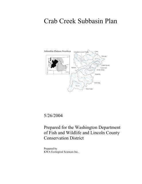
<strong>Crab</strong> <strong>Creek</strong> <strong>Subbasin</strong> <strong>Plan</strong><br />
5/26/2004<br />
Prepared for the Washington Department<br />
of Fish <strong>and</strong> Wildlife <strong>and</strong> Lincoln County<br />
<strong>Conservation</strong> District<br />
Prepared by<br />
KWA Ecological Sciences Inc.
<strong>Subbasin</strong> Contributors<br />
<strong>Subbasin</strong> Team Leader<br />
Patrick Verhey, Washington Department of Fish <strong>and</strong> Wildlife (WDFW)<br />
Contributors (in alphabetical order):<br />
Juli Anderson, WDFW<br />
Paul Ashley, WDFW<br />
Jim Blanchard, United States Bureau of Reclamation<br />
Dennis Bly<br />
Mike Clement, Grant County PUD<br />
Bobby Cummins, Yakama Nation<br />
Don Derifield, East Columbia Basin Irrigation District<br />
Tom Dresser, Grant County PUD<br />
Greg Fitzgerald, WDFW<br />
Robert Flores, US Fish <strong>and</strong> Wildlife Service<br />
Keith Franklin, Quincy Irrigation District<br />
Crayton Guhlke<br />
Anita Harman<br />
Betsy Jordan, Quincy Irrigation District<br />
Oscar Kuch<br />
John Larson, Upper Grant <strong>Conservation</strong> District<br />
Tracy Lloyd, WDFW<br />
David Lundgren, Lincoln County <strong>Conservation</strong> District<br />
Shannon McDaniel, South Columbia Basin Irrigation District<br />
Mike La<strong>Plan</strong>t<br />
Moses Lake Irrigation Reclamation District<br />
R<strong>and</strong>y Hill, US Fish <strong>and</strong> Wildlife Service<br />
Jeff Korth, WDFW<br />
Dan Roseburg, Moses Lake <strong>Conservation</strong> District<br />
Richard Stevens<br />
Kate Terrell, US Fish <strong>and</strong> Wildlife Service<br />
Todd Thompson, Bureau of L<strong>and</strong> Management<br />
Bill White, Yakama Nation<br />
Dean White, Lincoln County <strong>Conservation</strong> District<br />
Coordinators<br />
Paul Wagner, KWA Ecological Sciences, Inc.<br />
Sammi Buzzard, KWA Ecological Sciences, Inc.<br />
<strong>Crab</strong> <strong>Creek</strong> <strong>Subbasin</strong> <strong>Plan</strong> Approach <strong>and</strong> Public Involvement<br />
Outreach<br />
The Washington Department of Fish <strong>and</strong> Wildlife <strong>and</strong> Lincoln County <strong>Conservation</strong>
District partnered to coordinate <strong>Subbasin</strong> <strong>Plan</strong>ning for the <strong>Crab</strong> <strong>Creek</strong> <strong>Subbasin</strong>. Lincoln<br />
County <strong>Conservation</strong> District has been responsible for outreach <strong>and</strong> public involvement.<br />
The timeline established by the <strong>Northwest</strong> <strong>Power</strong> <strong>and</strong> <strong>Conservation</strong> Council (NPCC) has<br />
necessitated a very compressed process that has allowed little flexibility in stakeholder<br />
involvement. The rigorous schedule <strong>and</strong> limited budget have restricted the time available<br />
for outreach. In addition, the volume of work to be completed has resulted in many long<br />
meetings.<br />
The Washington Department of Fish <strong>and</strong> Wildlife <strong>and</strong> Lincoln County <strong>Conservation</strong><br />
District’s commitment is to make it possible for local stakeholders to continue to be<br />
heard, <strong>and</strong> to contribute to decisions about issues that affect both their livelihoods <strong>and</strong><br />
their quality of life. The NWPCC proposed a three year rolling review of subbasin plans,<br />
will make the plans relevant <strong>and</strong> enable them to be updated regularly, <strong>and</strong> adapted to new<br />
knowledge <strong>and</strong> information.<br />
The Washington Department of Fish <strong>and</strong> Wildlife <strong>and</strong> Lincoln County <strong>Conservation</strong><br />
District staff <strong>and</strong> contractors have used the media <strong>and</strong> a series of public meetings to<br />
communicate with the general public about <strong>Subbasin</strong> <strong>Plan</strong>ning in the <strong>Crab</strong> <strong>Creek</strong><br />
subbasin. In addition, the Coordinators delivered press releases to media representatives,<br />
<strong>and</strong> recruited stakeholders to represent local interests on the <strong>Subbasin</strong> Core Team (SCT).<br />
Outreach list<br />
In February, 2004, the Coordinators assembled an initial outreach list comprising about<br />
50 names. The list included representatives of the following interests:<br />
• Agriculture<br />
• Business<br />
• <strong>Conservation</strong> <strong>and</strong> the environment<br />
• Government (including local government, <strong>and</strong> local <strong>and</strong> regional representatives of<br />
state, tribe <strong>and</strong> federal agencies)<br />
• Media<br />
• Recreation<br />
The list has continued to grow as individuals express interest in <strong>Subbasin</strong> <strong>Plan</strong>ning. It<br />
has been used throughout <strong>Subbasin</strong> <strong>Plan</strong>ning to promulgate information, extend<br />
invitations, <strong>and</strong> issue updates on the progress of the process <strong>and</strong> changes to the planning<br />
schedule.<br />
Information sheet<br />
The Washington Department of Fish <strong>and</strong> Wildlife <strong>and</strong> Lincoln County <strong>Conservation</strong><br />
District used an information sheet, “<strong>Subbasin</strong> <strong>Plan</strong>ning 101”, provided by the NWPCC<br />
to introduce <strong>Subbasin</strong> <strong>Plan</strong>ning to stakeholders <strong>and</strong> the media <strong>and</strong> explain opportunities<br />
for public involvement. The information included a telephone number <strong>and</strong> email, postal<br />
mail, <strong>and</strong> web site addresses that individuals could use to obtain more information.<br />
Infrastructure <strong>and</strong> Organization<br />
<strong>Subbasin</strong> Core Team<br />
The Washington Department of Fish <strong>and</strong> Wildlife <strong>and</strong> Lincoln County <strong>Conservation</strong><br />
District initiated formation of the <strong>Subbasin</strong> Core Team (SCT) with kickoff meetings in<br />
Harrington <strong>and</strong> Moses Lake on February 10, 2004. Twenty-three stakeholders attended
the meeting in Harrington <strong>and</strong> sixteen stakeholders attended the meeting in Moses Lake.<br />
The agenda included an introduction to <strong>Subbasin</strong> <strong>Plan</strong>ning, an overview of the process,<br />
an explanation of the assessment methodology <strong>and</strong> work undertaken to date, <strong>and</strong> a<br />
description of anticipated roles <strong>and</strong> the SCT meeting schedule.<br />
The SCT met four times in February, 2004 <strong>and</strong> twice in March, 2004 for a reach<br />
designation <strong>and</strong> five Qualitative Habitat Assessment (QHA) meetings. At those<br />
meetings, Technical Group members presented QHA outcomes based on their initial<br />
assessment work, <strong>and</strong> worked with SCT members to refine the outcomes based on local<br />
knowledge <strong>and</strong> to develop preliminary lists of management strategies appropriate to the<br />
limiting factors indicated by the QHA outcomes.<br />
The SCT meetings occupied most of each day (9 AM-5 PM) due to the amount of time<br />
needed to review the QHA outcomes.<br />
Approach<br />
Start up<br />
The coordinators used the outreach list to invite stakeholders to participate in <strong>Subbasin</strong><br />
<strong>Plan</strong>ning, <strong>and</strong> to release information to the media. Those avenues were used to initiate<br />
public involvement as follows:<br />
• February 1, 2004: Mailing of initial press release to all members of the outreach list<br />
Briefings to introduce <strong>Subbasin</strong> <strong>Plan</strong>ning <strong>and</strong> explain the process, timeline, <strong>and</strong> roles:<br />
• February 10, 2004: Two kickoff meetings were held; one in Harrington <strong>and</strong> one in<br />
Moses Lake<br />
• February <strong>and</strong> March, 2004; QHA model were <strong>and</strong> reviewed by stakeholders<br />
Drafts will be placed in local public libraries <strong>and</strong> sent to stakeholders on request.<br />
Stakeholders will have two weeks to submit comments on the first draft, <strong>and</strong> 90 days to<br />
comment on the final draft during the formal public review period. The meetings have<br />
been advertised, <strong>and</strong> releases sent to local media outlets. The media releases include an<br />
update on <strong>Subbasin</strong> <strong>Plan</strong>ning, outline next steps, <strong>and</strong> invite stakeholder participation.<br />
Public comments<br />
Comments collected at public meetings <strong>and</strong> during public review of draft <strong>Subbasin</strong> <strong>Plan</strong>s<br />
have been appended to this plan as Appendix D.
<strong>Crab</strong> <strong>Creek</strong> <strong>Subbasin</strong> <strong>Plan</strong><br />
Table of Contents<br />
<strong>Subbasin</strong> Contributors..................................................................................................... 2<br />
Coordinators.................................................................................................................2<br />
<strong>Crab</strong> <strong>Creek</strong> <strong>Subbasin</strong> <strong>Plan</strong> Approach <strong>and</strong> Public Involvement ...................................... 2<br />
Outreach.......................................................................................................................2<br />
Executive Summary............................................................................................................ 9<br />
Purpose <strong>and</strong> Scope .......................................................................................................9<br />
Socio-economic Objectives .......................................................................................11<br />
Overview....................................................................................................................... 12<br />
<strong>Subbasin</strong> Overview <strong>and</strong> Regional Context ................................................................... 12<br />
<strong>Crab</strong> <strong>Creek</strong> Watershed ...............................................................................................12<br />
Topography/Geomorphology.....................................................................................19<br />
Climate.......................................................................................................................19<br />
Vegetation ..................................................................................................................19<br />
L<strong>and</strong> Use <strong>and</strong> Demographics .....................................................................................20<br />
Riparian <strong>and</strong> Wetl<strong>and</strong>.................................................................................................21<br />
Other Habitats ............................................................................................................22<br />
Hydrologic Function ..................................................................................................22<br />
Fish distribution .........................................................................................................23<br />
Artificial Production ..................................................................................................23<br />
Terrestrial / Wildlife Resources.................................................................................... 24<br />
Birds...........................................................................................................................31<br />
Mammals....................................................................................................................35<br />
Shrubsteppe Obligates ...............................................................................................35<br />
Other Shrubsteppe Obligates .....................................................................................36<br />
Reptiles <strong>and</strong> Amphibians ...........................................................................................37<br />
Shrubsteppe obligates ................................................................................................37<br />
Other Reptiles <strong>and</strong> Amphibians .................................................................................37<br />
Wildlife Limiting Factors ..........................................................................................38<br />
Fish Resources .............................................................................................................. 39<br />
Aquatic / Fish Relationships ......................................................................................39<br />
Major Limiting Factors ..............................................................................................47<br />
Fisheries .....................................................................................................................47<br />
Assessment........................................................................................................................ 48<br />
Focal Species ................................................................................................................ 48<br />
Selection Criteria .......................................................................................................48<br />
Fish Assessment............................................................................................................ 48<br />
Assessment Methods..................................................................................................... 56<br />
Scientific Conceptual Foundation................................................................................. 56<br />
Application of the Qualitative Habitat Analysis in the <strong>Crab</strong> <strong>Creek</strong> <strong>Subbasin</strong> <strong>Plan</strong>ning<br />
Process .......................................................................................................................56<br />
Assessment Units .......................................................................................................60<br />
Assessment Results....................................................................................................... 60<br />
Summary of Limiting Factors, Focal Species, Key Findings, <strong>and</strong> Data Gaps for the
Entire <strong>Crab</strong> <strong>Creek</strong> <strong>Subbasin</strong>.......................................................................................... 73<br />
Wildlife Assessment ..................................................................................................... 76<br />
Historic Reference Condition ....................................................................................79<br />
Ponderosa Pine...........................................................................................................80<br />
Shrubsteppe................................................................................................................83<br />
Shrub dominated Shrubsteppe ...................................................................................85<br />
Steppe/Grassl<strong>and</strong> dominated Shrubsteppe.................................................................86<br />
Eastside (Interior) Riparian Wetl<strong>and</strong> .........................................................................86<br />
Agriculture .................................................................................................................88<br />
Cliffs, Caves, <strong>and</strong> Talus Slopes .................................................................................89<br />
Agricultural Development .........................................................................................89<br />
Residential Development ...........................................................................................91<br />
Livestock Grazing......................................................................................................92<br />
Exotic Species............................................................................................................92<br />
Hydropower Development <strong>and</strong> Operation .................................................................92<br />
Fire .............................................................................................................................92<br />
Synthesis <strong>and</strong> Interpretation.......................................................................................... 93<br />
Terrestrial / Wildlife...................................................................................................93<br />
Inventory........................................................................................................................... 96<br />
Introduction................................................................................................................96<br />
Purpose <strong>and</strong> Scope .....................................................................................................96<br />
<strong>Subbasin</strong> Management.................................................................................................. 96<br />
Federal Government ..................................................................................................... 96<br />
State Government ......................................................................................................... 97<br />
Local Stakeholder Groups ............................................................................................ 99<br />
Irrigation Districts......................................................................................................99<br />
Native Americans.....................................................................................................101<br />
Wanapum Tribe .......................................................................................................101<br />
Other Native American Tribes.................................................................................101<br />
Programs ..................................................................................................................... 102<br />
Federal Government ................................................................................................... 102<br />
Americorps...............................................................................................................102<br />
Bonneville <strong>Power</strong> Administration............................................................................102<br />
National Oceanic <strong>and</strong> Atmospheric Administration (NOAA Fisheries) .................103<br />
U.S. Environmental Protection Agency...................................................................110<br />
U.S. Department of Energy......................................................................................112<br />
United States Department of Interior Bureau of L<strong>and</strong> Management.......................113<br />
United States Army Corps of Engineers..................................................................114<br />
United States Department of Agriculture.................................................................117<br />
United States Fish & Wildlife Service.....................................................................123<br />
U.S. Bureau of L<strong>and</strong> Management...........................................................................132<br />
U.S. Bureau of Reclamation ....................................................................................136<br />
U.S. Geological Survey............................................................................................136<br />
U.S. Forest Service ..................................................................................................137<br />
State Government ....................................................................................................... 139<br />
Washington Department of Fish & Wildlife............................................................139
Washington Department of Ecology........................................................................146<br />
Washington State Parks <strong>and</strong> Recreation Commission .............................................155<br />
Washington State Department of Transportation.....................................................155<br />
Washington State <strong>Conservation</strong> Commission..........................................................156<br />
Washington State Department of Natural Resources...............................................156<br />
Local Stakeholder ....................................................................................................... 157<br />
Local Government ...................................................................................................157<br />
Adams County <strong>Conservation</strong> District ......................................................................158<br />
Douglas County HCP...............................................................................................158<br />
Grant County Public UtilityDistrict .........................................................................158<br />
Lincoln County <strong>Conservation</strong> District .....................................................................160<br />
Projects........................................................................................................................ 162<br />
NPCC Approved/BPA Funded Projects ..................................................................162<br />
Swanson Lakes Wildlife Area (BPA Project # 199106100)....................................163<br />
Projects Funded Outside the NPCC Fish & Wildlife Program................................167<br />
Management <strong>Plan</strong>............................................................................................................ 172<br />
Vision Statement......................................................................................................... 172<br />
Fish Management........................................................................................................ 172<br />
Assessment Unit 1 – Lower <strong>Crab</strong> <strong>Creek</strong>..................................................................172<br />
Assessment Unit 2 – Refuge. ...................................................................................175<br />
Assessment Unit 3 – Potholes/Moses Lake .............................................................177<br />
Assessment Unit 4 – Upper Middle <strong>Crab</strong> <strong>Creek</strong>......................................................178<br />
Assessment Unit 5 – Upper <strong>Crab</strong> <strong>Creek</strong>. .................................................................181<br />
Wildlife Management ................................................................................................. 187<br />
Monitoring <strong>and</strong> Evaluation Program for the <strong>Crab</strong> <strong>Creek</strong> <strong>Subbasin</strong>................................ 188<br />
Approach..................................................................................................................189<br />
Guidance for this M&E Program.............................................................................189<br />
Principles, Goals <strong>and</strong> Objectives .............................................................................190<br />
References................................................................................................................... 228<br />
Acronyms <strong>and</strong> Abbreviations ......................................................................................... 232
List of Tables<br />
Table 1. Wildlife Species of Interest within <strong>Crab</strong> <strong>Creek</strong> <strong>Subbasin</strong> .................................. 24<br />
Table 2: Fish species of Interest within the <strong>Crab</strong> <strong>Creek</strong> <strong>Subbasin</strong> ................................... 39<br />
Table 3. Historic L<strong>and</strong>cover Type by Ownership............................................................. 78<br />
Table 4. Wildlife habitat limiting factors analysis for the Columbia Cascade Ecoprovince,<br />
Washington (Source: NPPC 2002a-g) .............................................................................. 94<br />
Table 5. Habitat type <strong>and</strong> quantity on the Swanson Lakes Wildlife Area...................... 164<br />
Table 6. Lincoln County <strong>Conservation</strong> District Projects................................................ 168<br />
Table 7. Biological indicator variables (with conceptual protocols) to be monitored in the<br />
<strong>Crab</strong> <strong>Creek</strong> Baseline M&E Program............................................................................... 201<br />
List of Figures<br />
Figure 1. <strong>Crab</strong> <strong>Creek</strong> subbasin, l<strong>and</strong> ownership, hydrography, county, <strong>and</strong> dam <strong>and</strong><br />
hatchery, urban area.......................................................................................................... 11<br />
Figure 2. Location of <strong>Crab</strong> <strong>Creek</strong> <strong>Subbasin</strong> in the Columbia Plateau.............................. 12<br />
Figure 3. Priority Species.................................................................................................. 33<br />
Figure 4. Historic L<strong>and</strong>cover ............................................................................................ 77<br />
Figure 6. Current Ownership ............................................................................................ 78<br />
Figure 7. Changes in focal wildlife habitat types in the Columbia Cascade Ecoprovince,<br />
Washington (IBIS 2003)................................................................................................... 80<br />
Figure 8. Protection status of ponderosa pine in the Columbia Cascade Ecoprovince,<br />
Washington (IBIS 2003)................................................................................................... 82<br />
Figure 9. Protection status of shrubsteppe in the Columbia Cascade Ecoprovince,<br />
Washington (IBIS 2003)................................................................................................... 84<br />
Figure 10. Protection status of riparian wetl<strong>and</strong>s in the Columbia Cascade Ecoprovince,<br />
Washington (IBIS 2003)................................................................................................... 87<br />
Figure 11. Protection status of agriculture in the Columbia Cascade Ecoprovince,<br />
Washington (IBIS 2003)................................................................................................... 89<br />
Figure 12. Location of the Swanson Lakes Wildlife Area in <strong>Crab</strong> <strong>Creek</strong> ...................... 164<br />
<strong>Subbasin</strong>.......................................................................................................................... 164<br />
Figure 13. WDFW Sharp-Tailed Grouse Management Zones ....................................... 166
Executive Summary<br />
Purpose <strong>and</strong> Scope<br />
In October of 2000, the <strong>Northwest</strong> <strong>Power</strong> <strong>Plan</strong>ning Council adopted a revised Fish <strong>and</strong><br />
Wildlife Program for the Columbia River Basin. The new program is intended to be more<br />
comprehensive than, but complimentary to, regional efforts related to the Endangered<br />
Species Act, State-sponsored recovery <strong>and</strong> watershed planning <strong>and</strong> coordination efforts,<br />
<strong>and</strong> tribal recovery initiatives.<br />
The revised Program calls for an ecosystem-based approach for planning <strong>and</strong><br />
implementing fish <strong>and</strong> wildlife recovery. To accomplish this, the Program divides the<br />
Columbia Basin into ecological provinces that are further divided into individual<br />
subbasins.<br />
At the heart of the Program is the subbasin plan, consisting of a comprehensive<br />
description of the basin general ecology including the identification of specific fish <strong>and</strong><br />
wildlife needs. Future action strategies <strong>and</strong> project funding are to be based upon these<br />
identified needs.<br />
<strong>Subbasin</strong> summaries were developed in 2001 as an interim step to organize key planning<br />
attributes, to allow near-term implementation of the revised Fish <strong>and</strong> Wildlife Program<br />
until comprehensive subbasin plans can be completed.<br />
The <strong>Crab</strong> <strong>Subbasin</strong> is the subject of one of 10 subbasin plans being generated from within<br />
the Columbia Plateau Ecoprovince. Columbia Plateau North includes the Columbia River<br />
<strong>and</strong> all tributaries upstream of The Dalles Dam up to <strong>and</strong> including Wanapum Dam on<br />
the north <strong>and</strong> west bank <strong>and</strong> <strong>Crab</strong> <strong>Creek</strong>. Columbia Plateau South includes the Columbia<br />
River <strong>and</strong> all tributaries on the south bank upstream of The Dalles Dam up to the<br />
confluence with the Snake River; Snake River <strong>and</strong> all tributaries from Lewiston, Idaho to<br />
the confluence with the Columbia River.<br />
The <strong>Crab</strong> <strong>Subbasin</strong> <strong>Plan</strong> draws from the <strong>Crab</strong> <strong>Subbasin</strong> Summary (NWPCC 2001), which<br />
included an information summary for fish <strong>and</strong> wildlife, relevant l<strong>and</strong> use planning,<br />
human population patterns, <strong>and</strong> overall management issues for subwatersheds <strong>and</strong><br />
tributaries. Most of the information contained in the Overview section of this subbasin<br />
plan was obtained directly from the <strong>Crab</strong> <strong>Subbasin</strong> Summary. The subbasin plan will also<br />
draw from a significant body of additional science to facilitate coordinated recovery<br />
planning for the <strong>Crab</strong> ecosystem.<br />
The <strong>Crab</strong> <strong>Creek</strong> <strong>Subbasin</strong> <strong>Plan</strong> addresses the limiting factors for fish <strong>and</strong> wildlife<br />
ecosystems in the <strong>Crab</strong> <strong>Creek</strong> Watershed. However, the needs of watershed residents <strong>and</strong><br />
their critical role in ecosystem stewardship have been expressly considered as part of
overall ecosystem recovery <strong>and</strong> its benefits.<br />
<strong>Crab</strong> <strong>Creek</strong>, sometimes referred to as the longest ephemeral stream in North America,<br />
possesses many unique characteristics not found in other subbasins. Numerous stream<br />
reaches <strong>and</strong> lake chains did not exist prior to the USBR Columbia Basin Project <strong>and</strong><br />
modern irrigation practices. Because of this, new habitat has been created which now<br />
support diverse populations of fish <strong>and</strong> wildlife. Resident salmonids are present in the<br />
<strong>Crab</strong> <strong>Creek</strong> <strong>Subbasin</strong> <strong>and</strong> were historically. Through a combination of hatchery<br />
supplementation <strong>and</strong> natural production, resident salmonids now support high quality<br />
recreational fisheries in many locations throughout the subbasin. Warmwater species<br />
have been introduced throughout most of the subbasin <strong>and</strong> now support important<br />
fisheries in lakes <strong>and</strong> reservoirs. Anadromous salmonids, including ESA listed Upper<br />
Columbia River Summer Steelhead, also currently utilize the subbasin, but only in the<br />
lower most reaches. However, the specific origin of these fish <strong>and</strong> their historical<br />
presence are unknown. These <strong>and</strong> other data gaps must be filled before comprehensive<br />
management plans can be developed.<br />
Aquatic habitat areas that did not exist prior to the Columbia Basin Project have no true<br />
restoration value. However, these same areas are important to the current culture <strong>and</strong><br />
economics of the subbasin <strong>and</strong> can be enhanced. The <strong>Crab</strong> <strong>Creek</strong> <strong>Subbasin</strong> offers<br />
enormous opportunity to conduct fisheries enhancement to help mitigate for other<br />
fisheries that have been lost.
Figure 1. <strong>Crab</strong> <strong>Creek</strong> subbasin, l<strong>and</strong> ownership, hydrography, county, <strong>and</strong> dam <strong>and</strong><br />
hatchery, urban area.<br />
The <strong>Crab</strong> <strong>Creek</strong> <strong>Subbasin</strong> <strong>Plan</strong> addresses the limiting factors for fish <strong>and</strong> wildlife<br />
ecosystems in the <strong>Crab</strong> <strong>Creek</strong> Watershed. However, the needs of watershed residents <strong>and</strong><br />
their critical role in ecosystem stewardship have been expressly considered as part of<br />
overall ecosystem recovery <strong>and</strong> its benefits.<br />
Socio-economic Objectives<br />
The socio-economic objectives achieved through the <strong>Crab</strong> <strong>Creek</strong> <strong>Subbasin</strong> <strong>Plan</strong> are<br />
intended to include the scope of tribal trust/cultural needs <strong>and</strong> responsibilities,<br />
recreational fisheries, <strong>and</strong> other regional economic aspects of fisheries.<br />
The resulting recovery of salmonid populations <strong>and</strong> the resulting benefits are expected to<br />
flow to recreational fishers <strong>and</strong> other stakeholders.
Overview<br />
<strong>Subbasin</strong> Overview <strong>and</strong> Regional Context<br />
The revised Columbia Basin Fish <strong>and</strong> Wildlife Program calls for an ecosystem-based<br />
approach for planning <strong>and</strong> implementing fish <strong>and</strong> wildlife recovery. The <strong>Crab</strong> <strong>Creek</strong><br />
<strong>Subbasin</strong> <strong>Plan</strong> will lay the foundation to achieve this goal by integrating fish <strong>and</strong> wildlife<br />
assessments, inventories <strong>and</strong> management plans in a manner that begins to connect<br />
communities of science, interest <strong>and</strong> place in the <strong>Crab</strong> <strong>Creek</strong> <strong>Subbasin</strong>.<br />
The <strong>Crab</strong> <strong>Creek</strong> <strong>Subbasin</strong> is located in central Washington in portions of Douglas,<br />
Lincoln, Adams, Grant, <strong>and</strong> Spokane counties, within the Columbia Plateau Province<br />
(Figure 1). It is bounded on the east by the Palouse <strong>Subbasin</strong>, on the south by the Lower<br />
Mid-Columbia Mainstem <strong>Subbasin</strong>, on the west by the Upper Mid-Columbia Mainstem<br />
<strong>Subbasin</strong>, <strong>and</strong> on the north by the Rufus Woods <strong>and</strong> Roosevelt Lake <strong>Subbasin</strong>s. The head<br />
waters begin in Lincoln County near the town of Reardan approximately 30 km west of<br />
Spokane <strong>and</strong> include a small part of western Spokane County 13 km west of Cheney.<br />
<strong>Crab</strong> <strong>Creek</strong> flows southwest for approximately 225 km draining into the Columbia River<br />
near the town of Schwana in Grant County, five miles south of the Wanapum Dam.<br />
Figure 2. Location of <strong>Crab</strong> <strong>Creek</strong> <strong>Subbasin</strong> in the Columbia Plateau<br />
<strong>Crab</strong> <strong>Creek</strong> Watershed<br />
Sometimes referred to as the longest ephemeral stream in North America, <strong>Crab</strong> <strong>Creek</strong>
defies simple description. Some 225 km in length, it drains a vast area of some 13,200<br />
square kilometers. The creek winds through scabrock channels for most of its length,<br />
channels believed carved by floods of ancient Lake Missoula. For ease of discussion, we<br />
separate the creek into to three reaches in the following: (1) Upper <strong>Crab</strong> <strong>Creek</strong>—from its<br />
source near Reardon, Washington downstream to Brook (Stratford) Lake; (2) Middle<br />
<strong>Crab</strong> <strong>Creek</strong>— from Brook Lake to, <strong>and</strong> including, Potholes Reservoir; (3) Lower <strong>Crab</strong><br />
<strong>Creek</strong>— from below Potholes Reservoir to the Columbia River.<br />
Upper <strong>Crab</strong> <strong>Creek</strong> was historically, <strong>and</strong> remains to present-day, a disappearing stream--reaches<br />
of permanent flow interspersed with miles of dry creek beds, or at best, isolated,<br />
stagnant pools during most of the year. Whether modern l<strong>and</strong> use has changed flow<br />
volume <strong>and</strong> the lengths of permanent reaches is unknown, yet as discussed earlier, the<br />
ground water table has dropped some 45 m (150 ft.) over the past few decades. Over a<br />
century of livestock use within the upper watershed have likely changed the amount <strong>and</strong><br />
character of riparian vegetation somewhat, but has not obliterated it entirely. Tillage of<br />
the upl<strong>and</strong>s for wheat production has undeniably increased soil erosion <strong>and</strong> contributed to<br />
heavy silt transport during snowmelt <strong>and</strong> rainwater runoff. Yet in spite of this<br />
perturbation, permanent reaches in general lack heavy deposits of silt <strong>and</strong> run cool<br />
enough in summer, at least near springs, to hold rainbow trout 1 . Perhaps the greatest<br />
impact on salmonids are carp. Carp are established at least as far upstream as 2.4 km west<br />
of Odessa.<br />
Portions of creek between Odessa <strong>and</strong> Brook Lake have been channeled <strong>and</strong> diked to<br />
reduce spring flooding of farm crops in the coulee floor. Numerous springs occur<br />
throughout the upper basin. One rather large drainage--Lake <strong>Creek</strong>, with its numerous<br />
lakes <strong>and</strong> recreational trout population--feeds southwest to within a few miles of <strong>Crab</strong><br />
<strong>Creek</strong> before disappearing into the ground. There is likely subterranean contact with the<br />
<strong>Crab</strong> channel.<br />
Water quality could be enhanced in the Upper <strong>Crab</strong> <strong>Creek</strong> basin from a practical<br />
st<strong>and</strong>point. Removal of dikes, where found in channeled reaches could lessen soil<br />
transport to, <strong>and</strong> deposition in, Middle <strong>Crab</strong> <strong>Creek</strong> (especially Moses Lake) by allowing<br />
diffusion of flows (velocity reduction) over the valley bottom. Improved soil<br />
conservation practices on cropl<strong>and</strong>s throughout the upper basin could further benefit<br />
downstream areas, as well as permanent flows in the upper watershed.<br />
Middle <strong>Crab</strong> <strong>Creek</strong> is the most heavily populated reach within the <strong>Crab</strong> <strong>Creek</strong> subbasin,<br />
with Moses Lake as the main human population center. It is this reach that bears the brunt<br />
of winter <strong>and</strong> spring runoff that carry agricultural chemicals <strong>and</strong> eroded soils from Upper<br />
<strong>Crab</strong>, although Brook Lake intercepts <strong>Crab</strong> flows <strong>and</strong> acts as a sump for much of the silt<br />
<strong>and</strong> chemicals.<br />
1 Much of the Overview section of this document was obtained directly from the<br />
<strong>Crab</strong> <strong>Creek</strong> <strong>Subbasin</strong> Summary (NWPPC 2001) which often refers to fish by<br />
common name only. Genus <strong>and</strong> species information is listed in Table 2.
Historical information indicates that long before irrigation development perennial<br />
connection between <strong>Crab</strong> <strong>Creek</strong> at Brook <strong>and</strong>/or Round lakes <strong>and</strong> Moses Lake did not<br />
occur (Evermann <strong>and</strong> Nichols 1909). Groves (1951) states that only two tributaries fed<br />
Moses Lake: Rocky Ford <strong>Creek</strong>, <strong>and</strong> a small tributary emanating from two points above<br />
Parker Horn (probably in the Willow Lakes area <strong>and</strong> at Homestead <strong>Creek</strong>). Only during<br />
high water conditions did Upper <strong>Crab</strong> thread its way through the present Willow Lakes<br />
area <strong>and</strong> on to Moses Lake at Parker Horn. Today, several springs join the <strong>Crab</strong> <strong>Creek</strong><br />
channel in this reach, a result of elevated groundwater from irrigation development. The<br />
springs creating the seven miles of Rocky Ford <strong>Creek</strong> are widely accepted now as<br />
connected by underground flows to <strong>Crab</strong> <strong>Creek</strong> in the vicinity of Round <strong>and</strong> Willow<br />
lakes (Bain 1990).<br />
Groves (1951) also mentions that an Indian legend held that Moses Lake was once dry.<br />
The concept has plausibility given that shifting s<strong>and</strong> created large dunes on the south end<br />
of the lake, effectively damming the outlet. A disastrous flood in 1904 washed through<br />
the dune <strong>and</strong> lowered the lake eight feet. Groves (1951) leaves a telling note: “Soon after<br />
the great flood of 1904 when the Moses Lake overflow reached the Columbia River, carp<br />
were noticed.” The deduction then is that <strong>Crab</strong> <strong>Creek</strong> did not reach the Columbia River<br />
except during flood events. At least temporary connections with the Columbia<br />
undoubtedly occurred off <strong>and</strong> on prior to 1904, as Northern pikeminnow, a species<br />
indigenous to the Columbia River, was one of the original inhabitants of Moses.<br />
Common carp were first introduced to the <strong>Northwest</strong> in 1880, <strong>and</strong> escaped into the<br />
Columbia in 1881 (Lampman 1946).<br />
Water quality has been touched on earlier in this document. More detail for this section<br />
can be found in Williamson, et al. (1998). Several waters are on the federal Clean Water<br />
Act “303 (d) list” as not meeting water quality st<strong>and</strong>ards. With one exception, listed<br />
waters fail to meet st<strong>and</strong>ards for one or more of the parameters temperature, pH <strong>and</strong><br />
dissolved oxygen (Weaver 1999). Dieldrin has been found in edible fish tissue<br />
(largemouth bass <strong>and</strong> lake whitefish) in Potholes Reservoir. Moses Lake has come of<br />
interest to the Washington Department of Ecology in the last 15 years because of high<br />
levels of nutrients (primarily nitrates <strong>and</strong> phosphates). On-farm demonstration projects<br />
sought to lower nutrient discharge to Moses Lake (Bain 1990). While effective, the<br />
methods have not been widely employed. Flushing the lake with fresh water directly out<br />
of canals has had some benefits, where water is poured into Rocky Coulee Wasteway,<br />
which drains into <strong>Crab</strong> <strong>Creek</strong> a short ways above Parker Horn<br />
The middle section of <strong>Crab</strong> <strong>Creek</strong> suffers from muddy water during spring through<br />
summer from several causes: flood-born silt from eroded soils in the upper watershed;<br />
carp that stir up mud in shallow areas of lakes <strong>and</strong> streams; <strong>and</strong> irrigation return water<br />
bearing silt <strong>and</strong> fertilizers from cropl<strong>and</strong>s. The repository for these flows is Moses Lake.<br />
Temperature <strong>and</strong> dissolved oxygen, while unsatisfactory at times <strong>and</strong> contributing to<br />
small, localized losses of fish during summer, do not presently have major negative<br />
impacts on fish life within either Middle <strong>Crab</strong> <strong>Creek</strong> or Moses Lake. Further increases in<br />
nutrient loading may at some point, however, have detrimental effects on existing<br />
fisheries.
Lower <strong>Crab</strong> <strong>Creek</strong> (from below O’Sullivan Dam on Potholes Reservoir to the Columbia<br />
River): This is the only reach supporting anadromy. Fall Chinook <strong>and</strong> steelhead have<br />
been found upstream as far as, <strong>and</strong> into, Red Rock Coulee 2 . Chinook in significant<br />
numbers spawn in Red Rock Coulee (Bowen et al. 2003). Steelhead also spawn in Red<br />
Rock , <strong>and</strong> may be the progeny of steelhead smolt releases made several decades ago<br />
(NWPCC 2001). Adults have long been known to move into the stream in spring, <strong>and</strong><br />
occasionally steelhead have been caught by anglers near the mouth of Red Rock <strong>and</strong> in<br />
the creek itself over the years (NWPCC 2001). That steelhead show some affinity to the<br />
creek hints that reproduction may be successful, at best in the cooler <strong>and</strong> cleaner waters<br />
of Red Rock. The converse is that these adults are pioneers from another run. This seems<br />
most probable, considering the long freshwater life of juvenile steelhead. Requiring two<br />
or more years of rearing in freshwater before heading seaward, young steelhead would, in<br />
Lower <strong>Crab</strong> <strong>Creek</strong> probably succumb to temperatures that approach the high 80s from<br />
late spring to late summer. Fall Chinook are better adapted to such places with their fall<br />
spawning habit (during cool temps) <strong>and</strong> the departure of age-0 young prior to summer<br />
heat (Bowen et al. 2003). The small rainbow trout of Red Rock are of undefined origin.<br />
The U.S. Bureau of Reclamation is completing a report on two years of inventory of<br />
anadromous fish in the Columbia Basin Project. This will be the most thorough work to<br />
date on presence, distribution, spawning sites <strong>and</strong> habitat use <strong>and</strong> may shed more light on<br />
steelhead origins <strong>and</strong> use within the drainage.<br />
The extent of anadromous passage upstream is uncertain. A falls just downstream of<br />
McManamon Road is probably a formidable barrier. Private l<strong>and</strong> below the road has not<br />
been assessed for passage barriers.<br />
From O’Sullivan Dam where several springs join into the renewal of <strong>Crab</strong> <strong>Creek</strong>, WDFW<br />
for many years stocked fingerling rainbow <strong>and</strong> brown trout in the stream, <strong>and</strong> as well the<br />
many nearby lakes whose outlets contribute to <strong>Crab</strong> <strong>Creek</strong> flow. The section down to<br />
McManamon Road produced fat <strong>and</strong> large trout, some well over 2.3 kg. This fishery was<br />
maintained for several years with periodic rotenone treatments to control carp <strong>and</strong> other<br />
competitor species. Unable to prevent the return of carp, <strong>and</strong> a change in management<br />
emphasis by the U.S. Fish <strong>and</strong> Wildlife Service (Columbia National Wildlife Refuge) on<br />
key parts of the area, led WDFW ab<strong>and</strong>oning efforts to maintain this fishery. Below the<br />
falls near McManamon Road, there is little opportunity to develop a notable fishery for<br />
any species. Too much of the fish biomass is comprised of sunfish, carp, sculpins <strong>and</strong><br />
several other species to allow even a modest warmwater fishery.<br />
The stream passes through an area dotted with scores of small lakes <strong>and</strong> marshes. Nearly<br />
all contain fish. Many are managed solely for warmwater species, primarily largemouth<br />
bass, bluegill, black crappie. Several lakes support a large mix of warmwater fishes, in<br />
2 "Red Rock Coulee" is the common name (Bowen et al. 2003) for the tributary located in<br />
Grant County in Lower <strong>Crab</strong> <strong>Creek</strong>. The Quincy Columbia Basin Irrigation District also<br />
refers to this as a wasteway.
addition to the species listed above: smallmouth bass, yellow perch, walleye,<br />
pumpkinseed sunfish, bullhead <strong>and</strong> channel catfish, <strong>and</strong> may also contain carp. These<br />
latter lakes generally yield low catch rates to anglers <strong>and</strong> offer sporadic success. Very<br />
popular trout fisheries exist in many other lakes. The management aim here is to keep<br />
these lakes free of non-salmonid species to maintain high yield to anglers. Lakes that<br />
have gained high notoriety over years include the ten-lake Pillar-Widgeon group,<br />
Hampton Lakes, Hutchinson <strong>and</strong> Shiner Lakes. All of the above lie on the Columbia<br />
National Wildlife Refuge. Elsewhere, anglers favor the Warden Lakes, Corral, Canal,<br />
Heart <strong>and</strong> the Windmill group of lakes. The darlings of Washington’s fly anglers are<br />
Lenice, Merry <strong>and</strong> Nunnally near the mouth of <strong>Crab</strong> <strong>Creek</strong>. This Lower <strong>Crab</strong> <strong>Creek</strong> reach<br />
of the subbasin has a long history as a destination fishery, providing lowl<strong>and</strong> lakes<br />
fisheries equal to the best that Washington has to offer. Almost 75 percent of the anglers<br />
using this area reside outside the <strong>Crab</strong> <strong>Creek</strong> drainage, with over 60 percent originating in<br />
Western Washington.<br />
Water quality <strong>and</strong> habitat of the stream itself is poor throughout <strong>and</strong> contaminants include<br />
PCBs <strong>and</strong> dieldrin (Weaver 1999). Temperatures reach lethal levels for salmonids in the<br />
lower end. Soil laden irrigation return flows, the activities of carp, <strong>and</strong> occasional<br />
flooding disallow good water clarity during warm months <strong>and</strong> have left much of the<br />
streambed buried in muck, mostly that downstream of Highway 26. Much of the Lower<br />
<strong>Crab</strong> reach from below Highway 26 <strong>and</strong> west to its juncture with Red Rock Coulee is<br />
contained within dikes to protect adjacent cropl<strong>and</strong>s. Cattle operations over past 100<br />
years <strong>and</strong> poor tillage practices have directly <strong>and</strong> indirectly stripped channel banks of<br />
riparian cover. [0]Changes in amount <strong>and</strong> duration of flows within the <strong>Crab</strong> <strong>Creek</strong><br />
drainage has also contributed to erosion. The amount of riparian cover was also likley<br />
limited, as well since <strong>Crab</strong> <strong>Creek</strong> did not flow year-round.<br />
Irrespective of these perturbations, Lower <strong>Crab</strong> <strong>Creek</strong> flows in quantities far above<br />
historic levels (pre-irrigation development), <strong>and</strong> it flows year around. This alone makes<br />
the lower reach better habitat for fish <strong>and</strong> wildlife than it ever was during pre-settlement.<br />
Water temperatures are elevated to extreme levels in summer, as much a natural<br />
condition for desert streams as a consequence of warmed discharge of lakes <strong>and</strong> irrigation<br />
return flows high in the reach.<br />
Banks Lake <strong>and</strong> Billy Clapp Reservoir are artificial reservoirs located within the <strong>Crab</strong><br />
<strong>Creek</strong> <strong>Subbasin</strong> which were created through the Columbia Basin Project. Banks Lake,<br />
part of the Columbia Basin Project, is an equalizing reservoir created by building two<br />
rock-faced, earthfill dams (North Dam <strong>and</strong> Dry Falls Dam) at the north <strong>and</strong> south ends of<br />
the Ice-Age channel of the Columbia River, now known as Gr<strong>and</strong> Coulee. Major features<br />
forming <strong>and</strong> serving Banks Lake are the feeder canal with a capacity of 26,000 cubic feet<br />
per second, North Dam, 2 miles southwest of Gr<strong>and</strong> Coulee Dam, <strong>and</strong> Dry Falls Dam <strong>and</strong><br />
Main Canal headworks near Coulee City, 29 miles south of Gr<strong>and</strong> Coulee Dam. North<br />
Dam is located on the northern edge of the area underlain by the Columbia Plateau lava.<br />
The structure is in the center of a deep, relatively flat bottomed, steep-walled canyon<br />
about 1.6 km downstream from the Columbia River gorge. Basalt flows <strong>and</strong> interbedded<br />
Latah beds underlie the northern part of North Dam. Dry Falls Dam is located 43 km
within the area underlain by the massive basalt flows of the Columbia Plateau lava.<br />
Banks Lake is formed by these two dams <strong>and</strong> is 27 miles long with 27,000 water surface<br />
acres. This reservoir, with an active storage capacity of 715,000 acre-feet, feeds<br />
Columbia River water into the Main Canal. In addition, it provides water on a return flow<br />
basis to produce power when the pump generating units are operating in the generating<br />
mode.<br />
In conjunction with the addition of the six pump/generating units the canal size was<br />
increased. The south side of the canal was removed, the base widened from 50 feet to 80<br />
feet, an entire new south wall constructed, 8 feet added to the top of the north wall, <strong>and</strong> a<br />
new flume section was added to bypass a duplex tunnel cut-<strong>and</strong>-cover section. This<br />
increased the operating capacity to 26,000 cubic feet per second. Reconstruction was<br />
completed in 1981.<br />
The fisheries of Banks Lake have undergone many changes, both favorable as well as<br />
adverse since its construction in 1951. There are 22 fish species in Banks Lake of which<br />
11 are actively pursued by anglers. This reservoir fishery offers anglers one of the very<br />
best year round freshwater fishing opportunities in the state (WDG 1982).<br />
The Game Department made several kokanee fry plants in the 1960's <strong>and</strong> 1970's.<br />
However, the kokanee population is more dependent upon lake shore spawning to<br />
perpetuate the population <strong>and</strong> fishery. Kokanee are the mainstay of the fishery in Banks<br />
Lake which is considered to be the premier kokanee fishery in Washinton. Unfortunately<br />
kokanee are also the most sensitive fish species in the lake to environmental<br />
manipulations (WDG 1982).<br />
<strong>Plan</strong>ting of hatchery rainbow trout fingerlings have resulted in a successful non-seasonal<br />
boat <strong>and</strong> bank fishery. This species is the third most sought after gamefish in Banks<br />
Lake, well behind kokanee <strong>and</strong> yellow perch. Environmental manipulations impact<br />
rainbow trout far less than kokanee. However, lake shore spawning of rainbow trout is<br />
not significant <strong>and</strong> annual hatchery fingerling plants must be made to sustain a viable<br />
fishery (WDG 1982).<br />
Warmwater gamefish initially held the spotlight in Banks Lake, however, these<br />
populations have declined <strong>and</strong> stabilized. Today yellow perch are the second most<br />
popular fish species with anglers on Banks Lake. The average size has decreased some,<br />
yet this species provides an excellent year round fishery (WDG 1982).<br />
Largemouth bass once the main attraction in the 1950's <strong>and</strong> 1960's hold the number four<br />
slot with Banks Lake anglers today. This species, though widespread throughout the<br />
lake, is somewhat confined to specific areas of preferred habitat.<br />
Current management is for mixed species recreational fisheries including smallmouth<br />
bass, largemouth bass, yellow perch, rainbow trout, walleye, kokanee, black crappie,<br />
bullhead, <strong>and</strong> lake whitefish. A cooperative rainbow trout rearing project between<br />
WDFW, an Electric City sportsmen's group <strong>and</strong> Coulee City Chamber of Commerce
offers has been conducted to improve trout fishing. Several public access areas are welldeveloped,<br />
including a state park about mid-way up the lake <strong>and</strong> a city park at Coulee<br />
City on the south end.<br />
Billy Clapp Reservoir is formed by Pinto Dam which is part of the Columbia Basin<br />
Project. The Main Canal begins at the headworks at Dry Falls Dam <strong>and</strong> consists of<br />
unlined <strong>and</strong> concrete- lined sections. Total length of the canal, including siphons, tunnels,<br />
<strong>and</strong> Billy Clapp Lake, is 18.4 miles. The first 1.8 miles from Dry Falls Dam to the Bacon<br />
Siphon <strong>and</strong> Tunnel structures has been increased in capacity from 13,200 to 19,300 cubic<br />
feet per second. Bacon Siphon <strong>and</strong> Tunnel structures consist of two siphons, each about<br />
1,000 feet long, <strong>and</strong> two tunnels, each about 2 miles long, that carry the water to Billy<br />
Clapp Lake. This lake, some 6 miles long <strong>and</strong> formed by the construction of the earthfill<br />
Pinto Dam, is a segment of the canal system. Construction of an equal length of very<br />
difficult <strong>and</strong> expensive canal was thus avoided.<br />
Billy Clapp Reservoir is a 1000 acre equalizing reservoir 10.5 miles downstream from<br />
Banks Lake. The lake is basically a wide spot in the main canal with an average<br />
inflow/outflow rate of 6500 cfs of water during normal irrigation dem<strong>and</strong> periods. This<br />
results in a rather rapid turnover rate for the reservoir, less retention of nutrients, <strong>and</strong> a<br />
more lotic environment than Banks Lake. These characteristics complicates intensive<br />
management for this water body. Synonymous with irrigation waters is a continuous<br />
recruitment of the twenty plus fish species present. Gamefish as well as less desirable fish<br />
such as carp, northern pikeminnow, pumkinseed sunfish <strong>and</strong> suckers are common (WDG<br />
1982).<br />
Historically Billy Clapp was a very popular kokanee <strong>and</strong> walleye fishery. These two fish<br />
species accounted for around 95% of the fishing effort (Stober 1978). Stober's study<br />
gave evidence that Billy Clapp's kokanee fishery was somewhat dependent upon adult<br />
kokanee that emigrated from Banks Lake via the main canal. The installation of an outlet<br />
barrier net at Banks Lake from 1978-1981 appeared to have a negative impact on the<br />
Billy Clapp fisheries (WDG 1982).<br />
The walleye fishery may also be dependent upon Banks Lake recruitment. Walleye<br />
fisheries in both Banks <strong>and</strong> Billy Clapp have declined rapidly in recent years. The high<br />
spring irrigation withdrawals may result in a significant loss of both spawning adult<br />
walleye <strong>and</strong> newly hatched fry (WDG 1982).<br />
The future of Billy Clapp Reservoir is complicated with the installation of two low head<br />
hydro plants on the canal between Banks Lake <strong>and</strong> Billy Clapp Reservoir. <strong>Plan</strong>ts of<br />
hatchery fry may be the only option left to maintain the important kokanee <strong>and</strong> walleye<br />
fisheries. Additionally, inflows may double with future irrigation dem<strong>and</strong>s.<br />
L<strong>and</strong>s around the 1,010 acre lake are included in a wildlife reserve program. Access is<br />
limited. Summer Falls State Park is located on the north end of the lake. The Department<br />
of Wildlife provides public access <strong>and</strong> the only boat ramp at the south end. Management<br />
is for mixed species recreational fisheries including yellow perch, black crappie, rainbow
trout, <strong>and</strong> walleye.<br />
Topography/Geomorphology<br />
Upl<strong>and</strong>s areas of the Plateau are characterized by gently rolling loess-covered hills<br />
interspersed with channeled scabl<strong>and</strong>s – wide basalt terraces with steep walls. The<br />
l<strong>and</strong>scape within much of this <strong>Subbasin</strong> was sculpted by the torrential Spokane Floods<br />
which took place approximately 12,000 to 15,000 years ago. Glaciated areas in portions<br />
of Lincoln <strong>and</strong> Douglas counties are marked with small water bodies, most of which are<br />
shallow ephemeral ponds that are watered in wet cycles <strong>and</strong> dry during drought years.<br />
The substrate consists of unconsolidated quaternary sediments <strong>and</strong> Columbia River<br />
basalt. Most of the soils in the subbasin are related to the volcanic history or the<br />
subsequent effects of glaciation, runoff, <strong>and</strong> flooding. The main soils in cropl<strong>and</strong>dominated<br />
areas are Bagdad, Broadax, Hanning, Renslow, Ritzville, Shano, Touhey,<br />
Willis, <strong>and</strong> Zen (Beieler 1978, Stockman 1978). The Aquolls, Haploxerolls, <strong>and</strong><br />
Esquatzel soils are prone to wetness <strong>and</strong>/or flooding. The typical soils in rangel<strong>and</strong> areas<br />
include Anders, Bakeoven, Benge, Heytou, Lickskillet, Rock <strong>Creek</strong>, Roloff, Stratford,<br />
<strong>and</strong> Tucannon. Ponderosa pine areas tend to be dominated with Badge, Ewall, <strong>and</strong><br />
Springdale soils.<br />
Climate<br />
The average temperatures in the <strong>Crab</strong> <strong>Creek</strong> <strong>Subbasin</strong> are 51°F minimum <strong>and</strong> 83°F<br />
maximum during summer <strong>and</strong> 21°F minimum <strong>and</strong> 36°F maximum during winter (U.S.<br />
Weather Service Website). The record minimum temperature was - 33°F recorded in<br />
Moses Lake <strong>and</strong> the record maximum temperature was 115°F recorded in Ephrata <strong>and</strong><br />
Wilson <strong>Creek</strong>. Reardan tends to be the coldest location in the subbasin during winter;<br />
other locations tend to be 4 - 6°F warmer. Reardan, Wilbur, <strong>and</strong> Harrington tend to be the<br />
coolest locations during summer (50 - 80°F typical range). The other locations typically<br />
reach the mid-80°F range for summer highs <strong>and</strong> about 50°F for summer lows, with 2<br />
exceptions; Ephrata <strong>and</strong> Quincy are typically in the upper 50°F range for summer lows.<br />
The average precipitation in the subbasin is 10.1 inches. The driest locations (< 10<br />
inches/year) include Quincy, Ephrata, Moses Lake, Wilson <strong>Creek</strong>, Lind, <strong>and</strong> Othello.<br />
Locations in the 10 – 12 inch precipitation zone include Ritzville, <strong>and</strong> Odessa. Harrington<br />
<strong>and</strong> Wilbur are in the > 12 inch precipitation zone. The driest year was 3 inches recorded<br />
for Ephrata in 1976. Winter is typically the wettest season in the subbasin, with<br />
substantial portions of the precipitation falling as snow. The average annual snowfall is<br />
21.4 inches. Othello receives the smallest amount at < 10 inches; Odessa, Moses Lake,<br />
Quincy, Lind, Ephrata, <strong>and</strong> Ritzville average 10 – 20 inches; Harrington <strong>and</strong> Wilson<br />
<strong>Creek</strong> average 20 – 30 inches.<br />
Vegetation<br />
Habitats that are not converted are typically shrubsteppe. Daubenmire (1970) described<br />
shrubsteppe as vegetative communities consisting of one or more layers of perennial<br />
grass with a conspicuous but discontinuous overstory layer of shrubs. In the <strong>Crab</strong> <strong>Creek</strong><br />
<strong>Subbasin</strong>, shrubsteppe also includes ‘meadowsteppe’ <strong>and</strong> ‘steppe’ habitats which may
have a relatively low frequency of shrubs. The dominant shrubs include sagebrush<br />
(Artemisia spp.), rabbitbrush (Chrysothamnus spp.), bitterbrush (Purshia tridentate),<br />
grease wood (Sarcobatus spp.), <strong>and</strong> Spiny hopsage (Grayia spinosa). The dominant<br />
grasses include native bunchgrasses (Poa, Stipa, <strong>and</strong> Agropyron spp.) <strong>and</strong> non-native<br />
downy brome (Bromus tectorum). Riparian vegetation consists of willows (Salix spp.),<br />
rose (Rosa spp.), water birch ( Betula occidentalis), black cottonwood (Populus<br />
angustifolia ), aspen ( P. termuloides), hawthorn (Crataegus douglasii), <strong>and</strong> service berry<br />
(Amelanchier anifolia).<br />
L<strong>and</strong> Use <strong>and</strong> Demographics<br />
The economy is dominated by agriculture. Although the area has a long history of<br />
occupation by native peoples (Coullier et al. 1942), large-scale conversion of <strong>and</strong> from<br />
shrubsteppe to cropl<strong>and</strong> began in the late 1800’s <strong>and</strong> exp<strong>and</strong>ed when irrigation became<br />
widespread after the damming of the Columbia River in the 1930’s (National Research<br />
Council 1995). The delivery of irrigation water to the Columbia Basin Irrigation Project<br />
in 1952 dramatically changed the appearance <strong>and</strong> ecology of the southwest corner of this<br />
<strong>Subbasin</strong> from mostly shrubsteppe to a huge system of reservoirs, canals, wasteways, <strong>and</strong><br />
irrigated farml<strong>and</strong>. The Columbia Basin Project irrigates greater than 2500 square<br />
kilometers of l<strong>and</strong>. Outside of the Irrigation Project dry-l<strong>and</strong> wheat farming <strong>and</strong> cattle<br />
grazing dominate. The major crops in the eastern <strong>and</strong> northern <strong>Crab</strong> <strong>Creek</strong> <strong>Subbasin</strong> are<br />
cereal grains. Agriculture within the irrigation project is more diverse <strong>and</strong> crops include<br />
alfalfa, wheat, corn, potatoes, various tree fruits <strong>and</strong> many different seed crops.<br />
Vineyards <strong>and</strong> pulp farms have begun to appear recently. The major municipalities within<br />
this <strong>Subbasin</strong> are Moses Lake (pop. 14,290), Ephrata (pop. 6,170), Othello (pop. 5,445),<br />
Quincy (pop. 4,185), Warden (pop. 2,335), Ritzville (1,730), Royal City (pop. 1,680),<br />
<strong>and</strong> Odessa (pop. 987).<br />
Cropl<strong>and</strong><br />
Crop production is the most abundant current l<strong>and</strong> use within the <strong>Crab</strong> <strong>Creek</strong> <strong>Subbasin</strong>.<br />
Most cropl<strong>and</strong>s are in irrigated or dryl<strong>and</strong> crops or cattle pasture (Jacobson <strong>and</strong> Snyder<br />
2000, Johnson <strong>and</strong> O’Neil, 2001). The major crops include cereal grains like wheat,<br />
barley, <strong>and</strong> corn, potatoes, onions, <strong>and</strong> fruit (apples, cherries, peaches, <strong>and</strong> pears). Most<br />
of the cereal grains (other than corn) are produced without irrigation; the other crops are<br />
typically irrigated, most with the benefit of the Columbia Basin Irrigation Project.<br />
Although certain amounts of cropl<strong>and</strong> have been shown to benefit wildlife, particularly<br />
when configured appropriately with native habitat, the widespread <strong>and</strong> continuous nature<br />
of the current cropl<strong>and</strong>s have been shown to be detrimental for most species (Buss <strong>and</strong><br />
Dziedzic 1955).<br />
The deep soil habitats were the first areas to be used for commercial crops by the earliest<br />
pioneers. Buss (1965) indicated that the first pioneers were homesteading in the valleys<br />
<strong>and</strong> canyons <strong>and</strong> that domestic livestock created ecological disturbances which helped to<br />
modify the wildlife community. For example, as agriculture became more common in the
<strong>Crab</strong> <strong>Creek</strong> <strong>Subbasin</strong>, Canada geese 3 became year round residents <strong>and</strong> nested here (Buss,<br />
1965), <strong>and</strong> s<strong>and</strong>hill cranes became less common except during migration. Generally,<br />
“monoculture agriculture” has greatly changed the distribution <strong>and</strong> abundance of wildlife<br />
species in this subbasin. Examples are sharp-tailed grouse, sage grouse, mule deer, <strong>and</strong><br />
neotropical migrants (sage sparrow, sage thrasher, loggerhead shrike, <strong>and</strong> others).<br />
CRP<br />
CRP (<strong>Conservation</strong> Reserve Program) is a federal program with contracts of at least 10<br />
years that resulted in the ‘set-aside’ of approximately 25% of the cropl<strong>and</strong> in the <strong>Crab</strong><br />
<strong>Creek</strong> <strong>Subbasin</strong>. These habitats were planted with perennial grasses starting in the mid-<br />
1980’s. Although most of the earlier CRP was planted in a monoculture of crested<br />
wheatgrass (Agropyron cristatum), most of the recent CRP includes a diversity of native<br />
grasses, forbs, <strong>and</strong> shrubs. Research has indicated that CRP may benefit key species of<br />
wildlife within the <strong>Crab</strong> <strong>Creek</strong> <strong>Subbasin</strong> including sage grouse <strong>and</strong> sharp-tailed grouse<br />
(Schroeder et al. 2000a, b). This benefit appears be due, in part, to a synergistic<br />
relationship between CRP <strong>and</strong> native shrubsteppe habitat. The quality of CRP appears to<br />
be improved when it’s adjacent to shrubsteppe <strong>and</strong> the quality of shrubsteppe appears to<br />
be improved when the remaining native habitat is interconnected by CRP.<br />
Cliffs<br />
Barren ground such as steep canyon walls <strong>and</strong> cliffs can offer protective habitat for<br />
numerous species of wildlife. [0]Cliffs may also support rare, threatened, or endangered<br />
plants, as these areas generally do not experince the disturbance or amount of disturbance<br />
as other areas. This may include nesting <strong>and</strong> roosting habitat, perches for hunting, <strong>and</strong><br />
hibernacula for winter. Cliffs form a relatively small but important part of the habitat<br />
within this <strong>Subbasin</strong>. Indirect impacts to this habitat <strong>and</strong> the species that depend on it<br />
include conversion <strong>and</strong> alteration of the surrounding habitats <strong>and</strong> direct disturbance from<br />
mining <strong>and</strong> human recreation (target shooting, rock climbing, camping near bat roost<br />
sites, etc.).<br />
Open Water<br />
Water is an important resource in the <strong>Crab</strong> <strong>Creek</strong> <strong>Subbasin</strong>, especially for wildlife. The<br />
usefulness of open water is increased when the adjacent habitats are of high quality <strong>and</strong><br />
quantity <strong>and</strong> offer necessary cover for nesting, roosting, <strong>and</strong> feeding. In addition, the<br />
negative consequences of poor l<strong>and</strong> use in adjacent habitats can negatively impact the<br />
quality of the open water by adding numerous chemicals such as pesticides, herbicides,<br />
<strong>and</strong> fertilizers (Williamson et al. 1998). These chemicals can impact wildlife directly<br />
through poisoning or indirectly through reduction <strong>and</strong>/or alteration of the food base.<br />
Riparian <strong>and</strong> Wetl<strong>and</strong><br />
Riparian <strong>and</strong> wetl<strong>and</strong> habitats are limited geographically <strong>and</strong> are vulnerable to loss <strong>and</strong><br />
degradation through human activities <strong>and</strong> l<strong>and</strong> use decisions. Since the arrival of settlers<br />
3<br />
Genus <strong>and</strong> species information for all wildlife referred to by common name are<br />
listed in Table 1.
in the early 1800’s, 50 to 90% of riparian habitat in Washington has been lost or<br />
extensively modified (Buss 1965). Protecting riparian habitat may yield the greatest gains<br />
for fish <strong>and</strong> wildlife while involving the least amount of area (Knutson <strong>and</strong> Naef 1997).<br />
Negative impacts of fragmentation on wildlife require that increased attention be given to<br />
buffer zone design around riparian habitats (O’Connell et at. 2000). Currently, riparian<br />
buffers average 9.1 m for <strong>Crab</strong> <strong>Creek</strong> tributaries (NWPCC 2001).<br />
Other Habitats<br />
Other habitats include infrequent types like s<strong>and</strong> dunes, forest/shrubs, <strong>and</strong> urban.<br />
Although none of these habitats are abundant, urban habitats are increasing in size,<br />
distribution, <strong>and</strong> influence throughout the <strong>Crab</strong> <strong>Creek</strong> <strong>Subbasin</strong>. The subbasin has grown<br />
in popularity as a preferred area for primary residential <strong>and</strong> secondary recreational home<br />
sites. As the population increases, more impacts to habitat <strong>and</strong> water quality are<br />
inevitable. Residential growth is moderate in most communities in this subbasin with the<br />
exception of Moses Lake where growth is occurring rapidly. Development is particularly<br />
rapid along lakeshores <strong>and</strong> streams.<br />
Hydrologic Function<br />
The size of this <strong>Subbasin</strong> is 13,200 square kilometers. Major tributaries of <strong>Crab</strong> <strong>Creek</strong><br />
include the following creeks Blue Stem, Rock (Lincoln County), Lords, Coal, Duck,<br />
Lake, Canniiwai, Wilson, Homestead <strong>Creek</strong> <strong>and</strong> Rocky Ford, <strong>and</strong> various intermittent<br />
<strong>and</strong> permanent irrigation return-flow (wasteways) of the Columbia Basin Irrigation<br />
Project. In addition several coulees that had intermittent streams prior to the Columbia<br />
Basin Project now support perennial flow, <strong>and</strong> include Rocky, Lind, <strong>and</strong> Red Rock<br />
coulees. <strong>Crab</strong> <strong>Creek</strong> flows through several lakes starting with Sylvan Lake in southcentral<br />
Lincoln County, then Brook Lake, Round Lake, Willow Lake, Moses Lake, <strong>and</strong><br />
Potholes Reservoir in Grant County. In many areas along its way <strong>Crab</strong> <strong>Creek</strong> flows<br />
below the surface. Changes in adjacent hydrology affect when <strong>and</strong> where the creek may<br />
resurface which can vary from year to year. The ground-water table in lower <strong>Crab</strong> <strong>Creek</strong><br />
has risen between 50 <strong>and</strong> 500 ft since 1950, as a result of the Irrigation Project. During<br />
the same time period upper <strong>Crab</strong> <strong>Creek</strong>’s ground-water table has declined 150 ft, because<br />
of increased ground water withdrawals for irrigation.<br />
The Bureau of Reclamation’s Columbia Basin Irrigation Project has the greatest<br />
influences on hydrology within the <strong>Crab</strong> <strong>Creek</strong> <strong>Subbasin</strong> (www.usbr.gov). More water is<br />
pumped into the <strong>Subbasin</strong> from the Columbia River than all natural sources within the<br />
<strong>Subbasin</strong>. Return flows after irrigation use, excess water, <strong>and</strong> leakage from the project all<br />
contribute considerable water to this system. O'Sullivan Dam impounds <strong>Crab</strong> <strong>Creek</strong><br />
below Moses Lake <strong>and</strong> collects Columbia Basin Irrigation water to create Potholes<br />
Reservoir (11,100 hectares). O'Sullivan Dam restricts upstream fish travel. This lower<br />
section below the dam contains approximately 40 linear miles of perennial stream habitat.<br />
Many lakes now occur as a result of the Irrigation Project that supports significant<br />
recreational fisheries.<br />
<strong>Crab</strong> <strong>Creek</strong> has been described as the longest intermittent creek in North America.<br />
However, the upper portion of <strong>Crab</strong> <strong>Creek</strong>, many of its tributaries (such as Sinking
<strong>Creek</strong>), actually have perennial flow of water that occurs immediately below the surface<br />
layer of basalt. This pattern of flow has resulted in creeks that fluctuate between surface<br />
<strong>and</strong> subsurface depending on the specific location, time of year, <strong>and</strong> weather conditions.<br />
In contrast, lower <strong>Crab</strong> <strong>Creek</strong> now has perennial surface flow as a result of return flow<br />
from the Columbia Basin Irrigation Project. Lower <strong>Crab</strong> <strong>Creek</strong> has four to five times the<br />
flow that occurred prior to the irrigation project (http://wa.water.usgs.gov). This section<br />
of the creek has been highly modified with irrigation diversions, watercontrolstructures,<br />
<strong>and</strong> channelization. These modifications along with increased flow have caused severe<br />
erosion, bank sloughing, <strong>and</strong> head cutting. Fish passage, habitat, <strong>and</strong> water-quality have<br />
all been compromised.<br />
Information regarding water quantity, quality, insteam flow, habitat is being assembled<br />
through the Watershed <strong>Plan</strong>ning Process in WRIA 43 (Upper <strong>Crab</strong> <strong>Creek</strong>). Information<br />
pertaining to water quality <strong>and</strong> quantity is also collected at locations throughout the<br />
subbasin by various entities including irrigation districts, USBOR, USFWS, GCPUD,<br />
WDFW, USGS, <strong>and</strong> WDOE.<br />
Fish distribution<br />
Comprehensive quantitative fish distribution information was not available for the <strong>Crab</strong><br />
<strong>Creek</strong> <strong>Subbasin</strong> <strong>and</strong> is therefore not presented here. However, determination of salmonid<br />
presence/absence for all stream reaches is an essential component of the Qualitative<br />
Habitat Analysis (QHA) used in the Assessment portion of this <strong>Subbasin</strong> <strong>Plan</strong>. Existing<br />
information pertaining to salmonid presence (WDFW planting records, survey data,<br />
Streamnet data) was used where available to improve the confidence ratings within the<br />
QHA model. In cases where documentation indicating salmonids presence was lacking,<br />
expert opinion <strong>and</strong> local knowledge where relied upon to complete the model.<br />
Artificial Production<br />
Artificial production in the <strong>Crab</strong> <strong>Creek</strong> <strong>Subbasin</strong> differs greatly in the lower <strong>and</strong> upper<br />
halves of the basin. In the lower half (WDFW Region 2) production is to support nonnative<br />
recreational fisheries including warm water fisheries. Salmonids are planted in<br />
lake systems for put <strong>and</strong> take <strong>and</strong> include brown trout, tiger trout, rainbow trout<br />
(including triploid), cutthroat trout (including Lahontan strain), eastern brook, <strong>and</strong><br />
kokanee. These are planted as fingerlings or at catchable size. Warmwater fish are<br />
planted to support natural production of warmwater species in lakes <strong>and</strong> reservoirs. These<br />
have included largemouth bass (including Florida strain), smallmouth bass, bluegill,<br />
black crappie, walleye, <strong>and</strong> channel catfish. Tiger muskellunge, a sterile hybrid cross<br />
between northern pike <strong>and</strong> muskellunge, have also been planted in Red Rock Lake <strong>and</strong><br />
Evergreen Lake to control undesirable fish species <strong>and</strong> to support a put <strong>and</strong> take fishery.<br />
Hatchery facilities that provide fish for the portion of the <strong>Crab</strong> <strong>Creek</strong> <strong>Subbasin</strong> managed<br />
through the WDFW Region 2 Office include: Columbia Basin Hatchery (WDFW), Omak<br />
Hatchery (WDFW), Ford Hatchery (WDFW), Meseberg (WDFW-Warmwater), Spokane<br />
Tribal Hatchery (Spokane Tribe), <strong>and</strong> Trout Lodge (Private).<br />
The upper half of the free-flowing portion of the subbasin (WDFW Region 1 from the<br />
confluence of Wilson <strong>Creek</strong> upstream to the headwaters) is currently managed for natural
trout production. Both indigenous <strong>and</strong> non-indigenous salmonids have been planted in<br />
past years . Salmonids are currently planted in multiple lakes in the Lake <strong>Creek</strong> drainage<br />
from the WDFW Spokane Hatchery facility. Yellowstone cutthroat from the Henry’s<br />
Fork of the Snake River <strong>and</strong> Yellowstone Lake in tributaries of <strong>Crab</strong> <strong>Creek</strong> in 1900<br />
(Ravenal 1901), 1901 (Ravenal 1902), 1903 <strong>and</strong> 1906 (Bowers 1907). Their plantings<br />
predate, by two to eight years, the first recorded report of a cutthroat from the <strong>Crab</strong> <strong>Creek</strong><br />
drainages in 1908 (Evermann <strong>and</strong> Nichols 1909). Additionally, westslope cutthroat trout<br />
(Lake Chelan stock) were introduced into <strong>Crab</strong> <strong>Creek</strong> in 1907 <strong>and</strong> 1908 (Risel<strong>and</strong> 1909).<br />
Since that time hatchery rainbow trout (primarily Spokane stock originally derived from<br />
coastal steelhead/rainbow from the McCloud River), which spawn in the fall (i.e. O.<br />
mykiss irideus), brook trout (Salvelinus fontinalis), brown trout (Salmo trutta), kokanee<br />
(O. nerka), <strong>and</strong> a variety of other species have been stocked (NWPCC 2001).<br />
Terrestrial / Wildlife Resources<br />
Many of the wildlife species found in the <strong>Crab</strong> <strong>Creek</strong> <strong>Subbasin</strong> (Table 1) are listed by the<br />
state of Washington or the U.S. government as sensitive, threatened, endangered or as<br />
c<strong>and</strong>idates for listing. The presence, distribution, <strong>and</strong> abundance of these species has<br />
been affected by habitat losses due to several factors including hydropower, agriculture,<br />
irrigation, urbanization, road construction, legal <strong>and</strong> illegal wildlife harvest, livestock<br />
grazing, <strong>and</strong> introduction of noxious weeds.<br />
Specific habitat-population impacts have been documented for many of the species in<br />
Table 1. For some, like many species of bats, complete life history information is lacking.<br />
Table 1. Wildlife Species of Interest within <strong>Crab</strong> <strong>Creek</strong> <strong>Subbasin</strong>
Birds<br />
Shrubsteppe Obligates<br />
The vast majority of the <strong>Crab</strong> <strong>Creek</strong> <strong>Subbasin</strong> historically consisted of shrubsteppe<br />
(Daubenmire 1970). Many of the species of interest (Table 1) are those that require<br />
shrubsteppe habitat for all, or a substantial portion, of their annual life cycle. Many of<br />
these species have been adversely impacted by habitat conversion to alternate uses, such<br />
as irrigated <strong>and</strong> dry l<strong>and</strong> agriculture, water impoundments associated with dams, <strong>and</strong><br />
urban/residential development. Changes in the l<strong>and</strong>scape related to habitat conversion<br />
that have affected shrubsteppe wildlife include: fragmentation of extant shrubsteppe<br />
habitat, differential loss of deep-soil communities, <strong>and</strong> alteration of the vegetation<br />
community resulting from grazing by livestock, invasion by exotic plants, <strong>and</strong> increased<br />
fire frequencies (V<strong>and</strong>er Haegen et al. 2001).<br />
Sage Grouse<br />
Sage grouse were historically found in shrubsteppe habitats throughout eastern<br />
Washington. The current population in Washington is estimated to be around 1000, with<br />
about 700 of the birds residing in a contiguous subpopulation in Douglas <strong>and</strong> Grant<br />
counties; almost entirely within the <strong>Crab</strong> <strong>Creek</strong> <strong>Subbasin</strong> (Schroeder et al. 2000b). An<br />
additional subpopulation of 300 birds is found in Yakima <strong>and</strong> Kittitas counties,<br />
approximately 50 km from the <strong>Crab</strong> <strong>Creek</strong> population. The two populations are largely<br />
separated by the Columbia Basin Project in western Grant County. Their populations are<br />
continuing to decline in Washington due to long-term effects of habitat conversion,<br />
degradation, fragmentation, <strong>and</strong> population isolation (Hays et al. 1998, Schroeder et al.<br />
2000b). Sage grouse in Washington declined 77% between 1960 <strong>and</strong> 1999 (Schroeder et<br />
al. 2000b).<br />
Sharp-tailed Grouse<br />
Sharp-tailed grouse were historically found in shrubsteppe <strong>and</strong> deciduous shrub<br />
communities throughout eastern Washington. The current population in Washington is<br />
estimated to be 600, with about one third of the birds residing in the <strong>Crab</strong> <strong>Creek</strong> <strong>Subbasin</strong><br />
(Schroeder et al. 2000a). Sharp-tailed grouse populations in Washington declined 94%<br />
between 1960 <strong>and</strong> 2000. The remaining birds are found in eight relatively small, isolated,<br />
subpopulations; one subpopulation is found entirely within the <strong>Crab</strong> <strong>Creek</strong> <strong>Subbasin</strong><br />
(Lincoln County), <strong>and</strong> two other subpopulations are on the edge of the subbasin (NW <strong>and</strong>
NE Douglas County). Subpopulations are separated from adjacent subpopulations by at<br />
least 20 km. Sharp-tailed grouse are continuing to decline in Washington due to longterm<br />
effects of habitat conversion, degradation, fragmentation, <strong>and</strong> population isolation<br />
(Hays et al. 1998b, Schroeder et al. 2000a).<br />
Ferruginous Hawk<br />
Ferruginous hawks were historically found in shrubsteppe habitat throughout the <strong>Crab</strong><br />
<strong>Creek</strong> <strong>Subbasin</strong>. Data from 1995 – 1997 indicate that < 30% of at least 222 historic<br />
breeding territories were occupied, mostly along Moses Coulee <strong>and</strong> <strong>Crab</strong> <strong>Creek</strong> (WDFW<br />
1996; WDFW, unpubl. data). The regional decline in abundance of ferruginous hawks<br />
has been tied to shrubsteppe habitat alteration associated with cultivation <strong>and</strong> grazing,<br />
<strong>and</strong> with subsequent declines in abundance of prey species.<br />
Historic information suggests black-tailed jackrabbits, white-tailed jackrabbits, <strong>and</strong><br />
Washington ground squirrels were important prey for nesting ferruginous hawks in<br />
Washington (Watson <strong>and</strong> Pierce 2000). All three species of mammals currently are<br />
c<strong>and</strong>idates for listing within Washington due to their low <strong>and</strong>/or declining abundance; the<br />
Washington ground squirrel is also a c<strong>and</strong>idate for federal listing (Table 1). Research on<br />
the Hanford Nuclear Reservation confirmed that adult ferruginous hawks were flying up<br />
to 15 km off site to forage for pocket gophers, a small alternate prey species (Leary<br />
1996). These long flights to foraging areas may reduce adult nest attendance <strong>and</strong><br />
potentially may increase mortality of young.<br />
Golden Eagles<br />
Golden eagles are prominent raptors in shrubsteppe habitats throughout Washington.<br />
Data collected since 1987 suggests that < 50% of 200 historic golden eagle territories in<br />
Washington are currently occupied (WDFW, unpubl. data). Thirteen golden eagle<br />
territories have been documented in the <strong>Crab</strong> <strong>Creek</strong> <strong>Subbasin</strong>, primarily north of Quincy<br />
Reasons for low site occupancy in the subbasin may be related to low prey<br />
abundance in shrubsteppe habitats near nest sites. Principal prey, such as blacktailed<br />
jackrabbits, white-tailed jackrabbits, <strong>and</strong> Washington ground squirrels, have declined<br />
dramatically, largely as a result of conversion <strong>and</strong> degradation of shrubsteppe habitat. A<br />
further concern may be toxic lead poisoning, possibly associated with pesticide residues<br />
in orchards along the Columbia River (W. Yake, WDOE, pers. comm.) or with lead shot<br />
or bullets in the carcasses of prey (E. Stauber, Washington State University, pers. comm.;<br />
T. Talcott, University of Idaho, pers. comm.).
Figure 3. Priority Species<br />
Other Shrubsteppe Obligates<br />
Sage thrasher, loggerhead shrike, sage sparrow, <strong>and</strong> Brewer’s sparrow are neotropical<br />
migrants that appear to be closely associated with shrubsteppe habitat (V<strong>and</strong>er Haegen et<br />
al. 2000). Populations of most shrubsteppe-associated songbirds appear to be declining<br />
(Saab <strong>and</strong> Rich 1997). Fragmentation <strong>and</strong> degradation of shrubsteppe adversely affect<br />
some species, although relatively few have been studied. Sage sparrows are less abundant<br />
(V<strong>and</strong>er Haegen et al. 2001) <strong>and</strong> Brewer’s sparrows <strong>and</strong> sage thrashers are less<br />
productive (WDFW, unpubl. data) in fragmented l<strong>and</strong>scapes. In addition, Brewer’s<br />
sparrows <strong>and</strong> sage thrashers are less abundant in shrubsteppe habitats of relatively poor<br />
quality (V<strong>and</strong>er Haegen et al. 2001). Habitat-specific population parameters, including<br />
productivity, dispersal, <strong>and</strong> adult <strong>and</strong> juvenile survival are unknown for most of these<br />
species. Numerous species, including sage sparrows <strong>and</strong> grasshopper sparrows, are not<br />
monitored adequately by the Breeding Bird Survey <strong>and</strong> will require specialized<br />
monitoring to detect <strong>and</strong> monitor population changes (Saab <strong>and</strong> Rich 1997).<br />
Colonial Nesting Birds<br />
American white pelicans, Caspian terns, black-crowned night herons, double crested<br />
cormorants, common Egrets <strong>and</strong> great blue herons are known to nest in relatively<br />
clustered <strong>and</strong> identifiable locations, typically referred to as colonies (Smith et al. 1997,<br />
NWPCC 2001). Because of the identifiable, <strong>and</strong> potential limiting nature of colonial<br />
habitats their protection is an important consideration in management. For example,<br />
blackcrowned night herons, great blue herons, common egrets, <strong>and</strong> double crested
cormorants, use specific riparian habitats in the Columbia Basin Irrigation Project for<br />
nesting. In contrast, Caspian terns tend to nest on specific isl<strong>and</strong>s that have resulted from<br />
the Columbia Basin Irrigation Project, i.e. Potholes Reservoir. Some of these colonial<br />
nesters feed on young salmonids in the Columbia River. Their foraging habits <strong>and</strong><br />
impacts on anadromous fish may be substantial.<br />
Burrowing Owl<br />
Burrowing owls appear to be associated with open habitats, particularly shrubsteppe, in<br />
Washington. Although these sites are often relatively disturbed, burrowing owls appear to<br />
be declining in the subbasin, based on incidental observations <strong>and</strong> recent inventories<br />
(Bartels <strong>and</strong> Tabor 1999). Some of the declines appear to be related to long-term loss in<br />
availability of potential burrows. The decline in number of burrows may be an indirect<br />
result of declines of mammals including pygmy rabbits, badgers, <strong>and</strong> ground squirrels<br />
whose deserted burrows are readily used by burrowing owls. In some parts of the<br />
subbasin, however, burrowing owls have declined at locations where burrows were<br />
available. The explanation for these declines is not clear.<br />
Upl<strong>and</strong> Game Birds<br />
Ring-necked pheasant, an introduced species, is the most popular game animal in the<br />
subbasin. Although pheasant numbers increased dramatically as a result of the Columbia<br />
Basin Project <strong>and</strong> establishment of irrigated farming in the subbasin, they have declined<br />
dramatically in the last 20 years (WDFW 2000a). The specific causes of the decline in<br />
recent years have not been accurately identified but are suspected to be related to<br />
changing agricultural practices <strong>and</strong> loss of winter habitat. The other upl<strong>and</strong> game birds<br />
(chukar, gray partridge, California quail, wild turkey) have been influenced both<br />
negatively <strong>and</strong> positively by changes in the <strong>Subbasin</strong>, depending on the species, habitat,<br />
<strong>and</strong> location.<br />
Waterfowl<br />
Waterfowl are seasonally abundant in the <strong>Crab</strong> <strong>Creek</strong> <strong>Subbasin</strong>. The semiarid climate <strong>and</strong><br />
irregular precipitation patterns support highly productive ephemeral <strong>and</strong> semi-permanent<br />
wetl<strong>and</strong>s, particularly in Lincoln <strong>and</strong> Douglas counties. During years with adequate<br />
precipitation, these wetl<strong>and</strong>s support the most productive <strong>and</strong> diverse waterfowl breeding<br />
communities in the Pacific <strong>Northwest</strong>. Grassl<strong>and</strong>s <strong>and</strong> shrubsteppe habitats surrounding<br />
these wetl<strong>and</strong>s provide habitat for upl<strong>and</strong> nesting ducks The Columbia Basin Irrigation<br />
Project has created numerous wetl<strong>and</strong>s that are more persistent but less productive for<br />
breeding waterfowl as a result of wetl<strong>and</strong> succession <strong>and</strong> invasion by exotic, undesirable<br />
vegetation. The cereal grains, corn, <strong>and</strong> other crops that are grown in this <strong>Subbasin</strong>, in<br />
concert with large reservoirs, wetl<strong>and</strong>s, canals, <strong>and</strong> wasteways provide ideal conditions<br />
for migrating <strong>and</strong> wintering waterfowl. In general, the Columbia Basin Project has<br />
provided major benefits for waterfowl <strong>and</strong> waterfowlrelated recreation.<br />
Other Birds<br />
Common loons, Wilson’s phalaropes, American avocets, <strong>and</strong> black-necked stilts are<br />
associated with open water <strong>and</strong>/or the shallower portions of large bodies of open water.
Although populations of these species appear to be declining throughout their broader<br />
ranges, there is little evidence that their respective declines are due to declining habitat<br />
quantity <strong>and</strong> quality within the <strong>Crab</strong> <strong>Creek</strong> <strong>Subbasin</strong>. Bald eagles also utilize the open<br />
water areas of the <strong>Crab</strong> <strong>Creek</strong> <strong>Subbasin</strong>, primarily for winter habitat <strong>and</strong> foraging.<br />
Although little recent nesting by bald eagles has been recorded in this subbasin, historic<br />
nesting was common. Maintaining high quality habitat for prey species, (fish <strong>and</strong><br />
waterfowl), potential nesting sites, <strong>and</strong> winter roost sites is critical to encourage <strong>and</strong><br />
perpetuate eagle use of the area.<br />
Numerous species such as the olive-sided flycatcher <strong>and</strong> willow flycatcher are associated<br />
with riparian areas during the breeding season. In contrast, sharptailed grouse (a<br />
shrubsteppe obligate) may use riparian areas during periods of harsh winter weather.<br />
Because of the small size, poor condition, <strong>and</strong> isolated nature of much of the riparian<br />
habitat in the <strong>Crab</strong> <strong>Creek</strong> <strong>Subbasin</strong>, this habitat type is critical in its overall importance.<br />
Mammals<br />
Shrubsteppe Obligates<br />
Washington Ground Squirrel<br />
Washington ground squirrels are endemic to Washington <strong>and</strong> Oregon (Betts 1990), <strong>and</strong><br />
have declined dramatically in both states (Betts 1999). They are associated with relatively<br />
deep soils within shrubsteppe communities (Dobler et al. 1996, Betts 1990, 1999).<br />
Because deep soil habitats were preferred areas for conversion, most are now used for<br />
irrigated <strong>and</strong> dryl<strong>and</strong> agriculture. The widespread loss <strong>and</strong> fragmentation of shrubsteppe<br />
has resulted in dramatic declines in the statewide population of Washington ground<br />
squirrels (Dobler et al. 1996). Most of the known populations of ground squirrels are<br />
within the <strong>Crab</strong> <strong>Creek</strong> <strong>Subbasin</strong> (Figure 3). The remaining populations appear to be at<br />
risk of extinction due to their isolation <strong>and</strong> the continued risk of habitat conversion,<br />
fragmentation, <strong>and</strong> degradation. Recent research in Grant County may reveal additional<br />
information on the species (Sherman 1999, 2000).<br />
Pygmy Rabbit<br />
Pygmy rabbit populations are associated with relatively deep soils dominated by<br />
shrubsteppe habitat (WDFW 1995c). However because the deep soil habitats were<br />
preferred areas for conversion, most are now used for irrigated <strong>and</strong> dryl<strong>and</strong> crops. The<br />
widespread loss <strong>and</strong> fragmentation of shrubsteppe has resulted in dramatic declines in the<br />
statewide population of pygmy rabbits (Musser <strong>and</strong> McCall 2000). There are only three<br />
small <strong>and</strong> isolated populations of pygmy rabbits remaining in the state, all within the<br />
<strong>Crab</strong> <strong>Creek</strong> <strong>Subbasin</strong> (Figure 3). Lack of genetic diversity in the remaining populations<br />
of pygmy rabbits may also be contributing to their decline (K. Warheit, WDFW, pers.<br />
comm.).
White-tailed Jackrabbits <strong>and</strong> Black-tailed Jackrabbits<br />
White-tailed jackrabbits <strong>and</strong> black-tailed of jackrabbits are closely associated with<br />
shrubsteppe habitats, <strong>and</strong> consequently, their populations have shown the same<br />
downward trends as other shrubsteppe obligates. White-tailed jackrabbits tend to be<br />
closely associated with the more mesic shrubsteppe habitats, <strong>and</strong> black-tailed jackrabbits<br />
with the relatively arid <strong>and</strong>/or disturbed sites. Although population figures are not<br />
available, the long-term declines appear to be dramatic.<br />
Other Shrubsteppe Obligates<br />
Other species including the sagebrush vole are largely restricted to shrubsteppe habitat<br />
<strong>and</strong> populations appear to be declining. Unfortunately the population, behavior, <strong>and</strong><br />
habitat information is insufficient to underst<strong>and</strong> the long-term relationships between<br />
populations <strong>and</strong> declining quality <strong>and</strong> quantity of shrubsteppe.<br />
Mule Deer <strong>and</strong> White-tailed Deer<br />
Mule deer <strong>and</strong> white-tailed deer occur primarily in shrubsteppe habitat in the subbasin<br />
but also use other habitats including cereal crops if the cropl<strong>and</strong> is near shrubsteppe. Both<br />
species are important game species in the subbasin although whitetails are not as widely<br />
distributed as mule deer. Neither species appears to have declined in recent years, but<br />
both species have been impacted by the changing l<strong>and</strong>scape in the Columbia Province in<br />
general, <strong>and</strong> the <strong>Crab</strong> <strong>Creek</strong> <strong>Subbasin</strong> in particular. This has occurred because of the loss<br />
of winter habitat at lower elevations <strong>and</strong> the fact that winter habitat within higher<br />
elevations of the <strong>Crab</strong> <strong>Creek</strong> <strong>Subbasin</strong> has declined in both quantity <strong>and</strong> quality.<br />
Irrigation canals in the Columbia Basin Irrigation Project are problematic for mule deer.<br />
These large (approx. 20 ft deep x 100 ft wide) concrete lined <strong>and</strong> steeply banked canals<br />
trap <strong>and</strong> kill many deer <strong>and</strong> occasionally moose <strong>and</strong> elk when stray into the Columbia<br />
Basin Irrigation Project within the subbasin. The total number of deer lost in the main<br />
canals is estimated at 200-300 per year in the Grant County portion of the subbasin.<br />
Fur Bearers<br />
Raccoon, coyote, bobcat, badger, mink, muskrat, beaver, <strong>and</strong> river otter are the primary<br />
furbearers in the <strong>Crab</strong> <strong>Creek</strong> <strong>Subbasin</strong>. All but the coyote <strong>and</strong> muskrat are significantly<br />
lower in abundance than they were historically. In general, the declines appear to be<br />
related to an overall decline in habitat quality with an associated decline in food <strong>and</strong>/or<br />
prey abundance (J. Tabor, WDFW, pers. comm.)<br />
Bats<br />
The <strong>Crab</strong> <strong>Creek</strong> <strong>Subbasin</strong> is an important area in the state for bats because of their<br />
abundance <strong>and</strong> diversity <strong>and</strong> because of the presence of unique <strong>and</strong>/or limiting habitat<br />
features. For example, although water is the most limiting factor in the distribution of<br />
bats in arid areas, it is available adjacent to roosting, breeding, <strong>and</strong> wintering<br />
(hibernacula) sites in this subbasin. Cliffs, mines, caves, <strong>and</strong> buildings provide the<br />
structures needed to form breeding colonies <strong>and</strong> hibernacula for most species. Although<br />
some species are flexible in their use of these structural features, other species require
specific elevations, aspects, <strong>and</strong> temperature ranges. Spotted Bats appear to be exclusive<br />
cliff dwellers during the young rearing period. The <strong>Crab</strong> <strong>Creek</strong> <strong>Subbasin</strong> probably<br />
represents a significant core of Washington’s Spotted Bat distribution. Buildings provide<br />
a significant source of roosting habitat in areas where water occurs but no suitable<br />
geological roost features exist. Townsend’s Big-eared bats are found almost exclusively<br />
roosting in buildings in cave-deficient areas. Risks to bats in the <strong>Crab</strong> <strong>Creek</strong> <strong>Subbasin</strong><br />
include loss or degradation of roosting <strong>and</strong> feeding habitat (mine closure, shrub removal),<br />
loss of available clean water, <strong>and</strong> disturbance of roost, breeding, <strong>and</strong> hibernation sites.<br />
Reptiles <strong>and</strong> Amphibians<br />
Shrubsteppe obligates<br />
Eight reptile <strong>and</strong> two amphibian species in Washington State are Columbia Basin<br />
dependent, i.e., their ranges in Washington are contained mostly or entirely within the<br />
Columbia Basin. Of these 10 species, the short-horned lizard (Phyrnosoma douglassi),<br />
sagebrush lizard (Sceloporus graciosus), side-blotched lizard (Uta stansburiana), night<br />
snake (Hypsiglena torquata), striped whipsnake (Masticophis taeniatus), California<br />
mountain kingsnake (Lampropeltis zonata), <strong>and</strong> blotched tiger salam<strong>and</strong>er (Ambystoma<br />
mavortium melanostictum [formerly A. tigrinum melanostictum) are considered at risk<br />
(Cassidy et al. 1997). Two species, the California mountain kingsnake <strong>and</strong> striped<br />
whipsnake are also listed as State C<strong>and</strong>idate species. Three cryptozoic reptiles, the ringnecked<br />
snake (Diadophis punctatus), the sharp-tailed snake (Contia tenuis), <strong>and</strong> the<br />
southern alligator lizard (Elgaria multicarinata) reach the northwest limits of their<br />
respective distributions in the western margin of the Columbia basin, <strong>and</strong> are likely to be<br />
particularly vulnerable at the edge of their range. Both the blotched tiger salam<strong>and</strong>er the<br />
Great Basin spadefoot (Spea intermontana), may be especially vulnerable to the<br />
hydrological modification of their habitat.<br />
Other Reptiles <strong>and</strong> Amphibians<br />
The northern leopard frog has declined dramatically throughout its historic range; the<br />
<strong>Crab</strong> <strong>Creek</strong> <strong>Subbasin</strong> is one of the few regions where they remain. The historic<br />
distribution was principally along wetl<strong>and</strong>s of the Columbia River <strong>and</strong> its tributaries<br />
(McAllister et al. 1999). Surveys since 1992 have located leopard frogs in 2 of 18 historic<br />
locations in Washington, both within the <strong>Crab</strong> <strong>Creek</strong> <strong>Subbasin</strong>. Loss of wetl<strong>and</strong> habitat<br />
along the Columbia River <strong>and</strong> its tributaries, competition <strong>and</strong> predation by non-native<br />
fish, <strong>and</strong> introduced bullfrogs (Rana catesbiana) may be significant factors in the decline<br />
of northern leopard frogs. Current populations also appear to be influenced by<br />
fluctuations in water levels within the Columbia Basin Irrigation Project. The Snake<br />
River may have provided an aquatic corridor to historically abundant leopard frog<br />
populations in Idaho <strong>and</strong> Montana (McAllister et al. 1999). Alteration of the major rivers<br />
<strong>and</strong> tributaries appears to be a major cause of the current population problems with the<br />
northern leopard frog.<br />
Columbia spotted frog (Rana luteiventris) is distributed within the <strong>Crab</strong> <strong>Creek</strong> subbasin<br />
in portions of Lincoln County (i.e., Coal <strong>Creek</strong>, Wilson <strong>Creek</strong>, mainstem <strong>Crab</strong> <strong>Creek</strong> @
Rocky Ford). Basically the channeled scabl<strong>and</strong> flood coulees with perennial water<br />
sources. Columbia spotted frog appears to be declining for the same reason most reptiles<br />
<strong>and</strong> amphibians are declining in the Columbia Basin, habitat loss <strong>and</strong> fragmentation.<br />
Wildlife Limiting Factors<br />
Isolation <strong>and</strong> fragmentation of native habitat are the biggest factors influencing the longterm<br />
changes in abundance <strong>and</strong> distribution of wildlife populations in the <strong>Crab</strong> <strong>Creek</strong><br />
<strong>Subbasin</strong> (Buss <strong>and</strong> Dziedzic 1955, Buss 1965, Swenson et al. 1987, McDonald <strong>and</strong><br />
Reese 1998). This habitat alteration has occurred due to conversion of native habitat for<br />
production of irrigated <strong>and</strong> dryl<strong>and</strong> crops, degradation of remaining native habitat,<br />
development <strong>and</strong> urbanization, road construction, <strong>and</strong> hydropower. Fragmentation has<br />
severely reduced habitat for area-sensitive species. Sage sparrows, for example, are<br />
generally found only in blocks of shrubsteppe greater than 1,000 ha (2,470 acres)<br />
(V<strong>and</strong>er Haegen et al. 2001). Populations of species with small home ranges <strong>and</strong> limited<br />
dispersal capabilities are likely to become isolated <strong>and</strong> vulnerable to extirpation. The<br />
isolation <strong>and</strong> fragmentation of shrubsteppe habitat also has reduced the integrity of the<br />
remaining populations of sharp-tailed grouse, thus putting them at risk of extinction.<br />
Wildlife populations in fragmented habitats may be more vulnerable to predation. In<br />
Washington, Brewer’s sparrows, lark sparrows, <strong>and</strong> sage thrashers had greater nest<br />
predation rates in fragmented habitats than in continuous habitats (WDFW, unpubl. data).<br />
Agricultural conversion has decreased the overall quantity of habitat for many native<br />
species, but loss of specific communities may be particularly critical for habitat<br />
specialists. Pygmy rabbits, for example, require deep-soil big sagebrush communities.<br />
This community type has been severely reduced on the l<strong>and</strong>scape (V<strong>and</strong>er Haegen et al.<br />
2001), possibly driving pygmy rabbits towards extirpation.<br />
Lack of knowledge for some species but in particular regarding herptiles further imperils<br />
these Columbia Basin dependent species. Specifically, our lack of underst<strong>and</strong>ing of<br />
habitat-use patterns <strong>and</strong> the population dynamics under different l<strong>and</strong> use scenarios<br />
prevents us from making reasonable management recommendations that would protect<br />
these species where they still occur.<br />
The single most significant habitat alteration in the subbasin occurred as a direct result of<br />
the construction of Gr<strong>and</strong> Coulee Dam (NWPCC 2001). The Bureau of Reclamation’s<br />
Columbia Basin Irrigation Project (CBIP), which began water deliveries in 1952,<br />
essentially resulted in the conversion of approximately 750,000 acres of irrigated<br />
farml<strong>and</strong> 70% of which occurs in the <strong>Crab</strong> <strong>Creek</strong> <strong>Subbasin</strong>.<br />
The CBIP caused the formation of numerous new wetl<strong>and</strong>s, wasteways, reservoirs <strong>and</strong><br />
canals that have provided significant benefits for some species of wildlife in terms of<br />
surface water <strong>and</strong> an interspersion of irrigated agriculture. These conditions have been<br />
particularly beneficial for migrating waterfowl <strong>and</strong> nesting ring-necked pheasants.<br />
However these benefits have been countered to some degree by negative impacts<br />
including: 1) relatively low nesting success for breeding waterfowl (NWPCC 2001); 2)<br />
direct mortality of 200-200 deer in irrigation canals (WDFW 1997; J. Tabor, WDFW,
pers. comm.); <strong>and</strong> 3) expansion of non-native species of plants, fish, <strong>and</strong> wildlife. Nonnative<br />
species have resulted in reduction <strong>and</strong> extirpation of many native species; a trend<br />
that will likely continue without intervention. For example, introduced bullfrogs <strong>and</strong><br />
nonnative fish have likely contributed to the decline of the endangered northern leopard<br />
frog (McAllister et al. 1999).<br />
Restoration direction in the subbasin is limited by a lack of information on the type,<br />
distribution, quality, <strong>and</strong> quantity of habitat, <strong>and</strong> the wildlife response to habitat<br />
management activities. The CRP (<strong>Conservation</strong> Reserve Program) is one example of<br />
current restoration activities. L<strong>and</strong>s enrolled in CRP appear to be improving the situation<br />
for numerous species of interest including sage grouse, sharp-tailed grouse, <strong>and</strong> some<br />
species of waterfowl (Schroeder et al. 2000a, b). This improvement appears to be related<br />
to the direct increase in quantity of shrubsteppe habitat (CRP), the indirect enhancement<br />
of habitats adjacent to CRP, <strong>and</strong> the improvement in the science of restoration.<br />
Fish Resources<br />
Aquatic / Fish Relationships<br />
The <strong>Crab</strong> <strong>Creek</strong> Sub basin hosts a rather large assemblage of piscine fauna (Table 2).<br />
Much of this assemblage has developed over the past 100 years as human settlement in<br />
the region contributed to establishment of many alien species <strong>and</strong> stocks. However, trout<br />
were one of the native fishes of <strong>Crab</strong> <strong>Creek</strong>. Perhaps the earliest recorded observations of<br />
fish in <strong>Crab</strong> <strong>Creek</strong> came from Strong (1906), who spoke of <strong>Crab</strong> <strong>Creek</strong>: “At its source<br />
near Medical Lake it is a mere brook, <strong>and</strong> here in 1870, there were trout, little fingerlings,<br />
by the hundreds.” No mention was made as to the species. This was prior to the first of<br />
many hatchery stockings in this watershed, the earliest being two releases of eastern<br />
brook trout in 1903 <strong>and</strong> 1904, followed by two releases of Westslope cutthroat of Lake<br />
Chelan origin in 1907 <strong>and</strong> 1908 (Risel<strong>and</strong> 1905; Risel<strong>and</strong> 1909). The U.S. Bureau of<br />
Fisheries workers collected trout in 1908 at a road crossing north of Ritzville, <strong>and</strong> many<br />
miles west of Strong’s 1870 observations. They established the trout of <strong>Crab</strong> <strong>Creek</strong> as<br />
cutthroat (Evermann <strong>and</strong> Nichols 1909). Dr. Robert J. Behnke, a world authority on trout<br />
taxonomy, pondered the descriptions of these trout <strong>and</strong> concluded they belonged to the<br />
Yellowstone cutthroat subspecies Oncorhynchus clarki bouveri, a cutthroat not known<br />
from any other Washington waters, although he also thought this subspecies might have<br />
been in the Palouse Watershed as well (Behnke 1992).<br />
The primary species of commercial or recreational importance within the watershed are<br />
lake whitefish, steelhead <strong>and</strong> rainbow trout, brown trout, Lahontan cutthroat trout,<br />
Chinook salmon (summer/fall run), kokanee, brown bullhead, walleye, largemouth bass,<br />
smallmouth bass, bluegill, black crappie <strong>and</strong> yellow perch. More details on the<br />
abundance <strong>and</strong> distribution of these, <strong>and</strong> a few other species of interest, is presented in<br />
the following.<br />
Table 2: Fish species of Interest within the <strong>Crab</strong> <strong>Creek</strong> <strong>Subbasin</strong>
White Sturgeon<br />
Sturgeon are resident in the Columbia River, including upstream of Gr<strong>and</strong> Coulee Dam.<br />
White sturgeon reside in the mainstem Columbia River <strong>and</strong> may use the confluence area<br />
of <strong>Crab</strong> <strong>Creek</strong> 4 . A few fish have been seen <strong>and</strong>/or rescued from the Banks Lake feeder<br />
canal during dewatering in the fall. One sturgeon was caught by an angler in Moses Lake<br />
in the early 1990s <strong>and</strong> pictured in the Moses Lake Herald newspaper. Their occurrence is<br />
likely in other large waters connected to the irrigation canal system.<br />
Pacific Lamprey<br />
Pacific lamprey are of high cultural importance to many tribal groups. However, presence<br />
<strong>and</strong> distribution of this anadromous species within the <strong>Crab</strong> <strong>Creek</strong> <strong>Subbasin</strong> are<br />
unknown. Pacific Lamprey radio telemetry research funded by the Grant County Public<br />
Utility District was conducted in years 2001 <strong>and</strong> 2002 in the mainstem Columbia River<br />
<strong>and</strong> included monitoring at the mouth of <strong>Crab</strong> <strong>Creek</strong>. Radio tagged Pacific lamprey were<br />
not observed to enter <strong>Crab</strong> <strong>Creek</strong> during the study period (Nass et al. 2003, GCPUD<br />
2003).<br />
Lake Whitefish<br />
Lake whitefish, an alien species, attract a small following of anglers, primarily in Banks<br />
Lake, but the species is widespread <strong>and</strong> abundant in all major lakes/reservoirs of the subbasin:<br />
Banks, Billy Clapp, Brook (Stratford), Moses, Soda, Crescent, <strong>and</strong> Long lakes, <strong>and</strong><br />
in Potholes <strong>and</strong> Red Rock reservoirs. All of these waters have direct connection with<br />
<strong>Crab</strong> <strong>Creek</strong>. They gained access to the sub-basin via water withdrawal from Franklin D.<br />
Roosevelt Lake (Columbia River) into Banks Lake, thence through the irrigation water<br />
delivery system. Nothing is known about their biology <strong>and</strong> interaction with other species<br />
within the sub-basin, although limited summer die-offs have been noted in Moses Lake<br />
<strong>and</strong> Potholes reservoirs (J. Foster, WDFW, pers. obs.)<br />
Mountain Whitefish<br />
While not of recreational importance within the sub-basin, of note is that this species has<br />
been found in Red Rock Coulee, a tributary entering <strong>Crab</strong> <strong>Creek</strong> at about stream km 26<br />
from the Columbia River (R. Starkey, former USFWS biologist, pers. comm.). There is<br />
no information on reproduction here, or of this species occurring in other parts of the subbasin.<br />
Brown Trout<br />
The WDFW regularly stocks fingerling brown trout in several lakes <strong>and</strong> flowages within<br />
the sub-basin, many of which have direct connection with <strong>Crab</strong> <strong>Creek</strong>. The upper<br />
permanent flowing reaches of the creek (generally in Lincoln County) have received<br />
hatchery releases intermittently in the past, as have some of the main tributaries in the<br />
upper <strong>Crab</strong> <strong>Creek</strong> basin. Stocking records indicate releases of browns in upper <strong>Crab</strong><br />
4 White sturgeon research has been conducted by the GCPUD in the mainstem<br />
Columbia River including the subbasin boundary area located at the <strong>Crab</strong><br />
<strong>Creek</strong>/Columbia River confluence. For more information regarding this work see<br />
GCPUD 2003.
<strong>Creek</strong> in eight of the years spanning 1946 – 1996. Most, if not all, were released at the<br />
bridge on Rocky Ford Road, a crossing historically known as Rocky Ford. In the<br />
permanent flowing section, between Moses Lake <strong>and</strong> upstream to Willow Lakes area<br />
(including Homestead <strong>Creek</strong> <strong>and</strong> Homestead Lake), brown trout are stocked either<br />
annually or every two years. Browns do not appear to reproduce well anywhere within<br />
the <strong>Crab</strong> <strong>Creek</strong> watershed <strong>and</strong> outside of the lakes, they support very little angling<br />
activity. Their overall distribution within flowing waters of the sub-basin is sketchy at<br />
best. Hatchery releases of browns are a regular part of the stocking program for many<br />
trout lakes, where they grow well, have minimal impact on rainbow fry releases, <strong>and</strong> are<br />
well received by anglers.<br />
Steelhead Trout<br />
The presence of steelhead (adults) have only been confirmed within Red Rock Coulee.<br />
Anglers have caught steelhead in April at the mouth of Red Rock Coulee (M. Spence,<br />
retired WDFW biologist, pers. comm.). Steelhead may be able to ascend higher in <strong>Crab</strong><br />
<strong>Creek</strong>, but potential passage barriers have not been thoroughly described for most of the<br />
reach, which is privately owned. Even so, a natural falls south of McManamon Road may<br />
pose a barrier, about 56 km above the mouth. However, NOAA Fisheries describes the<br />
end of anadromy on <strong>Crab</strong> <strong>Creek</strong> as the base of O’Sullivan Dam. As with Chinook<br />
salmon, steelhead use of <strong>Crab</strong> <strong>Creek</strong> prior to irrigation development was probably very<br />
limited, <strong>and</strong> most certainly the stream would not have produced smolts, given its<br />
ephemeral character. With present perennial flows, no information has yet been<br />
discovered that indicates lower <strong>Crab</strong> <strong>Creek</strong> produces smolts. Spawning habitat within<br />
<strong>Crab</strong> <strong>Creek</strong> appears to be limited due to high silt loads, temperature <strong>and</strong> water quality.<br />
Conceivably, young parr may move out of <strong>Crab</strong> <strong>Creek</strong> <strong>and</strong> finish rearing in the<br />
Columbia. Due to the large presence of rainbow trout (stocked <strong>and</strong> naturally<br />
reproducing), it has beem difficult to determine if steelhead par are migrating to the<br />
Columbia to rear. The presence of resident rainbows in Red Rock suggests that steelhead<br />
might well be successful in producing smolts in this tributary. Documentation exists<br />
indicating that steelhead were planted in both upper <strong>and</strong> lower <strong>Crab</strong> <strong>Creek</strong> in the past<br />
(WDG 1982). However, we were unable to find specific planting information regarding<br />
dates, specific locations, numbers of fish, or origin. Rainbows were released in Red Rock<br />
Lake several times after it first formed in 1966, but the last release was in 1976 (WDFW<br />
file data).<br />
Rainbow Trout<br />
Rainbow trout provide the mainstay of recreational fishing in the subbasin, rainbow trout<br />
stocking totals 1.5 million fish annually, mostly all fry or fingerling size, within the subbasin.<br />
In upper <strong>Crab</strong> <strong>Creek</strong> (presumably at Rocky Ford Road crossing), rainbows have<br />
been stocked during all but nine years between 1946 <strong>and</strong> 1996. Most of these were<br />
released at “catchable” sizes, i.e., about 17 - 25 cm (WDFW file data). Roughly, 100<br />
lakes within the subbasin are managed solely for trout angling. Others are managed for<br />
both trout <strong>and</strong> warmwater species, but in these waters, rainbows are usually released at a<br />
size of 17 - 25 cm. Although there is no evidence of redb<strong>and</strong> rainbow being native to the<br />
subbasin, unconfirmed reports of trout with external characteristics of of redb<strong>and</strong> exist<br />
from upper <strong>Crab</strong> <strong>Creek</strong> (Van Buren, pers comm.). Little scientific documentation exists
egarding existing trout species <strong>and</strong> their current distribution in upper <strong>Crab</strong> <strong>Creek</strong> <strong>and</strong> its<br />
tributaries (Lawlor, WDFW pers. comm.). Although the origin of O. mykiss in the <strong>Crab</strong><br />
<strong>Creek</strong> <strong>Subbasin</strong> is unknown, native presence cannot be dismissed. As mentioned<br />
previously, cutthroat were the only known trout indigenous to the upper permanent<br />
reaches of <strong>Crab</strong> <strong>Creek</strong>, <strong>and</strong> likely for its permanent tributaries as well. The original<br />
cutthroat stock (O. c. bouveri) is believed extirpated early in the twentieth century by any<br />
number of causes. However, thorough surveys have not been done in the watershed,<br />
leaving the question of cutthroat presence somewhat clouded.<br />
Chinook Salmon<br />
The spring-run race of Chinook, listed under the Federal Endangered Species Act as<br />
endangered of extinction, has not been identified within the <strong>Crab</strong> <strong>Creek</strong><strong>Subbasin</strong>. [One<br />
documented release of 45,840 Chinook (race unknown) into Banks Lake, averaging 53<br />
fish/kg (24/lb.), was made by the former Wash. Department of Fisheries in September<br />
1976.] However, the summer/fall race of Chinook has long been noted by WDFW<br />
biologists as entering <strong>Crab</strong> <strong>Creek</strong>. <strong>Crab</strong> <strong>Creek</strong> annually attracts several adults in the<br />
extreme lower end, but the success of their spawning is not clear. Stream survey work,<br />
now underway by the U.S. Bureau of Reclamation(BOR), shows that adults travel as far<br />
upstream in <strong>Crab</strong> <strong>Creek</strong> as the mouth of Red Rock Coulee, <strong>and</strong> on into Red Rock Coulee.<br />
Spawning redds have been found in Red Rock Coulee (Bowen et al. 2003). This effort is<br />
the most intensive to date on the use of <strong>Crab</strong> <strong>Creek</strong> by anadromous species, although the<br />
work is restricted to flows within the Columbia Basin Irrigation Project. Given that <strong>Crab</strong><br />
<strong>Creek</strong> was not a perennial stream prior to irrigation development, Chinook, with their fall<br />
spawning habit, were unlikely to have used <strong>Crab</strong> <strong>Creek</strong> historically. According to Strong<br />
(1906), <strong>Crab</strong> <strong>Creek</strong> below Moses Lake disappeared into the ground.<br />
Kokanee<br />
Kokanee gained access to Banks Lake from water pumped out of the Columbia River at<br />
Gr<strong>and</strong> Coulee. Stober et al. (1979) determined they were successfully reproducing in<br />
Banks Lake, at least until the late-1970s. However, kokanee were also stocked in Banks<br />
as early as 1962 <strong>and</strong> sporadically thereafter (based on availability). Uninterrupted annual<br />
stocking of fry or fingerlings has been done since 1992, with numbers varying between a<br />
low of 159,000 <strong>and</strong> a high of 1,678,000 (WDFW file data). The fishery for kokanee was<br />
excellent <strong>and</strong> very popular during the 1960s <strong>and</strong> 1970s, based on creel checks by<br />
biologists for the former Wash. Dept. of Game (now WDFW)(WDFW file data) <strong>and</strong> by<br />
the later work done by Stober et al. (1979). By mid-1980s, however, kokanee harvest<br />
dropped to the point that anglers gave up targeting kokanee.<br />
Cyprinids <strong>and</strong> Suckers<br />
Redside shiner <strong>and</strong> speckled dace were native to upper <strong>Crab</strong> <strong>Creek</strong> watershed where<br />
flows were perennial. Several other species may have been as well, but a thorough<br />
examination of early-day writings has not been attempted, nor have more recent surveys<br />
been conducted. While the species assemblage of the overall subbasin is large, the<br />
majority of this is found within the Columbia Basin Irrigation Project (Project), <strong>and</strong><br />
obviously a consequence of distribution through the irrigation system <strong>and</strong> illegal species
introductions. Today, vast areas of the subbasin are populated with the near ubiquitous<br />
carp, both in waters isolated from <strong>and</strong> directly connected to the Project. Until the late<br />
1970s when markets declined, carp were an important commercial species, processed into<br />
fish feed meal <strong>and</strong> as fresh fish for table fare. The carp fishery on Moses Lake was the<br />
most productive of any in Washington. During the heyday of commercial netting (1959 –<br />
1977), harvests ranged from a low of about 10 tons to a high of over 400 tons, averaging<br />
about 305 tons (avdp. measure) per year (WDFW file data).<br />
Brown Bullhead<br />
Another widespread species that occurs throughout <strong>Crab</strong> <strong>Creek</strong> <strong>and</strong> connected reservoirs,<br />
the brown bullhead is present in great abundance, especially Moses Lake <strong>and</strong> Potholes<br />
Reservoir where it commonly exceeds 30 cm. The species is not as avidly sought as are<br />
other game fish, but do contribute to the fishing enjoyment of juveniles <strong>and</strong> culinary fare<br />
of many ethnic groups. Brown bullhead continues to be a perennial competitor in many<br />
waters managed for trout, <strong>and</strong> as well in lakes dedicated to centrarchid management.<br />
Once established, the species all but defies eradication attempts <strong>and</strong> can quickly deplete<br />
productivity of a water for other management species.<br />
Centrachids<br />
All centrarchids are alien species to Washington. Within the <strong>Crab</strong> <strong>Creek</strong> subbasin,<br />
pumpkinseed sunfish, largemouth <strong>and</strong> smallmouth bass, black crappie <strong>and</strong> bluegill are the<br />
most abundant <strong>and</strong> widespread of the centrarchids present. They occur both in several<br />
flowing waters, including <strong>Crab</strong> <strong>Creek</strong> below Brook (Stratford) Lake, <strong>and</strong> in many small<br />
lakes <strong>and</strong> all reservoirs. With the exception of the diminutive pumpkinseed, these species<br />
are highly sought after by anglers. The <strong>Crab</strong> <strong>Creek</strong> <strong>Subbasin</strong> has the distinction of being<br />
noted as the best warmwater fishery in the state with thous<strong>and</strong>s of anglers from across the<br />
state attracted to its waters. At least 40 percent of the state’s bass tournaments take place<br />
in the subbasin. Yet as popular as these species are, their numbers have waned since the<br />
early 1980s for reasons undefined. Intensive research is underway on Moses Lake, <strong>and</strong> to<br />
a lesser degree effort is being directed at Potholes Reservoir, to discover remedial<br />
actions.<br />
Percids<br />
Yellow perch has long been a staple of the general angler <strong>and</strong> tremendous numbers were<br />
harvested annually until the early 1980s in all major reservoirs of the subbasin. The<br />
Potholes Reservoir perch fishery grew to legendary status, surpassing in importance<br />
(angler participation <strong>and</strong> harvest) all fisheries of any other single water body in Central<br />
Washington. Other major reservoirs also produced well. But declines began to be noticed<br />
in the late 1970s, <strong>and</strong> by the mid-1980s, the excellence of this fishery faded away to<br />
almost nothing. During this same period walleye began appearing commonly in the<br />
catches from Banks Lake, <strong>and</strong> thence down through the irrigation system to Billy Clapp,<br />
Moses lakes, Potholes Reservoir, <strong>and</strong> other waters connected by surface flow to the<br />
irrigation system. Both species alien to Washington <strong>and</strong> are widespread in the subbasin<br />
<strong>and</strong> the Columbia River. Perch in particular, have also been illegally transplanted to<br />
many waters reserved for trout production with consequences unfavorable to trout
angling. Walleye are now as nearly as popular in the subbasin with warmwater<br />
anglers as fishing for bass, <strong>and</strong> the subbasin is one of the state’s most preferred locations<br />
for walleye tournaments. The origin of walleye in Washington is unclear but generally<br />
believed from a release made in the Columbia River upstream of Gr<strong>and</strong> Coulee Dam in<br />
the 1950s (WDFW 1996).<br />
Caspian Terns Predation<br />
In 1980, at least 3000 pairs of Caspian terns bred at only three locations in Washington<br />
(Gray’s Harbor, Willapa Bay, <strong>and</strong> the Potholes Reservoir), <strong>and</strong> a total of only 200 pairs<br />
bred in one location in Oregon (WDFW unpublished data; Craig et al., in press). By<br />
2000, more than 9,500 pairs bred in the Columbia River Estuary on Rice <strong>and</strong> East S<strong>and</strong><br />
isl<strong>and</strong>s (Roby et al. 1998, Collis et al. 1999) with additional pairs breeding in at least four<br />
locations in eastern Washington, including the persistent colony at the Potholes<br />
Reservoir. About 75 pairs of Caspian terns bred at the Potholes Reservoir in 2000 (Roby<br />
et al., unpubl. data). At the tern colonies in the Columbia River estuary, between 44% <strong>and</strong><br />
91% of their diet is juvenile salmonids, resulting in a total annual depredation of 5 – 15<br />
million juvenile salmonids (6 - 21% of all juvenile salmonids)(Roby et al., unpubl. data).<br />
At the site in Commencement Bay near Tacoma, 50% of the Caspian tern diet is juvenile<br />
salmonids. At the Potholes Caspian tern colony, nearly 2000 PIT tags were recovered in<br />
2000 from juvenile salmonids, including about 2% of all Steelhead tagged in the mid-<br />
Columbia. Although over 80% of juvenile salmonids consumed by terns are hatcheryreared,<br />
there is concern that terns may consume sufficient juvenile wild salmonids,<br />
including ESA-listed stocks, to pose a significant threat to the future viability of these<br />
stocks. In addition, the tern colony on East S<strong>and</strong> Isl<strong>and</strong> in the Columbia River estuary is<br />
the largest in the World, representing about 25% of all Caspian terns in North America,<br />
<strong>and</strong> more than 70% of the west coast population.<br />
Major Limiting Factors<br />
Fisheries<br />
Most of the fishery in the <strong>Crab</strong> <strong>Creek</strong> <strong>Subbasin</strong> is non-native <strong>and</strong>/or altered dramatically<br />
by widespread changes in l<strong>and</strong>-use. For example, rainbow trout survive in many <strong>Crab</strong><br />
<strong>Creek</strong> stream reaches despite marginal habitat quality. Artificial habitats (isl<strong>and</strong>s for<br />
nesting Caspian terns) <strong>and</strong> altered fish <strong>and</strong> wildlife communities have resulted in high<br />
levels of predation <strong>and</strong> competition. Restoration of native fisheries is also limited by the<br />
direct <strong>and</strong> indirect impacts of runoff from cropl<strong>and</strong>s including extreme water flows<br />
(quantity <strong>and</strong> speed), movement of sediments <strong>and</strong> chemicals, <strong>and</strong> alteration of habitat.<br />
The current definition of riparian corridors <strong>and</strong> st<strong>and</strong>ards for protection of riparian<br />
buffers appear to be insufficient to protect <strong>Crab</strong> <strong>Creek</strong> <strong>and</strong> the associated tributaries from<br />
damage due to agricultural runoff.
Assessment<br />
Focal Species<br />
Selection Criteria<br />
A focal species has special ecological, cultural, or legal status <strong>and</strong> represent a<br />
management priority in the subbasin <strong>and</strong> by extension the ecoprovince. Focal species are<br />
used to evaluate the health of the ecosystem <strong>and</strong> the effectiveness of management actions.<br />
Criteria used in selecting the focal species include a) designation as Federal endangered<br />
or threatened species, or management priority as designated by a management authority<br />
b) cultural significance, c) local significance <strong>and</strong> d) ecological significance, or ability to<br />
serve as indicators of environmental health for other species. Each of the focal fish<br />
species for the <strong>Crab</strong> <strong>Creek</strong> <strong>Subbasin</strong> is described below.<br />
It should be noted here that all of the focal non-salmonid species listed below are all nonindigenous<br />
to the <strong>Crab</strong> <strong>Creek</strong> <strong>Subbasin</strong>. However, much of the fish habitat currently<br />
existing within the subbasin is artificially derived <strong>and</strong> in many cases more suitable for<br />
warmwater species or mixed species fisheries than for salmonids alone. Because of this,<br />
non-salmonids have been introduced <strong>and</strong> now support important fisheries throughout the<br />
<strong>Crab</strong> <strong>Creek</strong> <strong>Subbasin</strong> <strong>and</strong> rate high in management priority. These non-salmonid focal<br />
species, although non-indigenous, all meet the focal species criteria listed above.<br />
Fish Assessment<br />
Salmonids<br />
Salmonid Focal Species 1: Summer/fall Chinook (Oncorhynchus tshawytscha)<br />
Rationale for Selection<br />
In 1995, NMFS concluded that summer Chinook salmon in the mid-Columbia River are<br />
not a "distinct population segment" of a species (as defined by Waples 1991) or ESU as<br />
defined by the NMFS Policy on the Definition of Species under the U. S. Endangered<br />
Species Act (56 FR 58612 58618). Rather, they are part of a larger ESU that includes all<br />
late run (summer <strong>and</strong> fall) ocean type Chinook salmon from the mainstem Columbia<br />
River <strong>and</strong> its tributaries (excluding the Snake River) between Chief Joseph <strong>and</strong> McNary<br />
dams (Waknitz et al. 1995). For the purposes of sub-basin planning, it is assumed that<br />
there is one large metapopulation of summer/fall Chinook between the confluence of the<br />
Snake River <strong>and</strong> Chief Joseph Dam, but specific tributaries, in addition to limited areas of<br />
mainstem Columbia spawning, contain independent populations that need to be<br />
considered in management actions.<br />
In the 1997 “Status Review of Chinook Salmon from Washington, Idaho, Oregon, <strong>and</strong><br />
California”, NMFS indicated that summer/fall Chinook salmon in this ESU were not in
danger of extinction as a metapopulation, nor were they likely to become so in the<br />
foreseeable future (Myers et al.1998). Summer/fall Chinook are one of two anadromous<br />
salmonid species known to utilize the <strong>Crab</strong> <strong>Creek</strong> sub-basin. USFWS spawning surveys<br />
have confirmed that fish continue to return to spawn in Red Rock Coulee year after year<br />
which suggests that reproduction has been successful in this area. However, population<br />
trends, the extent of habitat use below O’Sullivan Dam, <strong>and</strong> juvenile survival rates <strong>and</strong><br />
residence time within the subbasin are unknown.<br />
Key Life History Strategies, Relationship to Habitat<br />
The distribution of Chinook salmon is known upstream to Red Rock Lake within Red<br />
Rock Coulee. Known Summer/fall Chinook spawning is limited to Red Rock Coulee,<br />
however there may additional spawning areas on <strong>Crab</strong> <strong>Creek</strong>, upstream of the confluence<br />
with Red Rock Coulee. Specific life history information for Summer/fall Chinook within<br />
the <strong>Crab</strong> <strong>Creek</strong> <strong>Subbasin</strong> has not been documented but generally adults in this ESU<br />
typically arrive at natal streams from July through late September, <strong>and</strong> spawn from late<br />
September through early November, peaking in mid-October. (Peven <strong>and</strong> Duree 1997,<br />
Murdoch <strong>and</strong> Miller 1999). Usually 50% or more of spawning adults have a total age of<br />
5 years, with the remainder predominantly 4 year old fish (Murdoch <strong>and</strong> Miller 1999).<br />
Juveniles generally emigrate to the ocean during the first year of life as subyearling<br />
smolts, leaving the natal stream from one to four months after emergence. However, there<br />
is evidence in the Columbia Cascade Ecoprovince that some juvenile Summer/fall<br />
Chinook undergo an extended residence period, with a protracted downstream migration.<br />
Many subyearlings rear in the mid-Columbia impoundments for various periods of time<br />
during their outmigration (Peven <strong>and</strong> Duree 1997).<br />
Relationship with Other Species<br />
Known Summer/fall Chinook spawning during the fall months is limited to the same<br />
stream reach within Red Rock Coulee as that used for steelhead spawning in the spring.<br />
Interactions between these species within the <strong>Crab</strong> <strong>Creek</strong> <strong>Subbasin</strong> have not been studied<br />
or documented, however, potential interactions between these species include:<br />
• Superimposition of summer/fall Chinook redds by steelhead,<br />
• Competition for food <strong>and</strong> space by juveniles of both species during the<br />
spring/summer rearing period,<br />
• Consumption of newly emergent fall Chinook fry by rearing steelhead parr of<br />
sufficient size.<br />
Salmonid Focal Species 2: Steelhead/Rainbow Trout (Oncorhynchus mykiss)<br />
Rationale for Selection<br />
O. mykiss are the dominant salmonid within the <strong>Crab</strong> <strong>Creek</strong> <strong>Subbasin</strong>. They occur<br />
primarily as resident rainbow trout <strong>and</strong> support quality fisheries in numerous stream<br />
reaches <strong>and</strong> lake systems throughout the subbasin. O. mykiss also occur within this<br />
subbasin as anadromous summer run steelhead which are considered part of the Upper<br />
Columbia Summer Steelhead ESU, <strong>and</strong> were listed as endangered on August 18, 1997.
Key Life History Strategies, Relationship to Habitat<br />
O. mykiss inhabit lake, tributary <strong>and</strong> mainstem reaches within the <strong>Crab</strong> <strong>Creek</strong> <strong>Subbasin</strong>.<br />
Spawning occurs in the spring where suitable habitat exists. Steelhead spawning is<br />
known to occur in Red Rock Coulee in the same area (albeit at different times of the<br />
year) as used by spawning fall Chinook. Resident forms of O. mykiss remain within the<br />
subbasin throughout their entire life cycle while anadromous steelhead juveniles remain<br />
in freshwater for at least one year prior to seaward outmigration. Both resident <strong>and</strong><br />
anadromous forms are therefore exposed to the full spectrum of environmental changes<br />
including annual changes in water quality <strong>and</strong> quantity.<br />
Relationship with Other Species<br />
Steelhead are known to spawn in the same areas as Summer/fall Chinook. Potential<br />
interactions between the two species are the same as listed for summer/fall Chinook<br />
above <strong>and</strong> include:<br />
• Superimposition of summer/fall Chinook redds by steelhead,<br />
• Competition for food <strong>and</strong> space by juveniles of both species during the<br />
spring/summer rearing period,<br />
• Consumption of newly emergent fall Chinook fry by rearing steelhead parr of<br />
sufficient size.<br />
In addition, cutthroat trout (O. clarki) are indiginous to the <strong>Crab</strong> <strong>Creek</strong> <strong>Subbasin</strong> <strong>and</strong><br />
share similar life history <strong>and</strong> habitat requirements with resident rainbow trout. Potential<br />
interactions between the two species include:<br />
• Competition at all life stages for food <strong>and</strong> habitat,<br />
• Consumption of juveniles by adults,<br />
• Interbreeding.<br />
Salmonid Focal Species 3: Kokanee (Oncorhynchus nerka)<br />
Rationale for Selection<br />
Kokanee were introduced into Banks Lake <strong>and</strong> Billy Clapp Reservoir <strong>and</strong> have provided<br />
excellent recreational fisheries in the past. Although the fishery has declined somewhat in<br />
recent years, management for kokanee remains a high priority in this system.<br />
Historically, natural production made a significant contribution to the kokanee fishery.<br />
The kokanee fishery has more recently been maintained through hatchery plants,<br />
although natural production through shoreline spawning may also occur.<br />
Key Life History Strategies, Relationship to Habitat<br />
Sockeye salmon differ from other pacific salmon in that they require a lake environment<br />
for part of their life cycle. Kokanee are a l<strong>and</strong>locked form of sockeye salmon that remain<br />
in freshwater for their entire lives <strong>and</strong> feed on zooplankton or aquatic insects. They prefer<br />
water temperatures close to 50 0 F <strong>and</strong> inhabit the pelagic zone of lakes throughout most of<br />
their life cycle. Kokanee reach a length of maturity of 8 to more than 15 inches typically<br />
by age 3 or 4. Females produce between 1,000 <strong>and</strong> 1, 700 eggs. Kokanee spawn in lake
tributaries or along the lake shoreline where ground water percolates through the gravel.<br />
Spawning occurs in the fall or winter with eggs or larval fish remaining in the gravel for<br />
another 8 to 12 weeks until emerging as feeding fry the following spring. All kokanee<br />
die after spawning (Wydoski <strong>and</strong> Whitney 2003).<br />
Relationship with Other Species<br />
Potential interactions with other species of gamefish include:<br />
• Competition for food with juvenile forms of other gamefish.<br />
• Prey for other gamefish.<br />
Non-salmonids<br />
Centrarchidae<br />
Non-Salmonid Focal Species 1: Smallmouth Bass (Micropterus dolomieu)<br />
Rationale for Selection<br />
In 1881, James Henshall described smallmouth bass as “inch for inch <strong>and</strong> pound for<br />
pound, the gamiest fish that swims” (Wydoski <strong>and</strong> Whitney 2003). Smallmouth bass are<br />
non-indigenous to Washington waters but provide important recreational fisheries<br />
throughout the <strong>Crab</strong> <strong>Creek</strong> <strong>Subbasin</strong>. For example, Banks Lake <strong>and</strong> Potholes Reservoir<br />
are two of the most popular bass tournament waters within the state of Washington <strong>and</strong><br />
attract thous<strong>and</strong>s of bass anglers each year. Although smallmouth bass are desirable<br />
gamefish, their habitat preference <strong>and</strong> their piscivorous tendency suggest that they may<br />
have a greater negative impact on salmonids, especially migrating smolts, than would<br />
largemouth bass. Some overlap does exist, but generally the habitat requirements of<br />
smallmouth bass differ from those of largemouth bass, <strong>and</strong> each are therefore considered<br />
separately as focal species in this subbasin.<br />
Key Life History Strategies, Relationship to Habitat<br />
Smallmouth bass usually inhabit cool clear lakes <strong>and</strong> streams. They generally inhabit<br />
areas of larger shallow gradient streams with boulders, rock, or gravel. In lakes they<br />
prefer areas with rocky reefs, littoral zone drop-offs, or gravel bars (Wydoski <strong>and</strong><br />
Whitney 2003). They are territorial with a strong homing ability <strong>and</strong> typically establish a<br />
specific home range. Migration distances are usually short, although larger fish tend to<br />
have larger home ranges <strong>and</strong> spawning migrations of up to 40 miles have been<br />
documented in the Columbia Basin (Wydoski <strong>and</strong> Whitney 2003). Spawning occurs in<br />
the spring at water temperatures between 55 0 F <strong>and</strong> 65 0 F. Female smallmouth bass<br />
produce between 2,000 <strong>and</strong> 20,285 eggs (Wydoski <strong>and</strong> Whitney 2003). Following the<br />
pattern of other centrarchid fishes, the male excavates a shallow depression for a nest <strong>and</strong><br />
guards it until the fry leave (Wydoski <strong>and</strong> Whitney 2003).<br />
Smallmouth bass begin to feed extensively when water temperatures rise above 50 0 F but<br />
feed most actively at their prefered temperature of 68 0 F. Smallmouth bass fry eat<br />
crustaceans such as copepods <strong>and</strong> cladocerans <strong>and</strong> when large enough, transition to a diet
of insects <strong>and</strong> larval fishes (Wydoski <strong>and</strong> Whitney 2003). Adult fish are opportunistic<br />
feeders <strong>and</strong> typically feed on sculpins, cyprinids (including juvenile northern<br />
pikeminnow), catastomids, <strong>and</strong> crayfish, depending upon availability. Juvenile<br />
salmonids, where abundant, may comprise a significant portion of the diet of smallmouth<br />
bass. Smallmouth bass are generally long-lived, <strong>and</strong> may reach an age of 14 years <strong>and</strong> a<br />
size of 8 pounds in Washington waters.<br />
Relationship with Other Species<br />
Competition with other gamefish for food <strong>and</strong> habitat.<br />
Predation upon other gamefish.<br />
Juvenile life stages provide forage for other gamefish.<br />
Non-Salmonid Focal Species 2: Largemouth Bass (Micropterus salmoides)<br />
Rationale for Selection<br />
Largemouth bass are non-indigenous to Washington waters but provide important<br />
recreational fisheries in lakes <strong>and</strong> reservoirs throughout the <strong>Crab</strong> <strong>Creek</strong> <strong>Subbasin</strong>.<br />
The current state record largemouth bass was taken from Banks Lake, which is one of the<br />
most popular bass tournament waters within the state of Washington <strong>and</strong> attracts<br />
thous<strong>and</strong>s of bass anglers each year. Although some overlap does exist, the habitat<br />
requirements of largemouth bass differ from those of smallmouth bass, <strong>and</strong> each are<br />
therefore considered separately as focal species in the <strong>Crab</strong> <strong>Creek</strong> <strong>Subbasin</strong>.<br />
Key Life History Strategies, Relationship to Habitat<br />
The largemouth bass is tolerant of warm water <strong>and</strong> does best in shallow, weedy lakes <strong>and</strong><br />
backwaters of rivers with clear water <strong>and</strong> bottoms of mud, s<strong>and</strong>, <strong>and</strong> organic material,<br />
which provide the best substrate for rooted aquatic vegetation. They prefer areas with<br />
objects that provide cover, such as brush, logs, pilings, submerged trees, reeds, <strong>and</strong> lily<br />
pads. They generally inhabit shallow areas with water depths of 10 feet or less (Wydoski<br />
<strong>and</strong> Whitney 2003).<br />
Largemouth bass establish home ranges which restrict their movements in lakes, but also<br />
adjust their home ranges in relation to forage densities. The optimal temperature for<br />
largemouth bass is 68 0 F (range 48 0 F to 75 0 F) <strong>and</strong> they can tolerate dissolved oxygen<br />
levels down to 2ppm (Wydoski <strong>and</strong> Whitney 2003). They are generally long-lived <strong>and</strong><br />
individual bass may reach an age of 16 years <strong>and</strong> attain a size of 11 pounds in<br />
Washington waters (Wydoski <strong>and</strong> Whitney 2003).<br />
Spawning occurs in the spring when water temperatures reach approximately 68 0 F <strong>and</strong><br />
usually takes place in shallow depths of 1 to 4 feet over substrates of s<strong>and</strong>, gravel, or<br />
rubble. Females produce from 2,000 to 109,314 eggs with larger fish producing more<br />
eggs. Like other centrarchids, male largemouth bass dig the nest <strong>and</strong> defend it until the<br />
fry disperse (Wydoski <strong>and</strong> Whitney 2003).<br />
The diet of largemouth bass fry is composed principally of small crustaceans <strong>and</strong> insects.<br />
Subadult <strong>and</strong> adult largemouth bass are opportunistic feeders, with fish (including
salmonids when available) <strong>and</strong> crayfish normally composing the majority of the diet.<br />
Other dietary items include frogs, salam<strong>and</strong>ers, <strong>and</strong> insects (Wydoski <strong>and</strong> Whitney 2003).<br />
.<br />
Relationship with Other Species<br />
• Competition with other gamefish for food <strong>and</strong> habitat.<br />
• Predation upon other gamefish.<br />
• Juvenile life stages provide forage for other gamefish.<br />
Non-Salmonid Focal Species 3: Bluegill (Lepomis macrochirus)<br />
Rationale for Selection<br />
Bluegills are non-indigenous to Washington waters, but because of their fine table<br />
quality, good fighting ability, <strong>and</strong> ease of capture, provide popular recreational fisheries<br />
in many of the lakes of the <strong>Crab</strong> <strong>Creek</strong> <strong>Subbasin</strong> managed for warmwater species.<br />
Bluegills, like other panfish, attain a relatively small maximum size (usually 6 to 10<br />
inches), are long lived, <strong>and</strong> therefore can provide an important forage base for other<br />
larger gamefish. Bluegills are highly fecund, <strong>and</strong> can easily overpopulate lakes without<br />
sufficient harvest or predator populations. As a result, stunting (slow growth due to high<br />
population density), can be a major problem in managing bluegill populations,<br />
particularly in small lakes.<br />
Key Life History Strategies, Relationship to Habitat<br />
Bluegill inhabit warm shallow lakes with rooted vegetation. All sizes (<strong>and</strong> therefore ages)<br />
show a strong orientation to habitat with cover or structure. The young remain in shallow<br />
water during summer. High turbitidity is probably detrimental to successful reproduction<br />
<strong>and</strong> good growth in this species. Bluegill are relatively long lived <strong>and</strong> are known to reach<br />
an age of 11 years in Washington waters. Bluegills typically spawn in the spring when<br />
water temperatures exceed 67 0 F. As with other members of the family Centrarchidae,<br />
males select spawning sites over s<strong>and</strong>y bottoms in shallow water <strong>and</strong> vigorously protect<br />
<strong>and</strong> clean the nest after spawning. The number of eggs produced by a female varies from<br />
2,360 to 81,104 depending upon her size, with larger fish producing more eggs. Bluegill<br />
fry eat zooplankton, principally crustaceans such as copepods <strong>and</strong> cladocerans. As they<br />
increase in size, they eat increasing proportions of various aquatic insects. Other foods<br />
include: molluscs, small crayfish, amphipods, fish eggs, <strong>and</strong> larval or small juvenile fish.<br />
During summer, bluegills may eat plants such as algae or rooted equatic vegetation<br />
(Wydoski <strong>and</strong> Whitney 2003).<br />
Relationship with Other Species<br />
• Competition with other gamefish for food <strong>and</strong> habitat, primarily with younger life<br />
stages of other gamefish.<br />
• Predation upon eggs <strong>and</strong> fry of other gamefish.<br />
• Prey for other gamefish.<br />
Non-Salmonid Focal Species 4: Black Crappie (Pomoxis nigromaculatus)<br />
Rationale for Selection
Black crappie are non-indigenous to Washington waters but support popular recreational<br />
fisheries in the <strong>Crab</strong> <strong>Creek</strong> <strong>Subbasin</strong>, primarily in the Potholes area. Black crappie are<br />
generally easy to catch, <strong>and</strong> catch per unit effort rates can be quite high. As a result,<br />
crappie fisheries in the <strong>Crab</strong> <strong>Creek</strong> <strong>Subbasin</strong> attract anglers from all areas of the state.<br />
Black crappie populations in Moses Lake have declined but the source of this decline<br />
remains unclear. Crappies, like bluegills are highly fecund, <strong>and</strong> can overpopulate lakes<br />
without sufficient harvest or predator populations. As a result, stunting (slow growth due<br />
to high population density), can be a potential problem in managing crappie populations.<br />
Key Life History Strategies, Relationship to Habitat<br />
Black crappie are generally found in clear waters of large streams, reservoirs, <strong>and</strong> in<br />
medium sized lakes <strong>and</strong> prefer dense aquatic vegetation over bottoms of s<strong>and</strong>, muck, <strong>and</strong><br />
organic debris. They can be highly mobile in lakes <strong>and</strong> reservoirs <strong>and</strong> generally are found<br />
in water depths of 10 feet or less in the spring but move to deeper areas during the<br />
summer months. Individual fish may live up to 10 years <strong>and</strong> reach a size of 17 inches, but<br />
5 to 6 years <strong>and</strong> a size of 10 inches is more common (Wydoski <strong>and</strong> Whitney 2003).<br />
Spawning occurs in the spring when water temperatures reach 58 0 F to 64 0 F. Males dig<br />
the nest in soft mud bottoms usually in water depths of 8 feet or less <strong>and</strong> guard the nest<br />
until the fry disperse. Females produce between 11,000 <strong>and</strong> 188,000 adhesive demersal<br />
eggs with larger fish producing more eggs (Wydoski <strong>and</strong> Whitney 2003).<br />
Young crappie feed principally on zooplankton. As they grow, black crappie feed more<br />
on small larval aquatic insects <strong>and</strong> large fish generally depend upon fishes for food<br />
(Wydoski <strong>and</strong> Whitney 2003).<br />
Relationship with Other Species<br />
• Competition with other gamefish for food <strong>and</strong> habitat, primarily with younger life<br />
stages of other gamefish.<br />
• Predation upon eggs <strong>and</strong> fry of other gamefish.<br />
• Prey for other gamefish.<br />
Percidae<br />
Non-Salmonid Focal Species 5: Walleye (Stitzostedion vitreum vitreum)<br />
Rationale for Selection<br />
Walleye are non-indigenous to the <strong>Crab</strong> <strong>Creek</strong> <strong>Subbasin</strong> but the popularity of recreational<br />
walleye fisheries within this subbasin have increased in recent years with walleye<br />
tournaments now occuring on Banks Lake, Moses Lakes, <strong>and</strong> Potholes Reservoir.<br />
Walleye broodstock are collected annually from Moses Lake <strong>and</strong> used in hatchery<br />
production to support walleye fisheries in the <strong>Crab</strong> <strong>Creek</strong> <strong>Subbasin</strong> <strong>and</strong> elsewhere in<br />
Washington state. Walleye are both a popular gamefish <strong>and</strong> an effective piscivorous<br />
predator, potentially impacting other gamefish populations to a high degree.<br />
Key Life History Strategies, Relationship to Habitat
Walleye are generally found in large lakes or streams <strong>and</strong> travel in loose schools on or<br />
near the bottom. They can tolerate water temperatures of 32 0 F to 90 0 F but prefer waters<br />
with a summer maximum of 77 0 F. In summer, feeding is often nocturnal with walleyes<br />
invading the shallows to feed at night <strong>and</strong> returning to deeper areas during daylight hours<br />
(Wydoski <strong>and</strong> Whitney 2003).<br />
Walleyes are highly mobile <strong>and</strong> may travel great distances (100 miles) within river or<br />
lake systems to spawn. Spawning occurs in the early spring when water temperatures<br />
reach 38 0 F to 44 0 F. Prefered spawning sites are over gravel, rubble, or bedrock bottoms<br />
in areas with current such as rapid areas of streams or wind blown shorelines of lakes.<br />
Males arrive at the spawning grounds first <strong>and</strong> remain in these areas longer than females.<br />
Walleyes are known to leave Moses Lake (Assessment Unit 3) in the late winter-early<br />
spring <strong>and</strong> ascend mainstem <strong>Crab</strong> <strong>Creek</strong> (Assessment Unit 4) to spawn. Females may<br />
produce between 40,000 <strong>and</strong> 600,000 eggs with larger females producing more eggs than<br />
smaller females. Spawning typically occurs at night. The eggs are broadcast over the<br />
spawning area <strong>and</strong> are adhesive when first spawned but become free floating after water<br />
hardening. Walleye fry are not highly mobile <strong>and</strong> often depend upon currents to move<br />
them to suitable rearing areas (Wydoski <strong>and</strong> Whitney 2003).<br />
Fingerling walleye begin to feed on planktonic crustaceans <strong>and</strong> gradually change diet to<br />
insects as they grow larger. As they continue to grow, they convert to a diet composed of<br />
a high proportion of fish. Yellow perch, where avalable, are often an important dietary<br />
component. Salmonids are also consumed by walleye, although usually secondary to<br />
other fishes such as cyprinids (including northern pikeminnow) <strong>and</strong> catastomids.<br />
Walleyes are relatively long-lived <strong>and</strong> my reach an age of 13 years <strong>and</strong> attain a size of 18<br />
pounds in Washington waters (Wydoski <strong>and</strong> Whitney 2003).<br />
Relationship with Other Species<br />
• Predation upon other gamefish.<br />
• Competition with other gamefish for food <strong>and</strong> habitat.<br />
• Juveniles provide forage for other gamefish.<br />
Non-Salmonid Focal Species 6: Yellow Perch (Perca flavescens)<br />
Rationale for Selection<br />
Yellow perch are non-indigenous to the <strong>Crab</strong> <strong>Creek</strong> <strong>Subbasin</strong> but like other focal species<br />
support unique <strong>and</strong> important recreational fisheries. They have markedly different life<br />
history <strong>and</strong> habitat requirements from focal centrarchid panfish species such as bluegill<br />
<strong>and</strong> black crappie. Yellow perch, like bluegill <strong>and</strong> black crappie, also can provide an<br />
important forage base for other focal predator species such as walleye <strong>and</strong> largemouth<br />
bass. In past years, thous<strong>and</strong>s of recreational anglers have traveled from all areas of the<br />
state to fish for yellow perch in Potholes Reservoir. Today, the perch population has<br />
declined but may be cyclic with the walleye population.<br />
Key Life History Strategies, Relationship to Habitat<br />
Yellow perch usually travel in loose schools that often are composed of fish of the same
sex, size, <strong>and</strong> age. They prefer lakes with a modest amount of vegetation <strong>and</strong> clear water.<br />
Adult perch generally live near the bottom but are known to suspend off the bottom in<br />
depths of 15 to 25 feet. Fingerling perch are usually found in shallow water but move to<br />
open <strong>and</strong> deeper water in late fall. Populations in large lakes are not considered to be<br />
highly mobile <strong>and</strong> tend to inhabit the same general area throughout the year. (Wydoski<br />
<strong>and</strong> Whitney 2003).<br />
Yellow perch move shoreward in the spring to spawn in the spring when water<br />
temperatures reach 45 0 F to 50 0 F. At this time males <strong>and</strong> females school separately. Males<br />
precede females to the spawning areas <strong>and</strong> females are in these areas only for a short<br />
time, when they are ready to spawn. Spawning takes place on vegetation or submerged<br />
brush <strong>and</strong> other objects over various types of bottoms (s<strong>and</strong>, gravel, <strong>and</strong> rubble). Eggs are<br />
deposited in a gelantenous ribbonlike mass about 2 to 3 inches wide <strong>and</strong> 2 to 7 feet long.<br />
Females can produce between 18,000 <strong>and</strong> 140,000 eggs with larger females producing<br />
more eggs than smaller females (Wydoski <strong>and</strong> Whitney 2003).<br />
Young perch feed in shallow areas on zooplankton, particularly copepods <strong>and</strong><br />
cladocerans. As the fish grow, they begin to feed on immature insects. Large perch feed<br />
on forage fish when available. Yellow perch generally live less than 8 years <strong>and</strong> attain an<br />
average size of about 10 inches (Wydoski <strong>and</strong> Whitney 2003).<br />
Relationship with Other Species<br />
• Competition with other gamefish for food <strong>and</strong> habitat, primarily with younger life<br />
stages of other gamefish.<br />
• Predation upon eggs <strong>and</strong> fry of other gamefish.<br />
• Prey for other gamefish.<br />
Assessment Methods<br />
Scientific Conceptual Foundation<br />
Application of the Qualitative Habitat Analysis in the <strong>Crab</strong> <strong>Creek</strong> <strong>Subbasin</strong><br />
<strong>Plan</strong>ning Process<br />
The QHA was found to be a useful tool to organize <strong>and</strong> summarize a large amount of<br />
information into a useable format as necessary to complete the Assessment portion of the<br />
<strong>Crab</strong> <strong>Creek</strong> <strong>Subbasin</strong> plan. The QHA tool was used as a guide to illustrate 1) what<br />
environmental changes have occurred in the <strong>Subbasin</strong> since pre-European settlement, <strong>and</strong><br />
2) to what degree can salmonid habitat be enhanced <strong>and</strong> protected in the <strong>Crab</strong> <strong>Creek</strong><br />
subbasin. It is fundamentally important to underst<strong>and</strong> that the QHA is not intended to<br />
provide quantitative information in the context of absolute values for habitat attribute<br />
ratings. Rather, the QHA is qualitative, <strong>and</strong> attribute ratings are intended to be relative<br />
values that indicate a relative (high, moderate or low) amount of change in environmental<br />
conditions.<br />
The Qualitative Habitat Analysis (QHA) was developed for use by the <strong>Northwest</strong> <strong>Power</strong><br />
<strong>and</strong> <strong>Conservation</strong> Council subbasin planning. The QHA is intended for use in stream
environments at the subbasin scale. The QHA provides a structured, qualitative approach<br />
to analyzing the relationship between the focal species <strong>and</strong> habitat conditions. The<br />
assessment examines eleven environmental attributes considered important for biologic<br />
productivity. Attributes were assessed for 70 stream reaches within the <strong>Crab</strong> <strong>Creek</strong><br />
subbasin.<br />
The QHA relies on the expert knowledge of natural resource professionals <strong>and</strong> citizens<br />
with experience in a local area to describe physical conditions in the target stream. These<br />
individuals are also asked to describe how focal species may have used habitats in the<br />
past, <strong>and</strong> how fish distribution has likely changed as a result of changing habitat<br />
attributes. From this assessment, planners are able to develop hypotheses about the<br />
population <strong>and</strong> environmental relationships of the focal species. The ultimate result is an<br />
indication of the relative importance for restoration <strong>and</strong>/or protection management<br />
strategies at the sub-watershed scale addressing specific habitat attributes.<br />
The QHA is a sophisticated analytical model. The QHA simply supplies a framework for<br />
reporting information <strong>and</strong> analyzing relationships between a species <strong>and</strong> its environment.<br />
It is up to local scientists, managers, <strong>and</strong> planners to interpret the results <strong>and</strong> make<br />
decisions based upon these relationships.<br />
One of the primary objectives of the subbasin planning process is to provide a clear<br />
rationale for selecting management recommendations. Embedded in this discussion must<br />
be credible information (<strong>and</strong> assumptions) identifying key factors limiting biologic<br />
productivity of focal species. Currently, only the Ecosystem Diagnosis <strong>and</strong> Treatment<br />
(EDT) methodology has the power to describe biologic productivity of the focal species<br />
as envisioned by the NPCC Technical Guide for <strong>Subbasin</strong> <strong>Plan</strong>ners. However, to<br />
adequately employ the EDT method requires a substantial commitment of time <strong>and</strong><br />
resources necessary to develop the datasets <strong>and</strong> to run the EDT model. Time <strong>and</strong><br />
resource constraints in the <strong>Crab</strong> <strong>Creek</strong> <strong>Subbasin</strong> planning process negated the<br />
development of a credible EDT model. Therefore <strong>Crab</strong> <strong>Creek</strong> subbasin planners chose to<br />
use the QHA because it is a simple means to organize <strong>and</strong> summarize large volumes of<br />
information <strong>and</strong> professional experience.<br />
The QHA analysis is capable of displaying information about three key conditions 5<br />
fundamental to the assessment, including:<br />
Historic/Reference Condition<br />
• How are habitat attributes characterized for each reach prior to European<br />
influence <strong>and</strong> specifically prior to installation of the BOR’s Columbia Irrigation<br />
Project (c.1940)?<br />
• How might salmonid populations have been distributed in the subbasin in the<br />
historic condition?<br />
Current Condition<br />
5<br />
Reference conditions are prescribed in the Technical Guide to <strong>Subbasin</strong><br />
<strong>Plan</strong>ners.
• How are habitat attributes characterized for each reach today?<br />
• How do we characterize the distribution <strong>and</strong> abundance of salmonid distribution<br />
throughout the subbasin today?<br />
Potential or “Desired” Future Condition<br />
• What geographic areas are most likely to be restored <strong>and</strong>/or protected?<br />
• How might salmonid distribution <strong>and</strong> abundance be affected as a result of these<br />
changes?<br />
As previously mentioned, the primary strength of the QHA is its ability to conveniently<br />
store <strong>and</strong> summarize a substantial amount of information relating focal species to their<br />
habitats. <strong>Plan</strong>ners used this assessment technique as a tool for examining three fundament<br />
questions:<br />
Where have significant habitat changes occurred since the historic reference condition?<br />
What changes are thought to have most significantly affected the distribution /abundance<br />
of focal species?,<br />
Where are the greatest opportunities to protect <strong>and</strong> / or restore habitat attributes that will<br />
potentially provide the greatest benefits to salmonid populations within the subbasin?<br />
Stream reaches <strong>and</strong> the QHA habitat rating values were described by the Technical<br />
Group <strong>and</strong> reviewed (<strong>and</strong> modified as needed) by all interested community stakeholders.<br />
Current <strong>and</strong> historic habitat conditions were described by ranking eleven habitat<br />
attributes for each of the stream reaches. Additionally, current <strong>and</strong> historic focal species<br />
distribution was described by ranking focal species use for each of the stream reaches.<br />
The QHA values were compared to existing literature where available to insure<br />
consistency <strong>and</strong> credibility.<br />
QHA is a modeling tool specific to salmonds. The <strong>Crab</strong> <strong>Creek</strong> <strong>Subbasin</strong> is unique in that<br />
much of subbasin consists of natural or artificial lakes which are managed for warm<br />
water species to which QHA reach <strong>and</strong> habitat attribute ratings do not apply. QHA was<br />
therefore applied in the context of rating habitat suitability for salmonids only <strong>and</strong><br />
warmwater species habitat was considered separately from this assessment.<br />
QHA generally employs a “single generic salmonid” approach to evaluating salmonid<br />
habitat throughout the subbasin which can be problematic in subbasins with multiple<br />
salmonid species with major life history differences. However, only two focal salmonid<br />
species were identified within the <strong>Crab</strong> <strong>Creek</strong> <strong>Subbasin</strong>; steelhead/rainbow trout <strong>and</strong><br />
summer/fall Chinook. O. mykiss exists throughout the subbasin primarily as resident<br />
rainbow trout, but also as steelhead in the anadromous zones of lower reaches. Cutthroat<br />
trout are indigenous to the <strong>Crab</strong> <strong>Creek</strong> <strong>Subbasin</strong>, but were not selected as a focal species<br />
because they: 1) are not as widespread as rainbow trout, but 2) do have extremely similar<br />
habitat requirements, <strong>and</strong> 3) do not exhibit anadromous life history characteristics in this<br />
subbasin, as ESA listed steelhead do. Summer/fall Chinook differ in life history<br />
characteristics from O. mykiss but appear to utilize the same or very similar freshwater<br />
habitat in the <strong>Crab</strong> <strong>Creek</strong> subbasin. For example, the only known spawning reach for
either Chinook or steelhead is within Red Rock Coulee. Owed to the year round rearing<br />
requirements of steelhead juveniles, factors limiting salmonid production in this reach<br />
<strong>and</strong> the anadromous corridor located downstream were considered to be important to both<br />
species but most pronounced for steelhead. Therefore, with regards to habitat attribute<br />
<strong>and</strong> life stage ratings, O. mykiss were used as the representative species. This was<br />
considered to be the most appropriate <strong>and</strong> conservative approach under the assumptaion<br />
that habitat protection/restoration actions would likely benefit both species but be most<br />
beneficial to steelhead given the potentially longer residence time.<br />
One underlying assumption of the QHA technique is that reference conditons (i.e.,<br />
historical condtions prior to European influence) were similar to Properly Functioning<br />
Conditions (PFC) <strong>and</strong> that current conditions are either the same or degraded from<br />
reference. The <strong>Crab</strong> <strong>Creek</strong> <strong>Subbasin</strong> is unique in that much of the subbasin did not exist<br />
prior to European influence <strong>and</strong> the Columbia Basin Irrigation Project. It should be noted<br />
here that identification <strong>and</strong> prioritization of habitat restoration (i.e., restoring salmonid<br />
habitat from a degraded current condition to an improved condition similar to that which<br />
existed historically) potential is a primary function of the QHA. Reference ratings of zero<br />
were given in <strong>Crab</strong> <strong>Creek</strong> reaches where the subbasin did not exist historically.<br />
Therefore, in many cases, habitat conditions were found to improve from reference<br />
conditions <strong>and</strong> therefore had no (or negative) restoration potential. However, although<br />
not directly identified through the QHA assessment, these same areas could still be<br />
important to salmonids <strong>and</strong> considered as having potential for habitat “enhancement”<br />
(i.e., improvement of current conditions beyond reference conditions) although no true<br />
restoration potential.<br />
Also generally inherent to the QHA is the concept that the existing habitat could provide<br />
a Properly Functioning Condition. This was found to often not be the case in the <strong>Crab</strong><br />
<strong>Creek</strong> <strong>Subbasin</strong>. As mentioned above, many <strong>Crab</strong> <strong>Creek</strong> Stream Reaches did not exist<br />
historically <strong>and</strong> most certainly were not Properly Functioning with regards to salmonid<br />
habitat. Supplying of water artifically to these areas has in many cases allowed the<br />
expansion of fish population ranges but has not created Properly Functioning Conditions<br />
or the potential for PFC. For example, much of lower <strong>Crab</strong> <strong>Creek</strong> was considered to be<br />
dry or intermittent historically, but now is perrenial. Lack of spawning habitat due to<br />
sediment is a primary limiting factor to salmonid production in many of these areas<br />
because s<strong>and</strong> is the dominant substrate. However, s<strong>and</strong> is also the dominant geological<br />
feature in many of these same areas which largely negates the potential for suitable<br />
spawning substrate. Likewise, in areas where water now flows through basalt canyons,<br />
the potential for riparian vegetation is zero. To allow identification <strong>and</strong> prioritization of<br />
protection <strong>and</strong> restoration reaches, habitat attribute ratings were equally applied among<br />
all stream reaches for both reference <strong>and</strong> current conditions as compared to ideal or<br />
Properly Functioning Conditions for salmonids without regard to whether these<br />
conditions could actually be achieved.<br />
In summary, the QHA was used in the <strong>Crab</strong> <strong>Creek</strong> subbasin planning process for two<br />
fundamental reasons; 1) the tool is a straight forward means to summarize a substantial<br />
amount of information in an accessible manner, <strong>and</strong> 2) the tool could be used <strong>and</strong> results
completed given very tight budget <strong>and</strong> temporal constraints. The subbasin planners have<br />
developed various approaches to communicate the findings of the QHA to the general<br />
public <strong>and</strong> scientific community as a basis for the development of management strategy<br />
recommendations. The methodology was successful in its intent in describing the<br />
fundamental environmental changes that have occurred in the <strong>Crab</strong> <strong>Creek</strong> subbasin <strong>and</strong><br />
has served as a guide for describing future management direction. The results of the QHA<br />
are summarized below <strong>and</strong> included in Appendix A.<br />
Assessment Units<br />
The <strong>Crab</strong> <strong>Creek</strong> <strong>Subbasin</strong> was divided into seventy stream reaches for QHA assessment.<br />
These were grouped into five Assessment Units based upon reach similarities. The Banks<br />
Lake system is considered the sixth Assessment Unit as it is part of the <strong>Crab</strong> <strong>Creek</strong><br />
<strong>Subbasin</strong>. However, as it is entirely the result of irrigation with the only surface<br />
connection to <strong>Crab</strong> <strong>Creek</strong> via irrigation wasteways, it was therefore not included in the<br />
QHA assessment.<br />
Assessment Results<br />
<strong>Crab</strong> <strong>Creek</strong> Assessment Unit 1 – Lower <strong>Crab</strong> <strong>Creek</strong>.<br />
Description<br />
This Assessment Unit begins at the mouth of <strong>Crab</strong> <strong>Creek</strong> <strong>and</strong> <strong>and</strong> terminates at the<br />
headwaters of Red Rock Coulee. Tributaries include Red Rock Coulee <strong>and</strong> the Burkett<br />
Lake System. This Assessment Unit was selected as unique in that it includes the entire<br />
range for in which anadromous fish presence has been observed <strong>and</strong> confirmed. It should<br />
be noted that NOAA Fisheries defines the end of anadromy for <strong>Crab</strong> <strong>Creek</strong> as the upper<br />
most boundary of Assessment Unit 2 at the base of O'Sullivan Dam. Although<br />
anadromous fish may well be present upstream of Assessment Unit 1, we could find no<br />
documentation to confirm this.<br />
This is the first of six assessment units of the <strong>Crab</strong> <strong>Creek</strong> <strong>Subbasin</strong>. Historically,<br />
mainstem <strong>Crab</strong> <strong>Creek</strong> was thought to exist in this AU, although supporting lower flows<br />
than currently. The Burkett Lake Stream system <strong>and</strong> Red Rock Coulee are thought not to<br />
have existed historically <strong>and</strong> exist now as a result of irrigation practices. Anadromous<br />
steelhead <strong>and</strong> summer/fall Chinook are known to utilize mainstem <strong>Crab</strong> <strong>Creek</strong> as a<br />
passage corridor <strong>and</strong> spawn in the lower portion of Red Rock Coulee. Steelhead are<br />
included within the Upper Columbia ESU <strong>and</strong> are listed as Endangered under ESA.<br />
Management of the Burkett Lake system is split between WDFW <strong>and</strong> GCPUD. WDFW<br />
manages Lake Lenice, Lake Nunnally, <strong>and</strong> Merry Lake (Bul3) for quality resident trout<br />
fisheries. GCPUD owns <strong>and</strong> is currently developing a management strategy for Burkett<br />
Lake (Bul1 <strong>and</strong> Bul2).<br />
Ten specific stream reaches were identified within this Assessment Unit. These are<br />
illustrated in Apprendix B <strong>and</strong> described below:
Mainstem <strong>Crab</strong> <strong>Creek</strong>1 (CC1) – From the mouth of <strong>Crab</strong> <strong>Creek</strong> (confluence with<br />
Columbia River) extending upstream to the end of the quality riparian zone.<br />
Mainstem <strong>Crab</strong> <strong>Creek</strong> 2 (CC2) – Relatively short braided section of mainstem <strong>Crab</strong><br />
<strong>Creek</strong> which extends from the upstream boundary of CC1 to just above the railroad<br />
crossing where braided habitat changes to channelized habitat.<br />
Burkett Lake Stream 1 (Bul1) – From confluence with mainstem <strong>Crab</strong> <strong>Creek</strong> upstream to<br />
man-made fish barrier structure at the outlet of Burkett Lake.<br />
Burkett Lake Stream 2 (Bul2) – From man-made barrier at Burkett Lake outlet upstream<br />
to inlet of Lake Lenice.<br />
Burkett Lake Stream 3 (Bul3) – Mainstem Burkett Lake Stream from inlet of Lake<br />
Lenice upstream to headwaters.<br />
Burkett Lake Stream 4 (Bul4) – Tributary from confluence with mainstem Burkett Lake<br />
Stream (above Lake Lenice) upstream to source at springs.<br />
Red Rock Coulee 1 (RRC1) – From the confluence with mainstem <strong>Crab</strong> <strong>Creek</strong> upstream<br />
to the Red Rock Road (E SW) crossing.<br />
Red Rock Coulee 2 (RRC2) – From the first county road Red Rock Road (E SW)<br />
crossing upstream to the outlet of Red Rock Lake.<br />
Red Rock Coulee 3 (RRC3) – From the outlet of Red Rock Lake upstream to the base of<br />
the natural falls at Red Rock Lake inlet.<br />
Red Rock Coulee 3 (RRC3) – From <strong>and</strong> including the natural falls at the inlet of Red<br />
Rock Lake upstream to the end of the channel.<br />
Focal Fish Species<br />
• Summer/fall Chinook Salmon<br />
• Steelhead/Rainbow Trout<br />
Limiting Factors<br />
Based upon expert knowledge <strong>and</strong> interpretation of the results of the QHA, primary<br />
factors limiting salmonid production in AU1 were determined to be:<br />
• Lack of suitable spawning substrate due to sedimentation<br />
• Elevated summer water temperatures<br />
• Low primary <strong>and</strong> secondary productivity (phytoplankton, zooplankton, <strong>and</strong><br />
benthic macro-invertebrates) although not identifiable through the QHA analysis<br />
were also considered to a likely limiting factor.<br />
Key Findings
Restoration Value: Stream reaches within AU1 were ranked as having no (or negative)<br />
restoration values as current conditions for salmonids are believed to have improved from<br />
reference conditions. This is due to increased stream flows resulting from current<br />
irrigation practices. Mainstem <strong>Crab</strong> <strong>Creek</strong> is believed to have been intermittent <strong>and</strong> Red<br />
Rock Coulee <strong>and</strong> the Burkett Lake Stream system were believed to have been nonexistent<br />
historically.<br />
Protection Value: Stream reach Red Rock Coulee 4 (Upper Red Rock Wasteway)<br />
received a protection score of zero as it is currently not believed to be inhabited by<br />
salmonids <strong>and</strong> fish passage is blocked by a natural falls at the downstream end of the<br />
reach. Red Rock Coulee 3 (Red Rock Lake) received a relatively low protection score as<br />
this area is managed largely for warmwater species. All other stream reaches received<br />
moderate to high protection scores due to the known presence of salmonids, including<br />
ESA listed species. The Burkett Lake Stream system, although not inhabited by a<br />
anadromous salmonids, received the highest protection scores due to the high quality<br />
trout fishery it supports.<br />
Data Gaps<br />
Substantial data gaps were found to exist within this Assessment Unit. These are listed<br />
below.<br />
• Primary/secondary productivity.<br />
• Juvenile anadromous fish presence <strong>and</strong> distribution.<br />
• Juvenile anadromous fish survival to adulthood.<br />
• Natural production of resident trout in Lenice, Nunnally, <strong>and</strong> Merry Lakes.<br />
• Impact of listed species presence on irrigation system.<br />
• Spawning habitat in mainstem <strong>Crab</strong> <strong>Creek</strong>.<br />
• Genetic origin of anadromous fish.<br />
<strong>Crab</strong> <strong>Creek</strong> Assessment Unit 2 - Refuge.<br />
Description<br />
Assessment Unit 2 begins at the confluence of Red Rock Coulee <strong>and</strong> continues upstream<br />
to the base of O’Sullivan Dam. This is the second of six assessment units of the <strong>Crab</strong><br />
<strong>Creek</strong> <strong>Subbasin</strong>. The upper portion is contained largely within USFWS wildlife refuge<br />
boundaries. Much of the lower portion is private l<strong>and</strong> with areas channelized <strong>and</strong><br />
impacted by l<strong>and</strong> use practices. Manmade <strong>and</strong> natural barriers may occur throughout this<br />
AU. Mainstem <strong>Crab</strong> <strong>Creek</strong>, now perennial, was believed to have existed historically but<br />
with lower possibly intermittent flows. With the exception of lower Owl <strong>Creek</strong>, all<br />
tributaries in this AU were believed to have been dry historically. Several tributaries<br />
within this AU consist of lake systems connected by surface flow. These systems are<br />
currently managed for resident trout or warm water species fisheries. Irrigation practices<br />
made possible by the USBR Columbia Basin Project are believed to have increased<br />
stream flows in this AU above historical levels. This Assessment Unit was selected as
unique because it includes the USFWS Columbia National Wildlife Refuge <strong>and</strong> the<br />
defined end of anadromy to the base of O’Sullivan Dam.<br />
Assessment Unit 2 contains a total of fourteen stream reaches. These are illustrated in<br />
Appendix B <strong>and</strong> described below.<br />
Mainstem <strong>Crab</strong> <strong>Creek</strong> 3 (CC3) - Channelized section that begins at upstream boundary<br />
of CC2 <strong>and</strong> continues upstream to just above the Corfu Road crossing.<br />
Mainstem <strong>Crab</strong> <strong>Creek</strong> 4 (CC4) – Natural channel section that begins just above the Corfu<br />
Road crossing <strong>and</strong> continues upstream to the beginning of the next channelized section.<br />
Mainstem <strong>Crab</strong> <strong>Creek</strong> 5 (CC5) – Channelized reach within Grant County that begins at<br />
upstream boundary of CC4 <strong>and</strong> continues upstream to the Adams County line.<br />
Mainstem <strong>Crab</strong> <strong>Creek</strong> 6 (CC6) – Begins at Adams County line <strong>and</strong> continues upstream to<br />
the confluence with the Black Lake Tributary.<br />
Mainstem <strong>Crab</strong> <strong>Creek</strong> 7 (CC7) – Extends upstream from the confluence with Black Lake<br />
Tributary to the first man-made fish passage barrier located within the USFWS National<br />
Wildlife Refuge.<br />
Mainstem <strong>Crab</strong> <strong>Creek</strong> 8 (CC8) – Extends upstream from the CC7 uppermost boundary to<br />
the outlet of Pond #1 located within the USFWS National Wildlife Refuge.<br />
Mainstem <strong>Crab</strong> <strong>Creek</strong> 9 (CC9) – Extends upstream from the outlet of Pond #1 on the<br />
USFWS National Wildlife Refuge to the base of O’Sullivan Dam.<br />
Owl <strong>Creek</strong> 1 (OC1) – From mouth upstream to Barton Road crossing.<br />
Owl <strong>Creek</strong> 2 (OC2) – From Barton Road Crossing to the headwaters. Includes June Lake,<br />
Windmill Lake, <strong>and</strong> others.<br />
Royal Lake Tributary (RL1) – From mouth to headwaters. Includes Royal Lake.<br />
Hutchinson Lake Tributary (HL1) – From mouth to headwaters. Includes Pillar Lake,<br />
Widgeon Lake, Hampton Lake, Juvenile Lake, McManamon Lake, <strong>and</strong> the Coyote <strong>and</strong><br />
Bobcat drainages.<br />
Black Lake Tributary (BL1) – From mouth to headwaters. Includes Upper <strong>and</strong> Lower<br />
Goose Lakes, Shoefly Lake, <strong>and</strong> Black Lake.<br />
Corral Lake Drainage (CL1) – From mouth to headwaters. Includes Corral Lake, Blythe<br />
Lake, Chukar Lake, <strong>and</strong> Scaup Lake.<br />
Goldeneye Lake Tributary (GE1) – From mouth to source. Includes Goldeneye Lake <strong>and</strong>
O’Sullivan Dam emergency spillway.<br />
Focal Fish Species<br />
Salmonids:<br />
• Summer/fall Chinook Salmon<br />
• Steelhead/Rainbow Trout<br />
Non-salmonids:<br />
• Smallmouth Bass<br />
• Largemouth Bass<br />
• Bluegill<br />
• Black Crappie<br />
• Walleye<br />
• Yellow Perch<br />
Limiting Factors<br />
Based upon expert knowledge <strong>and</strong> interpretation of the results of the QHA, primary<br />
factors limiting salmonid production in AU2 were determined to be:<br />
• Lack of spawning substrate (sedimentation).<br />
• High summer water temperatures (O. mykiss).<br />
• Barriers<br />
• Channel confinement<br />
• Riparian condition<br />
Key Findings<br />
Resoration Value: Similar to Assessment Unit 1, all stream reaches within Assessment<br />
Unit 2 were scored as having no (or negative) restoration value as current conditions have<br />
improved over reference. This is due to increased flow resulting from the USBR<br />
Columbia Basin Project. Mainstem <strong>Crab</strong> <strong>Creek</strong> in AU2 is currently a perennial stream<br />
but, although not well documented, was believed to be intermittent historically. With the<br />
exception of lower Owl <strong>Creek</strong>, all tributary systems in AU2 result from the current<br />
Columbia Basin Project, primarily seepage from O’Sullivan Dam, <strong>and</strong> did not exist<br />
historically.<br />
Protection Value: The Black Lake Tributary <strong>and</strong> the Royal Lake Tributary received<br />
protection scores of zero as these system currently do not support salmonids. The Black<br />
Lake system is currently managed for warmwater species. All other stream reaches were<br />
scored as having protection value with Upper Owl <strong>Creek</strong>, the Goldeneye Lake Tributary,<br />
<strong>and</strong> the Corral Lake Drainage receiving the highest scores due to the presence of resident<br />
trout fisheries within these systems. On mainstem <strong>Crab</strong> <strong>Creek</strong>, stream reaches CC6 <strong>and</strong><br />
CC7 received the highest protection scores. These are located within the boundaries of<br />
the USFWS National Wildlife Refuge.
Data Gaps<br />
Substantial data gaps were found to exist within this Assessment Unit. These are listed<br />
below.<br />
• Fish presence <strong>and</strong> distribution.<br />
• Barriers assessment.<br />
• Instream habitat assessment.<br />
• Comprehensive stream temperature data.<br />
• Extent of channel confinement.<br />
• Primary/secondary productivity.<br />
<strong>Crab</strong> <strong>Creek</strong> Assessment Unit 3 – Potholes/Moses Lake<br />
Description<br />
Assessment Unit 3 begins at the face of O’Sullivan Dam <strong>and</strong> includes Potholes Reservoir<br />
<strong>and</strong> wasteways, Moses Lake, Rocky Ford <strong>Creek</strong>, <strong>and</strong> the Sun Lake Chain. This is the<br />
third of six assessment units in the <strong>Crab</strong> <strong>Creek</strong> <strong>Subbasin</strong>. Historically, Moses Lake<br />
existed as a natural lake fed by Rocky Ford <strong>Creek</strong> <strong>and</strong> <strong>Crab</strong> <strong>Creek</strong>. Potholes Reservoir<br />
did not exist historically but mainstem <strong>Crab</strong> <strong>Creek</strong> is thought to have occurred<br />
intermittently within this area. The wasteways are entirely the result of recent irrigation<br />
practices <strong>and</strong> did not exist historically. Anadromous fish are not present, <strong>and</strong> likely were<br />
never present in this AU. Potholes <strong>and</strong> Moses Lake support quality mixed species<br />
fisheries, primarily for warm water species, but also including resident trout. The<br />
wasteways do support resident trout fisheries in some sections, largely as a result of<br />
hatchery supplementation with limited natural production (Lind Coulee). The Sun Lake<br />
Chain is connected to the <strong>Crab</strong> <strong>Creek</strong> System via sub-surface flow <strong>and</strong> becomes<br />
increasingly saline downstream. This Assessment Unit was selected as unique in that it<br />
consists primarily of lake habitat.<br />
Assessment Unit 3 contains a total of seven stream reaches. These are illustrated in<br />
Appendix B <strong>and</strong> described below.<br />
Mainstem <strong>Crab</strong> <strong>Creek</strong> 10 (CC10) – From the face of O’Sullivan Dam upstream to the<br />
outlet structures of Moses Lake. Includes all of Potholes Reservoir.<br />
Mainstem <strong>Crab</strong> <strong>Creek</strong> 11 (CC11) – From outlet structures of Moses Lake upstream to the<br />
Highway 17 crossing. Includes all of Moses Lake.<br />
Winchester Wasteway 1 (WWW1) – From the confluence with Potholes Reservoir<br />
upstream to the source.<br />
Frenchman Hills Wasteway 1 (FHW1) – From the confluence with Potholes Reservoir<br />
upstream to the source.<br />
Lind Coulee Wasteway 1 (LCW1) - From the confluence with Potholes Reservoir<br />
upstream to the source.
Rocky Ford <strong>Creek</strong> 1 (RF1) – From confluence with Moses Lake extending approximately<br />
seven miles upstream to private hatchery springs.<br />
Sun Lakes Chain 1 –SLC1 (formerly referred to as Rocky Ford <strong>Creek</strong> 2 - RF2)– From the<br />
upstream boundary of RF1 continuing upstream to the base (outlet) of Banks Lake Dam.<br />
This reach includes by subsurface connection the Sun Lakes, Lake Lenore, Soap Lake<br />
<strong>and</strong> Ephrata Lake.<br />
Focal Fish Species<br />
Salmonids:<br />
• Rainbow Trout<br />
Non-salmonids:<br />
• Smallmouth Bass<br />
• Largemouth Bass<br />
• Bluegill<br />
• Black Crappie<br />
• Walleye<br />
• Yellow Perch<br />
Limiting Factors<br />
Based upon expert knowledge <strong>and</strong> interpretation of the results of the QHA, primary<br />
factors limiting salmonid production in AU3 were determined to be:<br />
• Spawning habitat<br />
• High summer water temperatures<br />
• Water quality<br />
Key Findings<br />
Recovery Value: Both mainstem reaches (Potholes Reservoir <strong>and</strong> Moses Lake) received<br />
negative restoration scores as current conditions are more favorable to salmonids than<br />
reference. Potholes Reservoir did not exist prior to the Columbia Basin Irrigation Project<br />
<strong>and</strong> construction of O’Sullivan Dam. Mainstem <strong>Crab</strong> <strong>Creek</strong> in this area was thought to be<br />
intermittent. Moses Lake did exist historically as a natural lake but lake level <strong>and</strong><br />
salmonid habitat have increased under current conditions due to the presence of manmade<br />
outlet structures. Frenchman Hills Wasteway, Winchester Wasteway, <strong>and</strong> Lind<br />
Coulee Wasteway have no restoration value as they did not exist historically <strong>and</strong> are the<br />
result of modern irrigation practices. Lakes within the Sun Lake Chain were believed to<br />
have existed historically as natural lakes <strong>and</strong> received a moderately low restoration score.<br />
Rocky Ford <strong>Creek</strong> was believed to have existed historically owing to the natural spring<br />
source <strong>and</strong> received the highest restoration score for this Assessment Unit.<br />
Protection Value: Rocky Ford <strong>Creek</strong> received the highest protection score for this
Assessment Unit due to the high quality trout fishery it currently supports. The Sun Lakes<br />
Chain received a slightly lower protection score than Rocky Ford <strong>Creek</strong> due primarily to<br />
the high quality trout fishery present in Lake Lenore. Potholes Reservoir <strong>and</strong> Moses Lake<br />
both received moderate protection scores as each support mixed species fisheries which<br />
include resident trout. Winchester Wasteway, Frenchman Hills Wasteway, <strong>and</strong> Lind<br />
Coulee Wasteway all received similar moderately low protection scores as resident trout<br />
fisheries do currently exist in these systems supported largely by hatchery production.<br />
Data Gaps<br />
Substantial data gaps were found to exist within this Assessment Unit. These are listed<br />
below.<br />
• Species/habitat interactions.<br />
• Current level <strong>and</strong> extent of natural fish production.<br />
• Recreational impacts.<br />
• Urban impacts.<br />
• Extent <strong>and</strong> source of contamination.<br />
• Effect of contaminants on resident fish populations.<br />
<strong>Crab</strong> <strong>Creek</strong> Assessment Unit 4 – Upper Middle <strong>Crab</strong> <strong>Creek</strong><br />
Description<br />
This Assessment Unit begins on just upstream of Moses Lake <strong>and</strong> continues upstream to<br />
the railroad crossing near <strong>Crab</strong> Lake <strong>and</strong> is the fourth of six assessment units in the <strong>Crab</strong><br />
<strong>Creek</strong> <strong>Subbasin</strong>. This area is largely characterized by intermittent flow. Tributaries in this<br />
AU include Homestead <strong>Creek</strong>, Magpie <strong>Creek</strong>, Loan Springs <strong>Creek</strong>, Gloyd Springs <strong>Creek</strong>,<br />
<strong>and</strong> Rocky Coulee Wasteway. Anadromous fish are not present in this AU <strong>and</strong><br />
management is primarily for resident trout with secondary consideration for warm water<br />
species. Water quality is generally high. Tributaries include extensive emergent wetl<strong>and</strong><br />
areas. Walleye spawning occurs in lower portion of mainstem <strong>Crab</strong> <strong>Creek</strong>. This<br />
Assessment Unit was selected as unique in that it is characterized largely of by<br />
intermittent stream flows.<br />
Assessment Unit 4 contains a total of ten stream reaches. These are illustrated in<br />
Appendix B <strong>and</strong> described below.<br />
Mainstem <strong>Crab</strong> <strong>Creek</strong> 12 (CC12) – from Highway 17 crossing upstream to the<br />
confluence with Skane <strong>Creek</strong>.<br />
Mainstem <strong>Crab</strong> <strong>Creek</strong> 13 (CC13) – From the confluence with Skane <strong>Creek</strong> upstream to<br />
the confluence with Loan <strong>Creek</strong>.<br />
Mainstem <strong>Crab</strong> <strong>Creek</strong> 14 (CC14) – From the confluence with Loan <strong>Creek</strong> upstream to the<br />
Highway 28 crossing.<br />
Mainstem <strong>Crab</strong> <strong>Creek</strong> 15 (CC15) – From the Highway 28 crossing upstream to the Brook
Lake inlet, including Brook Lake.<br />
Mainstem <strong>Crab</strong> <strong>Creek</strong> 16 (CC16) – From the inlet of Brook Lake upstream to the railroad<br />
crossing near <strong>Crab</strong> Lake.<br />
Rocky Coulee Wasteway 1 (RCW1) – From the confluence with <strong>Crab</strong> <strong>Creek</strong> to the<br />
source.<br />
Skane (Gloyd Springs) <strong>Creek</strong> 1 (SK1) – From the confluence with <strong>Crab</strong> <strong>Creek</strong> to the<br />
source.<br />
Loan Springs <strong>Creek</strong> 1 (LSC1) - From the confluence with <strong>Crab</strong> <strong>Creek</strong> to the source.<br />
Magpie <strong>Creek</strong> 1 (MPC1) - From the confluence with <strong>Crab</strong> <strong>Creek</strong> to the source.<br />
Homestead <strong>Creek</strong> (HC1) - From the confluence with <strong>Crab</strong> <strong>Creek</strong> to the source.<br />
Focal Fish Species<br />
• Rainbow Trout<br />
Limiting Factors<br />
Based upon expert knowledge <strong>and</strong> interpretation of the results of the QHA, primary<br />
factors limiting salmonid production in AU4 were determined to be:<br />
• Low stream flows<br />
• High summer water temperatures<br />
• Low dissolved oxygen<br />
• Sedimentation<br />
• Habitat connectivity<br />
Key Findings<br />
Restoration Value: Mainstem <strong>Crab</strong> <strong>Creek</strong> Stream Reach 15 received a negative<br />
restoration score as current conditions are believed to have improved over reference.<br />
Rocky Coulee Wasteway received a restoration score of zero as it did not exist<br />
historically prior to modern irrigation practices. Mainstem <strong>Crab</strong> <strong>Creek</strong> Stream Reach 12<br />
<strong>and</strong> Loan Springs <strong>Creek</strong> also received restoration scores of zero as current conditions are<br />
believed to be comparable to reference. Mainstem <strong>Crab</strong> <strong>Creek</strong> Stream Reaches 13, 14,<br />
<strong>and</strong> 16, <strong>and</strong> Skane <strong>Creek</strong>, Magpie <strong>Creek</strong>, <strong>and</strong> Homestead <strong>Creek</strong> all received moderately<br />
low restoration scores. Overall, Magpie <strong>Creek</strong> received the highest restoration score for<br />
this Assessment Unit.<br />
Protection Value: Skane <strong>Creek</strong> <strong>and</strong> Homestead <strong>Creek</strong> received the highest protection<br />
scores due to the quality trout fisheries present in each. These stream reaches also include
well developed wetl<strong>and</strong>s. Mainstem <strong>Crab</strong> <strong>Creek</strong> Stream Reaches 12 <strong>and</strong> 13, Magpie<br />
<strong>Creek</strong>, <strong>and</strong> Loan Springs <strong>Creek</strong> all received moderate protection scores. Mainstem <strong>Crab</strong><br />
<strong>Creek</strong> Stream Reaches 14, 15, 16, <strong>and</strong> Rocky Coulee Wasteway all received relatively<br />
low protection scores.<br />
Data Gaps<br />
Information regarding the following was found to be lacking or incomplete in this<br />
Assessment Unit.<br />
• Comprehensive stream flow data<br />
• Comprehensive water temperature data<br />
• Comprehensive dissolved oxygen data<br />
• Resident trout carrying capacity<br />
• Resident trout spawning areas<br />
• Resident trout baseline population level<br />
• Resident trout localized migratory needs <strong>and</strong> habits<br />
• Affect of flow reductions on resident trout populations<br />
• Ground water/surface water interactions<br />
• Hatchery/natural interactions<br />
<strong>Crab</strong> <strong>Creek</strong> Assessment Unit 5 – Upper <strong>Crab</strong> <strong>Creek</strong><br />
Description<br />
This Assessment Unit extends from approximately <strong>Crab</strong> Lake to the headwaters of <strong>Crab</strong><br />
<strong>Creek</strong> <strong>and</strong> includes the South Fork of <strong>Crab</strong> <strong>Creek</strong> <strong>and</strong> numerous tributaries. This is the<br />
fifth of six assessment units in the <strong>Crab</strong> <strong>Creek</strong> <strong>Subbasin</strong> <strong>and</strong> is characterized by a mix of<br />
perennial <strong>and</strong> intermittent stream reaches. Fish management in this area is for resident<br />
trout. Unlike many areas in lower <strong>Crab</strong> <strong>Creek</strong>, all stream reaches in this Assessment Unit<br />
are believed to have existed historically. This Assessment Unit supports a quality resident<br />
trout fishery <strong>and</strong> therefore contains reaches with high protection value (habitat currently<br />
intact) <strong>and</strong> reaches with high restorative value (habitat degraded from historic condition).<br />
Anadromous fish do not occur in this Assessment Unit. This Assessment Unit was<br />
selected as unique in that it is largely characterized by perennial stream flows.<br />
Assessment Unit 5 contains a total of 29 stream reaches. These are illustrated in<br />
Appendix B <strong>and</strong> described below.<br />
Mainstem <strong>Crab</strong> <strong>Creek</strong> 17 (CC17) – From railroad crossing at upper boundary of CC16<br />
(Assessment Unit 4) extending upstream to the end of intermittent flow.<br />
Mainstem <strong>Crab</strong> <strong>Creek</strong> 18 (CC18) – From upper boundary of CC17 extending upstream to<br />
the end of perennial flow.<br />
Mainstem <strong>Crab</strong> <strong>Creek</strong> 19 (CC19) – From upper boundary of CC18 extending upstream to
the end of intermittent flow located just downstream from the town of Irby.<br />
Mainstem <strong>Crab</strong> <strong>Creek</strong> 20 (CC20) – From the upper boundary of CC19 extending<br />
upstream to the end of perennial flow located just above the Napier Road crossing.<br />
Mainstem <strong>Crab</strong> <strong>Creek</strong> 21 (CC21) - From the upper boundary of CC20 extending<br />
upstream to the end of intermittent flow near the town of Odessa.<br />
Mainstem <strong>Crab</strong> <strong>Creek</strong> 22 (CC22) - From the upper boundary of CC21 extending<br />
upstream to just above the inlet to Sylvan Lake. Sylvan Lake is included in this stream<br />
reach.<br />
Mainstem <strong>Crab</strong> <strong>Creek</strong> 23 (CC23) – From the upper boundary of CC22 extending<br />
upstream to the base of the first fish barrier dam.<br />
Mainstem <strong>Crab</strong> <strong>Creek</strong> 24 (CC24) – From <strong>and</strong> including the fish barrier dam at the upper<br />
boundary of CC23 extending upstream to the natural (non-barrier) falls.<br />
Mainstem <strong>Crab</strong> <strong>Creek</strong> 25 (CC25) – From the natural falls located at the upper boundary<br />
of CC25 extending upstream to the confluence with the South Fork of <strong>Crab</strong> <strong>Creek</strong>.<br />
Mainstem <strong>Crab</strong> <strong>Creek</strong> 26 (CC26) – From the confluence with the South Fork of <strong>Crab</strong><br />
<strong>Creek</strong> extending upstream to the springs located on U.S. Bureau of L<strong>and</strong> Management<br />
l<strong>and</strong>.<br />
Mainstem <strong>Crab</strong> <strong>Creek</strong> 27 (CC27) – From the upper boundary of CC26 extending<br />
upstream to end of intermittent flow.<br />
Mainstem <strong>Crab</strong> <strong>Creek</strong> 28 (CC28) - From the upper boundary of CC27 extending<br />
upstream to a set of natural barrier falls.<br />
Mainstem <strong>Crab</strong> <strong>Creek</strong> 29 (CC29) – From <strong>and</strong> including the natural barrier falls located at<br />
the upper boundary of CC28 extending upstream to just above the confluence with<br />
Bluestem <strong>Creek</strong>.<br />
Mainstem <strong>Crab</strong> <strong>Creek</strong> 30 (CC30) – From the upper boundary of CC29 extending<br />
upstream to the Reardon Ponds located in the headwaters.<br />
Wilson <strong>Creek</strong> 1 (WC1) – From confluence with <strong>Crab</strong> <strong>Creek</strong> upstream to the lower<br />
boundary of WC2.<br />
Wilson <strong>Creek</strong> 2 (WC2) – From upper boundary of WC1 to the headwaters.<br />
Cannawai <strong>Creek</strong> 1 (CaC1) – From confluence with <strong>Crab</strong> <strong>Creek</strong> to the source.<br />
Lake <strong>Creek</strong> 1 (LC1) – From confluence with <strong>Crab</strong> <strong>Creek</strong> to where to the headwaters.
Duck <strong>Creek</strong> 1 (DC1) – From confluence with <strong>Crab</strong> <strong>Creek</strong> to the source.<br />
Coal <strong>Creek</strong> 1 (CoC1) - From confluence with <strong>Crab</strong> <strong>Creek</strong> to the source.<br />
South Fork <strong>Crab</strong> <strong>Creek</strong> 1 (SFCC1) – From confluence with <strong>Crab</strong> <strong>Creek</strong> to the source.<br />
Knapp <strong>Creek</strong> 1 (KC1) - From confluence with <strong>Crab</strong> <strong>Creek</strong> to the source.<br />
Little <strong>Creek</strong> 1 (LitC1) - From confluence with <strong>Crab</strong> <strong>Creek</strong> to the source.<br />
Lords <strong>Creek</strong> 1 (LoC1) - From confluence with <strong>Crab</strong> <strong>Creek</strong> to the source.<br />
Battle <strong>Creek</strong> 1 (BatC1) - From confluence with <strong>Crab</strong> <strong>Creek</strong> to the source.<br />
Bluestem <strong>Creek</strong> 1 (BC1) - From confluence with <strong>Crab</strong> <strong>Creek</strong> to the source.<br />
Canby <strong>Creek</strong> 1 (CbC1) - From confluence with <strong>Crab</strong> <strong>Creek</strong> to the source.<br />
Rock <strong>Creek</strong> 1 (RC1) - From confluence with <strong>Crab</strong> <strong>Creek</strong> to the source.<br />
Tuttle <strong>Creek</strong> 1 (TC1) - From confluence with <strong>Crab</strong> <strong>Creek</strong> to the source.<br />
Focal Fish Species<br />
• Rainbow Trout<br />
Limiting Factors<br />
Based upon expert knowledge <strong>and</strong> interpretation of the results of the QHA, primary<br />
factors limiting salmonid production in AU5 were determined to be:<br />
• Habitat connectivity<br />
• Low summer flows<br />
• High summer water temperatures<br />
• Riparian condition<br />
Key Findings<br />
Restoration Value: Restoration scores on mainstem <strong>Crab</strong> <strong>Creek</strong> were relatively low in<br />
the lower portion (Reaches 17-23) of Assessment Unit 5 <strong>and</strong> in the very headwaters<br />
(Reach 30) <strong>and</strong> moderate to high in the remaining upper portion (reaches 23-29). All of<br />
the tributaries had relatively high restoration scores. Overall, Wilson <strong>Creek</strong> 1 (WC1)<br />
received the highest restoration score as this heavily channelized intermittent stream<br />
reach separates upper Wilson <strong>Creek</strong> (WC2), which supports a quality trout fishery, from<br />
mainstem <strong>Crab</strong> <strong>Creek</strong>.
Protection Value: On mainstem <strong>Crab</strong> <strong>Creek</strong>, reaches 26 <strong>and</strong> 29 received relatively high<br />
protection scores due to their current perennial nature <strong>and</strong> high quality trout fisheries. All<br />
other mainstem reaches received moderate to low protection scores. Protection scores<br />
were generally higher in the tributaries than in the mainstem. Little <strong>Creek</strong> <strong>and</strong> Canby<br />
<strong>Creek</strong> received the first <strong>and</strong> second highest protection scores (respectively) owing largely<br />
to superior quality riparian habitat currently present compared to other tributary reaches.<br />
Cannawai <strong>Creek</strong> received a protection score of zero as salmonids are not currently<br />
present in this tributary.<br />
Data Gaps<br />
Critical data gaps in Assessment Unit 5 were found to be:<br />
• Resident trout carrying capacity<br />
• Resident trout spawning areas<br />
• Resident trout baseline population level<br />
• Resident trout localized migratory needs <strong>and</strong> habits<br />
• Affect of flow reductions on resident trout populations<br />
• Ground water/surface water interactions<br />
• Trout genetics<br />
• Hatchery/natural interactions<br />
<strong>Crab</strong> <strong>Creek</strong> Assessment Unit 6 – Banks Lake.<br />
Description<br />
This Assessment Unit consists of Banks <strong>and</strong> Billy Clapp Lakes <strong>and</strong> extends from Pinto<br />
Ridge Dam on Billy Clapp Lake to the inlet structure on Banks Lake. This is the sixth of<br />
six assessment units in the <strong>Crab</strong> <strong>Creek</strong> <strong>Subbasin</strong> <strong>and</strong> is characterized by lake habitat<br />
which supports a mixed species fishery including resident salmonids. Salmonid<br />
production is largely through hatchery supplementation. Natural production has not been<br />
assessed. Anadromous fish do not occur in this Assessment Unit. Kokanee are unique to<br />
this Assessment Unit <strong>and</strong> have been introduced into both Banks <strong>and</strong> Billy Clapp Lakes.<br />
QHA was not performed in this Assessment Unit because this system is currently the<br />
result of irrigation with the only surface flow connection to mainstem <strong>Crab</strong> <strong>Creek</strong><br />
through irrigation wasteways.<br />
Limiting Factors<br />
• Low reservoir retention time resulting in low primary/secondary productivity.<br />
• Inter <strong>and</strong> intra-specific competition.<br />
• Lack of spawning habitat.<br />
• Predation.
Focal Fish Species<br />
Salmonids:<br />
• Rainbow Trout<br />
• Kokanee<br />
Non-salmonids:<br />
• Smallmouth Bass<br />
• Largemouth Bass<br />
• Bluegill<br />
• Black Crappie<br />
• Walleye<br />
• Yellow Perch<br />
Key Findings<br />
QHA analysis was not performed on Assessment Unit 6. Banks <strong>and</strong> Billy Clapp<br />
Reservoirs did not exist historically <strong>and</strong> are entirely the result of the Columbia Basin<br />
Irrigation Project. Therefore these reservoirs have no true restoration value. However,<br />
these systems do support popular recreational fisheries for both salmonids <strong>and</strong> nonsalmonids<br />
that potentially can be enhanced.<br />
Data Gaps<br />
• Natural salmonid production.<br />
• Species interactions.<br />
• Primary/secondary productivity.<br />
Summary of Limiting Factors, Focal Species, Key Findings, <strong>and</strong><br />
Data Gaps for the Entire <strong>Crab</strong> <strong>Creek</strong> <strong>Subbasin</strong><br />
Limiting Factors<br />
• Overall, factors found to limit salmonid production in the <strong>Crab</strong> <strong>Creek</strong> <strong>Subbasin</strong><br />
were:<br />
• High summer water temperatures<br />
• Low stream flows<br />
• Lack of suitable spawning substrate<br />
• Barriers<br />
• Channel confinement<br />
• Riparian condition<br />
• Water quality<br />
• Low dissolved oxygen<br />
• Sedimentation
• Habitat connectivity<br />
• Riparian condition<br />
Low primary <strong>and</strong> secondary productivity (phytoplankton, zooplankton, <strong>and</strong> benthic<br />
macro-invertebrates) although not identifiable through the QHA analysis were also<br />
considered to a likely limiting factor.<br />
Focal Fish Species<br />
Salmonids:<br />
• Summer/fall Chinook Salmon<br />
• Steelhead/Rainbow Trout<br />
Non-salmonids:<br />
• Largemouth Bass<br />
• Smallmouth Bass<br />
• Walleye<br />
• Yellow Perch<br />
• Bluegill<br />
• Black Crappie<br />
Key Findings<br />
The QHA provides a ranking of stream reaches by restoration <strong>and</strong> protection priority for<br />
the <strong>Crab</strong> <strong>Creek</strong> <strong>Subbasin</strong> as a whole. The top priority restoration <strong>and</strong> protection reaches<br />
are summarized below. QHA information for all stream reaches is available in Appendix<br />
A.<br />
Restoration Value: Overall, Mainstem <strong>Crab</strong> <strong>Creek</strong> Stream Reaches 12, 23, 24 <strong>and</strong><br />
Wilson <strong>Creek</strong> Stream Reach 1 received top priority restoration rankings. The primary<br />
habitat attributes in need of restoration for each of these stream reaches are indicated<br />
below in prioritized order.<br />
Mainstem <strong>Crab</strong> <strong>Creek</strong> Stream Reach 12<br />
Channel stability<br />
High temperature<br />
Habitat diversity<br />
Mainstem <strong>Crab</strong> <strong>Creek</strong> Stream Reach 23<br />
High Temperature<br />
Low Flow<br />
Riparian Condition<br />
Mainstem <strong>Crab</strong> <strong>Creek</strong> Stream Reach 24<br />
High Temperature<br />
Low Flow<br />
Riparian Condition
Wilson <strong>Creek</strong> Stream Reach 1<br />
Low Flow<br />
Riparian Condition(tie)<br />
Habitat Diversity(tie)<br />
Protection Value: Overall, Mainstem <strong>Crab</strong> <strong>Creek</strong> Stream Reaches 6 <strong>and</strong> 13, <strong>and</strong> Burkett<br />
Lake Stream Reach 4, Owl <strong>Creek</strong> Stream Reach 2, <strong>and</strong> Skane <strong>Creek</strong> received top priority<br />
protection rankings. The primary habitat attributes in need of protection for each of these<br />
stream reaches are indicated below in prioritized order.<br />
Mainstem <strong>Crab</strong> <strong>Creek</strong> Stream Reach 6<br />
Low Flow<br />
High Temperature (tie)<br />
Habitat Diversity (tie)<br />
Channel Stability (tie)<br />
Mainstem <strong>Crab</strong> <strong>Creek</strong> Stream Reach 13<br />
Channel Stability<br />
High Temperature<br />
Habitat Diversity<br />
Burkett Lake Stream Reach 4<br />
Low Flow<br />
Riparian Condition (tie)<br />
Channel Stability (tie)<br />
Habitat Diversity (tie)<br />
Owl <strong>Creek</strong> Stream Reach 2<br />
Low Flow<br />
High Temperature<br />
Habitat Diversity (tie)<br />
Channel Stability (tie)<br />
Skane <strong>Creek</strong> Stream Reach 1<br />
Low Flow<br />
High Temperature<br />
Dissolved Oxygen<br />
Data Gaps<br />
The following critical data gaps were found to exist in the <strong>Crab</strong> <strong>Creek</strong> <strong>Subbasin</strong>:<br />
• Salmonid presence <strong>and</strong> distribution.<br />
• Impact of listed species presence on irrigation system.<br />
• Genetic origin of anadromous fish <strong>and</strong> resident trout.<br />
• Barriers assessment.
• Instream habitat assessment.<br />
• Extent of channel confinement.<br />
• Extent <strong>and</strong> source of contamination.<br />
• Effect of contaminants on resident fish populations.<br />
• Species/habitat interactions.<br />
• Current level <strong>and</strong> extent of natural fish production.<br />
• Recreational impacts.<br />
• Urban impacts.<br />
• Comprehensive stream flow data.<br />
• Comprehensive water temperature data.<br />
• Comprehensive dissolved oxygen data.<br />
• Resident trout carrying capacity.<br />
• Resident trout spawning areas.<br />
• Resident trout baseline population level.<br />
• Resident trout localized migratory needs <strong>and</strong> habits.<br />
• Affect of flow reductions on resident trout populations.<br />
• Ground water/surface water interactions.<br />
• Hatchery/natural interactions.<br />
• Primary/secondary productivity.<br />
Wildlife Assessment<br />
Shrubsteppe<br />
The historic habitat within the <strong>Crab</strong> <strong>Creek</strong> <strong>Subbasin</strong> included shrubsteppe (including,<br />
meadow steppe, <strong>and</strong> steppe [grass]), forest/shrub, cliffs, open water, <strong>and</strong> riparian<br />
(Daubenmire 1970) (Figure 4). Shrubsteppe habitat types were clearly the most<br />
dominant, covering > 95% of the overall subbasin. Habitat within the subbasin has been<br />
dramatically altered (Dobler et al. 1996, Jacobson <strong>and</strong> Snyder 2000) (Figure 5).<br />
Substantial portions (> 60%) of the shrubsteppe have been converted, primarily for the<br />
production of irrigated <strong>and</strong> dryl<strong>and</strong> crops. Significant quantities of original habitat have<br />
also been converted to urban, commercial, <strong>and</strong> residential sites in addition to being<br />
altered by road construction, canal construction, <strong>and</strong> recreational development <strong>and</strong> use.<br />
Moreover, the pattern of cropl<strong>and</strong> conversion has resulted in a disproportionate loss of<br />
deep soil communities (V<strong>and</strong>er Haegen et al. 2000). In addition, much of the remaining<br />
shrub steppe has been fragmented into relatively small patches of habitat that are<br />
degraded in quality (Dobler et al. 1996). Ownership in the <strong>Crab</strong> <strong>Creek</strong> <strong>Subbasin</strong> is<br />
extremely diverse (Figure 12). Although most of the l<strong>and</strong> is privately owned, there are<br />
substantial quantities owned by local, state, <strong>and</strong> federal government agencies (Table 5).
Figure 4. Historic L<strong>and</strong>cover<br />
Figure 5. Current L<strong>and</strong>cover
Figure 6. Current Ownership<br />
Table 3. Historic L<strong>and</strong>cover Type by Ownership
Wildlife Assessment at the Ecoprovince Level<br />
Wildlife assessments were completed for both the Columbia Cascade <strong>and</strong> the Columbia<br />
Plateau Ecoprovinces. The <strong>Crab</strong> <strong>Creek</strong> <strong>Subbasin</strong> lies within the Columbia Plateau but is<br />
considered to be ecologically more similar to to the Cascade Ecoprovince <strong>and</strong> was<br />
therefore included in the Columbia Cascade Ecoprovince Wildlife Assessment. Funding<br />
was not available to complete an adequate Wildlife Assessment specific to the <strong>Crab</strong><br />
<strong>Creek</strong> <strong>Subbasin</strong>. However, the Columbia Cascade Ecoprovince Wildlife Assessment<br />
provides a useful assessment framework, <strong>and</strong> is presented below.<br />
Historic Reference Condition<br />
Dramatic changes in fish <strong>and</strong> wildlife habitat have occurred throughout the <strong>Crab</strong> <strong>Creek</strong><br />
subbasin since pre-European settlement (circa 1850). These changes have occurred<br />
primarily in focal riparian wetl<strong>and</strong> <strong>and</strong> shrubsteppe habitats (Figure 7).
Percent<br />
100<br />
75<br />
50<br />
25<br />
0<br />
-25<br />
-50<br />
-75<br />
Entiat<br />
Lake<br />
Chelan<br />
Wenatchee<br />
Focal Habitat Changes<br />
Methow<br />
Habitat Type<br />
Okanogan<br />
Upper<br />
Middle<br />
Mainstem<br />
<strong>Crab</strong><br />
Shrubsteppe<br />
Herbaceous w etl<strong>and</strong>s<br />
Riparian w etl<strong>and</strong>s<br />
Agriculture<br />
Figure 7. Changes in focal wildlife habitat types in the Columbia Cascade Ecoprovince,<br />
Washington (IBIS 2003).<br />
Agricultural l<strong>and</strong> use has significantly changed the composition <strong>and</strong> structure of shrub<br />
<strong>and</strong> steppe vegetation communities from historic conditions. Livestock grazing tends to<br />
decrease perennial graminoids (i.e. steppe <strong>and</strong>/or grassl<strong>and</strong>s <strong>and</strong> increase shrub density).<br />
Most of the native grasses <strong>and</strong> forbs are poorly adapted to heavy grazing <strong>and</strong> trampling<br />
by livestock (Cassidy 1997).<br />
True interior grassl<strong>and</strong> habitat was not likely historically present in the subbasin <strong>and</strong> may<br />
be more appropriately described as central arid steppe.<br />
The IBIS data also suggest that all wetl<strong>and</strong> habitat types have increased over historic<br />
amounts. This in part may be due to the construction of tributary dams <strong>and</strong> the creation of<br />
reservoirs. However, accurate habitat type maps, especially those detailing the desired<br />
diversity of riparian <strong>and</strong> wetl<strong>and</strong> habitats, are needed to improve assessment quality <strong>and</strong><br />
support management strategies/actions.<br />
<strong>Subbasin</strong> wildlife managers believe that significant physical <strong>and</strong> functional losses have<br />
occurred to these important wetl<strong>and</strong> habitats from agricultural <strong>and</strong> residential<br />
development <strong>and</strong> livestock grazing.<br />
Ponderosa Pine<br />
Historic<br />
The change in ponderosa pine distribution in the <strong>Crab</strong> <strong>Creek</strong> subbasin from circa 1850 to<br />
1999 is illustrated in Figures 11 to 13 of the Columbia Cascade Ecoprovince Wildlife<br />
Assessment <strong>and</strong> Inventory. Large, widely spaced, fire-resistant trees <strong>and</strong> an understory<br />
of forbs, grasses, <strong>and</strong> shrubs characterized these forests. Periodic fires maintained this
habitat type. With the settlement of the EcoProvince, most of the old pines were<br />
harvested for timber, <strong>and</strong> frequent fires have been suppressed. As a result, much of the<br />
original forest has been replaced by dense second growth of Douglas fir <strong>and</strong> ponderosa<br />
pine with little understory.<br />
Current<br />
The ponderosa pine zone is most narrowly defined as the zone in which ponderosa pine is<br />
virtually the only tree. Cassidy (1997) defined this zone more broadly to encompass most<br />
warm, open-canopy forests between the steppe vegetation zone <strong>and</strong> closed forest, thus it<br />
includes st<strong>and</strong>s where other trees, particularly Douglas-fir, may be codominant with<br />
ponderosa pine.<br />
Ecoprovince planners have used Cassidy’s definition of the ponderosa pine vegetation<br />
zone. The aspect dependence of this zone creates a complex inter-digitization between<br />
the steppe <strong>and</strong> ponderosa pine st<strong>and</strong>s, so that disjunct steep zone fragments occur on<br />
south-facing slopes deep within forest while ponderosa pine woodl<strong>and</strong>s reach well into<br />
the steppe along drainages <strong>and</strong> north slopes.<br />
The major defining structural feature of this zone is open-canopy forest or a patchy mix<br />
of open forest, closed forest, <strong>and</strong> meadows. Frequent disturbance by fire is necessary for<br />
the maintenance of open woodl<strong>and</strong>s <strong>and</strong> savanna (Cassidy 1997). Fire suppression favors<br />
the replacement of the fire-resistant ponderosa pine by the less tolerant Douglas-fir <strong>and</strong><br />
gr<strong>and</strong> fir.<br />
Heavy grazing of ponderosa pine st<strong>and</strong>s has led to swards of Kentucky bluegrass (Poa<br />
pratensis) <strong>and</strong> Canada bluegrass (Poa compressa) <strong>and</strong> replacement of native understory<br />
species by introduced annuals, especially cheat grass (Bromus tectorum). Four exotic<br />
Centaurea species are spreading rapidly through the ponderosa pine zone <strong>and</strong> threatening<br />
to replace cheat grass as the dominant increaser after grazing (Cassidy 1997). Open<br />
canopy conifer forest, the defining feature of this zone, covers slightly more than half the<br />
area of the zone. The status of ponderosa pine protection in the Okanogan subbasin in<br />
relation to other Upper Columbia River subbasins in illustrated in Figure 8.
Acres<br />
10,000<br />
8,000<br />
6,000<br />
4,000<br />
2,000<br />
0<br />
Ponderosa Pine Protection Status<br />
High<br />
Medium<br />
Low<br />
No<br />
High<br />
Medium<br />
Low<br />
No<br />
High<br />
Medium<br />
Low<br />
No<br />
High<br />
Medium<br />
Low<br />
No<br />
High<br />
Medium<br />
Low<br />
No<br />
High<br />
Medium<br />
Low<br />
No<br />
High<br />
Medium<br />
Low<br />
No<br />
Entiat Lake<br />
Chelan<br />
Wenatchee Methow Okanogan Upper<br />
Middle<br />
<strong>Subbasin</strong><br />
Figure 8. Protection status of ponderosa pine in the Columbia Cascade Ecoprovince,<br />
Washington (IBIS 2003).<br />
Desired Future Condition<br />
Recognizing that extant ponderosa pine habitat within the Ecoprovince currently covers a<br />
wide range of seral conditions, Ecoprovince planners identified three general<br />
ecological/management conditions that, if met, will provide suitable habitat for multiple<br />
wildlife species at the Ecoprovince scale within the ponderosa pine habitat type. These<br />
ecological conditions correspond to life requisites represented by a species’ assemblage<br />
that includes white-headed woodpecker (Picoides albolarvatus), flammulated owl (Otus<br />
flammeolus), pygmy nuthatch (Sitta pygmaea), <strong>and</strong> gray flycatcher (Empidonax wrightii).<br />
Species information (life requisites, distribution, status <strong>and</strong> trends) is included in the<br />
Columbia Cascade Ecoprovince Wildlife Assessment <strong>and</strong> Inventory. These species may<br />
also serve as a performance measure to monitor <strong>and</strong> evaluate the results of implementing<br />
future management strategies <strong>and</strong> actions.<br />
Ecoprovince wildlife/l<strong>and</strong> managers will review the conditions described below to plan<br />
<strong>and</strong>, where appropriate, guide future enhancement/protection actions on ponderosa pine<br />
habitats. Specific desired future conditions, however, are identified <strong>and</strong> developed within<br />
the context of individual management plans at the subbasin level.<br />
Condition 1a – mature ponderosa pine forest: The white-headed woodpecker represents<br />
species that require/prefer large patches (>350 acres) of open mature/old growth<br />
ponderosa pine st<strong>and</strong>s with canopy closures between 10 - 50 percent <strong>and</strong> snags (a<br />
partially collapsed, dead tree) <strong>and</strong> stumps for nesting (nesting stumps <strong>and</strong> snags > 31<br />
inches DBH). Abundant white-headed woodpecker populations can be present on burned<br />
or cut forest with residual large diameter live <strong>and</strong> dead trees <strong>and</strong> understory vegetation<br />
that is usually very sparse. Openness however, is not as important as the presence of<br />
mature or veteran cone producing pines within a st<strong>and</strong> (Milne <strong>and</strong> Hejl 1989).<br />
Condition 1b – mature ponderosa pine forest: The pygmy nuthatch represents species that<br />
<strong>Crab</strong>
equire heterogeneous st<strong>and</strong>s of ponderosa pine with a mixture of well-spaced, old pines<br />
<strong>and</strong> vigorous trees of intermediate age <strong>and</strong> those species that depend on snags for nesting<br />
<strong>and</strong> roosting, high canopy density, <strong>and</strong> large diameter (greater than 18 inches DBH) trees<br />
characteristic of mature undisturbed forests. Connectivity between suitable habitats is<br />
important for species, such as pygmy nuthatch, whose movement <strong>and</strong> dispersal patterns<br />
are limited to their natal territories.<br />
Condition 2 – multiple-canopy ponderosa pine mosaic: Flammulated owls represent<br />
wildlife species that occupy ponderosa pine sites that are comprised of multiple-canopy,<br />
mature ponderosa pine st<strong>and</strong>s or mixed ponderosa pine/Douglas-fir forest interspersed<br />
with grassy openings <strong>and</strong> dense thickets. Flammulated owls nest in habitat types with low<br />
to intermediate canopy closure (Zeiner et al. 1990), two layered canopies, tree density of<br />
508 trees/acre (9-foot spacing), basal area of 250 ft.2/acre (McCallum 1994b), <strong>and</strong> snags<br />
>20 inches DBH 3-39 ft. tall (Zeiner et al. 1990). Food requirements are met by the<br />
presence of at least one snag >12 inches DBH/10 acres <strong>and</strong> 8 trees/acre > 21 inches DBH.<br />
Shrubsteppe<br />
Historic<br />
Historically, sage dominated steppe vegetation occurred throughout the majority of the<br />
<strong>Subbasin</strong>. Shrubl<strong>and</strong>s were historically co-dominated by shrubs <strong>and</strong> perennial<br />
bunchgrasses with a microbiotic crust of lichens <strong>and</strong> mosses on the surface of the soil.<br />
Dominant shrubs were sagebrush of several species <strong>and</strong> subspecies: basin, Wyoming, <strong>and</strong><br />
mountain big sagebrush; low sagebrush; <strong>and</strong> early, rigid, <strong>and</strong> three-tip. Bitterbrush also<br />
was important in many shrubsteppe communities. Bunchgrasses were largely dominated<br />
by four species: bluebunch wheatgrass, Idaho fescue, needle <strong>and</strong> thread grass, <strong>and</strong><br />
S<strong>and</strong>berg's bluegrass. Soils, climate <strong>and</strong> topography acted to separate out distinct plant<br />
communities that paired sagebrush species with specific bunchgrasses across the<br />
l<strong>and</strong>scape.<br />
Within the shrubsteppe l<strong>and</strong>scape there also were alkaline basins, many of which<br />
contained large lakes during wetter pluvial times, where extensive salt desert scrub<br />
communities occur. This characteristic Great Basin vegetation contained numerous<br />
shrubs in the shadscale group including greasewood which has wide ecological<br />
amplitude, being equally at home in seasonally flooded playas <strong>and</strong> on dunes or dry<br />
hillsides.<br />
Current<br />
In recent years, several exotic plant species have become increasingly widespread.<br />
Russian starthistle (Centaurea repens) is particularly widespread, especially along <strong>and</strong><br />
near major watercourses. A 1981 assessment of range conditions rated most of the<br />
rangel<strong>and</strong>s in this zone in poor to fair range condition (Cassidy 1987). Agricultural l<strong>and</strong><br />
use dominates the central arid steppe vegetation zone in the subbasin.
The three-tip sage vegetation zone also occupies the central portion of the <strong>Crab</strong> <strong>Creek</strong><br />
<strong>Subbasin</strong> (Figure 17 of the Columbia Cascade Ecoprovince Wildlife Assessment <strong>and</strong><br />
Inventory). The average shrub cover is about 12 percent <strong>and</strong> ranges from near 0 Percent<br />
to greater than 30 percent. In recent years, tumble knapweed (Centaurea diffusa) has<br />
spread through this zone <strong>and</strong> threatens to replace other exotics as the chief increaser after<br />
grazing.<br />
A 1981 assessment of rangel<strong>and</strong>s rated most of this zone in fair range condition, with<br />
smaller amounts in good <strong>and</strong> poor range condition (but ecological condition is generally<br />
worse than range condition) (Cassidy 1987). Thirty-nine percent of this vegetation zone<br />
is in agricultural production statewide.<br />
Livestock grazing practices have led to trampled streambanks, increased bank erosion<br />
<strong>and</strong> sedimentation, <strong>and</strong> changes in vegetation, including loss of native grasses, impacts to<br />
woody vegetation, <strong>and</strong> establishment of noxious weeds (NPPC 2002e).<br />
According to NRCS definitions, rangel<strong>and</strong>s in fair to excellent condition provide<br />
adequate ground cover to protect the soil resource. Rangel<strong>and</strong> in poor to fair condition<br />
may not protect the soil, depending on the species composition <strong>and</strong> density. Areas in poor<br />
to fair condition may be prone to accelerated erosion.<br />
Accelerated erosion will likely degrade water quality. The status of shrubsteppe<br />
protection in the <strong>Crab</strong> <strong>Creek</strong> subbasin in relation to other Upper Columbia River<br />
subbasins in illustrated in Figure 9.<br />
Acres<br />
1,000,000<br />
750,000<br />
500,000<br />
250,000<br />
0<br />
Shrubsteppe Protection Status<br />
High<br />
Medium<br />
Low<br />
No<br />
High<br />
Medium<br />
Low<br />
No<br />
High<br />
Medium<br />
Low<br />
No<br />
High<br />
Medium<br />
Low<br />
No<br />
High<br />
Medium<br />
Low<br />
No<br />
High<br />
Medium<br />
Low<br />
No<br />
High<br />
Medium<br />
Low<br />
No<br />
Entiat Lake<br />
Chelan<br />
Wentatchee Methow Okanogan Upper<br />
Middle<br />
<strong>Subbasin</strong><br />
Figure 9. Protection status of shrubsteppe in the Columbia Cascade Ecoprovince,<br />
Washington (IBIS 2003).<br />
<strong>Crab</strong>
Desired Future Condition<br />
Shrub dominated Shrubsteppe<br />
The general recommended future condition of sagebrush dominated shrubsteppe habitat<br />
includes expansive areas of high quality sagebrush with a diverse understory of native<br />
grasses <strong>and</strong> forbs (non-native herbaceous vegetation less than 10 percent). More specific<br />
desired conditions include large unfragmented multi-structured patches of sagebrush with<br />
shrub cover varying between 10 <strong>and</strong> 30 percent.<br />
Good-condition shrubsteppe habitat has very little exposed bare ground, <strong>and</strong> supports<br />
mosses <strong>and</strong> lichens (cryptogammic crust) that carpet the area between taller plants.<br />
Similarly, subbasin l<strong>and</strong> managers will manage diverse shrubsteppe habitats to protect<br />
<strong>and</strong> enhance desirable shrub species such as bitterbrush while limiting the spread of<br />
noxious weeds <strong>and</strong> increaser native shrub species such as rabbitbrush.<br />
Ecoprovince planners have identified general ecological/management conditions that, if<br />
met, will provide suitable habitat for multiple wildlife species at the Ecoprovince scale<br />
within the shrubsteppe habitat type. Mule deer (Odocoileus hemionus hemionus), sage<br />
thrasher (Oreoscoptes montanus), sage grouse (Centrocercus urophasianus), <strong>and</strong> pygmy<br />
rabbit (Brachylagus idahoensis) were selected to represent the range of habitat conditions<br />
required by wildlife species that utilize sagebrush dominated shrubsteppe (shrubl<strong>and</strong>)<br />
habitat within the Ecoprovince.<br />
Species information (life requisites, distribution, abundance, status <strong>and</strong> trends) is<br />
included the Columbia Cascade Ecoprovince Wildlife Assessment <strong>and</strong> Inventory. These<br />
wildlife species may also serve as a performance measure to monitor <strong>and</strong> evaluate the<br />
results of implementing future management strategies <strong>and</strong> actions.<br />
<strong>Subbasin</strong> wildlife/l<strong>and</strong> managers will review the conditions described below to plan <strong>and</strong>,<br />
where appropriate, guide future enhancement/protection actions on shrubsteppe habitats.<br />
Specific desired future conditions, however, are identified <strong>and</strong> developed within the<br />
context of individual management plans at the subbasin level.<br />
Condition 1 – Sagebrush dominated shrubsteppe habitat: Sage thrasher was selected to<br />
represent shrubsteppe obligate wildlife species that require sagebrush dominated<br />
shrubsteppe habitats <strong>and</strong> that are dependent upon areas of tall sagebrush within large<br />
tracts of shrubsteppe habitat (Knick <strong>and</strong> Rotenberry 1995; Paige <strong>and</strong> Ritter 1999; V<strong>and</strong>er<br />
Haegen et al. 2001). Suitable habitat includes 5 to 20 percent sagebrush cover greater<br />
than 2.5 feet in height, 5 to 20 percent native herbaceous cover, <strong>and</strong> less than 10 percent<br />
non-native herbaceous cover.<br />
Condition 2 – Diverse shrubsteppe habitat: Mule deer were selected to represent species<br />
that require <strong>and</strong> prefer diverse, dense (30 to 60 percent shrub cover less than 5 feet tall)<br />
shrubsteppe habitats (Ashley et al. 1999) comprised of bitterbrush, big sagebrush,<br />
rabbitbrush, <strong>and</strong> other shrub species (Leckenby 1969; Kufeld et al. 1973; Sheehy 1975;<br />
Jackson 1990) with a palatable herbaceous understory exceeding 30 percent cover<br />
(Ashley et al. 1999).
Steppe/Grassl<strong>and</strong> dominated Shrubsteppe<br />
The general recommended future condition of steppe/grassl<strong>and</strong> dominated shrubsteppe<br />
habitat includes contiguous tracts of native bunchgrass <strong>and</strong> forb plant communities with<br />
less than five percent shrub cover <strong>and</strong> less than ten percent exotic vegetation. In xeric,<br />
brittle environments <strong>and</strong> sites dominated by shallow lithosols soils, areas between<br />
bunchgrass culms should support mosses <strong>and</strong> lichens (cryptogamic crust). In contrast,<br />
more mesic (greater than12 inches annual precipitation), deep soiled sites could sustain<br />
dense (greater than 75 percent cover) st<strong>and</strong>s of native grasses <strong>and</strong> forbs (conclusions<br />
drawn from Daubenmire 1970). Sharp-tailed grouse (Tympanuchus phasianellus) was<br />
chosen to represent the range of habitat conditions required by steppe/grassl<strong>and</strong> obligate<br />
wildlife species. Ecoprovince wildlife/l<strong>and</strong> managers recommend the following range of<br />
conditions:<br />
Greater than 40 percent native bunchgrass cover<br />
Grater than 30 percent native forb cover<br />
Less than 5 percent non-native herbaceous cover<br />
Visual obstruction readings (VOR) of at least 6 inches<br />
Greater than 75 percent deciduous shrub <strong>and</strong> tree cover<br />
Multi-structured fruit/bud/catkin-producing deciduous trees <strong>and</strong> shrubs dispersed<br />
throughout the l<strong>and</strong>scape (10 to 40 percent of the total area), or within 1 mile of sharptailed<br />
grouse nesting/broodrearing habitats<br />
Eastside (Interior) Riparian Wetl<strong>and</strong><br />
Historic<br />
Historically, riparian wetl<strong>and</strong> habitat was characterized by a mosaic of plant communities<br />
occurring at irregular intervals along streams <strong>and</strong> dominated singularly or in some<br />
combination by grass-forbs, shrub thickets, <strong>and</strong> mature forests with tall deciduous trees.<br />
Beaver activity <strong>and</strong> natural flooding are two ecological processes that affected the quality<br />
<strong>and</strong> distribution of riparian wetl<strong>and</strong>s.<br />
Current<br />
Today, agricultural conversion, altered stream channel morphology, <strong>and</strong> water<br />
withdrawal have played significant roles in changing the character of streams <strong>and</strong><br />
associated riparian areas. Woody vegetation has been extensively suppressed by grazing<br />
in some areas, many of which continue to be grazed. At lower elevations, agricultural<br />
conversions have led to altered stream channel morphology, loss of riparian vegetation<br />
<strong>and</strong> water withdrawals for irrigation. Large areas once dominated by cottonwoods, which<br />
contribute considerable structure to riparian habitats, are being lost. The implications of<br />
riparian area degradation <strong>and</strong> alteration are wide ranging for many wildlife populations<br />
that utilize these important habitats for breeding, nesting, foraging, <strong>and</strong> resting activities.<br />
Shallow water habitats typically connected to the mainstem of the river via culverts or<br />
small channels, provide special wildlife values. The reduced water fluctuation <strong>and</strong><br />
protection from wave action is beneficial to wildlife, directly <strong>and</strong> indirectly, <strong>and</strong> as a
esult those conditions promote diverse riparian <strong>and</strong> wetl<strong>and</strong> vegetative communities.<br />
Natural flooding regimes, which promote important ecological process in riparian areas,<br />
were altered by the development of hydropower on the Columbia River. In general, there<br />
has been a decline in the diversity of riparian habitats, but an increase in the amount of<br />
habitat due to the stability the upstream storage projects provide in periods of high flows.<br />
For some species of wildlife such as migrant or wintering waterfowl, suitable habitat has<br />
increased due to increased open water associated with the reservoirs. The status of<br />
shrubsteppe protection in the <strong>Crab</strong> <strong>Creek</strong> subbasin in relation to other Upper Columbia<br />
River subbasins in illustrated in Figure 10.<br />
Acres<br />
10,000<br />
8,000<br />
6,000<br />
4,000<br />
2,000<br />
0<br />
Riparian Wetl<strong>and</strong>s Protection Status<br />
High<br />
Medium<br />
Low<br />
No<br />
High<br />
Medium<br />
Low<br />
No<br />
High<br />
Medium<br />
Low<br />
No<br />
High<br />
Medium<br />
Low<br />
No<br />
High<br />
Medium<br />
Low<br />
No<br />
High<br />
Medium<br />
Low<br />
No<br />
High<br />
Medium<br />
Low<br />
No<br />
Entiat Lake<br />
Chelan<br />
Wenatchee Methow Okanogan Upper<br />
Middle<br />
<strong>Subbasin</strong><br />
Figure 10. Protection status of riparian wetl<strong>and</strong>s in the Columbia Cascade Ecoprovince,<br />
Washington (IBIS 2003).<br />
Desired Future Condition<br />
At the Ecoprovince level, wildlife/l<strong>and</strong> managers focused on riparian (riverine) wetl<strong>and</strong><br />
habitats due to its prevalence throughout the Ecoprovince, close association with<br />
salmonid habitat requirements, <strong>and</strong> relationship to water quality issues. <strong>Subbasin</strong> level<br />
planners have the option to address lacustrine <strong>and</strong> palustrine wetl<strong>and</strong> habitats at the local<br />
level.<br />
Ecoprovince planners have identified general ecological/management conditions that, if<br />
met, will provide suitable habitat for multiple wildlife species at the Ecoprovince scale<br />
within the riparian wetl<strong>and</strong> habitat type. Ecoprovince <strong>and</strong> subbasin level planners<br />
selected red-eyed vireo (Vireo olivaceus), yellow-breasted chat (Icteria virens), <strong>and</strong><br />
beaver (Castor canadensis) to represent the range of habitat conditions required by<br />
wildlife species that utilize Eastside (Interior) Riparian Wetl<strong>and</strong> habitat within the<br />
Ecoprovince.<br />
Species information (life requisites, distribution, abundance, status <strong>and</strong> trends) is<br />
<strong>Crab</strong>
included in the Columbia Cascade Ecoprovince Wildlife Assessment <strong>and</strong> Inventory.<br />
These wildlife species may also serve as a performance measure to monitor <strong>and</strong> evaluate<br />
the results of implementing future management strategies <strong>and</strong> actions.<br />
Ecoregion wildlife/l<strong>and</strong> managers will review the conditions described below to plan <strong>and</strong>,<br />
where appropriate, guide future enhancement/protection actions on riparian wetl<strong>and</strong><br />
habitats. Specific desired future conditions, however, are identified <strong>and</strong> developed within<br />
the context of individual management plans at the subbasin level.<br />
Wildlife/l<strong>and</strong> managers have a wide array of conditions to consider. Recognizing the<br />
variation between existing riparian wetl<strong>and</strong> habitat <strong>and</strong> the dynamic nature of this habitat<br />
type, recommended conditions for riparian wetl<strong>and</strong> habitat focus on the following habitat/<br />
anthropogenic attributes:<br />
The presence <strong>and</strong>/or height of native hydrophytic shrubs <strong>and</strong> trees<br />
Shrub <strong>and</strong>/or tree canopy structure, tree species <strong>and</strong> diameter (DBH)<br />
Distance between roosting <strong>and</strong> foraging habitats<br />
Human disturbance<br />
Ecoprovince wildlife/l<strong>and</strong> managers recommend the following range of conditions for the<br />
specific riparian wetl<strong>and</strong> habitat attributes:<br />
Greater than 60 percent tree canopy closure<br />
Mature deciduous trees greater than 160 feet in height <strong>and</strong> 21 inches DBH<br />
Greater than 10 percent young cottonwoods<br />
Tree cover less than 20 percent<br />
30 to 80 percent native shrub cover<br />
Multi-structured shrub canopy greater than 3 feet in height<br />
Snags greater than 16 inches DBH<br />
Agriculture<br />
The status of shrubsteppe protection in the <strong>Crab</strong> <strong>Creek</strong> subbasin in relation to other Upper<br />
Columbia River subbasins in illustrated in Figure 11.
Acres<br />
2,000,000<br />
1,500,000<br />
1,000,000<br />
500,000<br />
0<br />
Agriculture Protection Status<br />
High<br />
Medium<br />
Low<br />
No<br />
High<br />
Medium<br />
Low<br />
No<br />
High<br />
Medium<br />
Low<br />
No<br />
High<br />
Medium<br />
Low<br />
No<br />
High<br />
Medium<br />
Low<br />
No<br />
High<br />
Medium<br />
Low<br />
No<br />
High<br />
Medium<br />
Low<br />
No<br />
Entiat Lake<br />
Chelan<br />
Wenatchee Methow Okanogan Upper<br />
Middle<br />
<strong>Subbasin</strong><br />
Figure 11. Protection status of agriculture in the Columbia Cascade Ecoprovince,<br />
Washington (IBIS 2003).<br />
Cliffs, Caves, <strong>and</strong> Talus Slopes<br />
Cliffs, caves, <strong>and</strong> talus slopes within the <strong>Subbasin</strong> are very important <strong>and</strong> provide unique<br />
habitat for many birds <strong>and</strong> reptile species. Because vast areas of shrubsteppe habitat are<br />
virtually treeless, rock outcroppings provide critical nesting habitat for several raptor<br />
species.<br />
Rock outcroppings are also used by reptiles for thermoregulation. Barren ground such as<br />
steep canyon walls <strong>and</strong> cliffs can offer protective habitat for numerous species of<br />
wildlife. This may include nesting <strong>and</strong> roosting habitat, perches for hunting, <strong>and</strong> areas for<br />
hibernating in the winter.<br />
The Columbia River has sheer cliffs along much of its length that provide roosts for some<br />
bat species <strong>and</strong> nest sites for some bird species. Cliff-dwelling bats <strong>and</strong> birds forage in<br />
the adjacent steppe <strong>and</strong> over the river. The cliffs themselves are in little danger of<br />
development, but cliff-dwelling animals may be affected by habitat alteration of the<br />
surrounding steppe <strong>and</strong> the riparian strip (Cassidy 1997).<br />
Species that rely on the combination of sheer cliffs <strong>and</strong> large rivers have no alternate<br />
refuge. An important management consideration is the maintenance of the continuity of<br />
riparian areas <strong>and</strong> protection of the link between cliffs, caves, <strong>and</strong> talus slopes <strong>and</strong><br />
adjacent steppe.<br />
Agricultural Development<br />
Agricultural development in the <strong>Crab</strong> <strong>Creek</strong> subbasin has altered or destroyed vast<br />
amounts of native shrubsteppe habitat <strong>and</strong> fragmented riparian/floodplain habitat.<br />
Agricultural operations have increased sediment loads <strong>and</strong> introduced herbicides <strong>and</strong><br />
<strong>Crab</strong>
pesticides into streams. Conversion to agriculture has decreased the overall quantity of<br />
habitat for many native species, but loss of specific communities may be particularly<br />
critical for habitat specialists.<br />
Conversion of shrubsteppe communities to agricultural purposes throughout the<br />
Ecoprovince, <strong>and</strong> eastern Washington in general, has resulted in a fragmented l<strong>and</strong>scape<br />
with few extensive tracts of interior grassl<strong>and</strong> or shrubsteppe remaining (Dobler et al.<br />
1996).<br />
Agricultural l<strong>and</strong> uses in the Ecoprovince include dry l<strong>and</strong> wheat farms, irrigated<br />
agricultural row crop production, <strong>and</strong> irrigated agriculture associated with fruit <strong>and</strong><br />
livestock production (alfalfa <strong>and</strong> hay). Agriculture conversions concentrated in low<br />
elevation valleys have significantly affected valley bottom grassl<strong>and</strong>s, shrubl<strong>and</strong>s, <strong>and</strong><br />
cottonwood dominated riparian areas.<br />
Agricultural development has altered or destroyed vast amounts of native<br />
steppe/grassl<strong>and</strong> <strong>and</strong> shrubsteppe habitat in the lowl<strong>and</strong>s <strong>and</strong> fragmented riparian wetl<strong>and</strong><br />
habitat within the Ecoprovince. Agricultural operations have also increased sediment<br />
loads <strong>and</strong> introduced herbicides <strong>and</strong> pesticides into streams.<br />
Conversion of any wildlife habitat type to agriculture adversely affects wildlife in two<br />
ways: native habitat in most instances is permanently lost, <strong>and</strong> remaining habitat is<br />
isolated <strong>and</strong> embedded in a highly fragmented l<strong>and</strong>scape of multiple l<strong>and</strong> uses,<br />
particularly agriculture.<br />
Although the magnitude of agricultural conversion of Washington's shrubsteppe is<br />
impressive, its effect on wildlife may be magnified by a pattern of l<strong>and</strong> alteration that has<br />
resulted in extreme fragmentation of remaining habitats. Species tend to evolve in concert<br />
with their surroundings, <strong>and</strong> for shrubsteppe wildlife this means that species adapted to<br />
expansive l<strong>and</strong>scapes of steppe <strong>and</strong> shrubsteppe communities. When l<strong>and</strong>scapes are<br />
fragmented by conversion to l<strong>and</strong> use types different from what occurred naturally,<br />
wildlife dependent upon the remnant native habitat may be subjected to adverse<br />
population pressures, including:<br />
isolation of breeding populations;<br />
competition from similar species associated with other, now adjacent, habitats;<br />
increased predation by generalist predators;<br />
increased nest loss through parasitism by brown-headed cowbirds;<br />
creation of population sinks; <strong>and</strong><br />
increased conflict between wildlife species <strong>and</strong> economic agricultural crops, i.e., crop<br />
depredation.<br />
Fragmentation of previously extensive l<strong>and</strong>scapes can influence the distribution <strong>and</strong><br />
abundance of birds through redistribution of habitat types <strong>and</strong> through the pattern of<br />
habitat fragmentation, including characteristics such as decreased patch area <strong>and</strong><br />
increased habitat edge (Ambuel <strong>and</strong> Temple 1983; Wilcove et al. 1986; Robbins et al.
1989; Bolger et al. 1991, 1997).<br />
Fragmentation also can reduce avian productivity through increased rates of nest<br />
predation (Gates <strong>and</strong> Gysel 1978; Wilcove 1985), increased nest parasitism (Brittingham<br />
<strong>and</strong> Temple 1983; Robinson et al. 1995), <strong>and</strong> reduced pairing success of males (Gibbs<br />
<strong>and</strong> Faaborg 1990; Villard et al. 1993; Hagan et al. 1996).<br />
It is not known to what extent these population pressures affect birds <strong>and</strong> other wildlife<br />
species in fragmented shrubsteppe environments, although a recent study from Idaho<br />
(Knick <strong>and</strong> Rotenberry 1995) suggests that l<strong>and</strong>scape characteristics influence site<br />
selection by some shrubsteppe birds.<br />
Most research on fragmentation effects on birds has occurred in the forests <strong>and</strong><br />
grassl<strong>and</strong>s of eastern <strong>and</strong> central North America, where conversion to agriculture <strong>and</strong><br />
suburban/urban development has created a l<strong>and</strong>scape quite different from that which<br />
existed previously. The potential for fragmentation to adversely affect shrubsteppe<br />
wildlife in Washington warrants further research.<br />
Even though the conversion of native habitats to agriculture severely impacted native<br />
wildlife species such as the sharp-tailed grouse, agriculture did provide new habitat<br />
niches that were quickly filled with introduced species such as the ring-necked pheasant<br />
(Phasianus colchicus) chukar (Alectoris chukar), <strong>and</strong> the gray partridge (Perdix perdix).<br />
Moreover, native ungulate populations took advantage of new food sources provided by<br />
cropl<strong>and</strong>s <strong>and</strong> either exp<strong>and</strong>ed their range or increased in number.<br />
Wildlife species/populations that could adapt to <strong>and</strong>/or thrived on “edge” habitats<br />
increased with the introduction of agriculture until the advent of “clean farming”<br />
practices <strong>and</strong> monoculture cropping systems.<br />
Residential Development<br />
Residential development has resulted in the loss of large areas of habitat <strong>and</strong> increased<br />
the harassment of wildlife. Urban sprawl has eliminated large areas of lowl<strong>and</strong> wintering<br />
range of native wildlife. As the human population continues to grow, residential areas<br />
continue to spread into once wild areas that may have been prime habitat for wildlife.<br />
Disturbance by humans in the form of highway traffic, noise <strong>and</strong> light pollution, <strong>and</strong><br />
various recreational activities have the potential to displace wildlife <strong>and</strong> force them out of<br />
their native areas or forces them to use less desirable habitat.<br />
While urban areas comprise only a small percentage of the l<strong>and</strong> base within the <strong>Crab</strong><br />
<strong>Creek</strong> <strong>Subbasin</strong>, their habitat impacts are significant.<br />
Channelization <strong>and</strong> development along water courses has eliminated riparian <strong>and</strong> wetl<strong>and</strong><br />
habitats. Expansion of urban areas affects drainage, <strong>and</strong> homes built along streams have<br />
affected both water quality <strong>and</strong> the ability of the floodplain to function normally.<br />
Removal of woody, overhanging vegetation along stream corridors has increased stream<br />
temperatures to the point that they are unable to support coldwater biota.
Livestock Grazing<br />
Livestock grazing can result in the reduction of cover that is used by wildlife such as<br />
rodents, birds, deer <strong>and</strong> elk. In grazing areas near water sources, the riparian vegetation is<br />
often trampled down <strong>and</strong> soils have become compacted resulting in a loss of habitat for<br />
wildlife that utilize these areas. Bank erosion may also be increased with riparian<br />
livestock grazing, resulting in increased sedimentation in streams.<br />
Exotic Species<br />
The spread of non-native plant <strong>and</strong> wildlife species poses a threat to wildlife habitat<br />
quality <strong>and</strong> to wildlife species themselves. For example, noxious weeds can threaten the<br />
abundance of native plant species fed upon by wildlife, <strong>and</strong> introduced wildlife species<br />
can compete with native wildlife for resources, potentially leading to the decline of the<br />
native species. Eurasian water milfoil surveys conducted by the Chelan County Public<br />
Utility District during the mid 1980s found that milfoil is infiltrating native aquatic weed<br />
beds <strong>and</strong> displacing these native plant species (NPPC 2002e).<br />
Hydropower Development <strong>and</strong> Operation<br />
The development <strong>and</strong> operation of the hydropower system has resulted in widespread<br />
changes in riparian, riverine, <strong>and</strong> upl<strong>and</strong> habitats in the <strong>Subbasin</strong>. Biological effects<br />
related to hydropower development <strong>and</strong> operations on wildlife <strong>and</strong> its habitats may be<br />
direct or indirect. Direct effects include stream channelization, inundation of habitat <strong>and</strong><br />
subsequent reduction in some habitat types, degradation of habitat from water level<br />
fluctuations <strong>and</strong> construction <strong>and</strong> maintenance of power transmission corridors. Indirect<br />
effects include the building of numerous roads <strong>and</strong> railways, presence of electrical<br />
transmissions <strong>and</strong> lines, the expansion of irrigation, <strong>and</strong> increased access to <strong>and</strong><br />
harassment of wildlife.<br />
Fire<br />
Fire is a natural occurrence in most shrubsteppe ecosystems <strong>and</strong> has been one of the<br />
primary tools humans have used to manage this habitat type. Fire prevents woody<br />
vegetation from encroaching, removes dry vegetation, <strong>and</strong> recycles nutrients. Conversely,<br />
fire suppression allows shrubs <strong>and</strong> trees to encroach/increase on areas once devoid of<br />
woody vegetation <strong>and</strong>/or promotes decadence in undisturbed native steppe/grassl<strong>and</strong><br />
communities.<br />
Although fire can benefit steppe/grassl<strong>and</strong> habitat, it can be harmful too—particularly<br />
when fires become much more frequent than is natural. If too frequent, fire can remove<br />
plant cover <strong>and</strong> increase soil erosion (Ehrlich et al. 1997:201) <strong>and</strong> can promote the spread<br />
of annual grasses to the detriment of native plants (Whisenant 1990). Fires covering<br />
large areas of shrubsteppe habitat can eliminate shrubs <strong>and</strong> their seed sources <strong>and</strong> create<br />
grassl<strong>and</strong> habitat to the detriment of sage dependent wildlife species such as sage grouse.<br />
Fires that follow heavy grazing or repeated early season fires can result in annual
grassl<strong>and</strong>s of cheatgrass, medusahead, knapweed, <strong>and</strong>/or yellow starthistle.<br />
In Ecoprovince forest habitats, fire suppression has resulted in the loss of climax forest<br />
communities <strong>and</strong>, in some instances, wildlife species diversity by allowing the spread of<br />
shade tolerant species such as Douglas-fir <strong>and</strong> gr<strong>and</strong> fir. Prior to fire suppression,<br />
wildfires kept shade-tolerant species from encroaching on established forest<br />
communities. The lack of fire within the ecosystem has resulted in significant changes to<br />
the forest community <strong>and</strong> has negatively impacted wildlife. Changes in forest habitat<br />
components have reduced habitat availability, quality, <strong>and</strong> utilization for wildlife species<br />
dependent on timbered habitats.<br />
Long-term fire suppression can lead to changes in forest structure <strong>and</strong> composition, <strong>and</strong><br />
result in the accumulation of fuel levels that can lead to severe crown fires that replace<br />
entire st<strong>and</strong>s of trees. The higher elevation forests have evolved with high fire severity<br />
regimes, <strong>and</strong> fire suppression effects are not detectable. Thunderstorms bring lightning<br />
ignition to forested areas susceptible to fire.<br />
Recreational use accounts for 60 percent of fire ignitions in the Chiwawa River<br />
watershed (25-year period approximately 1972-1997) (NPPC 2002c). As forest st<strong>and</strong>s<br />
become more layered, homogenous, <strong>and</strong> loaded, the potential for catastrophic fire<br />
increases. Attempts to restore ponderosa pine forests to their pre- European structure <strong>and</strong><br />
function (i.e. conditions prior to forest suppression) should have positive impacts on<br />
some resident bird species, such as pygmy nuthatch, but too little information is currently<br />
available (Ghalambor 2003).<br />
Because fire is an important natural process in ponderosa pine forests <strong>and</strong> is an important<br />
factor in creating snags, the restoration of natural fire regimes has been proposed as a<br />
management tool (e.g. Covington <strong>and</strong> Moore 1994; Arno et al. 1995; Fule <strong>and</strong> Covington<br />
1995). In particular, the use of prescribed fires to reduce fuel loads has been suggested as<br />
being necessary in order to return fire regimes to more “natural” conditions (e.g.<br />
Covington <strong>and</strong> Moore 1994; Arno et al. 1995). Because frequent, low intensity ground<br />
fires play an important role in maintaining the character of natural ponderosa woodl<strong>and</strong>s<br />
(Moir et al. 1997), prescribed low intensity ground fires are presumed to have beneficial<br />
effects on the resident bird species such as pygmy nuthatch.<br />
The current level of information makes it difficult to accurately predict the effects of fire<br />
on some species of resident birds. However, it seems reasonable to conclude that low<br />
intensity ground fires would have little or no negative effects, whereas high intensity<br />
crown fires would have significant negative short-term effects because of the reduction in<br />
foraging habitat.<br />
Synthesis <strong>and</strong> Interpretation<br />
Terrestrial / Wildlife<br />
The following synthesis of findings is drawn from the Columbia Cascade Ecoprovincial
Review <strong>and</strong> provides a regional context for findings in the subbasin.<br />
Ecoprovince level planners reviewed the subbasin summaries (NPPC 2002a-g) for<br />
information on factors impacting focal habitats <strong>and</strong> limiting wildlife populations <strong>and</strong><br />
abundance. These are summarized in<br />
Table .<br />
The principal post-settlement conservation issues affecting focal habitats <strong>and</strong> wildlife<br />
populations include habitat loss <strong>and</strong> fragmentation resulting from conversion to<br />
agriculture, habitat degradation <strong>and</strong> alteration from livestock grazing, invasion of exotic<br />
vegetation, <strong>and</strong> alteration of historic fire regimes. Anthropogenic changes in shrub <strong>and</strong><br />
grass dominated communities has been especially severe in the state of Washington,<br />
where over half the native shrubsteppe has been converted to agricultural l<strong>and</strong>s (Dobler et<br />
al. 1996). Similarly, little remains of the interior grassl<strong>and</strong>s that once dominated the<br />
Ecoprovince.<br />
Table 4. Wildlife habitat limiting factors analysis for the Columbia Cascade Ecoprovince, Washington<br />
(Source: NPPC 2002a-g)<br />
<strong>Subbasin</strong><br />
Residential<br />
Development<br />
Fire<br />
Suppression<br />
Livestock<br />
Grazing<br />
Road<br />
Development<br />
Hydropower<br />
Development<br />
Limiting Factor<br />
Exotic<br />
Vegetation<br />
Agriculture Mining<br />
Timber<br />
Harvest<br />
Number of Limiting<br />
Factors Identified in<br />
<strong>Subbasin</strong><br />
Entiat Yes Yes Yes Yes Yes Yes No No Yes 7<br />
Lake Chelan Yes Yes Yes No Yes Yes Yes No No 6<br />
Wenatchee No Yes No Yes No No No Yes Yes 4<br />
Methow<br />
Okanogan<br />
Yes<br />
Yes<br />
No<br />
Yes<br />
Yes<br />
No<br />
Yes<br />
No<br />
Yes<br />
Yes<br />
No<br />
No<br />
Yes<br />
Yes<br />
Yes<br />
Yes<br />
Yes<br />
Yes<br />
7<br />
6<br />
Upper Middle Mainstem<br />
Columbia River<br />
Yes No Yes No Yes Yes Yes No No 5<br />
<strong>Crab</strong><br />
Number of <strong>Subbasin</strong>s<br />
Yes No No Yes Yes No Yes No No 4<br />
in Which Limiting<br />
Factor was Identified<br />
6 4 4 4 6 3 5 3 4<br />
Unlike forest communities that can regenerate after clearcutting, shrubsteppe <strong>and</strong> interior<br />
grassl<strong>and</strong>s that have been converted to agricultural crops are unlikely to return to a native<br />
plant communities even if left idle for extended periods because upper soil layers<br />
(horizons) <strong>and</strong> associated microbiotic organisms have largely disappeared due to water<br />
<strong>and</strong> wind erosion <strong>and</strong> tillage practices. Furthermore, a long history of grazing, fire, <strong>and</strong><br />
invasion by exotic vegetation has altered the composition of the plant community within<br />
much of the extant shrubsteppe <strong>and</strong> grassl<strong>and</strong> habitat in this region (Quigley <strong>and</strong><br />
Arbelbide 1997; Knick 1999).<br />
The loss of once extensive interior grassl<strong>and</strong>s <strong>and</strong> shrubsteppe communities has<br />
substantially reduced the habitat available to a wide range of habitat dependent obligate<br />
wildlife species including several birds found only in these community types (Quigley<br />
<strong>and</strong> Arbelbide 1997; Saab <strong>and</strong> Rich 1997).<br />
Sage sparrows, Brewer’s sparrows, sage thrashers, <strong>and</strong> sage grouse are considered<br />
shrubsteppe obligates, while numerous other species such as grasshopper sparrow <strong>and</strong><br />
sharp-tailed grouse are associated primarily with steppe/grassl<strong>and</strong> vegetation. In a recent<br />
analysis of birds at risk within the interior Columbia Basin, the majority of species<br />
identified as of high management concern were shrubsteppe/grassl<strong>and</strong> species. Moreover,<br />
according to the North American Breeding Bird Survey, over half these species have<br />
experienced long-term population declines (Saab <strong>and</strong> Rich 1997).
Residential development <strong>and</strong> hydropower development were identified as limiting factors<br />
in 86 percent of the subbasins, while mining <strong>and</strong> exotic vegetation were identified in only<br />
43 percent. The limiting factors analysis also indicates that the Entiat <strong>and</strong> Methow<br />
subbasins contain the highest number of limiting factors (seven each) in the Ecoprovince,<br />
while the Wenatchee <strong>and</strong> <strong>Crab</strong> subbasins contain the fewest (four each). Clearly,<br />
residential development, hydropower development, <strong>and</strong> agriculture are common limiting<br />
factors that are pervasive throughout the entire Ecoprovince.<br />
Technologies Employed<br />
Technical experts involved in providing information for the subbasin summaries<br />
identified nine habitat/wildlife-related limiting factors, including mismanaged livestock<br />
grazing, agricultural development, the spread of exotic vegetation, fire suppression, road<br />
development, hydropower development, residential development/urbanization, mining,<br />
<strong>and</strong> timber harvest.
Inventory<br />
Introduction<br />
Inventory of existing activities is a key element of the subbasin plans. The following<br />
section summarizes agency activities or role in the subbasin <strong>and</strong> assesses current<br />
management strategies.<br />
Federal, state <strong>and</strong> provincial agencies, local municipalities, tribal groups, <strong>and</strong> public<br />
interest groups all manage, regulate, or otherwise are involved in l<strong>and</strong> <strong>and</strong> water usage<br />
within their respective jurisdictions. For the most part, these governing bodies <strong>and</strong><br />
stakeholders have policies <strong>and</strong> guidelines to control the dem<strong>and</strong>s placed upon the<br />
watershed <strong>and</strong> their m<strong>and</strong>ates include the management of natural resources for society<br />
while maintaining a level of protection of water, l<strong>and</strong>, fish, <strong>and</strong> wildlife resources.<br />
An inventory of programs <strong>and</strong> projects follows, with the express purpose of identifying<br />
what <strong>and</strong> where projects are occurring <strong>and</strong> to describe their effectiveness. This inventory<br />
is designed to be compared with the needs for fish <strong>and</strong> wildlife identified in this plans<br />
Assessment. The difference between the needs identified in the Assessment, minus the<br />
programs <strong>and</strong> projects identified in the Inventory will provide insight into the future<br />
recommendations in the Management <strong>Plan</strong>.<br />
Purpose <strong>and</strong> Scope<br />
Programs <strong>and</strong> projects in the subbasin relating to fish <strong>and</strong> wildlife are primarily directed<br />
at rebuilding or maintaining anadromous <strong>and</strong> resident fish, wildlife, <strong>and</strong> habitat result<br />
from many of the direct <strong>and</strong> indirect impacts within the basin. Such impacts include<br />
hydroelectric facilities <strong>and</strong> their operations, water consumption, water management,<br />
urban development, infrastructure, agriculture, forestry, water quality, ground<br />
disturbances, out right habitat loss, <strong>and</strong> introduced species.<br />
<strong>Subbasin</strong> Management<br />
Federal Government<br />
Management within the <strong>Crab</strong> <strong>Creek</strong> <strong>Subbasin</strong> is coordinated by numerous federal<br />
agencies including The Bureau of Reclamation, the U.S. Fish <strong>and</strong> Wildlife Service, <strong>and</strong><br />
the Bureau of L<strong>and</strong> Management. Most l<strong>and</strong>s are managed with considerations of<br />
agricultural requirements <strong>and</strong> compromises between resource use <strong>and</strong> protection. Current<br />
policies give priority to areas <strong>and</strong>/or habitats occupied by sensitive, threatened, <strong>and</strong>/or<br />
endangered species.<br />
Bureau of L<strong>and</strong> Management<br />
The Bureau of L<strong>and</strong> Management (BLM) administers approximately 100,900 acres of<br />
federal l<strong>and</strong>s within the subbasin (Table 2). These l<strong>and</strong>s are located primarily in the<br />
Moses Coulee area <strong>and</strong> along upper <strong>Crab</strong> <strong>Creek</strong>. The l<strong>and</strong>s vary from scattered small<br />
tracts of less than 40 acres to blocks of approximately 15,000 acres. All of the larger<br />
blocks were created by l<strong>and</strong> tenure adjustments, primarily through l<strong>and</strong> exchange. BLM<br />
has had an active l<strong>and</strong> exchange program since the mid 1970’s, however the majority of
the consolidation has occurred in the last 10 years. Some l<strong>and</strong>s also have been acquired<br />
by purchase with federal L<strong>and</strong> <strong>and</strong> Water <strong>Conservation</strong> Funds <strong>and</strong> by donation. The BLM<br />
has been targeting acquisition of shrubsteppe <strong>and</strong> associated riparian area in their l<strong>and</strong><br />
tenure adjustment program. This program is expected to continue at least in the near<br />
future.<br />
Most of the BLM l<strong>and</strong>s in the subbasin are classified as shrubsteppe. About 2% of the<br />
BLM l<strong>and</strong>s are converted dryl<strong>and</strong> wheat fields or old CRP. The BLM also manages an<br />
estimated 40 miles of important riparian habitat along Douglas <strong>Creek</strong>, upper <strong>Crab</strong> <strong>Creek</strong>,<br />
<strong>and</strong> the major tributaries of <strong>Crab</strong> <strong>Creek</strong> (Lake <strong>Creek</strong>, Coal <strong>Creek</strong>, <strong>and</strong> Rock <strong>Creek</strong>). The<br />
BLM also manages lakeshore habitat on several lakes in the upper <strong>Crab</strong> <strong>Creek</strong> drainage.<br />
The BLM l<strong>and</strong>s are managed under the principle of multiple use. Dispersed recreation<br />
<strong>and</strong> grazing are common uses of BLM l<strong>and</strong>s. Access to public l<strong>and</strong>s has been a major<br />
component in their consolidation program. BLM policy gives priority to habitat for<br />
sensitive species <strong>and</strong> riparian areas.<br />
Bureau of Reclamation<br />
The Bureau of Reclamation (BOR) owns about 144,600 acres in the <strong>Crab</strong> <strong>Creek</strong> <strong>Subbasin</strong><br />
(Figure 6). Most of this acreage is in the Potholes Reservoir area <strong>and</strong> is managed as part<br />
of the Columbian Basin Wildlife Areas by the WDFW or as part of the Columbia<br />
National Wildlife Refuge by the U.S. Fish <strong>and</strong> Wildlife Service. The l<strong>and</strong>s were acquired<br />
as part of the Columbia Basin Irrigation Project.<br />
State Government<br />
Washington Department of Fish <strong>and</strong> Wildlife<br />
The Department of Fish <strong>and</strong> Wildlife has the responsibility to preserve, protect, <strong>and</strong><br />
perpetuate all fish <strong>and</strong> wildlife resources in the state of Washington. The WDFW also<br />
enforces all laws pertaining to fish <strong>and</strong> wildlife resources within the state including<br />
marine <strong>and</strong> fresh waters. The Wild Salmonid Policy (WSP)(State of Washington 1997) is<br />
one of the guidance documents used to review <strong>and</strong> modify current management goals,<br />
objectives, <strong>and</strong> strategies related to wild salmonids <strong>and</strong> their ecosystems to sustain<br />
ceremonial, subsistence, commercial, recreational, <strong>and</strong> non-consumptive fisheries, <strong>and</strong><br />
other related cultural <strong>and</strong> ecological values. The WSP will serve as the primary basis for<br />
watershed-based plans that insure adequate habitat protection.<br />
The Washington Department of Fish <strong>and</strong> Wildlife (WDFW) administers the Columbia<br />
Basin Wildlife Areas, 14 scattered management units encompassing approximately<br />
200,000 acres in the subbasin. These l<strong>and</strong>s include owned l<strong>and</strong>s (38,000 acres) with the<br />
balance administered through agreements with other state <strong>and</strong> federal l<strong>and</strong>owners. Most<br />
of the Columbia Basin Wildlife Areas, 142,000 acres, are U.S. Bureau of Reclamation<br />
l<strong>and</strong>s acquired as part of the Columbia Basin Irrigation Project. The Columbia Basin<br />
Wildlife Areas were established in 1952 by a 50 year Management Agreement between<br />
U.S. Bureau of Reclamation <strong>and</strong> Washington State. L<strong>and</strong> acquisitions adding to the<br />
wildlife areas were mostly completed by 1984.
The three most common habitats in the Columbia Basin Wildlife Areas are open water<br />
(63,500 acres), shrubsteppe (106,500 acres), <strong>and</strong> riparian (7,200 acres). The open water<br />
<strong>and</strong> riparian areas are almost entirely a result of the irrigation project. Both of these<br />
habitats were probably shrubsteppe before 1950. The wildlife areas are managed to<br />
preserve priority habitats <strong>and</strong> to benefit a variety of wildlife. Although the highest<br />
priority wildlife are native species listed as threatened or endangered, the shrubsteppe<br />
habitats within the Columbia Basin Wildlife Areas are managed primarily for introduced<br />
exotics (ring-necked pheasants), small game, <strong>and</strong> native wildlife species. Riparian <strong>and</strong><br />
shallow areas of open water are managed primarily for dabbling ducks. Open water is<br />
managed for game fish, waterfowl <strong>and</strong> native wildlife.<br />
Compatible recreation is allowed in all of the Columbia Basin Wildlife Areas. The total<br />
use on the wildlife areas is estimated to be over 800,000 visitors per year. Fishing is the<br />
most popular recreation activity on the Wildlife Areas <strong>and</strong> accounts for 50% of the total.<br />
Hunting accounts for about 10% of the use <strong>and</strong> other uses, such as water sports, camping,<br />
horseback riding, rock climbing, <strong>and</strong> wildlife viewing, make up the balance. There are<br />
fifteen grazing agreements <strong>and</strong> nineteen farming agreements on the wildlife areas that<br />
involve about 27,000 acres. All but two of these leases are on federal l<strong>and</strong>.<br />
Between 1991 <strong>and</strong> 1994 the WDFW purchased 18 properties (1,117 acres) within the<br />
Columbia Basin Irrigation Project. These are managed along with 19 other parcels (600<br />
acres owned or managed) for farml<strong>and</strong> wildlife. Activities on these properties include<br />
noxious weed control, <strong>and</strong> habitat development primarily for ring-necked pheasant.<br />
WDFW continues to work cooperatively with the Natural Resources <strong>Conservation</strong><br />
Service, the Farm Service Agency, <strong>and</strong> private l<strong>and</strong>owners on implementation of the<br />
<strong>Conservation</strong> Reserve Program. To date, over 280 water guzzlers have been installed <strong>and</strong><br />
thous<strong>and</strong>s of acres enhanced on private l<strong>and</strong>s (150 Habitat Protection Agreements with<br />
private l<strong>and</strong>owners) within the subbasin by WDFW’s Upl<strong>and</strong> Wildlife Restoration<br />
Program.<br />
Washington Department of Ecology<br />
The mission of the Department of Ecology (Ecology) is to protect, preserve, <strong>and</strong> enhance<br />
Washington’s environment, <strong>and</strong> to promote the wise management of its air, l<strong>and</strong>, <strong>and</strong><br />
water for the benefit of current <strong>and</strong> future generations. Ecology’s goals are to prevent<br />
pollution, clean up existing pollution, <strong>and</strong> support sustainable communities <strong>and</strong> natural<br />
resources. A major role is to allocate surface <strong>and</strong> ground water rights between industry,<br />
agriculture, homes, <strong>and</strong> wildlife.<br />
Ecology has administered two water quality monitoring grants performed by Lincoln<br />
County <strong>Conservation</strong> District, <strong>and</strong> in October 2000 funded the Initiating Phase of an<br />
Upper <strong>Crab</strong> (WRIA 43) Watershed <strong>Plan</strong>ning Act project authorized under HB 2514.<br />
Ecology also participates on the local planning unit representing the State of Washington.<br />
Ecology will soon begin working with local jurisdictions, agricultural interests <strong>and</strong> others<br />
to develop clean-up plans, or Total Maximum Daily Loads (TMDLs) for pollutants
exceeding state water quality criteria in upper <strong>Crab</strong> <strong>Creek</strong>. The initial primary concern is<br />
phosphorus loading to Moses Lake, <strong>and</strong> pH. More data is required to determine if <strong>Crab</strong><br />
<strong>Creek</strong> exceeds other parameters, such as temperature, fecal coliform bacteria, <strong>and</strong><br />
dissolved oxygen.<br />
Washington Department of Natural Resources<br />
The Department of Natural Resources (DNR) manages approximately 144,000 acres in<br />
the subbasin (Table 2). Approximately 69,800 acres are in rangel<strong>and</strong>, 43,700 acres are in<br />
dryl<strong>and</strong> agriculture, <strong>and</strong> 6,500 acres are in irrigated agriculture. These l<strong>and</strong>s are managed<br />
to generate revenue for state trust beneficiaries. The DNR’s l<strong>and</strong> management activities<br />
are designed to provide good stewardship <strong>and</strong> resource protection necessary to ensure<br />
that state trust l<strong>and</strong>s provide support to the beneficiaries in perpetuity.<br />
Approximately 480 acres of DNR l<strong>and</strong> within the subbasin are managed as Natural Area<br />
Preserves. These areas are set aside for research <strong>and</strong> education <strong>and</strong> help to maintain<br />
Washington’s native biological diversity. They protect the highest quality examples of<br />
native ecosystems <strong>and</strong> rare plant <strong>and</strong> animal species, as well as features of state, regional<br />
or national significance.<br />
Local Stakeholder Groups<br />
Irrigation Districts<br />
The U.S. Bureau of Reclamation’s Columbia Basin Project (CBP) is a Congressionally<br />
authorized mulitpurpose development located in central Washington. The three irrigation<br />
districts operating the Columbia Basin Project are the East Columbia Basin Irrigation<br />
District (East District), the Quincy-Columbia Basin Irrigation District (Quincy District)<br />
<strong>and</strong> the South Columbia Irrigation District (South District).<br />
The project’s principal multiple use facility, Gr<strong>and</strong> Coulee Dam, is on the main stem of<br />
the Columbia River about 90 miles west of Spokane, Washington at the head of the<br />
Gr<strong>and</strong> Coulee. Project irrigation works extend southward on the Columbia Plateau for<br />
125 miles to the vicinity of Pasco, Washington, at the confluence of the Snake <strong>and</strong><br />
Columbia Rivers. Beginning near Quincy, the Columbia Rivers forms the western<br />
project boundary; the eastern project boundary is about 60 miles east near the<br />
communities of Lind <strong>and</strong> Odessa. Columbia Basin Project l<strong>and</strong>s include portions of<br />
Grant, Lincoln, Adams, Franklin <strong>and</strong> Walla Walla Counties, with some northern facilities<br />
located in Douglas County. Construction of the Columbia Basin Project began in 1933<br />
with Gr<strong>and</strong> Coulee Dam which is the source of water <strong>and</strong> energy for the Project. World<br />
War II delayed construction of the irrigation project with wartime efforts being focused at<br />
bringing Gr<strong>and</strong> Coulee’s hydroelectric facilities online to support the war effort.<br />
Construction of irrigation facilities resumed following the war. Direct pumping to Block<br />
1 near Pasco began in 1948, <strong>and</strong> water delivery from Gr<strong>and</strong> Coulee Dam began in 1952.<br />
Irrigation development continued throught the next two decades. Irrigation facilities
were largely completed in the 1070’s. Farm development has now caught up with the<br />
capacity of the “first half” canal <strong>and</strong> drainage system with approximately 621,000 acres<br />
being irrigated currently. The project is currently authorized to irrigated 671,000 acres<br />
<strong>and</strong> was planned to irrigate 1,095,000 acres at its completion.<br />
In January 1969, the U.S. Bureau of Reclamation (Reclamation) transferred the<br />
operations <strong>and</strong> maintenance responsibilities for much of the irrigation <strong>and</strong> drainage<br />
systems withing the CBP to the three Districts. These facilities are contractually known<br />
as “transferred works”. Reclamation has kept control of certain “reserved works” which<br />
generally are facilities serving more than one irrigation district.<br />
Reclamation continues to operate Gr<strong>and</strong> Coulee facilities, Banks Lake which is the<br />
CBP’s main equalizing or regulating reservoir, the Main Canal including Billy Clapp<br />
Lake, which is another regulating reservoir, <strong>and</strong> the Potholes Reservoir. Reclamation<br />
also controls the headworks to the West, Potholes <strong>and</strong> East Low Canals. The three<br />
irrigation districts pay all the operations <strong>and</strong> maintenance costs for Reclamation to<br />
operate the irrigation portions of these facilities.<br />
The Quincy Columbia Basin Irrigation District, headquartered in Quincy operates <strong>and</strong><br />
maintains the West Canal system. The Potholes Canal system is operated <strong>and</strong> maintained<br />
by the South Columbia Basin Irrigation District from Pasco. The East Columbia Basin<br />
Irrigation District, headquartered in Othello, operates the East Low Canal system.<br />
In the 1980’s, the three districts developed seven small hydroelectric generating plants on<br />
CBP facilities. The total generating capacity of those seven plants is 144.6 megawatts<br />
(MW). The Gr<strong>and</strong> Coulee Project Hydroelectric Authority, which is a separate entity<br />
formed by the three irrigation districts, operates five of the hydroelectric plants. Two are<br />
operated by Grant County P.U.D.<br />
Adams County <strong>Conservation</strong> District<br />
The Adams <strong>Conservation</strong> District’s resource management efforts are focused upon three<br />
sub drainages all of which flow into <strong>Crab</strong> <strong>Creek</strong>. Recognizing the large volume of<br />
sediment that has accumulated in the Lind Coulee Arm of the Potholes Reservoir, the<br />
primary emphasis has been toward developing solutions that would quickly educate<br />
cooperators about methods to control <strong>and</strong> reduce future storm water runoff events. One<br />
major concern was from conventional tillage practices by dry l<strong>and</strong> wheat farmers, which<br />
left 50% of agriculture ground in a fallow condition resulting in tremendous sediment<br />
erosion events.<br />
In support of that concern a four-year Odessa aquifer erosion control study was initiated<br />
to seek solutions <strong>and</strong> this project concluded in 1989. A DOE funded Weber Coulee<br />
“Watershed <strong>Plan</strong>” followed <strong>and</strong> was completed in 1992. A Weber Coulee<br />
“Implementation Program” supported by NRCS technical assistance developed cost<br />
effective sediment containment projects in addition to numerous upl<strong>and</strong> treatment<br />
concepts. The introduction of the <strong>Conservation</strong> Reserve Program (CRP) also idled<br />
thous<strong>and</strong>s of acres of Adams County farm ground resulting in significant increases in the
wildlife population habitat.<br />
Through support from Washington <strong>Conservation</strong> Commission, Department of Ecology<br />
<strong>and</strong> Environmental Protection Agency additional funding was located to initiate the<br />
development of a larger “Agriculture Best Management Practice” project. Through this<br />
program GIS mapping technology was developed <strong>and</strong> offered producers improved farm<br />
conservation plans with useful maps for<br />
documenting specific tasks associated to targeted goals. An “Irrigation Water<br />
Monitoring” (IWM) program provided informative <strong>and</strong> useful data for identifying<br />
specific water application rates for avoiding over the application of water. One new<br />
concept that has been on leading edge technology for the agriculture industry is minimum<br />
tillage direct seed concepts where we maintain annual cover crops. While the concept<br />
works in most of the areas, selling the method takes a great deal of persuasion. Numerous<br />
other conservation practices were implemented. A final report was submitted in March<br />
2000.<br />
Among the long term goals <strong>and</strong> objectives are to develop a harmony between agriculture<br />
needs while exp<strong>and</strong>ing the habitat needs as required for our wildlife through natural<br />
resource preservation <strong>and</strong> conservation opportunities.<br />
Native Americans<br />
Wanapum Tribe<br />
The Wanapum are a people who have lived on the Middle Columbia River since time<br />
immemorial, whose homesite has been located within the Central Columbia Basin for all<br />
of this time. The <strong>Crab</strong> <strong>Creek</strong> drainage is a central part of their past. Millennia of trade,<br />
marriages <strong>and</strong> all manner of ceremonies have taken place their; the importance of the<br />
<strong>Crab</strong> <strong>Creek</strong> drainage <strong>and</strong> central interior Plateau to Wanapum culture is beyond words.<br />
For the Wanapum people, the <strong>Crab</strong> <strong>Creek</strong> drainage holds one of the densest<br />
concentrations of intact, undisturbed cultural <strong>and</strong> archaeological resources in all of<br />
central Washington – even more than along the mainstem Columbia River. All of the<br />
locations are of highest importance as they represent more than 12,000 years of<br />
Wanapum cultural practices <strong>and</strong> traditions that the Wanapum people continue to exercise.<br />
The <strong>Crab</strong> <strong>Creek</strong> drainage holds the highest importance possible to the Wanapum people.<br />
For fish, wildlife <strong>and</strong> all other economic resources, it has served them throughout the past<br />
<strong>and</strong> continues to serve their subsistence <strong>and</strong> ceremonial needs (May 3, 2004 Letter from<br />
Rex Buck Jr., Wanapum leader, Pat Wyena, Wanapum Elder, to Paul Wagner, KWA ).<br />
Other Native American Tribes<br />
Attempts were made to involve all known tribes with historical use of the <strong>Crab</strong> <strong>Creek</strong>, but<br />
no additional information has as yet been received.<br />
The Nature Conservancy<br />
The Nature Conservancy (TNC) owns 3,500 acres within Moses Coulee, 325 acres on
Badger Mountain, <strong>and</strong> 5,000 acres in the Beezley Hills. TNC also has 2,800 acres in a<br />
conservation easement within Moses Coulee near Sagebrush Flats (Rimrock Meadows).<br />
The l<strong>and</strong>s are owned <strong>and</strong> managed primarily for the protection <strong>and</strong> restoration of<br />
shrubsteppe habitat <strong>and</strong> associated wildlife, although educational, research <strong>and</strong> permitted<br />
recreational uses are allowed.<br />
Programs<br />
Federal Government<br />
Americorps<br />
Program: Washington <strong>Conservation</strong> Corps<br />
Abstract: Washington <strong>Conservation</strong> Corps is an A-Corps Program that does<br />
environmental/fishery project work. They have completed projects as well as work on<br />
on-going monitoring projects in the Columbia Plateau Province.<br />
Bonneville <strong>Power</strong> Administration<br />
Program: Fish <strong>and</strong> Wildlife Program<br />
Abstract: Establishment of prescriptions (goals, strategies, <strong>and</strong> procedural requirements)<br />
that apply to future BPA-funded wildlife mitigation projects.<br />
BPA implements its responsibilities under the <strong>Power</strong> Act <strong>and</strong> the Endangered Species<br />
Act through a variety of projects <strong>and</strong> associated contracts. Individual project summary<br />
descriptions are available grouped by regions defined by the <strong>Northwest</strong> <strong>Power</strong> <strong>Plan</strong>ning<br />
Council's Fish <strong>and</strong> Wildlife Program. Individual project summaries are also available<br />
through a flexible project summary query. The project information service is evolving as<br />
technology <strong>and</strong> time permits. The following two programs fall under the Fish <strong>and</strong><br />
Wildlife Program<br />
Program: Watershed Management Program (DOE/EIS-0265)<br />
Abstract: Establishment of prescriptions (goals, strategies, <strong>and</strong> procedural requirements)<br />
that apply to future BPA-funded watershed management projects.<br />
Program: Wildlife Mitigation Program<br />
Abstract: Establishment of prescriptions (goals, strategies, <strong>and</strong> procedural requirements)<br />
that apply to future BPA-funded wildlife mitigation projects.<br />
The development of the Federal Columbia River <strong>Power</strong> System has impacted many<br />
species of wildlife. Throughout much of the 1980’s BPA funded Losses Assessments to<br />
determine the net effects on wildlife. The <strong>Northwest</strong> <strong>Power</strong> <strong>Plan</strong>ning Council amended<br />
the wildlife losses <strong>and</strong> gains into the Columbia River Basin Fish <strong>and</strong> Wildlife Program.<br />
In 1990, BPA began implementing project proposals to mitigate for wildlife impacts.<br />
The Region has achieved a significant amount of high quality mitigation under the<br />
<strong>Northwest</strong> <strong>Power</strong> Act.
Program: The Pollution Prevention <strong>and</strong> Abatement Program<br />
Abstract: The Pollution Prevention <strong>and</strong> Abatemen(PP&A) program coordinates the<br />
management <strong>and</strong> disposal of wastes generated as a result of BPA work practices<br />
associated with the operation, maintenance, <strong>and</strong> construction of Bonneville's transmission<br />
system <strong>and</strong> its facilities.<br />
The program is responsible for analyzing environmental laws, regulations, <strong>and</strong> policy<br />
initiatives for their implications on the operation <strong>and</strong> maintenance of the power system,<br />
<strong>and</strong> managing Bonneville's environmental investigation, remediation <strong>and</strong> restoration<br />
projects, including pollution prevention activities <strong>and</strong> Superfund liabilities. Additionally,<br />
PP&A: administers Bonneville's environmental l<strong>and</strong> audit programs oversees PCB<br />
equipment replacement efforts develops <strong>and</strong> monitors practices regarding hazardous<br />
materials management is responsible for external relations <strong>and</strong> negotiations with<br />
environmental regulatory agencies.<br />
In its role to provide technical advice to Transmission Services <strong>and</strong> other client<br />
organizations within BPA, PP&A coordinates with the region to ensure water protection<br />
compliance, oversees research <strong>and</strong> technological development initiatives in the pollution<br />
prevention <strong>and</strong> abatement field, <strong>and</strong> develops st<strong>and</strong>ards <strong>and</strong> curriculum for its<br />
Environmental Training Program.<br />
National Oceanic <strong>and</strong> Atmospheric Administration (NOAA Fisheries)<br />
Program: Federal Columbia River <strong>Power</strong> System (FCRPS)<br />
Abstract: This branch provides biological, hydrologic, <strong>and</strong> engineering expertise for<br />
review <strong>and</strong> approval of fish passage facility designs <strong>and</strong> operations at the dams <strong>and</strong><br />
reservoirs that comprise the FCRPS, including the coordination of those projects with<br />
related Canadian <strong>and</strong> non-Federal projects. Specific program responsibilities include:<br />
development of new fish passage technologies <strong>and</strong> implementation of state-of-the-art<br />
passage technologies at Corps dams on the mainstream Columbia <strong>and</strong> Lower Snake<br />
rivers, the Corps’ juvenile fish transportation program, project <strong>and</strong> system operations for<br />
salmon including reservoir management, flow augmentation, fish passage spill, <strong>and</strong><br />
project-specific operations for fish passage, the salmon predator control program, <strong>and</strong><br />
system-wide gas abatement measures <strong>and</strong> temperature control operations. Branch staff<br />
provides technical advice <strong>and</strong> guidance to Corps’ management <strong>and</strong> project personnel on<br />
measures to reduce take of listed <strong>and</strong> unlisted salmon. Staff conducts on-site inspections<br />
of fish passage structures <strong>and</strong> monitoring facilities.<br />
FCRPS branch staff chair <strong>and</strong> administer the Implementation Team (IT). The IT invites<br />
senior policy representatives of the regional fish <strong>and</strong> wildlife agencies, Federal Action<br />
Agencies (BPA, Corps, USBOR), EPA, <strong>and</strong> Tribes to participate in making FCRPS<br />
operating recommendations that benefit salmonids. Staff also represents NMFS in the inseason<br />
Technical Management Team process that provides for nearly year round<br />
systemwide operations. Staff chair the System Configuration Team (SCT), which is an<br />
inter-agency team charged with overseeing the Corps’ approximately $100 million annual<br />
Columbia River Fish Mitigation Program. This program focuses on the study <strong>and</strong>
implementation of structural fish passage <strong>and</strong> water quality improvements to most of the<br />
Federal mainstream dams. Staff co-chairs the Water Quality Team (WQT), whose<br />
mission is to provide scientific <strong>and</strong> technical recommendations, advice <strong>and</strong> guidance on<br />
water quality issues to the various technical committees advising the Regional Forum<br />
related to the 2000 FCRPS Biological Opinion, <strong>and</strong> other regional Columbia River<br />
entities for decisions that impact aquatic resources.<br />
FCRPS branch staff serves as the NMFS representative to the Columbia Basin Fish <strong>and</strong><br />
Wildlife Authority (CBFWA). Branch staff represents NMFS before the Mid-Columbia<br />
Coordinating Committee particularly on operations to implement the Vernita Bar<br />
Agreement. Branch staff also reviews the effects of Hells Canyon <strong>and</strong> other Idaho<br />
<strong>Power</strong> Company projects on the middle <strong>and</strong> upper Snake River <strong>and</strong> the operation of<br />
USBOR irrigation projects in the Upper Snake River.<br />
Program: Cumulative Risk Initiative (CRI)<br />
Abstract: The Cumulative Risk Initiative (CRI) is an ongoing effort of the <strong>Northwest</strong><br />
Fisheries Science Center (NWFSC) that assesses salmonid population trends <strong>and</strong> the<br />
impact of various actions on those trends. This project uses the following approach. First,<br />
the group analyzes data regarding the "Four Hs" (habitat, harvest, hatcheries, <strong>and</strong><br />
hydrosystems) to assess the impact of these factors on salmonid population growth.<br />
Concurrently, the team assesses the risk of extinction <strong>and</strong> constructs population models<br />
for each species, using current survivorships for each life-stage. These models can<br />
identify the times or stages at which changing survivorship will yield the largest impact<br />
on population growth rates. Follow-up work entails examining whether such changes in<br />
survivorship are biologically feasible <strong>and</strong> what management options will yield the best<br />
results. Finally, as conservation actions are implemented, the National Marine Fisheries<br />
Service (NMFS), in collaboration with other regional scientists, will be engaging in<br />
ecological experiments to test hypotheses about the relationships between management<br />
actions in the 4 H’s <strong>and</strong> salmon populations.<br />
As part of their efforts to provide scientifically rigorous support for salmonid<br />
conservation <strong>and</strong> recovery planning, CRI scientists are committed to conducting<br />
consistent <strong>and</strong> transparent analyses.<br />
One main goal of the CRI effort is to organize data where they exist, <strong>and</strong> to provide an<br />
analytical framework for integrating the effects of taking actions in different portions of<br />
fish life cycles. This framework allows us to evaluate how actions in different portions of<br />
the salmon life cycle may improve survival, reduce risks, <strong>and</strong> foster recovery. The<br />
approach being used involves four facets:<br />
Data exploration<br />
Identification of key risk factors<br />
Detailed analyses <strong>and</strong> evaluation of management options<br />
Adaptive Management: Opportunities for pathbreaking science<br />
Program: Ecotoxicology <strong>and</strong> Environmental Fish Health Program
Abstract: The core mission of the Ecotoxicology <strong>and</strong> Environmental Fish Health<br />
Program is to determine the impacts of human activities on the health of wild fish,<br />
especially Pacific salmon <strong>and</strong> marine fish. To do this, the program has five research<br />
teams, four of which focus on different aspects of fish physiology <strong>and</strong> biology, <strong>and</strong> one<br />
of which focuses on assessing risks posed to fish health by human activities, especially<br />
the releases of chemical contaminants into freshwater, estuarine, <strong>and</strong> marine waters.<br />
While the primary expertise of the Program is in ecotoxicology, there is substantial effort<br />
made to assess the normal physiology of wild fish, <strong>and</strong> natural variations in response to<br />
non-anthropogenic factors, as a backdrop against which human activities, such as the<br />
release of toxic chemicals, can be assessed. In addition to determining the effects of toxic<br />
contaminants on fish health, an important part of our research also examines the recovery<br />
of fish health after remedial activities are undertaken to clean up contaminated sites. This<br />
important line of research allows us to determine the efficacy of cleanup operations, <strong>and</strong><br />
better determine the accuracy of our models which predict risk to our living aquatic<br />
resources.<br />
Program: Environmental Assessment Program<br />
Abstract: The Environmental Assessment Program researches the impacts of human<br />
activities on the health of fish <strong>and</strong> marine mammals. The program has three research<br />
teams, two of which measure contaminant levels in tissues of marine animals <strong>and</strong> develop<br />
new methods for measuring <strong>and</strong> underst<strong>and</strong>ing the impact of persistent contaminants. The<br />
third team supports these research projects in managing <strong>and</strong> communicating data. The<br />
primary expertise of the program is in chemistry, both organic <strong>and</strong> inorganic. However,<br />
program members also have experience in information technology, including database<br />
management <strong>and</strong> GIS. The program's researchers use state-of-the-art analytical methods<br />
to not only carry out research on contaminants <strong>and</strong> their possible impacts on marine<br />
mammal health, but also to provide chemical contaminant data vital to other programs<br />
within the EC Division as well as to state <strong>and</strong> other federal agencies.<br />
Program: Fish Passage Program<br />
Abstract: The Fish Passage, Migrational Behavior, <strong>and</strong> Riverine Survival Programs are<br />
part of the Riverine Ecology Group within the Fish Ecology Division. Staff from these<br />
combined programs, with support from the Fisheries Engineering Program, conduct<br />
multi-pronged investigations to assess the effects <strong>and</strong> influence of the Columbia River<br />
hydropower system on the long-term viability of anadromous fish stocks, particularly<br />
salmonids listed as threatened or endangered under the U.S. Endangered Species Act<br />
(ESA).<br />
Field research efforts cover a broad suite of studies, including: development <strong>and</strong> tests of<br />
equipment <strong>and</strong> structures at dams designed to alleviate hazardous conditions for migrant<br />
fish, evaluation of transportation of juvenile fish as a means to alleviate direct mortality<br />
at dams, evaluation of juvenile <strong>and</strong> adult fish survival as migrants pass dams under<br />
different structural <strong>and</strong> operational conditions, determination of passage timing to <strong>and</strong><br />
through the hydropower system as related to hydrographic influences, <strong>and</strong> studies on<br />
juvenile fish behavior related to changes in velocity to provide a better foundation for
development of effective passage structures. Research includes the design, construction,<br />
<strong>and</strong> evaluation of new or improved techniques <strong>and</strong> equipment to study fish in large river<br />
systems, including use of radio telemetry <strong>and</strong> remote antenna systems, PIT-tags <strong>and</strong><br />
means to detect them at dams <strong>and</strong> within free-flowing streams <strong>and</strong> rivers, <strong>and</strong> acoustic<br />
tags usable in small fish. Analytical efforts include evaluating adult returns of salmonids<br />
PIT-tagged as juveniles to determine the extent of influences of habitat, hatcheries,<br />
hydropower, <strong>and</strong> ocean conditions on return rates.<br />
The overall goal of the research is to determine the extent to which the hydropower<br />
system impacts anadromous fish, with emphasis on how it influences the salmonid life<br />
cycle <strong>and</strong> spawner to spawner <strong>and</strong> spawner to recruit relationships<br />
Program: Genetics <strong>and</strong> Evolution Program<br />
Abstract: Scientists in the Genetics <strong>and</strong> Evolution Program work in two broad areas:<br />
Evaluating how genetic processes contribute to species viability;<br />
Developing <strong>and</strong> using genetic tools for addressing resource management problems.<br />
Research areas in which the Program is particularly active include evaluating the genetic<br />
effects of artificial propagation, estimating effective population size, <strong>and</strong> underst<strong>and</strong>ing<br />
the effects of natural selection on molecular genetic diversity. In addition to being<br />
important for the viability of a species, genetic diversity provides a source of "genetic<br />
markers" that can be used to answer critical resource management questions. For<br />
example, Program scientists are using genetic markers to help identify <strong>and</strong> manage<br />
mixed-stock fisheries, to delineate conservation units <strong>and</strong> to assist with wildlife forensic<br />
investigations.<br />
Program: Salmon Harvest Program<br />
Abstract: The Harvest Program provides technical expertise to regional management<br />
entities <strong>and</strong> develops new <strong>and</strong> improved tools for use in salmon harvest management.<br />
Program: Full Utilization Program<br />
Abstract: The Full Utilization Program improves fish processing methods to more fully<br />
utilize each fish caught--to relieve pressure on the resource, reduce waste released into<br />
habitat, <strong>and</strong> to benefit the fishing industry.<br />
Program: Integrative Fish Biology Program<br />
Abstract: The Integrative Fish Biology Program develops fundamental biological<br />
underst<strong>and</strong>ing of fish development, growth, reproduction, smolt quality, fish health <strong>and</strong><br />
disease diagnosis <strong>and</strong> control.<br />
Program: Mathematical Biology <strong>and</strong> Systems Monitoring Program<br />
Abstract: Research efforts of the Mathematical Biology <strong>and</strong> Systems Monitoring<br />
Program include studies on how to most effectively monitor populations that are part of<br />
large scale spatially varying environments. The Program also works on monitoring<br />
projects that take into account the ecological surprises that inevitably arise in complex
systems, including evaluating possible scenarios associated with global climate change.<br />
Program: Migrational Behavior Program<br />
Abstract: The Migrational Behavior, Riverine Survival, <strong>and</strong> Fish Passage Programs are<br />
part of the Riverine Ecology Group within the Fish Ecology Division. Staff from these<br />
combined programs, with support from the Fisheries Engineering Program, conduct<br />
multi-pronged investigations to assess the effects <strong>and</strong> influence of the Columbia River<br />
hydropower system on the long-term viability of anadromous fish stocks, particularly<br />
salmonids listed as threatened or endangered under the U.S. Endangered Species Act<br />
(ESA).<br />
Field research efforts cover a broad suite of studies, including: development <strong>and</strong> tests of<br />
equipment <strong>and</strong> structures at dams designed to alleviate hazardous conditions for migrant<br />
fish, evaluation of transportation of juvenile fish as a means to alleviate direct mortality<br />
at dams, evaluation of juvenile <strong>and</strong> adult fish survival as migrants pass dams under<br />
different structural <strong>and</strong> operational conditions, determination of passage timing to <strong>and</strong><br />
through the hydropower system as related to hydrographic influences, <strong>and</strong> studies on<br />
juvenile fish behavior related to changes in velocity to provide a better foundation for<br />
development of effective passage structures. Research includes the design, construction,<br />
<strong>and</strong> evaluation of new or improved techniques <strong>and</strong> equipment to study fish in large river<br />
systems, including use of radio telemetry <strong>and</strong> remote antenna systems, PIT-tags <strong>and</strong><br />
means to detect them at dams <strong>and</strong> within free-flowing streams <strong>and</strong> rivers, <strong>and</strong> acoustic<br />
tags usable in small fish. Analytical efforts include evaluating adult returns of salmonids<br />
PIT-tagged as juveniles to determine the extent of influences of habitat, hatcheries,<br />
hydropower, <strong>and</strong> ocean conditions on return rates.<br />
The overall goal of the research is to determine the extent to which the hydropower<br />
system impacts anadromous fish, with emphasis on how it influences the salmonid life<br />
cycle <strong>and</strong> spawner to spawner <strong>and</strong> spawner to recruit relationships.<br />
Program: <strong>Northwest</strong> Salmon Recovery <strong>Plan</strong>ning<br />
Abstract: Over the past several decades, populations of salmon <strong>and</strong> steelhead throughout<br />
the West Coast have declined to dangerously low levels. These population declines <strong>and</strong><br />
extinctions are the result of numerous habitat-affecting factors (such as economic<br />
development, resource extraction, <strong>and</strong> other l<strong>and</strong> uses), harvest practices, hatchery<br />
production, <strong>and</strong> other factors. Human actions that depress population abundance have<br />
also caused salmon to be more susceptible to natural environmental fluctuations such as<br />
poor ocean conditions <strong>and</strong> drought. If this pattern is to be reversed, it is critical that<br />
comprehensive, focused recovery efforts take place throughout the region. In 1991, the<br />
National Marine Fisheries Service (NMFS) began a comprehensive review of the status<br />
of salmonid <strong>and</strong> steelhead throughout Washington, Oregon, Idaho, <strong>and</strong> California. NMFS<br />
is committed to this effort, <strong>and</strong> are implementing <strong>and</strong> planning West Coast salmon <strong>and</strong><br />
steelhead recovery.<br />
Program: Operations Management <strong>and</strong> Information Program<br />
Abstract: The Office of Operations, Management <strong>and</strong> Information is directed by the
Chief Financial Officer/Chief Administrative Officer, <strong>and</strong> provides advice, support <strong>and</strong><br />
guidance in the following areas: administrative processes, budget formulation <strong>and</strong><br />
execution, strategic planning, facility management, grants coordination, planning,<br />
organizational development, human resource management, internal <strong>and</strong> external<br />
relationships <strong>and</strong> communications, <strong>and</strong> information management. The Office coordinates<br />
the development of advice to the Assistant Administrator <strong>and</strong> Executive Board on the<br />
selection <strong>and</strong> priority of NMFS-wide program goals, objectives, <strong>and</strong> measures of<br />
accomplishment; monitors the use of resources <strong>and</strong> provides advice to the Assistant<br />
Administrator (AA) <strong>and</strong> Executive Board on the most effective <strong>and</strong> efficient distribution<br />
among the Financial Management Centers. It coordinates all national planning <strong>and</strong><br />
development efforts, ensuring that the appropriate internal <strong>and</strong> external stakeholders are<br />
involved. The Office provides advice <strong>and</strong> assistance to Headquarters, Regional Offices,<br />
<strong>and</strong> Science Centers on human resource management requirements <strong>and</strong> guidance from<br />
the Office of Personnel Management, the Department of Commerce, <strong>and</strong> NOAA. It<br />
provides leadership for NMFS national information resource management matters<br />
including planning, technical st<strong>and</strong>ards, security <strong>and</strong> network operations; manages<br />
internal <strong>and</strong> external communications; <strong>and</strong> manages all budget processes, including<br />
execution, development, <strong>and</strong> formulation. The Office coordinates administrative<br />
operations (e.g. correspondence, foreign travel operations, responses <strong>and</strong> reporting in<br />
conjunction to Inspector General <strong>and</strong> Government Accounting Office<br />
reviews/investigations). It coordinates the NMFS-wide infrastructure issues <strong>and</strong> the<br />
NMFS grants program; coordinates policy development; manages NMFS diversity;<br />
provides staff support to the Executive Board; <strong>and</strong> prepares/maintains current NMFS<br />
organization charts, functional statements, <strong>and</strong> staffing plans. The Office develops <strong>and</strong><br />
executes a viable Equal Employment Opportunity Program throughout NMFS.<br />
Program: Population Biology Program<br />
Abstract: The research in the Population Biology Program helps to form the foundation<br />
for conservation <strong>and</strong> recovery efforts of endangered species. Scientists in this Program<br />
identify the risk factors involved in the decline <strong>and</strong> the recovery of fish populations. They<br />
also contribute to development of monitoring <strong>and</strong> evaluation tools <strong>and</strong> investigate factors<br />
influencing salmon straying, colonization <strong>and</strong> the survival <strong>and</strong> distribution of migrating<br />
fish.<br />
Program: Riverine Survival Program<br />
Abstract: The Riverine Survival, Migrational Behavior, <strong>and</strong> Fish Passage Programs are<br />
part of the Riverine Ecology Group within the Fish Ecology Division. Staff from these<br />
combined programs, with support from the Fisheries Engineering Program, conduct<br />
multi-pronged investigations to assess the effects <strong>and</strong> influence of the Columbia River<br />
hydropower system on the long-term viability of anadromous fish stocks, particularly<br />
salmonids listed as threatened or endangered under the U.S. Endangered Species Act<br />
(ESA).<br />
Field research efforts cover a broad suite of studies, including: development <strong>and</strong> tests of<br />
equipment <strong>and</strong> structures at dams designed to alleviate hazardous conditions for migrant<br />
fish, evaluation of transportation of juvenile fish as a means to alleviate direct mortality
at dams, evaluation of juvenile <strong>and</strong> adult fish survival as migrants pass dams under<br />
different structural <strong>and</strong> operational conditions, determination of passage timing to <strong>and</strong><br />
through the hydropower system as related to hydrographic influences, <strong>and</strong> studies on<br />
juvenile fish behavior related to changes in velocity to provide a better foundation for<br />
development of effective passage structures. Research includes the design, construction,<br />
<strong>and</strong> evaluation of new or improved techniques <strong>and</strong> equipment to study fish in large river<br />
systems, including use of radio telemetry <strong>and</strong> remote antenna systems, PIT-tags <strong>and</strong><br />
means to detect them at dams <strong>and</strong> within free-flowing streams <strong>and</strong> rivers, <strong>and</strong> acoustic<br />
tags usable in small fish. Analytical efforts include evaluating adult returns of salmonids<br />
PIT-tagged as juveniles to determine the extent of influences of habitat, hatcheries,<br />
hydropower, <strong>and</strong> ocean conditions on return rates.<br />
The overall goal of the research is to determine the extent to which the hydropower<br />
system impacts anadromous fish, with emphasis on how it influences the salmonid life<br />
cycle <strong>and</strong> spawner to spawner <strong>and</strong> spawner to recruit relationships.<br />
Program: Salmon Enhancement Program<br />
Abstract: The Salmon Enhancement Program resolves existing <strong>and</strong> developing<br />
challenges associated with captive rearing, hatchery technology, <strong>and</strong> behavioral ecology<br />
of salmon to sustain <strong>and</strong> rebuild endangered or depleted stocks <strong>and</strong> to increase world<br />
seafood supply. The program is composed of two teams (the Hatchery Technology Team<br />
<strong>and</strong> the Behavioral ecology team) that conduct basic <strong>and</strong> applied research in fish<br />
behavior, <strong>and</strong> ecological interactions for cultured salmonids. These activities focus on<br />
studying husb<strong>and</strong>ry methodologies <strong>and</strong> developmental biology, growth, nutrition,<br />
survival, <strong>and</strong> behavioral <strong>and</strong> ecological fitness of cultured organisms. Research is applied<br />
to improve efficacy of production <strong>and</strong> conservation hatcheries, <strong>and</strong> captive broodstock<br />
<strong>and</strong> supplementation programs for recovery of endangered fish species.<br />
Program: Science Synthesis <strong>and</strong> Coordination Program<br />
Abstract: The Office of the Science Director provides overall leadership <strong>and</strong><br />
coordination for the Center's science programs. It ensures that adequate resources are<br />
available to accomplish research priorities <strong>and</strong> that the Center's science is responsive to<br />
regional <strong>and</strong> national management needs. The Office of the Science Director also<br />
oversees collaborative partnerships <strong>and</strong> manages small scientific programs in emerging<br />
areas.<br />
Program: Science Synthesis for Ecosystem-based Management Initiative (SEMI)<br />
Abstract: The goal of the Science for Ecosystem-based Management Initiative (SEMI) is<br />
to research the ecological interactions <strong>and</strong> processes necessary to sustain ecosystem<br />
composition, structure <strong>and</strong> function in the environments in which fish <strong>and</strong> fisheries exist.<br />
Underst<strong>and</strong>ing the factors that sustain the ecosystem will provide the scientific<br />
underpinnings needed to inform ecosystem-based management of groundfish in the<br />
Pacific <strong>Northwest</strong>.<br />
Ecosystem-based management can be an important complement to existing approaches of<br />
fisheries management. By underst<strong>and</strong>ing the complex ecological relationships within
which exploited fishes exist, researchers can better anticipate the effects of the ecosystem<br />
on fisheries <strong>and</strong> the effects of fishing on the ecosystem.<br />
The SEMI will draw upon expertise from within <strong>and</strong> outside the NWFSC to address the<br />
following five research foci:<br />
• Interactions of a target fish stock with predators, competitors <strong>and</strong> prey<br />
• The effects of weather <strong>and</strong> climate on target species <strong>and</strong> their ecological<br />
communities<br />
• The effects of fishing on marine ecosystems <strong>and</strong> fish habitat<br />
• Interactions between fishes <strong>and</strong> their habitat<br />
• Marine Protected Areas as a fisheries conservation <strong>and</strong> management tool<br />
Program: Watershed Program<br />
Abstract: The Watershed Program conducts research on physical <strong>and</strong> biological<br />
processes that influence aquatic ecosystems in the Pacific <strong>Northwest</strong>, effects of l<strong>and</strong><br />
management on those ecosystems, <strong>and</strong> ensuing effects on the health <strong>and</strong> productivity of<br />
anadromous fish populations. Program scientists provide technical support to NOAA<br />
Fisheries policy makers <strong>and</strong> regulatory staff, <strong>and</strong> collaborate with other agencies, tribes,<br />
<strong>and</strong> educational institutions on research <strong>and</strong> education related to the management of<br />
Pacific salmon (Oncorhynchus spp.).<br />
The Watershed Program has four teams that focus on three primary research themes:<br />
• Quantify fish responses to changes in watershed, habitat, or ecosystem conditions<br />
(Fish-Habitat Relationships);<br />
• Quantify the effects of natural or human disturbance on watershed processes <strong>and</strong><br />
habitat conditions (Natural Processes <strong>and</strong> Human Disturbances); <strong>and</strong><br />
• Evaluate the effectiveness of various habitat <strong>and</strong> watershed restoration strategies<br />
or techniques (Restoration).<br />
Research in all of the above areas relates to recovery planning for listed species of Pacific<br />
salmon <strong>and</strong> steelhead.<br />
U.S. Environmental Protection Agency<br />
Program: Environmental Monitoring <strong>and</strong> Assessment Program (EMAP)<br />
Abstract: The Environmental Monitoring <strong>and</strong> Assessment Program (EMAP) was<br />
developed by EPA to assess the condition of the nation's ecological resources. The<br />
Western EMAP project will cover western states: Idaho, Oregon, Washington, California,<br />
Montana, South Dakota, North Dakota, Nevada, Utah, Colorado, Wyoming, <strong>and</strong> Arizona.<br />
Western EMAP is a partnership between EPA's Office of Research <strong>and</strong> Development,<br />
Regions 8, 9, 10 <strong>and</strong> others.<br />
Western EMAP has 3 main components: coastal, rivers <strong>and</strong> streams, <strong>and</strong> l<strong>and</strong>scapes. The<br />
objective of Western EMAP is to assess the ecological condition of coastal waters <strong>and</strong><br />
rivers <strong>and</strong> streams across the western United States. EMAP is designed to monitor<br />
indicators of pollution <strong>and</strong> habitat condition <strong>and</strong> seek links between human-caused
stressors <strong>and</strong> ecological condition.<br />
Program: Partners for the Environment – Surf Your Watershed<br />
Abstact: Surf Your Watershed contains the following databases: Adopt Your Watershed,<br />
Wetl<strong>and</strong>s Restoration Projects, American Heritage Rivers Services, <strong>and</strong> SURF-<br />
Environmental Websites Database. A profile is given for every watershed that<br />
information is available for <strong>and</strong> links to “Know Your Watershed” <strong>and</strong> “Science in Your<br />
Watershed” are also provided. In the Chelan subbasin, Surf Your Watershed provides<br />
links to eight environmental web sites <strong>and</strong> four citizen-based groups involving the Chelan<br />
watershed. No partnerships are identified in the National Watershed Network, however if<br />
you select this link it shows information is available from the Environmental Statistics<br />
Group in Montana from their Hydrologic Units Project. There are also links to EPA<br />
database information available on air, community water sources, water discharges, toxic<br />
releases, hazardous waste, <strong>and</strong> superfund sites in the watershed. The profile also includes<br />
links to USGS gaging stations, 1990 water use, <strong>and</strong> selected USGS water resource<br />
abstracts. The information can be accessed at<br />
http://cfpub.epa.gov/surf/huc.cfm?huc_code=17020009.<br />
Program: Total Maximum Daily Load Program<br />
Abstract: A TMDL specifies the maximum amount of a pollutant that a waterbody can<br />
receive <strong>and</strong> still meet water quality st<strong>and</strong>ards, <strong>and</strong> allocates pollutant loadings among<br />
point <strong>and</strong> nonpoint pollutant sources. By law, EPA must approve or disapprove lists <strong>and</strong><br />
TMDLs established by states, territories, <strong>and</strong> authorized tribes. If a state, territory, or<br />
authorized tribe submission is inadequate, EPA must establish the list or the TMDL. EPA<br />
issued regulations in 1985 <strong>and</strong> 1992 that implement section 303(d) of the Clean Water<br />
Act - the TMDL provisions. The TMDL process involves identification of impaired water<br />
bodies, prioritization of waters/watersheds for TMDL development, <strong>and</strong> then TMDL<br />
development. State <strong>and</strong> territorial water quality agencies* are responsible for<br />
implementing the TMDL process. EPA reviews <strong>and</strong> approves lists of quality-limited<br />
waters <strong>and</strong> specific TMDLs. If EPA disapproves lists or TMDLs, EPA is required to<br />
establish the lists <strong>and</strong>/or TMDLs.<br />
As a result of the TMDL program The Washington State Department of Ecology <strong>and</strong> the<br />
Lake Chelan Water Quality Committee are developing a TMDL or water cleanup plan<br />
<strong>and</strong> coordinating local cleanup activities.<br />
EPA is doing the technical analysis <strong>and</strong> planning to issue temperature TMDLs for the<br />
Columbia/Snake River Mainstem in Oregon <strong>and</strong> Washington. EPA will be doing the<br />
technical analysis <strong>and</strong> issuing temperature TMDLs for Indian reservation waters in the<br />
Upper Columbia, including Lake Roosevelt.<br />
EPA is addressing Columbia <strong>and</strong> Snake River water quality improvement implementation<br />
activities in other policy forums. For the mainstem Columbia/Snake River, EPA is<br />
engaged with the Federal Columbia River <strong>Power</strong> System (FCRPS) action agencies - the<br />
U.S. Army Corps of Engineers, the Bonneville <strong>Power</strong> Administration, <strong>and</strong> the Bureau of
Reclamation, in the development of a Columbia River Water Quality <strong>Plan</strong>. The Water<br />
Quality <strong>Plan</strong> was called for in the 2000 FCRPS Biological Opinion in Appendix B to<br />
address water quality actions needed for the Columbia but were considered outside the<br />
boundaries of species recovery. EPA is participating in other regional forums including<br />
the Federal Regional Executives, the NMFS Implementation Forum, <strong>and</strong> the<br />
Transboundary Gas Group to provide representation on Clean Water Act policy <strong>and</strong><br />
technical decisions for the Columbia River.<br />
EPA has provided technical <strong>and</strong> scientific support to federal agencies, states <strong>and</strong> tribes<br />
through the development of a one dimensional temperature model for the<br />
Columbia/Snake Mainstem that will provide a critical foundation for future<br />
implementation decisions for the Columbia <strong>and</strong> Snake River Mainstem. This temperature<br />
model is a vital addition to state of the art knowledge of the temperature in the Columbia<br />
<strong>and</strong> Snake River system.<br />
EPA has continued to provide support to the states of Oregon, Washington, <strong>and</strong> Idaho to<br />
continue ongoing TMDL water quality improvement planning <strong>and</strong> water quality<br />
improvement projects to improve water quality throughout Columbia Basin tributaries.<br />
These water quality improvement plans are being developed over the next ten year period<br />
are expected to be completed by 2012. The states have the lead in water quality<br />
improvement implementation effort.<br />
As a result of the TMDL program there is a Quality Assurance Project <strong>Plan</strong> for the Total<br />
Maximum Daily Load Study: DDT Contamination <strong>and</strong> Transport in the Lower Mission<br />
<strong>Creek</strong> Basin which an assessment of DDT contamination <strong>and</strong> transport in the Mission<br />
<strong>Creek</strong> basin <strong>and</strong> will provide technical information for development of a TMDL., <strong>and</strong> a<br />
Wenatchee Watershed Multi-Parameter TMDL plan. Both are available through the<br />
Department of Ecology at<br />
http://www.ecy.wa.gov/programs/wq/tmdl/watershed/index.html#cro.<br />
U.S. Department of Energy<br />
Program: Hydropower Program<br />
Abstract: The mission of the U.S. Department of Energy's (DOE's) Hydropower<br />
Program is to develop, conduct, <strong>and</strong> coordinate research <strong>and</strong> development with industry<br />
<strong>and</strong> other Federal agencies to improve the technical, societal, <strong>and</strong> environmental benefits<br />
of hydropower. The Office of <strong>Power</strong> Technologies administers the program through the<br />
DOE Idaho Operations Office.<br />
The U.S. DOE Hydropower Program, managed by the Idaho National Engineering <strong>and</strong><br />
Environmental Laboratory (INEEL), supports the development of environmentally sound<br />
hydroelectric resources <strong>and</strong> is conducting research on the unresolved environmental<br />
issues associated with hydropower development. Successful, cost-effective mitigation of<br />
environmental impacts is a critical element in successful project development.<br />
Recommendations to DOE from the hydropower industry, the Federal Energy Regulatory
Commission, power marketing administrations, <strong>and</strong> the public have identified<br />
environmental research <strong>and</strong> development as a continuing need.<br />
The Advanced Hydropower Turbine Systems Program is a part of the Hydropower<br />
Program. The goal of DOE's Advanced Hydropower Turbine System (AHTS) Program<br />
is to develop technology that will allow the nation to maximize the use of its hydropower<br />
resources while minimizing adverse environmental effects. Conceptual designs of<br />
environmentally friendly hydropower turbines have been completed under the DOEindustry<br />
program. Potential injury mechanisms caused by turbine passage have been<br />
identified. Research is being performed to underst<strong>and</strong> the effects of these injury<br />
mechanisms on fish <strong>and</strong> to develop methods for reducing their severity.<br />
United States Department of Interior Bureau of L<strong>and</strong> Management<br />
The Spokane Resource Management <strong>Plan</strong> (RMP) of 1985, the Record of Decision (ROD)<br />
of 1987, <strong>and</strong> the RMP Amendment of 1992 directed that the management efficiency of<br />
BLM public l<strong>and</strong>s in eastern Washington be enhanced through a l<strong>and</strong> tenure adjustment<br />
program. The mechanism established to accomplish this goal was the consolidation of<br />
public l<strong>and</strong> ownership through the exchange of isolated parcels of public l<strong>and</strong>s which<br />
were identified as difficult <strong>and</strong> uneconomic to manage, for other l<strong>and</strong>s which would meet<br />
the specified goals for the management areas set forth in the RMP.<br />
The 1992 RMP Amendment provided additional guidance regarding the Spokane District<br />
L<strong>and</strong> Tenure Adjustment program. The management plan describes that the highest l<strong>and</strong><br />
tenure adjustment priority would be placed on consolidation of public l<strong>and</strong>s through l<strong>and</strong><br />
exchanges <strong>and</strong> purchases into, between <strong>and</strong> within the ten management areas identified in<br />
this RMP Amendment.<br />
Further RMP guidance directs that Exchanges would be accomplished to acquire specific<br />
tracts that: provide greater expanses of uninterrupted high value wildlife habitats, possess<br />
recreational values that can be better managed <strong>and</strong>/or developed in public ownership,<br />
provide legal access to other public l<strong>and</strong>s, qualify as an ACEC, have high scenic values,<br />
enhance the value/manageability of other public l<strong>and</strong>, or possess other resource values of<br />
public interest that would be devalued or lost if retained in private ownership.<br />
In an effort to meet RMP l<strong>and</strong> tenure adjustment goals of protecting important wildlife<br />
habitat, providing public access, <strong>and</strong> promoting the efficient management of public l<strong>and</strong>s,<br />
over 70,000 acres of important riparian <strong>and</strong> shrub-steppe habitat in Lincoln, Spokane,<br />
Whitman, Douglas, Grant <strong>and</strong> Yakima Counties have been acquired. The majority of this<br />
acreage has been acquired in the Upper <strong>Crab</strong> <strong>Creek</strong> <strong>and</strong> Moses Coulee Recovery Units<br />
identified in the WDFW Sage-grouse Recovery <strong>Plan</strong>, in draft.
In August of 1997, the Bureau adopted new St<strong>and</strong>ards <strong>and</strong> Guidelines for Rangel<strong>and</strong><br />
Health . These St<strong>and</strong>ards for Rangel<strong>and</strong> Health <strong>and</strong> Guidelines for Livestock Grazing<br />
Management for Public L<strong>and</strong>s in Oregon <strong>and</strong> Washington were developed in consultation<br />
with Resource Advisory Councils, Provincial Advisory Committees, tribes <strong>and</strong> other<br />
interested parties. These st<strong>and</strong>ards <strong>and</strong> guidelines meet the requirements <strong>and</strong> intent of 43<br />
Code of Federal Regulations, Subpart 4180 (Rangel<strong>and</strong> Health). The objectives of the<br />
Rangel<strong>and</strong> Health St<strong>and</strong>ards <strong>and</strong> Guides are: to promote healthy sustainable rangel<strong>and</strong><br />
ecosystems, to accelerate restoration <strong>and</strong> improvement of public rangel<strong>and</strong>s to properly<br />
functioning conditions; <strong>and</strong> to provide for sustainable industry <strong>and</strong> communities<br />
dependent upon healthy rangel<strong>and</strong>s. Although the focus of these st<strong>and</strong>ards is on<br />
domestic livestock grazing on BLM l<strong>and</strong>s, on-the-ground decisions must consider the<br />
effects <strong>and</strong> impacts of all uses.<br />
Shrub-steppe restoration efforts have been focused on recently acquired former<br />
agricultural l<strong>and</strong>s including over 1200 acres in Lincoln County (Upper <strong>Crab</strong> <strong>Creek</strong><br />
Recovery Unit) <strong>and</strong> 100 acres in Douglas County (Moses Coulee Recovery Unit).<br />
United States Army Corps of Engineers<br />
Section 10 Permit - Work in Navigable Waters<br />
A Corps permit is required when locating a structure, excavating, or discharging dredged<br />
or fill material in waters of the United States or transporting dredged material for the<br />
purpose of dumping it into ocean waters. Typical projects requiring these permits include<br />
the construction <strong>and</strong> maintenance of piers, wharfs, dolphins, breakwaters, bulkheads,<br />
groins, jetties, mooring buoys, <strong>and</strong> boat ramps.<br />
However, not every activity requires a separate, individual permit application. Certain<br />
activities <strong>and</strong> work can be authorized by letters-of- permission, nationwide permits, or<br />
regional permits. Some activities authorized by these permits are permitted in advance.<br />
Typically, little or no paperwork is required, <strong>and</strong> consequently permitting time is<br />
reduced. So, before submitting an application, contact the District Engineer's office for<br />
current information about the type of permit required.<br />
Activity which requires the Permit: Locating a structure, excavating, or discharging<br />
dredged or fill material in waters of the United States or transporting dredged material for<br />
the purpose of dumping it into ocean waters. Fees are variable.<br />
Statewide Contact:<br />
US Army Corps of Engineers, Seattle District Regulatory Branch, PO Box 3755, Seattle,<br />
WA98124-2255. Telephone: (206) 764-3495 Fax: (206) 764-6602<br />
* Permit information last updated 10/1/1998.<br />
401 Water Quality Certification<br />
Applicants receiving a section 404 permit from the Army Corp of Engineers, a Coast<br />
Guard permit or license from the Federal Energy Regulatory Commission (FERC), are<br />
required to obtain a section 401 water quality certification from the Department of<br />
Ecology. Issuance of a certification means that the Ecology anticipates that the<br />
applicant’s project will comply with state water quality st<strong>and</strong>ards <strong>and</strong> other aquatic<br />
resource protection requirements under Ecology's authority. The 401 Certification can
cover both the construction <strong>and</strong> operation of the proposed project. Conditions of the 401<br />
Certification become conditions of the Federal permit or license.<br />
For 404 permits the Corps has developed Nationwide permits to streamline the process<br />
for specific activities. The Corps reviews a proposed project to determine if an individual<br />
404 permit is required, or if the project can be authorized under a Nationwide permit. The<br />
Nationwide permits also need 401 Certification from Ecology. Ecology has already<br />
approved, denied or partially denied specific Nationwide permits.<br />
If approved, no further 401 Certification review by Ecology is required. If partially<br />
denied without prejudice, an individual certification or Letter of Verification from<br />
Ecology is required. If denied without prejudice, an individual certification is required for<br />
all activities under that nationwide permit.<br />
Activity which requires the Permit: Applying for a federal permit or license to conduct<br />
any activity that might result in a discharge of dredge or fill material into water or non-<br />
isolated wetl<strong>and</strong>s or excavation in water or non-isolated wetl<strong>and</strong>s.<br />
Fees: No fee for certification<br />
Online Application: The application for an individual permit, which is called Joint<br />
Aquatic Resources Permit Application Form (JARPA), is online <strong>and</strong> can be downloaded<br />
at http://www.ecy.wa.gov/programs/sea/pac/jarpa.html<br />
Application Requirements: If applicable to the project: Mitigation plans, Operation <strong>and</strong><br />
maintenance plans, Stormwater site plans <strong>and</strong> Restoration plans.<br />
Permit Dependencies: In most cases State Environmental Policy Act (SEPA) compliance<br />
is needed. If you live within any of Washington's 15 coastal counties then you may need<br />
a Coastal Zone Consistency Determination (CZM).<br />
Permit Time Frame: Individual 401’s: Minimum twenty day public notice; up to one<br />
year to approve, condition, or deny. Usually less than three months, see notes/comments.<br />
Nationwide permits that have been partially denied may take a few days or weeks, after<br />
receipt of the JARPA <strong>and</strong> a letter from the Corps issuing a LOV. Letter of Verification<br />
(LOV): Usually takes 30 days but can take up to 180 days.<br />
Permit Review Process: Review is conducted in Shoreline <strong>and</strong> Environmental Assistance<br />
within each regional office (except dredging <strong>and</strong> WSDOT projects which are done at<br />
Ecology's Headquarters). Regional staff review the applications for completeness <strong>and</strong><br />
send out a letter or call if additional information is needed. Once the application is<br />
considered complete the regional staff starts reviewing the project to recommend<br />
approval or denial. Modifications to plans submitted maybe required. Also a site visit<br />
maybe required as part of the process.
Permit Duration: 401 Certification becomes part of the Federal permit or license. The<br />
duration of the 401 Certification would be in effect for same time period as the permit or<br />
license, however Ecology issues 401 Certifications as 90.48 administrative orders, so<br />
they may have conditions that apply to the project longer than the Federal permit or<br />
license.<br />
Permit Appeal Information: Appealable to Pollution Control Hearings Board within<br />
thirty days of Ecology’s decision. P.C.H.B. may not hear case for six or more months.<br />
Notes / Comments: If an applicant receives a nationwide permit <strong>and</strong> Ecology issues a<br />
LOV, there is no public notice requirements under 401 certification for that specific<br />
project. If the applicant receives a nationwide permit but is required to obtain an<br />
individual 401 Certification, public notice is required.<br />
Legal Authority:<br />
• Chapter 173-201A State Water Quality Rule WAC<br />
• Chapter 173-225 Federal Clean Water Act, Section 401 WAC<br />
• Chapter 90.48 State Water Quality Law RCW<br />
Statewide Contact:<br />
Department of Ecology, 300 Desmond Drive, Lacey, WA98503. Telephone: (360) 407-<br />
6000<br />
* Permit information last updated 10/23/2003.<br />
Section 404 Permit - Discharge of Dredge <strong>and</strong> Fill Material<br />
A Corps permit is required when locating a structure, excavating, or discharging dredged<br />
or fill material in waters of the United States or transporting dredged material for the<br />
purpose of dumping it into ocean waters. Typical projects requiring these permits include<br />
the construction <strong>and</strong> maintenance of piers, wharfs, dolphins, breakwaters, bulkheads,<br />
groins, jetties, mooring buoys, <strong>and</strong> boat ramps.<br />
However, not every activity requires a separate, individual permit application. Certain<br />
activities <strong>and</strong> work can be authorized by letters-of- permission, nationwide permits, or<br />
regional permits. Some activities authorized by these permits are permitted in advance.<br />
Typically, little or no paperwork is required, <strong>and</strong> consequently permitting time is<br />
reduced. So, before submitting an application, contact the District Engineer's office for<br />
current information about the type of permit required.<br />
Activity which requires the Permit: Locating a structure, excavating, or discharging<br />
dredged or fill material in waters of the United States or transporting dredged material for<br />
the purpose of dumping it into ocean waters.<br />
Fees: Variable<br />
Statewide Contact:<br />
US Army Corps of Engineers, Seattle District Regulatory Branch. PO Box 3755, Seattle,<br />
WA98124-2255. Telephone: (206) 764-3495. Fax: (206) 764-6602
* Permit information last updated 10/1/1998.<br />
United States Department of Agriculture<br />
Natural Resource <strong>Conservation</strong> Service<br />
The Natural Resources <strong>Conservation</strong> Service (NRCS) is the technical agency of the US<br />
Department of Agriculture that provides assistance to conservation districts <strong>and</strong><br />
individuals in planning <strong>and</strong> carrying out conservation activities.<br />
NRCS has the expertise <strong>and</strong> experience to provide technical assistance to owners <strong>and</strong><br />
managers of private grazing l<strong>and</strong> for the long-term productivity <strong>and</strong> ecological health of<br />
grazing l<strong>and</strong>. NRCS assists with public awareness activities to inform the public on the<br />
values <strong>and</strong> benefits of private grazing l<strong>and</strong>.<br />
Program: <strong>Conservation</strong> Securities Program<br />
Abstract: This program, expected to begin in 2004, rewards l<strong>and</strong>owners who have<br />
demonstrated good l<strong>and</strong> stewardship. The NRCS will pay the l<strong>and</strong>owners an annual sum<br />
to continue their good work. It is expected to be used in most of the subbasins.<br />
Program: <strong>Conservation</strong> Technical Assistance<br />
Abstract: The <strong>Conservation</strong> Technical Assistance (CTA) program provides voluntary<br />
conservation technical assistance to l<strong>and</strong>-users, communities, units of state <strong>and</strong> local<br />
government, <strong>and</strong> other Federal agencies in planning <strong>and</strong> implementing conservation<br />
systems. This assistance is for planning <strong>and</strong> implementing conservation practices that<br />
address natural resource issues. It helps people voluntarily conserve, improve <strong>and</strong> sustain<br />
natural resources.<br />
Objectives of the program are to:<br />
Assist individual l<strong>and</strong>users, communities, conservation districts, <strong>and</strong> other units of State<br />
<strong>and</strong> local government <strong>and</strong> Federal agencies to meet their goals for resource stewardship<br />
<strong>and</strong> assist individuals to comply with State <strong>and</strong> local requirements. NRCS assistance to<br />
individuals is provided through conservation districts in accordance with the<br />
memor<strong>and</strong>um of underst<strong>and</strong>ing signed by the Secretary of Agriculture, the governor of<br />
the state, <strong>and</strong> the conservation district. Assistance is provided to l<strong>and</strong> users voluntarily<br />
applying conservation <strong>and</strong> to those who must comply with local or State laws <strong>and</strong><br />
regulations.<br />
Assist agricultural producers to comply with the highly erodible l<strong>and</strong> (HEL) <strong>and</strong> wetl<strong>and</strong><br />
(Swampbuster) provisions of the 1985 Food Security Act as amended by the Food,<br />
Agriculture, <strong>Conservation</strong> <strong>and</strong> Trade Act of 1990 (16 U.S.C. 3801 et. seq.) <strong>and</strong> the<br />
Federal Agriculture Improvement <strong>and</strong> Reform Act of 1996 <strong>and</strong> wetl<strong>and</strong>s requirements of<br />
Section 404 of the Clean Water Act. NRCS makes HEL <strong>and</strong> wetl<strong>and</strong> determinations <strong>and</strong><br />
helps l<strong>and</strong> users develop <strong>and</strong> implement conservation plans to comply with the law.<br />
Provide technical assistance to participants in USDA cost-share <strong>and</strong> conservation<br />
incentive programs. (Assistance is funded on a reimbursable basis from the CCC.)<br />
Collect, analyze, interpret, display, <strong>and</strong> disseminate information about the condition <strong>and</strong>
trends of the Nation’s soil <strong>and</strong> other natural resources so that people can make good<br />
decisions about resource use <strong>and</strong> about public policies for resource conservation.<br />
Develop effective science-based technologies for natural resource assessment,<br />
management, <strong>and</strong> conservation.<br />
This program is active in all subbasins as the basic operating budget to write contracts<br />
<strong>and</strong> perform ongoing maintenance.<br />
Program: Emergency Watershed Protection<br />
Abstract: The purpose of the Emergency Watershed Protection (EWP) program is to<br />
undertake emergency measures, including the purchase of flood plain easements, for<br />
runoff retardation <strong>and</strong> soil erosion prevention to safeguard lives <strong>and</strong> property from<br />
floods, drought, <strong>and</strong> the products of erosion on any watershed whenever fire, flood or any<br />
other natural occurrence is causing or has caused a sudden impairment of the watershed.<br />
It is not necessary for a national emergency to be declared for an area to be eligible for<br />
assistance. Program objective is to assist sponsors <strong>and</strong> individuals in implementing<br />
emergency measures to relieve imminent hazards to life <strong>and</strong> property created by a natural<br />
disaster. Activities include providing financial <strong>and</strong> technical assistance to remove debris<br />
from streams, protect destabilized streambanks, establish cover on critically eroding<br />
l<strong>and</strong>s, repairing conservation practices, <strong>and</strong> the purchase of flood plain easements. The<br />
program is designed for installation of recovery measures.<br />
Work is authorized by section 216, P.L. 81-516, (33 U.S.C. 701b1) <strong>and</strong> Sections 403-<br />
405, P.L. 95-334, (16 U.S.C. 2203-2205).<br />
Funding from this program was used in the aftermath of the wildfires in the Chelan Basin<br />
in 2001.<br />
Program: Farm <strong>and</strong> Ranchl<strong>and</strong> Protection Program<br />
Abstract: This new program is similar to the Wetl<strong>and</strong>s Protection Program. It is<br />
designed to protect farm <strong>and</strong> ranchl<strong>and</strong> from being sold out to development. NRCS<br />
contributes up to 50% of the appraised value of the l<strong>and</strong> in order to create an easement<br />
<strong>and</strong> put the l<strong>and</strong> in trust. A third party conservation or l<strong>and</strong> trust group contributes the<br />
remaining price for the l<strong>and</strong>, <strong>and</strong> takes responsibility for overseeing the easement.<br />
Program: Forestry Incentives Program<br />
Abstract: The Forestry Incentives Program (FIP) supports good forest management<br />
practices on privately owned, non-industrial forest l<strong>and</strong>s nationwide. FIP is designed to<br />
benefit the environment while meeting future dem<strong>and</strong>s for wood products. Eligible<br />
practices are tree planting, timber st<strong>and</strong> improvement, site preparation for natural<br />
regeneration, <strong>and</strong> other related activities. FIP is available in counties designated by a<br />
Forest Service survey of eligible private timber acreage. FIP is closely related to the<br />
Stewardship Incentive Program, <strong>and</strong> both are usually managed by DNR.<br />
Program: Grassl<strong>and</strong> Reserve Program<br />
Abstract: This new program, silmilar to the RC&D program, aims to prevent range <strong>and</strong>
pasture l<strong>and</strong> from being subdivided.<br />
Contracts for this program are expected to be created in 2004.<br />
Program: Grazing L<strong>and</strong>s <strong>Conservation</strong> Initiative (GLCI)<br />
Abstract: The Grazing L<strong>and</strong> <strong>Conservation</strong> Initiative (GLCI) is a nationwide<br />
collaborative process of individuals <strong>and</strong> organizations working to maintain <strong>and</strong> improve<br />
the management, productivity, <strong>and</strong> health of the Nation’s privately owned grazing l<strong>and</strong>.<br />
This process has formed coalitions that represent the grass root concerns that impact<br />
private grazing l<strong>and</strong>. The coalitions actively seek sources to increase technical assistance<br />
<strong>and</strong> public awareness activities that maintain or enhance grazing l<strong>and</strong> resources.<br />
Grazing l<strong>and</strong>s provide opportunities for improved nutrient management from l<strong>and</strong><br />
application of animal manure <strong>and</strong> other by-product nutrient sources, reduces soil erosion<br />
from wind <strong>and</strong> water, reduces potential for flooding, less sediment in streams <strong>and</strong><br />
reservoirs, <strong>and</strong> has a major impact on economic <strong>and</strong> social stability in rural communities.<br />
The Grazing L<strong>and</strong>s <strong>Conservation</strong> Initiative is a nationwide collaborative process of<br />
individuals <strong>and</strong> organizations working together to maintain <strong>and</strong> improve the<br />
management, productivity, <strong>and</strong> health of the Nation's privately owned grazing l<strong>and</strong>.<br />
GLCI was developed to provide for a coordinated effort to identify priority issues, find<br />
solutions, <strong>and</strong> effect change on private grazing l<strong>and</strong>. This initiative will complement <strong>and</strong><br />
enhance existing conservation programs.<br />
Program: Resource <strong>Conservation</strong> & Development Program<br />
Abstract: The purpose of the Resource <strong>Conservation</strong> <strong>and</strong> Development (RC&D)<br />
program is to accelerate the conservation, development <strong>and</strong> utilization of natural<br />
resources, improve the general level of economic activity, <strong>and</strong> to enhance the<br />
environment <strong>and</strong> st<strong>and</strong>ard of living in designated RC&D areas. It improves the capability<br />
of State, tribal <strong>and</strong> local units of government <strong>and</strong> local nonprofit organizations in rural<br />
areas to plan, develop <strong>and</strong> carry out programs for resource conservation <strong>and</strong><br />
development. The program also establishes or improves coordination systems in rural<br />
areas. Current program objectives focus on improvement of quality of life achieved<br />
through natural resources conservation <strong>and</strong> community development which leads to<br />
sustainable communities, prudent use (development), <strong>and</strong> the management <strong>and</strong><br />
conservation of natural resources. RC&D areas are locally sponsored areas designated by<br />
the Secretary of Agriculture for RC&D technical <strong>and</strong> financial assistance program funds.<br />
Program: Soil Survey Programs<br />
Abstract: The National Cooperative Soil Survey Program (NCSS) is a partnership led<br />
by NRCS of Federal l<strong>and</strong> management agencies, state agricultural experiment stations<br />
<strong>and</strong> state <strong>and</strong> local units of government that provide soil survey information necessary for<br />
underst<strong>and</strong>ing, managing, conserving <strong>and</strong> sustaining the nation's limited soil resources.<br />
Soil surveys provide an orderly, on-the-ground, scientific inventory of soil resources that
includes maps showing the locations <strong>and</strong> extent of soils, data about the physical <strong>and</strong><br />
chemical properties of those soils, <strong>and</strong> information derived from that data about<br />
potentialities <strong>and</strong> problems of use on each kind of soil in sufficient detail to meet all<br />
reasonable needs for farmers, agricultural technicians, community planners, engineers,<br />
<strong>and</strong> scientists in planning <strong>and</strong> transferring the findings of research <strong>and</strong> experience to<br />
specific l<strong>and</strong> areas. Soil surveys provide the basic information needed to manage soil<br />
sustainably. They also provide information needed to protect water quality, wetl<strong>and</strong>s, <strong>and</strong><br />
wildlife habitat. Soil surveys are the basis for predicting the behavior of a soil under<br />
alternative uses, its potential erosion hazard, potential for ground water contamination,<br />
suitability <strong>and</strong> productivity for cultivated crops, trees, <strong>and</strong> grasses. Soil surveys are<br />
important to planners, engineers, zoning commissions, tax commissioners, homeowners,<br />
developers, as well as agricultural producers. Soil surveys also provide a basis to help<br />
predict the effect of global climate change on worldwide agricultural production <strong>and</strong><br />
other l<strong>and</strong>-dependent processes.<br />
Program: Soil <strong>and</strong> Water <strong>Conservation</strong> Assistance<br />
Abstract: Soil <strong>and</strong> Water <strong>Conservation</strong> Assistance (SWCA) provides cost share <strong>and</strong><br />
incentive payments to farmers <strong>and</strong> ranchers to voluntarily address threats to soil, water,<br />
<strong>and</strong> related natural resources, including grazing l<strong>and</strong>, wetl<strong>and</strong>s, <strong>and</strong> wildlife habitat.<br />
SWCA will help l<strong>and</strong>owners comply with Federal <strong>and</strong> state environmental laws <strong>and</strong><br />
make beneficial, cost-effective changes to cropping systems, grazing management,<br />
nutrient management, <strong>and</strong> irrigation.<br />
This program had a one year life span, in 2000. It was a spin off of EQUIP.<br />
Program: Snow Survey <strong>and</strong> Water Supply Forecasting<br />
Abstract: The purpose of the program is to provide western states <strong>and</strong> Alaska with<br />
information on future water supplies. NRCS field staff collect <strong>and</strong> analyze data on depth<br />
<strong>and</strong> water equivalent of the snowpack at more than 1,200 mountain sites <strong>and</strong> estimate<br />
annual water availability, spring runoff, <strong>and</strong> summer streamflows. Individuals,<br />
organizations, <strong>and</strong> state <strong>and</strong> Federal agencies use these forecasts for decisions relating to<br />
agricultural production, fish <strong>and</strong> wildlife management, municipal <strong>and</strong> industrial water<br />
supply, urban development, flood control, recreation power generation, <strong>and</strong> water quality<br />
management. The National Weather Service includes the forecasts in their river<br />
forecasting function.<br />
The objectives of the program are to:<br />
Provide water users with accurate forecasts of surface water supply within the first 5<br />
working days of each month, Jan.-June.<br />
Efficiently obtain, manage, <strong>and</strong> disseminate high quality information on snow, water,<br />
climate, <strong>and</strong> hydrologic conditions.<br />
Develop <strong>and</strong> apply technology necessary to meet changing needs of water users.<br />
Program: Stewardship Incentive Program<br />
Abstract: The Stewardship Incentive Program (SIP) provides technical <strong>and</strong> financial<br />
assistance to encourage non-industrial private forest l<strong>and</strong>owners to keep their l<strong>and</strong>s <strong>and</strong><br />
natural resources productive <strong>and</strong> healthy. Qualifying l<strong>and</strong> includes rural l<strong>and</strong>s with
existing tree cover or l<strong>and</strong> suitable for growing trees <strong>and</strong> which is owned by a private<br />
individual, group, association, corporation, Indian tribe, or other legal private entity.<br />
Eligible l<strong>and</strong>owners must have an approved Forest Stewardship <strong>Plan</strong> <strong>and</strong> own 1,000 or<br />
fewer acres of qualifying l<strong>and</strong>. Authorizations may be obtained for exceptions of up to<br />
5,000 acres.<br />
This program is tied to the FIP, <strong>and</strong>is usually managed by DNR.<br />
Program: Watershed Protection, Watershed Surveys, <strong>and</strong> Flood Prevention<br />
Abstract: The Watershed Protection <strong>and</strong> Flood Prevention Act, P.L. 83-566, August 4,<br />
1954, (16 U.S.C. 1001-1008) authorized this program. Prior to fiscal year 1996,<br />
watershed planning activities <strong>and</strong> the cooperative river basin surveys <strong>and</strong> investigations<br />
authorized by Section 6 of the Act were operated as separate programs. The 1996<br />
appropriations act combined the activities into a single program entitled the Watershed<br />
Surveys <strong>and</strong> <strong>Plan</strong>ning program. Activities under both programs are continuing under this<br />
authority.<br />
The purpose of the Watershed Program, including River Basin operations, is to assist<br />
Federal, State, local agencies, local government sponsors, tribal governments, <strong>and</strong><br />
program participants to protect <strong>and</strong> restore watersheds from damage caused by erosion,<br />
floodwater, <strong>and</strong> sediment, to conserve <strong>and</strong> develop water <strong>and</strong> l<strong>and</strong> resources, <strong>and</strong> solve<br />
natural resource <strong>and</strong> related economic problems on a watershed basis. The program<br />
provides technical <strong>and</strong> financial assistance to local people or project sponsors, builds<br />
partnerships, <strong>and</strong> requires local <strong>and</strong> state funding contribution.<br />
Resource concerns addressed by the program include watershed protection, flood<br />
prevention, erosion <strong>and</strong> sediment control, water supply, water quality, opportunities for<br />
water conservation, wetl<strong>and</strong> <strong>and</strong> water storage capacity, agricultural drought problems,<br />
rural development, municipal <strong>and</strong> industrial water needs, upstream flood damages, water<br />
needs for fish, wildlife, <strong>and</strong> forest-based industries, fish <strong>and</strong> wildlife habitat<br />
enhancement, wetl<strong>and</strong> creation <strong>and</strong> restoration, <strong>and</strong> public recreation in watersheds of<br />
250,000 or fewer acres. Both technical <strong>and</strong> financial assistance are available.<br />
Types of surveys <strong>and</strong> plans include watershed plans, river basin surveys <strong>and</strong> studies,<br />
flood hazard analyses, <strong>and</strong> flood plain management assistance. The focus of these plans is<br />
to identify solutions that use conservation practice <strong>and</strong> nonstructural measures to solve<br />
resource problems.<br />
Watershed plans involving contribution in excess of $5,000,000 for construction, or<br />
construction of any single structure having a capacity in excess of 2,500 acre feet, require<br />
Congressional approval. Other plans are administratively authorized. After approval,<br />
technical <strong>and</strong> financial assistance can be provided for installation of works of<br />
improvement specified in the plans.<br />
Project sponsors are provided assistance in installing planned l<strong>and</strong> treatment measures<br />
when plans are approved. Surveys <strong>and</strong> investigations are made <strong>and</strong> detailed designs,<br />
specifications, <strong>and</strong> engineering cost estimates are prepared for construction of structural<br />
measures. Areas where sponsors need to obtain l<strong>and</strong> rights, easements, <strong>and</strong> rights-of-way
are delineated. Technical assistance is also furnished to l<strong>and</strong>owners <strong>and</strong> operators to<br />
accelerate planning <strong>and</strong> application of needed conservation measures on their individual<br />
l<strong>and</strong> units. There are presently over 1600 projects in operation.<br />
<strong>Conservation</strong> of Private Grazing L<strong>and</strong> Program<br />
The <strong>Conservation</strong> of Private Grazing L<strong>and</strong> Program (CPGL) is a voluntary program that<br />
helps owners <strong>and</strong> managers of private grazing l<strong>and</strong> address natural resource concerns<br />
while enhancing the economic <strong>and</strong> social stability of grazing l<strong>and</strong> enterprises <strong>and</strong> the<br />
rural communities that depend on them. To find out more information contact the USDA<br />
Service Center or the Lincoln County <strong>Conservation</strong> District.<br />
Wildlife Habitat Incentives Program<br />
The Wildlife Habitat Incentives Program (WHIP) is a voluntary program that encourages<br />
creation of high quality wildlife habitats that support wildlife populations of National,<br />
State, Tribal, <strong>and</strong> local significance. Through WHIP, NRCS provides technical <strong>and</strong><br />
financial assistance to l<strong>and</strong>owners <strong>and</strong> others to develop upl<strong>and</strong>, wetl<strong>and</strong>, riparian, <strong>and</strong><br />
aquatic habitat areas on their property. Contact the USDA Service Center for more<br />
information.<br />
<strong>Conservation</strong> Reserve Program<br />
The <strong>Conservation</strong> Reserve Program (CRP) is a voluntary program for agricultural<br />
l<strong>and</strong>owners. Through CRP, you can receive annual rental payments <strong>and</strong> cost-share<br />
assistance to establish long-term, resource conserving covers on eligible farml<strong>and</strong>. The<br />
Commodity Credit Corporation (CCC) makes annual rental payments based on the<br />
agriculture rental value of the l<strong>and</strong>, <strong>and</strong> it provides cost-share assistance for up to 50<br />
percent of the participant’s costs in establishing approved conservation practices.<br />
Participants enroll in CRP contracts for 10 to 15 years. The program is administered by<br />
the CCC through the Farm Service Agency (FSA), <strong>and</strong> program support is provided by<br />
NRCS, Cooperative State Research <strong>and</strong> Education Extension Service, state forestry<br />
agencies, <strong>and</strong> local Soil <strong>and</strong> Water <strong>Conservation</strong> Districts. To find out more information<br />
contact the USDA Service Center or the Lincoln County <strong>Conservation</strong> District.<br />
<strong>Conservation</strong> Security Program<br />
The <strong>Conservation</strong> Security Program is a voluntary program that provides financial <strong>and</strong><br />
technical assistance for the conservation, protection, <strong>and</strong> improvement of soil, water,<br />
<strong>and</strong> related resources on Tribal <strong>and</strong> private l<strong>and</strong>s. The program provides payments for<br />
producers who historically have practiced good stewardship on their agricultural l<strong>and</strong>s<br />
<strong>and</strong> incentives for those who want to do more. The program will be available in fiscal<br />
year 2003. It is expected that the Senate Appropriations Committee will continue to<br />
support CSP funding for FY 2004, <strong>and</strong> that the program will emerge from any<br />
Appropriations Conference Committee with full funding for a national program open to<br />
all producers. For the latest updated information on the status of the <strong>Conservation</strong><br />
Security Program funding <strong>and</strong> USDA-NRCS program implementation visit:<br />
www.mnproject.org/csp.
Environmental Quality Incentives Program<br />
The Environmental Quality Incentives Program (EQIP) is a voluntary conservation<br />
program that promotes agricultural production <strong>and</strong> environmental quality as compatible<br />
national goals. Through EQIP, farmers <strong>and</strong> ranchers may receive financial <strong>and</strong> technical<br />
help to install or implement structural <strong>and</strong> management conservation practices on eligible<br />
agricultural l<strong>and</strong>. Contact the USDA Service Center for more information.<br />
Farml<strong>and</strong> Protection Program<br />
The Farml<strong>and</strong> Protection Program provides funds to help purchase development rights to<br />
keep productive farml<strong>and</strong> in agricultural uses. Working through existing programs,<br />
USDA joins with State, tribal, or local governments to acquire conservation easements or<br />
other interests from l<strong>and</strong>owners. USDA provides up to 50 percent of the fair market<br />
easement value. To qualify, farml<strong>and</strong> must: be part of a pending offer from a State, tribe,<br />
or local farml<strong>and</strong> protection program; be privately owned; have a conservation plan; be<br />
large enough to sustain agricultural production; be accessible to markets for what the l<strong>and</strong><br />
produces; have adequate infrastructure <strong>and</strong> agricultural support services; <strong>and</strong> have<br />
surrounding parcels of l<strong>and</strong> that can support long-term agricultural production.<br />
Depending on funding availability, proposals must be submitted by the government<br />
entities to the appropriate NRCS State Office during the application window. Contact the<br />
USDA Service Center for more information.<br />
Resource <strong>Conservation</strong> <strong>and</strong> Development Program<br />
The Resource <strong>Conservation</strong> <strong>and</strong> Development Program (RC&D) encourages <strong>and</strong><br />
improves the capability of civic leaders in designated RC&D areas to plan <strong>and</strong> carry out<br />
projects for resource conservation <strong>and</strong> community development. Program objectives<br />
focus on “quality of life” improvements achieved through natural resources conservation<br />
<strong>and</strong> community development. Such activities lead to sustainable communities, prudent<br />
l<strong>and</strong> use, <strong>and</strong> the sound management <strong>and</strong> conservation of natural resources. Contact the<br />
USDA Service Center for more information.<br />
Wetl<strong>and</strong>s Reserve Program<br />
The Wetl<strong>and</strong>s Reserve Program is a voluntary program that provides technical <strong>and</strong><br />
financial assistance to eligible l<strong>and</strong>owners to address wetl<strong>and</strong>, wildlife habitat, soil,<br />
water, <strong>and</strong> related natural resource concerns on private l<strong>and</strong> in an environmentally<br />
beneficial <strong>and</strong> cost effective manner. The program provides an opportunity for<br />
l<strong>and</strong>owners to receive financial incentives to enhance wetl<strong>and</strong>s in exchange for<br />
retiring marginal l<strong>and</strong> from agriculture. The program is implemented by the Natural<br />
Resource <strong>Conservation</strong> Service (NRCS). Contact Ross Lhren at (509) 323-2971.<br />
United States Fish & Wildlife Service<br />
The Columbia National Wildlife Refuge<br />
The Columbia National Wildlife Refuge (CNWR) includes 23,200 acres of core l<strong>and</strong>s<br />
surrounding <strong>Crab</strong> <strong>Creek</strong> downstream from O’Sullivan Dam. The refuge was established<br />
in 1944 as a feature of the Columbia Basin Irrigation Project (CBIP). A majority of the<br />
refuge was purchased in fee title, but more than 2,600 acres, mostly along the dam face<br />
<strong>and</strong> Potholes Canal, are owned by U.S. Bureau of Reclamation <strong>and</strong> managed by the U.S.
Fish <strong>and</strong> Wildlife Service. The refuge was established “for use as an inviolate sanctuary,<br />
or for any other management purpose, for migratory birds” <strong>and</strong> “as a refuge <strong>and</strong> breeding<br />
ground for migratory birds <strong>and</strong> other wildlife.”<br />
The original acquisition boundary of the refuge included the entire length of <strong>Crab</strong> <strong>Creek</strong><br />
below Potholes Reservoir to its junction with the Columbia River. More than 6,000 acres<br />
outside the current primary management area were acquired from Public Domain l<strong>and</strong>s<br />
<strong>and</strong> through fee purchase. Priorities for purchase were reduced when the Columbia Basin<br />
Irrigation Project was scaled back <strong>and</strong> the flood zone associated with using <strong>Crab</strong> <strong>Creek</strong> as<br />
a wasteway capable of sustained 2000 cubic-feet-per-second flows was no longer needed.<br />
Approximately 4,000 acres of intermingled refuge l<strong>and</strong>s along lower <strong>Crab</strong> <strong>Creek</strong> are<br />
currently managed through agreement by WDFW. The U.S. Fish <strong>and</strong> Wildlife Service<br />
owns an additional 5,787 acres adjacent to Lake Lenore (once a national wildlife refuge)<br />
that is managed cooperatively by WDFW.<br />
The most common habitats on CNWR are wetl<strong>and</strong> (including lake, marsh <strong>and</strong> riparian)<br />
<strong>and</strong> shrubsteppe (19,000 acres). Before the CBIP changed the hydrology of the refuge<br />
area, the scenery was dominated by scabl<strong>and</strong>s combining expansive rock outcrops carved<br />
by glacial flood flows 12-15,000 years ago. The Refuge is the largest single l<strong>and</strong> holding<br />
in the Drumheller Channels National Natural L<strong>and</strong>mark, designated in 1986 for its scenic<br />
beauty <strong>and</strong> geologic history. Water was restricted to a few shallow lakes <strong>and</strong> <strong>Crab</strong> <strong>Creek</strong>,<br />
which was reduced to intermittent <strong>and</strong> subsurface flows during the summer. The majority<br />
of the vegetation was shrubsteppe. Leakage through O’Sullivan Dam, the Potholes Canal,<br />
a higher water table, <strong>and</strong> drainage via wasteways has increased the wetl<strong>and</strong> acreage from<br />
less than 300 to the current 3,800 acres, <strong>and</strong> has turned lower <strong>Crab</strong> <strong>Creek</strong> into a stream<br />
with perennial surface flow.<br />
Program: Refuge Comprehensive <strong>Conservation</strong> <strong>Plan</strong>ning Program<br />
Abstract: The US Fish <strong>and</strong> Wildlife Service is implementing a program that will have all<br />
540+ refuges in the National Wildlife Refuge System complete comprehensive planning<br />
documents within the next ten years. Columbia National Wildlife Refuge (CNWR) is the<br />
only refuge in the system within the <strong>Crab</strong> <strong>Creek</strong> <strong>Subbasin</strong>, <strong>and</strong> is scheduled to complete<br />
the plan in 2008. The last management plan for Columbia NWR was completed in 1986.<br />
The Comprehensive <strong>Conservation</strong> <strong>Plan</strong> (CCP) typically addresses all major management<br />
issues facing an individual refuge, with step-down plans used to deal with specific<br />
programs. Among the step-down plans already written for CNWR are: Grazing,<br />
Integrated Pest Management, Grassl<strong>and</strong> Management, Cropl<strong>and</strong> Management, Hunting,<br />
Fisheries Management, <strong>and</strong> Wetl<strong>and</strong> Management. Additional plans <strong>and</strong> revisions to<br />
current plans will be part of the CCP process.<br />
Program: Fish <strong>and</strong> Wildlife Management Assistance Program<br />
Abstract: The Fish <strong>and</strong> Wildlife Management Assistance program consists of fish <strong>and</strong><br />
wildlife management professionals in seven Regional offices <strong>and</strong> 64 field offices, located<br />
in 33 states.These field offices – e.g. Fishery Resources Offices, Fish <strong>and</strong> Wildlife<br />
Management Assistance Offices, Fish <strong>and</strong> Wildlife Offices, Coordination Offices, Marine<br />
Mammals Management Office – staff about 300 professional fishery biologists <strong>and</strong> other
experts.<br />
The Fish <strong>and</strong> Wildlife Management Assistance program fills a vital role in restoring <strong>and</strong><br />
maintaining the health of the Nation’s fish <strong>and</strong> wildlife resources. Program biologists<br />
monitor the health of fish <strong>and</strong> wildlife resources, diagnose ailments, prescribe remedies,<br />
refer specific problems to specialists, <strong>and</strong> coordinate diverse efforts to restore <strong>and</strong><br />
maintain health. The program helps avoid listing actions under the Endangered Species<br />
Act. The American people benefit from healthier ecosystems <strong>and</strong> resulting increases in<br />
fishing <strong>and</strong> other recreational opportunities.<br />
Responsibilities of the Fish And Wildlife Management Assistance Program include<br />
Native Fish <strong>Conservation</strong>, Native American Tribal Assistance, Federal L<strong>and</strong>s Assistance,<br />
Marine Mammal Management, Fish Passage Program, Interjurisdictional Fisheries<br />
Assistance, Alaska Subsistence Fisheries Management, Outreach <strong>and</strong> Other Duties.<br />
Program: Partners for Fish <strong>and</strong> Wildlife<br />
Abstract: The Partners for Fish <strong>and</strong> Wildlife Program is a voluntary partnership program<br />
that helps private l<strong>and</strong>owners restore wetl<strong>and</strong>s <strong>and</strong> other important fish <strong>and</strong> wildlife<br />
habitats on their own l<strong>and</strong>s. For over 15 years, the Partners for Fish <strong>and</strong> Wildlife<br />
Program has been providing financial <strong>and</strong> technical assistance to private l<strong>and</strong>owners<br />
through voluntary cooperative agreements.<br />
Washington State has several natural regions defined by their climate, elevation, <strong>and</strong><br />
geology. These include: forests, shrub-steppe grassl<strong>and</strong>s, freshwater systems, <strong>and</strong> marine<br />
systems. Over thous<strong>and</strong>s of years, fish <strong>and</strong> wildlife species have evolved <strong>and</strong> adapted to<br />
this array of ecosystems. Forests cover about half of the State, <strong>and</strong> our soils <strong>and</strong> climate<br />
make Washington one of the few areas in the nation capable of rapidly growing highquality<br />
timber.<br />
Current habitats of special concern include: streams <strong>and</strong> riparian (streamside) areas,<br />
wetl<strong>and</strong>s, prairies, oak woodl<strong>and</strong>s <strong>and</strong> shrub-steppe. Wildlife species of concern include<br />
bull trout (federally threatened), salmon, cutthroat trout, bald eagle, black tern, Columbia<br />
spotted frog <strong>and</strong> pygmy rabbit. <strong>Plan</strong>t species of concern include the federally listed<br />
golden paintbrush <strong>and</strong> water howellia.<br />
The Partners for Fish <strong>and</strong> Wildlife Program in Washington works with willing<br />
l<strong>and</strong>owners, l<strong>and</strong> managers <strong>and</strong> a variety of partners to restore habitat for the Pacific<br />
<strong>Northwest</strong>’s imperiled bull trout, salmon, steelhead, native trout stocks <strong>and</strong> a host of<br />
terrestrial wildlife species. We emphasize restoration projects that help restore overall<br />
watershed health for the long-term, <strong>and</strong> benefit a diverse array of fish <strong>and</strong> wildlife<br />
species. For example, the Partners Program contributed funding <strong>and</strong> technical assistance<br />
to restore a perpetual easement encompassing more than 300 acres of riparian, wetl<strong>and</strong><br />
<strong>and</strong> upl<strong>and</strong> habitat in Grays Harbor County. The project benefited bald eagle, bull trout,<br />
steelhead, cutthroat, coho <strong>and</strong> chum salmon, <strong>and</strong> other migratory <strong>and</strong> resident fish <strong>and</strong><br />
wildlife species.<br />
For stream, wetl<strong>and</strong> <strong>and</strong> riparian habitat restoration across the State, costs vary widely
due to the large variety of project types in these habitats. The average cost is $8,000 per<br />
acre for these different habitat types.<br />
Program: Fishery Resource Program<br />
Abstract: The Fisheries Program in the Pacific Region is headquartered in Portl<strong>and</strong>,<br />
Oregon. This office is responsible for policy guidance, budget, planning, oversight <strong>and</strong><br />
coordination of the diverse activities of the Fisheries Program in this Region.<br />
There are 19 National Fish Hatcheries in the Pacific Region that annually produce over<br />
60 million fish. All of these hatcheries, along with our many other Fishery Program<br />
offices, are important components of an integrated approach to the management <strong>and</strong><br />
restoration of aquatic species <strong>and</strong> their environments.<br />
Hatcheries have long played an important role in supporting recreational, commercial,<br />
<strong>and</strong> international fisheries, as well as in meeting our Tribal Trust responsibilities, <strong>and</strong><br />
continue to do so today. However, with the decline <strong>and</strong> endangerment of many native<br />
species, Pacific Region hatcheries must now also play an important role in supporting the<br />
restoration <strong>and</strong> recovery of these species.<br />
Salmon remain the focus of most hatchery efforts in the Pacific Region, though some<br />
work is done with other anadromous <strong>and</strong> resident species as well.<br />
Program: Hatchery Assessment Program<br />
Abstract: This office conducts production planning, marking, monitoring, <strong>and</strong> poststocking<br />
evaluations for National Fish Hatcheries in the Columbia River Basin. Over 15<br />
million fish were marked in 2001. Marking can include fin clips, coded-wire tags, <strong>and</strong><br />
PIT tags. To keep track of hatchery programs, this office maintains the Columbia River<br />
information System (CRiS), <strong>and</strong> participates in the interagency StreamNet database. They<br />
also develop hatchery <strong>and</strong> Genetic Management <strong>Plan</strong>s <strong>and</strong> Section 7 Biological<br />
Assessments for Endangered Species Act compliance. They develop collaborative<br />
projects to investigate diet, release, <strong>and</strong> rearing density to improve hatchery performance,<br />
as well as develop in-stream studies using traps, radio telemetry, <strong>and</strong> snorkeling to<br />
investigate behavior, wild <strong>and</strong> hatchery interactions <strong>and</strong> habitat use.<br />
Program: Native American Tribal Assistance Program<br />
Abstract: The U.S. Fish <strong>and</strong> Wildlife Service, through the Fish <strong>and</strong> Wildlife<br />
Management Assistance program, strive to fulfill Federal trust responsibilities to Native<br />
American Tribes. The program works with Native American Tribes to conserve <strong>and</strong><br />
manage fish <strong>and</strong> wildlife resources on Tribal l<strong>and</strong>s <strong>and</strong> ceded territories.<br />
Native American cultures are closely connected to fish <strong>and</strong> wildlife resources for<br />
sustenance, cultural enrichment, <strong>and</strong> economic support. Tribal governments manage or<br />
have influence over some of the Nation’s most important fish <strong>and</strong> wildlife resources.<br />
There are 572 federally recognized tribes in the United States, including 224 village<br />
groups in Alaska. “Federally recognized” means these tribes <strong>and</strong> governments have a<br />
special, legal relationship with the U.S. government.
The U.S. government is legally obligated to protect tribal trust resources, including fish<br />
<strong>and</strong> wildlife. The Native American Policy of the U.S. Fish <strong>and</strong> Wildlife Service, dated<br />
June 1994, articulates general principles that guide the Service’s government-togovernment<br />
relationship with Native American governments in the conservation of these<br />
resources.<br />
The following programs are part of the National Fish <strong>and</strong> Wildlife Management<br />
Assistance Program carried out by the Columbia River Fisheries Program Office:<br />
Program: Habitat <strong>and</strong> Population Evaluation<br />
Abstract: The Habitat <strong>and</strong> Population Evaluation Team conducts surveys to describe<br />
populations of fish <strong>and</strong> other aquatic organisms <strong>and</strong> their habitats. Surveys are used to<br />
monitor such factors as the distribution, abundance, life history characteristics, <strong>and</strong><br />
habitat use of populations. Methods used to collect information on these factors include a<br />
combination of traditional techniques (such as using fish traps <strong>and</strong> gill nets) <strong>and</strong><br />
developing technologies (such as using specialized electrofishing strategies, radio<br />
telemetry, <strong>and</strong> passive integrated transponder (PIT) tags). The analysis of population <strong>and</strong><br />
habitat information is useful for describing the status of select species, assessing habitat<br />
needs, <strong>and</strong> identifying restoration approaches, which are essential in developing <strong>and</strong><br />
implementing effective resource management strategies.<br />
Fish species that the team is presently focused include lampreys (particularly Pacific<br />
lamprey <strong>and</strong> western brook lamprey; contact Jen Stone), chum salmon (contact Nancy<br />
Uusitalo), <strong>and</strong> native trout (primarily coastal cutthroat trout; contact Joe Zydlewski). The<br />
lamprey project is an evaluation of habitat use <strong>and</strong> population dynamics of lampreys<br />
inhabiting Cedar <strong>Creek</strong>, a tributary of the Lewis River. The chum salmon project is an<br />
evaluation of factors limiting populations in the Columbia River Gorge chum salmon<br />
populations, namely in Hardy <strong>and</strong> Hamilton creeks. The coastal cutthroat trout project is<br />
an investigation of coastal cutthroat trout movements in the lower Columbia River, select<br />
tributaries, <strong>and</strong> the estuary. The team is also investigating the distribution <strong>and</strong> habitat use<br />
of the western pearl shell mussel in Cedar <strong>Creek</strong> (contact Jen Stone).<br />
Program: <strong>Conservation</strong> Assessment Program<br />
Abstract: The recent Endangered Species Act (ESA) listings in combination with the<br />
decline of many fish stocks in the Columbia basin has increased the Service’s need for<br />
analytical evaluations of stock assessment, extinction probabilities, <strong>and</strong> the development<br />
of sound, biologically <strong>and</strong> technically defensible recovery strategies. Because many of<br />
these fish stocks are still harvested, spawn <strong>and</strong> rear in freshwater habitat, <strong>and</strong> are<br />
supplemented with hatchery fish from many of the Service’s hatcheries, decisions about<br />
their protection <strong>and</strong> recovery require cooperation among the different federal, state, <strong>and</strong><br />
tribal governments. The effective management <strong>and</strong> restoration of Columbia River<br />
salmon, steelhead, bull trout, sturgeon, <strong>and</strong> other aquatic resources depends on both our<br />
analytical capability to evaluate stock status <strong>and</strong> recovery options as well as the ability of<br />
the different agencies to communicate effectively, resolve differences, develop unified<br />
positions, <strong>and</strong> work together in a spirit of cooperation in various interagency forums to
solve basin-wide problems. As such the <strong>Conservation</strong> Assessment Team (CAT-Team)<br />
was formed in 2000.<br />
The mission of the CAT-Team is to promote the Service's position <strong>and</strong> interests through<br />
interagency forums, local governments <strong>and</strong> coordination groups operating in the<br />
Columbia River basin <strong>and</strong> ensure that the decisions made by these groups result in the<br />
adoption of the best scientifically-based management measures for resident <strong>and</strong><br />
anadromous fish <strong>and</strong> wildlife resources. More specifically, the CAT-Team is responsible<br />
for developing <strong>and</strong> evaluating life-cycle, harvest, <strong>and</strong> production simulation models for<br />
endangered <strong>and</strong> threatened aquatic species (e.g. salmon <strong>and</strong> resident fish) in the<br />
Columbia River basin. The FWS is represented by the CAT-Team at (1) multi-agency<br />
technical forums developed to formulate <strong>and</strong> test hypotheses <strong>and</strong> resolve uncertainties in<br />
the fundamental biological issues surrounding the recovery of endangered salmon in the<br />
Columbia River basin <strong>and</strong> (2) the Pacific Salmon Commission, Chinook Technical Team,<br />
an international technical forum developed to evaluate <strong>and</strong> implement the international<br />
treaties regulating harvest of Pacific salmon. CAT-Team members assist in formulating<br />
<strong>and</strong> technically evaluating Service policy <strong>and</strong> positions relative to stock assessment <strong>and</strong><br />
recovery planning issues in the Columbia River basin. The CAT-Team may also provide<br />
guidance on experimental design, modeling <strong>and</strong> analysis for FWS research <strong>and</strong><br />
monitoring projects, develop <strong>and</strong> review research <strong>and</strong> monitoring funding proposals, <strong>and</strong><br />
provide information <strong>and</strong> education to the public. CAT-Team members are often called<br />
upon to brief the FWS, Department of Interior staff, <strong>and</strong> members of Congress on<br />
scientific issues surrounding management decisions.<br />
The team includes six members. Tim Cummings has been at the CRFPO since 1989. His<br />
current focus is on bull trout recovery planning. Bao Le has been with the CRFPO since<br />
2000. His current focus is on GIS technology. Ron Rhew came to the CRFPO in 2002.<br />
His current focus is on subbasin planning. Tim Whitesel joined the CRFPO in 2001. His<br />
current focus is on ESA implementation. Paul Wilson came to the CRFPO in 1999. His<br />
current focus is on population assessments. Henry Yuen has been at the CRFPO since<br />
1995. His current focus is on harvest management.<br />
Program: Water Management <strong>and</strong> Evaluation Program<br />
Abstract: Construction <strong>and</strong> operation of the Columbia River hydro system has been a<br />
major factor in the decline anadromous fishes <strong>and</strong> attributed to subsequent Endangered<br />
Species Act listing of Columbia River basin salmon <strong>and</strong> steelhead. In response to this<br />
situation, several groups have been created to recover <strong>and</strong> restore these populations of<br />
fish.<br />
Office staff coordinates <strong>and</strong> manage issues in the Columbia River basin that affect<br />
Service responsibilities through several regional forums. Examples include: coordinating<br />
<strong>and</strong> balancing spawning flows needed for endangered Kootenai River white sturgeon<br />
with instream flow needs for threatened Columbia <strong>and</strong> Snake river salmonids; developing<br />
flow requirements for listed Columbia River Chum below Bonneville Dam; scheduling<br />
releases of fish from Service hatcheries with requests for increased flows from Columbia<br />
<strong>and</strong> Snake river dams; <strong>and</strong> incorporating the requirements of anadromous fish in the
Columbia River into Federal Energy Regulatory Committee relicensing processes of the<br />
Snake River <strong>and</strong> mid-Columbia River hydroelectric projects.<br />
http://columbiariver.fws.gov/images/substrateworkfull.jpgOffice staff have significant<br />
experience <strong>and</strong> expertise in instream flow methodologies, river hydraulics, <strong>and</strong><br />
physical/biological habitat evaluations for anadromous <strong>and</strong> resident fish <strong>and</strong> wildlife in<br />
the Pacific <strong>Northwest</strong> <strong>and</strong> Columbia River basin. Instream flow assessments, hydraulic<br />
<strong>and</strong> habitat modeling, <strong>and</strong> species specific biological evaluations provide the information<br />
necessary to establish stream flows which are required to maintain or enhance habitat for<br />
fish <strong>and</strong> wildlife. Instream flow expertise is critical for successfully supporting stream<br />
flow recommendations for fish <strong>and</strong> wildlife habitat that is affected by the construction<br />
<strong>and</strong> operation of the hydro system as well as water diversions, <strong>and</strong> for other activities<br />
directed at the recovery <strong>and</strong> restoration of fish <strong>and</strong> wildlife populations on <strong>and</strong> off of<br />
Service l<strong>and</strong>s.<br />
Program: Fish <strong>and</strong> Wildlife Mitigation Program<br />
Abstract: To be effective in resolving resource management conflicts <strong>and</strong> species<br />
recovery challenges in the wildlife mitigation arena of the <strong>Northwest</strong> <strong>Power</strong> <strong>Plan</strong>ning<br />
Council's Columbia River Basin Fish <strong>and</strong> Wildlife Program (Program), the Columbia<br />
River Basin Mitigation Coordinator (Coordinator) position was established in 1997 to<br />
insure that the U.S. Fish <strong>and</strong> Wildlife Service (FWS) provided an advocate for wildlifespecific<br />
habitat needs within the Columbia River Basin (Basin) ecosystem, which is<br />
structurally diverse in both space <strong>and</strong> time.<br />
Congress enacted the Pacific <strong>Northwest</strong> Electric <strong>Power</strong> <strong>Plan</strong>ning <strong>and</strong> <strong>Conservation</strong> Act of<br />
1980 (Act) to insure low-cost electricity to the Pacific <strong>Northwest</strong> while protecting,<br />
mitigating, <strong>and</strong> enhancing the fish <strong>and</strong> wildlife resources that were affected <strong>and</strong> continue<br />
to be affected by the development <strong>and</strong> operation of the Federal Columbia River <strong>Power</strong><br />
System (FCRPS). Balancing the economic benefits of the hydro-power system with fish<br />
<strong>and</strong> wildlife values continues to be an ongoing challenge. As a result of the Act, a multitiered,<br />
multi-faceted process evolved. The <strong>Northwest</strong> <strong>Power</strong> <strong>Plan</strong>ning Council (NWPPC,<br />
Council), an interstate (Idaho, Montana, Oregon, <strong>and</strong> Washington) compact agency was<br />
created <strong>and</strong> the Council's Fish <strong>and</strong> Wildlife Program was established to mitigate for<br />
FCRPS impacts to fish <strong>and</strong> wildlife resources. The Program is funded through the<br />
region's electricity users or rate payers <strong>and</strong> is administered through the Bonneville <strong>Power</strong><br />
Administration (BPA) in coordination with the region's federal <strong>and</strong> state fish <strong>and</strong> wildlife<br />
management agencies, <strong>Northwest</strong> Indian tribes, <strong>and</strong> other stakeholders. The Columbia<br />
Basin Fish <strong>and</strong> Wildlife Authority (CBFWA), a consortium of nineteen federal <strong>and</strong> state<br />
agencies <strong>and</strong> Indian tribes, was formed as a collaborative association of Basin fish <strong>and</strong><br />
wildlife managers to insure comprehensive, consistent, <strong>and</strong> coordinated decisions are<br />
made in matters relating fish <strong>and</strong> wildlife resources <strong>and</strong> scientifically credible projects are<br />
proposed that reflect Basin-wide priorities. The NWPPC, BPA, <strong>and</strong> CBFWA, in<br />
partnership with local governments, environmental advocacy groups, industry, <strong>and</strong> the<br />
scientific community, work to develop policies <strong>and</strong> projects that can effectively recover<br />
<strong>and</strong> restore impacted fish <strong>and</strong> wildlife populations <strong>and</strong> their habitats through a systemwide<br />
approach that factors in the ecological variability of fifty tributary subbasins.
The Coordinator plays a key role in promoting the FWS ecosystem goals <strong>and</strong> resource<br />
priorities when addressing FCRPS impacts that transcend political boundaries across the<br />
Basin. Through cooperative efforts with other agencies, tribes, non-governmental<br />
organizations, <strong>and</strong> private citizens, the Coordinator participates in the development of<br />
Basin-wide priorities, conflict resolution strategies, effective habitat management <strong>and</strong><br />
restoration techniques, <strong>and</strong> monitoring <strong>and</strong> evaluation protocols to bring about the<br />
recovery efforts of the FWS through the Council's Program. The position requires a<br />
significant coordination effort, as multiple objectives <strong>and</strong> strategies evolve in response to<br />
the various legal, political, <strong>and</strong> technical agendas <strong>and</strong> interests that often produce<br />
conflicting dem<strong>and</strong>s on natural resources. Participation in the Council's Fish <strong>and</strong> Wildlife<br />
Program process, which is supported by a current annual budget of $186 million, is<br />
critical to insure that FWS interests are represented in an arena that can net significant<br />
benefits to fish <strong>and</strong> wildlife species <strong>and</strong> their associated habitats. Within this dynamic<br />
process, the FWS continually refines its own resource objectives <strong>and</strong> strategies to<br />
maximize its effectiveness in resolving natural resource problems within the Basin. The<br />
Coordinator assists National Wildlife Refuge managers within the Basin in identifying<br />
mitigation projects that address Program <strong>and</strong> FWS priorities <strong>and</strong> provides direction in the<br />
development of funding proposals through the Council's Rolling Provincial Review<br />
process. The Coordinator also acts as the FWS liaison/conduit of information to other<br />
FWS branches to insure that duplicative efforts are minimized <strong>and</strong> restoration activities<br />
are complimentary between aquatic <strong>and</strong> terrestrial eco-types.<br />
Program: Information, Education <strong>and</strong> Outreach Program<br />
Abstract: The Information <strong>and</strong> Education Program promotes public stewardship of fish<br />
<strong>and</strong> wildlife resources <strong>and</strong> fosters support for conservation activities through outreach<br />
strategies. It is focused on providing the public; elected officials; media; other federal,<br />
state, <strong>and</strong> local agencies; Tribes; <strong>and</strong> nongovernmental organizations with current<br />
information on Columbia River Fisheries Program Office activities.<br />
Program: Jobs in the Woods Program<br />
Abstract: The Jobs in the Woods (JITW) Program is part of the U.S. Fish <strong>and</strong> Wildlife<br />
Service's (Service) contribution to the <strong>Northwest</strong> Forest <strong>Plan</strong>. The Service uses<br />
congressionally appropriated funds to participate in watershed restoration projects in<br />
northern California, Oregon, <strong>and</strong> Washington. Program funds are used to complete<br />
watershed restoration activities on nonfederal l<strong>and</strong>s that include private, city, county,<br />
state, <strong>and</strong> tribal l<strong>and</strong>s.<br />
The main goals of the Program are:<br />
• improve or restore watershed health.<br />
• complement ongoing watershed restoration efforts on federal l<strong>and</strong>s.<br />
• benefit federally significant fish, wildlife, <strong>and</strong> plant species that include listed <strong>and</strong><br />
proposed species, sensitive <strong>and</strong> at-risk species, migratory birds, anadromous fish,<br />
<strong>and</strong> their habitats.<br />
• support timber-dependent communities through employment <strong>and</strong> training
opportunities for local workers.<br />
Program: Habitat <strong>Conservation</strong> <strong>Plan</strong>ning Program<br />
Abstract: After passage of the Endangered Species Act (ESA) of 1973, both the Federal<br />
government <strong>and</strong> non-Federal l<strong>and</strong>owners became concerned that a property owner’s<br />
otherwise lawful activity that might result in the unintentional take of a listed species<br />
would be prohibited, even if the l<strong>and</strong>owner was willing to plan activities to conserve the<br />
species.<br />
To resolve this problem, Congress amended section 10 of the ESA in 1982 to authorize<br />
“incidental take” through the development <strong>and</strong> implementation of Habitat <strong>Conservation</strong><br />
<strong>Plan</strong>s or HCPs. Private l<strong>and</strong>owners, corporations, state or local governments, or other<br />
non-Federal l<strong>and</strong>owners who wish to conduct activities on their l<strong>and</strong> that might<br />
incidentally harm (or "take") a species listed as endangered or threatened must first obtain<br />
an incidental take permit from the U.S. Fish <strong>and</strong> Wildlife Service.<br />
To obtain a permit, the applicant must develop a Habitat <strong>Conservation</strong> <strong>Plan</strong> (HCP),<br />
designed to offset any harmful effects the proposed activity might have on the species.<br />
The HCP process allows development to proceed while promoting listed species<br />
conservation. The “No Surprises” policy provides assurances to l<strong>and</strong>owners participating<br />
in HCP efforts.<br />
As of April 10, 2003, 541 Habitat <strong>Conservation</strong> <strong>Plan</strong>s have been approved, covering<br />
approximately 38 million acres <strong>and</strong> protecting more than 525 endangered or threatened<br />
species.<br />
Program: Partners in Flight<br />
Abstract: The Office of Migratory Bird Management (MBMO) emphasizes the wise<br />
management <strong>and</strong> conservation of neotropical migratory birds. Through the Partners in<br />
Flight (PIF) network, MBMO has successfully developed numerous bird conservation<br />
projects that help ensure the continuation of migration.<br />
Partners in Flight is a consortium of hundreds of private organizations, natural resource<br />
agencies, private businesses, industry associations, private l<strong>and</strong>owners, foundations,<br />
universities, <strong>and</strong> individual citizens dedicated to maintaining healthy bird populations in<br />
the United States <strong>and</strong> throughout the Western Hemisphere. PIF is dedicated to 'Keeping<br />
Common Birds Common,' but many of their efforts are also aimed at less common<br />
species <strong>and</strong> at developing ways to avoid collision between wildlife conservation <strong>and</strong><br />
economic development. Through those partnerships, PIF has been able to raise awareness<br />
of the value of migratory birds <strong>and</strong> the need for their protection. Before PIF, most people<br />
were not aware of any problem.<br />
Program: <strong>Conservation</strong> <strong>Plan</strong>ning
Abstract: Through the <strong>Conservation</strong> <strong>Plan</strong>ning program <strong>and</strong> Section 10 of the<br />
Endangered Species Act, the Service works with private l<strong>and</strong>owners, local <strong>and</strong> state<br />
governments, corporations, <strong>and</strong> other entities to conserve <strong>and</strong> protect listed <strong>and</strong> unlisted<br />
species on non-Federal l<strong>and</strong>s. Habitat <strong>Conservation</strong> <strong>Plan</strong>s, Safe Harbor Agreements <strong>and</strong><br />
C<strong>and</strong>idate <strong>Conservation</strong> Agreements with Assurances promote species <strong>and</strong> habitat<br />
conservation through innovative partnerships. <strong>Conservation</strong> of fish <strong>and</strong> wildlife <strong>and</strong> their<br />
habitats on private l<strong>and</strong>s is critical to maintaining our ecological biodiversity. Endangered<br />
species grants are also managed by this division.<br />
U.S. Bureau of L<strong>and</strong> Management<br />
Program: Ab<strong>and</strong>oned Mine L<strong>and</strong> Program<br />
Abstract: The initial BLM ab<strong>and</strong>oned mine-l<strong>and</strong> inventory effort identified 323<br />
ab<strong>and</strong>oned mines on Public L<strong>and</strong>s managed by BLM in Oregon <strong>and</strong> Washington. In<br />
general, these are old, historic mines worked during the mid- to late-1800's <strong>and</strong> early<br />
1900's, long before our current awareness of environmental hazards. Some of these<br />
mines have hazardous mine openings, <strong>and</strong> some have acidic, metal-laden waters that<br />
discharge into adjacent streams. With its partners, BLM Oregon/Washington's<br />
Ab<strong>and</strong>oned Mined-L<strong>and</strong>s Program has begun the cleanup of the mines that have the<br />
greatest impact on public safety <strong>and</strong> the Nation's water resources.<br />
Of the 323 ab<strong>and</strong>oned mines, approximately 50 have been determined to be in need of<br />
some form of remediation. Current site assessment <strong>and</strong>/or remediation work is being<br />
done on six of the higher priority sites (two in Washington <strong>and</strong> four in Oregon).<br />
Program: Environmental Education Information<br />
Abstract: It is BLM's vision that public participation in environmental education<br />
programs will lead to healthier <strong>and</strong> more productive ecosystems <strong>and</strong> that informed<br />
citizens will assist BLM in solving <strong>and</strong> preventing complex environmental problems on<br />
public l<strong>and</strong>s.<br />
BLM has four main environmental education goals:<br />
Stewardship: Work with educators <strong>and</strong> environmental education partners to educate the<br />
public about the need to sustain the health <strong>and</strong> productivity of ecosystems on public <strong>and</strong><br />
private l<strong>and</strong>s.<br />
Education: Where possible, make public l<strong>and</strong> resources available to all citizens for<br />
lifelong learning.<br />
Community: Help strengthen communities by providing opportunities where possible for<br />
citizens to "experience" the outdoors <strong>and</strong> invest in their surroundings.<br />
Partnerships: Work with environmental education partnerships to increase effectiveness<br />
<strong>and</strong> maximize use of resources.<br />
Program: Federal Recreation Pass Program
Abstract: The L<strong>and</strong> <strong>and</strong> Water <strong>Conservation</strong> Fund Act (LWCFA), passed by Congress in<br />
1965, <strong>and</strong> the Emergency Wetl<strong>and</strong>s Resources Act (EWRA), passed by Congress in<br />
1986, require Federal recreation fees in some National Parks, Forests, Wildlife Refuges,<br />
or Outdoor Recreation Areas.<br />
Three types of fees may be charged<br />
1. Entrance Fees<br />
For entering designated federal recreation areas.<br />
2. Use Fees<br />
For using visitor services such as campgrounds, swimming areas, boat launches,<br />
parking, waterfowl blinds, cave tours, or specialized interpretive services in<br />
designated federal recreation areas.<br />
3. Special Recreation Permit Fees<br />
For specialized uses that require a permit, such as group activities,<br />
Program: Interior Columbia Basin Ecosystem Management Project<br />
Abstract: In July 1993, President Clinton directed the Forest Service to "develop a<br />
scientifically sound <strong>and</strong> ecosystem-based strategy for management of eastside forests."<br />
Responding to this direction, the project was initiated by the United States Department of<br />
Agriculture Forest Service <strong>and</strong> the United States Department of Interior Bureau of L<strong>and</strong><br />
Management.<br />
The Project received more than 83,000 public comments on two Draft EIS documents<br />
released in June 1997. The comment period on these documents lasted 335 days. In<br />
response to the public comments, new scientific information, agency review, <strong>and</strong><br />
direction from the Secretaries of Agriculture <strong>and</strong> Interior, a Supplemental Draft EIS<br />
(SDEIS) was released in March 2000. Approximately 525 comments were received<br />
during the 90-day comment period. The project released a Final EIS <strong>and</strong> Proposed<br />
Decision in December 2000. The release of the Final EIS initiated a protest process that<br />
began on December 15, 2000 <strong>and</strong> ended January 16, 2001. Seventy-four protest letters<br />
were received.<br />
In January 2003 the Regional Executives for the USDA Forest Service, Forest Service<br />
Research, USDI Bureau of L<strong>and</strong> Management, US Fish <strong>and</strong> Wildlife Service, the<br />
National Marine Fisheries Service <strong>and</strong> the Environmental Protection Agency signed a<br />
Memor<strong>and</strong>om of Underst<strong>and</strong>ing completing the Project. The agencies signing the MOU<br />
agree to cooperatively implement The Interior Columbia Basin Strategy.<br />
Program: Integrated Weed Management Program<br />
Abstract: The IWMP in the Spokane District involves site specific EA’s on BLM l<strong>and</strong>,<br />
including existing conditions <strong>and</strong> proposed treatment methods. The EA’s are tiered to the<br />
BLM’s programmatic EA for vegetation. The BLM inventories the species listed on the<br />
state’s priority list. County weed boards. A complete programmatic EA for noxious<br />
weeds in the Spokane District is expected to begin within the next two years.
Program: L<strong>and</strong> Exchange Program<br />
Abstract: In managing the 264 million acres of public l<strong>and</strong>s under its jurisdiction, the<br />
Bureau of L<strong>and</strong> Management (BLM) provides for acquisition, use, disposal, <strong>and</strong><br />
adjustment of l<strong>and</strong> resources; determines the boundaries of Federal l<strong>and</strong>; <strong>and</strong>, maintains<br />
historic records for these ownership transactions.<br />
Acquisition, through exchange, purchase of l<strong>and</strong> <strong>and</strong> easements, <strong>and</strong> donation is an<br />
important component of the BLM's l<strong>and</strong> management strategy. The Bureau acquires l<strong>and</strong><br />
when it is in the public interest <strong>and</strong> consistent with publically-approved l<strong>and</strong> use plans.<br />
The BLM's l<strong>and</strong> acquisition program is designed to:<br />
improve management of natural resources through consolidation of Federal, State <strong>and</strong><br />
private l<strong>and</strong>s;<br />
secure key property necessary to protect endangered species, promote biological<br />
diversity, increase recreational opportunities, <strong>and</strong> preserve archaeological <strong>and</strong> historical<br />
resources; <strong>and</strong>,<br />
implement specific acquisitions authorized by Acts of Congress by acquiring minimal<br />
non-Federal l<strong>and</strong>s or interest in l<strong>and</strong>s.<br />
Exchange<br />
The process of "trading" or "swapping" l<strong>and</strong>s is referred to as exchange. Public l<strong>and</strong>s may<br />
be exchanged by the BLM for l<strong>and</strong>s owned by corporations, individuals, States or local<br />
governments. Exchanges are only pursued with willing l<strong>and</strong>owners. The l<strong>and</strong>s to be<br />
exchanged must be of equal monetary value <strong>and</strong> located within the same State. Through<br />
exchanges, non-Federal parties can acquire l<strong>and</strong>s with development or economic<br />
potential - commercial, industrial, residential, or agricultural. In turn, the Federal<br />
Government acquires l<strong>and</strong>s offering public recreation, wildlife, <strong>and</strong> resource values.<br />
Purchase<br />
The BLM is authorized to receive funding from L<strong>and</strong> <strong>and</strong> Water <strong>Conservation</strong> Fund<br />
(LWCF) appropriations to acquire l<strong>and</strong>s. This allows the BLM to purchase l<strong>and</strong>s needed<br />
to manage key natural resources or to acquire legal ownership to l<strong>and</strong>s which enhance the<br />
management of existing public l<strong>and</strong>s <strong>and</strong> resources. Funding is Congressionally limited<br />
to specific project areas. Major project areas include Wabayuma Peak Wilderness Area in<br />
Arizona, the Rogue National Wild <strong>and</strong> Scenic River in Oregon, <strong>and</strong> the Pacific Crest<br />
National Scenic Trail <strong>and</strong> King Range National <strong>Conservation</strong> Area in California.<br />
Easements for <strong>Conservation</strong>, Access Roads, Trails, <strong>and</strong> Improvements<br />
Easements allow the government to control certain rights on private property which<br />
usually involve access or development. The l<strong>and</strong>s remain in private ownership with<br />
limited rights owned by the government.<br />
Donation<br />
Generally accepted as a gift to the United States if the l<strong>and</strong>s are contiguous to <strong>and</strong> "blockup"<br />
existing public l<strong>and</strong>s <strong>and</strong> the need for public ownership is identified in l<strong>and</strong> use
plans.<br />
There are currently l<strong>and</strong> exchange projects underway in all subbasins in the province.<br />
The Central Washington Assembled L<strong>and</strong> Exchange (CWALE) is a two phase project<br />
that began in 1997 that would exchange 5,930 acres of federal l<strong>and</strong> for 9,665 acres of<br />
private l<strong>and</strong> in an effort to consolidate scattered <strong>and</strong> isolated tracts of l<strong>and</strong>. There are<br />
l<strong>and</strong>s involved in all subbasins in the province. The Environmental Analysis is available<br />
at http://www.or.blm.gov/Spokane/planningdocs/CWALE/cwale_ea.pdf/<br />
The Hallauer Exchange involves a trade of BLM l<strong>and</strong> in Ferry County for a 400-500 acre<br />
inholding on Palmer Mountain, near Loomis, in the Okanogan subbasin.<br />
There is also a small l<strong>and</strong> exchange underway in the Wenatchee <strong>Subbasin</strong> a trade of 360<br />
acres on federal l<strong>and</strong>, for a 340 acre parcel on private property.<br />
Program: Leave No Trace<br />
Abstract: Leave No Trace is a National Educational Program designed to promote<br />
responsible use of Public L<strong>and</strong>s to recreationists participating in human-powered<br />
activities.<br />
The National Outdoor Leadership School <strong>and</strong> Leave No Trace, Inc, a non-profit<br />
education program, unites four federal agencies- the Bureau of L<strong>and</strong> Management,<br />
National Park Service, U.S. Fish <strong>and</strong> Wildlife Service <strong>and</strong> the U.S. Forest Service- with<br />
manufacturers, outdoor retailers, user groups, educators, <strong>and</strong> individuals who share a<br />
commitment to maintaining <strong>and</strong> protecting our public l<strong>and</strong>s for future enjoyment.<br />
Together with the federal government, private organizations play a crucial role in<br />
promoting LNT outdoor skills <strong>and</strong> ethics.<br />
The leave No Trace message is more than a campaign for clean campsites. It's a program<br />
dedicated to building awareness, appreciation, <strong>and</strong> most of all, respect for our public<br />
recreation places. The LNT educational program is all about discovering, enjoying, <strong>and</strong><br />
maintaining the great outdoors---for ourselves, our children <strong>and</strong> the unique communities<br />
of plants <strong>and</strong> animals that inhabit these l<strong>and</strong>s.<br />
LNT Masters in Oregon/Washington focus on working with youth <strong>and</strong> other outdoor<br />
groups to pave the way for better awareness among future visitors to public l<strong>and</strong>s.<br />
Presentations are given to groups such as Cub Scouts, Boy Scouts, Girl Scouts, the<br />
Nature Conservancy, <strong>and</strong> the Oregon State Police Game Warden Division.<br />
Program: Watchable Wildlife Initiative<br />
Abstract: BLM, in cooperation with the Defenders of Wildlife, is enhancing wildlife<br />
viewing opportunities through the development of the Watchable Wildlife Initiative. Our<br />
first step is to provide detailed information to public l<strong>and</strong> visitors to help them discover<br />
areas where different wildlife species are likely to be observed. Interpretive signs will be<br />
installed at many of the wildlife viewing sites to provide additional underst<strong>and</strong>ing <strong>and</strong><br />
appreciation of wildlife in the <strong>Northwest</strong>. BLM maintains a website dedicated to the<br />
Watchable Wildlife Initiative.
There are two Watchable Wildlife locations in the Columbia Cascade Province: Palmer<br />
Lake in the Okanogan Basin, <strong>and</strong> Douglas <strong>Creek</strong> in the X Basin.<br />
U.S. Bureau of Reclamation<br />
Program: Federal Columbia River <strong>Power</strong> System BiOp Habitat Mitigation Program<br />
Abstract: The Biological Opinion on operation of the Federal dams on the Columbia<br />
River directs the Reclamation to work in specific subbasins on fish passage, fish screens,<br />
<strong>and</strong> instream water. The Methow <strong>and</strong> Entiat subbasins are two of the first group of<br />
subbasins targeted by this program. A Reclamation liaison is present in each subbasin.<br />
Under this program, Reclamation will cooperate with existing watershed restoration<br />
efforts by working with l<strong>and</strong>owners <strong>and</strong> local, regional, State, Tribal, <strong>and</strong> Federal entities<br />
to coordinate <strong>and</strong> assist with:<br />
Instream fish passage problems on private <strong>and</strong> non-federal l<strong>and</strong>s alon the mainstem <strong>and</strong><br />
major tributaries to the Methow <strong>and</strong> Entiat Rivers<br />
Fish screens, <strong>and</strong><br />
Aquisistions of instream flows to help salmon <strong>and</strong> steelhead, in accordance with<br />
Washington law.<br />
Program: Research, Monitoring, <strong>and</strong> Evaluation Program<br />
Abstract: The RM&E Program is m<strong>and</strong>ated by the BiOp in RP183. The BiOp states<br />
that the Bureau will participate in a salmonid monitoring program that will cover the<br />
entire US portion of the Columbia River Basin. Funding is currently being secured for<br />
this program.<br />
The Bureau will cooperate with local <strong>and</strong> regional agencies in this effort. The program<br />
will have be 3-tiered. Tier 1 will involve a GIS scale assessment. Tier 2 will be a midscale<br />
assessment, with an emphasis on compliance monitoring tied to the Endangered<br />
Species Act. Tier 3 will involve effectiveness monitoring of specific projects.<br />
The Methow <strong>and</strong> Wenatchee watersheds have been selected for Tiers 2 <strong>and</strong> 3 in the first<br />
round of the program.<br />
U.S. Geological Survey<br />
Program: National Streamflow Information Program<br />
Abstract: The USGS's National Streamgaging Network consists of a core of USGS<br />
funded <strong>and</strong> operated stream gages, stream gages operated by the USGS but funded in<br />
cooperation with other agencies, <strong>and</strong> stream gages funded <strong>and</strong> operated by other agencies<br />
that provide data appropriate to meet NSIP goals. The U.S. Geological Survey operates<br />
<strong>and</strong> maintains approximately 7,000 stream gages, which provide long-term, accurate, <strong>and</strong><br />
unbiased information that meets the needs of many diverse users. Although the National
Stream gage Network is operated primarily by the USGS, it is funded by a partnership of<br />
800 agencies at the Federal, State, Tribal, <strong>and</strong> local levels.<br />
U.S. Forest Service<br />
Program: PACFISH<br />
Abstract: In 1994, the U.S. Department of Agriculture Forest Service (FS) <strong>and</strong> the U.S.<br />
Department of the Interior Bureau of L<strong>and</strong> Management (BLM) developed an ecosystembased,<br />
aquatic habitat <strong>and</strong> riparian-area management strategy (commonly referred to as<br />
PACFISH) for Pacific salmon, steelhead, <strong>and</strong> sea-run cutthroat trout habitat on l<strong>and</strong>s they<br />
administer. The strategy was developed in response to information documenting broad<br />
declines in naturally reproducing Pacific salmon, steelhead, <strong>and</strong> sea-run cutthroat trout,<br />
<strong>and</strong> widespread degradation of habitat upon which these anadromous fish depend. This<br />
environmental assessment analyzes a range of interim strategies for arresting the<br />
degradation <strong>and</strong> beginning the restoration of aquatic <strong>and</strong> riparian ecosystems during the<br />
next 18 months while a longer-term strategy is developed <strong>and</strong> evaluated.<br />
Program: INFISH<br />
Abstract: The Inl<strong>and</strong> Native Fish Strategy environmental assessment is intended to<br />
provide interim direction to protect habitat <strong>and</strong> populations of resident native fish outside<br />
of anadromous fish habitat. Long-term management direction is being developed through<br />
two ecosystem-based environmental impact statements that are being developed for<br />
National Forest System l<strong>and</strong>s, <strong>and</strong> l<strong>and</strong>s administered by the Bureau of L<strong>and</strong><br />
Management in the Interior <strong>and</strong> Upper Columbia River Basins.<br />
Program: Pacific <strong>Northwest</strong> Fisheries Program<br />
Abstract: Efforts under this program that affect aquatic resources in the Columbia<br />
Cascade Province include Environmental Education <strong>and</strong> Habitat Management. The<br />
environmental education programs include “FishWatch”, National Fishing Week, Pacific<br />
<strong>Northwest</strong> Aquatic Training Program, “Fish On”, <strong>and</strong> Respect the River.<br />
Habitats of the Pacific <strong>Northwest</strong> National Forests Region are managed by an Aquatic<br />
<strong>Conservation</strong> Strategy, consisting of:<br />
Riparian reserve network, with special management guidelines for activities;<br />
Key Watersheds, a system of refugia for at-risk fish species;<br />
Watershed Analysis to define needs for monitoring <strong>and</strong> restoration activities;<br />
Watershed Restoration, comprehensive, long-term programs designed from the whole<br />
watershed perspective.<br />
Program: Respect the River<br />
Abstract: Respect the River is a multi-faceted restoration <strong>and</strong> education program<br />
designed to balance the need for preservation of riparian <strong>and</strong> flood prone areas with the<br />
needs of the public. It seeks to do this by accomplishing the following goals:
Identifying <strong>and</strong> addressing water quality issues that have developed from recreational use<br />
Educating the public about habitat, habitat needs <strong>and</strong> on-going restoration projects<br />
Creating a program <strong>and</strong> materials that are easily adaptable to other forests <strong>and</strong> agencies<br />
Creating community partnerships<br />
Respect the River originated in the Forest Service Pacific <strong>Northwest</strong> Region 6 on the<br />
Methow Valley Ranger District, Okanogan National Forest in 1993. In the Methow<br />
Valley Ranger District, dozens of degraded <strong>and</strong> “unofficial” or dispersed campsites were<br />
scattered near prime salmon spawning habitat in the headwaters of the Columbia River.<br />
Many had been used by generations of locals <strong>and</strong> visitors. Recognizing that closing wellloved<br />
areas would be both unpopular <strong>and</strong> unfortunate, the Forest Service searched for an<br />
alternative. The result was Respect the River, a program begun to improve fish habitat<br />
<strong>and</strong> protect endangered fish species while reducing the impacts of recreation in riparian<br />
areas.<br />
Friendly to both fish <strong>and</strong> people, Respect the River works on two fronts: education <strong>and</strong><br />
restoration. It uses contact rangers, newspaper <strong>and</strong> radio ads, brochures, <strong>and</strong> interpretive<br />
signs in combination with restoration treatments such as fence <strong>and</strong> boulder barriers,<br />
scarification, <strong>and</strong> revegetation. Only through education will recreationists underst<strong>and</strong> the<br />
importance of protecting riparian <strong>and</strong> riverine habitats <strong>and</strong> take ownership in conserving<br />
<strong>and</strong> restoring those areas across the region. No new illegal roads, user trails, or dispersed<br />
campsites have developed in the Respect the River focus areas since the programs<br />
inception. The quality of camping has improved; sites are better defined, smaller <strong>and</strong><br />
more vegetated. There is less trash <strong>and</strong> human waste. Soil <strong>and</strong> vegetation damage<br />
caused by illegal motorized vehicle use has been dramatically decreased. Bank erosion<br />
<strong>and</strong> illegal firewood cutting have decreased. Recreationists are parking their vehicles <strong>and</strong><br />
RVs away from the stream banks <strong>and</strong> helping water revegetated sites. Most importantly,<br />
campsites have remained open <strong>and</strong> recreationists are receiving a consistent message.<br />
The program has exp<strong>and</strong>ed to include the entire Okanogan-Wenatchee National Forest<br />
<strong>and</strong> Forests beyond the Columbia Cascade Province, as far away as New Mexico.<br />
Program: <strong>Northwest</strong> Forest <strong>Plan</strong><br />
Abstract: The <strong>Northwest</strong> Forest <strong>Plan</strong> was approved on April 14, 1994 <strong>and</strong> provides for<br />
coordinated l<strong>and</strong> management for l<strong>and</strong>s administered by the USFS <strong>and</strong> Bureau of L<strong>and</strong><br />
Management (BLM) within the range of the northern spotted owl. Over 88% of the Entiat<br />
sub-basin is under the jurisdiction of the Forest Service <strong>and</strong> subject to the <strong>Northwest</strong><br />
Forest <strong>Plan</strong>. This region-wide management direction will provide overall coordination<br />
across administrative units, provinces, <strong>and</strong> watersheds in Forest Service <strong>and</strong> BLM l<strong>and</strong>s,<br />
for the areas <strong>and</strong> resources covered by the final Supplemental Environmental Impact<br />
Assessment (SEIS) issued in February 1994. The <strong>Plan</strong> is divided into two main sections:<br />
aquatic <strong>and</strong> terrestrial. The aquatic conservation strategy is aimed at restoring <strong>and</strong><br />
maintaining the ecological health of watersheds. The strategy is designed to provide a<br />
scientific basis for protecting aquatic ecosystems <strong>and</strong> to enable planning for sustainable
esource management. The goals of the terrestrial section of the plan are (1) to maintain<br />
late-successional <strong>and</strong> old growth species habitat <strong>and</strong> ecosystems on federal l<strong>and</strong> <strong>and</strong> (2)<br />
to maintain biological diversity associated with native species <strong>and</strong> ecosystems in<br />
accordance with laws <strong>and</strong> regulations (Kaputa 2001).<br />
State Government<br />
Washington Department of Fish & Wildlife<br />
Washington L<strong>and</strong>owner Incentive Grants<br />
Approximately $1.5 million in l<strong>and</strong>owner incentive grants will be distributed throughout<br />
Washington. Of that 100,000 has been set aside for grants up to $3,000 each for smaller<br />
enhancement <strong>and</strong> restoration projects. For major projects, qualifying property owners<br />
can typically receive up to $50,000 in program funds. All grants require a 25 percent<br />
non- federal contribution, which may be cash or in-kind. The program is managed by the<br />
Washington Department of Fish <strong>and</strong> Wildlife (WDFW) <strong>and</strong> grants must be received by<br />
27 February 2004. Contact Ginna Correa at (360) 902-2478 or check the WDFW web<br />
site.<br />
Eastern Washington Pheasant Habitat Enhancement Grant Program<br />
Approximately $50,000 is available annually for private l<strong>and</strong>owners, nonprofit<br />
corporations, cooperative groups, <strong>and</strong> federal <strong>and</strong> state agencies to implement pheasant<br />
enhancement projects. Grant requests may be up to $5,000 per year without providing<br />
matching sources. The deadline for applications is 31 December of each year <strong>and</strong> funds<br />
are available on 1 July of the following year. Contact the Washington Department of<br />
Fish <strong>and</strong> Wildlife at (509) 456-4082 (Region 1) or (509) 754-4624 (Region 2).<br />
Fish <strong>and</strong> Wildlife <strong>and</strong> the Growth Management Act<br />
The Growth Management Act (GMA) (RCW 36.70A) is intended to avoid the possibility<br />
of uncoordinated <strong>and</strong> unplanned growth inherent in anticipated population increases. It<br />
requires county <strong>and</strong> city governments to adopt locally-derived plans <strong>and</strong> regulations<br />
around a basic framework of natural resources issues defined by the state legislature.<br />
One of the primary intents of the GMA is to prevent unwise use of natural resource <strong>and</strong><br />
critical areas in accommodating urban growth. Each jurisdiction must classify <strong>and</strong><br />
designate their resource l<strong>and</strong>s <strong>and</strong> critical areas, <strong>and</strong> each must adopt development<br />
regulations for their critical areas. In addition, some jurisdictions must adopt planning<br />
policies <strong>and</strong> comprehensive plans that address many aspects of urban growth <strong>and</strong><br />
development that are expected to occur in the county, including l<strong>and</strong> use, housing,<br />
utilities, transportation, <strong>and</strong> others. Subsequent amendments to the GMA require that<br />
counties <strong>and</strong> cities include the best available science in developing policies <strong>and</strong><br />
development regulations to protect the functions <strong>and</strong> values of critical areas. In addition,<br />
counties <strong>and</strong> cities must give special consideration to conservation or protection measures<br />
necessary to preserve or enhance anadromous fisheries.
The Washington Department of Fish <strong>and</strong> Wildlife (WDFW) has biologists in 5 of its 6<br />
regions who provide technical assistance to local jurisdictions in complying with the<br />
requirements of the GMA regarding fish <strong>and</strong> wildlife resources. One of the primary<br />
goals of WDFW is to integrate its Priority Habitats <strong>and</strong> Species (PHS) program into the<br />
local jurisdictions’ GMA planning activities.<br />
Road Maintenance/Transportation<br />
RCW 77.55.060 requires that “a dam or other obstruction across or in a stream shall be<br />
provided with a durable <strong>and</strong> efficient fishway approved by the director.” Culverts <strong>and</strong><br />
other stream crossing structures often create obstructions to upstream or downstream fish<br />
passage. Water diversions can result in significant mortality to juvenile fishes.<br />
WDFW has developed the Fish Passage Barrier <strong>and</strong> Surface Water Diversion Screening<br />
Assessment <strong>and</strong> Prioritization Manual (contact Dave Caudill, Habitat Technical<br />
Applications Division, 360-902-2486), which includes protocols for assessing fish<br />
passage barrier status at culverts <strong>and</strong> other instream structures, <strong>and</strong> juvenile fish<br />
screening <strong>and</strong> bypass status at water diversions. WDFW conducts fish passage barrier<br />
assessments <strong>and</strong> provides protocol training to other agencies <strong>and</strong> grant groups interested<br />
in conducting fish passage barrier assessments. WDFW also maintains a statewide Fish<br />
Passage <strong>and</strong> Diversion Screening Inventory database (contact Brian Benson, Habitat<br />
Science Division, 360-902-2570) that includes information on barrier status of<br />
inventoried culverts <strong>and</strong> other stream crossing structures, as well as known diversion<br />
screening information.<br />
The WDFW Habitat Program Technical Applications Division (TAPPS) also provides<br />
technical assistance to fish passage, screening, <strong>and</strong> habitat restoration project sponsors, to<br />
help them develop habitat-related projects. In addition, WDFW in cooperation with other<br />
state <strong>and</strong> federal agencies have developed Aquatic Habitat Guidelines technical guidance<br />
documents for certain types of habitat projects. The two guidance documents currently<br />
available include the Fish Passage Design at Road Culverts <strong>and</strong> Integrated Streambank<br />
Protection Guidelines (ISPG); soon to be available will be Salmon Habitat Restoration<br />
Guidelines (SHRG). Information on technical assistance opportunities <strong>and</strong> contacts are<br />
available on the WDFW website at http://wdfw.wa.gov/hab/tapps.index.htm<br />
The Hydraulic Code <strong>and</strong> Hydraulic Code Rules<br />
The Hydraulic Code (Chapter 77.55 RCW) <strong>and</strong> the associated Hydraulic Code Rules<br />
provide WDFW with a regulatory mechanism to protect fish life <strong>and</strong> their habitat from<br />
the impacts of most hydraulic projects. The Hydraulic Code requires that “in the event<br />
that any person or government agency desires to construct any form of hydraulic project<br />
or perform other work that will use, divert, obstruct, or change the natural flow or bed of<br />
any of the salt or fresh waters of the state, such person or government agency shall,<br />
before commencing construction or work thereon <strong>and</strong> to ensure the proper protection of<br />
fish life, secure the approval of the department as to the adequacy of the means proposed<br />
for the protection of fish life.”<br />
WDFW’s authority extends only to the protection of fish life. Fish life is broadly defined
to be “all fish species, including but not limited to food fish, shellfish, game fish, <strong>and</strong><br />
other nonclassified fish species <strong>and</strong> all stages of development of those species.”<br />
Furthermore, "protection of fish life" is defined to mean “prevention of loss or injury to<br />
fish or shellfish, <strong>and</strong> protection of the habitat that supports fish <strong>and</strong> shellfish<br />
populations.” Even though other animals such as amphibians, reptiles or birds may be<br />
impacted by hydraulic projects, the Hydraulic Code is specific to fish life <strong>and</strong> HPAs may<br />
not be conditioned to protect species other than fish. Measures to protect fish life<br />
imposed in HPAs often have multi-species benefits, though, because many species share<br />
the same habitat.<br />
Hydraulic project proponents must apply to WDFW for authorization to conduct their<br />
projects. With the exception of emergency projects <strong>and</strong> pamphlet HPAs, which may be<br />
applied for verbally, applications must be submitted in writing. Processing time for<br />
complete applications is m<strong>and</strong>ated by statute to be no greater than 15-days for expedited<br />
projects <strong>and</strong> 45-days for st<strong>and</strong>ard projects. Projects declared to be emergencies by<br />
county legislative authorities or by WDFW must be granted approval immediately upon<br />
request.<br />
Procedures administering the Hydraulic Code, including mitigation requirements <strong>and</strong><br />
appeal rights, are specified in Chapter 220-110 WAC. Site-specific requirements <strong>and</strong><br />
mitigation for unavoidable impacts to fish life are written into the HPA by the local Area<br />
Habitat Biologist.<br />
Resident Fish Management Program<br />
WDFW manages extensive resident fish populations in the <strong>Crab</strong> <strong>Creek</strong> <strong>Subbasin</strong>. Most,<br />
but not all, of these provide recreational angling. Species intensively managed include<br />
salmonids (primarily rainbow trout, but also brown trout, kokanee, eastern brook trout,<br />
mackinaw, <strong>and</strong> tiger trout), whitefish, spiny rayed species (primarily largemouth <strong>and</strong><br />
smallmouth bass, walleye, yellow perch, black crappie, bluegill, catfish, bullheads, <strong>and</strong><br />
tiger musky). In the mid through lower portions of the <strong>Crab</strong> <strong>Creek</strong> subbasin, the advent<br />
of the Columbia Basin Reclamation Project <strong>and</strong> the resulting rise in groundwater level<br />
provided many lakes <strong>and</strong> streams with either surface or subterranean connections to the<br />
<strong>Crab</strong> <strong>Creek</strong> drainage. The vast majority of this newly formed surface water has never<br />
had anadromous fishes or native fishes. These waters provide an excellent opportunity to<br />
manage recreational fisheries with little or no impact to native fishes in general <strong>and</strong> listed<br />
species specifically. This portion of the subbasin has already been used for off-site<br />
substitute mitigation for lost recreational fisheries in the blocked area (NWPCC’s Moses<br />
Lake <strong>and</strong> Banks Lake projects). Besides providing for the maintenance, regulation,<br />
monitoring, <strong>and</strong> evaluation of these waters, several others of WDFW’s programs aid in<br />
the managing of these fisheries, including the hatcheries (trout <strong>and</strong> warm water),<br />
hydraulic approval, <strong>and</strong> rehabilitation programs.<br />
WDFW Hatcheries Program<br />
Washington Department of Fish <strong>and</strong> Wildlife operates four trout hatcheries <strong>and</strong> one<br />
warmwater fish hatchery that contribute the bulk of the fish stocked in the <strong>Crab</strong> <strong>Creek</strong><br />
subbasin. A small number of trout are also obtained from a local (Grant County) private<br />
hatchery. Trout broodstock for all state hatcheries have been in-state for decades <strong>and</strong>
consist mostly of Spokane, Goldendale, <strong>and</strong> Mt Whitney rainbow, Lk Whatcom kokanee<br />
<strong>and</strong> brook, brown, <strong>and</strong> tiger trout from Ford. Warmwater broodstocks are either captured<br />
from in-state fisheries or obtained from out of state (tiger musky, walleye, crappie, <strong>and</strong><br />
catfish). Almost all of these fish are stocked in lakes, some of which have surface<br />
connections directly to <strong>Crab</strong> <strong>Creek</strong> <strong>and</strong> others with only subterranean connections. The<br />
objective of all fish stocked from these facilities is to produce recreational angling. There<br />
are currently no supplemental stocking programs for trout, <strong>and</strong> supplemental stocking to<br />
enhance warmwater fisheries is on a relatively small scale.<br />
Columbia Basin Hatchery (CBH), located about four miles north of Moses Lake (Grant<br />
County), produces the majority of the fish stocked in the <strong>Crab</strong> <strong>Creek</strong> subbasin. CBH<br />
currently produces about 1.5 million trout, mostly rainbow fingerlings (2-5 inches),<br />
90,000 rainbow catchables (9-10 inches), <strong>and</strong> 50-100,000 brown, eastern brook, <strong>and</strong> tiger<br />
trout fingerlings annually. Almost all of these fish are stocked in the mid to lower<br />
portions of the <strong>Crab</strong> <strong>Creek</strong> subbasin (Grant <strong>and</strong> Adams counties). The resident fish<br />
management plan calls for stocking most of these trout as fingerlings to be grown in-situ<br />
to yearling size or older for recreational anging harvest. Where undesirable species or<br />
mixed species fisheries occur, trout are either stocked as catchables or fingerlings are<br />
placed in net pens for further rearing to catchable size before release. Typically, about 1<br />
million fingerlings are stocke directly into lakes most of which have little of no direct<br />
connection to the creek.. Another 390-530,000 are reared in net pens in Moses Lake,<br />
Banks Lake, <strong>and</strong> Potholes Reservoir. Only about 15,000 are stocked directly into mid-<br />
<strong>Crab</strong> <strong>Creek</strong>, between Moses Lake <strong>and</strong> Stratford Lake.<br />
Ford Hatchery, in Stevens County, produces roughly 1 million kokanee fingerlings which<br />
are stocked directly or reared in net pens in Banks Lake. The number of kokanee<br />
produced is variable based on availability <strong>and</strong> is often supplemented with kokanee reared<br />
at the nearby Spokane Tribal Hatchery. Omak Hatchery, in Okanogan County, collects<br />
Lahontan cutthroat eggs at Lake Lenore <strong>and</strong> rears fingerlings primarily for Lake Lenore<br />
(40-80,000) <strong>and</strong> a few smaller lakes (15-20,000). Meseberg Hatchery, a relatively new<br />
facility at Ringold Springs in Franklin County raises warmwater fishes (black crappie,<br />
channel catfish, walleye, bass, tiger musky), which are stocked into carefully selected<br />
waters in the <strong>Crab</strong> <strong>Creek</strong> subbasin. Lastly, a variable number of rainbow trout, ~ 30-<br />
80,000 fish depending on the size stocked, are obtained from Trout Lodge, a private<br />
hatchery in Grant County. Among these rainbow are some triploid primarily used in the<br />
quality trout fisheries.<br />
Rehabilitation Program<br />
WDFW maintains the expertise <strong>and</strong> infrastructure to chemically treat aquatic habitats to<br />
reduce undesirable populations of fish. The rehabilitation program has been extensively<br />
<strong>and</strong> successfully used to manage recreational fisheries since the 1950’s <strong>and</strong> to a lesser<br />
extent several decades previously. Rehabilitation reduces predation <strong>and</strong> competition by<br />
undesirable species, providing the most economically feasible method of producing<br />
recreational angling. Without this tool, stocking fingerling fish would not provide much<br />
of a fishery in most waters, <strong>and</strong> the management of recreational trout fisheries especially,<br />
<strong>and</strong> even smaller warm water, mixed species fisheries would incur many times the cost.
Aquatic Education Program<br />
WDFW has several projects related to environmental education, schools, hunter/angler<br />
education, <strong>and</strong> publications geared toward educating <strong>and</strong> involving the public in salmon<br />
issues. For example, Salmon in the Classroom is a project in which about 600 schools<br />
statewide participate. Students receive 500 eggs from a designated hatchery <strong>and</strong> care for<br />
"their" salmon while learning about life histories <strong>and</strong> habitat requirements. By becoming<br />
salmon stewards, these students are more aware of local waterways <strong>and</strong> more conscious<br />
of <strong>and</strong> knowledgeable about water quality issues. Students release the salmon as fry after<br />
studying the streams <strong>and</strong> creeks into which the fish will be released.<br />
One publication, “SALMON SMART: A guide to Help People Help Salmon” explains<br />
how simple life choices people make can improve the situation for salmon. The document<br />
is fully downloadable from the WDFW website.<br />
Aquatic Habitat Guidelines Program<br />
In 1999, the governor's Salmon Recovery Office commissioned the Departments of Fish<br />
<strong>and</strong> Wildlife (WDFW), Ecology, <strong>and</strong> Transportation (WSDOT) to develop technical<br />
assistance guidance for those who want to protect <strong>and</strong> restore salmonid habitat. The scope<br />
of the program has recently broadened <strong>and</strong> now includes the promotion, protection, <strong>and</strong><br />
restoration of fully functioning marine, freshwater, <strong>and</strong> riparian habitat through<br />
comprehensive <strong>and</strong> effective management of activities affecting Washington's aquatic<br />
<strong>and</strong> riparian ecosystems. Participation in the project has also exp<strong>and</strong>ed with the addition<br />
of the United States Army Corps of Engineers (USACE) <strong>and</strong> the United States Fish <strong>and</strong><br />
Wildlife Service (USFWS) to the list of contributing agencies.<br />
Hydraulic Approval Program<br />
The HPA program is the vehicle through which WDFW regulates activities which affect<br />
the bed or flow of waters of the state for the protection of fish life. WDFW regulation of<br />
these activities has historically been controversial <strong>and</strong> the legislature has responded over<br />
the years with numerous changes in that authority. 6000 to 8000 permits are issued per<br />
year.<br />
Lead Entity Program<br />
The Lead Entity Program was created in the WDFW through the Salmon Recovery Act<br />
of 1998 (Chapter 77.85 RCW). Lead Entities are organizations that function to solicit,<br />
develop, prioritize, <strong>and</strong> submit habitat protection <strong>and</strong> restoration projects for funding to<br />
the Salmon Recovery Funding Board (SRFB). Lead Entity areas typically follow Water<br />
Resource Inventory Areas (WRIAs). They consist of a coordinator (usually a county,<br />
conservation district, or tribal staff), a committee of local technical personnel, <strong>and</strong> a<br />
committee of local citizens. The local technical experts assist in development of salmon<br />
recovery strategies, <strong>and</strong> identification <strong>and</strong> prioritization of projects. The local citizen<br />
committee is responsible for developing the final prioritized project list <strong>and</strong> submitting it<br />
to the SRFB for funding consideration.<br />
Lead Entities receive assistance from WDFW's Watershed Stewardship Team in their<br />
local areas <strong>and</strong> from WDFW's Lead Entity Program staff <strong>and</strong> Interagency Committee
(IAC) project managers in Olympia. Currently, there are 26 Lead Entities operating<br />
across the state. They are funded by the Legislature through WDFW/SRFB. Funding is<br />
provided to support the infrastructure <strong>and</strong> capacity needs of Lead Entities to help them<br />
make effective habitat decisions for salmon recovery.<br />
Nature Mapping<br />
Nature Mapping is a joint outreach program (developed by the Washington Department<br />
of Fish <strong>and</strong> Wildlife <strong>and</strong> the University of Washington Gap Analysis Project) to promote<br />
biodiversity studies through citizens <strong>and</strong> school-based data collection <strong>and</strong> research. The<br />
objective is to empower citizens to plan <strong>and</strong> manage resources for a community within a<br />
watershed. It was created to enlist citizens to help WDFW's mission to preserve <strong>and</strong><br />
protect fish <strong>and</strong> wildlife in Washington. The expected outcome of NatureMapping is to<br />
involve the public in the mission of the Washington Department of Fish <strong>and</strong> Wildlife, as<br />
a means to educate <strong>and</strong> develop stewardship for fish <strong>and</strong> wildlife.<br />
It creates a user-friendly way for fish, wildlife, stream <strong>and</strong> habitat data gathered by<br />
NatureMappers to be digitally entered into a public data layer established by the UW Gap<br />
Analysis Project. Future product development will allow participants to receive feedback<br />
on their <strong>and</strong> others' data. Data go into the state biological survey, <strong>and</strong> may be used for<br />
local watershed planning.<br />
Priority Habitats <strong>and</strong> Species Program<br />
The Priority Habitats <strong>and</strong> Species program (PHS) provides comprehensive information<br />
on important fish, wildlife, <strong>and</strong> habitat resources in Washington. Initiated in 1989, the<br />
PHS Program was identified as the agency's highest priority. Today, the PHS Program<br />
serves as the backbone of WDFW's proactive approach to the conservation of fish <strong>and</strong><br />
wildlife.<br />
PHS is the principal means by which WDFW provides important fish, wildlife, <strong>and</strong><br />
habitat information to local governments, state <strong>and</strong> federal agencies, private l<strong>and</strong>owners<br />
<strong>and</strong> consultants, <strong>and</strong> tribal biologists for l<strong>and</strong> use planning purposes. PHS is the agency's<br />
primary means of transferring fish <strong>and</strong> wildlife information from our resource experts to<br />
those who can protect habitat.<br />
PHS provides the information necessary to incorporate the needs of fish <strong>and</strong> wildlife in<br />
l<strong>and</strong> use planning by identifying habitats <strong>and</strong> species determined to be priorities based on<br />
defensible criteria; mapping the known locations of priority habitats <strong>and</strong> species using<br />
GIS technology; providing information on the conditions required to maintain healthy<br />
populations of priority species <strong>and</strong> viable, functioning priority habitats using best<br />
available science; providing consultation <strong>and</strong> guidance on l<strong>and</strong> use issues affecting<br />
priority habitats <strong>and</strong> species; distributing this information <strong>and</strong> making it easily accessible.<br />
Salmonid Stock Inventory (SaSI)<br />
SaSI is a st<strong>and</strong>ardized, uniform approach to identifying <strong>and</strong> monitoring the status of<br />
Washington's salmonid fish stocks. It is a compilation of data on all wild stocks <strong>and</strong> a<br />
scientific determination of each stock's status as: healthy, depressed, critical, unknown,
or extinct. SaSI thus is a basis for prioritizing recovery efforts <strong>and</strong> for measuring the<br />
results of future recovery actions. SaSI is a cooperative product of the Washington<br />
Department of Fish <strong>and</strong> Wildlife <strong>and</strong> the tribal co-managers. SaSI development began in<br />
1992, as an effort by 20 western Washington tribes <strong>and</strong> the Washington Department of<br />
Fish <strong>and</strong> Wildlife's predecessor agencies, the Washington Department of Fisheries <strong>and</strong><br />
the Washington Department of Wildlife. The updated, 24K Salmonid Stock Status<br />
Inventory is nearly complete in WRIAs 44 - 49, <strong>and</strong> will be completed in its entirety by<br />
Fall, 2003.<br />
SSHIAP<br />
The Salmon <strong>and</strong> Steelhead Habitat Inventory <strong>and</strong> Assessment Program (SSHIAP) is a<br />
partnership-based information system that characterizes freshwater <strong>and</strong> estuary habitat<br />
conditions <strong>and</strong> distribution of salmonid stocks in Washington at the 1:24,000 scale. The<br />
SSHIAP system delineates streams into segments based on physical characteristics <strong>and</strong><br />
habitat types. These segments provide a consistent spatial data framework for integrating<br />
a wide variety of habitat information <strong>and</strong> for subsequent analyses. The SSHIAP system<br />
quantitatively characterizes habitat conditions, incorporates Salmonid Stock Inventory<br />
(SaSI) stock distribution <strong>and</strong> status, <strong>and</strong> links habitat conditions <strong>and</strong> stock distribution<br />
with productivity modeling efforts. Begun in 1995, the western Washington Treaty<br />
Indian Tribes <strong>and</strong> the Washington Department of Fish <strong>and</strong> Wildlife (WDFW) are the comanagers<br />
on the project. SSHIAP currently covers Water Resource Inventory Areas<br />
(WRIA’s) 1-23; work is underway to extend SSHIAP coverage to WRIA’s 24-62.<br />
WDFW will have fish distribution, barriers to fish passage, <strong>and</strong> stream characteristics for<br />
individual stream segments (gradient, elevation, waterbody type) available by the end of<br />
June for the Columbia Cascade.<br />
Watershed Recovery Inventory Project<br />
The Watershed Recovery Inventory Project was created to develop a comprehensive<br />
inventory of watershed restoration projects <strong>and</strong> watershed information needed to respond<br />
effectively to the challenges <strong>and</strong> opportunities presented by the potential salmonid<br />
listings under the Endangered Species Act (ESA). Information on the several parameters<br />
that affect salmonid productivity was collected for each Watershed Resource Inventory<br />
Area of the state. Information provided by the WRIP included water quality issues,<br />
current (at the time) <strong>and</strong> recommended supplementation activities, <strong>and</strong> a database<br />
directory of information that would be of value in salmonid recovery planning <strong>and</strong><br />
project identification.<br />
Water Resource Inventory Areas were ranked according to priority for salmonid<br />
restoration project implementation in order to reverse the trend of declining salmon,<br />
steelhead, bull trout, <strong>and</strong> cutthroat populations.<br />
Wildlife Research<br />
The Wildlife Research Division's primary responsibility is to conduct scientific<br />
investigations of priority wildlife species <strong>and</strong> habitats in Washington. In addition we<br />
provide expertise, technical information <strong>and</strong> quantitative analysis to other programs both<br />
inside <strong>and</strong> outside the Agency. The Division produces progress <strong>and</strong> final reports,
publications in peer reviewed literature, presents seminars <strong>and</strong> workshop of significant<br />
results, <strong>and</strong> writes management recommendations for species studied.<br />
Statewide Fish Screening, Yakima Screen Shop<br />
Fish screening projects provide tangible <strong>and</strong> significant improvements to juvenile fish<br />
survival (compared to obsolete screen technology), with both immediate <strong>and</strong> long-term<br />
beneficial impacts. New fish screens comply with current state <strong>and</strong> federal biological<br />
protection criteria to reduce direct mortality <strong>and</strong> indirect mortality (caused by stress <strong>and</strong><br />
injury) to both anadromous <strong>and</strong> resident salmonids, including ESA-listed spring Chinook<br />
<strong>and</strong> steelhead (Endangered), <strong>and</strong> bull trout (Threatened) in Entiat River basin. In<br />
addition, screening projects complement <strong>and</strong> enhance other investments in upstream<br />
passage, habitat restoration, <strong>and</strong> hatchery supplementation of wild stocks by reducing<br />
injury <strong>and</strong> mortality of fish associated with legal gravity <strong>and</strong> pump diversions (Egbers<br />
2001).<br />
Washington Department of Ecology<br />
Watershed <strong>Plan</strong>ning<br />
In 1998, the Washington State legislature approved ESHB 2514 to create RCW 90.82.<br />
This RCW enables local stakeholders within their watersheds to develop management<br />
strategies related to water quantity (required by the bill), water quality (optional),<br />
instream flow (optional), <strong>and</strong> habitat (optional).<br />
There is no RCW 90.82 watershed management plan at this time.<br />
Program: HB2514 Watershed <strong>Plan</strong>ning WRIA 43.<br />
Abstract: A number of technical assessments are being conducted for Water Resource<br />
Inventory Area (WRIA) 43, which comprises the Upper <strong>Crab</strong> <strong>Creek</strong>-Wilson <strong>Creek</strong> basin.<br />
The assessments (water quantity, instream flow, water quality, <strong>and</strong> habitat) are part of<br />
Phase II activities, defined under the State’s Watershed <strong>Plan</strong>ning program (Chapter 90.82<br />
RCW). Lincoln County is the Lead Agency overseeing completion of the assessments on<br />
behalf of the WRIA 43 Watershed <strong>Plan</strong>ning Unit (PU). Based on the results <strong>and</strong> findings<br />
of these assessments, the PU will make management decisions regarding the use of<br />
WRIA’s water resources. These decisions will be included in a management plan to be<br />
developed as part of the Phase III Watershed <strong>Plan</strong>ning program.<br />
The long-term goals of the WRIA stakeholders are to prevent intrusion of unnecessary<br />
regulations into local decisions regarding WRIA water resources <strong>and</strong> to protect WRIA<br />
water as a sustainable resource. To accomplish these long-term goals, based on an<br />
underst<strong>and</strong>ing of PU member intents, the following specific goals are proposed for the<br />
watershed planning effort:<br />
1. Balance in-stream <strong>and</strong> out-of-stream uses of water with water supply availability.<br />
2. Protect the water resources against over-draft <strong>and</strong> over-allocation.<br />
3. Protect the quality of water resources.
4. Conserve water resources.<br />
5. These specific goals are intended to guide the development of the watershed plan.<br />
The framework involves the recognition of, <strong>and</strong> a roadmap for, specific management<br />
steps.<br />
To achieve the above specific goals, the following objectives are proposed:<br />
• Availability <strong>and</strong> quality of water resources<br />
• Water recharge <strong>and</strong> discharge relationships<br />
• Existing water rights<br />
• Water use <strong>and</strong> projected dem<strong>and</strong>.<br />
• Develop strategies to increase availability of water supplies, where needed.<br />
• Identify water quality impairments, evaluate causes, <strong>and</strong> define approaches to<br />
improve quality, where needed. (Draft Memor<strong>and</strong>um, from Said Amali<br />
(Kennedy/Jenks) to David Lundgren (LCCD), August 6, 2003<br />
http://kjweb1.kennedyjenks.com/projectwebsitev2/projframe.asp).<br />
Program: Columbia River Regional Initiative (CRI) – Water Resource Program<br />
Abstract: The purpose of the Columbia River (Regional) Initiative (CRI) is to develop<br />
an integrated state program for managing Columbia River water resources - to allow<br />
access to new water withdrawals while providing support for salmon recovery.<br />
The CRI will result in a rule that defines how the Department of Ecology will carry out<br />
its dual obligations to allocate water <strong>and</strong> preserve a healthy environment.<br />
The Columbia River Initiative's objectives are to develop a workable <strong>and</strong> sustainable<br />
state water-management program for the Columbia River that allows the basin's economy<br />
to grow, diversify <strong>and</strong> be sustained, reflects scientifically sound information, <strong>and</strong> meets<br />
the needs of a growing population <strong>and</strong> a healthy economy while also meeting the needs<br />
of fish <strong>and</strong> healthy watersheds.<br />
Program: Environmental Assessment Program<br />
Abstract: The Program Mission is to provide objective, reliable information about<br />
environmental conditions that can be used to measure the effectiveness of the program,<br />
inform the public, <strong>and</strong> help focus the use of limited resources. The program is<br />
responsible for monitoring <strong>and</strong> reporting environmental status, trends, <strong>and</strong> results to<br />
ensure that agency staff, citizens, governments, tribes, <strong>and</strong> businesses have access to high<br />
quality environmental information. Most of the Environmental Assessment Program<br />
monitoring <strong>and</strong> investigation efforts focus on threats to water or sediment quality, while<br />
many of its directed studies are conducted in support of clients in other agency programs.<br />
Program: Shoreline <strong>and</strong> Environmental Assistance Program (SEA) – Flood Control<br />
Assistance Account Program (FCAAP)<br />
Abstract: The mission of this program is to work in partnership with communities to
support healthy watersheds <strong>and</strong> promote statewide environmental interests. Includes<br />
<strong>Conservation</strong> Corps, Office of Regulatory Assistance, Padilla Bay National Estuarine<br />
Research Reserve, SEPA, Watersheds, <strong>and</strong> Wetl<strong>and</strong>s.<br />
Program: Water Quality Program<br />
Abstract: The mission of the Washington State Department of Ecology's Water Quality<br />
Program is " To Protect <strong>and</strong> Restore Washington's Waters." The Water Quality Program<br />
focus is on a geographic basin management approach that includes regulation,<br />
prevention, <strong>and</strong> enforcement. The program continues to focus efforts on increasing<br />
technical assistance, public involvement, <strong>and</strong> education to help the public, governments,<br />
businesses, <strong>and</strong> industries to underst<strong>and</strong> <strong>and</strong> comply with environmental laws <strong>and</strong><br />
regulations.<br />
The watershed approach to water quality management geographically targets water<br />
quality assessments, watershed permitting, <strong>and</strong> nonpoint source programs. The approach<br />
establishes 23 water quality management areas (basins) within the state, synchronizes<br />
water quality assessments <strong>and</strong> wastewater permitting, <strong>and</strong> schedules permitting <strong>and</strong><br />
enforcement activities within management areas according to a five year rotating cycle.<br />
In July 1993 the Water Quality Program initiated the approach.<br />
Since beginning the watershed approach, the program has also maintained its baseline<br />
program of permitting, monitoring, inspections, <strong>and</strong> enforcement actions statewide. The<br />
program is focused on addressing the most significant <strong>and</strong> critical environmental<br />
problems, responding to permit applications from new wastewater treatment plant<br />
facilities, <strong>and</strong> responding to other m<strong>and</strong>ated obligations.<br />
The objectives of the Water Quality Program are:<br />
• To protect, preserve, <strong>and</strong> enhance the quality of the state surface <strong>and</strong> ground water,<br />
ensuring the wise environmentally sound use of the state's water resources;<br />
• Prevent generation of pollutants; <strong>and</strong><br />
• Achieve a water quality stewardship ethic <strong>and</strong> an educated public.<br />
Program Activities:<br />
Wastewater discharge permits: Ecology is responsible for issuing wastewater discharge<br />
permits under the State Water Pollution Control Act (Chapter 90.48).<br />
Nonpoint sources of pollution: The program also focuses on nonpoint sources of<br />
pollution. Ecology nonpoint water pollution prevention work is largely voluntary<br />
focusing on agriculture, urban runoff, <strong>and</strong> general water quality complaints.<br />
Water quality st<strong>and</strong>ards: The program is responsible for developing surface <strong>and</strong> ground<br />
water quality st<strong>and</strong>ards.
Financial <strong>and</strong> technical assistance: The program is also responsible for working with<br />
local communities <strong>and</strong> public agencies to improve the water quality of Washington by<br />
providing financial <strong>and</strong> technical assistance.<br />
Water Quality Management Areas<br />
The State of Washington has been divided into 23 water quality management areas<br />
(WQMAs). Ecology has four regional offices located throughout the state. Each region<br />
has approximately five WQMAs within its boundaries, with the exception of Eastern<br />
Regional Office which has eight (for a total of 23). The WQMAs have been named <strong>and</strong><br />
an identified staff "lead" has been assigned to coordinate watershed processes <strong>and</strong><br />
activities within the area.<br />
Other water quality technicians <strong>and</strong> research staff are also targeted to these 23 WQMAs<br />
across the state. Point source permits for municipal <strong>and</strong> industrial facilities are<br />
scheduled, within individual watersheds, to be issued during the same year to ensure<br />
equity, consistency, <strong>and</strong> predictability (see schedule below). Nonpoint source pollution<br />
controls, along with technical <strong>and</strong> financial assistance programs, are being integrated to<br />
complete the comprehensive system.<br />
Five Step - Five Year Cycle<br />
Each year, approximately four or five WQMAs are scheduled into a cycle. Within each<br />
cycle, there are five steps with each step consuming one year. The steps are: Scoping,<br />
Data Collection/Analysis, Technical Report Development, <strong>and</strong> Implementation.<br />
Approximately five WQMAs are scheduled each year to enter the process. The schedule<br />
below shows the WQMA names in the left-h<strong>and</strong> column organized into year groups.<br />
These groups are moved through the five step, five year process outlined above. In this<br />
way, the entire state will be covered within a period of five years. It is important to note<br />
that statewide coverage is ensured by scheduling WQMAs rather than prioritizing them.<br />
Scheduling avoids the priority trap, that is, placing all assets into one area only to find<br />
too much work leading to excluding other areas for treatment.<br />
Activities Schedule for Watersheds Under 5-year Cycle<br />
Water Quality<br />
Management Areas<br />
Skagit/Stillaguamish,<br />
Columbia Gorge,<br />
Horseheaven/Klickitat,<br />
State Fiscal Year (July 1 through June 30)<br />
FY02 FY03 FY04 FY05 FY06 FY07 FY08 FY09 FY10 FY11<br />
R I S D A R I S D A
Upper Columbia, Pend<br />
Oreille<br />
Isl<strong>and</strong>/Snohomish,<br />
South Puget Sound,<br />
Okanogan, <strong>Crab</strong><br />
<strong>Creek</strong>, Esquatzel<br />
Nooksack/San Juan,<br />
Western Olympic,<br />
Wenatchee, Upper<br />
Snake, Lower Snake<br />
Kitsap, Lower<br />
Columbia, Upper<br />
Yakima, Mid<br />
Columbia<br />
Cedar/Green, Eastern<br />
Olympic, Lower<br />
Yakima, Spokane<br />
I = Permits Issued; Other Actions Started<br />
S = Scoping<br />
D = Data Collection<br />
A = Data Analysis<br />
R = Technical Report<br />
Program: Water Resource Program<br />
A R I S D A R I S D<br />
D A R I S D A R I S<br />
S D A R I S D A R I<br />
I S D A R I S D A R<br />
Abstract: This program encompasses many smaller programs. Summaries for these are<br />
below.<br />
Major Program Activities:<br />
1. Administer Water Rights<br />
The agency is responsible for making decisions on applications for new water rights <strong>and</strong><br />
changes <strong>and</strong> transfers to existing water rights. The 2001 legislature adopted HB 1832,<br />
which allows the agency to provide priority to processing water right changes <strong>and</strong><br />
provided a budget increase that more than doubled the number of staff dedicated to<br />
processing water rights.<br />
2. Local Watershed Management<br />
The Water Resources Program works with local watershed planning groups, other<br />
programs within the agency, other state agencies, <strong>and</strong> tribes to address water issues under
the Watershed Management Act. Activities include:<br />
Providing technical support to local watershed planning groups to develop new or<br />
amended stream flows.<br />
Providing basic watershed planning support services, including hydrology, water law,<br />
water right processing, <strong>and</strong> data.<br />
3. Restoring <strong>and</strong> Maintaining Stream flows – INSTREAM FLOWS<br />
The agency has responsibility for restoring <strong>and</strong> maintaining stream flows. The passage of<br />
HB 1832, along with additional funding, allows the program to improve its capacity in<br />
this area. Activities include:<br />
Conducting technical studies <strong>and</strong> adopting stream flow rules in fish critical basins not<br />
engaged in watershed planning.<br />
Acquiring water to maintain <strong>and</strong> restore stream flows in fish critical basins through<br />
donations, leases, <strong>and</strong> purchases of trust water rights.<br />
4. Water Rights Compliance<br />
The agency has responsibility to ensure compliance with water rights. Activities include:<br />
Metering 80 percent of water use (by volume) in fish-critical basins – the agency’s top<br />
compliance priority, per court order.<br />
Strategically enforcing in egregious cases, for ESA needs, <strong>and</strong> high water use sectors.<br />
5. <strong>Conservation</strong> <strong>and</strong> Re-use of Agricultural <strong>and</strong> Municipal Water Supplies – WATER<br />
AQUISTION<br />
The agency supports conserving <strong>and</strong> re-using water supplies, including:<br />
Promoting water right transfers <strong>and</strong> changes to make better use of existing water supplies<br />
<strong>and</strong> reducing pressure on new sources.<br />
Providing project specific technical assistance.<br />
6. Adjudication<br />
The agency is responsible for initiating <strong>and</strong> supporting the adjudication of water rights.<br />
Adjudication is a judicial determination of existing water rights <strong>and</strong> water right claims,<br />
including federal, tribal, <strong>and</strong> non-tribal claims, to determine their validity <strong>and</strong> scope.<br />
Activities include:<br />
Supporting the Yakima River Basin adjudication. At the current level of effort, it is<br />
anticipated that the adjudication will be 90 percent complete in the year 2003.<br />
Present information regarding adjudication to watershed planning groups.<br />
7. Well Construction Regulation<br />
The agency carries out its well drilling responsibilities by:<br />
Licensing <strong>and</strong> regulating well drillers, investigating complaints, approving variances, <strong>and</strong><br />
providing continuing education to well drillers.<br />
Administering the program in partnership with delegated counties <strong>and</strong> providing
technical assistance to homeowners, well drillers, tribes, <strong>and</strong> local governments.<br />
8. Dam Safety<br />
The agency staff oversees the safety of the state’s dams by:<br />
Inspecting more than 300 existing dams situated above populated areas, focusing<br />
primarily on structural integrity <strong>and</strong> flood <strong>and</strong> earthquake safety.<br />
Conducting engineering reviews, approvals, <strong>and</strong> inspections of new construction <strong>and</strong><br />
repair of existing dams <strong>and</strong> taking regulatory, enforcement, or emergency actions.<br />
9. Drought Response<br />
The agency provides services to mitigate the effects of droughts <strong>and</strong> to prepare for future<br />
drought by:<br />
Providing information, financial assistance, <strong>and</strong> coordinating drought response efforts.<br />
Providing water via emergency transfers, changes, <strong>and</strong> temporary wells.<br />
10. Support Activities<br />
Two functions provide the support necessary to carry out the major Water Resources<br />
Program activities:<br />
Data management, communication <strong>and</strong> outreach services. This includes the development<br />
of a new water rights data system.<br />
Policy <strong>and</strong> planning support, including consultation, analysis, <strong>and</strong> implementation tools<br />
(manuals, procedures <strong>and</strong> rules).<br />
Program: Columbia River Instream Resource Protection Program – Water<br />
Resource Program<br />
Abstract: The purpose of the Columbia River Instream Resource Protection Program is<br />
to establish the state's policies "for insuring the future viability of instream resource<br />
values of the main stem of the Columbia River . . ., including fish, wildlife, recreation,<br />
aesthetics, navigation, <strong>and</strong> hydropower resource values" (WAC 173-531-060). Ecology is<br />
undertaking this project with full knowledge of the limitations of the State of<br />
Washington. It realizes that management of the Columbia River involves other states,<br />
many federal agencies, <strong>and</strong> Canada. This program addresses the main stem of the<br />
Columbia River.<br />
Program: Trust Water Rights Program – Water Resources Program<br />
Abstract: In 1991 the Washington state legislature instructed Ecology to develop a state<br />
trust water rights program in response to "the need to develop <strong>and</strong> test means to facilitate<br />
the<br />
voluntary transfer of water <strong>and</strong> water rights, including conserved water, to provide water
for presently unmet <strong>and</strong> emerging needs".<br />
The trust water rights program codified at Chapter 90.42 RCW applies to ten water<br />
resource inventory areas (WRIAs) of the state. Two areas have been designated for<br />
implementation: the two regional pilot planning areas, the Methow <strong>and</strong> Dungeness-<br />
Quilcene basins. (Also see abstract below.)<br />
Up to eight additional areas containing critical water supply problems, four on each side<br />
of the Cascade Mountains, may be identified for program implementation. The trust<br />
water rights concept will be tested <strong>and</strong> more information gathered for refinement of the<br />
guidelines <strong>and</strong> the legislation. An earlier trust rights statute, Chapter 90.38 RCW, applies<br />
only to the Yakima basin <strong>and</strong> is not directly administered through these trust water rights<br />
guidelines.<br />
Program: Water Aquisition Program - Water Resources Program<br />
Abstract: The state has launched the Washington Water Acquisition Program, a<br />
voluntary program to increase stream flows in 16 watersheds with vulnerable salmon <strong>and</strong><br />
trout populations. The program is backed by strong interest <strong>and</strong> support from local, state,<br />
federal <strong>and</strong> tribal governments <strong>and</strong> private entities. State agencies involved include the<br />
departments of Ecology, Fish <strong>and</strong> Wildlife <strong>and</strong> Washington <strong>Conservation</strong> Commission.<br />
Using state <strong>and</strong> federal funds, program sponsors are providing an opportunity for farmers,<br />
ranchers <strong>and</strong> other water-right holders to participate in salmon recovery by selling,<br />
leasing or donating their water where critically low stream flows limit fish survival.<br />
All water obtained through the program will be returned to the creeks, streams <strong>and</strong> rivers<br />
where it was originally withdrawn. Program sponsors have developed criteria <strong>and</strong><br />
guidance to help ensure water-right acquisitions receive fair market value <strong>and</strong> are<br />
targeted in areas that will most benefit fish.<br />
Efforts will be concentrated in 16 basins across the state (where low flows are a known<br />
limiting factor to salmon populations.) These basins have been identified by the<br />
governor’s statewide salmon recovery strategy. In Eastern Washington, the basins are:<br />
Lower Yakima, Methow, Middle Snake, Naches, Okanogan, Upper Yakima, Walla Walla<br />
<strong>and</strong> Wenatchee. In Western Washington, the basins are: Cedar-Sammamish, Chambers-<br />
Clover, Elwha-Dungeness, Green-Duwamish, Nooksack, Puyallup-White, Quilcene-<br />
Snow <strong>and</strong> Snohomish. Acquisitions within the 16 basins will be targeted to small<br />
tributaries with good fish habitat located in areas where there is willingness <strong>and</strong> interest<br />
from water right holders <strong>and</strong> the local community.<br />
Participants in the state Water Irrigation Efficiencies Program:
May voluntarily place all or part of water saved into trust to enhance stream flows.<br />
Grants awarded are based on demonstrated need <strong>and</strong> environmental benefit, <strong>and</strong> are<br />
administered by local conservation districts.<br />
Proportion of saved water placed in the trust water rights program must be at least equal<br />
to the percentage of public investment in the conservation measure or irrigation<br />
efficiency.<br />
Program: Trust Water Rights Program<br />
Abstract: In 1991 the Washington state legislature instructed Ecology to develop a state<br />
trust water rights program in response to "the need to develop <strong>and</strong> test means to facilitate<br />
thevoluntary transfer of water <strong>and</strong> water rights, including conserved water, to provide<br />
water for presently unmet <strong>and</strong> emerging needs".<br />
The trust water rights program codified at Chapter 90.42 RCW applies to ten water<br />
resource inventory areas (WRIAs) of the state. Two areas have been designated for<br />
implementation: the two regional pilot planning areas, the Methow <strong>and</strong> Dungeness-<br />
Quilcene basins. (Also see abstract below.)<br />
Up to eight additional areas containing critical water supply problems, four on each side<br />
of the Cascade Mountains, may be identified for program implementation. The trust<br />
water rights concept will be tested <strong>and</strong> more information gathered for refinement of the<br />
guidelines <strong>and</strong> the legislation. An earlier trust rights statute, Chapter 90.38 RCW, applies<br />
only to the Yakima basin <strong>and</strong> is not directly administered through these trust water rights<br />
guidelines.<br />
The Water Trust works with the State’s Trust Water Rights Program (in the Methow)<br />
using Ecology & BPA funding to purchase or lease water for instream use. Water Trust<br />
Contact: Lisa Pelly (206) 675-1585.<br />
Program: Water Aquisition Program<br />
Abstract: The state has launched the Washington Water Acquisition Program, a<br />
voluntary program to increase stream flows in 16 watersheds with vulnerable salmon <strong>and</strong><br />
trout populations. The program is backed by strong interest <strong>and</strong> support from local, state,<br />
federal <strong>and</strong> tribal governments <strong>and</strong> private entities. State agencies involved include the<br />
departments of Ecology, Fish <strong>and</strong> Wildlife <strong>and</strong> Washington <strong>Conservation</strong> Commission.<br />
Using state <strong>and</strong> federal funds, program sponsors are providing an opportunity for farmers,<br />
ranchers <strong>and</strong> other water-right holders to participate in salmon recovery by selling,<br />
leasing or donating their water where critically low stream flows limit fish survival.<br />
All water obtained through the program will be returned to the creeks, streams <strong>and</strong> rivers<br />
where it was originally withdrawn. Program sponsors have developed criteria <strong>and</strong><br />
guidance to help ensure water-right acquisitions receive fair market value <strong>and</strong> are<br />
targeted in areas that will most benefit fish.
Efforts will be concentrated in 16 basins across the state (where low flows are a known<br />
limiting factor to salmon populations.) These basins have been identified by the<br />
governor’s statewide salmon recovery strategy. In Eastern Washington, the basins are:<br />
Lower Yakima, Methow, Middle Snake, Naches, Okanogan, Upper Yakima, Walla Walla<br />
<strong>and</strong> Wenatchee. In Western Washington, the basins are: Cedar-Sammamish, Chambers-<br />
Clover, Elwha-Dungeness, Green-Duwamish, Nooksack, Puyallup-White, Quilcene-<br />
Snow <strong>and</strong> Snohomish. Acquisitions within the 16 basins will be targeted to small<br />
tributaries with good fish habitat located in areas where there is willingness <strong>and</strong> interest<br />
from water right holders <strong>and</strong> the local community.<br />
Washington State Parks <strong>and</strong> Recreation Commission<br />
Program: State Parks<br />
Abstract: The Washington State Parks <strong>and</strong> Recreation Commission manages a diverse<br />
system of 120 parks <strong>and</strong> a variety of recreation programs, including boating, crosscountry<br />
skiing <strong>and</strong> snowmobiling. A board of commissioners who guide <strong>and</strong> direct the<br />
agency governs State Parks. State Parks has a current biennial (two-year) budget of $90<br />
million <strong>and</strong> employs approximately 500 full-time employees. The agency is<br />
headquartered in Olympia, Wash., <strong>and</strong> operates regional offices in Wenatchee (Eastern<br />
region), Burlington (<strong>Northwest</strong> region), Auburn (Puget Sound region) <strong>and</strong> Olympia<br />
(Southwest region).<br />
The Washington State Parks <strong>and</strong> Recreation Commission acquires, operates, enhances<br />
<strong>and</strong> protects a diverse system of recreational, cultural, historical <strong>and</strong> natural sites. The<br />
Commission fosters outdoor recreation <strong>and</strong> education statewide to provide enjoyment <strong>and</strong><br />
enrichment for all, <strong>and</strong> a valued legacy to future generations. They also protect <strong>and</strong><br />
preserve important habitat.<br />
Washington State Department of Transportation<br />
WSDOT is engaged in a number of wetl<strong>and</strong> <strong>and</strong> fish & wildlife activities in the Columbia<br />
Plateau Province. Most of this work relates to either maintanence of existing projects<br />
(e.g. bridge repair) or the "delivery" of new projects (e.g., road widening, safety<br />
improvements). In the process of planning these projects, WSDOT has both wetl<strong>and</strong> <strong>and</strong><br />
fish & wildlife biologists that conduct site inventories <strong>and</strong> characterizations, wetl<strong>and</strong><br />
delineations, surveys, etc. in order to avoid, minimize the effects of project <strong>and</strong>, when<br />
appropriate, to develop mitigation plans. WSDOT have environmental staff operating in<br />
both its regions <strong>and</strong> out of its Headquarters to address environmental issues. There are<br />
environmental staff in the North Central (Wenatchee), South-Central (Yakima) <strong>and</strong><br />
Eastern (Spokane) Regions. In addition, environmental staff are located at the WSDOT<br />
Headquarters (Olympia). The environmental staff in the regions typically operate out of<br />
an "environmental section." At WSDOT Headquarters, the Environmental Services<br />
Office has a Biology Program consisting of Wetl<strong>and</strong>, Alternative Mitigation, <strong>and</strong> Fish &<br />
Wildlife Teams. Each of the Teams provide technical support on Regional Projects. In<br />
addition, the Environmental Services Office in headquarters has a Watershed Program<br />
which gets involved in more long-range project planning.
Washington State <strong>Conservation</strong> Commission<br />
Program: Agriculture, Fish <strong>and</strong> Water (AFW)<br />
Abstract: This collaborative process called Agriculture, Fish <strong>and</strong> Water (AFW) is aimed<br />
at voluntary compliance. The AFW process involves negotiating changes to the existing<br />
Field Office Technical Guide (FOTG) <strong>and</strong> the development of guidelines for Irrigation<br />
Districts to be used to enhance, restore, <strong>and</strong> protect habitat for endangered fish <strong>and</strong><br />
wildlife species, <strong>and</strong> address state water quality needs. This two-pronged approach has<br />
developed into two processes; one involving agricultural interests <strong>and</strong> the second one<br />
concerns Irrigation Districts across the state. The negotiated agreement must assure the<br />
long-term economic viability of agriculture in Washington State.<br />
Program: <strong>Conservation</strong> Reserve Enhancement Program (CREP)<br />
Abstract: The <strong>Conservation</strong> Reserve Enhancement Program (CREP) is a joint<br />
partnership between the State of Washington <strong>and</strong> USDA, administered by the<br />
Washington State <strong>Conservation</strong> Commission <strong>and</strong> the Farm Services Agency (FSA). The<br />
agreement was signed in 1998 <strong>and</strong> provides incentives to restore <strong>and</strong> improve salmon <strong>and</strong><br />
steelhead habitat on private l<strong>and</strong>.<br />
The program is voluntary for l<strong>and</strong>owners; the l<strong>and</strong> enrolled in CREP is removed from<br />
production <strong>and</strong> grazing under 10 or 15 year contracts. In return, l<strong>and</strong>owners plant trees<br />
<strong>and</strong> shrubs to stabilize the stream bank <strong>and</strong> to provide a number of additional ecological<br />
functions. L<strong>and</strong>owners receive annual rent, incentive <strong>and</strong> maintenance payments <strong>and</strong> cost<br />
share for practice installations. These payments made by FSA <strong>and</strong> the <strong>Conservation</strong><br />
Commission, can result in no cost to the l<strong>and</strong>owner for participation.<br />
Program: Salmon Habitat Limiting Factors<br />
Abstract: In 1998, the Washington State <strong>Conservation</strong> Commission was tasked in House<br />
Bill 2496 with assessing the habitat-based factors limiting the success of salmonids in<br />
Washington State. The Commission's role is now encoded in the Revised Code of<br />
Washington Chapter 77.85.070. Habitat limiting factors are assessed for individual<br />
watershed resource inventory areas.<br />
Washington State Department of Natural Resources<br />
Program: Aquatic L<strong>and</strong>s Enhancement Account (ALEA)<br />
Abstract: Washington Department of Natural Resources (DNR) Aquatic L<strong>and</strong>s<br />
Enhancement Account (ALEA) Grant Program invests in projects that enhance <strong>and</strong><br />
protect wildlife <strong>and</strong> fish habitat <strong>and</strong> provide places for people to enjoy Washington’s salt<br />
<strong>and</strong> fresh water shorel<strong>and</strong>s <strong>and</strong> tidel<strong>and</strong>s.<br />
Projects under this program include:<br />
• Restoring important freshwater <strong>and</strong> marine habitat for fish <strong>and</strong> birds.<br />
• Developing low-impact shoreline access projects such as trails, viewing<br />
platforms, <strong>and</strong> non-motorized boat launches.
• Buying waterfront properties to create public access <strong>and</strong> protect shorelines <strong>and</strong><br />
habitat.<br />
• Creating interpretive sites <strong>and</strong> displays focusing on aquatic resource education.<br />
Program: Washington Natural Heritage Program<br />
Abstract: The WNHP collects data about existing native ecosystems <strong>and</strong> species to<br />
provide an objective, scientific basis from which to determine protection needs. The<br />
program also develops <strong>and</strong> recommends strategies for protection of the native ecosystems<br />
<strong>and</strong> species most threatened in Washington. L<strong>and</strong>owners, state <strong>and</strong> federal government<br />
agencies, consulting firms, planning departments, <strong>and</strong> conservation groups use this<br />
information to support the state’s environmental <strong>and</strong> economic health.<br />
Program: Washington State Natural Areas Program<br />
Abstract: Two types of areas are managed by the Department of Natural Resources:<br />
Natural Area Preserves, <strong>and</strong> Natural Resource <strong>Conservation</strong> Areas. Natural Area<br />
Preserves protect the best remaining examples of many ecological communities including<br />
rare plant <strong>and</strong> animal habitat. <strong>Conservation</strong> areas protect outst<strong>and</strong>ing examples of native<br />
ecosystems, habitat for endangered, threatened <strong>and</strong> sensitive plants <strong>and</strong> animals, <strong>and</strong><br />
scenic l<strong>and</strong>scapes. Environmental education <strong>and</strong> low impact public use are appropriate on<br />
conservation areas where they do not impair the resource values of the area protected.<br />
There is one Natural Area Preserve in the Entiat <strong>Subbasin</strong>, three in the Columbia Upper<br />
Middle Mainstem <strong>Subbasin</strong>, <strong>and</strong> one in the Wenatchee <strong>Subbasin</strong>. There are four Natural<br />
Area Preserves <strong>and</strong> one Natural Resource <strong>Conservation</strong> Area in the Okanogan subbasin.<br />
(WRIAs). <strong>Northwest</strong> Indian Fisheries Commission (NWIFC),Washington Department of<br />
Fish <strong>and</strong> Wildlife <strong>and</strong> local conservation districts all play key roles in the development of<br />
limiting factors analyses. Limiting factors are defined as conditions that limit the ability<br />
of habitat to fully sustain populations of salmon. These factors are primarily associated<br />
with fish passage barriers, degraded estuarine areas, riparian corridors, stream channels<br />
<strong>and</strong> wetl<strong>and</strong>s.<br />
Local Stakeholder<br />
Local Government<br />
Local public utility districts, conservation districts, water boards, noxious weed boards,<br />
county commissions, <strong>and</strong> city governments have an impact on resource planning within<br />
the <strong>Crab</strong> <strong>Creek</strong> <strong>Subbasin</strong>. Because the economy of this subbasin is largely driven by<br />
agriculture, there is a tremendous involvement by local governments in resource-related<br />
issues, particular those related to water.<br />
Lincoln County is Lead Agency for the Upper <strong>Crab</strong> (WRIA 43) Watershed <strong>Plan</strong>ning<br />
Unit, which will address water supply, <strong>and</strong> consider water quality, fish <strong>and</strong> wildlife<br />
habitat, <strong>and</strong> instream flows. Lincoln County <strong>Conservation</strong> District facilitates the <strong>Plan</strong>ning<br />
Unit, which, after completing the Initiating Phase, will have four years to produce a
watershed assessment <strong>and</strong> develop a plan to address water supply <strong>and</strong> related issues.<br />
Adams County <strong>Conservation</strong> District<br />
The Adams County <strong>Conservation</strong> District recently (March 2000) submitted a final report<br />
to Department of Ecology for a three year Agriculture BMP Implementation plan that<br />
addresses specific conservation practices for that conservation district. They have<br />
previously completed a comprehensive Weber Coulee Watershed <strong>Plan</strong>, <strong>and</strong> followed with<br />
a Weber Coulee Implementation plan.<br />
Douglas County HCP<br />
The Foster <strong>Creek</strong> <strong>Conservation</strong> District in Douglas County is developing a countywide<br />
Habitat <strong>Conservation</strong> <strong>Plan</strong> (HCP). The District’s mission in undertaking this project is to<br />
enhance the local quality of life in Douglas County by protecting <strong>and</strong> increasing wildlife<br />
species habitat while at the same time providing regulatory certainty <strong>and</strong> protection from<br />
incidental takings for local farmers, ranchers, <strong>and</strong> orchardists.<br />
Grant County Public UtilityDistrict<br />
Program: Fish <strong>and</strong> Wildlife Research<br />
Abstract: The Grant County Public Utility District, a customer-owned utility, is<br />
committed to responsible management <strong>and</strong> operation of the utility's power production <strong>and</strong><br />
energy delivery services including the stewardship of our natural resources in order to<br />
provide clean, affordable, <strong>and</strong> renewable hydropower energy. They collaborate with other<br />
agencies <strong>and</strong> Tribes to find new <strong>and</strong> better ways to protect the water, air <strong>and</strong> l<strong>and</strong> on<br />
which all life depends. They track fish counts at the Priest Rapids facility <strong>and</strong> water<br />
quality at both Priest Rapids <strong>and</strong> Wanapum facilities.<br />
Program: Education<br />
Abstract: Grant County Public Utility District works to develop <strong>and</strong> provide educational<br />
materials for students. These include an interactive CD-ROM entitled “It’s<br />
Hydrological” <strong>and</strong> a h<strong>and</strong>s-on Science Curriculum for students entitled “The Nature of<br />
Water <strong>Power</strong>.”<br />
Program: Priest Rapids Project License Application (FERC NO. 2114)<br />
Abstract: For nearly half a century, the Priest Rapids Project has provided Grant County<br />
citizens <strong>and</strong> millions of other homes <strong>and</strong> businesses in the <strong>Northwest</strong> with clean,<br />
renewable, reliable <strong>and</strong> affordable electricity. The Project is owned, operated <strong>and</strong><br />
managed by the original developer, Public Utility District No. 2 of Grant County,<br />
Washington (Grant PUD) as authorized <strong>and</strong> regulated under the Federal Energy<br />
Regulatory Commission (FERC) license issued November 4,No. 1955 (FERC P -2114).<br />
Grant PUD is a consumer-owned electric utility operating as a municipal corporation of<br />
the state of Washington. Established in 1938 by a vote of the people, Grant PUD is<br />
governed by a five-member Board of Commissioners composed of local citizens, elected<br />
on a nonpartisan basis.<br />
The relicensing process is designed to ensure that the Priest Rapids Project (Project) is
operated to serve the public interest from both an economic <strong>and</strong> an environmental<br />
perspective. Grant PUD believes the Final License Application for the Priest Rapids<br />
Project submitted to FERC in October 2003 presents a well supported plan for the future<br />
operations of the Project. It recognizes the important role the Project plays in maintaining<br />
the local <strong>and</strong> regional economy <strong>and</strong> a healthy environment.<br />
Grant PUD is applying for a new 50-year license for the Project, the largest non-federal<br />
hydroelectric project of its kind in the country, with 1,755 megawatts of installed<br />
capacity. Electricity from the Project is sold on a non-profit retail basis to Grant PUD<br />
customers <strong>and</strong> wholesale to twelve utilities serving customers in Washington, Oregon,<br />
Idaho, Montana, Wyoming, California <strong>and</strong> Utah. The Project produced a total of 8.85<br />
billion kilowatt hours of electricity in 2002, equivalent to the energy consumed in a year<br />
by a city the size of Seattle, Washington.<br />
The Federal Energy Regulatory Commission has authority under the Federal <strong>Power</strong> Act<br />
to issue licenses for non-federal hydroelectric projects. The current 50-year license for<br />
the Priest Rapids Project expires on October 31, 2005. The Project includes two<br />
hydroelectric developments: Wanapum <strong>and</strong> Priest Rapids. Grant PUD seeks to relicense<br />
the Project <strong>and</strong> continue operating it for the benefit of its ratepayer-owners <strong>and</strong> millions<br />
of consumers throughout the <strong>Northwest</strong>.<br />
This Final License Application developed pursuant to the relevant relicensing regulations<br />
(18 CFR §4.51), contains a detailed description of the Project, how it has operated<br />
historically, <strong>and</strong> how Grant PUD proposes to operate it in the future. Included are<br />
proposals for capital improvements <strong>and</strong> operational changes in all resource areas. These<br />
include l<strong>and</strong> use, recreation, aesthetics, fisheries resources, wildlife, cultural resources,<br />
terrestrial resources <strong>and</strong> project operations. Described in the application are the<br />
environmental resources affected by the Project <strong>and</strong> the proposed additional protection,<br />
mitigation <strong>and</strong> enhancement programs for the next license term.<br />
Included in the Grant PUD Final License Application are a comprehensive set of<br />
protection, mitigation, <strong>and</strong> enhancement measures that addresses the impacts on fish,<br />
wildlife <strong>and</strong> botanical resources of the Priest Rapids Project Area. These measures are<br />
focused on improving or enhancing existing conditions in the Project Area.<br />
Proposed measures include the development of management plans <strong>and</strong> enhancements<br />
activities for the lower five miles of <strong>Crab</strong> <strong>Creek</strong>. Reasons for considering enhancements<br />
in <strong>Crab</strong> <strong>Creek</strong> include the following:<br />
(1) Many of the l<strong>and</strong>s in the lower five miles of <strong>Crab</strong> <strong>Creek</strong> were purchased with Grant<br />
PUD monies or purchased jointly with WDFW as mitigation for original inundation<br />
(Article 40 <strong>and</strong> supplemental agreements) <strong>and</strong> are included within the Priest Rapids<br />
Project Area;<br />
(2) In 1986 WDFW approached Grant PUD with an enhancement plan/proposal for lower<br />
<strong>Crab</strong> <strong>Creek</strong>. At that time both parties agreed that issues in <strong>Crab</strong> <strong>Creek</strong> would be<br />
addressed in relicensing;
(3) Grant PUD received several issues related to <strong>Crab</strong> <strong>Creek</strong> during the Solution Group<br />
Process (USFWS <strong>and</strong> WDFW);<br />
(4) Enhancements in the lower five miles of <strong>Crab</strong> <strong>Creek</strong> could benefit several resource<br />
areas (wildlife, water quality, resident fish, <strong>and</strong> recreation); <strong>and</strong><br />
(5) Developing a concept (for lower <strong>Crab</strong> <strong>Creek</strong>) supported by as many stakeholders <strong>and</strong><br />
agencies as possible would illustrate support for Grant PUD’s license application <strong>and</strong><br />
PME proposal. This would allow Grant PUD to have some control in the decision<br />
A number of fisheries enhancement strategies have been proposed for the lower five<br />
miles of <strong>Crab</strong> <strong>Creek</strong> including a fish barrier at the mouth to exclude anadromous fish.<br />
Lincoln County <strong>Conservation</strong> District<br />
Lincoln County <strong>Conservation</strong> District has completed four years of baseline water quality<br />
monitoring at 19 locations along <strong>Crab</strong> <strong>Creek</strong> <strong>and</strong> its tributaries. They have worked with<br />
local crop <strong>and</strong> livestock producers to reduce erosion <strong>and</strong> nonpoint pollution utilizing<br />
programs such as <strong>Conservation</strong> Reserve Program (CRP), Environmental Quality<br />
Incentive Program (EQUIP), <strong>Conservation</strong> Reserve Enhancement Program (CREP),<br />
Centennial Clean Water Funds, <strong>and</strong> EPA Section 319 nonpoint source funds. LCCD is<br />
also serving as facilitator for Watershed <strong>Plan</strong>ning in WRIA 43, Upper <strong>Crab</strong> <strong>Creek</strong>/Wilson<br />
<strong>Creek</strong> Watershed.<br />
Program: CRP Tree <strong>Plan</strong>ting<br />
Abstract: The Lincoln County <strong>Conservation</strong> District has served a vendor for<br />
conservation trees <strong>and</strong> shrubs adapted to the local area for CRP plantings for the last<br />
several years. Many farmers in the higher rainfall areas of northeastern Lincoln County<br />
who needed to plant trees <strong>and</strong> shrubs as part of their CRP (<strong>Conservation</strong> Reserve<br />
Program) contracts have purchased these plants <strong>and</strong> had them planted by the District.<br />
The District ordered <strong>and</strong> prepared the trees <strong>and</strong> shrubs for planting <strong>and</strong> then contracted<br />
with the Department of Natural Resources prison crew to plant these stems on CRP<br />
ground. In some years the District has planted as many as 100,000 or more stems on<br />
CRP ground. However, due to changes in the CRP program under the current farm bill,<br />
farmers are no longer being given any special points for planting trees <strong>and</strong> shrubs on new<br />
CRP ground <strong>and</strong> so the farmers are planting native grasses <strong>and</strong> forbs instead. The<br />
District’s CRP tree planting program has been severely curtailed due to lack of interest.<br />
Program: Annual Tree Sale<br />
Abstract: The District has offered trees <strong>and</strong> shrubs for sale to local residents at the annual<br />
tree sale held every April for the past 15 to 20 years or more. Five different categories of<br />
trees <strong>and</strong> shrubs, including Conifers, Hedges & <strong>Conservation</strong>, Ornamental,<br />
Riparian/Wetl<strong>and</strong>, <strong>and</strong> Shade have been offered for sale. The District typically orders<br />
between 8,000 <strong>and</strong> 10,000 trees <strong>and</strong> shrubs <strong>and</strong> sells them to about 100 to 150 customers<br />
each year.
Program: CRP Guzzlers<br />
Abstract: The District has recently begun selling CRP guzzlers or “wildlife watering<br />
facilities” to farmers in Lincoln County <strong>and</strong> Spokane County who need one or more<br />
guzzlers for the recent CRP signup. The District has purchased a large order of 100<br />
guzzlers <strong>and</strong> lids <strong>and</strong> is able to pass on the savings to the farmers. These large guzzlers<br />
meet NRCS specifications <strong>and</strong> hold 500 gallons of water. District staff will install about<br />
1/3 of these guzzlers on CRP ground this summer.<br />
Program: Riparian Restoration Projects<br />
Abstract: The District worked on two riparian restoration projects in 2003 in fullfilment<br />
of part of the requirements for the <strong>Crab</strong> <strong>Creek</strong>’s Contribution to Moses Lake TMDL grant<br />
from the Washington State Department of Ecology. Additional grant money to remove<br />
the vehicles from Downs Road was received from the Terry Husseman grant. The<br />
Downs Road project on <strong>Crab</strong> <strong>Creek</strong> involved the removal of ab<strong>and</strong>oned vehicles from the<br />
creek bank <strong>and</strong> creek, rebuilding an existing fence farther back from the creek, applying<br />
erosion control fabric, <strong>and</strong> planting riparian trees <strong>and</strong> shrubs along the stream bank to<br />
help stabilize the stream bank. The Rocky Ford Road project on the South Fork of <strong>Crab</strong><br />
<strong>Creek</strong> involved the fencing out of a spring, planting riparian trees <strong>and</strong> shrubs, the<br />
installation of two off-stream watering troughs, <strong>and</strong> the installation of an armored water<br />
gap across the creek as a back up source of water that will also reduce sedimentation to<br />
the creek.<br />
Program: <strong>Conservation</strong> Commission Implementation Grant<br />
Abstract: The District solicits local farmers for conservation project proposals with 50%<br />
cost share available up to $3,500 for each farmer. About 5 to 10 farmers in each grant<br />
funding cycle are selected to fund their conservation project. The implementation grant<br />
has funded diverse projects such as grassed waterways, spring developments <strong>and</strong> cross<br />
fencing.<br />
Program: Water Quality Monitoring<br />
Abstract: The District has received four grants from the Department of Ecology to<br />
conduct water quality monitoring in WRIA 43 (Upper <strong>Crab</strong> <strong>Creek</strong>/Wilson <strong>Creek</strong><br />
Watershed) over the past eight years. Those grants include the <strong>Crab</strong> <strong>Creek</strong> I grant, the<br />
Lake <strong>Creek</strong> Watershed Water Reuse Feasibility Study, the <strong>Crab</strong> <strong>Creek</strong> II grant, <strong>and</strong> the<br />
current <strong>Crab</strong> <strong>Creek</strong>’s Contribution to Moses Lake TMDL grant. The purpose of the<br />
grants was/is to collect baseline data on water quality in <strong>Crab</strong> <strong>Creek</strong> <strong>and</strong> its tributaries in<br />
WRIA 43, identify stream reaches with significant water quality impairment (if possible),<br />
<strong>and</strong> implement some riparian restoration projects.<br />
Program: Watershed <strong>Plan</strong>ning<br />
Abstract: The District has served as facilitator for HB 2514 Watershed <strong>Plan</strong>ning for<br />
WRIA 43 (Upper <strong>Crab</strong> <strong>Creek</strong>/Wilson <strong>Creek</strong> Watershed) since January 2001. The<br />
<strong>Plan</strong>ning Unit is now in Phase 2 Assessment <strong>and</strong> is currently addressing the Water<br />
Quantity, Instream Flow, Water Quality, <strong>and</strong> Habitat planning elements. The <strong>Plan</strong>ning<br />
Unit also recently applied for the Water Storage grant.
Program: 6 th Grade Education Day<br />
Abstract: The District has sponsored a 6 th grade education day for the last 15 to 20 or<br />
more years. The District contacts local experts in their field to make brief 15 minute<br />
presentations to 9 to 12 separate groups of 6 th grade students from around Lincoln County<br />
for a total of about 200 students each year. The local experts teach a diverse array of<br />
subjects to the kids, including wildlife, bird watching (Audubon Society), beekeeping,<br />
forestry, soils, water quality, outdoor survival, weeds, <strong>and</strong> other subjects.<br />
Projects<br />
NPCC Approved/BPA Funded Projects<br />
A number of programs are available that provide project resources to address offsite<br />
mitigation for salmon entrainment in downstream dams, as well as programs to address<br />
endangered species recovery <strong>and</strong> clean water management. Habitat conservation plans<br />
prescribe mitigation for habitat <strong>and</strong> fish losses associated with development etc.<br />
Project: Banks Lake Fishery Evaluation Project<br />
Program: NPCC, CRFWP, BPA, WDFW Fish Program<br />
Abstract:. The Banks Lake project (BPA Project #2001-028-00) was instigated by<br />
WDFW <strong>and</strong> is funded within the NWPCC’s Columbia River Fish <strong>and</strong> Wildlife Program<br />
as mitigation for the loss of anadromous salmon <strong>and</strong> recreational angling above Chief<br />
Joseph <strong>and</strong> Gr<strong>and</strong> Coulee Dams. Banks Lake once supported a popular <strong>and</strong> successful<br />
fishery for kokanee <strong>and</strong> various warmwater fish. These fisheries have declined in recent<br />
years, <strong>and</strong> the current limiting factors need to be determined. The limiting factors to be<br />
examined include water quality, habitat, food limitation, exploitation, predation, <strong>and</strong><br />
entrainment. The project seeks to link environmental conditions to habitat use to<br />
underst<strong>and</strong> the physical <strong>and</strong> chemical limitations of the system. Estimates of<br />
zooplankton biomass <strong>and</strong> production will be used to establish the potential of the forage<br />
base <strong>and</strong> carrying capacity for various planktivorous fishes. Predator prey interactions<br />
between piscivore <strong>and</strong> prey-fish will be quantified through diet analysis <strong>and</strong> bioenergetics<br />
modeling. The emigration <strong>and</strong> immigration of sportfish through the irrigation <strong>and</strong><br />
hydroelectric facilities will be monitored to underst<strong>and</strong> which species <strong>and</strong> size classes are<br />
likely gained <strong>and</strong> lost during hydro operations. Substrate type, habitat complexity,<br />
littoral productivity, <strong>and</strong> spawning success will be determined before <strong>and</strong> after the<br />
summer draw down period to assess impacts of the proposed change in hydro operations<br />
outlined in the 2000 NMFS Biological Opinion. The outcome will consist of<br />
management recommendations to WDFW <strong>and</strong> BPA regarding harvest, regulations,<br />
stocking numbers <strong>and</strong> timing. The goal of these actions will be to maintain a quality<br />
fishery for large predatory species (walleye, bass, <strong>and</strong> burbot) while simultaneously<br />
increasing panfish <strong>and</strong> salmonid harvest opportunities.<br />
Project: Factors Affecting the Recreational Fishery in Moses Lake, Washington<br />
Program: NPCC, CRFWP, BPA, WDFW Fish Program<br />
Abstract: The Moses Lake project (BPA Project #1995-028-00) was instigated by<br />
WDFW <strong>and</strong> is funded within the NPCC’s Columbia River Fish <strong>and</strong> Wildlife Program as
mitigation for the loss of anadromous salmon <strong>and</strong> recreational angling above Chief<br />
Joseph <strong>and</strong> Gr<strong>and</strong> Coulee Dams. The Moses Lake project’s goal is to restore the failed<br />
recreational fishery for panfish species (black crappie, bluegill <strong>and</strong> yellow perch) in<br />
Moses Lake. The Project consists of three phases. Phase 1 was the assessment of all<br />
currently available physical <strong>and</strong> biological information, the collection of baseline<br />
biological data, the formulation of testable hypotheses, <strong>and</strong> the development of a detailed<br />
study plan to test the hypotheses. Phase 2 was the implementation of the study plan<br />
including data collection, quantification, hypotheses testing, <strong>and</strong> the formulation of a<br />
management plan. Phase 3 of the project implements the management plan, <strong>and</strong> includes<br />
monitoring <strong>and</strong> evaluation of the recommendations. The Moses Lake project has<br />
completed Phase 1 <strong>and</strong> is currently in the last year of Phase 2 of the project. Limiting<br />
factors investigated included water quality, specifically temperature <strong>and</strong> dissolved<br />
oxygen, habitat availability, over-harvest, food limitations, recruitment, <strong>and</strong> predation.<br />
The fishs’ environmental conditions will be linked to their habitat use to underst<strong>and</strong> the<br />
physical <strong>and</strong> chemical limitations of the system. Estimates of zooplankton <strong>and</strong><br />
macroinvertebrate biomass <strong>and</strong> production will be established to determine the potential<br />
of the forage base, carrying capacity <strong>and</strong> competitive interactions for various<br />
planktivorous <strong>and</strong> insectivorous fishes. Substrate type, habitat complexity, <strong>and</strong> littoral<br />
productivity will be determined, before <strong>and</strong> after the fall drawdown <strong>and</strong> spring fill up.<br />
Predator prey interactions between piscivores <strong>and</strong> prey-fish will be quantified through<br />
diet analysis <strong>and</strong> bioenergetics modeling. Bioenergetics modeling will be used to provide<br />
quantitative estimates of fish consumptive dem<strong>and</strong> to compare to forage supply.<br />
Additionally, panfish harvest will be quantified to determine if over-harvest is limiting<br />
panfish production in Moses Lake. Identified limiting factors will be ranked to determine<br />
which had the greatest impacts on the fishery, <strong>and</strong> a management plan that best addresses<br />
the limiters to panfish production in Moses Lake will be developed. Finally,<br />
implementation of the management plan, monitoring <strong>and</strong> evaluation of the implemented<br />
recommendations will complete the project.<br />
Swanson Lakes Wildlife Area (BPA Project # 199106100)<br />
The 8,094 hectare (20,000 acre) Swanson Lakes Wildlife Area (SLWA) is located in<br />
Lincoln County, Washington approximately 21 kilometers (35 miles) southeast of Gr<strong>and</strong><br />
Coulee Dam (Figure 7). This wildlife area was established in 1992 primarily to support<br />
the recovery of sharp-tailed grouse <strong>and</strong> to partially mitigate for wildlife losses resulting<br />
from the construction of Gr<strong>and</strong> Coulee <strong>and</strong> Chief Joseph Dams. More than 16,000 sharptailed<br />
grouse habitat units (HUs) were lost due to construction of Gr<strong>and</strong> Coulee Dam <strong>and</strong><br />
over 1,000 HUs were lost at Chief Joseph Dam (both totals reflect only state losses – not<br />
tribal losses). The SLWA is comprised of l<strong>and</strong>s purchased <strong>and</strong>/or owned by WDFW<br />
(2,517 hectares/6,220 acres), Bonneville <strong>Power</strong> Administration (5,059 hectares/12,500<br />
acres), <strong>and</strong> the Washington Department of Natural Resources (518 hectares/1,280 acres).<br />
In addition, the Bureau of L<strong>and</strong> Management (BLM) owns approximately 6,071 hectares<br />
(15,000 acres) that adjoins SLWA on the south.
Figure 12. Location of the Swanson Lakes Wildlife Area in <strong>Crab</strong> <strong>Creek</strong><br />
<strong>Subbasin</strong><br />
Shrubsteppe is the dominant cover type on the SLWA (Table 6). WDFW manages the<br />
SLWA principally for shrubsteppe obligate wildlife species such as sharp-tailed grouse<br />
<strong>and</strong> sage grouse <strong>and</strong> to provide public recreational opportunities. Mule deer is also a high<br />
priority management species because of its high recreational value (Anderson <strong>and</strong> Ashley<br />
1993). Sharp-tailed grouse, sage grouse, <strong>and</strong> mule deer are loss-assessment species<br />
associated with Gr<strong>and</strong> Coulee <strong>and</strong> Chief Joseph Dams ( Howerton 1986, Berger <strong>and</strong><br />
Kuehn 1992).<br />
Table 5. Habitat type <strong>and</strong> quantity on the Swanson Lakes Wildlife Area.
Swanson Lakes Wildlife Area management strategies address several critical l<strong>and</strong>scape<br />
scale limiting factors, such as shrubsteppe habitat conversion, degradation, <strong>and</strong><br />
fragmentation (Hays et al. 1998b, Schroeder et al. 2000a), as well as species-specific<br />
limiting factors. Management activities that have been implemented to address habitat<br />
conversion <strong>and</strong> degradation factors include seeding agricultural fields to native-like<br />
vegetation, removing livestock, protecting <strong>and</strong> maintaining existing habitat, <strong>and</strong><br />
controlling introduced vegetation (Anderson <strong>and</strong> Ashley1993, WDFW 1998). These<br />
activities <strong>and</strong> strategies also address factors that limit local populations of sharp-tailed<br />
grouse <strong>and</strong> sage grouse such as quality <strong>and</strong> availability of nesting <strong>and</strong> wintering habitat<br />
(WDFW 1995a, b). The large project acreage <strong>and</strong> contiguous nature of the parcels that<br />
comprise the wildlife area reduces shrub-steppe habitat fragmentation within this portion<br />
of the subbasin.<br />
Swanson Lakes Wildlife Area management goals, objectives, <strong>and</strong> strategies for sharptailed<br />
grouse (see section on Sagebrush Flat Wildlife Area for information on goals <strong>and</strong><br />
objectives for sage grouse) support WDFW statewide goals <strong>and</strong> objectives for this<br />
species (WDFW 1995b). The sharp-tailed grouse population in Washington will be<br />
considered secure when statewide objectives have been met or exceeded for 10<br />
consecutive years. Management goals <strong>and</strong> objectives for sharp-tailed grouse on the<br />
SLWA are listed below.<br />
Goal 1: Establish <strong>and</strong> maintain a viable sharp-tailed grouse population at the Swanson<br />
Lakes Wildlife Area. This goal is consistent with the statewide goal to increase the<br />
population size <strong>and</strong> distribution of sharp-tailed grouse (WDFW 1995b). This goal is also<br />
consistent with the <strong>Crab</strong> <strong>Creek</strong> <strong>Subbasin</strong> goal to recover sharp-tailed grouse populations<br />
to viable levels within the subbasin.<br />
Objective 1: Conduct research on sharp-tailed grouse on the SLWA through 2005 in<br />
conjunction with WDFW’s statewide sharp-tailed grouse research program.<br />
Strategy: Monitor population size, determine population viability, <strong>and</strong> evaluate<br />
population responses to habitat alteration.
Objective 2: Increase the number of sharp-tailed grouse from approximately 180<br />
(estimated number currently occupying SLWA [M. Schroeder, pers. comm.) to 400 by<br />
2010. This objective is consistent with the statewide objective to increase the breeding<br />
population of sharp-tailed grouse to more than 2,000 distributed throughout four<br />
management zones (SLWA is considered the ‘core’ property in WDFW’s Sharp-tailed<br />
Grouse Management Zone 4, Figure 8). This objective also is consistent with the <strong>Crab</strong><br />
<strong>Creek</strong> <strong>Subbasin</strong> objective to establish a population of at least 1,000 sharp-tailed grouse by<br />
2010.<br />
Goal 2: Protect, enhance, <strong>and</strong> maintain 20,000 acres of shrubsteppe habitat for sharptailed<br />
grouse <strong>and</strong> other shrubsteppe obligates. This goal is consistent with the statewide<br />
goal to protect, enhance, <strong>and</strong> increase shrubsteppe habitat (WDFW 2000b).<br />
Objective 1: Implement management activities <strong>and</strong> schedules described in the SLWA<br />
Enhancement <strong>Plan</strong> (Anderson, J. Ashley, P. R. 1993). This objective is consistent with<br />
the statewide objective to protect at least 98,000 acres of high quality, relatively<br />
contiguous (
Monitoring<br />
(WDFW 1995b). Swanson Lakes Wildlife Area is located in zone 4. Sharp-tailed grouse<br />
leks (traditional display sites for concentrations of males) have been monitored on <strong>and</strong><br />
near SLWA annually since the early 1970s. Sharptailed grouse movements have also<br />
been documented with the aid of radio telemetry. In addition, WDFW personnel <strong>and</strong>/or<br />
volunteers conduct neotropical bird surveys, sage grouse surveys, mule deer production<br />
counts, <strong>and</strong> hunter harvest surveys annually. Although less frequent, small mammal<br />
transects, winter raptor counts, <strong>and</strong> habitat data are also conducted on the SLWA.<br />
This BPA funded mitigation project provides habitat for several threatened <strong>and</strong><br />
endangered species <strong>and</strong> is an important link in WDFW’s ongoing efforts to reverse<br />
downward population trends in shrubsteppe obligate wildlife species such as sharp-tailed<br />
grouse <strong>and</strong> sage grouse. Continued funding <strong>and</strong> support for the SLWA is crucial to<br />
addressing impacts caused by fragmentation, degradation <strong>and</strong> conversion of shrubsteppe<br />
habitat. (for more information see Appendix C).<br />
Projects Funded Outside the NPCC Fish & Wildlife Program<br />
Program: Wetl<strong>and</strong> Restoration<br />
Project: Marsh Unit 3 Restoration, Columbia National Wildlife Refuge.<br />
Project Abstract: Columbia NWR has nearly completed the first planning phase of the<br />
Marsh Unit 3 restoration. During the 1950s shallow marsh impoundments in the<br />
floodplain were created for waterfowl using a dike system <strong>and</strong> diversions from <strong>Crab</strong><br />
<strong>Creek</strong>. During 1980 the <strong>Crab</strong> <strong>Creek</strong> channel was severely incised due to flood<br />
evacuation flows from Potholes Reservoir. Maintenance issues have increased <strong>and</strong><br />
wildlife management objectives have changed, <strong>and</strong> restoration of a functional riparian<br />
system, including large woody vegetation sustained by periodic flooding, is the goal.<br />
This habitat will provide shading for the creek <strong>and</strong> habitat for resident <strong>and</strong> migratory<br />
birds <strong>and</strong> other wildlife. Implementation of the restoration would return the channel<br />
closer to its original alignment, increase channel sinuosity <strong>and</strong> reduce channel depth<br />
while re-connecting the creek to the floodplain.
Table 6. Lincoln County <strong>Conservation</strong> District Projects<br />
Project<br />
Participating<br />
Agencies Program Cost Start Date End Date<br />
Downs Lincoln Riparian $30,000 4/1/03 10/31/2004<br />
Road County Restoration<br />
Riparian <strong>Conservation</strong> Projects,<br />
Restoration District, <strong>Crab</strong> <strong>Creek</strong>'s<br />
Project, Department Contribution<br />
<strong>Crab</strong> <strong>Creek</strong> of Ecology, to Moses<br />
Department Lake TMDL<br />
of Fish <strong>and</strong> grant, Terry<br />
Wildlife Husseman<br />
grant<br />
Rocky Ford Lincoln Riparian $20,000 4/1/03 10/31/2004<br />
Road County Restoration<br />
Riparian <strong>Conservation</strong> Projects,<br />
Restoration District, <strong>Crab</strong> <strong>Creek</strong>'s<br />
Project, Department Contribution<br />
South Fork of Ecology, to Moses<br />
of <strong>Crab</strong> Department Lake TMDL<br />
<strong>Creek</strong> of Fish <strong>and</strong><br />
Wildlife<br />
grant<br />
Facilitator Lincoln Watershed $450,000 01/012001 6/30/2005<br />
for County <strong>Plan</strong>ning<br />
Watershed <strong>Conservation</strong><br />
<strong>Plan</strong>ning, District,<br />
WRIA 43 Department<br />
of Ecology,<br />
Department<br />
of Fish <strong>and</strong><br />
Wildlife,<br />
Lincoln<br />
County,<br />
WRIA 43<br />
<strong>Plan</strong>ning<br />
Unit<br />
Water Lincoln Water $200,000 8/1/2002 10/31/2004<br />
Quality County Quality<br />
Monitoring, <strong>Conservation</strong> Monitoring,<br />
<strong>Crab</strong> <strong>Creek</strong> District, <strong>Crab</strong> <strong>Creek</strong>'s<br />
<strong>and</strong> its Department Contribution<br />
Tributaries of Ecology to Moses<br />
in WRIA<br />
Lake TMDL<br />
43<br />
grant
Water<br />
Quality<br />
Monitoring,<br />
Lower Half<br />
of <strong>Crab</strong><br />
<strong>Creek</strong> in<br />
WRIA 43<br />
Water<br />
Quality<br />
Monitoring,<br />
Lake <strong>Creek</strong><br />
Sub-<br />
Watershed<br />
Water<br />
Quality<br />
Monitoring,<br />
Upper Half<br />
of <strong>Crab</strong><br />
<strong>Creek</strong> in<br />
WRIA 43<br />
WRP<br />
Project on<br />
<strong>Crab</strong> <strong>Creek</strong><br />
at Canby<br />
Bridge<br />
Road,<br />
WRIA 43<br />
WRP<br />
Project,<br />
<strong>Crab</strong> <strong>Creek</strong><br />
at <strong>Crab</strong><br />
Lake just<br />
east of<br />
Wilson<br />
<strong>Creek</strong>,<br />
WRIA 43<br />
Lincoln<br />
County<br />
<strong>Conservation</strong><br />
District,<br />
Department<br />
of Ecology<br />
Lincoln<br />
County<br />
<strong>Conservation</strong><br />
District,<br />
Department<br />
of Ecology<br />
Lincoln<br />
County<br />
<strong>Conservation</strong><br />
District,<br />
Department<br />
of Ecology<br />
Natural<br />
Resources<br />
<strong>Conservation</strong><br />
Service,<br />
others<br />
Natural<br />
Resources<br />
<strong>Conservation</strong><br />
Service,<br />
others<br />
Water<br />
Quality<br />
Monitoring,<br />
<strong>Crab</strong> <strong>Creek</strong><br />
II grant<br />
Water<br />
Quality<br />
Monitoring,<br />
Lake <strong>Creek</strong><br />
Watershed<br />
Reuse<br />
Feasibility<br />
Study<br />
Water<br />
Quality<br />
Monitoring,<br />
<strong>Crab</strong> <strong>Creek</strong> I<br />
grant<br />
Wetl<strong>and</strong><br />
Reserve<br />
Program<br />
Wetl<strong>and</strong><br />
Reserve<br />
Program<br />
$200,000 8/1/2000 7/31/2002<br />
$200,000 8/1/1998 7/31/1999<br />
$200,000 9/1/1996 8/31/1997<br />
unknown unknown unknown<br />
unknown unknown unknown<br />
Organization: Lincoln County <strong>Conservation</strong> District<br />
Project: Downs Road Riparian Restoration Project on <strong>Crab</strong> <strong>Creek</strong><br />
Program: Riparian Restoration Projects, <strong>Crab</strong> <strong>Creek</strong>’s Contribution to Moses Lake<br />
TMDL grant <strong>and</strong> Terry Husseman grant<br />
Project Abstract: The Downs Road project on <strong>Crab</strong> <strong>Creek</strong> involved the removal of<br />
ab<strong>and</strong>oned vehicles from the creek bank <strong>and</strong> creek, rebuilding an<br />
existing fence farther back from the creek, applying erosion control
fabric, <strong>and</strong> planting riparian trees <strong>and</strong> shrubs along the stream bank<br />
to help stabilize the stream bank.<br />
Organization: Lincoln County <strong>Conservation</strong> District<br />
Project: Rocky Ford Road Riparian Restoration Project on the South Fork of <strong>Crab</strong><br />
<strong>Creek</strong><br />
Program: Riparian Restoration Projects, <strong>Crab</strong> <strong>Creek</strong>’s Contribution to Moses Lake<br />
TMDL grant<br />
Project Abstract: The Rocky Ford Road project on the South Fork of <strong>Crab</strong> <strong>Creek</strong><br />
Involved the fencing of a spring, planting riparian trees <strong>and</strong><br />
shrubs, the installation of two off-stream watering troughs, <strong>and</strong> the<br />
installation of an armored water gap across the creek as a back up<br />
source of water that will also reduce sedimentation to the creek.<br />
Organization: Lincoln County <strong>Conservation</strong> District<br />
Project: Facilitator for Watershed <strong>Plan</strong>ning, WRIA 43<br />
Program: Watershed <strong>Plan</strong>ning<br />
Project Abstract: The District has served as facilitator for HB 2514 Watershed<br />
<strong>Plan</strong>ning for WRIA 43 (Upper <strong>Crab</strong> <strong>Creek</strong>/Wilson <strong>Creek</strong><br />
Watershed) since January 2001. The <strong>Plan</strong>ning Unit is now in Phase<br />
2 Assessment <strong>and</strong> is currently addressing the Water Quantity,<br />
Instream Flow, Water Quality, <strong>and</strong> Habitat planning elements. The<br />
<strong>Plan</strong>ning Unit also recently applied for the Water Storage grant.<br />
Organization: Lincoln County <strong>Conservation</strong> District<br />
Project: Water Quality Monitoring, <strong>Crab</strong> <strong>Creek</strong>’s Contribution to Moses Lake TMDL<br />
grant<br />
Program: Water Quality Monitoring<br />
Project Abstract: The purpose of this grant is to collect water quality data along the<br />
entire length of <strong>Crab</strong> <strong>Creek</strong> <strong>and</strong> also selected tributaries in WRIA 43,<br />
identify stream reaches with significant water quality impairment (if<br />
possible), <strong>and</strong> implement some riparian restoration projects.<br />
Organization: Lincoln County <strong>Conservation</strong> District<br />
Project: Water Quality Monitoring, <strong>Crab</strong> <strong>Creek</strong> II grant<br />
Program: Water Quality Monitoring<br />
Project Abstract: The purpose of this grant was to collect baseline water quality on the<br />
lower half of <strong>Crab</strong> <strong>Creek</strong> <strong>and</strong> its tributaries in WRIA 43<br />
Organization: Lincoln County <strong>Conservation</strong> District<br />
Project: Water Quality Monitoring, Lake <strong>Creek</strong> Watershed Water Reuse Feasibility<br />
Study<br />
Program: Water Quality Monitoring<br />
Project Abstract: The purpose of this grant was to collect baseline water quality on the<br />
Lake <strong>Creek</strong> system <strong>and</strong> to assess the feasibility of taking treated
sewage water from the Spokane sewage treatment plant, piping it to<br />
the head of Lake <strong>Creek</strong> sub-watershed between Davenport <strong>and</strong><br />
Creston, <strong>and</strong> introducing the water to Lake <strong>Creek</strong> to help rehydrate<br />
the Lake <strong>Creek</strong> system.<br />
Organization: Lincoln County <strong>Conservation</strong> District<br />
Project: Water Quality Monitoring, <strong>Crab</strong> <strong>Creek</strong> I grant<br />
Program: Water Quality Monitoring<br />
Project Abstract: The purpose of this grant was to collect baseline water quality on the<br />
upper half of <strong>Crab</strong> <strong>Creek</strong> <strong>and</strong> its tributaries in WRIA 43<br />
Organization: Natural Resources <strong>Conservation</strong> Service<br />
Project: WRP project on <strong>Crab</strong> <strong>Creek</strong> at Canby Bridge Road, WRIA 43<br />
Program: Wetl<strong>and</strong> Reserve Program<br />
Project Abstract: Wetl<strong>and</strong> Reserve Program project on Inl<strong>and</strong> <strong>Northwest</strong> L<strong>and</strong> Trust<br />
along <strong>Crab</strong> <strong>Creek</strong><br />
Organization: Natural Resources <strong>Conservation</strong> Service<br />
Project: WRP project, <strong>Crab</strong> <strong>Creek</strong> at <strong>Crab</strong> Lake just east of Wilson <strong>Creek</strong>, WRIA 43<br />
Program: Wetl<strong>and</strong> Reserve Program<br />
Project Abstract: Wetl<strong>and</strong> Reserve Program project on ground along <strong>Crab</strong> <strong>Creek</strong> that<br />
is typically flooded/ponded for long periods about every 5 out of 10<br />
years or more.
Management <strong>Plan</strong><br />
Vision Statement<br />
The <strong>Crab</strong> <strong>Creek</strong> subbasin will support healthy <strong>and</strong> diverse populations of fish <strong>and</strong><br />
wildlife <strong>and</strong> their habitats while preserving the economies, customs, cultures, subsistence<br />
<strong>and</strong> recreational opportunities within the basin, while recognizing that the lower portion<br />
of the basin is largely dependent upon the water supplied by the Columbia Basin<br />
Irrigation Project. Decisions to improve <strong>and</strong> protect fish <strong>and</strong> wildlife populations, their<br />
habitats <strong>and</strong> ecological function are made using open <strong>and</strong> cooperative processes that<br />
respect different points of view <strong>and</strong> statutory responsibilities, <strong>and</strong> are made for the benefit<br />
of current <strong>and</strong> future generations.<br />
Hypothesis statements were written for each of the six assessment units <strong>and</strong> measurable<br />
biological objectives identified for each statement. These are described below along with<br />
management strategies to achieve the stated objectives.<br />
Fish Management<br />
Assessment Unit 1 – Lower <strong>Crab</strong> <strong>Creek</strong><br />
Mainstem <strong>Crab</strong> <strong>Creek</strong> <strong>and</strong> Red Rock Coulee<br />
Hypothesis Statement 1: Anadromous fish species in this Assessment Unit are<br />
genetically unique.<br />
Objective 1. Fill Data Gap - Determine genetic origin of summer/fall Chinook.<br />
Objective 2. Fill Data Gap – Determine genetic origin of steelhead.<br />
Hypothesis Statement 2: Lack of spawning habitat does limit anadromous production in<br />
this mainstem <strong>Crab</strong> <strong>Creek</strong> <strong>and</strong> Red Rock Coulee.<br />
Objective 1. Fill Data Gap – Where information does not exist, assess spawning habitat<br />
in mainstem <strong>Crab</strong> <strong>Creek</strong> <strong>and</strong> in Red Rock Coulee.<br />
Hypothesis Statement 3: High summer water temperatures limit summer rearing for<br />
juvenile steelhead (but not for juvenile summer/fall Chinook) in mainstem <strong>and</strong> Red Rock<br />
Coulee rearing areas.<br />
Objective 1. Fill Data Gap - Determine presence, distribution, <strong>and</strong> survival of juvenile<br />
salmonids in mainstem <strong>Crab</strong> <strong>Creek</strong> <strong>and</strong> Red Rock Coulee.
Hypothesis Statement 4: Current resident fisheries do not impact anadromous fish.<br />
Objective 1. Adopt regulations preventing take, harvest, or harassment of listed<br />
anadromous salmonids.<br />
Hypothesis Statement 5: Primary/secondary productivity<br />
(phytoplankton/zooplankton/macro-invertebrate) does limit juvenile salmonid rearing<br />
potential in anadromous zones.<br />
Objective 1. Fill Data Gap - Determine primary/secondary<br />
phytoplankton/zooplankton/macro-invertebrate) productivity in anadromous zones.<br />
Hypothesis Statement 6: Presence of ESA listed species within constructed irrigation<br />
facilities may impact irrigation practices.<br />
Objective 1. Support the recovery of listed species while minimizing impacts to<br />
irrigation practices.<br />
Objective 2. Set barriers in place to keep protected species out of irrigation project 6 .<br />
Hypothesis Statement 7: Enhancement of riparian condition will decrease instream<br />
temperature.<br />
Objective 1. Enhance riparian condition.<br />
Objective 2. Control non-native invasive vegetation species.<br />
Management Strategy: Redd count data is collected annually for summer/fall Chinook<br />
<strong>and</strong> steelhead in Red Rock Coulee by the USFWS, USBOR, GCPUD <strong>and</strong> habitat<br />
information for a portion of this Assessment Unit has been collected by the USBR <strong>and</strong><br />
USFWS. However, substantial data gaps regarding anadromous fish <strong>and</strong> habitat still<br />
exist. Steelhead in the <strong>Crab</strong> <strong>Creek</strong> <strong>Subbasin</strong> are considered to be part of the Upper<br />
Columbia ESU which are currently listed as Endangered under ESA, although the actual<br />
origin of this stock is unknown. Consideration has been given to blocking this area to<br />
anadromous fish passage as a potential management strategy to eliminate the possibility<br />
of detrimental impacts related to operation of the irrigation system. [0]Anadromous fish<br />
would be forced to spawn in more suitable <strong>and</strong> productive habitat. For example, a large<br />
spawning area (with suitable habitat) has been identified for fall Chinook downstream of<br />
Wanapum Dam. Steelhead would be forced to use more suitable, habitat in higher<br />
quality tributaries outside the <strong>Crab</strong> <strong>Creek</strong> <strong>Subbasin</strong>. However, this potential strategy<br />
appears to be based on a mis-intreptiation of RPA 37 under the FCRPS BiOp.<br />
Clarification was provided by NOAA Fisheries (Letter from Brian J. Brown (NOAA<br />
Fisheries) to William D. Gray (USBOR), March 9, 2004):<br />
“Action 37 should not be interpreted by the Bureau as a requirement to erect fish passage<br />
6 As supported by Quincy Columbia Basin Irrigation District.
arriers in natural streams that receive return flows from the CBP, such as <strong>Crab</strong> <strong>Creek</strong>,<br />
without consideration of their habitat value to anadromous fish. The intent of this action<br />
was to prevent the further loss of listed salmonid species by being falsely attacted into<br />
CBP wasteways where they would be unable to successfully reproduce or rear. The<br />
extenent of steelhead <strong>and</strong> fall Chinook salmon spawing in <strong>Crab</strong> <strong>Creek</strong> suggest the creek<br />
has significant habitat value in its present condition”.<br />
This strategy is currently supported by local irrigation districts but not by federal <strong>and</strong><br />
state fish management agencies <strong>and</strong> remains unresolved. An alternative management<br />
strategy is to consider the presence of these fish within this Assessment Unit as beneficial<br />
<strong>and</strong> to develop management strategies to assist in their recovery <strong>and</strong>/or enhancement.<br />
Data gaps must be filled before a specific management strategies can be adopted. These,<br />
as outlined in the objectives listed above, include: steelhead <strong>and</strong> summer/fall Chinook<br />
genetics; primary/secondary productivity; juvenile salmonid presence, distribution, <strong>and</strong><br />
survival; <strong>and</strong> extent of suitable spawning habitat. Once these data gaps are filled, specific<br />
management strategies can be developed to encourage Best Management Practices<br />
regarding l<strong>and</strong> <strong>and</strong> water use. These strategies may include:<br />
Determination of the impact of ESA listed salmonids on the irrigation system <strong>and</strong>, in<br />
cooperation with irrigation districts, determine if irrigation return flows can be used to<br />
enhance/support salmonid habitat.<br />
.<br />
Control of invasive plant species <strong>and</strong> overall improvement of riparian condition to buffer<br />
stream temperatures to improve salmonid survival.<br />
Determination of the impact of resident fisheries on anadromous fish <strong>and</strong> adopt <strong>and</strong><br />
enforce angling regulations that prevent take, harassment, or harvest of listed species<br />
(steelhead) as necessary.<br />
Burkett Lake System<br />
Hypothesis Statement 8: Portions of the Burkett Lake system managed by WDFW<br />
provide an excellent resident salmonid population <strong>and</strong> fishery largely supported by<br />
hatchery stocking.<br />
Objective 1. Maintain high quality trout fisheries in Lake Lenice, Lake Nunnally, <strong>and</strong><br />
Merry Lake.<br />
Objective 2. Fill Data Gap - Determine level of resident trout natural production.<br />
Management Strategy: Lake Lenice, Lake Nunnally, <strong>and</strong> Merry Lake are managed by<br />
WDFW to maintain a high quality trout sport fishery (i.e., greater number of large fish<br />
than normal). Current management practices include low density hatchery stocking,<br />
undesirable species control, use of selective gear, <strong>and</strong> conservative catch limits. This<br />
system is currently monitored through creel <strong>and</strong> biological surveys. Habitat management
considerations are to minimize the eutrophication of this system which will involve<br />
management actions to control vegetation <strong>and</strong> siltation. Work with sterile (triploid <strong>and</strong><br />
hybrid) salmonids to minimize the potential impact on other stocks is also ongoing. The<br />
management strategy is to continue current management practices <strong>and</strong> evaluate the<br />
following:<br />
• Natural salmonid production in the Burkett Lake system upstream from Burkett Lake<br />
(Stream Reaches Bul3 <strong>and</strong> Bul4).<br />
• Improving flow to Stream Reaches Bul3 <strong>and</strong> Bul4 to enhance natural fish production<br />
in cooperation with irrigation districts.<br />
• Burkett Lake to the confluence with <strong>Crab</strong> <strong>Creek</strong> (Stream Reaches Bul1 <strong>and</strong> Bul2) is<br />
owned by GCPUD <strong>and</strong> a specific management strategy for this area is in<br />
development.<br />
Assessment Unit 2 – Refuge.<br />
Hypothesis Statement 1: Salmonid production is limited by barriers.<br />
Objective 1. Fill Data Gap - Determine fish use <strong>and</strong> distribution.<br />
Objective 2. Fill Data Gap – Conduct barrier assessment.<br />
Hypothesis Statement 2: Lack of spawning substrate limits salmonid production.<br />
Objective 1. Fill Data Gap - Determine distribution of salmonid populations (see #1).<br />
Objective 2. Fill Data Gap - Quantify habitat.<br />
Hypothesis Statement 3: Salmonid production is limited by high summer water<br />
temperatures.<br />
Objective 1. Fill Data Gap -Quantify stream temperatures where data currently nonexistent.<br />
Hypothesis Statement 4: In-stream habitat diversity, <strong>and</strong> complexity is limited by<br />
channel confinement.<br />
Objective 1. Fill Data Gap - Assess channel confinement.<br />
Objective 2. Re-connect floodplain where appropriate.<br />
Objective 3. Re-establish wetl<strong>and</strong> connectivity.<br />
Hypothesis Statement 5: Salmonid production limited by l<strong>and</strong> use practices<br />
Objective 1. Implement Best Management Practices regarding l<strong>and</strong> use.
Hypothesis Statement 6: Enhancement of riparian condition will decrease instream<br />
temperature.<br />
Objective 1. Enhance riparian condition.<br />
Objective 2. Control non-native invasive vegetation species<br />
Hypothesis Statement 7: Primary/secondary productivity<br />
(phytoplankton/zooplankton/macro-invertebrate) does limit fish production.<br />
Objective 1. Fill Data Gap - Determine primary/secondary<br />
(phytoplankton/zooplankton/macro-invertebrate) productivity.<br />
Management Strategy: Much of this Assessment Unit lies within the boundaries of<br />
Columbia National Wildlife Refuge which is managed by the USFWS. The management<br />
strategy is to continue to protect fish <strong>and</strong> wildlife habitat within these areas. Upper Owl<br />
<strong>Creek</strong>, the Goldeneye Lake Tributary, <strong>and</strong> the Corral Lake Drainage, <strong>and</strong> Mainstem <strong>Crab</strong><br />
<strong>Creek</strong> Stream Reaches 6 <strong>and</strong> 7 received the highest QHA protection scores <strong>and</strong> therefore<br />
merit a maximum level of protection. Best Management Practices regarding l<strong>and</strong> <strong>and</strong><br />
water use should be continued in areas throughout this Assessment Unit where currently<br />
implemented <strong>and</strong> adopted in areas where not. Lake systems within this Assessment Unit<br />
support resident trout fisheries primarily through hatchery plantings where habitat is most<br />
suitable for salmonids. Lakes with habitat less suitable for salmonids are managed for<br />
warm water species. This management strategy should be continued. The extent of<br />
salmonid (both anadromous <strong>and</strong> resident) distribution in stream systems within this AU is<br />
largely unknown. These salmonids potentially include ESA listed Upper Columbia River<br />
Summer Steelhead. Salmonid habitat throughout most of this Assessment Unit has not<br />
been fully assessed <strong>and</strong> represents a significant data gap. Channel confinement has not<br />
been fully assessed but may limit habitat diversity <strong>and</strong> floodplain/wetl<strong>and</strong> connectivity.<br />
Barriers <strong>and</strong> high water temperatures have also been identified as potential limiting<br />
factors but have not been fully assessed. Primary/secondary productivity is also unknown<br />
but is thought to potentially limit salmonid production. These data gaps must also be<br />
filled before more specific management strategies can be developed.<br />
Similar to Assessment Unit 1, Assessment Unit 2 has no true restoration potential as<br />
current conditions have improved over reference due to increased stream flows resulting<br />
from irrigation. However, current conditions can be enhanced beyond present to further<br />
promote salmonid survival. Once data gaps as identified above have been filled,<br />
enhancement strategies may include:<br />
• Improvement of floodplain <strong>and</strong> wetl<strong>and</strong> connectivity.<br />
• Barrier removal or modification to all fish passage.<br />
• Control of invasive plant species <strong>and</strong> riparian enhancement to buffer stream<br />
temperatures.
This Assessment Unit offers many excellent opportunities for fisheries enhancements<br />
with little or no additional impacts to anadromous fishes.<br />
Assessment Unit 3 – Potholes/Moses Lake<br />
Hypothesis Statement 1: This AU supports many excellent resident fish populations <strong>and</strong><br />
fisheries.<br />
Objective 1. Rehabilitate system as necessary (includes carp exclusion <strong>and</strong><br />
vegetation control practices) to maintain current status of resident fisheries.<br />
Objective 2. Fill Data Gap - Determine species/habitat interactions.<br />
Hypothesis Statement 2: Restoration/enhancement of riparian condition will decrease<br />
instream temperature.<br />
Objective 1. Enhance/restore riparian condition where appropriate.<br />
Objective 2. Control non-native invasive vegetation species<br />
Hypothesis Statement 3: Recreational activities impact fish <strong>and</strong> wildlife resources.<br />
Objective 1. Manage impacts to fish <strong>and</strong> wildlife resources.<br />
Hypothesis Statement 4: Urban development in the Moses Lake <strong>and</strong> Sun Lake Chain<br />
areas has impacted fish <strong>and</strong> wildlife habitat resources.<br />
Objective 1. Fill Data Gap - Assess impacts due to urban development.<br />
Hypothesis Statement 5: Contaminant input may limit fish populations.<br />
Objective 1. Fill Data Gap - Assess source <strong>and</strong> extent of contaminant input.<br />
Objective 2. Fill Data Gap - Assess effect of contaminants on fish populations.<br />
Management Strategies: This Assessment Unit differs from that of Assessment Units 1<br />
<strong>and</strong> 2 in that it:<br />
• is characterized largely by lake/reservoir habitat,<br />
• does not include anadromous salmonids (either listed or non-listed),<br />
• is surrounded by the largest metropolitan area (Moses Lake) in the subbasin, <strong>and</strong><br />
• receives the highest recreational use in the subbasin.<br />
Similar to Assessment Units 1 <strong>and</strong> 2, much of the fish habitat in Assessment Unit 3 did
not exist prior to the USBR Columbia Basin Project <strong>and</strong> modern irrigation practices<br />
which reduces restoration potential to zero in many locations. Exceptions to this are the<br />
Sun Lakes Chain, <strong>and</strong> Rocky Ford <strong>Creek</strong>. It should be noted here that the local irrigation<br />
districts objected to the inclusion of Frenchman Hills, Lind Coulee, <strong>and</strong> Winchester<br />
Wasteways (<strong>and</strong> all other wasteways) with regards to Fish Habitat Assessment <strong>and</strong><br />
Management <strong>Plan</strong>ning in this subbasin plan as these are artificially generated waterways<br />
<strong>and</strong> management of such areas should by appropriate authority <strong>and</strong> jursidiction<br />
(Appendix D – letter from irrigation districts). These wasteways were included in the<br />
Assessment portion of this subbasin plan as they do support salmonids largely through<br />
hatchery planting with limited natural production. However, in terms of salmonid habitat,<br />
they have no true restoration value <strong>and</strong> the lowest protection scores in the AU. The issue<br />
as to whether these wasteways should be included in this subbasin plan for management<br />
consideration remains unresolved.<br />
Current management in this Assessment Unit is for both salmonids <strong>and</strong> warmwater<br />
species depending upon the suitability of the habitat. Mixed species fisheries occur in<br />
Potholes <strong>and</strong> Moses Lake with heavy management emphasis on warmwater species<br />
owing to the marginal salmonid habitat as supported by expert opinion <strong>and</strong> the QHA<br />
results. In contrast Rocky Ford <strong>Creek</strong> (RF1) <strong>and</strong> Lake Lenore (SLC1) are managed for<br />
<strong>and</strong> support quality trout fisheries. Rocky Ford <strong>Creek</strong> received the highest QHA<br />
protection <strong>and</strong> restoration score for the AU. Control of invasive plant species to restore<br />
riparian condition would help buffer stream temperatures <strong>and</strong> be most beneficial in this<br />
stream reach.<br />
As in Assessment Units 1 <strong>and</strong> 2, substantial data gaps exist in Assessment Unit 3. The<br />
management strategy for this AU is to continue current management practices for both<br />
salmonids <strong>and</strong> non-salmonids with consideration for increased impacts related to urban<br />
growth <strong>and</strong> increased recreational use. In addition, existing data gaps must be filled so<br />
that management strategies can be further developed <strong>and</strong> implemented. Species<br />
interactions in systems such as Moses Lake <strong>and</strong> Potholes which support both salmonids<br />
<strong>and</strong> non-salmonids are complex, not well understood, <strong>and</strong> represent a significant data<br />
gap. Water quality issues exist in this AU, <strong>and</strong> the Washington Department of Ecology is<br />
currently developing a TMDL for phosphorus in Moses Lake. However, the effect of<br />
such contaminants on all focal species is largely unknown <strong>and</strong> represents another<br />
significant data gap. Development of TMDLs should continue in this Assessment Unit.<br />
Specific impacts of urban growth to both fish <strong>and</strong> wildlife resources represent another<br />
data gap which must be filled before long term management strategies can be developed<br />
<strong>and</strong> Best Management Practices for l<strong>and</strong> <strong>and</strong> water use can be developed <strong>and</strong><br />
implemented. Potentially irrigation return flows may be used to further enhance fish<br />
habitat. Management strategies pertaining to water use <strong>and</strong> fish habitat should be<br />
developed in full cooperation with all affected parties.<br />
This Assessment Unit offers many excellent opportunities for fisheries enhancements<br />
with little or no additional impacts to anadromous fishes.<br />
Assessment Unit 4 – Upper Middle <strong>Crab</strong> <strong>Creek</strong>
Hypothesis Statement 1: Low flows limit salmonid production. Results in:<br />
• Intermittent flow<br />
• High summer water temperatures<br />
• Low dissolved oxygen<br />
Objective 1. Fill Data Gap - Determine seasonal hydrograph <strong>and</strong> relate to<br />
salmonid production.<br />
Objective 2. Fill Data Gap – Determine water temperature profile.<br />
Objective 3. Fill Data Gap – Determine dissolved oxygen levels.<br />
Hypothesis Statement 2: Sedimentation limits spawning success.<br />
Objective 1. Reduce sedimentation to improve salmonid spawning habitat.<br />
Hypothesis Statement 3: Lack of habitat connectivity due to intermittent surface flow<br />
limits salmonid production.<br />
Objective 1. Fill Data Gap - Determine resident trout baseline population level in this<br />
AU.<br />
Objective 2. Fill Data Gap - Determine resident trout carrying capacity in this AU.<br />
Objective 3. Fill Data Gap – Determine potential effects of habitat connectivity in<br />
intermittent reaches.<br />
Objective 4. Fill Data Gap - Determine migratory needs <strong>and</strong> habits of resident trout in<br />
this AU.<br />
Objective 5. Fill Data Gap - Identify all important resident trout spawning areas.<br />
Objective 6. Determine feasibility of flow enhancement.<br />
Hypothesis Statement 4: Improvement in riparian condition where degraded will<br />
increase salmonid production.<br />
Objective 1. Improve riparian condition in degraded stream reaches.<br />
Objective 2. Control non-native invasive vegetation species.<br />
Hypothesis Statement 5: Salmonid habitat is influenced by l<strong>and</strong> <strong>and</strong> water use practices.<br />
Objective 1. Implement Best Management Practices regarding l<strong>and</strong> <strong>and</strong> water use.
Objective 2. Fill Data Gap - Quantify current habitat conditions.<br />
Hypothesis Statement 6: Ground water input to <strong>Crab</strong> <strong>Creek</strong> is a vital component<br />
supporting fish habitat.<br />
Objective 1. Fill Data Gap – Determine groundwater/surface water interaction.<br />
Hypothesis Statement 7: This AU provides good resident salmonid populations <strong>and</strong><br />
fisheries.<br />
Objective 1. Maintain system as necessary (includes stocking, carp exclusion <strong>and</strong> spiny<br />
ray control practices) to continue current status of resident trout fishery.<br />
Management Strategy: The management strategy for Assessment Unit 4 is to continue<br />
current management practices <strong>and</strong> adapt these practices as more information becomes<br />
available through the filling of identified data gaps. This Assessment Unit differs from<br />
Assessment Units 1-3 in that AU4 consists largely of stream habitat <strong>and</strong> is managed<br />
primarily for resident trout fisheries. Both indigenous <strong>and</strong> non-indigenous trout species<br />
have been planted in the past <strong>and</strong> planting continues to occur. This area is not currently<br />
managed for natural trout production. Anadromous fish are not currently present <strong>and</strong><br />
were not believed to have been present historically <strong>and</strong> are not considered in current<br />
management.<br />
As in the previous three Assessment Units, substantial data gaps exist in Assessment Unit<br />
4. Existing data gaps must be filled so that management strategies can be further<br />
developed <strong>and</strong> implemented. Currently this Assessment Unit is managed for trout<br />
fisheries with emphasis on recreation. This includes carp exclusion <strong>and</strong> spiny ray control<br />
practices where necessary. Data gaps to be filled are listed under the objectives above.<br />
This Assessment Unit is characterized by intermittent stream flow <strong>and</strong> of primary interest<br />
are the effects of intermittent flow on water temperature, dissolved oxygen, <strong>and</strong> the<br />
migrational needs, <strong>and</strong> survival of resident salmonids. Stream flows as well as the<br />
influence of groundwater on surface flow should be thoroughly assessed. Baseline<br />
population levels <strong>and</strong> system carrying capacity should also be determined. Current habitat<br />
condition were rated through the QHA, but these ratings were largely based upon expert<br />
opinion. Current habitat conditions should be quantified. Potentially such information can<br />
be used to develop management strategies such as to connect discontinuous habitat areas<br />
to increase resident salmonid populations to target levels once carrying capacities have<br />
been determined. Best Management Practices for both l<strong>and</strong> <strong>and</strong> water use can also be<br />
developed <strong>and</strong> implemented.<br />
With the exception of Rocky Coulee Wasteway, all of the stream reaches in this AU<br />
existed historically. These reaches currently possess moderate to low restoration value<br />
but moderate to high protection value. Gloyd Springs <strong>Creek</strong> (SK1) is characterized by<br />
high water quality <strong>and</strong> this should be protected <strong>and</strong> maintained. Wetl<strong>and</strong> areas are an<br />
important part of the ecology of this Assessment Unit <strong>and</strong> these should be protected. In<br />
reaches where riparian vegetation has been degraded (primarily tributary reaches),
iparian vegetation should be restored or enhanced to buffer stream temperatures. Control<br />
of non-native invasive plant species should accompany this strategy. Sedimentation has<br />
been identified as factor limiting salmonid production by reducing spawning habitat.<br />
Sources of sedimentation should be identified <strong>and</strong> corrective strategies developed.<br />
This Assessment Unit offers many excellent opportunities for fisheries enhancements<br />
with little or no additional impacts to anadromous fishes.<br />
Assessment Unit 5 – Upper <strong>Crab</strong> <strong>Creek</strong>.<br />
Hypothesis Statement 1: Lack of habitat connectivity limits salmonid production.<br />
Objective 1. Fill Data Gap - Determine resident trout baseline population level in this<br />
AU.<br />
Objective 2. Fill Data Gap - Determine resident trout carrying capacity in this AU.<br />
Objective 3. Fill Data Gap – Determine potential effects of habitat connectivity in<br />
intermittent reaches.<br />
Objective 4. Fill Data Gap - Determine migratory needs <strong>and</strong> habits of resident trout in<br />
this AU.<br />
Objective 5. Fill Data Gap - Identify all important resident trout spawning areas.<br />
Hypothesis Statement 2: Improvement in riparian condition where degraded will<br />
increase salmonid production.<br />
Objective 1. Improve riparian condition in degraded stream reaches.<br />
Objective 2. Control non-native invasive vegetation species.<br />
Hypothesis Statement 3: High summer water temperatures limit salmonid production.<br />
Objective 1. Reduce summer water temperatures to acceptable levels.<br />
Hypothesis Statement 4: Salmonid habitat is influenced by l<strong>and</strong> <strong>and</strong> water use practices.<br />
Objective 1. Implement Best Management Practices regarding l<strong>and</strong> <strong>and</strong> water use.<br />
Objective 2. Fill Data Gap - Quantify current habitat conditions.<br />
Hypothesis Statement 5: Ground water input to <strong>Crab</strong> <strong>Creek</strong> is a vital component<br />
supporting fish habitat.<br />
Objective 1. Fill Data Gap – Determine groundwater/surface water interaction.
Hypothesis Statement 6: Hatchery supplementation impacts natural trout populations.<br />
Objective 1. Fill Data Gap – determine genetic composition of natural trout population<br />
Objective 2. Fill Data Gap – determine hatchery/natural trout population interactions.<br />
Hypothesis Statement 7: Increased recreational fisheries will impact natural aquatic<br />
populations <strong>and</strong> habitat.<br />
Objective 1. Increase management effort to protect natural aquatic populations <strong>and</strong><br />
habitat.<br />
Hypothesis Statement 8: This AU provides an excellent resident salmonid population<br />
<strong>and</strong> fishery.<br />
Objective 1. Maintain system as necessary (includes carp exclusion <strong>and</strong> spiny ray control<br />
practices) to continue current status of resident trout fishery.<br />
Management Strategy: Assessment Unit 5 is very similar to Assessment Unit 4. The<br />
primary difference is that AU5 consists of a higher proportion of stream reaches with<br />
perennial flow although intermittent reaches do exist. Recreational angling effort is also<br />
higher in AU5 than in AU4 <strong>and</strong> merits additional consideration.<br />
As in Assessment Unit 4, the management strategy for Assessment Unit 5 is to continue<br />
current management practices <strong>and</strong> adapt these practices as more information becomes<br />
available through the filling of identified data gaps. This strategy should include<br />
management for the impacts of increased future recreational use. Current management is<br />
for natural trout production although both indigenous <strong>and</strong> non-indigenous trout species<br />
have been planted in the past <strong>and</strong> planting continues to occur. Anadromous fish are not<br />
currently present <strong>and</strong> were not believed to have been present historically <strong>and</strong> are not<br />
considered in current management.<br />
As in all previous Assessment Units, substantial data gaps exist in Assessment Unit 5.<br />
Existing data gaps must be filled so that management strategies can be further developed<br />
<strong>and</strong> implemented. Currently this Assessment Unit is managed for trout fisheries with<br />
emphasis on natural production. This includes carp exclusion <strong>and</strong> spiny ray control<br />
practices where necessary. Data gaps to be filled are listed under the objectives above.<br />
The effects of intermittent flow <strong>and</strong> low summer flow on water temperature, dissolved<br />
oxygen, <strong>and</strong> the migrational needs, survival, <strong>and</strong> natural production of resident salmonids<br />
should be assessed. Stream flows as well as the influence of groundwater on surface flow<br />
should be thoroughly assessed. Baseline population levels, spawning areas, <strong>and</strong> system<br />
carrying capacity should also be determined. Current habitat conditions were rated<br />
through the QHA, but these ratings were largely based upon expert opinion. Current<br />
habitat conditions should be quantified. Potentially such information can be used to<br />
develop management strategies such as the development of water storage projects to
increase summer stream flows to increase fish habitat, connect discontinuous habitat<br />
areas, <strong>and</strong> lower summer water temperatures. Management strategies pertaining to stream<br />
flows will require coordination with all affected stakeholders <strong>and</strong> HB2514 Watershed<br />
<strong>Plan</strong>ning conducted by the Washington Department of Ecology in this subbasin. Through<br />
coordinated effort, Best Management Practices for both l<strong>and</strong> <strong>and</strong> water use can be<br />
developed <strong>and</strong> implemented. The effect of hatchery plantings on natural populations of<br />
trout has not been assessed <strong>and</strong> represents another significant data gap. Assessment of<br />
genetic changes, predation, <strong>and</strong> competition at all life stages should be conducted to<br />
determine if current hatchery practices should be modified.<br />
All stream reaches existed historically within AU5 with habitat conditions generally<br />
better than at present. Therefore all stream reaches in this Assessment Unit have<br />
restoration value. Tributary <strong>and</strong> mainstem stream reaches included in AU5 received the<br />
highest QHA restoration scores in the entire subbasin. Riparian condition has been<br />
degraded throughout most of this Assessment Unit <strong>and</strong> is identified as a primary limiting<br />
factor. Specific management strategies should be developed to restore riparian condition<br />
when habitat conditions have been fully quantified. Control of non-native invasive plant<br />
species should accompany this strategy.<br />
Existing qualitative data on the fishery in the system suggests that fish are growing <strong>and</strong><br />
reproducing at rates commensurate with the finest blue ribbon trout fisheries in the<br />
Pacific <strong>Northwest</strong> (Al Scholz, EWU Fisheries Professor, Personal communication). Fish<br />
condition is noted to be very good <strong>and</strong> specimens as large as 4 pounds (estimated) are<br />
common. This information, along with other anecdotal evidence suggests that, although<br />
habitat conditions aren’t necessarily pristine, from a textbook perspective, they are very<br />
functional.<br />
However, very little is known about the population(s) <strong>and</strong> their interaction with the<br />
habitat. It is known that DO concentrations in some areas drop well below the minimum<br />
desirable concentration of 5 mg/l <strong>and</strong> pH levels regularly exceed 9. This, combined with<br />
high summer densities, indicates that a slight shift in any habitat parameter may result in<br />
stressors that cause the population to crash. Therefore it is imperative that existing<br />
conditions are protected <strong>and</strong> maintained while studies examine the extent of the<br />
population(s), interactions with the habitats, <strong>and</strong> detail surface water/groundwater<br />
dynamics <strong>and</strong> the extent to which they regulate habitat conditions.<br />
To begin, a thorough hydrogeologic analysis is needed. The methods of the study should<br />
focus on describing the locations <strong>and</strong> magnitudes of surface <strong>and</strong> groundwater exchanges<br />
<strong>and</strong> should be done at a level of detail sufficient enough to identify individual aquifers<br />
<strong>and</strong> their recharge zone(s). Meanwhile, specific channel typing <strong>and</strong> habitat inventories<br />
should be systematically conducted throughout the watershed <strong>and</strong> overlaid on the<br />
information gathered in the hydrogeologic study. Finally, a thorough fish population<br />
inventory needs to be conducted to estimate habitat utilization at different life history<br />
stages <strong>and</strong> seasons along with potential migration patterns. At the point that these three<br />
items are understood, comprehensive restoration programs can begin to be designed.<br />
Prior to that underst<strong>and</strong>ing improving habitat conditions can be done by preventing
degradation.<br />
While research is being conducted to enhance the knowledge of the watershed, common,<br />
non- invasive, restoration practices can be implemented. Such practices include riparian<br />
restoration, water conservation, <strong>and</strong> wetl<strong>and</strong> restoration. Stream bank <strong>and</strong> channel<br />
restoration projects should be delayed until the hydrogeologic conditions are clearly<br />
understood. Well intended channel modifications could result in the creation of a losing<br />
zone or block an important area of groundwater infusion.<br />
Riparian restoration projects will generally be planting native, bank stabilizing, trees,<br />
grasses, <strong>and</strong>/or shrubs or fencing to control grazing impacts on stream banks. Vigorous<br />
riparian plant communities offer stream shade, which limits solar heat flux <strong>and</strong> attenuates<br />
diurnal temperature fluctuations; increases overhead cover to fish, protecting them from<br />
potential overhead predation; increases invertebrate habitat, which results in increased<br />
food production for fish; <strong>and</strong> offer wildlife resting <strong>and</strong> travel corridors. However,<br />
riparian restoration efforts must be specifically designed for each proposed location due<br />
to the physical diversity <strong>and</strong> size of the watershed.<br />
The size of the <strong>Crab</strong> <strong>Creek</strong> Watershed traverses many different microclimates <strong>and</strong> over<br />
80 different soil types (Soil <strong>Conservation</strong> Service 1981, 1984), which are critical for<br />
determining the restoration species composition. Lincoln County Soil Survey <strong>and</strong> the<br />
Grant County Soil Survey identified 3 soil types within the bankfull channel <strong>and</strong> potential<br />
riparian area of <strong>Crab</strong> <strong>Creek</strong>, their erosion potential, <strong>and</strong> substrate size within soil<br />
horizons. While we assume that the soil surveys accurately reflect the soil types of the<br />
region, we do not recommend following the species suggested for environmental<br />
plantings.<br />
Many of the species suggested in the soil surveys are actually detrimental to riparian<br />
restoration, wildlife habitat, <strong>and</strong> agriculture production <strong>and</strong> many are not native to the<br />
area (e.g. Russian olive). Evidence from surveys conducted in the late 1800’s confirms<br />
that in many places along <strong>Crab</strong> <strong>Creek</strong> riparian areas were very dense <strong>and</strong> contained<br />
timber that was deemed to be harvestable. Tree species such as willow, cottonwood,<br />
birch, <strong>and</strong> alder were specifically mentioned due to their commercial value; however, a<br />
dense community of shrubs <strong>and</strong> herbaceous plants was no doubt present. Riparian <strong>and</strong><br />
wetl<strong>and</strong> plants that are native to the area should be used in restoration of riparian areas<br />
<strong>and</strong> wetl<strong>and</strong>s. Species specific communities <strong>and</strong> densities should be designed to meet the<br />
soil <strong>and</strong> climate of the proposed restoration site.<br />
Fences that exclude livestock from accessing riparian areas are effective riparian<br />
restoration measures. It is a non-invasive technique that prevents livestock from loitering<br />
in <strong>and</strong> around the stream, which has been shown to limit plant vigor <strong>and</strong> destabilize<br />
stream banks. Exclusion fencing allows plants to establish deep dense root masses,<br />
which stabilize banks <strong>and</strong> ultimately leads to stream channel stability. In many cases,<br />
livestock exclusion, <strong>and</strong> the lack of persistent disturbance, allows the riparian zone to<br />
restore itself. However, planting the appropriate riparian vegetation may assist the<br />
project area to respond faster.
Fences, however, are subject to flood damage <strong>and</strong> may not be the most cost effective or<br />
efficient methods to exclude livestock from riparian corridors. In many cases, permanent<br />
exclusion is not necessary. Limiting livestock exposure to time sufficient enough to graze<br />
available grasses, then excluding them, facilitates the economic interest of the rancher<br />
<strong>and</strong> protects the delicate ecological balance of the riparian zone. Hard crossings, nose<br />
pumps, <strong>and</strong> solar pumps are examples of ways a rancher can provide water to their<br />
livestock to encourage livestock to water outside of the riparian area.<br />
Groundwater infusion into <strong>Crab</strong> <strong>Creek</strong> <strong>and</strong> its tributaries is likely one of the primary<br />
factors in maintaining suitable habitat conditions. Water conservation strategies such as<br />
wetl<strong>and</strong> restoration <strong>and</strong> enhancement promote groundwater recharge by capturing surface<br />
flows, preventing flashy surface water runoff, <strong>and</strong> storing the water in shallow aquifers,<br />
which can resurface at downstream locations.<br />
If water runs off rapidly, during high water events, it is not available for surface water<br />
infusion during low flow periods <strong>and</strong> may carry increased loads of pollutants. Wetl<strong>and</strong>s<br />
allow water to slow long enough for water to infiltrate into shallow aquifers where it can<br />
be stored at temperatures approximately 10-13º C. In so doing, water is naturally treated<br />
by physical <strong>and</strong> biological processes, thereby promoting increased water quality at<br />
infusion points downstream.<br />
Assessment Unit 6 – Banks Lake.<br />
Banks Lake <strong>and</strong> Billy Clapp Reservoir.<br />
Hypothesis Statement 1. Banks <strong>and</strong> Billy Clapp Reservoirs provide quality mixedspecies<br />
recreational fisheries.<br />
Objective 1. Fill Data Gap - Determine focal species interactions to maintain quality<br />
mixed species fishery.<br />
Hypothesis Statement 2. Primary/secondary productivity limit fish production in Banks<br />
<strong>and</strong> Billy Clapp Reservoirs.<br />
Objective 1. Fill Data Gap - Determine primary/secondary productivity.<br />
Hypothesis Statement 3. Natural salmonid production occurs in Banks <strong>and</strong> Billy Clapp<br />
Reservoirs.<br />
Objective 1. Fill Data Gap – Determine level of natural salmonid production in Banks<br />
<strong>and</strong> Billy Clapp Reservoirs.<br />
Hypothesis Statement 4. Gamefish populations can be severely impacted by irrigation or<br />
hydroelectric operations of reservoir.
Objective 1. Determine the impacts of current reservoir water level fluctuations on<br />
gamefish populations, including weekly manipulations for hydropower <strong>and</strong> seasonal<br />
drawdowns.<br />
Objective 2. Determine the impacts of current flows <strong>and</strong> retention times on reservoir<br />
productivity.<br />
Objective 3. Determine current impacts of entrainment.<br />
Objective 4. Maintain or increase kokanee sport fishery harvest at 70,000 fish or greater<br />
at an average size greater than 13 inches. Investigate the following:<br />
• Manage lake level to provide optimal shoreline spawning <strong>and</strong> high<br />
survival.<br />
fry emergent<br />
• Utilize a self-sustaining shoreline spawning kokanee<br />
• Monitor harvest <strong>and</strong> relative magnitude of adult kokanee population annually.<br />
• Develop methodology to monitor <strong>and</strong> predict relative size of spawning population<br />
• Stock at least 1 million <strong>and</strong> as many as 5 million kokanee fingerlings or larger<br />
cohorts, depending on natural production levels <strong>and</strong> stocked fish survival.<br />
• Develop regional kokanee egg source.<br />
• Provide imput on future environmental impacts<br />
Objective 2. Increase angler opportunity <strong>and</strong> diversity for additional salmonid species.<br />
Investigate the following:<br />
• Annual stocking of at least 200,000 rainbow trout fingerlings at 20/lb in size. Rear in<br />
net pens where feasible.<br />
• Evaluate cost/benefit ratios of various trout introductions <strong>and</strong> planting schemes.<br />
• Increase creel census efforts to monitor relative changes in program success.<br />
Hypothesis Statement 5. Lake whitefish population is currently under utilized <strong>and</strong><br />
constitutes a significant proportion of the total biomass in the system.<br />
Objective 1. Increase utilization of lake whitefish.<br />
• Increase media <strong>and</strong> angler awareness of sport fishery opportunities.<br />
• Investigate new types of fisheries.<br />
Management Strategy: The management strategy for Assessment Unit 6 is to continue<br />
current management practices <strong>and</strong> adapt these practices as more information becomes<br />
available through the filling of identified data gaps. Currently this system is managed for<br />
mixed species fisheries. Data gaps to be filled are identified under the objectives above.
Anadromous fish do not currently <strong>and</strong> have never existed in this Assessment Unit <strong>and</strong> are<br />
not considered under the current management program. Banks Lake <strong>and</strong> Billy Clapp<br />
offer many excellent opportunities for fisheries enhancements with little or no additional<br />
impacts to anadromous fishes.<br />
Wildlife Management<br />
Overall Goal: Protect, enhance, <strong>and</strong> restore native habitats, particularly shrubsteppe, to<br />
provide the quality <strong>and</strong> continuity necessary to support viable populations of wildlife<br />
within the <strong>Crab</strong> <strong>Creek</strong> <strong>Subbasin</strong>.<br />
Habitat Distribution<br />
Habitat mapping within the <strong>Crab</strong> <strong>Creek</strong> <strong>Subbasin</strong> in particular, <strong>and</strong> eastern Washington in<br />
general, is a priority for numerous agencies <strong>and</strong> organizations including the WDFW<br />
(Dobler et al. 1996; Jacobson <strong>and</strong> Snyder 2000; Hays et al., in prep.), DNR (R. Crawford,<br />
pers. comm.), BLM (T. Thompson, pers. comm.), TNC (N. Warner, pers. comm.), <strong>and</strong><br />
the Foster <strong>Creek</strong> <strong>Conservation</strong> District (M. Mazola, pers. comm.). Although the<br />
distribution of basic habitats such as shrubsteppe <strong>and</strong> cropl<strong>and</strong> is known (Figure 5), the<br />
distribution of specific variations in the types <strong>and</strong> condition of shrubsteppe is not. In<br />
addition, the location of CRP was mapped based on NRCS data from the mid-1990’s; the<br />
current distribution of CRP is different <strong>and</strong> it has not been mapped.<br />
Status: Shrubsteppe is considered a priority habitat by the WDFW (2000b). A general<br />
map of shrubsteppe habitat in eastern Washington <strong>and</strong> in the <strong>Crab</strong> <strong>Creek</strong> <strong>Subbasin</strong> was<br />
completed in 2000 (Jacobson <strong>and</strong> Snyder).<br />
Limiting Factors: The lack of an adequate map of distribution of specific shrubsteppe<br />
habitats is adversely impacting management efforts in the <strong>Crab</strong> <strong>Creek</strong> <strong>Subbasin</strong>.<br />
Goal 1: Map specific types of shrubsteppe habitat within the <strong>Crab</strong> <strong>Creek</strong> <strong>Subbasin</strong>.<br />
Objective: Map all habitat within the subbasin using a method that permits evaluation of<br />
habitat potential, habitat condition, <strong>and</strong> endemic features of the l<strong>and</strong>scape such as slope,<br />
aspect, soil, <strong>and</strong> weather by the year 2005.<br />
Task 1: Use current habitat map for subbasin (Jacobson <strong>and</strong> Snyder 2000) as a ‘starting<br />
point’ for distribution of habitat by general habitat category.<br />
Task 2: Define specific habitat types within general categories that reflect variation in<br />
habitat potential (Daubenmire 1970), habitat condition, <strong>and</strong> endemic features of the<br />
l<strong>and</strong>scape such as slope, aspect, soil, <strong>and</strong> weather.<br />
Task 3: Map CRP with aid of aerial photography in county offices of the National<br />
Resources <strong>Conservation</strong> Service.
Task 4: Use digitized maps for soil type (when <strong>and</strong> where available) to refine current<br />
maps on habitat potential.<br />
Task 5: Use satellite data to refine mapped distributions of habitat.<br />
Task 6: Use ground-reconnaissance data to evaluate specific variation within general<br />
habitat categories <strong>and</strong> to refine <strong>and</strong> finalize subbasin habitat maps.<br />
Goal 2: Monitor periodic changes in habitat distributions.<br />
Objective: Develop a system for monitoring changes in habitat on a<br />
regular 5-year interval by the year 2005.<br />
Goal 3: Inventory all wetl<strong>and</strong>s.<br />
Objective: Develop a wetl<strong>and</strong> management plan.<br />
Monitoring <strong>and</strong> Evaluation Program for the <strong>Crab</strong> <strong>Creek</strong><br />
<strong>Subbasin</strong><br />
Note: The first sections of this plan addresses fish exclusively <strong>and</strong> is derived from a<br />
variety of sources including the PNAMP guidance. Following fish we provide a general<br />
framework for terrestrial (wildlife) monitoring. The wildlife section is adapted from<br />
Paquet, Marcot <strong>and</strong> Powell 2004.<br />
Introduction<br />
To allow the subbasin plan authors to track the progress of specific objectives <strong>and</strong> goals<br />
over time, a disciplined <strong>and</strong> well coordinated monitoring <strong>and</strong> evaluation (M&E) program<br />
is proposed. This program is designed to help confirm our scientific assumptions, resolve<br />
key scientific uncertainties, <strong>and</strong> provide the basis for performance tracking <strong>and</strong> adaptive<br />
management. The goals for this coordinated program are to maximize efficiencies; avoid<br />
duplication, <strong>and</strong> improve experiments to minimize confounding factors or actions.<br />
This effort will begin to provide essential information on habitat conditions <strong>and</strong> fish<br />
populations beginning in 2004. This will also allow state, federal <strong>and</strong> tribal programs to<br />
operate in a manner consistent with efforts to detect the trends <strong>and</strong> effectiveness between<br />
<strong>and</strong> among other subbasins, ESUs, programs <strong>and</strong> across a broader group of “H’s” <strong>and</strong><br />
planning efforts.<br />
The monitoring plan described in this document is not another regional monitoring<br />
strategy. Rather, this plan draws from the existing strategies <strong>and</strong> outlines an approach<br />
specific to the <strong>Crab</strong> <strong>Creek</strong> subbasin <strong>and</strong> the Upper Columbia region.<br />
The plan described here addresses the following five basic questions:
1. What are the current habitat conditions <strong>and</strong> abundance, distribution, life-stage<br />
survival, <strong>and</strong> age-composition of anadromous fish in the <strong>Crab</strong> <strong>Creek</strong> subbasin<br />
(status monitoring)?<br />
2. How do these factors change over time (trend monitoring)?<br />
3. What effects do tributary habitat actions have on fish populations <strong>and</strong> habitat<br />
conditions (effectiveness monitoring)?<br />
4. What effects do fishery management actions have on fish populations<br />
(effectiveness monitoring)?<br />
5. Are the goals, vision <strong>and</strong> objectives of the subbasin plan being met?<br />
Assumptions<br />
Monitoring <strong>and</strong> evaluation coordination <strong>and</strong> implementation will be an ongoing activity<br />
at the reach, subbasin, <strong>and</strong> regional levels. The subbasin planners assume these iterative,<br />
concurrent processes at different scales will be coordinated to optimize when <strong>and</strong> where<br />
implementation occurs to increase learning from broader scale monitoring both within<br />
<strong>and</strong> across subbasins.<br />
Monitoring that is proposed will be more effective if it fits within a broader<br />
programmatic network of status monitoring programs <strong>and</strong> intensively monitored<br />
watersheds. The subbasin planners assume that M&E efforts will be able to rely on<br />
broader monitoring frameworks <strong>and</strong> programmatic activities (where they exist) to meet<br />
some of their needs.<br />
The subbasin planners assume that local, bottom-up approaches developed within<br />
subbasins will have a higher likelihood for successful funding <strong>and</strong> meaningful results if<br />
they reflect the approaches being developed within the comprehensive state, tribal<br />
initiatives, <strong>and</strong> federal pilot projects (Wenatchee, John Day, <strong>and</strong> Upper Salmon), <strong>and</strong> the<br />
top-down framework <strong>and</strong> considerations being developed by PNAMP.<br />
Approach<br />
A coordinated <strong>and</strong> comprehensive approach to the monitoring <strong>and</strong> evaluation of status<br />
<strong>and</strong> trends in anadromous <strong>and</strong> resident salmonid populations <strong>and</strong> their habitats is needed<br />
to support restoration efforts in the Columbia Cascade Province, <strong>and</strong> in the <strong>Crab</strong> <strong>Creek</strong><br />
subbasin in particular. Currently, independent research projects <strong>and</strong> some monitoring<br />
activities are conducted by various state <strong>and</strong> federal agencies, tribes, <strong>and</strong> to some extent<br />
by watershed councils or l<strong>and</strong>owners, but to date there has been no overall framework for<br />
coordination of efforts or for interpretation <strong>and</strong> synthesis of results.<br />
Guidance for this M&E Program<br />
Three primary documents make up this framework plan for <strong>Crab</strong> <strong>Creek</strong>. They are:
• The Upper Columbia Monitoring Strategy (Hillman, et. al. 2004)<br />
• Considerations for Monitoring in <strong>Subbasin</strong> <strong>Plan</strong> (PNAMP 2004)<br />
• Considerations for Monitoring Wildlife in <strong>Subbasin</strong> <strong>Plan</strong> (NPCC, 2004)<br />
The authors also used a variety of programs <strong>and</strong> plans to help construct the <strong>Crab</strong> <strong>Creek</strong><br />
Monitoring Framework. Examples used include:<br />
• The Pacific <strong>Northwest</strong> Aquatic Monitoring Partnership (PNAMP)—Draft<br />
Guidance to the State, Feds <strong>and</strong> Tribes for Monitoring (2004)<br />
• The Coordinated System Wide Monitoring <strong>and</strong> Evaluation Project (CSMEP)<br />
Work <strong>Plan</strong>.<br />
• 2003 ISAB Review of Supplementation<br />
• Federal Research Evaluation <strong>and</strong> Monitoring (RME) <strong>Plan</strong><br />
• The Pacific Coastal Salmon Recovery Fund (PCSRF) Performance St<strong>and</strong>ards<br />
• The Pacific Coastal Salmon Recovery Fund Data Definitions<br />
• A Data Management Protocol (Wolf, Jordan, Toshach et al—in press)<br />
• BPA Pilot Studies in Wenatchee <strong>and</strong> John Day (data dictionary <strong>and</strong> geospatial<br />
database structure)<br />
• The Washington Coordinated Monitoring Strategy<br />
• The Oregon Monitoring <strong>Plan</strong><br />
• The subbasin authors/planners also suggest use of the following resources in<br />
implementing the M&E plan:<br />
• The Yakima Klickitat Fisheries Project: http://www.ykfp.org<br />
• The Northeast Oregon Hatchery:<br />
http://www.cbfwa.org/2001/projects/198805301.htm<br />
• The Columbia Basin Fish <strong>and</strong> Wildlife Authority (M&E):<br />
http://www.cbfwa.org/rme.htm<br />
• The State of Washington: Outline for Salmon Regional Recovery <strong>Plan</strong>s.<br />
http://www.wdfw.wa.gov/recovery/recovery_model.htmCoordinated<br />
Management Strategy. http://www.iac.wa.gov/srfb/monitoring.htm<br />
Principles, Goals <strong>and</strong> Objectives<br />
The following principles will guide M&E in the <strong>Crab</strong> <strong>Creek</strong> <strong>Subbasin</strong>:<br />
Resource Policy <strong>and</strong> Management: The purpose of monitoring efforts is to provide the<br />
most important scientific information needed to inform public policy <strong>and</strong> resource<br />
management decisions.<br />
Acknowledge each party’s m<strong>and</strong>ates, objectives, <strong>and</strong> management milestones.<br />
Construct a monitoring program that meets each party’s milestones <strong>and</strong> objectives<br />
through coordinating <strong>and</strong> sharing monitoring resources.<br />
Develop a monitoring program that is sufficiently robust to meet public policy needs;
demonstrate the links between public policy needs <strong>and</strong> monitoring efforts.<br />
Develop a monitoring program that demonstrates compliance.<br />
Commit to resolving scientifically the most important policy <strong>and</strong> management questions<br />
using an adaptive management approach.<br />
Efficiency <strong>and</strong> Effectiveness:<br />
• Cooperative monitoring will enhance efficiencies <strong>and</strong> effectiveness of our<br />
respective <strong>and</strong> collective efforts.<br />
• Participate fully in the PNAMP, including the identification of contact(s) for<br />
monitoring issues.<br />
• Identify <strong>and</strong> coordinate goals, objectives, <strong>and</strong> budgets, <strong>and</strong> demonstrate resource<br />
savings over short <strong>and</strong> longer time frames.<br />
• Cooperatively adapt programs <strong>and</strong> budgets to address monitoring gaps.<br />
• State <strong>and</strong> federal agencies <strong>and</strong> the tribes commit to long term inter- <strong>and</strong> intraagency<br />
monitoring programs.<br />
• Encourage staff exchanges <strong>and</strong> shared training to learn what each other are doing<br />
(e.g., new innovations) <strong>and</strong> ensure consistency across programs.<br />
• Develop common monitoring approaches, including quality control/quality<br />
assurance programs; shared evaluation tools; integrated status <strong>and</strong> trend<br />
monitoring efforts; l<strong>and</strong> use, l<strong>and</strong> cover, <strong>and</strong> riparian vegetation categorization;<br />
core data for representative subset of watersheds in all represented states.<br />
• Perform all monitoring activities in a timely manner.<br />
• Scientifically Based: Environmental monitoring must be scientifically sound.<br />
• Develop an integrated monitoring program (e.g., issues, disciplines, <strong>and</strong> values).<br />
• Monitoring program is based on shared goals <strong>and</strong> objectives (e.g., census level,<br />
regional status <strong>and</strong> trends, cause <strong>and</strong> effect questions, effectiveness of regional<br />
efforts, identification of trouble spots).<br />
• Address multiple spatial <strong>and</strong> temporal scales.<br />
• Develop <strong>and</strong> use compatible data collection <strong>and</strong> analysis protocols.<br />
• Recognize inherent diversity <strong>and</strong> variability <strong>and</strong> dynamic inter-relationships or<br />
resource conditions in monitoring design, analysis <strong>and</strong> interpretation.<br />
• All environmental data should have a known level of precision.<br />
• All baseline data on ecosystems are known <strong>and</strong> compiled between agencies.<br />
• Shared Information: Monitoring data should be accessible to all on a timely basis.<br />
• Make strategic investments in information systems needed to make data useful.<br />
• Monitoring databases would integrate a number of issues, disciplines <strong>and</strong> values.<br />
• Data management systems <strong>and</strong> protocols provide a linkage for sharing data<br />
between agencies.<br />
• Adopt <strong>and</strong> use common data sharing protocols.<br />
• Adopt <strong>and</strong> use common database/s of core metadata, data, <strong>and</strong> electronically<br />
connected distribution systems.
The primary goal of this M&E framework is:<br />
To combine, coordinate, <strong>and</strong> st<strong>and</strong>ardize the activities of multiple agencies working on<br />
fisheries related issues in the <strong>Crab</strong> <strong>Creek</strong> subbasin <strong>and</strong> establish a measure of success or<br />
failure of habitat <strong>and</strong> hatchery practices directed towards rehabilitation of fish <strong>and</strong><br />
wildlife populations.<br />
Specific goals of the <strong>Crab</strong> <strong>Creek</strong> subbasin M&E plan include:<br />
• Assess status <strong>and</strong> trends of watershed conditions <strong>and</strong> salmon populations<br />
regionally.<br />
• Monitor habitat, water quality, biotic health, <strong>and</strong> salmon in select watersheds.<br />
• Analyze habitat, water quality <strong>and</strong> population trends at the l<strong>and</strong>scape scale.<br />
• Document conservation <strong>and</strong> restoration projects, activities <strong>and</strong> programs.<br />
• Evaluate effectiveness of restoration <strong>and</strong> management efforts locally.<br />
• Evaluation the combined effectiveness of restoration <strong>and</strong> conservation efforts in<br />
select watersheds.<br />
• St<strong>and</strong>ardize monitoring, collection, management <strong>and</strong> analysis efforts.<br />
• Coordinate <strong>and</strong> support public-private monitoring partnerships.<br />
• Integrate information <strong>and</strong> product data products <strong>and</strong> reports.<br />
Specific Questions (Long List of possible questions):<br />
How are the annual abundance <strong>and</strong> productivity of salmon by species, ESU, <strong>and</strong> life stage<br />
changing over time?<br />
What improvements are occurring in restoring the geographic distribution of salmon by<br />
ESU, species, <strong>and</strong> life stage to their historic range?<br />
Are the unique life history characteristics of salmon within a Salmon Recovery Region<br />
changing over time because of human activities?<br />
What are the trends in the climate of the Pacific <strong>Northwest</strong> that will allow the State to<br />
anticipate <strong>and</strong> account for such conditions in initiating <strong>and</strong> monitoring management<br />
actions for watershed health <strong>and</strong> salmon recovery? What trends in climate may mask or<br />
expose the status of freshwater habitat <strong>and</strong> its role in salmon recovery?<br />
What are the trends in effects of hatchery production on the survival <strong>and</strong> productivity of<br />
wild salmon populations within each ESU?<br />
How are surface water quality conditions changing over time?<br />
How effective are clean water programs at meeting water quality criteria?<br />
What are the trends in water quantity <strong>and</strong> flow characteristics?
What are the status <strong>and</strong> trends in habitat-forming l<strong>and</strong>scape processes in riverine<br />
ecosystems as they relate to watershed health <strong>and</strong> salmon recovery?<br />
Are habitat improvement projects effective?<br />
What is the condition of salmon populations at the ESU, <strong>Subbasin</strong> <strong>and</strong> watershed scale?<br />
What is the status <strong>and</strong> what are the trends in aquatic habitats, water quality, <strong>and</strong> stream<br />
flow?<br />
What are the critical factors that limit watershed function <strong>and</strong> salmon productivity?<br />
What constitutes detectable <strong>and</strong> meaningful change in habitat condition <strong>and</strong> populations?<br />
What changes are occurring in watersheds that improve stream habitat quality?<br />
What are the management practices <strong>and</strong> programs that enhance or restore watershed<br />
functions <strong>and</strong> salmon populations?<br />
What habitat changes <strong>and</strong> biotic responses result from these projects, practices, <strong>and</strong><br />
programs?<br />
What are the abundances, productivity, <strong>and</strong> distributions of Columbia River? Basin<br />
(CRB) fish populations relative to performance st<strong>and</strong>ards or objectives?<br />
What is the biological, chemical, <strong>and</strong> physical status of CRB fish habitat relative to<br />
performance st<strong>and</strong>ards or objectives?<br />
What are the relationships between fish populations <strong>and</strong> freshwater <strong>and</strong> estuary/ocean<br />
habitat conditions that determine population-limiting factors?<br />
What is the effect of a specific mitigation or management action on the habitat <strong>and</strong>/or<br />
population performance of CRB fish?<br />
What is the combined effect of multiple watershed level mitigation on management<br />
actions on the habitat <strong>and</strong>/or population performance of CRB fish?<br />
Are Federal <strong>and</strong> state mitigation actions achieving the necessary survival changes<br />
identified in the All H Federal Caucus Program <strong>and</strong> the FCRPS BO for each ESU?<br />
Priority Needs<br />
• Fill Data Gap – Determine genetic origin of steelhead.<br />
• Support the recovery of listed species while minimizing impacts to irrigation<br />
practices.<br />
• Fill Data Gap - Determine fish use <strong>and</strong> distribution.
• Fill Data Gap - Quantify current habitat conditions.<br />
• Fill Data Gap -Quantify stream temperatures where data currently non-existent.<br />
• Reduce summer water temperatures to acceptable levels.<br />
• Enhance/restore riparian condition where appropriate.<br />
• Fill Data Gap - Determine focal species interactions to maintain quality mixed<br />
species fishery.<br />
• Fill Data Gap – Determine potential effects of habitat connectivity in intermittent<br />
reaches.<br />
Measurable Objectives<br />
7 (Long List of Questions that the <strong>Crab</strong> <strong>Creek</strong> Basin M&E plan will address). 8<br />
• Support the recovery of listed species while minimizing impacts to irrigation<br />
practices.<br />
• Adopt regulations preventing take, harvest, or harassment of listed anadromous<br />
salmonids.<br />
• Maintain high quality trout fisheries in the Burkett Lake system.<br />
• Re-connect floodplain where appropriate.<br />
• Re-establish wetl<strong>and</strong> connectivity.<br />
• Enhance/restore riparian condition where appropriate.<br />
• Control non-native invasive vegetation species<br />
• Increase management effort to protect natural fish <strong>and</strong> wildlife populations <strong>and</strong><br />
habitat where appropriate.<br />
• Implement Best Management Practices regarding l<strong>and</strong> <strong>and</strong> water use.<br />
• Reduce sedimentation to improve salmonid spawning habitat where appropriate.<br />
• Reduce summer water temperatures to acceptable levels.<br />
• Maintain system as necessary (includes carp exclusion <strong>and</strong> spiny ray control<br />
practices) to continue current status of resident trout fishery.<br />
• Fill Data Gap - Quantify current habitat conditions.<br />
• Fill Data Gap - Determine genetic origin of summer/fall Chinook.<br />
• Fill Data Gap – Determine genetic origin of steelhead<br />
• Fill Data Gap – Where information does not exist, assess spawning habitat in<br />
7 Please also refer to the individual Assessment Unit summaries for a long list of detailed<br />
habitat objectives by geographic area. The M&E plan is developed to capture the<br />
variables <strong>and</strong> indicators necessary to determine whether progress is being made to<br />
achieve this list of habitat <strong>and</strong> artificial production objectives<br />
8 The monitoring plan proposed requires a long-term commitment as most<br />
outcomes will not be realized for 7 to 20+ years. This project is designed to<br />
address the following priority objectives:
mainstem <strong>Crab</strong> <strong>Creek</strong> <strong>and</strong> in Red Rock Coulee.<br />
• Fill Data Gap - Determine presence, distribution, <strong>and</strong> survival of juvenile<br />
salmonids in mainstem <strong>Crab</strong> <strong>Creek</strong> <strong>and</strong> Red Rock Coulee.<br />
• Fill Data Gap - Determine primary/secondary (phytoplankton/zooplankton/macroinvertebrate)<br />
productivity.<br />
• Fill Data Gap - Determine level of resident trout natural production.<br />
• Fill Data Gap - Determine fish use <strong>and</strong> distribution.<br />
• Fill Data Gap – Conduct barrier assessment.<br />
• Fill Data Gap -Quantify stream temperatures where data currently non-existent.<br />
• Fill Data Gap – Determine dissolved oxygen levels where critical information is<br />
lacking.<br />
• Fill Data Gap - Assess channel confinement.<br />
• Fill Data Gap - Assess impacts due to urban development.<br />
• Fill Data Gap - Determine seasonal hydrograph <strong>and</strong> relate to salmonid production.<br />
• Fill Data Gap - Assess source <strong>and</strong> extent of contaminant input.<br />
• Fill Data Gap - Assess effect of contaminants on fish populations.<br />
• Fill Data Gap - Determine species/habitat interactions.<br />
• Fill Data Gap - Determine resident trout baseline population levels in Assessment<br />
Units 4 <strong>and</strong> 5.<br />
• Fill Data Gap - Determine resident trout carrying capacity in Assessment Units 4<br />
<strong>and</strong> 5.<br />
• Fill Data Gap – Determine potential effects of habitat connectivity in intermittent<br />
reaches.<br />
• Fill Data Gap - Determine migratory needs <strong>and</strong> habits of resident trout.<br />
• Fill Data Gap - Identify all important resident trout spawning areas.<br />
• Fill Data Gap – Determine groundwater/surface water interaction.<br />
• Fill Data Gap – determine genetic composition of natural trout population.<br />
• Fill Data Gap – determine hatchery/natural trout population interactions<br />
• Fill Data Gap - Determine focal species interactions to maintain quality mixed<br />
species fishery.<br />
• Fill Data Gap – Determine level of natural salmonid production in Banks <strong>and</strong><br />
Billy Clapp Reservoirs.<br />
The plan is designed to address these questions <strong>and</strong> at the same time eliminate<br />
duplication of work, reduce costs, <strong>and</strong> increase monitoring efficiency. The<br />
implementation of valid statistical designs, probabilistic sampling designs, st<strong>and</strong>ardized<br />
data collection protocols, consistent data reporting methods, <strong>and</strong> selection of sensitive<br />
indicators will increase monitoring efficiency. 9<br />
9 An efficient monitoring plan reduces “error” to the maximum extent possible.
For this plan to be successful, all organizations involved must be willing to cooperate <strong>and</strong><br />
freely share information. Cooperation includes sharing monitoring responsibilities,<br />
adjusting or changing sampling methods to comport with st<strong>and</strong>ardized protocols, <strong>and</strong><br />
adhering to statistical design criteria. In those cases where the st<strong>and</strong>ardized method for<br />
measuring an indicator is different from what was used in the past, it may be necessary to<br />
measure the indicator with both methods for a few years so that a relationship can be<br />
developed between the two methods. Scores generated with a former method could then<br />
be adjusted to correct for any bias.<br />
Specific Elements of the <strong>Plan</strong><br />
Program Setup<br />
In order to setup a monitoring program, it will be important to follow a logical sequence<br />
of steps. By proceeding through each step, the planner will better underst<strong>and</strong> the goals of<br />
monitoring <strong>and</strong> its strengths <strong>and</strong> limitations. These steps will aid the implementation of a<br />
valid monitoring program that reduces duplication of sampling efforts, <strong>and</strong> thus overall<br />
costs, but still meets the needs of the different entities. The plan assumes that all entities<br />
involved with implementing the plan will cooperate <strong>and</strong> freely share information. Setup<br />
steps are:<br />
• Identify the populations <strong>and</strong>/or subpopulations of interest (e.g., steelhead,<br />
summer/fall Chinook).<br />
• Identify the geographic boundaries (areas) of the populations or subpopulations of<br />
interest.<br />
• Describe the purpose for selecting these populations or subpopulations (i.e., what<br />
are the concerns?).<br />
• Identify the objectives for monitoring.<br />
• Select the appropriate monitoring approach (status/trend or effectiveness<br />
monitoring or both) for addressing the objectives.<br />
• Identify <strong>and</strong> review existing monitoring <strong>and</strong> research programs in the area of<br />
interest.<br />
• Determine if those programs satisfy the objectives of the proposed program.<br />
• If monitoring <strong>and</strong> evaluation data gaps exist, implement the appropriate<br />
monitoring approach by following the criteria outlined in 9-13.<br />
• Classify the l<strong>and</strong>scape <strong>and</strong> streams in the area of interest.<br />
• Complete a data management needs assessment. Describe how data collection<br />
<strong>and</strong> management needs will be met <strong>and</strong> shared among the different entities.<br />
One can think of error as unexplained variability, which can reduce monitoring<br />
efficiency through the use of invalid statistical designs, biased sampling designs,<br />
poorly selected indicators, biased measurement protocols, <strong>and</strong> non-st<strong>and</strong>ardized<br />
reporting methods.
• Identify an existing database for storing biological <strong>and</strong> physical/environmental<br />
data.<br />
• Estimate costs of implementing the program.<br />
• Identify cost-sharing opportunities.<br />
Suggested Table of Contents (for any entity implementing an M&E element)<br />
1. Statement of Need <strong>and</strong> Program Outline<br />
2. Summary of Indicators <strong>and</strong> Program Elements<br />
3. Summary of Monitoring <strong>and</strong> Evaluation Priorities<br />
4. Program Set Up Statistical Design<br />
5. Sampling Design<br />
a. Sample Size<br />
b. Measurement Error<br />
6. Fish Population Monitoring Overview<br />
7. Habitat Monitoring Overview<br />
8. Biological Variables<br />
10. Physical/Environmental Variables<br />
11. Spatial Scales<br />
12. Performance St<strong>and</strong>ards<br />
13. Classification<br />
14. Indicators to be used<br />
15. Measuring Protocols to be used<br />
16. Status Trend Monitoring<br />
17. Effectiveness Monitoring<br />
18. Data Management Needs Assessment <strong>and</strong> Data Management <strong>Plan</strong><br />
19. Peer Review <strong>and</strong> Annual Reporting<br />
20. Adaptive Management<br />
21. References<br />
22. Appendices as needed<br />
Basic Statistical Considerations<br />
This document defines “statistical design” as the logical structure of a monitoring study.<br />
It does not necessarily mean that all studies require rigorous statistical analysis. Rather, it<br />
implies that all studies, regardless of the objectives, be designed with a logical structure<br />
that reduces bias <strong>and</strong> the likelihood that rival hypotheses are correct. The purpose of this<br />
section is two-fold. First, it identifies the minimum requirements of valid statistical<br />
designs <strong>and</strong> second it identifies the appropriate designs for status/trend <strong>and</strong> effectiveness<br />
monitoring. The following discussions draw heavily on the work of Hairston (1989),<br />
Hicks et al. (1999), Krebs (1999), Manly (1992, 2001), <strong>and</strong> Hillman <strong>and</strong> Giorgi (2002).<br />
(See: Hillman et al. 2004) section 3, pages 9-13.)<br />
Sampling Design Considerations
Once the investigator has selected a valid statistical design, the next step is to select<br />
“sampling” sites. Sampling is a process of selecting a number of units for a study in such<br />
a way that the units represent the larger group from which they were selected. The units<br />
selected comprise a sample <strong>and</strong> the larger group is referred to as a population. 10 All the<br />
possible sampling units available within the area (population) constitute the sampling<br />
frame. 11 The purpose of sampling is to gain information about a population. If the<br />
sample is well selected, results based on the sample can be generalized to the population.<br />
Statistical theory assists in the process of drawing conclusions about the population using<br />
information from a sample of units.<br />
Defining the population <strong>and</strong> the sample units may not always be straightforward because<br />
the extent of the population may be unknown, <strong>and</strong> natural sample units may not exist.<br />
For example, a researcher may exclude livestock grazing from sensitive riparian areas in<br />
a watershed where grazing impacts are widespread. In this case the management action<br />
may affect aquatic habitat conditions well downstream from the area of grazing. Thus,<br />
the extent of the area (population) that might be affected by the management action may<br />
be unclear, <strong>and</strong> it may not be obvious which sections of streams to use as sampling units.<br />
When the population <strong>and</strong>/or sample units cannot be clearly defined, the investigator<br />
should subjectively choose the potentially affected area <strong>and</strong> impose some type of<br />
sampling structure. For example, sampling units could be stream habitat types (e.g.,<br />
pools, riffles, or glides), fixed lengths of stream (e.g., 150-m long stream reaches), or<br />
reach lengths that vary according to stream widths (e.g., see Simonson et al. 1994).<br />
Before selecting a sampling method, the investigator should define the population, size<br />
<strong>and</strong> number of sample units, <strong>and</strong> the sampling frame. (See: Hillman et al. 2004) section 4,<br />
pages 9-13).<br />
Spatial Scale<br />
Because monitoring will occur at a range of spatial scales, there may be some confusion<br />
between the roles of status/trend monitoring <strong>and</strong> effectiveness monitoring. Generally,<br />
one thinks of status/trend monitoring as monitoring that occurs at coarser scales <strong>and</strong><br />
effectiveness monitoring at finer scales. In reality, both occur across different spatial<br />
scales, <strong>and</strong> the integration of both is needed to develop a valid monitoring program<br />
(ISAB 2003; AA/NOAA Fisheries 2003; WSRFB 2003).<br />
10 This definition makes it clear that a “population” is not limited to a group of<br />
organisms. In statistics, it is the total set of elements or units that are the target of<br />
our curiosity. For example, habitat parameters will be monitored at sites selected<br />
from the population of all possible stream sites in the watershed.<br />
11 The sampling frame is a “list” of all the available units or elements from which<br />
the sample can be selected. The sampling frame should have the property that<br />
every unit or element in the list has some chance of being selected in the sample.<br />
A sampling frame does not have to list all units or elements in the population.
The scale at which status/trend <strong>and</strong> effectiveness monitoring occurs depends on the<br />
objectives of the study, the size or distribution of the target population, <strong>and</strong> the indicators<br />
that will be measured. In status/trend monitoring, for example, the objective may be to<br />
measure egg-parr survival of summer/fall Chinook salmon in the <strong>Crab</strong> <strong>Creek</strong> Basin, but<br />
because the <strong>Crab</strong> <strong>Creek</strong> subbasin may have consisted of multiple sub populations of<br />
Chinook, status/trend monitoring can occur at various scales depending on the<br />
distribution of the population of interest.<br />
In the same way, effectiveness monitoring can occur at different spatial scales. That is,<br />
one can assess the effect of a tributary action on a specific Recovery Unit or ESU (which<br />
may encompass several populations), a specific population (may include several subpopulations),<br />
at the sub-population level (may encompass a watershed within a basin), or<br />
at the reach scale. Clearly, the objectives <strong>and</strong> hence the indicators measured dictate the<br />
spatial scale at which effectiveness monitoring is conducted. For example, if the<br />
objective is to assess the effects of nutrient enhancement on egg-smolt survival of spring<br />
Chinook in the Chiwawa Basin (a sub-population of the Wenatchee spring Chinook<br />
population), then the spatial scale covered by the study should include the entire area<br />
inhabited by the eggs, fry, parr, <strong>and</strong> smolts. If, on the other h<strong>and</strong>, the objective is to<br />
assess the effects of a sediment reduction project on egg-fry survival of a local group of<br />
spring Chinook (i.e., Chinook within a specific reach of stream), then the study area<br />
would only encompass the reach of stream used by spawners of that local group.<br />
In theory there might be no limit to the scale at which effectiveness monitoring can be<br />
applied, but in practice there is a limit. This is because as the spatial scale increases, the<br />
tendency for multiple treatments (several habitat actions) affecting the same population<br />
increases. That is, at the spatial scale representing a Recovery Unit, ESU, or population,<br />
there may be many habitat actions within that area. Multiple treatment effects make it<br />
very difficult to assess the effects of specific actions on an ESU. Even though it may be<br />
impossible to assess specific treatment effects at larger spatial scales, it does not preclude<br />
one from conducting effectiveness monitoring at this scale. Indeed, one can assess the<br />
combined or cumulative effects of tributary actions on the Recovery Unit, ESU, or<br />
population. However, additional effectiveness monitoring may be needed at finer scales<br />
to assess the effects of individual actions on the ESU or population. (See: Hillman et al.<br />
2004, section 5, pages 31-33.)<br />
Classification<br />
Both status/trend <strong>and</strong> effectiveness monitoring require l<strong>and</strong>scape classification. The<br />
purpose of classification is to describe the “setting” in which monitoring occurs. This is<br />
necessary because biological <strong>and</strong> physical/environmental indicators may respond<br />
differently to tributary actions depending on l<strong>and</strong>scape characteristics. A hierarchical<br />
classification system that captures a range of l<strong>and</strong>scape characteristics should adequately<br />
describe the setting in which monitoring occurs. The idea advanced by hierarchical<br />
theory is that ecosystem processes <strong>and</strong> functions operating at different scales form a<br />
nested, interdependent system where one level influences other levels. Thus, an<br />
underst<strong>and</strong>ing of one level in a system is greatly informed by those levels above <strong>and</strong>
elow it.<br />
A defensible classification system should include both ultimate <strong>and</strong> proximate control<br />
factors (Naiman et al. 1992). Ultimate controls include factors such as climate, geology,<br />
<strong>and</strong> vegetation that operate over large areas, are stable over long time periods, <strong>and</strong> act to<br />
shape the overall character <strong>and</strong> attainable conditions within a watershed or basin.<br />
Proximate controls are a function of ultimate factors <strong>and</strong> refer to local conditions of<br />
geology, l<strong>and</strong>form, <strong>and</strong> biotic processes that operate over smaller areas <strong>and</strong> over shorter<br />
time periods. These factors include processes such as discharge, temperature, sediment<br />
input, <strong>and</strong> channel migration. Ultimate <strong>and</strong> proximate control characteristics help define<br />
flow (water <strong>and</strong> sediment) characteristics, which in turn help shape channel<br />
characteristics within broadly predictable ranges (Rosgen, 1996).<br />
The UCMS plan proposes a classification system that incorporates the entire spectrum of<br />
processes influencing stream features <strong>and</strong> recognizes the tiered/nested nature of<br />
l<strong>and</strong>scape <strong>and</strong> aquatic features. This system captures physical/environmental differences<br />
spanning from the largest scale (regional setting) down to the channel segment. The<br />
Action Agencies/NOAA Fisheries RME plan proposes a similar classification system.<br />
By recording these descriptive characteristics, the investigator will be able to assess<br />
differential responses of indicator variables to proposed actions within different classes of<br />
streams <strong>and</strong> watersheds. Importantly, the classification work described here fits well<br />
with Level 1 monitoring under the ISAB (2003) recommend strategies for restoring<br />
tributary habitat. Classification variables <strong>and</strong> recommend methods for measuring each<br />
variable are defined below. (See: Hillman et al. 2004) section 6, pages 33-45.).<br />
The Upper Columbia Recovery <strong>Plan</strong> process is currently collecting information (GISbased)<br />
to include this element.<br />
Indicators<br />
The <strong>Crab</strong> <strong>Creek</strong> subbasin planners have identified the following as a subset of key<br />
indicators: temperature, low flow, habitat diversity, channel stability, sediment, barriers,<br />
invertebrates, <strong>and</strong> riparian characteristics.<br />
Additional indicators that provide information for use in assessing fish population<br />
structure <strong>and</strong> distribution <strong>and</strong> habitat conditions as described generally in the EDT<br />
analytical model <strong>and</strong> method are also targeted in the <strong>Crab</strong> <strong>Creek</strong> Monitoring <strong>and</strong><br />
Evaluation Program.<br />
Theses indicators represent a subset of variables that should be measured. Investigators<br />
can measure additional variables depending on their objectives <strong>and</strong> past activities. For<br />
example, reclamation of mining-impact areas may require the monitoring of pollutants,<br />
toxicants, or metals. Some management actions may require the measurement of<br />
thalweg 12 profile, placement of artificial instream structures, or livestock presence.<br />
12<br />
“Thalweg” is defined as the path of a stream that follows the deepest part of the<br />
channel (Armantrout 1998).
Adding other needed indicators will supplement the core list.<br />
Indicator variables identified in the UCMS template are consistent with those identified<br />
in the Action Agencies/NOAA Fisheries RME <strong>Plan</strong> <strong>and</strong> with most of the indicators<br />
identified in the WSRFB (2003) monitoring strategy. The Action Agencies/NOAA<br />
Fisheries selected indicators based on their review of the literature (e.g., Bjornn <strong>and</strong><br />
Reiser 1991; Spence et al. 1996; <strong>and</strong> Gregory <strong>and</strong> Bisson 1997) <strong>and</strong> several regional<br />
monitoring programs (e.g., PIBO, AREMP, EMAP, WSRFB, <strong>and</strong> the Oregon <strong>Plan</strong>).<br />
They selected variables that met various purposes including assessment of fish<br />
production <strong>and</strong> survival, identifying limiting factors, assessing effects of various l<strong>and</strong><br />
uses, <strong>and</strong> evaluating habitat actions. Their criteria for selecting variables were based on<br />
the following characteristics:<br />
Indicators should be sensitive to l<strong>and</strong>-use activities or stresses.<br />
They should be consistent with other regional monitoring programs.<br />
They should lend themselves to reliable measurement.<br />
Physical/environmental indicators would relate quantitatively with fish production.<br />
Table 7. Biological indicator variables (with conceptual protocols) to be monitored in the <strong>Crab</strong> <strong>Creek</strong><br />
Baseline M&E Program.<br />
General<br />
characteris<br />
tics<br />
Specific indicators Recommended protocol Sampling<br />
frequency<br />
HGMP<br />
Performance<br />
Indicator
Adults<br />
Escapement/Numbe<br />
r<br />
Dolloff et al. (1996);<br />
Reynolds (1996); Van<br />
Deventer <strong>and</strong> Platts<br />
(1989)<br />
Annual --Total<br />
number of<br />
fish<br />
harvested in<br />
Colville<br />
Tribes<br />
summer/fall<br />
fisheries.<br />
--Annual<br />
number of<br />
summer/fall<br />
Chinook<br />
spawners in<br />
each<br />
spawning<br />
area, by age<br />
(Similkamee<br />
n River,<br />
<strong>Crab</strong><br />
<strong>Creek</strong>River,<br />
Columbia<br />
River above<br />
Wells Dam).<br />
Etc.<br />
Age structure Borgerson (1992) Annual To be<br />
completed as<br />
Size Anderson <strong>and</strong> Neumann<br />
(1996)<br />
above<br />
Annual To be<br />
completed as<br />
above<br />
Sex ratio Strange (1996) Annual To be<br />
completed as<br />
Origin (hatchery or<br />
wild)<br />
above<br />
Borgerson (1992) Annual To be<br />
completed as<br />
above<br />
Genetics WDFW Genetics Lab Annual To be<br />
completed as<br />
above<br />
Fecundity Cailliet et al. (1986) Annual To be<br />
completed as<br />
above
Redds<br />
Parr/Juven<br />
iles<br />
Smolts<br />
Macroinve<br />
rtebrates<br />
Number Mosey <strong>and</strong> Murphy<br />
(2002)<br />
Distribution Mosey <strong>and</strong> Murphy<br />
(2002)<br />
Abundance/Distribu<br />
tion<br />
Dolloff et al. (1996);<br />
Reynolds (1996); Van<br />
Deventer <strong>and</strong> Platts<br />
(1989)<br />
Size Anderson <strong>and</strong> Neumann<br />
(1996)<br />
Annual To be<br />
completed as<br />
above<br />
Annual To be<br />
completed as<br />
above<br />
Annual To be<br />
completed as<br />
above<br />
Annual To be<br />
completed as<br />
above<br />
Number Murdoch et al. (2000) Annual To be<br />
completed as<br />
Size Anderson <strong>and</strong> Neumann<br />
(1996)<br />
above<br />
Annual To be<br />
completed as<br />
above<br />
Genetics WDFW Genetics Lab Annual To be<br />
completed as<br />
above<br />
Transport Wipfli <strong>and</strong> Gregovich<br />
(2002)<br />
Annual/Mont<br />
hly<br />
To be<br />
completed as<br />
above<br />
Composition Peck et al. (2001) 1 Annual To be<br />
completed as<br />
above<br />
Measuring Protocols<br />
An important component of all regional monitoring strategies (ISAB, Action<br />
Agencies/NOAA Fisheries, <strong>and</strong> WSRFB) is that the same measurement method be used<br />
to measure a given indicator. The reason for this is to allow comparisons of biological<br />
<strong>and</strong> physical/environmental conditions within <strong>and</strong> among watersheds <strong>and</strong> basins. 13 This<br />
section identifies methods to be used to measure biological <strong>and</strong> physical/environmental<br />
indicators. The methods identified in this plan are consistent with those described in the<br />
Action Agencies/NOAA Fisheries RME <strong>Plan</strong> <strong>and</strong>, for the most part, consistent with<br />
EMAP <strong>and</strong> WSRFB protocols.<br />
13 Bonar <strong>and</strong> Hubert (2002) <strong>and</strong> Hayes et al. (2003) review the benefits,<br />
challenges, <strong>and</strong> the need for st<strong>and</strong>ardized sampling.
PNAMP is supporting an initiative to coordinate a side-by-side comparison of protocols<br />
<strong>and</strong> will communicate to subbasin planners which protocols will be included in the test.<br />
This comparison, which is proposed to take place in 2005, will be done to identify which<br />
protocols are best for determining watershed condition status <strong>and</strong> trend. It’s possible a<br />
pilot study in the John Day basin will take place in 2004 if funding <strong>and</strong> logistical<br />
constraints are resolved.<br />
The Action Agencies/NOAA Fisheries monitoring group reviewed several publications,<br />
including the work of Johnson et al. (2001) that describe methods for measuring<br />
indicators. Not surprisingly, there can be several different methods for measuring the<br />
same variable. For example, channel substrate can be described using surface visual<br />
analysis, pebble counts, or substrate core samples (either McNeil core samples or freezecore<br />
samples). These techniques range from the easiest <strong>and</strong> fastest to the most involved<br />
<strong>and</strong> informative. As a result, one can define two levels of sampling methods. Level 1<br />
(extensive methods) involves fast <strong>and</strong> easy methods that can be completed at multiple<br />
sites, while Level 2 (intensive methods) includes methods that increase accuracy <strong>and</strong><br />
precision but require more sampling time. The Action Agencies/NOAA Fisheries<br />
monitoring group selected primarily Level 2 methods, which minimize sampling error,<br />
but maximizes cost.<br />
Before identifying measuring protocols, it is important to define a few terms. These<br />
terms are consistent with the Action Agencies/NOAA Fisheries RME <strong>Plan</strong>.<br />
Reach (effectiveness monitoring) – for effectiveness monitoring, a stream reach is<br />
defined as a relatively homogeneous stretch of a stream having similar regional, drainage<br />
basin, valley segment, <strong>and</strong> channel segment characteristics <strong>and</strong> a repetitious sequence of<br />
habitat types. Reaches are identified by using a list of classification (stratification)<br />
variables. Reaches may contain one or more sites. The starting point <strong>and</strong> ending point of<br />
reaches will be measured with Global Positioning System (GPS) <strong>and</strong> recorded as<br />
Universal Transverse Mercator (UTM).<br />
Although the level of accuracy expected from GPS reporting of stream locations may not<br />
be sufficient for all subbasin monitoring <strong>and</strong> evaluation purposes, the researchers for the<br />
John Day <strong>and</strong> Upper Columbia projects are planning to use it for the subbasin pilot<br />
efforts.<br />
Reach (status/trend monitoring) – For status/trend monitoring, this section refers only to a<br />
“sampling reach” as defined by the EMAP design <strong>and</strong> referenced in the UC Strategy<br />
document. This is one method to consider using to initially locate a reach, with the “X”<br />
point being the place where bankfull width is determined. From this location the extent of<br />
the upstream <strong>and</strong> downstream boundaries (total reach length) are determined according to<br />
the protocol used. Data collected in the sampling reach should be linked to the best<br />
available hydrograpghy layers to facilitate mapping <strong>and</strong> use in a GIS. Typically the<br />
1:100,000 scale has been used, but a routed 1:24,000 scale hydrography may soon<br />
become available.<br />
Note: St<strong>and</strong>ardized GIS <strong>and</strong> post processing of spatial data will require a st<strong>and</strong>ardized
protocol that does not currently exist. In the interim PNAMP recommends the following:<br />
1. all GIS data should be provided with Federal Geographic Data Committee compliant<br />
metadata, including information on projection used; 2. data should be linked to a<br />
st<strong>and</strong>ardized stream each identification system to facilitate mapping <strong>and</strong> use in GIS; <strong>and</strong>,<br />
3. use existing 1:100,000 <strong>and</strong> 1:24,000 hydrography layers where they have been cleaned<br />
<strong>and</strong> routed, <strong>and</strong> if not, use the best available information.<br />
Site (effectiveness monitoring) – a site is an area of the effectiveness monitoring stream<br />
reach that forms the smallest sampling unit with a defined boundary. Site length depends<br />
on the width of the stream channel. Sites will be 20 times the average bankfull width<br />
with a minimum length of 150 m <strong>and</strong> a maximum length of 500 m. Site lengths are<br />
measured along the thalweg. The upstream <strong>and</strong> downstream boundaries of the site will<br />
be measured with GPS <strong>and</strong> recorded as UTM. For purposes of re-measurements, these<br />
points will also be photographed, marked with permanent markers (e.g., orange plastic<br />
survey stakes), <strong>and</strong> carefully identified on maps <strong>and</strong> site diagrams. Site lengths <strong>and</strong><br />
boundaries will be “fixed” the first time they are surveyed <strong>and</strong> they will not change over<br />
time even if future conditions change.<br />
Transect – a transect is a straight line across a stream channel, perpendicular to the flow,<br />
along which habitat features such as width, depth, <strong>and</strong> substrate are measured at predetermined<br />
intervals. Effectiveness monitoring sites <strong>and</strong> status/trend monitoring reaches<br />
will be divided into 11 evenly spaced transects by dividing the site into 10 equidistant<br />
intervals with “transect 1” at the downstream end of the site or reach <strong>and</strong> “transect 11” at<br />
the upstream end of the site or reach. The number of transects varies for different<br />
attributes.<br />
Habitat Type – Habitat types, or channel geomorphic units, are discrete, relatively<br />
homogenous areas of a channel that differ in depth, velocity, <strong>and</strong> substrate characteristics<br />
from adjoining areas. This plan recommends that the investigator identify the habitat<br />
type under each transect within a site or reach following the Level II classification system<br />
in Hawkins et al. (1993). That is, habitat will be classified as turbulent fast water, nonturbulent<br />
fast water, scour pool, or dammed pool (see definitions in Hawkins et al. 1993).<br />
By definition, for a habitat unit to be classified, it should be longer than it is wide.<br />
Plunge pools, a type of scour pool, are the exception, because they can be shorter than<br />
they are wide. (See: Hillman et al. 2004) section 8, pages 59-76)<br />
Status/Trend Monitoring<br />
If the objective of the monitoring program is to assess the current status of populations<br />
<strong>and</strong>/or environmental conditions, or to assess long-term trends in these parameters, then<br />
the following steps will help the investigator design a valid status/trend monitoring<br />
program.<br />
Problem Statement <strong>and</strong> Overarching Issues:<br />
• Identify <strong>and</strong> describe the problem to be addressed.<br />
• Identify boundaries of the study area.
• Describe the goal or purpose of the study.<br />
• List hypotheses to be tested.<br />
Statistical Design (see Section 3 of UCMS Strategy):<br />
• Describe the statistical design to be used (e.g., EMAP design).<br />
• List <strong>and</strong> describe potential threats to external validity <strong>and</strong> how these threats will<br />
be addressed.<br />
• If this is a pilot test, explain why it is needed.<br />
• Describe descriptive <strong>and</strong> inferential statistics to be used <strong>and</strong> how precision of<br />
statistical estimates will be calculated.<br />
Sampling Design (see Sections 4 & 5 of UCMS Strategy):<br />
• Describe the statistical population(s) to be sampled.<br />
• Define <strong>and</strong> describe sampling units.<br />
• Identify the number of sampling units that make up the sampling frame.<br />
• Describe how sampling units will be selected (e.g., r<strong>and</strong>om, stratified-r<strong>and</strong>om,<br />
systematic, etc.).<br />
• Describe variability or estimated variability of the statistical population(s).<br />
• Define Type I <strong>and</strong> II errors to be used in statistical tests (the plan recommends no<br />
less than 0.80 power).<br />
Measurements (see Sections 7 & 8 of UCMS Strategy):<br />
• Identify indicator variables to be measured.<br />
• Describe methods <strong>and</strong> instruments to be used to measure indicators.<br />
• Describe precision of measuring instruments.<br />
• Describe possible effects of measuring instruments on sampling units (e.g., core<br />
sampling for sediment may affect local sediment conditions). If such effects are<br />
expected, describe how the study will deal with them.<br />
• Describe steps to be taken to minimize systematic errors.<br />
• Describe QA/QC plan, if any.<br />
• Describe sampling frequency for field measurements.<br />
Results:<br />
Explain how the results of this study will yield information relevant to management<br />
decisions.<br />
<strong>Subbasin</strong> planners should include a section regarding how the data from the study (with<br />
metadata) will be stored, managed <strong>and</strong> made available to others. A starting point for<br />
some subbasin data collection efforts, could be the data definitions document for the<br />
Upper Columbia <strong>and</strong> John Day pilot projects once it has been reviewed. Proponents for<br />
the Upper Columbia <strong>and</strong> John Day projects are reviewing the final data dictionary on
which their data system will be developed. The mechanics of data management in the<br />
Upper Columbia <strong>and</strong> John Day systems are being developed by the respective project<br />
teams <strong>and</strong> need significant additional work.<br />
Data Management<br />
Several forms of analysis will be required as data are gathered. Statistical tests, design<br />
components, database management architecture, <strong>and</strong> various reporting format<br />
requirements are things the sponsor will take into consideration. A data management<br />
protocol will be established following the general outline:<br />
1. Develop Data Dictionary<br />
1.1 Other Documentation<br />
1.1.1 Develop Data Flow Diagram<br />
1.1.2 Process Flow Diagram<br />
1.1.3 Prepare Data Management <strong>Plan</strong> (who, what when how)<br />
2. Develop Forms<br />
2.1 Develop Field Forms<br />
2.1.1 Create list of useful existing forms<br />
2.1.3 Create Rough Drafts of needed Forms<br />
2.1.4 Edit Forms to coincide with Finalized Data Dictionary (when complete)<br />
2.1.5 Finalize Field Forms<br />
2.2 Develop PDA Forms<br />
2.3 Develop Data Loggers<br />
3. Establish Data Collection <strong>and</strong> Reporting St<strong>and</strong>ards<br />
3.1 Establish appropriate level of granularity<br />
3.2 Create/Adopt Chain of Custody Protocols<br />
3.3 Create/Adopt QA/QC Protocols<br />
3.4 Create/Adopt All Methods, Indicators, Metrics <strong>and</strong> Protocols (sampling <strong>and</strong><br />
statistical design)<br />
4.Create/Adopt Field Manuals<br />
4.1 Field Forms<br />
4.2 PDAs<br />
4.3 Data Loggers<br />
4.4 Test Field manuals <strong>and</strong> equipment<br />
5. Training of all field crews <strong>and</strong> outside contractors<br />
6. Collect Data<br />
6.1 Field Forms<br />
6.2 PDAs<br />
6.3 Data Loggers<br />
7. Data Reporting Timelines, Protocols <strong>and</strong> Formats<br />
8. QA/QC<br />
9. Data Transition<br />
9.1 Develop data transition methods (including 10.0 Below)<br />
9.1.1 Field Forms to Electronic Entry Form<br />
9.2.1 Data Loggers to Individual PCs<br />
9.2.1.1 Individual PCs to Central Server<br />
9.3.1 PDAs to Individual PCs
9.3.1.1 Individual PCs to Central Server<br />
9.4 Test data transitions<br />
10. All data to single repository<br />
10.1 Develop Repository capability<br />
10.2 Test Repository capability<br />
11. Final Testing Check off<br />
12. Documentation From steps above to derive a program Data Management<br />
Protocol<br />
Some additional considerations include:<br />
All M&E data will be held within the data archive system developed for the <strong>Crab</strong> <strong>Creek</strong><br />
M&E <strong>Plan</strong>. This system will consist of st<strong>and</strong>ardized Access/Excel database (Geospatial<br />
data base structure <strong>and</strong> data dictionary being developed for the John Day will be used in<br />
the Upper Columbia) formats <strong>and</strong> will be compatible with other industry <strong>and</strong> BPA<br />
structures. Data will be unrestricted <strong>and</strong> available to all resource management agencies<br />
<strong>and</strong> subbasin planners. It will remain in this data archive system until delivered to BPA,<br />
the Upper Columbia RTT, CBFWA, <strong>and</strong> other basin database systems such as<br />
StreamNet, IBIS, <strong>and</strong> SSHIAP etc.<br />
Finally, data should follow a common form for definitions. The Pacific Costal Salmon<br />
Recovery Fund project has a set of draft definitions that are currently under review by<br />
PNAMP <strong>and</strong> others, <strong>and</strong> could be used.<br />
WILDLIFE:<br />
Following is a suggested template <strong>and</strong> outline for considering a terrestrial Monitoring <strong>and</strong><br />
Evaluation section in subbasin plans.<br />
1. Overview of Monitoring <strong>and</strong> Evaluation – Background <strong>and</strong> Concepts<br />
1.1 Why is Monitoring <strong>and</strong> Evaluation important in subbasin planning?<br />
1.1.1 Direction from Technical Guide for <strong>Subbasin</strong> <strong>Plan</strong>ners (Council Document 2001-<br />
20)<br />
1.1.1.1 “Each subbasin plan must have a monitoring plan component that describes how<br />
strategies to be implemented are achieving the stated biological objectives…”<br />
1.1.1.2 “The measures are the improvement in conditions of habitat or population overall<br />
– the trends within the subbasin.<br />
1.1.1.3 Address if the strategies selected <strong>and</strong> implemented address the “limiting factors”<br />
as anticipated
1.1.1.4 Verify that the “limiting factors” are elements that limit the environmental<br />
expression <strong>and</strong> biological performance desired.<br />
1.1.1.5 Not to be project-specific (that follows later).<br />
1.1.1.6 Four fundamental questions for M&E design: (1) what indicator variables will<br />
actually be monitored? (2) Who collects the information <strong>and</strong> how? (3) How is the<br />
information evaluated <strong>and</strong> used? (4) How much will it cost?<br />
1.1.1.7 To answer the four fundamental questions listed above, five steps to consider<br />
during the design of M&E plans for subbasin implementation strategies: (1) adopt<br />
elements of an ecological management framework; (2) define monitoring objectives<br />
(address indicators, address management needs, resolve scale issues, conduct early<br />
planning of the evaluation component); (3) establish monitoring needs (address sampling<br />
design, indicators, performance st<strong>and</strong>ards, <strong>and</strong> pilot studies); (4) develop a data <strong>and</strong><br />
information archive (address QA/QC, data management <strong>and</strong> analysis, <strong>and</strong> report<br />
preparation); <strong>and</strong> (5) evaluation (conduct a scientific evaluation, a decision-making<br />
evaluation, <strong>and</strong> a public evaluation)<br />
1.1.2 Guidance in “A Technical Guide for Developing Wildlife Elements of a <strong>Subbasin</strong><br />
<strong>Plan</strong>” (Scheeler et al. 2003)<br />
1.1.2.1 Merely mentions section 5.6 Research, Monitoring <strong>and</strong> Evaluation as part of the<br />
Outline for <strong>Subbasin</strong> <strong>Plan</strong><br />
1.1.3 Existing direction <strong>and</strong> protocols for aquatic monitoring <strong>and</strong> evaluation<br />
1.1.3.1 Pacific <strong>Northwest</strong> Aquatic Monitoring Partnership (PNAMP) draft<br />
“Recommendations for Monitoring in <strong>Subbasin</strong> <strong>Plan</strong>s”<br />
1.1.3.1.1 Involved aquatic monitoring, including resident <strong>and</strong> anadromous fish<br />
1.1.3.1.2. Will describe how to monitor, not what or why<br />
1.1.3.1.3 Was reviewed by ISRP/ISAB: needs to address multiscale benefits (subbasin,<br />
province, state, <strong>and</strong> region) of a collaborative approach<br />
1.1.3.2 Other aquatic monitoring protocols, for information:<br />
1.1.3.2.1 Aquatic Ecological Unit Inventory draft technical guide<br />
(http://www.fs.fed.us/emc/rig/includes/aeui_draft_april04.pdf)<br />
1.1.3.3.2 Pacfish/Infish Biological Opinion monitoring
(http://www.fs.fed.us/biology/resources/pubs/feu/rmrs_gtr_121.pdf)<br />
1.1.4 Need to coordinate <strong>and</strong> integrate terrestrial monitoring <strong>and</strong> evaluation with aquatic<br />
monitoring <strong>and</strong> evaluation<br />
1.1.4.1 Efficiencies of effort by coordinating monitoring of parameters, sites conditions,<br />
etc.<br />
1.1.4.2 Both should use top-down <strong>and</strong> bottom-up approaches, collaborative development<br />
of monitoring priorities, etc.<br />
1.2 Other attributes of a successful monitoring program (Reid ca. 1994, with our<br />
additions)<br />
• Statisticians <strong>and</strong> regulatory staff are involved in planning the program from the<br />
earliest stages<br />
• There is an institutional commitment to completing the program<br />
• The overall program has a well-defined objective<br />
• The monitoring strategy is designed to achieve the objectives of the program<br />
• The study is designed using prior knowledge of:<br />
• what will change<br />
• where it will change<br />
• how much it will change<br />
• when it will change<br />
• A detailed plan for collecting baseline conditions is developed before monitoring<br />
begins<br />
• Monitoring parameters are appropriately sensitive to expected change<br />
• Methods other than monitoring may be used if they are more efficient for<br />
answering question<br />
• Monitoring methods for each study are designed specifically to answer the<br />
question proposed<br />
• Monitoring protocols are consistent through the duration of a study<br />
• A detailed plan for analyzing the data is developed <strong>and</strong> tested before monitoring<br />
begins<br />
• All aspects of the monitoring plan are tested during an initial pilot study<br />
• There is a clear tie between results <strong>and</strong> user needs; results will provide useful<br />
information<br />
• A mechanism is included for communicating <strong>and</strong> applying the results<br />
Also with good advice on monitoring are:
• Convention on Biological Diversity, with guidelines on designing national-level<br />
monitoring programs (http://www.biodiv.org/doc/meetings/sbstta/sbstta-<br />
09/official/sbstta-09-10-en.doc)<br />
• Other federal guidance on monitoring, such as internal USDA Forest Service<br />
guidance on forest plan monitoring <strong>and</strong> evaluation.<br />
1.3 General objectives for monitoring. Examples from Reid (ca. 1994):<br />
Objective Comments Examples<br />
Early warning:<br />
Of large events<br />
Of detrimental trends<br />
Evaluate effectiveness of<br />
a practice or method<br />
Test hypotheses of<br />
associative or causal<br />
relations<br />
Regulatory oversight:<br />
Was action carried out?<br />
long-term; accuracy more important<br />
than consistency, so improved<br />
methods are incorporated as<br />
developed<br />
long-term; consistency as important<br />
as accuracy<br />
timing <strong>and</strong> attributes keyed to<br />
knowledge of response mechanism;<br />
may be short-term; usually is<br />
effectiveness or validation<br />
monitoring<br />
timing <strong>and</strong> attributes keyed to<br />
hypothesis <strong>and</strong> knowledge of<br />
response mechanism; may be shortterm<br />
implementation monitoring; timing<br />
keyed to timing of activity, attributes<br />
to wording of regulations; long-term.<br />
If st<strong>and</strong>ards defined by<br />
implementation, may be same as<br />
compliance monitoring.<br />
compliance monitoring; attributes<br />
keyed to wording of regulations,<br />
Was goal attained? timing to knowledge of response<br />
mechanism <strong>and</strong> timing of activity;<br />
long-term<br />
Define resource to facilitate planning:<br />
baseline monitoring, usually short<br />
Through time<br />
term<br />
National Weather<br />
Service rainfall records<br />
used in flood<br />
forecasting<br />
Atmospheric CO2;<br />
Christmas bird counts<br />
USFS BMPEP<br />
Many research<br />
experiments<br />
County building permit<br />
inspections<br />
EPA water quality<br />
Stream gauging for<br />
reservoir planning
Through space inventory, usually carried out once Forest st<strong>and</strong> inventory<br />
Describe something<br />
Compare areas<br />
not a valid objective; for what<br />
purpose is it to be described?<br />
not a valid objective; for what<br />
purpose are they to be compared?<br />
Many inventories<br />
Many inventories<br />
1.4 Examples of specific objectives of natural resource planning monitoring<br />
Examples of specific objectives can be found on<br />
http://www.fs.fed.us/oonf/reports/det2.html (source: USDA Forest Service), which<br />
include monitoring parameters of (1) ecosystem condition, health, <strong>and</strong> sustainability; (2)<br />
sustainable multiple forest <strong>and</strong> range benefits; <strong>and</strong> (3) organizational effectiveness.<br />
Many other examples are available in the literature <strong>and</strong> on the Web. Specific to<br />
monitoring within the Columbia River basin is the publication by Bisbal (2001):<br />
Abstract:<br />
A logical sequence of seven steps is proposed as a generic template to design plans<br />
for monitoring <strong>and</strong> evaluating fish <strong>and</strong> wildlife in the Columbia River ecosystem.<br />
Management programs for these resources fail to include coordinated monitoring <strong>and</strong><br />
evaluation plans. This short-coming is indicative of pervasive management conflicts<br />
detected from regional to local geographic scales. In the absence of a cohesive<br />
ecological management framework, monitoring <strong>and</strong> evaluation activities proceed<br />
without a clear underst<strong>and</strong>ing of what uncertainty they are intended to address, nor is<br />
there a clear description of the process to utilize the information gained. As a result,<br />
the accountability for the investment of public funds for fish <strong>and</strong> wildlife restoration<br />
is poor, information collected from the environment is not included in decisionmaking,<br />
<strong>and</strong> the ability to gain knowledge while taking management actions is<br />
compromised. The sequence of steps discussed here does not identify or describe<br />
distinct monitoring activities or methodologies at any particular location or listed<br />
under any specific monitoring plan. Instead, it concentrates on the generic elements<br />
necessary for the design <strong>and</strong> implementation of coordinated fish <strong>and</strong> wildlife<br />
monitoring plans. It is proposed that at least four major issues dem<strong>and</strong> considerable<br />
attention in order to improve regional monitoring <strong>and</strong> evaluation capabilities: The<br />
first is adoption of an ecological framework for the management of fish <strong>and</strong> wildlife<br />
at relevant geographic scales within the ecosystem. Such a framework must include<br />
an explicit identification of goals, objectives, <strong>and</strong> actions to steer coordinated<br />
decisions across the boundaries of technical disciplines, management jurisdictions,<br />
<strong>and</strong> institutional responsibilities. The second is that the identification of these<br />
management goals for the geographic location of interest must precede the design of<br />
monitoring <strong>and</strong> evaluation plans from the top down. Third, the evaluation component<br />
must be considered early on in the planning process, so that it blends smoothly with
monitoring at the time of implementation. Fourth, decision-makers <strong>and</strong> scientists<br />
engaged in the planning of fish <strong>and</strong> wildlife monitoring <strong>and</strong> evaluation efforts in the<br />
region must have a close collaborative relationship. Monitoring <strong>and</strong> evaluation plans<br />
designed under these premises may enhance our collective observational capabilities,<br />
promote cost-effectiveness <strong>and</strong> adequate evaluation, <strong>and</strong> provide a useful tool to<br />
adjust our management practices to the challenges of complex ecosystems.<br />
2.0 Types of monitoring <strong>and</strong> evaluation<br />
The following terminology on “tiers” derives from the Independent Scientific Review<br />
Panel, with additional terminology from federal agency usage (viz., USDA Forest Service<br />
<strong>and</strong> USDI Bureau of L<strong>and</strong> Management).<br />
2.1 Tier 1 Trend (Change) Monitoring (generally similar to “implementation<br />
monitoring”) – Did the agencies, l<strong>and</strong>owners, <strong>and</strong> managers implement the management<br />
guidelines? Implementation monitoring is sometimes viewed as an administrative<br />
accounting of actions.<br />
2.2 Tier 2 Statistical Monitoring (generally similar to “effectiveness monitoring”) – Did<br />
the management guidelines have the expected results? Effectiveness monitoring is<br />
viewed as tracking results as a specific outcome of management activities.<br />
2.3 Tier 3 Research Monitoring (generally similar to “validation monitoring”) – Are the<br />
scientific assumptions underlying the management guidelines correct? Validation<br />
monitoring is viewed as testing the scientific basis for the management guidelines, <strong>and</strong><br />
may entail research.<br />
2.4 Evaluation – should be integrated into the cycle of objective-setting, planning,<br />
monitoring, evaluation of results, <strong>and</strong> revising objectives. Part of the adaptive<br />
management cycle <strong>and</strong> as a feedback loop back into the monitoring plan.<br />
3 Prioritizing <strong>and</strong> Selecting What to Monitor (a proposed list)<br />
3.1 Criteria for selecting parameters to monitor<br />
3.1.1 Identify <strong>and</strong> list the key assumptions underlying the management guidelines. For<br />
wildlife, examples include such concepts as functional redundancy imparting greater<br />
resilience of ecosystems to perturbations; <strong>and</strong> use of focal species as “umbrella species”<br />
that represent the habitat needs <strong>and</strong> ecological roles of other species. Validating some<br />
key assumptions may extend into the realm of research, although some may be tested<br />
with Tier 2 Statistical Monitoring (or effectiveness monitoring) activities.<br />
3.12 Identify <strong>and</strong> list habitats, species, <strong>and</strong> key ecological functions most at risk. These<br />
form the basis from which specific parameters (habitat area, habitat patch size, species<br />
presence, population density <strong>and</strong> trend, inferred redundancy of key ecological functions,<br />
etc.) are determined <strong>and</strong> tracked through Tier 2 Statistical Monitoring (or effectiveness
monitoring) activities.<br />
3.1.3 List the management activities resulting from the subbasin plan, that would be<br />
instituted to meet the plan objectives. An example of such management activities is<br />
controlling pollution or re-establishing the channel complexity of the Willamette River.<br />
Management activities can be identified at scales broader than the individual project<br />
scale. Tier 1 Trend (Change) Monitoring (or implementation monitoring) would track<br />
whether the management activities are being carried out as stated in the plan.<br />
3.1.4 Identify <strong>and</strong> list limiting factors that most guide the outcome <strong>and</strong> form of the<br />
subbasin plan <strong>and</strong> associated management guidelines. An example may be the need to<br />
quickly slow or reverse the spread of noxious weeds or exotic species. Tier 2 Statistical<br />
Monitoring (or effectiveness monitoring) could track such parameters.<br />
3.1.5 Identify <strong>and</strong> list which habitats, species, <strong>and</strong> key ecological functions are most<br />
effectively (<strong>and</strong> positively) influenced by management activities <strong>and</strong> guidelines for<br />
conservation or restoration. That is, Tier 2 Statistical Monitoring (or effectiveness<br />
monitoring), especially, is best aimed at parameters that management can influence,<br />
rather than other system conditions for which management may have little to no direct<br />
influence.<br />
3.1.6 Identify <strong>and</strong> list parameters most directly <strong>and</strong> severely affecting desired ecosystem<br />
services. Such parameters may include specific wildlife-habitat types, <strong>and</strong> categories of<br />
key ecological functions, key environmental correlates, <strong>and</strong> other factors. A combination<br />
of Tier 2 Statistical Monitoring (or effectiveness monitoring) (to track trends in<br />
parameters) <strong>and</strong> Tier 3 Research Monitoring (or validation monitoring) activities could<br />
be used to test the underlying causal links to amounts <strong>and</strong> patterns of ecosystem services.<br />
3.6 Identify parameters by spatial scale. Some parameters may need to be determined at<br />
the scale of a subbasin, others finer than a subbasin, <strong>and</strong> others broader than a subbasin<br />
(e.g., Ecoprovince). For the last of these, each subbasin would contribute their share of<br />
sampling that, collectively across the appropriate set of subbasins, would provide sample<br />
sizes <strong>and</strong> locations by which to judge conditions <strong>and</strong> trends of specified parameters at the<br />
desired level of statistical confidence.<br />
3.7 Parameters would be identified from both bottom-up (local issues <strong>and</strong> needs) <strong>and</strong> topdown<br />
(Basin, Ecoprovince, <strong>and</strong> other broader issues <strong>and</strong> needs) priorities <strong>and</strong> procedures<br />
3.8 Integrate terrestrial with aquatic, <strong>and</strong> wildlife with fish, monitoring activities <strong>and</strong><br />
needs assessments. This will help address ecosystem more as a whole, <strong>and</strong> provide<br />
efficiencies in monitoring budgets <strong>and</strong> operations.<br />
4 Specific Examples for <strong>Subbasin</strong> <strong>Plan</strong>ning<br />
Some examples of monitoring <strong>and</strong> evaluation at the subbasin planning level within the<br />
Columbia River basin:
4.1 Draft Walla Walla <strong>Subbasin</strong> Wildlife Assessment <strong>and</strong> Inventory (Paul R. Ashley,<br />
Stacey H. Stovall, 2004; “Originally Appendix J of the Southeast Wildlife Ecoregion<br />
Wildlife Assessment <strong>and</strong> Inventory [WDFW 2004]): “Draft <strong>Subbasin</strong> Management <strong>Plan</strong><br />
Terrestrial Research, Monitoring <strong>and</strong> Evaluation”<br />
Lists 4 major assumptions used to focus subbasin planning (use of focal habitats; use of<br />
umbrella species as focal species; managing for focal species’ “recommended<br />
management conditions” would provide for functional focal habitats; focal species<br />
assemblages adequately represent focal habitats)<br />
Presents an “Ecoregion Assessment <strong>and</strong> Inventory Synthesis Cycle”, an adaptive<br />
management process<br />
{Presents a Research, Monitoring <strong>and</strong> Evaluation <strong>Plan</strong>, which lists research needs, data<br />
gaps, <strong>and</strong> methods for monitoring focal habitats <strong>and</strong> focal species<br />
Presents focal habitat <strong>and</strong> species monitoring methodology, including general methods<br />
for vegetation <strong>and</strong> wildlife, <strong>and</strong> specific parameters to monitor for each focal habitat <strong>and</strong><br />
species.<br />
5 The Role of Research<br />
5.1 The "R" component of “RM&E” may come later - research<br />
5.2 <strong>Subbasin</strong> plans can be used to help list key uncertainties <strong>and</strong> assumptions to test.<br />
5.3 Monitoring can be designed to answer some research questions, in the sense of<br />
adaptive management. Implementing the subbasin plans can be done as management<br />
experiments to track <strong>and</strong> test.<br />
5.4 As an example, the main hypotheses <strong>and</strong> key assumptions pertaining to the “key<br />
ecological functions” part of the IBIS database can be listed (see<br />
http://www.spiritone.com/~brucem/kef1.htm#Hypotheses) as a basis for selected research<br />
studies.
Monitoring <strong>and</strong> Evaluation <strong>Plan</strong> References<br />
Action Agencies (Bonneville <strong>Power</strong> Administration, U.S. Bureau of Reclamation, <strong>and</strong><br />
U.S. Army Corps of Engineers) <strong>and</strong> NOAA Fisheries. 2003. Draft research, monitoring<br />
<strong>and</strong> evaluation plan for the NOAA-Fisheries 2000 Federal Columbia River <strong>Power</strong> System<br />
Biological Opinion. Bonneville <strong>Power</strong> Administration, U.S. Bureau of Reclamation,<br />
U.S. Army Corps of Engineers, <strong>and</strong> NOAA Fisheries, Portl<strong>and</strong>, OR. Web link:<br />
http://www.nwr.noaa.gov/1hydrop/hydroweb/fedrec.htm<br />
Bonar, S. A. <strong>and</strong> W. A. Hubert. 2002. St<strong>and</strong>ard sampling of inl<strong>and</strong> fish: benefits,<br />
challenges, <strong>and</strong> a call for action. Fisheries 27:10-16.<br />
Bjornn T. C. <strong>and</strong> D. W. Reiser. 1991. Habitat requirements of salmonids in streams.<br />
American Fisheries Society Special Publication 19:83-138.<br />
Good, T. P., T. K. Harms, <strong>and</strong> M. H. Ruckelshaus. 2003. Misuse of checklist assessments<br />
in endangered species recovery efforts. <strong>Conservation</strong> Ecology 7(2): 12. [online] URL:<br />
http://www.consecol.org/vol7/iss2/art12<br />
Gregory, S. V. <strong>and</strong> P. A Bisson. 1997. Degradation <strong>and</strong> loss of anadromous salmonid<br />
habitat in the Pacific <strong>Northwest</strong>. Pages 277-314 in: D. J. Stouder, P. A. Bisson, <strong>and</strong> R. J.<br />
Naiman, editors. Pacific salmon <strong>and</strong> their ecosystems, status <strong>and</strong> future options.<br />
Chapman <strong>and</strong> Hall, New York, NY.<br />
Hairston, N. G. 1989. Ecological experiments: purpose, design, <strong>and</strong> execution.<br />
Cambridge University Press, New York, NY.<br />
Hayes, D. <strong>and</strong> 14 others. 2003. Developing a st<strong>and</strong>ardized sampling program: the<br />
Michigan experience. Fisheries 28:18-25.<br />
Hawkins, C. P., <strong>and</strong> ten others. 1993. Hierarchical approach to classifying stream habitat<br />
features. Fisheries 18:3-12.<br />
Hawkins, C., J. Ostermiller, M. Vinson, <strong>and</strong> J. Stevenson. 2001. Steam algae,<br />
invertebrate, <strong>and</strong> environmental sampling associated with biological water quality<br />
assessments: field protocols. Utah State University, Logan, UT.<br />
Web link: http://www.usu.edu/buglab/monitor/USUproto.pdf<br />
Hicks, L. L., J. Light, G. Watson, B. Sugden, T. W. Hillman, <strong>and</strong> D. Berg. 1999.<br />
Adaptive management: concepts <strong>and</strong> applications to Plum <strong>Creek</strong>’s Native Fish Habitat<br />
<strong>Conservation</strong> <strong>Plan</strong>. Native Fish Habitat <strong>Conservation</strong> <strong>Plan</strong> Technical Report No. 13,<br />
Plum <strong>Creek</strong> Timber Company, Seattle, WA.<br />
Hillman, T. W. <strong>and</strong> A. E. Giorgi. 2002. Monitoring protocols: effectiveness monitoring<br />
of physical/environmental indicators in tributary habitats. BioAnalysts, Inc. Report to
Bonneville <strong>Power</strong> Administration, Portl<strong>and</strong>, Or. Web link:<br />
http://www.efw.bpa.gov/cgi-bin/FW/welcome.cgi?ViewMode=External<br />
Hillman, T. W. 2004. Monitoring Strategy for the Upper Columbia Basin. BioAnalysts,<br />
Inc. Eagle, Idaho. Prepared for: Upper Columbia Regional Technical Team; Upper<br />
Columbia Salmon Recovery Board Wenatchee, Washington.<br />
ICBTRT (Interior Columbia Basin Technical Recovery Team). 2003. Independent<br />
populations of chinook, steelhead, <strong>and</strong> sockeye for listed evolutionarily significant units<br />
within the interior Columbia River domain. Working draft. NOAA Fisheries <strong>Northwest</strong><br />
Fisheries Science Center, Seattle, WA.<br />
ISAB (Independent Scientific Advisory Board). 2003. A review of strategies for<br />
recovering tributary habitat. Independent Scientific Advisory Board for the <strong>Northwest</strong><br />
<strong>Power</strong> <strong>Plan</strong>ning Council, ISAB 2003-2, Portl<strong>and</strong>, OR. Web link:<br />
http://www.nwppc.org/library/isab/Default.htm<br />
Johnson, D. H., <strong>and</strong> nine others. 2001. Inventory <strong>and</strong> monitoring of salmon habitat in<br />
the Pacific <strong>Northwest</strong>—directory <strong>and</strong> synthesis of protocols for management/research<br />
<strong>and</strong> volunteers in Washington, Oregon, Montana, Idaho, <strong>and</strong> British Columbia. Review<br />
draft. Washington Department of Fish <strong>and</strong> Wildlife, Olympia, WA. Web link:<br />
http://www.wa.gov/wdfw/hab/sshiap/dataptcl.htm<br />
Kershner, J. L., E. Cowley, R. Henderson, K. Kratz, D. Martin, C. Quimby,<br />
K. Stein, D. Turner, L. Ulmer, M. Vinson, <strong>and</strong> D. Young. 2001. Effectiveness<br />
monitoring of aquatic <strong>and</strong> riparian resources in the area of PACFISH/INFISH<br />
<strong>and</strong> the Biological Opinions for Bull trout, salmon, <strong>and</strong> steelhead. Draft<br />
plan. USDA Forest Service/USDI Bureau of L<strong>and</strong> Management. Logan, UT. 50p.<br />
Krebs, C. J. 1999. Ecological methodology. Second edition. Benjamin/Cummings,<br />
Menlo Park, CA.<br />
Malone, K. Mobr<strong>and</strong> Biometrics, personal communication.<br />
Manly, B. F. J. 2001. Statistics for environmental science <strong>and</strong> management. Chapman<br />
<strong>and</strong> Hall, New York, NY.<br />
Naiman, R. J., D. G. Lonzarich, T. J. Beechie, <strong>and</strong> S. C. Ralph. 1992. General principles<br />
of classification <strong>and</strong> the assessment of conservation potential in rivers. Pages 93-123 in:<br />
P. J. Boon, P. Calow, <strong>and</strong> G. E. Petts, editors. River conservation <strong>and</strong> management. John<br />
Wiley <strong>and</strong> Sons, New York, NY.<br />
NPCC, 2001. <strong>Northwest</strong> <strong>Power</strong> <strong>and</strong> <strong>Conservation</strong> Council. Technical Guidance for<br />
<strong>Subbasin</strong> <strong>Plan</strong>ners, Council Document 2001-20.<br />
NMFS (National Marine Fisheries Service). 1996. Making Endangered Species Act
determinations of effect for individual or grouped actions at the watershed scale. The<br />
National Marine Fisheries Service Environmental <strong>and</strong> Technical Services Division,<br />
Habitat <strong>Conservation</strong> Branch, Seattle, WA.<br />
Pacific Coastal Salmon Recovery Fund, 2004. Final Data Dictionary.<br />
Peck, D. V., J. M. Lazorchak, <strong>and</strong> D. J. Klemm. 2001. Environmental monitoring <strong>and</strong><br />
assessment program—surface waters: western pilot study field operations manual for<br />
wadeable streams. Draft Report. EPA/XXX/X-XX/XXX, U.S. Environmental<br />
Protection Agency, Washington, D.C. Web link:<br />
http://www.epa.gov/emap/html/pubs/docs/groupdocs/surfwatr/field/ewwsm01.html<br />
[Although this draft document states that it should not be cited or quoted, some of the<br />
material in the report is an important improvement to Lazorchak et al. (1998). By not<br />
citing the document, it may give the appearance that this document improves some of the<br />
methods outlined in the Lazorchak et al. report. To avoid this, PNAMP believes it is<br />
necessary to offer credit where credit is due.]<br />
PNAMP, 2004. Recommendations for Coordinating State, Federal, <strong>and</strong> Tribal Watershed<br />
<strong>and</strong> Salmon Monitoring Programs in the Pacific <strong>Northwest</strong>.<br />
Reynolds, L., A. T. Herlihy, P. R. Kaufmann, S. V. Gregory, <strong>and</strong> R. M. Hughes. 2003.<br />
Electrofishing effort requirements for assessing species richness <strong>and</strong> biotic integrity in<br />
Western Oregon streams. North American Journal of Fisheries Management 23:450-461.<br />
Rosgen, D. 1996. Applied river morphology. Wildl<strong>and</strong> Hydrology, Pagosa Springs,<br />
CO.<br />
Simonson, T., J. Lyons, <strong>and</strong> P. Kanehl. 1994. Quantifying fish habitat in streams:<br />
transect spacing, sample size, <strong>and</strong> a proposed framework. North American Journal of<br />
Fisheries Management 14:607-615.<br />
Spence, B. C., G. A. Lomnicky, R. M. Hughes, <strong>and</strong> R. P. Novitzki. 1996. An ecosystem<br />
approach to salmonid conservation. TR-4501-96-6057, Management Technology,<br />
Corvallis, OR.<br />
WMOC. 2002. The Washington Comprehensive Monitoring Strategy <strong>and</strong> Action <strong>Plan</strong><br />
for watershed health <strong>and</strong> salmon recovery. Washington Monitoring Oversight<br />
Committee. Olympia, WA. Web link http://www.iac.wa.gov/srfb/docs.htm<br />
WSRFB (Washington Salmon Recovery Funding Board). 2003. Draft 5/16/2003<br />
monitoring <strong>and</strong> evaluation strategy for habitat restoration <strong>and</strong> acquisition projects.<br />
Washington Salmon Recovery Funding Board, Olympia, WA. Web link:<br />
http://www.iac.wa.gov/srfb/docs.htm<br />
Other Relevant References for Fish
Attached is an excerpted list of relevant references from Hillman et al., 2004. Since this<br />
list contains many links to key documents <strong>and</strong> hosts a wealth of applicable citations, the<br />
<strong>Crab</strong> <strong>Creek</strong>subbasin planners have appended this to provide guidance to access this<br />
useful information.<br />
Anderson, R. O. <strong>and</strong> R. M. Neumann. 1996. Length, weight, <strong>and</strong> associated structural<br />
indices. Pages 447-482 in: B. R. Murphy <strong>and</strong> D. W. Willis, editors. Fisheries<br />
techniques, 2 nd edition. American Fisheries Society, Bethesda, MD.<br />
Armantrout, N. B., compiler. 1998. Glossary of aquatic habitat inventory terminology.<br />
American Fisheries Society, Bethesda, MD.<br />
Bain, M. B. <strong>and</strong> N. J. Stevenson, editors. 1999. Aquatic habitat assessment: common<br />
methods. American Fisheries Society, Bethesda, MD.<br />
Bailey, R. G. 1978. Description of eco-regions of the United States. U.S. Forest<br />
Service, Intermountain Region, Ogden, UT.<br />
Bailey, R. G. 1998. Eco-regions map of North America: explanatory note. U.S. Forest<br />
Service, Miscellaneous Publication 1548, Washington, D.C.<br />
Bayley, P. B. 2002. A review of studies on responses of salmon <strong>and</strong> trout to habitat<br />
change, with potential for application in the Pacific <strong>Northwest</strong>. Report to the Washington<br />
State Independent Science Panel, Olympia, WA.<br />
Bevenger, G. S. <strong>and</strong> R. M. King. 1995. A pebble count procedure for assessing<br />
watershed cumulative effects. Research Paper RM-RP-319, USDA Forest Service,<br />
Rocky Mountain Forest <strong>and</strong> Range Experiment Station, Fort Collins, CO.<br />
Bilhimer, D., J. Carroll, S. O’Neal, <strong>and</strong> G. Pelletier. 2003. Draft quality assurance<br />
project plan: Wenatchee River temperature, dissolved oxygen, pH, <strong>and</strong> fecal coliform<br />
total maximum daily load year 2 technical study. Washington State Department of<br />
Ecology, Olympia, WA.<br />
Bisson, P. A. <strong>and</strong> D. R. Montgomery. 1996. Valley segments, stream reaches, <strong>and</strong><br />
channel units. Pages 23-52 in: R. R. Hauer <strong>and</strong> G. A. Lamberti, editors. Methods in<br />
stream ecology. Academic Press, New York, NY.<br />
Borgerson, L. A. 1992. Scale analysis. Oregon Department of Fish <strong>and</strong> Wildlife, Fish<br />
Research Project F-144-R-4, Annual Progress Report, Portl<strong>and</strong>, OR.<br />
Box, G. E. P. <strong>and</strong> G. M. Jenkins. 1976. Time-series analysis: forecasting <strong>and</strong> control.<br />
Holden-Day, San Francisco, CA.<br />
Browne, R. H. 2001. Using the sample range as a basis for calculating sample size in
power calculations. The American Statistician 55:293-298.<br />
BURPTAC (Beneficial Use Reconnaissance Project Technical Advisory Committee).<br />
1999. 1999 beneficial use reconnaissance project workplan for wadable streams. Idaho<br />
Division of Environmental Quality, Boise, ID. Web link:<br />
http://www.deq.state.id.us/water/surface_water/99_burp_workplan.pdf<br />
Cailliet, G. M., M. S. Love, <strong>and</strong> A. W. Ebeling. 1986. Fishes, a field <strong>and</strong> laboratory<br />
manual on their structure, identification, <strong>and</strong> natural history. Wadsworth Publishing<br />
Company, Belmont, CA.<br />
Clay, C. H. 1995. Design of fishways <strong>and</strong> other fish facilities. Second edition. Lewis<br />
Publishers, Boca Raton, Florida.<br />
Cohen, J. 1988. Statistical power analysis for the behavioral sciences. Lawrence-<br />
Erlbaum, Hillsdale, NJ.<br />
Cook, T. D. <strong>and</strong> D. T. Campbell. 1979. Quasi-experimentation: design <strong>and</strong> analysis<br />
issues for field settings. Houghton Mifflin Company, Boston, MA.<br />
Cupp, C. E. 1989a. Identifying spatial variability of stream characteristics through<br />
classification. Master’s thesis. University of Washington, Seattle, WA.<br />
Cupp, C. E. 1989b. Valley segment type classification for forested l<strong>and</strong>s of Washington.<br />
Washington State Timber/Fish/Wildlife Agreement, TFW-AM-89-001, Department of<br />
Natural Resources, Olympia, WA.<br />
Currens, K. P., H. W. Li, J. D. McIntyre, D. R. Montgomery, <strong>and</strong> D. W. Reiser. 2000.<br />
Recommendations for monitoring salmonid recovery in Washington State. Independent<br />
Science Panel Report 2000-2, Olympia, WA.<br />
Currens, K. P., H. W. Li, J. D. McIntyre, D. R. Montgomery, <strong>and</strong> D. W. Reiser. 2002.<br />
Responses of salmon <strong>and</strong> trout to habitat changes. Independent Science Panel Technical<br />
Memor<strong>and</strong>um 2002-2, Olympia, WA.<br />
Diaz-Ramos, S., D. L. Stevens, <strong>and</strong> A. R. Olsen. 1996. EMAP statistical methods<br />
manual. U.S. Environmental Protection Agency, EPA/620/R-96/XXX, Corvallis, OR.<br />
Dolloff, A., J. Kershner, <strong>and</strong> R. Thurow. 1996. Underwater observation. Pages 533-554<br />
in: B. R. Murphy <strong>and</strong> D. W. Willis, editors. Fisheries techniques, 2 nd edition. American<br />
Fisheries Society, Bethesda, MD.<br />
Frissell, C. A., W. J. Liss, C. E. Warren, <strong>and</strong> M. D. Hurley. 1986. A hierarchical<br />
framework for stream habitat classification; viewing streams in a watershed context.<br />
Environmental Management 10:199-214.
Gordon, N. D., T. A. McMahon, <strong>and</strong> B. L. Finlayson. 1992. Stream hydrology an<br />
introduction for ecologists. John Wiley <strong>and</strong> Sons, New York, NY.<br />
Green, R. H. 1979. Sampling design <strong>and</strong> statistical methods for environmental<br />
biologists. John Wiley <strong>and</strong> Sons, Inc., New York, NY.<br />
Green, R. H. 1994. Aspects of power analysis in environmental monitoring. Pages 173-<br />
182 in: D. J. Fletcher <strong>and</strong> B. F. J. Manly, editors. Statistics in ecology <strong>and</strong> environmental<br />
monitoring. University of Otago Press, Dunedin.<br />
Hadley, R. F. <strong>and</strong> S. A. Schumm. 1961. Sediment sources <strong>and</strong> drainage basin<br />
characteristics in upper Cheyenne River basin. U.S. Geological Survey, Water-Supply<br />
Paper 1531-B, Reston, Virginia.<br />
Harrelson, C. C., C. L. Rawlins, <strong>and</strong> J. P. Potyondy. 1994. Stream channel reference<br />
sites: an illustrated guide to field technique. USDA Forest Service, Rocky Mountain<br />
Forest <strong>and</strong> Range Experiment Station, General Technical Report RM-245, Fort Collins,<br />
CO.<br />
Hillman, T. W., J. W. Mullan, <strong>and</strong> J. S. Griffith. 1992. Accuracy of underwater counts<br />
of juvenile Chinook salmon, coho salmon, <strong>and</strong> steelhead. North American Journal of<br />
Fisheries Management 12:598-603.<br />
Hillman, T. W. <strong>and</strong> D. W. Chapman. 1996. Comparison of underwater methods <strong>and</strong><br />
electrofishing for estimating fish populations in the Upper Blackfoot River Basin.<br />
BioAnalysts, Inc. Report to the Seven-Up Pete Joint Venture, Lincoln, MT.<br />
Hillman, T. W. <strong>and</strong> M. D. Miller. 2002. Abundance <strong>and</strong> total numbers of Chinook<br />
salmon <strong>and</strong> trout in the Chiwawa River Basin, Washington. BioAnalysts, Inc. Report to<br />
Chelan County Public Utility District, Wenatchee, WA.<br />
Hughes, R. M., E. Rexstad, <strong>and</strong> C. E. Bond. 1987. The relationship of aquatic ecoregions,<br />
river basins <strong>and</strong> physiographic provinces to the ichthyogeographic regions of<br />
Oregon. Copeia 2:423-432.<br />
Hunt, C. B. 1967. Physiography of the United States. W. H. Freeman, San Francisco,<br />
CA.<br />
Hurlbert, S. J. 1984. Pseudoreplication <strong>and</strong> the design of ecological field experiments.<br />
Ecological Monographs 54:187-211.<br />
Idea Works, Inc. 1997. Methodologists tool chest. Version 1.2. Distributed by Scolari,<br />
Sage Publications Software, Beverly Hills, CA.<br />
Kaufmann, P. R., P. Levine, E. G. Robinson, C. Seeliger, <strong>and</strong> D. V. Peck. 1999.<br />
Quantifying physical habitat in wadeable streams. EPA/620/R-99/003, U.S.
Environmental Protection Agency, Washington, D.C. Web link:<br />
http://www.epa.gov/emap/html/pubs/docs/groupdocs/surfwatr/field/phyhab.html<br />
Lazorchak, J. M., D. J. Klemm, <strong>and</strong> D. V. Peck (editors). 1998. Environmental<br />
monitoring <strong>and</strong> assessment program—surface waters: field operations <strong>and</strong> methods for<br />
measuring the ecological condition of wadeable streams. EPA/620/R-94/004F, U.S.<br />
Environmental Protection Agency, Washington, D.C. Web link:<br />
http://www.epa.gov/emap/html/pubs/docs/groupdocs/surfwatr/field/ws_abs.html<br />
Lee, K. N. 1993. Compass <strong>and</strong> gyroscope: integrating science <strong>and</strong> politics for the<br />
environment. Isl<strong>and</strong> Press, Washington, D.C.<br />
Lipsey, M. W. 1990. Design sensitivity: statistical power for experimental research.<br />
Sage Publications, Beverly Hills, CA.<br />
MacDonald, L. H., A. W. Smart, <strong>and</strong> R. C. Wissmar. 1991. Monitoring guidelines to<br />
evaluate effects of forestry activities on streams in the Pacific <strong>Northwest</strong> <strong>and</strong> Alaska.<br />
U.S. Environmental Protection Agency, EPA/910/9-91-001, Seattle, WA.<br />
Manly, B. F. J. 1992. The design <strong>and</strong> analysis of research studies. Cambridge<br />
University Press, New York, NY.<br />
Mapstone, B. D. 1995. Scalable decision rules for environmental impact studies: effect<br />
size, Type I, <strong>and</strong> Type II errors. Ecological Applications 5:401-410.<br />
Meehan, W. R., editor. 1991. Influences of forest <strong>and</strong> range management on salmonid<br />
fishes <strong>and</strong> their habitats. American Fisheries Society Special Publication 19, Bethesda,<br />
MD.<br />
Meekin, T. K. 1967. Report on the 1966 Wells Dam chinook tagging study.<br />
Washington Department of Fisheries report to Douglas County Public Utility District,<br />
Contract Number 001-01-022-4201.<br />
Montgomery, D. R. <strong>and</strong> J. M. Buffington. 1993. Channel classification, prediction of<br />
channel response, <strong>and</strong> assessment of channel condition. Washington State<br />
Timber/Fish/Wildlife Agreement, TFW-SH10-93-002, Department of Natural Resources,<br />
Olympia, WA. Web site:<br />
http://www.nwifc.wa.gov/cmerdoc/TFW_SH10_93_002.pdf<br />
Montgomery, D. R. <strong>and</strong> J. M. Buffington. 1997. Channel-reach morphology in mountain<br />
drainage basins. Geological Society of American Bulletin 109:596-611.<br />
Moore, K., K. Jones, <strong>and</strong> J. Dambacher. 1994. Methods for stream habitat surveys;<br />
aquatic inventory project. Oregon Department of Fish <strong>and</strong> Wildlife, Aquatic Inventories<br />
Project, Natural Production Program, Corvallis, OR. Web link:<br />
http://oregonstate.edu/Dept/ODFW/freshwater/inventory/methods.html
Moore, K.M., K. F. Bierly <strong>and</strong> C. D. Pearson. 2002. Monitoring Strategy for the Oregon<br />
<strong>Plan</strong> for Salmon <strong>and</strong> Watersheds. Oregon Watershed Enhancement Board. Salem,<br />
Oregon.<br />
Mosey, T. R. <strong>and</strong> L. J. Murphy. 2002. Spring <strong>and</strong> summer Chinook spawning ground<br />
surveys on the Wenatchee River Basin, 2001. Chelan County Public Utility District,<br />
Wenatchee, WA.<br />
Mullan, J. W., K. R. Williams, G. Rhodus, T. W. Hillman, <strong>and</strong> J. D. McIntyre. 1992.<br />
Production <strong>and</strong> habitat of salmonids in Mid-Columbia River tributary streams. U.S. Fish<br />
<strong>and</strong> Wildlife Service Monograph I, Leavenworth, WA.<br />
Murdoch, A., K. Petersen, T. Miller, M. Tonseth, <strong>and</strong> T. R<strong>and</strong>olph. 2000. Freshwater<br />
production <strong>and</strong> emigration of juvenile spring chinook salmon from the Chiwawa River in<br />
1998. Report No. SS99-05, Washington Department of Fish <strong>and</strong> Wildlife, Olympia, WA.<br />
Nawa, R. K., C. A. Frissell, <strong>and</strong> W. J. Liss. 1988. Life history <strong>and</strong> persistence of<br />
anadromous fish stocks in relation to stream habitats <strong>and</strong> watershed classification.<br />
Annual progress report to Oregon Department of Fish <strong>and</strong> Wildlife, Portl<strong>and</strong>, OR.<br />
NCSS (Number Cruncher Statistical Systems). 2000. Pass 2000 power analysis <strong>and</strong><br />
sample size for Windows. NCSS, Kaysville, UT.<br />
NRC (National Research Council). 1992. Restoration of aquatic ecosystems: science,<br />
technology, <strong>and</strong> public policy. National Academy Press, Washington, D.C.<br />
Omernik, J. M. 1987. Aquatic ecoregions of the conterminous United States. Annals of<br />
the Association of American Geographers 77:118-125.<br />
OPSW (Oregon <strong>Plan</strong> for Salmon <strong>and</strong> Watersheds). 1999. Water quality monitoring,<br />
technical guidebook. Version 2.0. Corvallis, OR. Web link:<br />
http://www.oweb.state.or.us/publications/index.shtml<br />
Overton, C. K., S. P. Wollrab, B. C. Roberts, <strong>and</strong> M. A. Radko. 1997. R1/R4<br />
(Northern/Intermountain Regions) fish <strong>and</strong> fish habitat st<strong>and</strong>ard inventory procedures<br />
h<strong>and</strong>book. USDA Forest Service General Technical Report INT-GTR-346, Ogden, UT.<br />
Overton, W. S., D. White, <strong>and</strong> D. L. Stevens. 1990. Design report for EMAP<br />
environmental monitoring <strong>and</strong> assessment program. U.S. Environmental Protection<br />
Agency, EPA/600/3-91/053, Corvallis, OR.<br />
Parker, M. A. 2000. Fish passage – culvert inspection procedures. Watershed<br />
Restoration Technical Circular No. 11. Ministry of Environment, L<strong>and</strong>s <strong>and</strong> Parks <strong>and</strong><br />
Ministry of Forest, British Columbia.
Parker, R. A. <strong>and</strong> N. G. Berman. 2003. Sample size: more than calculations. The<br />
American Statistician 57:166-170.<br />
Parmenter, A. W., A. Hansen, R. E. Kennedy, W. Cohen, U. Langener, R. Lawrence, B.<br />
Maxwell, A. Gallant, <strong>and</strong> R. Aspinall. 2003. L<strong>and</strong> use <strong>and</strong> l<strong>and</strong> cover in the greater<br />
Yellowstone ecosystem: 1975-1995. Ecological Applications 13:687-703.<br />
Paulsen, C., S. Katz , T. Hillman, A. Giorgi, C. Jordan, M. Newsom, <strong>and</strong> J. Geiselman,<br />
2002 Guidelines for Action Effectiveness Research Proposals for FCRPS Offsite<br />
Mitigation Habitat Measures. Bonneville <strong>Power</strong> Administration, U.S. Bureau of<br />
Reclamation, U.S. Army Corps of Engineers, <strong>and</strong> NOAA Fisheries, Portl<strong>and</strong>, OR. Web<br />
link:<br />
http://www.efw.bpa.gov/cgiin/FW/welcome.cgi?ViewMode=ExternalView.<br />
Peterman, R. M. 1990. Statistical power analysis can improve fisheries research <strong>and</strong><br />
management. Canadian Journal of Fisheries <strong>and</strong> Aquatic Sciences 47:2-15.<br />
Platts, W. S., W. F. Megahan, <strong>and</strong> G. W. Minshall. 1983. Methods for evaluating stream,<br />
riparian, <strong>and</strong> biotic conditions. USDA Forest Service General Technical Report INT-<br />
138, Ogden, UT.<br />
Platts, W. S. <strong>and</strong> twelve others. 1987. Methods for evaluating riparian habitats with<br />
applications to management. USDA Forest Service General Technical Report INT-221,<br />
Ogden, UT.<br />
Reeves, G. H., <strong>and</strong> nine others. 2001. Aquatic <strong>and</strong> riparian effectiveness monitoring<br />
plan for the <strong>Northwest</strong> Forest <strong>Plan</strong>. USDA Forest Service, Pacific <strong>Northwest</strong> Research<br />
Station, Corvallis, OR.<br />
Reynolds, J. B. 1996. Electrofishing. Pages 221-253 in: B. R. Murphy <strong>and</strong> D. W.<br />
Willis, editors. Fisheries techniques, 2 nd edition. American Fisheries Society, Bethesda,<br />
MD.<br />
Roni, P., L. Weitkamp, <strong>and</strong> J. Scordino. 1999. Identification of essential fish habitat for<br />
salmon in the Pacific <strong>Northwest</strong>: initial efforts, information needs, <strong>and</strong> future direction.<br />
American Fisheries Society Symposium 22:93-107.<br />
Roper, B. B., J. L. Kershner, <strong>and</strong> R. C. Henderson. 2003. The value of using permanent<br />
sites when evaluating stream attributes at the reach scale. Journal of Freshwater Ecology<br />
18:585-592.<br />
Royce, W. F. 1996. Introduction to the practice of fishery science. Revised edition.<br />
Academic Press, New York, NY.<br />
Scheaffer, R. L., W. Mendenhall, <strong>and</strong> L. Ott. 1990. Elementary survey sampling.<br />
Fourth edition. PWS-KENT Publishing Company, Boston, MA.
Schuett-Hames, D., J. Ward, M. Fox, A. Pleus, <strong>and</strong> J. Light. 1994. Large woody debris<br />
survey module. Section 5 in: D. Schuett-Hames, A. Pleus, L. Bullchild, <strong>and</strong> S. Hall,<br />
editors. Ambient monitoring program manual. Timber-Fish-Wildlife TFW-AM9-94-<br />
001, <strong>Northwest</strong> Indian Fisheries Commission, Olympia, WA. Web link:<br />
http://www.nwifc.wa.gov/TFW/documents.asp<br />
Schuett-Hames, D., A. E. Pleus, E. Rashin, <strong>and</strong> J. Matthews. 1999a. Method manual for<br />
the stream temperature survey. Timber-Fish-Wildlife TFW-AM9-99-005, <strong>Northwest</strong><br />
Indian Fisheries Commission, Olympia, WA. Web link:<br />
http://www.nwifc.wa.gov/TFW/documents.asp<br />
Schuett-Hames, D., R. Conrad, A. Pleus, <strong>and</strong> M. McHenry. 1999b. Method manual for<br />
the salmonid spawning gravel composition survey. Timber-Fish-Wildlife TFW-AM9-99-<br />
006, <strong>Northwest</strong> Indian Fisheries Commission, Olympia, WA. Web link:<br />
http://www.nwifc.wa.gov/TFW/documents.asp<br />
Skalski, J. R. <strong>and</strong> D. S. Robson. 1992. Techniques for wildlife investigations, design<br />
<strong>and</strong> analysis of capture data. Academic Press, New York, NY.<br />
Smith, E. P., D. R. Orvos, <strong>and</strong> J. Cairns. 1993. Impact assessment using the before-aftercontrol-impact<br />
(BACI) model: concerns <strong>and</strong> comments. Canadian Journal of Fisheries<br />
<strong>and</strong> Aquatic Sciences 50:627-637.<br />
Smith, R. L. <strong>and</strong> T. M. Smith. 2001. Ecology <strong>and</strong> field biology. Sixth edition.<br />
Benjamin Cummings, New York, N.Y.<br />
Stevens, D. L. 1997. Variable density grid-based sampling designs for continuous<br />
spatial populations. Environmetrics 8:167-195.<br />
Stevens, D. L. 2002. Sampling design <strong>and</strong> statistical analysis methods for the integrated<br />
biological <strong>and</strong> physical monitoring of Oregon streams. Report No. OPSW-ODFW-2002-<br />
07, The Oregon <strong>Plan</strong> for Salmon <strong>and</strong> Watersheds, Oregon Department of Fish <strong>and</strong><br />
Wildlife, Corvallis, OR.<br />
Stevens, D. L. <strong>and</strong> A. R. Olsen. 1999. Spatially restricted surveys over time for aquatic<br />
resources. Journal of Agricultural, Biological, <strong>and</strong> Environmental Statistics 4:415-428.<br />
Stevens, D. L. <strong>and</strong> N. S. Urquhart. 2000. Response designs <strong>and</strong> support regions in<br />
sampling continuous domains. Environmetrics 11:13-41.<br />
Stewart-Oaten, A., W. W. Murdoch, <strong>and</strong> K. R. Parker. 1986. Environmental impact<br />
assessment: “pseudoreplication” in time? Ecology 67:929-940.<br />
Stewart-Oaten, A., J. R. Bence, <strong>and</strong> C. W. Osenberg. 1992. Assessing effects of<br />
unreplicated perturbations: no simple solutions. Ecology 73:1396-1404.
Strahler, A. N. 1952. Hypsometric (area-altitude) analysis of erosional topography.<br />
Bulletin of the Geological Society of America 63:1117-1142.<br />
Strange, R. J. 1996. Field examination of fishes. Pages 433-446 in: B. R. Murphy <strong>and</strong><br />
D. W. Willis, editors. Fisheries techniques, 2 nd edition. American Fisheries Society,<br />
Bethesda, MD.<br />
Underwood, A. J. 1994. Things environmental scientists (<strong>and</strong> statisticians) need to know<br />
to receive (<strong>and</strong> give) better statistical advice. Pages 33-61 in: D. J. Fletcher <strong>and</strong> B. F. J.<br />
Manly, editors. Statistics in ecology <strong>and</strong> environmental monitoring. University of Otago<br />
Press, Dunedin.<br />
USFWS (U.S. Fish <strong>and</strong> Wildlife Service). 2000. Biological Opinion, effects to listed<br />
species from operations of the Federal Columbia River <strong>Power</strong> System. U.S. Fish <strong>and</strong><br />
Wildlife Service, Regions 1 <strong>and</strong> 6, Portl<strong>and</strong>, OR.<br />
Van Deventer, J. S. <strong>and</strong> W. S. Platts. 1989. Microcomputer software system for<br />
generating population statistics from electrofishing data—user’s guide for MicroFish 3.0.<br />
USDA Forest Service General Technical Report INT-254, Ogden, UT.<br />
WDFW (Washington Department of Fish <strong>and</strong> Wildlife). 2000. Fish passage barrier <strong>and</strong><br />
surface water diversion screening assessment <strong>and</strong> prioritization manual. Washington<br />
Department of Fish <strong>and</strong> Wildlife Habitat Program, Environmental Restoration Division,<br />
Olympia, WA.<br />
Web link: http://www.wa.gov/wdfw/hab/engineer/fishbarr.htm<br />
Wertz, W. A. <strong>and</strong> J. F. Arnold. 1972. L<strong>and</strong> systems inventory. U.S. Forest Service,<br />
Intermountain Region, Ogden, UT.<br />
WFC (World Forestry Center). 1998. Pilot study report, Umpqua l<strong>and</strong> exchange project.<br />
World Forestry Center, Portl<strong>and</strong>, OR. Web link:<br />
http://www.or.blm.gov/umpqua/documents.htm<br />
WFPB (Washington Forest Practices Board). 1995. Washington forest practices board<br />
manual: st<strong>and</strong>ard methodology for conducting watershed analysis under Chapter 222-22<br />
WAC. Version 3.0. Washington Forest Practices Board, Olympia, WA. Web link:<br />
http://www.dnr.wa.gov/forestpractices/watershedanalysis/<br />
Whittier, T. R., R. M. Hughes, <strong>and</strong> D. P. Larsen. 1988. Correspondence between<br />
ecoregions <strong>and</strong> spatial patterns in stream ecosystems in Oregon. Canadian Journal of<br />
Fisheries <strong>and</strong> Aquatic Sciences 45:1264-1278.<br />
Wipfli, M. S. <strong>and</strong> D. P. Gregovich. 2002. Export of invertebrates <strong>and</strong> detritus from<br />
fishless headwater streams in southeastern Alaska: implications for downstream salmonid<br />
production. Freshwater Biology 47:957-969.
Zaroban, D. W. 2000. Protocol for placement <strong>and</strong> retrieval of temperature data loggers<br />
in Idaho streams. Idaho Division of Environmental Quality, Boise, ID. Web link:<br />
http://www.deq.state.id.us/water/tlp.htm<br />
Wildlife Citations<br />
Bisbal, G. A. 2001. Conceptual design of monitoring <strong>and</strong> evaluation plans for fish <strong>and</strong><br />
wildlife in the Columbia River ecosystem. Environmental Management 28:433-453.<br />
NWPPC. 2001. Technical guide for subbasin planners. Council Document 2001-20.<br />
<strong>Northwest</strong> <strong>Power</strong> <strong>Plan</strong>ning Institute, Portl<strong>and</strong> OR. 30 pp.<br />
Reid, Leslie M. ca. 1994. Monitoring <strong>and</strong> the <strong>Northwest</strong> Forest <strong>Plan</strong>. USDA Forest<br />
Service, Pacific Southwest Research Station.<br />
http://www.fs.fed.us/psw/publications/reid/6MONITORC.htm<br />
Scheeler, C. A., P. Ashley, W. Blosser, D. H. Johnson, J. Kagan, C. Macdonald, B. G.<br />
Marcot, T. A. O'Neil, P. J. Paquet, D. Parkin, E. Roderick, P. Roger, A. Sondenaa, <strong>and</strong> S.<br />
Soults. 2003. A technical guide for developing wildlife elements of a subbasin plan.<br />
http://www.nwcouncil.org/fw/subbasinplanning/admin/guides/wildlife.pdf. Columbia<br />
Basin Fish <strong>and</strong> Wildlife Authority, <strong>and</strong> <strong>Northwest</strong> <strong>Power</strong> <strong>Plan</strong>ning Council, Portl<strong>and</strong>,<br />
OR. 21 February 2003. 20 pp.<br />
[note: a bibliography of approx. 200 wildlife citations can be provided on monitoring<br />
<strong>and</strong> evaluation—Contact Peter Paquet <strong>and</strong>/or Bruce Marcot]
References<br />
Anderson, J., <strong>and</strong> P.R. Ashley. 1993. Swanson Lakes Columbia River Mitigation Project<br />
Enhancement <strong>Plan</strong>. Washington Department of Fish <strong>and</strong> Wildlife. Olympia. 37p.<br />
Bain, R. C. 1990. Moses Lake Clean Lake Project: irrigation water management final<br />
report. Moses Lake Irrigation <strong>and</strong> Reclamation District.<br />
Behnke, R. J. 1992. Native trout of Western North America. Amer. Fish. Soc., Monogr.<br />
6. Bethesda, Maryl<strong>and</strong>.<br />
Bartels <strong>and</strong> Tabor 1999<br />
Beieler, V. E. 1978. Soil survey of Douglas County, Washington. USDA, Soil<br />
<strong>Conservation</strong> Service.<br />
Betts, B. 1990. Geographic distribution <strong>and</strong> habitat preferences of Washington ground<br />
squirrels (Spermophilus washingtoni). <strong>Northwest</strong> Naturalist 71:27-37.<br />
Betts, B. 1999. Current status of Washington ground squirrels in Oregon <strong>and</strong><br />
Washington. <strong>Northwest</strong> Naturalist 80:35-38.<br />
Bowen, M.D., R.Sutton, <strong>and</strong> E. Young. 2003. Anadromous Salmonid Habitat in Three<br />
Watersheds of the Columbia Basin Project. Prepared for Ephrata Field Office, Upper<br />
Columbia Area Office, U.S. Department of Interior, Bureau of Reclamation. 140pp.<br />
Bowers, G.M. 1907. The distribution of food fishes during fiscal year 1906. United<br />
States Department of Commerce <strong>and</strong> Labor, Bureau of Fisheries Document.<br />
Washington, Government Printing Office. Issued March 12, 1907. No. 613: 78<br />
pp.<br />
Buss, I. O. 1965. Wildlife Ecology. Washington State University. Pullman.<br />
Buss, I. O., <strong>and</strong> E. S. Dziedzic. 1955. Relation of cultivation to the disappearance of the<br />
Columbian sharp-tailed grouse from southeastern Washington. Condor 57:185-187.<br />
Columbia Basin Project Water Quality. Bureau of Reclamation, PN Regional Office,<br />
Boise ID, July 1982.<br />
Coullier, D., A. E. Hudson, <strong>and</strong> A. Ford. 1942. Archaeology of the Upper Columbia<br />
Region. University of Washington Publications in Anthropology, Seattle. 9:1-178.
Daubenmire, R. 1970. Steppe vegetation of Washington. Bulletin EB 1446.<br />
Washington State University Cooperative Extension. Pullman. 131p.<br />
Dobler, F. C., J. Eby, C. Perry, S. Richardson, <strong>and</strong> M. V<strong>and</strong>er Haegen. 1996. Status of<br />
Washington’s shrub-steppe ecosystem: extent, ownership, <strong>and</strong> wildlife/vegetation<br />
relationships. Phase One Completion Report. Washington Department of Fish <strong>and</strong><br />
Wildlife. Olympia. 39p.<br />
Evermann, B. W., <strong>and</strong> J. T. Nichols. 1909. Notes on the fishes of <strong>Crab</strong> <strong>Creek</strong>,<br />
Washington, with description of a new species of trout. Proc. Biol. Soc. of Wash. 22:91-<br />
94<br />
Grant County Public Utility District. 2003. Final Application for New License. Priest<br />
Rapids Hydroelectric Project. FERC No. 2114.<br />
Groves, K. E. 1951. Fishes of Moses Lake, Washington. Walla Walla College Dept.<br />
Biol. Sci., College Place, Washington. 22pp.<br />
Hays, D. W., M. J. Tirhi, <strong>and</strong> D. W. Stinson. 1998a. Washington State status report for<br />
the sage grouse. Washington Department of Fish <strong>and</strong> Wildlife. Olympia. 62p.<br />
Jacobson, J. E., <strong>and</strong> M. C. Snyder. 2000. Shrubsteppe mapping of eastern Washington<br />
using L<strong>and</strong>sat Satellite Thematic Mapper data. Washington Department of Fish <strong>and</strong><br />
Wildlife. Olympia. 35p.<br />
Johnson, D.H. <strong>and</strong> T.A. O’Neil 2001 Wildlife-Habitat Relationships in Oregon <strong>and</strong><br />
Washington. Oregon State University Press, Corvallis, Oregon pp. 768<br />
Lampman, B. H. 1946. Coming of the pond fishes. Binford <strong>and</strong> Mort, Portl<strong>and</strong>,<br />
Washington. 177pp.<br />
Leary, A. W. 1996. Home ranges, core use areas, <strong>and</strong> dietary habits of ferruginous<br />
hawks in southcentral Washington. M.S. thesis. Boise State University, Idaho.<br />
Letter from Brian J. Brown (NOAA Fisheries) to William D. Gray (USBOR), March 9,<br />
2004<br />
McAllister, K. R., W. P. Leonard, D. W. Hays, <strong>and</strong> R. C. Friesz. 1999. Washington<br />
State status report for the northern leopard frog. Washington Department of Fish <strong>and</strong><br />
Wildlife. Olympia. 36p.
McDonald, M. W., <strong>and</strong> K. P. Reese. 1998. L<strong>and</strong>scape changes within the historical<br />
distribution of Columbian sharp-tailed grouse in eastern Washington: is there hope?<br />
<strong>Northwest</strong> Science 72:34-41.<br />
Musser, J., <strong>and</strong> T. McCall. 2000. Pygmy rabbit management. Washington Department<br />
of Fish <strong>and</strong> Wildlife. Olympia. 12p.<br />
Nass, B., C. Sliwinski, K.K. English, L. Porto, <strong>and</strong> L. Hildebr<strong>and</strong>. 2003. Assessment of<br />
Adult Lamprey Migratory Behavior at Wanapum <strong>and</strong> Priest Rapids Dams Using Radiotelemetry<br />
Techniques, 2001-2002. Prepared for Public Utility District of No.2 of Grant<br />
County. 225pp.<br />
National Research Council. 1995. Upstream: salmon <strong>and</strong> society.<br />
<strong>Northwest</strong> <strong>Power</strong> <strong>Plan</strong>ning Council. 2001. Draft <strong>Crab</strong> <strong>Creek</strong> <strong>Subbasin</strong> Summary. August<br />
3, 2001. 122pp.<br />
Ravenal, W. de C. 1902. Report on the propagation <strong>and</strong> distribution of food-fishes.<br />
Report of the United States Fish Commission 27 (1901): 21-110.<br />
Recionnaissance Investigation of Water Quality, Botton Sediment, <strong>and</strong> biota Associated<br />
with the Irrigation Drainage in the Columbia Basin Project, Washington, 1991-92. S.S.<br />
embrey <strong>and</strong> E.K. Block. US Geological Survey Water Resources Investigation Report 95-<br />
4007. Tacoma WA 1995.<br />
Risel<strong>and</strong>, J. L. 1905. 14 th <strong>and</strong> 15 th annual reports of the State Fish Commissioner for<br />
the years 1903 <strong>and</strong> 1904. Wash. Dept. Fish <strong>and</strong> Game, Olympia.<br />
Risel<strong>and</strong>, J.L. 1909. Eighteenth <strong>and</strong> nineteenth annual reports of the State Fish<br />
Commission <strong>and</strong> ex-office State Game Warden of the State of Washington, 1907-<br />
1908. State of Washington Department of Fish <strong>and</strong> Game. E.L. Boardman,<br />
Public Printer, Olympia, WA. 45 pp.<br />
Roby, D. D., D. P. Craig, K. Collis, <strong>and</strong> S. L. Adamany. 1998. Avian predation on<br />
juvenile salmonids in the Lower Columbia River. 1997 Annual Report to Bonneville<br />
<strong>Power</strong> Administration <strong>and</strong> U.S. Army Corps of Engineers.<br />
Schroeder, M. A., D. W. Hays, M. A. Murphy, <strong>and</strong> D. J. Pierce. 2000a. Changes in the<br />
distribution <strong>and</strong> abundance of Columbian sharp-tailed grouse in Washington.<br />
<strong>Northwest</strong>ern Naturalist 81:95-103.<br />
Schroeder, M. A., D. W. Hays, M. F. Livingston, L. E. Stream, J. E. Jacobson, <strong>and</strong> D. J.<br />
Pierce. 2000b. Changes in the distribution <strong>and</strong> abundance of sage grouse in Washington.<br />
<strong>Northwest</strong>ern Naturalist 81:104-112.
Sherman 1999. Annual Report on Field Activities Re: 1999 Scientific Collection Permit.<br />
10 p.<br />
Sherman 2000. Annual Report on Field Activities Re: Scientific Collection Permit 00-<br />
27 12 p.<br />
Smith, M. R., P. W. Mattocks, Jr., <strong>and</strong> K. M. Cassidy. 1997. Breeding birds of<br />
Washington State. Location data <strong>and</strong> predicted distributions. Volume 4 in Washington<br />
Stober, Q. J., R. W. Tyler, C. E. Petrosky, K. R. Johnson, C. F. Cowman, Jr., J. Wicock,<br />
<strong>and</strong> R. E.Nakatani. 1979. Development <strong>and</strong> evaluation of a net barrier to reduce<br />
entrainment loss of kokanee from Banks Lake. Final report, Fish. Res. Inst., Univ. Wash,<br />
Seattle<br />
Stockman, D.D. 1978. Soil survey of Lincoln County, Washington. USDA, Soil<br />
<strong>Conservation</strong> Service.<br />
Strong, T. N. 1906. Cathlamet on the Columbia. Metropolitan Press, Portl<strong>and</strong>, Oregon.<br />
Swenson, J. E., C. A. Simmons, <strong>and</strong> C. D. Eustace. 1987. Decrease of sage grouse<br />
Centrocercus urophasianus after ploughing of sagebrush steppe. Biological<br />
<strong>Conservation</strong> 41:125-132.<br />
US Bureau of Reclamaion. 1976. Final Environmental Impact Statement, Columbia<br />
Basin Project, Washington: USBR DOI INTFES-76-8, Volume 1, appendix.<br />
V<strong>and</strong>er Haegen, W. M., S. M. McCorquodale, C. R. Peterson, G. A. Green, <strong>and</strong> E.<br />
Yensen. 2001. Wildlife communities of eastside shrubl<strong>and</strong> <strong>and</strong> grassl<strong>and</strong> habitats. In D.<br />
H. Johnson <strong>and</strong> T. A. O'Neil, editors. Wildlife-habitat relationships in Oregon <strong>and</strong><br />
Washington. University of Oregon Press, Corvallis, Oregon.<br />
Washington Department of Game. 1982. A <strong>Plan</strong> for the Management of Okanogan,<br />
Douglas, Grant, Adams, <strong>and</strong> Franklin County Game Fisheries (Region 2). Draft.<br />
Watson, J. W., <strong>and</strong> D. J. Pierce. 2000. Migration <strong>and</strong> winter ranges of ferruginous<br />
hawks from Washington. Annual Report. Washington Department of Fish <strong>and</strong> Wildlife,<br />
Olympia.<br />
[WDFW] Washington Department of Fish <strong>and</strong> Wildlife. 1995c. Washington State<br />
recovery plan for the pygmy rabbit. Washington Department of Fish <strong>and</strong> Wildlife.<br />
Olympia. 73p.<br />
[WDFW] Washington Department of Fish <strong>and</strong> Wildlife. 1996. Washington State<br />
recovery plan for ferruginous hawk. Washington Department of Fish <strong>and</strong> Wildlife.
Olympia. 63p.<br />
[WDFW] Washington Department of Fish <strong>and</strong> Wildlife. 1997. Report to Bureau of<br />
Reclamation <strong>and</strong> Columbia Basin Irrigation Districts on Deer Mortality in Irrigation<br />
Canals. 3 p.<br />
[WDFW] Washington Department of Fish <strong>and</strong> Wildlife. 2000a. Game status <strong>and</strong> trend<br />
report. Washington Department of Fish <strong>and</strong> Wildlife. Olympia.<br />
Williamson, A. K., M. D. Munn, S. J. Ryker, R. J. Wagner, J. C. Ebbert, <strong>and</strong> A. M.<br />
V<strong>and</strong>erpool. 1998. Water quality in the Central Columbia Plateau: Washington <strong>and</strong><br />
Idaho, 1992-1995. USGS. Geological Survey Circular 1144. Denver, CO. 35p.<br />
Weaver, D. 1999. A case study evaluating a change to the surface water quality<br />
st<strong>and</strong>ards from “class-based” to “use-based” within the Columbia Basin Project Area.<br />
Wash. St. Dept. Ecol., Water Quality Prog. Publ. No. 99-27. 68pp.<br />
Wydoski, R.S. <strong>and</strong> R.R. Whitney. 2003. Inl<strong>and</strong> fishes of Washington. Second Edition,<br />
Revised <strong>and</strong> Exp<strong>and</strong>ed. American Fisheries Society. University of Washington Press,<br />
Seattle, Washington. 322 pages.<br />
Acronyms <strong>and</strong> Abbreviations<br />
BLM Bureau of L<strong>and</strong> Management<br />
BPA Bonneville <strong>Power</strong> Administration<br />
BOR Bureau of Reclamation<br />
BiOP Biological Opinion<br />
cfs cubic feet per second<br />
Corps U.S. Army Corps of Engineers<br />
CRITFC Columbia River Inter-Tribal Fish Commission<br />
CRMP Cultural Resources Management <strong>Plan</strong><br />
CWA Clean Water Act<br />
DOE U. S. Department of Energy<br />
DOI U.S. Department of the Interior<br />
EA Environmental Assessment<br />
Ecology Washington State Department of Ecology<br />
ECP Eco-regional <strong>Conservation</strong> <strong>Plan</strong>ning<br />
EDT Ecosystem Diagnostic & Treatment<br />
EIS Environmental Impact Statement<br />
EMS Energy Management System<br />
EPA U.S. Environmental Protection Agency<br />
ESA Endangered Species Act<br />
FERC Federal Energy Regulatory Commission
FWS U.S. Fish <strong>and</strong> Wildlife Service<br />
GIS Geographic Information System<br />
HCP Habitat <strong>Conservation</strong> <strong>Plan</strong><br />
HEP Habitat Evaluation Procedure<br />
HGMP Hatchery Genetic Management <strong>Plan</strong><br />
huc habitat<br />
IBIS Interactive Biological Information System<br />
ISRP Independent Scientific Review Panel<br />
JFC Joint Fisheries Committee<br />
LFA Limiting Factors Analysis<br />
NEPA National Environmental Policy Act<br />
NGO Non-governmental Organization<br />
NMFS National Marine Fisheries Service<br />
NOAA National Oceanic <strong>and</strong> Atmospheric Administration<br />
NPCC <strong>Northwest</strong> <strong>Power</strong> <strong>Plan</strong>ning <strong>and</strong> <strong>Conservation</strong> Council<br />
PA Programmatic Agreement<br />
PFRCC Pacific Fisheries Resource <strong>Conservation</strong> Council<br />
PUD Public Utility District<br />
RM river mile<br />
SSHIAP Salmon <strong>and</strong> Steelhead Habitat Inventory <strong>and</strong> Assessment Project<br />
TMDL Total Maximum Daily Load<br />
TSS Total Suspended Sediment<br />
USFS U.S. Forest Service<br />
USGS U.S. Geological Survey<br />
WQI water quality index<br />
WDFW Washington Department of Fish <strong>and</strong> Wildlife<br />
WSCC Washington State <strong>Conservation</strong> Commission<br />
Yakama Nation Confederated Tribes <strong>and</strong> B<strong>and</strong>s of the Yakama Indian<br />
Nation<br />
YFRM Yakama Fisheries Resource Management