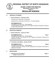
REGULAR AGENDA - Regional District of North Okanagan
REGULAR AGENDA - Regional District of North Okanagan
REGULAR AGENDA - Regional District of North Okanagan

Create successful ePaper yourself
Turn your PDF publications into a flip-book with our unique Google optimized e-Paper software.
REGIONAL DISTRICT OF NORTH OKANAGAN<br />
ELECTORAL AREA ADVISORY COMMITTEE MEETING<br />
Thursday, December 8, 2011<br />
10:30 am<br />
<strong>REGULAR</strong> <strong>AGENDA</strong><br />
A. APPROVAL OF <strong>AGENDA</strong><br />
1. Regular Agenda – December 8, 2011<br />
(Opportunity for Introduction <strong>of</strong> Late Items)<br />
(Opportunity for Introduction <strong>of</strong> Late Items – In Camera Agenda)<br />
RECOMMENDATION 1<br />
That the Agenda <strong>of</strong> the December 8, 2011 Electoral Area Advisory Committee<br />
meeting be approved as presented.<br />
B. ADOPTION OF MINUTES<br />
1. Electoral Area Advisory Committee – November 3, 2011<br />
RECOMMENDATION 2 Page 1<br />
That the minutes <strong>of</strong> the November 3, 2011 Electoral Area Advisory Committee<br />
Meeting be adopted as circulated.<br />
C. PETITIONS AND DELEGATIONS<br />
1. Waiver <strong>of</strong> Lot Frontage Application<br />
FORSLUND, Linda c/o J.R. Shortt<br />
(See item F.2)<br />
2. Waiver <strong>of</strong> Lot Frontage Application<br />
CULLEN, Glen and Carrie c/o Richard and Irene Montgomery<br />
(See item F.3)<br />
D. REPORTS<br />
1. Advisory Planning Commission Meetings<br />
RECOMMENDATION 3 Page 6<br />
That the minutes <strong>of</strong> the following Advisory Planning Commission meetings be<br />
received for information:<br />
a. Electoral Area "C" – Meeting <strong>of</strong> November 30, 2011 (to be distributed at<br />
meeting)<br />
b. Electoral Area "F" – Meeting <strong>of</strong> November 21, 2011<br />
2. Eagle Pass Heliskiing Referral
Electoral Area Advisory Committee<br />
Agenda – Regular - 2 - December 8, 2011<br />
[File No. 11-0614-E-REF]<br />
- Commercial Tenure Amendment and Management Plan dated October 6, 2011<br />
RECOMMENDATION 4 Page 9<br />
That the referral dated October 6, 2011 from Eagle Pass Heliskiing c/o Front Counter<br />
BC regarding the proposed Commercial Tenure Amendment and Management Plan<br />
be received for information.<br />
E. UNFINISHED BUSINESS<br />
F. NEW BUSINESS<br />
1. Bylaw 2485 - Electoral Areas "D" & "E" Official Community Plan<br />
- Staff report dated November 22, 2011<br />
RECOMMENDATION 5 Page 42<br />
That it be recommended to the Board <strong>of</strong> Directors that Electoral Areas “D” & “E”<br />
Official Community Plan Bylaw No. 2485, 2011 be amended to include the changes<br />
outlined in Attachment 2, “Referral Comments and Public Feedback” <strong>of</strong> the report<br />
dated November 22, 2011 from the Sustainability Coordinator; and further,<br />
That it be recommended that Electoral Areas “D” & “E” Official Community Plan<br />
Bylaw No. 2485, 2011 be given Second Reading, as amended, and referred to<br />
Public Hearing.<br />
2. Waiver <strong>of</strong> Lot Frontage Application<br />
FORSLUND, Linda c/o J.R. Shortt [File No. 11-0205-E-SUB]<br />
- Staff report dated November 16, 2011<br />
RECOMMENDATION 6 Page 168<br />
That the memorandum from the Planning Department dated November 16, 2011<br />
regarding Waiver <strong>of</strong> Lot Frontage Application for the property legally described as Lot<br />
3, Sec 27, Twp 45, ODYD, Plan KAP91514 and located at 1404 Highway 6, Electoral<br />
Area “E” be received for information; and further,<br />
DIRECTION REQUESTED<br />
The Electoral Area Advisory Committee is requested to choose one <strong>of</strong> the following<br />
options:<br />
That it be recommended to the Board <strong>of</strong> Directors that the 10% minimum lot frontage<br />
requirement <strong>of</strong> Section 803.7 <strong>of</strong> the <strong>Regional</strong> <strong>District</strong> <strong>of</strong> <strong>North</strong> <strong>Okanagan</strong> Zoning<br />
Bylaw No. 1888, 2003 BE WAIVED for the property legally described as Lot 3, Sec<br />
27, Twp 45, ODYD, Plan KAP91514 and located at 1404 Highway 6, Electoral Area<br />
“E” by reducing the lot frontage <strong>of</strong> proposed Lot A from 174.47 metres to 132.88<br />
metres as shown on the site plan attached to the Planning Department report dated<br />
November 16, 2011.<br />
Or
Electoral Area Advisory Committee<br />
Agenda – Regular - 3 - December 8, 2011<br />
That it be recommended to the Board <strong>of</strong> Directors that the 10% minimum frontage<br />
requirement <strong>of</strong> Section 803.7 <strong>of</strong> the RDNO Zoning Bylaw No. 1888, 2003 NOT BE<br />
WAIVED for the property legally described as Lot 3, Sec 27, Twp 45, ODYD, Plan<br />
KAP91514 and located at 1404 Highway 6, Electoral Area “E”.<br />
3. Waiver <strong>of</strong> Lot Frontage Application<br />
CULLEN, Glen and Carrie c/o Richard and Irene Montgomery<br />
[File No. 11-0613-F-WVR]<br />
- Staff report dated November 16, 2011<br />
RECOMMENDATION 7 Page 173<br />
That the memorandum from the Planning Department dated November 16, 2011<br />
regarding Waiver <strong>of</strong> Lot Frontage Application for the properties legally described as<br />
Lots 1 and 3, Sec 3, Twp 19, R9, W6M, KDYD, Plan KAP74661 and located at 227<br />
and 229 Glenmary Road, Electoral Area ‘F’ be received for information; and further,<br />
DIRECTION REQUESTED<br />
The Electoral Area Advisory Committee is requested to choose one <strong>of</strong> the following<br />
options:<br />
That it be recommended to the Board <strong>of</strong> Directors that the 10% minimum frontage<br />
requirement <strong>of</strong> Section 802.7 <strong>of</strong> the <strong>Regional</strong> <strong>District</strong> <strong>of</strong> <strong>North</strong> <strong>Okanagan</strong> Zoning<br />
Bylaw No. 1888, 2003 BE WAIVED for the properties legally described as Lots 1 and<br />
3, Sec 3, Twp 19, R9, W6M, KDYD, Plan KAP74661 and located at 227 and 229<br />
Glenmary Road, Electoral Area ‘F’ by reducing the lot frontage <strong>of</strong> proposed Lot 3<br />
from 170.7 metres to 23.3 metres and proposed Lot 1 from 94.07 metres to 84.32<br />
metres as shown on the site plan attached to the Planning Department report dated<br />
November 16, 2011.<br />
Or<br />
That it be recommended to the Board <strong>of</strong> Directors that the 10% minimum frontage<br />
requirement <strong>of</strong> Section 802.7 <strong>of</strong> the RDNO Zoning Bylaw No. 1888, 2003 NOT BE<br />
WAIVED for the properties legally described as Lots 1 and 3, Sec 3, Twp 19, R9,<br />
W6M, KDYD, Plan KAP74661 and located at 227 and 229 Glenmary Road, Electoral<br />
Area ‘F’.<br />
4. Agricultural Land Commission Application<br />
COOKE, Robert and Leslie [File No. 11-0472-F-ALR]<br />
- Staff report dated September 21, 2011<br />
RECOMMENDATION 8 Page 181<br />
That it be recommended to the Board <strong>of</strong> Directors that the application <strong>of</strong> Robert and<br />
Leslie Cooke under Section 21(2) <strong>of</strong> the Agricultural Land Commission Act to<br />
subdivide the property legally described as The NE ¼ <strong>of</strong> Sec 26, Twp 18, R8, W6M,<br />
KDYD, Except Plans 6432, B11041, 31145, H13556 and KAP45812, located at 69<br />
Ashton Cooke Road, Electoral Area ‘F’ not be authorized for submission to the<br />
Agricultural Land Commission pursuant to Section 25(3) <strong>of</strong> the Agricultural Land<br />
Commission Act.
Electoral Area Advisory Committee<br />
Agenda – Regular - 4 - December 8, 2011<br />
5. Agricultural Land Commission Application<br />
WIFFEN, Arlene [File No. 11-0507-C-ALR]<br />
- Staff report dated November 17, 2011<br />
RECOMMENDATION 9 Page 193<br />
That it be recommended to the Board <strong>of</strong> Directors that the application to deposit fill<br />
under Section 20(3) <strong>of</strong> the Agricultural Land Commission Act on the property legally<br />
described as Lot 16, Sec 36, Twp 9, ODYD, Plan 411 and located at 1788 Francis<br />
Street, Electoral Area ‘C’ be authorized for submission to the Agricultural Land<br />
Commission.<br />
6. Shuswap River Watershed Sustainability Plan<br />
- Staff report dated November 21, 2011<br />
RECOMMENDATION 10 Page 200<br />
That the report dated November 21, 2011 from the Sustainability Coordinator<br />
regarding the Shuswap River Watershed Sustainability Plan be received for<br />
information; and further,<br />
That it be recommended to the Board <strong>of</strong> Directors that the Shuswap River<br />
Watershed Sustainability Plan Preliminary Issue Identification Paper be endorsed to<br />
inform Phase II <strong>of</strong> the planning process.<br />
7. Building Department Review Project<br />
- Staff report dated November 28, 2011<br />
OPTIONS FOR CONSIDERATION Page 214<br />
The following are staff recommendations for resolution <strong>of</strong> the Building Department<br />
funding problem:<br />
1. That taxation be used to fund a portion <strong>of</strong> the Building Department budget to a<br />
maximum <strong>of</strong> $200,000 in 2012; and further,<br />
2. That a refundable surcharge be implemented as part <strong>of</strong> the fee schedule within<br />
the Building Bylaw; and further,<br />
3. That the Notice on Title fee be increased to reflect the full cost <strong>of</strong> the Notice on<br />
Title process and further,<br />
4. That the remainder <strong>of</strong> the recommendations from the Building Department<br />
Review Project Report dated April 27, 2011 be considered in 2012 for<br />
effectiveness and cost efficiency <strong>of</strong> the Building Department.
Electoral Area Advisory Committee<br />
Agenda – Regular - 5 - December 8, 2011<br />
8. Natural Resource Road Act<br />
- Letter dated October 26, 2011 from UBCM<br />
FOR DISCUSSION Page 221<br />
9. Illegal Dumping - Sugar Lake Campsite<br />
- Staff e-mail<br />
FOR DISCUSSION Page 224<br />
10. O’Keefe Ranch Watermain Extension<br />
RECOMMENDATION 11<br />
That the <strong>of</strong>fer <strong>of</strong> financial assistance towards the O’Keefe Ranch water connection<br />
fees ($1,500 from Electoral Area “B” discretionary fund and $1,000 from Electoral<br />
Area “C” discretionary fund) be withdrawn if O’Keefe Ranch has not met the<br />
outstanding conditions by January 31, 2012, namely:<br />
• Signing <strong>of</strong> the Greater Vernon Water Terms and Conditions; and<br />
• Securing the Easement in favour <strong>of</strong> Greater Vernon Water through private land.<br />
11. <strong>North</strong> <strong>Okanagan</strong> Jaws <strong>of</strong> Life Coordination Understanding<br />
- Staff report dated November 9, 2011<br />
RECOMMENDATION 12 Page 225<br />
That it be recommended to the Board <strong>of</strong> Directors that the Memorandum <strong>of</strong><br />
Understanding referred to as <strong>North</strong> <strong>Okanagan</strong> Jaws <strong>of</strong> Life Coordination<br />
Understanding be endorsed.<br />
12. Vernon / <strong>North</strong> <strong>Okanagan</strong> Safe Communities Unit<br />
- Report dated November 28, 2011<br />
- November 2011 SpeedWatch report<br />
- BlockWatch Program report dated November 28, 2011<br />
RECOMMENDATION 13 Page 228<br />
That the reports dated November 28, 2011 from the Vernon / <strong>North</strong> <strong>Okanagan</strong><br />
Detachment – Safe Communities Unit be received for information.<br />
G. IN CAMERA<br />
RECOMMENDATION 14<br />
That, pursuant to Section 92 <strong>of</strong> the Community Charter, the regular meeting <strong>of</strong> the<br />
Electoral Area Advisory Committee convene In Camera to deal with matters deemed<br />
closed to the public in accordance with Section 90(1)(e) <strong>of</strong> the Community Charter.
Electoral Area Advisory Committee<br />
Agenda – Regular - 6 - December 8, 2011<br />
H. REPORT FROM IN CAMERA<br />
I. ADJOURNMENT
EAAC - <strong>REGULAR</strong> <strong>AGENDA</strong><br />
December 8, 2011 - Item B.1<br />
REGIONAL DISTRICT OF NORTH OKANAGAN<br />
MINUTES <strong>of</strong> a <strong>REGULAR</strong> meeting <strong>of</strong> the ELECTORAL AREA ADVISORY COMMITTEE held<br />
in the Board Room at the <strong>Regional</strong> <strong>District</strong> Office on Thursday, November 3, 2011<br />
Members: Director R. Fairbairn Electoral Area "D" Chair<br />
Director E. Foisy Electoral Area "E" Vice Chair<br />
Director M. Gavinchuk Electoral Area "B"<br />
Director M. Macnabb Electoral Area “C”<br />
Alt. Director B. Cowan Electoral Area “F”<br />
Staff: L. Mellott General Manager, Electoral Area Administration<br />
G. Routley Deputy Planning Manager<br />
L. Frank Sustainability Coordinator / Planning Technologist<br />
(Temporary)<br />
L. Schrauwen Clerk, Electoral Area Administration / Human<br />
Resources (taking minutes)<br />
Others:<br />
Public<br />
CALL MEETING TO ORDER<br />
The Chair called the meeting to order at 10:30 a.m.<br />
APPROVAL OF <strong>AGENDA</strong><br />
Regular Agenda – November 3, 2011<br />
Moved and seconded by Directors Macnabb and Gavinchuk<br />
That the Agenda <strong>of</strong> the November 3, 2011 Electoral Area Advisory Committee meeting be<br />
approved as presented.<br />
CARRIED<br />
ADOPTION OF MINUTES<br />
Electoral Area Advisory Committee – October 6, 2011<br />
Moved and seconded by Directors Macnabb and Foisy<br />
That the minutes <strong>of</strong> the October 6, 2011 Electoral Area Advisory Committee Meeting be<br />
adopted as circulated.<br />
CARRIED<br />
PETITIONS AND DELEGATIONS<br />
Official Community Plan / Rezoning Application<br />
METCALFE, David and Deanna c/o Tim and Dawn Wierzbicki<br />
David and Deanna Metcalfe as well as Tim and Dawn Wierzbicki were present to answer<br />
possible questions.<br />
Page 1 <strong>of</strong> 232
EAAC - <strong>REGULAR</strong> <strong>AGENDA</strong><br />
December 8, 2011 - Item B.1<br />
Electoral Area Advisory Committee<br />
Minutes – Regular - 2 - November 3, 2011<br />
Development Permit Application<br />
SEMINUTIN, Valery and Tammy<br />
Valery Seminutin spoke in support <strong>of</strong> the application.<br />
Development Permit with Variance Application<br />
PURSER, Stephen and Yvonne<br />
No one was present to speak to this application.<br />
REPORTS<br />
Advisory Planning Commission Meetings<br />
Moved and seconded by Alternate Director Cowan and Director Foisy<br />
That the minutes <strong>of</strong> the following Advisory Planning Commission meetings be received for<br />
information:<br />
- Electoral Area "C" – Meeting <strong>of</strong> October 26, 2011<br />
- Electoral Area "F" – Meeting <strong>of</strong> October 17, 2011<br />
CARRIED<br />
Vernon / <strong>North</strong> <strong>Okanagan</strong> Safe Communities Unit<br />
Moved and seconded by Directors Macnabb and Gavinchuk<br />
That the report dated October 24, 2011 from the Vernon / <strong>North</strong> <strong>Okanagan</strong> Detachment – Safe<br />
Communities Unit be received for information.<br />
CARRIED<br />
The GM, Electoral Area Administration was requested to confirm with the Crime Prevention<br />
Coordinator as to the number <strong>of</strong> people in each electoral area who belong to a Blockwatch<br />
Program.<br />
NEW BUSINESS<br />
Bylaw 2484 – Kingfisher Local Area Plan<br />
Moved and seconded by Alternate Director Cowan and Director Macnabb<br />
That it be recommended to the Board <strong>of</strong> Directors that Bylaw No. 2484, 2011 being the<br />
Kingfisher Local Area Plan, be amended to include the changes outlined in Attachment 2,<br />
“Referral Comments and Public Feedback”; and further,<br />
That it be recommended that the Kingfisher Local Area Plan, Bylaw No. 2484, 2011 be given<br />
Second Reading, as amended and referred to Public Hearing; and further,<br />
That the Public Hearing be delegated to the Electoral Area Advisory Committee; and further,<br />
That staff be directed to set a date for the Public Hearing far enough in advance to ensure wide<br />
spread community notification.<br />
CARRIED<br />
Page 2 <strong>of</strong> 232
EAAC - <strong>REGULAR</strong> <strong>AGENDA</strong><br />
December 8, 2011 - Item B.1<br />
Electoral Area Advisory Committee<br />
Minutes – Regular - 3 - November 3, 2011<br />
Discussion ensued regarding seasonal residents and how their opinions are integrated into the<br />
Kingfisher Local Area Plan. It was noted that the Board <strong>of</strong> Directors receives input through the<br />
Public Hearing process. The Code <strong>of</strong> Conduct item in the Kingfisher Local Area Plan was<br />
discussed with regard to seasonal residents and tourists.<br />
Discussion took place regarding how the Kingfisher Local Area Plan integrates with other<br />
planning documents. It was noted that the Kingfisher Local Area Plan will be an appendix to the<br />
Electoral Area “F” Official Community Plan, and it was developed concurrent with the <strong>Regional</strong><br />
Growth Strategy.<br />
Official Community Plan / Rezoning Application<br />
METCALFE, David and Deanna c/o Tim and Dawn Wierzbicki [File No.10-0773-F-OR]<br />
Moved and seconded by Alternate Director Cowan and Director Macnabb<br />
That it be recommended to the Board <strong>of</strong> Directors that the application to amend the Electoral<br />
Area “F” Official Community Plan land use designation and the zoning <strong>of</strong> the properties legally<br />
described as Lot 1 & 2, Sec 15, Twp 20, R8, W6M, KDYD, Plan 35737, and located at 75 & 57<br />
Parsons Road, Electoral Area ‘F’ from Country Residential to Small Holdings be supported and<br />
staff be directed to prepare an Official Community Plan Amendment Bylaw for First Reading<br />
only; and further,<br />
That the applicant be required to hold a Public Information Meeting in accordance with the<br />
Public Information Meeting Guide, prior to consideration <strong>of</strong> bylaws for further readings.<br />
CARRIED<br />
Development Permit Application<br />
SEMINUTIN, Valery and Tammy [File No. 11-0433-C-DP]<br />
Moved and seconded by Directors Macnabb and Foisy<br />
That it be recommended to the Board <strong>of</strong> Directors that an exemption to Section 1701.3.b.ii <strong>of</strong><br />
the <strong>Regional</strong> <strong>District</strong> <strong>of</strong> <strong>North</strong> <strong>Okanagan</strong> Zoning Bylaw No. 1888, 2003 be approved for the<br />
property legally described as Lot B, Sec 35, Twp 9, ODYD, Plan 33375 and located at 915<br />
Pottery Road, Electoral Area ‘C’ to permit the floodplain setback <strong>of</strong> an accessory residential<br />
building to be reduced from 15 m to 10 m as shown on the site plan attached to the Planning<br />
Department Report dated October 12, 2011 and subject to a Section 219 Covenant being<br />
registered on the title <strong>of</strong> the subject property which saves harmless the <strong>Regional</strong> <strong>District</strong> from<br />
any damages that may be caused by flooding; and further,<br />
That a Development Permit be issued for the property legally described as Lot B, Sec 35, Twp<br />
9, ODYD, Plan 33375 and located at 915 Pottery Road, Electoral Area ‘C’ subject to:<br />
1. The dimensions and siting <strong>of</strong> the accessory residential building to be constructed on the<br />
land be in general accordance with the site plan attached to the Planning Department<br />
Report dated October 12, 2011;<br />
2. Land within 15 m <strong>of</strong> the natural boundary <strong>of</strong> Hog Gulch Creek must remain free <strong>of</strong><br />
development with the exception <strong>of</strong> fencing, works and plantings to control erosion, protect<br />
banks, protect fisheries or waterfowl habitat or otherwise preserve and enhance the creek<br />
and associated habitats and except as permitted under the Riparian Areas Regulation.<br />
CARRIED<br />
Page 3 <strong>of</strong> 232
EAAC - <strong>REGULAR</strong> <strong>AGENDA</strong><br />
December 8, 2011 - Item B.1<br />
Electoral Area Advisory Committee<br />
Minutes – Regular - 4 - November 3, 2011<br />
Development Permit with Variance Application<br />
PURSER, Stephen and Yvonne [File No. 11-0274-F-DP]<br />
Moved and seconded by Alternate Director Cowan and Director Gavinchuk<br />
That it be recommended to the Board <strong>of</strong> Directors that upon consideration <strong>of</strong> input from adjacent<br />
landowners, a Development Permit with Variance be issued for the property legally described as<br />
South 10 Chains <strong>of</strong> the Fractional W ½ <strong>of</strong> the SE ¼ <strong>of</strong> Sec 27, Twp 20, R8, W6M, KDYD,<br />
Except Plans 26399, H809, and KAP76653 and located at 8259 Highway 97A, Electoral Area<br />
“F” to vary Sections 1101.2.e and 1201.6.d <strong>of</strong> the <strong>Regional</strong> <strong>District</strong> <strong>of</strong> <strong>North</strong> <strong>Okanagan</strong> Zoning<br />
Bylaw No. 1888, 2003 by waiving the requirement to pave a commercial parking and loading<br />
area subject to the following conditions:<br />
1. The dimensions and siting <strong>of</strong> buildings on the land be in general accordance with the site<br />
plan and building elevations attached to and forming part <strong>of</strong> Planning Department<br />
Information Report dated September 21, 2011;<br />
2. No natural vegetation shall be removed or degraded within a horizontal distance <strong>of</strong> 15 m<br />
from the natural boundary <strong>of</strong> Rogers Creek nor shall any development occur which will<br />
preclude growth <strong>of</strong> natural vegetation except in accordance with the written permission <strong>of</strong><br />
Fisheries and Oceans Canada and the Ministry <strong>of</strong> Environment;<br />
3. No building or structure or any part there<strong>of</strong>, including any fixed equipment may be<br />
constructed, reconstructed, moved, extended or located, nor should any landfill, land<br />
clearing or other disturbance take place within a horizontal distance <strong>of</strong> 15 metres from the<br />
natural boundary <strong>of</strong> Rogers Creek;<br />
4. Any clearing and/or excavation or fill done on the subject property should be completed in<br />
such a manner as to ensure that sediment, concrete washwater, leachates or any other<br />
substance <strong>of</strong> any type that may be deleterious to aquatic life should not be deposited into<br />
Rogers Creek and/or adjacent flood channels via ditches, storm sewers or overland flow,<br />
and all construction and excavation wastes, overburden, soil or any other substances that<br />
may be deleterious to aquatic life should be disposed <strong>of</strong> or placed in such a manner as to<br />
prevent their entry into Rogers Creek;<br />
5. A means <strong>of</strong> sewage disposal that does not discharge directly into Rogers Creek must be<br />
installed. The applicant must provide evidence that the filings required by the Sewerage<br />
System Regulation under the Health Act have been made, or that a holding tank permit has<br />
been issued, or that treated sewage effluent will be disposed <strong>of</strong> in accordance with the<br />
Environmental Management Act;<br />
6. A storm water management plan must be prepared by a pr<strong>of</strong>essional engineer to provide for<br />
the control <strong>of</strong> run-<strong>of</strong>f from any parking areas, internal roadways, and buildings during and<br />
after the period <strong>of</strong> construction <strong>of</strong> any buildings. Storm water outlet facilities should not be<br />
installed directly into Rogers Creek or into a tributary watercourse, drainage ditch or gully<br />
except where a stormwater renovation system is being implemented. Storm water<br />
management systems should be consistent with the "Land Development Guidelines for the<br />
Protection <strong>of</strong> Aquatic Habitats" (Ministry <strong>of</strong> Water, Land and Air Protection and Department<br />
<strong>of</strong> Fisheries and Oceans, 1992), and may require approval by the Department <strong>of</strong> Fisheries<br />
and Oceans and/or the Ministry <strong>of</strong> Environment. The storm water management plan should<br />
also be consistent with the document titled Stormwater Planning: A Guide for BC;<br />
7. The driveway, parking and loading area shall be graded to provide an even surface, be<br />
drained so that no surface water accumulates thereon or runs <strong>of</strong>f onto any sidewalk, or runs<br />
<strong>of</strong>f onto any highway and that the surface shall be kept free <strong>of</strong> weeds, and shall be<br />
gravelled, treated to suppress dust and have access to and from highways as approved by<br />
the Ministry <strong>of</strong> Transportation and Infrastructure where applicable.<br />
CARRIED<br />
Page 4 <strong>of</strong> 232
EAAC - <strong>REGULAR</strong> <strong>AGENDA</strong><br />
December 8, 2011 - Item B.1<br />
Electoral Area Advisory Committee<br />
Minutes – Regular - 5 - November 3, 2011<br />
IN CAMERA<br />
Moved and seconded by Directors Macnabb and Gavinchuk<br />
That, pursuant to Section 92 <strong>of</strong> the Community Charter, the regular meeting <strong>of</strong> the Electoral<br />
Area Advisory Committee convene In Camera to deal with matters deemed closed to the public<br />
in accordance with Section 90(1)(f) <strong>of</strong> the Community Charter.<br />
The regular meeting <strong>of</strong> the Electoral Area Advisory Committee adjourned to meet In Camera at<br />
11:11 p.m.<br />
The regular meeting <strong>of</strong> the Electoral Area Advisory Committee reconvened at 11:42 a.m.<br />
ADJOURNMENT<br />
There being no further business the meeting was adjourned at 11:51 a.m.<br />
Certified Correct:<br />
Chair<br />
Corporate Officer<br />
Page 5 <strong>of</strong> 232
1<br />
EAAC - <strong>REGULAR</strong> <strong>AGENDA</strong><br />
December 8, 2011 - Item D.1<br />
REGIONAL DISTRICT OF NORTH OKANAGAN<br />
MINUTES <strong>of</strong> the <strong>REGULAR</strong> meeting <strong>of</strong> the Advisory Planning Commission<br />
Electoral Area ‘F’ held in the Board Room at the Enderby Fire Hall on<br />
MONDAY, November 21, 2011.<br />
MEMBERS:<br />
Keith Gray, Chairperson<br />
Dale Fennell, Vice Chairperson<br />
Bob Honeyman<br />
Diane Larsen<br />
Tilman Nahm<br />
Robert Whitley<br />
Herman Halvorson, Director<br />
OTHERS PRESENT: Gail Murphy, Recording Secretary<br />
GUESTS: Jackie Pearase, Incoming Director, Leslie & Robert Cooke<br />
Keith Gray, Chairperson, called the meeting to order at 6:56 PM.<br />
A. ADOPTION OF MINUTES:<br />
Moved by Tilman Nahm<br />
Seconded by Dale Fennell<br />
“That the Minutes <strong>of</strong> the October 17, 2011 regular meeting <strong>of</strong> the Advisory<br />
Planning Commission Electoral Area “F” APC be adopted as circulated.”<br />
CARRIED<br />
Moved by Bob Honeyman<br />
Seconded by Diane Larsen<br />
“That the agenda order be changed from D New Business to C and C Unfinished<br />
Business to D.”<br />
CARRIED<br />
Keith Gray led the Introduction <strong>of</strong> the APC Committee and Guests to each other.<br />
B. PETITION AND DELEGATIONS:<br />
1. Agricultural Land Commission Application<br />
R. & L. Cooke<br />
(File No. 11-0472-F-ALR<br />
PETITION:<br />
a. Robert Cooke is asking to have 5 acres taken <strong>of</strong>f <strong>of</strong> the 62 acres.<br />
b. The land has been in the family name since 1902 but due to illness <strong>of</strong><br />
his wife, the property has become too much for them so they want to<br />
subdivide the 5 acres to build a house and <strong>of</strong>fer their children to buy the<br />
rest <strong>of</strong> the farm.<br />
c. The land that is proposed for subdivision is divided by a swampy area,<br />
gravel pit and hillside with the possibility <strong>of</strong> 1 to 2 ½ acres <strong>of</strong> the 5<br />
acres could be farm land.<br />
Page 6 <strong>of</strong> 232<br />
1
2<br />
EAAC - <strong>REGULAR</strong> <strong>AGENDA</strong><br />
December 8, 2011 - Item D.1<br />
C. NEW BUSINESS:<br />
1. Agricultural Land Commission Application<br />
R. & L. Cooke<br />
(File No. 11-0472-F-ALR<br />
Moved by Dale Fennell<br />
Seconded by Tilman Nahm<br />
“That the APC accept the recommendations <strong>of</strong> Development Services to not be<br />
authorized for submission to the Agricultural Land Commission pursuant to<br />
Section 25(3) <strong>of</strong> the Agricultural Land Commission Act.”<br />
Discussion:<br />
a. Dale stated he has concerns for the water from the Edwin Stream as he<br />
has water rights on it along with three others. Dale stated the Creek has<br />
never dried up but the volume <strong>of</strong> the creek has diminished somewhat in<br />
the last two years. He is concerned with any further development on the<br />
property that might occur in that swampy area as it could impact the flow <strong>of</strong><br />
the stream. Page 9 (5) addresses the stream and the water licenses along<br />
with concerns and guidelines. Page 7, under planning stated that a portion<br />
was subdivided (KAP45812) from the subject property (H13550 – NE1/4)<br />
in 1991. Dale says the water is critical to the adjacent properties with water<br />
licenses from Edwin stream.<br />
b. Tilman Nahm viewed the property and is concerned with the possibility <strong>of</strong><br />
septic pollution entering that water course.<br />
CARRIED<br />
D. Unfinished Business<br />
1. Rezoning/OCP Amendment Application<br />
T. & J. ZUMMAC<br />
(File No. 09-0489-F-OR)<br />
- Bylaw 2425<br />
- Bylaw 2426<br />
After some discussion, while waiting for a telephone conference from Planning it<br />
was:<br />
Moved by Tilman Nahm<br />
Seconded by Dale Fennell<br />
“That the APC table this application to a later date for further information from the<br />
Planning Department by speaker phone or a personal visit.”<br />
E. ADJOURNMENT:<br />
“There being no further business, the meeting adjourned at 7:55 P.M.”<br />
Next Area “F” APC meeting will be held on December 19, 2011 in the Fire Hall.<br />
Page 7 <strong>of</strong> 232<br />
2
3<br />
Certified Correct:<br />
EAAC - <strong>REGULAR</strong> <strong>AGENDA</strong><br />
December 8, 2011 - Item D.1<br />
_______________________________<br />
Chair<br />
__________________________<br />
Secretary<br />
Page 8 <strong>of</strong> 232<br />
3
EAAC - <strong>REGULAR</strong> <strong>AGENDA</strong><br />
December 8, 2011 - Item D.2<br />
Eagle Pass Heliskiing<br />
Commercial Tenure Amendment<br />
And<br />
Management Plan<br />
October 2011<br />
EPH Tenure Amendment Application Management Plan – October 6, 2011<br />
Page | 1<br />
Page 9 <strong>of</strong> 232
EAAC - <strong>REGULAR</strong> <strong>AGENDA</strong><br />
December 8, 2011 - Item D.2<br />
General Overview <strong>of</strong> Business<br />
o Eagle Pass Heliskiing current operating tenure is 102 km long running<br />
north and south along the western side <strong>of</strong> the Monashee Mountains.<br />
Revelstoke is situated in approximately the mid point <strong>of</strong> the tenure. Our<br />
main base <strong>of</strong> operation is 20 km south <strong>of</strong> Revelstoke at Mulvehill Creek<br />
Wilderness Lodge. We also operate out <strong>of</strong> Silver Star Mountain Resort,<br />
and Sparkling Hill Wellness Hotel both just outside <strong>of</strong> Vernon, B.C. This<br />
will be our first winter operating our regular program from Echo Bay<br />
Lodge.<br />
o We <strong>of</strong>fer lodge based, small group Heliskiing to our clients which<br />
specializes in a personalized boutique ski vacations that skiers can enjoy<br />
from around the world.<br />
o Eagle Pass Heliskiing has relocated it’s main lodge in part due to a loss in<br />
overlap tenure with CMH and is looking to secure poor weather skiing<br />
close to Echo Bay Lodge at Mulvehill Creek Lodge<br />
Objective <strong>of</strong> Tenure Amendment Application<br />
The objective <strong>of</strong> this application is to apply for the additional areas outlined in red on the<br />
overview map to augment and improve Eagle Pass’s current operation. This is required<br />
due to relocation <strong>of</strong> the base lodge and expansion <strong>of</strong> the operation. Another part <strong>of</strong> the<br />
<strong>of</strong> the expansion is a result <strong>of</strong> new partnerships with nearby resorts; Silver Star<br />
Mountain Resort and Sparkling Hill Resort nearby Vernon, B.C. The areas include:<br />
o Begbie Polygon: approx 5 km west <strong>of</strong> Revelstoke<br />
o South Cranberry Polygon: approx 30 km SW <strong>of</strong> Revelstoke near the weat<br />
shore <strong>of</strong> Upper Arrow Lake<br />
o Vidler Polygon: Due east <strong>of</strong> Cherryville and Sugar Lake<br />
o Mabel Shoulder Polygon: east <strong>of</strong> Kingfisher on N side <strong>of</strong> Tsuis Creek<br />
o Simard Creek Polygon: east <strong>of</strong> Kingfisher on S side <strong>of</strong> Tsuis Creek<br />
o Nelson Polygon: between Mabel Lake and the Shuswap Lake<br />
o Silver Star Polygon: NE <strong>of</strong> Silver Star Mountain Resort<br />
o Bews Polygon: between Anstey Arm and Lake Revelstoke in Perry River<br />
drainage<br />
o Griffin Polygin: west <strong>of</strong> 3 Valley Gap and adjoins existing EPH poylgons to<br />
the east and west. To the SE it borders Mt Griffin Park.<br />
Key Areas <strong>of</strong> Concern<br />
o Key areas <strong>of</strong> concern include environmental values, public and<br />
commercial interests in the proposed areas. Red and blue listed species<br />
and EPH’s potential impacts on them are <strong>of</strong> particular concern. EPH has<br />
an existing environmental management plan that should address the<br />
majority <strong>of</strong> the environmental issues.<br />
EPH Tenure Amendment Application Management Plan – October 6, 2011<br />
Page | 2<br />
Page 10 <strong>of</strong> 232
EAAC - <strong>REGULAR</strong> <strong>AGENDA</strong><br />
December 8, 2011 - Item D.2<br />
Section 1: Description <strong>of</strong> the Operation & Activities Offered<br />
1.1 General Description <strong>of</strong> Operation<br />
1.1.1 General Area<br />
Our operating tenure is in the <strong>North</strong> Central Monashee Mountains north and south <strong>of</strong><br />
the Trans Canada Highway between Revelstoke and Sicamous. It is on the west side <strong>of</strong><br />
the height <strong>of</strong> land <strong>of</strong> the Monashee Range. It encompasses approximately 101,400<br />
hectares.<br />
Two new proposed polygons (Begbie and South Cranberry) are west and south <strong>of</strong><br />
Revelstoke and drain into the Columbia River watershed. These two polygons are in<br />
close proximity to our new lodge located 18 km south <strong>of</strong> Revelstoke, which will serve as<br />
necessary poor weather skiing.<br />
More polygons are in between Silver Star Mountain Resort and our existing tenure to<br />
provide jump runs enroute from Silver Star Mountain or Sparkling Hill Resort near<br />
Vernon, B.C.<br />
1.1.2 Base Operation<br />
Base Operation<br />
Mulvehill Creek Wilderness Lodge, Revelstoke, B.C.<br />
o Regular ski program with 3 groups using A-star<br />
o Day ski program from Revelstoke, 3 groups in A-Star<br />
o Total skier day potential 1800<br />
Mulvehill Creek Wilderness Lodge is ideally situated for operating in the south and mid<br />
parts <strong>of</strong> EPH current tenure. It is located 18 km south <strong>of</strong> Revelstoke <strong>of</strong>f <strong>of</strong> hwy #23 and<br />
along the shores <strong>of</strong> the Columbia River. From here, we will also be able to shuttle<br />
guests west on Hwy 1 or towards Mica Dam in order to access the northern tenure<br />
area. Mulvehill Creek Lodge is using 100% micro hydro energy.<br />
Other Lodging<br />
Sparkling Hill Wellness Hotel, Vernon B.C.<br />
o Private Ski Lodge<br />
o Exclusive private ski program using Bell 407 (guide and tail guide)<br />
o Total skier day potential 280-540<br />
Sparkling Hill Resort is located 18 km south <strong>of</strong> Vernon, B.C. <strong>of</strong>f hwy #97.<br />
EPH Tenure Amendment Application Management Plan – October 6, 2011<br />
Page | 3<br />
Page 11 <strong>of</strong> 232
EAAC - <strong>REGULAR</strong> <strong>AGENDA</strong><br />
December 8, 2011 - Item D.2<br />
Silver Star Mountain Resort, Vernon B.C.<br />
o Day ski semi private program<br />
o Private and semi private program using B2 A-Star<br />
o Total skier day potential 280-540<br />
Eagle Pass Heliskiing is commencing day ski operations from Silver Star Mountain<br />
Resort this December. Silver Star Mountain Resort is located 36 km to the southwest <strong>of</strong><br />
EPH southern tenure boundary which is along the NE side <strong>of</strong> Mabel Lake.<br />
1.1.3 Improvements<br />
o 2 new Enviro Tanks for remote fuel caches<br />
1.1.4 Access<br />
1.1.5 Staff<br />
o Most guests skiing with Eagle Pass Heliskiing fly to and from Kelowna<br />
International Airport and use ground shuttle or heli transfer to the<br />
respective lodges – all located on private land. Ground transfer is 2.5<br />
hours using highway 97 N and then on the TransCanada to Revelstoke. If<br />
there are highway closures, the ground shuttle will be through highway 6<br />
in Vernon to Nakusp and then north to Revelstoke. EPH does <strong>of</strong>fer heli<br />
transfer direct from Kelowna International Airport.<br />
Staff Category # <strong>of</strong> Employees Experience and/or Certificates<br />
Lead Guide 6 UIAGM/ACMG Full Certificate or<br />
Equivalent<br />
Guide 8 ACMG/CSGA assistant<br />
Office<br />
2 full time/ 1 part<br />
Lodge Staff 10-12 N/A<br />
Total Staff<br />
28 full time<br />
winter<br />
6 year round<br />
EPH Tenure Amendment Application Management Plan – October 6, 2011<br />
Page | 4<br />
Page 12 <strong>of</strong> 232
EAAC - <strong>REGULAR</strong> <strong>AGENDA</strong><br />
December 8, 2011 - Item D.2<br />
1.2 Commercial Recreation Activities Offered On Crown Land<br />
1.2.1 Description <strong>of</strong> Experience Being Offered<br />
o Eagle Pass Heliskiing <strong>of</strong>fers small group Heliskiing utilizing either a<br />
Eurocopter B2 A-Star or a Bell 407, both small powerful machines which<br />
fit 4 and 5 guests plus guide and pilot.<br />
o Dec 15- April 15 Season<br />
o Multi Group lodge based packages from Mulvehill Creek Wilderness<br />
Lodge<br />
o Exclusive Private and Semi Private ski vacations from Sparkling Hill<br />
Wellness Hotel<br />
o Day skiing program from Silver Star Mountain Resort<br />
o Future plans <strong>of</strong> some form <strong>of</strong> ground transfer back up skiing during poor<br />
weather<br />
1.2.2 Detailed Listing <strong>of</strong> Activities & Level <strong>of</strong> Use<br />
o EPH is currently operating as a mechanized heliski operator and we also<br />
<strong>of</strong>fer heli-assisted ski touring. All packages and ski product will be lodge<br />
based from Mulvehill Creek Lodge and Sparkling Hill Resort, or day skiing<br />
complimented from the community <strong>of</strong> Revelstoke and Silver Star Mountain<br />
Resort and surrounding area.<br />
o EPH is in the process <strong>of</strong> researching suitable areas for cat ski back up<br />
within its operating area which may commence in the 2013 or 2014 winter<br />
season. This area will be used only when flying is not and option. We<br />
anticipate that further conversations with agencies, stakeholders, and First<br />
Nations would be required to achieve approval <strong>of</strong> backup winter<br />
recreation.<br />
EPH Tenure Amendment Application Management Plan – October 6, 2011<br />
Page | 5<br />
Page 13 <strong>of</strong> 232
Year Full<br />
Capacity<br />
is<br />
reached<br />
EAAC - <strong>REGULAR</strong> <strong>AGENDA</strong><br />
December 8, 2011 - Item D.2<br />
Extensive<br />
Area Map<br />
Reference<br />
Activity<br />
/Activitie<br />
s<br />
Specific<br />
References<br />
on Map<br />
Table 1.1 Extensive Areas <strong>of</strong> Use<br />
Activity Report Client Days<br />
Frequency<br />
<strong>of</strong> Use<br />
Period <strong>of</strong><br />
use<br />
Existing or<br />
Proposed<br />
Use<br />
Current<br />
Year<br />
Next<br />
Year<br />
Year 3 Full<br />
Capacity<br />
Begbie Heliskiing W <strong>of</strong><br />
Revelstoke<br />
Extensive Dec 15-<br />
Apr 15<br />
20-30 times<br />
per year<br />
0 100 100 150 2014<br />
Cranberry Heliskiing S <strong>of</strong> Mulvehill Extensive Dec 15-<br />
Apr 15<br />
30-40 times<br />
per year<br />
0 150 200 250 2014<br />
Page 14 <strong>of</strong> 232<br />
Vidler Helskiing E <strong>of</strong> Vernon Intensive Dec 15-<br />
Apr 15<br />
Simard<br />
Creek<br />
Silver<br />
Star<br />
Heliskiing E <strong>of</strong> Mabel Occasional Dec 15-<br />
Apr 15<br />
Heliskiing N <strong>of</strong> Silver<br />
Star<br />
Occasional Dec 15-<br />
Apr 15<br />
15 times per<br />
year<br />
5-10 times<br />
per year<br />
5-10 times<br />
per year<br />
0 80 150 250 2015<br />
0 25 25 25 2012<br />
0 25 25 50 2015<br />
Nelson Heliskiing E <strong>of</strong> Mabel Occasional Dec 15-<br />
Apr 15<br />
1-5 times per<br />
year<br />
0 36 36 150 2015<br />
Mabel<br />
Shoulder<br />
Heliskiing E <strong>of</strong> Mabel Occasional Dec 15-<br />
Apr 15<br />
5-10 times<br />
per year<br />
0 25 25 25 2012<br />
Griffin Heliskiing W <strong>of</strong> Griffin<br />
Lake<br />
Occasional Dec 15-<br />
Apr 15<br />
5-10 times<br />
per year<br />
0 25 25 25 2012<br />
Bews Helisking Perry River Occasional Dec 15-<br />
Apr 15<br />
5-10 times<br />
per year<br />
0 25 25 25 2012<br />
EPH Tenure Amendment Application Management Plan – October 6, 2011<br />
6
EAAC - <strong>REGULAR</strong> <strong>AGENDA</strong><br />
December 8, 2011 - Item D.2<br />
1.2.1.4 Notes and Descriptors for Proposed Polygons<br />
Begbie Creek Polygon (extensive use site)<br />
Begbie Creek polygon is located 5 km directly west <strong>of</strong> the town <strong>of</strong> Revelstoke and 11<br />
km north <strong>of</strong> Mulvehill Creek Wilderness Lodge. It encompasses the Begbie Creek<br />
drainage. It is bordered by CMH south near Mt Begbie, and to the north on Mt<br />
Macpherson. To the west, the zone borders on English Lake Park. This zone adjoins<br />
our existing tenure south <strong>of</strong> HWY #1 by 3 Valley Gap.<br />
Bioclimatic zones consist <strong>of</strong> Interior Cedar Hemlock (ICH) in the valley, Engelmann<br />
Spruce/Subalpine Fir (ESSF) and Alpine Tundra (AT) in the upper elevations. Skiing will<br />
occur between the elevations <strong>of</strong> 1100 and 2500 M. This zone is in close proximity to our<br />
main lodge and will provide good jump runs to our existing tenure area and good home<br />
runs. The skiing in this zone can be classified as low to moderate poor weather skiing at<br />
the lower elevations, and mod-high hazard good weather skiing in the higher<br />
elevations. The area will also allow for safe exit to main lodge in poor weather.<br />
21 Ha <strong>of</strong> this zone has been identified as UWR u-8-005 (Mountain Goat). 37 Ha <strong>of</strong> this<br />
zone has been identified as UWR u-8-004 (Caribou) but does not fall under the<br />
Mountain Caribou Section 16 Map Reserve.<br />
South Cranberry Creek Polygon (extensive use site)<br />
South Cranberry Creek polygon lies west <strong>of</strong> the Columbia River on the northern east<br />
facing half <strong>of</strong> Hall Mountain, and to the west <strong>of</strong> Coursier Lake, directly north and west <strong>of</strong><br />
Pingston Lake and adjoins directly into our existing Gates Creek Zone. CMH Kootenay<br />
borders to the south and northwest <strong>of</strong> this zone. Great Canadian Snowmobile tours<br />
operate on and around Hall Mountain.<br />
Bioclimatic zones consist <strong>of</strong> ICH, ESSF and AT. Skiing will occur between 800 M and<br />
2500 M. The northeast aspect <strong>of</strong> Hall Mtn will provide good poor weather skiing as it<br />
has numerous low elevation cut blocks. The area to the south and east <strong>of</strong> Coursier lake<br />
is characterized by open and sparsely treed skiing near the tops <strong>of</strong> the runs, and<br />
excellent tree and cut block skiing below. Runs are in close proximity to each other and<br />
provide numerous aspects to ski, and provide safe exit to main valley and lodge in poor<br />
weather. EPH and CMH are currently working on a flight safety plan to ensure safe<br />
travel through existing and proposed terrain.<br />
26 Ha <strong>of</strong> this zone has been identified as UWR u-4-001 (Moose). Mountain Caribou<br />
Section 16 Map Reserve borders south <strong>of</strong> this zone along the top <strong>of</strong> Hall Peak and to<br />
the northwest <strong>of</strong> Coursier Lake on this proposed zone.<br />
EPH Tenure Amendment Application Management Plan – October 6, 2011<br />
7<br />
Page 15 <strong>of</strong> 232
EAAC - <strong>REGULAR</strong> <strong>AGENDA</strong><br />
December 8, 2011 - Item D.2<br />
Vidler Polygon (intensive use site)<br />
Vidler polygon lies directly east <strong>of</strong> Cherryville and is bordered by Halycon Heliskiing to<br />
the north, CMH Kootenay to the west, and Keefer Lake adventures to the south. Vidler<br />
zone lies south <strong>of</strong> Vidler Creek, east <strong>of</strong> Mosquito Lake, and north <strong>of</strong> Mt Beavon.<br />
Bioclimatic zones consist <strong>of</strong> ICH and ESSF. The area has been heavily logged and<br />
would be the southern boundary <strong>of</strong> EPH. It will provide very good poor weather skiing<br />
for heliskiing from EPH’s bases <strong>of</strong> Silver Star Mountain Resort and Sparkling Hill Resort<br />
which is 30 km away. Skiing will occur between 800 M and 2200 M. Tops <strong>of</strong> runs are<br />
sparsely treed and most runs end up in cut blocks near the valley bottoms. South facing<br />
runs will <strong>of</strong>fer great early to mid season tree skiing.<br />
EPH is currently entering a joint venture agreement with Keefer Lake Adventures to<br />
provide mechanized guiding service and expertise for their cat and heliski program.<br />
This polygon will tie into their existing tenure and EPH will look at drawing up a Joint<br />
Use agreement (JUA) with Keefer Lake in the future which has plans <strong>of</strong> <strong>of</strong>fering both<br />
cat and heliski operations.<br />
Most <strong>of</strong> this proposed zone has been identified as UWR u-4-001, u-8-006 (Moose), and<br />
u-8-001 (Mule Deer).<br />
The following polygons are in between existing EPH operating Tenure and both<br />
Silver Star Mountain and Sparkling Hill Resort. These areas have been selected<br />
as jump in runs for multi group heliski programs and for jump in runs for private<br />
and semi private groups heading deeper into the bigger mountains. Most <strong>of</strong> these<br />
areas top out at 2000 M with skiing down to a minimum <strong>of</strong> 800 M.<br />
Mabel Shoulder Zone<br />
Mabel Shoulder zone lies directly east <strong>of</strong> Mabel Lake and north <strong>of</strong> Tsuis Creek. It ties<br />
into our existing tenure in the Mabel Zone. The border goes down to near lake level in<br />
consideration <strong>of</strong> a future lodge site.<br />
Bioclimatic zones consist <strong>of</strong> ICH near valley bottom and ESSF to the ridge tops. Skiing<br />
elevation will be from 800 M to 2000 M with numerous poor weather cut block skiing on<br />
the south aspect facing Tsuis Creek. This area can be characterized by low hazard<br />
poor weathers skiing<br />
Most <strong>of</strong> this zone has been identified as UWR u-8-006 (Moose), and u-8-001 (Mule<br />
Deer).<br />
EPH Tenure Amendment Application Management Plan – October 6, 2011<br />
8<br />
Page 16 <strong>of</strong> 232
EAAC - <strong>REGULAR</strong> <strong>AGENDA</strong><br />
December 8, 2011 - Item D.2<br />
Simard Creek Polygon<br />
Simard Creek Zone lies directly east <strong>of</strong> Mabel Lake and south <strong>of</strong> Tsuis Creek. It ties<br />
into our existing tenure in the Mabel Zone.<br />
Bioclimatic zones consist <strong>of</strong> ICH near valley bottom and ESSF to the ridgetops. Skiing<br />
elevations will be from 800 M to 1900 M and will consist primarily <strong>of</strong> NW facing poor<br />
weather cut block skiing.<br />
Silver Star Polygon<br />
Silver Star zone lies due northeast from Silver Star Mountain Resort and Silver Star<br />
Provincial Park. To the east is Trinity valley and to the west is a high plateau which is<br />
used by recreational snowmobilers.<br />
Bioclimatic zones consist <strong>of</strong> ESSF and elevation ranges are between 800 M to 1500 M.<br />
This area will be for poor weather skiing from Silver Star Mountain Resort using NE<br />
facing cutblocks.<br />
Nelson Polygon<br />
Nelson polygon lies east <strong>of</strong> Mt Nelson, directly west <strong>of</strong> Monashee Park where it<br />
intersects with the Sushwap River. Recreational Snowmobiling is popular to the west <strong>of</strong><br />
the polygon on Mt Nelson and towards Mount Mandela and Park Mtn to the south. This<br />
area serves as a jump run for skiing into Gates Creek from Silver Star Mountain.<br />
Bioclimatic zones consist <strong>of</strong> ESSF. Skiing elevations will be 1100 M to 2100 M and is<br />
primarly north east and east facing. Open trees at the top into cut blocks for pickups.<br />
This area is characterized as low hazard poor weather skiing.<br />
Bews Polygon<br />
Bews Polygon lies at the headwaters <strong>of</strong> Bews Creek and is a small sliver <strong>of</strong> untenured<br />
terrain that ties into our existing high use alpine area. The terrain is a cirque which our<br />
terrain currently uses half <strong>of</strong>. The height <strong>of</strong> land to the east forms the boundary for CMH<br />
Revelstoke. This extension <strong>of</strong> our Bews zone will allow us to ski the entire alpine bowl<br />
feature to our existing pickup.<br />
Bioclimatic zones are AT with elevation ranges from 1600 M to 2500 M and will consist<br />
<strong>of</strong> low to moderate hazard good weather skiing.<br />
A small section <strong>of</strong> this zone has been identified as UWR u-8-005 (Goat)<br />
EPH Tenure Amendment Application Management Plan – October 6, 2011<br />
9<br />
Page 17 <strong>of</strong> 232
EAAC - <strong>REGULAR</strong> <strong>AGENDA</strong><br />
December 8, 2011 - Item D.2<br />
Griffin Polygon<br />
Griffin Polygon is located 10 km west <strong>of</strong> 3 Valley Gap and adjoins existing EPH<br />
poylgons to the east and west. To the SE it borders Mt Griffin Park.<br />
Bioclimatic zones in this polygon consist <strong>of</strong> AT, ESSF and ICH. Skiing will occur<br />
between 1900 m and 1000 m. This area can be characterized by a series <strong>of</strong> N and NE<br />
facing ridges <strong>of</strong>fering good poor weather tree skiing, and jump runs between the<br />
existing polygons to the east and west.<br />
1.4 Intensive Use Sites<br />
Fuel Cache Site<br />
o #2 located 50 38’56.6” N 118 21’27.6” W 830 M<br />
Note: This fuel cache will play an integral role in supplying fuel to all ski programs<br />
working in the southern tenure area. On the safety side, should groups get caught on<br />
the western divide <strong>of</strong> the Monashees and not be able to get back through either<br />
Lindmark or Gates Creek back into the Columbia. The helicopter may have to follow the<br />
Shuswap valley south to Cherryville and then back towards Wap Creek. For this<br />
reason, a fuel cache will be necessary at this location and will have the following:<br />
o Overnight kit<br />
o Avalanche Rescue Gear<br />
o Rope Rescue Kit<br />
o Toboggan<br />
Fuel cache will be an Enviro tank complete with berm, spill kit and all emergency shut<br />
<strong>of</strong>f valves. This cache will likely stay in place permanently and be available for use by<br />
forestry during fire season if requested.<br />
Radio Repeater Site<br />
o A new Radio Repeater site to be place somewhere in the western side <strong>of</strong><br />
the Monashee Mountains that has the ability to use Mt English Repeater<br />
to access Mulvehill Creek Lodge and Sparkling Hill Resort and Silver Star<br />
Mountain Resort. This location is T.B.D.<br />
o All radio monitoring and tracking will be done from our main dispatch at<br />
Echo Bay Lodge (Mulvehill)<br />
EPH Tenure Amendment Application Management Plan – October 6, 2011<br />
10<br />
Page 18 <strong>of</strong> 232
Distance to<br />
Environ.<br />
Sensitive<br />
Area<br />
200 M<br />
#2 Fuel Cache 30-40 days 1 daily yes N/A/ Logging Landing 400 M<br />
EAAC - <strong>REGULAR</strong> <strong>AGENDA</strong><br />
December 8, 2011 - Item D.2<br />
Table 1.2 Details <strong>of</strong> Intensive Use Sites<br />
Intensiv<br />
e Use<br />
Map<br />
Referen<br />
ce<br />
Intended<br />
Use<br />
Frequency<br />
<strong>of</strong> Use<br />
Period<br />
<strong>of</strong> use<br />
Desired<br />
Exclusivity<br />
Existing or<br />
Proposed<br />
improvements<br />
Environmentall<br />
y Sensitive Area<br />
Page 19 <strong>of</strong> 232<br />
EPH Tenure Amendment Application Management Plan – October 6, 2011<br />
11
EAAC - <strong>REGULAR</strong> <strong>AGENDA</strong><br />
December 8, 2011 - Item D.2<br />
Section 2: Overlap with Environmental & Cultural Values<br />
Eagle Pass Heliskiing contracted Dr. Steven Wilson, RPBio and Dennis Hamilton RPBio to<br />
develop an Environmental Management System. This management system is an ongoing<br />
process and is modified from year to year. EPH is committed to work cooperatively with WLAP<br />
to develop the Environmental Management System that will address environmental concerns<br />
while meeting EPH’s operational requirements.<br />
EPH looks to continue an open dialogue with public and commercial stakeholders within and<br />
bordering our tenure.<br />
Below is a portion <strong>of</strong> our environmental management system. The complete EMS is available<br />
on request.<br />
2.0 Eagle Pass Heli-skiing – Framework for Environmental Management System<br />
Prepared for: Eagle Pass Heli-skiing June 7, 2004<br />
Prepared by: Dr. Steven Wilson, RPBio 1 & Dennis Hamilton, RPBio. 2<br />
The following is a framework for an environmental management system for the Proposed Eagle Pass<br />
Heli-skiing (hereafter EPH) tenure. The intent <strong>of</strong> the framework is to outline and highlight the issues and<br />
approaches that will be considered as part <strong>of</strong> a full environmental management system that will be<br />
developed (in cooperation with WLAP) and implemented to support <strong>of</strong> EPH’s tenure application<br />
approval.<br />
The framework is based on the following principles:<br />
1 All operational practices are intended to be in compliance with WLAP’s current Interim Wildlife<br />
Guidelines for Commercial Backcountry Recreation in British Columbia, and EPH is committed to<br />
meeting the requirements <strong>of</strong> any future guidelines developed by the Province. In addition, EPH<br />
will adhere to BCHSSOA’s Best Practices for Sustainability.<br />
2 EPH will develop, in consultation with WLAP, an appropriate data management system to record<br />
wildlife sightings. It will include training all staff on identification <strong>of</strong> key wildlife species and their<br />
habitats, taking appropriate actions when wildlife are encountered and consistent recording <strong>of</strong><br />
both wildlife sighting information and management actions.<br />
3 All sightings <strong>of</strong> key wildlife species (mountain goats, mountain caribou, grizzly bear, wolverine<br />
and other red- or blue-listed species or regionally-significant wildlife) will be recorded to 100 m<br />
UTM accuracy. This information will be reported annually to WLAP and LWBC.<br />
4 All EPH activities will involve good flight practices (consistent flightpaths, avoid flying over ridges,<br />
etc.) and no wildlife habitats will be altered (e.g., glading) without prior permission from the<br />
Province.<br />
5 EPH will fully cooperate with LWBC and/or WLAP initiatives to ensure compliance and to monitor<br />
1 EcoLogic Research, 406 Hemlock Avenue, Gabriola Island, BC, V0R 1X1 (sfwilson@shaw.ca)<br />
2 Nanuq Consulting Ltd, 512 West Innes Street, Nelson, BC, V1L 3J3 (dlhamilton@netidea.com)<br />
EPH Tenure Amendment Application Management Plan – October 6, 2011<br />
12<br />
Page 20 <strong>of</strong> 232
EAAC - <strong>REGULAR</strong> <strong>AGENDA</strong><br />
December 8, 2011 - Item D.2<br />
the effectiveness <strong>of</strong> EPH’s operational strategies with respect to wildlife.<br />
2.2 Key Issues Identified in the Proposed Eagle Pass Tenure Area<br />
2.2.1 Mountain Goats<br />
Late winter goat ranges within the proposed tenure area have been mapped and confirmed via<br />
aerial reconnaissance.<br />
Operational Strategy<br />
Early winter: Before snow depths are adequate to restrict mountain goats to late winter ranges,<br />
animals are expected to range widely throughout the proposed tenure; therefore, all helicopter<br />
and skiing activity will adopt an avoid-when-seen approach. Flights 2 km)<br />
reconnaissance flights.<br />
Late winter: EPH will contract a qualified biologist (with approval <strong>of</strong> WLAP) to survey each<br />
January mapped late winter ranges for occupancy by mountain goats. All data related to these<br />
surveys will be delivered annually to WLAP and LWBC. Where ranges are occupied, seasonal<br />
closures will be established for the remainder <strong>of</strong> the season. Closure areas will include current<br />
line-<strong>of</strong>-sight approach distances specified by WLAP (currently 2 km), except where topographic<br />
barriers allow closer approaches.<br />
2.2.2 Mountain Caribou<br />
Caribou populations in the Monashees are currently very low; as a result, EPH expects to<br />
encounter caribou very rarely. During the majority <strong>of</strong> the ski season (after approximately 15<br />
January), caribou are expected to be located primarily in subalpine forests on gentle slopes.<br />
Operational Strategy<br />
EPH will employ an avoid-when-seen strategy and will restrict skiing to areas >2 km away or in<br />
other drainages until caribou have moved out <strong>of</strong> the area. High-elevation or distant (>2 km)<br />
reconnaissance flights <strong>of</strong> the area will be used to determine when caribou have moved.<br />
2.2.3 Grizzly Bear<br />
Grizzly bear encounters are an issue primarily in the spring when bears are beginning to<br />
emerge from dens. Sites where grizzly bears are likely to be encountered include the base <strong>of</strong><br />
avalanche chutes which are first to green-up in the spring.<br />
Operational Strategy<br />
EPH will adopt an avoid-when-seen strategy with grizzly bears and will not ski on runs where<br />
grizzly bears have been sighted. Early morning and/or late afternoon reconnaissance flights will<br />
be used to determine when the grizzly bear has left the area, as this is the time the bears are<br />
most likely to be active.<br />
2.2.4 Wolverine<br />
Wolverines are wide-ranging mammals that could be encountered in any area <strong>of</strong> the tenure at<br />
any time.<br />
EPH Tenure Amendment Application Management Plan – October 6, 2011<br />
13<br />
Page 21 <strong>of</strong> 232
EAAC - <strong>REGULAR</strong> <strong>AGENDA</strong><br />
December 8, 2011 - Item D.2<br />
Operational Strategy<br />
EPH will adopt an avoid-when-seen strategy with wolverine and will not ski runs where<br />
wolverines are observed. Because wolverines travel quickly, skiing will be restricted on the day<br />
<strong>of</strong> the sighting only. In addition, active den sights will be mapped and avoided (1 km radius) for<br />
the remainder <strong>of</strong> the season.<br />
2.2.5 Other Red- and Blue-listed Species or <strong>Regional</strong>ly Important Wildlife<br />
Operational strategies will be developed for other species in consultation with WLAP as part <strong>of</strong><br />
the complete environmental management system to be developed before operations commence.<br />
2.1 Fish Values<br />
There are several watersheds within the proposed tenure area, including the Perry River in the<br />
north, the headwaters <strong>of</strong> the Eagle River in the central portion, and the head waters <strong>of</strong> the<br />
Shuswap River in the south.<br />
Eagle Pass Heliskiings' activities are not expected to significantly impact aquatic resources. All<br />
fuel handling will be conducted in accordance with “A Field Guide to Fuel Handling and<br />
Transportation & Storage” published by WLAP (3"' edition, 2002) and the Fuel Management<br />
Best Practices as outlined in HeliCat Canada Best Practices for Sustainability document. Fuel<br />
absorbent pads will be stored at all refueling sites. Double hulled enviro-tanks will be used to<br />
ensure compliance with all relevant regulations.<br />
2.2 First Nations<br />
EPH consulted with First Nations during its original tenure application dated June 2004. During<br />
this process, there was concern over some traditional trapping areas, however it was agreed<br />
that these would not be affected by a winter operation such as EPH. Other comments included<br />
concerns regarding environmental impacts and EPH mitigation strategies. EPH provided First<br />
Nations an outline <strong>of</strong> our management system for our environmental strategies.<br />
Most First Nations groups agreed that Heliskiing would be beneficial to both parties in<br />
encouraging local business and employment opportunities in the area.<br />
In the event that a first nations artifact or site is located, the location will be marked, and will be<br />
left untouched and immediately reported to the Ministry <strong>of</strong> Water, Land, and Air Protection, and<br />
the appropriate First Nations group.<br />
The following are First Nations groups that EPH may approach prior to and during the<br />
application process for the proposed additional polygons:<br />
Begbie Creek Polygon<br />
Adams Lake Indian Band<br />
Little Shuswap Indian Band<br />
Lower Similkameen Indian Band<br />
EPH Tenure Amendment Application Management Plan – October 6, 2011<br />
14<br />
Page 22 <strong>of</strong> 232
EAAC - <strong>REGULAR</strong> <strong>AGENDA</strong><br />
December 8, 2011 - Item D.2<br />
Neskonlith Indian Band<br />
<strong>Okanagan</strong> Indian Band<br />
<strong>Okanagan</strong> Nation Alliance<br />
Penticton Indian Band<br />
Shuswap Indian Band<br />
Splats'in First Nation<br />
Bews Creek Polygon<br />
Adams Lake Indian Band<br />
Little Shuswap Indian Band<br />
Neskonlith Indian Band<br />
<strong>Okanagan</strong> Indian Band<br />
Shuswap Indian Band<br />
Griffin Polygon<br />
Adams Lake Indian Band<br />
Little Shuswap Indian Band<br />
Neskonlith Indian Band<br />
<strong>Okanagan</strong> Indian Band<br />
Splats'in First Nation<br />
Mabel Front Country Polygon<br />
Adams Lake Indian Band<br />
Little Shuswap Indian Band<br />
Lower Similkameen Indian Band<br />
Neskonlith Indian Band<br />
<strong>Okanagan</strong> Indian Band<br />
<strong>Okanagan</strong> Nation Alliance<br />
Penticton Indian Band<br />
Splats'in First Nation<br />
Nelson Polygon<br />
Lower Similkameen Indian Band<br />
<strong>Okanagan</strong> Indian Band<br />
<strong>Okanagan</strong> Nation Alliance<br />
Penticton Indian Band<br />
Splats'in First Nation<br />
Silver Star Polygon<br />
Lower Similkameen Indian Band<br />
<strong>Okanagan</strong> Indian Band<br />
<strong>Okanagan</strong> Nation Alliance<br />
Penticton Indian Band<br />
Splats'in First Nation<br />
South Cranberry Polygon<br />
Lower Similkameen Indian Band<br />
<strong>Okanagan</strong> Indian Band<br />
EPH Tenure Amendment Application Management Plan – October 6, 2011<br />
15<br />
Page 23 <strong>of</strong> 232
EAAC - <strong>REGULAR</strong> <strong>AGENDA</strong><br />
December 8, 2011 - Item D.2<br />
<strong>Okanagan</strong> Nation Alliance<br />
Penticton Indian Band<br />
Shuswap Indian Band<br />
Splats'in First Nation<br />
Vidler<br />
Lower Similkameen Indian Band<br />
<strong>Okanagan</strong> Indian Band<br />
<strong>Okanagan</strong> Nation Alliance<br />
Penticton Indian Band<br />
Shuswap Indian Band<br />
Splats'in First Nation<br />
2.3 Mineral Tenure<br />
I acknowledge that there may be mineral tenures that overlap with my area <strong>of</strong> use and understand that I may have<br />
to coordinate access and activities with the tenure holders. I further acknowledge that additional mineral tenures<br />
may be located in my area <strong>of</strong> use in the future and that I may have to coordinate access and activities with the<br />
tenure holders.Signed: ________________________________________________<br />
(initial review by mapping contractor did not locate mineral tenures)<br />
2.4 Commercial Recreation Tenure & Guide Outfitter Territories<br />
2.4.1. Winter Commercial Recreation Stakeholders<br />
The proposed areas will border on and not overlap the following existing tenure holders:<br />
Canadian Mountain Holidays, Keefer Lake Adventures (possibly Halcyon Hot springs tenure on<br />
Hall Mountain).<br />
Great Canadian Snowmobile Tours has overlap in our current operating tenure. New overlap<br />
areas are in the Hall Mtn area in South Cranberry Creek Zone and a small section in the Mabel<br />
Front Country zone on a logging road. GCST has been consulted with in reference to potential<br />
overlap conflicts. GCST feels that having EPH in the area skiing will add an added level <strong>of</strong><br />
safety in case <strong>of</strong> emergencies due to the remote nature and travel time to the nearest hospitals.<br />
There is a new overlap area presented by Carl Kuster Mountain Park which lies within our<br />
existing operating area but not within new proposed skiing zones or amendments.<br />
2.4.2 Guide/Outfitters<br />
EPH is aware <strong>of</strong> two guide/outfitters in the area; Sugar Valley Outfitters and Monashee<br />
Outfitting. The season <strong>of</strong> operation for EPH is Dec thru to mid April, which falls outside <strong>of</strong> the<br />
fall hunting season and therefore has a negligible effect on guide outfitting<br />
EPH Tenure Amendment Application Management Plan – October 6, 2011<br />
16<br />
Page 24 <strong>of</strong> 232
EAAC - <strong>REGULAR</strong> <strong>AGENDA</strong><br />
December 8, 2011 - Item D.2<br />
I acknowledge that my areas <strong>of</strong> use may overlap with a commercial recreation tenure and/or guide outfitting<br />
territory. I understand that I am required to contact these tenures holders have them complete an Operator Input<br />
Form. I will receive this information from the regional LWBC <strong>of</strong>fice.<br />
Signed: ________________________________________________<br />
3.0 Public Use and Access<br />
3.1 Winter Public Recreation<br />
3.1.1 Ski Touring<br />
At all times <strong>of</strong> the year, EPH will practice active avoidance when ski tourers are noted in the<br />
area. This will mean staying flexible and moving to different drainages to avoid these<br />
individuals. Potential areas within the new proposed polygons are in the Begbie Creek zone and<br />
South Cranberry zone leading into the Gates Creek Zone.<br />
To avoid visual and auditory disturbance and to ensure a pleasant backcountry experience for<br />
local tourers, EPH will ensure all flight paths avoid the intensive non-mechanized RMZ.<br />
3.1.2 Snowmobiling<br />
In EPH original management plan dated June 2004, consultation with both Revelstoke<br />
Snowmobile Club and Eagle Valley Snowmobile Club were conducted. EPH has not had<br />
conflict with any snowmobile user group in it’s 5 years <strong>of</strong> commercial operation and looks to<br />
continue a good relationship with the snowmobile community as a whole. High use areas such<br />
as Boulder Mountain have seen little conflict between the two user groups and EPH foresees no<br />
issues moving forward.<br />
Vidler Polygon and South Cranberry Polygon are potential areas where there is a moderate<br />
amount <strong>of</strong> snowmobile activity. EPH will continue to work with both clubs, and if there are<br />
others, to ensure that if issues develop, they can be mitigated between EPH and the clubs.<br />
3.0 The <strong>Okanagan</strong> Shuswap Land Resource Management Plan (LRMP)<br />
The <strong>Okanagan</strong> Shuswap LRMP was developed by over 30 different participants between 1995<br />
and 2000. The plan was approved by government in Dec 2001. The LRMP provides an<br />
integrated strategic direction for the management <strong>of</strong> Crown Lands in the Okanogan Shuswap.<br />
Many different resource management zones, (RMZ's) were developed that cover 93 % <strong>of</strong> the<br />
plan area excluding protected areas. (Figure 14) The existing management plan follows LRMP<br />
directives. It is intended that the new polygons will be made consistent with LRMP directives as<br />
well.<br />
EPH Tenure Amendment Application Management Plan – October 6, 2011<br />
17<br />
Page 25 <strong>of</strong> 232
EAAC - <strong>REGULAR</strong> <strong>AGENDA</strong><br />
December 8, 2011 - Item D.2<br />
Figure 1 <strong>Okanagan</strong> Shuwap Land Resource Management Plan Area<br />
EPH Tenure Amendment Application Management Plan – October 6, 2011<br />
18<br />
Page 26 <strong>of</strong> 232
EAAC - <strong>REGULAR</strong> <strong>AGENDA</strong><br />
December 8, 2011 - Item D.2<br />
Appendix 1 - Hazards and Safety Plan<br />
I certify that I have prepared Hazards and Safety Plan which meets or exceeds Workers Compensation<br />
Board and approved industry standards and that my operation will meet the requirements <strong>of</strong> this plan.<br />
____________________________________________________ Signed<br />
____________________ Date<br />
EPH Tenure Amendment Application Management Plan – October 6, 2011<br />
19<br />
Page 27 <strong>of</strong> 232
EAAC - <strong>REGULAR</strong> <strong>AGENDA</strong><br />
December 8, 2011 - Item D.2<br />
~lI!, BRITISH<br />
~ COLUMBIA<br />
EPH General Overview<br />
Legend<br />
CI<br />
0 6 12 km.<br />
Scale: 1:435,353<br />
Copyright/Disclaimer<br />
The material contained in this web site is owned by the<br />
Government <strong>of</strong> British Columbia and protected by<br />
copyright law. It may not be reproduced or redistributed<br />
without the prior written permission <strong>of</strong> the Province <strong>of</strong><br />
British Columbia. To request permission to reproduce<br />
all or part <strong>of</strong> the material on this web site please<br />
complete the Copyright Permission Request Form<br />
which can be accessed through the Copyright<br />
Information Page.<br />
CAUTION: Maps obtained using this site are not<br />
designed to assist in navigation. These maps may be<br />
generalized and may not reflect current conditions.<br />
Uncharted hazards may exist. DO NOT USE THESE<br />
MAPS FOR NAVIGATIONAL PURPOSES.<br />
Datum/Projection: NAD83, Albers Equal Area Conic<br />
Key Map <strong>of</strong> British Columbia<br />
Page 28 <strong>of</strong> 232
~\b BRITISH<br />
~ COLUMBIA<br />
Vidler<br />
Legend<br />
C Contours. (1 :250,000)<br />
~<br />
~<br />
Contour · Indel(<br />
Contour-Intermediate<br />
Area <strong>of</strong> Exclusion<br />
Area <strong>of</strong> Indeflnlte Contours<br />
Forest Roads - (TEN )<br />
Forest Ro ads - Current (FTEN)<br />
/ • Forest Service Road<br />
/ • Road Permit<br />
D Indian Re serves - Outlined<br />
Provincial Parks - Tantalis - Colour<br />
Filled<br />
Copyright/Disclaimer<br />
The material contained in this web site is owned by the<br />
Government <strong>of</strong> British Columbia and protected by<br />
copyright law. It may not be reproduced or redistributed<br />
without the prior written permission <strong>of</strong> the Province <strong>of</strong><br />
British Columbia. To request permission to reproduce<br />
all or part <strong>of</strong> the material on this web site please<br />
complete the Copyright Permission Request Form<br />
which can be accessed through the Copyright<br />
Information Page.<br />
CAUTION: Maps obtained using this site are not<br />
designed to assist in navigation. These maps may be<br />
generalized and may not reflect current conditions.<br />
Uncharted hazards may exist. DO NOT USE THESE<br />
MAPS FOR NAVIGATIONAL PURPOSES.<br />
Datum/Projection: NAD83, Albers Equal Area Conic<br />
Key Map <strong>of</strong> British Columbia<br />
EAAC - <strong>REGULAR</strong> <strong>AGENDA</strong><br />
December 8, 2011 - Item D.2<br />
Page 29 <strong>of</strong> 232<br />
0 2.75 5.5 km.<br />
Scale: 1:191,555
D \ \ 0<br />
11\ I<br />
ces · .f<br />
::c::!: ""<br />
· .<br />
0<br />
V)c:o<br />
-:2: § , ~<br />
12--, I-::J<br />
0 ....<br />
~~<br />
~<br />
~<br />
~<br />
~<br />
~ tl<br />
..<br />
·u<br />
., 0 .!:-c<br />
:<br />
~ ·<br />
0<br />
u . u ~ i~<br />
South Cranberry<br />
Legend<br />
Copyright/Disclaimer<br />
The material contained in this web site is owned by the<br />
Government <strong>of</strong> British Columbia and protected by<br />
copyright law. It may not be reproduced or redistributed<br />
without the prior written permission <strong>of</strong> the Province <strong>of</strong><br />
British Columbia. To request permission to reproduce<br />
all or part <strong>of</strong> the material on this web site please<br />
complete the Copyright Permission Request Form<br />
which can be accessed through the Copyright<br />
Information Page.<br />
CAUTION: Maps obtained using this site are not<br />
designed to assist in navigation. These maps may be<br />
generalized and may not reflect current conditions.<br />
Uncharted hazards may exist. DO NOT USE THESE<br />
MAPS FOR NAVIGATIONAL PURPOSES.<br />
Datum/Projection: NAD83, Albers Equal Area Conic<br />
Key Map <strong>of</strong> British Columbia<br />
,<br />
0<br />
"0<br />
u<br />
EAAC - <strong>REGULAR</strong> <strong>AGENDA</strong><br />
December 8, 2011 - Item D.2<br />
Page 30 <strong>of</strong> 232<br />
0 1250 2500 m.<br />
Scale: 1:88,812
;« Glacier<br />
"X< Icefleld<br />
~ canal<br />
~D a m<br />
~<br />
~ DitCh<br />
..... BRITISH<br />
~ COLUMBIA<br />
Simard Creek<br />
Dam - Beaver<br />
Legend<br />
/ ' Flooded Land - Inundated<br />
Lake -Definite<br />
Copyright/Disclaimer<br />
complete the Copyright Permission Request Form<br />
which can be accessed through the Copyright<br />
Information Page.<br />
CAUTION: Maps obtained using this site are not<br />
designed to assist in navigation. These maps may be<br />
Datum/Projection: NAD83, Albers Equal Area Conic<br />
Key Map <strong>of</strong> British Columbia<br />
EAAC - <strong>REGULAR</strong> <strong>AGENDA</strong><br />
December 8, 2011 - Item D.2<br />
M'ih~L..1jfii!<br />
c:I . .<br />
Water· Rivers, Creeks, Shorelines,<br />
etc. (1 :20,000)<br />
sk<br />
ke<br />
o<br />
A R K<br />
/ FaIi S<br />
/Flume<br />
,.RaPIdS<br />
Rlv eror Stream - Definite<br />
RiverorStream-Dry<br />
Rlveror Strea m -Indefinite<br />
RlverorStream - Left Bank<br />
RlverorStream- Right Bank<br />
~ Dam- section Base<br />
Page 31 <strong>of</strong> 232<br />
/ ' l ake- Indefinite<br />
/ " lake-Inte rmittent<br />
~ Reservoir-Definite<br />
/ ' Reservoir -Indefinite<br />
/ ' Reservolr.lntermlttent<br />
Swamp<br />
A/ Breakwall or Breakwater • Large<br />
0 650 1300 m.<br />
Scale: 1:47,018<br />
l.J.J<br />
The material contained in this web site is owned by the<br />
Government <strong>of</strong> British Columbia and protected by<br />
copyright law. It may not be reproduced or redistributed<br />
without the prior written permission <strong>of</strong> the Province <strong>of</strong><br />
British Columbia. To request permission to reproduce<br />
all or part <strong>of</strong> the material on this web site please<br />
~<br />
generalized and may not reflect current conditions.<br />
Uncharted hazards may exist. DO NOT USE THESE<br />
MAPS FOR NAVIGATIONAL PURPOSES.<br />
0::(
~lit, BRITISH<br />
~ COLUMBIA<br />
Silver Star<br />
Legend<br />
a Contours _ (1:250,000)<br />
~<br />
Contour-Index<br />
Contour-Intermediate<br />
~ AreaOfExC lu 5lo n<br />
A rea <strong>of</strong>tndefinite Contours<br />
D Indian Reserves - Outlined<br />
Provincial Parks - Tantalis - Colou r<br />
Filled<br />
Copyright/Disclaimer<br />
The material contained in this web site is owned by the<br />
Government <strong>of</strong> British Columbia and protected by<br />
copyright law. It may not be reproduced or redistributed<br />
without the prior written permission <strong>of</strong> the Province <strong>of</strong><br />
British Columbia. To request permission to reproduce<br />
all or part <strong>of</strong> the material on this web site please<br />
complete the Copyright Permission Request Form<br />
which can be accessed through the Copyright<br />
Information Page.<br />
CAUTION: Maps obtained using this site are not<br />
designed to assist in navigation. These maps may be<br />
generalized and may not reflect current conditions.<br />
Uncharted hazards may exist. DO NOT USE THESE<br />
MAPS FOR NAVIGATIONAL PURPOSES.<br />
Datum/Projection: NAD83, Albers Equal Area Conic<br />
Key Map <strong>of</strong> British Columbia<br />
EAAC - <strong>REGULAR</strong> <strong>AGENDA</strong><br />
December 8, 2011 - Item D.2<br />
Page 32 <strong>of</strong> 232<br />
0 1400 2800 m.<br />
Scale: 1:95,778
•.Jt, BRITISH<br />
~ COLUMBIA<br />
Nelson<br />
Legend<br />
c:a . .<br />
Water· Rivers, Creeks, Shorelines,<br />
etc . (1 :20,000)<br />
;x>
..... BRITISH<br />
~ COLUMBIA<br />
Mabel Frontcountry<br />
Legend<br />
c:I . .<br />
Water· Rivers, Creeks, Shorelines,<br />
etc. (1 :20,000)<br />
;« Glacier<br />
"X< Icefleld<br />
~ canal<br />
~D a m<br />
~<br />
~ DitCh<br />
/ FaIiS<br />
/Flume<br />
Dam - Beaver<br />
,.RaPIdS<br />
~<br />
Rlv eror Stream - Definite<br />
RiverorStream-Dry<br />
Rlveror Strea m -Indefinite<br />
RlverorStream - Left Bank<br />
RlverorStream- Right Bank<br />
Dam- section Base<br />
/ ' Flooded Land - Inundated<br />
Lake -Definite<br />
Copyright/Disclaimer<br />
The material contained in this web site is owned by the<br />
Government <strong>of</strong> British Columbia and protected by<br />
copyright law. It may not be reproduced or redistributed<br />
without the prior written permission <strong>of</strong> the Province <strong>of</strong><br />
British Columbia. To request permission to reproduce<br />
all or part <strong>of</strong> the material on this web site please<br />
complete the Copyright Permission Request Form<br />
which can be accessed through the Copyright<br />
Information Page.<br />
CAUTION: Maps obtained using this site are not<br />
designed to assist in navigation. These maps may be<br />
generalized and may not reflect current conditions.<br />
Uncharted hazards may exist. DO NOT USE THESE<br />
MAPS FOR NAVIGATIONAL PURPOSES.<br />
Datum/Projection: NAD83, Albers Equal Area Conic<br />
Key Map <strong>of</strong> British Columbia<br />
EAAC - <strong>REGULAR</strong> <strong>AGENDA</strong><br />
December 8, 2011 - Item D.2<br />
Page 34 <strong>of</strong> 232<br />
/ ' l ake- Indefinite<br />
/ " lake -Inte rmittent<br />
~ Reservoir-Definite<br />
/ ' Reservoir -Indefinite<br />
/ ' Reservolr.lntermlttent<br />
Swamp<br />
A/ Breakwall or Breakwater • Large<br />
0 800 1600 m.<br />
Scale: 1:57,467<br />
A R K
E E 3 3 3 ~<br />
~ i<br />
. , ~<br />
a a a 1i ~ ~<br />
" " ~ ~ ~ • 0<br />
D \\\\\\\\ \ \ \ ,\\\\ "<br />
<<br />
~~ ] ~<br />
.- ~<br />
0<br />
~ :2 ~<br />
~~g<br />
COS<br />
'7 ~<br />
ii)<br />
~<br />
0 ..<br />
< < <<br />
Griffon<br />
~<br />
Legend<br />
~<br />
::c::!: U)<br />
v)c:o<br />
:£<br />
12--, u<br />
-:2:<br />
I-::J E<br />
~<br />
~<br />
Copyright/Disclaimer<br />
The material contained in this web site is owned by the<br />
Government <strong>of</strong> British Columbia and protected by<br />
copyright law. It may not be reproduced or redistributed<br />
without the prior written permission <strong>of</strong> the Province <strong>of</strong><br />
British Columbia. To request permission to reproduce<br />
all or part <strong>of</strong> the material on this web site please<br />
complete the Copyright Permission Request Form<br />
which can be accessed through the Copyright<br />
Information Page.<br />
CAUTION: Maps obtained using this site are not<br />
designed to assist in navigation. These maps may be<br />
generalized and may not reflect current conditions.<br />
Uncharted hazards may exist. DO NOT USE THESE<br />
MAPS FOR NAVIGATIONAL PURPOSES.<br />
Datum/Projection: NAD83, Albers Equal Area Conic<br />
Key Map <strong>of</strong> British Columbia<br />
.~<br />
E<br />
EAAC - <strong>REGULAR</strong> <strong>AGENDA</strong><br />
December 8, 2011 - Item D.2<br />
•<br />
~<br />
~ !<br />
~<br />
~ .~<br />
~<br />
~ ~ i<br />
~ i .. ..<br />
~<br />
.:!:O~ ~ •<br />
Page 35 <strong>of</strong> 232<br />
0 650 1300 m.<br />
Scale: 1:47,164
..... BRITISH<br />
~ COLUMBIA<br />
Bews<br />
Legend<br />
c:I . .<br />
Water · Rivers, Creeks, Shorelines,<br />
etc. (1 :20,000)<br />
;« Glacier<br />
"X< Icefleld<br />
~ canal<br />
~D a m<br />
~<br />
~ DitCh<br />
/ FaIi S<br />
/Flume<br />
Dam - Beaver<br />
,.RaPIdS<br />
~<br />
Rlv eror Stream - Definite<br />
RiverorStream-Dry<br />
Rlveror Strea m -Indefinite<br />
RlverorStream - Left Bank<br />
RlverorStream- Right Bank<br />
Dam- section Base<br />
/ ' Flooded Land - Inundated<br />
~<br />
Lake -Definite<br />
Swamp<br />
Copyright/Disclaimer<br />
The material contained in this web site is owned by the<br />
Government <strong>of</strong> British Columbia and protected by<br />
copyright law. It may not be reproduced or redistributed<br />
without the prior written permission <strong>of</strong> the Province <strong>of</strong><br />
British Columbia. To request permission to reproduce<br />
all or part <strong>of</strong> the material on this web site please<br />
complete the Copyright Permission Request Form<br />
which can be accessed through the Copyright<br />
Information Page.<br />
CAUTION: Maps obtained using this site are not<br />
designed to assist in navigation. These maps may be<br />
generalized and may not reflect current conditions.<br />
Uncharted hazards may exist. DO NOT USE THESE<br />
MAPS FOR NAVIGATIONAL PURPOSES.<br />
Datum/Projection: NAD83, Albers Equal Area Conic<br />
Key Map <strong>of</strong> British Columbia<br />
EAAC - <strong>REGULAR</strong> <strong>AGENDA</strong><br />
December 8, 2011 - Item D.2<br />
Page 36 <strong>of</strong> 232<br />
/ ' l ake- Indefinite<br />
/ " lake -Inte rmittent<br />
Reservoir-Definite<br />
/ ' Reservoir -Indefinite<br />
/ ' Reservolr.lntermlttent<br />
A/ Breakwall or Breakwater • Large<br />
0 600 1200 m.<br />
Scale: 1:43,682
..... BRITISH<br />
~ COLUMBIA<br />
Begbie<br />
Legend<br />
c:I . .<br />
Water · Rivers, Creeks, Shorelines,<br />
etc. (1 :20,000)<br />
;« Glacier<br />
"X< Icefleld<br />
~ canal<br />
~D a m<br />
~<br />
~ DitCh<br />
/ FaIi S<br />
/Flume<br />
Dam - Beaver<br />
,.RaPIdS<br />
~<br />
Rlv eror Stream - Definite<br />
RiverorStream-Dry<br />
Rlveror Strea m -Indefinite<br />
RlverorStream - Left Bank<br />
RlverorStream- Right Bank<br />
Dam- section Base<br />
/ ' Flooded Land - Inundated<br />
~<br />
Lake -Definite<br />
Swamp<br />
Copyright/Disclaimer<br />
The material contained in this web site is owned by the<br />
Government <strong>of</strong> British Columbia and protected by<br />
copyright law. It may not be reproduced or redistributed<br />
without the prior written permission <strong>of</strong> the Province <strong>of</strong><br />
British Columbia. To request permission to reproduce<br />
all or part <strong>of</strong> the material on this web site please<br />
complete the Copyright Permission Request Form<br />
which can be accessed through the Copyright<br />
Information Page.<br />
CAUTION: Maps obtained using this site are not<br />
designed to assist in navigation. These maps may be<br />
generalized and may not reflect current conditions.<br />
Uncharted hazards may exist. DO NOT USE THESE<br />
MAPS FOR NAVIGATIONAL PURPOSES.<br />
Datum/Projection: NAD83, Albers Equal Area Conic<br />
Key Map <strong>of</strong> British Columbia<br />
EAAC - <strong>REGULAR</strong> <strong>AGENDA</strong><br />
December 8, 2011 - Item D.2<br />
Page 37 <strong>of</strong> 232<br />
/ ' l ake- Indefinite<br />
/ " lake -Inte rmittent<br />
Reservoir-Definite<br />
/ ' Reservoir -Indefinite<br />
/ ' Reservolr.lntermlttent<br />
A/ Breakwall or Breakwater • Large<br />
0 650 1300 m.<br />
Scale: 1:47,164
EAAC - <strong>REGULAR</strong> <strong>AGENDA</strong><br />
December 8, 2011 - Item D.2<br />
118°35'0"W<br />
118°30'0"W<br />
118°25'0"W<br />
118°20'0"W<br />
118°15'0"W<br />
118°10'0"W<br />
118°5'0"W<br />
118°0'0"W<br />
50°55'0"N<br />
Griffin<br />
C<br />
r<br />
e<br />
e<br />
k<br />
Begbie<br />
MT<br />
BEGBIE<br />
M u l v e h i l l<br />
23<br />
76690<br />
C r<br />
L<br />
A<br />
K<br />
E<br />
i<br />
e<br />
m<br />
r i m<br />
D<br />
50°50'0"N<br />
50°50'0"N<br />
50°45'0"N<br />
50°40'0"N<br />
Kingfisher<br />
50°35'0"N<br />
50°30'0"N<br />
B<br />
A<br />
C a<br />
v<br />
a<br />
n<br />
a<br />
u<br />
g h<br />
y<br />
s<br />
i<br />
o<br />
N<br />
r<br />
C<br />
Mabel Front Country s<br />
u<br />
i<br />
s<br />
u<br />
T<br />
Simard<br />
e<br />
n<br />
t<br />
r<br />
r<br />
o<br />
T<br />
s<br />
o<br />
h<br />
w<br />
e<br />
t<br />
a<br />
L<br />
C r<br />
C<br />
r<br />
118°40'0"W<br />
EAGLE PASS HELISKIING<br />
INTENSIVE USE SITE MAP<br />
General Location<br />
1:250,000<br />
0 1 2 4 6 8<br />
Kilometers<br />
a<br />
W<br />
p<br />
MT<br />
MABEL<br />
C<br />
r<br />
r<br />
C<br />
r r y<br />
D e<br />
PARK<br />
MTN<br />
r<br />
C<br />
k<br />
e<br />
e<br />
r<br />
C<br />
W<br />
h i p<br />
[<br />
JOSS<br />
d<br />
n<br />
u<br />
o<br />
H<br />
MTN<br />
Fuel Cache Site #2<br />
50º 38' 56.6" Nr<br />
C<br />
118º 21' 27.6" W<br />
118°35'0"W<br />
C<br />
r<br />
Nelson<br />
118°30'0"W<br />
TSUIUS<br />
MTN<br />
R<br />
Fuel Cache Site #2<br />
Eagle Pass HeliSkiing<br />
Licence <strong>of</strong> Occupation<br />
# 3410026<br />
I<br />
Greenbush<br />
L<br />
R<br />
V<br />
E<br />
Eagle Pass HeliSkiing<br />
Tenure Amendment Zones<br />
[<br />
k<br />
d<br />
a r<br />
L i n m<br />
V i<br />
C r ]<br />
t r u m<br />
Peters L<br />
e c<br />
MT<br />
S p<br />
Vidler<br />
k u m<br />
FOSTHALL<br />
SUGAR<br />
Twin Peaks<br />
Lake<br />
MTN<br />
C<br />
r<br />
118°25'0"W<br />
118°20'0"W<br />
118°15'0"W<br />
Forest Service Road<br />
Road Permit<br />
Road; Paved<br />
Road; Gravel<br />
River/Stream<br />
Lake/River<br />
Page 38 <strong>of</strong> 232<br />
ARMSTRONG<br />
PEAK<br />
g u e<br />
r<br />
C<br />
Monashee<br />
Park<br />
CARIBOO<br />
MTN<br />
k t<br />
a n e<br />
B l<br />
GATES<br />
PEAK<br />
r r y<br />
b<br />
e<br />
n<br />
a<br />
r<br />
C<br />
C<br />
r<br />
MT<br />
GUNNARSEN<br />
r<br />
C<br />
r<br />
C<br />
South Cranberry<br />
Coursier<br />
CRANBERRY<br />
Lake<br />
MTN South Cranberry<br />
Ecological Reserve<br />
Provincial Park<br />
Protected Area<br />
Private Land<br />
Survey Parcel<br />
O d i n<br />
L e d g e<br />
F o s t h a<br />
118°10'0"W<br />
P<br />
i<br />
n<br />
g<br />
s<br />
t<br />
o<br />
n<br />
C r<br />
F o s t h a l l<br />
118°5'0"W<br />
50°45'0"N<br />
50°40'0"N<br />
50°35'0"N<br />
50°30'0"N<br />
50°25'0"N<br />
Projection: BC Albers<br />
Datum: NAD83<br />
Base Data: LRDW<br />
±Date: August 23, 2011
EAAC - <strong>REGULAR</strong> <strong>AGENDA</strong><br />
December 8, 2011 - Item D.2<br />
118°24'0"W<br />
118°23'0"W<br />
118°22'0"W<br />
118°21'0"W<br />
118°20'0"W<br />
118°19'0"W<br />
118°18'0"W<br />
118°17'0"W<br />
50°40'30"N<br />
UPPER SHUSWAP RIVER ECOLOGICAL RESERVE<br />
50°40'0"N<br />
50°39'30"N<br />
50°39'0"N<br />
[[<br />
Fuel Cache Site #2<br />
50º 38' 56.6" N<br />
118º 21' 27.6" W<br />
50°39'0"N<br />
50°38'30"N<br />
MONASHEE PARK<br />
50°36'30"N<br />
50°36'0"N<br />
50°37'30"N<br />
50°38'0"N<br />
50°37'30"N<br />
50°38'30"N<br />
50°38'0"N<br />
50°40'0"N<br />
50°39'30"N<br />
50°41'0"N<br />
50°37'0"N<br />
50°40'30"N<br />
50°41'30"N<br />
50°41'0"N<br />
50°42'0"N<br />
50°37'0"N<br />
50°36'30"N<br />
50°41'30"N<br />
118°26'0"W<br />
118°25'0"W<br />
EAGLE PASS HELISKIING<br />
INTENSIVE USE SITE MAP<br />
1:50,000<br />
0 0.25 0.5 1 1.5 2<br />
Kilometers<br />
118°24'0"W<br />
[<br />
118°23'0"W<br />
Fuel Cache Site #2<br />
Eagle Pass HeliSkiing<br />
Licence <strong>of</strong> Occupation<br />
# 3410026<br />
118°22'0"W<br />
Forest Service Road<br />
Road Permit<br />
Road; Paved<br />
Road; Gravel<br />
Page 39 <strong>of</strong> 232<br />
118°21'0"W<br />
118°20'0"W<br />
Ecological Reserve<br />
Provincial Park<br />
River/Stream<br />
Lake/River<br />
118°19'0"W<br />
118°18'0"W<br />
Projection: BC Albers<br />
Datum: NAD83<br />
Base Data: LRDW<br />
±Date: August 23, 2011
1000<br />
p<br />
a<br />
i<br />
EAAC - <strong>REGULAR</strong> <strong>AGENDA</strong><br />
December 8, 2011 - Item D.2<br />
900<br />
SUGAR-FALLS<br />
Fuel Cache Site #2<br />
50º 38' 56.6" N<br />
118º 21' 27.6" W<br />
VANWYK<br />
[[<br />
SUGAR LAKE<br />
r<br />
v e<br />
R<br />
800<br />
800<br />
s w<br />
u<br />
S h<br />
900<br />
EAGLE PASS HELISKIING<br />
INTENSIVE USE SITE MAP<br />
1:5,000<br />
0 25 50 100 150 200<br />
Meters<br />
[<br />
Fuel Cache Site #2<br />
Forest Service Road<br />
Road Permit<br />
Road; Paved<br />
Road; Gravel<br />
Page 40 <strong>of</strong> 232<br />
River/Stream<br />
Lake/River<br />
20m Contour - Index<br />
20m Contour - Intermediate<br />
±Projection: BC Albers<br />
Datum: NAD83<br />
Base Data: LRDW<br />
Date: August 23, 2011
EAAC - <strong>REGULAR</strong> <strong>AGENDA</strong><br />
December 8, 2011 - Item D.2<br />
,<br />
., ...<br />
"<br />
,<br />
, , ,<br />
"'- ,<br />
,<br />
, ,<br />
Page 41 <strong>of</strong> 232
EAAC - <strong>REGULAR</strong> <strong>AGENDA</strong><br />
December 8, 2011 - Item F.1<br />
REGIONAL DISTRICT<br />
<strong>of</strong><br />
NORTH OKANAGAN<br />
REPORT<br />
File No.: 3046.01.04<br />
TO:<br />
FROM:<br />
Electoral Area Advisory Committee<br />
Laura Frank, Sustainability Coordinator<br />
DATE: November 22, 2011<br />
Electoral Areas “D” & “E” Official Community Plan Bylaw No.<br />
SUBJECT:<br />
2485, 2011 Amendments for Second Reading<br />
RECOMMENDATION:<br />
That it be recommended to the Board <strong>of</strong> Directors that Bylaw No. 2485, 2011 being the Electoral<br />
Area “D” & “E” Official Community Plan, be amended to include the changes outlined in<br />
Attachment 2, “Referral Comments and Public Feedback” <strong>of</strong> the report dated November 22,<br />
2011 from the Sustainability Coordinator; and<br />
That it be recommended that Bylaw No. 2485, 2011 being the Electoral Area “D” & “E” Official<br />
Community Plan be given Second Reading, as amended and referred to Public Hearing.<br />
DISCUSSION:<br />
The purpose <strong>of</strong> this report is to outline the proposed changes to the Electoral Area “D” & “E”<br />
Official Community Plan Amendment, which resulted from the referral and consultation process.<br />
As well it presents the Electoral Area “D” & “E” Official Community Plan, Bylaw No 2485, 2011<br />
for Second Reading and referral to a public hearing.<br />
A track changes version (Attachment 1), “Recommended Revisions for Bylaw No 2485, 2011”<br />
highlights the revisions to the Electoral Areas “D” & “E” Official Community Plan that resulted<br />
from public engagement and referral. The referrals included: First Nations; School <strong>District</strong> #22;<br />
the Agricultural Land Commission; Interior Health; Ministry <strong>of</strong> Transportation and Infrastructure;<br />
Ministry <strong>of</strong> Natural Lands and Resource Operations; Ministry <strong>of</strong> Agriculture; Department <strong>of</strong><br />
Fisheries and Oceans Canada; adjacent <strong>Regional</strong> <strong>District</strong>s and RDNO Staff, the Chief Financial<br />
Officer and the Manager <strong>of</strong> Environmental Services. Attachment 2, “Referral Comments and<br />
Public Feedback” summarizes: the submissions received; the <strong>Regional</strong> <strong>District</strong> <strong>of</strong> <strong>North</strong><br />
<strong>Okanagan</strong> responses to the formal comments received; and the recommended revisions to the<br />
Electoral Areas “D” & “E” Official Community Plan, Bylaw 2485, 2011.<br />
Both the Area “D” and “E” Advisory Planning Commissions have reviewed the draft plan and<br />
have provided their feedback to both the consultant and staff, this feedback has been reviewed<br />
and addressed in Attachment 2 “Referral Comments and Public Feedback” <strong>of</strong> this report.<br />
Land use changes were not a part <strong>of</strong> the Terms <strong>of</strong> Reference for this planning process;<br />
however, a number <strong>of</strong> residents came forward during the consultation process requesting land<br />
Page 42 <strong>of</strong> 232
EAAC - <strong>REGULAR</strong> <strong>AGENDA</strong><br />
December 8, 2011 - Item F.1<br />
Electoral Areas “D” and “E” Official Community Plan, Bylaw 2485, 2011<br />
Report to Electoral Area Advisory Committee – November 22, 201 Page 2<br />
use designation changes. These six requests have been reviewed and staff’s<br />
recommendations are outlined in the table - Land Use Designations (Attachment 3).<br />
At the Electoral Area Advisory Committee meeting held on August 4, 2011, the July 18, 2011<br />
staff report recommending Second Reading as amended was tabled in order to provide the<br />
Advisory Planning Commissions (APC) additional opportunities to review the proposed<br />
amendments. On October 13, 2011 the Director <strong>of</strong> Development Services, Rob Smailes and<br />
Laura Frank met with the Area E APC to review the recommended amendments and discuss<br />
any remaining issues or questions with the policies being brought forward. Based on the<br />
feedback provided at this meeting staff are recommending additional amendments to the<br />
Electoral Areas “D” & “E” Official Community Plan which are outlined in Attachment 2.<br />
Overall there was broad community support for the Electoral Areas “D” & “E” Official Community<br />
Plan. Residents were pleased with the plan and felt that it represented their values and goals<br />
for their communities. The planning process was carried out over three phases: the first phase<br />
involved extensive public consultation to determine the future vision residents had for their<br />
communities; the second phase focused on the creation <strong>of</strong> the plan and the third phase involved<br />
public consultation to review the draft plan policies. The public consultation process was open<br />
to all residents, local stewardship groups and societies; everyone was encouraged to participate<br />
in this planning process.<br />
BACKGROUND:<br />
At the <strong>Regional</strong> Board Priority setting workshops held on January 8 th and 9 th 2009, the review <strong>of</strong><br />
the Electoral Areas “D” and “E” OCP was identified as a key priority for the Planning and<br />
Building Department.<br />
At the Regular Meeting <strong>of</strong> the Board <strong>of</strong> Directors held on November 4, 2009, the Board resolved<br />
to endorse the Terms <strong>of</strong> Reference attached to the report dated October 6, 2009 from the<br />
Sustainability Coordinator for the review <strong>of</strong> Electoral Areas ‘D” and ‘E” Official Community Plan.<br />
The Board authorized staff to issue a call for proposals for the review <strong>of</strong> Electoral Areas “D” and<br />
“E” Official Community Plan and further resolved that funding be included in the 2010 financial<br />
plan and be allocated out <strong>of</strong> the Community Works Fund.<br />
It was also recommended that due to limited capacity within the Planning Department the review<br />
<strong>of</strong> the Electoral Areas “D” and “E” OCP be carried out by a consultant. At the Regular Meeting<br />
<strong>of</strong> February 3, 2010, the Board <strong>of</strong> Directors recommended that True Consulting Group be<br />
commissioned to conduct the review <strong>of</strong> the Electoral Area “D” and “E” OCP at a cost <strong>of</strong><br />
$69,630.00.<br />
On March 18, 2010 the consultant met with both the Area “D” & “E” Advisory Planning<br />
Commissions to introduce herself as well as outline the OCP review process. On April 14, 2010<br />
and April 28, 2010 the first public open houses were held at the Cherryville Community Hall and<br />
the White Valley Community Centre. The goal <strong>of</strong> these open houses was to provide an<br />
opportunity for residents to become familiar with the OCP process and identify community<br />
issues and opportunities. A number <strong>of</strong> display boards were on hand to provide residents with<br />
information on the OCP process, new legislative requirements, the area’s population pr<strong>of</strong>ile,<br />
housing counts and development opportunities. Prior to these meetings area residents were<br />
mailed a newsletter/questionnaire to get them to identify what they want the area to be like in<br />
twenty years.<br />
Page 43 <strong>of</strong> 232
EAAC - <strong>REGULAR</strong> <strong>AGENDA</strong><br />
December 8, 2011 - Item F.1<br />
Electoral Areas “D” and “E” Official Community Plan, Bylaw 2485, 2011<br />
Report to Electoral Area Advisory Committee – November 22, 201 Page 3<br />
After the first phase <strong>of</strong> the public consultation process which involved two public meetings, two<br />
joint Area “D” & “E” Advisory Planning Commission (APC) meetings and the solicitation <strong>of</strong><br />
written and verbal correspondence from area residents, True consulting presented the draft<br />
Electoral Area “D” and “E” OCP to RDNO planning staff on January 19, 2011. The plan has<br />
since been posted on the RDNO website for review.<br />
The draft Electoral Area “D” and “E” OCP contains policies that address: Environmental Issues,<br />
Agricultural & Resource Use, Rural, Rural Residential & Residential Land Use, Commercial,<br />
Industrial and Special Land Use Areas, Quality <strong>of</strong> Life, Transportation & Servicing, Economy,<br />
Development Permit Areas and Implementation.<br />
On April 4 and 14, 2011 public open houses were held in Cherryville and Lumby to provide area<br />
residents with an opportunity to give feedback on the draft OCP and proposed policies. Display<br />
panels outlining the environment, agricultural and resource use, residential, rural and rural<br />
residential uses and quality <strong>of</strong> life policies were presented. These meetings were well attended<br />
and a number <strong>of</strong> discussions occurred around transportation, ground water, economic<br />
development, illegal dumping <strong>of</strong> garbage on crown land, crown land and resource management,<br />
community health and recreation & tourism.<br />
SUMMARY:<br />
Although the Electoral Area “D” and “E” OCP process has been delayed the work carried out to<br />
date has been delivered in accordance with the Terms <strong>of</strong> Reference which called for the<br />
consultant to:<br />
1) Establish a meaningful public participation program with the citizens <strong>of</strong> Rural<br />
Lumby and Cherryville with the intent to establish if community priorities have<br />
changed since the last OCP was adopted.<br />
2) Revisit the appropriateness <strong>of</strong> policies guiding the location and type <strong>of</strong><br />
commercial, agricultural-industrial and rural residential land use.<br />
3) Review existing OCP policies and Development Permit Criteria within the<br />
context <strong>of</strong> Provincial legislative requirements including the Riparian Areas<br />
Regulation, the Local Government (Green Communities) Statutes Amendment<br />
Act, 2008 and Agricultural Land Commission regulations<br />
4) Develop targets for the reduction <strong>of</strong> greenhouse gases, and policies and<br />
actions proposed to achieve the targets<br />
5) Investigate the incorporation <strong>of</strong> greenhouse gas reductions, energy<br />
conservation and water conservation within the context <strong>of</strong> Development<br />
Permits.<br />
6) Develop policies that promote community business development, such as<br />
Home Occupations, that can be implemented through Zoning Bylaw review.<br />
7) Seek input and cooperation <strong>of</strong> the adjacent First Nations, the Village <strong>of</strong><br />
Lumby, <strong>District</strong> <strong>of</strong> Coldstream and the Agricultural Land Commission.<br />
8) To prepare an amendment bylaw that reflects the community values <strong>of</strong> Rural<br />
Lumby and Cherryville.<br />
The Electoral Area “D” & “E” Official Community Plan has been amended based on agency<br />
referral and public feedback and is now ready for Second Reading and referral to a Public<br />
Hearing.<br />
Page 44 <strong>of</strong> 232
EAAC - <strong>REGULAR</strong> <strong>AGENDA</strong><br />
December 8, 2011 - Item F.1<br />
Electoral Areas "0 " and "E" Official Community Plan, Bylaw 2485, 2011<br />
Report to Electoral Area Advisory Committee - November 22, 201<br />
Page 4<br />
Submitted by:<br />
Approved For Inclusion:<br />
Endorsed by:<br />
Rob Smailes, MCIP<br />
General Manager, Planning and Building<br />
Page 45 <strong>of</strong> 232
EAAC - <strong>REGULAR</strong> <strong>AGENDA</strong><br />
December 8, 2011 - Item F.1<br />
REGIONAL DISTRICT OF NORTH OKANAGAN<br />
BYLAW NO. 2485<br />
A Bylaw <strong>of</strong> the <strong>Regional</strong> <strong>District</strong> <strong>of</strong> <strong>North</strong> <strong>Okanagan</strong> to adopt<br />
an Official Community Plan for Electoral Areas “D” and “E”<br />
WHEREAS pursuant to Section 876 [Authority to adopt a bylaw] <strong>of</strong> the Local<br />
Government Act, R.S.B.C., 1996, Chapter 323, as amended, and Regulations passed<br />
pursuant thereto, the Board <strong>of</strong> the <strong>Regional</strong> <strong>District</strong> <strong>of</strong> <strong>North</strong> <strong>Okanagan</strong> may, by Bylaw,<br />
adopt one or more <strong>of</strong>ficial community plans;<br />
AND WHEREAS the said Official Community Plan shall be prepared in accordance with<br />
Section 877 <strong>of</strong> the Local Government Act, R.S.B.C.;<br />
AND WHEREAS the said Official Community Plan may include policy and context<br />
statements in accordance with Section 878 <strong>of</strong> the Local Government Act, R.S.B.C.;<br />
AND WHEREAS the said Official Community Plan may be expressed in maps, plans,<br />
reports, or any combination there<strong>of</strong>;<br />
AND WHEREAS the <strong>Regional</strong> Board has caused to be carried out a report outlining the<br />
general planning objectives and development policies for the <strong>Regional</strong> <strong>District</strong> <strong>of</strong> <strong>North</strong><br />
<strong>Okanagan</strong>.<br />
NOW THEREFORE, the Board <strong>of</strong> the <strong>Regional</strong> <strong>District</strong> <strong>of</strong> <strong>North</strong> <strong>Okanagan</strong>, in open<br />
meeting assembled, hereby ENACTS AS FOLLOWS:<br />
GENERAL<br />
1. This Bylaw may be cited as “ Official Community Plan Amendment Bylaw No.<br />
2485, 2011 “.<br />
2. The Official Community Plan Report marked Schedule "A", together with the<br />
Official Community Plan Maps marked Schedule "B", “C”, “D” attached hereto<br />
and forming part <strong>of</strong> this Bylaw, are hereby designated as the Official Community<br />
Plan for Electoral Areas "D" and “E” <strong>of</strong> the <strong>Regional</strong> <strong>District</strong> <strong>of</strong> <strong>North</strong> <strong>Okanagan</strong>.<br />
3. Bylaw No. 1690 being the "Electoral Areas “D” and “E” Official Community<br />
Plan Designation Bylaw No. 1690, 2001", and all amending bylaws thereto, are<br />
hereby repealed.<br />
Read a FIRST time this 16 th day <strong>of</strong> May, 2011<br />
Bylaw considered in conjunction with the <strong>Regional</strong> <strong>District</strong> Financial Plan and Waste<br />
Management Plan this 16 th day <strong>of</strong> May, 2011<br />
Page 46 <strong>of</strong> 232
EAAC - <strong>REGULAR</strong> <strong>AGENDA</strong><br />
December 8, 2011 - Item F.1<br />
Bylaw No. 2485 Page 2<br />
Read a SECOND time this day <strong>of</strong> , 2011<br />
Advertised on the day <strong>of</strong> , 2011, and<br />
the day <strong>of</strong> , 2011<br />
Public Hearing held pursuant to the provisions <strong>of</strong> Section 890 <strong>of</strong> the Local Government<br />
Act on<br />
the day <strong>of</strong> , 2011<br />
Received the approval <strong>of</strong> the Minister <strong>of</strong> Community, Sport and Cultural<br />
Development pursuant to Section 882 <strong>of</strong> the Local Government Act<br />
Approval No.<br />
this day <strong>of</strong> , 2011<br />
Minister <strong>of</strong> Community, Sport and<br />
Cultural Development<br />
Read a THIRD time this day <strong>of</strong> , 2011<br />
ADOPTED this day <strong>of</strong> , 2011<br />
CHAIR<br />
CORPORATE OFFICER<br />
Page 47 <strong>of</strong> 232
EAAC - <strong>REGULAR</strong> <strong>AGENDA</strong><br />
December 8, 2011 - Item F.1<br />
Attachment 1<br />
Recommended Revisions for<br />
Bylaw No. 2485, 2011<br />
Fringe Area Official<br />
Community Plan<br />
<strong>Regional</strong> <strong>District</strong> <strong>of</strong> the <strong>North</strong> <strong>Okanagan</strong><br />
Electoral Area ‘D’ (Rural Lumby)<br />
and<br />
Electoral Area ‘E’ (Cherryville)<br />
OFFICIAL COMMUNITY PLAN<br />
By-law 2485, 2011 – Schedule ‘A’<br />
November 22, 2011<br />
Track-Changes Version<br />
Page 48 <strong>of</strong> 232
EAAC - <strong>REGULAR</strong> <strong>AGENDA</strong><br />
December 8, 2011 - Item F.1<br />
Attachment 1<br />
Recommended Revisions for<br />
Bylaw No. 2485, 2011<br />
CONTENTS<br />
1 INTRODUCTION 1-1<br />
1.1 Legislative and Regulatory Content<br />
1.2 Community Consultation<br />
1.3 Community Vision<br />
1.4 Planning Principles<br />
1.5 The Sustainability Lens<br />
1.6 Acronyms<br />
1.7 Related Documents & Jurisdictions<br />
2 PLANNING CONTEXT 2-1<br />
2.1 Demographics and Growth Trends<br />
2.2 Housing<br />
2.3 Development Inventory and Opportunities<br />
2.4 Health and Socio-Economic Indicators<br />
2.5 First Nation Communities<br />
2.6 Planning Considerations<br />
3 ENVIRONMENT 3-1<br />
3.1 Context<br />
3.2 Environmentally Sensitive Areas Policies<br />
3.3 Watercourses and Riparian Areas Policies<br />
3.4 Wildlife Polices<br />
3.5 Floodplains and Alluvial Fans Policies<br />
3.6 Wildfire Policies<br />
3.7 Tree Retention and Tree Expansion Policies<br />
3.8 Hazardous Conditions Policies<br />
3.9 Energy and Conservation Policies<br />
3.10 Climate Change Policies<br />
4 AGRICULTURAL & RESOURCE USE 4-1<br />
4.1 Introduction<br />
4.2 Agriculture Policies<br />
4.3 Resource Policies<br />
4.4 Forestry Policies<br />
4.5 Sand, Gravel and Other Mineral Extraction Policies<br />
5 RURAL, RURAL RESDIENTIAL, & RESIDENTIAL 5-1<br />
5.1 Rural Land Use Policies<br />
5.2 Rural, Residential Policies<br />
5.3 Residential Land Use Policies<br />
5.4 Affordable Housing Policies<br />
5.5 Home Based Businesses / Home Occupations Policies<br />
6 COMMERCIAL 6-1<br />
6.1 Context<br />
6.2 Commercial Policies<br />
Page 49 <strong>of</strong> 232
Attachment 1<br />
Recommended Revisions for<br />
Bylaw No. 2485, 2011<br />
7 INDUSTRIAL 7-1<br />
7.1 Context<br />
7.2 Industrial Policies<br />
EAAC - <strong>REGULAR</strong> <strong>AGENDA</strong><br />
December 8, 2011 - Item F.1<br />
8 SPECIAL USE AREAS 8-1<br />
8.1 Context<br />
8.2 Special Public Use Area Policies<br />
8.3 Comprehensive Resort and Ecovillage Development Overview<br />
8.4 Comprehensive Resort and Ecovillage Development Policies<br />
9 QUALITY OF LIFE 9-1<br />
9.1 Context<br />
9.2 Parks and Open Space Policies<br />
9.3 Heritage Conservation Policies<br />
9.4 School Facilities and Other Community Services Policies<br />
9.5 Police and Fire Protection Policies<br />
9.6 Community Accessibility and Inclusion Policies<br />
9.7 Seniors and Special Needs Policies<br />
9.8 Community Engagement<br />
9.9 Arts and Culture Policy<br />
9.10 Community Health Policies<br />
10 TRANSPORTATION & SERVICING 10-1<br />
10.1 Context<br />
10.2 Transportation Policies<br />
10.3 Water Policies<br />
10.4 Sewage Collection and Disposal Policies<br />
10.5 Drainage Collection and Disposal Policies<br />
10.6 Solid Waste Disposal Policies<br />
10.7 Other Utility Service Policies<br />
11 ECONOMY 11-1<br />
11.1 Context<br />
11.2 Economic Policies<br />
12 DEVELOPMENT PERMIT AREAS 12-1<br />
12.1 General<br />
12.2 Riparian Development Permit Area<br />
12.3 Hazardous Lands Development Permit Area<br />
12.4 Commercial and Industrial Development Permit Areas<br />
13 IMPLEMENTATION 12-1<br />
SCHEDULES<br />
Schedule B<br />
Schedule C<br />
Schedule D<br />
Land Use<br />
Environmentally Sensitive Areas<br />
Hazardous Conditions<br />
Page 50 <strong>of</strong> 232
EAAC - <strong>REGULAR</strong> <strong>AGENDA</strong><br />
December 8, 2011 - Item F.1<br />
Attachment 1<br />
Recommended Revisions for<br />
Bylaw No. 2485, 2011<br />
Acknowledgements<br />
The Development <strong>of</strong> the <strong>North</strong> <strong>Okanagan</strong> Electoral Areas ‘D’ and ‘E’<br />
Official Community Plan has been a collaborative process, with the<br />
general public as vital contributors. T heir input throughout the<br />
planning process has helped shape the plan. <strong>Regional</strong> <strong>District</strong> staff,<br />
at all levels, also provided an important role and critical expertise.<br />
The following are especially acknowledged:<br />
Electoral Area Directors<br />
• Rick Fairbairn - Electoral Area ‘D’<br />
• Eugene Foisy - Electoral Area ‘E’<br />
Advisory Planning Committees - Area ‘D’ Area ‘E’<br />
<strong>North</strong> <strong>Okanagan</strong> <strong>Regional</strong> <strong>District</strong> Planning Staff<br />
TRUE Consulting<br />
Preamble<br />
It is recognized that the Plan Area is within the traditional territory <strong>of</strong> the<br />
<strong>Okanagan</strong> First Nation and the Shuswap First Nation. This plan is without<br />
prejudice to and cannot be used to define and/or limit Aboriginal and Treaty<br />
Rights and Aboriginal Title <strong>of</strong> First Nations in British Columbia.<br />
Page 51 <strong>of</strong> 232
EAAC - <strong>REGULAR</strong> <strong>AGENDA</strong><br />
December 8, 2011 - Item F.1<br />
Attachment 1<br />
Recommended Revisions for<br />
Bylaw No. 2485, 2011<br />
INTRODUCTION<br />
1<br />
1.1 LEGISLATIVE AND REGULATORY CONTEXT<br />
The Province <strong>of</strong> British Columbia (BC) was divided into <strong>Regional</strong> <strong>District</strong>s in 1965 in order to provide a<br />
form <strong>of</strong> local government for areas that are not part <strong>of</strong> a municipality (unincorporated areas). This<br />
Official Community Plan applies to a portion <strong>of</strong> the <strong>Regional</strong> <strong>District</strong> <strong>of</strong> <strong>North</strong> <strong>Okanagan</strong> (RDNO)<br />
covering parts <strong>of</strong> Electoral Areas ‘D’ and ‘E’ as shown on Figure 1.1.<br />
The <strong>Regional</strong> <strong>District</strong> operates within the context <strong>of</strong> the legislation <strong>of</strong> the Province <strong>of</strong> British Columbia.<br />
The Local Government Act and the Community Charter provide legislation for Community Plans and<br />
outline the tools available to local governments to plan and regulate land uses.<br />
This plan builds upon the policies and principles <strong>of</strong> the OCP adopted by By-law 1690, 2001. The<br />
planning process started in 2010 and has expanded the OCP policies to ensure consistency with<br />
current legislation and to reflect the current community vision.<br />
This Official Community Plan provides a general statement <strong>of</strong> the policies <strong>of</strong> the <strong>North</strong> <strong>Okanagan</strong><br />
<strong>Regional</strong> <strong>District</strong> about the form and character <strong>of</strong> land uses and servicing requirements in the plan<br />
area. The plan policies will guide decisions to be made by the Board <strong>of</strong> Directors when considering<br />
applications for various types <strong>of</strong> development. The Official Community Plan:<br />
a. expresses a community vision, developed through the planning process;<br />
b. provides an understanding <strong>of</strong> how the <strong>Regional</strong> <strong>District</strong> plans to work co-operatively with<br />
other jurisdictions, particularly the City <strong>of</strong> Vernon; <strong>District</strong> <strong>of</strong> Coldstream; Village <strong>of</strong> Lumby;<br />
First Nations; provincial government agencies; developers and community groups;<br />
c. contains statements regarding the <strong>Regional</strong> <strong>District</strong>’s plans to accommodate future growth<br />
and to integrate various land uses such as: residential, commercial, industrial, agricultural,<br />
institutional and recreational uses;<br />
d. provides statements regarding options for servicing new areas and levels <strong>of</strong> servicing that<br />
are appropriate for different types and levels <strong>of</strong> development;<br />
e. recognizes the different growth pressures experienced within the plan area;<br />
Page 52 <strong>of</strong> 232
EAAC - <strong>REGULAR</strong> <strong>AGENDA</strong><br />
December 8, 2011 - Item F.1<br />
Attachment 1<br />
Recommended Revisions for<br />
Bylaw No. 2485, 2011<br />
f. provides policies relating to the preservation and protection <strong>of</strong> the natural environment, its<br />
ecosystems and biological diversity;<br />
g. provides policies relating to avoiding hazards and promoting safety <strong>of</strong> humans and security<br />
<strong>of</strong> land improvements;<br />
h. contains policies respecting affordable, rental and special needs housing;<br />
i. contains targets for the reduction <strong>of</strong> greenhouse gas emissions and actions to achieve<br />
identified targets; and<br />
j. other discretionary statements referred to in Section 878 <strong>of</strong> the Local Government Act, in<br />
particular a <strong>Regional</strong> Context Statement, and where appropriate Part 27 <strong>of</strong> the Local<br />
Government Act dealing with Heritage Conservation.<br />
Figure 1.1: Plan Area Context<br />
Page 53 <strong>of</strong> 232
EAAC - <strong>REGULAR</strong> <strong>AGENDA</strong><br />
December 8, 2011 - Item F.1<br />
Attachment 1<br />
Recommended Revisions for<br />
Bylaw No. 2485, 2011<br />
The Official Community Plan uses population data from the 2006 Census <strong>of</strong> Canada and provides<br />
both short-term and long-term directions for the <strong>Regional</strong> <strong>District</strong>’s future. Updates <strong>of</strong> the plan are<br />
recommended every 5-10 years to evaluate whether or not the plan is still accurate in reflecting<br />
community trends, needs and desires.<br />
Finally, the Official Community Plan provides a foundation for financial planning. Specifically, land<br />
use and servicing strategies create requirements for the years ahead and this information can be<br />
incorporated into the <strong>Regional</strong> <strong>District</strong>’s financial planning and direct applications for supportive<br />
funding.<br />
1.2 COMMUNITY CONSULTATION<br />
Pursuant to Section 879 <strong>of</strong> the Local Government Act, the Official Community Plan process was a<br />
consultative exercise with opportunities for public input at several stages. The consultation process<br />
included meetings with the relevant Advisory Planning Commissions as well as public information<br />
meetings at key points in the planning process. The <strong>District</strong> has also maintained a web site that<br />
contains information on the OCP review process and draft documents. Stages in the planning<br />
process are outlined as follows.<br />
Official Community Plan Process<br />
Background Research and Review<br />
Draft Vision, Issues and Opportunities<br />
Consultation<br />
Draft OCP<br />
Consultation and Agency Referral<br />
Board Consideration and Approvals<br />
Implementation<br />
Page 54 <strong>of</strong> 232
EAAC - <strong>REGULAR</strong> <strong>AGENDA</strong><br />
December 8, 2011 - Item F.1<br />
Attachment 1<br />
Recommended Revisions for<br />
Bylaw No. 2485, 2011<br />
1.3 COMMUNITY VISION<br />
A community vision has been developed as part <strong>of</strong> the planning process to set direction for the future<br />
<strong>of</strong> the area in a manner that reflects the desires and aspirations <strong>of</strong> a broad cross-section <strong>of</strong> interests<br />
across the region.<br />
Official Community Plan Vision<br />
“Area ‘D’ (Rural Lumby) and Area ‘E’ (Cherryville) are comprised<br />
<strong>of</strong> diverse, distinct and liveable rural areas where people live,<br />
learn, work and play in harmony with each other and the natural<br />
environment.<br />
We are a unique area within the <strong>Regional</strong> <strong>District</strong> and plan to<br />
protect and enhance that uniqueness.<br />
We are leaders in fostering social integrity, economic<br />
development, and environmental sustainability, where the<br />
principles <strong>of</strong> independence and self-sufficiency are valued.<br />
We are known as an area where the natural environment is<br />
carefully managed as both a “natural” area and a “working”<br />
environment that will be sustained in this balance for future<br />
generations.”<br />
1.4 PLANNING PRINCIPLES<br />
Planning principles were developed to articulate key themes and values that emerged from the<br />
research and consultation process. These principles are the basis <strong>of</strong> ‘who we are’, ‘what we believe<br />
in’ and ‘where we would like to go’ as a community. The Official Community Plan is guided by these<br />
principles.<br />
Principle 1 –<br />
Cultivate<br />
Partnerships<br />
Principle 2 –<br />
Citizen<br />
Engagement<br />
Principle 3 –<br />
Environmental<br />
Stewardship<br />
The <strong>Regional</strong> <strong>District</strong> with will seek out and develop and nurture partnerships<br />
with federal, provincial and regional government agencies, First Nations,<br />
businesses, non-governmental organizations, community associations, and<br />
others to assist in achieving the shared community vision.<br />
The <strong>Regional</strong> <strong>District</strong> is committed to providing opportunities for its citizens to<br />
engage in meaningful participation in the community decision-making process.<br />
Ensure the protection, restoration and management <strong>of</strong> the region’s natural and<br />
agricultural environments for present and future generations. There are natural<br />
environments that are highly valued for their unique and vital ecosystems<br />
(including contributing to supply <strong>of</strong> clean water), scenic beauty, outdoor<br />
recreation, and support <strong>of</strong> a resource based economy. Minimize conflicts by<br />
developing and applying clear growth management and land use policies.<br />
Principle 4 –<br />
Natural<br />
Resource<br />
Conservation<br />
Support the wise use <strong>of</strong> energy and material resources by endorsing sustainable<br />
design and land and management practices.<br />
Page 55 <strong>of</strong> 232
Attachment 1<br />
Recommended Revisions for<br />
Bylaw No. 2485, 2011<br />
Principle 5 –<br />
Local<br />
Economic<br />
Resilience<br />
Principle 6 –<br />
Community<br />
Livability<br />
Principle 7 –<br />
Housing<br />
Diversity<br />
Principle 8 –<br />
Transportation<br />
Choice<br />
Principle 9 –<br />
Responsible<br />
Provision <strong>of</strong><br />
Services<br />
Principle 10 –<br />
Community<br />
Leadership<br />
EAAC - <strong>REGULAR</strong> <strong>AGENDA</strong><br />
December 8, 2011 - Item F.1<br />
Encourage economic development as a key to prosperity for the entire<br />
community through: the designation <strong>of</strong> employment lands; supporting<br />
diversification <strong>of</strong> employment through business development; providing<br />
educational opportunities to residents; and maintaining the integrity <strong>of</strong> resource<br />
lands used for agriculture, forestry and mining.<br />
The <strong>Regional</strong> <strong>District</strong> will strive to enable a high quality <strong>of</strong> life for its residents,<br />
where everyone enjoys a safe, vibrant and healthy community and has access to<br />
education, jobs, public services, culture, heritage, recreation and the natural<br />
environment. This is an area with a strong sense <strong>of</strong> community.<br />
Support a wide range <strong>of</strong> housing types and tenures that will help ensure that<br />
people <strong>of</strong> all ages, abilities, household types and incomes have a diversity <strong>of</strong><br />
housing choices and those residents and their families can continue to live in the<br />
area. This can in part be achieved by minimizing the costs <strong>of</strong> developing new<br />
lots and housing.<br />
Recognizing the transportation challenges associated with the dispersed<br />
settlement pattern in the plan area, the <strong>Regional</strong> <strong>District</strong> will work with Provincial<br />
authorities and support strategies to encourage transit, cycling, pedestrian and<br />
other modes <strong>of</strong> travel that minimize greenhouse gas emissions and ensure safe<br />
and efficient movement between communities and settlement areas.<br />
Infrastructure will be efficient, scaled appropriately and include suitable<br />
sustainable alternatives and technologies. The <strong>Regional</strong> <strong>District</strong> will not provide<br />
or allow services that are inconsistent with sustainable land management<br />
practices.<br />
The <strong>Regional</strong> <strong>District</strong> will provide ongoing leadership through adherence to the<br />
Guiding Principles, sustainable land management and the policies contained<br />
within the Official Community Plan when making land use decisions.<br />
1.5 THE SUSTAINABILITY LENS<br />
The community has a desire to see the area developed in a manner that is sustainable –<br />
environmentally, fiscally, economically and socially – so that children and grandchildren can satisfy<br />
their needs in the future and continue to enjoy the opportunities and amenities that the area has to<br />
<strong>of</strong>fer. This commitment requires balancing the protection <strong>of</strong> the environment with the needs <strong>of</strong> a<br />
changing population and economy. The principles, objectives and policies contained within the plan<br />
reinforce a commitment to sustainability. Examples <strong>of</strong> sustainability principles that have been<br />
considered as part <strong>of</strong> the planning process include:<br />
Options to the car are emphasized.<br />
• Enhance connectivity between roads and trails.<br />
• Local services (e.g. Cherryville commercial area, recreation areas) are supported where<br />
feasible.<br />
Work in harmony with the natural systems.<br />
• Protect watercourses and environmentally sensitive areas (Development Permits and Building<br />
Permits used to trigger reviews and approvals).<br />
• Adopt and enforce Encourage anti-sprawl land use policies (Lumby is the nearest centre for<br />
higher order retail services, regional/urban cultural and recreation services and higher density<br />
residential development).<br />
• Understand groundwater and its capacity to support development (set clear conservative<br />
subdivision requirements for pro<strong>of</strong> <strong>of</strong> water).<br />
Page 56 <strong>of</strong> 232
EAAC - <strong>REGULAR</strong> <strong>AGENDA</strong><br />
December 8, 2011 - Item F.1<br />
Attachment 1<br />
Recommended Revisions for<br />
Bylaw No. 2485, 2011<br />
• Encourage and support the use <strong>of</strong> clean, alternative and renewable energy sources.<br />
• Consider opportunities to support re-cycling.<br />
• Support and encourage community forests.<br />
• Encourage water conservation.<br />
• Consideration <strong>of</strong> wildfire interface areas.<br />
• Direct development away from areas <strong>of</strong> high natural hazards to areas <strong>of</strong> no or low natural<br />
hazards.<br />
• Support best practices to manage surface water, drainage and groundwater consistent with<br />
the principles <strong>of</strong> sustainability.<br />
• Consider the development <strong>of</strong> best management practices to protect the supply and quality <strong>of</strong><br />
water resources.<br />
• Establish a <strong>Regional</strong> Sustainability Committee.<br />
• Support Environmental Farm Plans for cattle ranches (livestock) on unprotected creeks.<br />
Buildings and infrastructure are greener, smarter and cheaper<br />
• Education on green alternatives<br />
• Discourage sprawl<br />
• Support local agriculture including ALC initiatives to support agricultural diversity (e.g. tourist<br />
accommodation where applicable).<br />
• Preserve agricultural land by supporting the retention <strong>of</strong> land within the Agricultural Land<br />
Reserve where ALR lands have suitability and capability for agriculture (e.g. large parcel size,<br />
suitable soils and compatible neighbouring land uses).<br />
• Investigate the need for a regional water conservation strategy, aimed at educating residents<br />
on water conservation methods and reducing water consumption.<br />
Jobs are close to home<br />
• Better internet service allows residents to work at home and reduce their carbon footprint.<br />
• Land use designations support home occupations.<br />
The spirit <strong>of</strong> the community is honoured<br />
• Principles <strong>of</strong> independence and self-sufficiency are valued.<br />
• Respect sacred First Nation sites.<br />
• Value heritage resources.<br />
• Support community driven initiatives (e.g. community recreation and culture)<br />
• Recognize, acknowledge and support the ongoing contributions <strong>of</strong> voluntary organizations and<br />
individual volunteers who improve the communities’ well-being.<br />
• Community services will be provided to a rural standard (e.g. community hall, parks, open<br />
space, solid waste, fire suppression). Residents will access urban services through<br />
neighbouring communities (schools, pools, libraries).<br />
• Ensure a safe community with programs for emergency preparedness.<br />
Everyone has a voice.<br />
• Planning processes engage the public.<br />
• Maintain connections between RDNO and local groups (e.g. APC, Stewardship Groups).<br />
Page 57 <strong>of</strong> 232
EAAC - <strong>REGULAR</strong> <strong>AGENDA</strong><br />
December 8, 2011 - Item F.1<br />
Attachment 1<br />
Recommended Revisions for<br />
Bylaw No. 2485, 2011<br />
1.6 ACRONYMS<br />
The following Acronyms are used throughout the report.<br />
ALC<br />
ALR<br />
DFO<br />
HADD<br />
HLDPA<br />
LEED<br />
LGA<br />
LHA<br />
MOE<br />
MOTI<br />
OCP<br />
OSLRMP<br />
QEP<br />
RAR<br />
RCMP<br />
RDNO<br />
RDPA<br />
SEI<br />
SPEA<br />
TRIM<br />
Agricultural Land Commission<br />
Agricultural Land Reserve<br />
Department <strong>of</strong> Fisheries & Oceans<br />
Harmful Alteration, Disruption or Destruction<br />
Hazardous Lands Development Permit Area<br />
Leadership in Energy & Environmental Design<br />
Local Government Act<br />
Local Health Area<br />
Ministry <strong>of</strong> Environment<br />
Ministry <strong>of</strong> Transportation and Infrastructure<br />
Official Community Plan<br />
<strong>Okanagan</strong> Shuswap Land & Resource Management Plan<br />
Qualified Environmental Pr<strong>of</strong>essional<br />
Riparian Areas Regulation<br />
Royal Canadian Mounted Police<br />
<strong>Regional</strong> <strong>District</strong> <strong>of</strong> <strong>North</strong> <strong>Okanagan</strong><br />
Riparian Development Permit Area<br />
Sensitive Ecosystem Inventory<br />
Streamside Protection & Enhancement Area<br />
Terrain Resource Inventory Mapping<br />
1.7 RELATED DOCUMENTS & JURISDICTIONS<br />
Key RDNO Policy Documents and Studies<br />
• RDNO, Transportation Options for Rural Residents Study, 2009, prepared by Stantec<br />
Consultants<br />
• RDNO Zoning Bylaw No. 1880, 2003<br />
• Labour Force Supply and Demand Forecast: 2006 – 2031, <strong>North</strong> <strong>Okanagan</strong> <strong>Regional</strong><br />
<strong>District</strong>, prepared by Peak Solutions Consulting, 2010<br />
• White Valley Parks, Recreation and Culture Master Plan, <strong>North</strong> <strong>Okanagan</strong> <strong>Regional</strong><br />
<strong>District</strong>, prepared by Yates, Thorn, & Associates, 2010<br />
General Provincial and Federal Legislation and Policy Documents<br />
• Local Government Act and Community Charter<br />
• Bill 27, Local Government (Green Communities) Statutes Amendment Act, 2008<br />
Page 58 <strong>of</strong> 232
EAAC - <strong>REGULAR</strong> <strong>AGENDA</strong><br />
December 8, 2011 - Item F.1<br />
Attachment 1<br />
Recommended Revisions for<br />
Bylaw No. 2485, 2011<br />
• The British Columbia Climate Action Charter, which commits local governments to taking<br />
action on climate change, including planning liveable, sustainable communities,<br />
encouraging green developments and transit-oriented developments, pedestrian and<br />
cycling facilities, and implementing innovation infrastructure technologies<br />
• Agriculture Land Commission Act<br />
Other Resources<br />
• A Guide to Green Choices: Ideas and Practical Advice for Land Use Decisions in BC<br />
• Develop with Care: Environmental Guidelines for Urban and Rural Land Development in<br />
BC<br />
• Resources from Waste: A Guide to Integrated Resource Recovery<br />
• Smart Growth<br />
• Green Bylaws Toolkit for Conserving Sensitive Ecosystems and Green Infrastructure<br />
• The Dock Primer, The Shore Primer, Land Development Guidelines for the Protection <strong>of</strong><br />
Aquatic Habitat (DFO) (and other documents on the DFO website)<br />
• Environmental Guidelines for Urban and Rural Land Development in BC, Ministry <strong>of</strong><br />
Environment, 2006<br />
• Planning for the Future; Age-friendly & Disability-friendly Official Community Plans,<br />
Rebekah Mahaffey<br />
• Protect our Forests and Rangeland, BC Government Brochure<br />
Where the RDNO does not have jurisdiction, the OCP may only state broad goals related to the topic.<br />
The following regulatory bodies have jurisdiction on certain matters and have been consulted in the<br />
OCP preparation process:<br />
• Agricultural Land Commission,<br />
• Fisheries and Oceans Canada,<br />
• Interior Health Authority/Ministry <strong>of</strong> Health Services,<br />
• Ministry <strong>of</strong> Agriculture,<br />
• Ministry <strong>of</strong> Community, Sport and Cultural Development<br />
• Ministry <strong>of</strong> Energy and Mines,<br />
• Ministry <strong>of</strong> Environment,<br />
• Ministry <strong>of</strong> Forests, Mines and LandsLands, and Natural Resource Operations,<br />
• Ministry <strong>of</strong> Transportation and Infrastructure,<br />
• Ministry <strong>of</strong> Tourism, Trade and InvestmentJobs, Tourism and Innovation,<br />
• School <strong>District</strong> No. 22, and<br />
• First Nations – <strong>Okanagan</strong> Indian Band and Splatsin (Spallumcheen) Indian Band.<br />
The Growth Strategies Act and the Local Government Act provide mechanisms to link local<br />
community plans with regional plans. At the time this OCP was written, the RNDO had not yet<br />
adopted its <strong>Regional</strong> Growth Strategy.<br />
Page 59 <strong>of</strong> 232
Attachment 1<br />
Recommended Revisions for<br />
Bylaw No. 2485, 2011<br />
EAAC - <strong>REGULAR</strong> <strong>AGENDA</strong><br />
December 8, 2011 - Item F.1<br />
PLAN CONTEXT<br />
2<br />
2.1 DEMOGRAPHICS AND GROWTH TRENDS<br />
The most comprehensive statistical pr<strong>of</strong>ile <strong>of</strong> the plan area is collected by Statistics Canada every<br />
5 years. The most recent census was done in 2006. As shown in Figure 1.1, Electoral Areas ‘D’ and<br />
‘E’ cover a larger geographic area than the plan area; however the census data is representative<br />
because most <strong>of</strong> the population resides within the plan area boundary.<br />
Population growth trends are summarized in Figure 2.1. Statistics Canada reports a combined 2006<br />
population for the two Electoral Areas <strong>of</strong> 3771. This reflects a 5% decline from 1996 when the census<br />
reported 3,969 persons in the 2 Electoral Areas. This population decline contrasts the +5.2% growth<br />
rate for the whole <strong>of</strong> BC in the same period. Reasons attributed to the population decline include: an<br />
aging population; smaller household size; fewer job opportunities in the resource sector resulting in an<br />
exodus from the area <strong>of</strong> young families; and potentially, changes in the Census Canada reporting<br />
system that affect data comparability across years.<br />
Figure 2.1: Growth Trends<br />
Source: Statistics Canada Census 1971 - 2006<br />
Page 60 <strong>of</strong> 232
Attachment 1<br />
Recommended Revisions for<br />
Bylaw No. 2485, 2011<br />
Figure 2.2 provides an overview <strong>of</strong> the current population and shows an area where: “family”<br />
household size is similar to the provincial average; most families are married or common-law families;<br />
and, there is a low mobility rate (persons moving). It is significant that there are a high percentage <strong>of</strong><br />
households with two adults and no children. Likely these are households that have raised their<br />
children and are remaining in the family home.<br />
Figure 2.2: Population Overview, 2006<br />
EAAC - <strong>REGULAR</strong> <strong>AGENDA</strong><br />
December 8, 2011 - Item F.1<br />
Population<br />
Characteristics<br />
ELECTORAL AREA<br />
D E BC<br />
Private occupied dwellings 1110 365<br />
Census families 920 270<br />
Census families with children 790 240<br />
at home<br />
Persons (avg.) in census<br />
2.8 2.8 2.9<br />
families<br />
Children at home under 18<br />
years 665 180<br />
Population 2837 934<br />
Lived at same address 1 year<br />
ago (non movers) 2465 840<br />
Median Age 43.4 44.9 40.8<br />
Figure 2.3: Population Pr<strong>of</strong>ile<br />
Source: Statistics Canada Census, 2006<br />
Page 61 <strong>of</strong> 232
EAAC - <strong>REGULAR</strong> <strong>AGENDA</strong><br />
December 8, 2011 - Item F.1<br />
Attachment 1<br />
Recommended Revisions for<br />
Bylaw No. 2485, 2011<br />
Figure 2.3 reveals the following demographic characteristics:<br />
• higher than average number <strong>of</strong> teens<br />
• fewer people 20 to 44 years<br />
• higher than average numbers <strong>of</strong> older adults 45 – 64<br />
Although many <strong>of</strong> the area’s households still contain children, the aging <strong>of</strong> the population generally<br />
means a trend towards smaller household sizes. Over time (5 – 10 years) this may be followed by<br />
some household downsizing and/or a demand for new services to support the changing household<br />
demographic (e.g. home support services for seniors).<br />
2.2 HOUSING<br />
The 2006 Census data for RDNO, Electoral Areas ‘D’ and ‘E’ indicate the following general trends<br />
related to housing.<br />
• Total number <strong>of</strong> private dwellings—1654<br />
• Total number <strong>of</strong> owned dwellings—1315<br />
• Total number <strong>of</strong> rented dwellings—170<br />
• Number <strong>of</strong> dwellings constructed before 1986—945 (64%) (in BC as a whole – 62%)<br />
• Number <strong>of</strong> dwellings constructed after 1986—540 (36%)<br />
• Dwellings requiring major repair as a % <strong>of</strong> total occupied private dwellings—Area ‘D’ 14.8%;<br />
Area ‘E’ 5.5% (7.4% in BC as a whole)<br />
• Average value <strong>of</strong> owned dwelling – Area ‘D’ $328,952; Area ‘E’ $254,292 ($418,703 for BC<br />
as a whole)<br />
• Average number <strong>of</strong> rooms per dwelling—Area ‘D’ 7.2 rooms; Area ‘E’ 5.9 rooms (6.4 rooms<br />
in BC as a whole)<br />
Electoral Area<br />
Housing D E BC<br />
Single detached housing as a<br />
% <strong>of</strong> total occupied dwellings 89.7% 49.2%<br />
Median Monthly Payments<br />
• Rented dwelling $501 $527 $752<br />
• Owner-occupied dwellings $617 $358 $876<br />
Source: Statistics Canada Census, 2006<br />
It is significant that the area contains a very high percentage <strong>of</strong> single family homes and that in<br />
Cherryville, particularly; this housing is affordable relative to provincial averages. Although this area<br />
does not have a large supply <strong>of</strong> rental housing, this housing is more affordable than in BC as a whole.<br />
It is also evident that the bulk <strong>of</strong> the housing was built before the mid 1980’s.<br />
Page 62 <strong>of</strong> 232
EAAC - <strong>REGULAR</strong> <strong>AGENDA</strong><br />
December 8, 2011 - Item F.1<br />
Attachment 1<br />
Recommended Revisions for<br />
Bylaw No. 2485, 2011<br />
2.3 DEVELOPMENT INVENTORY AND OPPORTUNITIES<br />
Figure 2.5 provides an inventory <strong>of</strong> lots in the plan area based on current OCP land use<br />
designationsidentifies vacant lots with land use designations that support future development based<br />
on the existing OCP land use designations and the 2010 BC Assessment data. For the purpose <strong>of</strong><br />
this inventory, vacant lots are lots with no assessed value. The inventory does not include vacant lots<br />
in the ALR because these lands are used for agriculture (e.g. Richlands) and are generally<br />
unavailable for residential development. As shown in Figure 2.5, the majority <strong>of</strong> vacant land with<br />
development potential is located in areas designated for Country Residential use (>2 ha). This supply<br />
can meet the most optimistic growth trend presented in Figure 2.1. With growth atrate <strong>of</strong> 1.5% over<br />
20 10 years, there would be a demand for an additional 475 units (230 units at 2.8 persons per unit).<br />
Figure 2.5: Existing Development Opportunities<br />
Development Area<br />
Land Use<br />
Designation<br />
Existing Units<br />
(est.)<br />
Potential Units<br />
Subdivision (est.<br />
units)<br />
• McInnes Road/ Rawlings<br />
Country<br />
80 130 210<br />
Lake Road<br />
Residential<br />
• Cherryville: Aumond Road/<br />
Sugar Lake Road<br />
Country<br />
Residential & 100 60 160<br />
Small Holdings<br />
• Lumby: Lady Slipper Road/<br />
Birch Road<br />
Country<br />
Residential & 40 20 60<br />
Small Holdings<br />
• Lumby: Hart Hurt Road/Mabel<br />
Lake Road<br />
Country<br />
Residential & 80 10 90<br />
Small Holdings<br />
Total 300 220 520<br />
Total<br />
Figure 2.6 summarizes building permit activity in the plan area as an estimate <strong>of</strong> current development<br />
activity. The building data incudes all types <strong>of</strong> construction (e.g. renovations, accessory buildings and<br />
non-residential uses) and there are <strong>of</strong>ten multiple permits for a single property. The data, therefore<br />
over represents development activity and yet is similar to our projection for optimistic growth<br />
conditions (23 units/year at 1.5% growth).<br />
Figure 2.6: Recent Building Permits (BP) and Authorizations to Construct (AC) 1<br />
Year Received 2009 2008 2007<br />
Application AC BP AC BP AC BP<br />
Area D 10 14 13 17 13 25<br />
Area E 7 0 8 2 10 5<br />
Total 17 14 21 19 23 30<br />
31 40 53<br />
1<br />
Includes all permits and authorizations including construction, renovations, accessory buildings, etc. over<br />
$25,000.<br />
Page 63 <strong>of</strong> 232
EAAC - <strong>REGULAR</strong> <strong>AGENDA</strong><br />
December 8, 2011 - Item F.1<br />
Attachment 1<br />
Recommended Revisions for<br />
Bylaw No. 2485, 2011<br />
2.4 HEALTH AND SOCIO-ECONOMIC INDICATORS<br />
Figure 2.7 demonstrates that while average household incomes are generally lower in the plan area<br />
than provincially, low income households (e.g. failing to meet housing affordability criteria) are<br />
proportionally less frequent in Area ‘E’ (6.7%) than in British Columbia as a whole (13.1%)(Figure<br />
2.8). It is likely that less expensive housing and lower operating costs are contributing to more<br />
affordable living conditions.<br />
Figure 2.7: Income (2005) (Median after tax income – all private households)<br />
Income ($)<br />
$50,000<br />
$45,000<br />
$40,000<br />
$35,000<br />
$30,000<br />
$25,000<br />
$20,000<br />
$15,000<br />
$10,000<br />
$5,000<br />
$-<br />
$39,055<br />
Source: Statistics Canada, 2006<br />
$30,852<br />
$46,472<br />
Area D Area E British Columbia<br />
Area<br />
Figure 2.8: Housing Affordability (% <strong>of</strong> households in low income positions after tax)<br />
14.0%<br />
13.1% 13.1%<br />
Percent<br />
12.0%<br />
10.0%<br />
8.0%<br />
6.0%<br />
4.0%<br />
2.0%<br />
6.7%<br />
0.0%<br />
Area E Area D British Columbia<br />
Source: Statistics Canada, 2006<br />
Area<br />
Page 64 <strong>of</strong> 232
EAAC - <strong>REGULAR</strong> <strong>AGENDA</strong><br />
December 8, 2011 - Item F.1<br />
Attachment 1<br />
Recommended Revisions for<br />
Bylaw No. 2485, 2011<br />
The two largest employment sectors in Area ‘D’ and ‘E’ are agriculture/resources and services. The<br />
resource sectors have been negatively impacted by global recessions in the past three years and<br />
changes in the structure <strong>of</strong> the forest industry. The community is interested in strategies to raise<br />
employment opportunities in the plan area.<br />
2.5 FIRST NATION COMMUNITIES<br />
There are no reserves within or adjacent to the plan area. The two nearest neighbouring reserves<br />
belong to the <strong>Okanagan</strong> Indian Band and the Splatsin (Spallmucheen) Indian Band.<br />
The <strong>Okanagan</strong> and Splatsin Bands have lived on the lands in their traditional territory for thousands <strong>of</strong><br />
years. Both Bands maintain traditional spiritual and practical interest in the crown lands within the<br />
plan area and have an interest in the planning process and policies.<br />
2.6 PLANNING CONSIDERATIONS<br />
The review <strong>of</strong> the plan area identifies several trends and conditions to be considered in planning for<br />
the future.<br />
• There will be fewer young people and many will continue to leave the area to find work or to<br />
further their education.<br />
• There is a loss <strong>of</strong> job opportunities in traditional resource sectors.<br />
• Older workers will be retiring, and their well-paying senior positions may not remain<br />
• The proportion <strong>of</strong> seniors will continue to rise but older seniors have not traditionally stayed in<br />
this area. New opportunities for specialized housing and services are necessary to keep<br />
seniors.<br />
• Housing is affordable for existing residents but it may not be affordable for new home<br />
purchasers.<br />
• The area will continue to be a good place to raise children, but a ‘family friendly’ community<br />
requires good access to education. There has been a recent increase in young (0-4 years) but<br />
this will not <strong>of</strong>fset the declining number <strong>of</strong> older teenaged students.<br />
• <strong>Regional</strong> projections anticipate that in-migration to the <strong>Okanagan</strong> region will be the largest<br />
driver <strong>of</strong> growth. Most <strong>of</strong> this growth is projected for the urban areas (Vernon, Lumby,<br />
Coldstream and Electoral Areas ‘B’ & ‘C’). There may also be potential for baby boomer<br />
migration to impact the growth <strong>of</strong> rural areas, particularly in the demand for rural hobby farm<br />
style housing.<br />
• An increase <strong>of</strong> home based business may provide local employment and drive a demand for<br />
more local support services.<br />
Over the last 10 years there have been many important local, regional, provincial and global changes<br />
that affect the way we plan our communities:<br />
• Global awareness <strong>of</strong> climate change and potential local impacts.<br />
• Fewer births than deaths throughout the western world with the result that the population is<br />
rapidly aging.<br />
Page 65 <strong>of</strong> 232
Attachment 1<br />
Recommended Revisions for<br />
Bylaw No. 2485, 2011<br />
• Large scale recession and pull-back in the markets.<br />
• Heightened awareness <strong>of</strong> the importance <strong>of</strong> “sustainability”, in all forms—financial, social,<br />
economic, physical where many residents have chosen to live a life <strong>of</strong> “voluntary simplicity”<br />
where “simple living is not about a life <strong>of</strong> poverty, but a life <strong>of</strong> purpose. By embracing an<br />
existence characterized by ecological awareness, frugal consumption and personal growth,<br />
we can change our lives.” 1 .<br />
• Legislative changes in BC that give local governments more tools and more responsibilities<br />
(including planning for energy, water conservation and Green House Gas reduction).<br />
• Changes in the role that resource industries play in the local economy.<br />
EAAC - <strong>REGULAR</strong> <strong>AGENDA</strong><br />
December 8, 2011 - Item F.1<br />
• Changes in the level <strong>of</strong> services available (e.g. water supply) and changes in the level <strong>of</strong><br />
servicing expected.<br />
• Increased challenges for lower income households in the region, manifesting itself particularly<br />
in the cost <strong>of</strong> housing, both rental and ownership.<br />
1 Mother Earth News – October/November 2010; Voluntary Simplicity: Outwardly Simple, Inwardly Rich.<br />
Page 66 <strong>of</strong> 232
EAAC - <strong>REGULAR</strong> <strong>AGENDA</strong><br />
December 8, 2011 - Item F.1<br />
Attachment 1<br />
Recommended Revisions for<br />
Bylaw No. 2485, 2011<br />
ENVIRONMENT<br />
3<br />
3.1 CONTEXT<br />
Electoral Area ‘D’ and ‘E’ encompass the rural areas surrounding Lumby and Cherryville in the middle<br />
Shuswap River Watershed. These two electoral areas take in Sugar Lake, the Shuswap River valley<br />
as it courses south, west and north into Mabel Lake (and includes the south end <strong>of</strong> the lake). These<br />
areas have a strong rural character focusing on agricultural and forestry sectors, as well as tourism<br />
and the recreation opportunities afforded by mountains, lakes, rivers and pastoral settings.<br />
The area is geographically diverse with flat-bottomed river valleys, steep hillsides, forest lands, lands<br />
with high agricultural capability, and lands with low capability. There are also broad expanses <strong>of</strong> land<br />
at higher elevations such as Trinity Valley and Richlands.<br />
There are several physical factors that limit options for community development. Steep hillsides and<br />
floodplain areas severely restrict areas where community growth can safely be accommodated. Also,<br />
it should be noted that regulatory factors such as the Agricultural Land Reserve place further limits on<br />
where the community can provide housing and other developments that are essential for the<br />
community.<br />
The Community Plan area contains a diversity <strong>of</strong> natural features such as lakes, streams, hills,<br />
valleys, forests and open space within a small area. These features exemplify the interesting and<br />
unique landscape <strong>of</strong> this part <strong>of</strong> the <strong>Regional</strong> <strong>District</strong>. The biogeoclimatic zones start with Interior<br />
Douglas Fir forests on the valley bottoms and go through several transitions as elevations increase.<br />
Forest types include Cedar-Hemlock, Montane Spruce, Englemann Spruce / sub-alpine fir and even<br />
alpine tundra on the top <strong>of</strong> several mountains. These diverse natural conditions are strong factors for<br />
attracting people to the area.<br />
Many <strong>of</strong> the natural features are in a delicate balance that may be easily disturbed by pollution, and<br />
unsightly development. Natural features may be retained by ensuring thoughtful development. The<br />
plan area contains several significant natural features that not only are important landmarks; they help<br />
define the community and its landscapes.<br />
Page 67 <strong>of</strong> 232
EAAC - <strong>REGULAR</strong> <strong>AGENDA</strong><br />
December 8, 2011 - Item F.1<br />
Attachment 1<br />
Recommended Revisions for<br />
Bylaw No. 2485, 2011<br />
Rawlings Lake<br />
The lake and surrounding marsh are very prolific for waterfowl production. On the Canada Land<br />
Inventory, this area is rated as Class 1, the highest rating.<br />
The lake and marsh should be protected by retaining the zoning in large parcels.<br />
Camel’s Hump<br />
Camel’s Hump is a prominent mountain east <strong>of</strong> Lumby which resembles a camel’s hump, and which is<br />
<strong>of</strong>ten climbed by hikers and climbers. Access to it is from Creighton Valley Road, and across private<br />
landlogging roads.<br />
Public access to Camel’s Hump should be continued in order that the public can walk There continues<br />
to be interest in public access to the top <strong>of</strong> this mountain. In the future, the RDNO may want to work<br />
with the province to pursue an adaptive management approach that can respond to potential user<br />
conflicts.<br />
Shuswap Falls<br />
The falls are unique in the <strong>Okanagan</strong> as the whole Shuswap River drops 21 metres over a series <strong>of</strong><br />
falls. Although some <strong>of</strong> the flow goes through the penstocks to create electricity, at periods <strong>of</strong> high<br />
water or generator shutdown there is a large flow over the falls.<br />
The falls are a natural feature, but in 1929 a dam was constructed to raise the water level, and<br />
penstocks and a generating station were installed to provide electrical power for Lumby and Vernon.<br />
Prior to that time, fish may have been able to ascend the falls, but now the dam prohibits that<br />
movement.<br />
The falls are accessible from a day use park and observation platform provided for and maintained by<br />
B.C. Hydro. In addition, Hydro provides a canoe landing launching area and portage around the falls.<br />
The penstocks and generating station are not accessible to the public, although they are a rare<br />
example <strong>of</strong> small-scale hydroelectric power development that was common in the early part <strong>of</strong> this<br />
century.<br />
RDNO requires developers to consider flood hazards and provide appropriate building setbacks and<br />
elevations. Developers may be required to assess flood hazard potential as part <strong>of</strong> their development<br />
application process.<br />
In 2007, the British Columbia Climate Action Charter was introduced creating a partnership between<br />
the Province and local governments to reduce greenhouse gas (GHG) emissions and positively affect<br />
climate change. The <strong>Regional</strong> <strong>District</strong> <strong>of</strong> <strong>North</strong> <strong>Okanagan</strong> became a signatory <strong>of</strong> the Climate Action<br />
Charter.<br />
In 2008, Bill 27, The Local Government (Green Communities) Statutes Act, was introduced by the<br />
Province mandating all local governments to include GHG reduction targets, policies and actions in all<br />
Official Community Plans and Rural Land Use Bylaws committing local governments to influence the<br />
reduction <strong>of</strong> community-wide emissions through various planning tools.<br />
The RDNO has reviewed regional target options and has concluded that a conservative regional<br />
target <strong>of</strong> 25% by 2020 is realistic, with potential to achieve a more aggressive target <strong>of</strong> 33%. Locally,<br />
Page 68 <strong>of</strong> 232
Attachment 1<br />
Recommended Revisions for<br />
Bylaw No. 2485, 2011<br />
EAAC - <strong>REGULAR</strong> <strong>AGENDA</strong><br />
December 8, 2011 - Item F.1<br />
based on pre-policy research, it was determined that Area D could achieve a 17% reduction and<br />
Area E a 213% reduction thereby supporting the 25% as conservative and achievable for this area.<br />
3.2 ENVIRONMENTALLY SENSITIVE AREAS POLICIES<br />
3.2.1 Limited mapping is presently available to record<br />
environmentally sensitive areas in the plan area. The<br />
RDNO supports efforts to prepare a Sensitive<br />
Ecosystem Inventory (SEI) for the plan area and<br />
recognizes that the community wishes to be involved<br />
in this process. Sensitive environments may include:<br />
a. lands with ecological significance as habitat for<br />
pants plants and animals that are rare or<br />
endangered species (blue listed species mapped on Schedule C);<br />
b. habitat that supports a cluster <strong>of</strong> rare species or great biodiversity<br />
c. land that is distinctive from surrounding areas that do not have the same<br />
characteristics <strong>of</strong> ‘sensitivity’;<br />
d. land that is easily damaged or erodible (e.g. grasslands);<br />
e. wetlands or areas within a specified distance <strong>of</strong> a wetland (see riparian area<br />
policies); and,<br />
f. lands that have limited resiliency to disturbances or demonstrate slow rates <strong>of</strong><br />
natural recovery after disturbance.<br />
3.2.2 Where appropriate, the <strong>Regional</strong> <strong>District</strong> may use one or more <strong>of</strong> the following tools to<br />
direct development away from Environmentally Sensitive Areas:<br />
a. Development Permit Areas;<br />
b. covenants registered under section 219 <strong>of</strong> the Land Titles Act;<br />
c. bare land strata to allow flexibility in conserving the feature or area;<br />
d. density bonus transfer or density averaging, to the developable portion <strong>of</strong> the site;<br />
e. development variance permits to vary conditions other than use or density; and/or<br />
f. voluntary stewardship such as contracts, leases or trusts to protect the feature or<br />
area.<br />
3.2.3 For Commercial and Industrial Development OCP Amendment Applications and/or<br />
Rezoning Applications, the RDNO may request a detailed Environmental Review <strong>of</strong><br />
environmentally sensitive areas consistent with the regulations <strong>of</strong> the LGA 920.1(1)<br />
and as specified in a Development Approval Information Bylaw if adopted by the<br />
RDNO. The environmental objective <strong>of</strong> the Environmental Review is to aid the RDNO<br />
when making decisions about the impacts <strong>of</strong> development on sensitive ecosystems.<br />
review shall be conducted by a Qualified Environmental Pr<strong>of</strong>essional (QEP) and the<br />
review should include recommendations on the management <strong>of</strong> sensitive conditions<br />
relating to the natural environment <strong>of</strong> the area affected. Environmental management<br />
mechanisms that may be considered are;<br />
3.5.1 The establishment <strong>of</strong> an Environmental Reserve designation where development on<br />
private lands in sensitive areas is protected from adverse development. Passive uses, with<br />
minimal impact on the applicable area would be supported within the Environmental Reserve<br />
designation. Developments acceptable in the reserve area would include trails, interpretive<br />
signs, benches and other similar types <strong>of</strong> passive recreation, conservation or environmental<br />
Page 69 <strong>of</strong> 232
EAAC - <strong>REGULAR</strong> <strong>AGENDA</strong><br />
December 8, 2011 - Item F.1<br />
Attachment 1<br />
Recommended Revisions for<br />
Bylaw No. 2485, 2011<br />
protection and management purpose or represent some other public benefit to the<br />
community that would not compromise the environmental sensitivity <strong>of</strong> the area.<br />
3.5.2 The use <strong>of</strong> Conservation Agreements, with the <strong>Regional</strong> <strong>District</strong> as a party to the<br />
agreement, to protect sensitive areas and implement conditions and recommendations <strong>of</strong><br />
any environmental reviews conducted through the development approval process.<br />
3.5.3 A Conservation Zone or Environmental Reserve designation may be assigned to land<br />
covenanted or deeded against further development or use, including common property in<br />
strata title subdivisions.<br />
3.5.4 Owners entering into Conservation Agreements and placing voluntary conservation<br />
covenants on their land shall not be deprived <strong>of</strong> the privilege to enjoy land as their own but<br />
they may not close, fence or otherwise obstruct any adjoining public route <strong>of</strong> access.<br />
Developments acceptable in the covenanted area could include trails, interpretive signs,<br />
benches and other similar types <strong>of</strong> passive recreation, conservation or environmental<br />
protection and management purpose or represent some other public benefit to the<br />
community and not compromise the environmental sensitivity <strong>of</strong> the area.<br />
3.5.5 The <strong>Regional</strong> <strong>District</strong> has a park function and may take responsibility for the long term<br />
management <strong>of</strong> the lands that are designated as parkland and protected through<br />
Conservation Agreements.<br />
3.2.4 Areas <strong>of</strong> major importance to wildlife as inventoried on Schedule C should be protected<br />
by retaining the parcels as large lots Large Holdings or Non-Urban designations.<br />
3.2.5 Support the efforts <strong>of</strong> community organizations such as <strong>North</strong> <strong>Okanagan</strong> Parks and<br />
Natural Areas Trust (NOPNAT), an organization dedicated to preserving the natural<br />
areas <strong>of</strong> the <strong>North</strong> <strong>Okanagan</strong> for the enjoyment <strong>of</strong> present and future generations.<br />
3.2.6 The <strong>Regional</strong> <strong>District</strong> considers that the Shuswap River Watershed, including Sugar<br />
Lake, Mabel Lake, the Shuswap River, and other watercourses and water bodies<br />
shown on Schedule C are environmentally sensitive to development. Disturbances<br />
caused by development in these areas can have long lasting and negative effects on<br />
the ecosystem if development is not managed properly.<br />
3.3 WATERCOURSES AND RIPARIAN AREAS POLICIES<br />
In 2010 the <strong>Regional</strong> <strong>District</strong> launched the<br />
Shuswap River Watershed Sustainability Plan<br />
(SRWSP) and process. The goal is to work with<br />
rural residents, community citizens, local<br />
organizations, municipal, provincial & federal<br />
governments, first nations and non-governmental<br />
agencies to achieve the sustainable management<br />
<strong>of</strong> the watershed. One <strong>of</strong> the main objectives is to<br />
protect and manage the quality and quantity <strong>of</strong><br />
water within the watershed to ensure long-term<br />
preservation <strong>of</strong> the water resource. To reinforce<br />
this objective, the community has indicated they<br />
are opposed to the sale <strong>of</strong> any water as a commodity, and oppose any inter-basin<br />
transfers <strong>of</strong> water. The SRWSP planning process will complement and integrate with<br />
the goals and objectives <strong>of</strong> the Shuswap Lake Integrated Planning Process (SLIPP). A<br />
number <strong>of</strong> the following policies will be addressed in the planning process.<br />
Page 70 <strong>of</strong> 232
Attachment 1<br />
Recommended Revisions for<br />
Bylaw No. 2485, 2011<br />
3.3.1 Encourage federal and provincial agencies to continue monitoring issues <strong>of</strong><br />
environmental importance, particularly water quality in local watercourses.<br />
3.3.2 Programs that enhance the fish capability <strong>of</strong> watercourses should be encouraged,<br />
including installation <strong>of</strong> fish ladders at BC Hydro’s Shuswap Falls facility.<br />
3.3.3 Co-operate with senior governments to provide a coordinated strategy for the<br />
stewardship <strong>of</strong> watercourses to ensure that no harmful alteration, disruption and/or<br />
destruction <strong>of</strong> fish habitat occurs recognizing the framework <strong>of</strong> the Provincial Riparian<br />
Areas Regulation. The <strong>Regional</strong> <strong>District</strong> designates all watercourses as part <strong>of</strong> the<br />
Riparian Development Permit Area. Schedule C identifies known watercourses in the<br />
plan area using the Provincial TRIM 1:20,000 map but may not include all watercourse<br />
locations. Accordingly, the <strong>Regional</strong> <strong>District</strong> may require additional technical research<br />
as part <strong>of</strong> the approval process. Given the lack <strong>of</strong> comprehensive watercourse data, it<br />
is recommended that in situations where a property owner maintains that development<br />
is outside <strong>of</strong> a watercourse area, the <strong>Regional</strong> <strong>District</strong> may require confirmation from a<br />
Qualified Environmental Pr<strong>of</strong>essional (QEP) that the proposed development is not<br />
within a riparian watercourse area.<br />
3.4 WILDLIFE POLICIES<br />
3.4.1 Work co-operatively with the Federal and Provincial government agencies to protect<br />
wildlife and wildlife habitat.<br />
3.4.2 Consider developing a Bear Aware Strategy to minimize the potential <strong>of</strong> bear/human<br />
interactions.<br />
3.4.3 Require the connectivity and movement <strong>of</strong> threatened and endangered species be<br />
considered as part <strong>of</strong> neighbourhood planning projects and OCP Amendment<br />
applications or rezoning applications. This process will assess opportunities to use<br />
such tools as the transfer <strong>of</strong> density, density bonusing, land trusts, covenants, parkland<br />
dedication or development agreements to conserve corridors <strong>of</strong> “sensitive<br />
ecosystems”.<br />
3.4.33.4.4 Work with relevant agencies, including the Ministry <strong>of</strong> Environment and the<br />
RCMP to develop a “no shooting” strategy in populated areas <strong>of</strong> Cherryville.<br />
3.5 FLOODPLAINS & ALLUVIAL FANS POLICIES<br />
EAAC - <strong>REGULAR</strong> <strong>AGENDA</strong><br />
December 8, 2011 - Item F.1<br />
3.5.63.5.1 When mobile homes or buildings to be used for habitation, business, the<br />
storage <strong>of</strong> goods damageable by floodwaters or materials that can pollute<br />
watercourses, are to be located or constructed in any area subject to flooding, such<br />
buildings or mobile homes shall be flood pro<strong>of</strong>ed in accordance with the flood pro<strong>of</strong>ing<br />
requirements <strong>of</strong> the relevant governing agency. These requirements shall be contained<br />
in the appropriate implementing bylaws.<br />
3.5.73.5.2 Alluvial fans and the floodplains <strong>of</strong> the Shuswap River, Bessette Creek and<br />
Duteau Creek and as shown on Schedule C are considered Hazardous Lands<br />
Development Permit Areas and are subject to the guidelines established in the<br />
Development Permit Section <strong>of</strong> this Plan (Section 12.3).<br />
Page 71 <strong>of</strong> 232
Attachment 1<br />
Recommended Revisions for<br />
Bylaw No. 2485, 2011<br />
EAAC - <strong>REGULAR</strong> <strong>AGENDA</strong><br />
December 8, 2011 - Item F.1<br />
3.6 WILDFIRE POLICIES<br />
3.6.1 The <strong>Regional</strong> <strong>District</strong> will, in co-operation with the appropriate agencies, continue to<br />
work towards developing strategies and procedures to prevent interface fires. The<br />
RDNO will encourage proactive stand treatments to reduce fire hazards on Crown land<br />
adjacent to rural interface areas.<br />
3.6.2 It is recognized that all areas within the OCP plan area are generally susceptible to<br />
wildfire risks and development should be consistent with provincial Best Practices for<br />
reducing risk <strong>of</strong> loss from wildfires.<br />
3.6.3 Work with the Ministry <strong>of</strong> Forests, Mines and LandsLands and Natural Resource<br />
Operations to establish wildfire risk mapping for the plan area and subsequently<br />
evaluating and approving new developments in areas where fire hazard is high.<br />
a. Prior to undertaking any subdivision or land use development that will create four or<br />
more parcels or dwelling units within a high wildfire hazard area, the landowner<br />
shall will provide the <strong>Regional</strong> <strong>District</strong> with a Wildfire Hazard Assessment Report<br />
for the proposed development, prepared by a Registered Pr<strong>of</strong>essional Forester<br />
licensed registered in BC or an equivalent quality pr<strong>of</strong>essional. The Wildfire<br />
Hazard Assessment Report shall: assess the current wildfire hazard, assess<br />
conditions on the site and neighbouring lands, evaluate the proposed development<br />
for wildfire susceptibility, and provide Fire Smart wildfire hazard mitigation<br />
recommendations to reduce the hazard <strong>of</strong> wildfire for the land and buildings to<br />
moderate or lower. The recommendations <strong>of</strong> the Wildfire Hazard Assessment<br />
Report shall be implemented during development and written into a restrictive<br />
covenant to be registered on a property title advising the property owner <strong>of</strong> the<br />
ongoing responsibility to manage their land and buildings in accordance with the<br />
recommendations <strong>of</strong> the Wildfire Hazard Assessment Report.<br />
b. For any subdivision or land use development that will create fewer than four<br />
parcels or dwelling units in a high wildfire hazard area, and for any subdivision or<br />
land use development in a moderate wildfire hazard area, the property owner<br />
should register a standard restrictive covenant on the property title outlining specific<br />
wildfire mitigation practices for building construction and land management that the<br />
landowners should implement over the long term to reduce wildfire hazard in their<br />
development.<br />
3.6.4 Continue to work on education related to Fire Smart and appropriate codes <strong>of</strong> conduct<br />
related to wildfire in rural areas.<br />
3.6.5 Encourage new construction using “fire smartFire Smart” principles, balanced with<br />
interests in maintaining rural character.<br />
3.6.6 Encourage harvesting <strong>of</strong> health-damaged trees and replanting <strong>of</strong> infected or damaged<br />
forest areas.<br />
3.6.7 Work with community and other government groups to ensure evacuation plans are<br />
prepared and implemented and kept up to date.<br />
Page 72 <strong>of</strong> 232
EAAC - <strong>REGULAR</strong> <strong>AGENDA</strong><br />
December 8, 2011 - Item F.1<br />
Attachment 1<br />
Recommended Revisions for<br />
Bylaw No. 2485, 2011<br />
3.7 TREE RETENTION AND TREE EXPANSION POLICIES<br />
3.7.1 Encourage, where possible, developers to retain and expand natural tree cover when<br />
developing their properties while being consistent with policies above. Tree retention<br />
and expansion is particularly encouraged along road frontages, natural watercourses<br />
and areas that are visually significant or where riparian areas can be enhanced.<br />
3.8.1 As a result <strong>of</strong> a QEP assessment, the <strong>Regional</strong> <strong>District</strong> may recommend against the<br />
removal <strong>of</strong> vegetation on lands considered to be environmentally sensitive or where<br />
such removal may increase hazards such as rock fall, landslide, soil instability or<br />
flooding as part <strong>of</strong> the Development Permit process. In some instances, the <strong>Regional</strong><br />
<strong>District</strong> may encourage planting to stabilize and enhance such lands.<br />
3.8 HAZARDOUS CONDITIONS POLICIES<br />
3.8.23.8.1 Hazardous conditions <strong>of</strong> concern to the <strong>Regional</strong> <strong>District</strong> includeand addressed<br />
through the Development Permit Area process are:<br />
a. areas <strong>of</strong> steep slopes (slopes in excess <strong>of</strong> 30%);<br />
b. rockfall/rolling rock hazard areas;<br />
c. landslides, land slip, subsidence or avalanche areas;<br />
d.a. floodplains; and,<br />
e.b. alluvial fans<br />
3.8.33.8.2 All lands subject to hazardous conditions within the plan area are subject to the<br />
A Hazardous Area Lands Development Permit Area. A Development Permit may be<br />
required prior to subdivision or building permit applications.<br />
a. A rezoning application may require an overall assessment <strong>of</strong> the site for<br />
development suitability (from conditions both on and <strong>of</strong>f the site) prepared by a<br />
pr<strong>of</strong>essional engineer and geoscientist licensed in BC specializing in geotechnical<br />
issues. Further detailed information may be required as a result <strong>of</strong> the assessment.<br />
b. A subdivision application may require a detailed Hazard Report (from conditions<br />
both on and <strong>of</strong>f the site) specifying ways to reduce that hazard to a safe level and<br />
prepared by a pr<strong>of</strong>essional engineer or geoscientist licensed in BC specializing in<br />
geotechnical assessment. The pr<strong>of</strong>essional engineer will be required to determine<br />
an adequate level <strong>of</strong> safety given the type <strong>of</strong> hazard and the land use proposed.<br />
Completion <strong>of</strong> works that reduce the hazard may be required prior to subdivision<br />
approval depending upon the content <strong>of</strong> the report.<br />
3.8.43.8.3 Responding to the referral <strong>of</strong> an application for Crown Land tenure, the<br />
<strong>Regional</strong> <strong>District</strong> may request a detailed Hazard Report for the site itself and the effect<br />
upon development in areas neighbouring the site.<br />
3.9 ENERGY AND CONSERVATION POLICIES<br />
3.9.1 Encourage collaboration with other levels <strong>of</strong> government and utilities to address energy<br />
and emissions management and promote best practices in energy efficiency.<br />
3.9.2 Endeavour to participate in senior government programs and initiatives that address<br />
climate change impacts and energy management that help plan for local-scale impacts<br />
<strong>of</strong> climate change.<br />
Page 73 <strong>of</strong> 232
EAAC - <strong>REGULAR</strong> <strong>AGENDA</strong><br />
December 8, 2011 - Item F.1<br />
Attachment 1<br />
Recommended Revisions for<br />
Bylaw No. 2485, 2011<br />
3.9.3 Encourage planning, design and construction strategies to minimize greenhouse gas<br />
emissions.<br />
3.9.4 Encourage developers through education to follow best practices in sustainable<br />
development – seeking out leading edge technologies.<br />
3.9.5 Consider creating incentives for responsible development practices by creating an<br />
incentive for green building policy that exchanges developer investment in green<br />
technology for density bonusing, modified development standards or other appropriate<br />
mechanisms. As a performance benchmark the <strong>Regional</strong> <strong>District</strong> may choose to adopt<br />
the Leadership in Energy & Environmental Design (LEED) standards.<br />
3.9.6 Explore strategies to increase recycling options in areas not serviced by the blue bag.<br />
3.9.7 New developments and redevelopments <strong>of</strong> property should consider the<br />
“Environmental Best Management Practices for Urban and Rural Land Development”<br />
(Ministry <strong>of</strong> Environment) and “Develop with Care: Environmental Guidelines for Urban<br />
and Rural Land Development in British Columbia” where applicable.<br />
3.9.8 Encourage and support initiatives to upgrade wood-burning appliances through the<br />
woodstove exchange program.<br />
3.10 CLIMATE CHANGE POLICIES<br />
3.10.1 Bill 27, the Local Government Act, was amended in 2008 to require local government<br />
to integrate targets, policies and strategies for greenhouse gas emissions into their<br />
Official Community Plans by May 2010.<br />
562.01 An <strong>of</strong>ficial development plan under section 562 must include targets for<br />
the reduction <strong>of</strong> greenhouse gas emissions in the area covered by the<br />
plan, and policies and actions <strong>of</strong> the Council proposed with respect to<br />
achieving those targets.<br />
GHG emission targets will be consistent with the overall target <strong>of</strong> the <strong>Regional</strong> <strong>District</strong>,<br />
more particularly, reducing GHG emissions by 25% by the year 2030. Strategies that<br />
will support GHG reductions include:<br />
a. promoting pedestrian and cycling facilities and routes as alternative transportation<br />
options;<br />
b. encouraging home-based businesses and encouraging changes in travel patterns;<br />
c. support provincial and federal programs to encourage energy retr<strong>of</strong>its;<br />
d. support the agricultural sector in developing ways to manage and recover energy;<br />
e. encourage the reduction <strong>of</strong> landfill waste;<br />
f. supporting local food security through local agricultural uses and food processing<br />
and by encouraging community gardens farmers markets to create more food<br />
independence;<br />
g. creating partnerships with local environmental groups to promote and support<br />
energy conservation and climate change initiatives within the <strong>Regional</strong> <strong>District</strong>;<br />
h. a pilot transit project that would support rural residents(e.g. Cherryville) traveling to<br />
Vernon for work or services;<br />
i. supporting Smart Growth planning principles as applicable to rural areas; and<br />
Page 74 <strong>of</strong> 232
EAAC - <strong>REGULAR</strong> <strong>AGENDA</strong><br />
December 8, 2011 - Item F.1<br />
Attachment 1<br />
Recommended Revisions for<br />
Bylaw No. 2485, 2011<br />
j. protection <strong>of</strong> ecosystems that perform essential ecosystem services such as<br />
cleaning air and purifying water, with no net loss <strong>of</strong> forest land.<br />
3.10.2 As a signatory to the Climate Action Charter, the <strong>Regional</strong> <strong>District</strong> will take steps to<br />
address and support the goals <strong>of</strong> the Charter, including becoming carbon neutral in<br />
respect <strong>of</strong> its corporate operations by 2012.<br />
3.10.3 The <strong>Regional</strong> <strong>District</strong> recognizes the need to take a region-wide approach to energy<br />
and emissions planning and may complete a Climate Action Plan and may include<br />
targets, policies and actions in the <strong>Regional</strong> Growth Strategy.<br />
3.10.4 Adopt a “lead by example” approach to energy and emissions planning and will commit<br />
to setting corporate targets, by:<br />
a. seeking funding support for measuring the <strong>Regional</strong> <strong>District</strong>’s carbon footprint by<br />
mapping operations, collecting emissions data and calculating a corporate<br />
footprint, and,<br />
b. identifying best carbon reduction opportunities and setting specific reduction<br />
targets.<br />
3.10.5 Incorporate strategies to reduce greenhouse gas emissions when engaged in major<br />
infrastructure planning and design projects or new facility construction.<br />
3.10.6 Determine which provincially funded initiatives that target the reduction <strong>of</strong> greenhouse<br />
gas emissions are available to the <strong>Regional</strong> <strong>District</strong>.<br />
3.10.7 The <strong>Regional</strong> <strong>District</strong> will explore new economically feasible policies, strategies and<br />
initiatives – passing bylaws when needed, that aim to reduce greenhouse gas<br />
emissions and build environmentally sustainable communities.<br />
Page 75 <strong>of</strong> 232
EAAC - <strong>REGULAR</strong> <strong>AGENDA</strong><br />
December 8, 2011 - Item F.1<br />
Attachment 1<br />
Recommended Revisions for<br />
Bylaw No. 2485, 2011<br />
AGRICULTURAL & RESOURCE USE<br />
4<br />
4.1 INTRODUCTION<br />
The natural resource sector has traditionally been the basis for jobs and economic development in the<br />
plan area. Forestry, particularly logging and forest production have been a significant source <strong>of</strong><br />
employment and income. The <strong>Regional</strong> <strong>District</strong> does not have direct management responsibility <strong>of</strong><br />
forest resources but can have a role in working with the province and to support initiatives that help to<br />
maintain jobs while protecting resources for future generations.<br />
The plan area contains a significant amount <strong>of</strong> land that is designated for Agricultural Use and is<br />
within the Agricultural Land Reserve. These lands typically support land extensive agricultural uses<br />
such as forage and livestock production and contribute to the rural character <strong>of</strong> the area. These lands<br />
continue to be under pressure for rural residential development however, there is also increasing<br />
recognition <strong>of</strong> their role in contributing to a more sustainable future.<br />
4.2 AGRICULTURE POLICIES<br />
4.2.1 Agricultural lands are designated on Schedules B, B1 & B2 and are within the ALR and<br />
the Agricultural Land Commission Act will take precedence.<br />
4.2.2 Lands designated Agricultural and within the ALR are intended to be used for<br />
agricultural purposes and associated uses as allowed by the Land ReserveAgricultural<br />
Land Commission and the <strong>Regional</strong> <strong>District</strong>. All uses and subdivision <strong>of</strong> Agricultural<br />
Land Reserve land, shall be in accordance with the Agricultural Land Commission Act,<br />
regulations thereto or Orders and Policies <strong>of</strong> the Land Reserve Commission.<br />
4.2.3 The minimum parcel size for Agricultural lands shall be 30.5 ha. Large parcel sizes<br />
and setbacks are encouraged and supported through the Zoning Bylaw regulations to<br />
minimize the potential for land use conflicts and to support long term agricultural use<br />
consistent with ALR Agricultural Land Commission Act objectives.<br />
Page 76 <strong>of</strong> 232
Attachment 1<br />
Recommended Revisions for<br />
Bylaw No. 2485, 2011<br />
EAAC - <strong>REGULAR</strong> <strong>AGENDA</strong><br />
December 8, 2011 - Item F.1<br />
4.2.4 Support the Agricultural Land Commission in its efforts to protect and enhance<br />
farmland. Where land is in the ALR, minimum parcel sizes shall apply only when the<br />
land is:<br />
a. excluded from the ALR; or<br />
b. approved for subdivision within the ALR pursuant to the Agricultural Land<br />
Commission Act, regulations thereto, or orders <strong>of</strong> the Commission; or<br />
c. exempted by the Agricultural Land Commission Act, regulations thereto, or orders<br />
<strong>of</strong> the Commission.<br />
4.2.5 Agricultural Industrial land uses that support local farm production should be<br />
encouraged. This type <strong>of</strong> agricultural use shall process or manufacture agricultural<br />
products, shall not be intrusive nor <strong>of</strong>fensive to the surrounding area, shall be located<br />
sensitively to avoid high capability soils and shall not contaminate ground or surface<br />
water<br />
4.2.6 Agricultural Industrial uses may be permitted on lands designated as Agricultural<br />
providing these uses are in compliance with the Agricultural Land Commission Act and<br />
the <strong>Regional</strong> <strong>District</strong> Zoning Bylaw, decisions <strong>of</strong> the Land ReserveAgricultural Land<br />
Commission and standards <strong>of</strong> the Ministry <strong>of</strong> Agriculture.<br />
4.2.7 The Land Reserve Boundaries underwent a full comprehensive review through the<br />
2001 OCP process and the revised boundaries are reflected on Schedule B, B1 & B2.<br />
Having successfully completed this review, the RDNO is unlikely to advance additional<br />
requests for exclusions. If an exclusion application is advanced, the application will<br />
need to be supported by a soil analysis conducted by a pr<strong>of</strong>essional agrologist or a soil<br />
scientist, concluding that the land is physically incapable <strong>of</strong> supporting agriculture as<br />
evaluated. Additionally it must be demonstrated that there are no negative impacts on<br />
agriculture. This information is to be provided at the expense <strong>of</strong> the landowner.<br />
4.2.8 The rural character <strong>of</strong> Electoral areas ‘D’ and ‘E’ shall be maintained to encourage the<br />
establishment <strong>of</strong> the widest range <strong>of</strong> agricultural activities. Support <strong>of</strong> programs which<br />
have a positive effect on agricultural activities such as noxious weed control, dog<br />
control, and routing <strong>of</strong> major roads and utilities to avoid farm severance’s, shall be<br />
considered.<br />
4.2.9 Where a non-Agricultural property is adjacent to a property which is in the ALR and a<br />
Subdivision or Development Permit application has been received for the non-<br />
Agricultural property, an appropriate buffer strip will be established and protected by<br />
Covenant on the non-Agricultural property following the “Landscape Buffer<br />
Specifications” published by the Land ReserveAgricultural Land Commission. The<br />
covenant is also intended to increase awareness <strong>of</strong> the right to farm in these areas and<br />
to increase awareness <strong>of</strong> the presence <strong>of</strong> neighbouring agricultural uses and thereby<br />
help to reduce the potential for future land use conflict.<br />
4.2.10 The <strong>Regional</strong> <strong>District</strong> will strongly encourage the Ministry <strong>of</strong> Agriculture and the<br />
Ministry <strong>of</strong> Forests, Mines and LandsLands and Natural Resource Operations to work<br />
with area ranchers to improve range land management practices with a goal to improve<br />
water quality.<br />
4.2.11 Notwithstanding the minimum parcel size required under the present bylaw (30.5 ha),<br />
the Zoning Bylaw may indicate a future minimum lot area for these subdivisions based<br />
Page 77 <strong>of</strong> 232
Attachment 1<br />
Recommended Revisions for<br />
Bylaw No. 2485, 2011<br />
EAAC - <strong>REGULAR</strong> <strong>AGENDA</strong><br />
December 8, 2011 - Item F.1<br />
on other land development considerations (e.g. 1.0 ha to support onsite septic disposal<br />
systems). The Zoning Bylaw may make provisions for smaller lots with the approval <strong>of</strong><br />
the ALC for such purposes as roads.<br />
4.2.12 Support ALC policies regarding agri-tourism businesses. An amendment to the Zoning<br />
Bylaw is recommended to ensure consistency between different RDNO areas.<br />
4.2.13 Support the Province’s general policy <strong>of</strong> integrated multiple use land management<br />
such as grazing and timber management recognizing that the subdivision <strong>of</strong> lands is<br />
not supported for these separate uses.<br />
4.2.14 Minimize conflicts between agricultural and other land uses (e.g.<br />
residential/recreational) through the use <strong>of</strong>:<br />
a. agricultural setbacks as specified in Schedule G, Division 16, Zoning Bylaw 1888;<br />
b. supporting public access restrictions where appropriate;<br />
c. minimum distance setbacks for intensive agricultural operations;<br />
d. fencing requirements and landscape buffers;<br />
e. covenants that are registered with new rural subdivisions that recognize existing<br />
neighbouring agricultural use, as applicable:<br />
f. continued liaison with Provincial Ministries and Crown agencies in the planning,<br />
disposition, and management <strong>of</strong> Crown lands; and<br />
g. compliance with the Farm Practices Protection Act (FPPA).<br />
4.2.15 Encourage all farming operations to comply with the followingprovincial regulations and<br />
guidelines as administered by the provinceparticularly as set out in the Environmental<br />
Management Act. Farming operations should include best management practices,<br />
beneficial biosecurity practices, good agricultural practices and compliance with all<br />
regulations and guidelines as administered by the province.<br />
4.2.16 environmental guidelines for farming practices as produced by the provincial ministries;<br />
4.2.17 regulations pertaining to agricultural waste control; and<br />
4.2.18 code <strong>of</strong> Agricultural Practice for Waste Management (Waste Management Act; Health<br />
Act).<br />
4.2.19<br />
4.2.204.2.16 Recognize the importance <strong>of</strong> local food production, processing, distribution and<br />
sale <strong>of</strong> locally grown products. Efforts to improve the local agricultural economy may<br />
include:<br />
a. strategically locating a farmers market;<br />
b. initiatives to increase agricultural awareness;<br />
c. development <strong>of</strong> community gardens;<br />
d. density bonusing for projects providing opportunities for local food production (e.g.,<br />
community gardens or greenhouses); and<br />
e. liaison with the Ministry <strong>of</strong> Agriculture regarding opportunities for hosting local<br />
workshops on ways to enhance opportunities for growing and marketing<br />
economically viable, local agricultural products.<br />
4.2.214.2.17 Encourage strategies that will see large agricultural land holdings retained and<br />
parcels consolidated and operated as single agricultural operations rather than broken<br />
up as individual land tenures with multiple ownership.<br />
Page 78 <strong>of</strong> 232
EAAC - <strong>REGULAR</strong> <strong>AGENDA</strong><br />
December 8, 2011 - Item F.1<br />
Attachment 1<br />
Recommended Revisions for<br />
Bylaw No. 2485, 2011<br />
4.2.224.2.18 Wherever possible, future major roads, utility or communication corridors<br />
should be directed away from and around land within the ALR.<br />
4.2.234.2.19 Support local agriculture through favourable consideration <strong>of</strong> proposals that<br />
enhance local agriculture through the strengthening <strong>of</strong> beneficial agricultural practices,<br />
support <strong>of</strong> local food systems, and the expansion <strong>of</strong> local markets and agri-tourism.<br />
The community supports the production <strong>of</strong> organic agricultural farming practices.<br />
4.3 RESOURCE POLICIES<br />
4.3.1 Lands designated for Resource Use on Schedule B, B1 and B2 are the large areas <strong>of</strong><br />
crown land and undeveloped areas bordering the settled community area.<br />
4.3.2 Subdivision <strong>of</strong> these areas is discouraged to minimize rural sprawl and to avoid land<br />
use conflicts between aggregate or forestry and residential uses.<br />
4.3.3 The <strong>Regional</strong> <strong>District</strong> will work with the relevant provincial agencies to ensure that local<br />
community interests are considered as part <strong>of</strong> the future decision making process<br />
relating to these lands. Interests can include such topics as recreation and watershed<br />
concerns.<br />
4.3.4 The minimum parcel size for Resource lands including lands for Forestry uses shall be<br />
30.5 ha. Large parcel sizes and setbacks are encouraged to support large scale<br />
resource activities (e.g. rangeland, woodlots) and to minimize land use conflicts.<br />
Minimum parcel sizes are regulated through the Zoning By-law.<br />
4.3.5 The <strong>Regional</strong> <strong>District</strong> recognizes that the OCP area falls within the <strong>Okanagan</strong> Shuswap<br />
Land & Resource Management Plan (OSLRMP) and that future crown resource land<br />
use decisions will follow the recommendations <strong>of</strong> the OSLRMP.<br />
4.5.1<br />
4.4 FORESTRY POLICIES<br />
4.4.1 Provincial forests within the Resource designation shall be encouraged to be managed<br />
in accordance with economic, environmental and social objectives identified in this<br />
Plan and the objectives and strategies <strong>of</strong> the <strong>Okanagan</strong> Shuswap Land and Resource<br />
Management Plan (OSLRMP).<br />
4.4.2 Lands within the Community Plan area having potential for forest use and wood lot<br />
licences should be maintained in large parcels.<br />
4.4.3 New and existing Community Forests and other forestry tenures are a permitted use<br />
under the Resource designation. The action items for the Cherryville Community<br />
Forest stewardship group are as followsCommunity Stewardship Groups are supported<br />
and potential actions items for these groups include:<br />
a. working with the province to develop a water quality monitoring programs; for<br />
Cherry Creek, Ferry Creek and the Shuswap River to establish a water quality base<br />
line.<br />
Page 79 <strong>of</strong> 232
Attachment 1<br />
Recommended Revisions for<br />
Bylaw No. 2485, 2011<br />
EAAC - <strong>REGULAR</strong> <strong>AGENDA</strong><br />
December 8, 2011 - Item F.1<br />
b. implementing an education program to raise awareness <strong>of</strong> the impacts <strong>of</strong> actions<br />
onr water quality;<br />
c. identifying riparian areas in need <strong>of</strong> protection; and<br />
d. conducting a hydrological mapping exercise to identify potential impacts <strong>of</strong> logging<br />
on the water supply.<br />
4.4.4 Promote a wood friendly culture. One strategy to signify this culture is to adopt a<br />
“wood first” policy designed to link to the Province <strong>of</strong> British Columbia’s Wood First Act.<br />
A wood first policy could contain a number <strong>of</strong> directives including conditions that<br />
require:<br />
4.4.5<br />
4.4.6 all publicly funded buildings to include a detailed description <strong>of</strong> how wood will be used<br />
as a primary building material.<br />
4.4.7 giving favourable consideration to design proposals for publicly funded buildings that<br />
demonstrate a more substantial and/or innovative use <strong>of</strong> wood content as a primary<br />
building material.<br />
4.4.8 support local value added wood industries.<br />
4.4.9 encourage and support education opportunities such as those sponsored through<br />
Wood Works BC or local academic institutes.<br />
4.4.10<br />
4.4.114.4.4 Recognize the significant role <strong>of</strong> independent operators within the local forestry<br />
industry. In many cases their operations will be home-based industries. The <strong>Regional</strong><br />
<strong>District</strong> will give favourable considerations to new initiatives were operators can<br />
successfully mitigate impacts on neighbouring rural properties.<br />
4.4.124.4.5 Support the establishment <strong>of</strong> Community Forests in cooperation with the<br />
Ministry <strong>of</strong> Forests, Mines and Lands Lands and Natural Resource Operations that are<br />
based on sustainable local forest practices and the enhances the local forest industry<br />
(e.g. new jobs, better use <strong>of</strong> resources) for the long term benefit <strong>of</strong> the community.<br />
4.4.134.4.6 The <strong>Regional</strong> <strong>District</strong> will work with the Ministry <strong>of</strong> Forests, Mines and Lands<br />
Lands and Natural Resource Operations and other stakeholders in the forest industry<br />
to protect the forest land base and promote sustainable forest operations while<br />
balancing recreation and other interests. Activities should reference the <strong>Okanagan</strong><br />
Shuswap Land & Resource Management Plan.<br />
4.4.144.4.7 Support public education efforts concerning the value <strong>of</strong> local agricultural<br />
production, forestry, composting, and water conservation.<br />
4.4.154.4.8 Forestry uses shall implement Best Management Practices including practices<br />
that preserve critical watersheds and view sheds and mitigate erosion.<br />
4.4.16 The minimum parcel size for lands supporting Forestry uses and designated for<br />
Resource Use designation shall be 30.5 ha. Large parcel sizes and setbacks are<br />
encouraged to support large scale resource activities (e.g. rangeland) and to minimize<br />
land use conflicts.<br />
4.4.17<br />
4.4.184.4.9 Recognize the role <strong>of</strong> Woodlot Licences as a technique for managing small<br />
parcels <strong>of</strong> crown land together with private holdings, for forestry purposes. The RDNO<br />
may assist the community in working with relevant provincial agencies through term<br />
tenure management where there are community interests on crown lands (e.g. trails).<br />
Page 80 <strong>of</strong> 232
EAAC - <strong>REGULAR</strong> <strong>AGENDA</strong><br />
December 8, 2011 - Item F.1<br />
Attachment 1<br />
Recommended Revisions for<br />
Bylaw No. 2485, 2011<br />
3 When considering the addition <strong>of</strong> new “industrial” resource uses (e.g. mineral<br />
extraction and large scale wood processing) the <strong>Regional</strong> <strong>District</strong> may require a<br />
vegetated natural buffer area, that is a minimum <strong>of</strong> 6m between neighbouring rural<br />
uses. New and Industrial Forest uses may also be subject to the Commercial and<br />
Industrial Permit Area if located on private land.<br />
4.5 SAND, GRAVEL AND OTHER MINERAL EXTRACTION POLICIES<br />
4.5.24.5.1 Land covering areas <strong>of</strong> high mineral and aggregate potential shall be retained<br />
in large parcels (Resource, Non-Urban and Large Holding Zones) to allow for<br />
extraction with minimum conflicts.<br />
4.5.34.5.2 Extraction <strong>of</strong> mineral resources shall be followed by reclamation.<br />
4.5.44.5.3 The <strong>Regional</strong> <strong>District</strong> recognizes that certain properties within the plan area as<br />
shown on Figure 4.1, including areas on Trinity Valley Road and along the boundary <strong>of</strong><br />
the <strong>District</strong> <strong>of</strong> Coldstream have aggregate potential. The <strong>Regional</strong> <strong>District</strong> will have due<br />
regard for these resource values when considering land development proposals within<br />
the general vicinity <strong>of</strong> these deposits.<br />
4.5.54.5.4 The Ministry <strong>of</strong> Energy and Mines encourages the <strong>Regional</strong> <strong>District</strong> to<br />
undertake an evaluation <strong>of</strong> aggregate resources including supply and demand. Figure<br />
4.1 is based on partial information. More areas than shown probably have a high<br />
aggregate potential.<br />
4.5.64.5.5 All mineral exploration and mining activities will continue to be subject to the<br />
Mines Act, Mineral Tenure Act and associated regulations. The <strong>Regional</strong> <strong>District</strong><br />
recognizes that the Ministry <strong>of</strong> Energy and Mines is the primary agency responsible for<br />
managing mining activities on Crown and private lands.<br />
4.5.74.5.6 Sand and gravel extraction and processing may be permitted on large lots<br />
(Resource, Non-Urban, Large Holdings) subject to consistency with Zoning Bylaw<br />
regulations. New uses will require a site specific amendment application and will need<br />
to demonstrate that proposed activities can be conducted in a manner that limits<br />
impacts on neighbouring properties, including: control <strong>of</strong> hours <strong>of</strong> operation; dust<br />
control; screening; access; traffic circulation and site reclamation.<br />
Page 81 <strong>of</strong> 232
EAAC - <strong>REGULAR</strong> <strong>AGENDA</strong><br />
December 8, 2011 - Item F.1<br />
Attachment 1<br />
Recommended Revisions for<br />
Bylaw No. 2485, 2011<br />
Figure 4.1 Aggregate Deposits and Mineral Claims<br />
Page 82 <strong>of</strong> 232
EAAC - <strong>REGULAR</strong> <strong>AGENDA</strong><br />
December 8, 2011 - Item F.1<br />
Attachment 1<br />
Recommended Revisions for<br />
Bylaw No. 2485, 2011<br />
RURAL, RURAL RESIDENTIAL, & RESIDENTIAL<br />
5<br />
5.1 RURAL LAND USE POLICIES<br />
5.1.1 Low density Rural lands are those used for, or having a potential for resource<br />
extraction and that are not suitable for intensive development because <strong>of</strong> limitations.<br />
These limitations include but are not limited to, elevation, slope, water, accessibility,<br />
distance to community services, disruption <strong>of</strong> existing resource or agricultural uses, or<br />
interference with watershed conservation and are designated in the locations shown on<br />
Schedules B, B1 and B2 as Large Holdings (LH) and Non-Urban (NU).<br />
5.1.2 The minimum parcel size for low density Rural use shall be appropriate to the use, but<br />
in no case shall the minimum parcel size be less than that <strong>of</strong> the Non-Urban zone (7.2<br />
ha) except in those cases where subdivision <strong>of</strong> a smaller lot is permitted by virtue <strong>of</strong> a<br />
road severance under the provisions <strong>of</strong> the <strong>Regional</strong> <strong>District</strong> Zoning Bylaw or Section<br />
946 <strong>of</strong> the Local Government Act.<br />
5.2 RURAL RESIDENTIAL POLICIES<br />
5.2.1 Rural Residential lands are intended to provide an alternate to urban living with lots 1.0<br />
hectare or larger. These lots emphasize an attachment to the lands and utilization for<br />
rural and agricultural uses, but with lesser services and greater distances to community<br />
facilities and shopping. Lands that may be suitable for rezoning to accommodate Rural<br />
Residential land use (subject to policies <strong>of</strong> this section) are shown on Schedules B, B1<br />
and B2 as Country Residential (CR) and Small Holdings (SH). The minimum parcel<br />
size for CR is 2 ha and for SH is 1 ha.<br />
5.2.2 Rural residential lands should conform to the following requirements:<br />
a. outside the Agricultural Land Reserve;<br />
b. not in an area with excessive slopes;<br />
c. not in an area that has high capacity for other uses such as gravel extraction,<br />
mining, or forest development;<br />
d. not subject to flooding or in an area with a high water table; and<br />
e. not subject to excessive expenditures for services such as roads, electric power<br />
and school bussing;<br />
Page 83 <strong>of</strong> 232
EAAC - <strong>REGULAR</strong> <strong>AGENDA</strong><br />
December 8, 2011 - Item F.1<br />
Attachment 1<br />
Recommended Revisions for<br />
Bylaw No. 2485, 2011<br />
f. contains suitable building sites;<br />
g. contains sewage disposal areas;<br />
h. contains adequate water supplies as specified in the Subdivision Servicing Bylaw;<br />
i. does not destroy or alienate important habitat for fish and wildlife; and,<br />
j. does not detrimentally affect neighbouring properties and the community as a<br />
whole.<br />
5.2.3 Future Small Holdings (SH) developments are restricted to areas identified on<br />
Schedules B, B1 and B2. Applications to amend the Zoning Bylaw for the Small<br />
Holdings (SH) Zone should conform to the following requirements:<br />
a. be located in close proximity to local areas with similar residential densities and<br />
services; and<br />
b. the form and character <strong>of</strong> development should not detract from the rural character<br />
<strong>of</strong> the built and natural environment.<br />
5.2.4 Upon receipt <strong>of</strong> a rezoning application for Rural Residential developments, the<br />
<strong>Regional</strong> Board will give consideration to the fire protection issues in the local area.<br />
5.2.5 Subdivision for Rural Residential housing shall be in a manner that will conform to the<br />
physical site characteristics and not produce a continuous expanse <strong>of</strong> housing.<br />
5.2.6 At theWith <strong>Regional</strong> Boards’ discretionapproval, clustering shall be permitted to allow<br />
lots smaller than the minimum <strong>of</strong> the applicable zone provided that the number <strong>of</strong> lots<br />
in the cluster does not defeat the objectives <strong>of</strong> maintaining a rural area and the overall<br />
density is maintained.<br />
5.2.7 Within the plan area there are three (3) areas that currently support existing residential<br />
densities; : Whitevale; <strong>North</strong> <strong>of</strong> Lumby; and, the trailer park in Cherryville. These<br />
developments are not representative <strong>of</strong> the rural development supported in this plan<br />
and new designations are NOT contemplated except as outlined in 5.3.3. Challenges<br />
facing these development formats in rural areas include:<br />
a. transportation- focus on personal automobile;<br />
b. amenity space – local public spaces are limited;<br />
c. servicing – densities require community water and sewer;<br />
d. public opinion – neighbours do not support higher densities; and<br />
e. energy – sustainability policies encourage concentrated, infill development and<br />
discourage sprawl.<br />
5.2.8 Pursuant to Section 904 <strong>of</strong> the Local Government Act, the <strong>Regional</strong> Board may apply a<br />
bonus density to a maximum <strong>of</strong> 20% for Small Holdings (SH) designations without<br />
amendment to this Plan where application for amendment to the Zoning Bylaw<br />
proposes a minimum <strong>of</strong> 10% <strong>of</strong> additional land is dedicated for the following community<br />
or site amenities:<br />
a. dedication <strong>of</strong> parkland, linear parkland and/or Greenways where their location<br />
conforms to Parks dedicated on Schedules B, B1 and B2. ;<br />
b. long-term security and management <strong>of</strong> significant areas <strong>of</strong> mature, natural<br />
vegetation, or any other significant habitat amenity;<br />
Page 84 <strong>of</strong> 232
EAAC - <strong>REGULAR</strong> <strong>AGENDA</strong><br />
December 8, 2011 - Item F.1<br />
Attachment 1<br />
Recommended Revisions for<br />
Bylaw No. 2485, 2011<br />
c. the maintenance <strong>of</strong> substantial buffer zones adjacent to major roads; or where the<br />
owner <strong>of</strong> property provides for the conservation or provision <strong>of</strong> any other amenities;<br />
and.<br />
d. a road and trail fund has been established by the RDNO and is supported by a trail<br />
network plan.<br />
5.2.9 Rural Residential land development that proposes to create more than 2 new lots shall<br />
not be considered for rezoning until a comprehensive plan consistent with the rural<br />
residential policies is provided, and until the roads and services adequate for the<br />
development are either in place or financial guarantees regarding their installation are<br />
provided.<br />
5.2.10 Due to the importance <strong>of</strong> an adequate water supply in Rural Residential areas, and the<br />
uncertainty about water supply in some areas, assurances about the water supply as<br />
specified in the Subdivision Servicing Bylaw shall be provided prior to the zoning <strong>of</strong><br />
land for Rural Residential use.<br />
5.3 RESIDENTIAL LAND USE POLICIES<br />
5.3.1 In accordance with provincial recommendations and standards, no lots will be created<br />
less that 1.0 hectare unless connected to a community sewer system. Lots less than<br />
this size have been determined to be not acceptable for septic effluent disposal. There<br />
are three existing Residential developments in the plan area that were established<br />
prior to this policy.<br />
5.3.2 Residential use is development on lots less than 1 ha in size and is encouraged to be<br />
located within the Village <strong>of</strong> Lumby and not within the plan area.<br />
5.3.3 Notwithstanding the above, the <strong>Regional</strong> Board may consider Residential development<br />
in the “downtown” Cherryville area upon receipt <strong>of</strong> a comprehensive plan showing<br />
servicing details. Such a development would require a community sewer system.<br />
5.4 AFFORDABLE HOUSING POLICIES<br />
5.4.1 The <strong>Regional</strong> Board supports the provision <strong>of</strong> secondary suites as a form <strong>of</strong> affordable<br />
housing that is regulated through the Zoning Bylaw.<br />
5.4.2 Manufactured Homes are recognized as another source <strong>of</strong> affordable housing and will<br />
be treated equivalent to site built homes with respect to where they are permitted and<br />
their siting on a lot, but with restrictions as may be established by the Zoning Bylaw.<br />
5.4.3 The <strong>Regional</strong> <strong>District</strong> recognizes that affordable housing and social housing projects<br />
benefit from close proximity to other services, therefore an urban location (e.g. Lumby)<br />
is considered more suitable than rural locations within the plan area. The <strong>Regional</strong><br />
<strong>District</strong> will collaborate with the Village <strong>of</strong> Lumby on efforts to encourage affordable<br />
housing for the local community.<br />
5.4.4 The Zoning Bylaw conditionally supports a second dwelling in some zones for family<br />
members as a strategy to provide affordable housing and support aging in place.<br />
Page 85 <strong>of</strong> 232
EAAC - <strong>REGULAR</strong> <strong>AGENDA</strong><br />
December 8, 2011 - Item F.1<br />
Attachment 1<br />
Recommended Revisions for<br />
Bylaw No. 2485, 2011<br />
Additional considerations that may be integrated into the Zoning Bylaw provisions<br />
include:<br />
a. Registration <strong>of</strong> a Housing Agreement specifying that the property shall not be<br />
subdivided and the second dwelling is intended for family members;<br />
b. In accordance with the regulations <strong>of</strong> the Agricultural Land Reserve Act; and<br />
c. In accordance with health regulations relating to the provision <strong>of</strong> water supply and<br />
sanitary sewer service permits.<br />
5.5 HOME BASED BUSINESSES / HOME OCCUPATIONS POLICIES<br />
5.5.1 Continue to support home occupations, including bed and breakfasts in association<br />
with a residential dwelling in all land use areas subject to the relevant requirements for<br />
home occupations specified in the Zoning Bylaw. Permitted uses should not cause land<br />
use conflicts or place excessive demands on services. Generally, these businesses<br />
are small scale, incubator businesses and when they reach sufficient size they may<br />
need to relocate to a more appropriate area. The RDNO may review the existing<br />
regulations should the area obtain high speed internet and expand opportunities for<br />
new home based businesses.<br />
5.5.2 It is recognized that within the plan area home occupations typically will be on large<br />
lots (> 1 ha) with a strong association to the agriculture and resource basis <strong>of</strong> the local<br />
economy. As such, the Zoning Bylaw makes special provision for home occupations in<br />
the plan area.<br />
5.5.3 Farm sales that are ancillary to the agricultural use <strong>of</strong> land within the Agricultural Land<br />
Reserve and are consistent with the provisions <strong>of</strong> the Zoning Bylaw, Minister <strong>of</strong><br />
Agriculture standards and the Agricultural Land Commission Act will continue to be<br />
supported by the <strong>Regional</strong> Board.<br />
5.5.4 Requests to increase the size <strong>of</strong> home based business beyond that permitted in the<br />
Zoning Bylaw are not encouraged as these uses will be in direct conflict with the<br />
Commercial and Industrial Policies <strong>of</strong> this Plan.<br />
Page 86 <strong>of</strong> 232
EAAC - <strong>REGULAR</strong> <strong>AGENDA</strong><br />
December 8, 2011 - Item F.1<br />
Attachment 1<br />
Recommended Revisions for<br />
Bylaw No. 2485, 2011<br />
COMMERCIAL<br />
6<br />
6.1 CONTEXT<br />
Vernon has developed as the regional commercial business and service centre for the <strong>North</strong><br />
<strong>Okanagan</strong> <strong>Regional</strong> <strong>District</strong>. The commercial policies in this plan reinforce the centralization <strong>of</strong><br />
services while recognizing that some services, particularly tourist and local convenience services,<br />
should be provided at the local level. The rationale for local services includes building a sense <strong>of</strong><br />
community and helping to reduce GHG emissions.<br />
In the future, ,commercial uses will continue to be encouraged to locate as infill development in larger<br />
communities, however, small scale commercial uses are supported where they are consistent with<br />
rural character (e.g. home based, agricultural, forestry).<br />
6.2 COMMERCIAL POLICIES<br />
6.2.1 Major Retail and Service Commercial uses should be encouraged to locate within the<br />
Village <strong>of</strong> Lumby and other nearby urban centres.<br />
6.2.2 Neighbourhood Commercial uses to supply goods and services to serve local needs<br />
should be permitted at locations to serve existing or future residential areas. Existing<br />
commercial lands are designated on Schedules B, B1 and B2. Applications for new<br />
neighbourhood commercial developments should address the following:<br />
a. Minimizing impacts on adjacent land uses;<br />
b. Strengthening an existing community focal point (e.g. in close proximity to existing<br />
commercial developments or community uses – “Downtown Cherryville”);<br />
c. Contributing to more sustainable land use patterns, minimizing trip generations and<br />
thereby reducing GHG emissions and supporting the sale <strong>of</strong> local products and<br />
foods, including local restaurants and famers markets;<br />
d. Provide safe access for both pedestrians and vehicles; and<br />
e. Consider alternative transportation options, including potential for connections to a<br />
local trail network.<br />
Page 87 <strong>of</strong> 232
EAAC - <strong>REGULAR</strong> <strong>AGENDA</strong><br />
December 8, 2011 - Item F.1<br />
Attachment 1<br />
Recommended Revisions for<br />
Bylaw No. 2485, 2011<br />
6.2.3 Highway and Tourist Commercial, and Recreation Commercial uses may be permitted<br />
at suitable locations subject to a successful OCP Amendment and Rezoning<br />
Application and the following conditions:<br />
a. sewage disposal, water supply, drainage and access shall meet the requirements<br />
<strong>of</strong> the authority having jurisdiction and any additional requirements <strong>of</strong> the <strong>Regional</strong><br />
Board;<br />
b. the proposed use shall not adversely affect the environment or adjacent land uses;<br />
c. the site should be outside <strong>of</strong> the Agricultural Land Reserve unless prior approval<br />
has been obtained from the Land Reserve Commission; and<br />
d. include public consultation in the planning process. All OCP Amendment<br />
applications for Commercial uses shall be subject to a Public Information Meeting<br />
to be hosted in the community by the applicant prior to scheduling <strong>of</strong> a Public<br />
Hearing.<br />
6.2.4 In accordance with Development Permit Sections <strong>of</strong> this Plan, land designated as<br />
Commercial, including resort developments, is also designated as a Commercial and<br />
Industrial Development Permit Area (Section 12.4) in order to establish requirements<br />
respecting the form and character <strong>of</strong> development.<br />
6.2.5 The <strong>Regional</strong> Board supports development <strong>of</strong> Recreation Commercial accommodation<br />
uses, including rental cabins and campgrounds that are oriented towards tourists. To<br />
ensure availability <strong>of</strong> these uses for tourists and the general public, the <strong>Regional</strong> Board<br />
may require covenants to restrict further subdivision as a condition precedent to<br />
approvals when considering rezoning applications.<br />
6.2.6 The <strong>Regional</strong> Board encourages and supports new development proposals in Ecotourism<br />
and adventure tourism that seek to provide wilderness and natural experiences<br />
and education in a sustainable manner with the least amount <strong>of</strong> impact on the<br />
environment.<br />
6.2.7 Temporary Permits pursuant to Section 921 <strong>of</strong> the Local Government Act, including<br />
appropriate designations, may be considered for a commercial use <strong>of</strong> a short-term<br />
duration on a parcel designated Resource, Agricultural, Non-Urban, Rural, Small<br />
Holdings or Country Residential.<br />
6.2.8 The <strong>Regional</strong> Board supports, in principle, the development <strong>of</strong> tourist-related<br />
agricultural businesses such as vacation farms, farm bed and breakfast operations,<br />
farm-gate marketing, winery, etc. on agricultural lands subject to ALR regulations.<br />
6.2.9 The <strong>Regional</strong> district <strong>District</strong> will consider developing a sustainability checklist for new<br />
commercial development applications to encourage sustainability issues to be<br />
considered in the review process.<br />
Page 88 <strong>of</strong> 232
EAAC - <strong>REGULAR</strong> <strong>AGENDA</strong><br />
December 8, 2011 - Item F.1<br />
Attachment 1<br />
Recommended Revisions for<br />
Bylaw No. 2485, 2011<br />
INDUSTRIAL<br />
7<br />
7.1 CONTEXT<br />
The plan area is part <strong>of</strong> a larger regional industrial sector and it is important that going forward, the<br />
RDNO and the neighbouring municipalities work collaboratively in supporting the region’s industrial<br />
base.<br />
The plan area contains many large rural residential properties that may be regarded as viable<br />
locations for land extensive industrial activities. The <strong>Regional</strong> <strong>District</strong> may consider new industrial<br />
activities in a rural context but requires applicants to participate in a detailed review and consultation<br />
process.<br />
7.2 INDUSTRIAL POLICIES<br />
7.2.1 Lands designated for industrial use are recognized in the plan document and mapped<br />
on Schedules B, B1 and B2. The minimum parcel size for industrial uses is regulated<br />
through the Zoning Bylaw and is not less than 1 ha where the lot is serviced with an onsite<br />
septic tank effluent disposal system.<br />
7.2.2 Electoral Areas ‘D’ and ‘E’, in association with the Vernon, Village <strong>of</strong> Lumby and the<br />
<strong>District</strong> <strong>of</strong> Coldstream, should identify appropriate land resources for short and long<br />
term industrial development. Research and priority setting should include both vacant<br />
greenfield sites and brownfield sites (e.g. Lavington glass plant).<br />
7.2.3 Industrial land shall be serviced with potable water supplies, proper approved sanitary<br />
sewage disposal facilities, and suitable storm water drainage collection, treatment and<br />
disposal systems.<br />
7.2.4 Industry should be encouraged, particularly those industries which take advantage <strong>of</strong><br />
local conditions, local resources and employ local people.<br />
Page 89 <strong>of</strong> 232
EAAC - <strong>REGULAR</strong> <strong>AGENDA</strong><br />
December 8, 2011 - Item F.1<br />
Attachment 1<br />
Recommended Revisions for<br />
Bylaw No. 2485, 2011<br />
7.2.5 Electoral Areas ‘D’ and ‘E’ should take advantage <strong>of</strong> possible grants available to aid in<br />
servicing industrial land.<br />
7.2.6 Major industrial land developments shall not be considered for rezoning until a<br />
comprehensive plan in accordance with the industrial policies is provided, and until the<br />
roads and services adequate for the development are either in place, or financial<br />
guarantees regarding their construction and installation are provided. Applications for<br />
new industrial developments will require a comprehensive review process including a<br />
traffic study that is conducted to review the impacts <strong>of</strong> the development on the rural<br />
road network.<br />
7.2.7 Industry emissions shall not adversely affect the land, water or air environment, either<br />
in the short term or cumulatively in the long term. Further, that noise, light and dust<br />
from industrial activities are kept at a level so as not to be a nuisance to surrounding<br />
areas.<br />
7.2.8 Agricultural Industrial uses shall be permitted in accordance with the provisions <strong>of</strong> the<br />
agricultural policies <strong>of</strong> this Plan. Agriculture is recognized as a regional growth<br />
opportunity and the <strong>Regional</strong> <strong>District</strong> supports more intensive use <strong>of</strong> agricultural lands<br />
in the ALR subject to relevant provincial regulations.<br />
7.2.9 In accordance with Section 12.4 land designated as “Industrial” is also designated as<br />
part <strong>of</strong> the Commercial and Industrial Development Permit Area in order to establish<br />
requirements respecting the form and character <strong>of</strong> development.<br />
7.2.10 Future industrial uses will not be supported in areas subject to flooding or other<br />
hazards, or in areas that will cause disruption to the established community.<br />
Page 90 <strong>of</strong> 232
EAAC - <strong>REGULAR</strong> <strong>AGENDA</strong><br />
December 8, 2011 - Item F.1<br />
Attachment 1<br />
Recommended Revisions for<br />
Bylaw No. 2485, 2011<br />
SPECIAL USE AREAS<br />
8<br />
8.1 CONTEXT<br />
From time to time, extraordinary land uses arise which do not conform with the usual residential,<br />
industrial, commercial, or open space land use categories. These include specialized and unique<br />
uses which have widely varying, site specific location requirements. In some instances these are<br />
public uses such as waste disposal sites, airports, health clinics, and minimum-security work camps.<br />
Special uses may also include uses that because <strong>of</strong> their unique development strategy may not be<br />
accommodated under other land use designations (e.g. comprehensive resorts and eco villages).<br />
Because <strong>of</strong> their uniqueness and special requirements, it is not possible to pre-designate specific<br />
areas for these uses. Nevertheless, it is essential that the need for such areas be recognized in the<br />
Plan.<br />
8.2 SPECIAL PUBLIC USE AREA POLICIES<br />
8.2.1 Special Public Uses that are intended to accommodate extraordinary public land uses<br />
shall be recognized and considered for rezoning without specific designation on the<br />
Official Community Plan Land Use Map, Schedules, B, B1 and B2.<br />
8.2.2 In rezoning <strong>of</strong> land to a Special Public Use, consideration shall be given to the<br />
following;<br />
a. the protection <strong>of</strong> the interests <strong>of</strong> adjacent land owners;<br />
b. the implementation <strong>of</strong> sustainability practices wherever possible;<br />
c. regulations, policies and guidelines <strong>of</strong> government agencies; and<br />
d. the incorporation <strong>of</strong> extraordinary development requirements by zoning, covenant,<br />
agreements, or development permit.<br />
Page 91 <strong>of</strong> 232
EAAC - <strong>REGULAR</strong> <strong>AGENDA</strong><br />
December 8, 2011 - Item F.1<br />
Attachment 1<br />
Recommended Revisions for<br />
Bylaw No. 2485, 2011<br />
8.3 COMPREHENSIVE RESORT AND ECOVILLAGE DEVELOPMENTS OVERVIEW<br />
Comprehensive Resort and Ecovillage Developments may be considered as Special Uses. These<br />
uses are recognized as potentially appropriate for the plan area however to ensure that they are<br />
consistent with the OCP’s overall planning principles and objectives they must be considered through<br />
individual OCP and Rezoning application processes.<br />
Comprehensive Resort developments are considered to be land uses that may have a residential<br />
component but the primary rationale for their development in the plan area is to support a recreational<br />
use (e.g. golf, fishing, skiing, eco-tours). These uses will contribute to the economy through job<br />
creation and may also provide specialized accommodation.<br />
Ecovillages are intentional communities formed with the goal <strong>of</strong> becoming more socially, economically<br />
and ecologically sustainable. Rural ecovillages are usually based on organic farming, and other<br />
approaches which promote ecosystem function and biodiversity. Some <strong>of</strong> the components <strong>of</strong> an<br />
ecovillage are:<br />
• educated commitment to principles<br />
• opportunities for local purchasing<br />
• alternatives to purchasing <strong>of</strong> global energy (e.g. oil)<br />
• local food<br />
• moral purchasing and decision making<br />
• respect diversity<br />
• sustainable design practices<br />
Overall an ecovillage is driven by a collective commitment to create an alternative, sustainable<br />
lifestyle. Applicants seeking approvals for these projects will need to clearly demonstrate a<br />
commitment to sustainability principles and to ensure that the project is consistent with the principles<br />
<strong>of</strong> growth management and rural protection. These uses are not an opportunity for satellite, market<br />
driven housing development.<br />
8.4 COMPREHENSIVE RESORT AND ECOVILLAGE DEVELOPMENT POLICIES<br />
8.4.1 Comprehensive Resort or Ecovillage Developments must be recognized through site<br />
specific amendments to the Official Community Plan and shall only be considered in<br />
conjunction with rezoning to a Comprehensive Development Zone which will define the<br />
uses and development regulations specific to the lands in question. As part <strong>of</strong> the<br />
development application review process, or in advance <strong>of</strong> the application, the RDNO<br />
will work with stakeholders to define the terms <strong>of</strong> development approvals for unique<br />
comprehensive resort or ecovillage proposals. Potential stakeholders may include:<br />
• the Agricultural Land Commission<br />
• neighbourhood / community associations<br />
• Ministry <strong>of</strong> Health<br />
• Local Health Authority<br />
• School <strong>District</strong><br />
• Ministry <strong>of</strong> Transportation and Infrastructure<br />
Page 92 <strong>of</strong> 232
Attachment 1<br />
Recommended Revisions for<br />
Bylaw No. 2485, 2011<br />
EAAC - <strong>REGULAR</strong> <strong>AGENDA</strong><br />
December 8, 2011 - Item F.1<br />
The goal <strong>of</strong> this review process will be to ensure that new developments contribute<br />
positively to sustainable rural character in the plan area.<br />
8.4.2 Comprehensively Resort and Ecovillage Developments must establish efficient, cost<br />
effective wastewater management systems. While conventional septic disposal<br />
systems may be appropriate for rural, large lot areas, it is no longer viewed as an<br />
acceptable means <strong>of</strong> wastewater management for new or expanded resort and<br />
ecovillage developments. Ecovillages may elect to pursue alternative development<br />
strategies but will need to clearly demonstrate the long term viability <strong>of</strong> such initiatives,<br />
providing the appropriate supporting pr<strong>of</strong>essional reports.<br />
8.4.3 Comprehensive Resort and Ecovillage Developments need to protect the quality <strong>of</strong><br />
surface and ground water sources, while achieving an economically viable level <strong>of</strong><br />
development without adding to the financial burden <strong>of</strong> taxpayers.<br />
8.4.4 Without diminishing the role <strong>of</strong> the City <strong>of</strong> Vernon or the Village <strong>of</strong> Lumby as the<br />
principal and secondary commercial and service centres in this area, comprehensive<br />
resort and ecovillage developments may include limited commercial and personal<br />
services to provide visitors and residents with a full service resort or sustainable<br />
community experience.<br />
8.4.5 Comprehensive developments in or adjacent to agricultural land should be avoided or<br />
heavily buffered except for “Bed and Breakfast” operations and “Agro-tourism” in<br />
accordance with Agricultural Land Reserve Commission regulations and Ministry <strong>of</strong><br />
Agriculture standards.<br />
8.4.6 Comprehensive developments within this designation shall be largely self-contained<br />
and shall not facilitate nor be deemed to encourage further development on adjacent<br />
lands.<br />
8.4.7 In accordance with the provisions <strong>of</strong> the Development Permit Section <strong>of</strong> this Plan, land<br />
designated as ‘Comprehensive Resort or Ecovillage Development’ is also designated<br />
as a Development Permit Area in matters concerning the protection <strong>of</strong> the natural<br />
environment, protection <strong>of</strong> development from hazardous conditions, and matters<br />
concerning the form and character <strong>of</strong> commercial and industrial development. The<br />
establishment <strong>of</strong> objectives for the form and character <strong>of</strong> intensive residential<br />
development may also be required.<br />
8.4.8 The design <strong>of</strong> new and expanded comprehensive resort and ecovillage developments<br />
shall be responsive to the natural environment such that site grading and visual<br />
impacts from lands beyond are minimized.<br />
8.4.9 The <strong>Regional</strong> Board may require the developer to provide a Traffic Impact Assessment<br />
prepared by a pr<strong>of</strong>essional engineer that addresses the potential for impacts the<br />
development may have on traffic patterns, safety and volumes in the surrounding<br />
community. The Ministry <strong>of</strong> Transportation and Infrastructure must agree to the Terms<br />
<strong>of</strong> Reference for a Traffic Impact Assessment prior to preparation.<br />
8.4.10 The <strong>Regional</strong> Board may require the developer to provide an Environmental Impact<br />
Assessment prepared by a qualified environmental consultant to address potential<br />
impacts the development may have on the quality <strong>of</strong> the natural environment.<br />
Page 93 <strong>of</strong> 232
EAAC - <strong>REGULAR</strong> <strong>AGENDA</strong><br />
December 8, 2011 - Item F.1<br />
Attachment 1<br />
Recommended Revisions for<br />
Bylaw No. 2485, 2011<br />
8.4.11 Where a comprehensive development proposes a non-traditional land tenure system,<br />
such as ecovillage co-housing or cooperative ownership, the <strong>Regional</strong> Board may<br />
address the specialized nature <strong>of</strong> the ownership as part <strong>of</strong> the approval process to<br />
ensure that specialized ownership conditions are recognized over the long term (e.g.<br />
by future owners and neighbours).<br />
8.4.12 The <strong>Regional</strong> Board will require the developer to demonstrate how services can be met<br />
by the developer for such services as schools so that there are no indirect public costs<br />
(e.g. school buses).<br />
8.4.13 Developments which implement water conservation and re-use strategies are<br />
encouraged.<br />
8.4.14 Proposals for a Comprehensive Resort and Ecovillage Development projects shall<br />
demonstrate how storm-water and wastewater shall be managed on the site such that<br />
water quality and surrounding properties are not negatively impacted by the<br />
development.<br />
8.4.15 The level <strong>of</strong> servicing appropriate to each proposal shall be defined for consideration<br />
by the <strong>Regional</strong> Board, however, it is noted that all development must be serviced with<br />
a water system meeting the requirements <strong>of</strong> the Safe Drinking Water Regulation.<br />
Page 94 <strong>of</strong> 232
EAAC - <strong>REGULAR</strong> <strong>AGENDA</strong><br />
December 8, 2011 - Item F.1<br />
Attachment 1<br />
Recommended Revisions for<br />
Bylaw No. 2485, 2011<br />
QUALITY OF LIFE<br />
9<br />
Parks, Open Space Recreation, Heritage, Culture and Institutional<br />
9.1 CONTEXT<br />
The residents <strong>of</strong> the plan area pride themselves on the easy access to outdoor recreation<br />
opportunities. As the population increases and there are additional demands placed on the area’s<br />
resources, the <strong>Regional</strong> <strong>District</strong> may need to become more involved in the protection <strong>of</strong> existing<br />
amenities and meeting the new demands <strong>of</strong> a changing community.<br />
Parks and recreation are governed by the <strong>Regional</strong> <strong>District</strong> through the White Valley Parks,<br />
Recreation and Culture Advisory Committee whose members are one representative from each <strong>of</strong><br />
three jurisdictions (Electoral Areas D and E and the Village <strong>of</strong> Lumby). The administration function is<br />
currently managed by the Village <strong>of</strong> Lumby who provide services under contract to the <strong>North</strong><br />
<strong>Okanagan</strong> <strong>Regional</strong> <strong>District</strong>.<br />
Local community associations are also key participants in the delivery <strong>of</strong> services to the residents <strong>of</strong><br />
the plan area managing such facilities as the Cherryville Community Hall. Local and grassroots<br />
organizations such as the Cherryville Community Club and the Mabel Lake Community Association<br />
are formed into “not for pr<strong>of</strong>it” societies - representing the “doers” <strong>of</strong> the community – creative people<br />
matching community needs to appropriate activities.<br />
Throughout the plan area there are many trails that are used regularly by both residents and tourists.<br />
These trails include traditional use paths, formally designated and signed trails and forestry roads.<br />
The community is interested in protecting and developing this trail network with an emphasis on such<br />
aspects as integrated multiuse management and the development <strong>of</strong> alternate transportation<br />
networks.<br />
Page 95 <strong>of</strong> 232
EAAC - <strong>REGULAR</strong> <strong>AGENDA</strong><br />
December 8, 2011 - Item F.1<br />
Attachment 1<br />
Recommended Revisions for<br />
Bylaw No. 2485, 2011<br />
Many <strong>of</strong> the community services used by residents in the plan area (high schools, hospitals, health<br />
clinics, recreation facilities) are located in nearby communities where higher population densities are<br />
available to support these services. The plan area policies support the continued centralization <strong>of</strong><br />
these services however, residents also recognize that local, rural services can help create a sense <strong>of</strong><br />
place, contribute to employment within the community and support other industries such as tourism.<br />
Residents would like to encourage local services to the greatest extent possible.<br />
The Plan area also contains historical and archaeological features which should be preserved,<br />
protected, and designated so that the public is aware <strong>of</strong> their significance. History helps communities<br />
to achieve maturity by making its citizens aware <strong>of</strong> past conditions and the contributions <strong>of</strong> pioneers to<br />
the community. Settlement by non-natives in this area began over one hundred years ago and was<br />
fostered by the search for gold. As the earliest pioneers searched for valuable minerals, the<br />
agriculture and forestry industries developed. These factors are important in the context <strong>of</strong> this plan as<br />
they are essential to the identity <strong>of</strong> the communities within the plan area (see Cherryville and Area<br />
History inset). Objectives and policies focusing on conservation <strong>of</strong> important heritage resources will<br />
be addressed in this plan. In addition to several historical buildings, other significant heritage features<br />
include:<br />
Indian Rock Paintings (Pictographs)<br />
There are two known locations <strong>of</strong> Indian rock paintings in the Community Plan area, both <strong>of</strong> which are<br />
described in the book "Pictographs in Interior British Columbia" by John Corner. The first is on the<br />
south side <strong>of</strong> Highway No. 6 about three kilometres west <strong>of</strong> the Sugar Lake Road in Section 26,<br />
Township 57, while the second is on the north side <strong>of</strong> Creighton Valley Road about 13 km south and<br />
east <strong>of</strong> Highway No. 6, in Section 13, Township 41.<br />
Cherryville Gold Diggings<br />
The earliest exploration in the Lumby area was associated with the search for gold on Cherry and<br />
Monashee Creeks over a hundred years ago. Some <strong>of</strong> the workings are still visible on Monashee<br />
Creek in Section 1, Township 57.<br />
Archaeological Sites<br />
The Community Plan area contains eight recorded archaeological sites, most <strong>of</strong> which are either<br />
former Indian dwellings or places in which rock tools were shaped. These sites are located along the<br />
Shuswap River, a short distance upstream or downstream from Shuswap Falls, or at Rawlings Lake.<br />
In addition, there may well be other sites uncovered in the future. Archaeological sites are protected<br />
under the Heritage Conservation Act and should not be disturbed without approval from the<br />
appropriate provincial ministry.<br />
Page 96 <strong>of</strong> 232
EAAC - <strong>REGULAR</strong> <strong>AGENDA</strong><br />
December 8, 2011 - Item F.1<br />
Attachment 1<br />
Recommended Revisions for<br />
Bylaw No. 2485, 2011<br />
Cherryville and Area History<br />
In 1863 Mr. W.C. Young, then stationed in Osoyoos, was instructed by Governor Douglas to<br />
visit <strong>Okanagan</strong> Gold strikes. Two miles from the mouth <strong>of</strong> Cherry Creek, he found a budding<br />
and as yet unnamed settlement, consisting <strong>of</strong> two houses and another being built. A mile<br />
further along the creek was a cabin and the discovery claim <strong>of</strong> partners, Pion and Louis.<br />
Between 1863 and 1895 the original town, <strong>of</strong> what we know as Cherryville, was merely a small<br />
mining camp, located deep within the canyon walls <strong>of</strong> Cherry Creek. It boasted a population <strong>of</strong><br />
nearly 100 people, half <strong>of</strong> which were Chinese miners. Every possible method <strong>of</strong> extraction<br />
was tried to get the gold and silver from the area.<br />
With more and more miners heading into the Cherry Creek area, a road was built from Lumby<br />
in 1877. According to the B.C. Department <strong>of</strong> Public Works and under supervision <strong>of</strong> C.A.<br />
Vernon, the route came through Blue Springs Valley. It was about eight feet wide. With a road<br />
to the area, families began to arrive. Like all communities, in the 1800’s they were known by<br />
the Post Office name. The first known post <strong>of</strong>fice in the area was listed as the Cherry Creek<br />
Post Office. The community <strong>of</strong> Cherryville was christened when Olava Handon Hanson<br />
became postmaster. She submitted three names into Ottawa, one being Cherry Creek,<br />
another Cherryville and the third one, no one can recall. Ottawa choose Cherryville. It was<br />
always felt that Cherry Creek and Cherryville were named after the wild Choke Cherries that<br />
grew abundantly, along the banks <strong>of</strong> the creek, as there were no cherry trees in the area.<br />
In the 1900’s, the town site <strong>of</strong> Hilton, at Richlands Estates, was located on what is now the<br />
corner <strong>of</strong> Creighton Valley Road and Holmes Road. It was originally sold to wealthy<br />
Englishmen, as an area with a mild climate, suitable for orchards. The Settlement quickly grew<br />
with money coming from England. It had a post <strong>of</strong>fice, hotel, livery stable, barber shop, grocery<br />
store, hardware store, butcher shop and blacksmith shop. Many orchards were established<br />
and irrigation was put in. While the area was beautiful it was not the same as the South<br />
<strong>Okanagan</strong> and quick fortunes failed to materialize. The community dwindled, when the First<br />
World War began and the money stopped coming from England. Some <strong>of</strong> the people remained<br />
in the area, finding other ways <strong>of</strong> making a living. The original Richlands School House, now<br />
used by the Seventh Day Adventist Church, is the only building left at the Hilton site. There are<br />
still two <strong>of</strong> the old homes remaining; one at the Burnyeat Ranch and the other at the Neil<br />
place. Neither is habitable.<br />
The Hilton School was built in 1907 and kept is name until 1948, when the new school was<br />
built beside it and renamed Cherryville School. The area grew. Ranches and farms sprang up.<br />
A mill was built in 1948 on Sugar Lake Road (Ferguson Mill). Logging remains a major<br />
industry in the community. As <strong>of</strong> 1998, Cherryville remains unincorporated and has a<br />
population <strong>of</strong> 1,000 people. It has two general stores, both carrying gas and propane – with one<br />
<strong>of</strong> them being a liquor vender. It also has a golf course, three restaurants, a library, a quilt<br />
shop, a campground, a gun club, and two churches. It also boasts <strong>of</strong> some <strong>of</strong> the most<br />
beautiful scenery in B.C.<br />
Source: Provided by the Cherryville Historical Society for the 2001, Official Community Plan<br />
Page 97 <strong>of</strong> 232
EAAC - <strong>REGULAR</strong> <strong>AGENDA</strong><br />
December 8, 2011 - Item F.1<br />
Attachment 1<br />
Recommended Revisions for<br />
Bylaw No. 2485, 2011<br />
9.2 PARKS AND OPEN SPACE POLICIES<br />
9.2.1 Areas recognized as having value for public recreation and<br />
protected natural areas are designated as Parks and Open<br />
Space on Schedules B, B1 and B2.<br />
9.2.2 The White Valley Parks, Recreation and Culture Master Plan<br />
provides comprehensive planning and service delivery<br />
strategies for the plan area. This document has not been<br />
formally adopted by the RDNO and does not provide specific<br />
park designations for the plan area but does provide guidance<br />
to direct future decision making.<br />
9.2.3 Support a community planning process to determine the short-term and long-term<br />
goals and objectives to establish Hanson Park as the civic focal point <strong>of</strong> the community<br />
<strong>of</strong> Cherryville.<br />
9.2.4 Encouraged strategies to protect McIntyre Lake including: designation as a BC Park, ;<br />
designation as a conservation area, ; transfer <strong>of</strong> ownership to the <strong>Regional</strong> <strong>District</strong> <strong>of</strong><br />
<strong>North</strong> <strong>Okanagan</strong>; or designation as a recreation site under the Forest & Range<br />
Practices Protection Act. Land use management should consider multi use options<br />
including supporting recreation and protecting wildlife.<br />
9.2.5 Work with the relevant provincial agencies to ensure that those key crown land<br />
holdings which are currently used for recreation or which need to be safeguarded for<br />
ecological reasons be secured. Lands <strong>of</strong> particular interest to the community include<br />
the Meadows and Richlands.<br />
9.2.6 The concept <strong>of</strong> a recreation plan for the Shuswap River will be considered in the<br />
Shuswap River Watershed Sustainability Plan and process which is being developed in<br />
collaboration with BC Hydro, First Nations, members <strong>of</strong> the community and applicable<br />
government agencies.<br />
9.2.7 The <strong>Regional</strong> Board, through White Valley Parks and Recreation, will undertake a<br />
comprehensive inventory <strong>of</strong> undeveloped public access points to the Shuswap River,<br />
Mabel Lake and Sugar Lake.<br />
9.2.8 The <strong>Regional</strong> Board, through White Valley Parks and Recreation, and in co-ordination<br />
with local groups and organizations will support a Trails Master Planning process,<br />
including an inventory <strong>of</strong> existing resources. The community is heavily dependent on<br />
the private automobile for its transportation needs; however, there is an interest in<br />
supporting trail development for alternate transportation use, local recreation use, and<br />
tourism development (e.g. to support a burgeoning local horse industry).<br />
9.2.9 If practical, parks and recreational trails should not be situated in or adjacent to<br />
agricultural lands. If there are no alternative locations, these areas should be buffered<br />
to protect park users from agricultural activities and agriculture from park users and<br />
their pets. Fencing and signage should also be considered to reduce impacts on<br />
farming.<br />
Page 98 <strong>of</strong> 232
EAAC - <strong>REGULAR</strong> <strong>AGENDA</strong><br />
December 8, 2011 - Item F.1<br />
Attachment 1<br />
Recommended Revisions for<br />
Bylaw No. 2485, 2011<br />
9.2.10 The <strong>Regional</strong> Board, through Whitevalley Parks and Recreation, may initiate a<br />
community process to determine the best use <strong>of</strong> the “Meadows” on Sugar Lake Road<br />
and the “gravel pits” on Highway 6.<br />
9.2.11 Joint development and use <strong>of</strong> school and park sites by School <strong>District</strong> No. 22 and the<br />
<strong>Regional</strong> <strong>District</strong> should be continued, and when required, site specific formal<br />
agreements may be concluded to provide for integrated development and use.<br />
9.2.12 The <strong>Regional</strong> <strong>District</strong> will work with School <strong>District</strong> No. 22 to support multi-use options<br />
for schools. In particular, schools with declining enrolment may have vacant floor<br />
space that can support new community activities. Opportunities may include<br />
partnerships with local community groups for activities and services, such as: day<br />
cares, after school programs, recreation and cultural activities and private education<br />
initiatives.<br />
9.2.13 Where applicable, parkland, or money in lieu <strong>of</strong> parkland, shall be provided to the<br />
<strong>Regional</strong> <strong>District</strong> pursuant to Part 26: Division 10 Development Cost Charge Recovery<br />
and 10.1 School Site Acquisitions Charges <strong>of</strong> the Local Government Act. The parkland<br />
or money in lieu shall be provided as a condition precedent to subdivision within the<br />
Plan area.<br />
9.2.14 Review The White Valley Parks and Recreation Development Cost Charge Bylaw<br />
1390, 1996 to ensure that the regulations and fees are relevant to the current<br />
objectives for parks planning.<br />
9.2.15 Development Cost Charges that are payable for parks purposes as a condition<br />
precedent to subdivision approval, shall be waived if the value <strong>of</strong> the parkland, or the<br />
amount <strong>of</strong> the money in lieu <strong>of</strong> parkland, required to be provided pursuant to the<br />
provisions <strong>of</strong> Part 26: Division 10 – Development Cost Charge Recovery <strong>of</strong> the Local<br />
Government Act, is equal to or exceeds the amount <strong>of</strong> the applicable Development<br />
Cost Charge. If the value <strong>of</strong> the parkland, or the amount <strong>of</strong> payment in lieu <strong>of</strong> parkland,<br />
is less than the applicable Development Cost Charge, then the balance <strong>of</strong> the<br />
Development Cost Charge shall be paid as a condition precedent to subdivision<br />
approval.<br />
9.2.16 Waterfront properties that have long range potential as public access should be<br />
protected by acquiring where possible the right <strong>of</strong> first refusal in favour <strong>of</strong> the <strong>Regional</strong><br />
<strong>District</strong>.<br />
9.2.17 In the acquisition and development <strong>of</strong> open spaces, quality <strong>of</strong> the recreation<br />
experience should be considered the number one priority in the planning process as<br />
well as in the management <strong>of</strong> the site in the future. The focus should be on the values<br />
<strong>of</strong> specific additions to the present opportunities.<br />
9.2.18 Address the need for trail connectivity and trail extensions as part <strong>of</strong> the review<br />
process for new subdivisions.<br />
9.2.19 Work with local organizations to support community research, planning and<br />
management <strong>of</strong> parks, stewardship projects and trails. Support community grass roots<br />
organizations in their effort to secure funding for these projects.<br />
Page 99 <strong>of</strong> 232
Attachment 1<br />
Recommended Revisions for<br />
Bylaw No. 2485, 2011<br />
9.2.20 Encourage co-ordination <strong>of</strong> the efforts <strong>of</strong> different levels <strong>of</strong> government who provide<br />
public outdoor space. The emphasis for future outdoor recreation space in the<br />
Community Plan area should be on the provision <strong>of</strong> resource-based facilities (i.e.<br />
hiking, historical, scenic and natural interest, etc.).<br />
9.2.21 Continue to recognize the role <strong>of</strong> local grass root organizations in the local provision <strong>of</strong><br />
sustainable cultural and recreational services. The <strong>Regional</strong> <strong>District</strong> supports efforts to<br />
secure funding for these projects and has also played an important role in supporting<br />
sustainable upgrades to local community facilities.<br />
9.3 HERITAGE CONSERVATION POLICIES<br />
EAAC - <strong>REGULAR</strong> <strong>AGENDA</strong><br />
December 8, 2011 - Item F.1<br />
9.3.1 Recognize the importance <strong>of</strong> heritage resources in the plan area as representative <strong>of</strong><br />
its history and key to its identity, character and sense <strong>of</strong> place, and seek to integrate<br />
heritage conservation, and awareness about heritage into planning and day-to-day<br />
decisions.<br />
9.3.2 Pursuant to section 953 <strong>of</strong> the Local Government Act, The <strong>Regional</strong> Board may, by<br />
bylaw, appoint a Heritage Advisory Commission for all, or part <strong>of</strong> the Electoral Areas.<br />
Furthermore, the terms <strong>of</strong> reference to be established by the Board for the Commission<br />
will include, but not be limited to: a mandate to advise the Board on heritage matters<br />
and other matters referred to it by the Board; and direction to undertake activities<br />
specified in the terms <strong>of</strong> reference.<br />
9.3.3 Pursuant to section 954 <strong>of</strong> the Local Government Act, the Board may, by resolution,<br />
establish a Community Heritage Register for purposes <strong>of</strong> identifying heritage properties<br />
within the Plan area.<br />
9.3.4 The <strong>Regional</strong> Board will cooperate with property owners seeking heritage designation<br />
or other heritage recognition for their properties by employing the following policies and<br />
the associated potential regulatory mechanisms for conserving and protecting the<br />
heritage resources within the Plan area.<br />
a. The Board may consider Conservation Covenants under Section 219 <strong>of</strong> the Land<br />
Title Act for buildings with established heritage value.<br />
b. The Board may, when conditions warrant creative solutions not possible within<br />
existing regulatory frameworks, enter into Heritage Revitalization Agreements with<br />
property owners for the preservation <strong>of</strong> heritage resources. Utilization <strong>of</strong> these<br />
agreements will be pursuant to section 966 <strong>of</strong> the Local Government Act.<br />
c. Pursuant to section 967 <strong>of</strong> the Local Government Act, The Board may, by Bylaw,<br />
designate real property, in whole or in part, considered to have heritage value or<br />
character, or is deemed necessary or desirable for the conservation <strong>of</strong> protected<br />
heritage resources. The Board will emphasize and encourage voluntary<br />
designation over imposed designation recognizing constraints associated with such<br />
designation. Furthermore, the terms and conditions for such designation will<br />
include guidelines and policies regarding the issuance <strong>of</strong> a Heritage Alteration<br />
Permit.<br />
d. The Board recognizes the particular vulnerability <strong>of</strong> heritage resources currently<br />
located within the Provincial Agricultural Land Reserve and will cooperate with the<br />
Provincial Land Reserve Commission to protect these resources through<br />
designation or other mechanisms.<br />
Page 100 <strong>of</strong> 232
EAAC - <strong>REGULAR</strong> <strong>AGENDA</strong><br />
December 8, 2011 - Item F.1<br />
Attachment 1<br />
Recommended Revisions for<br />
Bylaw No. 2485, 2011<br />
9.3.5 The <strong>Regional</strong> Board will work with the community and landowners to ensure the<br />
Heritage Resources (Chinese Diggings and miners’ cabins along Cherry Creek) are<br />
preserved. The general locations <strong>of</strong> these resources are shown on Schedule B2.<br />
9.3.6 The community plan area contains numerous native archaeological sites including rock<br />
paintings, former dwellings and places where rock tools where shaped. The general<br />
locations <strong>of</strong> these sites are shown on Schedules B, B1 and B2. These sites are<br />
protected under the Heritage Conservation Act which provides that designated heritage<br />
sites shall not be disturbed without permission <strong>of</strong> the Archaeological Branch. The<br />
<strong>Regional</strong> <strong>District</strong> would also provide a referral to the Splatsin and <strong>Okanagan</strong> Indian<br />
Bands should an application be received in the vicinity <strong>of</strong> these resources.<br />
9.3.7 The <strong>Regional</strong> Board will work with the community and the agencies having jurisdiction<br />
to ensure that landmarks such as creeks and mountains represent the historical names<br />
given when the area was first settled.<br />
9.4 SCHOOL FACILITIES AND OTHER COMMUNITY SERVICES POLICIES<br />
9.4.1 Public service, assembly and civic uses such as schools, community halls, health<br />
clinics, churches and fire halls are permitted in all areas and land use designations<br />
except in the Residential Single Family designations; except that Assembly uses<br />
pursuant to the Community Care and Assisted Living Act <strong>of</strong> B.C. shall also be<br />
permitted in areas designated for Single Family use consistent with the Zoning Bylaw<br />
where appropriate siting, parking, buffering and setbacks standards can be met.<br />
9.4.2 Pursuant to the Parks and Open Space policies <strong>of</strong> this Plan, the <strong>Regional</strong> <strong>District</strong><br />
encourages the joint use and development <strong>of</strong> school sites in co-operation with School<br />
<strong>District</strong> No. 22.<br />
9.4.3 When determining the location for any new school facilities, the siting in or adjacent to<br />
agricultural land should be avoided.<br />
9.4.39.4.4 The RDNO will continue to work with the School <strong>District</strong> to ensure students<br />
experience safe, healthy environments.<br />
9.5 POLICE AND FIRE PROTECTION POLICIES<br />
9.5.1 Continue to recognize the plan area as a rural area where residents acknowledge and<br />
accept that beyond a very limited area close to the village Village <strong>of</strong> Lumby fire<br />
protection services are not provided by either the <strong>Regional</strong> <strong>District</strong> through local<br />
volunteer fire departments. The only fire department with the plan area is located in<br />
Lumby and it does service a limited part <strong>of</strong> Area D. The <strong>Regional</strong> <strong>District</strong> will continue<br />
to provide emergency services throughout the plan area as part <strong>of</strong> a region-wide<br />
service delivery model.<br />
9.5.2 Support and encourage the application <strong>of</strong> Fire Smart principles for existing and new<br />
development.<br />
9.5.3 Continue to support and work closely with the RCMP. This may include the formation<br />
<strong>of</strong> citizen support groups such as Neighbourhood Watch through the Safe<br />
Page 101 <strong>of</strong> 232
Attachment 1<br />
Recommended Revisions for<br />
Bylaw No. 2485, 2011<br />
Communities Program (where densities warrant this type <strong>of</strong> program), as a proactive<br />
step in the reduction <strong>of</strong> crime.<br />
9.6 COMMUNITY ACCESSIBILITY AND INCLUSION POLICIES<br />
EAAC - <strong>REGULAR</strong> <strong>AGENDA</strong><br />
December 8, 2011 - Item F.1<br />
9.6.1 Support opportunities for balanced, active and diverse lifestyles where housing, public<br />
services and amenities are affordable, accessible and inclusive.<br />
9.6.2 Encourage land use patterns, community activities and events that generate intergenerational<br />
and inter-cultural interest, participation and social integration.<br />
9.6.3 Consider establishing a region-wide committee to provide feedback and direction to<br />
elected <strong>of</strong>ficials and staff on aging and disability issues. This feedback may include<br />
facilitating the preparation <strong>of</strong> an age-friendly assessment <strong>of</strong> the community to discover<br />
what is working around accessibility and inclusion and what needs improvement.<br />
9.7 SENIORS AND SPECIAL NEEDS POLICIES<br />
9.7.1 The essential role <strong>of</strong> pioneers, founding families, elders and other seniors in the<br />
settlement <strong>of</strong> this area is gratefully acknowledged. It is important that their changing<br />
housing needs and requirements for support services be recognized and addressed<br />
within the community.<br />
9.7.2 Support local strategies and partnerships to deliver seniors’ care, assisted living<br />
services and residential based services for persons with special needs.<br />
9.7.3 Access for persons with special needs should be considered in the design <strong>of</strong> public<br />
buildings and transportation facilities (including trails).<br />
9.7.4 Support local initiatives to become more involved in the Age-Friendly Communities<br />
Program. Currently this has been a Lumby led initiative but there is potential for<br />
benefits throughout the plan area. Improved communications (high speed internet and<br />
broader cell phone coverage) are essential for a successful age-friendly community,<br />
supporting all age groups with such services as: remote educational opportunities,<br />
particularly for children and youth; home occupations; and services for seniors<br />
choosing to age in place.<br />
9.7.5 When reviewing new development applications, the <strong>Regional</strong> <strong>District</strong> will apply an agefriendly<br />
lens to the review process to support a local population that hopes to age in<br />
place. While many <strong>of</strong> the health and support services needed by seniors are outside<br />
the jurisdiction <strong>of</strong> the <strong>Regional</strong> <strong>District</strong> the community can benefit from a greater<br />
awareness <strong>of</strong> age-friendly features and barriers. (See age-friendly features and<br />
barriers in information box following).<br />
9.8 COMMUNITY ENGAGEMENT<br />
9.8.1 Support community participation in planning processes and encourage community<br />
engagement in a variety <strong>of</strong> volunteer organizations including the Advisory Planning<br />
Committee.<br />
Page 102 <strong>of</strong> 232
EAAC - <strong>REGULAR</strong> <strong>AGENDA</strong><br />
December 8, 2011 - Item F.1<br />
Attachment 1<br />
Recommended Revisions for<br />
Bylaw No. 2485, 2011<br />
An Age-Friendly Lens:<br />
Considerations for Planners, Developers and Service Providers<br />
Suggestions for improving age-friendliness in rural areas . . .<br />
• Support programs that use retired pr<strong>of</strong>essionals (e.g., pharmacists, nurses,<br />
teachers) to provide volunteer support for seniors’ in their homes —for example,<br />
to explain medication and health care issues.<br />
• Work with the local Health Authority and the Provincial government to identify<br />
programs appropriate to the area.<br />
• Support a Safely Home Program—a program developed for cognitively impaired<br />
people through the Alzheimer Society.<br />
• Provide cooking services to seniors living on their own.<br />
• Support the efforts <strong>of</strong> the Interior Health Authority to attract more rural doctors.<br />
• Support daycare services that <strong>of</strong>fer respite services for caretakers.<br />
• Support a home visit program to provide social visits to seniors.<br />
• Families can learn about available community programs and services.<br />
For Information Only<br />
9.9 ARTS AND CULTURE POLICY<br />
9.9.1 It is recognized that the region’s larger urban<br />
centres (e.g. Vernon) will be the focal point for<br />
regional cultural expression and diversity but the<br />
<strong>Regional</strong> <strong>District</strong> will work with regional<br />
institutions and associations to support cultural<br />
amenities and/or programs at the local level.<br />
Vacant classrooms, for example, may provide an<br />
opportunity for local programs, special events,<br />
celebrations support for local artists.<br />
9.10 COMMUNITY HEALTH POLICIES<br />
9.10.1 Recognize the importance <strong>of</strong> open spaces, parks, cultural and artistic events and<br />
recreational opportunities in enhancing the quality <strong>of</strong> life <strong>of</strong> residents.<br />
9.10.2 Support medical facilities that operate on smaller scales (e.g. palliative care homes) in<br />
rural residential land use designations. It is anticipated that these smaller specialized<br />
facilities may be more “footloose” in terms <strong>of</strong> their locational decision and able to<br />
succeed in a rural area where they can integrate an attractive rural setting into their<br />
overall service delivery model.<br />
Page 103 <strong>of</strong> 232
EAAC - <strong>REGULAR</strong> <strong>AGENDA</strong><br />
December 8, 2011 - Item F.1<br />
Attachment 1<br />
Recommended Revisions for<br />
Bylaw No. 2485, 2011<br />
TRANSPORTATION & SERVICING<br />
10<br />
10.1 CONTEXT<br />
Highway 6 is the main highway corridor in the plan area. Over the years efforts have been made to<br />
plan a transportation network with efficient linkages between and within the rural areas as shown on<br />
the Land Use Plan (Schedules B, B1 and B2). The development <strong>of</strong> these connections has been<br />
limited, restricted by: a lack <strong>of</strong> funding; a slow rate <strong>of</strong> new development and developer driven<br />
investment; and, competing jurisdictions (e.g. ALR).<br />
A network <strong>of</strong> secondary roads provides access to many <strong>of</strong> the settled areas within the plan area.<br />
These roads were typically constructed to a rural standard to accommodate lower traffic volumes and<br />
are characterized by narrower travel lanes, ditches for storm water and they lack designated space for<br />
pedestrian or bicycle travel. Some <strong>of</strong> the local roads are in reasonable condition but many roads are<br />
minimally maintained and surfaced with dirt or gravel.<br />
In 2007, the Province <strong>of</strong> British Columbia passed the Climate Action Charter which commits all<br />
communities in the province to significantly reduce their greenhouse gas emissions by 2012.<br />
Reducing personal vehicle traffic through alternative forms <strong>of</strong> transportation is one <strong>of</strong> the key ways to<br />
meet this goal; however, it is difficult to implement these types <strong>of</strong> “urban” conservation strategies<br />
where there is a dispersed settlement pattern and no public transit.<br />
The plan area contains a mix <strong>of</strong> small “urban” lots, primarily located close to Lumby and serviced with<br />
community water, and large “rural” lots with independent water and sewer systems. For the term <strong>of</strong><br />
this plan, policies support planning strategies that will see this area continue to be a “rural” area with<br />
larger rural lots on independent water and sewer systems.<br />
Page 104 <strong>of</strong> 232
EAAC - <strong>REGULAR</strong> <strong>AGENDA</strong><br />
December 8, 2011 - Item F.1<br />
Attachment 1<br />
Recommended Revisions for<br />
Bylaw No. 2485, 2011<br />
The plan area is within the area that was examined as part <strong>of</strong> the Groundwater Assessment in the<br />
<strong>Okanagan</strong> Basin (GAOB) project that was initiated in 2004 and completed in 2009. 2 The primary<br />
objective <strong>of</strong> the GAOB project was to characterize and provide sound scientific understanding <strong>of</strong><br />
groundwater resources in this region and to assist communities with long-rang planning for the<br />
continued provision <strong>of</strong> safe and sustainable water supplies. The recommendations <strong>of</strong> this study reenforce<br />
the need for continued groundwater research and monitoring and the use <strong>of</strong> this information<br />
in land use planning and decision making.<br />
The community has expressed interest in new development opportunities that utilize alternative green<br />
energy and servicing strategies. Green infrastructure and servicing may be a good companion for<br />
new rural development in this area; however the <strong>Regional</strong> <strong>District</strong> should proceed cautiously to ensure<br />
that these developments are sustainable over the long term, in terms <strong>of</strong> social, environmental and<br />
economic costs.<br />
10.2 TRANSPORTATION POLICIES<br />
10.2.1 The Ministry <strong>of</strong> Transportation and Infrastructure, the Land Reserve Commission and<br />
the <strong>North</strong> <strong>Okanagan</strong> <strong>Regional</strong> <strong>District</strong> should perform a detailed review <strong>of</strong> the “Major<br />
Street Network Plan” to ensure that long term goals can be achieved. This review<br />
should coincide with The <strong>Regional</strong> <strong>District</strong> supports the preparation <strong>of</strong> a Bicycle and<br />
Trail Network Plan. The plan should to consider crossovers between the road and<br />
trail network plans. Planning should also consider the and opportunities for<br />
alternative transportation modes including: bicycle routes, trails, a Handidart,<br />
community van, carpool and car co-operatives.<br />
10.2.2 Until the above mentioned review is undertaken, the The existing and proposed<br />
major roads designated on Schedules B, B1 and B2 are endorsed as the long term<br />
major routes for movement <strong>of</strong> traffic, and shall have a minimum width <strong>of</strong> 25 metres.<br />
The location <strong>of</strong> proposed routes within the Agricultural Land Reserve is not to be<br />
construed as having the endorsement <strong>of</strong> the Agricultural Land Reserve Commission.<br />
The construction, upgrading, or dedication <strong>of</strong> these routes may not proceed without<br />
the approval <strong>of</strong> the Commission. However, it is recognized that Provincial Agricultural<br />
Land Commission Resolution #1625/83 permits some upgrading without additional<br />
approvals being required.<br />
10.2.3 New roads and major improvements to existing roads shall be located so as to<br />
provide minimum disruption to agricultural uses.<br />
10.2.4 Planning for future roads and subdivisions shall take into consideration the needs <strong>of</strong><br />
public transit, school buses, pedestrians, farm equipment and bicycle routes and<br />
other environmentally sensitive transportation methods.<br />
10.2.5 For developments in which road upgrading will be required as a result <strong>of</strong> the<br />
development, the development will not occur until roads adequate for the<br />
development are in place.<br />
2<br />
Carmichael, V., Kenny, S., Allen, D., and Gellein, C. 2009 “Compendium <strong>of</strong> Aquifer Hydraulic Properties from Reevaluated<br />
Pumping Tests in the <strong>North</strong> <strong>Okanagan</strong>, British Columbia” , B.C. Ministry <strong>of</strong> the Environment and Simon<br />
Fraser University.<br />
Page 105 <strong>of</strong> 232
EAAC - <strong>REGULAR</strong> <strong>AGENDA</strong><br />
December 8, 2011 - Item F.1<br />
Attachment 1<br />
Recommended Revisions for<br />
Bylaw No. 2485, 2011<br />
10.2.6 Access to crown lands and water-bodies shall be provided wherever necessary<br />
under the appropriate subdivision regulations or as a condition precedent to<br />
rezoning.<br />
10.2.7 Local roads shall have a minimum right <strong>of</strong> way width <strong>of</strong> 20 meters.<br />
10.2.8 Continuous strip development along highways will be discouraged for safety,<br />
aesthetic and functional reasons.<br />
10.2.9 The <strong>Regional</strong> Board supports the<br />
concept <strong>of</strong> an all-weather road to link<br />
the Village <strong>of</strong> Lumby with Silver Star<br />
Village. The new road is to function<br />
as the “connector” <strong>of</strong> different<br />
geographic areas (e.g. White Valley<br />
to Silver Star to Vernon). It is not<br />
intended to function as a local road<br />
and catalyst for new development.<br />
Should the road be constructed, the<br />
area would continue to support large<br />
lots for rural or resource use.<br />
10.2.10 Proposed transportation routes<br />
should avoid wetlands and streams<br />
and consider the impacts <strong>of</strong> roads on<br />
sensitive natural ecosystems, if<br />
possible. Environmental Impact<br />
Assessments may be necessary, at<br />
the discretion <strong>of</strong> relevant government<br />
agencies. (see “Road Design<br />
considerations to minimize impacts<br />
on Watercourses for information<br />
only). Transportation routes should<br />
follow property boundaries and avoid<br />
bisecting productive agricultural<br />
lands.<br />
10.2.11 Encourage the Ministry <strong>of</strong><br />
Transportation and Infrastructure and<br />
Infrastructure (MoTI) to consider the<br />
Road Design Considerations<br />
to Minimize Impacts on<br />
Watercourses<br />
In low-gradient terrain, for example,<br />
alternative design and maintenance<br />
practices could maintain phosphorus<br />
delivery from roads to receiving waters at<br />
lower rates than is presently the case. Some<br />
approaches to achieve this objective are as<br />
follows:<br />
• implement strict erosion and<br />
sedimentation control practices during<br />
road construction;<br />
• design local road systems to avoid<br />
riparian areas and to minimize surface<br />
run<strong>of</strong>f and erosion susceptibility;<br />
• maintain natural drainage patterns;<br />
• minimize ditch length connected to the<br />
natural surface drainage network;<br />
• employ infiltration systems where<br />
required to control surface run<strong>of</strong>f and<br />
sediment transport; and<br />
• minimize soil exposure caused by ditch<br />
maintenance operations.<br />
For Information Only<br />
needs <strong>of</strong> pedestrians and cyclists when approving new roads or upgrading existing<br />
roads. The community <strong>of</strong> Whitevale, for example, has expressed interest in the<br />
development <strong>of</strong> walkways and bike trails along Whitevale Road and in the Whitevale<br />
area generally. New road designs, for example, can support alternative<br />
transportation options with the addition <strong>of</strong> wider shoulders for pedestrian travel or a<br />
wider paved travel surface that can become a designated bicycle route.<br />
10.2.12 New roads shall be encouraged to connect into the existing road network plan as<br />
shown on Schedules B, B1 & B2.<br />
Page 106 <strong>of</strong> 232
EAAC - <strong>REGULAR</strong> <strong>AGENDA</strong><br />
December 8, 2011 - Item F.1<br />
Attachment 1<br />
Recommended Revisions for<br />
Bylaw No. 2485, 2011<br />
10.2.13 Transportation planning may be required as part <strong>of</strong> the development review process<br />
to ensure that traffic issues and impacts are considered in relation to a new<br />
development proposal.<br />
10.2.14 Recognize the importance <strong>of</strong> accessibility for seniors and the mobility impaired and<br />
support designs that accommodate these user groups.<br />
10.3 WATER POLICIES<br />
10.3.1 Potable water shall be provided through community water systems for comprehensive<br />
residential, recreational, industrial and commercial developments within the<br />
Community Plan area.<br />
10.3.2 Development <strong>of</strong> land (where more than 1 additional lot is created) that is dependent<br />
upon subsurface groundwater supplies in areas that are known to have supply issues<br />
should shall be subject to certification by a pr<strong>of</strong>essional engineer, or a groundwater<br />
geologist, or by a hydrogeologist as to the quality and quantity <strong>of</strong> water available prior<br />
to rezoning or subdivision approval as the case may be. The <strong>Regional</strong> Board may<br />
request information that demonstrates the impact to neighboring wells <strong>of</strong> such a<br />
development. Proven wells with registered well logs may be exempt from the above<br />
certification.<br />
10.3.3 The <strong>Regional</strong> <strong>District</strong> should work with the provincial government to ensure data<br />
collected through the development review process contributes the understanding <strong>of</strong><br />
water resources over the long term (e.g. can be integrated into the numerical flow<br />
models for aquifer characterization). This may require a review <strong>of</strong> the Subdivision<br />
Bylaw to ensure that the data collected and tests conducted can be effectively used in<br />
the decision making process. It is important that this information provide both an<br />
understanding <strong>of</strong> impacts <strong>of</strong> the proposed development on the existing water supply<br />
and provide a reliable predictive assessment <strong>of</strong> the availability <strong>of</strong> the water supply to<br />
accommodate the proposed development.<strong>Regional</strong> <strong>District</strong> policies may be reviewed to<br />
ensure consistency with the province’s updates to the Water Act.<br />
10.3.4 Encourage water conservation for all land uses, including residential, commercial,<br />
industrial and agriculture. The <strong>Regional</strong> <strong>District</strong> will encourage public acceptance <strong>of</strong><br />
water conservation when designing homes, such as low water consumption plumbing<br />
fixtures and consideration <strong>of</strong> water confinement measures such as cisterns or water<br />
storage facilities to capture rainwater and snowmelt so as to provide for irrigation and<br />
perhaps a water source for firefighting.<br />
10.3.5 Encourage and support public education on water supply and a drop-<strong>of</strong>f facility for<br />
water testing.<br />
10.4 SEWAGE COLLECTION AND DISPOSAL POLICIES<br />
10.4.1 A study <strong>of</strong> subsurface soil conditions (the terms <strong>of</strong> reference established with<br />
assistance <strong>of</strong> the <strong>North</strong> <strong>Okanagan</strong> Health Region) shall be undertaken to determine the<br />
best method <strong>of</strong> sewage treatment and disposal for new development (where more than<br />
1 additional lot is created). The study shall be carried out prior to rezoning or<br />
subdivision approval as the case may be.<br />
Page 107 <strong>of</strong> 232
EAAC - <strong>REGULAR</strong> <strong>AGENDA</strong><br />
December 8, 2011 - Item F.1<br />
Attachment 1<br />
Recommended Revisions for<br />
Bylaw No. 2485, 2011<br />
10.4.2 Holding tanks shall not be permitted as a method <strong>of</strong> sewage disposal except for<br />
commercial and industrial uses pursuant to the <strong>Regional</strong> <strong>District</strong> <strong>of</strong> <strong>North</strong> <strong>Okanagan</strong><br />
Holding Tank Sewage Disposal Bylaw No. 671, 1985 and amendments thereto, and in<br />
an emergency to replace malfunctioning septic tanks on a temporary basis.<br />
10.4.3 Sewage treatment facilities proposed to be utilized for commercial developments which<br />
propose direct discharge <strong>of</strong> effluent into watercourses or water bodies shall not be<br />
supported.<br />
10.4.310.4.4 The <strong>Regional</strong> <strong>District</strong> recognizes that new and innovative independent on-site<br />
system strategies continue to be developed and may have application in the RDNO<br />
subject to approval from the relevant agencies.<br />
10.5 DRAINAGE COLLECTION AND DISPOSAL POLICIES<br />
10.5.1 The <strong>Regional</strong> Board may request a study <strong>of</strong> the drainage requirements for developable<br />
lands located within the Community Plan area to be undertaken before development<br />
approvals are considered. This study shall include the works required, and the method<br />
<strong>of</strong> treatment and disposal, and should consider innovative methods <strong>of</strong> handling and<br />
treatment.<br />
10.5.2 Adequate drainage works, that are consistent with the “Land Development Guidelines<br />
for the Protection <strong>of</strong> Aquatic Habitat (1992)”, shall be provided in conjunction with new<br />
development to ensure that erosion and siltation <strong>of</strong> receiving creeks and streams is<br />
prevented. Such works will also serve to prevent damage to property, including<br />
agricultural lands, by peak drainage run-<strong>of</strong>fs.<br />
10.5.3 The <strong>Regional</strong> <strong>District</strong> has limited capacity to manage stormwater but supports<br />
alternative stormwater management solutions that are both cost effective and<br />
environmentally sustainable. This may include strategies to reduce and control run-<strong>of</strong>f<br />
such as storm water detention ponds, limiting impervious surfaces, retaining open<br />
ditches. Provision shall be made to manage all stormwater safety without <strong>of</strong>fsite<br />
impacts to other properties.<br />
10.5.4 Encourage public acceptance <strong>of</strong> water conservation when designing homes, such as<br />
low water consumption plumbing fixtures and consideration <strong>of</strong> water confinement<br />
measures such as cisterns or water storage facilities to capture rainwater and<br />
snowmelt so as to provide for irrigation and perhaps a water source for fire-fighting.<br />
10.5.5 In rural areas, retain low areas, water bodies, and ditches as part <strong>of</strong> the rainwater and<br />
stormwater drainage system.<br />
10.5.6 Strongly encourage measures to limit run<strong>of</strong>f to minimize the release <strong>of</strong> substances<br />
harmful to the environment. This may include the requirement <strong>of</strong> preventative<br />
measures such as implementation <strong>of</strong> an erosion and sediment control plan or<br />
treatment like stormwater interceptors. Commercial and industrial may require oil<br />
interceptors to mitigate contamination <strong>of</strong> water sources. This is standard practices but<br />
may not be required owing to limited development <strong>of</strong> this nature.<br />
10.6 SOLID WASTE DISPOSAL POLICIES<br />
Page 108 <strong>of</strong> 232
Attachment 1<br />
Recommended Revisions for<br />
Bylaw No. 2485, 2011<br />
10.6.1 Diversion <strong>of</strong> a variety <strong>of</strong> materials from the waste stream is encouraged through<br />
recycling facilities and backyard composting with special attention paid to the 3R<br />
hierarchy <strong>of</strong> waste management: Reduce-Reuse-Recycle.<br />
10.6.2 Support implementation <strong>of</strong> the policies in the RDNO’s 2007 Solid Waste Management<br />
Plan.<br />
10.7 OTHER UTILITY SERVICE POLICIES<br />
10.7.1 The co-operation <strong>of</strong> the B. C. Hydro and Power Authority shall be solicited in improving<br />
the appearance <strong>of</strong> the structures and rights-<strong>of</strong>-way <strong>of</strong> their transmission lines.<br />
10.7.2 The Zoning bylaw shall continue to allow the installation <strong>of</strong> servicing equipment in<br />
locations where it is required and where it is not <strong>of</strong>fensive because <strong>of</strong> size,<br />
appearance, noise, or odour.<br />
10.7.3 When considering bonus density policies pursuant to Section 904 <strong>of</strong> the Local<br />
Government Act and set out in Section 2 <strong>of</strong> this plan, where an owner provides land<br />
associated with the provision <strong>of</strong> a local utility the <strong>Regional</strong> <strong>District</strong> may consider this a<br />
kind <strong>of</strong> amenity.<br />
10.7.4 Encourage the provision and expansion <strong>of</strong> telecommunications coverage, and<br />
provision <strong>of</strong> natural gas service.<br />
10.7.5 Encourage new developments to consider generating some <strong>of</strong> their own energy with<br />
methods such as solar, wind or geothermal energy. Support the establishment <strong>of</strong> small<br />
scale green energy development projects that use water, wind, sunlight, biomass or<br />
geothermal energy to generate electricity for sale into the electrical transmission and<br />
distribution infrastructure when those facilities:<br />
a. have been property evaluated and are shown to be technically sound,<br />
environmentally sensitive and socially responsible;<br />
b. are located, designed, constructed and operated in a manner that is consistent with<br />
the overall vision for the region, e.g. does not negatively impact environmental<br />
quality;<br />
c. can be connected into the existing transmission and distribution infrastructure with<br />
minimal impact and does not require the development <strong>of</strong> any new major<br />
transmission corridors; and<br />
d. provides tangible community benefits comparable to projects currently under<br />
development.<br />
10.7.6 Discourage the creation <strong>of</strong> lots straddling utility rights-<strong>of</strong>-ways.<br />
EAAC - <strong>REGULAR</strong> <strong>AGENDA</strong><br />
December 8, 2011 - Item F.1<br />
10.7.7 All land use designations (except Single Family Residential) permit facilities for Public<br />
Utilities and Services.<br />
10.7.8 The <strong>Regional</strong> <strong>District</strong> encourages initiatives exploring new sustainability practices that<br />
would lead to alternative servicing standards, recognizing that approvals for alternative<br />
practices may rest with other jurisdictions.<br />
10.7.810.7.9 Infrastructure that supports local renewable energy (e.g. solar, wind,<br />
geothermal, biomass and hydro) is supported as a permitted use in all land use zones<br />
Page 109 <strong>of</strong> 232
EAAC - <strong>REGULAR</strong> <strong>AGENDA</strong><br />
December 8, 2011 - Item F.1<br />
Attachment 1<br />
Recommended Revisions for<br />
Bylaw No. 2485, 2011<br />
subject to the approval <strong>of</strong> standards in the Zoning By-law for such infrastructure as<br />
solar panels and wind turbines.<br />
Page 110 <strong>of</strong> 232
EAAC - <strong>REGULAR</strong> <strong>AGENDA</strong><br />
December 8, 2011 - Item F.1<br />
Attachment 1<br />
Recommended Revisions for<br />
Bylaw No. 2485, 2011<br />
ECONOMY<br />
11<br />
11.1 CONTEXT<br />
The 2006 Census data for the plan area reflect high employment in the primary industries, especially<br />
forestry – the provincial average is 5%, while the plan area is at 15%. Over the last decade there has<br />
been a shrinking in the area’s total labour force, and the role <strong>of</strong> the forestry industry has also declined.<br />
In 2001, for example, primary industry represented 20% <strong>of</strong> the total occupations. Other sectors<br />
where the economy is focused is on processing and manufacturing, trades and transport, and sales<br />
and service.<br />
Within the plan area the residents are concerned about the future<br />
employment opportunities and have been exploring new ways to<br />
diversify the economy and create a more sustainable future.<br />
Opportunities in agriculture, tourism, home-based businesses,<br />
industrial land development and the service sector are among the<br />
options being considered. Due to the remote location <strong>of</strong> many <strong>of</strong> the<br />
areas’ residents and communities there are challenges in establishing<br />
efficient home based businesses as a result <strong>of</strong> the lack <strong>of</strong> high speed<br />
internet access and cell phone coverage.<br />
A sustainable local economy<br />
can grow around a<br />
consciousness that treasures<br />
our piece <strong>of</strong> the earth.<br />
Visioning Workshop 2010<br />
A healthy environment is essential for a healthy economy that is based on natural resources. While<br />
the plan area has expanded to include some areas <strong>of</strong> crown land, there is a large crown land base<br />
outside <strong>of</strong> the plan area that is tightly linked to the future <strong>of</strong> the area and the local economy. Much <strong>of</strong><br />
this land base is outside the scope <strong>of</strong> the local government but local government and the community<br />
can become engaged on key issues such as recreation and community forests, and forest reserves.<br />
Page 111 <strong>of</strong> 232
EAAC - <strong>REGULAR</strong> <strong>AGENDA</strong><br />
December 8, 2011 - Item F.1<br />
Attachment 1<br />
Recommended Revisions for<br />
Bylaw No. 2485, 2011<br />
11.2 ECONOMIC POLICIES<br />
11.2.1 Recognize the importance <strong>of</strong> communication<br />
connectivity for businesses and families in rural<br />
areas and work with community groups to explore<br />
options for improving the level <strong>of</strong> communication<br />
services specifically cell phone coverage and high<br />
speed internet access.<br />
11.2.2 Support the innovative and sustainable use <strong>of</strong> local<br />
wood and consider adopting a Wood First Policy<br />
and supporting other Wood Products Initiatives to<br />
capitalize on the area’s natural assets.<br />
Without modernization <strong>of</strong><br />
communication services,<br />
Cherryville will stay in the same<br />
stagnation it is currently<br />
experiencing with the decline <strong>of</strong><br />
the forest industry, etc.<br />
Visioning Workshop 2010<br />
11.2.3 Support initiatives that increase local food production and agricultural activities in the<br />
community.<br />
11.2.4 Continue to support activities that promote local food production and provide<br />
opportunities for the sale <strong>of</strong> produce and other local food products such as the<br />
seasonal Farmers Market or similar opportunities.<br />
11.2.5 Participate in the multiparty efforts to address region-wide economic sustainability,<br />
economic diversification and adjustments, and issues associated with changes in the<br />
local forestry based economy.<br />
11.2.6 As part <strong>of</strong> the diversification <strong>of</strong> the local economy, recognize the role <strong>of</strong> new regional<br />
educational facilities, and encourage these institutions to consider research and<br />
educational opportunities to focus on regional issues, including: research on<br />
agricultural opportunities; forest sector diversification, water conservation.<br />
11.2.7 Work with other agencies and organizations to promote tourism development in<br />
Electoral Areas ‘D’ and ‘E’ and build on the potential associated with:<br />
• innovative home-based employment/business opportunities;<br />
• travel corridors; and<br />
• tourism experiences associated with a high quality natural environment such as<br />
sport-tourism and eco-tourism where the environment and natural surroundings are<br />
protected, enjoyed and respected.<br />
11.2.8 Promote the region as a sustainable rural environment, where planning considers the<br />
environment, social and economic aspects <strong>of</strong> the community. This environment is<br />
anticipated to be a strong draw for new business opportunities that require a healthy,<br />
clean natural environment such as: health retreats, and natural or organic farming.<br />
11.2.9 The <strong>Regional</strong> <strong>District</strong> will continue to support and encourage annual sporting and<br />
artistic events and festivals (e.g. Cherryville Days) as important economic benefits to<br />
the community.<br />
11.2.911.2.10 The plan area contains significant cultural, business and recreational assets<br />
that contribute to the quality <strong>of</strong> life for local residents. Potentially these assets may<br />
also support stronger tourism opportunities. The RDNO may have a role in assisting<br />
Page 112 <strong>of</strong> 232
EAAC - <strong>REGULAR</strong> <strong>AGENDA</strong><br />
December 8, 2011 - Item F.1<br />
Attachment 1<br />
Recommended Revisions for<br />
Bylaw No. 2485, 2011<br />
the region to better develop their tourism potential through various tourism market<br />
research and planning initiatives. Others in the region that may be able to support this<br />
initiative include the Thompson <strong>Okanagan</strong> Tourism Association (TOTA), a regional<br />
destination marketing organization (RDMO) and the School <strong>of</strong> Tourism at Thompson<br />
Rivers University.<br />
Page 113 <strong>of</strong> 232
EAAC - <strong>REGULAR</strong> <strong>AGENDA</strong><br />
December 8, 2011 - Item F.1<br />
Attachment 1<br />
Recommended Revisions for<br />
Bylaw No. 2485, 2011<br />
DEVELOPMENT PERMIT AREAS<br />
12<br />
12.1 GENERAL<br />
Section 919 <strong>of</strong> the Local Government Act states that an Official Community Plan may designate<br />
Ddevelopment Ppermit Aareas for one or more <strong>of</strong> the following purposes: for the protection <strong>of</strong> the<br />
natural environment, protection <strong>of</strong> development from hazardous conditions, and/or to regulate the<br />
form and character <strong>of</strong> commercial, industrial, or multi-family residential development.<br />
There are three types <strong>of</strong> Development Permit Areas within the Community Plan area where<br />
development permits are required:<br />
1) Protection <strong>of</strong> the Natural Environment: Riparian Development Permit Area<br />
2) Protection <strong>of</strong> Development Conditions: Hazardous Lands Development Area<br />
3) Form and Character <strong>of</strong> Industrial and Commercial Development: Commercial and Industrial<br />
Development Permit Area<br />
12.1.1 Where land is subject to more than one Development Permit Area designation, a single<br />
development permit is required. The application will be subject to the requirements <strong>of</strong><br />
all applicable Development Permit Areas, and any development permit issued will be in<br />
accordance with the guidelines <strong>of</strong> all such areas.<br />
12.1.2 The Board may consider the adoption <strong>of</strong> a Delegation Bylaw whereby <strong>Regional</strong> <strong>District</strong><br />
staff could issue delegated development permits where: Delegated development<br />
permits will be issued by <strong>Regional</strong> <strong>District</strong> staff where:<br />
i. variances or floodplain exemptions will not be required to any community<br />
Community planPlan, Zoning Bylaw or subdivision Subdivision bylaw Bylaw <strong>of</strong><br />
the <strong>Regional</strong> <strong>District</strong> <strong>of</strong> <strong>North</strong> <strong>Okanagan</strong>; and<br />
ii. in development permit areas designated as Riparian Areas or Hazardous<br />
Lands, the use is low density residential, rural or agricultural only, and<br />
• The proposed building or use <strong>of</strong> land conform with flood plain setbacks<br />
and Flood Construction Levels contained in the <strong>Regional</strong> <strong>District</strong> Zoning<br />
Bylaw; and<br />
Page 114 <strong>of</strong> 232
EAAC - <strong>REGULAR</strong> <strong>AGENDA</strong><br />
December 8, 2011 - Item F.1<br />
Attachment 1<br />
Recommended Revisions for<br />
Bylaw No. 2485, 2011<br />
• The use will not involve the bulk storage <strong>of</strong> fuel oil, gasoline or other<br />
substances that could result in the pollution <strong>of</strong> the environment; and<br />
• Where no existing land clearing, placement <strong>of</strong> fills, or other works or<br />
undertakings have occurred on the lands in question that may have<br />
resulted in the harmful alteration, disruption or destruction (HADD) <strong>of</strong><br />
fisheries habitat and is in accordance with the Riparian Areas<br />
Regulation.<br />
The <strong>Regional</strong> <strong>District</strong> recognizes that variances a variance may could be considered as<br />
part <strong>of</strong> the Development Permit process, but not necessarily approved, for new<br />
developments where site specific conditions warrant reduced setback standards such<br />
as, but not limited to, situations where topographical constraints would necessitate<br />
environmental modification.<br />
12.1.3 The <strong>Regional</strong> <strong>District</strong> may establish Development Permit Area designations and<br />
guidelines pursuant to the Local Government Act section 919.1(gf) to guide the form<br />
and character <strong>of</strong> development in a resort area such as Comprehensive Developments<br />
and Ecovillage Developments if one is proposed to be established through applications<br />
to amend this Official Community Plan. For properties designated Comprehensive<br />
Development or Ecovillage Development a development permit following the<br />
guidelines <strong>of</strong> 12.5 Commercial and Industrial Development Permit Area will apply.<br />
12.1.4 Where new information is received concerning areas that may be hazardous or where<br />
protection <strong>of</strong> the natural environment is justified, the <strong>Regional</strong> <strong>District</strong> will consider<br />
designation <strong>of</strong> these areas within a Development Permit Area.<br />
12.2 RIPARIAN DEVELOPMENT PERMIT AREA<br />
Designation<br />
12.2.1 The Riparian Development Permit Area (RDPA) is designated under<br />
Section 919.1(1)(a) <strong>of</strong> the Local Government Act. The primary objective <strong>of</strong> the<br />
Riparian Development Permit Area designation is to regulate development activities in<br />
watercourses and their riparian areas in order to preserve natural features, functions<br />
and conditions that support natural processes. The RDPA will assist the RDNO in<br />
implementing the Provincial Riparian Areas Regulation, which applies to<br />
“development” involvingincluding:<br />
a) removal, alteration, disruption or destruction <strong>of</strong> vegetation;<br />
b) disturbance <strong>of</strong> soils;<br />
c) construction or erection <strong>of</strong> buildings and structures;<br />
d) creation <strong>of</strong> non-structural impervious or semi-impervious surfaces;<br />
e) flood protection works;<br />
f) construction <strong>of</strong> roads, trails, docks, wharves, and bridges;<br />
g) provision and maintenance <strong>of</strong> sewer and water services;<br />
h) development <strong>of</strong> drainage systems;<br />
i) development <strong>of</strong> utility corridors;<br />
j) subdivision as defined in Section 872 <strong>of</strong> the Local Government Act;<br />
Page 115 <strong>of</strong> 232
EAAC - <strong>REGULAR</strong> <strong>AGENDA</strong><br />
December 8, 2011 - Item F.1<br />
Attachment 1<br />
Recommended Revisions for<br />
Bylaw No. 2485, 2011<br />
within a “riparian assessment area” as defined in 12.2.3.<br />
Area<br />
12.2.2 The <strong>Regional</strong> <strong>District</strong> considers that the Shuswap River Watershed, including Sugar<br />
Lake, Mabel Lake, Rawlings Lake, the Shuswap River and all other watercourses as<br />
subject to the Riparian Areas RegulationsDevelopment Permit Area.<br />
12.2.3 The RDPA is consistent with the Riparian Assessment Area (Figure 12.1), as is defined<br />
under the Provincial Riparian Areas Regulation (RAR) as:<br />
a. For a stream, the 30 metre strip on both sides <strong>of</strong> the stream measured from the<br />
high water mark,<br />
b. For a ravine less than 60 metres wide, a strip on both sides <strong>of</strong> the stream<br />
measured from the high water mark to a point that is 30 metres beyond the top <strong>of</strong><br />
the ravine bank; and<br />
c. For a ravine 60 metres wide or grater, a strip on both sides <strong>of</strong> the stream<br />
measured from the high water mark to a point that is 10 metres beyond the top <strong>of</strong><br />
the ravine bank.<br />
High water mark is defined under the Riparian Areas Regulations (RAR) as the visible<br />
high water mark <strong>of</strong> a stream where the presence and action <strong>of</strong> the water are so<br />
common and usual, and so long continued in all ordinary years, as to mark on the soil<br />
<strong>of</strong> the bed <strong>of</strong> the stream a character distinct from that <strong>of</strong> its banks, in vegetation, as well<br />
as in the nature <strong>of</strong> the soil itself, and includes the active floodplain.<br />
Stream is defined under the Regulations (RAR) as any <strong>of</strong> the following that provides<br />
fish habitat:<br />
a. a watercourse, whether it usually contains water or not;<br />
b. a pond, lake, river, creek or brook;<br />
c. a ditch, spring or wetland that is connected by surface flow to something referred to<br />
in paragraph a) or b).<br />
Ravine is defined under the Regulations (RAR) as a narrow, steep sided valley that is<br />
commonly eroded by running water and has a slope grade greater than 3:1.<br />
Page 116 <strong>of</strong> 232
EAAC - <strong>REGULAR</strong> <strong>AGENDA</strong><br />
December 8, 2011 - Item F.1<br />
Attachment 1<br />
Recommended Revisions for<br />
Bylaw No. 2485, 2011<br />
Figure 12.1: Riparian Assessment Area:<br />
Source: British Columbia Ministry <strong>of</strong> Water, Land & Air Protection, Riparian<br />
Areas Regulation Implementation Guidebook, March 2005<br />
Guidelines<br />
12.2.4 Drawings for Riparian Development Permit Area Applications should include a detailed<br />
site plan that indicates:<br />
a. location <strong>of</strong> existing and proposed buildings and structures in relation to any<br />
sensitive area, watercourse, pond or lake on, or adjacent to the subject property<br />
and;<br />
b. location <strong>of</strong> existing and proposed driveways, parking areas and other impervious<br />
surface areas and how the storm water run-<strong>of</strong>f will be managed, and;<br />
c. location <strong>of</strong> existing and proposed vehicular routes that cross watercourses,<br />
including details on culverts and bridges, (Note that culvert construction in fishery<br />
streams may be violations <strong>of</strong> Section 35(1) <strong>of</strong> the federal Fisheries Act) andor<br />
stream crossings which may require approval from the Department <strong>of</strong> Fisheries and<br />
Oceans Canada (DFO);<br />
d. details on existing and proposed streamside vegetation. ;<br />
e. stormwater management systems and sediment control plans consistent tothat will<br />
protect water quality and quantity <strong>of</strong> any nearby fish bearing watercourses;<br />
f. Details details on the proposed method <strong>of</strong> sewage disposal; and<br />
f.g. an assessment by a Qualified Environmental Pr<strong>of</strong>essional (QEP) must be carried<br />
out in accordance with the Riparian Areas Regulation. The <strong>Regional</strong> <strong>District</strong> <strong>of</strong><br />
<strong>North</strong> <strong>Okanagan</strong> requires notification from the Province that a Riparian Areas<br />
assessment report has been received, demonstrating that the proposed<br />
development meets the requirements <strong>of</strong> Section 4(2) or <strong>of</strong> Section 4(3) <strong>of</strong> the<br />
Riparian Areas Regulation.<br />
Page 117 <strong>of</strong> 232
EAAC - <strong>REGULAR</strong> <strong>AGENDA</strong><br />
December 8, 2011 - Item F.1<br />
Attachment 1<br />
Recommended Revisions for<br />
Bylaw No. 2485, 2011<br />
12.2.5 Upon reviewing a Riparian Development Permit application the <strong>Regional</strong> Board will<br />
consider the following guidelines.<br />
a. land within an identified spea Streamside Protection & Enhancement Area (SPEA)<br />
as determined by a QEP should be kept free <strong>of</strong> development with the exceptions <strong>of</strong><br />
fencing, and works and plantings to control erosion, protect banks, protect fisheries<br />
or otherwise preserve and enhance the natural water course and associated<br />
habitats;<br />
b. the <strong>Regional</strong> Board may, where appropriate, require fencing <strong>of</strong> sensitive habitat to<br />
protect fish bearing watercourses from livestock or the public, as a condition <strong>of</strong><br />
development approval;<br />
c. an assessment by a Qualified Environmental Pr<strong>of</strong>essional (QEP) must be carried<br />
out in accordance with the Riparian Areas Regulation and the report must state in<br />
their pr<strong>of</strong>essional opinion that a lesser setback will not negatively affect the<br />
functioning <strong>of</strong> the watercourse or riparian area and that the criteria listed in the<br />
Riparian Areas Regulation has been fulfilled, including acceptance by DFO and<br />
MOE where required.<br />
d. c. the <strong>Regional</strong> Board may require a Restrictive Covenant to ensure long term<br />
protection <strong>of</strong> vegetation along a natural watercourse, pond or lake so that it will be<br />
maintained to provide shade for the water surface, bank stability, and wildlife or<br />
waterfowl habitat sufficient for species which frequent the area;<br />
e. d. a means <strong>of</strong> sewage disposal that does not discharge directly into a waterbody<br />
or watercourse shall be installed for all developments.<br />
f. e. for Commercial Zones the applicant must provide evidence that the filings<br />
required by the Sewerage System Regulation under the Health Act have been<br />
made, or that a holding tank permit has been issued under the Regulation and the<br />
proposed holding tank complies with <strong>Regional</strong> <strong>District</strong> <strong>of</strong> <strong>North</strong> <strong>Okanagan</strong> Holding<br />
Tank Sewage Disposal Bylaw No. 671, 1985 and amendments thereto, or that<br />
sewage will be disposed <strong>of</strong> in accordance with the Municipal Sewage Regulations<br />
under the Environmental Management Act.<br />
g. f. where an on-site sewage disposal system is proposed as part <strong>of</strong> a commercial<br />
development, a study <strong>of</strong> subsurface soil conditions may be required to be<br />
undertaken by a QEP qualified pr<strong>of</strong>essional to determine the suitability for this<strong>of</strong> the<br />
proposed system and septic tank, drainage and deposit fields or systems utilizing<br />
the irrigation <strong>of</strong> waste water shall be prohibited in areas containing unsuitable soil<br />
or groundwater which is subject to degradation;<br />
h. g. a storm water management system should be installed to control the quantity<br />
and quality <strong>of</strong> run-<strong>of</strong>f from parking areas, internal roadways, and buildings, and<br />
these systems shall should be in accordance with recommendations <strong>of</strong> the QEP.<br />
i. h. commercial and industrial developments which entail the use <strong>of</strong> chemical<br />
products which could contaminate the natural environment shall provide means to<br />
control these products within an appropriate containment facility as approved by<br />
the authority having jurisdiction.<br />
Exemptions<br />
12.2.6 Notwithstanding the Policies <strong>of</strong> this Section and pursuant to Section 919.1 (4) <strong>of</strong> the<br />
Local Government Act, the following development proposals may not require Development<br />
Permits:<br />
Page 118 <strong>of</strong> 232
EAAC - <strong>REGULAR</strong> <strong>AGENDA</strong><br />
December 8, 2011 - Item F.1<br />
Attachment 1<br />
Recommended Revisions for<br />
Bylaw No. 2485, 2011<br />
a. the construction, alteration, addition, repair, demolition and maintenance <strong>of</strong> farm<br />
buildings, farm fences and normal farm practices as they are subject to the Farm<br />
Practices Protection (Right to Farm) Act;<br />
b. reconstruction, renovation or repair <strong>of</strong> a legal permanent structure that maintains<br />
the same footprint in accordance with provisions <strong>of</strong> the relevant section <strong>of</strong> the Local<br />
Government Act. Only if the existing footprint is expanded or moved and or land or<br />
vegetation is disturbed would a RDPA Riparian Development Permit be required;<br />
b.c. a proposed subdivision where a Riparian Area assessment report has been<br />
completed; or where no modifications are proposed within the Riparian<br />
Assessment Area and a Section 219 covenant has been registered on the title <strong>of</strong><br />
the property restricting development within the Riparian Assessment Area;<br />
complies with all conditions <strong>of</strong> subdivision required by the applicable provincial and<br />
federal agencies and the applicant’s solicitor has <strong>of</strong>fered an unconditional letter <strong>of</strong><br />
undertaking to register any and all restrictive covenants required by those agencies<br />
as a condition precedent to final subdivision approval by the <strong>Regional</strong> <strong>District</strong>;<br />
c.d. clearing <strong>of</strong> land for cultivation, growing and harvesting <strong>of</strong> crops. However, the<br />
landowner should contact the Ministry <strong>of</strong> Environment and the Department <strong>of</strong><br />
Fisheries and Oceans appropriate agencies to ensure compliance with provincial<br />
and federal regulations;<br />
d.e. an area where the applicant can demonstrate that the conditions guidelines <strong>of</strong><br />
the RDPA Riparian Development Permit Area have already been satisfied, or a<br />
Development Permit for the same area has already been issued in the past and the<br />
conditions in the Development Permit have all been met, or the conditions<br />
addressed in the previous Development Permit will not be affected; or<br />
e.f. a letter is provided by a QEP confirming that there is no watercourse or riparian<br />
area as defined by the Riparian Areas Regulation.<br />
12.3 HAZARDOUS LANDS DEVELOPMENT PERMIT AREA<br />
Designation<br />
Area<br />
12.3.1 The Hazardous Lands Development Permit Area (HLDPA) is designated under the<br />
Local Government Act, Section 919.1(1)b for the purpose <strong>of</strong> protecting development<br />
from hazardous conditions.<br />
12.3.2 The Hazardous Lands Development Permit Area has been established to identify lands<br />
where development within the identified hazard areas may create a risk to property.<br />
12.3.3 The objectives <strong>of</strong> the Hazardous Lands Development Permit Area are:<br />
a. To promote awareness <strong>of</strong> the potential hazards related to terrain conditions which<br />
may be present;<br />
b. To allow appropriate development <strong>of</strong> lands within specified areas, supported by<br />
geotechnical assessment and incorporation <strong>of</strong> appropriate design provisions to<br />
mitigate hazards and ensure safe development, where identified natural hazards<br />
warrant such provisions.<br />
12.3.4 Lands subject to hazardous conditions and designated as the Hazardous Lands<br />
Development Permit Area include: the alluvial fans <strong>of</strong> four area creeks (Sowsap,<br />
Page 119 <strong>of</strong> 232
EAAC - <strong>REGULAR</strong> <strong>AGENDA</strong><br />
December 8, 2011 - Item F.1<br />
Attachment 1<br />
Recommended Revisions for<br />
Bylaw No. 2485, 2011<br />
Ireland, Bigg and Gallon Creeks and the NE ¼ <strong>of</strong> Section 33 Township 43, near the<br />
south end <strong>of</strong> Mabel Lake) and all Provincially designated floodplains that exist along<br />
the Shuswap River, its lake system, Bessette Creek and Duteau Creek as shown on<br />
Schedule D.<br />
Unless a Development Permit exemption applies, all properties within areas shown as<br />
Hazardous Lands on Schedule D will require a Hazardous Lands Development Permit<br />
prior to one, or both any <strong>of</strong> the following:<br />
a. Subdivision <strong>of</strong> Lland must not be subdivided; or<br />
b.a. Construction <strong>of</strong>, addition to or alteration <strong>of</strong> a building or other structure must not be<br />
started; or<br />
c.b. Alteration <strong>of</strong> Lland or a building or other structure must not be altered.<br />
Guidelines<br />
12.3.5 Upon reviewing a Hazardous Lands Development Permit application the <strong>Regional</strong><br />
Board will consider the following guidelines:<br />
Alluvial Fans and Unstable Slopes<br />
a. restricting the construction <strong>of</strong> septic tank, drainage and deposit fields, or irrigation<br />
or water systems in areas containing unstable soil;<br />
b. vegetation planting and/or preservation to control erosion or to protect banks where<br />
requested by the Ministry <strong>of</strong> Environment and/or Department <strong>of</strong> Fisheries and<br />
Oceans Canada; and<br />
c. construction <strong>of</strong> works necessary to eliminate the hazard in which the<br />
recommendations <strong>of</strong> a qualified geotechnical engineer shall be required to be<br />
provided by the developer.<br />
d. where a qualified geotechnical engineer reports that the proposed development<br />
cannot be safely constructed on the land, the Development Permit Application may<br />
be refused.<br />
e. registration <strong>of</strong> a Restrictive Covenant to save harmless the <strong>Regional</strong> <strong>District</strong> in the<br />
event <strong>of</strong> any damages as a result <strong>of</strong> land slippage, debris flow or flooding. The<br />
Restrictive Covenant may be registered on title identifying the hazard and remedial<br />
requirements as specified in the geotechnical or engineering reports for the benefit<br />
and safe use <strong>of</strong> future owners.<br />
Shuswap River, Bessette Creek and Duteau Creek Floodplain Areas<br />
a. no buildings or foundations for buildings should be built within an area below the<br />
Normal High Water Mark <strong>of</strong> a lake or watercourse as defined by the Ministry <strong>of</strong><br />
Environment; and,<br />
b. the <strong>Regional</strong> Board may require a Restrictive Covenant for a development within a<br />
floodplain, as defined by the Ministry <strong>of</strong> Environment to save harmless the <strong>Regional</strong><br />
<strong>District</strong> in the event <strong>of</strong> any damages as a result <strong>of</strong> land slippage, debris flow or<br />
flooding. The Restrictive covenant may be registered on title identifying the hazard<br />
and remedial requirements as specified in the geotechnical or engineering reports<br />
for the benefit and safe use <strong>of</strong> future owners.<br />
Page 120 <strong>of</strong> 232
Attachment 1<br />
Recommended Revisions for<br />
Bylaw No. 2485, 2011<br />
EAAC - <strong>REGULAR</strong> <strong>AGENDA</strong><br />
December 8, 2011 - Item F.1<br />
b.c. the <strong>Regional</strong> Board may consider requests for exemption to the Floodplain in<br />
accordance with section 910(5), and 910(6) <strong>of</strong> the LGA.<br />
Exemptions<br />
12.3.6 Notwithstanding the Policies <strong>of</strong> this Section and pursuant to Section 919.1 (4) <strong>of</strong> the<br />
Local Government Act, the following development proposals may not require<br />
Development Permits:<br />
a. interior alterations or repairs to a building;<br />
b. exterior decks, walkways, ramps, stairways;<br />
c. accessory buildings not greater than 10m² which conform to the Zoning Bylaw;<br />
d. additions <strong>of</strong> not greater than 25 percent <strong>of</strong> the existing building footprint which<br />
conform to the Zoning Bylaw;<br />
e. repairs to malfunctioning septic systems;<br />
f. the siting <strong>of</strong> the building is located outside <strong>of</strong> the designated Floodplain area as<br />
shown on Schedule D;<br />
12.3.7 A Development Permit may also not be required where:<br />
a. developments is in the floodplain where the conditions <strong>of</strong> the Floodplain<br />
Management Provisions <strong>of</strong> the Zoning Bylaw have been met;<br />
b. the proposed building will not be used for storage <strong>of</strong> hazardous chemicals;<br />
c. the proposed building is not located in an area that may be subject to torrents or<br />
land slippage, and;<br />
d. there is an existing covenant registered on the property that “Saves Harmless” the<br />
<strong>Regional</strong> <strong>District</strong> from damages due to flooding, torrents or land slippage.<br />
12.4 COMMERCIAL AND INDUSTRIAL DEVELOPMENT PERMIT AREA<br />
Designation<br />
12.4.1 The Commercial and Industrial Development Permit Area is designated under<br />
Section 919.1(1)(f) <strong>of</strong> the Local Government Act as an area for the establishment <strong>of</strong><br />
objectives and the provision <strong>of</strong> guidelines for the form and character <strong>of</strong> commercial and<br />
industrial development. including alterations and additions, and shall require a<br />
Development Permit prior to issuance <strong>of</strong> a Building Permit or Authorization to<br />
Construct.<br />
12.4.2 The <strong>Regional</strong> <strong>District</strong> has the objective <strong>of</strong> maintaining the attractive rural setting and<br />
visual quality within Electoral Areas and to ensure that the form and character <strong>of</strong><br />
commercial and industrial developments are appropriately integrated into this rural<br />
setting and co-ordinated with existing developments in these areas.<br />
Area<br />
12.4.3 The Commercial and Industrial Development Permit Area includes all lands as<br />
designated commercial or industrial on Schedules B, B1 and B2.<br />
Page 121 <strong>of</strong> 232
EAAC - <strong>REGULAR</strong> <strong>AGENDA</strong><br />
December 8, 2011 - Item F.1<br />
Attachment 1<br />
Recommended Revisions for<br />
Bylaw No. 2485, 2011<br />
12.4.412.4.3 Unless a Development Permit exemption applies, all properties that are<br />
currently, or become zoned for Commercial and Industrial uses will require a<br />
commercial and Industrial Development Permit prior to one or bothany <strong>of</strong> the following:<br />
a. Subdivision <strong>of</strong> land;; or<br />
b. construction <strong>of</strong>, addition to or alteration <strong>of</strong> a building or other structure.<br />
Guidelines<br />
12.4.512.4.4 General principles <strong>of</strong> building siting and design are provided to help guide<br />
quality building standards appropriate to the plan area as follows:<br />
a. the massing <strong>of</strong> buildings should be variable in form and should be incorporated<br />
where practical, into smaller blocks which relate to the contours <strong>of</strong> the natural<br />
landscape;<br />
b. where more than one building is to be constructed on the site, the buildings should<br />
share common architectural features;<br />
c. exterior design and finish should incorporate products which complement the<br />
natural setting and include materials characteristic <strong>of</strong> the region such as smooth<br />
face brick, stucco, stone, natural stained or painted wood, or some combination <strong>of</strong><br />
the above;<br />
d. the form and character <strong>of</strong> development and landscaping should harmonize with the<br />
natural setting and should reflect a low density <strong>of</strong> development. Landscaping<br />
should:<br />
• include groups <strong>of</strong> large native tree species and will be used to stabilize graded<br />
areas;<br />
• include supplementary screening in the form <strong>of</strong> fencing, hedging, planting, other<br />
screening materials or a combination <strong>of</strong> materials in the following areas:<br />
- around outdoor storage areas<br />
- around waste containers<br />
- around heating and cooling equipment and other service areas<br />
- between parking areas and the street<br />
• retain significant existing vegetation to retain the existing character <strong>of</strong> the area.<br />
This is especially important when development occurs adjacent to established<br />
rural and low density residential areas; and<br />
• where commercial or industrial properties border lands that are in the<br />
Agricultural Land Reserve, properties will be fenced on the developed side to<br />
discourage trespass onto agricultural lands. A minimum 6m setback/buffer<br />
shall should be provided between highway commercial uses and agricultural<br />
lands. The buffer can be landscaped but should not be incorporated into the<br />
overall land use activities.<br />
12.4.612.4.5 New development must provide safe and efficient vehicle entrances, exits and<br />
site circulation. Vehicle parking should be encouraged at the rear or side <strong>of</strong> a building<br />
and should be broken into smaller groups, and the smaller groups should be separated<br />
with landscaping or natural vegetation while still maintaining sight distances for safe<br />
access and egress.<br />
Page 122 <strong>of</strong> 232
EAAC - <strong>REGULAR</strong> <strong>AGENDA</strong><br />
December 8, 2011 - Item F.1<br />
Attachment 1<br />
Recommended Revisions for<br />
Bylaw No. 2485, 2011<br />
12.4.712.4.6 Design drawings for a Development Permit Application respecting the form and<br />
character <strong>of</strong> commercial or industrial development should include the following:<br />
a. a landscape plan indicating how the landscaping will co-ordinate with existing<br />
developments in the area and/or the natural surroundings as well as the size and<br />
density <strong>of</strong> plantings, type and density <strong>of</strong> ground cover, and the dimensions <strong>of</strong> the<br />
landscape area;<br />
b. a development plan indicating the location and size <strong>of</strong> buildings, parking areas,<br />
fencing, outside lighting, as well as the size, design and location <strong>of</strong> any signs;<br />
c. the building design showing the character <strong>of</strong> the building, exterior architectural<br />
details, building materials, and colours; and,<br />
d. demonstrate ability to harmonize with the natural landscape, including minimizing<br />
the impacts <strong>of</strong> servicing.<br />
Exemptions<br />
12.4.812.4.7 Notwithstanding the Policies <strong>of</strong> this Section and pursuant to Section 919.1 (4) <strong>of</strong><br />
the Local Government Act, and with approval, the following development proposals<br />
may not require Development Permits:<br />
a. the erection <strong>of</strong> signs provided they conform to the requirements <strong>of</strong> the Ministry <strong>of</strong><br />
Transportation and Infrastructure Sign Policy and the "<strong>Regional</strong> <strong>District</strong> <strong>of</strong> <strong>North</strong><br />
<strong>Okanagan</strong> Zoning Bylaw";<br />
b. minor additions to, or alterations <strong>of</strong>, a building or structure provided the addition or<br />
alteration conforms to all the requirements <strong>of</strong> the Zoning Bylaw and does not<br />
require additional parking stalls and promotes the attractive natural setting and<br />
visual quality <strong>of</strong> the Electoral Area; or<br />
c. interior renovations that do not affect the exterior <strong>of</strong> the building, the repair or<br />
replacement <strong>of</strong> ro<strong>of</strong>ing, or painting;<br />
c.d. construction, including alterations and additions, to accessory buildings which will<br />
not be visible from an adjacent public road right-<strong>of</strong>-way, adjacent park or adjacent<br />
residential property, provided that the proposal requires no variance(s) from the<br />
Zoning Bylaw, no assessment under the Riparian Areas Regulation and no<br />
approval from the appropriate provincial ministry or agency.<br />
Page 123 <strong>of</strong> 232
EAAC - <strong>REGULAR</strong> <strong>AGENDA</strong><br />
December 8, 2011 - Item F.1<br />
Attachment 1<br />
Recommended Revisions for<br />
Bylaw No. 2485, 2011<br />
IMPLEMENTATION<br />
13<br />
This Official Community Plan (OCP) points the general direction in which future growth and<br />
development should proceed. The adoption <strong>of</strong> the OCP is an initial and necessary step toward the<br />
realization <strong>of</strong> the objectives and goals within the OCP, yet it is only through implementation that the<br />
OCP will be fully effective. This Plan will be implemented through a variety <strong>of</strong> measures, ranging from<br />
the development <strong>of</strong> new bylaws and the direct involvement <strong>of</strong> residents, land owners, and<br />
stakeholders through RDNO committees and commissions, preparation <strong>of</strong> specified plans and<br />
studies, and public participation. Certain measures are to be implemented immediately; others may<br />
require months or years to complete. Some measures, such as increased community involvement,<br />
are ongoing while others will only be implemented when staff and the Board <strong>of</strong> Directors are reviewing<br />
new development applications.<br />
All proposed changes to this Plan must follow the amendment procedures contained in the Local<br />
Government Act. In addition, any proposed changes will be referred to the Advisory Planning<br />
Commissions, and public hearings as required by the Local Government Act to provide residents with<br />
the opportunity to comment on the issues and get involved in the implementation <strong>of</strong> the Plan. While<br />
every effort has been made in the preparation <strong>of</strong> this OCP to anticipate future development and<br />
associated requirements, it is important to stress that occasional amendments to this OCP may occur<br />
in response to new circumstances and situations.<br />
The following table is provide to highlight actions and responsibilities for the implementation <strong>of</strong> the<br />
OCP. Terms used in the implementation table include:<br />
Timing:<br />
Immediate 0-1 year Short 1-2 years<br />
Medium 2-5 years Long >5 years<br />
Ongoing – taking place now and will continue to be implemented<br />
Page 124 <strong>of</strong> 232
EAAC - <strong>REGULAR</strong> <strong>AGENDA</strong><br />
December 8, 2011 - Item F.1<br />
Attachment 1<br />
Recommended Revisions for<br />
Bylaw No. 2485, 2011<br />
Action:<br />
Co-operative<br />
Policy<br />
Regulatory<br />
Advocacy<br />
Education<br />
Management<br />
Implementation requires multiple parties to work cooperatively.<br />
Participants include: RDNO, First Nations, local<br />
community groups and members, agencies, provincial and<br />
federal government.<br />
Directs future RDNO decision making and actions.<br />
Implemented through local regulations.<br />
Activities to promote or support initiatives <strong>of</strong> interest to the<br />
community and its resources.<br />
Goal is to improve awareness and understanding.<br />
Activities that may be undertaken by the RDNO as part <strong>of</strong><br />
ongoing administrative functions.<br />
Policy Action<br />
Type <strong>of</strong> Timing<br />
Sec.<br />
Action<br />
Environment – Environmentally Sensitive Areas<br />
3.2.1 Support preparation <strong>of</strong> SEI and include community Co-operative Medium<br />
in process.<br />
3.2.2 Use tools to protect ESA’s. Policy Long<br />
3.2.3 Request Environmental Review with Development Regulatory Ongoing<br />
Approval process.<br />
3.2.4 Discourage small lot subdivision in areas with Policy Long<br />
wildlife significance.<br />
3.2.5 Support efforts <strong>of</strong> community organizations. Policy Ongoing<br />
3.2.6 Recognition <strong>of</strong> watercourses as environmentally Policy Ongoing<br />
sensitive areas.<br />
Environment – Watercourses and Riparian Areas<br />
3.3.1 Encourage federal and provincial agencies to Co-operative/ Ongoing<br />
monitor environmental issues.<br />
Advocacy<br />
3.3.2 Encourage programs that enhance fish capability <strong>of</strong> Co-operative/ Ongoing<br />
watercourses.<br />
Advocacy<br />
3.3.3 Designation <strong>of</strong> watercourses as Riparian<br />
Regulatory Ongoing<br />
Development Permit Areas, within the framework <strong>of</strong><br />
the Provincial Riparian Areas Regulation.<br />
Environment – Wildlife<br />
3.4.1 Work with federal and provincial agencies to protect Co-operative/ Ongoing<br />
wildlife and wildlife habitat.<br />
Advocacy<br />
3.4.2 Consider developing a Bear Aware Strategy. Education Medium<br />
3.4.3 Require consideration <strong>of</strong> wildlife movement in Policy Ongoing<br />
neighbourhood planning projects.<br />
3.4.4 Work with relevant agencies to develop a “no Co-operative Medium<br />
shooting” strategy in Cherryville.<br />
Environment – Floodplains & Alluvial Fans<br />
3.5.1 Require flood pro<strong>of</strong>ing <strong>of</strong> buildings located in areas Regulatory Ongoing<br />
subject to flooding.<br />
3.5.2 Designation <strong>of</strong> alluvial fans as Hazardous Lands<br />
Development Permit Areas.<br />
Regulatory Ongoing<br />
Page 125 <strong>of</strong> 232
EAAC - <strong>REGULAR</strong> <strong>AGENDA</strong><br />
December 8, 2011 - Item F.1<br />
Attachment 1<br />
Recommended Revisions for<br />
Bylaw No. 2485, 2011<br />
Policy Action<br />
Type <strong>of</strong> Timing<br />
Sec.<br />
Action<br />
Environment - Wildfire<br />
3.6.1 Work with appropriate agencies to develop Co-operative Ongoing<br />
strategies to prevent interface fires.<br />
3.6.2 Encourage development to be consistent with Co-operative/ Ongoing<br />
provincial Best Practices for reducing risk <strong>of</strong> loss<br />
from wildfires.<br />
Advocacy<br />
3.6.3 Work with relevant agencies to develop mapping <strong>of</strong> Co-operative/ Ongoing<br />
wildfire risks and to plan for new development. Advocacy<br />
3.6.4 Continue to work on education related to Fire Smart Education Ongoing<br />
in rural areas.<br />
3.6.5 Encourage new construction using Fire Smart Co-operative/ Medium<br />
principles.<br />
Education<br />
3.6.6 Encourage harvesting <strong>of</strong> health damaged trees. Co-operative Short<br />
3.6.7 Work with relevant agencies on emergency Co-operative/ Ongoing<br />
preparedness.<br />
Management<br />
Environment – Tree Retention and Expansion<br />
3.7.1 Encourage tree retention and expansion to benefit Co-operative/ Ongoing<br />
the environment.<br />
Advocacy<br />
Environment – Hazardous Conditions<br />
3.8.1 Recognition <strong>of</strong> hazardous conditions, floodplains Policy Ongoing<br />
and alluvial fans.<br />
3.8.2 Designation <strong>of</strong> Development Permit Area for Regulation Ongoing<br />
floodplains and alluvial fans.<br />
3.8.3 Possible request for Hazard Report for crown land Policy Ongoing<br />
development applications.<br />
Environment – Energy and Conservation<br />
3.9.1 Encourage management and best practices in<br />
energy efficiency.<br />
Co-operative/<br />
Advocacy<br />
Ongoing<br />
3.9.2 Endeavour to participate in senior government<br />
programs that help plan for local-scale impacts <strong>of</strong><br />
climate change.<br />
Co-operative/<br />
Advocacy<br />
3.9.3 Encourage planning, design, and construction<br />
strategies to minimize GHG emissions.<br />
Co-operative/<br />
education<br />
3.9.4 Encourage developers to follow best practices in Co-operative/<br />
sustainable development.<br />
education<br />
3.9.5 Consider creating incentives for responsible Policy<br />
development practices.<br />
3.9.6 Explore strategies to increase recycling options. Management<br />
Co-operative<br />
3.9.7 Encourage support and application <strong>of</strong><br />
Policy<br />
environmental best practices.<br />
3.9.8 Encourage and support initiatives to upgrade woodburning<br />
Management<br />
appliances.<br />
Co-operative<br />
Ongoing<br />
Ongoing<br />
Ongoing<br />
Medium<br />
Short<br />
Ongoing<br />
Medium<br />
Page 126 <strong>of</strong> 232
EAAC - <strong>REGULAR</strong> <strong>AGENDA</strong><br />
December 8, 2011 - Item F.1<br />
Attachment 1<br />
Recommended Revisions for<br />
Bylaw No. 2485, 2011<br />
Policy Action<br />
Type <strong>of</strong> Timing<br />
Sec.<br />
Action<br />
Environment – Climate Change<br />
3.10.1 Meet GHG emission targets consistent with the Policy/ Immediate<br />
overall target <strong>of</strong> the <strong>Regional</strong> <strong>District</strong> and<br />
implement strategies that support GHG reductions.<br />
Management<br />
3.10.2 Support the goals <strong>of</strong> the Climate Action Charter. Policy/ Ongoing<br />
Management<br />
3.10.3 Consider completion <strong>of</strong> a Climate Action Plan. Policy Medium<br />
3.10.4 Adopt a “lead by example” approach to energy and Policy/ Short<br />
emissions planning.<br />
Management<br />
3.10.5 Incorporate GHG reduction strategies when Policy Ongoing<br />
engaged in RD projects.<br />
3.10.6 Research provincially funded GHG initiatives that Co-operative/ Short<br />
are available to the <strong>Regional</strong> <strong>District</strong>.<br />
Management<br />
3.10.7 Explore new economically feasible policies,<br />
strategies and initiatives to reduce GHG emissions<br />
and build environmentally sustainable communities.<br />
Policy Medium<br />
Agricultural & Resource Use - Agricultural<br />
4.2.1 Designation <strong>of</strong> ALR lands for Agricultural Use. Policy Ongoing<br />
4.2.2 Agricultural use shall be in accordance with the Policy Ongoing<br />
ALC Act.<br />
4.2.3 Minimum parcel size for Agricultural lands 30.5 ha. Policy/ Ongoing<br />
Regulation<br />
4.2.4 Support the ALC efforts to protect and enhance Policy/ Ongoing<br />
farmland.<br />
Co-operative<br />
4.2.5 Support sensitive siting <strong>of</strong> Agricultural Industrial Policy Ongoing<br />
uses.<br />
4.2.6 Permit Agricultural Industrial uses subject to RDNO Policy/ Ongoing<br />
Zoning.<br />
Regulation<br />
4.2.7 Require applicant for ALR exclusions to provide soil Policy Ongoing<br />
analysis and assess impacts on agriculture.<br />
4.2.8 Maintain rural character to support agriculture. Policy Ongoing<br />
4.2.9 Require buffer to protect ALR lands on adjoining Policy/ Ongoing<br />
non-agricultural lands.<br />
Regulation<br />
4.2.10 Encourage agricultural land management practices Co-operative Ongoing<br />
that improve water quality.<br />
4.2.11 Support ALC decisions for smaller lot sizes for Policy Ongoing<br />
unique siting considerations (e.g. roads).<br />
4.2.12 Support ALC policies for agri-tourism businesses. Policy/ Short<br />
Regulation<br />
4.2.13 Support agricultural use as part <strong>of</strong> crown land Co-operative Ongoing<br />
multiple use land management models.<br />
4.2.14 Minimize conflicts between agricultural and other<br />
land uses.<br />
Co-operative/<br />
Policy/<br />
Regulation<br />
Ongoing<br />
Page 127 <strong>of</strong> 232
EAAC - <strong>REGULAR</strong> <strong>AGENDA</strong><br />
December 8, 2011 - Item F.1<br />
Attachment 1<br />
Recommended Revisions for<br />
Bylaw No. 2485, 2011<br />
Policy Action<br />
Type <strong>of</strong> Timing<br />
Sec.<br />
Action<br />
4.2.15 Support farming operations that follow provincial Co-operative/ Ongoing<br />
regulations and best management practices. Policy<br />
4.2.16 Recognize the importance <strong>of</strong> local food production, Co-operative/ Immediate<br />
processing, distribution and sale <strong>of</strong> locally grown<br />
products.<br />
Policy/<br />
Education<br />
4.2.17 Encourage strategies that will see large agricultural Policy/ Ongoing<br />
land holdings retained and consolidated as single<br />
operations.<br />
Regulation<br />
4.2.18 Direct roads and utility corridors away from ALR. Co-operative/ Ongoing<br />
Policy<br />
4.2.19 Support proposals that enhance local agriculture. Policy Ongoing<br />
Agricultural & Resource Use - Resource<br />
4.3.1 Designation <strong>of</strong> large areas <strong>of</strong> undeveloped land and Policy/ Ongoing<br />
crown land for Resource Use.<br />
Regulation<br />
4.3.2 Subdivision <strong>of</strong> these areas is discouraged. Policy Ongoing<br />
4.3.3 Ensure that local interests are considered in future Policy/ Ongoing<br />
planning for Resource lands.<br />
Co-operative<br />
4.3.4 Commercial and Industrial Development Permit Policy/ Ongoing<br />
Area may apply to new Industrial Resource uses. Regulation<br />
4.3.5 Minimum Parcel size for Resource lands is 30.5 ha. Policy/ Ongoing<br />
Regulation<br />
4.3.6 Recognize the <strong>Okanagan</strong> Shuswap Land &<br />
Resource Management Plan directions for<br />
Resource uses.<br />
Policy/<br />
Co-operative<br />
Ongoing<br />
Agricultural & Resource Use - Forestry<br />
4.4.1 Recognize the <strong>Okanagan</strong> Shuswap Land &<br />
Resource Management Plan directions for Forestry<br />
uses.<br />
4.4.2 Lands supporting forestry uses maintained as large<br />
lots.<br />
4.4.3 New and existing Community Forests and other<br />
forestry tenures are permitted as Resource uses<br />
and supported through the actions <strong>of</strong> Community<br />
Stewardship Groups.<br />
Policy/<br />
Co-operative<br />
Policy/<br />
Co-operative<br />
Policy/<br />
Co-operative/<br />
Advocacy<br />
Ongoing<br />
Ongoing<br />
Ongoing<br />
4.4.4 Recognize role <strong>of</strong> independent operators. Policy Ongoing<br />
4.4.5 Support the establishment <strong>of</strong> Community Forests Policy/ Ongoing<br />
for long term community benefit.<br />
Co-operative<br />
4.4.6 Work with stakeholders in the forest industry to<br />
protect the forest land base and promote<br />
sustainable forest operations and other interests.<br />
Policy/<br />
Co-operative/<br />
Education<br />
Ongoing<br />
Page 128 <strong>of</strong> 232
EAAC - <strong>REGULAR</strong> <strong>AGENDA</strong><br />
December 8, 2011 - Item F.1<br />
Attachment 1<br />
Recommended Revisions for<br />
Bylaw No. 2485, 2011<br />
Policy<br />
Sec.<br />
Action<br />
Type <strong>of</strong><br />
Action<br />
4.4.7 Support public education efforts concerning local Education<br />
agriculture, forestry, composting and water<br />
conservation<br />
4.4.8 Support forestry implementation <strong>of</strong> Best<br />
Policy/<br />
Management Practices.<br />
Co-operative<br />
4.4.9 Recognize the role <strong>of</strong> Woodlot Licences as a Policy/<br />
technique for managing small parcels for forestry. Co-operative<br />
Agricultural & Resource Use – Sand, Gravel and Other Mineral Extraction<br />
4.5.1 Retain land covering areas <strong>of</strong> high mineral and Policy/<br />
aggregate potential in large parcels.<br />
Regulation<br />
4.5.2 Support site reclamation following extraction <strong>of</strong> Policy/<br />
mineral resources.<br />
Co-operative<br />
4.5.3 Recognition <strong>of</strong> the resource value <strong>of</strong> lands with Policy/<br />
aggregate potential.<br />
Co-operative<br />
4.5.4 Encourage updated inventory <strong>of</strong> lands with Policy/<br />
aggregate potential.<br />
Co-operative<br />
4.5.5 Recognition <strong>of</strong> provincial agencies and having Policy/<br />
primary responsibility for managing mining<br />
Co-operative<br />
activities.<br />
4.5.6 Sand and gravel extraction and process permitted Regulation<br />
on large lots subject to Zoning Bylaw.<br />
Rural, Rural Residential & Residential – Rural Use<br />
5.1.1 Support low density rural use. Policy/<br />
Regulation<br />
5.1.2. Support minimum parcel size <strong>of</strong> 7.2 ha. Policy/<br />
Rural, Rural Residential & Residential – Rural Residential Use<br />
5.2.1 Support minimum parcel size for Country<br />
Residential at 1 ha and Small Holdings at 2 ha.<br />
5.2.2 Rural residential designations should address rural<br />
conditions related to the ALR, environment and<br />
servicing.<br />
5.2.3 Future Small Holdings (SH) developments are<br />
restricted to areas identified on Schedules B, B1<br />
and B2.<br />
5.2.4 New developments to consider fire protection<br />
issues.<br />
5.2.5 Subdivisions to consider the physical site<br />
characteristics.<br />
5.2.6 Clustering is supported where rural area objectives<br />
are maintained.<br />
Regulation<br />
Policy/<br />
Regulation<br />
Policy/<br />
Regulation<br />
Policy<br />
Policy<br />
Policy<br />
Policy<br />
Timing<br />
Medium<br />
Ongoing<br />
Ongoing<br />
Ongoing<br />
Ongoing<br />
Ongoing<br />
Long<br />
Ongoing<br />
Ongoing<br />
Ongoing<br />
Ongoing<br />
Ongoing<br />
Ongoing<br />
Ongoing<br />
Ongoing<br />
Ongoing<br />
Ongoing<br />
Page 129 <strong>of</strong> 232
EAAC - <strong>REGULAR</strong> <strong>AGENDA</strong><br />
December 8, 2011 - Item F.1<br />
Attachment 1<br />
Recommended Revisions for<br />
Bylaw No. 2485, 2011<br />
Policy Action<br />
Type <strong>of</strong> Timing<br />
Sec.<br />
Action<br />
5.2.7 Existing residential areas in Whitevale, in the Policy Ongoing<br />
trailer park in Cherryville and in an area <strong>North</strong> <strong>of</strong><br />
Lumby, are not representative <strong>of</strong> the rural densities<br />
supported by the plan.<br />
5.2.8 Density bonuses supported for community or site Policy/ Short<br />
amenities including: parkland, trails and<br />
environmental management or protection.<br />
Regulation<br />
5.2.9 Development approvals including rezoning Policy Ongoing<br />
applications require a comprehensive plan.<br />
5.2.10 Assurance <strong>of</strong> water as specified in the Subdivision Policy/ Ongoing<br />
Servicing Bylaw required prior to zoning <strong>of</strong> land. Regulation<br />
Rural, Rural Residential & Residential – Residential Use<br />
5.3.1 No lots will be created less that 1.0 hectare unless Policy/ Ongoing<br />
connected to a community sewer system.<br />
Regulation<br />
5.3.2 Residential use on lots less than 1 ha encouraged Policy/ Ongoing<br />
to locate in urban areas such as Lumby.<br />
Regulation<br />
5.3.3 Consider Residential development in the<br />
Policy/ Ongoing<br />
“downtown” Cherryville area with appropriate<br />
servicing.<br />
Regulation<br />
Rural, Rural Residential & Residential – Affordable Housing<br />
5.4.1 Support secondary suites as a form <strong>of</strong> affordable Policy/ Ongoing<br />
housing.<br />
Regulation<br />
5.4.2 Manufactured Homes recognized as source <strong>of</strong> Policy/ Ongoing<br />
affordable housing and subject to standard siting<br />
requirements.<br />
Regulation<br />
5.4.3 Urban locations (e.g. Lumby) considered most Policy Ongoing<br />
suitable for affordable housing due to proximity to<br />
other services.<br />
5.4.4 Second dwelling for family members supported in Policy/ Ongoing<br />
some zones for affordable housing and to support<br />
aging in place.<br />
Regulation<br />
Rural, Rural Residential & Residential – Home Based Businesses / Home Occupations<br />
5.5.1 Support home occupations, ancillary to residential Policy/ Ongoing<br />
use.<br />
Regulation<br />
5.5.2 Recognize that large rural lots may attract<br />
Policy/ Ongoing<br />
agriculture and resource based home occupations. Regulation<br />
5.5.3 Support ancillary farm sales. Policy/ Short<br />
Regulation<br />
5.5.4 Size <strong>of</strong> home based business regulated through<br />
Zoning Bylaw.<br />
Policy/<br />
Regulation<br />
Ongoing<br />
Page 130 <strong>of</strong> 232
EAAC - <strong>REGULAR</strong> <strong>AGENDA</strong><br />
December 8, 2011 - Item F.1<br />
Attachment 1<br />
Recommended Revisions for<br />
Bylaw No. 2485, 2011<br />
Policy<br />
Sec.<br />
Action<br />
Type <strong>of</strong><br />
Action<br />
Commercial<br />
6.2.1 Urban areas appropriate for major Retail and Policy<br />
Service Commercial uses.<br />
6.2.2 Neighbourhood Commercial uses supported to Policy<br />
serve local needs.<br />
6.2.3 Highway and Tourist Commercial, and Recreation<br />
Commercial uses supported at suitable locations.<br />
6.2.4 Commercial and Industrial Development Permit<br />
Area established for commercial lands.<br />
6.2.5 Support development <strong>of</strong> Recreation Commercial<br />
accommodation uses.<br />
6.2.6 Support new development proposals in Ecotourism<br />
and adventure tourism that address<br />
required conditions.<br />
6.2.7 Temporary Permits may be considered for a<br />
commercial use <strong>of</strong> a short-term duration.<br />
6.2.8 Supports the development <strong>of</strong> tourist-related<br />
agricultural businesses subject to ALR regulations.<br />
6.2.9 Considers developing a sustainability checklist for<br />
new commercial development applications.<br />
Industrial<br />
7.2.1 Minimum parcel size 1 ha without servicing. Policy/<br />
7.2.2 Identifies appropriate land resources for industrial<br />
development.<br />
7.2.3 Set servicing requirements throught to Subdivision<br />
Servicing Bylaw.<br />
7.2.4 Encourages local resources and employ local<br />
people.<br />
7.2.5 Understand grants available to aid in servicing<br />
industrial land.<br />
7.2.6 New major industrial land developments require<br />
comprehensive planning.<br />
7.2.7 Emissions shall not adversely affect the land, water<br />
or air environment.<br />
7.2.8 Intensive agricultural use <strong>of</strong> ALR lands subject to<br />
relevant provincial regulations.<br />
7.2.9 Industrial land designated as part <strong>of</strong> the<br />
Commercial and Industrial Development Permit<br />
Area.<br />
7.2.10 Future industrial uses not be supported in areas<br />
subject to environmental hazards or where<br />
community is disrupted.<br />
Policy/<br />
Regulation<br />
Policy/<br />
Regulation<br />
Policy/<br />
Regulation<br />
Policy/<br />
Regulation<br />
Policy/<br />
Regulation<br />
Policy/<br />
Regulation<br />
Policy<br />
Regulation<br />
Policy<br />
Policy/<br />
Regulation<br />
Policy<br />
Co-operative/<br />
Advocacy<br />
Policy<br />
Policy<br />
Policy<br />
Policy/<br />
Regulation<br />
Policy<br />
Timing<br />
Ongoing<br />
Ongoing<br />
Ongoing<br />
Ongoing<br />
Ongoing<br />
Ongoing<br />
Ongoing<br />
Short<br />
Medium<br />
Ongoing<br />
Ongoing<br />
Ongoing<br />
Ongoing<br />
Medium/<br />
Long<br />
Ongoing<br />
Ongoing<br />
Ongoing<br />
Ongoing<br />
Ongoing<br />
Page 131 <strong>of</strong> 232
EAAC - <strong>REGULAR</strong> <strong>AGENDA</strong><br />
December 8, 2011 - Item F.1<br />
Attachment 1<br />
Recommended Revisions for<br />
Bylaw No. 2485, 2011<br />
Policy Action<br />
Type <strong>of</strong> Timing<br />
Sec.<br />
Action<br />
Special Use Areas<br />
8.2.1 Special Public Uses that are intended to<br />
Policy Ongoing<br />
accommodate extraordinary public land uses are<br />
recognized.<br />
8.2.2 Comprehensive planning and impact analysis is Policy Ongoing<br />
required when considering Special Public Use,<br />
developments.<br />
Special Use Areas – Comprehensive Resort and Ecovillage Development<br />
8.4.1 Recognizes Comprehensive Resort or Ecovillage Policy Ongoing<br />
Developments through site specific OCP<br />
amendments.<br />
8.4.2 Comprehensive Resort or Ecovillage<br />
Policy Ongoing<br />
Developments must establish efficient, cost<br />
effective wastewater management systems.<br />
8.4.3 Comprehensive Resort and Ecovillage<br />
Policy Ongoing<br />
Developments need to protect the quality <strong>of</strong> surface<br />
and ground water sources..<br />
8.4.4 Comprehensive Resort and Ecovillage<br />
Policy Ongoing<br />
developments may include limited commercial and<br />
personal services as part <strong>of</strong> resort experience.<br />
8.4.5 Comprehensive developments in or adjacent to Policy Ongoing<br />
agricultural land should be avoided or heavily<br />
buffered.<br />
8.4.6 Comprehensive developments shall be largely selfcontained.<br />
Policy Ongoing<br />
8.4.7 Comprehensive Resort or Ecovillage Development Policy/ Ongoing<br />
areas are designated as Development Permit<br />
Areas for the protection <strong>of</strong> the natural environment,<br />
protection from hazardous conditions, and matters<br />
concerning the form and character <strong>of</strong> commercial<br />
and industrial development.<br />
Regulation<br />
8.4.8 Respond to the natural environment with minimal Policy Ongoing<br />
visual impacts.<br />
8.4.9 May require a Traffic Impact Assessment. Policy Ongoing<br />
8.4.10 May an Environmental Impact Assessment. Policy Ongoing<br />
8.4.11 Consider and regulate non-traditional land tenure Policy/ Ongoing<br />
system.<br />
Regulation<br />
8.4.12 Requires developer to show how local services can Policy Ongoing<br />
be met (e.g. school buses).<br />
8.4.13 Encourages developments to implement water Policy Ongoing<br />
conservation and re-use strategies.<br />
8.4.14 Requires projects to demonstrate how water quality Policy Ongoing<br />
will be managed..<br />
8.4.15 Requires the level <strong>of</strong> servicing appropriate to each<br />
proposal to be defined.<br />
Policy Ongoing<br />
Page 132 <strong>of</strong> 232
EAAC - <strong>REGULAR</strong> <strong>AGENDA</strong><br />
December 8, 2011 - Item F.1<br />
Attachment 1<br />
Recommended Revisions for<br />
Bylaw No. 2485, 2011<br />
Policy<br />
Sec.<br />
Action<br />
Type <strong>of</strong><br />
Action<br />
Quality <strong>of</strong> Life – Parks and Open Space<br />
9.2.1 Areas recognized as having value for public Policy<br />
recreation and protected natural areas are<br />
designated as Parks and Open Space.<br />
9.2.2 Recognize the policy direction provided by the Policy/<br />
White Valley Parks, Recreation and Culture Master Co-operative<br />
Plan.<br />
9.2.3 Support a community planning process for Hanson Policy/<br />
Park.<br />
Co-operative<br />
9.2.4 Encourage strategies to protect McIntyre Lake. Policy/<br />
Co-operative<br />
9.2.5 Work with the relevant provincial agencies to Policy/<br />
ensure that those key crown land holdings used for Co-operative<br />
recreation or with ecological values are secured.<br />
9.2.6 Concept <strong>of</strong> a recreation plan for the Shuswap River<br />
considered in the Shuswap River Watershed<br />
Sustainability Plan.<br />
9.2.7 Work with White Valley Parks and Recreation to<br />
develop an inventory <strong>of</strong> undeveloped public access<br />
points to the Shuswap River, Mabel Lake and<br />
Sugar Lake.<br />
9.2.8 Support a Trails Master Planning process, including<br />
an inventory <strong>of</strong> existing resources.<br />
9.2.9 Parks and recreational trails should recognize<br />
neighbouring agricultural lands.<br />
9.2.10 Consider a community process to determine the<br />
best use <strong>of</strong> the “Meadows” on Sugar Lake Road<br />
and the “gravel pits” on Highway 6.<br />
9.2.11 Continue to support joint development and use <strong>of</strong><br />
school and park sites.<br />
9.2.12 Work with School <strong>District</strong> No. 22 to support multiuse<br />
options for schools.<br />
9.2.13 Where applicable, parkland, or money in lieu <strong>of</strong><br />
parkland, shall be provided with development.<br />
9.2.14 Review The White Valley Parks and Recreation<br />
Development Cost Charge Bylaw 1390, 1996 to<br />
ensure relevance to the current planning<br />
objectives.<br />
9.2.15 Recognize regulations may support waiving<br />
Development Cost Charges under specified<br />
conditions.<br />
9.2.16 Waterfront properties with long range public access<br />
potential should be protected.<br />
9.2.17 Acquisition and development <strong>of</strong> open spaces,<br />
should consider quality <strong>of</strong> the recreation<br />
experience.<br />
Policy/<br />
Co-operative<br />
Policy/<br />
Co-operative<br />
Policy/<br />
Co-operative<br />
Policy/<br />
Co-operative<br />
Policy/<br />
Co-operative<br />
Policy/<br />
Co-operative<br />
Policy/<br />
Co-operative<br />
Policy/<br />
Regulation<br />
Policy/<br />
Regulation/<br />
Management<br />
Policy/<br />
Co-operative/<br />
Advocacy<br />
Policy<br />
Policy/<br />
Co-operative<br />
Timing<br />
Ongoing<br />
Ongoing<br />
Medium<br />
Medium<br />
Medium<br />
Immediate<br />
Short<br />
Short<br />
Ongoing<br />
Medium<br />
Ongoing<br />
Short<br />
Ongoing<br />
Short<br />
Ongoing<br />
Ongoing<br />
Ongoing<br />
Page 133 <strong>of</strong> 232
EAAC - <strong>REGULAR</strong> <strong>AGENDA</strong><br />
December 8, 2011 - Item F.1<br />
Attachment 1<br />
Recommended Revisions for<br />
Bylaw No. 2485, 2011<br />
Policy<br />
Sec.<br />
Action<br />
Type <strong>of</strong><br />
Action<br />
9.2.18 Address the need for trail connectivity and trail Policy/<br />
extensions as part <strong>of</strong> the review process for new Co-operative<br />
subdivisions.<br />
9.2.19 Work with local organizations to support community Policy/<br />
research, planning and management <strong>of</strong> parks, Co-operative/<br />
stewardship projects and trails.<br />
Advocacy<br />
9.2.20 Encourage co-ordination <strong>of</strong> the efforts <strong>of</strong> different Policy/<br />
levels <strong>of</strong> government who provide public outdoor Co-operative/<br />
space.<br />
Advocacy<br />
9.2.21 Continue to recognize the role <strong>of</strong> local grass root Policy/<br />
organizations in provision <strong>of</strong> sustainable cultural Co-operative/<br />
and recreational services.<br />
Advocacy<br />
Quality <strong>of</strong> Life – Heritage and Conservation<br />
9.3.1 Recognizes the importance <strong>of</strong> heritage resources. Policy/<br />
Co-operative/<br />
Advocacy<br />
9.3.2 Appoint a Heritage Advisory Commission for all, or<br />
part <strong>of</strong> the Electoral Areas.<br />
9.3.3 Establish a Community Heritage Register for<br />
purposes <strong>of</strong> identifying heritage properties.<br />
Policy/<br />
Co-operative/<br />
Advocacy<br />
Policy/<br />
Co-operative<br />
9.3.4 Cooperate with property owners seeking heritage<br />
designation or other heritage recognition.<br />
Policy/<br />
Co-operative<br />
9.3.5 Ensure the Chinese Diggings and miners’ cabins Policy/<br />
along Cherry Creek are preserved.<br />
Co-operative<br />
9.3.6 Recognize and provide referrals on development Policy/<br />
applications in the vicinity <strong>of</strong> heritage and cultural Co-operative<br />
resources.<br />
Quality <strong>of</strong> Life – School Facilities and Other Community Services<br />
9.4.1 Public service, assembly and civic uses such as Policy/<br />
schools, community halls, health clinics, churches Regulation<br />
and fire halls are permitted in all areas and land<br />
use designations except in the Residential Single<br />
Family designations.<br />
9.4.2 Encourages joint use and development <strong>of</strong> school Policy/<br />
sites in co-operation with School <strong>District</strong>.<br />
Co-operative<br />
9.4.3 Avoid siting new school facilities adjacent to Policy<br />
agricultural land.<br />
9.4.4 Work with School <strong>District</strong> to ensure students Policy/<br />
experience safe, healthy environments.<br />
Co-operative<br />
Timing<br />
Ongoing<br />
Ongoing<br />
Ongoing<br />
Ongoing<br />
Ongoing<br />
Short<br />
Long<br />
Long<br />
Medium<br />
Ongoing<br />
Ongoing<br />
Ongoing<br />
Ongoing<br />
Ongoing<br />
Page 134 <strong>of</strong> 232
EAAC - <strong>REGULAR</strong> <strong>AGENDA</strong><br />
December 8, 2011 - Item F.1<br />
Attachment 1<br />
Recommended Revisions for<br />
Bylaw No. 2485, 2011<br />
Policy Action<br />
Sec.<br />
Quality <strong>of</strong> Life – Police and Fire Protection<br />
9.5.1 Recognize plan area as a rural area where<br />
residents acknowledge and accept servicing<br />
limitations.<br />
9.5.2 Supports and encourages the application <strong>of</strong> Fire<br />
Smart principles for existing and new development.<br />
Type <strong>of</strong><br />
Action<br />
Policy<br />
Policy/<br />
Education/<br />
Co-operative<br />
9.5.3 Supports and work closely with the RCMP. Policy/<br />
Co-operative<br />
Quality <strong>of</strong> Life – Community Accessibility and Inclusion<br />
9.6.1 Support opportunities for balanced, active and Policy/<br />
diverse lifestyles where housing, public services Co-operative/<br />
and amenities are affordable, accessible and Advocacy<br />
inclusive.<br />
9.6.2 Encourages land use patterns, community activities<br />
and events that generate inter-generational and<br />
inter-cultural interest, participation and social<br />
integration.<br />
9.6.3 Establish a region-wide committee to provide<br />
feedback and direction to elected <strong>of</strong>ficials and staff<br />
on aging and disability issues.<br />
Quality <strong>of</strong> Life – Seniors and Special Needs<br />
9.7.1 Recognize essential role <strong>of</strong> pioneers, founding<br />
families, elders and other seniors in the settlement<br />
<strong>of</strong> this area.<br />
9.7.2 Support local strategies and partnerships to deliver<br />
seniors’ care, assisted living services and<br />
residential based services for persons with special<br />
needs.<br />
9.7.3 Access for persons with special needs should be<br />
considered in the design <strong>of</strong> public buildings and<br />
transportation facilities (including trails).<br />
9.7.4 Support local initiatives to become more involved in<br />
the Age-Friendly Communities Program.<br />
9.7.5 Apply an age-friendly lens to the review process for<br />
new development applications.<br />
Quality <strong>of</strong> Life – Community Engagement<br />
9.8.1 Support community participation in planning<br />
processes and encourage engagement in<br />
volunteer organizations including APC.<br />
Quality <strong>of</strong> Life – Arts and Culture<br />
9.9.1 Recognize role <strong>of</strong> region’s larger urban centres as<br />
the focal point for regional cultural expression and<br />
diversity while supporting local level initiatives.<br />
Policy/<br />
Co-operative/<br />
Advocacy<br />
Policy/<br />
Co-operative/<br />
Advocacy<br />
Policy<br />
Policy/<br />
Co-operative/<br />
Advocacy<br />
Policy/<br />
Co-operative/<br />
Advocacy<br />
Policy/<br />
Co-operative<br />
Policy<br />
Policy/<br />
Co-operative<br />
Policy/<br />
Co-operative<br />
Timing<br />
Ongoing<br />
Ongoing<br />
Ongoing<br />
Ongoing<br />
Ongoing<br />
Medium<br />
Ongoing<br />
Ongoing<br />
Ongoing<br />
Medium<br />
Ongoing<br />
Ongoing<br />
Ongoing<br />
Page 135 <strong>of</strong> 232
EAAC - <strong>REGULAR</strong> <strong>AGENDA</strong><br />
December 8, 2011 - Item F.1<br />
Attachment 1<br />
Recommended Revisions for<br />
Bylaw No. 2485, 2011<br />
Policy Action<br />
Sec.<br />
Quality <strong>of</strong> Life – Community Health<br />
9.10.1 Recognize the role <strong>of</strong> open spaces, parks, cultural<br />
and artistic events and recreational opportunities in<br />
enhancing the quality <strong>of</strong> life.<br />
9.10.2 Support medical facilities that operate on smaller<br />
scales (e.g. palliative care homes) in rural<br />
residential land use designations.<br />
Transportation and Servicing – Transportation<br />
10.2.1 Support preparation <strong>of</strong> a Bicycle and Trail Network<br />
Plan.<br />
10.2.2 Recognize existing and proposed major roads as<br />
designated on Schedules.<br />
10.2.3 New roads and major improvements to existing<br />
roads shall minimize disruption to agricultural uses.<br />
10.2.4 Planning for future roads and subdivisions shall<br />
consider diverse demands on road networks.<br />
10.2.5 For developments in which road upgrading will be<br />
required, the development will not occur until roads<br />
adequate for the development are in place.<br />
10.2.6 Access to crown lands and water-bodies shall be<br />
provided wherever necessary under the appropriate<br />
subdivision regulations.<br />
10.2.7 Local roads shall have a minimum right <strong>of</strong> way<br />
width <strong>of</strong> 20 meters.<br />
10.2.8 Strip development along highways discouraged for<br />
safety, aesthetic and functional reasons.<br />
10.2.9 Concept <strong>of</strong> an all-weather road to link Lumby with<br />
Silver Star Village is supported.<br />
10.2.10 Proposed transportation routes should avoid<br />
wetlands and streams and consider the impacts <strong>of</strong><br />
roads on sensitive natural ecosystems, if possible.<br />
10.2.11 Encourage the Ministry <strong>of</strong> Transportation and<br />
Infrastructure and Infrastructure (MoTI) to consider<br />
the needs <strong>of</strong> pedestrians and cyclists when<br />
approving new roads or upgrading existing roads.<br />
10.2.12 New roads shall be encouraged to connect into the<br />
existing road network plan.<br />
10.2.13 Transportation planning may be required as part <strong>of</strong><br />
the development review process.<br />
10.2.14 Recognize the importance <strong>of</strong> accessibility for<br />
seniors and the mobility impaired.<br />
Type <strong>of</strong><br />
Action<br />
Policy<br />
Policy/<br />
Co-operative/<br />
Advocacy<br />
Policy/<br />
Co-operative<br />
Policy/<br />
Regulation/<br />
Co-operative<br />
Policy/<br />
Co-operative<br />
Policy<br />
Policy<br />
Policy/<br />
Co-operative/<br />
Regulation<br />
Policy/<br />
Co-operative/<br />
Regulation<br />
Policy<br />
Policy<br />
Policy<br />
Policy/<br />
Co-operative<br />
Policy/<br />
Co-operative<br />
Policy/<br />
Co-operative<br />
Policy/<br />
Co-operative<br />
Timing<br />
Ongoing<br />
Ongoing<br />
Short<br />
Ongoing<br />
Ongoing<br />
Ongoing<br />
Ongoing<br />
Ongoing<br />
Ongoing<br />
Ongoing<br />
Ongoing<br />
Ongoing<br />
Ongoing<br />
Ongoing<br />
Ongoing<br />
Ongoing<br />
Page 136 <strong>of</strong> 232
EAAC - <strong>REGULAR</strong> <strong>AGENDA</strong><br />
December 8, 2011 - Item F.1<br />
Attachment 1<br />
Recommended Revisions for<br />
Bylaw No. 2485, 2011<br />
Policy<br />
Sec.<br />
Action<br />
Type <strong>of</strong><br />
Action<br />
Transportation and Servicing – Water<br />
10.3.1 Potable water shall be provided through community Policy/<br />
water systems for comprehensive residential, Co-operative/<br />
recreational, industrial and commercial<br />
Regulation<br />
developments.<br />
10.3.2 Development <strong>of</strong> land (where more than 1 additional Policy/<br />
lot is created) will require information related to Co-operative/<br />
water as regulated.<br />
Regulation<br />
10.3.3 Work with the provincial government to ensure data Policy/<br />
collected through the development review process Co-operative<br />
contributes the understanding <strong>of</strong> water resources.<br />
10.3.4 Encourage water conservation for all land uses. Policy/<br />
Co-operative/<br />
Education<br />
10.3.5 Encourage and support public education on water<br />
supply and a drop-<strong>of</strong>f facility for water testing.<br />
Transportation and Servicing – Sewage Collection and Disposal<br />
10.4.1 Subsurface soil conditions shall be investigated to<br />
determine the best method <strong>of</strong> sewage treatment<br />
and disposal for new development (where more<br />
than 1 additional lot is created).<br />
10.4.2 Holding tanks shall not be permitted as a method <strong>of</strong><br />
sewage disposal except for commercial and<br />
industrial uses.<br />
10.4.3 Sewage treatment facilities for commercial<br />
developments proposing direct discharge into<br />
watercourses or water bodies not supported.<br />
10.4.4 Recognize that new and innovative independent<br />
on-site system strategies continue to be developed<br />
and may have local application subject to relevant<br />
approvals.<br />
Transportation and Servicing – Drainage Collection and Disposal<br />
10.5.1 May request study <strong>of</strong> the drainage as part <strong>of</strong><br />
development approval process.<br />
10.5.2 Adequate drainage works, shall be provided in<br />
conjunction with new development.<br />
Policy/<br />
Co-operative/<br />
Education<br />
Policy/<br />
Co-operative/<br />
Regulation<br />
Policy/<br />
Co-operative<br />
Policy/<br />
Co-operative<br />
Policy/<br />
Co-operative/<br />
Education<br />
Policy/<br />
Co-operative<br />
Policy/<br />
Co-operative<br />
Timing<br />
Ongoing<br />
Ongoing<br />
Ongoing<br />
Ongoing<br />
Short/<br />
Ongoing<br />
Ongoing<br />
Ongoing<br />
Ongoing<br />
Ongoing<br />
Ongoing<br />
Ongoing<br />
10.5.3 Recognize that alternative stormwater<br />
management solutions may be both cost effective<br />
and environmentally sustainable manage all<br />
stormwater safety without <strong>of</strong>fsite impacts to other<br />
properties.<br />
10.5.4 Encourages public acceptance <strong>of</strong> water<br />
conservation when designing homes.<br />
Policy/<br />
Co-operative/<br />
Education<br />
Policy/<br />
Co-operative/<br />
Education<br />
Ongoing<br />
Ongoing<br />
Page 137 <strong>of</strong> 232
EAAC - <strong>REGULAR</strong> <strong>AGENDA</strong><br />
December 8, 2011 - Item F.1<br />
Attachment 1<br />
Recommended Revisions for<br />
Bylaw No. 2485, 2011<br />
Policy Action<br />
Sec.<br />
10.5.5 In rural areas, retain low areas, water bodies, and<br />
ditches as part <strong>of</strong> the rainwater and stormwater<br />
drainage system.<br />
10.5.6 Encourage measures to limit run<strong>of</strong>f to minimize the<br />
release <strong>of</strong> substances harmful to the environment.<br />
Transportation and Servicing – Solid Waste Disposal<br />
10.6.1 Diversion <strong>of</strong> a variety <strong>of</strong> materials from the waste<br />
stream is encouraged through recycling facilities<br />
and backyard composting with special attention<br />
paid to the 3R hierarchy <strong>of</strong> waste management:<br />
Reduce-Reuse-Recycle.<br />
10.6.2 Support implementation <strong>of</strong> the policies in the<br />
RDNO’s 2007 Solid Waste Management Plan.<br />
Transportation and Servicing – Other Utility Service<br />
10.71 Co-operation <strong>of</strong> the B. C. Hydro and Power<br />
Authority shall be solicited in improving the<br />
appearance <strong>of</strong> the structures and rights-<strong>of</strong>-way <strong>of</strong><br />
their transmission lines.<br />
10.7.2 Zoning bylaw shall continue to allow the installation<br />
<strong>of</strong> servicing equipment in locations where it is<br />
required.<br />
10.7.3 When considering bonus density policies pursuant<br />
to Section 904 <strong>of</strong> the Local Government Act and,<br />
where an owner provides land associated with the<br />
provision <strong>of</strong> a local utility, the <strong>Regional</strong> <strong>District</strong> may<br />
consider this a kind <strong>of</strong> amenity.<br />
10.7.4 Encourage the provision and expansion <strong>of</strong><br />
telecommunications coverage, and provision <strong>of</strong><br />
natural gas service.<br />
10.7.5 Encourage new developments to consider<br />
generating some <strong>of</strong> their own energy with methods<br />
such as solar, wind or geothermal energy.<br />
10.7.6 Discourage the creation <strong>of</strong> lots straddling utility<br />
rights-<strong>of</strong>-ways.<br />
10.7.7 All land use designations (except Single Family<br />
Residential) permit facilities for Public Utilities and<br />
Services.<br />
10.7.8 Encourage initiatives to explore new sustainability<br />
practices that would lead to alternative servicing<br />
standards, recognizing that approvals for<br />
alternative practices may rest with other<br />
jurisdictions.<br />
Type <strong>of</strong><br />
Action<br />
Policy<br />
Policy/<br />
Co-operative<br />
Policy/<br />
Co-operative/<br />
Education<br />
Policy<br />
Policy/<br />
Co-operative<br />
Policy/<br />
Regulation<br />
Policy/<br />
Regulation<br />
Policy/<br />
Co-operative/<br />
Advocacy<br />
Policy/<br />
Co-operative/<br />
Education<br />
Policy<br />
Policy/<br />
Regulation<br />
Policy/<br />
Co-operative/<br />
Education<br />
Timing<br />
Ongoing<br />
Ongoing<br />
Ongoing<br />
Ongoing<br />
Ongoing<br />
Ongoing<br />
Ongoing<br />
Ongoing<br />
Ongoing<br />
Ongoing<br />
Ongoing<br />
Ongoing<br />
Page 138 <strong>of</strong> 232
EAAC - <strong>REGULAR</strong> <strong>AGENDA</strong><br />
December 8, 2011 - Item F.1<br />
Attachment 1<br />
Recommended Revisions for<br />
Bylaw No. 2485, 2011<br />
Policy Action<br />
Sec.<br />
Transportation and Servicing – Other Utility Service<br />
10.7.9 Infrastructure that supports local renewable energy<br />
(e.g. solar, wind, geothermal, biomass and hydro)<br />
is supported as a permitted use in all land use<br />
zones subject to the approval <strong>of</strong> standards in the<br />
Zoning By-law for such infrastructure as solar<br />
panels and wind turbines.<br />
Economy<br />
11.2.1 Recognize the importance <strong>of</strong> communication<br />
connectivity for businesses and families in rural<br />
areas and work with community groups to explore<br />
options for improving the level <strong>of</strong> communication<br />
services specifically cell phone coverage and high<br />
speed internet access.<br />
11.2.2 Support the innovative and sustainable use <strong>of</strong> local<br />
wood and consider adopting a Wood First Policy<br />
and supporting other Wood Products Initiatives to<br />
capitalize on the area’s natural assets.<br />
11.2.3 Supports initiatives that increase local food<br />
production and agricultural activities in the<br />
community.<br />
11.2.4 Support activities that promote local food<br />
production and provide opportunities for the sale <strong>of</strong><br />
produce and other local food products.<br />
11.2.5 Participate in the multiparty efforts to address<br />
region-wide economic sustainability, economic<br />
diversification and adjustments, and issues<br />
associated with changes in the local forestry based<br />
economy.<br />
11.2.6 Recognize the role <strong>of</strong> new regional educational<br />
facilities, and encourage these institutions to<br />
consider research and educational opportunities to<br />
focus on regional issues.<br />
11.2.7 Work with other agencies and organizations to<br />
promote tourism development in Electoral Areas ‘D’<br />
and ‘E’.<br />
11.2.8 Promote the region as a sustainable rural<br />
environment, where planning considers the<br />
environment, social and economic aspects <strong>of</strong> the<br />
community.<br />
11.2.9 Supports and encourage annual sporting and<br />
artistic events and festivals (e.g. Cherryville Days)<br />
as important economic benefits to the community.<br />
Type <strong>of</strong><br />
Action<br />
Policy/<br />
Co-operative/<br />
Education/<br />
Regulation<br />
Policy/<br />
Co-operative/<br />
Advocacy<br />
Policy/<br />
Co-operative<br />
Policy/<br />
Co-operative/<br />
Education<br />
Policy/<br />
Co-operative/<br />
Education<br />
Policy/<br />
Co-operative/<br />
Education/<br />
Advocacy<br />
Policy/<br />
Co-operative/<br />
Education/<br />
Advocacy<br />
Policy/<br />
Co-operative/<br />
Advocacy<br />
Policy/<br />
Co-operative/<br />
Advocacy<br />
Policy/<br />
Co-operative/<br />
Advocacy<br />
Timing<br />
Ongoing<br />
Immediate<br />
Ongoing<br />
Ongoing/<br />
Immediate<br />
Ongoing<br />
Ongoing<br />
Ongoing<br />
Ongoing<br />
Ongoing<br />
Ongoing<br />
Page 139 <strong>of</strong> 232
EAAC - <strong>REGULAR</strong> <strong>AGENDA</strong><br />
December 8, 2011 - Item F.1<br />
Attachment 1<br />
Recommended Revisions for<br />
Bylaw No. 2485, 2011<br />
Policy Action<br />
Sec.<br />
11.2.10 Recognize that the plan area contains significant<br />
cultural, business and recreational assets that<br />
contribute to the quality <strong>of</strong> life for local residents.<br />
The RDNO may have a role in assisting the region<br />
to better develop their tourism potential through<br />
various specifically focused tourism market<br />
research and planning initiatives.<br />
Type <strong>of</strong><br />
Action<br />
Policy/<br />
Co-operative/<br />
Advocacy<br />
Timing<br />
Ongoing<br />
Page 140 <strong>of</strong> 232
EAAC - <strong>REGULAR</strong> <strong>AGENDA</strong><br />
December 8, 2011 - Item F.1<br />
"<br />
Page 141 <strong>of</strong> 232
EAAC - <strong>REGULAR</strong> <strong>AGENDA</strong><br />
December 8, 2011 - Item F.1<br />
, ,<br />
I' , 1<br />
Page 142 <strong>of</strong> 232
EAAC - <strong>REGULAR</strong> <strong>AGENDA</strong><br />
December 8, 2011 - Item F.1<br />
•<br />
~<br />
z ~ I" j.i<br />
I I<br />
z<br />
~ I~<br />
~ , , i if 1 1<br />
0 ,<br />
Hi I "i d !<br />
z<br />
~<br />
~<br />
0<br />
z<br />
~H dliliil<br />
fi'!<br />
Dy ®®s"' I<br />
11<br />
• • I<br />
i j , I j<br />
11Hll'J"I'p<br />
_1l1<br />
II 1111<br />
J I h i<br />
Ul']<br />
,<br />
!<br />
,<br />
I<br />
•<br />
,<br />
-------------------------<br />
. ,<br />
i I<br />
.<br />
.. i<br />
,,- ~<br />
I:· .<br />
..l<br />
l )<br />
r--,<br />
~<br />
-<br />
. ".<br />
, I,<br />
Page 143 <strong>of</strong> 232
EAAC - <strong>REGULAR</strong> <strong>AGENDA</strong><br />
December 8, 2011 - Item F.1<br />
•<br />
<<br />
z -.<br />
«<br />
~~ ~r ; ~<br />
~<br />
:e j;j<br />
i'1lz<br />
I<br />
t i .
EAAC - <strong>REGULAR</strong> <strong>AGENDA</strong><br />
December 8, 2011 - Item F.1<br />
•<br />
. Oz<br />
e<<br />
2"<br />
"<<br />
~~<br />
~o<br />
EAAC - <strong>REGULAR</strong> <strong>AGENDA</strong><br />
December 8, 2011 - Item F.1<br />
Attachment 2<br />
Referral Comments and Public Feedback, Electoral Area “D” & “E” Official Community Plan.<br />
# Policy/<br />
Area <strong>of</strong><br />
Interest<br />
Source <strong>of</strong><br />
Comment<br />
Comment RDNO Response<br />
Agency<br />
Feedback<br />
Within the draft plan there were a number <strong>of</strong><br />
grammatical errors, spelling errors, incorrect<br />
acronyms and sentences that needed re-wording<br />
to provide clarity to the statement.<br />
The consultant has made these corrections<br />
throughout the document and RDNO staff has<br />
reviewed these changes and can confirm that<br />
the edits have not changed the intent and or<br />
direction <strong>of</strong> the plan. All changes made to the<br />
document are highlighted in blue font.<br />
R-1 Sections<br />
4.2.2, 4.2.6,<br />
4.2.9, 8.4.5,<br />
10.2.1,<br />
10.2.2<br />
Agricultural<br />
Land<br />
Commission<br />
The draft OCP incorrectly references the “Land<br />
Reserve Commission”; all references to the Land<br />
Reserve Commission should be changed to the<br />
Agricultural Land Commission, as per its renaming<br />
in 2002<br />
All references to the “Land Reserve Commission<br />
are recommended to be changed to the<br />
Agricultural Land Commission.<br />
R-2 Section<br />
9.2.9<br />
Agricultural<br />
Land<br />
Commission<br />
Section 9.2.9 references buffering to protect<br />
agriculture from non-farm uses. It is suggested<br />
that fencing and signage also be referenced in the<br />
text.<br />
In order to address the ALC feedback staff and<br />
the consultant recommends Section 9.2.9 read<br />
as If practical, parks and recreational trails<br />
should not be situated in or adjacent to<br />
agricultural lands. If there are no alternative<br />
locations, these areas should be buffered to<br />
protect park users from agricultural activities<br />
and agriculture from park users and their<br />
pets. Fencing and signage should also be<br />
considered to reduce impacts on farming.<br />
R-3 Section<br />
10.2.2<br />
Agricultural<br />
Land<br />
Commission<br />
Section 10.2.2 references road improvements<br />
supported by ALC Resolution #1625/83. Given the<br />
lengthy passage <strong>of</strong> time since 1983, the 2002<br />
amendments to the ALC regulation pertaining to<br />
road right <strong>of</strong> way improvements, and the<br />
uncertainty as to what the resolution addresses, it<br />
In order to address the ALC feedback staff and<br />
the consultant recommends Section 10.2.2 read<br />
as The existing and proposed major roads<br />
designated on Schedules B, B1 and B2 are<br />
endorsed as the long term major routes for<br />
movement <strong>of</strong> traffic, and shall have a<br />
minimum width <strong>of</strong> 25 meters. The location <strong>of</strong><br />
Page 146 <strong>of</strong> 232
EAAC - <strong>REGULAR</strong> <strong>AGENDA</strong><br />
December 8, 2011 - Item F.1<br />
Electoral Areas “D” and “E” Official Community Plan, Bylaw 2485, 2011<br />
Report to Electoral Area Advisory Committee – November 22, 201 Page 6<br />
is suggested that the reference be deleted. proposed routes within the Agricultural Land<br />
Reserve is not to be construed as having the<br />
endorsement <strong>of</strong> the Agricultural Land<br />
Commission. The construction, upgrading,<br />
or dedication <strong>of</strong> these routes may not<br />
proceed without the approval <strong>of</strong> the<br />
Commission.<br />
R-4 Section<br />
10.2.10<br />
Agricultural<br />
Land<br />
Commission<br />
Section 10.2.10 indicates that proposed<br />
transportation routes should avoid wetlands and<br />
sensitive natural ecosystems. It is suggested that<br />
in addition, the following text be added:<br />
“Transportation<br />
routes should follow property<br />
boundaries and avoid bisecting productive<br />
agricultural lands”.<br />
In order to address the ALC feedback staff and<br />
the consultant recommends Section 10.2.10<br />
read as Proposed transportation routes<br />
should avoid wetlands and streams and<br />
consider the impacts <strong>of</strong> roads on sensitive<br />
natural ecosystems, if possible.<br />
Environmental Impact Assessments may be<br />
necessary, at the discretion <strong>of</strong> relevant<br />
government agencies. (see “Road Design<br />
considerations to minimize impacts on<br />
Watercourses for information only).<br />
Transportation routes should follow property<br />
boundaries and avoid bisecting productive<br />
agricultural lands.<br />
R-5 General<br />
comment<br />
Agricultural<br />
Land<br />
Commission<br />
Upon completion <strong>of</strong> the amendments noted above,<br />
the Commission would consider the draft OCP to<br />
be consistent with the purposes <strong>of</strong> the ALC Act, as<br />
per Section 46 <strong>of</strong> the Act.<br />
All <strong>of</strong> the recommendations brought forward by<br />
the ALC have been incorporated into the<br />
amended version <strong>of</strong> Bylaw No. 2485, 2011.<br />
R-6 Section 1.4 Area D APC Area D APC requested that both Principles 6 and 9<br />
be removed from the plan.<br />
Staff and the consultant recommend that both<br />
policies remain as they reflect some <strong>of</strong> the key<br />
theme and values that emerged from the<br />
research and consultation process <strong>of</strong> the<br />
development <strong>of</strong> this plan.<br />
R-7 Section 1.4 Area E APC Add to Principle 7 “Minimize the costs and<br />
development <strong>of</strong> housing and lot development”.<br />
Staff recommends the following text be added to<br />
Principle 7: Support a wide range <strong>of</strong> housing<br />
types and tenures that will help ensure that<br />
people <strong>of</strong> all ages, abilities, household types and<br />
incomes have a diversity <strong>of</strong> housing choices and<br />
those residents and their families can continue to<br />
Page 147 <strong>of</strong> 232
EAAC - <strong>REGULAR</strong> <strong>AGENDA</strong><br />
December 8, 2011 - Item F.1<br />
Electoral Areas “D” and “E” Official Community Plan, Bylaw 2485, 2011<br />
Report to Electoral Area Advisory Committee – November 22, 201 Page 7<br />
live in the area. This can in part be achieved<br />
by minimizing the costs <strong>of</strong> developing new<br />
lots and housing.<br />
R-8 Section 1.5 Area E APC Under Section 1.5 the APC has raised concern<br />
with the statement “Adopt and enforce anti-sprawl<br />
land use”. They acknowledge that there is a desire<br />
to maintain “centralization” within the region<br />
however they feel that this does not fit into their<br />
community plan as “we need to have an open mind<br />
regarding business location and opportunity at this<br />
stage <strong>of</strong>f our development”.<br />
Staff and the consultant recommends the<br />
wording be changed to Encourage anti-sprawl<br />
land use policies (Lumby is the nearest<br />
centre for higher order retail services,<br />
regional/urban cultural and recreation<br />
services and higher density residential<br />
development). It is important to acknowledge<br />
that the RDNO will continue to promote and<br />
adhere to sustainable planning practices which<br />
include reducing sprawl (urban scale<br />
development) in rural un-serviced areas.<br />
R-9 Section 1.6 Area E APC Under Section 1.5 “Work in harmony with the<br />
natural systems” the APC has raised issues with<br />
the “Understand groundwater and its capacity to<br />
support development (set clear conservative<br />
subdivision requirements for pro<strong>of</strong> <strong>of</strong> water”<br />
Comment noted however the specifics for pro<strong>of</strong><br />
<strong>of</strong> water will be addressed through the review <strong>of</strong><br />
the subdivision servicing bylaw.<br />
R-10 Section 1.5 Area E APC Under Section 1.5 “Work in harmony with the<br />
natural systems” the APC has raised issues with<br />
the statement <strong>of</strong> “Establish a <strong>Regional</strong><br />
Sustainability Committee”. They wonder what this<br />
will do for Area E and how would it be paid for.<br />
They note that they are looking to reduce taxes to<br />
encourage young families to our area, not burden<br />
them with more debt.<br />
We think there has been a misunderstanding <strong>of</strong><br />
what a Sustainability Committee is. Their<br />
purpose is to provide advice and support on the<br />
protection, enhancement, restoration and<br />
management <strong>of</strong> the local environment and to<br />
ensure that communities are planned to provide<br />
for environmental sustainability. This committee<br />
is made <strong>of</strong> volunteers who provide their expert<br />
advice on specific issues.<br />
R-11 Section 3.1 Area D APC The Area D APC raised concerns with the section<br />
on Camel’s Hump and public access.<br />
To provide clarity on access it is recommended<br />
that this section be revised to read as follows:<br />
Camel’s Hump is a prominent mountain east<br />
<strong>of</strong> Lumby which resembles a camel’s hump,<br />
and which is <strong>of</strong>ten climbed by hikers and<br />
climbers. Access to it is from Creighton<br />
Valley Road, and logging roads. There<br />
continues to be interest in public access to<br />
Page 148 <strong>of</strong> 232
EAAC - <strong>REGULAR</strong> <strong>AGENDA</strong><br />
December 8, 2011 - Item F.1<br />
Electoral Areas “D” and “E” Official Community Plan, Bylaw 2485, 2011<br />
Report to Electoral Area Advisory Committee – November 22, 201 Page 8<br />
the top <strong>of</strong> this mountain. In the future, the<br />
RDNO may want to work with the province to<br />
pursue an adaptive management approach<br />
that can respond to potential user conflicts.<br />
R-12 Section 3.1 Area E APC The APC does not want to sacrifice Area E<br />
lifestyles to meet RDNO Greenhouse Gas<br />
reduction targets.<br />
R-13 Section<br />
3.2.1<br />
R-14 Section<br />
3.2.3<br />
Area E APC The community would like to be involved in the<br />
inventory for sensitive areas.<br />
Area E APC<br />
Area D APC<br />
The APC has taken issue with the requirement for<br />
an Environmental Review <strong>of</strong> environmentally<br />
sensitive areas. Anything that adds a “review” or<br />
“study” means an added cost and we are strongly<br />
looking to reduce costs, not add to them”.<br />
Required clarification if a QEP is needed.<br />
Originating out <strong>of</strong> the Green Communities Act<br />
(Bill 27, 2008), the Local Government Act<br />
(Section 877) now mandates that the scope <strong>of</strong><br />
an Official Community Plan must include targets<br />
for the reduction <strong>of</strong> greenhouse gas (GHG)<br />
emissions together with supporting policies and<br />
actions for the local government to work towards<br />
achieving those targets. Additional clarity has<br />
been provided on how these targets can be<br />
achieved with the recommend following wording:<br />
Locally, based on pre-policy research, it was<br />
determined that Area D could achieve a 19%<br />
reduction and Area E a 23% reduction<br />
thereby supporting the 25% as conservative<br />
and achievable for this area.<br />
Staff and the consultant recommend the<br />
following text be added; The RDNO supports<br />
efforts to prepare a Sensitive Ecosystem<br />
Inventory (SEI) for the plan area and<br />
recognizes that the community wishes to be<br />
involved in this process.<br />
Staff recommends that in order to address Area<br />
E’s concerns with costs that at this stage the<br />
policy apply only to Commercial and Industrial<br />
developments. Additionally, since we currently<br />
do not have the mapping required to support a<br />
Development Permit Area for the protection <strong>of</strong><br />
environmentally sensitive areas that policy 3.2.3<br />
read as follows: For Commercial and Industrial<br />
Development OCP Amendment Applications<br />
and/or Rezoning Applications, the RDNO may<br />
request a detailed Environmental Review <strong>of</strong><br />
environmentally sensitive areas consistent<br />
Page 149 <strong>of</strong> 232
EAAC - <strong>REGULAR</strong> <strong>AGENDA</strong><br />
December 8, 2011 - Item F.1<br />
Electoral Areas “D” and “E” Official Community Plan, Bylaw 2485, 2011<br />
Report to Electoral Area Advisory Committee – November 22, 201 Page 9<br />
R-15 Section 3.3 Area E & D<br />
APCs<br />
R-16 Section<br />
3.4.2<br />
R-17 Section<br />
3.4.4<br />
R-18 Section<br />
3.6.1<br />
The Area E & D APCs opposes any sale <strong>of</strong> water<br />
as a commodity.<br />
Area D APC The Area D APC feels policies 3.4.2 & 3.4.3 are<br />
redundant and that policy 3.4.1 covers <strong>of</strong>f the intent<br />
<strong>of</strong> both policies.<br />
Area E APC The Area E APC has raised concerns with hunters<br />
shooting in populated areas.<br />
Area E APC The Area E APC has requested that some fuel<br />
management language be added to section 3.6.1;<br />
“The <strong>Regional</strong> <strong>District</strong> will encourage proactive<br />
stand treatments to reduce fire hazards on Crown<br />
land adjacent to rural interface areas”.<br />
with the regulations <strong>of</strong> the LGA 920.1(1) and<br />
as specified in a Development Approval<br />
Information Bylaw if adopted by the RDNO.<br />
The objective <strong>of</strong> the Environmental Review is<br />
to aid the RDNO when making decisions<br />
about the impacts <strong>of</strong> development on<br />
sensitive ecosystems. This policy will enable<br />
the RDNO to request a QEP report for<br />
development application on environmentally<br />
sensitive<br />
lands if a Development Approval<br />
Information Bylaw is adopted.<br />
To address this concern staff and the consultant<br />
recommend the following wording: To reinforce<br />
this objective, the community has indicated<br />
they are opposed to the sale <strong>of</strong> any water as<br />
a commodity, and oppose any inter-basin<br />
transfers <strong>of</strong> water.<br />
Staff and the consultant recommends these<br />
policies remain as they provide additional detail<br />
and direction on specific human and wildlife<br />
issues that were reported by the community<br />
during the consultation process.<br />
Staff and the consultant recommend the<br />
following policy be added. 3.4.4 Work with<br />
relevant agencies, including the Ministry <strong>of</strong><br />
Environment and the RCMP to develop a “no<br />
shooting” strategy in population areas <strong>of</strong><br />
Cherryville.<br />
Staff recommends the policy read as: The<br />
<strong>Regional</strong> <strong>District</strong> will, in co-operation with the<br />
appropriate agencies, continue to work towards<br />
developing strategies and procedures to prevent<br />
interface fires. The RDNO will encourage<br />
proactive stand treatments to reduce fire<br />
hazards on Crown land adjacent to rural<br />
interface areas.<br />
Page 150 <strong>of</strong> 232
EAAC - <strong>REGULAR</strong> <strong>AGENDA</strong><br />
December 8, 2011 - Item F.1<br />
Electoral Areas “D” and “E” Official Community Plan, Bylaw 2485, 2011<br />
Report to Electoral Area Advisory Committee – November 22, 201 Page 10<br />
R-19 Section<br />
3.6.3<br />
R-20 Section<br />
4.2.3<br />
R-21 Section<br />
4.2.9<br />
R-22 Section<br />
4.2.11<br />
Area E APC The Area E & D APCs have requested that policy<br />
3.6.3 be scratched and they wonder who would<br />
enforce these policies.<br />
Area E APC The Area E & D APCs have asked for clarification<br />
on the 30.5 minimum parcel size for Agricultural<br />
lands as well as why this is included in the OCP.<br />
Area E APC The Area E APC has raised concerns with the<br />
recommendation that non agricultural lands provide<br />
a buffer strip protected by covenant when adjacent<br />
to agricultural lands to reduce land use conflicts.<br />
Area E APC The Area E APC has asked for clarification on<br />
policy 4.2.11.<br />
Staff recommends the policy remain. This policy<br />
is stating that the RDNO will work with the<br />
Ministry <strong>of</strong> Forests, Lands and Natural Resource<br />
Operations in developing Wildfire Risk mapping<br />
at which time the RDNO could then consider<br />
requiring Wildfire Hazard Assessment Reports.<br />
This process would be enforced through the<br />
Development Approval Process.<br />
The minimum parcel size for Agricultural lands is<br />
recommended to be 30.5 ha. This is supported<br />
in the Zoning Bylaw and is in place to discourage<br />
parcelization <strong>of</strong> farm land. Larger tracks <strong>of</strong> land<br />
minimize the potential for land use conflicts and<br />
contribute to more viable farming lands.<br />
Staff recommends this policy stay but that the<br />
requirements for a covenant be eliminated:<br />
Where a non-Agricultural property is<br />
adjacent to a property which is in the ALR<br />
and a Subdivision or Development Permit<br />
application has been received for the non-<br />
Agricultural property, an appropriate buffer<br />
strip will be established on the non-<br />
Agricultural property following the<br />
“Landscape Buffer Specifications” published<br />
by the Agricultural Land Commission.<br />
This policy is outlining that the zoning bylaw can<br />
permit other lot sizes subject to ALC approval.<br />
R-23 Section<br />
4.2.12<br />
R-24 Section<br />
4.2.14<br />
Area E APC The Area E APC has asked for clarification on<br />
policy 4.2.12.<br />
Area E APC The Area E APC had some general questions<br />
about this policy in regards to what kind <strong>of</strong> fence<br />
would be required and whether a covenant is<br />
necessary.<br />
This<br />
policy is referencing the agri-tourism<br />
opportunities that the ALC currently allows and is<br />
speaking to the potential for amendment to the<br />
Zoning Bylaw that would allow all ALC permitted<br />
uses which would apply to all RDNO Electoral<br />
Areas.<br />
Staff would like to point out that this section is<br />
intended to improve conditions for agriculture<br />
and the emphasis is on conditions that would<br />
apply to new residential lands.<br />
Page 151 <strong>of</strong> 232
EAAC - <strong>REGULAR</strong> <strong>AGENDA</strong><br />
December 8, 2011 - Item F.1<br />
Electoral Areas “D” and “E” Official Community Plan, Bylaw 2485, 2011<br />
Report to Electoral Area Advisory Committee – November 22, 201 Page 11<br />
R-25 Section<br />
4.2.19<br />
Area E APC The Area E APC wanted some language added<br />
that the community as a whole supports the<br />
production <strong>of</strong> organic agriculture farming practices.<br />
Staff recommends the addition <strong>of</strong> the following<br />
text: The community supports the production<br />
<strong>of</strong> organic agricultural farming practices.<br />
R-26 Section<br />
4.3.2<br />
R-27 Section 4.3 Staff &<br />
Consultant<br />
Area E APC The Area E APC is wondering why we would want<br />
to discourage the subdivision <strong>of</strong> Land designated<br />
for Resource Use.<br />
Upon review <strong>of</strong> the initial draft the consultant and<br />
staff felt the Resource Policies were lacking<br />
direction when it came to Development Permit<br />
Area requirements, specification <strong>of</strong> minimum parcel<br />
sizes and reference to the Land & Resource<br />
Management Plan.<br />
Staff recommends the following wording to<br />
provide clarity to the intent <strong>of</strong> the policy:<br />
Subdivision <strong>of</strong> these areas is discouraged to<br />
minimize rural sprawl and to avoid land use<br />
conflicts between aggregate or forestry and<br />
residential uses.<br />
Staff<br />
added:<br />
recommends the following policies be<br />
4.3.4 The minimum parcel size for Resource<br />
lands including lands for Forestry uses shall<br />
be 30.5 ha. Large parcel sizes and setbacks<br />
are encouraged to support large scale<br />
resource activities (e.g. rangeland, woodlots)<br />
and to minimize land use conflicts. Minimum<br />
parcel sizes are regulated through the Zoning<br />
By-law.<br />
R-28 Section<br />
4.4.3<br />
Area E APC Area E APC recommended that this policy be<br />
removed as a number <strong>of</strong> the specific initiatives<br />
were underway (water quality monitoring on Cherry<br />
and Ferry Creek).<br />
4.3.5 The <strong>Regional</strong> <strong>District</strong> recognizes that<br />
the OCP area falls within the <strong>Okanagan</strong><br />
Shuswap Land & Resource Management Plan<br />
and that future crown land use decisions will<br />
follow the recommendations <strong>of</strong> the (LRMP).<br />
Staff recommends the policy remain in the OCP<br />
and that the wording be more general to<br />
encourage additional activities be undertaken by<br />
Stewardship Groups.<br />
Community Stewardship Groups are<br />
supported and potential action items for<br />
these groups include:<br />
a. Working with the province to develop<br />
water quality monitoring programs;<br />
Page 152 <strong>of</strong> 232
EAAC - <strong>REGULAR</strong> <strong>AGENDA</strong><br />
December 8, 2011 - Item F.1<br />
Electoral Areas “D” and “E” Official Community Plan, Bylaw 2485, 2011<br />
Report to Electoral Area Advisory Committee – November 22, 201 Page 12<br />
b. Implementing an education program<br />
to raise awareness <strong>of</strong> the impacts <strong>of</strong><br />
actions on water quality;<br />
c. Identifying riparian areas in need <strong>of</strong><br />
protection; and<br />
d. Conducting a hydrological mapping<br />
exercise to identify potential impacts<br />
<strong>of</strong> logging on the water supply.<br />
R-29 Section<br />
4.4.4<br />
Staff Upon review <strong>of</strong> the draft plan it was determined<br />
that a “Wood First Policy” was created at the time<br />
this OCP review was underway.<br />
Staff recommends policy 4.4.4 “Promote a<br />
wood friendly culture” be removed as this<br />
policy has already been adopted by the board.<br />
R-30 Section<br />
4.4.10<br />
Staff Upon review <strong>of</strong> the draft plan it was determined<br />
that the minimum parcel size for the resource use<br />
designation is best located at the start <strong>of</strong> section<br />
4.3<br />
Staff recommends policy 4.4.10 be removed<br />
as policy 4.3.5 speaks to the minimum parcel<br />
size for resource use lands.<br />
R-31 Section<br />
4.4.12<br />
R-32 Section<br />
5.2.2<br />
R-33 Section<br />
5.2.10<br />
Area E APC The Area E APC has raised concerns with the<br />
resource use lands being a part <strong>of</strong> the Commercial<br />
and Industrial Permit Area.<br />
Area E APC The Area E APC would like H. “contains adequate<br />
water supplies” removed from the policy. The Area<br />
D APC wanted a definition <strong>of</strong> what “adequate<br />
water” is.<br />
Area E APC The Area E APC would like this policy removed.<br />
The Area D APC would again like a definition <strong>of</strong><br />
what “adequate water supply” is.<br />
The intent <strong>of</strong> this policy was to ensure that the<br />
community could use the Commercial and<br />
Industrial Development Permit Area for new<br />
resource uses to manage development<br />
standards. Upon review staff recommends<br />
that this policy be removed as it may be too<br />
restrictive for Areas “D” & “E”.<br />
Staff recommends the wording be changed to<br />
“contains adequate water supplies as<br />
specified in the Subdivision Servicing Bylaw”<br />
as that is where the discussion and<br />
determination <strong>of</strong> pro<strong>of</strong> <strong>of</strong> water is occurring.<br />
Staff recommends the policy be worded to state:<br />
Due to the importance <strong>of</strong> an adequate water<br />
supply in Rural Residential areas, and the<br />
uncertainty about water supply in some areas,<br />
assurances about water supply as specified in<br />
the Subdivision Service Bylaw shall be<br />
provided prior to the zoning <strong>of</strong> land for Rural<br />
Residential use.<br />
Page 153 <strong>of</strong> 232
EAAC - <strong>REGULAR</strong> <strong>AGENDA</strong><br />
December 8, 2011 - Item F.1<br />
Electoral Areas “D” and “E” Official Community Plan, Bylaw 2485, 2011<br />
Report to Electoral Area Advisory Committee – November 22, 201 Page 13<br />
R-34 Section<br />
5.3.1<br />
R-35 Section<br />
6.2.9<br />
R-36 Section<br />
7.2.1<br />
R-37 Section<br />
9.2.14<br />
R-38 Section<br />
9.2.18<br />
Area E APC The Area E APC would like the wording <strong>of</strong><br />
“encourage alternate septic systems” added to the<br />
last sentence <strong>of</strong> this policy.<br />
Area E APC The Area E APC would like this policy removed<br />
from the plan as they feel it is a catchall.<br />
Staff Upon review <strong>of</strong> the draft plan staff and the<br />
consultant determined that the minimum parcel<br />
size for industrial lands was not included in policy<br />
7.2.1<br />
Area E APC The Area E APC had concerns with development<br />
cost reviews and thinks that the rates should stay<br />
where they are at.<br />
Area E APC The Area E APC has acknowledged that the<br />
community is interested in pursuing a trail<br />
extension from the Community Park, to the<br />
Meadows. They would also like to apply to get a<br />
parcel <strong>of</strong> land reserved for Parks and Open Space,<br />
to be utilized as a community trail system for<br />
hiking, bicycles and cross country skiing. They are<br />
wondering if there is any funding available for this<br />
initiative out <strong>of</strong> the road and trails program.<br />
Staff has reviewed this policy and recommends<br />
that any reference to alternate septic systems<br />
remain in section 10.4 Sewage Collection and<br />
Disposal Policies. Policy 10.4.4 does address<br />
the potential for alternate septic systems.<br />
Staff recommends this policy remain as<br />
Sustainability Checklists are a great tool for<br />
informing and educating a homeowner / builder<br />
on alternatives for their building which would<br />
reduce water and electrical consumption making<br />
the building more efficient.<br />
Staff recommends the following additions: The<br />
minimum parcel size for industrial uses is<br />
regulated through the Zoning Bylaw and is<br />
not less than 1 ha where the lot is serviced<br />
with an on-site septic tank effluent disposal<br />
system.<br />
The policy to review the Parks & Recreation Plan<br />
is to see if revisions to the Development Cost<br />
Charge bylaw are necessary is a decision that<br />
would be made at the political level and staff<br />
recommends that this policy remain in the plan.<br />
Staff will look into this matter with the<br />
community. Designating private lands as park<br />
space requires a more detailed planning process<br />
as there are legislative requirements that outline<br />
municipal land acquisitions.<br />
R-39 Section<br />
9.4.4<br />
Area E APC The Area E APC would like a policy created that<br />
“Encourages a safe environment for children by:<br />
creating a pesticide free playground by reducing or<br />
eliminating herbicide applications on school fields<br />
or playgrounds and encourage “non-wi-fi” in<br />
schools because <strong>of</strong> harmful effects. Use lines or<br />
In order to address this feedback staff<br />
recommends the following policy be added to<br />
section 9.4: 9.4.4 The RDNO will continue to<br />
work with the School <strong>District</strong> to ensure<br />
students experience safe, healthy<br />
environments.<br />
Page 154 <strong>of</strong> 232
EAAC - <strong>REGULAR</strong> <strong>AGENDA</strong><br />
December 8, 2011 - Item F.1<br />
Electoral Areas “D” and “E” Official Community Plan, Bylaw 2485, 2011<br />
Report to Electoral Area Advisory Committee – November 22, 201 Page 14<br />
hardwire Internet only, no towers or microwave in<br />
schools.<br />
R-40 Section<br />
9.8.1<br />
R-41 Section<br />
10.2.1<br />
R-42 Section<br />
10.3.2<br />
R-43 Section<br />
10.3.3<br />
Area E APC The Area E APC requested that a policy be added<br />
that encouraged community engagement in<br />
volunteer organizations including the Advisory<br />
Planning Committee.<br />
Area E APC The Area E APC felt that a review <strong>of</strong> the “Major<br />
Street Network Plan” is not necessary for their<br />
community.<br />
Area E APC The Area E APC thinks this policy should be<br />
removed as the subdivision servicing by-law is<br />
under review.<br />
Staff and the consultant recommend the<br />
following policy be added: To Support<br />
community participation in planning<br />
processes and encourage community<br />
engagement in a variety <strong>of</strong> volunteer<br />
organizations including the Advisory<br />
Planning Committee.<br />
Staff and the consultant recommends the<br />
wording <strong>of</strong> this policy be changed to: The<br />
<strong>Regional</strong> <strong>District</strong> supports the preparation <strong>of</strong><br />
a Bicycle and Trail network Plan. The plan<br />
should consider crossovers between the<br />
road and trail network plans and<br />
opportunities for alternative transportation<br />
modes including: bicycle routes, trails, a<br />
Handidart community van, carpool and car<br />
co-operatives.<br />
Staff and the consultant recommends this<br />
policy remain within the plan but the wording<br />
be changed from shall to should which will<br />
allow planners some discretion when reviewing<br />
specific applications.<br />
Area E APC Area E APC would like this policy removed. Staff and the consultant recommends the policy<br />
remain but that the wording be changed to: The<br />
<strong>Regional</strong> <strong>District</strong> should work with the<br />
provincial government to ensure data<br />
collected through the development review<br />
process contributes to the understanding <strong>of</strong><br />
water resources over the long term (e.g. can<br />
be integrated into the numerical flow models<br />
for aquifer characterization). <strong>Regional</strong><br />
<strong>District</strong> policies may be reviewed to ensure<br />
consistency with the province’s updates to<br />
the Water Act.<br />
Page 155 <strong>of</strong> 232
EAAC - <strong>REGULAR</strong> <strong>AGENDA</strong><br />
December 8, 2011 - Item F.1<br />
Electoral Areas “D” and “E” Official Community Plan, Bylaw 2485, 2011<br />
Report to Electoral Area Advisory Committee – November 22, 201 Page 15<br />
R-44 Section<br />
10.4.1<br />
R-45 Section<br />
10.4.4<br />
Area E APC The Area E APC has indicated that they feel the<br />
study <strong>of</strong> subsurface soil conditions should be<br />
carried out at the building stage and not prior to<br />
rezoning or subdivision.<br />
Area E APC The Area E APC has suggested the following<br />
policy be added to the plan: Encourage alternate<br />
and modernized methods <strong>of</strong> disposing <strong>of</strong> human<br />
waste, such as composting toilets or non-septic<br />
toilets and accept these methods as water<br />
conservation techniques.<br />
R-46 Section 12 Staff The Development Permit Area sections were<br />
reviewed by the Planning Department and<br />
amended to ensure clarity in Development Permit<br />
areas, conditions and exemptions.<br />
Staff and the consultant recommend the policy<br />
remain as is. This review is intended as a<br />
requirement for new development and should<br />
not be done at the building permit stage where<br />
there is no discretion.<br />
Staff and the consultant recommend the<br />
following<br />
policy be added: The <strong>Regional</strong><br />
<strong>District</strong> recognizes that new and innovative<br />
independent on-site system strategies<br />
continue to be developed and may have<br />
application in the RDNO subject to approval<br />
from the relevant agencies.<br />
Staff and the consultant recommend the<br />
amendments made to Section 12 be<br />
approved to provide clarity to the<br />
Development Permit requirements/ process.<br />
R-47 Section 13 Staff &<br />
Consultant<br />
The consultant and staff have agreed that an<br />
Implementation table should be included in the<br />
plan to provide direction and clarity on the time<br />
frame and who is involved in implementing the<br />
OCP policies.<br />
Staff and the consultant recommend the<br />
addition <strong>of</strong> Section 13 be included in the<br />
amended Official Community Plan.<br />
R-48<br />
Section 1.4<br />
page 1-5<br />
Section 1.5<br />
Nicole<br />
Kohnert<br />
RDNO<br />
Manager <strong>of</strong><br />
<strong>Regional</strong><br />
Engineering<br />
Services<br />
Principle 9 refers to Sustainable land management<br />
practices; the question was raised “what are<br />
sustainable land management practices and will<br />
they have an impact on landfills?”<br />
In Section 1.5 reference is made that “Community<br />
services will be provided to a rural standard”;<br />
clarification has been requested as to what the<br />
Sustainable Land Management Practices is<br />
<strong>of</strong>ten defined as the use <strong>of</strong> land resources such<br />
as soils, water, animals and plants for the<br />
production <strong>of</strong> goods-to meet changing human<br />
needs- while assuring the long-term productive<br />
potential <strong>of</strong> these resources, and the<br />
maintenance <strong>of</strong> their environmental functions. In<br />
regards to landfills this statement would support<br />
the implementation <strong>of</strong> sustainable practices for<br />
landfill management that lessen their impact on<br />
the environment.<br />
The delivery <strong>of</strong> any community services whether<br />
it be urban or rural standards are based on<br />
population size and available funds / tax base for<br />
specific services.<br />
Page 156 <strong>of</strong> 232
EAAC - <strong>REGULAR</strong> <strong>AGENDA</strong><br />
December 8, 2011 - Item F.1<br />
Electoral Areas “D” and “E” Official Community Plan, Bylaw 2485, 2011<br />
Report to Electoral Area Advisory Committee – November 22, 201 Page 16<br />
definition <strong>of</strong> a “rural standard” is.<br />
Section<br />
3.9.6<br />
Section 3.9.6 states “explore strategies to increase<br />
recycling options in areas not serviced by the blue<br />
bag”. It has been noted that options currently exist<br />
at the Cherryville and Lumby Recycling & Disposal<br />
Facilities.<br />
Comment noted.<br />
R-49 General<br />
Comments<br />
Columbia<br />
Shuswap<br />
<strong>Regional</strong><br />
<strong>District</strong><br />
The CSRD Board has no concerns with the<br />
proposed Official Community Plan Bylaw 2485,<br />
2011. However, upon staff’s review <strong>of</strong> the<br />
document they did note that because the OCP<br />
area does include the Shuswap River Watershed<br />
and because RDNO is a participant in the SLIPP<br />
Process, staff recommends that language related<br />
to SLIPP be in the OCP.<br />
In section 3.3 staff recommends the following<br />
addition <strong>of</strong> text to address the CSRD’s feedback:<br />
This Planning process will complement and<br />
integrate with the goals and objectives <strong>of</strong> the<br />
Shuswap Lake Integrated Planning Process<br />
(SLIPP).<br />
R-50 General<br />
Comments<br />
Interior Health Interior Health has raised no concerns with the<br />
proposed Official Community Plan Bylaw 2485,<br />
2011 and commends the <strong>Regional</strong> <strong>District</strong> for<br />
including sustainability, affordable housing and<br />
good security considerations into the plan.<br />
Comments noted.<br />
R-51 General<br />
Comments<br />
Ministry <strong>of</strong><br />
Forests,<br />
Lands and<br />
Natural<br />
Resource<br />
Operations<br />
Ecosystems Section <strong>of</strong> MoNLRO have provided Comments noted.<br />
information on the potential use <strong>of</strong> the conservation<br />
framework for priority ecosystems (TEM data) for<br />
Environmentally Sensitive Development Permit<br />
Areas.<br />
They also note that the Riparian Area Regulation<br />
The Riparian Area Regulations are met in the<br />
must be met or beat in this jurisdiction.<br />
Development Permit Section.<br />
Water Allocation Section have noted that if there<br />
are any works in and about a stream, a proponent<br />
will be required to submit an application for<br />
approval under Section 9 <strong>of</strong> the Water Act to Front<br />
Counter BC.<br />
They have also noted that development <strong>of</strong><br />
properties should be consistent with provincial<br />
Page 157 <strong>of</strong> 232
EAAC - <strong>REGULAR</strong> <strong>AGENDA</strong><br />
December 8, 2011 - Item F.1<br />
Electoral Areas “D” and “E” Official Community Plan, Bylaw 2485, 2011<br />
Report to Electoral Area Advisory Committee – November 22, 201 Page 17<br />
“Flood Hazard Area Land Use Management<br />
Guidelines”.<br />
Planning Section <strong>of</strong> the Ministry <strong>of</strong><br />
Environment has pointed out that there are<br />
several provincial protected areas that fall within<br />
the existing plan area. We would be appreciative if<br />
the OCP highlighted the importance <strong>of</strong> these<br />
provincial parks and ecological reserves in the text<br />
portions <strong>of</strong> the document. Mapping, as indicated<br />
on Schedule B would be enhanced if provincial<br />
parks and ecological reserves were visible ie,<br />
Denison Bonneau Park, Echo Lake Park, Vance<br />
Creek Ecological Reserve.<br />
Staff recommends that the mapping be<br />
amended to include the provincial parks and<br />
ecological reserves.<br />
They have noted that on page 9-4 there is<br />
reference regarding an initiative to have McIntyre<br />
Lake protected as a “BC Park”. They have no<br />
record <strong>of</strong> the importance <strong>of</strong> this site as a provincial<br />
park, nor is there any strategic land use direction /<br />
recommendations indicating this site is suitable for<br />
such a designation. They have suggested that we<br />
contact their section to discuss the specific <strong>of</strong> this<br />
site.<br />
They have also indicated that since the OCP area<br />
falls within the planning context <strong>of</strong> the <strong>Okanagan</strong><br />
Shuswap Land and Resource Management Plan<br />
they would like to ensure that the OCP, and any<br />
future land use decisions, follows the<br />
recommendations <strong>of</strong> the OSLRMP.<br />
Comments noted.<br />
Page 158 <strong>of</strong> 232
EAAC - <strong>REGULAR</strong> <strong>AGENDA</strong><br />
December 8, 2011 - Item F.1<br />
Electoral Areas “D” and “E” Official Community Plan, Bylaw 2485, 2011<br />
Report to Electoral Area Advisory Committee – November 22, 201 Page 18<br />
Attachment 3 Land Use Designations<br />
Property Owner &<br />
Address<br />
John & Lorna<br />
Guild<br />
#49 Pine Rd.<br />
Cherryville<br />
BC<br />
Current<br />
Zoning<br />
None<br />
Urban<br />
OCP<br />
Designation<br />
Requested OCP<br />
Designation<br />
Non Urban Country<br />
Residential<br />
In<br />
the<br />
ALR<br />
Context Staff Recommendation<br />
No The subject property is currently<br />
designated Non Urban and is requested<br />
to be designated Country Residential.<br />
The property to the south <strong>of</strong> the subject<br />
site is in the ALR, designated<br />
Agriculture and zoned Large Holding.<br />
The surrounding properties to the east<br />
and west are zoned and designated<br />
Country Residential. The properties to<br />
the east and west <strong>of</strong> the subject site<br />
underwent a detailed planning analysis<br />
in 2008 and it was determined that the<br />
proposed OCP and zoning amendment<br />
complied with the OCP policies and the<br />
suitability <strong>of</strong> the land for the intended<br />
use seemed satisfactory.<br />
Based on the detailed planning<br />
analysis and public<br />
consultation that was carried<br />
out on the properties to the<br />
east and west <strong>of</strong> the subject<br />
site, Staff recommends that the<br />
lot legally described as Lot 3<br />
Sec 24 Twp 57 Plan 33142 be<br />
designated in the Official<br />
community Plan as Country<br />
Residential. This redesignation<br />
will provide consistency in land<br />
use along Pine Rd.<br />
See Figure 1: Map <strong>of</strong> Subject<br />
Property at #49 Pine Rd,<br />
Cherryville BC.<br />
Ginette<br />
Bouffard &<br />
Doug Becker<br />
#1022 Sugar<br />
Lake Rd.<br />
Cherryville<br />
BC<br />
Non<br />
Urban<br />
Non Urban Country<br />
Residential<br />
No The subject property is currently zone<br />
Non Urban and is requested to be<br />
designated Country Residential. The<br />
property owners are looking to<br />
subdivide the subject site as they<br />
currently have a written contractual<br />
agreement specifying each party’s area<br />
<strong>of</strong> land.<br />
The subject site and proposed<br />
subdivision has not undergone<br />
analysis in relation to the Country<br />
Residential OCP policies and is<br />
best determined through the<br />
application process. Staff does<br />
not recommend that the subject<br />
site be redesignated through<br />
this OCP process.<br />
See Figure 2: Map <strong>of</strong> Subject<br />
Property at 1022 Sugar Lake<br />
Rd. Cherryville BC.<br />
Page 159 <strong>of</strong> 232
EAAC - <strong>REGULAR</strong> <strong>AGENDA</strong><br />
December 8, 2011 - Item F.1<br />
Electoral Areas “D” and “E” Official Community Plan, Bylaw 2485, 2011<br />
Report to Electoral Area Advisory Committee – November 22, 201 Page 19<br />
Property Owner &<br />
Address<br />
Mark Budgen<br />
(on behalf <strong>of</strong><br />
the property<br />
owner)<br />
#423 Hwy 6<br />
Cherryville<br />
BC<br />
Current<br />
Zoning<br />
Crown<br />
land<br />
OCP<br />
Designation<br />
Requested OCP<br />
Designation<br />
In<br />
the<br />
ALR<br />
Context Staff Recommendation<br />
N/A Commercial No The area in question is the area located<br />
between highway #6 and Block A <strong>of</strong> the<br />
<strong>North</strong>west ¼ <strong>of</strong> Section 1 Township 57<br />
ODYD. This area is currently the<br />
subject <strong>of</strong> a crown land tenure<br />
acquisition with the Province <strong>of</strong> BC by<br />
the owners <strong>of</strong> the Gold Pan Café and<br />
Goldpanner Campground. This<br />
application is to rectify an existing and<br />
historical problem <strong>of</strong> the Gold Pan Café<br />
sitting on Crown Land. It is the<br />
applicants desire to have the<br />
commercial designation <strong>of</strong> the existing<br />
campground extended over the crown<br />
land to Highway #6.<br />
Staff recommends that the land<br />
located between highway #6<br />
and Block A <strong>of</strong> the <strong>North</strong>west ¼<br />
<strong>of</strong> Section 1 Township 57 ODYD<br />
be designated as commercial to<br />
rectify the historical and<br />
existing land use designation<br />
inconsistencies.<br />
See Figure 3: Map <strong>of</strong> Subject<br />
Property at #423 Hwy 6,<br />
Cherryville BC.<br />
Hank<br />
Cameron<br />
#92 Begbie<br />
Road<br />
Cherryville<br />
BC<br />
Three<br />
properties:<br />
#92<br />
Begbie<br />
Rd: Non<br />
Urban<br />
#100<br />
Begbie<br />
Rd: Non<br />
Urban &<br />
#95<br />
Begbie Rd<br />
(owner:<br />
Gail<br />
Thomas:<br />
Non<br />
Urban<br />
Non Urban Country<br />
Residential<br />
No The subject properties are currently<br />
zoned Non Urban and a request has<br />
been made to designate them as<br />
Country Residential to reflect the<br />
property size and protect the interests<br />
<strong>of</strong> local residents.<br />
Staff does not recommend that<br />
the subject sites be<br />
redesignated through this OCP<br />
process as there are a number <strong>of</strong><br />
additional properties in this area,<br />
<strong>of</strong> a similar size, that are zoned<br />
and designated Non Urban who<br />
may also want Country<br />
Residential designations. The<br />
Non Urban zoning and<br />
designation does not restrict any<br />
<strong>of</strong> the permitted uses that are<br />
outlined in the Country<br />
Residential zone other than<br />
eliminates the potential for<br />
subdivision. This request is best<br />
suited for an application process.<br />
See Figure 4: Map <strong>of</strong> Subject<br />
Properties at #92, #95 & #100<br />
Begbie Rd. Cherryville BC.<br />
Page 160 <strong>of</strong> 232
EAAC - <strong>REGULAR</strong> <strong>AGENDA</strong><br />
December 8, 2011 - Item F.1<br />
Electoral Areas “D” and “E” Official Community Plan, Bylaw 2485, 2011<br />
Report to Electoral Area Advisory Committee – November 22, 201 Page 20<br />
Property Owner &<br />
Address<br />
Vincenzo<br />
d”Errico<br />
2545<br />
Highway 6<br />
(Electoral<br />
Area D)<br />
Current<br />
Zoning<br />
Non<br />
Urban<br />
OCP<br />
Designation<br />
Requested OCP<br />
Designation<br />
Non Urban Country<br />
Residential<br />
In<br />
the<br />
ALR<br />
Yes<br />
Context Staff Recommendation<br />
The subject property is located within<br />
the ALR. The applicant has previously<br />
tried to subdivide the property into five,<br />
seventeen acre parcels while remaining<br />
within the ALR. This application was<br />
turned down by the ALC as it was<br />
determined that the proposal would<br />
negatively impact agriculture and is<br />
inconsistent with the objective <strong>of</strong> the<br />
ALC Act to preserve agricultural land.<br />
Staff does not recommend that<br />
the subject site be<br />
redesignated through this OCP<br />
process as this subdivision<br />
proposal has already been<br />
submitted to the Agricultural Land<br />
Commission and was not<br />
supported. Additionally the<br />
<strong>Regional</strong> <strong>District</strong> does not<br />
redesignate lands in the ALR for<br />
uses other than agriculture. The<br />
subject proposal would need to be<br />
brought forward through an<br />
individual application.<br />
See Figure 5: Map <strong>of</strong> Subject<br />
Property at #2545 Highway 6,<br />
(Electoral Area D).<br />
Sherry<br />
Kineshanko<br />
53 Birch Road<br />
& 262 Mable<br />
Lake Road<br />
(Electoral<br />
Area D)<br />
Two<br />
properties:<br />
53 Birch<br />
Rd: Non<br />
Urban<br />
262 Mable<br />
Lake Rd:<br />
Small<br />
Holdings<br />
53 Birch Rd:<br />
Non Urban<br />
262 Mable<br />
Lake Rd:<br />
Residential,<br />
Agricultural<br />
& Small<br />
Holdings<br />
Small<br />
Holdings<br />
Yes The subject properties are currently<br />
zoned NU and SH. The applicant would<br />
like to do a boundary realignment to<br />
add lands to the property at 53 Birch<br />
Road. A portion <strong>of</strong> the property located<br />
at 262 Mable Lake Rd is within the ALR.<br />
This application is beyond the<br />
scope <strong>of</strong> a simple land use<br />
change and requires careful<br />
analysis. This proposal is best<br />
suited for an application process.<br />
Additionally, since a portion <strong>of</strong> the<br />
subject lands are within the ALR<br />
staff would not redesignate these<br />
properties until the proposal has<br />
been submitted and approved by<br />
the ALC.<br />
See Figure 6: Map <strong>of</strong> Subject<br />
Property at 53 Birch Road &<br />
262 Mable Lake Rd, (Electoral<br />
Area D).<br />
Page 161 <strong>of</strong> 232
EAAC - <strong>REGULAR</strong> <strong>AGENDA</strong><br />
December 8, 2011 - Item F.1<br />
Electoral Areas “D” and “E” Official Community Plan, Bylaw 2485, 2011<br />
Report to Electoral Area Advisory Committee – November 22, 201 Page 21<br />
Figure 1: Map <strong>of</strong> Subject Property at #49 Pine Rd, Cherryville BC.<br />
Page 162 <strong>of</strong> 232
EAAC - <strong>REGULAR</strong> <strong>AGENDA</strong><br />
December 8, 2011 - Item F.1<br />
Electoral Areas “D” and “E” Official Community Plan, Bylaw 2485, 2011<br />
Report to Electoral Area Advisory Committee – November 22, 201 Page 22<br />
Figure 2: Map <strong>of</strong> Subject Property at #1022 Sugar Lake Rd, Cherryville BC.<br />
~<br />
~<br />
~<br />
z<br />
CI<br />
"<br />
~<br />
9 -<br />
~ I<br />
.<br />
f; ~<br />
:....I "<br />
.- ~<br />
II<br />
~<br />
\<br />
....<br />
..<br />
Page 163 <strong>of</strong> 232
EAAC - <strong>REGULAR</strong> <strong>AGENDA</strong><br />
December 8, 2011 - Item F.1<br />
Electoral Areas “D” and “E” Official Community Plan, Bylaw 2485, 2011<br />
Report to Electoral Area Advisory Committee – November 22, 201 Page 23<br />
Figure 3: Map <strong>of</strong> Subject Property at #423, Hwy 6, Cherryville BC.<br />
Page 164 <strong>of</strong> 232
EAAC - <strong>REGULAR</strong> <strong>AGENDA</strong><br />
December 8, 2011 - Item F.1<br />
Electoral Areas “D” and “E” Official Community Plan, Bylaw 2485, 2011<br />
Report to Electoral Area Advisory Committee – November 22, 201 Page 24<br />
Figure 4: Map <strong>of</strong> Subject Properties<br />
Page 165 <strong>of</strong> 232
EAAC - <strong>REGULAR</strong> <strong>AGENDA</strong><br />
December 8, 2011 - Item F.1<br />
Electoral Areas “D” and “E” Official Community Plan, Bylaw 2485, 2011<br />
Report to Electoral Area Advisory Committee – November 22, 201 Page 25<br />
Figure 5: Map <strong>of</strong> Subject Property at #2545 Highway 6, (Electoral Area D).<br />
Page 166 <strong>of</strong> 232
EAAC - <strong>REGULAR</strong> <strong>AGENDA</strong><br />
December 8, 2011 - Item F.1<br />
Electoral Areas “D” and “E” Official Community Plan, Bylaw 2485, 2011<br />
Report to Electoral Area Advisory Committee – November 22, 201 Page 26<br />
Figure 6: Map <strong>of</strong> Subject Properties at 53 Birch Rd and 262 Mable Lake Rd, (Electoral Area D).<br />
Page 167 <strong>of</strong> 232
EAAC - <strong>REGULAR</strong> <strong>AGENDA</strong><br />
December 8, 2011 - Item F.2<br />
REGIONAL DISTRICT<br />
<strong>of</strong><br />
NORTH OKANAGAN<br />
MEMORANDUM<br />
File No. : 11-0682-E-WVR<br />
TO:<br />
FROM:<br />
DATE:<br />
SUBJECT:<br />
Electoral Area Advisory Committee<br />
Planning Department<br />
November 16, 2011<br />
Waiver <strong>of</strong> Lot Frontage Application for the property legally<br />
described as Lot 3, Sec 27, Twp 45, ODYD, Plan KAP91514 and<br />
located at 1404 Highway 6, Electoral Area "E"<br />
At the Regular Meeting <strong>of</strong> the Board <strong>of</strong> Directors on September 7, 2011 , the Board resolved that<br />
until Bylaw changes for delegation <strong>of</strong> Lot Frontage Waivers are adopted, Lot Frontage Waiver<br />
requests be forwarded directly to the Electoral Area Advisory Committee for consideration<br />
without the need for a staff report provided the proposed subdivision complies with all other<br />
RDNO bylaws, no variances are needed and reasonable road frontage is provided.<br />
In keeping with this direction, the subject Lot Frontage Waiver Application is forwarded for<br />
consideration to the Electoral Area Advisory Committee. Attached is a Subdivision Information<br />
Report which outlines the conditions <strong>of</strong> the proposed subdivision as it relates to <strong>Regional</strong> <strong>District</strong><br />
bylaws. To date, the applicant has not submitted documentation to demonstrate whether or not<br />
the proposed subdivision complies with all RDNO bylaws.<br />
The subject property contains a single family dwelling and a suitable building site has been<br />
identified on the proposed Lot A. Access to the existing single family dwelling and building site<br />
are proposed to be gained via driveways that would share the same access from Highway 6.<br />
The applicant has submitted the attached site plans which demonstrate that driveways could be<br />
constructed on the subject properties to comply with the private driveway access requirements<br />
<strong>of</strong> Section 310 <strong>of</strong> the Zoning Bylaw.<br />
The subject Lot Frontage Waiver Application requests that the Board <strong>of</strong> Directors waive the ten<br />
percent minimum lot frontage requirement <strong>of</strong> Section 803.7 <strong>of</strong> the <strong>Regional</strong> <strong>District</strong> <strong>of</strong> <strong>North</strong><br />
<strong>Okanagan</strong> Zoning Bylaw No. 1888, 2003 for the property legally described as Lot 3, Sec 27,<br />
Twp 45, ODYD, Plan KAP91514 and located at 1404 Highway 6, Electoral Area "E" by reducing<br />
the lot frontage <strong>of</strong> proposed Lot A from 174.47 metres to 132.88 metres as shown on the site<br />
plan attached to the Planning Department report dated November 16, 2011 .<br />
Submitted by:<br />
4~~<br />
Deputy Plannin::ana:<br />
Approved by:<br />
Rob Smailes, MCIP<br />
General Manager, Planning and Building<br />
Page 168 <strong>of</strong> 232
EAAC - <strong>REGULAR</strong> <strong>AGENDA</strong><br />
December 8, 2011 - Item F.2<br />
File:<br />
Applicant:<br />
Location:<br />
ELECTORAL AREA "E"<br />
SUBDIVISION APPLICATION<br />
SUBJECT PROPERTY MAP<br />
11-0205-E-SUB<br />
Linda Forslund clo J.R. Shortt<br />
1404 Highway 6<br />
4 • ,<br />
z<br />
w<br />
::i:<br />
w<br />
CJ)<br />
US<br />
SHUSWAP<br />
PLAN 43687<br />
A<br />
PLAN 32676<br />
REM , S l/2 eXe,<br />
N. OF SHUSWAP River<br />
REM . NWl/4<br />
N. OFHWY<br />
8597<br />
PLAN 24879<br />
A<br />
KAP89595<br />
3<br />
2<br />
A<br />
KAP70547<br />
~7<br />
2<br />
P.20171 P.23387<br />
1<br />
PLA./IJ 2<br />
Subject Property<br />
EAAC - <strong>REGULAR</strong> <strong>AGENDA</strong><br />
December 8, 2011 - Item F.2<br />
REGIONAL DISTRICT<br />
<strong>of</strong><br />
NORTH OKANAGAN<br />
PLANNING DEPARTMENT<br />
SUBDIVISION REFERRAL<br />
SUBDIVISION INFORMATION REPORT FORM<br />
File No.: 11-0205-E-SUB Date: August 23, 2011<br />
Applicant:<br />
Jason R. Shortt<br />
To:<br />
<strong>District</strong> Development Technician: Dave Solberg Your File: 2011-01919<br />
A.P.C. 'E' Chair:<br />
Clint Whitecotton<br />
Director:<br />
Eugene Foisy<br />
Proposed Subdivision <strong>of</strong>:<br />
Legal Description:<br />
Lot 3, Sec 27, Twp 45, ODYD, Plan KAP91514<br />
P.I.D.#: 028-364-015<br />
Civic Address: 1404 Highway 6<br />
Owner name:<br />
Linda Forslund<br />
Owner address: 1404 Highway 6, Lumby, BC V0E 2G1<br />
Agent:<br />
Jason R. Shortt<br />
Agent Address: 2801 – 32 nd Street, Vernon, BC V1T 5L8<br />
Existing Lots / New Lots Proposed:<br />
Potable Water:<br />
Parent Property Size:<br />
Present Zoning:<br />
Official Community Plan:<br />
1 lot / 1 lot plus remainder<br />
On-site wells<br />
26.4 ha<br />
Non-Urban (N.U)<br />
Controlled Access Highway / Non-Urban<br />
Affected by Agricultural Land Reserve: Yes X No N/A<br />
Approved by B.C. Land Commission: Yes No X N/A<br />
Affected by Controlled Access Highway: X Yes No N/A<br />
Affected by Major Road Network Plan: X Yes No N/A<br />
Page 170 <strong>of</strong> 232<br />
Page 1 <strong>of</strong> 2
Subdivision Information Report Form<br />
File No.: 11-0205-E-SUB<br />
Development Permit Required: Yes X No<br />
EAAC - <strong>REGULAR</strong> <strong>AGENDA</strong><br />
December 8, 2011 - Item F.2<br />
Waiver <strong>of</strong> Lot Frontage Required: X Yes No<br />
Development Cost Charge to be paid: X Yes No Amount: $500.00<br />
Purpose: White Valley Parks and Recreation <strong>District</strong> Development Cost Charge<br />
Bylaw No. 1390, 1996<br />
Parkland or money-in-lieu required: Yes X No<br />
Application Fee: $650.00<br />
Fee Received [Date]: July 26, 2011 Receipt No.: 137759<br />
This <strong>of</strong>fice recommends that the proposed plan <strong>of</strong> subdivision not be approved as proposed Lot A would not<br />
comply with the minimum lot frontage standard <strong>of</strong> the Non-Urban (N.U) Zone <strong>of</strong> the <strong>Regional</strong> <strong>District</strong> <strong>of</strong> <strong>North</strong><br />
<strong>Okanagan</strong> Zoning Bylaw No. 1888, 2003. Section 803.7 <strong>of</strong> the Zoning Bylaw requires that lots that are proposed<br />
to be subdivided within the N.U zone must have a lot frontage <strong>of</strong> not less than one-tenth <strong>of</strong> the perimeter <strong>of</strong> the lot.<br />
The subdivision layout would need to be revised in order to conform with the Zoning Bylaw or the proposed<br />
subdivision would require the approval <strong>of</strong> a lot frontage waiver request. To process such a request, the applicant<br />
would need to submit a letter to the <strong>Regional</strong> <strong>District</strong> along with the required $450.00 processing fee.<br />
Should the above requirement be satisfied, this <strong>of</strong>fice raises no objection to the proposed plan <strong>of</strong> subdivision<br />
subject to the following:<br />
1. The highways adjacent to the subject property must be dedicated pursuant to the requirements <strong>of</strong> Section<br />
401.3 <strong>of</strong> the <strong>Regional</strong> <strong>District</strong> <strong>of</strong> <strong>North</strong> <strong>Okanagan</strong> Subdivision Servicing Bylaw No. 726, 1986 and constructed<br />
to your Ministry’s standards.<br />
2. Pro<strong>of</strong> <strong>of</strong> water quality, surface water supplies and/or groundwater supplies for all proposed lots pursuant to the<br />
requirements <strong>of</strong> Sections 402.1 and 402.3 to 402.6 <strong>of</strong> Subdivision Servicing Bylaw No. 726. In this regard,<br />
surface water and groundwater supplies must be tested by a pr<strong>of</strong>essional hydrologist or a pr<strong>of</strong>essional<br />
engineer specializing in groundwater hydrology or groundwater geology. Surface and subsurface water<br />
supplies must be proven to have water that is potable in accordance with Section 402.5.<br />
3. Approval <strong>of</strong> the Interior Health Environmental Health Officer with respect to the sewage disposal in accordance<br />
with Section 403 <strong>of</strong> Subdivision Servicing Bylaw No. 726.<br />
4. Pro<strong>of</strong> <strong>of</strong> compliance with the minimum lot area and minimum lot frontage requirements <strong>of</strong> the Non-Urban<br />
(N.U.) Zone <strong>of</strong> the <strong>Regional</strong> <strong>District</strong> <strong>of</strong> <strong>North</strong> <strong>Okanagan</strong> Zoning Bylaw No. 1888, 2003 for all proposed lots.<br />
5. Pro<strong>of</strong> <strong>of</strong> compliance with the buildings per lot requirements <strong>of</strong> Section 803.2 <strong>of</strong> Zoning Bylaw No. 1888 for all<br />
proposed lots.<br />
6. Pro<strong>of</strong> <strong>of</strong> compliance with the building setback requirements <strong>of</strong> Zoning Bylaw No. 1888 with respect to new<br />
lot lines and existing buildings.<br />
7. Pro<strong>of</strong> <strong>of</strong> compliance with the building site and driveway access requirements <strong>of</strong> Section 310 <strong>of</strong> Zoning Bylaw<br />
No. 1888 for all proposed lots.<br />
8. Payment <strong>of</strong> a Development Cost Charge in the amount <strong>of</strong> $500.00 pursuant to the White Valley Parks and<br />
Recreation <strong>District</strong> Development Cost Charge Bylaw No. 1390, 1996.<br />
9. Where the subdivision is subject to the Riparian Areas Regulation, receipt <strong>of</strong> notification from the Ministry <strong>of</strong><br />
Environment that an assessment report has been received, demonstrating the proposed development<br />
meets the requirements <strong>of</strong> Section 4(2) or <strong>of</strong> Section 4(3) <strong>of</strong> the Riparian Areas Regulation.<br />
__________________________________<br />
Greg Routley<br />
Deputy Planning Manager<br />
Page 171 <strong>of</strong> 232<br />
Page 2 <strong>of</strong> 2
EAAC - <strong>REGULAR</strong> <strong>AGENDA</strong><br />
December 8, 2011 - Item F.2<br />
Page 172 <strong>of</strong> 232<br />
SUBDIVISION PLAN OF LOT 3, SEC<br />
TP 45, ODYD, PLAN KAP91514.<br />
Pursuant to Section 67 <strong>of</strong> the Land Title Act<br />
BCGS<br />
SCALE<br />
82 L.027<br />
1:2500<br />
27,<br />
Pr<strong>of</strong>iles<br />
scale 1: 1000<br />
Proposed Dri~o.y fOf Lot A<br />
Qn .so", lOCh! 150m 2IX'n<br />
Averooe Grad!! m IN 'MfJTH 1{<br />
4J2JrJm IN HDGHr (c aiZe) trHEH F'LOTTfD AT A SCJI.£ OF ',2~<br />
Proposed Driveway for Lot 8<br />
Awro;e Grade <br />
LEGENO<br />
tI£ARJNCS AR£ ~<br />
NIl) 111£ ~<br />
• DCNOTES srAHOMD IRON POSr FrJfJND<br />
o lJEIi(T(E;$ ST~ IIff»I PrI$T PVJ';£1)<br />
AI¥'I'fI:MD IJHD£R DE LAND Tm£ ACT 1HtS<br />
."<br />
D~ (.MM ~ FlM$U...:o<br />
_n. or 7Ij!' /ST.(7£ or<br />
.......:JIT JI)WI I'CIISWND. ~<br />
~(~ ...-.)<br />
~I-<br />
"""<br />
.......<br />
11IOM Pf.AN ~1514.<br />
'"<br />
. """"''''''"''<br />
APPROI'INC OFFICER FOR 1Ht<br />
I.IIN1!mI'( OF 11W6PORTATION<br />
....<br />
fnlnl<br />
_<br />
_<br />
1144<br />
_ 7.15 :11:<br />
$!.R<br />
!fIg<br />
SEC / 2 7<br />
T P 4 5<br />
anti'll'<br />
373.'"<br />
.... _ 115e'<br />
....,1"9" - 14.3"<br />
"<br />
£HTEIJ BY THIS PlAN, AND 7H4T TH£ SlRIfl' AND PUN ARC<br />
CORR£Cr. THE I'I£LD SlIR\'EY lIltS ~<br />
ON rue __ ." "<br />
ND'fDI8£R. 20'" 1H£ f'tAN WAS CO/JI't£Tf1> AND 0/fCl0;lD, AND T/£<br />
CHCOaJSf fIEIJ UNDER 1 ___ "''''''__ ~''''<br />
~20I'.<br />
"Ji:iCH1tSiiiiir,-7i:i::'Ci--'-'-<br />
RUC;C:;FI f N SHORIT<br />
N 1/ 2 S 1/2 SEC 27<br />
British Columbia Lqnd Survey-or<br />
2tJO, J2t>d ~ .......... ac.<br />
-.. 54$-MII ,-"" 54S-Z14/<br />
".11. '2/1 p.J7 n. ~<br />
.-<br />
LOT 2<br />
PLAN KAP91514<br />
1!9"3&'13·<br />
251,415
EAAC - <strong>REGULAR</strong> <strong>AGENDA</strong><br />
December 8, 2011 - Item F.3<br />
REGIONAL DISTRICT<br />
<strong>of</strong><br />
NORTH OKANAGAN<br />
MEMORANDUM<br />
File No.: 11-0613-F-WVR<br />
TO:<br />
FROM:<br />
DATE:<br />
SUBJECT:<br />
Electoral Area Advisory Committee<br />
Planning Department<br />
November 16, 2011<br />
Waiver <strong>of</strong> Lot Frontage Application for the properties legally<br />
described as Lots 1 and 3, Sec 3, Twp 19, R9, W6M, KDYD, Plan<br />
KAP74661 and located at 227 and 229 Glenmary Road<br />
At the Regular Meeting <strong>of</strong> the Board <strong>of</strong> Directors on September 7, 2011, the Board resolved that<br />
until Bylaw changes for delegation <strong>of</strong> Lot Frontage Waivers are adopted, Lot Frontage Waiver<br />
requests be forwarded directly to the Electoral Area Advisory Committee for consideration<br />
without the need for a staff report provided the proposed subdivision complies with all other<br />
RDNO bylaws, no variances are needed and reasonable road frontage is provided.<br />
In keeping with this direction, the subject Lot Frontage Waiver Application is forwarded for<br />
consideration to the Electoral Area Advisory Committee. Attached is a Subdivision Information<br />
Report which outlines the conditions <strong>of</strong> the proposed subdivision as it relates to <strong>Regional</strong> <strong>District</strong><br />
bylaws. To date, the applicant has not submitted documentation to demonstrate whether or not<br />
the proposed subdivision complies with all RDNO bylaws.<br />
The subject properties each contain a single family dwelling. Access to each dwelling is gained<br />
via a driveway that crosses two properties to the south <strong>of</strong> the subject properties before<br />
connecting to Glenmary Road. Access easements are registered over the driveway in favour <strong>of</strong><br />
the subject properties. The <strong>Regional</strong> <strong>District</strong> is not registered as a Transferee in the easements.<br />
The applicant has submitted the attached site plans which demonstrate that driveways could be<br />
constructed on the subject properties to comply with the private driveway access requirements<br />
<strong>of</strong> Section 310 <strong>of</strong> the Zoning Bylaw.<br />
The subject Lot Frontage Waiver Application requests that the Board <strong>of</strong> Directors waive the ten<br />
percent minimum lot frontage requirement <strong>of</strong> Section 802.7 <strong>of</strong> the <strong>Regional</strong> <strong>District</strong> <strong>of</strong> <strong>North</strong><br />
<strong>Okanagan</strong> Zoning Bylaw No. 1888, 2003 for the properties legally described as Lots 1 and 3,<br />
Sec 3, Twp 19, R9, W6M, KDYD, Plan KAP74661 and located at 227 and 229 Glenmary Road ,<br />
Electoral Area 'F' by reducing the lot frontage <strong>of</strong> proposed Lot 3 from 170.7 metres to 23.3<br />
metres and proposed Lot 1 from 94.07 metres to 84.32 metres as shown on the site plan<br />
attached to the Planning Department report dated November 16, 2011.<br />
Submitted by:<br />
!!.7J.~<br />
Deputy Planning Manager<br />
Approved by:<br />
C~<br />
RobSlT1aiieS,MCiP<br />
General Manager, Planning and Building<br />
Page 173 <strong>of</strong> 232
EAAC - <strong>REGULAR</strong> <strong>AGENDA</strong><br />
December 8, 2011 - Item F.3<br />
File:<br />
Applicant:<br />
Location:<br />
ELECTORAL AREA "F"<br />
SUBDIVISION APPLICATION<br />
SUBJECT PROPERTY MAP<br />
11-0237 -F-SUB<br />
Glen & Carrie Cullen clo Richard & Irene Montgomery<br />
227 & 229 Glenmary Road<br />
loS. 6<br />
C.T.227502-F<br />
KAP1I8962<br />
C.T. P9010-F<br />
4<br />
.#<br />
/<br />
A<br />
PlAN 2'JI83<br />
3<br />
PlAN 38451<br />
loS. 1<br />
C.T. 227502-F<br />
PlAN 5258<br />
,<br />
""IU-,,:<br />
2<br />
PlAN 5256<br />
C.T. P9010·F<br />
Subject p ro~"<br />
~<br />
,<br />
Page 175 <strong>of</strong> 232<br />
EAAC - <strong>REGULAR</strong> <strong>AGENDA</strong><br />
December 8, 2011 - Item F.3<br />
I I~<strong>of</strong>;13-f-.vJJrt II ~U,,; ?;rr'lS- '<br />
J..6T 7 ,., SCI1L!E /: ;)0"0<br />
\ \ f { <strong>of</strong> -r.r& 56 ~<br />
(\ 0))0<br />
,,10:<br />
ID%<br />
2.-3 ' I~'" @ _ Jro%<br />
13 - c. ' ~'" ~ .5.5'%<br />
l -1' "'In @ 101.<br />
¥-s ' "''{S-@.19 %<br />
5{" I,·S" e "i., %<br />
~ -" ~7'" @ ''I''l.<br />
7-'< ~ 'v. @ 1'/"/0<br />
f<br />
~-
EAAC - <strong>REGULAR</strong> <strong>AGENDA</strong><br />
December 8, 2011 - Item F.3<br />
>- -<br />
·,' i<br />
, ,I<br />
~,"'\I I<br />
~':~'"<br />
i<br />
/<br />
/'<br />
o<br />
i<br />
'hS"S ~ -'J'1~ :?·21 !<br />
'/.010 J.tt.'G = 'I; -1 i<br />
j,li 3\,j 3'>\/ "51 ljO ;<br />
~ 'd("''l '' lilj .!') I" L~ I )\3 """<br />
!<br />
c.:, i<br />
, I<br />
)---. 1<br />
I<br />
} __ J<br />
;' I<br />
I":<br />
J<br />
10<br />
.. ,<br />
oJ<br />
2<br />
o<br />
& It 'f1'<br />
Page 177 <strong>of</strong> 232<br />
EAAC - <strong>REGULAR</strong> <strong>AGENDA</strong><br />
December 8, 2011 - Item F.3<br />
-3.<br />
4<br />
ro/ rO\~r ,. r<br />
. . '// crt~ ... I. C ~.\ r\C<br />
I<br />
::<br />
?<br />
110:1 A:.'(..p:/ /.~ v €P/ .. ~)~:. ~ ~%<br />
~ [£Nl""iAR'1<br />
'ReI'\)<br />
/'<br />
---I:<br />
--. -, -------q --r--- -..:.=--=--------., -:Sm l2-<br />
------------ I. = _:::.:..........<br />
22-'1- 6 '.to t-~\I';ey<br />
Pm; 025 - 1:>2.2 - o=t-I<br />
L oT 3 SEc.. 3 T-P l~ 1
EAAC - <strong>REGULAR</strong> <strong>AGENDA</strong><br />
December 8, 2011 - Item F.3<br />
REGIONAL DISTRICT<br />
<strong>of</strong><br />
NORTH OKANAGAN<br />
PLANNING DEPARTMENT<br />
SUBDIVISION REFERRAL<br />
SUBDIVISION INFORMATION REPORT FORM<br />
File No.: 11-0237-F-SUB Date: August 23, 3011<br />
Applicant:<br />
Richard & Irene Montgomery<br />
<strong>District</strong> Development Technician:<br />
A.P.C. 'F' Chair:<br />
Director:<br />
Desiree Lantenhammer<br />
Keith Gray<br />
Herman Halvorson<br />
Your File: 2011-02110<br />
Proposed Subdivision <strong>of</strong>:<br />
Legal Description:<br />
P.I.D.#:<br />
Civic Address:<br />
Owner name(s):<br />
Owner address(es):<br />
Lot 1 and Lot 3, Sec 3, Twp 19, R9, W6M , KDYD, Plan KAP74661<br />
025-822-055 (F) I 025-822-071<br />
227 & 229 Glenmary Road<br />
Glen & Carrie Cullen<br />
227 Glenmary Road<br />
Enderby, BC VOE 1 V3<br />
Richard & Irene Montgomery<br />
229 Glenmary Road<br />
Enderby, BC VOE 1 V3<br />
Proposed Use:<br />
Lots Proposed:<br />
Potable Water:<br />
Property Size:<br />
Present Zoning:<br />
Community Plan:<br />
Rural Residential<br />
Two (2) lot boundary adjustment<br />
On-site wells<br />
2.04 & 10.5 ha<br />
Country Residential (C.R)<br />
Country Residential<br />
Affected by Agricultural Land Reserve: Yes X No<br />
Approved by B.C. Land Commission: Yes No<br />
N/A<br />
X N/A<br />
Page 1 0'2<br />
Page 178 <strong>of</strong> 232
EAAC - <strong>REGULAR</strong> <strong>AGENDA</strong><br />
December 8, 2011 - Item F.3<br />
Subdivision Information Report Form<br />
File No.: 11-0237-F-SUB<br />
Affected by Controlled Access Highway:<br />
Yes<br />
X No<br />
N/A<br />
Affected by Major Road Network Plan:<br />
X Yes<br />
No<br />
N/A<br />
Development Permit Required:<br />
X Yes<br />
No<br />
Waiver <strong>of</strong> Lot Frontage Required:<br />
X Yes<br />
No<br />
Development Cost Charge to be paid: Yes X No<br />
Parkland or money-in-lieu required: Yes X No<br />
Application Fee: $650.00<br />
Fee Received [Date]: May 10, 2011<br />
Amount: $0.00<br />
Receipt No.: n/a<br />
Receipt No.: 134578<br />
This <strong>of</strong>fice recommends that the proposed plan <strong>of</strong> subdivision not be approved as proposed Lot 3 would not<br />
comply with the minimum lot frontage standard <strong>of</strong> the Country Residential (C.R) Zone <strong>of</strong> <strong>Regional</strong> <strong>District</strong> <strong>of</strong> <strong>North</strong><br />
<strong>Okanagan</strong> Zoning Bylaw No. 1888, 2003. Section 802.7 <strong>of</strong> the Zoning Bylaw requires that lots that are proposed<br />
to be subdivided within the Country Residential (C.R) zone must have a lot frontage <strong>of</strong> not less than one-tenth <strong>of</strong><br />
the perimeter <strong>of</strong> the lot. The subdivision layout would need to be revised in order to conform with the Zoning Bylaw<br />
or the proposed subdivision would require the approval <strong>of</strong> a lot frontage waiver request. To process such a<br />
request, the applicant would need to submit a letter to the <strong>Regional</strong> <strong>District</strong> along with the required $450.00<br />
processing fee.<br />
Should the above requirement be satisfied, this <strong>of</strong>fice raises no objection to the proposed plan <strong>of</strong> subdivision<br />
subject to the following :<br />
1. The highways adjacent to the subject property must .be dedicated pursuant to the requirements <strong>of</strong> Section<br />
401.3 <strong>of</strong> the <strong>Regional</strong> <strong>District</strong> <strong>of</strong> <strong>North</strong> <strong>Okanagan</strong> Subdivision Servicing Bylaw No. 726, 1986 and constructed<br />
to your Ministry's standards.<br />
2. Pro<strong>of</strong> <strong>of</strong> water quality, surface water supplies and/or groundwater supplies for all proposed lots pursuant to the<br />
requirements <strong>of</strong> Sections 402.1 and 402.3 to 402.6 <strong>of</strong> Subdivision Servicing Bylaw No. 726. Surface and<br />
subsurface water supplies must be proven to have water that is potable in accordance with Section 402.5.<br />
3. Approval <strong>of</strong> the Interior Health Environmental Health Officer with respect to the sewage disposal in accordance<br />
with Section 403 <strong>of</strong> Subdivision Servicing Bylaw No. 726.<br />
4. Pro<strong>of</strong> <strong>of</strong> provision <strong>of</strong> hydro service for all proposed lots in accordance with Section 409 <strong>of</strong> the Subdivision<br />
Servicing Bylaw No. 726.<br />
5. Pro<strong>of</strong> <strong>of</strong> compliance with the minimum lot area and minimum lot frontage requirements <strong>of</strong> the Country<br />
Residential (C.R.) Zone <strong>of</strong> the <strong>Regional</strong> <strong>District</strong> <strong>of</strong> <strong>North</strong> <strong>Okanagan</strong> Zoning Bylaw No. 1888, 2003 for all<br />
proposed lots.<br />
6. Pro<strong>of</strong> <strong>of</strong> compliance with the building setback requirements <strong>of</strong> Zoning Bylaw No. 1888 with respect to new<br />
lot lines and existing buildings.<br />
7. Pro<strong>of</strong> <strong>of</strong> compliance with the driveway access requirements <strong>of</strong> Section 310 <strong>of</strong> Zoning Bylaw No. 1888 for all<br />
proposed lots.<br />
8. The subject property is identified in the Electoral Area "F" Official Community Plan as being within a<br />
Development Permit Area for Protection <strong>of</strong> Development from Hazardous Conditions (Wildfire Interface Area).<br />
Prior to final subdivision approval, issuance <strong>of</strong> a Development Permit in this regard is required.<br />
9. Where the subdivision is subject to the Riparian Areas Regulation, receipt <strong>of</strong> notification from the Ministry <strong>of</strong><br />
Environment that an assessment report has been received , demonstrating the proposed development<br />
meets the requirements <strong>of</strong> Section 4(2) or <strong>of</strong> Section 4(3) <strong>of</strong> the Riparian Areas Regulation.<br />
Greg Routley<br />
Deputy Planning Manager<br />
Page 2 0(2<br />
Page 179 <strong>of</strong> 232
EAAC - <strong>REGULAR</strong> <strong>AGENDA</strong><br />
December 8, 2011 - Item F.3<br />
:s 6f I'll'+-<br />
-4-- -<br />
CJ)<br />
,<br />
•<br />
~<br />
~<br />
..<br />
... 0/)<br />
~ %:<br />
~<br />
I-<br />
'"<br />
e<br />
0<br />
"-<br />
Q<br />
a::<br />
"" '"<br />
~<br />
--<br />
~<br />
~<br />
~<br />
-,<br />
~<br />
<br />
"-<br />
h<br />
i;j<br />
0<br />
()<br />
'"<br />
'"<br />
It<br />
"" 't<br />
.~<br />
>-<br />
... " It.<br />
0<br />
""<br />
I, t:<br />
~<br />
EAAC - <strong>REGULAR</strong> <strong>AGENDA</strong><br />
December 8, 2011 - Item F.4<br />
REGIONAL DISTRICT<br />
<strong>of</strong><br />
NORTH OKANAGAN<br />
PLANNING DEPARTMENT<br />
INFORMATION REPORT<br />
APPLICATION UNDER SECTION 21(2) OF THE<br />
AGRICULTURAL LAND COMMISSION ACT<br />
Date: September 21, 2011<br />
File No.:<br />
Applicant:<br />
Legal Description:<br />
11-0472-F-ALR<br />
Robert & Leslie Cooke<br />
The NE ¼ <strong>of</strong> Sec 26, Twp 18, R8, W6M, KDYD, Except Plans<br />
6432, B11041, 31145, H13556 and KAP45812<br />
P.I.D.# 013-777-611<br />
Civic Address:<br />
Property Size:<br />
Servicing:<br />
69 Ashton Cooke Road<br />
21.46 ha (62.80 acres)<br />
Well water and on site septic disposal<br />
Soil Classification: Class 4 (Improvable to 70% Class 4 / 30% Class 3)<br />
Zoning:<br />
O.C.P. Designation:<br />
Proposed Use:<br />
Country Residential (C.R)<br />
Country Residential / Development Permit Area<br />
Subdivision within the ALR to create one lot plus remainder<br />
PLANNING DEPARTMENT RECOMMENDATIONS<br />
That it be recommended to the Board <strong>of</strong> Directors that the application <strong>of</strong> Robert and Leslie<br />
Cooke under Section 21(2) <strong>of</strong> the Agricultural Land Commission Act to subdivide the property<br />
legally described as The NE ¼ <strong>of</strong> Sec 26, Twp 18, R8, W6M, KDYD, Except Plans 6432,<br />
B11041, 31145, H13556 and KAP45812, located at 69 Ashton Cooke Road, Electoral Area ‘F’<br />
not be authorized for submission to the Agricultural Land Commission pursuant to Section 25(3)<br />
<strong>of</strong> the Agricultural Land Commission Act.<br />
BACKGROUND:<br />
The subject application proposes to subdivide a portion <strong>of</strong> the 21.46 ha property located at 69<br />
Ashton Cooke Road for the purpose <strong>of</strong> creating a 2.023 ha Country Residential lot or the same<br />
sized parcel as a homesite lot under Section 946 <strong>of</strong> the Local Government Act. As the proposed<br />
F:\3000-3699 LAND ADMIN\3067 AREA F\3067 - APPLICATIONS\ALR\2011\11-0472-F-ALR - COOKE\11-0472-F-ALR - COOKE -<br />
ALR Info Sheet.docx<br />
Page 181 <strong>of</strong> 232
EAAC - <strong>REGULAR</strong> <strong>AGENDA</strong><br />
December 8, 2011 - Item F.4<br />
Agricultural Land Commission Application<br />
11-0472-F-ALR (Robert & Leslie Cooke) Page 2<br />
lot is partially located in the Agricultural Land Reserve (ALR), approval under Section 21(2) <strong>of</strong><br />
the Agricultural Land Commission (ALC) Act is required.<br />
Site Context<br />
The subject property is located on the north side <strong>of</strong> Ashton Cooke Road and with the exception<br />
<strong>of</strong> a 1.26 ha triangular portion at the northwest corner, is entirely within the Agricultural Land<br />
Reserve. Upon review <strong>of</strong> the Land Commission’s mapping, the correct ALR boundary has been<br />
identified as being adjacent to the west property line as shown below:<br />
The property is zoned Country Residential (C.R) and designated in the OCP as Agricultural. The<br />
property was originally a full quarter section totalling160 acres that was subdivided 4 times over<br />
the years, creating 5 lots and dedication <strong>of</strong> Ashton Cooke Road. In 1954 the first lot divided <strong>of</strong>f<br />
was a 1.259 ha parcel to the west. Adjacent to that parcel is a 3.059 ha lot created in 1980 that<br />
shares a west lot line with the subject parcel. To the south is a 3.956 ha parcel that was<br />
subdivided in 1991 under Section 996 <strong>of</strong> the Municipal Act (now Section 946 <strong>of</strong> the Local<br />
Government Act). Each <strong>of</strong> these properties that have been subdivided from the parent parcel lie<br />
outside <strong>of</strong> the Agriculture Land Reserve, are zoned Country Residential (C.R.) and designated<br />
in the OCP as Future Small Holdings.<br />
To the east is Ashton Creek Ranch, a beef cattle feed lot also primarily in the ALR, zoned Non<br />
Urban (N.U.) and designated Agricultural and Non Urban. To the north is a BC Hydro power<br />
substation created by subdivision in 1974. The 32.77 ha parcel is zoned and designated Non<br />
Urban (N.U.) Access to the substation is gained via a private road located near the west<br />
boundary <strong>of</strong> the subject property. A second Statutory Right <strong>of</strong> Way traverses the field in the<br />
center <strong>of</strong> the property for transmission lines.<br />
The attached plan shows a field leased out to a local farmer for alfalfa cultivation in the center <strong>of</strong><br />
the property. To the east <strong>of</strong> the field is a single family dwelling constructed in 1995 by the<br />
current owners and an older barn both accessed by a driveway from Ashton Cooke Road. The<br />
original homestead is unused and located at the northwest edge <strong>of</strong> the field. Dense trees<br />
surround the field and homesite. The rear <strong>of</strong> the property is a steep hillside sloping up to the<br />
north. Edwin Stream enters the property at the southwest corner. Ashton Creek traverses the<br />
BC Hydro property to the north.<br />
Page 182 <strong>of</strong> 232
EAAC - <strong>REGULAR</strong> <strong>AGENDA</strong><br />
December 8, 2011 - Item F.4<br />
Agricultural Land Commission Application<br />
11-0472-F-ALR (Robert & Leslie Cooke) Page 3<br />
The Proposal<br />
The purpose <strong>of</strong> the application to subdivide is to create a smaller homesite for Mr. and Mrs.<br />
Cooke and retain the remainder farm property for the Cooke’s children. The proposal is shown<br />
on the attached plan as a 2.023 ha parcel that includes the 1.26 ha non-ALR portion at the west<br />
end <strong>of</strong> the property. Mr. Cooke states that the proposed homesite has poor farming potential as<br />
approximately 1/3 <strong>of</strong> the area is a swamp around Edwin Stream, 1/3 <strong>of</strong> the area is a former<br />
gravel pit and 1/3 <strong>of</strong> the area is a steep hillside. Mr. Cooke suggests that the parcel size is<br />
similar to those in the area and would not impact the current use <strong>of</strong> the surrounding properties.<br />
As the current property owner Mr. Robert Cooke and his wife Leslie have also occupied the<br />
subject property as their principal place <strong>of</strong> residence since 1995. Mr. Cooke has also<br />
demonstrated that three members <strong>of</strong> the Cooke family have continuously owned the property<br />
since 1961 and states that the property has been in continuous ownership by the Cooke family<br />
since 1902. As the grandson <strong>of</strong> the original owner, Mr. Cooke has requested that the application<br />
be treated as either a homesite severance or as a Country Residential conventional subdivision<br />
proposal. Below is an ortho (air) photo <strong>of</strong> the property:<br />
Agricultural Capability <strong>of</strong> the Subject Property<br />
The Canada Land Inventory agricultural capability classification system groups land into seven<br />
classes according to the land’s potential and limitations for agricultural use depending on soil<br />
and climate characteristics. Class 1 land is capable <strong>of</strong> producing the very widest range <strong>of</strong> crops<br />
whereas Class 7 land has no capability for soil bound agriculture. As the class numbers<br />
increase from Class 1 to 7, the range <strong>of</strong> crops decreases. Associated with each class is a<br />
subclass that identifies limitations or special management practices needed to improve the soil.<br />
The classification usually gives land two ratings: unimproved and improved. Unimproved ratings<br />
describe the land in its native condition. Improved ratings indicate the land’s potential once<br />
management practises have been implemented, such as irrigation, stone removal or drainage.<br />
Page 183 <strong>of</strong> 232
EAAC - <strong>REGULAR</strong> <strong>AGENDA</strong><br />
December 8, 2011 - Item F.4<br />
Agricultural Land Commission Application<br />
11-0472-F-ALR (Robert & Leslie Cooke) Page 4<br />
The Inventory rates the subject property as Class 4 with an improved rating <strong>of</strong> 70% Class 4 and<br />
30% Class 3. Class 4 land is capable <strong>of</strong> a restricted range <strong>of</strong> crops. Soil and climate conditions<br />
require special management considerations. Class 3 land is capable <strong>of</strong> producing a fairly wide<br />
range <strong>of</strong> crops under good management practices. Soil and/or climate limitations are somewhat<br />
restrictive. The subclasses associated with the property are soil moisture deficiency, stoniness<br />
and topography.<br />
Area “F” Agricultural Land Reserve Boundary Review – 2008<br />
The 2005 Official Community Plan directed that a major review <strong>of</strong> the ALR be carried out for the<br />
entire plan area. The ALR boundary review was completed in 2009 with the Board <strong>of</strong> Directors<br />
endorsing no changes to the ALR boundary specific to the Ashton Cooke Road area. The<br />
consultant described reasoning for not recommending a boundary change as: the Ashton-<br />
Cooke Road traverses though a meaningful agricultural community with decent soils and<br />
topography to support agricultural activities. No change to the ALR boundary is recommended.<br />
Agricultural Land Commission Policy No. 11 – Homesite Severance on ALR Lands<br />
The ALC has adopted the following guidelines to provide a consistent approach to the<br />
consideration and approval <strong>of</strong> homesite severance applications:<br />
1. A once only severance may be permitted where the applicant submits documentary<br />
evidence that he or she has continuously owned and occupied the property as his or her<br />
principal place <strong>of</strong> residence since December 21, 1972.<br />
2. Where an application for a homesite severance has had a previous subdivision application<br />
approved by the ALC resulting in the creation <strong>of</strong> a separate parcel, the ALC may consider<br />
the previous approval as having fulfilled the objectives <strong>of</strong> the Homesite Severance Policy<br />
and may deny any further consideration under the Homesite Severance Policy.<br />
3. An application for a homesite severance will be considered only where the applicant submits<br />
documentary evidence showing a legitimate intention to sell the remainder <strong>of</strong> the property.<br />
4. There will be cases where the ALC considers that good land use criteria rule out any<br />
subdivision <strong>of</strong> the land because subdivision would compromise the agricultural integrity <strong>of</strong><br />
the area, and the ALC must therefore exercise its discretion to refuse the homesite<br />
severance. Where the ALC decides to allow a homesite severance, there are two options:<br />
a) the existing homesite may be created as a separate parcel where it is <strong>of</strong> a minimum size<br />
compatible with the character <strong>of</strong> the property (plus a reasonable area, where required,<br />
for legal access purposes); or<br />
b) where the location <strong>of</strong> the existing homesite is such that the creation <strong>of</strong> a parcel<br />
encompassing the homesite would, in the ALC’s opinion, create potential difficulty for the<br />
agricultural operation or management <strong>of</strong> the remainder, the ALC may, as it deems<br />
appropriate, approve the creation <strong>of</strong> a parcel elsewhere on the subject property.<br />
5. The remainder <strong>of</strong> the subject property after severance <strong>of</strong> the homesite must be <strong>of</strong> a size and<br />
configuration that will, in the ALC’s opinion, constitute a suitable agricultural parcel. Where,<br />
in the ALC’s opinion, the remainder is <strong>of</strong> an unacceptable size or configuration from an<br />
agricultural perspective, there are three options:<br />
a) the ALC may deny the homesite severance;<br />
b) the ALC may require that the remainder be consolidated with an adjacent parcel; or<br />
Page 184 <strong>of</strong> 232
EAAC - <strong>REGULAR</strong> <strong>AGENDA</strong><br />
December 8, 2011 - Item F.4<br />
Agricultural Land Commission Application<br />
11-0472-F-ALR (Robert & Leslie Cooke) Page 5<br />
c) the ALC may require the registration <strong>of</strong> a covenant against the title <strong>of</strong> the remainder and<br />
such a covenant may prohibit the construction <strong>of</strong> dwellings.<br />
6. A condition <strong>of</strong> every homesite severance approved by the ALC shall be an order stipulating<br />
that the homesite is not to be resold for five years except in the case <strong>of</strong> estate settlements.<br />
7. Where a homesite severance application has been approved by the ALC, local governments<br />
are encouraged to handle the application in the same manner as an application under Sec.<br />
946 <strong>of</strong> the Local Government Act ins<strong>of</strong>ar as compliance with local bylaws is concerned.<br />
<strong>Regional</strong> <strong>District</strong> <strong>of</strong> <strong>North</strong> <strong>Okanagan</strong> Policy No. LU012 – Homesite Severance Policy<br />
The above noted Policy states that homesite severance subdivision applications to the ALC<br />
should be considered on their own merits and the <strong>Regional</strong> Board may abandon or depart from<br />
the following established guidelines based on these merits:<br />
1. Section 946 subdivisions within an ALR should not be authorized unless the subject<br />
property has been owned by the applicant prior to the enactment <strong>of</strong> the ALC Act on<br />
December 21, 1972. Owners who purchased their land after the Act came into effect should<br />
not have any expectations <strong>of</strong> approval <strong>of</strong> any subdivision <strong>of</strong> their land.<br />
2. Section 946 subdivisions should not be authorized where the property is owned by a limited<br />
company unless the company is owned by a family that resides on the subject property.<br />
3. Section 946 subdivisions within an ALR should be located on land where soils have a lower<br />
capability rating for agricultural uses; near existing small lots within the vicinity <strong>of</strong> the<br />
proposed subdivision; and not near existing intensive agricultural operations in the area.<br />
4. The density provisions <strong>of</strong> the <strong>Regional</strong> <strong>District</strong> Zoning Bylaw should be respected whereby<br />
the remnant lot following a Section 946 subdivision should meet the minimum lot size<br />
standard <strong>of</strong> the zone in which the property is located and further, if the lot is classified as a<br />
farm for assessment and taxation purposes, the remnant lot should be at least 2 ha.<br />
5. The minimum lot size for a parcel being created should be 1 ha to reflect the minimum lot<br />
area requirement <strong>of</strong> the Ministry <strong>of</strong> Community, Aboriginal and Women’s Services applicable<br />
to lots serviced with on-site septic tank effluent disposal systems.<br />
6. Notwithstanding the minimum lot standard cited above, the maximum lot size for the parcel<br />
being created pursuant to Section 946 should be the smallest possible land area necessary<br />
to incorporate an existing residence; accessory residential buildings that are located in close<br />
proximity to the existing residence; and the access driveway, well and septic tank effluent<br />
disposal system servicing the existing residence. Larger, vacant lots may also be approved<br />
where necessary in order to provide a suitable building site meeting the setback, site<br />
coverage and site servicing requirements <strong>of</strong> the <strong>Regional</strong> <strong>District</strong> Zoning and Subdivision<br />
Servicing Bylaws in force from time to time.<br />
7. Road dedication for widening an existing public road should be required across the entire<br />
frontage <strong>of</strong> the subject property, but should be the smallest possible land area necessary to<br />
satisfy the Ministry <strong>of</strong> Transportation requirements.<br />
8. If an application is not authorized, the applicant should be allowed to make representations<br />
to the <strong>Regional</strong> Board or Committee respecting matters contained in the application and the<br />
applicant should be afforded a reasonable opportunity to be heard or to present written<br />
submissions on matters contained in the application.<br />
Page 185 <strong>of</strong> 232
EAAC - <strong>REGULAR</strong> <strong>AGENDA</strong><br />
December 8, 2011 - Item F.4<br />
Agricultural Land Commission Application<br />
11-0472-F-ALR (Robert & Leslie Cooke) Page 6<br />
OFFICIAL COMMUNITY PLAN:<br />
The subject property is designated in the Electoral Area “F” Official Community Plan as Country<br />
Residential. The following Agricultural and Rural Residential Land Policies are to be considered<br />
when reviewing this application:<br />
Agricultural Policies<br />
1. All use and subdivision <strong>of</strong> agricultural land, except those exempted under Part 2 and Part 5<br />
respectively <strong>of</strong> the Agricultural Land Reserve Use, Subdivision and Procedure Regulation,<br />
B.C. Reg. 171/2002 shall be in accordance with the provisions <strong>of</strong> the Agricultural Land<br />
Commission Act, regulations thereto, and the orders <strong>of</strong> the Commission.<br />
2. Parcel sizes are to be consistent with the agricultural capability and productivity bearing in<br />
mind that land with lower capability and productivity requires larger acreage. However, this<br />
condition should not be used to build a case for exclusion <strong>of</strong> existing small parcels which are<br />
in agricultural use and have a capability for agriculture.<br />
3. Lands within the Agricultural Land Reserve shall be protected from conflict with nonagricultural<br />
use by a separation varying with the type and intensity <strong>of</strong> conflicting land use<br />
through adoption <strong>of</strong> appropriate setbacks and buffering within the non-agricultural areas, in<br />
which the recommendations <strong>of</strong> the Ministry <strong>of</strong> Agriculture and Lands shall be considered.<br />
4. Notwithstanding the minimum lot size standards and land use policies cited in this Plan or<br />
the <strong>Regional</strong> <strong>District</strong> Zoning Bylaw in force from time to time or any other policy or bylaw that<br />
has been adopted to guide decision-making, the <strong>Regional</strong> Board may, after due<br />
consideration, not authorize an application to the Commission if the proposed subdivision or<br />
use would have a negative impact on agricultural land or the farming community.<br />
5. Where a rural zone provides for the construction <strong>of</strong> more than one single family dwelling per<br />
lot, or provides for the construction <strong>of</strong> two family dwellings, then new development may be<br />
permitted without the provision <strong>of</strong> a water supply system provided that a covenant is<br />
registered on the title <strong>of</strong> the subject property to:<br />
a) require that each additional dwelling unit be provided with it’s own complete and<br />
separate groundwater well meeting the requirements <strong>of</strong> the <strong>Regional</strong> <strong>District</strong> subdivision<br />
servicing bylaw in force from time to time, and the Drinking Water Protection Act and the<br />
Drinking Water Protection Regulation; or<br />
b) restrict development on any lot to only one single family dwelling unless and until a water<br />
supply system is constructed meeting the standards contained in the Drinking Water<br />
Protection Act and the Drinking Water Protection Regulation.<br />
Development Permit Areas<br />
The subject property is identified as being within a Development Permit Area for the Protection<br />
<strong>of</strong> the Natural Environment and for Protection <strong>of</strong> Development from Hazardous Conditions<br />
(Ashton Creek Alluvial Fan and Wildfire Interface Area). Issuance <strong>of</strong> Development Permit(s) in<br />
this regard will be required prior to subdivision approval and the proposal must be in compliance<br />
with the Area “F” OCP. Issuance <strong>of</strong> such Permits has been delegated to staff, and therefore<br />
does not require approval <strong>of</strong> the <strong>Regional</strong> <strong>District</strong> Board <strong>of</strong> Directors.<br />
Page 186 <strong>of</strong> 232
EAAC - <strong>REGULAR</strong> <strong>AGENDA</strong><br />
December 8, 2011 - Item F.4<br />
Agricultural Land Commission Application<br />
11-0472-F-ALR (Robert & Leslie Cooke) Page 7<br />
ZONING BYLAW:<br />
The subject property is zoned Country Residential (C.R). Uses permitted in the C.R zone include<br />
accessory farm sales, ancillary single family dwellings, bed and breakfast use, boarding house use,<br />
community care facilities (subject to provincial legislation), fruit and produce pickers' cabins and work<br />
force housing units on lots 4 ha or larger, home occupations use, intensive agricultural use, limited<br />
agricultural use, limited resource use, manufactured homes, packing houses, public parks and<br />
playgrounds, veterinary clinics, wineries and cideries, single and two family dwellings, and accessory<br />
buildings and structures. The number <strong>of</strong> dwellings allowed per lot in the C.R. zone (relevant to<br />
this application) may not exceed:<br />
1. one single family dwelling or one two family dwelling or one manufactured home; and<br />
2. one additional single family dwelling on lots 4 ha or larger for lands located outside the ALR;<br />
and<br />
3. one ancillary single family dwelling on lands in and out <strong>of</strong> the ALR on lots 2 ha or larger in<br />
size.<br />
The minimum parcel size in the C.R. zone is 2.0 ha. A proposal for subdivision must meet<br />
minimum lot frontage, servicing, building site and private access driveway requirements.<br />
PLANNING ANALYSIS:<br />
Mr. Cooke states that the property has been in the Cooke family since 1902 when his<br />
grandfather William Cooke first purchased the property. In 1991 the property was passed on to<br />
Robert Cooke’s father, Edwin Cooke. In 1992 the title was transferred to Robert’s brother<br />
Gordon. In 1995 Robert Cooke and his wife Leslie purchased the property and have resided<br />
there ever since.<br />
Planning has concern that the length <strong>of</strong> ownership by Mr. Robert Cooke may not meet ALC<br />
policy since he has not continuously owned and occupied the property as his or her principal<br />
place <strong>of</strong> residence since December 21, 1972. Despite this, Planning suggests that the history <strong>of</strong><br />
the Cooke family ownership be noted and duly considered by the Board <strong>of</strong> Directors.<br />
Further to this, a previous subdivision <strong>of</strong> the property was approved under Section 996 <strong>of</strong> the<br />
Municipal Act (which is now known as Section 946 <strong>of</strong> the Local Government Act). The 1991<br />
subdivision divided the parcel to the south <strong>of</strong> Ashton Cooke Road from the subject property<br />
under plan KAP45812. ALC policy suggests that a once only severance is allowed. Although the<br />
plan indicates a ‘residence for a relative’ subdivision, it does not appear that the ALC made a<br />
resolution on the matter, perhaps as the area is outside <strong>of</strong> the ALR boundary.<br />
Under Section 802.5 <strong>of</strong> the Zoning Bylaw the proposal can be considered as a conventional<br />
subdivision as the proposed lot sizes would meet the 2.0 ha minimum parcel size for the<br />
Country Residential zone. Nonetheless, the proposed subdivision still requires the approval <strong>of</strong><br />
the ALC as all but 1.26 ha <strong>of</strong> the property is located in the ALR.<br />
The applicant has identified that Edwin Stream is a “swamp” area that cannot be drained and<br />
salvaged as it is the originating water source for four adjacent properties which have water<br />
rights to it. Planning suggests that development <strong>of</strong> that section <strong>of</strong> the property may be limited<br />
Page 187 <strong>of</strong> 232
EAAC - <strong>REGULAR</strong> <strong>AGENDA</strong><br />
December 8, 2011 - Item F.4<br />
Agricultural Land Commission Application<br />
11-0472-F-ALR (Robert & Leslie Cooke) Page 8<br />
due to the wetland and the proximity to the stream. The applicant is aware that Riparian Area<br />
Regulations may need to be contemplated by a Pr<strong>of</strong>essional. Planning further suggests that<br />
Edwin Stream acts as a buffering area between the neighbouring non-ALR lot and the subject<br />
properties current agricultural use.<br />
The Planning Department recommends that this application not be supported as it does not<br />
comply with the Agricultural Policies <strong>of</strong> the OCP which state that notwithstanding the minimum<br />
lot size standards cited in the Zoning Bylaw, the <strong>Regional</strong> Board may, after due consideration,<br />
not authorize an application to the ALC if the proposed subdivision would have a negative<br />
impact on agricultural land or the farming community. It is suggested that proposed subdivision<br />
would have such an impact as it may limit the agricultural capabilities <strong>of</strong> the subject property<br />
which in an unimproved state is rated as having the potential to support a restricted range <strong>of</strong><br />
crops and in an improved state, is rated as having the potential to produce a fairly wide range <strong>of</strong><br />
crops under good management practices. Overall, the size and soil characteristics <strong>of</strong> the<br />
property provide the potential for it to be used for limited agricultural purposes.<br />
Approval <strong>of</strong> the application could also set a precedent that would lead property owners to<br />
believe that agricultural parcels within the area can be subdivided, which in turn could lead to<br />
additional requests similar to the proposed application. Furthermore, the creation <strong>of</strong> smaller<br />
farm parcels in agricultural areas can affect the land values in the area by giving the impression<br />
that farm land can be used for speculative non-agricultural development. This results in artificial<br />
inflation <strong>of</strong> the value <strong>of</strong> agricultural land making it more difficult for farmers to purchase land.<br />
If the Board <strong>of</strong> Directors is <strong>of</strong> the opinion that the length <strong>of</strong> family ownership and other factors<br />
outweigh the potential consequences <strong>of</strong> the proposal, they may forward the application to the<br />
ALC for further consideration.<br />
SUMMARY:<br />
The subject application proposes to subdivide a 2.023 ha portion from the 21.46 ha property<br />
located at 69 Ashton Cooke Road for the purpose <strong>of</strong> creating either a homesite lot under<br />
Section 946 <strong>of</strong> the Local Government Act or a conventional Country Residential subdivision<br />
meeting the requirements <strong>of</strong> the Zoning Bylaw. Planning recommends that this application not<br />
be supported as does not comply with the Agricultural Policies <strong>of</strong> the Electoral Area “F” Official<br />
Community Plan, the Agricultural Land Commission Homesite Severance Policy and the<br />
<strong>Regional</strong> <strong>District</strong> Homesite Severance Policy.<br />
REFERRALS:<br />
The application has been referred to the following for their review and comment:<br />
1. Electoral Area ‘F’ Director<br />
2. Electoral Area ‘F’ Advisory Planning Commission<br />
3. Electoral Area Advisory Committee<br />
4. Ministry <strong>of</strong> Transportation and Infrastructure<br />
We have no objections to the subject application and further comments would be provided<br />
when/if this proceeds to a subdivision proposal.<br />
Page 188 <strong>of</strong> 232
EAAC - <strong>REGULAR</strong> <strong>AGENDA</strong><br />
December 8, 2011 - Item F.4<br />
Agricultural Land Commission Application<br />
11-0472-F-ALR (Robert & Leslie Cooke) Page 9<br />
5. Ministry <strong>of</strong> Forests, Lands and Natural Resource Operations (Environment)<br />
Ecosystems Section: This application may be subject to the Riparian Areas Regulation (RAR) if<br />
a stream is present on the property (Edwin Stream). If there is a stream, the proponent should<br />
be advised that a RAR Assessment is required for subdivision as defined in Section 872 <strong>of</strong> the<br />
Local Government Act. The assessment defines the required Streamside protection and<br />
Enhancement Area (SPEA) setback, which must be determined prior to subdivision. RAR<br />
assessments must be completed b a qualified environmental pr<strong>of</strong>essional (QEP) following the<br />
provincial RAR guidelines. For more information on RAR visit<br />
http://www.env.gov.bc.ca/habitat/fish_protection_act/riparian/riparian_areas.html. To ensure<br />
proposed activities are planned and carried out with minimal impacts to the environment and in<br />
compliance with all relevant legislation, the proponent and approving agency are advised to<br />
adhere to guidelines in the provincial best management practices document: Develop with Care:<br />
Environmental Guidelines for Urban & Rural Land Development<br />
(http://www.env.gov.bc.ca/wld/BMP/bmpintro.html).<br />
Water Allocation Section: If there is any work in and about a stream below the high water mark<br />
<strong>of</strong> any creeks in the area, the proponent will be required to submit an application for approval<br />
under Section 9 <strong>of</strong> the Water Act to Front Counter BC, and to obtain approval prior to<br />
undertaking works in about this stream. There are water licences located downstream <strong>of</strong> the<br />
proposed work therefore extra care must be taken to ensure no siltation or disturbances occur.<br />
Rights <strong>of</strong> all licences under the Water Act need to be protected. Please obtain a list <strong>of</strong> affected<br />
licences along with relevant information regarding the Water Allocation Section on<br />
www.eng.gov.bc.ca/wsd<br />
This area may be subject to flooding and erosion. Please contact your local government agency<br />
for their requirements. Development <strong>of</strong> the property should be consistent with provincial “Flood<br />
Hazard Area Land use Management Guidelines”. A copy <strong>of</strong> the guidelines is available on<br />
website: www.env.gov.bc.ca/wsd/public_safety/flood/pdgs_word/guidelines.pdf<br />
It is the proponent’s responsibility to ensure their activities are in compliance with all relevant<br />
legislation.<br />
6. Ministry <strong>of</strong> Agriculture<br />
The Ministry <strong>of</strong> Agriculture does not support this application to subdivide. Home site severance<br />
on ALR lands may only be considered by the Agricultural Land Commission where property<br />
under application has been the principal residence <strong>of</strong> the applicant as owner-occupant since<br />
December 21, 1972 and the applicant wishes to dispose <strong>of</strong> the parcel but retain a homesite on<br />
the land. The information provided in the land use application does not demonstrate fulfillment<br />
<strong>of</strong> the Agricultural Land Commissions policies, and cannot be supported by the Ministry <strong>of</strong><br />
Agriculture. However, it should be noted that in the event the applicant is eligible for<br />
consideration the Agricultural Land Commission Act, Homesite Severence on ALR Lands Policy<br />
#11 (2003) does state:<br />
Persons making use <strong>of</strong> this policy should understand clearly that:<br />
a. No one has an automatic right to a “homesite severance”;<br />
b. the Commission shall be the final arbiter as to whether a particular “homesite severance”<br />
meets good land use criteria;<br />
c. a prime concern <strong>of</strong> the Commission will always be to ensure that the “remainder” will<br />
constitute a suitable agricultural parcel.<br />
Page 189 <strong>of</strong> 232
EAAC - <strong>REGULAR</strong> <strong>AGENDA</strong><br />
December 8, 2011 - Item F.4<br />
Agricultural Land Commission Application<br />
11-0472-F-ALR (Robert & Leslie Cooke)<br />
Page 10<br />
Submitted by:<br />
Approved For Inclusion:<br />
Endorsed by:<br />
Rob Smailes, MCIP<br />
General Manager, Planning and Building<br />
Page 190 <strong>of</strong> 232
EAAC - <strong>REGULAR</strong> <strong>AGENDA</strong><br />
December 8, 2011 - Item F.4<br />
File:<br />
Applicant:<br />
Location:<br />
ELECTORAL AREA "F"<br />
AGRICULTURAL LAND COMMISSION APPLICATION<br />
SUBJECT PROPERTY MAP<br />
11-0472-F-ALR<br />
Robert & Leslie Cooke<br />
69 Ashton Cooke Road<br />
JO<br />
O(lCh<br />
c<br />
ROJ\Q<br />
~ A<br />
U
29712<br />
; ,-::. .<br />
EAAC - <strong>REGULAR</strong> <strong>AGENDA</strong><br />
December 8, 2011 - Item F.4<br />
Page 192 <strong>of</strong> 232<br />
,r, ,C,:~,,, c.~b,l:Ju't.~t*{':-; oh.<br />
:ii::2" :~~Q/~~, :,,).p:i.f,:-_" .~P',~~. ": ,~~~;: ' ~',e':,:,,';':~:--: ':'.:~' ~ ":.-(<br />
f: F .<br />
... .<br />
c' "<br />
-A,L .. ~ . 'J~~.- t , ~ i.' --- v .<br />
'...,..,j.,. ~<br />
. _,;,1--' , 'I,~"" , ~- - ' ...,... . "<br />
. ,...- ,0'.'). "'- -, .. . I'<br />
h .,'..- ,:"l, .' ,<br />
, I P. p" .'" - ' .. ~ , ."\ \~<br />
".. / "'.: .. ,)(t~~ :,:' · ~:;;";," ,, 1::11 '<br />
;;;.J' . 'ffj/"; ' . ", ~ 'j" '." r U I,<br />
",.;:;{;;;B~\"'. •. ',.,"j " ," .11,,,',. " Iili<br />
:X/';', jk ... .. , JK}<br />
" /("'~' 4-<br />
' " .,: ,:iY. '~'J":""·i' i;." "'~ . r~.,.~/1 UIl<br />
, ' .,' , ' . "'i~j;:~;~?,:;;·:1t;;· :;~i<br />
",;. ~ ." " .' '. ,;' '., ", ',', '". '~. ".-" ';,',; ',',' .j<br />
, " ,,' qy" 10.2"" ,.,~~\ 'JIE' 1<br />
' ,<br />
' ,., '<br />
!CI _ '""1. j-~<br />
, co I.. ',I<br />
. jJ ~ "<br />
. >:f ~ ' JlC" ,<br />
EAAC - <strong>REGULAR</strong> <strong>AGENDA</strong><br />
December 8, 2011 - Item F.5<br />
REGIONAL DISTRICT<br />
<strong>of</strong><br />
NORTH OKANAGAN<br />
PLANNING DEPARTMENT<br />
INFORMATION REPORT<br />
APPLICATION UNDER SECTION 20(3) OF THE<br />
AGRICULTURAL LAND COMMISSION ACT<br />
Date: November 17, 2011<br />
File No.:<br />
Applicant:<br />
11-0507-C-ALR<br />
Arlene Wiffen<br />
Legal Description: Lot 16, Sec 36, Twp 9, ODYD, Plan 411<br />
P.I.D.# 002-002-914<br />
Civic Address:<br />
Property Size:<br />
Servicing:<br />
1788 Francis Street<br />
3.88 ha<br />
Greater Vernon Water Utility and on-site septic sewage disposal<br />
Soil Classification: Class 4 and 5<br />
Zoning:<br />
O.C.P. Designation:<br />
Proposal:<br />
Country Residential (C.R)<br />
Agricultural<br />
Placement <strong>of</strong> fill to support farm uses on the property.<br />
PLANNING DEPARTMENT RECOMMENDATION:<br />
That the application to deposit fill under Section 20(3) <strong>of</strong> the Agricultural Land Commission Act<br />
on the property legally described as Lot 16, Sec 36, Twp 9, ODYD, Plan 411 and located at<br />
1788 Francis Street, Electoral Area ‘C’ be authorized for submission to the Agricultural Land<br />
Commission.<br />
BACKGROUND:<br />
This is an application under Section 20(3) <strong>of</strong> the Agricultural Land Commission (ALC) Act for the<br />
placement <strong>of</strong> fill on the property located at 1788 Francis Street. The owners <strong>of</strong> the subject<br />
property have placed fill over a 0.8 ha area <strong>of</strong> land on the subject property. The applicant has<br />
indicated that the fill has been deposited to increase the productivity <strong>of</strong> the land as it pertains to<br />
maintaining cattle. The subject property is located in the Agricultural Land Reserve (ALR) and<br />
as such, approval <strong>of</strong> the ALC is required.<br />
F:\3000-3699 LAND ADMIN\3063 AREA C\3063 - APPLICATIONS\ALR\2011\11-0507-C-ALR - WIFFEN\11-0507-C-ALR - WIFFEN<br />
- ALR Info Sheet.docx<br />
Page 193 <strong>of</strong> 232
EAAC - <strong>REGULAR</strong> <strong>AGENDA</strong><br />
December 8, 2011 - Item F.5<br />
Agricultural Land Commission Application<br />
11-0507-C-ALR (Arlene Wiffen) Page 2<br />
Site Context<br />
The 3.88 ha subject property is located on the west side <strong>of</strong> Francis Street, just south <strong>of</strong> Hillview<br />
Elementary School and the Francis Street and Pottery Road intersection. The property is flat<br />
and has been cleared for agricultural use. The subject site is situated at a lower elevation,<br />
approximately one meter below the properties to the north (Hillview Elementary School) and<br />
west. The southerly portion <strong>of</strong> the subject property has been identified in the Sensitive<br />
Ecosystems Ranking as being part <strong>of</strong> a high value ecosystem corridor. A single family dwelling<br />
is located on the north east corner <strong>of</strong> the subject property. Access to the dwelling is gained<br />
from a driveway on the north east section <strong>of</strong> the property that connects to Francis Street.<br />
The subject and adjacent properties to the east and west are all located within the Agricultural<br />
Land Reserve (ALR), zoned Country Residential (C.R) and are designated in the Rural Vernon<br />
Official community Plan (OCP) as Agricultural. The property to the north <strong>of</strong> the subject site is<br />
currently zoned C.R, designated Public Institutional and is the current location <strong>of</strong> Hilllview<br />
Elementary School. The property to the south is located within the ALR, zoned Non-Urban<br />
(N.U) and designated as Agricultural.<br />
The following orthophoto (aerial photograph) <strong>of</strong> the subject and surrounding properties was<br />
taken in the year 2010. The area to the east <strong>of</strong> the hatched line is where the fill and topsoil<br />
have been spread and piled:<br />
The Proposal<br />
The applicant has deposited approximately 10,000 m 3 <strong>of</strong> sand, gravel, clay and topsoil over a<br />
portion <strong>of</strong> the property measuring 100 m by 80 m. The maximum depth <strong>of</strong> the fill is 2m. On<br />
Page 194 <strong>of</strong> 232
EAAC - <strong>REGULAR</strong> <strong>AGENDA</strong><br />
December 8, 2011 - Item F.5<br />
Agricultural Land Commission Application<br />
11-0507-C-ALR (Arlene Wiffen) Page 3<br />
October 6, 2010 an Agricultural Land Commission Inspector notified the applicant that the<br />
deposition <strong>of</strong> soil/fill materials on lands within the ALR is not permitted, unless authorized by the<br />
ALC. The applicant has subsequently submitted this application to rectify the situation and<br />
obtain permission to deposit and disperse the remaining soil/fill on the subject site.<br />
The applicant has indicated that due to the high water table it became too difficult to hay the<br />
property. The applicant has since purchased cattle and has been utilising the property as<br />
pasture. According to the applicant the forage quality is an issue on the subject site, in addition<br />
the excess surface moisture has created problems with the cow’s hooves. The applicant<br />
brought fill in to raise the ground above the water table to improve the quality <strong>of</strong> the land as it<br />
pertains to pasture and maintaining cattle. Prior to depositing the fill the original top soil was<br />
removed and piled, the fill was spread and levelled, and the top soil was replaced. Currently<br />
there are a number <strong>of</strong> piles <strong>of</strong> fill and topsoil that are still proposed to be spread on the subject<br />
site.<br />
Agricultural Capability <strong>of</strong> the Subject Property<br />
The BC Land Inventory rates the land on the north east half <strong>of</strong> the subject property as Class 4<br />
with an improved rating <strong>of</strong> Class 2. The subclasses associated with these ratings are soil<br />
moisture deficiency and undesirable soil structure. The south west half <strong>of</strong> the subject property<br />
is rated 70% Class 5 and 30% Class 4 with an improved rating <strong>of</strong> Class 3. The subclasses<br />
associated with these ratings are soil moisture deficiency, excess water and low fertility.<br />
The BC Land Inventory agricultural capability classification system groups land into seven<br />
classes according to the land’s potential and limitations for agricultural use depending on soil<br />
and climate characteristics. Class 1 land is capable <strong>of</strong> producing the very widest range <strong>of</strong> crops<br />
whereas Class 7 land has no capability for soil bound agriculture. As the class numbers<br />
increase from Class 1 to 7, the range <strong>of</strong> crops decreases. Associated with each class is a<br />
subclass that identifies limitations or special management practices needed to improve the soil.<br />
The classification usually gives land two ratings: unimproved and improved. Unimproved ratings<br />
describe the land in its native condition. Improved ratings indicate the land’s potential once<br />
management practises have been implemented, such as irrigation, stone removal or drainage.<br />
Class 1 land either has no or only very slight limitations that restrict its use for the production <strong>of</strong><br />
common agricultural crops. Class 2 land is capable <strong>of</strong> producing a wide range <strong>of</strong> crops. Minor<br />
restrictions <strong>of</strong> soil or climate may reduce capability but post no major difficulties in management.<br />
Class 3 land is capable <strong>of</strong> producing a fairly wide range <strong>of</strong> crops under good management<br />
practices. Soil and or climate limitations are somewhat restrictive. Class 4 land is capable <strong>of</strong> a<br />
restricted range <strong>of</strong> crops. Soil and climate conditions require special management<br />
considerations. Class 5 land is capable <strong>of</strong> producing cultivated perennial forage crops and<br />
specially adapted crops. Soil and/or climate conditions severely limit capability. Class 6 land is<br />
considered to be important in its natural state as grazing land and cannot be cultivated due to<br />
soil and/or climate limitations. Class 7 lands have no capability for soil bound agriculture or<br />
sustained natural grazing.<br />
Page 195 <strong>of</strong> 232
EAAC - <strong>REGULAR</strong> <strong>AGENDA</strong><br />
December 8, 2011 - Item F.5<br />
Agricultural Land Commission Application<br />
11-0507-C-ALR (Arlene Wiffen) Page 4<br />
AGRICULTURAL LAND COMMISSSION ACT:<br />
Section 20(1) <strong>of</strong> the ALC Act states that a person must not use agricultural land for a non-farm<br />
use unless permitted by the Act or the regulations. Section 20(2) <strong>of</strong> the Act states that the<br />
removal <strong>of</strong> soil and the placement <strong>of</strong> fill are non-farm uses, except as provided in the<br />
regulations. The regulation permits the placement <strong>of</strong> fill for the purpose <strong>of</strong> constructing<br />
greenhouses, farm buildings, aquaculture facilities, composting facilities and turf farms.<br />
RDNO staff contacted the ALC to determine the necessity for this application and it was<br />
confirmed that a Board resolution is required. In this case, the Board is not required to provide<br />
a recommendation <strong>of</strong> support or non-support, and simply should just resolve to forward the<br />
application to the ALC. ALC staff have indicated the placement <strong>of</strong> fill on ALR lands is the<br />
number one enforcement and compliance issue dealt with in the Fraser Valley, but the RDNO<br />
rarely receives these types <strong>of</strong> applications. As such, the RDNO does not currently have a<br />
service under Sections 723 and 797 <strong>of</strong> the Local Government Act to regulate the deposit and<br />
removal <strong>of</strong> soil. Even though the RDNO does not have authority in this matter, it is our<br />
responsibility to follow ALC protocol and process the application.<br />
OFFICIAL COMMUNITY PLAN:<br />
The Rural Vernon Official Community Plan (OCP) designates the subject property as<br />
Agricultural. The following relevant policies apply to this application:<br />
1. Lands designated as Agricultural are intended to be used for agricultural purposes and<br />
associated uses as allowed by the Agricultural Land Commission and the <strong>Regional</strong> <strong>District</strong>.<br />
2. All uses and subdivision <strong>of</strong> land within the ALR shall be in accordance with the “Agricultural<br />
Land Commission Act” regulations thereto or Orders and Policies <strong>of</strong> the Commission.<br />
3. Notwithstanding the minimum lot size standards and land use policies cited in this Plan or<br />
the Zoning Bylaw or any other policy or bylaw that has been adopted to guide decision<br />
making, the <strong>Regional</strong> Board may, after due consideration, not authorize an application to the<br />
Commission if the proposed subdivision or use would have a negative impact on agricultural<br />
land or the farming community.<br />
ZONING BYLAW:<br />
The subject property is zoned Country Residential (C.R). Uses permitted in the C.R zone<br />
include accessory farm sales, ancillary single family dwellings, bed and breakfast use, boarding<br />
house use, community care facilities, fruit and produce pickers' cabins and work force housing<br />
units on lots 4 ha or larger, home occupations use, intensive agricultural use, limited resource<br />
use, manufactured homes, packing houses, public parks and playgrounds, veterinary clinics,<br />
wineries and cideries, single and two family dwellings, and accessory buildings and structures.<br />
PLANNING ANALYSIS:<br />
The applicant has indicated the fill and topsoil have been deposited to improve the agricultural<br />
capability <strong>of</strong> the subject property. Based on the information submitted by the applicant the<br />
proposal is consistent with the Agricultural Policies <strong>of</strong> the Rural Vernon Official Community Plan<br />
and it appears that it would not have a negative impact on the agricultural use <strong>of</strong> the subject or<br />
surrounding properties. However, in discussions with ALC, staff noted that the <strong>Regional</strong> <strong>District</strong><br />
Page 196 <strong>of</strong> 232
EAAC - <strong>REGULAR</strong> <strong>AGENDA</strong><br />
December 8, 2011 - Item F.5<br />
Agricultural Land Commission Application<br />
11-0507-C-ALR (Arlene Wiffen) Page 5<br />
does not currently have the ability to request hydrology assessments as it pertains to the impact<br />
<strong>of</strong> fill on the subject and surrounding properties and or an agrologist report to determine the fill’s<br />
soil composition. The ALC has indicated that they may require these reports in their review <strong>of</strong><br />
the application. If approved by the ALC, the proposal would also be consistent with the OCP<br />
Policy which states that lands designated as Agricultural are intended to be used for agricultural<br />
purposes and associated uses as allowed by the Agricultural Land Commission. The applicant<br />
has indicated that in areas where fill is still required the topsoil would be removed and stockpiled<br />
prior to placement; this would help to preserve the integrity <strong>of</strong> the soil. The Planning<br />
Department raises no objections to this application and recommends that it be forwarded to the<br />
ALC for their consideration.<br />
SUMMARY:<br />
This application requests permission from the ALC to place fill on the property located at 1788<br />
Francis Street. In an effort to improve the agricultural capability <strong>of</strong> the property the owners have<br />
placed fill and topsoil over a 0.8 ha area <strong>of</strong> land. It is recommended that the application be<br />
authorized for submission to the Agricultural Land Commission as the proposed use <strong>of</strong> the<br />
property is consistent with the Agricultural Policies <strong>of</strong> the Rural Vernon Official Community Plan.<br />
REFERRALS:<br />
The application has been referred to the following for their review and comment:<br />
1. Electoral Area ‘C’ Director<br />
2. Electoral Area ‘C’ Advisory Planning Commission<br />
3. Electoral Area Advisory Committee<br />
4. Ministry <strong>of</strong> Transportation and Infrastructure<br />
No comments received<br />
5. Ministry <strong>of</strong> Agriculture and Lands<br />
No comments received<br />
6. Ministry <strong>of</strong> Environment/ Ministry <strong>of</strong> Natural Resource Operations<br />
To ensure proposed activities are planned and carried out with minimal impacts tot he<br />
environment and in compliance with all relevant legislation, the proponent and approving<br />
agency are advised to adhere to guidelines in the provincial best management practices<br />
(BMP’s) document: Develop with Care: Environmental Guidelines for Urban & Rural<br />
Land Development. It is the proponent’s responsibility to ensure their activities are in<br />
compliance with all relevant legislation.<br />
____________________________________________________________________________<br />
Page 197 <strong>of</strong> 232
EAAC - <strong>REGULAR</strong> <strong>AGENDA</strong><br />
December 8, 2011 - Item F.5<br />
Agricultural Land Commission Application<br />
11-0507-C-ALR (Arlene Wiffen)<br />
Page 6<br />
Submitted by:<br />
~~~<br />
Laura Frank, MA (Plan)<br />
Sustainability Coordinator<br />
Approved For Inclusion:<br />
Endorsed by:<br />
~<br />
Rob Smailes, MCIP<br />
General Manager, Planning and Building<br />
Page 198 <strong>of</strong> 232
ELECTORAL AREA "c"<br />
EAAC - <strong>REGULAR</strong> <strong>AGENDA</strong><br />
December 8, 2011 - Item F.5<br />
AGRICULTURAL LAND COMMISSION APPLICATION<br />
SUBJECT PROPERTY MAP<br />
File: 11-0507 -C-ALR<br />
Applicant: Arlene Wiffen<br />
Location: 14788 Francis Street<br />
25TH AVENUE<br />
,<br />
PlAN 411<br />
36<br />
,<br />
1 87398<br />
~ PLAN 411<br />
10143<br />
• •<br />
W198FT ,,~<br />
PT 19<br />
"ro<br />
F!EM20 ...<br />
PLAN 291<br />
., PLAN<br />
A<br />
PLAN 33375 P20<br />
,<br />
B<br />
16596<br />
,_ .<br />
... 0 PlAN 21 2 50<br />
>-<br />
w<br />
~<br />
"'<br />
"'"<br />
z<br />
'"<br />
'"<br />
~<br />
~<br />
•<br />
...<br />
•<br />
~<br />
,om<br />
2<br />
S160.38'OF2<br />
,<br />
, ,<br />
PlAN 101301<br />
,<br />
,<br />
~<br />
10553<br />
,<br />
,<br />
PlAN 14S~1<br />
" ,<br />
•<br />
POTTERY ROAD<br />
••<br />
7 •<br />
28<br />
11<br />
PLAN 12038<br />
Subject Property r-----,<br />
29<br />
2<br />
KAP58531<br />
PlAN 11619<br />
,<br />
•<br />
OECO;MOS ROAD<br />
2 ~ 10 i"<br />
z 9 :'! B<br />
~ ;;p~c<br />
.•<br />
" ,<br />
MOUNTVIEW ROAD<br />
,<br />
! PLAN 1\427<br />
•<br />
,<br />
,<br />
0 ,<br />
<<br />
0<br />
~<br />
~<br />
•<br />
•<br />
3 21655 002005601"<br />
Z<br />
0 ,<br />
Z<br />
~"<br />
•<br />
,~<br />
W<br />
> e 21655<br />
~<br />
m<br />
~<br />
~ • ,"<br />
,<br />
.VIEW<br />
)LF<br />
)RSE<br />
28<br />
PLAN 677<br />
27<br />
PLAN 677<br />
26<br />
PLAN 677<br />
~~,<br />
Page 199 <strong>of</strong> 232
EAAC - <strong>REGULAR</strong> <strong>AGENDA</strong><br />
December 8, 2011 - Item F.6<br />
REGIONAL DISTRICT<br />
<strong>of</strong><br />
NORTH OKANAGAN<br />
REPORT<br />
File No.: 3046.01.04<br />
TO:<br />
FROM:<br />
Electoral Area Advisory Committee<br />
Anna Page<br />
DATE: November 21 2011<br />
SUBJECT: Shuswap River Watershed Sustainability Plan<br />
RECOMMENDATION:<br />
That the report dated November 21, 2011 from the Sustainability Coordinator regarding the Shuswap<br />
River Watershed Sustainability Plan be received for information; and further<br />
That it be recommended to the Board <strong>of</strong> Directors that the Shuswap River Watershed Sustainability<br />
Plan Preliminary Issue Identification Paper be endorsed to inform Phase II <strong>of</strong> the planning process.<br />
DISCUSSION:<br />
Background<br />
The RDNO is coordinating the development <strong>of</strong> the Shuswap River Watershed Sustainability Plan<br />
(SRWSP). In 2010 the Board <strong>of</strong> Directors endorsed the Terms <strong>of</strong> Reference for the development <strong>of</strong><br />
the SRWSP and for its development to be funded from the Community Works Fund.<br />
The Terms <strong>of</strong> Reference outlines three phases for developing the SRWSP;<br />
<br />
<br />
<br />
Phase I – Visioning and Issue Identification<br />
Phase II – Plan Development<br />
Phase II – Implementation and Monitoring<br />
Phase I <strong>of</strong> the planning process began in late 2010 with a stakeholder workshop held in December<br />
and continued with public workshops held in June 2011. Phase I is now coming to conclusion and<br />
Phase II will begin with the community workshop – Sharing Our Experiences.<br />
Visioning and Issue Identification<br />
As discussed in the Shuswap River Watershed Sustainability Plan report to the EAAC dated<br />
September 13, 2011, staff has reviewed and analyzed the input received from the stakeholder and<br />
community workshops and developed a draft vision statement and an Issues Identification Paper.<br />
The following draft vision statement for the SRWSP will be presented at the Sharing Our Experiences<br />
workshop:<br />
Working together to sustain a healthy, resilient watershed where ecosystems are<br />
protected and restored and environmental and cultural values are respected. Through<br />
Page 200 <strong>of</strong> 232
EAAC - <strong>REGULAR</strong> <strong>AGENDA</strong><br />
December 8, 2011 - Item F.6<br />
Shuswap River Watershed Sustainability Plan<br />
Report to Electoral Area Advisory Committee – November 21 2011 Page 2<br />
the management <strong>of</strong> human activities, impacts on the watershed will be minimized,<br />
ensuring that wildlife, habitat and people thrive.<br />
The attached Preliminary Issue Identification Paper organizes the comments and input received from<br />
workshop participants into three broad themes:<br />
1. Protection <strong>of</strong> the Natural Environment;<br />
2. Recreation; and<br />
3. Process and Governance<br />
These themes will provide topic areas to shape policy and action development within the planning<br />
process.<br />
Sharing Our Experiences – Community Workshop<br />
The Shuswap River Watershed Sustainability Planning process has now moved into Phase II – Plan<br />
Development. To kick-start Phase II a community workshop titled Sharing Our Experiences is being<br />
held in Ashton Creek on November 26 th , 2011. This workshop is being used to;<br />
<br />
<br />
<br />
Share the results <strong>of</strong> Phase I - visioning and issue identification, including presentations on the<br />
Shuswap River Technical Assessment and the Lower Shuswap River and Mabel Lake<br />
Foreshore Mapping and Inventory<br />
Learn about the activities <strong>of</strong> groups already active within the watershed.<br />
Begin plan development through establishing guiding principles and working groups<br />
Working Groups<br />
Volunteers are being sought for working groups that will address the issue themes and comments that<br />
evolved from Phase I and provide recommendations on policy that will form the foundation <strong>of</strong> the<br />
SRWSP.<br />
As requested at the October 19 th , 2011 meeting <strong>of</strong> the Board <strong>of</strong> Directors staff has reviewed the cost<br />
<strong>of</strong> covering mileage and meal costs for working group members. Based on a “highest-cost” scenario<br />
the cost could be up to $20,000.00. The highest costs scenario includes 150km per person per<br />
meeting, 36 working group members and each working group meeting 5 times. These variables are<br />
all at the very high end <strong>of</strong> what is expected. Based on this cost estimate working group members will<br />
be provided with mileage reimbursement and meals for working group meetings.<br />
Table 1 shows expenditure on the SRWSP as <strong>of</strong> November 2011 including estimates <strong>of</strong> expenditure<br />
for the Sharing Our Experiences workshop. Expenditure to date is $122,937.93 which includes staff<br />
time, just under 50% <strong>of</strong> the total budget.<br />
When the Board <strong>of</strong> Directors approved the use <strong>of</strong> Community Works Funds for the development <strong>of</strong> the<br />
SRWSP in November 2010 the resolution was as follows;<br />
That the Shuswap River Watershed Sustainability Plan be funded from the Community Works<br />
Fund at a cost <strong>of</strong> $250,000.00 with the potential for an additional $50,000.00 being sought<br />
after phase one is complete;<br />
Phase I is now complete and given that expenditure to date accounts for almost half <strong>of</strong> the budget it is<br />
likely that the additional $50,000.00 will be required for the completion <strong>of</strong> Phase II, Plan Development<br />
and Phase III Implementation and Monitoring. These phases will include significant staff time, costs<br />
associated with the working groups and potentially external contracts to address information gaps<br />
Page 201 <strong>of</strong> 232
EAAC - <strong>REGULAR</strong> <strong>AGENDA</strong><br />
December 8, 2011 - Item F.6<br />
Shuswap River Watershed Sustainability Plan<br />
Report to Electoral Area Advisory Committee – November 21 2011 Page 3<br />
indentified in the Technical Assessment and through the working groups. Staff will regularly review<br />
expenditure on the SRWSP and reassess whether the additional $50,000.00 is required by end <strong>of</strong><br />
second quarter, 2012.<br />
SRWSP Budget and Expenditure 2011<br />
Mileage $69.44<br />
Meeting/workshop costs $1,249.33<br />
Logo development $722.40<br />
Advertising $1,800.00<br />
Expenses $45.90<br />
Contract Services $61,597.00<br />
Lower Shuswap River WQ Monitoring $17,848.00<br />
TOTAL EXPENSES INCURRED TO DATE $83,332.07<br />
Staff Time $39,605.86<br />
Community Works Fund Tier 2 $250,000.00<br />
TOTAL EXPENDITURE TO DATE $122,937.93<br />
TOTAL GRANT AMOUNT REMAINING FOR SRWSP $127,062.07<br />
Table 1. SRWSP Budget Expenditure<br />
Technical Assessment<br />
The Shuswap River Technical Assessment is currently in draft form and has been referred to<br />
members <strong>of</strong> the Technical Advisory Committee for review. Once comments from this committee<br />
have been received and integrated into the document the Technical Assessment will be presented to<br />
the EAAC. This will likely occur in the early New Year.<br />
SUMMARY<br />
Phase I <strong>of</strong> the development <strong>of</strong> the SRWSP is now complete and Phase II will be kicked-<strong>of</strong>f at the<br />
Sharing Our Experiences Community Workshop on November 26 th , 2011 Phase II, Plan<br />
Development, will be driven by working groups addressing the issues identified in Phase I and<br />
outlined in the Preliminary Issue Identification paper attached for endorsement. Expenditure to date<br />
is approximately 50% <strong>of</strong> the budget. It is likely that the additional $50,000.00 identified in the original<br />
Board <strong>of</strong> Directors resolution to fund the SRWSP will be required to complete the planning process.<br />
Page 202 <strong>of</strong> 232
EAAC - <strong>REGULAR</strong> <strong>AGENDA</strong><br />
December 8, 2011 - Item F.6<br />
Shuswap River Watershed Sustainability Plan<br />
Report to Electoral Area Advisory Committee - November 21 2011 Page 4<br />
Submitted by:<br />
Anna Page:8uslainabilily Coo~<br />
Approved For Inclusion:<br />
Endorsed by:<br />
Rob Smailes. MCIP<br />
General Manager, Planning and Building<br />
Page 203 <strong>of</strong> 232
EAAC - <strong>REGULAR</strong> <strong>AGENDA</strong><br />
December 8, 2011 - Item F.6<br />
Shuswap River Watershed Sustainability Plan<br />
Preliminary Issue Identification Paper<br />
The <strong>Regional</strong> <strong>District</strong> <strong>of</strong> <strong>North</strong> <strong>Okanagan</strong> (RDNO) has committed to facilitate the development <strong>of</strong> a<br />
watershed sustainability plan for the Shuswap River. The decision to undertake such a planning<br />
process was prompted by the recognition that the current convergence <strong>of</strong> uses, values and pressures,<br />
on the Shuswap River could compromise the integrity <strong>of</strong> the watershed. Residents in local communities<br />
are conscious <strong>of</strong> this situation and have expressed concerns to the Board <strong>of</strong> Directors, the City <strong>of</strong><br />
Enderby and regional planning staff with regard to a range <strong>of</strong> issues along the Shuswap River including<br />
impacts <strong>of</strong> recreational use, impacts <strong>of</strong> adjacent land uses, water quality concerns and ecosystem<br />
health.<br />
The purpose <strong>of</strong> the Shuswap River watershed sustainability planning process is to:<br />
1) Create a common long-term vision for the management <strong>of</strong> the Shuswap River Watershed<br />
(which includes its tributaries) that all stakeholders and community members agree to and<br />
strive to achieve.<br />
2) Create a comprehensive plan that will guide agencies and the community in decision<br />
making with regard to land and water planning within the Shuswap River Watershed.<br />
Phase I <strong>of</strong> the process to develop the Shuswap River Watershed Sustainability Plan (SRWSP) has<br />
focused on developing a vision for the Shuswap River Watershed, identification <strong>of</strong> issues to be<br />
addressed during the planning process and determining the current condition <strong>of</strong> the watershed.<br />
Visioning and issue identification has been undertaken through stakeholder and public engagement<br />
during a stakeholder workshop held in December 2010 and two public workshops held in June 2011.<br />
Surveys were also distributed at the public workshops and have been available on-line.<br />
The condition <strong>of</strong> the Shuswap River Watershed has been assessed through two technical exercises,<br />
the Shuswap River Technical Assessment undertaken by Golder Associates with an emphasis on water<br />
quality, water quantity and riparian health, and the Lower Shuswap River and Mabel Lake Inventory,<br />
Mapping and Aquatic Habitat Index undertaken by Ecoscape Environmental Consultants Ltd. Both <strong>of</strong><br />
these exercises have contributed to the issue identification process and will inform how issues are<br />
addressed in Phase II <strong>of</strong> the planning process – Plan Development.<br />
Stakeholder and Public Engagement<br />
27 organizations were represented at the December 2010 Stakeholders workshop including<br />
environmental groups, community associations, federal, provincial and local government and first<br />
nations.<br />
Page 204 <strong>of</strong> 232
EAAC - <strong>REGULAR</strong> <strong>AGENDA</strong><br />
December 8, 2011 - Item F.6<br />
The June 2011 public workshops were held in Ashton Creek in the northern part <strong>of</strong> the watershed and<br />
in Lumby in the south. Over 76 people attended the two workshops and surveys and written<br />
comments have been received from 16 individuals.<br />
Draft Vision Statement<br />
A vision statement for the SRWSP describes the collective desired future state <strong>of</strong> the Shuswap River<br />
Watershed. It provides guidance for all components <strong>of</strong> the planning process and the plan itself. The<br />
development <strong>of</strong> the vision statement is an on-going process and to date has been informed through the<br />
public and stakeholder engagement process. An initial vision statement was developed after the<br />
stakeholders’ workshop in December, 2010 based on the feedback received during a visioning<br />
exercise. This draft statement was presented at the public workshops and in the survey and<br />
participants were asked to indicate if they felt it required changes and/or additions. The feedback<br />
received during this part <strong>of</strong> the process was then used to edit the original version and generate the<br />
following vision statement for the SRWSP.<br />
Working together to sustain a healthy, resilient watershed where ecosystems are<br />
protected and restored and environmental and cultural values are respected. Through<br />
the management <strong>of</strong> human activities, impacts on the watershed will be minimized,<br />
ensuring that wildlife, habitat and people thrive.<br />
Review and endorsement <strong>of</strong> this version will be sought during the initial stage <strong>of</strong> Phase II <strong>of</strong> the<br />
planning process.<br />
Issue Identification<br />
Exercises undertaken at the workshops were designed to inform the issue identification process. In all<br />
three workshops and within the survey, comments were sought in two categories;<br />
1. Identification <strong>of</strong> areas <strong>of</strong> interest and importance<br />
2. Identification <strong>of</strong> areas <strong>of</strong> concern<br />
Over 150 comments were received specifically addressing these categories. The issues identified were<br />
broad in range but they can be grouped into three general themes;<br />
1. The natural environment<br />
2. Recreation<br />
3. Process and governance<br />
Each <strong>of</strong> these themes can then be organized into a number <strong>of</strong> sub-themes as shown in figure 1.<br />
The comments received have been organized into themes to provide topic areas to shape policy and<br />
action development within the planning process. It is recognized that the issues are frequently<br />
interconnected, and therefore will need to be addressed in an integrated manner within the planning<br />
process. There is also a geographic element to the issues with some being specific to certain parts <strong>of</strong><br />
the watershed and others applying watershed wide. Policy development will need to account for<br />
geographic scope to reflect the nature <strong>of</strong> the issues identified.<br />
SRWSP Preliminary Issue Identification Paper 2 | P age<br />
Page 205 <strong>of</strong> 232
EAAC - <strong>REGULAR</strong> <strong>AGENDA</strong><br />
December 8, 2011 - Item F.6<br />
Ecosystem<br />
Natural<br />
Environment<br />
Habitat<br />
Watershed Management<br />
Salmon<br />
Riparian<br />
Water Quality<br />
Recreation<br />
Impacts<br />
Management<br />
Process and<br />
Governance<br />
Plan development and<br />
implementation<br />
Engagement and<br />
participation <strong>of</strong> various<br />
levels <strong>of</strong> government<br />
Figure 1: SRWSP Issue Themes as Emerged from the Stakeholder and Public Workshops<br />
During the workshops participants were asked to identify areas <strong>of</strong> importance and specific geographic<br />
concerns on large maps <strong>of</strong> the Shuswap River watershed. This exercise has provided a geographic<br />
reference for a number <strong>of</strong> the issues raised. All the maps from the workshops have been<br />
amalgamated into two master maps, one for the stakeholder workshop and one for the public<br />
workshops (Appendix 1). The comments generally fall into the natural environment and recreation<br />
themes and provide specific locations where issues are known to be evident.<br />
In the discussion <strong>of</strong> the issue themes that follow relevant results from the Shuswap River Technical<br />
Assessment and the Lower Shuswap and Mabel Lake Inventory and Mapping work will be included<br />
where appropriate.<br />
The Natural Environment<br />
Analysis <strong>of</strong> the comments received during the issue identification phase indicates that protection and<br />
restoration <strong>of</strong> the natural environment within the Shuswap River Watershed is <strong>of</strong> paramount concern.<br />
Concerns were raised regarding degradation <strong>of</strong> habitat, protection <strong>of</strong> overall watershed health and<br />
impacts on water quality. The majority <strong>of</strong> the comments relate to the impacts that land and water uses<br />
are having on the watershed and that management <strong>of</strong> these activities needs to give priority to<br />
protecting the integrity <strong>of</strong> the natural environment.<br />
SRWSP Preliminary Issue Identification Paper 3 | P age<br />
Page 206 <strong>of</strong> 232
EAAC - <strong>REGULAR</strong> <strong>AGENDA</strong><br />
December 8, 2011 - Item F.6<br />
Habitat<br />
Maintenance <strong>of</strong> ecosystem health and prioritizing it above all other considerations in management<br />
decisions was a strong theme within the comments. Participants were concerned about impacts on<br />
wildlife habitat throughout the watershed from upland areas being impacted by logging practices to<br />
aquatic habitats being compromised due to adjoining land use practices and activities on the river itself.<br />
The significance <strong>of</strong> the Shuswap River Watershed as a salmon fishery was illustrated through the<br />
comments <strong>of</strong> many participants. Comments referenced the value <strong>of</strong> salmon to the entire ecosystem as<br />
well as concerns regarding damage to spawning habitat and the impediment to fish passage at Wilsey<br />
Dam. Actions to protect and restore salmon spawning habitat were identified as critical in the on-going<br />
management <strong>of</strong> the watershed.<br />
Protection and restoration <strong>of</strong> riparian areas, the areas bordering streams, rivers, lakes, and wetlands<br />
that link water to land, was another strong theme within the comments received. Concern was<br />
expressed relating to loss <strong>of</strong> vegetation and bank damage in riparian areas due to development on<br />
adjoining lands, cattle access and erosion caused by motorized boat traffic.<br />
Riparian health and identification <strong>of</strong> sites for restoration was a key component <strong>of</strong> the two technical<br />
assessments that have been undertaken within the watershed. Orthophoto interpretation <strong>of</strong> the state<br />
<strong>of</strong> riparian areas was conducted on the Upper and Middle Shuswap River by Golder as a part <strong>of</strong> the<br />
Shuswap River Technical Assessment and a very detailed inventory <strong>of</strong> riparian areas was undertaken<br />
on the Lower Shuswap River and Mabel Lake by Ecoscape. These two assessments have provided a<br />
list <strong>of</strong> priority sites for restoration in the case <strong>of</strong> the Lower Shuswap River, and a list <strong>of</strong> sites to be<br />
ground-truthed in the Middle and Upper Shuswap River. The assessments have found that the<br />
condition <strong>of</strong> riparian areas <strong>of</strong> the Shuswap River varies in level and source <strong>of</strong> impact between the<br />
upper, middle, and lower sections <strong>of</strong> the river.<br />
The health <strong>of</strong> riparian areas is strongly linked to the quality <strong>of</strong> salmon habitat. Vegetated riparian areas<br />
play a significant role in maintaining water temperature, providing large woody debris and ensuring river<br />
banks remain intact, all <strong>of</strong> which are important for salmon spawning habitat. Loss <strong>of</strong> vegetation in<br />
riparian areas increases the vulnerability <strong>of</strong> banks to erosion which in turn can lead to sedimentation,<br />
affecting water quality and the condition <strong>of</strong> spawning areas. Areas <strong>of</strong> high value spawning habitat were<br />
identified on the watershed maps by workshop participants as were areas with compromised riparian<br />
zones and significant bank erosion. The Lower Shuswap was repetitively identified as having significant<br />
bank erosion and riparian damage.<br />
Watershed Management<br />
The comments made in relation to watershed management were general in nature identifying<br />
watershed wide concerns with regard to the environmental impacts <strong>of</strong> land uses, lack <strong>of</strong> appropriate<br />
management and controls and identifying the Shuswap River as the “ecological heart” <strong>of</strong> the region.<br />
The need to manage the watershed in a sustainable manner was imbedded in this theme. It is the<br />
purpose <strong>of</strong> the Shuswap River Watershed Sustainability planning process to do just that, to provide a<br />
policy framework within which to implement sustainable management <strong>of</strong> the watershed.<br />
Water Quality<br />
Water quality in the Shuswap River and its tributaries featured significantly in the comments received.<br />
Comments referred to the need to protect water quality in general as well as identifying particular<br />
activities and point sources <strong>of</strong> concern. These included emergency dumping <strong>of</strong> sewerage, pesticides,<br />
manure management, failure <strong>of</strong> septic systems, pharmaceuticals and toxins, storm water run-<strong>of</strong>f and<br />
sedimentation caused by erosion to river and stream banks. Land use activities within the catchment<br />
including logging, agriculture and industrial businesses were also connected to water quality concerns.<br />
Specific point sources <strong>of</strong> potential water pollution were identified on the watershed maps (Appendix 1).<br />
SRWSP Preliminary Issue Identification Paper 4 | P age<br />
Page 207 <strong>of</strong> 232
EAAC - <strong>REGULAR</strong> <strong>AGENDA</strong><br />
December 8, 2011 - Item F.6<br />
Gaining an understanding <strong>of</strong> the current quality <strong>of</strong> the water throughout the Shuswap River watershed<br />
is a detailed and potentially costly process. However, some information already exists and on-going<br />
monitoring is being undertaken at a number <strong>of</strong> points within the system by community groups and<br />
government agencies. The Shuswap River Technical Assessment included a high level review <strong>of</strong><br />
existing water quality data based on data presented in historical monitoring reports. The review<br />
identified that the overall water quality <strong>of</strong> the Shuswap River Watershed is considered “good,” however<br />
water quality impacts have been observed for nutrients and microbial parameters predominantly<br />
attributed to human activities.<br />
A preliminary risk assessment was also conducted for the Shuswap River Watershed as a part <strong>of</strong> the<br />
Technical Assessment. As a result potential areas <strong>of</strong> concern were identified and mapped, largely<br />
related to intensive agriculture, waste management and wastewater treatment, and industry found<br />
within the Middle and Lower Shuswap River Watersheds.<br />
Water Quantity<br />
Linked to the theme <strong>of</strong> protection <strong>of</strong> the natural environment is water quantity. Although water<br />
quantity was not directly raised within the comments received from the workshops and survey it relates<br />
directly to in-stream habitat and water quality. Water quantity was one <strong>of</strong> the three focus areas <strong>of</strong> the<br />
Shuswap River Technical Assessment.<br />
It was concluded within the Shuswap River Technical Assessment that overall surface water use does<br />
not appear to be an issue relative to flow; however, summer use is up to 2.5 times higher than the<br />
annual use due to agricultural and domestic irrigation, and summer flows are much lower. As such,<br />
water use in late summer and early fall has the ability to significantly reduce in-stream flows especially<br />
in some tributary streams <strong>of</strong> the Shuswap River Watershed. This is further compounded by a trend <strong>of</strong><br />
lower summer flows over the last 30 years attributed to climate change.<br />
Recreation<br />
Recreation was a very strong theme within the comments which included concerns regarding the<br />
impacts recreational activities are having on the natural environment, conflict between different users,<br />
maintenance <strong>of</strong> access and recommendations for management.<br />
Impacts <strong>of</strong> Recreation<br />
Concern was expressed primarily with respect to use <strong>of</strong> motorized vehicles within the watershed,<br />
including boats, personal water crafts, ATVs and snowmobiles and the impacts they can have on<br />
riparian areas, wetlands and in-stream habitats. Damage is connected to driving directly on or in<br />
sensitive areas or through associated impacts such as erosion <strong>of</strong> river banks caused by wave action<br />
from motor boat wakes.<br />
The erosive effect that boat wakes may be having on riparian areas was identified as a concern in both<br />
the Shuswap River Technical Assessment and the Inventory and Mapping report primarily where there<br />
was already a loss <strong>of</strong> vegetation.<br />
Conflict between different recreational uses was identified as a concern specifically between motor<br />
boats and swimmers, tubers, canoeists and kayakers. There is concern that collisions between<br />
motorized and non-motorized users are imminent given the speed at which some boats are being<br />
driven and the number <strong>of</strong> other users <strong>of</strong> the river.<br />
Observations from residents within the watershed would suggest that recreational use <strong>of</strong> the Shuswap<br />
River has increased in recent years especially in terms <strong>of</strong> number <strong>of</strong> motorized boats and people<br />
“tubing” on the lower stretches <strong>of</strong> the river. The increase in numbers <strong>of</strong> recreational users increases<br />
SRWSP Preliminary Issue Identification Paper 5 | P age<br />
Page 208 <strong>of</strong> 232
EAAC - <strong>REGULAR</strong> <strong>AGENDA</strong><br />
December 8, 2011 - Item F.6<br />
any impacts they cause on the natural environment and the potential for conflict between different<br />
users.<br />
The themes identified regarding recreation within the watershed link into the themes discussed earlier<br />
with respect to the natural environment, illustrating the interconnected nature <strong>of</strong> the issues.<br />
Recreational activities are perceived to be having an impact on the natural environment especially with<br />
regard to habitat degradation and water quality. Loss <strong>of</strong> vegetation in riparian areas due to land use<br />
activities renders river banks vulnerable to erosion caused by wave action from motor boat wakes,<br />
undermining banks and potentially leading to more loss <strong>of</strong> vegetation. Erosion caused by motorized<br />
vehicles, be it in riparian or upland areas, leads to an increase in sediment in the system which can<br />
smother fish spawning habitat and aquatic vegetation and decrease water quality. Nutrients and<br />
pollutants can be transported into the waterway attached to the sediment particles, also having a<br />
negative impact on water quality.<br />
Recreation Management<br />
Policy development will need to reflect the relationship between human activities, including recreation,<br />
and the natural environment. This was reflected in the sub-theme <strong>of</strong> recreational management.<br />
Comments included both a desire for restrictions on activities to reduce or eliminate impacts on the<br />
environment and potential conflicts between users, and an interest in maintaining access for<br />
recreational activities within the catchment. These two themes speak to the balance that policy will<br />
need to achieve, protecting the natural environment and the safety <strong>of</strong> users while still providing for<br />
recreational opportunities.<br />
Process and Governance<br />
The third general theme that comments fell into was process and governance. Participants expressed<br />
significant frustration at the perceived lack <strong>of</strong> coordination between government agencies with regard to<br />
management <strong>of</strong> the Shuswap Watershed and lack <strong>of</strong> understanding <strong>of</strong> each other’s roles. This<br />
sentiment is emphasized by the absence <strong>of</strong> a lead agency or single authority with regard to<br />
management <strong>of</strong> the river. Participation by all relevant agencies in the planning process for the SRWSP<br />
was identified as critical to the success <strong>of</strong> the project but participants exhibited a general lack <strong>of</strong><br />
confidence in the ability <strong>of</strong> RDNO to facilitate such participation. It was also suggested that the<br />
planning process appeared to be very bureaucratic and that there needed to be more involvement <strong>of</strong><br />
the community at a grass roots level.<br />
It is intended that the SRWSP will be an integrated plan with involvement from the community, relevant<br />
agencies, community groups and first nations in its development and implementation. The intent and<br />
design <strong>of</strong> the process to develop the SRWSP is to allow for a bottom up, not top down approach to plan<br />
development. The process has been designed in a manner to facilitate this with opportunity for<br />
involvement from the community and stakeholders in the identification <strong>of</strong> issues, the development <strong>of</strong><br />
policy and in implementation. Phase 1 – Issue Identification, has primarily been informed by the<br />
stakeholder and public workshops. The outcomes <strong>of</strong> the technical assessment and the mapping work<br />
currently being undertaken will add to and reinforce the outputs <strong>of</strong> the workshops and inform policy<br />
development.<br />
Stakeholder and community involvement will continue in Phase II <strong>of</strong> the planning process – Plan<br />
Development. The development <strong>of</strong> policy and short and long-term objectives and strategies will be<br />
informed by working groups populated by interested volunteers from the community and stakeholder<br />
representatives. The outputs <strong>of</strong> the working groups will be open for review and input by the community<br />
and stakeholders. Phase III <strong>of</strong> the plan development – Implementation will likely involve multiple<br />
agencies, community groups and individuals.<br />
SRWSP Preliminary Issue Identification Paper 6 | P age<br />
Page 209 <strong>of</strong> 232
EAAC - <strong>REGULAR</strong> <strong>AGENDA</strong><br />
December 8, 2011 - Item F.6<br />
Priority Setting<br />
At the public workshops participants were given stickers to place against issues that they felt were a<br />
priority for the SRWSP to address. This exercise will not exclusively drive which issues will be given<br />
highest priority, but does provide some guidance to the issues <strong>of</strong> greatest concern. The ten comments<br />
that received the most stickers were as follows:<br />
Issue<br />
# Stickers<br />
Impacts from house boats and speed boats 32<br />
Agricultural practices (pesticide use and manure management and impacts <strong>of</strong><br />
run-<strong>of</strong>f)<br />
32<br />
Preserve and protect water quality 18<br />
Maintaining good water quality and clarity 18<br />
Spawning areas/habitat 17<br />
Sustainability <strong>of</strong> watershed 14<br />
Erosion 11<br />
Intensification <strong>of</strong> water based recreation activities (Lower Shuswap) 11<br />
Failure <strong>of</strong> septic systems 10<br />
Critical spawning habitat 10<br />
These ten comments speak primarily to concerns regarding the impacts human activities are having on<br />
the natural environment and a desire to manage the watershed in a sustainable manner.<br />
Next Steps<br />
The results <strong>of</strong> Phase I <strong>of</strong> the planning process Visioning and Issue Identification will be presented to the<br />
community at the Sharing Our Experiences workshop in November 2011 along with the results <strong>of</strong> the<br />
Shuswap River Technical Assessment and the Lower Shuswap River and Mabel Lake Inventory,<br />
Mapping and Aquatic Habitat Index. All three pieces <strong>of</strong> work will inform Phase II – Plan Development<br />
and establish themes for the working groups to address through policy development.<br />
SRWSP Preliminary Issue Identification Paper 7 | P age<br />
Page 210 <strong>of</strong> 232
EAAC - <strong>REGULAR</strong> <strong>AGENDA</strong><br />
December 8, 2011 - Item F.6<br />
Appendix 1<br />
SRWSP Workshop Watershed Maps<br />
SRWSP Preliminary Issue Identification Paper 8 | P age<br />
Page 211 <strong>of</strong> 232
SRWSP Public Workshops<br />
June 21st and 22nd 2011<br />
Mapping Exercise Master<br />
EAAC - <strong>REGULAR</strong> <strong>AGENDA</strong><br />
December 8, 2011 - Item F.6<br />
Mara Lake power boats,<br />
pollution (noise and environmental),<br />
development, houseboats<br />
Trailer Court<br />
Bank erosion<br />
Cattle in river<br />
Dock is a hazard to<br />
navigation at corner.<br />
The lake type design is not<br />
suitable for the river environment<br />
River Hygene!!!<br />
Erosion from<br />
cattle in river<br />
<strong>North</strong> Enderby timber<br />
mill - pipe coming from<br />
mill property comes out <strong>of</strong><br />
bank, run out goes directly<br />
into river.<br />
- Valleywide meats abatoir waste - making its way onto<br />
neighbourhood properties - is it going into river as<br />
well? Whole area is a flood plain - proposed <strong>of</strong>fal<br />
incenerator again on floodplain.<br />
- Livestock getting loose (e.g. fallow deer)<br />
and interacting with native deer and possibility<br />
<strong>of</strong> disease (same as invasive weeds but worse).<br />
- Riverbend slaughter valley wide meats.<br />
Close Enderby<br />
boat launch<br />
- Enderby sewer inflow<br />
- Enderby sewer partially<br />
treated sewer output Old dumpsite @<br />
- Population <strong>of</strong> Enderby 200m past Brash<br />
Allen Road needs<br />
soil testing<br />
- Untreated sewerage<br />
into creek<br />
- Lumby sewer needs huge upgrade<br />
to spray irrigation away from watershed<br />
(east <strong>of</strong> Lumby)<br />
- Lumby sewerage “emergency”<br />
dumps into bassette creek<br />
VSB Lumby<br />
Bank by BC Hydro<br />
lines eroding badly<br />
Concern <strong>of</strong> number <strong>of</strong><br />
and speed <strong>of</strong> speed boats<br />
No boats<br />
Spawning<br />
habitat<br />
Provincial park<br />
(extra protection<br />
required)<br />
Max setbacks 90m? on<br />
sensitive habitat zones<br />
i.e. spawning/holding/rearing<br />
Too many<br />
floaters Septic field on Bank erosion<br />
flood plain<br />
Lack <strong>of</strong> riparian vegetation<br />
Boating through spawning<br />
between farms and animals<br />
ground and tributaries<br />
and river<br />
Fish habitat<br />
Park mountain community<br />
watershed , NORD commision<br />
No jet boats<br />
No fishing through<br />
private land<br />
Agriculture<br />
pollution<br />
USB for<br />
Mabel Lake Hall<br />
Min water<br />
flows Bassette Creek<br />
low flows/aggradation<br />
between Horner and Whitevale<br />
- Wilsey Dam<br />
fish passage<br />
- No fish ladder<br />
- Fish ladder needed<br />
Creighton Creek low flows<br />
Creighton Creek<br />
excessive bedload causes<br />
flood <strong>of</strong> our fields<br />
Overuse <strong>of</strong><br />
fresh water<br />
Houseboat<br />
effluent<br />
Septic systems <strong>of</strong><br />
Kingfisher cabins<br />
South Mabel Lake<br />
Community Watershed<br />
Logging<br />
Biggs Creek Bears and other wildlife<br />
coyotes<br />
Bats<br />
Grizzly<br />
Protect spawning habitat<br />
Wildlife habitat<br />
Rubber boa, eagles,<br />
hawks, frogs, clams<br />
Cattle at river<br />
Pristine river<br />
Screech owl<br />
Creighton Valley community watershed<br />
as a NORD commision <strong>of</strong> local residents<br />
Water samples failed<br />
our private test in 2010<br />
Restrict size<br />
<strong>of</strong> development<br />
Vegetated sand beds<br />
- No woodlot above to remediate shoreline<br />
Biggs Creek<br />
pollution. Affects salmon<br />
- A wood lot above Biggs Creek, Why?<br />
Flood control<br />
- Resort sewerage system<br />
- Treatment plant effluent<br />
Ryder creek serious<br />
washout - clay<br />
land erosion<br />
Creek very unstable -<br />
indescriminate logging<br />
- debris<br />
Flood control<br />
Spallumcheen River<br />
Community watershed<br />
potatoe ridge<br />
Water monitoring<br />
Controls watertable<br />
for domestic wells<br />
Cattle<br />
Needs boat and motor<br />
size restrictiond. ATV<br />
activity in spring very bad.<br />
Province needs more staff on<br />
the ground<br />
Flood<br />
control<br />
Diversion from<br />
McAuley and tribs<br />
during peak irrigation<br />
Source: Working maps from tables at public workshops<br />
Page 212 <strong>of</strong> 232
SRWSP Stakeholders Workshop<br />
December 2nd 2010<br />
Mapping Exercise Master<br />
EAAC - <strong>REGULAR</strong> <strong>AGENDA</strong><br />
December 8, 2011 - Item F.6<br />
ATV damage - Rosemund Lake<br />
Fortune Creek<br />
low flow/high<br />
temp<br />
Rich wildlife area<br />
in the river delta<br />
- Noise and pollution and river bank<br />
FN<br />
erosion due to power boat use<br />
Grad parties<br />
- Boat stream bank erosion lower<br />
Shuswap River<br />
No objective basis for describing river health<br />
- Environment concern<br />
Boats and speed <strong>of</strong><br />
Erosion - ATVs, jet boats/speed boats<br />
Development<br />
mud boggers. Need restrictions on use<br />
Grindrod intake<br />
Private lots<br />
Streams have lost riparian values<br />
Mabel Lake<br />
Archeologically<br />
- cows with access to streams<br />
intake<br />
significant sites<br />
Lack <strong>of</strong> riparian vegetation and agriculture<br />
Agric. run-<strong>of</strong>f, cattle<br />
Recreation<br />
Lease land for ag.<br />
Agricultural practices - pest etc<br />
Fishing/Hunting<br />
Erosion, boating speed, tubing (high use) Kingsfisher Interpretive<br />
Erosion <strong>of</strong> BC Hydro Erosion <strong>of</strong> BC<br />
Centre<br />
High power boat usage<br />
1 m missing<br />
Hydro crossings<br />
DW intake<br />
Erosion problems<br />
Tubing from Trinity<br />
(high use)<br />
Houseboats<br />
Intensification <strong>of</strong> agriculture<br />
along river particularly dairy<br />
farming - pesticides, fertilizers, manure<br />
Car bodies<br />
High value spawning habitat<br />
Septic systems?<br />
Trinity Creek<br />
Extractions -<br />
low flow/high temps<br />
Recreational vehicles in<br />
higher watershed areas<br />
Critical spawning<br />
habitat<br />
Forestry concerns - Environment such as<br />
pine beetle effects, land erosion etc.<br />
Quads<br />
Snowmobiles<br />
Monashee Powder<br />
Prevent further<br />
development on whole lake<br />
Good wq<br />
and clarity<br />
Protection <strong>of</strong> the source<br />
(and all lower sources<br />
tributaties/creeks on river)<br />
Cows<br />
Cows<br />
Pristine<br />
Headwaters lost Salmon (?)<br />
Private lots<br />
Septic systems?<br />
Development<br />
Boating Issues<br />
- riparian damage<br />
with the larger boats<br />
Fishing<br />
Silver Star<br />
*<br />
- Sewerage going down<br />
creeks into Shuswap River<br />
- Silver Star pollution<br />
- Septic System<br />
- Sewerage treatment plant discharge (?)<br />
Bassette Creek<br />
- Effluent adding nutrients<br />
Septics<br />
Cattle<br />
Cattle<br />
Motor boats harming<br />
shore habitat, wildlife<br />
Cattle<br />
Critical spawning<br />
habitat<br />
Wilsey Dam (fish ladder)<br />
Fish barrier<br />
boats and helicopters<br />
damaging salmon<br />
spawning grounds<br />
Hydro (selling?)<br />
Development<br />
Hydro (selling?)<br />
Development Sugar Lake<br />
Development<br />
Dam<br />
Sewerage from sugar<br />
Brenda Falls lake development<br />
Fish ladder<br />
Cattle<br />
Cattle<br />
Septics?<br />
Tubers - tubists?<br />
throwing garbage - cans - palstics<br />
Bassette and Creighton Creeks<br />
extractions exceed supply<br />
McCauley Creek<br />
Duteau Creek<br />
Unnatural hydrograph<br />
Source: Working maps from tables at stakeholders workshop<br />
Page 213 <strong>of</strong> 232
EAAC - <strong>REGULAR</strong> <strong>AGENDA</strong><br />
December 8, 2011 - Item F.7<br />
REGIONAL DISTRICT<br />
<strong>of</strong><br />
NORTH OKANAGAN<br />
REPORT<br />
File No.: 3010.08<br />
TO:<br />
FROM:<br />
Electoral Area Advisory Committee<br />
Rob Smailes, General Manager, Planning and Building<br />
DATE: November 28, 2011<br />
SUBJECT: Building Department Review Project Discussion Paper<br />
A. INTRODUCTION:<br />
This discussion paper outlines some problems, solutions and alternatives regarding the finances <strong>of</strong><br />
the Building Department. A review was undertaken in 2010 which goes into details and lists many<br />
recommendations for improving revenues and operations and controlling costs. The Building<br />
Department Review Project Report is attached and is confidential as it contains legal and personnel<br />
information. The intent <strong>of</strong> this report is to begin a dialogue regarding possible solutions to financial<br />
problems, that being finding ways <strong>of</strong> matching revenues with expenses for building services.<br />
B. BACKGROUND/HISTORY:<br />
The RDNO Building Department provides Building Inspection Services to the five electoral areas and<br />
4 municipalities (City <strong>of</strong> Armstrong, City <strong>of</strong> Enderby, Village <strong>of</strong> Lumby and Township <strong>of</strong><br />
Spallumcheen). These services are provided under Authority from RDNO Bylaw 842. The Service<br />
Establishment Bylaw does include provisions to allow the RDNO to levy taxes to fund the service,<br />
although it has historically been completely funded by Building Permit revenue. The majority <strong>of</strong> the<br />
costs are wage and benefit related and over the last 10 years the Department has generally consisted<br />
<strong>of</strong> 3-4 Building Inspectors, a Chief Building Inspector and one clerical staff.<br />
In 2010, a consultant was retained to review the Building Inspection Service:<br />
“The purpose was to examine the business <strong>of</strong> building permits and inspections to ensure that it<br />
is meeting the mandate and terms and conditions <strong>of</strong> the service establishment bylaw and that<br />
the function is effective and efficient, consistent and fair in its application and transparent to all<br />
parties. It was also intended to ensure that the structure, administration and operation <strong>of</strong> the<br />
department are consistent with the new realities <strong>of</strong> the RDNO and the new organizational<br />
model <strong>of</strong> empowerment and accountability.” 1<br />
The Review Project, which will be circulated on the In-Camera Agenda as it currently includes legal<br />
and personnel matters, contains several significant recommendations relating to the operation,<br />
authority and financing <strong>of</strong> the Building Department. The most important and timely issue at the<br />
forefront is the discussion regarding the use <strong>of</strong> taxation along with building permit fees to fund the<br />
Building Department.<br />
1 Building Department Review Project, April 27, 2011, page 1<br />
Page 214 <strong>of</strong> 232
EAAC - <strong>REGULAR</strong> <strong>AGENDA</strong><br />
December 8, 2011 - Item F.7<br />
Building Department Review Recommendations<br />
Report to Electoral Area Advisory Committee – November 28, 2011 Page 2<br />
C. PROBLEM DEFINITION<br />
There are several factors relating to Building Department revenue and expenses that make long term<br />
financial sustainability challenging. These issues include the dependence on and cyclical nature <strong>of</strong><br />
building permit fee revenues; non cyclical nature <strong>of</strong> Building Department work loads; the skill set <strong>of</strong><br />
staff; the costs and non cyclical nature <strong>of</strong> enforcement and compliance; and the significant amount <strong>of</strong><br />
outstanding and yet to be completed building permit files that have consumed resources years after<br />
the fees have been collected (for example, there are approximately 5,000 outstanding permits as<br />
outlined in Appendix 1 <strong>of</strong> the Building Department Review Project Report). Sustainability can only be<br />
achieved through a combination <strong>of</strong> changes to revenue generation and cost control.<br />
1. Revenue<br />
Revenue exclusively from permit fees is one <strong>of</strong> the fundamental issues addressed in the<br />
Building Department Review. Permit fees collected can amount less than expenses in any<br />
given year depending on building activity levels. The Building Inspection Service annual<br />
budget in 2011 is $812,000 however approximately $400,000 in permit fee revenue was<br />
collected in 2011. There are a number <strong>of</strong> issues related to the nature <strong>of</strong> this source that make<br />
long term sustainability <strong>of</strong> the service a challenge. The shortfall has to be made up by use <strong>of</strong><br />
reserves from previous years.<br />
a. Cyclical nature <strong>of</strong> revenue<br />
During slower economic times, construction activity continues but generally at a lower<br />
value. There are less high value, large projects and new homes, and more renovations<br />
and modest additions/alterations. However, there is still a requirement to undertake<br />
important elements <strong>of</strong> the service. It is estimated that small value permits still require<br />
70-80% <strong>of</strong> the effort but generate only about 20%-30% <strong>of</strong> the revenue <strong>of</strong> large value<br />
permits.<br />
During good economic times permit values are high and it is possible to build a surplus,<br />
as was the case between 2001 and 2008 where combined revenues were over<br />
$500,000 greater than expenses. However, when building activity is high, due to<br />
resource limitations, enforcement and the level <strong>of</strong> attention put towards outstanding<br />
permits (final inspections/occupancy permits) generally tend to be less. Thus revenues<br />
cycle sharply with the business cycle where as work and expenses do not.<br />
b. Funding equity<br />
The Building Department Review project identified several recommendations for<br />
addressing the revenue problem, including introduction <strong>of</strong> taxation to partially fund the<br />
department to reduce the fluctuation in revenues. When considering the use <strong>of</strong> taxation<br />
for Building Service, it is important to note this is a public service provided by the<br />
regional district that provides broad public benefits by ensuring safer buildings and<br />
neighbourhoods and by maintaining the integrity <strong>of</strong> the tax roll for tax purposes. It is<br />
common in many other <strong>Regional</strong> <strong>District</strong>s in British Columbia to use taxation to fund a<br />
portion <strong>of</strong> the Building Department budget to align public benefit with public funding but<br />
the proportion varies region to region (see Page 18 <strong>of</strong> the Building Department Review<br />
Report).<br />
Another equity matter relates to the fact that a significant amount <strong>of</strong> work is required for<br />
achieving compliance with and enforcement <strong>of</strong> the Building and Zoning Bylaws. There<br />
are no financial incentives to comply and the permit holders that follow the rules pay<br />
the same permit fees as those who choose not to.<br />
Page 215 <strong>of</strong> 232
EAAC - <strong>REGULAR</strong> <strong>AGENDA</strong><br />
December 8, 2011 - Item F.7<br />
Building Department Review Recommendations<br />
Report to Electoral Area Advisory Committee – November 28, 2011 Page 3<br />
c. Jurisdiction service fee <strong>of</strong> 20%<br />
Another revenue problem is that the participants (Electoral Areas Services and the four<br />
municipalities) in this service retain 20% <strong>of</strong> Building Permit fees. This is taken right <strong>of</strong>f<br />
the top and is not represented in any way in the Building Department annual budget.<br />
This practice was established many years ago without any rationalization <strong>of</strong> the value<br />
or level <strong>of</strong> effort provided by the participants towards the service. As there are limits on<br />
the amount that can be charged for building permit fees (it is based on a rate <strong>of</strong> $11<br />
per $1000 <strong>of</strong> construction value), this retention <strong>of</strong> 20% <strong>of</strong> the total fees significantly<br />
effects the bottom line. The service provided by the participants has little or no effect<br />
on the demands on the building department however a significant portion <strong>of</strong> revenue is<br />
not available for operation and management <strong>of</strong> the department. 2 The amount <strong>of</strong><br />
building permit fees retained by the participants should be rationalized to the service<br />
each provides.<br />
2. Cost Control<br />
a. Staff reductions<br />
In 2011 several cost cutting measures have occurred in an attempt to <strong>of</strong>fset the<br />
reduced Building Permit Revenue. One Building Inspector position was vacated in<br />
September; which represents a reduction <strong>of</strong> over 20% in inspection staff. In addition a<br />
portion <strong>of</strong> another Inspection position is being utilized for technical assistance in the<br />
Planning Department (mostly subdivision application related). Further reductions <strong>of</strong><br />
staffing levels through a combination <strong>of</strong> re-assignment to other functional areas<br />
(Engineering – Cross-Connection Control) and by a reduction in work hours (to part<br />
time) are possible.<br />
However, if the Department is to provide consistent service and remain sustainable, it<br />
is not possible to increase and decrease staffing levels to exactly match the economic<br />
cycles. One <strong>of</strong> the main reasons is that it is difficult to attract and retain pr<strong>of</strong>essional<br />
qualified building inspection staff unless some stability can be provided during<br />
moderate economic downturns. During times when building activity is high and staff are<br />
needed it is difficult to attract qualified staff due to the many other opportunities.<br />
Significant permit and inspection delays then occur resulting in complaints from<br />
builders and owners.<br />
“The key is to provide a balance by having a core level <strong>of</strong> pr<strong>of</strong>essionally qualified<br />
staff that are retained regardless <strong>of</strong> the economic cycle and supplementing staffing<br />
levels during the active building periods.” 3<br />
b. Overhead reductions<br />
Also during 2011, cost savings were realized as a result <strong>of</strong> reduced training, reduced<br />
legal expenses, unused contingency and delaying the purchases <strong>of</strong> field use<br />
computers and s<strong>of</strong>tware. In addition, some synergies were gained by using Planning<br />
staff to provide counter coverage for Building staff to allow more time for inspectors in<br />
the field and reduce the need to return to the <strong>of</strong>fice to provide counter coverage. Also,<br />
as there is a reduced amount <strong>of</strong> actual expenses from the budget, the overhead<br />
charges for Finance and Corporate and Administration Departments will be reduced for<br />
2 Building Department Review Project, April 27, 2011, page 10<br />
3 Building Department Review Project, April 27, 2011, page 11<br />
Page 216 <strong>of</strong> 232
EAAC - <strong>REGULAR</strong> <strong>AGENDA</strong><br />
December 8, 2011 - Item F.7<br />
Building Department Review Recommendations<br />
Report to Electoral Area Advisory Committee – November 28, 2011 Page 4<br />
further savings. The total costs savings from 2011 should amount to around $75,000<br />
and therefore reduce the 2011 budget from $812,000 to approximately $735,000.<br />
In addition, the RDNO was successful in a legal matter that resulted in a settlement<br />
payment <strong>of</strong> approximately $25,000 being paid to the RDNO which <strong>of</strong>fset a portion <strong>of</strong><br />
legal expenses from previous years and added a small amount <strong>of</strong> revenue in 2011.<br />
D. SOLUTIONS<br />
Staff have investigated alternative solutions to the financial sustainability issues <strong>of</strong> the Building<br />
Department. The following describes proposals for both the revenue and expense side <strong>of</strong> the financial<br />
equation:<br />
1. Revenue Side<br />
a. Taxation<br />
The Building Department is currently funded completely by building permit fee revenue.<br />
During the Building Department Review, other <strong>Regional</strong> <strong>District</strong>s (RDs) were consulted<br />
regarding this practice and it appears that most RDs use some taxation to fund this<br />
public service. The amount varies from a low <strong>of</strong> 7% in the Sunshine Coast RD to a<br />
high <strong>of</strong> 66% in the Bulkley Nechako RD. Additional details are included on page 18 <strong>of</strong><br />
the Building Department Review Project Report. Staff are recommending that the<br />
Board <strong>of</strong> Directors move towards taxation for the 2012 year to fund a portion <strong>of</strong> the<br />
costs. It is recommended that for 2012 this should be about $200,000. This represents<br />
from a high <strong>of</strong> $13.82 and a low <strong>of</strong> $7.52 per average participant household (see the<br />
attached chart). This amount should be revisited in one year after the outcome <strong>of</strong> other<br />
revenue and cost control actions are known.<br />
b. Notice on Title fees<br />
Contained in the Building Department Review Project is a financial argument to<br />
introduce fees that more accurately reflect the actual costs <strong>of</strong> achieving enforcement<br />
and compliance. This focuses on the problems <strong>of</strong> construction without permits;<br />
construction contrary to the Zoning Bylaw or construction that does not meet the<br />
building code or Building Bylaw. The Building Department tries to work with builders<br />
and owners in a cooperative manner to achieve compliance and not move to<br />
enforcement unless absolutely necessary. This approach, while helpful to the<br />
builders/owners and provides somewhat <strong>of</strong> an educational role <strong>of</strong> the service, can<br />
become very time consuming with the costs being covered by all the permit holders<br />
including those that do follow the rules.<br />
In order to introduce some equity and to provide for incentives to be compliant, it is<br />
recommended that the fees to remove Notice on Title be amended to reflect the true<br />
costs incurred by the RDNO to place Notice. Currently, the fee to remove the Notice on<br />
Title after compliance is achieved is $157.50 which only covers a very small portion <strong>of</strong><br />
the cost incurred by staff. Currently, the Department spends approximately 30% <strong>of</strong> staff<br />
time trying to achieve compliance and enforce the Building and Zoning Bylaw<br />
regulations relating to construction. This can amount to over $150,000 per year in<br />
wages alone and when the costs <strong>of</strong> legal involvement and staff time from other RDNO<br />
Departments (Planning, Administration, etc.) is factored in, it is clear this is a significant<br />
budgetary amount. Again, these actions are paid for by all permit holders, the majority<br />
<strong>of</strong> which follow the rules.<br />
Page 217 <strong>of</strong> 232
EAAC - <strong>REGULAR</strong> <strong>AGENDA</strong><br />
December 8, 2011 - Item F.7<br />
Building Department Review Recommendations<br />
Report to Electoral Area Advisory Committee – November 28, 2011 Page 5<br />
Moving in the direction to amend the fees will entail staff keeping accurate records <strong>of</strong><br />
time spent in compliance and enforcement actions in cases where the Notice on Title is<br />
used. Management will develop a cost per hour similar to that in the Planning<br />
Department for dealing with legal document amendments (currently $78 per hour) and<br />
that amount should be invoiced when owners are ready to comply and request to have<br />
the Notice removed from title.<br />
c. Refundable deposit<br />
The Building Department Review Project makes recommendations for implementing a<br />
refundable deposit to cover costs for matters such as re-inspection and minor noncompliance.<br />
This deposit would act as a bond to ensure that the owner/builder<br />
complies with the terms and conditions <strong>of</strong> the building bylaws. It would be completely<br />
refundable upon issuance <strong>of</strong> the occupancy permit if all bylaw terms and conditions are<br />
met and no other charges are assessed against the permit holder. This could improve<br />
efficiency as the owner/builder will have incentive to get the deposit back and therefore<br />
should improve compliance rates thus reducing administrative costs. More details can<br />
be found starting on page 3 <strong>of</strong> the Building Department Review Project.<br />
2. Expenses<br />
a. Lower service levels (reduced staffing) until activity levels increase<br />
It is recommended that the 2012 Budget reflect reduction in building staff levels by 20%<br />
over 2011 to save approximately $110,000 in wages, benefits and overhead charges<br />
over the next year. If activity levels increase dramatically during the building season, it<br />
will be difficult to add qualified Inspection staff and service levels may in fact be lower<br />
than industry standard and result in complaints regarding wait times for permits and<br />
inspections. This matter will require active monitoring and management through the<br />
year to determine if staffing levels are required to increase, even if only on a temporary<br />
basis during the busy part <strong>of</strong> the year.<br />
E. ALTERNATIVES<br />
b. Spend less resources on enforcement/compliance in 2012<br />
The vacated position in the Building Department was 75% committed to enforcement<br />
and compliance. The majority <strong>of</strong> the efforts from this position were used to “cleanup”<br />
older files that were still active. In most cases this effort was utilized to undertake final<br />
inspections files active since 1999. Appendix 1 <strong>of</strong> the Building Department Review<br />
Project outlines the magnitude <strong>of</strong> the open and active files that have required additional<br />
efforts to complete.<br />
About 30% <strong>of</strong> the total time departmental staff spent in any given year is dedicated to<br />
enforcement and compliance. It might be possible to re-focus effort and use incentives<br />
to achieve a level <strong>of</strong> compliance for 2012 and closely monitor time spent in this area<br />
moving forward. When coupled with a cost recovery approach to Notice on Title and<br />
the refundable deposit, the cost <strong>of</strong> enforcement should decrease, but the actual<br />
savings are unknown at this time.<br />
1. Taxation versus user pay (permit fees)<br />
Significant changes are required to the financial aspects <strong>of</strong> the Building Department if it is to:<br />
continue providing an acceptable level <strong>of</strong> pr<strong>of</strong>essional service to the participants; to align those<br />
whole pay for service with those who benefit; and to reconcile the problem <strong>of</strong> highly cyclical<br />
revenues paying for relatively noncyclical costs. The recommendations introduce a component<br />
Page 218 <strong>of</strong> 232
EAAC - <strong>REGULAR</strong> <strong>AGENDA</strong><br />
December 8, 2011 - Item F.7<br />
Building Department Review Recommendations<br />
Report to Electoral Area Advisory Committee – November 28, 2011 Page 6<br />
<strong>of</strong> taxation reflect the timely change in direction for improvements to the financial sustainability<br />
<strong>of</strong> the Building Inspection Service (the extent <strong>of</strong> these changes are outlined in the table below).<br />
Requisition Amount $100,000 $150,000 $200,000<br />
Tax per Average Home<br />
Avg House<br />
City <strong>of</strong> Armstrong $5.16 $7.75 $10.33 $309,868<br />
City <strong>of</strong> Enderby $4.54 $6.82 $9.09 $253,284<br />
Township <strong>of</strong> Spallumcheen $3.89 $5.83 $7.77 $267,818<br />
Village <strong>of</strong> Lumby $4.56 $6.83 $9.11 $250,408<br />
Electoral Area "B" $5.20 $7.80 $10.40 $299,549<br />
Electoral Area "C" $6.91 $10.36 $13.82 $397,951<br />
Electoral Area "D" $4.73 $7.09 $9.46 $272,270<br />
Electoral Area "E" $3.76 $5.64 $7.52 $216,628<br />
Electoral Area "F" $5.52 $8.28 $11.04 $318,038<br />
2. Reduce service levels further<br />
The participants could agree to reduce service levels further and accept the consequences <strong>of</strong><br />
longer wait times to issue permits and perform inspections. This will result in frustration and<br />
complaints from builders/owners and will likely cause some to begin construction without<br />
permits thus increasing the need for enforcement. Also, if the economy improves quickly, it<br />
may be difficult to attract qualified Building Inspections staff in a timely fashion, thus<br />
exacerbating the problem.<br />
3. Discontinue or reduce fee retention by participants<br />
One <strong>of</strong> the recommendations for consideration during the 2012 year is to examine and<br />
rationalize the 20% fee retention by the participants. This fee is not included in the Building<br />
Department budget and is taken <strong>of</strong>f the top by the municipalities and Electoral Area Services.<br />
This can equate to a significant amount <strong>of</strong> money depending on building activity levels, based<br />
on the 2011 budget, $125,000 was removed from the revenue stream that could have been<br />
used to fund operations and management <strong>of</strong> the Building Inspection Service. This monetary<br />
amount is less than last several years because <strong>of</strong> lower activity levels. Coincidentally, this is<br />
close to the amount staff are recommending for taxation in the 2012 budget year. Also <strong>of</strong> note<br />
is that during times <strong>of</strong> high activity there have been additional transfers to the participating<br />
municipalities <strong>of</strong> money from surplus, for example in the 2007 budget year, over $108,000 was<br />
transferred above the 20% value already taken.<br />
4. Reduce service areas<br />
This entails allowing participating jurisdictions to negotiate their way out <strong>of</strong> the Building<br />
Service. As there are potential costs associated with this, participants should expect to be<br />
required to pay their share for exiting the service.<br />
This alternative would require the participants to determine if they wish to continue providing<br />
building inspection in their communities (it is not mandated service) and if they do, who<br />
besides the RDNO is going to provide it. There could be significant community consequences<br />
to this action and staff would recommend the participants consider such a decision carefully.<br />
Page 219 <strong>of</strong> 232
EAAC - <strong>REGULAR</strong> <strong>AGENDA</strong><br />
December 8, 2011 - Item F.7<br />
Building Department Review Recommendations<br />
Report to Electoral Area Advisory Committee - November 28, 201 1 Page 7<br />
F. SUMMARY:<br />
If the participants desire to continue to provide the Building Inspection Service, then they must make<br />
some decisions relating to the operation , financing and authority to ensure it is sustainable in the long<br />
term . Staff have recommended that the participants move forward with a number <strong>of</strong> actions outlined in<br />
the Building Department review Project, with a focus on the financial aspects as a priority for 2012.<br />
There are several other cost control measures that are outlined in the Building Department Review<br />
Project. Some <strong>of</strong> these will be brought forward in the form <strong>of</strong> recommendations to the Board <strong>of</strong><br />
Directors. Others will be dealt with administratively. A future report will focus on opportunities to<br />
increase efficiencies. Staff consider these a priority while the remainder outlined in the Review Project<br />
should be considered during the 2012 year depending on number <strong>of</strong> factors including activity levels,<br />
new fee structures, and possible changes to the participants <strong>of</strong> the Building Inspection Service.<br />
G. RECOMMENDATIONS:<br />
The following are staff recommendations for resolution <strong>of</strong> the Building Department funding problem:<br />
1. That taxation be used to fund a portion <strong>of</strong> the Building Department budget to a maximum <strong>of</strong><br />
$200,000 in 2012; and further,<br />
2. That a refundable surcharge be implemented as part <strong>of</strong> the fee schedule within the Building<br />
Bylaw; and further,<br />
3. That the Notice on Title fee be increased to reflect the full cost <strong>of</strong> the Notice on Title process<br />
and further,<br />
4. That the remainder <strong>of</strong> the recommendations from the Building Department Review Project<br />
Report dated April 27, 2011 be considered in 2012 for effectiveness and cost efficiency <strong>of</strong> the<br />
Building Department.<br />
Approved For Inclusion:<br />
Submitted/Endorsed by:<br />
Rob Smailes, MC/P<br />
General Manager, Planning and Building<br />
Page 220 <strong>of</strong> 232
EAAC - <strong>REGULAR</strong> <strong>AGENDA</strong><br />
December 8, 2011 - Item F.8<br />
MEMBER RELEASE<br />
October 26, 2011<br />
TO:<br />
FROM:<br />
RE:<br />
Mayor & Council | Chair & Board | Senior Staff<br />
UBCM Secretariat<br />
NATURAL RESOURCE ROADS<br />
Purpose<br />
This communication is being forwarded to inform local governments about a<br />
proposal by the provincial government to introduce a Natural Resource Road<br />
Act in the fall <strong>of</strong> 2012.<br />
The Province has developed a discussion paper entitled the “Natural Resource<br />
Road Act Project” which outlines the general intent <strong>of</strong> the new legislation and it<br />
is looking for local government feedback on the proposed policy by December<br />
15, 2011. The Natural Resource Road Project website is located at:<br />
http://www.for.gov.bc.ca/m<strong>of</strong>/nrra/index.htm<br />
Background<br />
The provincial government has looked at the issue <strong>of</strong> how to operate and<br />
manage rural resource roads on a number <strong>of</strong> occasions. In 2008 the provincial<br />
government introduced Bill 30 – Resource Road Act. The Act was intended to<br />
establish a new framework for the operation and maintenance <strong>of</strong> resource roads.<br />
The legislation was met with a mixed response from industry, environmental<br />
groups and other users. The provincial government removed Bill 30 from the<br />
legislative agenda following first reading.<br />
In 2009 the provincial government indicated that it intended to take a further<br />
look at the resource roads issue based on concerns raised by local government.<br />
A number <strong>of</strong> local governments indicated that the use and future access to<br />
resource roads was a growing concern around the province. A<br />
UBCM/Provincial Joint Committee was created to look at the issue and a report<br />
was produced in 2010 entitled “Resource Roads and Communities: Issues and<br />
Recommendations” and was discussed at a clinic at the 2010 UBCM Convention.<br />
The report on resource roads can be located on the UBCM website at:<br />
http://www.ubcm.ca/EN/main/resolutions/policy-papers/convention-policypapers-2000-present.html<br />
Page 221 <strong>of</strong> 232
EAAC - <strong>REGULAR</strong> <strong>AGENDA</strong><br />
December 8, 2011 - Item F.8<br />
Natural Resource Road Act Project<br />
The Province has developed a discussion paper entitled the “Natural Resource<br />
Road Act Project” and is looking for stakeholder input into the process.<br />
The discussion paper outlines a number <strong>of</strong> different issues that the Province is<br />
attempting to address in the legislation. The first set <strong>of</strong> issues is around the<br />
approval and use <strong>of</strong> the roads. The paper outlines the following suggestions:<br />
• consolidate resource road legislation into a single act and provide a onewindow<br />
approach to the approval <strong>of</strong> resource roads;<br />
• ensure that resource roads are built and maintained with due<br />
consideration to environmental impacts;<br />
• ensure that roads are open to everyone except as required to protect the<br />
road, to mitigate unacceptable environmental impacts and to provide for the<br />
safety <strong>of</strong> road users;<br />
• reflect a “use at your own risk” approach when accessing resource roads.<br />
Liability to third parties will be limited to instances <strong>of</strong> misfeasance on the part <strong>of</strong><br />
the designated maintainer. Unless a designated maintainer or government has<br />
intentionally or negligently created a hazard that causes another user injury or<br />
vehicle damage, there will be no recourse to compensation;<br />
A second set <strong>of</strong> issues that the Province is investigating is the operation and<br />
management <strong>of</strong> rural resource roads. The paper makes the following<br />
suggestions:<br />
• require that the provincial government identify one designated maintainer<br />
for each resource road, the provincial government may assign any user <strong>of</strong> the<br />
road as a designated maintainer. However, there will be only one designated<br />
maintainer for each road or section <strong>of</strong> road at a time. The designated maintainer<br />
is responsible for maintaining and repairing the road and will in the majority <strong>of</strong><br />
cases be assigned to the party who is considered the primary user <strong>of</strong> the road<br />
(whether industrial, commercial or other). Where multiple parties use roads for<br />
industrial or some commercial (yet to be defined) purposes, they will be<br />
obligated to contribute fairly to the cost <strong>of</strong> maintenance incurred by the<br />
maintainer;<br />
• require that government decision-makers determine when a resource road<br />
can be closed and require that the provincial government consider the future<br />
value <strong>of</strong> the road to the public good when setting relief conditions. An<br />
underlying objective is to support non-industrial maintainers taking on<br />
responsibility for roads no longer required by industry, thereby retaining more<br />
roads for longer periods <strong>of</strong> time;<br />
• require that any road lacking a designated maintainer may be subject to<br />
deactivation. One <strong>of</strong> the key principles behind the proposed legislation is that<br />
every resource road will need to have a person responsible for carrying out<br />
maintenance. Someone will need to be identified as responsible for mitigating<br />
the environmental risks associated with operating the road - maintaining the<br />
bridges and stream culverts, which will eventually fail if not maintained - or the<br />
road will be closed.<br />
Page 222 <strong>of</strong> 232
EAAC - <strong>REGULAR</strong> <strong>AGENDA</strong><br />
December 8, 2011 - Item F.8<br />
Next Steps<br />
The provincial government is looking for local government feedback on the<br />
future direction and operation <strong>of</strong> resource roads. They would like to know what<br />
role local government feels it should play in this process and how local<br />
governments would like to see resource roads managed and operated in the<br />
future.<br />
The deadline for feedback is December 15, 2011. The Natural Resource Road<br />
Project website is located at:<br />
http://www.for.gov.bc.ca/m<strong>of</strong>/nrra/index.htm<br />
UBCM Contact<br />
UBCM would request that you forward a copy to us <strong>of</strong> your local government’s<br />
response to the Natural Resource Road Project.<br />
If your local government has any questions regarding this communication,<br />
please contact Ken Vance, Senior Policy Advisor Email: kvance@ubcm.ca;<br />
Tel: 604-270-8226 ext. 114.<br />
1110-40: mr-nrr-oct/2011<br />
Page 223 <strong>of</strong> 232
EAAC - <strong>REGULAR</strong> <strong>AGENDA</strong><br />
December 8, 2011 - Item F.9<br />
From: Dale Danallanko<br />
Subject: Illegal Dumping<br />
There are two separate issues here.<br />
The first is the Ministry <strong>of</strong> Forests policy with respect to provision <strong>of</strong> garbage services at the Sugar Lake<br />
Recreation Sites. I have to assume that the caretaker/operator at these facilities is following the direction<br />
give to him by his superior. This “No Trace Camping” policy has downstream effects. Some <strong>of</strong> the<br />
people leaving these facilities illegally dump their garbage. I will assume (hope) that this is a very small<br />
percentage <strong>of</strong> the total number <strong>of</strong> people using these facilities. In order for this situation to change, the<br />
Ministry <strong>of</strong> Forests will have to change this policy and provide garbage services at facilities such as these<br />
throughout the province. In my opinion, the best way to do that is for members <strong>of</strong> the RDNO Board <strong>of</strong><br />
Directors to be m ade aware <strong>of</strong> the issue and f or the RDNO Board to lobby the Ministry <strong>of</strong> Forests to<br />
change this policy. If the Board were to direct staff to do s ome research on t his issue and make<br />
recommendations, I would be happy to do that, but I believe it would be inappropriate for me as a staff<br />
member to lobby a provincial ministry without direction from the Board to do so. Pressure on the Ministry<br />
from the public through the MLA could be effective.<br />
The second issue is the broader question <strong>of</strong> responsibility for illegal dumping. There is a small amount in<br />
the RDNO Solid Waste Management Operating Budget under “Illegal Dumping”. What is not clear is to<br />
what purpose this money is to be directed. To the best <strong>of</strong> my knowledge, the RDNO does not have an<br />
illegal dumping policy or illegal dumping strategy. We recently did an update <strong>of</strong> the RDNO Solid Waste<br />
Management Plan, which included a public consultation component. The issue <strong>of</strong> illegal dumping did not<br />
come up during the review process. Again, I believe this is a policy issue that should be addressed by<br />
the Board <strong>of</strong> Directors. If the Board wants to deal with illegal dumping, the RDNOs role and<br />
responsibilities need to be clear. Under what circumstances would the RDNO get involved in an illegal<br />
dump cleanup? Who would do the clean up? How would it be funded? I believe these are questions that<br />
need to be addressed at a Board level. Once again, if the Board were to direct staff to do some research<br />
on this issue and make recommendations, I would be happy to do that.<br />
This is a complicated issue, with no easy solutions. If the RDNO were to take an active role in cleaning<br />
up illegal dumps, would this have the unintended consequence <strong>of</strong> increasing the magnitude <strong>of</strong> the<br />
problem as people would be less hesitant to illegally dump if they knew it was going to be cleaned up? I<br />
don’t know. People throw their empty popcorn boxes on t he floor at the movie theater knowing that<br />
somebody is going to come and clean it up. If no such service was provided, I believe that most people<br />
would be more likely to take responsibility for their own empty container and place it in the garbage can.<br />
Some people are responsible and do that anyway, some people would still leave it even if there was<br />
nobody to clean it up and would expect somebody else to clean up their mess. A poor analogy perhaps,<br />
but illegal dumping is not an easy issue. In a perfect world, people would take responsibility for their own<br />
waste, but we know that not likely to happen anytime soon.<br />
Thanks.<br />
Dale Danallanko, B.A.Sc. | Recycling and Disposal Facilities Operations Manager | <strong>Regional</strong> <strong>District</strong><br />
<strong>of</strong> <strong>North</strong> <strong>Okanagan</strong> | 9848 Aberdeen Road Coldstream BC V1B 2K9 |<br />
P 250.550.3744 | F 250.550.3701 | E dale.danallanko@rdno.ca | W www.rdno.ca<br />
Page 224 <strong>of</strong> 232
EAAC - <strong>REGULAR</strong> <strong>AGENDA</strong><br />
December 8, 2011 - Item F.11<br />
REGIONAL DISTRICT<br />
<strong>of</strong><br />
NORTH OKANAGAN<br />
REPORT<br />
File No.: 7170.01<br />
TO:<br />
FROM:<br />
Electoral Area Advisory Committee<br />
Community Protective Services<br />
DATE: November 9, 2011<br />
SUBJECT:<br />
<strong>North</strong> <strong>Okanagan</strong> Jaws <strong>of</strong> Life Coordination Understanding<br />
RECOMMENDATION:<br />
That it be recommended to the Board that staff be authorized to sign the Memorandum <strong>of</strong><br />
Understanding referred to as <strong>North</strong> <strong>Okanagan</strong> Jaws <strong>of</strong> Life Coordination Understanding.<br />
BACKGROUND:<br />
Jaws (120) Dissolution <strong>of</strong> Service, Bylaw 2517 was given first three readings at the September<br />
26, 2011 Board Meeting and was subsequently referred to partiCipants.<br />
Fundamental to support <strong>of</strong> Bylaw 2517 is agreement amongst participants that a region wide<br />
Jaws <strong>of</strong> Life service be maintained through individual fire departments after January 1, 2012.<br />
ACTIONS:<br />
Each jurisdiction has been provided with information necessary to register with Emergency<br />
Management BC to ensure eligibility for cost recovery when responding to Jaws incidents<br />
outside fire protection areas.<br />
The subject MOU sets out the terms <strong>of</strong> understanding necessary to define response areas<br />
covered by each individual fire department which in aggregate will provide region wide Jaws<br />
response effective January 1, 2012,<br />
This information will be provided to Fire Dispatchers in order to provide timely and accurate<br />
dispatch <strong>of</strong> Jaws calls.<br />
Submitted by:<br />
Approved for inclusion:<br />
Attachment:<br />
Page 225 <strong>of</strong> 232
EAAC - <strong>REGULAR</strong> <strong>AGENDA</strong><br />
December 8, 2011 - Item F.11<br />
NOILeD 2012<br />
Memorandum <strong>of</strong> Understanding<br />
<strong>North</strong> <strong>Okanagan</strong> Jaws <strong>of</strong> Life Coordination Understanding<br />
This Memorandum <strong>of</strong> Understanding is an arrangement between local governments (the "parties")<br />
identified by their signatories for purposes <strong>of</strong> providing coordinated and region wide response to<br />
vehicle and equipment incidents requiring Jaws <strong>of</strong> Life service in the <strong>North</strong> <strong>Okanagan</strong>.<br />
I. MISSION<br />
The <strong>North</strong> <strong>Okanagan</strong> Jaws <strong>of</strong> Life Coordination Understanding (NOJLCU) is an arrangement<br />
between local governments for the provision <strong>of</strong> Jaws <strong>of</strong> Life response outside fire protection areas<br />
in the <strong>Regional</strong> <strong>District</strong> <strong>of</strong> <strong>North</strong> <strong>Okanagan</strong>.<br />
The patties wish to enter into this NOJLCU to define response areas assigned to each fire<br />
department.<br />
Nothing in this NOJLCU shall prevent another fire department(s) from responding, if so requested<br />
by the fire department assigned to respond pursuant to this arrangement or when requested by the<br />
Provincial Authority responsible for road rescue services.<br />
II.<br />
PURPOSE AND SCOPE<br />
The purpose <strong>of</strong> the NOJLCU is to create a framework <strong>of</strong> cooperation and shared understanding<br />
between the parties as to Jaws <strong>of</strong> Life response to vehicle and equipment incidents throughout the<br />
<strong>North</strong> <strong>Okanagan</strong>. This is not an agreement to provide services to each other but rather an<br />
understanding <strong>of</strong> who will respond where and when tasked to do so by P.E.P., in areas outside <strong>of</strong><br />
fire protection in order to avoid duplication <strong>of</strong> service or confusion for the 911 system.<br />
The parties shall in addition to providing Jaws <strong>of</strong> Life service within its own fire protection area,<br />
provide response to areas outside its fire protection area pursuant to terms <strong>of</strong> this NOJLCU.<br />
III.<br />
RESPONSIBILITIES<br />
Each party will appoint a person to serve as the <strong>of</strong>ficial contact and coordinate the activities <strong>of</strong> each<br />
organization in carrying out this NOJLCU.<br />
The participants agree to the following tasks:<br />
o Respond to motor vehicle or equipment incidents involving known or suspected<br />
entrapment <strong>of</strong> victims within assigned areas (attached as Addendum A) providing a task<br />
number has been issued by the Provincial Authority responsible for road rescue<br />
serVIces.<br />
o Each organization shall be responsible for completing and submitting its own claim<br />
forms as applicable for cost recovery from the Provincial Authority.<br />
Page 226 <strong>of</strong> 232
EAAC - <strong>REGULAR</strong> <strong>AGENDA</strong><br />
December 8, 2011 - Item F.11<br />
NOjLeU 2012<br />
Signature <strong>of</strong> (Local Government) Representative: ____________ Date: ______ _<br />
Printed Name: _________________ Title: ___________ _<br />
Local Government: ---------------------------------------------------------<br />
Fire Department: _______________________________ __<br />
Signature <strong>of</strong> (Local Government) Representative: ____________ Date: ______ _<br />
Printed Name:<br />
Title:<br />
----------------- ------------<br />
Local Government: ---------------------------------------------------------<br />
Fire Department: _______________________________ __<br />
Signature <strong>of</strong> (Local Government) Representative: ____________ Date: ______ _<br />
Printed Name: _________________ Title: ___________ _<br />
Local Government: --------------------------------<br />
Fire Department: _______________________________ _<br />
Signature <strong>of</strong> (Local Government) Representative: ____________ Date: ______ _<br />
Printed Name: _________________ Title: ___________ _<br />
Local Government: ---------------------------------------------------------<br />
Fire Department: _______________________________ _<br />
Signature <strong>of</strong> (Local Government) Representative: ____________ Date: ______ _<br />
Printed Name: _________________ Title: ___________ _<br />
Local Government: ---------------------------------------------------------<br />
Fire Department: _______________________________ _<br />
Page 227 <strong>of</strong> 232
EAAC - <strong>REGULAR</strong> <strong>AGENDA</strong><br />
December 8, 2011 - Item F.12a<br />
Vernon/<strong>North</strong> <strong>Okanagan</strong> RCMP<br />
<strong>Regional</strong> Crime Prevention Programs Coordinator<br />
Report to the <strong>Regional</strong> <strong>District</strong> <strong>North</strong> <strong>Okanagan</strong><br />
Board <strong>of</strong> Directors<br />
Date: November 28th 2011.<br />
.<br />
• Coordinator attended the BC Crime Prevention Association Training Symposium<br />
in Burnaby for 4 days in the month <strong>of</strong> November.<br />
• Coordinator attended the November’s <strong>North</strong> <strong>Okanagan</strong> Seniors Action Network<br />
meeting at the Peoples Place, Vernon regarding senior’s issues.<br />
• Coordinator has attended Excel part 1 / 2, training course this month provided by<br />
the City <strong>of</strong> Vernon over 2 days at the Water Reclamation depot, Vernon.<br />
• Coordinator gets daily crime updates from reading the RCMP occurrence logs<br />
regarding the 5 Electoral Areas.<br />
• Coordinator prepares Drug Awareness talks at Community Policing <strong>of</strong>fice.<br />
• Coordinator prepares Fraud, Cons and Scams presentation.<br />
• Coordinator met with Christine Silver Area representative for ICBC regarding<br />
future program involvement in the area.<br />
• Speed reader board from ICBC Representative Road Safety Coordinator being<br />
used in the RDNO Electoral areas by Coordinator.<br />
• Coordinator continues to visit Electoral Areas on daily visits and talks to residents<br />
and businesses regarding safety / crime concerns in their community.<br />
• Coordinator attended Kal Secondary School for information on school Lock Down<br />
• Bi weekly email sent to Block watch contacts with updates and Crime tips.<br />
• Coordinator has taken 1 Annual days leave holiday in November.<br />
• Coordinator has taken 1 Bank Holiday in November, Remembrance Day.<br />
Page 228 <strong>of</strong> 232
EAAC - <strong>REGULAR</strong> <strong>AGENDA</strong><br />
December 8, 2011 - Item F.12a<br />
RDNO Area B (BX/Swan Lake) – Area C (BX Silver Star)<br />
• Speed Watch program performed on 2 occasions during November on Silver<br />
Star Road by BX Elementary School by Coordinator.<br />
• Speed Watch program performed on 1 occasion during November on Pleasant<br />
Valley Road by Coordinator, driver speed awareness / education operation.<br />
• Citizens on Patrol (two volunteers) spent 10 hours patrolling in the BX area. The<br />
patrols in this area are a regular and on-going part <strong>of</strong> the COP program.<br />
• Citizens on Patrol are regularly checking the Community Gardens in Area B<br />
during Thursday, Friday and Saturday evening patrols due to community<br />
concerns during November.<br />
• Coordinator visited Keddleston Road and spoke with residents regarding issues<br />
and to refresh Block Watch contact list<br />
• Maintaining regular contact with the 4 Block Watch programs in the area, which<br />
gives Coordinator access to over 149 households / family members by the e-mail<br />
system and BlockWatch Captains set up.<br />
RDNO Area D (Lumby Rural) – RDNO Area E (Cherryville)<br />
• Speed Watch program performed on 1 occasion this month in Cherryville, on<br />
<strong>North</strong> Fork road, close to Elementary School, during school zone.<br />
• Speed Watch program performed on 1 occasion in Cherryville on Highway 6E,<br />
located near Frank’s store junction.<br />
• Speed Watch program performed 1 occasion on Mabel Lake Road, outside <strong>of</strong><br />
Lumby, close to JW Inglis Elementary school, this month during school zone.<br />
• Coordinator attended Lumby Seniors Wellness drop in centre and gave<br />
presentation on Fraud Cons and Scams to community members.<br />
• Attended Cherryville Elementary school delivered WITS anti bullying program to<br />
Kindergarten / Grade 1 students.<br />
• Attended Cherryville Elementary school delivered Drug Awareness presentation<br />
to Grade 6/7 students.<br />
• Coordinator visited Whitevale Road and spoke with residents regarding issues<br />
and to refresh Block Watch contact list.<br />
• Maintaining regular contact with the 1 Block Watch program in area which gives<br />
Coordinator access to 25 households / family members by the e-mail system and<br />
Block Watch Captain set up.<br />
Page 229 <strong>of</strong> 232
EAAC - <strong>REGULAR</strong> <strong>AGENDA</strong><br />
December 8, 2011 - Item F.12a<br />
RDNO Area F (Enderby Rural)<br />
• WITS (anti bullying) program at Grindrod Elementary school to K / Grade 1 and<br />
Grade 2 / 3 commenced this term, have attended twice in the month <strong>of</strong> November.<br />
• Drug Awareness talks at Grindrod Elementary school to Grade 4 / 5 and Grade 6 /<br />
7 commenced this term, have attended twice in the month <strong>of</strong> November.<br />
• Coordinator attended, prepared and presented a Block Watch information session<br />
at Grindrod Hall for the community, 8 people in attendance.<br />
• Lockout Auto crime operation performed at Rivermouth Marina, 16 motor vehicles<br />
checked and crime prevention notices displayed on window screen.<br />
• Speed Watch program performed on 2 occasions in Grindrod Highway 97, during<br />
November, monitoring traffic over bridge and through community, 50k zone.<br />
• Speed Watch program performed on 1 occasion in Ashton Creek during<br />
November, monitoring traffic close to the Elementary school during school zone.<br />
• Maintaining regular contact with the 4 Block Watch programs in area which gives<br />
the Coordinator access to over 70 households / family members by the email<br />
system and the Block Watch Captain set up.<br />
I submit my November report, Block Watch report and the attached November Speed<br />
Watch report for your information and consideration,<br />
Kind regards,<br />
Roy Morgan.<br />
<strong>Regional</strong> <strong>District</strong> <strong>of</strong> <strong>North</strong> <strong>Okanagan</strong>.<br />
Crime Prevention Program Coordinator.<br />
.<br />
Office 250 550 7845 or Cell 250 938 2260<br />
Page 230 <strong>of</strong> 232
EAAC - <strong>REGULAR</strong> <strong>AGENDA</strong><br />
December 8, 2011 - Item F.12b<br />
SPEED WATCH MONTHLY REPORT FOR November 2011<br />
RDNO Speed Watch PROGRAM COORDINATOR: Roy Morgan<br />
PHONE: 250-550-7845 FAX: 250-260-5866 E-MAIL: rmorgan@vernon.ca<br />
Locations<br />
(Intersection/ Corridor/<br />
Highway)<br />
# <strong>of</strong> Speed<br />
Watch<br />
Deployments<br />
Total<br />
Vehicles<br />
Checked<br />
Over 10<br />
km/h<br />
Pleasant Valley Road B 1 33 1<br />
Silver Star Rd, BX school C 2 357 1<br />
Upper Hartnell Road C 0 0 0<br />
Mabel Lake Road, near JW<br />
1 44 0<br />
Inglis Elementary. Lumby D<br />
Cherryville <strong>North</strong> Fork Road,<br />
1 12 0<br />
near Elementary school. E<br />
Highway 6E, near Franks<br />
1 35 1<br />
store, Cherryville E<br />
Highway 97N, Mara, near<br />
0 0 0<br />
Putula Recreation park. F<br />
Mabel Lake Road, Ashton<br />
1 32 0<br />
Creek school, Enderby F<br />
Grindrod, Highway 97S F 2 47 0<br />
Mabel Lake Road, Kingfisher F 0 0 0<br />
Other location(s)<br />
# <strong>of</strong><br />
deployments<br />
with police<br />
presence<br />
(2 or 3 strikes)<br />
# <strong>of</strong><br />
tickets<br />
issued<br />
TOTALS<br />
9 560 3<br />
Total visibility hours<br />
9<br />
# <strong>of</strong> Warning Letters issued<br />
0<br />
Total admin hours<br />
1.0<br />
# <strong>of</strong> Active Volunteers<br />
0<br />
TOTAL HOURS<br />
10.5<br />
# <strong>of</strong> Seat Belt Surveys<br />
0<br />
Comments: Locations chosen close to school zones and communities concerns regarding speed.<br />
Please email to: kari.monteiro@icbc.com<br />
Phone: (250) 729-3505/Fax: (250) 729-3547<br />
Page 231 <strong>of</strong> 232
EAAC - <strong>REGULAR</strong> <strong>AGENDA</strong><br />
December 8, 2011 - Item F.12c<br />
Date: November 28 th 2011.<br />
Vernon/<strong>North</strong> <strong>Okanagan</strong> RCMP<br />
<strong>Regional</strong> Crime Prevention Programs Coordinator<br />
Report to the <strong>Regional</strong> <strong>District</strong> <strong>North</strong> <strong>Okanagan</strong><br />
Board <strong>of</strong> Directors<br />
Details <strong>of</strong> the Block Watch programs I oversee in the Electoral Areas.<br />
As requested by Electoral Area C Director Mike Macnabb.<br />
Area B: Spalding Road includes Cunningham Road, Sutton Road, Norquay Road,<br />
Macdonald Road, Alain Road and Rimer Road<br />
36 Households.<br />
Area C: Dixon Dam Road includes Deer Park Road.<br />
10 Households.<br />
Mountview Road includes East Vernon Road, Decosmos and Downie Road.<br />
34 Households.<br />
Hartnell Road includes Upper Hartnell Road, Neil Road, Day Road,<br />
Lynx Road and Kingsview Road<br />
35 Households.<br />
Keddleston Road includes Wilson Jackson Road and Deerwood Road.<br />
70 Households.<br />
Area D: Whitevale Road.<br />
25 Households.<br />
Area F: Grindrod includes 2 nd Avenue, 3 rd Avenue, 4 th Avenue and Davey Street.<br />
17 Households.<br />
Hamley Road includes Edgar Road, Grandview Bench, Violet Road.<br />
29 Households.<br />
Watershed Road includes Rosoman Road and Mabel Lake Road<br />
15 Households.<br />
I submit this Block Watch report, detailing the 271 Households for your information,<br />
Kind regards<br />
Roy<br />
Page 232 <strong>of</strong> 232