Kingfisher Local Area Plan - Regional District of North Okanagan
Kingfisher Local Area Plan - Regional District of North Okanagan
Kingfisher Local Area Plan - Regional District of North Okanagan

Create successful ePaper yourself
Turn your PDF publications into a flip-book with our unique Google optimized e-Paper software.
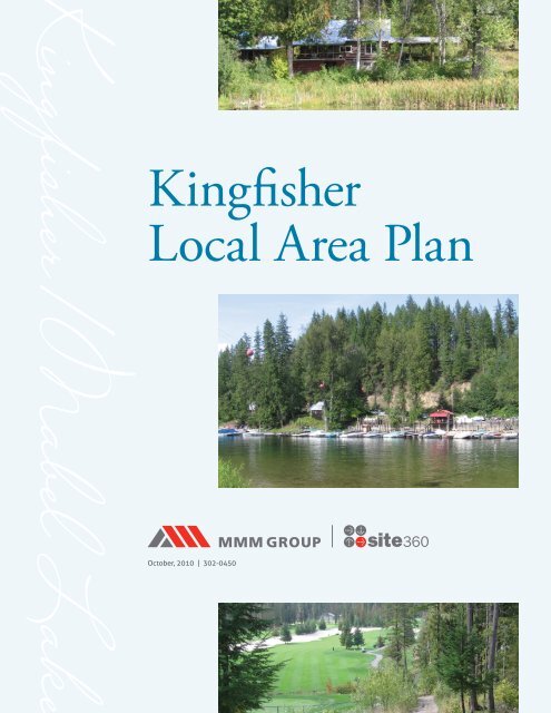
<strong>Kingfisher</strong>/Mabel Lake<br />
<strong>Kingfisher</strong><br />
<strong>Local</strong> <strong>Area</strong> <strong>Plan</strong><br />
October, 2010 | 302-0450
<strong>Kingfisher</strong>/Mabel Lake<br />
Table <strong>of</strong> Contents<br />
1.0 Overview 1<br />
2.0 <strong>Kingfisher</strong> Pr<strong>of</strong>ile 3<br />
2.1 Physical Description 3<br />
2.2 Census Data 4<br />
3.0 Current Official Community <strong>Plan</strong> 5<br />
3.1 Rural/Agricultural 5<br />
3.2 Parks, Trails and Open Space 7<br />
3.3 Transportation 10<br />
3.4 Infrastructure 12<br />
3.5 Residential / Affordable Housing 15<br />
3.6 Commercial / Resort / Resource 16<br />
3.7 Heritage 18<br />
3.8 Environment 18<br />
3.9 Future Land Use / Potential Growth 19<br />
4.0 Public Consultation 21<br />
4.1 Public Meetings 21<br />
4.2 Written Correspondence 22<br />
4.3 Issue Identification 23<br />
4.4 Issues Arising from Public Input 26<br />
5.0 Other <strong>Area</strong> <strong>Plan</strong>s 31<br />
5.1 Enderby and <strong>Area</strong> “F” Services Parks 31<br />
Master <strong>Plan</strong><br />
5.2 Lower Shuswap River Inventory and Mapping 31<br />
5.3 Community Wildland Fire Protection <strong>Plan</strong> 32<br />
1
2<br />
6.0 <strong>Local</strong> <strong>Plan</strong> <strong>Area</strong> Recommendations 35<br />
6.1 General 35<br />
6.2 Environmental Issues 37<br />
6.3 Peak Season Use / Management 41<br />
6.4 Infrastructure 44<br />
6.5 Emergency <strong>Plan</strong>ning 47<br />
6.6 Future Land Use 49<br />
6.7 Rural / Agricultural Policies 52<br />
6.8 Residential Policies 53<br />
6.9 Commercial Policies 54<br />
6.10 Parkland and Open Space Recommendations 55<br />
6.11 Heritage Policies 58<br />
6.12 Summary <strong>of</strong> Recommendations 59<br />
7.0 Future Community <strong>Plan</strong>ning 67<br />
8.0 Conclusion 69<br />
Appendix A: Heritage Resources<br />
Appendix B: Development Permit <strong>Area</strong>s Map<br />
Appendix C: Floodplain Mapping<br />
Appendix D: Emergency Response <strong>Plan</strong> Mapping<br />
Appendix E: “Blue Sky” Village at Mabel Lake<br />
ingfisher/Mabel Lake<br />
<strong>Kingfisher</strong> <strong>Local</strong> <strong>Area</strong> <strong>Plan</strong> | Site360 / MMM Group Limited | October, 2010 | 302-0450
<strong>Kingfisher</strong>/Mabel Lake<br />
1.0 Overview<br />
The purpose <strong>of</strong> this <strong>Local</strong> <strong>Area</strong> <strong>Plan</strong> is to refine the Electoral <strong>Area</strong> “F” Official<br />
Community <strong>Plan</strong> with specific policies to the <strong>Kingfisher</strong> <strong>Area</strong>. While the existing<br />
Official Community <strong>Plan</strong> covers <strong>of</strong>f many general polices for the <strong>Kingfisher</strong> <strong>Area</strong>,<br />
the <strong>Local</strong> <strong>Area</strong> plan process allows the <strong>Kingfisher</strong> stakeholders to engage in a<br />
consultative process that is specific to their area. The recommendations from the<br />
<strong>Local</strong> <strong>Area</strong> <strong>Plan</strong> will be presented to <strong>Regional</strong> <strong>District</strong> staff and Board members for<br />
appropriate inclusion or modification <strong>of</strong> the existing <strong>Area</strong> “F” Official Community<br />
<strong>Plan</strong>.<br />
The <strong>Kingfisher</strong>/Mabel Lake area is located 37 kilometres east <strong>of</strong> Enderby in<br />
Electoral <strong>Area</strong> “F” <strong>of</strong> the <strong>Regional</strong> <strong>District</strong> <strong>of</strong> <strong>North</strong> <strong>Okanagan</strong>. Situated at the<br />
mouth <strong>of</strong> the Shuswap River on Mabel Lake, the community is a collection <strong>of</strong><br />
fulltime, seasonal and recreational residences, commercial, and public properties<br />
surrounded by rural and agricultural land uses. During the summer months the<br />
character <strong>of</strong> the community alters dramatically with an influx <strong>of</strong> people taking<br />
advantage <strong>of</strong> the recreational opportunities in the area.<br />
The Electoral <strong>Area</strong> “F” Official Community <strong>Plan</strong> (OCP) outlines broad objectives<br />
and policies to guide the form and character <strong>of</strong> existing and proposed land use<br />
development in the area.<br />
In the past fifteen years, three major amendments to the OCP have facilitated<br />
significant growth in the area. That growth, along with the associated population<br />
growth and increase in day use has led to concerns regarding the current and<br />
future capacity to manage the population and infrastructure, the recreational<br />
carrying capacity and associated environmental impacts. The increased number<br />
<strong>of</strong> residents (permanent and seasonal) and day users, coupled with the shortage<br />
<strong>of</strong> infrastructure, amenity access points and monitoring, has led to conflicting<br />
usage issues both on land (e.g. parking, traffic, trespass, illegal camping, beach<br />
users verses boaters) and on water (e.g. lack <strong>of</strong> moorage, excessive buoys at the<br />
river mouth and improper use <strong>of</strong> boats on the lake and river). Environmental<br />
impacts have been noted but not scientifically documented.<br />
1
2<br />
The need to develop a comprehensive plan for the area was identified in the 1996 and<br />
2005 Official Community <strong>Plan</strong>s to address the impacts <strong>of</strong> this growth. The 2005 OCP<br />
states:<br />
“The <strong>Regional</strong> Board recognizes that the sustainability <strong>of</strong> Recreation Commercial<br />
development in <strong>Kingfisher</strong> and other identified areas <strong>of</strong> the <strong>Plan</strong>, has absolute<br />
limits defined by physical geography, environmental and social carrying<br />
capacity as well as other aspects and it will seek to establish and address such<br />
limits through a strategic local area plan which may introduce development<br />
containment boundaries, transition and buffer zones between the rural and<br />
recreation resort areas <strong>of</strong> the community, local transportation plans, servicing<br />
standards, and open space strategies. Environmentally sensitive areas and<br />
important connectivity corridors must also be identified and protected.”<br />
In November 2008 area residents again raised concerns about further development<br />
in the area and consistently requested that the local area plan be initiated On July<br />
8th, 2009, the <strong>Regional</strong> Board passed a resolution approving a request for proposals<br />
to prepare a local area plan based on a previously compiled draft terms <strong>of</strong> reference.<br />
A formal request for proposals was posted and closed November 13, 2009. Site360<br />
Consulting Inc. was the recommended proponent and was formally issued a contract<br />
to prepare the local area plan in January 2010. In addition to the stated terms <strong>of</strong><br />
reference, Site360 included with their work plan;<br />
• A Community Vision for the plan area based on the results <strong>of</strong> stakeholder<br />
consultation.<br />
• A timeframe for the plan – both for implementation <strong>of</strong> specific initiatives and for<br />
the future review <strong>of</strong> the plan in its entirety.<br />
• An implementation matrix for all new initiatives or actions for existing<br />
conditions, there will be a clear outline provided <strong>of</strong> what needs to be done and<br />
by whom.<br />
• Recommendations for further study to compliment the outcome <strong>of</strong> the local area<br />
plan.<br />
• Recommended amendments to the Electoral <strong>Area</strong> “F” OCP beyond adopting the<br />
local area plan as an appendix to the OCP.<br />
<strong>Kingfisher</strong> <strong>Local</strong> <strong>Area</strong> <strong>Plan</strong> | Site360 / MMM Group Limited | November, 2010 | 302-0450<br />
ingfisher/Mabel Lake<br />
<strong>Kingfisher</strong>/Mabel Lake<br />
2.0 <strong>Kingfisher</strong> Pr<strong>of</strong>ile<br />
Site360 Consulting Inc.was<br />
the recommended proponent<br />
and was formally issued a<br />
contract to prepare the local<br />
area plan in January 2010.<br />
2.1 Physical Description<br />
The <strong>Kingfisher</strong> <strong>Plan</strong> area has been defined as either side <strong>of</strong> the Shuswap River<br />
between “Halfway Hill”, or the Shuswap River Islands Park, to the shores adjacent<br />
to the outlet <strong>of</strong> Mabel Lake into the Shuswap River (See Figure [<strong>Plan</strong> Outline <strong>Area</strong>]).<br />
There are limited private land holdings, mostly close to the north side <strong>of</strong> the<br />
Shuswap River, with crown lands occupying most <strong>of</strong> land above the valley bottom.<br />
The western portion <strong>of</strong> the plan area is predominantly rural and agricultural.<br />
Forage crops such as hay and alfalfa and pasture land for livestock dominate the<br />
agricultural uses while the remaining rural lands remain mostly in forest. Most<br />
<strong>of</strong> the area consists <strong>of</strong> larger land holdings with some rural residential parcels<br />
existing closer to the river.<br />
The eastern border <strong>of</strong> the plan area is Mabel Lake. The lakeshore has been<br />
developed as two distinct areas separated by the Shuswap River. The north side<br />
is accessed by the Enderby Mabel Lake Road and consists <strong>of</strong> Mabel Ridge Estates,<br />
Mabel Lake Resort and its ancillary developments, the airstrip, river mouth<br />
marina, and a handful <strong>of</strong> private lakeshore cabin lots. Slightly further away from<br />
the lake is the closed <strong>Kingfisher</strong> school and the <strong>Kingfisher</strong> Hall that is still very<br />
actively used in the community.<br />
<strong>North</strong> <strong>of</strong> Mabel Ridge Estates, there is very little private land on the lakeshore<br />
within the plan area.<br />
The west side consists <strong>of</strong> cabin/seasonal residential lots and the church camp<br />
(Camp McKenzie). There is no public road access to the west side although there<br />
is a rough road route that would be passable in an emergency back through the<br />
Hidden Lake area. This road crosses through private lands and is not available<br />
for public use. Regular access is provided by private boats to individual or shared<br />
docks. Although there are dedicated roads on the west side, there are very few<br />
regular vehicles there. There are a few ATV’s and some construction equipment<br />
that likely never leaves the west side. The west side does have hydro and<br />
telephone service across the Shuswap River.<br />
This limited access makes the pontoon boat the watercraft <strong>of</strong> choice amongst the<br />
west side property owners. There is at least one pontoon boat that serves as a<br />
water taxi and garbage collection service.<br />
3
4<br />
2.2 Census Data<br />
The 2001 Canada Statistics Census (as reported through BC Stats) indicated that<br />
there were 195 residents within the <strong>Kingfisher</strong> census area who indicated it was<br />
there principal residence. This was a drop from 1996 when there was a reported<br />
population <strong>of</strong> 226. The 2001 reporting population was pretty evenly split with<br />
51% male and 49% female. Some other summary data from the 2006 census:<br />
• 170 <strong>of</strong> the 195 were over the age <strong>of</strong> 15years old, 30 were over 65 years old.<br />
• 100% <strong>of</strong> the respondents owned their own dwelling which had an average<br />
value <strong>of</strong> $167,252.<br />
• Of the reported population, there were none listed as aboriginal, none<br />
listed as visible minorities, 27% listed as immigrants and <strong>of</strong> those<br />
immigrants, almost 65% <strong>of</strong> those were born in Germany.<br />
• The top two occupations by population were Educational Services; and,<br />
Pr<strong>of</strong>essional, Scientific and Technical Services. These two categories<br />
covered all <strong>of</strong> the full time work force. There were 60 people listed within<br />
the labour force with 100% <strong>of</strong> them listed as employed.<br />
Unfortunately, BC Stats has not published detailed updates <strong>of</strong> the 2006 Census<br />
but the population count rose to 238.<br />
<strong>Kingfisher</strong> <strong>Local</strong> <strong>Area</strong> <strong>Plan</strong> | Site360 / MMM Group Limited | November, 2010 | 302-0450<br />
ingfisher/Mabel Lake<br />
The <strong>Kingfisher</strong>/Mabel Lake<br />
area is located 37 kilometres<br />
east <strong>of</strong> Enderby in Electoral<br />
<strong>Area</strong> “F” <strong>of</strong> the <strong>Regional</strong><br />
<strong>District</strong> <strong>of</strong> <strong>North</strong> <strong>Okanagan</strong>.<br />
<strong>Kingfisher</strong>/Mabel Lake<br />
3.0 Current Official Community<br />
<strong>Plan</strong> for Electoral <strong>Area</strong> “F”<br />
The current OCP for Electoral <strong>Area</strong> “F” was prepared in 2004 and adopted in 2005.<br />
As with many Official Community <strong>Plan</strong>s, there is a lot <strong>of</strong> background discussion on<br />
the overall theme <strong>of</strong> the OCP and then specific policies within each section. The<br />
specific policies are the only portions which have any legal force and effect as part<br />
<strong>of</strong> the OCP bylaw, but the background and discussion materials provide general<br />
purpose and intent for the policies.<br />
The OCP for Electoral <strong>Area</strong> “F” provides a general theme <strong>of</strong> urban containment and<br />
rural preservation. The majority <strong>of</strong> new permanent residential growth is directed<br />
to the City <strong>of</strong> Enderby where infrastructure and community services are provided.<br />
Limited opportunities are identified within the plan area for seasonal residential<br />
and comprehensive resort development. Development in rural areas is generally<br />
discouraged and preservation <strong>of</strong> agriculturally viable lands is encouraged. There<br />
are few direct references to the <strong>Kingfisher</strong> area within the OCP but there are many<br />
general policies that apply for the purpose <strong>of</strong> future growth and preservation. The<br />
following sections summarize the general intent <strong>of</strong> the OCP with regard to specific<br />
land use categories.<br />
3.1 Rural/Agricultural<br />
The policies listed within Division IV <strong>of</strong> the OCP generally follow the policies and<br />
objectives <strong>of</strong> the Agricultural Land Commission Act. In summary, non-agricultural<br />
development <strong>of</strong> viable agricultural lands is strongly discouraged. Further policies<br />
seek to limit or control non-agricultural development on non-ALR lands in order<br />
to minimise impacts to ALR lands. These policies are typical <strong>of</strong> any OCP where<br />
there are ALR lands involved. The ALC has statutory review obligations for an OCP<br />
Bylaw and will make sure that these kinds <strong>of</strong> provision are included before they<br />
will “sign <strong>of</strong>f” on the OCP Bylaw.<br />
However, the OCP acknowledges that there are conflicting policies with respect to<br />
the protection <strong>of</strong> the environment and the preservation <strong>of</strong> agricultural activities.<br />
When the Riparian <strong>Area</strong> Regulations were enacted provincially, they imposed<br />
province wide standards for environmental protection for all riparian areas<br />
adjacent to water bodies. These regulations were also intended to streamline<br />
with federal Department <strong>of</strong> Fisheries and Oceans regulations that protect fish and<br />
potential fish habitat.<br />
5
6<br />
The reality is that many agricultural areas are found in river valleys, adjacent to<br />
wetlands and lakes, and generally in areas where they have a potential influence<br />
on drainage courses and ground water. Indeed, many agricultural activities<br />
require drainage works to ensure the land is suitable for particular farming<br />
activities. The <strong>Kingfisher</strong> area is typical in this regard in that most <strong>of</strong> the ALR<br />
lands and agricultural activities take place in close proximity to the Shuswap River<br />
and its associated tributaries and wetlands.<br />
The 2004 OCP acknowledged that the specific fencing and buffering policies<br />
listed in division XI.B <strong>of</strong> the plan (Development Permit <strong>Area</strong>s for the protection<br />
<strong>of</strong> the natural environment) were not endorsed by the Ministry <strong>of</strong> Agriculture and<br />
listed specific actions for exemptions and future considerations. It should also<br />
be acknowledged that RAR does not apply to agricultural activities. However, that<br />
exemption does not exempt agricultural activities from potential <strong>of</strong>fences under<br />
the Fisheries Act and DFO.<br />
These are complicated issues that involve several levels <strong>of</strong> local, provincial and<br />
federal governments. The local area plan should promote a common vision for<br />
both agriculture and the protection <strong>of</strong> the environment. It should also provide<br />
land owners with simple guidelines to follow in order to ensure that the activities<br />
they pursue within their own private lands are consistent with regulations and the<br />
vision <strong>of</strong> the community.<br />
Detailed studies are currently underway for the Shuswap River and Mabel Lake<br />
that will create specific mapping, inventory <strong>of</strong> habitat and quantitative indexing<br />
for sensitive habitat areas. The result <strong>of</strong> these studies will provide the regulatory<br />
bodies a clear framework to manage the environmental assets within the plan<br />
area. The goal should be to use these studies to also clearly explain new policies<br />
and regulations for agricultural activities that not only abide by the various levels<br />
<strong>of</strong> governmental jurisdiction but also strive to meet the vision and objectives <strong>of</strong><br />
the community.<br />
<strong>Kingfisher</strong> <strong>Local</strong> <strong>Area</strong> <strong>Plan</strong> | Site360 / MMM Group Limited | November, 2010 | 302-0450<br />
ingfisher/Mabel Lake<br />
<strong>Kingfisher</strong>/Mabel Lake<br />
3.2 Parks, Trails and Open Space<br />
The OCP identifies three general levels <strong>of</strong> park space; user-oriented areas,<br />
intermediate areas, and resource-based areas. The OCP also noted that the<br />
public input indicated a need for more user-oriented park space within the<br />
<strong>Kingfisher</strong> community. Specifically, it was suggested that a community park for<br />
active use (multi-use ball field) was needed as well as improvement to the beach<br />
access for swimming and marine activities (primarily boating).<br />
Intermediate parks are generalised as day use parks generally within a one hour<br />
drive from home. Intermediate parks for the <strong>Kingfisher</strong> residents would therefore<br />
typically be outside <strong>of</strong> the plan area. However, given the proximity to Enderby,<br />
many <strong>of</strong> the user-oriented parks within the plan area are used as intermediate<br />
area parks by residents from outside <strong>of</strong> the plan area. This aspect suggests that<br />
a higher ratio <strong>of</strong> user-oriented parks is warranted within the <strong>Kingfisher</strong> plan area<br />
that the permanent population would normally justify.<br />
The <strong>Kingfisher</strong> plan area also has two Class A Provincial Parks; Skookumchuk<br />
Rapids and Shuswap River Islands provincial parks are the resourced based parks<br />
within the plan area. There is also access to significant crown land and forestry<br />
campsites through the <strong>Kingfisher</strong> plan area that are used in both summer and the<br />
winter (i.e. Hunter’s Range, Noisy Creek, Mount Griffen).<br />
7
8<br />
It should be noted that there has been little in the way <strong>of</strong> trail development in<br />
the <strong>Kingfisher</strong> area. There is a small network <strong>of</strong> trails that has been developed<br />
by Mabel Lake Resort that generally provide linkages from the River mouth boat<br />
launch and marina back towards the golf course. This leaves most pedestrians<br />
to travel on the gravel shoulders <strong>of</strong> the public roads. During peak times when<br />
parking is at a premium, the pedestrians are left to walk on the roadway. The<br />
trail is in varying states <strong>of</strong> improvement and maintenance.<br />
A trail system was also initiated to follow the outside boundary <strong>of</strong> the golf course from Lusk Lake Road East back to the<br />
clubhouse.<br />
The <strong>Kingfisher</strong> area has long been recognised as a popular area for outdoor<br />
recreation. The Mable Lake Resort has a long history, dating back to 1928,<br />
indicating the early acknowledgement that the area provided outdoor experience<br />
worthy <strong>of</strong> tourist travel. The experiences available in the natural surroundings,<br />
including the lake, river and mountains surrounding the plan area continue to<br />
draw seasonal residents and tourists to the area.<br />
The lake frontage within the plan is the main access point to Mabel Lake. Other<br />
access is available through crown land and from the south end <strong>of</strong> the lake,<br />
but these accesses are more rugged and there are no other communities as<br />
developed as <strong>Kingfisher</strong> on the lake. This makes <strong>Kingfisher</strong> a very busy place at<br />
peak times, particularly during the summer and puts a strain on the most popular<br />
user-oriented park spaces.<br />
<strong>Kingfisher</strong> <strong>Local</strong> <strong>Area</strong> <strong>Plan</strong> | Site360 / MMM Group Limited | November, 2010 | 302-0450<br />
ingfisher/Mabel Lake<br />
The <strong>Kingfisher</strong>/Mabel Lake<br />
area is located 37 kilometres<br />
east <strong>of</strong> Enderby in Electoral<br />
<strong>Area</strong> “F” <strong>of</strong> the <strong>Regional</strong><br />
<strong>District</strong> <strong>of</strong> <strong>North</strong> <strong>Okanagan</strong>.<br />
<strong>Kingfisher</strong>/Mabel Lake<br />
It appears that no significant initiatives have been implemented to address the<br />
needs identified by the 2004 OCP specific to the <strong>Kingfisher</strong> area. There are<br />
undeveloped park resources in the area and other potential park resources that<br />
can be targeted for future public acquisition. The key piece <strong>of</strong> land is the crown<br />
land lot at the end <strong>of</strong> Parkway Road. RDNO (through Fortune Parks) is actively<br />
pursuing tenure for this parcel which would provide the opportunity to resolve<br />
needed <strong>of</strong>f-lake facilities for parking. Other potential public uses could be<br />
accommodated on this site if it were correctly developed and managed.<br />
The 2004 OCP lists the following specific land resources that should be reserved<br />
for public use open space:<br />
• Resourced based area at Skookumchuk Rapids (including the Class A<br />
Provincial Park south <strong>of</strong> the rapids).<br />
• The narrow strip <strong>of</strong> land between the Enderby Mabel Lake Road and the<br />
Shuswap River from Lot 4, <strong>Plan</strong> 20671 west <strong>of</strong> the Cook Creek recreational<br />
area.<br />
• “The Islands” in Shuswap River – now a Class A provincial park.<br />
• <strong>District</strong> Lot 2423 on Mabel Lake – south <strong>of</strong> the west side development.<br />
• Development <strong>of</strong> additional public accesses to the Shuswap River for hand<br />
launched recreational uses.<br />
• Commitment to the development and enhancement <strong>of</strong> the Shuswap River<br />
as a recreational corridor with suitable maintenance and management<br />
including river bank stabilisation where necessary to minimise erosion<br />
problems.<br />
• The remainder <strong>of</strong> <strong>District</strong> Lots 2415 and 5142 at the mouth <strong>of</strong> the Shuswap<br />
River at Mabel Lake.<br />
The Fortune <strong>Area</strong> Parks Master <strong>Plan</strong> is currently underway which will address<br />
parks needs within the <strong>Kingfisher</strong> <strong>Area</strong>. However, there are specific issues to be<br />
addressed at the local area plan level that are discussed in the Recommendations<br />
section <strong>of</strong> this plan.<br />
9
10<br />
3.3 Transportation<br />
The current OCP addresses the main transportation link to the <strong>Kingfisher</strong><br />
area as the Enderby Mabel Lake Road. All roads within the plan area are the<br />
responsibility <strong>of</strong> the Ministry <strong>of</strong> Transportation and Infrastructure (MoTI) and<br />
as such, the RDNO can only act in an advisory role to MoTI with respect to road<br />
issues. However, the OCP did acknowledge that improvements were warranted<br />
on Enderby Mabel Lake Road regarding pedestrian and vehicular traffic safety,<br />
and drainage.<br />
The RDNO commissioned traffic counts for Enderby Mabel Lake Road during the<br />
summer and early fall <strong>of</strong> 2009 in advance <strong>of</strong> the local area plan process. While<br />
the exercise indicated a definite increase in traffic during the summer period<br />
(July 28 through August 12) compared to the fall period (September 9 through<br />
September 24), the traffic volumes are well within the parameters for a two lane<br />
rural highway (using TAC guidelines).<br />
For example, the peak hourly traffic count occurred On August 1st between 1:00<br />
PM and 2:00 PM and was 196 vehicles total in both directions. The maximum<br />
capacity for a two lane rural highway at sustained speeds above 80 km/h is 920<br />
vehicles per hour in both directions. This is a very generalised statement as<br />
the capacity numbers would change through various sections due to geometry<br />
<strong>Kingfisher</strong> <strong>Local</strong> <strong>Area</strong> <strong>Plan</strong> | Site360 / MMM Group Limited | November, 2010 | 302-0450<br />
ingfisher/Mabel Lake<br />
<strong>Kingfisher</strong>/Mabel Lake<br />
and other factors that could influence maximum capacity. However, at 21% <strong>of</strong><br />
maximum capacity under ideal conditions at the maximum peak hour, the general<br />
conclusion is that traffic volume is not anywhere close to being a technical<br />
constraint.<br />
Despite the fact that overall traffic volumes on Enderby Mabel Lake Road are well<br />
within capacity for the engineered design <strong>of</strong> the road, there are still concerns<br />
about pedestrian and cycle safety and the general condition <strong>of</strong> the road surface.<br />
<strong>Local</strong> roads within the plan area are fairly limited. Most <strong>of</strong> them in the western<br />
portion <strong>of</strong> the plan area are either short dead end roads to serve a few rural lots<br />
or they are part <strong>of</strong> the Forestry Service road network. In the eastern portion <strong>of</strong> the<br />
plan area, there are a few local network roads that serve to access Mabel Ridge<br />
Estates and some <strong>of</strong> the rural parcels such as Beatie Road. The OCP does specify<br />
that Lusk Lake Road should be connected through to Lusk Lake Road East. This<br />
connection is available by a dedicated road right <strong>of</strong> way but it has not been constructed<br />
to date due to grades and third party ownership issues. It would serve<br />
to provide linkage from Mabel Ridge Estates and the resort area back to Enderby<br />
Mable Lake Road by way <strong>of</strong> Beatie Road. Currently, the local road network does<br />
not provide any looping connectivity such that all traffic must follow the main<br />
route <strong>of</strong> Enderby Mabel Lake Road. Lusk Lake, Beatie, <strong>Kingfisher</strong> and Stoney<br />
Roads are still gravelled surfaced roads. All other local roads east <strong>of</strong> <strong>Kingfisher</strong><br />
Creek are paved.<br />
The OCP also identified that improvements were needed to the intersections <strong>of</strong><br />
Enderby Mabel Lake Road and River mouth Drive and Beatie Road to improve<br />
geometric alignments and provision <strong>of</strong> parking.<br />
The residential development within the Mabel Lake Resort has primarily been<br />
developed with private strata roads that generally have one point <strong>of</strong> access from<br />
the public road systems. Therefore, they serve as access for the development<br />
within the resort only and do not provide for public vehicular connectivity. There<br />
could be connectivity in an emergency situation along the east side <strong>of</strong> the airstrip<br />
utilising private roads within the resort strata development.<br />
11
12<br />
In the absence <strong>of</strong> lands being released from the ALR for further development,<br />
there are few opportunities to improve alternate access to Enderby Mabel Lake<br />
Road. However, there are improvements to be considered to enhance and<br />
promote safe pedestrian and other non-motorised modes <strong>of</strong> travel. The one<br />
option that should be explored is the Forest Service Road to Three Valley Gap.<br />
This is a long route but the road is reasonably good in summer conditions. If the<br />
east end <strong>of</strong> <strong>Kingfisher</strong> had to be evacuated, this would be a potential route out <strong>of</strong><br />
the valley.<br />
3.4 Infrastructure<br />
The predominantly rural nature <strong>of</strong> the plan area dictates that there is limited<br />
community infrastructure available other than in the immediate area <strong>of</strong> the Mabel<br />
Lake Resort. BC Hydro provides electricity and telephone service by way <strong>of</strong> land<br />
lines. There is no reliable cellular phone service within the plan area.<br />
The provision <strong>of</strong> water and sewage disposal is therefore limited to private on site<br />
systems for each rural parcel. Water is typically provided by private wells or water<br />
licenses from surface sources. Sewage disposal is handled by private onsite<br />
septic systems. The OCP has used the lack <strong>of</strong> services as one <strong>of</strong> the primary<br />
reasons to discourage further development in the rural portions <strong>of</strong> the plan area<br />
but defers regulatory approval for water and sewage disposal to the respective<br />
divisions <strong>of</strong> the Ministry <strong>of</strong> Environment and Interior Health Authority.<br />
The Mabel Lake portion <strong>of</strong> the plan area has been historically developed with<br />
lakefront lots and the resort development. The development prior to 2000 was<br />
facilitated by a similar approach to infrastructure as the rural areas – private<br />
water and sewage disposal.<br />
The community water system consists <strong>of</strong> a lake intake, two domestic pumps<br />
and one fire flow pump all operated and maintained by RDNO. The distribution<br />
network fronts 317 residential properties that could be hooked into the system<br />
but to date only 247 properties, plus one apartment site, one commercial golf<br />
course, one commercial RV Park and the campground are connected to the<br />
system. The design <strong>of</strong> the water system is such that one <strong>of</strong> the domestic pumps<br />
should provide enough capacity for all domestic requirements and the second is<br />
for back-up to be used in the case <strong>of</strong> a malfunction <strong>of</strong> the first pump or routine<br />
maintenance. Typically the pumps will be used in a rotation to extend the overall<br />
<strong>Kingfisher</strong> <strong>Local</strong> <strong>Area</strong> <strong>Plan</strong> | Site360 / MMM Group Limited | November, 2010 | 302-0450<br />
ingfisher/Mabel Lake<br />
<strong>Kingfisher</strong>/Mabel Lake<br />
lifecycle <strong>of</strong> the pumps. The fire flow pump is only intended to be used in the case<br />
<strong>of</strong> an emergency when maximum flow is required for firefighting purposes.<br />
Recent data from the summer <strong>of</strong> 2010 indicate that peak demand flows were<br />
27% over capacity, meaning that the second domestic pump would have been<br />
in operation for approximately 6 hours per day (during the peak event) to meet<br />
demand flows. This indicates that the system is at or beyond design capacity<br />
for peak times <strong>of</strong> the year. The solution to provide more capacity would be to<br />
install larger pumps and replace the lake intake with a larger diameter pipe. The<br />
alternative is to implement demand management. This can be done by way <strong>of</strong><br />
educational programs to reduce consumption, water metering to provide financial<br />
incentives to use less water, irrigation restrictions, etc.<br />
As a condition <strong>of</strong> the golf course and related development at Mabel Lake Resort, a<br />
community sewer collection and disposal system was required to be implemented.<br />
A Liquid Waste Management <strong>Plan</strong> was prepared in the late 1990’s and the initial<br />
collection and disposal system was installed concurrently with the golf course in<br />
the early 2000’s and subsequently turned over to RDNO. The scope <strong>of</strong> the Liquid<br />
Waste Management <strong>Plan</strong> was such that the system needed to be designed for<br />
growth such that it could eventually accommodate service to Mabel Ridge Estates<br />
and the West Side cabins.<br />
The current system is connected to approximately 101 homes that have all been<br />
developed by the resort. There are no homes outside <strong>of</strong> the resort development<br />
that have been connected to the community system. The system is currently<br />
designed to accept effluent into a community septic tank and then dispose the<br />
effluent to ground through disposal field. Individual homes are still required to<br />
have a septic tank to capture solids and only deliver effluent (i.e. liquid waste)<br />
to the collection and disposal system (STEP system). Based on flow monitoring,<br />
the summer peak use is estimated at approximately 23,000 US gallons per day<br />
(87 cubic metres) which is well below the maximum limits <strong>of</strong> the Operational<br />
Certificate issued by the Ministry <strong>of</strong> Environment <strong>of</strong> 250 cubic metres per day. The<br />
<strong>of</strong>f season usage <strong>of</strong> the system is estimated to be minimal as only homes within<br />
the resort lands are currently connected.<br />
13
14<br />
The system is designed to be easily expanded to serve all <strong>of</strong> the north side<br />
development (<strong>North</strong>side lakefront lots, Mabel Ridge Estates and the Mabel Lake<br />
Resort controlled properties) and, with additional efforts, can also serve the west<br />
side properties. At a certain threshold, secondary treatment <strong>of</strong> the effluent will<br />
be required to preserve capacity in the field areas. However, based on the data<br />
presented in the Liquid Waste Management <strong>Plan</strong>, the sewer system seems to<br />
be operating within the intended parameters. There should be enough capacity<br />
within the existing system to provide sewer service to the extent <strong>of</strong> the original<br />
service area included within the Liquid Waste Management <strong>Plan</strong>. Detailed<br />
analysis by a pr<strong>of</strong>essional engineer would be required before any formal service<br />
extension program is initiated.<br />
Ground water sampling was originally conducted in 1996 during the first stages<br />
<strong>of</strong> the Liquid Waste Management <strong>Plan</strong> and it was found that there were probable<br />
impacts to ground water from existing septic systems. Water sampling has been<br />
conducted at different times since the original report and there are still results<br />
that indicate ongoing impacts to ground water. Some <strong>of</strong> the water quality issues<br />
can be attributed to natural occurrence but the pattern <strong>of</strong> increasing quality issues<br />
as you move closer to the river mouth suggest that a good portion is related to<br />
human impacts.<br />
This is a reasonable outcome as none <strong>of</strong> the residential users closest to the lake<br />
have been able to hook up to the community system. It is also a reasonable<br />
expectation that these impacts will continue until such time as more <strong>of</strong> the<br />
existing residences can hook into the community system. The Mabel Lake<br />
Water system is tested every two weeks and has not recorded any water quality<br />
concerns. This is likely due to the fact that the intake is upstream <strong>of</strong> most <strong>of</strong><br />
the waterfront developments and existing private septic systems. Many <strong>of</strong> the<br />
waterfront lots still derive their water directly from the lake and therefore, water<br />
quality issues in the shore zone area are a great concern for those private users.<br />
<strong>Kingfisher</strong> <strong>Local</strong> <strong>Area</strong> <strong>Plan</strong> | Site360 / MMM Group Limited | November, 2010 | 302-0450<br />
ingfisher/Mabel Lake<br />
<strong>Kingfisher</strong>/Mabel Lake<br />
3.5 Residential / Affordable Housing<br />
The OCP makes a firm commitment that all new residential uses will be serviced<br />
by community water and sewer. This leads to the fact that no new residential<br />
growth is likely within the <strong>Kingfisher</strong> plan area unless it is tied into the community<br />
sewer and water system available in the vicinity <strong>of</strong> the resort. Based on the<br />
current OCP land use designations, there are additional lands to be developed<br />
to accommodate residential units and there are also residential lots that have<br />
already been created that are still vacant (i.e. no permanent residential structures<br />
constructed). These opportunities are all within the vicinity <strong>of</strong> the resort, in Mabel<br />
Ridge Estates or on the West Side.<br />
Other opportunities for modest growth are found in the rural areas within the<br />
plan in the form <strong>of</strong> potential subdivision within the constraints <strong>of</strong> the Zoning<br />
regulations and the Agricultural Land Reserve. These would be developed to be<br />
serviced with on-site water and onsite septic disposal systems.<br />
Given the requirement that RDNO has set for services, the current ALR boundaries<br />
and the established development pattern, there is little opportunity to designate<br />
addition lands for residential development. However, should ALR lands be<br />
released by the ALC that are generally north and west <strong>of</strong> the existing settlement<br />
on the north shore, potential residential policies should be revisited. There are<br />
also lands around Lusk Lake that are generally suitable for development and close<br />
enough to service with water and sewer. Mabel Ridge Estates could be extended<br />
to the north. However, there are no current applications for the release <strong>of</strong> these<br />
lands. There is also the fundamental question <strong>of</strong> whether residential growth<br />
into these areas is consistent with the vision for the community. More detailed<br />
analysis <strong>of</strong> residential growth potential is examined in the Recommendation<br />
Section.<br />
The current OCP acknowledges that affordable housing strategies are difficult<br />
to implement in rural areas. The <strong>Kingfisher</strong> plan area is predominantly rural<br />
and affordable options are most likely in the form <strong>of</strong> manufactured or mobile<br />
homes. The Zoning Bylaw makes provisions for accommodations on rural parcels<br />
predominantly to accommodate on farm workers. The ALC Act similarly limits<br />
most additional residential accommodation within the ALR for bona fide farm<br />
labour.<br />
15
16<br />
Within the Mabel Lake area <strong>of</strong> the plan, most <strong>of</strong> the older residential development<br />
is situated on lots that are not currently serviced to accommodate secondary<br />
suites. However, there would be some potential, particularly within Mabel Ridge<br />
Estates to consider allowing secondary suites once sanitary sewer is available.<br />
Within the resort development, most <strong>of</strong> the residential development has been<br />
created as second residences or vacation homes. These are not affordable<br />
options. Similarly, any <strong>of</strong> the lots that are located in relative proximity to the lake<br />
will be valued for their recreational amenities and would not fall within affordable<br />
definitions.<br />
Future development potential in the Parkway Road area could create some<br />
smaller multiple dwelling units that could be purpose built for rental to seasonal<br />
employees in the form <strong>of</strong> mixed use development. The need for permanent<br />
affordable residential units is difficult to assess as most <strong>of</strong> the employment<br />
generated by the commercial activities is seasonal. Until the community<br />
establishes year round employment, it is difficult to justify affordable housing<br />
as a community need beyond what is currently possible within the rural context.<br />
The reality is that beyond the seasonal labour needs, individuals make a<br />
lifestyle choice to locate within the plan area, not necessarily a choice based on<br />
economics.<br />
3.6 Commercial / Resort / Resource<br />
The OCP identifies limited potential for commercial land uses within the <strong>Kingfisher</strong><br />
<strong>Plan</strong> area. A potential opportunity exists for the two lots at the intersection <strong>of</strong><br />
Parkway Road and Enderby Mabel Lake Road with the emphasis on a community<br />
commercial establishment.<br />
The resort lands are rezoned for development and have been generally subdivided<br />
into all intended lots . It is not anticipated that additional land development will<br />
occur within the current resort boundaries although there are several vacant<br />
lots that have not been built on. The resort cabins on the lakeshore, although<br />
they are old, have been maintained and updated to continue their seasonal use.<br />
It is unlikely that these cabins could be re-developed due to their proximity to<br />
Mabel Lake and current environmental restrictions. Similarly, the store, which<br />
also serves as administration for the holiday park, is old but well maintained. It<br />
is unlikely that redevelopment <strong>of</strong> these facilities would result in any increase in<br />
development density due to current environmental regulations.<br />
<strong>Kingfisher</strong> <strong>Local</strong> <strong>Area</strong> <strong>Plan</strong> | Site360 / MMM Group Limited | November, 2010 | 302-0450<br />
ingfisher/Mabel Lake<br />
<strong>Kingfisher</strong>/Mabel Lake<br />
Without new lands being released from the ALR, no significant expansion <strong>of</strong> the<br />
resort boundaries is possible. The main area where development potential exists<br />
is north <strong>of</strong> Parkway Road and it has been identified for residential development<br />
with some future park needs. There are also two vacant lots south <strong>of</strong> Parkway<br />
Road that have been designated and zoned for general commercial use.<br />
Resources in the area generally refer to forestry and mineral (including gravel)<br />
deposits. The OCP identified that the areas with the least limitation to growth<br />
<strong>of</strong> forestry activities are located south <strong>of</strong> the river and west <strong>of</strong> the lakeshore –<br />
generally behind the west side cabins. The area north <strong>of</strong> the river and between<br />
<strong>Kingfisher</strong> Creek and Mabel Lake is indicated as the next best potential for<br />
forestry growth (there are recently active blocks located north <strong>of</strong> the kingfisher<br />
community).<br />
Generally, the plan area is categorised as having no significant mineral deposits,<br />
but is identified as a favourable geological environment. There are a few probable<br />
locations for aggregate reserves and given the nature <strong>of</strong> the river valley and some<br />
localised borrow pits, it is expected that small aggregate deposits could be found<br />
throughout the plan area.<br />
If any significant resource development occurs, consideration should be given to<br />
access and infrastructure required for the resource development in terms <strong>of</strong> how<br />
it may benefit the plan area in the long term, even after the resource has been<br />
depleted.<br />
17
18<br />
3.7 Heritage<br />
The current OCP acknowledges the potential to designate heritage sites and<br />
to appoint a Heritage Commission. Neither has occurred since the OCP was<br />
prepared. However, the Enderby and <strong>District</strong> Heritage Commission serve as a<br />
review committee for any heritage issues within Electoral <strong>Area</strong> “F”. The OCP<br />
acknowledges that there have been public calls for the Shuswap River to be<br />
named a heritage river. The OCP also recognises that there are several identified<br />
archaeological sites along the river.<br />
The Enderby and <strong>District</strong> Heritage Commission encourages any land owner who<br />
wishes to consider heritage designation to contact them. Furthermore, that<br />
the Splatsin First Nations be consulted regarding the location <strong>of</strong> archaeological<br />
sites, particularly along the river and they would be involved in any discussion<br />
regarding the designation <strong>of</strong> the Shuswap River as a Heritage River.<br />
A list <strong>of</strong> potential sites, buildings and houses has been provided by the Heritage<br />
Commission and is listed in the Appendix A.<br />
3.8 Environment<br />
The current OCP does not address the broad environment in a specific section.<br />
Rather it identifies Special <strong>Area</strong>s and policies to address these areas over time.<br />
Specific to the <strong>Kingfisher</strong> area, the current OCP identifies;<br />
• Skookumchuk Rapids<br />
• Waterfall in Fall Creek<br />
• The Islands<br />
• Salmon Enhancement Project<br />
• The Shuswap River Watershed<br />
• Various Heritage Buildings and Sites<br />
The OCP identifies policies to protect these features and to recognise them as<br />
significant public assets to the area. The OCP further explains that Development<br />
Permit areas are established for the following areas:<br />
<strong>Kingfisher</strong> <strong>Local</strong> <strong>Area</strong> <strong>Plan</strong> | Site360 / MMM Group Limited | November, 2010 | 302-0450<br />
ingfisher/Mabel Lake<br />
<strong>Kingfisher</strong>/Mabel Lake<br />
• All development/land disturbance within 30 m <strong>of</strong> a defined watercourse<br />
• Steep slopes, but only for DL 2415.<br />
• Floodplain areas for Shuswap River and Mabel Lake (applicable to<br />
<strong>Kingfisher</strong> LAP)<br />
• Hazardous conditions at Fall Creek (slide area)<br />
• Wildfire interface areas.<br />
• Form and character for industrial, commercial and multi-family developments.<br />
A consolidated Development Permit Map is included as Appendix B and a Floodplain<br />
Map, based on provincial floodplain data is included as Appendix C.<br />
3.9 Future Land Use / Growth Potential<br />
As mentioned earlier, there is existing capacity for new housing units (both rural<br />
and residential) on land that is zoned and/or subdivided but currently vacant. It<br />
is estimated that throughout the plan area, there is approximately 240 residential<br />
dwellings that could be constructed without any further rezoning applications.<br />
19
20<br />
Generally there are about 75 potential units within the resort lands (East and West<br />
Airstrip and Central Golf Course), approximately 80 units to be built on vacant<br />
residential lots in Mabel Ridge Estates and on the west side, with the remaining<br />
units located in the rural areas on Country Residential, Non-Urban, Small Holdings<br />
and Large Holdings zoned properties.<br />
There are parcels that are currently zoned NU (Non-Urban) within the plan area<br />
that are supported by the OCP for rezoning to more intensive uses. These lands<br />
are primarily found in the vicinity <strong>of</strong> Parkway Road and Enderby Mabel Lake<br />
Road in the vicinity <strong>of</strong> the resort. The future land use designation is shown as<br />
residential and includes lands north <strong>of</strong> Parkway Road and a small portion <strong>of</strong> land<br />
between the golf course and Enderby Mabel Lake Road.<br />
The one other area where the future land use designation supports rezoning is<br />
north <strong>of</strong> Lusk Lake along Beatie Road in the vicinity <strong>of</strong> Stoney Road. The change<br />
supported in the OCP would be from NU to CU (Country Urban) residential which<br />
would allow 2 Ha (5 acre) lots to be created on the west side <strong>of</strong> Beatie Road.<br />
In order to create more potential development lands within the plan area, there<br />
would have to be a shift in policy by RDNO to promote more SH (Small Holdings)<br />
opportunities in rural areas, not in the ALR. This would require a policy shift from<br />
discouraging further development <strong>of</strong> semi-residential lands without the benefit <strong>of</strong><br />
community sewer and water.<br />
Another way to create more potential development lands in the future is to<br />
promote the exclusion <strong>of</strong> ALR lands in proximity to the north side developments<br />
where logical and feasible extensions to community water and sewer are<br />
available. The final option would be to consider a large scale expansion <strong>of</strong> the<br />
<strong>Kingfisher</strong> community to the north and east <strong>of</strong> Mabel Ridge Estates where the<br />
terrain is challenging but manageable and the lands are not in the ALR. These<br />
options will be examined further in the Recommendations section.<br />
<strong>Kingfisher</strong> <strong>Local</strong> <strong>Area</strong> <strong>Plan</strong> | Site360 / MMM Group Limited | November, 2010 | 302-0450<br />
ingfisher/Mabel Lake<br />
<strong>Kingfisher</strong>/Mabel Lake<br />
4.0 Public Consultation<br />
4.1 Public Meetings<br />
Site360 and RDNO have hosted four public meetings at the <strong>Kingfisher</strong> Hall. The<br />
first meeting was held on May 12th between 4:00 and 8:00 PM. This meeting<br />
was intended to introduce the stakeholders to the process and the consultant.<br />
Encouragement was provided for the public to use email as the preferred method<br />
<strong>of</strong> contact but fax numbers and mailing addresses were also provided. The<br />
evening was well attended with 98 individuals signed in and an additional 25-30<br />
people who did not sign in for an estimated total attendance <strong>of</strong> 125.<br />
Comment sheets were provided for participants to fill out and leave behind<br />
or send in to either Site360 or RDNO at a later date. The consultants made a<br />
presentation followed by a participatory discussion <strong>of</strong> the issues that were<br />
brought up by audience members. These issues were recorded on flip charts.<br />
The second meeting was held on June 16th at the same venue between 6:00 and<br />
8:00 PM. For this meeting, the consultant compiled a summary <strong>of</strong> the issues that<br />
had been identified by the public through various correspondence and presented<br />
them on ten display boards. The consultants reviewed the summary issues with<br />
the audience and engaged in some discussion on each issue. Some clarification<br />
and sub-headings were added to the display boards and then each participant<br />
was provided five coloured dot stickers. It was explained that this was not a vote<br />
but it was a method for the participants in attendance to signal to the consultant<br />
what the priority issues were. Forty-two individuals signed in to the meeting but<br />
53 people participated in placing the stickers. Total estimated attendance was<br />
approximately 60 people.<br />
A third and a fourth public meeting was held on August 4th with an afternoon<br />
session from 1:00 to 3:00 PM and an evening session from 6:00 to 8:00 PM.<br />
The format for these meetings was similar to the second public meeting as the<br />
intent for these meetings was to capture seasonal residents who were not able<br />
to attend previous meetings. The consultant reviewed the issues presented on<br />
the display boards and engaged the attendees in a group discussion about the<br />
issues. Furthermore, a blank flipchart was provided for attendees to write down<br />
their ideas for vision statements for the plan area. Signed in attendance for the<br />
afternoon session was 73 and 54 for the evening session. While there were not<br />
necessarily any significant new issues brought up, earlier themes were expanded<br />
and participation by the audience in the discussion period was generally<br />
thorough.<br />
21
22<br />
4.2 Written Correspondence<br />
Throughout the process to date, stakeholders have been encouraged to send<br />
comments to the consultant by email, regular mail or fax. All correspondence<br />
has been retained and provided to RDNO. An issues identification paper was<br />
prepared following the second public meeting which summarized the issues and<br />
their weighted response based on the individual submissions and then again on<br />
the feedback during the public meetings.<br />
To date, Site360 is in receipt <strong>of</strong> the following;<br />
Letters and Emails Completed Comment Forms<br />
87 27<br />
A form letter campaign was also initiated by the owners/developers <strong>of</strong> the resort.<br />
The form letter asked petitioners to sign in support <strong>of</strong> a general statement;<br />
“That the Mabel Lake Community should be allowed to grow as a ‘Resort<br />
Community’ as envisioned by the <strong>Regional</strong> <strong>District</strong> with the approval <strong>of</strong> the<br />
golf course in 2001.”<br />
The form letter also included nine specific issues that were promoted as the focus<br />
<strong>of</strong> the new planning program (<strong>Local</strong> <strong>Area</strong> <strong>Plan</strong>):<br />
• Expansion <strong>of</strong> sewer and water services to all property owners who request<br />
these improvements.<br />
• Develop local environmental policies for the foreshore <strong>of</strong> Mabel Lake<br />
(Riparian <strong>Area</strong> Policies).<br />
• Obtain ownership and expand the upper river mouth parking lot area.<br />
• Develop a long range trail network system.<br />
• Open some existing public access points to Dolly Varden Beach.<br />
• Develop policies for the proposed commercial hub near the golf course<br />
clubhouse.<br />
• Confirm that Mabel Lake is a “resort community” and provide long range<br />
land use policy strategy.<br />
<strong>Kingfisher</strong> <strong>Local</strong> <strong>Area</strong> <strong>Plan</strong> | Site360 / MMM Group Limited | November, 2010 | 302-0450<br />
ingfisher/Mabel Lake<br />
<strong>Kingfisher</strong>/Mabel Lake<br />
• Develop a tourism policy for the whole area from Shuswap Falls to Mabel<br />
Lake.<br />
• Open new land to encourage new commercial and recreational<br />
opportunities for Mabel Lake.<br />
The form letter was signed by a total <strong>of</strong> 540 individuals: 351 who are categorized<br />
as resident/property owners east <strong>of</strong> and including Club <strong>Kingfisher</strong> RV Resort and<br />
189 who are categorized as guests <strong>of</strong> owners.<br />
By comparing the individual submission versus the comments (and sticker<br />
“voting”) at the public meetings, the consultant was able to derive a wealth<br />
<strong>of</strong> discrete issues from the individual submissions and also gauge the group<br />
sentiment from the public meetings.<br />
4.3 Issue Identification<br />
Prior to the public meeting on June 16th , Site360 compiled a list <strong>of</strong> general<br />
topics that summarised the input received to date. Many <strong>of</strong> the stakeholders<br />
who responded provided extensive detail with their input and all written<br />
correspondence has been retained and copied to RDNO for reference into<br />
this plan. The general topics were elaborated on during the presentation and<br />
discussion sessions. The consultant did not reveal the distribution <strong>of</strong> areas<br />
<strong>of</strong> concern prior to or during the June 16th session in order to try and get a<br />
comparison between the input received from individuals and the input received<br />
during the June 16th meeting. The following table indicates the general topics<br />
and summarises the distribution <strong>of</strong> concerns received directly by the consultant<br />
and the distribution received during the public meetings.<br />
23
24<br />
General Topic<br />
1 Policing: traffic/speeding, unlicensed<br />
vehicles, summer parties<br />
Distribution<br />
Prior to June 16<br />
Meeting (written<br />
comments)<br />
Distribution<br />
At June 16<br />
Meeting<br />
Total<br />
Distribution <strong>of</strong><br />
Comments<br />
5.7% 6.0% 4.6% 4.7%<br />
2a Noise/Pollution: seasonal peak use 4.4% 0.3% 3.7%<br />
2b<br />
Growth: Development <strong>of</strong> Complete<br />
Community, Affordable Housing,<br />
Servicing for vacant lots<br />
3 Fire Safety: emergency planning,<br />
summer congestion<br />
4 Over Population, Crowding and<br />
Growth: public amenities, building/<br />
bylaw enforcement, generally carrying<br />
capacity <strong>of</strong> the area<br />
5 Parking: lack <strong>of</strong> parking for summer<br />
visitors, lack <strong>of</strong> parking for Westside<br />
residents and guests<br />
6 Traffic: general congestion in vicinity<br />
to lake/campground, Enderby-Mabel<br />
Lake Road<br />
7 Parks: trails, public parks, public<br />
beach, sidewalks/multi-use trails,<br />
public washroms<br />
8 Water Quality: lakefront and riverfront,<br />
groundwater, fish habitat<br />
9 Boating: congestion at ramps,<br />
proliferation <strong>of</strong> buoys, storage (trailer)<br />
parking<br />
10 Sewage Disposal: extension <strong>of</strong> sanitary<br />
sewer service, capacity <strong>of</strong> community<br />
system, capacity <strong>of</strong> private fields,<br />
monitoring <strong>of</strong> groundwater<br />
2.8% 4.3%<br />
6.9% 3.4% 6.9% 8.9%<br />
<strong>Kingfisher</strong> <strong>Local</strong> <strong>Area</strong> <strong>Plan</strong> | Site360 / MMM Group Limited | November, 2010 | 302-0450<br />
Distribution<br />
at August 4<br />
Meeting<br />
4.4% 40.8% 6.0% 24.3%<br />
13.9% 7.2% 12.5% 11.6%<br />
13.8% 13.6% 13.4% 10.6%<br />
11.9% 10.2% 13.2% 9.0%<br />
5.7% 6.4% 6.9% 9.6%<br />
23.3% 7.5% 20.3% 8.4%<br />
10.0% 4.6% 9.7% 8.6%<br />
TOTALS 100.0% 100.0% 100.0% 100.0%<br />
ingfisher/Mabel Lake<br />
<strong>Kingfisher</strong>/Mabel Lake<br />
Analysis<br />
When reading the detailed emails and letters, it is clear that the majority <strong>of</strong><br />
the specific issues that have been raised are in some way related to growth.<br />
However, what is interesting is that a very low percentage (6.0%) <strong>of</strong> the individual<br />
submissions suggested that the area had reached or exceeded capacity while the<br />
group response at the public meeting clearly indicated this was the prime concern<br />
(40.8% and 24.3% responding to this category at the respective public meetings).<br />
It is apparent that the issues <strong>of</strong> concern can also be divided into two broad<br />
categories; (i) physical and evident issues, and (ii) perceived or suspected issues.<br />
Examples <strong>of</strong> the physical and evident issues are issues such as the proliferation<br />
<strong>of</strong> buoys and parking congestion. Examples <strong>of</strong> the perceived or suspected<br />
issues are issues such as ground water quality and capacity and function <strong>of</strong> the<br />
community sewer system.<br />
Physical and evident issues are easier to quantify and qualify as they are visible<br />
and the cause and effects are usually relatively easy to interpret. Perceived or<br />
suspected issues typically need to be quantified and qualified through additional<br />
study to either validate them as physical and evident issues or to dismiss them as<br />
being non-issues.<br />
The majority <strong>of</strong> the issues identified to date are physical and evident issues. They<br />
could be mitigated by effective management and/or capital expenditure. There<br />
will be a few perceived or suspected issues which will require additional study<br />
and data gathering and will therefore not be fully addressed by this planning<br />
process.<br />
25
26<br />
4.4 Issues Arising from Public Input<br />
It is impossible to capture all <strong>of</strong> the specific statements into general categories<br />
but the majority <strong>of</strong> the individual submissions did fall into a few generalized<br />
themes. The only group petition that was submitted was by the resort owners/<br />
developers and that petition has already been summarized above. It generally<br />
indicates that the people who have bought into the resort development or those<br />
who patronize it, are generally happy with the way the resort has developed and<br />
would like to make sure that it continues to be successful. The group submission<br />
also seeks to have the area generally east <strong>of</strong> the Club <strong>Kingfisher</strong> RV park to<br />
be recognised as a Resort Community in order to further support recreational<br />
businesses and developments.<br />
The individual submissions covered multiple issues, summarised as follows.<br />
Seasonal Use <strong>of</strong> Community Amenities<br />
Seasonal use is prevalent in the area closest to the lake and is expanding<br />
westward through the recent development <strong>of</strong> two new RV resorts. Public use<br />
<strong>of</strong> the river is also extending from the west to impact areas along the river.<br />
Community amenities such as public parking, boat launches, boat moorage<br />
facilities, retail (i.e. convenience store), public beach access, trails and park<br />
space are all impacted by the seasonal influx <strong>of</strong> non-resident owners, visitors<br />
and permanent residents who also use these amenities on a seasonal basis. The<br />
discussion through the public meetings indicated that this seasonal peak use was<br />
the contributing factor to the sense that the area had reached or exceeded the<br />
carrying capacity.<br />
Some <strong>of</strong> the impacts are the result <strong>of</strong> the lack <strong>of</strong> any management <strong>of</strong> the public<br />
resources, some public resources are inappropriately located in conflicting<br />
locations and some are simply undersized for the peak use. Further review <strong>of</strong><br />
existing underutilised resources in the community is a key component to fully<br />
understand the capacity for the seasonal peak use. The Parks Master plan<br />
currently underway should identify existing public land resources that are underimproved<br />
or not improved at all for public use.<br />
<strong>Kingfisher</strong> <strong>Local</strong> <strong>Area</strong> <strong>Plan</strong> | Site360 / MMM Group Limited | November, 2010 | 302-0450<br />
ingfisher/Mabel Lake<br />
<strong>Kingfisher</strong>/Mabel Lake<br />
Existing Development Potential<br />
There have been a lot <strong>of</strong> comments regarding new or further development <strong>of</strong> the<br />
area. There is an existing inventory <strong>of</strong> lots that are vacant or under developed<br />
based on the current land use regulations (currently estimated at approximately<br />
200 lots). Discussion about future growth needs to recognise how much future<br />
growth is already de facto approved by way <strong>of</strong> existing lot and zoned land<br />
inventory. There also needs to be a better community understanding <strong>of</strong> what<br />
can be done with these lands in terms <strong>of</strong> services, maximum buildable areas<br />
and current environmental regulations. The plan area has a relatively small<br />
land base with respect to non-rural (i.e. less than 1 hectare lots) development<br />
potential. A detailed inventory and clear set <strong>of</strong> criteria for development on all lots<br />
less than 1 hectare and all lots that allow for multi-family, commercial or tourist<br />
commercial should be prepared. This would help evaluate the current capacity<br />
that the community should expect without any changes in the OCP or other<br />
planning policy documents. There needs to be a clear understanding <strong>of</strong> what the<br />
approved but undeveloped land potential holds in terms <strong>of</strong> additional buildings<br />
and population growth before any future growth and development models can be<br />
examined.<br />
27
28<br />
Community Infrastructure<br />
There are reports that were prepared when the community sanitary sewer system<br />
was implemented by Mabel Lake Resort and RDNO that describe how the system<br />
can be expanded to serve a broader segment <strong>of</strong> the lakeside and near lake<br />
community. However, it does not seem as if there has been a clear mandate by<br />
the community nor the local government since that time to see the expansion<br />
<strong>of</strong> the system, despite efforts by both parties. There are also perceived issues<br />
with the capacity, both current and future, <strong>of</strong> the system as well as the quality <strong>of</strong><br />
the effluent and the effectiveness <strong>of</strong> the ground disposal system. Reporting and<br />
monitoring <strong>of</strong> the system is required and has likely been done over the years. If<br />
the broader community is to have faith and confidence in the sewer system, this<br />
reporting should be made more readily available to the community. Until there<br />
is a more complete buy in to the system, it will be difficult to get a majority <strong>of</strong><br />
support for expansion. Similarly, the local government will have options for<br />
expansion <strong>of</strong> the system and they will have tools to mandate connection. These<br />
issues or challenges need to be discussed with the community within the design<br />
limits <strong>of</strong> the system to see if a strategy can be developed and championed by the<br />
community.<br />
The community water system has not been a significant topic <strong>of</strong> discussion to<br />
date but it also deserves the same kind <strong>of</strong> disclosure on monitoring and capacity.<br />
Both <strong>of</strong> these infrastructure systems are demand driven. The community can<br />
have a significant impact on how effective and efficient these systems are, how<br />
capacity can be preserved through demand management and how both individual<br />
and community sustainable practises can influence the need for infrastructure in<br />
the future. However, if the community is not aware <strong>of</strong> anything beyond the tap or<br />
the toilet, they will not establish any sense <strong>of</strong> ownership in the systems.<br />
<strong>Kingfisher</strong> <strong>Local</strong> <strong>Area</strong> <strong>Plan</strong> | Site360 / MMM Group Limited | November, 2010 | 302-0450<br />
ingfisher/Mabel Lake<br />
<strong>Kingfisher</strong>/Mabel Lake<br />
Environment<br />
Concerns about the environment are evident as a thread in almost every piece <strong>of</strong><br />
correspondence. The issues range from protection <strong>of</strong> surrounding mountains and<br />
forest by way <strong>of</strong> provincial park dedication to concerns over groundwater quality.<br />
The plan, as per the terms <strong>of</strong> reference, addresses best practises for development,<br />
Riparian <strong>Area</strong>s Regulations and Development Permit Guidelines. However, the<br />
main issue <strong>of</strong> identifying carrying capacity <strong>of</strong> the environment to accommodate<br />
future growth and peak season use needs some baseline work that will also<br />
require future monitoring and analysis.<br />
There is no doubt that human activity leaves a footprint on the environment. The<br />
question for <strong>Kingfisher</strong> is how big should the footprint be? There needs to be a<br />
fixed set <strong>of</strong> data collection that can be used as a “yardstick” for the environmental<br />
health <strong>of</strong> the community. It need not be complex but it should be a consistent<br />
set <strong>of</strong> tests that are done on an annual or semi-annual basis and made available<br />
to the community. The primary issue, based on feedback so far, should be water<br />
quality in the lake and in the ground. There are provincial standards that the data<br />
29
30<br />
can be compared to, and over time, they can see what is happening to their local<br />
environment.<br />
Similar to the issue with the infrastructure, awareness in the community needs to<br />
be established based on physical evidence rather than perception or suspicion.<br />
<strong>Kingfisher</strong> is a relatively isolated area and is near the top <strong>of</strong> an elaborate water<br />
basin. If the community desires to take extensive measures on their collective<br />
environmental impact, they can likely do so without a lot <strong>of</strong> impact from<br />
neighbouring communities.<br />
The environmental issue in general will cross over to all other issues. It is<br />
impossible to develop a local area plan without addressing the environment in all<br />
other divisions <strong>of</strong> policy.<br />
Valley Specific Issues<br />
The most specific issue that has come up with respect to the river valley portion<br />
<strong>of</strong> this community has been a few opinions about the ALR. It does not seem that<br />
further exclusion from the ALR is desired by the valley residents nor have they<br />
expressed any need for changes in land use. They are concerned about river use<br />
by the public and general traffic issues. There have also been a few comments<br />
made about affordable housing options within the more rural parts <strong>of</strong> the plan<br />
area and the recent RV parks created west <strong>of</strong> the <strong>Kingfisher</strong> Road. In the later<br />
correspondence, issues regarding home based economic opportunities in the<br />
rural area were mentioned a few times. Current ALC and Zoning policies already<br />
make provisions for bed and breakfasts, farm tourism and farm accommodation<br />
that should be adequate for rural opportunities. However, the Zoning Bylaw<br />
should be reviewed to ensure that all opportunities that are afforded by the ALC<br />
Policies are also accommodated by zoning regulations.<br />
Although many <strong>of</strong> the issues seem to be focused around the lakeside <strong>of</strong> the plan<br />
area, these issues seem to be consistent across the participants to date. It seems<br />
to indicate that the Valley residents are also concerned about issues at the lake as<br />
they see it as a community resource.<br />
<strong>Kingfisher</strong> <strong>Local</strong> <strong>Area</strong> <strong>Plan</strong> | Site360 / MMM Group Limited | November, 2010 | 302-0450<br />
ingfisher/Mabel Lake<br />
<strong>Kingfisher</strong>/Mabel Lake<br />
5.0 Other <strong>Area</strong> <strong>Plan</strong>s<br />
5.1 Enderby and <strong>Area</strong> “F” Services Parks Master <strong>Plan</strong><br />
The Parks Master <strong>Plan</strong> is currently in its fourth draft and is not available for<br />
thorough evaluation in the context <strong>of</strong> the <strong>Kingfisher</strong> LAP. However, the master<br />
plan is structured on defining existing park resources in the community and<br />
determining short term and long term strategies for acquisition and park<br />
development. The draft plan acknowledges a few specific acquisitions and<br />
improvements within the <strong>Kingfisher</strong> LAP boundaries to acknowledge existing use<br />
patterns by the public and for future trail opportunities.<br />
The focus <strong>of</strong> the Parks Master <strong>Plan</strong> within the plan area is on the river and does<br />
not suggest any new beach access for Mabel Lake nor does it acknowledge<br />
the extent <strong>of</strong> existing land resources for potential park and public use. It does<br />
acknowledge that the acquisition <strong>of</strong> the crown land above the current river mouth<br />
boat launch would benefit the operational aspect <strong>of</strong> the boat launch and related<br />
parking.<br />
5.2 Lower Shuswap River Inventory and Mapping<br />
The Lower Shuswap River Inventory and Mapping is a detailed report that studies<br />
the Shuswap River from Mara Lake to Mabel Lake and includes the Mabel Lake<br />
shoreline. The study examines habitat values <strong>of</strong> the River and shore zones<br />
and creates and inventory <strong>of</strong> habitat values. This study will provide a detailed<br />
baseline inventory that RDNO can use to fine tune Environmental Development<br />
Permit standards and related land use policies.<br />
• A review <strong>of</strong> the current draft that is available to the public indicates<br />
that most <strong>of</strong> the Shuswap River through the plan area is important<br />
salmon spawning grounds. The report provide four sets <strong>of</strong> mapping that<br />
inventories;<br />
• Landuse, Bank Erosion, Bank and Channel Modifications<br />
• Significant Habitat areas/features for Fish and Wildlife<br />
• Instream and Riparian Vegetation<br />
• Retrospective Account <strong>of</strong> Riparian Communities, Condition and Channel<br />
Migration<br />
31
32<br />
The last set <strong>of</strong> mapping does not include data for the plan area. The combined<br />
inventory is intended to be the baseline information for the Shuswap River within<br />
the study area. Further work will be based on the inventory to form a ranked<br />
index <strong>of</strong> the environmental condition along the length <strong>of</strong> the river. Once this<br />
is complete, the data should be used to evaluate Environmental Development<br />
Permit applications within the study area. Furthermore, the combined data will<br />
be a benchmark for further studies to evaluate longer tem impacts to this part <strong>of</strong><br />
the ecosystem.<br />
5.3 Community Wildland Fire Protection <strong>Plan</strong><br />
The Community Widlland Fire Protection <strong>Plan</strong> was presented to RDNO Board<br />
in August 2010 for information and recommendation. The report generally<br />
outlines strategies to mitigate the effects <strong>of</strong> interface wildfires and to increase<br />
preparedness for and monitoring <strong>of</strong> interface wildfire hazards. The report<br />
identifies the developed area at the east end <strong>of</strong> the plan area as a High<br />
Interface Fire Hazard Zone, with the remaining portions <strong>of</strong> the plan area<br />
ranked as Moderate to Low. The report covers the entire RDNO and includes<br />
the recommendation for a district wide Wildland Fire Protection Committee<br />
to be formed and to examine specific areas in more detail. Other general<br />
recommendations for the district include education and awareness campaigns,<br />
“FireSmart” demonstrations and overall monitoring <strong>of</strong> Pine Beetle affected forests.<br />
The report also focuses on a few recommendations specific to the <strong>Kingfisher</strong> LAP<br />
area:<br />
• Establish and maintain 10 m (where feasible) vegetation clearance from the<br />
edge <strong>of</strong> the Enderby-Mabel Lake Road.<br />
• Prepare a community survey <strong>of</strong> water sources available for firefighting<br />
purposes.<br />
• Establish a 20-35 m open fuel break to the north and east <strong>of</strong> Dolly Varden<br />
Road.<br />
• All road easements within the <strong>Kingfisher</strong> community should be cleared <strong>of</strong><br />
vegetation where interface issues exist.<br />
• Further efforts to establish a <strong>Regional</strong> Volunteer Fire Service, for at least six<br />
months <strong>of</strong> the year.<br />
<strong>Kingfisher</strong> <strong>Local</strong> <strong>Area</strong> <strong>Plan</strong> | Site360 / MMM Group Limited | November, 2010 | 302-0450<br />
ingfisher/Mabel Lake<br />
<strong>Kingfisher</strong>/Mabel Lake<br />
• A major FireSmart campaign including demonstration projects on<br />
volunteer’s property.<br />
The report was accepted by the <strong>Regional</strong> Board for information and endorsed the<br />
following recommendations:<br />
• Incorporate wildland fire mitigation goals into <strong>Regional</strong> <strong>Plan</strong>ning<br />
• Establish prescription, pilot and treatment projects for hazard mitigation in<br />
Mara, Shuswap Falls, <strong>Kingfisher</strong>, Cherryville, and the Keddleston/Jackpine<br />
Road locations.<br />
• Refine RDNO hazard and emergency mapping to include water sources,<br />
firebreaks, areas requiring treatmant and those that have been treated.<br />
• Continue with liaison and education <strong>of</strong> residents.<br />
• Liaise with BC Hydro, Ministries <strong>of</strong> Parks, Forests and Highways as well as<br />
large tract property owners to maintain hazard free transportation corridors.<br />
33
34<br />
<strong>Kingfisher</strong> <strong>Local</strong> <strong>Area</strong> <strong>Plan</strong> | Site360 / MMM Group Limited | November, 2010 | 302-0450<br />
ingfisher/Mabel Lake<br />
<strong>Kingfisher</strong>/Mabel Lake<br />
6.0 <strong>Local</strong> <strong>Plan</strong> <strong>Area</strong><br />
Recommendations<br />
6.1 General<br />
First <strong>of</strong> all, the <strong>Kingfisher</strong> Community should be praised for their level <strong>of</strong><br />
involvement with the <strong>Local</strong> <strong>Area</strong> <strong>Plan</strong> process. There was a very high participation<br />
rate at the public meetings and with the number <strong>of</strong> individual written<br />
submissions. There were times when emotions ran high, but the community<br />
members continued to be respectful <strong>of</strong> RDNO staff, the consultant and their fellow<br />
citizens. Thank you.<br />
The main issue that evolved was that <strong>of</strong> the carrying capacity <strong>of</strong> the area in terms<br />
<strong>of</strong> social, environmental, and physical characteristics and impacts. This is a<br />
subjective question to answer, but to be clear, it is primarily an issue during the<br />
peak times between the May long weekend and Labour Day. What may seem like<br />
overcrowding to the <strong>Kingfisher</strong> community could be interpreted much differently<br />
in any larger centre. Many <strong>of</strong> the people who come to the area during the peak<br />
times are indeed from larger cities and therefore do not perceive that there is any<br />
kind <strong>of</strong> an overcrowding issue.<br />
However, those who are permanent residents or long time seasonal residents<br />
view the peak use time much differently. They relate to how things use to be<br />
when they first started coming to the area. There is little doubt that the number<br />
<strong>of</strong> people coming to the <strong>Kingfisher</strong> area and the lake head in particular has<br />
grown over the years and will likely continue to grow in the future. This change<br />
in small communities that enjoy spectacular outdoor amenities, particularly in<br />
the summer, is nothing new. Places like Sorrento, Celista, and Anglemont on<br />
Shuswap Lake; Osoyoos in the <strong>Okanagan</strong> and Christina Lake in the Kootenay<br />
Boundary area have all experienced similar growth trends, albeit at different<br />
scales. The <strong>Kingfisher</strong> community will, over time, face the same challenges as<br />
those other communities and will have to revisit community issues.<br />
There were a lot <strong>of</strong> comments made by the public that indicated they were<br />
frustrated by the process <strong>of</strong> the local area plan – that they had done this all before<br />
and didn’t see any results. They certainly did not want to go through this process<br />
again! The goal <strong>of</strong> this process was to provide some current recommendations<br />
based on our involvement with the community over the last eight months. It is<br />
also to provide a long term vision for the community that can be re-visited from<br />
time to time as the needs and desires <strong>of</strong> the stakeholder may change in the future.<br />
35
36<br />
The long term vision can also assist RDNO to prepare for future needs <strong>of</strong> the<br />
community.<br />
6.1.1 Vision Statement<br />
The main point is that a <strong>Local</strong> <strong>Area</strong> <strong>Plan</strong> is a guide. It is not static and it does not<br />
last forever. The recommendations made here are the best advice for the current<br />
conditions and current vision for the future. Based on the input received and<br />
the participation at the public meetings, the following paragraph represents the<br />
collection <strong>of</strong> visions presented by the community:<br />
The <strong>Kingfisher</strong> Community will remain an area known for its pristine<br />
environment, strong environmental values vibrant community spirit and<br />
natural beauty. These attributes will continue to draw new residents and<br />
visitors to the area as they have throughout the history <strong>of</strong> <strong>Kingfisher</strong>. The<br />
community needs to ensure that a balance is achieved between the existing<br />
rural lifestyle and the growing recreational and residential pressures.<br />
Actions are required to ensure that none <strong>of</strong> the attributes that make the<br />
community a great place are lost to the pressures <strong>of</strong> growth. Principles<br />
<strong>of</strong> sustainability need to be applied with regard to infrastructure, public<br />
amenities, access to natural resources, future land uses and impacts on the<br />
environment.<br />
<strong>Kingfisher</strong> <strong>Local</strong> <strong>Area</strong> <strong>Plan</strong> | Site360 / MMM Group Limited | November, 2010 | 302-0450<br />
ingfisher/Mabel Lake<br />
<strong>Kingfisher</strong>/Mabel Lake<br />
6.2 Environmental Issues<br />
6.2.1 Monitor Water<br />
Water monitoring is currently done on a relatively ad hoc basis, other than the<br />
regulatory requirements for the Mabel Lake Water System. The Westside residents<br />
association has been doing annual testing and has been able to increase<br />
the number <strong>of</strong> samples due to funding <strong>of</strong> the testing by Interior Health Authority.<br />
The Lower Shuswap River Inventory and Mapping study will provide an excellent<br />
baseline study for aquatic and riparian habitat values but will not necessarily<br />
include water quality testing. RDNO should <strong>of</strong>fer to be the keeper <strong>of</strong> records<br />
collected to date and should be the catalyst to make sure regular water testing,<br />
at least annually, from a set number <strong>of</strong> sites is provided to IHA. Furthermore, the<br />
results <strong>of</strong> this testing should be made available through the RDNO website or<br />
coordinated through the <strong>Kingfisher</strong> Hall society for availability to the community.<br />
6.2.2 Use SHIM and FIM to Supplement DP Process<br />
The results <strong>of</strong> the Lower Shuswap River Inventory and Mapping study will include<br />
a detailed inventory mapping <strong>of</strong> Sensitive Habitat Inventory and Mapping (SHIM)<br />
and Foreshore Inventory and Mapping (FIM). The mapping and inventory will<br />
include an evaluation that will indicate where the most sensitive or valuable<br />
habitat exists within the Lower Shuswap River system, called an Aquatic Habitat<br />
Index (AHI). This index should be used to guide developments that seek to<br />
change habitat values within 30 m <strong>of</strong> any inventoried watercourse as well as<br />
37
38<br />
guide the application process for in-water facilities such as boat launches, hand<br />
launches and marina facilities. Once the report is finalized, the collated mapping<br />
<strong>of</strong> SHIM, FIM and AHI should form the basis <strong>of</strong> the Development Permit Requirements<br />
where development is proposed within 30 m <strong>of</strong> a watercourse.<br />
6.2.3 Consult on Riparian <strong>Area</strong>s Regulation<br />
Consult Ministry <strong>of</strong> Environment and Department <strong>of</strong> Fisheries and Oceans with<br />
respect to <strong>North</strong> shore cabins and the implications <strong>of</strong> Riparian <strong>Area</strong>s Regulation<br />
The north shore cabins are some <strong>of</strong> the oldest improvements on private land<br />
within the plan area. They are also the most challenging lots with respect to<br />
the location <strong>of</strong> the road, the lake boundary and topography. It is likely that the<br />
application <strong>of</strong> standard Riparian <strong>Area</strong>s regulations (RAR) would result in very little<br />
if any developable land on these lots should they seek redevelopment. However,<br />
RAR is limited in its approach to the overall environmental decisions that need<br />
to be made when evaluating development plans adjacent to the lake. RAR only<br />
addresses riparian habitat potential and does not look at existing conditions. The<br />
Department <strong>of</strong> Fisheries and Oceans may look at these situations differently and<br />
be willing to look at conditions that may provide improvements to the natural<br />
environment, rather than only looking at the potential to restore habitat values.<br />
This issue is also applicable to the Westside properties but they generally have<br />
better topographic conditions. The reason to use the north shore cabins as a trial<br />
area is that they have the potential to be serviced by sanitary sewer in the very<br />
near future and therefore there is a greater likelihood <strong>of</strong> re-development (i.e. new<br />
construction) that would trigger RAR analysis.<br />
6.2.4 Commence Sewer Collection Extension<br />
The RDNO has relied on survey analysis as the basis for decisions on whether to<br />
extend sanitary sewer collection systems in the past. Based on the community<br />
input, there is interest in extending the sewer collection system for Mable Ridge<br />
Estates, the north shore cabins and other ancillary lands on the north shore that<br />
were contemplated to be serviced by the <strong>Kingfisher</strong> Liquid Waste Management<br />
<strong>Plan</strong>. RDNO should proceed with a plan to extend the collection system and;<br />
• Make all new construction contingent on connecting to the system wherever<br />
it has been installed.<br />
<strong>Kingfisher</strong> <strong>Local</strong> <strong>Area</strong> <strong>Plan</strong> | Site360 / MMM Group Limited | November, 2010 | 302-0450<br />
ingfisher/Mabel Lake<br />
<strong>Kingfisher</strong>/Mabel Lake<br />
• Make all new construction provide “dry services” in areas where future<br />
collection service is planned;<br />
And also consider:<br />
• Providing incentives for voluntary connection.<br />
• Providing economical financing for those who do not need immediate<br />
service.<br />
It would also be prudent to consider a 20 year capital plan to extend a sewer<br />
collection system to the Westside. Although Westside residents have previously<br />
indicated that they did not want sewer service, it is not responsible to think<br />
that even seasonal use can continue on individual septic system forever. The<br />
Westside should be hooked into the community system in due course. Water<br />
quality readings at specific locations have shown the presence <strong>of</strong> coliforms and<br />
other traces that are most likely human caused increase as you get closer to the<br />
river outlet, both on the north shore, and on the Westside. These quality issues<br />
will not likely be resolved until there is a community sewer system in place that<br />
services all lakefront and near lakefront properties.<br />
There were abundant questions about the existing community sewer system and<br />
its capacity and efficiency. In reviewing the past technical analysis and current<br />
monitoring records, it is clear that the system is functioning well below capacity.<br />
There can be improvements in the quality measurements and reporting, and, similar<br />
to the water quality analysis mentioned above, these records should be easily<br />
accessible by the public. There were limited comments received regarding odour<br />
issues from the existing system and about future treatment options. It should be<br />
noted that the current system is a very simple STEP (Septic Tank Effluent Pump)<br />
system with no treatment involved. The <strong>Kingfisher</strong> Liquid Waste Management<br />
<strong>Plan</strong> and the current Operational Certificate both require treatment facilities to be<br />
added as connectivity to the system increases. If there are any shortfalls in the<br />
existing system, they can be rectified and the overall analysis is that the facility’s<br />
attributes are well suited for significant expansion.<br />
39
40<br />
6.2.5 Identify Potential Marina Site<br />
Use SHIM, FIM and AHI to indentify potential new marina or expanded marina site<br />
There are challenges accommodating all <strong>of</strong> the boat moorage during peak times in<br />
the summer. Random moorage buoys end up proliferating the outlet area <strong>of</strong> the<br />
lake. Shallow water and exposure to the wind also create hazardous conditions<br />
during storm events. RDNO could promote the ability to create a water license<br />
area appropriate for an additional marina facility. The current one at Mabel Lake<br />
Resort is reserved for resort patrons and the River mouth Marina is well patronized.<br />
The regulatory process to establish a new marina is significant but can be<br />
streamlined if the environmental information is current. The SHIM, FIM and AHI<br />
information would help to analyze either expansion potential or a new location<br />
for marina facilities. RDNO can explore the potential to obtain the water license<br />
(or License <strong>of</strong> Occupation) and then <strong>of</strong>fer it as a partnership to an operator in the<br />
community. Some public services could also be secured as part <strong>of</strong> the partnership.<br />
6.2.6 Prohibit House Boats<br />
The public stakeholders made it clear that there was a desire to prohibit houseboats<br />
or other watercraft that had the potential to impact Mabel Lake with grey or<br />
black water discharge. As there is quite limited access to Mabel Lake, the ability<br />
to control the launching <strong>of</strong> large scale watercraft should be within the local government’s<br />
grasp. This may require zoning bylaws to cover the lake area but this is<br />
possible to achieve. RDNO should explore its options for prohibiting houseboats<br />
on Mabel Lake.<br />
6.2.7 Provision for Future Water System Upgrades<br />
There is a community water system in place that services approximately 246<br />
residences, 60 apartment units, the golf course, the campground at the Holiday<br />
Park and the RV park at Club <strong>Kingfisher</strong>. There are approximately 71 residences<br />
that could be connected to the system (and are paying an annual fee for the ability)<br />
but are currently not taking water from the system. RDNO should be planning<br />
to add services to west side and north-east water front properties to assure water<br />
quality and supply are closely monitored.<br />
<strong>Kingfisher</strong> <strong>Local</strong> <strong>Area</strong> <strong>Plan</strong> | Site360 / MMM Group Limited | November, 2010 | 302-0450<br />
ingfisher/Mabel Lake<br />
<strong>Kingfisher</strong>/Mabel Lake<br />
6.2.8 Survey High Water Mark<br />
As mentioned earlier, the <strong>North</strong> shore cabins are likely the ones that will face<br />
the greatest challenge in meeting RAR provisions. RDNO should consider commissioning<br />
a survey from the end <strong>of</strong> the lots on Simard Road through to the boat<br />
launch at the river mouth that would establish the legal high water mark. This<br />
would be a starting point for analysis for all subsequent RAR applications. It may<br />
also lead to a long term strategy for acquisition <strong>of</strong> properties that should not be<br />
re-developed.<br />
6.3 Peak Season Use / Management<br />
6.3.1 Secure Land Use for DL 2415 and Make Improvements for Marine Use<br />
Related Parking<br />
DL 2415 is found at the end <strong>of</strong> west end Parkway Road and is situated above the<br />
river mouth boat launch. It is currently about half cleared and half forested and<br />
there is some evidence that it has been used as an ad hoc playfield in the past.<br />
The site is now mostly used as parking for vehicles and boat trailers during the<br />
busier times <strong>of</strong> the summer. There is neither organization nor any monitoring <strong>of</strong><br />
the site. RDNO (through Fortune Parks) has been in negotiations with the crown<br />
to gain control <strong>of</strong> the site either through a crown grant or through a license <strong>of</strong><br />
occupation. There may be some first nation’s issues that need to be addressed<br />
prior to any transfer <strong>of</strong> property rights takes place. The use <strong>of</strong> this site is integral<br />
to addressing capacity <strong>of</strong> marine use during the summer months. There is<br />
significant potential to clear more <strong>of</strong> the site and to formalize a gravel parking lot<br />
41
PL<br />
1.45m<br />
1.8m<br />
3.25m<br />
3.5m<br />
CL<br />
3.5m<br />
3.25<br />
3.25m<br />
PL<br />
42<br />
for vehicles and bout trailers. There may even be enough space to add a picnic<br />
area overlooking the lake and a small informal lawn. The parking facilities on<br />
this lot could be managed during the summer by way <strong>of</strong> pre-paid passes or daily<br />
rates. Any other opportunities to create a management presence on site should<br />
be investigated and pursued for the months <strong>of</strong> June, July and August.<br />
6.3.2 Review Public Boat Launch<br />
Review public boat launch at river mouth and work with the marina lease holder to<br />
improve a public dock function and to try to achieve practices that would maximize<br />
utility while not compromising revenues.<br />
There were several aspects to the operation <strong>of</strong> the marina at the river mouth<br />
raised by the public. RDNO is not a party to the license <strong>of</strong> occupation or water<br />
license for this marina, but it is in the interest <strong>of</strong> RDNO to make sure that it operates<br />
at the highest level possible. There needs to be a better public dock section<br />
for temporary moorage while patrons are either parking their vehicles or retrieving<br />
them. Currently, many boats pull up on the adjacent swimming beach when<br />
there is no more room at the public dock. Some other comments were that if the<br />
river mouth marina allowed slips to be shared by more than one tenant, there<br />
would be more efficient utilization <strong>of</strong> the slips.<br />
6.3.3 Develop Road Cross Section<br />
Develop a road cross section with MoTI for a Resort standard that includes a trail/<br />
sidewalk on at least one side, specified parking bays and minimum travel lanes<br />
with traffic calming.<br />
This standard should be applied to Mabel Lake Road between Mabel Ridge Estates<br />
and <strong>Kingfisher</strong> Hall and also to River mouth Drive. Implementation would have<br />
to be phased as funding could be secured and the standard could be modified<br />
to include temporary pull outs near the resort store and Large Road boat launch.<br />
The standard design would improve parking efficiency, pedestrian safety and can<br />
be used for traffic calming.<br />
<strong>Kingfisher</strong> <strong>Local</strong> <strong>Area</strong> <strong>Plan</strong> | Site360 / MMM Group Limited | November, 2010 | 302-0450<br />
ingfisher/Mabel Lake<br />
Sidewalk<br />
Shoulder<br />
Parking<br />
Resort Road Standard<br />
Travel<br />
Concrete sidewalk or<br />
asphalt lane with clear<br />
demarcation from<br />
parking lanes.<br />
Can also accommodate<br />
drainage<br />
Boulevard/Shoulder width<br />
to vary subject to total r/w<br />
width. As shown - min 20m<br />
r/w.<br />
Travel<br />
Parking<br />
Shoulder<br />
Traffi c calming bulbs<br />
located at pedestrian<br />
crossing and other<br />
strategic locations<br />
<strong>Kingfisher</strong>/Mabel Lake<br />
6.3.4 Review Options for Public Launch and Moorage<br />
Large Road is a public road that accesses the resort boat launch and marina. The<br />
resort effectively manages their facilities but the opportunity for public facilities<br />
at this location remains. Any consideration would have to be done in conjunction<br />
with the resort management to ensure safety and effective design.<br />
6.3.5 Establish “Community Code <strong>of</strong> Conduct”<br />
The public comments indicated that during summer months, when visitors and<br />
seasonal owners frequent the area, many basic traffic rules are ignored. Due to<br />
the fact that RCMP are not likely to establish any kind <strong>of</strong> permanent presence in<br />
the community, there should be a “Community Code <strong>of</strong> Conduct” that is promoted<br />
throughout the Mabel lake area. Some examples <strong>of</strong> activities that are inappropriate<br />
are:<br />
• Unlicensed vehicles on the road<br />
• Underage drivers<br />
• Speeding through congested areas<br />
• Parties on the beach and the ancillary anti-social behaviour, littering,<br />
broken glass<br />
• Excessive noise past 11 PM<br />
6.3.6 Establish Community Patrol<br />
Private patrols (non-commissioned) have been effective in the urban context to<br />
provide assistance to people for such things as a safe walk to your car, providing<br />
tourist assistance, assistance by-law and police <strong>of</strong>ficers. In a seasonal resort<br />
context, they can remind patrons <strong>of</strong> the Community Code <strong>of</strong> Conduct and provide<br />
assistance to visitors. Given the scope <strong>of</strong> the peak use, it is probably only viable<br />
for a few weeks and weekends throughout the summer and would rely on a<br />
volunteer organization that could potentially be trained through the safe communities<br />
program (RCMP).<br />
43
44<br />
6.3.7 Encourage Trail Development Through Fortune Parks Master <strong>Plan</strong><br />
There are a few trails established near the lake that connect the river mouth<br />
area with Mabel Lake Road and there is a rough trail established to make a loop<br />
around the golf course. However, the standards <strong>of</strong> these trails vary greatly and<br />
there is no common understanding <strong>of</strong> who the trails are for. A medium range<br />
goal should be to establish a trail standard and trail signage to be developed<br />
separately from the roadway that would extend from the bridge over <strong>Kingfisher</strong><br />
Creek to the Holiday Centre.<br />
6.4 Infrastructure<br />
6.4.1 Expand Sewer Collection System<br />
As mentioned in section 6.2.3, there is fundamental environmental reasoning to<br />
provide sewer service to as many properties as feasible over the long term. Furthermore,<br />
there are likely many properties that are either currently challenged to<br />
prove out their own septic system or will be in the future as replacement systems<br />
are required.<br />
6.4.2 Reserve Long Term Potential for Westside Users<br />
It is not apparent that the Westside properties currently need sanitary sewer and<br />
they certainly have not expressed a desire for service. However, given that the<br />
current community system has been studied and deemed feasible to expand to<br />
serve the Westside, it should be a long term capital planning item.<br />
<strong>Kingfisher</strong> <strong>Local</strong> <strong>Area</strong> <strong>Plan</strong> | Site360 / MMM Group Limited | November, 2010 | 302-0450<br />
ingfisher/Mabel Lake<br />
<strong>Kingfisher</strong>/Mabel Lake<br />
6.4.3 Examine Solution for Westside Septic Pump-outs<br />
The Westside is land locked and therefore has no current ability for septic tank<br />
pump out vehicles to access and maintain those septic tanks. Regulatory issues<br />
prevent this occurring from a barge. RDNO, the Westside community association,<br />
Interior Health Authority and Ministry <strong>of</strong> Environment should work together to<br />
establish a protocol for water based pump out services.<br />
6.4.4 <strong>Plan</strong> for Water System Upgrades<br />
As per 6.2.7, the community water system should be planned to service any new<br />
construction and all existing development within a feasible catchment area. The<br />
current service area includes as far west as Club <strong>Kingfisher</strong>. When the sanitary<br />
sewer is planned to cross the river and provide service to the Westside, it would<br />
be appropriate to extend a water main across the river at the same time.<br />
Recent data from peak use in the summer <strong>of</strong> 2010 indicates that the water system<br />
is operating beyond design capacity during the peak periods. Although water<br />
demand management can extend the availability <strong>of</strong> water, it does not change<br />
the maximum design capacity <strong>of</strong> the system. In order to make community water<br />
available for existing and future development, it will be necessary to upgrade the<br />
pumping systems and the lake intake which will require regulatory approvals from<br />
the Ministry <strong>of</strong> Environment. RDNO should initiate discussions with the Ministry<br />
now regarding increasing the water supply.<br />
6.4.5 Initiate Water Demand Management<br />
The community water system is currently functioning beyond capacity for a limited<br />
time during peak periods in the summer but likely well below capacity outside <strong>of</strong><br />
peak times. Many municipalities have successfully stretched existing capacity <strong>of</strong><br />
their water systems by reducing demand and especially peak demand with simple<br />
but effective education program (e.g. WaterSmart in Kelowna). Educational<br />
programs can be followed up with measures such as implementing water meters<br />
which allow consumption to be charged at unit rates rather than flat rates. These<br />
kinds <strong>of</strong> initiatives can extend the capacity <strong>of</strong> the system by reducing demand.<br />
However, if the service area is to be expanded, physical plant upgrades will still<br />
likely be required over the longer term.<br />
45
46<br />
6.4.6 Prepare Road Standards <strong>Plan</strong><br />
Prepare a road standards plan for the core area to ensure that roads are going to<br />
be upgraded to a standard appropriate for the current use.<br />
The existing main road through the plan area is Enderby-Mabel Lake Road. It<br />
terminates at the entry to Mabel Ridge Estates (at Dolly Varden Road). It is recommended<br />
that the design standard change at the <strong>Kingfisher</strong> Creek Bridge and<br />
extend to the terminus at Dolly Varden Road. The new design standard should<br />
allow for formalized parking on both sides <strong>of</strong> the road and a sidewalk or pedestrian<br />
route on at least one side. Such a design standard should be able to be<br />
accommodated within a standard 20 m road right <strong>of</strong> way, subject to requirements<br />
to include cut and fill sections. This standard would also warrant a posted speed<br />
limit <strong>of</strong> 50 km/h and can include traffic calming measures. Implementation for<br />
this standard will need to be phased in gradually and where triggered by development<br />
applications. It is recommended that the implementation start at Large<br />
Road or the eastern end <strong>of</strong> Enderby- Mabel Lake Road and progress to the west.<br />
Phasing and timing will be dependent on funding ability from MoTI and RDNO.<br />
6.4.7 Prepare Long-Term Road Improvements <strong>Plan</strong><br />
Prepare long term plan for improvements along Enderby-Mabel Lake Road<br />
including turning tapers for major attractions, pull outs at scenic areas and other<br />
strategic areas.<br />
West <strong>of</strong> <strong>Kingfisher</strong> Creek, Enderby-Mabel lake Road should be reviewed for opportunities<br />
for pull outs to allow slower vehicles to get <strong>of</strong>f the road and allow traffic<br />
to pass. Opportunities will be limited but should be focused near steeper hills<br />
or after sections where posted speeds are reduced. Additional review should be<br />
focused on locations where significant attractions exist in order to accommodate<br />
minor pavement tapers to allow safe turning movement on and <strong>of</strong>f the main road.<br />
6.4.8 Construct Emergency Access Link<br />
Dedicated road allowance exists between Lusk Lake Road and Lusk Lake Road<br />
East. There is an existing pedestrian pathway constructed through this area as<br />
part <strong>of</strong> the trail system that goes around the golf course.This is a potential area<br />
for a link to be established as an alternate exit from the north shore and Mabel<br />
Ridge Estates to Beatie Road in the event <strong>of</strong> an emergency where the main road<br />
<strong>Kingfisher</strong> <strong>Local</strong> <strong>Area</strong> <strong>Plan</strong> | Site360 / MMM Group Limited | November, 2010 | 302-0450<br />
ingfisher/Mabel Lake<br />
<strong>Kingfisher</strong>/Mabel Lake<br />
is blocked east <strong>of</strong> Beatie Road. Construction to a permanent road standard<br />
would require significant re-grading but an emergency access only could likely be<br />
established with relatively minor alterations. The emergency access route would<br />
be closed to regular traffic by <strong>of</strong> a gate or other means that could be opened in an<br />
emergency situation.<br />
6.5 Emergency <strong>Plan</strong>ning<br />
6.5.1 Improve Public Awareness <strong>of</strong> Emergency Response <strong>Plan</strong><br />
There does not seem to be a specific emergency plan for the <strong>Kingfisher</strong> area;<br />
however, there is an <strong>Area</strong> “F” emergency response plan that has identified safe<br />
zones, helispots and staging areas within the plan area. The <strong>Area</strong> “F” Emergency<br />
Response Maps should be made available to the community and be the subject<br />
<strong>of</strong> a public awareness campaign. An area specific emergency plan would be<br />
beneficial for the community but funding from senior levels <strong>of</strong> government would<br />
first need to be secured.<br />
The existing Emergency Response <strong>Plan</strong> Map for the <strong>Kingfisher</strong> <strong>Plan</strong> <strong>Area</strong> is<br />
included in Appendix B.<br />
47
48<br />
6.5.2 Promote FireSmart Education and Awareness<br />
The RDNO is currently in talks with the Ministry <strong>of</strong> Forest and Range and has hired<br />
a consultant to undertake the first steps in identifying prescription for all electoral<br />
areas in the <strong>North</strong> <strong>Okanagan</strong>. Once these prescriptions have been identified,<br />
prioritized and funded there will be an opportunity to invite community members<br />
to see the different treatments and how they could apply similar fire mitigation<br />
techniques on their lands.<br />
6.5.3 Explore Potential for Open Fuel Breaks<br />
The Wildland Fire Protection <strong>Plan</strong> recommends open fuel breaks in the <strong>Kingfisher</strong><br />
area to be established north and east <strong>of</strong> Mabel Ridge Estates. Although it does<br />
not specify an open fuel break for the west side subdivision, it does identify that<br />
the west side subdivision is a High Interface Fire Hazard Zone. Given that the<br />
west side is water access only, it would seem logical to suggest an open fuel<br />
break to the west <strong>of</strong> the established lots.<br />
6.5.4 Explore Fire Protection Service Options.<br />
The Wildland Fire Protection <strong>Plan</strong> also recommends that a volunteer fire station be<br />
established and equipped with basic equipment to suppress fire incidents. RDNO<br />
will explore protection services options identified by the Ministry <strong>of</strong> Public Safety<br />
and Solicitor General in the “Establishing and Operating a Fire Department” document.<br />
A volunteer fire station can also become a significant community service<br />
organization beyond providing fire protection services.<br />
6.5.5 Seek Provincial Commitment to Maintain Emergency Egress<br />
Many participants in the <strong>Local</strong> <strong>Area</strong> plan process pointed out that there is no<br />
alternate road access out <strong>of</strong> the community. There is a network <strong>of</strong> well maintained<br />
Forrest Service Roads in the surrounding area. Specifically, the <strong>Kingfisher</strong><br />
Main – Noisy Creek does provide a physical link out <strong>of</strong> the valley to the north all<br />
the way to Three Valley Gap. This is a long route but it does provide an alternate<br />
route should there be a catastrophic event that severed the Enderby-Mabel Lake<br />
Road route west <strong>of</strong> the Brandt Creek Hand Launch site. There may be other Forrest<br />
Service road links available as temporary bypasses. RDNO should work with the<br />
Ministry <strong>of</strong> Forrest and Range to ensure that valuable linkages are not decommissioned<br />
when no longer needed for resource based activities.<br />
<strong>Kingfisher</strong> <strong>Local</strong> <strong>Area</strong> <strong>Plan</strong> | Site360 / MMM Group Limited | November, 2010 | 302-0450<br />
ingfisher/Mabel Lake<br />
<strong>Kingfisher</strong>/Mabel Lake<br />
6.6 Future Land Use<br />
The public comments during the consultation period were dominated by the<br />
impacts <strong>of</strong> seasonal use at the lake. This is an understandable reaction as the<br />
area has undergone a significant transformation in the last ten years with the<br />
development <strong>of</strong> the golf course and the introduction <strong>of</strong> new residential forms <strong>of</strong><br />
development. It is easy to attribute the increased volume <strong>of</strong> people to the growth<br />
<strong>of</strong> development. The recommendations <strong>of</strong> this <strong>Local</strong> <strong>Area</strong> <strong>Plan</strong> are therefore more<br />
heavily weighted on changes that would result in better facilities to handle the<br />
influx <strong>of</strong> population in the peak summer months and on “management” strategies<br />
to accommodate the pressures <strong>of</strong> this recent growth. There was relatively little<br />
discussion on specific land use changes outside <strong>of</strong> the application by the resort<br />
ownership group to release lands from the ALR north and west <strong>of</strong> the current golf<br />
course. As discussed in Section 4.3, the majority <strong>of</strong> the individual submissions<br />
did not indicate that there should not be any further growth in the area, rather,<br />
that growth should be conditional on various issues being addressed.<br />
On this basis, we are not recommending any broad changes to the future land<br />
use designations currently found in the OCP. The plan does recommend one new<br />
designation as discussed in Section 6.6.2. There is existing development potential<br />
that is supported by the current OCP and this potential should be allowed.<br />
However, the full recommendations <strong>of</strong> this plan must be considered to establish<br />
appropriate and reasonable developer contributions that should be secured at<br />
the time <strong>of</strong> development approvals.<br />
6.6.1 Preserve Current Official Community <strong>Plan</strong><br />
No broad changes to current Official Community plan to increase land base for<br />
development over current scenario are recommended.<br />
The reality is that without further and significant exclusion <strong>of</strong> lands from the ALR,<br />
there are not enough developable lands to consider for future development that<br />
will enable the area to develop into a more sustainable and complete community.<br />
Lands currently designated for development are consistent with the vision and<br />
concept <strong>of</strong> the golf course and a small resort community. It is recommended<br />
that if additional lands are to be released from the ALR, RDNO seriously consider<br />
the Future Considerations discussed in Section 7 before any land use decisions<br />
are made. There could be the potential for significant future growth east <strong>of</strong><br />
49
50<br />
<strong>Kingfisher</strong> Creek in the longer term future, including additional resort oriented<br />
developments. However, such decisions should be made based on establishing<br />
a permanent and complete community. Any additional lands designated for<br />
development beyond the current OCP without planning for a complete community<br />
would result in further pressures on existing community resources without a long<br />
term plan that would support incremental improvements to infrastructure, public<br />
amenities and general strategies to minimize and improve impacts to the natural<br />
environment.<br />
6.6.2 Consider Commercial/Industrial Land for Dry Land Marine Facility<br />
The one specific land use change that warrants further study would be to accommodate<br />
a dry land marine facility. Such a facility would accommodate dry land<br />
boat storage and a system to allow rapid launch and retrieval <strong>of</strong> boats from Mabel<br />
Lake. A general location on the north side <strong>of</strong> Enderby-Mabel Lake Road, west <strong>of</strong><br />
the Rivermouth Drive / Beatie Road intersection is recommended for this designation.<br />
Similar facilities have been successfully developed where there are limited<br />
access points and limited on lake marine facilities such as at Sicamous and<br />
Kelowna. Ideally, a new boat launch area would be constructed to be dedicated<br />
to this operation but it can operate in conjunction with a public launch facility.<br />
Further investigation is warranted to determine if an additional launch area could<br />
be accommodated on the river, recognizing that there are environmental concerns<br />
to be addressed. This would be a private enterprise solution to relieve pressure<br />
not only on the existing boat launches but also on storage. There are challenges<br />
to creating additional marina spaces on the lake and the proliferation <strong>of</strong> private<br />
moorage buoys is creating hazards and detracting from the enjoyment <strong>of</strong> the<br />
foreshore.<br />
6.6.3 Prepare Guidelines for Infill Construction and Re-Construction<br />
Informal observation <strong>of</strong> the existing development on the waterfront leads to the<br />
conclusion that many cabins that are currently located on waterfront lots would<br />
not comply with current environmental setback regulations if they were to be<br />
re-constructed. The biggest hurdle would be compliance with the Riparian <strong>Area</strong>s<br />
Regulations (RAR) as this regulation only looks at potential habitat conservation<br />
and restoration and does not take into account the existing situation with respect<br />
to making incremental improvements. While it is not likely that RAR would be<br />
<strong>Kingfisher</strong> <strong>Local</strong> <strong>Area</strong> <strong>Plan</strong> | Site360 / MMM Group Limited | November, 2010 | 302-0450<br />
ingfisher/Mabel Lake<br />
<strong>Kingfisher</strong>/Mabel Lake<br />
waived for the waterfront lots, there may be potential to work with Department <strong>of</strong><br />
Fisheries and Oceans (federal) and Ministry <strong>of</strong> Environment (provincial) to develop<br />
a protocol that outlines what kind <strong>of</strong> improvements can be made while providing<br />
incremental benefits to the environment including riparian habitat and water<br />
quality. Both government agencies are engaged in other studies in the area and<br />
are familiar with future challenges.<br />
For non-waterfront lots, there are still many vacant lots that are being used<br />
seasonally with travel trailers and other non-permanent structures. These lots<br />
will be considered for permanent construction over time. As indicated in 6.2.4,<br />
consideration should be given to building regulations to ensure that dry sanitary<br />
sewer service is included in any new construction that is within the future service<br />
area anticipated by the Liquid Waste Management <strong>Plan</strong>. Similarly, domestic water<br />
systems should include a future connection to community water if it is within the<br />
service area.<br />
6.6.4 Acknowledge Growth<br />
Acknowledge that growth will be lead by the recreational/seasonal stakeholders<br />
but that permanent residency will grow proportionately. Over the long term,<br />
permanent residency will be established to a greater extent as seasonal investment<br />
in the community continues.<br />
The <strong>Kingfisher</strong> area has demonstrated a historical draw as a recreational destination.<br />
This will continue to be a primary source <strong>of</strong> growth pressure into the future.<br />
Analogies have already been made to other small communities that have slowly<br />
transformed from a purely recreational community to one where permanent<br />
residency has grown to a year round component. It is not considered to be<br />
sustainable for the long term if all new growth is only considered for seasonal use.<br />
Recreational housing and businesses can be accommodated within a plan for a<br />
51
52<br />
full time community, but it means that key land uses and infrastructure must be<br />
considered and protected for a complete community.<br />
6.7 Rural/Agricultural Policies<br />
The current policy direction has been to limit rural growth in the plan area,<br />
focusing on the desire to limit private water and septic installations. There is no<br />
compelling reason to change that direction. Furthermore, many <strong>of</strong> the rural lands<br />
are within the ALR and will be retained for their agricultural potential.<br />
6.7.1 Review Zoning Bylaw No. 1888, 2003 Section 301<br />
Review Zoning Bylaw No. 1888, 2003 Section 301 which is currently more restrictive<br />
than ALR policies which allow secondary housing units, farm accommodation,<br />
farm tourism activities and recreational uses on rural lands provided that these<br />
activities will not impact the rural and agricultural nature <strong>of</strong> the area.<br />
The Agricultural Land Reserve Act, its regulations and policies include provision<br />
for individuals to pursue limited non-farm uses. The rural stakeholders commented<br />
that they would like to see additional opportunities for them to earn an<br />
income from their land but they do not feel that there are appropriate avenues for<br />
them to follow. RDNO should clarify how the various policies <strong>of</strong> the ALC apply to<br />
the <strong>Kingfisher</strong> area and they could produce a short bulletin on what opportunities<br />
are available through application to the ALC and are provided within the rural<br />
zoning categories within the plan area.<br />
6.7.2 Support Recreational Opportunities on ALR and Rural Lands<br />
There are likely many recreational activities that could be accommodated on<br />
rural parcels that do not require extensive or permanent construction activities.<br />
Provided a land owner can demonstrate that there are no long term impacts to<br />
their land or neighbouring rural parcels, RDNO should be supportive <strong>of</strong> non-farm<br />
use applications to the ALC for recreation based business opportunities within the<br />
rural areas <strong>of</strong> the plan. Some examples might be a zip-line operation, cycling and<br />
hiking tours, horseback riding, limited bed and breakfast operations, eco-tours,<br />
etc.<br />
<strong>Kingfisher</strong> <strong>Local</strong> <strong>Area</strong> <strong>Plan</strong> | Site360 / MMM Group Limited | November, 2010 | 302-0450<br />
ingfisher/Mabel Lake<br />
<strong>Kingfisher</strong>/Mabel Lake<br />
6.7.3 Adhere to Septic Disposal and Domestic Water Provisions<br />
Continue to require stringent adherence to septic disposal and domestic water<br />
provision for all new rural construction and subdivisions.<br />
The current regulations for new domestic water sources and onsite septic systems<br />
provide current best practices for safe operation <strong>of</strong> these private utility services.<br />
Any changes to provincial or federal policies should be implemented without<br />
hesitation in order to provide the best protection possible to the rural residents <strong>of</strong><br />
the plan area.<br />
6.8 Residential Policies<br />
6.8.1 Require Dry Service Connections for Residential Construction<br />
All residential construction (new, infill, re-construction) should be required to<br />
provide dry service connections for the eventual sanitary sewer connections.<br />
All new residential construction that is within the future sewer service area as<br />
identified by the Liquid Waste Management <strong>Plan</strong> should provide a dry service<br />
connection so that when community sewer is available to them, connection can<br />
be made easily. Similarly, RDNO should examine the community water system<br />
and map out a future service area so that long term community water can be<br />
made available to residences. Any new construction within the future service area<br />
should be required to make provision for future connection to the system.<br />
Rural parcels that fall outside <strong>of</strong> future service areas for community water and<br />
sewer would be exempt from this policy.<br />
6.8.2 Consider Secondary Suites<br />
Where residential development is connected to sanitary sewer, opportunities for<br />
secondary suites for rentals should be considered. The goal is to provide some<br />
housing alternatives within the community.<br />
It is acknowledged that there may not be a demonstrated need for permanent<br />
rental housing within the plan area due to the seasonal nature <strong>of</strong> employment opportunities.<br />
However, this will likely change over the long term. Secondary suites<br />
can provide an affordable option for those seeking alternative housing within the<br />
plan area. Where community water and sewer are available, RDNO should investigate<br />
zoning regulations that provide for secondary suites on residential parcels.<br />
53
54<br />
6.8.3 Consider Residential Construction as Permanent Residency<br />
All new residential construction, except on the Westside should be considered as<br />
permanent residency for the purposes <strong>of</strong> zoning and construction requirements.<br />
Past policies and regulations have acknowledged that most residential construction<br />
is intended to be used for only a limited period in any given year. These<br />
policies may have provided for reduced servicing standards and/or construction<br />
requirements. It is recommended that all new construction be reviewed as<br />
permanent accommodation in order to ensure that it will be compatible with the<br />
community as it builds a more permanent population.<br />
6.9 Commercial Policies<br />
6.9.1 Support Commercial Land Use at Parkway Road<br />
Continue to support general commercial land use at Parkway Road to provide an<br />
alternative to the Holiday Park Store.<br />
The current OCP designates two parcels <strong>of</strong> land near parkway Road and Enderby-<br />
Mabel Lake Road as general commercial land use. The parcels are also currently<br />
zoned C-1: General Commercial which provides for a broad range <strong>of</strong> general commercial<br />
uses on the main floor with opportunities for accommodation above. It is<br />
recognized that there may be a limited market for general commercial currently;<br />
however, these lands provide a good centralized location for general commercial<br />
in the future. The current general commercial business is located at the store near<br />
<strong>Kingfisher</strong> <strong>Local</strong> <strong>Area</strong> <strong>Plan</strong> | Site360 / MMM Group Limited | November, 2010 | 302-0450<br />
ingfisher/Mabel Lake<br />
<strong>Kingfisher</strong>/Mabel Lake<br />
the Holiday Park. It is envisioned that the current store would continue to cater<br />
to the convenience necessities <strong>of</strong> those attending the Holiday park and the beach<br />
related functions and that the Parkway Road site would cater to general commercial<br />
activities that support the resort development and the broader <strong>Kingfisher</strong><br />
community.<br />
Should the long term vision discussed in Section 7 be adopted as a long term<br />
plan for the area, there may be potential for the Parkway Road commercial lands<br />
to be re-designated for commercial accommodation. However, this opportunity<br />
will not exist unless additional lands are designated for long term neighbourhood<br />
commercial use.<br />
6.9.2 Establish Water Lot/License for Marine Use<br />
Consider establishing a water lot/license <strong>of</strong>f <strong>of</strong> the end <strong>of</strong> Large Road for the<br />
purposes <strong>of</strong> marine use. Provide the license to private operators on the condition<br />
<strong>of</strong> short term and daily usage being available to the public.<br />
The limited lakefront available for public use has been discussed in previous<br />
sections. One <strong>of</strong> the resulting impacts is that there are limited marine facilities<br />
on the lake within the <strong>Plan</strong> area. Large Road is a public road that accesses<br />
the private marina and boat launch at the resort. RDNO should investigate the<br />
potential to create an additional water lot or aquatic lease area for additional<br />
marine facilities. RDNO could then make the lease available to private operators<br />
in exchange for improved public use facilities such as an improved boat launch<br />
and short term moorage. Any investigation into this possibility would need to be<br />
coordinated with review <strong>of</strong> the community water system as the lake intake is also<br />
located in the same general area.<br />
6.10 Parkland and Open Space Recommendations<br />
The current draft Parks Master <strong>Plan</strong> focuses on improvements to the existing river<br />
access points.<br />
The current draft <strong>of</strong> the Fortune Parks Master Parks <strong>Plan</strong> for <strong>Area</strong> “F” focuses most<br />
<strong>of</strong> the recommended actions for the <strong>Kingfisher</strong> <strong>Area</strong> on improving the access<br />
points to the Shuswap River. While these access points are important for public<br />
enjoyment <strong>of</strong> the Shuswap River, they were not the priority issues relayed through<br />
the stakeholder meetings and input for the <strong>Kingfisher</strong> LAP. There are existing river<br />
access points developed at Dales, Cooke Creek and Brandt Hand launch sites.<br />
55
56<br />
6.10.1 Utilize All Public Land Resources<br />
No plans have been made to increase access to Mabel Lake in the current draft<br />
Parks Master <strong>Plan</strong>. Initiatives should be directed at fully utilizing all public land<br />
resources on both Mabel Lake and the Shuswap River. At minimum, this should<br />
include clear demarcation <strong>of</strong> public road access points.<br />
The stakeholder input identified access to the lake for the public as the priority for<br />
park and open space needs. In reviewing the legal composite plans, there appear<br />
to be several road end access points that have not be cleared or marked for<br />
public access. It is recommended that these existing assets be recognized and be<br />
cleared and marked with signage for simple pedestrian access to the water. Long<br />
term plans should be made to acquire additional public land on the foreshore to<br />
Mabel Lake.<br />
6.10.2 Develop Long Term Acquisition <strong>Plan</strong><br />
In conjunction with the RAR mapping exercise to identify the high water mark on<br />
the north shore, a long term acquisition plan should be developed to acquire<br />
those lots that will be difficult or impossible to redevelop for residential use,<br />
providing they can be used by the public for access to the lake.<br />
In conjunction with 6.2.8, RDNO should identify the properties that are considered<br />
the most difficult to meet current and future environmental guidelines for<br />
residential development and add those to a log term acquisition strategy for<br />
public use. The criteria for inclusion should include an analysis <strong>of</strong> whether there<br />
is potential to add them to contiguous public lands and whether they are suitable<br />
for public access. This process should be done in conjunction with a review <strong>of</strong> the<br />
specific polices for the <strong>Kingfisher</strong> <strong>Area</strong> found in the <strong>Area</strong> F Parks Master <strong>Plan</strong>.<br />
<strong>Kingfisher</strong> <strong>Local</strong> <strong>Area</strong> <strong>Plan</strong> | Site360 / MMM Group Limited | November, 2010 | 302-0450<br />
ingfisher/Mabel Lake<br />
<strong>Kingfisher</strong>/Mabel Lake<br />
6.10.3 Implement Programs for Public Asset Management<br />
Most <strong>of</strong> the seasonal peak issues are derived from a lack <strong>of</strong> management presence<br />
at the lake. RDNO should examine potential partners in the community to<br />
implement programs that would result in effective management <strong>of</strong> public assets<br />
during the summer and a revenue stream to <strong>of</strong>f-set wages. Opportunities will be<br />
increased when RDNO can secure DL 2415 from the crown.<br />
Partners in Parks is a template that has been used in other communities where<br />
park land assets are made available for limited commercial use in order to provide<br />
a community service. An example that could be used in the case <strong>of</strong> <strong>Kingfisher</strong><br />
would be on site management <strong>of</strong> the boat launch and upper parking lot. In order<br />
to <strong>of</strong>f-set wages for this service, the upper parking lot could be contracted out<br />
for parking and storage. This would be more feasible once the land at the upper<br />
parking lot is fully controlled by RDNO and improvements can be made.<br />
6.10.4 Acknowledge Potential Provincial Marine Parks<br />
The OCP acknowledges a potential future provincial park south <strong>of</strong> the west side<br />
development. This would likely be restricted to boat access only. There could be<br />
additional potential for marine based park land to the north <strong>of</strong> the existing development<br />
area on Mabel Lake. Two provincial parks already exist on the Shuswap<br />
River at Skookumchuck Rapids and The Islands.<br />
6.10.5 Develop Trail System<br />
There is a great potential to develop a trail system with connectivity throughout<br />
the <strong>Kingfisher</strong> area, at least east <strong>of</strong> Rohan-Peters Road. Options for a trail separated<br />
from the road should be explored west <strong>of</strong> Rohan-Peters Road with the MoTI.<br />
As mentioned in 6.3.7, the general area could benefit from a dedicated trail<br />
system. Short term focus should be on the area east <strong>of</strong> <strong>Kingfisher</strong> Creek where<br />
seasonal crowding and traffic congestion is most prevalent. However, a more<br />
complete trail system should enter the long term planning horizon that extends<br />
further to the west. It is unlikely that Enderby-Mabel lake Road will ever be more<br />
than a rural two lane highway. Therefore, RDNO should discuss with MoTI what<br />
potential there is for a separate trail to be located within the road right <strong>of</strong> way.<br />
57
58<br />
6.10.6 Acquire Ball Field<br />
Ball field acquisition is in the draft Parks Master <strong>Plan</strong>.<br />
Other than improved access to the Shuswap River, the Draft Parks Master <strong>Plan</strong><br />
identifies the acquisition <strong>of</strong> the ball field property west <strong>of</strong> <strong>Kingfisher</strong> Creek as<br />
the major parkland acquisition for the plan area. This acquisition would provide<br />
for programmable active recreation space for the community and also formalize<br />
public access to the Skookumchuck Rapids. Although this land has been used<br />
ad hoc by the community, it is still private land and should be owned by the local<br />
government if the public use is to continue.<br />
6.11 Heritage Policies<br />
The Enderby and <strong>District</strong> Museum Society is a commission <strong>of</strong> the City <strong>of</strong> Enderby<br />
and the RDNO and was contacted to provide input regarding heritage resources<br />
for the <strong>Kingfisher</strong> area. The society is prepared to assist any property owners who<br />
feel that they have a heritage resource and are seeking some form <strong>of</strong> protection.<br />
The society has also provided a list <strong>of</strong> resources in the plan area that is listed in<br />
Appendix “x”. it is recommended that RDNO continue to use the society to assist<br />
with the voluntary protection <strong>of</strong> heritage assets within the plan area.<br />
The society is also an advocate to designate the entire Shuswap River as a<br />
Heritage River. There are likely several implications and opportunities that go<br />
with a Heritage River designation that are beyond the scope <strong>of</strong> this plan. RDNO is<br />
encouraged to study the implications and opportunities <strong>of</strong> this action in conjunction<br />
with the Enderby and <strong>District</strong> Museum Society. Furthermore, all initiatives<br />
regarding heritage management should include consultation with the Splatsin<br />
First Nation, including an inventory <strong>of</strong> any sites protected under the Heritage<br />
Conservation Act.<br />
<strong>Kingfisher</strong> <strong>Local</strong> <strong>Area</strong> <strong>Plan</strong> | Site360 / MMM Group Limited | November, 2010 | 302-0450<br />
ingfisher/Mabel Lake<br />
<strong>Kingfisher</strong>/Mabel Lake<br />
6.12 SUMMARY OF LOCAL PLAN AREA RECOMMENDATIONS<br />
The following matrix summarises the recommendations <strong>of</strong> the <strong>Local</strong> <strong>Area</strong> <strong>Plan</strong>. It<br />
also provides for targeted time frames and jurisdictional responsibilities to act on<br />
each recommendation. The Current time frame is considered between the adoption<br />
<strong>of</strong> the plan and five years from then; the Medium time frame is considered<br />
between five and ten years from adoption <strong>of</strong> the plan, and the Long time frame<br />
is beyond ten years from adoption <strong>of</strong> the plan. The table also includes suggested<br />
implications if the recommendations are not acted on by the appropriate jurisdiction.<br />
It is recommended that RDNO commit to reviewing this summary as part<br />
<strong>of</strong> any regular review <strong>of</strong> OCP policy within Electoral Are “F” in the future. It also<br />
provides the community a list <strong>of</strong> opportunities that they may want to assist RDNO<br />
prioritise based on available resources and funding.<br />
59
<strong>Kingfisher</strong> <strong>Local</strong> <strong>Area</strong> <strong>Plan</strong> | Site360 / MMM Group Limited | November, 2010 | 302-0450<br />
6.2 Environmental Issues<br />
Jurisdiction<br />
6.2.1 Monitor Water IHA, RDNO, MoE,<br />
Community<br />
6.2.2 Use SHIM and FIM to<br />
Supplement DP Process<br />
6.2.3 Consult on Riparian <strong>Area</strong>s<br />
Regulation<br />
6.2.4 Commence Sewer<br />
Collection Extension<br />
6.2.5 Identify Potential Marina<br />
Site<br />
Time Frame:<br />
Current (now-5 years),<br />
Medium (5-10 years),<br />
Long (beyond 10 years)<br />
C<br />
Is this a key<br />
recommendation for<br />
improving carrying<br />
capacity?<br />
No – but it is important to<br />
assist with planning and<br />
implementation <strong>of</strong> water<br />
infrastructure<br />
Implications if not<br />
acted on<br />
Future decisions on<br />
water and sewer<br />
infrastructure will be<br />
made on incomplete<br />
information. Trend<br />
analysis on water<br />
quality will not be<br />
complete.<br />
RDNO C No Decisions regarding<br />
protection <strong>of</strong><br />
environment will not be<br />
made on the best<br />
knowledge available<br />
RDNO, DFO, MoE C No Uncertainty for<br />
lakefront property<br />
owners regarding<br />
future improvements<br />
including consent to<br />
infrastructure<br />
improvements.<br />
RDNO, MoE<br />
RDNO, MoE, DFO, Front<br />
Counter BC<br />
C – <strong>North</strong>side<br />
L – Westside<br />
C – feasibility<br />
M - implementation<br />
Yes<br />
Yes – for peak use periods<br />
Continued impacts<br />
from private septic<br />
systems on water<br />
quality.<br />
Continued proliferation<br />
<strong>of</strong> buoys, summer<br />
congestion at boat<br />
ramps and parking<br />
area, potential marine<br />
and road safety issues<br />
60<br />
ingfisher/Mabel Lake<br />
Jurisdiction<br />
<strong>Kingfisher</strong>/Mabel Lake<br />
Time Frame:<br />
Current (now-5 years),<br />
Medium (5-10 years),<br />
Long (beyond 10 years)<br />
Is this a key<br />
recommendation for<br />
improving carrying<br />
capacity?<br />
Implications if not<br />
acted on<br />
6.2 Environmental Issues<br />
6.2.1 Monitor Water IHA, RDNO, MoE,<br />
Community<br />
6.2.2 Use SHIM and FIM to<br />
Supplement DP Process<br />
6.2.3 Consult on Riparian <strong>Area</strong>s<br />
Regulation<br />
6.2.4 Commence Sewer<br />
Collection Extension<br />
6.2.5 Identify Potential Marina<br />
Site<br />
C<br />
No – but it is important to<br />
assist with planning and<br />
implementation <strong>of</strong> water<br />
infrastructure<br />
Future decisions on<br />
water and sewer<br />
infrastructure will be<br />
made on incomplete<br />
information. Trend<br />
analysis on water<br />
quality will not be<br />
complete.<br />
RDNO C No Decisions regarding<br />
protection <strong>of</strong><br />
environment will not be<br />
made on the best<br />
knowledge available<br />
RDNO, DFO, MoE C No Uncertainty for<br />
lakefront property<br />
owners regarding<br />
future improvements<br />
including consent to<br />
infrastructure<br />
improvements.<br />
RDNO, MoE<br />
RDNO, MoE, DFO, Front<br />
Counter BC<br />
C – <strong>North</strong>side<br />
L – Westside<br />
C – feasibility<br />
M - implementation<br />
Yes<br />
Yes – for peak use periods<br />
Continued impacts<br />
from private septic<br />
systems on water<br />
quality.<br />
Continued proliferation<br />
<strong>of</strong> buoys, summer<br />
congestion at boat<br />
ramps and parking<br />
area, potential marine<br />
and road safety issues<br />
61
<strong>Kingfisher</strong> <strong>Local</strong> <strong>Area</strong> <strong>Plan</strong> | Site360 / MMM Group Limited | November, 2010 | 302-0450<br />
Jurisdiction<br />
Time Frame:<br />
Current (now-5 years),<br />
Medium (5-10 years),<br />
Long (beyond 10 years)<br />
Is this a key<br />
recommendation for<br />
improving carrying<br />
capacity?<br />
6.2.6 Prohibit House Boats RDNO C No – but is a factor for water<br />
quality over the long term<br />
6.2.7 Provision for Future Water<br />
System Upgrades<br />
RDNO, MoE, IHA<br />
C – feasibility, demand<br />
mangement<br />
M – Capital <strong>Plan</strong>ning,<br />
implementation<br />
Yes – water system is already<br />
functioning above design<br />
capacity at peak periods<br />
Implications if not<br />
acted on<br />
6.2.8 Survey High Water Mark RDNO, MoE C No See 6.2.3<br />
6.3 Peak Season Use / Management<br />
6.3.1 Secure Land Use and<br />
Improve Parking<br />
6.3.2 Review Public Boat<br />
Launch<br />
6.3.3 Develop Road Cross<br />
Section<br />
6.3.4 Review Options for Public<br />
Launch and Moorage<br />
Introduction <strong>of</strong><br />
houseboats to Mabel<br />
Lake. More difficult to<br />
regulate once they are<br />
established. Potential<br />
water quality impacts.<br />
Shortfall in capacity,<br />
failure to protect safe<br />
and reliable water<br />
supply to service area<br />
Fortune Parks, RDNO C Yes Continued parking<br />
issues during peak<br />
periods, will limit<br />
capacity <strong>of</strong> current<br />
boat launch site<br />
RDNO<br />
RDNO, MoTI<br />
C – negotiated<br />
improvements<br />
L – Crown license renewal<br />
C – feasibility, capital<br />
planning<br />
M - staged<br />
implementation<br />
No<br />
Yes<br />
Missed opportunity to<br />
create more efficient<br />
use <strong>of</strong> existing facilities<br />
through partnership<br />
Continues ad hoc<br />
parking solutions,<br />
public safety issues<br />
RDNO, Front Counter BC C - feasibility No Solutions to improve<br />
marine related<br />
capacity will have to<br />
be found at existing or<br />
alternate sites<br />
62<br />
ingfisher/Mabel Lake<br />
<strong>Kingfisher</strong>/Mabel Lake<br />
6.3.5 Establish “Community<br />
Code <strong>of</strong> Conduct”<br />
6.3.6 Establish Community<br />
Patrol<br />
6.3.7 Encourage Trail<br />
Development through<br />
Fortune Parks Master<br />
<strong>Plan</strong><br />
Jurisdiction<br />
Time Frame:<br />
Current (now-5 years),<br />
Medium (5-10 years),<br />
Long (beyond 10 years)<br />
Is this a key<br />
recommendation for<br />
improving carrying<br />
capacity?<br />
Implications if not<br />
acted on<br />
Community, RCMP C No Missed opportunity to<br />
have community<br />
based soultion for<br />
improving social<br />
behavior<br />
Community, RCMP<br />
Fortune Parks, RDNO,<br />
Community, MoTI<br />
C – feasibilty for peak<br />
period only<br />
C – planning and<br />
implementation through<br />
development<br />
M - implementation<br />
No<br />
Yes<br />
Missed opportunity for<br />
community based<br />
solution for public<br />
safety<br />
Pedestrian linkages<br />
are important to<br />
reduce traffic issues<br />
and to increase<br />
pedestrian safety<br />
6.4 Infrastructure<br />
6.4.1 Expand Sewer Collection<br />
System<br />
RDNO, MoE, IHA,<br />
Community<br />
C – planning, community<br />
consent, and potential<br />
intial phases <strong>of</strong><br />
imlementation<br />
M – implementation for<br />
<strong>North</strong>side<br />
Yes<br />
Continued potential<br />
impacts to ground<br />
water, lack <strong>of</strong> options<br />
for property owners<br />
6.4.2 Reserve Long Term<br />
Potential for Westside<br />
Users<br />
RDNO, MoE, IHA,<br />
Community<br />
M – Capital <strong>Plan</strong>ning<br />
L – Implementation<br />
Yes – but only in the longer<br />
term<br />
Continued potential<br />
impact to water quality,<br />
missed opportunity for<br />
long range<br />
sustainablity planning<br />
6.4.3 Examine Solution for<br />
Westside Septic Pumpouts<br />
RDNO, MoE, IHA,<br />
Community<br />
C – feasibility Yes Septic system failures<br />
with no current viable<br />
solution<br />
63
<strong>Kingfisher</strong> <strong>Local</strong> <strong>Area</strong> <strong>Plan</strong> | Site360 / MMM Group Limited | November, 2010 | 302-0450<br />
6.4.4 <strong>Plan</strong> for Water System<br />
Upgrades<br />
6.4.5 Initiate Water Demand<br />
Management<br />
6.4.6 Prepare Road Standards<br />
<strong>Plan</strong><br />
6.4.7 Prepare Long-Term Road<br />
Improvements <strong>Plan</strong><br />
6.4.8 Construct Emergency<br />
Access Link<br />
6.5 Emergency <strong>Plan</strong>ning<br />
6.5.1 Improve Public<br />
Awareness<strong>of</strong> Emergency<br />
Response <strong>Plan</strong><br />
6.5.2 Promote FireSmart<br />
Education and Awareness<br />
Jurisdiction<br />
Time Frame:<br />
Current (now-5 years),<br />
Medium (5-10 years),<br />
Long (beyond 10 years)<br />
Is this a key<br />
recommendation for<br />
improving carrying<br />
capacity?<br />
Implications if not<br />
acted on<br />
RDNO, MoE, IHA C – planing, feasibility Yes Water system will<br />
continue to function<br />
above capacity at peak<br />
periods, no opportunity<br />
to expand service area<br />
RDNO, Community C Yes Missed opportunity to<br />
extend functional<br />
capacity <strong>of</strong> existing<br />
water sytem<br />
RDNO, MoTI<br />
C – planning and<br />
Yes See 6.3.3<br />
feasibilty<br />
RDNO, MoTI C – planning No – but is a perception <strong>of</strong><br />
safety issue<br />
Leaves all road issues<br />
to the sole discretion<br />
<strong>of</strong> MoTI<br />
MoTI, RDNO C – planning, design Yes No alternate<br />
emergency access<br />
routes (loops) to<br />
Enderby-Mabel lake<br />
Road<br />
RDNO C No Lack <strong>of</strong> community<br />
awarenes <strong>of</strong><br />
Emergency <strong>Plan</strong>ning<br />
RDNO, MFR, Community C No Missed opportunity for<br />
community<br />
involvement in wildfire<br />
hazardmitigation<br />
RDNO, MFR C - feasibilty No No improvement to<br />
broad based<br />
community wildfire<br />
hazaed mitigation<br />
6.5.3 Explore Potential for<br />
Open Fuel Breaks<br />
ingfisher/Mabel Lake<br />
64<br />
<strong>Kingfisher</strong>/Mabel Lake<br />
6.5.4 Explore Fire Protection<br />
Service Options<br />
6.5.5 Seek Provincial<br />
Commitment to Maintain<br />
Emergency Egress<br />
Jurisdiction<br />
RDNO, Ministry <strong>of</strong> Public<br />
Safety and Solicitor<br />
General<br />
Time Frame:<br />
Current (now-5 years),<br />
Medium (5-10 years),<br />
Long (beyond 10 years)<br />
Is this a key<br />
recommendation for<br />
improving carrying<br />
capacity?<br />
Implications if not<br />
acted on<br />
C – feasibility Yes No reduction in fire<br />
risks, missed<br />
opportunity for<br />
communtiy based<br />
volunteer organisation<br />
RDNO, MFR C Yes – but only in Medium and<br />
Long term<br />
Potential loss <strong>of</strong><br />
alternate route out <strong>of</strong><br />
the east end <strong>of</strong> the<br />
communtiy<br />
6.6 Future Land Use<br />
6.6.1 Preserve Current Official<br />
Community <strong>Plan</strong><br />
6.6.2 Consider<br />
Commercial/Industrial<br />
Land for Marine Facility<br />
6.6.3 Prepare Guidelines for<br />
Infill Construction and Re-<br />
Construction<br />
RDNO C Yes Does not require<br />
action<br />
RDNO C Yes Missed alternative to<br />
marine based facilities<br />
to increase boating<br />
capacity and efficiency<br />
<strong>of</strong> exiting boating<br />
facilities<br />
RDNO, MoE, DFO C Yes No clear direction on<br />
future development<br />
standards, particularly<br />
on waterfront lots<br />
6.6.4 Acknowledge Growth RDNO, Community C Yes Ad hoc planning<br />
6.7 Rural/Agricultural Policies<br />
6.7.1 Review Zoning Bylaw No.<br />
1888, 2003 Section 301<br />
6.7.2 Support Recreational<br />
Opportunities on ALR and<br />
Rural Lands<br />
RDNO C No Missed opportunites<br />
for rural land holdings<br />
RDNO, ALC C Yes Missed opportunity to<br />
diversify recreation<br />
industry, promote ecotourism<br />
65
<strong>Kingfisher</strong> <strong>Local</strong> <strong>Area</strong> <strong>Plan</strong> | Site360 / MMM Group Limited | November, 2010 | 302-0450<br />
6.7.3 Adhere to Septic Disposal<br />
and Domestic Water<br />
Provisions<br />
6.8 Residential Policies<br />
6.8.1 Require Dry Service<br />
Connections for<br />
Residential Construction<br />
6.8.2 Consider Secondary<br />
Suites<br />
6.8.3 Consider Residential<br />
Construction as<br />
Permanent Residency<br />
6.9 Commercial Policies<br />
6.9.1 Support Commercial Land<br />
Use at Parkway Road<br />
6.9.2 Establish Water<br />
Lot/License for Marine<br />
Use<br />
Jurisdiction<br />
Time Frame:<br />
Current (now-5 years),<br />
Medium (5-10 years),<br />
Long (beyond 10 years)<br />
Is this a key<br />
recommendation for<br />
improving carrying<br />
capacity?<br />
Implications if not<br />
acted on<br />
RDNO C Yes Effective growth<br />
management tool,<br />
sustainable<br />
development practise<br />
will be lost<br />
RDNO C Yes Commitment to future<br />
conversion to<br />
community sewer is<br />
weakened<br />
RDNO C No Potential housing<br />
alternative will be<br />
missed<br />
RDNO C Yes Potential for reduced<br />
servicing standards<br />
will hamper future<br />
sustainability<br />
RDNO C Yes No action required.<br />
RDNO, Front Counter BC C - feasibility No See 6.3.4<br />
66<br />
6.10 Parkland and Open Space Recommendations<br />
6.10.1 Utilize All Public Land<br />
Resources<br />
Fortune Parks, RDNO,<br />
Front Counter BC<br />
C – planning<br />
M – implementation<br />
6.10.2 Develop Long Term<br />
Acquisition <strong>Plan</strong><br />
ingfisher/Mabel Lake<br />
Fortune Parks, RDNO<br />
C – planning, feasibility<br />
M/L – implementation<br />
Yes<br />
Yes<br />
Missed use <strong>of</strong> existing<br />
resource<br />
Continues peak eriod<br />
pressure on existing<br />
resources<br />
<strong>Kingfisher</strong>/Mabel Lake<br />
6.10.3 Implement Programs for<br />
Public Asset Management<br />
6.10.4 Acknowledge Potential<br />
Provincial Marine Parks<br />
Jurisdiction<br />
Fortune Parks, RDNO,<br />
Community<br />
6.10.5 Develop Trail System Fortune Parks, RDNO,<br />
Community<br />
Time Frame:<br />
Current (now-5 years),<br />
Medium (5-10 years),<br />
Long (beyond 10 years)<br />
Is this a key<br />
recommendation for<br />
improving carrying<br />
capacity?<br />
Implications if not<br />
acted on<br />
C – planning Yes Existing and future<br />
resources/assets will<br />
not be used in the<br />
most efficient way<br />
Fortune parks, BC Parks M/L No Future provincial park<br />
strategies will not be<br />
developed.<br />
C Yes Missed opportunity to<br />
establish trail<br />
requirements through<br />
development,<br />
community projects<br />
6.10.6 Acquire Ball Field Fortune parks, RDNO C Yes Missed opportunity to<br />
capitalise on<br />
community recreation<br />
opportunity and private<br />
property owners good<br />
will<br />
6.11 Heritage Policies<br />
6.11.1 Continue Enderby and<br />
<strong>District</strong> Museum Society<br />
as heritage resource<br />
RDNO, City <strong>of</strong> Enderby C No No effective heritage<br />
management<br />
resources<br />
67
68<br />
<strong>Kingfisher</strong> <strong>Local</strong> <strong>Area</strong> <strong>Plan</strong> | Site360 / MMM Group Limited | November, 2010 | 302-0450<br />
ingfisher/Mabel Lake<br />
<strong>Kingfisher</strong>/Mabel Lake<br />
7.0 Future Community <strong>Plan</strong>ning<br />
The focus <strong>of</strong> this local area plan has been on addressing existing issues that<br />
have been the result <strong>of</strong> growth. If these issues can be addressed, the community<br />
could start to look at what an expanded village and residential community might<br />
look like. We heard comments about wanting sustainable growth and to have a<br />
complete community. The community’s observations are that the current area is a<br />
mix <strong>of</strong> rural and seasonal recreational residences with rural agricultural activities<br />
more predominant in the river valley and western portions <strong>of</strong> the plan area. Commercial<br />
recreational activities are also found closer to the Mabel Lake portion <strong>of</strong><br />
the plan area. This mix <strong>of</strong> land uses forms the <strong>Kingfisher</strong> community.<br />
We have prepared a hypothetical plan that is one possible iteration <strong>of</strong> a land<br />
use plan that would promote a permanent and complete village area at the<br />
Mabel Lake end <strong>of</strong> the plan area. This is the most logical place to consider future<br />
permanent growth as the basis level <strong>of</strong> infrastructure are found here and the lake<br />
head is the most prominent feature that seems to attract visitors and seasonal<br />
residents. It is therefore logical to consider that this area is most likely to attract<br />
future permanent growth. We call this plan a “Blue Sky” plan as it is intended to<br />
reflect a preliminary level <strong>of</strong> thought and research with a positive outlook.<br />
Our version <strong>of</strong> “Blue Sky” planning for the Village at Mabel Lake is attached as<br />
Appendix E. Some <strong>of</strong> the key points included in this version are;<br />
• the establishment <strong>of</strong> a village centre for institutional and commercial uses<br />
around the current location <strong>of</strong> the community hall<br />
• a range <strong>of</strong> residential housing types including some low density multiple<br />
family uses<br />
• future park provisions and riparian management areas adjacent to water<br />
courses<br />
• potential acquisition <strong>of</strong> additional lakefront lands for public use<br />
• an expanded and upgraded community water and sewer infrastructure<br />
69
70<br />
ingfisher/Mabel Lake<br />
The intent <strong>of</strong> such a plan is to provide a long term vision that should be considered when making current<br />
policies. It could also be the basis for supporting lands to be released from the ALR. It is very much a plan<br />
for only one portion <strong>of</strong> the <strong>Kingfisher</strong> area but by establishing a village node here, the rest <strong>of</strong> the plan area<br />
could be preserved in its rural and agricultural state for the very long term.<br />
It must be noted that this version <strong>of</strong> a “Blue Sky” plan has not been included for implementation. Rather,<br />
it is included to promote future community discussion on what the future holds for the <strong>Kingfisher</strong> plan<br />
area. There are limitless variations <strong>of</strong> this plan that could eventually be considered to establish a village<br />
centre here. The community and RDNO have many recommendations to consider with this <strong>Local</strong> <strong>Area</strong> <strong>Plan</strong><br />
that should be addressed before any future planning similar to our Blue Sky plan is considered. However,<br />
there will be a point where a more detailed planning exercise for the village area may serve as a catalyst to<br />
address some <strong>of</strong> the recommendations. The timing <strong>of</strong> this initiative is left to the community and RDNO to<br />
best decide.<br />
<strong>Kingfisher</strong> <strong>Local</strong> <strong>Area</strong> <strong>Plan</strong> | Site360 / MMM Group Limited | November, 2010 | 302-0450<br />
<strong>Kingfisher</strong>/Mabel Lake<br />
8.0 Conclusion<br />
We are experiencing a change in what creates great communities. The industrial approach<br />
<strong>of</strong> needing a large factory or industry to support the town is proving to be less<br />
important with the advent <strong>of</strong> communication technologies and the information age.<br />
People are creative and they will find ways to be employed in remote areas by connection<br />
through the internet. <strong>Kingfisher</strong> could grow into an area with a vibrant village core<br />
and capitalise on all <strong>of</strong> the natural attributes it has today, but it needs to address some<br />
current shortcomings first and set a solid plan for the future.<br />
The useable land base within the plan area is too limited to allow a random progression<br />
from where the community is at today and still preserve the sensitive environment<br />
that makes this place special. However, once the short term recommendations have<br />
been considered, consideration should be given to a village planning exercise including<br />
significant community engagement.<br />
71
<strong>Kingfisher</strong>/Mabel Lake<br />
Appendix A:<br />
Heritage Resources
Fall<br />
Creek<br />
TP.19 RGE.6 W6M<br />
Legend<br />
o<br />
FALL<br />
CREEK<br />
T.P. 19 R7 W6<br />
CREEK<br />
<strong>Kingfisher</strong><br />
Heritage Sites<br />
!(<br />
")<br />
Heritage Site<br />
Heritage House<br />
Rivers<br />
Lakes_Bndry<br />
Gravel Road<br />
<strong>Local</strong> Road (paved)<br />
Major Road (paved)<br />
International Boundary<br />
<strong>Regional</strong> Boundary<br />
Reserve Boundary<br />
Park Boudary<br />
Cadastral<br />
Creek<br />
TSUIUS<br />
NARROWS<br />
TP.19 RGE.6 W6<br />
TP. 19 RGE. 6 W6M<br />
<strong>Kingfisher</strong><br />
TP. 19 RGE. 7 W6M<br />
TP.19 R.6 W6<br />
") 14<br />
") 16<br />
!( 8<br />
") 15<br />
SKOOKUMCHUCK RAPIDS PARK<br />
!( 7<br />
!( 6<br />
Creek<br />
")") 19 18<br />
Lusk<br />
") 12<br />
!( 3<br />
!( 5<br />
!( 1<br />
") 13<br />
") 17<br />
!( 9<br />
!( 4<br />
")<br />
Creek<br />
")<br />
21 20<br />
MABEL<br />
LAKE<br />
K.D.Y.D.<br />
O.D.Y.D.<br />
!( 2<br />
T.P. 19 R6 W6<br />
Fa l Creek Walkway<br />
MABEL<br />
Creek<br />
LAKE<br />
A 2010-09-01 PRELIMINARY JRB<br />
revision<br />
T.P. 19 R7 W6<br />
T.P. 18 R7 W6<br />
") 11<br />
") 10<br />
!( 1<br />
TOWNSHIP 18 RANGE 7 W6M<br />
TWP 19 RGE 6 W6M<br />
Hidden<br />
Lake<br />
Delorme<br />
issue:<br />
drawn by:<br />
designed by:<br />
checked by:<br />
approved by:<br />
scale:<br />
ISSUED FOR REVIEW<br />
1:25,000<br />
JRB<br />
AB<br />
AB<br />
AB<br />
date:<br />
2010-11-02<br />
Plotted: P:\51 - BC Interior\Site 360 2010\King Fisher\Technical\Civil\Drawings\_Current Dwgs\Floodplain.mxd, 2010-11-03, 4:50 pm, bathj<br />
TP. 18 R7 W6<br />
T.P. 18 R7 W6<br />
Gleitz<br />
Smidsk<br />
Creek<br />
Creek<br />
Mudra<br />
Creek<br />
SHUSWAP RIVER ISLANDS PARK<br />
0 0.25 0.5 1 1.5 2 2.5<br />
Kilometers<br />
Barnes<br />
TP.18 Rge.7 W6M<br />
TOWNSHIP 18 RANGE 7 W6M<br />
Creek<br />
KDYD<br />
ODYD<br />
T.P. 18 R6<br />
TP.18 RGE.6 W6M<br />
Id Location Description<br />
1 Shusw ap River<br />
1 Shusw ap River<br />
2 Pictographs on Mabel Lake<br />
3 2550 Mabel Lake Road <strong>Kingfisher</strong> Interpretive Centre (1985)<br />
4 16 Mabel Lake Subd Road Mackenzie Camp (1949)<br />
5 2775 Mabel Lake Road Hupel School (1922-1948)<br />
6 16 <strong>Kingfisher</strong> Road <strong>Kingfisher</strong> School (1954-1984)<br />
7 3337 Mabel Lake Road <strong>Kingfisher</strong> Community Hall (1949)<br />
8 3254 Mabel Lake Road Mrs. Hall's Post Office (1926-1943)<br />
9 54 Rivermouth Road Forestry cabin and barn (1939: Using logs from 1910 w arehouse)<br />
10 1952 Mabel Lake Road Heritage House ((1910)<br />
11 1993 Mabel Lake Road Heritage House (1936)<br />
12 2367 Mabel Lake Road Heritage House (1925)<br />
13 2943 Mabel Lake Road Heritage House (1929: Moved to current location 1945)<br />
14 3071 Mabel Lake Road Heritage House (1921)<br />
15 3300 Mabel Lake Road Heritage House (1908)<br />
16 3193 Mabel Lake Road Heritage House (1949)<br />
17 24 Rivermouth Road Heritage House by Joe Kass (1926)<br />
18 65 Lusk Lake Road Heritage House<br />
19 51 Lusk Lake Road Heritage House (1946)<br />
20 15 Dolly Varden Road Walker vertical log cabin (1917)<br />
21 3486 Mabel Lake Road Cuthbertson cabin (1933)<br />
M A B E L L A K E<br />
Torrent<br />
Smyth<br />
Creek<br />
101-389 Queensway Ave, Kelowna, BC, V1Y 8E6<br />
t. 250.869.1334 | f. 250.869.1364 | www.mmm.ca<br />
NORTH OKANAGAN REGIONAL DISTRICT<br />
project no.<br />
file name<br />
sheet no.<br />
drawing no.<br />
KINGFISHER<br />
LOCAL AREA PLAN<br />
MABEL LAKE, BC<br />
HERITAGE SITES<br />
C001<br />
5110-006-001<br />
SITEMAP.mxd<br />
revision no.<br />
A<br />
1 <strong>of</strong> 1
<strong>Kingfisher</strong>/Mabel Lake<br />
Appendix B:<br />
Development Permit <strong>Area</strong>s<br />
Map
Legend<br />
Gravel Road<br />
o<br />
FALL<br />
Grassy<br />
Lake<br />
TP.19 RGE.6 W6M<br />
<strong>Local</strong> Road (paved)<br />
Major Road (paved)<br />
International Boundary<br />
<strong>Regional</strong> Boundary<br />
Reserve Boundary<br />
Park Boudary<br />
Cadastral<br />
DPA - 200 Year Floodplain<br />
DPA - Water Course 30m Setback<br />
Study <strong>Area</strong><br />
CREEK<br />
<strong>Kingfisher</strong><br />
CREEK<br />
T.P. 19 R7 W6<br />
Creek<br />
TSUIUS<br />
NARROWS<br />
TP.19 RGE.6 W6<br />
TP. 19 RGE. 6 W6M<br />
<strong>Kingfisher</strong><br />
TP. 19 RGE. 7 W6M<br />
TP.19 R.6 W6<br />
Creek<br />
SKOOKUMCHUCK RAPIDS PARK<br />
Lusk<br />
K.D.Y.D.<br />
O.D.Y.D.<br />
Creek<br />
MABEL<br />
LAKE<br />
T.P. 19 R6 W6<br />
T.P. 19 R7 W6<br />
Fall<br />
Creek<br />
A 2010-09-01 PRELIMINARY JRB<br />
Fa l Creek Walkway<br />
TWP 19 RGE 6 W6M<br />
Delorme<br />
Creek<br />
MABEL<br />
LAKE<br />
issue:<br />
drawn by:<br />
designed by:<br />
checked by:<br />
approved by:<br />
scale:<br />
ISSUED FOR REVIEW<br />
1:25,000<br />
revision<br />
JRB<br />
AB<br />
AB<br />
AB<br />
date:<br />
2010-11-02<br />
Plotted: P:\51 - BC Interior\Site 360 2010\King Fisher\Technical\Civil\Drawings\_Current Dwgs\Development Permit <strong>Area</strong>s.mxd, 2011-01-17, 11:24 am, bathj<br />
TP. 18 R7 W6<br />
T.P. 18 R7 W6<br />
Gleitz<br />
Smidsk<br />
Creek<br />
Creek<br />
Creek<br />
Mudra<br />
T.P. 18 R7 W6<br />
SHUSWAP RIVER ISLANDS PARK<br />
0 0.25 0.5 1 1.5 2 2.5<br />
Kilometers<br />
Barnes<br />
TP.18 Rge.7 W6M<br />
TOWNSHIP 18 RANGE 7 W6M<br />
TOWNSHIP 18 RANGE 7 W6M<br />
KDYD<br />
ODYD<br />
Hidden<br />
Lake<br />
TP.18 RGE.6 W6M<br />
M A B E L L A K E<br />
Torrent<br />
Smyth<br />
Creek<br />
101-389 Queensway Ave, Kelowna, BC, V1Y 8E6<br />
t. 250.869.1334 | f. 250.869.1364 | www.mmm.ca<br />
NORTH OKANAGAN REGIONAL DISTRICT<br />
project no.<br />
file name<br />
sheet no.<br />
drawing no.<br />
KINGFISHER<br />
LOCAL AREA PLAN<br />
MABEL LAKE, BC<br />
DEVELOPMENT<br />
PERMIT AREAS<br />
C001<br />
5110-006-001<br />
SITEMAP.mxd<br />
1 <strong>of</strong> 1<br />
revision no.<br />
A<br />
T.P. 18 R6
<strong>Kingfisher</strong>/Mabel Lake<br />
Appendix C:<br />
Floodplain Mapping
1880<br />
420<br />
960<br />
740<br />
980<br />
460<br />
420<br />
400<br />
400<br />
400<br />
1260<br />
1880<br />
1820<br />
1680<br />
880<br />
800<br />
980<br />
1000<br />
1040<br />
1060<br />
1060<br />
980<br />
900<br />
TP.19 RGE.6 W6M<br />
640<br />
700<br />
Legend<br />
1760<br />
o<br />
1800<br />
FALL<br />
1840<br />
1760<br />
1740<br />
1860<br />
CREEK<br />
1760<br />
1780<br />
1820<br />
1780<br />
1720<br />
1680<br />
1700<br />
1660<br />
1640<br />
1700<br />
1640<br />
1680<br />
1600<br />
1580<br />
1260<br />
1520<br />
1520<br />
1300<br />
1400<br />
1440<br />
1420<br />
1360<br />
1340<br />
1220<br />
1240<br />
T.P. 19 R7 W6<br />
1180<br />
1120<br />
1080<br />
1020<br />
920<br />
940<br />
880<br />
860<br />
820<br />
740<br />
680<br />
CREEK<br />
840<br />
800<br />
860<br />
900<br />
920<br />
1000<br />
940<br />
1000<br />
960<br />
980<br />
1000<br />
980<br />
1000<br />
880<br />
980<br />
940<br />
980<br />
1000<br />
1000<br />
780<br />
960<br />
800<br />
940<br />
980<br />
1040<br />
1000<br />
1020<br />
840<br />
720<br />
640<br />
680<br />
920<br />
860<br />
880<br />
800<br />
820<br />
780<br />
560<br />
600<br />
<strong>Kingfisher</strong><br />
Creek<br />
520<br />
620<br />
680<br />
560<br />
600<br />
640<br />
680<br />
700<br />
660<br />
700<br />
660<br />
720<br />
680<br />
600<br />
580<br />
560<br />
540<br />
460<br />
420 440<br />
TSUIUS<br />
Contours<br />
Gravel Road<br />
<strong>Local</strong> Road (paved)<br />
Major Road (paved)<br />
International Boundary<br />
<strong>Regional</strong> Boundary<br />
Reserve Boundary<br />
Park Boudary<br />
Cadastral<br />
200 Year Floodplain<br />
Lakes<br />
NARROWS<br />
1560<br />
1140<br />
TP.19 RGE.6 W6<br />
420<br />
TP. 19 RGE. 6 W6M<br />
1500<br />
1380<br />
1120<br />
700<br />
640<br />
700<br />
480<br />
620<br />
<strong>Kingfisher</strong><br />
480<br />
1720<br />
1460<br />
1480<br />
980<br />
TP. 19 RGE. 7 W6M<br />
600<br />
660<br />
620<br />
TP.19 R.6 W6<br />
580<br />
540<br />
Creek<br />
1280<br />
500<br />
600<br />
500<br />
1620<br />
1540<br />
440<br />
480<br />
SKOOKUMCHUCK RAPIDS PARK<br />
400<br />
480<br />
1380<br />
780<br />
760<br />
480<br />
380<br />
380<br />
440<br />
Lusk<br />
620<br />
K.D.Y.D.<br />
O.D.Y.D.<br />
400<br />
1280<br />
1400<br />
1420<br />
1380<br />
1340<br />
1300<br />
1360<br />
1380<br />
1340<br />
1360<br />
1360<br />
1340<br />
1320<br />
1320<br />
1280<br />
1200<br />
1160<br />
1100<br />
1060 1040<br />
860<br />
900<br />
840<br />
700<br />
720<br />
480<br />
420<br />
400<br />
420<br />
440<br />
420<br />
400<br />
400<br />
420<br />
380<br />
400<br />
380<br />
380<br />
400<br />
380<br />
440<br />
440<br />
460<br />
440<br />
480<br />
500<br />
680<br />
620<br />
580<br />
660<br />
680<br />
520<br />
700<br />
MABEL<br />
LAKE<br />
460<br />
420<br />
440<br />
480<br />
500<br />
540<br />
560<br />
580<br />
Creek<br />
1260<br />
1320<br />
1380<br />
1400<br />
400<br />
420<br />
T.P. 19 R6 W6<br />
460<br />
620<br />
640<br />
660<br />
640<br />
1260<br />
1160<br />
980<br />
960<br />
760<br />
Fall<br />
Creek<br />
Fa l Creek Walkway<br />
720<br />
580<br />
720<br />
780<br />
880<br />
920<br />
MABEL<br />
440<br />
460<br />
660<br />
900<br />
780<br />
1020<br />
700<br />
420<br />
1360<br />
1380<br />
1220<br />
820<br />
740<br />
Creek<br />
760<br />
840<br />
1000<br />
960<br />
LAKE<br />
A 2010-09-01 PRELIMINARY JRB<br />
revision<br />
1200<br />
1020<br />
1340<br />
1060<br />
1120<br />
940<br />
1180<br />
920<br />
1300<br />
880<br />
1080<br />
1040<br />
1240<br />
820<br />
840<br />
1140<br />
1000<br />
800<br />
T.P. 19 R7 W6<br />
T.P. 18 R7 W6<br />
460<br />
580<br />
500<br />
560<br />
380<br />
780<br />
800<br />
440<br />
840<br />
940<br />
TOWNSHIP 18 RANGE 7 W6M<br />
900<br />
960<br />
980<br />
860<br />
880<br />
760<br />
920<br />
800<br />
680<br />
TWP 19 RGE 6 W6M<br />
Hidden<br />
Lake<br />
Delorme<br />
700<br />
740<br />
940<br />
900<br />
920<br />
960<br />
940<br />
980<br />
880<br />
860<br />
660<br />
560<br />
560<br />
640<br />
720<br />
860<br />
issue:<br />
drawn by:<br />
designed by:<br />
checked by:<br />
approved by:<br />
scale:<br />
ISSUED FOR REVIEW<br />
1:25,000<br />
JRB<br />
AB<br />
AB<br />
AB<br />
date:<br />
2010-11-02<br />
640<br />
520<br />
440<br />
400<br />
700<br />
860<br />
780<br />
480<br />
Plotted: P:\51 - BC Interior\Site 360 2010\King Fisher\Technical\Civil\Drawings\_Current Dwgs\Floodplain.mxd, 2010-11-03, 4:50 pm, bathj<br />
360<br />
720<br />
540<br />
740<br />
TP. 18 R7 W6<br />
600<br />
T.P. 18 R7 W6<br />
620<br />
540<br />
Gleitz<br />
Smidsk<br />
Creek<br />
Creek<br />
Mudra<br />
Creek<br />
560<br />
380<br />
SHUSWAP RIVER ISLANDS PARK<br />
0 0.25 0.5 1 1.5 2 2.5<br />
Kilometers<br />
520<br />
Barnes<br />
360<br />
500<br />
600<br />
TP.18 Rge.7 W6M<br />
TOWNSHIP 18 RANGE 7 W6M<br />
Creek<br />
720<br />
760<br />
740<br />
760<br />
780<br />
760<br />
720<br />
KDYD<br />
ODYD<br />
780<br />
T.P. 18 R6<br />
980<br />
760<br />
1040<br />
760<br />
960<br />
1060<br />
1120<br />
1100<br />
TP.18 RGE.6 W6M<br />
820<br />
1000<br />
880<br />
1180<br />
1120<br />
1240<br />
1080<br />
1160<br />
880<br />
1020<br />
1220<br />
860<br />
1140<br />
1060<br />
1080<br />
1240<br />
1200<br />
940<br />
1040<br />
1000<br />
880<br />
1100<br />
880<br />
1000<br />
1060<br />
880<br />
920<br />
900<br />
860<br />
800<br />
680<br />
540<br />
580<br />
640<br />
620<br />
520<br />
440<br />
480<br />
500<br />
420<br />
M A B E L L A K E<br />
480<br />
500<br />
540<br />
520<br />
600<br />
620<br />
680<br />
660<br />
700<br />
580<br />
800<br />
820<br />
880<br />
920<br />
Torrent<br />
960<br />
940<br />
840<br />
1000<br />
1060<br />
980<br />
1080<br />
1120<br />
1140<br />
740<br />
1040<br />
760<br />
1120<br />
1200<br />
1200<br />
900<br />
1160<br />
1220<br />
1220<br />
Smyth<br />
1260<br />
1020<br />
1140<br />
1200<br />
1240<br />
1180<br />
Creek<br />
1280<br />
1100<br />
1280<br />
1180<br />
1220<br />
1300<br />
1260<br />
1160<br />
1300<br />
1320<br />
1240<br />
1320<br />
101-389 Queensway Ave, Kelowna, BC, V1Y 8E6<br />
t. 250.869.1334 | f. 250.869.1364 | www.mmm.ca<br />
NORTH OKANAGAN REGIONAL DISTRICT<br />
project no.<br />
file name<br />
sheet no.<br />
drawing no.<br />
KINGFISHER<br />
AREA SECTOR PLAN<br />
MABEL LAKE, BC<br />
SHUSWAP RIVER<br />
FLOOD PLAIN MAPPING<br />
200 YEAR LEVEL<br />
C001<br />
5110-006-001<br />
SITEMAP.mxd<br />
revision no.<br />
A<br />
1 <strong>of</strong> 1
<strong>Kingfisher</strong>/Mabel Lake<br />
Appendix D:<br />
Emergency Response <strong>Plan</strong><br />
Mapping
This document is a composite legal drawing. Several information<br />
DEASE ROAD<br />
ROAD<br />
2<br />
1<br />
Bldg.4<br />
PH.3<br />
Bldg.1<br />
PH.1<br />
Bldg.2<br />
Bldg.3<br />
PH.2<br />
95<br />
96<br />
97<br />
91<br />
92<br />
93<br />
94<br />
98<br />
99<br />
COMMON<br />
PROPERTY<br />
PHASE 2<br />
89<br />
90<br />
86<br />
85<br />
83<br />
82<br />
81<br />
80<br />
79<br />
88<br />
87<br />
78<br />
LAKEVIEW<br />
32<br />
31<br />
30<br />
29<br />
28<br />
27<br />
26<br />
25<br />
24<br />
23<br />
22<br />
21<br />
20<br />
19<br />
18<br />
17<br />
16<br />
15<br />
14<br />
13<br />
12<br />
11<br />
10<br />
7<br />
9<br />
8<br />
PL.<br />
COMMON PROPERTY<br />
32<br />
31<br />
30<br />
29<br />
28<br />
27<br />
26<br />
25<br />
24<br />
23<br />
22<br />
21<br />
20<br />
19<br />
18<br />
17<br />
16<br />
15<br />
14<br />
13<br />
12<br />
11<br />
10<br />
9<br />
8<br />
7<br />
F81<br />
ROHAN - PETERSROAD<br />
REGI ONAL<br />
NORTH<br />
DIS TRICT<br />
O KAN AGAN<br />
<strong>Regional</strong> <strong>District</strong><br />
<strong>of</strong> <strong>North</strong> <strong>Okanagan</strong><br />
Scale 1:20 000<br />
Campsite <strong>Area</strong>s<br />
Dale, Elbow, Grassy<br />
Lakes<br />
ROAD<br />
Legend:<br />
FIRE ACCESS ROUTE<br />
(Not All Vehicles)<br />
EVACUATION ROUTE<br />
PRIMARY TACTICAL<br />
ROAD BLOCKS<br />
SECONDARY<br />
ROAD BLOCKS<br />
BEATTIE<br />
SFZ<br />
SAFE ZONE<br />
LESLIE<br />
RD.<br />
sources have been used to create this drawing including the B.C.<br />
Land Titles Office, the <strong>Regional</strong> <strong>District</strong>, local Municipal Governments<br />
and a number <strong>of</strong> Provincial Ministries. As such, the <strong>Regional</strong> <strong>District</strong><br />
<strong>of</strong> <strong>North</strong> <strong>Okanagan</strong> assumes no responsibility for the accuracy <strong>of</strong><br />
completeness <strong>of</strong> this drawing. The original data sources should be<br />
contacted to verify information as needed. Electoral<br />
Private<br />
SFZ<br />
Campsite<br />
Cooke Creek<br />
Campsite<br />
H-2<br />
S<br />
POTRIE<br />
Fisheries<br />
RD.<br />
ADAMS RD(UNDEVELOPED)<br />
Interprative Centre -<br />
Water Hydrants<br />
Campsite<br />
Hidden<br />
Hidden<br />
Lake<br />
Lake<br />
HIDDEN LAKE<br />
Campsite Campsite<br />
F82<br />
ROAD<br />
CAWLEY<br />
RD.<br />
FOREST<br />
SERVICE<br />
ROAD<br />
ROAD<br />
ROHAN - PETERS<br />
ROHAN - PETERS<br />
ENDERBY MABEL LAKE ROAD<br />
SKOOKUMCHUCK RAPIDS PARK<br />
SFZ<br />
SFZ<br />
Very rough access 4x4 only<br />
Baird<br />
Lake<br />
1/2 Acre<br />
Water Supply<br />
COMMUNITY<br />
CENTRE<br />
Mackenzie<br />
Youth Camp<br />
SFZ<br />
S<br />
<strong>Area</strong> 'F' Emergency Response Map A<br />
KINGFISHER RD.<br />
RIVERMOUTH DRIVE<br />
MABEL LAKESUBDIVISIONRD.<br />
BEATTIE ROAD<br />
KAS2501<br />
PH. 2<br />
100<br />
101<br />
102<br />
103<br />
104<br />
105<br />
106<br />
ENDERBY<br />
PARKWAY RD.<br />
LUSK LAKE RD<br />
KAS2501<br />
PHASE 1<br />
AIRSTRIP<br />
CESSNA RD.<br />
MABEL<br />
PL.<br />
LAKE<br />
MABEL<br />
LEIGHTON<br />
Airstrip<br />
LAKE<br />
ZEMLA RD.<br />
F84<br />
COMMONPROPERTY<br />
Lusk<br />
KAS2501<br />
PH. 2<br />
COMMONPROPERTY<br />
ROAD<br />
H-2<br />
STONEY ROAD<br />
Lake<br />
LUSK LAKE<br />
COMMON PROPERTY<br />
RD. E.<br />
VARDEN<br />
DOLLY<br />
LARGE RD.<br />
ROAD<br />
ROAD<br />
WALKER<br />
SIMARD RD.<br />
Summer Homes<br />
Boat Evacuation<br />
EL LAKE<br />
Lusk<br />
Lake<br />
Fire<br />
Fire<br />
Station<br />
South end<br />
<strong>of</strong> Airstrip<br />
Boat Launch &<br />
Water Fill up<br />
Gravity Water<br />
Reserve. Fed<br />
from Lake.<br />
Hydrants<br />
KM<br />
50<br />
K.D.Y.D.<br />
O.D.Y.D.<br />
SFZ<br />
Road to Three Valley Gap (Normally not maintained in the Winter)<br />
Fire Station<br />
ENDERBY MABEL LAKE<br />
Misc. Equipment<br />
"Cottonwoods"<br />
ROAD<br />
MABEL LAKE FOREST SERVICE ROAD<br />
STAGING AREAS (Potential)<br />
S (For Fire Fighting Resources)<br />
Notes:<br />
ASSISTED EVACUATION<br />
H-2 HELISPOTS<br />
WATER COURSE<br />
DANGEROUS GOODS<br />
GROUP HOME<br />
POWER LINES<br />
RESIDENCE<br />
OPERATIONAL<br />
ZONES<br />
ELECTORAL<br />
AREA 'F'<br />
F80<br />
F81<br />
F82<br />
F83<br />
F84<br />
F85<br />
F86<br />
F87<br />
F88<br />
DRAFT<br />
Prepared by: RDNO<br />
July 7, 2004<br />
WATER ACCESS<br />
Amended: Oct.21,2010
<strong>Kingfisher</strong>/Mabel Lake<br />
Appendix E:<br />
“Blue Sky”: Village at Mabel<br />
Lake
800<br />
500<br />
440<br />
700<br />
580<br />
Creek<br />
740<br />
820<br />
800<br />
600<br />
640<br />
700<br />
Legend<br />
Rivers<br />
600<br />
Gravel Road<br />
o<br />
760<br />
780<br />
TP.19 RGE.6 W6<br />
680<br />
720<br />
620<br />
660<br />
700<br />
640<br />
560<br />
440<br />
PARK<br />
420<br />
RR<br />
620<br />
TP. 19 RGE. 6 W6M<br />
680<br />
720<br />
660<br />
600<br />
TSUIUS<br />
NARROWS<br />
<strong>Local</strong> Road (paved)<br />
Major Road (paved)<br />
International Boundary<br />
<strong>Regional</strong> Boundary<br />
Reserve Boundary<br />
Park Boudary<br />
Cadastral<br />
Boundaries<br />
Single / Two Family Residential<br />
Low Density / Resort Multi-Family<br />
Futue Residential Reserve / Rural<br />
480<br />
INST<br />
480<br />
Village Centre Multi-Family<br />
Village Centre Commercial<br />
Resort Commercial<br />
<strong>Kingfisher</strong><br />
Civil Use / Institutional<br />
480<br />
Industrial / Marine Centre<br />
540<br />
RR<br />
Creek<br />
SF<br />
PARK<br />
Park / Open Space / Natural Reserve<br />
Golf Course<br />
520<br />
500<br />
460<br />
CR<br />
VMF<br />
400<br />
PARK<br />
INST<br />
VCOM<br />
SKOOKUMCHUCK RAPIDS PARK<br />
460<br />
PARK<br />
Lusk<br />
380<br />
IND<br />
440<br />
GOLF<br />
GOLF<br />
620<br />
K.D.Y.D.<br />
O.D.Y.D.<br />
400<br />
SF<br />
Creek<br />
420<br />
440<br />
LDM<br />
SF<br />
SF<br />
LDM<br />
540<br />
440<br />
460<br />
480<br />
440<br />
500<br />
480<br />
460<br />
520<br />
500<br />
580<br />
620<br />
580<br />
560<br />
660<br />
680<br />
620<br />
700<br />
440<br />
INST<br />
INST<br />
CR<br />
SF<br />
LDM<br />
CR<br />
420<br />
MABEL<br />
LAKE<br />
400<br />
420<br />
460<br />
480<br />
500<br />
580<br />
540<br />
560<br />
A 2010-09-01 PRELIMINARY JRB<br />
issue:<br />
drawn by:<br />
designed by:<br />
checked by:<br />
approved by:<br />
scale:<br />
ISSUED FOR REVIEW<br />
1:10,000<br />
revision<br />
JRB<br />
AB<br />
AB<br />
AB<br />
date:<br />
2010-11-02<br />
660<br />
SF<br />
Plotted: Plotted: P:\51 P:\51 - BC Interior\Site - BC Interior\Site 360 2010\King 360 2010\King Fisher\Technical\Civil\Drawings\_Current Dwgs\Floodplain.mxd, Dwgs\Lake<strong>Area</strong>Map.mxd, 2010-11-03, 2010-11-19, 2010-11-22, 4:50 pm, 11:43 4:52 bathj pm, am, bathj<br />
820<br />
840<br />
520<br />
660<br />
940<br />
920<br />
600<br />
640<br />
720<br />
980<br />
940<br />
700<br />
760<br />
0 100 200 400 600 800 1,000<br />
Meters<br />
900<br />
1020<br />
860<br />
1000<br />
960<br />
880<br />
680<br />
780<br />
740<br />
700680<br />
640<br />
580<br />
620<br />
560<br />
520<br />
540<br />
PARK<br />
480<br />
460<br />
400<br />
420<br />
MABEL<br />
LAKE<br />
420<br />
440<br />
460<br />
500<br />
400<br />
520<br />
480<br />
560<br />
540<br />
600<br />
580<br />
640<br />
660<br />
640<br />
660<br />
620<br />
680<br />
101-389 Queensway Ave, Kelowna, BC, V1Y 8E6<br />
t. 250.869.1334 | f. 250.869.1364 | www.mmm.ca<br />
NORTH OKANAGAN REGIONAL DISTRICT<br />
project no.<br />
file name<br />
sheet no.<br />
drawing no.<br />
KINGFISHER<br />
LOCAL AREA PLAN<br />
MABEL LAKE, BC<br />
"BLUE SKY"<br />
FUTURE VILLAGE<br />
AT MABEL LAKE<br />
VISION PLAN<br />
C001<br />
5110-006-001<br />
SITEMAP.mxd<br />
revision no.<br />
A<br />
1 <strong>of</strong> 1