Distributed Imaging Radar Technology - Space and Missile Defense ...
Distributed Imaging Radar Technology - Space and Missile Defense ...
Distributed Imaging Radar Technology - Space and Missile Defense ...

Create successful ePaper yourself
Turn your PDF publications into a flip-book with our unique Google optimized e-Paper software.
SMDC/ARSTRAT<br />
Technical Center<br />
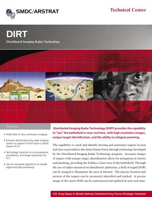
DIRT<br />
<strong>Distributed</strong> <strong>Imaging</strong> <strong>Radar</strong> <strong>Technology</strong><br />
Summary<br />
• Wide field of view continuous imaging<br />
• Enhance distributed array radar imaging<br />
system in support of the Future Combat<br />
System (FCS)<br />
• <strong>Technology</strong> transition to reconnaissance,<br />
surveillance, <strong>and</strong> target acquisition for<br />
FCS<br />
• Use of innovative algorithms to h<strong>and</strong>le<br />
signal <strong>and</strong> data processing<br />
<strong>Distributed</strong> <strong>Imaging</strong> <strong>Radar</strong> <strong>Technology</strong> (DIRT) provides the capability<br />
to “see” the battlefield in near real time, with high-resolution images,<br />
unique target identification, <strong>and</strong> the ability to mitigate jamming.<br />
The capability to track <strong>and</strong> identify moving <strong>and</strong> stationary targets in near<br />
real time is provided to the Army Future Force through technology developed<br />
by the <strong>Distributed</strong> <strong>Imaging</strong> <strong>Radar</strong> <strong>Technology</strong> program. Accurate images<br />
of targets with unique target identification allow for mitigation of clutter<br />
<strong>and</strong> jamming, providing the Soldier a clear view of the battlefield. Through<br />
the use of radars mounted on distributed platforms, a field of regard (FOR)<br />
can be imaged to illuminate the area of interest. The precise location <strong>and</strong><br />
motion of the targets can be accurately identified <strong>and</strong> tracked. A precise<br />
image of the entire FOR can be constructed <strong>and</strong> updated in near real time.<br />
U.S. Army <strong>Space</strong> & <strong>Missile</strong> <strong>Defense</strong> Comm<strong>and</strong>/Army Forces Strategic Comm<strong>and</strong>
DIRT<br />
Technical Center<br />
<strong>Distributed</strong> <strong>Imaging</strong> <strong>Radar</strong> <strong>Technology</strong><br />
<strong>Distributed</strong> <strong>Imaging</strong> <strong>Radar</strong> <strong>Technology</strong><br />
Overview<br />
The <strong>Distributed</strong> <strong>Imaging</strong> <strong>Radar</strong> <strong>Technology</strong> (DIRT)<br />
program develops technology to continuously track<br />
<strong>and</strong> identify a variety of moving <strong>and</strong> stationary battlefield<br />
targets for the U.S. Army Future Force. These<br />
targets include close-combat vehicles <strong>and</strong> weapons<br />
(tanks, artillery, <strong>and</strong> rockets), deep targets (missile<br />
transporter erector launchers), Battle Management<br />
Comm<strong>and</strong>, Control, Computer, Communications <strong>and</strong><br />
Intelligence nodes, <strong>and</strong> weapon stockpiles.<br />
Benefits for Tomorrow’s <strong>Defense</strong><br />
DIRT will provide the capability for the Army to<br />
“see” the width <strong>and</strong> breadth of the battlefield in near<br />
real time, with high-resolution images of targets, with<br />
unique target identification, <strong>and</strong> with the ability to<br />
mitigate clutter <strong>and</strong> jamming. DIRT will also provide<br />
wide area coverage of the battlefield, continuous tracking<br />
of moving <strong>and</strong> stationary targets, no single point<br />
of failure, precision tracking for targeting, <strong>and</strong> the<br />
capability of direct h<strong>and</strong>over to defensive weapons.<br />
The DIRT program demonstrates the feasibility of<br />
continuous imaging over a wide field of view with<br />
a <strong>Distributed</strong> Aperture <strong>Radar</strong> System. It develops,<br />
plans, <strong>and</strong> designs a <strong>Distributed</strong> Aperture <strong>Radar</strong><br />
Battlefield <strong>Imaging</strong> System <strong>and</strong> provides for technology<br />
transition to Reconnaissance, Surveillance, <strong>and</strong> Target<br />
Acquisition for the Future Combat System.<br />
motion of the subapertures phase centers at time of<br />
transmission. The radar return is then received at each<br />
subaperture. The central DIRT processing node will<br />
receive the subaperture returns, location, <strong>and</strong> time<br />
of transmission. These returns will be processed <strong>and</strong><br />
distributed in near real time for use on the battlefield.<br />
To select target locations (e.g. range cells) in the FOR,<br />
the synchronized time <strong>and</strong> phase of deconvolution of<br />
the waveforms must be performed. The moving target<br />
indicator processing <strong>and</strong> compensation for the Doppler<br />
shift must then be taken into account. An image will be<br />
constructed over the selected FOR. Within the image,<br />
ground benchmarks/reflectors can be located. Updated<br />
subaperture locations <strong>and</strong> motion, <strong>and</strong> compensated<br />
time <strong>and</strong> phase of deconvolved waveforms for location<br />
errors, can be combined to provide an accurate picture<br />
of the FOR. The image can be reconstructed with<br />
updated subaperture locations <strong>and</strong> waveform returns<br />
to provide even higher resolution images of the area<br />
of interest.<br />
The DIRT program is made up of three primary<br />
technologies: <strong>Space</strong> Time Coded Aperture consists of<br />
waveforms transmitted <strong>and</strong> recovered simultaneously<br />
from distributed subapertures; precision time <strong>and</strong><br />
phase synchronization of transmissions from separate<br />
subapertures; <strong>and</strong> nearly instantaneous images<br />
reconstructed from a single set of transmissions from<br />
distributed radar apertures.<br />
Technical Concept<br />
A field of regard (FOR) will be imaged by steering<br />
subapertures to illuminate the area of interest. The<br />
radar system(s) will transmit orthogonal waveforms<br />
(nearly simultaneously) from subapertures. The DIRT<br />
processing will precisely measure the location <strong>and</strong><br />
www.smdc.army.mil<br />
For more information, please contact:<br />
U.S. Army <strong>Space</strong> <strong>and</strong> <strong>Missile</strong> <strong>Defense</strong> Comm<strong>and</strong>/<br />
U.S. Army Forces Strategic Comm<strong>and</strong><br />
Public Affairs Office<br />
P.O. Box 1500<br />
Huntsville, AL 35807-3801<br />
Phone: 256-955-3887<br />
Fax: 256-955-1214<br />
Email: webmaster@smdc.army.mil<br />
www.smdc.army.mil<br />
Distribution A 0906/6303/0170