Application of inverse ray-tracing seismic modelling techniques
Application of inverse ray-tracing seismic modelling techniques
Application of inverse ray-tracing seismic modelling techniques

Create successful ePaper yourself
Turn your PDF publications into a flip-book with our unique Google optimized e-Paper software.
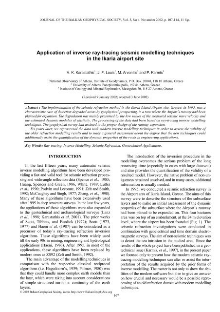
JOURNAL OF THE BALKAN GEOPHYSICAL SOCIETY, Vol. 5, No 4, November 2002, p. 107-114, 11 figs.<br />
<strong>Application</strong> <strong>of</strong> <strong>inverse</strong> <strong>ray</strong>-<strong>tracing</strong> <strong>seismic</strong> <strong>modelling</strong> <strong>techniques</strong><br />
in the Ikaria airport site<br />
V. K. Karastathis 1 , J. F. Louis 2 , M. Arvanitis 2 and P. Karmis 3<br />
1 National Observatory <strong>of</strong> Athens, Institute <strong>of</strong> Geodynamics, P.O. Box. 20048, 118 10 Athens, Greece<br />
2 University <strong>of</strong> Athens, Panepistimioupolis, 157 84 Athens, Greece<br />
3 Institute <strong>of</strong> Geology and Mineral Exploration, Mesogeion 70, 115 27 Athens, Greece<br />
(Received 9 January 2002; accepted 3 June 2002)<br />
Abstract : The implementation <strong>of</strong> the <strong>seismic</strong> refraction method in the Ikaria Island Airport site, Greece, in 1995, was a<br />
characteristic case <strong>of</strong> detection degraded areas by geophysical prospecting, in a zone where the Airport’s runway had been<br />
planned for expansion. The degradation was mainly presumed by the low values <strong>of</strong> the measured <strong>seismic</strong> wave velocity and<br />
the estimated dynamic modulus <strong>of</strong> elasticity. The processing <strong>of</strong> the data had been based on <strong>ray</strong>-<strong>tracing</strong> <strong>inverse</strong> <strong>modelling</strong><br />
<strong>techniques</strong>. The geophysical survey had assisted to the proper design <strong>of</strong> the runway expansion.<br />
Six years later, we reprocessed the data with modern <strong>inverse</strong> <strong>modelling</strong> <strong>techniques</strong> in order to assess the validity <strong>of</strong><br />
the older refraction <strong>modelling</strong> results and to make a general assessment about the degree that the new <strong>techniques</strong> could<br />
additionally assist the quantification <strong>of</strong> the dynamic properties <strong>of</strong> the rocks in engineering applications.<br />
Key Words: Ray-<strong>tracing</strong>, Inverse Modelling, Seismic Refraction, Geotechnical <strong>Application</strong>s.<br />
INTRODUCTION<br />
In the last fifteen years, many automatic <strong>seismic</strong><br />
<strong>inverse</strong> <strong>modelling</strong> algorithms have been developed providing<br />
a fast and valid tool for <strong>seismic</strong> refraction processing<br />
and wide-angle reflection data (Spence et al., 1985;<br />
Huang, Spencer and Green, 1986, White, 1989; Lutter<br />
et al., 1990; Podvin and Lecomte, 1991; Zelt and Smith,<br />
1992; McCaughey and Singh, 1977; Zhang, et al., 1998).<br />
Many <strong>of</strong> these algorithms have been extensively used<br />
after 1995 in deep structure surveys. In the last few years,<br />
the applications <strong>of</strong> these algorithms were also expanded<br />
to the geotechnical and archaeological surveys (Lanz<br />
et al., 1998; Karastathis et al. 2001). The prior works<br />
<strong>of</strong> Scott, Tibbets, and Burdick (1972); Scott (1973,<br />
1977) and Haeni et al. (1987) can be considered as a<br />
precursor <strong>of</strong> today’s <strong>ray</strong>-<strong>tracing</strong> refraction inversion<br />
algorithms. These algorithms have been widely used<br />
till the early 90s in mining, engineering and hydrological<br />
applications (Haeni, 1986). After 1995, in most <strong>of</strong> the<br />
applications, these algorithms have been replaced by<br />
modern ones as ZS92 (Zelt and Smith, 1992).<br />
The main advantage <strong>of</strong> the <strong>modelling</strong> <strong>techniques</strong> in<br />
comparison with the respective classical reciprocal<br />
algorithms (i.e. Hagedoorn’s, 1959; Palmer, 1980) was<br />
that they could handle more complex earth models than<br />
the later, which were taking into account considerations<br />
<strong>of</strong> simple structured earth i.e. continuity <strong>of</strong> the earth<br />
layers.<br />
© 2002 Balkan Geophysical Society, access http://www.BalkanGeophySoc.org<br />
107<br />
The introduction <strong>of</strong> the inversion procedure in the<br />
<strong>modelling</strong> overcomes the serious problem <strong>of</strong> the long<br />
processing time (especially in cases with large datasets)<br />
and also provides the quantification <strong>of</strong> the validity <strong>of</strong> a<br />
resulted model. However, the native problem <strong>of</strong> non-uniqueness<br />
remained unsolved, and in many cases, additional<br />
information is usually needed.<br />
In 1995, we conducted a <strong>seismic</strong> refraction survey in<br />
the Airport area <strong>of</strong> Ikaria Island, Greece. The aims <strong>of</strong> this<br />
survey were to describe the structure <strong>of</strong> the subsurface<br />
layers and to make an initial assessment <strong>of</strong> the dynamic<br />
properties <strong>of</strong> the subsurface where the Airport’s runway<br />
had been planed to be expanded on. This four hectares<br />
area was on top <strong>of</strong> an embankment, at the 24 m elevation<br />
level, where the airport has been founded (Fig. 1). The<br />
<strong>seismic</strong> refraction investigations were conducted in<br />
combination with geoelectrical and time domain electromagnetic<br />
surveys. The aim <strong>of</strong> non-<strong>seismic</strong> <strong>techniques</strong> was<br />
to detect the sea intrusion in the studied area. Since the<br />
results <strong>of</strong> the whole project have been published in a geotechnical<br />
issue (Karmis, et al., 1997), in the present paper<br />
we focused only to present how the modern <strong>seismic</strong> <strong>ray</strong><strong>tracing</strong><br />
<strong>modelling</strong> <strong>techniques</strong> can alter or assist the interpretation<br />
<strong>of</strong> the results acquired by the prior forms <strong>of</strong><br />
<strong>inverse</strong> <strong>modelling</strong>. The matter is not only to show the abilities<br />
<strong>of</strong> the modern s<strong>of</strong>tware but also to give an answer<br />
on how crucial and necessary would be a possible reprocessing<br />
<strong>of</strong> an old refraction dataset with modern <strong>modelling</strong><br />
<strong>techniques</strong>.
108 Karastathis et al.<br />
FIG. 1. The runway <strong>of</strong> the Ikaria airport is oriented NNE-SSW and terminated on an embankment area near the coast.<br />
At this area the runway was planned to be extended. (photo: Air Traffic Safety Electronic Engineers Association <strong>of</strong><br />
Hellenic Civil Aviation Authority: http://www.hcaa-eleng.gr/ikaria.htm)<br />
GEOLOGICAL SETTING<br />
The bedrock that underlies the embankment is a metamorphosed<br />
unit constituted by phyllite and schist, with<br />
a succession <strong>of</strong> intercalated carbonate layers. Highly<br />
fractured carbonate layers are observed on the outcrops.<br />
The surface sediments consist <strong>of</strong> sand and pebble conglomerate.<br />
The embankment material is made <strong>of</strong> scree and<br />
boulders.<br />
DATA ACQUISITION AND PROCESSING<br />
A number <strong>of</strong> P-wave <strong>seismic</strong> refraction pr<strong>of</strong>iles were<br />
conducted in the investigated area. Additional P-wave<br />
refraction survey was carried out to estimate the Poisson<br />
ratio <strong>of</strong> the bedrock in an adjacent area where the bedrock<br />
outcropped. Some shorter S-wave refraction<br />
pr<strong>of</strong>iles were also conducted in order to contribute to<br />
the assessment <strong>of</strong> the dynamic properties <strong>of</strong> the layers.<br />
The locations <strong>of</strong> the P-wave refraction pr<strong>of</strong>iles IKRP1,<br />
IKRP2, IKRP3 and IKRP4 are shown in Figure 2. The<br />
dataset IKRP1 was acquired with the use <strong>of</strong> 48 geophones<br />
and spacing interval <strong>of</strong> 4 m. A 24 geophone layout<br />
was used in all the other lines. The receiver interval was<br />
4 m for IKRP2 and IKRP3 and 2 m for IKRP4. The<br />
lengths <strong>of</strong> the IKRP1, IKRP2, IKRP3 and IKRP4 were<br />
188, 92, 92 and 46 m respectively. Dynamite was used<br />
as <strong>seismic</strong> source for the data acquisition and the resonant<br />
frequency <strong>of</strong> geophones was 10 Hz. The data recording<br />
unit was an ABEM Terraloc instrument.<br />
The first processing <strong>of</strong> the data (Karmis et al., 1997)<br />
was done by the use <strong>of</strong> the inversion <strong>ray</strong>-<strong>tracing</strong> <strong>modelling</strong><br />
algorithm SIPT1 <strong>of</strong> Haeni et al. (1987), based on<br />
the previous work <strong>of</strong> Scott, Tibbets and Burdick (1972)<br />
and Scott (1973, 1977). The program could handle mo-<br />
FIG. 2. Sketch map <strong>of</strong> the P-wave refraction pr<strong>of</strong>iles.<br />
dels with steeply dipping layers and abrupt changes in<br />
velocity. Its ability for data processing was limited to 48<br />
traces per shot and seven shots per spread. The algorithm<br />
could support models only with five or less layers. The<br />
inputs required by the program are the first arrival times,<br />
the assignment <strong>of</strong> arrivals to the corresponding refractors<br />
as well as the positions (elevation and location) <strong>of</strong><br />
the sources and receivers. By the use <strong>of</strong> a delay-time<br />
method the program performs a first approximation <strong>of</strong> the
<strong>Application</strong> <strong>of</strong> <strong>inverse</strong> <strong>ray</strong>-<strong>tracing</strong> <strong>seismic</strong> <strong>modelling</strong> <strong>techniques</strong> ... 109<br />
N<br />
60 70 80 90 100 110 120 130 140 150 160 170 180 190 200 210 220 230 240<br />
S<br />
20<br />
10<br />
0<br />
0.3 1.3 2.3 3.3 4.3<br />
Km/s<br />
FIG. 3. Velocity structure <strong>of</strong> the refraction pr<strong>of</strong>ile IKRP1. Triangles denote geophone positions.<br />
FIG. 4. Top: The first arrival <strong>ray</strong>-paths through a two-layer model <strong>of</strong> IKRP1. Bottom: Comparison <strong>of</strong> observed (bars<br />
represent ±1.2 ms uncertainty) and predicted travel times shown by dots. Overall RMS misfit was 1.18 ms for 288 arrivals.<br />
layered model. This initial model is improved by the implementation<br />
<strong>of</strong> an automatic inversion procedure based<br />
on a <strong>ray</strong>-<strong>tracing</strong> technique. In particular, a set <strong>of</strong> travel<br />
times are calculated by the program, and compared with<br />
the observed data and if the misfit is not within a userspecified<br />
limit, the refractor interface is adjusted in a<br />
such way to improve the model travel times fitting. The<br />
procedure is iterative and is continued until the limit<br />
was reached. The resulted model is finally smoothed.<br />
The program Rayinvr (Zelt and Smith, 1992; Zelt and<br />
Forsyth, 1994) was implemented for the reprocessing<br />
<strong>of</strong> the data. This is a <strong>ray</strong>-<strong>tracing</strong> algorithm accompanied<br />
with a least-square inversion routine that uses any type<br />
<strong>of</strong> <strong>seismic</strong> wave arrivals and provides a simultaneous<br />
determination <strong>of</strong> the 2-D velocity and interface structure.<br />
It uses a layered model consisted <strong>of</strong> trapezoids cells. The<br />
user defines the number and the shape <strong>of</strong> the trapezoid<br />
cells and also sets the velocity values on their corners.<br />
This definition is done by setting up the respective<br />
“boundary” and “velocity nodes”. The velocity values<br />
within the trapezoids come from a linear interpolation<br />
between the four defined corner velocities. The algorithm<br />
not only improves the time required for data processing<br />
in comparison to the forward <strong>modelling</strong> but also<br />
estimates model parameter resolution, uncertainty and<br />
non-uniqueness. The Rayinvr has been mostly used in<br />
crustal studies such as those reported by Zelt and Ellis<br />
(1989); O’Leary, et al. (1995); Zelt and White (1995);<br />
Clowes, et al.,(1995); and Sato and Kennett (2000). The<br />
data processing was done on a Sun Ultra 10 workstation.
110 Karastathis et al.<br />
4.6<br />
4.1<br />
3.6<br />
3.1<br />
2.6<br />
2.1<br />
1.6<br />
1.1<br />
0.6<br />
0<br />
-0.5<br />
-1<br />
-1.5<br />
-2<br />
-2.5<br />
Km/s<br />
-3 Km/s<br />
20<br />
10<br />
0<br />
20<br />
10<br />
0<br />
20<br />
10<br />
0<br />
20<br />
10<br />
0<br />
20<br />
10<br />
0<br />
20<br />
10<br />
0<br />
100 150 200<br />
100 150 200<br />
100 150 200<br />
100 150 200<br />
100 150 200<br />
100 150 200<br />
FIG. 5. A single parameter resolution test. The final model (A) was perturbed by raising the 180 m node by 3 m. The<br />
resulting model (B) was used to produce a new arrival time dataset. The inversion <strong>of</strong> the final model (A) with the<br />
perturbed time dataset resulted to a new model (C). The next model (D) presents the initial perturbation which created the<br />
perturbed time dataset. Model (E) shows the resulted perturbation on the final model crated by inverting the perturbed<br />
time dataset. The models (D) and (E) are little different. The difference is shown in model (F).<br />
A<br />
B<br />
C<br />
D<br />
E<br />
F<br />
N<br />
60 70 80 90 100 110 120 130 140 150 160 170 180 190 200 210 220 230 240<br />
S<br />
20<br />
10<br />
0<br />
0 5 10 15 20 25 30 35 40 45 50<br />
GPa<br />
FIG. 6. Section representing the estimated elasticity modulus <strong>of</strong> the line IKRP1.<br />
FIG. 7. The refraction <strong>seismic</strong> section after processing with the SIPT1 algorithm.
<strong>Application</strong> <strong>of</strong> <strong>inverse</strong> <strong>ray</strong>-<strong>tracing</strong> <strong>seismic</strong> <strong>modelling</strong> <strong>techniques</strong> ... 111<br />
1400<br />
1200<br />
1000<br />
Velocity (m/s)<br />
800<br />
600<br />
400<br />
200<br />
0<br />
60 80 100 120 140 160 180 200 220 240<br />
Distance (m)<br />
FIG. 8. The horizontal variation <strong>of</strong> the overburden layer velocity as calculated by the algorithm SIPT1 on the IKRP1<br />
data.<br />
W<br />
60 80 100 120 140<br />
E<br />
20<br />
10<br />
0<br />
0.3 0.8 1.3 1.8 2.3 2.8 3.3 3.8 4.3 4.8<br />
Km/s<br />
20<br />
W<br />
60 70 80 90 100 110 120 130 140 150<br />
E<br />
10<br />
0<br />
0 3 6 9 12 15 18 21 24 27 30 33 36 39 42 45 48<br />
GPa<br />
FIG. 9. The velocity model (top) and the respective presentation <strong>of</strong> the estimated elasticity modulus (bottom) <strong>of</strong> the<br />
<strong>seismic</strong> line IKRP2.
112 Karastathis et al.<br />
1200<br />
1000<br />
800<br />
Velocity (m/s)<br />
600<br />
400<br />
200<br />
0<br />
60 80 100 120 140<br />
Distance (m)<br />
FIG. 10. The horizontal variation <strong>of</strong> the velocity <strong>of</strong> the overburden in IKRP2 line, as calculated by the algorithm SIPT1.<br />
5 10 15 20 25 30 35 40 45<br />
20<br />
700 m/s 1000 m/s 1200 m/s<br />
15<br />
10<br />
5<br />
0.3 1.3 2.3 3.3 4.3<br />
Km/s<br />
FIG. 11. The velocity structure <strong>of</strong> the refraction pr<strong>of</strong>ile IKRP4 as resulted from the processing with the Rayinvr algorithm.<br />
The numbers inside indicate the velocity values as calculated by SIPT1.<br />
RESULTS<br />
The results <strong>of</strong> the <strong>seismic</strong> and geoelectical surveys<br />
in 1995 (Louis and Karastathis, 1996; Karmis et al.,<br />
1997), described a deteriorated zone at the eastern side<br />
<strong>of</strong> the investigated area. Although <strong>seismic</strong> refraction<br />
survey succeeded to detect this deterioration, questions<br />
remained outstanding about the precision and the completeness<br />
<strong>of</strong> the results. The comparison <strong>of</strong> the previous<br />
results derived by the SIPT1 algorithm with the new<br />
ones acquired by one <strong>of</strong> the most popular and modern<br />
inversion <strong>modelling</strong> algorithms, the Rayinvr, provided<br />
us with useful answers to all these questions.<br />
The line IKRP1 could be considered as the backbone<br />
line <strong>of</strong> the <strong>seismic</strong> survey. The model resulted after<br />
processing with Rayinvr is presented in Figure 3. The<br />
structure is simple without any abrupt anomaly in the<br />
depth <strong>of</strong> the bedrock interface or in the P-wave velocity
<strong>Application</strong> <strong>of</strong> <strong>inverse</strong> <strong>ray</strong>-<strong>tracing</strong> <strong>seismic</strong> <strong>modelling</strong> <strong>techniques</strong> ... 113<br />
values. The lowest values <strong>of</strong> the P-wave velocity <strong>of</strong> the<br />
first layer (800 – 900 m/s) around 80-100 m and 130-<br />
160 m are concentrated in very shallow depths and could<br />
not lead to any concern about the compactness <strong>of</strong> this<br />
layer. These low values can be attributed to a natural<br />
deterioration <strong>of</strong> the superficial materials.<br />
The <strong>ray</strong>-coverage <strong>of</strong> IKRP1 was dense enough to<br />
describe the P-wave velocity <strong>of</strong> the first layer and the<br />
upper part <strong>of</strong> the bedrock (See Figure 4 – upper panel).<br />
This was succeeded by utilizing 48 geophones and 7<br />
shots which are the maximum limits <strong>of</strong> the processing<br />
capabilities <strong>of</strong> the SIPT algorithm. The fitting between<br />
calculated and observed times was very good (Figure 4<br />
– lower panel) since the RMS error was not higher than<br />
1.2 ms.<br />
We also tested the stability <strong>of</strong> the final model (Fig.<br />
5a) by perturbing it at one point (180 m). Actually, we<br />
moved the boundary node <strong>of</strong> this point upwards for 2 m.<br />
The velocity model then was modified (Fig. 5b). A new<br />
data set was created by forward <strong>modelling</strong>. This data<br />
was inverted by using the final model as a starting model.<br />
The inversion produces a new model (Fig. 5c). The<br />
purpose was to check if the final model was sensitive<br />
to small perturbations. We found out that the model<br />
was stable, since the smearing around the anomaly was<br />
very small. The resulted model after the inversion <strong>of</strong><br />
the perturbed data is shown in Figure 5c. Figure 5d<br />
shows the initial perturbation <strong>of</strong> the model (difference<br />
between 5a and 5b), the Figure 5e shows the resulted<br />
anomaly (difference between 5a and 5c) and the Figure<br />
5f shows the difference between the two anomalies (5d<br />
and 5e). We can notice that the difference is very small<br />
and we can conclude that the inversion is stable.<br />
We also estimated the elastic modulus <strong>of</strong> the materials<br />
in the IKRP1 section. The resulted section is shown<br />
in Figure 6.<br />
The comparison <strong>of</strong> the new results with the previous<br />
ones showed a very good agreement in the depth estimation<br />
<strong>of</strong> the bedrock. Figure 7 shows the refraction<br />
pr<strong>of</strong>ile as resulted from the SIPT1 processing. The<br />
velocity distribution <strong>of</strong> the first layer is presented in<br />
Figure 8. The estimated velocity values by SIPT1 (see<br />
Fig. 8) agreed well with the values <strong>of</strong> the first six meters<br />
material in the Rayinvr model. This was expected since<br />
the major part <strong>of</strong> the first layer <strong>ray</strong>s came through these<br />
first meters. If Karmis et al., (1997) had not conducted<br />
supplementary geophysical methods such as geoelectrical<br />
pr<strong>of</strong>iling or electromagnetic soundings, they could<br />
not be able to evaluate the quality <strong>of</strong> the interpretation<br />
for the layers deeper than 5-6 m. The modern <strong>modelling</strong><br />
technique able to handle models with linear velocity<br />
increase allowed estimating velocity at those depths.<br />
The deteriorated area at the eastern part <strong>of</strong> the<br />
investigated area was detected by both the IKRP2 and<br />
IKRP3 lines. We present P-wave velocity and elasticity<br />
modulus sections obtained from the <strong>modelling</strong> <strong>of</strong> line<br />
IKRP2 pr<strong>of</strong>ile (Fig. 9). It is easily seen that the area over<br />
120 m has lower values <strong>of</strong> P-wave velocity. Figure 10<br />
shows the velocity graph <strong>of</strong> the previous processing.<br />
Although the velocity variation is clear in this section,<br />
it is difficult to decide if the low velocity zone is limited<br />
inside the upper layer without additional information.<br />
Seismic line IKRP4 (Figure 11) also indicates a<br />
small deterioration in the upper part <strong>of</strong> the first layer.<br />
The estimated velocities by the previous processing are<br />
presented by red lettering. The agreement between the<br />
two processing methods as far as the P-wave velocity<br />
is concerned, was very good. However the new processing<br />
succeeded to specify better the area with the lower<br />
velocities.<br />
CONCLUSIONS<br />
The reprocessing <strong>of</strong> the data leads to obtain new<br />
information about the velocity field derived from the<br />
<strong>seismic</strong> refraction survey. It also provides an idea about<br />
the quality <strong>of</strong> the previous <strong>inverse</strong> <strong>modelling</strong> results.<br />
The former <strong>techniques</strong> could not estimate the velocity<br />
values in the deeper part <strong>of</strong> the upper layer since they<br />
could not handle models with a gradient increase in the<br />
velocity field.<br />
The reprocessing <strong>of</strong> the data is worth trying since<br />
new information can be derived from the former <strong>seismic</strong><br />
refraction experiments having extensive <strong>ray</strong>-coverage.<br />
In Greece, there are many datasets i.e. important engineering<br />
<strong>seismic</strong> surveys and crustal investigations. This<br />
work shows that the reinterpretation <strong>of</strong> these datasets<br />
would be very useful.<br />
REFERENCES<br />
Clowes, R. M., Zelt, C. A., Amor, J. R. and Ellis, R. M., 1995.<br />
Lithospheric structure in the southern Canadian Cordillera from a<br />
network <strong>of</strong> <strong>seismic</strong> refraction lines: Can. J. Earth Sci., 32, 1485–<br />
1513.<br />
Haeni, F. P., 1986. <strong>Application</strong> <strong>of</strong> <strong>seismic</strong>-refraction <strong>techniques</strong> to<br />
hydrologic studies: U.S. Geological Survey Open File Report<br />
84-746, 144.<br />
Haeni, F. P., Grantham D. G., and Ellefsen K., 1987. Micro-computer-based<br />
version <strong>of</strong> SIPT-. A program for interpretation <strong>of</strong><br />
<strong>seismic</strong> refraction data: U.S. Geological Survey Open file report<br />
87-103-A. Hartford, Connecticut.<br />
Hagedoorn J. G., 1959. The plus-minus method <strong>of</strong> interpreting<br />
<strong>seismic</strong> refraction sections: Geophysical Prospecting, 7, 158-182.<br />
Huang, H., Spencer, C. and Green, A., 1986. A method for the<br />
inversion <strong>of</strong> refraction and reflection travel times for laterally<br />
varying velocity structures: Bull. Seism. Soc. Am., 76 , 837-846.<br />
Karastathis, V. K., Papamarinopoulos S. and Jones R. E., 2001.<br />
2-D velocity structure <strong>of</strong> the buried ancient canal <strong>of</strong> Xerxes:<br />
An application <strong>of</strong> <strong>seismic</strong> methods in archaeology: Journal <strong>of</strong><br />
Applied Geophysics, 47, 29–43<br />
Karmis P., Louis J. F. and Karastathis V. K., 1997. Site characterisation<br />
by geophysical methods - A case history: Proceedings,<br />
International Symposium on Engineering Geology and the Environment<br />
- Greek National Group <strong>of</strong> International Association<br />
<strong>of</strong> Engineering Geology (IAEG), Athens, 1997, 1285 - 1291.
114 Karastathis et al.<br />
Lanz, E., Maurer, H., and Green, A. G., 1998. Refraction tomography<br />
over a buried waste disposal site: Geophysics, 63, 1414-1433.<br />
Louis J. F. and Karastathis V. K., 1996. Seismic investigations in<br />
Ikaria airport: Technical Report. University <strong>of</strong> Athens.<br />
Lutter, W. J., Nowack, R. L., and Braile, L. W., 1990. Seismic<br />
imaging <strong>of</strong> upper crustal structure using travel times from the<br />
PASSCAL Ouachita experiment: J. Geophys. Res., 95, 4621-4631.<br />
McCaughey, M., and Singh, S. C., 1997. Simultaneous velocity and<br />
interface tomography <strong>of</strong> normal-incidence and wide-aperture<br />
traveltime data: Geophys. J. Int., 131, 87-99.<br />
O’Leary, D. M., Ellis, R. M., Stephenson, R. A., Lane, L. S., and<br />
Zelt, C. A., 1995. Crustal structure <strong>of</strong> the northern Yukon and<br />
MacKenzie Delta: J. Geophys. Res. 100, 9905–9920.<br />
Palmer, D., 1980. The generalized reciprocal method <strong>of</strong> <strong>seismic</strong><br />
refraction interpretation. Society <strong>of</strong> Exploration Geophysicists.<br />
Podvin, P., and Lecomte, I., 1991. Finite-difference computation<br />
<strong>of</strong> traveltimes in very contrasted velocity models: A massively<br />
parallel approach and its associated tools: Geophys. J. Internat.,<br />
105, 271–284.<br />
Sato, Τ., and Kennett B. L. N., 2000. Two-dimensional inversion<br />
<strong>of</strong> refraction traveltimes by progressive model development:<br />
Geophys. J. Int., 140, 543-558.<br />
Scott, J. H., 1977. SIPT – a <strong>seismic</strong> refraction <strong>inverse</strong> <strong>modelling</strong> program<br />
for timeshare terminal computer systems: U.S. Geological<br />
Survey Open File Report 77-365, 35 pp.<br />
Scott, J. H., Tibbets, B. L., and Burdick, R. G., 1972. Computer<br />
analysis <strong>of</strong> <strong>seismic</strong> refraction data: U.S. Bureau <strong>of</strong> Mines, Report<br />
Investigations, 7595, 95.<br />
Scott, J. H., 1973. Seismic refraction <strong>modelling</strong> by computer: Geophysics,<br />
38, 271-284.<br />
Spence, G. D., Clowes, R. M., and Ellis, R. M., 1985. Seismic<br />
structure across the active subduction zone <strong>of</strong> western Canada:<br />
J. Geophys. Res., 90, 6754-6772.<br />
White, D. J., 1989. Two-dimensional <strong>seismic</strong> refraction tomography:<br />
Geophys. J. Int., 97, 223-245.<br />
Zelt, C. A. and Forsyth, D. A., 1994. Modelling wide-angle <strong>seismic</strong><br />
data for crustal structure: southeastern Grenville province: J.<br />
Geophys. Res., 99, 11687-11704.<br />
Zelt, C. A. and Smith, R. B., 1992. Seismic traveltime inversion<br />
for 2-D crustal velocity structure: Geophys. J. Int., 108, 16-34.<br />
Zelt, C. A., Ellis, R. M., 1989. Seismic structure <strong>of</strong> the crust and<br />
upper mantle in the Peace River Arch region: Can. J. Geophys.<br />
Res., 94, 5729–5744.<br />
Zelt, C. A., White, D. J., 1995. Crustal structure and tectonics <strong>of</strong><br />
the southeastern Canadian Cordillera: J. Geophys. Res., 100,<br />
24255–24273.<br />
Zhang, J., ten Brink, U.S. and Toksφz, M.N., 1998. Nonlinear<br />
refraction and reflection traveltime tomography: J. Geophys.<br />
Res., 103, 29743-29757.