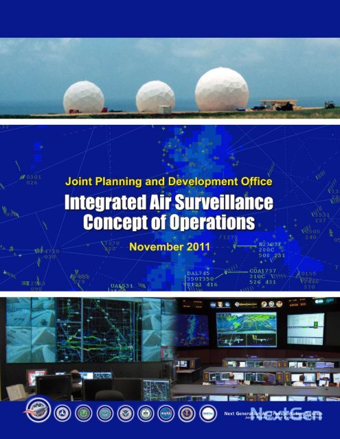
Integrated Air Surveillance Concept of Operations - Joint Planning ...
Integrated Air Surveillance Concept of Operations - Joint Planning ...
Integrated Air Surveillance Concept of Operations - Joint Planning ...

You also want an ePaper? Increase the reach of your titles
YUMPU automatically turns print PDFs into web optimized ePapers that Google loves.
<strong>Integrated</strong> <strong>Air</strong> <strong>Surveillance</strong> <strong>Concept</strong> <strong>of</strong> <strong>Operations</strong><br />
Revision Approval Record<br />
<strong>Joint</strong> <strong>Planning</strong> and Development Office<br />
Department <strong>of</strong> Defense<br />
Department <strong>of</strong> Commerce/National Oceanic<br />
and Atmospheric Administration<br />
Department <strong>of</strong> Homeland Security<br />
Federal Aviation Administration<br />
Office <strong>of</strong> the Director for National<br />
Intelligence<br />
Karlin Toner<br />
Robert Salesses<br />
Samuel Williamson<br />
Alan Cohn<br />
Michael Huerta<br />
Guy Turner<br />
November 2011
<strong>Integrated</strong> <strong>Air</strong> <strong>Surveillance</strong> <strong>Concept</strong> <strong>of</strong> <strong>Operations</strong><br />
Document Revision History<br />
Version Document Content Added Reviewer Release Date<br />
2.1 Modifications to incorporate major community <strong>Integrated</strong> 23 April 2009<br />
comments<br />
<strong>Surveillance</strong> (IS)<br />
Community<br />
2.2 Modifications to incorporate major community IS Community 04 May 2009<br />
comments<br />
3.0 Modifications to incorporate major community IS Community 16 June 2009<br />
comments<br />
4.0 Internal <strong>Integrated</strong> <strong>Surveillance</strong> Analysis Team<br />
(ISAT) Review<br />
<strong>Integrated</strong><br />
<strong>Surveillance</strong><br />
Analysis Team<br />
18 May 2011<br />
4.01 Revisions based on ISAT review IS Community 26 May 2011<br />
4.02 Revisions based on IS Community Review IS Community 24 June 2011<br />
4.03 Revisions based on IS Community Review Senior Advisors 20 July 2011<br />
4.04 Revisions based on IS Community Review Senior Advisors 29 Aug 2011<br />
4.05 Revisions based on IS Senior Advisors Review Senior Advisors 30 Aug 2011<br />
November 2011
<strong>Integrated</strong> <strong>Air</strong> <strong>Surveillance</strong> <strong>Concept</strong> <strong>of</strong> <strong>Operations</strong><br />
Acknowledgements<br />
Many IS practitioners have given generously <strong>of</strong> their time and expertise to work with the <strong>Joint</strong><br />
<strong>Planning</strong> and Development Office (JPDO) NextGen <strong>Integrated</strong> <strong>Surveillance</strong> Analysis Team<br />
(ISAT) in developing the <strong>Integrated</strong> <strong>Surveillance</strong> (IS) <strong>Concept</strong> <strong>of</strong> <strong>Operations</strong> (ConOps). Version<br />
4 reflects requirements and desired capabilities <strong>of</strong> those partners who work in close collaboration<br />
across federal, state, and local organizations to keep the Nation's air space secure and safe. We<br />
thank them all for their shared insights and believe that such collaborative efforts now can spur<br />
real progress in the future. The following tables list these participants and their contributions:<br />
Participants in the IS ConOps Revision Process<br />
Agency<br />
Department <strong>of</strong> Commerce (DOC)<br />
Department <strong>of</strong> Defense (DoD)<br />
Federal Aviation Administration (FAA)<br />
Participants<br />
Mr. Daniel Melendez, NOAA<br />
Mr. Bob Saffle, NOAA / Noblis Inc.<br />
Mr. Benjie Spencer, NOAA<br />
Mr. Jud Stailey, NOAA<br />
Lt Col Tom Alto, NORAD-USNORTHCOM<br />
Lt Col Campbell, EADS<br />
Lt. Col Chas Cox, NORAD-USNORTHCOM<br />
Lt Col Filkorn, EADS<br />
Mr. Glenn Gese, NORAD-USNORTHCOM<br />
Mr. Willie Harris, JIAMDO<br />
Mr. Rick Hensley, NORAD-USNORTHCOM<br />
Lt. Col Pat Holleran, NORAD-USNORTHCOM<br />
Mr. Bill Mullins, USAF HQ<br />
Lt Col Rodder, EADS<br />
Mr. Steve Ruggles, NORAD-USNORTHCOM /<br />
Booz Allen Hamilton<br />
Mr. Harry Smythe, NORAD-USNORTHCOM<br />
Lt Col Merryl Tengesdal, NORAD-<br />
USNORTHCOM<br />
Lt Col Ann Wong, JIAMDO<br />
Mr. Brandon Wood, NORAD-USNORTHCOM<br />
Mr. James Baird, NAS EA Group<br />
Ms. Michelle Merkle, ATS <strong>Concept</strong> &Validation<br />
Development<br />
Mr. Gary Miller, Tactical <strong>Operations</strong> Security<br />
Group<br />
Ms. Lisa Smith<br />
Ms. Jennifer Wahal<br />
November 2011
<strong>Integrated</strong> <strong>Air</strong> <strong>Surveillance</strong> <strong>Concept</strong> <strong>of</strong> <strong>Operations</strong><br />
Department <strong>of</strong> Homeland Security (DHS)<br />
Office <strong>of</strong> the Director <strong>of</strong> National Intelligence<br />
(ODNI)<br />
Mr. Craig Bensho<strong>of</strong>, AMOC<br />
Mr. John Bioty, DHS HQ / Booz Allen Hamilton<br />
Mr. Bruce Browne, TSA/NCRCC<br />
Mr. Mitch Crosswait, DHS HQ<br />
Mr. Robin Dooley, AMOC<br />
Ms. Dianna Davis, TSA<br />
Col William Durham, CBP<br />
Mr. Jim Durrett, AMOC<br />
Mr. Chris Featherstone, DHS HQ<br />
Mr. Hal Frasch, CBP<br />
Ms. Cristal Frinell, AMOC<br />
Ms. Kim Garcia, AMOC, Intelligence<br />
Mr. Dan Hicken, FAA liaison, AMOC<br />
Mr. Bob Keller, AMOC, Intelligence<br />
Mr. Ron Kissinger, AMOC<br />
Ms. Diana Knittle, AMOC<br />
Mr. Chuck Larir SDEO, AMOC<br />
Ms. Virginia Lariviere, AMOC<br />
Mr. Jeff Mayer SDEO, AMOC<br />
Mr. Clinton Preston, DHS HQ<br />
Mr. Francisco Quesada, AMOC<br />
Mr. Julian Ross, DHS HQ<br />
Mr. Joe Anello, DHS HQ<br />
Mr. Randy Talley, DHS HQ<br />
Mr. Stephen Roulle AMOC<br />
Ms. Sherry Zeigler, AMOC<br />
Mr. Josh Holtzman<br />
JPDO NextGen <strong>Integrated</strong> <strong>Surveillance</strong> Analysis Team<br />
Participants<br />
Patricia Craighill<br />
Peggy Gervasi<br />
Diana Takata<br />
Wanda Jones-Heath<br />
Stephen Irmo<br />
Claude Speed<br />
Uriel Moore<br />
Dale DeKinder<br />
Shawn Herron<br />
Beth Huffer<br />
Role<br />
JPDO Assistant Director – Defense,<br />
Special Advisor to the Chief, Warfighting<br />
Integration and CIO<br />
Director, JPDO Strategic Interagency Initiatives<br />
Division<br />
JPDO Chief Architect (Acting)<br />
Deputy Director, JPDO Net-Centric <strong>Operations</strong><br />
Division<br />
JPDO IS ConOps Revision Federal Lead<br />
IS ConOps Revision Contractor Lead / Alion<br />
Science and Technology<br />
IS ConOps Revision Support / Alion Science and<br />
Technology<br />
IS ConOps Revision Support / 5D Consulting LLC<br />
IS ConOps Revision Support / Booz Allen<br />
Hamilton<br />
IS ConOps Revision Support / <strong>Concept</strong> Solutions<br />
November 2011
<strong>Integrated</strong> <strong>Air</strong> <strong>Surveillance</strong> <strong>Concept</strong> <strong>of</strong> <strong>Operations</strong><br />
Terry Moss<br />
Emily Brandes<br />
Jerry Friedman<br />
Avinash Pinto<br />
IS ConOps Revision Support / Alion Science and<br />
Technology<br />
IS ConOps Revision Support / <strong>Concept</strong> Solutions<br />
IS ConOps Revision Support / MITRE<br />
IS ConOps Revision Support / MITRE<br />
November 2011
<strong>Integrated</strong> <strong>Air</strong> <strong>Surveillance</strong> <strong>Concept</strong> <strong>of</strong> <strong>Operations</strong><br />
Table <strong>of</strong> Contents<br />
Preface ............................................................................................................................................. i<br />
1 Introduction ............................................................................................................................. 1<br />
1.1 Purpose ............................................................................................................................ 3<br />
1.2 Background ..................................................................................................................... 4<br />
1.3 Scope ............................................................................................................................... 5<br />
1.4 Justification for Changes................................................................................................. 6<br />
1.5 Coordination with Other Domains .................................................................................. 6<br />
1.6 Governance ..................................................................................................................... 6<br />
2 Current <strong>Operations</strong> and Systems ............................................................................................. 8<br />
2.1 Description <strong>of</strong> Current <strong>Operations</strong> .................................................................................. 8<br />
2.2 Current System Characteristics ..................................................................................... 16<br />
2.3 Operational Constraints ................................................................................................ 17<br />
2.4 Policy Constraints ......................................................................................................... 18<br />
3 Description <strong>of</strong> Desired Operational Capabilities .................................................................. 19<br />
3.1 Operational Policies and Principles .............................................................................. 19<br />
3.2 Assumptions .................................................................................................................. 20<br />
3.3 Constraints .................................................................................................................... 21<br />
3.4 <strong>Integrated</strong> <strong>Air</strong> <strong>Surveillance</strong> Environment ..................................................................... 22<br />
3.5 Desired Operational Capabilities .................................................................................. 27<br />
4 Desired System Capabilities ................................................................................................. 31<br />
4.1 Interagency Detection and Maintenance <strong>of</strong> Tracks ...................................................... 32<br />
4.2 Agile Information Sharing Infrastructure ..................................................................... 32<br />
4.3 Sensor Network ............................................................................................................. 34<br />
4.4 Command Center Data Processing and Visual Displays .............................................. 36<br />
4.5 Cross Domain Security Gateways ................................................................................ 36<br />
5 System Operation and Sustainment ...................................................................................... 37<br />
5.1 <strong>Surveillance</strong> Performance Reporting ............................................................................ 37<br />
5.2 Full Required <strong>Surveillance</strong> Performance (RSP) and Modes <strong>of</strong> Operation ................... 37<br />
5.3 System Support ............................................................................................................. 37<br />
6 Operational Scenarios ........................................................................................................... 39<br />
6.1 Tracking <strong>of</strong> lost cargo airliner within Continental United States (CONUS) ................ 39<br />
November 2011
<strong>Integrated</strong> <strong>Air</strong> <strong>Surveillance</strong> <strong>Concept</strong> <strong>of</strong> <strong>Operations</strong><br />
6.2 Fast Business Jet Penetration from Northern Border .................................................... 39<br />
6.3 Fast Business Jet Penetration from Gulf <strong>of</strong> Mexico ..................................................... 39<br />
6.4 Degraded Mode Automatic Dependent <strong>Surveillance</strong>-Broadcast (ADS-B) .................. 39<br />
6.5 Lost Pilot ―Blunders‖ into Controlled <strong>Air</strong>space ........................................................... 40<br />
6.6 Off-Nominal General Aviation Flight .......................................................................... 40<br />
7 Summary <strong>of</strong> Impacts ............................................................................................................. 41<br />
7.1 Summary <strong>of</strong> Operational Impacts ................................................................................. 41<br />
7.2 Other Potential Impacts ................................................................................................. 42<br />
7.2.1 Regulatory Impacts ................................................................................................... 42<br />
7.2.2 Fiscal Impacts ........................................................................................................... 42<br />
7.2.3 Organizational Impacts: ............................................................................................ 42<br />
7.2.4 Acquisition Impacts: ................................................................................................. 43<br />
8 Recommendations ................................................................................................................. 44<br />
8.2 Governance ................................................................................................................... 44<br />
8.3 Policy and Guidance Changes ...................................................................................... 44<br />
9 Conclusion ............................................................................................................................ 46<br />
Appendix A: References ............................................................................................................... 47<br />
Appendix B: Terms and Definitions ............................................................................................. 51<br />
Appendix C: Acronyms ................................................................................................................ 60<br />
Table <strong>of</strong> Figures<br />
Figure 1: NAS <strong>Surveillance</strong> Today .............................................................................................. 16<br />
Figure 2: Current <strong>Integrated</strong> <strong>Air</strong> <strong>Surveillance</strong> Challenges .......................................................... 17<br />
Figure 3: NextGen <strong>Integrated</strong> <strong>Air</strong> <strong>Surveillance</strong> High-Level Information Sharing <strong>Concept</strong> ........ 23<br />
Figure 4: NextGen Information Sharing Environment Description ............................................ 31<br />
November 2011
<strong>Integrated</strong> <strong>Air</strong> <strong>Surveillance</strong> <strong>Concept</strong> <strong>of</strong> <strong>Operations</strong><br />
Preface<br />
The United States Government conducts air surveillance operations to encourage and allow<br />
maximum appropriate use <strong>of</strong> United States airspace and to maintain the safety, security and<br />
defense <strong>of</strong> the homeland. Given the complexity <strong>of</strong> the National <strong>Air</strong>space System (NAS), and the<br />
ever increasing volume <strong>of</strong> air traffic, meeting these objectives is a multi-agency responsibility.<br />
The <strong>Surveillance</strong> Mission Partners - the Departments <strong>of</strong> Transportation, Defense, Homeland<br />
Security and Commerce, 1 supported by the Office <strong>of</strong> the Director <strong>of</strong> National Intelligence - all<br />
have vital roles to play. Better integration <strong>of</strong> the surveillance mission partners’ operations and<br />
systems is needed to ensure that they can continue to carry out their respective missions<br />
effectively. <strong>Integrated</strong> air surveillance is defined as the integration <strong>of</strong> information from<br />
cooperative and non-cooperative surveillance systems to create a user-defined operational<br />
picture, from common information, <strong>of</strong> real or near-real time situation for safety, security, and<br />
efficiency. 2<br />
In December 2008, participants at the Interagency <strong>Surveillance</strong> Summit 3 , hosted by the Deputy<br />
Secretary <strong>of</strong> Homeland Security, requested development <strong>of</strong> an <strong>Integrated</strong> <strong>Air</strong> <strong>Surveillance</strong><br />
<strong>Concept</strong> <strong>of</strong> <strong>Operations</strong> (IS ConOps) drawn from existing ConOps-related documents, an initial<br />
<strong>Integrated</strong> <strong>Surveillance</strong> Enterprise Architecture (ISEA) and a governance recommendation. The<br />
Next Generation <strong>Air</strong> Transportation System (NextGen) <strong>Joint</strong> <strong>Planning</strong> and Development Office<br />
(JPDO) was tasked to prepare those products.<br />
In July 2010, the JPDO’s oversight body, the Senior Policy Committee 4 (SPC), directed that the<br />
recommended governance mechanism and work plan be put into action and that the IS ConOps<br />
be updated with the specific intent <strong>of</strong> resolving the outstanding issues that had prevented total<br />
concurrence in draft version 3.0.<br />
This update to the IS ConOps identifies shared requirements for joint capabilities and changes<br />
needed to effect a transition from today’s evolving collaborative environments to a fully and<br />
deliberately integrated, interagency air surveillance ―system <strong>of</strong> systems‖. Key attributes <strong>of</strong> the<br />
NextGen strategy to improve air surveillance capabilities include:<br />
Leveraging existing surveillance assets to provide optimal, persistent, wide area<br />
surveillance coverage <strong>of</strong> key sectors <strong>of</strong> the United States airspace and approaches, with<br />
1 <strong>Integrated</strong> <strong>Surveillance</strong> for the Next Generation <strong>Air</strong> Transportation System: Final Report <strong>of</strong> the <strong>Integrated</strong><br />
<strong>Surveillance</strong> Study Team, October 31, 2008.<br />
2 Final Report <strong>of</strong> the <strong>Integrated</strong> <strong>Surveillance</strong> Study Team, October 31, 2008.<br />
3 Summit attendees included senior leaders from the FAA, National Oceanic and Atmospheric Administration,<br />
JPDO, DHS, the United States <strong>Air</strong> Force, NORAD-NORTHCOM, National Guard Bureau, ODNI, <strong>Air</strong> Force North,<br />
and the National Security Staff.<br />
4 The Senior Policy Committee is chaired by the Secretary <strong>of</strong> Transportation and includes the Secretary <strong>of</strong><br />
Homeland Security, the FAA Administrator, the Director <strong>of</strong> the White House Office <strong>of</strong> Science and Technology, the<br />
Secretary <strong>of</strong> Commerce, the NASA Administrator, the Secretary <strong>of</strong> the United States <strong>Air</strong> Force, and the Office <strong>of</strong><br />
the Director <strong>of</strong> National Intelligence (ex-<strong>of</strong>ficio).<br />
November 2011<br />
i
<strong>Integrated</strong> <strong>Air</strong> <strong>Surveillance</strong> <strong>Concept</strong> <strong>of</strong> <strong>Operations</strong><br />
the longer-term goal <strong>of</strong> providing coverage <strong>of</strong> the entirety <strong>of</strong> United States airspace<br />
(refer to Appendix A and Appendix D for requirements specificity)<br />
Developing an interagency, information sharing infrastructure that enables seamless<br />
sharing <strong>of</strong> surveillance data and other relevant information through machine-to-machine<br />
interfaces, to ensure access to data by all authorized consumers and to maintain data<br />
integrity, provenance, and security<br />
Encouraging and facilitating development <strong>of</strong> automated data correlation, fusion, filtering<br />
and analysis tools, to alleviate information overload and to reduce the burden on<br />
operators <strong>of</strong> conducting time-consuming and labor-intensive manual information<br />
management tasks<br />
In order to deliver this capability, key governance and policy issues must be addressed by the <strong>Air</strong><br />
Domain Awareness Board (ADAB), including:<br />
Conduct acquisition, research and development, and maintenance activities that consider<br />
the requirements, capabilities and architectures <strong>of</strong> all surveillance mission partners, and<br />
equitably allocate responsibilities and costs for shared infrastructure and services<br />
Review, approve, and implement multi-layer security policies that impact interagency<br />
interoperability<br />
The near-term strategy described in this IS ConOps is consistent with the long-term 2025<br />
NextGen vision for NAS air traffic management, security, law enforcement, and defense needs.<br />
It complements the ADA initiative, which is creating an ADA Operational <strong>Concept</strong> (OpsCon)<br />
document.<br />
November 2011<br />
ii
<strong>Integrated</strong> <strong>Air</strong> <strong>Surveillance</strong> <strong>Concept</strong> <strong>of</strong> <strong>Operations</strong><br />
1 Introduction<br />
Effective operation <strong>of</strong> the NAS for civil aviation, national defense, homeland security, and other<br />
aviation security activities (e.g., law enforcement) relies on accurate and timely airspace<br />
situational awareness supported by surveillance capabilities. <strong>Integrated</strong> air surveillance is<br />
defined as the combination <strong>of</strong> information from cooperative and non-cooperative surveillance<br />
systems to create a user-defined operational picture (from common information) <strong>of</strong> real or nearreal<br />
time situation for safety, security, and efficiency. 5 To this end, individual agencies within<br />
the United States Government have made varying progress toward fielding advanced<br />
surveillance and situational awareness capabilities.<br />
Gaps and incompleteness still remain, causing operational risks. These risks impede<br />
effectiveness and efficiency in achieving United States Government agency missions and stand<br />
as obstacles to achieving the NextGen vision to include the security <strong>of</strong> the aviation system,<br />
defense <strong>of</strong> the homeland, and the comprehensive transformation <strong>of</strong> the United States NAS.<br />
A combination <strong>of</strong> newly developed, deployed, or planned procedures and technological advances<br />
for the NAS make NextGen goals attainable. The Next Generation <strong>Air</strong> Transportation System’s<br />
<strong>Integrated</strong> Plan (2004) and Next Generation <strong>Air</strong> Transportation System 2005 Progress Report<br />
detail problems facing the NAS and identified six goals and 19 objectives to achieve the<br />
NextGen vision. The following objectives are particularly germane to this document:<br />
Reduce transit time and increase predictability<br />
Provide for common defense while minimizing civilian constraints<br />
Mitigate new and varied threats<br />
Ensure security efficiently serves demand<br />
Tailor strategies to threats, balancing costs and privacy issues<br />
Minimize impact <strong>of</strong> weather and other disruptions<br />
The United States must continue to use the full range <strong>of</strong> its assets and capabilities to prevent the<br />
<strong>Air</strong> Domain from being used to commit acts <strong>of</strong> terrorism and other unlawful or hostile acts<br />
against the United States, its people, property, territory and allies and friends. The United States<br />
must strive to minimize the impact <strong>of</strong> its security interdiction efforts on the Aviation<br />
Transportation System (ATS) 6 and continue to facilitate the free flow and growth <strong>of</strong> trade and<br />
commerce in the <strong>Air</strong> Domain. These efforts are critical to global stability and economic growth,<br />
and are vital to United States interests. 7<br />
5 Final Report <strong>of</strong> the <strong>Integrated</strong> <strong>Surveillance</strong> Study Team, October 31, 2008.<br />
6 National Security Presidential Directive (NSPD-47)/ Homeland Security Presidential Directive (HSPD-16),<br />
Aviation Security Policy, March 26, 2007.<br />
7 Ibid.<br />
November 2011 1
<strong>Integrated</strong> <strong>Air</strong> <strong>Surveillance</strong> <strong>Concept</strong> <strong>of</strong> <strong>Operations</strong><br />
A guiding principle <strong>of</strong> NextGen is that safety and security <strong>of</strong> the NAS must be <strong>of</strong> primary<br />
concern: ―Safety needs to be embedded at the core <strong>of</strong> all procedures, products, policies, or<br />
technologies associated with aviation.‖ 8<br />
Further, a collaborative, cooperative approach among United States Government aviation<br />
security agencies is required to ensure coordinated planning for and response to threats in the <strong>Air</strong><br />
Domain. This dual emphasis on safety and security means that completeness <strong>of</strong> sensor coverage<br />
to improve <strong>Air</strong> Domain situational awareness will be crucial to the success <strong>of</strong> integrated air<br />
surveillance.<br />
Both the National Strategy for Aviation Security (NSAS) and the supporting <strong>Air</strong> Domain<br />
<strong>Surveillance</strong> and Intelligence Integration (ADSII) Plan <strong>of</strong>fer guidance for improving <strong>Air</strong> Domain<br />
awareness: ―To maximize domain awareness the Nation must have the ability to integrate<br />
surveillance data, all-source intelligence, law enforcement information and relevant open-source<br />
data from public and private sectors, including international partners.‖ 9<br />
These documents provide that surveillance mission partners should synchronize surveillance<br />
efforts and integrate capabilities to monitor, detect, identify and track aerial objects persistently,<br />
within and outside <strong>of</strong> the United States.<br />
Multiple departments and agencies require air surveillance and security data and information to<br />
satisfy <strong>of</strong>ten overlapping aviation-related roles and responsibilities. These organizations and<br />
their associated needs include:<br />
1. Department <strong>of</strong> Transportation (DOT)/Federal Aviation Administration (FAA), for<br />
managing and regulating air traffic and supporting aviation security;<br />
2. Department <strong>of</strong> Homeland Security (DHS), for coordinating the conduct <strong>of</strong> airborne and<br />
airport aviation security as part <strong>of</strong> a layered security construct, the investigation <strong>of</strong><br />
criminal activities, regulatory violations and interdiction <strong>of</strong> suspect aircraft and<br />
orchestrating government efforts for emergency management;<br />
3. Department <strong>of</strong> Defense (DoD), for executing <strong>Air</strong> Sovereignty and <strong>Air</strong> Defense missions<br />
and Civil Support for mitigating catastrophic events;<br />
4. Office <strong>of</strong> the Director <strong>of</strong> National Intelligence (ODNI)/Intelligence Community for<br />
integrating surveillance data generated by Federal elements with its analyses to enabled<br />
prudent planning and crisis response capabilities;<br />
5. Department <strong>of</strong> Commerce (DOC), for conducting surveillance in obtaining and providing<br />
atmospheric information to generate weather forecasts and information on routine and<br />
hazardous weather affecting ATS operations; and<br />
6. Department <strong>of</strong> Justice (DOJ), for the investigation and prosecution <strong>of</strong> criminal activities,<br />
terrorist acts, or terrorist threats by individuals or groups inside the United States, or<br />
8 Department <strong>of</strong> Transportation and <strong>Joint</strong> <strong>Planning</strong> and Development Office. Next Generation <strong>Air</strong> Transportation<br />
System <strong>Integrated</strong> Plan, 2004. Available at: http://www. jpdo.gov/ library/NGATS_v1_1204r.pdf<br />
9 National Strategy for Aviation Security <strong>Air</strong> Domain <strong>Surveillance</strong> and Intelligence Integration: December 19, 2008<br />
November 2011 2
<strong>Integrated</strong> <strong>Air</strong> <strong>Surveillance</strong> <strong>Concept</strong> <strong>of</strong> <strong>Operations</strong><br />
directed at United States citizens or institutions abroad, where such acts are within the<br />
Federal criminal jurisdiction <strong>of</strong> the United States.<br />
To maximize domain awareness, the United States Government will continue to invest in and<br />
improve enhanced sensor technology; Intelligence, <strong>Surveillance</strong> and Reconnaissance (ISR)<br />
capabilities; and information processing tools and training <strong>of</strong> analysts to monitor the NAS. 10<br />
Improvements through the 2018 to 2025 timeframe should include effective monitoring <strong>of</strong><br />
operating vehicles, terrorists, persons <strong>of</strong> interest, and aviation infrastructure in identified areas <strong>of</strong><br />
interest, at designated times and provision <strong>of</strong> improved surveillance consistent with operational<br />
needs, benefits and cost. Over the next 14 years, air surveillance research, technology<br />
development and transfer, testing and evaluation should seek to provide a persistent capability<br />
for detecting and monitoring all types <strong>of</strong> airborne vehicles, in all weather conditions, in the<br />
required areas <strong>of</strong> coverage. 11<br />
1.1 Purpose<br />
This interagency IS ConOps provides an operational foundation for the near term and long term<br />
integrated air surveillance mission. The near term is defined as the approval date <strong>of</strong> this<br />
document through 2018. Many <strong>of</strong> the capabilities described in this IS ConOps are achievable<br />
using non-materiel solutions (e.g., training, policy, cross-organizational coordination, etc.),<br />
which should be addressed in the near term. Most <strong>of</strong> the capabilities that require acquisitions <strong>of</strong><br />
materiel solutions are, by necessity, longer term issues. The long term is defined as 2019 and<br />
beyond.<br />
Note: Capabilities that can, or should, be delivered in the near term are underlined throughout<br />
the document.<br />
The IS ConOps serves these primary objectives:<br />
Identify needed air surveillance capabilities (refer to Appendices A and D for<br />
requirements specificity)<br />
Identify potential changes in how air surveillance capabilities can be combined and<br />
information integrated with intelligence and other sources to realize shared awareness<br />
goals<br />
Identify information needed for a complementary ISEA that informs near- and long-term<br />
budget formulation for the 2025 and beyond time frame<br />
Provide insight for influencing other follow-on analytic requirements development and<br />
acquisition processes <strong>of</strong> stakeholder departments and agencies<br />
In so doing, the IS ConOps addresses the following key issues:<br />
10 Department <strong>of</strong> Transportation and <strong>Joint</strong> <strong>Planning</strong> and Development Office. Next Generation <strong>Air</strong> Transportation<br />
System <strong>Integrated</strong> Plan, 2004. Available at: http://www. jpdo.gov/ library/NGATS_v1_1204r.pdf.<br />
11 Final Report <strong>of</strong> the <strong>Integrated</strong> <strong>Surveillance</strong> Study Team, October 31, 2008<br />
November 2011 3
<strong>Integrated</strong> <strong>Air</strong> <strong>Surveillance</strong> <strong>Concept</strong> <strong>of</strong> <strong>Operations</strong><br />
The importance <strong>of</strong> making decisions in the near term, based on operational direction and<br />
engineering analysis, to achieve the right mix <strong>of</strong> sensors for required coverage<br />
The types <strong>of</strong> air surveillance information provided by each agency<br />
Secured integration and sharing <strong>of</strong> air surveillance, intelligence, and other associated<br />
pertinent information required by agencies for domain awareness<br />
The need to establish necessary levels <strong>of</strong> reliability, availability, and accuracy for<br />
surveillance information, as determined by each organization<br />
1.2 Background<br />
The National Security Presidential Directive 47/Homeland Security Directive 16, Aviation<br />
Security Policy, March 26, 2007, the National Strategy for Aviation Security <strong>of</strong> March 26, 2007,<br />
and the <strong>Air</strong> Domain <strong>Surveillance</strong> and Intelligence Integration <strong>of</strong> December 19, 2008, all<br />
highlight the need for a collaborative, cooperative relationship among the surveillance mission<br />
partners in order to ensure ―unity <strong>of</strong> effort‖ in planning for, and responding to, threats in the <strong>Air</strong><br />
Domain. Senior-leader participants <strong>of</strong> the December 2008 <strong>Surveillance</strong> Summit asked the SPC<br />
to accept the role as interim governing authority for interagency coordination <strong>of</strong> air surveillance<br />
for a period <strong>of</strong> 18 months. In accepting, the SPC agreed to provide an oversight mechanism for<br />
interagency homeland air surveillance, operations, and requirements pending the larger<br />
interagency effort to establish an <strong>Air</strong> Domain governance construct that would be connected to<br />
the National Security Council/National Security Staff.<br />
The December 2008 <strong>Surveillance</strong>…Vision for the Future summit provided a platform to address<br />
interagency governance and policy barriers, as outlined in the JPDO IS Study Team’s (ISST)<br />
final report on NextGen. 12 An outcome <strong>of</strong> the summit’s Senior Executive discussions was for<br />
JPDO to obtain SPC approval to accomplish three tasks by July 2010:<br />
Coordinate development <strong>of</strong> a concept <strong>of</strong> operations for interagency air surveillance;<br />
Coordinate development <strong>of</strong> an interagency integrated air surveillance EA and funding<br />
pr<strong>of</strong>ile; and<br />
Identify existing and potential executive bodies to provide enduring interagency<br />
governance <strong>of</strong> air surveillance activities.<br />
In fulfillment <strong>of</strong> these tasks, the JPDO established an interagency IS ConOps <strong>Integrated</strong> Process<br />
Team (IPT), comprised <strong>of</strong> representatives from DHS, DOT/FAA, ODNI, DoD, DOC, and the<br />
JPDO. The IPT was established to address recommendations from the ISST final report.<br />
In July 2010, the SPC agreed that the recommended governance mechanism and work plan be<br />
put into action and that the IS ConOps be updated, with the specific intent <strong>of</strong> resolving the<br />
outstanding issues that had prevented total concurrence in draft version 3.0.<br />
The ADA initiative is creating an ADA OpsCon document. This IS ConOps will complement<br />
the air surveillance aspect <strong>of</strong> that OpsCon.<br />
12 Senior Leader Invitation Letters, 27 October 2008, Signed by DHS S-2<br />
November 2011 4
<strong>Integrated</strong> <strong>Air</strong> <strong>Surveillance</strong> <strong>Concept</strong> <strong>of</strong> <strong>Operations</strong><br />
1.3 Scope<br />
This IS ConOps identifies how interagency integrated air surveillance and information<br />
management capabilities available in the near-term time frame will enhance existing capabilities<br />
<strong>of</strong> surveillance mission partners to perform their specific missions. It was informed by many<br />
documents, both classified and unclassified, which are cited in Appendix A: References, and in<br />
the Appendix D: <strong>Surveillance</strong> Capability Parameters. In addition, the IS ConOps contributes to<br />
a broader goal <strong>of</strong> increased air domain awareness and collaborative interagency decision-making,<br />
while bridging requirements for NextGen in 2025 and beyond.<br />
Specifically, the IS ConOps addresses the following issues:<br />
In-flight operations, as they relate to air surveillance and its data and associated aviation<br />
security information<br />
Aggregation and dissemination <strong>of</strong> such information<br />
Data and information exchange requirements within the integrated air surveillance<br />
domain<br />
Use <strong>of</strong> weather technologies as they apply to the integrated air surveillance operational<br />
concepts<br />
Other areas sufficient to meet stakeholders’ persistent surveillance needs<br />
Domestic <strong>Air</strong> Space, which is defined as air space that ―overlies the continental land<br />
mass <strong>of</strong> the United States [to include Alaska] plus Hawaii and United States<br />
possessions‖ 13 and their approaches. For the purposes <strong>of</strong> this document, we refer to it as<br />
domestic air space or the homeland.<br />
The IS ConOps does not attempt to perform the following:<br />
Provide analysis <strong>of</strong> current or future gaps in surveillance coverage, although gaps may<br />
persist or emerge in the long-term timeframe<br />
Consider new sensors that may be under development by individual agencies (although<br />
all cooperative and non-cooperative surveillance sensor capabilities currently in use are<br />
assumed to be available through the near-term)<br />
Address aircraft operating on the ground<br />
Address weather observing<br />
Provide detailed coverage <strong>of</strong> all processes associated with pre-flight information<br />
gathering or internal department and agency decision-making surrounding the use <strong>of</strong><br />
surveillance information<br />
13 FAA Order : JO 7110.65T Effective Date: February 11, 2010<br />
November 2011 5
<strong>Integrated</strong> <strong>Air</strong> <strong>Surveillance</strong> <strong>Concept</strong> <strong>of</strong> <strong>Operations</strong><br />
1.4 Justification for Changes<br />
Today, operational information sharing among partner agencies depends largely on the telephone<br />
(i.e., the Domestic Events Network [DEN]). Interagency command centers lack a common air<br />
picture as a result <strong>of</strong> limited automated information sharing, networking, and data integration<br />
among agencies. Not all sensor output and processed sensor information, including air tracks,<br />
are available to all agency users for a variety <strong>of</strong> reasons (e.g., data quality and reliability<br />
concerns, technical incompatibility limitations, policy decisions). Other surveillance-related<br />
information is also inaccessible to many surveillance operators. Results <strong>of</strong> these limitations<br />
include:<br />
Inefficiencies through duplication <strong>of</strong> efforts<br />
Gaps in surveillance information available to agencies<br />
Gaps in surveillance coverage, which adversely impact the ability <strong>of</strong> agencies to<br />
accomplish their missions<br />
To satisfy the demands <strong>of</strong> air traffic management, aviation security, law enforcement, and<br />
national defense, agencies must take greater advantage <strong>of</strong> existing surveillance and surveillancerelated<br />
resources (e.g., sensors and information assets) and leverage them to the fullest extent<br />
possible.<br />
1.5 Coordination with Other Domains<br />
<strong>Operations</strong> must be supportive <strong>of</strong> cross-domain collaboration and integration. <strong>Air</strong> surveillance<br />
sensors and associated information-sharing capabilities must eventually be integrated with the<br />
capabilities and activities <strong>of</strong> other physical domains (e.g., maritime, land, and space). Integration<br />
will be necessary to support maritime interdictions, land-based activity, and space launches<br />
effectively. Since activities in the <strong>Air</strong> Domain may easily shift to the maritime or land domains,<br />
it is essential that hand-<strong>of</strong>fs for continued monitoring between and among the domains be<br />
handled smoothly.<br />
1.6 Governance<br />
As a result <strong>of</strong> the September 11, 2001 terrorist attacks, the need for improvements to homeland<br />
air surveillance and information exchange capabilities has been clearly acknowledged.<br />
However, efforts to deploy advanced capabilities have been hindered by the lack <strong>of</strong> an<br />
interagency governance policy capable <strong>of</strong> coordinating requirements, development efforts,<br />
acquisition programs and fiscal responsibility across agencies.<br />
Programs with national stature and spanning several agencies require effective and enduring<br />
governance mechanisms to coordinate requirements, budgeting, and execution among agencies.<br />
The governance structure for integrated air surveillance requires additional strength in the<br />
budgeting process to ensure that the Office <strong>of</strong> Management and Budget (OMB) and appropriate<br />
Congressional committees recognize and properly manage requirements and budgets that<br />
November 2011 6
<strong>Integrated</strong> <strong>Air</strong> <strong>Surveillance</strong> <strong>Concept</strong> <strong>of</strong> <strong>Operations</strong><br />
encompass multiple agencies. To this end, mindful <strong>of</strong> individual agency processes, the<br />
integrated air surveillance governance process must perform the following functions:<br />
Coordinate efforts and interests <strong>of</strong> policy-makers, regulatory authorities, and leaders from<br />
participating agencies<br />
Identify cross-agency requirements to aggregate national solutions on integrated<br />
surveillance capabilities<br />
Establish priorities<br />
Create a cross-agency air surveillance road map to synchronize agency surveillance<br />
initiatives<br />
Coordinate development and submission <strong>of</strong> complimentary agency budgets<br />
Facilitate and monitor execution <strong>of</strong> the above<br />
Of specific importance to integrated air surveillance, the advent <strong>of</strong> Automatic Dependent<br />
<strong>Surveillance</strong>-Broadcast (ADS-B) as the primary means <strong>of</strong> cooperative surveillance for FAA <strong>Air</strong><br />
Traffic Management operations stands out as a prime challenge. While the FAA has determined<br />
that it does not require primary long-range radar (LRR) coverage to support its mission, DoD and<br />
DHS will continue to rely heavily on these radars for their defense, security and law enforcement<br />
missions. By 2025-2030, the current service life extension program for these radars will end. If<br />
the program is not extended, or capabilities provided or replaced by other means, long-standing<br />
capability gaps will remain unresolved, which will be further compounded by widespread loss <strong>of</strong><br />
non-cooperative surveillance in key areas. Clearly, each <strong>of</strong> the partner agencies has some<br />
requirement for non-cooperative surveillance. Identifying and documenting the extent <strong>of</strong> those<br />
requirements and accompanying responsibilities will require coordination and collaboration.<br />
A challenge for integrated United States air surveillance stakeholders is to have the right<br />
policies, processes and resources in place for the integrated air surveillance mission. An analysis<br />
is needed to determine what resources will satisfy the stated requirements <strong>of</strong> all partner agencies<br />
and identify areas where requirements intersect. The results <strong>of</strong> the analysis will provide agencies<br />
with information they need to prioritize acquisition and development objectives and to share the<br />
cost <strong>of</strong> realizing those objectives in a manner that will benefit all parties.<br />
The ISST Final Report addresses the critical importance <strong>of</strong> governance:<br />
There are many potential mechanisms that might be used to oversee <strong>Integrated</strong> <strong>Surveillance</strong> for NextGen.<br />
Given the complexity <strong>of</strong> the task and the different priorities <strong>of</strong> the surveillance mission partners, the ISST<br />
believes that any successful governance structure must be collaboratively developed by the White House<br />
and the Congress, to ensure alignment <strong>of</strong> responsibility, authority and funding…. [The ADAB has been<br />
established to] support development <strong>of</strong> the whole-<strong>of</strong>-government solution, [clarify] ADA priorities, and<br />
[synchronize] future interagency actions by identifying overarching investment goals and potential<br />
policy/strategic level synergies, redundancies, and conflicts 14 .<br />
Section 8 <strong>of</strong> this ConOps, Recommendations, lists initial recommended targets for an integrated<br />
air surveillance governance process.<br />
14 <strong>Air</strong> Domain Awareness Board Charter, [Approval Date]<br />
November 2011 7
<strong>Integrated</strong> <strong>Air</strong> <strong>Surveillance</strong> <strong>Concept</strong> <strong>of</strong> <strong>Operations</strong><br />
2 Current <strong>Operations</strong> and Systems<br />
This section provides a brief description <strong>of</strong> essential, present-day air domain surveillance<br />
operational elements for each agency bearing primary responsibility for homeland defense and<br />
the safety and security <strong>of</strong> the NAS: FAA, DoD, DOC, DHS, and ODNI, on behalf <strong>of</strong> the<br />
Intelligence Community. Sections 2.3 and 2.4 address operational and policy constraints that<br />
apply to current operations and systems.<br />
2.1 Description <strong>of</strong> Current <strong>Operations</strong><br />
<strong>Air</strong> and atmospheric surveillance operations are conducted in support <strong>of</strong> national defense,<br />
security and law enforcement, air traffic management, and weather forecasting. An aircraft<br />
displaying suspicious behavior causes the agencies responsible for the safety, security, and<br />
defense <strong>of</strong> the homeland to determine which <strong>of</strong> these three mission areas the aircraft behavior<br />
falls under and then respond accordingly. Protection and safety <strong>of</strong> the homeland and its<br />
approaches are their essential responsibilities.<br />
The United States Government operates over 400 land-based radars (long-range, terminal, and<br />
air defense) for North American surveillance coverage from the surface to approximately 60,000<br />
feet above mean sea level (MSL). In some areas, the FAA uses cooperative surveillance systems<br />
to provide surveillance information while assuring aircraft separation.<br />
<strong>Air</strong>borne and Tethered Aerostat Radar Systems (TARS) augment surveillance for DHS and DoD<br />
by providing additional low-level, ―look-down‖ surveillance along United States borders and<br />
some capability in air approaches over the Caribbean. Additionally, DHS and DoD coordinate<br />
the deployment <strong>of</strong> ground mobile radars to counter emerging threats in the border environments.<br />
(In the Caribbean, DoD over-the-horizon radars are primarily tasked with conducting counternarcotics<br />
missions.)<br />
The Next Generation Weather Radar (NEXRAD) system maintained by the National Oceanic<br />
and Atmospheric Administration (NOAA) comprises 159 Weather <strong>Surveillance</strong> Radar-1988<br />
Doppler (WSR-88D) sites throughout the United States and select overseas locations. This<br />
system is a joint effort <strong>of</strong> DOC, DoD, and DOT. In addition to the three meteorological base<br />
data quantities that these radars produce -- reflectivity, mean radial velocity, and spectrum width<br />
-computer processing generates numerous meteorological analysis products. Dual Polarization<br />
capability is currently being added to all WSR-88D units, with completion in 2013.<br />
Other surveillance-related information resources, both inside and outside the continental United<br />
States include the United States Intelligence Community (IC) and foreign partners including<br />
Canada, the North Atlantic Treaty Organization (NATO), Mexico, and the European<br />
Organisation for the Safety <strong>of</strong> <strong>Air</strong> Navigation (EUROCONTROL). DoD integrates sensor data<br />
and other surveillance-related data at the North American Aerospace Defense Command<br />
(NORAD) air defense sectors. A number <strong>of</strong> DHS departments, including Customs and Border<br />
Protection (CBP), Immigration and Customs Enforcement (ICE), Transportation Security<br />
Administration (TSA), United States Coast Guard (USCG), and United States Secret Service<br />
November 2011 8
<strong>Integrated</strong> <strong>Air</strong> <strong>Surveillance</strong> <strong>Concept</strong> <strong>of</strong> <strong>Operations</strong><br />
(USSS) collect, analyze, integrate, and disseminate surveillance data and other information to<br />
support aviation safety and security.<br />
Changing mission requirements <strong>of</strong> surveillance mission partners have resulted in a number <strong>of</strong><br />
collaborative efforts to improve the delivery <strong>of</strong> surveillance capabilities. Several examples <strong>of</strong><br />
these efforts include:<br />
FAA and United States <strong>Air</strong> Force (USAF) collaboration on radar Moving Target<br />
Detection technology<br />
DoD, DHS and FAA collaboration consider potential long and short term solutions for<br />
terminal and long range radars<br />
<strong>Joint</strong> development <strong>of</strong> the current surveillance architecture, in which cooperative and noncooperative<br />
surveillance data are integrated at the sensor prior to dissemination<br />
A collaborative joint development and acquisition program to obtain new terminal radar<br />
data processing and air traffic control automation systems for FAA and DoD - Standard<br />
Terminal Automation Replacement System (STARS)<br />
DOC and FAA, with awareness and monitoring by DoD, examine the NEXRAD<br />
replacement, which may be capable <strong>of</strong> detecting weather and aircraft using the same<br />
sensor infrastructure<br />
2.1.1 Federal Aviation Administration<br />
The FAA’s overarching mission is ―to provide the safest, most efficient aerospace system in the<br />
world.‖ 15 To this end, the FAA bears primary responsibility for regulating and providing air<br />
traffic separation, safety advisories, and other safety services to civil and military aircraft<br />
operating in the NAS as well as other <strong>Air</strong> Domain safety and security operations, including:<br />
<strong>Planning</strong> and implementing airspace restrictions and other air traffic management<br />
Providing separation assurance between air vehicles and between aircraft and terrain as<br />
well as restricted airspace<br />
Detecting, identifying, tracking, and monitoring NAS operations as a function <strong>of</strong> the<br />
provision <strong>of</strong> air traffic management services, including possible security incidents<br />
Reporting anomalies/non-conformance appropriately for determining security risk<br />
pr<strong>of</strong>iles<br />
Providing <strong>Air</strong> Traffic Management (ATM) services that support airborne operational<br />
threat response, including DoD and DHS efforts to detect and track aircraft for air<br />
sovereignty and air defense<br />
Sharing pre-flight and in-flight information, flight plan changes, <strong>Air</strong> Traffic Control<br />
(ATC) clearances, and other <strong>Air</strong> Domain information with surveillance mission partners<br />
The FAA provides these essential functions, many involving labor-intensive, manual processes,<br />
which are related to air surveillance:<br />
15 FAA Mission: http://www.faa.gov/about/Mission/.<br />
November 2011 9
<strong>Integrated</strong> <strong>Air</strong> <strong>Surveillance</strong> <strong>Concept</strong> <strong>of</strong> <strong>Operations</strong><br />
Flight plan processing<br />
Flight monitoring<br />
Traffic control<br />
First Alerting<br />
Flight operations support<br />
NAS operations monitoring<br />
NAS usage planning<br />
These functions require surveillance data in real time or recorded surveillance data for post<br />
analysis operations. The real time surveillance service provides air traffic state data for<br />
automation services, aircrews, air traffic personnel, and others, enabling shared situational<br />
awareness from which to conduct safe and expeditious air and surface operations. Recorded<br />
surveillance data is used for post-event analysis, airspace design, procedure design, and quality<br />
assurance/control. The FAA shares surveillance-related information with surveillance mission<br />
partners predominantly by manual and verbal coordination.<br />
The FAA, in coordination with DoD and DHS, also provides NAS operations security in these<br />
core functions:<br />
Security policy development<br />
Early warning<br />
Security implementation for the NAS<br />
Coordination <strong>of</strong> security activities and issues<br />
Balancing security implementation against NAS air transportation needs<br />
The FAA operates the DEN teleconference, which is used by all partners to identify, monitor,<br />
manage, and coordinate security situations as well as to conduct crisis response and emergency<br />
operations. A variety <strong>of</strong> coordination tools, aircraft situational displays, and security related<br />
databases with limited inter-connectivity support the DEN, but the teleconference is the primary<br />
means for sharing information.<br />
2.1.2 Department <strong>of</strong> Defense<br />
DoD executes its homeland defense responsibilities through NORAD, United States Northern<br />
Command (USNORTHCOM), and United States Pacific Command (USPACOM). These<br />
commands are responsible for preparation, planning, and response execution, including use <strong>of</strong><br />
lethal force, in support <strong>of</strong> DoD missions.<br />
DoD currently relies on FAA and joint FAA, DHS, and DoD cooperative and non-cooperative<br />
surveillance sensors and on alerts from air traffic controllers and DHS <strong>Air</strong> and Marine<br />
<strong>Operations</strong> Center (AMOC) detection enforcement <strong>of</strong>ficers, as primary sources <strong>of</strong> information<br />
about anomalous and suspicious activity in the NAS. In coordination with the FAA, DoD also<br />
operates DoD radars and conducts air traffic safety operations in those areas <strong>of</strong> the NAS airspace<br />
for which it is primarily responsible. DoD airborne surveillance aircraft, Tethered Aerostat<br />
Radar Systems, over-the-horizon radars and other ground-based radars provide additional air<br />
November 2011 10
<strong>Integrated</strong> <strong>Air</strong> <strong>Surveillance</strong> <strong>Concept</strong> <strong>of</strong> <strong>Operations</strong><br />
surveillance capability in critical border regions and other targeted areas. However, current data<br />
feeds from DoD and FAA surveillance systems are not uniformly integrated, and the exchange <strong>of</strong><br />
other surveillance-related information among mission partners is predominantly conducted<br />
through manual processes and voice communications.<br />
NORAD is assigned three missions through the NORAD Agreement: (1) aerospace warning; (2)<br />
aerospace control; and (3) maritime warning. Responsibilities under these three missions<br />
include:<br />
Deter, detect, and defend against aerospace threats to North America<br />
Provide timely, accurate integrated threat warning and attack assessment<br />
Provide timely, accurate maritime warning to North America<br />
USNORTHCOM conducts homeland defense, civil support, and security cooperation to defend<br />
and secure the United States and its interests. Its primary responsibilities include:<br />
Monitoring Areas <strong>of</strong> Responsibility (AORs) that include air, land, and sea approaches<br />
and encompass the continental United States, Alaska, Canada, Mexico and the<br />
surrounding water out to approximately 500 nautical miles<br />
<strong>Planning</strong>, organizing, and executing homeland defense and civil support missions, as<br />
ordered by the President or Secretary <strong>of</strong> Defense<br />
Executing civil support missions that include domestic disaster relief operations (e.g.<br />
wildfires, hurricanes, floods and earthquakes.)<br />
Support also includes counter-drug operations and managing the consequences <strong>of</strong> a terrorist<br />
event employing a weapon <strong>of</strong> mass destruction. The command provides assistance to a Primary<br />
Agency when tasked by the Secretary <strong>of</strong> Defense.<br />
2.1.3 Department <strong>of</strong> Homeland Security<br />
The National Strategy for Aviation Security describes detailed lead responsibilities for DHS in<br />
stating that it ―will coordinate the operational implementation <strong>of</strong> the Strategy, including the<br />
integration and synchronization <strong>of</strong> related Federal programs and initiatives. 16 In support <strong>of</strong> this<br />
directive, DHS conducts air surveillance and <strong>Air</strong> Domain Awareness operations by coordinating<br />
law enforcement and other air assets to detect, intercept, interdict, and track cooperative and noncooperative<br />
aircraft. Responsibilities include:<br />
Establish security risk criteria and determine operational security threats; and<br />
Detect, track, intercept, interdict, and conduct surveillance <strong>of</strong> cooperative and noncooperative<br />
aircraft for coordinating the conduct <strong>of</strong> DHS air security mission activities<br />
and de-conflicting with simultaneous DoD air defense operations.<br />
16 National Strategy for Aviation Security, March 26, 2007<br />
November 2011 11
<strong>Integrated</strong> <strong>Air</strong> <strong>Surveillance</strong> <strong>Concept</strong> <strong>of</strong> <strong>Operations</strong><br />
DHS air surveillance operations also depend heavily on accessing information from a wide range<br />
<strong>of</strong> intelligence, law enforcement, and open source databases, which today are largely<br />
incompatible. As a result, DHS operators conducting investigations must query separate<br />
databases for information as well as undertake extensive communications among the multiple<br />
DHS partner agencies to cue and coordinate air security law enforcement operations.<br />
2.1.3.1 Customs and Border Protection<br />
Customs and Border Protection (CBP) directs the AMOC, a multi-agency organization that<br />
coordinates the DHS effort to provide localized homeland air security during a National Special<br />
Security Event (NSSE) and border security operations to counter narcotics smuggling, human<br />
trafficking, and terrorism. To execute this effort, the AMOC’s <strong>Air</strong> and Marine <strong>Operations</strong><br />
<strong>Surveillance</strong> System (AMOSS) leverages multiple sensors and aggregates intelligence and<br />
information from law enforcement and open-source databases.<br />
AMOC's current technologies allow AMOSS users to receive, integrate, and view sensor and<br />
track data from multiple sensors, such as:<br />
Ground and air-based radars<br />
Tethered Aerostat Radar Systems<br />
Optical sensors on Unmanned Aerial Vehicles (UAVs)<br />
Automatic Identification System (AIS) data<br />
Link-16 data link on-board aircraft<br />
Friendly Force Tracker (FFT) satellite tracking devices<br />
<strong>Air</strong>borne Early Warning (AEW) aircraft (e.g., P-3 with E-2 radar)<br />
CBP, through the Office <strong>of</strong> <strong>Air</strong> and Marine, maintains a fleet <strong>of</strong> interceptor, utility and<br />
surveillance aircraft that support national and local domain awareness efforts by conducting<br />
intercepts, interdictions and surveillance in support <strong>of</strong> criminal investigations and response to<br />
disaster and recovery efforts.<br />
2.1.3.2 Transportation Security Administration<br />
Created by the Aviation and Transportation Security Act (ATSA), Public Law 107-71, on<br />
November 19, 2001, the TSA is the primary federal entity responsible for aviation security. Its<br />
primary responsibilities include:<br />
Receiving, assessing, and distributing intelligence information related to transportation<br />
security<br />
Assessing threats to transportation<br />
Developing policies, strategies, and plans for dealing with threats to transportation<br />
security<br />
Developing other plans related to transportation security, including coordinating<br />
countermeasures with appropriate departments, agencies, and instrumentalities <strong>of</strong> the<br />
United States Government<br />
November 2011 12
<strong>Integrated</strong> <strong>Air</strong> <strong>Surveillance</strong> <strong>Concept</strong> <strong>of</strong> <strong>Operations</strong><br />
Serving as primary liaison for transportation security to the intelligence and law<br />
enforcement communities<br />
Enforcing security-related regulations and requirements<br />
Working in conjunction with the FAA Administrator on any actions or activities that may<br />
affect aviation safety or air carrier operations<br />
Working with the International Civil Aviation Organization and appropriate aeronautic<br />
authorities <strong>of</strong> foreign governments under section 44907 <strong>of</strong> Title 49 <strong>of</strong> the United States<br />
Code to address security concerns on passenger flights by foreign air carriers in foreign<br />
air transportation<br />
Carrying out such other duties and exercising such other powers, relating to<br />
transportation security as the TSA Administrator considers appropriate, to the extent<br />
authorized by law.<br />
To execute those responsibilities, the TSA established the Transportation Security <strong>Operations</strong><br />
Center (TSOC) to serve as the centralized hub for collecting, assessing, and disseminating<br />
operational information for all transportation modes.<br />
The TSOC collaborates with counterparts from FAA and other agencies to share information in<br />
real time and to coordinate response plans and actions. For example, during events involving a<br />
possible security threat, concern, or anomaly regarding one or more aircraft, the TSOC provides<br />
all pertinent available information that may bear upon the status, security, and recommended<br />
disposition <strong>of</strong> the aircraft in question.<br />
As unresolved aviation security events may become air defense events, the TSOC is also<br />
responsible for collecting and disseminating relevant information such as:<br />
The presence <strong>of</strong> Federal <strong>Air</strong> Marshal Service (FAMS) teams on airliners<br />
The presence <strong>of</strong> armed Federal Flight Deck Officer(s) (FFDOs) in the cockpit or other<br />
armed law enforcement <strong>of</strong>ficers in the cabin<br />
Any screening anomalies noted at the departure airport<br />
<strong>Air</strong>line corporate <strong>of</strong>fice or owner <strong>of</strong> the airplane<br />
<strong>Air</strong>craft’s fuel load and estimated range/flight time<br />
Passenger and crew manifest information<br />
Presence <strong>of</strong> hazardous cargo<br />
The TSOC is located within the TSA Freedom Center, which also hosts the National Capital<br />
Region Coordination Center (NCRCC). The NCRCC is an interagency-staffed organization<br />
whose coordinated actions are intended to enhance the effectiveness <strong>of</strong> air security and defense<br />
operations in the National Capital Region (NCR) and the restricted airspace around Camp David,<br />
Maryland. 17 The NCRCC also includes full-time 24/7 representation from the FAA, DoD, CBP,<br />
United States Coast Guard (USCG), United States Capitol Police and United States Secret<br />
Service (USSS).<br />
17 National Capital Region Coordination Center (NCRCC) <strong>Concept</strong> <strong>of</strong> <strong>Operations</strong>, April 2011.<br />
November 2011 13
<strong>Integrated</strong> <strong>Air</strong> <strong>Surveillance</strong> <strong>Concept</strong> <strong>of</strong> <strong>Operations</strong><br />
To support the TSOC’s and the NCRCC’s requirements for air surveillance situation awareness<br />
and related agency responsibilities, the Freedom Center features several complementary air<br />
traffic and surveillance systems. Key among these are the CBP’s <strong>Air</strong> Marine <strong>Operations</strong><br />
<strong>Surveillance</strong> System (AMOSS), the DoD’s Battle Control System - Fixed (BCS-F) Remote<br />
Tactical <strong>Air</strong> Picture (RTAP), the FAA’s Enhanced Traffic Management System (ETMS), and the<br />
TSA-FAA Automatic Detection and Processing Terminal (ADAPT) V2. The ADAPT V2<br />
system is particularly well suited to TSA’s mission requirements because it combines the<br />
surveillance capabilities and user interface <strong>of</strong> AMOSS, with enhanced real-time crossreferencing<br />
against internal and external databases, including:<br />
All TSA <strong>Air</strong>craft Operator Security Programs<br />
FAA-TSA <strong>Air</strong>space Authorizations/Waivers<br />
State Department diplomatic clearances<br />
Stolen aircraft database<br />
European Union Banned / Restricted aircraft<br />
United States and Canadian aircraft registration data<br />
<strong>Air</strong>line and aircraft information<br />
Special Interest Flight (SIF) categories<br />
Official <strong>Air</strong>line Guide (OAG) information<br />
2.1.3.3 United States Immigration and Customs Enforcement<br />
United States Immigration and Customs Enforcement (ICE) is the primary investigative agency<br />
for smuggling acts committed in the air domain. ICE maintains close ties to the CBP Office <strong>of</strong><br />
<strong>Air</strong> and Marine and is fully integrated into the AMOC staff, where ICE leads the Law<br />
Enforcement Division. ICE also maintains liaison <strong>of</strong>ficers at TSOC, JIATF-South, JIATF-West<br />
and the National Targeting Center-Passenger.<br />
2.1.4 Department <strong>of</strong> Commerce<br />
The National Oceanic and Atmospheric Administration (NOAA) mission is as follows:<br />
Understand and predict changes in climate, weather, oceans, and coasts<br />
Share that knowledge and information with others<br />
As part <strong>of</strong> the interagency <strong>Air</strong> Domain surveillance team, NOAA provides weather information<br />
for shared situational awareness. NOAA utilizes the following resources to gather and distribute<br />
weather data:<br />
Satellite systems<br />
Weather radars<br />
Surface/upper air observing system<br />
Ships, buoys, aircraft, and research facilities<br />
High-performance computing with information management and distribution systems<br />
November 2011 14
<strong>Integrated</strong> <strong>Air</strong> <strong>Surveillance</strong> <strong>Concept</strong> <strong>of</strong> <strong>Operations</strong><br />
NOAA also anticipates working with the IS partner agencies to explore the potential for<br />
obtaining weather information from air surveillance systems and for providing air surveillance<br />
information from NOAA weather radar systems.<br />
2.1.5 Intelligence Community<br />
The Intelligence Community (IC) gathers and exploits several types <strong>of</strong> intelligence:<br />
Geospatial Intelligence (GEOINT)<br />
Signals Intelligence (SIGINT)<br />
Human Intelligence (HUMINT)<br />
Measurement and Signature Intelligence (MASINT)<br />
Open Source Intelligence (OSINT)<br />
In addition, the IC leverages information-sharing relationships with non-IC partners, such as law<br />
enforcement, regulatory, and other Federal agencies and public, private, industry, and allied<br />
partners, to assess and disseminate <strong>Air</strong> Domain-related information concerning:<br />
Groups or individuals with hostile intent<br />
Movement <strong>of</strong> dangerous or illicit cargo<br />
The state <strong>of</strong> worldwide aviation infrastructure<br />
IC aviation security-associated responsibilities include:<br />
Conducting all-source analysis regarding terrorism, proliferation, narcotics, hostile<br />
nation-state, and illicit activity that threaten United States and allied nation interests in<br />
the <strong>Air</strong> Domain<br />
Identifying and analyzing threats to the <strong>Air</strong> Domain, complementing surveillance to<br />
detect actual threats if, and when, they materialize.<br />
Providing interagency partners, policymakers, and operators with the necessary insight to<br />
enable them to take appropriate preventive, defensive, or operational response measures;<br />
Providing timely, relevant, and accurate information on the worldwide aviation<br />
infrastructure<br />
Supporting response and recovery from an attack by contributing to identification <strong>of</strong><br />
perpetrators; assessing tactics, techniques, and procedures to inform decisions about<br />
short- and long-term aviation security measures; and sharing analyses with those<br />
responsible for planning and operational actions<br />
Helping to identify and cue, based on intelligence reporting, portions <strong>of</strong> the air<br />
surveillance picture that are <strong>of</strong> national security interest<br />
Integrating air surveillance data generated by the FAA, CBP, DoD, and other elements<br />
with IC analyses to enable security planning and crisis response capabilities<br />
The combined lack <strong>of</strong> integrated shared data and an ―analysis architecture‖ from which a User<br />
Defined Operational Picture (UDOP) can be produced, constrains intelligence integration and<br />
information sharing within the IC and across the non-IC. This constraint hinders IC efforts to<br />
November 2011 15
<strong>Integrated</strong> <strong>Air</strong> <strong>Surveillance</strong> <strong>Concept</strong> <strong>of</strong> <strong>Operations</strong><br />
carry out its aviation security responsibilities. Net-centric capabilities and enterprise-wide<br />
service-oriented architectures can be used to support shared domain awareness in order to<br />
integrate interagency partners’ capabilities. These capabilities align with ODNI’s Vision 2015<br />
and presidential direction to maximize shared domain awareness in NSPD-47/HSPD-16.<br />
2.2 Current System Characteristics<br />
Figure 1 shows how air surveillance sources and systems are organized today. <strong>Surveillance</strong><br />
sources (e.g., primary radar, secondary radar, <strong>Air</strong>borne Warning and Control System [AWACS],<br />
Automatic Dependent <strong>Surveillance</strong> [ADS]) provide data to government agency command and<br />
control (C2) systems. Multiple point-to-point and Internet Protocol (IP) networks connect<br />
sources where an ad hoc sharing architecture has evolved to distribute surveillance source<br />
information to different C2 centers. Such sharing has evolved along with joint radar<br />
development and usage agreements over time.<br />
Figure 1: NAS <strong>Surveillance</strong> Today<br />
Each C2 center provides a correlator-tracker function that produces estimates <strong>of</strong> position, speed<br />
and ground track angle. Each center develops the correlator-tracker function to serve its own<br />
needs. FAA distributes track data for use by other government systems and external<br />
(commercial) interests serving the general public. The FAA also distributes flight plan and ATC<br />
November 2011 16
<strong>Integrated</strong> <strong>Air</strong> <strong>Surveillance</strong> <strong>Concept</strong> <strong>of</strong> <strong>Operations</strong><br />
clearance data for external users. Interagency Shared Situational Awareness is facilitated<br />
primarily by multiple teleconferences (including the DEN). Shared Situational Awareness (SSA)<br />
is improved further in the NCRCC by collocating disparate remote displays for DoD, DHS, and<br />
DOT C2 automation.<br />
2.3 Operational Constraints<br />
Current air surveillance operations and infrastructure are not integrated and automated across<br />
partner agencies. Information needed to assess the intent <strong>of</strong> an anomalous and/or suspiciouslybehaving<br />
aircraft is not accessible to all partners across the multitude <strong>of</strong> their systems. The<br />
inability to acquire, fuse, and analyze disparate interagency data and information feeds<br />
automatically hinders detection, identification, tracking, and monitoring operations. For<br />
example, the FAA-operated DEN, which is used to conduct crisis response and emergency<br />
operations, relies primarily on voice communication as the primary source <strong>of</strong> interagency<br />
information. It lacks digital communications and coordination tools to support the DEN, as<br />
illustrated in Figure 2 below:<br />
Figure 2: Current <strong>Integrated</strong> <strong>Air</strong> <strong>Surveillance</strong> Challenges<br />
Shortfalls and gaps in current operations and systems, in addition to constraints on information<br />
sharing, limit broader shared situational awareness and the full leveraging <strong>of</strong> existing interagency<br />
air surveillance systems and capabilities. Gaps exist at low altitudes across most <strong>of</strong> the United<br />
States interior, as well as the oceanic approaches. Incomplete coverage and limited capabilities<br />
to conduct wide-area surveillance <strong>of</strong>f the coasts produce additional gaps. Current plans to use<br />
November 2011 17
<strong>Integrated</strong> <strong>Air</strong> <strong>Surveillance</strong> <strong>Concept</strong> <strong>of</strong> <strong>Operations</strong><br />
legacy systems, which were designed for specific agencies and missions, attempt to improve<br />
coverage through information sharing. However, these plans will not improve completeness <strong>of</strong><br />
coverage by sensors.<br />
2.4 Policy Constraints<br />
In order to achieve integrated air surveillance information sharing, integration, and automation<br />
objectives, the ADAB needs to inform policies relating to the integrated air surveillance domain<br />
aimed toward the following objectives:<br />
Support development, budgeting, and execution <strong>of</strong> multi-agency programs<br />
Address completeness <strong>of</strong> coverage based on an agreed-upon risk analysis<br />
Address cross-domain access to sensitive, restricted, or classified information, including<br />
access by surveillance mission partners during normal operations and by authorized law<br />
enforcement and other authorized users during contingency events<br />
Support implementation <strong>of</strong> an information-sharing infrastructure<br />
Refine integrated surveillance mission definitions to ensure no gaps in mission coverage,<br />
process, or decision-making<br />
Align integrated surveillance roles and responsibilities defined within the agency with<br />
those proposed from a multi-agency standpoint<br />
Define the multi-agency back-up sequence, cooperation, and response to ADS-B failure<br />
November 2011 18
<strong>Integrated</strong> <strong>Air</strong> <strong>Surveillance</strong> <strong>Concept</strong> <strong>of</strong> <strong>Operations</strong><br />
3 Description <strong>of</strong> Desired Operational Capabilities<br />
<strong>Integrated</strong> air surveillance services must be able to detect, monitor, track, and identify all air<br />
vehicles and atmospheric weather in and approaching the NAS. This capability will serve the<br />
purposes <strong>of</strong> air traffic management, aviation safety, air security, air defense, and law<br />
enforcement. As such, future integrated air surveillance services must meet growth in traffic<br />
demand and ensure protection from an increasing number <strong>of</strong> potential threats. These services<br />
include:<br />
Reduced separation spacing and a move towards all weather visual-equivalent operations<br />
to meet NextGen’s goal <strong>of</strong> increased capacity for civil aviation<br />
An integrated User-Defined Operational Picture that provides capability to access flight<br />
information for any track <strong>of</strong> interest, across all partner agencies, as applicable security<br />
and need-to-know conditions permit<br />
Accurate, comprehensive, and readily accessible preflight information (e.g., flight plan<br />
intent, reliable pre-flight and in-flight risk assessments) that enables monitoring flight<br />
path conformance and determination <strong>of</strong> bona fide risks to aviation security<br />
Data from all surveillance sources, including cooperative and non-cooperative sensor<br />
systems, will be accessible and made available/exposed for operational display and data<br />
processing<br />
Integration <strong>of</strong> surveillance information from multiple sources, including classified<br />
systems, that provide real-time access to information needed to deter and prevent threats<br />
before they enter United States airspace<br />
Routine air traffic operations conducted in a manner that supports both increased air<br />
traffic and increased flight safety<br />
Key information exchanges automated and shared via the Net-Centric infrastructure,<br />
where feasible<br />
Implementation <strong>of</strong> NextGen key concept elements: management by trajectories, flight<br />
objects, net-centric operations, and facilities transformation<br />
Ability to integrate additional and emergent surveillance capabilities as they are<br />
developed<br />
Ability to integrate information from other domains such as maritime and land<br />
Ability to incorporate information from non- United States sources<br />
3.1 Operational Policies and Principles<br />
Sections 2.3 and 2.4 discussed current operational and policy constraints that impede air<br />
surveillance operations. Many <strong>of</strong> these will continue through the near-term and beyond.<br />
Nonetheless, the United States must address them in order to bring about the changes needed to<br />
achieve integrated air surveillance objectives. This section describes those changes.<br />
November 2011 19
<strong>Integrated</strong> <strong>Air</strong> <strong>Surveillance</strong> <strong>Concept</strong> <strong>of</strong> <strong>Operations</strong><br />
The <strong>Air</strong> Domain <strong>Surveillance</strong> and Intelligence Integration Plan 18 specifically names detection<br />
and prevention, information sharing, and integration as guiding principles. These principles<br />
inform the near-term operational concepts for integrated air surveillance, which encompass the<br />
following:<br />
Informing, through aggregation <strong>of</strong> all available flight-related information<br />
Monitoring, in service <strong>of</strong> both air traffic safety and preserving security and defense <strong>of</strong> the<br />
homeland<br />
Detecting planned or actual anomalous and/or suspicious behavior within and<br />
approaching the NAS<br />
Identifying and locating safety and security threats to the <strong>Air</strong> Domain<br />
Assessing and responding to identified safety, security and defense threats<br />
This unprecedented exchange <strong>of</strong> information across every level <strong>of</strong> government and between<br />
public and private sectors will require policy and legal changes. Rule-making concerning<br />
adoption <strong>of</strong> ADS-B by aircraft originating both inside and outside <strong>of</strong> the United States will have<br />
significant policy and operational implications for integrated air surveillance partners in the nearterm<br />
and beyond. In anticipation <strong>of</strong> such changes, Section 710 <strong>of</strong> the Vision 100 - Century <strong>of</strong><br />
Aviation Reauthorization Act (Public Law 108-176) directed DOT, DOC, DoD, DHS, the<br />
National Aeronautics and Space Administration (NASA), and the Office <strong>of</strong> Science &<br />
Technology Policy (OSTP) to work together in developing and implementing operations and<br />
technologies that bring about and support NextGen in accordance with pertinent policies,<br />
regulations, and legislation. ODNI was added as an ―Ex Officio‖ member <strong>of</strong> the JPDO Senior<br />
Policy Committee and supporting Executive Board to support implementation <strong>of</strong> NextGen<br />
activities and facilitate the integration <strong>of</strong> surveillance and intelligence capabilities to enhance<br />
aviation security <strong>of</strong> United States interests worldwide.<br />
3.2 Assumptions<br />
For purposes <strong>of</strong> this IS ConOps, the following assumptions are critical to successful integrated<br />
air surveillance:<br />
The United States Government will establish an effective governance process that is<br />
capable <strong>of</strong> initiating and executing cross-agency initiatives.<br />
Existing non-cooperative surveillance sensors including FAA en route and terminal<br />
radars will not undergo changes in ownership, operation, or location, and they will need<br />
to remain in service beyond the near term if not replaced by an alternative.<br />
Current FAA terminal airspace approach radars will still be operational in the near-term.<br />
The FAA will transition from current transponder technology for en route and terminal<br />
surveillance to the ADS-B system (with the rule taking effect in 2020) as the primary<br />
method <strong>of</strong> handling commercial Instrument Flight Rules (IFR) traffic.<br />
18 White House. <strong>Air</strong> Domain <strong>Surveillance</strong> and Intelligence Integration Plan, March 2007. Available at: http://www.<br />
dhs.gov/xlibrary/assets/hspd16_domsurvintelplan.pdf<br />
November 2011 20
<strong>Integrated</strong> <strong>Air</strong> <strong>Surveillance</strong> <strong>Concept</strong> <strong>of</strong> <strong>Operations</strong><br />
Mission-level roles and responsibilities <strong>of</strong> partner agencies will remain as presently<br />
assigned, even if modifications to operational, system, and information exchange<br />
capabilities impact roles and responsibilities <strong>of</strong> system users at the tactical level.<br />
This IS ConOps applies only to surveillance <strong>of</strong> air vehicles in flight, not on the ground.<br />
This IS ConOps does not cover post-flight analysis and decision-making, or operational<br />
responses (i.e., post-flight agency execution/engagement activities).<br />
Intelligence will be available, as appropriate, to support and be integrated into aviation<br />
surveillance requirements.<br />
NOAA will continue to operate its current generation <strong>of</strong> weather surveillance sensors and<br />
will not field weather radars that can simultaneously track air vehicles with sufficient<br />
accuracy to complement air vehicle surveillance systems before the near term timeframe.<br />
NOAA is developing the initial version <strong>of</strong> the Four-Dimensional (4-D) Weather Data<br />
Cube for aviation weather data in support <strong>of</strong> the NextGen Program.<br />
DoD and DHS will continue to preserve and maintain existing long range radar<br />
capabilities, principally through execution <strong>of</strong> the long range radar service life extension<br />
program. As indications and warnings demand, or as operations require, DoD and DHS<br />
will employ tactical/mobile surveillance assets.<br />
Integration <strong>of</strong> FAA and international surveillance and flight data coverage <strong>of</strong> oceanic and<br />
international airspace will not change during the timeframe <strong>of</strong> this IS ConOps.<br />
<strong>Integrated</strong> <strong>Surveillance</strong> agency partners will support cooperative efforts to develop new<br />
surveillance technologies.<br />
3.3 Constraints<br />
Many current operational and policy constraints will continue throughout the near and long term<br />
time frames and even beyond, including the following:<br />
A dedicated governance mechanism is not yet in place for a national integrated air<br />
surveillance capability.<br />
The widespread exchange <strong>of</strong> information advocated by this IS ConOps, including<br />
gathering, analysis, and dissemination activities, must be conducted in compliance with<br />
the following:<br />
o Applicable laws<br />
o Executive Orders<br />
o Presidential Directives<br />
o Attorney General-approved guidelines<br />
o Federal Court orders/procedures<br />
o Respective Department/Agency policy and guidance<br />
o International arrangements and agreements regarding information sharing<br />
Policy changes and new interagency agreements will be required to implement<br />
information exchange activities.<br />
No existing network architecture exists for automated interagency processing,<br />
integration, and dissemination <strong>of</strong> information, between interagency networks or across<br />
different levels <strong>of</strong> classification, in such a way that ensures that such information is<br />
accessible only by those with appropriate clearance.<br />
November 2011 21
<strong>Integrated</strong> <strong>Air</strong> <strong>Surveillance</strong> <strong>Concept</strong> <strong>of</strong> <strong>Operations</strong><br />
Standards for the seamless exchange <strong>of</strong> information from multiple, incompatible sources,<br />
whether classified or not, have either not been developed or uniformly adopted.<br />
International agreements for net-centric information sharing have not been negotiated.<br />
3.4 <strong>Integrated</strong> <strong>Air</strong> <strong>Surveillance</strong> Environment<br />
For civil aviation, security, and defense operations, integrated air surveillance will be based on<br />
three fundamental principles:<br />
Maximize operational benefits for all mission partners<br />
Ensure safe, secure, and efficient operations in the NAS<br />
Harmonize global aviation to move passengers and cargo freely.<br />
<strong>Integrated</strong> air surveillance operates within an environment <strong>of</strong> information sharing, cooperative<br />
and non-cooperative surveillance, location-specific operations, and unmanned aircraft systems<br />
operations as described in the following sub-sections.<br />
3.4.1 Information Sharing <strong>Operations</strong><br />
Enabling technologies will provide interagency Shared Situational Awareness through an<br />
enterprise network that distributes surveillance source, track, and geographic data for use by<br />
external systems and government C2 facilities that provide air traffic management, security,<br />
defense, and other services. Such technologies include:<br />
Net-Centric sharing <strong>of</strong> data and information<br />
Shared services that process source data<br />
Selected exchange protocols that distribute information<br />
Shared sources include:<br />
Fixed site, mobile, and air-based<br />
Surface, upper air, satellite, and weather radar sensors<br />
ADS services<br />
Weather information will be provided through the 4-D Weather Data Cube and the single<br />
authoritative source capabilities as described in the NextGen Weather ConOps. While the DoD<br />
will leverage and populate the 4-D Weather Data Cube, DoD-unique weather requirements will<br />
be met through the appropriate DoD Services’ weather forecasters and forecasting systems.<br />
The long term, high-level concept for information sharing shown in Figure 3 below is based on<br />
establishment <strong>of</strong> a Net-Centric Information Sharing Environment that enables organizations with<br />
integrated surveillance mission responsibilities to discover and share information as they need it.<br />
While this vision may not be fully achieved within the near-term, it does establish a framework<br />
for designing, programming and acquiring the needed capabilities described in this IS ConOps.<br />
November 2011 22
<strong>Integrated</strong> <strong>Air</strong> <strong>Surveillance</strong> <strong>Concept</strong> <strong>of</strong> <strong>Operations</strong><br />
Figure 3: NextGen <strong>Integrated</strong> <strong>Air</strong> <strong>Surveillance</strong> High-Level Information Sharing <strong>Concept</strong><br />
The Net-Centric information-sharing environment enables data collection and collaboration<br />
among operations centers, IS information consumers, Noble Eagle conference members, law<br />
enforcement and other integrated surveillance partners.<br />
All partners will have access to data from information providers (e.g., sensor data, weather, flight<br />
object, Information Sharing Environment-Suspicious Activity Report [ISE-SAR], critical<br />
infrastructure, geospatial imagery, terrain, and map information). Participants will also have<br />
access to a set <strong>of</strong> NextGen shared enterprise services, e.g., decision support, collaboration,<br />
situational awareness, and data visualization to support accomplishment <strong>of</strong> their missions.<br />
Shared data is correlated, combined, and enhanced by common shared situation awareness<br />
trackers and mission-specific trackers, and other data reduction processes and then augmented<br />
with mission-specific data (e.g., air vehicle flight plans, clearances, weather watch areas, analysis<br />
results and interpretation).<br />
3.4.2 <strong>Surveillance</strong> <strong>Operations</strong><br />
Cooperative surveillance operations using ADS-B surveillance information will enhance existing<br />
radar-based surveillance information used for ATC automation functions such as tracking,<br />
minimum safe altitude warning (MSAW) and conflict alerting. ADS-B-enhanced cockpit<br />
displays will enable flight crews to see positions <strong>of</strong> other aircraft on the ground, in-flight, and in<br />
November 2011 23
<strong>Integrated</strong> <strong>Air</strong> <strong>Surveillance</strong> <strong>Concept</strong> <strong>of</strong> <strong>Operations</strong><br />
final approach, thereby reducing potential for deviations, errors, and collisions. For example,<br />
NAS users equipped with ADS-B avionics will be better able to maintain separation from other<br />
aircraft, even when visibility is reduced, and will be able to detect potential conflict, in some<br />
cases even before ATC detects it. In addition, air traffic management operations will benefit<br />
from increased efficiency based on optimal spacing intervals between aircraft.<br />
Non-cooperative surveillance sensors do not require transponders and will assist cooperative<br />
surveillance sensors in detecting and identifying objects. This type <strong>of</strong> surveillance is required for<br />
defense, security, and law enforcement missions. It is also required for ATC in high-density<br />
terminal areas and must complement other ATC needs when the required cooperative<br />
surveillance capability is lost.<br />
Additional sources <strong>of</strong> non-surveillance information will be shared among interagency partners<br />
supporting DOT, DoD, DOC, and DHS missions. Examples <strong>of</strong> this type <strong>of</strong> data include, flight<br />
risk pr<strong>of</strong>ile data, payload information (e.g., flight crew, passengers, or cargo), aircraft<br />
owner/operator information, intelligence, weather data, and other situational awareness-related<br />
information.<br />
3.4.3 Location-Specific <strong>Operations</strong><br />
This section <strong>of</strong> the IS ConOps describes how surveillance operations differ by location and<br />
situation. Drawing distinctions in surveillance realms can highlight how differences in airspace<br />
management and control rules, proximity to critical infrastructure and key resources (CI/KR),<br />
and availability <strong>of</strong> information, affect agency interdiction and air traffic management decisions.<br />
These distinctions inform subsequent decisions about whether or where to place new sensors by<br />
identifying levels <strong>of</strong> domain awareness that can be achieved using expected near-term<br />
capabilities in different locations and situations and with respect to different classes <strong>of</strong> air<br />
vehicles.<br />
3.4.3.1 Approach from outside by unauthorized flights<br />
Agreements between Canada and the United States , and between Mexico and the United States<br />
, for sharing surveillance sensor data, track histories, flight plans, and aircraft and crew pr<strong>of</strong>iles<br />
through net-centric information-sharing systems will be an important component in United<br />
States efforts to protect the homeland. In event <strong>of</strong> an unauthorized air approach from outside the<br />
NAS, shared surveillance track data from Canada and Mexico will provide United States<br />
security and defense partners with timely information needed to locate, identify, track, and<br />
respond to the aircraft. Should interdiction be necessary, integration <strong>of</strong> surveillance information,<br />
including data from NAV Canada and from the Mexican Director General <strong>of</strong> Civil Aeronautics<br />
(DGAC), will provide operators with a more complete picture from which to inform decision<br />
makers and direct actions.<br />
Equally important to <strong>Air</strong> Domain protection is the ability <strong>of</strong> interagency surveillance partners to<br />
prevent unauthorized approaches from outside the United States before they occur. In the<br />
NextGen environment, pre-flight information will be available to enable assessment <strong>of</strong> risks,<br />
based on information known before the flight launches.<br />
November 2011 24
<strong>Integrated</strong> <strong>Air</strong> <strong>Surveillance</strong> <strong>Concept</strong> <strong>of</strong> <strong>Operations</strong><br />
3.4.3.2 Cities and critical infrastructure<br />
Improved surveillance information-sharing capabilities in the near term will facilitate increased<br />
safety in ATM operations and protection <strong>of</strong> cities, critical infrastructure and other key assets<br />
located inside the United States and its territories. NextGen will support automation to reduce<br />
flight separation standards and increase airspace capacity through user-executed airborne<br />
spacing, sequencing, and separation operations. NextGen will enable automatic messages to<br />
appropriate agencies, in the event <strong>of</strong> a breach or impending breach <strong>of</strong> volumetric boundaries<br />
surrounding cities and other key assets, whether or not <strong>of</strong>fending flights fall within preestablished,<br />
reportable risk pr<strong>of</strong>ile criteria.<br />
Such messages will provide sufficient time and information for surveillance mission partners to<br />
assess the magnitude <strong>of</strong> threats and to decide upon and execute an appropriate response in far<br />
less time and with far more available information than today. NextGen’s track data and<br />
information-sharing capabilities will allow agencies to track and assess flights <strong>of</strong> interest<br />
collaboratively. Same track monitoring will also provide agencies tasked with coordinating and<br />
carrying out interdictions with an enhanced picture <strong>of</strong> threat locations and status and the<br />
locations and status <strong>of</strong> responding friendly aircraft.<br />
3.4.3.3 Open range flight<br />
For less populated and more remote areas within the United States , current fiscal limitations<br />
prevent the same level <strong>of</strong> surveillance sensor density that exists in more densely populated urban<br />
environments. This situation will continue through the near-term. Additionally, in these areas,<br />
more Visual Flight Rules (VFR) traffic operates with little or no interaction with ATM operators.<br />
In the near-term, there will be little change in the persistent surveillance capabilities in these<br />
areas. However, enhanced data sharing and net-centric operations will allow incorporation <strong>of</strong><br />
available existing sensors and mobile sensors to develop capabilities around critical<br />
infrastructure and key resources in the areas as needed.<br />
General aviation (GA) aircraft equipped with ADS-B avionics will have a significant advantage<br />
at regional airports with limited radar coverage. Currently, such airports use labor-intensive<br />
timed-approach procedures, thereby limiting the number <strong>of</strong> aircraft that can make an approach<br />
even in favorable weather conditions. Significant delays are common for arrivals and departures<br />
in inclement weather. Increased ADS-B service at selected locations will enable ATC to provide<br />
radar-like flight separation services at these airports with significant benefits to NAS users.<br />
GA aircraft in open range flight pose a different risk than that <strong>of</strong> commercial aircraft around<br />
large cities. As in present day operations, surveillance mission partners in the near-term will not<br />
have the same level <strong>of</strong> pre-flight knowledge about GA flights that they have for commercial<br />
aircraft because many GA aircraft do not file flight plans, and the percentage <strong>of</strong> GA aircraft<br />
outfitted with ADS-B will be significantly less than the percentage <strong>of</strong> commercial aircraft<br />
outfitted with ADS-B.<br />
While some GA aircraft do not file flight plans and may not be fitted with ADS-B equipment,<br />
these aircraft tend to be smaller in size and pose a lower risk due to limited consequence if used<br />
November 2011 25
<strong>Integrated</strong> <strong>Air</strong> <strong>Surveillance</strong> <strong>Concept</strong> <strong>of</strong> <strong>Operations</strong><br />
in an attack. In the near term, it is possible for civilian infrastructure in open range areas to be<br />
highly vulnerable to attacks from the air. Additionally, threats may originate from open range<br />
areas thereby exposing a vulnerability to an attack in urban areas with more sensor coverage.<br />
Existing non-cooperative surveillance systems will continue to provide security and defense<br />
partners with crucial data in the near term. NextGen air surveillance improvements in the nearterm,<br />
which are focused on improving information aggregation capabilities and overall<br />
situational awareness, will provide an opportunity to make a well-informed assessment <strong>of</strong> the<br />
numbers and types <strong>of</strong> surveillance sensors that will be required in open range airspace.<br />
3.4.3.4 Temporary restrictions<br />
Temporarily restricted airspace presents unique challenges to <strong>Air</strong> Domain safety and security.<br />
<strong>Surveillance</strong> capabilities are largely the same for temporarily restricted zones as they are for<br />
fixed sites. In the latter, however, surveillance mission partners have pre-established measures in<br />
place to facilitate effective monitoring <strong>of</strong> those zones. Permanent security volumetric<br />
expressions surround cities and critical infrastructure, which correlate flight risk levels with<br />
proximity to the asset. These expressions enable NAS automated services to ensure that a flight<br />
plan does not call for the aircraft to venture closer to a high-value asset than the flight’s risk level<br />
warrants and to revise the flight trajectory, if appropriate.<br />
Such automated calculations are not always available for temporary restrictions. The earlier a<br />
notice can be provided about a temporary restriction, the more partners will be able to replicate<br />
needed surveillance capabilities. National Special Security Events usually allow months <strong>of</strong><br />
planning. Presidential visits are usually announced a few days in advance. In short notice<br />
situations, it may be difficult to ensure that everyone who needs to know about a Temporary<br />
Flight Restriction (TFR) receives notice. Inadvertent airspace penetrations are not uncommon in<br />
such circumstances, especially by aircraft flying VFR, which are not necessarily hostile, but<br />
merely uninformed. In these circumstances, agencies can only respond with whatever<br />
capabilities they have at their immediate disposal. The challenge is exacerbated in the situation<br />
where terrorists may strive to pass as a legitimate flight for as long as possible.<br />
Improved information-sharing capabilities, intelligence aggregation services and automated alert<br />
capabilities will mitigate this problem to some extent. Information about aircraft and pilots, for<br />
instance, which are identified as higher-risk, can be quickly and widely disseminated to regional<br />
airports and other local <strong>of</strong>ficials. Automated alerts on aircraft exhibiting anomalous behavior<br />
can be sent as soon as the behavior occurs, thus increasing the window <strong>of</strong> time in which to<br />
respond to those aircraft.<br />
3.4.4 Unmanned <strong>Air</strong>craft Systems (UAS) <strong>Operations</strong><br />
In the near-term, UAS must be able to operate as an integrated part <strong>of</strong> the NAS. A growing<br />
number and mix <strong>of</strong> UAS with varying capabilities and conducting operations at various altitudes<br />
and geographic locations will present significant operational and regulatory implications. For<br />
example, because UAS have no person onboard the aircraft, other capabilities such as onboard<br />
equipage, sensor (radar) tracking, or direct human observation must substitute.<br />
November 2011 26
<strong>Integrated</strong> <strong>Air</strong> <strong>Surveillance</strong> <strong>Concept</strong> <strong>of</strong> <strong>Operations</strong><br />
<strong>Air</strong> surveillance operations considerations regarding UAS operations will include the following:<br />
UAS operations will significantly increase within the NAS and in the approaches.<br />
UAS could provide additional air surveillance capabilities for integration into the mix <strong>of</strong><br />
surveillance capabilities.<br />
UASs may be another node <strong>of</strong> data sharing capability, just as they are used in overseas<br />
operations today.<br />
3.5 Desired Operational Capabilities<br />
In the near term, air surveillance sensor data and other pertinent information will be provided by<br />
individual partners but jointly used by multiple partners. To maintain the safety and security <strong>of</strong><br />
our national airspace and protect our nation from attacks originating from outside as well as from<br />
within the NAS, the data and information collection done by individual agencies will need to be<br />
complemented by automated capabilities for jointly accessing, viewing, analyzing, and sharing<br />
that information among all o mission partners. Every air surveillance partner should have the<br />
ability to contribute to, access, analyze, and share surveillance data and surveillance-related<br />
information in accordance with pre-established authorizations. Acquisition and development<br />
decisions made in the near-term must be aimed at providing complete coverage for the airspace<br />
within and approaching United States borders.<br />
Achieving these capabilities will require cross-agency coordination for several purposes:<br />
Make decisions in the near-term that provide more complete sensor coverage for the NAS<br />
- inward and outward relative to the border.<br />
Capitalize on less costly and more readily-achievable goals <strong>of</strong> rapid coordination and<br />
information exchange among partner departments and agencies, which enable fulfillment<br />
<strong>of</strong> individual and interagency integrated air surveillance, safety, security, and defense<br />
responsibilities.<br />
Enable partners to improve the probability <strong>of</strong> discovering suspicious activity earlier and<br />
differentiating between aircraft experiencing navigational or procedural errors (including<br />
airspace violations) from those exhibiting hostile intent.<br />
Integrate air surveillance information and potential threat-related intelligence in order to<br />
provide accessible <strong>Air</strong> Domain safety and security information to all air safety, security,<br />
defense, and intelligence partners requiring such information.<br />
Maximize coordination between multi-agency air traffic, security, and defense operations<br />
to enable partners to detect, monitor, assess, sort, identify, deter, and take tactical action<br />
to mitigate threats to the homeland and to facilitate and manage airspace used for<br />
transportation and commerce.<br />
Automated processing <strong>of</strong> information will complement current labor-intensive, time-consuming<br />
verbal or written communications. Automation <strong>of</strong> routine and common exchanges <strong>of</strong><br />
information will supplement voice-only communications, providing improved data-capture,<br />
which will reduce the need for repetition and reduce the possibilities for miscommunication. For<br />
November 2011 27
<strong>Integrated</strong> <strong>Air</strong> <strong>Surveillance</strong> <strong>Concept</strong> <strong>of</strong> <strong>Operations</strong><br />
example, manual data integration through repetitive querying <strong>of</strong> multiple, incompatible databases<br />
will be a thing <strong>of</strong> the past.<br />
Automation will not only accelerate surveillance mission partners’ decision-making processes<br />
but will increase levels <strong>of</strong> confidence in decisions. Shared, automated and immediate access to<br />
all pertinent pre-flight information and continuous, real-time aggregation, and correlation <strong>of</strong> data<br />
feeds from surveillance systems will likewise provide DoD and DHS with information needed to<br />
make an accurate assessment <strong>of</strong> any given flight’s security risk.<br />
The operational capabilities described in this section assume the existence <strong>of</strong> an effective<br />
governance process that coordinates and aligns operational capability requirements across the<br />
community.<br />
3.5.1 Confirmation <strong>of</strong> the same track<br />
<strong>Air</strong> domain surveillance applies electronic and data processing technology to produce timely air<br />
traffic position and movement (ground speed and flight track) information supporting defense,<br />
homeland security, and safe and efficient air transportation missions. DoD, DHS, and FAA own<br />
and operate legacy surveillance sensors, data communications networks, and surveillance data<br />
processing systems that have evolved over time to satisfy changing mission needs.<br />
Flight tracks are displayed differently on these legacy systems. In many cases, <strong>Integrated</strong><br />
<strong>Surveillance</strong> partner agencies must collaborate in identifying, assessing, and responding to an<br />
anomalous flight. The different C2 systems used by different agencies each generate their own<br />
distinct tracks from the data they receive from primary, long range radars. Even though two C2<br />
systems may be monitoring the same aircraft and receiving the same sensor inputs, the tracks that<br />
represent that aircraft are distinct in the two systems. Collaboration among geographically<br />
dispersed operators monitoring different C2 systems requires that they confirm that System A’s<br />
track and System B’s track indeed represent the same aircraft. Currently, voice communication<br />
among the operators is the only means <strong>of</strong> performing the confirmation, and this constraint<br />
sometimes imposes significant time delays on operators.<br />
The NextGen <strong>Integrated</strong> <strong>Surveillance</strong> capability to provide confirmation <strong>of</strong> the same track will<br />
improve the identification process by making coordination with NextGen partners faster and<br />
more accurate. Information normally obtained by a phone call after an aircraft is designated as a<br />
pending, track <strong>of</strong> interest (TOI) or suspect track would be made available to surveillance<br />
operators on all systems using NextGen automated information-sharing capabilities.<br />
3.5.2 Known pre-flight information will be shared before aircraft take <strong>of</strong>f<br />
Selected available pre-departure information (e.g., flight plans, aircraft, and crew-related data)<br />
will be gathered and shared between the FAA and DHS to provide the opportunity to determine<br />
whether or not a flight meets acceptable safety and risk standards. Automated and semiautomated<br />
systems will collect, aggregate, and disseminate this information so that risk pr<strong>of</strong>iles<br />
can be ready and accessible within a very short time after the FAA receives the flight plan. FAA<br />
and DHS analyses <strong>of</strong> the raw inputs received through NAS automation services will be<br />
November 2011 28
<strong>Integrated</strong> <strong>Air</strong> <strong>Surveillance</strong> <strong>Concept</strong> <strong>of</strong> <strong>Operations</strong><br />
automatically disseminated to appropriate <strong>Air</strong> Domain security partners and accessible to other<br />
partners as necessary and authorized. The establishment <strong>of</strong> procedures and protocols to gather<br />
and disseminate this information before flight will require the concerted efforts <strong>of</strong> policy-makers,<br />
legislators, regulatory authorities, and leaders from each participating agency.<br />
Various types <strong>of</strong> pre-flight information will be processed through automated information<br />
collection and dissemination services for different classes <strong>of</strong> aircraft. In the case <strong>of</strong> commercial<br />
passenger aircraft, the aircraft type and tail number, call sign, flight plan, passenger flight risks<br />
and watch lists, as well as the anticipated presence or absence <strong>of</strong> Federal <strong>Air</strong> Marshals on board<br />
the aircraft, will all be collected and disseminated to FAA and DHS personnel pre-flight. The<br />
information and DHS Risk Pr<strong>of</strong>iles will also be accessible, as necessary, to other authorized air<br />
security partners and system users. This level <strong>of</strong> information will usually not be available for<br />
general aviation flights.<br />
3.5.3 Increased track-monitoring confidence and user-defined operating picture<br />
Authorized mission partners will have ready access to networked surveillance data and<br />
information from multiple, heret<strong>of</strong>ore incompatible data sources, which will enable operators to<br />
select and display data on-demand as circumstances require.<br />
3.5.4 Selected dissemination <strong>of</strong> updated in-flight information<br />
New in-flight information that becomes available will be made available to appropriate<br />
recipients. Where feasible, such information will be updated and shared automatically.<br />
Examples include flight plan deviations, squawk changes, lost communications, lost radios<br />
and/or transponders, changes in aircraft, performance characteristics (autopilot on/<strong>of</strong>f, throttle<br />
settings, attitude, etc.), passenger disturbances, presence <strong>of</strong> a Federal <strong>Air</strong> Marshal (FAM),<br />
evidence <strong>of</strong> an un-secure cockpit, threat information, National Capital Region and State<br />
Department waivers, and information about when the aircraft was last in foreign airspace. This<br />
dissemination capability will be tied to the UDOP capability, described in 3.5.3 above.<br />
3.5.5 Improved Detection Capability<br />
The ability to detect air vehicles <strong>of</strong> all sizes, traveling at varying altitudes and speeds, is crucial<br />
to effective air surveillance. Because threats to the homeland are continually evolving, air<br />
surveillance systems must be flexible and adaptable and able to detect new threats as they<br />
emerge. C2 and other sensor surveillance data processing systems must have access to data from<br />
all available means, including all cooperative and non-cooperative surveillance sensors, to<br />
perform composite tracking, sensor integration and other state-<strong>of</strong>-the-art data-processing<br />
procedures that will produce the most accurate, high-quality, and comprehensive air picture<br />
possible.<br />
November 2011 29
<strong>Integrated</strong> <strong>Air</strong> <strong>Surveillance</strong> <strong>Concept</strong> <strong>of</strong> <strong>Operations</strong><br />
3.5.6 Flexible sensor infrastructures<br />
Operational and employment concepts should consider interagency requirements in the<br />
development and acquisition <strong>of</strong> sensors and infrastructure, which includes scalable and agile<br />
systems that provide certain flexibility:<br />
Rapid reconfiguration to detect targets that are outside the sensor’s normal use (e.g.,<br />
using weather radar to detect air vehicle targets)<br />
Relocation to provide coverage in gap areas or to back-up installed sensors in a continuity<br />
<strong>of</strong> operations situation.<br />
3.5.7 Agile information-sharing capability<br />
<strong>Integrated</strong> air surveillance operations collect, aggregate, analyze, and disseminate data from<br />
surveillance sensors, as well as such information as flight plans, aircraft and crew pr<strong>of</strong>iles, risk<br />
pr<strong>of</strong>iles, and intelligence. <strong>Surveillance</strong> provides knowledge <strong>of</strong> current position, track history,<br />
and movement rate for vehicles in the <strong>Air</strong> Domain, while the other aviation-related information<br />
provides the context needed to create a comprehensive and shared picture <strong>of</strong> the NAS. This<br />
integrated picture provides robust and thorough aviation system situational awareness to support<br />
routine air traffic operations and <strong>of</strong>f-nominal operations involving anomalous or suspicious<br />
activity. This integration will also provide the foundation to conduct analyses and<br />
interpretations.<br />
The information-sharing capability must be agile to accommodate changes in threats, evolution<br />
<strong>of</strong> technology, and expanded mission requirements. It must allow cross-domain access to<br />
sensitive, restricted, or classified information, including access by authorized law enforcement<br />
and other users. Further, it must be able to mitigate failures among its components and networks<br />
(e.g., decreased system performance and degradation <strong>of</strong> ADS-B).<br />
November 2011 30
<strong>Integrated</strong> <strong>Air</strong> <strong>Surveillance</strong> <strong>Concept</strong> <strong>of</strong> <strong>Operations</strong><br />
4 Desired System Capabilities<br />
Section 3 <strong>of</strong> this document described the desired operational capabilities that support<br />
achievement <strong>of</strong> integrated air surveillance goals and objectives. This section describes the<br />
desired system capabilities that support those operational capabilities.<br />
The NextGen Information Sharing Environment (ISE) diagram shown in Figure 4 below<br />
illustrates an environment where a set <strong>of</strong> technical architecture, standards, and pr<strong>of</strong>iles provides a<br />
mechanism to achieve broad-based information sharing across the aviation community. The goal<br />
is to use the technical standards and pr<strong>of</strong>iles to drive procurements that require common system<br />
interfaces within a Service-Oriented Architecture (SOA). These common interfaces will enable<br />
achievement <strong>of</strong> the NextGen and integrated air surveillance interoperability and information<br />
sharing objectives.<br />
These technical standards and pr<strong>of</strong>iles can be targeted for incorporation into procurements as<br />
performance specifications for system acquisitions.<br />
Figure 4: NextGen Information Sharing Environment Description<br />
November 2011 31
<strong>Integrated</strong> <strong>Air</strong> <strong>Surveillance</strong> <strong>Concept</strong> <strong>of</strong> <strong>Operations</strong><br />
4.1 Interagency Detection and Maintenance <strong>of</strong> Tracks<br />
<strong>Integrated</strong> air surveillance systems must provide the capability to detect and maintain tracks in<br />
such a manner that two or more individuals, at different agencies, or within the same agency,<br />
monitoring separate watch screens, can quickly confirm when the tracks they are looking at on<br />
their respective screens represent the same object.<br />
4.2 Agile Information Sharing Infrastructure<br />
4.2.1 <strong>Surveillance</strong> Information Sharing Capabilities<br />
An integrated information-sharing environment will enable distribution and sharing <strong>of</strong><br />
information from data collection systems, such as radar, multilateration, ADS, and national<br />
intelligence capabilities. Data from these sources will be correlated and processed to produce<br />
position and velocity information for air vehicles.<br />
Track surveillance reports <strong>of</strong> air vehicles will be linked over time, enabling a continuous record<br />
<strong>of</strong> movement as well as real-time position and continuity <strong>of</strong> associated information. Automated<br />
processes will apply appropriate security and privacy policies to track data and manage source<br />
data distribution.<br />
Information will be available for use by automated operator decision support functions and the<br />
<strong>Air</strong> Domain situation displays to enable operational coordination among government agencies in<br />
addition to supporting routine services and tasks.<br />
4.2.2 Cooperative and Non-Cooperative Means<br />
<strong>Surveillance</strong> systems will require sources (e.g., sensors and systems) able to obtain position<br />
information using cooperative and non-cooperative means for detecting aircraft.<br />
4.2.3 Use <strong>of</strong> Non-<strong>Surveillance</strong> Data<br />
IS systems should be capable <strong>of</strong> sharing non-surveillance data associated with surveillance<br />
tracks, as appropriate, among interagency partners supporting DOT, DoD, DOC, and DHS<br />
missions. Examples <strong>of</strong> this type <strong>of</strong> data include, flight risk pr<strong>of</strong>ile data, payload information<br />
(e.g., flight crew, passengers or cargo), aircraft owner/operator information, intelligence, weather<br />
data, and other situational awareness-related information.<br />
4.2.4 Shared Services<br />
Automated processing <strong>of</strong> sensor and other surveillance information will occur through shared<br />
services, accessible through an enterprise network infrastructure, that provide for collecting,<br />
correlating, tracking, fusing, data reduction and management <strong>of</strong> airborne vehicle position and<br />
movement data. However, more general services will also be provided, such as information<br />
discovery and translation. The IS architecture effort will identify specific shared services.<br />
Shared services include:<br />
November 2011 32
<strong>Integrated</strong> <strong>Air</strong> <strong>Surveillance</strong> <strong>Concept</strong> <strong>of</strong> <strong>Operations</strong><br />
Data management<br />
Track correlation<br />
Intelligence capabilities<br />
Association <strong>of</strong> intelligence with surveillance tracks<br />
Weather data reduction<br />
4.2.5 Enterprise Network<br />
A Net-Centric infrastructure will distribute appropriately protected information between and<br />
among shared services, command centers, and individual users. This network will have<br />
applicable class-<strong>of</strong>-service attributes, quality-<strong>of</strong>-service attributes, and communications protocols<br />
for delivery <strong>of</strong> the type <strong>of</strong> information available through shared services.<br />
Shared interagency architectures will describe an economical national surveillance service,<br />
including cost and performance benefits, that can be gained by using all available resources (e.g.,<br />
systems and sensors) to satisfy integrated air surveillance goals and objectives. These resources<br />
will achieve required coverage and will be engineered to provide service availability and other<br />
Required <strong>Surveillance</strong> Performance (RSP) metrics that satisfy individual and combined agency<br />
requirements.<br />
Fundamental enabling technologies for integrated air surveillance services include:<br />
Net-Centric data-distribution capability<br />
Service-oriented architecture implementation<br />
<strong>Air</strong> surveillance data-exchange protocols<br />
4.2.6 Multi-Domain Environment<br />
The agile information sharing infrastructure that supports the integrated surveillance mission is<br />
expected to encompass multiple different domains, each <strong>of</strong> which may be controlled and<br />
administered by different organizational entities, and which may operate at different levels <strong>of</strong><br />
security classification (as defined in Executive Order 13526). To allow information sharing to<br />
occur in this environment, the agile information-sharing infrastructure will include:<br />
Network boundary protection mechanisms that allow information exchanges to occur<br />
among different domains at the same level <strong>of</strong> classification<br />
Cross-domain security gateways that enable automated passing and interagency sharing<br />
and collaboration <strong>of</strong> approved formatted information exchanges, such as track<br />
information, via accredited cross domain devices through varying classifications <strong>of</strong><br />
information systems.<br />
4.2.7 Information System Security Controls<br />
Each <strong>of</strong> the domains within the agile information-sharing infrastructure will include information<br />
system security controls to support mission assurance for the domain, and to further provide<br />
November 2011 33
<strong>Integrated</strong> <strong>Air</strong> <strong>Surveillance</strong> <strong>Concept</strong> <strong>of</strong> <strong>Operations</strong><br />
integrity, confidentiality, and availability as needed within the domain, as described in NIST 800-<br />
53, Recommended Security Controls for Federal Information Systems and Organizations, and<br />
equivalent Federal guidance pertinent to the security level <strong>of</strong> the domain. 19 Controls used in<br />
different domains must be interoperable and harmonized at the appropriate points to allow the<br />
necessary sharing <strong>of</strong> information end-to-end. Access to information must be based on<br />
appropriate processes, such as attribute-based access controls (ABAC) and proper identification<br />
authentication, providing the proper information to the authorized user.<br />
4.2.8 Quality <strong>of</strong> Shared Information<br />
Requirements concerning the quality <strong>of</strong> data used for the integrated air surveillance mission will<br />
depend on purposes for which the data is being used. For example, data used in providing<br />
safety-<strong>of</strong>-life critical services, such as air traffic operations and weapons targeting, will have<br />
stringent requirements for availability and timeliness. The components <strong>of</strong> the agile informationsharing<br />
infrastructure must be designed, tested, and operated in order to provide the necessary<br />
performance and availability to meet these requirements where needed.<br />
The information sharing infrastructure will also provide support for higher-level requirements<br />
related to information quality, such as:<br />
Provenance - An information receiver may need to be able to determine and authenticate<br />
the original data source and chain <strong>of</strong> custody <strong>of</strong> subsequent processing <strong>of</strong> the data;<br />
Consistency - Algorithms for processing and analyzing data may need to meet standards<br />
for consistency among mission partners (e.g., tracker, coordinate system, adaptation) to<br />
allow for shared situational awareness and collaborative decision making;<br />
Accuracy - Systems may have requirements for the maximum allowable error between<br />
the data values and the actual value <strong>of</strong> the quantity being measured; and<br />
Data update rate - Systems may impose requirements on the maximum time interval<br />
between new information updates.<br />
4.2.9 Geo-Coordinated Data<br />
<strong>Surveillance</strong> data distributed for shared use at different operations centers will be positionreferenced<br />
using a common global coordinate system. Data may be converted to a local position<br />
reference system if operationally necessary.<br />
4.3 Sensor Network<br />
An information-sharing environment will deliver appropriately secured sensor data to facilities<br />
for subsequent automated processing. This network will have applicable class-<strong>of</strong>-service<br />
attributes, quality-<strong>of</strong>-service attributes, and communications protocols for delivery <strong>of</strong> near real<br />
19 National Institute <strong>of</strong> Standards and Technology (NIST) Special Publication 800-53, Recommended Security<br />
Controls for Federal Information Systems and Organizations, 2009.<br />
November 2011 34
<strong>Integrated</strong> <strong>Air</strong> <strong>Surveillance</strong> <strong>Concept</strong> <strong>of</strong> <strong>Operations</strong><br />
time data. Partner agencies will network existing Federal surveillance sensors currently not in<br />
the network in order to take maximum advantage <strong>of</strong> their collective capabilities. Near-term<br />
shared surveillance capabilities include:<br />
Radar Coverage (Refer to Appendix A, References, and Appendix D, <strong>Surveillance</strong><br />
Capability Parameters, for more specificity in requirements)<br />
o Border coverage<br />
o Terminal coverage<br />
o En Route coverage<br />
Radar Detection Capabilities<br />
o Low, slow, small-radar cross-section aircraft<br />
o High-altitude, supersonic aircraft<br />
Radar Use<br />
o Weather<br />
o Flight tracking<br />
o ATC – certified for safety<br />
o Target control – quality certification<br />
Non-cooperative and cooperative surveillance and Automatic Dependent <strong>Surveillance</strong><br />
Services.<br />
Sensor networks will be designed to mitigate the effects <strong>of</strong> the following:<br />
Interference from physical objects (e.g., wind farms, in-band emissions both intentional<br />
and unintentional)<br />
Commercial and governmental competition for bandwidth, frequency spectrum, or<br />
technologies<br />
Non-traditional relationships with atypical IS partners (e.g., Department <strong>of</strong> Energy for<br />
resolution <strong>of</strong> wind farm interference)<br />
Competition for frequency spectrum<br />
Long term shared surveillance capabilities, defined in this IS ConOps as those that will be<br />
delivered 2019 and beyond, require acquisitions <strong>of</strong> materiel solutions. These acquisitions should<br />
provide desired completeness <strong>of</strong> coverage inside the United States NAS based upon an agreed<br />
upon risk analysis. As noted in the ISST Final Report: ―The end state <strong>of</strong> surveillance integration<br />
should be a NextGen surveillance capability that can persistently detect/track operating air<br />
vehicles 24/7/365 in all weather conditions, on airport surfaces and from near the ground to near<br />
space.‖ 20<br />
Sensors and systems used to detect air vehicles may be dedicated solely to that purpose or may<br />
be used for other purposes (e.g., use <strong>of</strong> primary radar to detect aircraft and meteorological<br />
phenomena), thereby lowering costs for the combined services.<br />
20 Final Report <strong>of</strong> the <strong>Integrated</strong> <strong>Surveillance</strong> Study Team, October 31, 2008, p.11.<br />
November 2011 35
<strong>Integrated</strong> <strong>Air</strong> <strong>Surveillance</strong> <strong>Concept</strong> <strong>of</strong> <strong>Operations</strong><br />
The surveillance architecture should enable rapid reconfiguration <strong>of</strong> mobile assets to support<br />
contingency or unanticipated needs for equipment, with the explicit understanding that existing<br />
systems are acceptable, in order to meet the following requirements:<br />
Facilitate continuity <strong>of</strong> operations (COOP) after loss <strong>of</strong> access to a normal facility or after<br />
loss <strong>of</strong> equipment; and<br />
Respond to the need for a temporary command center or for coverage<br />
expansion/enhancement.<br />
Reconfiguration alternatives should enable use <strong>of</strong> existing spare or portable equipment to include<br />
portable temporary systems as well as airborne systems. In contingency situations certain system<br />
limitations are acceptable (e.g., lower Required <strong>Surveillance</strong> Performance (RSP) standards may<br />
be acceptable).<br />
4.4 Command Center Data Processing and Visual Displays<br />
Command centers contain the processing, displays, automation, and people that use air<br />
surveillance information. UDOP capabilities will provide for shared situation awareness based<br />
on multiple data sets by the shared services. Command centers will process mission-specific<br />
data, e.g., analysis <strong>of</strong> air vehicle flight plans, clearances, intelligence information, and weather<br />
watch areas, which will complement shared services from other sources. They will also have the<br />
ability to publish and subscribe to specific track and geographic <strong>Air</strong> Domain information.<br />
4.5 Cross Domain Security Gateways<br />
Secure information-sharing capabilities will leverage gateway/data guard capabilities between<br />
different networks with multi-level security classifications. These capabilities will enable<br />
automated passing and interagency sharing and collaboration <strong>of</strong> varying classifications <strong>of</strong><br />
information.<br />
November 2011 36
<strong>Integrated</strong> <strong>Air</strong> <strong>Surveillance</strong> <strong>Concept</strong> <strong>of</strong> <strong>Operations</strong><br />
5 System Operation and Sustainment<br />
5.1 <strong>Surveillance</strong> Performance Reporting<br />
<strong>Surveillance</strong> systems should monitor and report real-time achieved surveillance performance (by<br />
coverage volumes) that will inform and enable operators to adapt when nominal RSP is<br />
unavailable. For example, air traffic managers may have to adjust planned traffic flow patterns<br />
or curtail specific operational capabilities for service volumes operating with degraded mode<br />
surveillance performance, as described below.<br />
5.2 Full Required <strong>Surveillance</strong> Performance (RSP) and Modes <strong>of</strong> Operation<br />
<strong>Surveillance</strong> systems should operate in nominal modes achieving full RSP and in degraded<br />
modes that support operations possible under a lower RSP. This capability enables a service in<br />
which the cost <strong>of</strong> high availability may be reduced in selected service volumes, yet also enables a<br />
system that provides usable surveillance capability when system disruptions affect service<br />
availability.<br />
The near-term air surveillance system will need to operate in a variety <strong>of</strong> modes:<br />
Nominal mode: System services and functions are available and/or operational,<br />
depending upon the implementation segment.<br />
Off-nominal mode: System services and functions are not available and/or operational,<br />
depending upon the implementation segment. Additional services and functions might be<br />
operational in this case, depending on the nature <strong>of</strong> the <strong>of</strong>f-nominal condition.<br />
Degraded mode: The system must be able to provide some reduced level <strong>of</strong> capability<br />
when sensors, digital components, communication links, etc., are degraded due to natural<br />
or manmade causes. In addition, the system must be robust enough to provide a reduced<br />
level <strong>of</strong> service when facilities are damaged.<br />
Augmented mode: The system must have the capability to augment the normal mode <strong>of</strong><br />
operation with additional capability when special circumstance require. This augmented<br />
mode will also serve to mitigate degradation due to loss <strong>of</strong> facilities.<br />
Exercise mode: The system must have the capability for injection <strong>of</strong> exercise scenarios to<br />
train operators, supervisors, and managers in a realistic operational environment without<br />
degradation to the system.<br />
Training mode: The system must have a capability to train and refresh operators without<br />
degradation to the system.<br />
Simultaneous operational mode: In normal mode, the system must support operations in<br />
multiple modes (e.g., exercise mode and training mode) simultaneously without<br />
degradation to the system.<br />
5.3 System Support<br />
As a ―system <strong>of</strong> systems‖, integrated surveillance requires a cohesive interagency system support<br />
strategy that aligns with responsibilities such as may be envisioned by the ADAB governance<br />
November 2011 37
<strong>Integrated</strong> <strong>Air</strong> <strong>Surveillance</strong> <strong>Concept</strong> <strong>of</strong> <strong>Operations</strong><br />
process. This strategy needs to address cross-agency allocation <strong>of</strong> responsibilities for the<br />
following:<br />
Maintenance<br />
Supply<br />
Support and test equipment<br />
Manpower and personnel<br />
Training and training aids<br />
Technical data<br />
Computer resource support<br />
Packaging, handling, storage and transportation<br />
Facilities<br />
The strategy also needs to consider interagency operations and interagency system interactions.<br />
For example, it needs to recognize that agencies execute missions across many different<br />
operations centers. Hence, an end-to-end, cross-agency approach will be needed.<br />
November 2011 38
<strong>Integrated</strong> <strong>Air</strong> <strong>Surveillance</strong> <strong>Concept</strong> <strong>of</strong> <strong>Operations</strong><br />
6 Operational Scenarios<br />
Operational scenarios provide a means for IS ConOps developers to translate operational<br />
concepts and descriptions into Enterprise Architecture (EA) views and roadmaps. They serve as<br />
representative exemplars <strong>of</strong> typical situations that occur in the integrated surveillance operational<br />
domain. In this regard, the following scenario abstracts portray concepts that provide varying<br />
details <strong>of</strong> operational descriptions ranging from an <strong>of</strong>f-nominal to a more complex ―Lost Cargo<br />
Jet‖ scenario. These scenarios are available at on the JPDO <strong>Joint</strong> <strong>Planning</strong> Environment:<br />
http://jpe.jpdo.gov/ee/request/home.<br />
In all scenario abstracts listed below, incorporation <strong>of</strong> weather information into the shared<br />
situational awareness is a prerequisite for successful performance <strong>of</strong> the activity.<br />
6.1 Tracking <strong>of</strong> lost cargo airliner within Continental United States<br />
(CONUS)<br />
Scenario description: This scenario provides an operational view <strong>of</strong> risks imposed by<br />
suspicious activity relative to a large cargo aircraft (GA originated) and those activities<br />
associated with applying integrated surveillance concepts. It describes the interaction <strong>of</strong> FAA,<br />
DHS, and DoD organizations as they conduct their national security missions.<br />
6.2 Fast Business Jet Penetration from Northern Border<br />
Scenario description: This scenario introduces the risk <strong>of</strong> fast and potentially chartered aircraft<br />
that are generally well-equipped. . It demonstrates how surveillance information and <strong>Air</strong><br />
Domain awareness capabilities are employed to detect and evaluate the intentions <strong>of</strong><br />
unauthorized foreign aircraft penetrating the United States NAS from the Northern Border,<br />
including coordination and information sharing with Canada’s air traffic management and<br />
defense authorities. The scenario emphasizes the necessity for timely operations and decision<br />
making that relies on integrated surveillance information.<br />
6.3 Fast Business Jet Penetration from Gulf <strong>of</strong> Mexico<br />
Scenario description: This scenario introduces the risk <strong>of</strong> fast and potentially chartered aircraft<br />
that are generally well-equipped and emphasizes the necessity for timely operations and decision<br />
making that rely on integrated surveillance information. It demonstrates how surveillance<br />
information and <strong>Air</strong> Domain awareness capabilities are employed to detect and evaluate the<br />
intentions <strong>of</strong> foreign aircraft penetrating the United States NAS from the Gulf <strong>of</strong> Mexico,<br />
including coordination and information sharing with Mexican air traffic control authorities.<br />
6.4 Degraded Mode Automatic Dependent <strong>Surveillance</strong>-Broadcast (ADS-B)<br />
Scenario description: ADS-B service is currently available and will increasingly be an<br />
important part <strong>of</strong> IS. This scenario, therefore, deals with how to mitigate an ADS-B loss and<br />
demonstrates how a commercial aircraft will utilize avionics, automation and other decision<br />
November 2011 39
<strong>Integrated</strong> <strong>Air</strong> <strong>Surveillance</strong> <strong>Concept</strong> <strong>of</strong> <strong>Operations</strong><br />
support tools to collaborate with the ANSP during a loss <strong>of</strong> the Global Navigation Satellite<br />
System signal. Operational collaboration remains sufficiently resilient to avoid a complete NAS<br />
degradation or shutdown.<br />
6.5 Lost Pilot “Blunders” into Controlled <strong>Air</strong>space<br />
Scenario description: Many situations involving integrated surveillance require a decision at<br />
some point on whether a law-abiding pilot is performing in an unexpected manner or intending<br />
to commit a criminal act. This scenario demonstrates operational activities that occur when a<br />
non-cooperative target enters controlled airspace without non-cooperative surveillance coverage.<br />
It describes activities <strong>of</strong> the <strong>Air</strong> Navigation Service Provider (ANSP), which becomes aware <strong>of</strong><br />
an aircraft not providing cooperative surveillance messages and operating in controlled airspace<br />
without authorization. In this scenario, the pilot is a law-abiding citizen who is contacted via the<br />
emergency radio channel and directed out <strong>of</strong> controlled airspace while other aircraft are diverted<br />
from the approach.<br />
6.6 Off-Nominal General Aviation Flight<br />
Scenario description: This operational scenario demonstrates how surveillance information and<br />
<strong>Air</strong> Domain awareness capabilities are employed to detect and determine the intent <strong>of</strong> criminal<br />
activity within the NAS. This scenario describes activities <strong>of</strong> the AMOC, the <strong>Air</strong> Navigation<br />
Service Provider Security <strong>Operations</strong> personnel, and local law enforcement as they attempt to<br />
identify and determine the intent <strong>of</strong> an anomalous flight in the NAS. Intelligence indicators,<br />
associated with the aircraft, indicate that the flight is operated by a drug cartel.<br />
November 2011 40
<strong>Integrated</strong> <strong>Air</strong> <strong>Surveillance</strong> <strong>Concept</strong> <strong>of</strong> <strong>Operations</strong><br />
7 Summary <strong>of</strong> Impacts<br />
7.1 Summary <strong>of</strong> Operational Impacts<br />
Adoption <strong>of</strong> the desired operational and system capabilities described in Sections 3 and 4 <strong>of</strong> this<br />
IS ConOps will have far-reaching effects. Increased use <strong>of</strong> integrated sensors and net-centric<br />
information-sharing capabilities <strong>of</strong> integrated air surveillance systems will increase the safety,<br />
capacity, and efficiency <strong>of</strong> routine air traffic management and enable DoD and DHS to locate<br />
and identify commercial and general aviation aircraft more quickly and more effectively. Shared<br />
situational awareness will be greatly improved between stakeholders, facilities, NAS users and<br />
the FAA.<br />
Automated-data and information-sharing capabilities in the near term should provide the<br />
following:<br />
Prompt identification <strong>of</strong> the same track; and for legally authorized agencies, immediate<br />
access to intelligence and other information pertaining to flights, their crews, passengers,<br />
cargo, and possible threat associations<br />
<strong>Air</strong>craft type and tail number, supplemented by any information about the aircraft’s<br />
history, flight plans, and presence <strong>of</strong> Federal <strong>Air</strong> Marshals and potentially suspicious<br />
persons on board the aircraft can impact the risk level associated with any given flight<br />
Ready access to information from diverse sources will aid surveillance partners in<br />
achieving the most robust possible situational awareness in the shortest possible time,<br />
thereby enabling better, more timely decisions when dealing with both routine and<br />
anomalous air transportation activities<br />
Near real-time information gathered through newly automated information-sharing<br />
capabilities<br />
Collectively, these capabilities will enable more accurate and timely decisions with less risk. No<br />
longer will the opening minutes <strong>of</strong> a DEN conference have to be spent with each agency trying<br />
to identify which track on its watch screen is the same track that appears on the watch screens <strong>of</strong><br />
the other agencies. No exchanges <strong>of</strong> rudimentary information about the flight will be required to<br />
bring surveillance mission partners up-to-speed on the unfolding situation, as that information<br />
will have been accessible and/or disseminated automatically to everyone with a need to know.<br />
Watch screens can be tailored by individual operators to reduce clutter by displaying only<br />
requested information, thereby allowing users to monitor suspicious and/or unknown tracks<br />
quickly and confidently. Conversely, watch personnel can be confident that basic changes in a<br />
flight’s status, particularly changes in security status, will be automatically updated and widely<br />
disseminated, even if the flight track was previously removed from the screen. Automated alerts<br />
concerning changes in a flight’s security will lessen the need for visual confirmation that an<br />
aircraft has left the bounds <strong>of</strong> its flight trajectory. <strong>Operations</strong> personnel will thus not only start<br />
from a higher level <strong>of</strong> shared situational awareness, but they will not be overly burdened by the<br />
information overload that can arise from having to sort and monitor all tracks manually. The<br />
operational result <strong>of</strong> this will be more timely response decisions.<br />
November 2011 41
<strong>Integrated</strong> <strong>Air</strong> <strong>Surveillance</strong> <strong>Concept</strong> <strong>of</strong> <strong>Operations</strong><br />
Finally, automated information gathering and dissemination capabilities will provide vastly more<br />
accurate and complete data records and will support improved analytics such as post-event<br />
analysis. This capability can also prevent legal challenges related to the chain <strong>of</strong> custody <strong>of</strong><br />
evidence, improving the chances for successful prosecution by law enforcement agencies <strong>of</strong><br />
criminal acts and enforcement <strong>of</strong> air traffic control regulations.<br />
7.2 Other Potential Impacts<br />
7.2.1 Regulatory Impacts<br />
The wide-spread sharing <strong>of</strong> information that NextGen air surveillance systems will engender has<br />
significant impacts for policy-making and for regulatory authorities that must ensure that<br />
information gathering, analysis, and dissemination activities are conducted in compliance with<br />
the following:<br />
Applicable laws<br />
Executive Orders<br />
Presidential Directives<br />
Attorney General-approved guidelines<br />
Federal Court orders/procedures<br />
Respective Department/Agency policy and guidance<br />
International arrangements and agreements regarding information sharing<br />
7.2.2 Fiscal Impacts<br />
Implementing the system-wide changes in the way air surveillance information is collected and<br />
disseminated will require a collaborative interagency approach and substantial investment.<br />
7.2.3 Organizational Impacts:<br />
As desired operational and system capabilities are widely adopted, additional impacts will occur:<br />
Innovative and unanticipated uses for and applications <strong>of</strong> the capabilities will be<br />
identified<br />
Organizational roles and missions will evolve to accommodate new information-sharing<br />
paradigms, which will necessitate the need for updated policy guidance<br />
New training and education regimens will be adopted<br />
The mix <strong>of</strong> personnel assigned to the surveillance mission area and the facilities in which<br />
they operate could change<br />
The collaborative decision-making environment engendered by these new capabilities<br />
will demand leaders with a more collaborative leadership skill set than the classic<br />
directive model <strong>of</strong> leadership<br />
November 2011 42
<strong>Integrated</strong> <strong>Air</strong> <strong>Surveillance</strong> <strong>Concept</strong> <strong>of</strong> <strong>Operations</strong><br />
7.2.4 Acquisition Impacts:<br />
Materiel solutions will be needed to bring the desired operational and system capabilities to<br />
fruition and in their wake, as related systems and sensors are developed and deployed, to<br />
complete the eventual national surveillance environment.<br />
November 2011 43
<strong>Integrated</strong> <strong>Air</strong> <strong>Surveillance</strong> <strong>Concept</strong> <strong>of</strong> <strong>Operations</strong><br />
8 Recommendations<br />
The following recommendations discuss efforts that are necessary for successful implementation<br />
<strong>of</strong> this IS ConOps. The effectiveness <strong>of</strong> the high-level integrated surveillance concepts described<br />
within this document hinge on establishment <strong>of</strong> an enduring governance mechanism that drives<br />
forward integrated air surveillance as a holistic national capability.<br />
8.2 Governance<br />
Recommendation: It is recommended that the <strong>Air</strong> Domain Awareness Board (ADAB) address<br />
the topics in this section.<br />
Discussion: The integrated air surveillance concepts and capabilities described within this<br />
document are based on a series <strong>of</strong> foundational decisions and technologies that are appropriate<br />
for the ADAB to address as listed below, in recommended priority sequence:<br />
Cross-agency sensor infrastructure development and consolidation:<br />
o Determine the whole <strong>of</strong> government sensor mix needed (i.e., joint requirements<br />
development).<br />
o Perform cross agency acquisition, research, and development.<br />
o Perform cross agency maintenance, infusion <strong>of</strong> technology, and management<br />
o Ensure that cost sharing is planned into the process.<br />
o Ensure that interference mitigation actions are incorporated into sensor designs<br />
Shared information services across the surveillance community:<br />
o Implement a service to distribute FAA flight data to authorized users in the IS<br />
community.<br />
o Implement a service to distribute Suspicious Activity Report (SAR) data to<br />
authorized users in the IS community.<br />
o Implement a service to provide automated threat alarm, warning, and notification<br />
data to authorized users in the IS community.<br />
Net-Centric infrastructure:<br />
o Develop a cross-agency, Net-Centric architecture that describes an informationsharing<br />
infrastructure and its relationship to agency systems and services.<br />
o Provide a road map for implementing and managing a NextGen-managed Net-<br />
Centric network and services.<br />
o Set standards for cross-agency interoperability specifications.<br />
Improvements in multi-layer security (i.e., common policy across agencies)<br />
8.3 Policy and Guidance Changes<br />
Recommendation: It is recommended that the ADAB review and analyze, and as required,<br />
initiate and recommend changes in policies, directives, rules, and interagency agreements to<br />
support integrated air surveillance objectives with an initial focus on policies cited in this section<br />
and in Section 3.1 <strong>of</strong> this integrated air surveillance <strong>Concept</strong> <strong>of</strong> <strong>Operations</strong>.<br />
November 2011 44
<strong>Integrated</strong> <strong>Air</strong> <strong>Surveillance</strong> <strong>Concept</strong> <strong>of</strong> <strong>Operations</strong><br />
Discussion: Shortfalls and gaps in current operations and systems, in addition to constraints on<br />
information sharing, limit broader shared situational awareness and the full leveraging <strong>of</strong><br />
existing interagency air surveillance systems and capabilities. In order to improve operational<br />
policies and address existing policy constraints to improve surveillance coverage and facilitate<br />
information sharing, the ADAB needs to inform policies that relate to the integrated air<br />
surveillance domain.<br />
November 2011 45
<strong>Integrated</strong> <strong>Air</strong> <strong>Surveillance</strong> <strong>Concept</strong> <strong>of</strong> <strong>Operations</strong><br />
9 Conclusion<br />
Impacts on the near term national suite <strong>of</strong> sensors resulting from this IS ConOps will be limited<br />
by programs already in the acquisition pipeline and already planned increases in surveillance<br />
sensor networking. Nevertheless, they are still noteworthy. Decisions on sensor infrastructure<br />
should consider strengthening and widening the border coverage and expansion from the border<br />
looking inward and outward. Ultimately this expansion will increase coverage inside the United<br />
States and along its borders.<br />
Integration <strong>of</strong> data from all available sensors, whether owned by FAA, DHS, DoD, or other<br />
agencies, will provide <strong>Air</strong> Domain surveillance partners with the most complete possible<br />
position and movement information inside the national airspace and its approaches. The benefits<br />
<strong>of</strong> having such an enhanced view <strong>of</strong> the airspace will include a greater chance <strong>of</strong> successful<br />
interdictions, when such responses are necessary and a lower likelihood <strong>of</strong> unintended impacts,<br />
as security and defense partners are able to detect, identify, and assess threats with a higher<br />
degree <strong>of</strong> precision and confidence.<br />
Finally, the benefits <strong>of</strong> increasing <strong>of</strong> interagency surveillance information-sharing capabilities<br />
will allow the Federal government to be better informed as it makes decisions regarding which<br />
surveillance sensors to develop and deploy and where they need to be positioned. This approach<br />
should lower development and acquisition costs as well as result in a more effective and<br />
efficient, integrated sensor network.<br />
November 2011 46
<strong>Integrated</strong> <strong>Air</strong> <strong>Surveillance</strong> <strong>Concept</strong> <strong>of</strong> <strong>Operations</strong><br />
Appendix A: References<br />
1. <strong>Integrated</strong> <strong>Surveillance</strong> for the Next Generation <strong>Air</strong> Transportation System: Final Report <strong>of</strong><br />
the <strong>Integrated</strong> <strong>Surveillance</strong> Study Team, October 31, 2008.<br />
2. Federal Aviation Administration. <strong>Air</strong> Traffic Organization (ATO) <strong>Concept</strong> <strong>of</strong> <strong>Operations</strong> for<br />
<strong>Air</strong> Domain Security, Final Version 1.0, July 28, 2008.<br />
3. Federal Aviation Administration. NextGen Implementation Plan, 2009.<br />
4. Department <strong>of</strong> Transportation and <strong>Joint</strong> <strong>Planning</strong> and Development Office. NextGen<br />
Enterprise Architecture Fiscal Year (FY) 11, 2008.<br />
5. Department <strong>of</strong> Transportation and <strong>Joint</strong> <strong>Planning</strong> and Development Office. Next Generation<br />
<strong>Air</strong> Transportation System <strong>Integrated</strong> Plan, 2004. Available at: http://www. jpdo.gov/<br />
library/NGATS_v1_1204r.pdf.<br />
6. Next Generation <strong>Air</strong> Transportation System, <strong>Integrated</strong> Work Plan: A Functional Outline,<br />
Version 1.0, September 30, 2008.<br />
7. National <strong>Air</strong>space System <strong>Surveillance</strong> and Broadcast Services <strong>Concept</strong> <strong>of</strong> <strong>Operations</strong>,<br />
Version 4.0, May, 2008.<br />
8. Security Annex <strong>Concept</strong> <strong>of</strong> <strong>Operations</strong> for the Next Generation <strong>Air</strong> Transportation System,<br />
Version 2.0, June 13, 2007.<br />
9. National Strategy for Aviation Security (NSAS) <strong>Air</strong> Domain <strong>Surveillance</strong> and Intelligence<br />
Integration (ADSII): Action Item 102, Final v1.20, December 19, 2008<br />
10. National Strategy for Aviation Security (NSAS) <strong>Air</strong> Domain Security Integration and<br />
Intelligence Supporting Plan: Action Item 103, July 15, 2008.<br />
11. Department <strong>of</strong> Transportation and <strong>Joint</strong> <strong>Planning</strong> and Development Office. <strong>Concept</strong> <strong>of</strong><br />
<strong>Operations</strong> for the Next Generation <strong>Air</strong> Transportation System, Version 2.0, June 13, 2007.<br />
Available at: http://www.jpdo.gov/library/NextGen_v2.0.pdf.<br />
12. Department <strong>of</strong> Commerce and Office <strong>of</strong> the Federal Coordinator for Meteorology (OFCM).<br />
Working Group for Multifunction Phased Array Radar, Multifunction Phased Array Radar,<br />
2008.<br />
13. Department <strong>of</strong> Defense. Department <strong>of</strong> Defense Dictionary <strong>of</strong> Military and Associated<br />
Terms, 2001. Available at: http://www.dtic.mil/doctrine/jel/new_pubs/jp1_02.pdf.<br />
14. North American Aerospace <strong>Surveillance</strong> Council. North American <strong>Air</strong> <strong>Surveillance</strong> Plan,<br />
2002.<br />
15. Gordon, P., Moore, J., Park, J., & Richardson, H. (2007). Economic impacts <strong>of</strong> a terrorist<br />
attack on the UNITED STATES commercial aviation system study. Risk Analysis, 27, 3.<br />
16. <strong>Joint</strong> NEO Spiral 1 Team. Network Enabled <strong>Operations</strong> (NEO) Spiral 1, Final Report,<br />
Boeing, 2008.<br />
17. National Academy <strong>of</strong> Sciences, National Research Council and Committee on the Evaluation<br />
<strong>of</strong> the Multifunction Phased Array Radar <strong>Planning</strong> Process. Evaluation <strong>of</strong> the Multifunction<br />
Phased Array Radar <strong>Planning</strong> Process, 2008. Available at: http://www.nap.<br />
edu/catalog/12438.html.<br />
18. President George W. Bush. National Security Presidential Directive/NSPD-47, Homeland<br />
Security Presidential Directive/HSPD-16, Aviation Security Policy, June 20, 2006.<br />
19. Vision 100-Century <strong>of</strong> Aviation Reauthorization Act. Public Law 108-176. United States<br />
Statutes at Large. 117 Stat. 2490.<br />
20. White House. <strong>Air</strong> Domain <strong>Surveillance</strong> and Intelligence Integration Plan, March 2007 and<br />
Aviation Operational Threat Response Plan, March 2007. Available at: http://www.<br />
November 2011 47
<strong>Integrated</strong> <strong>Air</strong> <strong>Surveillance</strong> <strong>Concept</strong> <strong>of</strong> <strong>Operations</strong><br />
dhs.gov/xlibrary/assets/hspd16_domsurvintelplan.pdf and http://www.dhs.gov/xlibrary/<br />
assets/hspd16_opthreatrespplan.pdf.<br />
21. White House. Aviation Transportation System Security Plan, March 2007. Available at:<br />
http://www.dhs.gov/xlibrary/assets/hspd16_transsystemsecurityplan.pdf.<br />
22. White House. Domestic Outreach Plan, March 2007. Available at: http://www.dhs.gov/<br />
xlibrary/assets/hspd16_domoutreachplan.pdf.<br />
23. White House. International Outreach Plan, March 2007. Available at: http://www.dhs.<br />
gov/xlibrary/assets/hspd16_intloutreachplan.pdf.<br />
24. White House. National Strategy for Aviation Security, March 2007. Available at: http://<br />
www.whitehouse.gov/homeland/nstrategy_asecurity.pdf.<br />
25. Federal Aviation Administration. Crisis Management Handbook, November 2003.<br />
26. Domestic Events Network Customer Guide Version 4, ATO Systems <strong>Operations</strong> Security,<br />
June 1, 2007.<br />
27. Federal Aviation Administration Order 1900.1G, FAA Emergency <strong>Operations</strong> Plan,<br />
September 11, 2006.<br />
28. Federal Aviation Administration Order 1910.1J, Continuity <strong>of</strong> <strong>Operations</strong> Plan for<br />
Washington Headquarters, July 6, 2006.<br />
29. Federal Aviation Administration Order 7110.65, <strong>Air</strong> Traffic Control, February 16, 2006.<br />
30. Federal Aviation Administration Order 7210.3, Facility Operation and Administration,<br />
February 19, 2004.<br />
31. Homeland Security Presidential Directive (HSPD-1), Organization <strong>of</strong> the Homeland Security<br />
Council, October 29, 2001.<br />
32. Homeland Security Presidential Directive (HSPD-5), Management <strong>of</strong> Domestic Incidents,<br />
February 28, 2003.<br />
33. Department <strong>of</strong> Defense and Federal Aviation Administration <strong>Joint</strong> Order 7610.4M, Special<br />
<strong>Operations</strong>, January 18, 2007.<br />
34. Department <strong>of</strong> Homeland Security. National Response Framework, January 2008<br />
35. National Security Presidential Directive (NSPD-47)/ Homeland Security Presidential<br />
Directive (HSPD-16), Aviation Security Policy, March 26, 2007.<br />
36. Federal Aviation Administration, NAS-SR-1000, National <strong>Air</strong>space System Requirements<br />
Specification.<br />
37. United States Code Title 49–Transportation, 2004.<br />
38. <strong>Concept</strong> <strong>of</strong> Use for the Automated Data Analysis and Processing Terminal (ADAPT).<br />
39. National <strong>Air</strong>space System Enterprise Architecture, Operational Improvements and Mid-term<br />
Scenarios.<br />
40. National <strong>Air</strong>space System <strong>Surveillance</strong> and Broadcast Services <strong>Concept</strong> <strong>of</strong> <strong>Operations</strong><br />
Version 1.0, May 11, 2006.<br />
41. CRS Report for Congress, Securing General Aviation, January 24, 2008.<br />
42. NSPD-47/HSPD-16, June 20, 2006.<br />
43. <strong>Air</strong> Domain <strong>Surveillance</strong> and Intelligence Integration (ADSII) Plan, Mar 26, 2007.<br />
44. Interagency MANPADS <strong>Concept</strong> Plan (CONPLAN), March 3, 2009.<br />
45. United States Intelligence Activities, Executive Order 12333, as amended.<br />
46. National Security Act <strong>of</strong> 1947, 50 U.S.C. 40, (July 26, 1947), as amended by the Intelligence<br />
Reform and Terrorism Protection Act <strong>of</strong> 2004, Public Law 108-458.<br />
47. Terrorism, 18 U.S.C., Chapter 113B, § 2332(a), 2332(g) and 921, as amended by the<br />
Intelligence Reform and Terrorism Prevention Act <strong>of</strong> 2004, P.L. 108-458.<br />
November 2011 48
<strong>Integrated</strong> <strong>Air</strong> <strong>Surveillance</strong> <strong>Concept</strong> <strong>of</strong> <strong>Operations</strong><br />
48. Intelligence Reform and Terrorism Prevention Act <strong>of</strong> 2004, P.L. 108-458, 2004.<br />
49. Director <strong>of</strong> National Intelligence Vision 2015: A Globally Networked and <strong>Integrated</strong><br />
Intelligence Enterprise.<br />
50. Intelligence Community Directive 902, Global Maritime and <strong>Air</strong> Intelligence Integration,<br />
January 14, 2009.<br />
51. North American <strong>Air</strong> <strong>Surveillance</strong> Plan (NAASP), Interagency Operational Requirements and<br />
Initial Funding Pr<strong>of</strong>ile, October 23, 2002.<br />
52. Plan for the Emergency Security Control <strong>of</strong> <strong>Air</strong> Traffic (ESCAT), Federal Register Vol 71<br />
No. 203, 32 CFR Part 245, October 20, 2006.<br />
53. ADSII Supporting Plan Action Item 93, Shared Criteria for Tracks <strong>of</strong> Interest, June 27, 2007.<br />
54. ADSII Supporting Plan Action Items 95 and 98, Recommendation for Development and<br />
Implementation <strong>of</strong> Automation Systems in Support <strong>of</strong> NSAS, February 25, 2008.<br />
55. ADSII Supporting Plan Action Item 96, Recommendation for Development and<br />
Implementation <strong>of</strong> Automation Systems in Support <strong>of</strong> NSAS, February 25, 2008.<br />
56. National Strategy for Aviation Security (NSAS) <strong>Air</strong> Domain <strong>Surveillance</strong> and Intelligence<br />
Integration (ADSII): Action Item 102, Final v1.20, December 19, 2008.<br />
57. National Strategy for Aviation Security (NSAS) <strong>Air</strong> Domain Security Integration and<br />
Intelligence Supporting Plan: Action Item 103, July 15, 2008.<br />
58. Aviation Operational Threat Response (AOTR) Supporting Plan, AOTR Protocols,<br />
September 2007.<br />
59. AOTR Supporting Plan Action Item 60, July 24, 2008.<br />
60. AOTR Supporting Plan Action Item 61, Documentation <strong>of</strong> the Procedures to Coordinate the<br />
Decision and Execution <strong>of</strong> Diverting Tracks <strong>of</strong> Interest (TOI), July 24, 2008.<br />
61. AOTR Supporting Plan Action Item 62, December 2007.<br />
62. AOTR Supporting Plan Action Item 65, Assessment Study on the Feasibility and Desirability<br />
<strong>of</strong> Establishing a National-level Aviation Security Coordination Center, August 2007.<br />
63. AOTR Supporting Plan Action Item 001, Operational Plans for Aviation Security <strong>Planning</strong> at<br />
National Special Security Events (NSSE) and Other Significant Security Events, September<br />
2007.<br />
64. Aviation Transportation System Recovery (ATSR) Supporting Plan, Implementation Plan for<br />
Aviation Transportation System Recovery, December 8, 2008.<br />
65. Aviation Transportation Security System (ATSS) Supporting Plan Action Item 32, Shared<br />
Criteria for Flights <strong>of</strong> Interest, August 1, 2008.<br />
66. Federal Aviation Administration, Department <strong>of</strong> Defense and Department <strong>of</strong> Homeland<br />
Security National Agreement (NAT)–120.<br />
67. Federal Aviation Administration, Department <strong>of</strong> Defense and Department <strong>of</strong> Homeland<br />
Security National Agreement (NAT)–134.<br />
68. Federal Aviation Administration Order 1200.22C, National <strong>Air</strong>space System Data and<br />
Interface Equipment Used By Outside Interests, September 30, 2002.<br />
69. Federal Aviation Administration. FAA <strong>Surveillance</strong> Strategy for NextGen, Briefing delivered<br />
by Jim Baird to Homeland <strong>Air</strong> <strong>Surveillance</strong> IPT, March 28, 2011<br />
70. North American Aerospace Defense Agreement (United States-Canada), 2006.<br />
71. North American Aerospace Defense Terms <strong>of</strong> Reference (United States-Canada), 2007.<br />
72. FAA Order : JO 7110.65T Effective Date: February 11, 2010<br />
73. National Institute <strong>of</strong> Standards and Technology (NIST) Special Publication 800-53,<br />
Recommended Security Controls for Federal Information Systems and Organizations, 2009.<br />
November 2011 49
<strong>Integrated</strong> <strong>Air</strong> <strong>Surveillance</strong> <strong>Concept</strong> <strong>of</strong> <strong>Operations</strong><br />
Classified References<br />
1. North American <strong>Air</strong> <strong>Surveillance</strong> Plan, Classified Annex, 26 Jul 2002 (Submitted by <strong>Air</strong><br />
<strong>Surveillance</strong> Working Group (ASWG), but never fully staffed or approved.)<br />
2. Homeland <strong>Air</strong> and Cruise Missile Defense <strong>of</strong> North America <strong>Joint</strong> Capabilities Document<br />
(JCD), 28 Nov 2005<br />
3. <strong>Integrated</strong> <strong>Air</strong> and Missile Defense JCD, 21 Mar 2006<br />
4. <strong>Integrated</strong> <strong>Air</strong> And Missile Defense Initial Capabilities Document (ICD), 1 Nov 2010<br />
5. <strong>Integrated</strong> <strong>Air</strong> and Missile Defense CONOPS, 27 Feb 2009<br />
6. N-NC <strong>Integrated</strong> <strong>Air</strong> and Missile Defense (IAMD) Roadmap, Ver.4 (still in development),<br />
(Projected Release Date) Aug 2011<br />
7. <strong>Air</strong> <strong>Surveillance</strong> Gap Literature Review Final Brief, (PowerPoint), J8 Directorate, 31 March<br />
2011<br />
8. Tactical Employment <strong>Air</strong> Defense <strong>of</strong> the United States and Canada (ADUSCAN), 1<br />
December 2010<br />
November 2011 50
<strong>Integrated</strong> <strong>Air</strong> <strong>Surveillance</strong> <strong>Concept</strong> <strong>of</strong> <strong>Operations</strong><br />
Appendix B: Terms and Definitions<br />
Note: The definitions were derived from the reference documents located in Appendix A <strong>of</strong> the<br />
IS ConOps, complete with parenthetical numbers in bold—e.g., (1) (2) (3) (69) (70)—that refer<br />
to the reference documents.<br />
<strong>Air</strong> Domain: The global airspace, including domestic, international and foreign airspace, as well<br />
as all manned and unmanned aircraft operating, and people and cargo present in that airspace,<br />
and all aviation-related infrastructures. (1) (2) (35)<br />
<strong>Air</strong> Domain Awareness: The effective understanding <strong>of</strong> threats associated with the <strong>Air</strong> Domain<br />
that could impact the security, safety, or economy <strong>of</strong> the United States. (1) (9) (10) (35)<br />
<strong>Air</strong> Domain <strong>Surveillance</strong>: The process for gathering information about the nature, position, or<br />
movement <strong>of</strong> a target or targets in the <strong>Air</strong> Domain (global airspace). Aviation security partners<br />
must regularly assess existing and future sensors requirements and, where appropriate, Federal<br />
departments and agencies must synchronize efforts to develop and integrate new and emerging<br />
technologies and capabilities to persistently monitor, detect, identify and track aircraft in those<br />
areas <strong>of</strong> national interest, both within and outside the United States. (1) (7)<br />
<strong>Air</strong> <strong>Surveillance</strong> System: The sensors, automation systems and data distribution associated with<br />
the <strong>Air</strong> Domain. (1) (2)<br />
<strong>Air</strong>craft: A machine that can derive support in the atmosphere from the reactions <strong>of</strong> the air other<br />
than the reactions <strong>of</strong> the air against the earth’s surface (as in the case <strong>of</strong> a rocket or missile). An<br />
aircraft can include a fixed-wing structure, rotorcraft, lighter-than-air vehicle, or a vehicle<br />
capable <strong>of</strong> leaving the atmosphere for space flight. (8) (4)<br />
<strong>Air</strong>space Situational Awareness: The shared cognizance and understanding <strong>of</strong> the present<br />
events—as well as an evaluation <strong>of</strong> the risks, threats, vulnerabilities and potential<br />
consequences—which transpire in the <strong>Air</strong> Domain. This activity is accomplished through an<br />
interconnected network <strong>of</strong> machines and personnel communicating data and information about<br />
the event in real time. (2)<br />
Anomalous Activity Alert: An alert or warning notification in the form <strong>of</strong> a pop-up window,<br />
service report, email, or other computational signifier that indicates the non-normal behavior<br />
(anomalous activity) <strong>of</strong> an aircraft and which is automatically transmitted to ATO security and<br />
DHS, together with the ATM flight information indicating the aircraft’s last know position.<br />
Anomalous Behavior: Behavior that is non-normal, indicating that a person, object, or other<br />
entity should be put under surveillance. (1) (2) (6) (8)<br />
Anomalous <strong>Operations</strong>: see Non-Normal <strong>Operations</strong><br />
Automatic Dependent <strong>Surveillance</strong>-Broadcast (ADS-B): An advanced surveillance<br />
technology that allows avionics to broadcast an aircraft’s identification, position, altitude,<br />
November 2011 51
<strong>Integrated</strong> <strong>Air</strong> <strong>Surveillance</strong> <strong>Concept</strong> <strong>of</strong> <strong>Operations</strong><br />
velocity and other information. Since the aircraft’s position is normally derived from the Global<br />
Positioning System (GPS) and transmitted at least once per second, the broadcasted position<br />
information is more accurate than most current radar-based position information. Additionally,<br />
the avionics provides uniquely specific flight parameter information with the broadcast <strong>of</strong> its<br />
surveillance position. The greater positional accuracy and ability to provide aircraft-derived<br />
flight parameters, in addition to position data, defines ADS-B as enhanced surveillance. These<br />
other parameters, such as directional vector, velocity, mid-term and long-term intent and other<br />
data are limited only by the equipment’s capability, the communication data link capacity and<br />
the receiving system’s capability. The accuracy and broadcast characteristics <strong>of</strong> ADS-B supports<br />
numerous cockpit-based and air traffic control applications. ADS-B-equipped aircraft with<br />
cockpit displays can receive ADS-B messages from other suitably equipped aircraft within the<br />
reception range resulting in an air-to-air and airport surface surveillance capability. ADS-B<br />
surveillance broadcasts can also be received by ground-based transceivers to provide air-toground<br />
and airport surface surveillance information for ATC and Traffic Flow Management<br />
(TFM) services and other functions such as fleet operations management, collaborative decision<br />
making and security functions. (7)<br />
Automation System: A device that collects, analyzes, fuses and displays information from<br />
multiple sources and then displays and/or distributes the results. (1)<br />
Aviation Transportation System: The system that includes the UNITED STATES airspace, all<br />
manned and unmanned aircraft operating in that airspace, all UNITED STATES aviation<br />
operators, airports, airfields, air navigation services and related infrastructure and all aviationrelated<br />
industry. (1) (2)<br />
Characteristic: An attribute or feature <strong>of</strong> an object, such as its position, speed, or course. (1) (2)<br />
Consequence: The result <strong>of</strong> an attack on infrastructure assets reflecting level, duration and<br />
nature. Consequences can be measured in terms <strong>of</strong> loss <strong>of</strong> life, economic damage and/or<br />
psychological/political effects. (2) (8)<br />
Controlled <strong>Air</strong>space: An airspace <strong>of</strong> defined dimensions within which civilian air traffic control<br />
services are provided to control flights. (13)<br />
Cooperative <strong>Air</strong> Vehicle: An air vehicle that acts in compliance with a United States agency,<br />
such as the FAA or United States <strong>Air</strong> Force. (13)<br />
Cooperative <strong>Surveillance</strong>: <strong>Surveillance</strong> characterized by the requirement for equipping vehicles<br />
with functioning avionics that assist surveillance sensors to detect and identify the object. This<br />
type <strong>of</strong> surveillance is considered the routine and preferred method <strong>of</strong> airborne object detection<br />
because <strong>of</strong> the additional information it provides. (1)<br />
Countermeasure: An activity implemented to mitigate risk. (2)<br />
Cross Domain Security Gateways: Gateways comprised <strong>of</strong> trusted computing capabilities<br />
which serve as a guard between two different network security domains <strong>of</strong> classified and<br />
November 2011 52
<strong>Integrated</strong> <strong>Air</strong> <strong>Surveillance</strong> <strong>Concept</strong> <strong>of</strong> <strong>Operations</strong><br />
unclassified information, enabling the automated passing <strong>of</strong> data that meet systems security<br />
criterion between the domains for enhanced interagency information sharing and collaboration.<br />
Data: Facts represented in a readable language (such as numbers, characters, images, or other<br />
methods <strong>of</strong> recording) on a durable medium. Data, on their own, carry no meaning. Empirical<br />
data are facts originating in or based on observations or experiences. A database is a store <strong>of</strong><br />
data concerning a particular domain. Data in a database may be less structured or have weaker<br />
semantics (built-in meaning) than knowledge in a knowledge base. (4)<br />
Detection Probability: The likelihood <strong>of</strong> position data reports (by type <strong>of</strong> object).<br />
Dirigible: An airship that is a lighter-than-air vehicle—such as a blimp or Zeppelin—that can be<br />
steered by a rudder, propeller, or other form <strong>of</strong> thrust. (13)<br />
Domestic <strong>Air</strong> Space: <strong>Air</strong>space that overlies the continental land mass <strong>of</strong> the United States, plus<br />
Alaska, Hawaii and United States possessions. (74)<br />
Enterprise Architecture (<strong>Integrated</strong> <strong>Surveillance</strong>): The organizing logic for business processes<br />
and Information Technology (IT) infrastructure associated with the capabilities, operational<br />
activities and identified relationships between and among the federal agencies, so as to bring<br />
about integrated surveillance. (1) (5)<br />
Flight Data: The collection <strong>of</strong> attributes associated with each known and planned flight within<br />
the <strong>Air</strong> Domain. This may include dozens <strong>of</strong> data points such as aircraft type, aircraft<br />
identification and flight plan. (1) (7)<br />
Flight Object: A set <strong>of</strong> flight-specific, data elements available throughout the duration <strong>of</strong> the<br />
flight, both to the user and the affected service providers across the NAS. The flight object is<br />
contained in the message set, which may contain Flight Pr<strong>of</strong>ile and Flight Trajectory<br />
information. These message set data elements may consist <strong>of</strong> flight information such as flight<br />
route, discrete identification code, preferred trajectory, aircraft weight, type position, runway<br />
preference, gate assignment, etc. Flight Pr<strong>of</strong>ile information includes a complete set <strong>of</strong> user<br />
preferences for climb, descent, cruise and other operational preferences. Flight Trajectory<br />
information includes the four-dimensional path <strong>of</strong> the flight expressed at the level <strong>of</strong><br />
performance the flight is capable <strong>of</strong> achieving. (7)<br />
Flight Track: A representation <strong>of</strong> an aircraft’s position as it moves from its initial location and<br />
altitude (typically the departure airport) to its final location and altitude (typically its destination<br />
airport). (1) (2) (6) (8)<br />
Hostile Intent: The threat <strong>of</strong> imminent use <strong>of</strong> force by a foreign force, terrorist(s), or<br />
organization against the United States and U.S. national interests, U.S. forces and, in certain<br />
circumstances, U.S. nationals, their property, U.S. commercial assets and other designated non-<br />
U.S. forces, foreign nationals and their property. When hostile intent is present, the U.S. may<br />
use proportional force, including armed force, in self-defense by all necessary means available to<br />
deter or neutralize the potential attacker or, if necessary, to destroy the threat. A determination<br />
November 2011 53
<strong>Integrated</strong> <strong>Air</strong> <strong>Surveillance</strong> <strong>Concept</strong> <strong>of</strong> <strong>Operations</strong><br />
that hostile intent exists and requires the use <strong>of</strong> proportional force in self-defense must be based<br />
on evidence that an attack is imminent. Evidence necessary to determine hostile intent will vary<br />
depending on the state <strong>of</strong> international and regional political tension, military preparations,<br />
intelligence and indications and warning information. (13)<br />
Instrument Flight Rules: Regulations and procedures for flying aircraft by referring only to the<br />
aircraft instrument panel for navigation. (29)<br />
<strong>Integrated</strong> Aviation (<strong>Air</strong>) <strong>Surveillance</strong>: The integration <strong>of</strong> information from cooperative and<br />
non-cooperative surveillance systems to create a user-defined operational picture (from common<br />
information) <strong>of</strong> real or near-real time situation for safety, security and efficiency. (1) (7)<br />
Integrity: Independent determination <strong>of</strong> data veracity. In this context, a quality whereby data<br />
and/or information is considered consistent, whole and accurate, usually as such data and/or<br />
information is involved in multiple processes and uses. (1) (2)<br />
Intelligence: The product resulting from the collection, processing, integration, analysis,<br />
evaluation and interpretation <strong>of</strong> available data and information concerning foreign countries or<br />
areas. (1) (2)<br />
Intelligence Community: The community comprised <strong>of</strong> the Office <strong>of</strong> the Director <strong>of</strong> National<br />
Intelligence; the Central Intelligence Agency; the National Security Agency; the Defense<br />
Intelligence Agency; the National Geospatial-Intelligence Agency; the National Reconnaissance<br />
Office; other <strong>of</strong>fices within the Department <strong>of</strong> Defense involved in the collection <strong>of</strong> specialized<br />
national intelligence through reconnaissance; the intelligence elements <strong>of</strong> the Army, the Navy,<br />
the <strong>Air</strong> Force, the Marine Corps, the Federal Bureau <strong>of</strong> Investigation and the Department <strong>of</strong><br />
Energy; the Bureau <strong>of</strong> Intelligence and Research <strong>of</strong> the Department <strong>of</strong> State; the Office <strong>of</strong><br />
Intelligence and Analysis <strong>of</strong> the Department <strong>of</strong> Treasury; the Office <strong>of</strong> Intelligence <strong>of</strong> the Coast<br />
Guard in the Department <strong>of</strong> Homeland Security; the intelligence elements <strong>of</strong> the Drug<br />
Enforcement Administration; and such other elements <strong>of</strong> any other department or agency as may<br />
be designated by the President, or designated jointly by the Director <strong>of</strong> National Intelligence and<br />
the head <strong>of</strong> the department or agency concerned, as an element <strong>of</strong> the Intelligence Community.<br />
(1)<br />
Intent (Flight): The information associated with a flight, including the aircraft’s filed flight<br />
plans, on-board Flight Management System (FMS) trajectories representing intent and<br />
current/predicted positions, preferred routes and altitudes, broadcast information, preferred<br />
runway, gate assignment, pushback and taxi information (6)<br />
Intent (Purpose): An aim or design to execute a specified course <strong>of</strong> action. (13)<br />
Interdiction: (1) A military action to divert, disrupt, delay, or destroy the enemy’s military<br />
capability before it can be used effectively against friendly forces, or to otherwise achieve<br />
objectives. (2) A law enforcement activity conducted to divert, disrupt, delay, intercept, board,<br />
detain, seize or arrest, as appropriate, vessels, vehicles, aircraft, people and cargo. (13)<br />
November 2011 54
<strong>Integrated</strong> <strong>Air</strong> <strong>Surveillance</strong> <strong>Concept</strong> <strong>of</strong> <strong>Operations</strong><br />
Mode <strong>of</strong> Operation, Augmented: A mode <strong>of</strong> operation whereby the normal mode <strong>of</strong> operation<br />
is enhanced with additional capability, when special circumstances require. This augmented<br />
mode would also serve to mitigate degradation due to loss <strong>of</strong> facilities.<br />
Mode <strong>of</strong> Operation, Degraded: A mode <strong>of</strong> operation whereby a reduced level <strong>of</strong> capability<br />
results when some or all <strong>of</strong> the sensors, digital components, communication links, etc., are<br />
degraded due to either natural or manmade causes.<br />
Mode <strong>of</strong> Operation, Exercise: A mode <strong>of</strong> operation whereby the system is exercising scenarios.<br />
This mode is done for the training <strong>of</strong> operators, supervisors and managers in a realistic ―train as<br />
you fight‖ environment.<br />
Mode <strong>of</strong> Operation, Nominal: see Normal <strong>Operations</strong><br />
Mode <strong>of</strong> Operation, Off-Nominal: see Non-Normal <strong>Operations</strong><br />
Mode <strong>of</strong> Operation, Training: A mode <strong>of</strong> operation utilized for educating and training<br />
operators.<br />
Multilateration: The process involved in locating and tracking a target through computation <strong>of</strong><br />
the difference <strong>of</strong> time in the arrival <strong>of</strong> a signal emitted from the target to multiple receivers. (7)<br />
National <strong>Air</strong>space System: The common network <strong>of</strong> U.S. airspace including air navigation<br />
facilities, equipment, services, airports or landing areas, aeronautical charts,<br />
information/services, rules, regulations, procedures, technical information, manpower and<br />
material. Also, please see Domestic <strong>Air</strong> Space. (6), (7), (8), (29), (53)<br />
National <strong>Air</strong>space System Automation: An automated anomaly analysis algorithm that will<br />
precipitate anomaly alerts. In order to better identify potential threats and thereby prevent<br />
catastrophic events, the automation will detect and correlate anomalous travel patterns into a<br />
pr<strong>of</strong>ile. (1)<br />
Net-Centric Information Management Service: see Service<br />
Net-Centric <strong>Operations</strong>: An approach which allows for the integration <strong>of</strong> all existing and future<br />
surveillance inputs through a collection <strong>of</strong> self-synchronized networks. (10)<br />
Net-Centricity: A robust, globally interconnected network environment in which data and<br />
information are shared in a timely and consistent manner among users, applications and<br />
platforms. (8)<br />
Network Enabled Architecture: Computational architecture utilizing net-centric operations.<br />
(10)<br />
November 2011 55
<strong>Integrated</strong> <strong>Air</strong> <strong>Surveillance</strong> <strong>Concept</strong> <strong>of</strong> <strong>Operations</strong><br />
Next Generation <strong>Air</strong> Transportation System: A comprehensive transformation and evolution<br />
<strong>of</strong> our nation’s air transportation infrastructure, as well as how the infrastructure is developed,<br />
operated, and maintained, primarily through new and updated:<br />
Automation: <strong>Integrated</strong> information systems are needed that provide advanced<br />
trajectory, separation, capacity, flow contingency and security management functions<br />
Infrastructure: Advanced technologies are needed that provide integrated<br />
communication, navigation, surveillance and security infrastructure services<br />
Processes: New automation and infrastructure requires new and revised responsibilities<br />
and integrated processes to provide increased capacities and efficiencies<br />
Collaboration: Industry and government need to work together in new ways to define,<br />
fund, develop, implement, govern, and operate NextGen technologies, processes, and<br />
policies<br />
<strong>Integrated</strong> <strong>Operations</strong>: NextGen operational processes and technologies require the<br />
integration <strong>of</strong> safety, security and environmental requirements as core components<br />
Information Sharing: <strong>Integrated</strong> operations require the broad sharing <strong>of</strong> information<br />
across many organizations and systems in an open, yet secure, manner<br />
Knowledge Development: NextGen can benefit from formal and informal networks to<br />
enhance creation <strong>of</strong> new knowledge, resulting in more innovative problem solving.<br />
The future <strong>of</strong> our nation’s ability to move people and goods in a safe, secure, efficient and<br />
environmentally responsible manner depends upon successful implementation <strong>of</strong> NextGen.<br />
NextGen will collect, integrate, fuse, analyze and disseminate cooperative and non-cooperative<br />
aviation surveillance information and other aviation security-associated information. (6)<br />
Non-Cooperative Active <strong>Surveillance</strong>: A type <strong>of</strong> surveillance that uses a transmitter to send a<br />
radio-frequency (RF) field that reflects <strong>of</strong>f the airborne object and is detected by a receiver<br />
collocated with the transmitter or located elsewhere. The distance to the object is determined by<br />
the time it takes for the RF to make the round trip and the angle is determined by the position <strong>of</strong><br />
the antenna. This type <strong>of</strong> surveillance works even if the airborne object has no cooperative<br />
systems on board. (1) (6)<br />
Non-Cooperative <strong>Air</strong> Vehicle: An air vehicle that does not act in compliance with a U.S.<br />
agency, such as the FAA or Department <strong>of</strong> Defense. (1) (6)<br />
Non-Cooperative <strong>Surveillance</strong>: <strong>Surveillance</strong> that does not require that vehicles be equipped<br />
with functioning avionics that assist surveillance sensors to detect and identify the object. Noncooperative<br />
surveillance is required for defense, security and law enforcement missions. It is<br />
also required for ATC in high-density terminal areas and must complement other ATC needs<br />
when the required cooperative surveillance capability is lost. (1)<br />
Non-Normal <strong>Operations</strong> (Anomalous <strong>Operations</strong>, Off-Nominal <strong>Operations</strong>): When services,<br />
systems and functions—such as the Broadcast Services System (BSS)—are not available and/or<br />
operational, and all services cannot be provided, depending upon the implementation segment.<br />
(7)<br />
November 2011 56
<strong>Integrated</strong> <strong>Air</strong> <strong>Surveillance</strong> <strong>Concept</strong> <strong>of</strong> <strong>Operations</strong><br />
Normal <strong>Operations</strong> (Nominal <strong>Operations</strong>): When services, systems and functions—such as<br />
BSS—are available and/or operational and all services can be provided, depending upon the<br />
implementation segment. In the case <strong>of</strong> BSS, for example, this status also assumes that the<br />
interfacing systems providing the surveillance reports for Traffic Information Service-Broadcast<br />
(TIS-B) and weather and aeronautical data for Flight Information Service-Broadcast (FIS-B) are<br />
operational and providing that data. Otherwise, the TIS-B and FIS-B services would not be<br />
available. (7)<br />
Off-Nominal <strong>Operations</strong>: see Non-Normal <strong>Operations</strong><br />
Purpose: see Intent<br />
Required <strong>Surveillance</strong> Performance: a means <strong>of</strong> specifying surveillance quality necessary to<br />
support operational requirements. RSP is quantified by metrics that can vary by mission needs<br />
and airspace volumes. A national integrated surveillance service capability will nominally<br />
provide capability to satisfy the most demanding RSP for an airspace volume. The RSP concept<br />
describes a means <strong>of</strong> specifying surveillance quality necessary to support operational<br />
requirements.<br />
The surveillance service should monitor performance and include a means <strong>of</strong> reporting achieved<br />
surveillance performance to operators. The integrated surveillance service may achieve<br />
surveillance performance that might fall short <strong>of</strong> designed RSP due to system faults, atmospheric<br />
conditions, maintenance activities or other factors. Operator notification <strong>of</strong> achieved<br />
surveillance performance enables execution <strong>of</strong> contingency plans (such as fallback to reduced<br />
capability operations) and enables initiation <strong>of</strong> activities to repair or temporarily replace failed<br />
systems.<br />
The surveillance service should be planned to operate in degraded modes, which support<br />
operations that remain possible under a lower RSP. This situation enables design <strong>of</strong> a service<br />
where the cost <strong>of</strong> high service availability may be reduced in selected service volumes, while<br />
also enabling development <strong>of</strong> a system that will provide continuity <strong>of</strong> operations, retaining a<br />
usable surveillance capability in the event <strong>of</strong> equipment failure or other causes that disrupt<br />
availability.<br />
The following attributes <strong>of</strong> surveillance data elements and reports define RSP:<br />
Availability—likelihood <strong>of</strong> surveillance service for a specified volume;<br />
Update Period—time between position estimates;<br />
Detection Probability—likelihood <strong>of</strong> position data reports (by type <strong>of</strong> air vehicle);<br />
Continuity—probability <strong>of</strong> a series <strong>of</strong> correlated reports;<br />
Integrity—independent determination <strong>of</strong> data veracity;<br />
Accuracy—precision <strong>of</strong> position or velocity; and<br />
Latency—data age when available for display or other use.<br />
(1) (2) (6) (8)<br />
November 2011 57
<strong>Integrated</strong> <strong>Air</strong> <strong>Surveillance</strong> <strong>Concept</strong> <strong>of</strong> <strong>Operations</strong><br />
Risk: A measure <strong>of</strong> potential harm that encompasses threat, vulnerability and consequence. (2)<br />
(8)<br />
Risk Level: A metric used to describe briefly the potential severity <strong>of</strong> the subject risk posed to<br />
the United States and its interests. (2)<br />
Risk Pr<strong>of</strong>ile: A summary <strong>of</strong> threat, consequence and vulnerability characteristics dynamically<br />
associated with a flight object. This information is compiled with the aid <strong>of</strong> automation and<br />
analyzed by DHS, ATO and other security partners. (2)<br />
Security Volumetric Expression: The volume <strong>of</strong> protected area around an asset or an event in<br />
response to a security risk pr<strong>of</strong>ile. (2)<br />
Separation: A minimum distance to keep an aircraft safe from other aircraft, terrain, obstacle,<br />
the ground, or specified airspace. (2)<br />
Service (Net-Centric Information Management): A computational mechanism that: (a)<br />
enables access to one or more capabilities using a prescribed interface; (b) is composed <strong>of</strong><br />
operations (e.g., create, read, update, delete) usually having a common, functional goal; (c) is<br />
<strong>of</strong>fered by one system/s<strong>of</strong>tware application to another system/s<strong>of</strong>tware application; (d) is carried<br />
out via the electronic exchange <strong>of</strong> data and information over an enterprise network; and<br />
(e) follows a precise set <strong>of</strong> rules and protocols according to a service definition (a machine and<br />
human-readable, technical description <strong>of</strong> the service). (6)<br />
Situational Awareness: The shared cognizance and understanding <strong>of</strong> the present events—as<br />
well as an evaluation <strong>of</strong> the risks, threats, vulnerabilities and potential consequences—which<br />
transpire in some domain. This status is accomplished through an interconnected network <strong>of</strong><br />
machines and personnel communicating data and information about the event in real time. (2) (8)<br />
Stakeholder: A person or organization that has a legitimate interest, or vested interest in a<br />
project or entity; anyone with an interest (or stake) in what the entity does. The security and<br />
aviation organizations involved in or affected by security activities. (2) (4) (8)<br />
<strong>Surveillance</strong>: The process for gathering information about a nature, position, or movement <strong>of</strong> a<br />
target (e.g., tracking the position and vector <strong>of</strong> an aircraft or a vessel). (1) (2)<br />
<strong>Surveillance</strong> Community: The surveillance mission partners, industry and academia. (1) (2)<br />
Suspicious Activity Report: A report generated by a person or machine that results from<br />
suspicious behavior and includes key information about the flight, the aircraft operator, the air<br />
traffic management position detecting the suspicious activity, and the aircraft’s location. (2)<br />
Suspicious Behavior: Behavior where (a) the intention is unclear (intentionally or<br />
inadvertently), or (b) there is reason to doubt the intention or execution <strong>of</strong> some behavior,<br />
indicating that a person, object, or other entity should be put under surveillance. (1) (2) (6) (8)<br />
November 2011 58
<strong>Integrated</strong> <strong>Air</strong> <strong>Surveillance</strong> <strong>Concept</strong> <strong>of</strong> <strong>Operations</strong><br />
Target: An object <strong>of</strong> surveillance. (1) (2) (7)<br />
Threat: The likelihood <strong>of</strong> an attack on a particular asset based on intent and capability <strong>of</strong> the<br />
adversary. (2)<br />
Track: The projection on the earth’s surface <strong>of</strong> the path <strong>of</strong> an aircraft, the direction <strong>of</strong> such path<br />
at any point is usually expressed in degrees from North (True, Magnetic, or Grid). (7)<br />
Trajectory: A four-dimensional representation <strong>of</strong> an aircraft’s predicted future position as it<br />
moves from its initial location and altitude (typically the departure airport) to its final location<br />
and altitude (typically its destination airport). It is also described as the time ordered sequence <strong>of</strong><br />
points that describe an aircraft’s route <strong>of</strong> flight in the horizontal, vertical and time dimensions.<br />
(2) (6)<br />
Update Period: The time between position estimates <strong>of</strong> an aircraft. (1)<br />
User: Any person or agency (here, specifically, DoD, DOT, DOC, DHS, ODNI) that utilizes the<br />
work-sites, terminals and systems associated with NAS and NextGen surveillance, such as an<br />
operator, agent, or air traffic controller.<br />
User-Defined Operational Picture: The implementation <strong>of</strong> information standards ensuring that<br />
common representations <strong>of</strong> information are applied in a way that people can understand and use<br />
the information. (2)<br />
Visual Flight Rules: Rules that govern the procedures for conducting flight under visual<br />
conditions. (29)<br />
Vulnerability: The weakness in the design, implementation, or operation <strong>of</strong> an asset or system,<br />
which can be exploited by an adversary or disrupted by a natural disaster. (2)<br />
Weather <strong>Surveillance</strong>: The means, through human and automated sensors, to measure in situ<br />
characteristics <strong>of</strong> the atmosphere. It can be done remotely by space-, air- and land-based<br />
systems, including on-board sensors, radar and satellite technologies. (1) (6)<br />
November 2011 59
<strong>Integrated</strong> <strong>Air</strong> <strong>Surveillance</strong> <strong>Concept</strong> <strong>of</strong> <strong>Operations</strong><br />
Appendix C: Acronyms<br />
4D: Four-Dimensional<br />
ADA: <strong>Air</strong> Domain Awareness<br />
ADAB: <strong>Air</strong> Domain Awareness Board<br />
ADAPT: Automatic Detection and Processing Terminal<br />
ADS: Automatic Dependent <strong>Surveillance</strong><br />
ADS-A: Automatic Dependent <strong>Surveillance</strong>-Addressed<br />
ADS-B: Automatic Dependent <strong>Surveillance</strong>-Broadcast<br />
ADSII: <strong>Air</strong> Domain <strong>Surveillance</strong> and Intelligence Integration<br />
ADSUSCAN: <strong>Air</strong> Defense <strong>of</strong> the United States and Canada<br />
AEW: <strong>Air</strong>borne Early Warning<br />
AIS: Automatic Identification System<br />
AMOC: <strong>Air</strong> and Marine <strong>Operations</strong> Center<br />
AMOSS: <strong>Air</strong> and Marine <strong>Operations</strong> <strong>Surveillance</strong> System<br />
ANSP: <strong>Air</strong> Navigation Service Provider<br />
AOR: Area <strong>of</strong> Responsibility<br />
AOTR: Aviation Operational Threat Response<br />
ASR: <strong>Air</strong>port <strong>Surveillance</strong> Radar<br />
ASWG: <strong>Air</strong> <strong>Surveillance</strong> Working Group<br />
ATC: <strong>Air</strong> Traffic Control<br />
ATM: <strong>Air</strong> Traffic Management<br />
ATO: <strong>Air</strong> Traffic Organization<br />
ATS: Aviation Transportation System<br />
ATSA: Aviation and Transportation Security Act<br />
ATSR: Aviation Transportation System Recovery<br />
ATSS: Aviation Transportation Security System<br />
AWACS: <strong>Air</strong>borne Warning and Control System<br />
BCS-F: Battle Control System - Fixed<br />
BSS: Broadcast Services System<br />
C2: Command and Control<br />
CIKR: Critical Infrastructure and Key Resource<br />
CIO: Chief Information Officer<br />
CIP: Critical Infrastructure Protection<br />
CONPLAN: <strong>Concept</strong> Plan<br />
ConOps: <strong>Concept</strong> <strong>of</strong> <strong>Operations</strong><br />
CONUS: Continental United States<br />
COOP: Continuity <strong>of</strong> <strong>Operations</strong><br />
DEN: Domestic Events Network<br />
DGAC: Director General <strong>of</strong> Civil Aeronautics<br />
DHS: Department <strong>of</strong> Homeland Security<br />
DOC: Department <strong>of</strong> Commerce<br />
DoD: Department <strong>of</strong> Defense<br />
DOJ: Department <strong>of</strong> Justice<br />
DOT: Department <strong>of</strong> Transportation<br />
DSCA: Defense Support <strong>of</strong> Civil Authorities<br />
November 2011 60
<strong>Integrated</strong> <strong>Air</strong> <strong>Surveillance</strong> <strong>Concept</strong> <strong>of</strong> <strong>Operations</strong><br />
EA: Enterprise Architecture<br />
EADS: Eastern <strong>Air</strong> Defense Sector<br />
ESCAT: Emergency Security Control <strong>of</strong> <strong>Air</strong> Traffic<br />
ETMS: Enhanced Traffic Management System<br />
EUROCONTROL: European Organisation for the Safety <strong>of</strong> <strong>Air</strong> Navigation<br />
FAA: Federal Aviation Administration<br />
FAM(S): Federal <strong>Air</strong> Marshal (Service)<br />
FFDO: Federal Flight Deck Officer<br />
FFT: Friendly Force Tracker<br />
FIS-B: Flight Information Service-Broadcast<br />
FMS: Flight Management System<br />
FY: Fiscal Year<br />
GA: General Aviation<br />
GEOINT: Geospatial Intelligence<br />
GPS: Global Positioning System<br />
HUMINT: Human Intelligence<br />
IAMD: <strong>Integrated</strong> <strong>Air</strong> and Missile Defense<br />
IC: Intelligence Community<br />
ICD: Initial Capabilities Document<br />
ICE: Immigration and Customs Enforcement<br />
IFR: Instrument Flight Rules<br />
IP: Internet Protocol<br />
IPT: <strong>Integrated</strong> Process Team<br />
IS ConOps: <strong>Integrated</strong> <strong>Air</strong> <strong>Surveillance</strong> <strong>Concept</strong> <strong>of</strong> <strong>Operations</strong><br />
ISE: Information Sharing Environment<br />
ISEA: <strong>Integrated</strong> <strong>Surveillance</strong> Enterprise Architecture<br />
ISE-SAR: Information Sharing Environment-Suspicious Activity Report<br />
ISR: Intelligence, <strong>Surveillance</strong> and Reconnaissance<br />
ISST: <strong>Integrated</strong> <strong>Surveillance</strong> Study Team<br />
IT: Information Technology<br />
JCD: <strong>Joint</strong> Capabilities Document<br />
JIAMDO: <strong>Joint</strong> <strong>Integrated</strong> <strong>Air</strong> and Missile Defense Organization<br />
JPDO: <strong>Joint</strong> <strong>Planning</strong> and Development Office<br />
LRR: Long Range Radar<br />
MANPADS: Man-Portable <strong>Air</strong> Defense System<br />
MASINT: Measurement and Signature Intelligence<br />
MSAW: Minimum Safe Altitude Warning<br />
MSL: Mean Sea Level<br />
NAASP: North American <strong>Air</strong> <strong>Surveillance</strong> Plan<br />
NAS: National <strong>Air</strong>space System<br />
NASA: National Aeronautics and Space Administration<br />
NAT: National Agreement<br />
NATO: North Atlantic Treaty Organization<br />
NCR: National Capital Region<br />
NCRCC: National Capital Region Coordination Center<br />
NEO: Network Enabled Operation<br />
November 2011 61
<strong>Integrated</strong> <strong>Air</strong> <strong>Surveillance</strong> <strong>Concept</strong> <strong>of</strong> <strong>Operations</strong><br />
NEWP: NextGen Executive Weather Panel<br />
NEXRAD: Next Generation Weather Radar<br />
NextGen: Next Generation <strong>Air</strong> Transportation System<br />
NIST: National Institute <strong>of</strong> Standards and Technology<br />
NOAA: National Oceanic and Atmospheric Administration<br />
NORAD: North American Aerospace Defense Command<br />
NSAS: National Strategy for Aviation Security<br />
NSPD-47/HSPD-16: National Security Presidential Directive-47/Homeland Security<br />
Presidential Directive-16<br />
NSSE: National Special Security Event<br />
OAG: Official <strong>Air</strong>line Guide<br />
ODNI: Office <strong>of</strong> the Director <strong>of</strong> National Intelligence<br />
OFCM: Office <strong>of</strong> the Federal Coordinator for Meteorology<br />
OMB: Office <strong>of</strong> Management and Budget<br />
OpsCon: Operational <strong>Concept</strong><br />
OSINT: Open Source Intelligence<br />
OSTP: Office <strong>of</strong> Science & Technology Policy<br />
Pt–to-Pt: Point to Point<br />
RF: Radio Frequency<br />
RSP: Required <strong>Surveillance</strong> Performance<br />
RTAP: Remote Tactical <strong>Air</strong> Picture<br />
SAR: Suspicious Activity Report<br />
SIF: Special Interest Flight<br />
SIGINT: Signals Intelligence<br />
SOA: Service-Oriented Architecture<br />
SPC: Senior Policy Committee<br />
SRR: Short Range Radar<br />
SSA: Shared Situational Awareness<br />
STARS: Standard Terminal Automation Replacement System<br />
TARS: Tethered Aerostat Radar Systems<br />
TFM: Traffic Flow Management<br />
TFR: Temporary Flight Restriction<br />
TIS-B: Traffic Information Service-Broadcast<br />
TOI: Track <strong>of</strong> Interest<br />
TSA: Transportation Security Administration<br />
TSOC: Transportation Security <strong>Operations</strong> Center<br />
UAS: Unmanned <strong>Air</strong>craft Systems<br />
UDOP: User Defined Operational Picture<br />
U.S.: United States<br />
USAF: United States <strong>Air</strong> Force<br />
USCG: United States Coast Guard<br />
USNORTHCOM: United States Northern Command<br />
USSS: United States Secret Service<br />
VFR: Visual Flight Rules<br />
WSR: Weather <strong>Surveillance</strong> Radar<br />
November 2011 62
<strong>Integrated</strong> <strong>Air</strong> <strong>Surveillance</strong> <strong>Concept</strong> <strong>of</strong> <strong>Operations</strong><br />
Appendix D: <strong>Surveillance</strong> Capability Parameters (Published<br />
Separately)<br />
November 2011 63