Mapping, digging and documenting using sound - The Cyprus Institute
Mapping, digging and documenting using sound - The Cyprus Institute
Mapping, digging and documenting using sound - The Cyprus Institute
SHOW LESS

Create successful ePaper yourself
Turn your PDF publications into a flip-book with our unique Google optimized e-Paper software.
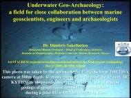
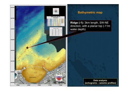
Bathymetric map<br />
Ridge (-1): 3km length, SW-NE<br />
direction, with a planar top (-11m<br />
water depth)<br />
Data analysis<br />
(echograms – seismic profiles)