
Create successful ePaper yourself
Turn your PDF publications into a flip-book with our unique Google optimized e-Paper software.
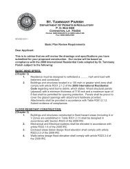
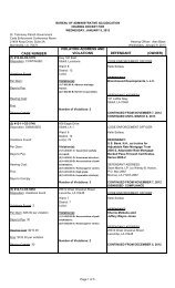
<strong>St</strong>. <strong>Tammany</strong> <strong>Parish</strong> <strong>Government</strong><br />
Department Of Planning<br />
P. 0. Box 628<br />
Covington, LA 70434<br />
Phone: (985) 898-2529<br />
Fax: (985) 898-3003<br />
e-mail: planning@stpgov.org<br />
Pat Brister<br />
<strong>Parish</strong> President<br />
January 20, 2012<br />
1. ZONiNG CASE NO. ZCI2-03-016<br />
A-lA (Suburban District) TO A-4 (Single-Family<br />
Residential District)<br />
WARD 3, DISTRICT 3<br />
Parcel located on the north side of Penn Mill Road,<br />
west of Quave Road, north of US Highway 190<br />
S24,T6S,Ri OE<br />
SIZE - 51.27 acres<br />
PETITIONER - James H. Simpson<br />
OWNER - Team Discipleship, Inc<br />
2. ZONiNG CASE NO. ZC12-03-017<br />
A-i (Suburban District) TO A-2 (Suburban District)<br />
WARD 2, DISTRICT 3<br />
Parcel located on the east & west sides of Lee<br />
Settlement Road, north of Doris Road, south ofDudley<br />
Road<br />
S7,T5S,Rl OE<br />
SIZE - 10.76 acres<br />
PETITIONER - Sean R. Bourgeois<br />
OWNER - Belinda Bourgeois & Johnny Gill<br />
3.ZONING CASE NO. ZC12-03-018<br />
NC-I (Professional Office District) TO HC-2 (Highway<br />
Commercial District)<br />
WARD 7, DISTRICT 7<br />
Parcel located on the southeast corner of US Highway<br />
190 & Oaklawn Drive, being lot 1, North Oaklawn<br />
Subdivision<br />
S39,T8S,RI 3E<br />
SIZE -49,210 sq.ft.<br />
PETITIONER - Sam & Louise Woods<br />
OWNER - Sam & Louise Woods<br />
4. ZONING CASE NO. ZCI2-03-0i9<br />
A-3 (Suburban District) TO 1-1 (Industrial District)<br />
WARD 6, DISTRICT 6<br />
Parcel located on the north side of LA Highway 36,<br />
west of LA Highway 1088<br />
S13,T7S,RI2E<br />
SIZE - 20 acres<br />
PETITIONER - Anthony Matherne/CLECO Power<br />
OWNER - <strong>St</strong>. <strong>Tammany</strong> Land CO, LLC, P & F Lumber<br />
Company (2000) LLC, PF Monroe Properties, LLC,<br />
Markle Interests, LLC, Donald Markle III<br />
6. ZONING CASE NO. ZC12-03-021<br />
A-2 (Suburban District) TO A4-A (Single-Family<br />
Residential District) & HC-2 (Highway Commercial<br />
District)<br />
WARD I, DISTRICT 1<br />
Parcel located on the east side of LA Highway 1077,<br />
north of LA Highway 1085, south of US Highway 190<br />
S34,T6S,Rl OE<br />
SIZE - 116.30 acres<br />
PETITIONER - Jeff Schoen<br />
OWNER - Tallow Creek Shooting Grounds, LLC<br />
7. ZONING CASE NO. ZC12-03-022<br />
NC-2 (Indoor Retail and Service District) TO NC-S<br />
(Retail and Service District)<br />
WARD 9, DISTRICT 12<br />
Parcel located at the southwest corner of Carroll Road<br />
& Devon <strong>St</strong>reet, being 58255 Carroll Road, Slidell<br />
S38,T9S,R14E<br />
SIZE - 1 acre<br />
PETITIONER - William Michael Sims<br />
OWNER - William Michael Sims & Janice Wood Sims<br />
8. ZONING CASE NO. ZCI2-03-023<br />
A-IA (Suburban) District TO PUD (Planned Unit<br />
Development Overlay)<br />
WARD 3, DISTRICT 3<br />
Parcel located on the north side of Penn Mill Road,<br />
west of Quave Road, north of US Highway 190<br />
S24,T6S,R1 OE<br />
SIZE - 51.27 acres<br />
PETITIONER - James H. Simpson<br />
OWNER - Team Discipleship, INC.<br />
9. ZONING CASE NO. ZC12-03-024<br />
Ordinance to amendthe <strong>St</strong>. Tam <strong>Parish</strong> UDC code, Vol<br />
1, Sec. 7.01 landscape & tree preservation regulations<br />
relative to grade of trees & credit for existing trees<br />
S. ZONING CASE NO. ZCI2-03-020<br />
A-I (Suburban District) TO PF-I (Public Facilities<br />
District)<br />
WARD 2, DISTRICT 3<br />
Parcel located on the west side of LA Highway 25,<br />
north of C. Gotti Road, south of Willie Road, being<br />
78689 Highway 25, Folsom<br />
S35,T5S,RIOE<br />
SIZE - 18.677 acres<br />
PETITIONER - Jake Roudkovski<br />
OWNER - Bogue Falaya Baptist Church
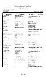
FOR OFFICE USE ONLY<br />
PUBLIC NOTICE<br />
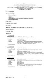
The <strong>St</strong>. <strong>Tammany</strong> <strong>Parish</strong> Zoning Commission will hold their regular monthly meeting on<br />
Tuesday, March 6, 2012 in the <strong>St</strong>. <strong>Tammany</strong> <strong>Parish</strong> Administrative Complex, 21490 Koop<br />
Drive, Mandeville, LA at 6:00 PM. A public hearing will be conducted at this meeting to<br />
hear comments for or against amendments to the Unified Development Code with respect to<br />
the following changes:
01/20/2012 17:31 9958922325 PAGE 81/01<br />
01/20/2012 03:57 99599a3e0<br />
-<br />
PGf 14114<br />
Maps depicting the areas proposed for land use change maybe inspeded at the <strong>St</strong>. Taminany<br />
<strong>Parish</strong> Department of Planning and Zoning office, Room 500, 21490 Koop Drive,<br />
Mandeville, LA weekdays from 8:00 AM to 4:30 PM.<br />
Is) Sidney Fontenot, Director<br />
Department of Planrilng<br />
ST. TAMMAKY.FAR)VJEK<br />
RUN ON:<br />
Thuday,.Pebrumy 2. 201<br />
Thndabniat&2W<br />
Thursday. March 1. 201Z<br />
SLIDELL SENflY NEWJ<br />
RUN ON:<br />
Wed.nesdav. Eebruarv Y, 2012<br />
Wednesdays Februaryl<br />
We’a.Z9, Qi<br />
Please attach a copy o. the tear sheet for each day run to the invoice.<br />
ReceWed by/4/kt .t:4/o/i
1. ZONiNG CASE NO. ZC12-03-016<br />
Petition to change the zoning district classification for a tract of land situated in S24,T6S,R1 OE,<br />
Ward 3, <strong>St</strong>. <strong>Tammany</strong> <strong>Parish</strong>, Louisiana, which property is a Parcel located on the north side ofPenn<br />
Mill Road, west of Quave Road, north of US Highway 190, and which property comprises a total<br />
of 51.27 acres of land more or less, from its present A-lA (Suburban District) to a A-4 (Single<br />
Family Residential District)<br />
follows:<br />
.<br />
The property petitioned for rezoning is more fully described as<br />
CERTAiN PIECE OR PARCEL OF GROUND together with all the<br />
buildings and improvements thereof; and all of the rights, ways, mains, privileges,<br />
servitudes, appurtenances and advantages and component parts thereunto<br />
belonging or in anywise appertaining, lying and being situated in Section 24,<br />
Township 6 South, Range 10 East, <strong>St</strong>. <strong>Tammany</strong> <strong>Parish</strong>, Louisiana, and being<br />
more fully described as Tract 5 on a survey of John E. Bonneau & Associates,<br />
Inc., dated October 30, 1992, bearing survey no. 921565, and according to said<br />
survey Tract 5 is more fully described as follows: Commencing at the corner<br />
section of Sections 14, 13, 23 and 24 proceed South 89°14’41” West a distance of<br />
1467.94’ to a point; thence proceed South 00°37’23” West a distance of 1313.91’ to<br />
a point; thence proceed South 89°58’50” East a distance of 1293.68’ to a point;<br />
thence proceed South 00°0 1’12” West a distance of 2724.40’ to a point; thence<br />
proceed South 69°14’44” East a distance of 656.28’ to a point being the Point of<br />
Beginning; From the Point of Beginning proceed North 00°04’07” East a distance<br />
of 2323.92’ to a point; thence proceed South 89°59’44” East a distance of 1380.60’<br />
to a point; thence proceed South 00°05’33” West a distance of 697.00’ to a point;<br />
thence proceed south 89°59’15” West a distance of 662.10’ to a point; thence<br />
proceed South 00°05’42” East a distance of 1900.77’ to a point on the northern<br />
boundary of Penn Mill Road; thence proceed North 69°14’44” West along the<br />
northern boundary of Penn Mill Road a distance of 773.50’ to the Point of<br />
Beginning. Said parcel contains 51.27 acres.<br />
1
2. ZONJI’.TG CASE NO. ZC12-03-017<br />
Petition to change the zoning district classification for a tract ofland situated in S7,T5S,R1 OE, Ward<br />
2, <strong>St</strong>. <strong>Tammany</strong> <strong>Parish</strong>, Louisiana, which property is a Parcel located on the east & west sides of Lee<br />
Settlement Road, north ofDoris Road, south ofDudley Road, and which property comprises a total<br />
of 10.76 acres of land more or less, from its present A-i (Suburban District) to a A-2 (Suburban<br />
District). The property petitioned for rezoning is more fully described as follows:<br />
Located in Section 7 Township 5 South Range 10 East, <strong>St</strong>. <strong>Tammany</strong> <strong>Parish</strong>, Louisiana.<br />
From the Center of Section 7 Township 5 South Range 10 East, <strong>St</strong>. <strong>Tammany</strong> <strong>Parish</strong>,<br />
Louisiana run North 89 degrees 50 minutes West, 1111.40 feet; thence South 00 degrees<br />
28 minutes West, 350.86 feet to the Point of Beginning.<br />
From the Point of Beginning run North 00 degrees 23 minutes 15 seconds East, 351.71<br />
feet to a point; thence South 89 degrees 53 minutes 48 seconds East, 288.35 feet to a<br />
point; thence South 89 degrees 57 minutes 23 seconds East, 383.55 feet to a point; thence<br />
South 00 degrees 25 minutes 37 seconds West, 407.54fret to a point; thence South 00<br />
degrees 25 minutes 44 seconds West, 325.39 feet to a point; thence North 57 degrees 13<br />
minutes 18 seconds West, 88.88 feet to a point; thence North 15 degrees 19 minutes 33<br />
seconds West, 261.49 feet to a point; thence South 79 degrees 15 minutes 32 seconds<br />
West, 196.08 feet to a point; thence North 05 degrees 48 minutes 23 seconds West,<br />
202.52 feet to a point; thence South 75 degrees 10 minutes 45 seconds West, 323.03 feet<br />
back to the Point of Beginning.<br />
Located in Section 7 Township 5 South Range 10 East, <strong>St</strong>. Tanimany <strong>Parish</strong>, Louisiana.<br />
From the Center of Section 7 Township 5 South Range 10 East, <strong>St</strong>. <strong>Tammany</strong> <strong>Parish</strong>,<br />
Louisiana run North 89 degrees 50 minutes West, 1111.40 feet; thence South 00 degrees<br />
28 minutes West, 350.86 feet; thence North 00 degrees 23 minutes 15 seconds East,<br />
351.71 feet to a point, thence South 89 degrees 53 minutes 48 seconds East, 288.35 feet<br />
to a point; thence South 89 degrees 57 minutes 23 seconds East, 383.55 feet to the Point<br />
of Beginning.<br />
From the Point of Beginning run South 88 degrees 13 minutes 17 seconds East, 448.89<br />
feet to a point; thence South 01 degrees 00 minutes 00 seconds East, 407.87 feet to a<br />
point; thence North 87 degrees 56 minutes 34 seconds West, 457.08 feet to a point;<br />
thence North 00 degrees 25 minutes 37 seconds East, 407.54 feet back to the Point of<br />
Beginning.<br />
2
3. ZONING CASE NO. ZC12-03-018<br />
Petition to change the zoning district classification for a tract of land situated in S39,T8S,Rl 3E,<br />
Ward, <strong>St</strong>. <strong>Tammany</strong> <strong>Parish</strong>, Louisiana, which property is a Parcel located on the southeast corner<br />
ofUS Highway 190 & Oaklawn Drive, being lot<br />
1<br />
,North Oaklawn Subdivision, and which property<br />
comprises a total of 49,210 sq.ft. of land more or less, from its present NC-i (Professional Office<br />
District) to a HC-2 (Highway Commercial District). The property petitioned for rezoning is more<br />
fully described as follows:<br />
ALL THAT CERTAIN PIECE OR PARCEL OF LAND, together with all the<br />
buildings and improvements thereon and all the rights, ways, means, privileges,<br />
servitudes, prescriptions, appurtenances and advantages thereunto belonging or<br />
in anywise appertaining thereto, situated in LOT 349, NORTH OAKLAWN<br />
SUBDIVISION situated in Section 39, Township 8 South, Range 13 East, <strong>St</strong>.<br />
Tamrnany <strong>Parish</strong>, Louisiana, more particularly described, to-wit:<br />
LOT 1, of the resubdivision of LOT 349, NORTH OAKLAWN SUBDIVISION;<br />
From the Southwest corner of Lot 349, run North 26 degrees 43 minutes East<br />
1058.24 feet to the Northwest corner of Lot 349 and the Point of Beginning;<br />
thence run South 71 degrees 47 minutes East 191.71 feet; thence run South 27<br />
degrees 23 minutes West 259.09 feet; thence run North 71 degrees 47 minutes<br />
West 188.74 feet; thence run North 26 degrees 43 minutes East 258.63 feet to<br />
the Point of Beginning.<br />
3
4. ZONING CASE NO. ZC12-03-019<br />
Petition to change the zoning district classification for a tract of land situated in Si 3 ,T7S,Ri 2E,<br />
Ward 6, <strong>St</strong>. <strong>Tammany</strong> <strong>Parish</strong>, Louisiana, which property is a Parcel located on the north side of LA<br />
Highway 36, west of LA Highway 1088, and which property comprises a total of 20 acres of land<br />
more or less, from its present A-3 (Suburban District) to a I-i (Industrial District). The property<br />
petitioned for rezoning is more fully described as follows:<br />
A certain parcel of ground situated in Section 13, Township 7 South, Range 12 East, <strong>St</strong>.<br />
<strong>Tammany</strong> <strong>Parish</strong>, Louisiana and more ftlly described as follows:<br />
Commence from the section corner common to Sections 11, 12, 13 & 14, Township 7 South<br />
Range 12 East, go North 89 degrees 29 minutes 45 seconds East, a distance of 3656.77 feet to the<br />
Point of Beginning.<br />
From the Point of Beginning go North 89 degrees 15 minutes 46 seconds East, a distance<br />
of 841 .72 feet; thence go South 01 degrees 44 minutes 26 seconds East, a distance of<br />
1000.64 feet: thence go North 74 degrees 52 minutes 26 seconds West, a distance of<br />
1000.00 feet; thence go South 15 degrees 07 minutes 34 second West, a distance of<br />
500.00 feet to a point on the Northerly right of way line of LA. Hwy 36; thence go along<br />
said right of way North 74 degrees 52 minutes 26 seconds West, a distance of 100.00<br />
feet; thence leave said right of way and go North 15 degrees 07 minutes 34 seconds East,<br />
a distance of 1227.51 feet back to the Point of Beginning.<br />
4
5. ZONING CASE NO. ZC12-03-020<br />
Petition to change the zoning district classification for a tract of land situated in S35,T5S,RI OE,<br />
Ward 2, <strong>St</strong>. Tanimany <strong>Parish</strong>, Louisiana, which property is a Parcel located on the west side of LA<br />
Highway 25, north of C. Gotti Road, south of Willie Road, being 78689 Highway 25, Folsom, and<br />
which property comprises a total of 18.677 acres of land more or less, from its present A-I<br />
(Suburban District) to a PF-1 (Public Facilities District). The property petitioned for rezoning is<br />
more fully described as follows:<br />
All THAT CERTAIN PIECE OR PARCEL OF GROUND, together with all the buildings and<br />
improvements thereon, and all the rights, ways, privileges, servitudes, appurtenances and<br />
advantages thereunto belonging or in anywise appertaining thereto, situated in Section 35,<br />
Township 5 South, Range 10 East of <strong>St</strong>. Helena Meridian, Greensburg Land District, in the<br />
<strong>Parish</strong> of <strong>St</strong>. <strong>Tammany</strong>, <strong>St</strong>ate of Louisiana, described and delineated, according to map by<br />
Land Surveying, Inc. No. 1054, dated April 7, 1977.<br />
From the section corner common to Sections 25, 26, 35 and 36, Township 5 South, Range 10<br />
East, run South 89 degrees 54 minutes West 1345.5 feet; thence run South 02 degrees 15<br />
minutes East 542.06 feet to the POINT OF BEGINNING of the property herein conveyed;<br />
thence run North 89 degrees 00 minutes East 755.0 feet to a point on the West side of <strong>St</strong>ate<br />
Highway No. 25; thence run South 31 degrees 51 minutes East along said West side of<br />
Highway 974.10 feet; thence run North 89 degrees 58 minutes West 1231.78 feet; thence run<br />
North 02 degrees 36 minutes West, along fence, 811.0 feet to the POINT OF BEGINNING<br />
hereto set.<br />
5
6. ZONING CASE NO. ZC12-03-021<br />
Petition to change the zoning district classification for a tract of land situated in S34,T6S,R1 OE,<br />
Ward 1, <strong>St</strong>. <strong>Tammany</strong> <strong>Parish</strong>, Louisiana, which property is a Parcel located on the east side of<br />
LA Highway 1077, north of LA Highway 1085, south of US Highway 190, and which property<br />
comprises a total of 116.30 acres of land more or less, from its present A-2 (Suburban District)<br />
to a A4-A (Single-Family Residential District) & HC-2 (Highway Commercial District). The<br />
property petitioned for rezoning is more fully described as follows:<br />
Located in Section 34 Township 6 South, Range 10 East, <strong>St</strong>. <strong>Tammany</strong> <strong>Parish</strong>, Louisiana.<br />
From the ¼ Section Corner common to Sections 27 and 34 Township 6 South Range 10<br />
East, <strong>St</strong>. Tamrnany <strong>Parish</strong>, Louisiana this being the Point of Beginning.<br />
From the Point of Beginning run North 89 degrees 54 minutes 55 seconds East, 1336.14<br />
feet, thence South 00 degrees 09 minutes 15 seconds West, 1986.56 feet; thence North 52<br />
degrees 08 minutes 20 seconds West, 2625.28 feet; thence South 37 degrees 50 minutes<br />
08 seconds West, 890.36 feet; thence South 52 degrees 08 minutes 20 seconds East,<br />
691.99 feet; thence South 37 degrees 51 minutes 40 seconds West, 400.00 feet; thence<br />
South 52 degrees 08 minutes 20 seconds East, 1225. 06 feet, thence North 89 degrees 20<br />
minutes 01 seconds West, 1333.38 feet; thence North 89 degrees 33 minutes 59 seconds<br />
West, 226.08 feet; thence North 23 degrees 30 minutes 34 seconds West, 465.98 feet;<br />
thence North 66 degrees 23 minutes 06 seconds East, 270.05 feet; thence North 23<br />
degrees 21 minutes 05 seconds West, 20.00 feet; thence North 65 degrees 40 minutes 13<br />
seconds East, 91.66 feet; thence with a curve to the left having a Radius of 200.00 feet<br />
and an Arc of 97.50 feet; thence North 37 degrees 44 minutes 21 seconds East, 81.95<br />
feet; thence South 52 degrees 08 minutes 20 seconds East, 158.81 feet; thence North 37<br />
degrees 50 minutes 06 seconds East, 276.54 feet; thence North 52 degrees 08 minutes 20<br />
seconds West, 602.14 feet; thence North 37 degrees 54 minutes 13 seconds East, 124.74<br />
feet, thence North 50 degrees 36 minutes 50 seconds West, 212.74feet, thence with a<br />
curve to the right having a Radius of 747.99 feet and an Arc of 197.05 feet; thence South<br />
59 degrees 00 minutes 06 seconds West, 173. 13 feet; thence South 23 degrees 33 minutes<br />
49 seconds East, 260. 00 feet; thence South 65 degrees 52 minutes 33 seconds West,<br />
380.99 feet; thence North 23 degrees 33 minutes 52 seconds West, 1038.25 feet; thence<br />
South 87 degrees 08 minutes 07 seconds East, 1337. 76 feet; thence North 23 degrees 34<br />
minutes 22 seconds West, 799.9ofeet; thence South 87 degrees 07 minutes 53 seconds<br />
East, 1417.23 feet back to the Point of Beginning.<br />
This tract contains 104.80 Acres.<br />
6
6. ZONING CASE NO. ZC12-03-021<br />
Located in Section 34 Township 6 South, Range 10 East, <strong>St</strong>. Tanirnany <strong>Parish</strong>, Louisiana.<br />
From the ¼ Section Corner common to Sections 27 and 34 Township 6 South Range 10<br />
East, <strong>St</strong>. <strong>Tammany</strong> <strong>Parish</strong>, Louisiana run North 89 degrees 54 minutes 55 seconds East,<br />
1336.14 feet; thence South 00 degrees 09 minutes 15 seconds West, 2586.56 feet; thence<br />
North 89 degrees 20 minutes 01 seconds West, 2682.65 feet; thence North 89 degrees 33<br />
minutes 59 seconds West, 226.08 feet; thence North 23 degrees 30 minutes 34 seconds<br />
West, 465.98 feet to the Point of Beginning.<br />
From the Point of Beginning continue North 23 degrees 30 minutes 34 seconds West,<br />
438.80 feet; thence North 23 degrees 33 minutes 52 seconds West, 190.86 feet; thence<br />
North 65 degrees 52 minutes 33 seconds East, 380.99 feet; thence North 23 degrees 33<br />
minutes 49 seconds West, 260. O0feet, thence North 59 degrees 00 minutes 06 seconds<br />
East, 173.13 feet; thence with a curve to the left having a Radius of 747.99 feet and an<br />
Arc of 197. 05 feet; thence South 50 degrees 36 minutes 50 seconds East, 212.74 feet;<br />
thence South 37 degrees 54 minutes 13 seconds West, 124. 74 feet; thence South 52<br />
degrees 08 minutes 20 seconds East, 602.14 feet; thence South 37 degrees 50 minutes 06<br />
seconds West, 276.S4feet; thence North 52 degrees 08 minutes 20 seconds West, 158.81<br />
feet; thence South 37 degrees 44 minutes 21 seconds West, 81.95 feet, thence with a<br />
curve to the right having a Radius of 200.00 feet and an Arc of 97.50 feet, thence South<br />
65 degrees 40 minutes 13 seconds West, 91. 66feet; thence South 23 degrees 21 minutes<br />
05 seconds East, 20. 00 feet; thence South 66 degrees 23 minutes 06 seconds West, 270.05<br />
feet back to the Point of Beginning.<br />
This tract contains 11.5 Acres.<br />
7
7. ZONiNG CASE NO. ZC12-03-022<br />
Petition to change the zoning district classification for a tract of land situated in S3 8,T9S,Rl 4E,<br />
Ward 9, <strong>St</strong>. <strong>Tammany</strong> <strong>Parish</strong>, Louisiana, which property is a Parcel located at the southwest<br />
corner of Carroll Road & Devon <strong>St</strong>reet, being 58255 Carroll Road, Slidell, and which property<br />
comprises a total of<br />
1<br />
acre of land more or less, from its present NC-2 (Indoor Retail and Service<br />
District) to a NC-5 (Retail and Service District). The property petitioned for rezoning is more<br />
fully described as follows:<br />
ALL THAT CERTAIN LOT OR PARCEL OF GROUND, together with the improvements<br />
rights, ways, servitudes and appurtenances, together with all trees<br />
standing, thereunto belonging or in anywise appertaining, lying and<br />
situated in <strong>St</strong>. <strong>Tammany</strong> <strong>Parish</strong>, in that portion of said <strong>Parish</strong> known<br />
as BAYOU LIBERTY GARDENS SUBDIVISION, and mare particularly described<br />
as follows:<br />
Lots or Plots 20 and 21 in Square K of said BAYOU LIBERTY GARDENS<br />
SUBDIVISION, said Square K being bounded by East Avenue, Garden<br />
Drive, the Slidell—Baton Rouge Highway, and more particularly described<br />
as follows:<br />
Lot 20 measures 101.65 feet front on Slidell-Baton Rouge Highway, 100<br />
feet in width in the rear on the line of Lot 16, 236.59 feet depth on<br />
the side line dividing it from Lot 19, and 218.29 feet on the side<br />
line dividing it from Lot 21; Lot 21 forms the southeast corner of the<br />
subdivision and measures 101.65 feet front on the Slidell—Baton Rouge<br />
Highway, 100 feet in width in the rear on the line of Lot 16; 218.29<br />
feet in depth on the side line dividing it from Lot 20 and 200 feet<br />
in depth along the south side of said property. The whole of said<br />
measurements being in accordance with map of Bayou Liberty Gardens<br />
Subdivision made by H. G. Fritchie, Surveyor, April 17, 1930, blue<br />
print whereof has been approved by the <strong>Parish</strong> Surveyor and is filed in<br />
the office of the Clerk of Court for the <strong>Parish</strong> of <strong>St</strong>. <strong>Tammany</strong>, <strong>St</strong>ate<br />
of Louisiana. The said property has the same measurement and location<br />
in accordance with a survey of J.V.Burkes & Assoc.., Inc. dated<br />
December 4, 2001; attached hereto and made a part hereof.<br />
8
8. ZONING CASE NO. ZC12-03-023<br />
Petition to change the zoning district classification for a tract of land situated in S24,T6S,R1OE,<br />
Ward 3, <strong>St</strong>. <strong>Tammany</strong> <strong>Parish</strong>, Louisiana, which property is a Parcel located on the north side ofPenn<br />
Milil Road, west of Quave Road, north of US Highway 190, and which property comprises a total<br />
of 51.27 acres of land more or less, from its present A-IA (Suburban) District to a PUD (Planned<br />
Unit Development Overlay). The property petitioned for rezoning is more fully described as follows:<br />
CERTAIN PIECE OR PARCEL OF GROUND together with all the<br />
buildings and improvements thereof; and all of the rights, ways, mains, privileges,<br />
servitudes, appurtenances and advantages and component parts thereunto<br />
belonging or in anywise appertaining, lying and being situated in Section 24,<br />
Township 6 South, Range 10 East, <strong>St</strong>. <strong>Tammany</strong> <strong>Parish</strong>, Louisiana, and being<br />
more fully described as Tract 5 on a survey of John E. Bonneau & Associates,<br />
Inc., dated October 30, 1992, bearing survey no. 921565, and according to said<br />
survey Tract 5 is more fully described as follows: Commencing at the corner<br />
section of Sections 14, 13, 23 and 24 proceed South 89°14’4l” West a distance of<br />
1467.94’ to a point; thence proceed South 00°37’23” West a distance of 1313.91’ to<br />
a point; thence proceed South 89°58’50” East a distance of 1293.68’ to a point;<br />
thence proceed South 00°01 ‘12” West a distance of 2724.40’ to a point; thence<br />
proceed South 69°l4’44” East a distance of 656.28’ to a point being the Point of<br />
Beginning; From the Point of Beginning proceed North 00°04’07” East a distance<br />
of 2323.92’ to a point; thence proceed South 89°59’44” East a distance of 1380.60’<br />
to a point; thence proceed South 00°05’33” West a distance of 697.00’ to a point;<br />
thence proceed south 89°59’ 15” West a distance of 662.10’ to a point; thence<br />
proceed South 00°05’42” East a distance of 1900.77’ to a point on the northern<br />
boundary of Penn Mill Road; thence proceed North 69°14’44” West along the<br />
northern boundary of Penn Mill Road a distance of 773.50’ to the Point of<br />
Beginning. Said parcel contains 51.27 acres.<br />
9
9. ZONING CASE NO. ZC12-03-024<br />
Ordinance to amend the <strong>St</strong>. Tam <strong>Parish</strong> UDC code, Vol 1, Section 7.01 landscape & tree<br />
preservation regulations relative to grade of trees & credit for existing trees<br />
10