Microtremor Measurements Used to Map Thickness of Soft Sediments
Microtremor Measurements Used to Map Thickness of Soft Sediments
Microtremor Measurements Used to Map Thickness of Soft Sediments

You also want an ePaper? Increase the reach of your titles
YUMPU automatically turns print PDFs into web optimized ePapers that Google loves.
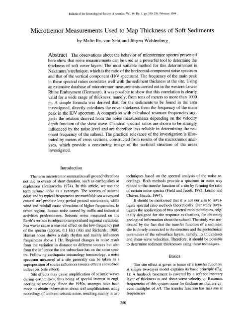
Bulletin <strong>of</strong> the Seismological Society <strong>of</strong> America, Vol. 89, No. 1, pp. 250-259, February 1999<br />
<strong>Microtremor</strong> <strong>Measurements</strong> <strong>Used</strong> <strong>to</strong> <strong>Map</strong> <strong>Thickness</strong> <strong>of</strong> S<strong>of</strong>t <strong>Sediments</strong><br />
by Malte Ibs-von Seht and Jtirgen Wohlenberg<br />
Abstract The observations about the behavior <strong>of</strong> microtremor spectra presented<br />
here show that noise measurements can be used as a powerful <strong>to</strong>ol <strong>to</strong> determine the<br />
thickness <strong>of</strong> s<strong>of</strong>t cover layers. The most suitable method for this determination is<br />
Nakamura' s technique, which is the ratio <strong>of</strong> the horizontal-component noise spectrum<br />
and that <strong>of</strong> the vertical component (I-I/V spectrum). The frequency <strong>of</strong> the main peak<br />
in these spectral ratios correlates well with the sediment thickness at the site. Using<br />
an extensive database <strong>of</strong> microtremor measurements carried out in the western Lower<br />
Rhine Embayment (Germany), it was possible <strong>to</strong> show that this correlation is clearly<br />
valid for a wide range <strong>of</strong> thickness, namely, from tens <strong>of</strong> meters <strong>to</strong> more than 1000<br />
m. A simple formula was derived that, for the sediments <strong>to</strong> be found in the area<br />
investigated, directly calculates the cover thickness from the frequency <strong>of</strong> the main<br />
peak in the H/V spectrum. A comparison with calculated resonant frequencies suggests<br />
the relation derived from the noise measurements depending on the velocity<br />
depth function <strong>of</strong> the shear wave. Classical spectral ratios are shown <strong>to</strong> be strongly<br />
influenced by the noise level and are therefore less reliable in determining the resonant<br />
frequency <strong>of</strong> the subsoil. The practical relevance <strong>of</strong> the investigation is illustrated<br />
by means <strong>of</strong> cross sections, constructed from results <strong>of</strong> the microtremor analyses,<br />
which provide a convincing image <strong>of</strong> the surficial structure <strong>of</strong> the areas<br />
investigated.<br />
Introduction<br />
The term microtremor summarizes all ground vibrations<br />
not due <strong>to</strong> events <strong>of</strong> short duration, such as earthquakes or<br />
explosions (Steinwachs 1974). In this article, we use the<br />
term seismic noise as a synonym. The sources <strong>of</strong> seismic<br />
noise and its typical frequencies are manifold: sea waves and<br />
coastal surf produce long-period ground movements, while<br />
wind and rainfall cause vibrations <strong>of</strong> higher frequencies. In<br />
urban regions, human noise caused by traffic and industrial<br />
activities predominates. Seismic noise measured on the<br />
Earth's surface is subject <strong>to</strong> temporal and regional variations.<br />
Sea waves cause a seasonal effect on the low-frequency part<br />
<strong>of</strong> the spectra (approx. 0.1 Hz) (Aki and Richards, 1980).<br />
Human noise shows a daily rhythm and mainly influences<br />
frequencies above 1 Hz. Regional changes in noise result<br />
from the variation in distance <strong>to</strong> different sources but also<br />
from the influence the site subsurface has on the noise spectra.<br />
Following earthquake seismology terminology, a noise<br />
spectrum measured at a site generally can be taken as a<br />
superposition <strong>of</strong> source influences (source effect) and subsoil<br />
influences (site effect).<br />
Site effects may cause amplification <strong>of</strong> seismic waves<br />
during earthquakes, thus being <strong>of</strong> special interest in engineering<br />
seismology. Since the 1950s, attempts have been<br />
made <strong>to</strong> obtain information about soil amplifications using<br />
recordings <strong>of</strong> ambient seismic noise, resulting mainly in two<br />
techniques based on the spectral analysis <strong>of</strong> the noise recordings.<br />
Both methods provide a spectrum in some way<br />
related <strong>to</strong> the transfer function <strong>of</strong> a site by forming the ratio<br />
<strong>of</strong> certain noise spectra (Field and Jacob, 1993; Lermo and<br />
Chfivez-Garcfa, 1994).<br />
It should be mentioned that it is not our aim <strong>to</strong> investigate<br />
spectral ratio methods theoretically. Our study investigates<br />
the application <strong>of</strong> two spectral ratio techniques, originally<br />
designed for site response evaluations, for obtaining<br />
geological information about the subsoil. The study was motivated<br />
by the fact that the transfer function <strong>of</strong> a sediment<br />
site is closely connected <strong>to</strong> the structure and the geotechnical<br />
parameters <strong>of</strong> the subsurface layers, namely, its thicknesses<br />
and shear-wave velocities. Therefore, it should be possible<br />
<strong>to</strong> determine sediment thicknesses using these techniques.<br />
Basics<br />
The site effect is given in terms <strong>of</strong> a transfer function.<br />
A simple two-layer model explains its basic principle (Fig.<br />
1): A hardrock basement is covered by a s<strong>of</strong>t sedimentary<br />
layer <strong>of</strong> thickness m and shear-wave velocity v s. Resonant<br />
frequencies <strong>of</strong> this system occur for thicknesses that are uneven<br />
multiples <strong>of</strong> 2/4. The transfer function has maxima at<br />
frequencies<br />
250
<strong>Microtremor</strong> <strong>Measurements</strong> <strong>Used</strong> <strong>to</strong> <strong>Map</strong> <strong>Thickness</strong> <strong>of</strong> S<strong>of</strong>t <strong>Sediments</strong> 251<br />
fr -- n'v~ (n = 1,3,5 .... ). (1)<br />
4m<br />
A velocity-depth function in a sedimentary layer may be<br />
written as<br />
v~(z) = Vo'(1 + Z) ~, (2)<br />
where v0 is the surface shear-wave velocity, Z = Z/Zo (with<br />
Zo = lm), and x gives the depth dependence <strong>of</strong> the velocity.<br />
The fundamental resonant frequency fr is calculated as<br />
1/4To, where To is the shear-wave travel time between the<br />
bot<strong>to</strong>m <strong>of</strong> the layer and the surface. As by definition, v(z)<br />
= dzldt, the travel time is calculated as<br />
m<br />
~ro = Mz) Vo<br />
0 0<br />
m<br />
1 (1 + m) ~-~ - 1<br />
Vo (1 - x)<br />
The dependency between thickness and resonant frequency<br />
becomes<br />
(3)<br />
Shear-wave velocities <strong>of</strong> the sediments <strong>to</strong> be found in<br />
the area <strong>of</strong> investigation were experimentally determined by<br />
Budny (1984) using downhole measurements. For the sandy<br />
lithology in the western Lower Rhine Embayment, he gives<br />
values for the surface velocity v0 = 162 m/sec and the depth<br />
dependence x = 0.278. Figure 2 is a plot showing equation<br />
(5) with these values. We presuppose that the shear-wave<br />
velocity <strong>of</strong> the half-space is always higher than in the cover<br />
layer because otherwise there would be no resonance at all.<br />
Under ideal conditions, the thickness <strong>of</strong> a layer could<br />
be calculated from its measured resonant frequency on the<br />
basis <strong>of</strong> the shear-wave velocity. Problems occur because in<br />
most cases resonant frequencies cannot be read directly from<br />
noise spectra. Rather, the spectra are superimposed by the<br />
influences <strong>of</strong> the source effect, namely, the frequency content<br />
and the amplitudes <strong>of</strong> the microtremor sources. There<br />
are two techniques that use spectral ratios <strong>of</strong> microtremors<br />
<strong>to</strong> overcome this problem (Fig. 3). The first method, sometimes<br />
called classical spectral ratio technique, uses a remote<br />
1000-<br />
or<br />
1 Vo(1 - x)<br />
fr -- 4T ° - 4[(1 + m) 1-x - 1] (4)<br />
q)<br />
¢-<br />
100-<br />
m = L 4f~ + 1j - 1, (5)<br />
wherefr is <strong>to</strong> be given in Hz, Vo in m/sec, and m in m.<br />
10-<br />
0.1 10<br />
resonant frequency [Hz]<br />
Figure 2. Connection between layer thickness and<br />
resonant frequency calculated on the basis <strong>of</strong> equation<br />
(5).<br />
m<br />
Ir<br />
I Horizontal spectrum I<br />
Vertical spectrum = HA/<br />
l [ Sediment site spectrum = S/R ]<br />
Reference site spectrum<br />
0<br />
o~<br />
• reference site<br />
sediment site<br />
Q.<br />
E<br />
0<br />
J<br />
i<br />
fr<br />
frequency<br />
sed m~ent cover<br />
Figure 1.<br />
function.<br />
Basic principle <strong>of</strong> site response, transfer<br />
Figure 3. Two techniques for site response evaluations<br />
using noise spectra.
252 M. Ibs-von Seht and J. Wohlenberg<br />
reference recording site placed on hard rock and a second<br />
recorder that is placed on the sediments <strong>to</strong> be mapped. The<br />
spectral ratio <strong>of</strong> noise recordings at the two sites is assumed<br />
<strong>to</strong> show something similar <strong>to</strong> the site effect (Lermo et al.,<br />
1988; Field and Jacob, 1990; Field et al., 1995; Lachet et<br />
al., 1996). We call this kind <strong>of</strong> spectral ratio S/R spectrum<br />
(because the spectral ratio <strong>of</strong> a sediment site and a reference<br />
site is formed). The second method, proposed by Nakamura<br />
(1989) and known as Nakamura's technique, requires only<br />
one recording station. This is because the spectral ratio <strong>of</strong><br />
the horizontal and the vertical components recorded at the<br />
same site is formed (H/V spectrum). This process is said <strong>to</strong><br />
eliminate the influence <strong>of</strong> the source effect. A more detailed<br />
description <strong>of</strong> the method can be found in Lermo and Ch~vez-Garcfa<br />
(1993).<br />
Nakamura's technique has awakened interest because it<br />
seems <strong>to</strong> show some essential advantages over traditional<br />
S/R spectra. Nakamura (1989), Lermo and Chavez-Garcia<br />
(1993), Field et al. (1995), and Lachet et al. (1996) applied<br />
the method for site response estimations in Japan, Europe,<br />
and America. They found out that determination <strong>of</strong> the fundamental<br />
resonant frequency <strong>of</strong> the subsoil is possible. In<br />
contrast <strong>to</strong> classical S/R spectra, Nakamura's technique<br />
should also allow a rough estimate <strong>of</strong> the soil amplification<br />
fac<strong>to</strong>r. In field practice, Nakamura's technique is less expensive,<br />
because only one recording station is needed, and<br />
it is said <strong>to</strong> be less sensitive <strong>to</strong> local noise sources. A satisfac<strong>to</strong>ry<br />
theoretical explanation <strong>of</strong> the method has not yet<br />
been given. Lachet and Bard (1994) investigated the method<br />
using numerical noise simulations. They conclude that H/V<br />
spectra show clear maxima at the resonant frequency <strong>of</strong> the<br />
subsoil, but its amplitudes are dependent on the Poisson's<br />
ratio <strong>of</strong> the uppermost layer and are therefore not suitable<br />
for soil amplification estimates. Further theoretical support<br />
has been given by Field and Jacob (1995).<br />
Field Data<br />
<strong>Microtremor</strong> measurements were carried out in two<br />
boundaried areas <strong>of</strong> the western Lower Rhine Embayment<br />
(Germany) <strong>to</strong> the north <strong>of</strong> Aachen (Fig. 4). The geological<br />
evolution <strong>of</strong> this region has produced sedimentary covers <strong>of</strong><br />
different thicknesses <strong>of</strong> Tertiary and Quaternary ages. The<br />
southern area <strong>of</strong> investigation (Fig. 5, <strong>to</strong>p) covers the northern<br />
border <strong>of</strong> the Eifel, where the Paleozoic basement dips<br />
<strong>to</strong>ward the north. The s<strong>of</strong>t-rock thicknesses increase from<br />
0 m in the south <strong>to</strong> about 350 m in the north. The northern<br />
area <strong>of</strong> investigation (Fig. 5, bot<strong>to</strong>m) is situated in a region<br />
where sediment thickness is much higher and may exceed<br />
1000 m. The various layer thicknesses are crucial for the<br />
study because they produce the various spectral responses<br />
observed. One further advantage <strong>of</strong> the areas investigated is<br />
the large number <strong>of</strong> drilling sites. At these points, detailed<br />
information about the subsurface structure, namely, the<br />
thickness <strong>of</strong> sedimentary covers, is available. This is needed<br />
for calibrating the results <strong>of</strong> the noise investigations.<br />
: i!i:i:i:}:i!i! : il i?:i:i ~:i~i~<br />
Tertiary [.......................<br />
1 areas <strong>of</strong><br />
Quaternary [..........................<br />
i investigation<br />
Mesozoic S fault<br />
Paleozoic<br />
Figure 4. Geological overview <strong>of</strong> the western<br />
Lower Rhine Embayment and areas <strong>of</strong> investigation.<br />
We present here the results <strong>of</strong> measurements at 102<br />
sites. Thirty-four <strong>of</strong> them were made very close <strong>to</strong> or directly<br />
at drilling sites where the cover thickness is known. Ten sites<br />
were placed on hard rock and used as reference stations for<br />
the forming <strong>of</strong> S/R spectra. To minimize the influence <strong>of</strong><br />
human noise, all recordings were taken at night between<br />
1 a.m. and 4 a.m. We used digital equipment (Lennartz PCM<br />
5800) and three different seismometer types (Mark L4-3D/<br />
1 second, Lennartz LE-3D/1 second, and LE-3D/5 second).<br />
Table 1 gives the labels and the coordinates <strong>of</strong> the sites.<br />
For further processing, only quiet sections <strong>of</strong> the noise<br />
recordings were used. Therefore, all recordings were examined<br />
<strong>to</strong> identify and cut <strong>of</strong>f those parts <strong>of</strong> the traces disturbed<br />
by very near-local sources, such as passing cars or<br />
opera<strong>to</strong>r's footsteps. The resulting length <strong>of</strong> the clean recordings<br />
varies between 1 and 10 min and is given in Table<br />
1. During data processing, an instrument correction was applied<br />
<strong>to</strong> those recordings taken by 1-sec seismometers <strong>to</strong><br />
obtain a flat response above approx. 0.5 Hz. Amplitude spectra<br />
were calculated for all sites and components. The spectra<br />
were smoothed by applying a low-pass filter. Furthermore,<br />
rms amplitudes <strong>of</strong> the noise recordings were calculated for<br />
all traces (see Table 1).<br />
The H/V spectral ratio [Ti-vv(o))] was obtained by dividing<br />
the averaged spectra <strong>of</strong> the horizontal components <strong>of</strong><br />
the sediment site [SNs(O)) and SEW(O))] by the spectrum <strong>of</strong><br />
the vertical component [Sv(o))] <strong>of</strong> the sediment site:<br />
Twv(CO) = [SNs(O)) + Szw(o))]/2 (6)<br />
Sv(o))<br />
The S/R spectral ratio [Tspa(o))] was formed by dividing the<br />
averaged spectra <strong>of</strong> the horizontal components <strong>of</strong> the sedi-
<strong>Microtremor</strong> <strong>Measurements</strong> <strong>Used</strong> <strong>to</strong> <strong>Map</strong> <strong>Thickness</strong> <strong>of</strong> S<strong>of</strong>t <strong>Sediments</strong> 253<br />
,,,:.,
254 M. Ibs-von Seht and J. Wohlenberg<br />
Table 1<br />
Coordinates <strong>of</strong> Sites Measured and Results<br />
<strong>of</strong> <strong>Microtremor</strong> Analysis (continued)<br />
t R H YITISH f(sm) fo~v) m~n m~a¢<br />
Site G (sec) (km) (km) (nm/sec) (Hz) (Hz) (m) (m)<br />
M7 S 101 2502.84 5633.84 176 1.45 1.35 55<br />
M8 S 180 2503.90 5633.90 62 3.20 19<br />
M10 S 192 2502.36 5633.78 247 1.30 1.12 82<br />
Mll S 195 2503.33 5633.81 215 1.60 1.20 75<br />
M12 S 198 2504.55 5634.04 108 2.60 2.68 24<br />
M13 S 168 2505.03 5633.93 79 3.10 2.80 23<br />
M14 S 189 2505.83 5633.95 85 7.96 5<br />
M16 S 180 2503.34 5631.98 232 3.00 1.10 84<br />
M17 S 246 2503.75 5632.12 590 2.80 1.32 65<br />
M18 S 288 2504.08 5632.33 167 1.70 1.52 54<br />
M19 S 300 2504.53 5632.51 127 2.30 2.32 30<br />
M20 S 258 2505.10 5632.56 114 2.00 1.96 38<br />
M23 S 318 2504.00 5631.78 214 1.30 1.12 87 82<br />
M24 S 429 2502.70 5634.42 258 1.60 1.36 67 63<br />
M25 S 224 2503.36 5635.13 322 2.10 2.20 44 32<br />
M26 S 323 2503.90 5635.17 107 4.50 30 12<br />
J2 H 309 2515.70 5633.00 64<br />
J3 S 552 2515.00 5633.01 118 3.60 12<br />
J4 S 664 2514.33 5633.18 102 4.10 11<br />
J5 S 309 2513.42 5632.91 186 1.70 1.62<br />
J6 S 309 2512.60 5632.76 99<br />
J7 S 428 2512.28 5632.55 220 2.05 31<br />
J8 S 540 2513.93 5633.28 207 2.12 34<br />
J9 S 540 2513.63 5632.79 125 5.00 10<br />
J10 S 397 2513.43 5632.43 108 1.35 1.05 90<br />
Jll S 292 2512.96 5632.25 105 1.10 84<br />
J12 S 540 2513.08 5631.45 256 4.10 4.00 14<br />
J13 S 327 2512.75 5631.05 451 1.34 0.95 103<br />
J14 S 336 2514.72 5633.78 67 5.45 5.55 9<br />
J15 S 329 2514.82 5634.15 228 4.40 4.48 12<br />
J16 S 531 2514.81 5634.50 196 4.40 4.48 12<br />
J17 S 419 2514.72 5634.84 271 3.66 3.60 16<br />
J18 S 129 2514.14 5634.45 86 4.12 3.92 14<br />
J19 S 312 2513.99 5633.93 64<br />
E1 S 282 2506.12 5651.93 548 0.20 900 895<br />
E2 S 518 2509.45 5656.50 649 0.16 1257 1219<br />
E3 S 381 2518.88 5660.77 701 0.28 549 561<br />
E4 S 250 2520.18 5658.08 681 0.40 500 342<br />
E5 S 391 2522.00 5654.60 636 0.28 565 561<br />
E6 S 543 2512.50 5657.72 760 0.14 1600<br />
E7 S 453 2513.65 5658.33 857 0.79 177<br />
E8 S 546 2517.23 5662.28 700 0.37 460<br />
Site = label <strong>of</strong> site; G = geology; S = s<strong>of</strong>t rock; H = hard rock;<br />
R and H = longitude and latitude according <strong>to</strong> Gauss-Krueger coordinates;<br />
rms H = averaged horizontal rms amplitude; f(S/R) = frequency <strong>of</strong> main<br />
peak in S/R spectrum; f(wv) = frequency <strong>of</strong> main peak in H/V spectrum;<br />
m~l I = thickness <strong>of</strong> cover layer known from drilling (if available);<br />
mo,lc = thickness <strong>of</strong> cover layer calculated using H/V frequencies.<br />
functions were computed using the method proposed by<br />
Haskell (1960). The geotechnical parameters required were<br />
taken from Budny (1984). He experimentally determined<br />
vs(z) functions and Q fac<strong>to</strong>rs for different s<strong>of</strong>t rocks <strong>of</strong> the<br />
Lower Rhine Embayment. Furthermore, he gives density<br />
values for these rocks.<br />
Figure 6 shows examples <strong>of</strong> calculated transfer functions<br />
compared with S/R and H/V spectra for six different<br />
sites (for model parameters, see Table 2). The plots show<br />
clear similarities between the different types <strong>of</strong> spectra. The<br />
spectral ratios always have dominant maxima at low frequencies<br />
that correspond <strong>to</strong> the main peak in the transfer<br />
functions. Furthermore, the general decay <strong>of</strong> the transfer<br />
functions <strong>to</strong>ward high frequencies is also visible in the spectral<br />
ratios. Sites $9 and E5 are exceptions. In the case <strong>of</strong><br />
these stations, neither the frequency nor the amplitude <strong>of</strong> the<br />
main peak <strong>of</strong> the S/R spectral ratios show similarities with<br />
the transfer functions. Site $9 was situated in the vicinity <strong>of</strong><br />
a high-density traffic highway, the high-noise amplitudes <strong>of</strong><br />
which obviously spoil the shape <strong>of</strong> the S/R spectrum. E5 is<br />
a site <strong>of</strong> high sedimentary thickness (565 m), which appears<br />
<strong>to</strong> be the reason why the information content <strong>of</strong> the S/R<br />
spectrum is low. In contrast, these fac<strong>to</strong>rs seem <strong>to</strong> have little<br />
or no effect on the H/V spectra.<br />
When calculating transfer functions, problems occur because<br />
the thickness and lithology <strong>of</strong> the sedimentary layers<br />
may be known, but geotechnical parameters have <strong>to</strong> be taken<br />
from empirical formulas. In fact, at an actual site, these parameters<br />
may vary considerably. Adjusting the parameters<br />
<strong>to</strong> obtain a shape similar <strong>to</strong> the spectral ratios is possible,<br />
but no new information is obtained in this way. We chose a<br />
different approach and looked at the correlation between the<br />
thickness at a site and the main frequency in the spectral<br />
ratios. For this purpose, the frequency <strong>of</strong> the main peak in<br />
the two types <strong>of</strong> spectral ratios was determined for all sedimentary<br />
sites (see Table 1). The data obtained at 34 drilling<br />
sites where the thickness was known are suitable for performing<br />
the correlation.<br />
In Figure 7, the data <strong>of</strong> the drilling sites were used <strong>to</strong><br />
plot the S/R and H/V main frequencies versus the thickness<br />
at the sites. S/R spectra sometimes do not show a clear main<br />
peak, resulting in a smaller number <strong>of</strong> data points for this<br />
kind <strong>of</strong> spectral ratio. The cross-plot reveals good correlation<br />
for the H/V frequencies over a wide range <strong>of</strong> thickness,<br />
namely, from tens <strong>of</strong> meters <strong>to</strong> more than 1000 m, while the<br />
S/R frequencies are more scattered. Furthermore, there are<br />
several S/R data points that have <strong>to</strong> be treated as outliers.<br />
These data points (indicated in the plot) were zero-weighted<br />
when calculating nonlinear regression fits <strong>of</strong> the form<br />
m = af b. (9)<br />
Values and standard errors <strong>of</strong> the correlation coefficients a<br />
and b are given in Table 3.<br />
The relationships between the mean thickness m and the<br />
frequency <strong>of</strong> the main peak in S/R spectra, f(s/u), and H/V<br />
spectra, f(wv), are given in equations (10) and (11).<br />
146 ¢- 1.375 (10)<br />
m = 'S(S/R) ,<br />
ON~-- 1.388 (l 1)<br />
m = ~,vj(H/V) ,<br />
The resulting straight lines are nearly parallel, and the S/R<br />
line is slightly shifted <strong>to</strong>ward higher frequencies.
<strong>Microtremor</strong> <strong>Measurements</strong> <strong>Used</strong> <strong>to</strong> <strong>Map</strong> <strong>Thickness</strong> <strong>of</strong> S<strong>of</strong>t <strong>Sediments</strong> 255<br />
(a)<br />
~4.<br />
13.<br />
E<br />
o~<br />
6<br />
site M25<br />
: l 1 I : II<br />
l l I I I II<br />
i i! ilii<br />
....... ~--r--~-r-,y ~-;<br />
] ! ] .>'iii<br />
', l : ~ : J-'[<br />
~ k " i]''<br />
;-~. ,----,--,---,--,-,-,-<br />
[ } I I I I I<br />
:-;,;~'-i- i----~---i--i-i--~-,'.<br />
)'-' i ,Jr i,.ii<br />
........ i- 7+~,<br />
I I ', I I 11<br />
l I [ I : I:<br />
I : 1 I I II<br />
i ; iiiii<br />
~0<br />
frequency [Hz]<br />
(b)<br />
8 site 14/21<br />
2-<br />
0<br />
t ...... ~----!--i---::--i-i-ii<br />
', i ! ', i;[/!<br />
........ • ----r..~...i..~:7_+<br />
,'\1,'\ i i i i ili<br />
...... L___i ...... L_._L._: ._i_ :__: _L<br />
:, ~! [ i ilii!<br />
-: ___-"_.~..... L_._i__L_i.i_.Li<br />
: : '. '.I:1'. '. i\ iA I ! ! ! !<br />
i i ig)ii i \.,,i iii::i<br />
i i ,F'i/!l i " ~ h l !ii<br />
......!---;.~.::4---~-~~ '~-!--~i-~--!-!.<br />
....... Fi i~i: .... ~,!<br />
' / i i : I ', Ii<br />
~-4~ I I +, I 11 l : : I ; I~<br />
i<br />
1 10<br />
frequency [Hz]<br />
(c)<br />
6<br />
site W43<br />
iii!i<br />
"1~ ! i ! fill<br />
i / ".J i i .i i ill<br />
i / \ i i i !ii!<br />
! .<br />
i i '!i''<br />
4 . . . . . . . . . . .<br />
i ............. "-i[ ' __,___.,.__,..,_,__,.,.<br />
(d)<br />
'<br />
site W41<br />
i iiiiiil<br />
i i iiii,"i \ i i i iii!!<br />
4 ....... ,'----i---4---i--~4.-; ~ -4 ..... i ..... D--4---i---i-4--Db<br />
i i i ! i ili " \ i ! i i i ii!<br />
! i i; ". \ i i { i ! if!<br />
: : '. :;". ~. '. \.. : : '. '. '. '. :<br />
o=2. '= - ~ i i<br />
i ii,;:~l 7 > ' ! i::::::!_i<br />
"-~ i 7",,;-1-<br />
----i-77iii i i i 1711<br />
o i i i i ill i i i i ill<br />
~o<br />
1 10<br />
frequency [Hz]<br />
frequency [Hz]<br />
(e)<br />
(0<br />
site $9<br />
36<br />
14 site E5<br />
_]ii;i[ i;;[ i[ [i ; i i ;Ii;]i[~i;[i i[[;[[ Z[[ ii 1111 [i<br />
i i i ill! c\ i i i ii!i<br />
=::::::::::::::::::::::::::::::::::::::::::::::::::::::::::::::::::::::_ ,2 ...... i----i---i---i--i-i-!-l...~<br />
~: 2s - ....... .:-"-'V -i-'-V!--",:', ........... f ...... ,-",,',-,",-,-',--,--<br />
._O 24 . . . . . . . . t-L} <<br />
~ ~ ......................... '----'--'---",,-'............ I ::...._~..,.',_~/.~'_-_,.-t-,<br />
..... ' 1. -.+t v+.<br />
°o,o ......,,,,,,,,~----!-i-i-iii-, .... -~-~ ...... i-!-i!i-ii<br />
'. '. '. ; : ','. : , /1 '. ' fill#<br />
...... L____.l_.i.__il_.j.j.i: , ! i i i i !ii<br />
......•----;--~'---I--L'-"<br />
.......... z._ ..... '. : '. '.~'. :"<br />
'~"+ 8- .i ..... i i ! !!,'i-- ...... t--i ...... ,,-,-,-,-,,<br />
.....<br />
=i '=---,,_ ..... '~: : :.::.t.~ , r rr-r l~yr~<br />
: : I '. '. 7'. \ i i i i i i i!<br />
256 M. Ibs-von Seht and J. Wohlenberg<br />
Table 2<br />
Geotechnical Parameters <strong>Used</strong> <strong>to</strong> Calculate Transfer Functions<br />
for Sites M25, W21, W43, W41, $9, and E6<br />
Depth v s p<br />
Site Lithology (m) (lrdsec) (kg/m 3) Q<br />
M25 clay 0-10 303 2053 6.1<br />
sand 10-25 398 2090 8.5<br />
sand 25-44 465 2101 10.4<br />
hard rock >44 2500 2500 100<br />
W21 loess 0-8 200 1900 3.5<br />
gravel 8-14 300 2080 6<br />
sand 14-25 398 2090 8.5<br />
sand 25-50 482 2104 10.9<br />
sand 50-75 540 2112 12.6<br />
sand 75-100 585 2117 14<br />
sand 100-111 622 2120 15.2<br />
hard rock > 111 2500 2500 100<br />
W43 loess 0-8 200 1900 3.5<br />
gravel 8-15 300 2080 6<br />
sand 15-25 398 2090 8.5<br />
sand 25-50 482 2104 10.9<br />
sand 50-61 540 2107 12.6<br />
hard rock > 110 2500 2500 100<br />
W41 loess 0-8 200 1900 3.5<br />
gravel 8-14 300 2080 6<br />
sand 14-25 398 2090 8.5<br />
sand 25-50 482 2104 10.9<br />
sand 50-75 540 2112 12.6<br />
sand 75-100 585 2117 14<br />
sand 100-129 622 2120 15.2<br />
clay 129-140 475 2298 16.2<br />
hard rock >140 2500 2500 100<br />
$9 sand 0-25 398 2090 8.5<br />
sand 25-33 430 2095 9.4<br />
brown coal 33-35 216 1200 3<br />
sand 35-55 495 2104 11.3<br />
hard rock >55 2500 2500 100<br />
E6 gravel 0-15 353 1800 6<br />
gravel 15-25 410 1950 8<br />
gravel 25-35 452 2050 10<br />
sand 35-50 482 2102 10.9<br />
sand 50-100 585 2113 14<br />
sand 100-150 654 2118 16.2<br />
sand 150-200 709 2122 18<br />
sand 200-250 754 2124 19.5<br />
sand 250-300 793 2125 20.9<br />
sand 300-350 828 2127 22<br />
sand 350-400 859 2127 23.1<br />
sand 400-450 888 2128 24.1<br />
sand 450-485 907 2129 24.8<br />
sand 485-520 600 3000 25.4<br />
sand 520-565 946 2129 26.2<br />
hard rock >565 3100 2800 120<br />
The deviations <strong>of</strong> the data points in Figure 7 from the<br />
strict linear relationships are most probably a consequence<br />
<strong>of</strong> lithological inhomogeneties. Equations (10) and (11) are<br />
based on the assumption <strong>of</strong> equal v~(z) functions at each site<br />
measured. Conditions in practice are different because there<br />
may occur layers <strong>of</strong> velocities more or less deviating from<br />
a general velocity-depth function. Thus, drawing a straight<br />
line through the data points includes an averaging <strong>of</strong> lithol-<br />
E<br />
¢/)<br />
u)<br />
¢.-<br />
1000"<br />
o 100"<br />
. i<br />
t'-<br />
E<br />
E<br />
°~<br />
(D<br />
10-<br />
0.1<br />
% i i i i i I i i J i t<br />
,~, ', resonant frequencies : ',<br />
~,,~, calculated, , , on, the, base eq., (5) ,i ::<br />
L<br />
i % i i i i ~ I i ___L._ _L------I...<br />
["........ ~-X~';T---r'-r'~-,-rn-~ ..... , - , , ;<br />
[__ K _-_--:i: -_-~'i._,_ _~_ zero weighted data points.<br />
l ; :\~ ...... J .L . ,<br />
. . . . . . . . . . . . . v . . . . . T-v-t-1 . . . . . . r . . . . r---t---<br />
[ ...... ; .... ,*-"~.: ~x . . . . F ,"h", , , ,<br />
i i q ",1 i i i i t • i ~ i<br />
f ........ ~ .... ~---~:-x,-,-~,4-,, . . . . . ~-~ .... ,---~--<br />
/<br />
i<br />
',<br />
i<br />
',<br />
i<br />
',<br />
'.1 i i i<br />
~:.4_\, ,/,<br />
~l<br />
,,<br />
i<br />
,<br />
i<br />
,<br />
i<br />
I" ........ . . L ..... . ! -- - L- -II I .~,l~lt. f%~. -~., ~_ J- ~ J~ ..... ~L4 .... -t ---L--I I<br />
= mare Trequenoes4/,iK;... ,'NL 2~x a" '\ ' '<br />
,n N-s dra "4 i<br />
l<br />
........ k .... *-----~----~-- ~--4 ~~ Z. " --..%~ .... ~---~---<br />
........ L .... S---.L----t..~--~.U J . . . . t: ---_l~--t.---<br />
t . . . . . . . . ~ - J ' " . . . .<br />
£ . T------F----r--~--T--FS-- -¥--~ . . . . . . . . . . . -r-%- --<br />
F ........ ,, ,,,<br />
i i . , *~ i t<br />
............. ~-ma n frequendes-~ .... ,--,-,~<br />
: , • , "... , ,,: ,<br />
I- ........ ~ .... ,- in S/R-speetra---~'~.,.;--~.~ -<br />
........ ,~ .... I---,~-",-- ; -'-~'" ," '--~'U -<br />
t I t I I t l t . . . .<br />
1 5<br />
frequency [Hz]<br />
Figure 7. Main frequencies in spectral ratios plotted<br />
versus sediment thickness (solid circles: H/V frequencies;<br />
triangles: S/R frequencies). The solid lines<br />
are fits <strong>to</strong> the data points (see equation 9). The dashed<br />
line is the theoretical dependence between thickness<br />
and resonant frequency (see equation 5).<br />
Table 3<br />
Squared Correlation Coefficient (Rs) <strong>of</strong> Data Points in Figure 7<br />
and Values <strong>of</strong> a and b in Equation (9) with Standard Errors<br />
(Aa and Ab)<br />
S/RSpec~a<br />
H/VSpec~a<br />
R s 0.749 0.981<br />
a 146 96<br />
Aa 19 4<br />
b - 1.375 - 1.388<br />
Ab 0.210 0.025<br />
ogy or an averaging <strong>of</strong> the depth dependence <strong>of</strong> the shearwave<br />
velocity. A thickness value calculated from (10) or<br />
(11) for a particular site can only be as reliable as the overall<br />
vs(z) function is valid for the site. The very local subsurface<br />
velocity structure cannot be taken in<strong>to</strong> account for the calculation.<br />
However, especially for the H/V frequencies, the<br />
thickness-frequency correlation delivers an estimate <strong>of</strong> the<br />
local thickness that can be used for hard-rock basement mappings.<br />
A reason for the numerous outliers <strong>of</strong> S/R frequencies<br />
in Figure 7 and the high scatter <strong>of</strong> the data points in Figure<br />
8 could be the value <strong>of</strong> the noise level at the recording sites.<br />
Therefore, in Figure 9, we plotted the frequency ratio f~s/R)/<br />
f~wv) versus the horizontal rms amplitudes <strong>of</strong> the noise recordings<br />
(the amplitudes <strong>of</strong> the two horizontal records were<br />
averaged). The cross-plot illustrates that the frequency ratio<br />
becomes unstable and generally tends <strong>to</strong> higher values at
. . . . .<br />
<strong>Microtremor</strong> <strong>Measurements</strong> <strong>Used</strong> <strong>to</strong> <strong>Map</strong> <strong>Thickness</strong> <strong>of</strong> S<strong>of</strong>t <strong>Sediments</strong> 257<br />
5-<br />
4-<br />
~3-<br />
J<br />
2-<br />
1--<br />
0<br />
0<br />
~-o<br />
•<br />
• o."<br />
• • •<br />
I I I I I<br />
1 2 3 4 5 6<br />
f~ [Hz]<br />
Figure 8. Plot <strong>of</strong> H/V main frequency [f(wv)] versus<br />
S/R main frequency If(s/R)]. The dashed line is the<br />
f(n/v) = f(S/R) line.<br />
3.5t ..... ~ ...... i ...... [ ..... i ...... i ...... i ..... i ...... i ...... i .....<br />
3.01 ..... ! ...... i ...... i ..... i ...... i ...... i ..... 4 ...... i ...... i .<br />
E • 7 .................. ~, .............................................<br />
"- ff 2 • 0"~ ................. ! ! .i: .............................................<br />
-. , :<br />
'. '. i '~i k i i i<br />
1.5-:1- ..... i ...... i ...... !;-z-i ...... ! ...... ,~----,i ...... i ...... ,~ .....<br />
,N "i L,*si i<br />
1 U-.[ ..... I ...... ,~'-,ff~" .'I ...... 1--~"r "° ~*- ..... ;----*r--i--<br />
o.sl. i, i :i. i .', i, i, i, i,<br />
0 200 400 600 800<br />
RMSs [nm/s]<br />
Figure 10. Ratio <strong>of</strong> actual (mdrill) and calculated<br />
(mo~c) thickness plotted versus the rms horizontal<br />
amplitude <strong>of</strong> noise recordings (solid circles: mcalc<br />
calculated using H/V frequencies; triangles: mc~<br />
calculated using S/R frequencies).<br />
4.0<br />
3.5<br />
3.0-<br />
2.0-<br />
1.5<br />
1.0-<br />
0.5<br />
, , , , , , , , , ,<br />
d , , , , , i , , ,<br />
!i! ! ! !iili<br />
, , , , i , , i , ,<br />
I;I I : I : :~I<br />
J , , , , , * , , ,<br />
77! ............... :--v--',--:-~-~-: ..........<br />
iii . i i i'iiii<br />
,~-÷ H ............... ÷ ~- "-- -',- - ~ --',- J,- ,~-<br />
', ', I * : *', ', : I : ',<br />
,, : , * ,, ,,, ,, ,, ,, ,, : ,<br />
', ', ', ', ° ~ ', : I '~ ',<br />
: ', I *b ° ° I" ° : ° : ', I : :<br />
i::t .: ,, ,. : : :.,.,<br />
iii i i i i i lll<br />
100 1000<br />
RMS H [nmls]<br />
Figure 9. Ratio <strong>of</strong> S/R and H/V main frequencies<br />
plotted versus the rms horizontal amplitude <strong>of</strong> noise<br />
recordings.<br />
increasing noise amplitudes. As a consequence, one <strong>of</strong> the<br />
two methods (S/R or H/V) seems <strong>to</strong> be affected by the noise<br />
level, which, in urban regions, mainly depend on the intensity<br />
<strong>of</strong> local noise sources. To find out which <strong>of</strong> the two<br />
methods is influenced by the noise level, we looked at the<br />
relation between the thickness calculated using (10) and (11)<br />
and the sediment thickness known from drillings with respect<br />
<strong>to</strong> the noise amplitudes. For this purpose, ratios <strong>of</strong><br />
actual (mdrill) and calculated sediment thicknesses (mc,lc)<br />
were formed. These ratios were plotted versus the rms amplitudes<br />
(Fig. 10). The thickness ratios derived from the<br />
H/V frequencies vary between 0.8 and 1.4, revealing no dependence<br />
on the noise amplitude. In contrast, the ratios de-<br />
rived from the S/R frequencies reach values up <strong>to</strong> 4 with<br />
increasing amplitude. This indicates that the frequencies <strong>of</strong><br />
the main peaks in the S/R spectra are being influenced by<br />
local noise sources, while they are not controlled by the<br />
thickness <strong>of</strong> the cover layer.<br />
The observed sensitivity <strong>of</strong> the S/R spectra <strong>to</strong> local noise<br />
sources can be explained as follows. As the thicknesses calculated<br />
on the base <strong>of</strong> (10) are <strong>to</strong>o small, the frequencies<br />
J~s/~) measured are <strong>to</strong>o high. This corresponds <strong>to</strong> the fact that<br />
smaller distances <strong>to</strong> noise sources cause increasing noise amplitudes,<br />
while the portion <strong>of</strong> high frequencies in the signal<br />
spectrum grows. As a consequence, high-frequency peaks<br />
occur in the numera<strong>to</strong>r spectrum. The denomina<strong>to</strong>r spectrum<br />
provided by the reference site is not normally influenced by<br />
the same local noise source. Therefore, the high-frequency<br />
part <strong>of</strong> the spectrum is not eliminated during the formation<br />
<strong>of</strong> the S/R spectral ratio giving rise <strong>to</strong> the high-frequency<br />
main peaks in the S/R spectra. One could consider the conditions<br />
being reversed, that is, the reference site being influenced<br />
by near-noise sources while the sediment site is quiet.<br />
This would result in a spectral ratio that provides distinct<br />
local minima at high frequencies. In practice, such conditions<br />
are not normally given, because reference sites are<br />
situated preferably at quiet locations without local noise<br />
sources.<br />
In the case <strong>of</strong> the H/V spectra, both numera<strong>to</strong>r and denomina<strong>to</strong>r<br />
spectra are taken at the same site. It is thus at least<br />
possible that influences <strong>of</strong> local noise sources are eliminated<br />
when forming the spectral ratio. Figure 10 indicates that<br />
there is no significant effect <strong>of</strong> the noise amplitudes on the<br />
reliability <strong>of</strong> cover thickness values calculated from H/V<br />
main frequencies. This observation strongly suggests the<br />
H/V ratio actually is not affected by the presence <strong>of</strong> local<br />
noise sources.
258 M. Ibs-von Seht and J. Wohlenberg<br />
Application<br />
Relationship (11) found for the s<strong>of</strong>t rocks <strong>of</strong> the western<br />
Lower Rhine Embayment enables direct calculations <strong>of</strong> estimates<br />
<strong>of</strong> sediment thicknesses from the main peak in the<br />
microtremor H/V spectral ratios. We demonstrate that this<br />
method can be used <strong>to</strong> obtain information about subsoil geological<br />
structure. The cross sections (Fig. 11) show the subsurface<br />
structures <strong>of</strong> the areas investigated. The morphologies<br />
<strong>of</strong> the hard-rock basement shown in the figures were<br />
constructed using the data <strong>of</strong> the microtremor measurements<br />
only. The positions <strong>of</strong> the two pr<strong>of</strong>iles are indicated in Figure<br />
5. Pr<strong>of</strong>ile 1 is situated in the southern area <strong>of</strong> investigation<br />
and extends across the S<strong>to</strong>lberg Graben. Pr<strong>of</strong>ile 2 is situated<br />
in the northern area <strong>of</strong> investigation and crosses the Roer<br />
Boundary Fault and the Kleingladbach Fault. Cover thicknesses<br />
were calculated according <strong>to</strong> equation (11) for the<br />
stations involved. <strong>Thickness</strong>es known from drilling are<br />
drawn as vertical bars in the pr<strong>of</strong>iles. Additionally, the figures<br />
contain an interpretation <strong>of</strong> the geological and tec<strong>to</strong>nic<br />
situation.<br />
While in the southeastern part <strong>of</strong> pr<strong>of</strong>ile 1, cover thicknesses<br />
around 50 m were calculated; thicknesses <strong>of</strong> up <strong>to</strong><br />
200 m can be observed for its northwestern part. This increase<br />
<strong>of</strong> thickness is confirmed by numerous drillings and<br />
is due <strong>to</strong> a northwestern tilt <strong>of</strong> the Paleozoic basement, as is<br />
typical for the blocks <strong>of</strong> the Lower Rhine Embayment. Additionally,<br />
the results <strong>of</strong> the noise investigations include a<br />
strong relief <strong>of</strong> the basement for the center part <strong>of</strong> the pr<strong>of</strong>ile.<br />
In this part, not supported by information from drillings, the<br />
cover thickness decreases <strong>to</strong> less than 25 m. This ridge-type<br />
high <strong>of</strong> the basement corresponds well <strong>to</strong> the assumed position<br />
<strong>of</strong> the Aachen Thrust Fault, a prominent Paleozoic<br />
lineament at the base <strong>of</strong> the Tertiary. The strong relief accompanying<br />
the fault results from the different resistance <strong>to</strong><br />
weathering <strong>of</strong> the rock types on both sides <strong>of</strong> the fault. The<br />
upper Devonian shale and limes<strong>to</strong>ne in the south are less<br />
subject <strong>to</strong> weathering than the upper Carboniferous muds<strong>to</strong>nes<br />
and silts<strong>to</strong>nes <strong>to</strong> the north <strong>of</strong> the fault. Therefore, the<br />
observed structure at the base <strong>of</strong> the Tertiary can be interpreted<br />
as a paleo relief <strong>of</strong> the postcarboniferous landscape.<br />
Pr<strong>of</strong>ile 2 is situated in a region <strong>of</strong> much thicker covers.<br />
The results <strong>of</strong> the noise investigations prove a tilt <strong>of</strong> the Roer<br />
Block in the direction <strong>of</strong> the Roer Boundary Fault. The thickness<br />
calculated for site E6 is 1500 m. Site E7, which is<br />
situated only approx. 1 km northeasterly, but beyond the<br />
Roer Boundary Fault, proves <strong>to</strong> have less cover thickness<br />
for the Wassenberg Block. Increasing thicknesses beyond<br />
the Kleingladbach Fault could also be detected by the measurements.<br />
Information from drillings supports the observations.<br />
The results <strong>of</strong> the noise investigations on pr<strong>of</strong>ile 2<br />
show that also in regions <strong>of</strong> thick sedimentary covers, the<br />
method provides reliable information on thicknesses. Vertical<br />
shifts in the basement <strong>of</strong> more than 1000 m can be<br />
detected.<br />
NW<br />
SE<br />
200 . . . . . . . . . . . . . . . . . . . . . . . . . . . . . . . . . . . . . . . . . . . . . . . . . . . . . . . . . . . . . . . . . . .<br />
Z loo<br />
ii I<br />
0 :2<br />
-100 """""''"'''''''''''"<br />
0 1 2 3 4 5 6 7 8 9 10 11 12 13 14<br />
relative distance [km]<br />
v measuring site<br />
base <strong>of</strong> s<strong>of</strong>t sediments<br />
o determined by noise<br />
measurements<br />
thickness <strong>of</strong> s<strong>of</strong>t<br />
sediments determined<br />
by drilling<br />
SW<br />
NE<br />
o 5 lO 15<br />
relative distance [kin]<br />
Figure 11. Cross sections showing the subsurface structure <strong>of</strong> the areas investigated<br />
constructed using results <strong>of</strong> microtremor analysis. For location <strong>of</strong> pr<strong>of</strong>ile 1 and pr<strong>of</strong>ile<br />
2, see Figure 5.
<strong>Microtremor</strong> <strong>Measurements</strong> <strong>Used</strong> <strong>to</strong> <strong>Map</strong> <strong>Thickness</strong> <strong>of</strong> S<strong>of</strong>t <strong>Sediments</strong> 259<br />
Summary and Conclusions<br />
We have investigated two different spectral ratio techniques<br />
that use microtremor recordings for the determination<br />
<strong>of</strong> the fundamental resonant frequency <strong>of</strong> the subsoil. Our<br />
aim was <strong>to</strong> derive a practical method for mapping the thickness<br />
<strong>of</strong> s<strong>of</strong>t cover layers.<br />
<strong>Microtremor</strong> measurements taken at 102 sites in the<br />
western Lower Rhine Embayment were analyzed using the<br />
classical spectral ratio technique and Nakamura's technique.<br />
Both approaches reveal spectral ratios that are closely connected<br />
<strong>to</strong> calculated transfer functions <strong>of</strong> the subsoil. The<br />
extensive database <strong>of</strong> microtremor recordings and the availability<br />
<strong>of</strong> data concerning cover thicknesses derived from<br />
drillings allow comparison <strong>of</strong> the frequency <strong>of</strong> the main peak<br />
in the spectral ratios and the sediment thickness at the measuring<br />
sites. Thus, a significant correlation is found <strong>to</strong> exist<br />
between these parameters and a simple formula could be<br />
drawn up that calculates estimates <strong>of</strong> the cover thickness<br />
from the spectral ratio main peak. The dependence is clearly<br />
controlled by the velocity-depth function <strong>of</strong> the shear wave,<br />
an observation that agrees with the model <strong>of</strong> resonance in a<br />
two-layer case.<br />
The presence <strong>of</strong> high-amplitude local noise sources<br />
strongly influences the shape <strong>of</strong> the noise spectra and may<br />
also spoil the information content <strong>of</strong> the spectral ratios.<br />
Therefore, the two spectral ratio techniques were tested for<br />
their sensitivity <strong>to</strong> noise amplitudes. By comparing cover<br />
thicknesses known from drillings and those calculated from<br />
the main frequencies in the spectral ratios with respect <strong>to</strong> the<br />
noise level, such a sensitivity becomes evident for the classical<br />
spectral ratio technique, whereas Nakamura's technique<br />
remains stable.<br />
We conclude that microtremor measurements in combination<br />
with Nakamura's technique can be a powerful <strong>to</strong>ol<br />
<strong>to</strong> map sedimentary cover layers. Particularly in regions <strong>of</strong><br />
unknown basement morphology, such a procedure may be<br />
a way <strong>to</strong> quickly obtain a general idea <strong>of</strong> the subsurface<br />
structure. The requirement for obtaining quantitative thickness<br />
values is either knowledge <strong>of</strong> the velocity-depth function<br />
<strong>of</strong> the shear wave <strong>to</strong> be assumed for the s<strong>of</strong>t rocks <strong>to</strong><br />
be measured or an appropriate number <strong>of</strong> sites with known<br />
thicknesses. In the first case, a kind <strong>of</strong> calibrating function<br />
equivalent <strong>to</strong> equation (11) is <strong>to</strong> be established using equation<br />
(5). In the second case, the function is delivered directly<br />
by the measurements at the reference sites. The reliability <strong>of</strong><br />
the thickness estimates obtained using the calibrating function<br />
in the first place is determined by the uniformity <strong>of</strong> the<br />
depth dependence <strong>of</strong> the shear-wave velocity. The microtremor<br />
survey expense is relatively small because only one<br />
seismic recorder is required and data processing routines are<br />
standard.<br />
Acknowledgments<br />
This study is part <strong>of</strong> a Ph.D. dissertation at the Institute <strong>of</strong> Applied Geophysics,<br />
Technical University <strong>of</strong> Aachen. The Deutsche Forschungsgemeinschaft<br />
(DFG) supported the research. We thank the reviewers <strong>of</strong> this<br />
article for the constructive comments.<br />
References<br />
Aki, K. and P. G. Richards (1980). Quantitative Seismology, vol. I, W. H.<br />
Freeman and Company, New York.<br />
Budny, M. (1984). Seismische Bestimmung der bodendynamischen Kennwerte<br />
von oberfl~ichennahen Schichten in Erdbebengebieten der Niederrheinischen<br />
Bucht und ihre ingenieurseismologische Anwendung,<br />
Geological Institute University Cologne, special issue 57.<br />
Field, E. H. and K. H. Jacob. (1990). Using microtremors <strong>to</strong> assess potential<br />
earthquake site response: a case study in Flushing Meadows, New<br />
York City, Bull. Seism. Soc. Am. 80, 1456-1480.<br />
Field, E. H. and K. H. Jacob. (1993). The theoretical response <strong>of</strong> sedimentary<br />
layers <strong>to</strong> ambient seismic noise, Geophys. Res. Lett. 20, 2925-<br />
2928.<br />
Field, E. H. and K. H. Jacob. (1995). A comparison and test <strong>of</strong> various siteresponse<br />
estimation techniques including three that are not referencesite<br />
dependent, Bull. Seism. Soc. Am. 85, 1127-1143.<br />
Field, E. H., A. C. Clement, K. H. Jacob, V. Aharonian, S. E. Hough, P.<br />
A. Friberg, T. O. Babalan, S. S. Karapetian, S. M. Hovanessian, and<br />
H. A. Abramian. (1995). Earthquake site-response study in Giumri<br />
(formerly Leninakan), Armenia, using ambient noise observations,<br />
Bull. Seism. Soc. Am. 85, 349-353.<br />
Haskell, N. A. (1960). Crustal reflection <strong>of</strong> plane SH-waves, J. Geophys.<br />
Res. 65, 4147-4150.<br />
Lachet, C. and P.-Y. B ard. (1994). Numerical and theoretical investigations<br />
on the possibilities and limitations <strong>of</strong> the "Nakamura's Technique,"<br />
J. Phys. Earth 42, 377-397.<br />
Lachet, C., D. Hatzfeld, P.-Y. Bard, N. Theodulidis, C. Papaloannou, and<br />
A. Savvaidis. (1996). Site effects and microzonation in the city <strong>of</strong><br />
Thessaloniki (Greece). Comparison <strong>of</strong> different approaches, Bull.<br />
Seism. Soc. Am. 86, 1692-1703.<br />
Lermo, J. and J. Ch~vez-Garcfa. (1993). Site effect evaluation using spectral<br />
ratios with only one station, Bull. Seism. Soc. Am. 83, 1574-1594.<br />
Lermo, J. and J. Chfivez-Garcfa. (1994). Are microtremors useful in site<br />
response Evaluation?, Bull Seism. Soe. Am. 84, 1350-1364.<br />
Lermo, J., M. Rodrfguez, and S. K. Singh. (1988). The Mexico earthquake<br />
<strong>of</strong> September 19, 1985 --Natural period <strong>of</strong> sites in the valley <strong>of</strong> Mexico<br />
from microtremor measurements and strong motion data, Earthquake<br />
Spectra 4, 805-814.<br />
Nakamura, Y. (1989). A method for dynamic characteristics estimation <strong>of</strong><br />
subsurface using microtremors on the ground surface, Quarterly Reports<br />
<strong>of</strong> the Railway Technical Research Institute Tokyo, 30, 25-33.<br />
Steinwachs, M. (1974). Systematische Untersuchnngen der kurzperiodischen<br />
seismischen Bodenurtmhe in der Bundesrepublik Deutschland,<br />
Geologisches Jahrbuch E3.<br />
Technical University <strong>of</strong> Aachen<br />
Applied Geophysics<br />
Lochnerstrasse 4-20<br />
D-52056 Aachen, Germany<br />
Manuscript received 6 Oc<strong>to</strong>ber 1997.