The Rocky Mountain Oilfield Testing Center - RMOTC
The Rocky Mountain Oilfield Testing Center - RMOTC
The Rocky Mountain Oilfield Testing Center - RMOTC

Create successful ePaper yourself
Turn your PDF publications into a flip-book with our unique Google optimized e-Paper software.
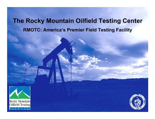
<strong>The</strong> <strong>Rocky</strong> <strong>Mountain</strong> <strong>Oilfield</strong> <strong>Testing</strong> <strong>Center</strong><br />
<strong>RMOTC</strong>: America’s Premier Field <strong>Testing</strong> Facility
What is <strong>RMOTC</strong>?<br />
<strong>The</strong> <strong>Rocky</strong> <strong>Mountain</strong> <strong>Oilfield</strong> <strong>Testing</strong> <strong>Center</strong><br />
(<strong>RMOTC</strong>), is an operating oil field focusing on<br />
environmentally-balanced energy technologies<br />
and alternatives,<br />
and is the premiere<br />
energy testing and<br />
demonstration field<br />
in the nation.
Field Location<br />
• <strong>RMOTC</strong> is located at<br />
Teapot Dome <strong>Oilfield</strong><br />
within the Naval<br />
Petroleum Reserve No. 3<br />
(NPR-3)<br />
• Town offices are located<br />
in Casper, WY<br />
Casper<br />
WYOMING
<strong>RMOTC</strong> Provides<br />
Operations and <strong>Testing</strong> Facilities include:<br />
• Drilling & Service Rigs<br />
• Administrative Services, Engineers,<br />
Scientists, & Support Staff<br />
• Support Equipment<br />
• Bio-Treatment Facilities<br />
• Soil Remediation Facilities<br />
• Field Laboratory<br />
• Gas Processing Facilities<br />
• Production Facilities<br />
• Tanks & Pipelines<br />
• Aquaculture & Hydroponic Greenhouse<br />
Facilities
Unique Location<br />
• Remote, federally-owned<br />
and secure site<br />
• 10,000-acre 000 operating oil<br />
field<br />
• Full complement of onsite<br />
facilities and equipment<br />
• Approximately 1350 well<br />
bores; 600+ active wells<br />
• Nine producing reservoirs<br />
• Depths from 250-7000 ft.<br />
• Real world field testingti<br />
• Producing, non-producing,<br />
and new well drilling<br />
opportunities<br />
• Industry experienced<br />
specialists<br />
• Varied terrain & weather<br />
conditions
<strong>RMOTC</strong> offers <strong>Testing</strong> Opportunities in:<br />
•Exploration<br />
• Environmental Technology<br />
• Production Technology<br />
• Drilling Technology<br />
• Renewable Energy<br />
• Energy Assurance
Teapot Dome Oil Field History<br />
• Production began in the early<br />
1900’s<br />
• By 1927 over 80 wells had<br />
been drilled.<br />
• <strong>The</strong> field was shut down in<br />
1927 and no wells were drilled<br />
until the 1950’s.<br />
• <strong>The</strong> field was opened to full<br />
p<br />
production in the mid 1970’s<br />
and has been producing oil<br />
and gas since.
Period<br />
Formation<br />
Litho Thick- Depth Produclogy<br />
ness (feet) tive<br />
Quaternary Kaycee<br />
0-50<br />
195<br />
Sussex 30 □<br />
225<br />
290<br />
Steele Shannon 120 515 ■<br />
635<br />
NPR-3 Reservoir<br />
Summary<br />
1355<br />
◙<br />
Upper<br />
• Nine oil-bearing intervals<br />
Cretaceous<br />
1990<br />
Niobrara Shale<br />
450<br />
◙<br />
• Four currently producing<br />
Carlisle Shale<br />
240<br />
2440<br />
□<br />
1st Wall Creek 160 2680 □<br />
245 2840<br />
• Shannon - depth 500’<br />
2nd Wall Creek 65 3085 ■<br />
Frontier<br />
175 3150<br />
• Niobrara Shale 2000’<br />
3rd Wall Creek 5 3325 ◙<br />
3330<br />
265<br />
3595<br />
• 2nd Wall Creek 3000’<br />
Mowry Shale<br />
230<br />
Muddy Sandstone<br />
15 3825 ◙<br />
Lower<br />
3840<br />
Cretaceous<br />
<strong>The</strong>rmopolis Shale<br />
135<br />
• Tensleep 5500’<br />
Dakota<br />
3975<br />
85<br />
◙<br />
Lakota<br />
10 4060 ◙<br />
• Granite Basement 7000’<br />
4070<br />
Morrison<br />
270<br />
□<br />
Jurassic<br />
Upper 95 4340<br />
Sundance<br />
• Range of rock composi-<br />
Lower 150<br />
4435<br />
□<br />
Crow Mtn 80 4585<br />
Alcova LS 20 4665<br />
Chugwater<br />
4685<br />
tion & petrophysics<br />
Triassic<br />
Group<br />
Red Peak 520<br />
□<br />
• Clastics and Carbonates<br />
Permian Goose Egg<br />
320<br />
5205<br />
5525<br />
Tensleep<br />
320<br />
Pennsylvanian<br />
Amsden<br />
160 5845<br />
Mississippian Madison<br />
300<br />
6005<br />
Cambrian<br />
through<br />
Devonian<br />
Undifferentiated<br />
780<br />
6305<br />
Pre-Cambrian Granite<br />
7085<br />
□<br />
■
Reservoir Data<br />
Formation Shannon Shales 2 nd Wall Ck Tensleep<br />
OOIP MMBO 144 25 57 4<br />
OGIP BCF 1.4 2.2 45.1 .01<br />
Area, acres 3800 8640 3590 320<br />
Ave Poro. 18 % n/a 15 % 8 %<br />
Ave Perm. 63 md n/a 100 md 80 md<br />
Thickness ft. 65 35 30 50<br />
Pressure PSI 25-70 25-250 25-250 2350<br />
Cum. Oil 11.5 4.1 10.3 1.8<br />
Recovery % 8 16 18 45<br />
Cum. Gas .7 .9 45.1* (inj.) 0<br />
Temp. °F 65 100 125 190<br />
Oil Gravity 29-35 38-42 38 32
<strong>RMOTC</strong>’s Drilling Rig<br />
<strong>The</strong> <strong>Rocky</strong><br />
<strong>Mountain</strong> <strong>Oilfield</strong><br />
<strong>Testing</strong> <strong>Center</strong> has<br />
expanded its<br />
testing capabilities<br />
with the new<br />
<strong>RMOTC</strong> Rig No. 1,<br />
built by Crown<br />
Energy of Calgary,<br />
Alberta, Canada.<br />
• 118 foot high<br />
telescoping mast<br />
• 375,000 pounds<br />
• Depths up to 8000 feet<br />
• High-pressure capability<br />
to 8000 PSI while rotating<br />
• 900 HP draw-works<br />
• Two tandem reducedemissions<br />
engines
106°15'0"W<br />
15 0 106°15' 0"W<br />
Flow Assurance Test Loop<br />
018<br />
017 016 015<br />
014 013<br />
018<br />
019<br />
020<br />
021<br />
022<br />
023<br />
024<br />
019<br />
030<br />
029<br />
028<br />
027<br />
026<br />
025<br />
030<br />
031<br />
032<br />
033<br />
034<br />
035<br />
036<br />
031<br />
Schematic<br />
006<br />
005<br />
004<br />
003<br />
002<br />
001<br />
006<br />
\A1;Flow Assurance Loop<br />
007<br />
008<br />
009<br />
010<br />
011<br />
012<br />
007<br />
018<br />
017<br />
016<br />
015<br />
014<br />
013<br />
018<br />
019<br />
43°15'0"N<br />
019<br />
020<br />
021<br />
022<br />
023<br />
024<br />
43°15'0"N<br />
030<br />
029 028<br />
027<br />
026<br />
025<br />
030<br />
NPR3 Basemap<br />
0 0.2 0.4<br />
1:18,000<br />
0.6 0.8<br />
0.1<br />
Miles<br />
Legend<br />
NPR3.dwg Polyline<br />
natronatwp<br />
natronasect<br />
Roads<br />
Hillshade of teapot_dem<br />
Value<br />
High : 255<br />
Low : 0
<strong>RMOTC</strong> Has Comprehensive Surface and Subsurface<br />
Data to Support Test Projects<br />
• 3D & 2D Seismic Data<br />
• Production History<br />
• Drilling & Tubulars<br />
• Well Headers,<br />
Formation Tops<br />
• Well Logs and Cores
Workstations and Software<br />
• Comprehensive suite of<br />
integrated interpretation tools<br />
from Landmark Graphics in<br />
G&G, production, drilling, and<br />
engineering software<br />
• Upgraded new hardware and IT<br />
infrastructure<br />
• IT staff support<br />
• ESRI ArcGIS for GIS capabilities<br />
• Drilling rig instrumented for realtime<br />
data capture and access via<br />
the internet
Customer Operations <strong>Center</strong>
Questions?