Negley Corridor - City of Pittsburgh
Negley Corridor - City of Pittsburgh
Negley Corridor - City of Pittsburgh

Create successful ePaper yourself
Turn your PDF publications into a flip-book with our unique Google optimized e-Paper software.
<strong>Negley</strong> <strong>Corridor</strong> Development Strategy Partners<br />
East End Neighborhood Forum<br />
Alpha Terrace<br />
Bloomfield-Garfield Corporation (BGC)<br />
East Liberty Development, Inc. (ELDI)<br />
Friendship Development Associates (FDA)<br />
Friendship Preservation Group (FPG)<br />
Garfield Jubilee Association (GJA)<br />
Highland Park Community Club (HPCC)<br />
Highland Park Community Development Corporation (HPCDC)<br />
<strong>Negley</strong> Place Neighborhood Alliance (NPNA)<br />
The Community Builders (TCB)<br />
Community Design Center <strong>of</strong> <strong>Pittsburgh</strong> (CDCP)<br />
<strong>City</strong> <strong>of</strong> <strong>Pittsburgh</strong> Department <strong>of</strong> <strong>City</strong> Planning (DCP)<br />
Klavon Design Associates, Inc.<br />
<strong>City</strong> <strong>of</strong> <strong>Pittsburgh</strong><br />
Tom Murphy, Mayor<br />
<strong>Pittsburgh</strong> <strong>City</strong> Council<br />
Councilman Dan Cohen<br />
Councilman Jim Ferlo<br />
Councilwoman Valerie McDonald<br />
Councilman Michael Diven<br />
Councilman Alan Hertzberg<br />
Councilman Bob O’Connor, president<br />
Councilman Dan Onorato<br />
Councilman Gene Ricciardi<br />
Councilman Sala Udin<br />
Eloise Hirsh, Director <strong>of</strong> <strong>City</strong> Planning
Contents<br />
Overview...............................................................................................1<br />
Development Strategy<br />
and Action Agenda ...............................................................................7<br />
Project Implementation Chart .............................................................29<br />
Development Principles.......................................................................35<br />
Existing Conditions Data .....................................................................43
The <strong>Negley</strong> <strong>Corridor</strong> Initiative is a collaboration among<br />
community groups surrounding <strong>Negley</strong> Avenue.<br />
The following organizations are involved in the effort:<br />
Alpha Terrace<br />
Bloomfield-Garfield Corporation (BGC)<br />
East End Neighborhood Forum (EENF)<br />
East Liberty Development, Inc. (ELDI)<br />
Friendship Development Associates (FDA)<br />
Friendship Preservation Group (FPG)<br />
Garfield Jubilee Association (GJA)<br />
Highland Park Community Club (HPCC)<br />
Highland Park Community Development Corporation (HPCDC)<br />
<strong>Negley</strong> Place Neighborhood Alliance (NPNA)<br />
The Community Builders (TCB)<br />
Community Design Center <strong>of</strong> <strong>Pittsburgh</strong> (CDCP)<br />
<strong>City</strong> <strong>of</strong> <strong>Pittsburgh</strong> Department <strong>of</strong> <strong>City</strong> Planning (DCP)
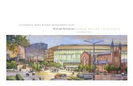
I. Overview<br />
<strong>Negley</strong> <strong>Corridor</strong><br />
Development Strategy<br />
Overview 1
I. Overview<br />
*NOTE: To avoid<br />
confusion, in this report<br />
"Highland Park" will be<br />
used to refer to the<br />
regional park; the<br />
neighborhood will be<br />
specified as "Highland<br />
Park neighborhood."<br />
<strong>Negley</strong> Avenue is a primary corridor in <strong>Pittsburgh</strong>’s East End. It connects<br />
neighborhoods and commercial centers, is a major transportation<br />
thoroughfare, and provides access to Highland Park and the <strong>Pittsburgh</strong><br />
Zoo. Many neighborhoods border on <strong>Negley</strong>; it can connect<br />
neighborhoods and be a boundary between them. Unfortunately, <strong>Negley</strong><br />
Avenue has <strong>of</strong>ten been more <strong>of</strong> a barrier than a connection, with no<br />
community taking "ownership" <strong>of</strong> the corridor. This report and the<br />
broader <strong>Negley</strong> <strong>Corridor</strong> Initiative is an attempt to view <strong>Negley</strong> Avenue<br />
as a common thread weaving together the neighborhoods <strong>of</strong> East Liberty,<br />
Highland Park, Garfield, and Friendship.<br />
Several East End neighborhood groups have joined together in an effort<br />
to focus attention on development strategies for northern <strong>Negley</strong><br />
Avenue. This report is the product <strong>of</strong> that effort and can be used as a<br />
resource document for all those involved in development on this<br />
corridor. The <strong>Negley</strong> <strong>Corridor</strong> is defined in this report as properties<br />
fronting onto <strong>Negley</strong> Avenue from Centre Avenue north to the street’s<br />
terminus in Highland Park.<br />
The Department <strong>of</strong> <strong>City</strong> Planning has completed this document on<br />
behalf <strong>of</strong> the East End Neighborhood Forum (EENF) and the <strong>Negley</strong><br />
<strong>Corridor</strong> Initiative Oversight Committee, a collection <strong>of</strong> community<br />
representatives from each neighborhood adjacent to the <strong>Negley</strong> <strong>Corridor</strong><br />
study area. This development strategy details a long-term vision for the<br />
corridor to set the context for future private and public development<br />
decisions. Rather than describing short-term fixes, this vision articulates<br />
what the corridor can become with the concerted effort <strong>of</strong> residents who<br />
live along the corridor, private and non-pr<strong>of</strong>it developers, community<br />
organizations, and the public sector.<br />
<strong>City</strong> Planning Role<br />
While the Department <strong>of</strong> <strong>City</strong> Planning is preparing this phase <strong>of</strong> the<br />
<strong>Negley</strong> <strong>Corridor</strong> Development Strategy, it is not a city-initiated effort.<br />
<strong>City</strong> Planning is acting as a consultant to the <strong>Negley</strong> <strong>Corridor</strong> Initiative<br />
under the auspices <strong>of</strong> EENF; Phase One, Existing Conditions, was<br />
undertaken by Environmental Planning and Design (see Chapter V).<br />
The planners involved are <strong>of</strong>fering their expertise and their perspective,<br />
but are acting under the direction <strong>of</strong> the <strong>Negley</strong> <strong>Corridor</strong> Initiative<br />
Committee. Moreover, although the Department <strong>of</strong> <strong>City</strong> Planning is<br />
Overview 3
producing the report, it should not be considered a plan detailing future<br />
city budget expenditures. The <strong>City</strong> <strong>of</strong> <strong>Pittsburgh</strong> currently has no funds<br />
budgeted for the implementation <strong>of</strong> this plan. Upon completion <strong>of</strong> the<br />
strategy, the <strong>Negley</strong> <strong>Corridor</strong> Initiative Committee may elect to seek<br />
funding, both public and private to see that the recommendations are<br />
implemented. This document is meant to guide all development that takes<br />
place along the corridor, most <strong>of</strong> which will be private development.<br />
A Vision for the <strong>Negley</strong> <strong>Corridor</strong><br />
When the strategy recommendations are implemented, what will the<br />
<strong>Negley</strong> <strong>Corridor</strong> be like? The following statements <strong>of</strong>fer a sense <strong>of</strong> how<br />
one may experience the new <strong>Negley</strong> Avenue.<br />
The vision for the <strong>Negley</strong> <strong>Corridor</strong> is that <strong>of</strong> a grand residential street that culminates at one<br />
<strong>of</strong> the city’s premier regional parks.<br />
At the corridor’s southern boundary, one finds an abundance <strong>of</strong> large-scale, auto-oriented<br />
commercial activity on Baum Boulevard. Even so, the intersection <strong>of</strong> Baum Boulevard and <strong>Negley</strong><br />
Avenue is a beautiful, lushly landscaped gateway to the <strong>Negley</strong> <strong>Corridor</strong>. Although there is not<br />
actually a park there, the amount <strong>of</strong> landscaping on each property facing the intersection reminds<br />
one <strong>of</strong> Highland Park at <strong>Negley</strong> Avenue’s northern terminus.<br />
Commercial activity is located at specific focal points and faces the side streets, rather than fronting<br />
on <strong>Negley</strong>. Parking for commercial uses is provided either at the rear or side <strong>of</strong> the structures.<br />
The corridor’s zoning accurately reflects these various land uses. Directional signage points<br />
the way from <strong>Negley</strong> Avenue to nearby neighborhood commercial districts.<br />
Technically, <strong>Negley</strong> Avenue is the border separating four neighborhoods along the<br />
corridor’s length. However, instead <strong>of</strong> each neighborhood turning its back to <strong>Negley</strong> Avenue,<br />
it is a focal point for development activity and has been the vehicle for the various neighborhoods<br />
to jointly work toward common goals. <strong>Negley</strong> Avenue now functions as a seam that binds several<br />
neighborhoods.<br />
The corridor contains many amenities, including street trees, attractive bus shelters and trash<br />
receptacles, consistent lighting, clear and uniform signage, and highly visible textured crosswalks.<br />
There is a consistent pattern <strong>of</strong> development along the corridor because a common setback –<br />
distance between buildings and the street – has been established for nearly all the buildings and<br />
their front yards.<br />
Traffic is calmed, but still flows efficiently along the corridor because there is consistent on-street<br />
parking and well-timed lights. The on-street parking contributes to pedestrian safety by creating a<br />
buffer between moving vehicles and persons on the sidewalk. Bus shelters, street trees, and visible<br />
textured crosswalks also help to improve conditions for pedestrians.<br />
All structures along the corridor are well maintained and in compliance with city codes. Single family<br />
structures are maintained for single family use. Multiple family structures are kept clean, have<br />
adequate parking for residents, and contribute to <strong>Negley</strong> Avenue’s residential identity; their front<br />
yards, porches, and landscaping are similar to that <strong>of</strong> single family homes. Porches are no longer<br />
removed from the fronts <strong>of</strong> homes. In fact, porches have been restored to those facades from<br />
which they were once removed. These homes now have a much stronger presence along the street<br />
because their porches provide gracious entry points to the home and maintain the common setback<br />
along the corridor.<br />
These characteristics create an important sense <strong>of</strong> place and a unique identity for the <strong>Negley</strong><br />
<strong>Corridor</strong>.<br />
4 Overview
Community Contribution to the Document<br />
An extensive public process has helped to direct each phase <strong>of</strong> this<br />
report, including visioning, data collection, and recommendations.<br />
The <strong>Negley</strong> <strong>Corridor</strong> Initiative Oversight Committee, convened by EENF,<br />
has met at critical junctures in the process to provide direction and<br />
feedback to the consultants. The oversight committee is made up <strong>of</strong><br />
activists and pr<strong>of</strong>essionals with knowledge <strong>of</strong> the obstacles to and<br />
opportunities for development along the corridor. Committee members<br />
represented each <strong>Negley</strong> <strong>Corridor</strong> neighborhood to ensure that all voices<br />
were heard throughout the process. Broader representation was obtained<br />
at three public meetings hosted by EENF where consultant work was<br />
presented to the attendees for their input.<br />
This public process and implementation strategy should set the stage<br />
for an effective, coordinated implementation effort. Residents and<br />
activists who know about the strategy because <strong>of</strong> taking part in preparing<br />
the strategy’s recommendations are more likely to get involved<br />
in the implementation. Work has begun on implementation <strong>of</strong> this strategy's<br />
recommendations. The companion document, <strong>Negley</strong> <strong>Corridor</strong><br />
Initiative Site Analysis Study, has been completed; this document<br />
presents detailed information on redevelopment options for four strategic<br />
sites on <strong>Negley</strong> Avenue. Community discussions regarding the issue<br />
<strong>of</strong> absentee landlords have been held as well. The community should<br />
form other committees to oversee the implementation <strong>of</strong> this strategy,<br />
using the implementation chart in Chapter III <strong>of</strong> this document.<br />
Overview 5
Overview <strong>of</strong> Document<br />
The next chapter contains the development strategy recommendations:<br />
from improving crosswalks to developing vacant properties, from<br />
increasing home ownership to improving traffic flow. The<br />
recommendations, once implemented, will achieve the vision for the<br />
<strong>Negley</strong> <strong>Corridor</strong> discussed above. To assist implementation, a chart<br />
for tracking the action agenda is included in Chapter III. Chapter IV<br />
contains four sets <strong>of</strong> design principles that will inform development<br />
and renovation decisions so that they contribute to the quality <strong>of</strong> the<br />
corridor’s built environment. Chapter V discusses the challenges and<br />
opportunities existing in the <strong>Negley</strong> <strong>Corridor</strong>. Issues such as property<br />
maintenance, traffic and parking, vacant land, etc. are contrasted with<br />
the opportunities such as strong community-based organizations,<br />
architectural quality, and good centralized location. In total, this<br />
development strategy report is meant to be a tool for those involved<br />
in returning <strong>Negley</strong> Avenue to a grand residential street.<br />
6 Overview
II. Development Strategy and Action Agenda<br />
coverstock<br />
<strong>Negley</strong> <strong>Corridor</strong><br />
Development Strategy<br />
Development Strategey and Action Agenda 7
II. Development Strategy and Action Agenda<br />
The vision statement in Chapter I describes a grand residential street<br />
with plentiful landscaping, handsome structures, and many public<br />
amenities. Once the recommendations in this chapter are implemented,<br />
this will be the experience for <strong>Negley</strong> Avenue residents and visitors.<br />
The recommendations begin with development, then discuss the public<br />
realm, property maintenance, traffic, and zoning. A series <strong>of</strong> design<br />
principles are outlined in Chapter IV to guide specific development<br />
efforts.<br />
The following illustrative plan represents the changes recommended<br />
to reach the vision for the <strong>Negley</strong> <strong>Corridor</strong>. The plan is shown in two<br />
sections because the corridor is long and narrow. Section One, Figure IIa,<br />
contains the southern portion <strong>of</strong> the corridor, from Centre Avenue to<br />
Black Street; Section Two, Figure IIb, repeats the East Liberty<br />
Boulevard/Black Street area and continues from there to <strong>Negley</strong> Avenue’s<br />
terminus at Highland Park.<br />
Development and Rehabilitation<br />
The most dramatic changes to the <strong>Negley</strong> <strong>Corridor</strong> will be made<br />
through development projects. There are many opportunities for new<br />
construction on vacant parcels and opportunities for rehabilitation<br />
<strong>of</strong> degraded properties. The priority development sites are shown<br />
on the development strategy plan. In addition to working on actual<br />
development projects, we recommend that the community focus on<br />
development review, maintenance <strong>of</strong> a <strong>Negley</strong> Avenue property database,<br />
and outreach to developers doing projects or considering projects in the<br />
corridor.<br />
In addition to the development projects and rehabilitation opportunities<br />
discussed in detail below, it is recommended that the area's CDCs and<br />
the EENF coordinate an outreach strategy to developers and property<br />
owners to inform them about the goals <strong>of</strong> the <strong>Negley</strong> <strong>Corridor</strong><br />
Development Strategy. The community must advocate for the strategy's<br />
design principles and development goals and encourage increased home<br />
ownership as opportunities arise. A committee should be formed to<br />
review development projects and provide one voice for community input<br />
regarding development proposals. The database created during the first<br />
phase <strong>of</strong> this study should be maintained on a regular basis and used as a<br />
resource for identifying potential development opportunities. Such an<br />
organized effort targeting appropriate development is essential to the<br />
success <strong>of</strong> this strategy.<br />
Development Strategey and Action Agenda 9
The <strong>Negley</strong> <strong>Corridor</strong><br />
Figure II a.<br />
N<br />
10 Development Strategey and Action Agenda
Figure II b.<br />
N<br />
Development Strategey and Action Agenda 11
Companion Document: <strong>Negley</strong> <strong>Corridor</strong> Initiative Site Analysis Study<br />
Prior to the printing <strong>of</strong> this development strategy document, the community began studying the<br />
feasibility <strong>of</strong> redeveloping four high-priority development sites on the <strong>Negley</strong> <strong>Corridor</strong>. The following<br />
sites are included in the study, which is now complete:<br />
• 5531 Penn Avenue, a former Gulf gasoline station at the corner <strong>of</strong> <strong>Negley</strong> and Penn Avenues;<br />
• 500 North <strong>Negley</strong> Avenue, an apartment building <strong>of</strong> architectural significance at the corner <strong>of</strong><br />
East Liberty Boulevard and <strong>Negley</strong> Avenue;<br />
• 251 North <strong>Negley</strong> Avenue, a former Texaco gasoline station; and<br />
• 120 - 138 South <strong>Negley</strong> Avenue, a series <strong>of</strong> rental properties, the porches and entranceways <strong>of</strong><br />
which have been removed or significantly altered.<br />
The Community Design Center <strong>of</strong> <strong>Pittsburgh</strong> and The Community Builders collaborated on this<br />
project, with participation from <strong>Negley</strong> <strong>Corridor</strong> Initiative community representatives. The aim <strong>of</strong><br />
the analysis was to research development options in order to determine acquisition and<br />
redevelopment costs and to demonstrate a cohesive strategy for moving ahead on the community's<br />
vision for the corridor. The Community Design Center <strong>of</strong> <strong>Pittsburgh</strong> (CDCP) provided funding to<br />
hire an architect to do preliminary architectural analysis <strong>of</strong> the sites. The architect provided site<br />
plans/renderings and construction costs for each site; community preferences for future<br />
development <strong>of</strong> each site were taken into account. The Community Builders (TCB) provided<br />
economic development assistance to refine the initial analysis and provided the architect<br />
with the initial site information.<br />
This analysis will facilitate development <strong>of</strong> the sites in a "package," which will increase the likelihood<br />
<strong>of</strong> success over each project being structured separately. Implementation <strong>of</strong> <strong>Negley</strong> <strong>Corridor</strong><br />
Initiative Site Analysis Study is included in Chapter III <strong>of</strong> this document, "Project<br />
Implementation Chart."<br />
High Visibility Sites<br />
The <strong>Negley</strong> <strong>Corridor</strong> Initiative should first concentrate on development<br />
sites with the highest visibility. Thus, the vacant lot at the corner<br />
<strong>of</strong> Penn and <strong>Negley</strong> (the former Gulf station) is the highest priority<br />
for development. Three neighborhoods and two commercial districts<br />
intersect at this property. Development <strong>of</strong> this site will also reinforce the<br />
investment currently underway at New Pennley Place, a project that will<br />
have a dramatic positive impact on the aesthetics and quality <strong>of</strong> life on<br />
<strong>Negley</strong> Avenue.<br />
This strategy document recommends that the former Gulf station<br />
site be redeveloped for a commercial or a mixed-use development.<br />
The new building should create a strong presence on the corner and be<br />
at least two stories tall to complement the corridor’s urban character.<br />
Suburban-style development with a one-story building and a large<br />
parking lot between the building and the street should be avoided.<br />
The most likely way to achieve such high quality urban development<br />
is for the local CDCs participating in the <strong>Negley</strong> <strong>Corridor</strong> Initiative to<br />
acquire the property and control the development. This site is one <strong>of</strong><br />
four included in <strong>Negley</strong> <strong>Corridor</strong> Initiative Sites Analysis Study, a<br />
companion document to this report. Please refer to that report for more<br />
detailed information.<br />
12 Development Strategey and Action Agenda
Another highly visible commercial site is the former car dealership<br />
showroom at the intersection <strong>of</strong> <strong>Negley</strong> Avenue and Baum Boulevard.<br />
The strategy recommendation is that the original building remains intact<br />
and that it be redeveloped with a first floor retail use and <strong>of</strong>fice/studio or<br />
residential uses on the upper floors. The existing building has a strong<br />
presence on the corner and now serves as a buffer for the Friendship<br />
neighborhood from the traffic and noise on Baum Boulevard.<br />
Redevelopment <strong>of</strong> the site would present an opportunity to install<br />
additional landscaping to enhance the appearance <strong>of</strong> the southern<br />
terminus <strong>of</strong> the <strong>Negley</strong> <strong>Corridor</strong>. This will contribute to the landscaping<br />
<strong>of</strong> the Baum/Centre node to create a green entrance to the corridor (see<br />
"Greening the <strong>Corridor</strong>" later in this chapter for a description <strong>of</strong> the<br />
landscaping improvements). Greening this area will help to create a more<br />
distinct sense <strong>of</strong> place, will reduce the harshness <strong>of</strong> the current landscape,<br />
and will reflect Highland Park at the corridor’s northern terminus.<br />
The corner <strong>of</strong> Penn Avenue and <strong>Negley</strong> Avenue is a high priority for redevelopment.<br />
Development Strategey and Action Agenda 13
This property at the corner <strong>of</strong> Baum Boulevard and <strong>Negley</strong> Avenue is an important<br />
development opportunity. Construction <strong>of</strong> a drug store is now underway.<br />
Penn and <strong>Negley</strong> is the corridor's most important intersection and the least residential in character. Penn Avenue is<br />
one <strong>of</strong> the area's major arteries and leads to commercial districts in Garfield and East Liberty. Because many<br />
properties at this intersection are currently commercial, mixed use or commercial development is encouraged at the<br />
vacant site across from New Pennley Place in order to reinforce Penn Avenue as a commercial corridor and to<br />
provide retail opportunities to residents nearby. New structures should be at least two stories and built up to the<br />
sidewalks to reinforce the urban character <strong>of</strong> the intersection and to complement development<br />
at New Pennley Place.<br />
14 Development Strategey and Action Agenda
When a major chain drugstore proposed to demolish the former car dealership showroom at<br />
the intersection <strong>of</strong> Baum Boulevard, Roup Avenue, and <strong>Negley</strong> Avenue and replace it with<br />
a suburban-style box store, the Friendship community sprung into action. The neighborhood<br />
activists were concerned that the proposed development would be unsightly and cause adverse<br />
impacts on the quality <strong>of</strong> life in Friendship. The showroom building currently buffers the<br />
neighborhood from much <strong>of</strong> the noise and traffic on Baum Boulevard. A neighborhood committee<br />
was formed who then met with the drugstore chain <strong>of</strong>ficials to explain their opposition to the<br />
project as proposed. The committee showed the company how to work with the existing structure<br />
and convinced the company <strong>of</strong> the soundness <strong>of</strong> the Friendship-supported alternative. As a result,<br />
the community’s privacy and integrity will be preserved.<br />
Thus, in response to neighborhood concerns, the drugstore chain is considering keeping the<br />
existing Roup and Baum building standing. The company will house its operations in the first floor<br />
and leave the upper floors vacant. The company has decided against allowing for l<strong>of</strong>t-style<br />
apartments on the top floors, because it feels the residents would compete with customers<br />
for the limited parking spaces.<br />
The site plan preserves the character <strong>of</strong> the historic showroom building, but the triangular<br />
two-story section <strong>of</strong> the building will be demolished to provide drive-thru lanes. The plan also<br />
includes removal <strong>of</strong> the canopy along Baum Boulevard, the ramps along Stratford, and the auto<br />
service facility next door on <strong>Negley</strong>. The plan includes a canopy over the drive-thru lanes. Details<br />
remain to be worked out regarding lighting, the delivery side along Stratford, and about fencing,<br />
but the community agrees that this proposed solution is much more neighborhood-friendly.<br />
- Friendship Journal, January 1999 and February 1999<br />
This action on the part <strong>of</strong> Friendship residents is an excellent model for community activism in<br />
support <strong>of</strong> good design and positive development projects. The Friendship activists recognized<br />
community assets, communicated directly with developers and business people, persuaded them to<br />
consider their ideas, and resolved the situation in a way satisfactory to all involved. This example is<br />
potentially different from future cases because many <strong>of</strong> those involved were pr<strong>of</strong>essional architects.<br />
Community activists without such particular expertise should not be deterred however, because<br />
being an expert is not a requirement for success. Also, when technical assistance is needed, activists<br />
may request it from community organizations, governmental bodies, or various technical assistance<br />
providers.<br />
Reuse <strong>of</strong> the existing building with retail at street level and plenty <strong>of</strong> landscaping would be ideal.<br />
Development Strategey and Action Agenda 15
Residential Development Priorities<br />
Residential development is recommended for the other high-priority<br />
development sites along <strong>Negley</strong> Avenue, in keeping with the vision<br />
<strong>of</strong> <strong>Negley</strong> Avenue as a grand residential street. The following vacant sites<br />
present excellent opportunities for high quality development along<br />
<strong>Negley</strong>. The site <strong>of</strong> a former Texaco gas station at 251 North <strong>Negley</strong><br />
Avenue should be developed for mixed-use or residential use. If<br />
contamination issues prevent such development, the property should<br />
be improved and brought into use as a parking lot with landscaped<br />
sitting areas. Development <strong>of</strong> this property will be an appropriate<br />
compliment to New Pennley Place across the street. The vacant site at<br />
<strong>Negley</strong> Avenue and Hays Street is a priority development opportunity<br />
because <strong>of</strong> its prominent corner location. At that location, The <strong>Negley</strong><br />
<strong>Corridor</strong> Initiative recommends multi-family dwellings designed to<br />
replicate the historic grand residences found on <strong>Negley</strong> Avenue.<br />
Redevelopment <strong>of</strong> this prominent corner, at Hays Street, would have a big impact<br />
on the corridor.<br />
There are also opportunities to improve the appearance <strong>of</strong> the corridor<br />
through rehabilitating highly visible residential properties. First, the<br />
rental properties across from Penn Plaza near the intersection <strong>of</strong> <strong>Negley</strong><br />
and Penn Avenues are currently unsightly and poorly maintained. The<br />
committee has focused on rehabilitation <strong>of</strong> these structures due to their<br />
prominent location and because they have the potential once again to be<br />
attractive residences (see <strong>Negley</strong> <strong>Corridor</strong> Initiative Site Analysis<br />
Study for more information).<br />
Second, another structure with great potential is the apartment building<br />
on the northeast corner <strong>of</strong> <strong>Negley</strong> Avenue and East Liberty Boulevard,<br />
16 Development Strategey and Action Agenda
500 N. <strong>Negley</strong> Avenue, which is currently in disrepair. Without attention<br />
in the near future, this once-handsome structure will deteriorate to such<br />
an extent that it will be excessively costly to renovate. The prominent<br />
location <strong>of</strong> this building is the main reason for its inclusion here, but its<br />
rehabilitation can also serve as an example to spark interest in the<br />
rehabilitation <strong>of</strong> nearby buildings on <strong>Negley</strong> Avenue and on East Liberty<br />
Boulevard (see <strong>Negley</strong> <strong>Corridor</strong> Initiative Site Analysis Study for<br />
more information).<br />
Should rehabilitation <strong>of</strong> the apartment building at 500 N. <strong>Negley</strong> Avenue<br />
be infeasible, the following design considerations should be followed for<br />
new construction on the site and similar sites. First, a building<br />
constructed on the site should be substantial in scale, such as a two- or<br />
three-story building, to make a strong presence on the corner site.<br />
Second, the building should be built as close to the corner <strong>of</strong> the<br />
property as possible, again, to reinforce the urban character <strong>of</strong> <strong>Negley</strong><br />
Avenue. Finally, parking and refuse containers should be hidden from<br />
view <strong>of</strong> <strong>Negley</strong> Avenue and East Liberty Boulevard. The four sets <strong>of</strong><br />
design principles found in Chapter IV should be consulted for this<br />
project and all others throughout the corridor.<br />
Finally, the apartment building at the northwest corner <strong>of</strong> <strong>Negley</strong> Avenue<br />
and Black Street should be redeveloped as well. In yet another key<br />
location, this building is oriented away from <strong>Negley</strong> Avenue and is<br />
unsightly. The property would be an asset to the corridor were it to<br />
create a strong presence on the corner with the main entrance facing<br />
<strong>Negley</strong> Avenue.<br />
New development along the <strong>Negley</strong> <strong>Corridor</strong> should complement the existing residential architecture. New singleand<br />
multi-family housing should be similar in scale and massing to the larger, single-family homes on the street.<br />
New buildings, such as the one in this illustration, should be oriented to the street, with the main entrance and<br />
entry porch facing <strong>Negley</strong> Avenue. The gabled ro<strong>of</strong>s, windows, and detailing reinforce the residential identity <strong>of</strong> the<br />
corridor, as well as the adjoining side street. The structure is built to established setback lines along both streets,<br />
creating a strong presence on the corner and maintaining the rhythm <strong>of</strong> the street.<br />
Development Strategey and Action Agenda 17
In the longer term, the <strong>Negley</strong> <strong>Corridor</strong> Initiative should encourage the<br />
redevelopment <strong>of</strong> Penn Plaza apartments similarly to New Pennley Place.<br />
Should the opportunity arise to rehabilitate Penn Plaza in a similar<br />
manner, it should be done. Local streets could then be reconnected<br />
through the property and the residences could have a stronger, more<br />
attractive presence on <strong>Negley</strong> Avenue. The vacant lot and auto repair<br />
shop at 222 - 226 <strong>Negley</strong> Avenue at the intersection <strong>of</strong> <strong>Negley</strong> Avenue<br />
with Rural Street should be considered for redevelopment to better<br />
compliment New Pennley Place as well. In addition to these suggested<br />
targets, the <strong>Negley</strong> <strong>Corridor</strong> Initiative will focus on additional residential<br />
properties as opportunities present themselves.<br />
All development and property maintenance activity along the <strong>Negley</strong><br />
<strong>Corridor</strong> should be undertaken in accordance with the development<br />
guidelines prepared as part <strong>of</strong> this strategy. Charts containing the<br />
guidelines and accompanying text are found in Chapter IV. The<br />
guidelines, which can be used by homeowners, CBOs, and developers,<br />
will help to achieve high quality developments that complement nearby<br />
properties and enhance the overall image <strong>of</strong> the corridor.<br />
Property Maintenance<br />
Property maintenance is one <strong>of</strong> the biggest challenges facing the <strong>Negley</strong><br />
<strong>Corridor</strong>. The problems associated with absentee landlords are the major<br />
concern, but property maintenance issues also pertain to individual<br />
homeowners and multi-family buildings with local management.<br />
This is discussed in greater detail in Chapter V, as is the issue <strong>of</strong><br />
homeowners struggling with the high cost <strong>of</strong> renovations and<br />
maintenance. Improving property maintenance throughout<br />
the corridor will require a concerted effort with a variety <strong>of</strong> techniques.<br />
Financial Resources<br />
A major resource for this effort will be the housing programs available<br />
through the Urban Redevelopment Authority <strong>of</strong> <strong>Pittsburgh</strong> (URA). URA<br />
programs can be utilized in a variety <strong>of</strong> ways to improve property<br />
maintenance. Homeowners can use low interest loans for maintenance <strong>of</strong><br />
and improvements to their homes. Most <strong>of</strong> these URA programs are<br />
available citywide but low-income neighborhoods have higher income<br />
limits and/or purchase price limits. So for the <strong>Negley</strong> <strong>Corridor</strong>, Garfield,<br />
Friendship, and East Liberty are target neighborhoods, while Highland<br />
Park neighborhood residents can access the programs if they meet the<br />
lower income and purchase price limits.<br />
URA programs can also be used to support homeownership, which is a<br />
goal for <strong>Negley</strong> <strong>Corridor</strong> Initiative members. Most <strong>of</strong> the URA programs<br />
require that the applicant occupy the house or a unit in the house.<br />
Encouraging the use <strong>of</strong> these programs will further the goals <strong>of</strong> the<br />
<strong>Negley</strong> <strong>Corridor</strong> Initiative to increase homeownership and reduce<br />
absentee landlords. The major focus should be on marketing the existing<br />
programs. A concerted effort must be made to educate owners about the<br />
18 Development Strategey and Action Agenda
available programs, encourage them to take advantage <strong>of</strong> them, and to<br />
develop relationships with participating bank representatives. This task<br />
can begin immediately and remain ongoing.<br />
Community development corporations (CDCs) in the area are instrumental<br />
in putting together financial packages to make development projects<br />
happen. They are able to access financial resources beyond the URA,<br />
including bank financing, other developers, foundation funding, and<br />
state/federal programs.<br />
Historic tax credits may also be a resource for improving the<br />
maintenance <strong>of</strong> properties along the corridor. The Federal government<br />
encourages the preservation <strong>of</strong> historic buildings through various means,<br />
including preservation tax incentives. The Federal Historic Preservation<br />
Tax Incentives program is one <strong>of</strong> the Federal government's most<br />
successful and cost-effective community revitalization programs.<br />
These incentives reward private investment in rehabilitating historic<br />
properties such as <strong>of</strong>fices, rental housing, and retail stores.<br />
Current tax incentives include: 1) a 20% tax credit for the certified<br />
rehabilitation <strong>of</strong> certified historic structures and 2) a 10% tax credit for<br />
the rehabilitation <strong>of</strong> non-historic, non-residential buildings built before<br />
1936. The 20% rehabilitation tax credit is available for properties<br />
rehabilitated for commercial, industrial, agricultural, or rental residential<br />
purposes, but it is not available for properties used exclusively as the<br />
owner's private residence. This tax credit is the one most likely to be<br />
applicable to most properties on <strong>Negley</strong> Avenue because the 10% tax<br />
credit cannot be used for residential buildings. Those interested in<br />
learning more about this tax incentive program should call the<br />
Pennsylvania Historic Preservation Officer at (717) 787-2891.<br />
Information can also be accessed by visiting http://www.cr.nps.gov.<br />
The following programs are available through the Urban Redevelopment Authority <strong>of</strong><br />
<strong>Pittsburgh</strong> (URA).<br />
PITTSBURGH HOME OWNERSHIP PROGRAM (PHOP)<br />
The PHOP helps low and moderate income people to become homeowners. This<br />
program provides mortgages at a fixed below-market interest rate for a term <strong>of</strong> 30 years to eligible<br />
home buyers within any city neighborhood. Both the income limits and the purchase price limits<br />
are higher in Target Neighborhoods (including Garfield, Friendship, and East Liberty) than in<br />
Program Neighborhoods (Highland Park neighborhood).<br />
HOUSING RECOVERY PROGRAM (HRP)<br />
The HRP is the most affordable mortgage program for <strong>City</strong> <strong>of</strong> <strong>Pittsburgh</strong> borrowers who want to<br />
purchase or refinance older homes and make substantial home repairs to them. The purchase and<br />
remodeling costs are combined in one payment. In certain areas <strong>of</strong> the city (including Garfield,<br />
Friendship and East Liberty), borrowers who meet certain income requirements can have the<br />
repayment <strong>of</strong> a portion <strong>of</strong> the HRP loan deferred at a 0% interest rate. The deferred portion<br />
will not have to be repaid until the sale <strong>of</strong> the property. Many <strong>of</strong> the houses located along the<br />
<strong>Negley</strong> <strong>Corridor</strong> are older and architecturally interesting; HRP can help those who like homes<br />
with character.<br />
Development Strategey and Action Agenda 19
(URA Programs, cont.)<br />
HOME IMPROVEMENT LOAN PROGRAM (HILP)<br />
Low-Interest Home Improvement Loans can be in any amount up to $25,000 and can be used for<br />
any home improvement or repair. The qualifying amount will be based on the work needed on the<br />
home, the amount <strong>of</strong> the homeowner's income, and other financial obligations. The <strong>Negley</strong><br />
<strong>Corridor</strong> neighborhoods <strong>of</strong> East Liberty, Friendship, and Garfield are in a target area, so there are no<br />
income limits. Since no equity is needed to qualify, one can apply even if he or she just purchased a<br />
home. The home can have 1-4 units; however, the homeowner must occupy the home in order to<br />
be eligible for this program. This program could be used to address the issue <strong>of</strong> porches that have<br />
been removed from the facades <strong>of</strong> many <strong>Negley</strong> Avenue homes.<br />
PITTSBURGH HOME REHABILITATION PROGRAM (PHRP)<br />
The PHRP <strong>of</strong>fers the lowest interest rate available for home improvements, starting with the necessary<br />
repairs. This program is focused on single-family or two-unit homes and is available only to<br />
low-income homeowners.<br />
For more information, contact the URA’s Housing Office at 255-6566 or visit their website at<br />
www.ura.org/housing.htm<br />
The URA is located at 200 Ross Street, 10th Floor in Downtown <strong>Pittsburgh</strong>.<br />
Homeowners may also wish to take advantage <strong>of</strong> the Renovation Information Network, a community<br />
resource for home renovation consultation. Call the Community Design Center <strong>of</strong> <strong>Pittsburgh</strong> at<br />
391-4333 for more information.<br />
Code Enforcement<br />
Another immediate and ongoing task is to embark on a code<br />
enforcement effort, particularly to target the negligent absentee landlords<br />
on the corridor. First, acquisition should be the strategy to deal with the<br />
most troublesome property owners. Those who have long histories <strong>of</strong><br />
non-compliance are unlikely to come around; the community should<br />
focus on purchasing properties from such owners.<br />
Next, a code compliance effort should be initiated for the majority <strong>of</strong><br />
problem properties. This will involve prioritizing the properties <strong>of</strong><br />
concern, putting pressure on public agencies to enforce the codes,<br />
keeping track <strong>of</strong> the progress <strong>of</strong> the code enforcement effort, testifying<br />
at housing court, etc. It is also highly recommended that the<br />
community work in earnest to develop positive relationships with code<br />
enforcement agencies and to become educated about the <strong>of</strong>ten-frustrating<br />
legal processes involved in cleaning up problem properties.<br />
Community activists will find that learning about the process will help<br />
them to have productive interactions with code enforcement agencies.<br />
Also, the CBOs and CDCs involved in the effort should focus on<br />
developing relationships with property owners. This course is more<br />
likely to lead to improved property conditions over the long term;<br />
collaboration, rather than conflict, should be pursued as a matter<br />
<strong>of</strong> course. Extreme confrontational tactics will be needed as well,<br />
but should be used as a last resort because a lasting agreement with<br />
commitment from each party is unlikely to arise from confrontation<br />
alone.<br />
20 Development Strategey and Action Agenda
Finally, the relationships built during the code enforcement effort can<br />
be utilized to improve the conditions <strong>of</strong> multi-unit rental properties<br />
beyond what is required under the various city and county codes.<br />
This will involve improving the appearance <strong>of</strong> the buildings, planting<br />
additional landscaping, screening <strong>of</strong> tenants more closely, etc. This<br />
effort can be accomplished with a combination <strong>of</strong> property acquisition<br />
and cajoling <strong>of</strong> property owners. The community’s constant vigilance,<br />
aptitude for developing working relationships with property owners/<br />
enforcement agencies, and ability to maximize on opportunities<br />
will be required to make this successful.<br />
The <strong>Negley</strong> <strong>Corridor</strong> Initiative members may find that mediation is a valuable tool for<br />
resolving problems between community organizations and problem property owners, if they are<br />
willing to talk to one another. The biggest challenge will be to get property owners to the table;<br />
once that is done, mediation is likely to be successful. Mediation can be used to resolve disputes<br />
among other parties as well (e.g., neighbors, organizations, landlord/tenants, youth/adults, etc.).<br />
Mediation is a voluntary process where people involved in a conflict talk to each other with the help<br />
<strong>of</strong> trained mediators who are impartial. Each person is given a chance to explain his or her point <strong>of</strong><br />
view without being interrupted, and then everyone jointly decides what problems need to be<br />
solved. With the help <strong>of</strong> the mediators, the people involved consider possible solutions and choose<br />
the ones that work best for everyone. The end result <strong>of</strong> a successful mediation is a written<br />
agreement that all parties sign and intend to uphold.<br />
Approximately 85% <strong>of</strong> mediations reach agreement. Participants are more likely to live up to a<br />
decision they made themselves than one that was made for them by others.<br />
Contact the <strong>Pittsburgh</strong> Mediation Center for help with a conflict by calling (412) 381-4443.<br />
Porchless houses such as these detract from the<br />
vision <strong>of</strong> <strong>Negley</strong> Avenue as a grand residential<br />
street.<br />
Development Strategey and Action Agenda 21
Restore Porches<br />
The removal <strong>of</strong> porches from houses on <strong>Negley</strong> Avenue is a major<br />
community concern because this practice significantly detracts from the<br />
architectural quality <strong>of</strong> each individual structure and from the streetscape<br />
as a whole. Front porches have a strong visual and social impact on the<br />
streetscape. They provide a gracious entry to the home, as well as<br />
sheltered outdoor space for the residents. The property maintenance<br />
effort should include a "porch program" focused specifically on halting<br />
the removal <strong>of</strong> front porches and providing incentives for owners to<br />
replace porches that have been removed. The URA's Home Improvement<br />
Loan Program, discussed in an earlier sidebar, is a possible source <strong>of</strong><br />
funding for this effort. The "porchless" houses in the 100-block <strong>of</strong><br />
S. <strong>Negley</strong> Avenue were included in the <strong>Negley</strong> <strong>Corridor</strong> Initiative Site<br />
Analysis Study, a companion document to this report. Please refer to that<br />
document for more detailed information.<br />
Front porches have a strong visual and social impact on a streetscape. They provide a gracious entry to the home,<br />
as well as a sheltered outdoor area for the residents. The porches on the row <strong>of</strong> facades in this rendering give the<br />
homes a strong presence along the street, reinforcing the character <strong>of</strong> <strong>Negley</strong> Avenue as a grand residential street.<br />
The drawing also illustrates proposed street improvements including a planting strip between the street and the<br />
sidewalk that provides a buffer between pedestrians and cars, and an opportunity to plant street trees.<br />
22 Development Strategey and Action Agenda
Public Space Improvements<br />
We recommend public space improvements in "nodes" at high traffic<br />
intersections or near assets along the corridor. Those nodes are labeled<br />
and marked with pink circles on the plan, at locations where <strong>Negley</strong><br />
intersects with the following major streets: Centre Avenue, Baum<br />
Boulevard, Friendship Avenue, Penn Avenue, East Liberty Boulevard,<br />
Black Street, Stanton Avenue, Wellesley Street, Bryant Street, and Mellon<br />
Terrace. The improvements for each node would include enhanced crosswalks,<br />
improved lighting where necessary, bus shelters, tree planting,<br />
public trash receptacles, and improved signage for wayfinding. These<br />
nodes will enhance the appearance <strong>of</strong> <strong>Negley</strong> Avenue as a whole and<br />
make the intersections safer and more pedestrian-friendly. Proper maintenance<br />
<strong>of</strong> public space improvements must be considered from the start;<br />
street cleaning <strong>of</strong> <strong>Negley</strong> Avenue should be considered as well. For more<br />
information on intersection treatments, please see Chapter IV.<br />
This drawing includes many public space improvements: highly visible crosswalks, bus<br />
shelters, landscaping, and pedestrian-oriented design <strong>of</strong> buildings and infrastructure.<br />
Development Strategey and Action Agenda 23
Greening the <strong>Corridor</strong><br />
Landscaping is recommended throughout the corridor to beautify it and<br />
improve the quality <strong>of</strong> life for residents and visitors. Landscaping<br />
recommendations for individual residences and new developments can<br />
be found in Chapter IV. To make a significant impact at the southern<br />
terminus <strong>of</strong> the study area, we recommend that landscaping be increased<br />
on each parcel at the Baum/<strong>Negley</strong> intersection. This will create a visual<br />
terminus for the corridor to act as a portal entrance to the <strong>Negley</strong><br />
<strong>Corridor</strong> Initiative neighborhoods. This landscaping will contribute to<br />
<strong>Negley</strong> Avenue’s sense <strong>of</strong> place by reflecting Highland Park at the<br />
corridor’s northern end.<br />
Trail connections can be made to increase accessibility to parks<br />
and open space in the vicinity <strong>of</strong> the corridor. For example, an on-street<br />
bike route could be installed along East Liberty Boulevard in order to<br />
connect the <strong>Negley</strong> <strong>Corridor</strong> to <strong>Negley</strong> Run and lower portions <strong>of</strong><br />
Highland Park. Similarly, a greenway containing informal trails could be<br />
created from <strong>Negley</strong> Avenue up the hills to Garfield. This will increase<br />
passive recreational opportunities and create a better connection between<br />
the Garfield neighborhood and <strong>Negley</strong> Avenue. The two are close to one<br />
another, but because <strong>of</strong> the topography they seem quite far apart.<br />
Additional connections can also be made from <strong>Negley</strong> Avenue to<br />
Highland Park and the <strong>Pittsburgh</strong> Zoo at the northern end <strong>of</strong> the<br />
corridor. Although the park and zoo are accessible now from streets,<br />
creating trail access <strong>of</strong>f <strong>of</strong> <strong>Negley</strong> Avenue would be a significant amenity<br />
for residents and visitors to the area. A connection may also be possible<br />
from <strong>Negley</strong> Avenue through the King Estate to the Heth's Run area near<br />
the zoo parking lot.<br />
Improvements to Highland Park itself are recommended as well.<br />
At the northern end <strong>of</strong> <strong>Negley</strong> Avenue, where it ends at the park, we<br />
recommend that the fountain be restored to create a visual terminus<br />
for the corridor. This will be the final touch to reestablishing <strong>Negley</strong><br />
Avenue’s former grandeur. A master plan is currently underway for<br />
the city's four regional parks, including Highland Park. The Parks<br />
Master Plan will address community connections and park<br />
improvements in detail.<br />
Development at <strong>Negley</strong> and Baum that includes significant landscaping will create a distinct entrance<br />
to the <strong>Negley</strong> <strong>Corridor</strong> and reflect Highland Park at the terminus <strong>of</strong> <strong>Negley</strong> Avenue.<br />
24 Development Strategey and Action Agenda
The existing conditions and <strong>Negley</strong> Avenue and Baum Boulevard reflect the need for<br />
increased landscaping.<br />
Improvements are needed here, where <strong>Negley</strong> Avenue terminates at Highland Park.<br />
Development Strategey and Action Agenda 25
The <strong>City</strong> <strong>of</strong> <strong>Pittsburgh</strong> is fortunate to contain an abundance <strong>of</strong> parks and open space, allowing<br />
residents and visitors to enjoy many outdoor and recreational activities within their urban neighborhoods.<br />
<strong>Pittsburgh</strong>’s four regional parks - Frick, Highland, Schenley and Riverview - are significant<br />
amenities for the city and represent an important asset used by the entire region. Maintenance and<br />
management <strong>of</strong> the parks, however, continue to be the sole responsibility <strong>of</strong> the <strong>City</strong> <strong>of</strong> <strong>Pittsburgh</strong>,<br />
with partial funding from the Regional Asset District. To guide the long-term management,<br />
renovation, and maintenance <strong>of</strong> the parks, the <strong>City</strong> <strong>of</strong> <strong>Pittsburgh</strong> has received funding from the<br />
Pennsylvania Department <strong>of</strong> Conservation and Natural Resources (DCNR) to prepare master plans<br />
for each <strong>of</strong> these parks. Community-based task forces have been established in each <strong>of</strong> the four<br />
parks to provide input and guide the development <strong>of</strong> the master plans.<br />
During 1999 and 2000, the Department <strong>of</strong> <strong>City</strong> Planning will work with the <strong>Pittsburgh</strong> Parks<br />
Conservancy, park task forces, technical consultants, and other <strong>City</strong> <strong>of</strong> <strong>Pittsburgh</strong> departments to:<br />
• Study the current physical, environmental and use conditions in each park;<br />
• Develop a set <strong>of</strong> policy guidelines for each park; and<br />
• Prepare a master plan for each park, which will include maintenance, management and<br />
implementation plans.<br />
Transportation Improvements<br />
Traffic flow is a crucial component <strong>of</strong> this strategy because it has a<br />
significant impact on quality <strong>of</strong> life. <strong>Negley</strong> Avenue is a major<br />
transportation corridor carrying heavy traffic daily in each direction.<br />
The streetscape improvements discussed above will improve the<br />
environment for drivers by making crosswalks more visible and<br />
increasing signage. We must go further, however, if we are to<br />
significantly improve traffic conditions along <strong>Negley</strong> Avenue.<br />
<strong>Negley</strong> Avenue traffic congestion at peak hours is especially problematic<br />
at the intersections <strong>of</strong> <strong>Negley</strong> Avenue with Penn Avenue and East Liberty<br />
Boulevard, where two lanes merge into one. This process <strong>of</strong> going from<br />
one lane to two and back to one again seems to create congestion<br />
because <strong>of</strong> the merging. A turn-only lane would be an improvement,<br />
as it would allow for adequate flow through intersections without the<br />
backup caused at merge points. The proposed solution is to allow street<br />
parking along <strong>Negley</strong> Avenue so that there will be one lane <strong>of</strong> traffic in<br />
each direction with turn lanes at major intersections. An added benefit<br />
that is anticipated with this strategy is that the street parking would also<br />
serve as a buffer between cars traveling on the street and pedestrians<br />
walking along the sidewalk.<br />
A transportation and urban design study is currently underway in East<br />
Liberty, particularly focusing on creating options to improve Penn Circle.<br />
As part <strong>of</strong> this study, traffic flow on <strong>Negley</strong> Avenue has been analyzed.<br />
The study team will examine a variety <strong>of</strong> alternate traffic patterns for<br />
Penn Circle and impacts on adjacent streets will be analyzed as well.<br />
The information collected as part <strong>of</strong> the Penn Circle study will be useful<br />
for making changes to improve conditions on <strong>Negley</strong> Avenue. With this<br />
information, the city traffic planners and engineers can then better<br />
determine, along with the community, whether to test and/or implement<br />
the on-street parking and turn lanes.<br />
26 Development Strategey and Action Agenda
Any adjustments to the traffic flow should include an analysis and<br />
adjustments to the timing <strong>of</strong> the traffic lights and crosswalk lights.<br />
This is necessary to ensure that traffic flow is not disrupted and that<br />
pedestrian safety is considered. Two intersections, East Liberty<br />
Boulevard and Black Street, are <strong>of</strong> particular concern regarding the<br />
timing <strong>of</strong> traffic signals.<br />
Traffic congestion on <strong>Negley</strong> Avenue is a major quality <strong>of</strong> life concern.<br />
Land Use and Zoning<br />
There are two main zoning considerations for the corridor. First, an<br />
analysis <strong>of</strong> densities should be conducted to determine whether the<br />
density <strong>of</strong> the existing built environment matches the zoning districts.<br />
The zoning analysis should be considered in terms <strong>of</strong> housing type and<br />
market trends. Second, <strong>Negley</strong> Avenue should not be used as a zoning<br />
district boundary. This will help to reinforce the notion that the avenue<br />
is a seam connecting neighborhoods rather than a boundary between<br />
them.<br />
The new Urban Zoning Code that went into effect in February 1999 has<br />
prompted a citywide analysis <strong>of</strong> whether existing zoning districts are<br />
appropriate. This analysis is underway and the <strong>Negley</strong> <strong>Corridor</strong> "cluster"<br />
<strong>of</strong> neighborhoods is one <strong>of</strong> the first areas <strong>of</strong> the city being studied. After<br />
the land use analysis and associated public discussion is complete, any<br />
changes to zoning district boundaries thought to be necessary will be<br />
introduced as zoning map changes before <strong>City</strong> Planning Commission<br />
and <strong>City</strong> Council. This project to analyze zoning district boundaries in<br />
conjunction with the new zoning code is called “Map <strong>Pittsburgh</strong>: Zoning<br />
for your Neighborhood”.<br />
Development Strategey and Action Agenda 27
28 Development Strategey and Action Agenda
III. <strong>Negley</strong> <strong>Corridor</strong> Development Strategy<br />
Implementation Chart<br />
<strong>Negley</strong> <strong>Corridor</strong><br />
Development Strategy<br />
<strong>Negley</strong> <strong>Corridor</strong> Development Strategy Implementation Chart 29
III. <strong>Negley</strong> <strong>Corridor</strong> Development Strategy<br />
Implementation Chart<br />
Project/Activity<br />
Responsible<br />
Party<br />
Priority<br />
Comments<br />
1 Development and Rehabilitation<br />
1a. Package development <strong>of</strong> the four target sites<br />
identified in the <strong>Negley</strong> <strong>Corridor</strong> Initiative<br />
Sites Analysis Study (see companion<br />
document). Conduct any further study that is<br />
necessary. See below for suggestions regarding<br />
strategic development opportunities not<br />
included in this analysis.<br />
CDCs, URA<br />
1<br />
Strategic sites analysis is<br />
complete.<br />
1b. Develop vacant site at Penn and <strong>Negley</strong>.<br />
This is the priority location for development in<br />
order to reinforce investment at New Pennley<br />
Place. It is also highly visible and is the<br />
intersection <strong>of</strong> three neighborhoods and two<br />
commercial districts.<br />
CDCs, EENF,<br />
URA<br />
1<br />
High priority. High cost. Long<br />
term.<br />
1c. Develop other high visibility commercial sites<br />
• Former auto showroom at Roup/Baum<br />
Boulevard and <strong>Negley</strong> Avenue;<br />
• Auto body shop at 222-26 N. <strong>Negley</strong><br />
(currently commercial, but residential use<br />
should be considered).<br />
CDCs, EENF,<br />
URA, Private<br />
Developers<br />
2<br />
Baum & <strong>Negley</strong><br />
redevelopment underway.<br />
1d. Residential development priorities<br />
• Vacant site at Hays Street;<br />
• Rental properties with unsightly front<br />
facades at 120 - 138 S. <strong>Negley</strong>;<br />
• Apartment building at 500 N. <strong>Negley</strong>;<br />
• Rental property at Black Street.<br />
CDCs, EENF,<br />
URA, Private<br />
Developers<br />
2<br />
Some <strong>of</strong> these included in<br />
strategic sites analysis.<br />
1e. Long-term development projects<br />
• Redevelop Penn Plaza Apartments ala New<br />
Pennley Place;<br />
• Redevelop vacant lot and auto repair shop<br />
at 222 - 226 N. <strong>Negley</strong>.<br />
CDCs, URA,<br />
Private<br />
Developers<br />
3<br />
Long Term, costly.<br />
<strong>Negley</strong> <strong>Corridor</strong> Development Strategy Implementation Chart 31
Project/Activity<br />
Responsible<br />
Party<br />
Priority<br />
Comments<br />
1f. Engage in outreach to developers to<br />
encourage development that would contribute<br />
to the goals <strong>of</strong> this strategy. Advocate for the<br />
compliance with this strategy’s design<br />
principles (uniform setbacks, build to corners,<br />
maintain architectural integrity <strong>of</strong> original<br />
structure, etc.).<br />
EENF/<br />
CDCs/<br />
CBOs<br />
ongoing<br />
Low cost, cooperative effort.<br />
1g. Form EENF committee for <strong>Negley</strong> <strong>Corridor</strong><br />
development review. The guidelines included<br />
in this strategy will assist this effort.<br />
EENF<br />
1<br />
Low cost, cooperative effort.<br />
1h. Maintain a property database.<br />
CDCs/EENF<br />
ongoing<br />
Low cost.<br />
1i. Encourage increased home ownership<br />
• HRP;<br />
• affordable housing development;<br />
• market existing URA programs;<br />
• financial counseling.<br />
CDCs/<br />
CBOs<br />
1<br />
Marketing can be done<br />
immediately and remain<br />
ongoing.<br />
1j. Research development financing opportunities<br />
such as historic tax credits.<br />
CDCs/<br />
CBOs<br />
2<br />
2 Property Maintenance<br />
2a. Improve the appearance <strong>of</strong> apartment<br />
buildings (use historic tax credits).<br />
CDCs/<br />
CBOs/<br />
owners<br />
2<br />
Seize opportunities as they<br />
arise.<br />
2b. Focus efforts on code enforcement.<br />
<strong>City</strong>/CDCs/<br />
CBOs<br />
1<br />
Can begin immediately.<br />
Low cost.<br />
2c. Improve home maintenance; market existing<br />
URA programs.<br />
CDCs/<br />
CPOs/<br />
owners,<br />
URA<br />
ongoing<br />
Can begin immediately.<br />
Low cost.<br />
2d. Address absentee/negligent landlord issues:<br />
• code compliance;<br />
• develop relationships;<br />
• sidewalk maintenance;<br />
• improve condition <strong>of</strong> properties beyond<br />
code compliance;<br />
• obtain properties from the most troublesome<br />
owners.<br />
CDCs,<br />
EENF,<br />
CBOs, <strong>City</strong><br />
ongoing<br />
2e. Porch Program:<br />
Target existing URA programs for property<br />
owners to rebuild front porches on their<br />
properties. Discourage other property owners<br />
from removing existing porches.<br />
<strong>City</strong>, URA,<br />
CDCs<br />
1<br />
See strategic sites analysis<br />
report.<br />
32 <strong>Negley</strong> <strong>Corridor</strong> Development Strategy Implementation Chart
Project/Activity<br />
Responsible<br />
Party<br />
Priority<br />
Comments<br />
3 Public Realm<br />
3a. Public space improvements in nodes along the<br />
corridor:<br />
• tree planting;<br />
• bus shelters;<br />
• lighting;<br />
• crosswalks;<br />
• public trash receptacles;<br />
• improved way finding (signage).<br />
<strong>City</strong><br />
2<br />
Could be implemented<br />
incrementally.<br />
3b. Make physical improvements to the<br />
intersection <strong>of</strong> Penn and <strong>Negley</strong>.<br />
<strong>City</strong>,<br />
Developers<br />
2<br />
4 Greening The <strong>Corridor</strong><br />
4a. Increase landscaping on each parcel at the<br />
Baum/Centre/<strong>Negley</strong> intersection.<br />
Developers,<br />
<strong>City</strong><br />
2<br />
4b. Install on-street bike route on East Liberty<br />
Blvd. from <strong>Negley</strong> Avenue to <strong>Negley</strong> Run.<br />
<strong>City</strong><br />
2<br />
4c. Explore the creation <strong>of</strong> a greenway on the<br />
hillside between <strong>Negley</strong> Avenue and Garfield.<br />
CBOs, <strong>City</strong><br />
3<br />
Low cost.<br />
4d. Create trail connections from <strong>Negley</strong> to the<br />
<strong>Pittsburgh</strong> Zoo and to the Heth's Run area.<br />
<strong>City</strong><br />
3<br />
Long-term, dependent on<br />
outside funding sources.<br />
4a. Improvements/maintenance to Highland Park<br />
at <strong>Negley</strong> Avenue's northern terminus (restore<br />
fountain, increase landscaping and<br />
connections).<br />
<strong>City</strong><br />
2<br />
This will be part <strong>of</strong> the Parks<br />
Master Plan underway by<br />
DCP.<br />
5 Traffic and Parking<br />
5a. Explore increased on-street parking to buffer<br />
pedestrians, serve residents, and potentially<br />
reduce congestion caused by merging<br />
between one and two lanes on <strong>Negley</strong>.<br />
<strong>City</strong><br />
2<br />
Long term issue.<br />
5b. Improve the timing <strong>of</strong> traffic lights so that<br />
traffic flows more effectively.<br />
<strong>City</strong><br />
3<br />
Long term issue.<br />
<strong>Negley</strong> <strong>Corridor</strong> Development Strategy Implementation Chart 33
Project/Activity<br />
Responsible<br />
Party<br />
Priority<br />
Comments<br />
5c. Install safety signs to improve the safety for<br />
children and pedestrians.<br />
<strong>City</strong><br />
1<br />
6 Land Use and Zoning<br />
6a. Conduct a zoning re-mapping process as part<br />
<strong>of</strong> the newly adopted <strong>City</strong> <strong>of</strong> <strong>Pittsburgh</strong> Urban<br />
Zoning Code.<br />
DCP<br />
1<br />
Low cost. Currently underway.<br />
Key:<br />
1: High priority<br />
2: Medium priority<br />
3. Low priority<br />
CBOs:<br />
CDCs:<br />
<strong>City</strong>:<br />
DCP:<br />
EENF:<br />
URA:<br />
Community-based organizations<br />
Community development corporations<br />
<strong>City</strong> <strong>of</strong> <strong>Pittsburgh</strong><br />
Department <strong>of</strong> <strong>City</strong> Planning<br />
East End Neighborhood Forum<br />
Urban Redevelopment Authority <strong>of</strong> <strong>Pittsburgh</strong><br />
34 <strong>Negley</strong> <strong>Corridor</strong> Development Strategy Implementation Chart
IV. Development Principles<br />
<strong>Negley</strong> <strong>Corridor</strong><br />
Development Strategy<br />
Development Principles 35
IV. Development Principles<br />
This chapter contains a series <strong>of</strong> principles intended to inform<br />
development decisions for the <strong>Negley</strong> <strong>Corridor</strong>. The goal <strong>of</strong> these<br />
principles is not to enforce generic uniformity on <strong>Negley</strong> Avenue<br />
development, but to encourage development that adds to the quality <strong>of</strong><br />
the corridor and brings the area closer to becoming once again a grand<br />
residential street. CDCs, private developers, and individual homeowners<br />
will find the principles helpful for making appropriate choices in terms<br />
<strong>of</strong> zoning, building placement, landscaping, etc. This section <strong>of</strong> the<br />
report will be a practical and useful reference tool as this strategy<br />
is being implemented.<br />
Urban Principles<br />
The Urban Principles provide general guidelines to comply with the<br />
zoning code and to fit in with the urban context <strong>of</strong> <strong>Negley</strong> Avenue.<br />
This set <strong>of</strong> principles is quite general and includes single-family, multifamily,<br />
and local commercial uses. Planned-unit developments would be<br />
subject to requirements specific to each particular project. They should,<br />
however, be encouraged to follow the principles detailed in this plan.<br />
Intersection Principles<br />
The Intersection Principles address development <strong>of</strong> properties adjacent to<br />
intersections as well as the public space improvements at intersections along<br />
the corridor. The intersections included in the strategy are divided into four<br />
categories with different recommendations for building placement, building<br />
height, landscaping, and site furnishings. Development sites at these<br />
intersections are considered especially important to the success <strong>of</strong> the strategy’s<br />
goals because corner sites tend to have more impact and are more noticeable<br />
than others. As development <strong>of</strong> these sites takes place, the <strong>Negley</strong> <strong>Corridor</strong><br />
Initiative should make an effort to have the landscaping and site furnishings<br />
included as part <strong>of</strong> the development.<br />
Development Principles 37
Architectural Principles<br />
The Architectural Principles discuss building and site materials<br />
appropriate for single-family, multi-family, planned unit development,<br />
and local commercial land uses. These standards allow for a variety<br />
<strong>of</strong> options yet are specific enough to have an impact on the image<br />
<strong>of</strong> the corridor.<br />
Landscape Principles<br />
The Landscape Principles provide prototypical-landscaping designs and<br />
suggested species for each planting type. Prototypes have been created<br />
for both residential and non-residential development. This chart will<br />
prove to be extremely helpful for developers and homeowners making<br />
landscaping decisions. The planting suggestions have been chosen<br />
specifically for the <strong>Negley</strong> <strong>Corridor</strong> environment, so they are highly<br />
likely to succeed. The <strong>Negley</strong> <strong>Corridor</strong> Initiative should be vigilant that<br />
appropriate attention is paid to the landscaping <strong>of</strong> multi-family and<br />
non-residential development projects.<br />
38 Development Principles
BUILDING PLACEMENT<br />
Use the relevant zoning district<br />
setback requirements and the<br />
existing setbacks <strong>of</strong> adjacent lots<br />
to set contextual front, side and<br />
rear setbacks.<br />
BUILDING HEIGHT<br />
Use the zoning district maximum<br />
building height limit and the building<br />
height <strong>of</strong> the adjacent lot to<br />
set contextual heights limits for<br />
new buildings.<br />
LANDSCAPING<br />
SITE FURNISHINGS<br />
Transit Shelters<br />
Benches<br />
Trash Receptacles<br />
Bike Racks<br />
<strong>Negley</strong> <strong>Corridor</strong><br />
CLASS I<br />
Friendship Avenue & <strong>Negley</strong> Avenue<br />
Wellesley Avenue & <strong>Negley</strong> Avenue<br />
Bryant Street & <strong>Negley</strong> Avenue<br />
30' Front Yard<br />
30' Rear Yard<br />
15' - 29' Streetside Yard<br />
3' - 5' Interior Side Yard<br />
40' Height or 3 Stories Maximum<br />
Use single family prototype<br />
Optional<br />
Required<br />
Required<br />
Optional<br />
CLASS II<br />
Stanton Avenue & <strong>Negley</strong> Avenue<br />
Black Street & <strong>Negley</strong> Avenue<br />
25' Front Yard<br />
25' Rear Yard<br />
3' - 5' Interior Side Yard<br />
15' - 29' Streetside Yard<br />
55' Height or 4 Stories Maximum<br />
Use multi-family prototype<br />
Optional<br />
Required<br />
Required<br />
Optional<br />
CLASS III<br />
Penn Avenue & <strong>Negley</strong> Avenue<br />
East Liberty Boulevard & <strong>Negley</strong><br />
Avenue<br />
25' Front Yard<br />
25' Rear Yard<br />
3' - 5' Interior Side Yard<br />
15' - 29' Streetside Yard<br />
45' Height or 3 Stories Maximum<br />
Use local commercial and<br />
multi-family prototypes<br />
Required<br />
Required<br />
Required<br />
Required<br />
CLASS IV<br />
Baum Boulevard & <strong>Negley</strong> Avenue<br />
0' - 25' Front Yard<br />
0' - 25' Rear Yard<br />
0' - 5' Interior Side Yard<br />
15' - 29' Streetside Yard<br />
55' Height or 4 Stories Maximum<br />
Use local commercial<br />
prototype<br />
Required<br />
Required<br />
Required<br />
Required<br />
I N T E R S E C T I O N P R I N C I P L E S
STREET TREES<br />
Acer buergeranum - Trident Maple<br />
Acer ginnala - Amur Maple<br />
Amelanchier canadensis - Common<br />
Serviceberry (Tree Form)<br />
Cercis canadensis - Eastern Redbud<br />
(Tree Form)<br />
Fraxinus pennsylvanica - Green Ash<br />
Cladrastis kentukea - Yellowwood<br />
Gleditsia triacanthos - Honeylocust<br />
Pyrus calleryana - Bradford Pear<br />
Sorbus species - Mountain Ash<br />
Tilia cordata - Little Leaf Linden<br />
Zelkova serrata - Zelkova<br />
SHADE TREES<br />
Acer species - Maples<br />
Cercis canadensis - Eastern Redbud<br />
Cladrastis kentukea - Yellowwood<br />
Gleditsia triacanthos - Honeylocust<br />
Fraxinus Species - Ash<br />
Quercus species - Oaks<br />
Tilia species - Linden<br />
Ulmus species - Elm<br />
Zelkova serrata - Zelkova<br />
SMALL FLOWERING TREES<br />
Amelanchier canadensis - Common<br />
Serviceberry<br />
Cercis canadensis - Eastern Redbud<br />
Cornus florida - Flowering Dogwood<br />
Prunus serrulata - Oriental Cherry<br />
Magnolia stellata - Star Magnolia<br />
EVERGREEN TREES<br />
Picea abies - Norway Spruce<br />
Pinus strobus - White Pine<br />
Pinus nigra - Austrian Pine<br />
Tsuga canadensis - Canadian Hemlock<br />
DECIDUOUS SHRUBS<br />
Euonymus alata ‘Compacta’ - Dwarf<br />
Burningbush<br />
Cornus alba ‘Argento-marginata’ -<br />
Silverblotch Dogwood<br />
Cornus alba ‘Sibirica Bloodgood’ -<br />
Bloodgood Siberian Dogwood<br />
PLANTING SUGGESTIONS<br />
<strong>Negley</strong> <strong>Corridor</strong><br />
Cornus kousa - Chinese Dogwood<br />
Cotoneaster apiculata - Cranberry<br />
Cotoneaster<br />
Forsythia suspensa - Weeping Forsythia<br />
Potentilla species - Potentilla<br />
Prunus glandulosa ‘Rosea’ - Pink<br />
Flowering<br />
Almond<br />
Rhododendron species - Rhododendron<br />
Rosa rugosa - Rugosa Rose<br />
Viburnum species - Viburnum<br />
EVERGREEN SHRUBS<br />
Buxus sempervirens - Boxwood<br />
Ilex species - Holly<br />
Juniperus chinensis pfitzenana - Pfitzer<br />
Juniper<br />
Pieris japonica - Japanese Andromeda<br />
Pinus mugo - Mugho Pine<br />
Taxus species - Yews<br />
GROUNDCOVER<br />
Euonymus fortunei ‘Colorata’ - Purpleleaf<br />
Wintercreeper<br />
Pachysandra terminalis - Japanese<br />
Pachysandra<br />
Vinca minor - Periwinkle<br />
ORNAMENTAL GRASSES<br />
Liriope muscari ‘Big Blue’ - Big Blue<br />
Liriope<br />
Imperata cylindrica ‘Red Baron’ -<br />
Japanese Blood Grass<br />
Miscanthus sinensis “Gracillimus’ -<br />
Maiden Grass<br />
Pennisetum alopecuroides - Fountain<br />
Grass<br />
PERENNIALS<br />
Hemerocallis species - Daylilies<br />
Astible Hybrids - Astible<br />
Lavadula angustifolia ‘Hidcote’ -<br />
English Lavender<br />
Liatris spicata - Spike Gayfeather<br />
Rudbeckia fulgida speciosa ‘Goldsturm’ -<br />
Black Eyed Susan Sedum x ‘Autumn<br />
Joy’ - Autumn Joy Sedum<br />
SINGLE-FAMILY<br />
LOCAL COMMERCIAL<br />
6'-8' GRASS BUFFER STRIP<br />
GROUNDCOVER<br />
EVERGREEN TREES / SHRUBS 25' O.C.<br />
DECIDUOUS SHRUBS 3'-4' O.C.<br />
SMALL FLOWERING TREE<br />
GROUNDCOVER<br />
STREET TREE<br />
RESIDENTIAL PROTOTYPES<br />
NON-RESIDENTIAL PROTOTYPE<br />
LAWN<br />
STREET TREES 25' O.C.<br />
ORNAMENTAL<br />
FENCE<br />
SHADE TREE<br />
DECIDUOUS<br />
SHRUBS<br />
PARKING<br />
PATIO / DECK<br />
EVERGREEN HEDGE 3' O.C.<br />
SMALL FLOWERING TREE 12' O.C.<br />
MULTI-FAMILY<br />
6'-8' GRASS BUFFER STRIP<br />
EVERGREEN TREE / SHRUB<br />
ORNAMENTAL FENCE / GARDEN WALL<br />
6'-8' GRASS BUFFER STRIP<br />
STREET TREES 25' O.C.<br />
DECIDUOUS SHRUB 4' O.C.<br />
EVERGREEN HEDGE 4' O.C.<br />
PARKING<br />
STREET TREES 25' O.C.<br />
SMALL FLOWERING<br />
TREE 12' O.C.<br />
*O.C. - ON CENTER<br />
EVERGREEN<br />
HEDGE 3' O.C.<br />
DECIDUOUS<br />
SHRUBS 4' O.C.<br />
PARKING<br />
EVERGREEN SHRUB 3' O.C.<br />
L A N D S C A P E P R I N C I P L E S
BUILDING PLACEMENT<br />
Use contextual setbacks <strong>of</strong> the adjacent<br />
lot uses to set front, side and rear setbacks.<br />
BUILDING HEIGHT<br />
Use contextual heights <strong>of</strong> adjacent buildings<br />
to set the height <strong>of</strong> any new building.<br />
Building measurement is from the finished<br />
grade to average height between eaves and<br />
ridge. Stories can include the basement<br />
and mezzanine.<br />
OFF-STREET PARKING<br />
Parking is permitted within the rear<br />
setback.<br />
PERMITTED FEATURES<br />
Fences, walls, balconies, porch, deck,<br />
driveways, storage sheds, gazebo,<br />
swimming pool, walks.<br />
<strong>Negley</strong> <strong>Corridor</strong><br />
SINGLE-FAMILY MULTI-FAMILY LOCAL COMMERCIAL<br />
20' MIN.<br />
30' MIN. 30' MIN.<br />
40' HT. MAX.<br />
OR 3 STORIES<br />
30' MIN.<br />
5' MIN.<br />
RESIDENTIAL<br />
RESIDENTIAL<br />
RESIDENTIAL<br />
20' MIN.<br />
5' MIN.<br />
20' MIN.<br />
5' MIN.<br />
30' MIN.<br />
WAY REQUIRED<br />
20' MIN.<br />
25' MIN. 25' MIN.<br />
55' HT. MAX.<br />
OR 4 STORIES<br />
30' MIN. 25' MIN.<br />
*LOT 50' X 110'<br />
5' MIN.<br />
RESIDENTIAL<br />
RESIDENTIAL<br />
RESIDENTIAL<br />
RESIDENTIAL<br />
20' MIN.<br />
5' MIN.<br />
25' MIN.<br />
25' MIN.<br />
WAY REQUIRED<br />
40' HT. MAX.<br />
OR 3 STORIES<br />
20' MIN.<br />
25' MIN. 20' MIN.<br />
25' MIN.<br />
5' MIN.<br />
RESIDENTIAL<br />
RESIDENTIAL<br />
COMMERCIAL<br />
20' MIN.<br />
5' MIN.<br />
20' MIN.<br />
PARKING 1/200 S.F.<br />
PUBLIC & PLANNED<br />
UNIT DEVELOPMENT<br />
All public open spaces and planned unit<br />
developments are decided on a case by<br />
case basis and are required to go through<br />
the appropriate planning approval process.<br />
U R B A N P R I N C I P L E S
BUILDING & SITE MATERIALS<br />
ROOF<br />
WALLS<br />
Two or more materials may be combined<br />
on one facade.<br />
COLUMNS<br />
All columns shall match the principle building<br />
wall material. Unfinished wood is prohibited.<br />
WINDOWS & DOORS<br />
FENCES & WALLS<br />
Fences and walls located in the front yard shall<br />
not exceed a maximum height <strong>of</strong> 4’. Fences and<br />
walls located in the side and rear yards shall not<br />
exceed a maximum height <strong>of</strong> 6 1/2’.<br />
STREET FURNITURE<br />
Benches - Painted steel<br />
Trash Receptacles - Painted steel<br />
Tree Grates - Cast iron<br />
Bike Racks - Painted steel<br />
Bollards - Painted steel<br />
TRANSIT SHELTERS<br />
All transit shelters shall be aluminum framework<br />
and electrostatically painted.<br />
SIGNAGE<br />
Business<br />
STREET LIGHTING<br />
Retr<strong>of</strong>it existing poles with new luminaires<br />
wherever possible. Provide new poles and<br />
luminaires on an as needed basis. Stagger<br />
lighting location on opposite sides <strong>of</strong> street.<br />
Provide banner support arms (optional).<br />
BANNERS<br />
(Optional)<br />
<strong>Negley</strong> <strong>Corridor</strong><br />
SINGLE-FAMILY<br />
Asphalt, slate shingles<br />
Wood, brick, stone, stucco<br />
Wood, brick, stone, stucco<br />
Aluminum, wood, vinyl-clad wood<br />
Wood, cast iron, brick, stucco<br />
Required (intersections only)<br />
Required (intersections only)<br />
Not applicable<br />
Optional (intersections only)<br />
Not applicable<br />
Optional<br />
8 SF max.<br />
Union metal pole ‘Octaflute’ with<br />
holophane luminaire ‘Port Huron’<br />
48" x 72" cloth or vinyl<br />
MULTI-FAMILY<br />
Asphalt, slate shingles<br />
Wood, brick, stone, stucco<br />
Wood, brick, stone, stucco<br />
Aluminum, wood, vinyl-clad wood<br />
Wood, cast iron, brick, stucco<br />
Required<br />
Required<br />
Optional<br />
Optional<br />
Optional<br />
Optional<br />
8 SF max.<br />
Union metal pole ‘Octaflute’ with<br />
holophane luminaire ‘Port Huron’<br />
48" x 72" cloth or vinyl<br />
PLANNED UNIT<br />
DEVELOPMENTS<br />
Asphalt shingles<br />
Wood, brick, stone, stucco, pre-cast concrete<br />
Wood, brick, stone, stucco, pre-cast concrete<br />
Aluminum, wood, vinyl-clad wood<br />
Wood, cast iron, brick, stucco,<br />
aluminum, steel<br />
Required<br />
Required<br />
Required<br />
Required<br />
Required<br />
Required<br />
(Advertising optional in commercial planned districts)<br />
8 SF max.<br />
Union metal pole ‘Octaflute’ with<br />
holophane luminaire ‘Port Huron’<br />
48" x 72" cloth or vinyl<br />
LOCAL COMMERCIAL<br />
Asphalt shingles, galvanized steel, flat ro<strong>of</strong><br />
Brick, stucco, stone, pre-cast concrete<br />
Brick, stucco, stone, pre-cast concrete<br />
Aluminum<br />
Cast iron, brick, aluminum, steel, stucco<br />
Required<br />
Required<br />
Required<br />
Required<br />
Required<br />
Required<br />
(Advertising optional)<br />
Wall mounted 80 SF max.;<br />
ground mounted 50 SF max.<br />
Union metal pole ‘Octaflute’ with<br />
holophane luminaire ‘Port Huron’<br />
Sterner pole with shoebox luminaire<br />
48" x 72" cloth or vinyl<br />
ARCHITECTURAL PRINCIPLES
V. Existing Conditions: Challenges and Assets<br />
<strong>Negley</strong> <strong>Corridor</strong><br />
Development Strategy<br />
Existing Conditions: Challenges and Assets 43
V. Existing Conditions: Challenges and Assets<br />
In 1997, Eastside Alliance, now known as East End Neighborhood Forum<br />
(EENF), received a grant from the Department <strong>of</strong> <strong>City</strong> Planning (DCP)<br />
to conduct a development strategy for the <strong>Negley</strong> <strong>Corridor</strong>. The original<br />
consultant completed Phase One <strong>of</strong> the project, including data collection<br />
and identification <strong>of</strong> issues, assets, and general recommendations. Their<br />
report is entitled <strong>Negley</strong> <strong>Corridor</strong> Renaissance: A Strategic Plan for <strong>Negley</strong><br />
Avenue and Adjoining Eastside Neighborhoods, July 25, 1997 (prepared<br />
for the <strong>Negley</strong> <strong>Corridor</strong> Initiative by Environmental Planning and Design<br />
(EPD) and Urban Market Research). EPD provided an inventory <strong>of</strong><br />
properties and public space improvements along <strong>Negley</strong> Avenue as well<br />
as an analysis <strong>of</strong> demographics, real estate trends, zoning, roadway<br />
conditions, and public services. The team also described the various<br />
issues and assets found in the <strong>Negley</strong> <strong>Corridor</strong> study area; their<br />
findings are summarized here in this chapter.<br />
The first section <strong>of</strong> this chapter contains the issues and assets that<br />
community members expressed when asked about the area in various<br />
forums. These items are primarily their perceptions, although some<br />
community members based their responses on actual experience. To test<br />
the community perceptions, the Phase One consultant team and <strong>Negley</strong><br />
<strong>Corridor</strong> Initiative Community Representatives collected data on existing<br />
conditions. As is described in the Existing Conditions Data section,<br />
the community perceptions were closely in line with the reality.<br />
Challenges<br />
The <strong>Negley</strong> <strong>Corridor</strong> presents a wide range <strong>of</strong> challenges to residents and<br />
community-based organizations. The following information is from <strong>City</strong><br />
Planning analysis as well as a review <strong>of</strong> the Phase One report completed<br />
by Environmental Planning and Design.<br />
Property Maintenance<br />
A major concern along <strong>Negley</strong> Avenue is property maintenance.<br />
Deteriorated or unkempt buildings and properties can have a negative<br />
impact on surrounding properties and a neighborhood overall. The most<br />
serious complaints refer to absentee landlords who do not keep their<br />
properties in good condition. Many multi-family rental properties are<br />
owned by out-<strong>of</strong>-town or <strong>of</strong>f-site owners who do not attend to basic<br />
building maintenance, proper trash disposal, parking compliance, etc.<br />
Thus, the properties deteriorate, present a blighting influence on the<br />
Existing Conditions: Challenges and Assets 45
area, and <strong>of</strong>ten disturb neighbors. In addition, some owners <strong>of</strong> multifamily<br />
buildings have removed significant architectural features <strong>of</strong> their<br />
buildings, such as porches, so as to reduce potential maintenance.<br />
Removing porches, bricking in windows, etc. detracts from the corridor’s<br />
attractiveness.<br />
It must be kept in mind that the high cost <strong>of</strong> property maintenance is a<br />
major issue in itself. The high cost <strong>of</strong> renovation and maintenance is a<br />
very serious concern for many property owners – both individual homeowners<br />
and landlords <strong>of</strong> multi-unit properties. An owner who wants to<br />
complete improvements may need assistance with accessing financing to<br />
do so.<br />
Reduction <strong>of</strong> Owner Occupants<br />
A related issue is the increased number <strong>of</strong> rental properties along <strong>Negley</strong><br />
Avenue. This trend toward investment properties rather than resident<br />
owner-occupied housing is <strong>of</strong>ten perceived to be a problem because <strong>of</strong><br />
the property maintenance issues discussed above. A reduction in<br />
homeowners can be a de-stabilizing factor in a neighborhood because<br />
landlords and tenants are <strong>of</strong>ten viewed as not being conscientious<br />
or focused on community involvement.<br />
Traffic and Parking<br />
<strong>Negley</strong> Avenue is a major artery serving surrounding neighborhoods,<br />
park and zoo visitors, and commuters. Thus, there is a great deal <strong>of</strong><br />
Vacant properties, like this one, that are not well maintained, are detrimental to the<br />
<strong>Negley</strong> <strong>Corridor</strong>'s image.<br />
46 Existing Conditions: Challenges and Assets
traffic on the street each day. Many perceive this in itself as a problem.<br />
The high traffic speeds and motorists who disregard traffic laws are<br />
additional problems. Traffic also backs up at certain intersections at rush<br />
hours due to lights that are not well timed and traffic merging between<br />
sections <strong>of</strong> the street that are one lane and portions where two lanes<br />
form (see Chapter II). There is no community consensus on whether<br />
increasing on-street parking or placing additional parking restrictions<br />
would serve to improve traffic conditions and pedestrian safety on<br />
<strong>Negley</strong> Avenue. Finally, additional traffic signage is needed to highlight<br />
street crossings near schools and other areas <strong>of</strong> high pedestrian activity.<br />
Vacant Land<br />
Additional challenges are presented by vacant properties along <strong>Negley</strong><br />
Avenue. Vacant property is <strong>of</strong>ten not routinely maintained and is liable<br />
to be unsightly because <strong>of</strong> dumping and excess vegetation. Even with<br />
adequate maintenance, vacant lots and buildings still make an area seem<br />
unattractive, abandoned, and unsafe. The vacant property at the<br />
intersection <strong>of</strong> Penn and <strong>Negley</strong> Avenues is the most visible case <strong>of</strong> the<br />
detrimental effect <strong>of</strong> vacant property. Development <strong>of</strong> this site is a<br />
priority in order to take advantage <strong>of</strong> this high pr<strong>of</strong>ile location.<br />
Opportunities<br />
There are many assets upon which the community can build during<br />
the implementation <strong>of</strong> this development strategy. Like the challenges<br />
discussed above, the following items have been discussed at public<br />
forums, noted during fieldwork, and contributed by DCP staff and<br />
<strong>Negley</strong> <strong>Corridor</strong> Initiative Committee members. As is <strong>of</strong>ten the case,<br />
some <strong>of</strong> the challenges mentioned above are found again here as<br />
opportunities.<br />
Community-based Organizations (CBOs)<br />
Numerous community organizations are active in the <strong>Negley</strong> <strong>Corridor</strong><br />
neighborhoods (see list on inside cover). The <strong>Negley</strong> <strong>Corridor</strong> Initiative is<br />
an effort to focus collectively on <strong>Negley</strong> Avenue issues. The CBOs have<br />
completed a variety <strong>of</strong> successful development projects, community<br />
planning activities, and other special projects – some <strong>of</strong> which are<br />
currently underway on <strong>Negley</strong> Avenue. The various staff people and<br />
board members have a great deal <strong>of</strong> expertise and are adept at utilizing<br />
the available development assistance tools. The CBOs know each other<br />
well and under the umbrella <strong>of</strong> the EENF are in a position to work<br />
together to implement the recommendations contained in this<br />
development strategy. In fact, cooperation among CDCs in an effort<br />
to specialize and effectively allocate resources is already taking place.<br />
One current project on <strong>Negley</strong> Avenue is New Pennley Place at the<br />
intersection <strong>of</strong> Penn Avenue. One <strong>of</strong> the local CDCs, East Liberty<br />
Development, Inc., is a partner in this project, which is expected to<br />
transform the heart <strong>of</strong> the <strong>Negley</strong> <strong>Corridor</strong>, stabilize the residential<br />
mix <strong>of</strong> the area, and spark other revitalization projects nearby.<br />
Existing Conditions: Challenges and Assets 47
Architectural Diversity and Quality<br />
The architectural quality <strong>of</strong> many <strong>Negley</strong> <strong>Corridor</strong> buildings is a<br />
significant asset. The development <strong>of</strong> the corridor was that <strong>of</strong> traditional<br />
neighborhoods and is <strong>of</strong>ten not adhered to in modern construction.<br />
Even in the cases where structures are in poor condition currently, the<br />
quality <strong>of</strong> the architecture makes such homes long term assets. Therefore,<br />
rather than trying to recreate <strong>Negley</strong> Avenue through new construction,<br />
<strong>of</strong>ten appropriate reuse and renovation is more feasible and economical.<br />
Such actions can then serve to preserve or recreate existing architectural<br />
features.<br />
The development <strong>of</strong> new structures, through infill development on the<br />
numerous vacant properties, should be held to the high design standards<br />
established in the corridor. Architectural features, including large, grand<br />
porches, intricate window and door treatments, consistent ro<strong>of</strong>lines,<br />
and residential landscaping add a sense <strong>of</strong> quality, as well as a residential<br />
atmosphere, to the corridor. The combination <strong>of</strong> such new structures,<br />
with the existing housing stock, can enhance the appearance <strong>of</strong> the<br />
corridor and make the <strong>Negley</strong> <strong>Corridor</strong> vision into a reality.<br />
Convenient, Centralized Location with Good Transportation<br />
Access<br />
The <strong>Negley</strong> <strong>Corridor</strong> communities are conveniently located in the heart<br />
<strong>of</strong> the East End. Downtown <strong>Pittsburgh</strong> is a fast and easy commute, either<br />
by car or transit. There are numerous bus routes to Downtown and<br />
Oakland serving <strong>Negley</strong> <strong>Corridor</strong> neighborhoods. Major arterial streets,<br />
<strong>Negley</strong> Avenue being one, through the area facilitate commutes by car<br />
to Downtown and Oakland as well. <strong>Negley</strong> Avenue buses also serve<br />
destinations other than Downtown/Oakland. Many stores and service<br />
providers are located in nearby commercial districts, such as Bloomfield,<br />
Garfield, Shadyside, and East Liberty. <strong>Negley</strong> Avenue provides convenient<br />
access to the Highland Park Bridge and Waterworks shopping center.<br />
Proximity to Regional Destinations<br />
Residents in the study area have easy access to Highland Park, one <strong>of</strong> the<br />
city’s four regional parks, with amenities including walking trails,<br />
playgrounds, a swimming pool, tennis courts, and lovely views <strong>of</strong> the<br />
Allegheny Valley. Also in Highland Park is the <strong>Pittsburgh</strong> Zoo, a popular<br />
regional destination open throughout the year. Because <strong>Negley</strong> Avenue is<br />
a major transportation thoroughfare, it is important to surrounding<br />
neighborhoods and to the city that we present the best possible image<br />
to visitors traveling through the area.<br />
Physical and Social Attributes<br />
Compared with much <strong>of</strong> <strong>Pittsburgh</strong>, the <strong>Negley</strong> <strong>Corridor</strong> is remarkably<br />
flat, with fewer physical obstacles to development or obstructions <strong>of</strong> view<br />
corridors. The built environment along the <strong>Negley</strong> <strong>Corridor</strong> is at a<br />
pleasing scale – development is neither too dense nor too sparse. The<br />
diversity <strong>of</strong> the <strong>Negley</strong> <strong>Corridor</strong> residents is another strength to build<br />
upon. Residents are comprised <strong>of</strong> a variety <strong>of</strong> income levels, different<br />
races, and various ages. This is beneficial because with diversity there is<br />
vitality, a variety <strong>of</strong> resources upon which to draw, and attributes that are<br />
attractive to a variety <strong>of</strong> potential new residents and businesses.<br />
48 Existing Conditions: Challenges and Assets
Existing Conditions Data<br />
This section reviews the data that was collected during the first phase <strong>of</strong><br />
this project. The data confirm much <strong>of</strong> what the community has<br />
expressed as challenges and opportunities for the corridor. We focus here<br />
on Land Use, Building Condition and Ownership, Real Estate, and<br />
Zoning. The data was collected by members <strong>of</strong> the <strong>Negley</strong> <strong>Corridor</strong><br />
Initiative and by Environmental Planning and Design.<br />
Land Use<br />
A wide variety <strong>of</strong> land uses are found on <strong>Negley</strong> Avenue, but the<br />
predominant use by far is residential. Commercial and institutional<br />
uses are scattered throughout the corridor, as seen in the Appendix.<br />
Use Number Percentage<br />
Residential Buildings 216 87%<br />
Commercial,<br />
Commercial/Residential 12 5%<br />
Parking 7 3%<br />
Vacant 7 3%<br />
Institutional 5 2%<br />
School 1
Housing Type Number Percentage<br />
Original single family buildings 44 20%<br />
Original duplex buildings 49 23%<br />
Multi-family conversion buildings 99 46%<br />
Original apartment buildings 24 11%<br />
Over half <strong>of</strong> the corridor’s buildings are in excellent or good condition;<br />
less than ten percent are in poor condition. This information supports<br />
our strategy to prioritize development activity on a few, visible sites and<br />
highlight maintenance <strong>of</strong> the rest <strong>of</strong> the corridor’s properties.<br />
Real Estate<br />
As discussed above, the primary land use on the <strong>Negley</strong> <strong>Corridor</strong> is<br />
residential. The report by Environmental Planning and Design (EPD)<br />
states that there are a variety <strong>of</strong> housing types, the highest percentage<br />
being those buildings converted to multi-family dwellings (p. 21).<br />
That study also found that structures considered to be assets were more<br />
likely to be single family structures in good condition. Over half <strong>of</strong> the<br />
multi-family conversions were considered to be assets, however, so that<br />
"when properly constructed and maintained, multi-unit buildings do not<br />
degrade the surrounding area" (p. 21). The EPD report also argued that<br />
their analysis <strong>of</strong> the real estate data showed that single family housing<br />
tends to appreciate in comparison to multi-family conversion properties.<br />
Thus, "it makes more economic sense to maintain single family housing<br />
in its original condition" (p. 22).<br />
Zoning<br />
The Department <strong>of</strong> <strong>City</strong> Planning has recently completed a complete<br />
re-writing <strong>of</strong> the <strong>City</strong>’s zoning code. The <strong>Pittsburgh</strong> Urban Zoning Code<br />
went into effect on February 26, 1999. A chart was created to convert the<br />
previous zoning districts into the new ones; a map was created<br />
displaying the conversion as well. The conversion map was passed with<br />
the new zoning code text and is now in effect as well. An initiative<br />
is underway now through the Department <strong>of</strong> <strong>City</strong> Planning to analyze<br />
the boundaries <strong>of</strong> the converted zoning districts to determine their<br />
appropriateness. This effort is referred to as "zoning re-mapping." The<br />
neighborhoods involved in the <strong>Negley</strong> <strong>Corridor</strong> Initiative will be<br />
considered early in this process and any proposed changes to the<br />
zoning district boundaries will then be submitted through the<br />
legislative process and made legal.<br />
50 Existing Conditions: Challenges and Assets
The following is a list <strong>of</strong> the zoning districts found in the <strong>Negley</strong> <strong>Corridor</strong> study<br />
area:<br />
RT-2<br />
RM-3<br />
RM-4<br />
RM-5<br />
RP<br />
LNC<br />
PO<br />
Two-Unit Residential, Low-Density<br />
Multi-Unit Residential, Moderate Density<br />
Multi-Unit Residential, High Density<br />
Multi-Unit Residential, Very-High Density<br />
Specially Planned Residential<br />
Local Neighborhood Commercial<br />
Parks and Open Space<br />
The boundaries <strong>of</strong> these districts are shown in the Appendix.<br />
Please call 255-2471 for zoning information.<br />
Existing Conditions: Challenges and Assets 51
VI. Appendix<br />
<strong>Negley</strong> <strong>Corridor</strong><br />
Development Strategy<br />
Appendix 53
Appendix 55
56 Appendix
Appendix 57<br />
1
Appendix 58 1